Category: Mississauga

  • Mapping Canada’s railway crossings

    Mapping Canada’s railway crossings

    Alexandra Ave. railway crossing in Mississauga

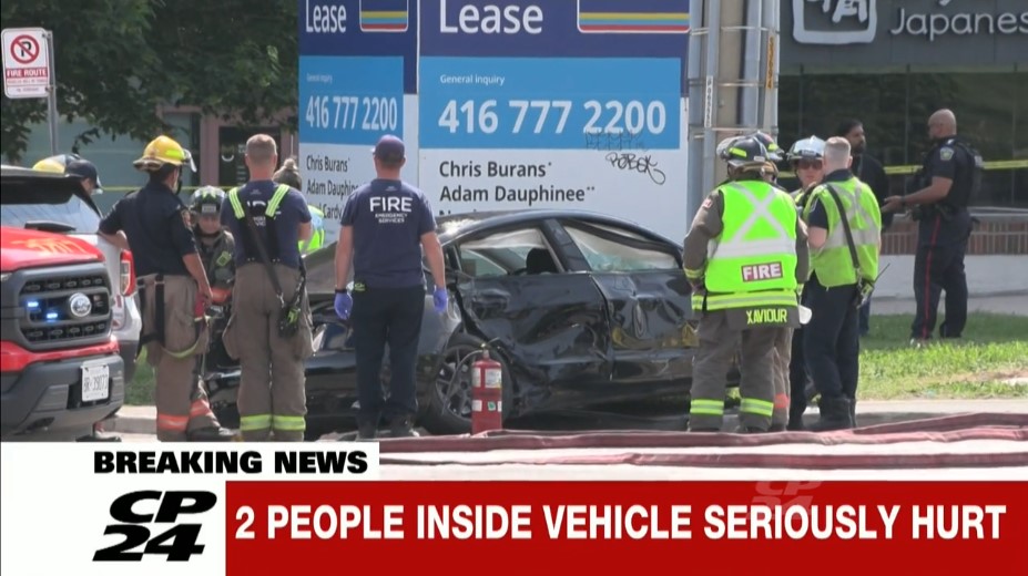
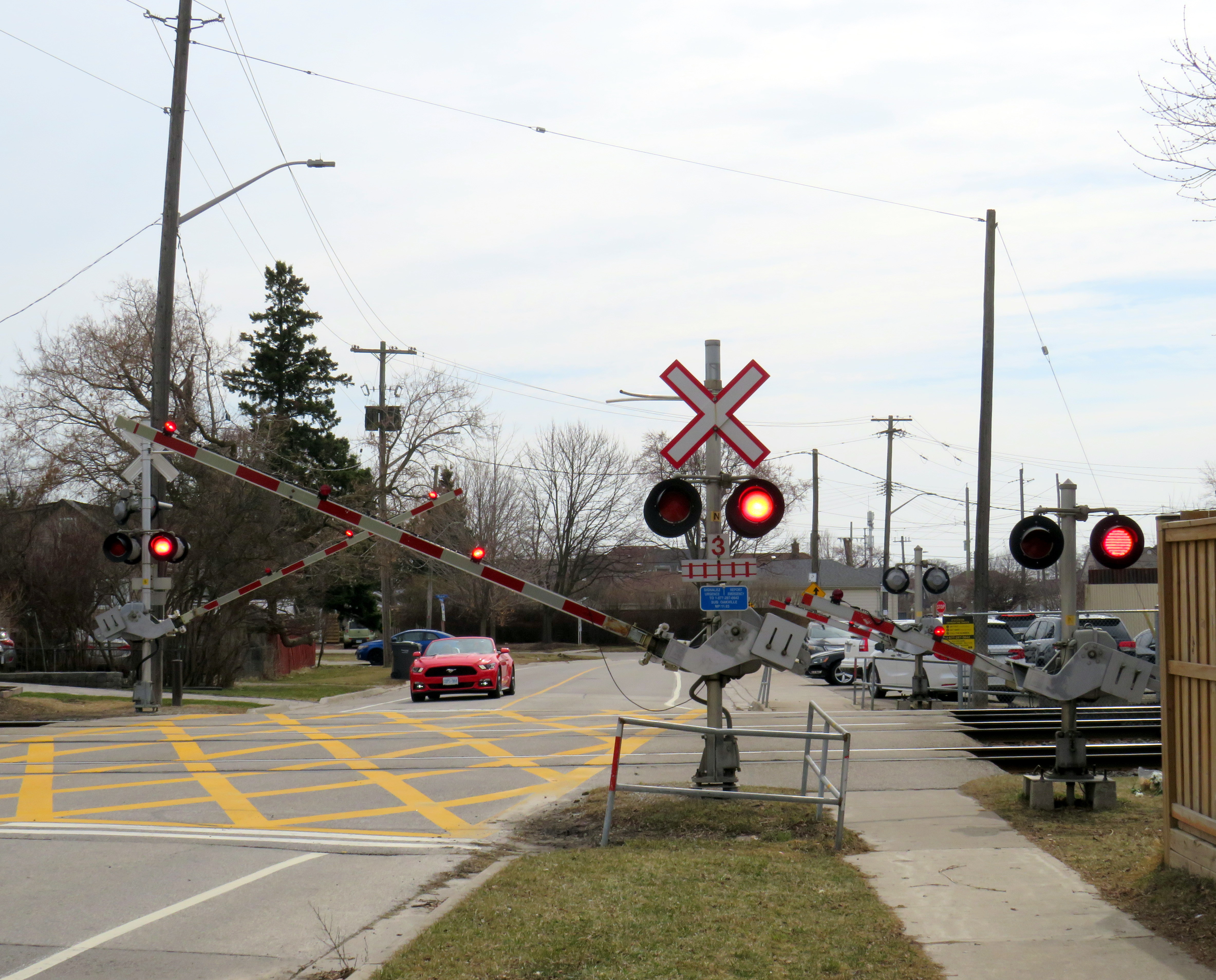
    On Wednesday, March 18, a boy on a motorized bicycle was struck and killed at the Alexandra Avenue railway crossing in Mississauga. The tragedy, which occurred despite properly-working lights and gates at the three-track crossing, is a reminder of how important rail safety can be. Despite decades of “Operation Lifesaver” safety awareness campaigns, police enforcement, and upgrades to high-risk railway crossings, these tragedies continue to occur. Deaths on Canada’s railways affect many lives, including the victim’s family and friends, as well as the train crew, who can not brake the train in time. When these collisions happen, they can also tie up rail passengers and goods movement for many hours as emergency responders do their work and an investigation takes place.

    Trackside memorial at Alexandra Avenue, March 31, 2026

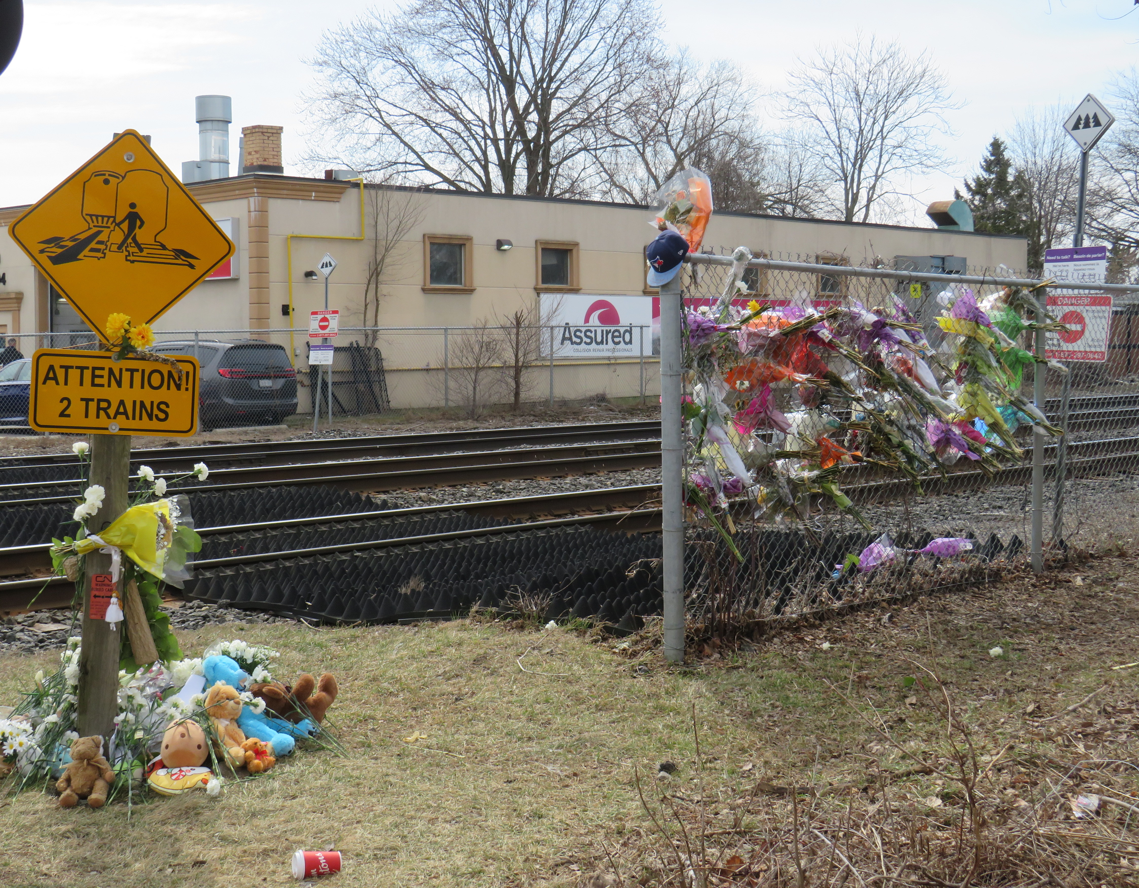
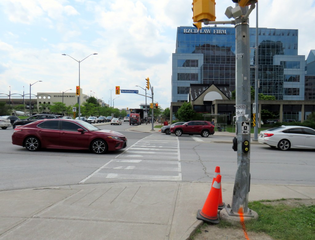
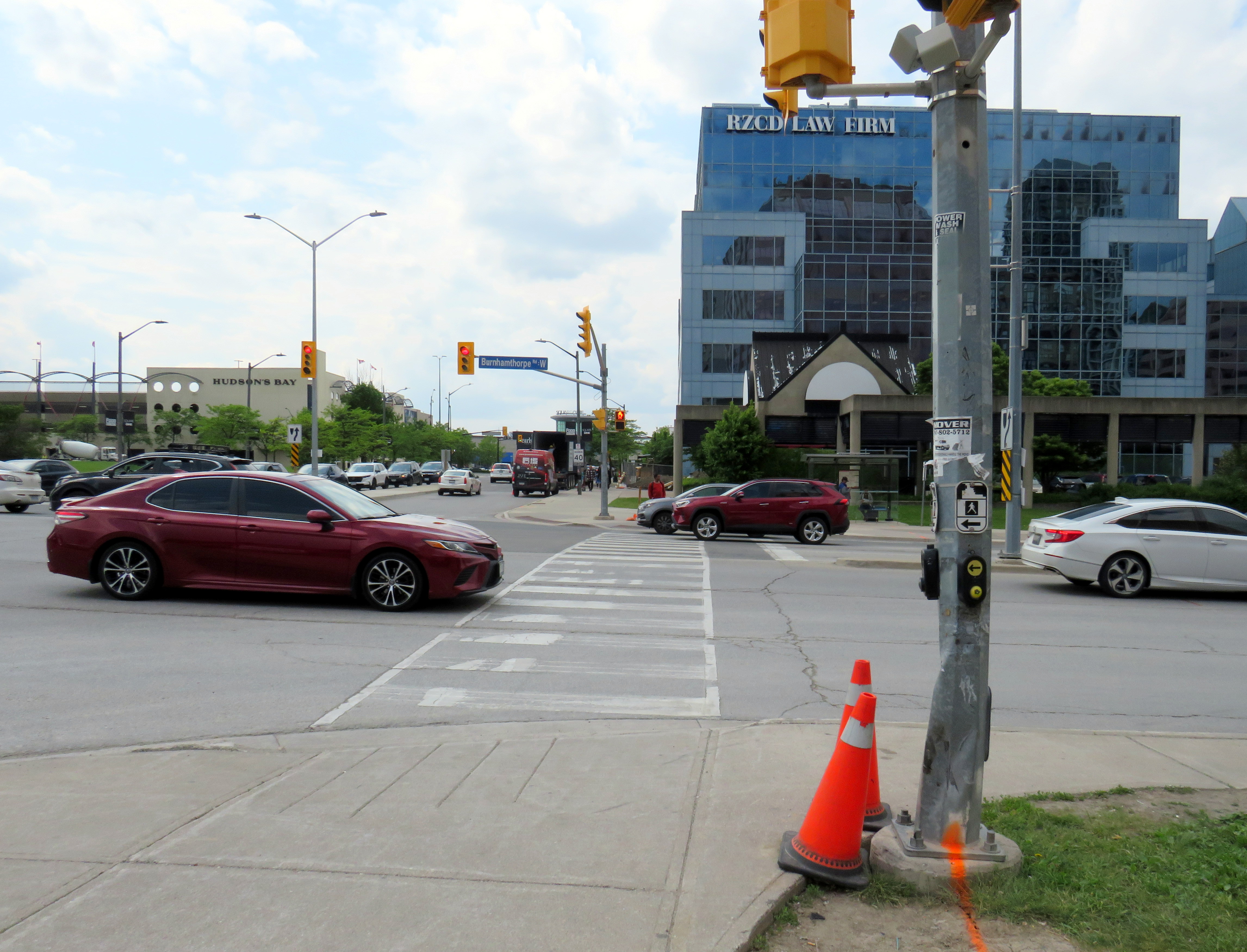
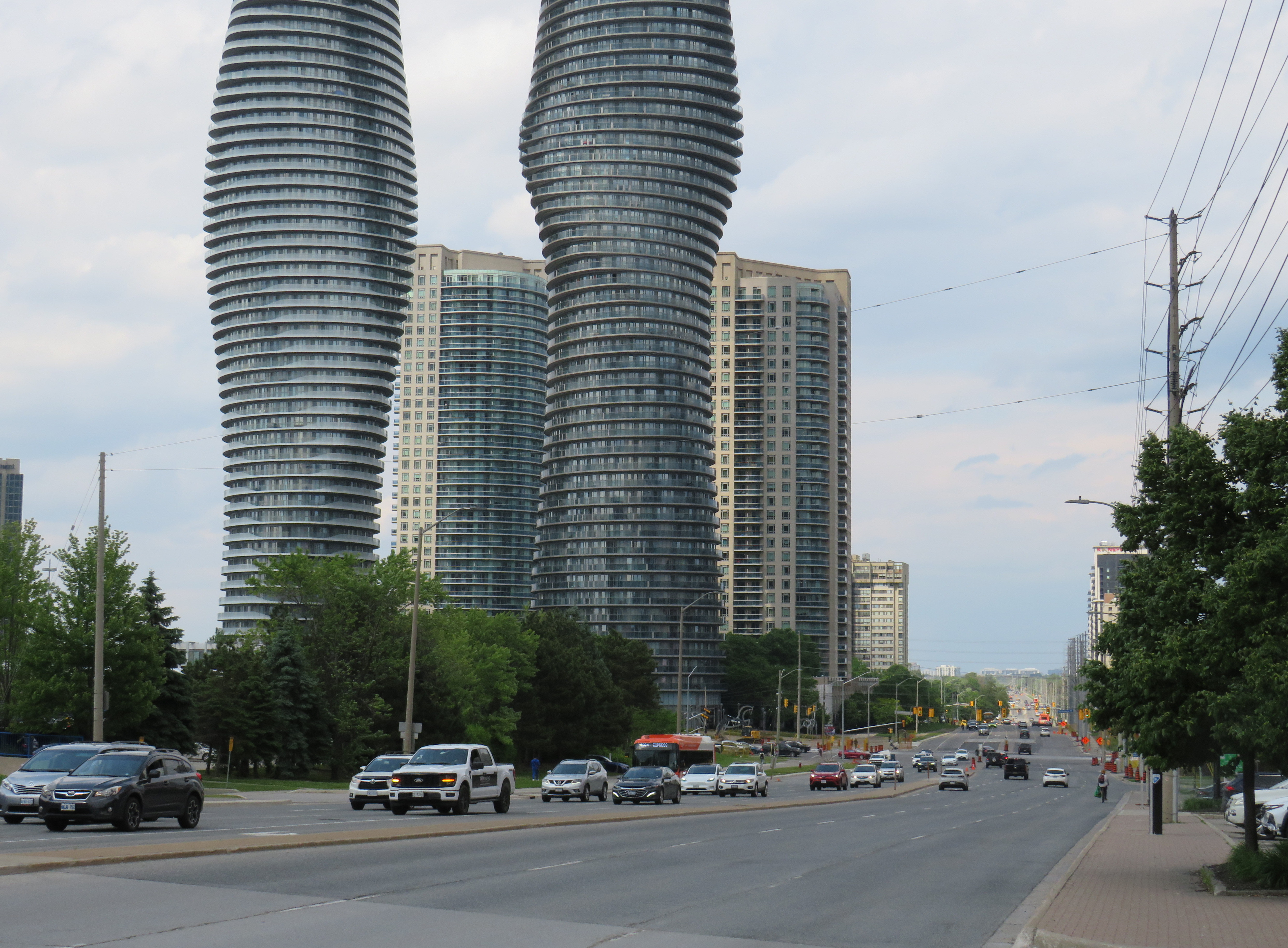
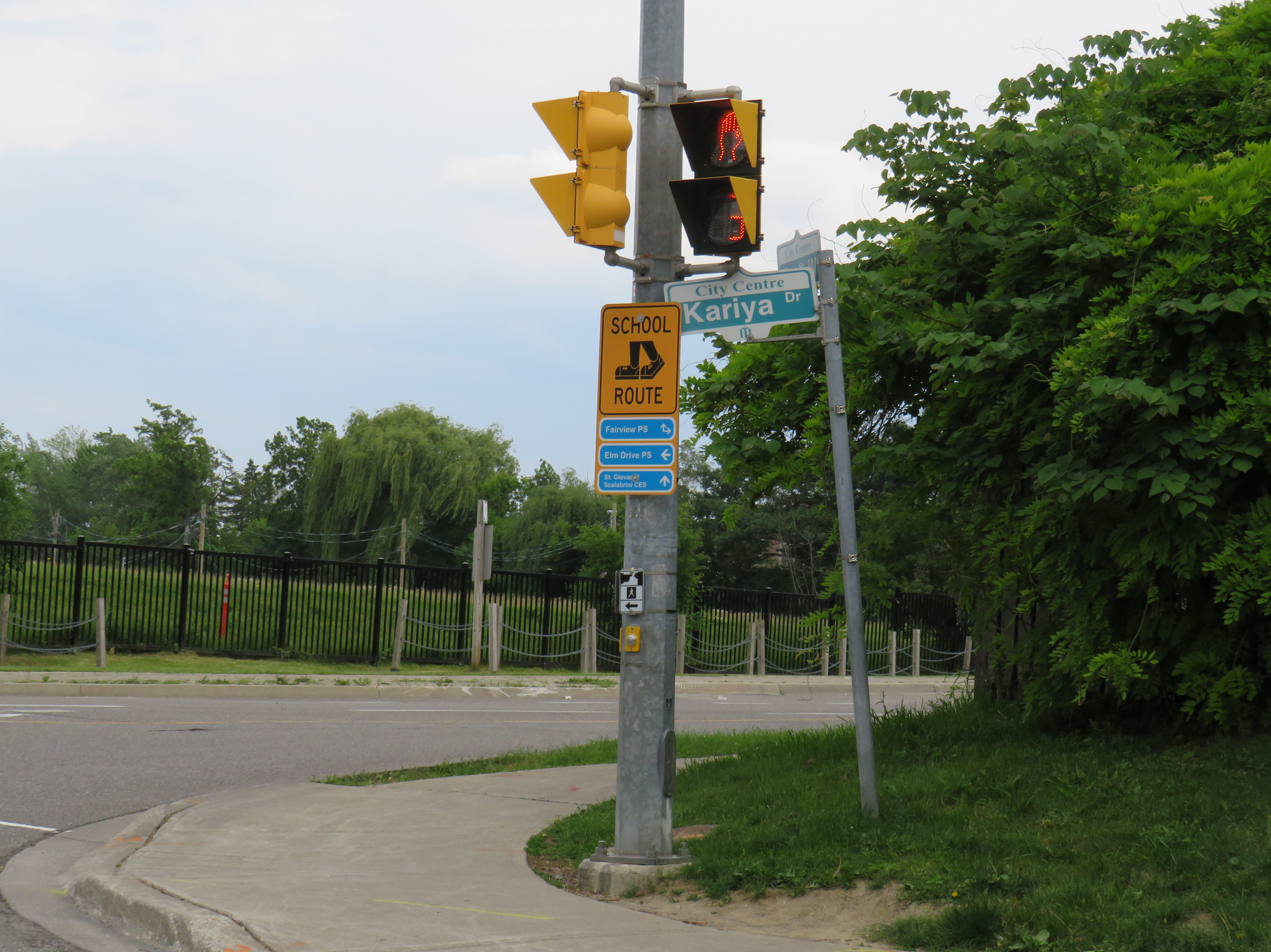
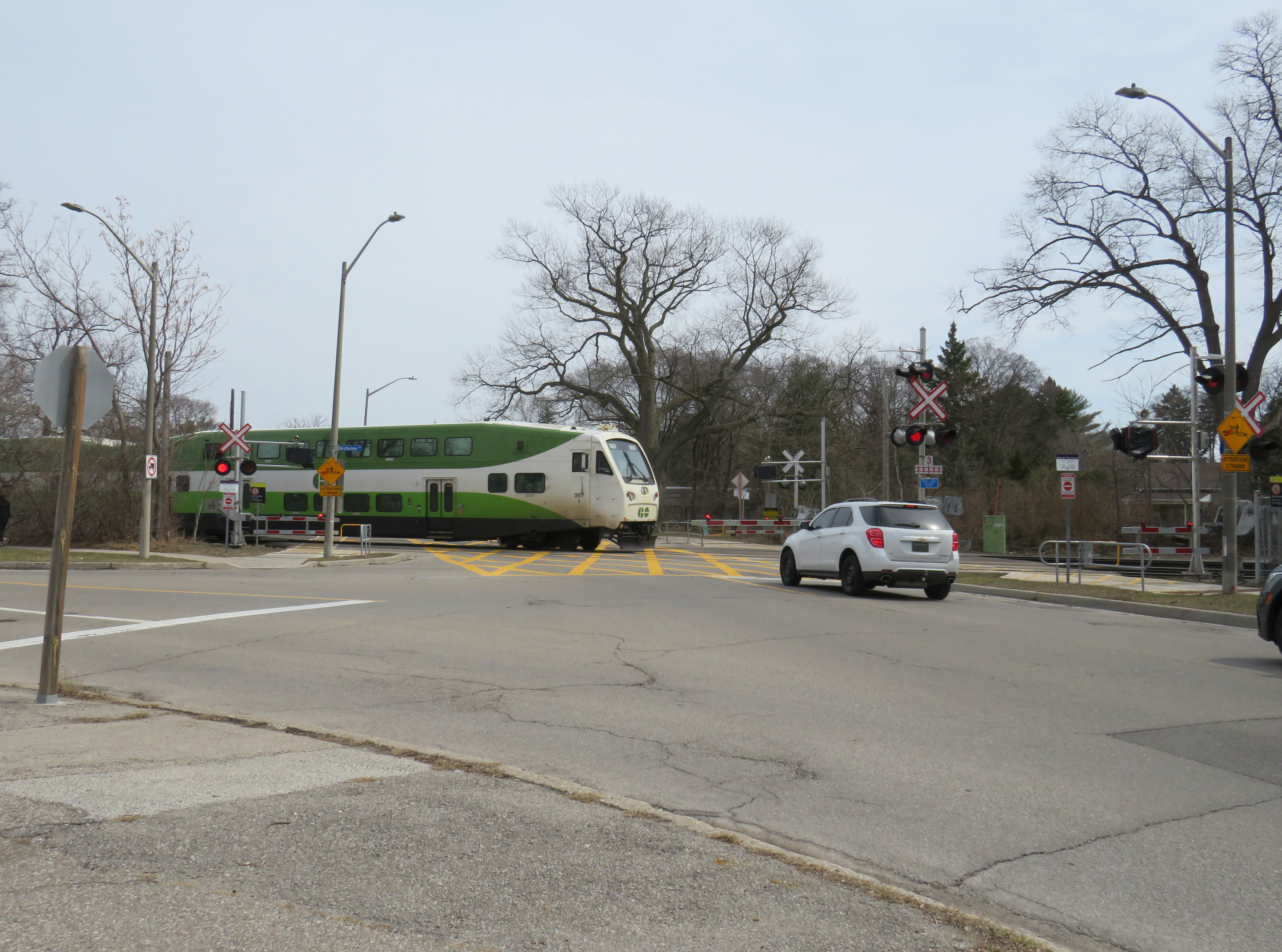
    This particular crossing, near Cawthra Avenue and Lakeshore Road, sees up to 125 GO Transit and VIA Rail passenger trains daily; the three-track corridor is one of the busiest stretches of railway in Canada. The Alexandra Ave. crossing was also ranked as the 21st riskiest in the country in a Transport Canada list of nearly 25,000 road-rail intersections. Of the top 25 railway crossings ranked by risk in Canada, 14 are owned by Metrolinx, the provincial agency in charge of GO Transit. At the very top of the list is another Mississauga railway crossing, where the GO Lakeshore West corridor meets Lorne Park Road.

    Lorne Park Road crossing

    According to the Transportation Safety Board of Canada, between the years 1999 to 2022, 630 people were killed and 774 people were seriously injured due to collisions with trains at grade crossings, an average of 26 per year. In most instances (69%) those who were killed were in motor vehicles, with pedestrians and cyclists making up the remainder.

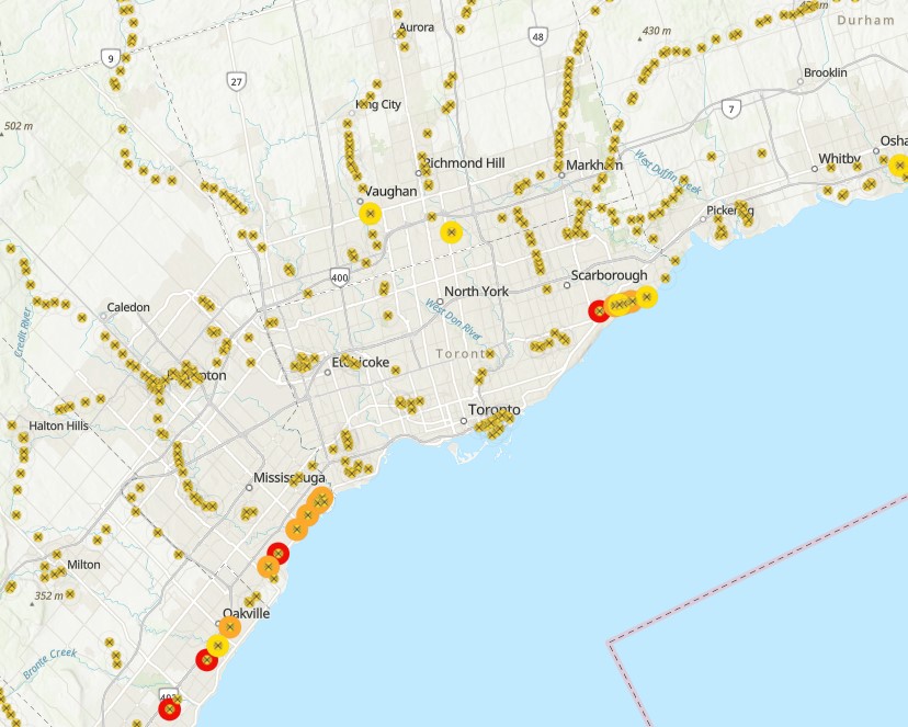
    The railway crossing inventory, last published in June 2021, ranks grade crossings according to their risk using GradeX, an internal analysis tool. Relative risk of each crossing is based on several factors, including historical accident data, train speeds, traffic volumes, sight lines at crossings, crossing protection features, and the local built environment to determine the level of collision risk. Fields include location (road crossing and railway subdivision/mile), type of protection (passive, with just an “X” crossbuck sign, or active, with lights, bells, or gates), number of collisions in the last five years since the dataset was compiled, speed limits, and traffic estimates.

    With this information, railways and road authorities can then work to improve the crossing to reduce the risk, or construct a grade separation to eliminate the risk. For example, the Burloak Drive crossing of the GO Lakeshore West Corridor and number 5 on the Transport Canada list, is currently being replaced with an underpass.

    The Transport Canada list is comprehensive, but it is not perfect, nor is it complete. The Ontario Northland Railway, whose tracks extend north from North Bay through Northeastern Ontario, is conspicuously missing. Several crossings in the map, mostly private crossings, do not have the correct latitude and longitudes. Several abandoned railways, including the Orangeville-Brampton and Barrie-Collingwood (west of Angus) still appear, as do long-decommissioned crossings of industrial spurs. The risk ranking also changes. In a 2016 CBC News article, the Melbourne Road CN crossing west of London, Ontario was ranked fourth riskiest. In the more recent dataset available online, it is ranked 341th, even though there were no physical changes to the railway crossing visible in Google Streetview from 2009 through 2023.

    I created a complete interactive map of all railway crossings; it can be found here.

    Sample of an interactive map of all railway crossings in Canada, with highest-risk crossings highlighted

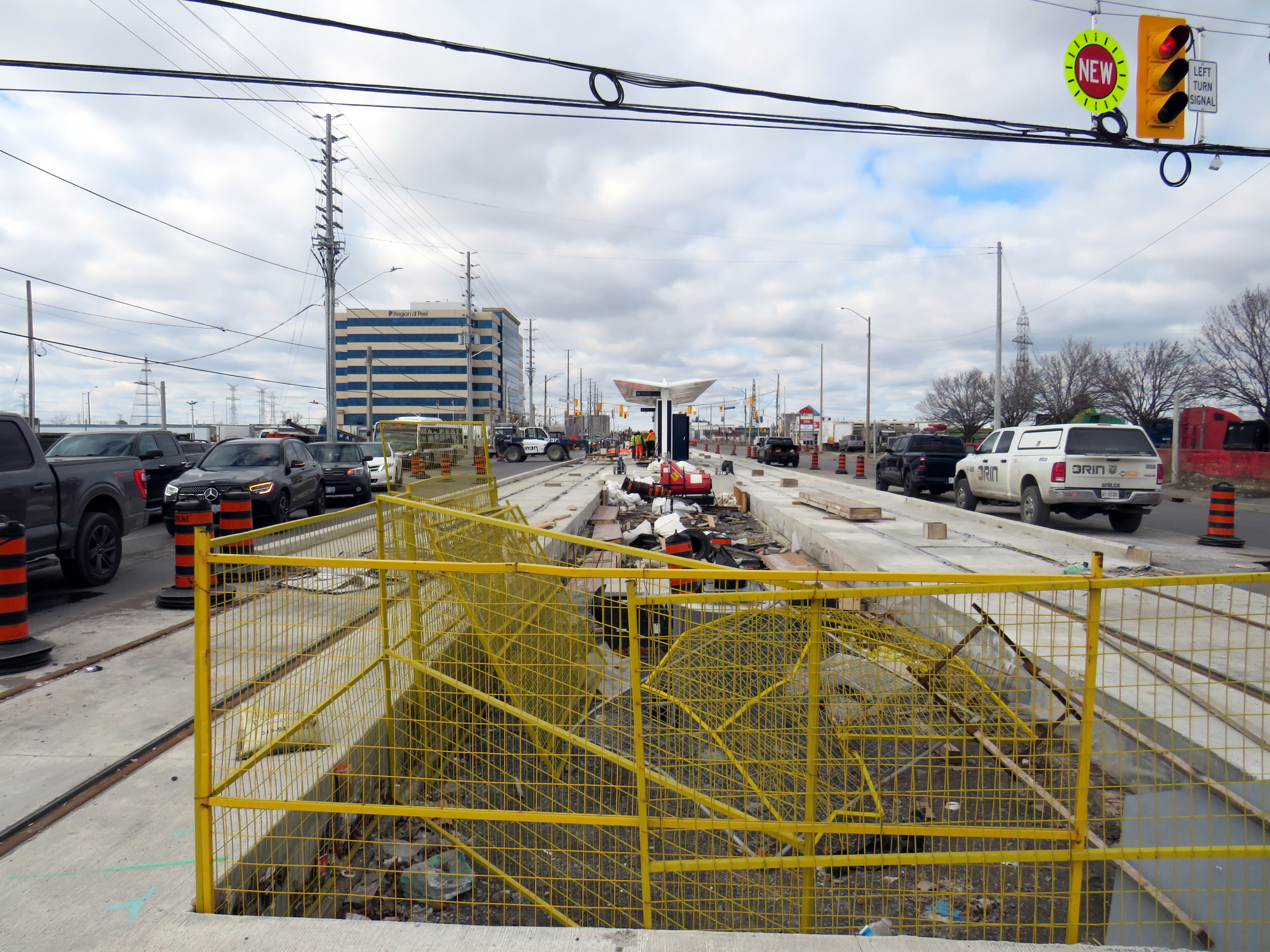
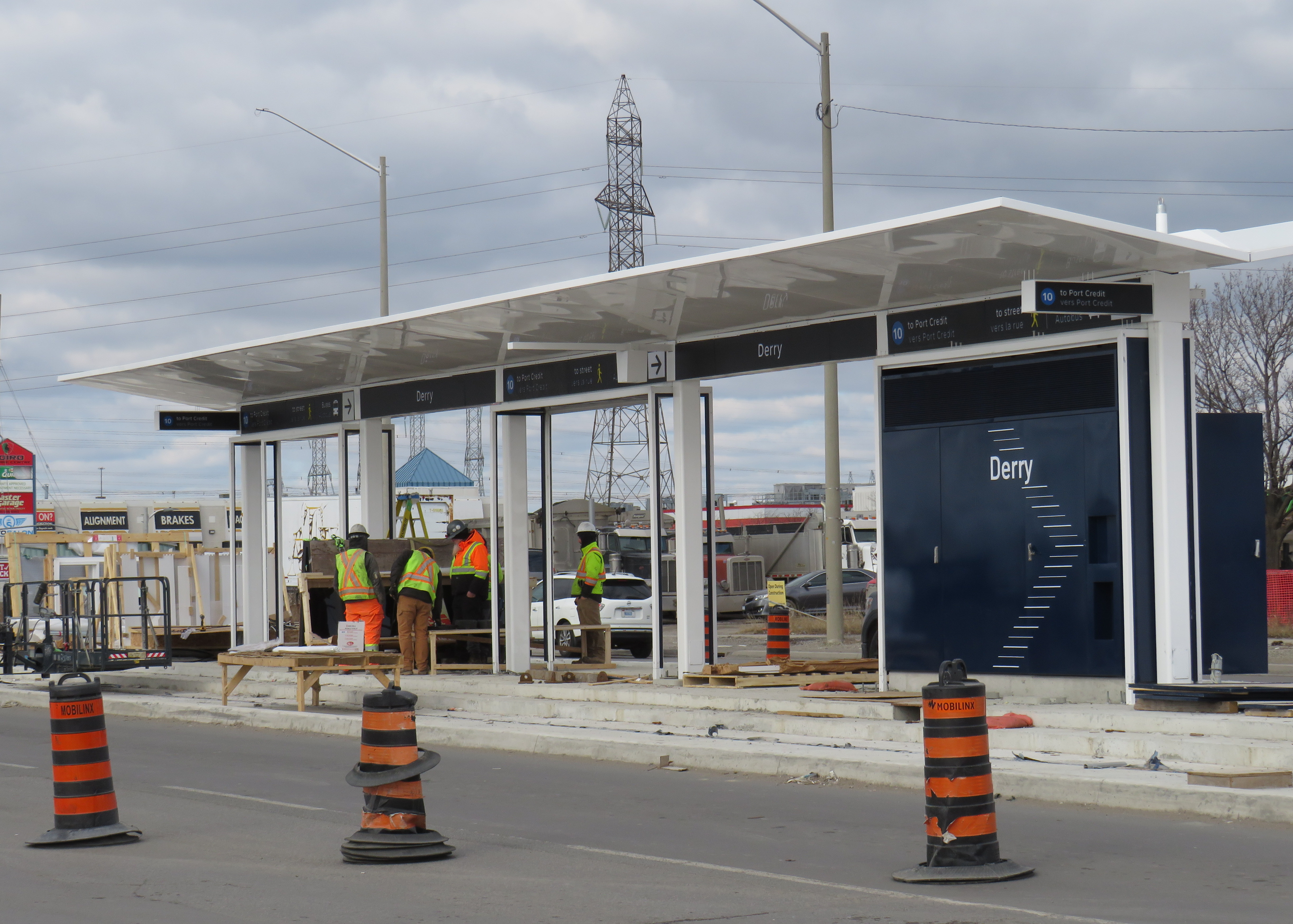
    The Lorne Park Road crossing is interesting for several reasons. After many years as a stop on the CN mainline, it was briefly a GO Transit station, with commuter train service only for its first year in 1967-1968. The two-lane road crosses the three-track railway at approximately a 30-degree angle; immediately to the north of the tracks is the intersection with Birchview Drive, which is parallel to the tracks. That intersection is controlled only with a stop sign, with pedestrians crossing the street at a wide angle with no marked crosswalk. The same number of trains that cross Alexandra Avenue also cross at Lorne Park Road, making it a busy crossing, and motor and pedestrian traffic is higher, as Lorne Park Road is a busier collector street with adjacent commercial properties. To its credit, however, Metrolinx recently upgraded the crossing, with enhanced pedestrian gates that prevent access when the railway crossing lights are activated.

    City of Mississauga aerial photography of the Lorne Park Road crossing, with Birchview Drive meeting Lorne Park Rd. immediately north of the railway (source)

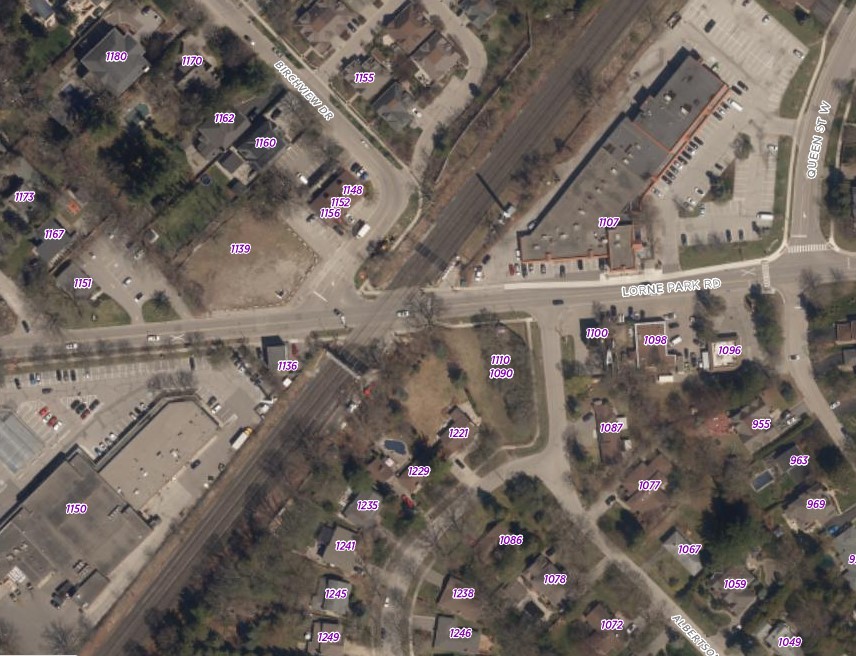
    A 2022 City of Mississauga-commissioned report by HDR recommended that the Lorne Park crossing be studied for future grade separation (it also recommended a more detailed study into closing the Alexandra Avenue crossing along with an Ogden Avenue grade separation), given the high number of train crossings, expected to increase with future GO Transit service expansion.

    The level crossing ranked second in the list is the CN Dundas Subdivision crossing of Egerton Street in London. At Egerton Street, there are six tracks across two separate signaled crossings, as it is at the entrance to CN’s London yard. Egerton Street, with two traffic lanes, is also a marked cycling route, with painted bike lanes along the collector street. The third crossing in the list is Scarborough Golf Club Road at the three track GO Lakeshore East Corridor.

    Building new overpasses or underpasses can be expensive and disruptive, especially in older urban environments where space is at a premium. Closing crossings completely can disconnect communities, especially for pedestrians and cyclists, who may have to travel much longer distances or use dangerous roads to get to their destinations. But they are often necessary for ensuring safe, frequent, and speedy train service. In the meantime, upgrading existing crossing and minimizing risk, along with continued education, is the way to go.

  • Deadly by design: Burnhamthorpe Road

    Deadly by design: Burnhamthorpe Road

    A dented light pole is the only indicator of a deadly collision in Mississauga City Centre

    On Saturday, June 7, around 10:20 AM, the drivers of two vehicles collided in the intersection of Burnhamthorpe Road and Kariya Drive in central Mississauga. One of the two cars that collided, a Tesla sedan, slid onto the sidewalk on the southeast corner, hitting a traffic pole, and then colliding with two pedestrians waiting at the corner to cross the street. One of the two pedestrians, a man in his forties, was killed; the other was taken to hospital with serious injuries. CBC Toronto, CP24/CTV News and the Toronto Star covered the collision.

    Unfortunately, there has been no follow-up reporting so far, and there is no press release or statement on the Peel Regional Police website.

    Screenshot of CP24 news report showing the badly damaged Tesla that crashed into two pedestrians

    A few days later, I visited the area to take note of the intersection and the surroundings.

    The intersection of Burnhamthorpe and Kariya is within the busy, urbanizing Mississauga City Centre (MCC) neighbourhood. MCC, also known as Downtown Mississauga, is the political, commercial, and cultural centre of the sprawling suburb of 750,000. The area is centred around Square One Shopping Centre, which opened in 1973, expanding several times in the next four decades to become one of Canada’s largest malls. Immediately to the west of Square One is Mississauga’s post-modern city hall, which is one of the most interesting and walkable civic centres in Ontario. Nearby is a performing arts theatre, a Sheridan College campus, several office buildings, a YMCA, central library, parks, a transit hub, as well as many high-rise residential towers. Newer residential development includes streetfront retail, oriented to the community with local restaurants, cafes, pharmacies, and grocery stores. Despite its greenfield suburban origins, Mississauga City Centre has become a true 15-minute city.

    Looking north on Confederation Parkway towards MCC
    Looking north on Confederation Parkway near Central Parkway, where MCC’s high-rise condominiums tower over older single-family homes

    The problem, though, is despite its impressive growth, MCC’s built infrastructure still has the trappings of a suburban speedway. Though some collector streets and minor arterials, like Living Arts Drive and Confederation Boulevard, are more human-scaled, with bicycle lanes, wider sidewalks, benches, and street trees, other streets have not been updated to suit the emerging urban environment. Burnhamthorpe Road is the best example of this.

    Looking east on Burnhampthorpe
    Looking east on Burnhampthorpe Road from Kariya Drive, towards Hurontario Street and the landmark Absolute condo towers

    Burnhamthorpe Road is six lanes wide, with an additional left turn lane at every intersection. Though there is a sidewalk on the south side and a designated multiuse path (MUP) on the north side, it is not a pleasant place to walk.

    Looking west on Burnhamthorpe
    Looking west on Burnhamthorpe Road, towards newly built and under-construction high-rise residential towers

    While I visited The MUP on the north side of Burnhamthorpe west of Kariya Drive was also closed off for the convenience of the builders of the Exchange District Condos development, one of many new mixed-use projects in the area. This forces pedestrians to cross the intersection to continue west, and no thought was made to closing one of the three westbound traffic lanes to provide a continuous path.

    Signs blocking path
    Multiple “sidewalk closed” bike lane detour, and “dismount and walk” signs blocking the asphalt MUP on the north side of Burnhamthorpe Road. Note that no traffic lanes were blocked to provide a continuous route for vulnerable road users.

    The intersection of Kariya and Burnhamthorpe is quite busy; at every light cycle, there were multiple pedestrians crossing here on mid Tuesday afternoon, including students walking to the mall or to home from nearby schools, couples and young families out for a stroll. (Kariya Park, named for a Japanese city that was twinned with Mississauga in 1981, is a lovely oasis.) Burnhamthorpe has a 60 km/h speed limit, though Kariya has a 40 km/h limit.

    Five pedestrians, standing where a man was struck and killed last Saturday, about to cross Burnhamthorpe Road on a Tuesday afternoon

    The corner is also a busy transfer point. Miway route 26 Burnhamthorpe is a major east-west bus corridor that connects with the TTC subway at Kipling Station; Kariya Drive is the best stop to get to Square One as Route 26 doesn’t serve the main terminal. Routes 3 Bloor and 8 Cawthra, which do continue to the City Centre Terminal, stop here as well.

    Route 26 Burnhamthorpe is one of MiWay’s busiest

    Also worth noting is that Kariya Drive is a signed school route. MCC itself does not have any elementary or secondary schools, but there are several schools within a short walk to the south of Burnhamthorpe, including Fairview Public School, Elm Drive Public School, St. Giovanni Scalabrini Catholic School, and Fr. Michael Goetz Catholic High School. The more people move into MCC, the more necessary safe walking routes will be.

    School route sign at Kariya Drive
    A school route sign with walking paths to three nearby elementary schools at Kariya Drive and Fairview Boulevard

    There is nothing particularly remarkable about the intersection of Burnhamthorpe Road and Kariya Drive itself that makes it deadly, but that is the problem here. To make walking safer and more attractive, there is much that should be done. Reducing Burnhamthorpe to four lanes in each direction, along with more street trees, could help to reduce speeds (the speed limit should also be dropped to at least 50 km/h), and with several nearby schools, parks, and YMCA, there’s a case for Burnhamthorpe to be designated a community safety zone, with increased enforcement, along with automated traffic cameras. Perhaps dedicated bus lanes could supplant the third traffic lane in each direction, as the nearby Hurontario LRT nears completion.

    Right now, drivers race through the intersection, making left turns against oncoming traffic and crossing pedestrians after the advance arrow signal disappears, as seen in the video below. Wide lanes and a 60 km/h speed limit encourage unsafe driving.

    Three motorists continue to make left turns from Kariya to Burnhamthorpe (behind the FedEx truck) after the advance turn arrow disappears and the green light for opposing traffic and walk signal turn on. Note several pedestrians waiting to cross as drivers rush through.

    To make Mississauga City Centre a complete urban hub, it needs to be safe for pedestrians and cyclists of all ages and abilities to get around. Six-lane arterials like Burnhamthorpe have no place in a dense, multi-use neighbourhood, especially when nearby Highway 403 can handle goods movement and through traffic. One death is too many.

  • Whose line is it anyway?

    Whose line is it anyway?

    Light rail construction on Hurontario Street at Derry Road, February 12, 2024

    Less than two weeks ago, I wrote about the politics of renaming of the Hurontario LRT for Hazel McCallion, a long-serving mayor of Mississauga and close political and personal ally of Premier Doug Ford.

    Though much of the information I received was redacted, I was able to learn that the Cities of Brampton and Mississauga had already come up with a brand for the new transit line. Metrolinx and the provincial government had to reimburse them for the costs once the Minister of Transportation intervened to force a new name upon the project, which cumulated with a love-in photo op on February 14, 2022.

    Among the information redacted in the information package sent to me, six months after my initial Freedom of Information request, was the LRT line’s colour and number. They were redacted under Section 18(1) of the provincial Freedom of Information and Privacy Protection Act, citing economic and other interests of Ontario.

    Redacted line colour, number, and logo

    At Derry Road, though, the secret is out. The Hurontario Line will be Line 10, represented by a bright blue colour similar to the former Line 3 Scarborough RT.

    Derry LRT station under construction

    Line 10 is a good choice for this corridor. Hurontario Street and Main Street through Mississauga and Brampton used to be part of provincial Highway 10, which was later bypassed by Highway 410 and downloaded to the two cities between the 1980s and the 2000s. It will also be the first Metrolinx-managed rapid transit project completely outside the City of Toronto, where Lines 1 through 6 are already assigned to the existing subway and the Eglinton-Crosstown and Finch West LRTs (with Line 3 reused for the Ontario Line when it opens).

    Brampton Transit and Miway currently operate bus services with that route number (10 South Industrial and 10 Bristol-Britannia), but those should be easy to change in advance of the LRT’s opening, which will take place in late 2025 or early 2026, given the construction progress so far.

    I remain puzzled and somewhat annoyed that this information was kept secret, and for what reasons. Revealing a line number and colour in a freedom of information request should not have been important. If it was to protect for another government photo opportunity, then that is now moot. Who is the Hurontario LRT for? The Doug Ford-led provincial government, or the people who will ride it?

    Finally, I note that like the shelters going up for the Finch West LRT and the surface stops of the Eglinton LRT, there is very little protection from the elements at the Hurontario LRT stops, with only a canopy and a single wall supplying shade and cover from the rain or snow. Compare the Derry Road LRT stop with older Brampton Züm shelters, which include enclosed waiting areas, benches, and even winter heating.

    Brampton Züm stop with full glass enclosure, benches, and a button to activate a heater in the winter
    One more thing…

    To my longtime followers as well as my occasional readers, thank you for your interest and support. Last year’s FOI request cost me $525.00. Sadly, freedom of information isn’t free. If you like my work and want to contribute to my online mapping and webhosting costs, please consider buying me a coffee.

  • Heavy interference in a light rail transit project

    Heavy interference in a light rail transit project

    Banner promoting “The Hazel McCallion Line” on Hurontario Street in Brampton, January 2024

    Previously on this website, I wrote about the renaming of two GO Transit stations: Oshawa and Brampton. I explained why renaming transit infrastructure is problematic, especially when they violate wayfinding standards, which call for simple, accurate, unique, and self-locating names.

    Both GO Transit stations were renamed by provincial agency Metrolinx, on behalf of the provincial government. Metrolinx operates GO Transit buses and trains, the UP Express airport link, administers the Presto fare payment system, and oversees the construction of new rapid transit projects in the Greater Toronto and Hamilton Area. The Hurontario LRT, which is currently under construction between Port Credit GO Station in Mississauga and Steeles Avenue in Brampton, is just one of many transit projects managed by Metrolinx.

    On February 14, 2022, at Cooksville GO Station, Premier Doug Ford, then Transportation Minister Caroline Mulroney, then Mississauga Mayor Bonnie Crombie, and Metrolinx CEO Phil Verster joined former Mississauga mayor Hazel McCallion announcing the name change from the Hurontario LRT to the Hazel McCallion LRT. The occasion also marked McCallion’s 101st birthday.

    Hazel McCallion with Metrolinx CEO Phil Verster, February 14, 2022 (Metrolinx photo)

    This is the first rapid transit line in North America to be named for a person, contradicting established standards for transit projects.1 Though McCallion was a formidable and popular mayor whose political career spanned seven decades, she was also very close to the Ford government in the last few years of her life. She also had many other public facilities named in her honour — a senior public school in Mississauga’s Streetsville neighbourhood, the library at University of Toronto’s Mississauga campus, the City of Mississauga’s central public library, a walkway leading to Square One Shopping Centre, and the Mississauga campus of Sheridan College. There is also the Hazel McCallion Auditorium at Mississauga Valley Community Centre and the Hazel McCallion Hall at Vic Johnston Community Centre. There was no need for yet another civic asset to be renamed for her.

    In Toronto, most former mayors have just one public asset named for them: David Crombie, Art Eggleton, June Rowlands, and Barbara Hall have parks dedicated in their honour. Mel Lastman — mayor of North York for 24 years before being elected mayor of amalgamated Toronto for another six — and Nathan Phillips have major public squares.2 In Mississauga, there was no need to rename yet another piece of civic infrastructure for the same person.

    Furthermore, there was no public consultation about the name change — even officials at the cities of Brampton and Mississauga were kept in the dark — while the name itself contravenes Metrolinx’s own naming conventions.

    In July, 2023, I submitted an access to information request to Metrolinx, the second time I went through the freedom of information process to find out more about the light rail transit project. There were several delays, and I did not receive my requested documents and communications until late January 2024.

    A deep dive into the background of the Hurontario LRT project, the person it is being renamed for, and my findings and impressions follow.

    (more…)