Nearly three years ago, I wrote about the complicated history of Toronto’s Dundas Street. Calls to rename the street, which honours Henry Dundas, 1st Viscount Melville, came during a time of reckoning in Canada and the United States with racism, colonialism, and our ongoing relationships with First Nations. Ryerson University (my alma mater) changed its name to Toronto Metropolitan University (TMU) in 2022, in acknowledgement of Egerton Ryerson’s role in developing Canada’s system of residential schools.
Retain the legal street names with additional interpretation and recognitions
Retain the legal street names but rename those civic assets with Dundas in their name, except TTC facilities (there are three parks and one library branch that include the Dundas name, and Yonge-Dundas Square; there are two TTC subway stations and one streetcar line that also bear the Dundas name)
Rename the streets and all other civic assets now carrying the Dundas name (including Dundas Street East, Dundas Street West, Dundas Square, and Old Dundas Street).
In 2021, Toronto City Council voted 17-7 in favour of the fourth option, renaming Dundas Street and all associated city assets, such as the library, the two subway stations, Yonge-Dundas Square, and three city parks. At the time, the estimated cost was $8.6 million, but by Fall 2023, it had grown to $12.7 million. There was also a significant backlash to the renaming, which included several conservative city councillors.
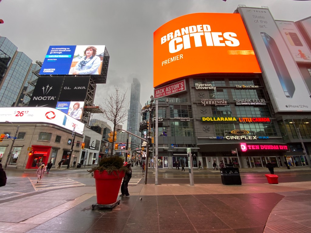
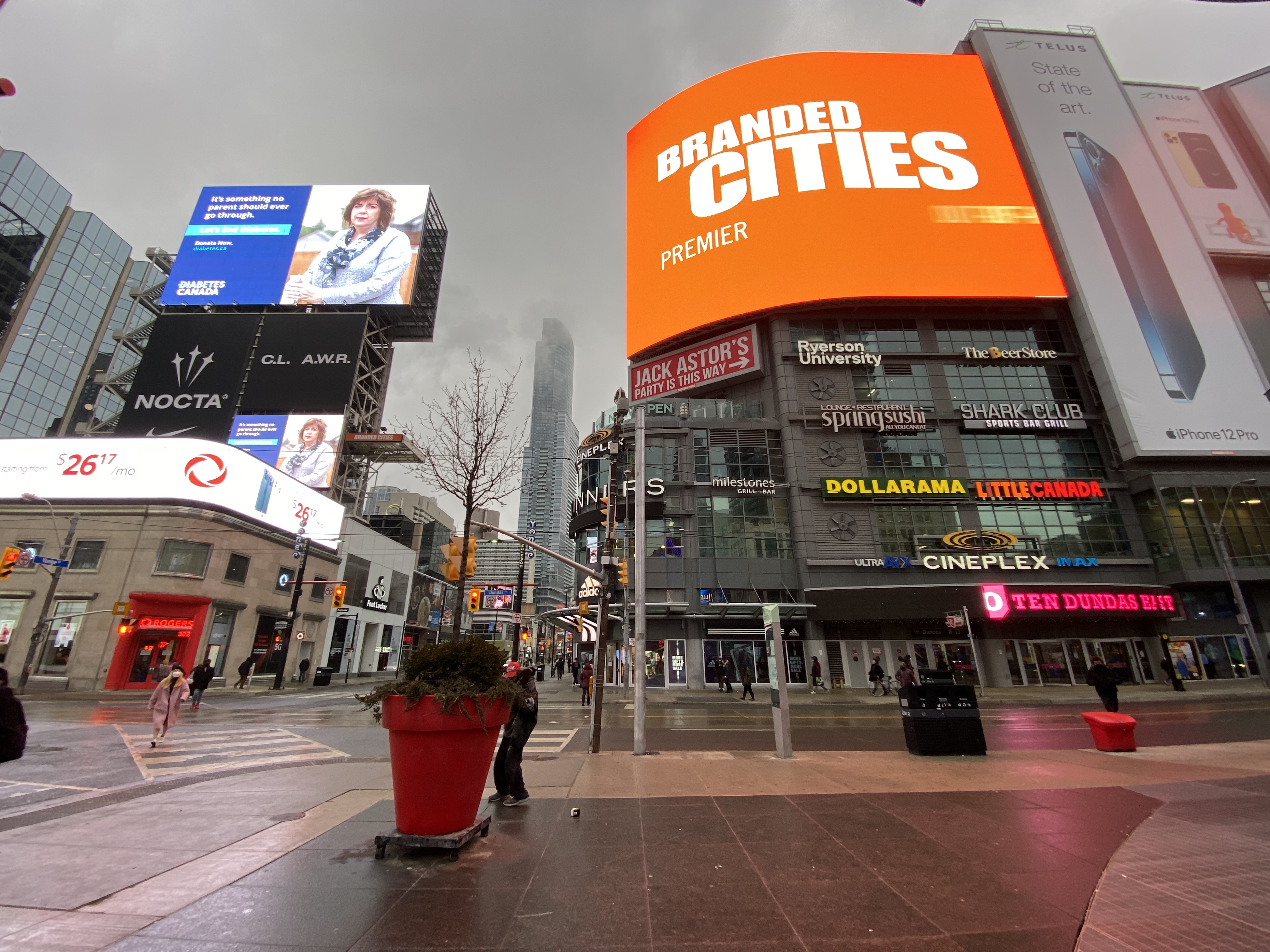
In the end, council voted to approve a compromise that would include renaming Yonge-Dundas Square, Dundas and Dundas West subway stations, and the Jane-Dundas library, but retain the name Dundas Street itself. There would also be a public education campaign “to acknowledge the historical impact of Henry Dundas’s actions and that of slavery more generally.”
Yonge-Dundas Square would be renamed Sankofa Square, while Dundas Station, directly below, would be renamed with financial support from TMU. “Sankofa” was one of four shortlisted names considered by the Recognition Review Community Advisory Committee (CAC), which was made up of Black and Indigenous leaders, including business owners and residents along Dundas, with the participation of local city councillors.
Sankofa, a concept that originates with the Akan people of Ghana, “refers to the act of reflecting on and reclaiming teachings from the past which enables us to move forward together.” The CAC’s short list notes the concept’s connection to West Africa, which represented a major portion of the origins of Africans trafficked to the Americas — including Upper Canada — during the slave trade.
Dundas Street, looking east from Dovercourt Road
This compromise will not make anyone especially happy, but Mayor Olivia Chow will have to make many more compromises to properly address the fiscal and social crises Toronto is facing. But this is one compromise I mostly agree with. At first I thought Yonge-Dundas Square should have an Indigenous name, but after reading the background materials, I learned that the First Nations elders on the CAC preferred a name that focuses on the Black historical experience.
Until recently, few people gave the name “Dundas Street,” named over 200 years ago, much thought. Now more people are aware that there were slaves here, in Ontario, despite Governor John Graves Simcoe’s abolitionist leanings. Our understanding of history evolves as we as people evolve — this is the reason why we have historians.
Nearly three years ago, I wrote about the history of Dundas Street. It’s a really interesting one, by the way, as it continued to change and grow right up until the 1950s. In 2023, we continue to add to the history of the colonial-era road.
In June 2020, Toronto-based artist and activist Andrew Lochhead launched a petition to rename Dundas Street, one of Toronto’s oldest, longest and best-known arterial roads. Lochhead states that Henry Dundas, 1st Viscount Melville “actively participated in obstructing the abolition of slavery in the British Empire from 1791 to the end of his political career in 1806.” While some historians may argue that Dundas was a pragmatic moderate, rather than an anti-abolitionist (unlike slave-owning Torontonians like William Jarvis or Peter Russell, who have streets named after them), it’s still worth wondering why Toronto has a street named after the Scottish politician, who had nothing to do with Toronto’s colonial history.
Until recently, I gave Dundas Street little thought. Years ago, I wrote about how the street was pieced together in the late 19th and early 20th century to provide a new through east-west route across central Toronto. Though I was aware that Dundas Street began at the present-day corner of Queen Street West and Ossington Avenue, I had long thought the road was named for the town of Dundas, to which it leads.
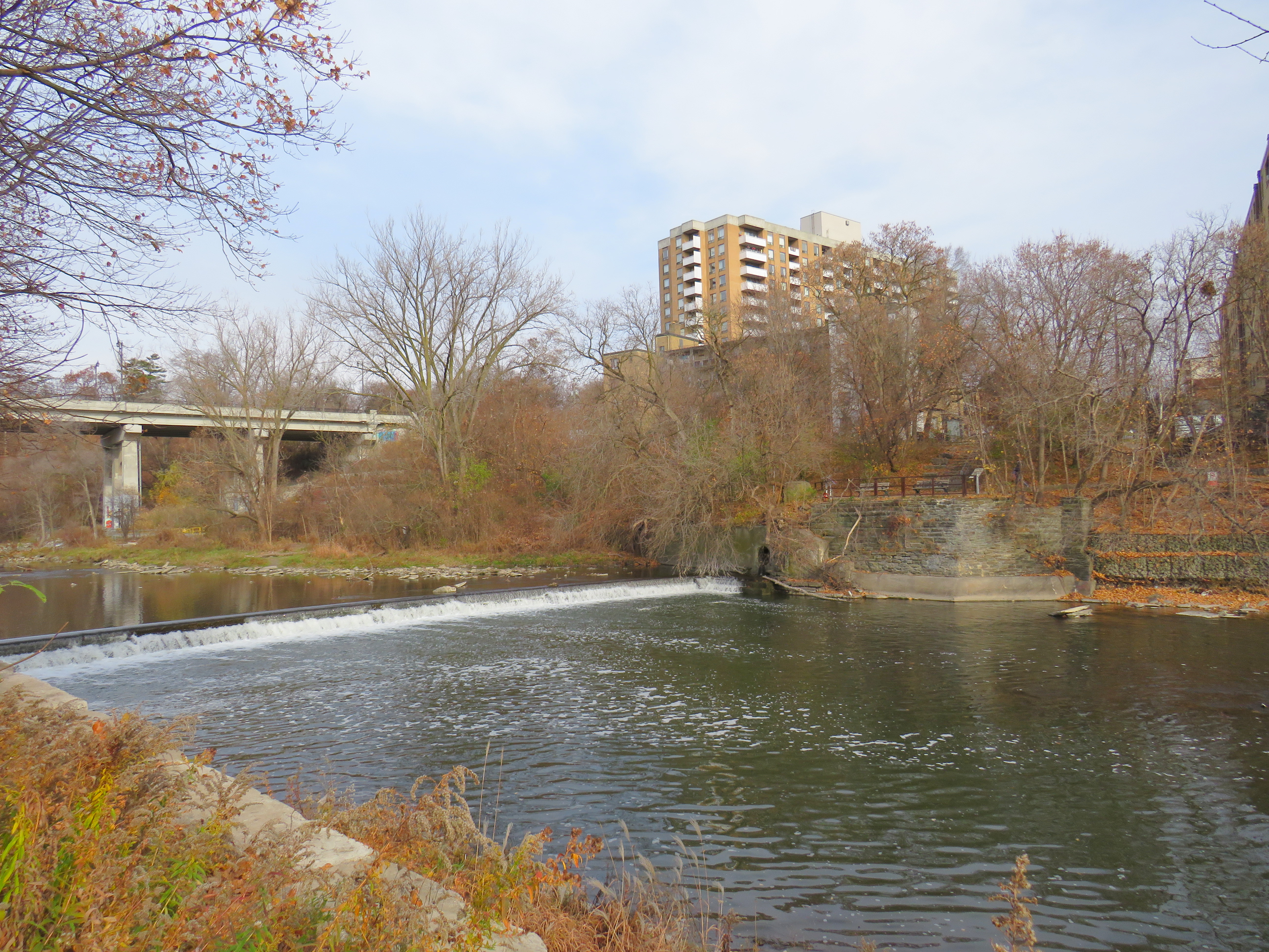
The end of Desjardins Canal, in the old Town of Dundas
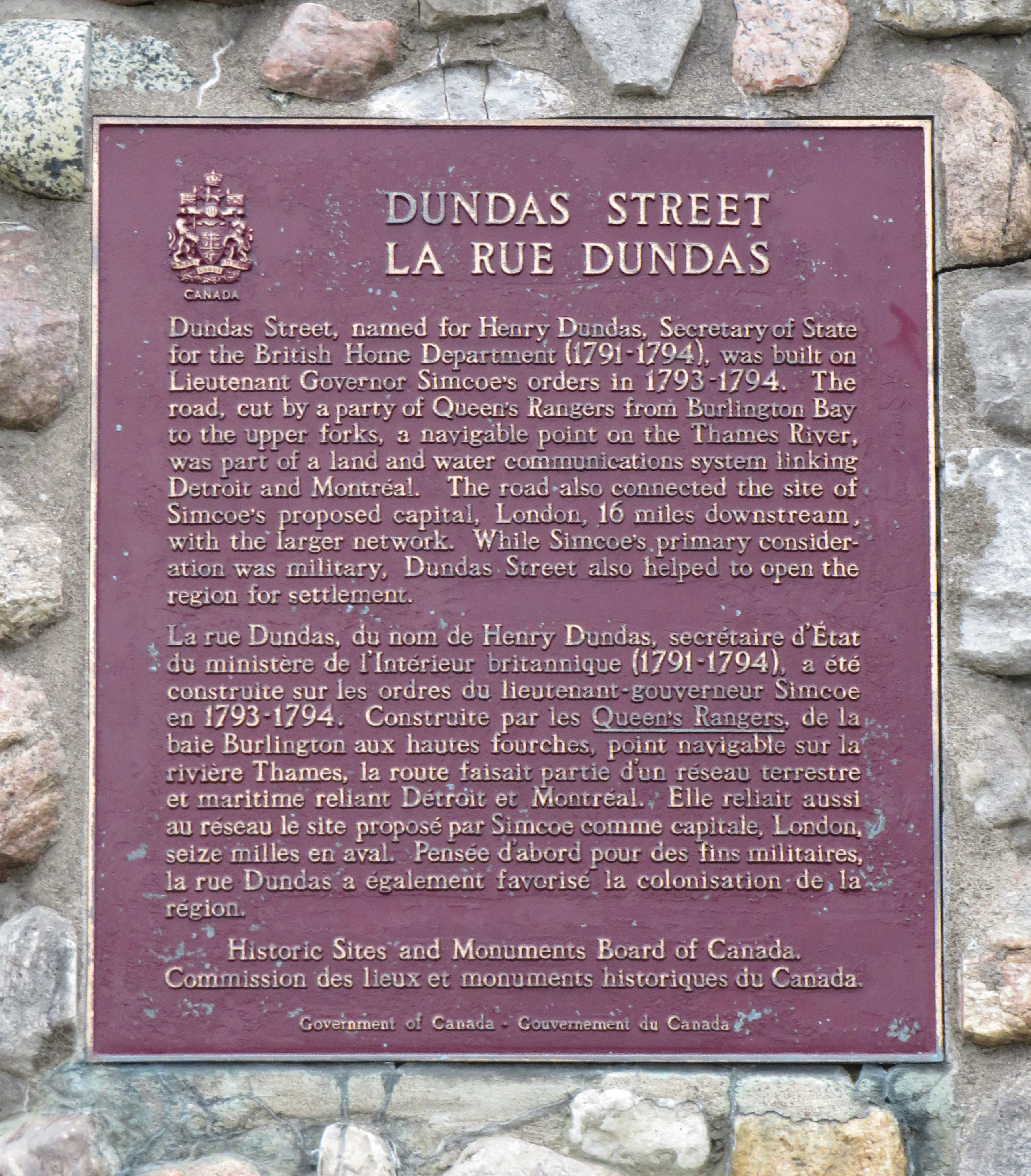
Dundas Street was established as a military supply route by order of John Graves Simcoe, the first British governor of Upper Canada. At first, it was surveyed and cleared in 1794 and 1795 between Cootes Paradise (at the very end of Lake Ontario, beyond Burlington Bay) and the Upper Forks of the Thames River, at what is now Woodstock. From there, small boats could be used to travel downriver to London and to Lake St. Clair. Though there were several Indigenous trails connecting Lake Ontario and the Thames River (the western part of Mohawk Road in Hamilton follows one such route), the new British colonial government favoured a straight, direct road.
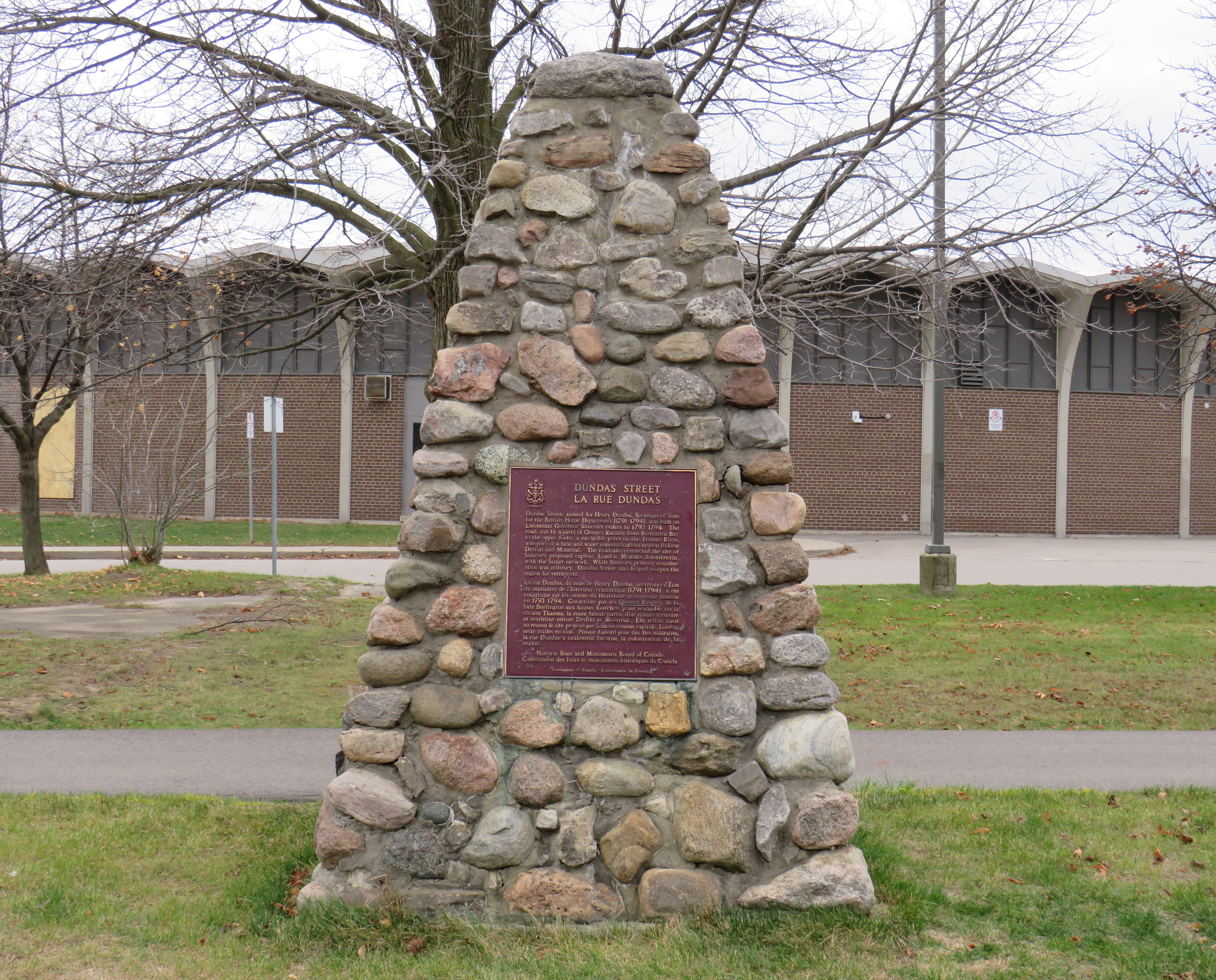
A federal plaque on a cairn in front of Dundas Valley Secondary School in Dundas
Though Dundas Street (which is known as Governor’s Road between Dundas and Paris) features a gentle climb up the Niagara Escarpment, detours were quickly established to get around challenging terrain, such as the confluence of Grand and Nith rivers near Paris. Dundas Street was soon extended westward, to Simcoe’s preferred capital site at London, and extended eastward, to York (Toronto).
Yonge Street, which was originally surveyed and cleared between Lake Ontario and the Holland River near Lake Simcoe, served a similar purpose as Dundas Street. Combined with Penetanguishine Road, Yonge Street provided a military supply route to Lake Huron, though bypassing the established Toronto Carrying Place trail. Though Dundas and Yonge Streets were built with military goals in mind, they, like many other early colonization roads, helped to promote new settlement of lands claimed from local First Nations. Like Dundas Street, Yonge Street was named for a senior British official — George Yonge, who was the British Secretary of War in 1793.
In its early years, Dundas Street’s position inland from Lake Ontario was advantageous as it provided an alternate route in case of invasion. The winding route through Etobicoke and West Toronto to Ossington Avenue allowed travellers to avoid deep ravines and Grenadier Pond.
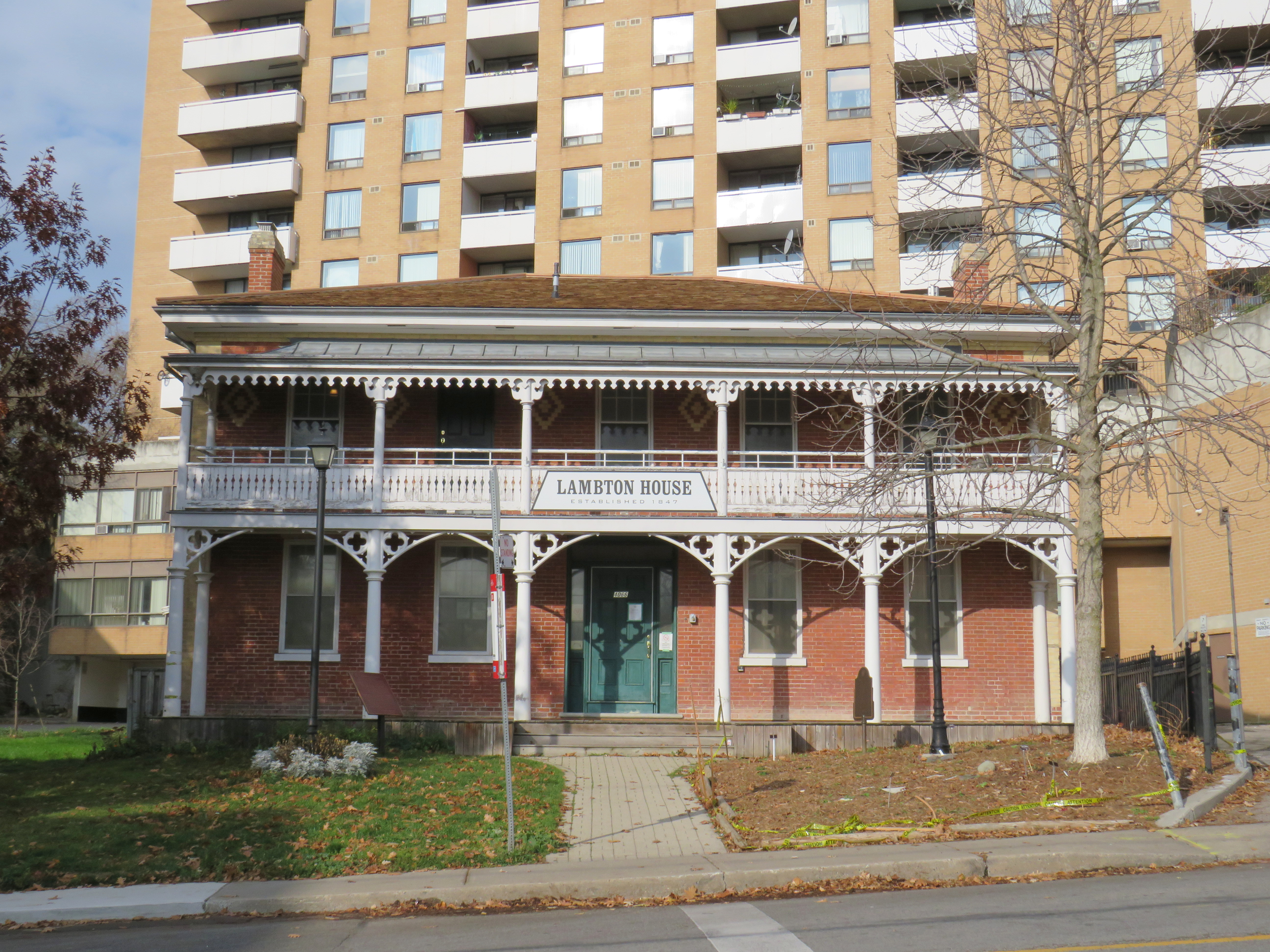
Lambton House, Old Dundas Street
Other early settlement routes, such as Weston Road, branched off of Dundas Street, leading to newly settled lands to the north and northwest of Toronto. Taverns dotted the route, providing accommodation and libation to travelers, several of which — including Lambton House and Montgomery’s Inn — survive to this day.
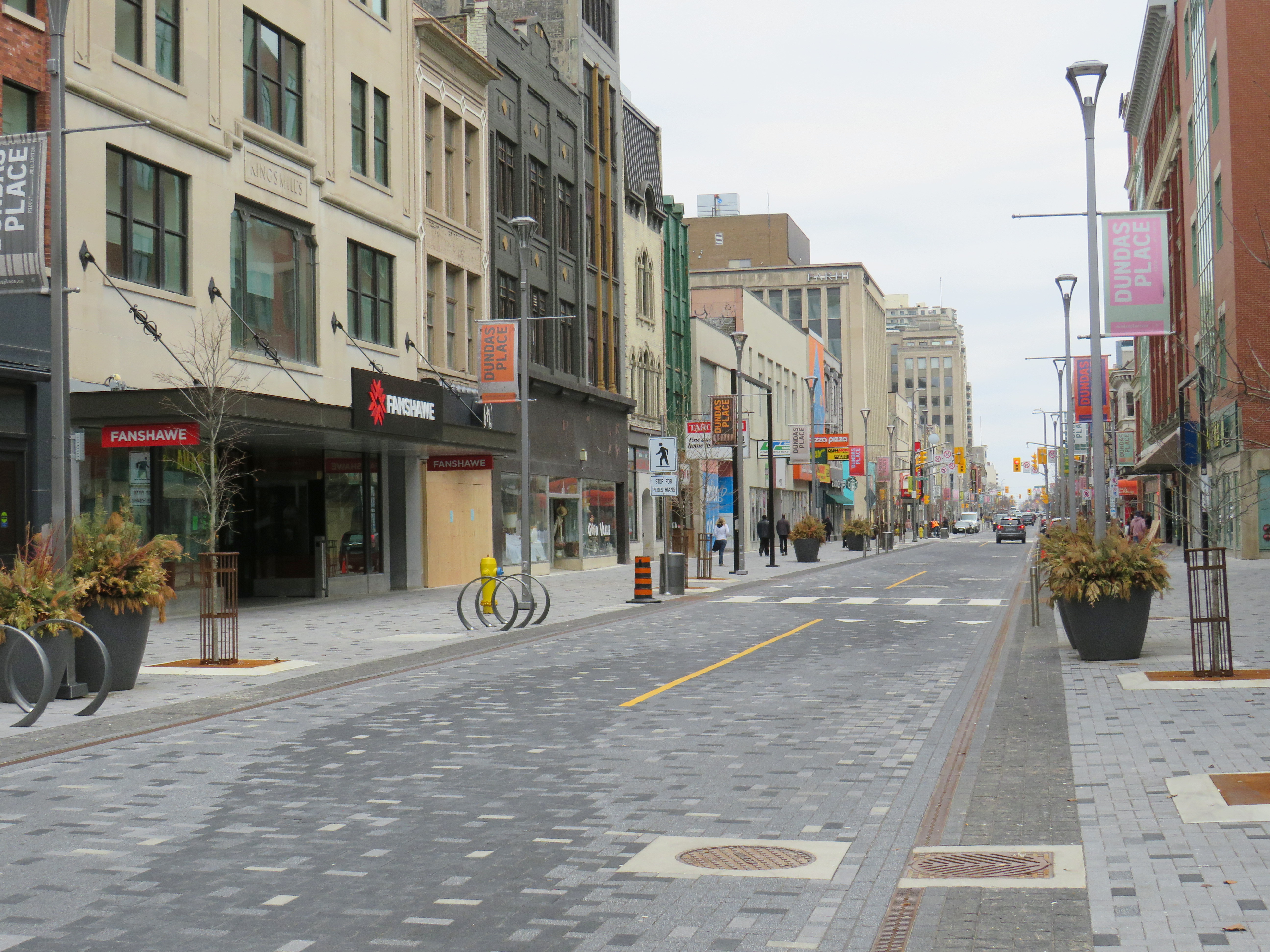
In London and Woodstock, Dundas Street formed the basis for each city’s downtown core. In London, it was recently rebuilt as a two-lane flexible street called Dundas Place, intended to host public events and revitalize the street, which has seen a loss of business to suburban malls and big box stores and to trendier bars and restaurants on Richmond Street, closer to Western University.
Dundas Street in Downtown London was recently rebuilt as a flexible street
Outside the cities, though, other routes surpassed Dundas Street in importance by the mid 1800s. The Lakeshore Road soon became the preferred route between Toronto and Hamilton (which overtook the town of Dundas in size and importance), while the railways, established between Toronto, Hamilton, and London in the 1850s, further eroded Dundas Street’s importance as a major through route until the automobile gained in popularity.
Much of the road between Paris and London became part of interprovincial Highway 2, which extended across Eastern Canada from Windsor, Ontario to Halifax, Nova Scotia. The Waterdown-Etobicoke section became part of Highway 5, while the lesser-travelled section between Paris and Dundas (which today is known as Governor’s Road) was established first as Highway 5B in 1938, then as Highway 99 in 1940.
The remains of the old Dundas Street bridge over the Humber, removed in 1928, looking west to the former settlement of Lambton Mills. The replacement high level bridge is seen to the left. The approaches to the old bridge are named Old Dundas Street.
The Dundas-Waterdown section, which winded its way up the escarpment (only to descend it again a short distance east), became a minor road, with part of the original alignment abandoned by the 1850s.
Though it never held the status of Toronto’s main street, Dundas Street would gain in importance and length in the 19th and early 20th centuries. As Toronto grew beyond its early street grid, it came up against the park lot system devised by Governor Simcoe and other officials to establish a landed gentry in the new colony (including the slaveholding Jarvis and Russell families, who worked to prevent Simcoe from instituting a complete abolition in Upper Canada). These lots which were long and narrow, extended north from Lot (now Queen) Street, and each were developed independently. This resulted in a mess of east-west streets that did not necessarily meet each other. Though College Street was laid out with minimal difficulty, there was no continuous east-west street between College and Queen Streets east of Ossington Avenue.
Dundas Street West, looking southeast from Dovercourt Avenue towards the downtown skyline. This is part of the 220-year old western extension of Dundas Street from the head of lake to York (Toronto).
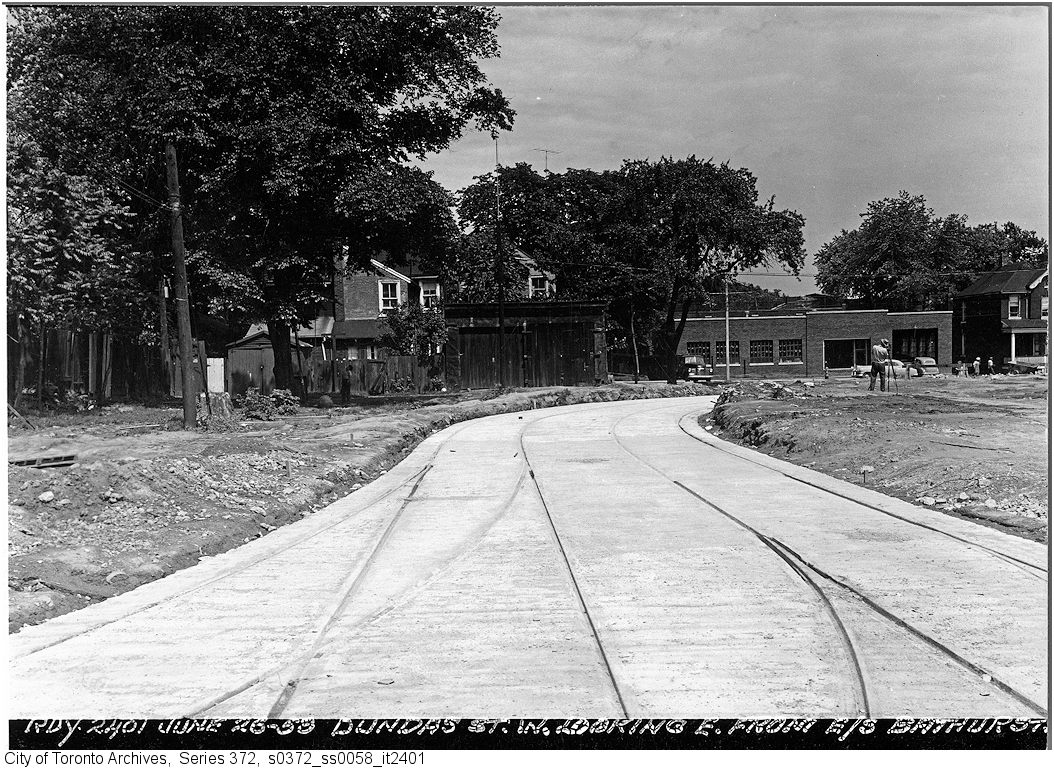
But by the early 1910s, Dundas Street was extended eastward, at first to Bathurst Street, following Arthur Street — which was widened to permit Toronto Railway Company streetcars — and then east to Yonge via St. Patrick, Anderson, and Agnes Streets. Jogs between these streets were slowly realigned, starting with the St. Patrick-Anderson-Agnes jogs between McCaul Street and University Avenue. However, it wasn’t until 1953 that the jog between former Arthur and St. Patrick Streets at Bathurst Street was eliminated. Scadding Court Community Centre now sits on the old roadway, though a small part survives as the centre’s staff parking lot.
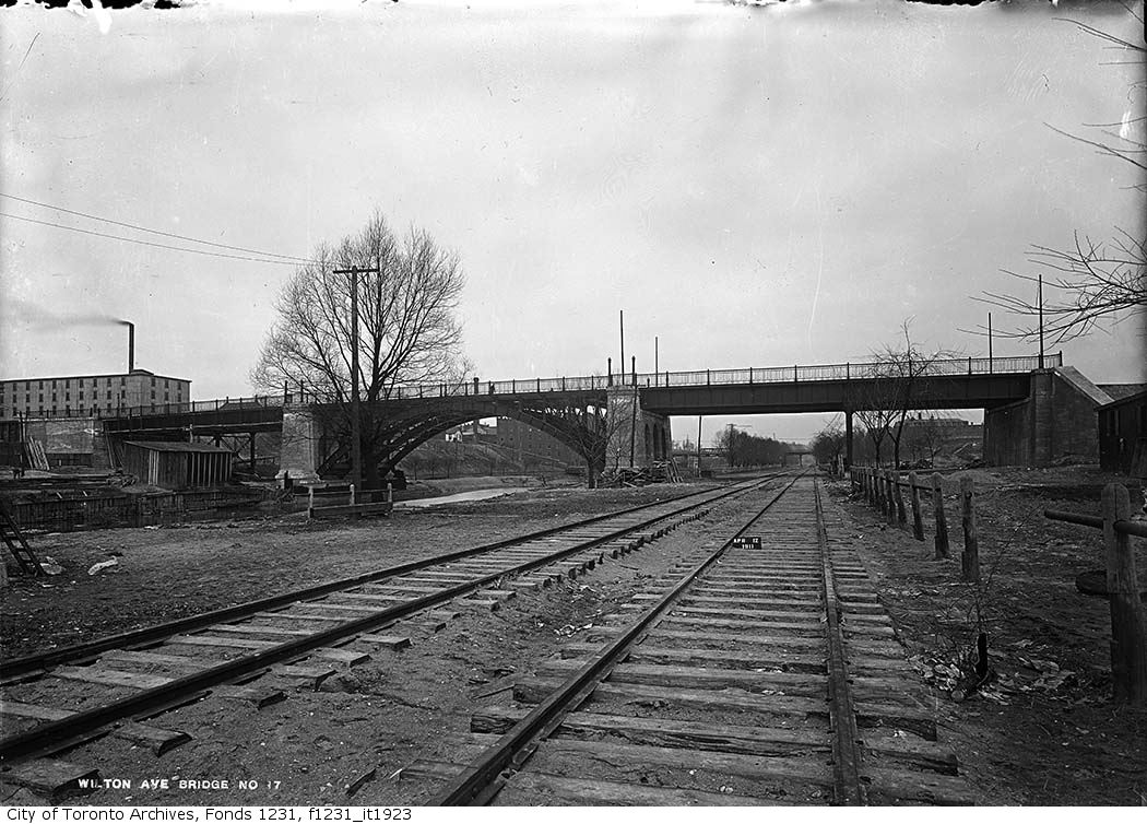
East of Yonge Street, Wilton Avenue was extended across the Don River in 1911, extending just east of Broadview Avenue, incorporating Elliot and Crawford Streets. Though the new bridge was built with streetcar tracks and overhead poles, through service did not begin until 1923, as part of a major TTC route restructuring.
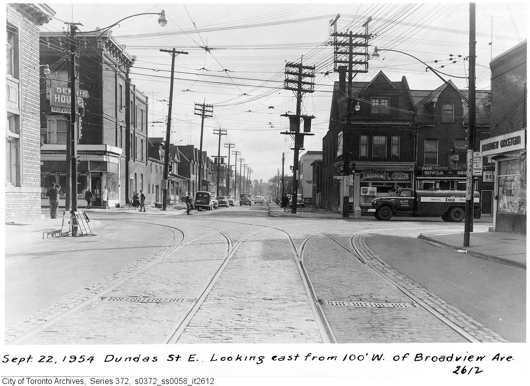
By 1920, Wilton Avenue was renamed Dundas Street East, though the through connection across Yonge Street was not completed until 1922, with the block long section east of Yonge left over from the realignment renamed Dundas Square.
Though the early extensions of Dundas Street through the city simplified the street grid and allowed for through streetcar service between West Toronto and Broadview Avenue, the eastern extension built in the 1950s was done entirely for the benefit of the automobile.
Though Dundas Street extended east of Broadview for one block to Boulton Avenue, it was as a narrow residential street, and did not continue beyond (this is why the Harbord Streetcar took a convoluted route via Dundas, Broadview, and Gerrard to get to Carlaw and Pape Avenues). New roadways were planned to expand traffic access to Downtown Toronto from the burgeoning suburbs, including a new extension of Dundas Street east to Kingston Road.
From Boulton Avenue, a new alignment was built east to Pape Avenue, resulting in the demolition of over a dozen houses on Boulton Avenue, De Grassi Street, West Avenue, and Wardell Street, before ducking under the Canadian National mainline in a new underpass built in 1953, and through an industrial area, avoiding major factory buildings.
East of Pape Avenue, the new roadway followed a widened Dagmar Avenue, before bending south though a former alley to Jones Avenue to connect with former Doel Avenue to Alton Avenue. Between Alton and Woodfield Road, another new section of roadway was built, through an old brickyard in the late 1940s, connecting with Applegrove Avenue to Coxwell Avenue. The final section, between Coxwell Avenue and Kingston Road, was built through a minor ravine, connecting with, and replacing part of, Maughan Crescent and Edgewood Avenue.
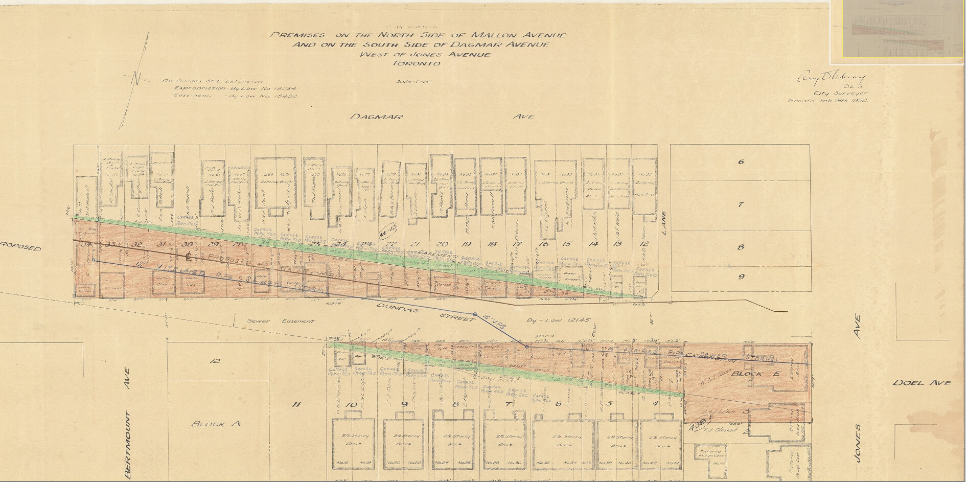
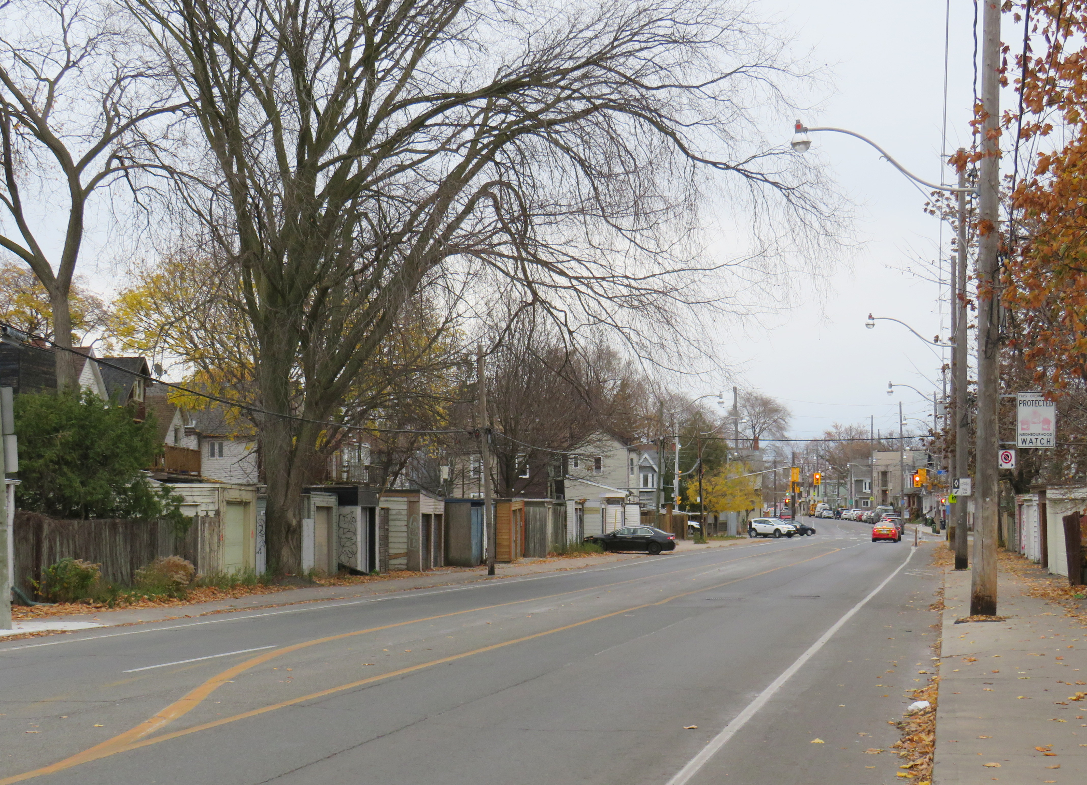
Plan for Dundas Street extension through the rear yards and laneway between Dagmar and Mallon Avenues. From City of Toronto Archives, Fonds 200, Series 2277, Item 32.Just west of Jones Avenue, Dundas Street East is lined with garages, as it passes through an old alley between Dagmar and Mallon Avenues.
Though Dundas Street East was shoehorned into several east-end neighbourhoods through the 1940s and 1950s to provide a new route for automobile traffic, over fifty years later it became an important cycling route. In 2003, the speed limit was reduced to 40 kilometres per hour, and the four traffic lanes reduced to two, with new bike lanes and a centre turning lane. Without streetcar tracks (unlike neighbouring Queen and Gerrard Streets), and with few storefronts, Dundas Street was simple to reconfigure. In 2020, the bike lanes were extended west across the Don River and into Regent Park, as part of the new ActiveTO measures.
Within Toronto, Dundas Street has gone by many names: Arthur, St. Patrick, Anderson, Agnes, Wilton, Elliot, Crawford, Dagmar, Doel, Applegrove, Maughan, and Edgewood. At various times in the first half of the last century, city officials have decided to change their names to Dundas Street.
It would not be without precedent to change Dundas Street’s name as well. Henry Dundas has no connection to local history, and even the historic road that bears his name did not extend any further east than Ossington Avenue.
Retain the legal street names with additional interpretation and recognitions
Retain the legal street names but rename those civic assets with Dundas in their name, except TTC facilities (there are three parks and one library branch that include the Dundas name, and Yonge-Dundas Square; there are two TTC subway stations and one streetcar line that also bear the Dundas name)
Rename the streets and all other civic assets now carrying the Dundas name (including Dundas Street East, Dundas Street West, Dundas Square, and Old Dundas Street).
I would agree with at least the third option, and likely the fourth option, even in part. As one of the city’s most famous and popular meeting places, a better name can be found for Yonge-Dundas Square. As Dundas Street East is a 20th century construct, and less than half the age of the historical road, it too, would be a great candidate for renaming to something meaningful. There are many other streets, towns, and parks in Toronto and elsewhere in Ontario that carry names given by early colonial officials, eager to leave their mark on newly claimed lands. Some are also worthy candidates for renaming.
Other municipalities, including Mississauga, Oakville, Burlington, Woodstock, and London, will also have to decide what they will do with their sections of Dundas Street. There is also the matter of the former Town of Dundas, the Dundas Valley, the United Counties of Stormont, Dundas, and Glengarry in Eastern Ontario (and two townships within it). There are also Dundas Streets in Belleville, Trenton, and Napanee along Highway 2, but otherwise unrelated to the historic road.
But the process must be thoughtful and considerate, and not just a another feel-good exercise that distracts from the real economic and racial inequities in our city.
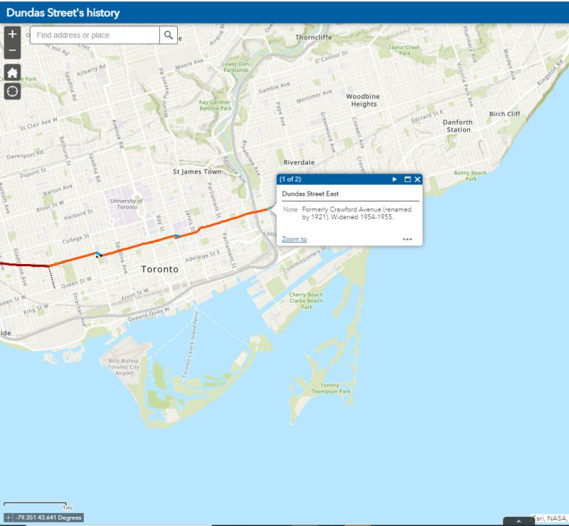
The interactive map below illustrates the history of Dundas Street, from London to Kingston Road.