Tag: Highways

  • The tragedy of Ontario’s HOV lanes

    The tragedy of Ontario’s HOV lanes

    Highway 403 in Mississauga, with HOV lanes in the centre

    In the last year, making the occasional car trip to visit family in Northeastern Ontario or just to get out of the city for a day or two, I kept wondering what the point of those new high occupancy vehicle (HOV) lanes were on the Queen Elizabeth Way, Highway 400, or Highway 401. At first, they seemed like a real time saver for anyone riding on a transit bus or driving with a few family members, friends, or carpool colleagues in the car. As time went on, with new exceptions, minimal or no police enforcement, and increasingly aggressive driving post-pandemic, one is left wondering why the province even bothers adding them to more highways.

    Now, amongst a flood of moves and musings by our oft-Trumpian premier, it appears that the province has given up on even the veneer of sustainability with these highway widenings throughout the Greater Golden Horseshoe and Ottawa regions. On Tuesday, March 17 — St. Patrick’s Day — Transportation Minister Prabmeet Sarkaria announced a proposed regulatory amendment that would allow all cars and light trucks in the HOV lanes, during off-peak periods. The change would “help keep drivers moving across the province, so they can spend less time in traffic and more time with their families and friends.”

    This announcement is part of a stream of messages from Doug Ford and his government clearly seeking the attention of the news media and the public. The week prior, Ford was talking about expanding the Toronto Island airport, even seizing control of the City of Toronto’s interest to ensure that jets could land on the waterfront. Before that, Ford mused about a new convention centre built on Lake Ontario near Exhibition Place. This week, Ford was on a law-and-order kick, attacking a fair and impartial judiciary, promoting the idea of “Bail TV,” and praising a homeowner that shot an intruder during a home invasion. Maybe this is to distract from scandal and a new proposed law to shield the premier, ministers, and staff from journalists using freedom of information requests to keep the government accountable.

    The legislative assembly will finally reconvene next week, starting Monday, March 23, after a 14-week break.

    The first HOV lanes were introduced on Highway 403 through Mississauga and on Highway 404 southbound from Highway 7 to Highway 401/Don Valley Parkway in 2005. A year later, the HOV lanes were touted as an “unqualified success,” with the minister of transportation at the time, Liberal Donna Cansfield, promising more reserved lanes to follow, with the QEW through Oakville and Burlington to be the next implementation. With the Ontario Provincial Police (OPP) conducting active enforcement on those two sections, they found that only 5 percent of motorists in the HOV lanes were violating the law.

    GO Transit was an especially keen user of the new HOV lanes. In 2005, only the Lakeshore Line had regular off-peak train service, and buses filled in the gaps in between. The 404 lanes saved valuable minutes for buses on the 70/71 Stouffville Line route between Union Station and Markham; the City of Toronto designated sections of the inner paved median on the DVP as well for GO buses that could be used to bypass traffic congestion.

    Clip from the Toronto Star on Thursday, Dec 14, 2006 

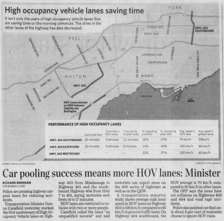
    At the time, the HOV lanes saved carpoolers and transit riders up to 17 minutes on the initial segments on Highways 403 and 404. The additional capacity created with the new lane (no existing lanes were to be converted to HOV-only under provincial policy) also led to time savings for all drivers, at least in the short term. Increased traffic caused by suburban growth and induced demand eventually negated those time savings for general traffic.

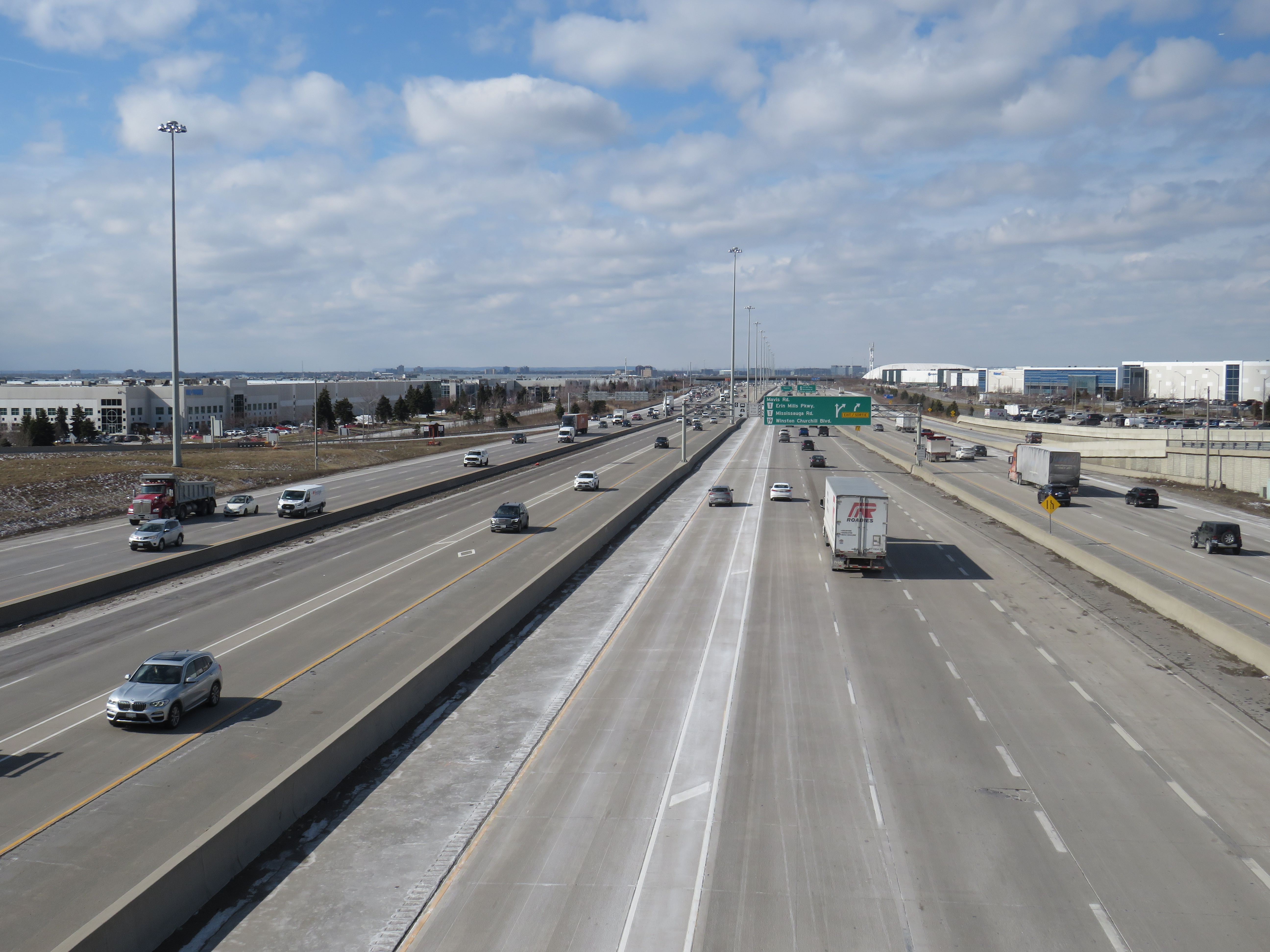
    HOV lanes were included in more highway expansion projects. The QEW HOV lanes through Oakville and Burlington were added in 2011. Lanes on Highways 400, 410, and 427 and Highway 417 in Ottawa followed, and when Highway 401’s express/collector system was expanded through western Mississauga and Milton, HOV lanes were part of that too.

    “One more lane should do it,” Highway 401 in Mississauga, with HOV lanes in the middle of a recently widened highway

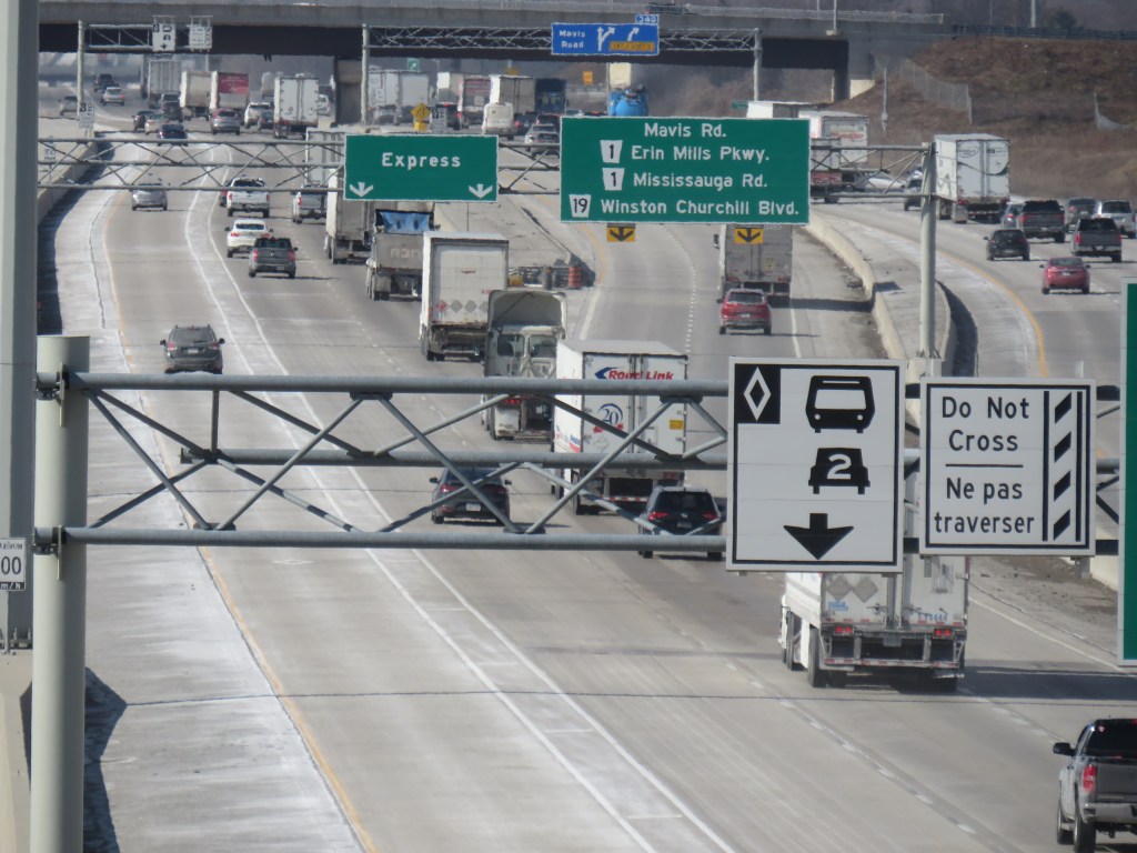
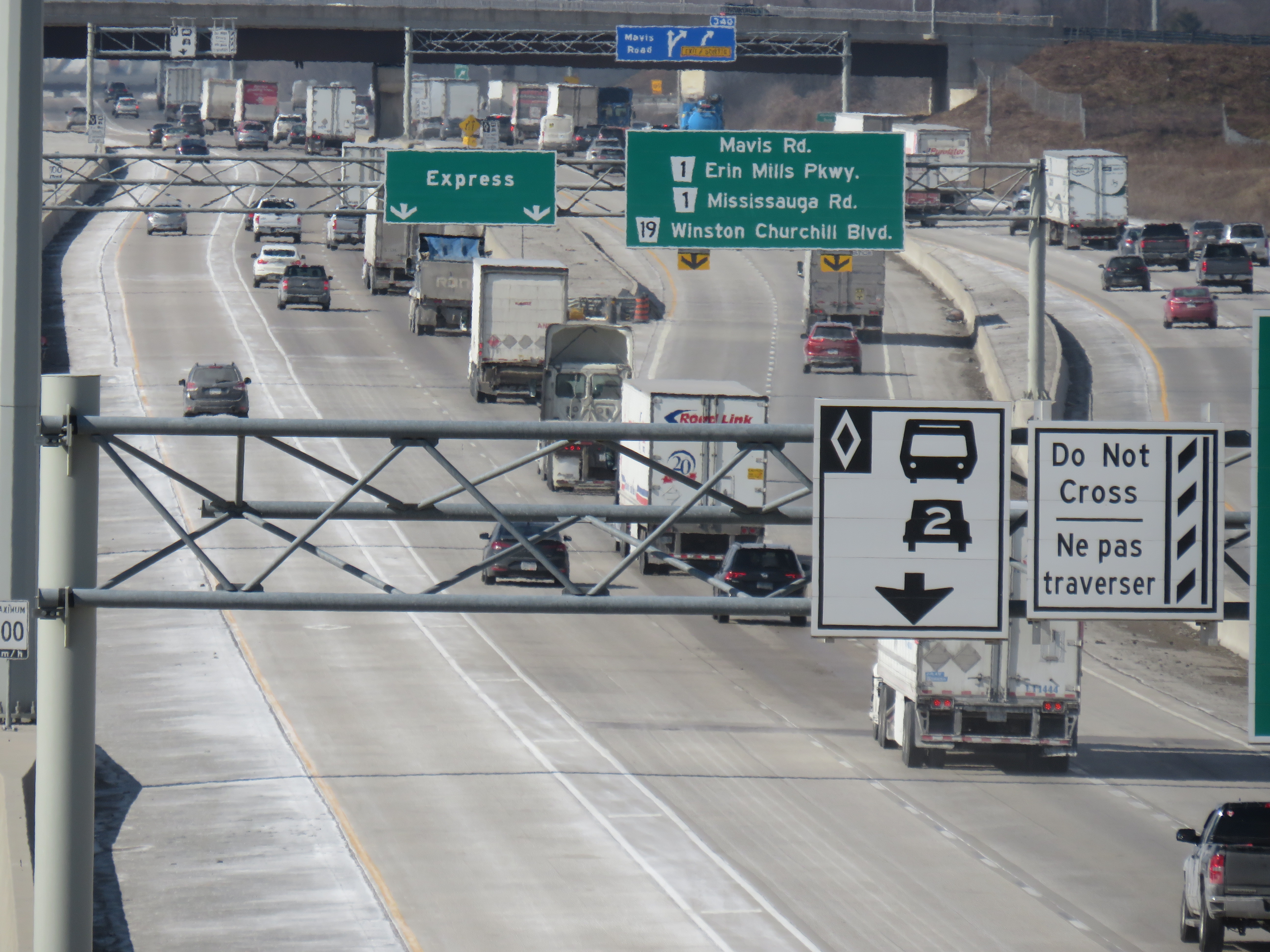
    Regulations on the use of HOV lanes were relaxed over the years too. Motorcyclists were permitted, as were any vehicle with a “green” license plate (available to any battery-electric or plug-in hybrid car, SUV, or light truck). HOT permits were also added, for anyone willing to pay and enter a lottery for the right to use the lanes while driving alone. Taxis and airport limos were also allowed, even when not carrying a passenger.

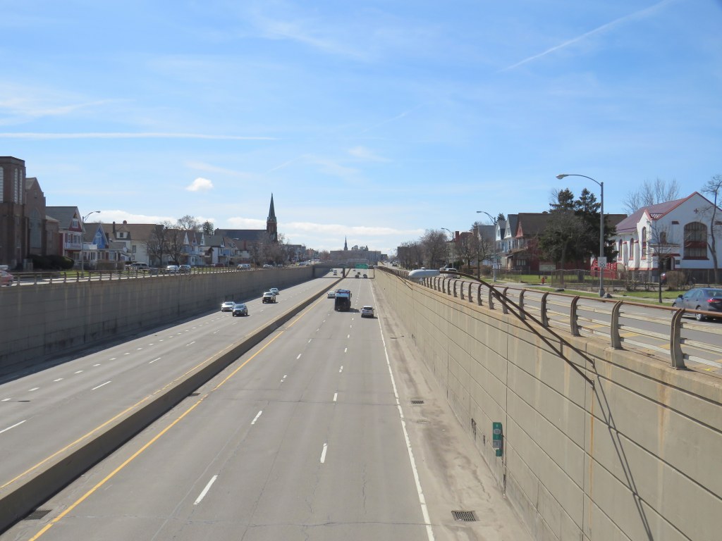
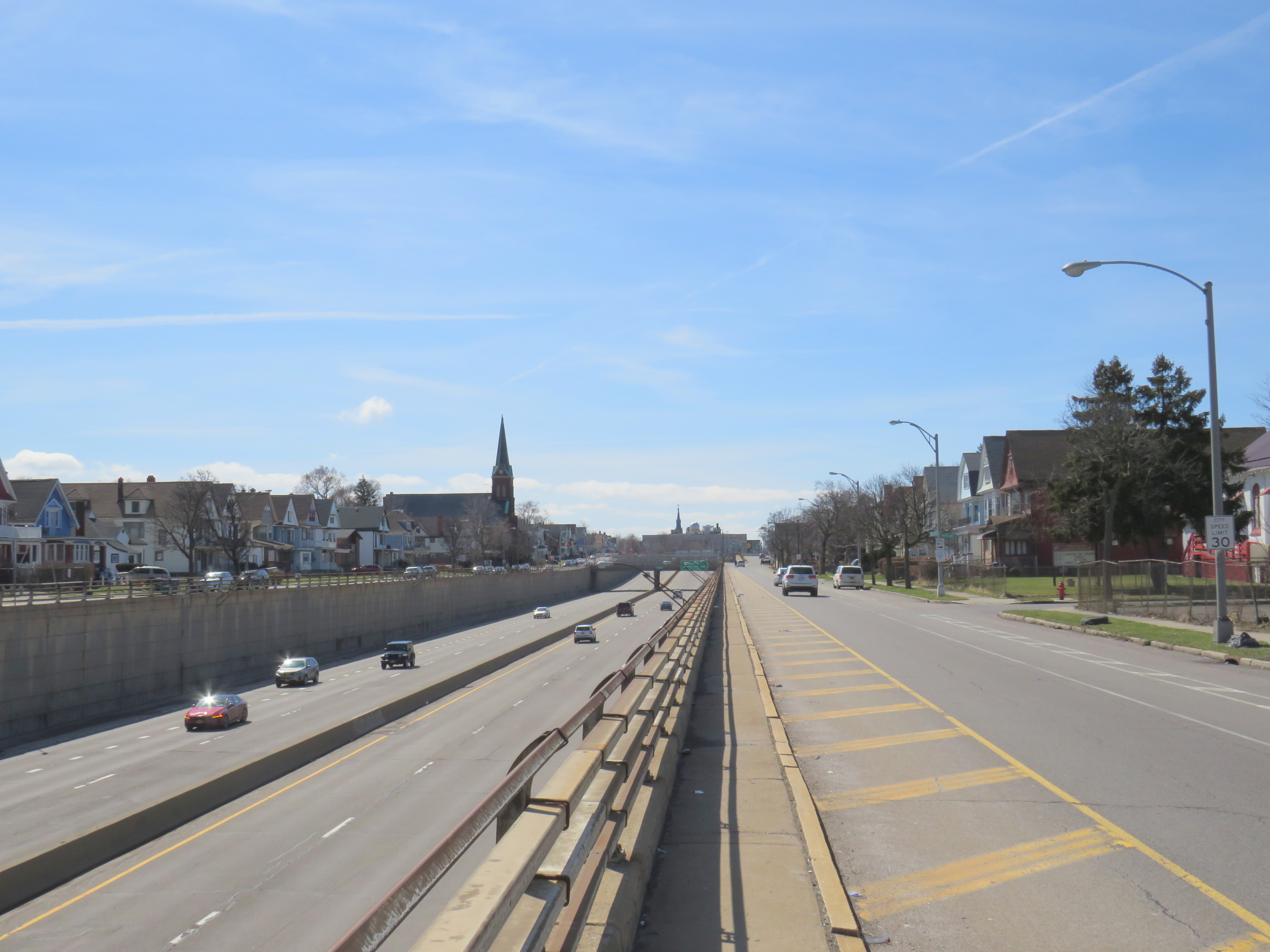
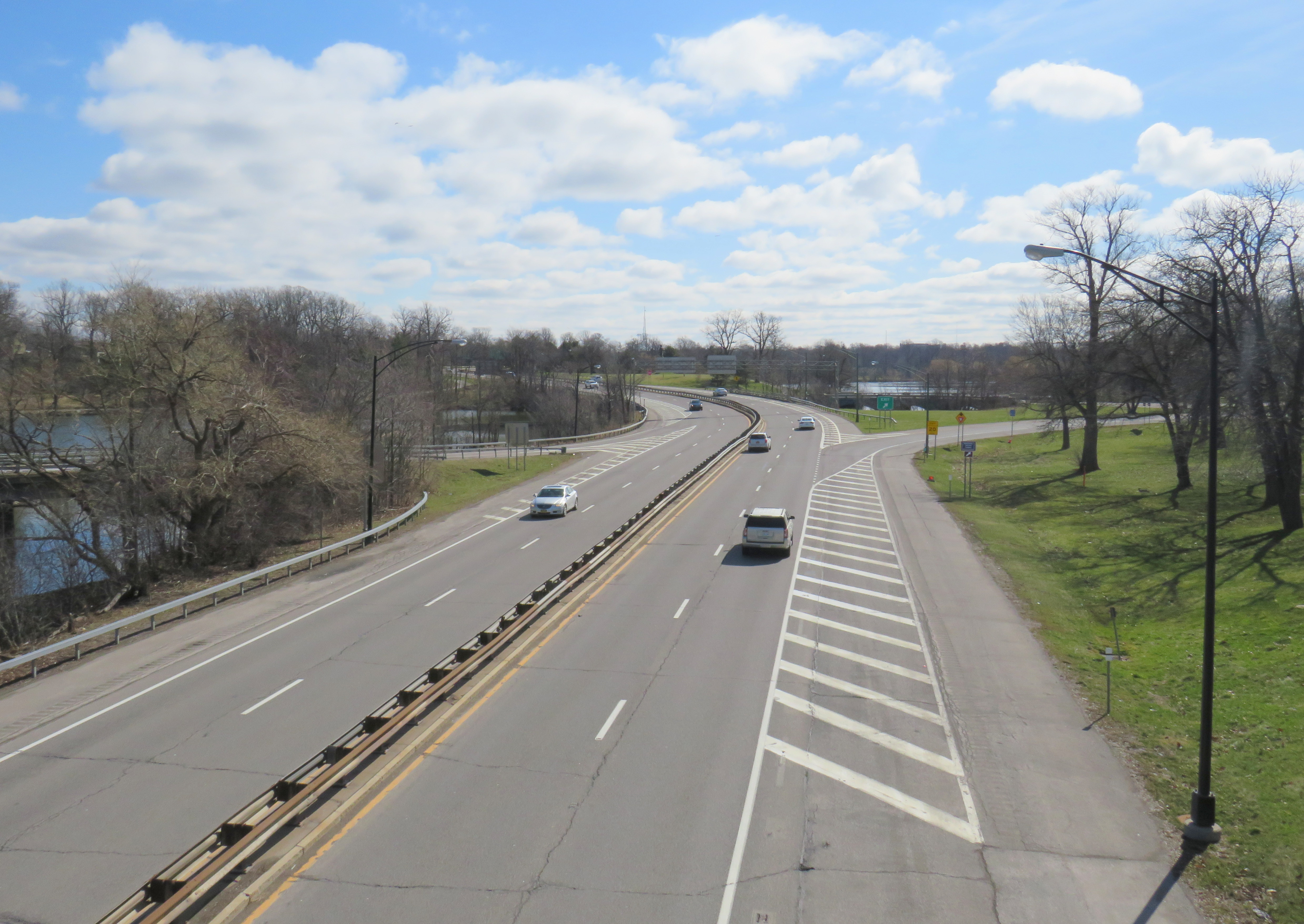
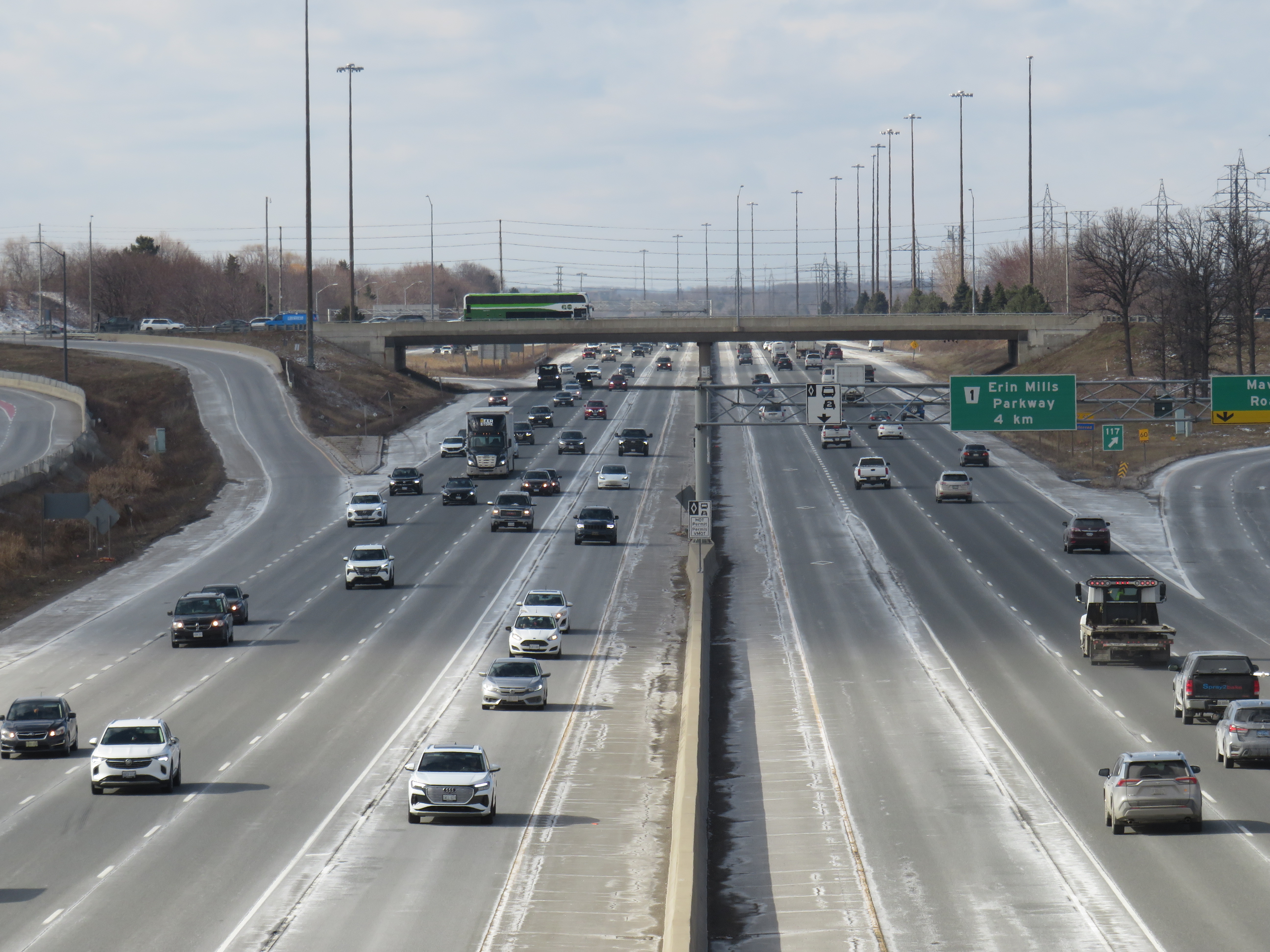
    Poor driving habits, which seemed to have gotten worse since the COVID-19 pandemic, have made a mockery of the initial intentions of the HOV lanes. Without enforcement, the HOV lanes are essentially treated by some drivers as fast lanes, with sudden swerving in and out despite double solid lines and “Do Not Cross” signs consistently posted along the highway, intended to reduce weaving. Solo drivers regularly use the lanes without consequence to get around slower drivers or trucks.

    Despite “Do Not Cross” signs, and a double solid line between the HOV lane and general traffic, this regulation is regularly ignored

    For now, we do not know what “off-peak hours” would mean when the provincial government finally legalizes another bit of the selfish and aggressive driving behaviour the rest of us have sadly gotten accustomed to. The QEW is frequently jammed most weekends between May and October, when families and tourists travel between Toronto, Hamilton, and Niagara. Highway 400 is notorious on Friday evenings and Sunday afternoons during Cottage Country commutes.

    This is yet another motorist-friendly move by this government eager to hold onto seats in suburban ridings and please its wealthy backers, along with permanent gas tax breaks, abandonment of license plate renewal fees, the prohibition on speed enforcement cameras, and the construction of destructive new highways like the 413. But at least this latest move is an acknowledgement of something I have felt for years about the HOV lanes in Ontario: a simple greenwashing of highway expansion, making us feel better about laying more concrete and asphalt.

  • The tragedy of East Buffalo

    The tragedy of East Buffalo

    Kensington Expressway, Buffalo

    Just two blocks away from the Jefferson Avenue Tops supermarket is Buffalo’s Kensington Expressway.

    The high-speed roadway, built with New York State funding, was built in the late 1950s to connect Downtown Buffalo with the New York State Thruway and the airport. The highway went through Buffalo’s East Side, historically Polish-American neighbourhoods that were becoming home to working-class and middle-class African-American families.

    Ironically, a parkway system planned by famed landscape architect Frederick Law Olmsted beginning in the 1860s helped highway planners 90 years later route their new highway. Olmsted had planned large park spaces throughout the city, with wide, treed parkways connecting the spaces together. Delaware Park, to the north, was the largest of these green spaces. In 1901, it was the site for the Pan-American Exposition (which became infamous as the location of the assassination of President William McKinley), while Humboldt Park, on the city’s east side, became a popular neighbourhood gathering place. Humboldt Parkway connected these two parks with a wide, gentle curve.

    Part of the Olmsted Parks and Parkways plan, Buffalo. Humboldt Parkway curves southeast from Delaware Park near the top of the map.

    Of course, city planners of the day, who were guided by the “City Beautiful” movement, never conceived of a time when automobiles would present a new challenge to urban places. From the opening of the Erie Canal in the 1830s to the exploitation of cheap, renewable hydro-electric power at nearby Niagara Falls in the 1890s and early 1900s, Buffalo was going to be a jewel of the Great Lakes, and it needed skyscrapers and public spaces to match its optimism and ambition.

    Humboldt Parkway in 1953, with a wide, treed median on the right (The Buffalo History Museum)

    By the 1950s, Buffalo’s growth had plateaued, and the city started losing population to the suburbs, as white middle class families took advantage of generous federal mortgage incentives, and the automobile made suburban living easy. Redlining — a practice in which banks and federal mortgage underwriters graded neighbourhoods based on their physical and socioeconomic statuses — made mortgages in “declining” or “hazardous” areas difficult or impossible to get. These resulting grades discouraged investment in the housing stock and made it especially difficult for Black families to purchase homes. Racism and xenophobia was embedded in the system: areas that Eastern European immigrants were seen to be “infiltrating” were typically marked as “definitely declining” and areas settled by Black households were marked as “hazardous.”

    In Buffalo, a 1937 redlining map reflected the segregation that would define the city to this day: most of the city east of Main Street was classified as “definitely declining” or “hazardous.” Houses facing Humboldt Parkway were marked as “still desirable” as it is “a small area which maintains its desirability because of location on both sides of an attractive parkway.” That parkway would disappear 20 years later.

    Though the Niagara branch of the New York State Thruway connected Downtown Buffalo to Niagara Falls, the main Thruway, and Canadian border crossings, mostly following rail corridors, city leaders felt that without additional urban highways, Buffalo would lose investment and that more residents and employers would leave the city for the suburbs.

    In 1954, City Planning Director Russell Tryon declared that the new ring highway “would be a major step forward in alleviating the traffic blight that has diseased our neighborhood communities” while believing that highway construction might help keep people in the city, rather than literally drive them to suburbia. “If we make Buffalo a better place in which to live, the people will stay and not move out.”

    The Scajaquada Expressway through Delaware Park

    To build the new highway, planners looked for the paths of least resistance: Olmsted’s parkway system and redlined neighbourhoods where properties could be bought up cheap. None of the parkways on Buffalo’s West Side (which was, and remains, mostly white and middle class) would be sacrificed, but the Humboldt Parkway, on the East Side, would be. The Scajaquada Expressway, across the city’s north side, ran right through the signature Delaware Park. The Kensington Expressway — New York State Route 33 — required the demolition of hundreds of homes. Many displaced residents moved into public housing towers on Fillmore Avenue — which were later abandoned and demolished.

    The abandoned Kensington Heights public housing buildings on Fillmore Avenue in 2010

    The highway only helped to destroy Buffalo’s urban fabric and contributed to the economic and population decline in the East End.

    Buffalo was not alone. In Detroit, Interstates 75 and 375 were routed right along Hastings Street, the commercial and cultural hub for the Motor City’s Black community. In Baltimore, Interstate 70 was to go right downtown through the city’s West Side. The section through a Black neighborhood was built, but the western extension through Baltimore’s western suburbs was never completed, leaving behind a scar known as the “Highway to Nowhere.”

    Baltimore’s Highway to Nowhere

    In Buffalo, the East Side community struggled for decades to get a full-service supermarket after A&P left in the 1960s after the new highway was built. It finally landed Tops Friendly Markets on the A&P site in 2003. This grocery store — the only one serving over 100,000 residents in Buffalo’s East End — became the site of Buffalo’s worst mass shooting, in which a white teenager targeted Black shoppers. The closure of that store only compounds the tragedy as fresh and affordable food has become, once again, even harder to access.

    Now, New York State is planning for the removal of several urban highways built through Black neighbourhoods, including Interstate 81 through Syracuse, the remainder of Rochester’s Inner Belt, and Buffalo’s Kensington Expressway. Reconnecting Buffalo’s East Side and investing in great public spaces could be a positive first step to living up to being “The City of Good Neighbors.”