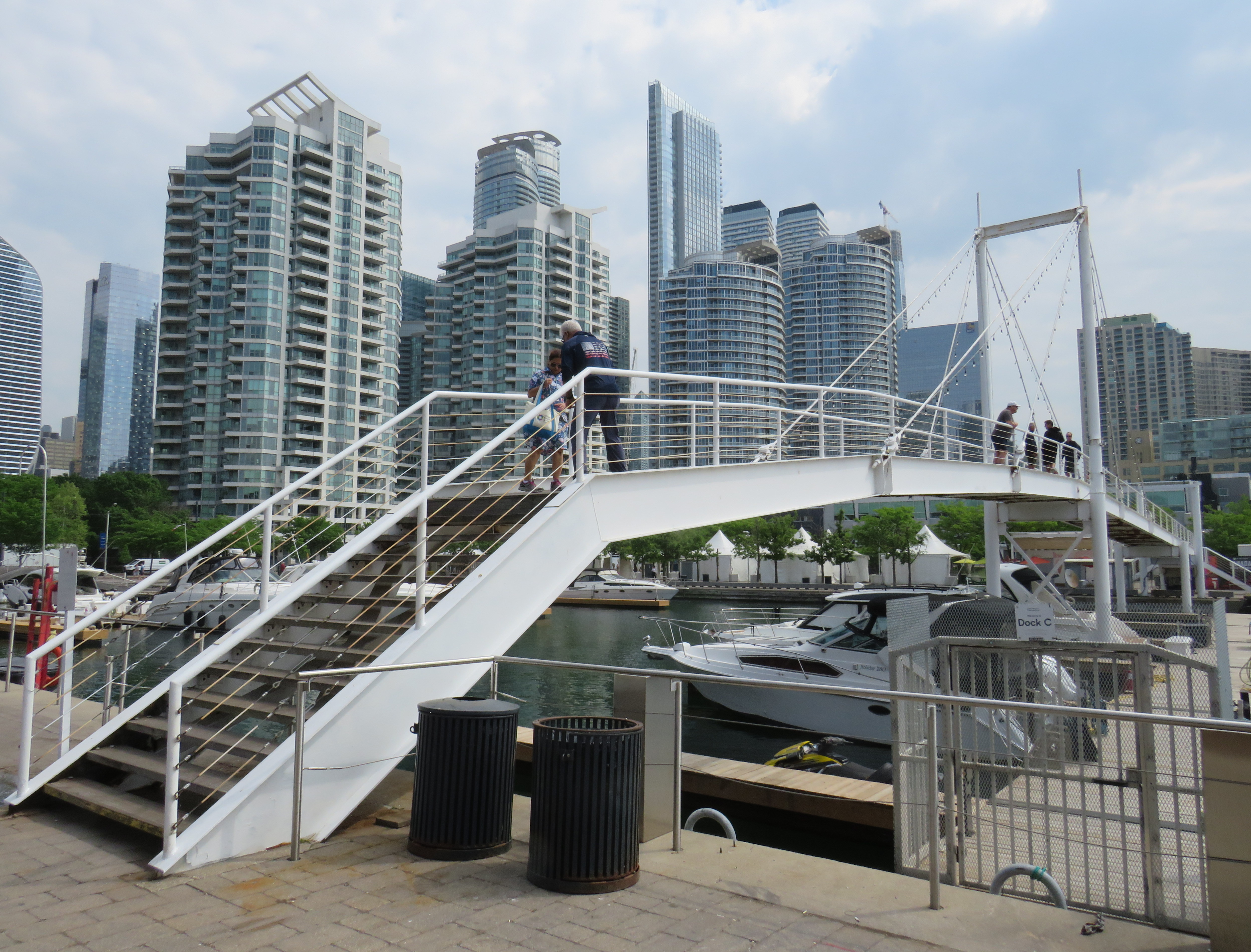
On Sunday, May 31, the Amsterdam Bridge reopened on Toronto’s Harbourfront after being closed for five years. The footbridge, which spans a marina south of Queen’s Quay, is a popular meeting place and photo opportunity, with views of Toronto Harbour to the south and the towering skyline to the north. A gift of the City of Amsterdam, one of Toronto’s sister cities at the time, the bridge was one of the first great public spaces on the waterfront as it was beginning to transition from a derelict industrial space to the city’s new front yard.
The Amsterdam Bridge in 2014
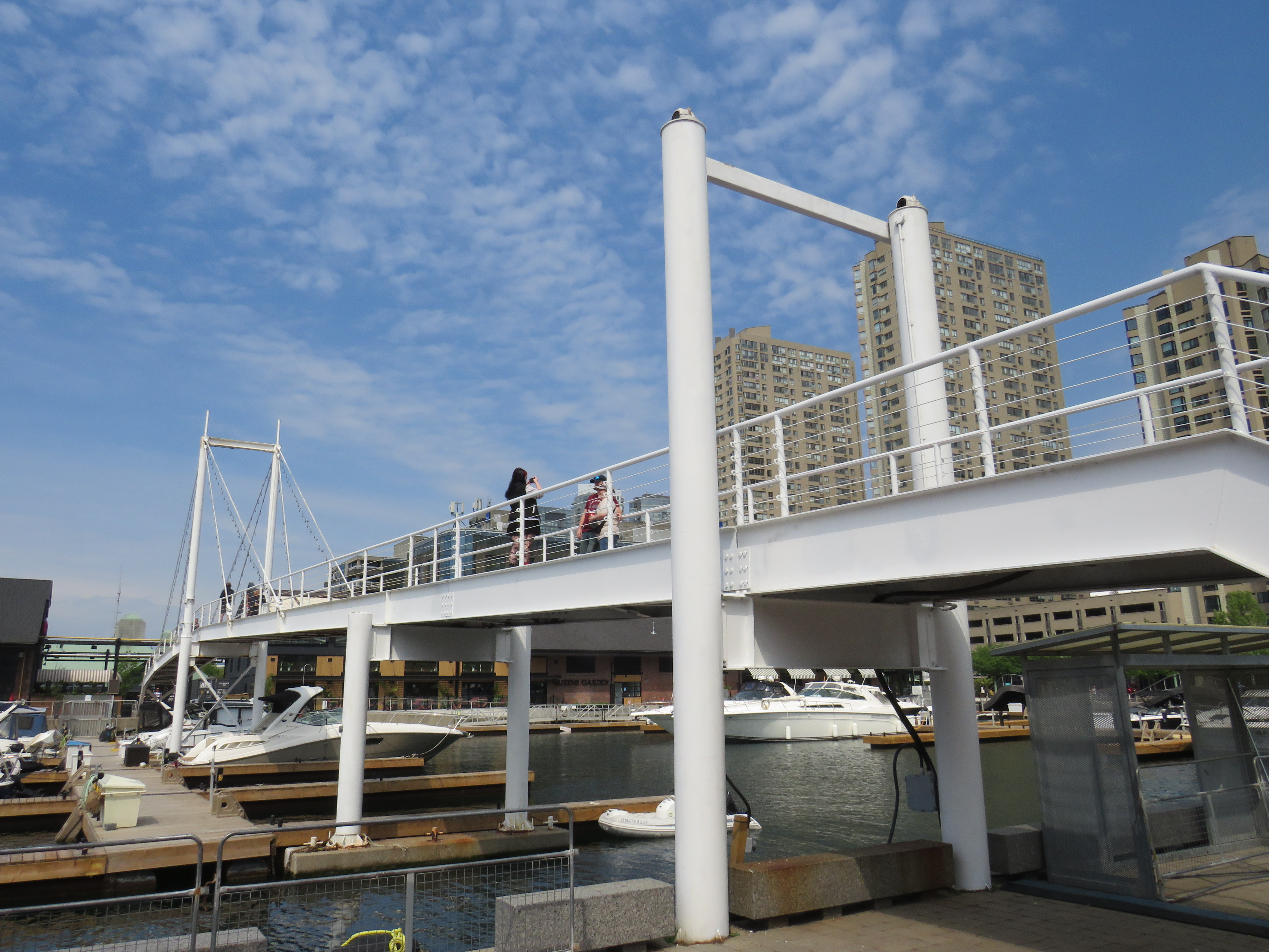
The footbridge, a cable suspension structure over the marina featured a lifting section on the east side so that tall yachts could moor at the north end of the marina on request, though this was not a regular occurrence. The design mimicked some of the iconic canal crossings in Amsterdam. Sadly, due to neglect, the bridge was closed to pedestrians in 2021 and the lifting section removed.
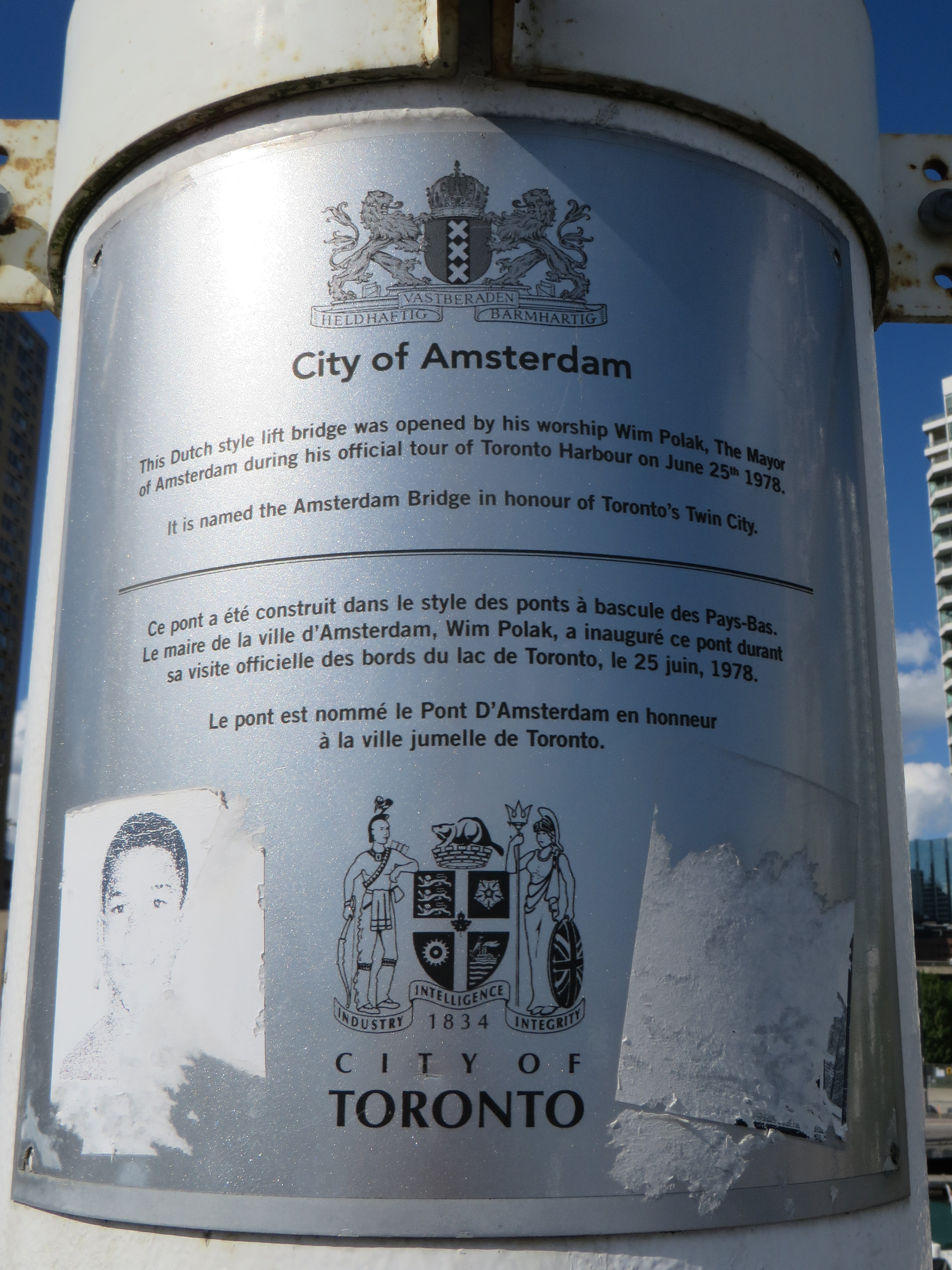
Plaque on the bridge commemorating the opening of the Amsterdam Bridge, a “Dutch style lift bridge” on June 25, 1978 by Amsterdam mayor Wim Polak, taken in 2014. Note the old pre-amalgamation City of Toronto coat of arms below. A replacement plaque with similar text (but with the current post-amalgamation civic coat of arms) since replaced the original.
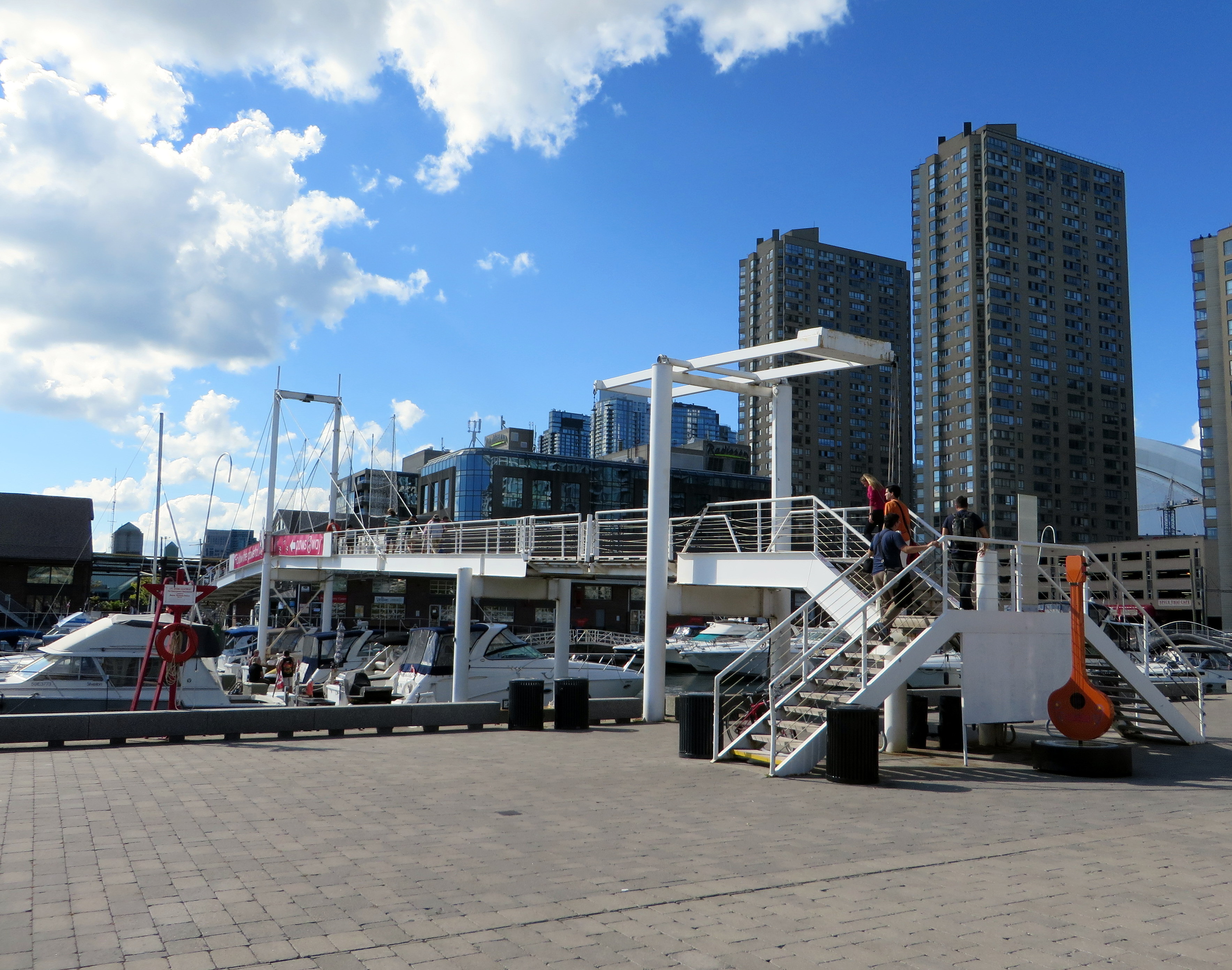
When the bridge reopened in 2026 just in time for Toronto hosting six World Cup soccer matches, the lifting section was replaced by a fixed span. Once again, visitors can climb the bridge, take in the views, and snap great photographs, but the “lift bridge” of the original “Dutch style lift bridge” is no more. It’s a shame too, that it took five years for this fix to even happen; Toronto needs to do better at maintaining its public assets, especially its unusual, fun, and quirky landmarks.
Fixed deck on the Amsterdam Bridge in 2026
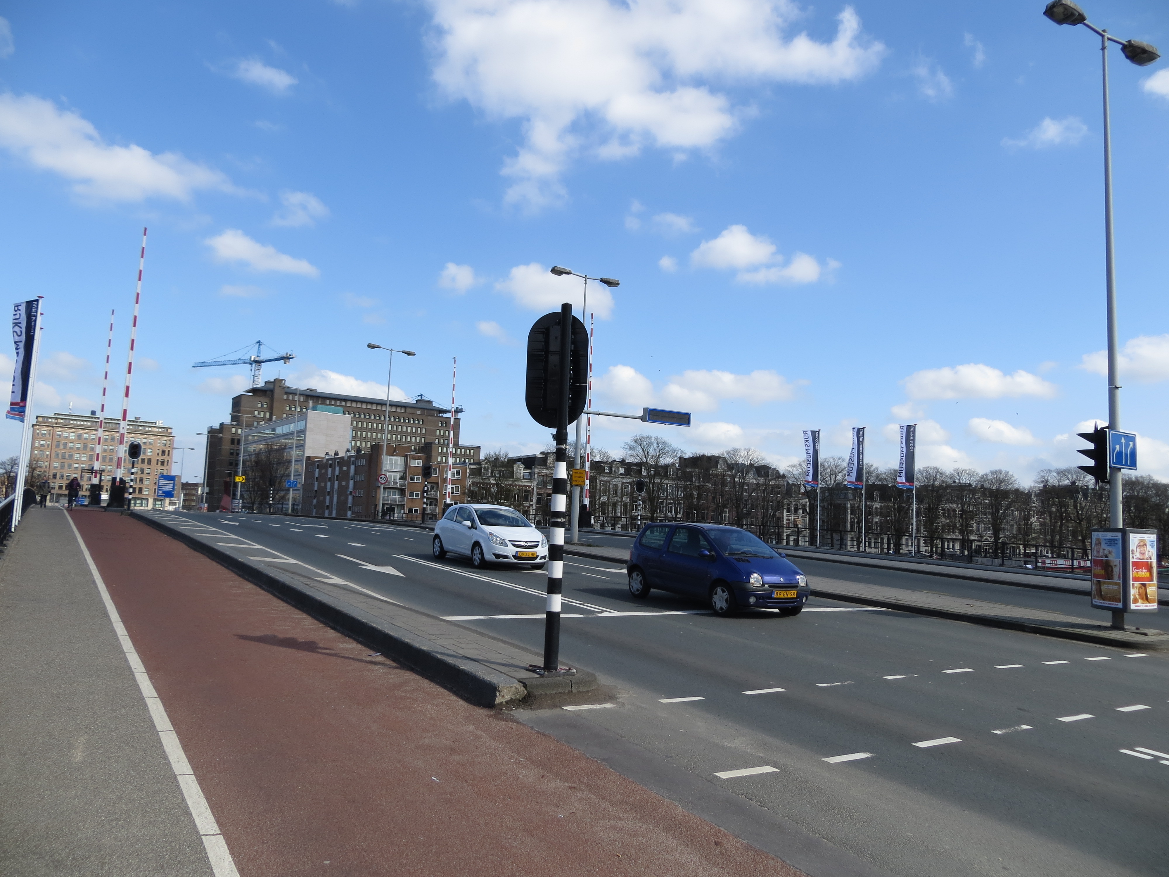
Around the same time Toronto got an Amsterdam Bridge, the City of Amsterdam named a bridge for Toronto. The Torontobrug spans the Amstel River, carrying the busy Centrumring (Central Ring Road). A five-lane traffic artery outside the major tourist areas, the bridge is not iconic by any means (I biked to it during my 2013 visit to Amsterdam) but it is an important road link. There are separated cycle tracks on both sides of the bridge, so it is at least multimodal. The bridge can still open for river boat traffic when necessary.
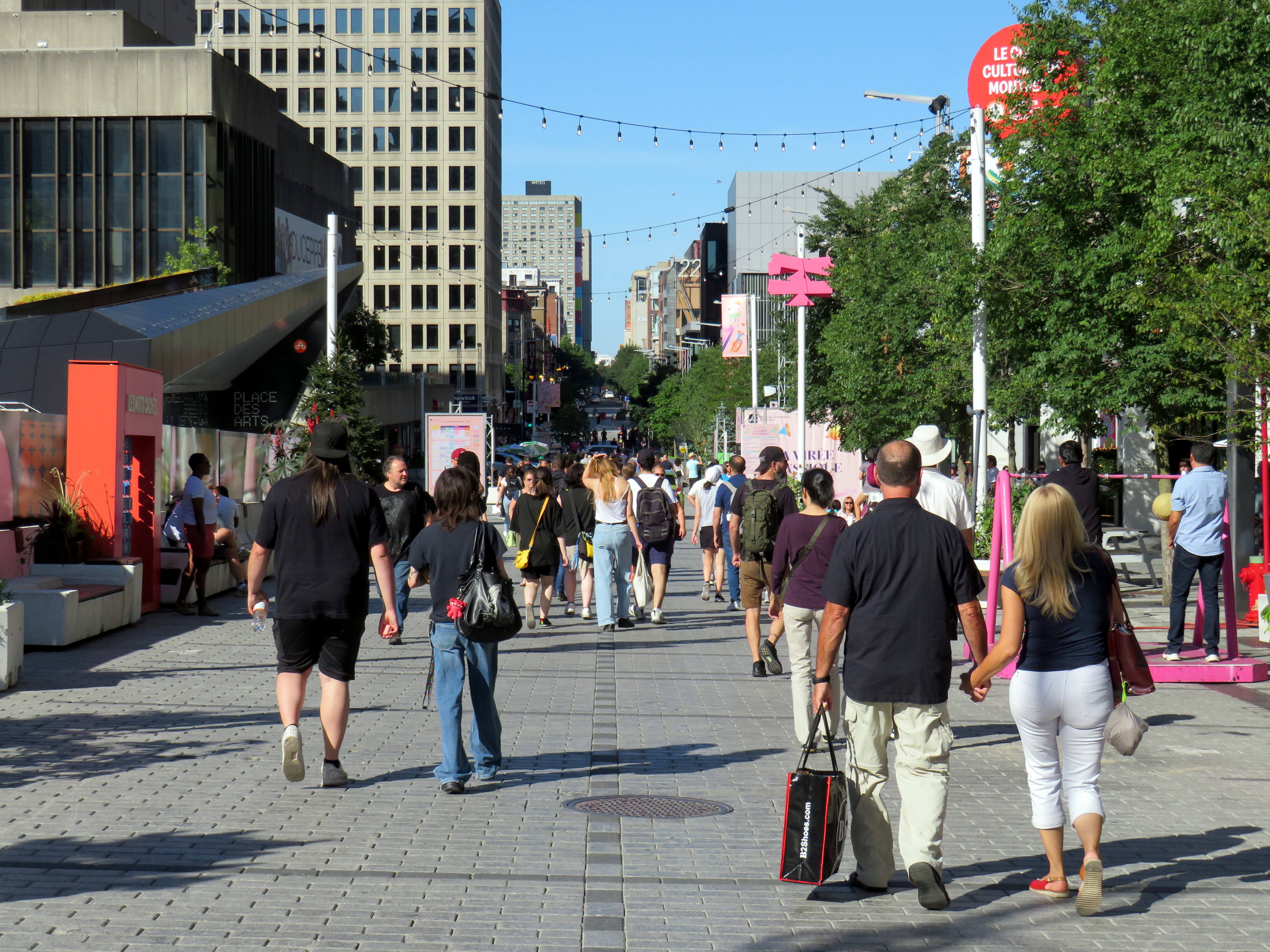
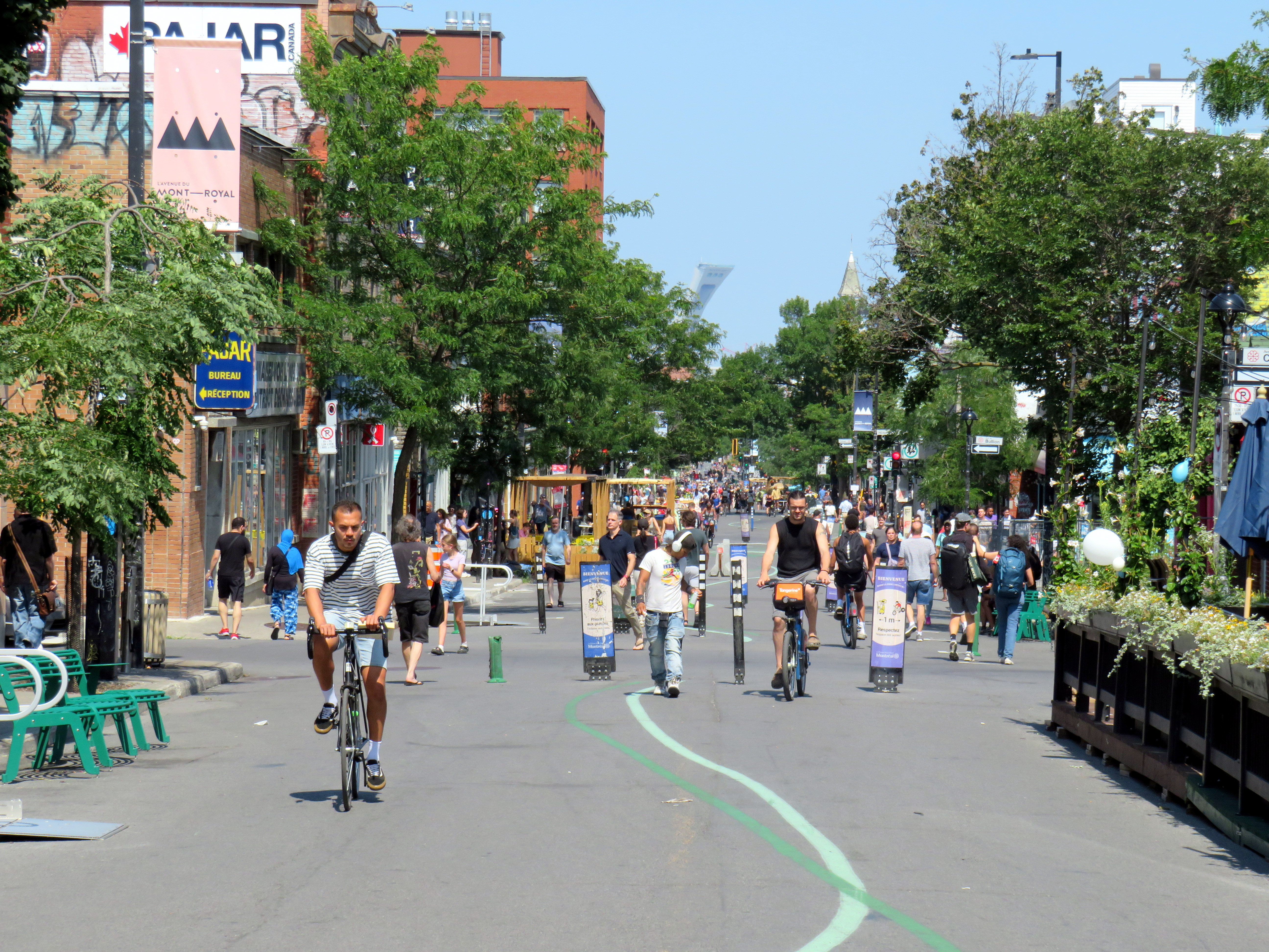
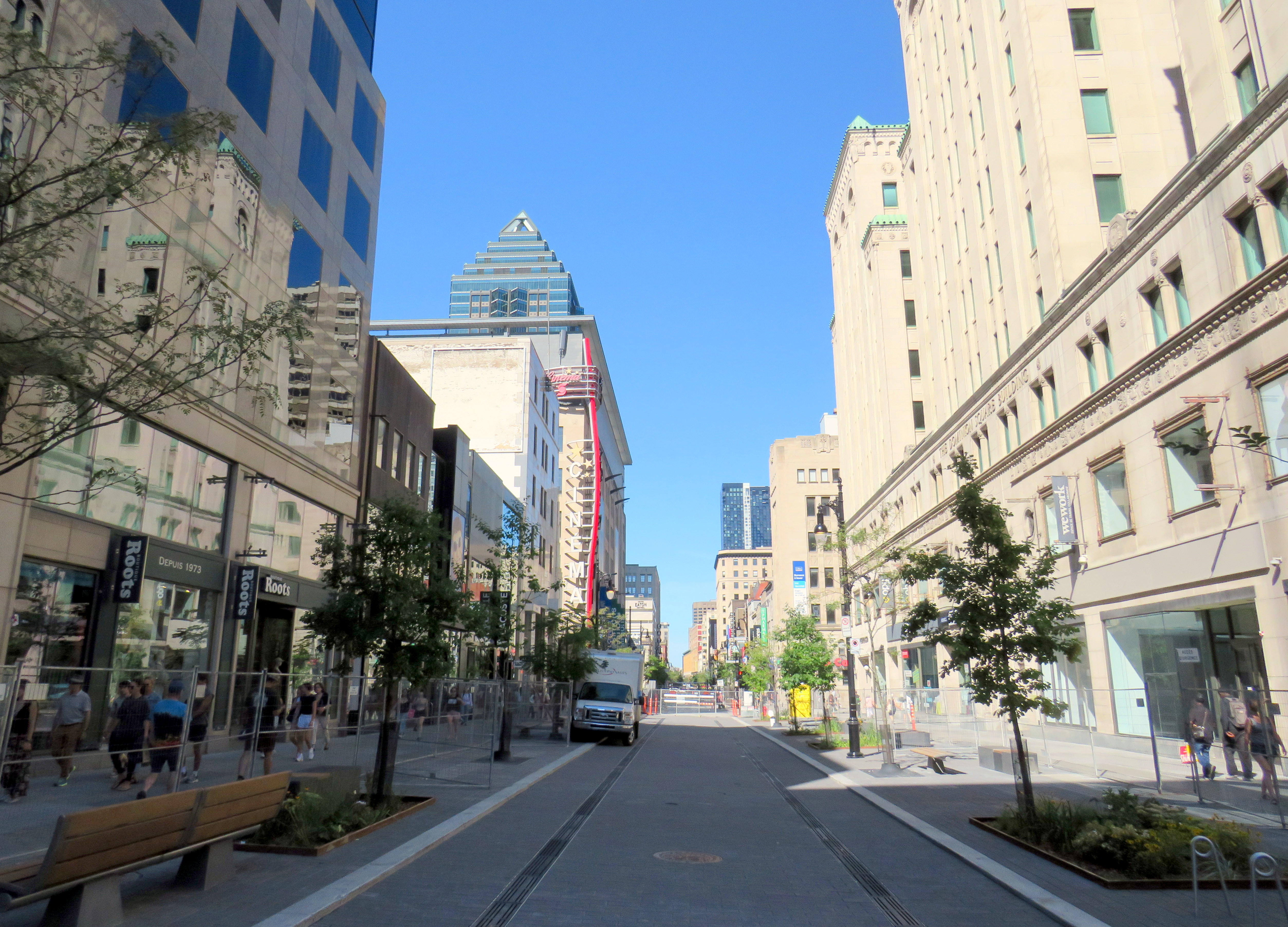
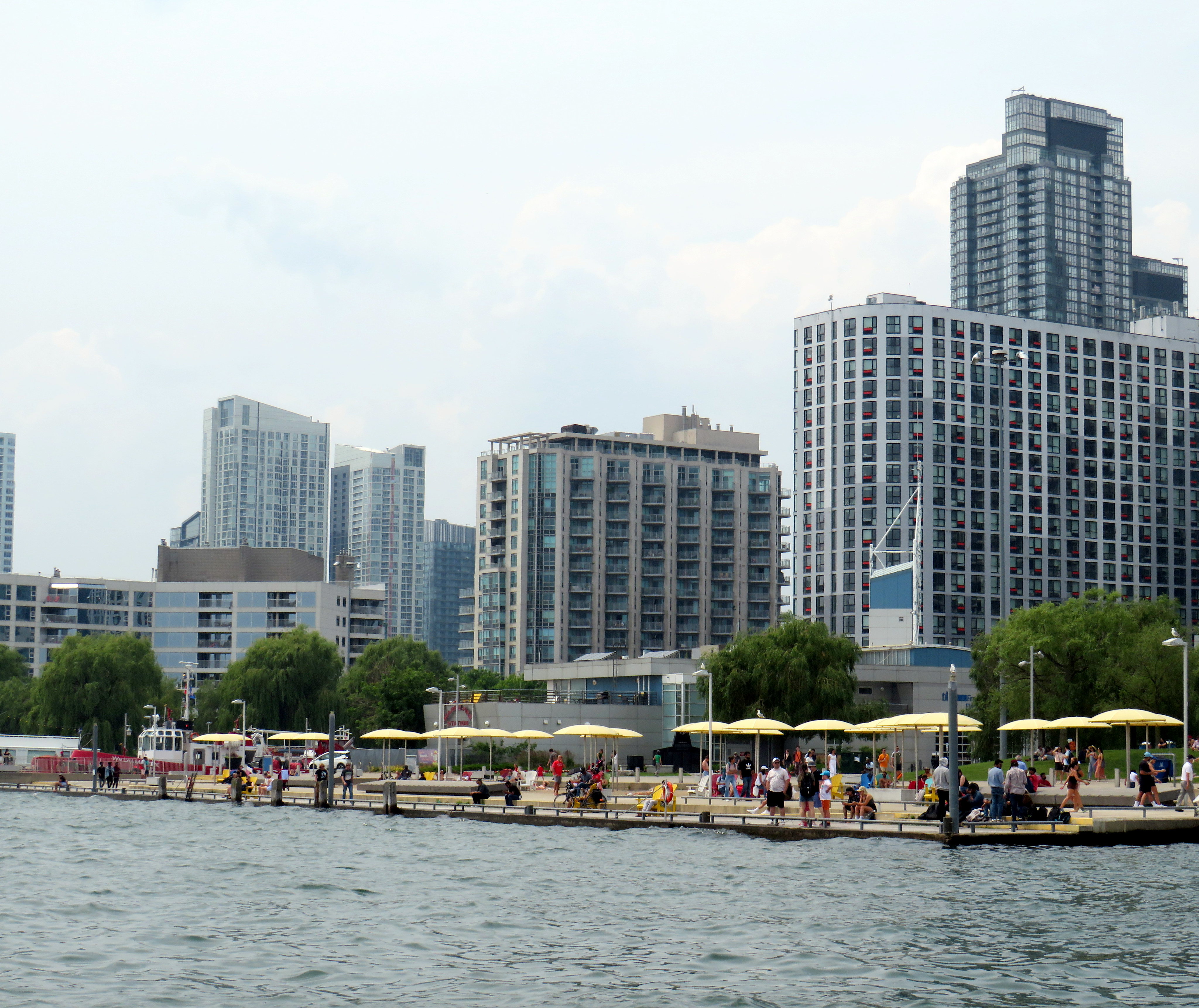
Rue St-Catharine in the Quartier des Spectacles, August 2025
A visit to Montreal can make one jealous. Jealous of the city’s better street furniture, greater cycling infrastructure, great public spaces throughout the city, and an improved pedestrian realm. Entire streets are closed in the summer months to motor traffic, allowing pedestrians to spill out into the roadway, and patios to sprout without the need for concrete blocks to protect them (and less noise and pollution to those dining al fresco).
For example, Avenue Mont-Royal, was first closed in Summer 2020 as a “Corridor Sanitare” to encourage people to get outside during the first wave of the COVID-19 pandemic and support local businesses, which set up patios on the sidewalk and the street. My spouse and I rented a car and visited Montreal during this time, getting a lot of walking in a city that opened up as much as safely possible.
Avenue Mont-Royal, looking east, August 2020
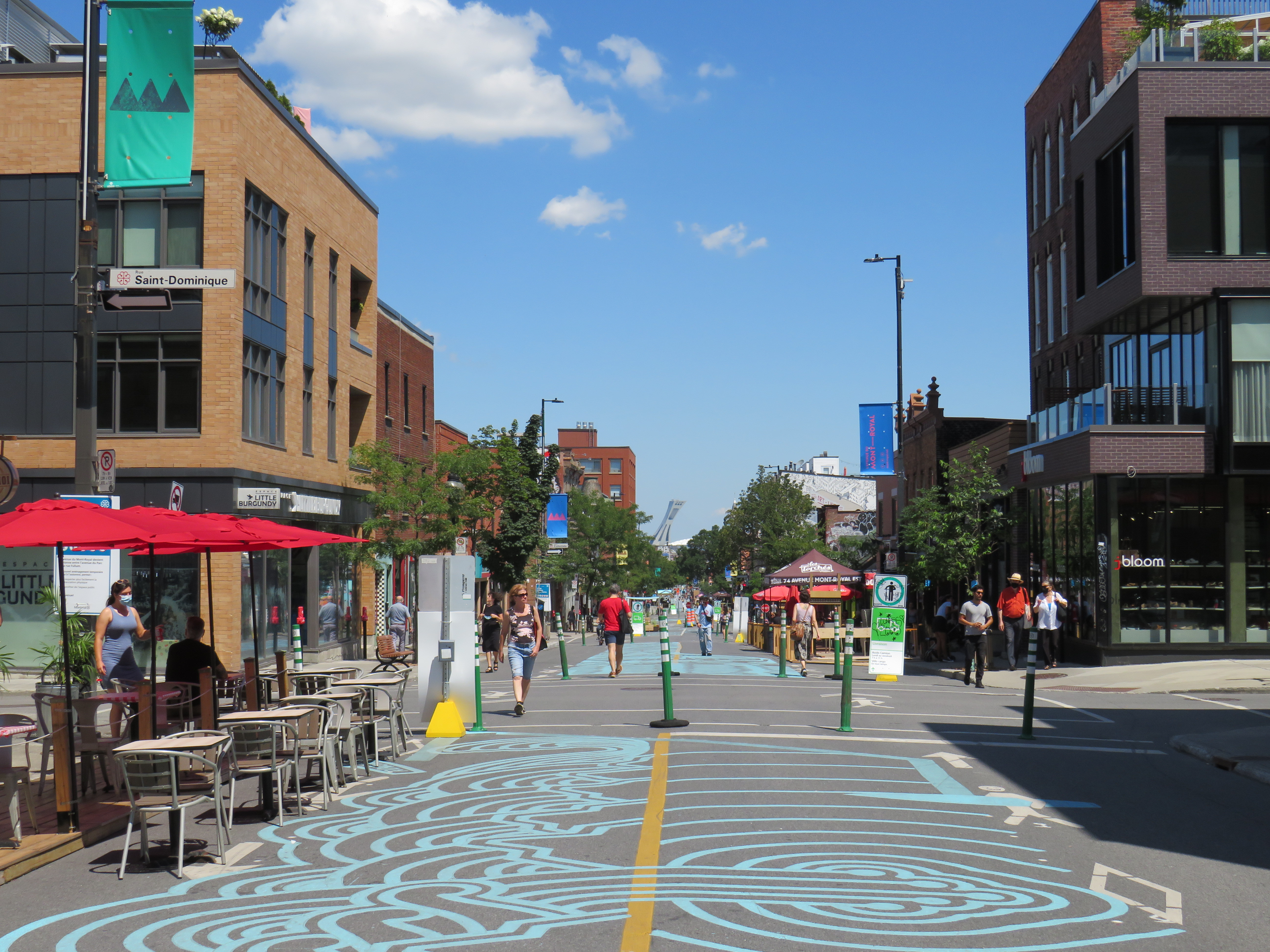
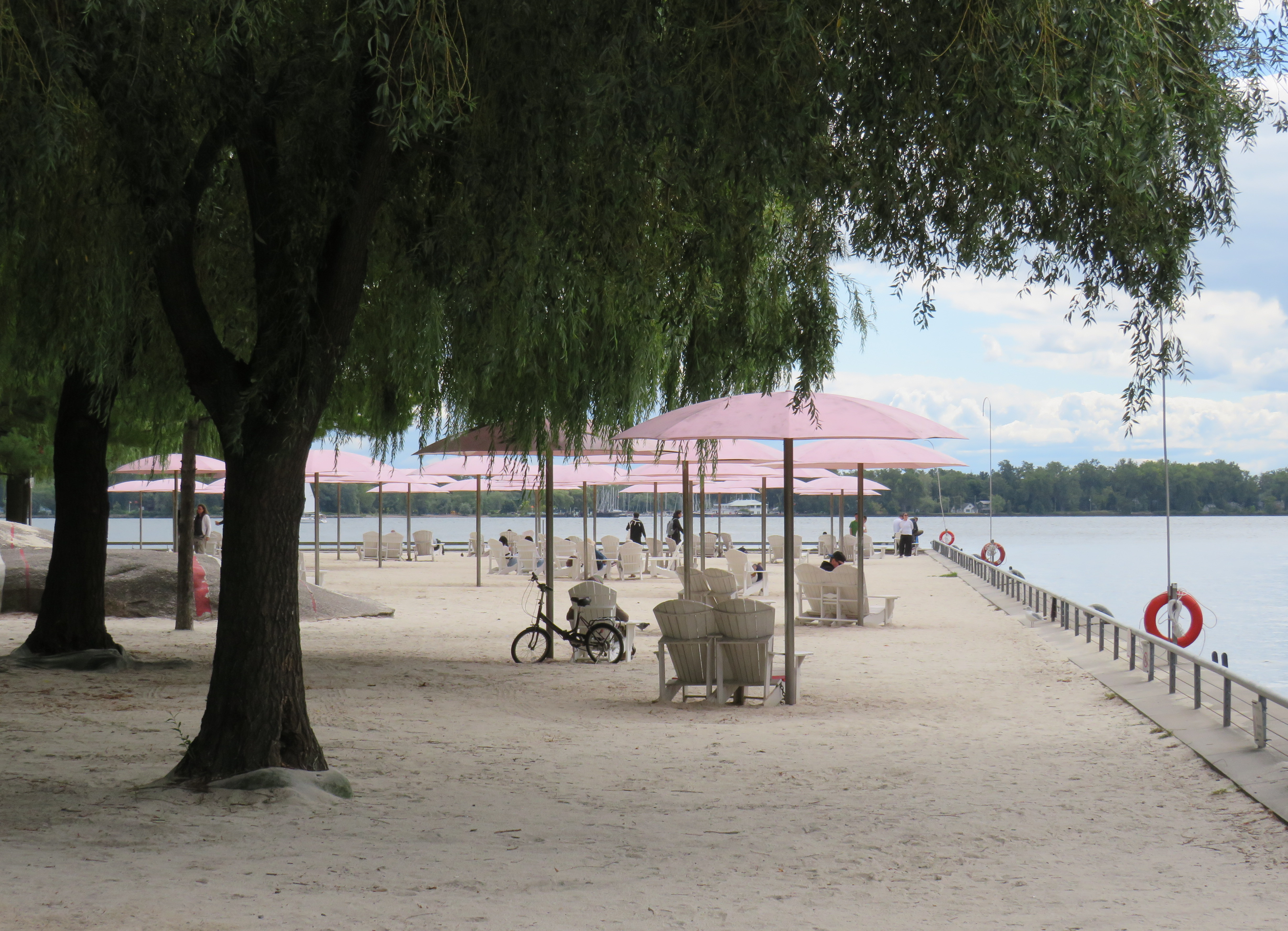
Happily, Montreal continued the tradition in the years since, even as pandemic restrictions eased, then disappeared entirely. Five years later, Avenue Mont-Royal was even more vibrant. Not only were there lots of patios on the street, there were public benches, shade structures, and water fountains, allowing anyone to sit, relax, and enjoy the outdoors. The annual summer closure is a hit.
Avenue Mont-Royal, looking east, August 2025
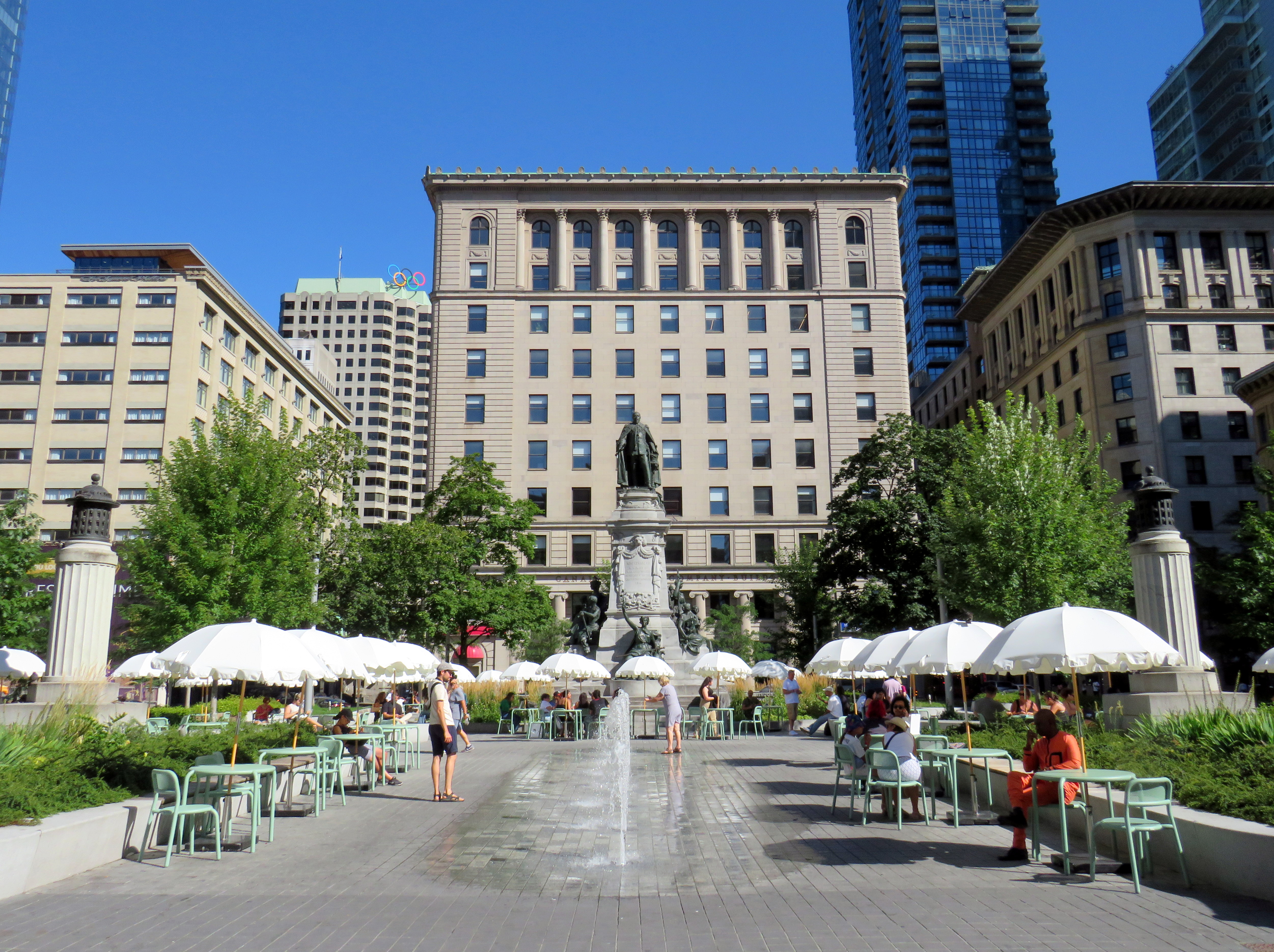
Several public squares were also renewed in recent years. Phillips Square, on Rue Ste-Catharine across from the now-shuttered Hudson’s Bay department store, was renewed with new splash fountains along with small café-style tables and chairs, complete with shade umbrellas. The metal chairs are movable, allowing larger groups to sit around a single table. It’s a refreshed natural congregation point along the city’s main shopping street.
Phillips Square, August 2025
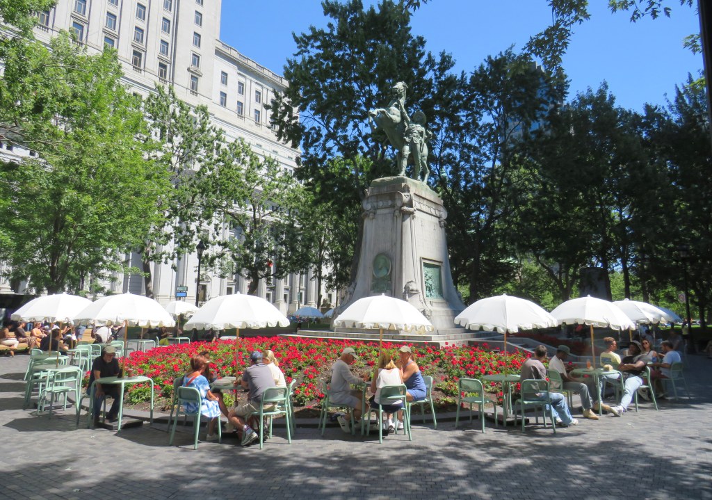
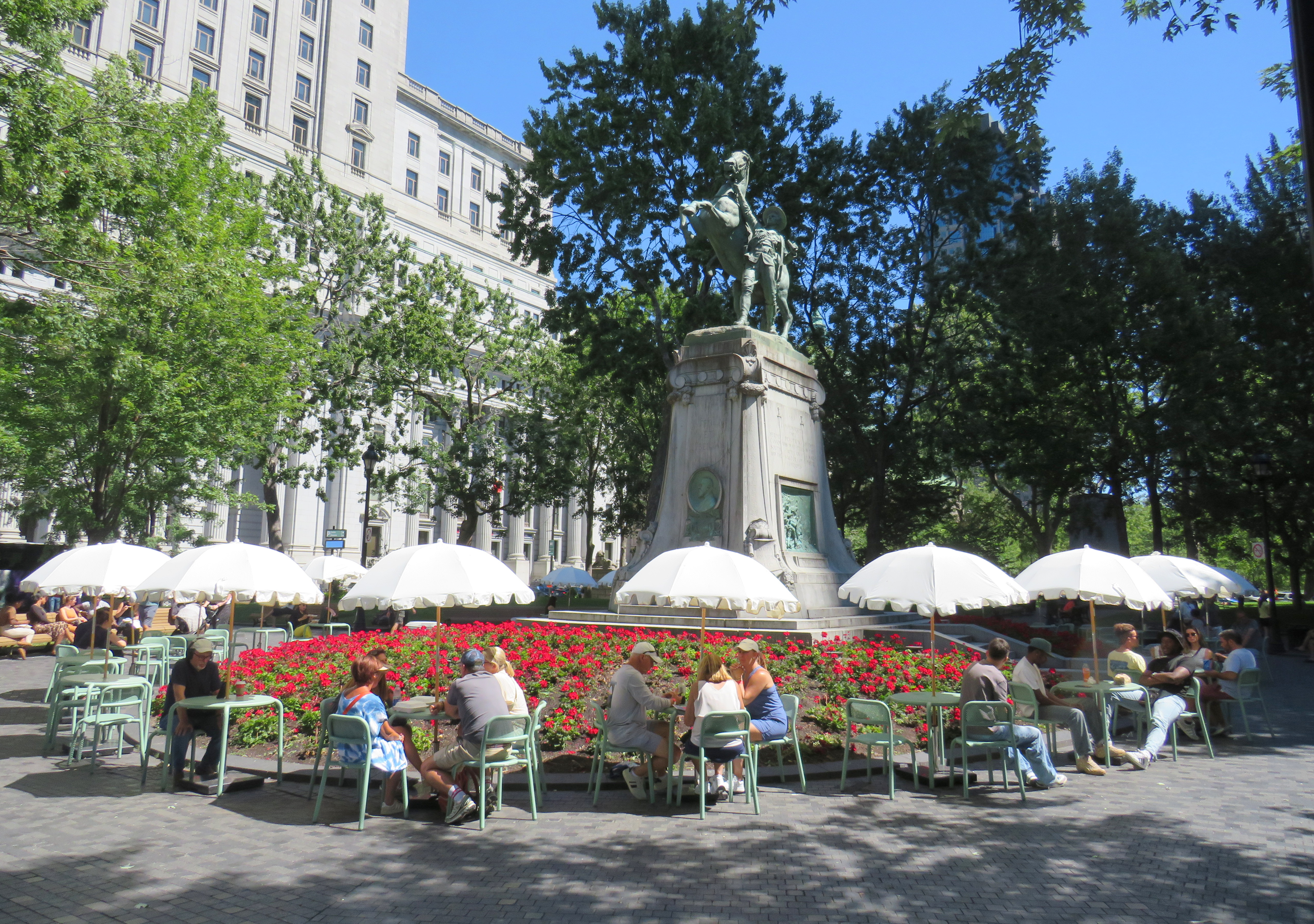
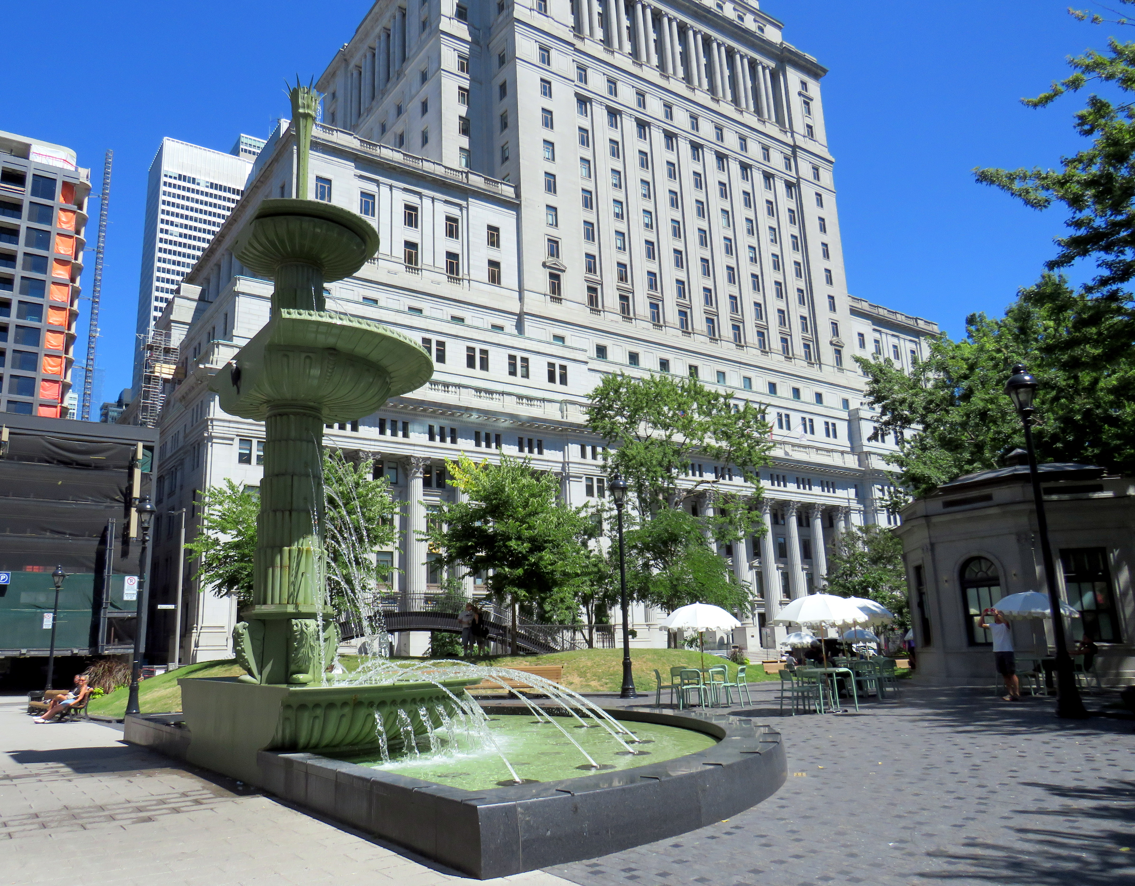
Similar tables and umbrellas were set up at Dorchester Square, several blocks to the west, near Mary, Queen of the World Cathedral and Central Station. Both squares were reimagined by the brilliant landscape architecture firm Claude Cormier + Associés. At Dorchester Square, a new water fountain, seemingly a classic installation, is cut in the rear, with a woodpecker behind. Such Easter eggs are features of Cormier park projects.
Dorchester Square, August 2025Fountain at Dorchester Square; note the woodpecker on the side. One of the two black curved footbridges across the parking ramps is behind.
Furthermore, Montreal is rebuilding the western section of Rue St-Catharine towards Crescent. Though motor vehicles are permitted after reconstruction, they are limited to a single through lane, with lay-bys for deliveries, passenger pick-ups and drop-offs, and emergency vehicles. Sidewalks are widened considerably, with more benches, bicycle parking, and street trees.
Completing Rue St-Catharine, near Bishop Street
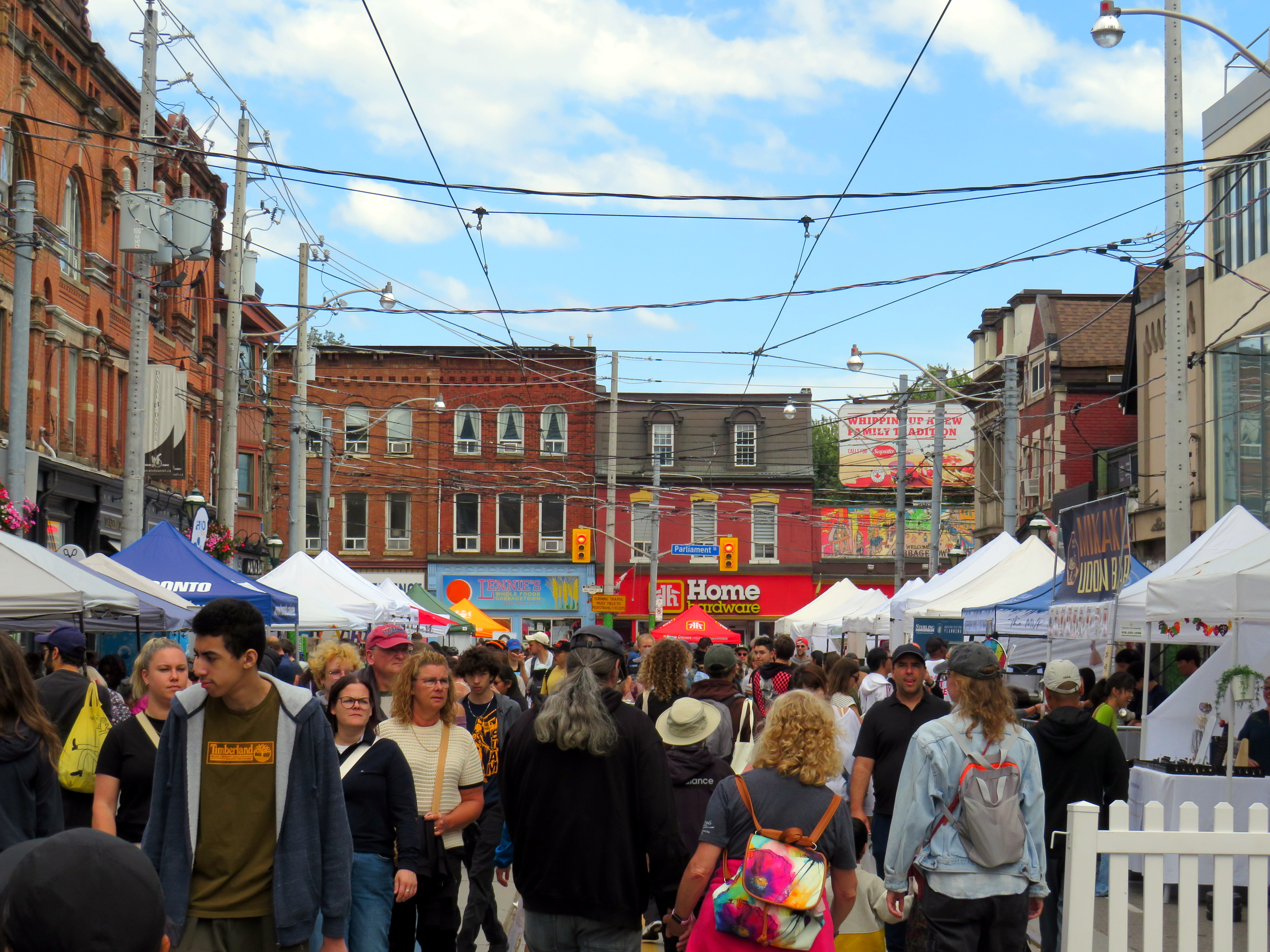
After returning to Toronto, it’s easy to feel down on this city. Montreal seems to do everything right. Meanwhile, ActiveTO, the open streets initiative following the pandemic restrictions here, quickly eroded, and was effectively ended in 2022. Open Streets, which closed sections of Yonge and Bloor Streets to motorists for two Sunday mornings, was last held in 2022. But there are still business improvement area-led weekend street festivals, which attract tens of thousands of pedestrians.
Torontonians want to walk, and pedestrianized streets, even when they’re just weekend events, are immensely popular. One downside, however, is a lack of seating outside of businesses’ patio areas. One is free to walk, enjoy live music, or just people watch, but to sit down, one is compelled to purchase something from one of the businesses with a sanctioned patio.
Torontonians love a street festival: Cabbagetown in September
There are a few other successes. A small segment Gould Street at Toronto Metropolitan University was pedestrianized and rebuilt as a central plaza for that university campus. A short section of Willcocks Street at the University of Toronto was similarly pedestrianized.
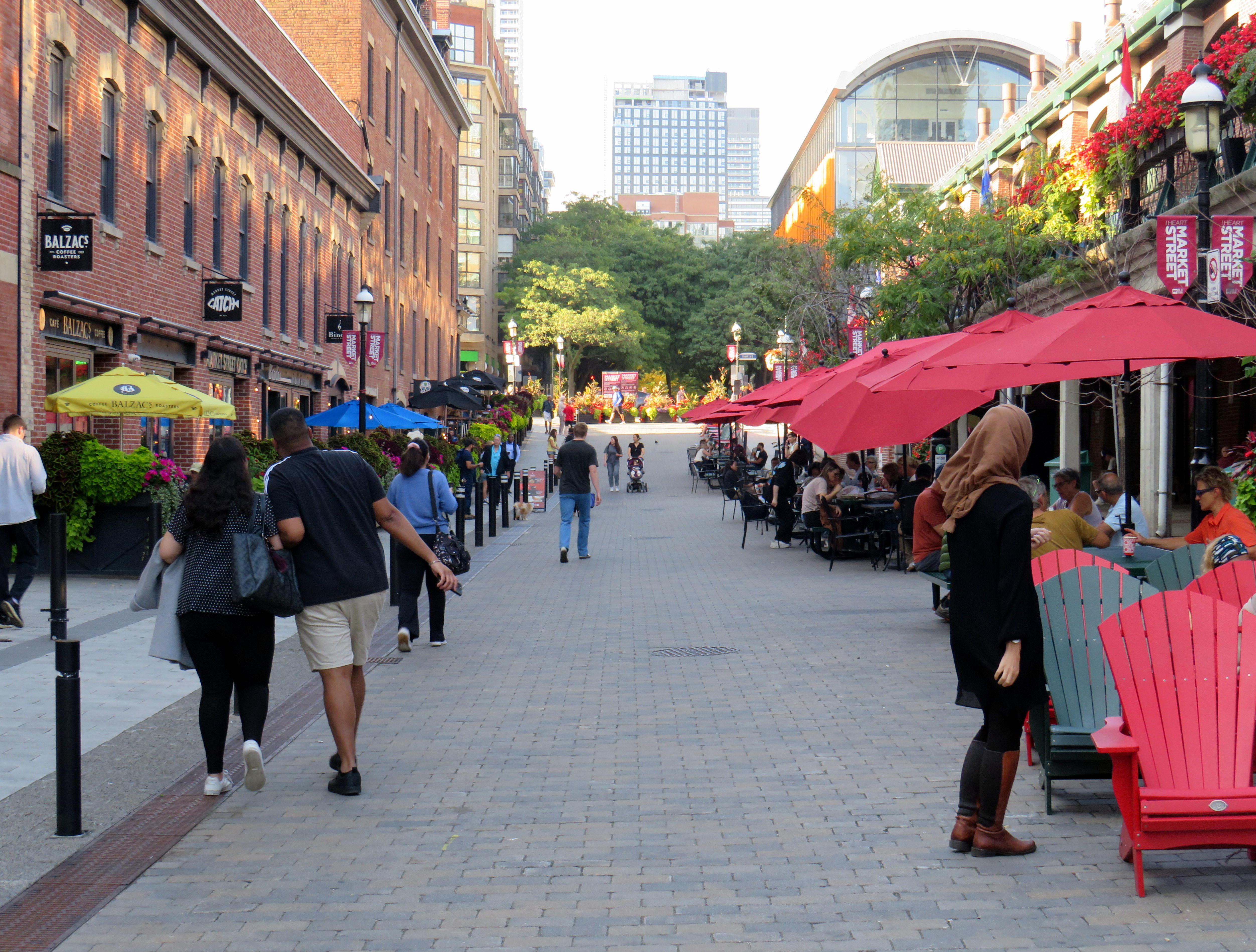
But the best example in Toronto is Market Street, which abuts St. Lawrence Market. Patio space and Muskoka chairs provide plenty of seating, without obligation to purchase anything (though it provides additional seating to those who picked up a snack or lunch inside the market). The shade umbrellas and high-quality surface materials and street furniture make this a wonderful oasis in Toronto’s downtown core.
Market Street looking north from The Esplanade. St. Lawrence Market is on the right.
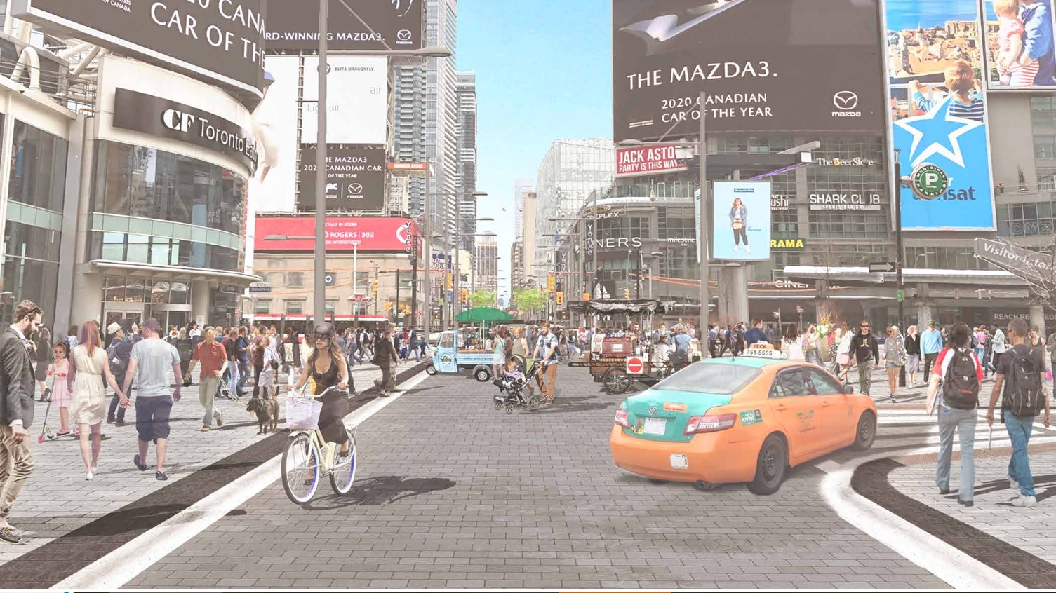
Planning for Yonge Street’s makeover, which will include narrowing the roadway, widening the sidewalks, improvements to the public realm, and seasonal closures of selected sections of the traffic lanes, is complete. Unfortunately, the YongeTOmorrow improvements will have to wait for another five years (work starting in 2030) due to Ontario Line construction.
Rendering of Yonge Street looking north towards Dundas, once YongeTOmorrow improvements are complete
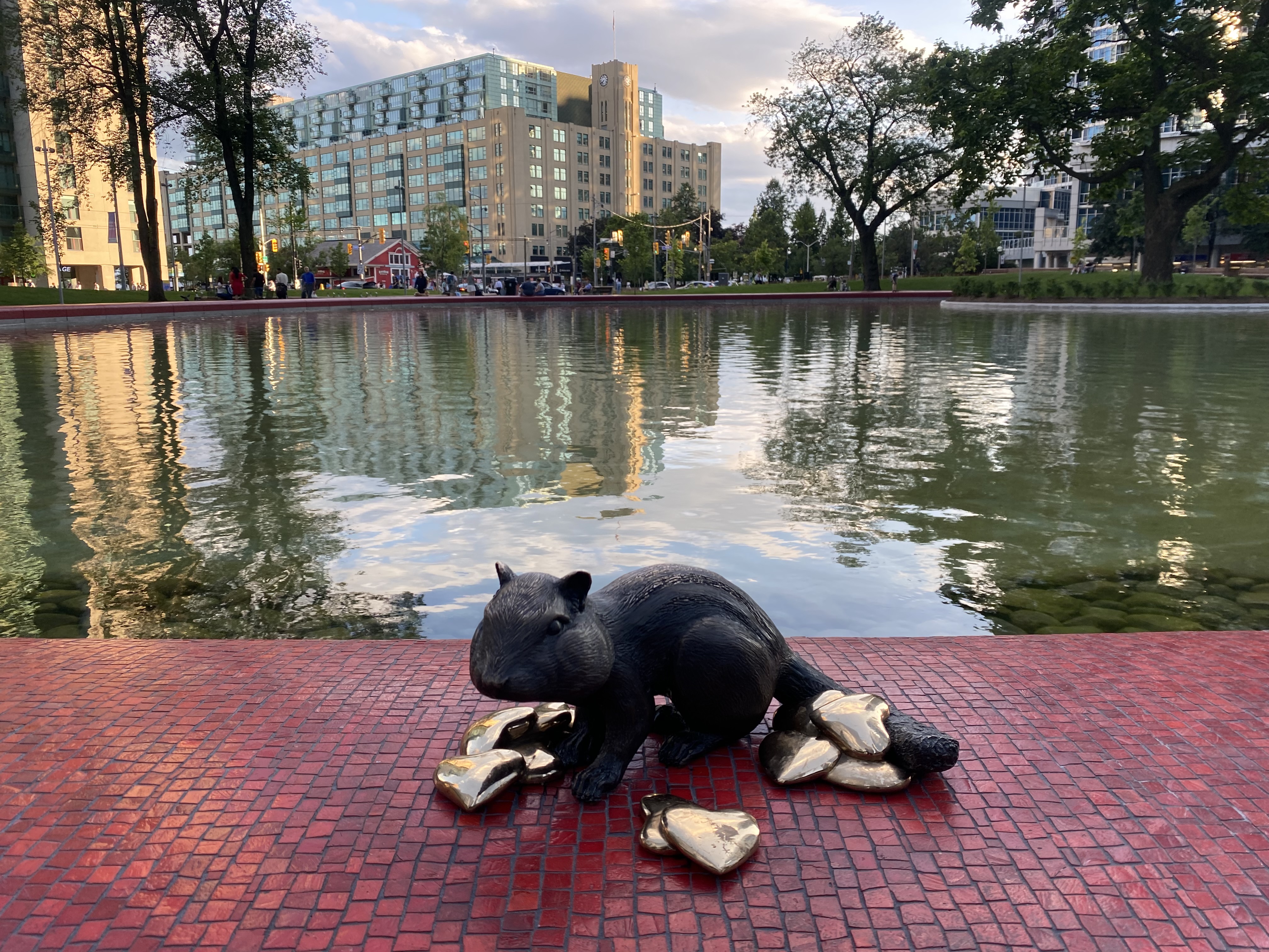
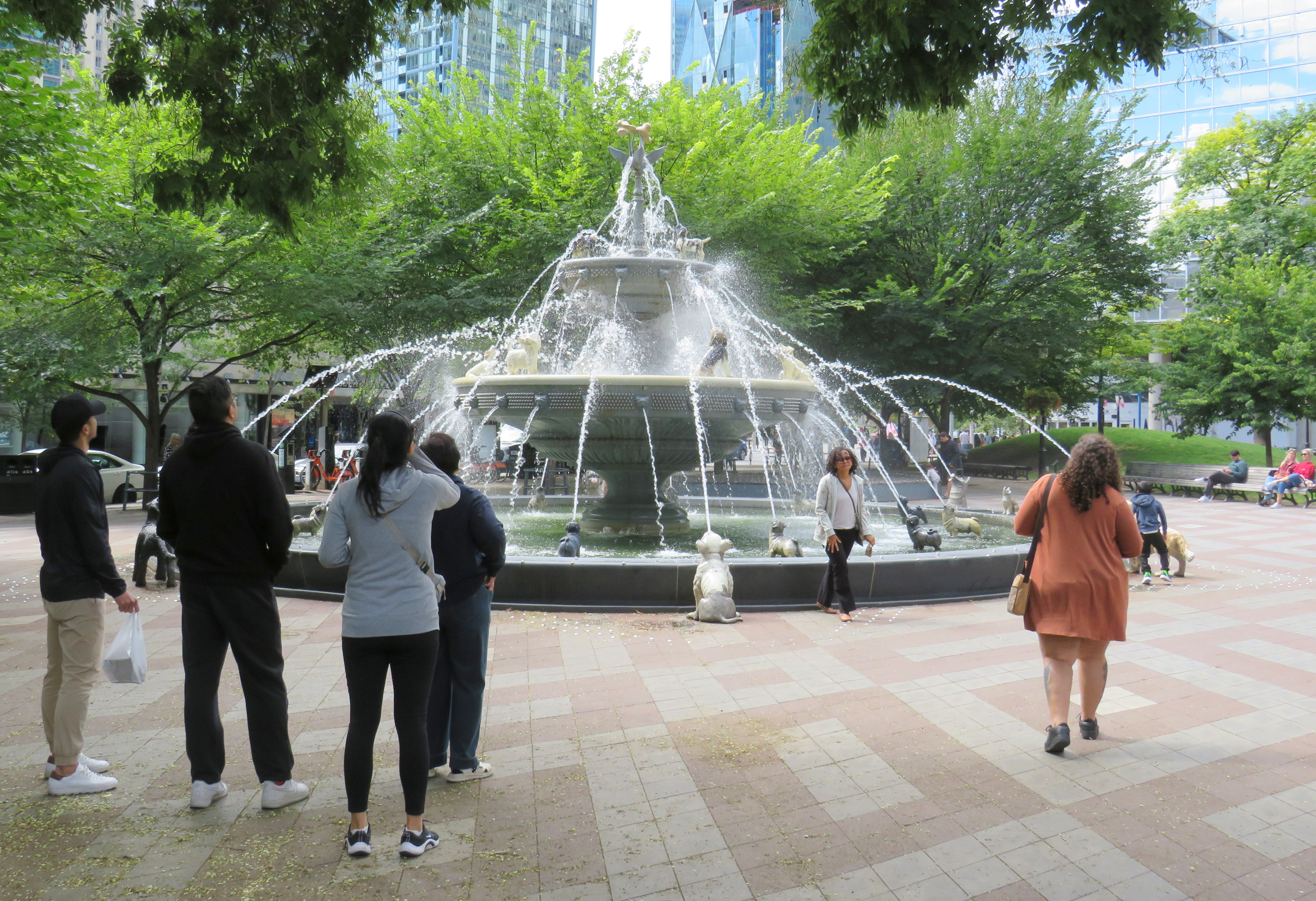
There are also other great things happening in Toronto. Claude Cormier was tapped to create new public spaces, such as HtO Park and Sugar Beach on the Harbourfront, but also reimagine existing places such as Love Park (previously a highway off-ramp) and Berczy Park, home of the popular Dog Fountain. At Love Park, not one of the 45 movable chairs have been taken (though one ended up in the pond). Torontonians have been shown to cherish great public spaces.
HTO Park from Toronto Harbour
Canada’s Sugar Beach
Love Park
Berczy Park
Toronto has made a lot of progress on improving its public realm, and it has shown that it is willing and able to close streets to traffic for the benefit of pedestrians and cyclists. Though it is so very easy to envy Montreal for its greater progress in the last two decades, it is up to us to continue the momentum Toronto does have, and work harder to push for change, even when there’s a car-focused provincial government. Streets can be narrowed, parks can be improved, and streets can be handed over to the people. Additional seating and more public washrooms will open up this city to many more residents and visitors.
This should all be a key pillar of a progressive agenda in next years’ municipal election. When certain candidates talk about tax cuts, austerity, and crime, there needs to be a focus on creating a better quality of life to provide an alternative. And that talk must be backed up with action, with quick wins that don’t require multi-year waits.
An abandoned railway signal towers over Philadelphia’s Rail Park
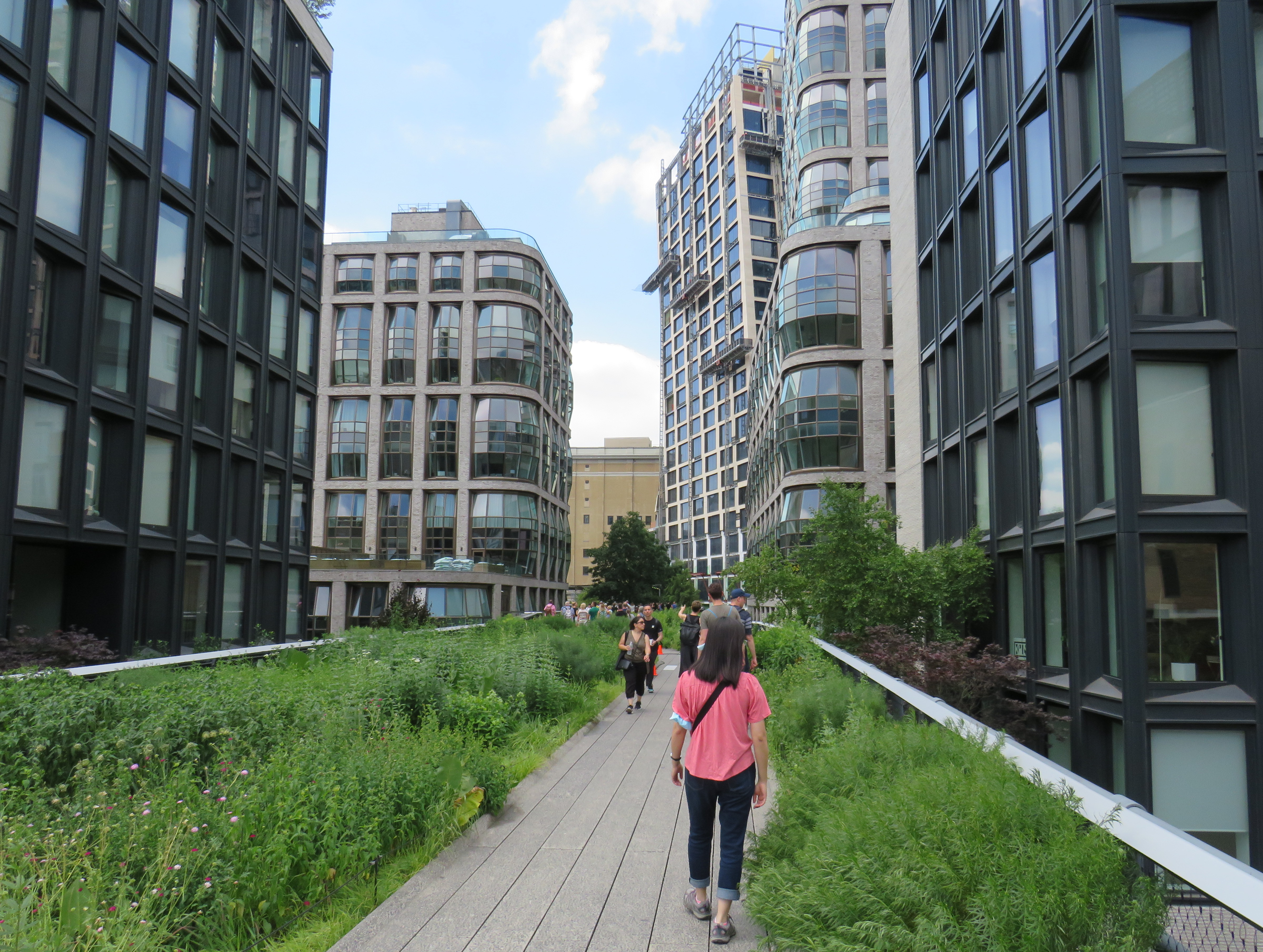
On a road trip early this summer, my spouse and I paid a visit to New York and Philadelphia. In New York, we walked the famous High Line, which revitalized an abandoned elevated freight railway corridor, transforming it into a popular grade-separated walking path on Manhattan’s Lower East Side.
New York’s High Line
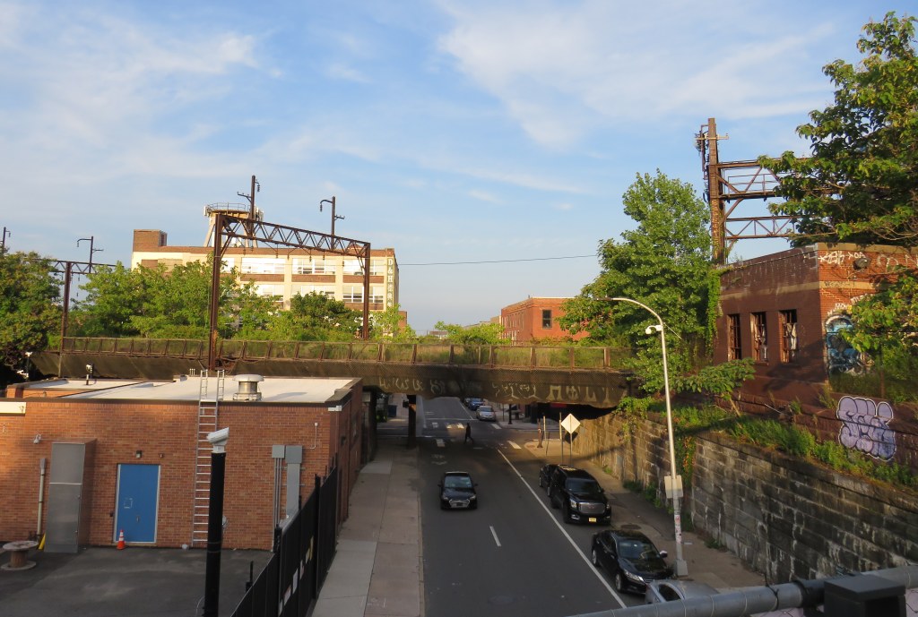
While in Philadelphia, I made a point of visiting another abandoned rail viaduct — Rail Park. It’s as ambitious as New York’s famed public space, but — for now — it is much less known.
The viaducts, cuts, and tunnels that will make up Philadelphia Rail Park trace their origin to the golden age of railroading. The Philadelphia and Reading Railroad, which connected Philadelphia with its northern and western suburbs, industrial towns to the northwest, and the lucrative anthracite coal fields of northeast Pennsylvania. For many years, the Reading Railroad, as it was known, was one of the United States’ most profitable companies. In 1893, the railway opened its Philadelphia Terminal, which became famous for the public market that was established below the station platforms. To this day, the Reading Terminal Market remains a vital city landmark. In the 1930s, most of the commuter services were electrified.
The 1893 Reading Terminal headhouse, now the entrance to the Pennsylvania Convention Center
By the 1970s, both the Reading and PRR were bankrupt. PRR merged with its New York-Chicago rival New York Central in 1968, before it too went into insolvency. Conrail took over many failing railways in the US Northeast and Midwest, consolidating operations, abandoning or transferring redundant track, and transferring most remaining commuter train operations (which were not assumed by Amtrak) to regional and state transit authorities.
In the mid-1980s, the Southeast Pennsylvania Transit Authority (SEPTA), which assumed control of the regional rail services formerly operated by the PRR and the Reading undertook an ambitious project to unite the separate regional rail systems. A new four-track tunnel was constructed east from PRR’s Suburban Station, and a new station — Market East — built to replace the old Reading Terminal. For the first time, trains could run through central Philadelphia, providing improved regional rail services.
Though the historic Reading Terminal headhouse and the famous market were preserved, the station platforms were removed to make way for a new convention centre. For years, the abandoned viaducts and tunnels leading into Reading Terminal sat unused. At least they did, until June 2018.
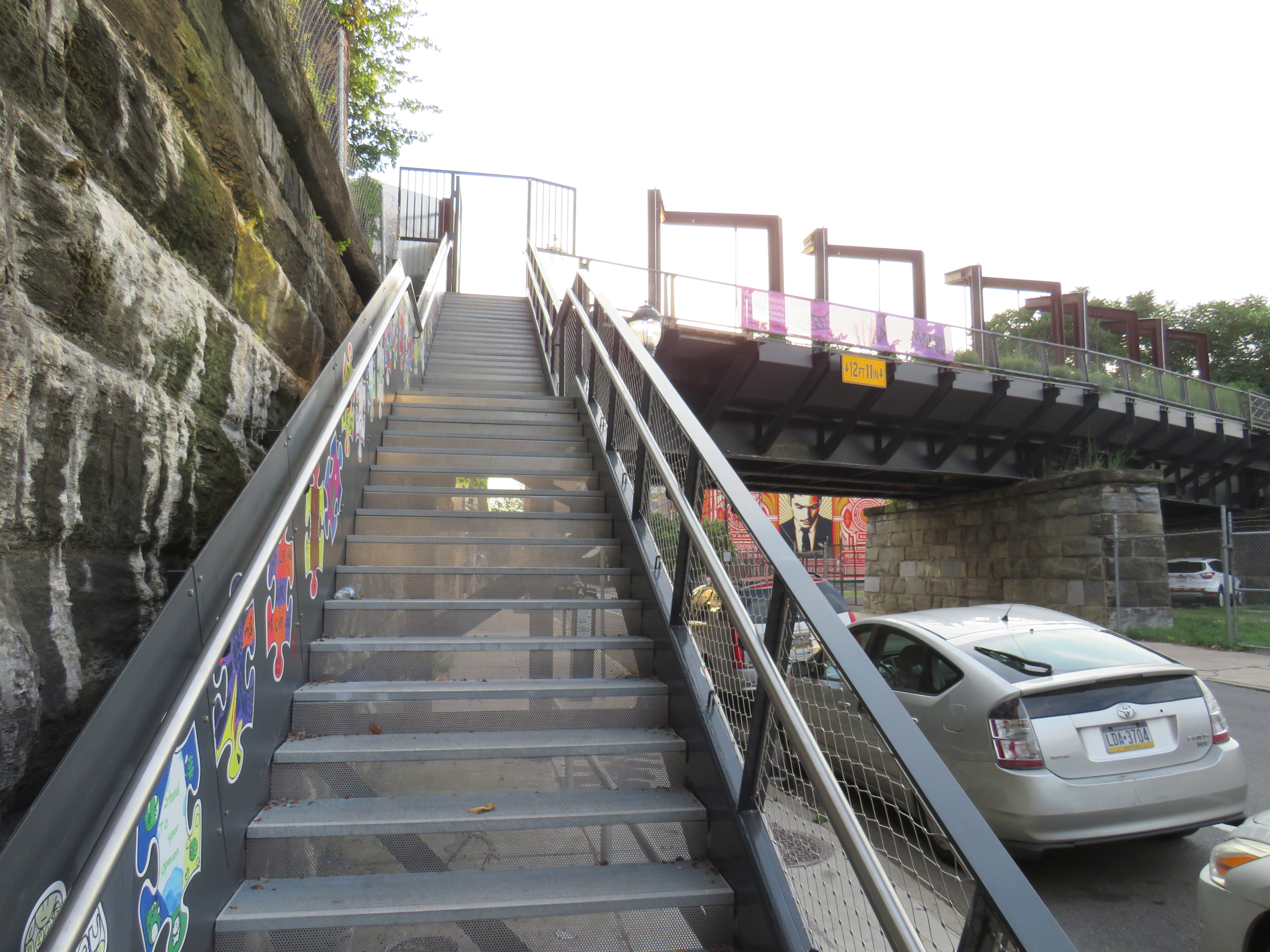
Entrance to the first phase of Rail Park, at Noble and 13th Streets
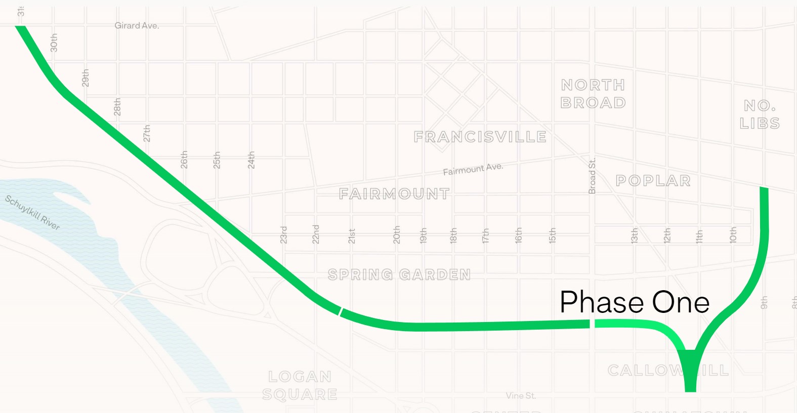
In 2018, a short, initial phase of Rail Park opened to the public. Spanning just two blocks, from Noble and 13th Streets to Callowhill and 11th Streets, it is still a remarkable public space. Like New York’s High Line, the short section of viaduct provides new viewpoints over gritty city streets, with temporary and permanent public art installations along the route.
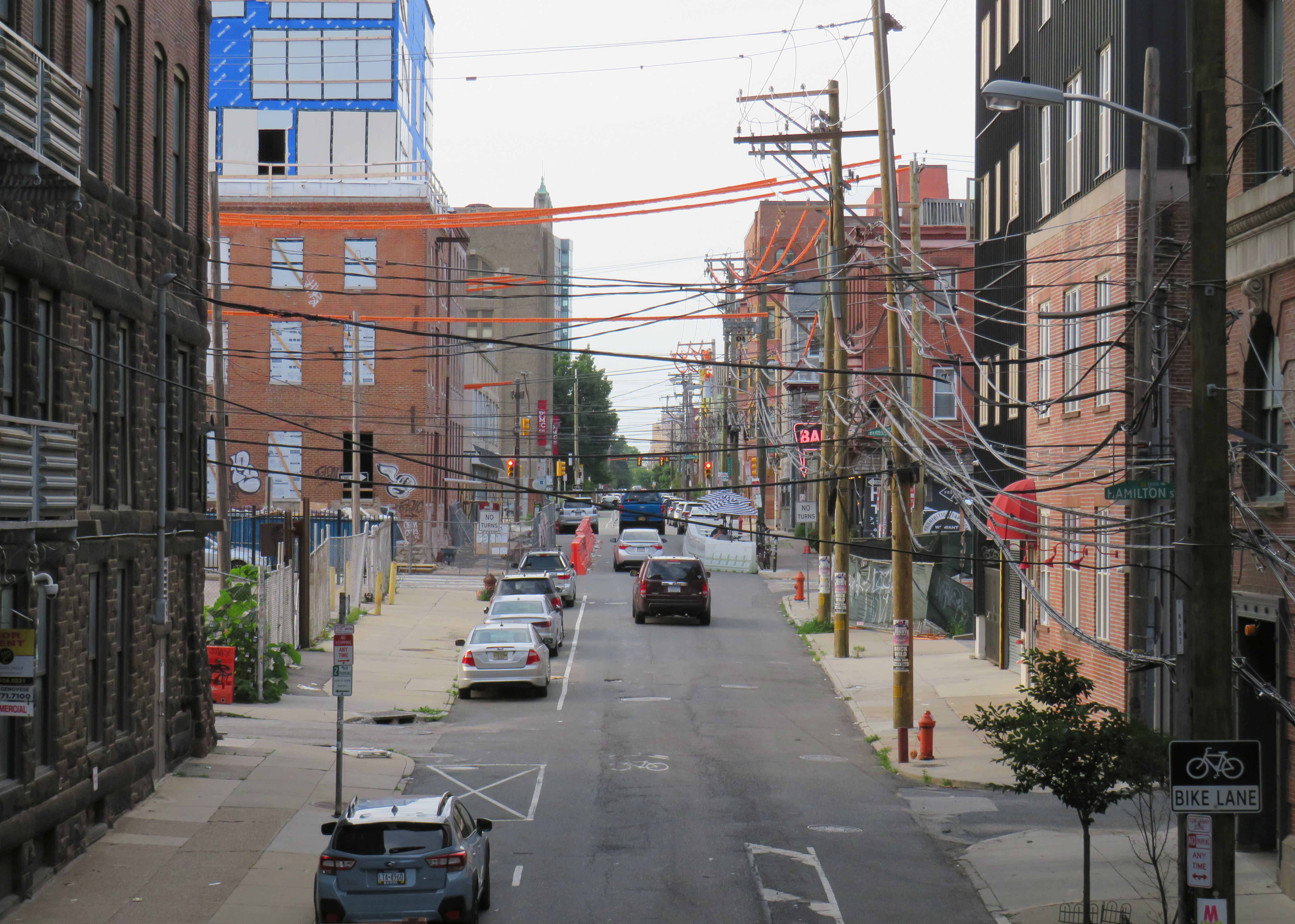
A map of the proposed extensions of Rail Park, with the opened first phase marked. Interactive map here. Looking north up 13th Street, towards the gentrifying Spring Garden neighbourhood“Workshop of the World” – an interpretive plaque provides information on the industries that lined the Reading Company’s route through PhiladelphiaAn art map of local industries that existed immediately north of Reading Terminal, made from punched Corten steelLooking east to the intersection of Callowhill and 11th Streets. For now, the only fully accessible entrance to Rail Park is at Noble and 13th Streets. The viaduct from the north is visible at left; this will be part of a future phase of Rail Park.A stairway leading up from Callowhill Street. The metal frames at the right hold swings for the public to enjoy.
Future park extensions will continue westward from 13th Street to a below-grade cut starting at Broad Street. It will continue west to the Benjamin Franklin Parkway and the Philadelphia Museum of Art (where the Rocky statue can be found outside), where it will enter a tunnel before emerging at Girard Avenue near Fairmount Park, the greatest of Philadelphia’s urban green spaces. Another section will connect the existing Phase I to the abandoned north-south viaduct between Vine Street and Fairmount Avenue, where the old route to Reading Terminal meets the 1980s rail diversion to Market East Station. Eventually, it will reach 3 miles (5 kilometres) in length.
The formerly abandoned viaduct offers a view of more recently abandoned transit infrastructure: the remnant tracks of the 23-Germantown trolley route, once the longest streetcar line in North America. In the early 1990s, SEPTA was forced to abandon three of its legacy street railway lines due to budget pressures and deteriorating PCC equipment. (Newer Kawasaki-built streetcars were only deployed on the surface-subway routes in West Philadelphia and on the former Red Arrow suburban lines from 69th Street Station.) The 15-Girard Line was later rebuilt with refurbished streetcars, but the 23 and 56-Erie lines were left to rot in a state of “temporary suspension.”
SEPTA has a wealth of transit infrastructure, which I wrote about after my first visit to Philadelphia in 2009, but it hasn’t put enough of it to good use. It has a massive, fully electric regional rail network, yet trains operate only every hour on most routes outside of peak periods. There’s a four-track subway tunnel under Broad Street that’s grossly underused, and unlike Toronto, there are even a few active trolley bus routes. And sadly, it’s allowed much of its infrastructure, like its trolley network, to remain in disuse.
A view down from Rail Park to long-disused trolley tracks on 12th Street