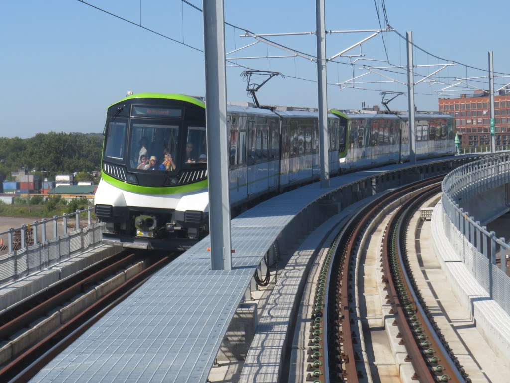
North America’s newest rapid transit service, the Réseau express métropolitain (REM), opened on Monday, July 31, 2023 after a weekend of free public rides. I took my first ride several weeks later, on August 22, 2023. The five stop, 16.6-kilometre line between Central Station and Autoroute 30 in Brossard, is the first of four phases of the initial REM network, with branches north and west of Downtown Montreal to open in the next few years.
Built by the CDPQ Infra, a division of Caisse de dépôt et placement du Québec (a provincial public pension fund), REM is a light metro network connecting suburban communities with Montreal’s urban core. With limited stops, a downtown-suburban focus, and frequent service, REM has similarities to Bay Area Rapid Transit (BART) in the San Francisco metro region, to S-Bahn systems in Germany and Austria, or RER in metropolitan Paris. Like Vancouver’s SkyTrain or the future Ontario Line here in Toronto, the trains are short, and operate fully automatically, running every 3.5 minutes during weekday peak periods, and every 7.5 minutes at all other times, from 5:30 AM until after midnight.
As REM is being built by a pension fund — which seeks to make an 8% return on building and operating the service — financing the line is a bit different. Though it received financing from the Canada Infrastructure Bank and support from the provincial government, much of the funding comes from other sources, such as development levees. It is also guaranteed a share of fare revenue from the provincial government.
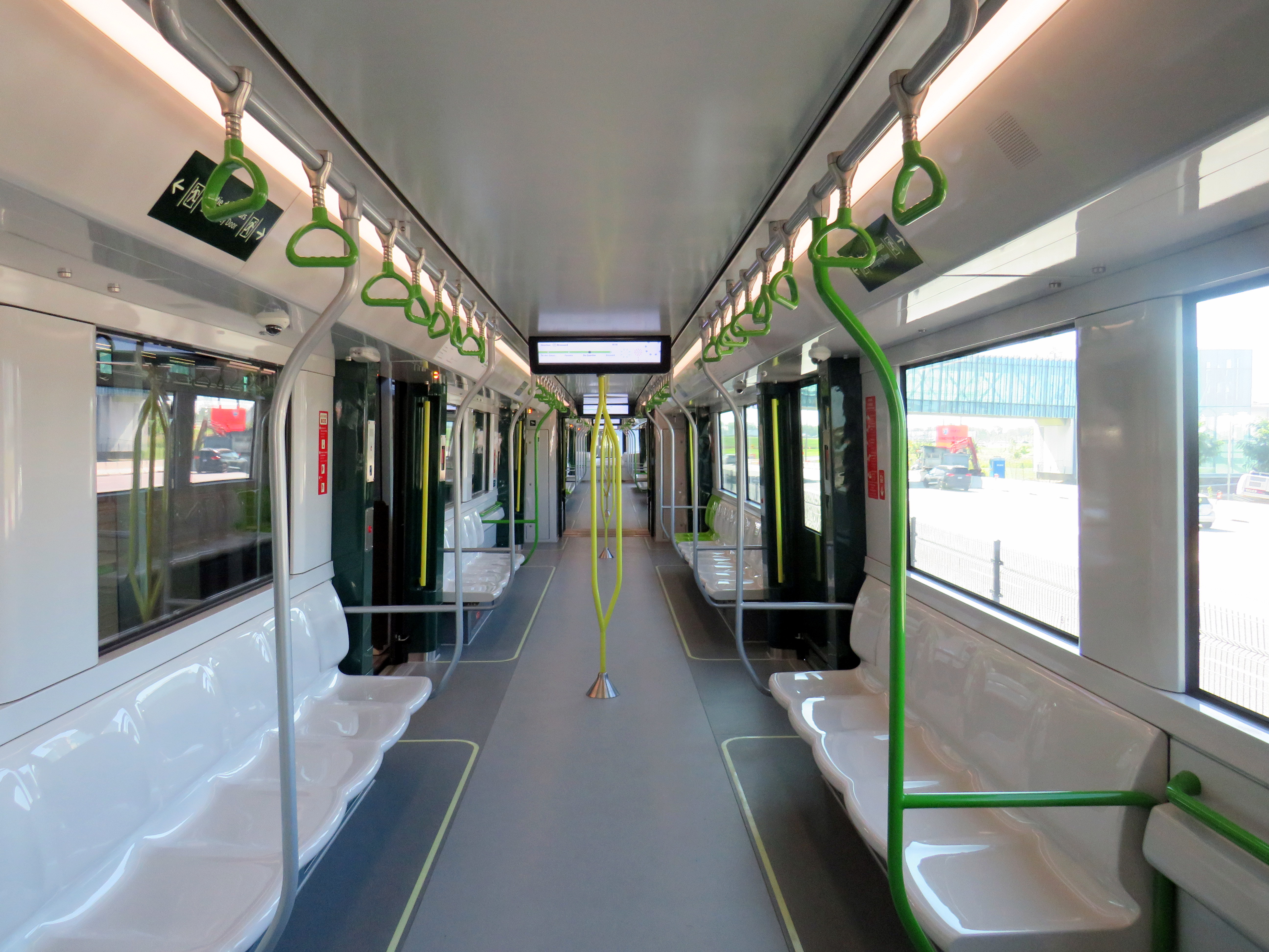
Rail car interior. All seats face inwards, there are 64 seats per car, with standing room for up to 300.
Though several notable transport enthusiasts have already documented the new REM during its opening weekend, I wanted to wait for some of the excitement to wane; I also wanted to experience the service from a regular passenger’s point of view, including checking out the stations and transfers to other transit operators.
For the most part, I came away satisfied. However, I encountered several shortcomings, particularly with service integration and transfers between modes.
Across Canada, our biggest cities are building new transit. Here in Toronto, the Crosstown and Finch West LRTs are well underway (though the first phase of the Eglinton-Crosstown is already three years late), as well as the Scarborough subway expansion, the Ontario Line, and GO Transit corridor improvements. Vancouver is building a major expansion to its Skytrain network, the Broadway Subway. Ottawa, Calgary, and Edmonton are all expanding their LRT networks. And in Montreal, the first phase of the Réseau express métropolitain (REM) will open for service, while major work on the Blue Line Métro extension has just begun.
While Greater Montreal has been busy with rail transit projects, it has also opened two new busways: on Boulevard Le Corbusier in Laval, and on Boulevard Pie-IX on Montreal’s east side. The Laval busway was completed in late 2017. The SRB Pie-IX corridor was mostly completed by the end of 2022, though a section near Boulevard Jean-Talon remains under construction for the Blue Line Métro extension.
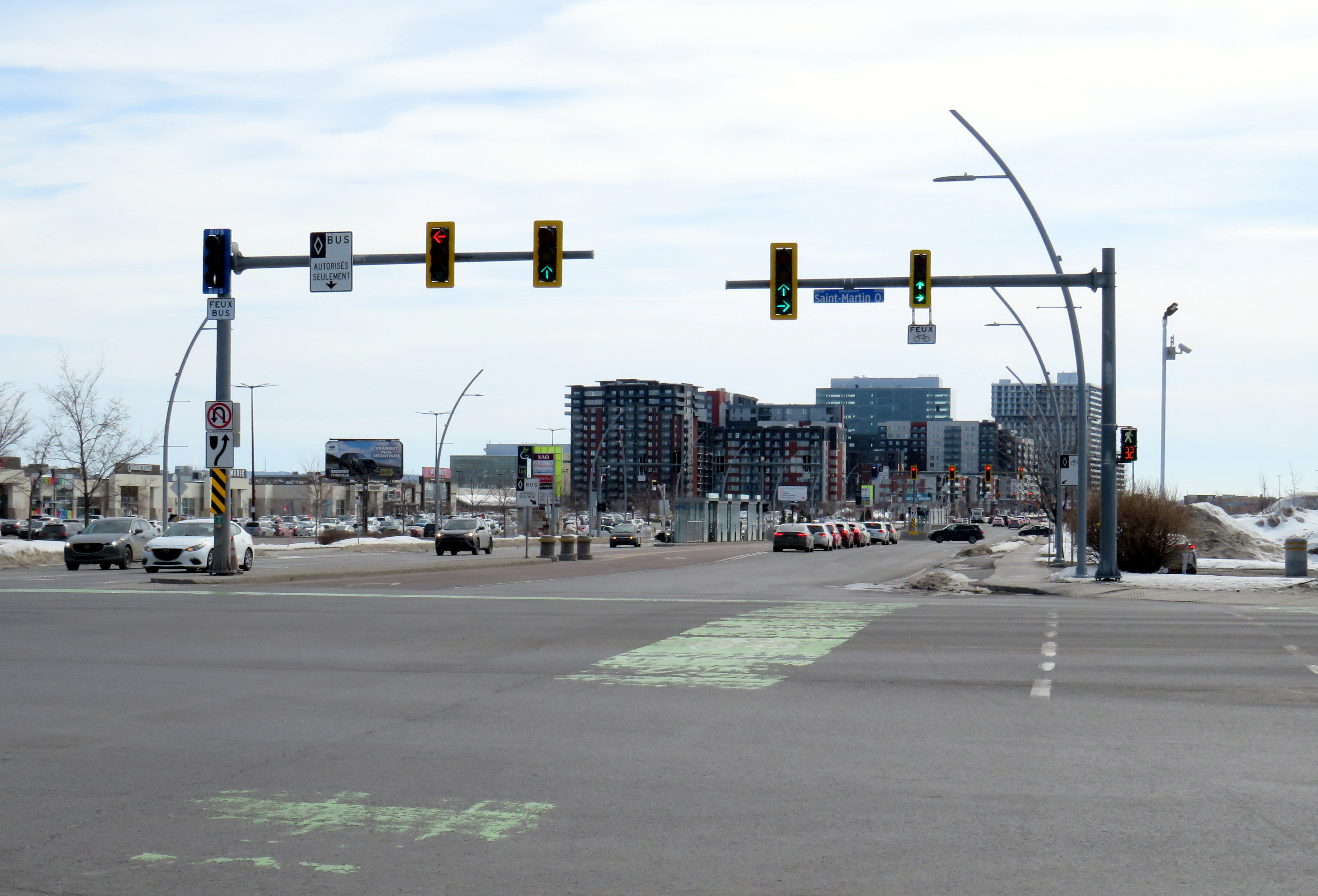
Laval’s Boulevard Le Corbusier
Looking south on Le Corbusier at Boul. Saint-Martin
Laval, a sprawling suburban municipality immediately north of Montreal Island, has a population of over 400,000. Though the large island has several historical town and village centres, the municipality is mostly made up of suburban subdivisions, shopping centres, low-rise apartment buildings, crisscrossed by several autoroute highways, including the A-13, A-15, A-19, A-25, and A-440. Despite the post-war sprawl and auto infrastructure, the far eastern end of the island remains largely agricultural.
After the extension of the Orange Line Métro into Laval in 2007, the city of Laval has worked towards urbanizing its geographical centre into “Centre-Ville Laval.” Laval’s new downtown core would consist of new and expanded educational institutions, new cultural and entertainment venues, office and high-tech employment, along with new higher-density, urban-scaled residential development. The new city centre would be focused on Boulevard Le Corbusier northward from Montmorency Métro Station, in an area lined with aging commercial properties.
During my March visit to Laval, some of the progress on Centre-Ville Laval was evident. A new sports and concert venue, Place Bell, opened in 2017, luring the Montreal Canadiens’ AHL affliate from St. John’s. (Place Bell should not be confused with Centre Bell, the home of the Canadiens, also located on the Orange Line). The Université de Montréal also opened a suburban campus next to the Métro station. Slowly, mid-ride condo buildings were built on the south end of Le Corbusier, within walking distance from the campuses and transit links.
New residential development on the south end of Boul. Le Corbusier, in the near distance
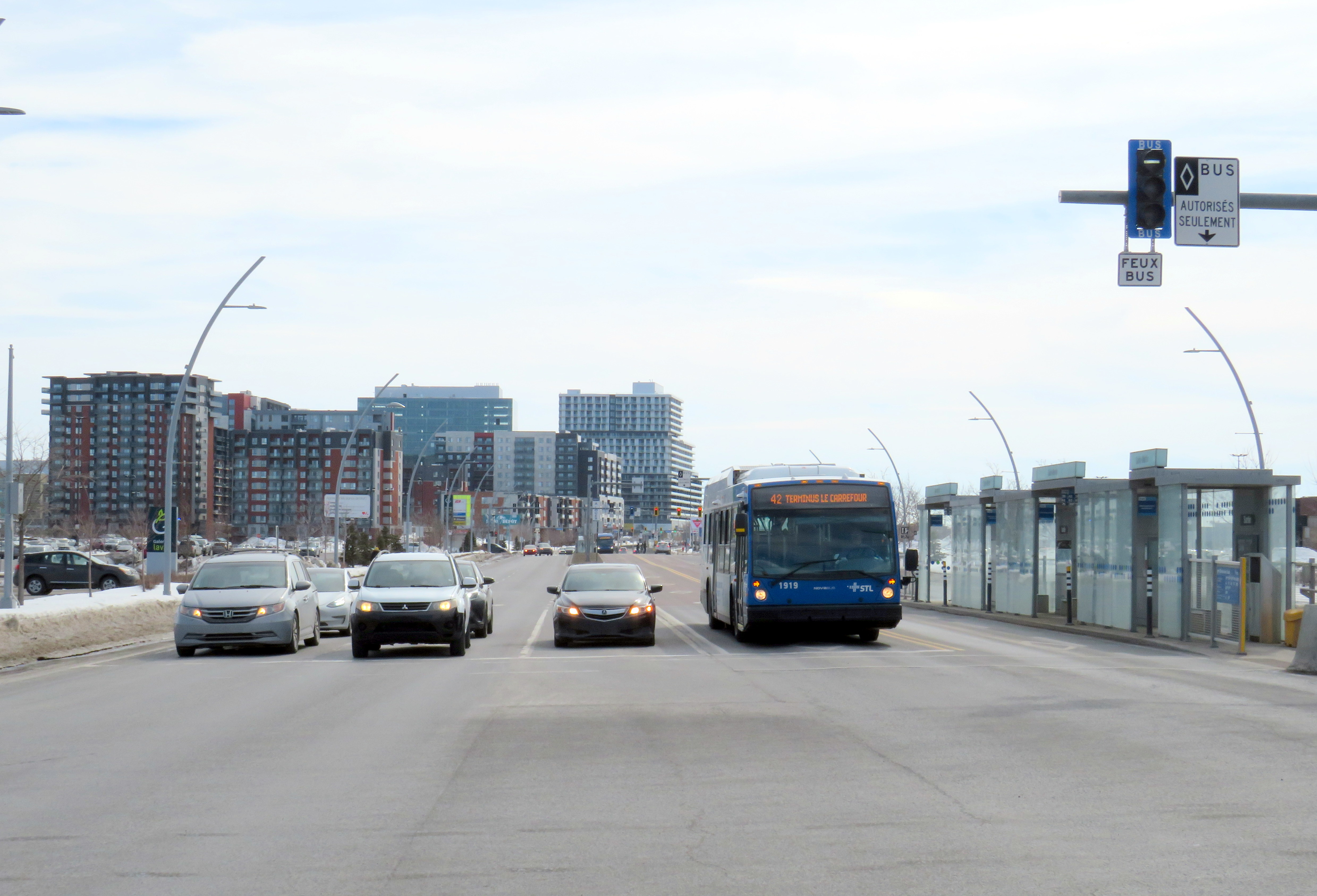
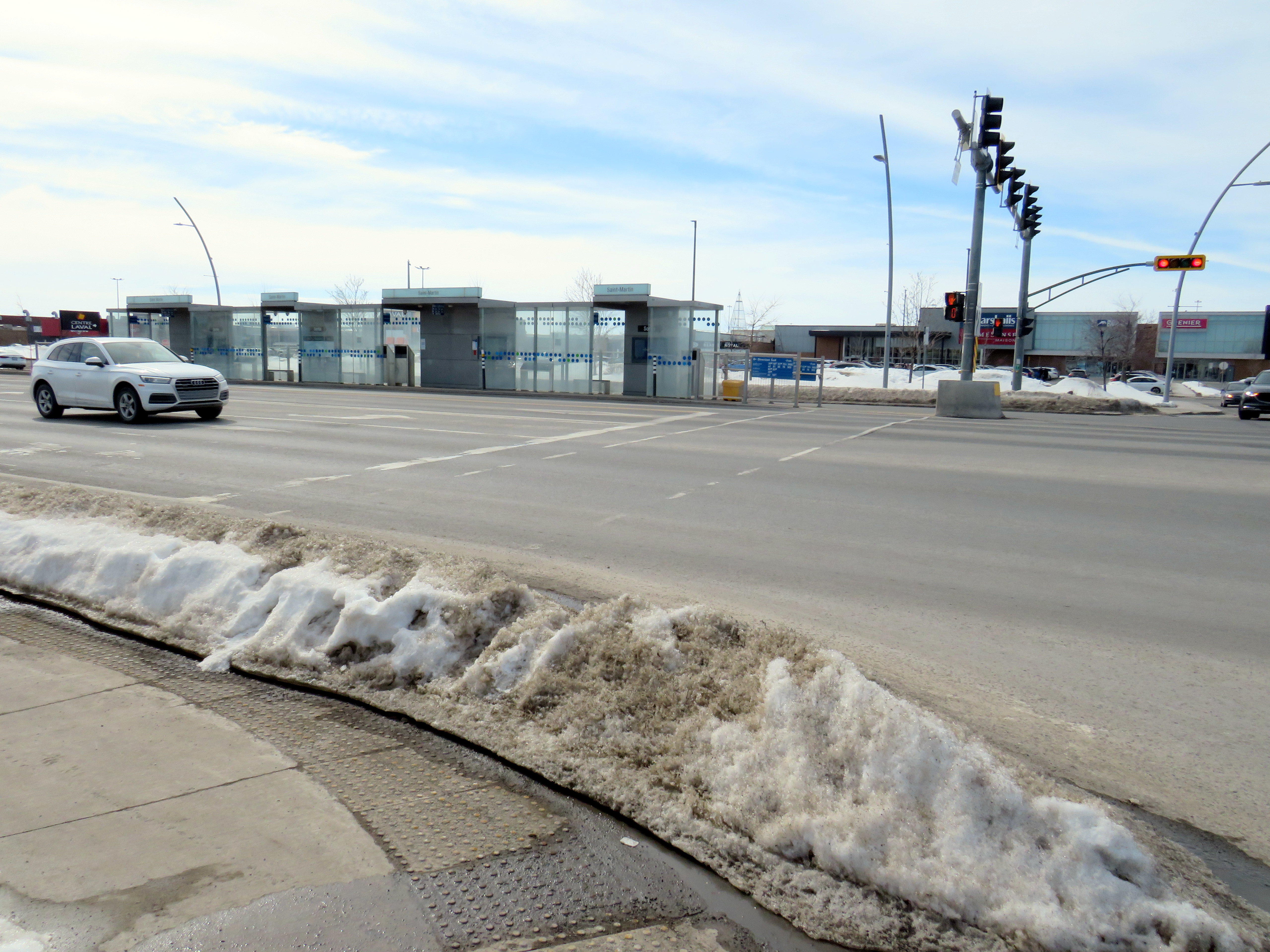
To support the planned growth of Laval’s city centre, a new busway was built northward, towards the massive Carrefour Laval shopping centre, a Cadillac Fairview-owned mall that dominates Montreal’s north suburbs. The busway passes between older, smaller shopping malls, such as Centre Laval and Galleries Laval, which will one day get redeveloped. Building the new busway, along with semi-protected cycling lanes, was clearly a way of indicating the municipality’s urban planning goals.
Unfortunately, the Laval busway reminded me of the things I disliked most about York Region’s Viva Rapidways. For one, the Laval busway doesn’t speed up bus service. It is only one kilometre long, and does not properly connect with either the bus terminal at Montmorency Métro or the bus terminal across the street from Carrefour Laval. Buses must re-enter mixed traffic at both ends of the route. As in Toronto and York Region, left-turning cars are prioritized at each traffic light, and there was no apparent transit priority.
The median bus stops are also difficult to get to. Despite many days since Montreal’s last significant snowfall, and bone-dry sidewalks and roadways, the curbs and crosswalks were left uncleared. This forces pedestrians to either mount the piles of old, packed, crusty snow, or divert into the roadways to cross the street. The bike lanes were merely a convenient snow storage space.
Laval should be embarrassed by its inaccessible crosswalks and bus infrastructure
For a Saturday morning, transit service on the busway was adequate, but not especially impressive. The Société de transport de Laval, the municipal transit agency, operates a free shuttle bus on weekends, holidays, and summer weekdays between Montmorency Métro and Carrefour Laval every 20 minutes. Otherwise, bus service was sporadic despite multiple routes using the busway: two or three buses would come at once, followed by a gap of 10 or 15 minutes.
Quebec’s unique traffic signals were both interesting for out-of-province visitors and frustrating for pedestrians. In Ontario and most other jurisdictions, a right green arrow indicates absolute right-of-way for right-turning motorists. In Quebec, it merely indicates that motorists have a green signal to turn right, regardless of conflicting movements. Outside of Montreal, motorists are permitted to turn right on a red light, unless signed otherwise. This is not great signalization, especially on high-speed suburban roadways.
Right-turning motorists have the green arrow to turn right, conflicting with pedestrians (which have the walk signal) and cyclists
However, bus signals are unmistakable from general traffic signals, with white bar aspects (and a white triangle instead of an amber light). That’s one thing that is done better than here in Ontario.
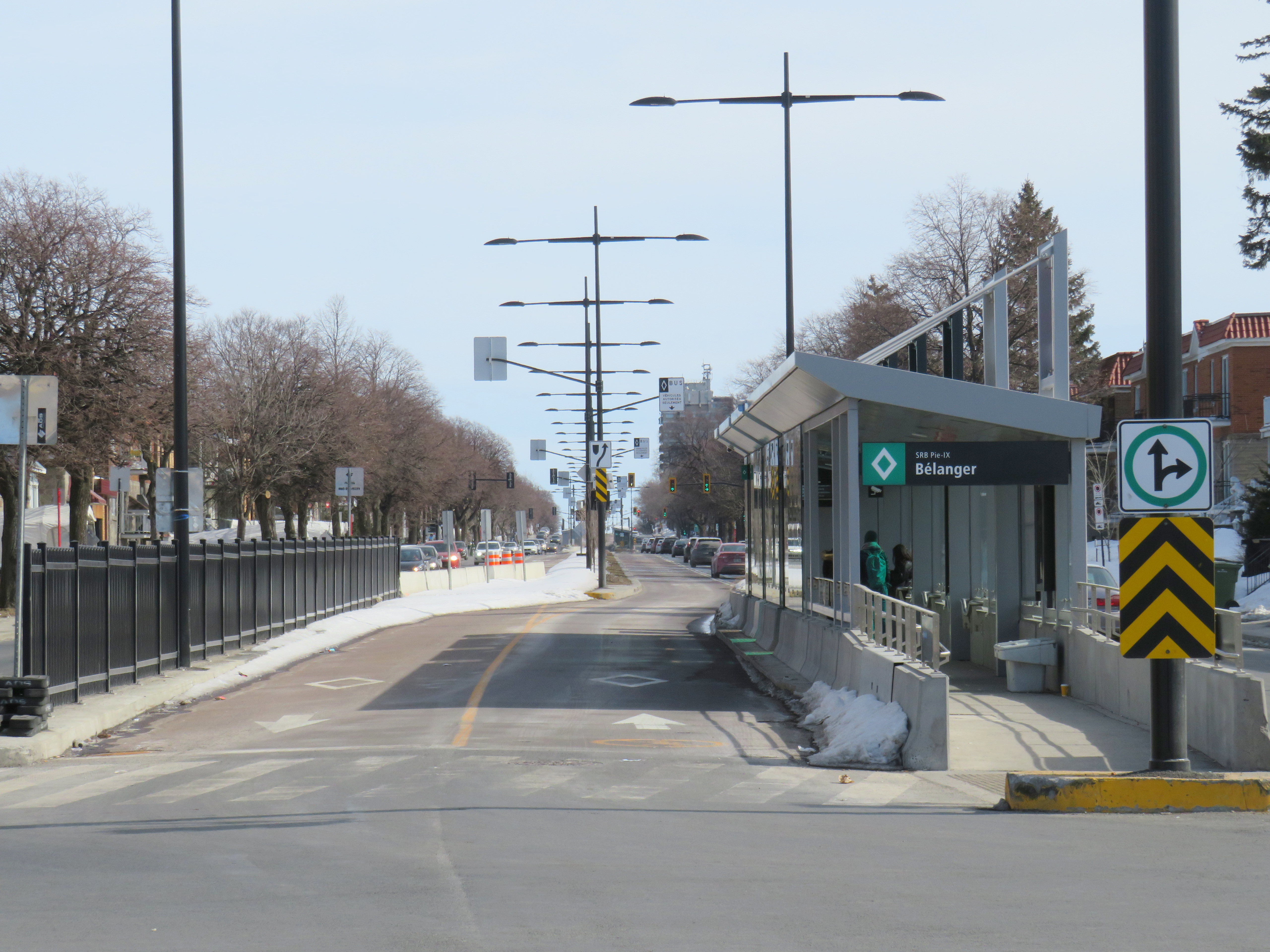
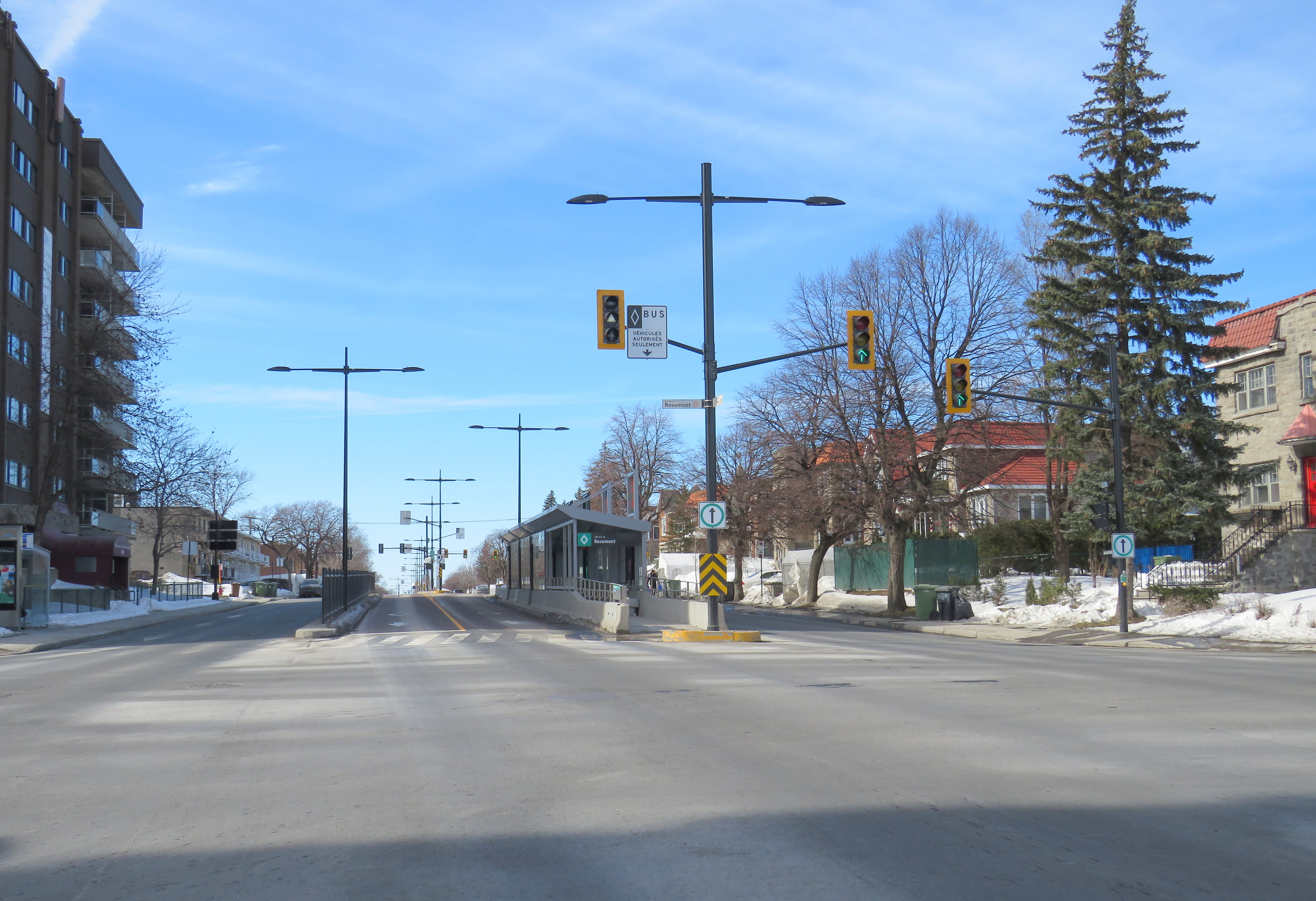
Montreal’s SRB Pie-IX
Looking south on Boul. Pie-IX from Rue Bélanger
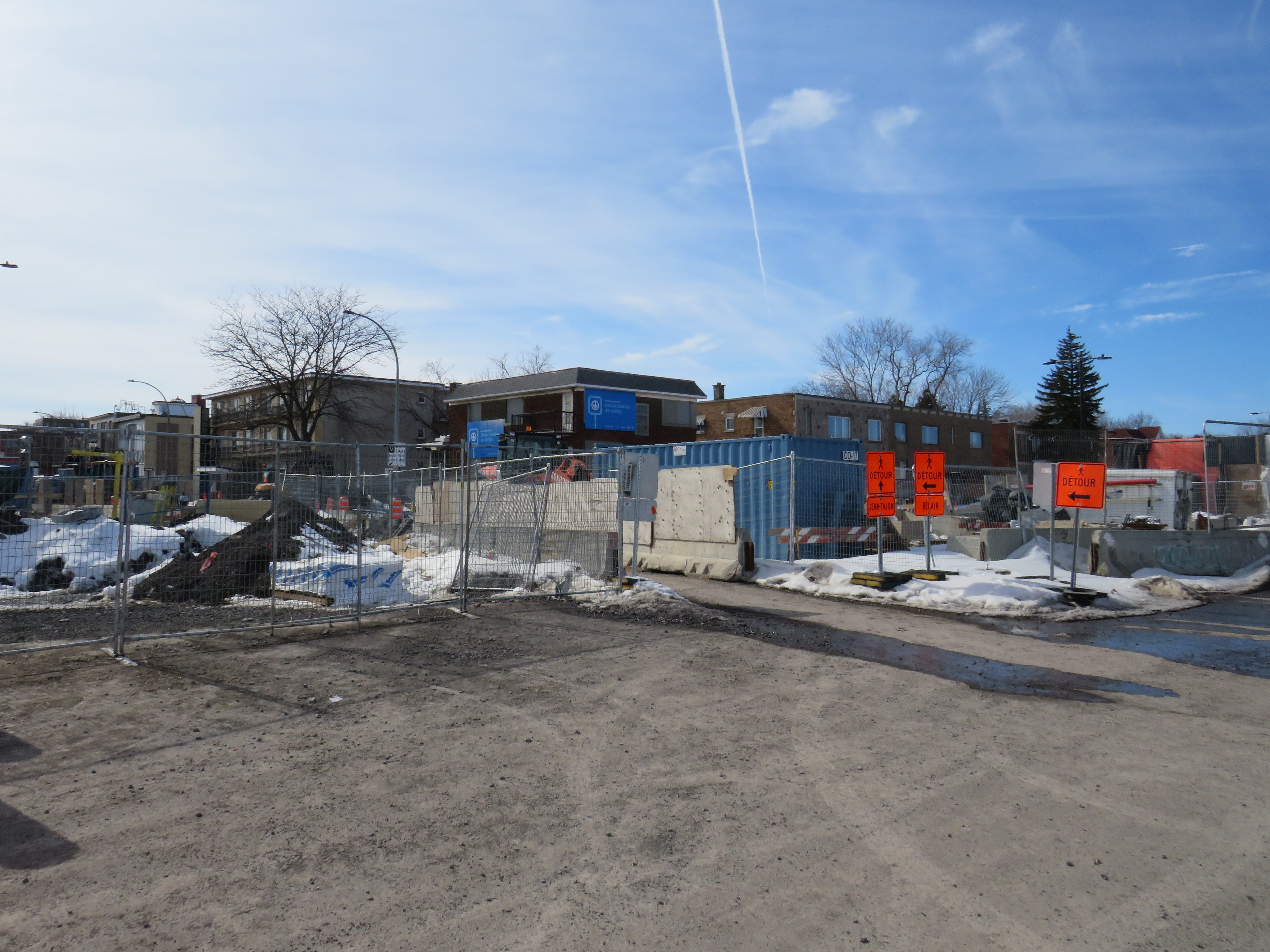
The SRB (BRT) corridor on Montreal’s Boulevard Pie-IX, which I visited later the same day, was a welcome contrast to Laval’s implementation. Boulevard Pie-IX (named for Pope Pius IX, the founder of the dogma of papal infallibility), is a wide north-south boulevard on Montreal’s east side, passing through Hochalaga, past Olympic Stadium and the Botanical Gardens, all the way into Laval. It’s a busy bus corridor, feeding into the Métro Green Line as well as the future extension of the Blue Line to Anjou.
The intersection of Pie-IX and Jean-Talon, where a new Métro station is under construction
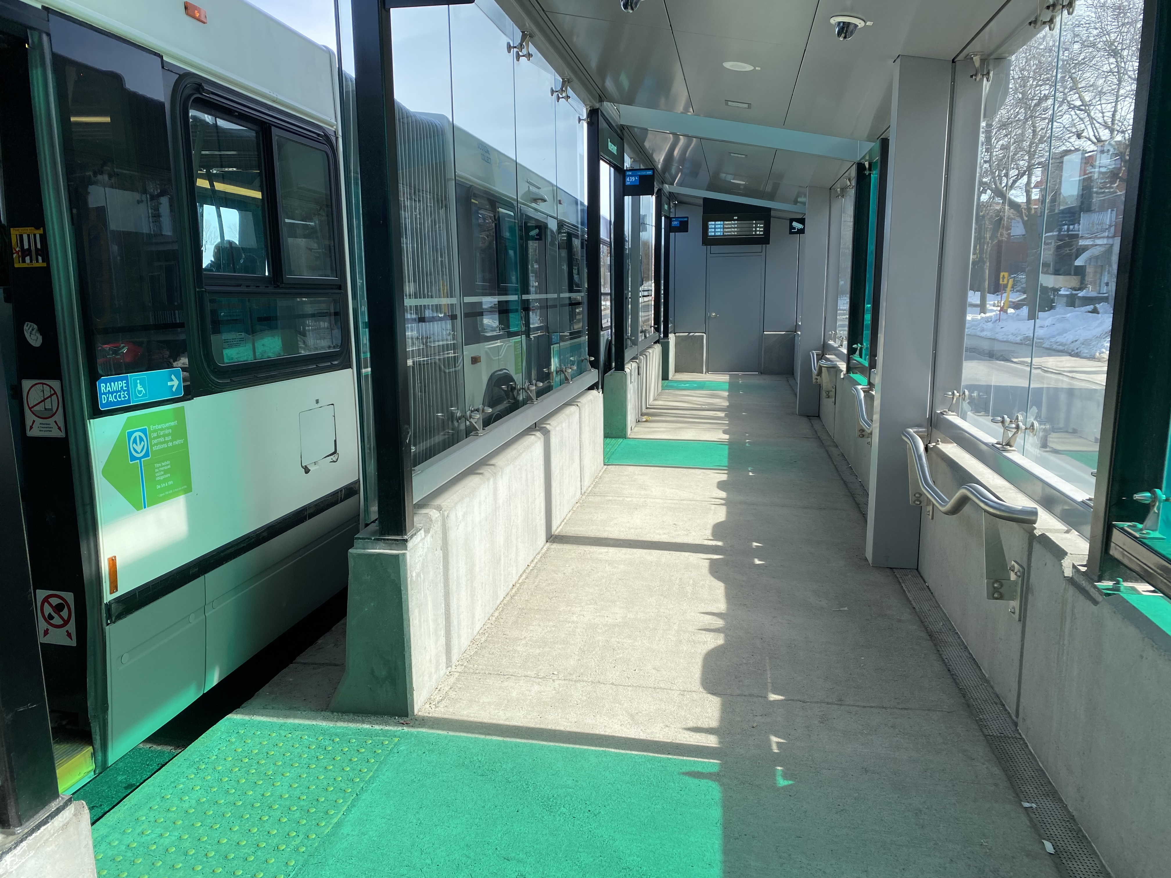
The 439 SRB route parallels the local 139 Pie-IX bus, and like other median busways, passengers board and exit at stops at the far side of the intersection. Though there is no fare pre-payment, passengers are permitted to board at rear doors with a valid Opus card or ticket. Shelters are simple, but the stained green glass lines up nicely with the gaps where the bus doors open.
Inside a SRB shelter
Unlike median busways elsewhere in Ontario or Quebec, buses are not slowed down by left-turning motorists as left turns are prohibited along the entire SRB corridor. This simplifies operations, allows for easier transit priority, and reduces the space required at intersections for dedicated left turn lanes. Unlike Laval, the crosswalks in Montreal were cleared and easy to traverse in winter.
Left turns are banned along the entire SRB corridor. Note the triangle light on the bus signal.
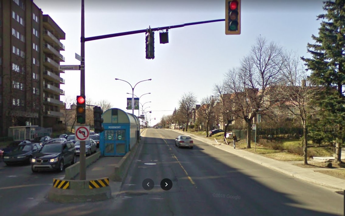
The current bus rapid transit alignment replaces an older, more dangerous set up where there was a central median where the inner lane was dedicated to buses in the opposite peak (contraflow) direction during weekday rush hours. Buses assigned to Pie-IX were equipped with special flashing arrows to warn oncoming motorists, along with overhead lights indicating the lane restriction. After several serious collisions, the arrangement was abandoned.
2009 Google Streetview image of the old Pie-IX express bus arrangement, where buses in the AM peak used the leftmost northbound lane to travel south, stopping at the median shelter. In the PM peak, northbound buses used the rightmost southbound lane.
Once again, Montreal shows how buses can be sped up without compromising safety or road space. Restricting left turns along the entire corridor was the right choice, and a solution that should be considered along some of Toronto’s busiest bus corridors as well.
Finally, rapid transit corridors on arterial roads are reliant on walk-up traffic, and should therefore be as easy and safe as possible to walk up to the transit service. This means effective and quick snow removal at crosswalks, pedestrian priority (there should be no beg buttons to push to access BRT/LRT stops), and proper pedestrian infrastructure and a walkable realm. The Viva Rapidways and the Laval Boul. Le Corbusier fail this basic criteria, while Montreal does a better job.
As Greater Toronto area plans more arterial LRT and BRT corridors, such as on Dundas Street in Mississauga/Oakville, and on Queen Street in Brampton, it would be wise to put transit and active transportation first, even if it means sacrificing a few left turn lanes.
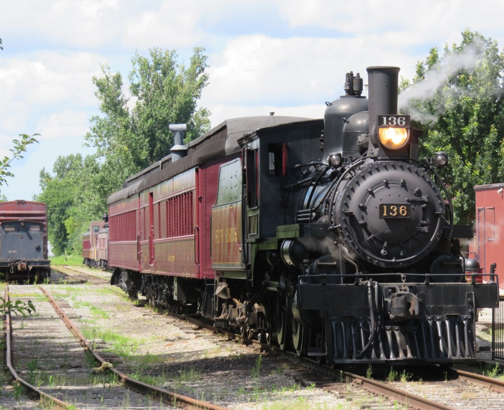
Former Canadian Pacific locomotive #136 hauls excursion trains at the South Simcoe Railway in Tottenham, Ontario
December 17, 2023: The complete map has been migrated to a newer ArcGIS Online account, on account of ESRI suddenly changing its monthly service account to charge bandwidth. That was a pay-as-you go account that helped me get re-acquainted with the ESRI ArcGIS Online platform before I set up a full online subscription to support a small business I co-founded in 2021.
However, I am happy to announce that I completed updates to the Ontario Intercity Transport Map and the 1955 Canada Passenger Rail Map, and that they are safely on a new subscription server at ESRI Canada. Please let me know if you have any suggestions or corrections to the maps, especially during the migration phase.
Sadly, passenger rail has faced a long, slow decline in Canada. Though commuter and regional rail systems in the Toronto and Montreal metropolitan areas have expanded tremendously over the last fifty years, rail service in general has declined in frequency, reliability, and even in speed. Prior to the COVID-19 pandemic, just six trains a day in each direction operated direct between Canada’s two largest cities, the fastest of those trains taking 4 hours 48 minutes to go 539 kilometres to get from Toronto to Montreal.
Seventy years ago, 28 trains on a typical weekday called at CN’s Hamilton Station, departing for Toronto, Niagara Falls, London, Guelph, Barrie, and Simcoe, with another 12 trains calling at the TH&B station on Hunter Street. In 2019, just six GO trains departed Hamilton for Toronto each weekday, with no direct connections even to Niagara, London, or Guelph.
There are several causes for the decline in passenger rail. In 1955, which the map below depicts, passenger train revenues were augmented by express cargo and mail, with the mail contracts alone helping to subsidize many branch lines. Lightly-travelled branch lines were served by mixed trains, which carry both passengers and freight. In Northern Ontario and Quebec, many highways were still of poor quality or unfinished — Highway 17 along the Lake Superior coast was not complete until September 1960. Construction of Highway 401 was just getting underway in 1955. In addition, the airline industry was still new, and air travel was expensive.
Improved highways drew more passengers to coach buses, while the move to trucks for cargo and mail deliveries made many branch lines unprofitable. Larger jet aircraft made air travel cheaper and more convenient for long distances. The major railways concentrated their energies on modernizing their freight networks, with CN and CP building new freight classification and intermodal yards outside of central Toronto, while focusing on bulk freight and shipping containers.
Though CN made efforts to win passengers back in the 1960s and early 1970s with new fare structures and equipment like the Turbo train between Toronto and Montreal, the government of Canada stepped in and took over most intercity passenger rail services in 1977. Though VIA Rail Canada acquired new modern locomotives and rail cars for the Ontario-Quebec corridor services, cuts to government subsidies made in 1981, 1989-1990, and 2012 forced further service cutbacks. British Columbia and Ontario also cut passenger services on their own rural railways.
I mapped the year 1955 for several reasons. I have CN and CP schedules for those years in my collection, while I found contemporary Ontario Northland and New York Central schedules online. It was also the year both railways inaugurated new transcontinental trains: CP launched the Canadian, while CN launched the Super Continental, luxurious diesel-hauled trains with modern sleeping cars and lounges. There were six trains a day leaving Montreal and Toronto for Vancouver that year. In 2019, there were just two trains a week.
In 1955, there were still many branch passenger and mixed trains in Ontario and Quebec, most of which were gone by 1965. Mixed trains were notoriously slow, though, but in many cases, there was a faster parallel highway coach. 1955 was also the last year for CP’s electric trains between Kitchener and Lake Erie, with the London & Port Stanley and Montreal & Southern Counties railways ending passenger runs a year later.
For Ontario and Quebec, I used Paul Delamere’s amazing Ontario Railway Map Collection and Quebec Railway Map Collection, adapting his work to identify those routes used by passenger trains in 1955, then mapping them on my own server. Mapping other routes was much more labourous.
Original version of interactive map
Please contact me if you have any suggestions, corrections, or other feedback.