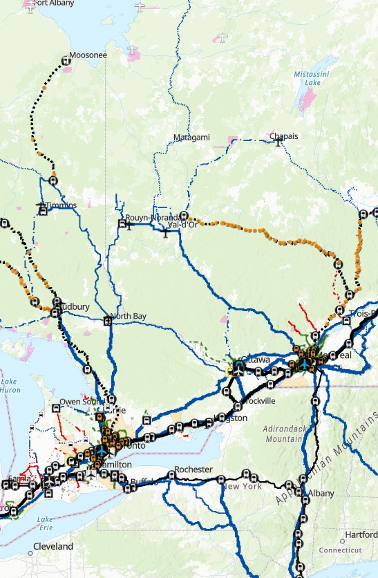
All of Canada’s transport links, in one map
This map depicts all intercity and regional bus and rail connections in Canada. Information for each transit agency and intercity carrier is available by clicking on the route or service area. Information has been compiled over five years, and has been a true labour of love.
I am grateful for the support of Transport Action Canada, Canada’s national advocacy organization for sustainable public transportation. Their contribution has helped keep this interactive map online and up-to-date.
Last update: March 3, 2026
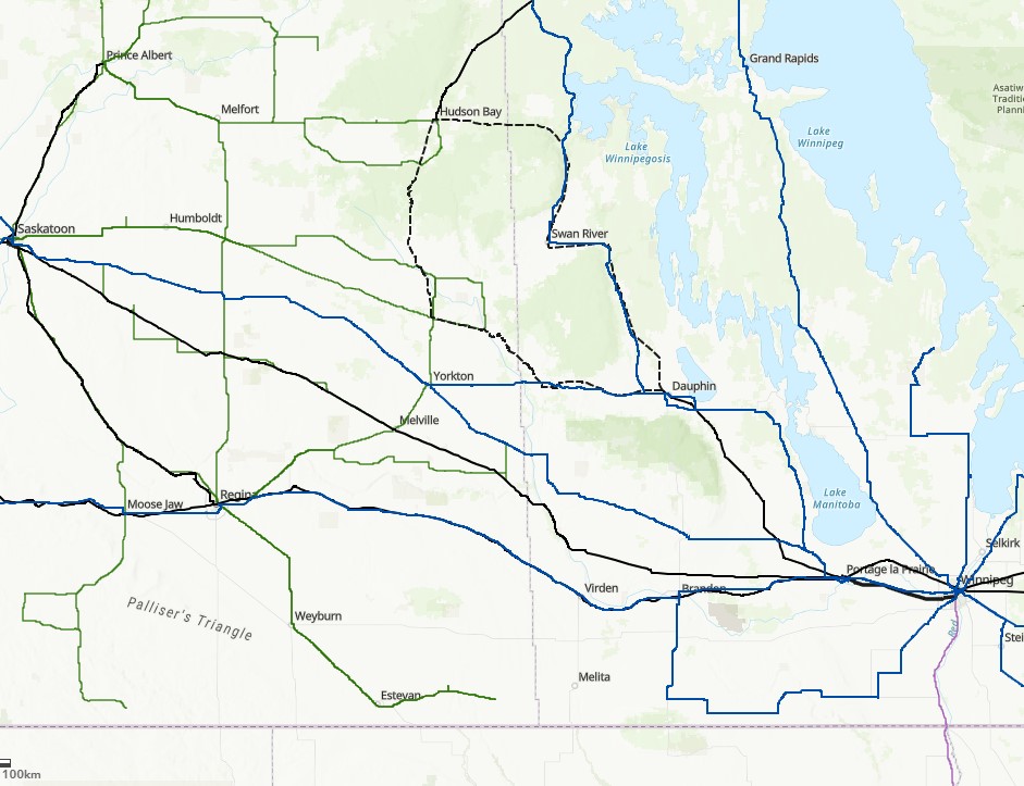
Historical transport links
This map depicts intercity bus and rail connections in Canada in the decades prior to 2020. This map includes former Greyhound Canada routes, VIA Rail, Ontario Northland, BC Rail, and Algoma Central rail services cut since 1980, as well as “fallen flag” operators such as Saskatchewan Transportation Company, Grey Goose, Gray Coach, and Voyageur-Colonial.
This map illustrates how many connections were lost in the last forty-five years.
Information is found through sources as the Ontario Intercity Transportation Guide, historical VIA and Greyhound timetables, as well as print and online maps covering services such as STC. Detailed information found in the interactive transport map above, such as frequency, is not available for bus routes, given limited information for many services. Please contact me with any corrections.
