Tag: Denver

  • Why transit system maps matter

    Why transit system maps matter

    I love maps, especially physical, paper maps. I like to visualize the places I travel to and determine how each city and region’s transit networks work. Though online interactive maps can be very helpful (like the ones I created to show all intercity transport services in Ontario and across Canada, filling a much-needed gap), there is still nothing like a well-designed static map, especially when it is in print and easily accessible to the public.

    This means providing maps that accurately and clearly depict the entire transit system, along with landmarks, connections, and frequency. Los Angeles Metro’s system map does a reasonable job for a map that covers a very large region.

    The Los Angeles Metro system map depicts the complex bus and rail network, including non-LA Metro agencies like Culver Citybus and Santa Monica’s Big Blue Bus. Colours and line width used to denote operator, service type, and frequency.

    Thankfully, most urban transit systems in North America continue to provide proper system maps both on their websites and in print, provided free on request at subway booths or terminal offices. (Some, however, have charged a small fee for a physical copy of their transit maps, such as San Francisco’s Muni.) In Europe, complete transit maps often have to be purchased, such as in Berlin or Vienna.

    I recently visited two mid-sized American cities that have done away with physical maps for their transit systems: Pittsburgh, Pennsylvania and Denver, Colorado. In those cities, figuring out how to get around by tram and bus was frustrating, even in an age of Google and Apple maps and transit planning apps accessible to anyone with a smartphone.

    Pittsburgh Regional Transit (formerly known as Port Authority Transit) operates a complicated web of bus routes that radiate from the city’s downtown core, along with a few cross-town and feeder routes. There are three busways and a light rail service to the southern suburbs. However, there is no proper system map, either in print or online as PDF or image file that allows the new or casual user to make sense of the network.

    Individual bus and LRT route schedules can be found under the Schedules tab on the PRT website, but one needs to know what route they are looking for. Under Rider Info, there is a link to a system map, but it takes the user to an ESRI interactive map.
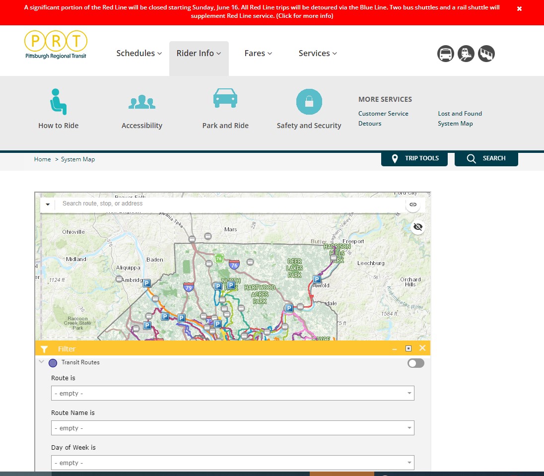
    Screenshot of the system map page of the PRT website

    The user can then select a service by route name or number in a drop-down tool, but the map itself is difficult to figure out. Zooming in reveals the location of fare vendors and park-and-ride lots, but not important service details like route numbers or service frequency.

    Zooming in, park-and-ride lots become the most prominent feature

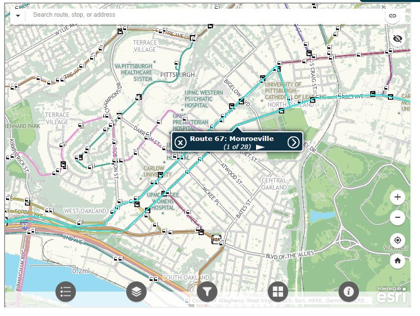
    Even at the neighbourhood level the map is difficult to read. The screenshot below shows Pittsburgh’s Oakland district, home to University of Pittsburgh, Carnegie Mellon University, several other educational institutions, medical centres, parks, museums, and cultural venues. Many bus routes follow Forbes Avenue and Fifth Avenue, but as each route is layered on top of each other, it is difficult to discern where each route runs and where they go.
    PRT’s ESRI interactive system map, zoomed into the Oakland District

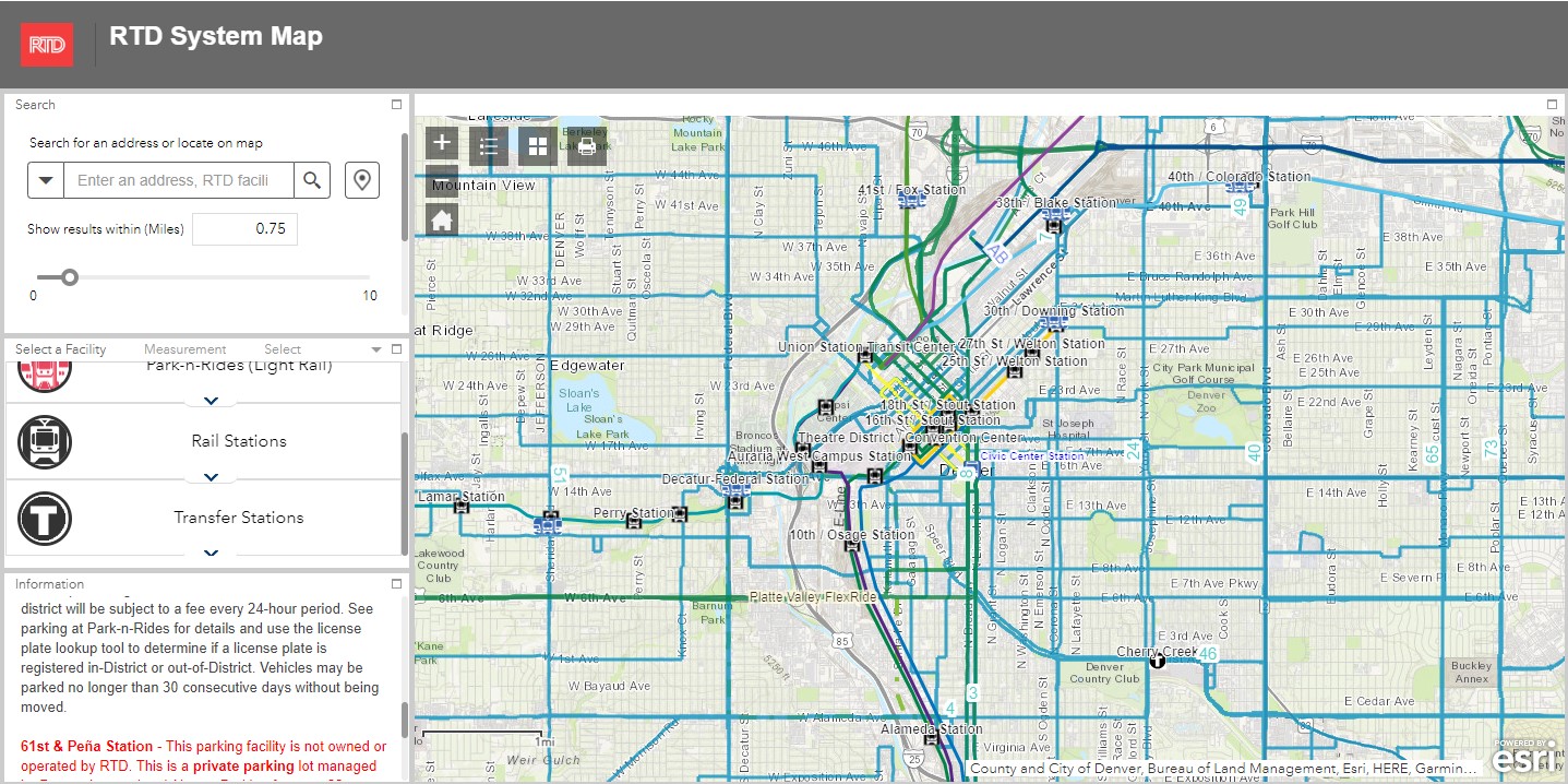
    Denver’s Regional Transportation District (RTD) also uses ESRI interactive maps to show bus routes (rail services are depicted in a static image map as well). At a small scale, only the light rail and commuter/regional rail services appear, along with transit park-and-ride locations. Denver’s bus system is less complicated than Pittsburgh, operating largely on a grid, but still, a proper map would make it much easier to get a sense of the network.

    RTD System Map zoomed out

    Zoom in, and bus routes appear, along with route numbers, but there is nothing to show the level of service for each route.
    Though online-only interactive maps have their purpose (my Ontario and Canada intercity maps are designed to show where connections exist, or not, and how to obtain schedule information), they are not well suited for urban transit systems and are very difficult to read on a mobile device. Properly designed static maps, in web image or PDF format do much better jobs.

    It is worth comparing Pittsburgh and Denver to the Toronto Transportation Commission (TTC). The TTC’s complete system map is provided to customers for free at subway stations, with smaller, simplified versions available as tear-away pamphlets. Large-format versions are also displayed across the network in bus shelters and subway stations. A PDF version can also be easily found on the TTC website in the main Routes and Schedules page. Surface routes are categorized by service level (express, frequent service, regular service, limited service, seasonal, and community routes) with major landmarks and transfer points to connecting services clearly indicated.

    I have some minor complaints about the TTC’s map (like regular routes, express routes should be categorized in the map based on their service levels, for instance) but it is a reasonable, easy to read map that is also quite easy to find.

    Unfortunately, more transit systems are moving away from easily accessible paper maps. Durham Region Transit, for example, no longer provides copies of its system map. Fortunately, a proper, well-designed PDF copy remains accessible on its website.

    When travelling, or looking to understand a city’s transit network though, there is nothing quite like poring through a well-designed, easy-to-read paper map. It would be a shame if more agencies went the way of Denver and Pittsburgh.
  • Travel by train (or bus): Denver’s renewed Union Station

    Travel by train (or bus): Denver’s renewed Union Station

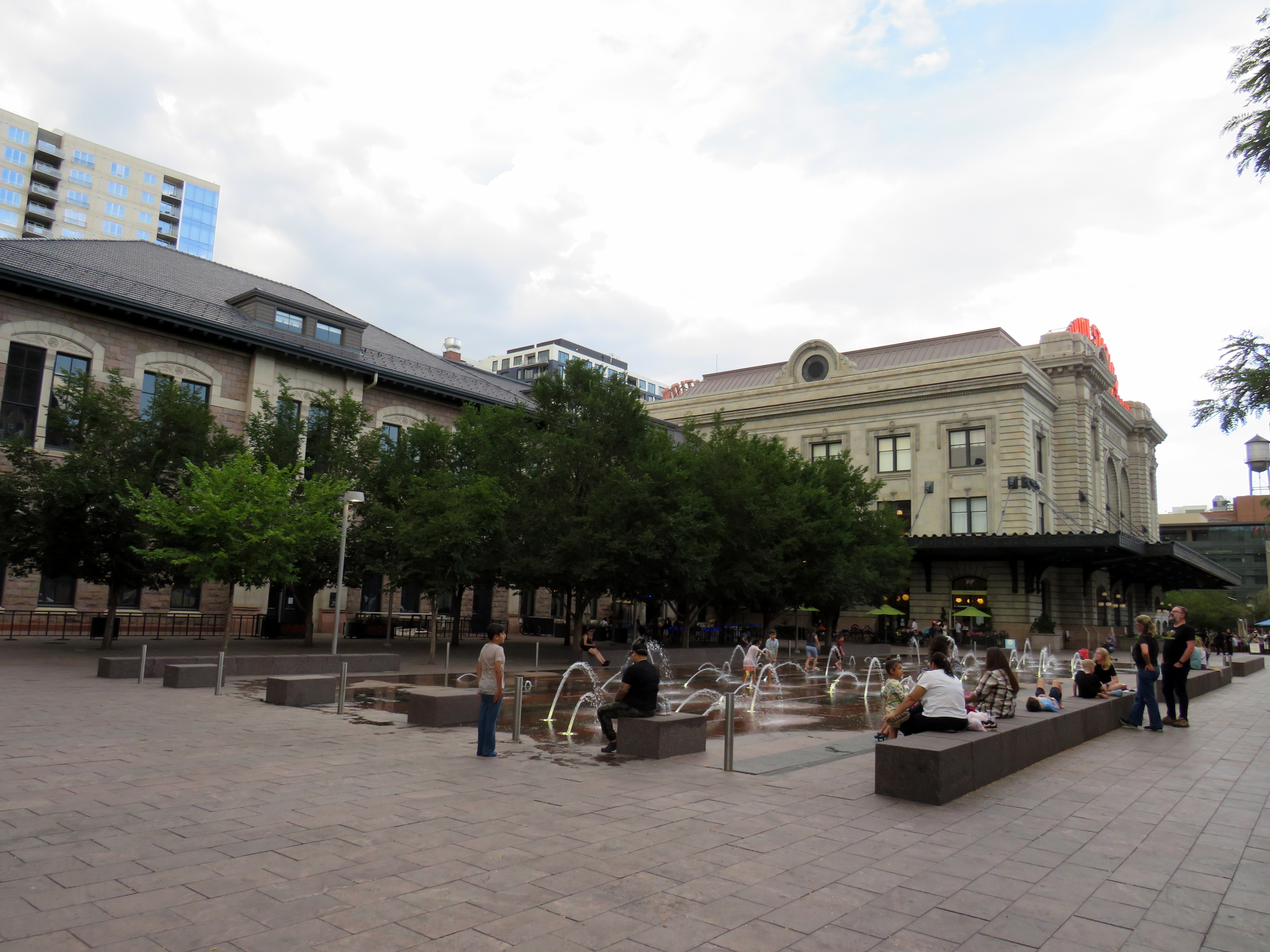
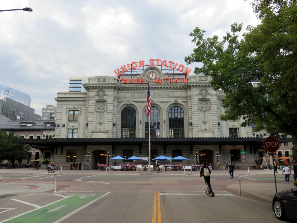
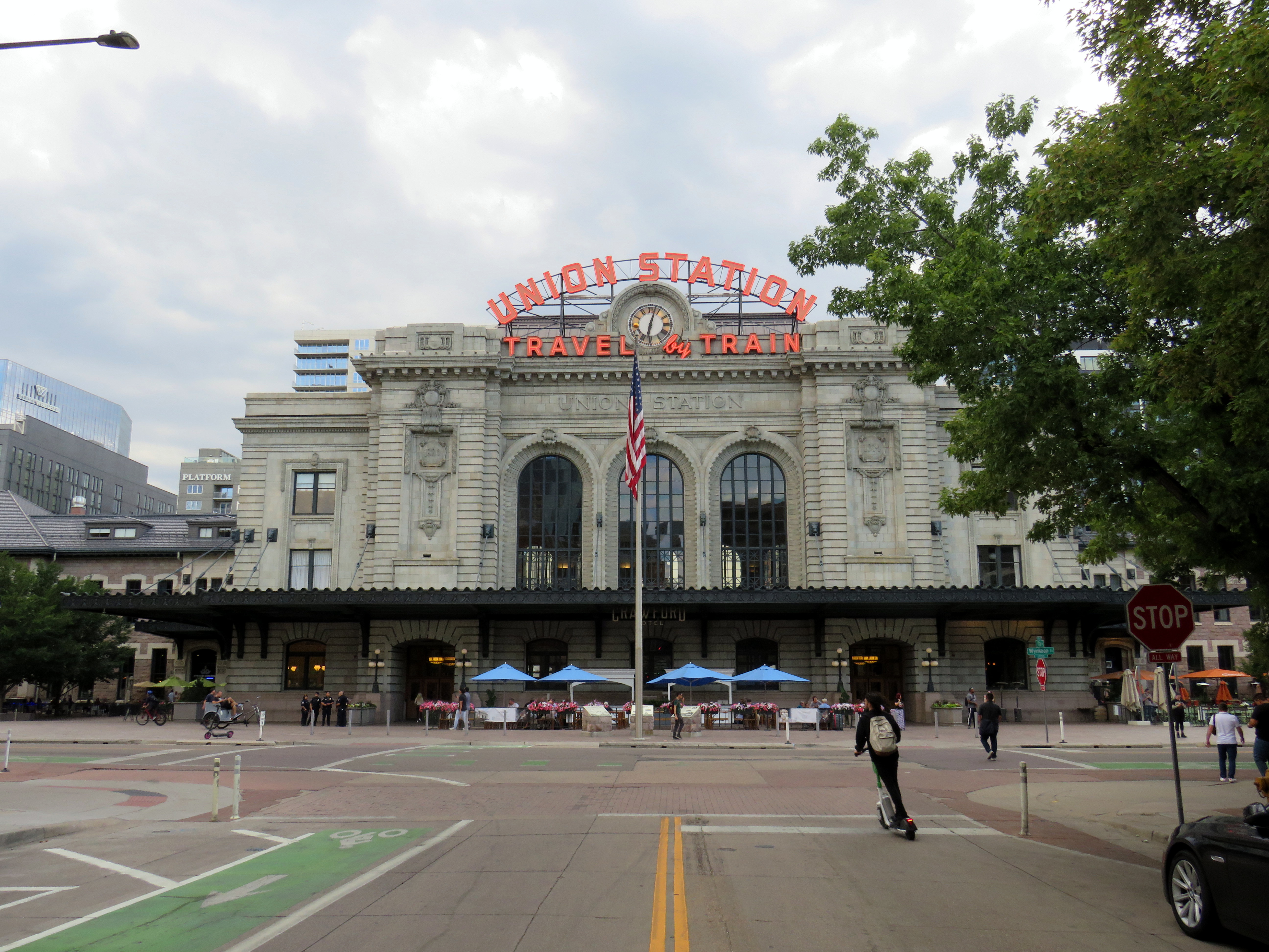
    Denver’s Union Station, with the iconic “Travel by Train” neon signage

    Earlier this summer, I had the privilege of travelling with my spouse to California. We started in San Diego (where my partner was attending a conference) and then made our way northwards, to Los Angeles, Santa Barbara, San Simeon, and finally the San Francisco Bay Area. I continued my trip an extra three days to ride Amtrak’s California Zephyr train east through Nevada and Utah to Denver, Colorado.

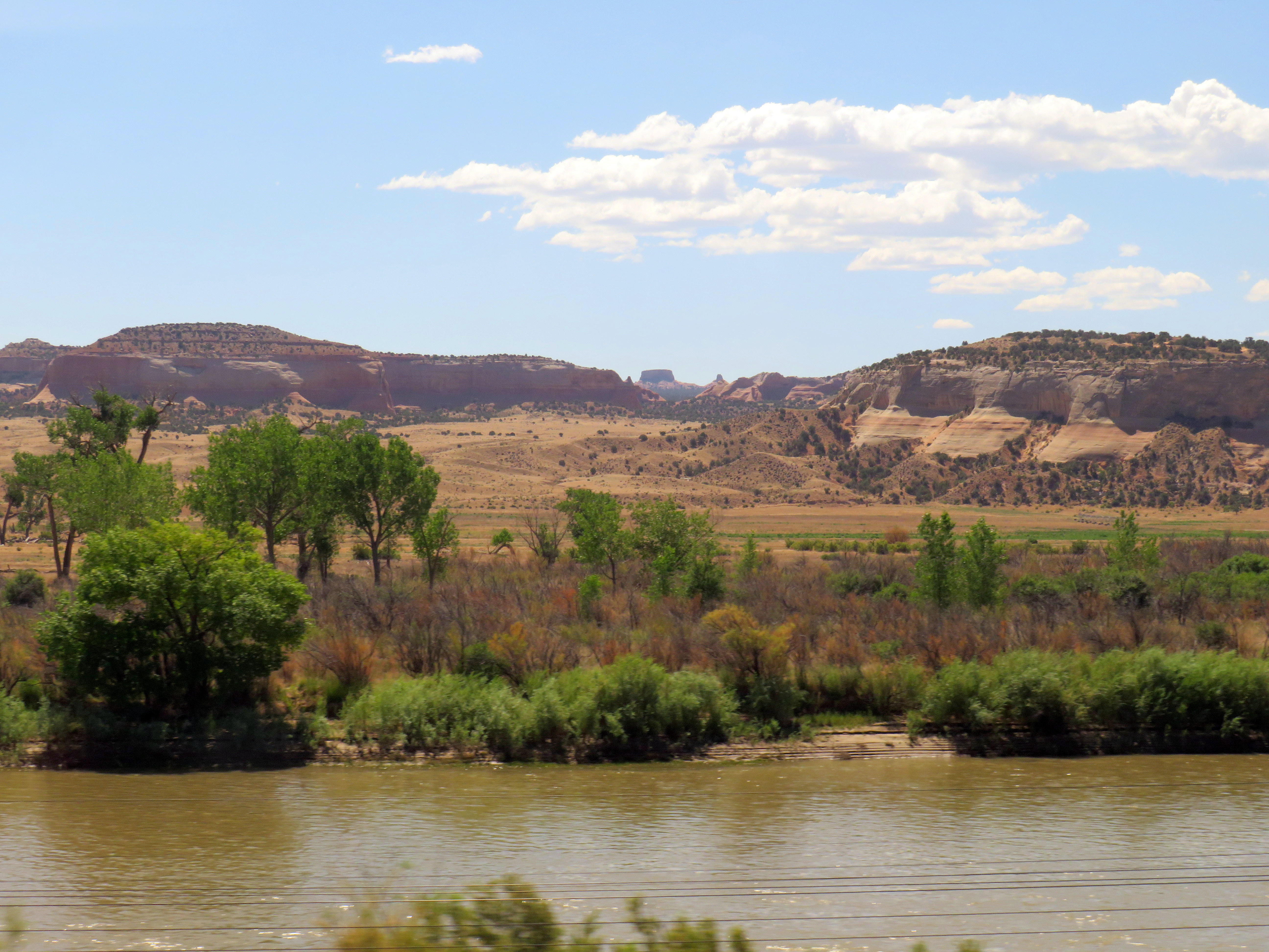
    Looking south from the California Zephyr across the Colorado River near the Utah-Colorado border

    Besides the breathtaking scenery through eastern Utah and western Colorado, I wanted to visit Denver itself, including its Union Station.

    Denver’s Union Station was constructed in 1881 to serve the Denver Pacific Railway (the city’s connection to the Union Pacific transcontinental railroad at Cheyenne, Wyoming), as well as the Denver & Rio Grande, the Denver, South Park & Pacific and the Colorado Central Railroads. (Today, it is reached by tracks belonging to the Union Pacific or BNSF Railroads.) Renovated and expanded in 1914, one of the station’s most iconic features, rooftop neon signs beckoning customers to “Travel by train” were added in the 1950s, as interstate highways were being planned and constructed across the United States and air travel became more common.

    The station was nearly closed in the 1980s with only Amtrak’s Oakland-Chicago California Zephyr calling once a day in each direction. Passenger train facilities would have been moved to a small “Amshack” building outside of the downtown core, with the station building incorporated into a proposed new convention centre. (This proposal is similar to the fate of St. Louis’ Union Station, which was turned into a hotel, shopping, and entertainment centre, with the Amtrak station moved into a small building off-site.) Luckily, this never took place.

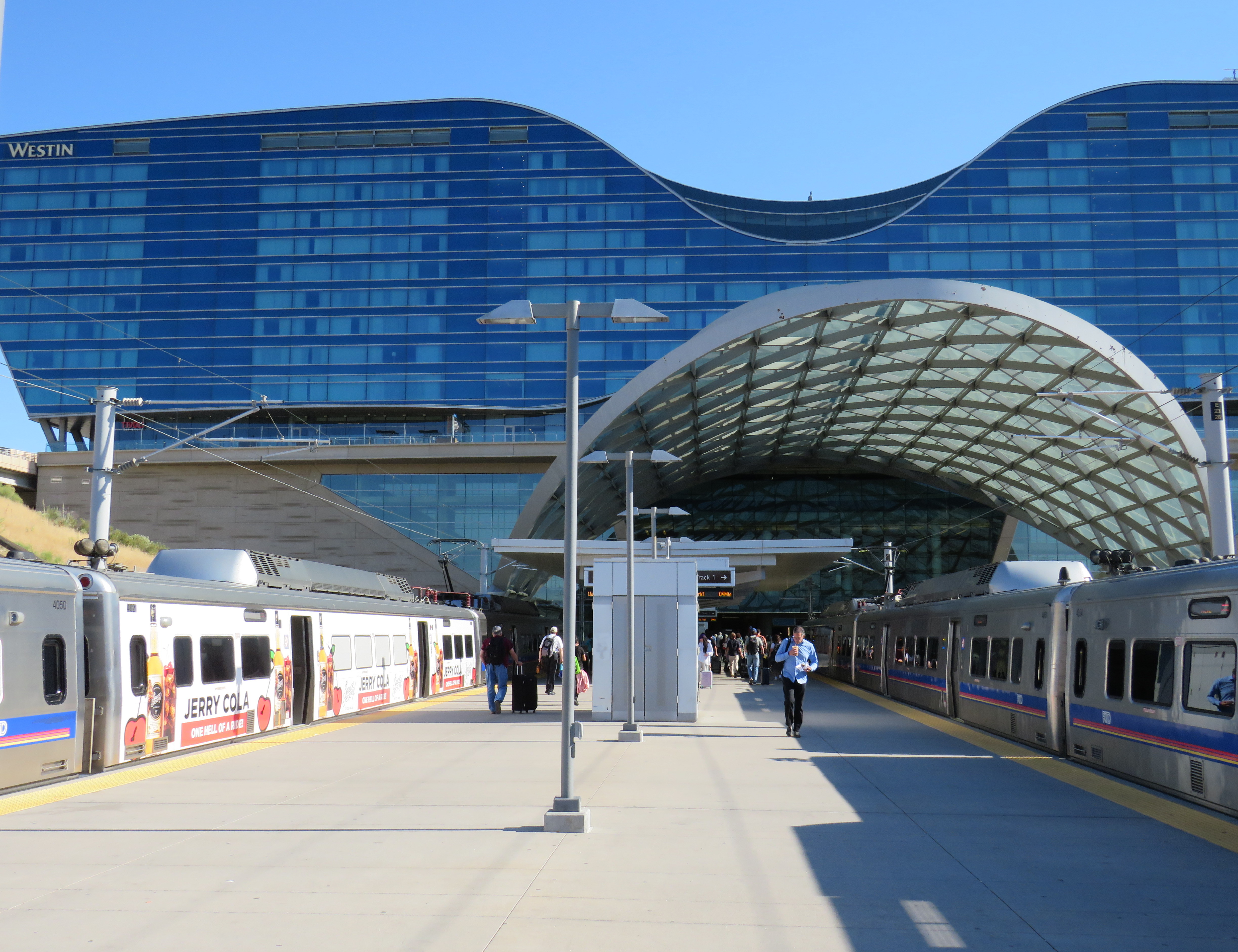
    Denver’s Regional Transit District (RTD) purchased the station in 2001, with a new master plan developed for the station property and the vicinity in 2002, approved by voters in 2004 as part of the “FasTracks” program. Denver’s light rail system was extended to Union Station in 2002, while the immediate area was redeveloped with midrise apartment and office buildings. The train platforms were rebuilt with a new canopy, meant to accommodate both Amtrak and proposed new commuter and regional rail services.

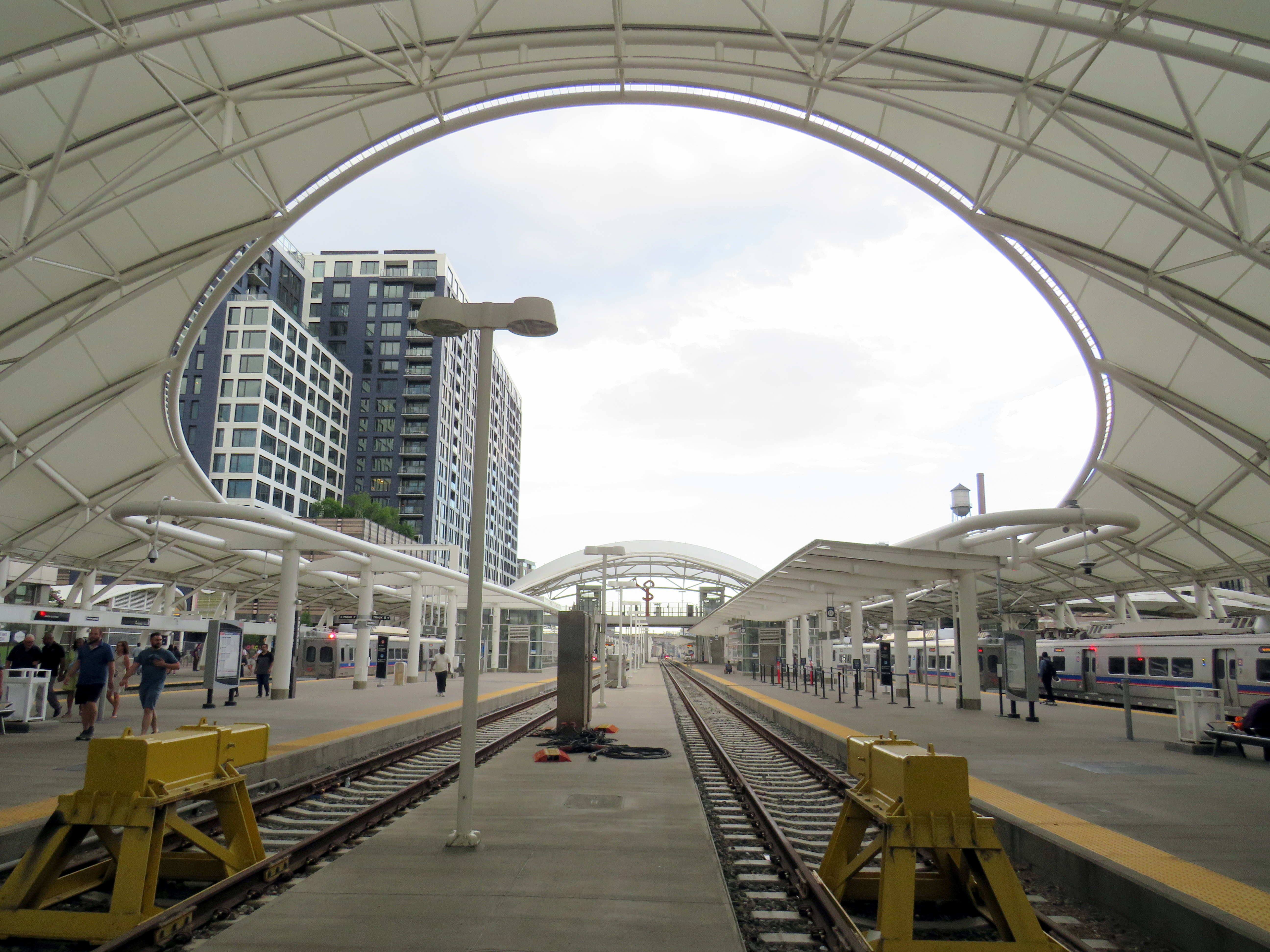
    Denver Union Station train platforms

    Connecting the historic Union Station building and train platforms with the LRT platforms two blocks north is a long underground bus concourse.

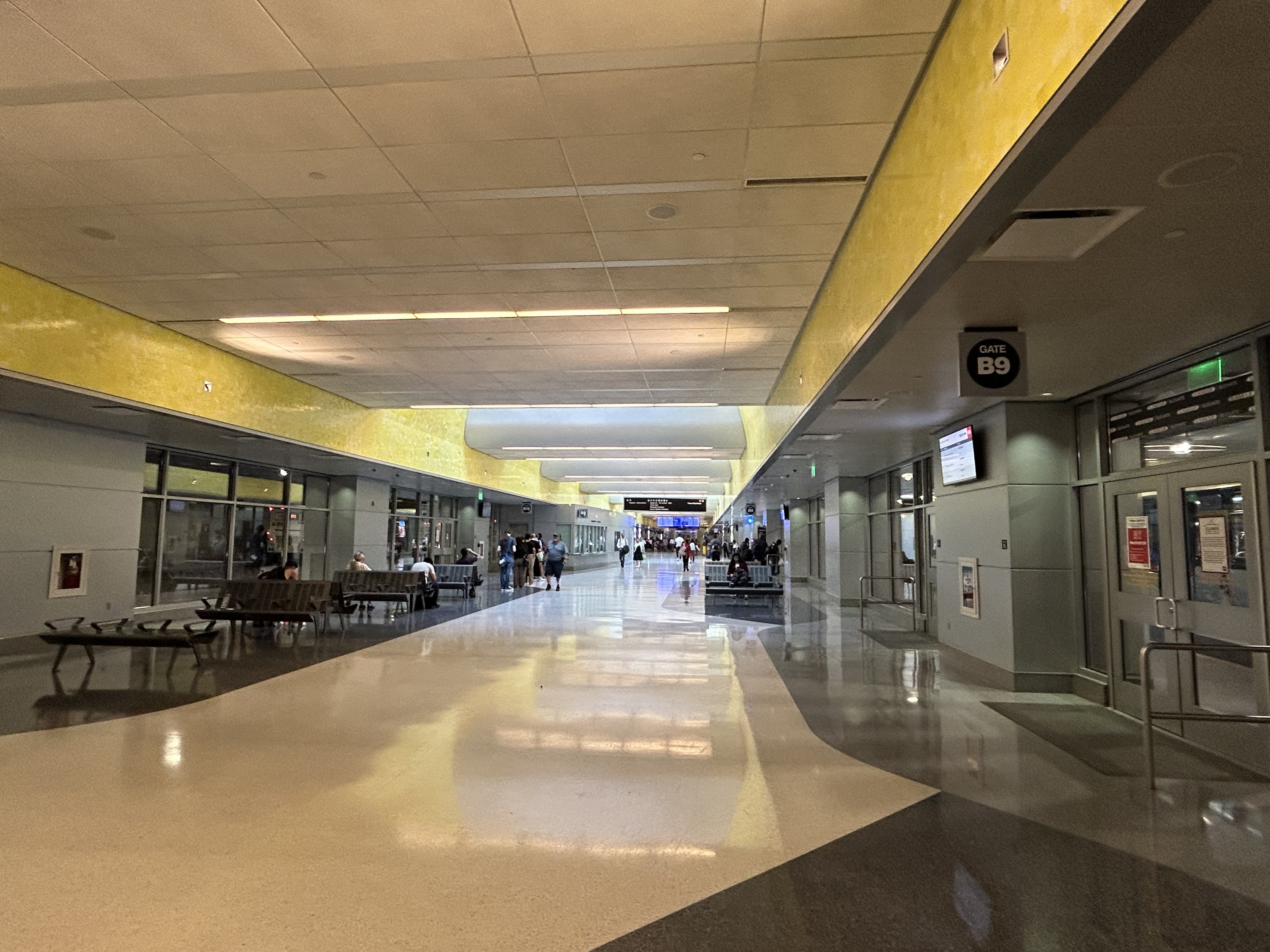
    Denver Union Station’s underground bus terminal

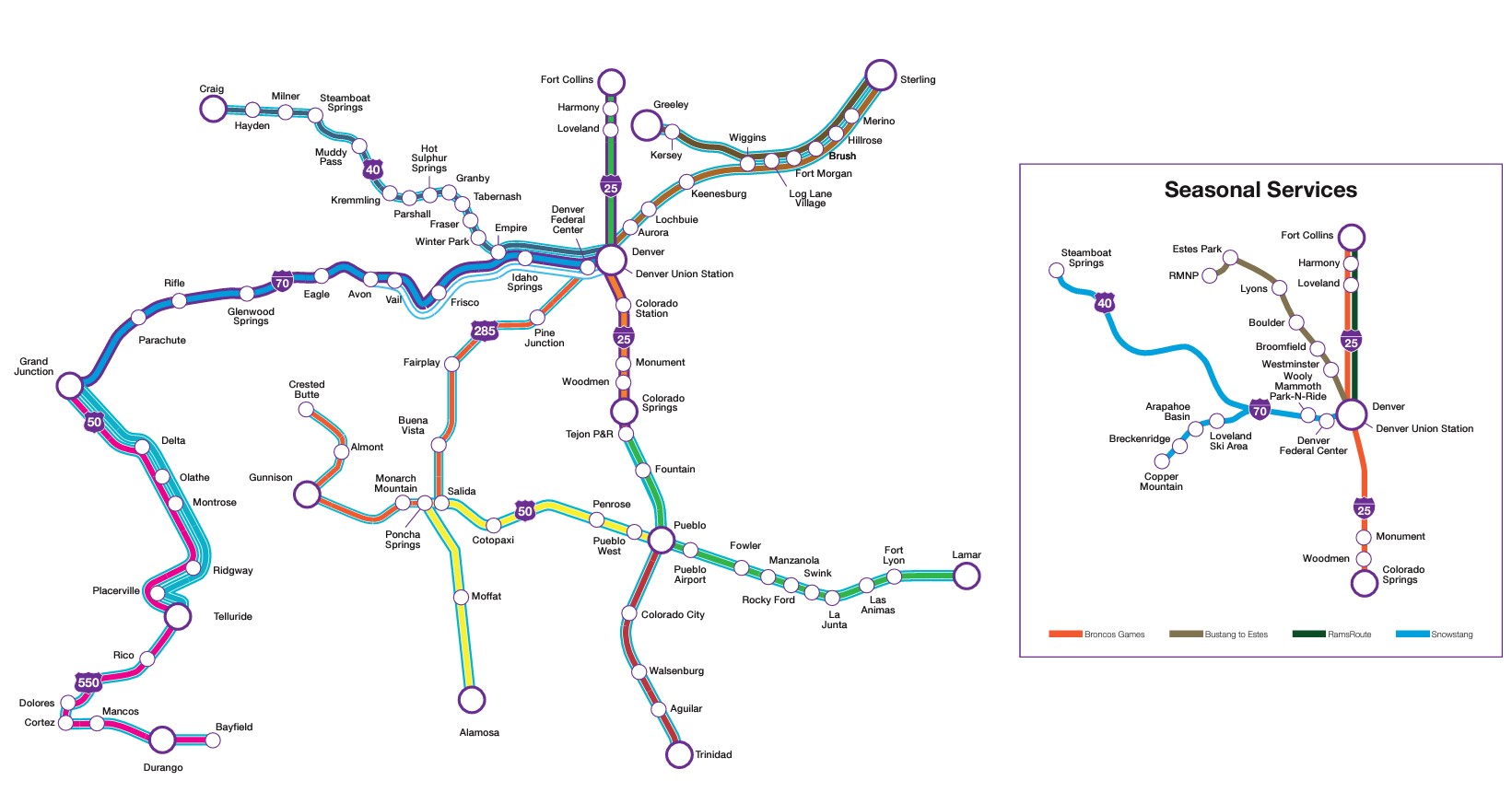
    The underground bus terminal serves local and regional RTD services, as well as Bustang, the State of Colorado’s intercity coach service. Bustang offers multiple daily bus services to cities such as Colorado Springs, Fort Collins, Grand Junction, and Pueblo, connecting most of the state together. There are also seasonal ski buses from Denver, along with special runs for Denver Bronco games.

    Bustang service map

    There are also two free RTD bus services connecting Union Station with the rest of Denver’s downtown core: MallRide, a frequent, daily service along the 16th Avenue pedestrian mall (which was undergoing reconstruction in July 2024, and was on detour), and MetroRide, which operates during daytime hours on a parallel route.

    Splash fountains in the Union Station west plaza

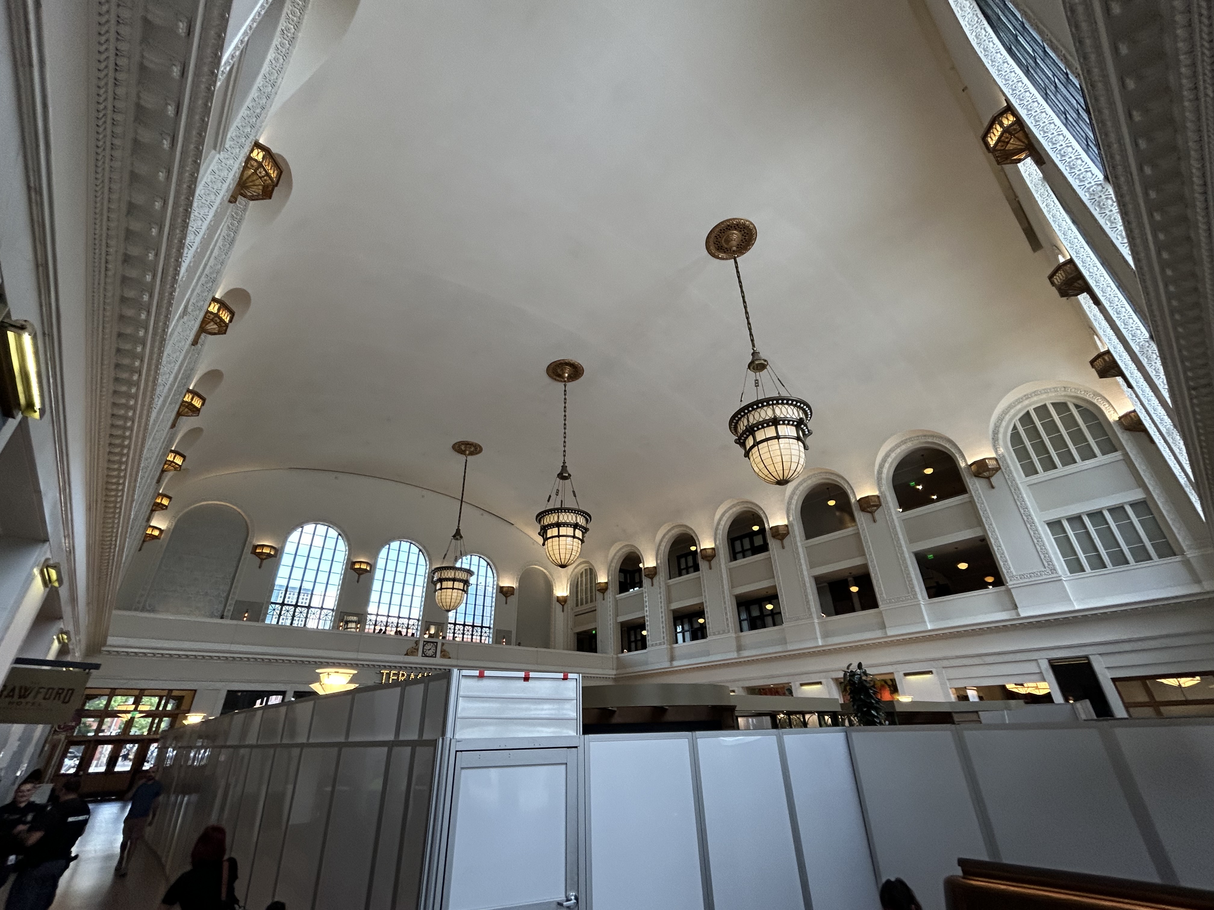
    Union Station now hosts a boutique hotel, several restaurants and bars, a branch of a local bookshop chain, and includes amenities such as public art and a splash fountain outside its main entrance. Though the main lobby was undergoing minor renovations, it was clear how much work went into the project.

    Union Station lobby
    Take the A-Train
    Arriving at Denver International Airport

    Like Toronto’s Union Station, Denver offers an airport rail link, operating every 15 minutes most of the day. The electric A-Line train runs from Union Station, making 7 intermediate stops. With the exception of the airport itself, the A-Line operates within the regular RTD fare zone, with free transfers between connecting buses and trains.

    To enter or exit the airport station itself, occasional travelers must purchase a special $10 day pass (a standard day pass is $5.50), but that, of course, includes all rides taken before or after arriving at or departing from the airport. (By contrast, there are no transfers or fare discounts when connecting between UP Express and GO Transit, TTC, or suburban transit services.)

    Because of the additional stops and the long distance between Downtown Denver and the international airport (25 miles or 40 kilometres), the trip takes 37 minutes versus UP Express’ 25 minutes.

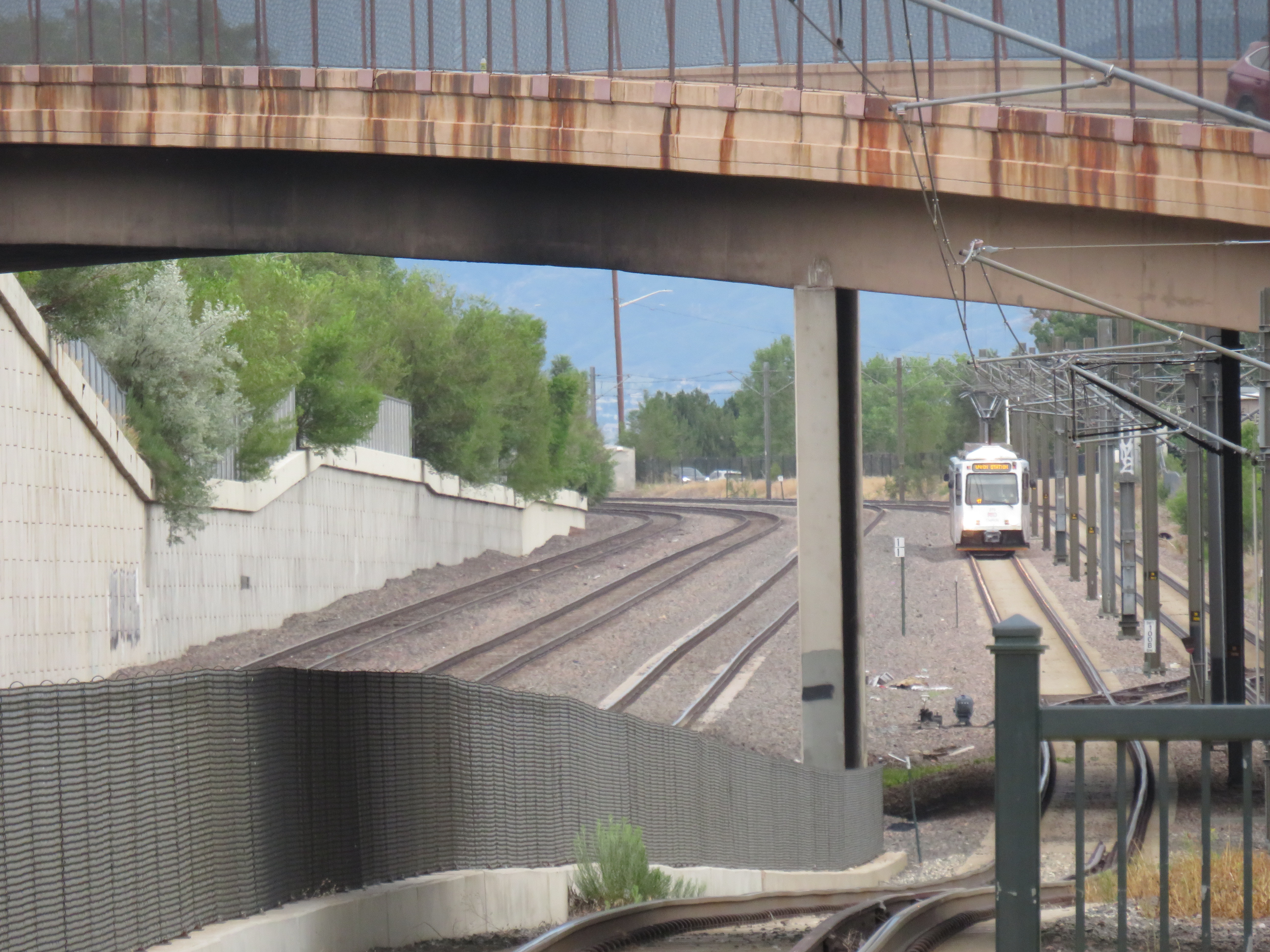
    Unfortunately, most RTD rail services, like the A-Line, follow existing or abandoned rail corridors. Though these routes offer limited obstructions to construction and allow for faster service than operating within roadways, they limit how much ridership can be generated by walk-on service. Even the Downtown Littleton station on the D-Line is distant from any commercial or residential uses, with a large commuter parking lot behind the historic station building.

    At least many RTD stations offer convenient bus transfers, which draw much of the ridership.

    The D-Line LRT at Littleton, Colorado

    A lot was done right at Denver Union Station, which is well served by local, state, and national rail and bus connections, and is serves well as a model for developing a good intermodal hub in a midsized city like Denver. There are certainly aspects that could be replicated at some GO Transit stations, such as Brampton, Port Credit, or Unionville, which are poised to become important intermodal hubs, such as great public spaces, easy connections between nodes, and complementary retail spaces. At Brampton in particular, much can be done with the small historic station building there to make it a centrepiece of a great downtown redevelopment.

    I am glad I visited Denver, and I am glad to have travelled by train.