
NOTE: Previous versions of the Ontario and Canada maps are retired; please see the new Canada Intercity Transport Map, launched March 30, 2025. This will now be the only interactive map that I will update.
In 2022, I was approached by staff at Infrastructure Canada who were interested in compiling information on intercity bus services across the country. Unfortunately, no repository had existed for a very long time, especially as transit and intercity coach services are primarily under provincial and municipal jurisdiction. Ontario’s provincial government last published a map of intercity carriers in 1990-1991, while Saskatchewan abolished its provincial bus service in 2017. The withering of Greyhound Canada’s once-extensive network left many communities from Ontario west to British Columbia and the Yukon without any service, while new private operators like Ebus and Rider Express filled in to serve the most lucrative routes.
Though the Federal Government operates VIA Rail and oversees air, marine, and long-distance rail transport, for road and city transport, its role has been more limited to helping to fund transit projects and some major road infrastructure improvements. Knowing that, I was excited to learn that there was interest in understanding the state of the country’s rural and intercity transport initiatives. I completed the project for Infrastructure Canada in June 2023, but I have recently updated a version of the map I completed, which I am excited to share.
A simplified methodology of how I completed this map can be found below.
Methodology
By June 2023, I had mapped 216 transportation agencies. These included:
- 151 public transit agencies (urban, rural, and regional services)
- 34 intercity bus operators
- 5 intercity and remote rail operators
- 27 ferry operators (not including Halifax Transit and TransLink, which also provide passenger ferry services)
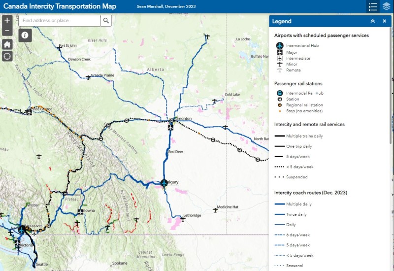
Intercity and remote rail: In 2023, passenger rail services are operated by VIA Rail Canada, Ontario Northland, Tshiuetin Rail Transportation, Keewatin Railway, and Amtrak. Tourist-oriented excursion railways, such as the Yukon and White Pass Route, Rocky Mountaineer, and Train de Charlevoix, were not included. This followed similar methodology on my Ontario map.
Regional and urban rail services: regional and commuter rail services are provided by Exo (Montreal), GO Transit (Toronto) and TransLink (Vancouver). Urban rapid transit services (subway, metro, Skytrain, LRT) are operated in seven Canadian metropolitan areas; these lines (but not all stations) were also included. Since June 2023, I added the first phase of Montreal’s Réseau express métropolitain (REM) which opened on July 31.
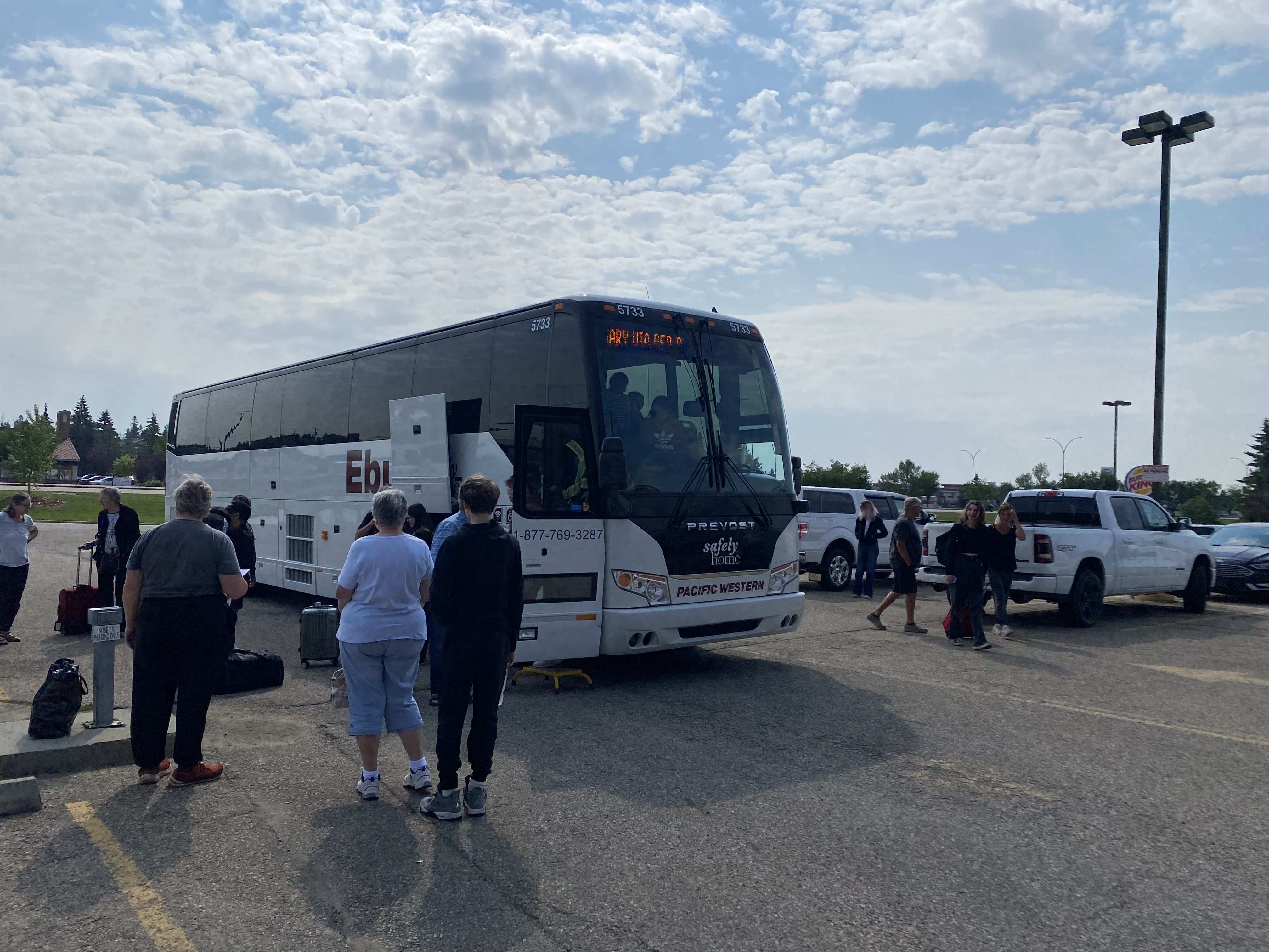
Intercity bus: Until 2018, Greyhound Canada was the dominant carrier in Western Canada, with a strong presence in Southern Ontario and Southwestern Quebec until 2020 but has cut many of its routes and services since the late 1990s. Smaller private companies and public-sector agencies have since filled some of the gaps left behind. Several intercity operators, most notably Rider Express (Western Canada and Ontario), Ontario Northland, Orleans Express (Quebec), and Maritime Bus have well organized websites with easy-to-find schedule and stop locations. Other agencies, such as Flixbus and Megabus, require the site visitor to use the ticket reservation form to find routes, times, and stop locations.
Regional bus services: these routes are generally operated by or contracted by municipalities, provincial agencies, First Nations, or non-profit organizations. There are two categories of regional buses depicted in the map:
- Urban services: these function as extensions of an urban transit system and/or are operated by an urban transit agency, these routes operate at least 5 days/week with a commuter-friendly schedule. These routes connect suburban areas and outlying communities with urban centres and transport hubs or connect two or more adjacent urban centres. Examples include GO Transit and Exo commuter and regional buses in the greater Toronto and Montreal areas.
- Rural services: these are longer-distance bus routes that connect small communities to each other or larger cities, they may operate less frequently than 5 days/week.
Other layers included:
- Ferry services – Data was obtained from provincial open data portals, where available, or were manually added.
- Airports – Data was obtained from the federal Open Data portal; only airports with scheduled passenger services were included. They are classified in five categories: international hubs (Toronto-Pearson, Montreal-Trudeau, Vancouver, Calgary), major (all other airports in the National Airports System), intermediate (other airports with multiple destinations, such as Hamilton, Toronto-Billy Bishop, and Abbotsford), minor, and remote.
- First Nations and Indigenous land claims, obtained from the federal Open Data portal.
- Transportation hubs, where multiple transportation agencies converge. These include rapid transit and regional rail stations and bus terminals.
Where possible I obtained GTFS or ready-made shapefiles, which I downloaded and edited in ArcGIS Pro, before they were consolidated into a single shapefile for each category.
Where GTFS or shapefiles were not available – as was the case with intercity carriers along with many smaller regional transit services, the routes were created using street directions in Google Maps, with each point at a listed bus terminal/agency/stop wherever possible. The KML files created in Google Maps were then exported and downloaded, with further edits and consolidation completed in ArcGIS Pro before being uploaded to the interactive map as hosted shapefiles.
Each transit agency’s service area was mapped using Statistics Canada 2021 census geographies, using either the Census Subdivision (CSD) layer (typically representing municipal boundaries) or population centres (used when the urban transit service area of a municipality differs significantly from the urban area, such as the City of Ottawa or the Municipality of Wood Buffalo in Alberta).
Challenges and conclusions
Researching each of the transport operators was a challenge; ensuring that data is up-to-date even more so. At least in British Columbia, all transit services (and most regional routes) are operated either by BC Transit or Translink. Quebec was more tricky as there are five intercity bus operators as well as numerous local and regional transit agencies. In Alberta, like Ontario, there are multiple agencies operating on the most lucrative routes (Edmonton-Calgary-Lethbridge, Edmonton-Fort McMurray), but service is limited or non-existent elsewhere.
Since the COVID-19 pandemic, service on major intercity corridors have rebounded, though a few gaps remain apparent. Service on the Trans-Canada Highway between Calgary, Medicine Hat, Moose Jaw, and Regina is currently non-existent, though Rider Express previously operated a bus one or two days a week, with a short-lived daily shuttle service between Moose Jaw and Regina. Service between Quebec and Atlantic Canada is limited to only the 3 day/week VIA train; Maritime Bus has not restored service meeting Orleans Express buses. There are also very few bus and rail connections across the US-Canada border. With the exception of a seasonal ferry, there are none east of Lake Champlain on the Quebec-Vermont border, nor are there any between Windsor, Ontario/Detroit, Michigan and White Rock, BC/Blaine, Washington.

Leave a comment