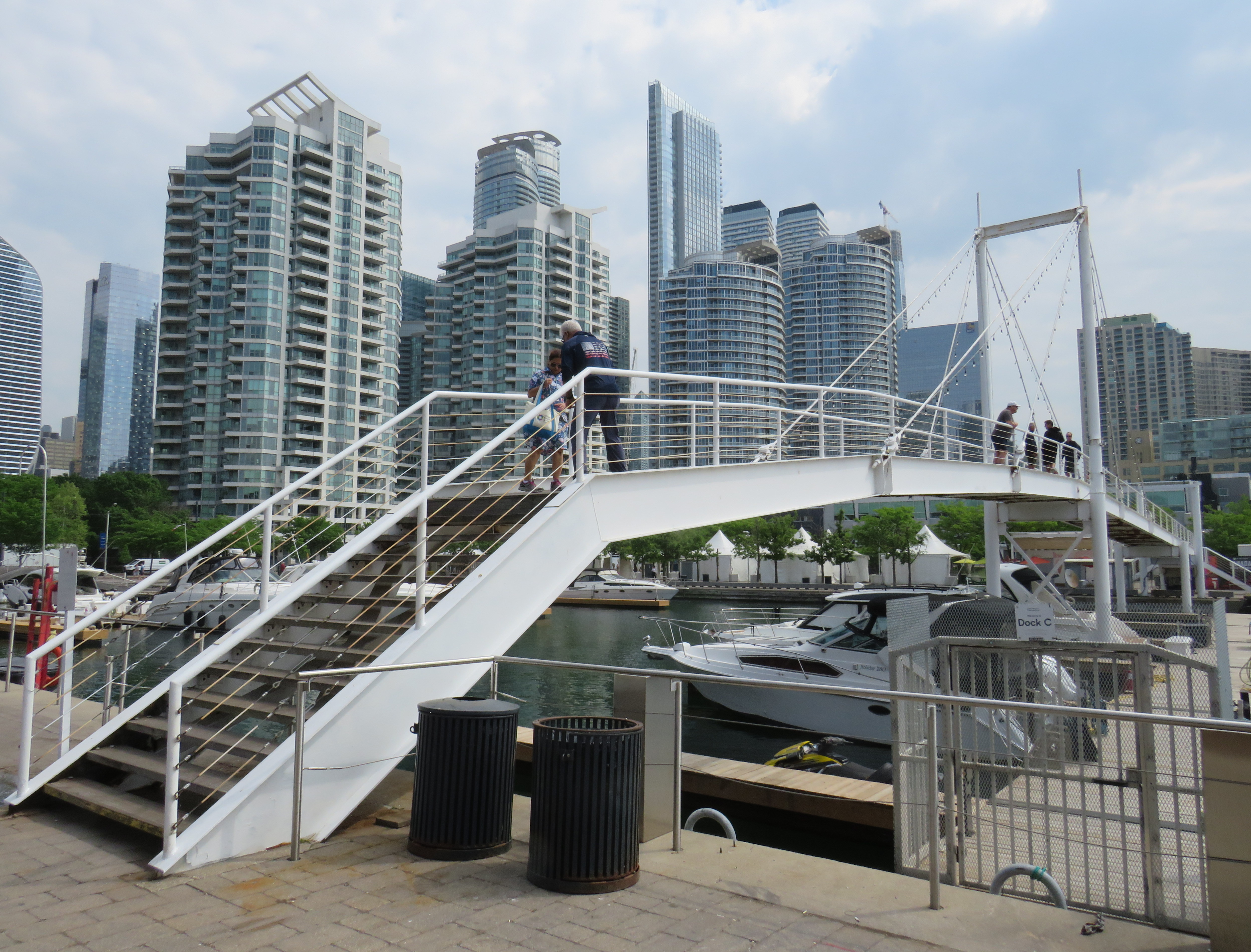
On Sunday, May 31, the Amsterdam Bridge reopened on Toronto’s Harbourfront after being closed for five years. The footbridge, which spans a marina south of Queen’s Quay, is a popular meeting place and photo opportunity, with views of Toronto Harbour to the south and the towering skyline to the north. A gift of the City of Amsterdam, one of Toronto’s sister cities at the time, the bridge was one of the first great public spaces on the waterfront as it was beginning to transition from a derelict industrial space to the city’s new front yard.
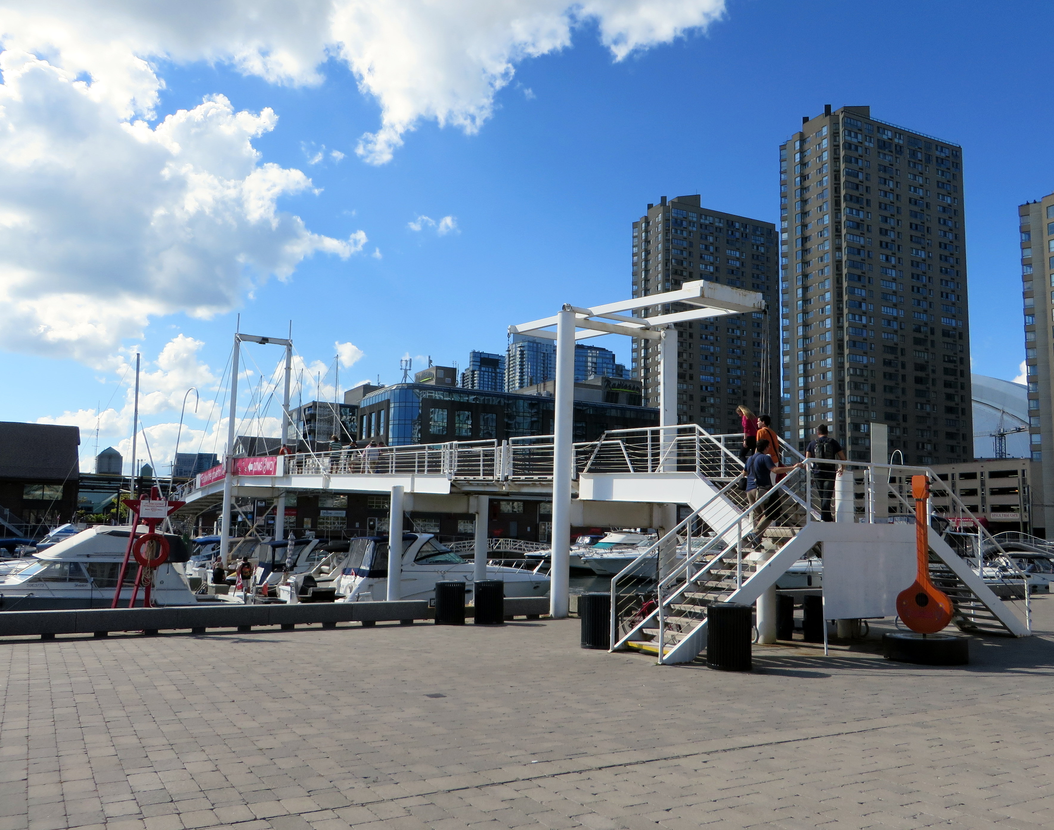
The Amsterdam Bridge in 2014
The footbridge, a cable suspension structure over the marina featured a lifting section on the east side so that tall yachts could moor at the north end of the marina on request, though this was not a regular occurrence. The design mimicked some of the iconic canal crossings in Amsterdam. Sadly, due to neglect, the bridge was closed to pedestrians in 2021 and the lifting section removed.
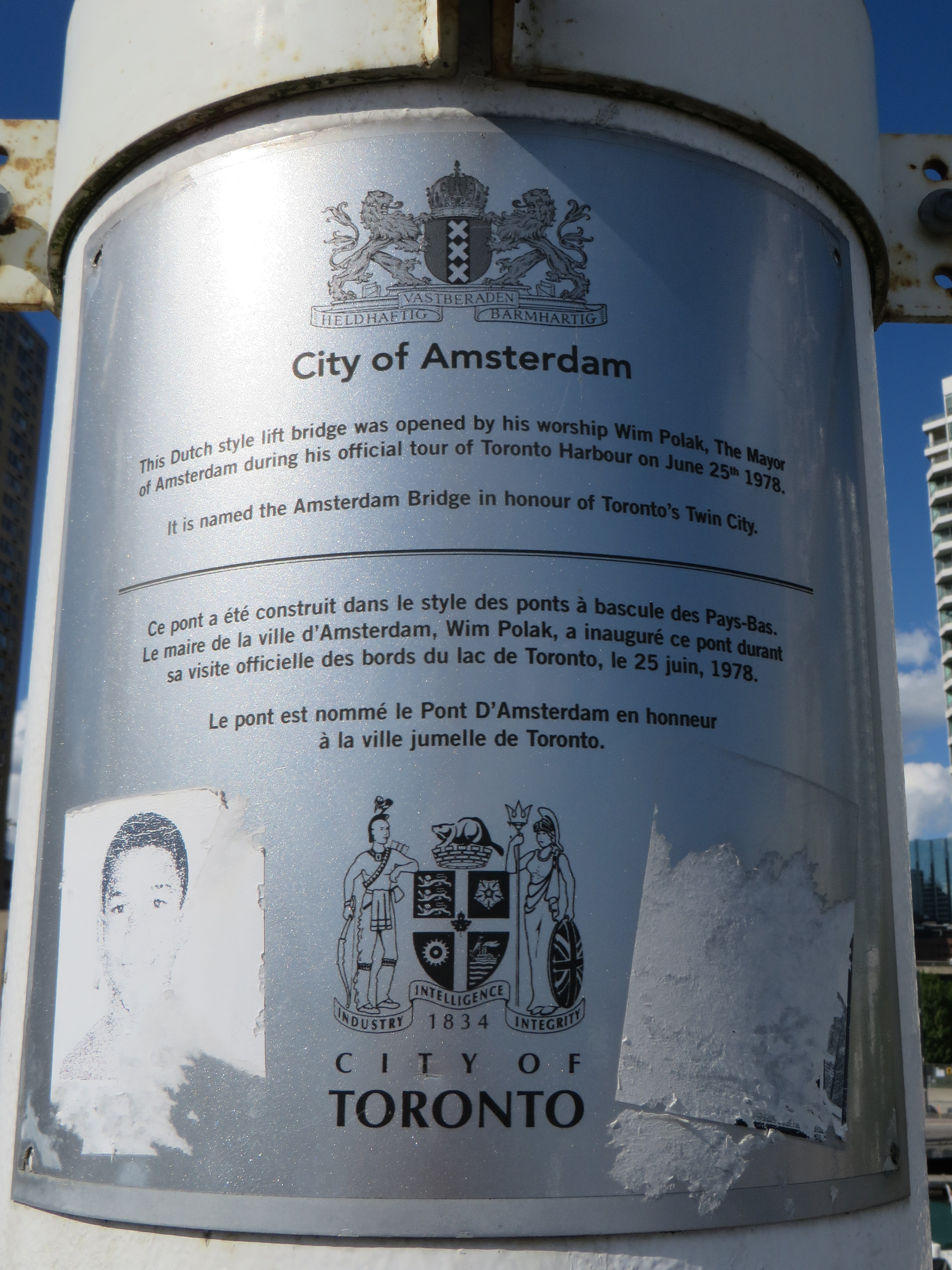
Plaque on the bridge commemorating the opening of the Amsterdam Bridge, a “Dutch style lift bridge” on June 25, 1978 by Amsterdam mayor Wim Polak, taken in 2014. Note the old pre-amalgamation City of Toronto coat of arms below. A replacement plaque with similar text (but with the current post-amalgamation civic coat of arms) since replaced the original.
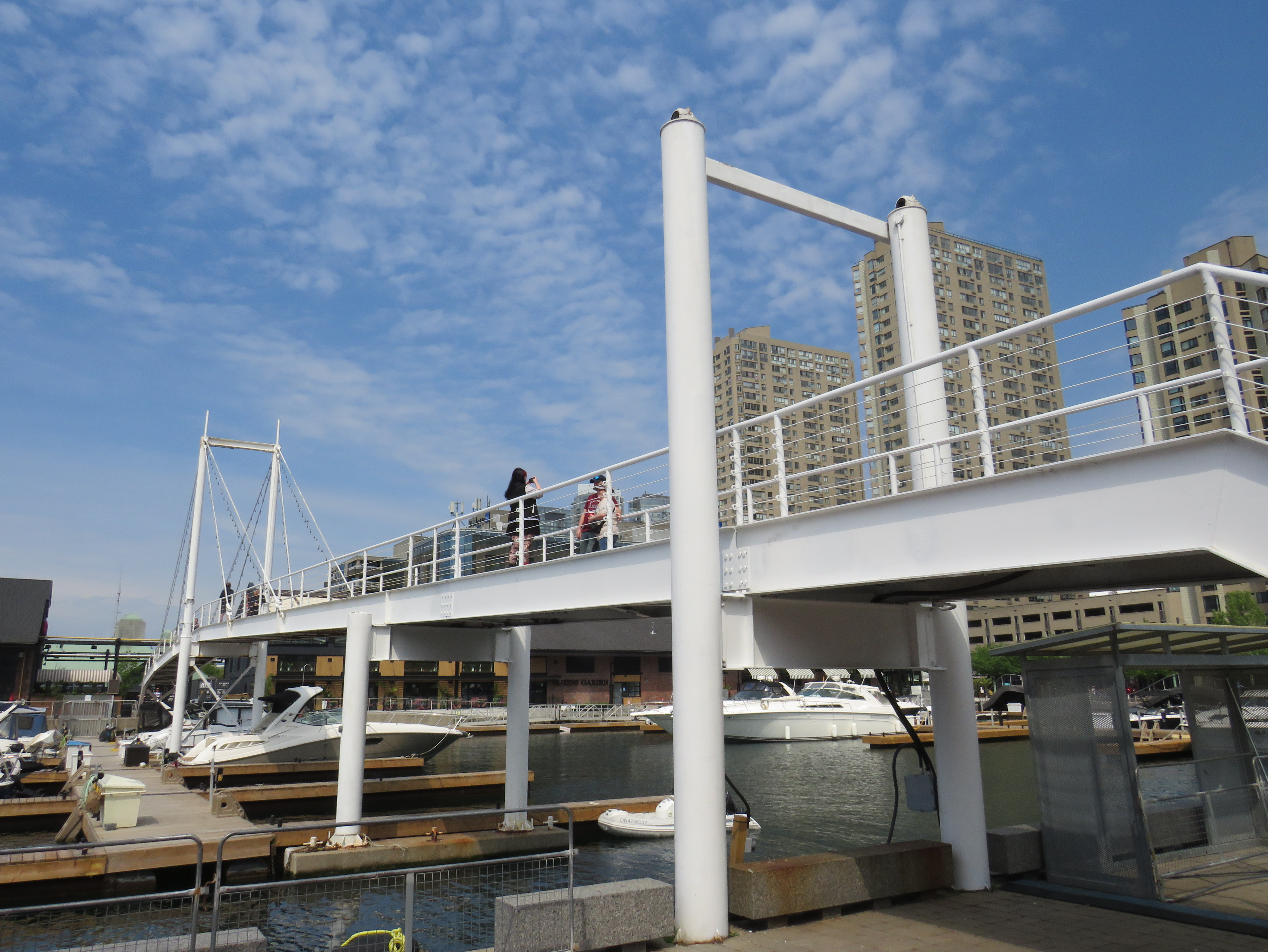
When the bridge reopened in 2026 just in time for Toronto hosting six World Cup soccer matches, the lifting section was replaced by a fixed span. Once again, visitors can climb the bridge, take in the views, and snap great photographs, but the “lift bridge” of the original “Dutch style lift bridge” is no more. It’s a shame too, that it took five years for this fix to even happen; Toronto needs to do better at maintaining its public assets, especially its unusual, fun, and quirky landmarks.
Fixed deck on the Amsterdam Bridge in 2026
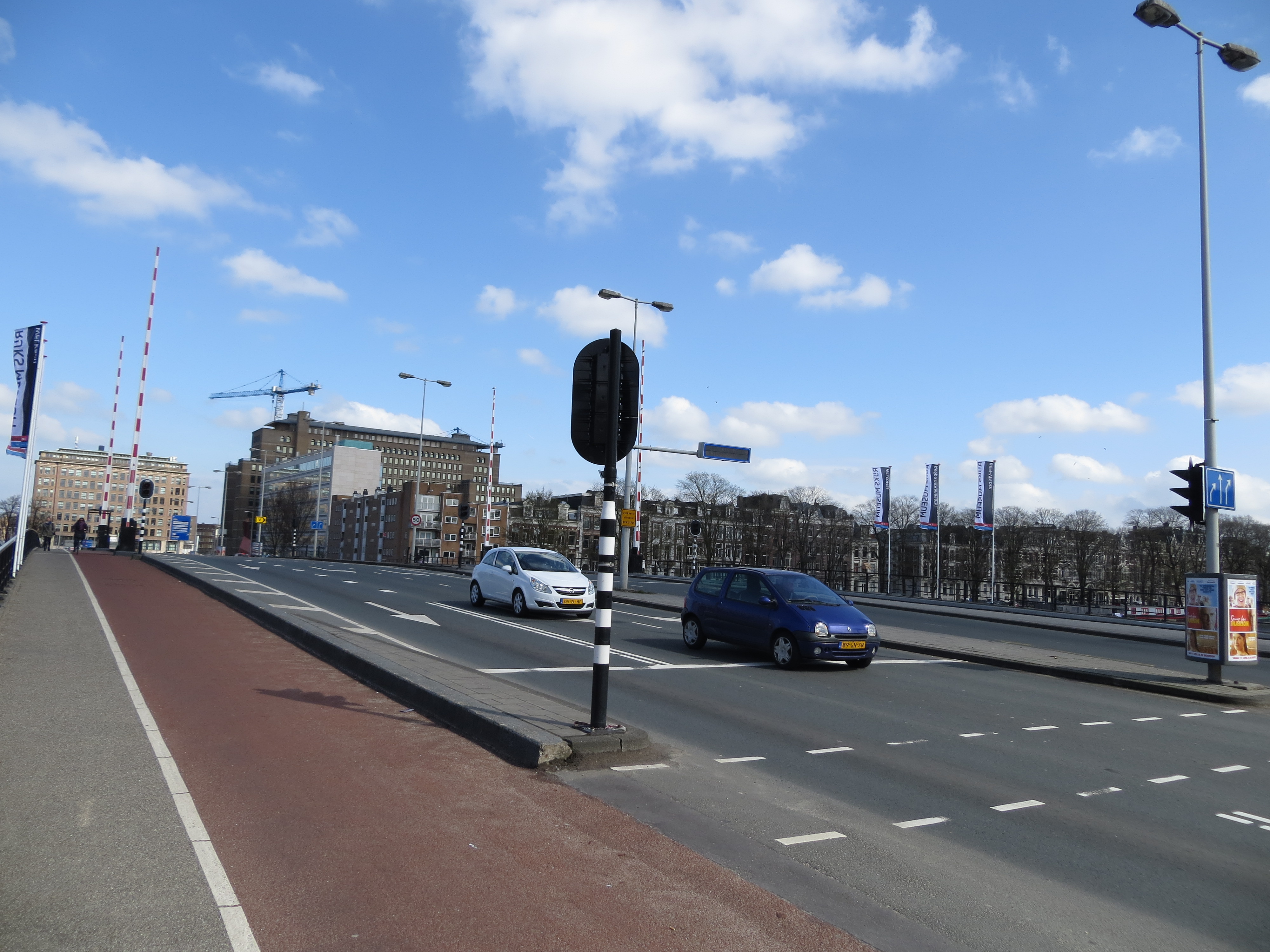
Around the same time Toronto got an Amsterdam Bridge, the City of Amsterdam named a bridge for Toronto. The Torontobrug spans the Amstel River, carrying the busy Centrumring (Central Ring Road). A five-lane traffic artery outside the major tourist areas, the bridge is not iconic by any means (I biked to it during my 2013 visit to Amsterdam) but it is an important road link. There are separated cycle tracks on both sides of the bridge, so it is at least multimodal. The bridge can still open for river boat traffic when necessary.
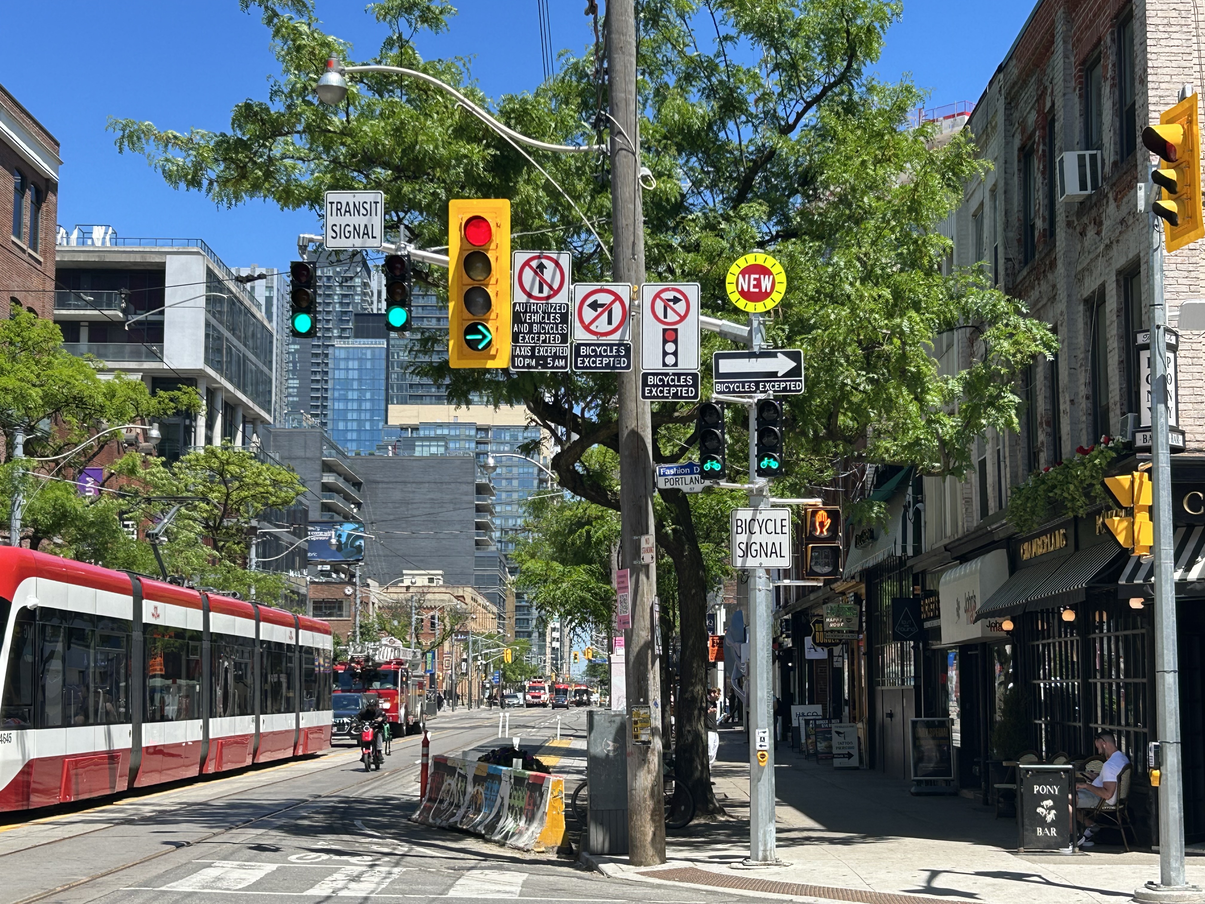
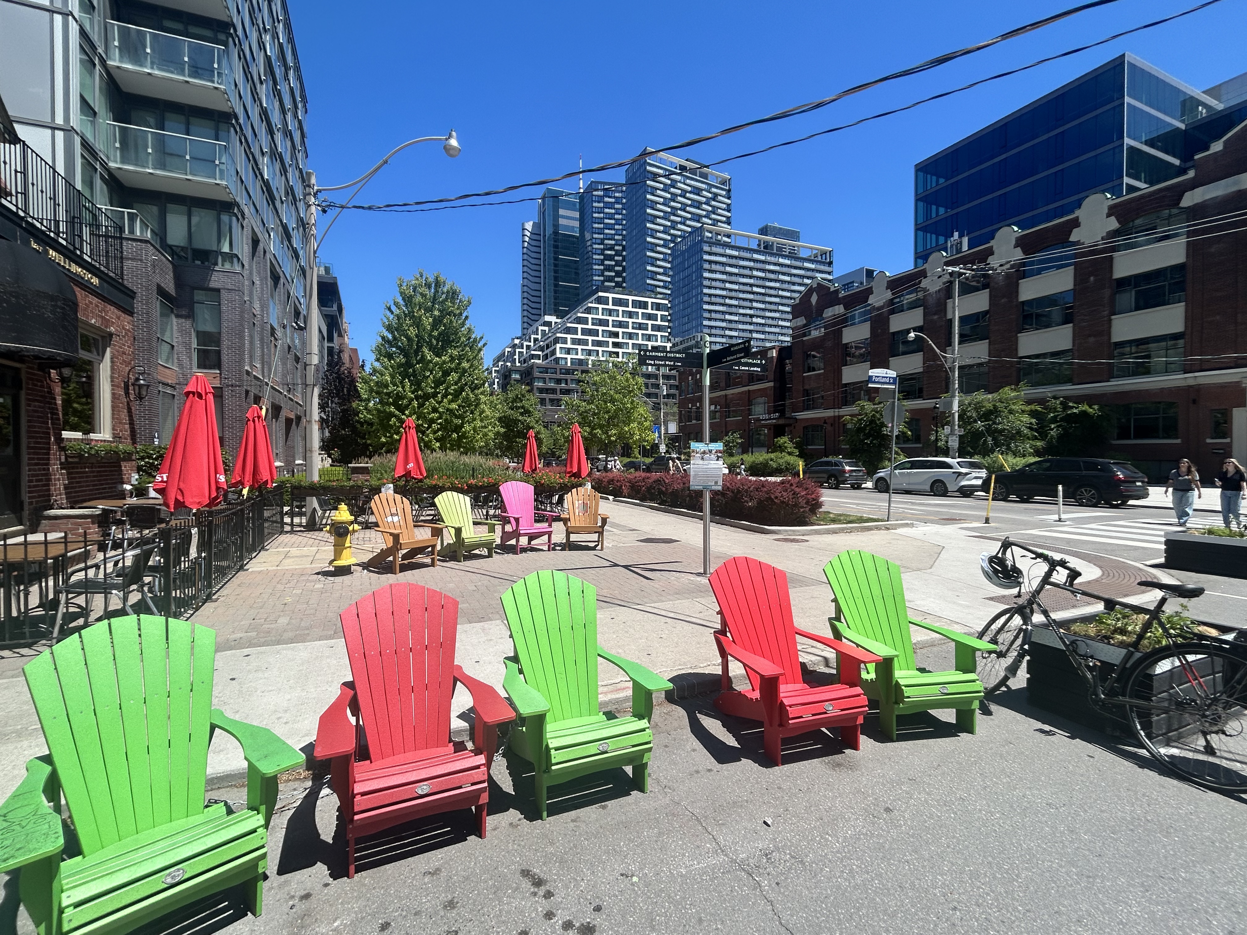
A mess of signs and signals on King Street West at Portland Avenue
On a lovely weekday afternoon in early June, I went for a ride through Downtown Toronto to check out the changes to Portland Street between Richmond Avenue and Front Street. This side street, just west of the downtown core, connects the busy Richmond-Adelaide cycle tracks with the Puente De Luz walking/cycling bridge across the Union Station Rail Corridor to CityPlace and via Dan Leckie Way to the Waterfront.
While the City of Toronto is currently restricted in adding new cycling lanes on major corridors, it continues to piece together alternative routes where possible; Portland Street, which parallels congested Spadina Avenue and Bathurst Street, is one of those opportunities. A new two-way cycle track was opened while most of Portland Street itself is now one-way for motorists.
Looking south at the end of Portland Street towards CityPlace and the ramp to the Puente De Luz Bridge (bridge at far left)
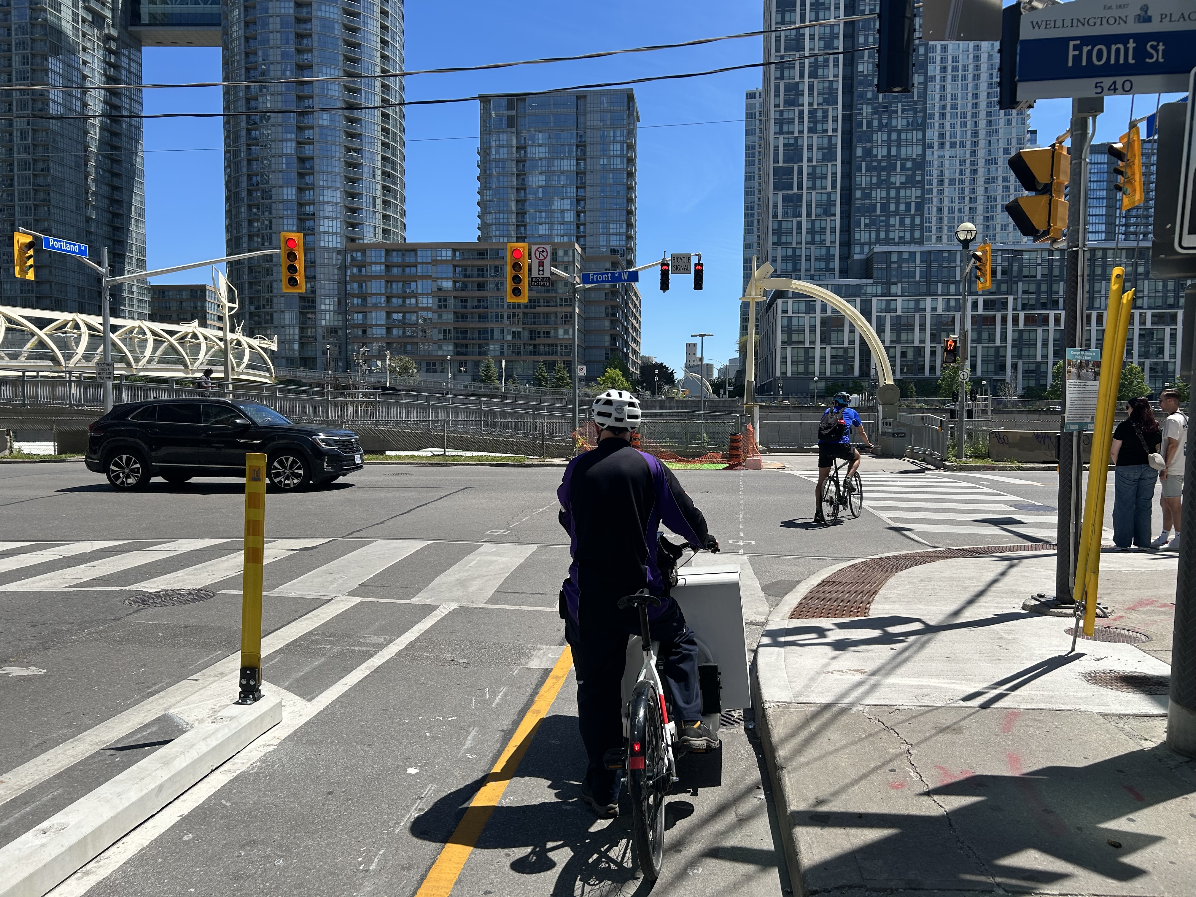
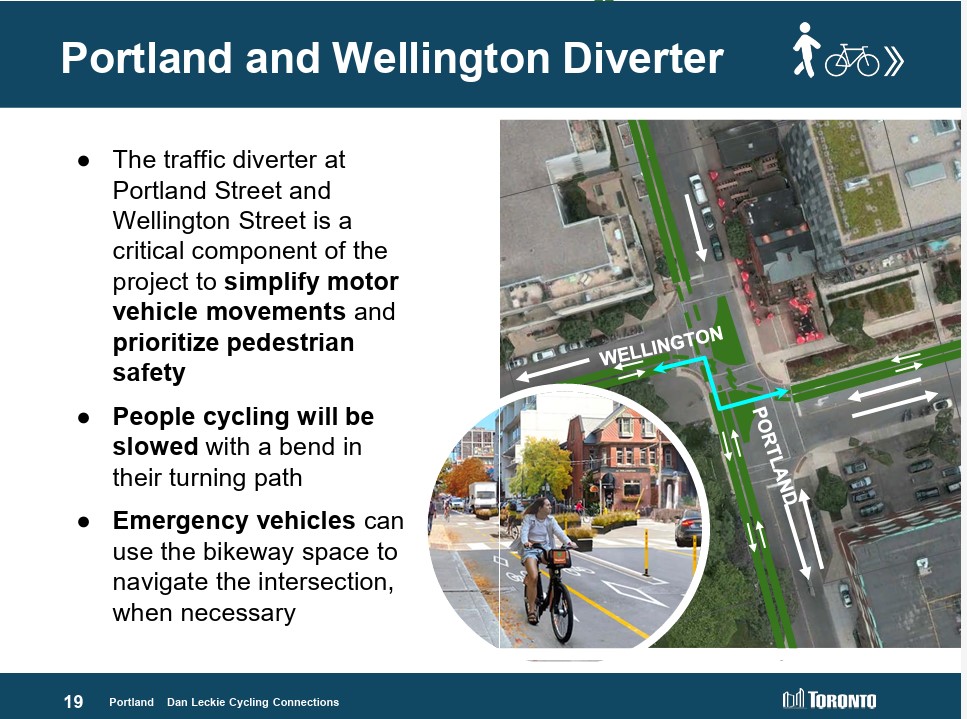
At Portland and Wellington Streets, an interesting new traffic alignment diverts motor traffic around the complex intersection while permitting through cyclist and pedestrian movement on all sides, improving safety for all road users. On Portland Street northbound and southbound, drivers are required to turn right onto Wellington maintaining local access while discouraging through drivers. This new layout, complete with Muskoka chairs laid out in the middle of the intersection is unusual for Toronto and is more common in cycling-friendly cities such as Montreal. Emergency vehicles can still pass through, following the cycling paths.
Wellington Street is a designated east-west cycling route connecting the Downtown Core and west end neighbourhoods like Parkdale and Liberty Village and will eventually hookup with an extension of the West Toronto Railpath. Together with increased density in the downtown area, this intersection will only get busier with cyclists and pedestrians in the future.
Portland looking north at Wellington. Motorists must turn in one direction from Wellington or Portland, opening up the middle of the crossing to a four-way cycling intersection, with planters and colourful Muskoka chairs Comfortable places to sit in the middle of an intersection
Despite the very unToronto urban intervention at Portland and Wellington, a very Toronto intervention continues one block north at King Street. Though the King Street Pilot was launched in November 2017, over eight years ago, little has been done since to improve the street for pedestrians or transit users. To discourage motorists from illegally proceeding through intersections (intended to eliminate congestion for streetcars and buses), the curb lanes are blocked with painted Jersey barriers. More recently, additional traffic lights were installed, so there are now signals for transit, cyclists, motorists, and pedestrians.
At Portland, and every other intersection that drivers are not permitted to go straight (taxi drivers are excepted after 10 pm), the traffic signals remain red at all times. A right green arrow appears for 5-10 seconds at the beginning of the cycle, allowing motorists to turn unimpeded. At Portland, however, eastbound motorists on King may not make a right on red because of the two-way cycle track on the west side of the street. Because of all these restrictions, there are seven signs facing eastbound drivers affixed to the traffic pole, along with two transit signals, one traffic signal, two bicycle signals, and one pedestrian signal.
This could have been clearer
The amount of clutter here can be confusing and is also unsightly. First off, there is no need for the “bicycle signal” sign below the two bicycle signal heads and next to the pedestrian signal. The signal aspects are already clearly for bicycles without the sign. Revising the Ontario Traffic Manual (OTM) to allow red arrows on traffic signals could both simplify the yellow traffic signal here and eliminate the need for the “no right turn on red” sign. It would also be clear then that right is the only permitted sign. Speaking of the OTM, dedicated transit signal aspects such as those used in Europe or even several American cities would eliminate the need for the “transit signal” sign and further reduce confusion. If the late night taxi exception was removed, the “no left turn” and “no straight movement” signs could be consolidated as well.
But most of all, the sign clutter makes it even more clear that the King Street Pilot configuration needs to become permanent, with raised curb extensions at the far sides of each intersection, with a level platform for streetcar boarding. Permanent planters and benches would be a visual cue to drivers that King Street is not a throughfare, but a pedestrian and transit-first corridor.
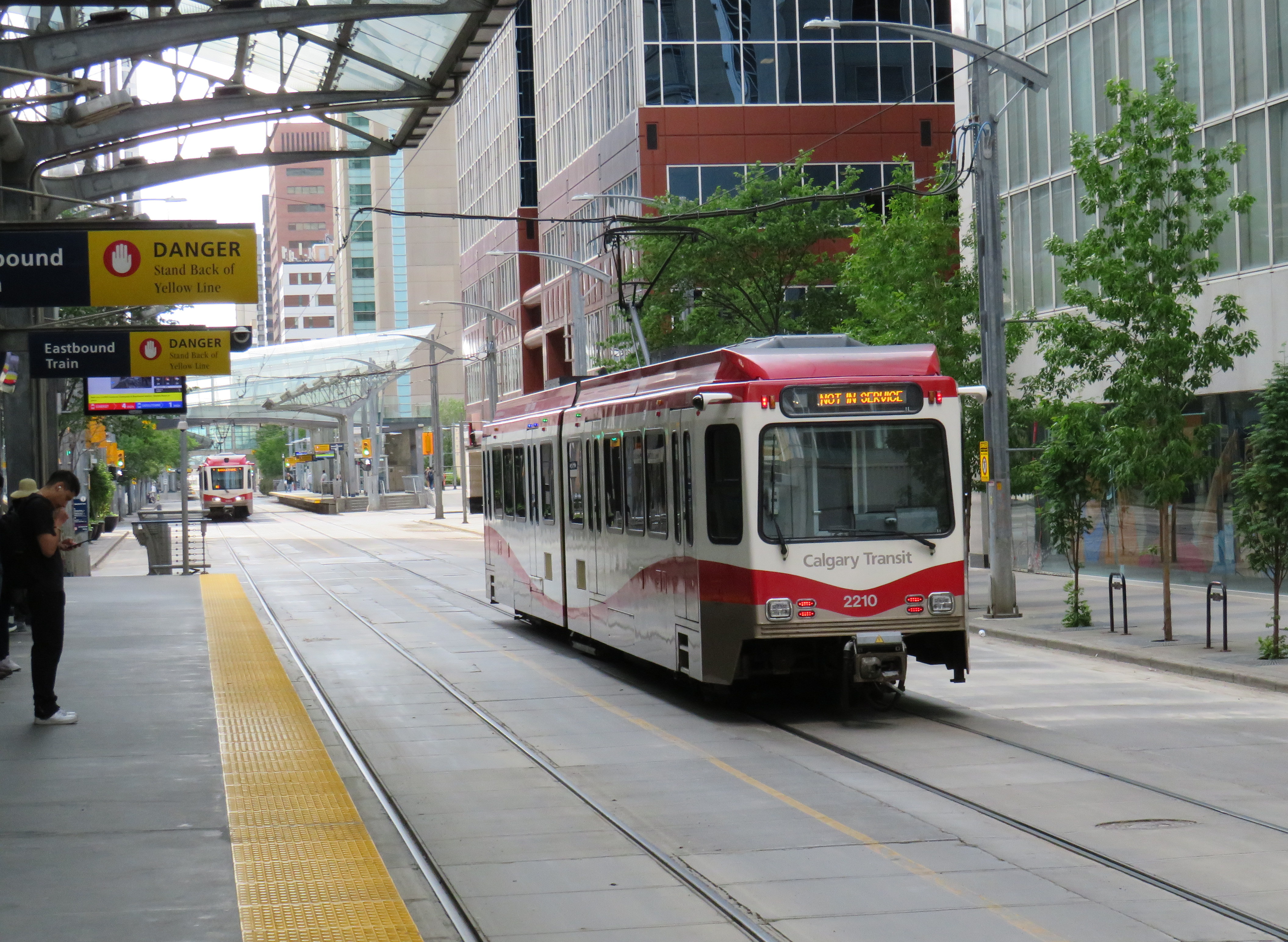
There is a lot less sign clutter along Seventh Avenue in Calgary, which is exclusively a transit and pedestrian corridor
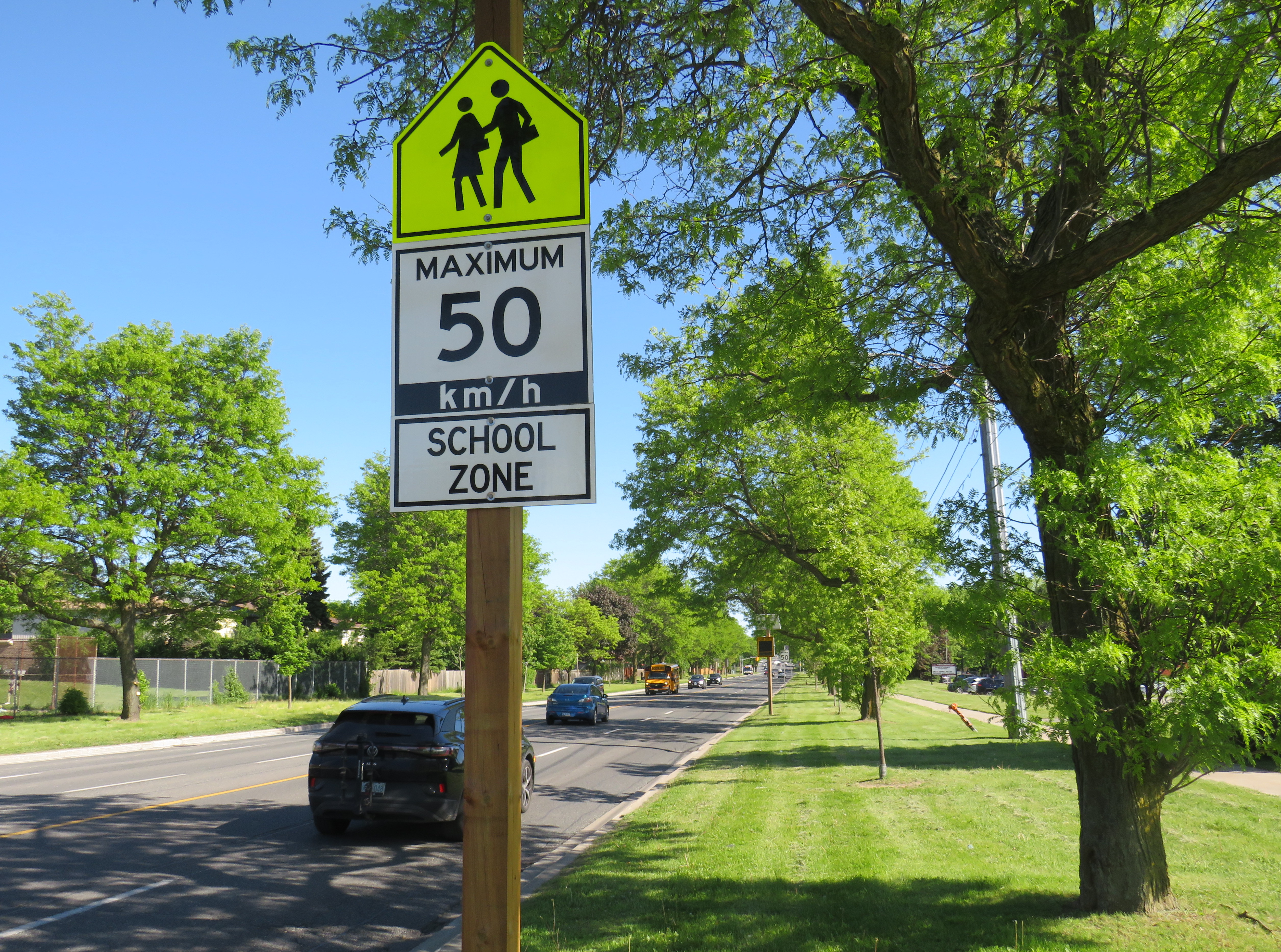
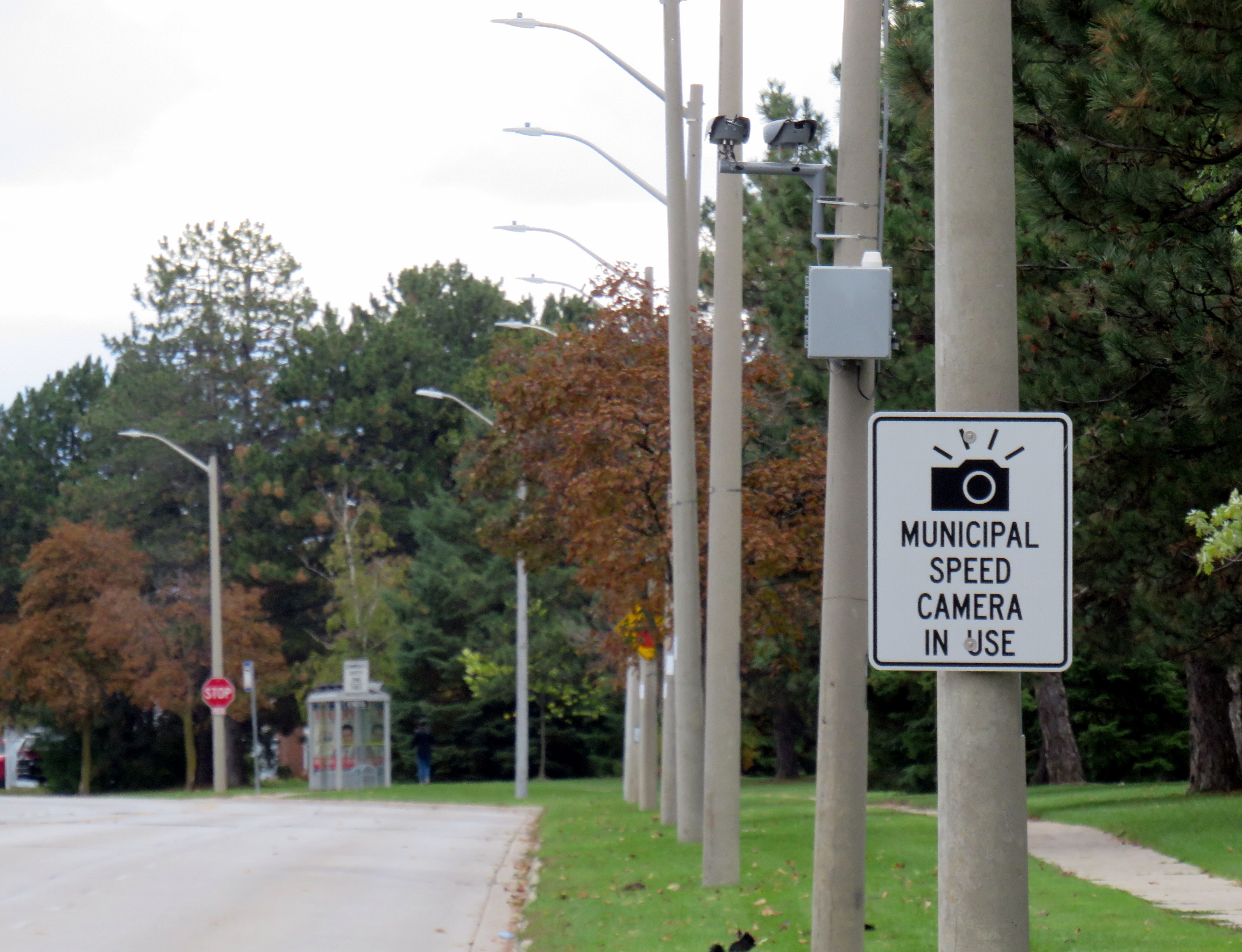
A gigantic school zone speed limit sign on McCowan Road in Scarborough
Months after Doug Ford’s provincial government banned the use of municipal speed enforcement cameras, calling it a “cash grab,” new supersized school speed zone signs are going up across the province. The first ones I encountered are on McCowan Road in Scarborough, near my spouse’s family home.
The signs, placed near St. Ignatius of Loyola Catholic School south of Finch Avenue, are gigantic: nearly 2.5 metres tall, mounted over three metres above the ground, affixed to an extra large wooden pole as the new signs were too big for the standard metal poles used for that purpose. The province delivered 80 signs to the City of Toronto, but with four signs per school zone (two mounted in each direction including advance warning signs), that meant only 20 schools would get these new totems.
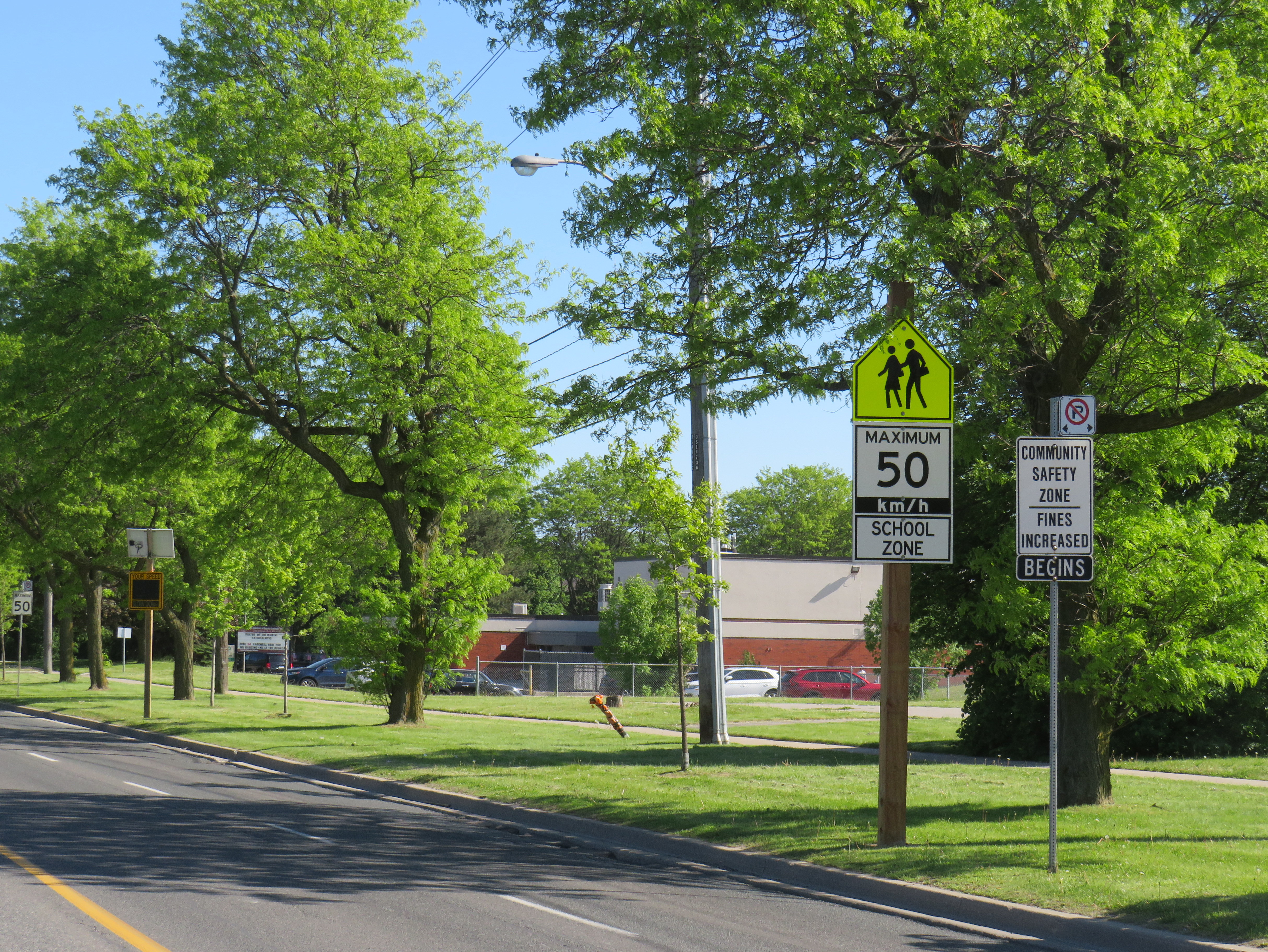
The new supersized school zone sign next to an older “community safety zone” sign, affixed to a standard metal sign pole
Before the pro-driver legislation was enacted on November 14, 2025, there was a speed camera placed on McCowan Road adjacent to the elementary school, one of 150 located in the City of Toronto. Under provincial law, municipal speed cameras were only allowed to be installed in specific designated safety zones, namely roadways adjacent to schools, parks, or seniors’ residences, and had to be accompanied with advisory signage.
Between April 2024, when the camera was activated, and July 2025, when the camera was destroyed (one of many vandalized that year), over 19,000 speeding motorists were captured by the photo camera travelling at least 11 km/h over the posted speed limit. This was despite the existing maximum speed, school zone, community safety zone, and municipal speed camera signs on this stretch of road.
Sign warning of a municipal speed camera in Brampton in October 2025
Despite the high number of infractions, the cameras were doing their job; a job that the Toronto Police isn’t motivated — or able — to do. As seasoned municipal watcher Matt Elliot points out, for period between January 1, 2025 through November 14, 2025 (when camera enforcement was forced to end), 628,165 speeding tickets were issued through the automated speed enforcement program. Toronto Police’s “Vision Zero” traffic unit issued just 14,500 tickets.
New city report notes the Toronto Police Vision Zero Enforcement Team handed out about 14,500 speeding tickets in 2025. Might sound like a lot, but well, compare and contrast.
Despite all those tickets issued, the cameras were especially effective at reducing speeding in school zones. A 2025 Toronto Metropolitan University/SickKids Hospital study found that speed enforcement cameras reduced speeding by 45 per cent and reduced speeds by most drivers by more than 10 km/h.
Active police enforcement remains a valuable tool because officers can lay charges that automatic speed cameras can not catch, including distracted, impaired, and dangerous driving. But policing has a dark history of racial profiling and has a pro-motorist “windshield bias,” while speed enforcement and red light cameras do not discriminate.
Furthermore, North American roads are designed for excessive speed and not for the safety of vulnerable road users. We rely on signs to advise motorists of how we expect them to drive, rather than road design that requires attentive and slower driving. Speed cameras were a useful stopgap that worked a lot better than signage.
So, the new supersized signs going up are not a solution to unsafe driving: they are just another mere indication that children, seniors, and all pedestrians and cyclists don’t really matter, especially to politicians like Doug Ford.
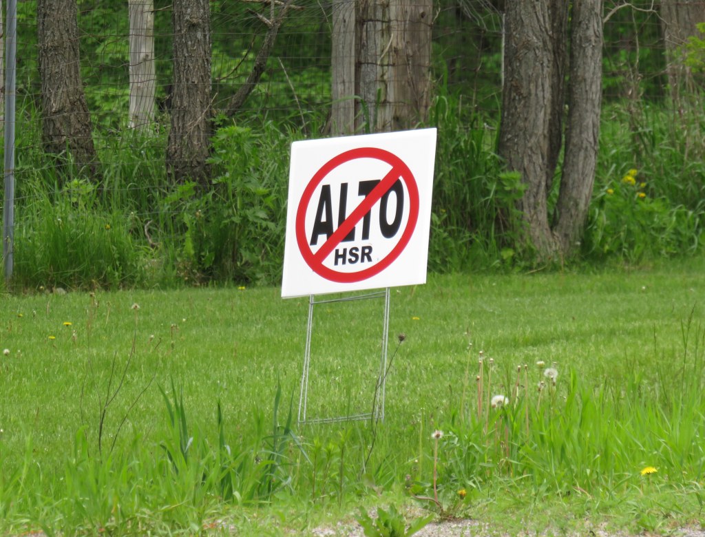
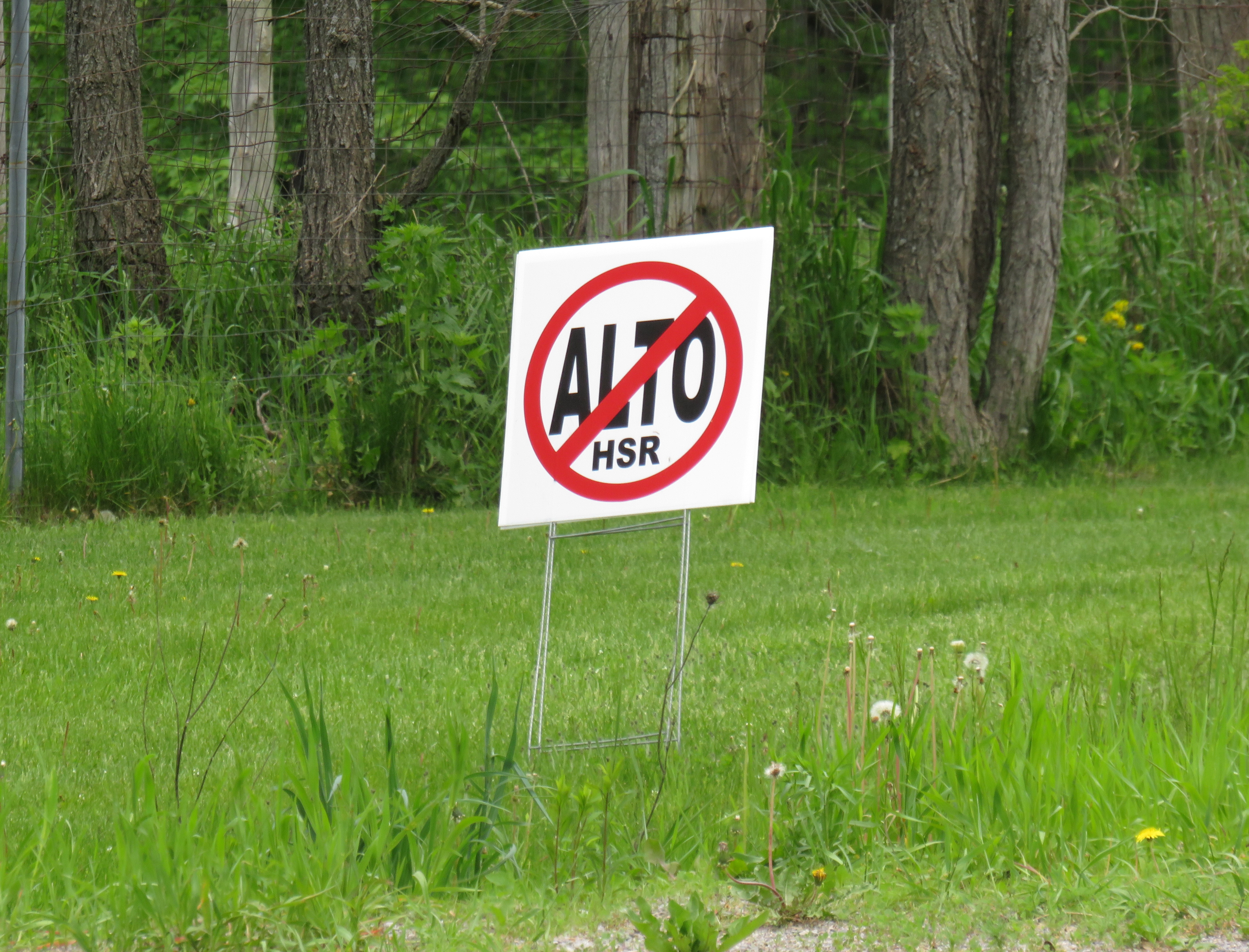
A “No ALTO HSR” sign on a property near Marmora, Ontario
There’s a running joke that Canada leads the world in high speed rail studies, but we never follow through with actually building those high speed lines. Comedian Rick Mercer had at least two sketches on his old weekly CBC television show mocking this state of affairs, as the idea goes back to the 1970s.
“VIA Rail: Yesterday’s speeds, today.”
“Canada’s High Speed Rail Study Industry: The future, never!”
In 2026, however, Canada is finally past the high speed rail study phase and appears to be committed to building the seven-station corridor between Toronto, Ottawa, Montreal, and Quebec City, with a consortium selected that is already planning the detailed route. It’s an exciting time as the first phase, between Ottawa and Montreal, should start construction in three years once the exact corridor is decided upon and land acquisition has begun.
High speed rail, if done right, should benefit Eastern Canada as a whole. Fast and frequent train service will divert a lot of the travel in the busy Toronto-Montreal-Ottawa triangle from the air, reducing emissions and allowing existing airports to handle any increases in long-haul demand. Faster and more reliable passenger train service would also take traffic off the highways and boost commerce within the most populated part of the country. If done right, it will also support plans for better transport infrastructure outside the corridor to Southwestern Ontario and provide Canadian expertise for other projects such as in Alberta, which is contemplating its own passenger rail network between Calgary and Banff and north to Edmonton.
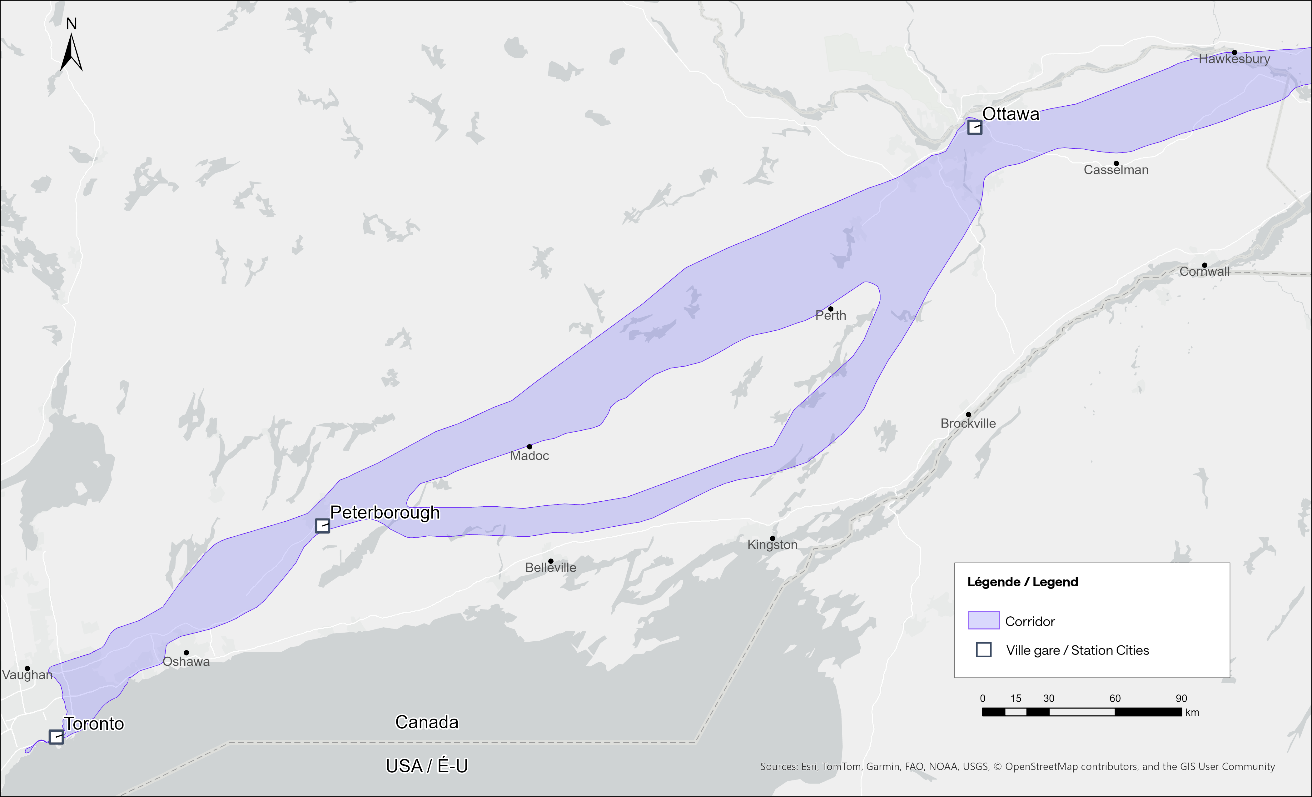
Map of potential routings for the Alto high speed line in Ontario
Not unexpectedly, there is opposition from residents and landowners along the route, especially in Eastern Ontario and the area of Quebec just northwest of Montreal. In Hastings County, north of Trenton and Belleville, there are a few dozen “No Alto HSR” signs on lawns and farms in places like Madoc, Marmora, Stirling, and Tweed. In this part of Ontario, between Peterborough and the Rideau Lakes region southwest of Ottawa, there are two broad potential routes: a southerly corridor runs near Campbellford, Stirling, Tweed, and Westport, including through some productive farmland in Northumberland and Hastings Counties. A second route runs north of Highway 7, just north of Madoc and Perth, along the southern fringes of the Canadian Shield.
Though a high speed railway line would be straight and relatively narrow, it would require the acquisition and severance of hundreds of properties. Along the existing CN and CP railway corridors to the south constructed in the 1850s and 1900s, there are frequent public road and private-access level crossings, something that is not possible with modern high speed trains passing at up to 300 kilometres per hour, so farmers whose land is crossed by the new high speed railway corridor may not be able to access parts of their property easily. Furthermore, there are no stops planned between Peterborough and Ottawa, a distance of over 250 kilometres.
In Prescott & Russell Counties in the Lower Ottawa Valley, even the local governments are opposed to Alto crews doing early survey work to determine an optimum route, with county warden Mario Zanth clear on the matter: “This council does not want them on our territory.” For now, Alto surveying is mostly done by way of drones over land where landowners have not granted access.
Once a more specific route is selected, hopefully some of the opposition will fade. Detailed design work and further consultation should also help mitigate concerns. This is especially important west of Ottawa, where there are the two diverging routes.
Despite the rural opposition, Alto should go ahead. Other major infrastructure projects, especially new highways, can be far more disruptive to local land use. But without local community benefits — at least a new freeway has regular access points — it will be harder to get buy-in.
Therefore, this needs to be a matter of “Alto and” than just “Alto” by itself. This means building and maintaining a supporting network of conventional VIA service, intercity and regional buses, and local transit connections. It might also mean adding a few additional stations along the route, in places such as Perth. Adding additional stops doesn’t have to slow down trains at all; Japan’s Shinkansen has three classes of trains, from the super-express Nozomi to the all-stops Kodama. While most passengers would be through Toronto-Ottawa-Montreal travellers, offering additional stops for select trains can make Alto more accessible to more people, especially if it means providing new options to underserved communities.
An express train passes the local Odawara Shinkansen Station in April 2019
If Alto becomes the backbone of a strong, integrated transportation network in Ontario and Quebec, the benefits will go far beyond those in the six cities directly served the planned high speed line, even to those directly bypassed by Alto trains. This integration is commonplace in Japan and Europe.
In Kingston, for example, a new or upgraded VIA station with additional tracks and platforms would allow for early morning departures and late evening arrivals from Toronto, Ottawa, and Montreal without having to sit on active CN freight tracks overnight; VIA schedules built around serving cities like Belleville, Kingston, and Drummondville would ensure the existing service remains vital as through passengers switch to the faster line. A new Kingston station near Division Street could integrate rail and bus services, with easy access to Highway 401, with local and regional buses to places like Gananoque. Enhanced bus connections to the rest of the Ottawa Valley from the Ottawa Alto/VIA Station could allow travelers from Pembroke, Arnprior, or Hawkesbury to quickly continue their journeys via train. At Trois-Rivières, there should be seamless connections to places like Shawinigan and Victoriaville. The Canada Intercity Transportation Map on this website shows which communities are unserved or underserved by bus and rail: these include many towns in Southern Ontario and Quebec that are within 100 kilometres of the Alto corridor.
Canada is right to invest in high quality and sustainable transportation infrasturure as a nation-building project, to boost the regional and national economy, and promote environmentally friendly travel options. But focusing only on Alto, without a strategy of leveraging the conventional VIA network and intercity bus connections to feed that network, can only limit the success of high speed rail. The communities in between deserve better.
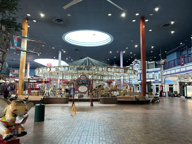
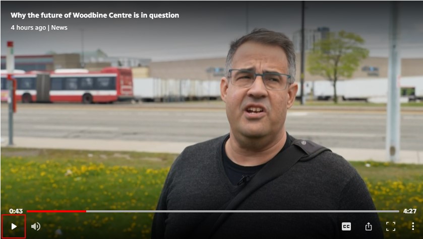
You can catch me on CBC Toronto today talking about the history of Woodbine Centre and Fantasy Fair with reporter Nav Nanwa. The CBC television report has some pretty good drone shots of the mall as well.
Here’s me standing in front of Highway 27 and the trailers stored in the old Sears parking lot
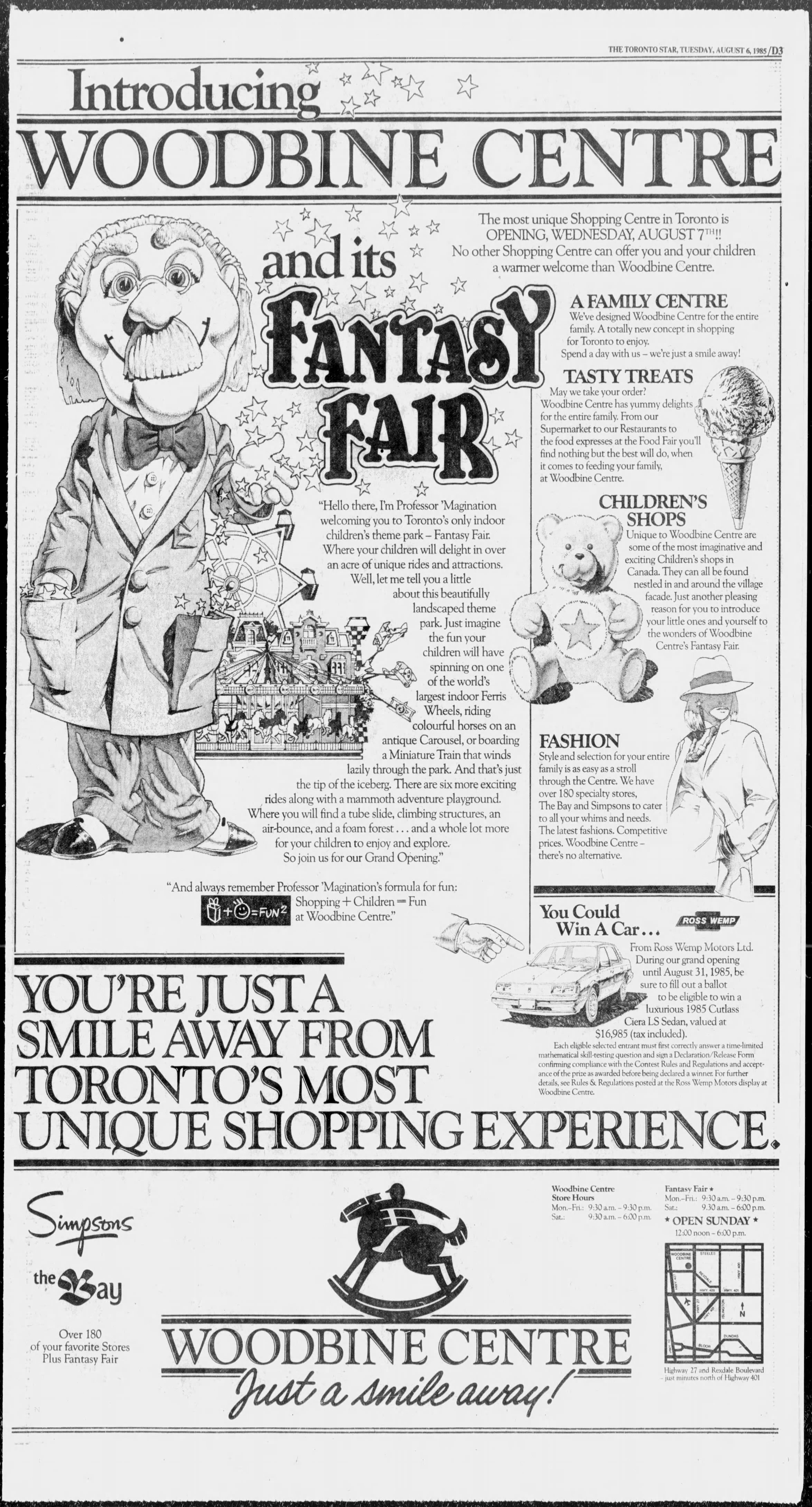
I wrote more about the history of Woodbine Centre in November 2024, which you can read here. Looking for reports of the mall opening from 1985, I found this full page ad in the Tuesday, August 6, 1985 edition of the Toronto Star.
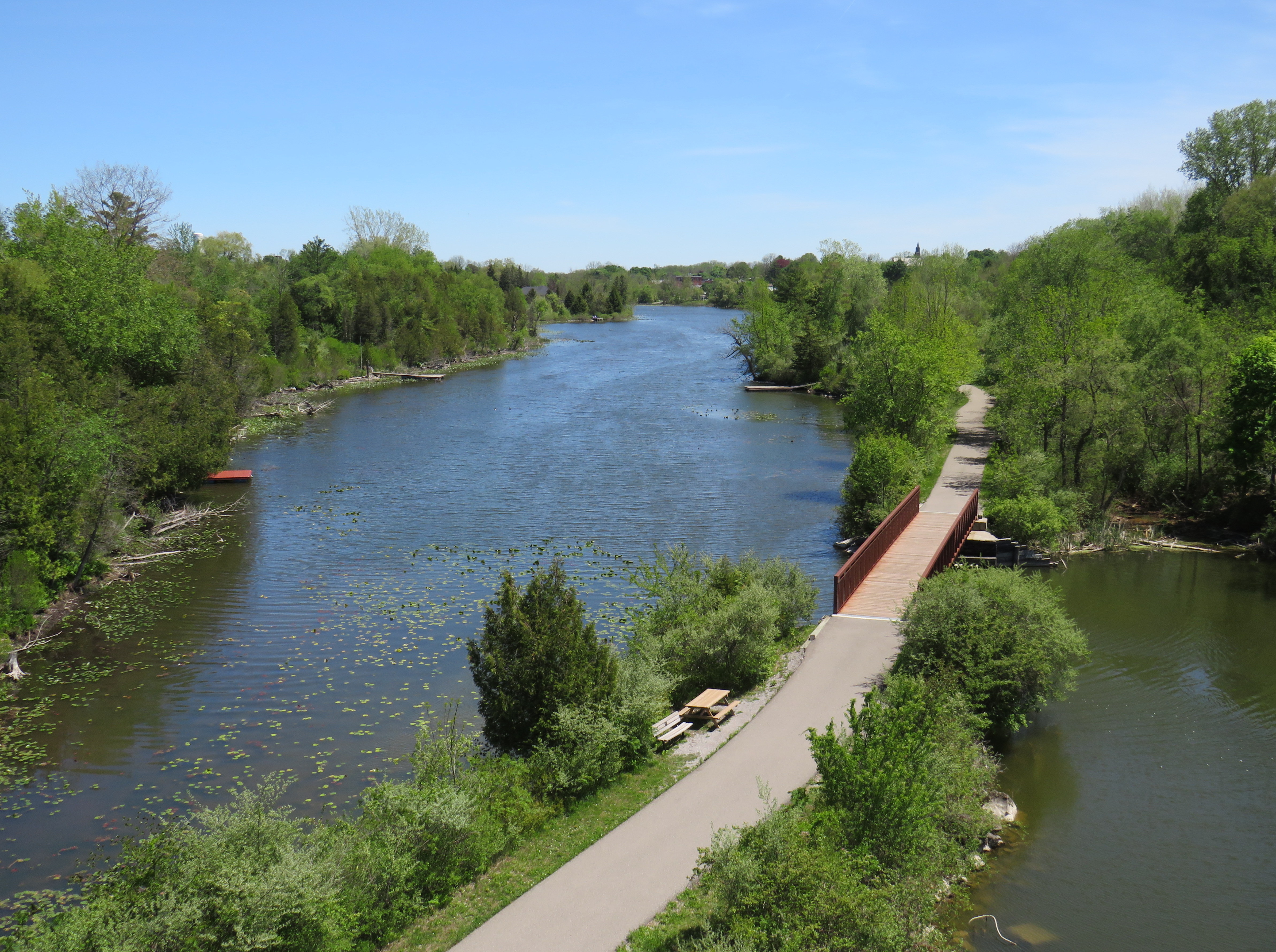
Looking down from the Black Bridge on the Norfolk County Trail to Shadow Lake and Waterford Ponds in May 2026
On a beautiful May Thursday, I met one of my colleagues in the village of Waterford. As he is now living in Port Rowan on Lake Erie, this was an opportunity for us to get some important work done, while also exploring one of Ontario’s great small communities.
Though the local area was settled over 200 years ago, Waterford was established as a thriving village with the arrival of the Canada Southern Railway (CASO) which was eventually incorporated into the giant New York Central system. The route through Canada, with its divisional headquarters in St. Thomas, was the fastest line between Buffalo, Detroit, and Chicago. It was joined by the Toronto, Hamilton & Buffalo (TH&B), which connected Hamilton and the Canadian Pacific Railway with CASO at Waterford and at Welland. In 1916, the electric Lake Erie & Northern (LE&N) Railway, another Canadian Pacific property, provided regular freight and passenger service between Port Dover, Brantford, and Kitchener. By the 1990s, all three railways were abandoned, but their former rights-of-way remain in active use as part of the local trail network.
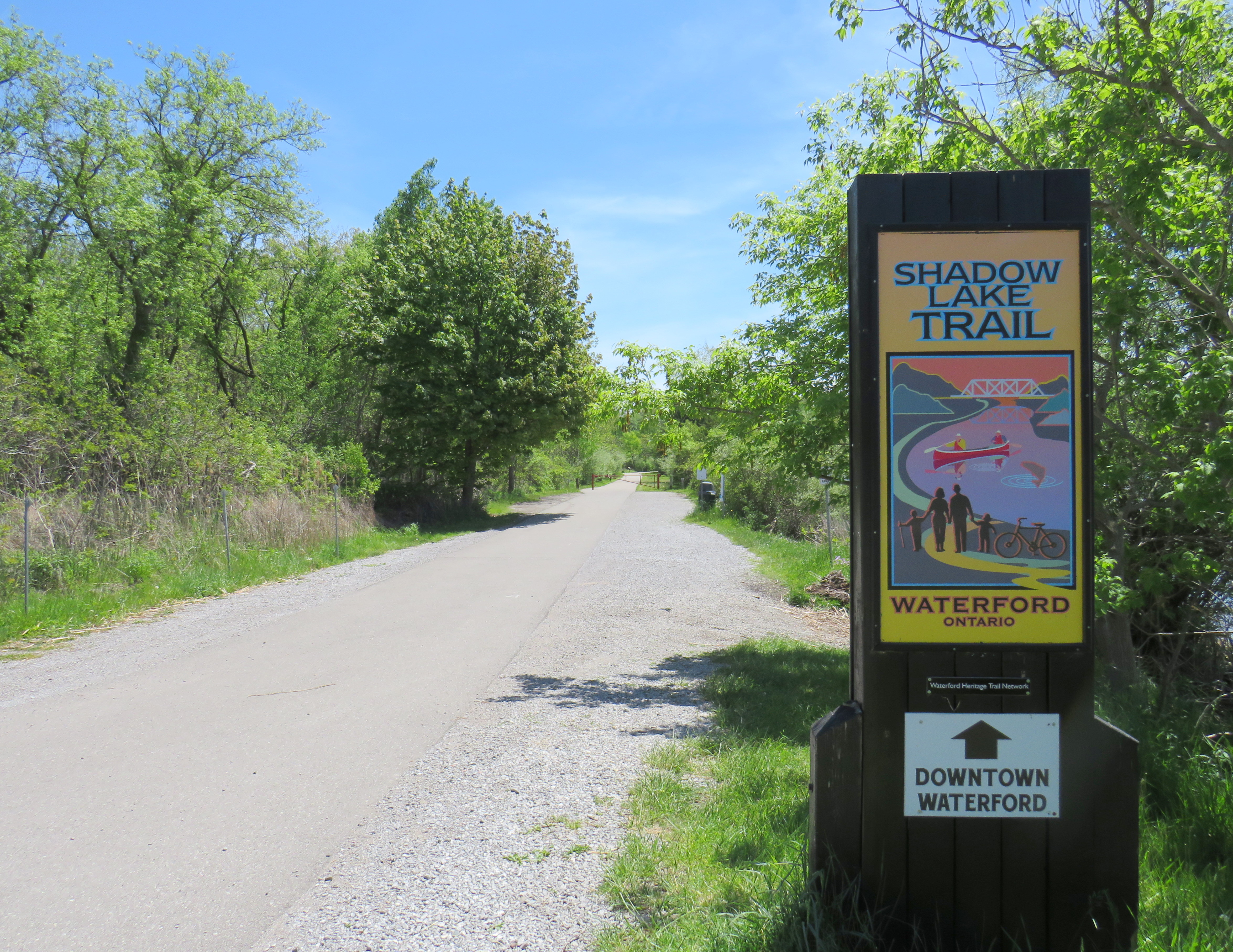
Take the Shadow Lake Trail to Downtown Waterford
The large system of ponds around Waterford, popular with birds, boaters, and anglers, are artificial. Shadow Lake was a millpond created by damming Nanticoke Creek. When constructing its railway, CASO found the sand and gravel deposits in this area irresistible for exploitation; the gravel was first used for railway ballast; larger aggregate pits created new ponds to the west.
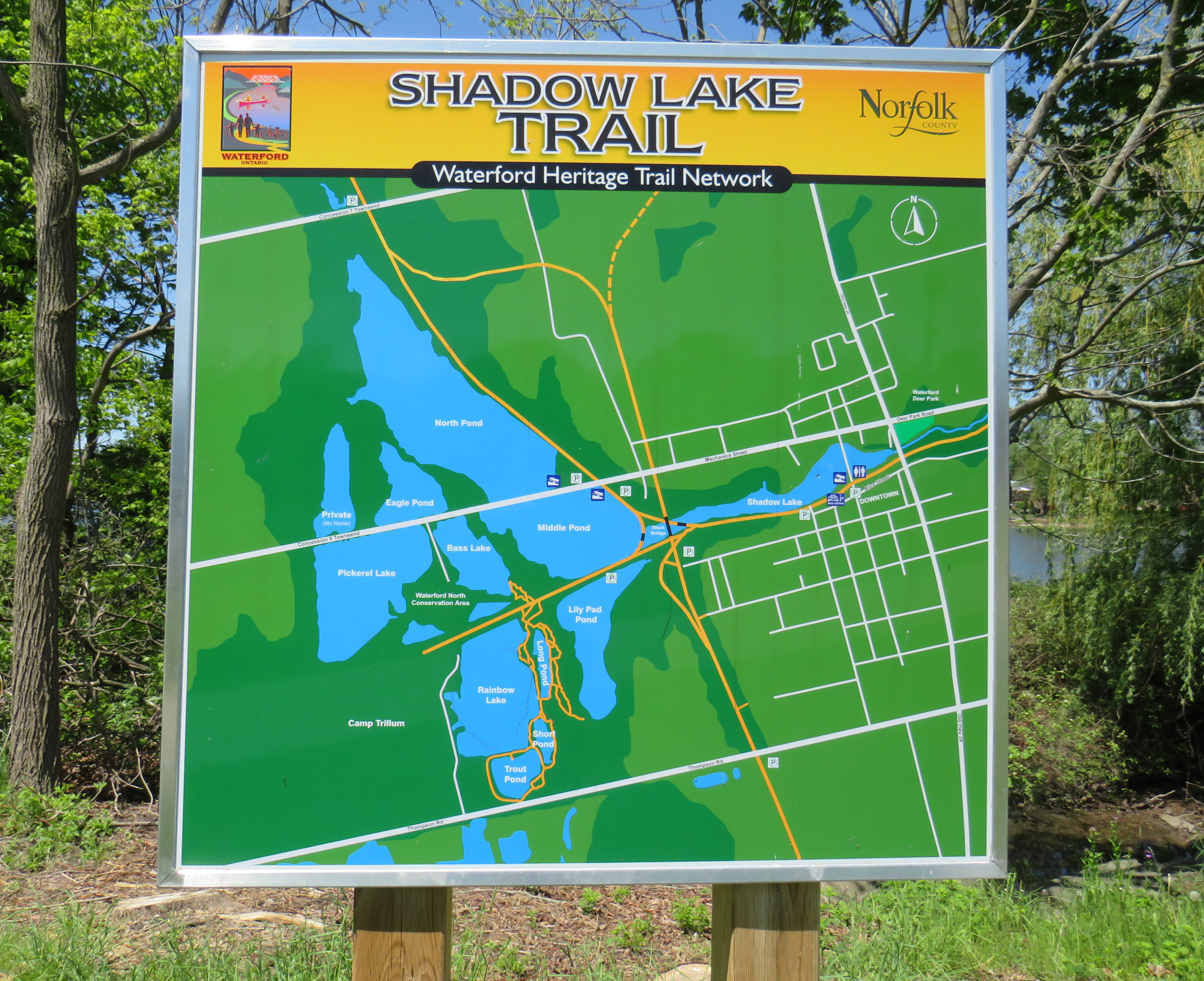
Map of the Shadow Lake Trailand connecting trails in Waterford, along with the extensive ponds surrounding them
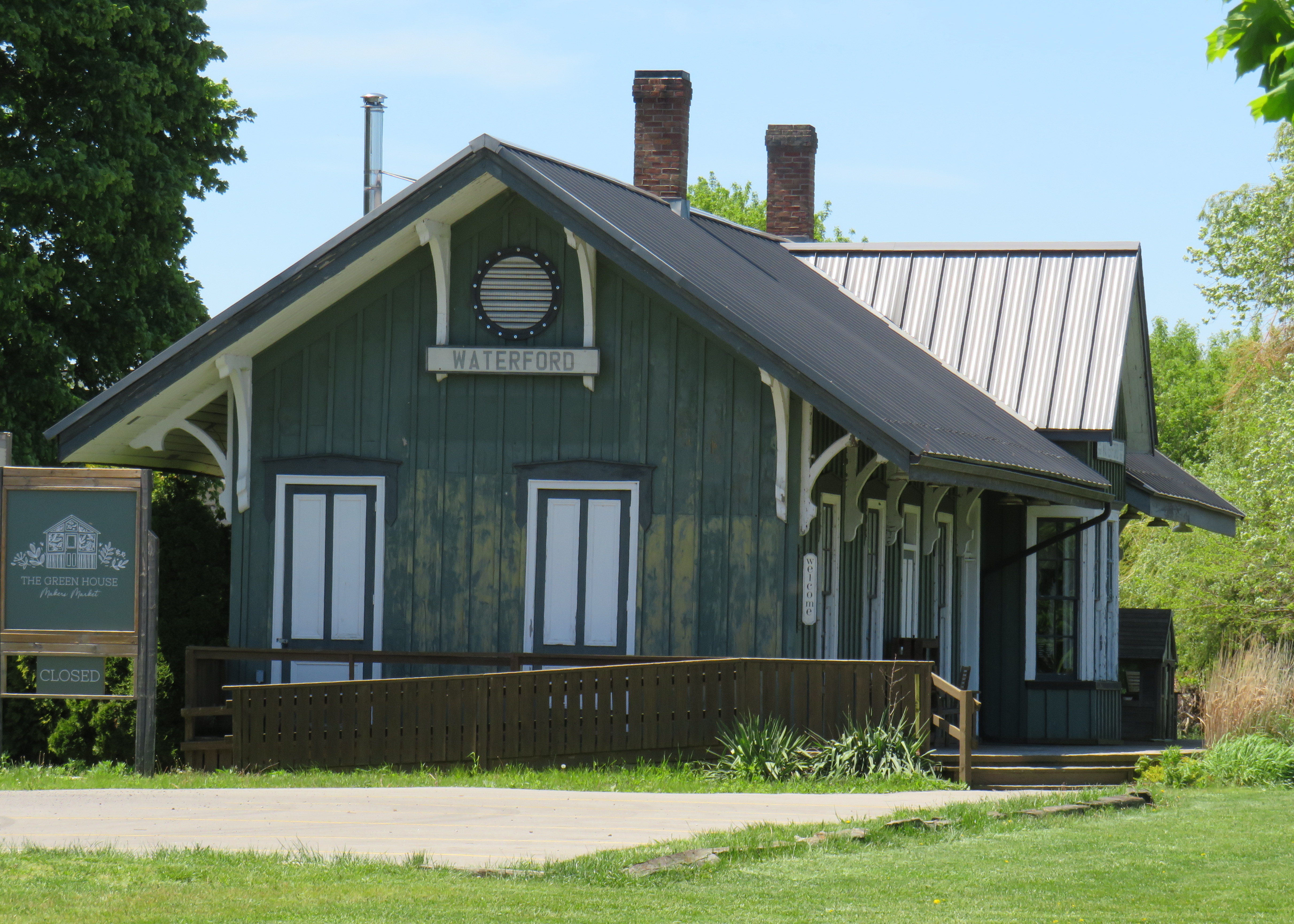
The former Canada Southern Railway Station, which also served the TH&B, still stands, and has recently been home to an artisan market. Sadly, the LE&N station was demolished in the 1970s.
Waterford CASO Station
Despite the loss of the railways and the LE&N station, the railway rights of way are fully intact within the village area and have been converted to trails. Within Waterford, the east-west Shadow Lake Trail follows the former CASO route between the Waterford Conservation Area to the west and Lingwood Park to the east, though it is not part of a continuous trail system across southwestern Ontario. Only short sections within Waterford, Tillsonburg, St. Thomas, and Essex are open to the public; most of the old railway corridor was sold off to local landowners in the late 1980s and early 1990s.
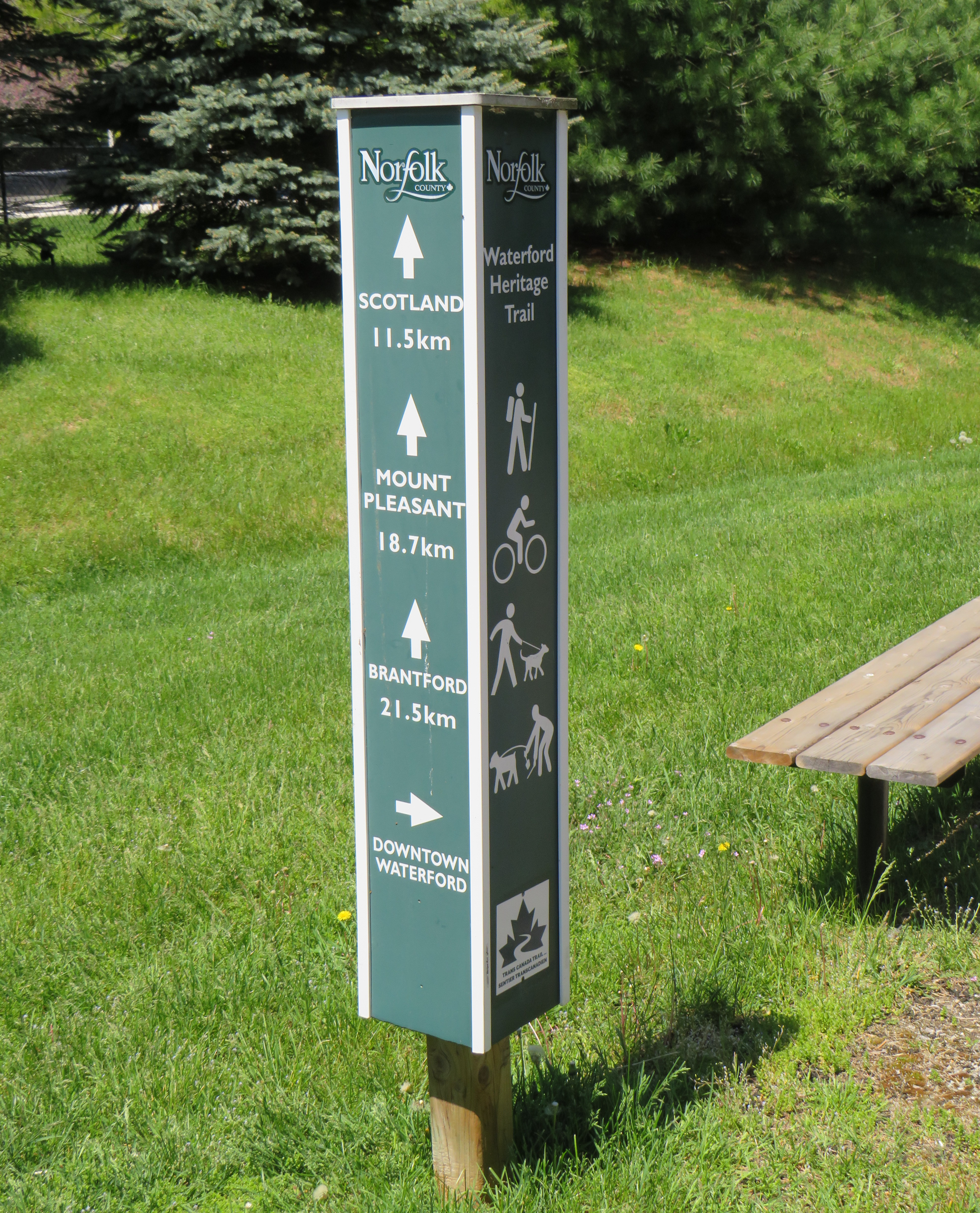
Norfolk County Trail sign
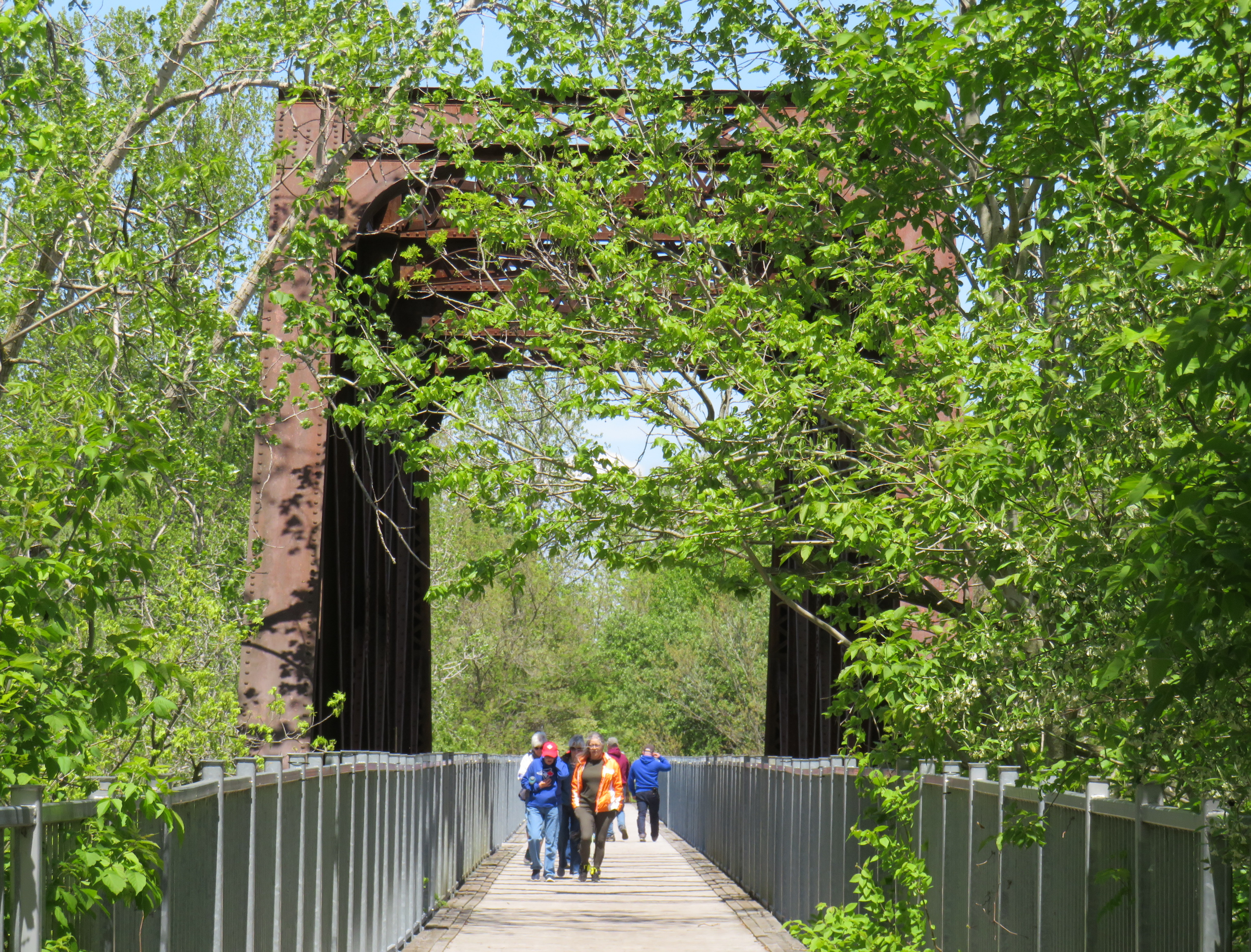
However, the north-south LE&N Trail, which connects to the Shadow Lake Trail by way of a gentle paved pathway or a metal staircase, is part of a much longer rail trail corridor that continues north to Brantford (the trail shifts to the TH&B route north of Waterford) and south to Simcoe and Port Dover. At Brantford, it is easy for the ambitious cyclist to continue east to Hamilton or north to Paris, Cambridge, and Kitchener via connecting high-quality rail trails. The Norfolk County Trail is at its scenic best when it crosses over the Waterford area via the Black Bridge.
The Black Bridge crosses over the old CSR and TH&B railways and the Waterford Ponds
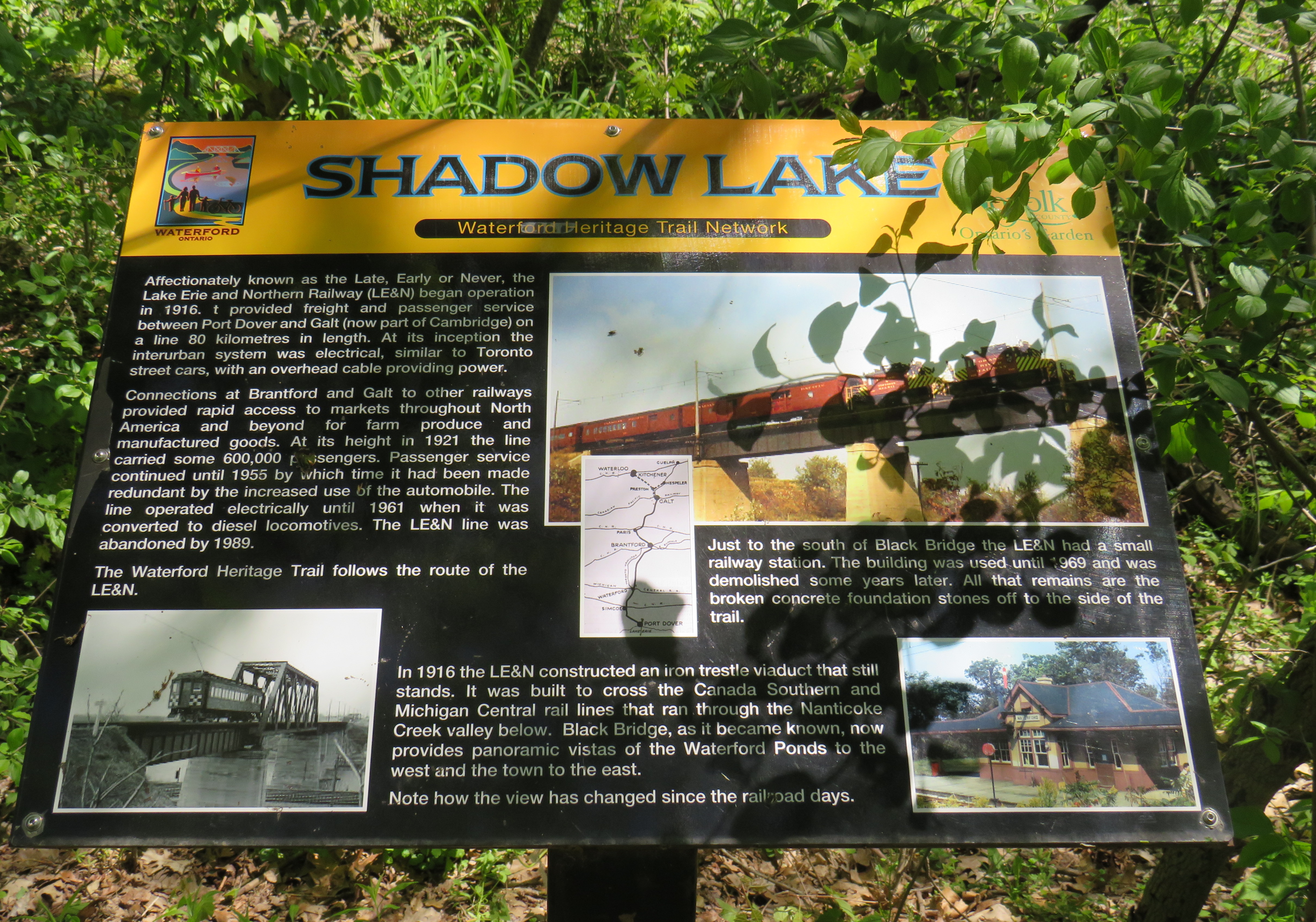
One aspect that I especially appreciated was all the interpretive plaques along the trail system that told the story of Waterford, local industry, and the railways. This is how I learned that the ponds were the result of milling and quarrying, rather than truly natural features.
One of several interpretive plaques along the trail system in Waterford
Despite their attractiveness for long-distance cyclists, the trails within the Waterford area are well-used by residents and visitors going for shorter walks. The trail network within Waterford connects well to local streets and to itself by way of the former low-level TH&B wye tracks, which also cross the ponds. A walker can easily do a round trip without backtracking while being surrounded by nature. Wayfinding signage is very good, and benches are plentiful. The ponds are a great spot for bird watching. As we know how good walking is for our physical and mental health, Waterford is blessed with this network and could be a model for other smaller urban centres and rural communities.
In the early afternoon on a Thursday, the Black Bridge was popular with pedestrians and cyclists
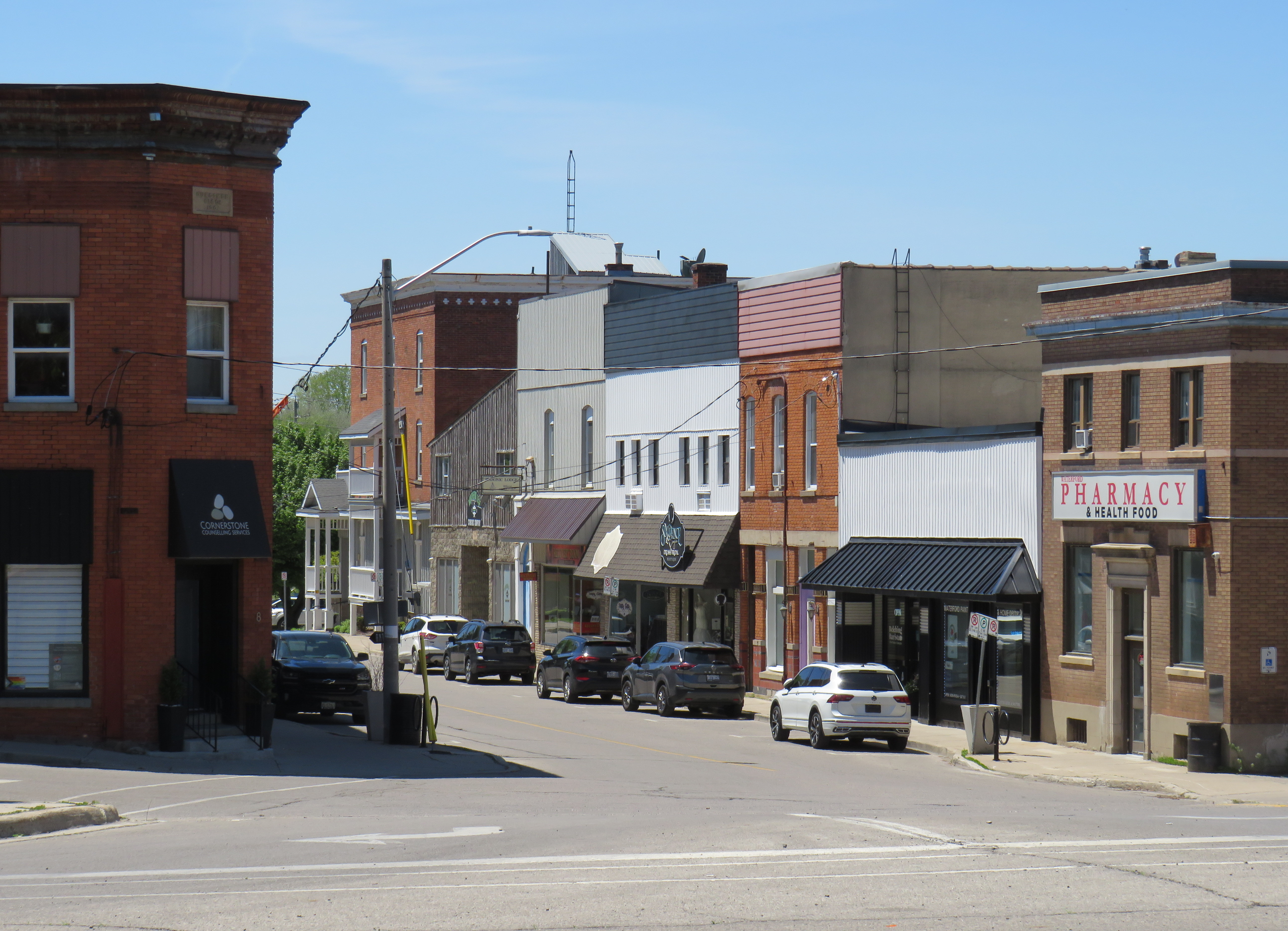
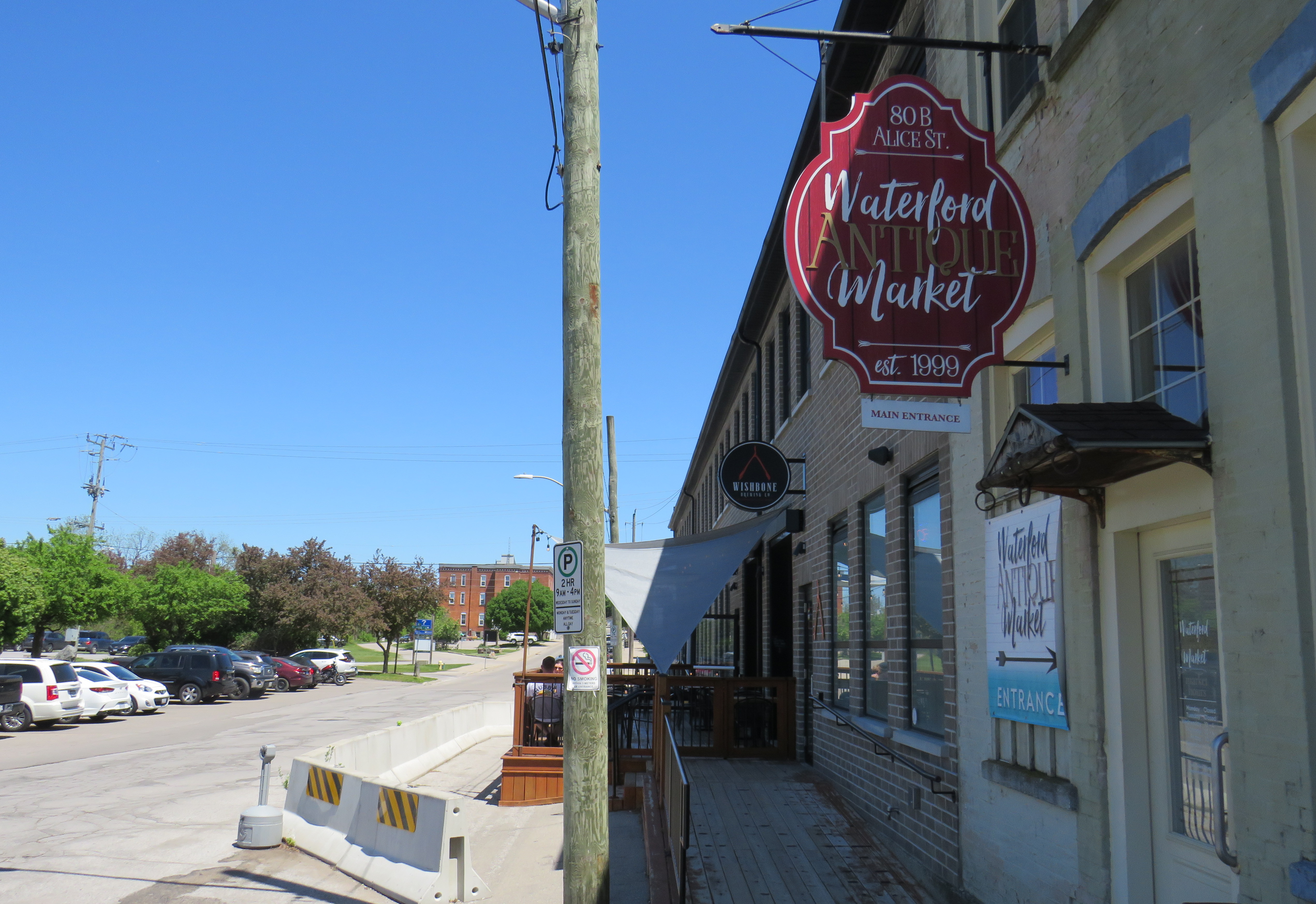
Within the little downtown, there are public washrooms for trail users as well as several restaurants, cafes, and a craft brewery located in a former textile plant. There are also several antique dealers, a public library, and other small shops.
Alice Street, Waterford’s main commercial strip, is lined with restaurants, shops, a cafe, and a breweryWaterford Antique Market and Wishbone Brewery, in a renovated textile plant
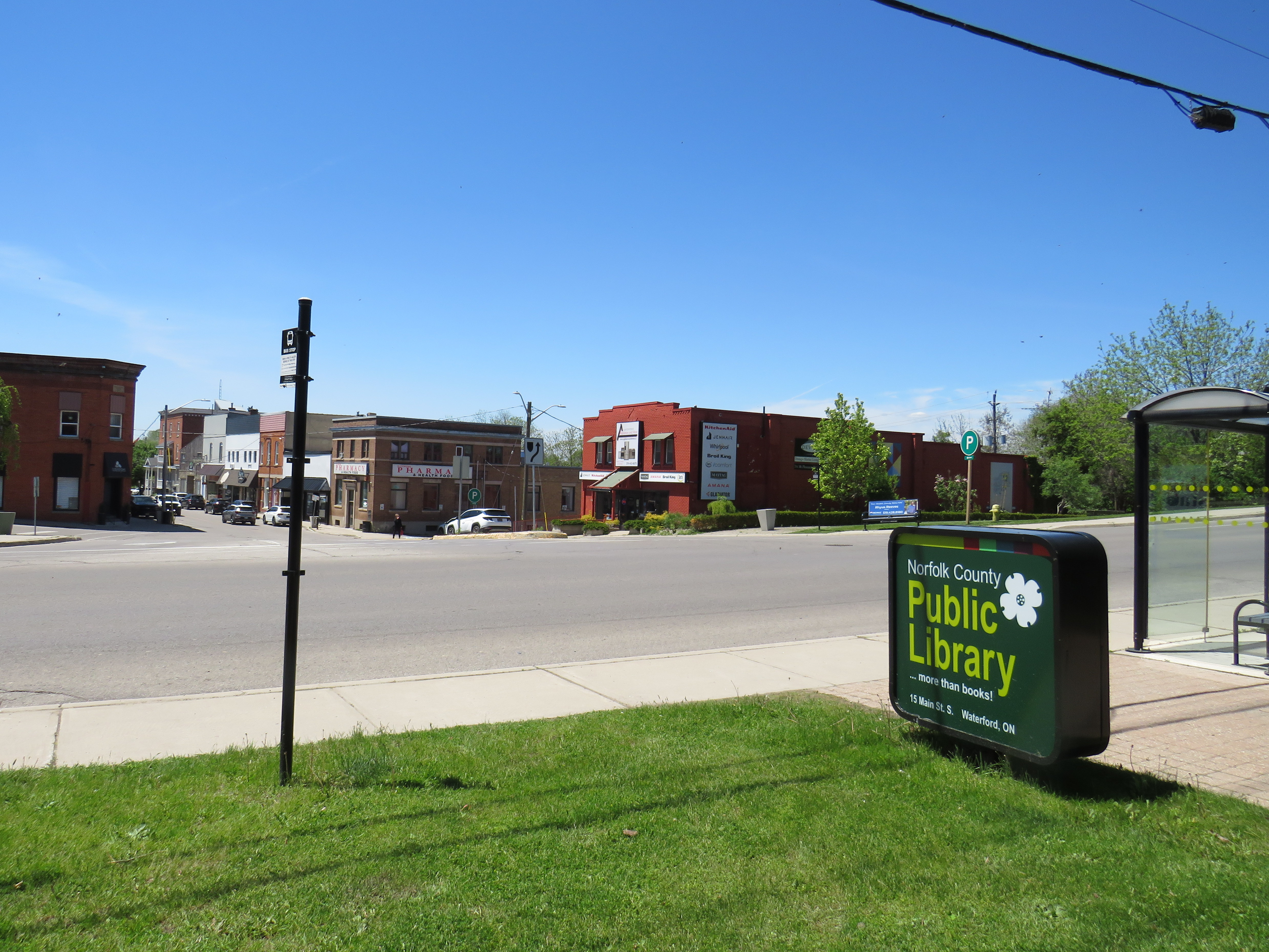
Despite all that Waterford has to offer, there is one thing that can be improved to make it safer to get around. Alice Street, the main commercial strip in Waterford, meets Old Highway 24 at an unsignalized crossing. Though busy Highway 24 now bypasses Waterford, the old highway is still busy, with drivers exceeding the 40 km/h posted speed limit. The Waterford library branch and northbound bus stop towards Brantford are on the opposite side of the wide T-intersection from the Alice Street businesses; it is surprising that there is no traffic signal here to control auto traffic and provide a safer pedestrian crossing.
The northbound bus stop (note the shelter at right) and library branch are on the opposite side of a busy road from the downtown shops
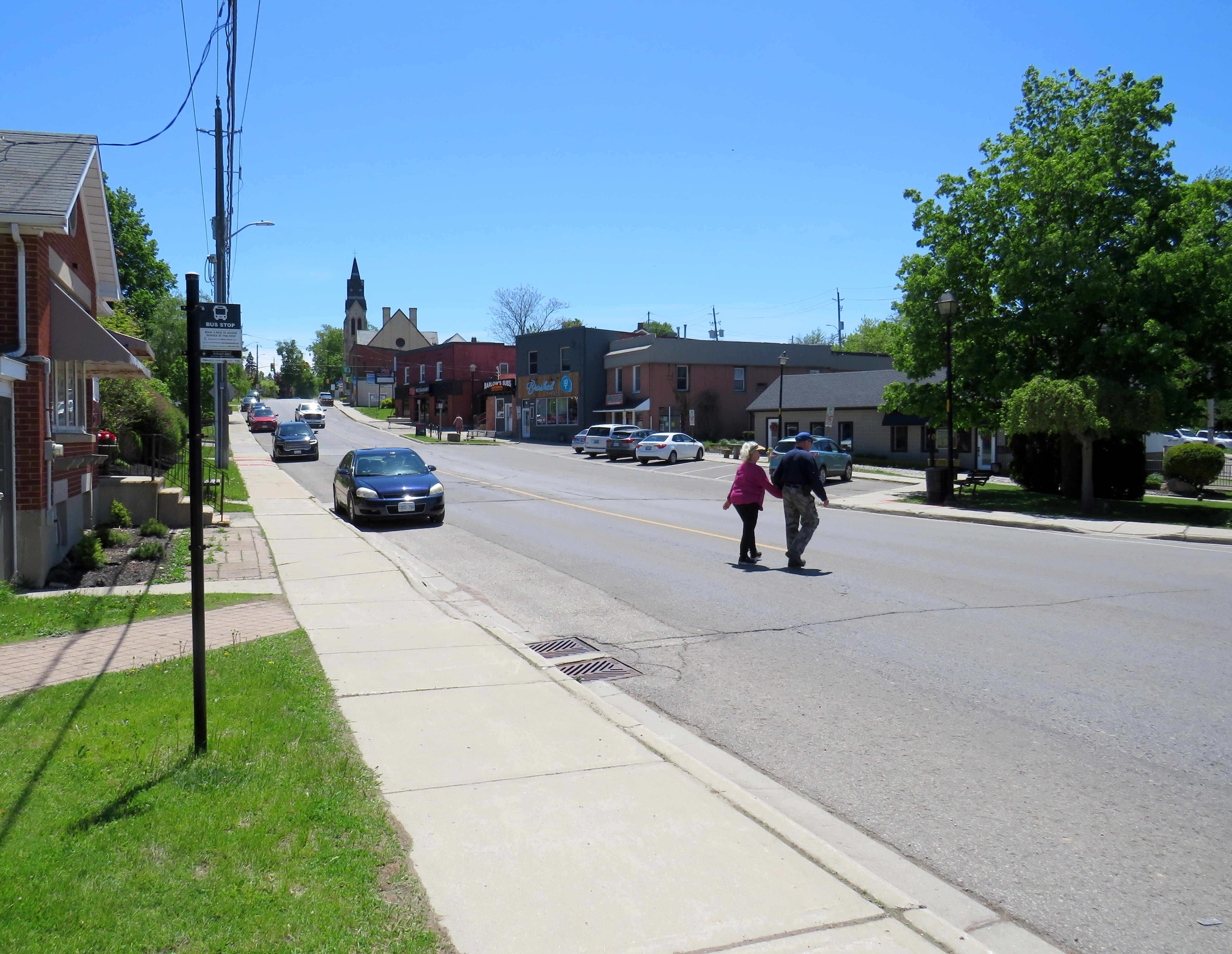
Though there is a traffic signal 200 metres to the south at Nichol Street, most pedestrians opt to cross at Alice Street instead. According to Google Streetview, there was a signed pedestrian crossing at Alice Street in 2009 but was removed by 2012.
Waterford is under a two hours’ drive from Downtown Toronto, though it is accessible without a car. GO Transit and VIA Rail both serve Downtown Brantford, where on weekdays, one can take a Ride Norfolk minibus south to Waterford. Cyclists from Hamilton or Toronto can take GO Transit buses to Brantford and bike south down the TH&B Rail Trail to Waterford on a relaxed 90-minute ride. From Simcoe, it’s an easy 45-minute ride.
In general, Ontario can do so much better promoting sustainable tourism and travel by way of transit, walking, and cycling, as there are many places like Waterford that are easy to get to and around without a car that are not especially well-known, and there are many opportunities to improve public and active transportation links to other communities throughout the province. Though some communities, like Brantford, Hamilton, and Peterborough are very well connected to multiple trail systems radiating outwards in multiple directions, other cities and towns are not so lucky.
Though St. Marys and St. Thomas, for instance, also have made great use of former rail infrastructure, they are lacking safe, high-quality active transportation connections to nearby cities like London or Stratford. Lindsay, in Kawartha Lakes, is at the nexus of several trails as well, but it lacks any intercity bus connections of its own. A provincial strategy could go a long way.
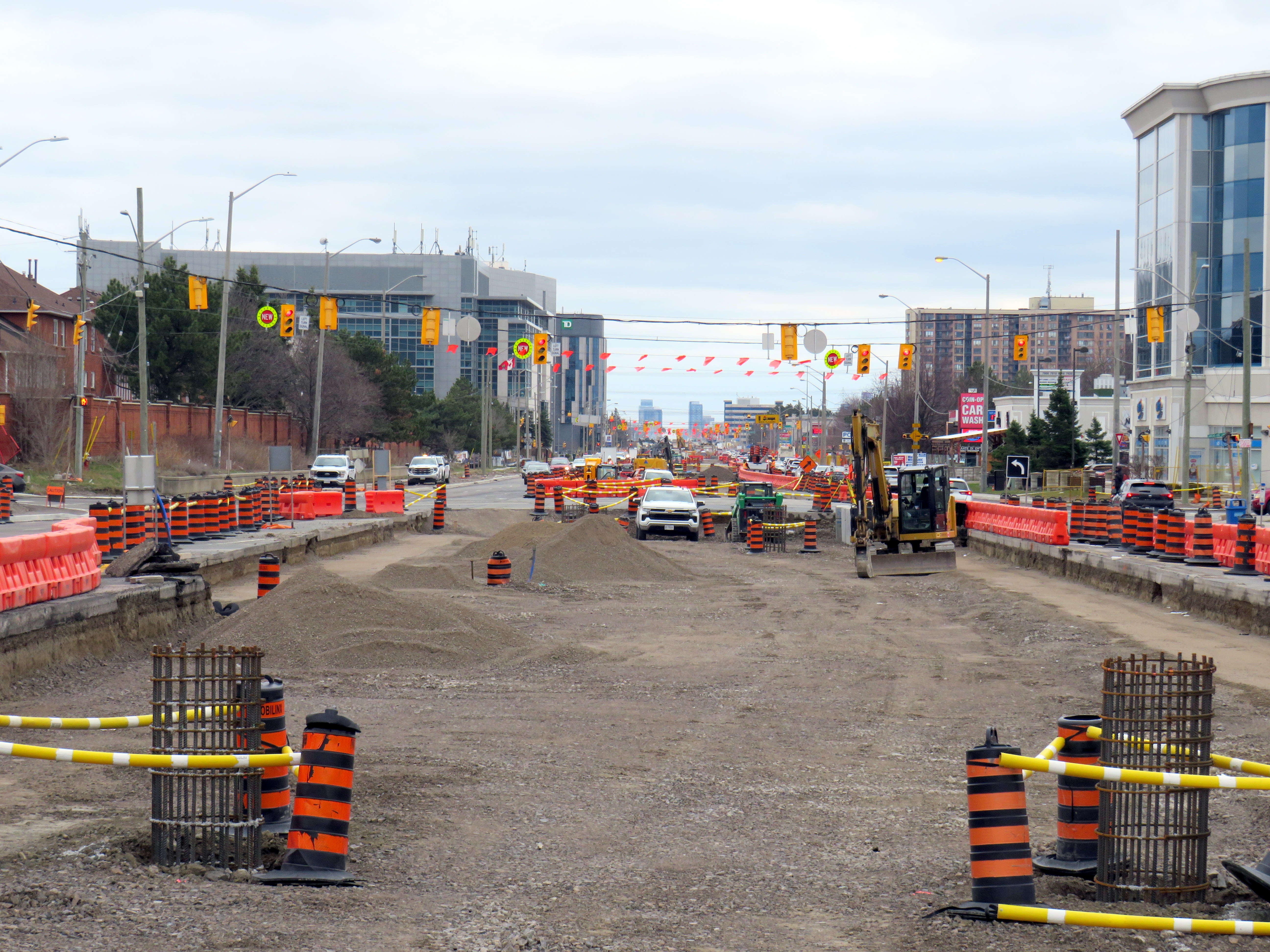
Hurontario Street, looking south from Steeles Avenue, where the first phase of the Hurontario LRT will terminate
The first phase of the Hurontario LRT, which will between Port Credit GO Station and Steeles Avenue in Brampton, is slowly taking shape after years of construction delays. In Spring 2026, eight years since construction started on the corridor, work on the LRT guideway into south Brampton has finally begun.
As I wrote in detail before, a previous iteration of Brampton City Council narrowly voted against the LRT entering downtown as a surface line in 2015. This was the version selected in the provincial environmental assessment. Instead, that council voted to study alternative corridors into Downtown Brampton requiring lengthy detours, and asking for the LRT northern terminus to be on the south side of Steeles Avenue, despite a major bus exchange — Brampton Gateway Terminal — on the north side of the intersection to accommodate all options. After the 2018 election, council recommitted to a Main Street alignment (though preferring a tunnel) and asked the province to restore the terminus on the north side of Steeles pending a decision on the final four kilometres into Downtown Brampton. In early 2026, only one of the six councillors opposed to the Main Street LRT ten years ago remains in office.
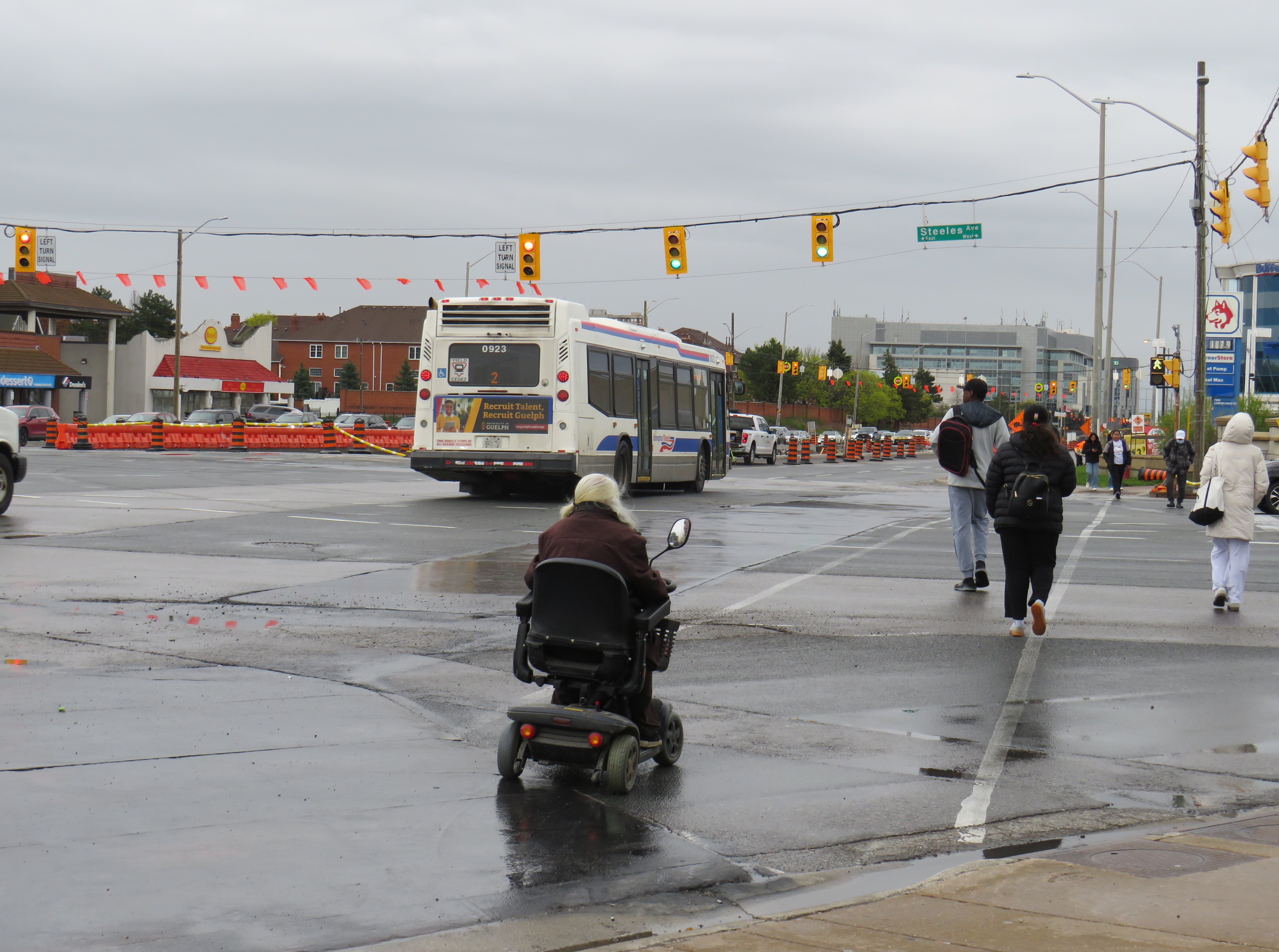
I wanted to follow up with Metrolinx to see how pedestrians would be safely accommodated at the Steeles and Hurontario intersection, given high traffic volumes, wide roads, and likely thousands of passengers switching between modes on a daily basis. Early concepts of an underground pedestrian tunnel were rejected by the province as out-of-scope, so pedestrians would have to cross both Hurontario and Steeles to make the transfer. Having no satisfactory answers despite many attempts to get an answer to this question, I took the lengthy and expensive route of submitting a freedom of information (FOI) request.
In summary, I learned that despite multiple requests from City of Brampton officials to restore the north side stop, Metrolinx and the provincial government refused. With the financial close with Mobilinx — the private-sector consortium selected to build, operate, and maintain the LRT — imminent in early 2019, there was no interest to make the minor change to facilitate the terminal, even though the city committed to taking on the cost on its own. The province was open to other changes to the line, however, as in 2022, it unilaterally renamed the line for a former Mississauga mayor and political ally of Doug Ford.
Looking south across Hurontario Street across a very busy multi-lane intersection towards the end of the LRT
As work at the Steeles-Hurontario intersection is now well underway, it has become visually clear the problem will be once the LRT opens. The population around the Brampton Gateway Terminal area is rapidly growing; a 40-storey condominium tower on nearby Steeles Avenue West is nearing completion, with many more highrise and mixed-use developments planned, including the eventual redevelopment of Shoppers World Mall. Already, there are dozens who cross nine-lane Steeles Avenue hourly; once passengers have to transfer from the LRT to the transit terminal on the northwest corner, there will be hundreds.
Furthermore, once the (now-funded) Phase 2 of the LRT to Downtown Brampton is started, the intersection will have to be torn up yet again to extend the tracks across Steeles and build a new north-side stop. The province’s refusal to do this all at once is baffling, and will likely be much more expensive than if it was done right the first time.
Looking across from Gateway Terminal towards the future LRT terminus on Wednesday, May 6. Already, there are plenty of pedestrians crossing here.
Already, the costs of the current Mobilinx contract have ballooned while construction delays pile up. The Hurontario LRT was originally supposed to open in 2024. In 2025, Mobilinx had to completely rebuild the track intersection at Topflight Drive just south of Highway 407 after track was already laid in 2023 due to construction errors. In February 2026, Global News reported that only 45 percent of the track was laid. Due to delays and problems paying contractors, the consortium’s credit rating was downgraded by Standard & Poor to BBB, which is near junk status.
Given the multiple delays and difficulties building the LRT, work is only now at the point where the dangerous terminal location is being baked in. Even though construction errors are fixed, and the project name changed, Metrolinx has been unwilling to address the safety issue at Steeles Avenue that was raised many times. In the meantime, Metrolinx, Peel Region, and City of Brampton will have to figure out how to mitigate the potential disaster that is now in the making.
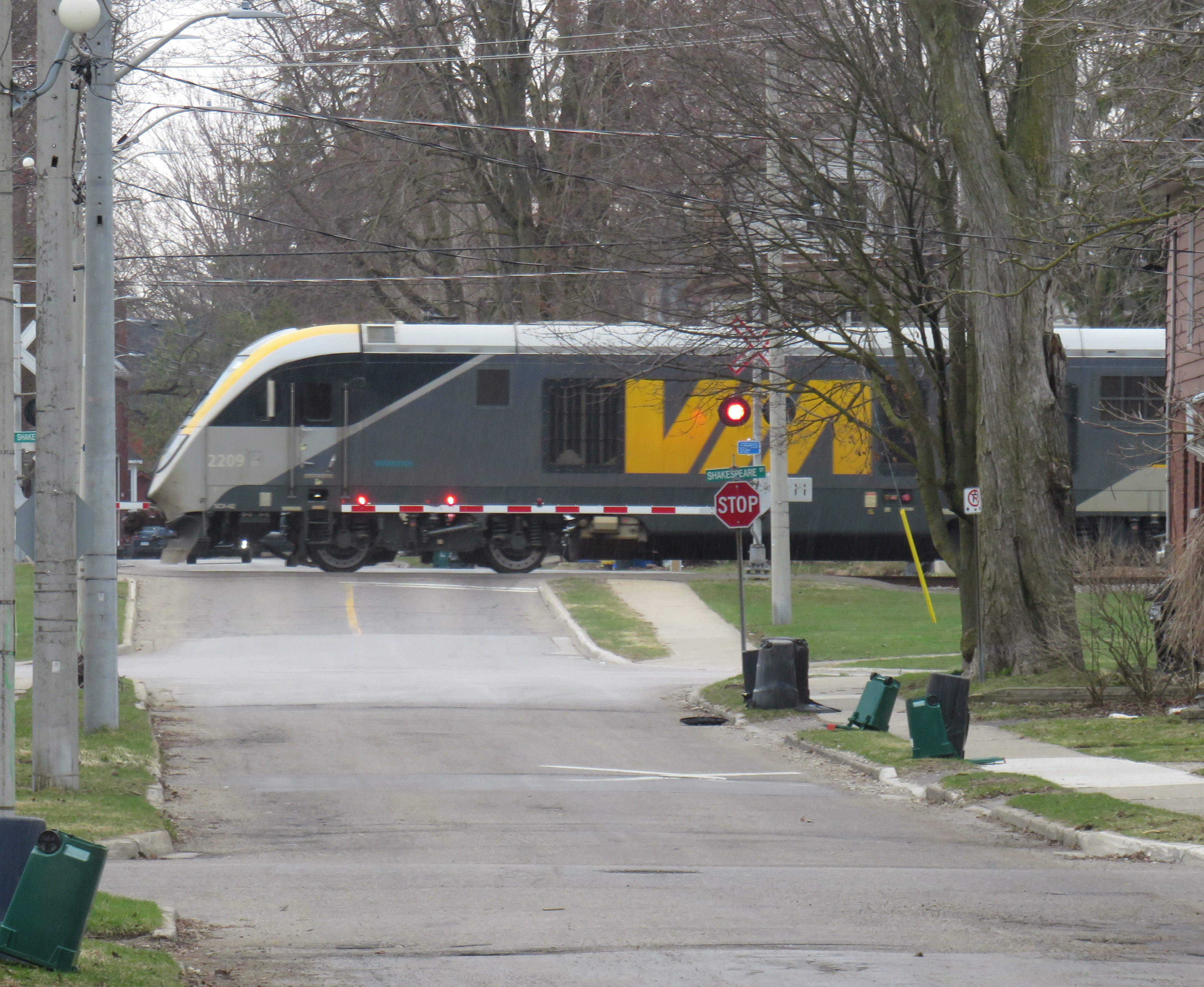
Slow orders at CN railway crossings are not the only slowdowns encountered by VIA trains
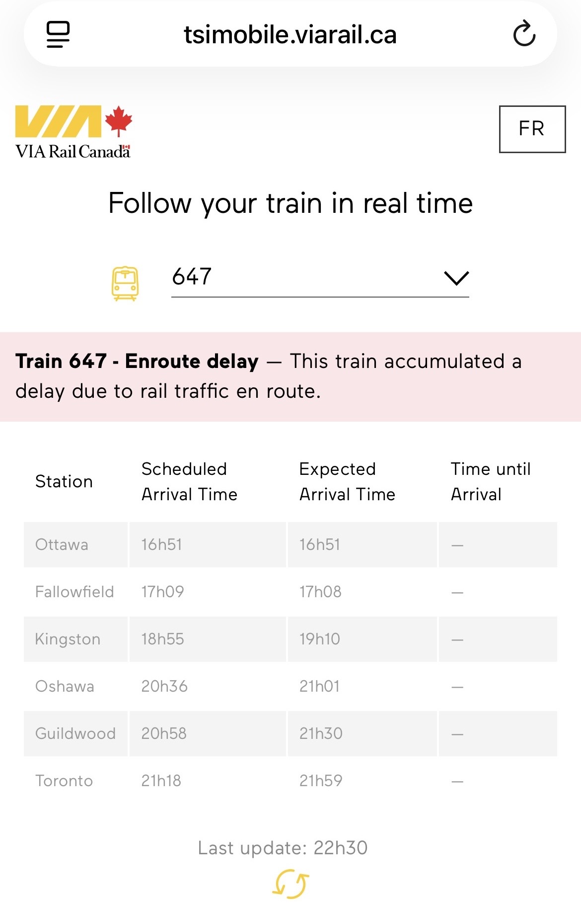
On the way home from a meeting I had in Ottawa on Sunday, May 3, I was aboard VIA Train 647, which left Ottawa Station at 4:51 PM. Our train was held up twice in the first hour: once at Smiths Falls, where we had to wait just under ten minutes for a CPKC freight train to pass, and again at Jasper, where we sat on a siding for about five minutes for an Ottawa-bound train to pass. As a result, our train arrived in Kingston at 7:10 PM, 15 minutes later than scheduled.
VIA Rail owns the track north of Brockville, where Toronto-Ottawa trains verge off the CN mainline between Toronto and Montreal, though it still has to cross the CPKC mainline at Smiths Falls through a freight yard there. Around 2010, after VIA took over the track from Canadian Pacific (once part of a line from Brockville to the Ottawa River near Arnprior), it built new passing sidings and moved the Smiths Falls station stop away from the old CP station to increase passenger train capacity and reduce conflicts. Ideally, the VIA and CPKC tracks would be completely separated, but it would be very expensive to implement.
Despite CN restrictions on VIA’s Venture equipment, with mandated reduced speeds at level crossings, we lost only ten more minutes upon arrival at Oshawa, getting there at 9:01 PM instead of the scheduled time of 8:36. But we had yet to encounter one last obstruction: Metrolinx-owned track between Pickering and Toronto Union Station.
Where the CN Kingston Sub meets the GO corridor west of Pickering Station, our train once again came to a stop for about five minutes. We were held behind a westbound GO Lakeshore East train, slowed down by its regular stop at Rouge Hill. Once we got moving again, our train stopped briefly at Guildwood to allow a few passengers to get off, and now we were 28 minutes late on the VIA train.
From Guildwood westward, the Lakeshore East corridor is triple tracked, so we were able to pass the westbound GO train as it made stops at Eglinton, Scarborough, and Danforth. But under the Main Street bridge, we stopped once again; two minutes later the GO train started moving slowly beside us, taking the lead. With the corridor down to two tracks between Woodbine Avenue and the Don River for Ontario Line work and track expansion, Metrolinx dispatchers decided it was worth holding back a VIA train that would have cleared the section quickly if we were permitted to proceed past Main Street, so that a GO train would have priority and not wait one minute or two despite that train being on time.
View from a stopped VIA train as a GO train picks up speed after stopping at Danforth Station
We finally arrived at Union at 9:59 PM, 41 minutes late. Sadly, this is a very common occurrence, particularly with inbound trains to Toronto.
Though CN gets plenty of blame for slowing down VIA Rail passenger trains by prioritizing its freight operations and its level crossing spat, Metrolinx must wear some of the blame for VIA’s woes. It is worth pointing out that nearly all VIA passengers affected by poor train dispatching are travelling to or from destinations served by GO Transit: Toronto, Oakville, Oshawa, Aldershot, Brampton, and the majority are travelling within Ontario, including cities such as London, Ottawa, and Kingston. As an agency of the province, Metrolinx should support Ontarians travelling on trains within Ontario, even if they are not aboard Metrolinx-operated GO trains.
In the fifth year that I have been following and mapping Canada’s intercity transportation links, the network (if you could call it that) remains in flux. Spring 2026 brings several new routes, particularly in Western Canada, that restore some former Greyhound services. Unfortunately, regional and commuter services in Ontario and Alberta are coming to an end. Wednesday, April 30 was the last day for the LTW Route 42 between Leamington and Windsor. In Alberta’s On-It is winding down its commuter buses between Calgary and Cochrane and Okatoks.
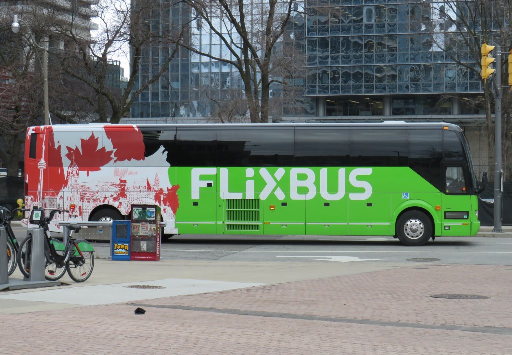
However, Flixbus continues to expand, taking over more former Greyhound routes. Unlike Greyhound or most other intercity transport companies, Flixbus is not a bus company per se, as it does not own or operate the services; instead it uses smaller contracted operators while coordinating branding, schedules, and ticketing. But starting in May, it will operate three-four days a week between Calgary, Regina, and Winnipeg, with stops in cities that have long been without service, such as Moose Jaw and Swift Current. Another route will connect Calgary with Drumheller, including a stop at the famous Royal Tyrrell Museum.
Despite the recent loss of TOK’s Southampton route and last year’s cutback of Grey County’s GTR services, there is hope for new connections in Midwestern Ontario. Grey County, together with neighbouring Bruce, Dufferin, and Wellington Counties, is studying a regional system to augment and replace the limited existing services. Hopefully, it will include regular service to fast-growing Saugeen Shores, which recently lost that TOK service. In Centre Wellington, a new local service connecting Elora and Fergus will soon start operations.
One of the major issues continually faces is the lack of intramodality and useful connections. A viable passenger rail system — be it a classic corridor service such as the Quebec-Windsor VIA train or a high-speed line such as the planned ALTO project — is much more useful to many more passengers when there are easy connections at stations. Through-ticketing and schedule coordination should be implemented whenever possible. Furthermore, though the Upper Ottawa Valley (towns and cites such as Renfrew and Pembroke) has a daily Ontario Northland bus, it arrives in Ottawa late in the evening and leaves early in the morning, limiting its usefulness to areas closer to Ottawa that could benefit from a commuter connection or onward trips to Montreal, Toronto, or Kingston. Despite more gaps seemingly filled, other gaps remain.
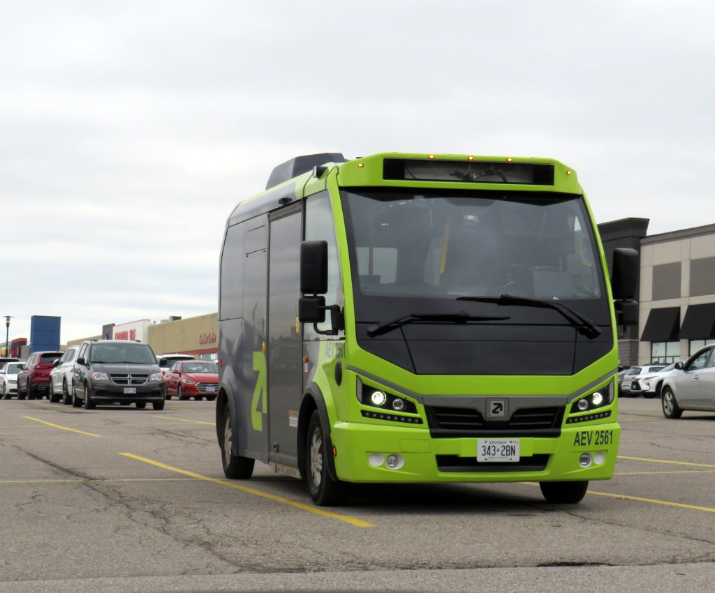
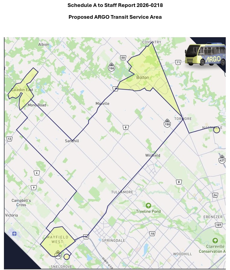
An Argo minibus lays over at Shoppers World Brampton
In an interesting staff report presented to Caledon Town Council, that municipality is planning to enter into a 15-month On-Demand Micro-Transit Pilot Agreement with Argo Transit, a Brampton-based provider of electric minibus services. This new on-demand transit service would replace most of the contracted Brampton Transit services in the Town of Caledon, including Routes 41, which serves Bolton, and 81, which runs along Kennedy Road north of Mayfield Road. Extensions of Route 30 Airport Road and 18 Dixie would continue under Brampton Transit, as they are limited-service extensions directly serving specific employers.
Argo already provides on-demand service in Bradford-West Gwillimbury, replacing a fixed-route service there last year It also operates a supplemental door-to-door on-demand service in central Brampton on top of the fixed route Brampton Transit service. In Brampton, and as expected in Caledon, the same fares at Brampton’s regular service are charged, paid through a Presto card or app.
The benefits for Caledon include new service to and within Caledon East, which is currently without transit, as well as midday, early evening, and weekend service not currently provided through Caledon’s contract with Brampton Transit. The proposed service times will be Monday to Friday from 5:30 AM to 8:00 PM, and Saturday and Sunday from 7:00 AM to 7:00 PM. If implemented, Argo service would begin October 1, 2026.
The map, included as an appendix to the staff report, shows connections to Brampton Transit on Mayfield Road and to York Region Transit in Kleinburg.
Map of proposed Argo service areas in Caledon, with connecting links.
There are some questions that should be addressed before October. Currently, Route 41 provides service to employment areas in south Bolton and provides connections to several Brampton Transit and YRT routes at Highway 50 and Queen Street, with easy transfers to the TTC subway in Vaughan and Humber College in Etobicoke. Would Brampton maintain a shortened route to Mayfield Road and Highway 50 that could make this link? Would transfers be permitted to other Brampton Transit routes along Mayfield Road, including Routes 15, 18, and 30, or would stops outside the on-demand areas be restricted to those in the map?
For Caledon, on-demand transit looks like an attractive option to replace Brampton Transit-contracted routes with low ridership and limited service hours. For it to succeed — and even build ridership for new fixed-route service in the future — connections to other transit will be necessary.
Despite population growth, Brampton Transit ridership is in decline
Meanwhile, Brampton Transit, after several years of dramatic ridership growth after the end of COVID-19 restrictions, is cutting back as ridership has taken a sudden dip in 2025-2026. Four minor routes — 33 Peter Robertson, 36 Gardenbrooke, 55 Elbern Markell and 56 Kingknoll — will be discontinued. These four neighbourbood routes provide local service in areas where other routes are within walking distance or operate in the opposite direction, so the effects are minor and the cuts justifiable if it keeps service going elsewhere.
However, Route 5 Bovaird, a major local route between Westwood Mall and Mount Pleasant GO Station, will see significant cuts: in the weekday peak from 13 minutes to 20 minutes and evenings from 30 to 40 minutes, and weekend evenings from every 30 to 50 minutes. The 505 Zum route that parallels the 5 does not operate weekend evenings, resulting in very poor service along the Bovaird corridor during those times.
This is a disappointing setback for transit in my hometown, which up to now has been a model for promoting ridership growth in a suburban edge city. For years, I have wrote about its success in growing demand by operating good service, especially to destinations well beyond its boundaries to places like York University (later the subway terminal in Vaughan), Mississauga City Centre, Humber College, and Pearson International Airport.
It would be very unfortunate if transit were allowed to enter a “death spiral” of ridership decline, fare hikes, and service cuts in response to this dip, largely due to a decline in international student enrollment at colleges and universities. Brampton has shown before that good service, with incremental growth is a great way of boosting ridership. This means operating buses at least every 20-30 minutes at all times on major corridors like Bovaird.