Category: Cycling

  • One more signal will do it…

    A mess of signs and signals on King Street West at Portland Avenue

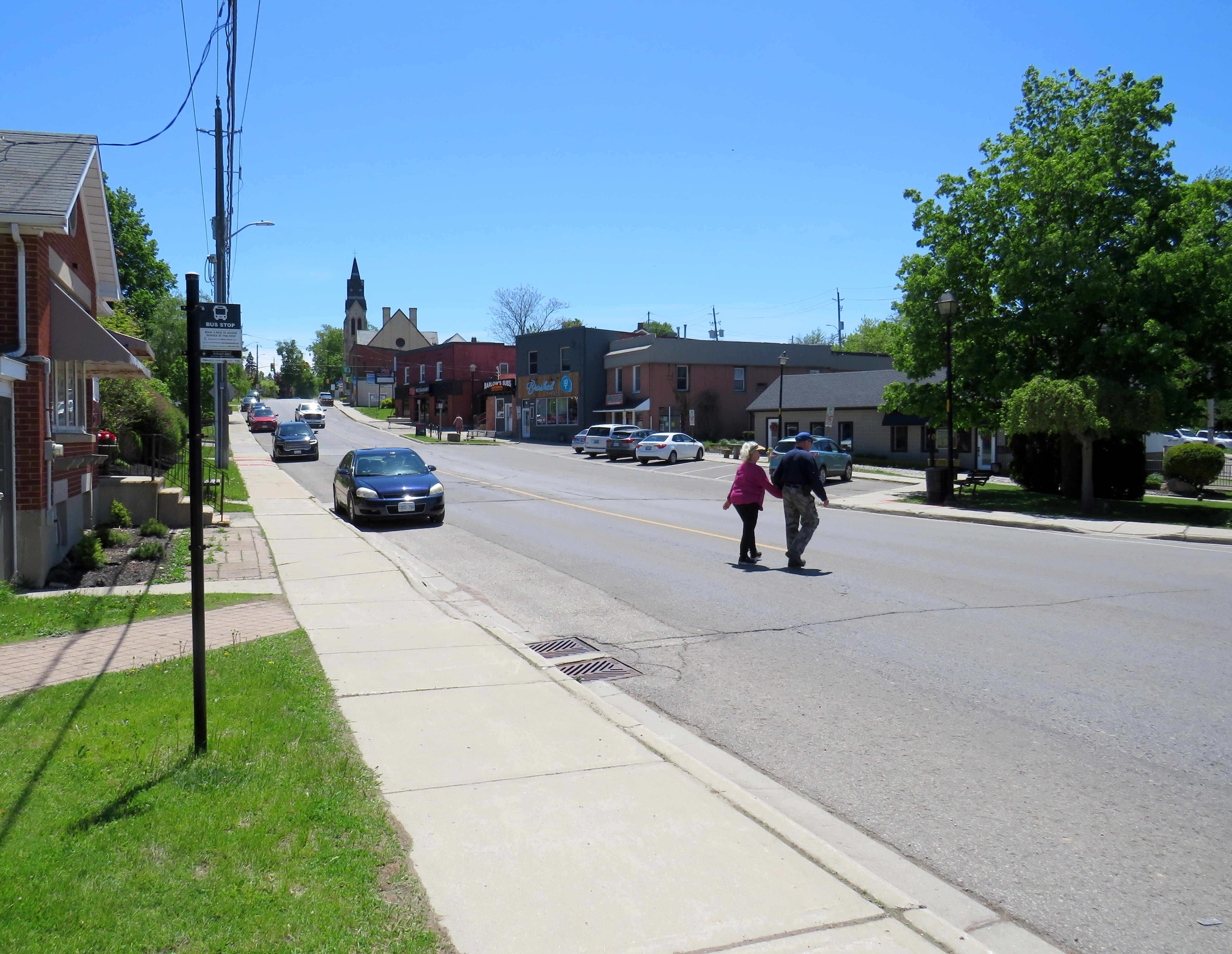
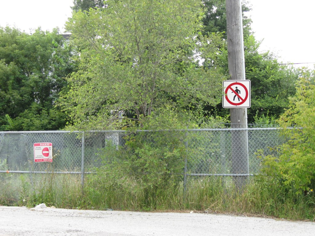
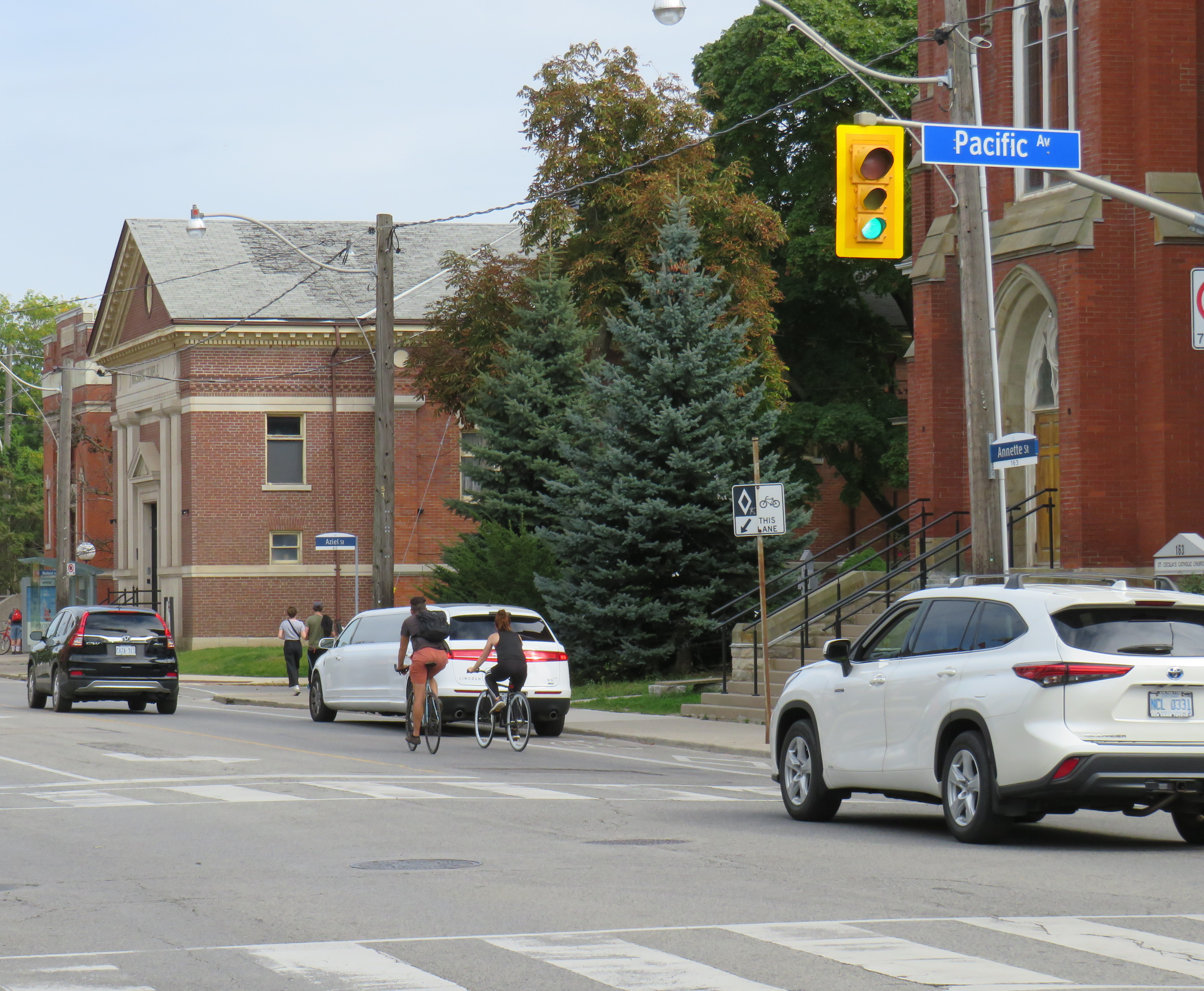
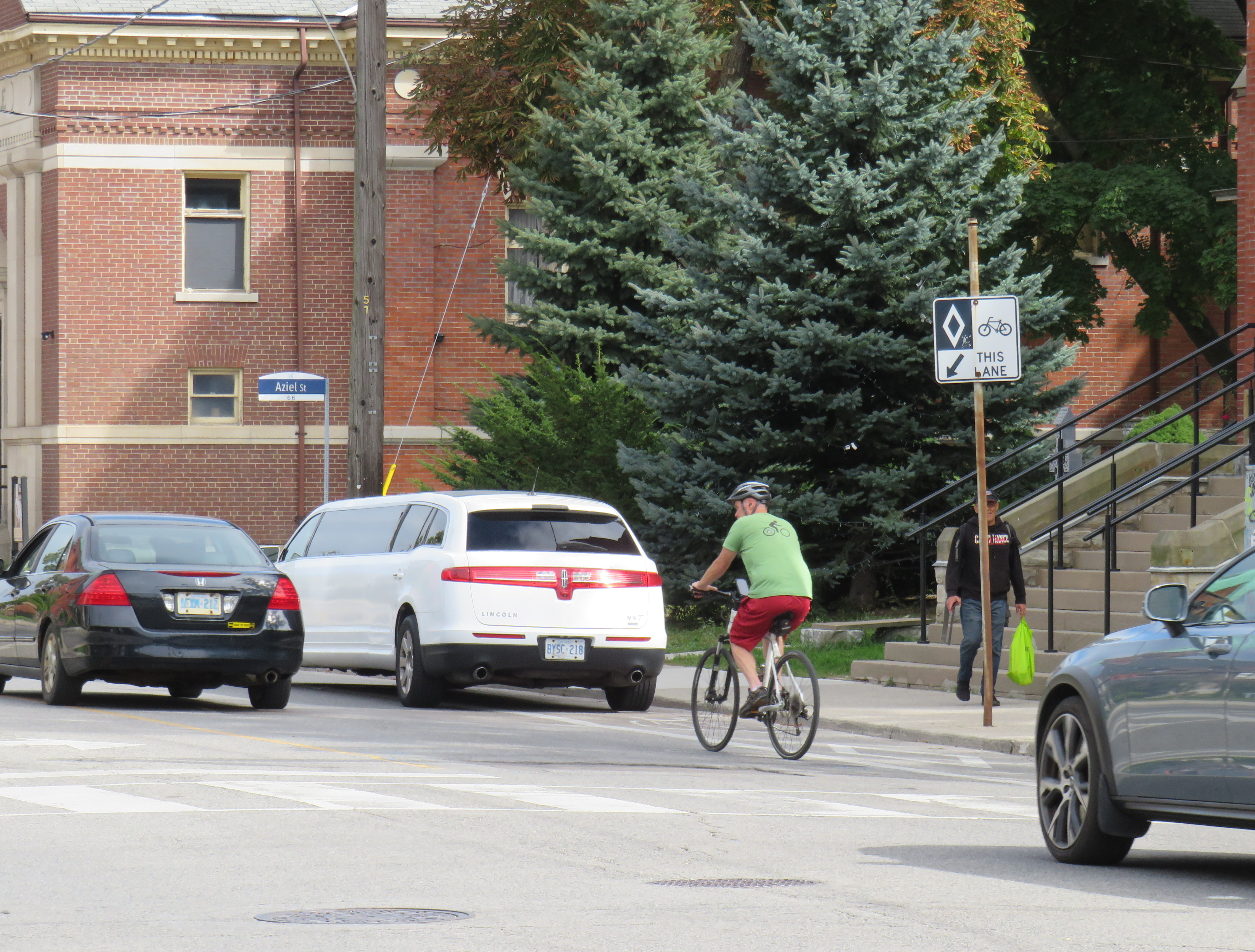
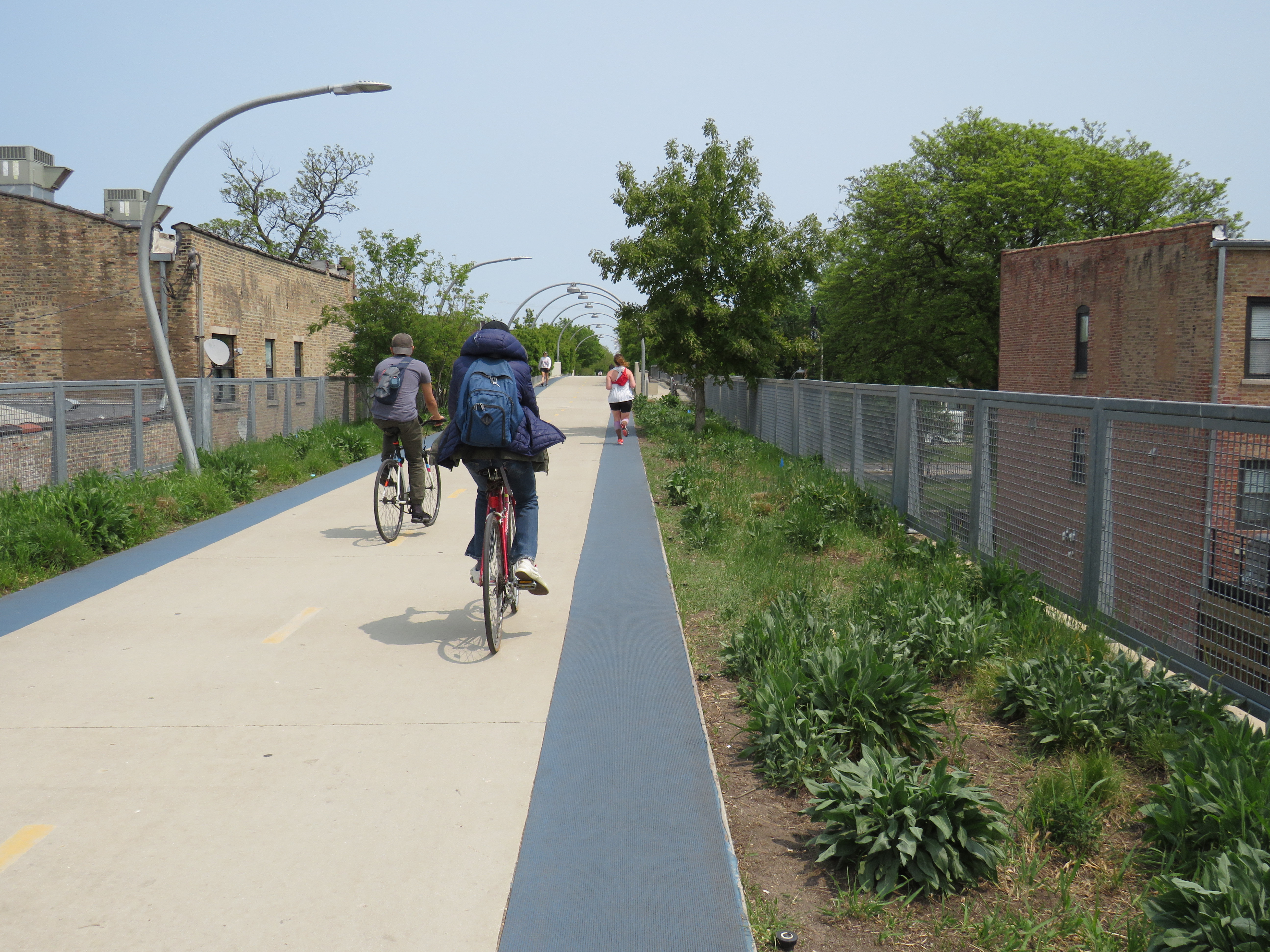
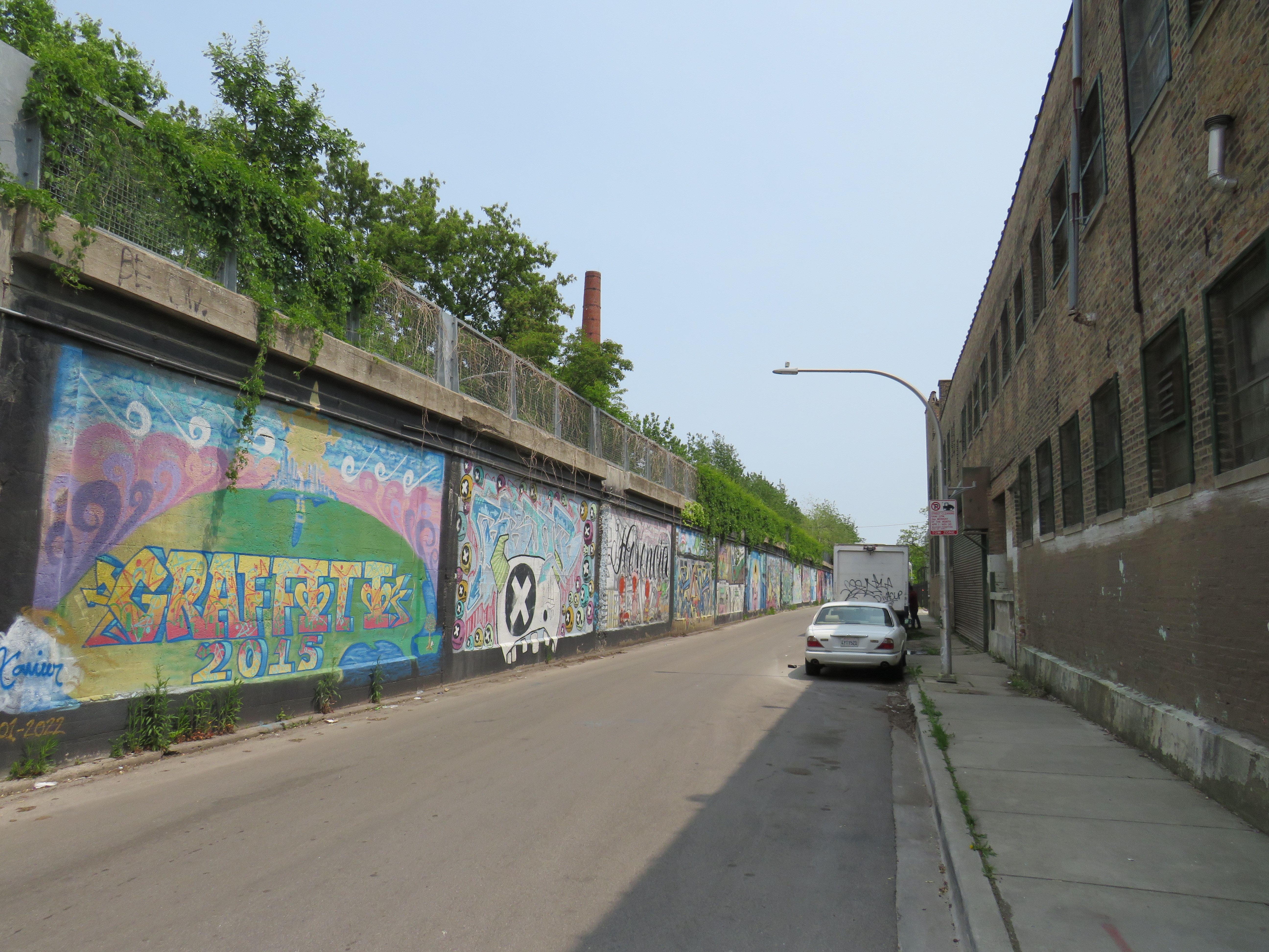
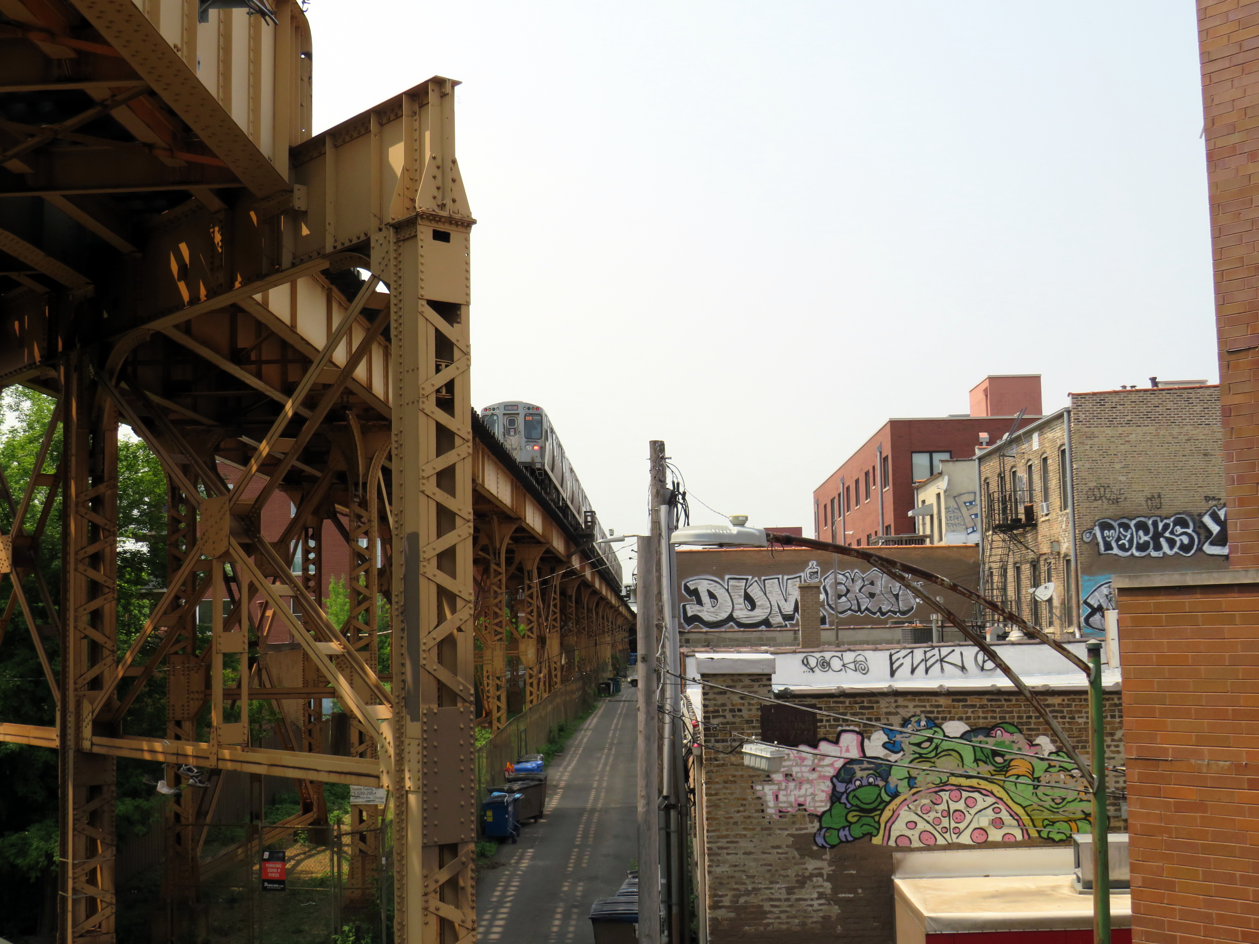
    On a lovely weekday afternoon in early June, I went for a ride through Downtown Toronto to check out the changes to Portland Street between Richmond Avenue and Front Street. This side street, just west of the downtown core, connects the busy Richmond-Adelaide cycle tracks with the Puente De Luz walking/cycling bridge across the Union Station Rail Corridor to CityPlace and via Dan Leckie Way to the Waterfront.

    While the City of Toronto is currently restricted in adding new cycling lanes on major corridors, it continues to piece together alternative routes where possible; Portland Street, which parallels congested Spadina Avenue and Bathurst Street, is one of those opportunities. A new two-way cycle track was opened while most of Portland Street itself is now one-way for motorists.

    Looking south at the end of Portland Street towards CityPlace and the ramp to the Puente De Luz Bridge (bridge at far left)

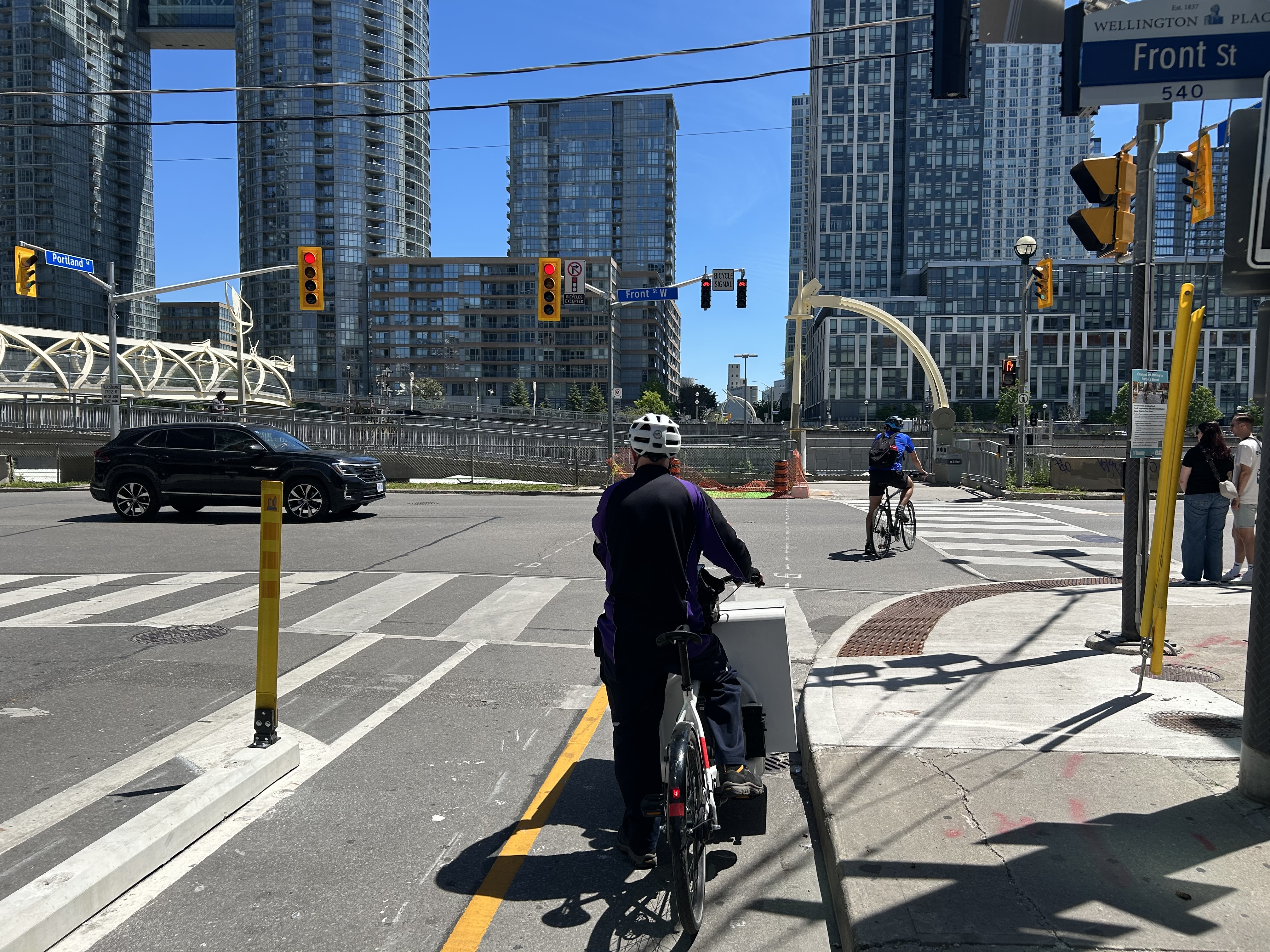
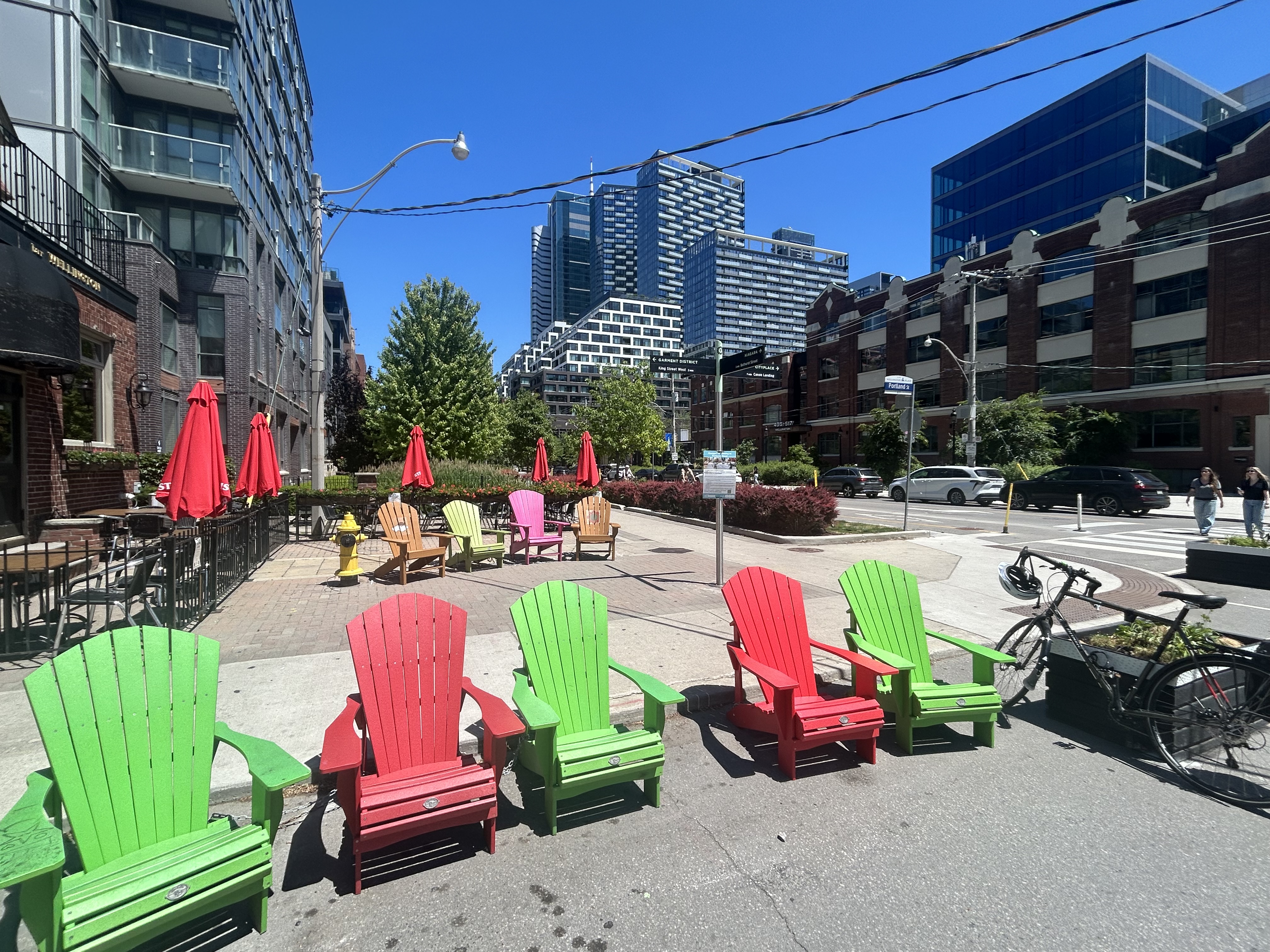
    At Portland and Wellington Streets, an interesting new traffic alignment diverts motor traffic around the complex intersection while permitting through cyclist and pedestrian movement on all sides, improving safety for all road users. On Portland Street northbound and southbound, drivers are required to turn right onto Wellington maintaining local access while discouraging through drivers. This new layout, complete with Muskoka chairs laid out in the middle of the intersection is unusual for Toronto and is more common in cycling-friendly cities such as Montreal. Emergency vehicles can still pass through, following the cycling paths.

    Slide from 2024 City of Toronto presentation depicting the new diverter at Portland and Wellington

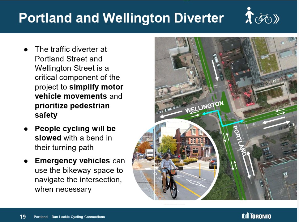
    Wellington Street is a designated east-west cycling route connecting the Downtown Core and west end neighbourhoods like Parkdale and Liberty Village and will eventually hookup with an extension of the West Toronto Railpath. Together with increased density in the downtown area, this intersection will only get busier with cyclists and pedestrians in the future.

    Portland looking north at Wellington. Motorists must turn in one direction from Wellington or Portland, opening up the middle of the crossing to a four-way cycling intersection, with planters and colourful Muskoka chairs
    Comfortable places to sit in the middle of an intersection

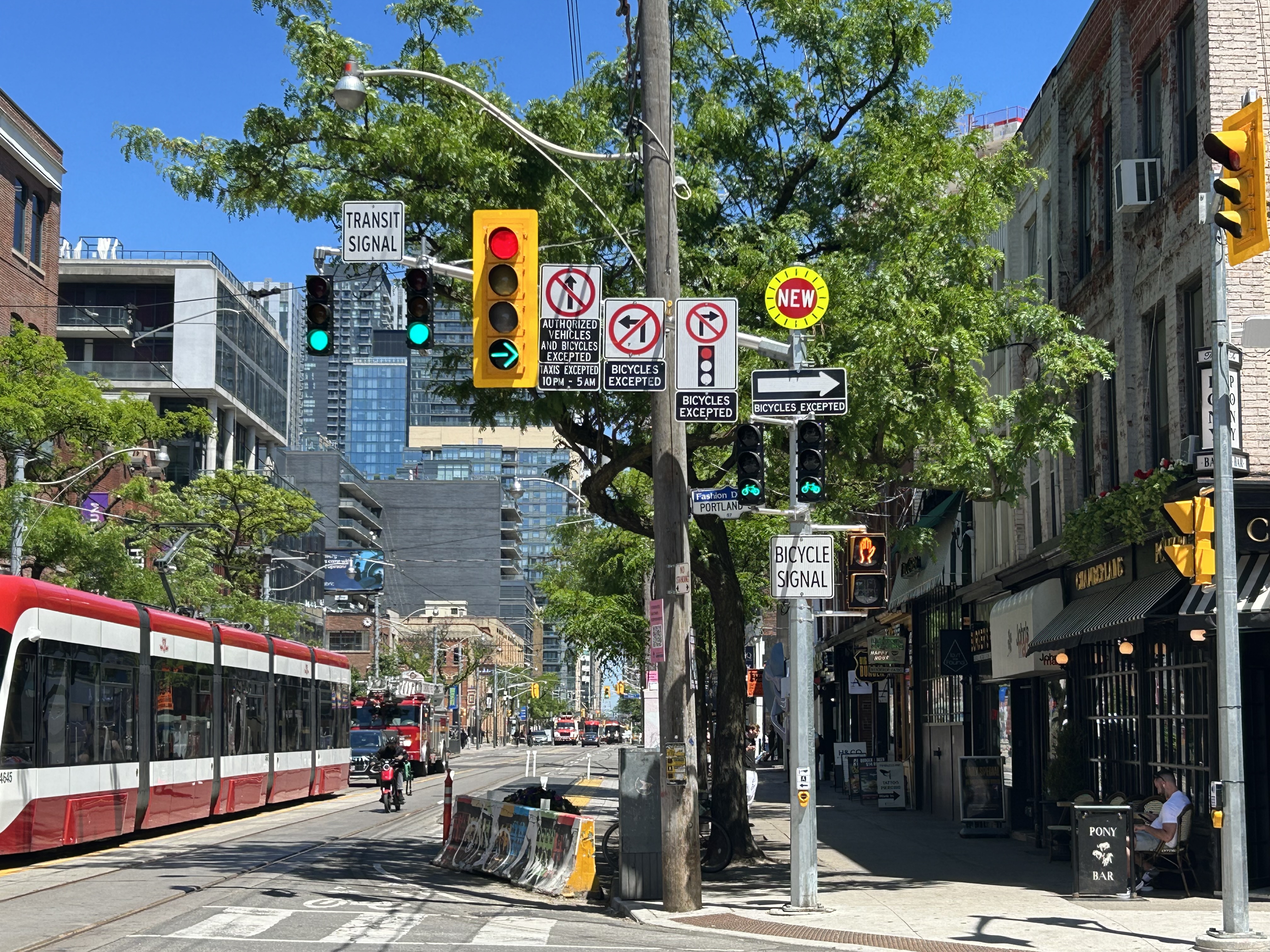
    Despite the very unToronto urban intervention at Portland and Wellington, a very Toronto intervention continues one block north at King Street. Though the King Street Pilot was launched in November 2017, over eight years ago, little has been done since to improve the street for pedestrians or transit users. To discourage motorists from illegally proceeding through intersections (intended to eliminate congestion for streetcars and buses), the curb lanes are blocked with painted Jersey barriers. More recently, additional traffic lights were installed, so there are now signals for transit, cyclists, motorists, and pedestrians.

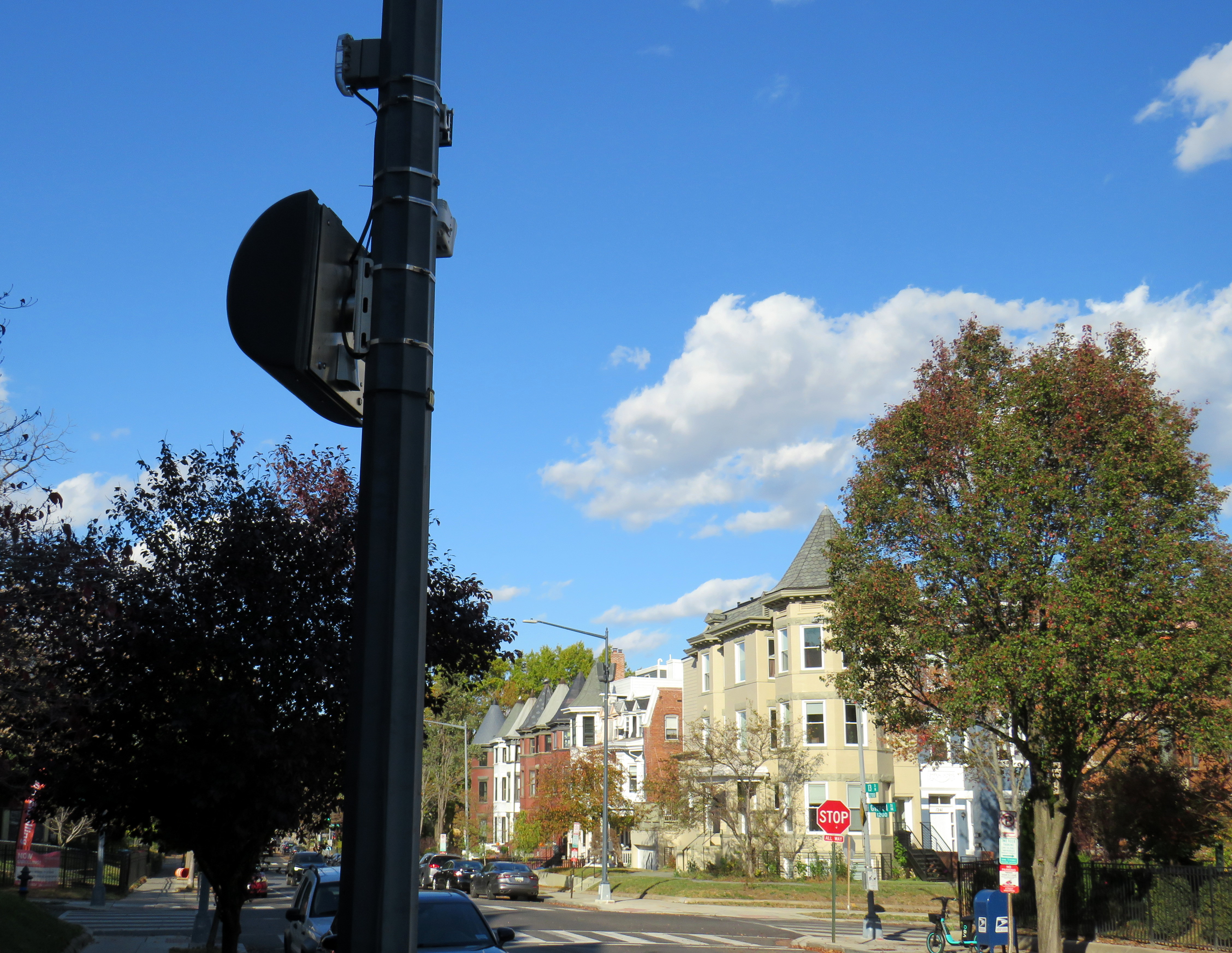
    At Portland, and every other intersection that drivers are not permitted to go straight (taxi drivers are excepted after 10 pm), the traffic signals remain red at all times. A right green arrow appears for 5-10 seconds at the beginning of the cycle, allowing motorists to turn unimpeded. At Portland, however, eastbound motorists on King may not make a right on red because of the two-way cycle track on the west side of the street. Because of all these restrictions, there are seven signs facing eastbound drivers affixed to the traffic pole, along with two transit signals, one traffic signal, two bicycle signals, and one pedestrian signal.

    This could have been clearer

    The amount of clutter here can be confusing and is also unsightly. First off, there is no need for the “bicycle signal” sign below the two bicycle signal heads and next to the pedestrian signal. The signal aspects are already clearly for bicycles without the sign. Revising the Ontario Traffic Manual (OTM) to allow red arrows on traffic signals could both simplify the yellow traffic signal here and eliminate the need for the “no right turn on red” sign. It would also be clear then that right is the only permitted sign. Speaking of the OTM, dedicated transit signal aspects such as those used in Europe or even several American cities would eliminate the need for the “transit signal” sign and further reduce confusion. If the late night taxi exception was removed, the “no left turn” and “no straight movement” signs could be consolidated as well.

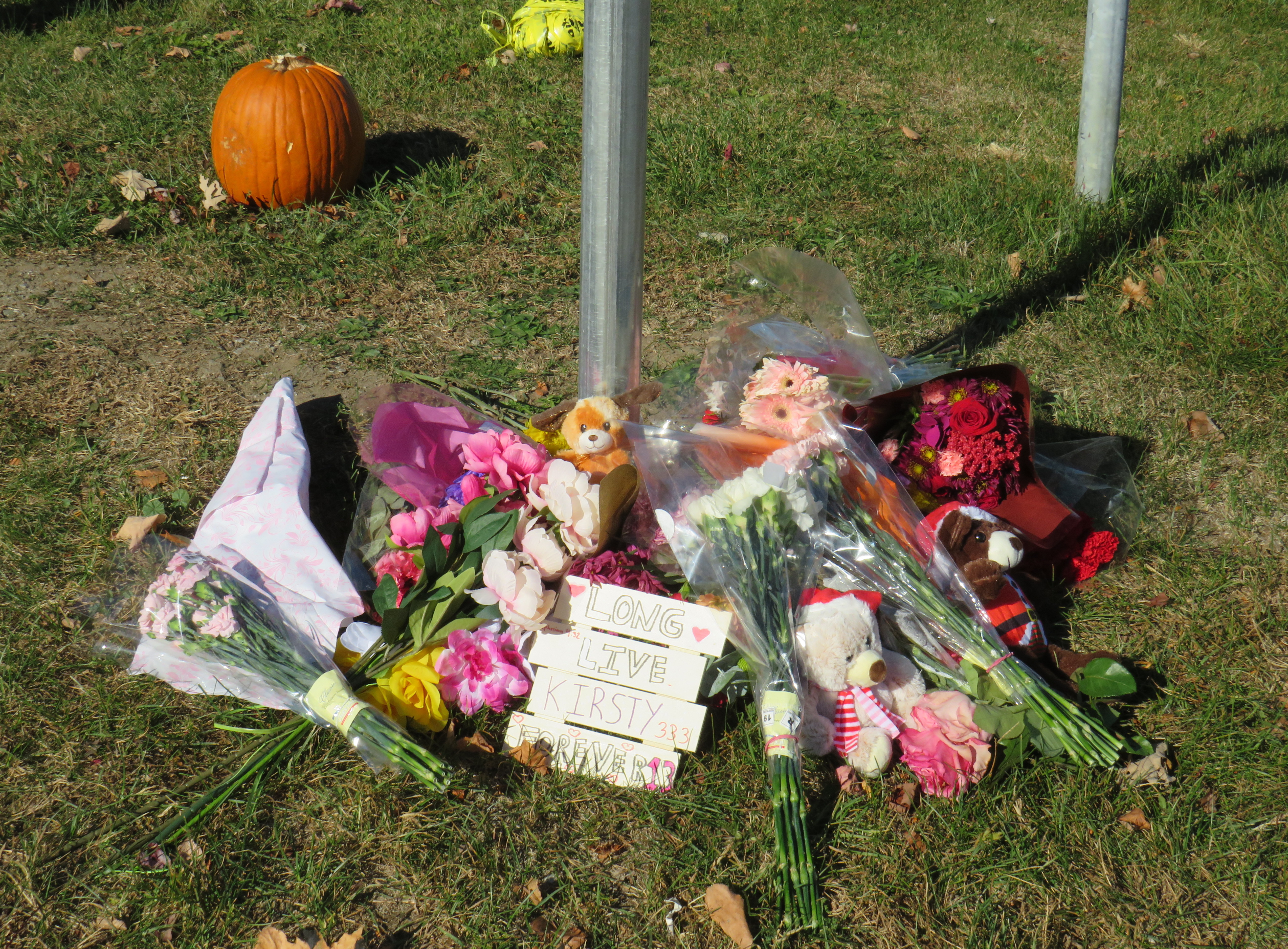
    But most of all, the sign clutter makes it even more clear that the King Street Pilot configuration needs to become permanent, with raised curb extensions at the far sides of each intersection, with a level platform for streetcar boarding. Permanent planters and benches would be a visual cue to drivers that King Street is not a throughfare, but a pedestrian and transit-first corridor.

    There is a lot less sign clutter along Seventh Avenue in Calgary, which is exclusively a transit and pedestrian corridor
  • A Waterford wandering

    A Waterford wandering

    Looking down from the Black Bridge on the Norfolk County Trail to Shadow Lake and Waterford Ponds in May 2026
    Looking down from the Black Bridge on the Norfolk County Trail to Shadow Lake and Waterford Ponds in May 2026

    On a beautiful May Thursday, I met one of my colleagues in the village of Waterford. As he is now living in Port Rowan on Lake Erie, this was an opportunity for us to get some important work done, while also exploring one of Ontario’s great small communities.

    Though the local area was settled over 200 years ago, Waterford was established as a thriving village with the arrival of the Canada Southern Railway (CASO) which was eventually incorporated into the giant New York Central system. The route through Canada, with its divisional headquarters in St. Thomas, was the fastest line between Buffalo, Detroit, and Chicago. It was joined by the Toronto, Hamilton & Buffalo (TH&B), which connected Hamilton and the Canadian Pacific Railway with CASO at Waterford and at Welland. In 1916, the electric Lake Erie & Northern (LE&N) Railway, another Canadian Pacific property, provided regular freight and passenger service between Port Dover, Brantford, and Kitchener. By the 1990s, all three railways were abandoned, but their former rights-of-way remain in active use as part of the local trail network.

    Take the Shadow Lake Trail to Downtown Waterford

    The large system of ponds around Waterford, popular with birds, boaters, and anglers, are artificial. Shadow Lake was a millpond created by damming Nanticoke Creek. When constructing its railway, CASO found the sand and gravel deposits in this area irresistible for exploitation; the gravel was first used for railway ballast; larger aggregate pits created new ponds to the west.

    Map of the Shadow Lake Trail and connecting trails in Waterford, along with the extensive ponds surrounding them
    Map of the Shadow Lake Trail and connecting trails in Waterford, along with the extensive ponds surrounding them

    The former Canada Southern Railway Station, which also served the TH&B, still stands, and has recently been home to an artisan market. Sadly, the LE&N station was demolished in the 1970s.

    Former railway station
    Waterford CASO Station

    Despite the loss of the railways and the LE&N station, the railway rights of way are fully intact within the village area and have been converted to trails. Within Waterford, the east-west Shadow Lake Trail follows the former CASO route between the Waterford Conservation Area to the west and Lingwood Park to the east, though it is not part of a continuous trail system across southwestern Ontario. Only short sections within Waterford, Tillsonburg, St. Thomas, and Essex are open to the public; most of the old railway corridor was sold off to local landowners in the late 1980s and early 1990s.

    Norfolk County Trail sign

    However, the north-south LE&N Trail, which connects to the Shadow Lake Trail by way of a gentle paved pathway or a metal staircase, is part of a much longer rail trail corridor that continues north to Brantford (the trail shifts to the TH&B route north of Waterford) and south to Simcoe and Port Dover. At Brantford, it is easy for the ambitious cyclist to continue east to Hamilton or north to Paris, Cambridge, and Kitchener via connecting high-quality rail trails. The Norfolk County Trail is at its scenic best when it crosses over the Waterford area via the Black Bridge.

    A railway bridge, since converted to a trail, crosses a pond
    The Black Bridge crosses over the old CSR and TH&B railways and the Waterford Ponds

    One aspect that I especially appreciated was all the interpretive plaques along the trail system that told the story of Waterford, local industry, and the railways. This is how I learned that the ponds were the result of milling and quarrying, rather than truly natural features.

    One of several interpretive plaques along the trail system in Waterford

    Despite their attractiveness for long-distance cyclists, the trails within the Waterford area are well-used by residents and visitors going for shorter walks. The trail network within Waterford connects well to local streets and to itself by way of the former low-level TH&B wye tracks, which also cross the ponds. A walker can easily do a round trip without backtracking while being surrounded by nature. Wayfinding signage is very good, and benches are plentiful. The ponds are a great spot for bird watching. As we know how good walking is for our physical and mental health, Waterford is blessed with this network and could be a model for other smaller urban centres and rural communities.

    Walkers on the old railway bridge
    In the early afternoon on a Thursday, the Black Bridge was popular with pedestrians and cyclists

    Within the little downtown, there are public washrooms for trail users as well as several restaurants, cafes, and a craft brewery located in a former textile plant. There are also several antique dealers, a public library, and other small shops.

    Alice Street, Waterford
    Alice Street, Waterford’s main commercial strip, is lined with restaurants, shops, a cafe, and a brewery
    Waterford Antique Market and Wishbone Brewery, in a renovated textile plant

    Despite all that Waterford has to offer, there is one thing that can be improved to make it safer to get around. Alice Street, the main commercial strip in Waterford, meets Old Highway 24 at an unsignalized crossing. Though busy Highway 24 now bypasses Waterford, the old highway is still busy, with drivers exceeding the 40 km/h posted speed limit. The Waterford library branch and northbound bus stop towards Brantford are on the opposite side of the wide T-intersection from the Alice Street businesses; it is surprising that there is no traffic signal here to control auto traffic and provide a safer pedestrian crossing.

    The northbound bus stop (note the shelter at right) and library branch are on the opposite side of a busy road from the downtown shops

    Though there is a traffic signal 200 metres to the south at Nichol Street, most pedestrians opt to cross at Alice Street instead. According to Google Streetview, there was a signed pedestrian crossing at Alice Street in 2009 but was removed by 2012.

    Waterford is under a two hours’ drive from Downtown Toronto, though it is accessible without a car. GO Transit and VIA Rail both serve Downtown Brantford, where on weekdays, one can take a Ride Norfolk minibus south to Waterford. Cyclists from Hamilton or Toronto can take GO Transit buses to Brantford and bike south down the TH&B Rail Trail to Waterford on a relaxed 90-minute ride. From Simcoe, it’s an easy 45-minute ride.


    In general, Ontario can do so much better promoting sustainable tourism and travel by way of transit, walking, and cycling, as there are many places like Waterford that are easy to get to and around without a car that are not especially well-known, and there are many opportunities to improve public and active transportation links to other communities throughout the province. Though some communities, like Brantford, Hamilton, and Peterborough are very well connected to multiple trail systems radiating outwards in multiple directions, other cities and towns are not so lucky.

    Though St. Marys and St. Thomas, for instance, also have made great use of former rail infrastructure, they are lacking safe, high-quality active transportation connections to nearby cities like London or Stratford. Lindsay, in Kawartha Lakes, is at the nexus of several trails as well, but it lacks any intercity bus connections of its own. A provincial strategy could go a long way.

  • It’s time to rethink slip lanes

    It’s time to rethink slip lanes

    Slip lane with small pedestrian refuge island at Dupont Street and Ossington Avenue

    There are many ways that road design acts to facilitate vehicle drivers yet impede pedestrian mobility. There’s the beg button (traffic engineers prefer the term “pedestrian call button”) that ensures maximum traffic throughput unless a pesky pedestrian or cyclist decides they want to cross the road too when the light turns green. There’s the two-phase pedestrian crossing that guarantees a long wait to cross a wide traffic artery on foot. Wide curb radii at intersections allow drivers to easily turn, yet they intrude into the crosswalk space. And there’s the slip lane, also known as a channelized right turn.

    Most slip lanes are designed to allow right-turning motor vehicles to bypass an intersection. Where an intersection may be controlled by a traffic signal or a stop sign, typically, a slip lane is only controlled by a yield sign, reminding motorists to give way to pedestrians crossing and/or oncoming traffic on the roadway being turned into. They are typically built for higher speeds, with turn radii even greater than those afforded by generous curved curbs at many urban intersections. The space left over in the triangular bit of concrete is where pedestrians must wait to cross the main roadways.

    Slip lane at Warden Avenue at Comstock Road in Scarborough features a very small island for pedestrians to wait to cross

    Occasionally, slip lanes are used to discourage or prevent certain turning movements. At shopping plaza entrances, for example, slip lanes are used to prevent left turns into or out of the driveway. They may also be used at one-way streets for the same purpose.

    Thankfully, slip lanes are not the standard in the City of Toronto. At least forty slip lanes were removed between 2005 and 2025, including Front Street eastbound at Yonge, from Coxwell Avenue southbound at Dundas Street East, and a half dozen on Danforth Road in Scarborough. In the downtown core, there are only three remaining examples that cross pedestrian pathways: from southbound Bay Street to Queen Street West, from eastbound Bloor Street to Parliament Street, and from Mount Pleasant Road to Jarvis Street. There are several other intersections in the city centre that allow some right-turning vehicles to bypass the main intersection, such as Adelaide and Richmond Streets at Jarvis, University at Front, or Parliament at Gerrard, but these still require a full turn at their start or end point, mitigating their danger.

    A map of slip lanes in Toronto, and those removed in the last twenty years, is below. This work was assisted my followers on BlueSky for their additions and corrections, and I appreciate their help.

    By removing slip lanes, pedestrians and cyclists are better protected, and there can often be new space for seating, public art, or even plant life.

    Former slip lane at Coxwell Avenue and Dundas Street East
    (City of Toronto, 2025 Water Summit winner)

    Slip lanes are far more common in suburban neighbourhoods outside the City of Toronto. In Brampton and Mississauga, slip lanes are common on regional roads such as Steeles Avenue, Dixie Road, or Erin Mills Parkway. These six-lane roads are designated as goods movement corridors, and are designed for heavy traffic, including tractor-trailers. Even in Peel, though, slip lanes are being rethought. Several were removed on Bovaird Drive in Brampton two years ago (replaced by signalized crossrides), while others are being repainted to empathize the pedestrian crossing and encourage slower movements. More signage tells motorists to stop for pedestrians.

    Modified slip lane at Bovaird Drive and Main Street in Brampton. Further east, slip lanes were removed at three lower-traffic intersections and replaced by multi-use path crossings.

    Though the City of Toronto has done some good work eliminating or modifying slip lanes in the name of traffic safety and an improved pedestrian realm, there are many more that still should be examined, such as the one at Ossington and Dupont, where, unusually, pedestrians are instructed to wait for a gap, rather than motorists instructed to yield. These “wait for gap” signs are found at the entrances and exits to expressways, such as the Gardiner Expressway or Highway 401. But these, too, can be changed. At the eastbound ramp to northbound Don Valley Parkway on the Prince Edward Viaduct, a free-flowing on-ramp was changed to a signalized right turn, improving safety and comfort for pedestrians and cyclists.

    Crossing the Bay Street on-ramp to the eastbound Gardiner Expressway makes getting to the Waterfront more dangerous and uncomfortable than it should be

    Hopefully, City of Toronto staff work to correct the situation at Dupont and Ossington (there’s no reason why pedestrians should be expected to yield to traffic in this revitalizing part of the city) and continue the work to make our streets safer for all.


    If you like my work and you would like to help out with my webhosting costs (I just had to renew my ad-free WordPress subscription), consider buying me a coffee. Thank you!

  • How a transit authority has become a barrier to active mobility

    How a transit authority has become a barrier to active mobility

    Metrolinx rendering of the planned new Drury Lane pedestrian overpass in Burlington

    On the home page of Metrolinx, the provincial agency tasked with building and operating regional transit in the Greater Toronto and Hamilton Area and beyond, there is a statement under the heading “Connecting Communities.”

    The Greater Golden Horseshoe is growing, and you need to get places. Our transit projects will connect new, established and emerging communities across the Greater Golden Horseshoe.
    Metrolinx

    Unfortunately, the very same transit projects and rail corridor upgrades can serve to disconnect, rather than connect, communities. Too often, GO Transit lines are secured without regard to the neighbourhoods they run through, without simple and convenient crossings for pedestrians and cyclists. Where overpasses are provided, they are built in such a way that makes them more difficult than necessary to cross.

    A GO Transit train passes under the existing Drury Lane pedestrian overpass

    Take the example of the planned replacement of the Drury Lane pedestrian overpass in Burlington, which connects Fairview Avenue to the south and Orpha Street and a postwar residential neighbourhood to the north. With Burlington GO Station only 500 metres to the west, the pedestrian overpass provides a useful connection to GO and Burlington Transit services as well as (the station’s north end is poorly connected to the Orpha Street area, it is primarily a motor vehicle access to a large parking structure). Drury Lane continues south of Fairview Street towards Burlington’s Central Park, the city’s main library branch, and leads towards the waterfront and downtown core. Unlike Brant Street, Fairview Street, or Guelph Line, Drury Lane is relatively quiet, with painted cycle lanes.

    The planned new Drury Lane pedestrian overpass in Burlington with lengthy access ramps

    The new overpass, replacing the existing 50-year-old structure, will be taller, with longer approach ramps. Metrolinx touts the improved accessibility of the new bridge, even though it will add more time to travel times with an extra ramp segment on each end. No stairs are provided to provide a short-cut for those able to navigate steps.

    The new bridge’s increased height will provide additional clearance for the planned electrification of the Lakeshore West rail corridor.

    Existing ramps at the north (Orpha Street) end, which requires three full turns to reach the top

    A simpler solution would have to build an underpass, which would require a much shorter vertical route for pedestrians and cyclists. Indeed, the rails are on a slight embankment above street level already. A wide, well-lit underpass would improve accessibility; in fact, pedestrian underpasses are provided at nearly all GO rail station where grade separations are required as they provide quicker and easier access between platforms and the station building, parking and bus stops.

    Though it has yet to open, the Paton Road connection under the GO Barrie Line in Toronto shows how a wide pedestrian underpass could look.

    There are many other opportunities for safe and accessible pedestrian and cycling infrastructure along GO Transit corridors. The best example might be in North York, where the combination of a Metrolinx rail corridor and a twelve-lane Highway 401 make pedestrian and cyclist movement especially difficult and unsafe. At one time, it was easy (though still illegal) to cross the tracks between Floral Parkway, a residential street running east-west from Keele Street to the GO Barrie Line, to Bridgeland Road, an industrial street connecting to Caledonia Road and leading towards Yorkdale Mall.

    By the late 2000s, new fencing was put up to prevent pedestrian crossings here; this was further upgraded with reinforced chainlink fences, and more recently, a noise wall. Metrolinx knew this was a popular place to cross, but instead of providing a safe route (either a signalized and gated at-grade crossing, an overpass, or an underpass), it worked only to harden its property.

    The highly-secured Bridgeland Road/Floral Parkway crossing in 2013
    The Bridgeland/Floral crossing in January 2025, with a noise barrier completely blocking Floral Parkway from the tracks

    As new high-density residential development is nearing completion at Dufferin and Bridgeland on the site of an old Holiday Inn, as well as mixed-use development planned at Yorkdale Mall and a major hospital at Keele and Highway 401, there is even more of a need for sustainable, safe, active transport. The walk between Floral Parkway and Bridgeland Road is 49 minutes; the Highway 401 interchanges at Keele and Dufferin are also unsafe to navigate by foot or bicycle; fast moving traffic and narrow sidewalks make them unpleasant as well.

    There are many other opportunities for improved active transport connections where railways and highways impose major barriers. There are a few good initiatives, such as new multiuse path connections in Mississauga’s Port Credit neighbourhood across the QEW and Credit River; a partnership between the Ministry of Transportation, the City of Mississauga, and the Region of Peel.

    We need local and provincial officials to push for safe and accessible access across transit corridors and major highways for all users, but especially pedestrians and cyclists who are typically overlooked when these projects are planned and built.

    Though transit construction is very beneficial for the region’s growth, it is still frustrating when an agency tasked with “[connecting] new, established and emerging communities across the Greater Golden Horseshoe” fails to connect the communities its transit projects run through.

  • Crossride of death: how an Ajax girl was killed riding her bike

    Crossride of death: how an Ajax girl was killed riding her bike

    Memorial for 13-year-old Kirsty, who was struck and killed while riding a bicycle in Ajax on November 7
    Memorial for 13-year-old Kirsty, who was struck and killed while riding a bicycle in Ajax on November 7

    January 13, 2025 update: A 44-year-old woman was charged by Durham Regional Police with careless driving causing death, over two months after this tragic collision.


    On Thursday, November 7, at approximately 7:35 AM, a 13-year-old girl was struck and killed by the driver of a Hyundai Santa Fe (a midsized crossover SUV) at Rossland Road and Stevensgate Drive. The girl was riding a bicycle in a marked crossride, a crossing designated for both pedestrians and cyclists along a multiuse path, when she was struck and pinned beneath the vehicle.

    Multiuse paths (MUPs) are typically found in parks, particularly along waterbodies such as lakes, rivers, and creeks such as Lake Ontario or the Don River. They are shared by all sorts of people, including walkers, runners, cyclists, dog-walkers, rollerbladers, and wheelchair users, often coming into conflict on busy, narrow sections such as the Martin Goodman Trail or the Lower Don Trail.

    In the suburbs surrounding Toronto (and in a few locations within the city, such as on Lake Shore Boulevard East and Eglinton Avenue West), MUPs are a popular form of cycling infrastructure along busier roads with higher speed limits. Older boulevard MUPs required cyclists to stop and dismount at road crossings (though these instructions were usually ignored). Newer and upgraded MUPs allow cyclists to ride across intersecting roadways, at marked crossrides. Signage advises motorists to watch for cyclists and advises cyclists to slow and watch for motorists and to yield to pedestrians. At signalized intersections, most new MUPs include dedicated bicycle signals.

    It was at one of these new crossrides that Kirsty was struck and killed. Though no official police press release or any follow-up news articles provided the girl’s name, that name was clearly visible at the makeshift memorial next to where she was killed.

    Crossride at Stevensgate Drive, where a driver pulled out ahead into the crossride without stopping at the stop sign/stop line first.
    Crossride at Stevensgate Drive, where a driver pulled out ahead into the crossride without stopping at the stop sign/stop line first.

    Rossland Road was recently widened from two to four through lanes; a new multiuse path was built on the north side of the roadway, complete with crossrides and cyclist signals. Rossland Road is very much a road. There are no houses fronting onto the roadway, while the few driveways on Rossland provide access only to church and commercial plaza parking lots.

    Rossland Road in Ajax has two lanes in each direction, with a concrete median in between. The speed limit on Rossland is 60 km/h.

    Stevensgate Drive, which leads north from Rossland Road, is a quiet residential street with about two dozen homes and an evangelical church. A stop sign controls traffic at Rossland Road. Though Stevensgate connects to a large subdivision to the north, there are several other streets with signalized intersections that also provide access to the community.

    Motorists take wide turns pulling into Stevensgate Drive. The memorial is below.
    Motorists take wide turns pulling into Stevensgate Drive

    When Kirsty was struck, it was by the southbound Santa Fe driver who would have passed a stop sign and a clearly painted stop line before entering the crossride. A CP24 news report clearly showed the vehicle being towed onto Rossland Road from the southbound direction. At 7:35 AM, it was daylight.

    Screenshot from CP24 report
    Screenshot from CP24 report

    Drivers rolling through stop signs are a common occurrence, even though the law clearly states that a full and complete stop at the stop sign and painted stop line is required before proceeding. Had the driver done so, this tragedy most likely would have been prevented.

    Looking west along the multiuse path from Stevensgate Drive, towards Ravenscroft Road
    Looking west along the multiuse path, towards Ravenscroft Road

    Two days later, on Saturday, November 9, I visited the scene. I noted the roadside memorial next to the stop sign facing Stevensgate Drive. While I was there, several people stopped to visit the memorial; at least two people left flowers and cards of sympathy.

    While there, I mounted a small digital camera on the trunk of a car parked on the west side of Stevensgate, about 75 metres north of the intersection, in a legal parking spot. The camera, mounted on a mini-tripod, was mostly inconspicuous. Within 25 minutes, five motorists improperly stopped after the stop line and into the crossride; two properly stopped before creeping up to make their turn. Two drivers also made fast, wide right turns into Stevensgate during that time. The edited video below shows motorists’ actions during that 25 minutes

    Video taken on Saturday, November 9 showing motorists driving south on
    Stevensgate Drive towards Rossland Road (3 minutes, 7 seconds)

    While taking photographs and recording the videos, a resident, who lived a few houses north of the intersection, came to talk to me, and asked if I knew the girl. I explained why I was there, and we had a short, but good chat, about the collision and road safety. He noted that it is hard to see traffic from the stop line, and that he has to pull forward before turning. But he agreed that the stop line was there for a reason, and that drivers often rush to get onto Rossland.

    Police enforcement is not necessarily the answer. There are too many intersections to watch, and the careless driving behaviours exhibited are normalized. In Toronto, it is cyclists on quiet streets and in public parks who are typically targeted at stop signs, not motorists, even though cyclists are the more vulnerable road users.

    In Washington DC, there are stop sign cameras mounted at specific locations, though there are only about a dozen of those throughout the city at any given time. These could provide a useful tool for targeted automated enforcement on Ontario’s roads to reinforce proper driving behaviour.

    A pole-mounted camera faces an all-way stop in Washington DC
    A pole-mounted camera faces an all-way stop in Washington DC

    Intersections should also be redesigned to improve the visibility of pedestrians and cyclists at crosswalks and crossrides and act to slow down motorists; raised sidewalks and path crossings would act as a speed hump as well as enhance visibility. A concrete island or short median at the stop sign would force motorists to approach the stop at a slower speed and prevent wide turns on to and off the intersecting street. A quick and inexpensive (though less-effective) solution could be to place wide knock-down bollards with supplemental crossing and stop sign messages in the middle of the roadway at each stop bar and crosswalk/crossride. Though this is best as a short-term measure.

    A wide knock-down bollard designed to provide additional visibility to a crosswalk
    (Milton, Ontario, via Google Streetview)

    As the provincial government vindictively overrides municipalities’ ability to provide safer on-road cycling infrastructure, off-street infrastructure, such as MUPs, will remain an important tool for promoting active transportation, especially in suburban areas and high-traffic neighbourhoods. Though boulevard MUPs provide separation from traffic in most cases, they are particularly hazardous at intersections, especially when motorists are distracted, aggressive, or just merely careless. There is much more that can and should be done to make them safer for all road users.

  • Deadly by design: Annette and Pacific

    Memorial for Julia Cleveland, September 28, 2024

    On Monday, September 23 at 8:06 PM, the driver of a 2024 Hyundai Elantra sedan travelled north on Pacific Avenue. The driver of a 2017 Hyundai Tucson crossover SUV drove west Annette Street. The two vehicles collided in the intersection with enough force that the Tucson continued into the sidewalk on the northwest corner, striking two pedestrians. A man, aged 50, was injured and taken to hospital. Julia Cleveland, 46, died at the scene.

    As of Thursday, October 3, charges have yet to be laid.

    Looking west on Annette Street towards Pacific Avenue

    On Saturday, September 29, I paid a visit to Annette and Pacific. A roadside memorial of flowers, cards, and tributes were laid next to the sidewalk where she and a fellow pedestrian were struck. I also took note of the streetscape, the surroundings, and driver behaviour on a Saturday afternoon.

    While at the intersection, I observed many examples of distracted, aggressive and inconsiderate driving, as the video compilation depicts. Drivers intentionally drove through stale amber and solid red lights, blocked crosswalks, and swerved around slower vehicles. These motorist behaviours are commonplace.

    Video shows driver behaviour at Annette Street and Pacific Avenue

    I also noted many pedestrians and cyclists. There’s a No Frills grocery store on Pacific Avenue between Annette and Dundas. Two blocks east, there’s a Toronto Public Library branch. There were several families with young children, as well as older pedestrians.

    In 2008, Annette Street was reconfigured from a four-lane cross-section to include bike lanes and centre left turn lanes. Though it is a busy east-west cycling route, connecting to bike lanes on Dupont Street and Runnymede Road, the lanes are unprotected and are only marked with solid white lines and signage. The limited protection offered to cyclists was made clear when a stretch Lincoln limousine pulled out front of St. Cecilia’s Catholic Church and idled in the bike lane for over 30 minutes. Though the driver was likely waiting out front for a wedding party to emerge, I noted at least two dozen cyclists forced to merge into traffic to get around it.

    The intersection itself offers minimal protection to pedestrians. Sidewalks are flush against the roadway, with very shallow curbs. There are unnecessarily wide turning radiuses at intersections. On the northwest corner of Pacific and Annette, there are metal bollards, but they are positioned to protect the small apartment building, not the sidewalk itself.

    Looking east on Annette from Pacific Avenue. On the right is St. Cecilia’s Catholic church, beyond is a masonic lodge and a Toronto Public Library branch

    Annette and Dupont Streets make up a useful bypass around traffic on Bloor Street to the south. There are three blocks between Pacific Avenue and the first traffic signals to the east, at Keele Street. To the west, however, there are traffic signals at the next three intersections: at High Park Avenue, Quebec Avenue, and Clendenan Avenue. Motorists might be tempted to speed through amber and red signals. Without better protection — protected bike lanes, for example, pedestrians and cyclists are especially vulnerable. Despite the 2008 road diet, the roadway has not been significantly altered.

    A few days later, on Wednesday, October 2, there were two more collisions in which drivers struck pedestrians at signalized intersections, at Avenue Road and Davenport Road in Midtown Toronto, and at Islington Avenue and Finchley Road/Odell Avenue in central Etobicoke.

    At Avenue and Davenport Roads, a pedestrian was struck when the drivers of three cars collided. One vehicle, a Mercedes-Benz SUV, stopped on the sidewalk after hitting a concrete pole.

    In Etobicoke, a family of five were struck by a left-turning motorist turning from Finchley Road south onto Islington Avenue. The driver, a 77-year old woman likely visually impaired by the late afternoon sun, hit the family; the entire family — including a one-month old baby — were sent to hospital with serious injuries, while the mother was sent to a trauma centre with life-threatening injuries. Traffic signals were installed there in 2022 to help pedestrians cross Islington Avenue. Despite the new signals, locals continue to complain of drivers rushing the lights.

    The problem on Toronto’s roads isn’t simply an engineering one, though protected bike lanes and physical traffic calming measures on Annette Street likely would have prevented Julia Cleveland’s death. Aggressive driving, including speeding, sudden lane changes, and red light running, along with distracted driving is increasingly a problem in Toronto and across the region. Engineering changes can help curb speeds, but there needs to be more done to rein in dangerous behaviour. That means more automated enforcement (red light and speed cameras) but also active enforcement to curb dangerous driving.

  • Bloor Street blues

    Bloor Street blues

    Bloor Street, entering Mississauga from Toronto

    On Friday, May 10, Mississauga City Councillor and mayoral candidate Dipika Damerla posted a message and video on Twitter/X, stating that “it will be up to the residents to decide on who best represents the vision of the Mississauga they want.” She followed that by saying that she “will not be silenced in my opposition to remove two lanes from Bloor Street and create more gridlock in Mississauga.”

    In the video, she is standing on Bloor Street West at Yonge Street in the heart of Toronto’s Bloor-Yorkville business district, 16 kilometres east of the Mississauga border at Etobicoke Creek. Needless to say, this is a very different built environment than anywhere in Mississauga.

    Toronto’s Bloor-Danforth bike route, which stretches from Danforth Avenue and Dawes Road on the east to Bloor Street West at Aberfoyle Crescent (near Islington Avenue) is very well used by cyclists, including commuters, couriers, and casual riders. There is also a subway paralleling the entire corridor. Behind Councillor Damerla, there is heavy traffic, but it is unfair to blame the bike lanes for this congestion. The vehicles are stopped at a red light at Yonge Street, one of the busiest intersections for pedestrians and cyclists in the city. There’s a dedicated scramble crossing at the intersection, which does reduce the green light time for traffic on Bloor, though it makes it safer for pedestrians, who outnumber all other road users there.

    There is also considerable construction in and around the intersection. Work continues on the troubled “The One” condominium tower, blocking off some of the southwest Yonge-Bloor corner. Just east of Yonge, pedestrians, cyclists, and motorists are squeezed as the TTC works to expand the Bloor-Yonge Subway Station below.

    Furthermore, before the bike lanes were installed, the curb lanes were used by stopped cars and delivery trucks; Bloor Street was never a traffic clearway, and it is a ridiculous argument that the bike lanes have caused congestion.

    Construction on Bloor Street is the cause of some of the congestion in the area

    In Mississauga, Bloor Street is a minor arterial road that extends as far west as Central Parkway. Between Etobicoke Creek and Royal Orchard Drive (just west of Dixie Road), Bloor is lined with rental and condominium apartment buildings and townhouse complexes. From Royal Orchard to Cawthra, the street is lined with low-density dwellings, a shopping plaza, and a high school. The western-most section is lined with fences as the houses back onto Bloor, more typical of major suburban arterial roads.

    Bloor Street in Mississauga
    Looking west towards Central Parkway and the Mississauga City Centre skyline

    The City of Mississauga was already planning to resurface Bloor Street, but took advantage of the timing to completely study the corridor with the goal of promoting active transportation and improving road safety while maintaining traffic flow.

    After extensive community consultation, Mississauga city staff recommended Alternative 6 for Bloor Street which widens the sidewalks, adds new separated cycle tracks, and a boulevard for trees and street lighting between the roadway and cycle tracks and the sidewalks and property lines. A continuous two-way left turn lane would allow motor vehicles to turn in and out of side streets and private driveways without conflicting with through traffic. This was approved by City Council in June 2023. Construction is scheduled to begin in October 2024.

    Council-approved redesign for Bloor Street in Mississauga

    This plan balances the needs of all road users, particularly students and seniors. It is great to see suburbs like Mississauga and Brampton rethink their streets to better serve all of their residents.

    Bloor Street, looking east from Havenwood Drive. Note the “school route” sign and the cyclist using the sidewalk in the distance.
    Yellow lawn signs with the slogan “Save Bloor Street.” Note the SUV parked in a way that partially blocks the narrow sidewalk.

    Bloor Street, whether it be a residential roadway in Mississauga, or a commercial street in Downtown Toronto, is not a place where drivers should expect nor be given ultimate priority over pedestrians, cyclists, or public transit riders.

    Luckily, many Mississauga politicians already get it. Reporting for the Mississauga News, Steve Cornwell noted that fellow councillor and mayoral candidate Alvin Tedjo “stands by the approved Bloor project”, while Carolyn Parrish, another city councillor running for mayor declared that a reversal of last year’s council vote would not pass, saying that the “issue’s dead” at one mayoral debate. Ward 3 Councillor Chris Fonseca — whose ward covers most of Bloor Street — championed the changes.

    Though Parrish has led several polls (with Damerla and Tedjo in second and third place), it is unfortunate to see a top-three candidate and sitting councillor using the Bloor Street redesign as a wedge issue. Mississauga is growing up. Some of its politicians should too.

  • How Sean got his bike back

    On Saturday August 19, while my spouse and I were paying a visit to the renewed AKG Art Gallery in Buffalo, a thief broke into our building and made off with my bicycle. The well-equipped thief broke into our building’s front entrance using a pry bar, and then used a heavy-duty bolt cutter to cut the rack my bicycle was attached to, taking care to watch for any activity in the garage by hiding in an adjacent stairwell. He spent nearly an hour in the building in total.

    This was the second time my bicycle was stolen. This time, I thought I had a better lock. The old spot I had was hidden from the cameras and out of view of most people in the garage — the new spot was in a more prominent location.

    The thief, walking away with my bicycle.

    My Brodie touring bicycle was quite distinguishable, with dual-sided pedals (flat on one side, clipless on the other), additional handlebar-mounted brake pedals, fenders and a rear rack, Marathon tires, reflective tape on the forks and seat stays, and the dealer’s original decal on the frame. When I bought it from Bateman’s Bicycle Company in March 2015, I had the extra brake pedals installed as I was unused to having a bike with drop bars, and I wanted a more upright position when riding on city streets.

    It took over a week before I discovered the bike missing as I had been really busy in August. When I discovered the theft, I informed the building management, and was able to get still photos and video of the thief. He was dressed in a black hoodie, with a black baseball cap and a surgical mask covering part of his face. His backpack had several tools, so he came in with a specific purpose. He did not cut the Kryptonite lock; instead he cut the rack and left with the lock still attached to the frame.

    I reported the theft to Toronto Police, firstly by going on their website, as I had registered my bicycle. (The last time I had a bicycle stolen, the police actually recovered the frame, which I later donated to Bike Sauce.) I saved a service receipt with the bicycle’s make, model, and serial number, and had photos to provide. However, since it involved a break-and-enter, I learned that I actually had to call the police and make a verbal report. After calling, I learned that I had to wait for an officer to arrive so I could give him a narrative. Our building maintenance manager expected it to take a few days; the officer arrived within a few hours, which impressed me. I posted the still photos to social media, including the Cycling in Toronto Facebook group, with the hope that someone might know something.

    I was able to provide a detailed timeline to the police based on the security videos, and provided still photos. A week later, a different police officer called me as he wasn’t able to meet the manager to review the videos; I was able to make a copy and dropped off a USB stick to 51 Division the next day. That was the extent of communications from Toronto Police.

    On Monday, September 18, I got a Facebook message from a friend of a friend telling me they found a Facebook Marketplace listing with a bike that matched my bike’s description. It looked like a match, with the extra brake pedals, the red and white tape, the dual pedals, and the Bateman’s dealer sticker. Missing were the fenders and water bottle cage, and cheap new lights were added, replacing the bare mounts.

    I had not thought of looking at Facebook Marketplace, but it appears to be a popular place to sell stolen goods. After my spouse searched Kijiji, there was a similar listing. But seeing one’s prized procession taken, and then put up for sale elsewhere felt like it added insult to injury. We had checked these sites before, with no matches.

    Screenshot of FB Marketplace listing
    Screenshot of FB Marketplace listing
    Screenshot of FB Marketplace listing

    I brought this to the police’s attention, hoping for at least advice. I emailed the officer assigned to the case, and heard nothing. I went down to 51 Division again with printed screenshots. I heard nothing.

    Back on the Cycling in Toronto Facebook Group, members suggested posting to another FB group, called Stolen Bikes – Toronto. After my membership was approved, I posted about the theft, and a member there quickly messaged me saying that they had just acquired the bike. I could meet him the next day, and I could get it from him. The person who purchased the bike said he followed the listing, feeling especially suspicious. Originally, it was listed for $400, but the person I met was able to get it for $150.

    I was so happy to get the bike back, after three weeks of anxiety, especially when I learned of the sale listing. I was worried I wouldn’t see it again, and that an unsuspecting or predatorial buyer would pick it up.

    Though I am not out a bike anymore, I will still need new locks and a safe place to store it. I will probably get new fenders when I take it in for an inspection. Until then, my bicycle is safe in our apartment. Luckily, our building allows bikes in the elevators and hallways.

    Having distinguishable characteristics helped to identify the bike when I shared the theft on social media; keeping a record of the make, model and serial number also helped. I also choose to secure the wheels with custom locks, which kept the bike intact. Finally, the cycling groups on Facebook proved to be an invaluable resourse for getting people to watch out, and eventually, getting the bike back. I am grateful for the people who kept an eye out and especially to the person who got it back in my possession.

  • Chicago’s 606: an urban rail trail

    Chicago’s 606: an urban rail trail

    Earlier this year, I had the opportunity to travel to the US Midwest. My spouse had a business meeting to attend in Chicago, so we made the most of our trip. I spent time in a few interesting cities, including Milwaukee, Madison, and Minneapolis-St. Paul.

    Having been to Chicago many times now, I sought out new and interesting places to visit off the tourists’ beaten paths. One of these places was The 606/Bloomingdale Trail, located a few miles northwest of Chicago’s downtown Loop.

    Though Chicago is famous for its elevated railway transit system (known as the “L”) it is also crisscrossed by hundreds of miles of mainline and spur railways, most of which is grade-separated from the local street network. These rail corridors were built by over a dozen railroad companies, whose vast networks converged on Chicago, bringing in, among many other things, grain, cattle, metals, and sending out cereals, meat products, industrial goods, and merchandise purchased from Sears, Roebuck and Montgomery Ward. Chicago’s dominance as a rail centre allowed it to grow into America’s second-largest city (it is now the third-largest).

    There are still many railways and yards throughout the city, along with an expansive commuter rail network, but many of the industrial spurs and branch lines became redundant with the decline of heavy industry and the shift to trucking. The Bloomingdale line, once a busy freight corridor owned by the Chicago, Milwaukee, St. Paul and Pacific Railroad (known as the Milwaukee Road, later part of Canadian Pacific’s network) was just one of these routes.

    Some local industries still stand on Bloomingdale Avenue next to the abandoned rail corridor

    The trail, built as a partnership between the local Friends of Bloomingdale Trail group, the federal non-profit Trust for Public Land, and the City of Chicago, opened in June 2013. Ten years later, the corridor is kept in excellent shape, and still looks fresh. The 4.3 kilometre (2.7 mile) trail is the longest elevated greenway in North America, longer even than New York’s High Line.

    On the day I visited, I rode the entire length of the trail in one direction on a Divvy bikeshare bike and walked most of the distance on the way back.

    The Bloomingdale Trail crosses Central Park Avenue, near the western terminus of the public corridor

    Unlike the High Line, the Bloomingdale Trail is open to cyclists, and is much less programmed, catering more to the surrounding neighbourhoods than tourists. The pathway is quite wide, making it quite suited to multiple uses. On each side of the pathway is a rubberized track, providing an incentive to walkers and runners to keep to the right. The trees are well maintained, providing plenty of shade. Benches and working water fountains are found throughout.

    Rubberized edges on both sides of the pathway
    One of many water fountains along the route
    A stand of poplars and a walking path at a wider part of the elevated right-of-way

    As the path follows an elevated rail corridor, not every intersecting street has an entrance to The 606/Bloomingdale Trail. However, fully accessible ramps are offered every 3-4 blocks, with stairwells installed at other locations. Wayfinding signage is good too, indicating the distances to local highlights and the nearest exits.

    Wayfinding sign, indicating trail highlights, connecting parks, and the next exits

    One thing I really appreciated about the Bloomingdale Trail are the unique vantage points. Milwaukee Avenue offers a lovely view towards Wicker Park and the Loop, while other parts of the trail pass by neighbourhood parks, backyards, and old warehouses.

    Looking southeast down Milwaukee Avenue towards Wicker Park
    View looking northwest to the Blue Line L and the alley behind Milwaukee Avenue

    At several intersecting streets, benches have been strategically placed to provide gathering places called “overlooks.” Where it crosses Humboldt Boulevard, part of the parkway ring surrounding central Chicago, over hundred people could sit and watch the traffic below. at once

    Lookout to Humboldt Boulevard

    Though the circumstances that allowed for the great elevated parks like Chicago’s 606 or New York’s High Line are unique to their locations, there are lessons that can be learned for other projects, as in Toronto.

    The presence of shade helps to make Chicago’s Bloomingdale Trail a success, as does the very wide pathway that accommodates all active transport users. (On a pleasant Thursday afternoon, the trail was about as busy as the Lower Don Trail here in Toronto, but the wide spaces reduced conflict between walkers, runners, and cyclists.) There need not be a lot of special features to animate the space, though thoughtful places to sit, hydrate, and connect to intersecting public spaces and streets are important.

    There are opportunities for Toronto to expand and improve upon its off-street greenways like the West Toronto Rail Path, the ravine trails, the Greenway, and possibilities for the Green Line and East Toronto; this is just one example of the concept done well.

  • The jarring streetscape of Jarvis Street

    The jarring streetscape of Jarvis Street

    Curb lanes closed for condominium construction have defeated the purpose of Jarvis Street’s fifth reversible lane

    Over a century ago, Jarvis Street was Toronto’s most fashionable address, and home to prominent families including the Masseys, who made their wealth from the farm equipment industry, and whose names live on through Massey Hall, Hart House, the Fred Victor Mission, and Massey College. The wide boulevards allowed for lush street trees to flourish, and without streetcars, there was no need for a wide roadway, despite the generous right-of-way.

    Jarvis Street looking south towards Carlton Street in the 1880s. City of Toronto Archives: Fonds 1478, Item 12.

    By the 1920s, though, Jarvis was no longer fashionable, with Forest Hill, North Rosedale, and Moore Park taking its place. Many of the old mansions fell into disrepair or were converted into apartments or businesses. The street became lined with low-rise apartment buildings, budget hotels, and missions to the poor and unhoused. After the Second World War, the city government decided to extend Mount Pleasant Road south of St. Clair Avenue to Bloor and Jarvis Streets and widen Jarvis Street to accommodate the increased traffic. Along with building the Dundas Street East extension, widening Dufferin Street, and pushing through Eastern Avenue, the City of Toronto was bending to the whims of the automobile, several years before the creation of Metropolitan Toronto in 1954.

    Jarvis Street looking north from Carlton Street, January 1947, just before the street trees were removed and the street widened. City of Toronto Archives, Series 372, Item 1725.

    By the 1960s, Jarvis Street became the preferred address of federal institutions such as the Moss Park Armoury, the regional Unemployment Insurance offices at Dundas Street, and the brutalist Ontario headquarters for the RCMP. The provincial government expanded the old Juvenile Court with a new modernist building, and Simpsons-Sears, the predecessor of Sears Canada, built a new imposing office building at 222 Jarvis, adjacent to the Simpsons warehouse on Mutual Street.

    Victorian rowhouses stand next to the brutalist RCMP building on Jarvis Street, north of Shuter Street in 1979. The RCMP building later became the home of the Grand Hotel, which installed a glass veneer over the imposing west façade. The Unemployment Insurance office, at the corner of Dundas Street appears in the far left. Both the RCMP/Grand Hotel and the UIC (later Hilton Garden Inn) building were recently demolished, but the rowhouses still stand.
    Photo by Harvey R. Naylor. City of Toronto Archives, Fonds 1526, File 61, Item 27.

    Jarvis Street was also the home of several of the CBC’s scattered radio and television studio spaces until they were consolidated at the CBC Broadcasting Centre on Front Street, and it was also the location of the first Four Seasons Hotel, when it started out as a chic motor hotel.

    Jarvis Street looking south from north of Carlton Street; the Four Seasons Motor Hotel at 415 Jarvis Street and St. Andrew’s Lutheran Church are visible in the background. Note the centre lane indicator above. Creator: Skinner, Dorothea Skinner. City of Toronto Archives Fonds 492, Item 170.

    By the early 1960s, Jarvis Street was reconfigured further to include a new reversible centre lane between Queen Street and Mount Pleasant Road at Charles Street. Then, as now, the centre lane was designated for southbound traffic, except during weekday afternoon rush hour, when the flow is reversed. Parking is prohibited at all times on the east side of the street, while on the west side, street parking is permitted except during the morning and afternoon peak periods. This, at least in theory, allows for two lanes of unobstructed traffic in both directions at all times, and in the rush hours, three lanes of peak-direction traffic. This, of course, depended on strict enforcement of parking and stopping prohibitions, and the lack of construction or other obstructions.

    As Jarvis Street rebounded and new residential development and commercial development began to line the street between the mid-1980s and the present day, the five-lane traffic arterial layout became less suitable. In 2009, City of Toronto staff recommended, with extensive public input, that it was desirable to remove the reversible centre lane, narrow the roadway, and widen the sidewalk on the east side of the street to improve the public realm and address the needs of the thousands of new residents who were moving into the east end of Downtown Toronto. The additional space would have allowed for tree planters and wayfinding signage that would highlight the street’s history. Studies conducted by city staff found that there was no need for the fifth lane to provide adequate traffic movement along the street.

    Cyclists, however, were unhappy that the road redesign did not include cycling lanes and they were able to convince council to alter its plans. As a result, in 2010, the road was not reconstructed, but the reversible lane was removed, with new painted cycle lanes on both sides of the street.

    When Toronto elected Rob Ford as mayor that October, he promised an end to “the war on the car,” even inviting now-disgraced hockey commentator Don Cherry to give the inaugural speech, which turned out to be a controversial rant against “pinko cyclists” and “left wing kooks.” In 2011, with the support of suburban councillors, Rob Ford reversed the decision to install bike lanes on Jarvis Street (along with Pharmacy Avenue and Birchmount Road in Scarborough), and the reversible lane was re-installed.

    Ironically, the demand by cyclists for bike lanes made it easy to restore the auto-oriented configuration, while widened sidewalks would have been much more difficult to remove.

    Between Dundas and Gerrard Street, the lanes shift to accommodate a lane closure for a new condominium tower on the east side of Jarvis Street.

    With much needed watermain and road reconstruction in the last few years, the traffic advantage provided by the reversible lane was negated because of the construction barriers. Several condominium towers being constructed along the street, at Carlton, Gerrard, and Shuter Streets, have further affected the ability of that fifth lane to move motorists quickly, effectively, or safely. Between Dundas and Gerrard Streets, the lanes temporarily shift for a long-term lane closure on the east side, just south of Gerrard. This lane shift adds additional confusion to an already confusing road layout.

    Looking north to Shuter Street, with the curb lane temporarily marked for right turns only.

    At Shuter Street, the construction of the Hyatt Place hotel and condominium apartment development has seen the northbound curb lane closed for several years. Approaching Shuter, the curb lane is marked as a right-turn lane, but it is used as an illegal bypass of traffic waiting at the light or turning left onto Shuter towards St. Michael’s Hospital and the Eaton Centre. This, combined with the hidden sightlines caused by the construction hoarding on the northeast corner, makes it especially dangerous for southbound motorists as well as pedestrians and cyclists crossing at this point. Beyond the construction hoarding, the right lane is used for construction crew parking, as well as staging for vehicles such as cement trucks.

    Looking down towards the Hyatt Place development, showing the obstructed northbound curb lane, as well as a grey SUV crossing into the centre lane, which was reserved for opposing traffic when this photo was taken.

    The long-term closure of lanes on Jarvis Street should make it clear to city officials that the outdated and unsafe middle lane is of no practical use, and it finally has got to go.

    At Jarvis and Shuter Streets, the northbound right turn lane is used by impatient motorists, including a City of Toronto garbage truck, a taxi cab, and the driver of a speeding Lincoln Navigator.

    Collisions are common on Jarvis Street because of the reversible centre lane — which exists nowhere else in Toronto, and in only a few places elsewhere in Canada — because of driver confusion, impatience, negligence and incompetence. As Jarvis Street becomes home to thousands of more residents in the next few years, is beyond time that the street becomes safer and more attractive to live, work, and enjoy life on.