Tag: Ajax

  • Crossride of death: how an Ajax girl was killed riding her bike

    Crossride of death: how an Ajax girl was killed riding her bike

    Memorial for 13-year-old Kirsty, who was struck and killed while riding a bicycle in Ajax on November 7
    Memorial for 13-year-old Kirsty, who was struck and killed while riding a bicycle in Ajax on November 7

    January 13, 2025 update: A 44-year-old woman was charged by Durham Regional Police with careless driving causing death, over two months after this tragic collision.


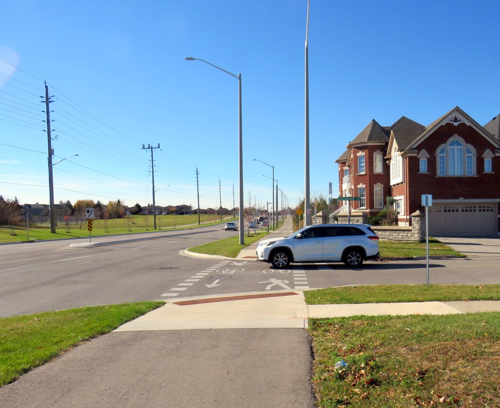
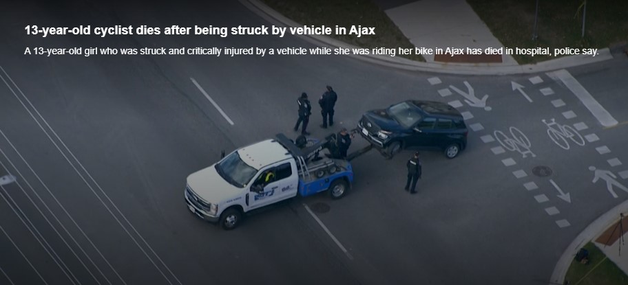
    On Thursday, November 7, at approximately 7:35 AM, a 13-year-old girl was struck and killed by the driver of a Hyundai Santa Fe (a midsized crossover SUV) at Rossland Road and Stevensgate Drive. The girl was riding a bicycle in a marked crossride, a crossing designated for both pedestrians and cyclists along a multiuse path, when she was struck and pinned beneath the vehicle.

    Multiuse paths (MUPs) are typically found in parks, particularly along waterbodies such as lakes, rivers, and creeks such as Lake Ontario or the Don River. They are shared by all sorts of people, including walkers, runners, cyclists, dog-walkers, rollerbladers, and wheelchair users, often coming into conflict on busy, narrow sections such as the Martin Goodman Trail or the Lower Don Trail.

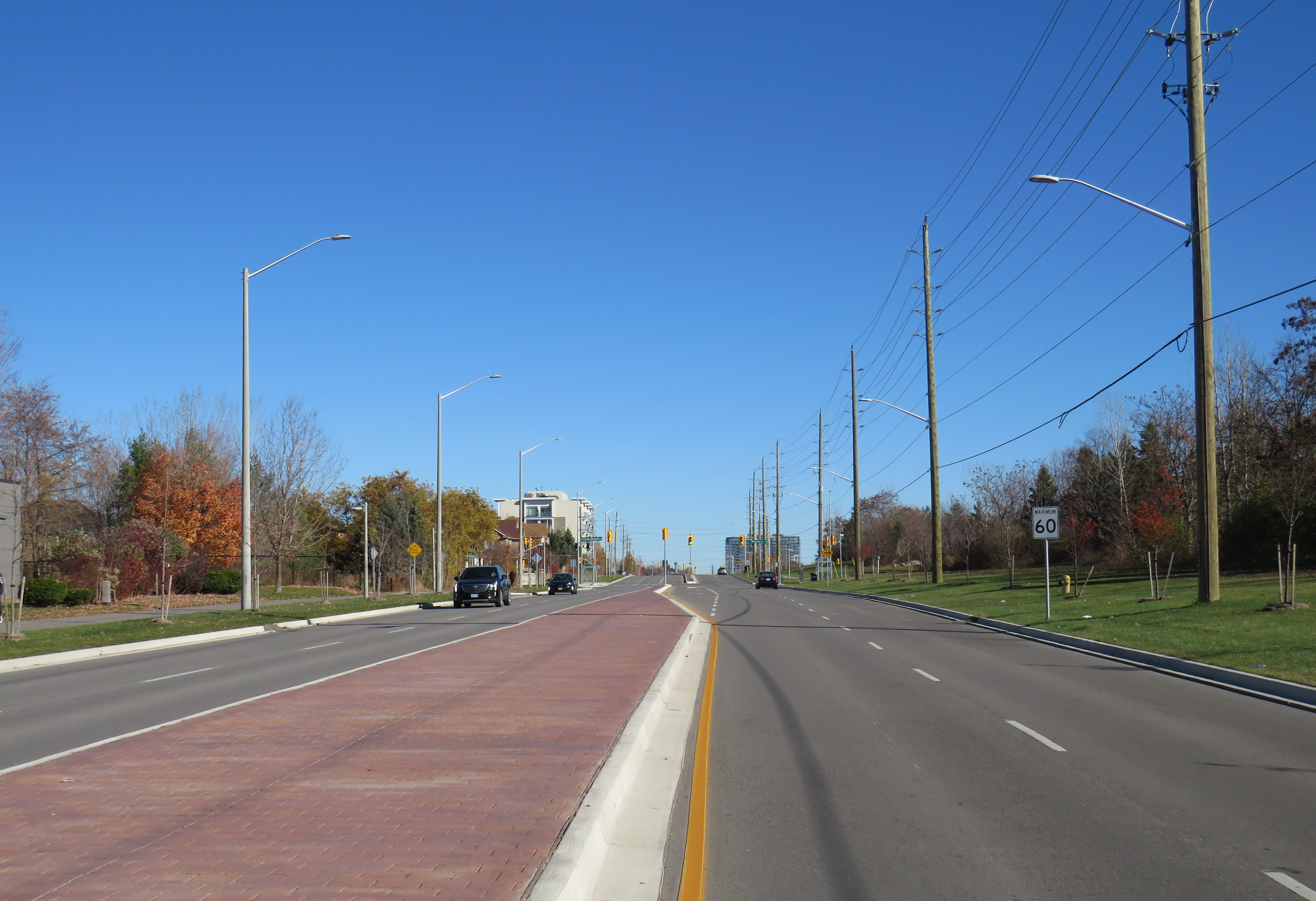
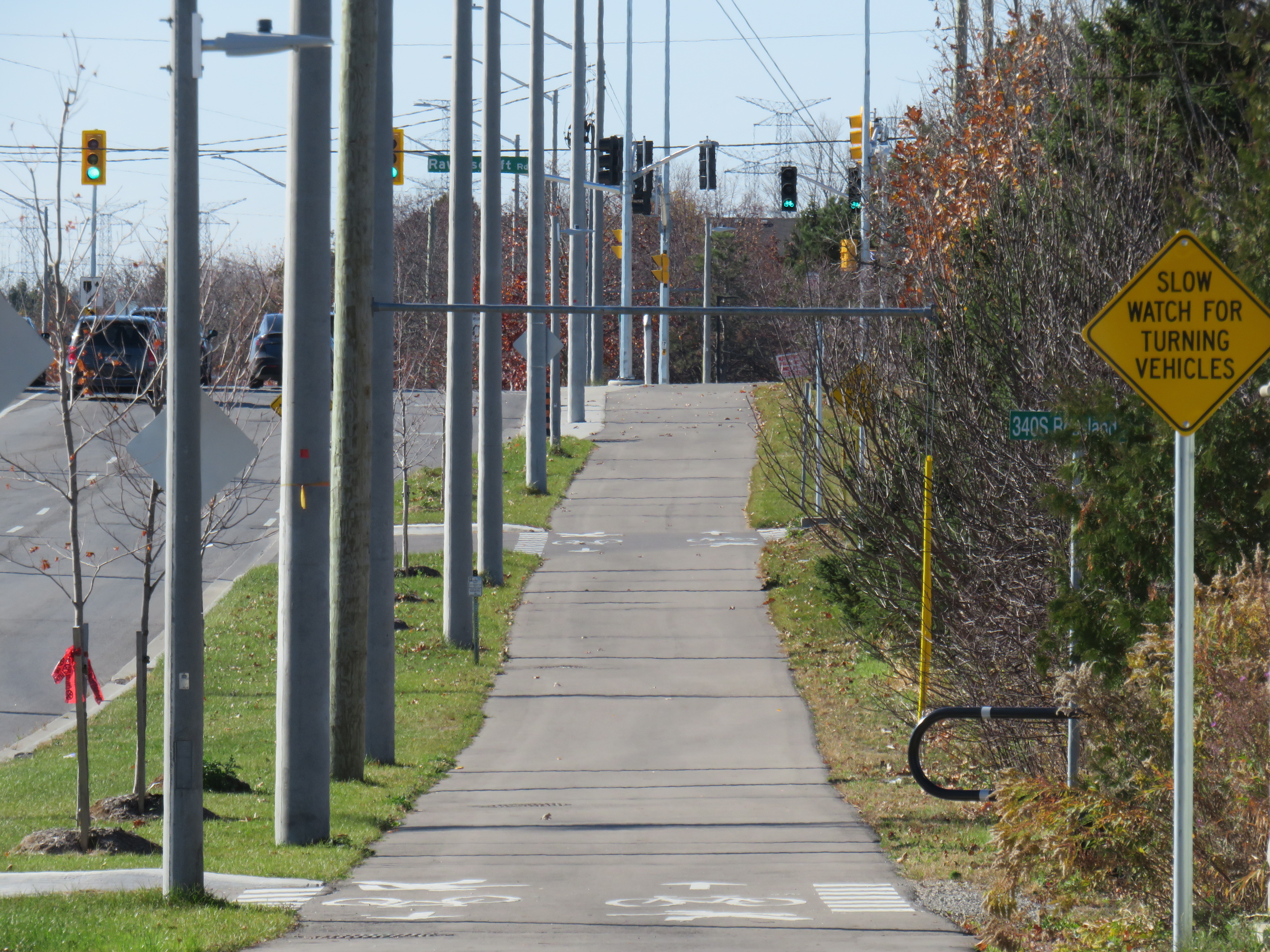
    In the suburbs surrounding Toronto (and in a few locations within the city, such as on Lake Shore Boulevard East and Eglinton Avenue West), MUPs are a popular form of cycling infrastructure along busier roads with higher speed limits. Older boulevard MUPs required cyclists to stop and dismount at road crossings (though these instructions were usually ignored). Newer and upgraded MUPs allow cyclists to ride across intersecting roadways, at marked crossrides. Signage advises motorists to watch for cyclists and advises cyclists to slow and watch for motorists and to yield to pedestrians. At signalized intersections, most new MUPs include dedicated bicycle signals.

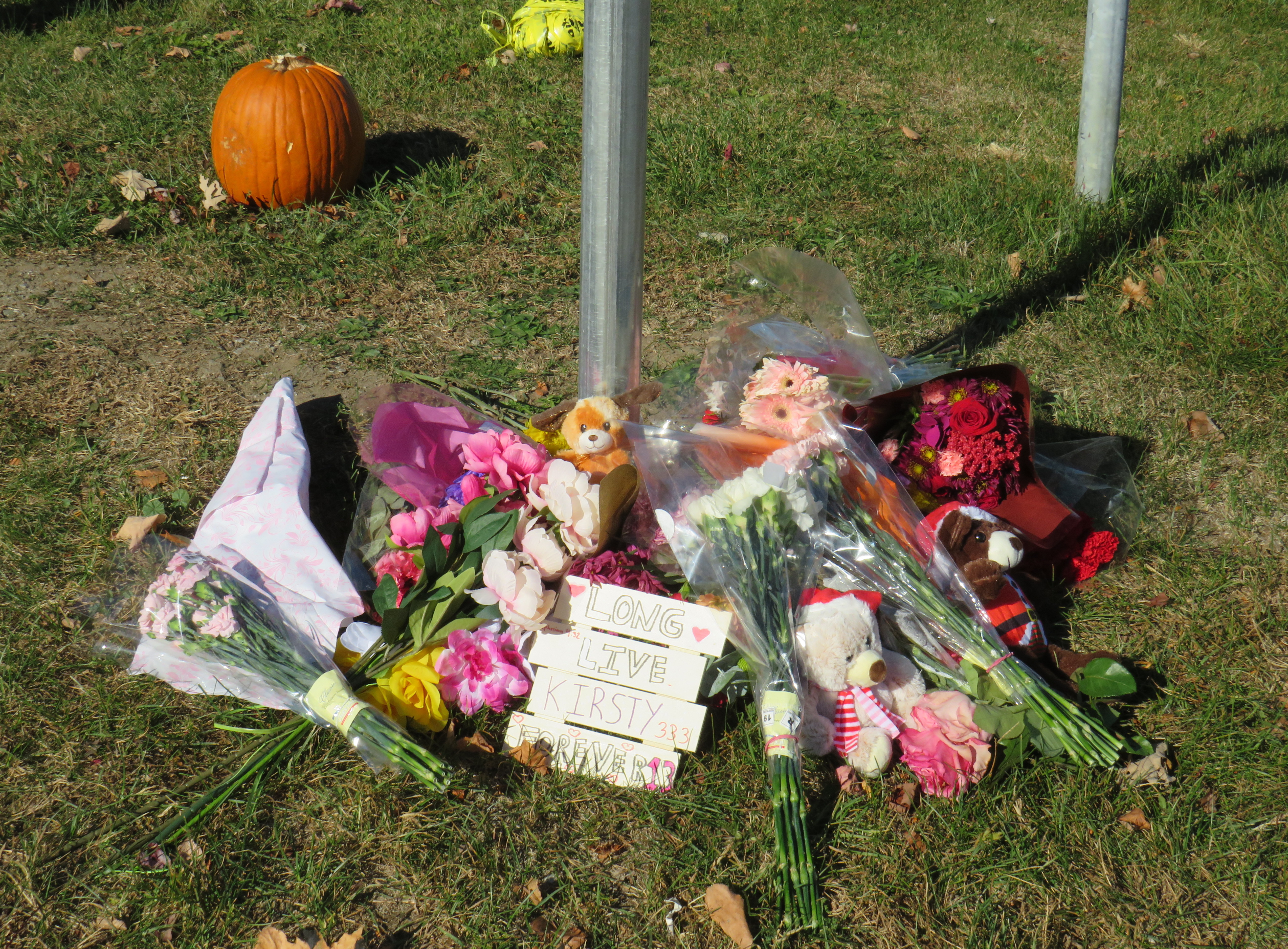
    It was at one of these new crossrides that Kirsty was struck and killed. Though no official police press release or any follow-up news articles provided the girl’s name, that name was clearly visible at the makeshift memorial next to where she was killed.

    Crossride at Stevensgate Drive, where a driver pulled out ahead into the crossride without stopping at the stop sign/stop line first.
    Crossride at Stevensgate Drive, where a driver pulled out ahead into the crossride without stopping at the stop sign/stop line first.

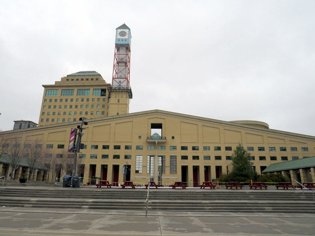
    Rossland Road was recently widened from two to four through lanes; a new multiuse path was built on the north side of the roadway, complete with crossrides and cyclist signals. Rossland Road is very much a road. There are no houses fronting onto the roadway, while the few driveways on Rossland provide access only to church and commercial plaza parking lots.

    Rossland Road in Ajax has two lanes in each direction, with a concrete median in between. The speed limit on Rossland is 60 km/h.

    Stevensgate Drive, which leads north from Rossland Road, is a quiet residential street with about two dozen homes and an evangelical church. A stop sign controls traffic at Rossland Road. Though Stevensgate connects to a large subdivision to the north, there are several other streets with signalized intersections that also provide access to the community.

    Motorists take wide turns pulling into Stevensgate Drive. The memorial is below.
    Motorists take wide turns pulling into Stevensgate Drive

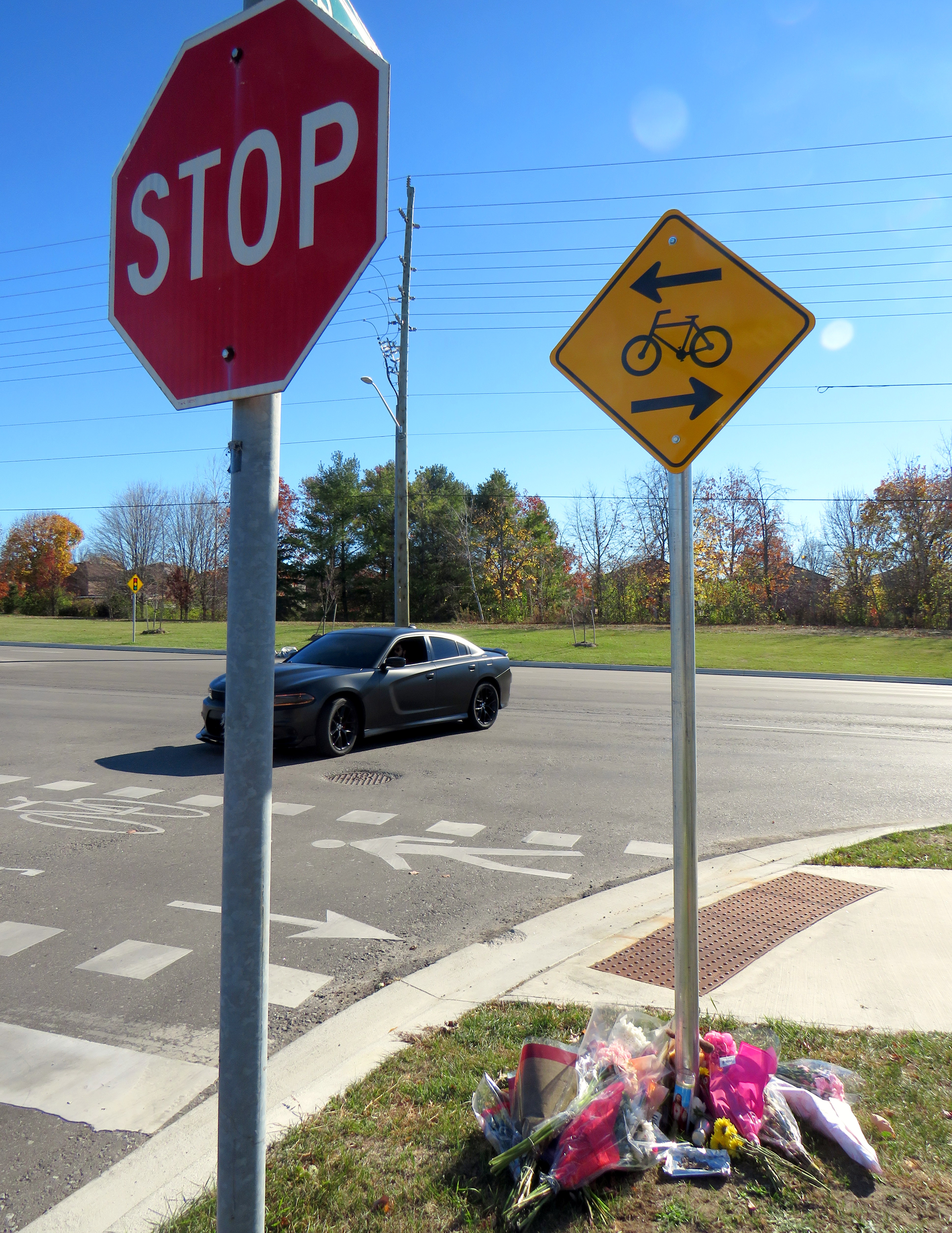
    When Kirsty was struck, it was by the southbound Santa Fe driver who would have passed a stop sign and a clearly painted stop line before entering the crossride. A CP24 news report clearly showed the vehicle being towed onto Rossland Road from the southbound direction. At 7:35 AM, it was daylight.

    Screenshot from CP24 report
    Screenshot from CP24 report

    Drivers rolling through stop signs are a common occurrence, even though the law clearly states that a full and complete stop at the stop sign and painted stop line is required before proceeding. Had the driver done so, this tragedy most likely would have been prevented.

    Looking west along the multiuse path from Stevensgate Drive, towards Ravenscroft Road
    Looking west along the multiuse path, towards Ravenscroft Road

    Two days later, on Saturday, November 9, I visited the scene. I noted the roadside memorial next to the stop sign facing Stevensgate Drive. While I was there, several people stopped to visit the memorial; at least two people left flowers and cards of sympathy.

    While there, I mounted a small digital camera on the trunk of a car parked on the west side of Stevensgate, about 75 metres north of the intersection, in a legal parking spot. The camera, mounted on a mini-tripod, was mostly inconspicuous. Within 25 minutes, five motorists improperly stopped after the stop line and into the crossride; two properly stopped before creeping up to make their turn. Two drivers also made fast, wide right turns into Stevensgate during that time. The edited video below shows motorists’ actions during that 25 minutes

    Video taken on Saturday, November 9 showing motorists driving south on
    Stevensgate Drive towards Rossland Road (3 minutes, 7 seconds)

    While taking photographs and recording the videos, a resident, who lived a few houses north of the intersection, came to talk to me, and asked if I knew the girl. I explained why I was there, and we had a short, but good chat, about the collision and road safety. He noted that it is hard to see traffic from the stop line, and that he has to pull forward before turning. But he agreed that the stop line was there for a reason, and that drivers often rush to get onto Rossland.

    Police enforcement is not necessarily the answer. There are too many intersections to watch, and the careless driving behaviours exhibited are normalized. In Toronto, it is cyclists on quiet streets and in public parks who are typically targeted at stop signs, not motorists, even though cyclists are the more vulnerable road users.

    In Washington DC, there are stop sign cameras mounted at specific locations, though there are only about a dozen of those throughout the city at any given time. These could provide a useful tool for targeted automated enforcement on Ontario’s roads to reinforce proper driving behaviour.

    A pole-mounted camera faces an all-way stop in Washington DC
    A pole-mounted camera faces an all-way stop in Washington DC

    Intersections should also be redesigned to improve the visibility of pedestrians and cyclists at crosswalks and crossrides and act to slow down motorists; raised sidewalks and path crossings would act as a speed hump as well as enhance visibility. A concrete island or short median at the stop sign would force motorists to approach the stop at a slower speed and prevent wide turns on to and off the intersecting street. A quick and inexpensive (though less-effective) solution could be to place wide knock-down bollards with supplemental crossing and stop sign messages in the middle of the roadway at each stop bar and crosswalk/crossride. Though this is best as a short-term measure.

    A wide knock-down bollard designed to provide additional visibility to a crosswalk
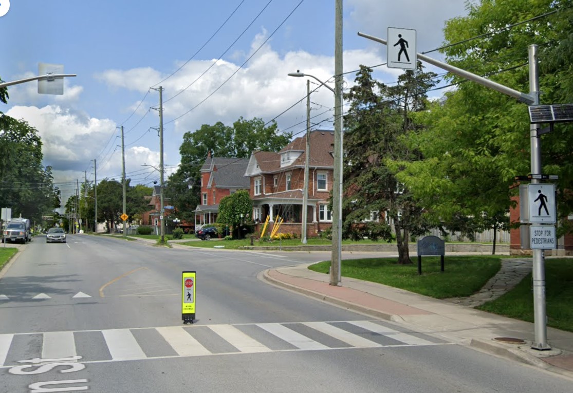
    (Milton, Ontario, via Google Streetview)

    As the provincial government vindictively overrides municipalities’ ability to provide safer on-road cycling infrastructure, off-street infrastructure, such as MUPs, will remain an important tool for promoting active transportation, especially in suburban areas and high-traffic neighbourhoods. Though boulevard MUPs provide separation from traffic in most cases, they are particularly hazardous at intersections, especially when motorists are distracted, aggressive, or just merely careless. There is much more that can and should be done to make them safer for all road users.

  • Can you walk to City Hall?

    Can you walk to City Hall?

    Mississauga City Hall, one of the most walkable municipal buildings in Ontario

    In late March 2024, with a streak of mild, sunny days, I was eager to get outside and walk. As I have long been interested in local politics and planning issues, public transit, active transportation (especially walking advocacy), I thought I would try to get to every city, town, and township hall in the Greater Toronto and Hamilton Area (GTHA) without a car.

    This was a fun project, even if there were times I felt really frustrated at times by poor transit and long hikes. The highlight of my quest was a tour of Mississauga City Hall from Councillor Joe Horneck. Mississauga’s civic centre is one of Ontario’s most iconic — and walkable — government buildings.

    Mississauga Council Chambers

    Of the three levels of government (federal, provincial, municipal), the municipal level has the most impact on the day-to-day lives of most Canadians; it is also the closest level of government to all. Residents can depute at committee meetings, get meetings with their local councillor and city staff, and obtain building permits, marriage licenses, or pay bills at city and town halls. Therefore, they should be as accessible as possible, especially to those without cars.

    Only one GTHA town hall (Caledon) was completely inaccessible without a car, though several other town halls required long walks from the nearest transit stop, making them inaccessible to some residents. But I could get to Brock Township, the least-populated and most-rural municipality in the GTHA, thanks to Durham Region Transit’s On-Demand service, though I had some difficulty there.

    The complete list of GTHA city and town halls, along with photographs and a map can be accessed here.

    Preview of Story Map

  • Some love for Ontario’s municipal flags

    Some love for Ontario’s municipal flags

    Flag of TorontoThe flag of the City of Toronto, designed by Renato De Santis, is an example of a very good civic flag

    I was in Orillia last week, mainly to check out the new Simcoe County Lynx bus system. While there, the flag flying from the Opera House (formerly the city hall) caught my attention. Most municipal flags are boring, usually consisting of the town or city’s coat of arms, shield, or logo on a plain background.

    Orillia municipal flag, with a yellow sun in the middle

    But Orillia’s flag is different. It has waving blue and white waves, with two green triangles facing the centre, and a bright yellow sun in the middle. The symbolism wasn’t difficult to figure out: the city’s position on the narrows between Lake Simcoe and Lake Couchiching, with the sun being a nod to Orillia author Stephen Leacock’s Sunshine Sketches of a Little Town, a light, humourous collection of short stories about the denizens of Mariposa, a thinly-veiled fictionalization of Orillia.

    Yet Canadian cities that boast populations twenty or thirty times that of Orillia can’t boast having such a fine flag.

    For the most part, we don’t think about state, provincial, and municipal flags, and that’s a pity. In the few cities that have an unique and powerful flag, they have become part of that city’s iconography. Unfortunately, though Toronto does have a very good civic flag, we don’t fly it like it should.

    According to the North American Vexillological Association, there are five principles for creating a good flag:

    • Keep it simple — so simple, it can be drawn by a child from memory
    • Use meaningful symbolism
    • Use two or three basic colours
    • Never use lettering or seals
    • Be distinctive or be related

    Canada’s flag, adopted in 1965, adheres to these principles perfectly. It uses just two basic colours: red and white. With a large red maple leaf in the middle, it’s easily recognizable around the world. While a child might not get the eleven-point maple leaf exactly right, it’s otherwise easy to draw from memory.

    There are, of course, exceptions to these principles.

    Maryland’s complicated state flag, based on the coat of arms of colony founder Cecil Calvert, Lord Baltimore, is distinctive and popular, nearly as common as the US flag. California’s state flag is emblazoned with the words “California Republic” but it has significant historical meaning. The flag of South Africa, adopted in 1994, has six colours, but by merging the Pan-African colours of the African National Congress with the red white and blue of Britain and the Netherlands, it represents unity in the post-apartheid era.

    Flags of Maryland, California, and South Africa, notable exceptions to the rules

    For the most part, famous and great civic flags adhere to these principles. The flags of Amsterdam, Berlin, Chicago, and Tokyo all stand out. In Chicago and Amsterdam, these flags are proudly flown from private homes and watercraft, found on t-shirts and souvenirs, and well known around the world. The bear from Berlin’s flag is almost as popular as the Ampelmännchen. Though Amsterdam’s flag’s origins go back centuries (the “x”s are actually St. Andrew’s crosses), it looks bad-ass, and on-brand for a city famous for its tolerance.

    Great civic flags: Amsterdam, Berlin, Chicago, Tokyo

    Compared to the great examples above, Ontario’s provincial flag is just bad. Compare the provincial red ensign with the flag of Manitoba, and then compare it to the Franco-Ontarien flag.

    The Ontario and Manitoba flags, British red ensigns defaced with the provincial shields, were only adopted in 1965 and 1966 as conservative reactions to the new flag of Canada. The two flags are difficult to tell apart from a distance, and they both contain the St. George’s cross (representing England) twice: once in the union flag in the canton, and again in the shield. There’s very little Ontario to be found. (At least the Manitoba flag contains a bison, a recognizable symbol of that province.)

    Meanwhile, the Franco-Ontarien flag is immediately recognizable, with the fleur-de-lis and a stylized trillium, the provincial flower, representing the French-Canadian presence in Ontario.

    Like Orillia, there are a few other civic flags in Ontario that get it right.

    Flags of Thunder Bay, Hamilton, Ottawa, and Toronto

    Thunder Bay’s flag depicts a rising sun above Lake Superior and the Sleeping Giant, a prominent natural landmark across the water. The flag of Hamilton includes a yellow cinquefoil, the badge of the Clan of Hamilton, with a steel chain with six large links representing the steel industry and the six municipalities amalgamated into the modern city. The flag of Ottawa contains the civic logo, with the points representing waterways and the Peace Tower on Parliament Hill. Finally, the flag of Toronto has an abstract depiction of Toronto’s city hall, with a maple leaf where the council chamber sits. The two towers also make a “T.”

    It’s a shame that Toronto doesn’t make more of its simple, yet great flag.

    Unfortunately, most flags look like those used by Ontario’s third and fourth largest cities.

    Mississauga’s flag violates most of the principles listed above by including the name of the place it represents, with the addition of “incorporated 1974” at the bottom. In the middle is the civic shield, with the typical trappings: a cog representing industry, a lighthouse representing a port (Port Credit), a waterwheel, a stalk of wheat, and wings, possibly representing Pearson Airport. Though Mississauga is a proud city with its own identity, this flag doesn’t appear except in front of civic buildings.

    Brampton’s flag is just the civic shield on a white background, again with similar trappings: a bushel of wheat, a plow, a steam locomotive, and a beaver. According to the city’s website, the gold colour and castle top signify the city’s relation with the small Cumbrian town of Brampton, England. The shield dates from the small rural town before post-war growth, with only a pine tree in the middle to represent the old township of Chinguacousy it merged with. There’s no recognition of Brampton’s modern identity as a multicultural city.

    But at least they’re not as bad as the worst city flag identified by the North American Vexillological Association, that of the city of Pocatello, Idaho, which manages to include the city slogan, a trademark, and a copyright notice. After some embarrassment, the city came up with a new, much better flag.

    Old Flag of PocatelloThe former flag of Pocatello, Idaho

    It would be wonderful to see Brampton and Mississauga come up with better designs. Brampton’s new logo and slogan, Flower City, better represents the city’s history and ambitions. A pretty good flag could be made out of that.

    As for Toronto, let’s embrace our flag more. It’s a fine one and far better than the province’s. As Torontonians generally think of themselves as Canadian first, Torontonian second, and Ontarian third, perhaps we should give our municipal banner more love.

  • Dispatches from Durham Region, and Kingston Road tokenism

    Two weeks ago, I was out exploring Durham Region, the eastern end of the Greater Toronto Area. While south Durham Region is mostly made up of generic suburban sprawl, there are some interesting historic villages and new urbanist neighbourhoods. North of Highway 7, Durham Region is still mostly rural, though plans for a new airport in North Pickering may change that.

    Sadly, Durham Region remains auto-centric in its outlook, even more so than other suburbs to the north and west of Toronto. The provincial government is constructing an eastern extension of Highway 407, with two new connecting highways to Highway 401 either nearly complete, or proposed. Oshawa, the largest city in Durham, is the birthplace of General Motors Canada, but while the auto industry declines, the city has been continuing to make many civic planning mistakes. And in Ajax, a small symbol of change – new bus and bicycle lanes – is still merely a token effort.

    (more…)