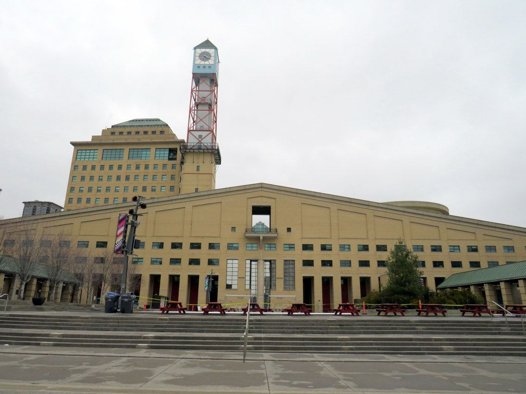
Mississauga City Hall, one of the most walkable municipal buildings in Ontario
In late March 2024, with a streak of mild, sunny days, I was eager to get outside and walk. As I have long been interested in local politics and planning issues, public transit, active transportation (especially walking advocacy), I thought I would try to get to every city, town, and township hall in the Greater Toronto and Hamilton Area (GTHA) without a car.
This was a fun project, even if there were times I felt really frustrated at times by poor transit and long hikes. The highlight of my quest was a tour of Mississauga City Hall from Councillor Joe Horneck. Mississauga’s civic centre is one of Ontario’s most iconic — and walkable — government buildings.
Mississauga Council Chambers
Of the three levels of government (federal, provincial, municipal), the municipal level has the most impact on the day-to-day lives of most Canadians; it is also the closest level of government to all. Residents can depute at committee meetings, get meetings with their local councillor and city staff, and obtain building permits, marriage licenses, or pay bills at city and town halls. Therefore, they should be as accessible as possible, especially to those without cars.
Only one GTHA town hall (Caledon) was completely inaccessible without a car, though several other town halls required long walks from the nearest transit stop, making them inaccessible to some residents. But I could get to Brock Township, the least-populated and most-rural municipality in the GTHA, thanks to Durham Region Transit’s On-Demand service, though I had some difficulty there.
The complete list of GTHA city and town halls, along with photographs and a map can be accessed here.
On Monday, October 30, the new Old Elm GO Station opened in the town of Whitchurch-Stouffville, northeast of Toronto. Located two kilometres away from Stouffville’s small downtown core, Old Elm is focused on park-and-ride passengers arriving from nearby communities such as Goodwood, Uxbridge, Port Perry, Beaverton, and from within Stouffville itself.
The new station is relatively simple, with a covered platform, a bus loop with several bays directly adjacent to the single platform, heated shelters, and a 673-spot parking lot. As a relatively quiet station with limited train service, there is no indoor waiting room or ticket office.
The bus loop is directly adjacent to the train platform
Though train service is limited to weekday rush hours and a few evening and weekend departures, there is regular GO Transit bus service connecting Uxbridge and Goodwood to Old Elm Station, and onwards to midday and weekend train connections at Mount Joy or continuing to Toronto Union Station. There are no York Region Transit connections at Old Elm.
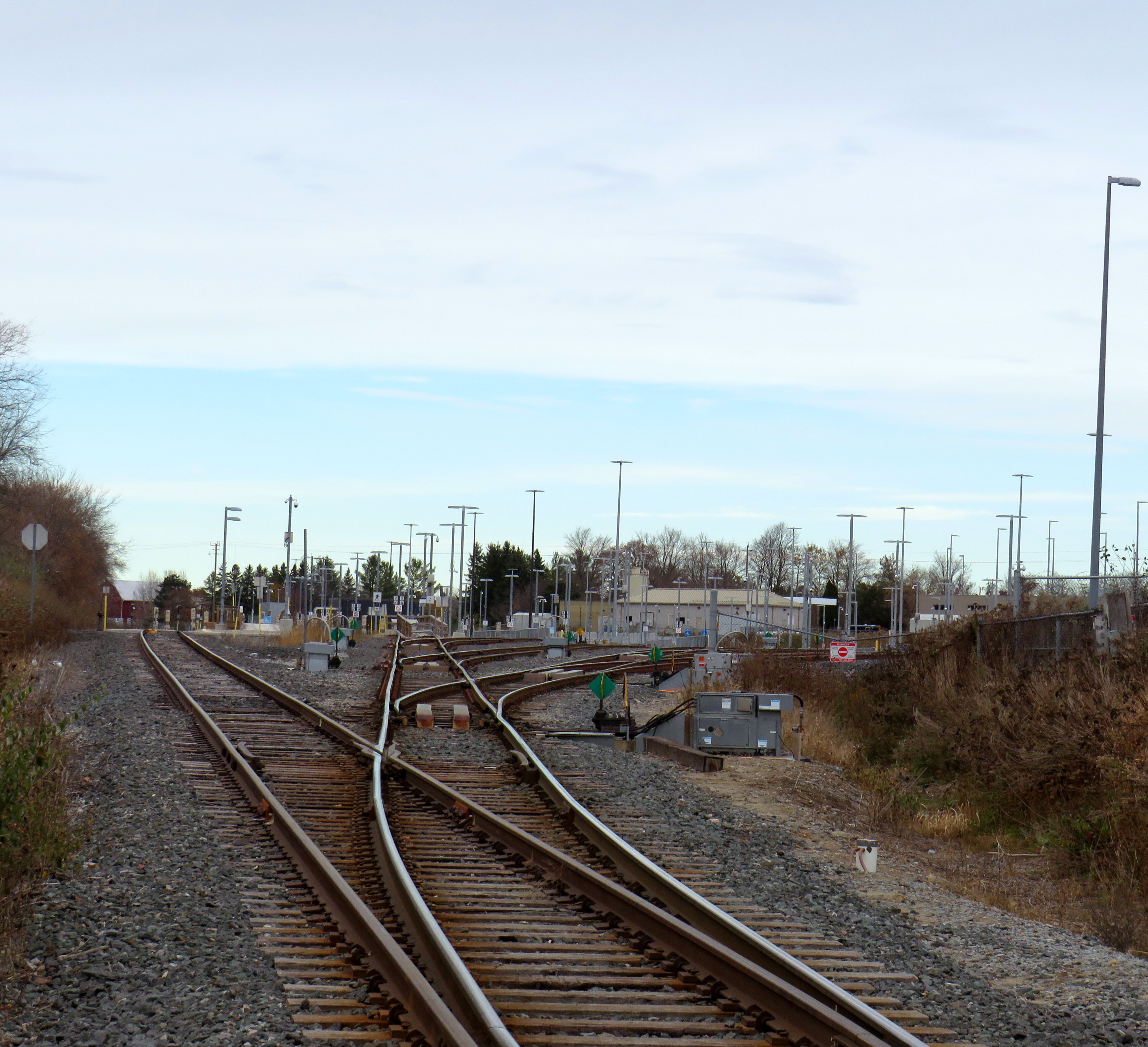
The Lincolnville layover yard, which was also the Lincolnville/Old Elm station location until October 2023
Previously, Old Elm Station was located a few hundred metres away, northeast of the Tenth Line/Bethesda Side Road intersection at the Lincolnville layover yard, where Stouffville Line trains continue to be stored overnight and weekends. That station, originally named Lincolnville for a nearby hamlet, was opened in 2008 to accommodate service expansion and relieve the small station at Stouffville, which had no room for a bus loop or additional parking. Since Lincolnville was a yard terminus, passengers had to walk across tracks to reach the next departing train, and each departing and arriving train had to crawl through the yard before reaching the mainline. (As Georgetown GO Station is also within a layover yard, trains passing through on their way to and from Kitchener must also crawl through. A new layover yard near Heritage Road in Brampton will allow for a rebuilt Georgetown Station with faster arrivals and departures.)
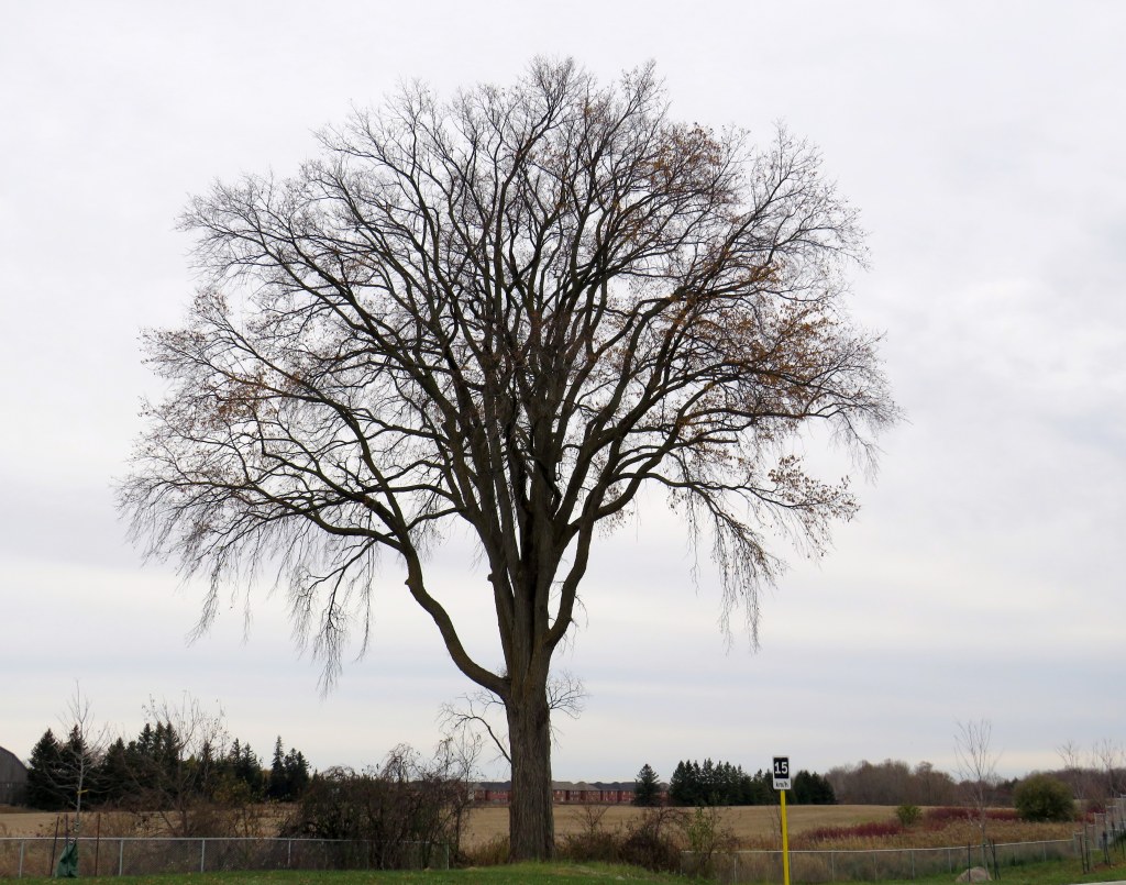
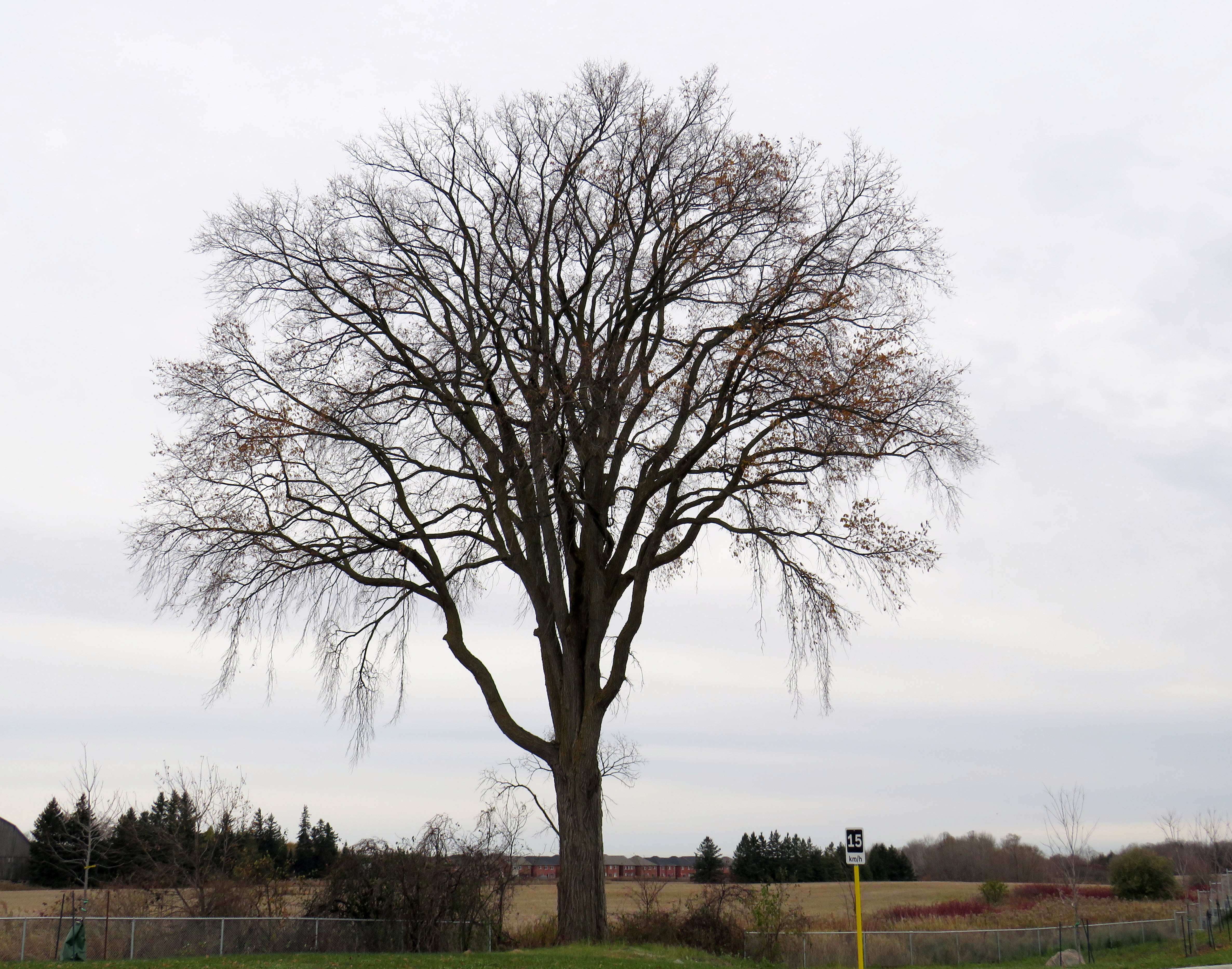
Lincolnville Station was confusingly renamed Old Elm in 2021, even though that new name referred to a tree on the new station site that didn’t open for two more years. Had the new name taken effect with the location change, it would have made more sense.
The new station site, located outside of the Lincolnville yard, allows for smoother and faster arrivals and departures, shaving several minutes off the trip for passengers to and from Lincolnville.
The station’s namesake, an old elm tree on the south end of the GO Transit property
Though Lincolnville/Old Elm is located in the Greenbelt, and the station is unable to support transit-oriented urban development, there was a need for the layover yard. Adding a small, auto-focused station was quite sensible. This is no Garage Mahal.
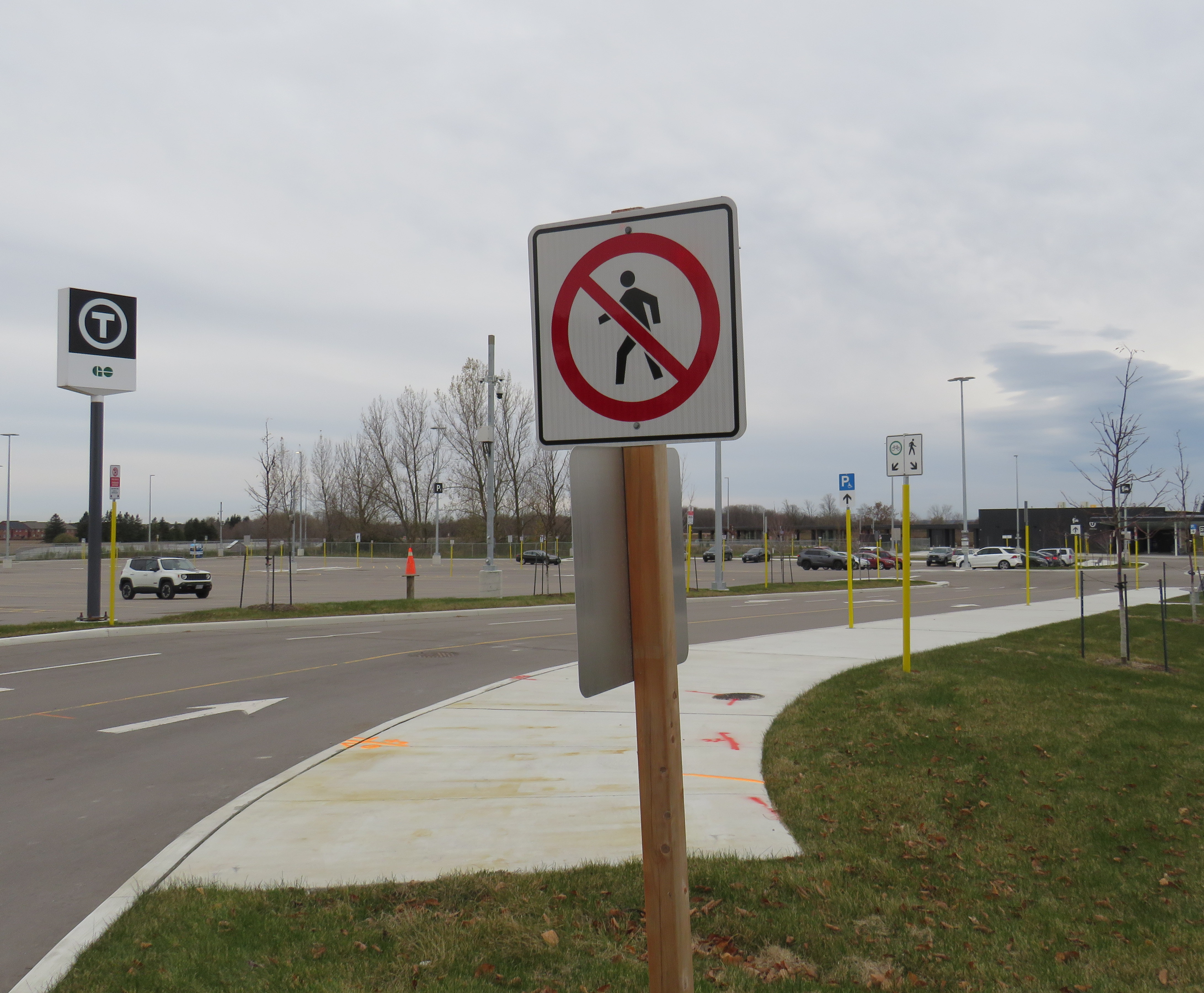
The one unfortunate feature is the complete lack of active transportation access beyond the station property. Though Metrolinx built a wide concrete walkway from Tenth Line to the station platforms, there are no sidewalks, no crosswalks, and no pedestrian signals at either the main entrance or the bus loop entrance, which are both signalized intersections. Instead, there are “no pedestrians” signs facing all directions.
“No pedestrians” sign placed in front of the new concrete pathway into Old Elm Station
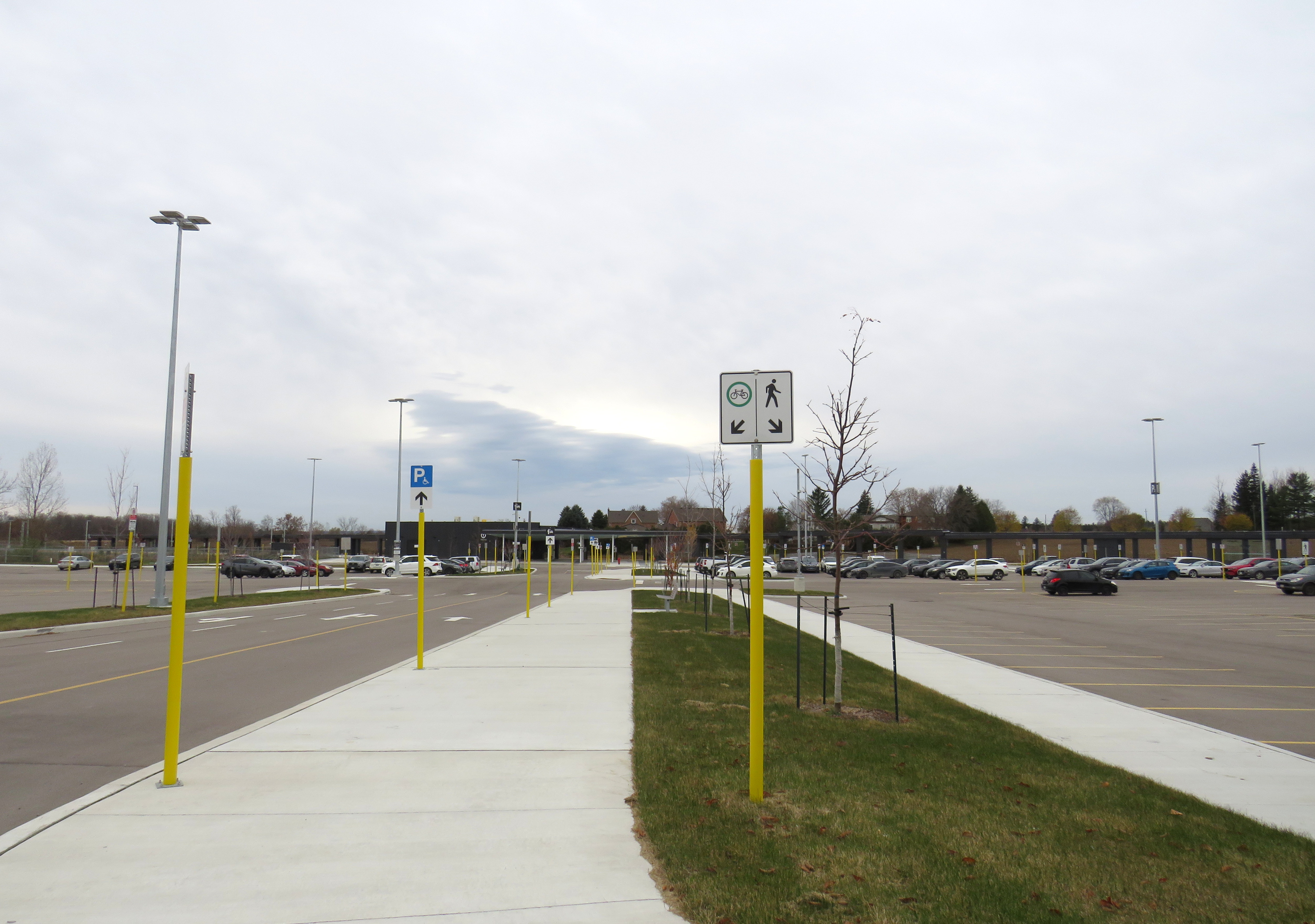
Once on Metrolinx property, though, there is a wide pathway, presumably for cyclists and pedestrians. Interestingly, the sign below shows that cyclists should keep to the left, on the wide pathway, while pedestrians are directed into the grass to the right.
Beyond the “no pedestrians” sign at the intersection, another sign instructs cyclists to keep to the left and pedestrians to the right – into the grass
I doubt Metrolinx intended for the hostile intersections to forbid any pedestrian activity. I note too that despite the rural locale, there are several neighbouring homes and businesses along Tenth Line and Bethesda Side Road. The nearest subdivision is less than a 15-minute walk away, a healthy stroll’s distance. A new residential development, Elm Villa, is planned for the site immediately to the south of the bus loop. Tenth Line is maintained by the Town of Whitchurch-Stouffville, so it is likely they are responsible for the oversight. Still, it is not a great look.
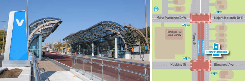
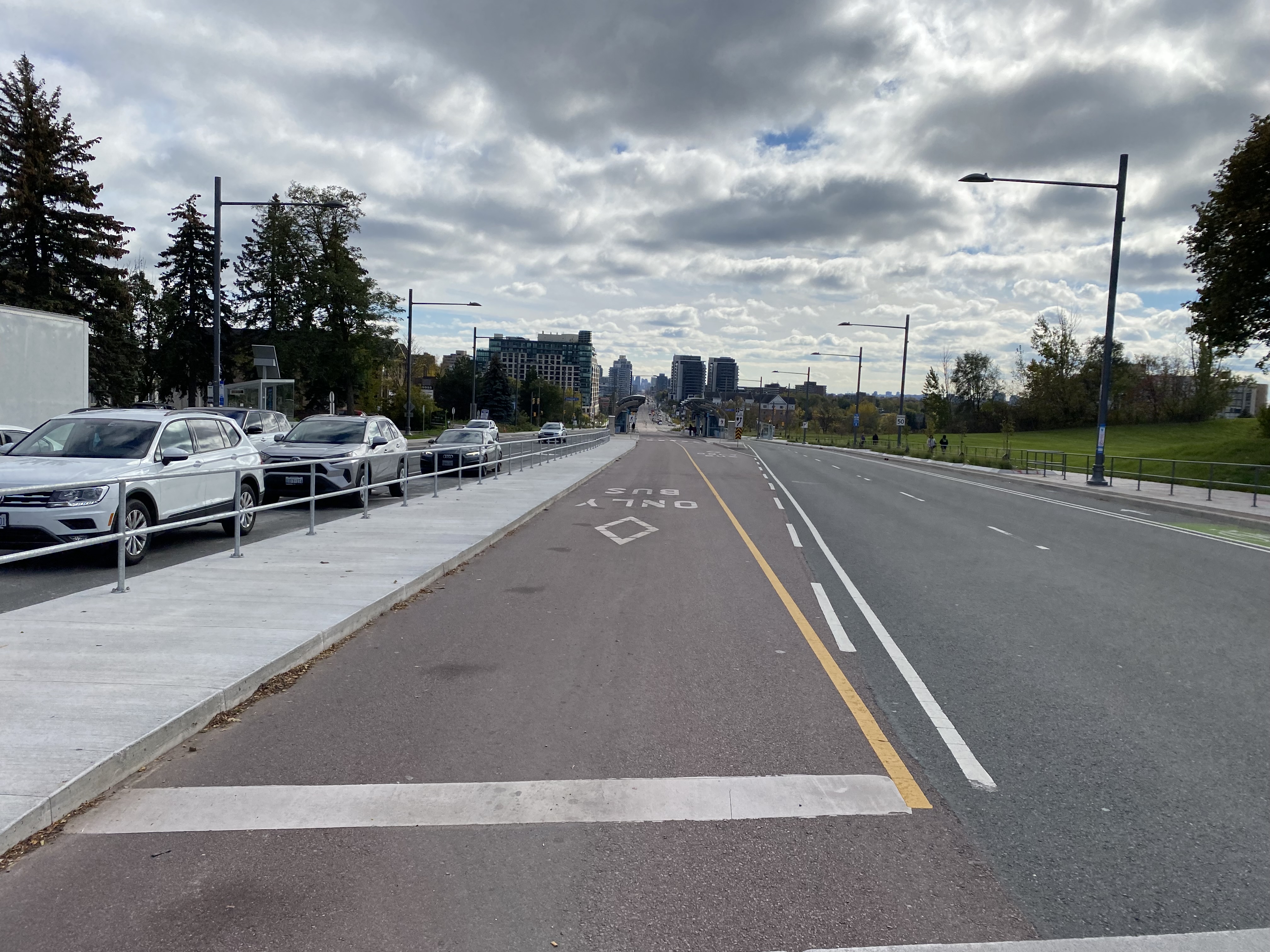
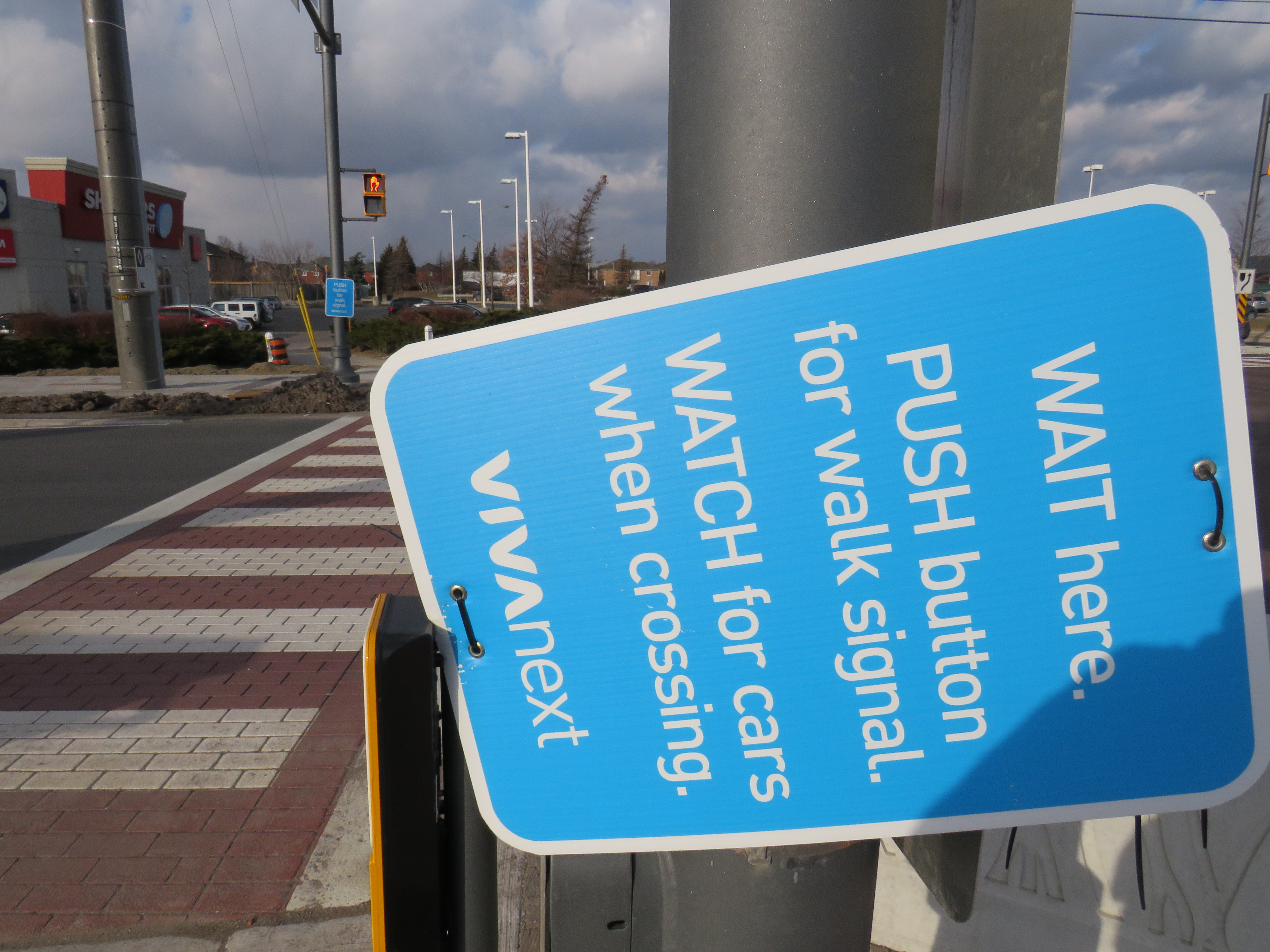
Earlier this year, I wrote about a major malfunction at a new Viva Rapidway station near Downtown Richmond Hill. The Major Mackenzie station on Yonge Street was built one block south of the busy east-west arterial road; passengers taking Viva buses were forced to walk from Major Mackenzie Drive south to the intersection of at the intersection of Elmwood Avenue and Hopkins Street, push a “beg button” and wait to cross to the bus platforms in the middle of Yonge.
The reason for this unusual situation was that the Yonge Street right-of-way narrows through Downtown Richmond Hill. At Major Mackenzie Drive, northbound Viva buses must enter mixed traffic for approximately two kilometres before returning to a median busway. (The northbound traffic signal at Major Mackenzie has a dedicated transit phase that allows Viva buses to exit the median ahead of general traffic.) This required the median Viva bus stop (called a VivaStation) to be located considerably south of the intersection of Yonge Street and Major Mackenzie Drive.
Back in February, temporary barriers and YRT transit enforcement officers were used to dissuade transit customers from Back in February, temporary barriers and YRT transit enforcement officers were used to dissuade transit customers from taking the faster and direct, yet more dangerous, route to Major Mackenzie Drive and connecting east-west buses by crossing midblock north of the platform, the faster and direct, yet more dangerous, route to Major Mackenzie Drive and connecting east-west buses.
The Major Mackenzie VivaStation and layout, February 2021
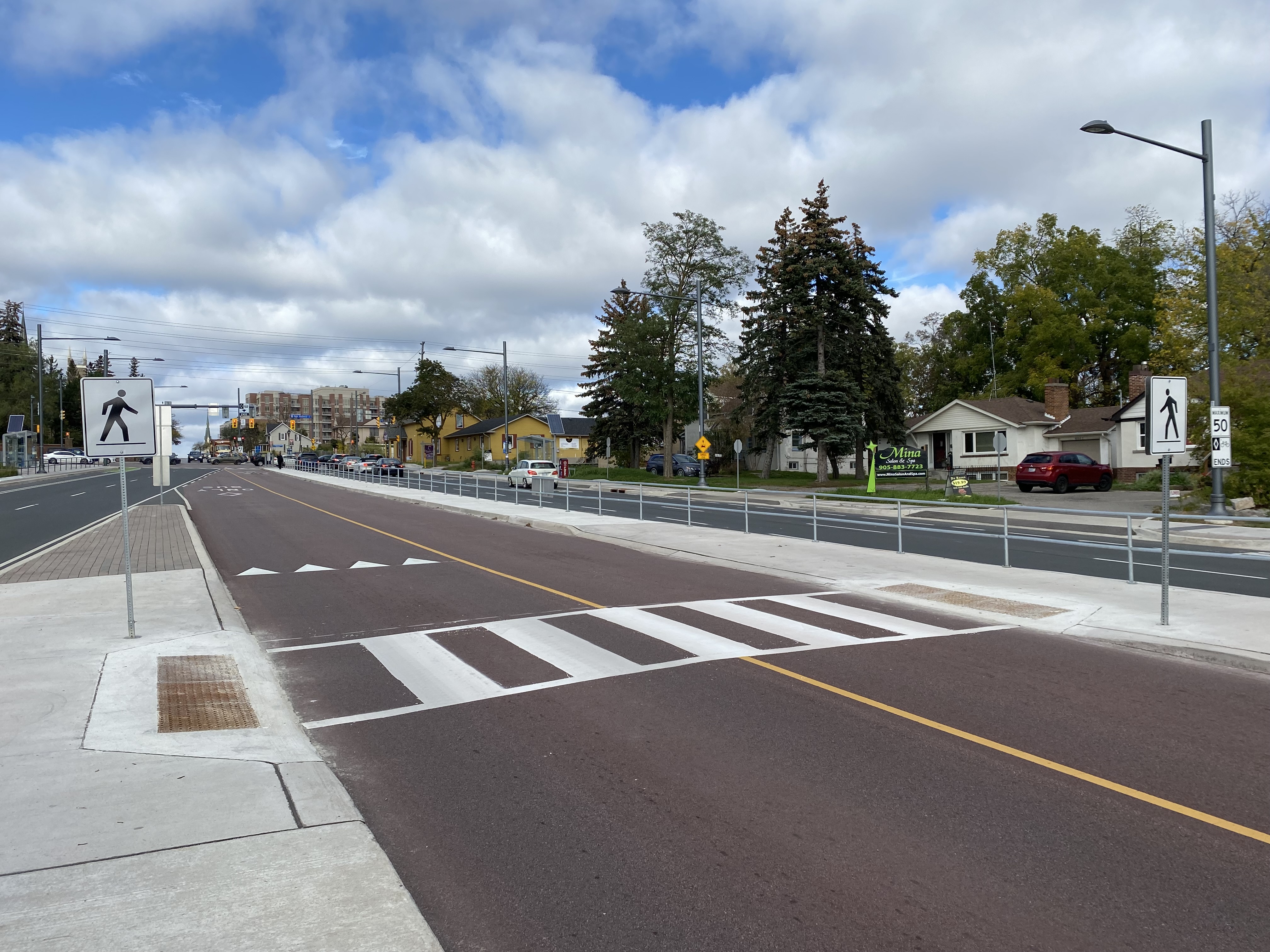
To my pleasant surprise, York Region fixed its mistake. Though the revised station is not ideal (it is still a long walk from Major Mackenzie Drive itself), a new walkway alongside the east side of the bus right-of-way from the VivaStation to the Major Mackenzie intersection makes the transfer to and from buses on Major Mackenzie much simpler.
Looking south from Major Mackenzie Drive
Just north of the bus platforms, a signed crosswalk allows passengers to go from the walkway and northbound platform to the southbound platform on the west side of the bus right-of-way.
Looking north towards Major Mackenzie Drive at the new crosswalk, which allows passengers to go between the southbound bus platform to a new walkway connecting the Major Mackenzie VivaStation to its namesake street.
Permanent metal rails prevent passengers from crossing Yonge Street until they get to the signalized intersection at Major Mackenzie. But transit enforcement officers were nowhere to be seen on this visit, on a Friday afternoon.
Metal barricades deter pedestrian crossings outside of signalized crosswalks.
Unfortunately, to make room for the walkway between the station and Major Mackenzie Drive, the northbound bicycle lane was cut, and replaced with “sharrows.” Though the new bicycle lanes on Yonge ended at Major Mackenzie (not enough room if you have to maintain four through traffic lanes through a historic town centre), this diminishes the gains cyclists made with the reconstruction of Yonge Street for the BRT lanes.
When surface transit projects — like the Viva Rapidways — are designed to fit into existing suburban roadways, compromises to the passenger experience are made. At Richmond Hill, this meant maintaining two traffic lanes in each direction while trying to squeeze a bus rapid transit station into the roadway. This resulted in the original blunder, which should have been thought though earlier in the planning stages.
The fix is not perfect, but it at least addresses the problems with the Major Mackenzie BRT station. Perhaps, one day, we will plan for transit, walking, and cycling first in places like Downtown Richmond Hill, rather than planning for private motor traffic first.
On Thursday, August 12, I rode the train to the very end of the Richmond Hill Line to check out GO Transit’s newest station.
In 2017, I made a similar trip to Gormley Station, just to the south of Bloomington GO, soon after that station opened to the public. Four years ago, I was critical of Metrolinx’s failures to support the urban intensification of the Greater Toronto and Hamilton Area (GTHA) by building new stations on the Greenbelt, on lands that will not support transit-oriented development.
Though I came away from Gormley Station disappointed, I wanted to see Bloomington Station for myself and give it an honest assessment. I came away with mixed feelings.
Most GO Stations outside the old City of Toronto put free car parking ahead of all other considerations. Some stations, such as Unionville, were even moved to sites where large surface lots could easily be built. Hamilton GO Centre, opened in 1996, was an exception: an urban station that combined a restored heritage building with a large bus terminal. A few other newer stations, such as Mount Pleasant in Brampton and Mount Joy in Markham, still had large surface parking lots, but also had easy walking connections to adjacent neighbourhoods. In Guelph and Kitchener, GO Transit used existing downtown stations instead of suburban stations, and Allandale Waterfront Station is located right across the street from Barrie’s gorgeous Kempenfelt Bay.
Gormley and Bloomington Stations represent a return to GO Transit’s old ways of putting parking ahead of all other considerations, despite Bloomington’s modern design.
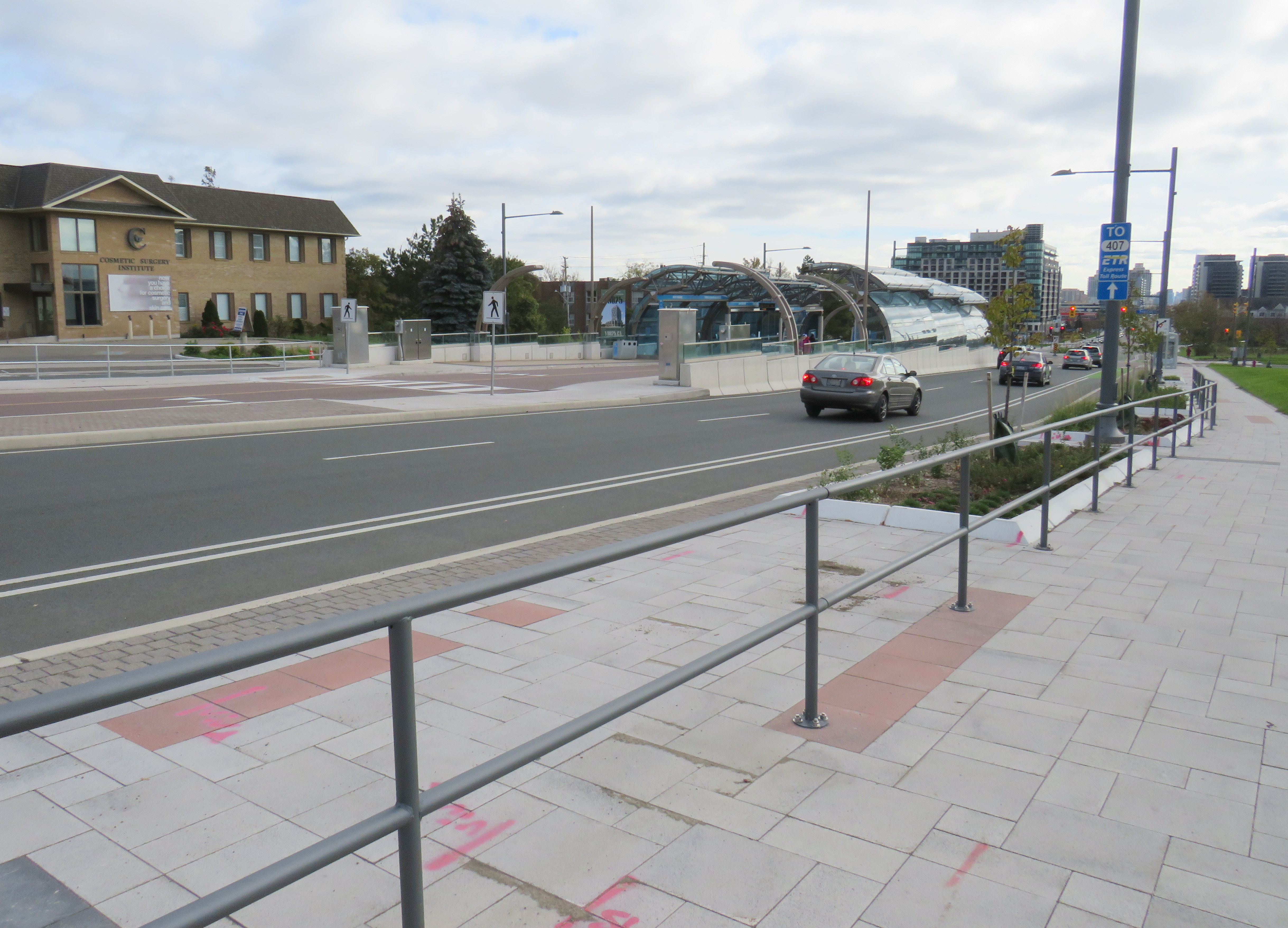
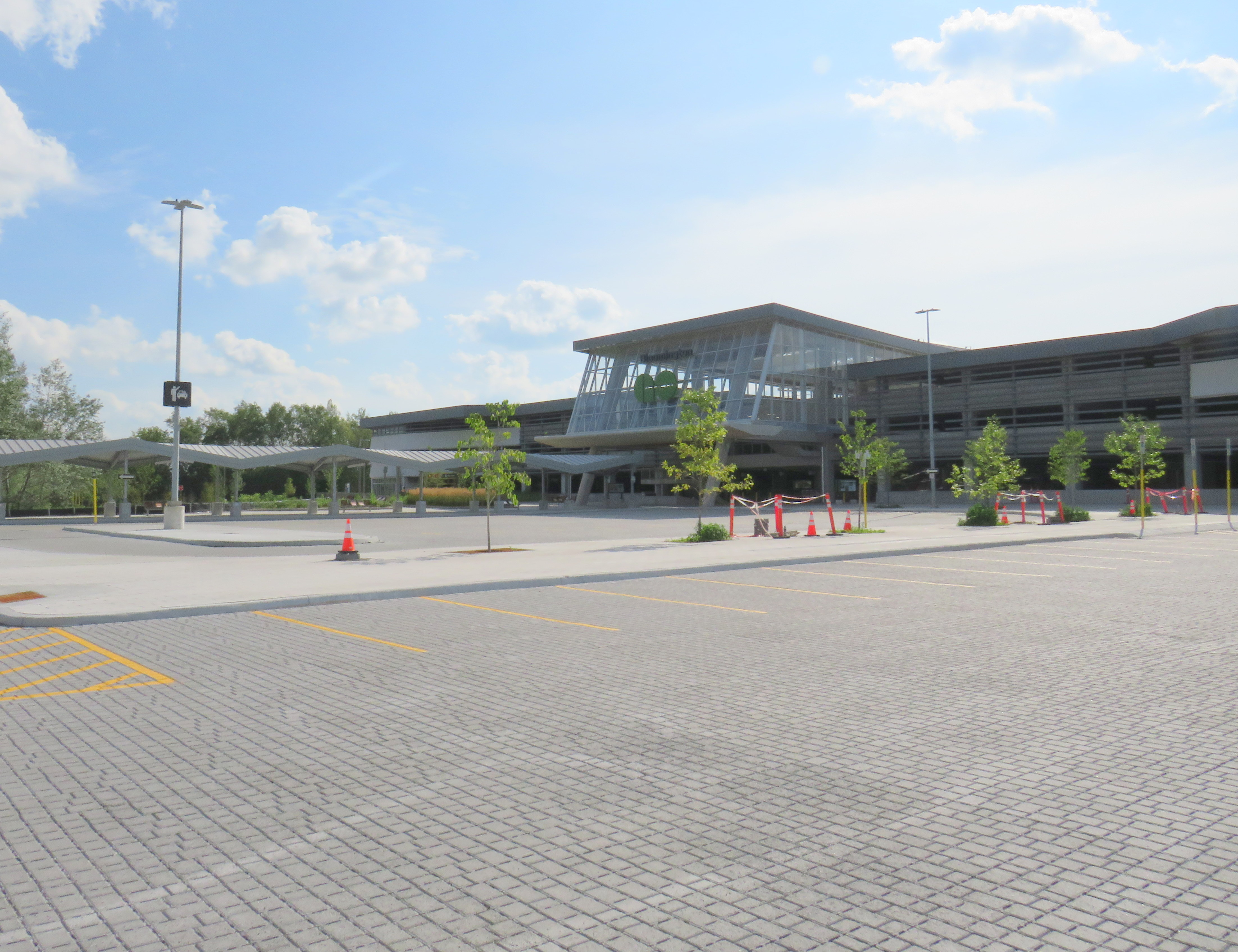
Metrolinx, the provincial agency responsible for planning and constructing transit infrastructure in the GTHA and for operating GO Transit, opened Bloomington Station on June 28, 2021. The station is located on Bloomington Road, adjacent to Highway 404, on the boundary between Richmond Hill and Aurora.
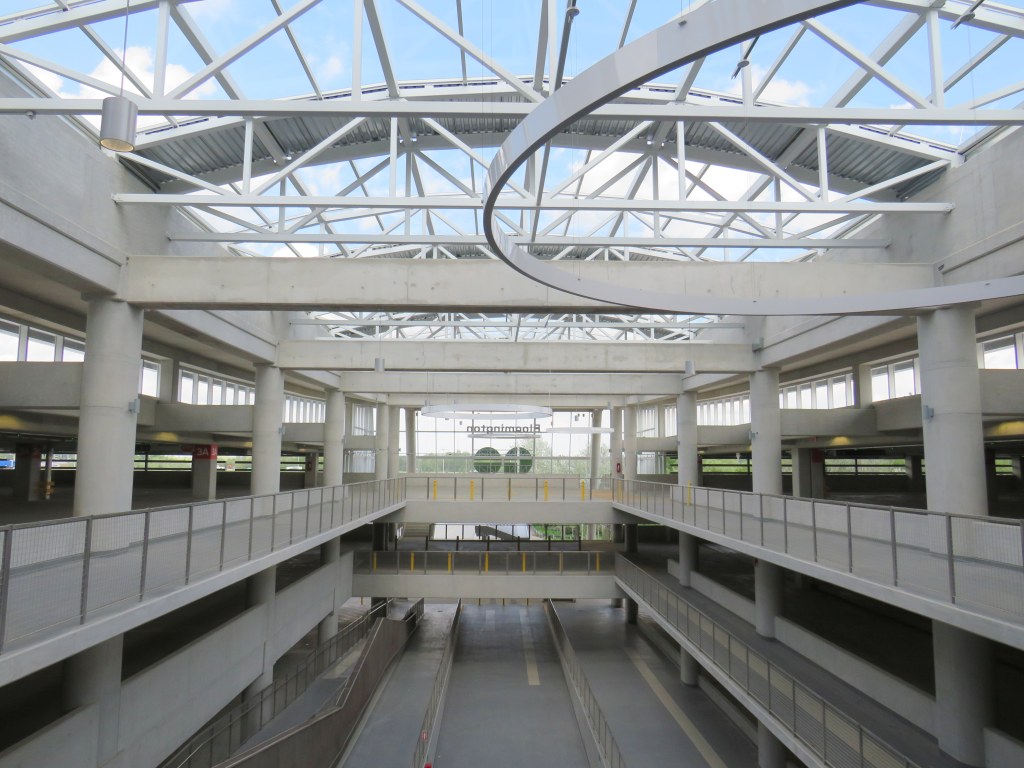
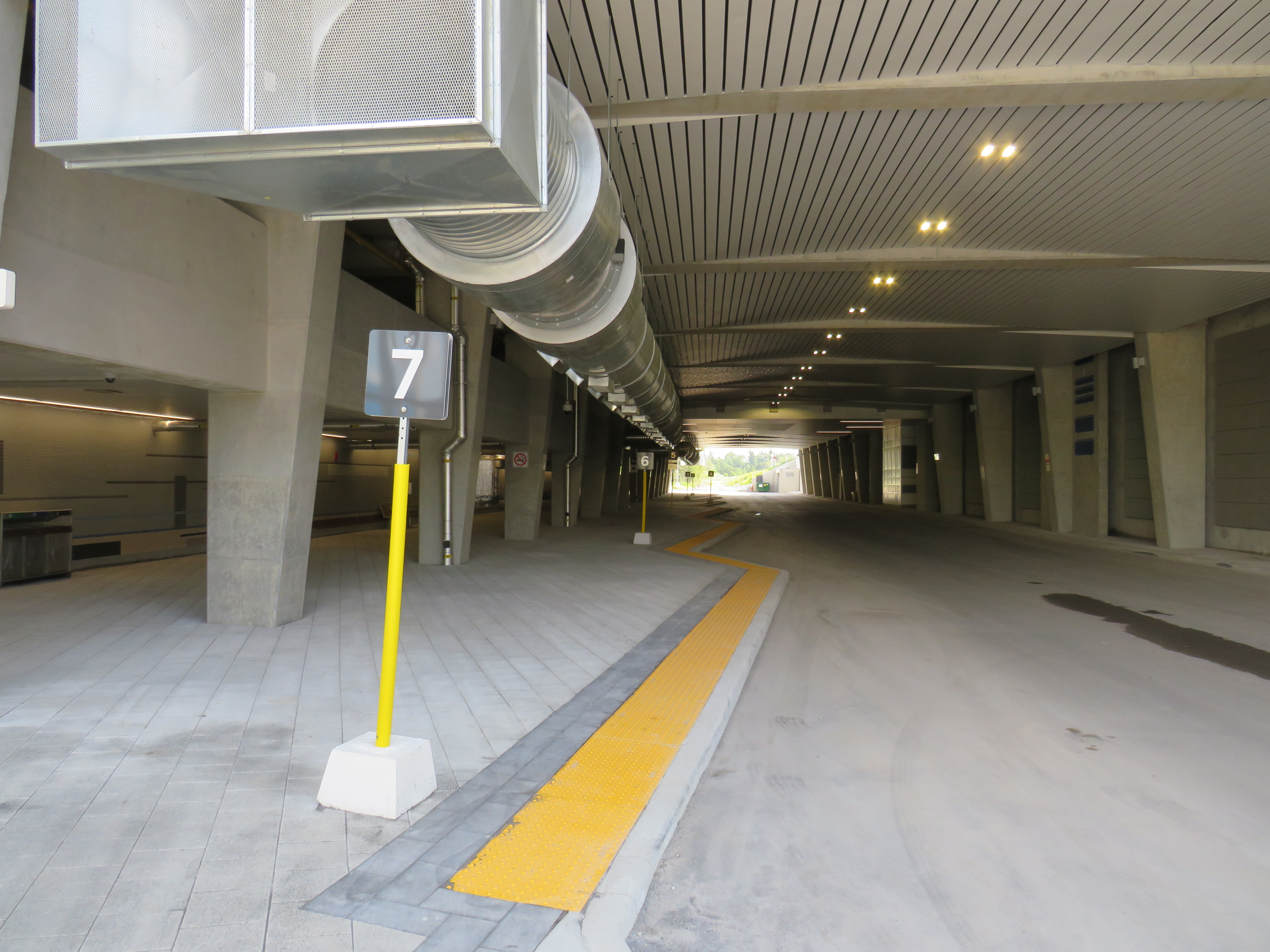
The station is built around a three-storey parking garage tucked into a hill, with the train platform and station amenities (an enclosed waiting room with washrooms and a ticket counter) on the second level. At the lower level, there is a six-bay bus loop almost directly below the rail platform, minimizing the distance between train and bus. Elevators, stairs, and ramps connect the three levels of parking, the bus bays, and the train platform.
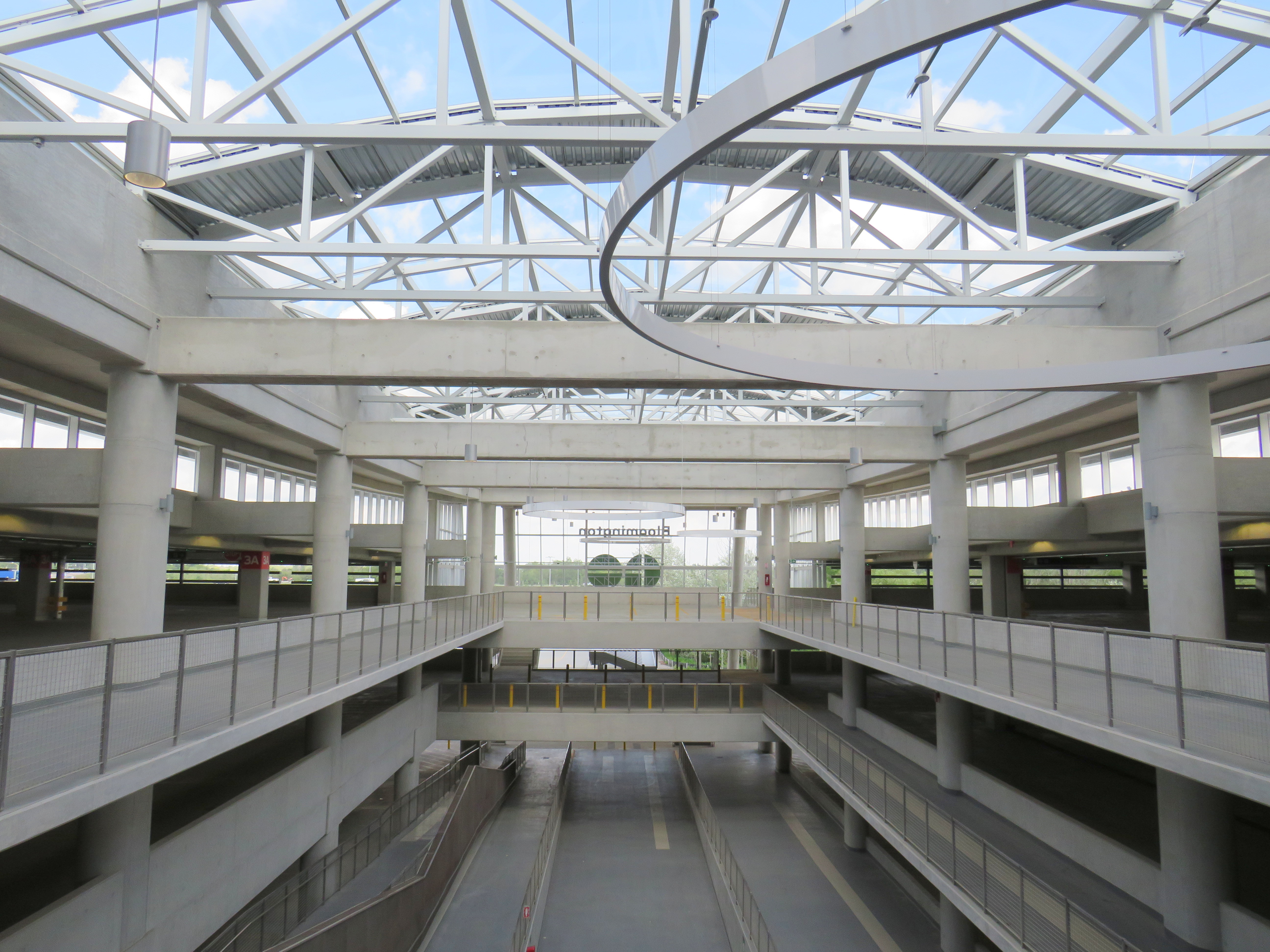
The station’s central atrium, which contains the pedestrian passages between parking levels, station, and platforms, is the architectural highlight. Above the parking areas, solar panels collect some of the energy required to light and heat the station.
Atrium at Bloomington Station, with parking spaces on both sides
In its blog, Metrolinx expressed pride in the new station, noting it was built to achieve LEED Gold certification through features such as energy efficient lighting, a water-permeable surface lot, stormwater management, and a pond for local wildlife with an underground passage to help animals migrate away from the station complex. Like most new GO platforms, Bloomington’s train platform is heated to allow snow and ice to melt, reducing salt usage. Finally, as far as suburban GO stations go, Bloomington’s footprint is quite compact. It cost $82.4 million to build the new station.
Plaque adjacent to wetland at Bloomington GO StationPermeable surface at Bloomington’s outdoor surface lot and passenger pick-up and drop-off area
Despite these innovations, a LEED certification can only go so far when the GTHA’s newest transit station is only accessible by car, with over 1,000 parking spaces. Though transit ridership is down significantly during the ongoing pandemic, especially on GO’s Richmond Hill Line (which operates only in the weekday peak-period direction and currently uses four-car trains), there are no ongoing connections from Bloomington GO Station operated by GO buses or York Region Transit.
Though several GO rail stations do not have any local transit connections only Bloomington and Gormley have no bus connections at all. (In April 2020, YRT discontinued the limited-service Route 15 that ran past Gormley Station). At Acton, Georgetown, and Lincolnville, which also do not have any local transit connections, passengers can still connect to GO buses for points beyond, or make a return trip.
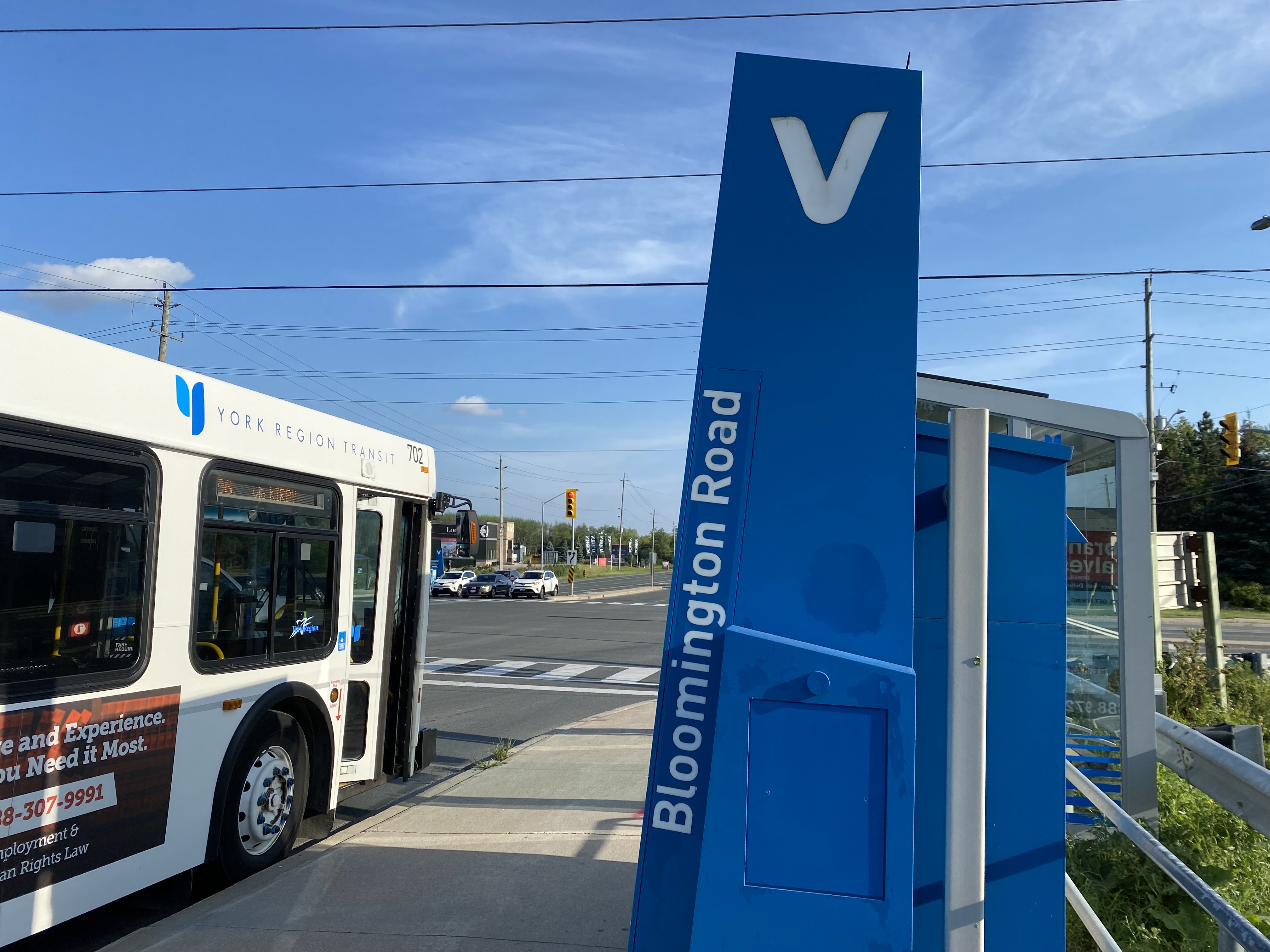
The only bus operating at Bloomington Station’s loop is GO Route 61, which provides supplemental weekday service between Union Station and Bloomington GO. But the last Route 61 bus leaves for Union at 1:55 PM.
There was no bus connection to be found at Bloomington GO Station
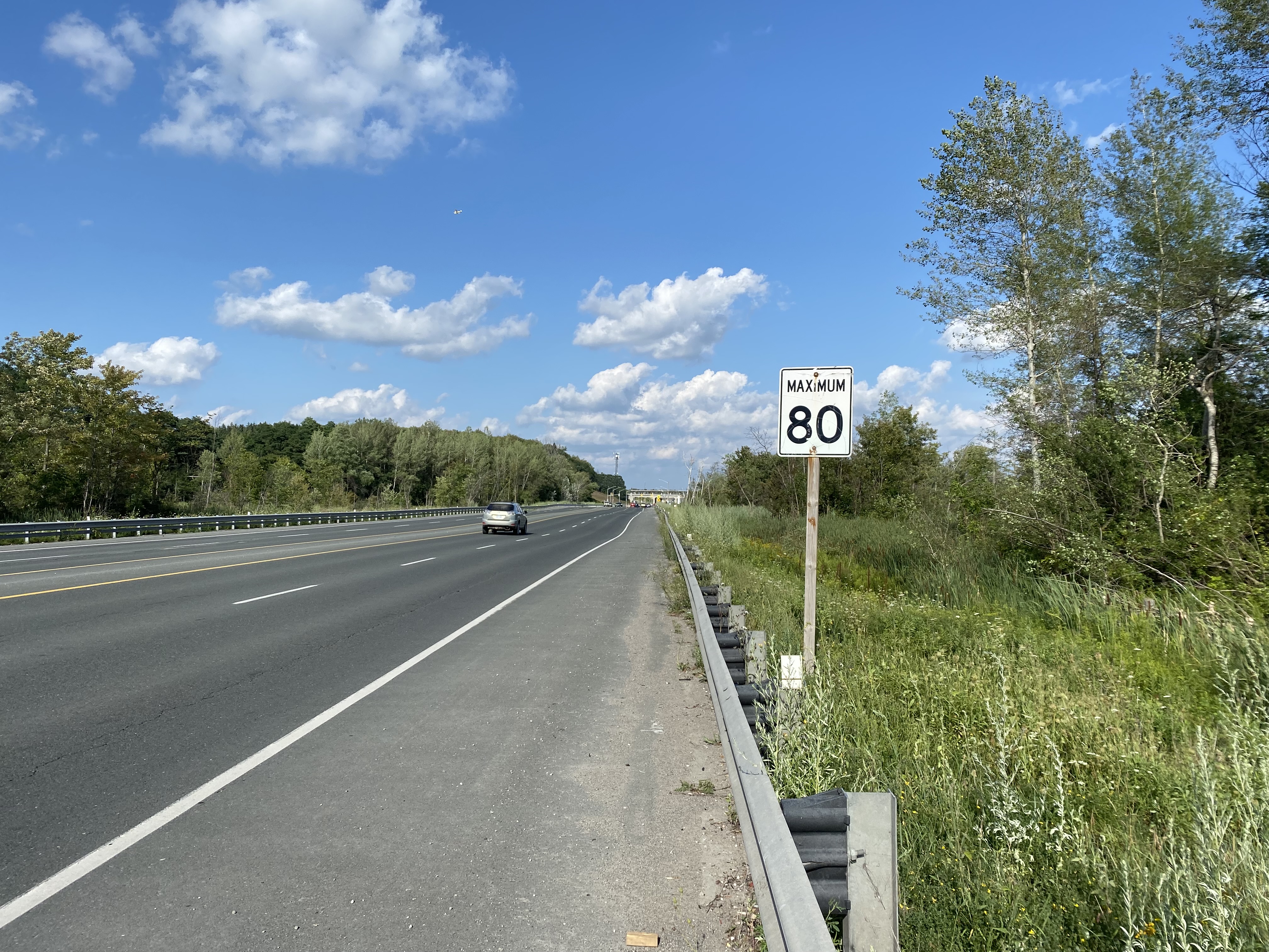
The nearest in-service bus stop is over one hour’s walk away, near Bloomington Road and Yonge Street. At least there was a paved shoulder along the busy five-lane road between the GO station and Bayview Avenue, where motorists were driving well in excess of the 80 km/h speed limit.
Looking east towards Bloomington GO at Leslie Street
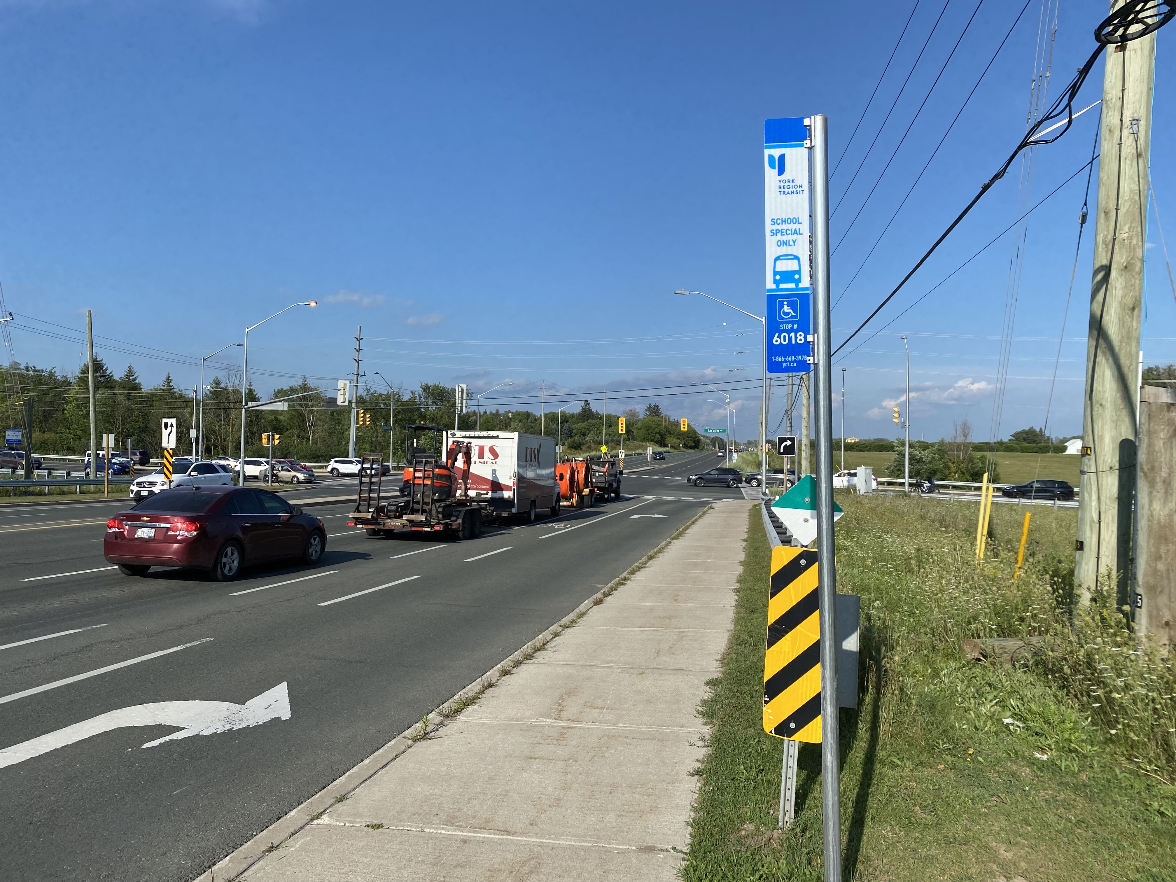
At Bayview Avenue, a sidewalk leads westerly to Yonge Street, with new residential subdivisions lining the south side of Bloomington Road. I noted a bus stop as I was walking west towards Bayview Avenue; alas, it was only for a high school special route.
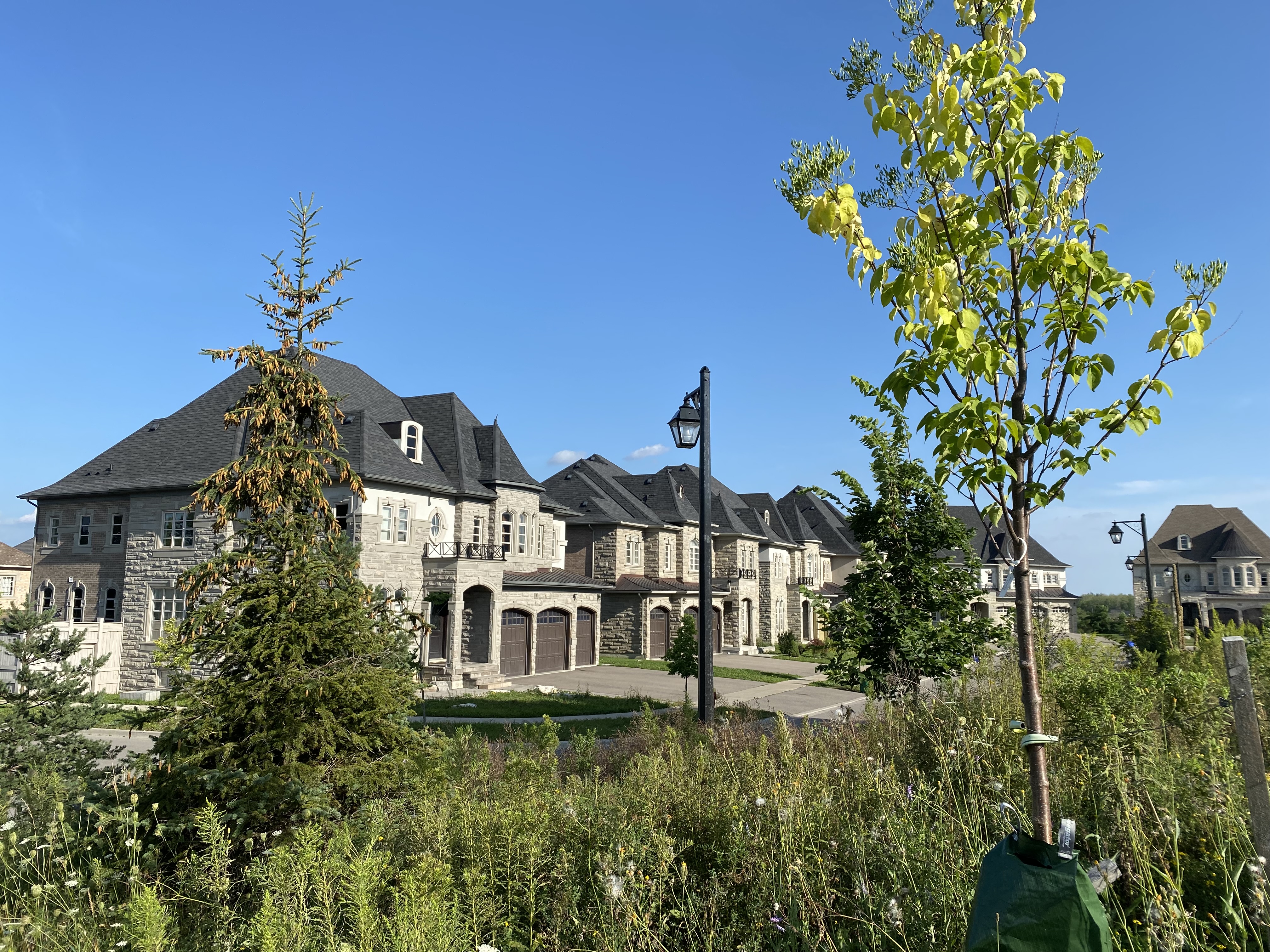
YRT stop at Bloomington Road and Bayview Avenue signed “school special only”New residential development along Bloomington Road featuring large houses with three-car garages was clearly designed for cars, rather than people
As I was nearing Yonge Street, I noted that the new subdivisions were set back far from the road, with many of the houses built with three-car garages. Building enough transit ridership here to support even a limited service bus route is going to be very difficult.
One hour and 8 minutes later, I arrived at the bus stop at Yonge Street, the closest place to Bloomington GO Station where I could get a bus to continue my journey.
The end of a long walk from Bloomington GO Station
Bloomington Station’s small footprint and environmental features might actually make it an ideal basic station design for more urbanized locations in the GTHA, where the compact design and logical layout could support easy bus connections and short walks to residential and employment areas. I liked the simplicity of the bus connections at Bloomington — if only there were any buses to connect to.
But Bloomington’s LEED Gold certification means little when it does not support sustainable development or sustainable access to the station.
Though its location adjacent to Highway 404 may entice some commuters to switch to parking at Bloomington and commuting downtown by train, Gormley, just one station to the south, already achieves a similar purpose.
For now, Bloomington Station is just a Garage Mahal — a grand monument to the old way of doing things at GO Transit.
At least the new Yonge Street Rapidway would serve York Region’s busiest transit corridor, supporting new high-density development in Richmond Hill. Unlike on Highway 7 or in Newmarket, there are no two-phase pedestrian crossings on this part of Yonge. Unfortunately, a botched connection between the new Rapidway at Major Mackenzie Drive created a new problem for the YRT/Viva transit network.
This issue — along with the other problems with York Region’s Rapidways that I discussed previously — should be held up as lessons on what not to do when building new transit rights-of-way in street medians, be it on Hurontario Street in Mississauga and Brampton, planned BRT lines on Dundas Street in Mississauga, or Queen Street in Brampton.
When the Toronto subway system was extended by six stops to York University and Vaughan, it marked the first time the TTC’s rapid transit system extended beyond the city’s boundaries. But it also exposed a major failing of the Golden Horseshoe’s transit structure: the complete lack of fare integration.
In 2017, the provincial government announced a new fare discount between the TTC and GO Transit, which operates the region’s commuter rail and bus network. This $1.50 fare discount, available to Presto card users, was funded by the previous Liberal government’s fledgling cap-and-trade carbon pricing scheme, with the promise of further fare adjustments (such as discounts for transferring between the TTC and other suburban transit agencies, such as York Region Transit and Miway) to come.
With the election of the Progressive Conservatives in 2018, the cap-and-trade scheme was cancelled, and with it, the continued funding for the GO-TTC fare discount. That discount is set to come to an end on March 31, 2020. Neither the cash-strapped TTC or Metrolinx, the provincial agency responsible for GO Transit and transit planning, will step up to make up the difference.
GO Transit buses used to stop right in front of Vari Hall, in the heart of York University’s campus
Though many regular GO rail commuters will feel the impact of the loss of the fare discount, the impact on York University students and staff will be especially felt. That’s because the new subway extension was planned to remove GO Transit buses from the heart of the campus to a purpose-built terminal at a remote new subway station next to Highway 407. I recently wrote about the problematic fare structure on those GO buses serving Highway 407 Station. Now, those commuters going two more stops will pay $6.40 a day in TTC fares on top of those expensive GO fares.
Unless they decide to walk to campus.
On Thursday, March 5, I tried do just that. It was not a pleasant experience.
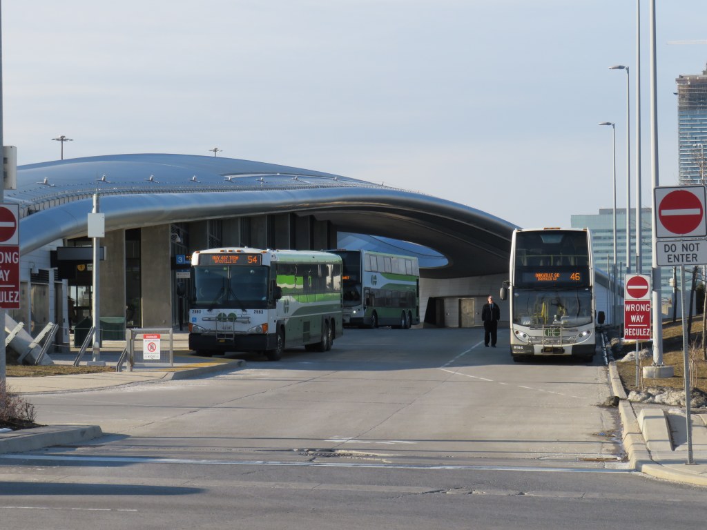
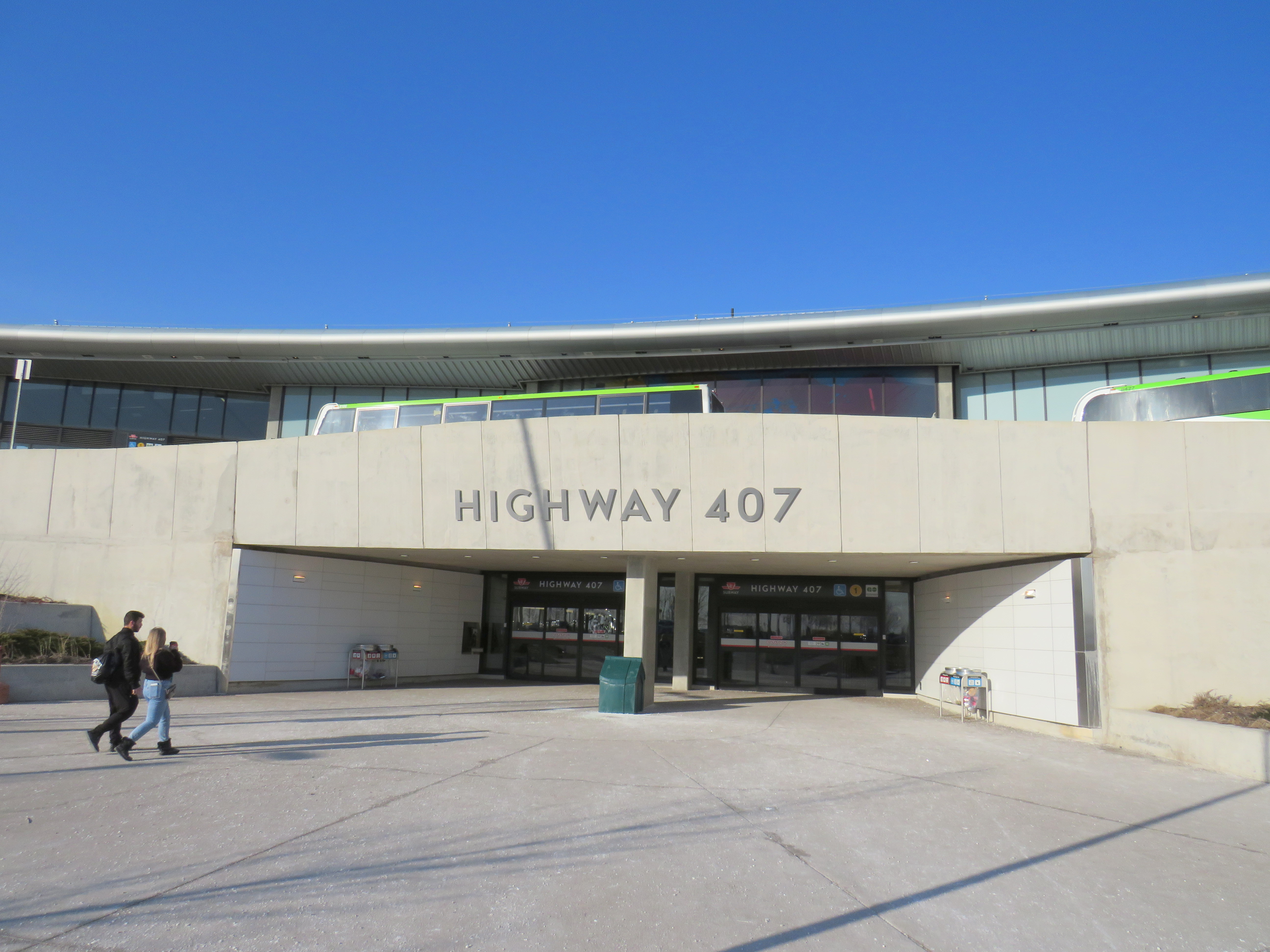
Highway 407 Station features a large bus terminal for GO Transit and YRT buses, a passenger drop-off and pick-up area, and a commuter lot. But it was not built with pedestrians in mind. That’s understandable. The only places within a few minutes’ walk are Beechwood Cemetery across the street, a warehouse, and the employee entrance to a major UPS parcel centre.
The main — and only authorized — entrance is on the opposite side of Jane Street, facing the passenger drop-off/pick-up area and the parking lot. It is quite clear in the design that most passengers would be transferring between bus and subway, perhaps with the idea that the fare boundary issue would be resolved by the time the station was open.
Jane Street, with the entrance to Highway 407 on the right, and Beechwood Cemetery on the left
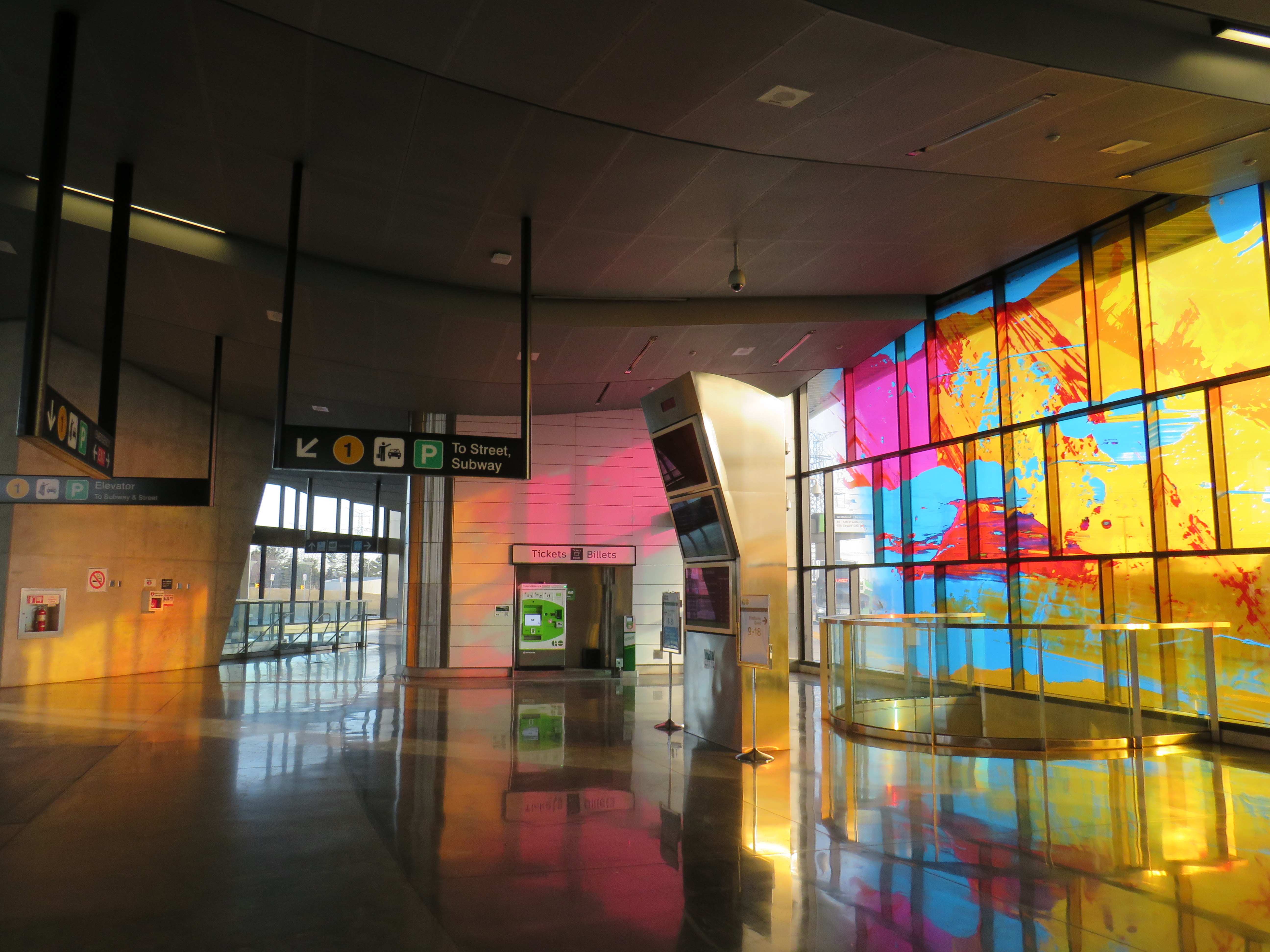
The vertical circulation prioritizes bus-subway connections. At the bus platform level, I spotted a sign that said “to street, subway” leading to a downwards escalator. But it led me past the mezzanine level straight to the subway fare gates. I had to climb halfway up to get to the entrance doors.
The stained glass at Highway 407 glows in the late afternoon sun. But it doesn’t take away from a poor user experience.
Once outside, I noted that the pedestrian path between the parking lot and the passenger waiting area was completely covered by a giant dirty snow pile. It’s clear that pedestrians are not welcome here.
Snow left on the only legal sidewalk leading out of Highway 407 Station
The circuitous route is designed to keep pedestrians out of the way of the buses entering and exiting the station. But I was left wondering why a shorter, direct, and snow-free route was not designed into the station plan at the beginning. It would have cut a few minutes from my efforts in leaving the station.
Pedestrians are barred from the more direct route into the station, even though the bus terminal is not a TTC fare-paid area.
Eventually, I made it to Jane Street, and began walking south towards Steeles Avenue and campus. The narrow sidewalk hugs Jane Street, and right into a splash zone under the CN Railway underpass.
An unpleasant walk along Jane Street
After twenty-seven minutes, I made it to Pioneer Village Station, which was designed with two separate bus terminals. YRT buses use the smaller bus loop on the north side of Steeles Avenue, outside the fare-paid area. TTC buses use a larger terminal south of Steeles Avenue, on the York University lands. YRT passengers headed to campus must cross Steeles Avenue at grade as the mezzanine level underneath is fully within the TTC fare paid zone. Technically, one could transfer from GO to the YRT 20 Jane bus at Highway 407 Station (with a Presto card, it would cost only $1 each way with the YRT-GO co-fare). But it would still only get you part of the way to campus.
After 35 minutes, I made it from the GO bus platform at Highway 407 Station to the Life Sciences Building at York University, on the northwest corner of the central campus, with another 5-10 minutes to major buildings such as Vari Hall or Scott Library. This was at a relatively quick pace (I’m an able-bodied thirty-something man), in quite pleasant weather. A rainy or bitterly cold day would be quite a different matter. Therefore, most will be forced to pay $3.20 each way (the current TTC Presto fare).
The subway, with the major GO and YRT terminals off campus, was designed for a new fare structure where students and university staff wouldn’t be penalized for having to transfer one or two subway stops to get to the middle of campus. The most we got was a fare discount for GO Transit riders, with nothing for YRT commuters. (Only Brampton Transit continues to directly serve York University.) And now that meagre fare concession is going away, because no one wants to pay for it.
Sadly, this is just further evidence of how we get transit so wrong in the Golden Horseshoe, despite it being the country’s economic heartland.
Transit advocacy group TTC Riders, along with allies at York University, have been calling on Queen’s Park to continue to fund the fare discount. You can find out more here.
I also expect that the opposition New Democrats will submit a motion in the legislature to maintain funding for the discount next week. I’ll update this post as necessary.
When York Region Transit was formed in 2001, it promised great things for the large, growing suburban region north of Toronto. It amalgamated four local transit systems, and took over local services provided by GO Transit, and extended service to outlying communities, including Stouffville, King City, and Holland Landing. In 2005, YRT introduced Viva, a series of limited-stop bus routes along major corridors, offering distinct, comfortable buses, off-board fare payment, and signal priority to speed up service.
Since YRT formed, Durham Region amalgamated its municipal transit systems, Brampton introduced Zum, a similar network of limited-stop bus routes, and Mississauga and Toronto rebranded and expanded their express bus routes. For a while, it appeared that York Region was leading the way in growing transit ridership in the suburbs.
Unfortunately, by focusing on building new Rapidways in the median of Yonge Street, Highway 7, and Davis Drive while neglecting service levels, — even cutting back bus service on Viva routes — York Region has fallen behind. I also found that those Rapidways — meant to speed buses through congested arterials — are poorly designed for pedestrians and transit riders. (more…)
On Yonge Street in Thornhill, a small green hut sits beside the busy roadway at the entrance to Cricklewood Park. On the side of the small building, a wood sign says “Stop 17.” Hundreds of buses and thousands of cars pass by this hut daily, yet few may know about the transit history it represents.
Stop 17 was a stop on the Toronto & York Radial Railway line that extended north from a terminal at Toronto’s city limits at Yonge Street and Glen Echo Avenue (now the location of a Loblaws supermarket) all the way to Sutton, via Richmond Hill and Newmarket. Electric radial service to Thornhill and Richmond Hill began in 1897. By 1908, radial service reached Lake Simcoe.
Stop 17 was one of two stops in Thornhill, located at the present-day intersection of Yonge Street and Royal Orchard Boulevard. The TTC, the eventual owner of most of Toronto’s radial lines, closed the Lake Simcoe route in 1930. Soon afterwards, the wooden shelter was moved to a nearby golf club, where it served as a snack bar and rain shelter. (The radial line was resurrected in late 1930 as a suburban streetcar service to Richmond Hill until 1948.)
Yonge Street looking south in Thornhill, September 1931. City of Toronto Archives, Fonds 1568, Item 441.
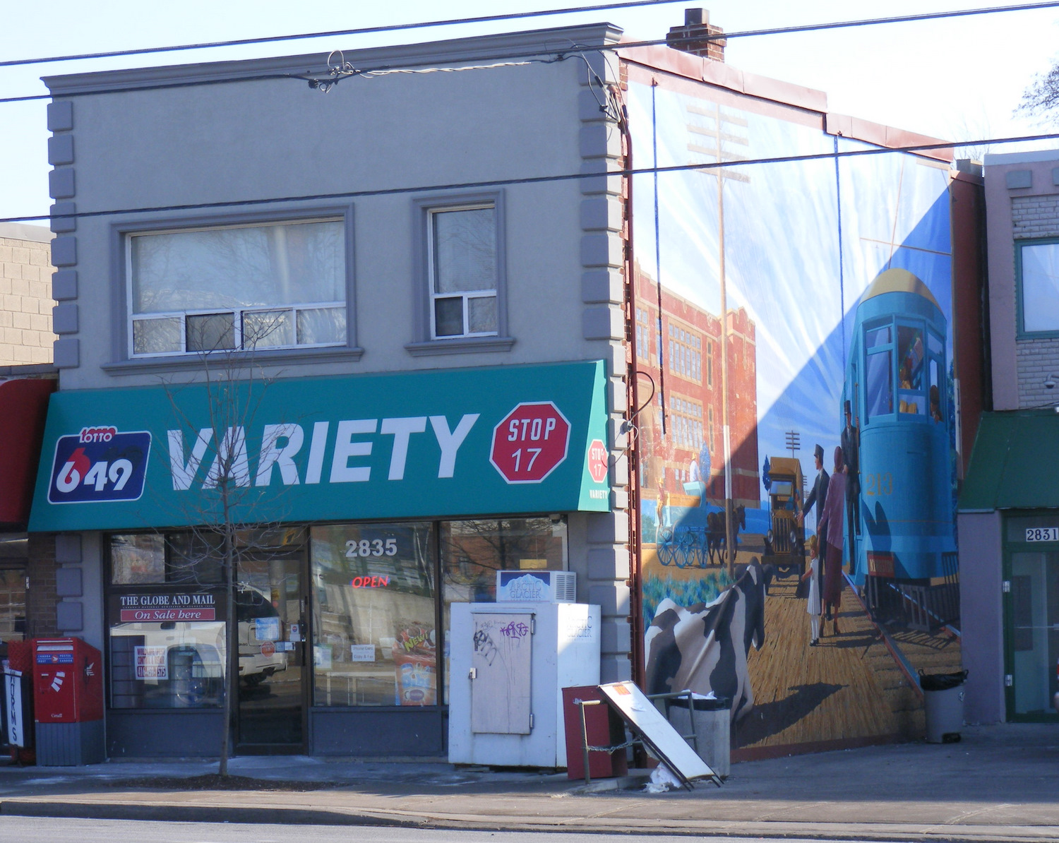
There was another Stop 17, on the Scarboro Radial Line between Toronto and West Hill. By coincidence, it is also memorialized in the name of a variety store (Stop 17 Variety), which also sports a mural depicting a T&Y radial car stopped in front of the Scarborough High School (now R.H. King Academy).
Stop 17 Variety on Kingston Road at St. Clair Avenue in Scarborough
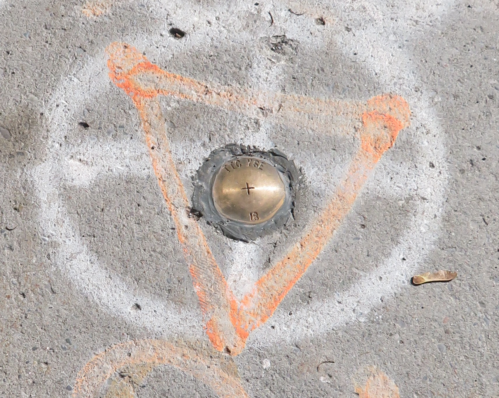
Nearby the Stop 17 shelter in Thornhill, I noticed several markings in the sidewalk. After a closer look, I noticed that they were survey markers, indicating a location where holes were drilled for preliminary core samples for the planned Yonge North Subway Extension from Finch Station to Richmond Hill.
One day, the subway will be extended north into York Region, a sensible project given the ridership potential, especially as Yonge Street sees urban intensification through Thornhill and Richmond Hill. The City of Toronto has been resistant to the extension, as the Yonge Subway is already operating over capacity, with a relief subway required to handle the loads.
The politics of subway building aside, it is fascinating to find the history and future of Toronto’s suburban transit in such close proximity.
On Sunday, December 17, 2017, the TTC opened the long-awaited $3.2 billion Toronto-York Spadina Subway Extension to York University and the City of Vaughan. The extension of Line 1, which included six new stations, opened over two years behind schedule largely due to construction-related delays. It was the first subway to extend beyond Toronto’s boundaries; York Region is now pushing for another subway extension up Yonge Street to Richmond Hill.
Unfortunately, fare integration between the TTC and suburban transit agencies was never completely worked out, despite many years’ notice that this would be an issue once the subway extension was opened. A new GO Transit terminal was built at Highway 407 Station, meant to handle GO Transit’s many buses currently serving York University. York University and York Region Transit (YRT) signed an agreement that YRT would remove its buses from campus after the subway opened. There was an assumption that transit riders destined for York University would simply transfer to the subway, but measures to prevent those riders from paying a second fare were never worked out.
Many YRT passengers will have to pay the whole $3.00 each way, or be required to make a new transfer and/or walk a farther distance from the north terminal at Pioneer Village Station.
The fact that there’s no fare agreement to allow YRT passengers to ride the subway from Vaughan Centre to York University without paying a full TTC fare is indicative of the failure to fully coordinate regional transportation in the Greater Toronto and Hamilton Area. And York Region’s complete abandonment of what used to be one of its most important hubs is indicative of that region’s lack of commitment to funding transit operations adequately, despite its ambitious capital spending and lobbying for subway extensions.
On Saturday, October 28, the Toronto Transit Commission (TTC) held open houses at three of the six new subway stations set to open on December 17, 2017 when the Line 1 subway is extended to York University and Vaughan. It was a fun afternoon with friends, checking out the architecture and the layout of Vaughan Metropolitan Centre,* Highway 407, and Pioneer Village Stations.
Some of the station architecture was stunning, and I came away feeling much less skeptical about Vaughan’s commitment to building a new urban district around its station. Most stations along the subway corridor will be well-used. However, I remain critical about the issue of transfers between transit agencies, and the usefulness of at least one station.


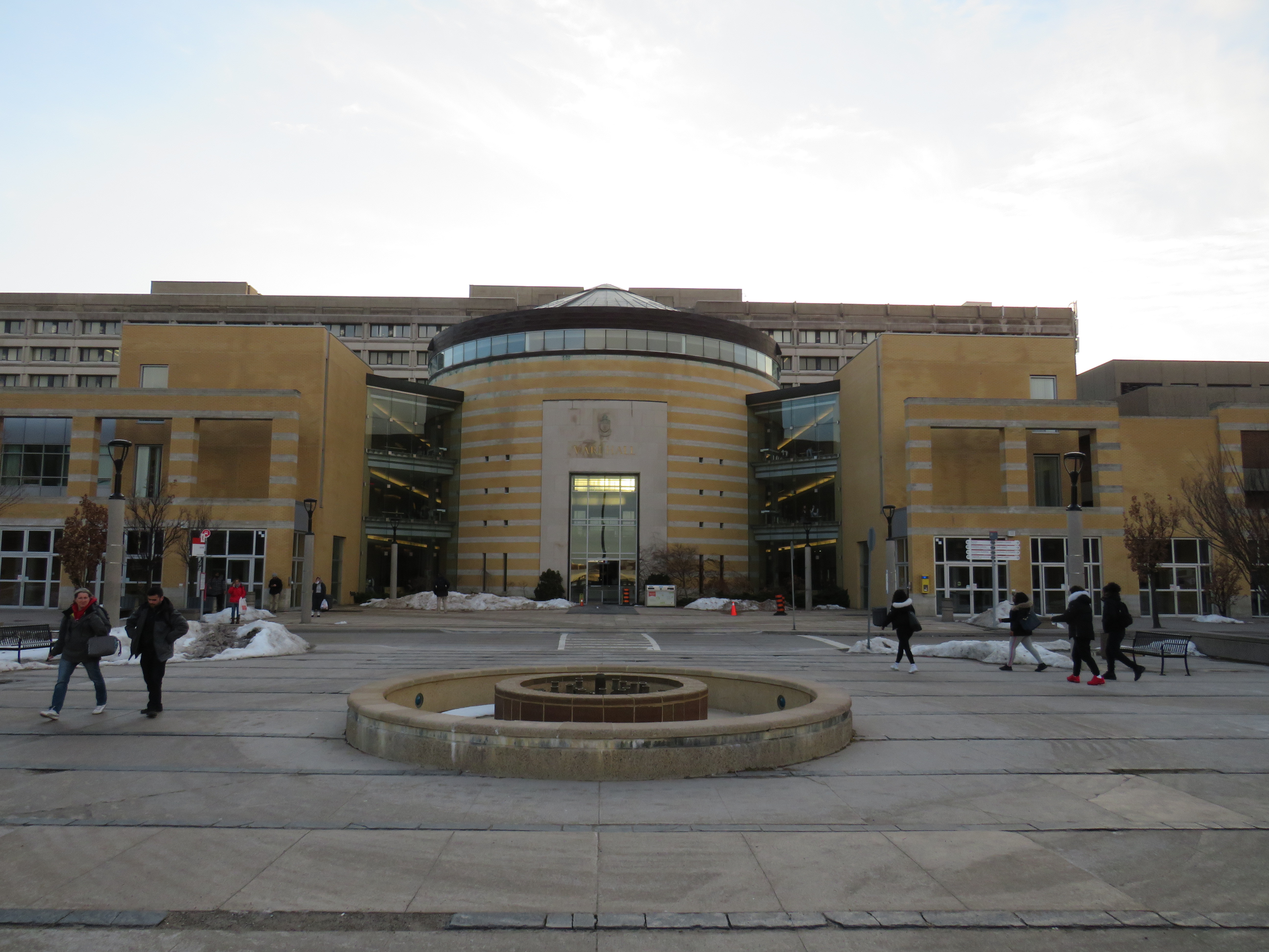 GO Transit buses used to stop right in front of Vari Hall, in the heart of York University’s campus
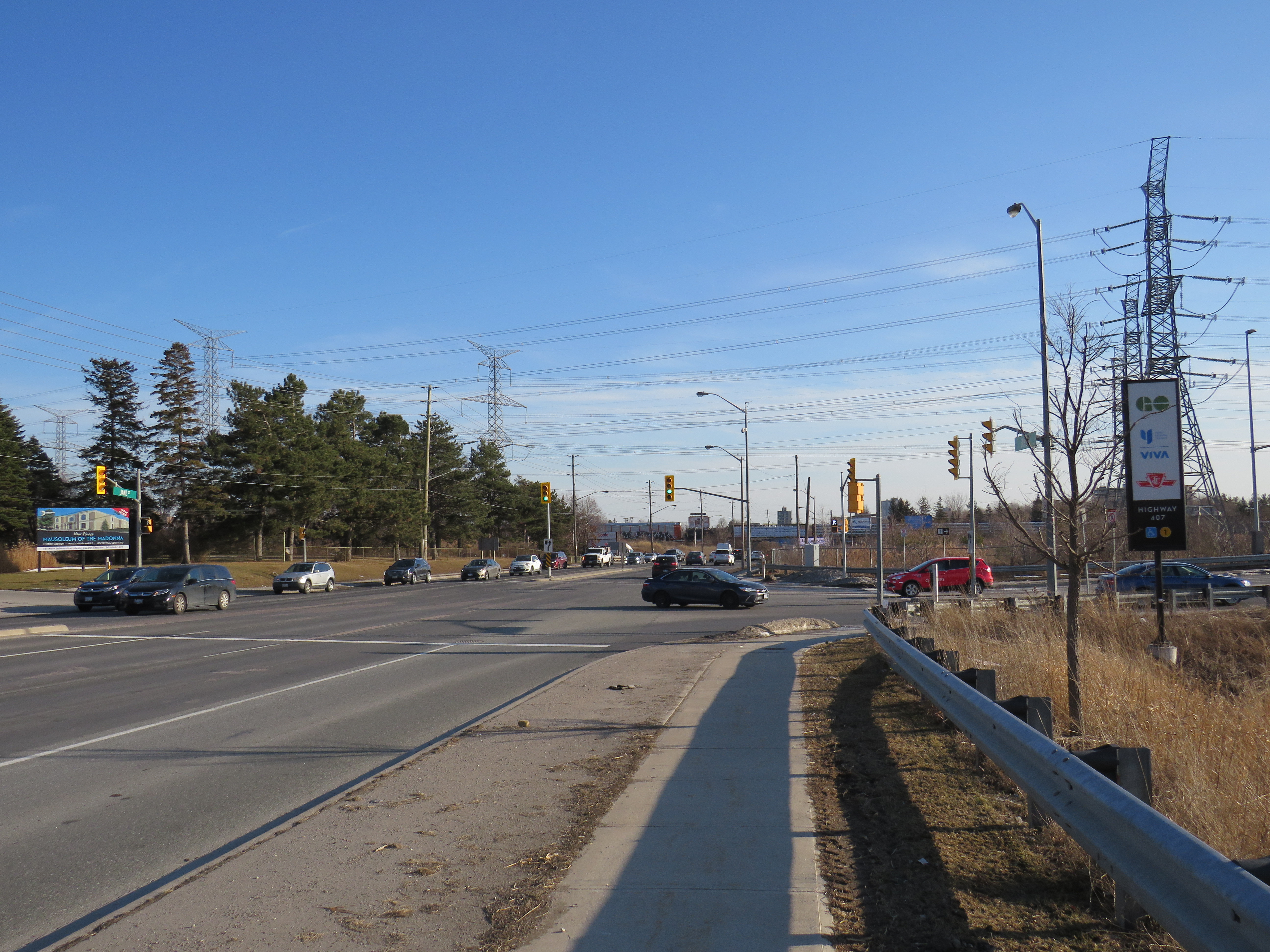
 The stained glass at Highway 407 glows in the late afternoon sun. But it doesn’t take away from a poor user experience.


 A broken system
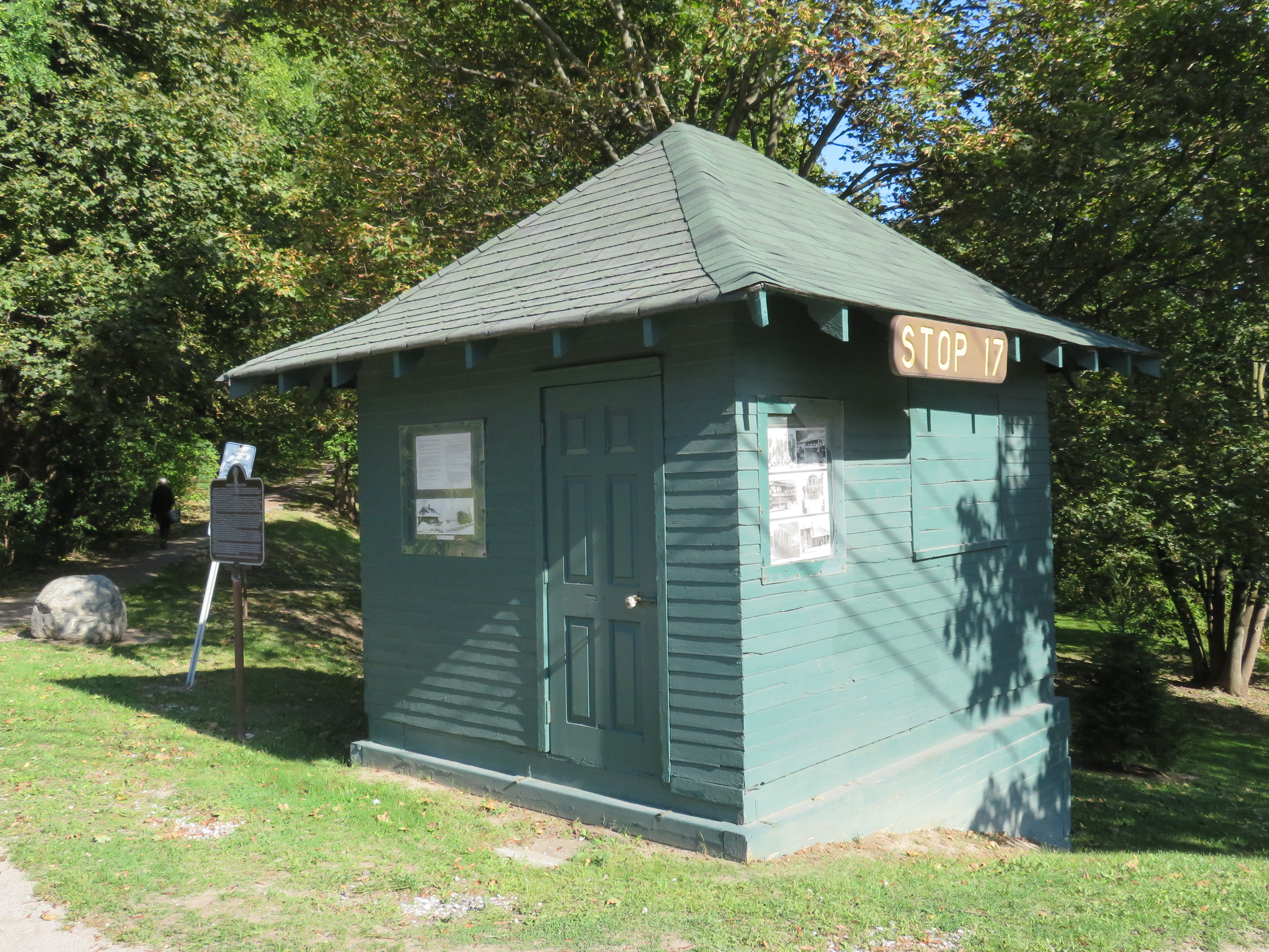

 Stop 17 Variety on Kingston Road at St. Clair Avenue in Scarborough
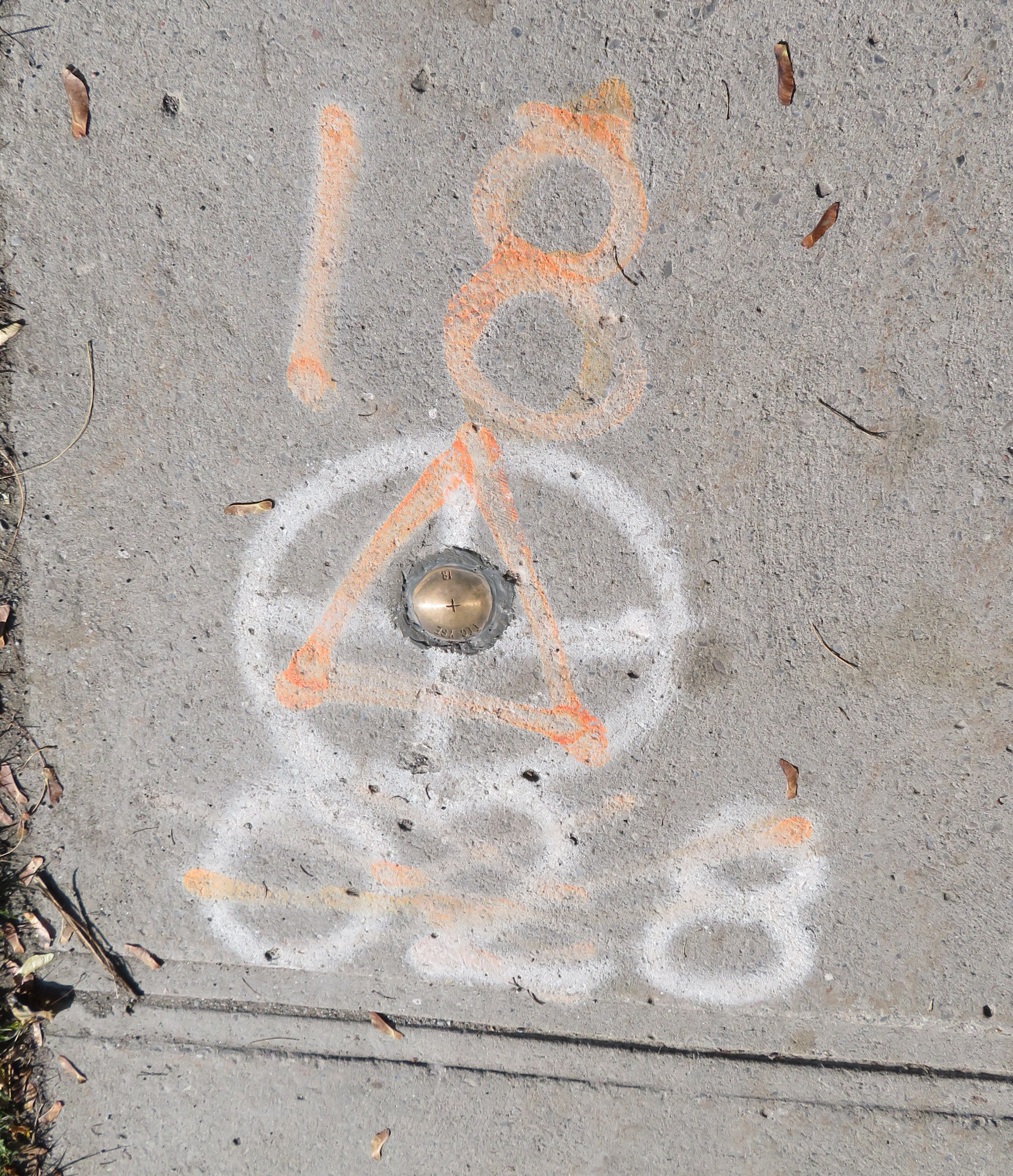
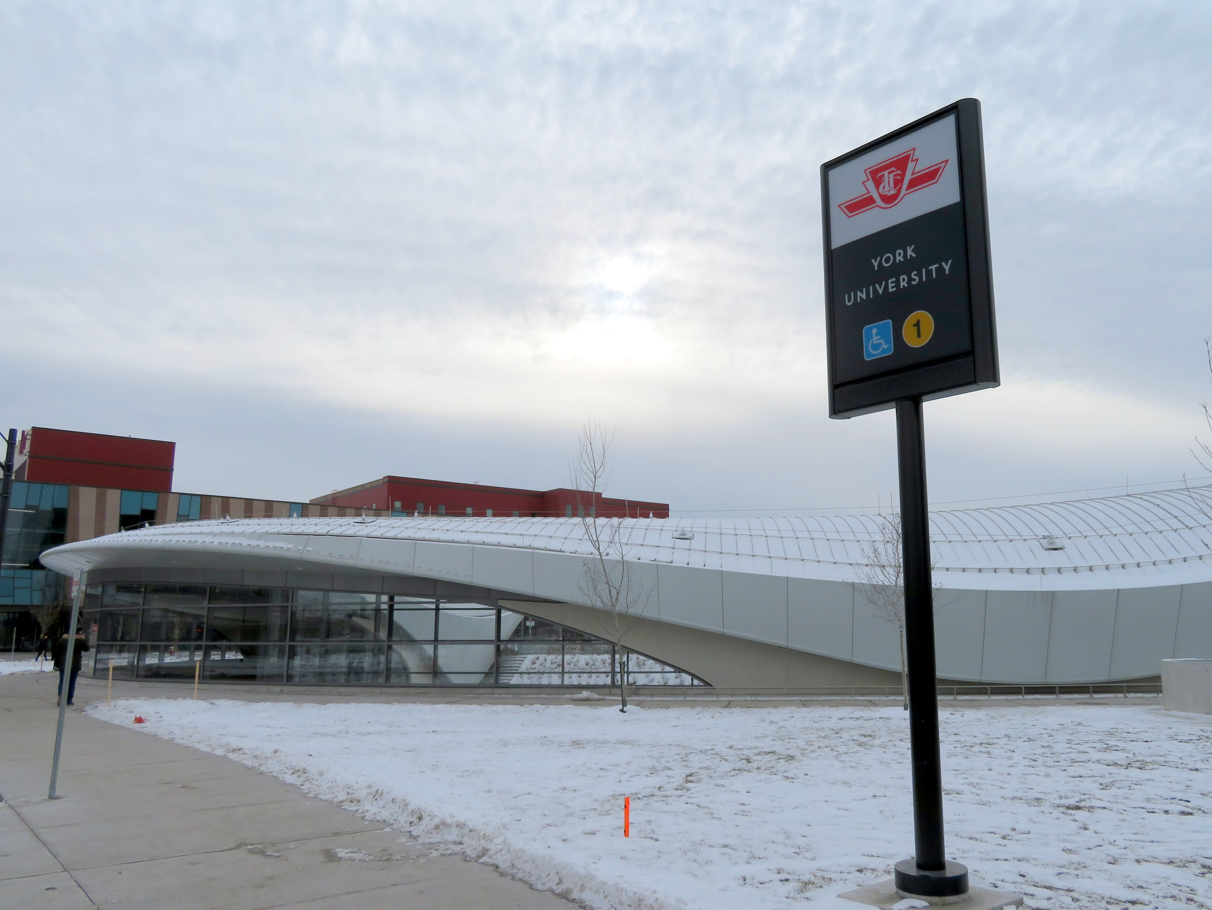
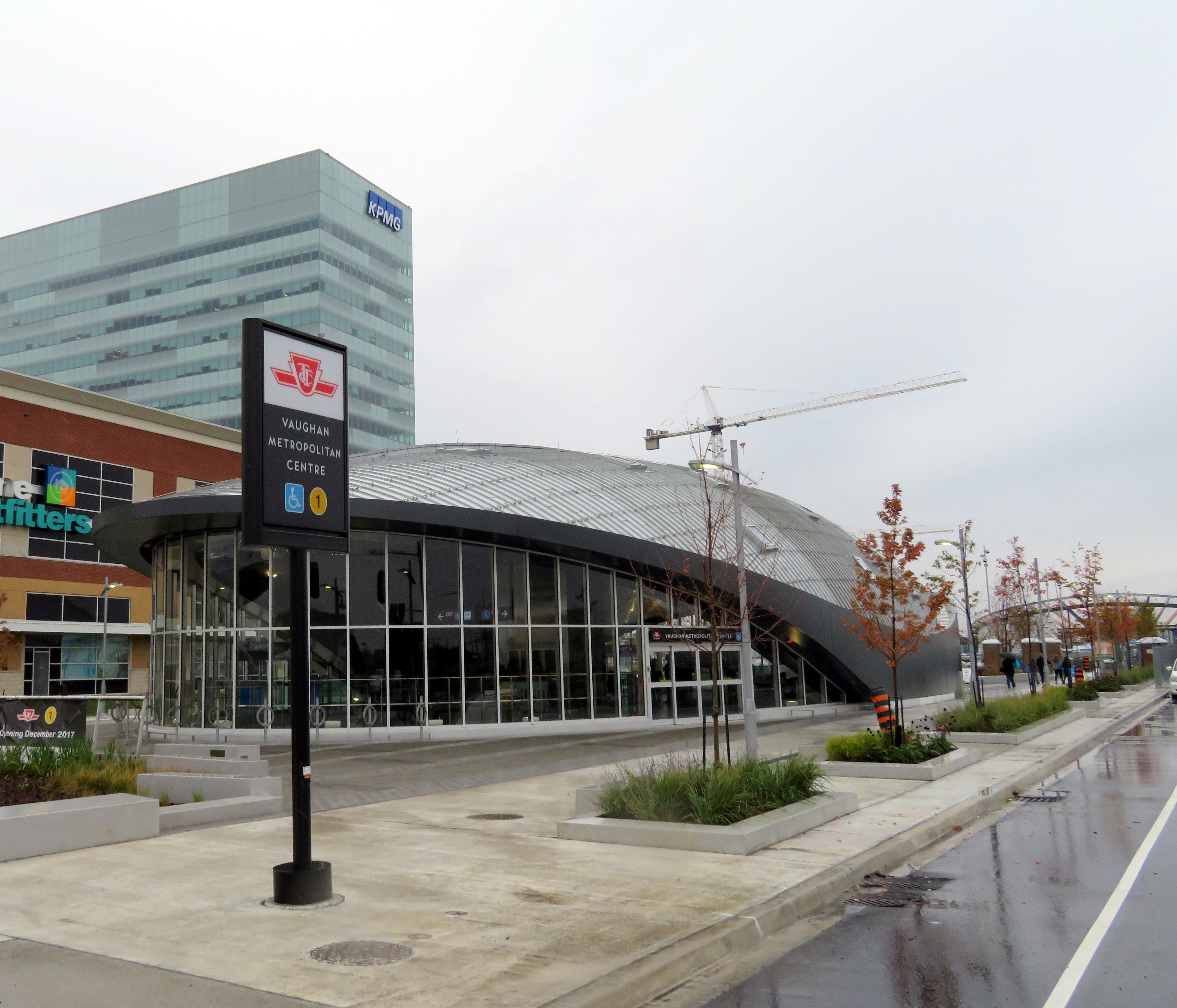 Vaughan Metropolitan Centre Station