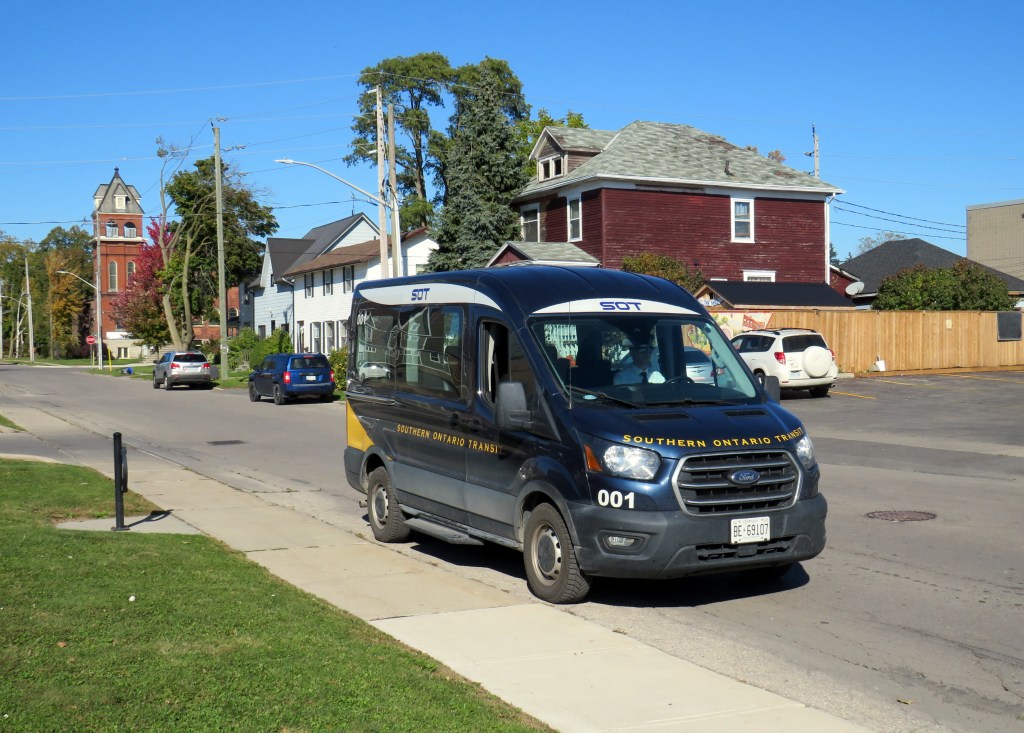
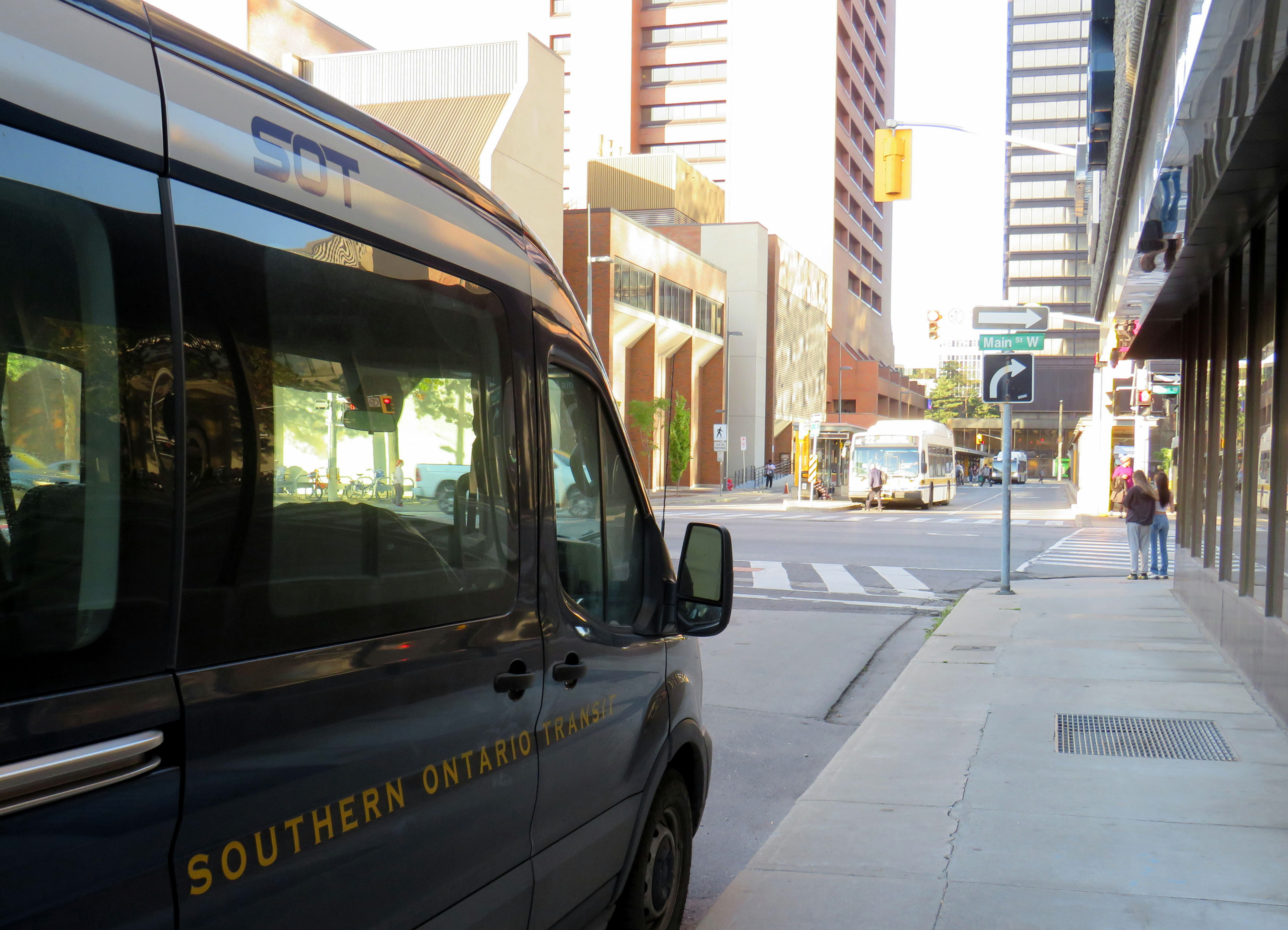
Southern Ontario Transit minibus in Dunnville, October 2024
Earlier in October, I got to meet Rae Rivard, owner-operator of Southern Ontario Transit (SOT), a new intercity transit operator currently serving Hamilton and Haldimand County. The route, which launched on September 16th, offers three weekday round trips between Downtown Hamilton and Dunnville, serving the communities of Caledonia, Hagersville, and Cayuga.
Haldimand County, along with the neighbouring Six Nations and Mississaugas of the Credit First Nation reserves, remained unserved by intercity or local bus services since the early 2000s; in 1990, United Trails operated a daily bus between Port Dover, Hagersville, Caledonia, and Hamilton. Cayuga and Dunnville were served by a Greyhound route on Highway 3 between Niagara and London. More recently, as Niagara Region was building a regional transit service and Norfolk County successfully applied for provincial funding for a new service between Simcoe and Brantford, Haldimand County refused to take part. Enter SOT.
SOT, which charges a $10 one-way fare, operates without the support of the municipal government, and is unable to put up bus stop signs or actively promote its service at municipal facilities such as libraries or community centres. For this reason, ridership remains low, despite growing populations in Caledonia and Hagersville and convenient links to Hamilton Airport, Mohawk College, St. Joseph’s Hospital, and to GO Transit and HSR services.
Rivard will tell you that “the primary challenge we face today is slow uptake. Due to a number of limitations and challenges currently out of our control, the number of regular and new riders trends up every week, but not as fast as we need to cover expenses…. Many of the limitations we are dealing with right now can easily be addressed at no expense, but these choices are out of our control.”
Rivard reached out to businesses and social service organizations, but was turned away, adding that “the entire operation has been entirely funded out of me and my wife’s savings, and we are really struggling to keep up with expenses at this rate.”
Without approved bus stop locations with curb access, SOT is not able to provide fully-accessible service, though it already has a wheelchair-accessible vehicle. The lack of physical bus stops and publicity has made it difficult to attract riders, though while riding with Rivard on a beautiful October afternoon, it was clear that a demand exists as several residents came up to the minibus to find out more information.
My hope is that word spreads about this unique and essential operation and that the local communities provide the needed support to make this service work. If this initial route succeeds, SOT would like to expand service in Haldimand and take on other gaps in the Ontario network.
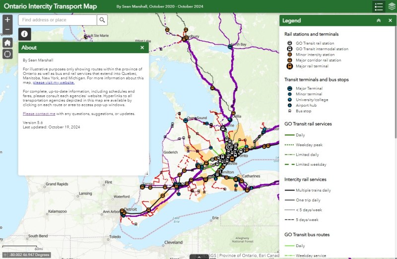
I updated my Ontario Intercity Transport Map to add Southern Ontario Transit’s route. Commuter Connect in Northumberland County ended service not long after VIA Rail finally resumed its early morning train from Kingston to Toronto. East Zorra-Tavistock Transit in Oxford County did not last long either, and service there has ended.
Added to the map:
Southern Ontario Transit between Hamilton, Caledonia, and Dunnville
Red Arrow’s daily Toronto-Western University express, which replaces its Toronto-Niagara Falls run
A new daily Flixbus route between Toronto, Hamilton, and St. Thomas
A new OnexBus route between London, Goderich, and Port Elgin, operating Friday through Monday
OnexBus’s London-Pearson Airport-Brampton route, which operates several trips a day
Ourbus’s Toronto-Ottawa route
Kasper’s daily Winnipeg-Kenora-Sioux Lookout service
Revisions to on-demand services in Niagara Region
Some revised routings and service levels across the province
Removed from the map:
Commuter Connect in Northumberland County
East Zorra-Tavistock Transit
Kasper’s on-demand service to Red Lake/Balmerton
Though it is good to see Bruce County — particularly rapidly growing Saugeen Shores — get another link, that part of Ontario is still poorly served; there should be daily services between larger Bruce County communities like Saugeen Shores, Kincardine, and Walkerton at least to Owen Sound and Hanover. Lindsay is also left without any intercity services, after TOK ended service from Toronto to Haliburton last year. where a Peterborough-Lindsay-Pontypool service, perhaps extending to Durham College/Ontario Tech University in Oshawa could prove to be a very useful route.
If you like this post and you would like to help out with my online mapping and webhosting costs, consider buying me a coffee.Thank you!
Mississauga City Hall, one of the most walkable municipal buildings in Ontario
In late March 2024, with a streak of mild, sunny days, I was eager to get outside and walk. As I have long been interested in local politics and planning issues, public transit, active transportation (especially walking advocacy), I thought I would try to get to every city, town, and township hall in the Greater Toronto and Hamilton Area (GTHA) without a car.
This was a fun project, even if there were times I felt really frustrated at times by poor transit and long hikes. The highlight of my quest was a tour of Mississauga City Hall from Councillor Joe Horneck. Mississauga’s civic centre is one of Ontario’s most iconic — and walkable — government buildings.
Mississauga Council Chambers
Of the three levels of government (federal, provincial, municipal), the municipal level has the most impact on the day-to-day lives of most Canadians; it is also the closest level of government to all. Residents can depute at committee meetings, get meetings with their local councillor and city staff, and obtain building permits, marriage licenses, or pay bills at city and town halls. Therefore, they should be as accessible as possible, especially to those without cars.
Only one GTHA town hall (Caledon) was completely inaccessible without a car, though several other town halls required long walks from the nearest transit stop, making them inaccessible to some residents. But I could get to Brock Township, the least-populated and most-rural municipality in the GTHA, thanks to Durham Region Transit’s On-Demand service, though I had some difficulty there.
The complete list of GTHA city and town halls, along with photographs and a map can be accessed here.
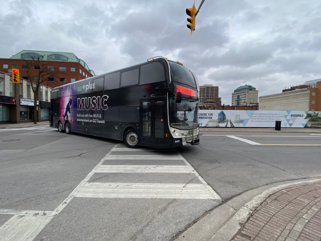
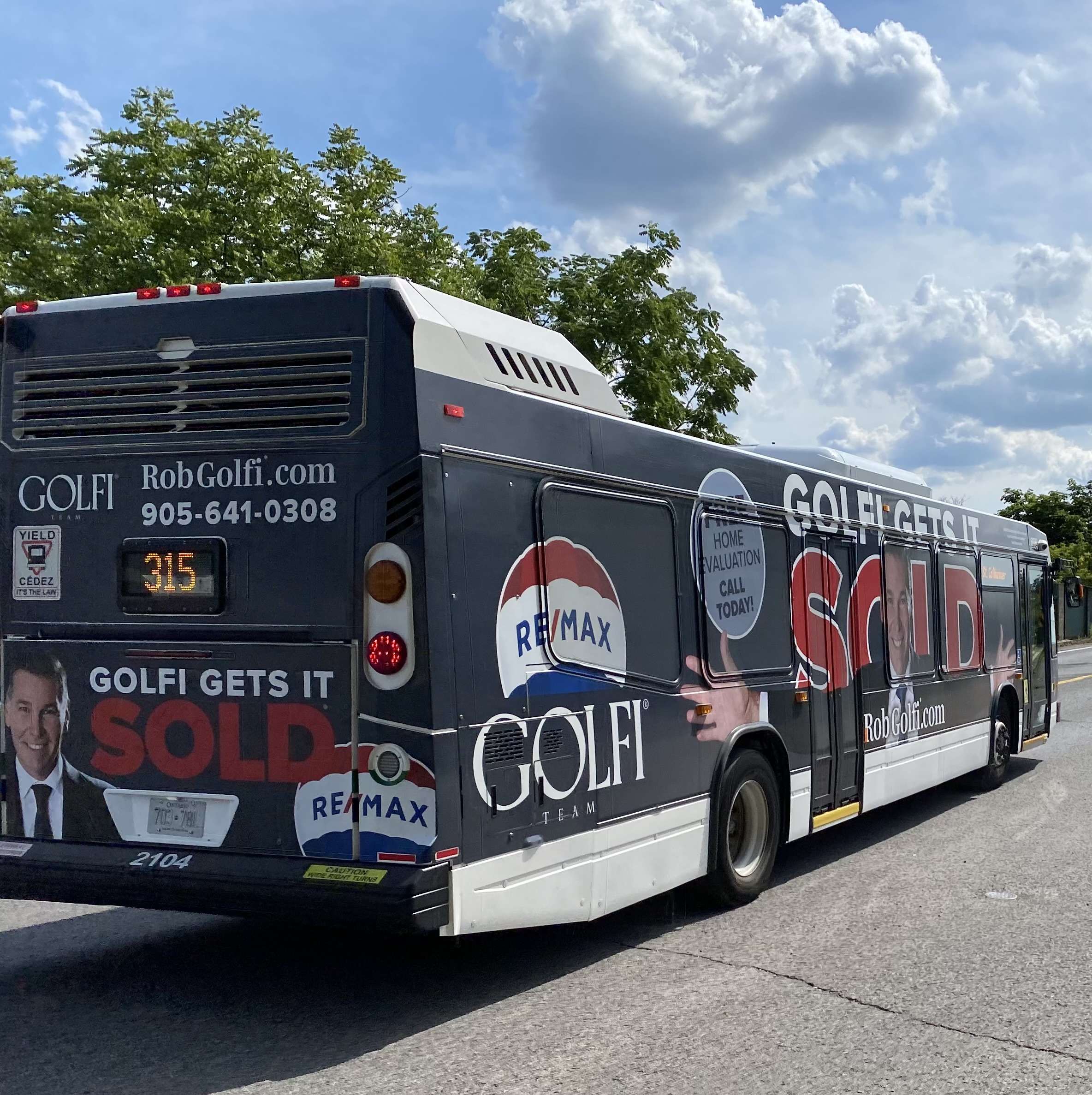
A Go Transit double decker bus completely covered by a vinyl wrap, with the exception of the front windows and entrance door. The wrap advertises the transit agency’s wifi and music streaming gimmick.
Apart from unscheduled short-turns, lengthy delays, or missed transfers, the thing that bothers me most about riding buses or streetcars is an obstructed view caused by a vinyl advertisement wrap.
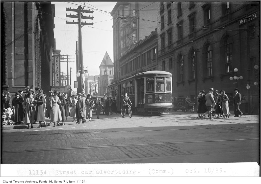
Though transit advertisements have been around almost as long as there have been transit services, these advertisements have generally been limited to posters and cards mounted outside the vehicles, or placed inside, above the windows or beside doors. Advertisements have long been placed inside train and subway stations, and in outdoor transit shelters.
TTC photograph of streetcar advertising, 1935. The advertisement can be found below the left dash window of the streetcar. City of Toronto Archives Fonds 16, Series 71, Item 11134.
For advertisers, transit ads provide an ideal vehicle for promoting their goods and services: they can be targeted to specific neighbourhoods that a bus, streetcar, or train passes through; the advertisements move around unlike static billboards, potentially drawing more eyeballs. For transit operators, advertising provides an easy revenue source. Most transit agencies outsource their advertising to larger firms, who are responsible for maintaining accounts and installing and removing ads from vehicles and transit facilities. These companies typically provide an annual payment for the right to advertise on transit vehicles, and at stations and stops.
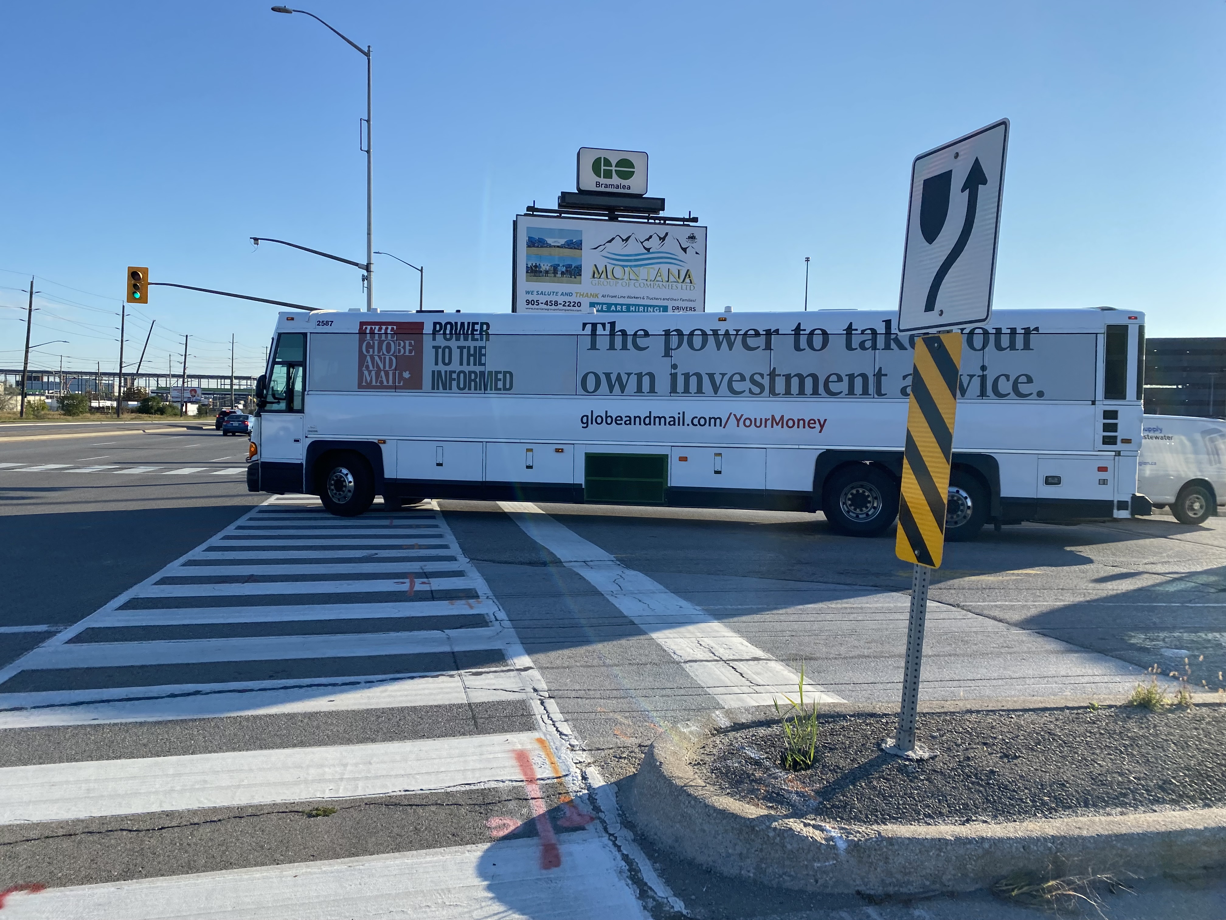
A GO Transit coach bus departing Bramalea Station, wrapped for a newspaper’s investment news service; all passenger windows are obscured by the advertising wrap
Though vinyl decals on transit vehicles are not a new innovation (advertisements in the late 1980s and early 1990s were typically opaque, sometimes covering parts of passenger windows) more recent technology has allowed for perforated vinyl wraps that fully cover windows, while providing an obscured outside view through small dots. While the vehicle is moving, a passenger inside may be able to see where they are, but not be able to read signage or see details. For some, not having a clear view of forward motion can contribute to motion sickness.
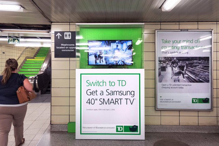
In TTC subway stations and some GO Transit stations, surfaces such as walls, floors, pillars, faregates and even stairways have also become advertising surfaces, a tactic called “station domination.”
An example of Pattison Outdoor’s “station domination” advertising, with a traditional ad poster at right, an installed video screen and ad pillar at centre, and stairs covered in ads, at left.
On occasion, vehicle wraps are used for public relations, rather than advertising. GO Transit and the TTC’s Pride buses are a good example of this. A more shameful example was the TTC’s messaging about fare evasion which took place in late 2019 and early 2020, just before the COVID-19 pandemic.
“Forgot to tap” – part of a TTC streetcar wrap used in late 2019 and early 2020
For the most part, the TTC does not allow ad wraps to completely obscure bus and streetcar windows, but allows up to 70 percent of the passenger windows to be covered, either in a “strip” format (where only the lower parts of the windows are kept uncovered) or “mural” format (where three of five sections of a streetcar are fully covered). Other agencies, like the Hamilton Street Railway, allow for complete vehicle wraps.
St. Catharines/Niagara Region TransitHamilton Street RailwayIt is difficult to get on a bus in Burlington, Hamilton, Niagara, or Brantford without your view being blocked by a certain real estate agent
In Waterloo Region, Regional Councillors just considered a motion to increase the number of wrapped Grand River Transit buses and — for the first time — on ION LRT cars. The appendix to the staff report recommending the increased number of advertising wraps depicts a rail car in a Tropicana wrap, with the windows partially obscured.
According to the report, the Region of Waterloo/Grand River Transit has a contract with Pattison Outdoor — one of Canada’s largest advertising firms — that allows for a total of five buses to be wrapped at any one time. GRT and Pattison want to increase this to ten percent of the total bus fleet, which numbers over 250. It also seeks to wrap one ION rail car at a time, with the promise that windows would not be fully covered and convert some static back-lit shelter ads to digital ads.
Currently, Waterloo Region receives guaranteed revenue from its contract with Pattison, averaging $1,546,500 a year, though the total revenue is projected to reach $1,800,000 for 2023, as ridership increases. Allowing for wraps on 20 more buses and one ION railcar is estimated to net an additional amount up to $500,000.
It’s worth noting that the report notes a 2018 recommendation against advertising on the exterior of LRT vehicles “due to concerns of diminishing the ION brand.” This restriction was also carried to ION-branded buses that follow the planned LRT extension between Fairway Station and Cambridge. It also notes strong public feedback against covering windows, and proposes to do so, “to maintain the customer experience.”
The Region of Waterloo’s entire Transit Services budget — including paratransit — for 2023 is $207,203,000, with transit fares bringing $46,143,000 of that – a 22.3% farebox ratio (property tax and provincial grants cover the difference). $2.3 million brought in from all advertising revenue — traditional poster ads and transit wraps — is not an insignificant sum, but it makes up just over 1% of the entire transit operating budget. In Toronto, the TTC’s 12-year, $324-million contract — also with Pattison Outdoor — brings in a total of $27 million a year, or 1.1% of the entire TTC budget.
At least Waterloo Region staff recognize that transit customers don’t like advertisements that obscure windows. They also acknowledge that transit wraps diminish the transit brand. For a revenue source that represents a mere drop in the bucket, why do transit agencies keep allowing them on their vehicles?
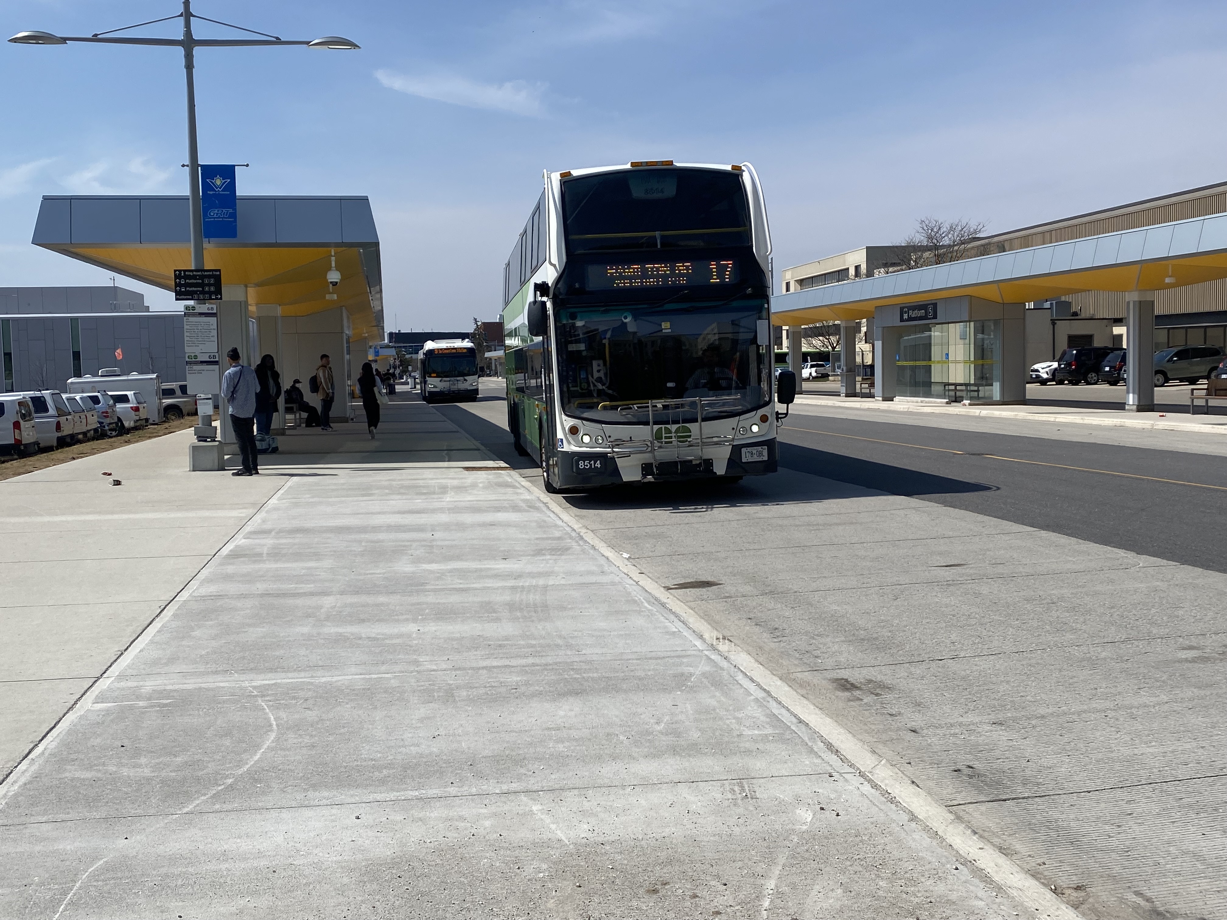
Route 17 bus arriving at University of Waterloo Station
On Monday, April 10, 2023, GO Transit filled a big hole in Ontario’s intercity transportation web with Route 17, which connects three major urban centres, four universities, and two existing GO Transit rail corridors. On that day, I made my way to Waterloo and rode one of those first buses south towards Hamilton. Nearly a month later, I made a second trip, from Guelph and Downtown Hamilton, on May 5.
Sign post at University of Waterloo indicating the stops for Route 17
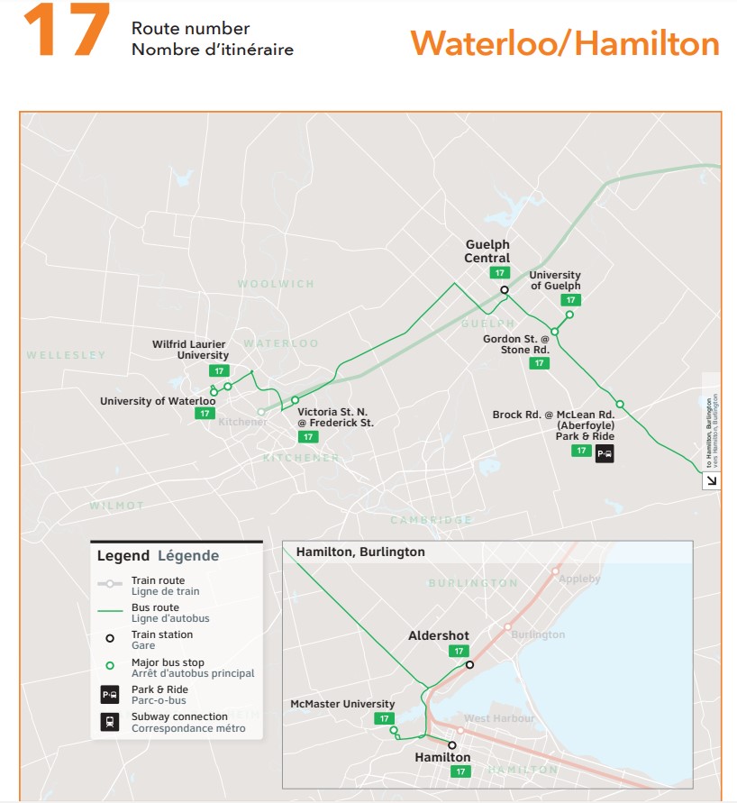
The bus originates at the new University of Waterloo bus terminal, located adjacent to the Ion LRT corridor and on the far east side of the university campus. It then stops in front of Wilfrid Laurier University, on Victoria Street North in Kitchener’s east end, at Guelph Central Station, University of Guelph, the park & ride lot in Aberfoyle, Aldershot Station, McMaster University, and Hamilton GO Centre.
Waterloo-bound Route 17 bus at Guelph Central Station, May 5, 2023
On the first day, the experience was more interesting than I expected, as the driver, new to the route, missed the turn from the Hanlon Expressway (Highway 6 through Guelph) towards Downtown Guelph. Luckily, dispatchers were able to guide the driver back on route after a short delay, so it only made for a roundabout tour of some of Guelph’s residential neighbourhoods, where GO Transit has certainly not gone before (and probably won’t, ever again).
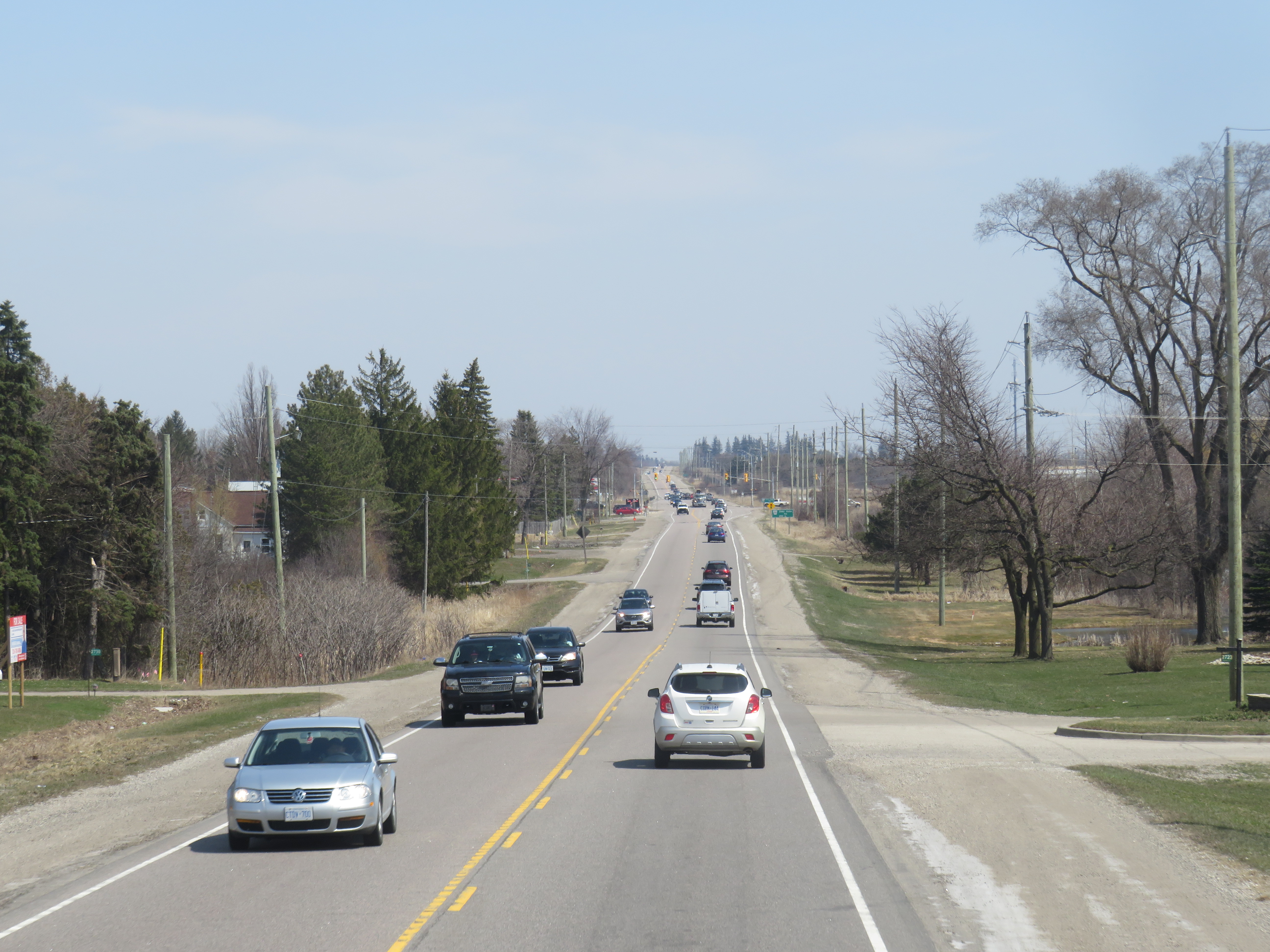
On congested Highway 7 between Kitchener and Guelph
Sitting at the top of the front of a double decker bus (so far, I had my choice of seats as the route is still new and not too busy) gave me a view of the traffic congestion in the western Greater Golden Horseshoe. Highway 7 between Kitchener and Guelph is still a two-lane road, without even paved shoulders to make it a bit more cycling friendly. Though there are a few GO trains on the adjacent railway, the service is sporadic and only runs on weekdays. A new four-lane freeway has been planned for decades, with some preliminary work started, but a regular two-way, all-day train service, and more bus links to places like Cambridge, would be even more effective in meeting travel demands in the region.
Highway 6 south of Highway 401 is also very congested, and a new highway bypass is planned to divert traffic around a two-lane section through Morriston and Puslinch Station. Clearly, there’s a lot of travel demand between Kitchener-Waterloo, Guelph, and Hamilton, but transit options have always been severely limited.
Thankfully, Metrolinx is upgrading the western portion of the Kitchener Line, with a second platform under construction at Guelph Central Station, and work started on new passing sidings between Kitchener and Georgetown. But it will be several years at least before the upgrades allow for regular, two-way, daily passenger rail, so the bus will have to do.
At Aldershot Station
In my review of GO’s service changes earlier this month, I argued that Route 17 was trying to do too much with a single bus route. Riding the corridor from end-to-end (albeit on two separate occasions), I could not help but feel frustrated by the southern end of the route, where the GO bus goes east on Highway 403 to connect with Aldershot Station, then backtracks to get to McMaster University, then turns around to get to Downtown Hamilton. I understand that all three destinations are important trip generators (Aldershot allows passengers from Burlington, Oakville, and southern Mississauga to get to Guelph and Waterloo, McMaster University is a reliable trip generator, and Downtown Hamilton is a busy urban hub), but for someone to get between Hamilton and Guelph or Waterloo, it’s a long way out of their way.
I am hopeful that GO Transit uses the summer down time to see where passengers are going and coming from and make route adjustments or add express runs once classes resume in September.
Map of GO Transit Route 17
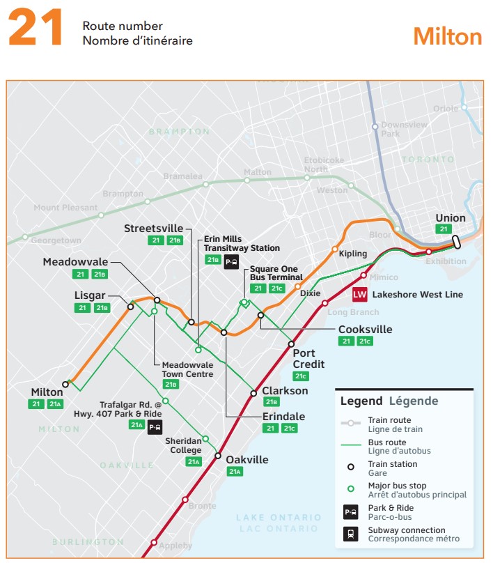
A note on Route 21
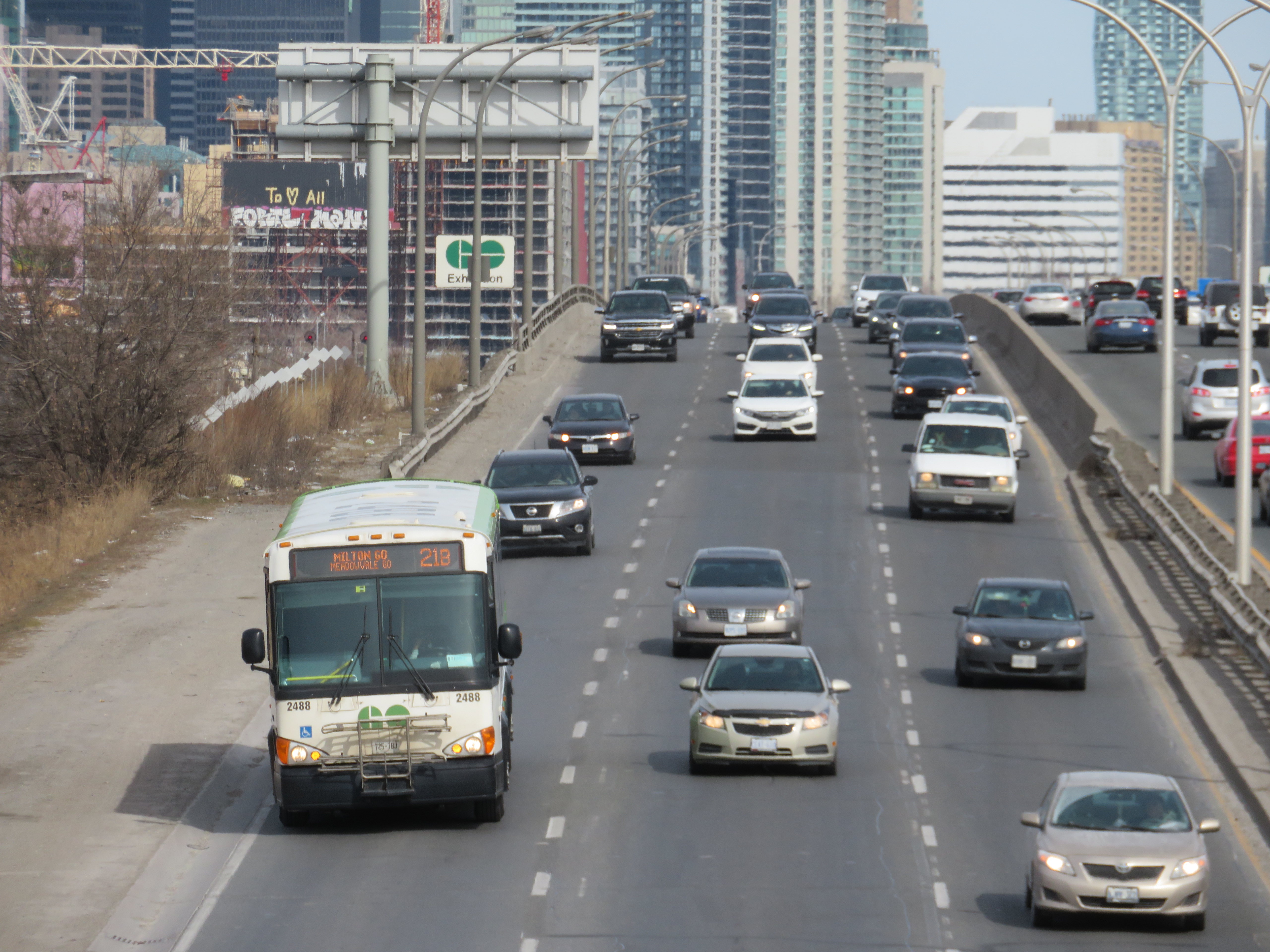
Last month, when previewing the new GO Transit changes, I discussed the changes to Route 21 (the Milton Corridor train-bus service), in which most buses were pulled from Union Station, instead diverted to three stations on the Lakeshore Line. Though at the time, I explained that the change made sense given severe traffic delays on the Gardiner Expressway and around the new GO Bus Terminal, it would mean a longer trip, and an unpopular transfer.
I underestimated the aggravation and anger transit riders had when the new schedules were put into service. The loss of direct GO bus service between Milton and Mississauga along Derry Road is also a new gap that should be re-filled.
I suggest three changes, though I acknowledge that the continued shortage of train crews and budget issues might make these more difficult:
Restore 15-minute rail service on the Lakeshore West corridor. This would at least ensure that transferring Route 21 customers aren’t stranded up to 30 minutes at Oakville, Clarkson, and Port Credit stations. Since GO Transit’s ridership has recovered faster off-peak versus peak periods, the extra capacity will be helpful.
Restore all-day, regular bus service on Derry Road between Milton and Meadowvale, perhaps extending to Bramalea Station and/or Highway 407 terminal. This would provide new connections, including the new weekend Kitchener Line trains.
Extend more buses between Square One and Kipling Terminal. Though the new Kipling Station bus terminal was a Metrolinx project, only Route 29 (Guelph-Square One-Kipling) uses it. It could then be an alternative to transferring to Union Station for some passengers.
GO Transit bus on the Gardiner Expressway. Route 21 will se major changes with the new schedules
On Saturday, April 8, GO Transit will introduce big changes to its rail and bus services. Brampton and Waterloo Region will see the biggest benefits, while a major gap in Ontario’s intercity bus network will finally get filled.
However, major construction work on the Barrie and Stouffville Lines will require the bustitution of most trains on those two corridors for at least a few months. Most buses serving the Milton Line will no longer operate to or from Union Station, but instead connect with the Lakeshore West Line. Finally, one of GO Transit’s oldest bus routes will finally disappear for good.
Though the scale of these service changes is truly impressive, there are some drawbacks that hopefully will be addressed in the near future.
As part of the April 2023 changes, GO Transit will finally introduce hourly weekend service on the Kitchener Line between Union Station and Mount Pleasant GO in northwest Brampton. Most Route 31 “train-bus” trips will be cancelled, while Route 33 (Guelph-Brampton-North York) takes over the Guelph via Highway 7 service completely.
With the exception of weekday counter-peak periods, early mornings, and late evenings (when Route 31 will still operate), Brampton finally has the all-way, two-way, every day train service it has been requesting for decades. Because of schedule constraints, and limited track space, weekend trains will not be stopping at Etobicoke North.
Route 30, the Bramalea-Kitchener-Waterloo bus, will also operate 7 days a week, with an easy transfer at Bramalea GO Station. This is the fastest and most frequent service between Toronto and Kitchener-Waterloo (private intercity bus service to Kitchener are limited, and they only stop at Sportsworld, near Highway 401), and should help build ridership for future train service expansion.
Unfortunately, there remains no quick GO bus service between Toronto, Brampton, and Guelph; passengers must still endure the Route 33 milk run on Highway 7 through Georgetown, Acton, and Rockwood. Weekend service on Route 48, the Guelph-Bramalea-Highway 407 route, timed to connect to Kitchener Line trains, could provide this useful link until track capacity is improved west of Bramalea and through Halton Region and Wellington County.
The introduction of GO Transit Route 17 between Kitchener-Waterloo, Guelph, and Hamilton is, in my view, even more significant than the new weekend train service on the Kitchener Line.
This new bus route is the first time a GO Transit service has gone against its 55-year-old business model of a Toronto-centric system, where all train services converge on Union Station, and all bus services supplement the train corridors or connect to a suburban Toronto terminal. This might even be the most significant GO Transit service change since the first Highway 407/York University bus service began in September 2000. The 407 Corridor, originally a single bus route connecting Oakville, Mississauga Square One, Bramalea, York University, and Markham, has expanded into a multi-branched 24-hour/7-day corridor that now extends to Oshawa, Guelph, and Hamilton.
Route 17, which will run hourly on weekdays, directly serves four university campuses (University of Waterloo, Wilfrid Laurier University, University of Guelph, and McMaster University), a record for any single bus route in Canada (only the TTC Yonge-University Subway serves as many university campuses in a one-seat ride). It also provides a direct Guelph-Kitchener-Waterloo link (which was only provided by infrequent Greyhound buses before 2020) and replaces former Coach Canada/Megabus routes abandoned prior to or during the COVID-19 pandemic.
Though Route 17 finally fills several gaps in the Greater Golden Horseshoe, it is, at best, a first good step.
For one thing, Route 17 is too slow to effectively serve as a great Kitchener-Waterloo/Hamilton connection. The travel time from University of Waterloo to Downtown Hamilton is between two hours and twenty minutes and two hours and thirty minutes. The typical driving time is about one hour. It is more competitive between Guelph and Hamilton, though the route diverts to Aldershot GO Station to connect with the GO Transit Lakeshore West corridor, adding 15-20 minutes of travel time over a direct McMaster/Downtown Toronto routing.
Finally, there is no weekend service offered at this point, and the new route misses Downtown Kitchener, diverting via the Conestoga Parkway, though a stop at Victoria and Frederick Streets east of downtown provides connections to several GRT bus routes. There is also a need for better connections between Cambridge and Guelph, something that GRT, Wellington County, and Guelph should work together to fix.
I am hopeful that the new hourly weekday service is attractive to students and commuters, and that ridership grows to a point that GO considers weekend service and either express runs, or a restructuring of the corridor to provide more direct services.
Route 21, the Milton GO bus corridor, provides Milton-Mississauga-Toronto service at all times except the weekday peak period direction, when GO operates seven trains between Milton and Union Station. Unfortunately, the busy Milton Corridor is Canadian Pacific’s mainline between Toronto and Chicago. Unlike CN (whose mainline is used by GO’s Kitchener Line between Bramalea and Georgetown), CP has been less amiable to GO service expansion outside the peak period window.
Because of passenger demand in central Mississauga, Route 21 has traditionally been one of GO Transit’s most complex routes, with ten distinct branches, with service to each station every 15-30 minutes at most times. With increasing traffic into and within Downtown Toronto, especially on summer weekends, Route 21 can be very slow and unreliable, with GO Transit forced to divert its buses on Route 21 and 31 away from its Union Station Bus Terminal to Port Credit GO.
Though weekend train service on the Kitchener Line solves the problem for Route 31, without access to CP’s tracks, Milton Line passengers must ride buses, which have to go somewhere.
The solution, then, was to permanently divert Milton Line buses to the Lakeshore West rail corridor. Route 21A will operate between Milton GO Station and Oakville GO Station, serving Sheridan College’s Oakville campus and the 407 Corridor at Trafalgar Road (allowing for new transfers from Milton to Hamilton/McMaster and Mississauga/Pearson Airport). Route 21B will run from Lisgar GO, serving Meadowvale GO, Streetsville GO, and Erin Mills Transitway Station before connecting to trains at Clarkson GO. Route 21C runs between Erindale GO, Square One, Cooksville GO, and Port Credit GO. Only during early mornings and late evenings will Route 21 serve Union Station, making all stops to and from Milton.
Dixie Station also loses its weekday Route 21 service. The station is not well connected with local transit nor is it in a walkable area, so it is completely dependent on drive-up traffic. That should be fine for commuters who can rely on the regular train schedules, and who don’t need to leave Toronto early or late, but it worth pointing out.
These changes simplify Route 21, and provide a reliable and predictable, albeit slower, connection to Downtown Toronto. They provide new connections to the busy Highway 407 bus corridor, and allow GO to divert buses and drivers to other services.
One thing GO can do to improve the utility of its realigned bus service is operate the new branches at all time periods to maximize ridership. For example, Route 21A, while providing new useful links between Milton, the Highway 407 corridor, and Sheridan College, does not run in the peak direction when the Milton Line trains are running, with no southbound buses from Milton to Oakville between 5:03 AM and 9:28 AM. A similar gap exists northbound in the late afternoon on weekdays.
Other changes
The Stouffville Line, which enjoys hourly train service seven days a week, goes down to just peak period rail service starting April 8. Work to double-track the corridor through Scarborough has been continuing, albeit slowly, so hopefully the suspension of off-peak trains will help speed up construction. Work to expand the Lakeshore East/Stouffville corridor through Toronto’s east end has also forced train service reductions between Toronto and Oshawa.
Route 81, one of the older bus routes in GO Transit’s network, will finally disappear. The bus route, connecting Whitby GO Station, Port Perry, and Beaverton, has seen low ridership, with alternative service provided by Durham Region Transit’s Route 905 to Port Perry and DRT’s rural on-demand service.
Finally, though they are not amongst the major upcoming changes, GO Transit’s services to Orangeville and Peterborough remain inadequate. Route 37, between Brampton and Orangeville, still does not operate on weekends, nor is there a morning northbound bus from Brampton. Ironically, there is better service leading north from Orangeville towards Shelburne, Dundalk, and Owen Sound operated by Grey County’s rural bus system.
Meanwhile, Route 88, which connects Oshawa GO Station with Peterborough and Trent University, was diverted several years ago to serve Bowmanville, replacing since-cancelled Route 90. Unfortunately, this results in a long, nearly two-hour bus ride between Oshawa and Trent University, or four hours between Toronto Union Station and Trent. The drive, with moderate traffic, is less than half that. Though Rider Express now operates a bus from Toronto to Ottawa via Peterborough, it only runs once a day, four days a week.
It would be great if GO Transit could speed up Route 88 to make it a viable and attractive option between Toronto, Durham Region, and Peterborough.
Finally
On the whole, I am pleasantly surprised by GO Transit’s April service changes. Weekend service on Route 30 and the new Route 17 between Hamilton, Guelph, and Kitchener-Waterloo close some major gaps in that part of the province. The Route 21 changes make a lot of sense and open up new connections, though many bus passengers will not be happy with the new forced transfer to get to or from Downtown Toronto. Though bustitutions on the Barrie and Stouffville Lines are not ideal, they will allow for important work to improve rail service on those two corridors. Finally, attention to bringing faster and fuller service on some bus routes – like 21A, 37, and 88 will help build a complete transit network across the Greater Golden Horseshoe.
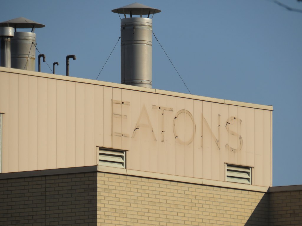
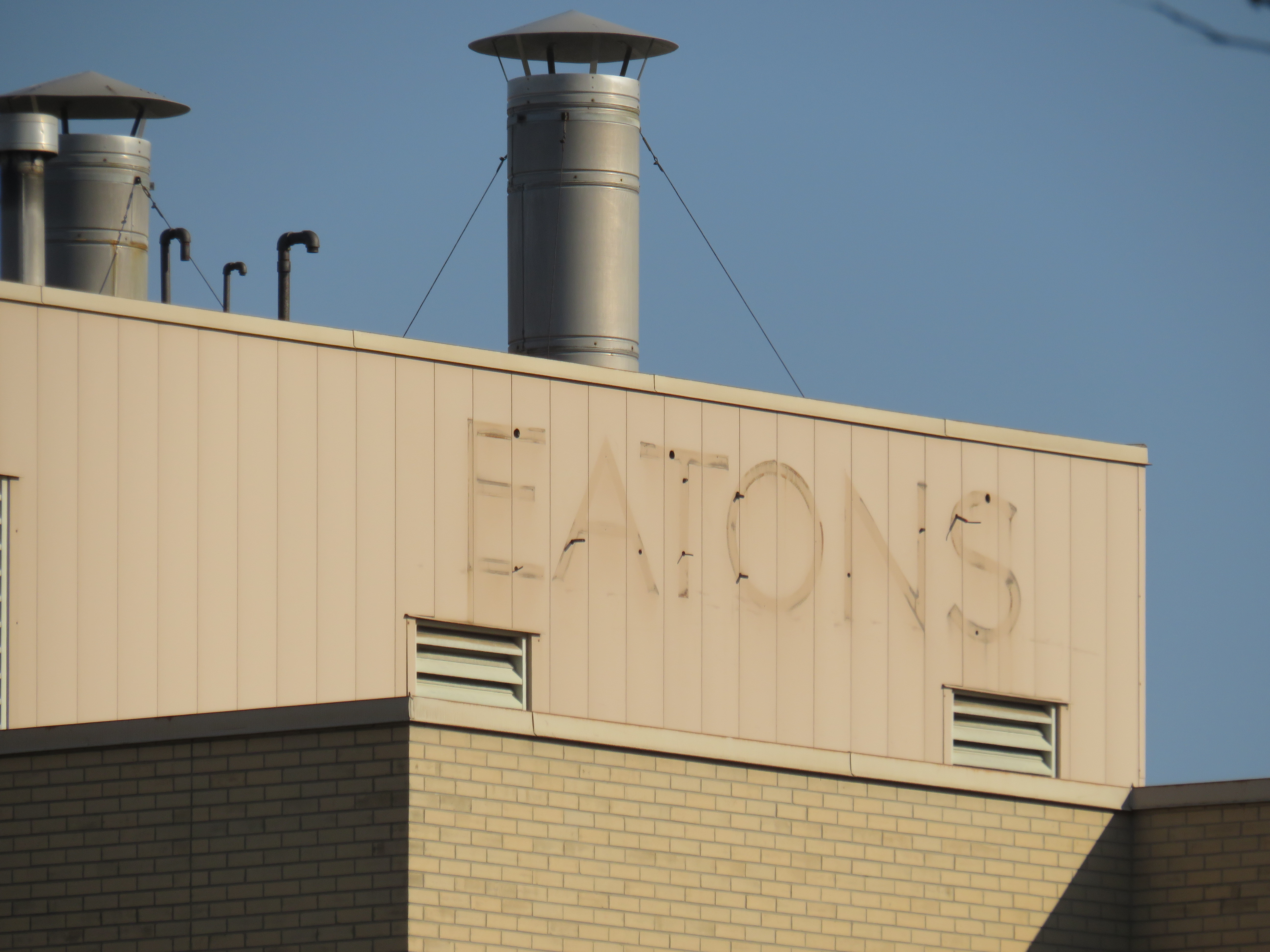
Main entrance to Hamilton City Centre, on James Street North. Note the awkward spacing of “City” over the entrance; it originally read “Eaton.”
On December 26, 2022, Hamilton’s former Eaton Centre, opened just 32 years ago, will close for good. Early in the new year, demolition will begin on the failed downtown mall, making way for a new residential development.
Hamilton Eaton Centre, fully opened in October 1990, was one of several downtown malls built in Ontario through a partnership between Eaton’s and commercial developer Cadillac Fairview, hoping to replicate the success of the Toronto Eaton Centre, which opened in phases between 1977 and 1979. It was the second major shopping centre to open in Downtown Hamilton; it followed the construction of the massive city-led Jackson Square development in the 1970s and 1980s in which entire city blocks were cleared to make way for urban renewal.
With support from the Ontario and municipal governments, the T. Eaton Company and Cadillac Fairview built new malls in Ottawa, Peterborough, Brantford, Kitchener, Thunder Bay, Sudbury, Sarnia, Hamilton, and expanded London’s existing Wellington Square. These private-public partnerships seemed to be beneficial; smaller cities worried about the decline of their downtowns would get an attractive new shopping centre after expropriating and demolishing existing buildings and/or providing municipal lands for the project. The municipality would finance new parking garages to support the new development. Meanwhile, Eaton’s would help finance the construction and provide a lead anchor for the new development. Cadillac Fairview, which specialized in retail and office development, would arrange the construction and the leasing for the mall stores. (There were a few downtown shopping centre projects in Ontario that did not have Eaton’s involvement, including malls in Chatham, Cornwall, Tillsonburg, and Waterloo.)
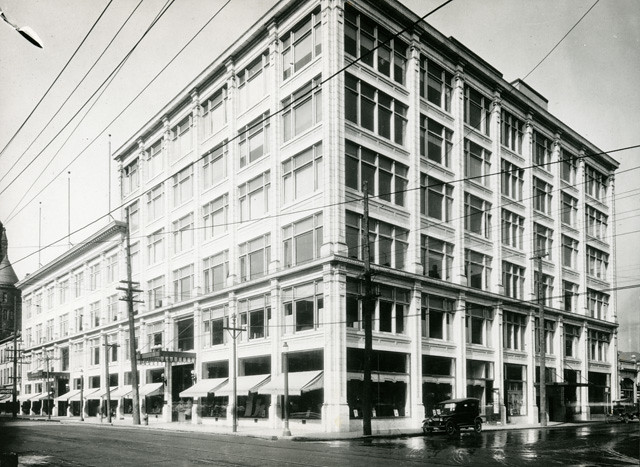
The old Eaton’s Hamilton Store in the 1920s, looking southwest from James Street North and (now disappeared) Merrick Street (Hamilton Public Library)
Unlike malls in Kitchener, Sarnia, Brantford, or Guelph, the Hamilton Eaton Centre was mostly built upon lands already acquired by Eaton’s itself, much like the larger and more successful Toronto Eaton Centre (the city of Hamilton assisted by closing Merrick Street between York Boulevard and James Street and transferring the right-of-way for the new development). The first phase of the project, built on the site of the Merrick Street parking garage and the old Hamilton Farmers Market, became the home of a new four-storey Eaton’s store to replace the dilapidated building on James Street. When the new store opened in April 1989, the old store was quickly demolished to make way for the mall itself, which opened just 18 months later.
The new Eaton’s Hamilton store on York Boulevard soon after opening in 1989. The store had exits to both Jackson Square and once completed, the new Eaton Centre mall. (Hamilton Public Library)
At first, Hamilton’s Eaton Centre was able to attract prestigious tenants such as HMV and Eddie Bauer thanks to Cadillac Fairview’s expertise and new office development in Downtown Hamilton, including a new CIBC office complex. The new mall was also able to attract existing downtown businesses out of storefront retail and the older Jackson Square mall.
YouTube video showing the exterior and interior of the old Downtown Hamilton Eaton’s store prior to closing, as well as its demolition in 1989 to make way for the new Hamilton Eaton Centre (via Hamilton Sight & Sound YouTube channel)
However, as I discussed previously on this website, the malls developed by Eaton’s and Cadillac Fairview did not do well in most markets. New, full-line Eaton’s stores were a poor fit for smaller, industrial cities like Peterborough, Brantford, and Sarnia. The malls themselves were more difficult to get to by car, and shoppers usually had to pay for parking. The established suburban malls were typically larger, and they offered ample free parking. By 1990, the old, large industries were in decline due to free trade and industrial automation, and in the 1990s, a new retail format — the big box “power centre” — emerged as serious competition during a major recession. And in 1994, Walmart entered the Canadian market.
The former Hamilton Eaton Centre (known as Hamilton City Centre since 2000) from the corner of James Street North and York Boulevard. The clocktower on the corner is an homage to the old Hamilton City Hall, which was demolished in 1960. The clocks themselves were originally installed in the old city hall and will be preserved when the current building is demolished.
With low traffic and many national retailers unwilling to renew their leases, Cadillac Fairview divested itself of most of its downtown malls. It sold its half-stake of Hamilton’s Eaton Centre to the T. Eaton Company in 1995 (Of its downtown malls, Cadillac Fairview would only hold onto the flagship Toronto Eaton Centre, and the Rideau Centre in Ottawa). According to a Hamilton Spectator article from that year, one of the mall’s three floors was already closed, just five years after its grand opening.1 Among the tenants that left the mall early was upscale men’s clothier Harry Rosen. By 1996, only 50 of the 120 stores outside the Eaton’s department store were still occupied, with another six stores closing early that year.2 A McMaster University business school lecturer predicted that one of the two downtown malls — Eaton Centre or Jackson Square — would close within 10 years. (He was only 15 years off the mark.)2
In February 1997 — after years of mismanagement and neglect by the fourth generation of the Eaton family — Eaton’s entered bankruptcy protection, allowing it to settle debts and restructure. Though stores in other downtown malls in Brantford, Sarnia, and Kitchener were among the first to go, the Downtown Hamilton store was left off the closure lists, as Eaton’s itself owned the property – losing the department store anchor would not help the mall in case of a property sale. In the meantime, Metrus Developments — which purchased the neighbouring Lister Block in 1989 — evicted its remaining tenants and boarded up the six-storey commercial building, hastening Downtown Hamilton’s visual and commercial decline.
In 1998, the Region of Hamilton-Wentworth (dissolved in 2001 after amalgamation) began leasing space on the formerly vacant third floor of Hamilton Eaton Centre, partly to help maintain the department store’s presence and support Eaton’s, which still owned the property. The City of Hamilton agreed to provide two hours of free parking at the attached York Boulevard garage and planned for the construction of a new store entrance to the Hamilton Farmers’ Market. This was just enough to keep the department store open until the company collapsed in 1999; the store closed for good in October of that year. The mall was rebranded Hamilton City Centre the year after, sold to a private real estate firm.
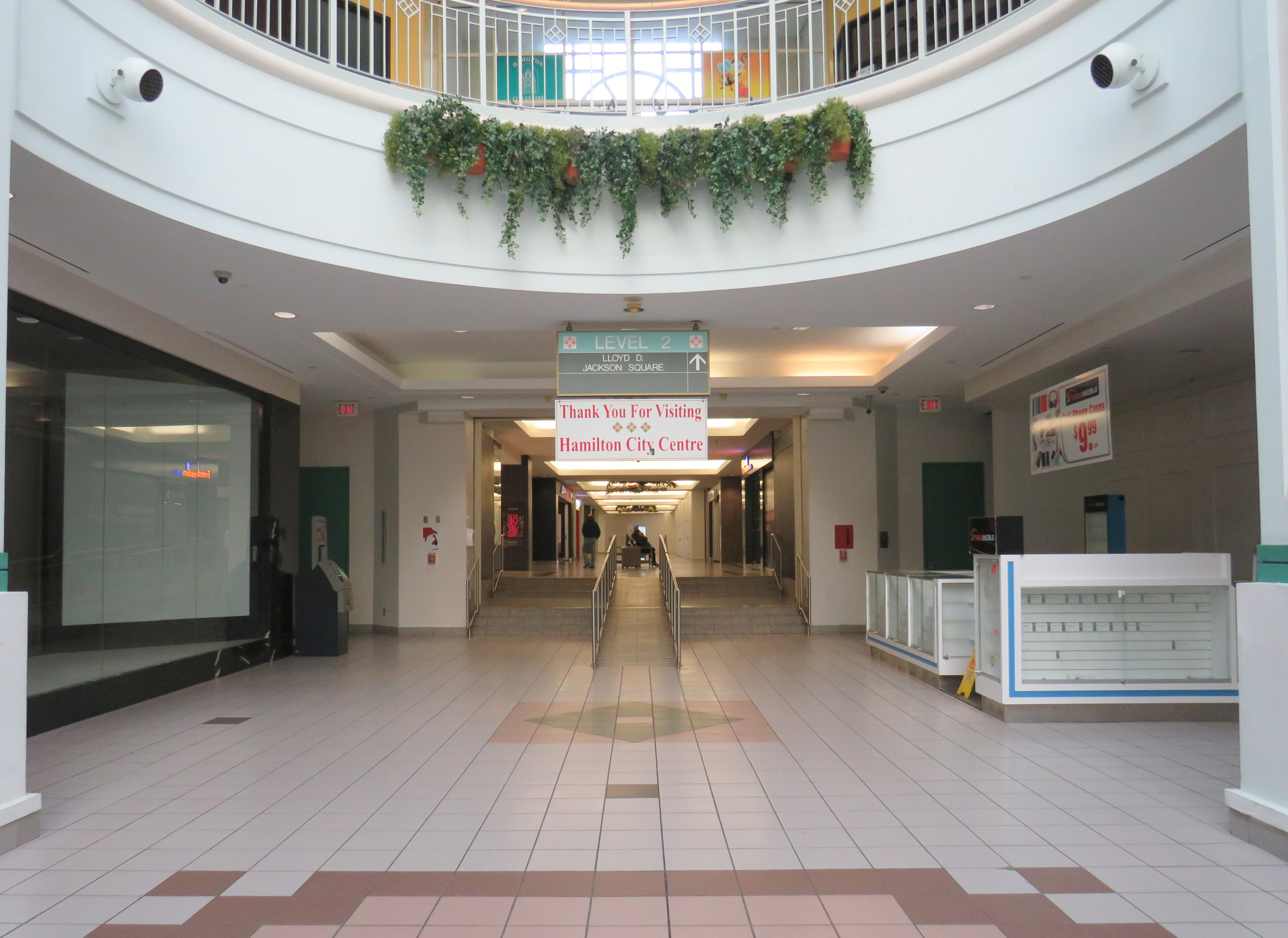
View from the third floor in Hamilton City Centre; the conversion of retail space to offices on the top level is apparentThe central atrium. All remaining stores must close by December 26, 2022.The connection between Hamilton City Centre and Jackson Square. This was originally the main route between the old Eaton’s store and the first phase of the 1970s-era mall. The largerJackson Square will undoubtedly benefit from the residential re-development of the Eaton’s site.
After Eaton’s closed, part of the massive retail space was renovated and turned into a fitness club. The City of Hamilton leased additional space in the old Eaton’s store, especially as it undertook renovations to its modernist 1960s-era city hall. New windows were punched into the brick facade to provide natural light to the new occupants. But the remaining national retailers like HMV, Fairweather, and Eddie Bauer left the mall, while a few small, independent retailers came in, attracted by cheap rents.
A fresh labelscar on the south-facing roof of the Eaton’s store, as seen from the patio on top of Jackson Square. Until 2021, a forgotten and unmaintained Eaton’s sign was left alone, hidden from street level.
The new development will have 1,940 residential apartments, along with street-level retail and office spaces, constructed in three phases. Walkways will allow the public to cut through the property, with one of those roughly following the old Merrick Street alignment. Unfortunately, it is being developed and planned independently of the rest of the Jackson Square superblock bound by James, King, and Bay Streets, and York Boulevard, and which also contains the farmers market, the central library, and Copps Coliseum, the sports venue built for an NHL franchise that never arrived.
But with the influx of new residents, Jackson Square — which, despite is retail vacancies, holds its own due to the attached office, hotel, and civic functions, as well as the full-service Nations supermarket — will only benefit from the demise of its newer downtown competitor.
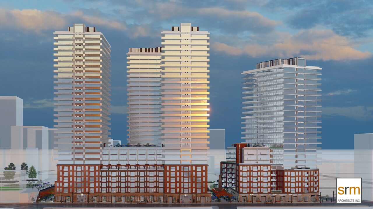
Rendering for the new development on the Eaton Centre site by SRM Architects.
“Eaton eyes the future after buying centre” Hamilton Spectator 13 July 1995: D12.
John Burman. “A tough sell: Struggling Eaton Centre looks for new direction” Hamilton Spectator 13 Feb 1996: A1
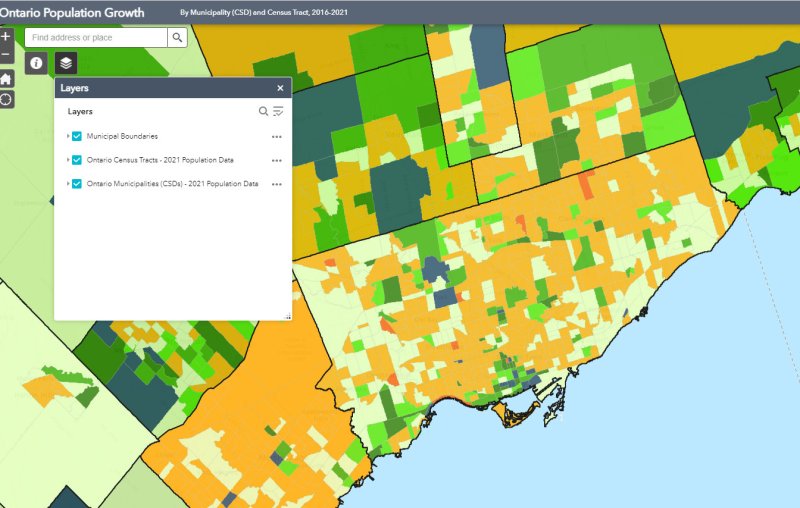
Despite new highrise development in its city centre, Mississauga lost 3,368 residents between 2016 and 2011
On February 9, data geeks across Canada rejoiced when Statistics Canada released the first round of data from the 2021 Census of the Population.
The data was released at all levels of geography made available by Statscan. At the federal level, Canada grew by 5.2% since the 2016 Census, with a total population of 36,991,981. Immigration, rather than natural growth (births vs. deaths) drove Canada’s population increase.
Of course, this growth did not occur evenly across the country. Newfoundland and Labrador lost residents, while Prince Edward Island and British Columbia saw the biggest population increases.
Within the Greater Toronto and Hamilton Area, Mississauga experienced population decline (-0.5%) for the first time since it became a city in 1974. Outer suburbs, such as Milton, East Gwillimbury, and areas just beyond the GTHA, such as New Tecumseth and Bradford saw population growth over 20%, driven by new greenfield development.
In older Toronto suburbs, including much of Etobicoke, North York, Scarborough, and even Mississauga, population losses at the local census tract level can be explained by ageing households, where Millennial and older Gen Z children moved out on their own, particularly into fast-growing downtown areas. These areas, dominated by single-family housing, could accommodate much of the GTHA’s growth with gentle density, including secondary suites (such as basement apartments), garden suites, and zoning policies that would make it easier and more economical to build “missing middle” housing such as walkup apartments and multiplex homes.
Toronto grew by 62,785 residents in the last five years, with only a few areas accommodating all that growth: the downtown core between Dufferin Street and Broadview Avenue, South Etobicoke, Yonge-Eglinton, and former industrial, instructional, and commercial lands stretching along the Highway 401 corridor through North York and West Scarborough. This corridor includes the Downsview Park development, a new condominium cluster at Wilson Subway Station, the former Canadian Tire lands near Sheppard Avenue and Leslie Street, and the intensification of the Fairview Mall area.
In June 2020, Toronto-based artist and activist Andrew Lochhead launched a petition to rename Dundas Street, one of Toronto’s oldest, longest and best-known arterial roads. Lochhead states that Henry Dundas, 1st Viscount Melville “actively participated in obstructing the abolition of slavery in the British Empire from 1791 to the end of his political career in 1806.” While some historians may argue that Dundas was a pragmatic moderate, rather than an anti-abolitionist (unlike slave-owning Torontonians like William Jarvis or Peter Russell, who have streets named after them), it’s still worth wondering why Toronto has a street named after the Scottish politician, who had nothing to do with Toronto’s colonial history.
Until recently, I gave Dundas Street little thought. Years ago, I wrote about how the street was pieced together in the late 19th and early 20th century to provide a new through east-west route across central Toronto. Though I was aware that Dundas Street began at the present-day corner of Queen Street West and Ossington Avenue, I had long thought the road was named for the town of Dundas, to which it leads.
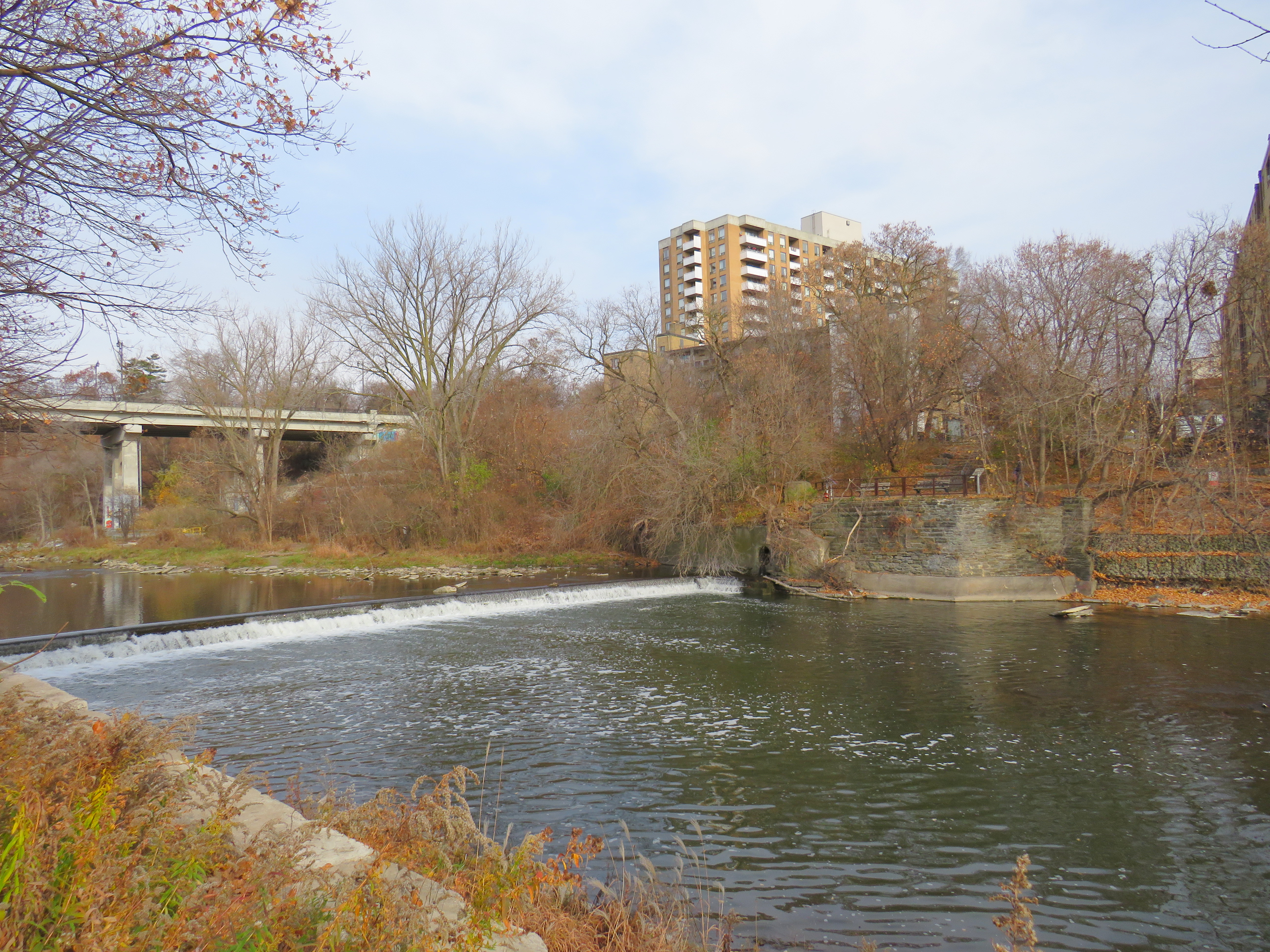
The end of Desjardins Canal, in the old Town of Dundas
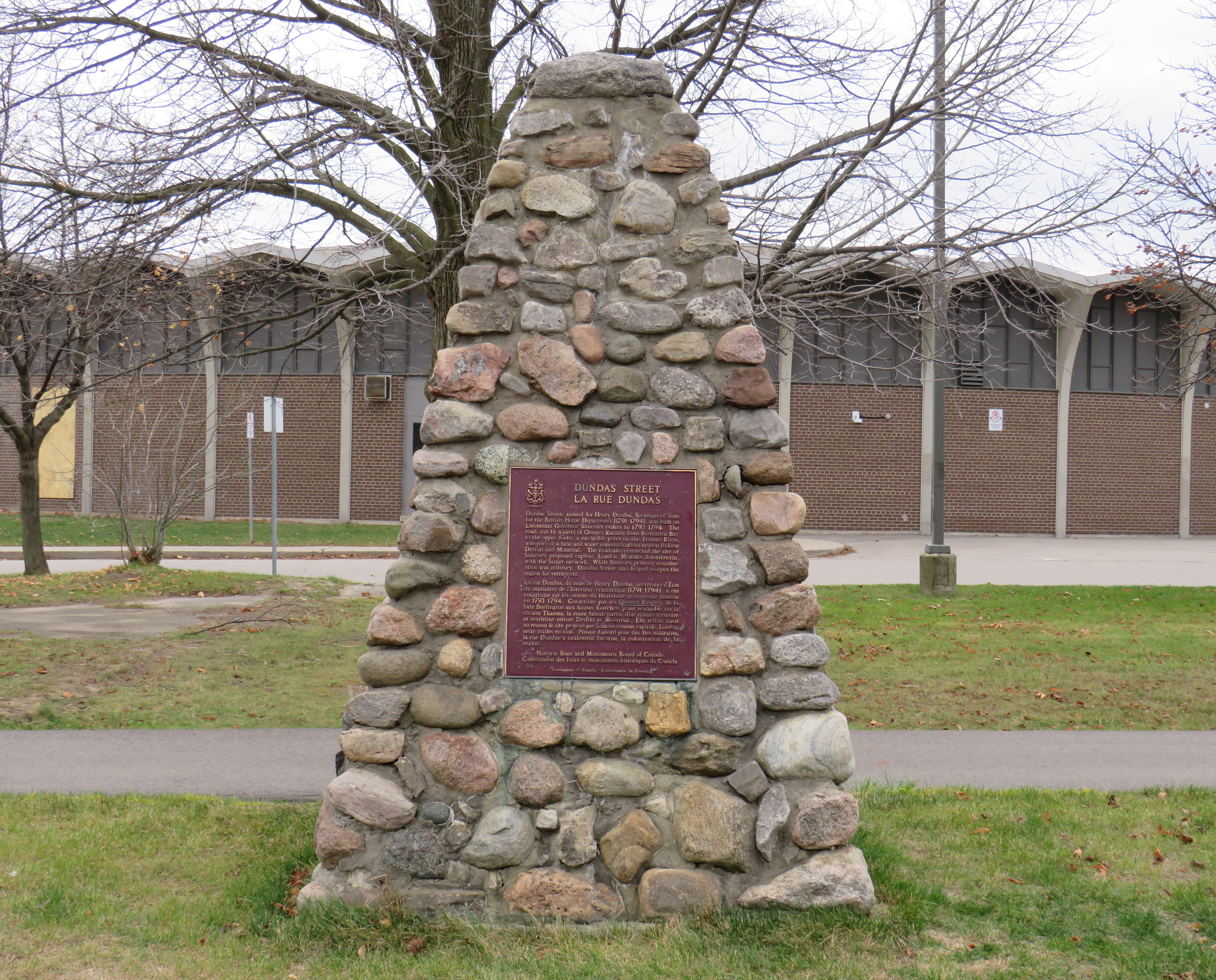
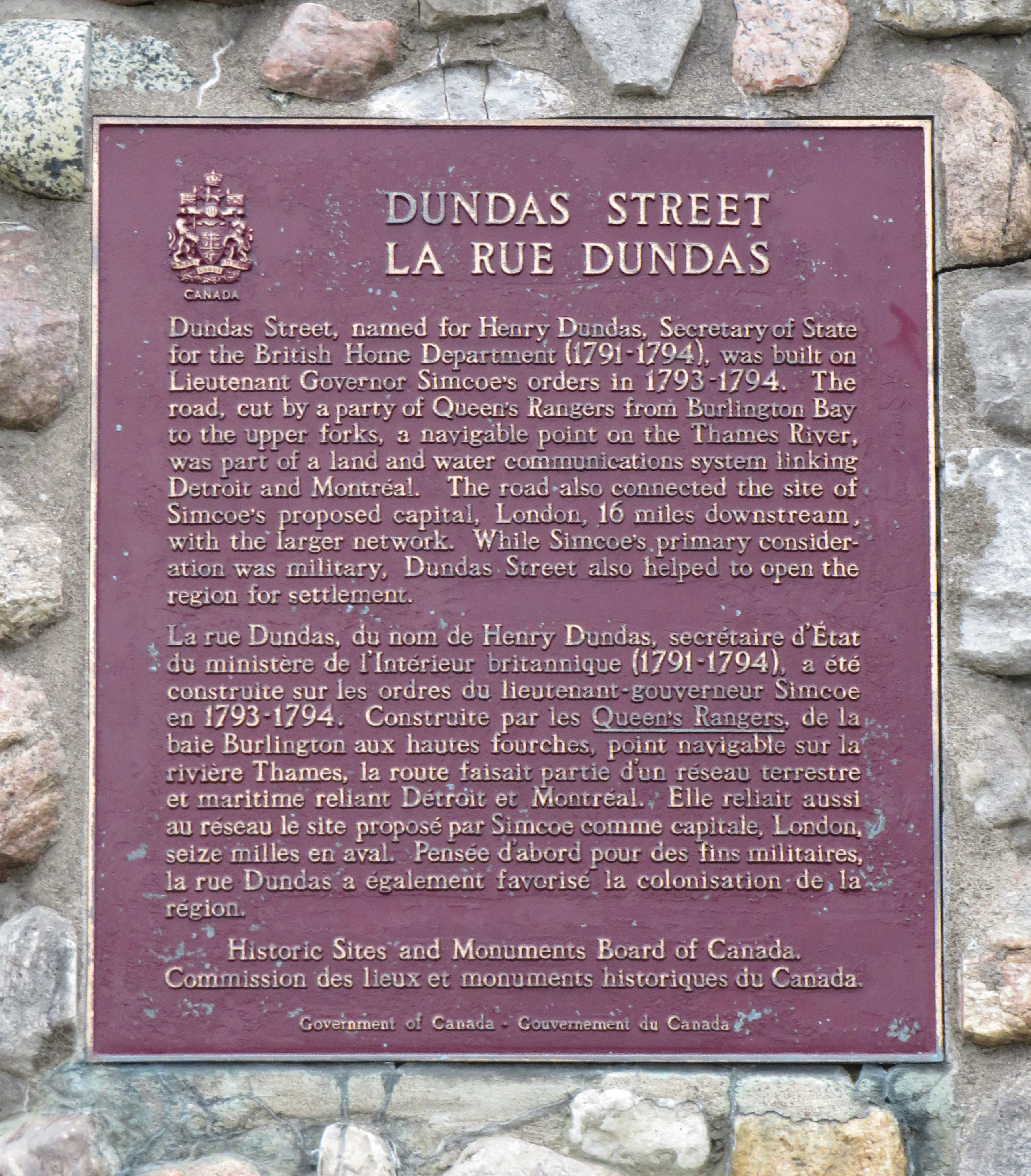
Dundas Street was established as a military supply route by order of John Graves Simcoe, the first British governor of Upper Canada. At first, it was surveyed and cleared in 1794 and 1795 between Cootes Paradise (at the very end of Lake Ontario, beyond Burlington Bay) and the Upper Forks of the Thames River, at what is now Woodstock. From there, small boats could be used to travel downriver to London and to Lake St. Clair. Though there were several Indigenous trails connecting Lake Ontario and the Thames River (the western part of Mohawk Road in Hamilton follows one such route), the new British colonial government favoured a straight, direct road.
A federal plaque on a cairn in front of Dundas Valley Secondary School in Dundas
Though Dundas Street (which is known as Governor’s Road between Dundas and Paris) features a gentle climb up the Niagara Escarpment, detours were quickly established to get around challenging terrain, such as the confluence of Grand and Nith rivers near Paris. Dundas Street was soon extended westward, to Simcoe’s preferred capital site at London, and extended eastward, to York (Toronto).
Yonge Street, which was originally surveyed and cleared between Lake Ontario and the Holland River near Lake Simcoe, served a similar purpose as Dundas Street. Combined with Penetanguishine Road, Yonge Street provided a military supply route to Lake Huron, though bypassing the established Toronto Carrying Place trail. Though Dundas and Yonge Streets were built with military goals in mind, they, like many other early colonization roads, helped to promote new settlement of lands claimed from local First Nations. Like Dundas Street, Yonge Street was named for a senior British official — George Yonge, who was the British Secretary of War in 1793.
In its early years, Dundas Street’s position inland from Lake Ontario was advantageous as it provided an alternate route in case of invasion. The winding route through Etobicoke and West Toronto to Ossington Avenue allowed travellers to avoid deep ravines and Grenadier Pond.
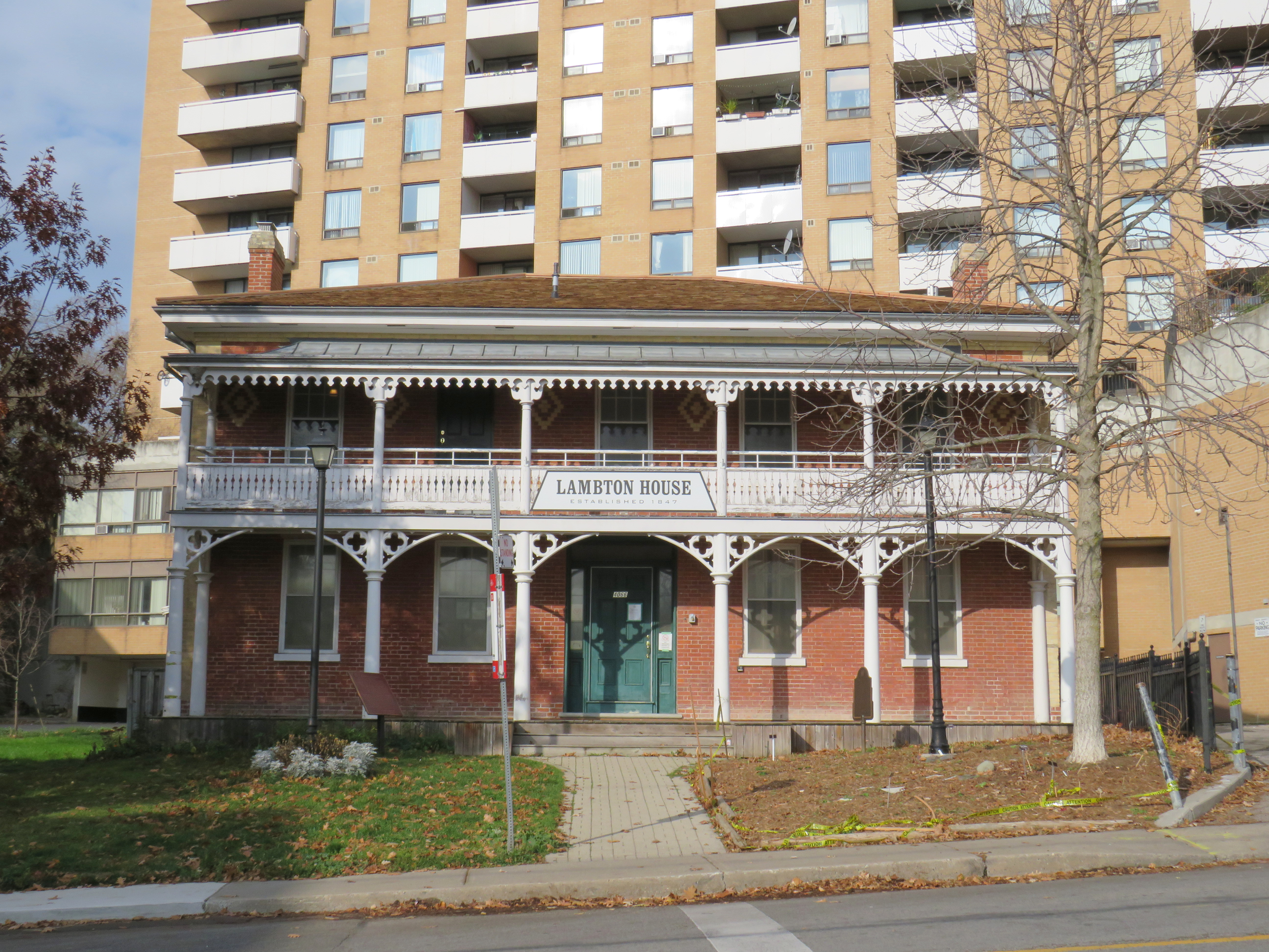
Lambton House, Old Dundas Street
Other early settlement routes, such as Weston Road, branched off of Dundas Street, leading to newly settled lands to the north and northwest of Toronto. Taverns dotted the route, providing accommodation and libation to travelers, several of which — including Lambton House and Montgomery’s Inn — survive to this day.
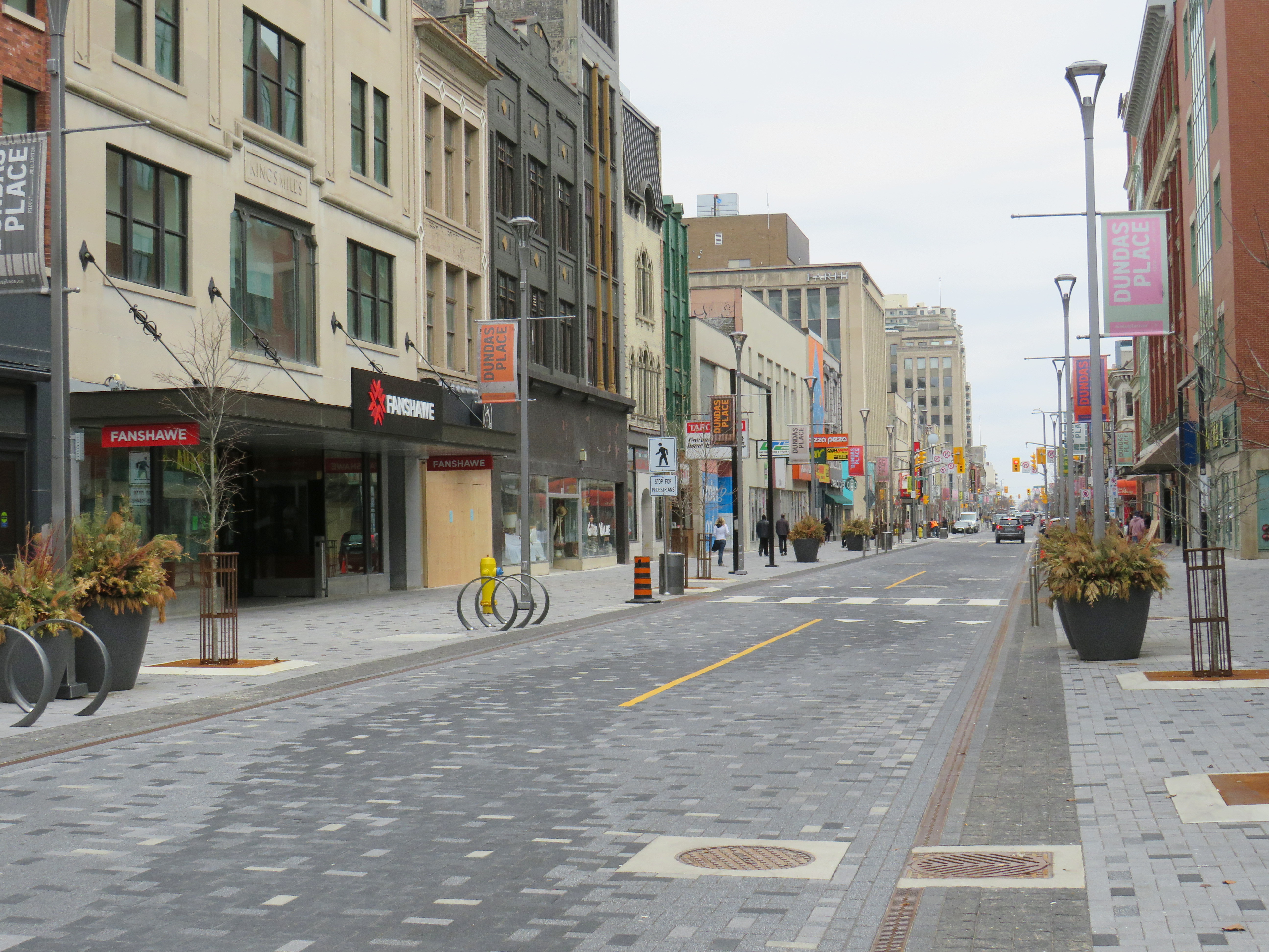
In London and Woodstock, Dundas Street formed the basis for each city’s downtown core. In London, it was recently rebuilt as a two-lane flexible street called Dundas Place, intended to host public events and revitalize the street, which has seen a loss of business to suburban malls and big box stores and to trendier bars and restaurants on Richmond Street, closer to Western University.
Dundas Street in Downtown London was recently rebuilt as a flexible street
Outside the cities, though, other routes surpassed Dundas Street in importance by the mid 1800s. The Lakeshore Road soon became the preferred route between Toronto and Hamilton (which overtook the town of Dundas in size and importance), while the railways, established between Toronto, Hamilton, and London in the 1850s, further eroded Dundas Street’s importance as a major through route until the automobile gained in popularity.
Much of the road between Paris and London became part of interprovincial Highway 2, which extended across Eastern Canada from Windsor, Ontario to Halifax, Nova Scotia. The Waterdown-Etobicoke section became part of Highway 5, while the lesser-travelled section between Paris and Dundas (which today is known as Governor’s Road) was established first as Highway 5B in 1938, then as Highway 99 in 1940.
The remains of the old Dundas Street bridge over the Humber, removed in 1928, looking west to the former settlement of Lambton Mills. The replacement high level bridge is seen to the left. The approaches to the old bridge are named Old Dundas Street.
The Dundas-Waterdown section, which winded its way up the escarpment (only to descend it again a short distance east), became a minor road, with part of the original alignment abandoned by the 1850s.
Though it never held the status of Toronto’s main street, Dundas Street would gain in importance and length in the 19th and early 20th centuries. As Toronto grew beyond its early street grid, it came up against the park lot system devised by Governor Simcoe and other officials to establish a landed gentry in the new colony (including the slaveholding Jarvis and Russell families, who worked to prevent Simcoe from instituting a complete abolition in Upper Canada). These lots which were long and narrow, extended north from Lot (now Queen) Street, and each were developed independently. This resulted in a mess of east-west streets that did not necessarily meet each other. Though College Street was laid out with minimal difficulty, there was no continuous east-west street between College and Queen Streets east of Ossington Avenue.
Dundas Street West, looking southeast from Dovercourt Avenue towards the downtown skyline. This is part of the 220-year old western extension of Dundas Street from the head of lake to York (Toronto).
But by the early 1910s, Dundas Street was extended eastward, at first to Bathurst Street, following Arthur Street — which was widened to permit Toronto Railway Company streetcars — and then east to Yonge via St. Patrick, Anderson, and Agnes Streets. Jogs between these streets were slowly realigned, starting with the St. Patrick-Anderson-Agnes jogs between McCaul Street and University Avenue. However, it wasn’t until 1953 that the jog between former Arthur and St. Patrick Streets at Bathurst Street was eliminated. Scadding Court Community Centre now sits on the old roadway, though a small part survives as the centre’s staff parking lot.
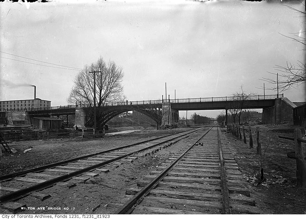
East of Yonge Street, Wilton Avenue was extended across the Don River in 1911, extending just east of Broadview Avenue, incorporating Elliot and Crawford Streets. Though the new bridge was built with streetcar tracks and overhead poles, through service did not begin until 1923, as part of a major TTC route restructuring.
By 1920, Wilton Avenue was renamed Dundas Street East, though the through connection across Yonge Street was not completed until 1922, with the block long section east of Yonge left over from the realignment renamed Dundas Square.
Though the early extensions of Dundas Street through the city simplified the street grid and allowed for through streetcar service between West Toronto and Broadview Avenue, the eastern extension built in the 1950s was done entirely for the benefit of the automobile.
Though Dundas Street extended east of Broadview for one block to Boulton Avenue, it was as a narrow residential street, and did not continue beyond (this is why the Harbord Streetcar took a convoluted route via Dundas, Broadview, and Gerrard to get to Carlaw and Pape Avenues). New roadways were planned to expand traffic access to Downtown Toronto from the burgeoning suburbs, including a new extension of Dundas Street east to Kingston Road.
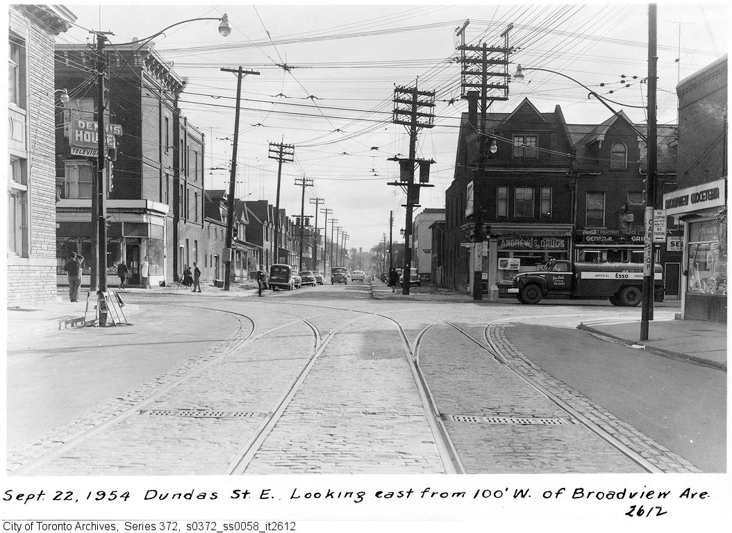
From Boulton Avenue, a new alignment was built east to Pape Avenue, resulting in the demolition of over a dozen houses on Boulton Avenue, De Grassi Street, West Avenue, and Wardell Street, before ducking under the Canadian National mainline in a new underpass built in 1953, and through an industrial area, avoiding major factory buildings.
East of Pape Avenue, the new roadway followed a widened Dagmar Avenue, before bending south though a former alley to Jones Avenue to connect with former Doel Avenue to Alton Avenue. Between Alton and Woodfield Road, another new section of roadway was built, through an old brickyard in the late 1940s, connecting with Applegrove Avenue to Coxwell Avenue. The final section, between Coxwell Avenue and Kingston Road, was built through a minor ravine, connecting with, and replacing part of, Maughan Crescent and Edgewood Avenue.
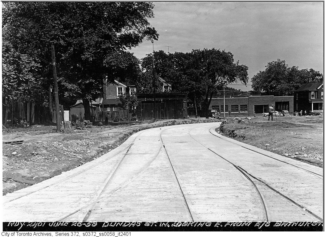
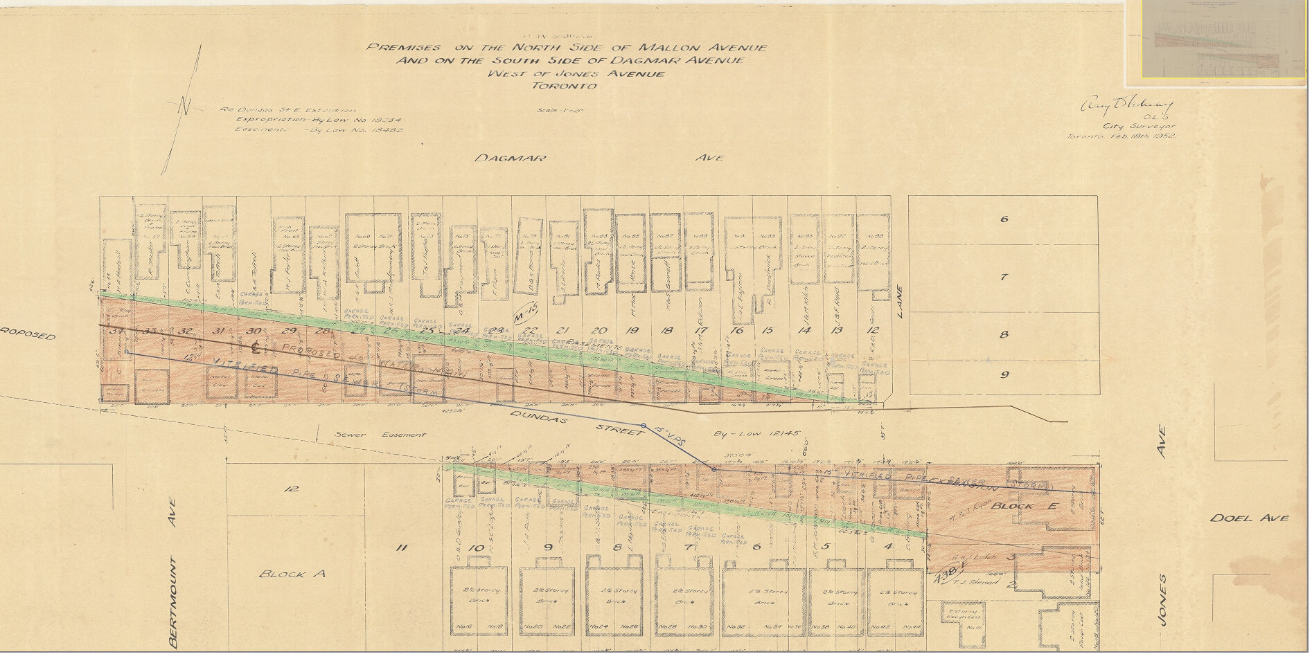
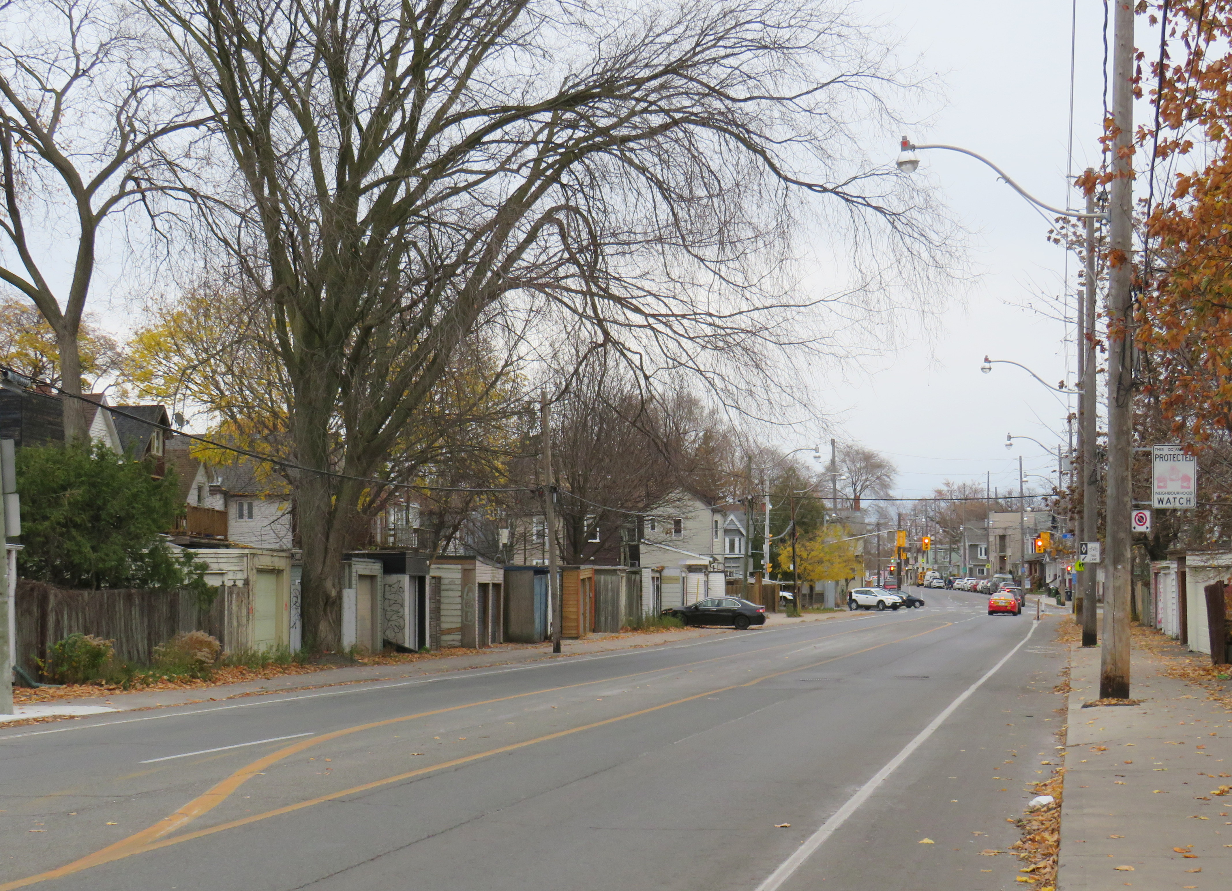
Plan for Dundas Street extension through the rear yards and laneway between Dagmar and Mallon Avenues. From City of Toronto Archives, Fonds 200, Series 2277, Item 32.Just west of Jones Avenue, Dundas Street East is lined with garages, as it passes through an old alley between Dagmar and Mallon Avenues.
Though Dundas Street East was shoehorned into several east-end neighbourhoods through the 1940s and 1950s to provide a new route for automobile traffic, over fifty years later it became an important cycling route. In 2003, the speed limit was reduced to 40 kilometres per hour, and the four traffic lanes reduced to two, with new bike lanes and a centre turning lane. Without streetcar tracks (unlike neighbouring Queen and Gerrard Streets), and with few storefronts, Dundas Street was simple to reconfigure. In 2020, the bike lanes were extended west across the Don River and into Regent Park, as part of the new ActiveTO measures.
Within Toronto, Dundas Street has gone by many names: Arthur, St. Patrick, Anderson, Agnes, Wilton, Elliot, Crawford, Dagmar, Doel, Applegrove, Maughan, and Edgewood. At various times in the first half of the last century, city officials have decided to change their names to Dundas Street.
It would not be without precedent to change Dundas Street’s name as well. Henry Dundas has no connection to local history, and even the historic road that bears his name did not extend any further east than Ossington Avenue.
Retain the legal street names with additional interpretation and recognitions
Retain the legal street names but rename those civic assets with Dundas in their name, except TTC facilities (there are three parks and one library branch that include the Dundas name, and Yonge-Dundas Square; there are two TTC subway stations and one streetcar line that also bear the Dundas name)
Rename the streets and all other civic assets now carrying the Dundas name (including Dundas Street East, Dundas Street West, Dundas Square, and Old Dundas Street).
I would agree with at least the third option, and likely the fourth option, even in part. As one of the city’s most famous and popular meeting places, a better name can be found for Yonge-Dundas Square. As Dundas Street East is a 20th century construct, and less than half the age of the historical road, it too, would be a great candidate for renaming to something meaningful. There are many other streets, towns, and parks in Toronto and elsewhere in Ontario that carry names given by early colonial officials, eager to leave their mark on newly claimed lands. Some are also worthy candidates for renaming.
Other municipalities, including Mississauga, Oakville, Burlington, Woodstock, and London, will also have to decide what they will do with their sections of Dundas Street. There is also the matter of the former Town of Dundas, the Dundas Valley, the United Counties of Stormont, Dundas, and Glengarry in Eastern Ontario (and two townships within it). There are also Dundas Streets in Belleville, Trenton, and Napanee along Highway 2, but otherwise unrelated to the historic road.
But the process must be thoughtful and considerate, and not just a another feel-good exercise that distracts from the real economic and racial inequities in our city.
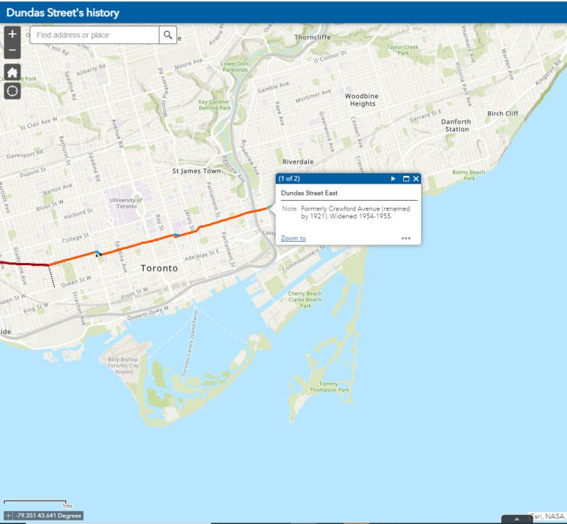
The interactive map below illustrates the history of Dundas Street, from London to Kingston Road.
The flag of the City of Toronto, designed by Renato De Santis, is an example of a very good civic flag
I was in Orillia last week, mainly to check out the new Simcoe County Lynx bus system. While there, the flag flying from the Opera House (formerly the city hall) caught my attention. Most municipal flags are boring, usually consisting of the town or city’s coat of arms, shield, or logo on a plain background.
But Orillia’s flag is different. It has waving blue and white waves, with two green triangles facing the centre, and a bright yellow sun in the middle. The symbolism wasn’t difficult to figure out: the city’s position on the narrows between Lake Simcoe and Lake Couchiching, with the sun being a nod to Orillia author Stephen Leacock’s Sunshine Sketches of a Little Town, a light, humourous collection of short stories about the denizens of Mariposa, a thinly-veiled fictionalization of Orillia.
Yet Canadian cities that boast populations twenty or thirty times that of Orillia can’t boast having such a fine flag.
For the most part, we don’t think about state, provincial, and municipal flags, and that’s a pity. In the few cities that have an unique and powerful flag, they have become part of that city’s iconography. Unfortunately, though Toronto does have a very good civic flag, we don’t fly it like it should.
According to the North American Vexillological Association, there are five principles for creating a good flag:
Keep it simple — so simple, it can be drawn by a child from memory
Use meaningful symbolism
Use two or three basic colours
Never use lettering or seals
Be distinctive or be related
Canada’s flag, adopted in 1965, adheres to these principles perfectly. It uses just two basic colours: red and white. With a large red maple leaf in the middle, it’s easily recognizable around the world. While a child might not get the eleven-point maple leaf exactly right, it’s otherwise easy to draw from memory.
There are, of course, exceptions to these principles.
Maryland’s complicated state flag, based on the coat of arms of colony founder Cecil Calvert, Lord Baltimore, is distinctive and popular, nearly as common as the US flag. California’s state flag is emblazoned with the words “California Republic” but it has significant historical meaning. The flag of South Africa, adopted in 1994, has six colours, but by merging the Pan-African colours of the African National Congress with the red white and blue of Britain and the Netherlands, it represents unity in the post-apartheid era.
Flags of Maryland, California, and South Africa, notable exceptions to the rules
For the most part, famous and great civic flags adhere to these principles. The flags of Amsterdam, Berlin, Chicago, and Tokyo all stand out. In Chicago and Amsterdam, these flags are proudly flown from private homes and watercraft, found on t-shirts and souvenirs, and well known around the world. The bear from Berlin’s flag is almost as popular as the Ampelmännchen. Though Amsterdam’s flag’s origins go back centuries (the “x”s are actually St. Andrew’s crosses), it looks bad-ass, and on-brand for a city famous for its tolerance.
Great civic flags: Amsterdam, Berlin, Chicago, Tokyo
Compared to the great examples above, Ontario’s provincial flag is just bad. Compare the provincial red ensign with the flag of Manitoba, and then compare it to the Franco-Ontarien flag.
The Ontario and Manitoba flags, British red ensigns defaced with the provincial shields, were only adopted in 1965 and 1966 as conservative reactions to the new flag of Canada. The two flags are difficult to tell apart from a distance, and they both contain the St. George’s cross (representing England) twice: once in the union flag in the canton, and again in the shield. There’s very little Ontario to be found. (At least the Manitoba flag contains a bison, a recognizable symbol of that province.)
Meanwhile, the Franco-Ontarien flag is immediately recognizable, with the fleur-de-lis and a stylized trillium, the provincial flower, representing the French-Canadian presence in Ontario.
Like Orillia, there are a few other civic flags in Ontario that get it right.
Flags of Thunder Bay, Hamilton, Ottawa, and Toronto
Thunder Bay’s flag depicts a rising sun above Lake Superior and the Sleeping Giant, a prominent natural landmark across the water. The flag of Hamilton includes a yellow cinquefoil, the badge of the Clan of Hamilton, with a steel chain with six large links representing the steel industry and the six municipalities amalgamated into the modern city. The flag of Ottawa contains the civic logo, with the points representing waterways and the Peace Tower on Parliament Hill. Finally, the flag of Toronto has an abstract depiction of Toronto’s city hall, with a maple leaf where the council chamber sits. The two towers also make a “T.”
It’s a shame that Toronto doesn’t make more of its simple, yet great flag.
Unfortunately, most flags look like those used by Ontario’s third and fourth largest cities.
Mississauga’s flag violates most of the principles listed above by including the name of the place it represents, with the addition of “incorporated 1974” at the bottom. In the middle is the civic shield, with the typical trappings: a cog representing industry, a lighthouse representing a port (Port Credit), a waterwheel, a stalk of wheat, and wings, possibly representing Pearson Airport. Though Mississauga is a proud city with its own identity, this flag doesn’t appear except in front of civic buildings.
Brampton’s flag is just the civic shield on a white background, again with similar trappings: a bushel of wheat, a plow, a steam locomotive, and a beaver. According to the city’s website, the gold colour and castle top signify the city’s relation with the small Cumbrian town of Brampton, England. The shield dates from the small rural town before post-war growth, with only a pine tree in the middle to represent the old township of Chinguacousy it merged with. There’s no recognition of Brampton’s modern identity as a multicultural city.
It would be wonderful to see Brampton and Mississauga come up with better designs. Brampton’s new logo and slogan, Flower City, better represents the city’s history and ambitions. A pretty good flag could be made out of that.
As for Toronto, let’s embrace our flag more. It’s a fine one and far better than the province’s. As Torontonians generally think of themselves as Canadian first, Torontonian second, and Ontarian third, perhaps we should give our municipal banner more love.
Early European settlers to Ontario were not very imaginative when they came up with local place names. Although some towns and townships have First Nations names (Toronto, Chinguacousy, Niagara), or named for First Nations leaders allied with the British (Tecumseh, Brant), most cities, towns, and townships were given the names of European settlements, British royals and nobility, or the names of those settlers.
The list of Ontario towns and cities includes no less than ten world capitals: Athens, Brussels, Delhi, Dublin, London, Paris, Vienna, Warsaw, Wellington, and Zurich. Other towns and cities across the province include the names of British royalty and nobility (Cobourg, Hanover, Port Arthur, Fort William, Richmond Hill) or the towns settler arrived from. These towns can be found throughout the province.
At Clappison’s Corners, a busy intersection outside of Hamilton, Paris and London appear on the same sign, amusing the occasional visitor. By driving west on Highway 5, Paris is just 42 kilometres away, with London an additional 80 kilometres’ drive via Highway 2.
The other Covent Garden Market, London
London was named for the British city in 1793, and was chosen as the site of the new capital of Upper Canada by governor John Graves Simcoe. He felt that the interior location, on the banks of the Thames River (Simcoe named that, too), would be safe from American attack. However, York (now Toronto), became the capital. But London became the regional centre for Western Ontario, and is now the world’s second-largest London with over 350,000 residents.
Paris, Ontario’s main street backs onto the Grand River
Paris was named in the 1840s not for the French capital, but for the large gypsum deposits in the area, used to make plaster of Paris. In 2000, the town of Paris was amalgamated with rural Brant County. The community has a population of just 12,000, the third-largest Paris (between Paris, Texas and Paris, Tennessee).
Before the provincial government downloaded thousands of highways to local municipalities in the late 1990s, Highway 5 ran from Highway 2 (Kingston Road) in Scarborough to Highway 2 again at Paris. At Paris, a motorist could continue on Highway 2 west to London and beyond. New freeways, such as Highway 403, offered a faster trip, while local roads, such as Highways 2 and 5, were downloaded as a cost-cutting measure. Today, Highway 5 runs for just 13 kilometres connecting Highways 6 and 8.
Today, the route to Paris and London is merely an anachronism of an earlier time, when King’s Highways covered the province and when motorists passed through many small towns on their way to places like Toronto, Detroit, and Montreal. At some point, the sign at Clappison’s Corners will be removed to make way for a new interchange. Until then, this humble monument to European settlement and rural King’s Highways will stand guard.


 The flag of the City of Toronto, designed by Renato De Santis, is an example of a very good civic flag
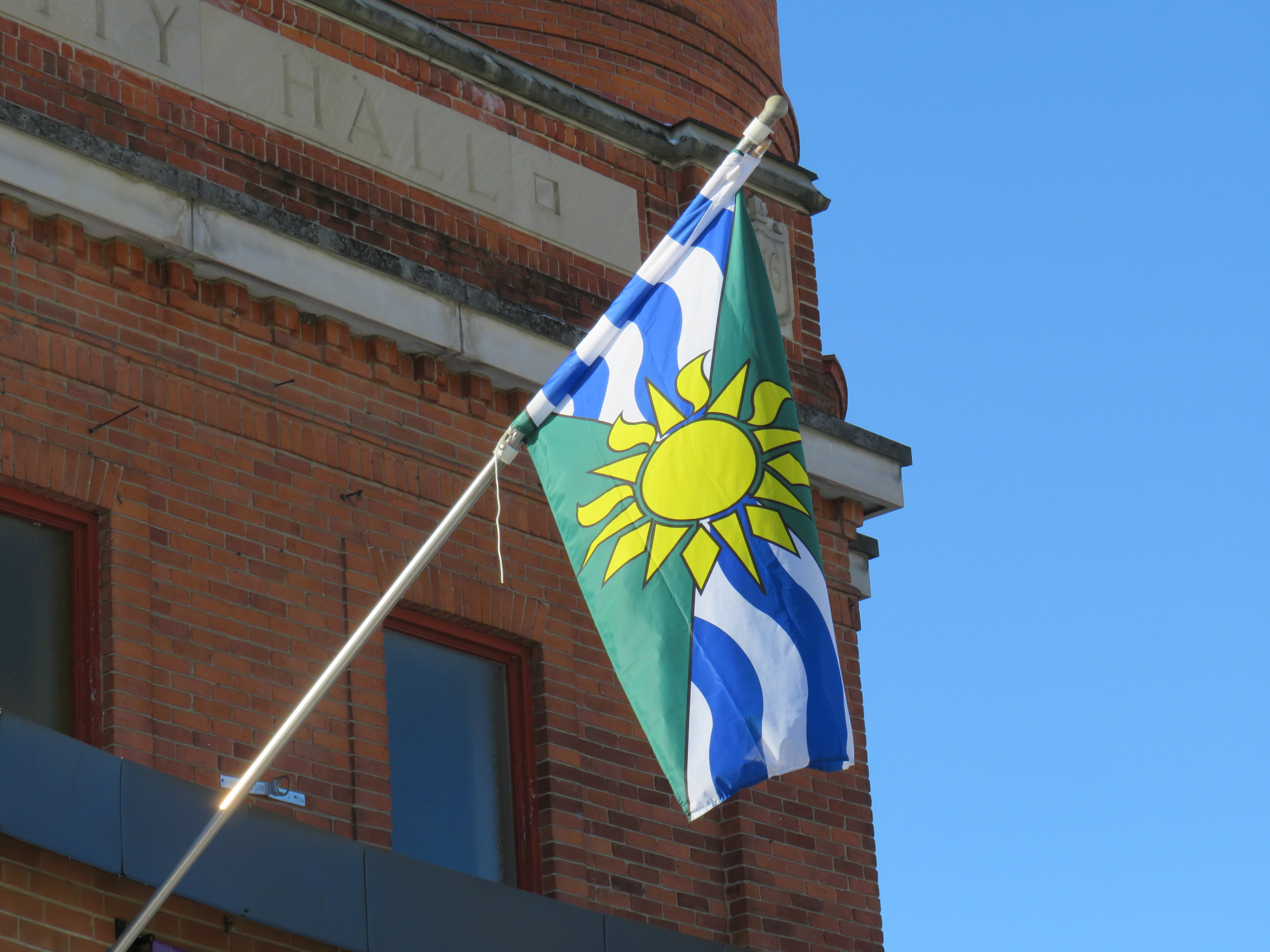


 The former flag of Pocatello, Idaho
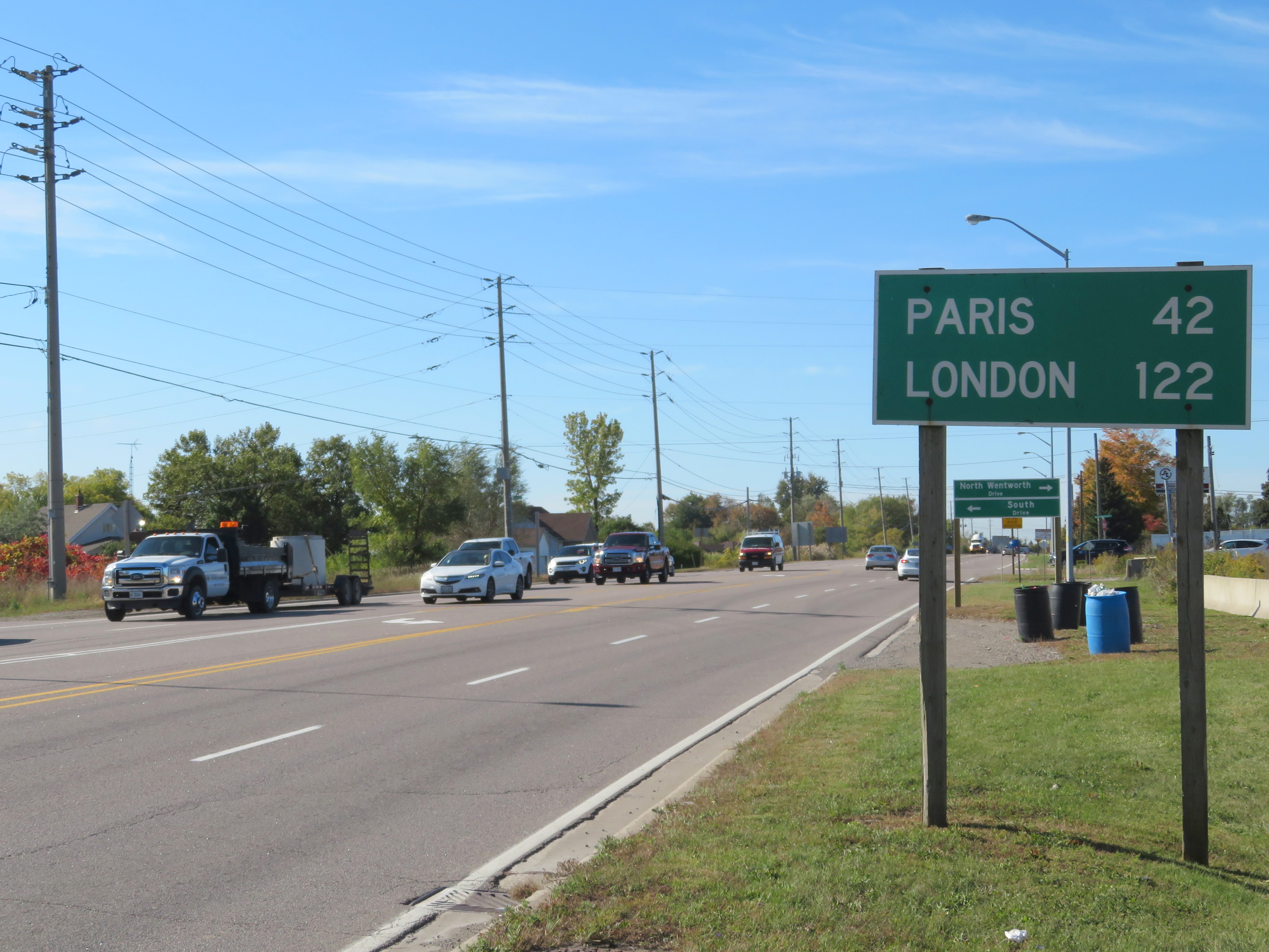 Distance Sign on Highway 5, Clappison’s Corners
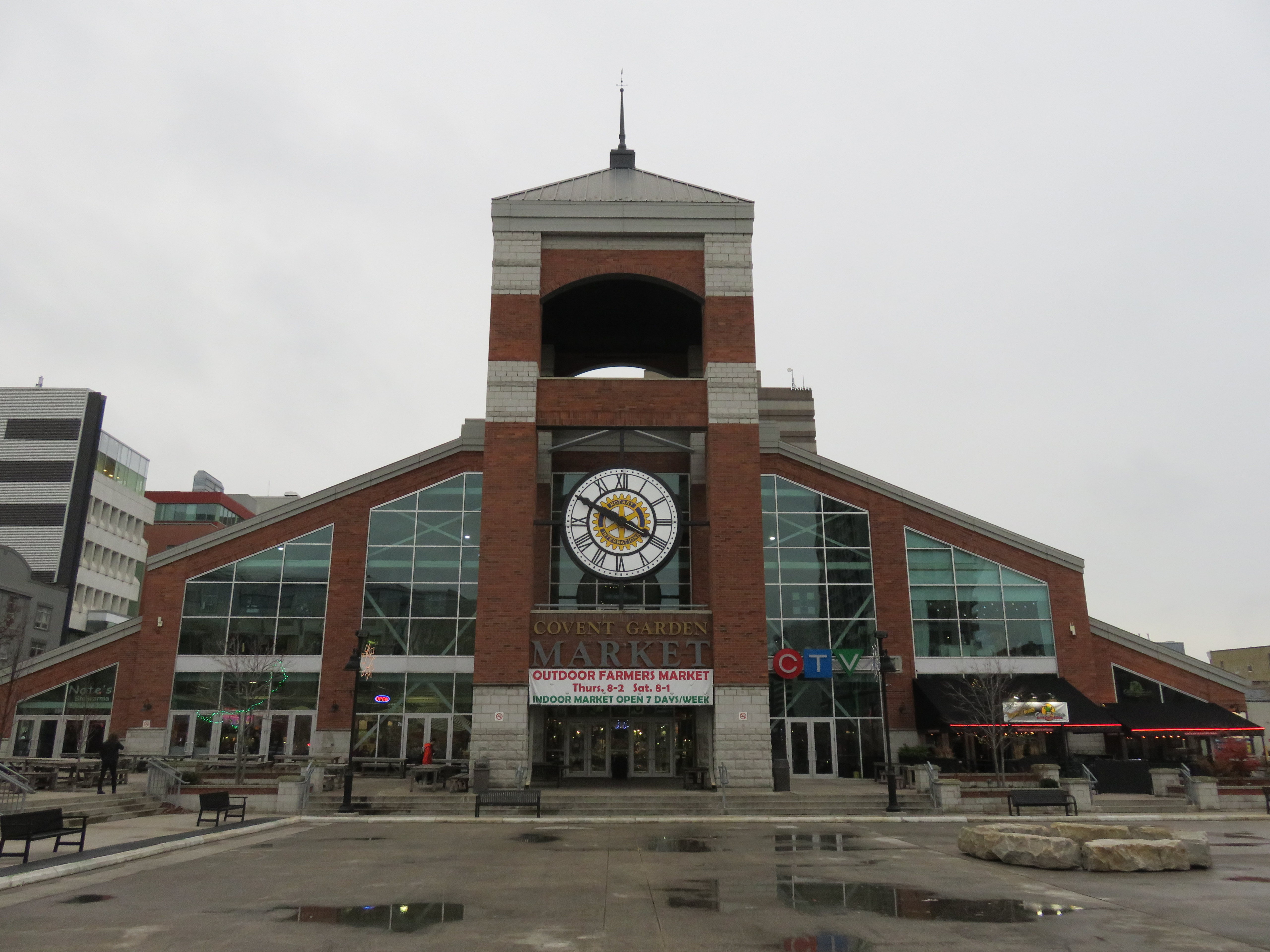 The other Covent Garden Market, London
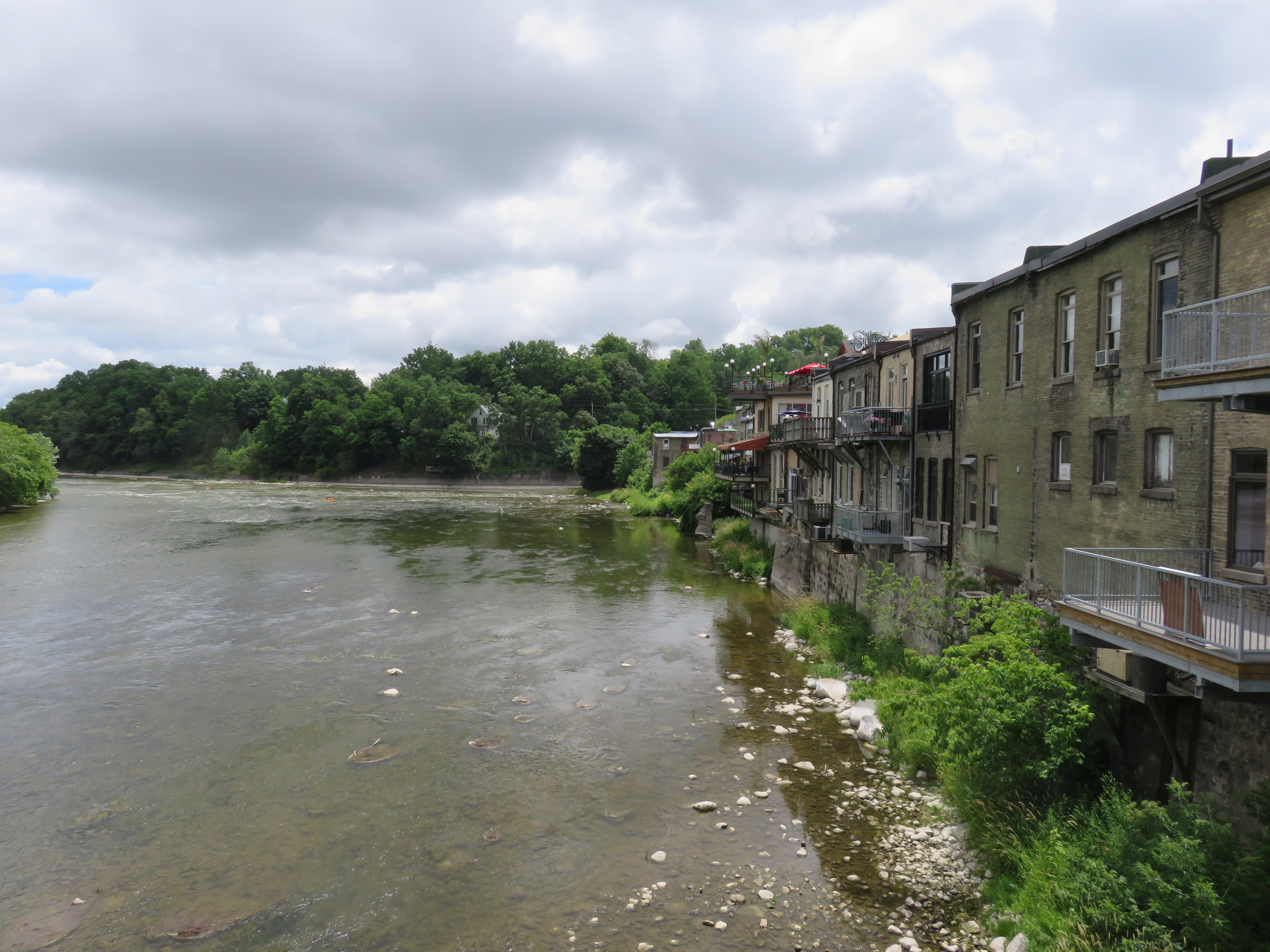 Paris, Ontario’s main street backs onto the Grand River