Tag: Hamilton

  • Mind the gap: as Waterloo’s light rail line opens, other connections close

    44248408831_5f34e1eaaa_o.jpg
    ION LRT service will finally commence Friday June 21

    Early in 2019, I had the opportunity to take a trip on Wroute, a new service that connected Guelph, Kitchener, and Burlington. Wroute was an interesting concept, a privately-operated option with characteristics of a bus service, a taxi company, and ride-hailing app. With a fleet of Tesla Model X electric SUVs, Wroute tried to fill a gap left by GO Transit and other intercity transportation operators in the Guelph-Kitchener/Waterloo-Hamilton Triangle. Unfortunately, Wroute ended operations on Thursday May 2.

    As I wrote in my article for TVO, fares were too high for a regular commuter, costing $20 for a single ride between Guelph and Kitchener, and $28 between Guelph and Aldershot, more than double the equivalent GO Transit fares.

    IMG_8407-001Wroute Testla at Guelph Central Station, January 2019

    When Waterloo Region celebrates the opening of the ION LRT on June 21, the bus system in Kitchener-Waterloo will be restructured to better connect with the corridor. Despite the improvements within Waterloo Region, links are still needed to surrounding communities. Hamilton and Guelph remain largely disconnected. With a growing employment base in Kitchener-Waterloo, as well large university and college campuses in all four city-regions, filling the gap is more important than ever.

    Hopefully this will come done soon.


  • Ontario’s failed downtown malls

    IMG_0392.JPG
    Bayside Mall, formerly the Sarnia Eaton Centre, on a Saturday morning in 2013. Most stores are vacant or occupied by non-profits or independent businesses.

    The Toronto Eaton Centre, large, famous, and vital, is only one of many malls built in the downtown cores of Ontario cities between the 1960s and 1990s. From Thunder Bay to Cornwall, the construction of new enclosed shopping centres were seen as a necessary tool to keep the old city centres vibrant and relevant in the face of competition from new suburban malls. But only in the province’s two largest cities did the concept work. Elsewhere, these urban shopping complexes were left largely vacant within ten years of opening, when leases expired. When the Eaton’s department chain went bankrupt in 1997, huge voids were left behind that developers and municipalities struggled to fill.

    The Toronto Eaton Centre was opened in two phases between 1977 and 1979. It added hundreds of shops and new office space to Downtown Toronto, anchored by a new Eaton’s flagship and was connected to the Simpson’s store across Queen Street. Today, the Eaton Centre is Canada’s second largest mall (including the Hudson’s Bay/Saks Fifth Avenue building) and the Toronto region’s second most productive shopping centre in terms of sales per square metre. In Ottawa, the downtown Rideau Centre, opened in 1983, is the busiest and most productive mall in that region (Retail Council of Canada, 2016).

    But elsewhere in Ontario, downtown malls — mostly built with municipal and/or provincial government support — have been, without exception, commercial and urban development failures. Not only did they suffer from high vacancy rates, they helped to wreck the downtown cores they are located in rather than foster the economic revitalization they once promised.

    (more…)
  • GO Transit’s Grimsby problem

    IMG_6615-001.JPG
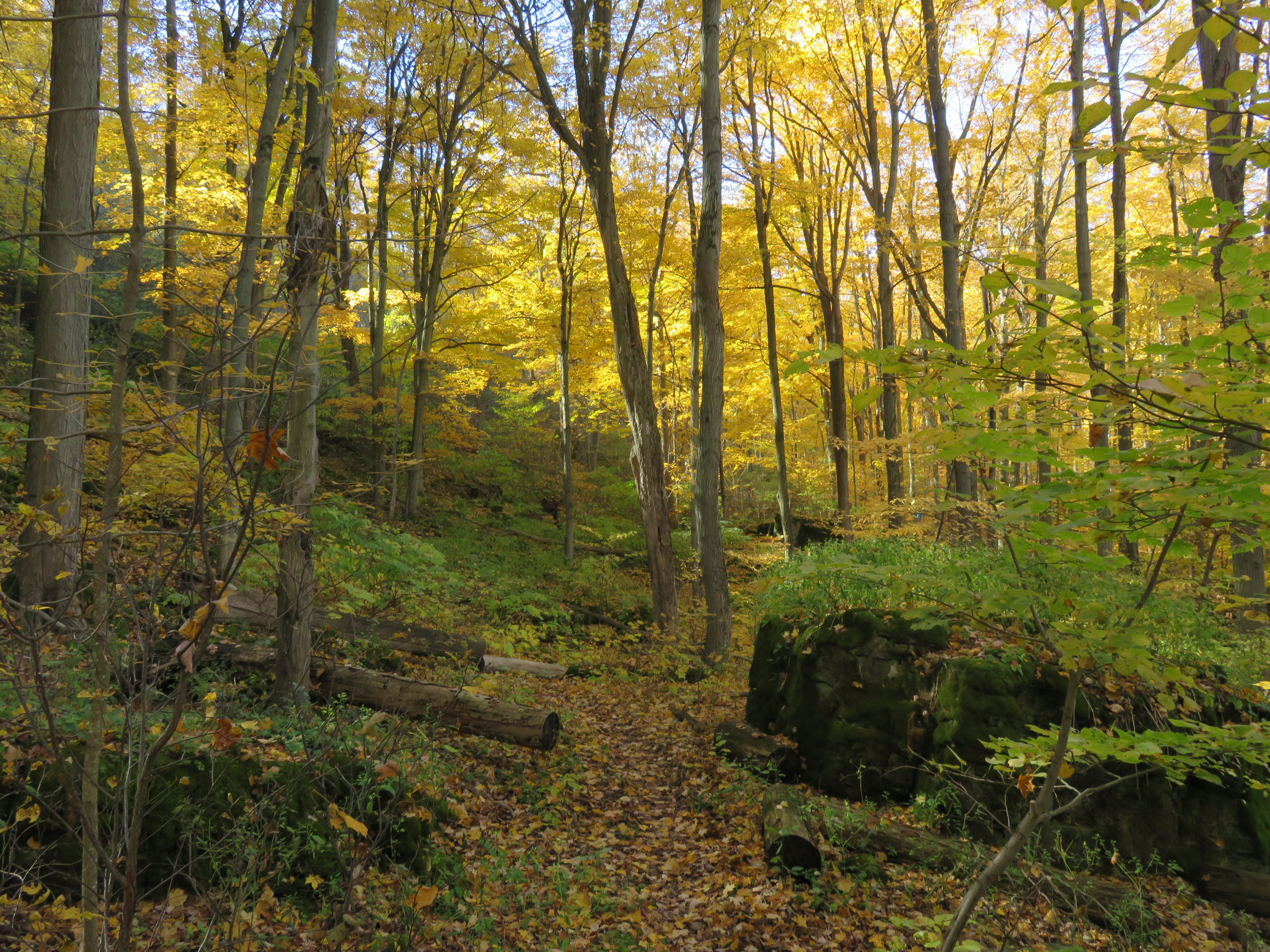
    The Bruce Trail near Fifty Road, November 6, 2016

    On Sunday, November 6, I took advantage of an unseasonably warm November day to go hiking on the Bruce Trail. I started in Grimsby and hiked for 23 kilometres west to the Stoney Creek Battlefield Monument in Hamilton. The hike was lovely as there was still some fall foliage left to enjoy, and the views above the Escarpment over Niagara vineyards and Lake Ontario were spectacular.

    img_6559-001
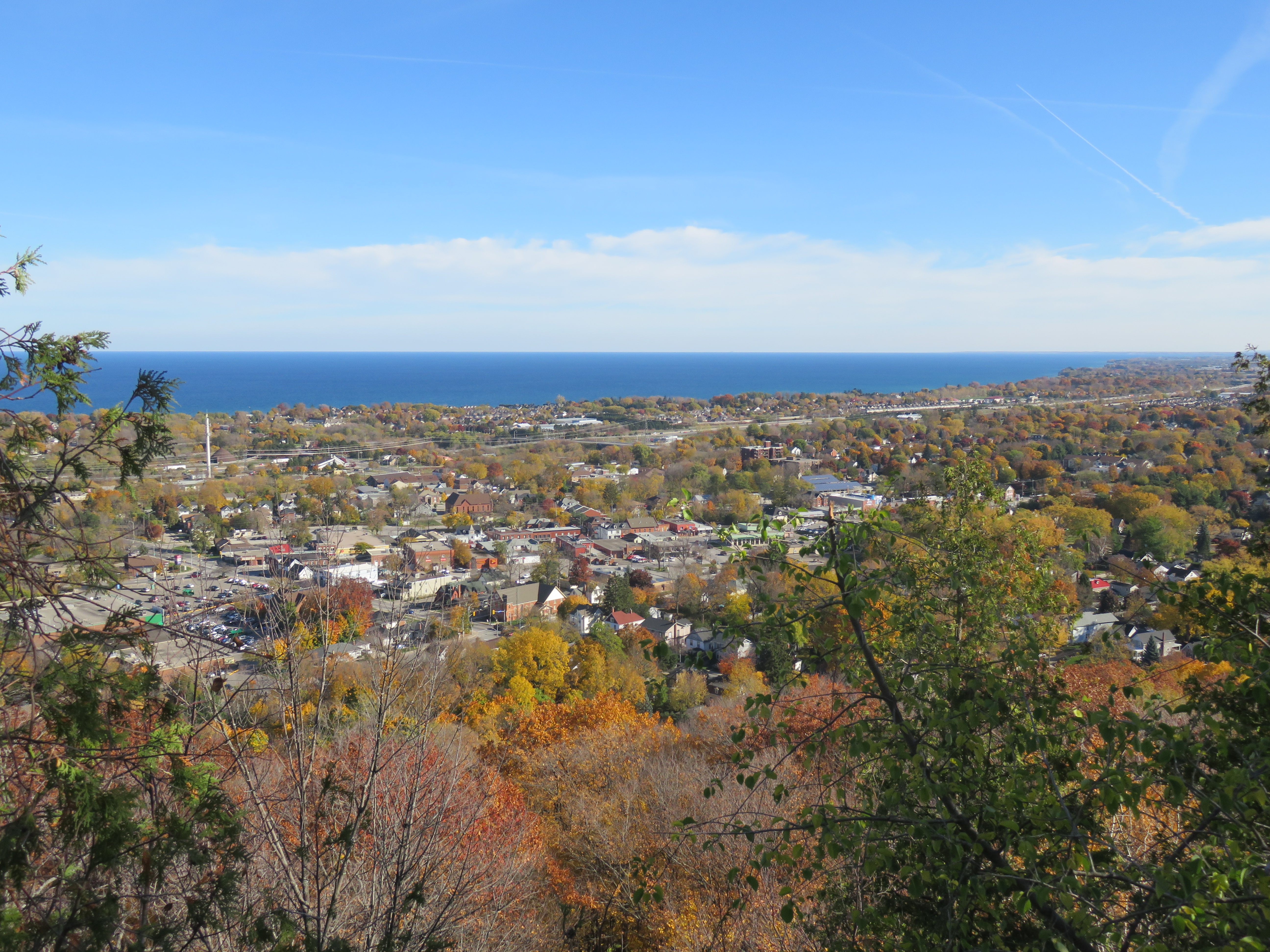
    View of Downtown Grimsby and Lake Ontario from the top of the Niagara Escarpment

    In order to do this six hour, one-way hike, I took the train to Grimsby, and began my trip from there (enjoying a coffee and snack at a great local coffee shop first). Upon arriving at Stoney Creek, I took a Hamilton Street Railway bus downtown for dinner before taking a GO bus back to Toronto.

    IMG_6650-001.JPG
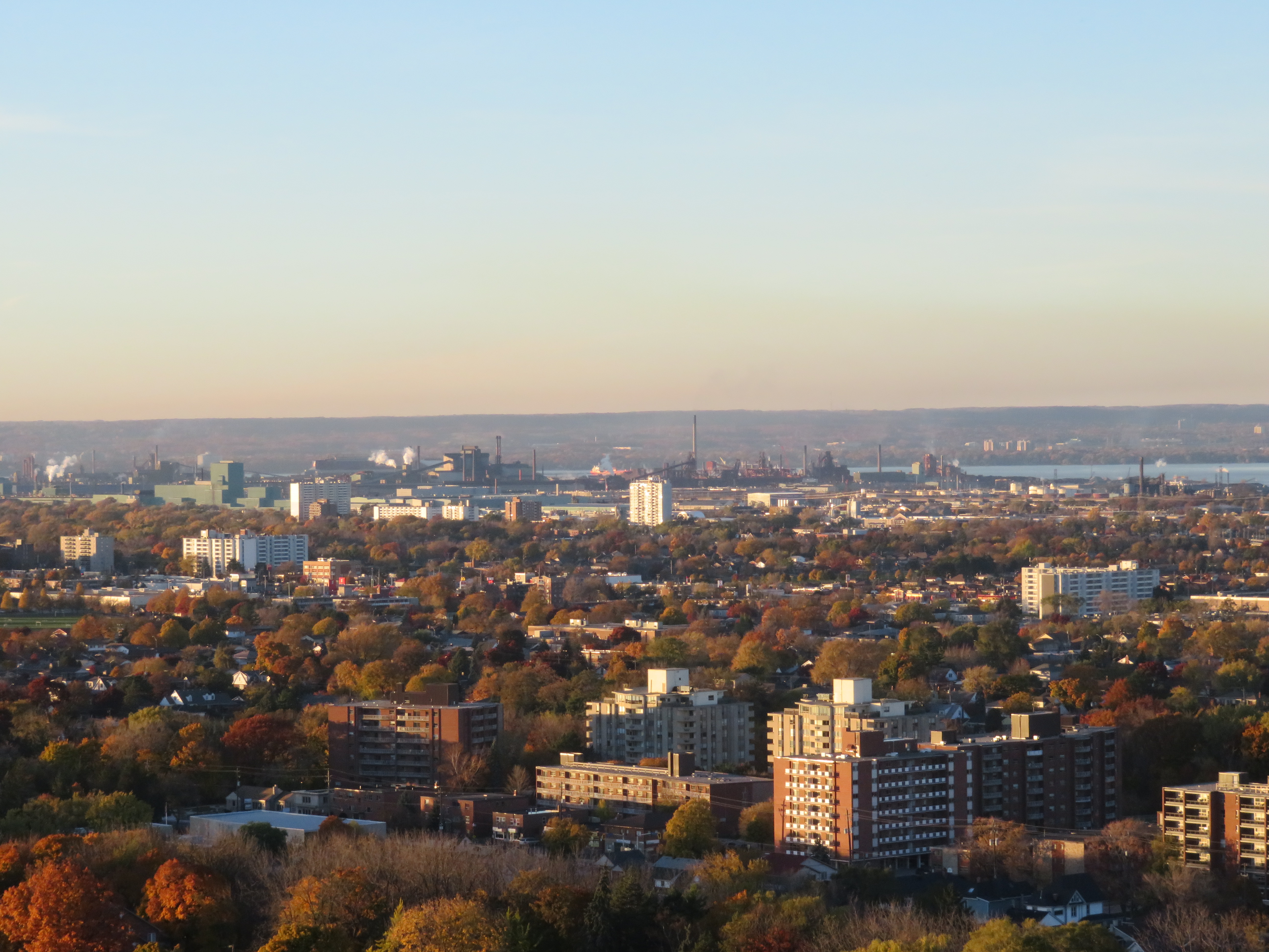
    View from the lookout at Devil’s Punch Bowl Conservation Area towards Hamilton Harbour

    img_6686-001
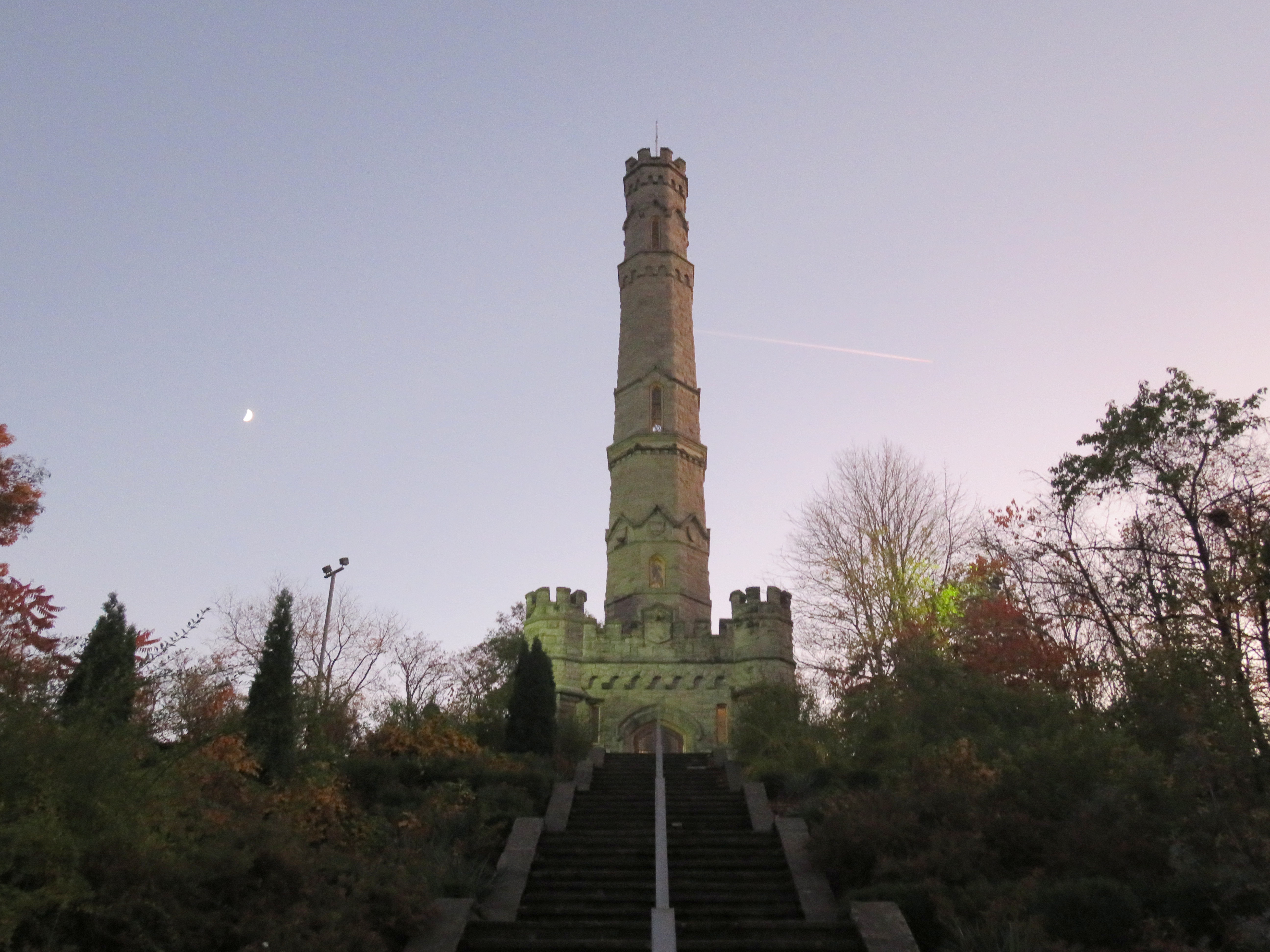
    The Stoney Creek Battlefield Monument, where I ended my hike as the sun began to set


    When I go for a bike ride or a hike, whether it be a solo trip or a hike with friends, I like to plan the trip in advance, and to think about the transportation options for getting there. And so I come once again to thinking about Grimsby, GO Transit, VIA Rail, and local transit.

    There is currently only one train each way between Toronto and Niagara Region — Amtrak’s Maple Leaf, which is operated by VIA crews on the Canadian side of the border. The Maple Leaf takes 12 hours and 30 minutes to get from Toronto’s Union Station to New York’s Penn Station, including a stop at the border for customs and immigration checks. Other delays, such as freight traffic and even ship traffic on the Welland Canal, make this train commonly late for Niagara passengers headed to Toronto in the evening. There was once a second daily VIA train between Toronto and Niagara Falls, scheduled to serve commuters, but it was cut by the Stephen Harper-led Conservative government in 2012.
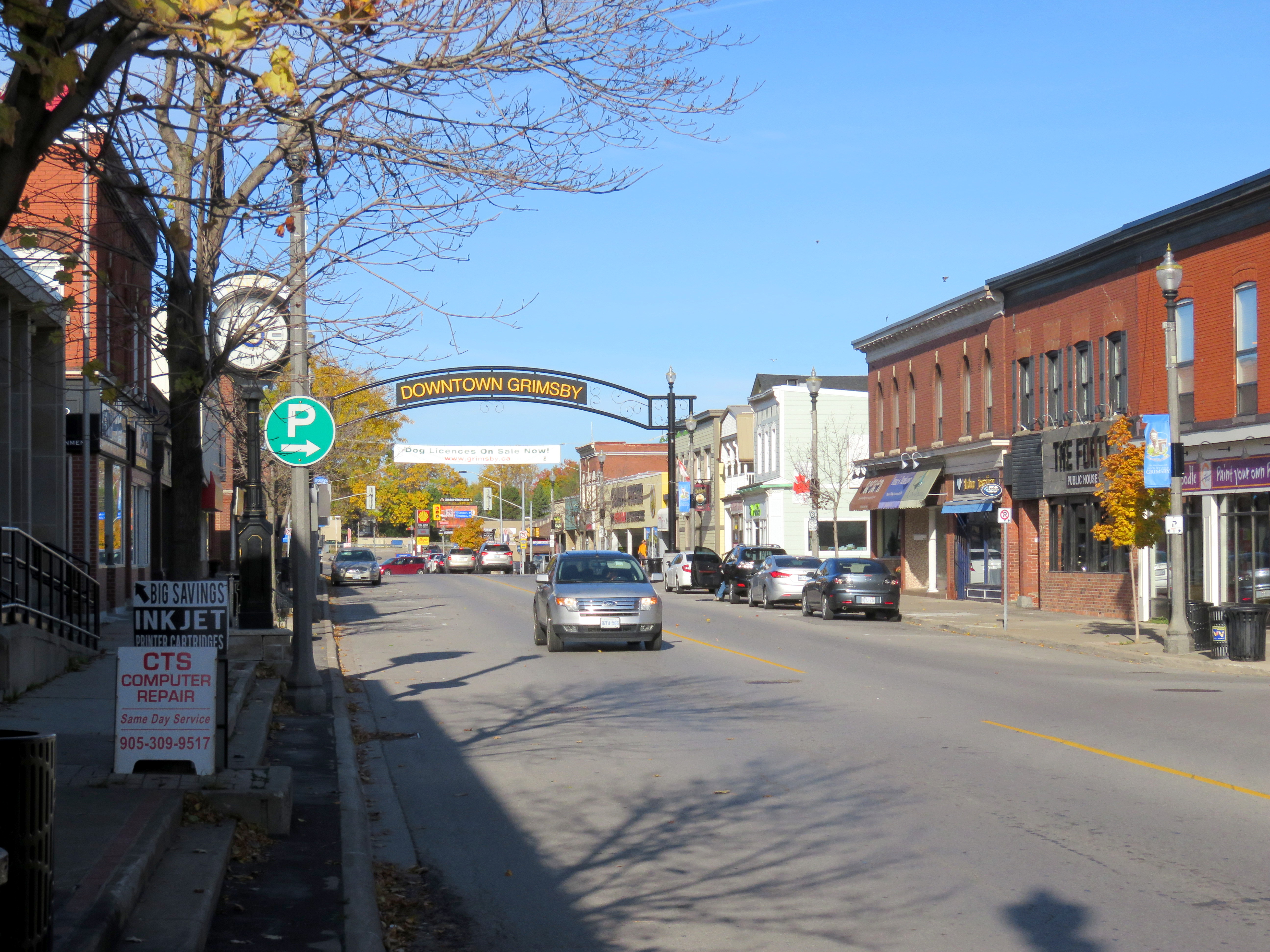
    img_6547-001Downtown Grimsby

    GO Transit operates a summer weekend train service between Toronto and Niagara Falls, making stops at Port Credit, Oakville, Burlington, and St. Catharines, but not at Grimsby. GO Transit also operates a year-round bus service — Route 12 — that follows the QEW between Burlington GO Station and Downtown Niagara Falls, stopping at several park and ride lots and at Fairview Mall in St. Catharines, a secondary hub for local transit in that city.

    The Maple Leaf Train leaves Union Station at 8:20 AM, 7 days a week, and arrives at Grimsby just after 9:30 AM, stopping only at Oakville and Aldershot. Taking GO Transit, it takes nearly two hours to get to the park and ride at Casablanca Boulevard, including the transfer time at Burlington Station.
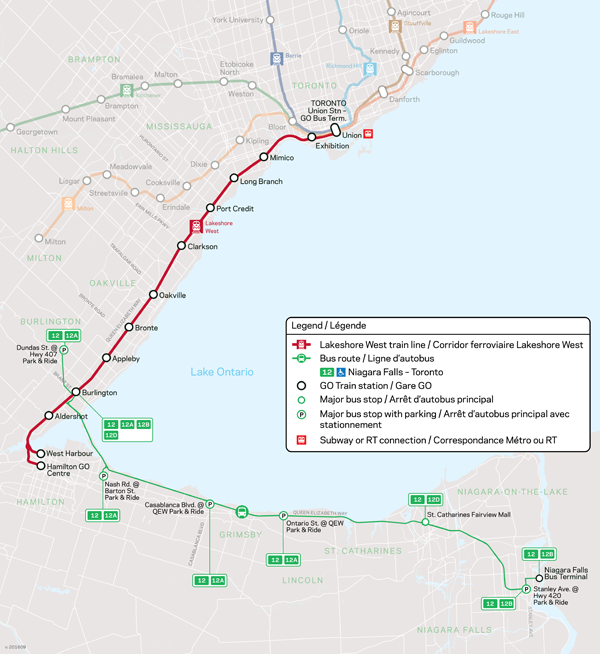
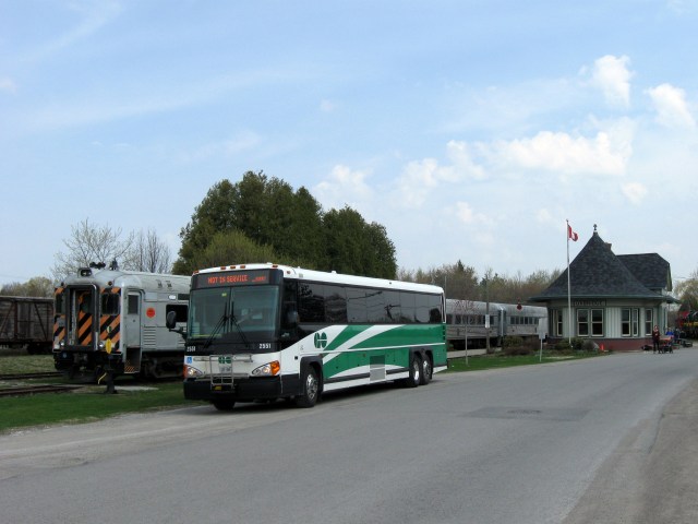
    niagara_bus_600
    GO Transit Route 12

    The Grimsby Amtrak/VIA station is located on Ontario Street, at a site picked by the Great Western Railway in 1853. It is a mere 5-10 minute walk to Downtown Grimsby, located in the centre of that community’s population. The GO Transit park and ride is located at the west end of town, at Casablanca Boulevard. The planned GO Transit Rail Station is located nearby. The bus stop and proposed rail station is located 3.5 kilometres from Downtown Grimsby, or a 45 minute walk.
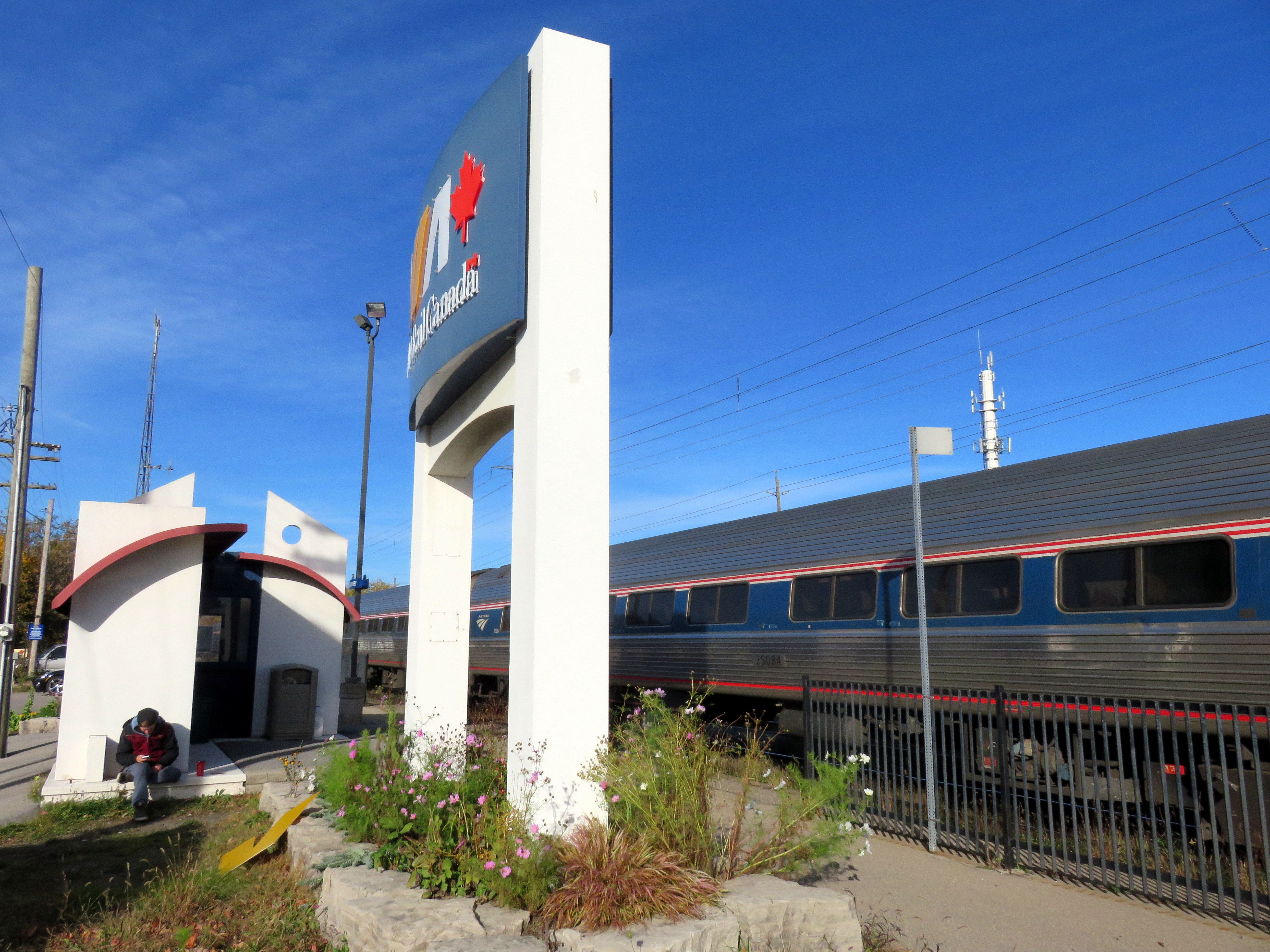
    img_6544-001Grimsby Station

    The current railway station at Grimsby consists of only a small shelter and indoor waiting area, along with a small parking lot for VIA customers. The platform is small, about one rail car’s length. The VIA Rail Canada sign is almost as large as the station building itself. But for me, the railway station’s location was far more convenient than the GO bus stop at Casablanca Boulevard.

    A new station at Casablanca Boulevard offers several advantages for GO Transit: easy access to the Queen Elizabeth Way, plenty of undeveloped land for a parking lot, and room for a platform for GO Transit’s 10-car and 12-car trains. But the location is not friendly for customers who wish to walk or cycle to the train, and without a local transit system, it’s inaccessible for many potential Grimsby commuters unless they were to take a taxi, get a ride, or drive their own car.

    img_6595-001
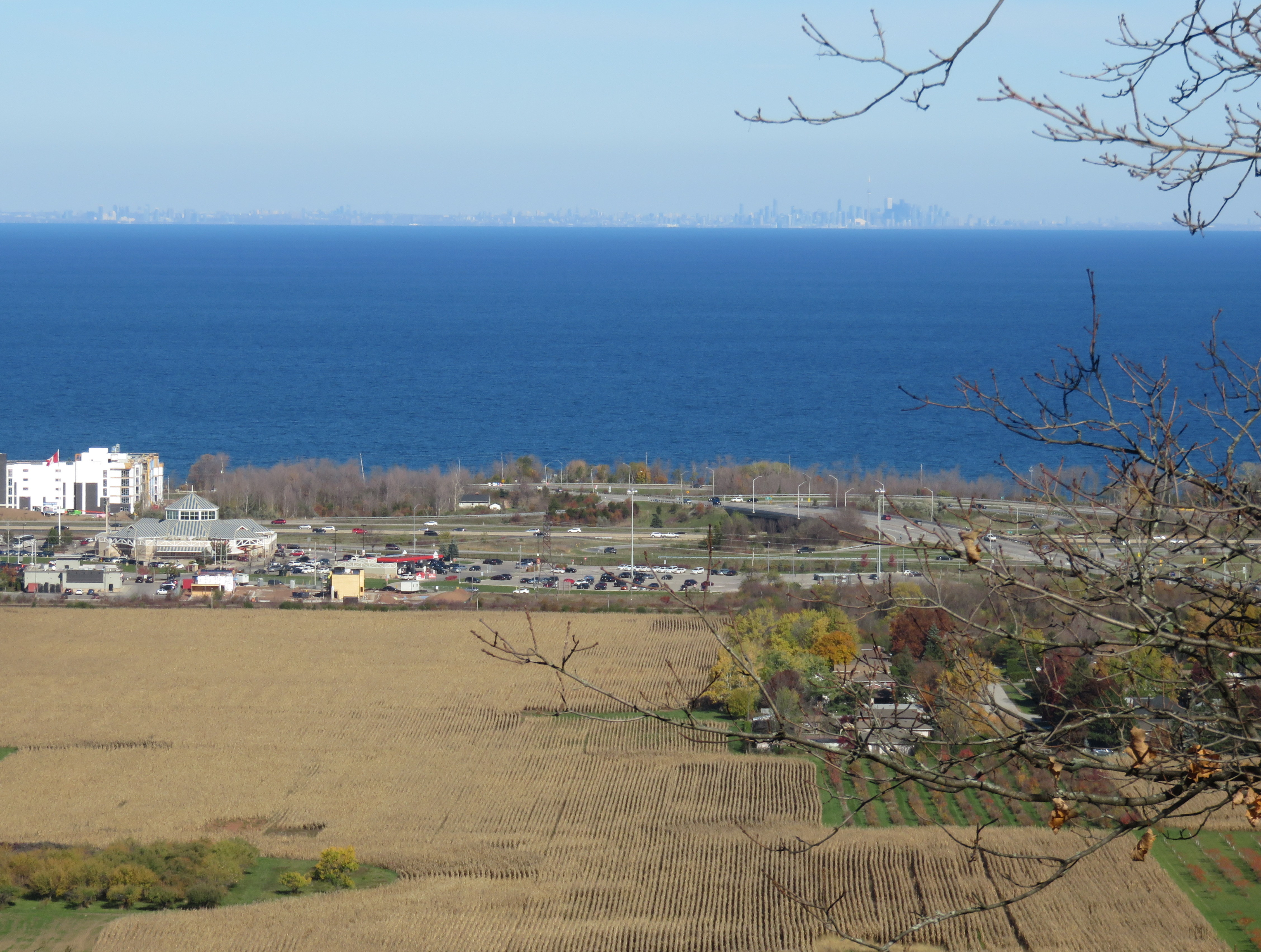
    Overlooking the QEW/Casablanca Boulevard interchange and the proposed location of the Grimsby GO Station. GO buses serve the park-and-ride lot in the middle ground. Note the clear view across the lake to Toronto.

    I have argued here before that GO Transit has an unfortunate record of catering to motorists while mostly ignoring the needs of many of its current and potential customers. GO Transit’s need for large parking lots often precludes locating stations in more urban locations. By providing ‘free’ parking, GO forces all passengers to subsidize those who drive alone to its stations.

    Of course, GO Transit is going to build Grimsby Station at Casablanca Boulevard; it was announced earlier this year as part of a GO service expansion project. But a useful local transit system, scheduled to connect with GO trains and buses, offering fare integration, can mitigate this problem. Transit riders shouldn’t be told to take a hike.

  • The Golden Horseshoe’s missing links

    14182301824_167b4e754a_k
    GO Transit bus at Uxbridge

    Over the last 15 years, GO Transit has done well expanding its bus and rail operations. It opened up new stations, such as Mount Pleasant, Lincolnville, Barrie South, Allandale Waterfront, and West Harbour. It introduced the Highway 407 service, finally making York University accessible to thousands of suburban students. And it extended its reach to Waterloo and Peterborough, not only serving post-secondary institutions and residents in those cities, but also making it easier for cyclists like myself to explore new trails and destinations.

    But as GO Transit expands, there are many gaps, large and small, that should be closed. Coinciding with GO Transit’s expansion, intercity bus operators have been cutting back; dozens of Ontario towns and cities no longer have any coach service, and many more have saw their service cut back. Several municipalities in GO’s service area have resisted operating local transit systems, and GO’s use of park-and-ride lots has made their bus services difficult to reach without a car. In this post, I discuss some of these challenges.


    Related:

    (more…)

  • A ride through Midwestern Ontario, Part II

    IMG_6019-001
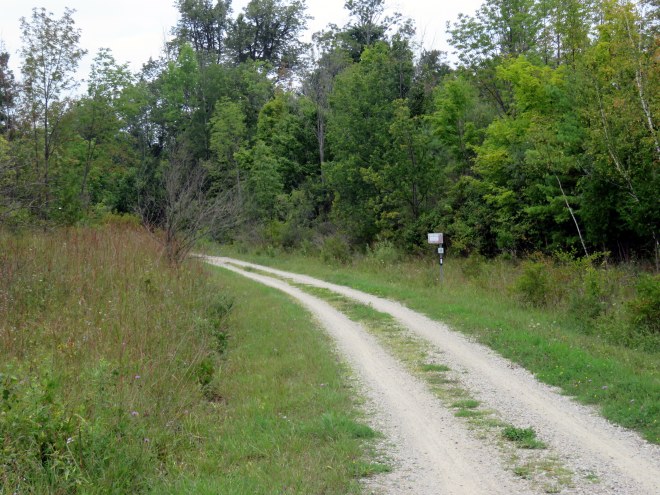
The Cambridge to Paris Rail Trail, part of a network of rail trails that join together in the City of Brantford

    Previously in this blog, I described the first day of a two-day ride through Midwestern Ontario, between Guelph and Kitchener via West Montrose and St. Jacobs. I rode through Ontario’s only authentic covered bridge, along infrastructure created for both cyclists and carriages, and through several picturesque towns and villages.

    Midwestern Ontario is a term that I generally use to describe the part of the province west of the Greater Toronto Area, yet outside the flat, prairie landscapes of Southwestern Ontario (Essex, Lambton, and Kent Counties). The rural landscape is marked by gentle rolling hills, livestock and cash crop farms, as well as cities and towns adjusting to a post-industrial economy. Brantford was once the capital of Canada’s once massive farm implement industry, but now not even the factories remain. Kitchener-Waterloo’s diverse heavy manufacturing concerns have mostly left; but there’s now a strong knowledge economy. Galt (now part of Cambridge) and Paris straddle the Grand River, their grand stone churches and commercial blocks make these some of Ontario’s most picturesque.

    Electric and steam railways — the Grand River Railway, the Lake Erie & Northern, the Toronto, Hamilton & Buffalo, the Grand Trunk, the Canada Southern — tied many of these communities together; now highways do. But many those abandoned railways have found new purpose as hiking and cycling trails; Brantford is at the heart of this new network.

    The second day’s ride, on August 30, took me from Downtown Kitchener, where I stayed overnight, through Cambridge, I then followed the Grand River closely to Brantford. After a stop in Brantford, I took the former TH&B railway corridor into Downtown Hamilton, where I enjoyed dinner and refreshments before loading my bike on a GO Transit bus and rode back home to Toronto. I completed a similar trip in 2012; I wrote about that ride in Spacing.

    Photos and commentary follow.

    (more…)

  • More thoughts on cycling infrastructure

    In Torontoist last week, I mapped the new and improved bike lanes proposed for 2016. There are some great new additions – more contraflow lanes in the east end and through Kensington Market allow cyclists to take direct routes along quieter residential streets. There will finally be a pilot of the long-demanded Bloor Street bikeway; at least between Shaw Street and Avenue Road. And, as I write this post, work is being completed on separated bike lanes along Adelaide and Richmond Streets east to Parliament Street. The popularity of the lanes added last year (University Avenue to Bathurst) pretty much guarantees that these new bike corridors, still officially pilots, are permanent.

    But the map below – created for the Torontoist post – shows many gaps, even with the new 2015 and 2016 additions. Note the long north-south lane in the top centre of the map. That’s Willowdale Avenue, the longest planned addition. It ends at Sheppard, just before Highway 401; there’s no easy and safe way for cyclists to cross North America’s widest and busiest auto route anywhere near where the new Willowdale bike lane ends. Freeways and railways remain nearly impenetrable barriers for pedestrians and cyclists; this prevents the true implementation of a minimum grid.

    Bike Routes - Sept17

    But even bike lanes are only good if they aren’t blocked by ignorant or ill-intended motorists. Simple barriers like knock-down bollards or curbs are helpful, but they aren’t always effective.

    Last Sunday, I cycled from my home in east Downtown Toronto to Downtown Hamilton, following the Martin Goodman Trail, Lakeshore Road, and the Hamilton Beach trail for an 84-kilometre ride. Through Oakville and Burlington, the Waterfront Trail is nearly non-existent, so I ride on Lakeshore Road itself, which has bike lanes in only a few sections. But motorists are, almost without exception, courteous and patient; it’s the one place in the suburbs where I really enjoy cycling.

    In Hamilton, after crossing the Queen Elizabeth Way on a spectacular bridge that also spans the Red Hill Creek, I again take minor streets to make my way west towards downtown, where I usually visit a favourite pub on Augusta Street before loading my bike on a GO Transit bus rack and returning to Toronto.

    6164718675_1ac3950080_o

    Hamilton, like Toronto, has started to add some great new cycling infrastructure. It has a bike share program, called SoBi Hamilton, it has great trails leading out to Brantford and Caledonia (as well as the Waterfront Trail), and some new bike lanes and cycletracks. The most impressive is Cannon Street, where a lane on a one-way arterial was transformed into a two-way separated cycletrack last year.

    14988034160_c541a52410_k

    But even green paint, knock-down bollards, and plenty of signage wasn’t enough on Sunday, when I encountered this:

    IMG_9624

    IMG_9625

    The woman in the red shirt and grey trackpants started screaming at me as I took these photos, claiming she had the right to stop here as she was moving out of the house. She threatened to call the cops on me (!) for taking photos of her stuff, saying I could be looking to steal it. (On my bike, of course.) Cyclists encountering this from the west would be forced into oncoming traffic; in any event it’s dangerous and illegal. (Taking photos of this type, on public property, certainly is not.)

    https://twitter.com/Sean_YYZ/status/645726388310396928


    There’s still a lot of ignorance out there; not by the woman with the U-Haul that I mentioned; but by at least one reaction:

    Sidewalk riding is itself illegal and dangerous (sidewalk riding cyclists are a pet peeve of mine). Happily, there were plenty of others willing to correct that user about the safety of vulnerable road users and the various laws and by-laws applicable in this case.

    But this is all a long and winding way to say that more cycling infrastructure is great. And places like Toronto and Hamilton are doing great work on that front. But the infrastructure is only as strong as its connectivity, and as long as they’re not blocked by ignorant and/or hostile motorists. Education and enforcement need to go along with the buckets of green paint, signage, and barriers now being added in our cities.