 The Cambridge to Paris Rail Trail, part of a network of rail trails that join together in the City of Brantford
Previously in this blog, I described the first day of a two-day ride through Midwestern Ontario, between Guelph and Kitchener via West Montrose and St. Jacobs. I rode through Ontario’s only authentic covered bridge, along infrastructure created for both cyclists and carriages, and through several picturesque towns and villages.
Midwestern Ontario is a term that I generally use to describe the part of the province west of the Greater Toronto Area, yet outside the flat, prairie landscapes of Southwestern Ontario (Essex, Lambton, and Kent Counties). The rural landscape is marked by gentle rolling hills, livestock and cash crop farms, as well as cities and towns adjusting to a post-industrial economy. Brantford was once the capital of Canada’s once massive farm implement industry, but now not even the factories remain. Kitchener-Waterloo’s diverse heavy manufacturing concerns have mostly left; but there’s now a strong knowledge economy. Galt (now part of Cambridge) and Paris straddle the Grand River, their grand stone churches and commercial blocks make these some of Ontario’s most picturesque.
Electric and steam railways — the Grand River Railway, the Lake Erie & Northern, the Toronto, Hamilton & Buffalo, the Grand Trunk, the Canada Southern — tied many of these communities together; now highways do. But many those abandoned railways have found new purpose as hiking and cycling trails; Brantford is at the heart of this new network.
The second day’s ride, on August 30, took me from Downtown Kitchener, where I stayed overnight, through Cambridge, I then followed the Grand River closely to Brantford. After a stop in Brantford, I took the former TH&B railway corridor into Downtown Hamilton, where I enjoyed dinner and refreshments before loading my bike on a GO Transit bus and rode back home to Toronto. I completed a similar trip in 2012; I wrote about that ride in Spacing.
Photos and commentary follow.
 Charles Street East, Kitchener, where rails are being installed for the Ion LRT.
 View from the pedestrian/cycling bridge over Highway 401 near Conestoga College, Kitchener. This is a scene reminiscent of Jack Chambers’ 401 Towards London No. 1, which depicts the 401 at a different location.
 The charming town of Galt, now part of the sprawling City of Cambridge, straddles the Grand River

German Mills near Glen Morris. A partially-hidden ruin located between the rail trail and the Grand River.

Old Great Western Railway piers north of Paris. The railway, once the Hamilton-London mainline, was abandoned in the 1930s with all rail traffic diverted via Brantford and Paris. Canoeists pass through the ghosts of the rail line.

Crossing the Grand River near Brant Conservation Area on a long and wide pedestrian/cycling bridge.

View downstream towards Brantford
Brantford is known as the “Telephone City.” Alexander Graham Bell, credited with the invention of the telephone, lived here for a time and worked on his famous invention* at the family homestead; the first long-distance telephone call was placed between Bell and an assistant in nearby Paris. A larger-than-life statue of Bell sits at the front of the local Bell Canada exchange building downtown. The old tractor plants to the south are now demolished, but Wilfrid Laurier University’s Brantford campus has brought new life to the urban core which has suffered through the 1980s and 1990s.
Today, Brantford leads in cycling infrastructure; great wayfinding signage and maps, together with many off-road trails make this a great place to cycle through. Two former railway bridges have been refurbished for pedestrians and cyclists. There are several businesses downtown ideal for making a mid-ride coffee or meal stop. Trails from here continue to Simcoe and Port Dover (a ride I did last year), and on to Hamilton.

Useful wayfinding for cyclists in Brantford

A contraflow bike lane in Brantford connects off-road trails to the downtown core.

Former CN Burford Sub bridge over the Grand River, one of several active transportation links in Brantford
 Brantford Carnegie Library, now part of the Wilfrid Laurier University Campus
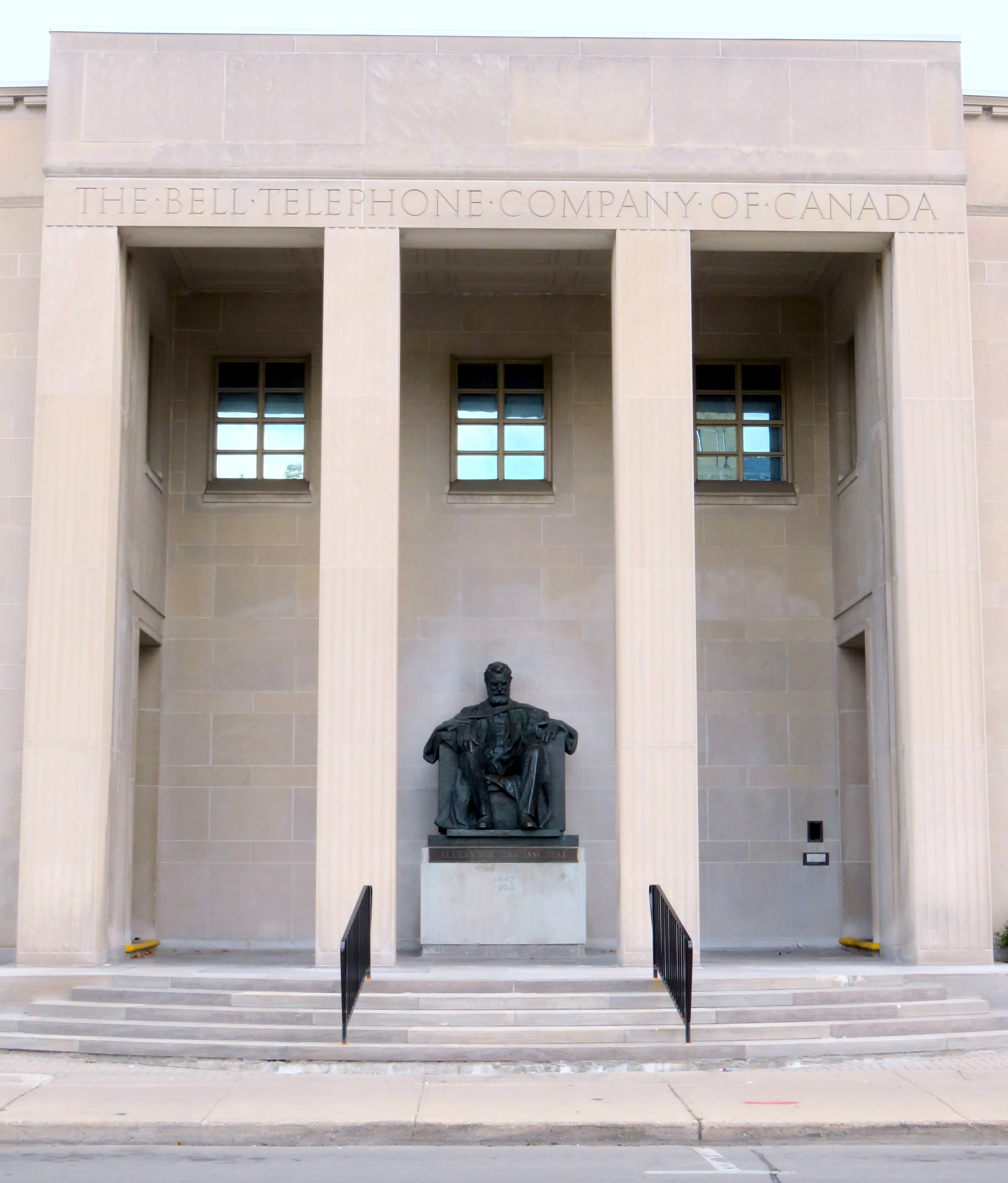 Bell Statue at Downtown Brantford
 The former route of the Toronto, Hamilton and Buffalo Railway meets the even older disused Brantford Canal

Dundas Valley Trail Centre, a replica rail station (based on the Grand Trunk station in Grimsby) on the former TH&B alignment. Various hiking trails through the Niagara Escarpment originate here.
 Deer next to the Hamilton-Brantford Rail Trail near Dundas. Deer sightings are common on my rides
*An acknowledgement that Alexander Graham Bell was one of several scientists working on the telephone; he is the most credited for inventing it. His work at Brantford was essential to the telephone’s development.

Leave a comment