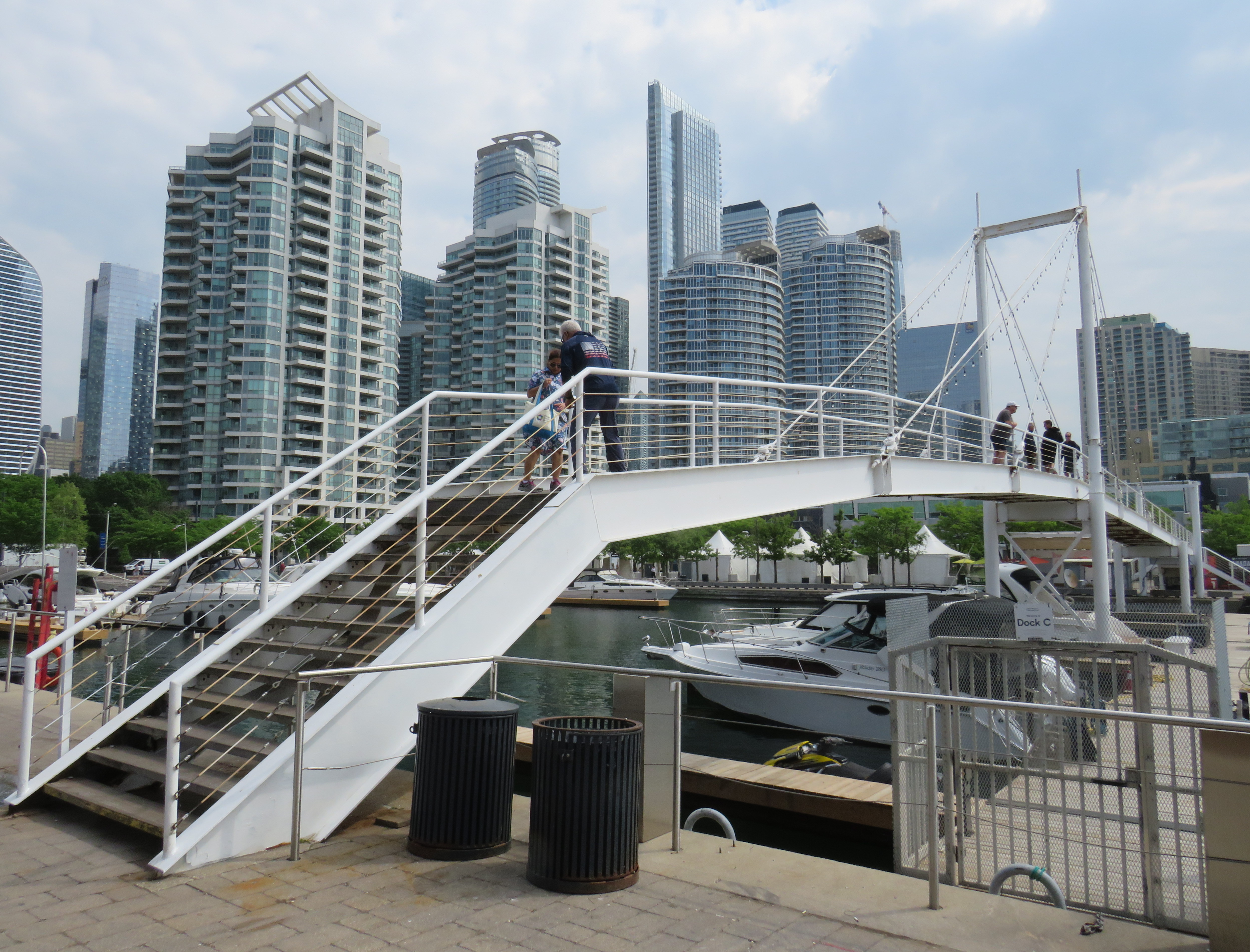
On Sunday, May 31, the Amsterdam Bridge reopened on Toronto’s Harbourfront after being closed for five years. The footbridge, which spans a marina south of Queen’s Quay, is a popular meeting place and photo opportunity, with views of Toronto Harbour to the south and the towering skyline to the north. A gift of the City of Amsterdam, one of Toronto’s sister cities at the time, the bridge was one of the first great public spaces on the waterfront as it was beginning to transition from a derelict industrial space to the city’s new front yard.
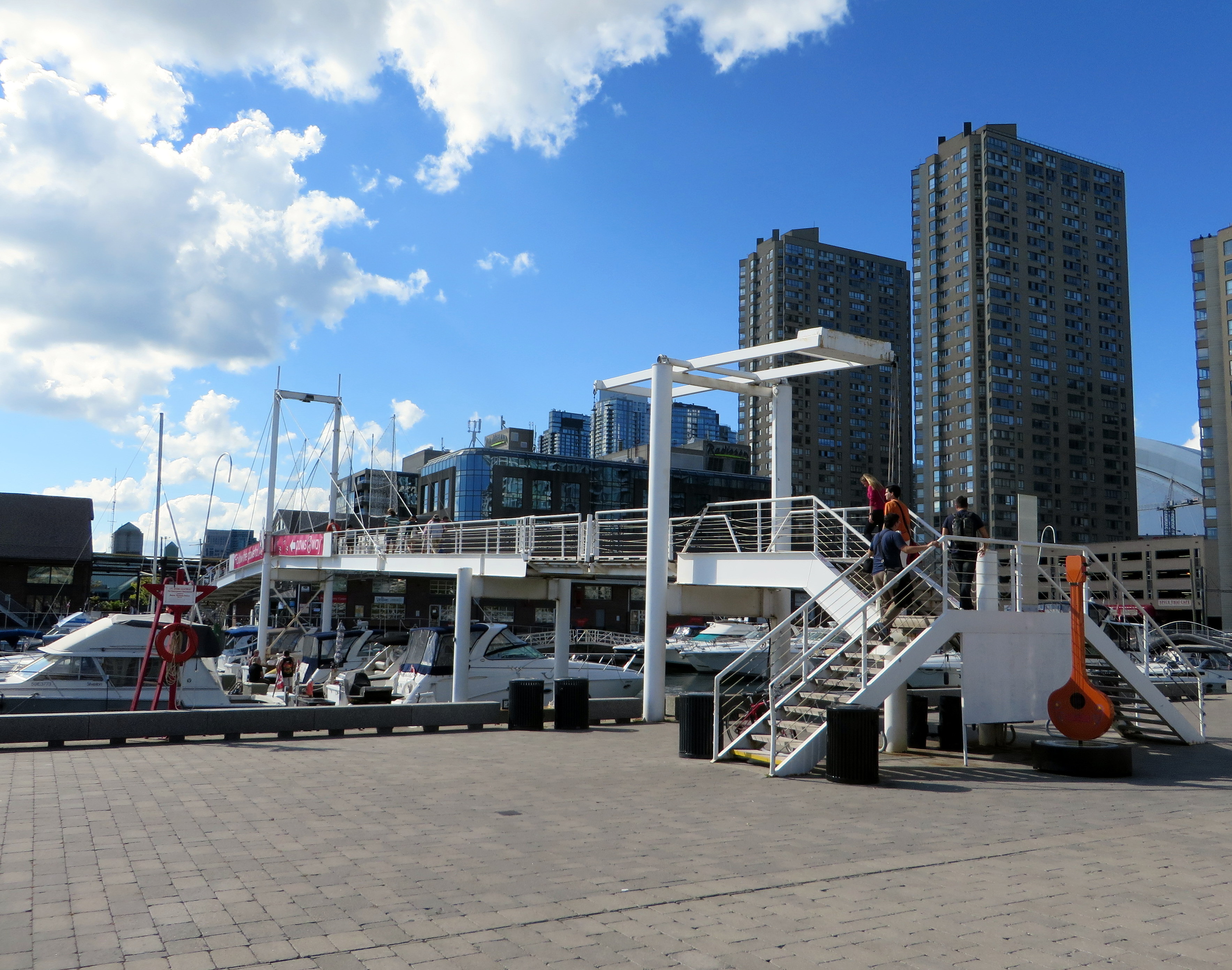
The Amsterdam Bridge in 2014
The footbridge, a cable suspension structure over the marina featured a lifting section on the east side so that tall yachts could moor at the north end of the marina on request, though this was not a regular occurrence. The design mimicked some of the iconic canal crossings in Amsterdam. Sadly, due to neglect, the bridge was closed to pedestrians in 2021 and the lifting section removed.
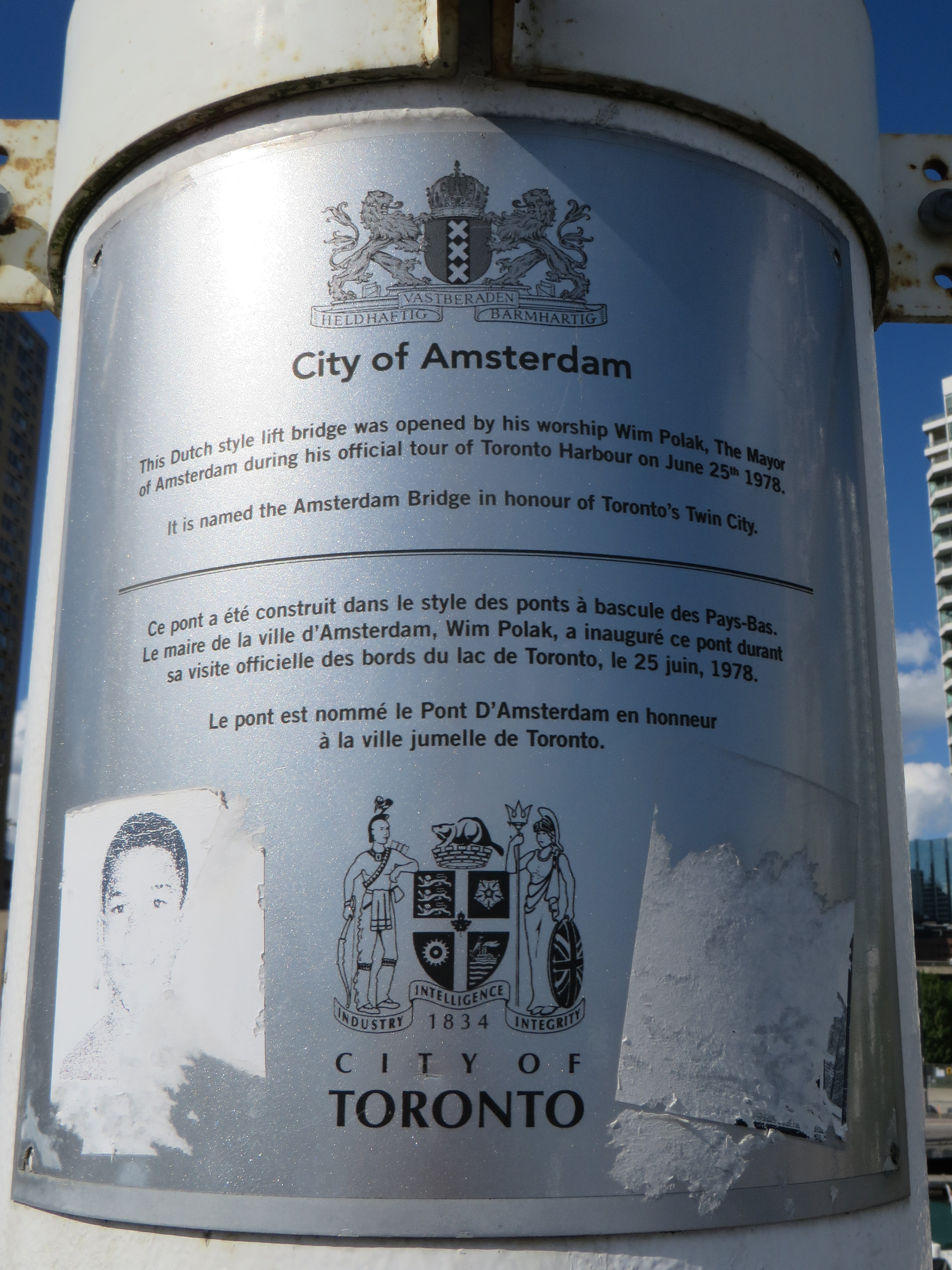
Plaque on the bridge commemorating the opening of the Amsterdam Bridge, a “Dutch style lift bridge” on June 25, 1978 by Amsterdam mayor Wim Polak, taken in 2014. Note the old pre-amalgamation City of Toronto coat of arms below. A replacement plaque with similar text (but with the current post-amalgamation civic coat of arms) since replaced the original.
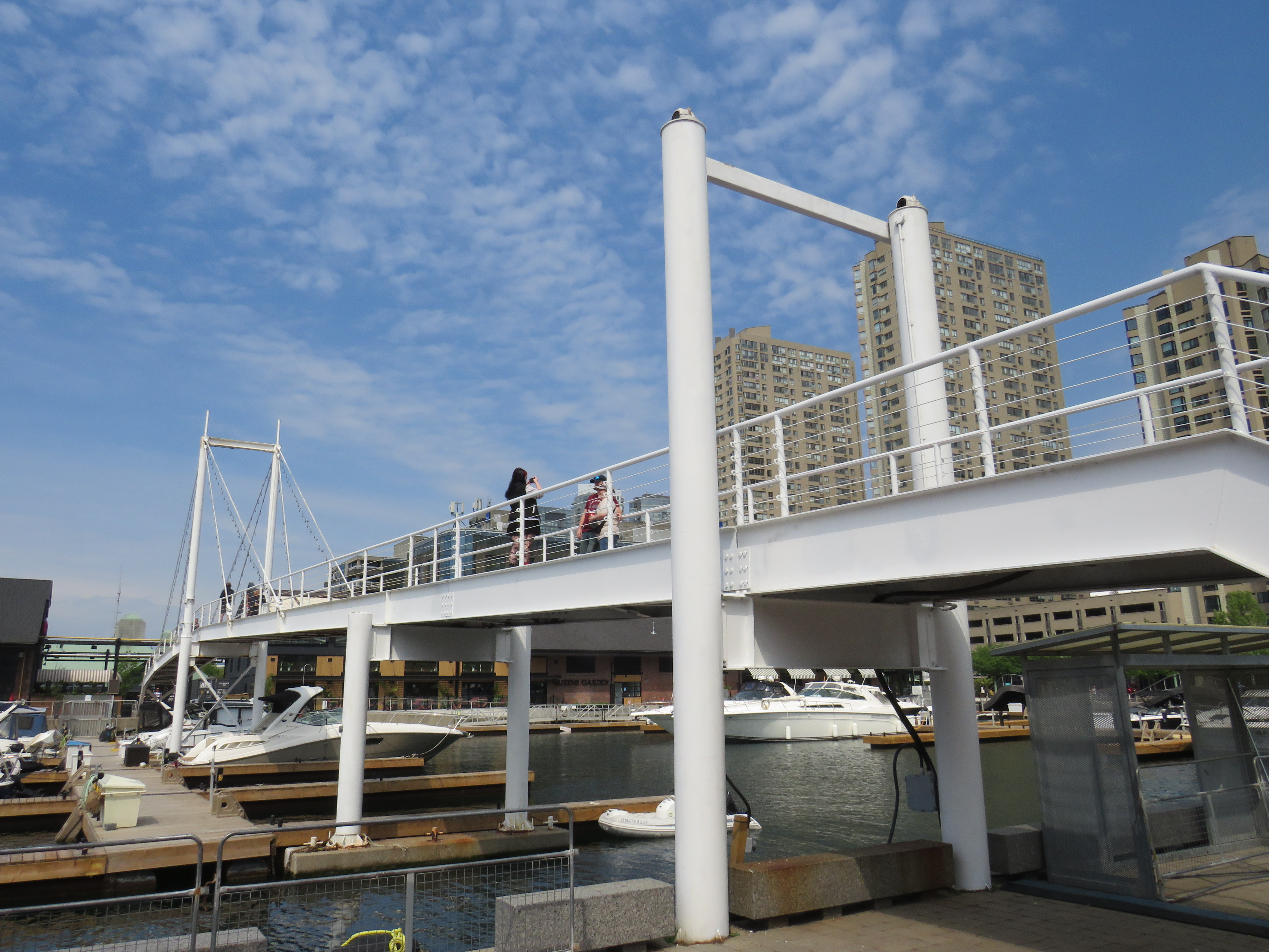
When the bridge reopened in 2026 just in time for Toronto hosting six World Cup soccer matches, the lifting section was replaced by a fixed span. Once again, visitors can climb the bridge, take in the views, and snap great photographs, but the “lift bridge” of the original “Dutch style lift bridge” is no more. It’s a shame too, that it took five years for this fix to even happen; Toronto needs to do better at maintaining its public assets, especially its unusual, fun, and quirky landmarks.
Fixed deck on the Amsterdam Bridge in 2026
Around the same time Toronto got an Amsterdam Bridge, the City of Amsterdam named a bridge for Toronto. The Torontobrug spans the Amstel River, carrying the busy Centrumring (Central Ring Road). A five-lane traffic artery outside the major tourist areas, the bridge is not iconic by any means (I biked to it during my 2013 visit to Amsterdam) but it is an important road link. There are separated cycle tracks on both sides of the bridge, so it is at least multimodal. The bridge can still open for river boat traffic when necessary.
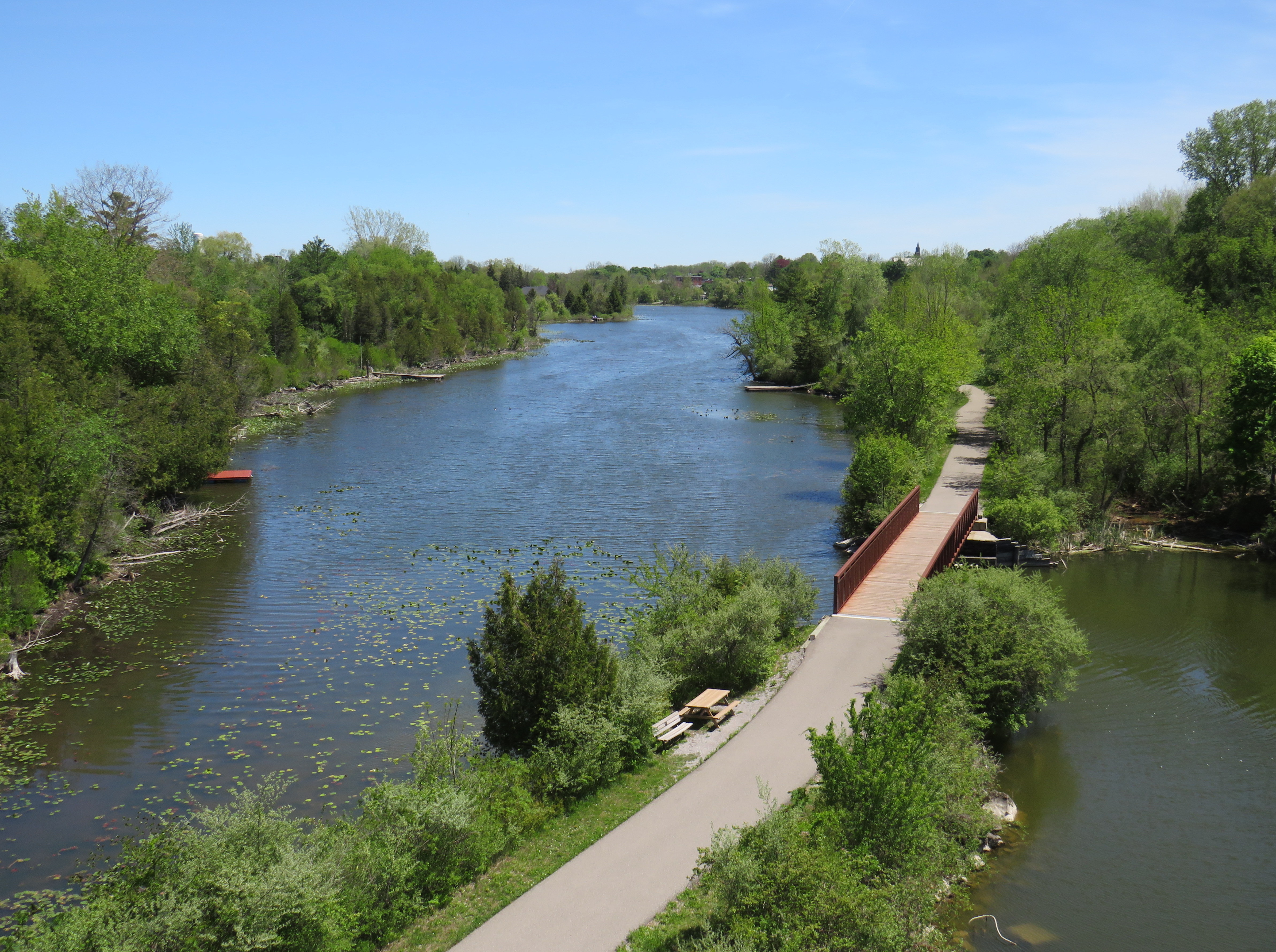
Looking down from the Black Bridge on the Norfolk County Trail to Shadow Lake and Waterford Ponds in May 2026
On a beautiful May Thursday, I met one of my colleagues in the village of Waterford. As he is now living in Port Rowan on Lake Erie, this was an opportunity for us to get some important work done, while also exploring one of Ontario’s great small communities.
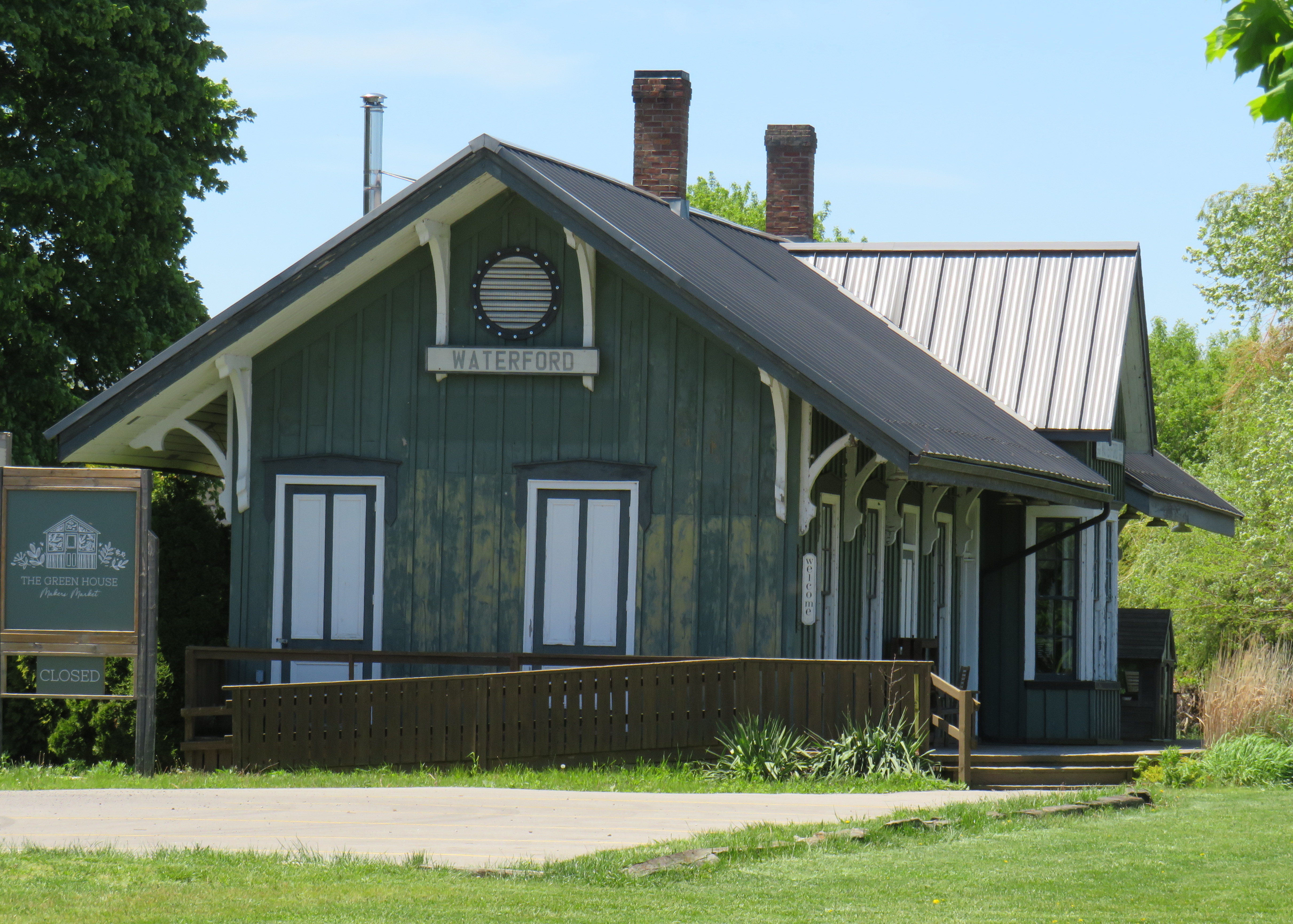
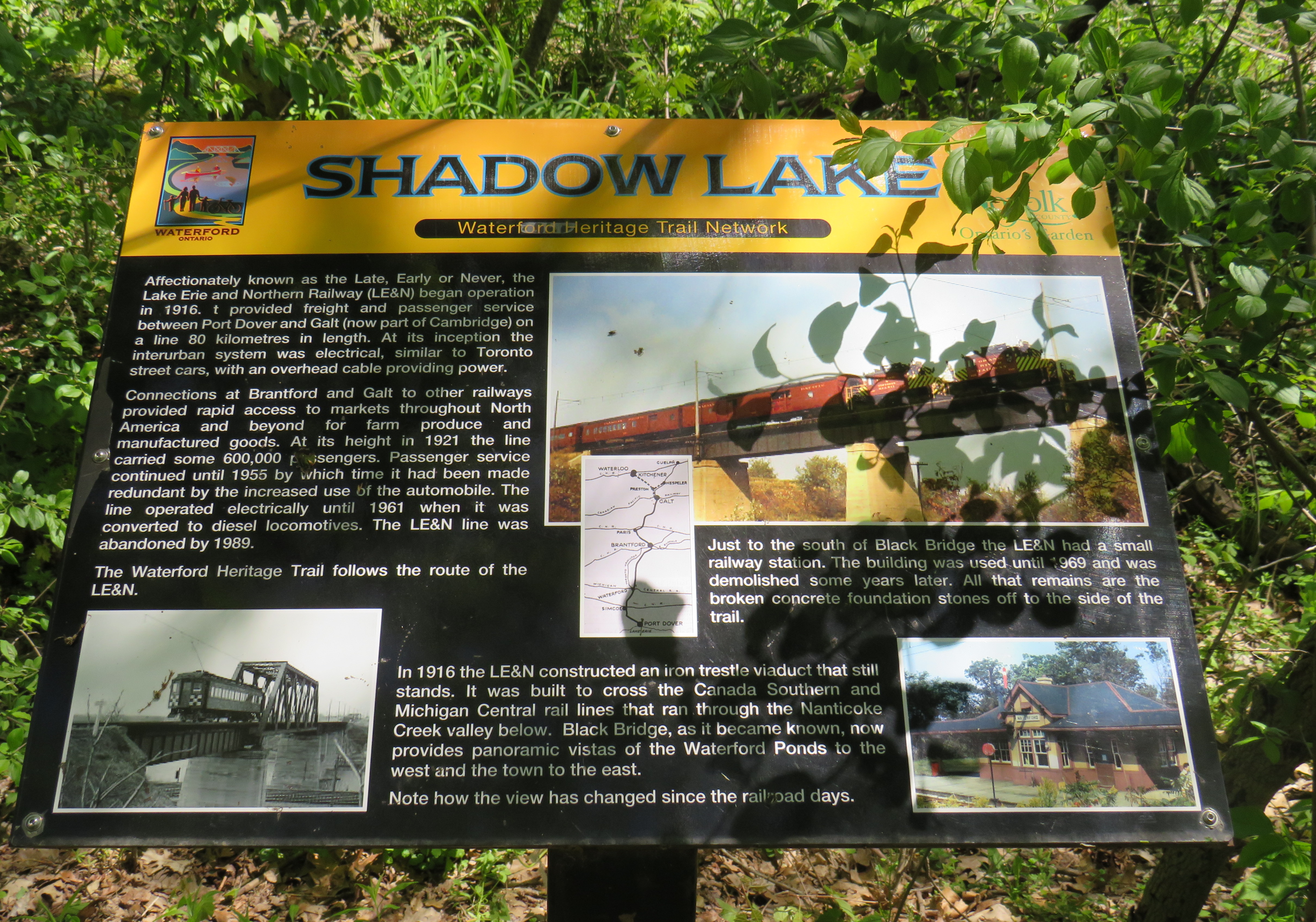
Though the local area was settled over 200 years ago, Waterford was established as a thriving village with the arrival of the Canada Southern Railway (CASO) which was eventually incorporated into the giant New York Central system. The route through Canada, with its divisional headquarters in St. Thomas, was the fastest line between Buffalo, Detroit, and Chicago. It was joined by the Toronto, Hamilton & Buffalo (TH&B), which connected Hamilton and the Canadian Pacific Railway with CASO at Waterford and at Welland. In 1916, the electric Lake Erie & Northern (LE&N) Railway, another Canadian Pacific property, provided regular freight and passenger service between Port Dover, Brantford, and Kitchener. By the 1990s, all three railways were abandoned, but their former rights-of-way remain in active use as part of the local trail network.
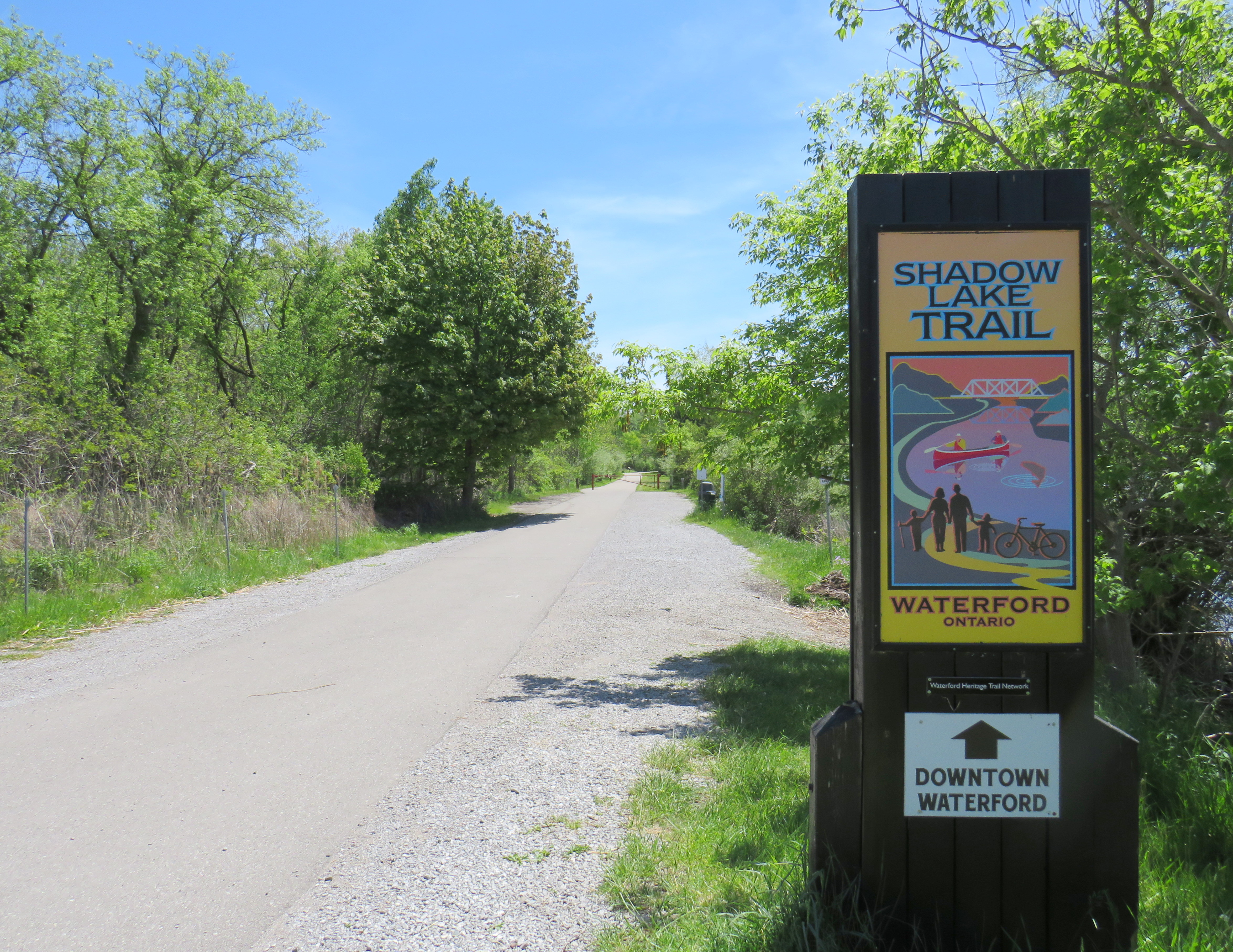
Take the Shadow Lake Trail to Downtown Waterford
The large system of ponds around Waterford, popular with birds, boaters, and anglers, are artificial. Shadow Lake was a millpond created by damming Nanticoke Creek. When constructing its railway, CASO found the sand and gravel deposits in this area irresistible for exploitation; the gravel was first used for railway ballast; larger aggregate pits created new ponds to the west.
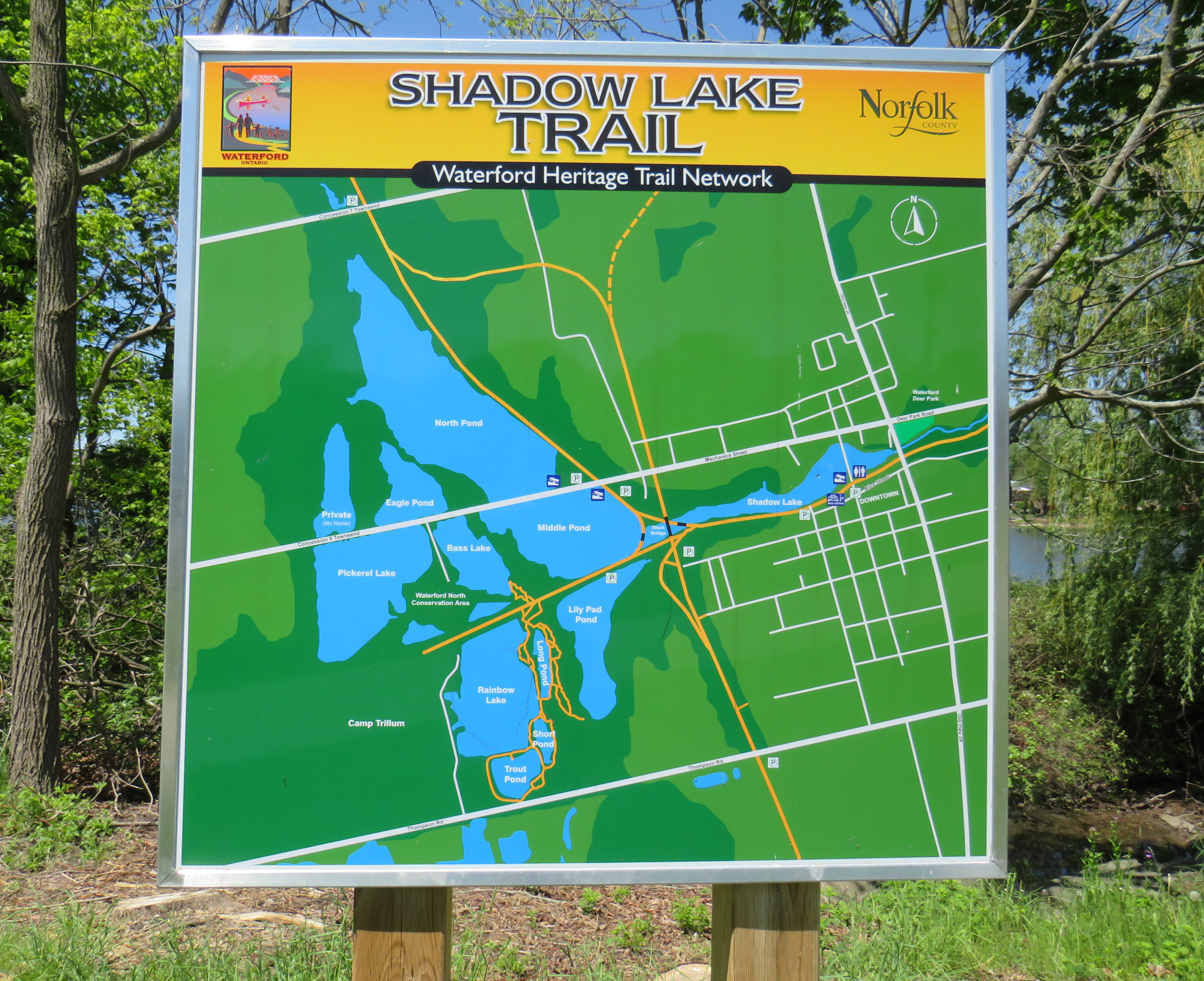
Map of the Shadow Lake Trailand connecting trails in Waterford, along with the extensive ponds surrounding them
The former Canada Southern Railway Station, which also served the TH&B, still stands, and has recently been home to an artisan market. Sadly, the LE&N station was demolished in the 1970s.
Waterford CASO Station
Despite the loss of the railways and the LE&N station, the railway rights of way are fully intact within the village area and have been converted to trails. Within Waterford, the east-west Shadow Lake Trail follows the former CASO route between the Waterford Conservation Area to the west and Lingwood Park to the east, though it is not part of a continuous trail system across southwestern Ontario. Only short sections within Waterford, Tillsonburg, St. Thomas, and Essex are open to the public; most of the old railway corridor was sold off to local landowners in the late 1980s and early 1990s.
Norfolk County Trail sign
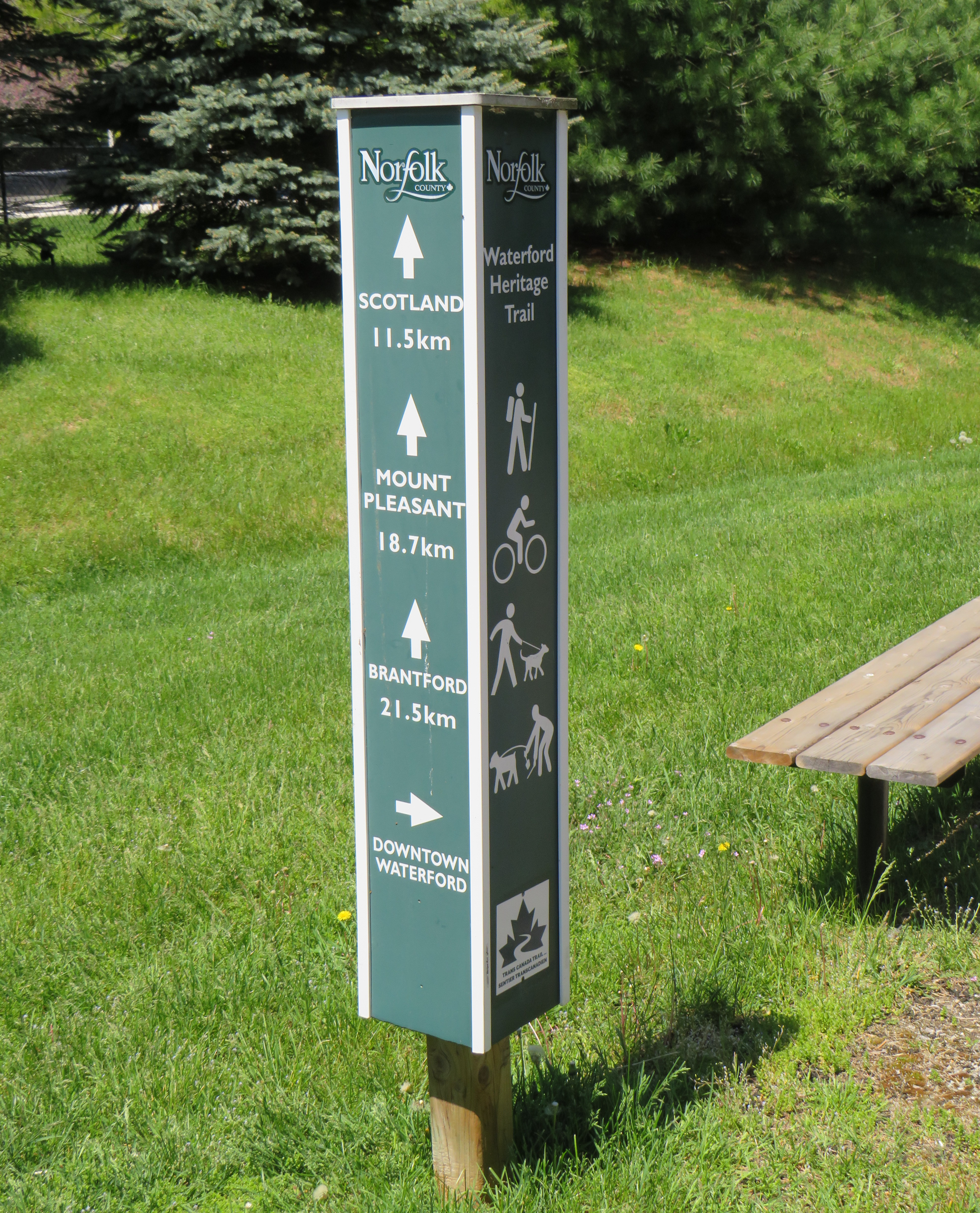
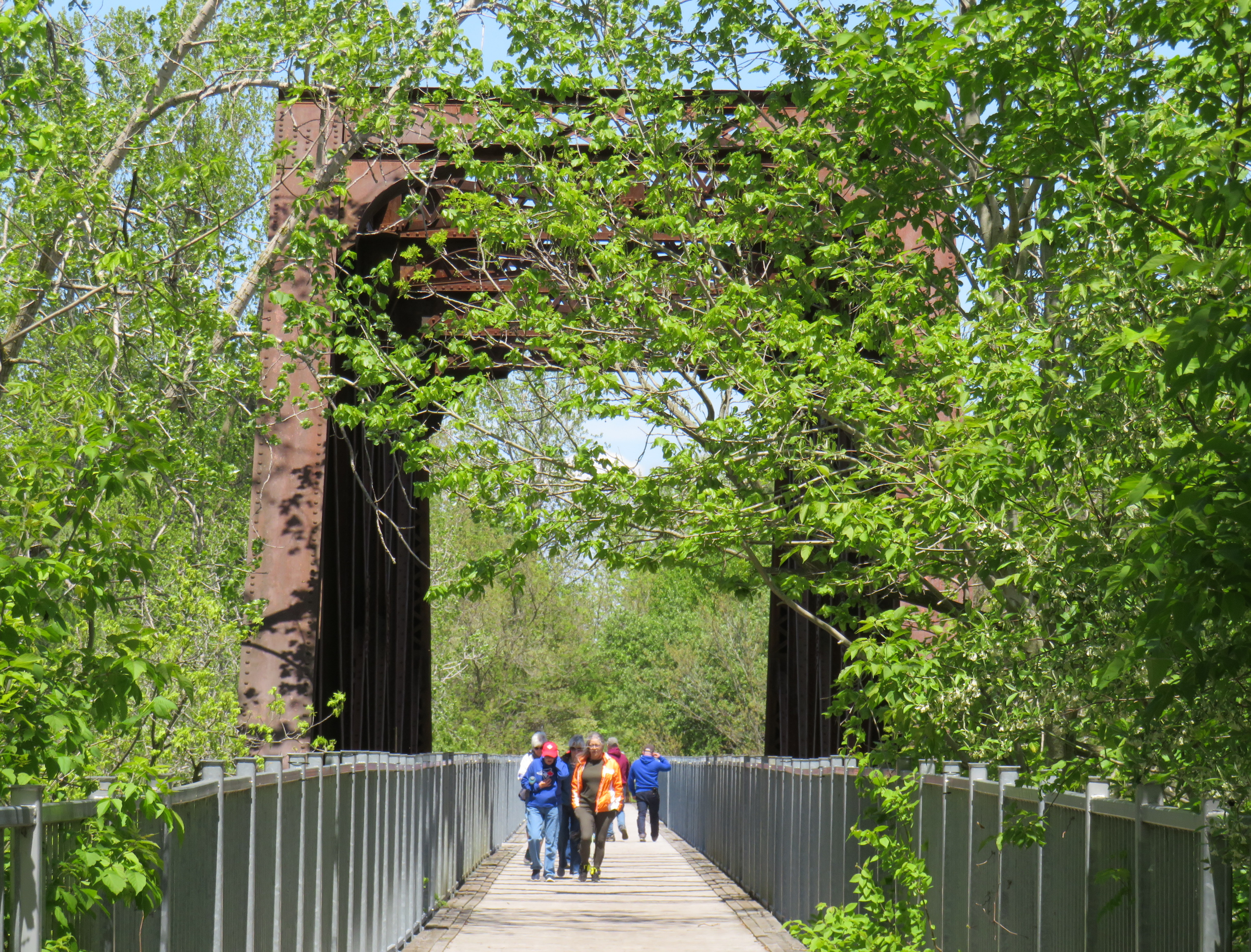
However, the north-south LE&N Trail, which connects to the Shadow Lake Trail by way of a gentle paved pathway or a metal staircase, is part of a much longer rail trail corridor that continues north to Brantford (the trail shifts to the TH&B route north of Waterford) and south to Simcoe and Port Dover. At Brantford, it is easy for the ambitious cyclist to continue east to Hamilton or north to Paris, Cambridge, and Kitchener via connecting high-quality rail trails. The Norfolk County Trail is at its scenic best when it crosses over the Waterford area via the Black Bridge.
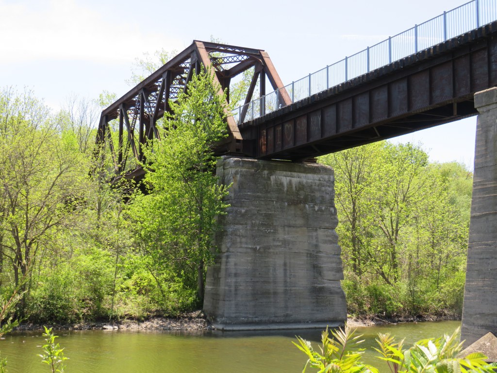
The Black Bridge crosses over the old CSR and TH&B railways and the Waterford Ponds
One aspect that I especially appreciated was all the interpretive plaques along the trail system that told the story of Waterford, local industry, and the railways. This is how I learned that the ponds were the result of milling and quarrying, rather than truly natural features.
One of several interpretive plaques along the trail system in Waterford
Despite their attractiveness for long-distance cyclists, the trails within the Waterford area are well-used by residents and visitors going for shorter walks. The trail network within Waterford connects well to local streets and to itself by way of the former low-level TH&B wye tracks, which also cross the ponds. A walker can easily do a round trip without backtracking while being surrounded by nature. Wayfinding signage is very good, and benches are plentiful. The ponds are a great spot for bird watching. As we know how good walking is for our physical and mental health, Waterford is blessed with this network and could be a model for other smaller urban centres and rural communities.
In the early afternoon on a Thursday, the Black Bridge was popular with pedestrians and cyclists
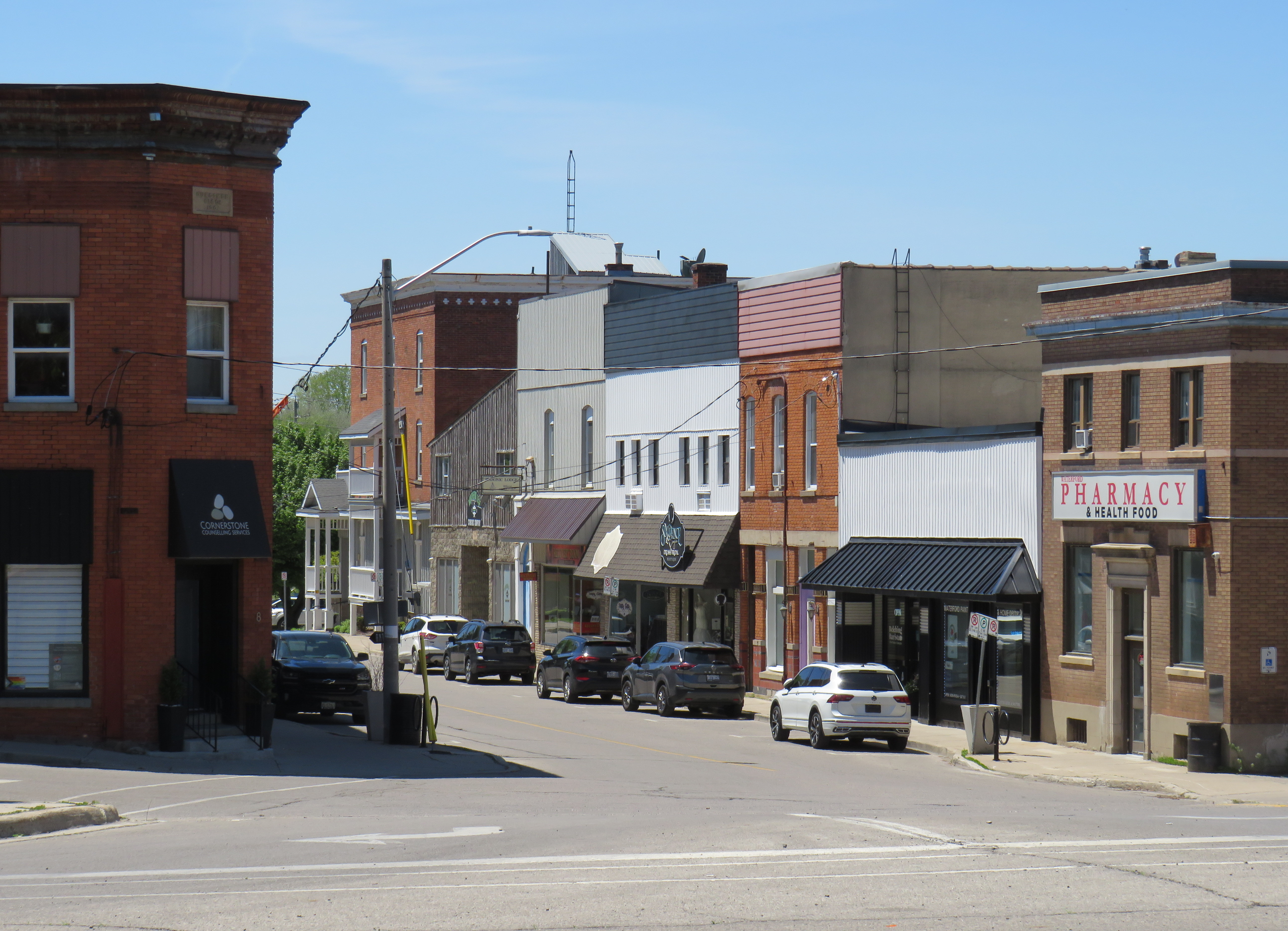
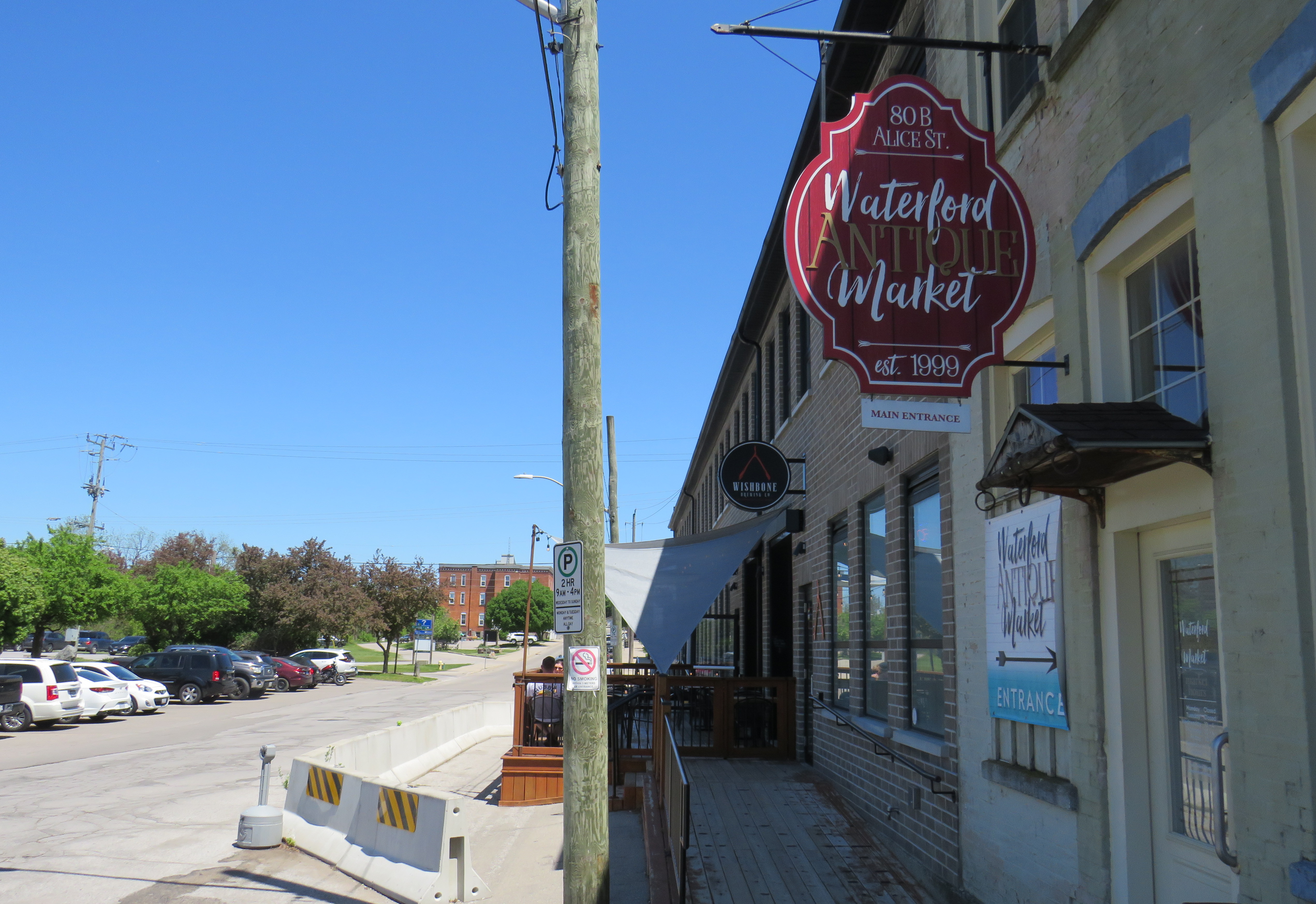
Within the little downtown, there are public washrooms for trail users as well as several restaurants, cafes, and a craft brewery located in a former textile plant. There are also several antique dealers, a public library, and other small shops.
Alice Street, Waterford’s main commercial strip, is lined with restaurants, shops, a cafe, and a breweryWaterford Antique Market and Wishbone Brewery, in a renovated textile plant
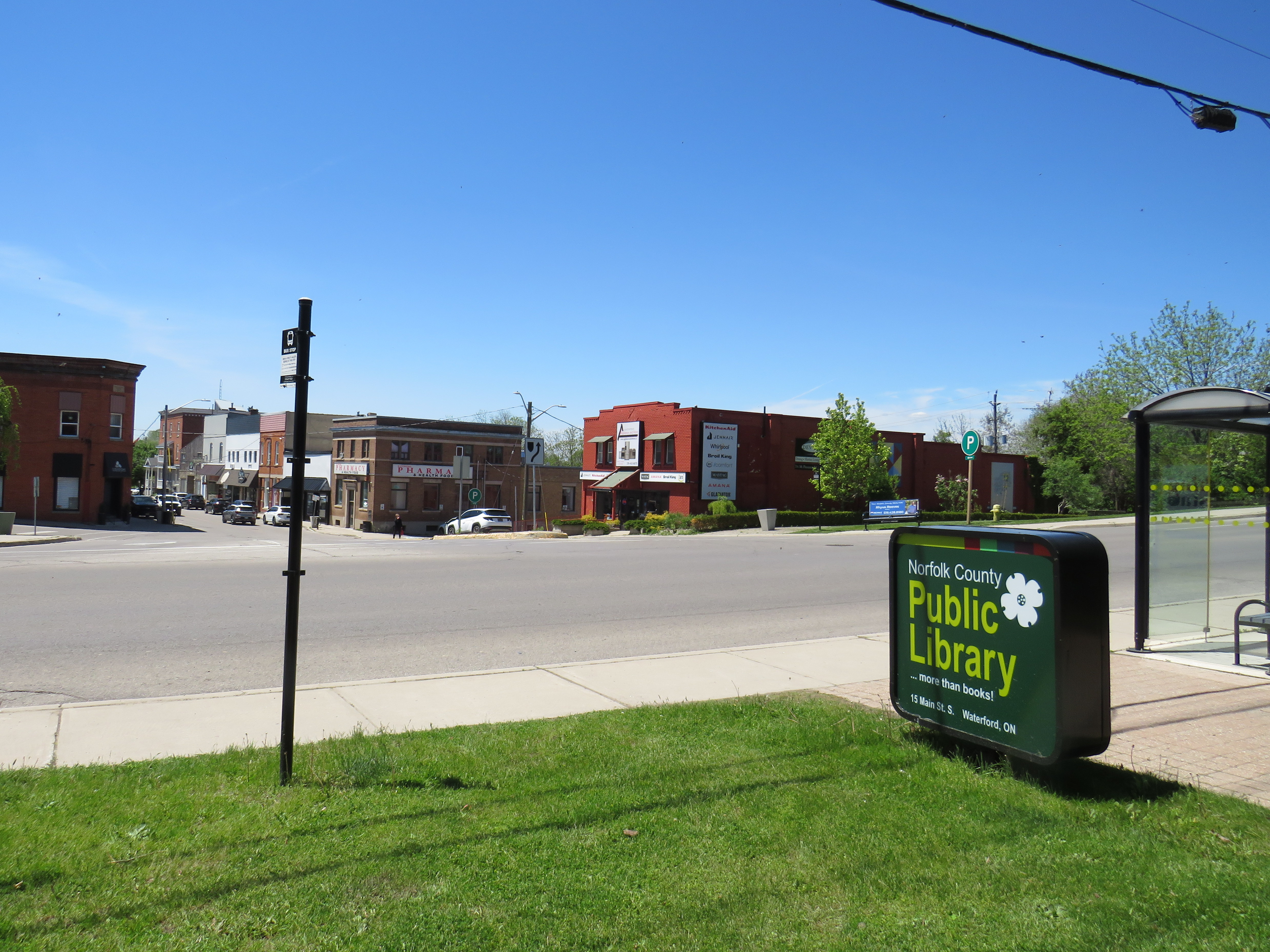
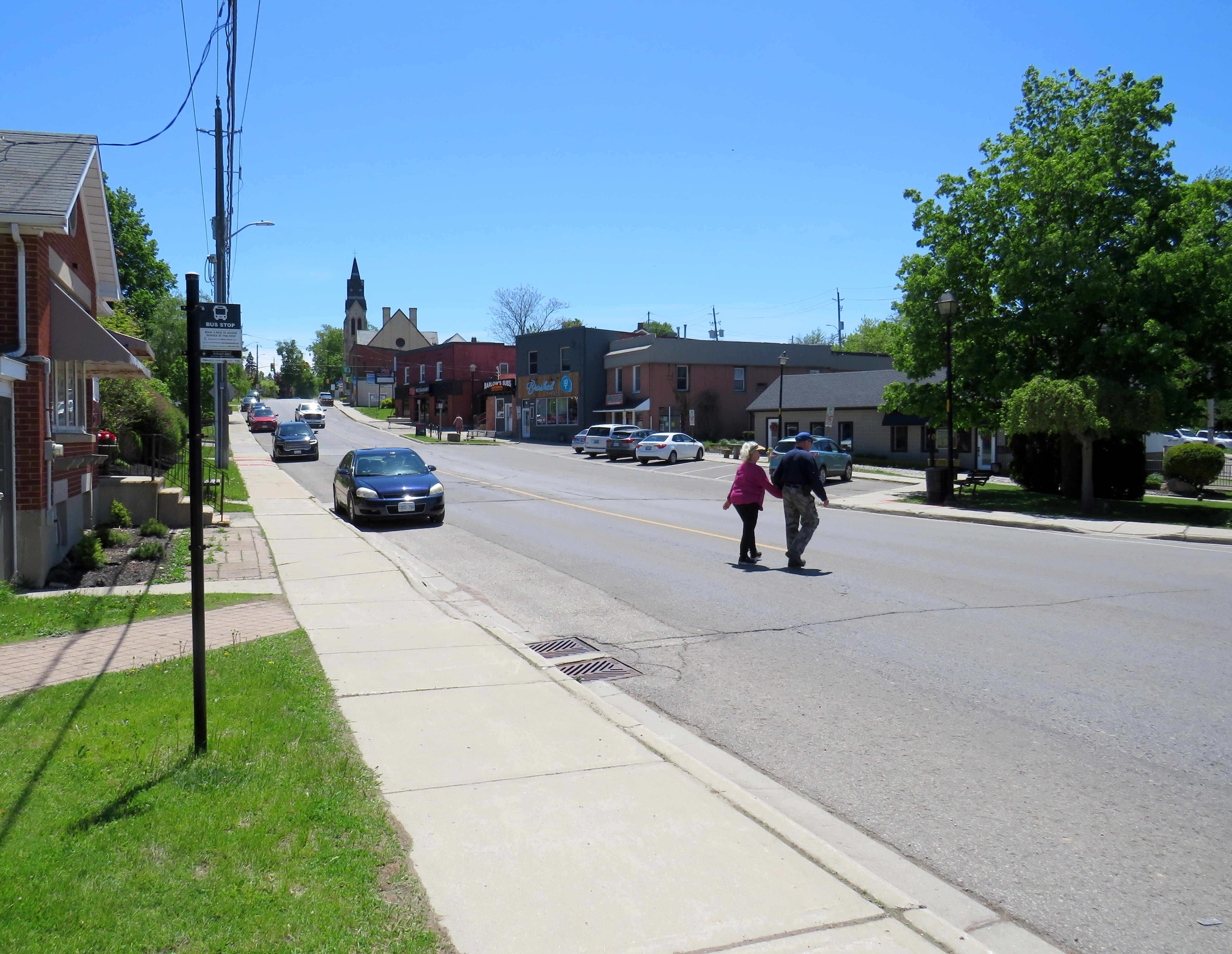
Despite all that Waterford has to offer, there is one thing that can be improved to make it safer to get around. Alice Street, the main commercial strip in Waterford, meets Old Highway 24 at an unsignalized crossing. Though busy Highway 24 now bypasses Waterford, the old highway is still busy, with drivers exceeding the 40 km/h posted speed limit. The Waterford library branch and northbound bus stop towards Brantford are on the opposite side of the wide T-intersection from the Alice Street businesses; it is surprising that there is no traffic signal here to control auto traffic and provide a safer pedestrian crossing.
The northbound bus stop (note the shelter at right) and library branch are on the opposite side of a busy road from the downtown shops
Though there is a traffic signal 200 metres to the south at Nichol Street, most pedestrians opt to cross at Alice Street instead. According to Google Streetview, there was a signed pedestrian crossing at Alice Street in 2009 but was removed by 2012.
Waterford is under a two hours’ drive from Downtown Toronto, though it is accessible without a car. GO Transit and VIA Rail both serve Downtown Brantford, where on weekdays, one can take a Ride Norfolk minibus south to Waterford. Cyclists from Hamilton or Toronto can take GO Transit buses to Brantford and bike south down the TH&B Rail Trail to Waterford on a relaxed 90-minute ride. From Simcoe, it’s an easy 45-minute ride.
In general, Ontario can do so much better promoting sustainable tourism and travel by way of transit, walking, and cycling, as there are many places like Waterford that are easy to get to and around without a car that are not especially well-known, and there are many opportunities to improve public and active transportation links to other communities throughout the province. Though some communities, like Brantford, Hamilton, and Peterborough are very well connected to multiple trail systems radiating outwards in multiple directions, other cities and towns are not so lucky.
Though St. Marys and St. Thomas, for instance, also have made great use of former rail infrastructure, they are lacking safe, high-quality active transportation connections to nearby cities like London or Stratford. Lindsay, in Kawartha Lakes, is at the nexus of several trails as well, but it lacks any intercity bus connections of its own. A provincial strategy could go a long way.
Buses on the Orange and Blue routes await departure at Orangeville Transit’s transfer hub
Earlier in December 2025, I took a short trip to Orangeville, Ontario, to take a ride on the province’s only fare-free transit system. Though Orangeville Transit provides a vital service for the town’s residents, the fare-free service is not necessarily a model for larger transit systems.
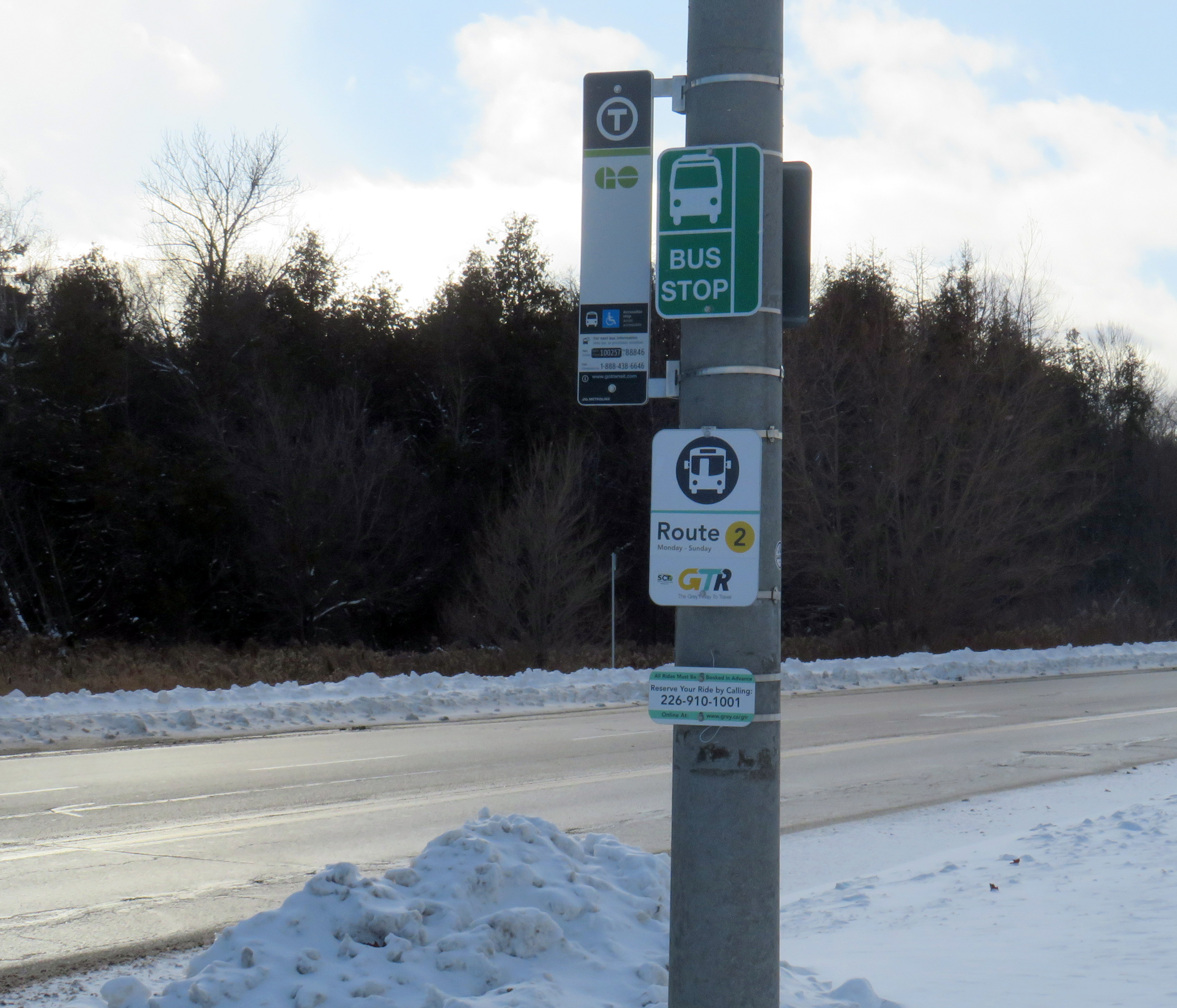
The town of Orangeville, population approximately 30,000, is on the outer edge of the Greater Toronto & Hamilton Area. Until 2021, it was connected to the Canadian Pacific mainline at Streetsville by a municipally-owned railway; Highways 9 and 10 link the town with Highways 400 and 410. GO Transit runs a limited weekday bus service from Brampton, and the remnant of Grey County’s GTR system runs between Orangeville, Shelburne, and Dundalk.
Orangeville Transit, GO Transit, and GTR Route 2 signs on Hansen Blvd.
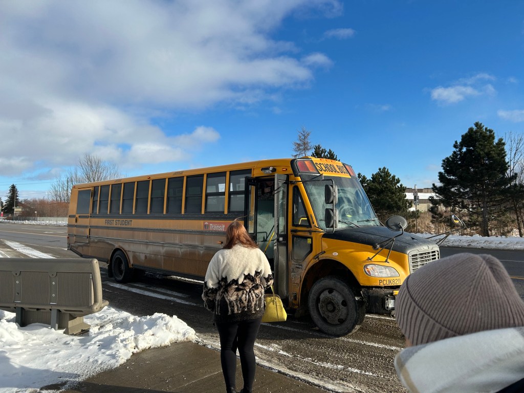
These three services meet at a curbside stop on Hansen Boulevard at First Street adjacent to the Orangeville Mall on the north side of town, where there is a standard bus shelter. After getting off the GO bus here, a GTR van arrived a few minutes later, dropping off a few more passengers. A few minutes after that, a yellow school bus arrived, sporting an Orangeville Transit sticker on the side. This would be my bus.
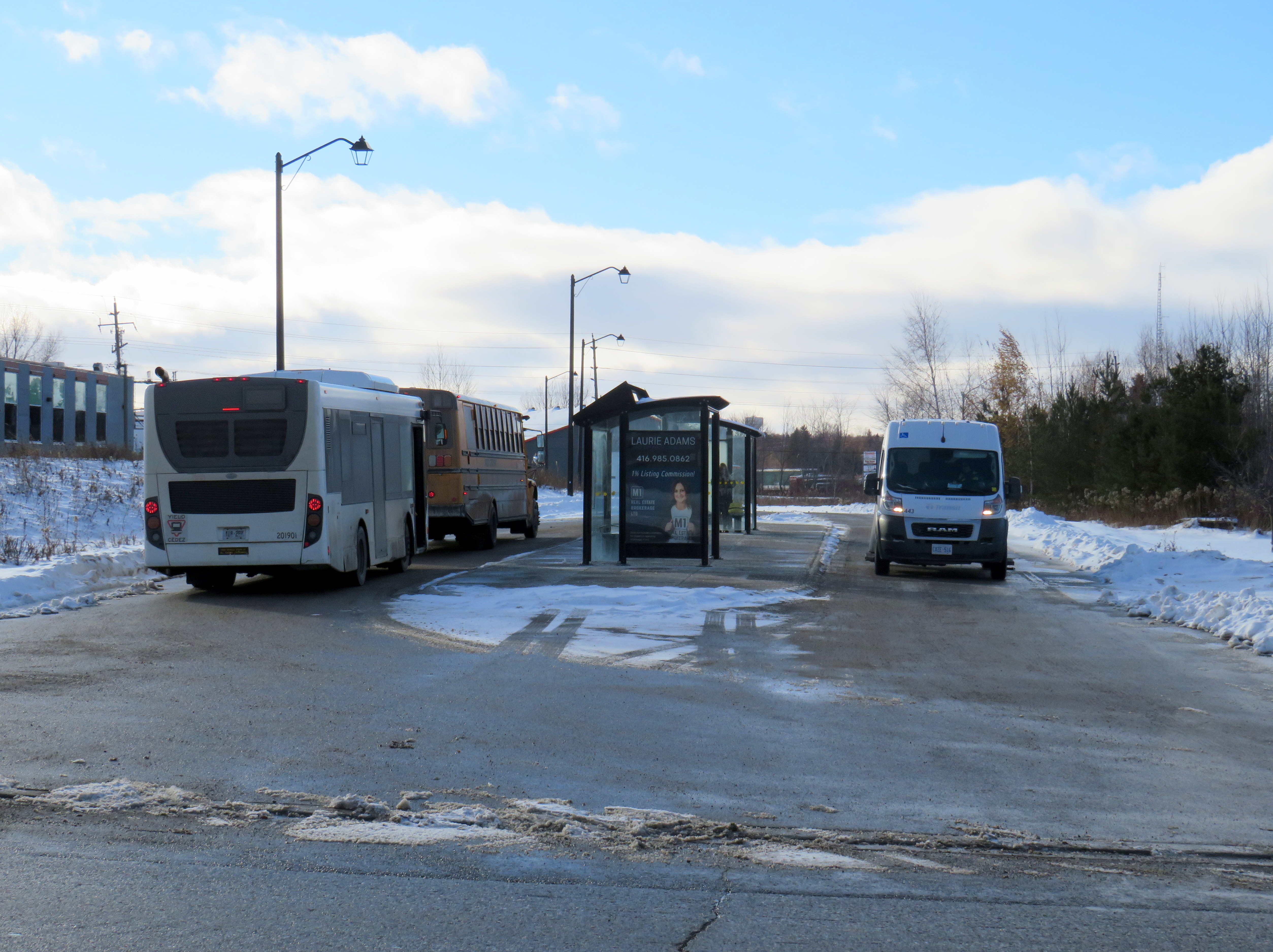
After a winding route through several residential subdivisions, circling back on Hansen Boulevard, the bus arrived at the central transfer point located in a field west of the downtown core. The transfer point, located behind a small shopping plaza, is adjacent to the abandoned Orangeville-Brampton Railway corridor. However, the new terminal is not served by GO or GTR. GO Transit buses layover at the old Canadian Pacific Railway station site on Townline before heading south to Brampton GO Station.
Orangeville Transit map, with two routes operating on 45-minute schedules
In some ways, the fare-free service in Orangeville is a success. Ridership more than doubled between 2019 and 2023, the year it introduced free fares. The program has since been extended through 2026. However, Orangeville Transit is a very small operation, with only two routes, each on a 45-minute schedule. The two routes are made up of circuitous, one-way loops that provide service to the entire municipality, but do not provide through or speedy service.
Though large systems, like GO Transit and the Toronto Transit Commission, get more than half their funding from fare revenue (in the late 1990s, fares made up 80% of the operating costs for those two systems due to provincial austerity), smaller systems, with lower costs, can get by with free fares. This is also true of some mid-sized American systems, such as Richmond, Albuquerque, or Kansas City, where fare collection might be more trouble than it is worth. But there’s a trade off; for many riders, a more frequent and faster ride would be worth a few dollars — reliable government funding along with targeted reduced fare programs might be a better solution.
In Orangeville’s case, the rider gets what they pay for — a slow, infrequent, and circuitous service where you might end up picked up by a school bus.
Transit journeys, wrapped
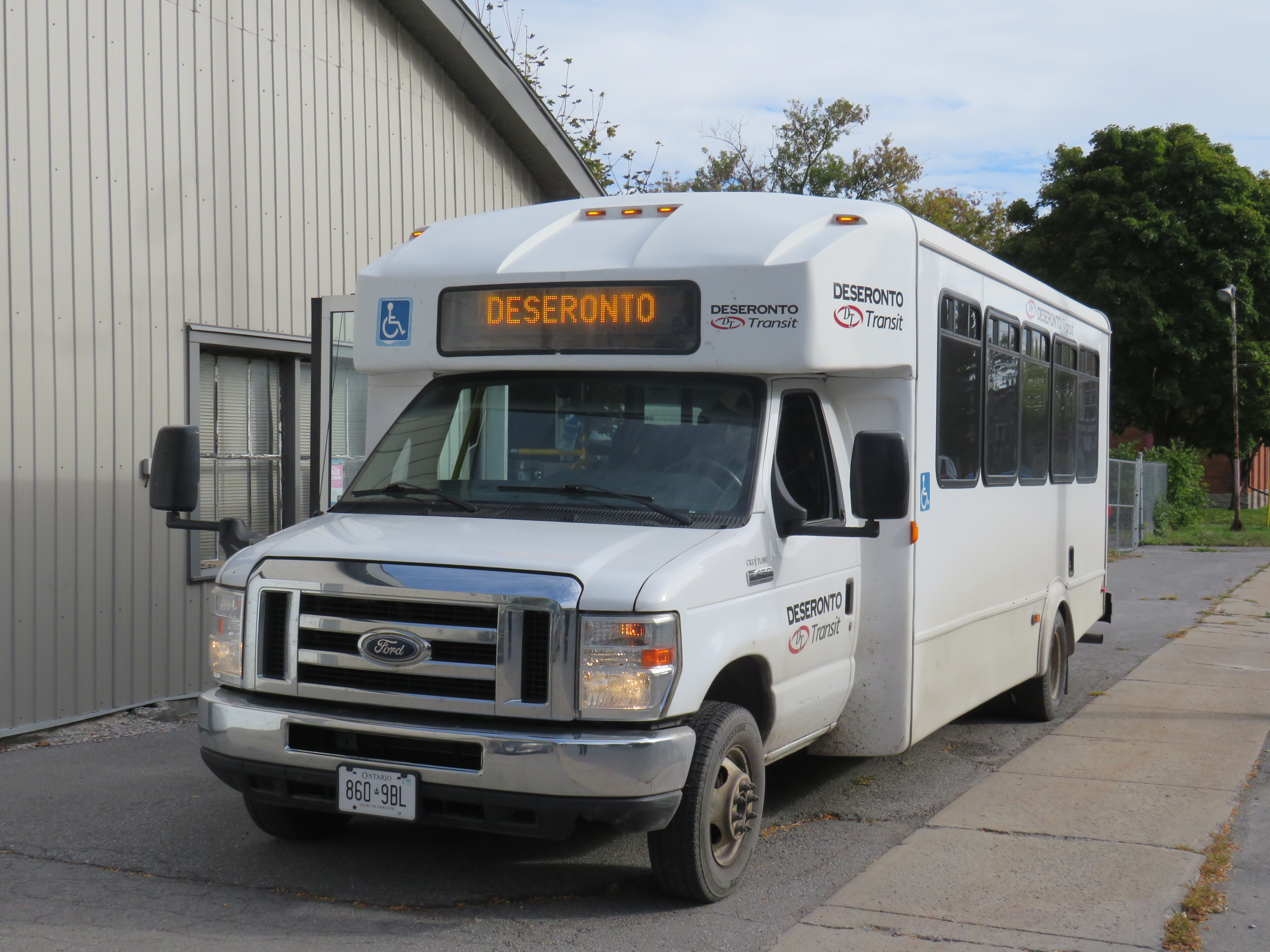
Orangeville Transit was the last of 32 distinct transit services I got to ride in 2025 and was one of 10 systems I rode for the first time (another three of those were in Italy). Unfortunately, my first ride on Deseronto Transit was also my last. With the obvious exception of the Vatican, I have been on at least one transit service in every one of the 21 countries I’ve been to so far.
Local and regional transit systems taken in 2025: Toronto Transit Commission GO Transit Brampton Transit MiWay York Region Transit Durham Region Transit Burlington Transit Hamilton Street Railway Orangeville Transit (1st time) Simcoe County Linx Barrie Transit Wasaga Beach Transit(1st time) London Transit Deseronto Transit(RIP) Belleville Transit Kingston Transit Brockville Transit (1st time) River Route(1st time) Transit Windsor LTW Transit(1st time) Thunder Bay Transit (1st time) OC Transpo Société de transport de l’Outaouais (Gatineau QC) Société de transport de Montréal Winnipeg Transit Calgary Transit TransLink (Metro Vancouver) BC Transit (Greater Victoria) Azienda Napoletana Mobilità (Naples) (1st time) Azienda per la mobilità di Roma Capitale (1st time) Ente Autonomo Volturno (Campagna IT) (1st time)
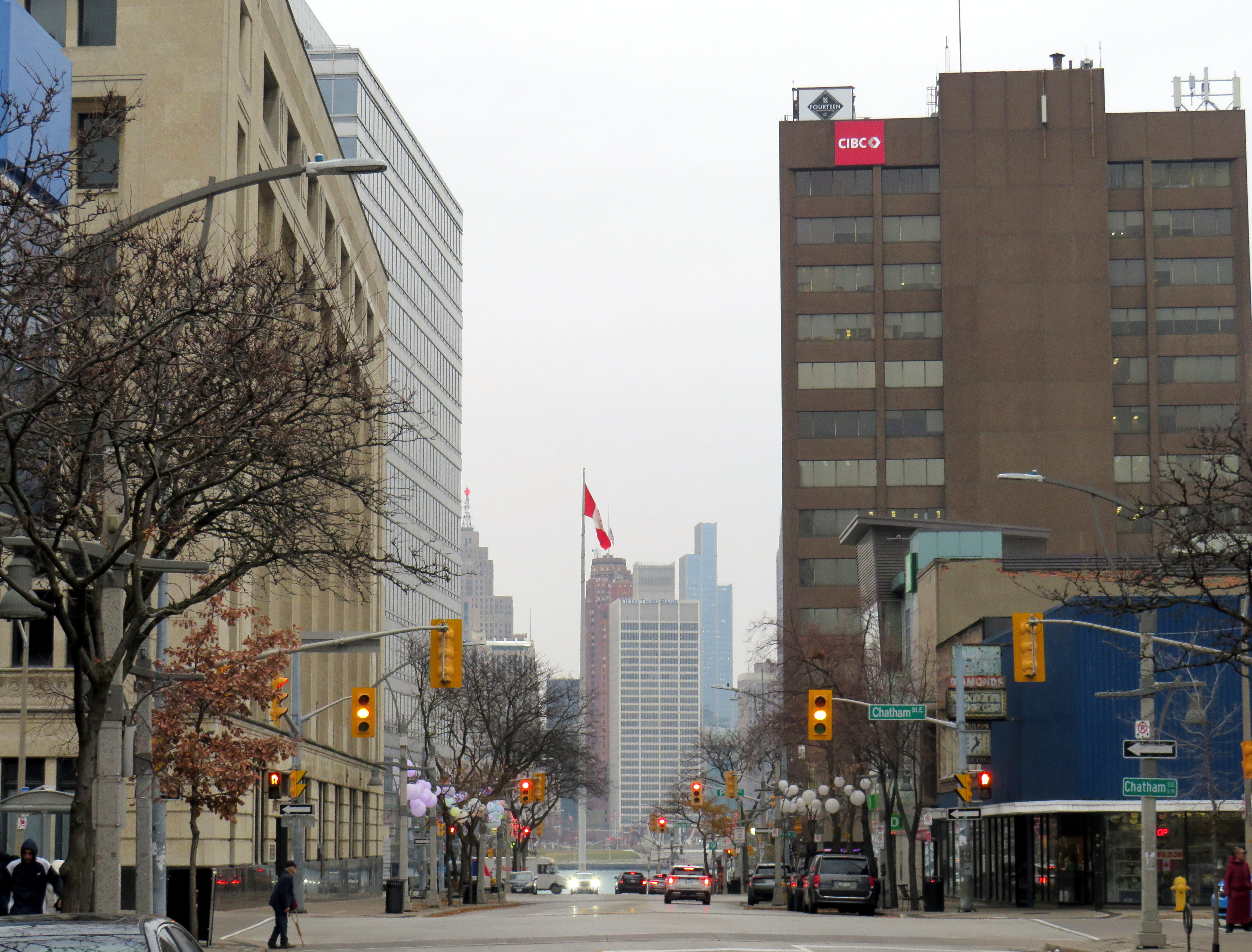
Downtown Detroit, as seen from Downtown Windsor, on a gloomy November morning
Windsor, Ontario, is built on transportation. The city’s position, right across the river from Detroit, has shaped the region ever since French settlers made their home on the wide, short, slow-moving river between Lake Erie and Lake St. Clair. (The river’s name, Detroit, is the French word for strait.) The narrow river made it a hub for shipping and for railways, followed by rail and road tunnels and highway bridges.
As the American auto industry got its start in Detroit, propelling it from a minor regional centre to the fourth-largest city in the United States, Windsor was a natural spot for companies like Ford, General Motors, and Chrysler to set up their first international operations. Canadian distillers and brewers also made Windsor their home and independent towns and cities lined the river, with names like Walkerville and Ford City. (These locales amalgamated with Windsor in 1935). The city had two electric railways: the Sandwich, Windsor, and Amherstburg (SW&A), a local streetcar and bus operation that also ran suburban lines to Amhertsburg and Tecumseh and the Windsor, Essex, and Lakeshore Rapid Railway (WE&L), which extended to Lake Erie at Leamington.
Today, Windsor has a population of 230,000, while neighbouring towns and townships in Essex County add another 200,000 people to the region. Though Windsor’s auto industry has been in flux since the 1980s thanks first to free trade agreements and now by US tariffs and protectionism, the region’s population continues to grow.
However, despite the region’s history and growth shaped by water, rail, and road links, public transport is lacking in Windsor-Essex, with several routes in peril. This is despite the presence of the University of Windsor, St. Clair College, two major hospital campuses, and a large built-up prewar urban area. Windsor was also the only large urban municipality to completely cease transit operations during the COVID-19 pandemic, where others continued to provide basic services subject to health and safety restrictions.
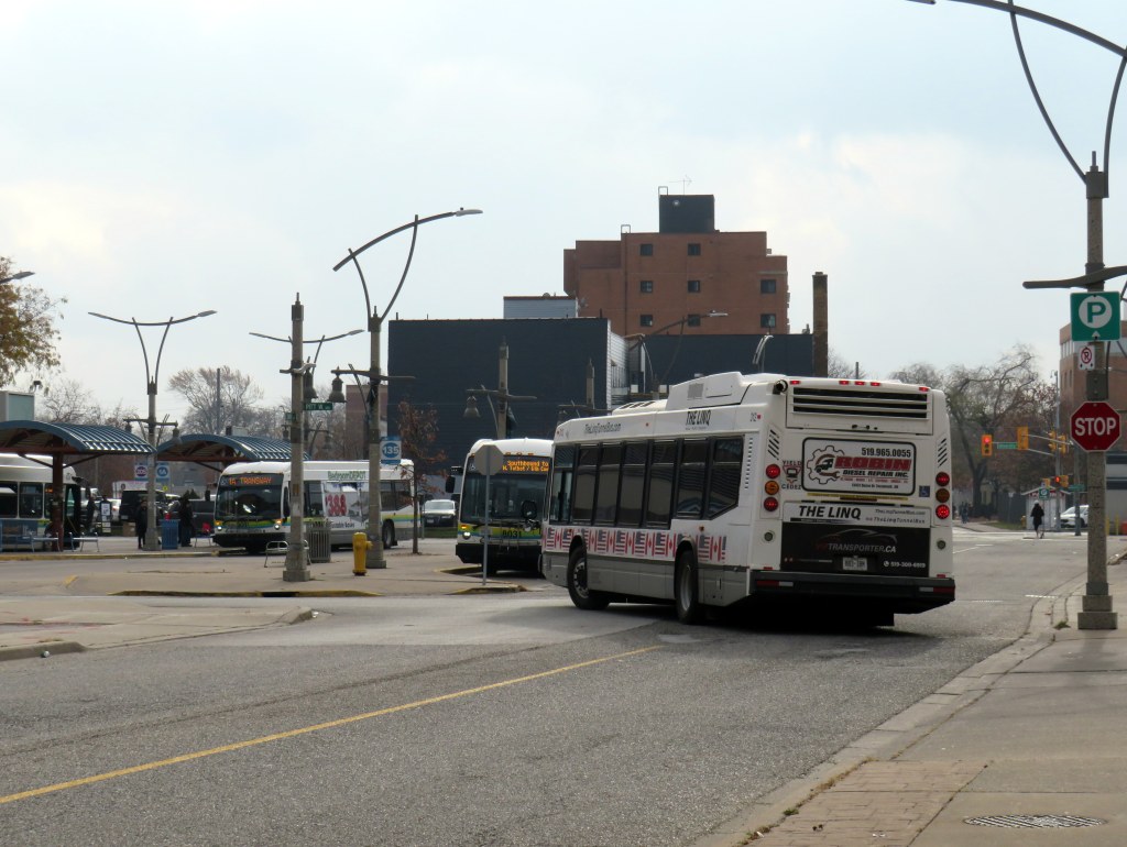
On August 30, 2025, Transit Windsor’s Tunnel Bus service was cancelled, after Windsor Mayor Drew Dilkens vetoed a council decision to maintain the service (funded partly by an increase in the one-way fare from $10 to $20). Even though the historic cross-border relationship is strained by threats of annexation, tariffs, and an authoritarian president, the Tunnel Bus still provides an essential link for business and leisure, with many fans of Detroit’s sports teams on the Canadian side of the river, and hundreds of workers crossing daily to Detroit’s offices and hospitals. Without access to an automobile or an expensive cross-border taxi ride, the bus is the only year-round way to get to the United States between Fort Erie and Walpole Island, as neither the tunnel or the Ambassador Bridge allow pedestrians or cyclists.
The new Gordie Howe Bridge will include a new multiuse path. However, it is not convenient to Windsor or Detroit destinations, nor is it close to decent transit options on either side of the soon-to-open crossing, including the Q-Line Streetcar, D-DOT and SMART buses, or intercity links such as VIA Rail, Amtrak, or Greyhound.
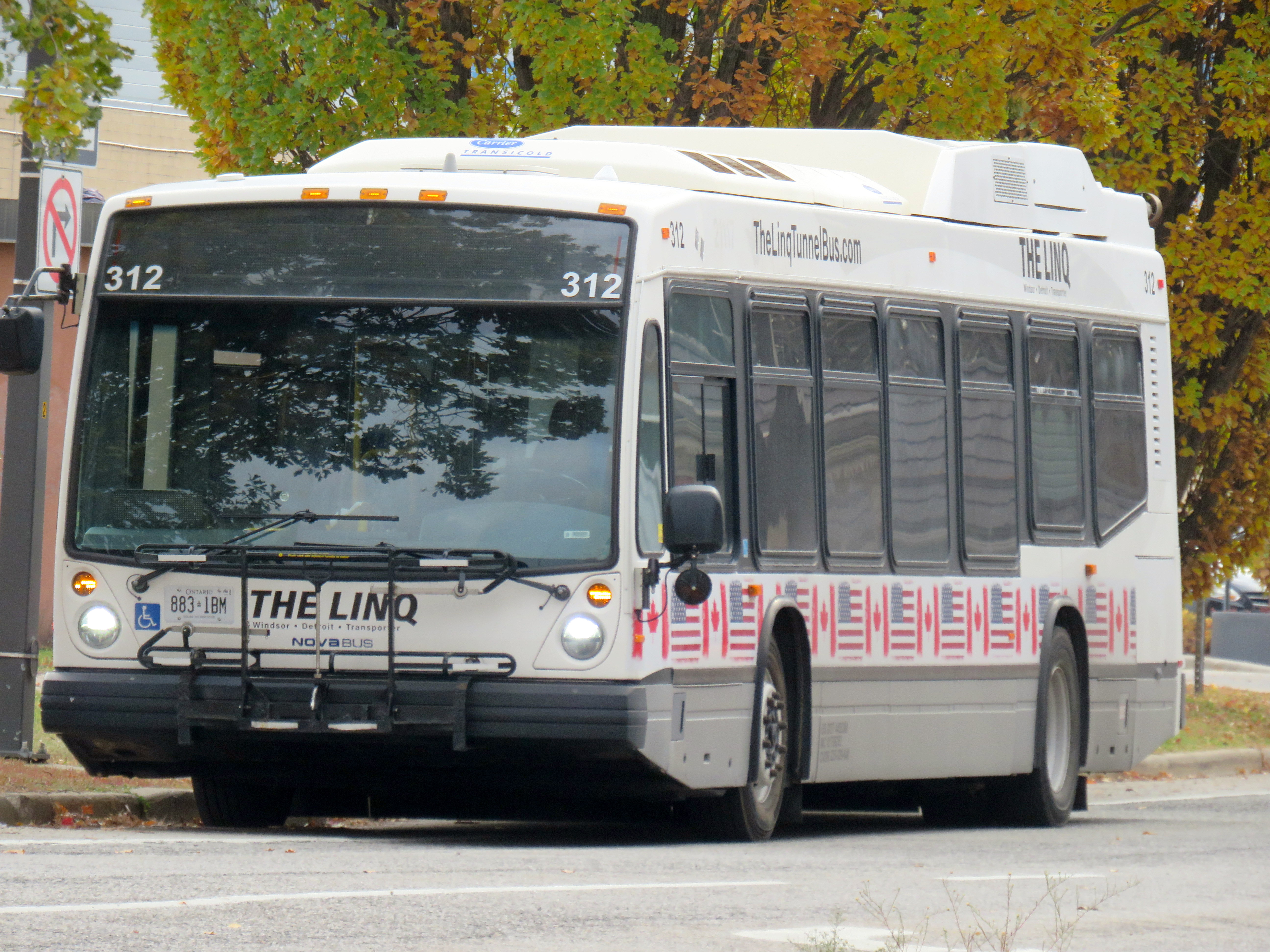
The Linq, the new privately-operated Tunnel bus between Windsor and Detroit
There is, however, a new privately-operated bus service, called The Linq. It has several used transit buses with bike racks and offers trips every two hours for a $15 one-way fare. It is a downgrade from the Transit Windsor-provided service, but the connection is still there.
Though the Linq tunnel bus passes by the Windsor transit terminal, it doesn’t stop close by
Unfortunately, there is no direct connection between Linq and Transit Windsor. The only pickup location in Windsor is at the corner of Bruce Avenue and Riverside Drive, a five-minute walk from the transit terminal where the former city-operated bus departed from. Though the Linq bus passes by the Windsor terminal, it does not stop right there. The route still serves the Rosa Parks Transit Terminal on the Detroit side, along with the stop by the tunnel entrance next to Mariners’ Church.
Regional (dis)connections
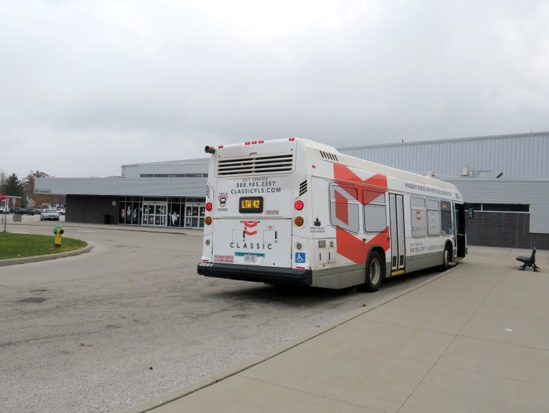
LTW 42 bus at Essex Sports Centre
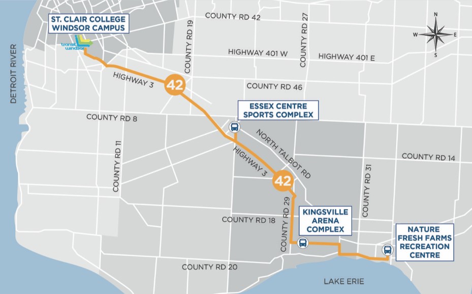
While visiting Windsor, I wanted to ride Route 42, the bus service linking Windsor with the towns of Essex, Kingsville, and Leamington. Operated by Transit Windsor using urban transit vehicles, the service got funding from the province, the County of Essex, and the Town of Leamington. It operates three weekday and two Saturday round trips, charging a flat $10 one-way fare or a $15 same day return fare, with free transfers to Leamington’s LTGO on-demand service and Transit Windsor’s urban routes at St. Clair College.
The service began in 2019, replacing a long-discontinued intercity coach route operated by Greyhound Canada and Chatham Coach Lines, along the old route of the WE&L Rapid Railway that ran until 1932. The bus only makes four stops: St. Clair College in Windsor, and sports and recreation centres in the three towns. The route’s number is not inspired by Douglas Adams but by the 42nd parallel, which runs a few hundred metres south of Leamington.
LTW Route 42 route map
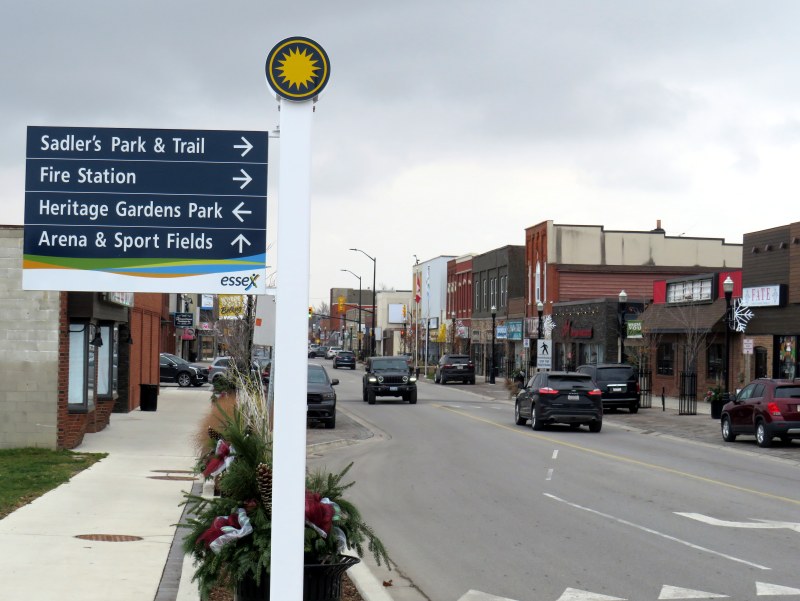
Unfortunately, the three sports centres are poor locations for promoting transit ridership. In Essex, the arena is a 10-to-15-minute walk to the town centre, a reasonable stroll for many. In Kingsville, the arena complex northeast of the built-up area is 2.5 kilometres from the town centre, a 35-45 minute walk with no local transit options. Without access to a car ride, the Route 42 service becomes inaccessible to many potential users.
Previous coach service operated by Greyhound and Chatham Coach Lines stopped in the town centres.
Essex Town Centre, a 10-15-minute walk from Route 42 at the sports centre
As of April 30, 2026, the LTW Transit service connecting Windsor with Essex, Kingsville, and Leamington will come to an end. This was a matter of funding. The provincial rural transport funding program came to an end, and neither the County of Essex nor the Town of Leamington were willing to continue subsidizing the service beyond the end of the academic year.
Though the province is willing to fund expensive new highway and transit projects in the Greater Toronto and Hamilton Area, including new subways and light rail and sprawl-inducing freeways, it is unwilling to back the provision of small town and rural transit services that connect residents to larger centres, whether it be for work, school, health appointments, shopping or social connections. Without a province-wide strategy and a sustainable funding program, services that started up with much promise are disappearing in places like Grey and Oxford Counties and Napanee and Deseronto.
It also does not help that Windsor-Essex does not have a regional level of government or even a degree of cooperation between the various municipalities. In York, Waterloo, Durham, and Niagara, regional governments have taken over transit services and are working to connect their entire regions together, even rural communities. Even Simcoe County provides a regional transit service to its smaller towns. The suburban Town of Tecumseh has a limited transit service separate from Windsor’s, while LaSalle and Amherstburg contract Transit Windsor for limited service within their communities. A regional transit service, subsidized by the entire Windsor-Essex tax base, could go a long way.
That’s a wrap
To conclude this post, I have few other observations of riding Transit Windsor over two days in late November. There are several ways that transit service can be improved, including better wayfinding, better connections between modes, and giving passengers a better view.
VIA Rail runs four daily trains between Toronto and Windsor, from a station in the Walkerville neighbourhood, three kilometres east of the downtown core. Passenger trains on the CN line used to continue to the downtown waterfront until the 1960s, when service was cut back to Walkerville, which had a wye to turn trains around. Eventually, all the CN, CP, and Michigan Central tracks and docks were removed from the riverside, which allowed Windsor to develop a lovely waterfront park system.
The Crosstown Route 2 along Wyandotte Street stops nearby the VIA Station off Walker Road, about a five-minute walk between bus and train. But getting between the two modes is not clear. Apart from a VIA Rail logo on the transit map, there is little indication of this useful connection at the station or at the bus stops on Wyandotte. Route 2 offers decent service during daytime hours, every 10-15 minutes on weekdays from 6:00 AM to 6:00 PM, but it quickly drops to every 30 minutes at 6:30 PM. Saturday daytime service is every 20 minutes, and on Sundays, every 40 minutes. Frequencies on other core routes, including the 1A and 1C Transway buses, is similar.
Compare this with Kingston, a city less than half of Windsor’s size, which provides direct transit service onto the VIA station grounds. In London, the downtown station is a more prominent landmark, and easy to get to by multiple routes.
As a regular transit passenger used to fare cards, transit apps, and open payment systems, I found myself annoyed by having to carry exact change — a toonie, a loonie, and three quarters — every time I rode. Transit Windsor does have plastic fare cards, but they can only be loaded up with individual fares or a 15-day or 30-day pass, not a declining balance that could be used on regional routes. As cash is less common as a payment type (with some smaller businesses going cashless), larger transit agencies should catch up.
The typical view from a Transit Windsor bus
Finally, I became annoyed by how many buses in Transit Windsor’s fleet are fully covered by vinyl advertising wraps, excepting only the windshield, front door, and driver’s side window. Even the LTW 42 bus, which goes a long distance at higher speeds, was fully wrapped. I took six different buses in two days and only one wasn’t wrapped. It makes for a miserable time as a rider, especially one who wants to see the neighbourhoods the buses pass through; I explained why advertising wraps are a bad idea before. At the very least, ad wraps should limit how much of the passenger window area is covered, as the TTC does.
Windsor has all the essentials for building a good transit system: a large pre-war urban area, post-secondary institutions, hospitals, and a well-populated and growing exurban and rural periphery. It just needs the leadership to recognize its potential.
A few weeks ago, I wrote about several new intercommunity transit services in Eastern Ontario. I went out to Brockville to ride River Route, which follows the St. Lawrence River between Brockville and Cardinal. I also noted the introduction of a new bus service between Kemptville and Ottawa, as well as services in Pembroke and Loyalist Township.
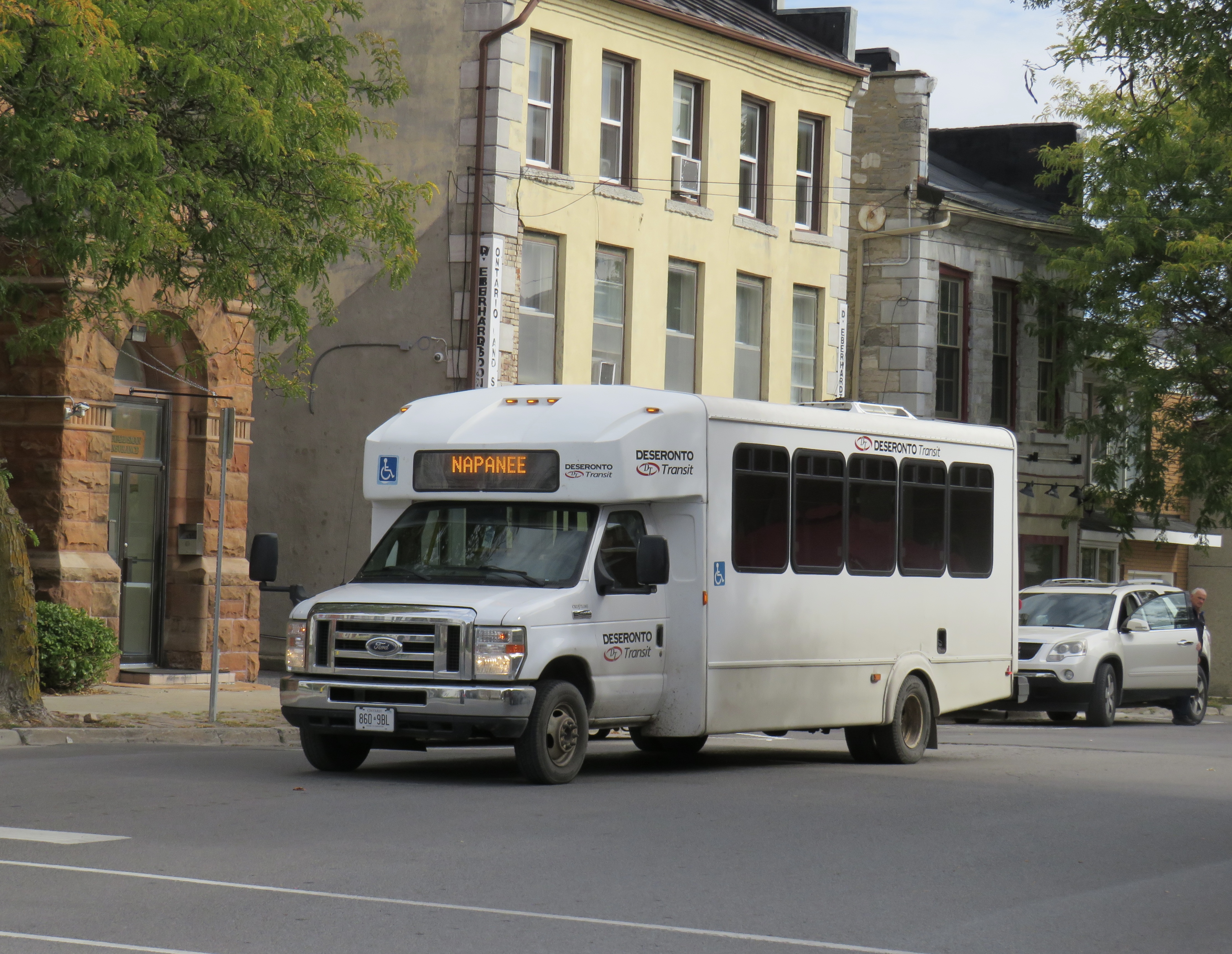
Unfortunately, another Eastern Ontario service, Deseronto Transit, will come to an end on November 28, 2025. Deseronto Transit is operated by the small town located on the Bay of Quinte between Belleville and Napanee; its single route runs between these three communities, while also stopping at Tyendinaga Mohawk Territory and Shannonville.
Early in 2025, the Town of Deseronto moved to end service by December 1, 2025, citing increasing expenses and ageing equipment and the end of provincial grant funding. As Deseronto is a very small town, population 1,750, the continued operation of a regional bus service is especially challenging. Despite the planned closure of service, it is commendable that the town was willing to give it a go, connecting its residents to employment areas in Belleville, as well as medical, educational, and shopping destinations in both Napanee and Belleville.
Laying over at Deseronto Transit’s garage
At its peak, Deseronto Transit was able to average 12-15 passengers per trip, thanks largely to its schedule and route that operates to important destinations in Belleville including Quinte Mall, Belleville General Hospital, and an industrial park in the northeast part of that city. But with the wind-down, ridership has fallen; I was one of only two passengers headed west to Belleville from Napanee and Deseronto on Friday, October 17.
In Belleville, there are still connections to Prince Edward County (which introduced a summer weekend service in 2025) at the Downtown Terminal, and to Trenton via Quinte Transit at Loyalist College. There is also an informal on-demand service to various communities north of Belleville within Hastings County.
One of the challenges operating small inter-community services is that they need long-term, dedicated funding, rather than a one-time grant. They also need to be publicized better, with proper bus stop signage, integrated websites, and easy connections to local transit and other intercity services.
A smart provincial government would not only ensure that these connections are funded and maintained; it would help to better integrate, brand, and advertise inter-community services, touting their benefits to residents and visitors alike. It already does this in the Greater Toronto and Hamilton Area (GO Transit) and in Northern Ontario (Ontario Northland); there really should be more to ensure rural and small town connections are sustainable and sustained in Southern Ontario.
Why going to Napanee is so complicated
To get to Napanee and to take a ride on Deseronto Transit, I had to take the only weekday morning departure from Toronto: a Maple Bus trip from Yorkdale Station to a gas station drop off north of Highway 401 in Napanee. The town is also served by Megabus (on the Pearson Airport-Kingston Route) and two daily VIA Rail trains, but these all leave the city in the PM hours. Maple Bus, a new entry not yet added to my intercity map, operates several buses a day between the Toronto area and Ottawa, with stops at most cities and towns along Highway 401 between Oshawa and Brockville.
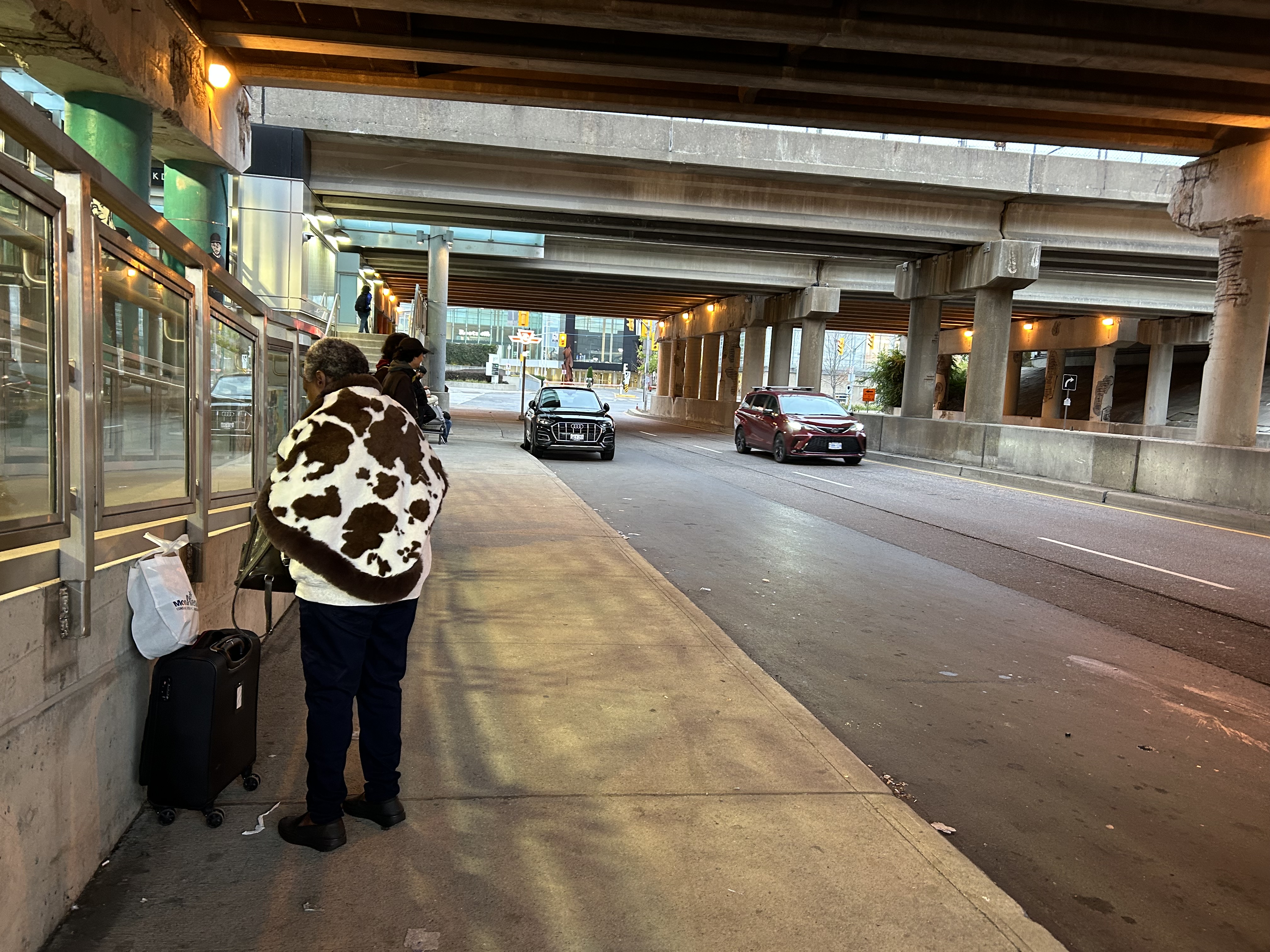
The main Toronto stop for Maple Bus and Flixbus is the passenger pick-up/drop-off area of Yorkdale Station, a curbside stopping zone under the Allen Road/Highway 401 ramps next to Yorkdale Subway Station. GO Transit, Megabus, and Ontario Northland use a nearby purpose-built bus terminal. Though the area is sheltered from rain by the overpasses, there is only one small bench to sit at. It is not a great place to wait for a bus, especially when it is nearly 40 minutes late, as my bus was.
Waiting under highway ramps at Yorkdale Station
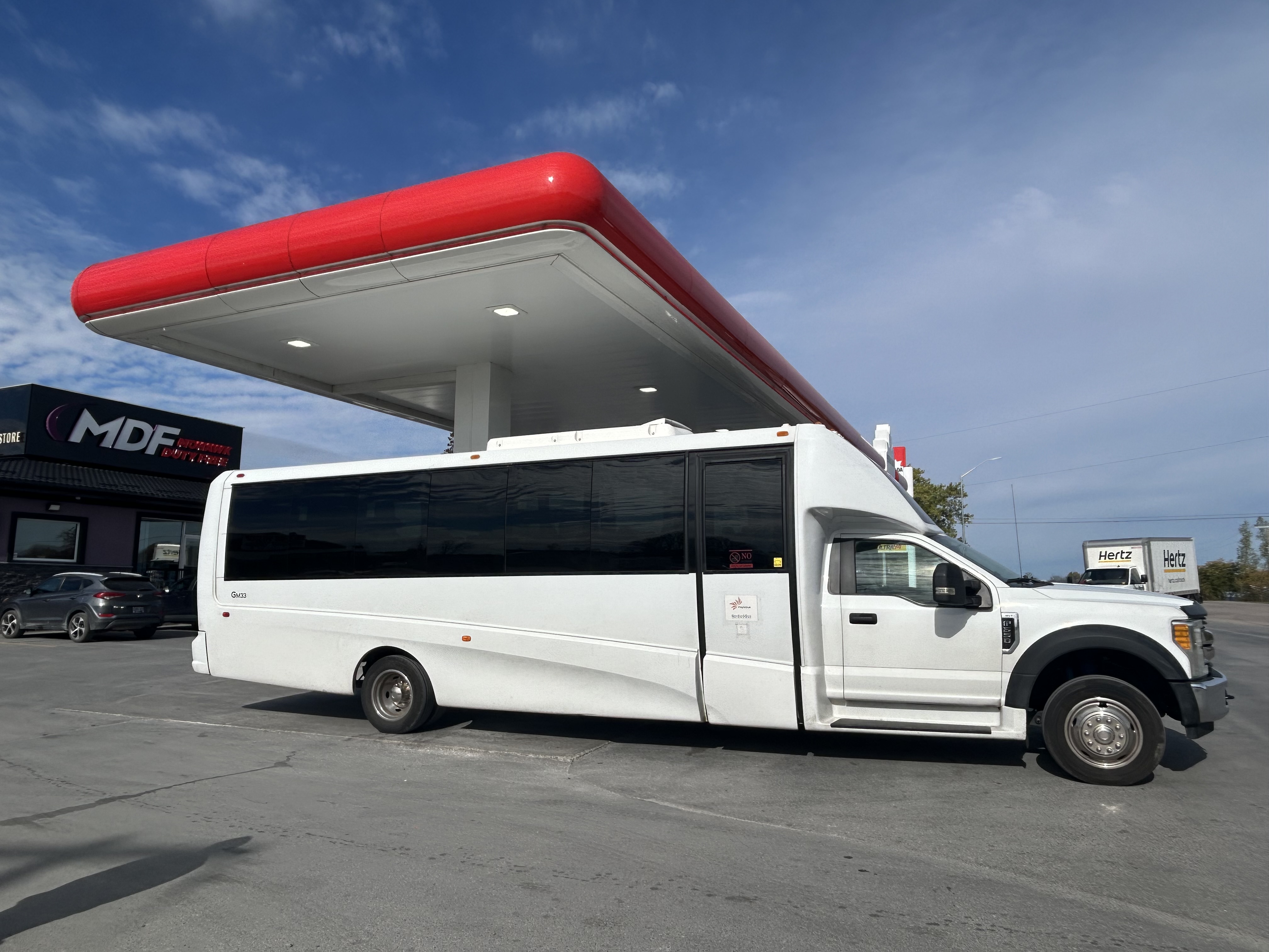
At least the Maple Bus vehicle was comfortable. The bus assigned was a mid-sized body-on-truck-chassis coach, which sits 25 in comfortable bucket seats (I have rode in smaller, less comfortable vehicles before). However, it does not have a toilet on board, and food and beverages are not allowed to be consumed. There was a rest stop, where the driver also refueled, at Tyendinaga First Nation off Highway 401 between Belleville and Napanee. When we made this stop, we were only ten minutes from my destination.
Maple Bus vehicle, during a rest break/refueling stop at Tyendinaga First Nation near Belleville
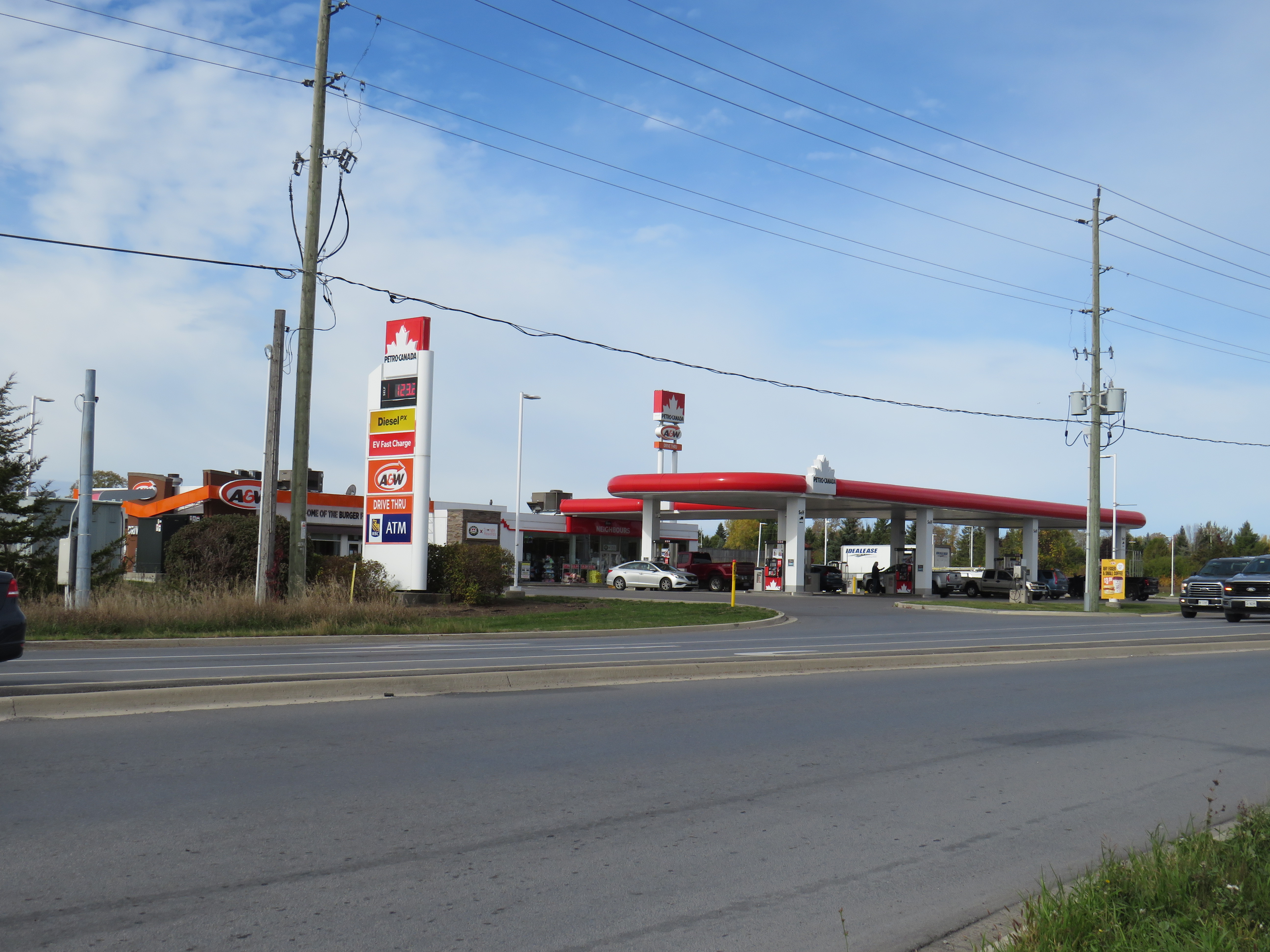
The most challenging part was the walk from the Maple Bus stop at a Petro-Canada/A&W north of Highway 401 towards the town centre. Megabus stops across the street at a Flying J truck stop. Presumably, these bus stop locations are chosen because of their ease of access on and off the highway, and because the property operators are cooperative with the bus operators, but they make things difficult for anyone without a pre-arranged ride.
The Maple Bus route stops at a Petro-Canada north of Highway 401
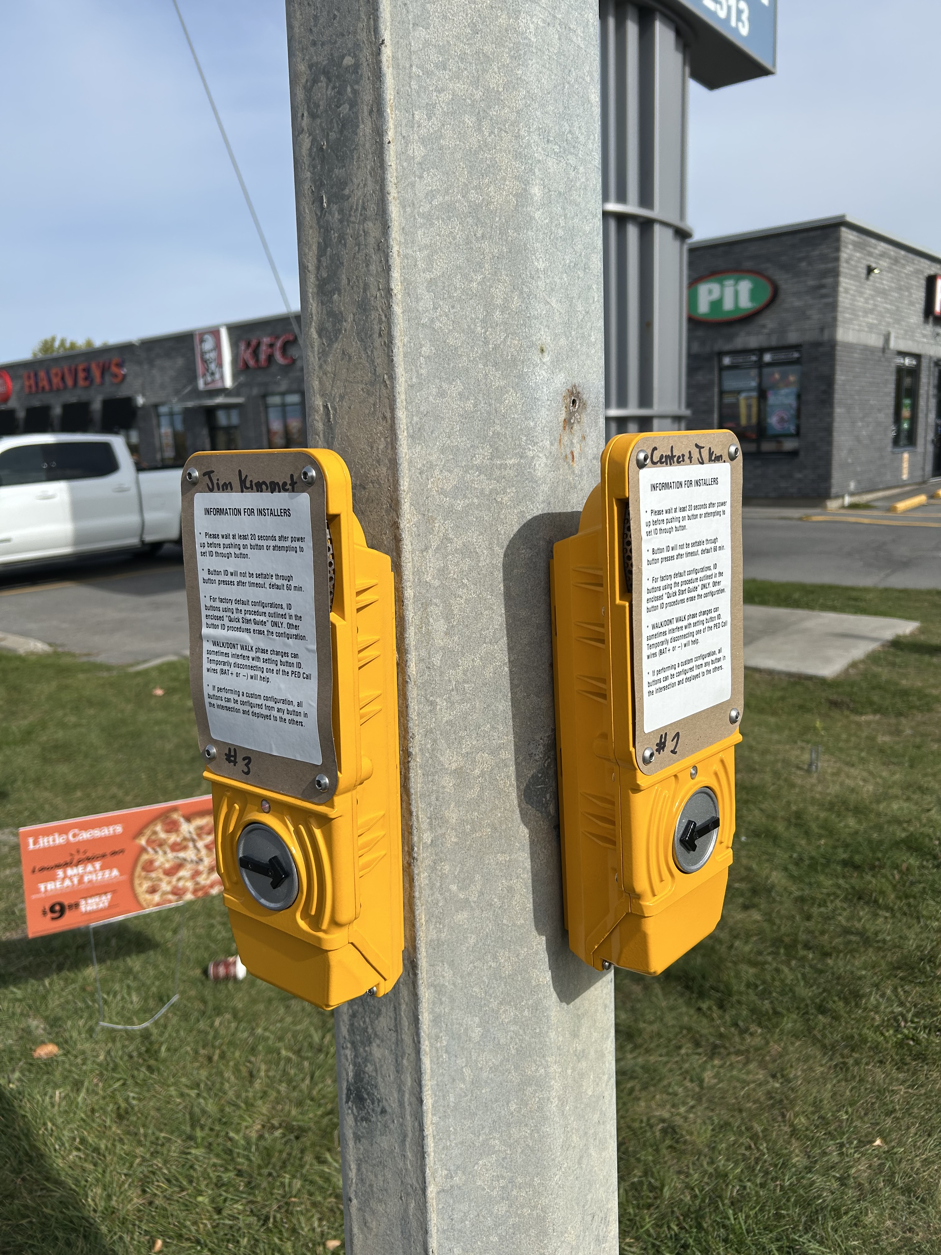
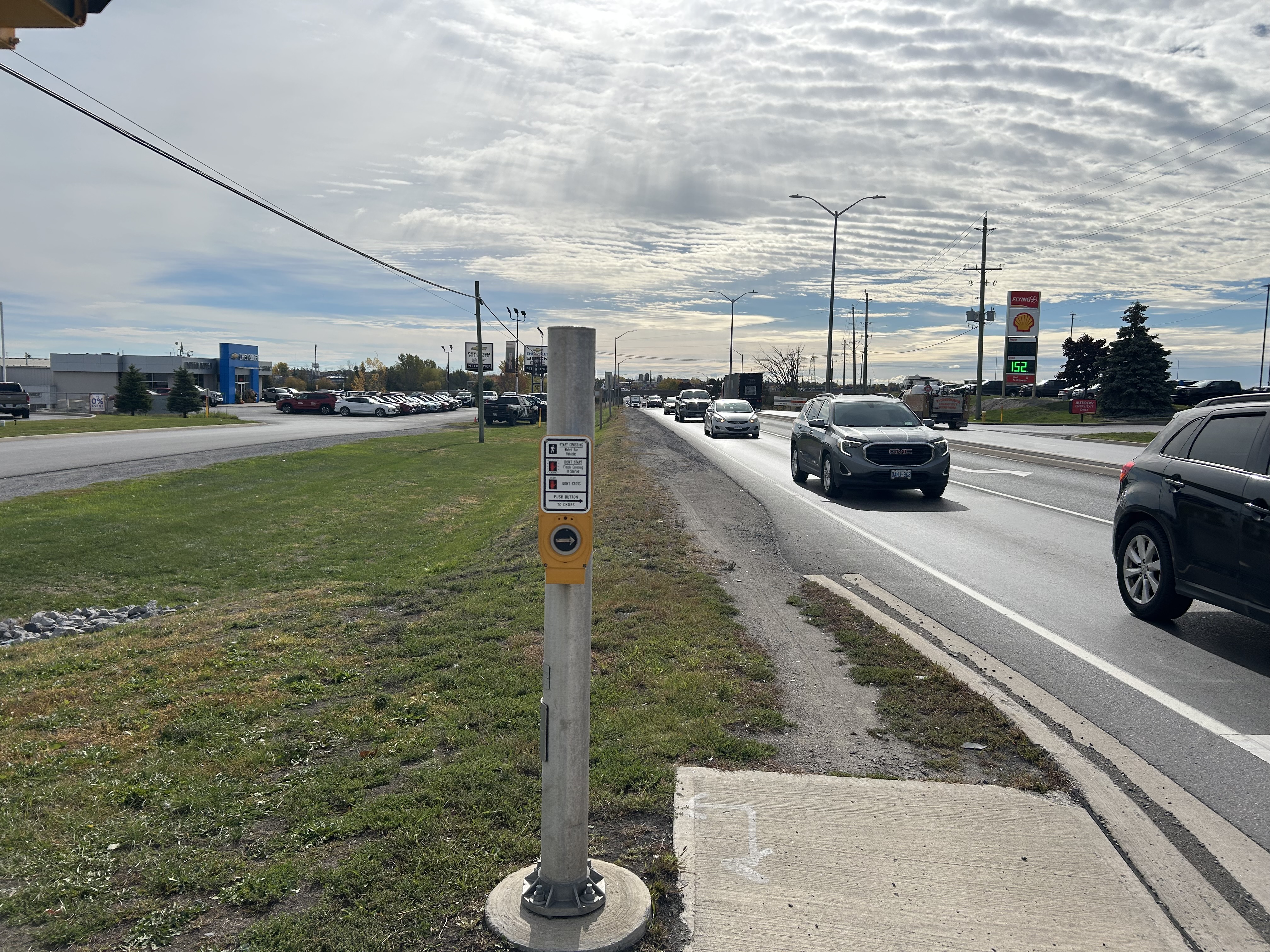
Though there are signalized pedestrian crossings at Highway 41 and Community Road, next to the Flying J and Petro-Canada, complete with crosswalks and “beg” buttons, there are no sidewalks continuing in any direction. Many push-button panels still have their installation instructions visible, rather than a “push button to cross” message.
Instructions for beg button installation still visible on two panels in NapaneeA dirt path continues south where there should be a paved sidewalk. The Flying J truck stop is on the right.
My walk south into the town centre required a precarious crossing of Highway 401 in a dark underpass alongside four lanes of traffic with very little clearance, as seen in the video below. Just further south of the interchange, there was another squeeze point at a drainage culvert. In snow, ice, or wet conditions, this would be especially dangerous.
Navigating the walk along Highway 41 south towards Napanee
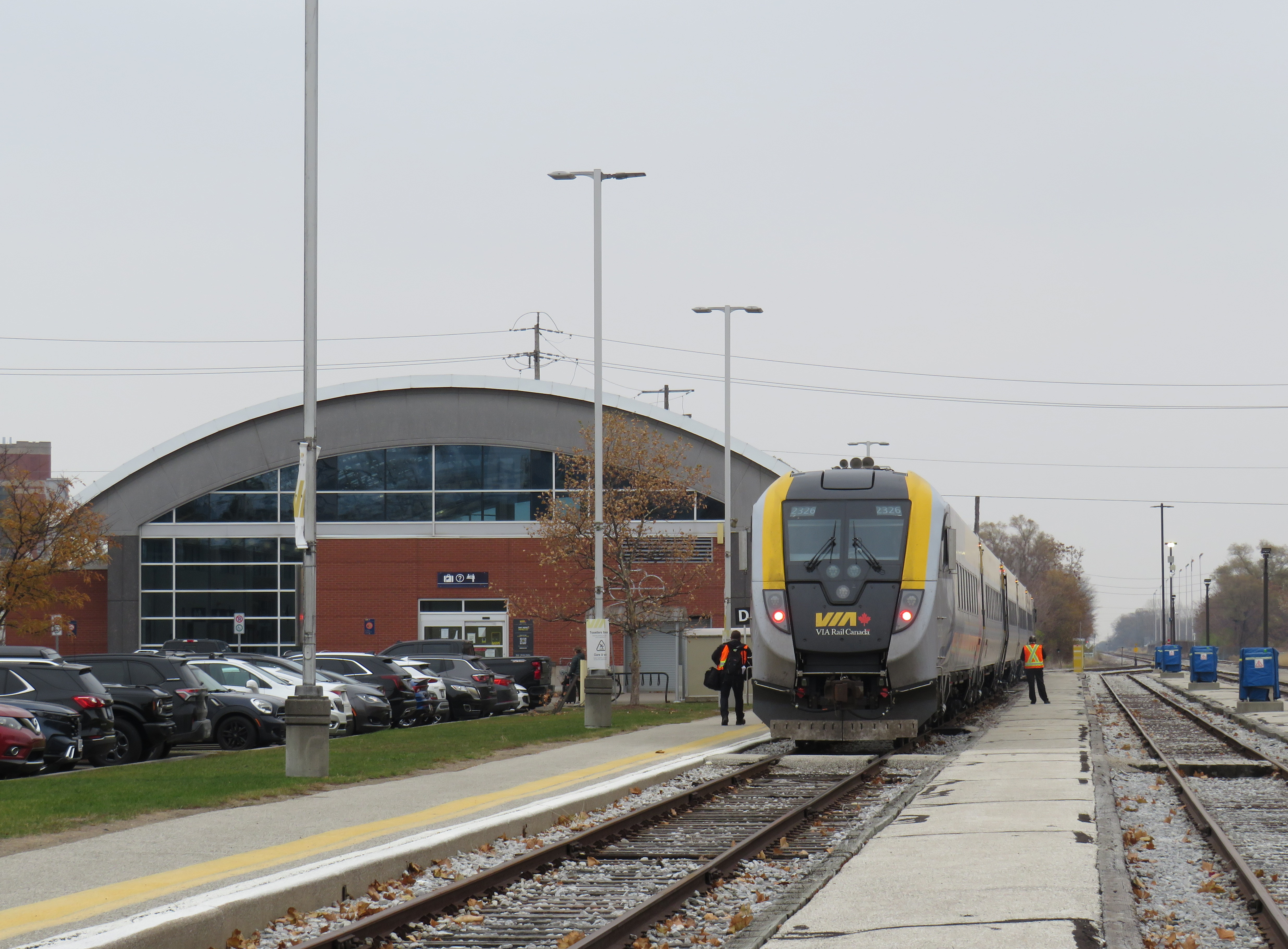
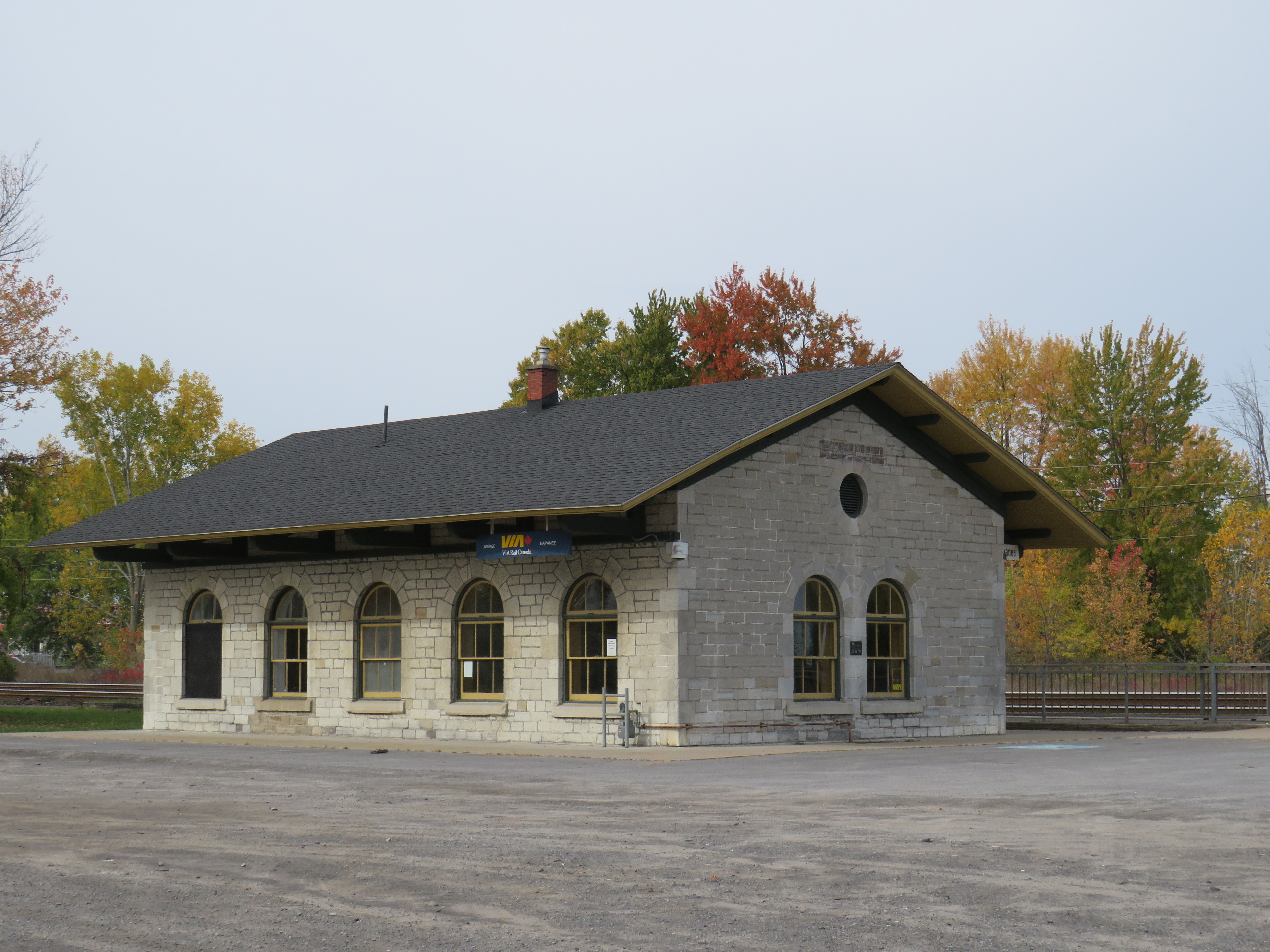
The VIA Rail station, located at a historic Grand Trunk Railway structure, is a short walking distance to Napanee’s downtown core, and to much of the populated urban centre. However, with a very limited train schedule and higher fares, many will still opt for the bus.
Napanee Railway Station
Unfortunately, the last-mile problem is common with intercity bus services, where bus stops are chosen out of convenience rather than passenger access and comfort, with distant truck stops favoured in places like Napanee, Chatham, and Cornwall. In major centres such as Toronto and Ottawa, carriers will choose more central, transit-accessible stops, but in smaller cities and rural areas, passengers are left on their own.
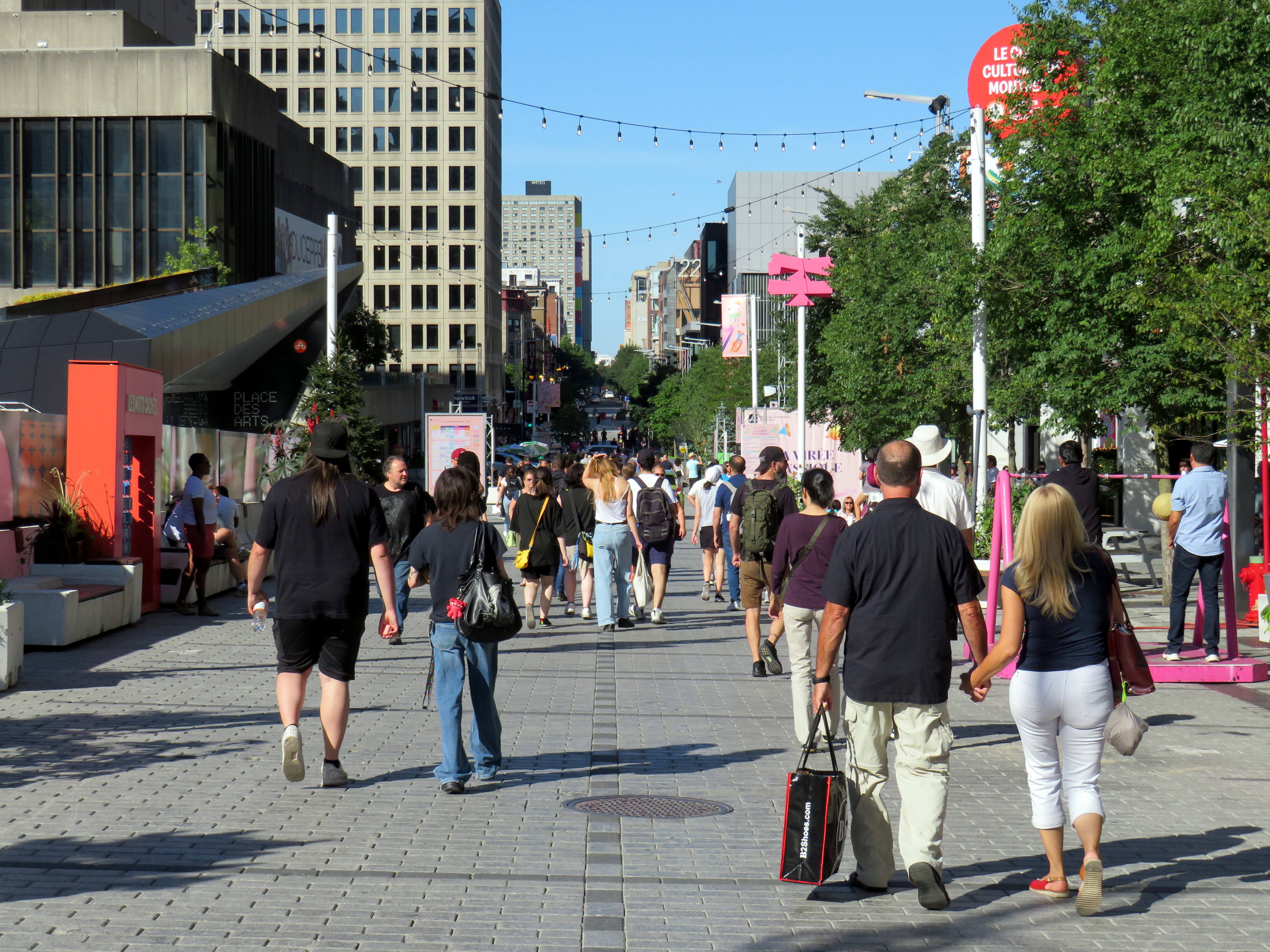
Rue St-Catharine in the Quartier des Spectacles, August 2025
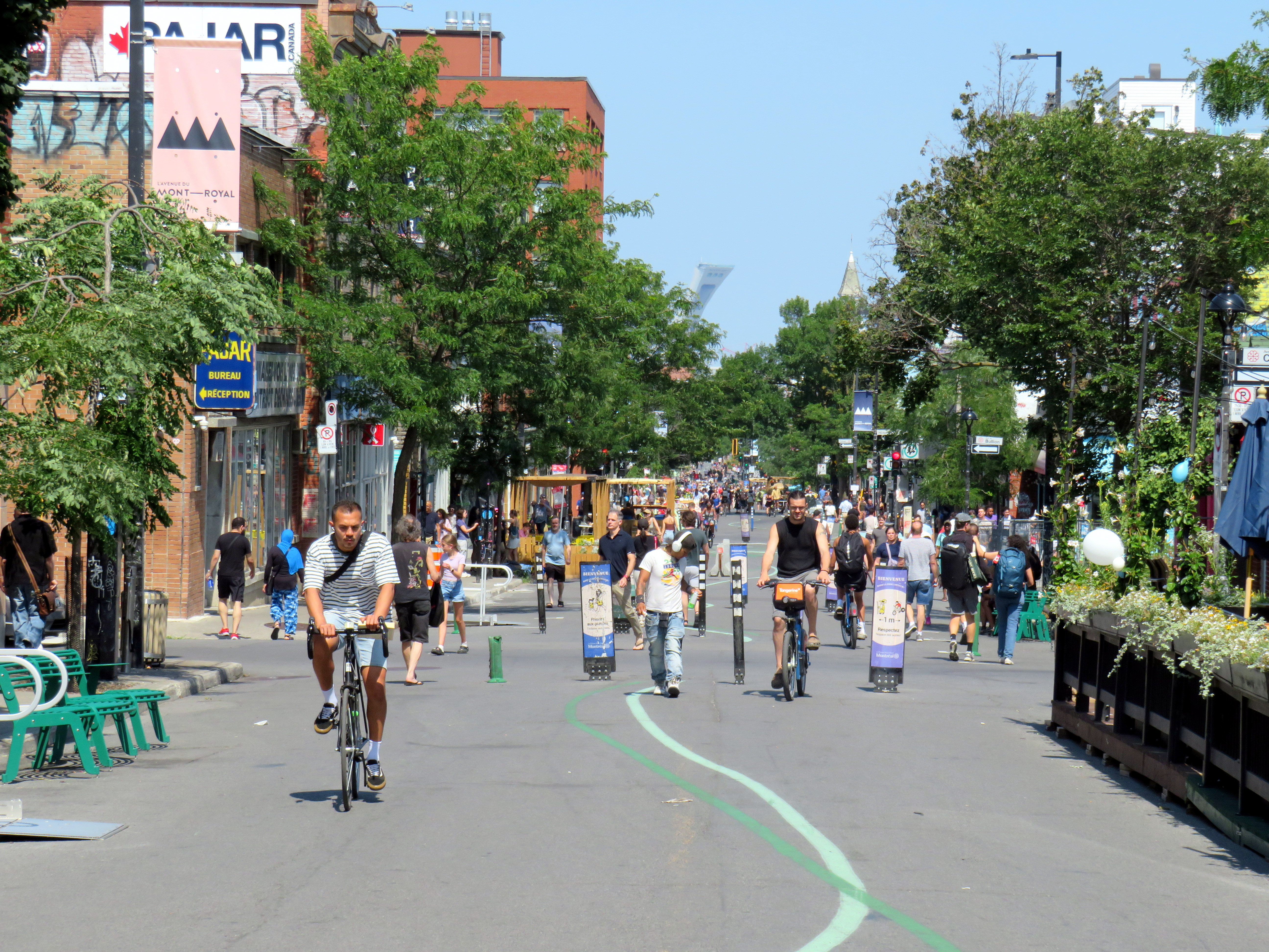
A visit to Montreal can make one jealous. Jealous of the city’s better street furniture, greater cycling infrastructure, great public spaces throughout the city, and an improved pedestrian realm. Entire streets are closed in the summer months to motor traffic, allowing pedestrians to spill out into the roadway, and patios to sprout without the need for concrete blocks to protect them (and less noise and pollution to those dining al fresco).
For example, Avenue Mont-Royal, was first closed in Summer 2020 as a “Corridor Sanitare” to encourage people to get outside during the first wave of the COVID-19 pandemic and support local businesses, which set up patios on the sidewalk and the street. My spouse and I rented a car and visited Montreal during this time, getting a lot of walking in a city that opened up as much as safely possible.
Avenue Mont-Royal, looking east, August 2020
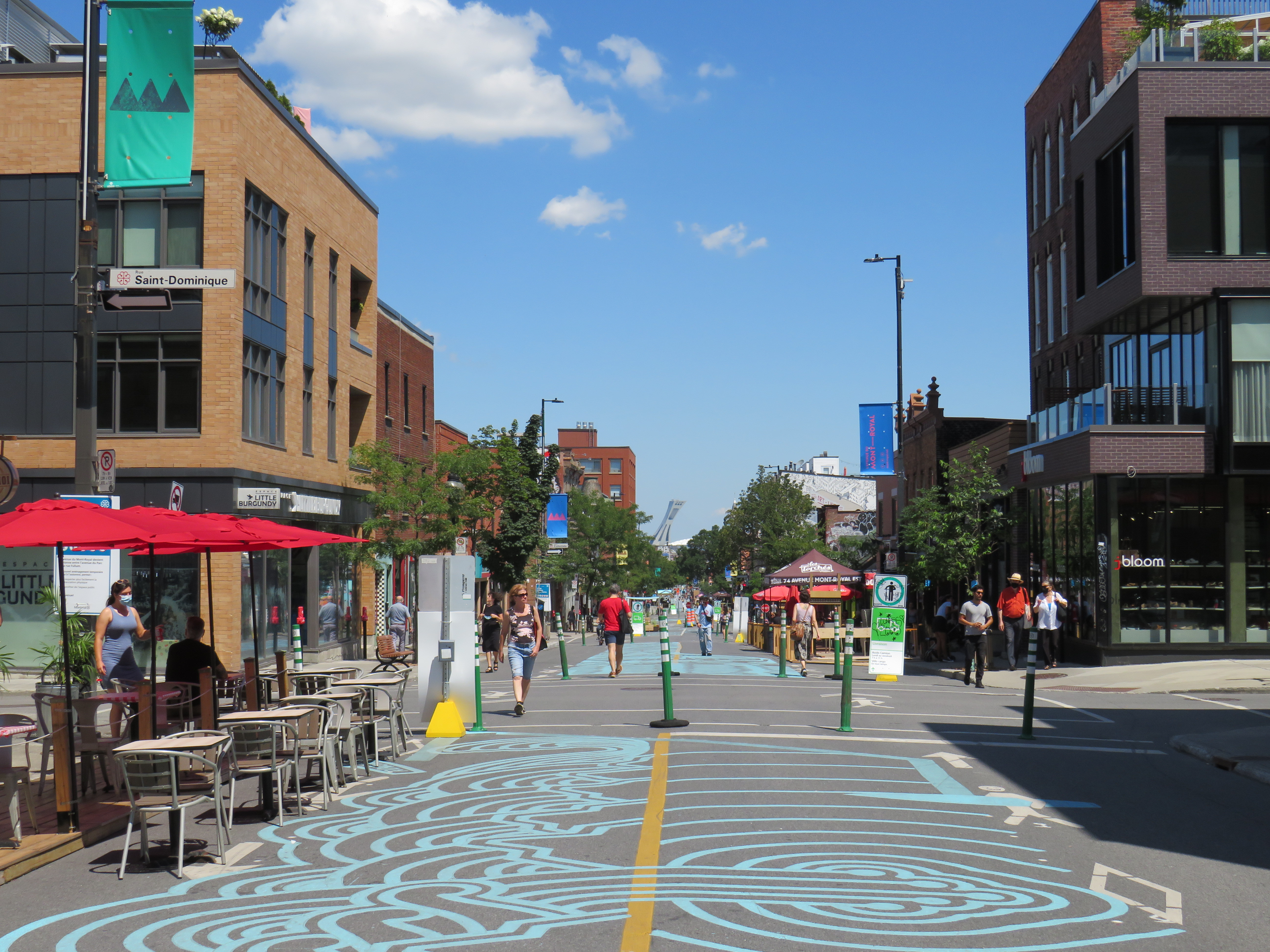
Happily, Montreal continued the tradition in the years since, even as pandemic restrictions eased, then disappeared entirely. Five years later, Avenue Mont-Royal was even more vibrant. Not only were there lots of patios on the street, there were public benches, shade structures, and water fountains, allowing anyone to sit, relax, and enjoy the outdoors. The annual summer closure is a hit.
Avenue Mont-Royal, looking east, August 2025
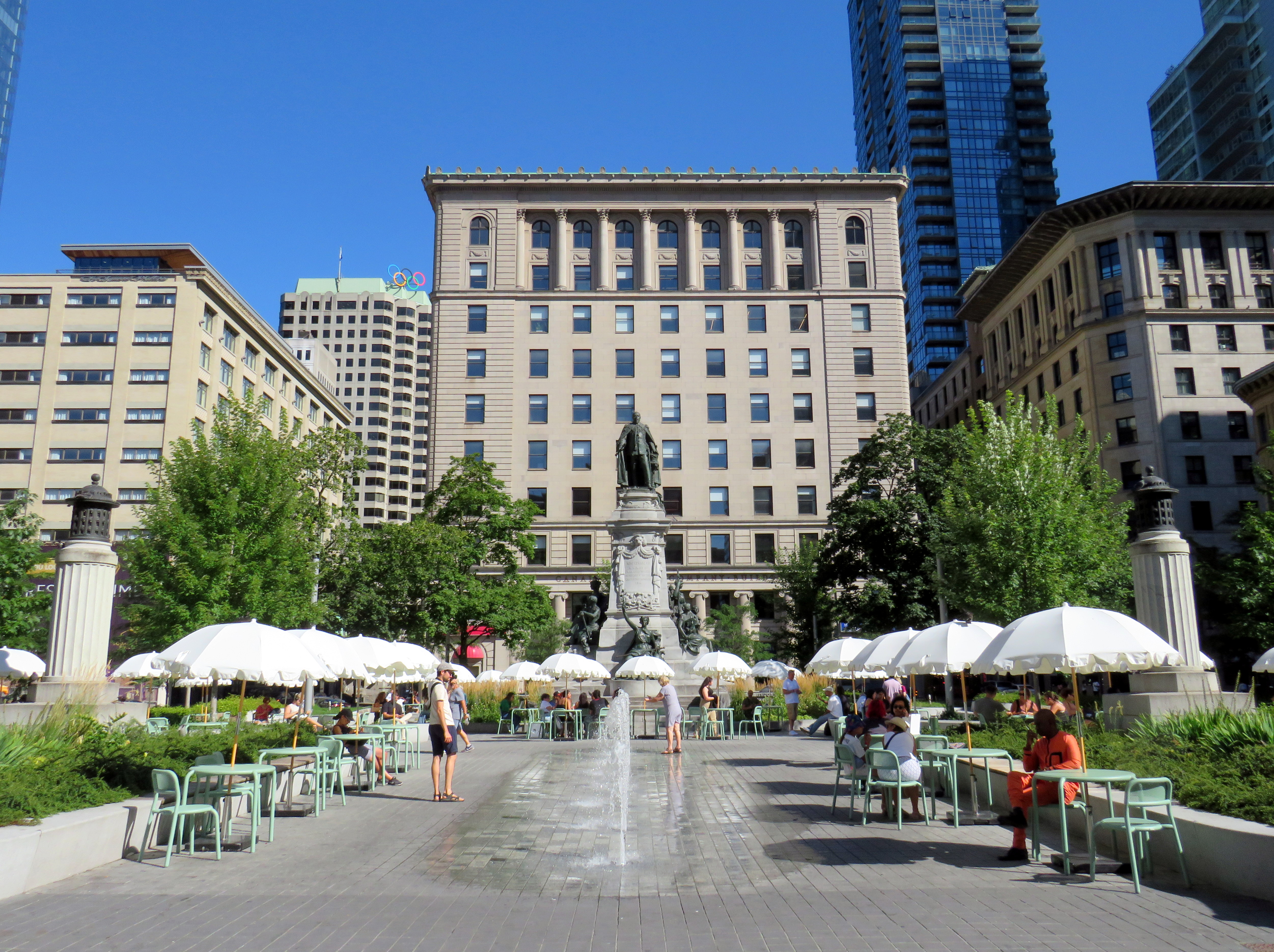
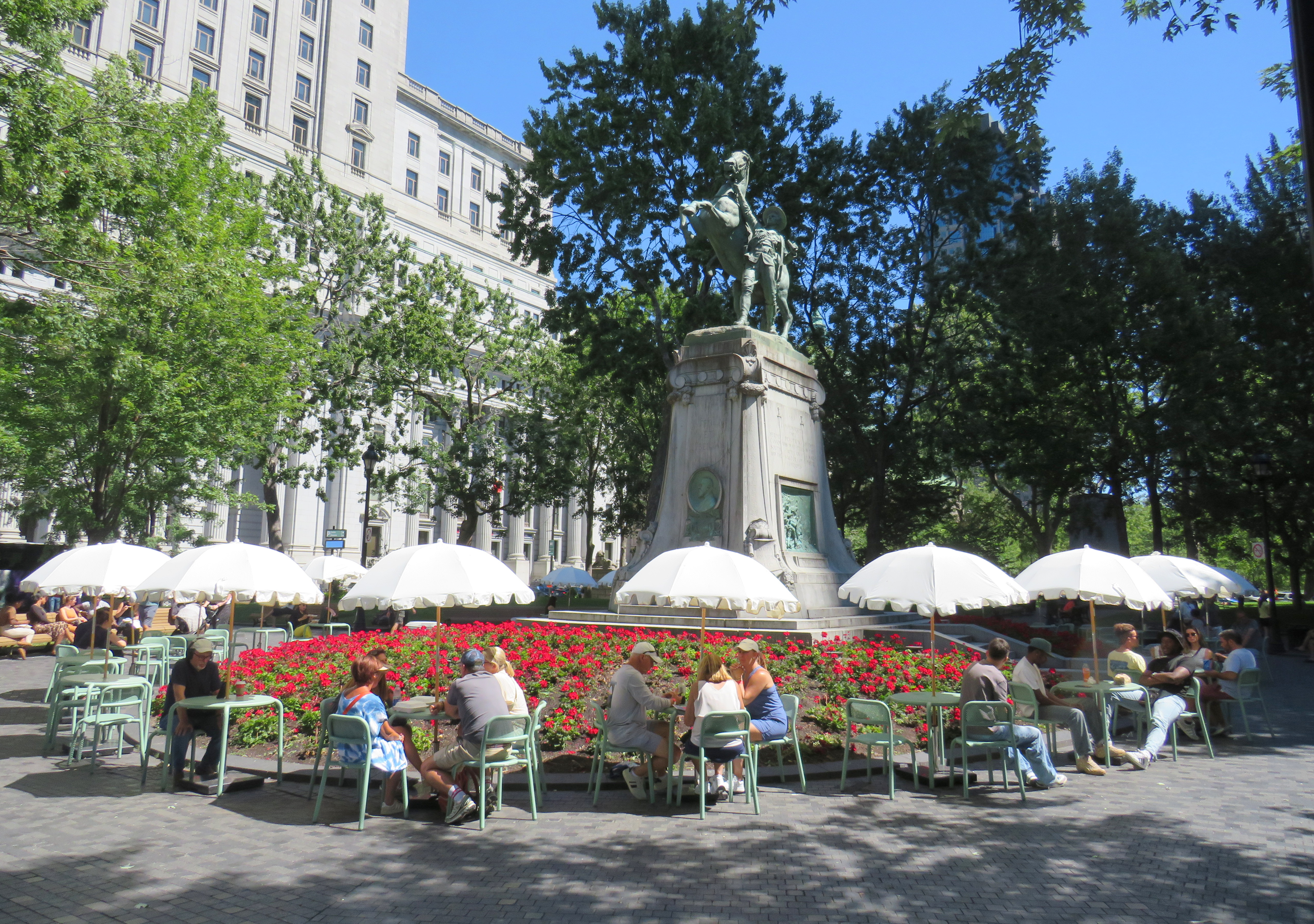
Several public squares were also renewed in recent years. Phillips Square, on Rue Ste-Catharine across from the now-shuttered Hudson’s Bay department store, was renewed with new splash fountains along with small café-style tables and chairs, complete with shade umbrellas. The metal chairs are movable, allowing larger groups to sit around a single table. It’s a refreshed natural congregation point along the city’s main shopping street.
Phillips Square, August 2025
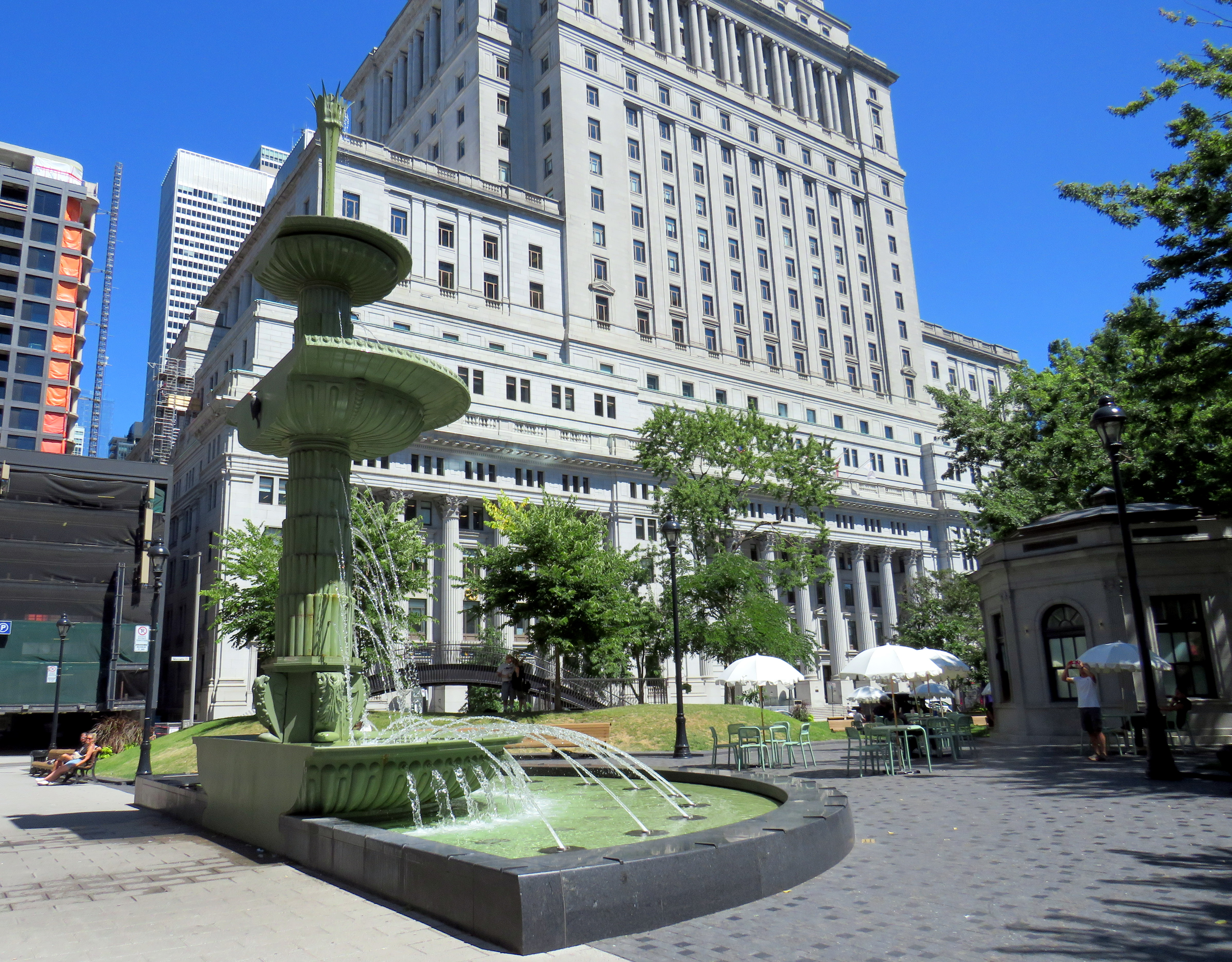
Similar tables and umbrellas were set up at Dorchester Square, several blocks to the west, near Mary, Queen of the World Cathedral and Central Station. Both squares were reimagined by the brilliant landscape architecture firm Claude Cormier + Associés. At Dorchester Square, a new water fountain, seemingly a classic installation, is cut in the rear, with a woodpecker behind. Such Easter eggs are features of Cormier park projects.
Dorchester Square, August 2025Fountain at Dorchester Square; note the woodpecker on the side. One of the two black curved footbridges across the parking ramps is behind.
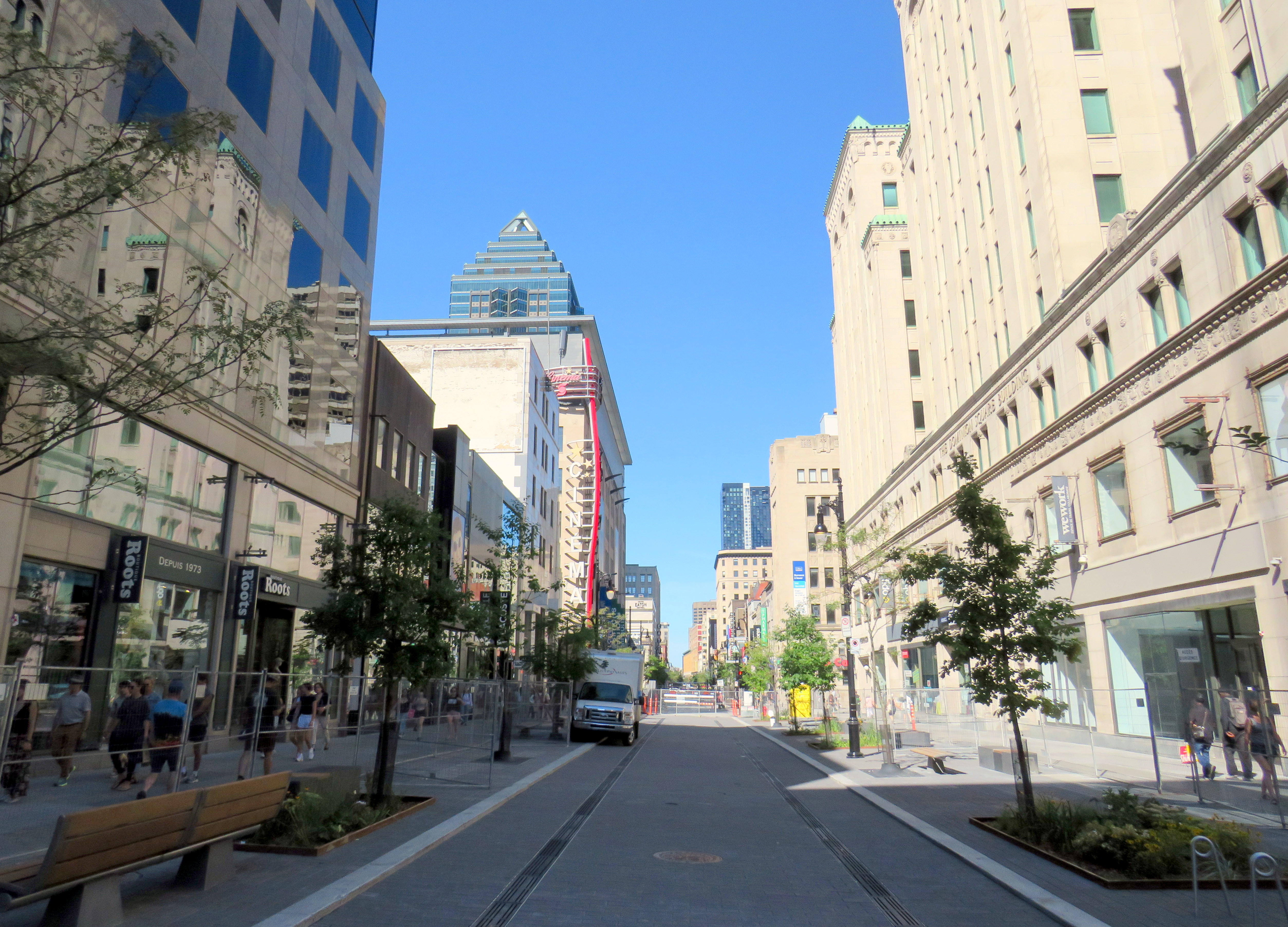
Furthermore, Montreal is rebuilding the western section of Rue St-Catharine towards Crescent. Though motor vehicles are permitted after reconstruction, they are limited to a single through lane, with lay-bys for deliveries, passenger pick-ups and drop-offs, and emergency vehicles. Sidewalks are widened considerably, with more benches, bicycle parking, and street trees.
Completing Rue St-Catharine, near Bishop Street
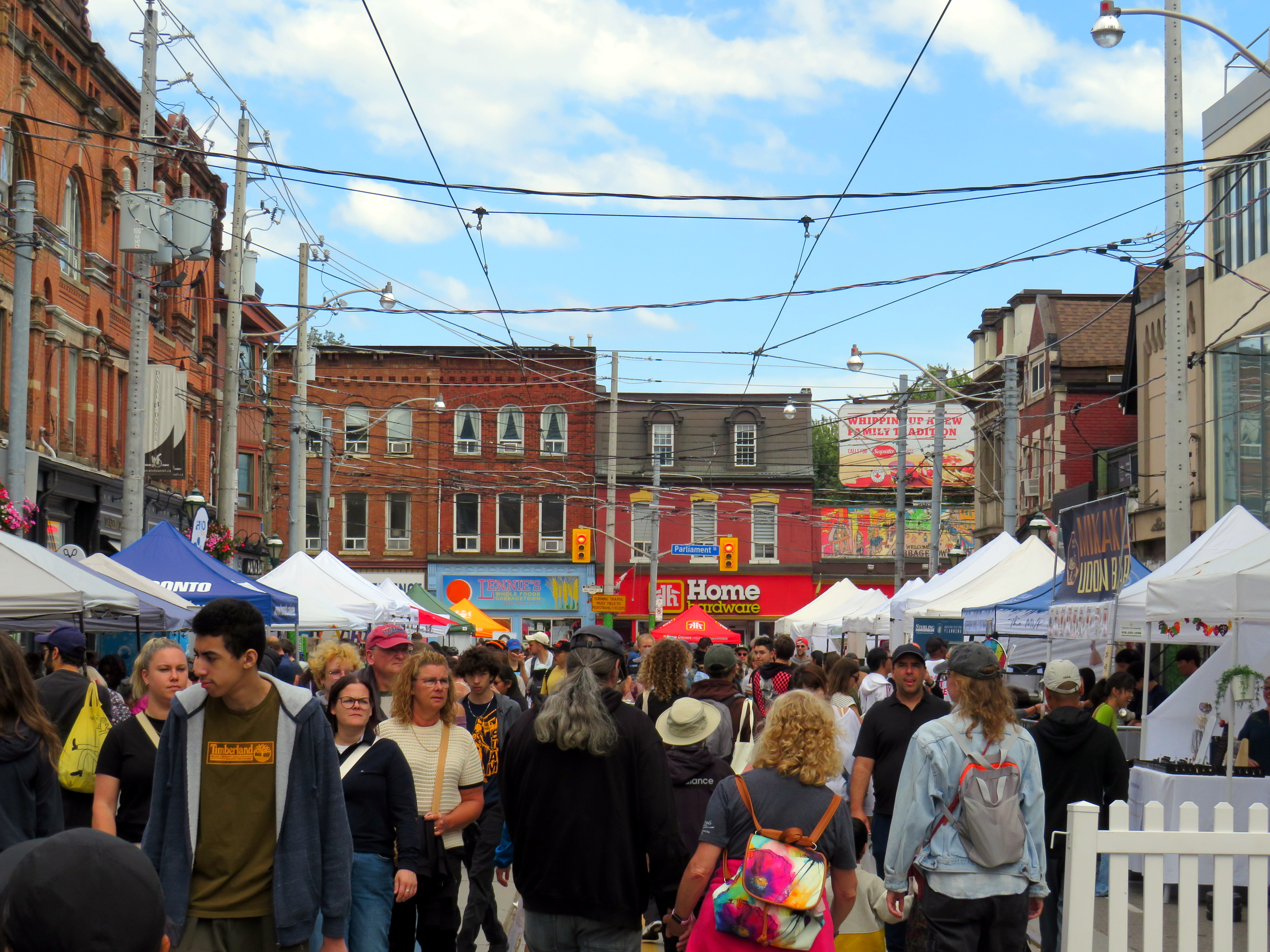
After returning to Toronto, it’s easy to feel down on this city. Montreal seems to do everything right. Meanwhile, ActiveTO, the open streets initiative following the pandemic restrictions here, quickly eroded, and was effectively ended in 2022. Open Streets, which closed sections of Yonge and Bloor Streets to motorists for two Sunday mornings, was last held in 2022. But there are still business improvement area-led weekend street festivals, which attract tens of thousands of pedestrians.
Torontonians want to walk, and pedestrianized streets, even when they’re just weekend events, are immensely popular. One downside, however, is a lack of seating outside of businesses’ patio areas. One is free to walk, enjoy live music, or just people watch, but to sit down, one is compelled to purchase something from one of the businesses with a sanctioned patio.
Torontonians love a street festival: Cabbagetown in September
There are a few other successes. A small segment Gould Street at Toronto Metropolitan University was pedestrianized and rebuilt as a central plaza for that university campus. A short section of Willcocks Street at the University of Toronto was similarly pedestrianized.
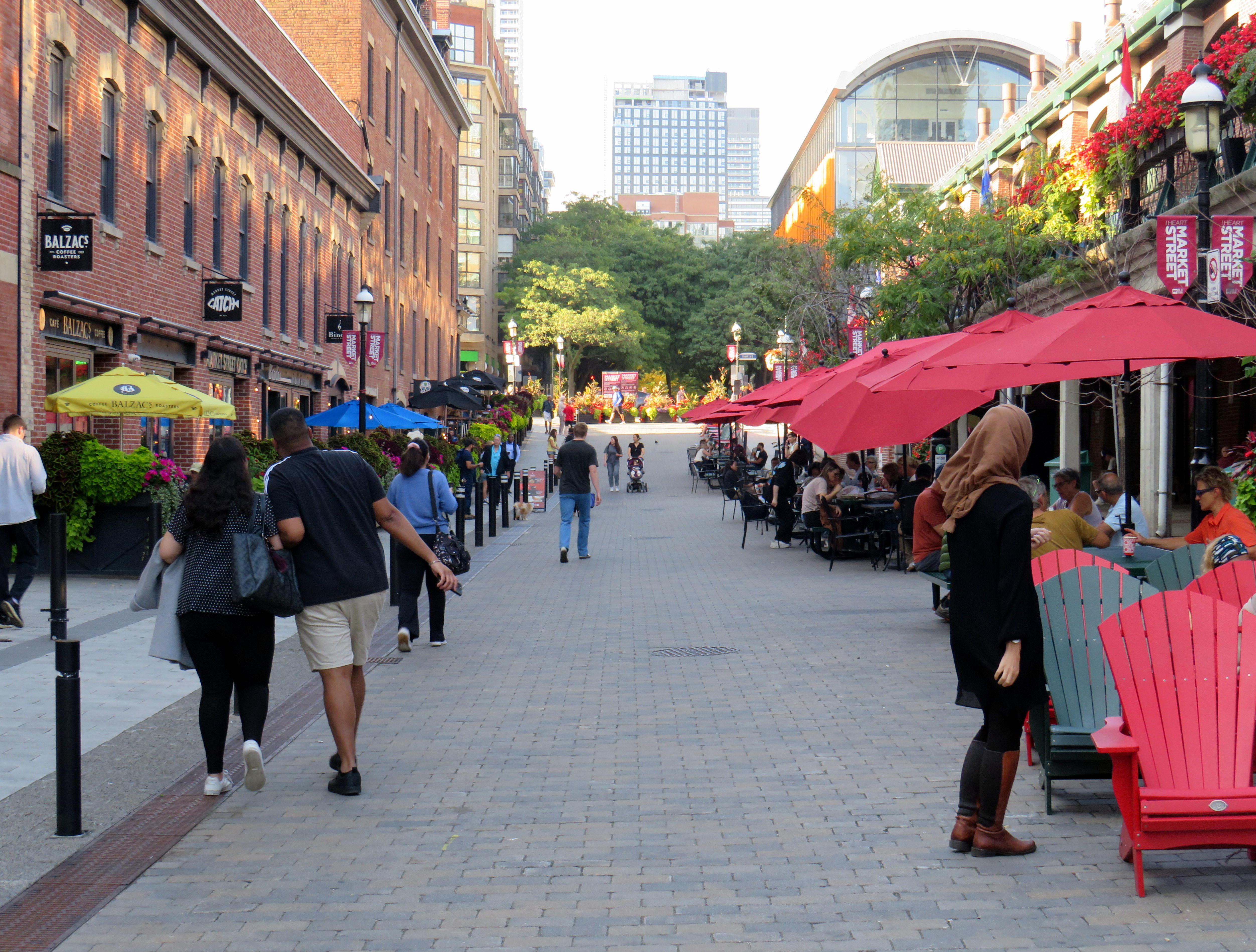
But the best example in Toronto is Market Street, which abuts St. Lawrence Market. Patio space and Muskoka chairs provide plenty of seating, without obligation to purchase anything (though it provides additional seating to those who picked up a snack or lunch inside the market). The shade umbrellas and high-quality surface materials and street furniture make this a wonderful oasis in Toronto’s downtown core.
Market Street looking north from The Esplanade. St. Lawrence Market is on the right.
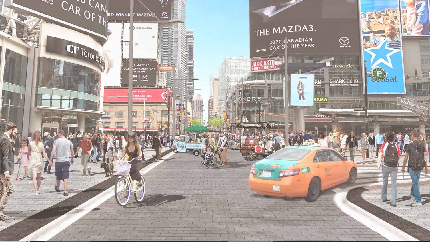
Planning for Yonge Street’s makeover, which will include narrowing the roadway, widening the sidewalks, improvements to the public realm, and seasonal closures of selected sections of the traffic lanes, is complete. Unfortunately, the YongeTOmorrow improvements will have to wait for another five years (work starting in 2030) due to Ontario Line construction.
Rendering of Yonge Street looking north towards Dundas, once YongeTOmorrow improvements are complete
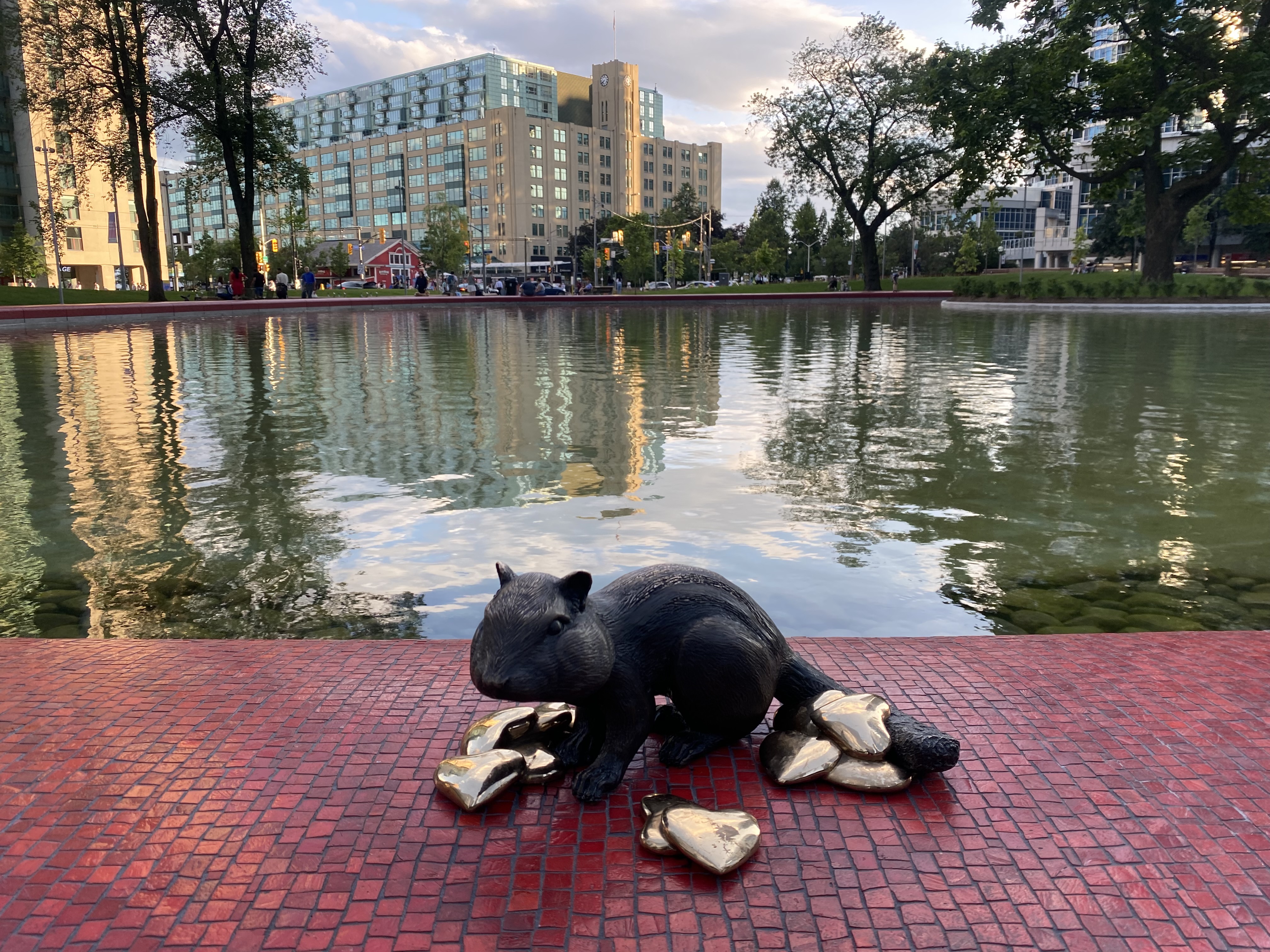
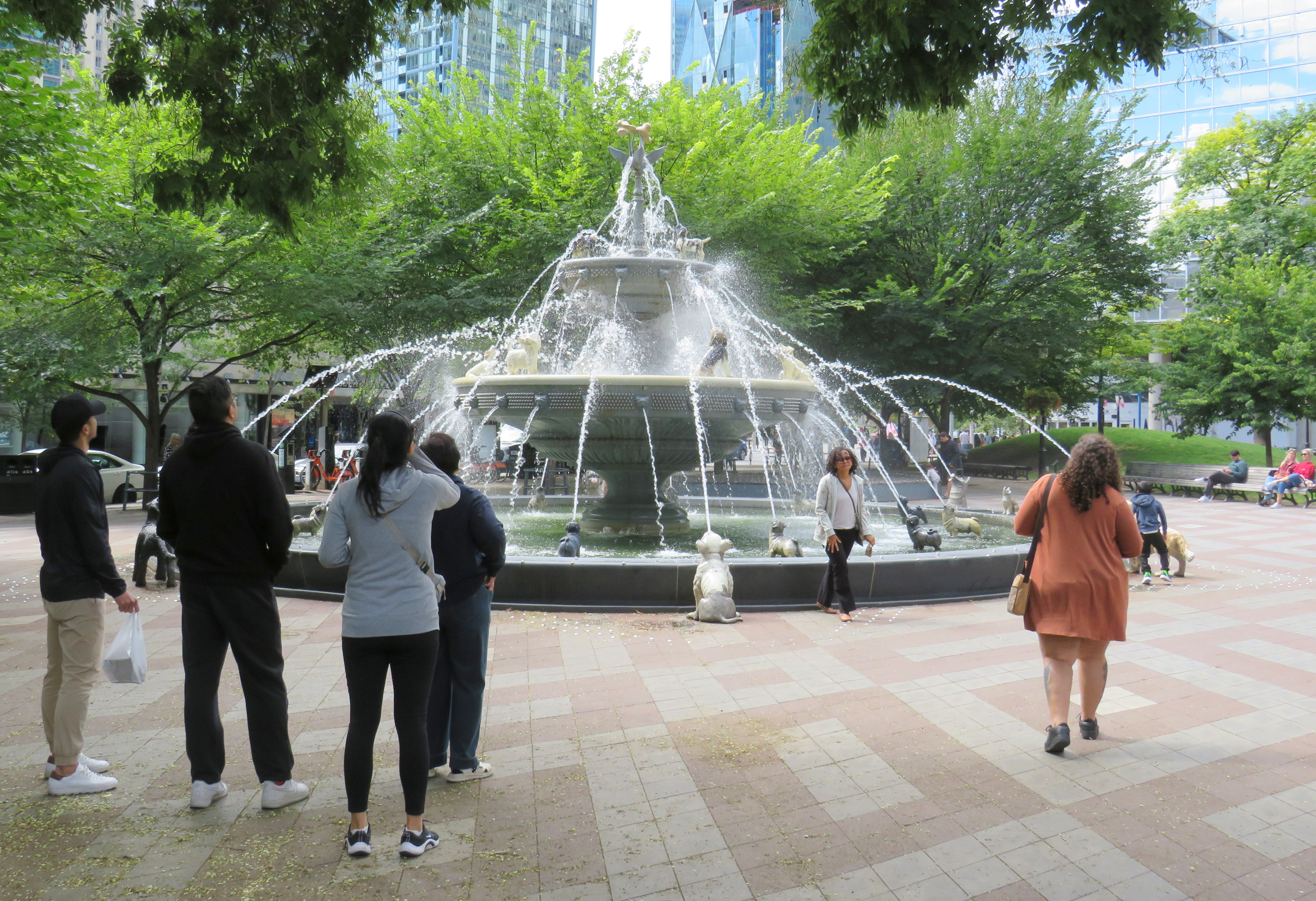
There are also other great things happening in Toronto. Claude Cormier was tapped to create new public spaces, such as HtO Park and Sugar Beach on the Harbourfront, but also reimagine existing places such as Love Park (previously a highway off-ramp) and Berczy Park, home of the popular Dog Fountain. At Love Park, not one of the 45 movable chairs have been taken (though one ended up in the pond). Torontonians have been shown to cherish great public spaces.
HTO Park from Toronto Harbour
Canada’s Sugar Beach
Love Park
Berczy Park
Toronto has made a lot of progress on improving its public realm, and it has shown that it is willing and able to close streets to traffic for the benefit of pedestrians and cyclists. Though it is so very easy to envy Montreal for its greater progress in the last two decades, it is up to us to continue the momentum Toronto does have, and work harder to push for change, even when there’s a car-focused provincial government. Streets can be narrowed, parks can be improved, and streets can be handed over to the people. Additional seating and more public washrooms will open up this city to many more residents and visitors.
This should all be a key pillar of a progressive agenda in next years’ municipal election. When certain candidates talk about tax cuts, austerity, and crime, there needs to be a focus on creating a better quality of life to provide an alternative. And that talk must be backed up with action, with quick wins that don’t require multi-year waits.
The end of the line for the restored Northlander train
Timmins, a resource town of 40,000 in Northeastern Ontario, is known for a few things: gold mines, beer parlours, the birthplace of country musician Shania Twain, and the place where folk musician Stompin’ Tom Connors got his start. If Connors — a travelling musician who delighted small town crowds with songs about their communities (like the hard working and hard drinking times of a “Sudbury Saturday Night”) — was still around, he’d probably write and perform a new song about getting kicked off an overnight train in the sparse environs of Porcupine, Ontario. After all, the song would quickly rhyme itself.
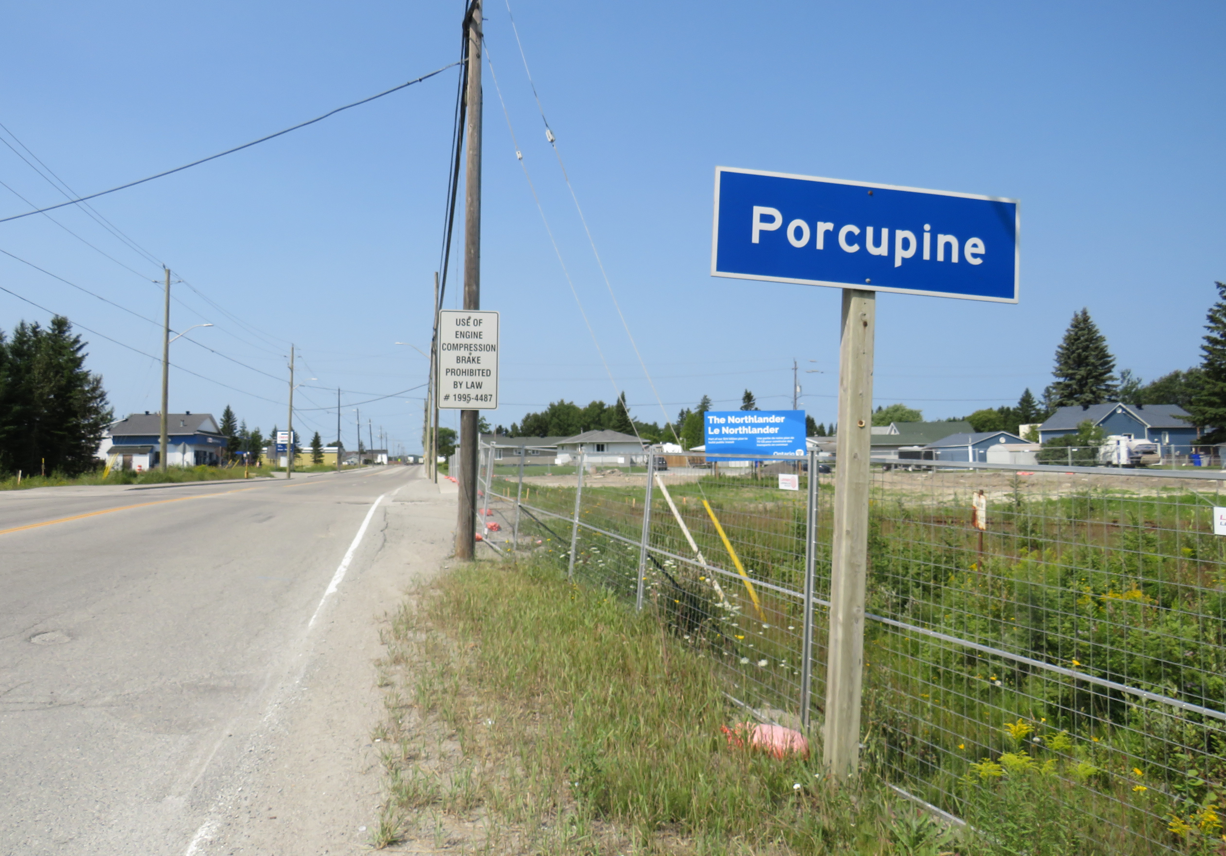
Porcupine is a small community of about 1,000 on the far eastern edge of the populated area in the geographically gigantic City of Timmins. Before the wave of municipal amalgamations across Ontario in the 1990s and early 2000s, Timmins was the largest city or town in the province by geographic area; it was formed through the amalgamation of the smaller City of Timmins with adjoining Mountjoy and Tisdale Townships (along with the town of South Porcupine) in the 1970s.
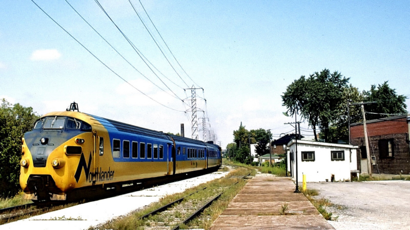
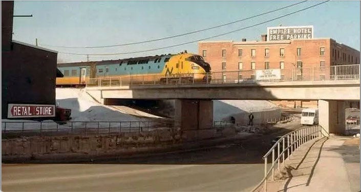
Until 1990, when the devastating cuts to VIA Rail took place, there were two daily trains between Toronto, North Bay, and Northeastern Ontario. The Northlander, a daytime train operated by Ontario Northland Railway, terminated at a downtown station in Timmins. The Northland, a joint VIA/ONR train, ran overnight between Kapuskasing and Toronto, with a bus connection to downtown Timmins. Famously, for a short period the daytime Northlander operated using former Trans-Europ-Express (TEE) cars, purchased used from Dutch and Swiss rail operators.
After 1990, Timmins was only connected by bus, with one daily bus to North Bay (and onwards to Toronto), and one bus, six days a week, to Sudbury (with connections to Toronto). The new daily overnight train — discussed earlier on this site — promises to restore a new daily trip, along with a more comfortable journey, even if sleeping accommodations will not be provided.
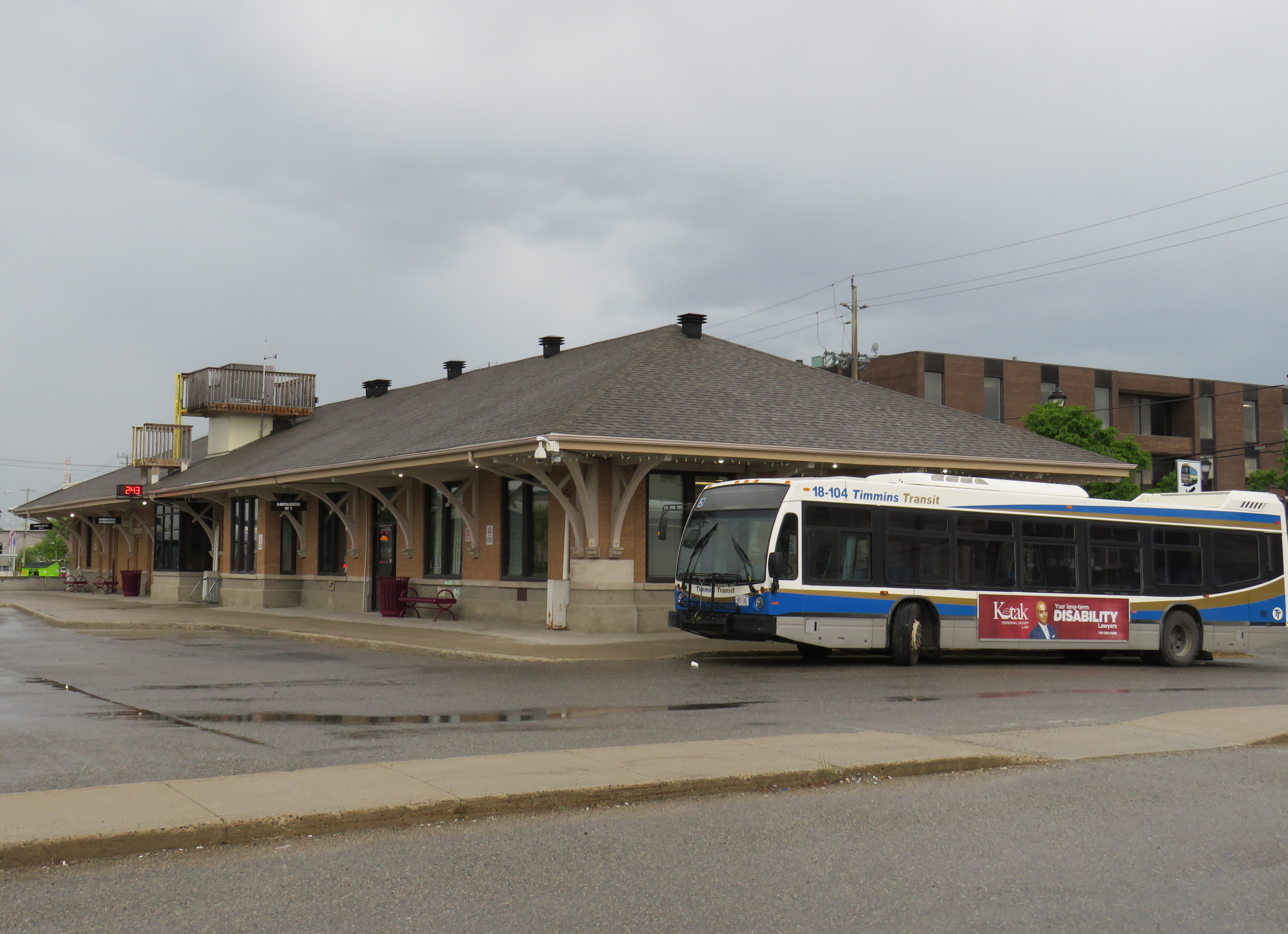
The Timmins Station is now a bus terminal serving local transit and Ontario Northland intercity coaches
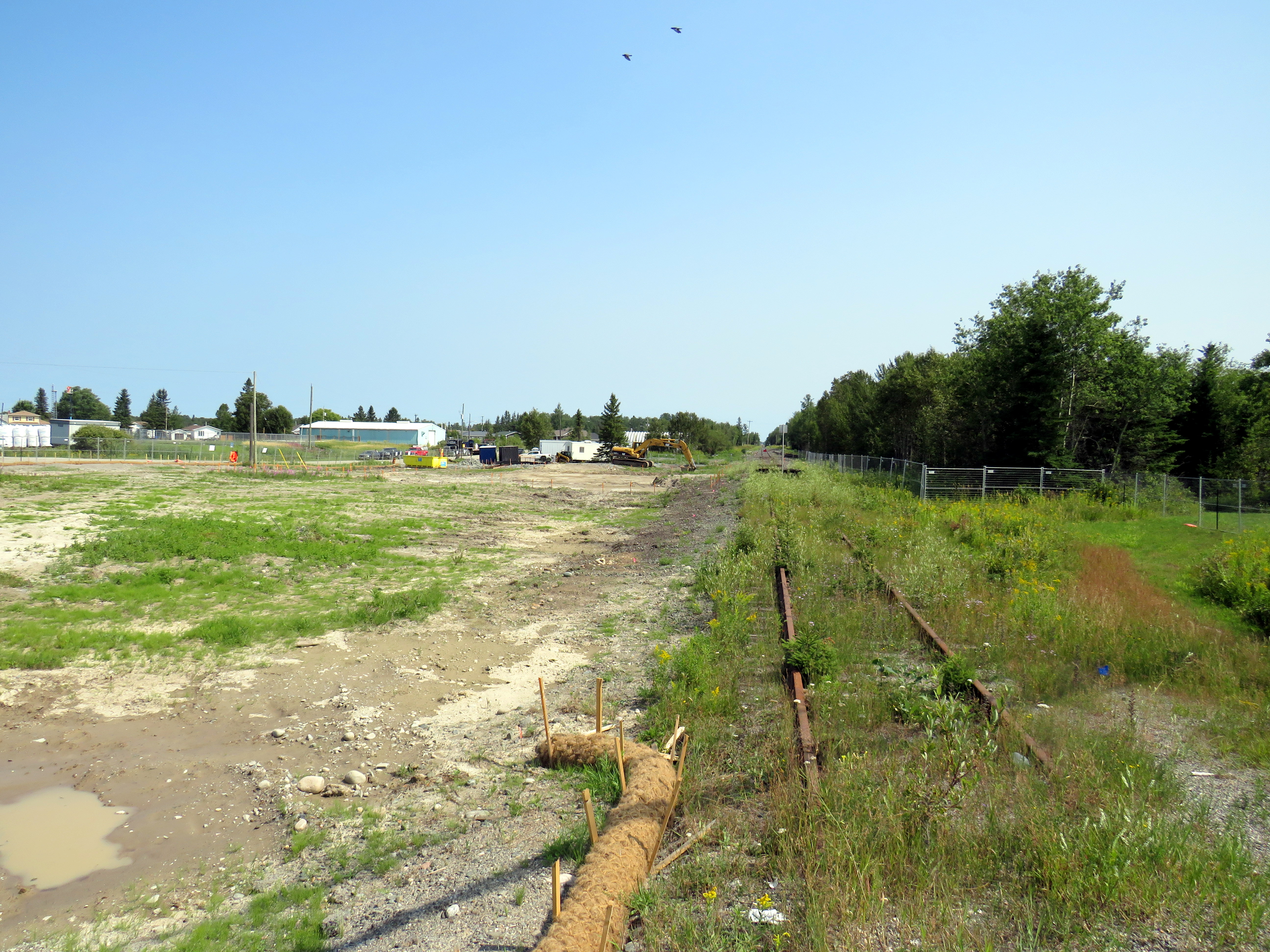
Unfortunately, the train will not be returning to Downtown Timmins. The end of rail is at Highway 101 at Porcupine, 13 kilometres to the east. Since abandonment of the passenger rail service, the railway was torn out west of South Porcupine; the railway overpass over Algonquin Boulevard (Highway 101) near the old Timmins Station was removed last year. Ore collected at the open-pit gold mines, previously loaded onto railcars, is now sent on massive dump trucks for processing at a plant at Hoyle, east of Porcupine.
The Northlander train departs Timmins on the now-demolished railway bridge over Algonquin Boulevard in the early 1980s
Happily, the Timmins station building remains in use as a transit terminal and Ontario Northland coach stop; it will likely serve a bus shuttle to the new Timmins-Porcupine Station now under construction.
The end of track at Highway 101 in Porcupine; construction has started on the new terminal station for the Northlander
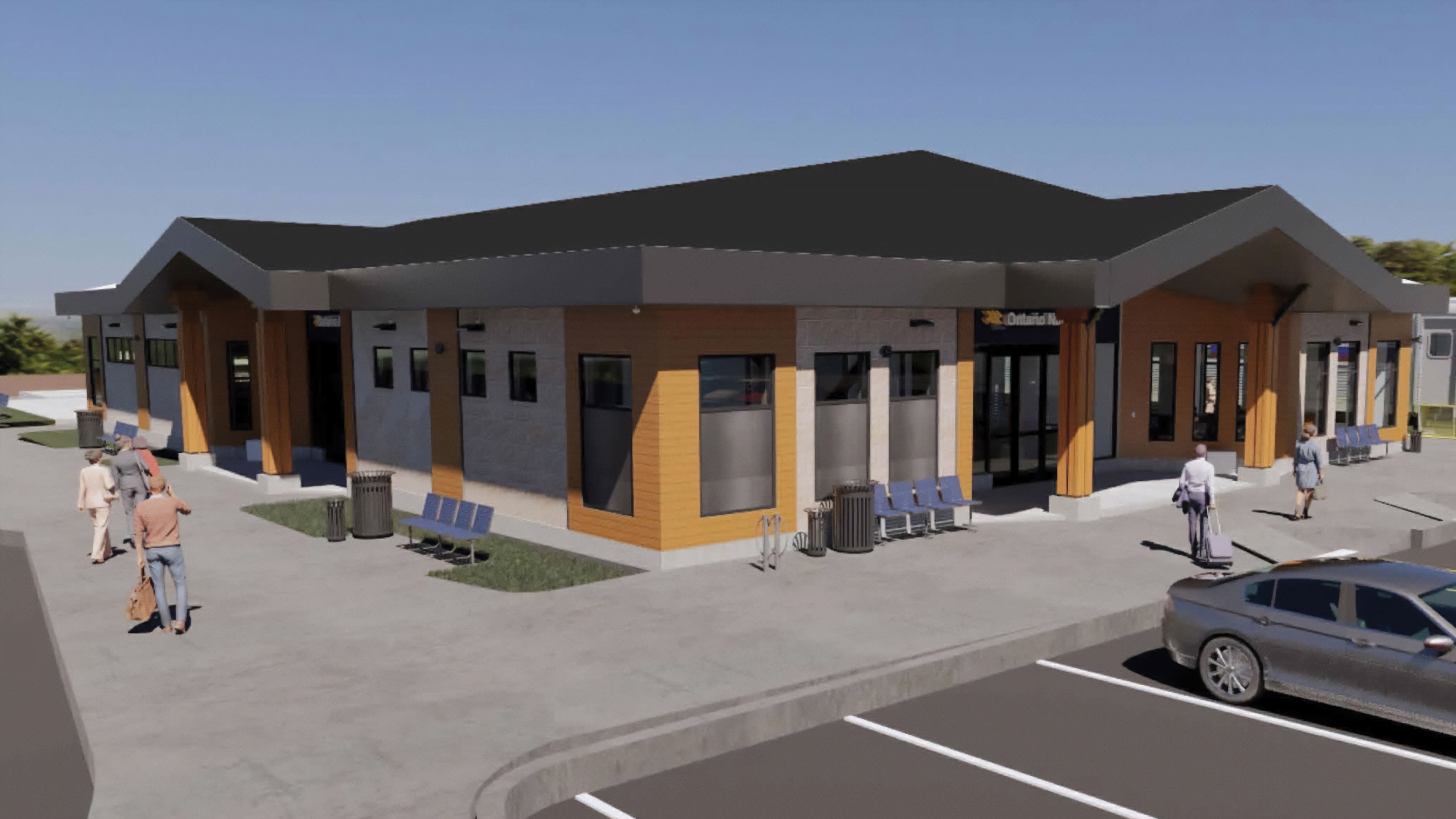
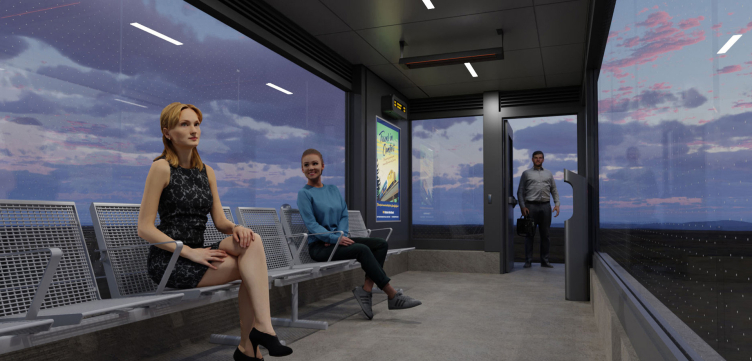
Since I last wrote about the promised return of the Northlander, there have been a few updates. The new station building will be somewhat more substantial than first proposed; it will include washrooms, a waiting area, and a service counter for ticket sales and bus parcels. This is welcome, as there is very little around the Porcupine station site. Nearby, there are only a few dozen houses, a propane depot, a small park, and a gas station across the street.
Rendering of new Timmins-Porcupine Station
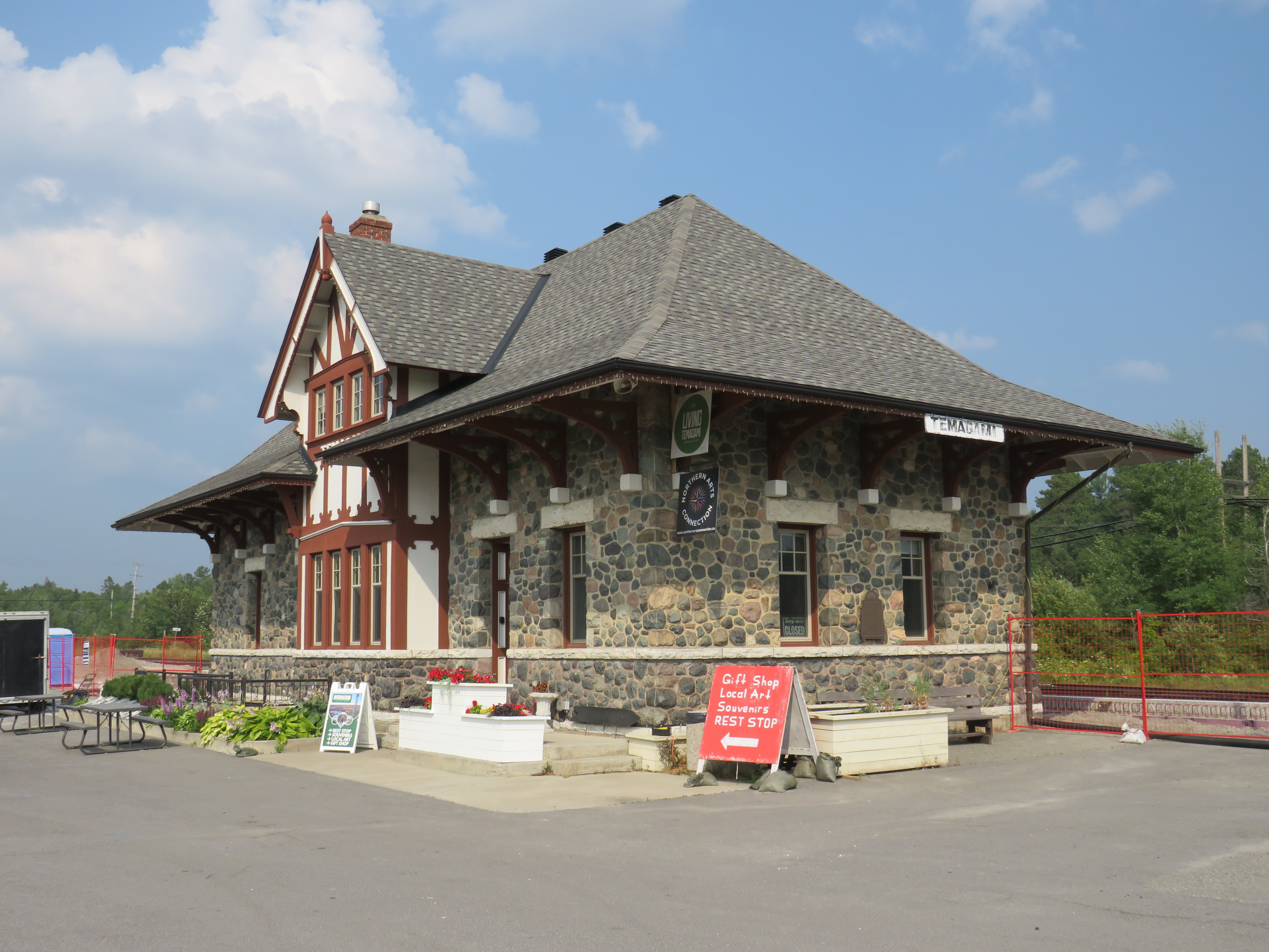
Most other stations will still just get enclosed shelters, though at Matheson, Swastika, New Liskeard, and Temagami, the construction of new platforms is well underway. Even though there are heritage passenger stations at Matheson (which just escaped demolition), Temagami, South River, Huntsville, and Gravenhurst, there will just be shelters for Northlander passengers at these stops. Shelters depicted on the Ontario Northland website resemble those at BRT stops or GO Transit station platforms, with lighting and overhead heat.
Fencing protects the construction of a new platform beside the handsome Temagami ONR Station. The station building will not be used for passenger services; it currently hosts a café and gift shop. Rendering of passenger shelter for Northlander stops
It will be nice to see the return of passenger rail to Northeastern Ontario when it launches in two years. Unfortunately, I remain unsure whether it will attract enough riders to be seen as viable after a year or two of service.
VIA Train #1 at Hornepayne, Ontario. Normally this stop would be made overnight.
In late January, I went on a short vacation. Many people, given the short days and cold weather, opt for warmer climes. I, on the other hand, decided to travel to the infamously cold city of Winnipeg, Manitoba. Back in November, VIA Rail offered great deals on winter travel as part of its “Black Friday” sale; a berth in a sleeping car from Toronto to Winnipeg cost $271, with meals included. Winter travel by train can be beautiful, and I had fond memories of my February 2014 trip aboard the Algoma Central Railway between Sault Ste. Marie and Hearst.
I planned to spend two nights in Winnipeg, including taking in my first NHL game since the pandemic. The Jets were playing on Friday night against the original Winnipeg Jets, the Utah Hockey Club (which moved to Salt Lake City from Phoenix in 2024). I would then travel back east by bus, with a stopover in Kenora, flying home from Thunder Bay.
Unfortunately, my train from Toronto was delayed by eleven hours, a new record in my rail travel setbacks. The train from Vancouver faced several setbacks due to extreme cold conditions in the Prairies and Northern Ontario, arriving in Toronto over 15 hours late, around 8AM on Wednesday morning. (VIA Rail’s communications were subpar, and though I got two emails advising of a 5:00 PM departure on Wednesday, we did not actually leave until 8:00 PM, about 10 hours late from Toronto.)
Despite the delays, it was a very pleasant train ride across Northern Ontario in the snow. The cooked-to-order meals served aboard the Canadian, as always, were very good, and service was friendly. The lights in the dome car for our section were turned off, allowing passengers to gaze into the wilderness, even at night.
As it turned out, I was able to cancel my first night’s stay in Winnipeg without penalty, which was fortunate as the train arrived at 7AM Friday, nearly 12 hours late. But for me, it was fortunate, as by then, coffee shops were opening up in Downtown Winnipeg. An earlier arrival, had the train made up time, would have forced me to find a 24-hour restaurant to wait at, and there aren’t any in the downtown area.
The monument to the 1919 Winnipeg General Strike; a Corten steel replica of a toppled streetcar across the street from Winnipeg City Hall. It was especially compelling partially buried in snow.
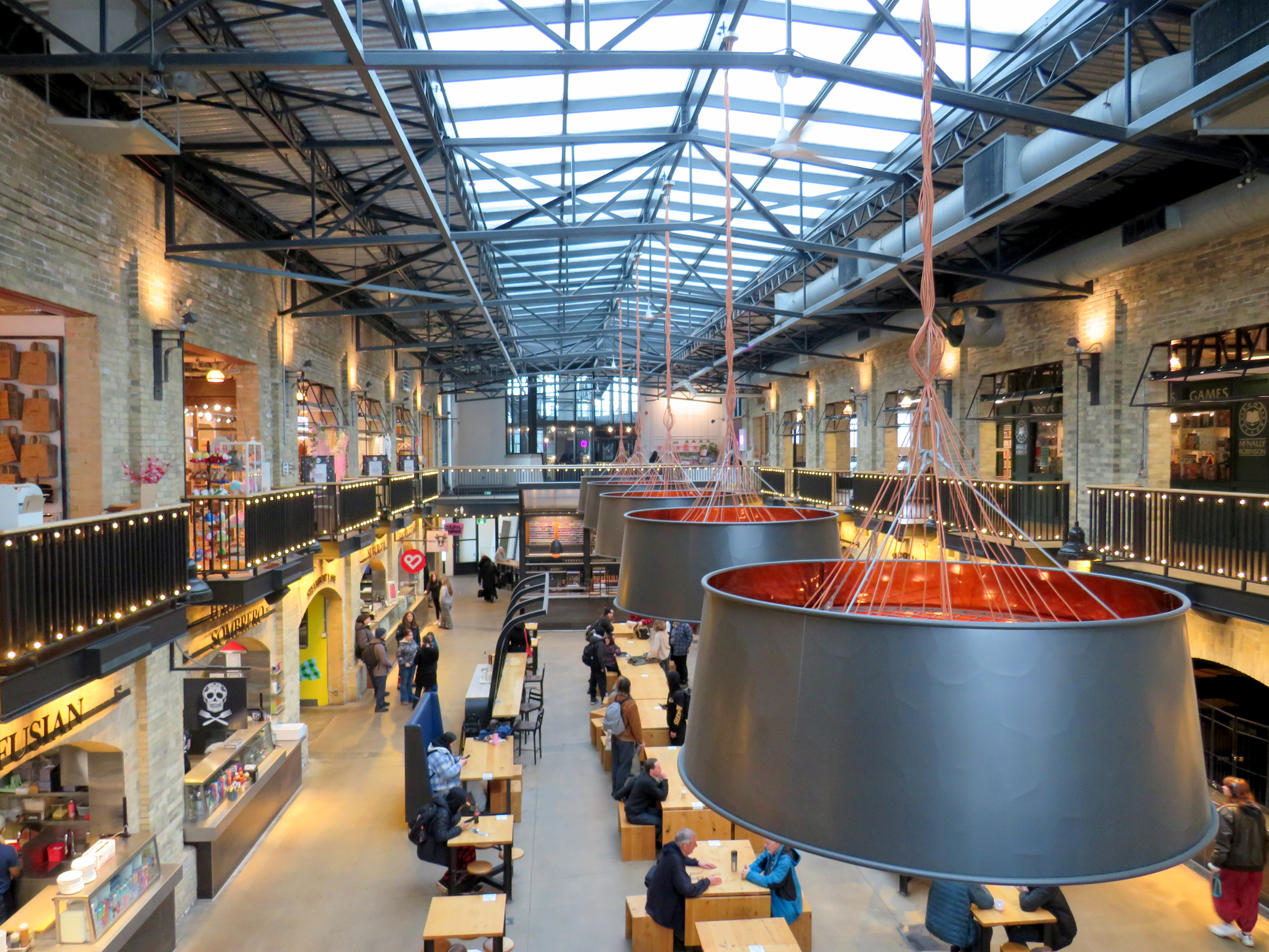
Though I have been to Winnipeg several times before, this was my first time visiting the city in winter. I was pleased to see how the city embraced the short, dark, cold days. Out at The Forks, where the Assiniboine River joins the Red River, there is a lively marketplace located in former railway maintenance and freight buildings behind Union Station. The complex includes a branch of the local McNally-Robinson bookstore chain, restaurants, cafes, art shops, and other local businesses. There are plenty of tables and seating, with water dispensers and plenty of public washrooms. It is one of Canada’s great public spaces.
Inside one of the market buildings in the Forks, a former railway maintenance building
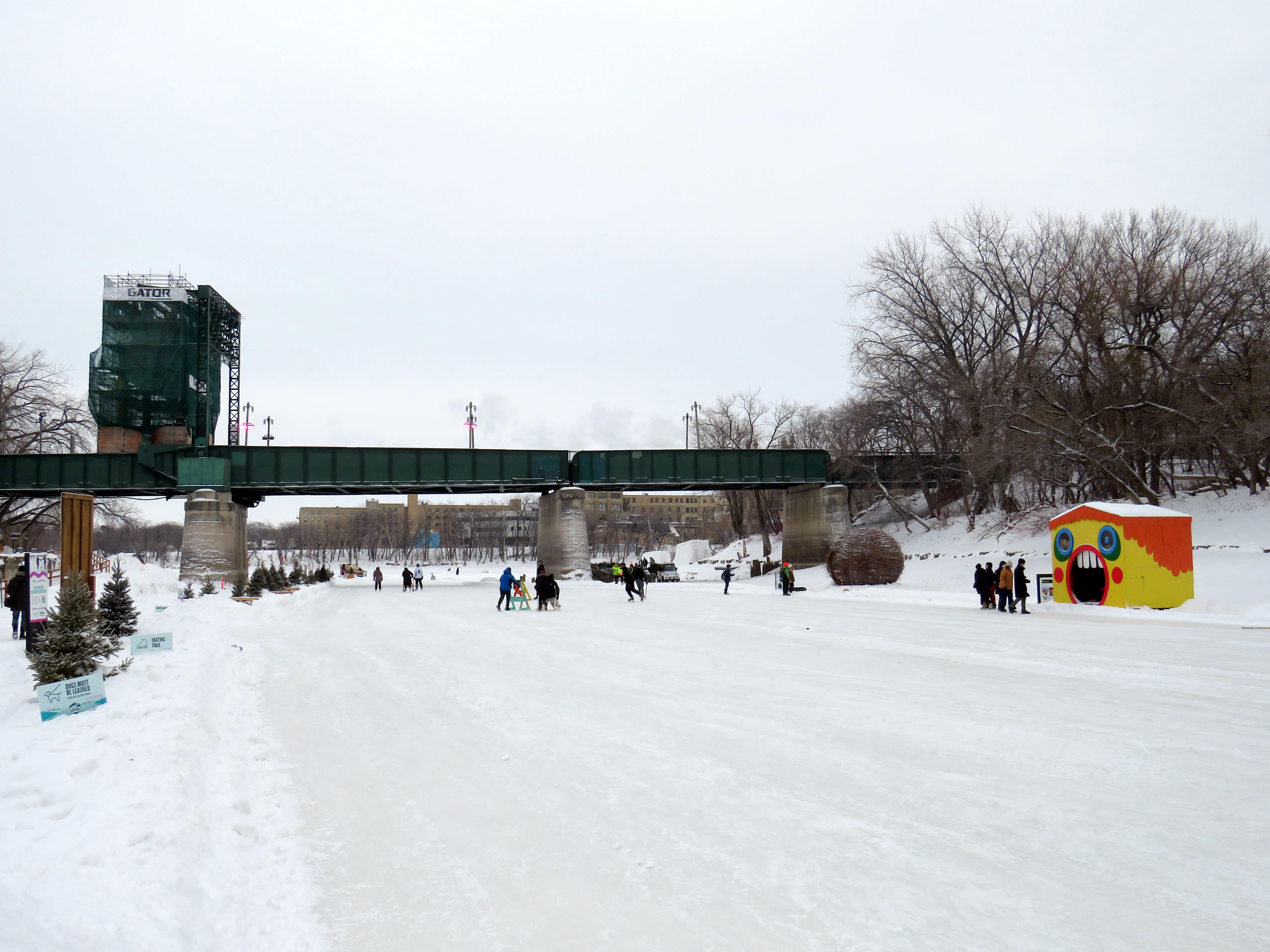
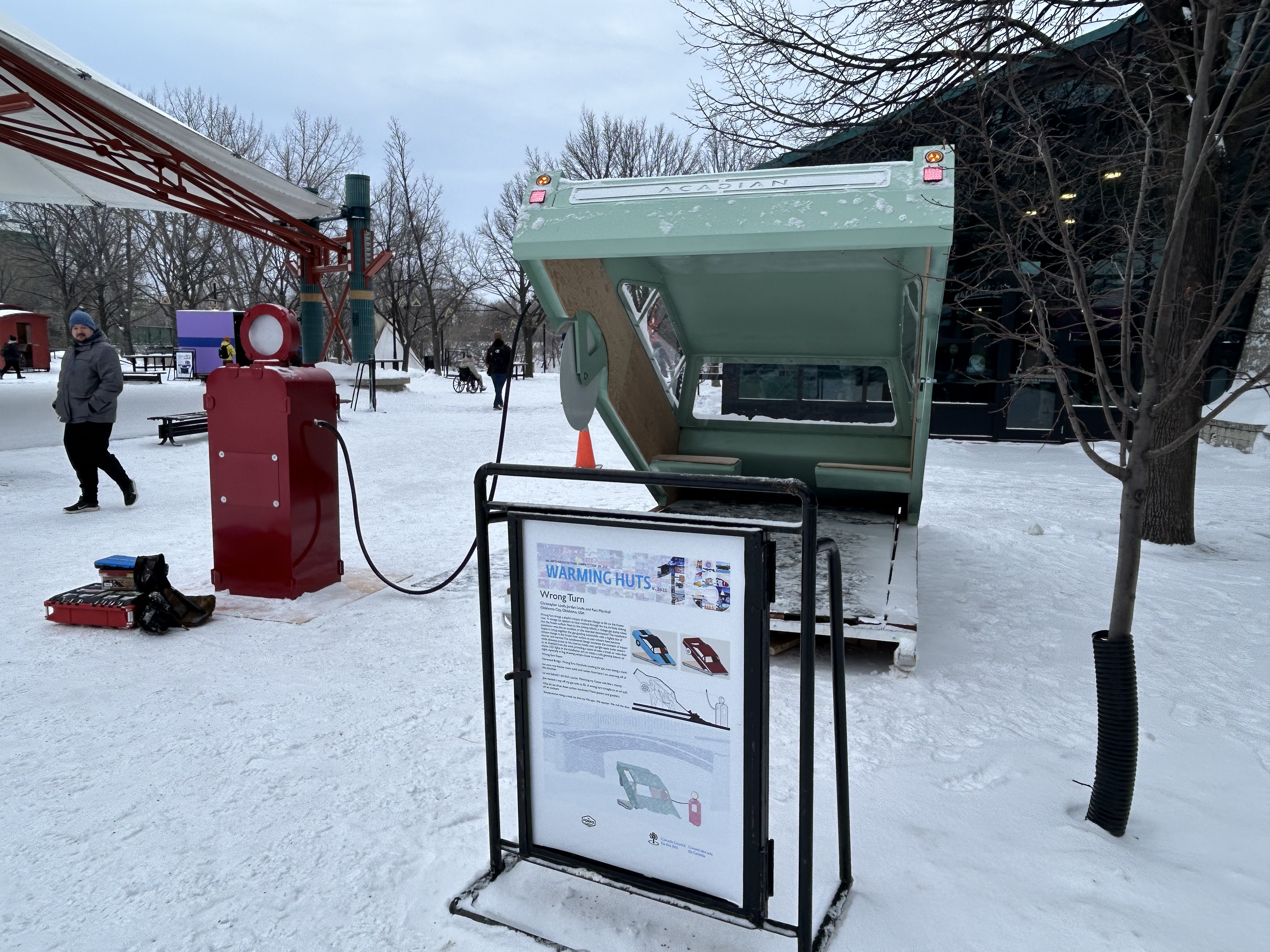
Outside, there were Warming Huts art stations, many of which were very compelling. Ice skaters have a choice of an artificial ice rink, covered by a tent-like canopy, or getting out on to a cleared natural path along the Assiniboine River.
Skaters on the Assiniboine River; warming huts along the ice give skaters a place to sitOne of the Warming Huts, titled “Wrong Turn,” representing a car sinking into an icy river
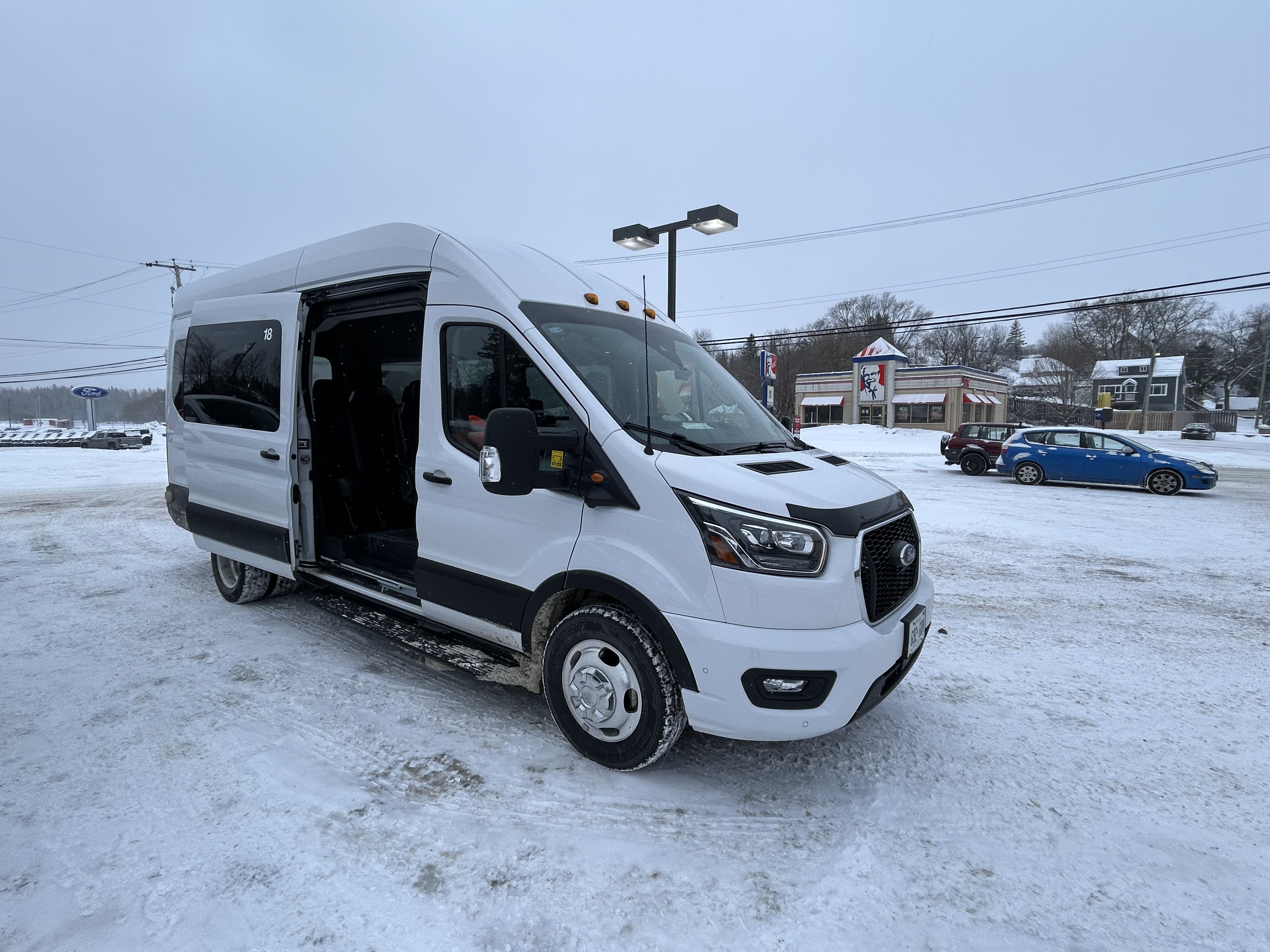
After 24 hours in Winnipeg, capped by a great hockey game in a lively arena, I made my way west towards Kenora and Thunder Bay. Kasper, which I last rode in 2019, has an early morning departure from Downtown Winnipeg, at the Balmoral bus terminal, stopping at Kenora, Dryden, and Sioux Lookout. Among the six passengers were a First Nations woman and her companion, returning home from a medical visit. Intercity buses are a lifeline. The Kasper bus was a 12-passenger van, and despite the poor winter weather conditions, it was a safe, comfortable, and friendly service.
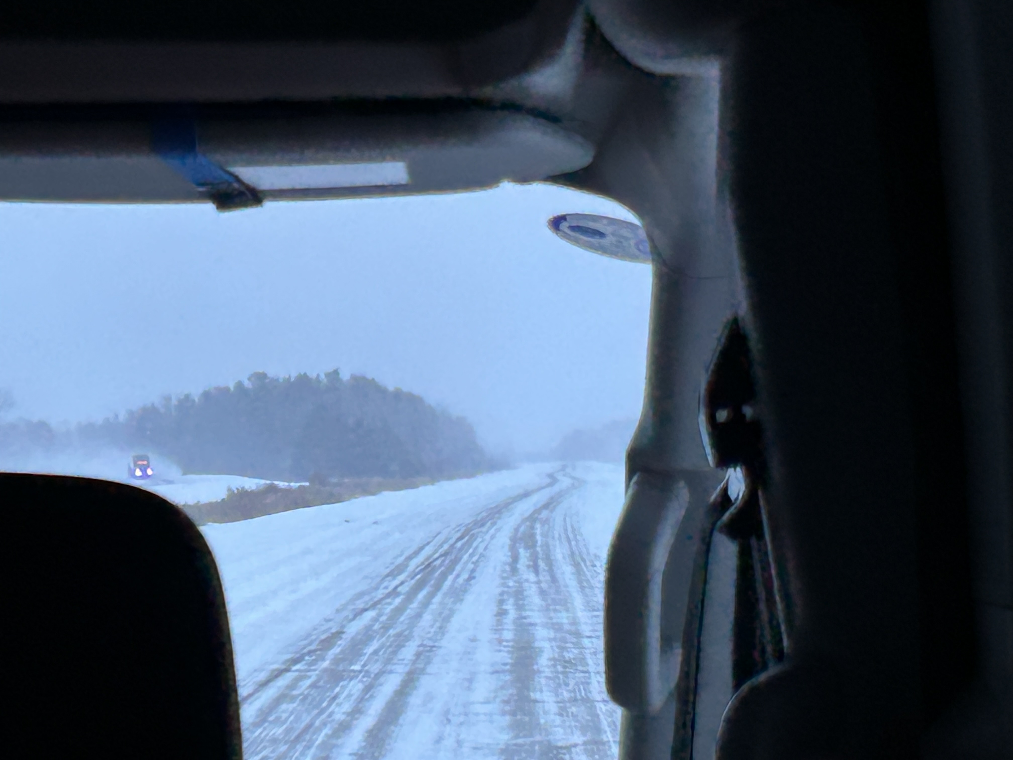
Snowy conditions on the Trans-Canada Highway headed east from Winnipeg
Taking the morning Kasper trip allowed me to spend a few hours in Kenora, population 15,000. The community on the Lake of the Woods is a popular summer vacation spot; this was my first time visiting Ontario’s most westerly city. Kasper’s Kenora stop is at a McDonalds just east of downtown; this gives passengers a chance to stretch, use the washroom, and grab food.
Kasper Minibus at the Kenora McDonald’s
The walk from the McDonald’s back towards downtown was pleasant. I was greeted by several deer, in their winter coats, comfortable wandering in a residential neighbourhood.
Northern white-tailed deer in their heavy winter coats
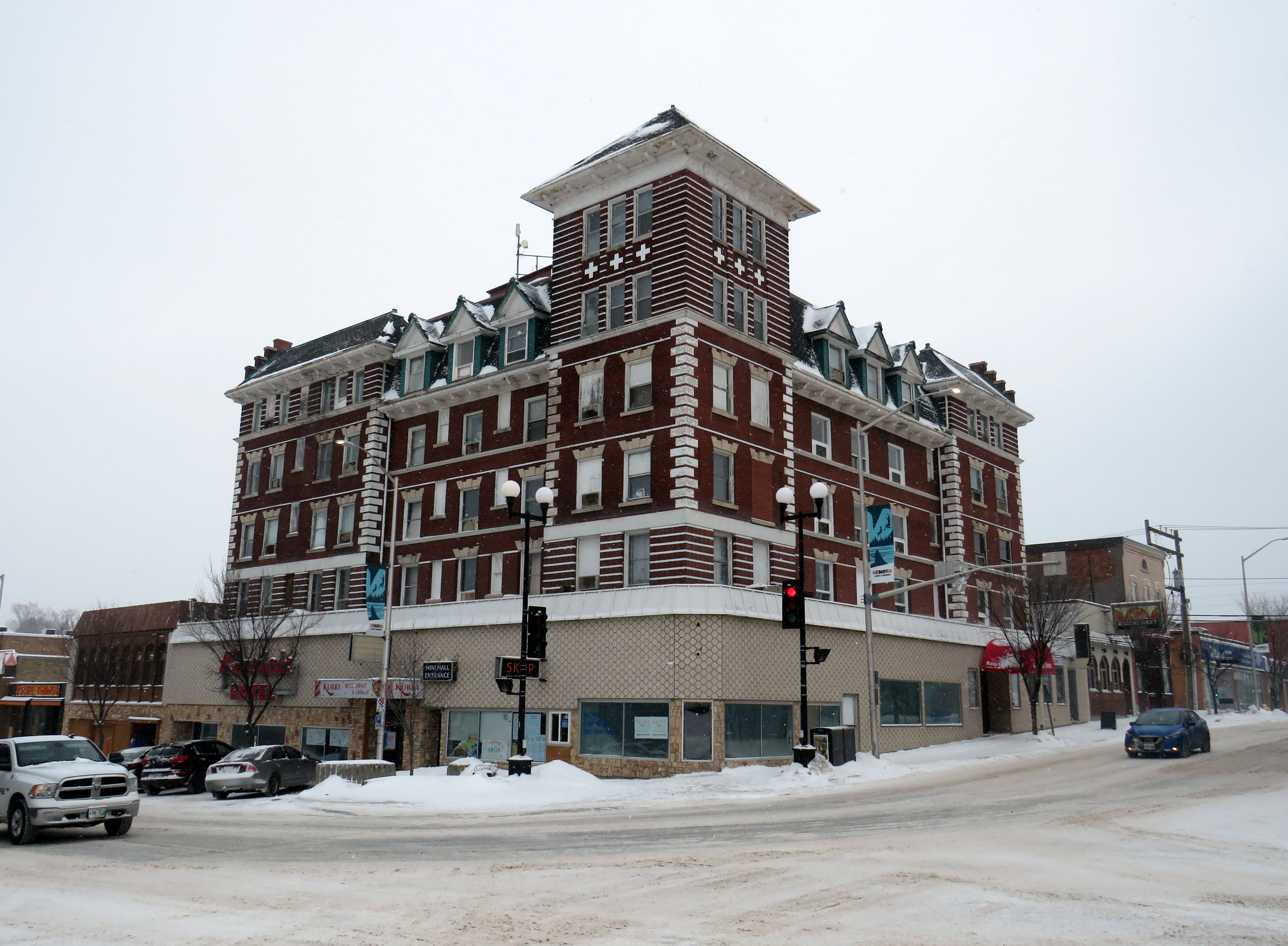
Kenora’s downtown is small, but blessed with a solid collection of historic buildings, including the old post office (now city hall), the district courthouse, a two-storey Canadian Pacific railway station (which served VIA until 1990), and the five-story Kenrica Hotel. The hotel has seen better days — the ground floor defaced by an unfortunate 1950s-era streetfront — but it still has good bones.
Kenrica Hotel, on the main corner in Downtown Kenora
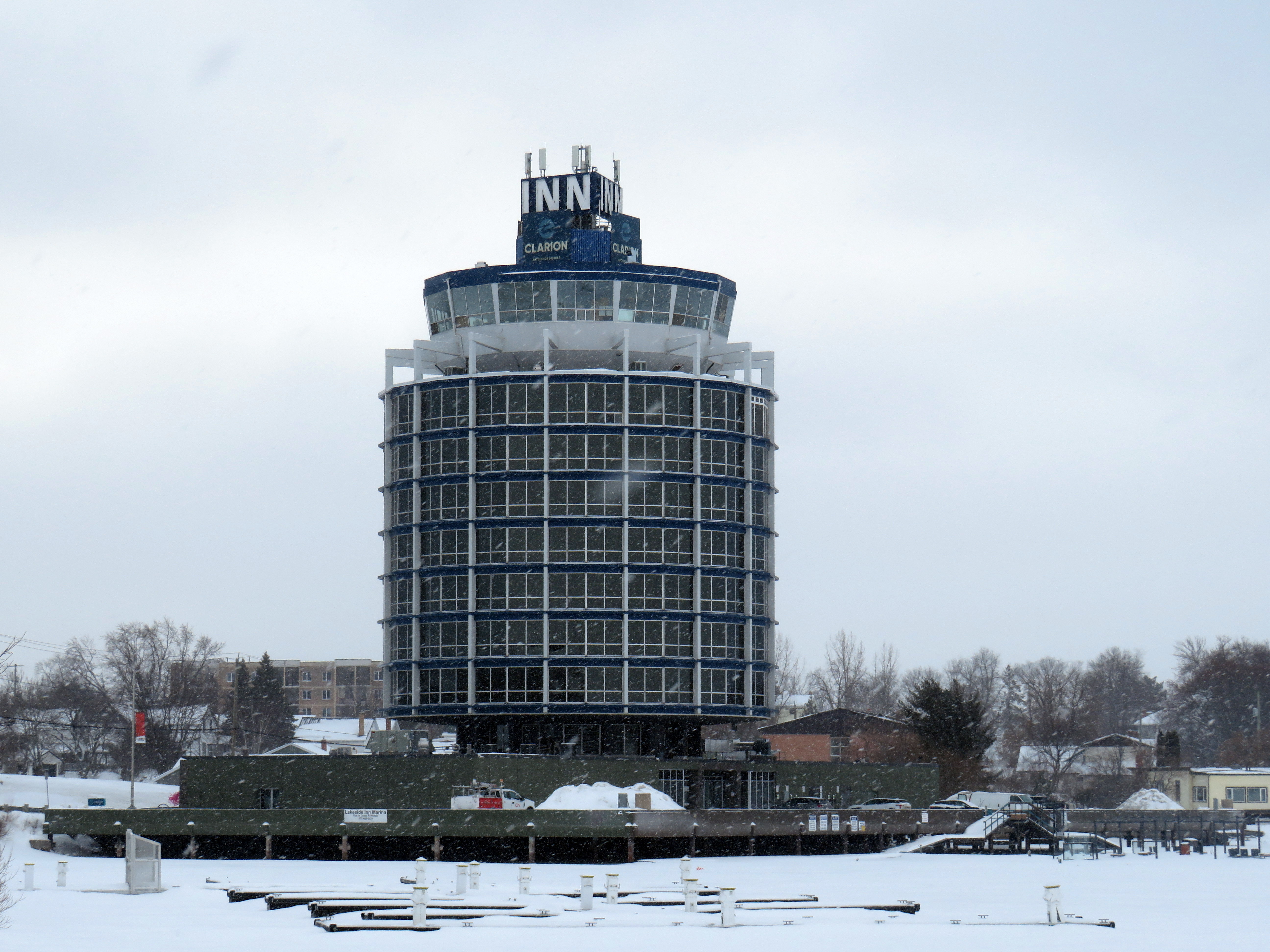
South of Downtown Kenora, on the lakefront, a cylindrical hotel, ten storeys high, overlooks Lake of the Woods, with a marina at its base. The hotel’s mid-century modernist form is unusual for Ontario, which makes it stand out even more.
The Clarion Inn on Lake of the Woods
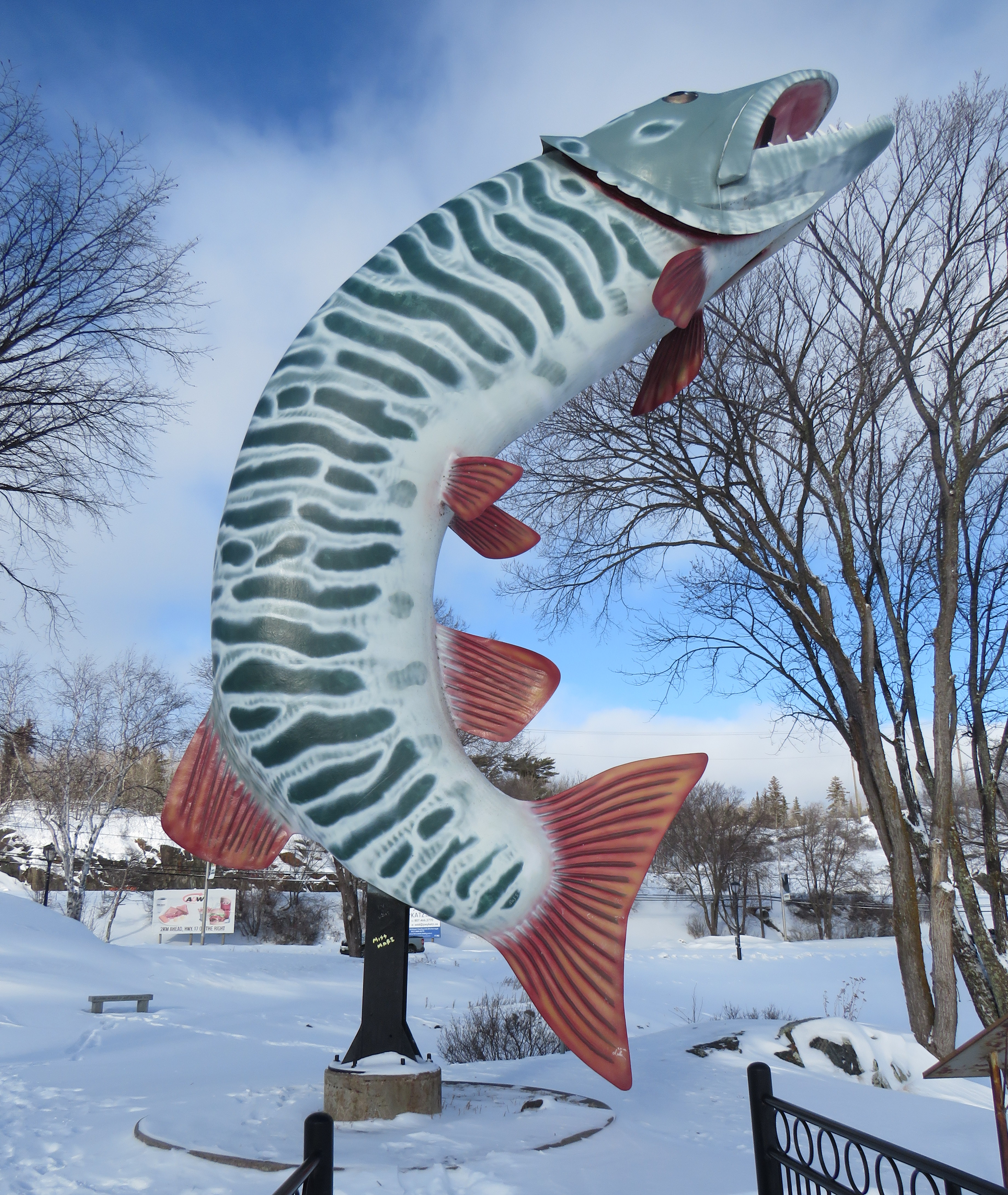
Many towns and cities in Northern Ontario feature a roadside attraction. Sudbury has the Big Nickel, Wawa has a giant goose, and White River has Winnie-the-Pooh. Kenora’s is a giant sculpture of a muskie fish, called “Husky.”
“Husky the Muskie” – Kenora’s roadside attraction
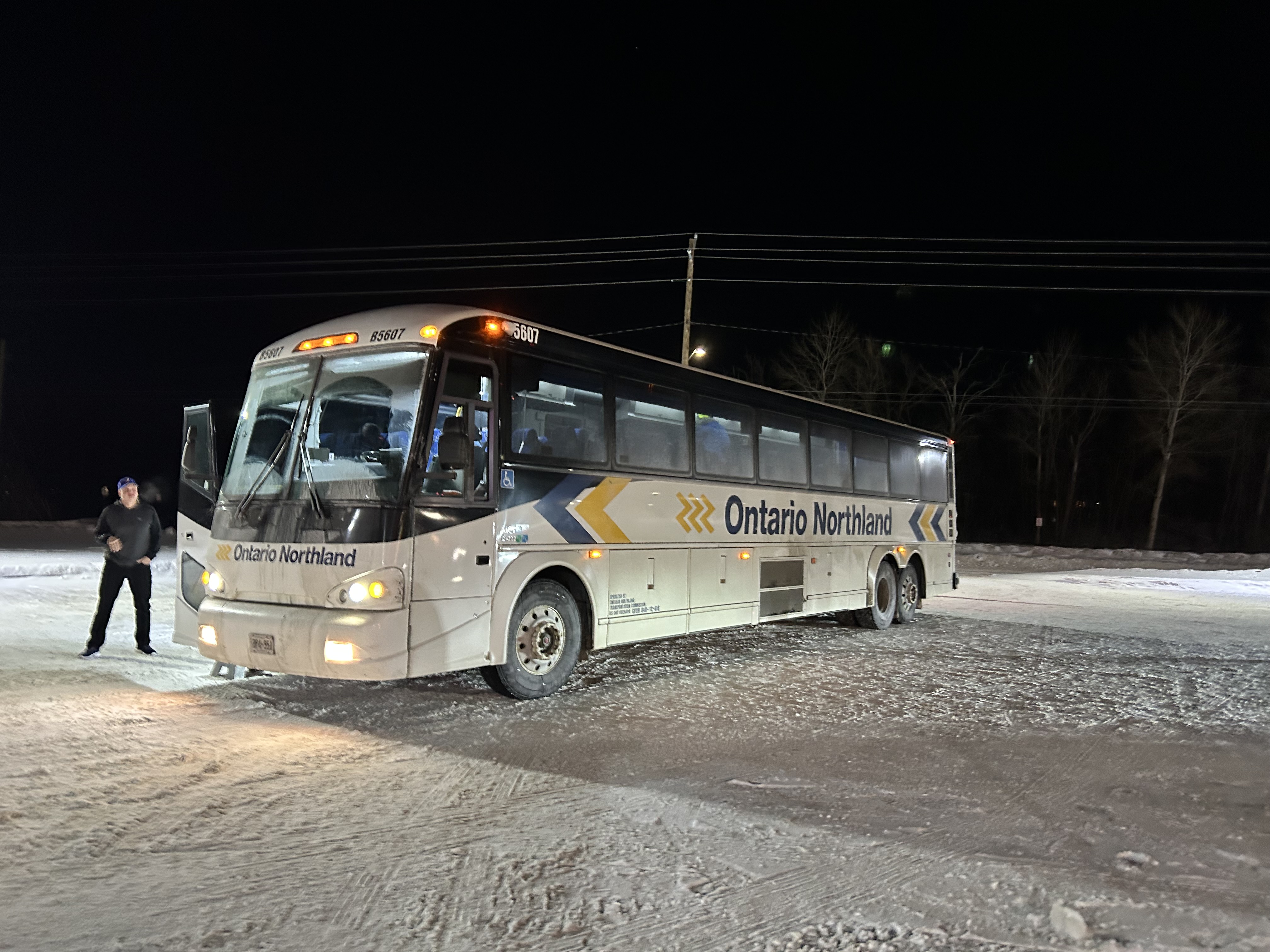
Ontario Northland operates a bus six days a week between Winnipeg, Thunder Bay, Sault Ste. Marie, and Sudbury, with operator changes at Thunder Bay and Sault Ste. Marie. Between Kenora and Thunder Bay, the route alternates, with service to Fort Frances and Atikokan three days a week and to Dryden and Ignace the other three days. Passing through Fort Frances (where the bus stopped at a McDonald’s there for a rest break), I finally visited every county, district, and region in Ontario, with Rainy River District being the final one.
Ontario Northland bus in a snow-covered McDonald’s in Fort Frances, Ontario
The Ontario Northland bus driver that day was exceptional; because of a winter storm, Highway 17 was closed near Batchewana Bay; as such, the bus would not continue past Thunder Bay. Though we were nearly an hour late arriving into Thunder Bay due to road conditions, the operator was willing to continue past the Thunder Bay Ontario Northland depot to drop anyone off continuing to the hospital campus. I was also able to get off the bus by my hotel.
The Ontario Northland depot at Thunder Bay is not in a very good location, in an industrial area off Highway 61 near the Thunder Bay airport, without direct local transit connections or adjacent amenities. At least a stop at Thunder Bay Regional Health Sciences Centre (which has local transit and is near Lakehead University) is also provided.
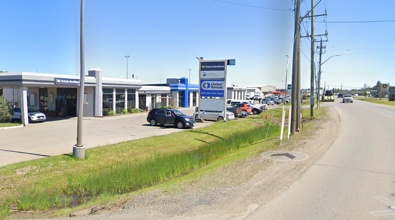
Ontario Northland Thunder Bay depot, located in an industrial area on a road without sidewalks(Google Streetview)
Difficult winter road conditions make travel across the North a challenge; this is why professional and safe bus and train operators are so important for getting around.
In mid-November, I found myself in Washington DC, accompanying my spouse as she had multiple days of work-related meetings. While I spent part of my time visiting cities in Delaware, Maryland, and Virginia, I also visited several neighbourhoods in Washington itself. Among the things I wanted to see for the first time was the D.C. Streetcar, one of nearly a dozen systems built across the United States in the last two decades. I had already taken rides on modern streetcars in Atlanta, Detroit, Kansas City, Cincinnati, as well as Portland and Seattle, coming away mostly unimpressed — though Portland, Detroit, and Kansas City show some promise. Washington’s small implementation didn’t win me over either.
I grew up in Brampton, a suburb of a city that maintained a large legacy streetcar fleet. Growing up, I thought streetcars were the greatest thing: big, smooth, quiet, gliding through some of Toronto’s most interesting neighbourhoods. I watched as the city expanded its street railway network along the waterfront and up Spadina Avenue before I had the opportunity to move to the big city.
Living in Toronto, and reliant on the streetcars, I got to experience the highs and the lows of street railway operation: traffic congestion, bunching, diversions, bustitutions, but also the sweet late-night rides when the streetcar really felt like the king of the road. The new low-floor Flexity streetcars brought even larger vehicles, but they were subject to the same constraints as the smaller CLRVs.
The TTC’s indifference to line management and the insistence on slow operation in the name of safety (without actually addressing problems like obsolete switches) made streetcar travel less magical with every passing year. But in Toronto, streetcars are still a workhorse, and there is still no easy way for buses to permanently substitute for the demand on routes like King Street.
Visiting cities elsewhere in the world, like Viennaor Hiroshima, makes me realize that trams can and should work, something that Toronto has largely forgotten. Or something that American cities rediscovering the streetcar haven’t even figured out.
Former D.C. Transit streetcar in the distinctive 1956-1962 Trans Caribbean Airlines colour scheme, at Seashore Trolley Museum in Maine
Like all large American cities, Washington once had a robust streetcar network, with several private operators that consolidated into Capital Transit in 1933. Streetcars extended throughout the District and into Maryland suburbs, with separate companies providing service into Virginia’s sprawling suburbs until 1941.
Within central Washington, streetcars were required by law to draw electric power from an underground conduit for aesthetic reasons, though outlying areas did not have this this obligation. Therefore, many streetcars in DC, including the modern PCC streetcars acquired in the 1930s and 1940s, had both overhead trolley poles and underbody current collectors.
The last streetcar line in DC was abandoned in January 1962. Fourteen years later, the first section of the Washington Metro opened for service. Unlike the streetcars, the new Metro system was more of a regional service, reaching far out into the Maryland and Virginia suburbs. (Famously, the affluent and congested Georgetown area of Washington is not served by Metro, which was designed mainly as a commuter service.) Though bus service was consolidated throughout the region, there were parts of Washington left underserved by Metro and local bus. The District government began operating its own bus service, DC Connector, and began planning new streetcar services to serve traditionally underserved and rejuvenating neighbourhoods.
Map of the proposed Phase I streetcar network. Only the thick red line was completed.
The first planned route would have connected Anacostia, a historic neighbourhood with a majority Black population, with the Metro and with the gentrifying Navy Yards district on the north side of the Anacostia River. At first, the new light rail would have followed a disused CSX freight spur line, but disagreements with the railroad and land title issues changed the route to a shorter, on-street alignment. After several false starts, work started in 2009 on a “demonstration line” between Anacostia Metro Station and Joint Base Anacostia–Bolling, a major military installation, with an extension to Minnesota Metro Station to follow.
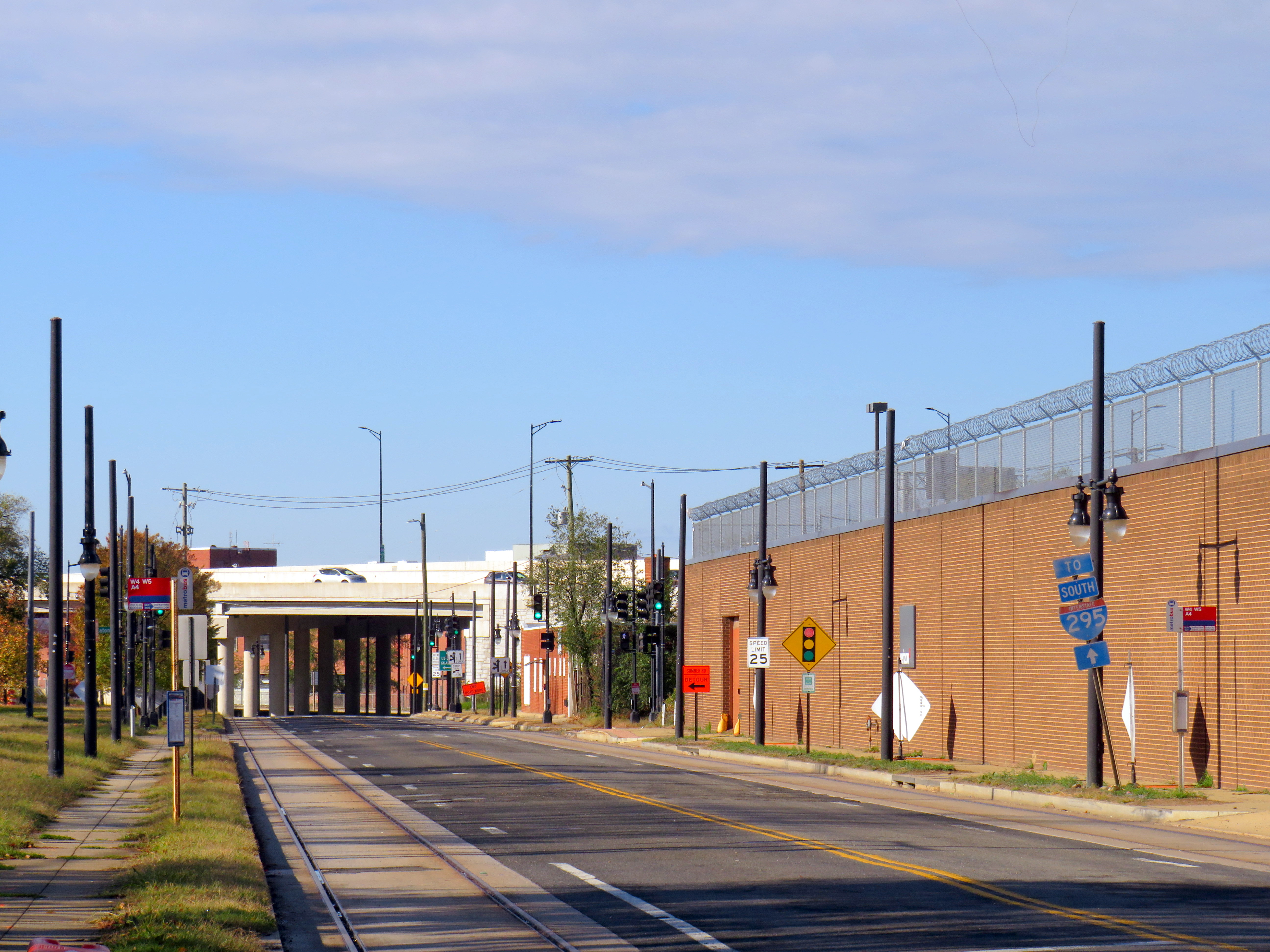
Looking east on Firth Sterling Ave SE with the tracks suddenly ending before Suitland Parkway. The abandoned CSX spur line right-of-way is on the right.
Work was suspended indefinitely in 2010. Today, less than a mile of track remains abandoned in place.
Looking west on Firth Sterling Ave SE toward Joint Base Anacostia–Bolling, where curb-side streetcar tracks installed in 2009-2010 are left abandoned
An abbreviated 2.4 mile (3.9 km) H Street-Benning Road Line did open, however, in 2016, several years late. The route, which begins on the H Street overpass north of Union Station, extends east to Oklahoma Avenue, at a public park and sports complex north of the abandoned RFK Stadium. Service, which is currently fare-free, operates every 12 minutes during daytime hours. A parallel bus route, the X2 Benning Road–H Street Line, operates as frequently, but has a much longer route and is considerably faster.
H Street, in the city’s east side, has long been a lower-income, majority Black neighbourhood, hit hard by disinvestment, civil unrest (especially after the assassination of Dr. Martin Luther King Jr. in 1968), crime, and depressed property values. But its proximity to the governmental, cultural, and commercial centres of the city made it an attractive corridor for redevelopment.
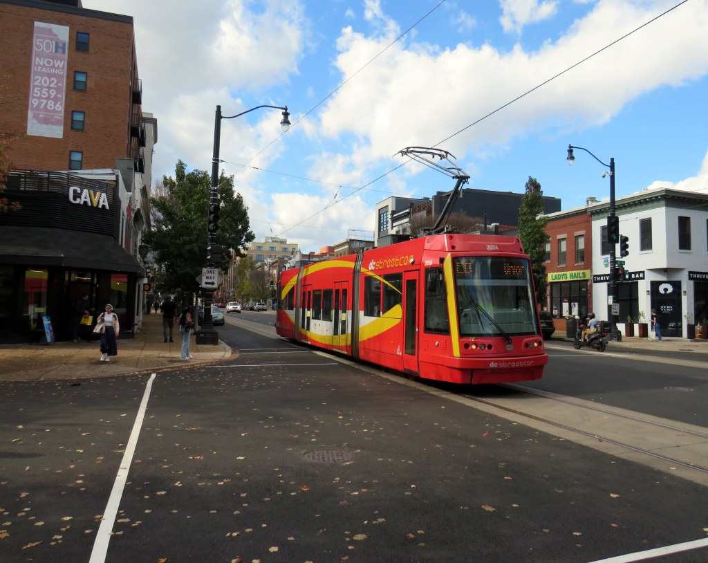
A westbound streetcar shifts into the median on H Street on the way to Union Station
Though Union Station is the western terminus of the short streetcar line, the connection to the Metro Red Line, Amtrak, MARC, and VRE trains is awkward. H Street is to the north of Union Station, crossing over the multitude of tracks leading into the station platforms on a long overpass. The streetcar stops halfway across, in the median. Passengers getting off the streetcar must walk further west on the median, then cross the eastbound lanes of H Street at a traffic signal controlling a driveway exit from the Union Station parking garage. A poorly marked sidewalk provides the connection into the parking garage (which also houses the Union Station intercity bus terminal) and down towards the main station building.
The path from DC Streetcar, through a parking garage, towards Union Station
Like most modern streetcar lines in the United States, the DC Streetcar runs in mixed traffic, in the outer driving lane. This allows for platform level boarding from the sidewalk at each stop, but it also leaves the streetcar susceptible to traffic delays due to congestion and from stopped cars and trucks. Though there are parking and layby spaces to the right of the streetcar track, a wide or improperly stopped vehicle can easily disrupt service. Streetcars regularly squeeze past properly parked delivery vans, as in the photo below.
A streetcar squeezes past a stopped Amazon delivery van on H Street
But new streetcar lines in North America are typically less about moving people than it is about sparking new urban development. On H Street, this has definitely happened. New mid-rise rental and condominium residential buildings line the western end, towards Union Station. A Whole Foods grocery store is at the base of one of those buildings, where previously, there was a parking lot and local grocery store.
Streetcar passes a Whole Foods grocery store at the base of a mew seven-storey rental apartment building, northeast corner of H Street and 6th Street NEThe same corner in 2008, with a neighbourhood grocery store on the northeast corner of H Street and 6th Street NE(Google Streetview)
Still, I wonder how much the streetcar itself contributed to the gentrification of H Street. The streetscape is greatly improved, but streetcar ridership is low, despite the free fare. The close proximity to Union Station, government offices, and commercial areas, along with rezoning of vacant lots would have made a bigger impact. However, government investment on the corridor made it attractive for speculators and developers to assemble land and build.
In the meantime, as rents skyrocket, crime remains a concern. New stores such as Whole Foods do not serve long-term residents and local businesses have been displaced. Like Whole Foods, the streetcar was designed to support the new community, while others continue to take the bus and shop at the Safeway on Benning Road.
Looking east at H Street and 3rd Street, 2008 (Google Streetview)Looking east towards 3rd Street, November 2024
If the H Street-Benning Road Streetcar was extended in both directions based on the original plans, it could prove to be a useful, albeit slow, transit service filling in one of the gaps left by the Washington Metro system. But as Washington struggles with its city budget, this is very unlikely. By the end of the year, the DC Circulator bus system will disappear for good, further orphaning the single short streetcar line operated by the District.
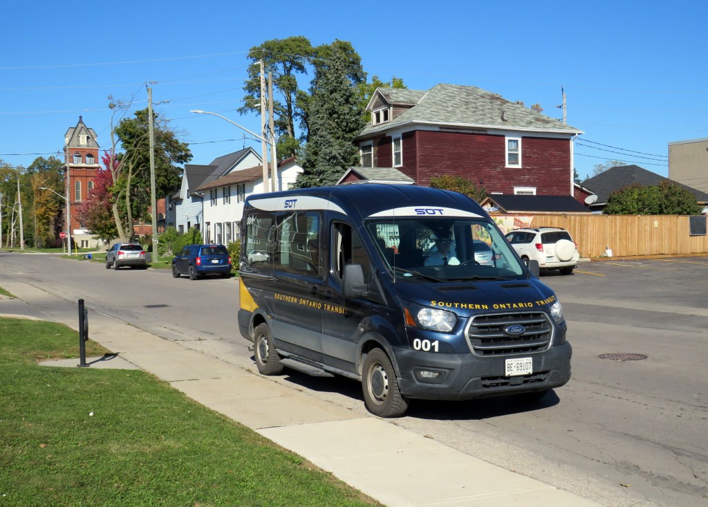
Southern Ontario Transit minibus in Dunnville, October 2024
Earlier in October, I got to meet Rae Rivard, owner-operator of Southern Ontario Transit (SOT), a new intercity transit operator currently serving Hamilton and Haldimand County. The route, which launched on September 16th, offers three weekday round trips between Downtown Hamilton and Dunnville, serving the communities of Caledonia, Hagersville, and Cayuga.
Haldimand County, along with the neighbouring Six Nations and Mississaugas of the Credit First Nation reserves, remained unserved by intercity or local bus services since the early 2000s; in 1990, United Trails operated a daily bus between Port Dover, Hagersville, Caledonia, and Hamilton. Cayuga and Dunnville were served by a Greyhound route on Highway 3 between Niagara and London. More recently, as Niagara Region was building a regional transit service and Norfolk County successfully applied for provincial funding for a new service between Simcoe and Brantford, Haldimand County refused to take part. Enter SOT.
SOT, which charges a $10 one-way fare, operates without the support of the municipal government, and is unable to put up bus stop signs or actively promote its service at municipal facilities such as libraries or community centres. For this reason, ridership remains low, despite growing populations in Caledonia and Hagersville and convenient links to Hamilton Airport, Mohawk College, St. Joseph’s Hospital, and to GO Transit and HSR services.
Rivard will tell you that “the primary challenge we face today is slow uptake. Due to a number of limitations and challenges currently out of our control, the number of regular and new riders trends up every week, but not as fast as we need to cover expenses…. Many of the limitations we are dealing with right now can easily be addressed at no expense, but these choices are out of our control.”
Rivard reached out to businesses and social service organizations, but was turned away, adding that “the entire operation has been entirely funded out of me and my wife’s savings, and we are really struggling to keep up with expenses at this rate.”
Without approved bus stop locations with curb access, SOT is not able to provide fully-accessible service, though it already has a wheelchair-accessible vehicle. The lack of physical bus stops and publicity has made it difficult to attract riders, though while riding with Rivard on a beautiful October afternoon, it was clear that a demand exists as several residents came up to the minibus to find out more information.
My hope is that word spreads about this unique and essential operation and that the local communities provide the needed support to make this service work. If this initial route succeeds, SOT would like to expand service in Haldimand and take on other gaps in the Ontario network.
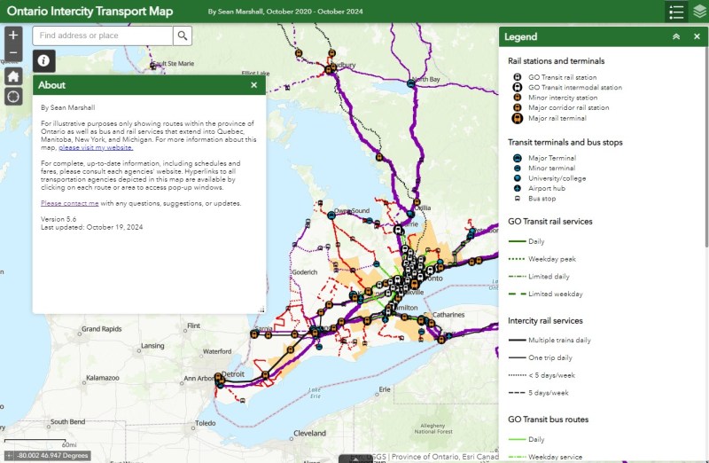
I updated my Ontario Intercity Transport Map to add Southern Ontario Transit’s route. Commuter Connect in Northumberland County ended service not long after VIA Rail finally resumed its early morning train from Kingston to Toronto. East Zorra-Tavistock Transit in Oxford County did not last long either, and service there has ended.
Added to the map:
Southern Ontario Transit between Hamilton, Caledonia, and Dunnville
Red Arrow’s daily Toronto-Western University express, which replaces its Toronto-Niagara Falls run
A new daily Flixbus route between Toronto, Hamilton, and St. Thomas
A new OnexBus route between London, Goderich, and Port Elgin, operating Friday through Monday
OnexBus’s London-Pearson Airport-Brampton route, which operates several trips a day
Ourbus’s Toronto-Ottawa route
Kasper’s daily Winnipeg-Kenora-Sioux Lookout service
Revisions to on-demand services in Niagara Region
Some revised routings and service levels across the province
Removed from the map:
Commuter Connect in Northumberland County
East Zorra-Tavistock Transit
Kasper’s on-demand service to Red Lake/Balmerton
Though it is good to see Bruce County — particularly rapidly growing Saugeen Shores — get another link, that part of Ontario is still poorly served; there should be daily services between larger Bruce County communities like Saugeen Shores, Kincardine, and Walkerton at least to Owen Sound and Hanover. Lindsay is also left without any intercity services, after TOK ended service from Toronto to Haliburton last year. where a Peterborough-Lindsay-Pontypool service, perhaps extending to Durham College/Ontario Tech University in Oshawa could prove to be a very useful route.
If you like this post and you would like to help out with my online mapping and webhosting costs, consider buying me a coffee.Thank you!