Tag: Detroit

  • Missing connections in Windsor-Essex

    Missing connections in Windsor-Essex

    Downtown Detroit, as seen from Downtown Windsor, on a gloomy November morning

    Windsor, Ontario, is built on transportation. The city’s position, right across the river from Detroit, has shaped the region ever since French settlers made their home on the wide, short, slow-moving river between Lake Erie and Lake St. Clair. (The river’s name, Detroit, is the French word for strait.) The narrow river made it a hub for shipping and for railways, followed by rail and road tunnels and highway bridges.

    As the American auto industry got its start in Detroit, propelling it from a minor regional centre to the fourth-largest city in the United States, Windsor was a natural spot for companies like Ford, General Motors, and Chrysler to set up their first international operations. Canadian distillers and brewers also made Windsor their home and independent towns and cities lined the river, with names like Walkerville and Ford City. (These locales amalgamated with Windsor in 1935). The city had two electric railways: the Sandwich, Windsor, and Amherstburg (SW&A), a local streetcar and bus operation that also ran suburban lines to Amhertsburg and Tecumseh and the Windsor, Essex, and Lakeshore Rapid Railway (WE&L), which extended to Lake Erie at Leamington.

    Today, Windsor has a population of 230,000, while neighbouring towns and townships in Essex County add another 200,000 people to the region. Though Windsor’s auto industry has been in flux since the 1980s thanks first to free trade agreements and now by US tariffs and protectionism, the region’s population continues to grow.

    However, despite the region’s history and growth shaped by water, rail, and road links, public transport is lacking in Windsor-Essex, with several routes in peril. This is despite the presence of the University of Windsor, St. Clair College, two major hospital campuses, and a large built-up prewar urban area. Windsor was also the only large urban municipality to completely cease transit operations during the COVID-19 pandemic, where others continued to provide basic services subject to health and safety restrictions.

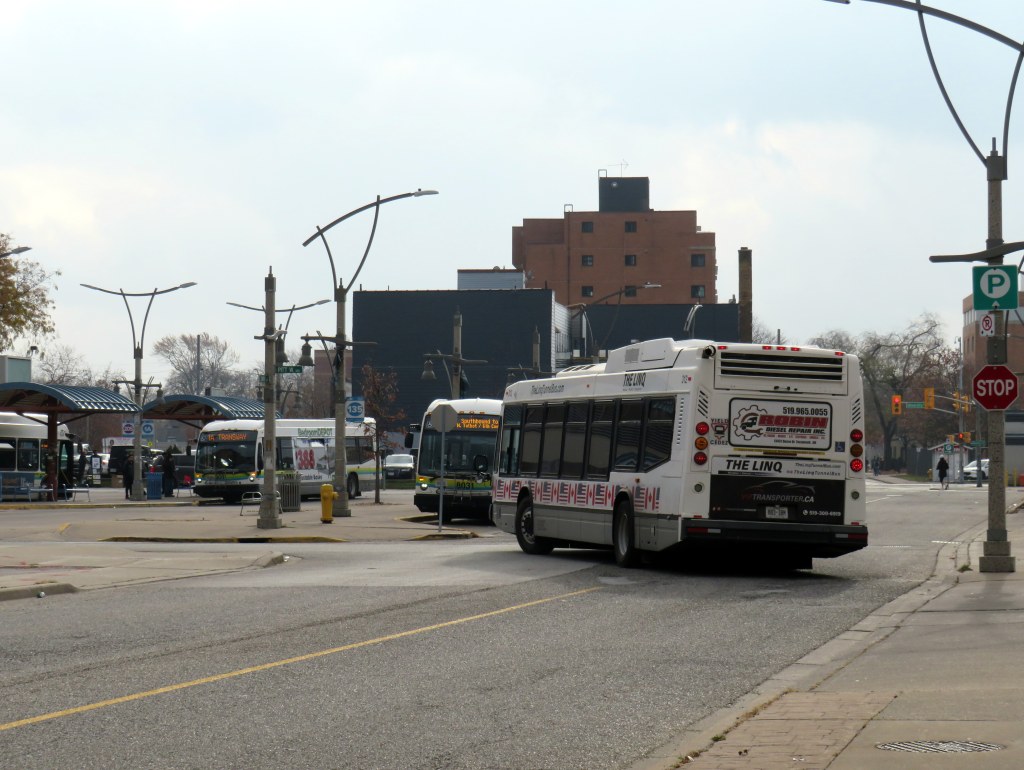
    On August 30, 2025, Transit Windsor’s Tunnel Bus service was cancelled, after Windsor Mayor Drew Dilkens vetoed a council decision to maintain the service (funded partly by an increase in the one-way fare from $10 to $20). Even though the historic cross-border relationship is strained by threats of annexation, tariffs, and an authoritarian president, the Tunnel Bus still provides an essential link for business and leisure, with many fans of Detroit’s sports teams on the Canadian side of the river, and hundreds of workers crossing daily to Detroit’s offices and hospitals. Without access to an automobile or an expensive cross-border taxi ride, the bus is the only year-round way to get to the United States between Fort Erie and Walpole Island, as neither the tunnel or the Ambassador Bridge allow pedestrians or cyclists.

    The new Gordie Howe Bridge will include a new multiuse path. However, it is not convenient to Windsor or Detroit destinations, nor is it close to decent transit options on either side of the soon-to-open crossing, including the Q-Line Streetcar, D-DOT and SMART buses, or intercity links such as VIA Rail, Amtrak, or Greyhound.

    The Linq, the new privately-operated Tunnel bus between Windsor and Detroit

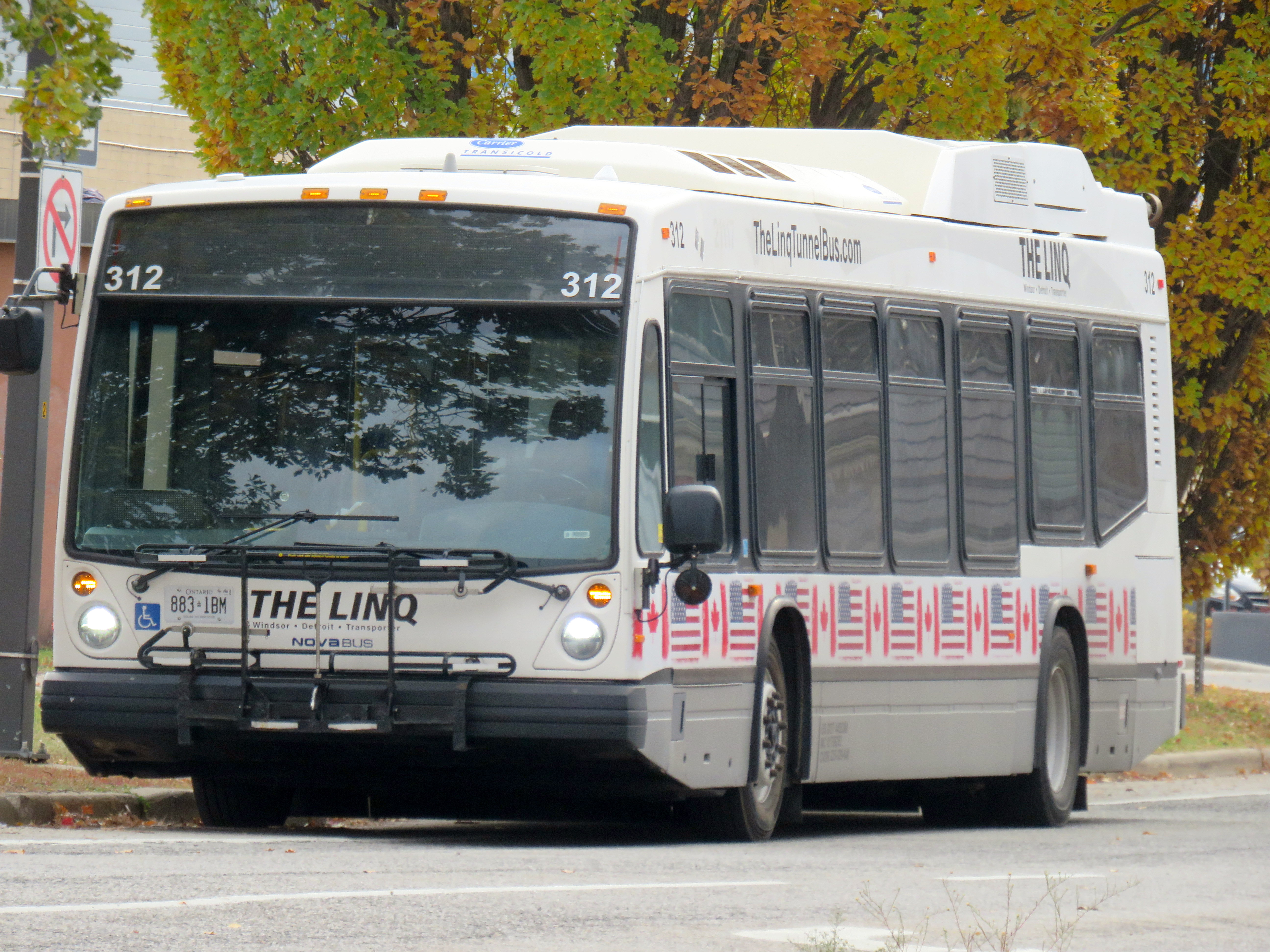
    There is, however, a new privately-operated bus service, called The Linq. It has several used transit buses with bike racks and offers trips every two hours for a $15 one-way fare. It is a downgrade from the Transit Windsor-provided service, but the connection is still there.

    The main benefit for the City of Windsor’s withdrawal of tunnel service is that the agency now comes under provincial, rather than federal, labour laws. This reduces the number of paid sick days (from 10 per year), saving the city between $1.4 million and $1.6 million.

    Though the Linq tunnel bus passes by the Windsor transit terminal, it doesn’t stop close by

    Unfortunately, there is no direct connection between Linq and Transit Windsor. The only pickup location in Windsor is at the corner of Bruce Avenue and Riverside Drive, a five-minute walk from the transit terminal where the former city-operated bus departed from. Though the Linq bus passes by the Windsor terminal, it does not stop right there. The route still serves the Rosa Parks Transit Terminal on the Detroit side, along with the stop by the tunnel entrance next to Mariners’ Church.

    Regional (dis)connections

    LTW 42 bus at Essex Sports Centre

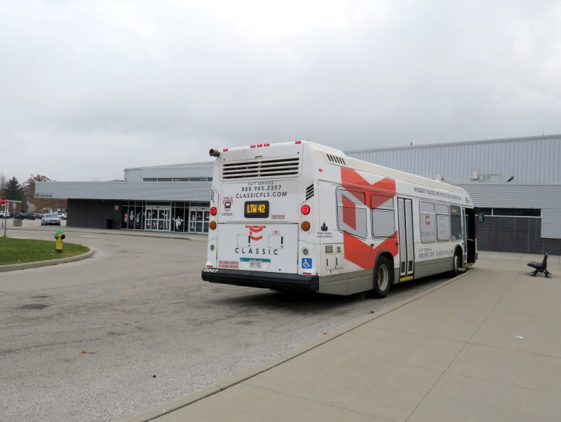
    While visiting Windsor, I wanted to ride Route 42, the bus service linking Windsor with the towns of Essex, Kingsville, and Leamington. Operated by Transit Windsor using urban transit vehicles, the service got funding from the province, the County of Essex, and the Town of Leamington. It operates three weekday and two Saturday round trips, charging a flat $10 one-way fare or a $15 same day return fare, with free transfers to Leamington’s LTGO on-demand service and Transit Windsor’s urban routes at St. Clair College.

    The service began in 2019, replacing a long-discontinued intercity coach route operated by Greyhound Canada and Chatham Coach Lines, along the old route of the WE&L Rapid Railway that ran until 1932. The bus only makes four stops: St. Clair College in Windsor, and sports and recreation centres in the three towns. The route’s number is not inspired by Douglas Adams but by the 42nd parallel, which runs a few hundred metres south of Leamington.

    LTW Route 42 route map

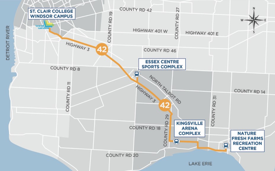
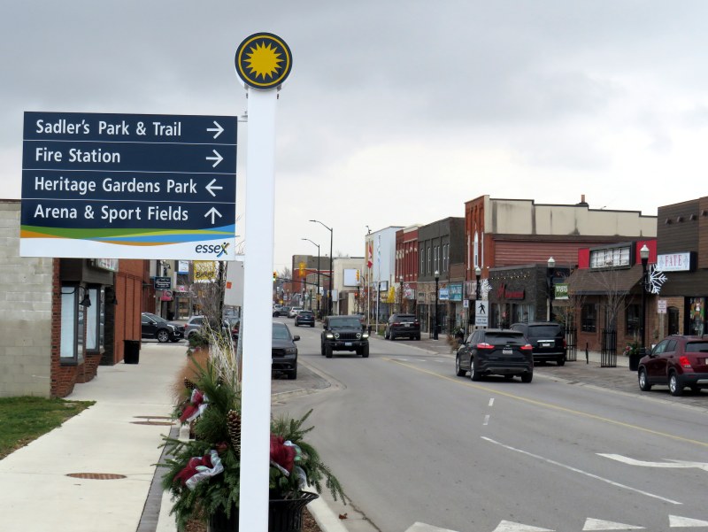
    Unfortunately, the three sports centres are poor locations for promoting transit ridership. In Essex, the arena is a 10-to-15-minute walk to the town centre, a reasonable stroll for many. In Kingsville, the arena complex northeast of the built-up area is 2.5 kilometres from the town centre, a 35-45 minute walk with no local transit options. Without access to a car ride, the Route 42 service becomes inaccessible to many potential users.

    Previous coach service operated by Greyhound and Chatham Coach Lines stopped in the town centres.

    Essex Town Centre, a 10-15-minute walk from Route 42 at the sports centre

    As of April 30, 2026, the LTW Transit service connecting Windsor with Essex, Kingsville, and Leamington will come to an end. This was a matter of funding. The provincial rural transport funding program came to an end, and neither the County of Essex nor the Town of Leamington were willing to continue subsidizing the service beyond the end of the academic year.

    Though the province is willing to fund expensive new highway and transit projects in the Greater Toronto and Hamilton Area, including new subways and light rail and sprawl-inducing freeways, it is unwilling to back the provision of small town and rural transit services that connect residents to larger centres, whether it be for work, school, health appointments, shopping or social connections. Without a province-wide strategy and a sustainable funding program, services that started up with much promise are disappearing in places like Grey and Oxford Counties and Napanee and Deseronto.

    It also does not help that Windsor-Essex does not have a regional level of government or even a degree of cooperation between the various municipalities. In York, Waterloo, Durham, and Niagara, regional governments have taken over transit services and are working to connect their entire regions together, even rural communities. Even Simcoe County provides a regional transit service to its smaller towns. The suburban Town of Tecumseh has a limited transit service separate from Windsor’s, while LaSalle and Amherstburg contract Transit Windsor for limited service within their communities. A regional transit service, subsidized by the entire Windsor-Essex tax base, could go a long way.

    That’s a wrap

    To conclude this post, I have few other observations of riding Transit Windsor over two days in late November. There are several ways that transit service can be improved, including better wayfinding, better connections between modes, and giving passengers a better view.

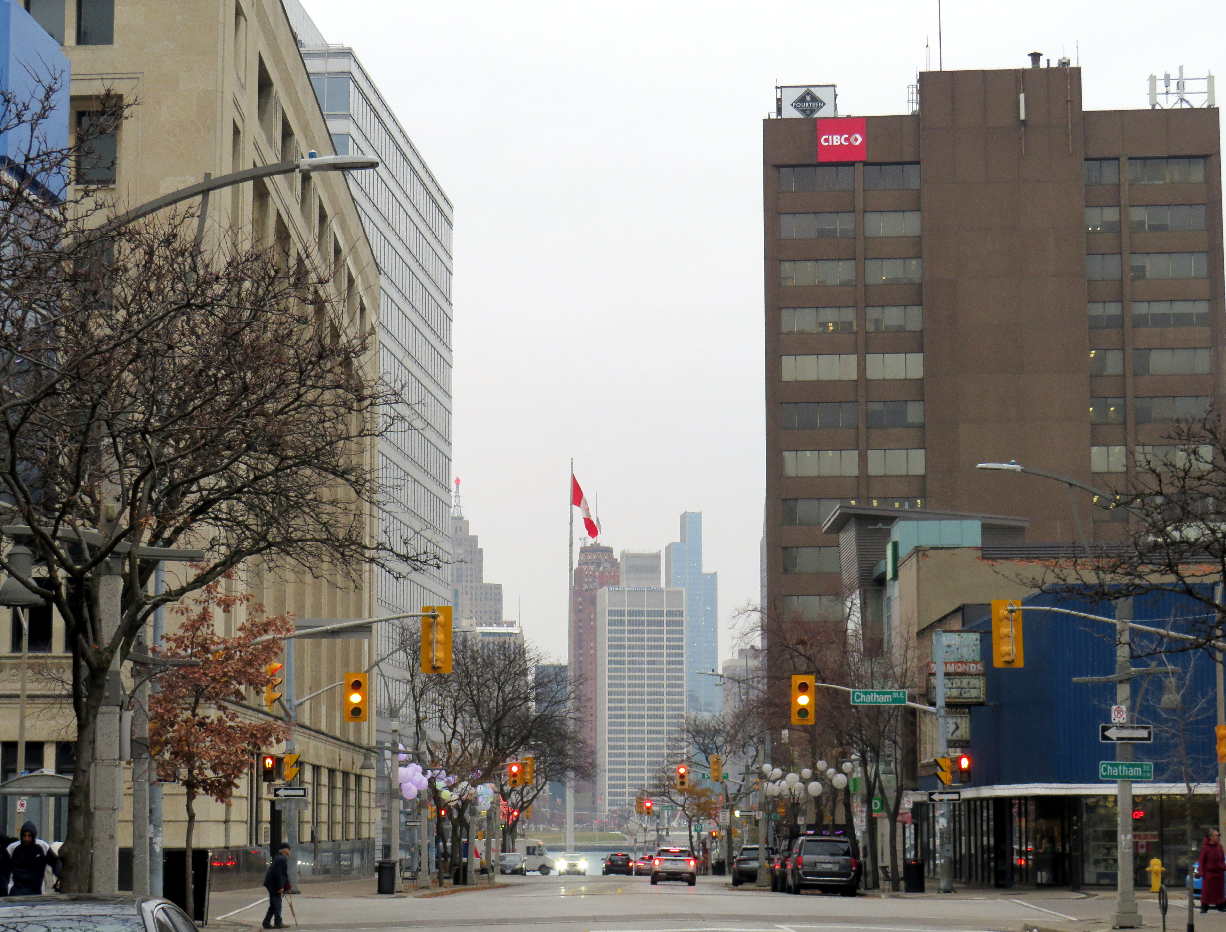
    VIA Rail runs four daily trains between Toronto and Windsor, from a station in the Walkerville neighbourhood, three kilometres east of the downtown core. Passenger trains on the CN line used to continue to the downtown waterfront until the 1960s, when service was cut back to Walkerville, which had a wye to turn trains around. Eventually, all the CN, CP, and Michigan Central tracks and docks were removed from the riverside, which allowed Windsor to develop a lovely waterfront park system.

    VIA Rail Station, constructed in 2012, replaced a smaller modernist structure built in the early 1960s

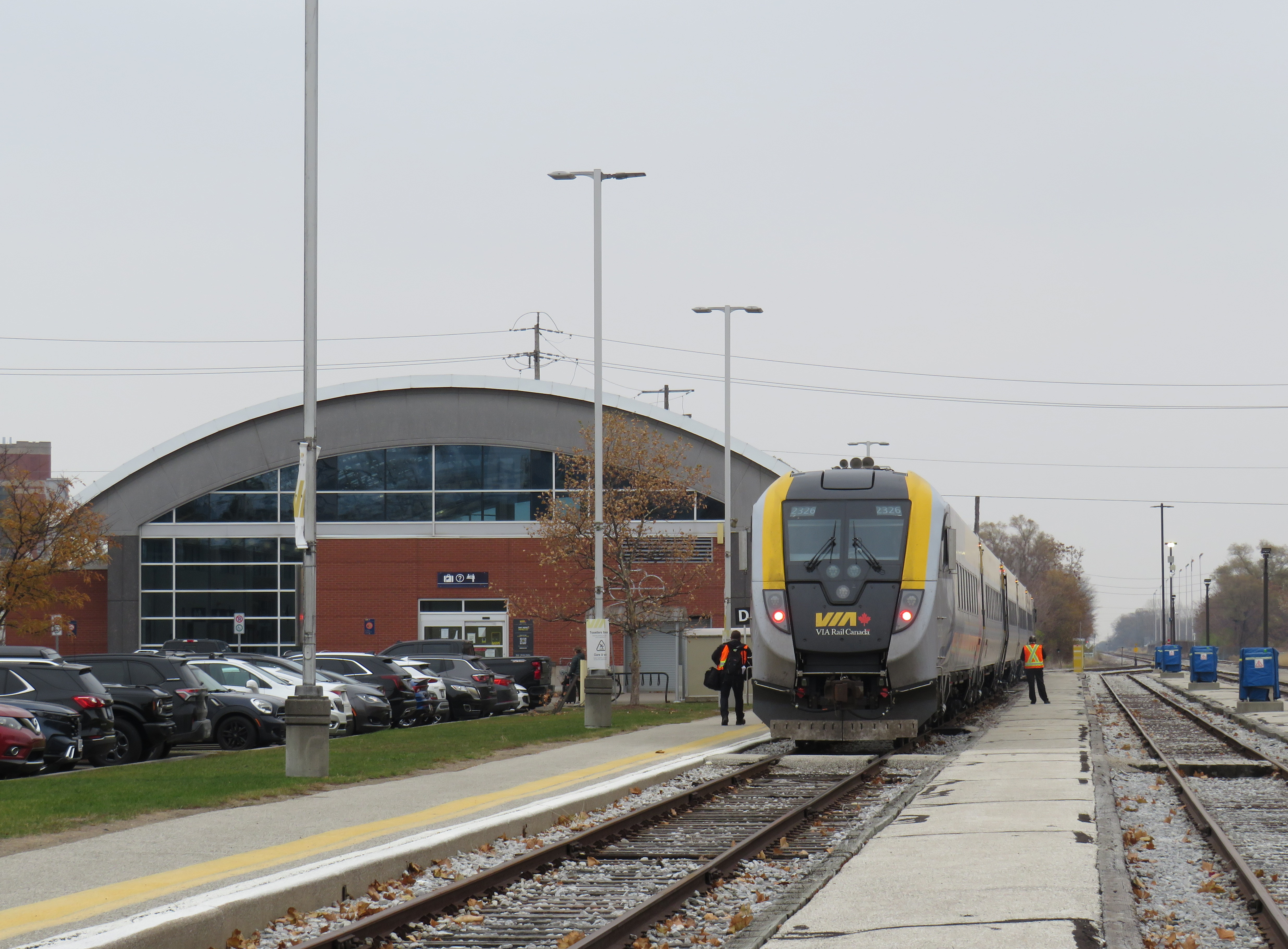
    The Crosstown Route 2 along Wyandotte Street stops nearby the VIA Station off Walker Road, about a five-minute walk between bus and train. But getting between the two modes is not clear. Apart from a VIA Rail logo on the transit map, there is little indication of this useful connection at the station or at the bus stops on Wyandotte. Route 2 offers decent service during daytime hours, every 10-15 minutes on weekdays from 6:00 AM to 6:00 PM, but it quickly drops to every 30 minutes at 6:30 PM. Saturday daytime service is every 20 minutes, and on Sundays, every 40 minutes. Frequencies on other core routes, including the 1A and 1C Transway buses, is similar.

    Compare this with Kingston, a city less than half of Windsor’s size, which provides direct transit service onto the VIA station grounds. In London, the downtown station is a more prominent landmark, and easy to get to by multiple routes.

    As a regular transit passenger used to fare cards, transit apps, and open payment systems, I found myself annoyed by having to carry exact change — a toonie, a loonie, and three quarters — every time I rode. Transit Windsor does have plastic fare cards, but they can only be loaded up with individual fares or a 15-day or 30-day pass, not a declining balance that could be used on regional routes. As cash is less common as a payment type (with some smaller businesses going cashless), larger transit agencies should catch up.

    The typical view from a Transit Windsor bus

    Finally, I became annoyed by how many buses in Transit Windsor’s fleet are fully covered by vinyl advertising wraps, excepting only the windshield, front door, and driver’s side window. Even the LTW 42 bus, which goes a long distance at higher speeds, was fully wrapped. I took six different buses in two days and only one wasn’t wrapped. It makes for a miserable time as a rider, especially one who wants to see the neighbourhoods the buses pass through; I explained why advertising wraps are a bad idea before. At the very least, ad wraps should limit how much of the passenger window area is covered, as the TTC does.

    Windsor has all the essentials for building a good transit system: a large pre-war urban area, post-secondary institutions, hospitals, and a well-populated and growing exurban and rural periphery. It just needs the leadership to recognize its potential.

  • The streetcar returns to Detroit – but who benefits?

    IMG_1489-001Woodward Avenue at Mack Avenue, August 2017

    I grew up in Brampton, a suburb of Toronto. Our family could not justify long, expensive vacations, but we did make several trips to Detroit and the region, usually to visit the Henry Ford Museum and Greenfield Village. We’d stay at a hotel outside Detroit, usually one with a swimming pool. Besides the museum visit and the pool, my parents would usually include a stop at an outlet mall. We’d also drive through Detroit itself, sparking my enduring fascination with the city.

    Since my first visit in the mid-1980s, the Hudson’s Department Store has been demolished, the Michigan Central Station has been permanently closed and allowed to deteriorate, and several downtown skyscrapers have closed and been abandoned. The city itself continued to lose population as more auto plants closed in the city and surrounding suburbs, and city services declined.

    But on recent trips, on my own or with friends, we started to see the beginnings of what looked like a comeback. New downtown baseball and football stadiums, followed by new office buildings, the re-opening of the long-abandoned Book-Cadillac and Fort Shelby Hotels, the opening of the Detroit Riverwalk and Dequindre Cut multi-use paths, and new residential development Downtown and Midtown.

    On the last trip to Detroit, my wife and I stayed downtown, at a hotel in the David Whitney Building, a formerly-abandoned office tower. We walked around Downtown Detroit and Eastern Market, visited the famous Art Deco Fisher Building, and went to several museums, including the Charles H. Wright Museum of African-American History, and the Detroit Historical Museum, both of which had special exhibitions marking the 50th anniversary of the 1967 Detroit Rebellion (also known as the 12th Street Riot). We ate at great local restaurants as well.

    And I went back to the Henry Ford Museum and Greenfield Village, both of which were as fun and as interesting as I remember.

    We also took the new QLine Streetcar. It was a fun ride, and I’m happy to report that the service was well used by both residents and tourists alike. But I have some serious concerns as well.

    (more…)

  • The new American streetcar: A visit to Detroit, Cincinnati, Atlanta, and Tampa

    IMG_5868-002The brand new Atlanta Streetcar

    I went on a short vacation, driving down Highway 401 and Interstate 75 from Toronto to Florida’s Gulf Coast. From there, I went on to Miami and Miami Beach, before flying back north; first to New York, then back home to Toronto.

    On the drive down, I took the opportunity to visit some of the cities along the way. Once I crossed the border and entered Detroit, my route followed Interstate 75 all the way. The great highway, 2,875 kilometres (1,786 miles) long, goes from the Canadian Border at Sault Ste. Marie to Naples, Florida, and via Alligator Alley to just north of Florida on the Atlantic Coast.

    Interstate 75 passes through Detroit, Cincinnati, Knoxville, Chattanooga, Atlanta, and Tampa; all were stops along the way. Four of those cities — Detroit, Cincinnati, Atlanta, and Tampa, all are either building, or have completed, new streetcar lines. Tampa’s TECO Line is a vintage heritage streetcar (like those in New Orleans and Memphis), the other three are modern streetcar lines that are or will be similar to those in Portland and Seattle — short urban circulator routes. Nearly all streetcar routes build in the last decade have followed Portland’s model of a modern circulatory streetcar; older systems, such as Tampa’s (or those in Memphis and newer lines in New Orleans) are heritage-type streetcars, using vintage or replica equipment on lines that are part of the regular transit system, but geared more to tourists and occasional riders.

    Unlike light rail, (think Calgary’s C-Train, or Los Angeles’ Gold, Blue, Green, or Expo Lines), the new streetcar systems being built in the United States have short stop spacing, usually run in mixed traffic (or in separate lanes on city streets), and are often built to promote urban development, tourism and/or local transit ridership. The systems planned or being built here in Ontario, such as Ottawa’s Confederation Line, or Kitchener-Waterloo’s ION line, should be considered to be light rail (though ION will be partially running in city streets in Uptown Waterloo and Downtown Kitchener).

    Detroit

    IMG_5482-001
    Looking down Woodward Avenue towards Downtown Detroit, January 2015

    After crossing the border, I made a quick stop in Detroit to see the progress on the M-1 Rail streetcar.

    The 12 stop, 5.3-kilometre (3.3 mile) streetcar route, now under construction, will run on Woodward Avenue, Detroit’s main street, from Congress Street, downtown near the river, up to Grand Boulevard, in the New Center district. The streetcar line will link the reviving downtown core, three major sports venues and live theatres, Wayne State University and the fabulous Detroit Institute of Arts, and Detroit’s Amtrak Station. (Map)

    Near Wayne State University, the roadway was being rebuilt to accommodate the new tracks; crews had dug-up the old streetcar tracks last used in 1956. Detroit once had a very extensive streetcar system that was one of the first to be publicly owned (Detroit and Toronto were pioneers in this respect); Detroit’s Department of Street Railways (DSR) even had a fleet of modern PCC streetcars in the post-war era. But the Motor City opted for buses, and it, with state and federal financing, was busy building a network of freeways to serve that rapidly decentralizing urban area. The M-1 streetcar is scheduled to open in 2016; 60 years after the last Woodward streetcar pulled into the carhouse in Highland Park for the last time.

    The route will mostly operate in curb lanes, much like other modern streetcar routes in Portland, Seattle, and the new Atlanta Streetcar discussed below. Interestingly, only the central section will have overhead wires; downtown and in New Center, the streetcars will operate off of battery power.

    In a city emerging from bankruptcy, Detroit’s short streetcar is being built mostly with private money; downtown business interests and some public institutions, such as Wayne State University, are contributing most of the funds. These business interests include the owner of the Detroit Red Wings and Tigers, pizza magnate Mike Illitch. Illitch’s firm, Olympia Developments, is looking to build a new arena for the Red Wings right on the streetcar line. Dan Gilbert, the head of Quicken Loans, centralized his company’s offices downtown and is one of the line’s biggest backers.

    Certainly the line will be an improvement and spur more development along Detroit’s most famous avenue; it will connect most of Detroit’s major trip generators. But the rest of the city is sprawling, largely poor and blighted,; the public transit system, D-DOT, has been forced to make major cutbacks in the last few years.  The city and federal governments preferred to build a bus rapid transit system that would serve suburban commuters as well as city residents; this is the main reason private funds are being used for this project.

    IMG_5469-002
    Former DSR tracks, last used in 1956, are removed as construction progresses on the M-1 streetcar, January 4, 2015

    Cincinnati

    IMG_5599-001
    Central Boulevard, where newly laid streetcar tracks sit above the abandoned Cincinnati Subway 

    The Cincinnati Streetcar, also planned to open in 2016, is further ahead in construction than Detroit. Like Detroit’s line, it was planned to link the downtown core with sports and entertainment venues, educational institutions, and gentrifying neighbourhoods. However the line, first proposed in 2007, has been mired in controversy. An unlikely alliance, conservatives and the NAACP, opposed the streetcar plan for different reasons and backed ballot initiatives to block the project. Republicans at the state level pulled funding for the project and opposed it at the federal level. (To put it very simply, conservatives were opposed to money spent on the project, while the NAACP saw the streetcar, serving the downtown and the gentrifying Over-the-Rhine district, distracting from social needs elsewhere in the city.) Until a pro-streetcar council was elected, it seemed that Cincinnati was yet again going to see a rail transit project abandoned before completion.

    After the First World War, plans were drawn up for a new streetcar subway line through an abandoned canal bed on the north side of the downtown core, with a new parkway built on top (Newark and Rochester also built streetcar subways in disused canal beds; Rochester’s was abandoned in the 1950s, Newark’s City Subway is still in use as part of its light rail system.) Central Parkway was built; the subway underneath was partially completed, and when the costs to complete the line soared, and construction bonds ran out, work was abandoned. The Cincinnati Street Railway completely got rid of its streetcars in 1951. Interestingly, many of Cincinnati’s streetcars continue in service here in Toronto. The purchase of 52 PCC streetcars was the first of several streetcar acquisitions the TTC made from American cities abandoning their street railways in the 1950s.

    The current route being completed is a short 5.8 kilometre (3.6 mile) long loop, utilizing Cincinnati’s one-way street grid. (Map) In effect, the first phase would be nearly half the length of Detroit’s starter line. (The extension to the university campus is now planned for a later phase, subject to funding.)

    While in that city (which I’d like to explore further; I was only there overnight and in the morning), I got to see new streetcar rail be laid along the route, and poles put up for overhead wiring. But without the extension to the University of Cincinnati, and a route catering more to tourists and to downtown and Over-the-Rhine residents and bar-goers, I wonder about the utility of this one short loop.

    IMG_5555-001Laying track for the Cincinnati streetcar, near the Reds’ ballpark

    Atlanta

    The Atlanta Streetcar opened on December 30, 2014, so I got to ride it a week after its launch. The Atlanta Streetcar, intended as the first phase of a larger system, connects downtown with the near east side, an area known as the “Old Fourth Ward” which includes the Dr. Martin Luther King Historical Site (where the civil rights leader was born, grew up and preached at his community church). The route, a one-way loop, similar to Cincinnati’s project, is only 3.7 kilometres long (2.3 miles); streetcars currently run every 10-15 minutes. For the first three months, the streetcar is free. Atlanta ripped out its streetcar system in the 1930s and after the Second World War; the last streetcar operated in the Georgia capital in 1949.

    The route serves many of Atlanta’s tourist attractions, including the King Historic Site, the Centennial Olympic Park, the World of Coca-Cola and the Georgia Aquarium (Atlanta, being land-locked, hundreds of miles from the Ocean and not even on a river, is an odd place for an aquarium, but I digress) and connects with Atlanta’s rapid transit system, the MARTA subway.

    But the streetcar’s short route, and infrequent schedule work against it. I found it to be very slow, and with a frequency of only every 10-15 minutes, it isn’t an efficient way of getting around the downtown core. If you miss it, you’re better off walking.

    IMG_5903-001
    The Atlanta Streetcar in mixed traffic. Note that cyclists are banned from the streetcar’s route.

    Tampa

    IMG_5991-002
    TECO Line streetcar at Whiting Station, in the south end of Tampa’s downtown core

    Tampa’s streetcar, opened in 2002, connects Tampa’s downtown with the historic Ybor City neighbourhood via a route along the city’s waterfront. While Tampa’s downtown is an important regional financial centre, it is rather dull, even sterile. Ybor City has emerged as the city’s nightlife and entertainment district. It has a bit of the same architectural charm one finds in the French Quarter in New Orleans.

    Like most early streetcar projects in the modern era, the TECO Line (named for Tampa Electric, the electric utility that helped sponsor its construction and operating partner) is a vintage streetcar system, using replica “Birney” streetcars built by the Gomaco Trolley Company in 2000. The streetcars run every 20 minutes, until about 9PM on weekdays and after midnight on Friday and Saturday nights. The line also passes the arena where the NHL’s Tampa Bay Lightning play; service is extended when there is a home game on weeknights. The TECO line is operated by the Hillsborough Area Regional Transit; fares are integrated with the rest of the local transit system.

    IMG_5986-002
    Interior of a replica streetcar on the TECO line

    Like most American streetcar lines, TECO streetcar line is intended to boost development (of Tampa’s waterfront and around Ybor City) and caters to tourists; there were several European visitors on the ride into Downtown Tampa. But unfortunately, all but one streetcar in service that day were wrapped in full-body advertisements, obscuring the view out the windows. I detest transit ad-wraps; they devalue the transit agency’s branding; if they cover windows, they partially obscure the view from inside the vehicle. I feel that they disrespect paying passengers. But to wrap the signature transit fleet, especially one intended for visitors and occasional transit riders, seems wildly inappropriate.

    IMG_5967-002
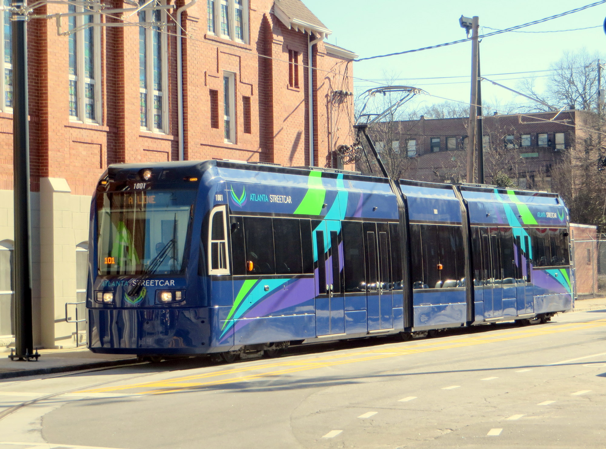
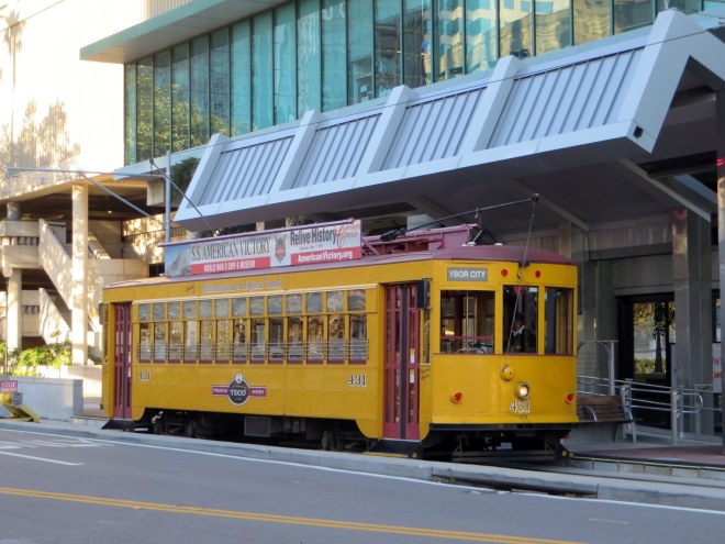
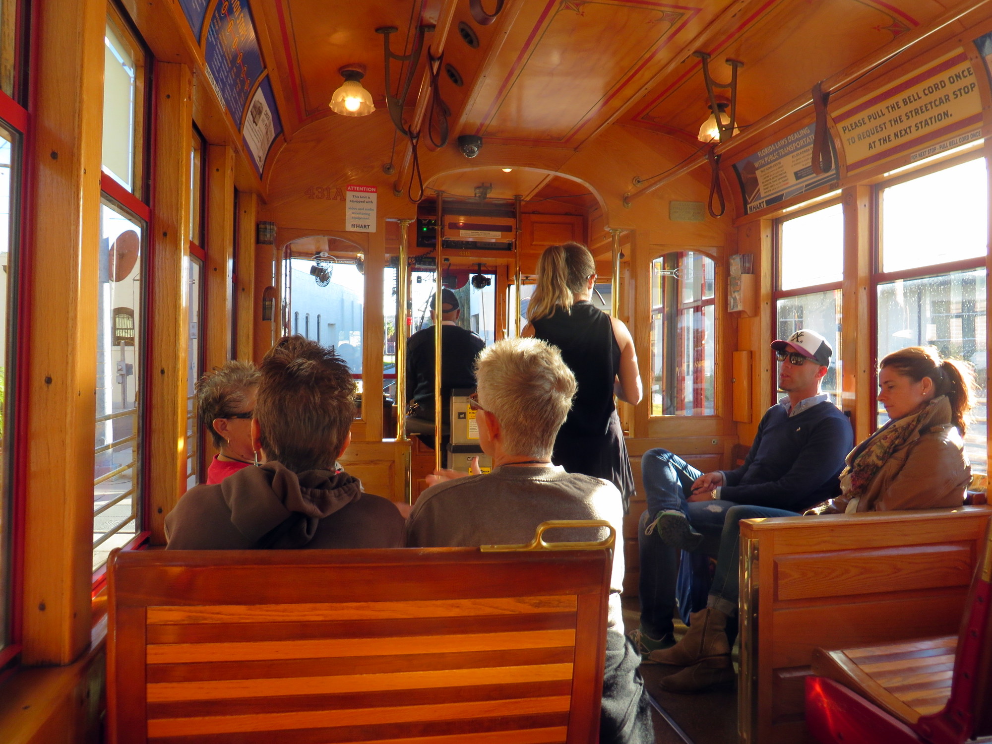
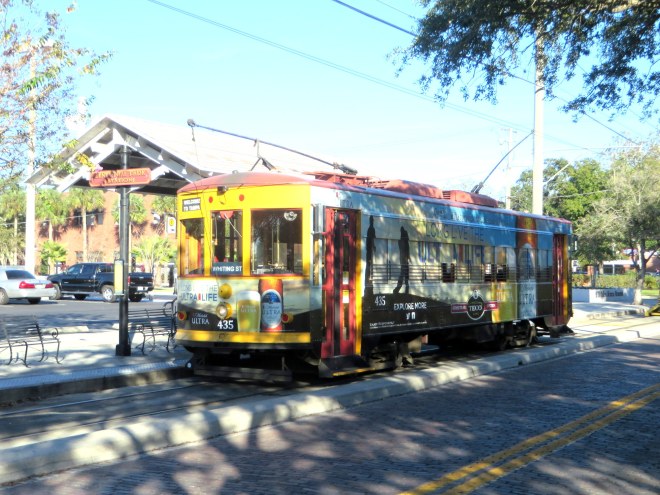
Fully wrapped TECO streetcar in Ybor City

    Concluding thoughts

    I’m a Torontonian, and I have loved streetcars since I was a small child. They have a certain “magic” that buses simply don’t have. Here in Toronto, and San Francisco, Philadelphia, Melbourne and many cities in Europe, streetcars/trams are an essential part of the transit network. Following Portland’s lead, the new modern streetcar lines being built across the United States (Washington, Milwaukee, and Kansas City are also building new streetcar lines) are looking to rail transit to promote mobility and economic growth in specific parts of those cities. Perhaps the small starter lines being built now will grow into large networks.

    It’s likely that Atlanta’s streetcar system will grow and become more useful. Maybe Detroit’s M-1 streetcar will speed up the revitalization of the Woodward Avenue corridor and become a symbol of the Motor City’s turnaround (it does have the most utility, it seems, of the four routes I saw on this trip). I am happy to see federal money spent on transit and cities looking to building local transit projects, instead of the massive highway construction projects of the last century. But with those good feelings, I can’t help but feel a touch of skepticism as well.