I love maps, especially physical, paper maps. I like to visualize the places I travel to and determine how each city and region’s transit networks work. Though online interactive maps can be very helpful (like the ones I created to show all intercity transport services in Ontarioand across Canada, filling a much-needed gap), there is still nothing like a well-designed static map, especially when it is in print and easily accessible to the public.
This means providing maps that accurately and clearly depict the entire transit system, along with landmarks, connections, and frequency. Los Angeles Metro’s system map does a reasonable job for a map that covers a very large region.
The Los Angeles Metro system map depicts the complex bus and rail network, including non-LA Metro agencies like Culver Citybus and Santa Monica’s Big Blue Bus. Colours and line width used to denote operator, service type, and frequency.
Thankfully, most urban transit systems in North America continue to provide proper system maps both on their websites and in print, provided free on request at subway booths or terminal offices. (Some, however, have charged a small fee for a physical copy of their transit maps, such as San Francisco’s Muni.) In Europe, complete transit maps often have to be purchased, such as in Berlin or Vienna.
I recently visited two mid-sized American cities that have done away with physical maps for their transit systems: Pittsburgh, Pennsylvania and Denver, Colorado. In those cities, figuring out how to get around by tram and bus was frustrating, even in an age of Google and Apple maps and transit planning apps accessible to anyone with a smartphone.
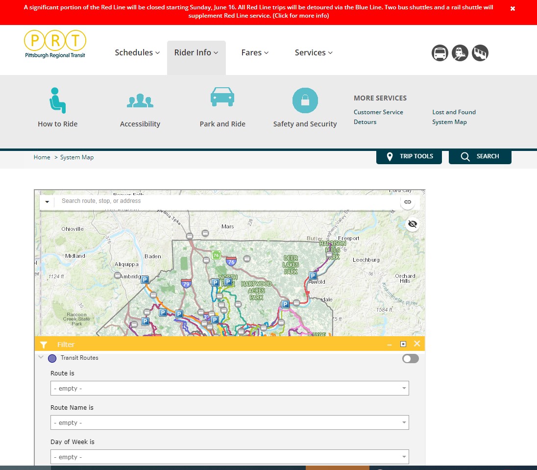
Pittsburgh Regional Transit (formerly known as Port Authority Transit) operates a complicated web of bus routes that radiate from the city’s downtown core, along with a few cross-town and feeder routes. There are three busways and a light rail service to the southern suburbs. However, there is no proper system map, either in print or online as PDF or image file that allows the new or casual user to make sense of the network.
The user can then select a service by route name or number in a drop-down tool, but the map itself is difficult to figure out. Zooming in reveals the location of fare vendors and park-and-ride lots, but not important service details like route numbers or service frequency.
Zooming in, park-and-ride lots become the most prominent feature
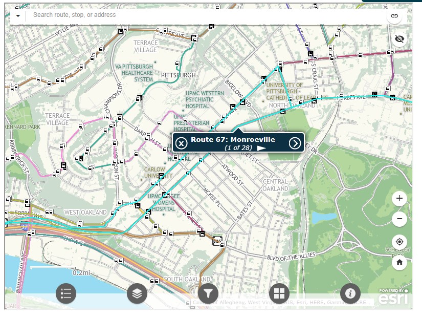
Even at the neighbourhood level the map is difficult to read. The screenshot below shows Pittsburgh’s Oakland district, home to University of Pittsburgh, Carnegie Mellon University, several other educational institutions, medical centres, parks, museums, and cultural venues. Many bus routes follow Forbes Avenue and Fifth Avenue, but as each route is layered on top of each other, it is difficult to discern where each route runs and where they go.
PRT’s ESRI interactive system map, zoomed into the Oakland District
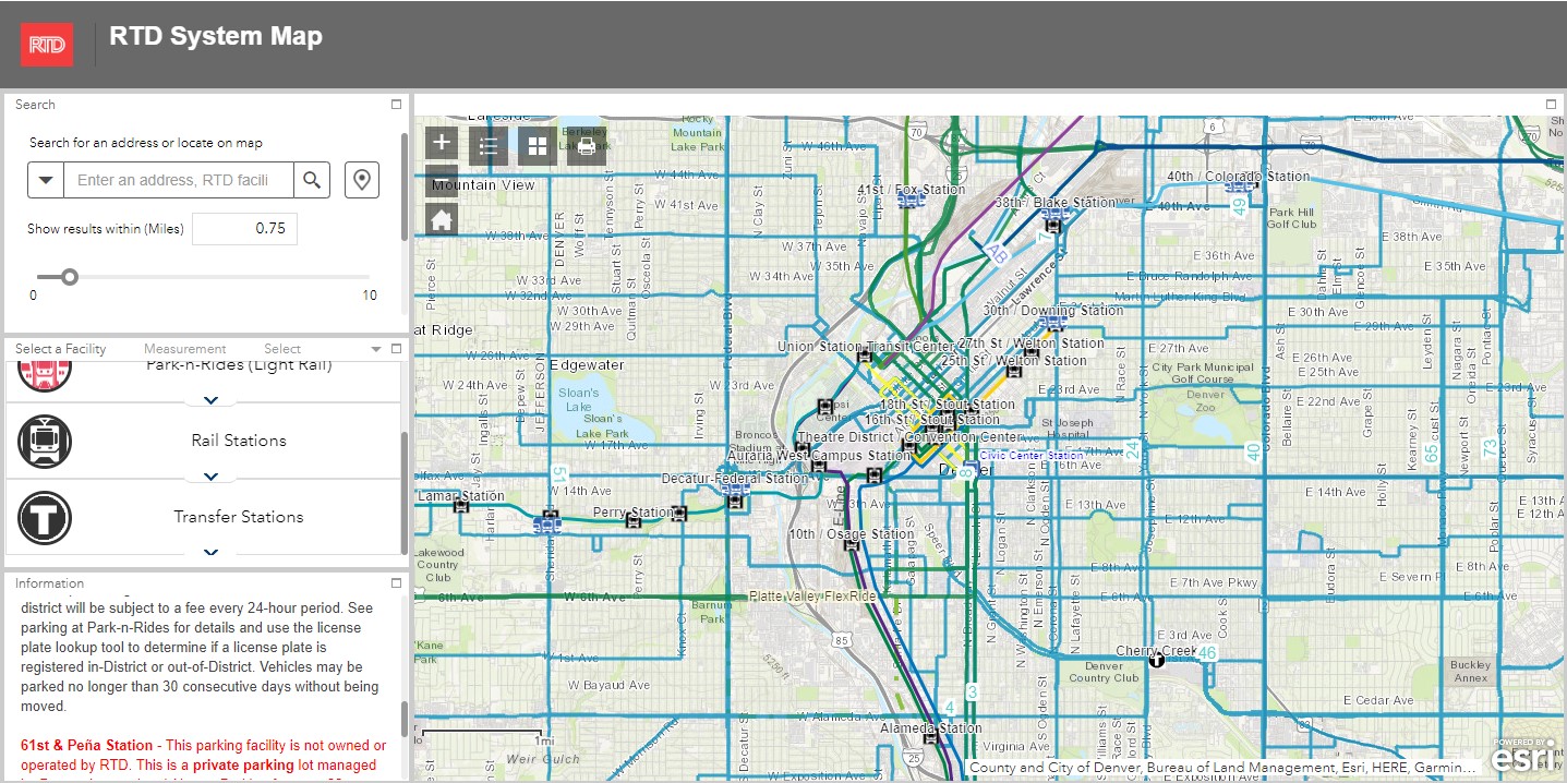
Denver’s Regional Transportation District (RTD) also uses ESRI interactive maps to show bus routes (rail services are depicted in a static image map as well). At a small scale, only the light rail and commuter/regional rail services appear, along with transit park-and-ride locations. Denver’s bus system is less complicated than Pittsburgh, operating largely on a grid, but still, a proper map would make it much easier to get a sense of the network.
Zoom in, and bus routes appear, along with route numbers, but there is nothing to show the level of service for each route.
Though online-only interactive maps have their purpose (my Ontario and Canada intercity maps are designed to show where connections exist, or not, and how to obtain schedule information), they are not well suited for urban transit systems and are very difficult to read on a mobile device. Properly designed static maps, in web image or PDF format do much better jobs.
It is worth comparing Pittsburgh and Denver to the Toronto Transportation Commission (TTC). The TTC’s complete system map is provided to customers for free at subway stations, with smaller, simplified versions available as tear-away pamphlets. Large-format versions are also displayed across the network in bus shelters and subway stations. A PDF version can also be easily found on the TTC website in the main Routes and Schedules page. Surface routes are categorized by service level (express, frequent service, regular service, limited service, seasonal, and community routes) with major landmarks and transfer points to connecting services clearly indicated.
I have some minor complaints about the TTC’s map (like regular routes, express routes should be categorized in the map based on their service levels, for instance) but it is a reasonable, easy to read map that is also quite easy to find.
Unfortunately, more transit systems are moving away from easily accessible paper maps. Durham Region Transit, for example, no longer provides copies of its system map. Fortunately, a proper, well-designed PDF copy remains accessible on its website.
When travelling, or looking to understand a city’s transit network though, there is nothing quite like poring through a well-designed, easy-to-read paper map. It would be a shame if more agencies went the way of Denver and Pittsburgh.
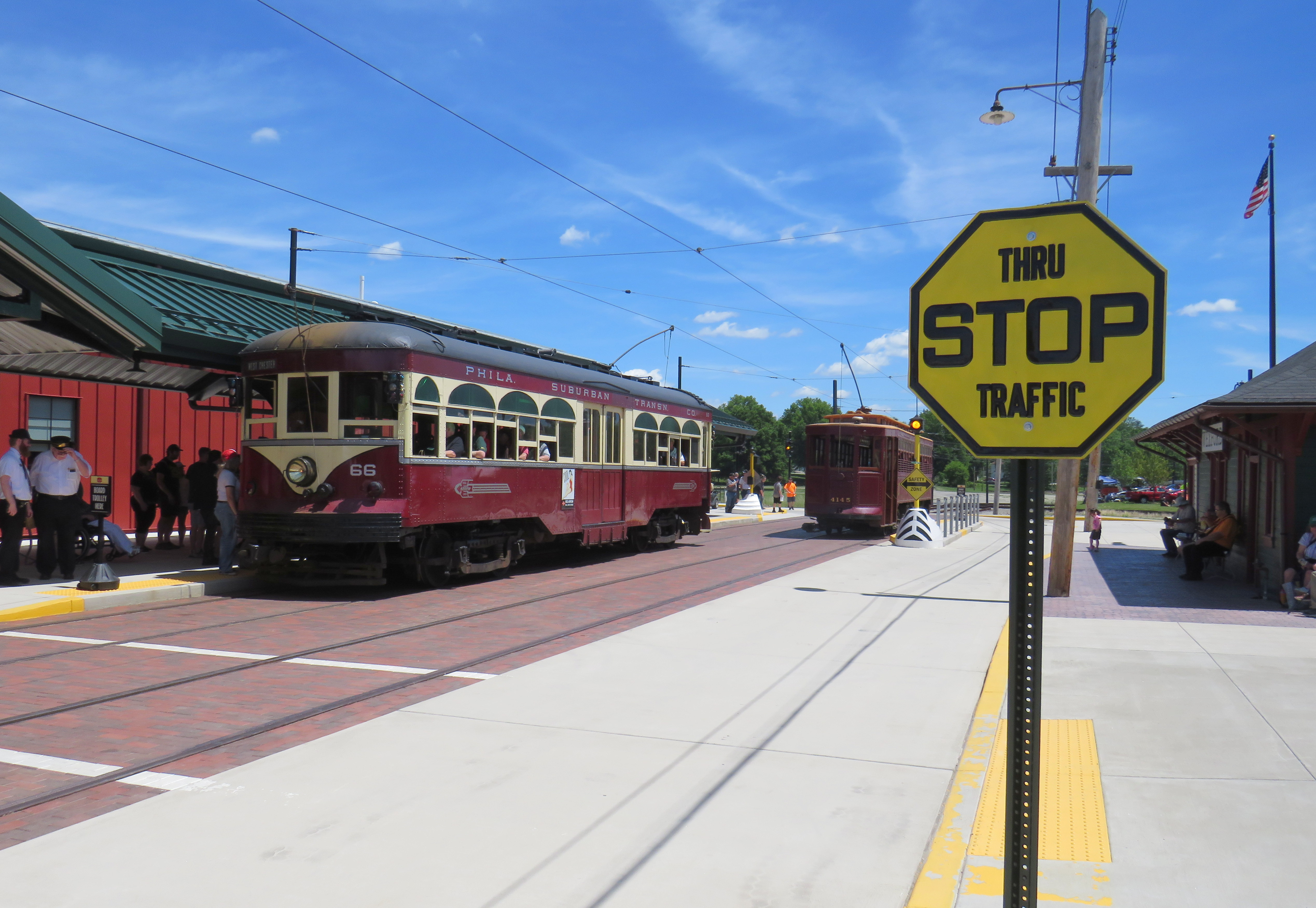
The Pennsylvania Trolley Museum now features a new main entrance and exhibition hall, along with an on-street boarding area complete with vintage signage.
While visiting Pittsburgh earlier in June, I also paid a second visit to the Pennsylvania Trolley Museum (PTM), located 45 minutes south of Downtown Pittsburgh in Washington PA. I had visited the museum a few years prior as part of a visit to the Pittsburgh area, but since then, a new section of the museum opened to the public, and there were additional cars in operation.
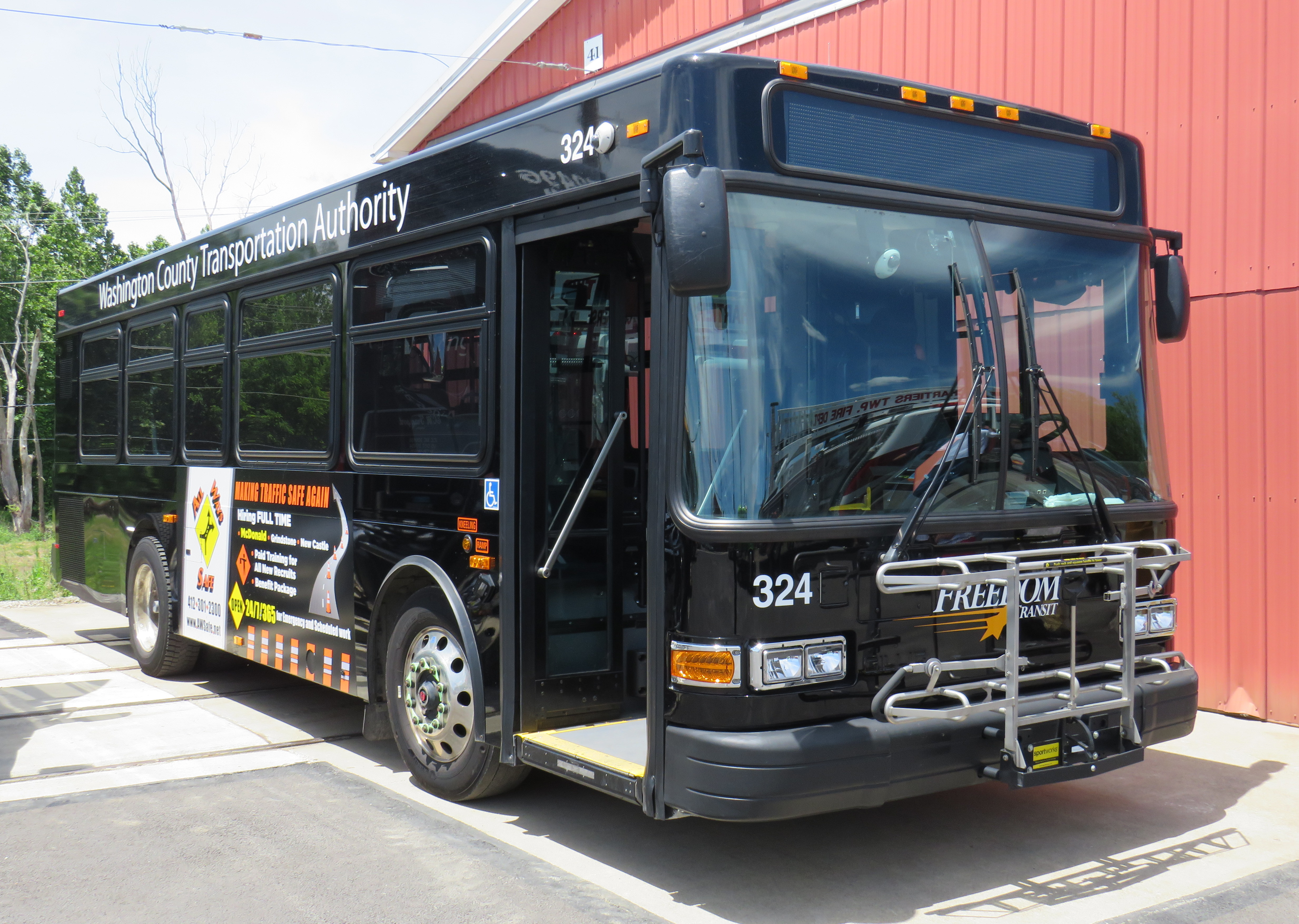
While I went to PTM with a friend who planned to stick around until the evening, I planned to return to downtown Pittsburgh earlier in the afternoon. I found information on a local transit service operated by Washington County — called Freedom Transit — that ran a route to and from Pittsburgh that stopped not too far from the museum’s main entrance. That plan did not go well at all.
It is an unfortunate irony that most North American transit museums have poor or non-existent transit access. There are historical reasons why this came to be, but some of the continent’s best transportation exhibitions are inaccessible to newer generations of transit fans, historians, and enthusiasts, many of which do not or cannot drive.
Washington County Transportation Authority, or “Freedom Transit,” doesn’t offer much freedom(more…)
Returning to Downtown Pittsburgh across the Roberto Clemente Bridge after the game and a fireworks display
Earlier in June, a friend and I took a weekend road trip to Pittsburgh, a five-hour drive southwest of Toronto. On our first night there, we took in a ballgame at PNC Park, where the hometown Pirates hosted the Minnesota Twins.
Though I do not follow the Pirates (who are in the National League) nor the Twins (who are in the AL Central), I was excited to take in a ballgame in Pittsburgh because I have heard about the park’s intimate confines, the great view of the Pittsburgh skyline, and the fireworks that follow certain Friday and Saturday night games. PNC Park lived up to the hype.
Among the major North American sports leagues, Major League Baseball has the most significant differences between venues. Unlike hockey, basketball, soccer, and football fields, the dimensions of each playing surface vary considerably, as does the architecture. PNC Park was built in the retro-classic style similar to Baltimore’s Camden Yards; it opened in 2001. When the naming rights for the new publicly-financed stadium was purchased by local bank PNC, the city renamed the adjacent 6th Avenue Bridge for beloved Pirates player Roberto Clemente, a Hall of Famer and a humanitarian. That bridge is closed before and after each game to motor vehicles so that fans can walk and bike across the Allegheny River to and from downtown.
Statue of Roberto Clemente located between the stadium and the bridge renamed in his honour. No statues of cable tycoons can be found here.
The skyline view from behind home plate is spectacular, showcasing the most iconic buildings and some of the many bridges crossing the three rivers in the downtown area. With lots of washrooms, a wide concourse, and plenty of food and drink concessions, the stadium felt intimate, yet uncrowded. Lineups were always short, and where play wasn’t visible (such as in the washrooms), speakers played the radio broadcast. Ushers were very friendly and helpful as well.
View from up behind home plate
The game was followed by a 10-minute fireworks display, with the rockets launched off a barge in the Allegheny River.
Finale of fireworks show
Though transit access is quite good — there is a station one block away on Pittsburgh LRT’s North Shore extension — many fans walked part of the way home. Downtown parking garages — built for office commuters — provide much of the parking demand, so there are few surface parking spaces surrounding the stadium. Even the football stadium, a few blocks to the west, is mostly served by parking garages and another LRT station. Hotels, restaurants, museums, and apartments neighbour the two North Shore stadiums.
Walkability and transit access are the key to fostering a great fan experience. Walkable stadiums promote safe, accessible, and sustainable travel to and from sports venues, and help support local businesses. Downtown locations have the advantage of having better transit access, existing parking facilities, and in the case of Pittsburgh (or Detroit, or Minneapolis), a downtown ballpark can be a point of civic pride, showing off the city to its inhabitants, and to a much larger audience.
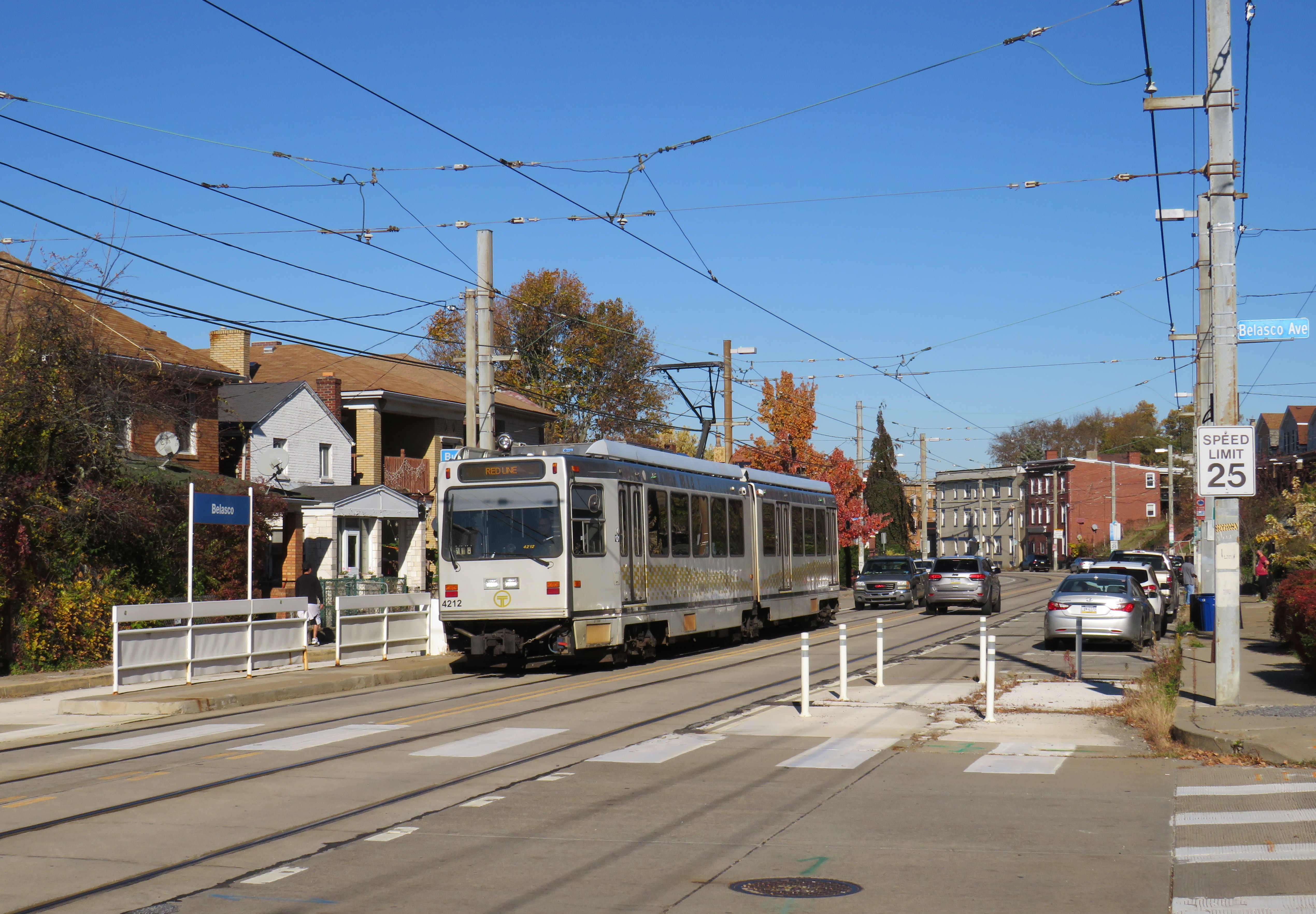
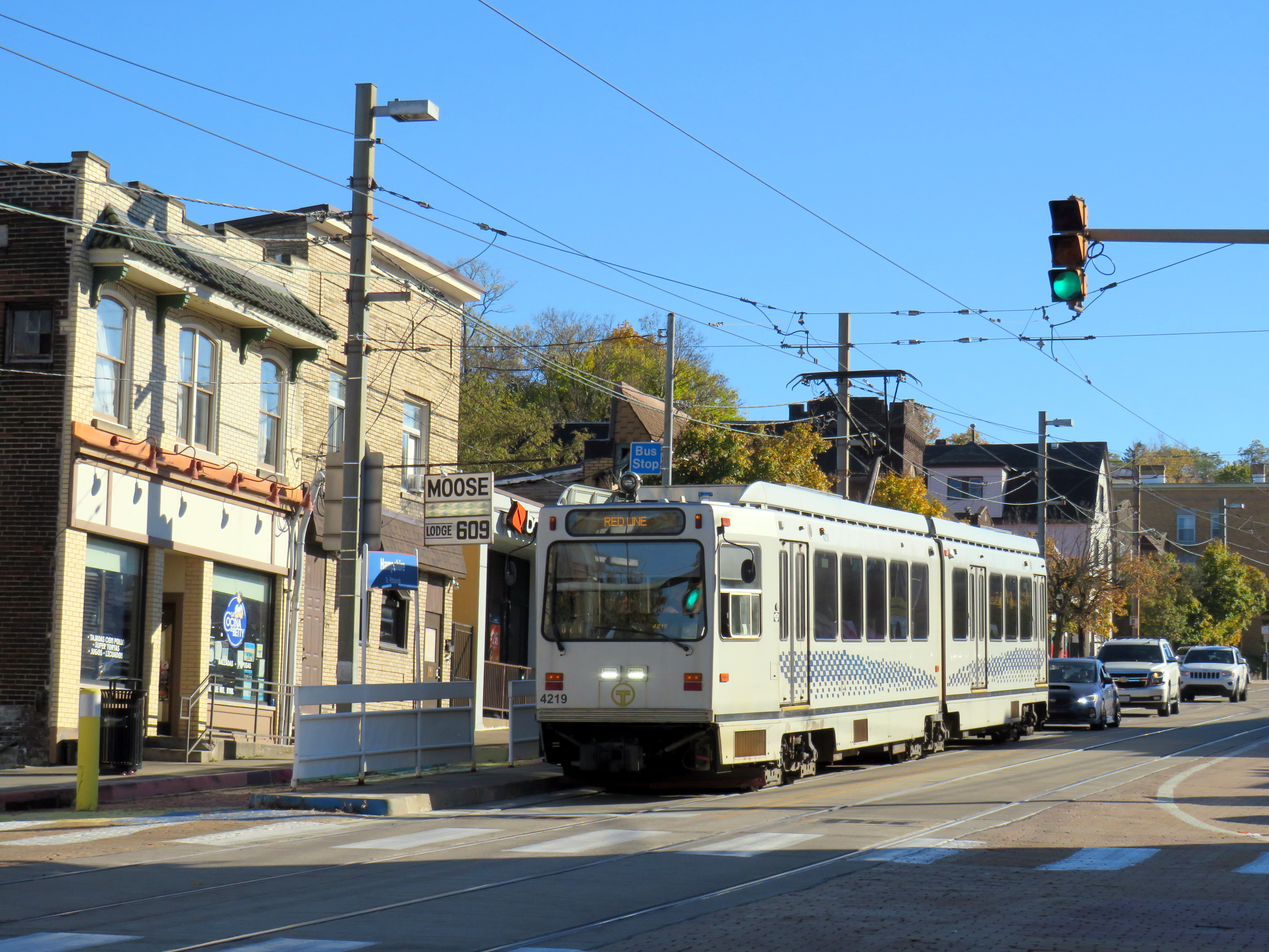
Pittsburgh Regional Transit Red Line train in the Brookline neighbourhood
In 2022, with travel restrictions eased, I had the opportunity to take several road trips throughout the Northeast and Midwestern states, from New York and Maryland to Kentucky and Michigan. Previously on this site, I wrote about my visit to Philadelphia’s Rail Park, a lesser-known, yet ambitious project to repurpose former Reading Railroad corridors in the city’s north end. I also wrote about Dayton’s trolley bus network, which, if operated to its full potential, could be a model for electrifying transit across North America.
In this post, I write about some of the other interesting transit services in Pennsylvania, Ohio, and West Virginia that I visited on my travels late last year, including a personal rapid transit prototype, the remnants of a huge legacy streetcar system transformed into a modern light rail line, bus rapid transit lines, and a new streetcar service I last visited while under construction in 2015. I even got to ride TANK.
Cleveland
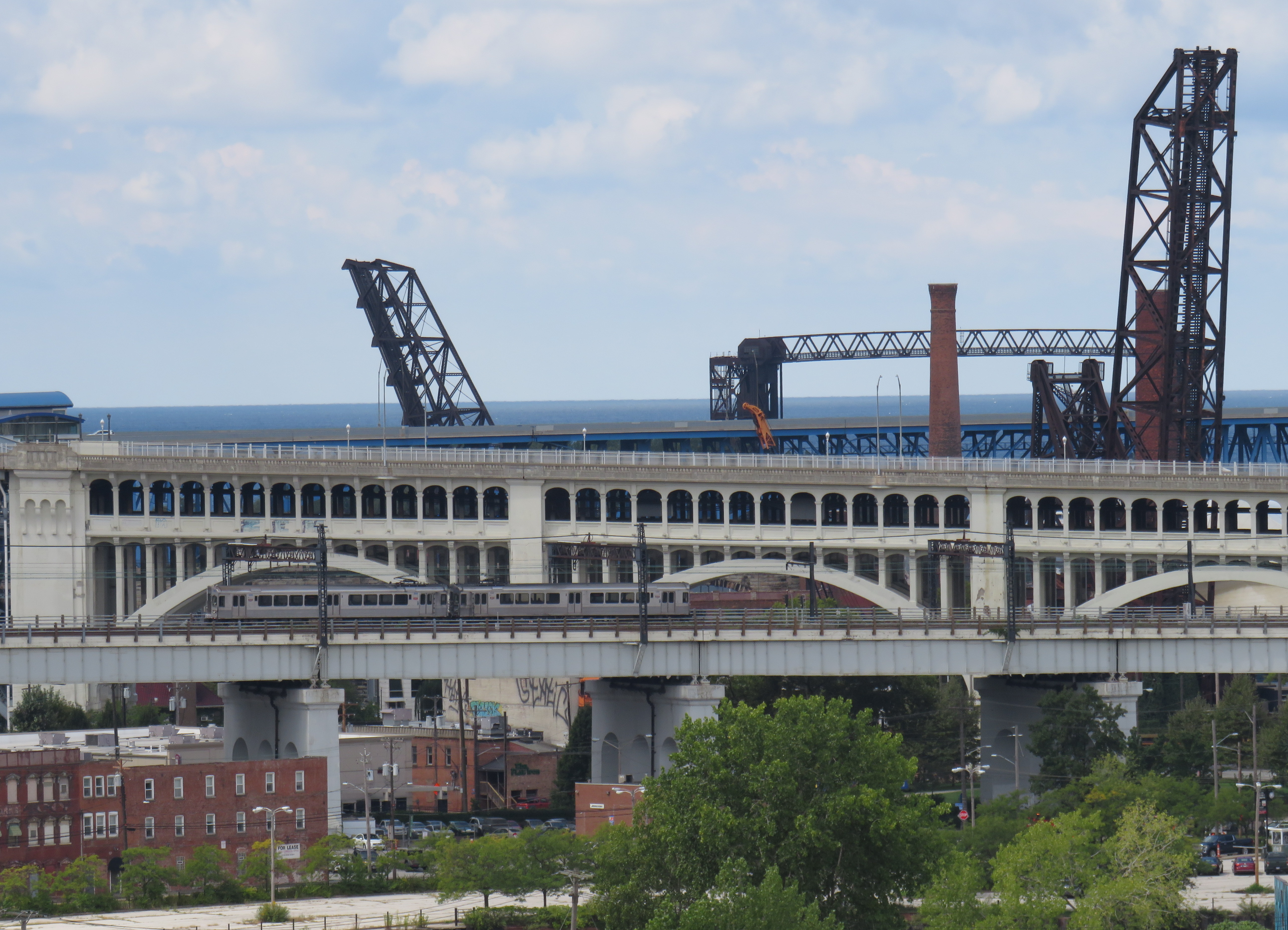
Cleveland Red Line train on one of the many bridges spanning the Cuyahoga River and the Flats. The arched double-decked bridge beyond the Rapid train once carried a streetcar subway into Downtown Cleveland from the west.
I visited Cleveland, Cincinnati, and Dayton in September 2022.
Cleveland, like most American cities, once had an expansive streetcar and interurban tram network. The city streetcars lasted until the early 1950s (its PCCs were acquired by the TTC), though the separate Shaker Heights Rapid Transit, which also used PCCs, continued in service.
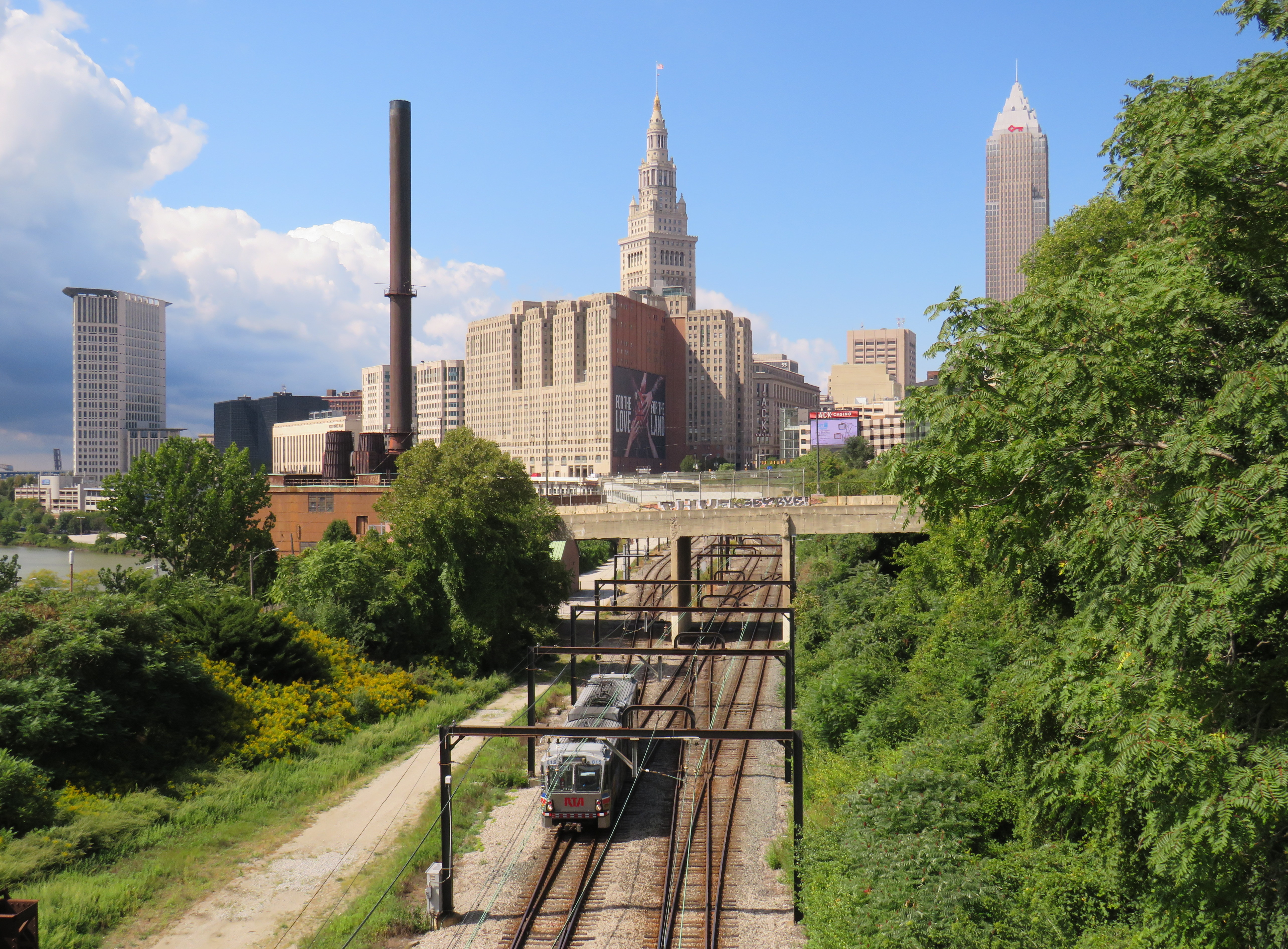
The Cleveland system, made up of the heavy-rail Red Line, and the light-rail Blue and Green Lines (the former Shaker Heights services), run almost entirely on the surface, largely adjacent to railway rights-of-way. The Red Line, built between the 1930s and 1960s, was North America’s first airport rail link when that extension opened in 1968. Unfortunately, the service suffers from low ridership, so it operates in two-car trains, every 15 minutes during daytime hours.
A Greater Cleveland RTA light rail vehicle heads eastbound from Downtown Cleveland, headed towards Shaker Heights. Terminal Tower in the centre background.
The Red Line follows an old passenger railway alignment into Terminal Tower, the massive transportation hub, office tower, and commercial development on Public Square. The complex included a hotel, Higbee’s Department Store (made famous by its appearance in A Christmas Story) and local and intercity train platforms. With the decline of passenger rail, the trains moved to a much smaller station on the waterfront, and the Higbee’s store later became a casino.
Both the Red Line and the former Shaker Heights light rail lines share the same tracks east of Downtown Cleveland, and both services run on overhead catenary.
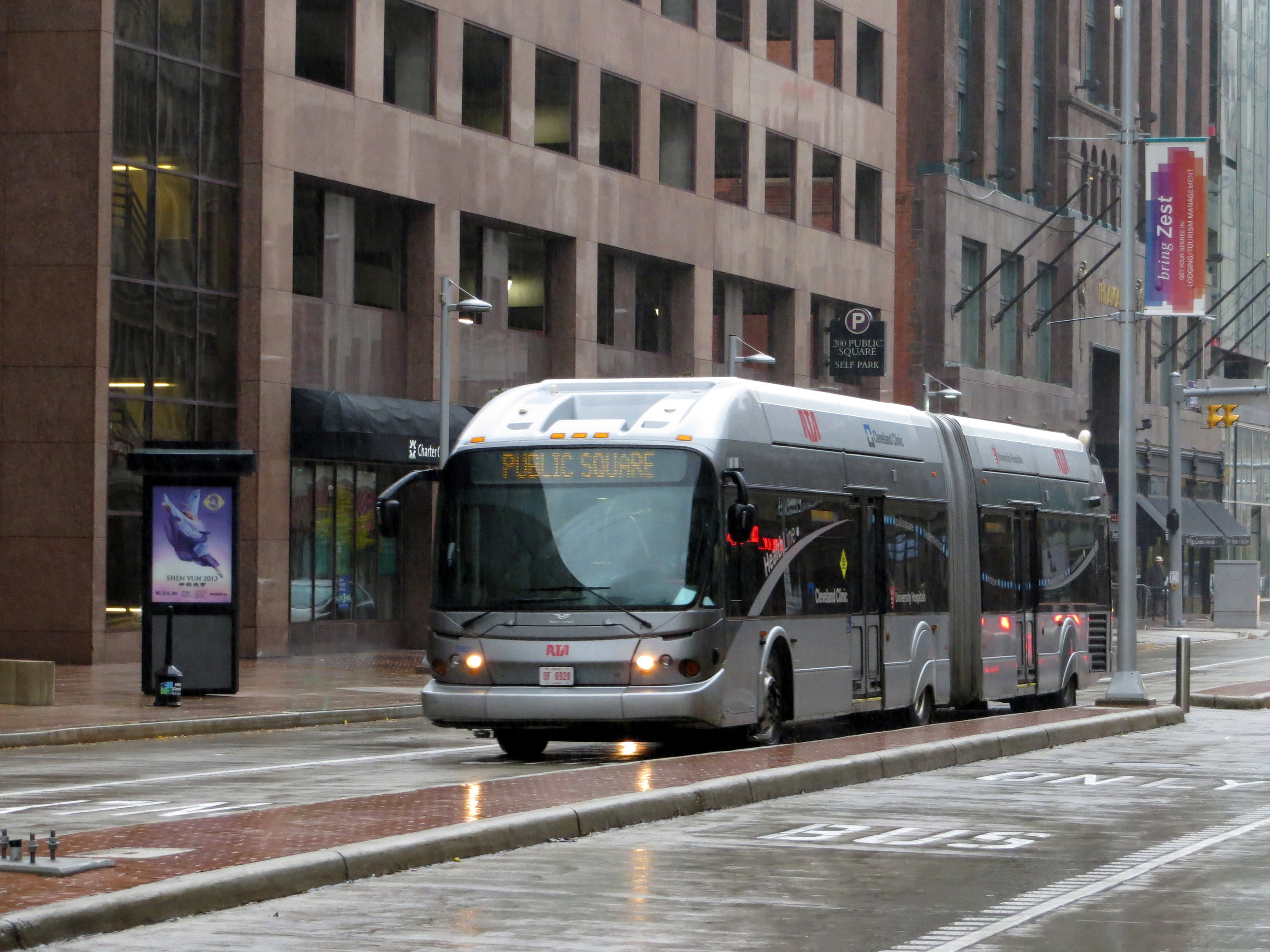
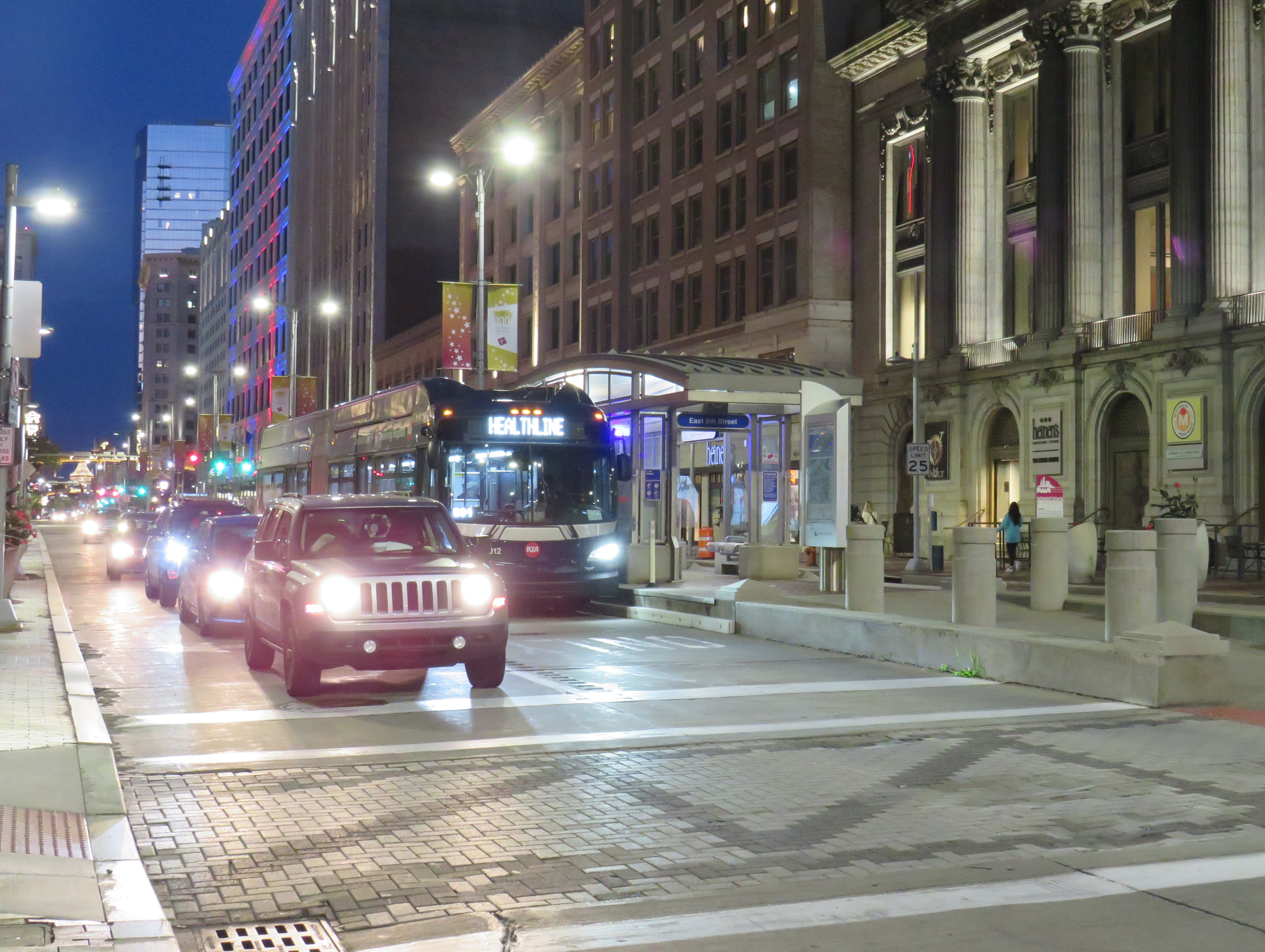
As the Red Line doesn’t follow city streets, Cleveland built a bus rapid transit line, branded “The HealthLine” on Euclid Avenue between Public Square and East Cleveland. The HealthLine is sponsored by the University Hospital and Cleveland Clinic health care corporations which it serves along with Case Western University and the art and cultural institutions clustered east of Downtown.
HealthLine bus with left-side doors
Though the HealthLine operates with special articulated buses with doors on both sides (to serve dedicated median stations, like that shown below), dedicated bus lanes are limited, and buses do not enjoy signal priority. However, the route is frequent and reliable, which is better than most urban bus services in the United States.
HealthLine bus on Euclid Avenue in Downtown Cleveland
Cincinnati
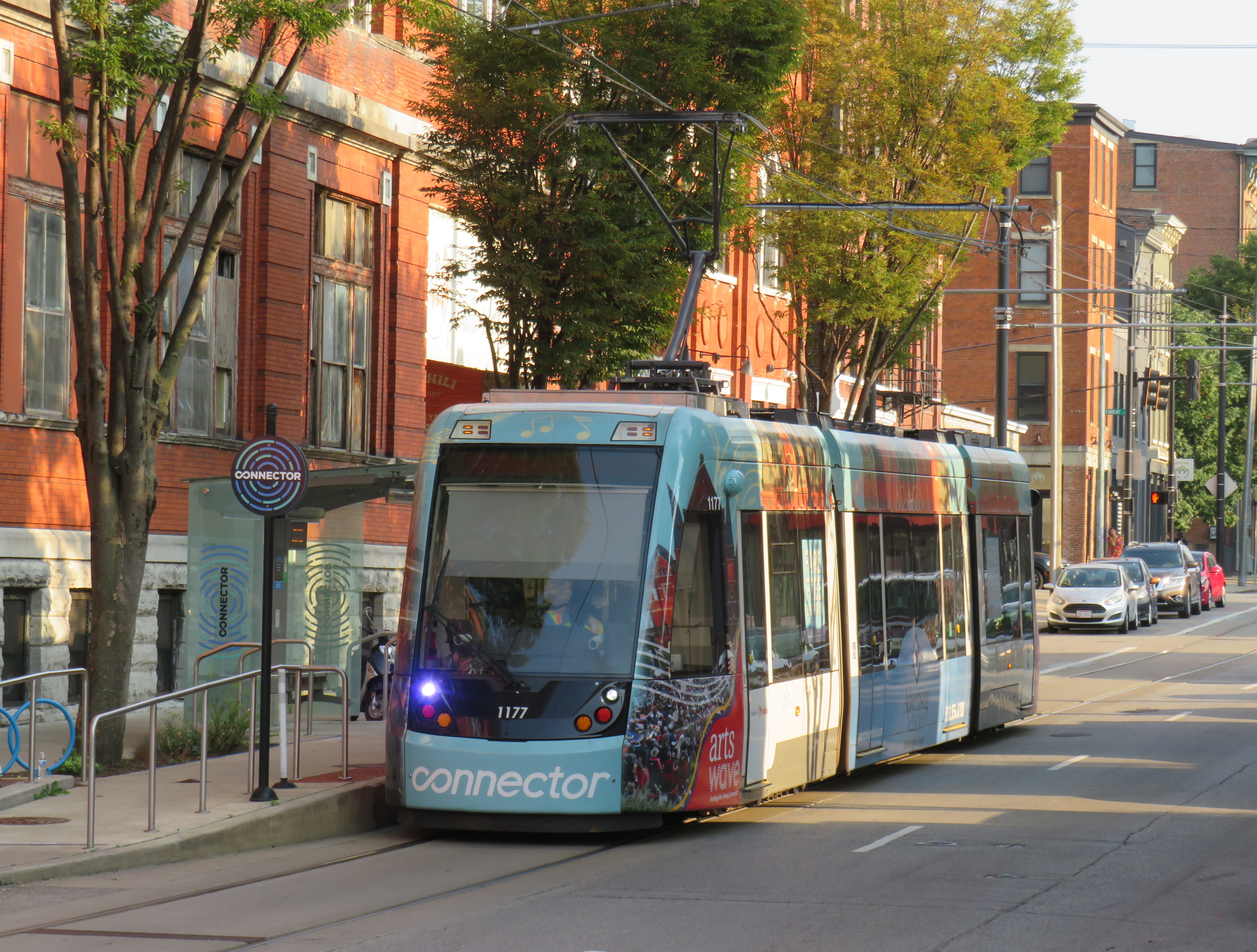
Cincinnati Connector
Like Cleveland, Cincinnati once had a large streetcar network, with trams also feeding into the city from communities in Northern Kentucky. Cincinnati abandoned its streetcars in the early 1950s, with the TTC acquiring its old PCC fleet.
The last time I visited Cincinnati, in January 2015, work had started on a new urban streetcar line that would connect its waterfront, the sports stadiums, the central downtown core, and the Over-the-Rhine area, a gentrifying neighbourhood north of the city core.
Like the modern urban streetcars in Atlanta, Detroit, Kansas City, and Portland, Cincinnati’s Connector serves a small area on a route practically geared to young urban residents and visitors. Though I came away with positive impressions of Kansas City’s streetcar (which is undergoing a lengthy extension), I felt that Cincinnati’s streetcar — like Atlanta’s and Detroit’s — was too slow, too infrequent, and too short to be of great use. At least the service was free to use.
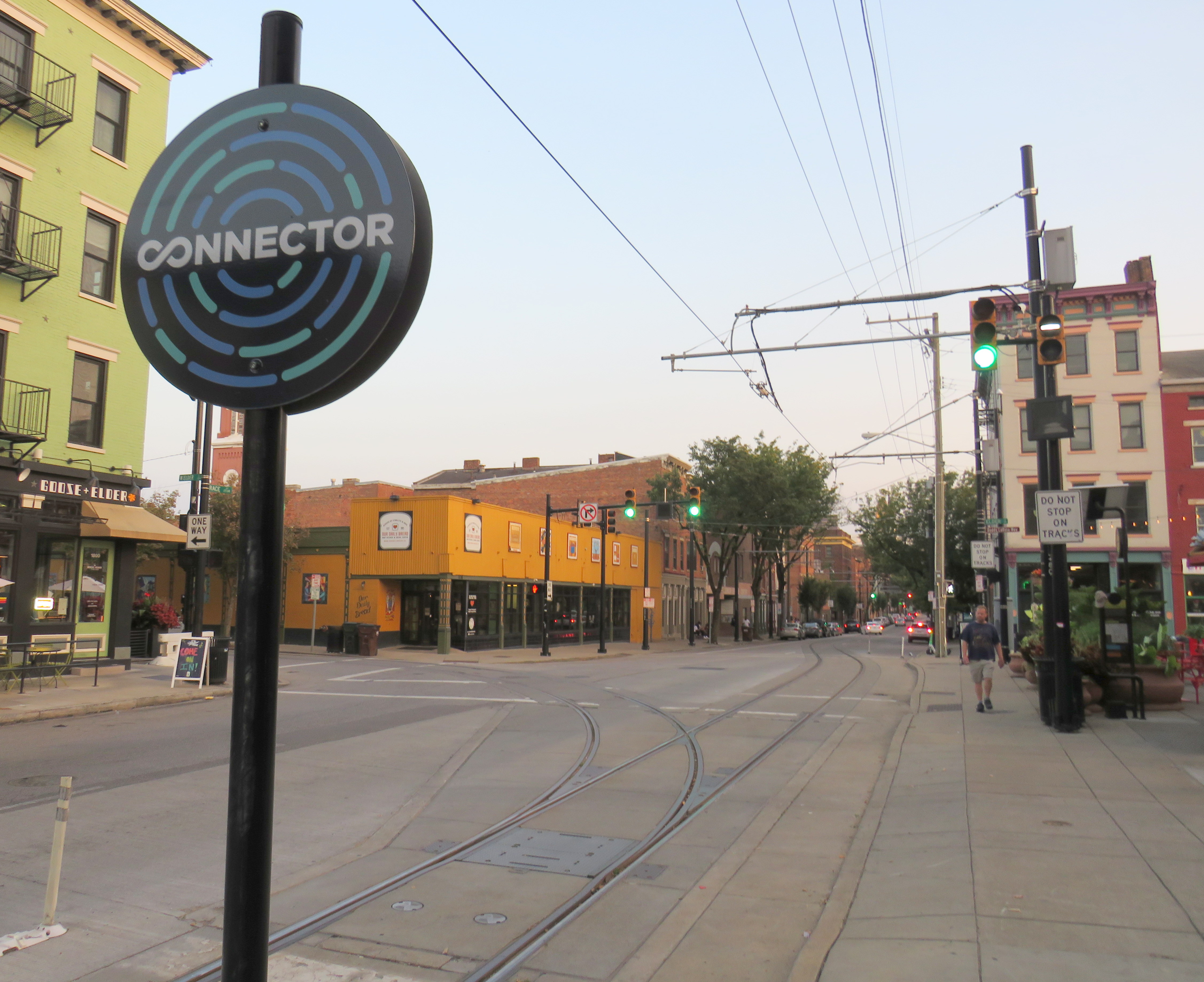
Junction to yet-to-be-built extension to University of Cincinnati
One thing I did note is that, unlike Toronto’s busy — and useful — legacy streetcar network, the small Cincinnati Connector loop was built with modern tram standards. The few switches (like the one shown above) are double-point switches, with dedicated signals. This allows streetcars to pass intersections at normal speed, unlike the TTC’s insistence on stopping and then proceeding at a dead slow pace over its manual, single-point track switches.
As a Torontonian, where streetcars form the backbone of transit in the dense, urban downtown area, it’s frustrating to see a small, novelty streetcar line build proper track infrastructure, while our crowded trams are forced to crawl at every intersection because of indifference at the TTC and at City Hall.
A Cincinnati Bell Connector Streetcar, followed by a SORTA bus
One of the amusing oddities of transit in the Cincinnati area are the acronyms used by the two local agencies. Cincinnati and the surrounding Ohio municipalities are served by the Southwest Ohio Regional Transit Authority, or SORTA. The agency wisely uses “Metro” as its public brand. Covington and other Kentucky communities are served by the Transit Authority of Northern Kentucky, or TANK. To their credit, the two agencies cooperate on fares, a $5 day pass purchased on one bus is good for all regular services on both agencies. Many TANK routes enter Downtown Cincinnati as well.
Pittsburgh
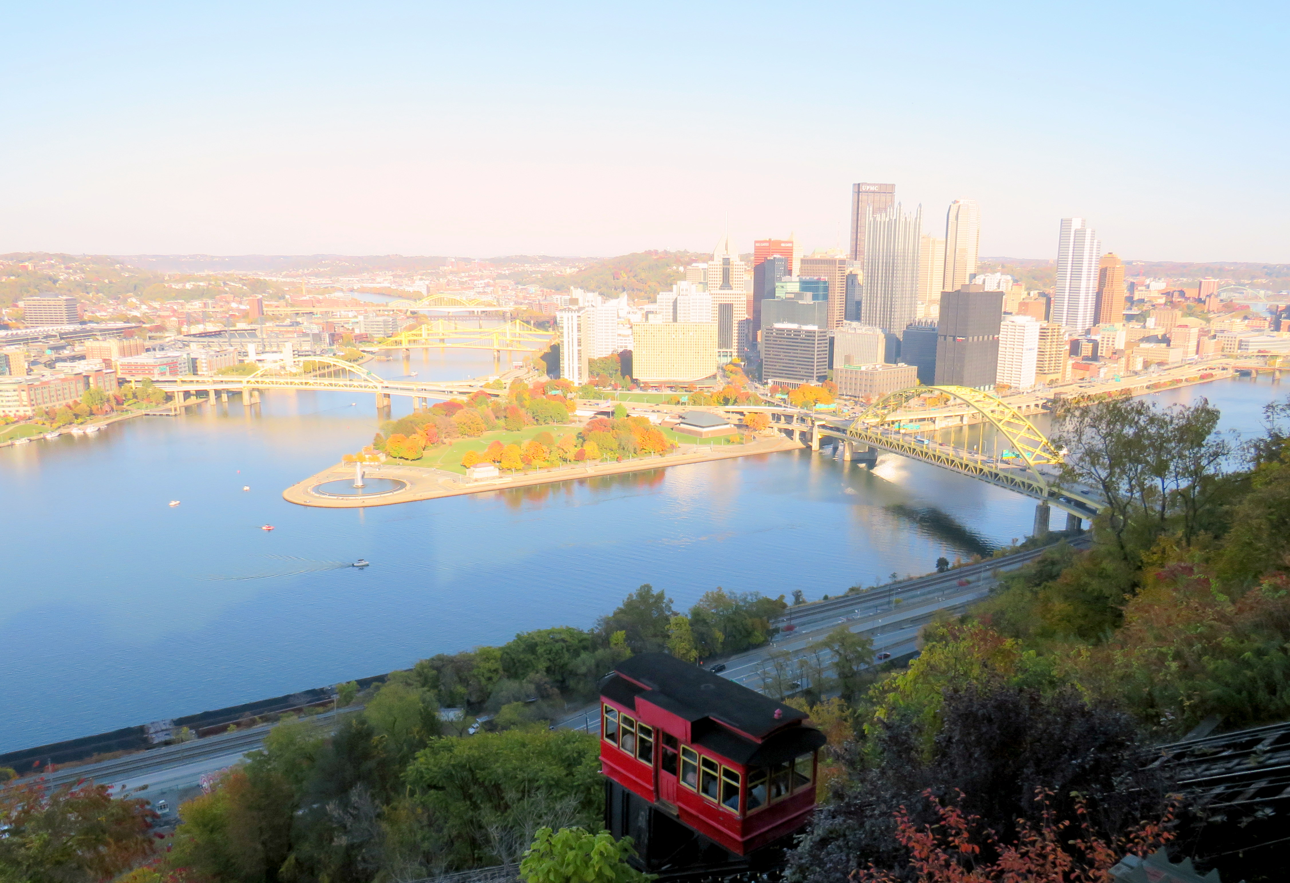
In late October, my spouse and I visited Pittsburgh to attend a conference. Pittsburgh has one of North America’s most fascinating cityscapes, with the downtown core situated where the Allegheny and Monongahela join to form the Ohio River, with steep hills immediately to the north and south. The steep topography is the main reason why Pittsburgh maintained two historic incline railways, where many other cities (including Hamilton) abandoned theirs.
The Duquesne Incline, on a very bright autumn afternoon
Pittsburgh was also a leading operator of PCC streetcars until the late 1960s, with a fleet of 666 PCCs — North America’s third-largest — at its peak. Because of Pittsburgh’s many hills, often requiring private rights-of-way or tunnels for streetcars to serve outlying areas, Pittsburgh was late to abandoning its street railway, but with highway projects in the 1950s, a public takeover in the 1960s, declining ridership, and a desire to modernize, most of the lines were abandoned and replaced by buses by 1971. Only a few South Hills lines, which used a lengthy tunnel to access Downtown Pittsburgh, remained.
Red Line train in Beechview
The two core southern lines were gradually upgraded to light rail standards, with a downtown tunnel replacing the on-street trackage there. Only a short section of Red Line in Beechview still operates on-street, betraying the service’s streetcar legacy. In 2012, the downtown subway was extended north under the Allegheny River to serve the North Shore, particularly the baseball and football stadiums.
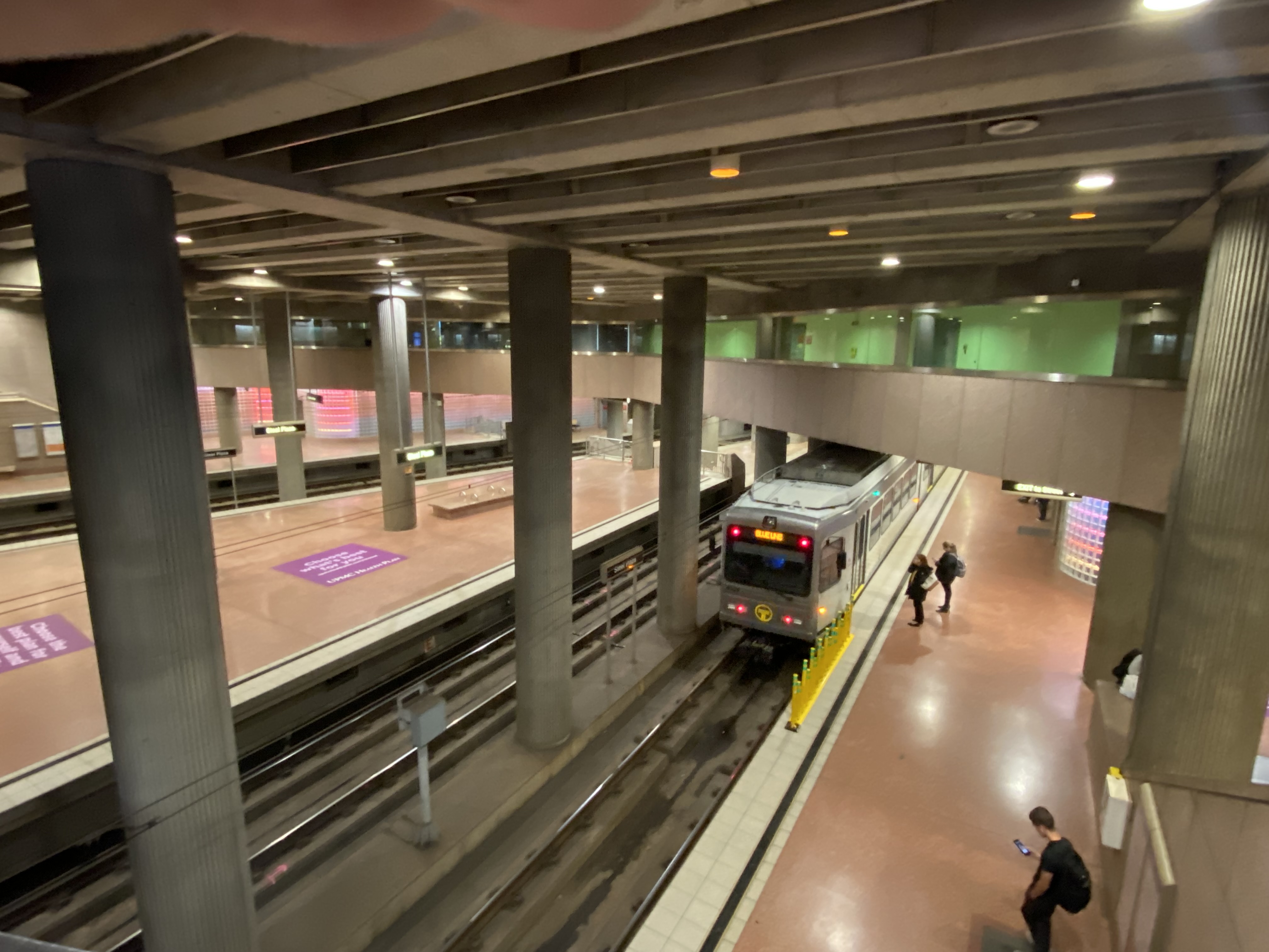
Steel Plaza Station, part of the Downtown Subway
In the 1980s, the Port Authority of Allegheny County, the public agency tasked with operating the city’s transit system, designed and built several busways radiating out of the city centre. Like Ottawa’s Transitway before construction of the Confederation Line LRT, the Pittsburgh busways follow former or current railway rights-of-way, with grade-separated road crossings, and with on-street operation in the downtown core. The busways offer rapid transit service, though stations are quite simple, with at-grade pedestrian crossings at most locations and basic shelters.
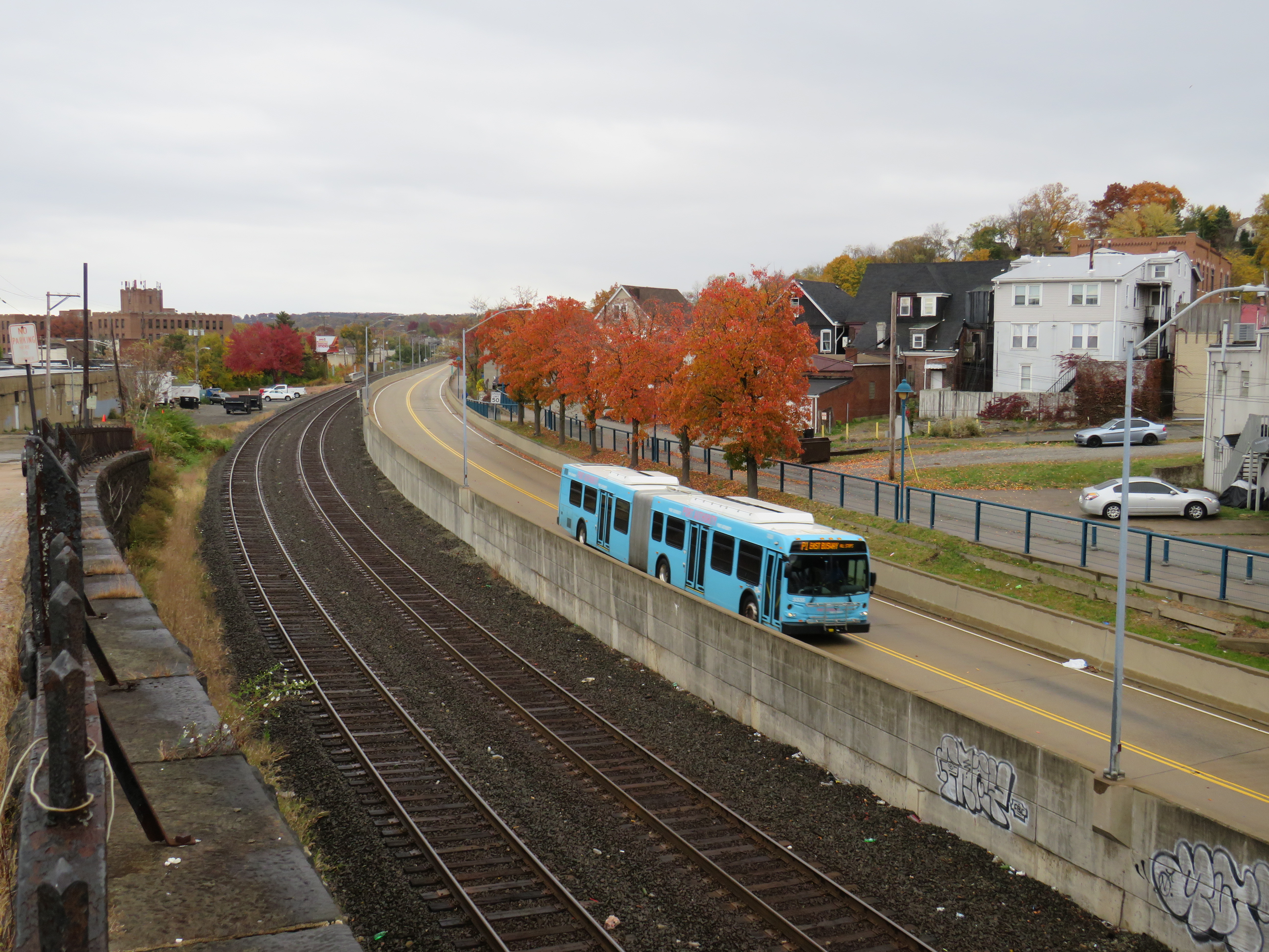
Dr. Martin Luther King Jr. (East) Busway, Swissvale
Pittsburgh’s problem though is that the busways and LRT managed to avoid the main university campuses and many of the city’s most vibrant neighbourhoods. Oakwood, the home of University of Pittsburgh, Carnegie Mellon University, many of the city’s arts and cultural institutions and some of its densest neighbourhoods, has only local bus service. Not coincidentally, Oakwood was one of the last parts of Pittsburgh to lose its streetcars in 1967.
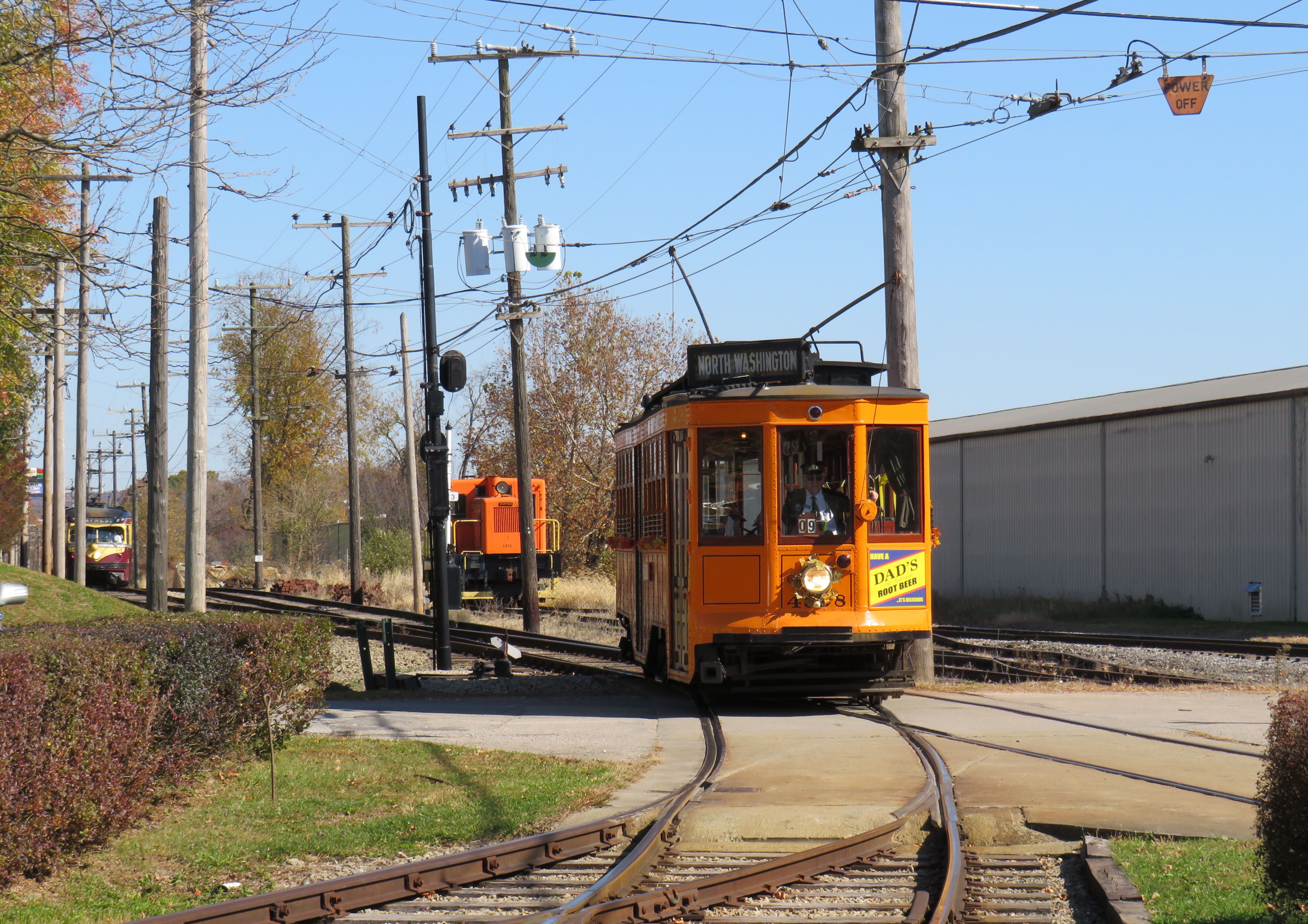
South of Pittsburgh, streetcars operate on an abandoned interurban line near Washington, Pennsylvania. Unlike the Halton County Radial Railway, the Washington interurban line’s tracks were not yet removed when the Pennsylvania Trolley Museum was formed. The museum, which operates several streetcars and hosts a large collection of static displays, is well worth the visit.
Former Pittsburgh Railway Company trolley #4398 carries autumn crowds at the museum in Washington, PA. Behind is a former Philadelphia Suburban Lines (Red Arrow) trolley.
Morgantown, West Virginia
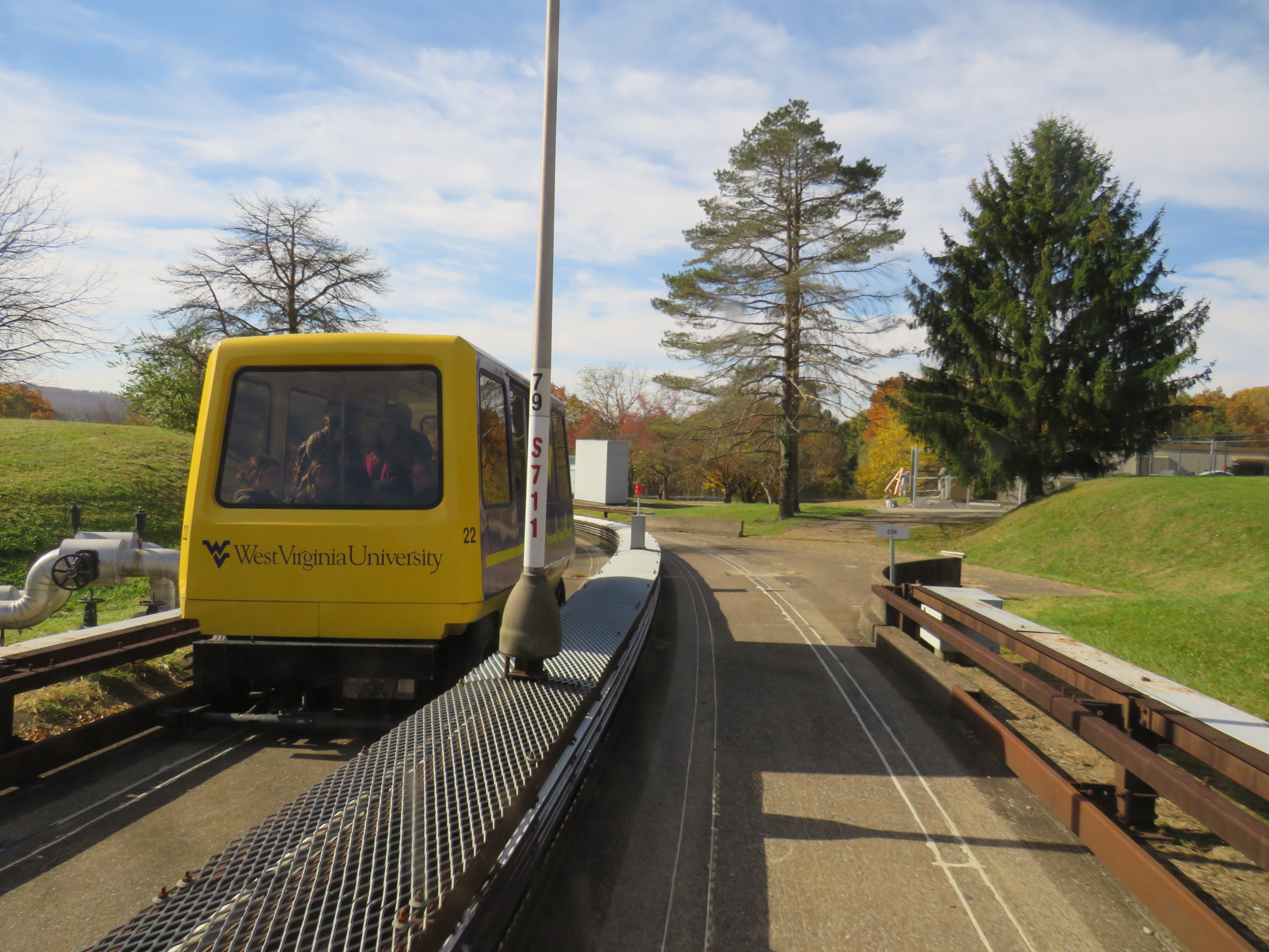
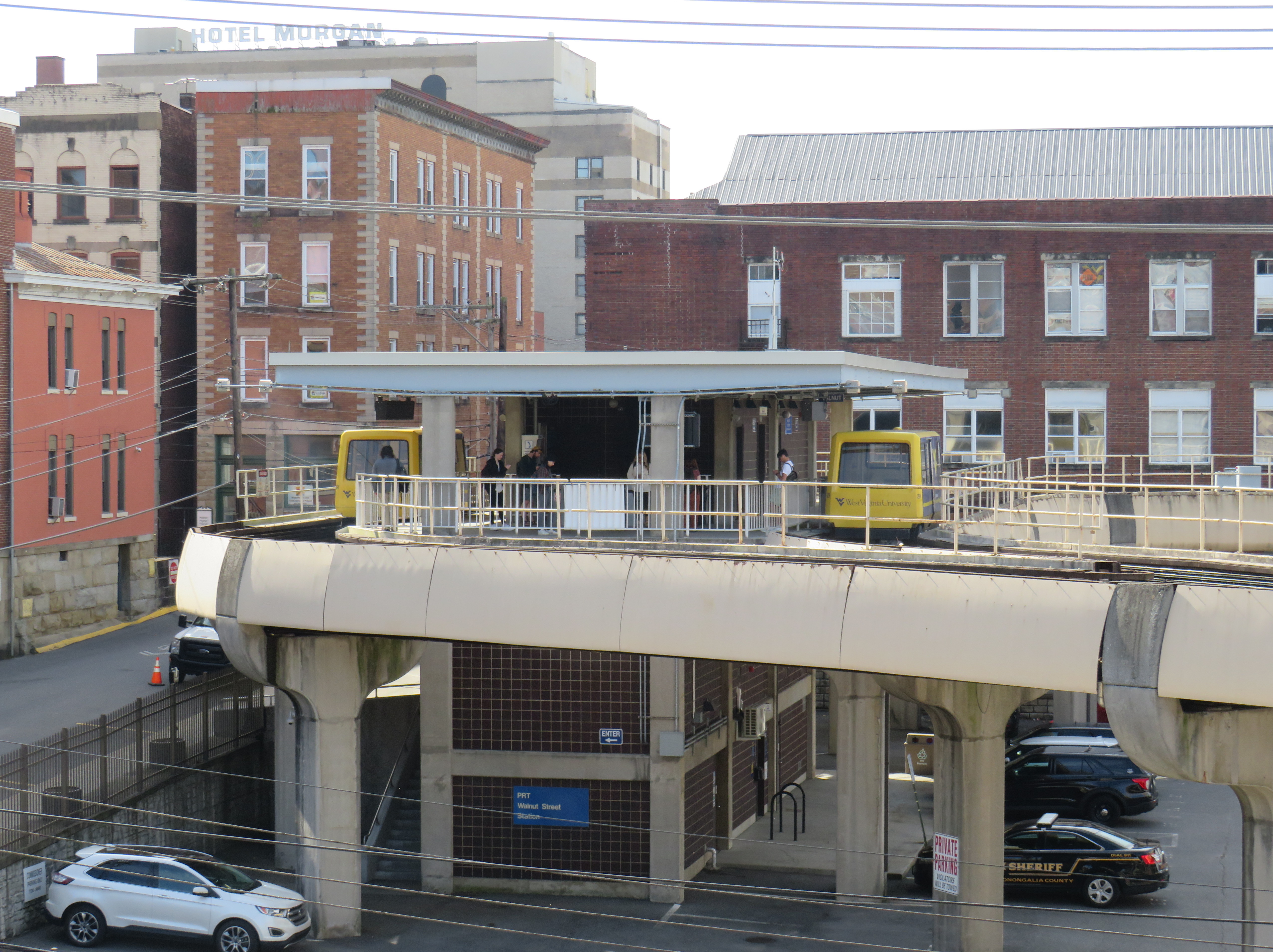
Only a 90-minute drive south of Pittsburgh is the city of Morgantown, West Virginia, home of the sprawling West Virginia University. What makes the public university especially unique is the automated transit system that serves the university and connects it to Downtown Morgantown.
The one-of-a-kind Morgantown PRT, opened in 1975, has five stations between Downtown Morgantown and the main campus to the north. What makes the line a “personal” rapid transit system is passengers, upon paying the fare or swiping their university ID card, select their destination station, and wait for a car that will take them to their desired point, skipping any stations in between. Though the technology can be described as a “gadgetbahn” it fills a unique niche, and still runs with the original rolling stock and guideways, though software and motor upgrades were required. Because of the limited road space between Morgantown and the university facilities to the north and the mountainous topology of West Virginia, traditional bus service gets caught in traffic, especially on game days.
Walnut Street Station in Downtown Morgantown
Each car has eight seats and allows for twelve standees, so despite the name, the service isn’t precisely “personal.” As it is operated by the university mostly for staff and students, it does not run on Sundays, holidays, or when classes are not in session. During off-peak periods, the PRT usually runs in an all-stops configuration.
The video below shows how the PRT operates, including the bypass of Towers Station.
Part of the nine-minute ride on the Morgantown PRT at the University of West Virginia
I will follow up with posts covering my return to Toronto, Ohio (which is just an hour’s drive west of Pittsburgh), and some thoughts after visiting a local history museum.