Extensions to Montreal’s REM has resulted in some regional route changes in the Montreal area
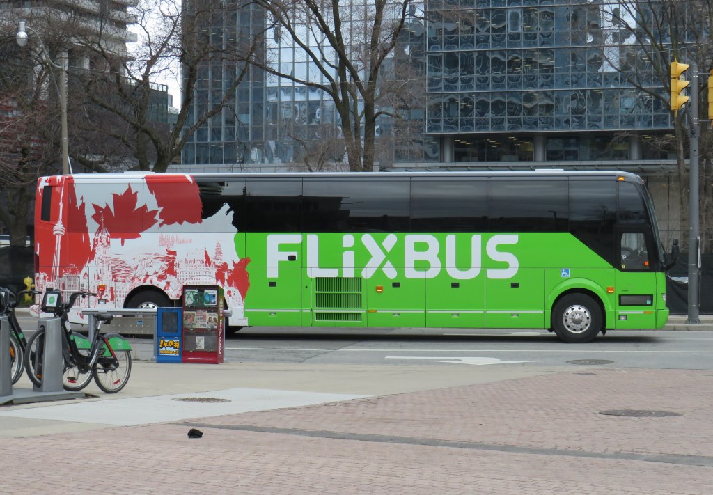
In time for summer, I have updated my Canada Intercity Transportation Map to include new connections and revisions. The only major changes to the intercity coach layer are new routes operated for Flixbus, including new seasonal routes from Toronto to North Bay and Prince Edward County.
In Quebec, the opening of the Deux-Montagnes and Anse-à-l’Orme branches of the REM in Greater Montreal resulted in several long-distance Exo regional bus lines cut back or replaced in favour of local bus routes feeding into the new regional rail service. Therefore, I have decided to remove Exo bus routes from the map where they exist entirely within one or two urban transit zones, being consistent with the municipal transit agencies surrounding Toronto. However, long-distance express routes and routes that serve Montreal’s outer periphery will remain on the map as part of the regional route layers.
In addition, I have also included a few new and previously overlooked services operated by the MRCs (municipalités régionale de comté), including taxibus service areas, which operate similarly to on-demand transit elsewhere in Canada, but have posted stops and semi-fixed schedules; many of these require preregistration before reserving a ride. Where taxibus services operate, I have opted to include those as on-demand, rather than fixed route lines to be consistent across Canada. Only on-demand and taxibus services that are open to the general public are included in the map.
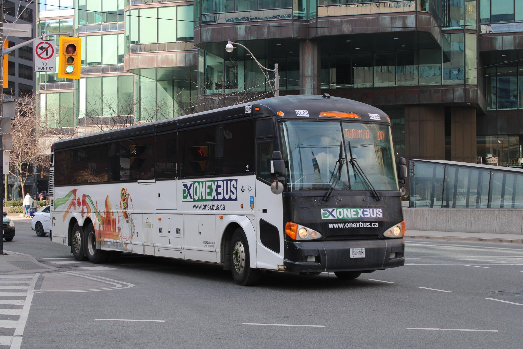
Onex Bus changed its schedules recently, eliminating most departures from Brampton Gateway
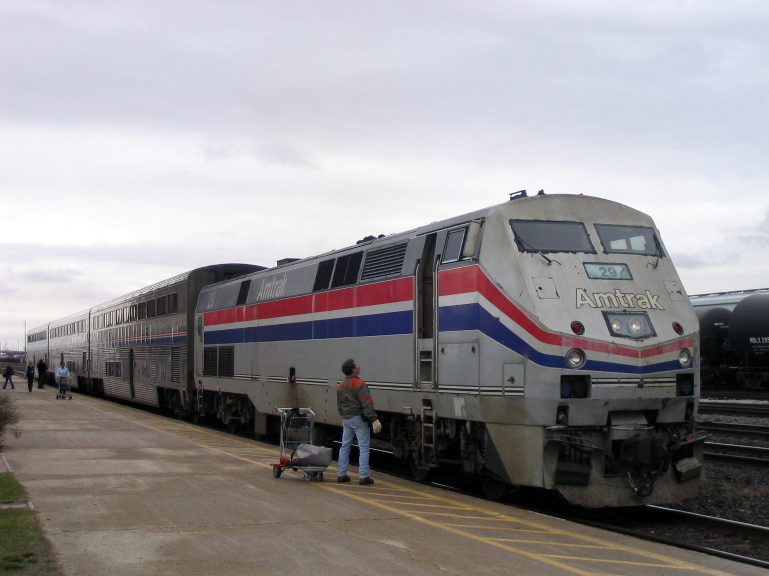
Mapping smaller intercity coach operators continues to be challenge, as deregulation in Ontario and Western Canada and online ticketing have made it harder to track changes in schedules and stop locations, though I have noted some changes with Onex Bus’ schedules, which ended most trips to and from Brampton Gateway Terminal at Main and Steeles earlier this year.
Previously, carriers like Greyhound would publish detailed schedules that were valid for at least a few months at a time, including holiday and school break special runs; Ontario Northland and Quebec-based carriers (where provincial regulation remains in force) at least maintain consistent schedules. As it is much harder to track this industry — with no central database — I always appreciate the contributions website visitors provide by email or social media. I thank everyone who has helped so far.
Unfortunately, the costs of maintaining this website and the ArcGIS Online portal to my maps continue to rise. However, I am committed to provide an ad-free, paywall-free resource. If you enjoy my work, please consider buying me a coffee to help with those costs. Thank you!
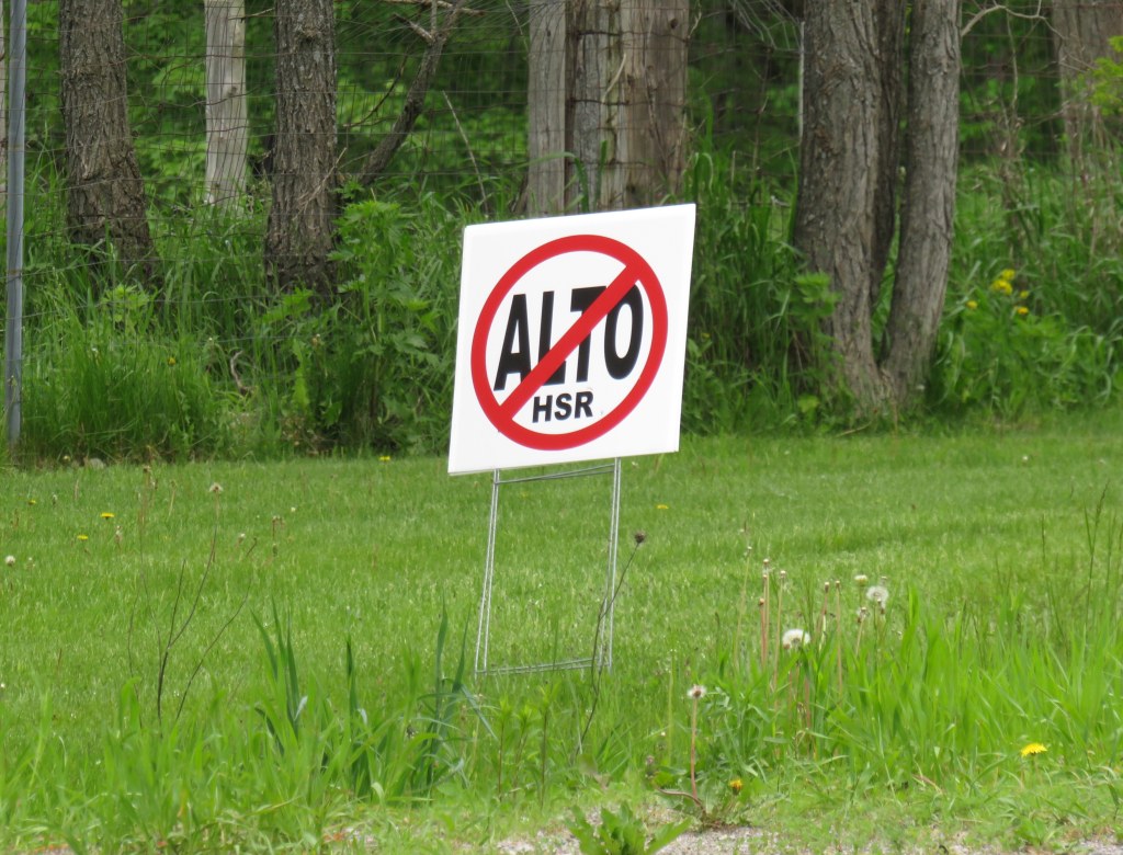
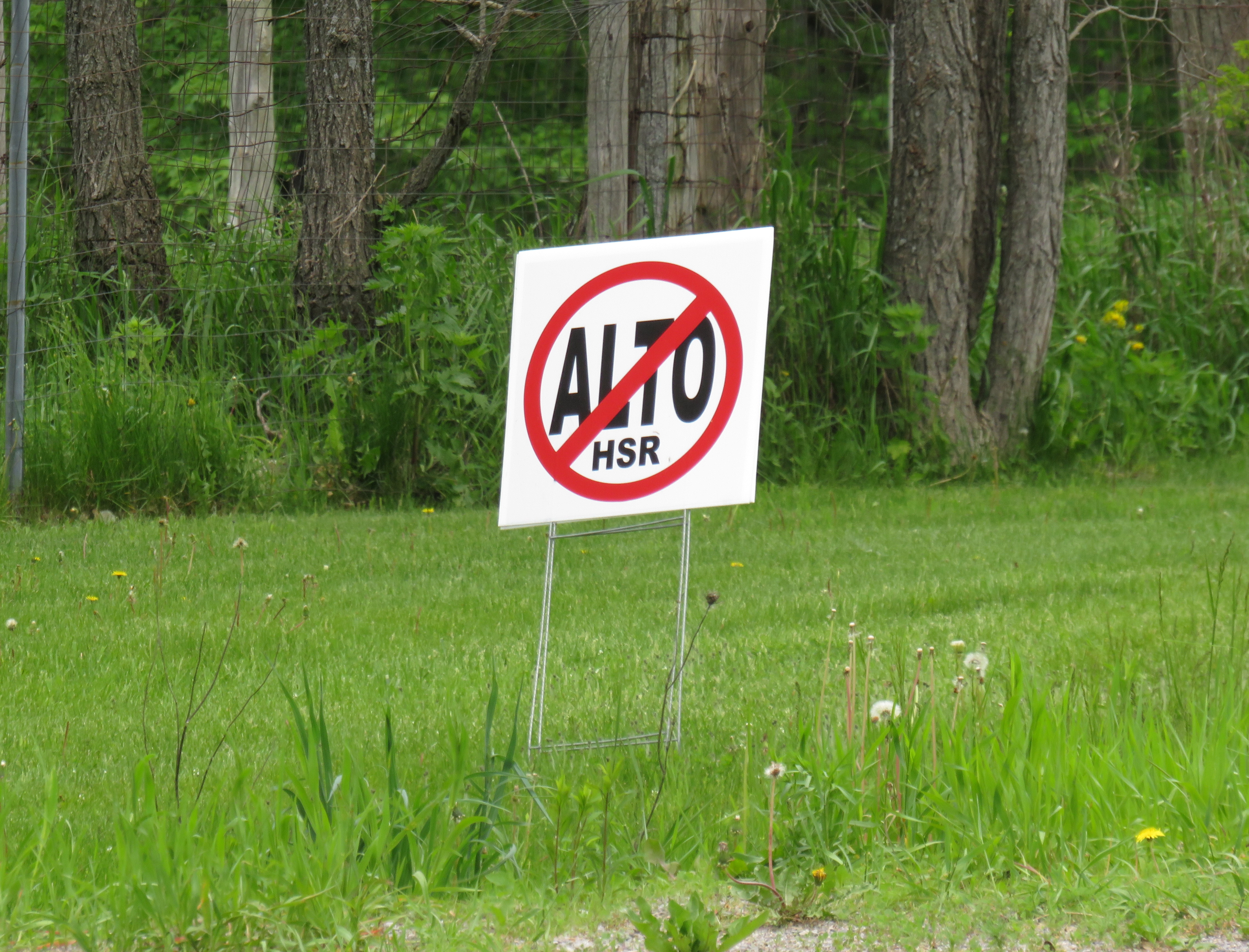
A “No ALTO HSR” sign on a property near Marmora, Ontario
There’s a running joke that Canada leads the world in high speed rail studies, but we never follow through with actually building those high speed lines. Comedian Rick Mercer had at least two sketches on his old weekly CBC television show mocking this state of affairs, as the idea goes back to the 1970s.
“VIA Rail: Yesterday’s speeds, today.”
“Canada’s High Speed Rail Study Industry: The future, never!”
In 2026, however, Canada is finally past the high speed rail study phase and appears to be committed to building the seven-station corridor between Toronto, Ottawa, Montreal, and Quebec City, with a consortium selected that is already planning the detailed route. It’s an exciting time as the first phase, between Ottawa and Montreal, should start construction in three years once the exact corridor is decided upon and land acquisition has begun.
High speed rail, if done right, should benefit Eastern Canada as a whole. Fast and frequent train service will divert a lot of the travel in the busy Toronto-Montreal-Ottawa triangle from the air, reducing emissions and allowing existing airports to handle any increases in long-haul demand. Faster and more reliable passenger train service would also take traffic off the highways and boost commerce within the most populated part of the country. If done right, it will also support plans for better transport infrastructure outside the corridor to Southwestern Ontario and provide Canadian expertise for other projects such as in Alberta, which is contemplating its own passenger rail network between Calgary and Banff and north to Edmonton.
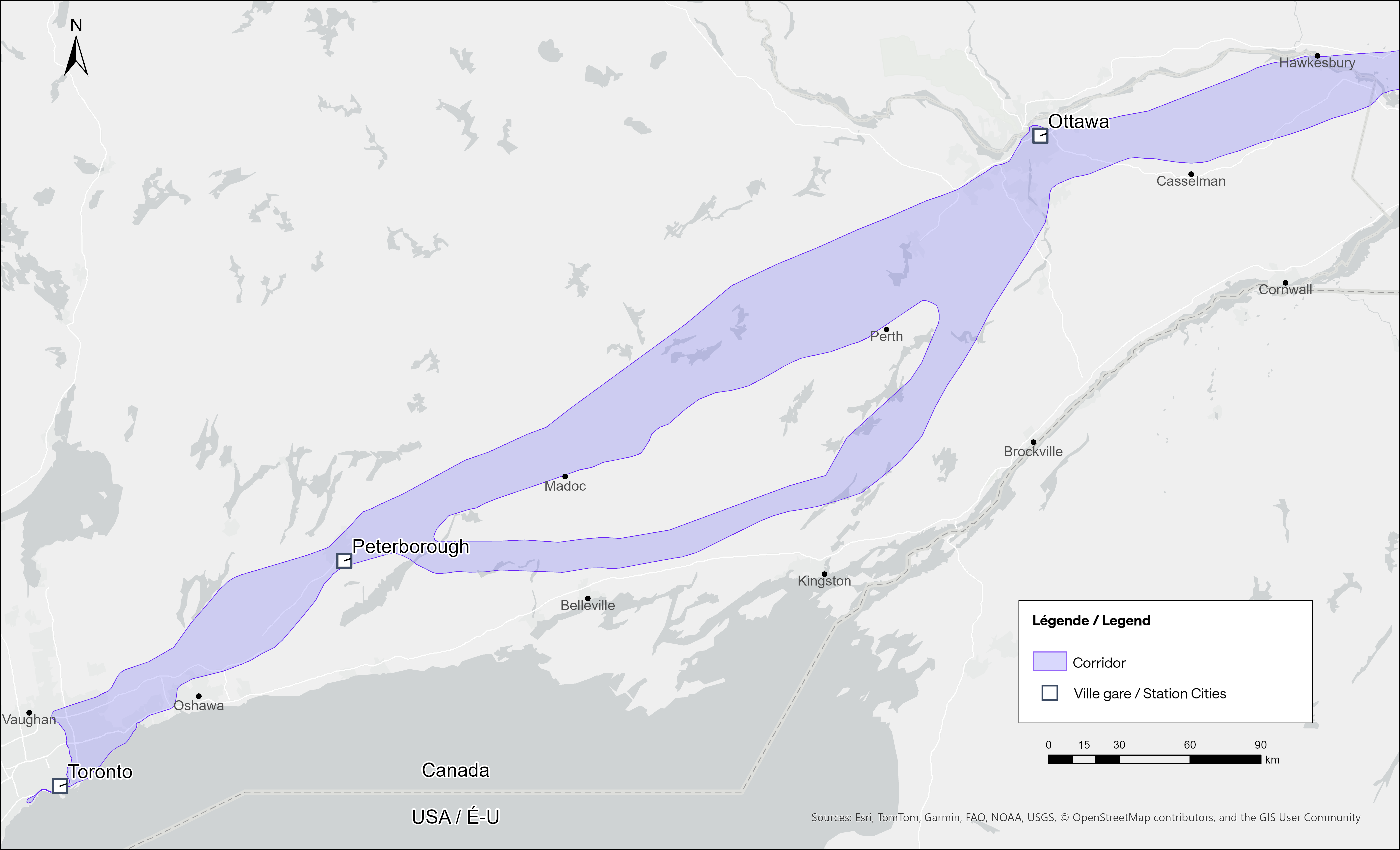
Map of potential routings for the Alto high speed line in Ontario
Not unexpectedly, there is opposition from residents and landowners along the route, especially in Eastern Ontario and the area of Quebec just northwest of Montreal. In Hastings County, north of Trenton and Belleville, there are a few dozen “No Alto HSR” signs on lawns and farms in places like Madoc, Marmora, Stirling, and Tweed. In this part of Ontario, between Peterborough and the Rideau Lakes region southwest of Ottawa, there are two broad potential routes: a southerly corridor runs near Campbellford, Stirling, Tweed, and Westport, including through some productive farmland in Northumberland and Hastings Counties. A second route runs north of Highway 7, just north of Madoc and Perth, along the southern fringes of the Canadian Shield.
Though a high speed railway line would be straight and relatively narrow, it would require the acquisition and severance of hundreds of properties. Along the existing CN and CP railway corridors to the south constructed in the 1850s and 1900s, there are frequent public road and private-access level crossings, something that is not possible with modern high speed trains passing at up to 300 kilometres per hour, so farmers whose land is crossed by the new high speed railway corridor may not be able to access parts of their property easily. Furthermore, there are no stops planned between Peterborough and Ottawa, a distance of over 250 kilometres.
In Prescott & Russell Counties in the Lower Ottawa Valley, even the local governments are opposed to Alto crews doing early survey work to determine an optimum route, with county warden Mario Zanth clear on the matter: “This council does not want them on our territory.” For now, Alto surveying is mostly done by way of drones over land where landowners have not granted access.
Once a more specific route is selected, hopefully some of the opposition will fade. Detailed design work and further consultation should also help mitigate concerns. This is especially important west of Ottawa, where there are the two diverging routes.
Despite the rural opposition, Alto should go ahead. Other major infrastructure projects, especially new highways, can be far more disruptive to local land use. But without local community benefits — at least a new freeway has regular access points — it will be harder to get buy-in.
Therefore, this needs to be a matter of “Alto and” than just “Alto” by itself. This means building and maintaining a supporting network of conventional VIA service, intercity and regional buses, and local transit connections. It might also mean adding a few additional stations along the route, in places such as Perth. Adding additional stops doesn’t have to slow down trains at all; Japan’s Shinkansen has three classes of trains, from the super-express Nozomi to the all-stops Kodama. While most passengers would be through Toronto-Ottawa-Montreal travellers, offering additional stops for select trains can make Alto more accessible to more people, especially if it means providing new options to underserved communities.
An express train passes the local Odawara Shinkansen Station in April 2019
If Alto becomes the backbone of a strong, integrated transportation network in Ontario and Quebec, the benefits will go far beyond those in the six cities directly served the planned high speed line, even to those directly bypassed by Alto trains. This integration is commonplace in Japan and Europe.
In Kingston, for example, a new or upgraded VIA station with additional tracks and platforms would allow for early morning departures and late evening arrivals from Toronto, Ottawa, and Montreal without having to sit on active CN freight tracks overnight; VIA schedules built around serving cities like Belleville, Kingston, and Drummondville would ensure the existing service remains vital as through passengers switch to the faster line. A new Kingston station near Division Street could integrate rail and bus services, with easy access to Highway 401, with local and regional buses to places like Gananoque. Enhanced bus connections to the rest of the Ottawa Valley from the Ottawa Alto/VIA Station could allow travelers from Pembroke, Arnprior, or Hawkesbury to quickly continue their journeys via train. At Trois-Rivières, there should be seamless connections to places like Shawinigan and Victoriaville. The Canada Intercity Transportation Map on this website shows which communities are unserved or underserved by bus and rail: these include many towns in Southern Ontario and Quebec that are within 100 kilometres of the Alto corridor.
Canada is right to invest in high quality and sustainable transportation infrasturure as a nation-building project, to boost the regional and national economy, and promote environmentally friendly travel options. But focusing only on Alto, without a strategy of leveraging the conventional VIA network and intercity bus connections to feed that network, can only limit the success of high speed rail. The communities in between deserve better.
In the fifth year that I have been following and mapping Canada’s intercity transportation links, the network (if you could call it that) remains in flux. Spring 2026 brings several new routes, particularly in Western Canada, that restore some former Greyhound services. Unfortunately, regional and commuter services in Ontario and Alberta are coming to an end. Wednesday, April 30 was the last day for the LTW Route 42 between Leamington and Windsor. In Alberta’s On-It is winding down its commuter buses between Calgary and Cochrane and Okatoks.
However, Flixbus continues to expand, taking over more former Greyhound routes. Unlike Greyhound or most other intercity transport companies, Flixbus is not a bus company per se, as it does not own or operate the services; instead it uses smaller contracted operators while coordinating branding, schedules, and ticketing. But starting in May, it will operate three-four days a week between Calgary, Regina, and Winnipeg, with stops in cities that have long been without service, such as Moose Jaw and Swift Current. Another route will connect Calgary with Drumheller, including a stop at the famous Royal Tyrrell Museum.
Despite the recent loss of TOK’s Southampton route and last year’s cutback of Grey County’s GTR services, there is hope for new connections in Midwestern Ontario. Grey County, together with neighbouring Bruce, Dufferin, and Wellington Counties, is studying a regional system to augment and replace the limited existing services. Hopefully, it will include regular service to fast-growing Saugeen Shores, which recently lost that TOK service. In Centre Wellington, a new local service connecting Elora and Fergus will soon start operations.
One of the major issues continually faces is the lack of intramodality and useful connections. A viable passenger rail system — be it a classic corridor service such as the Quebec-Windsor VIA train or a high-speed line such as the planned ALTO project — is much more useful to many more passengers when there are easy connections at stations. Through-ticketing and schedule coordination should be implemented whenever possible. Furthermore, though the Upper Ottawa Valley (towns and cites such as Renfrew and Pembroke) has a daily Ontario Northland bus, it arrives in Ottawa late in the evening and leaves early in the morning, limiting its usefulness to areas closer to Ottawa that could benefit from a commuter connection or onward trips to Montreal, Toronto, or Kingston. Despite more gaps seemingly filled, other gaps remain.
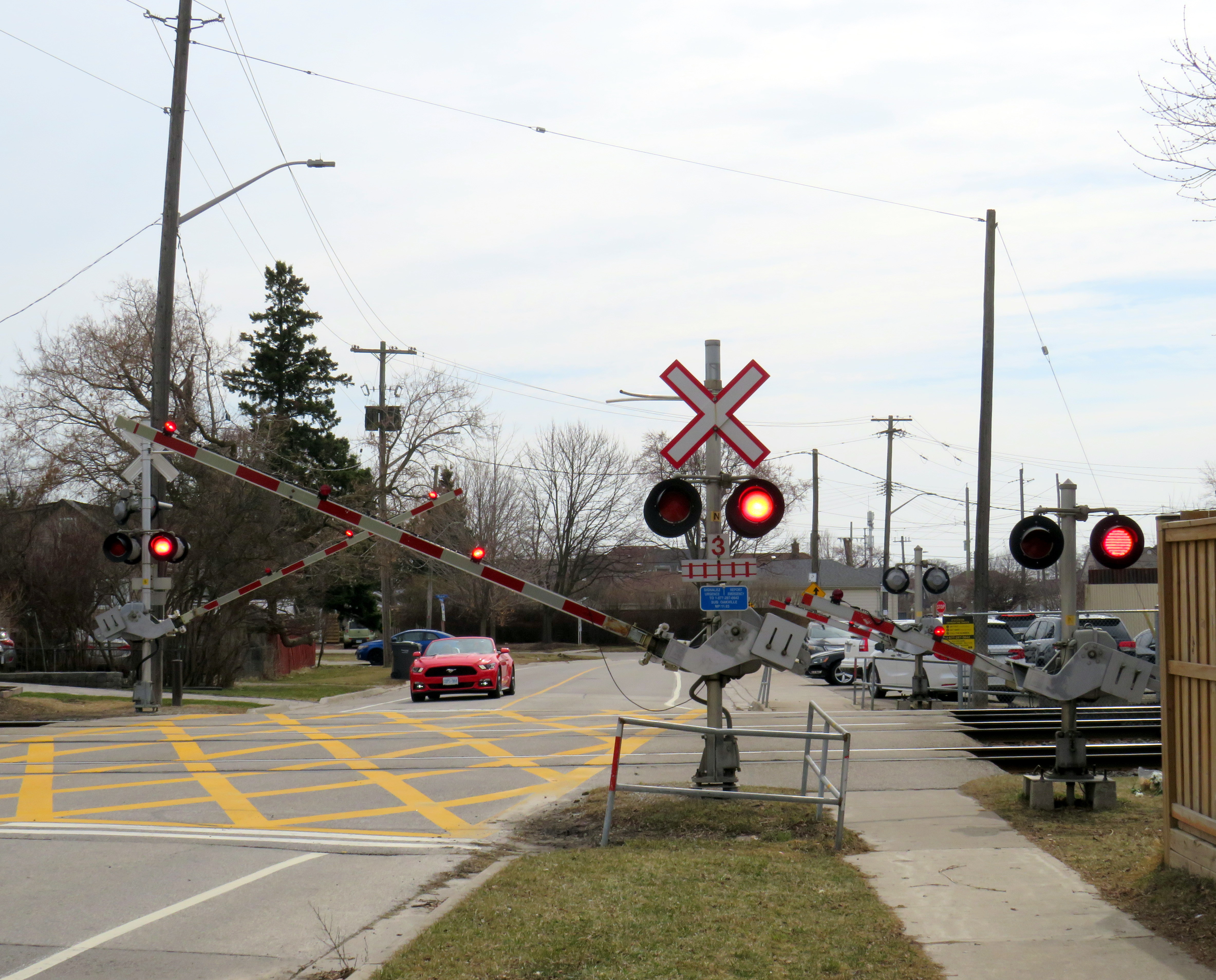
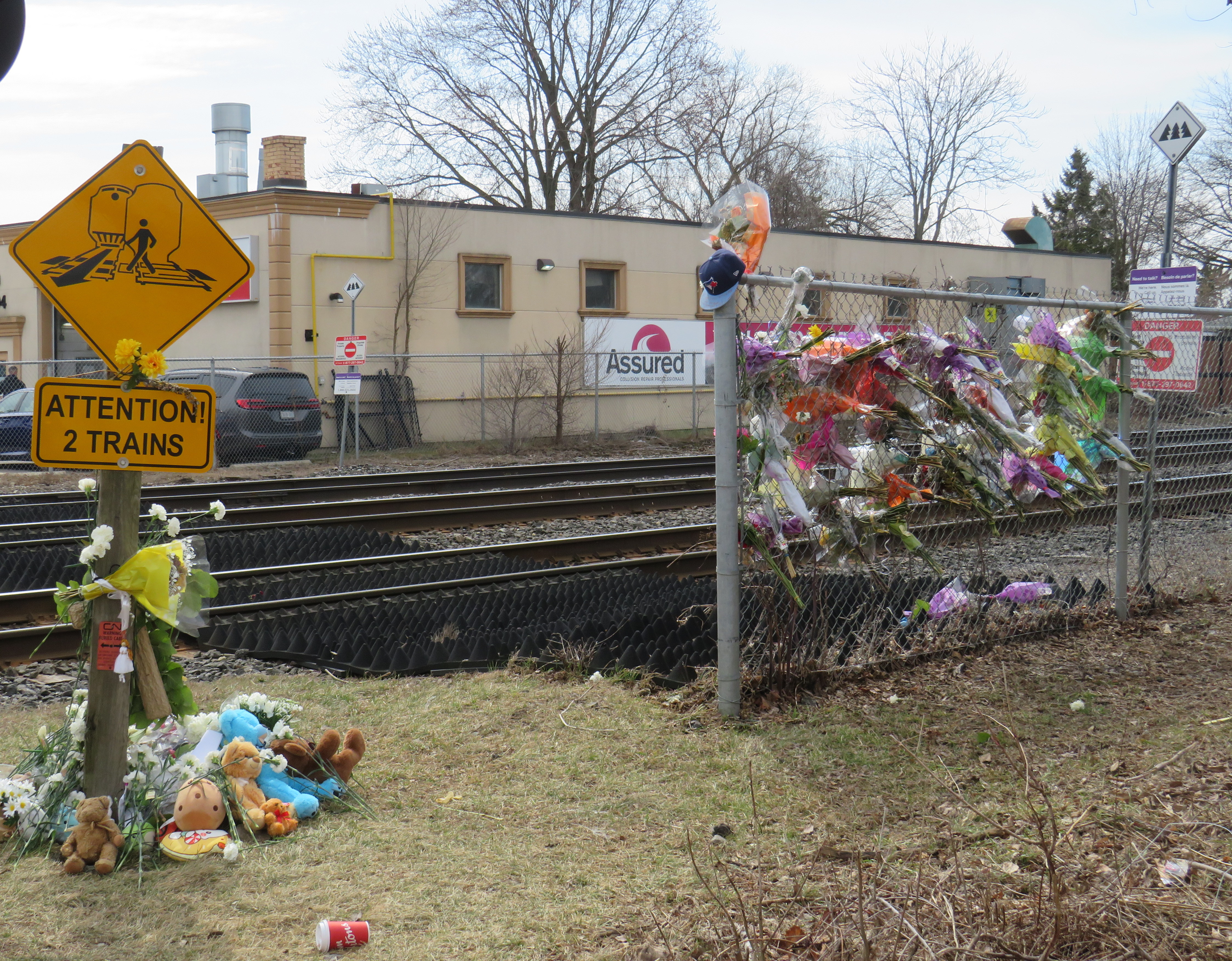
On Wednesday, March 18, a boy on a motorized bicycle was struck and killed at the Alexandra Avenue railway crossing in Mississauga. The tragedy, which occurred despite properly-working lights and gates at the three-track crossing, is a reminder of how important rail safety can be. Despite decades of “Operation Lifesaver” safety awareness campaigns, police enforcement, and upgrades to high-risk railway crossings, these tragedies continue to occur. Deaths on Canada’s railways affect many lives, including the victim’s family and friends, as well as the train crew, who can not brake the train in time. When these collisions happen, they can also tie up rail passengers and goods movement for many hours as emergency responders do their work and an investigation takes place.
Trackside memorial at Alexandra Avenue, March 31, 2026
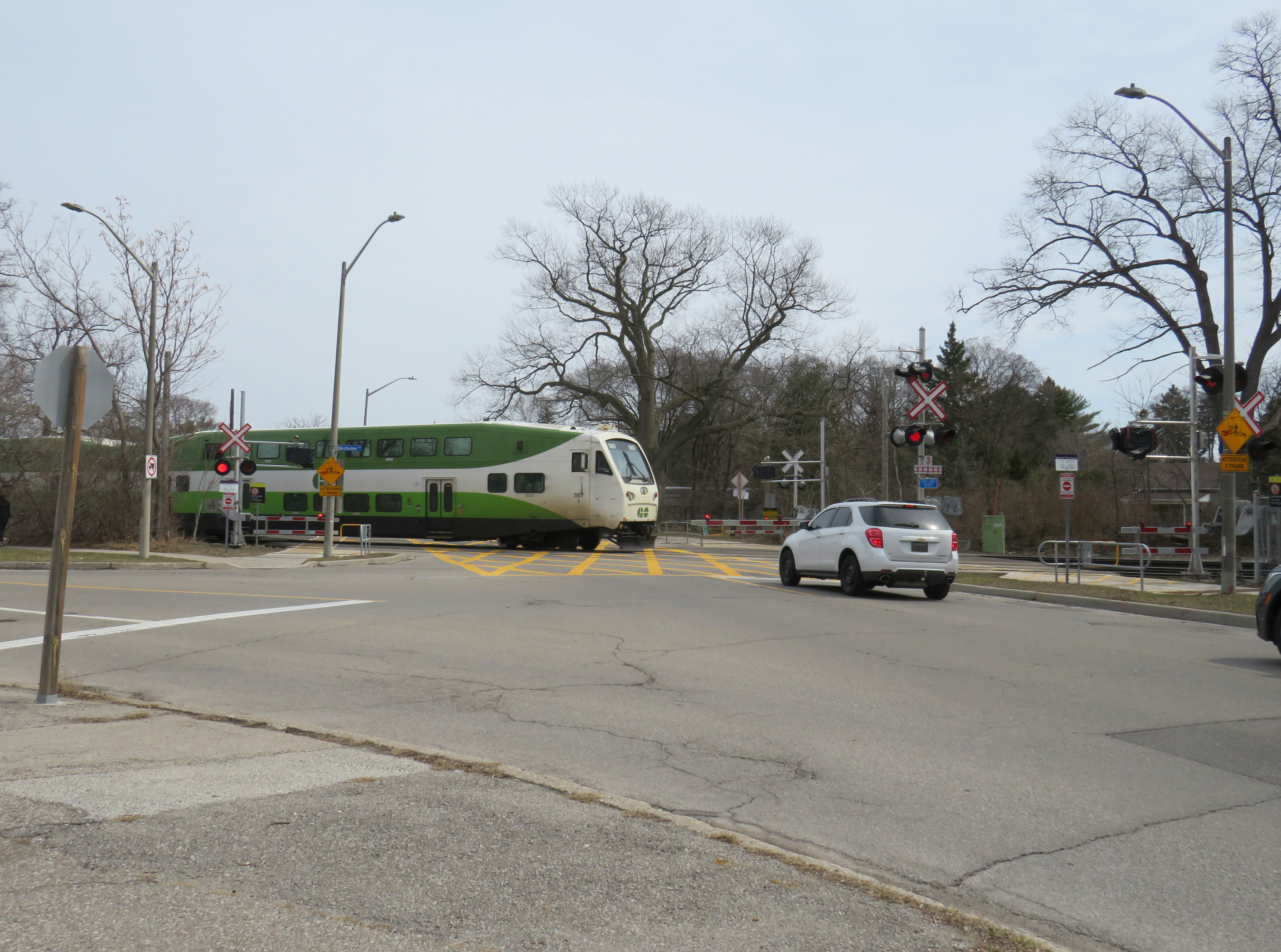
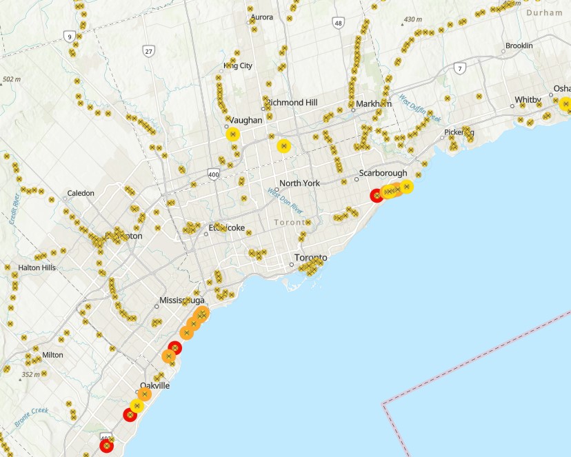
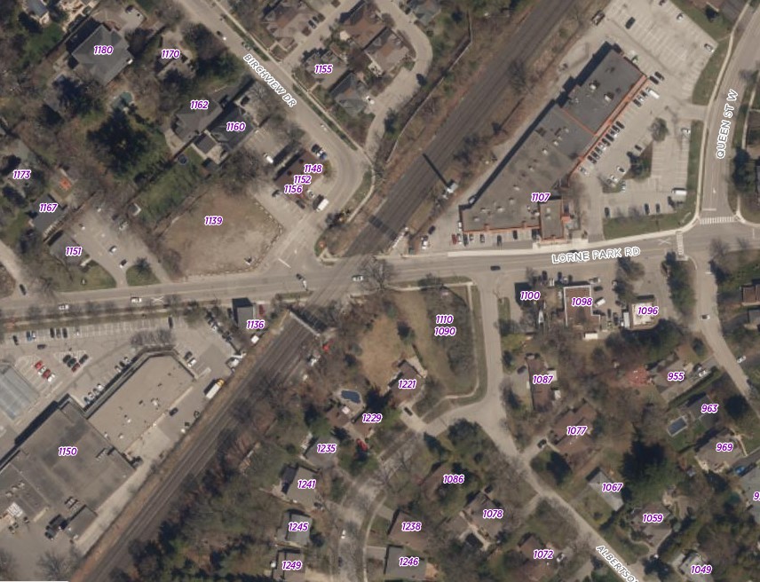
This particular crossing, near Cawthra Avenue and Lakeshore Road, sees up to 125 GO Transit and VIA Rail passenger trains daily; the three-track corridor is one of the busiest stretches of railway in Canada. The Alexandra Ave. crossing was also ranked as the 21st riskiest in the country in a Transport Canada list of nearly 25,000 road-rail intersections. Of the top 25 railway crossings ranked by risk in Canada, 14 are owned by Metrolinx, the provincial agency in charge of GO Transit. At the very top of the list is another Mississauga railway crossing, where the GO Lakeshore West corridor meets Lorne Park Road.
Lorne Park Road crossing
According to the Transportation Safety Board of Canada, between the years 1999 to 2022, 630 people were killed and 774 people were seriously injured due to collisions with trains at grade crossings, an average of 26 per year. In most instances (69%) those who were killed were in motor vehicles, with pedestrians and cyclists making up the remainder.
The railway crossing inventory, last published in June 2021, ranks grade crossings according to their risk using GradeX, an internal analysis tool. Relative risk of each crossing is based on several factors, including historical accident data, train speeds, traffic volumes, sight lines at crossings, crossing protection features, and the local built environment to determine the level of collision risk. Fields include location (road crossing and railway subdivision/mile), type of protection (passive, with just an “X” crossbuck sign, or active, with lights, bells, or gates), number of collisions in the last five years since the dataset was compiled, speed limits, and traffic estimates.
With this information, railways and road authorities can then work to improve the crossing to reduce the risk, or construct a grade separation to eliminate the risk. For example, the Burloak Drive crossing of the GO Lakeshore West Corridor and number 5 on the Transport Canada list, is currently being replaced with an underpass.
The Transport Canada list is comprehensive, but it is not perfect, nor is it complete. The Ontario Northland Railway, whose tracks extend north from North Bay through Northeastern Ontario, is conspicuously missing. Several crossings in the map, mostly private crossings, do not have the correct latitude and longitudes. Several abandoned railways, including the Orangeville-Brampton and Barrie-Collingwood (west of Angus) still appear, as do long-decommissioned crossings of industrial spurs. The risk ranking also changes. In a 2016 CBC News article, the Melbourne Road CN crossing west of London, Ontario was ranked fourth riskiest. In the more recent dataset available online, it is ranked 341th, even though there were no physical changes to the railway crossing visible in Google Streetview from 2009 through 2023.
The Lorne Park Road crossing is interesting for several reasons. After many years as a stop on the CN mainline, it was briefly a GO Transit station, with commuter train service only for its first year in 1967-1968. The two-lane road crosses the three-track railway at approximately a 30-degree angle; immediately to the north of the tracks is the intersection with Birchview Drive, which is parallel to the tracks. That intersection is controlled only with a stop sign, with pedestrians crossing the street at a wide angle with no marked crosswalk. The same number of trains that cross Alexandra Avenue also cross at Lorne Park Road, making it a busy crossing, and motor and pedestrian traffic is higher, as Lorne Park Road is a busier collector street with adjacent commercial properties. To its credit, however, Metrolinx recently upgraded the crossing, with enhanced pedestrian gates that prevent access when the railway crossing lights are activated.
City of Mississauga aerial photography of the Lorne Park Road crossing, with Birchview Drive meeting Lorne Park Rd. immediately north of the railway (source)
A 2022 City of Mississauga-commissioned report by HDR recommended that the Lorne Park crossing be studied for future grade separation (it also recommended a more detailed study into closing the Alexandra Avenue crossing along with an Ogden Avenue grade separation), given the high number of train crossings, expected to increase with future GO Transit service expansion.
Building new overpasses or underpasses can be expensive and disruptive, especially in older urban environments where space is at a premium. Closing crossings completely can disconnect communities, especially for pedestrians and cyclists, who may have to travel much longer distances or use dangerous roads to get to their destinations. But they are often necessary for ensuring safe, frequent, and speedy train service. In the meantime, upgrading existing crossing and minimizing risk, along with continued education, is the way to go.
With planning now well underway for the Alto high speed passenger rail corridor between Quebec City and Toronto, there has been some speculation that Ottawa’s grand old Union Station, in the heart of the capital’s downtown core and a mere stone’s throw from Parliament Hill, could see trains again. Local business leaders and Mayor Mark Sutcliffe are excited by the idea of a downtown station, expecting that a downtown transport hub would help revitalize the local economy. Though it’s a very attractive idea, there are unfortunately just too many reasons why this would not be feasible.
To understand why, it’s worth diving into the history and urban politics of railways in the National Capital Region.
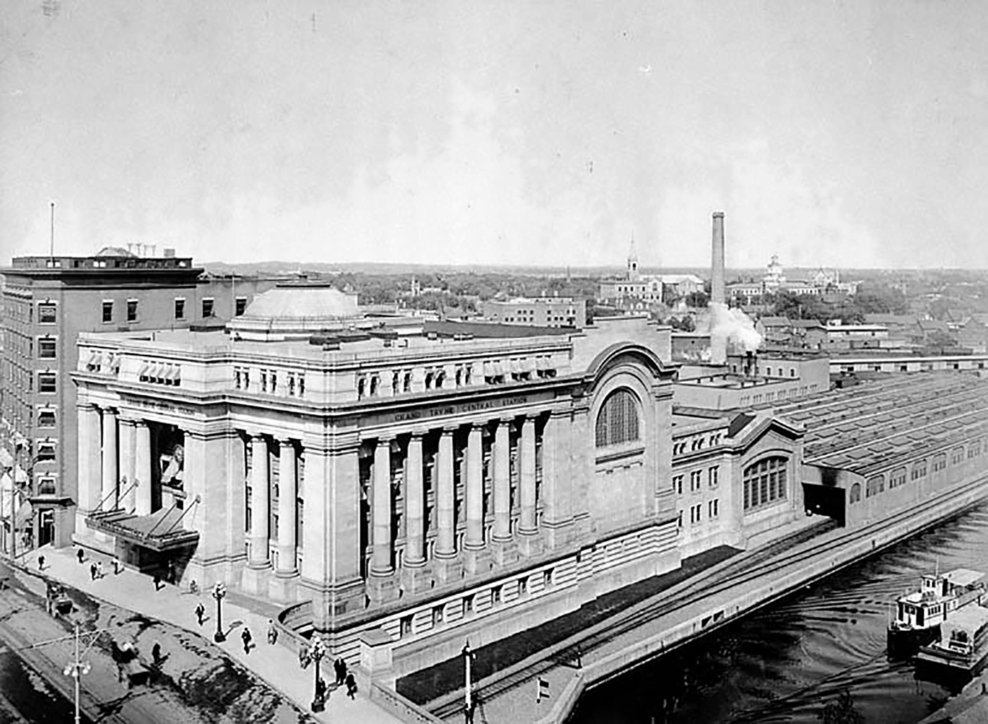
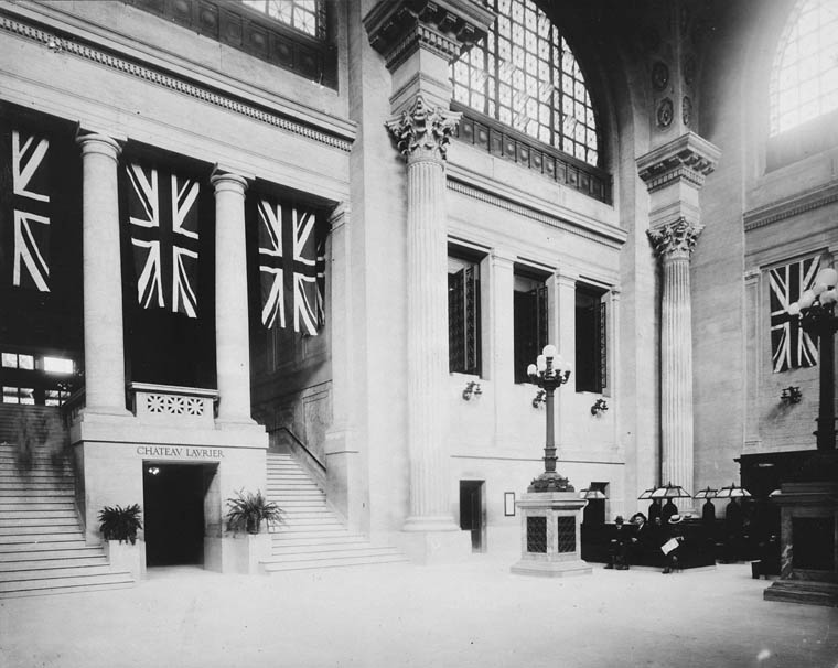
The Grand Trunk Central Station, opened in 1912, provided a grand entrance to Canada’s capital city that was previously served by a few smaller stations just outside the downtown core. The station, designed in the Beaux-Arts style, was built as a stub-end terminal. This meant that trains would arrive and depart from the south and would have to be backed up to change direction. This suited the Grand Trunk Railway just fine, as it lined up perfectly with its route to Montréal via Alexandria (still used by VIA Rail today). The railway also built a hotel across the street — the Chateau Laurier — and connected the station with the hotel with a pedestrian tunnel.
Entrance lobby, soon after opening. Note the tunnel under the staircase to the Chateau Laurier. (Library & Archives Canada)
The 1912 station was intermodal from the very beginning. Right outside the station’s front doors, there were Ottawa Electric Railway streetcar platforms serving several routes on Rideau and Sparks Streets, the two main commercial corridors in Downtown Ottawa. Right below the canal and railway bridge next to the station was the Hull Electric Railway’s loop; its streetcars crossed into Ontario via the Alexandra Bridge.
The Alexandra Bridge carried CPR trains, Hull streetcars, pedestrians, and motor vehicles when it opened in 1901
Soon after opening, the Canadian Pacific Railway joined the Grand Trunk, resulting in the terminal being renamed Union Station; the short-lived Canadian Northern Railway (CNoR) soon followed. As the CPR’s tracks to Hull (via the Alexandra Bridge) ran next to the GTR’s station, it suited the CPR well. Unlike Grand Trunk, both the CPR and CNoR had direct lines to Toronto.
Two platforms on the west side of the station allowed through CPR trains to continue towards the Alexandra Bridge and even return to Ottawa via the Prince of Wales Bridge to the west; this was the route the iconic Canadian train between Montréal and Vancouver took when it was inaugurated in 1955. Most trains — including all GTR and CNoR, however, terminated at the six stub-end tracks. Both GTR and CNoR were absorbed into the new Canadian National Railway (CN) by 1922.
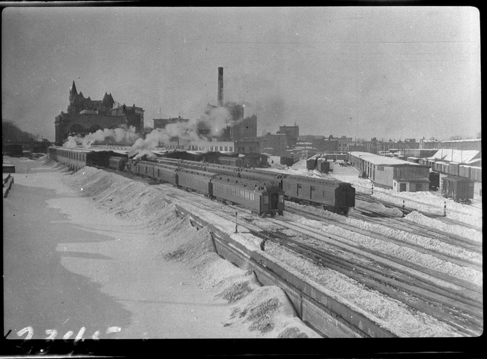
Approach tracks and Bush trainshed, Ottawa Union Station. A wintery scene, with a frozen Rideau Canal on the left. The yards at right are now occupied by the Rideau Centre, Convention Centre, and Department of Defense Headquarters (Library and Archives Canada)
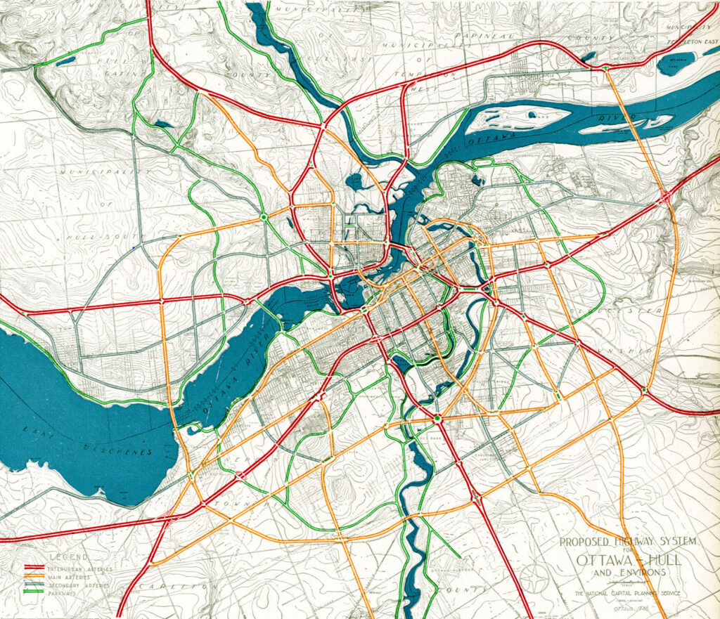
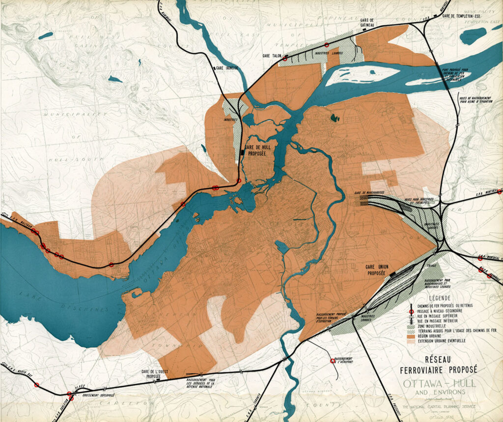
In the 1940s, the federal government led by Liberal prime minister William Lyon Mackenzie King wanted to beautify the nation’s capital region and address traffic congestion. Ottawa — and the federal government — was rapidly growing, while political leaders wanted a cityscape that matched the ambitions of an expanding nation. French urban planner Jacques Gréber was commissioned to plan the region’s future; Gréber’s recommendations, released in 1950, were ambitious and transformative. (You can read the entire report here.)
The Gréber Plan — formally titled “Plan for the National Capital” — called for new highways, the abandonment of Ottawa’s streetcars (which were seen as antiquated with unsightly overhead wires), and the removal of all railway infrastructure within the City of Ottawa. The old CN and CPR lines would make way for new roads, including a four-lane arterial along the east side of the Rideau Canal, leading to a new road bridge replacing the Alexandra. A new railway bypass along the periphery of the city would replace all urban trackage, with a proposed new Union Station site in Gloucester Township, south of Walkley Road. Most industrial uses — including the historic paper mills along the Ottawa River — would be moved to the new railway line.
Proposed highway system for Ottawa-Hull and environs, from Gréber’s reportProposed Railway system: Ottawa Hull and environs from Gréber’s report
Though the plan was not fully implemented, it did set the stage for much of the urban planning and infrastructure changes during Ottawa’s next fifty years. The railway bypass was constructed between Bell’s Corners in the west and Ramsayville in the east, with the old Grand Trunk tracks through the city replaced with The Queensway, now part of Highway 417. New parkways lined the rivers and canals. Two new multilane traffic bridges crossed the Ottawa River (though the Alexandra Bridge was maintained for traffic and pedestrians) and Albert and Slater Streets were made one-way, with a new bridge over the Rideau Canal (the Mackenzie King Bridge) linking them to the east. A large Greenbelt encompassed the city region, intended to direct growth while preserving natural areas.
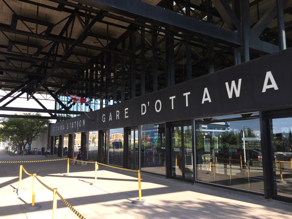
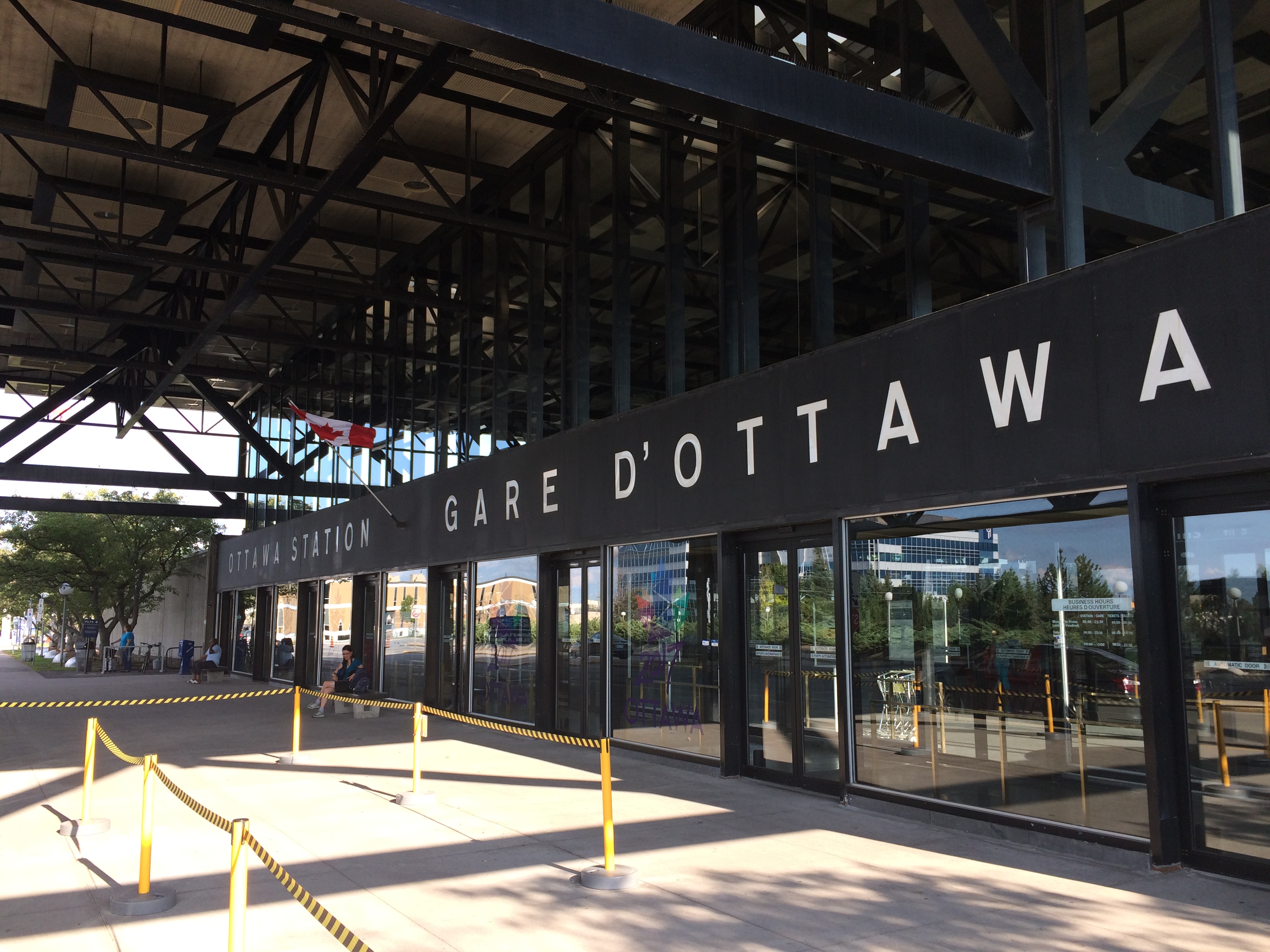
Fortunately, the passenger station was relocated to a point much closer to the city centre than the Gréber Plan envisioned: the old CN and CP tracks along the Rideau River south of the city centre were kept in place but rerouted to serve a new modernist station that opened in July 1966. The new Ottawa Station, designed by John C. Parkin, is one-of-kind. The architecture invokes an airport terminal, with large, sheltered driveways and an airy open lobby/concourse, and was the last grand railway station built in North America. In 1966-1967, there were still two daily transcontinental trains departing from Ottawa Station, along with multiple trains to Toronto and Montreal, including a Toronto-Ottawa night train. Today, there are just eight trains to Toronto and five trains to Montréal.
Ottawa Station, which opened July 31, 1966
Soon after the new station opened, the tracks and ancillary buildings around Union Station were removed, making way for Colonel By Drive, the Rideau Centre shopping mall, a new convention centre, and headquarters for the Department of Defense. The station building itself survived, however, first becoming a temporary museum space during the 1967 Centennial celebrations, then a government conference centre, mostly closed off to the public.
The temporary Senate Chambers in the former train concourse at Ottawa Union Station
Right now, the grand building is the temporary home of Canada’s Senate, and is again accessible to the public, via a free tour. The renovations to the building are very sympathetic to the built heritage. As reconstruction of Centre Block, the regular home of both Houses of Parliament, is still five years away from completion, there’s still lots of time to take the tour.
Awaiting Alto
The Alto high speed rail line project, now in the planning stage, will connect Québec, Montréal, Ottawa, and Toronto, with a total of seven stations (the other three are planned in Trois-Rivières, Laval, and Peterborough). The first segment, with the start of construction set for 2029, will link Montréal, Laval, and Ottawa. Consultations on the specific route and station locations are underway, with the broad corridors noted in maps available on the Alto website.
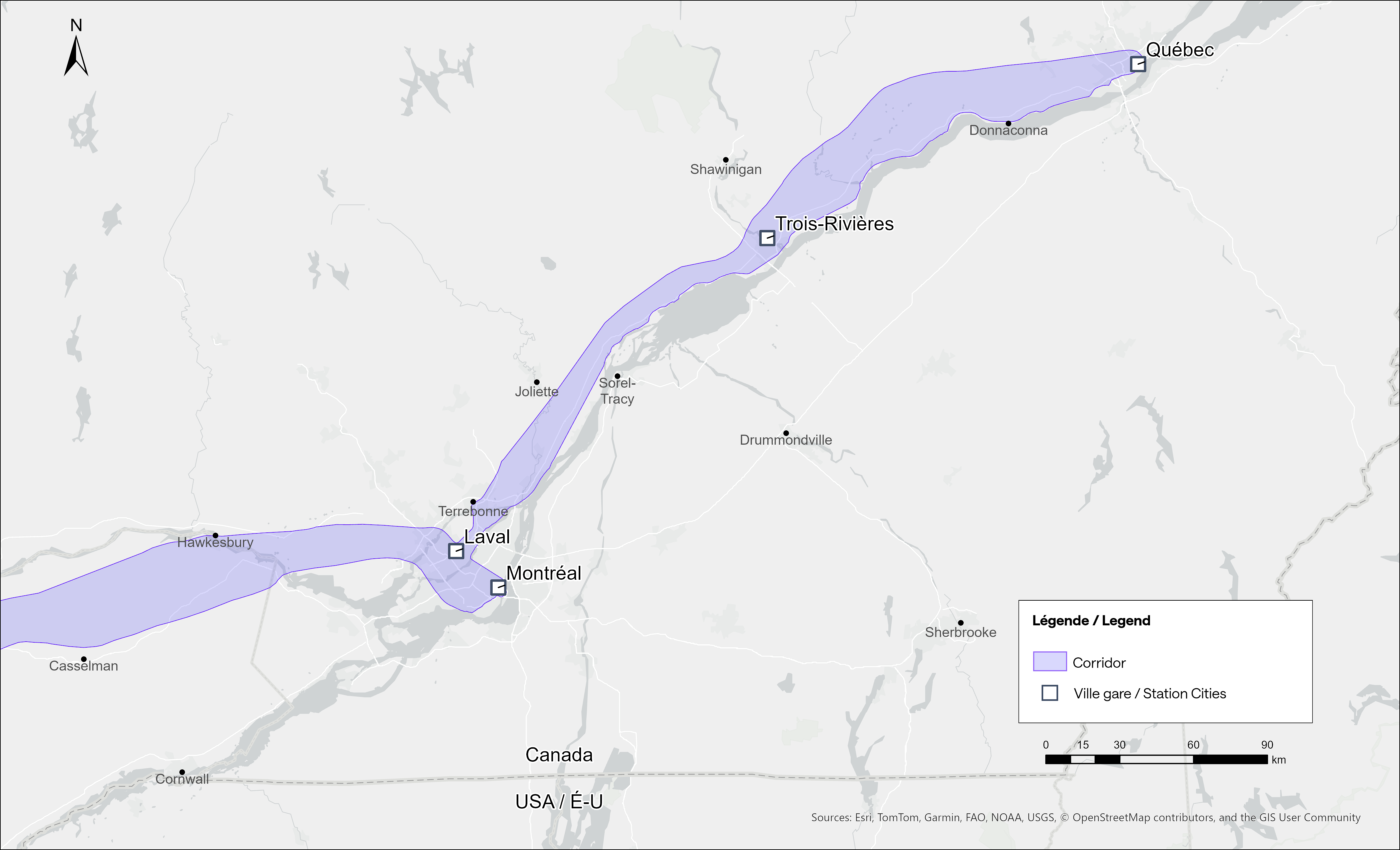
Map of potential routings for the Alto high speed line in OntarioMap of the planned routing for the Alto high speed line in Quebec
The maps clearly show a route between Ottawa and Montréal that will pass through Prescott & Russell Counties, roughly following an abandoned CPR corridor until about Hawkesbury, at which point it would cross into Quebec (following an older abandoned CNoR route) to Laval, then continue south into central Montréal, though not necessarily the existing Central Station (this would likely require a new tunnel under Mount Royal). The Montréal station appears to be a terminal for trains coming from Ottawa and from Trois-Rivières and Québec, much like the existing VIA Central Station.
Alto’s next phase towards Toronto could follow one of two broad routes between Ottawa and Peterborough, either just north of Highway 7, through the Canadian Shield, or a southerly alignment through the Rideau Lakes region and then through South Frontenac and passing near Stirling and Campbellford. All planned routes would require passing through Ottawa entirely on the Ontario side of the Ottawa River, making a through station particularly likely, especially for the critical Toronto-Montréal market.
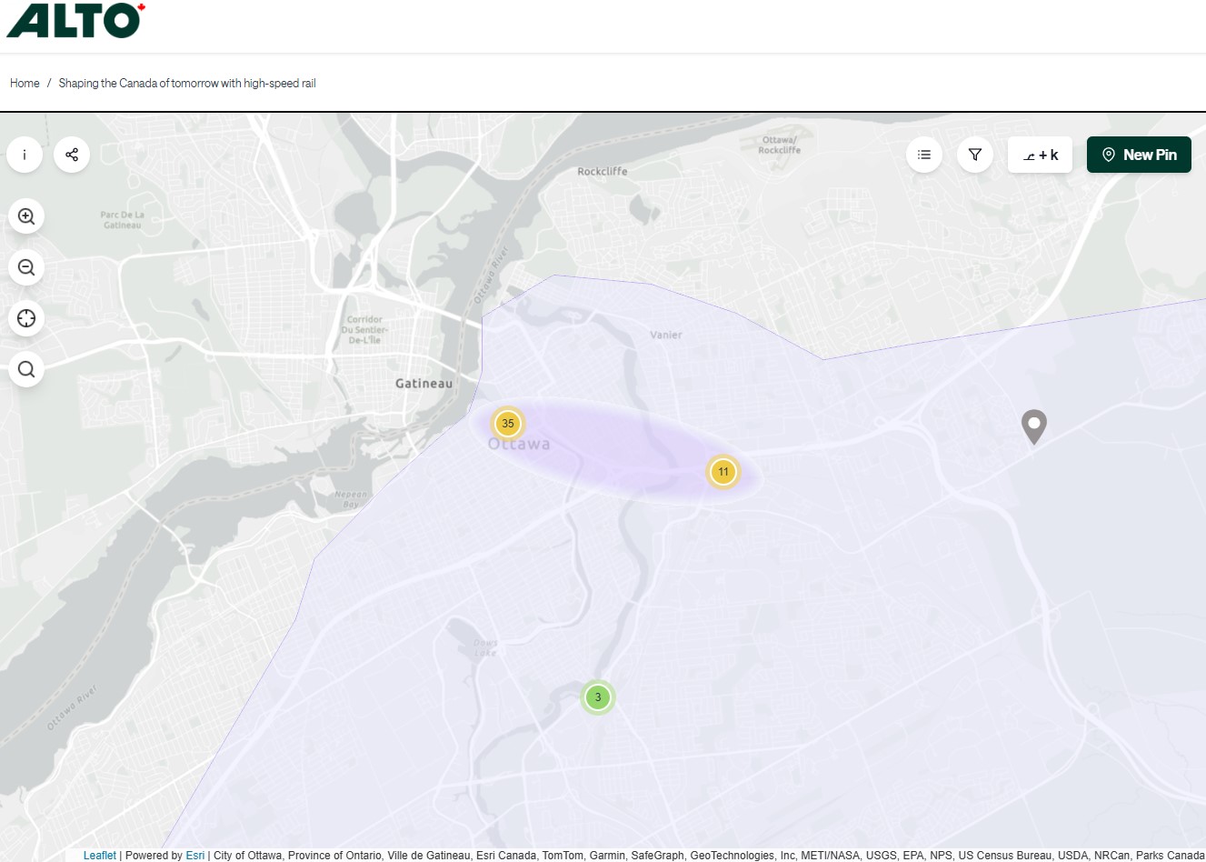
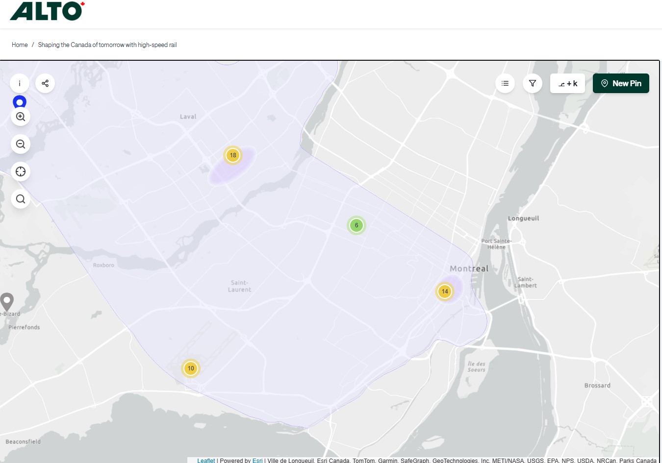
On the detailed consultation map, highlighted areas show where the seven station locations are being considered.
The map for Ottawa shows possible station locations in an area including the current VIA station and the old Union StationThe Montréaland Laval station locations under consideration. The Montréal station area highlighted includes the locations of Central and Lucien L’Allier Stations.The Montréal station for Alto is clearly intended to be a terminal.
The idea of a downtown Ottawa Station for the new high speed rail corridor is certainly enticing. It would breathe new life into a 114-year-old landmark, provide a very convenient spot for Ottawa politicians, public servants, business travelers, tourists, and students attending nearby University of Ottawa. Rideau O-Train Station is less than two blocks away. However, it would require a new tunnel and/or elevated structure to reach the station from the rail corridors to the south. Furthermore, Centre Block would have to reopen on schedule so the Senate can move back before construction can start on refurbishing the station for passenger service.
The 1966 Ottawa VIA Station, on the other hand, has its own advantages. There is plenty of room to build new high speed train platforms, which should provide level boarding for efficient passenger movement. There is also room for parking, passenger pick-up and drop-off, as well as easy access to the highway, unlike Union Station. With the closure of the Ottawa bus station, the VIA Rail Station has become a multimodal hub, with Ontario Northland, Flixbus, and Orleans Express all using the station’s driveway, along with a KLM/Air France shuttle to Dorval Airport. There is also a dedicated O-Train LRT station on-site, though it could be better integrated with the station building.
Perhaps most importantly, the existing VIA station can help ensure the existing Corridor service remains integral, as passengers from Kingston, Belleville, and elsewhere on Lake Ontario and the St. Lawrence River will not be served by Alto; neither would Casselman, Alexandria and Dorval. That the station is a through-line, and not a stub-end terminal, will also ensure that the crucial Toronto-Montréal market will see minimal delays from back-tracking and reversing at a downtown terminal. Though there are instances of high-speed trains reversing directions at major hubs — Trenitalia’s Frecciarossa mainline between Milan and Salerno turns back at Roma Termini and at Napoli Centrale — this is an uncommon arrangement.
All the planned Alto high speed rail stations will have to be easily accessible and close to the downtown cores of the cities it serves. At this point in the planning process, this looks like it will be the case at all three big city stations. But it will need more than walk-up traffic like downtown office workers and tourists; it will be most successful as part of a complete network of local, regional and intercity transport, including the conventional VIA rail system. With specific improvements, including new platforms and better O-Train station integration, the modern yet historic 1966 Ottawa Station is well suited for all of these needs.
Over the last six years, Greyhound Canada disappeared after years of decline, the COVID-19 pandemic hit with travel restricted, the Ontario provincial government set up one-time funding for intercommunity transport links while deregulating the intercity coach industry, and many municipalities dipped their toes into providing rural transit services.
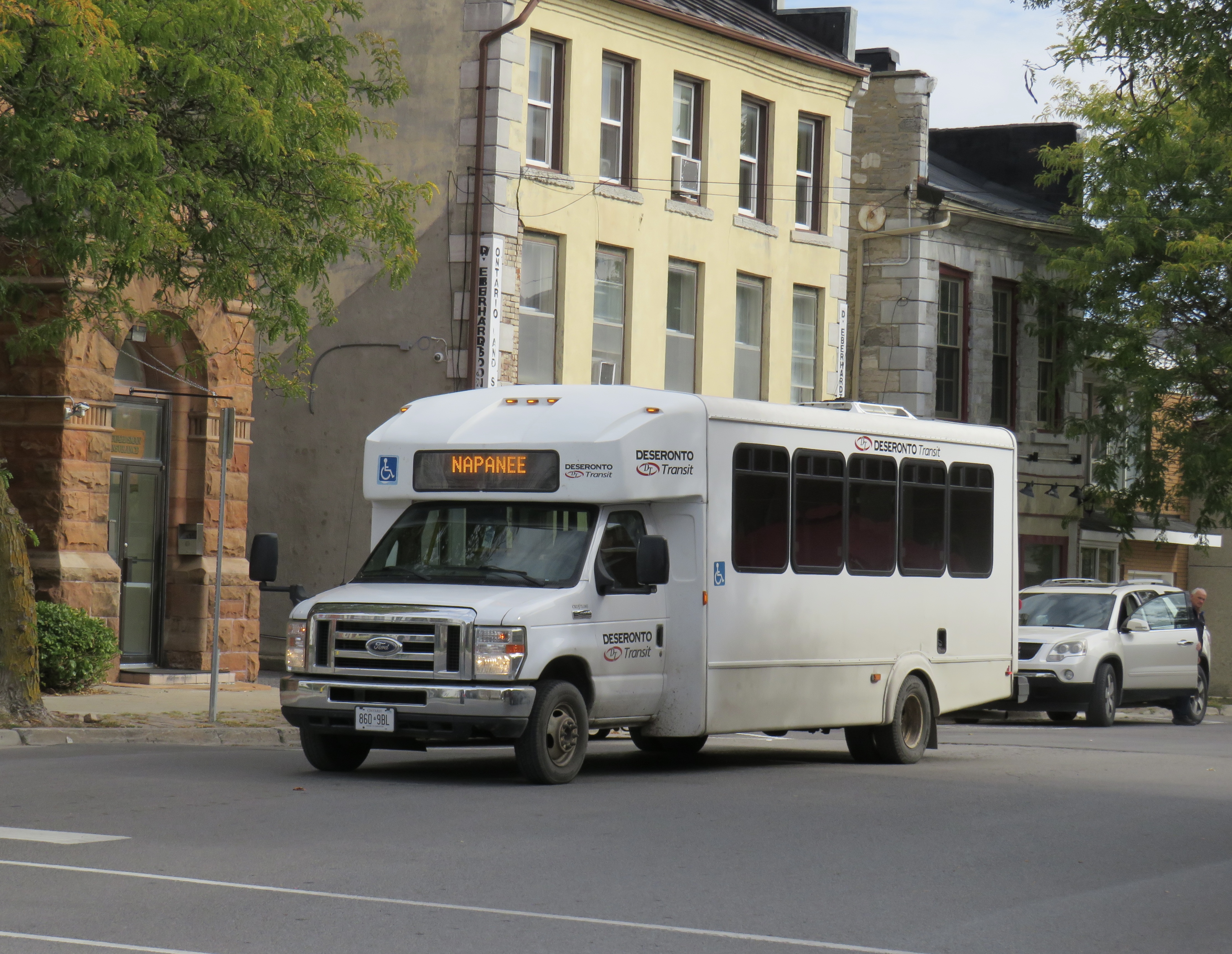
At the end of 2025, there was some good news to note — several rail transit lines opened in Toronto, Montreal, Ottawa, and Edmonton, while a few new rural services opened in Eastern Ontario. Unfortunately, there were also some major losses in Ontario, particularly in Grey County, Oxford County, Napanee-Deseronto, and the impending cancellation of a major route in Essex County. Unlike in Ontario, however, rural transport links remain stable in Quebec and British Columbia.
Stable funding is essential to keep these intercommunity and intercity links alive, particularly where private operators have not filled a need. For example, Flixbus recently cut back their once-a-day route from Toronto to the Lake Huron coast and will not serve rapidly-growing Saugeen Shores during the colder months. That part of Ontario is left only with a three-days-a-week TOK coach despite potential demand. A well-funded regional transport service coordinated by Grey, Bruce, and other adjacent counties could address this, but there needs to be political will to ensure stable and predictable service needed to grow ridership over the long term.
I just completed a round of edits to my intercity map, noting changes to routes, service levels, and in some cases, stop locations. A few new scheduled air shuttles in Atlantic Canada and Manitoba are included; these types of services are only mapped if they also provide non-airport service or at least connect to urban transport.
There are also more grey lines. Starting with edits in mid 2024, I have chosen to grey out abandoned routes, rather than just eliminating them. It is well worth noting where transport links have disappeared, and where replacement service might be worth planning.
Hopefully 2026 will see better service than the end of 2025.
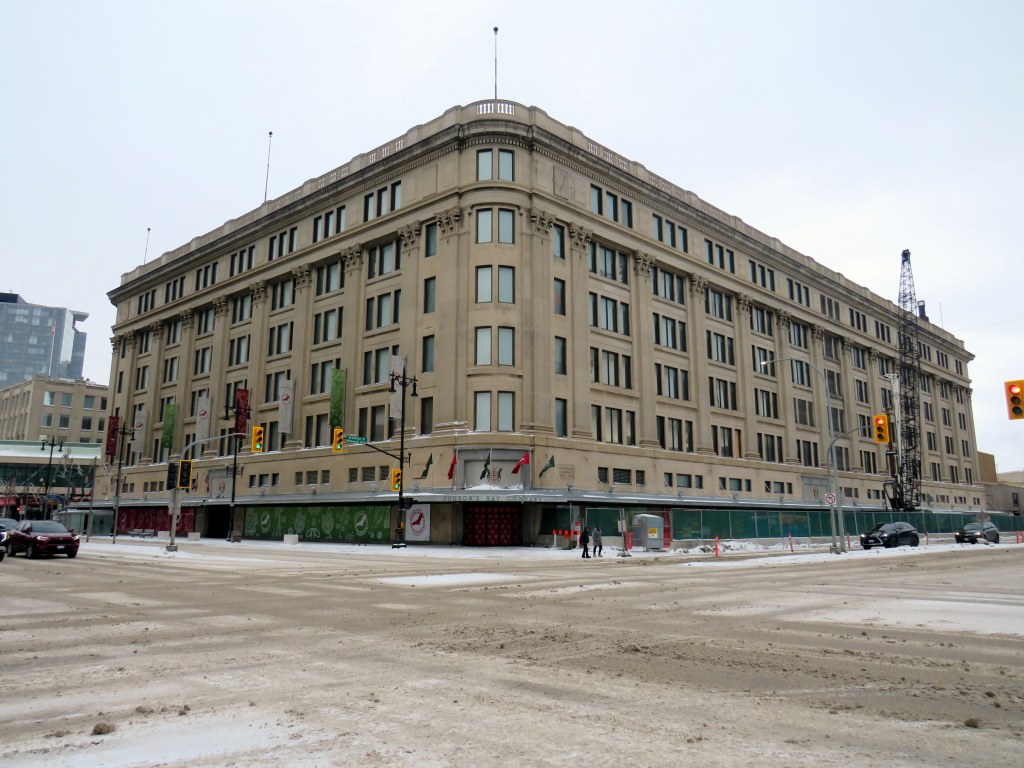
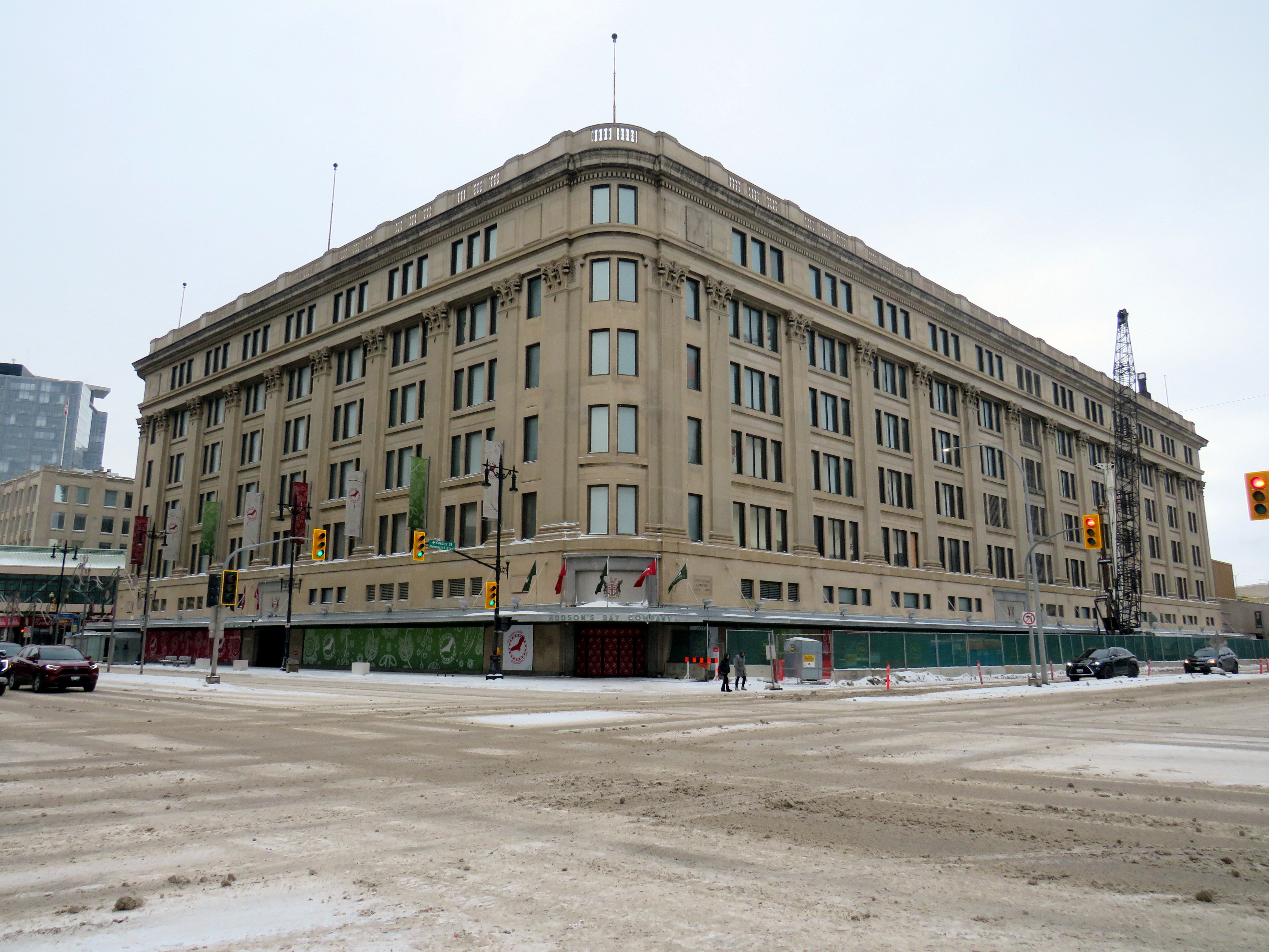
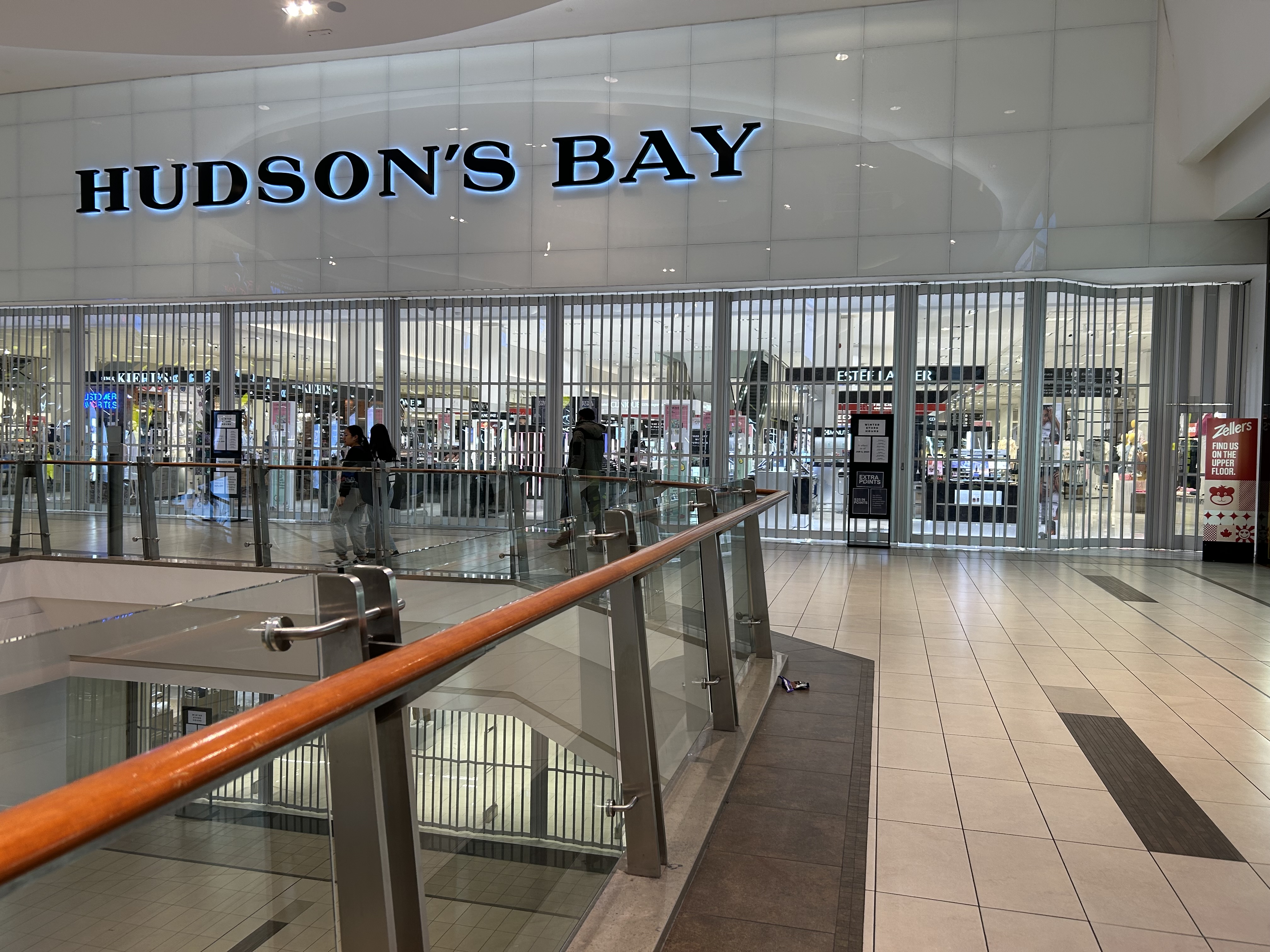
There’s a touch of irony that in the same year Canadian sovereignty is increasingly threatened by an American president, the Hudson’s Bay Company — one of the world’s oldest corporations — has filed for bankruptcy protection. It will likely close at least half of its 80 stores, but with no guarantee it will emerge in a healthy state, able to rebound.
On May 2, 1670, The Governor and Company of Adventurers of England, trading into Hudson’s Bay, was given a royal charter to trade in all lands that drained into Hudson’s Bay, 3.9 million km2 of land in the heart of the North American continent, in order to compete with the lucrative French fur trade in the St. Lawrence basin. The new company had monopolistic commercial control of what was then called Rupert’s Land: the entirety of present-day Manitoba, most of Saskatchewan and Northern Ontario, a significant part of present-day Quebec, Alberta, and Nunavut, and even parts of what eventually became Minnesota and North Dakota.
Of course, this new monopoly, which quickly became known as simply the Hudson’s Bay Company (HBC), was created without consent or consultation with the many First Nations and Inuit communities. In the early days of trade, however, HBC relied on trading with First Nations for the valuable fur trades. It established forts and factories (trading posts) throughout the northwest, establishing places such as Moose Factory and Fort Albany that remain to this day.
In later years, HBC claimed a trading monopoly on lands draining into the Pacific Ocean; it also brought in missionaries to convert Indigenous peoples. (Its monopoly was challenged by new entrants such as the North West Company, which eventually merged with HBC after violent skirmishes over trading territorial rights.)
HBC’s vast networks of forts and trading posts, particularly Fort Garry (now Winnipeg) led towards the full colonization of western and northern Canada. In 1870, with the decline of the fur trade HBC relinquished control of Rupert’s Land to the new Dominion of Canada, which led immediately to the creation of the Northwest Territories, followed quickly by the Red River Rebellion and the creation of the Province of Manitoba.
HBC continued as a fur and goods trading company and it was still the only retailer in remote western and northern communities. In larger cities like Vancouver, Winnipeg, Edmonton, and Calgary, it established new department stores. In smaller communities, especially in the north, it took full advantage of its dominant position, and Northern Stores became notorious for high prices (in 1987, HBC sold off its Northern Stores division). HBC continued to exploit Canada’s natural resources — it even had an oil and gas subsidiary between 1926 and 1982.
In 1960, HBC focused almost entirely on its department store empire, acquiring the Montreal-based Morgan’s chain, competing head-on with Eaton’s and Simpsons-Sears. In the 1970s and 1980s, it also scooped up discount chain Zellers, Simpson’s stores (after its split from Sears Canada), Ottawa-based Freimans, and Hamilton-based Robinson’s, eventually rebranding those stores as “The Bay.” Finally in 1993, it acquired Vancouver-based Woodward’s. During this time, it sold off the Northern stores and the oil company. In the late 1990s, it launched the Home Outfitters big-box chain. The Zellers chain expanded under HBC ownership, first acquiring the competing Towers discount chain in 1991 and K-Mart’s Canadian stores in 1998.
Though the flagship stores still proudly proclaimed the May 2, 1670 incorporation date, few thought about the long and checkered history of the company. My first memories of The Bay’s retail empire were of the Simpson’s store close to where we lived in Brampton. Simpson’s was the flagship anchor of Shoppers World, a once-vibrant mall. I also knew Simpson’s from the flagship Queen Street store in Downtown Toronto, famous for its toy section, Christmas window displays, and of course, the TVO children’s program Today’s Special. (The most memorable episodes for me, a young, budding urbanist, dealt with a fictionalized closure and demolition of the store, before a heritage plaque uncovered during the move out saved the day.)
Opening sequence of “Today’s Special,” set in the downtown Simpson’s Queen Street store
The Shoppers World Simpson’s store, like the rest of the banner, was converted to “The Bay” in 1991. In 2007 the store closed, not long after I moved to my own apartment in Toronto. (I still have some of the chinaware I purchased at that Bay store before I moved to my own place.) But as I worked, and later lived, in Downtown Toronto, I found the Queen Street store very useful for casual clothes shopping and the occasional big-ticket item.
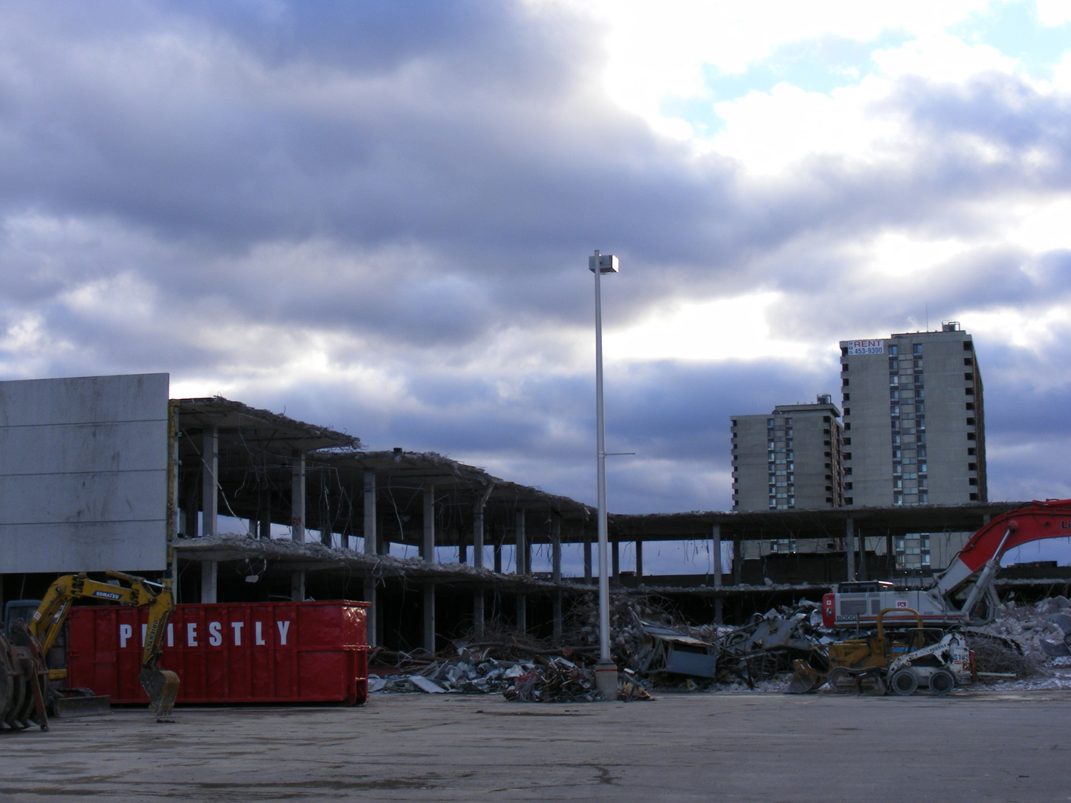
Demolition of the Shoppers World Simpson’s/The Bay department store in 2010
Though HBC was sold to a private equity firm in 2008, under CEO Bonnie Brooks’ leadership, there was still life in the department store, with leading stores like the Queen Street flagship upgraded. The fifth floor was a great place to browse for men’s clothes; the seventh floor had an excellent kitchenware department. HBC persisted through the bankruptcy of Eaton’s in 1997-1999 as well the wind-down of Sears Canada that began in 2012 (when it began selling the leases of its urban flagships, including former Eaton’s stores) and concluded in 2018.
But private equity did what private equity does best: it began selling off the assets and closing down stores, just as Sears did in its last decade. The Zellers discount department store chain was discontinued, with the majority of store leases sold to the ill-fated Target Canada operation in 2011. The Home Outfitters stores were closed in 2019. Real estate was sold off, with HBC leasing back the properties. For example, the Queen Street store was sold to real estate developer Cadillac Fairview — who owns the adjacent Eaton Centre mall — for $650 million in 2014.
In the last few years, it became clear that the department store chain was in decline. Though pandemic restrictions in 2020 and 2021 had a major effect, the downtown stores also lost office worker patronage. Suppliers were having trouble getting paid and were seizing merchandise at several stores; escalators and elevators were put out of service, and store hours were reduced at most locations.
The Hudson’s Bay store at Scarborough Town Centre closed at 7:00 on a weekday evening in March 2024, even though the rest of the mall remained open for another two hours
The loss of Canada’s last department store is unfortunate, but it comes as no surprise given the way private equity sucks once-proud businesses dry. The evidence was impossible to miss. How could customers be lured back when escalators were blocked off, marketing non-existent, and store opening hours scaled back? Not even Sears turned off the escalators in its last years.
I suspect, given the company’s 355-year history, a vestige of HBC will live on, especially in an era of renewed Canadian nationalist. Another business will certainly purchase the name and brand to continue selling the famous point blankets. Though the Queen Street store will certainly be redeveloped by Cadillac Fairview, strict heritage considerations will prevent its complete demolition. The Downtown Winnipeg store, closed in 2020, is already being repurposed into a new hub for Manitoba’s First Nations.
But it will remain a true shame, as I have always felt there was still a place for a full-service department store in Canada. It only needed to be well managed, relevant, and cared for.
VIA Train #1 at Hornepayne, Ontario. Normally this stop would be made overnight.
In late January, I went on a short vacation. Many people, given the short days and cold weather, opt for warmer climes. I, on the other hand, decided to travel to the infamously cold city of Winnipeg, Manitoba. Back in November, VIA Rail offered great deals on winter travel as part of its “Black Friday” sale; a berth in a sleeping car from Toronto to Winnipeg cost $271, with meals included. Winter travel by train can be beautiful, and I had fond memories of my February 2014 trip aboard the Algoma Central Railway between Sault Ste. Marie and Hearst.
I planned to spend two nights in Winnipeg, including taking in my first NHL game since the pandemic. The Jets were playing on Friday night against the original Winnipeg Jets, the Utah Hockey Club (which moved to Salt Lake City from Phoenix in 2024). I would then travel back east by bus, with a stopover in Kenora, flying home from Thunder Bay.
Unfortunately, my train from Toronto was delayed by eleven hours, a new record in my rail travel setbacks. The train from Vancouver faced several setbacks due to extreme cold conditions in the Prairies and Northern Ontario, arriving in Toronto over 15 hours late, around 8AM on Wednesday morning. (VIA Rail’s communications were subpar, and though I got two emails advising of a 5:00 PM departure on Wednesday, we did not actually leave until 8:00 PM, about 10 hours late from Toronto.)
Despite the delays, it was a very pleasant train ride across Northern Ontario in the snow. The cooked-to-order meals served aboard the Canadian, as always, were very good, and service was friendly. The lights in the dome car for our section were turned off, allowing passengers to gaze into the wilderness, even at night.
As it turned out, I was able to cancel my first night’s stay in Winnipeg without penalty, which was fortunate as the train arrived at 7AM Friday, nearly 12 hours late. But for me, it was fortunate, as by then, coffee shops were opening up in Downtown Winnipeg. An earlier arrival, had the train made up time, would have forced me to find a 24-hour restaurant to wait at, and there aren’t any in the downtown area.
The monument to the 1919 Winnipeg General Strike; a Corten steel replica of a toppled streetcar across the street from Winnipeg City Hall. It was especially compelling partially buried in snow.
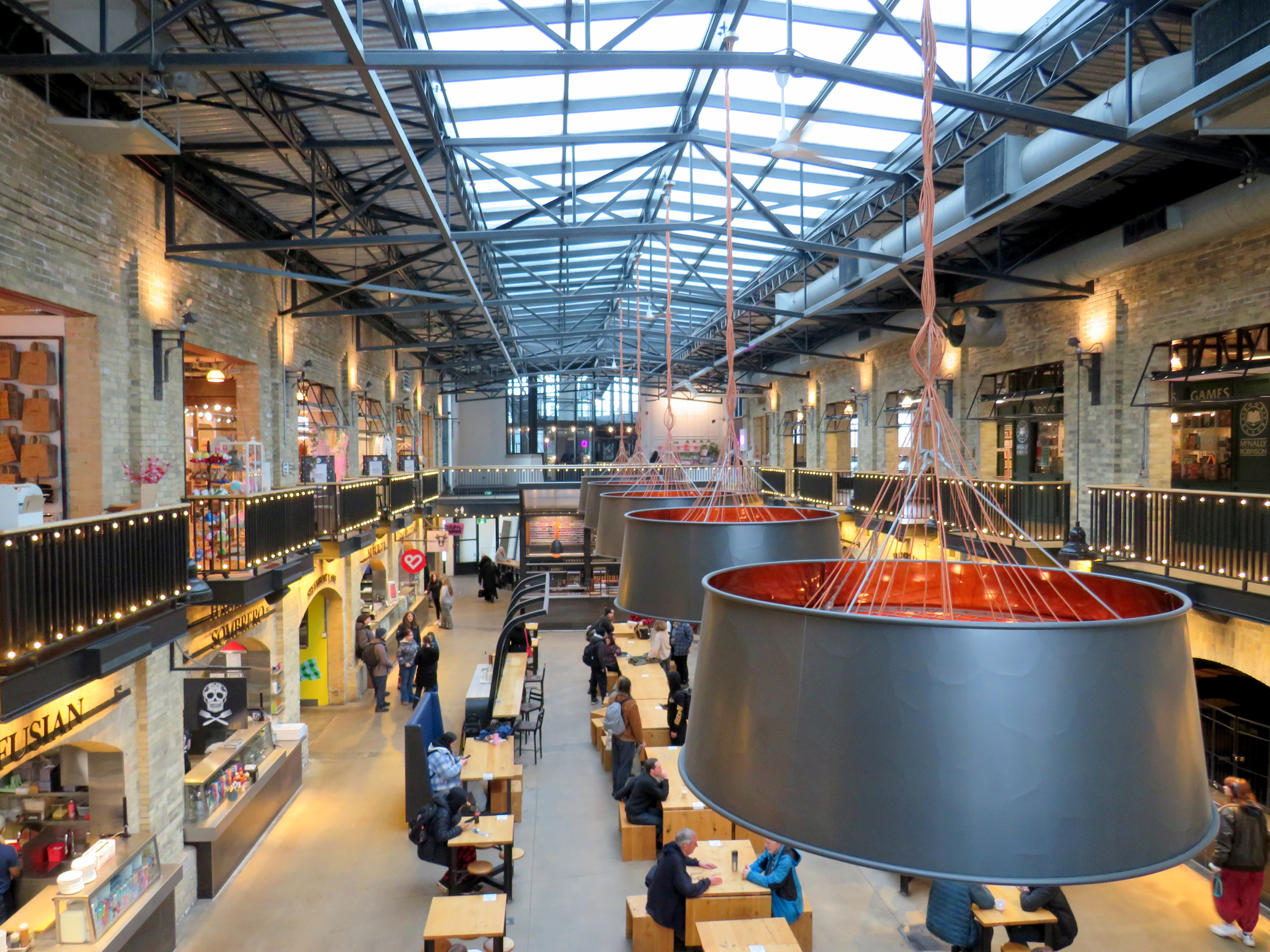
Though I have been to Winnipeg several times before, this was my first time visiting the city in winter. I was pleased to see how the city embraced the short, dark, cold days. Out at The Forks, where the Assiniboine River joins the Red River, there is a lively marketplace located in former railway maintenance and freight buildings behind Union Station. The complex includes a branch of the local McNally-Robinson bookstore chain, restaurants, cafes, art shops, and other local businesses. There are plenty of tables and seating, with water dispensers and plenty of public washrooms. It is one of Canada’s great public spaces.
Inside one of the market buildings in the Forks, a former railway maintenance building
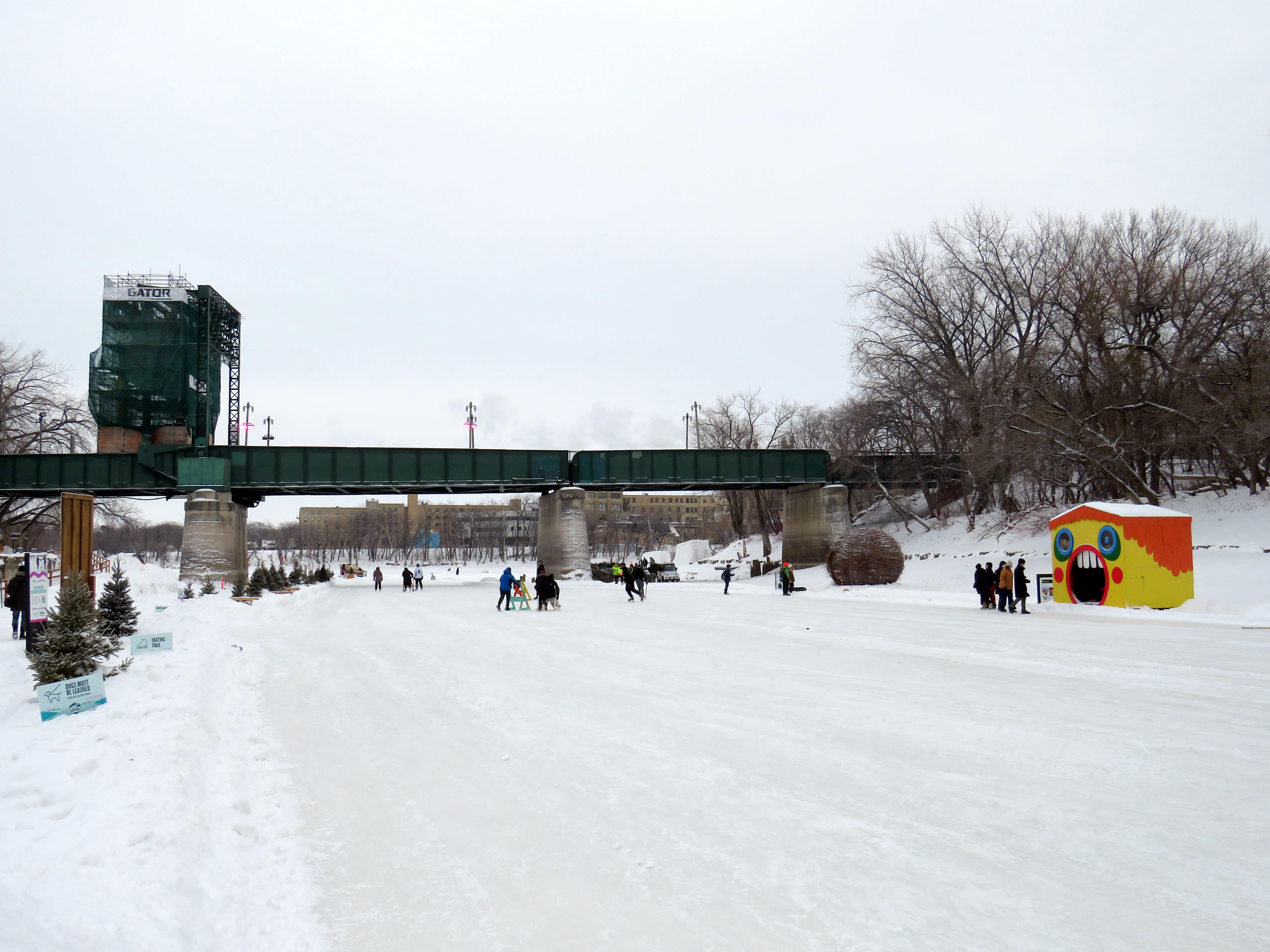
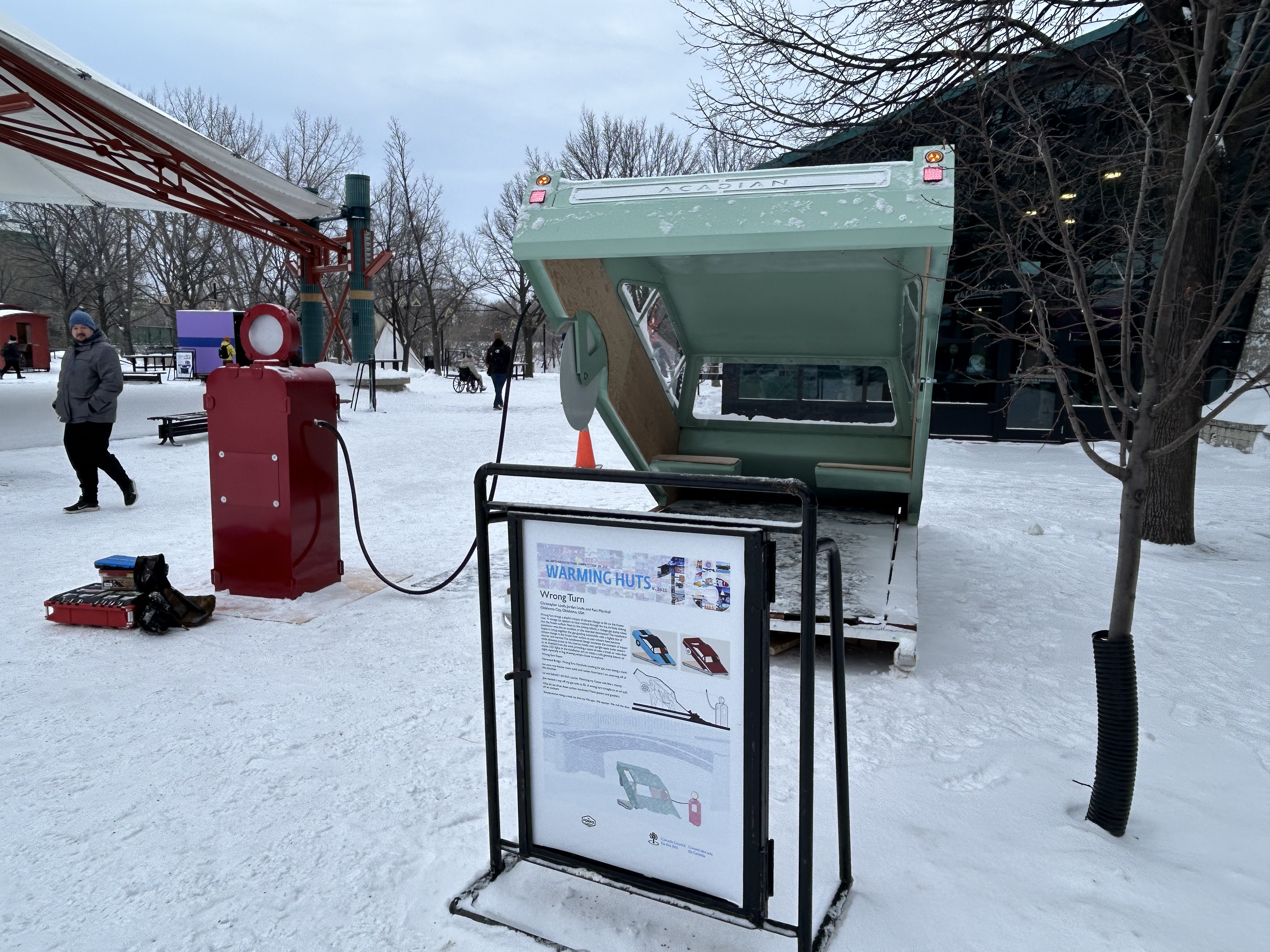
Outside, there were Warming Huts art stations, many of which were very compelling. Ice skaters have a choice of an artificial ice rink, covered by a tent-like canopy, or getting out on to a cleared natural path along the Assiniboine River.
Skaters on the Assiniboine River; warming huts along the ice give skaters a place to sitOne of the Warming Huts, titled “Wrong Turn,” representing a car sinking into an icy river
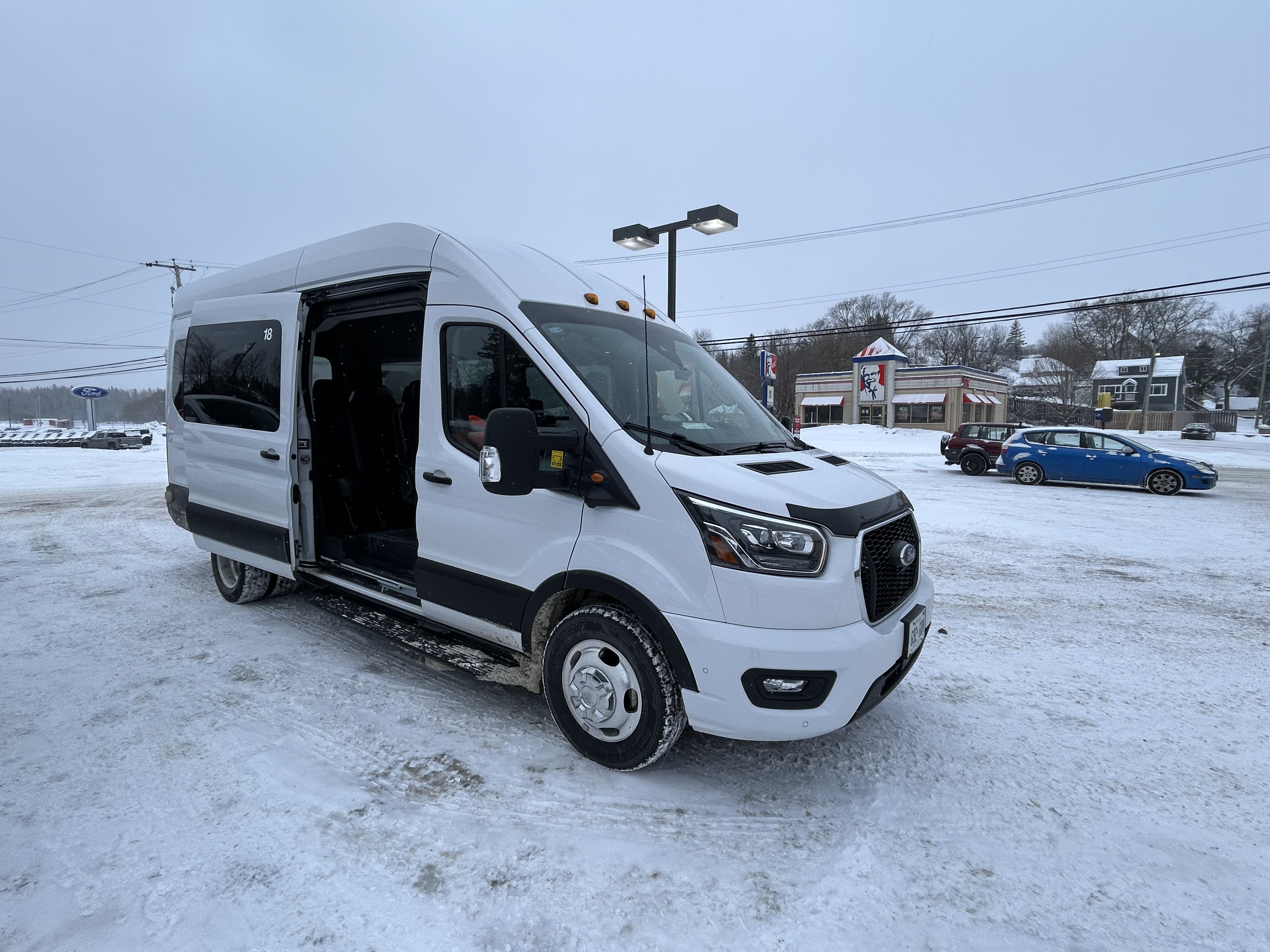
After 24 hours in Winnipeg, capped by a great hockey game in a lively arena, I made my way west towards Kenora and Thunder Bay. Kasper, which I last rode in 2019, has an early morning departure from Downtown Winnipeg, at the Balmoral bus terminal, stopping at Kenora, Dryden, and Sioux Lookout. Among the six passengers were a First Nations woman and her companion, returning home from a medical visit. Intercity buses are a lifeline. The Kasper bus was a 12-passenger van, and despite the poor winter weather conditions, it was a safe, comfortable, and friendly service.
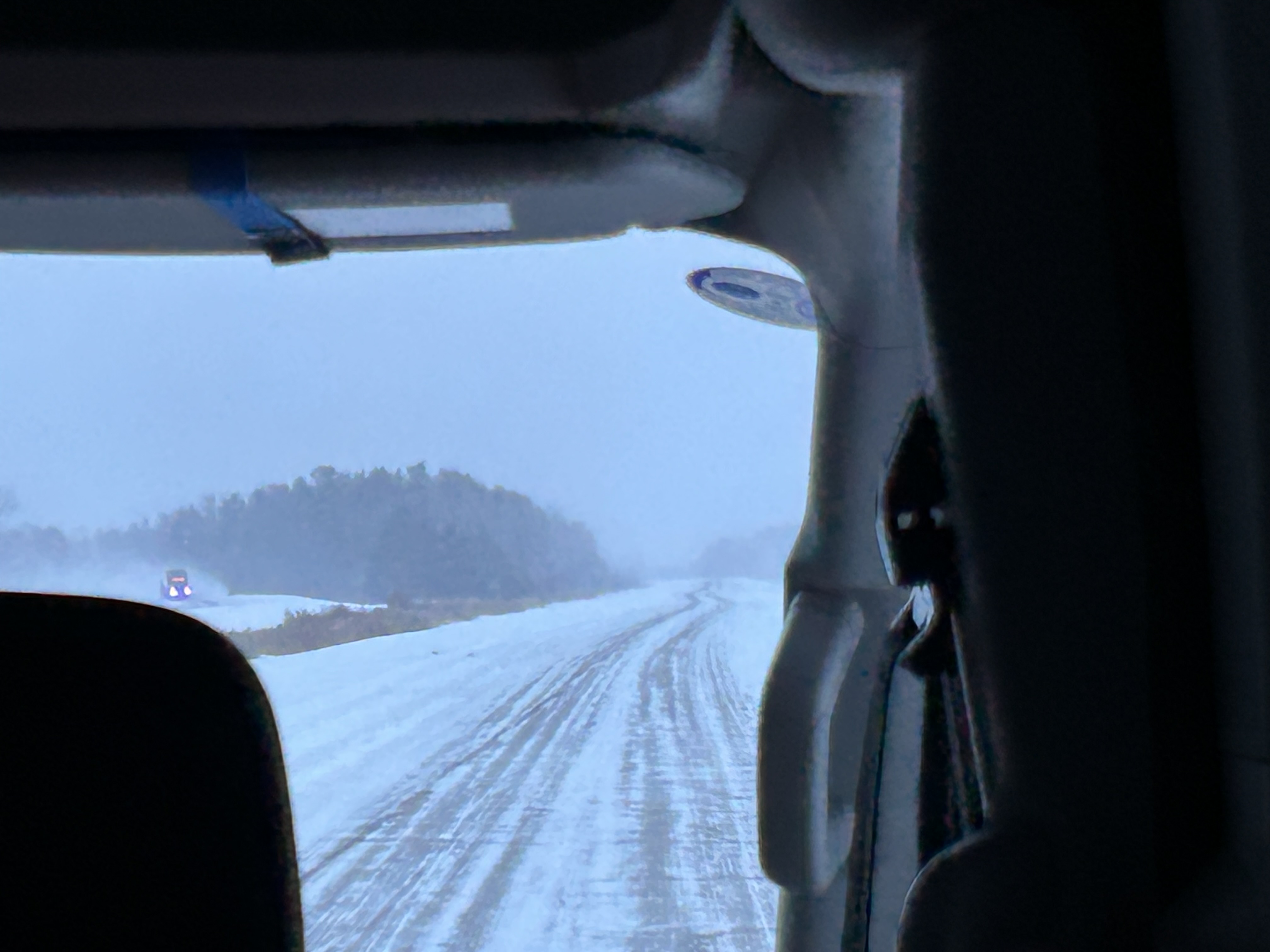
Snowy conditions on the Trans-Canada Highway headed east from Winnipeg
Taking the morning Kasper trip allowed me to spend a few hours in Kenora, population 15,000. The community on the Lake of the Woods is a popular summer vacation spot; this was my first time visiting Ontario’s most westerly city. Kasper’s Kenora stop is at a McDonalds just east of downtown; this gives passengers a chance to stretch, use the washroom, and grab food.
Kasper Minibus at the Kenora McDonald’s
The walk from the McDonald’s back towards downtown was pleasant. I was greeted by several deer, in their winter coats, comfortable wandering in a residential neighbourhood.
Northern white-tailed deer in their heavy winter coats
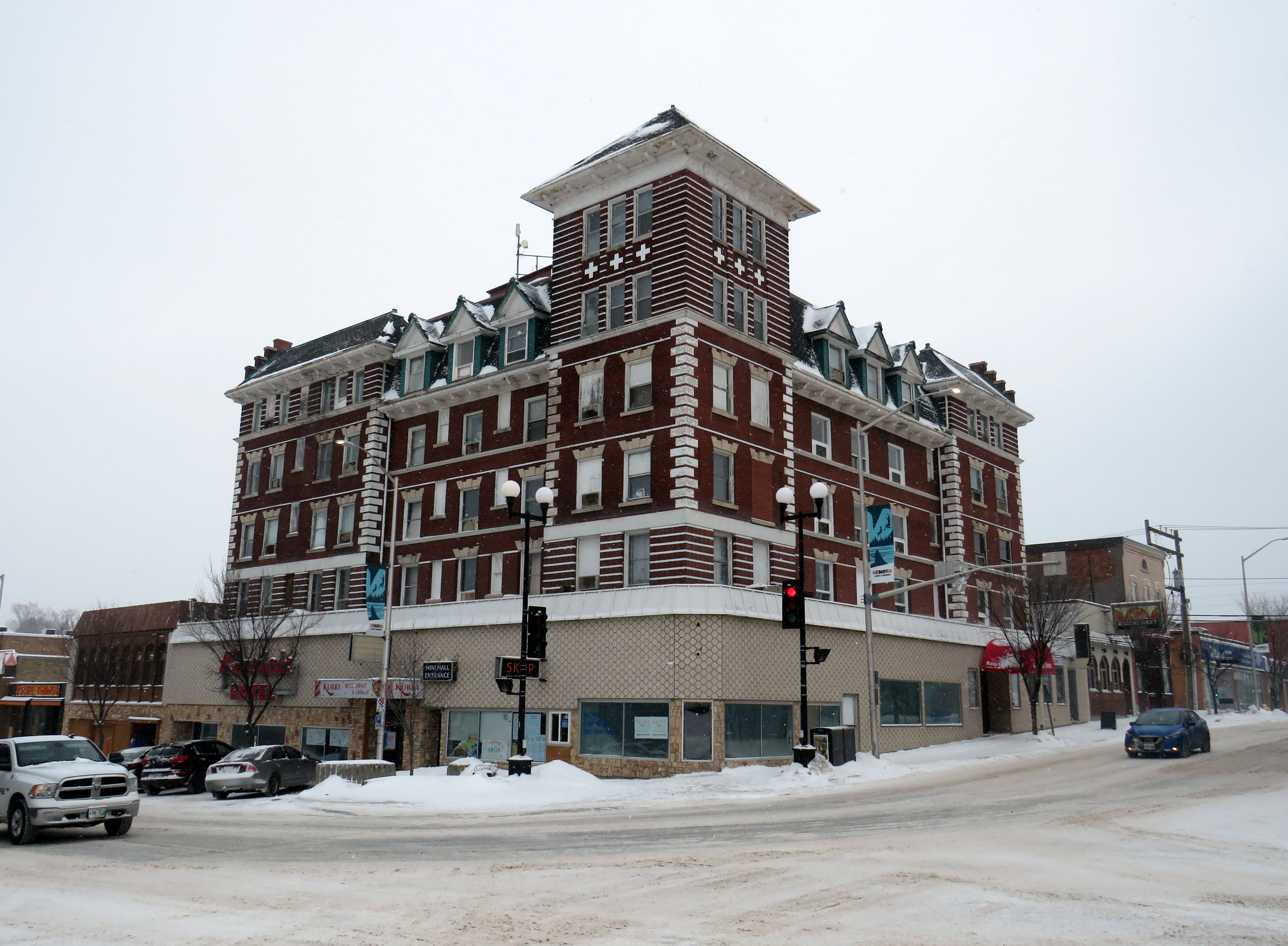
Kenora’s downtown is small, but blessed with a solid collection of historic buildings, including the old post office (now city hall), the district courthouse, a two-storey Canadian Pacific railway station (which served VIA until 1990), and the five-story Kenrica Hotel. The hotel has seen better days — the ground floor defaced by an unfortunate 1950s-era streetfront — but it still has good bones.
Kenrica Hotel, on the main corner in Downtown Kenora
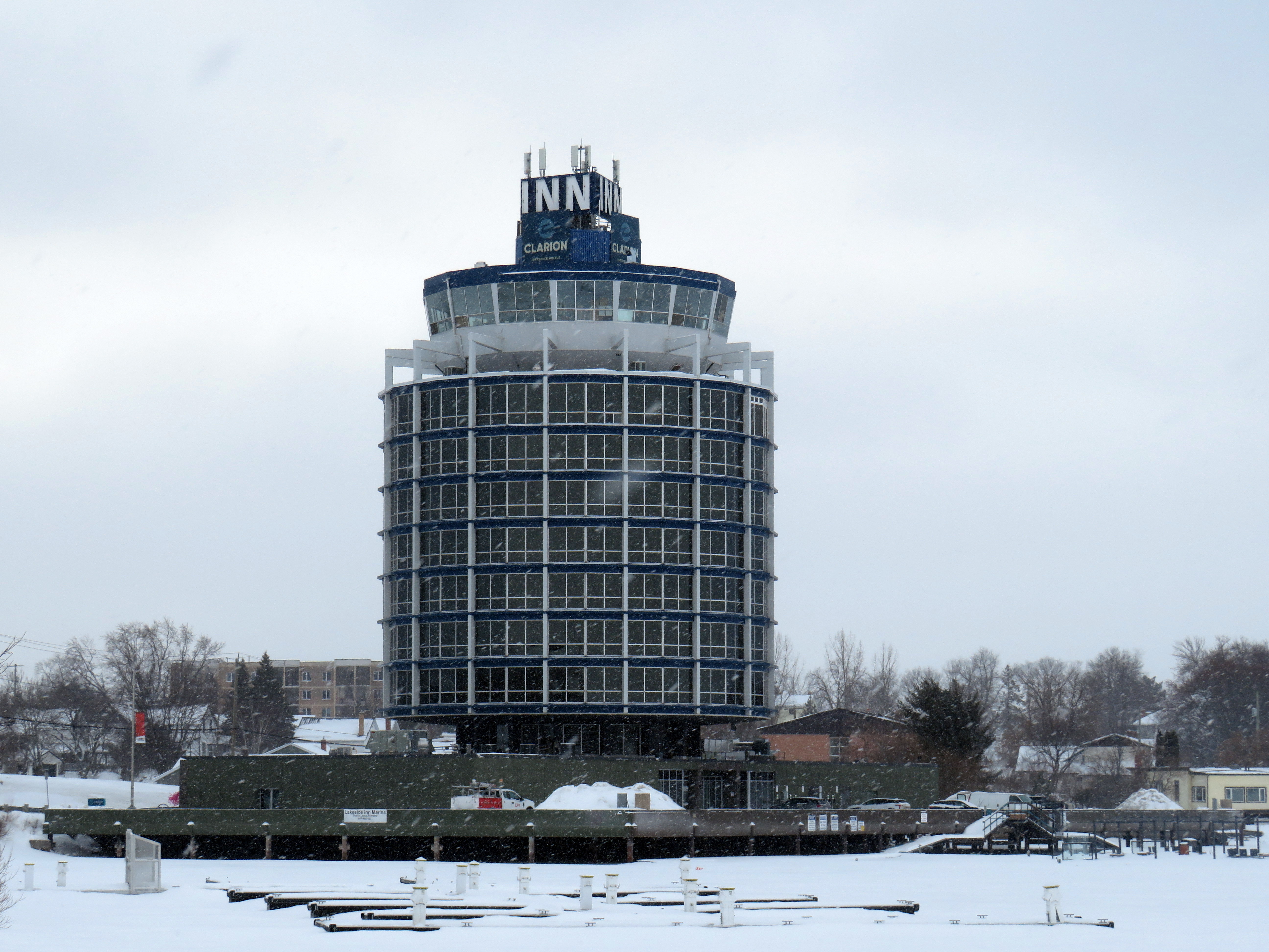
South of Downtown Kenora, on the lakefront, a cylindrical hotel, ten storeys high, overlooks Lake of the Woods, with a marina at its base. The hotel’s mid-century modernist form is unusual for Ontario, which makes it stand out even more.
The Clarion Inn on Lake of the Woods
Many towns and cities in Northern Ontario feature a roadside attraction. Sudbury has the Big Nickel, Wawa has a giant goose, and White River has Winnie-the-Pooh. Kenora’s is a giant sculpture of a muskie fish, called “Husky.”
“Husky the Muskie” – Kenora’s roadside attraction
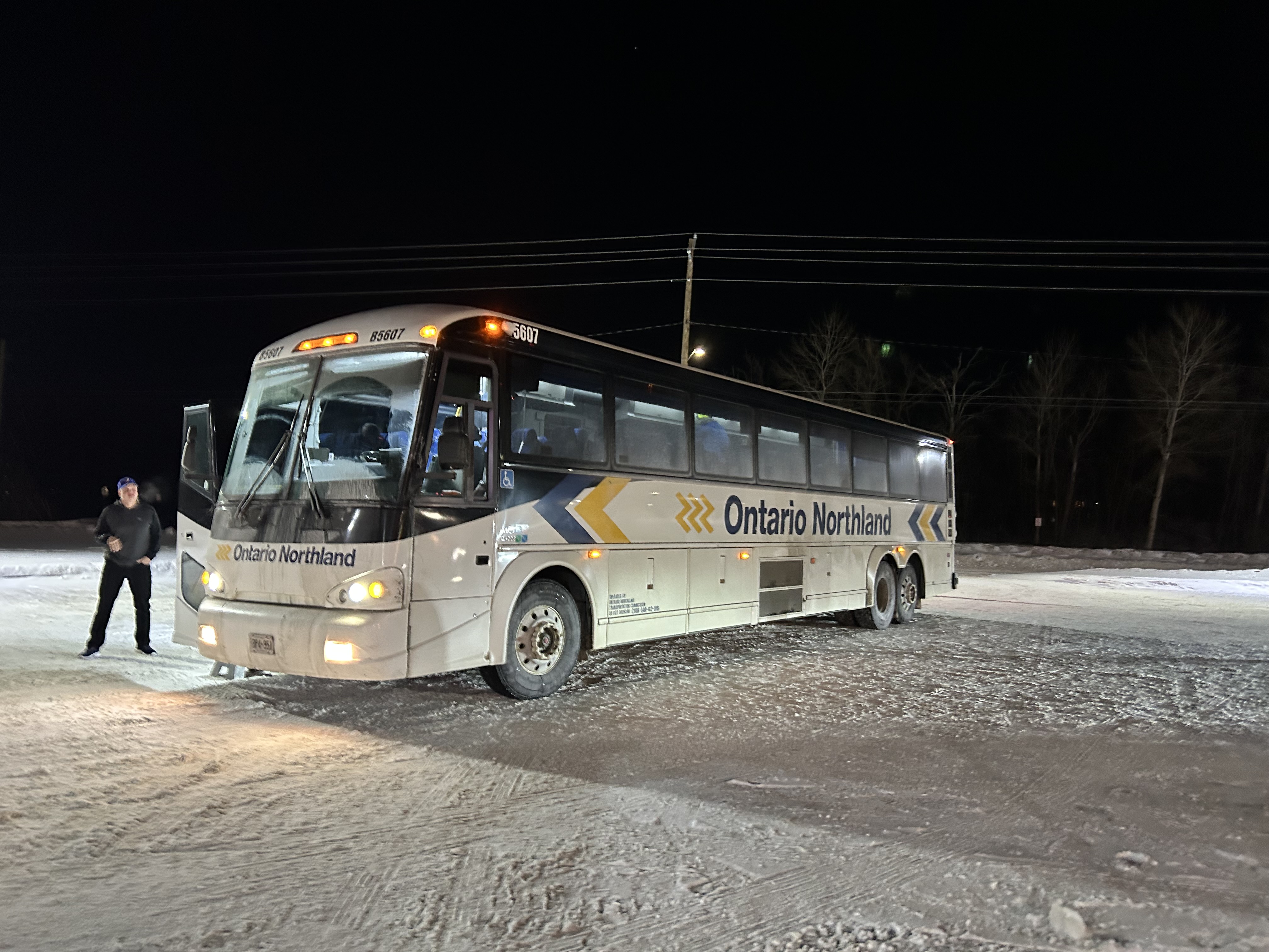
Ontario Northland operates a bus six days a week between Winnipeg, Thunder Bay, Sault Ste. Marie, and Sudbury, with operator changes at Thunder Bay and Sault Ste. Marie. Between Kenora and Thunder Bay, the route alternates, with service to Fort Frances and Atikokan three days a week and to Dryden and Ignace the other three days. Passing through Fort Frances (where the bus stopped at a McDonald’s there for a rest break), I finally visited every county, district, and region in Ontario, with Rainy River District being the final one.
Ontario Northland bus in a snow-covered McDonald’s in Fort Frances, Ontario
The Ontario Northland bus driver that day was exceptional; because of a winter storm, Highway 17 was closed near Batchewana Bay; as such, the bus would not continue past Thunder Bay. Though we were nearly an hour late arriving into Thunder Bay due to road conditions, the operator was willing to continue past the Thunder Bay Ontario Northland depot to drop anyone off continuing to the hospital campus. I was also able to get off the bus by my hotel.
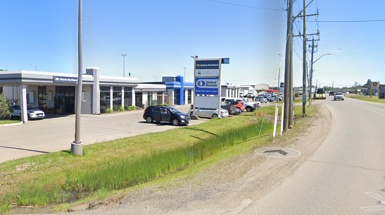
The Ontario Northland depot at Thunder Bay is not in a very good location, in an industrial area off Highway 61 near the Thunder Bay airport, without direct local transit connections or adjacent amenities. At least a stop at Thunder Bay Regional Health Sciences Centre (which has local transit and is near Lakehead University) is also provided.
Ontario Northland Thunder Bay depot, located in an industrial area on a road without sidewalks(Google Streetview)
Difficult winter road conditions make travel across the North a challenge; this is why professional and safe bus and train operators are so important for getting around.
There are buses to more destinations in 2024, but a few major gaps persist
NOTE: Previous versions of the Ontario and Canada maps are retired; please see the new Canada Intercity Transport Map, launched March 30, 2025. This will now be the only interactive map that I will update.
Unfortunately, outside of Ontario, there not that many updates to make. On Vancouver Island, at least, there is now daily service all the way to Port Hardy in the north and Tofino and Ucluelet to the west, with additional runs between Comox, Nanaimo, and Victoria. There are more buses between Vancouver and Seattle; FlixBus is now operating on the busy Calgary-Edmonton and Calgary-Banff routes. There is also a new twice-weekly Edmonton-Camrose service, thanks to work by the University of Alberta’s student union; it partnered with FlixBus to provide the service.
Also new to the map is Mountain Man Mike’s bus service between Vancouver, Nelson, Kaslo BC, and Calgary, as well as Mobilité Charlevoix, a regional service that connects several towns east of Québec City including Baie-Saint-Paul, La Malbaie, and Clermont.
Unfortunately, several wide gaps remain. Despite plenty of competition on the busiest routes in Southern Ontario and Alberta, there is no bus service between Calgary and Regina, leaving cities like Medicine Hat and Moose Jaw without intercity connections, apart from airport shuttle services, despite once-frequent Greyhound service. Between Winnipeg and Regina, it is still just one bus a week. Maritime Bus, for whatever reason, still has not restored service across the New Brunswick-Québec provincial line.
Without comprehensive government-led coordination and support, these gaps are likely to remain unfilled.
A VIA Rail train in Stratford, Ontario. In 1989, there were five trains a day connecting Stratford to Toronto. In 2024, there is only one.
July 2024: Map edited to include one new daily intercity train: Amtrak’s Borealis, an extension of an existing Chicago-Milwaukee train to St. Paul, Minnesota, offering a second daily train on the eastern section of the Empire Builder route.
Unlike in Europe or Asia, the story of passenger rail in North America the last seventy-five years has generally been one of decline. There are exceptions: service on the Northeast Corridor between Boston and Washington is frequent and relatively speedy. Commuter rail services have expanded in most major metro areas. And a new privately-owned intercity rail service in Florida offers frequent, dependable, and fast service between Miami and Orlando, with expansion on the way.
The development of new interstate highways, the loss of mail contracts and express freight to trucking, more affordable air travel, and competition from coach operators all contributed to the decline in North America. Though Canada and the United States both established national rail passenger services in the 1970s in an attempt to halt — or at least manage — the disappearance of intercity rail, the two countries had vastly different operating environments. Mexico, which had a nationalized railway network, privatized its assets and wound down intercity rail in 1995; today there is now only a commuter train in Mexico City and a new tourist-focused Tren Maya service in the Yucatan Peninsula.
Canada had only two major railway systems since the 1920s: privately-owned and profitable Canadian Pacific, and government-owned Canadian National. There were only several smaller railways owned by provincial governments and industrial concerns, along with a few American connections such the New York Central (NYC) line through southwestern Ontario, and the Toronto, Hamilton and Buffalo Railway, a joint venture of CP and NYC.
In the United States, there were dozens of medium and large railroads, all competing for fewer passengers and depleting natural resources. In the Northeast and Midwest, mergers between one-time rivals like NYC and Pennsylvania Railroad (Penn Central) and the Erie and Delaware, Lackawanna and Western Railroads (Erie Lackawanna) failed, leading to the creation of federally-backed Conrail. (Today, there are only six Class I railroads in the US, including CN and CP-Kansas City Southern)
In the midst of failing railroads and declining passenger services, Amtrak was formed in 1971 and took over the operation of most remaining intercity trains. (Commuter trains, often subsidized by local or state governments, remained operated by the freight railroads before being absorbed by transit agencies.) Amtrak purchased new rail cars for regional services to replace decrepit rolling stock (Amfleet); eventually new long-distance cars were also acquired one it was clear it would maintain those routes (Superliners)
Amtrak’s “International” in Sarnia, Ontario in 2004, equipped with Superliner coaches
In Canada, VIA Rail started off in 1976 as a passenger rail brand of CN, which, as a Crown corporation, was still committed to passenger services. In 1977, it became a separate agency and in 1978, it took over CP’s remaining rail services. The 1980 map shows what VIA Rail’s system looked like in the early years. VIA did not take over everything; CN and CP retained ownership of commuter trains in the Montreal area, which were not yet assumed by the regional transit agency there. Railways not owned by CN and CP also maintained their own passenger services, usually with government support or direct provincial operation (i.e., GO Transit, Ontario Northland, BC Rail, Algoma Central).
Both Amtrak and VIA saw major funding cuts from federal governments in the first decade of their existence. In the United States, poorly-performing routes such as the Mountaineer (Norfolk-Cincinnati-Chicago), the Floridian (Chicago-Nashville-Miami), the Lone Star (Chicago-Kansas City-Oklahoma City-Houston) and the National Limited (Washington-Columbus-Kansas City) were eliminated between 1977 and 1979; deteriorating track conditions on insolvent host railroads were a contributing factor.
VIA Rail also saw several service cuts after its formation. Though the trains eliminated between 1977 and 1980 were generally marginal services in Western Canada and Northern Ontario and Quebec, 1981 saw more drastic cuts across the country, including the elimination of CN’s transcontinental train through Saskatoon and Edmonton. Though those cuts were partially reversed in 1985, in 1990, nearly half of VIA’s trains were wiped from the timetable, including nearly every train in the Maritime Provinces and the famed Canadian on the CP route from Montreal and Ottawa through Thunder Bay, Regina, Calgary and Banff.
Amtrak, despite its challenges, never saw cuts as drastic as those made to VIA Rail. Unlike VIA, Amtrak enjoys more autonomy from the federal government. Many of its services are funded by state governments rather than the federal government. Powerful senators will lobby to maintain services or add new trains in their state. (Canadian federal politicians generally enjoy less influence and autonomy in our parliamentary system, with power increasingly centralized in the Prime Minister’s Office.)
Amtrak routes added since 1980 and depicted in the map below include the restoration of previously eliminated services. The Heartland Flyer (Oklahoma City-Fort Worth) is a partial restoration of the Lone Star, while Amtrak Regional service to Roanoke, Virginia, restores part of the cancelled Mountaineer. There are three daily transcontinental trains between Chicago and the West Coast and two between New York, Washington, and Florida. Daily service means these long-distance trains are much more useful for regular and casual travelers than VIA’s remaining long-distance trains.
Over a dozen states contribute to the operation of many daily trains. California goes even further, with a distinct Amtrak California brand with a dedicated fleet owned by that state’s department of transportation. If such a model existed in Canada, one might expect the continuation of services such as Toronto-Peterborough, Montreal-Sherbrooke, or even Calgary-Edmonton.
Bucking the trend: commuter rail
Unlike intercity passenger rail, commuter rail services have expanded in Canada and the United States. In 1980, there were only 11 metropolitan areas with commuter rail services (and in Pittsburgh and Detroit, those would soon disappear). In 2024, there were 23. Though systems in the New York and Chicago areas barely expanded (and in Philadelphia, commuter rail coverage actually shrunk), there was impressive growth in commuter services in the Greater Toronto Area, the San Francisco Bay Area, and in Southern California, to the point that GO Transit and Caltrain are evolving towards becoming true regional rail systems.
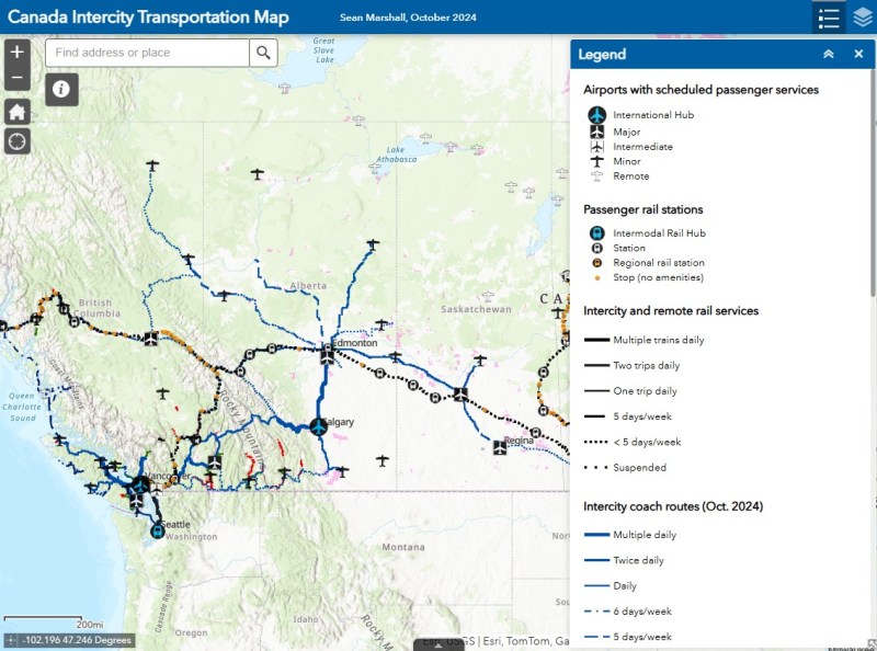
Interactive map
An interactive map, linked below, shows what the Amtrak and VIA Rail systems looked like in 1980 and in 2024, along with independent railways and commuter services. The 1980 map includes notable routes (in grey) that were cut since 1976, the year of America’s bicentennial and the Summer Olympics in Montreal. Use the slider to compare the two maps and click on any line for more details on each route.