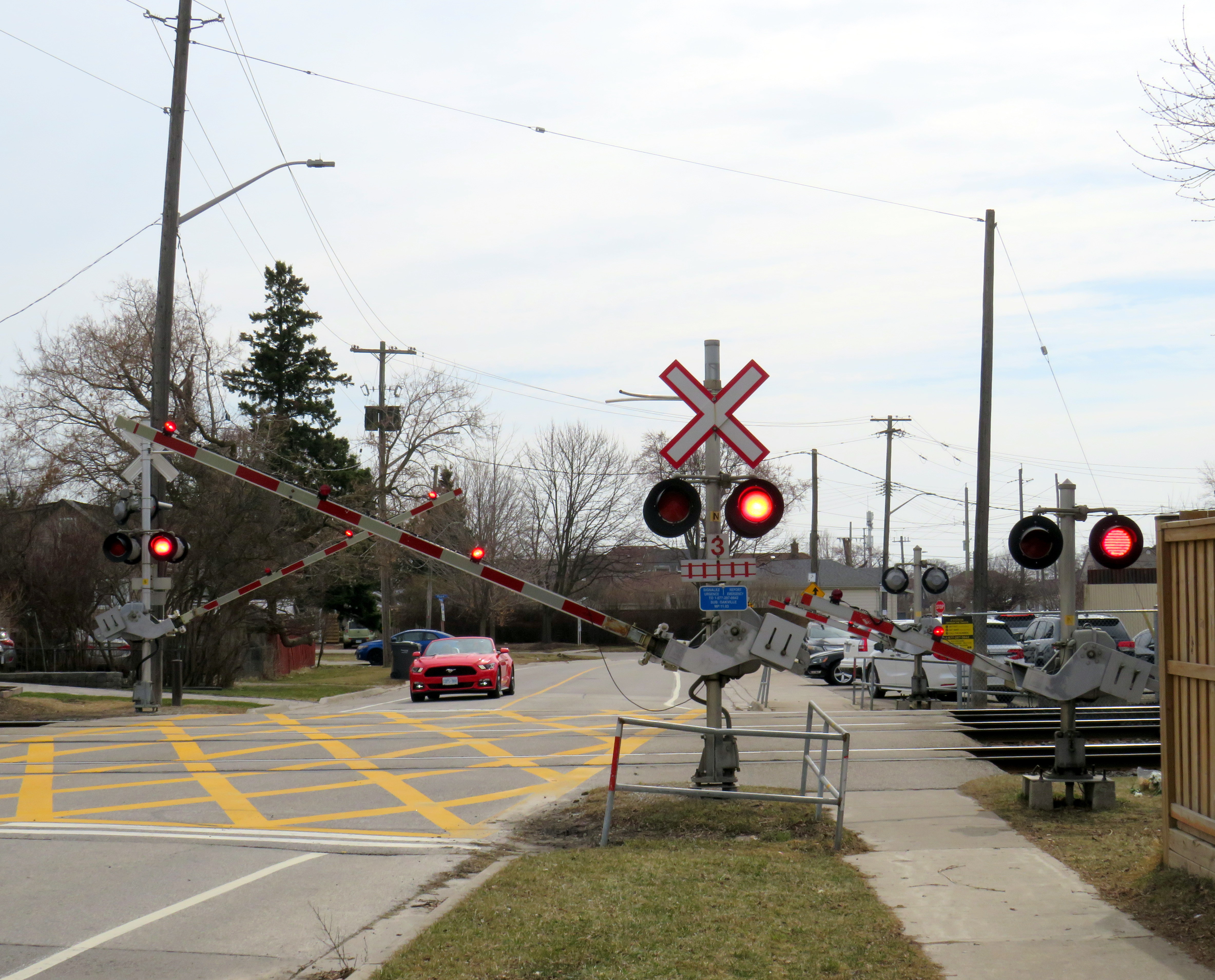
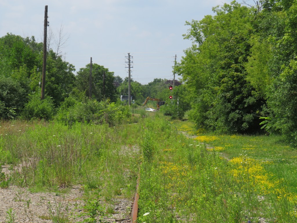
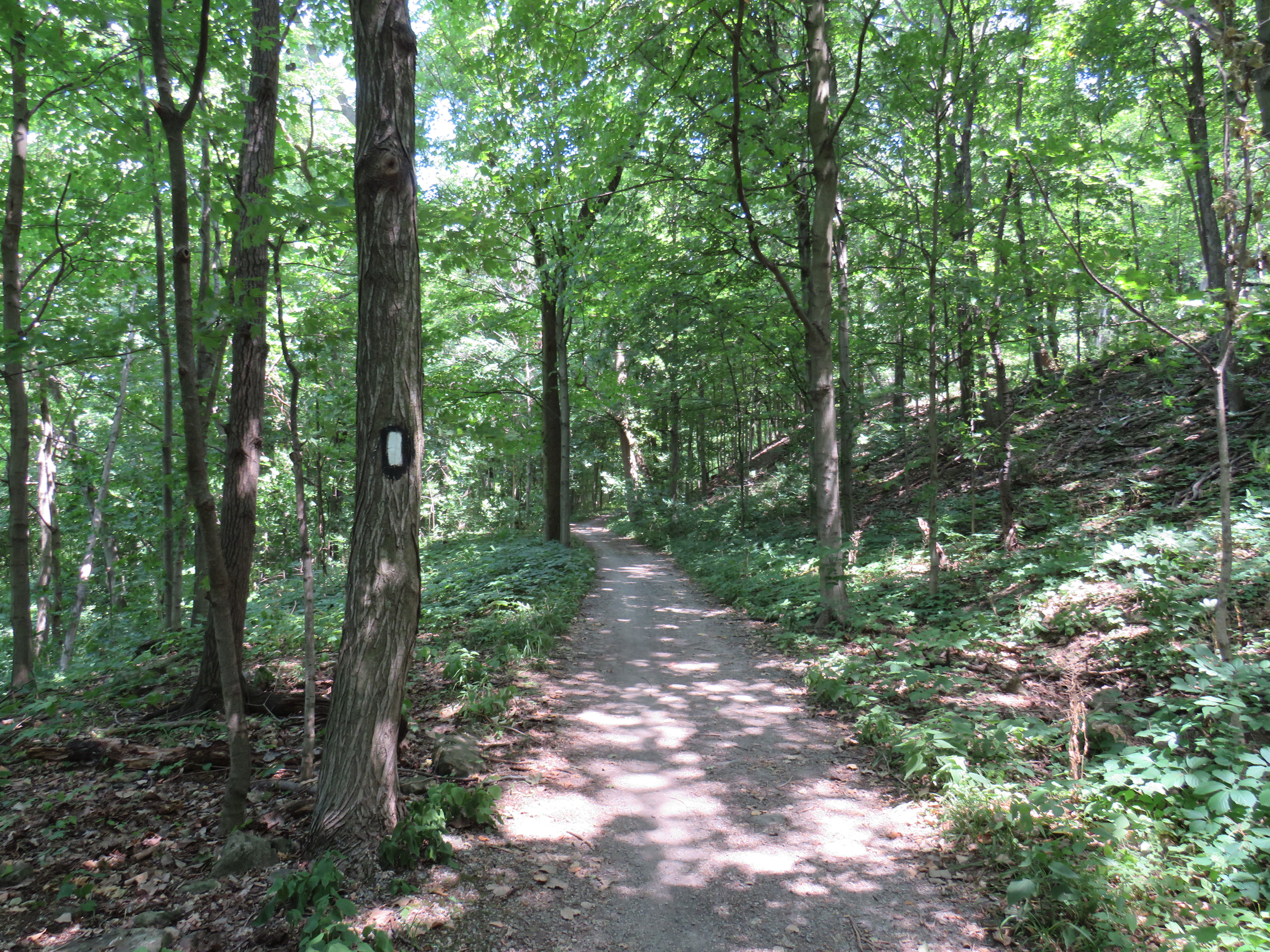
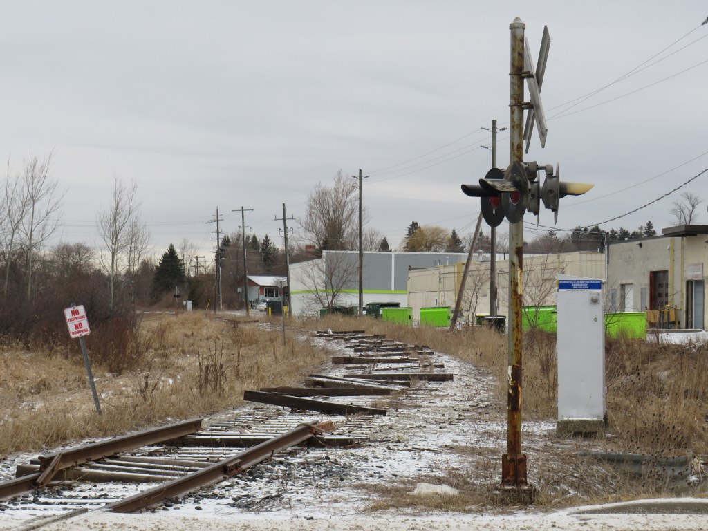
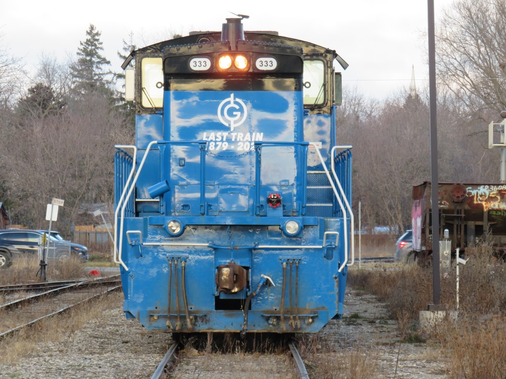
On Wednesday, March 18, a boy on a motorized bicycle was struck and killed at the Alexandra Avenue railway crossing in Mississauga. The tragedy, which occurred despite properly-working lights and gates at the three-track crossing, is a reminder of how important rail safety can be. Despite decades of “Operation Lifesaver” safety awareness campaigns, police enforcement, and upgrades to high-risk railway crossings, these tragedies continue to occur. Deaths on Canada’s railways affect many lives, including the victim’s family and friends, as well as the train crew, who can not brake the train in time. When these collisions happen, they can also tie up rail passengers and goods movement for many hours as emergency responders do their work and an investigation takes place.
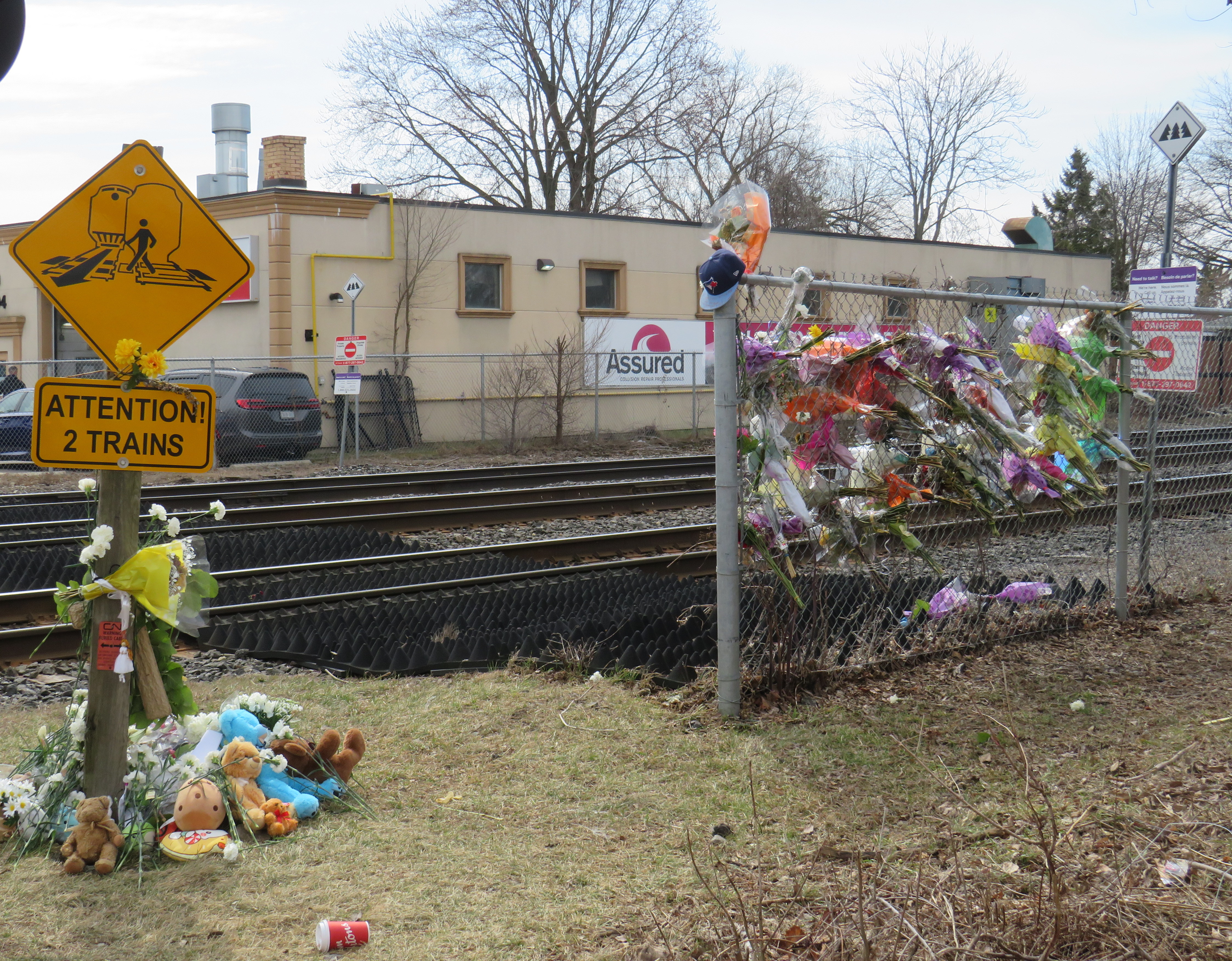
Trackside memorial at Alexandra Avenue, March 31, 2026
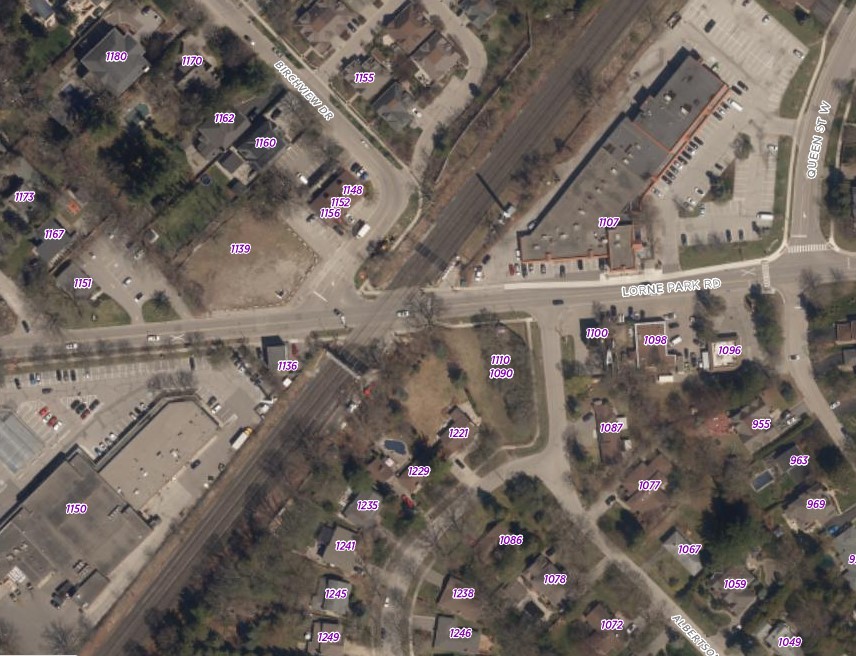
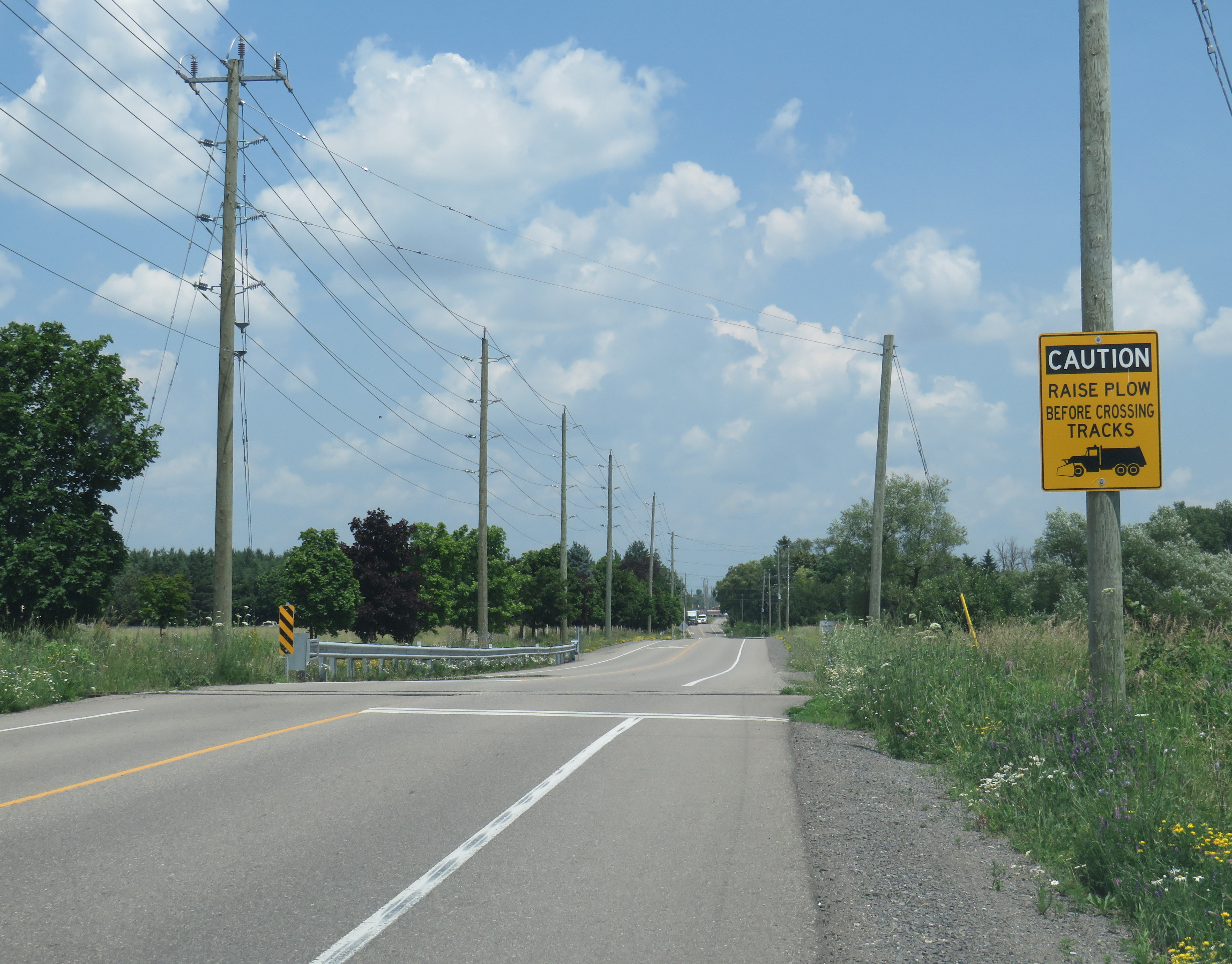
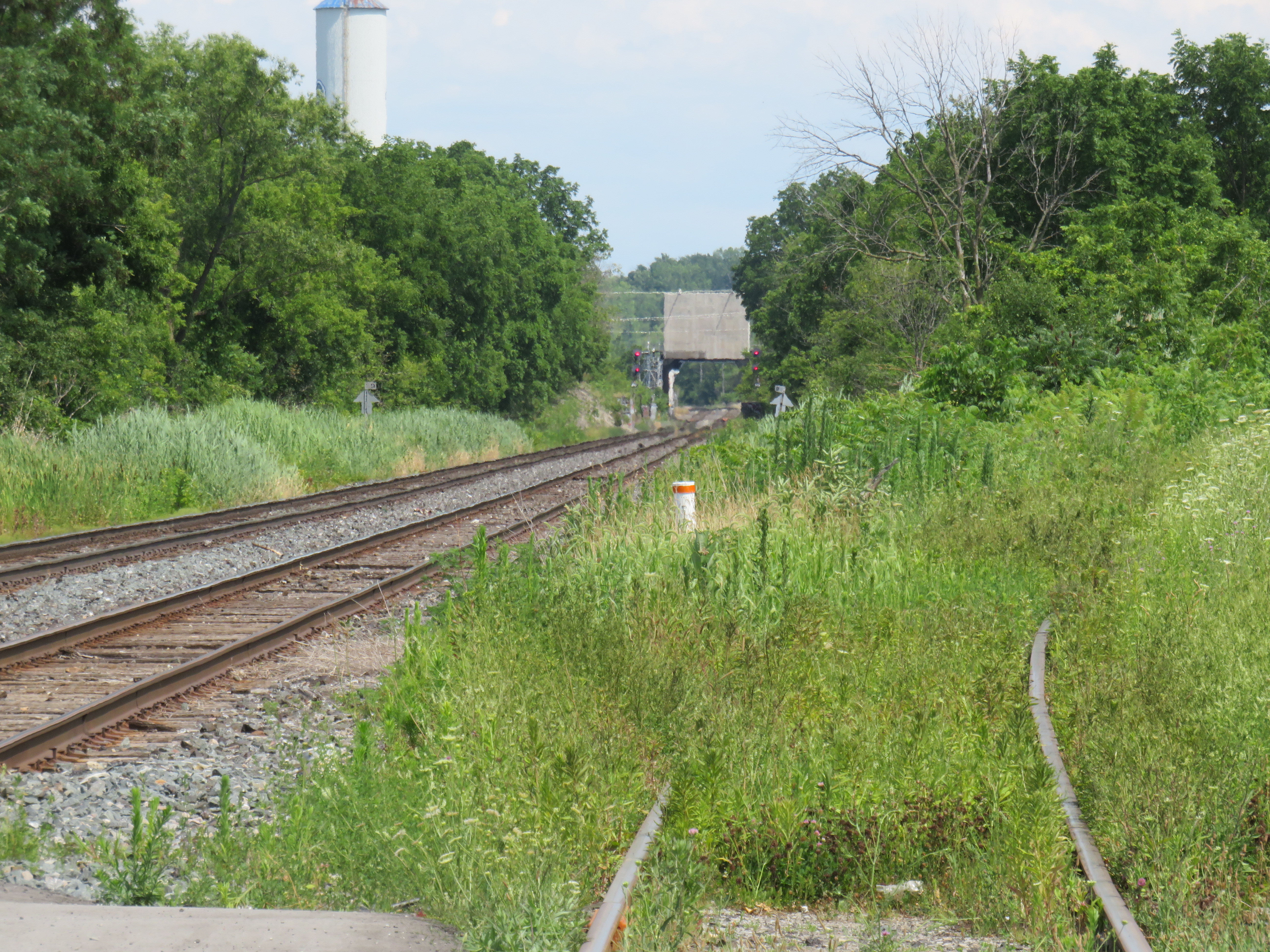
This particular crossing, near Cawthra Avenue and Lakeshore Road, sees up to 125 GO Transit and VIA Rail passenger trains daily; the three-track corridor is one of the busiest stretches of railway in Canada. The Alexandra Ave. crossing was also ranked as the 21st riskiest in the country in a Transport Canada list of nearly 25,000 road-rail intersections. Of the top 25 railway crossings ranked by risk in Canada, 14 are owned by Metrolinx, the provincial agency in charge of GO Transit. At the very top of the list is another Mississauga railway crossing, where the GO Lakeshore West corridor meets Lorne Park Road.
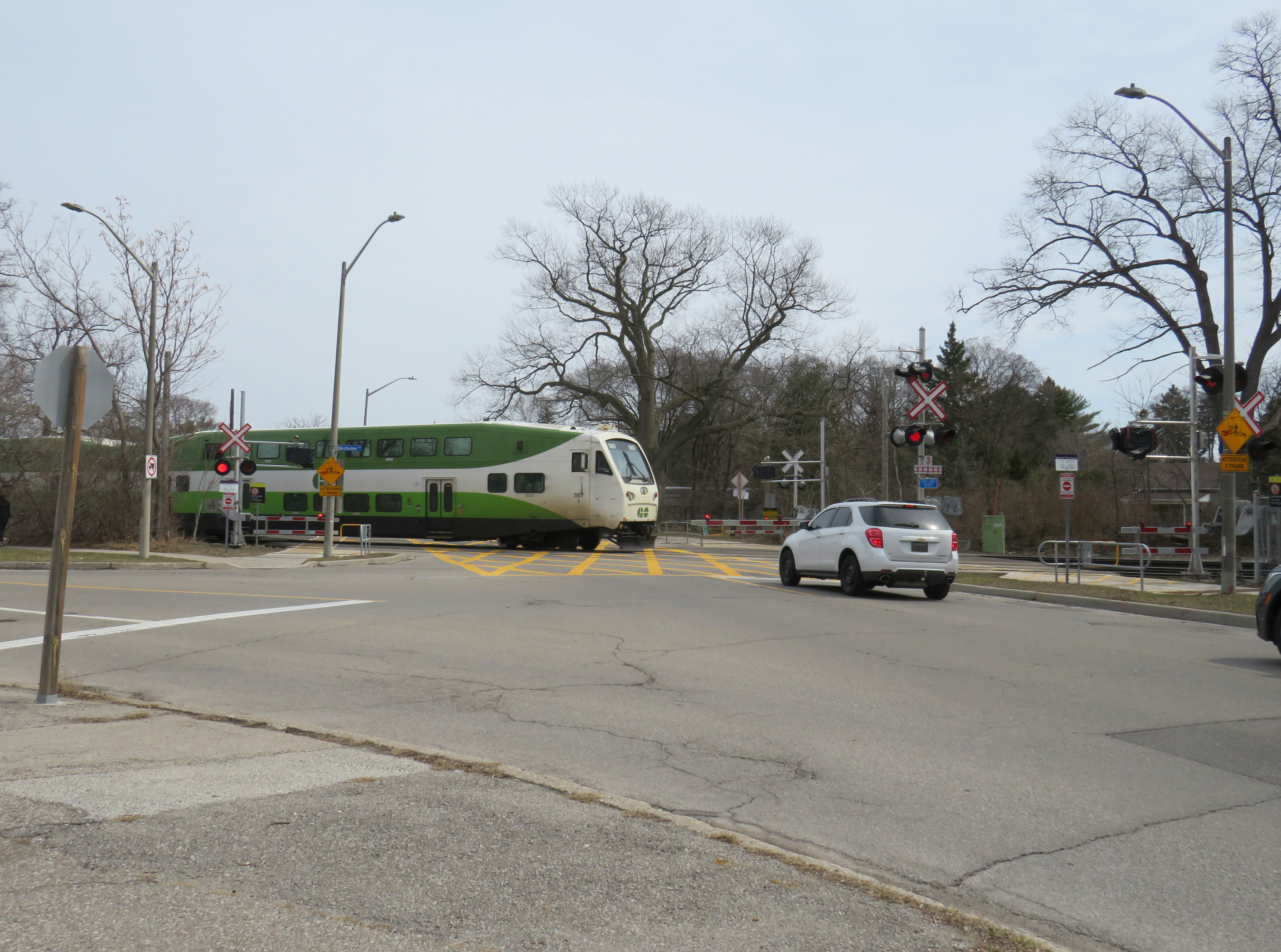
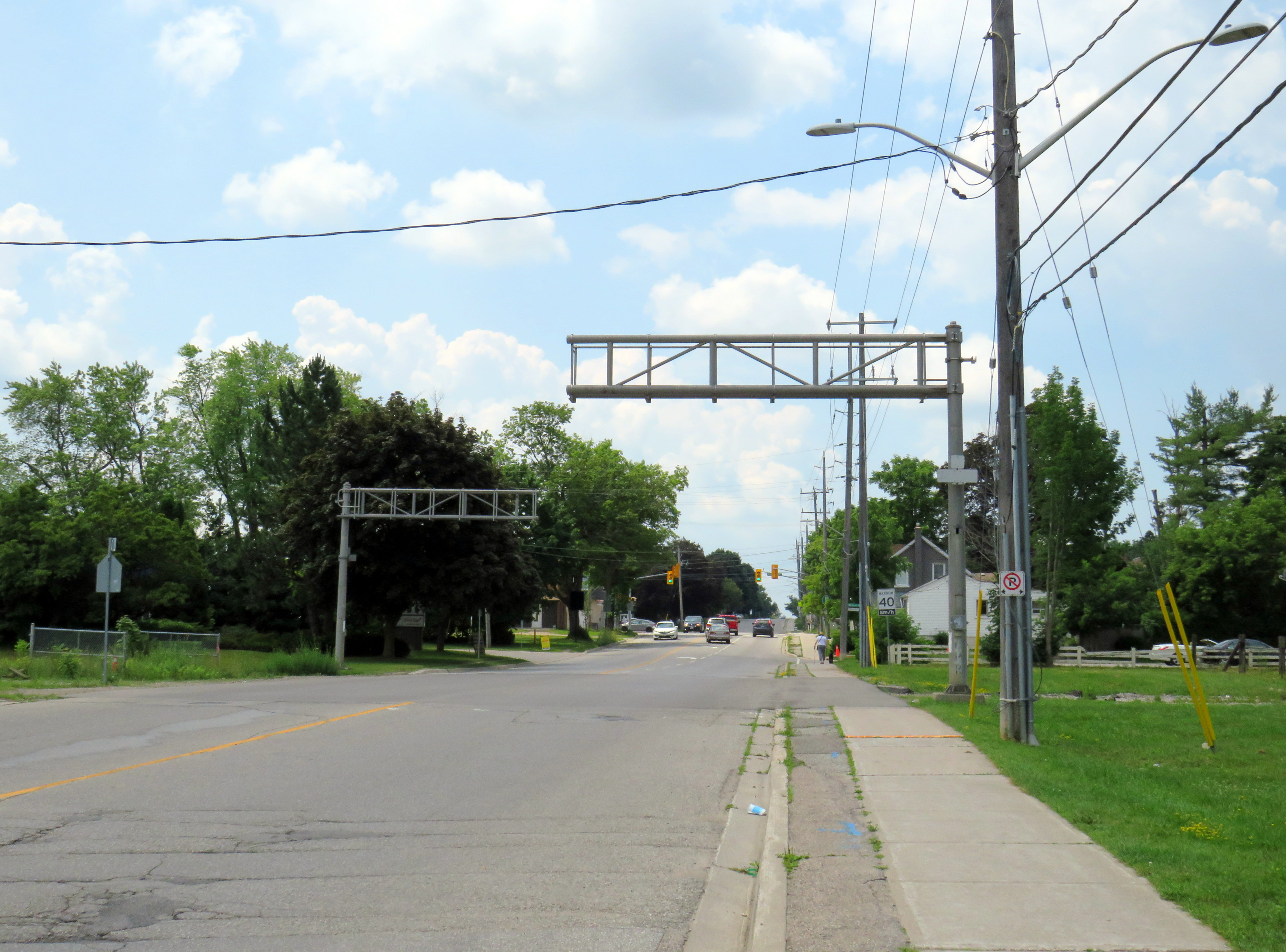
Lorne Park Road crossing
According to the Transportation Safety Board of Canada, between the years 1999 to 2022, 630 people were killed and 774 people were seriously injured due to collisions with trains at grade crossings, an average of 26 per year. In most instances (69%) those who were killed were in motor vehicles, with pedestrians and cyclists making up the remainder.
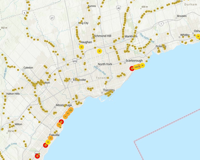
The railway crossing inventory, last published in June 2021, ranks grade crossings according to their risk using GradeX, an internal analysis tool. Relative risk of each crossing is based on several factors, including historical accident data, train speeds, traffic volumes, sight lines at crossings, crossing protection features, and the local built environment to determine the level of collision risk. Fields include location (road crossing and railway subdivision/mile), type of protection (passive, with just an “X” crossbuck sign, or active, with lights, bells, or gates), number of collisions in the last five years since the dataset was compiled, speed limits, and traffic estimates.
With this information, railways and road authorities can then work to improve the crossing to reduce the risk, or construct a grade separation to eliminate the risk. For example, the Burloak Drive crossing of the GO Lakeshore West Corridor and number 5 on the Transport Canada list, is currently being replaced with an underpass.
The Transport Canada list is comprehensive, but it is not perfect, nor is it complete. The Ontario Northland Railway, whose tracks extend north from North Bay through Northeastern Ontario, is conspicuously missing. Several crossings in the map, mostly private crossings, do not have the correct latitude and longitudes. Several abandoned railways, including the Orangeville-Brampton and Barrie-Collingwood (west of Angus) still appear, as do long-decommissioned crossings of industrial spurs. The risk ranking also changes. In a 2016 CBC News article, the Melbourne Road CN crossing west of London, Ontario was ranked fourth riskiest. In the more recent dataset available online, it is ranked 341th, even though there were no physical changes to the railway crossing visible in Google Streetview from 2009 through 2023.
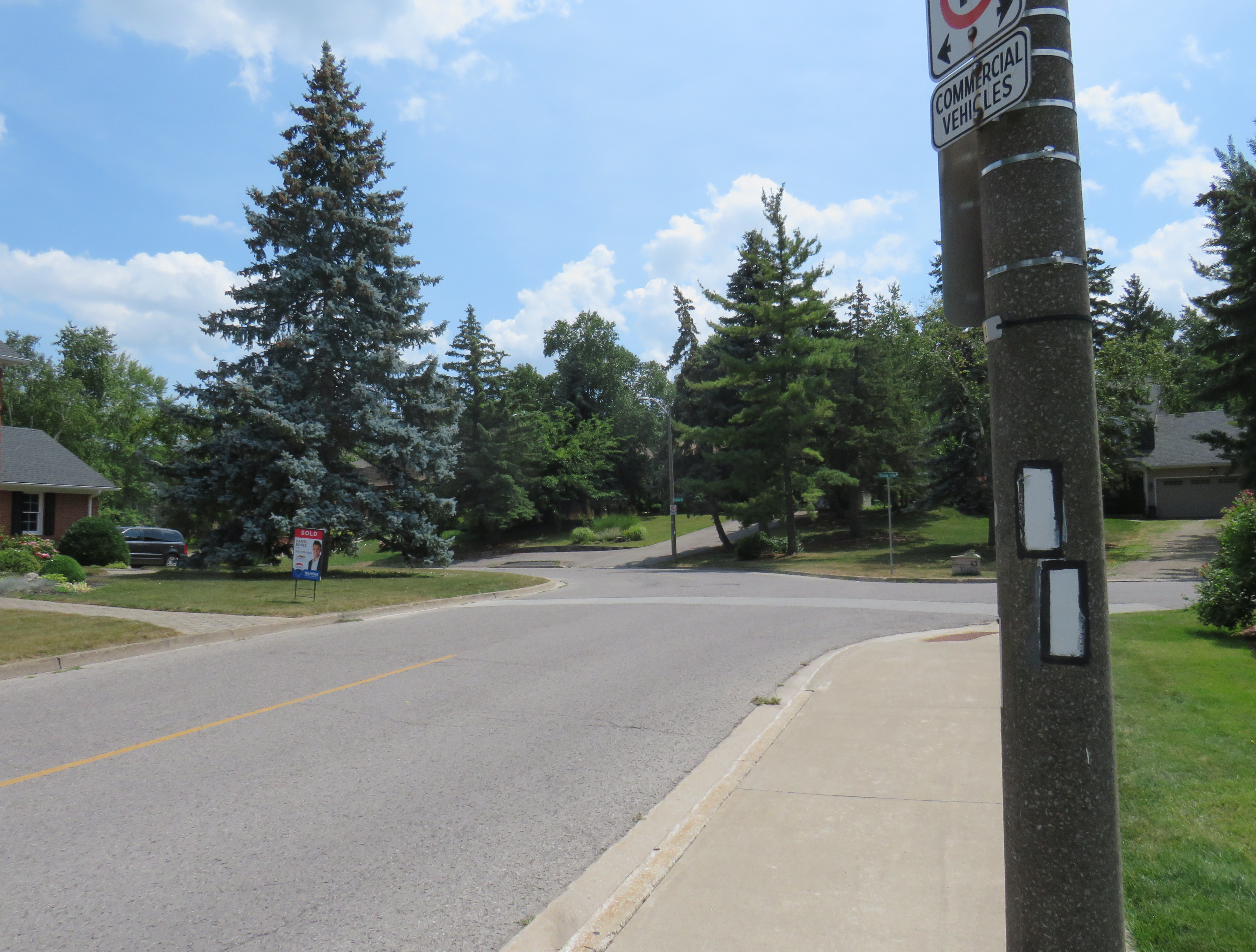
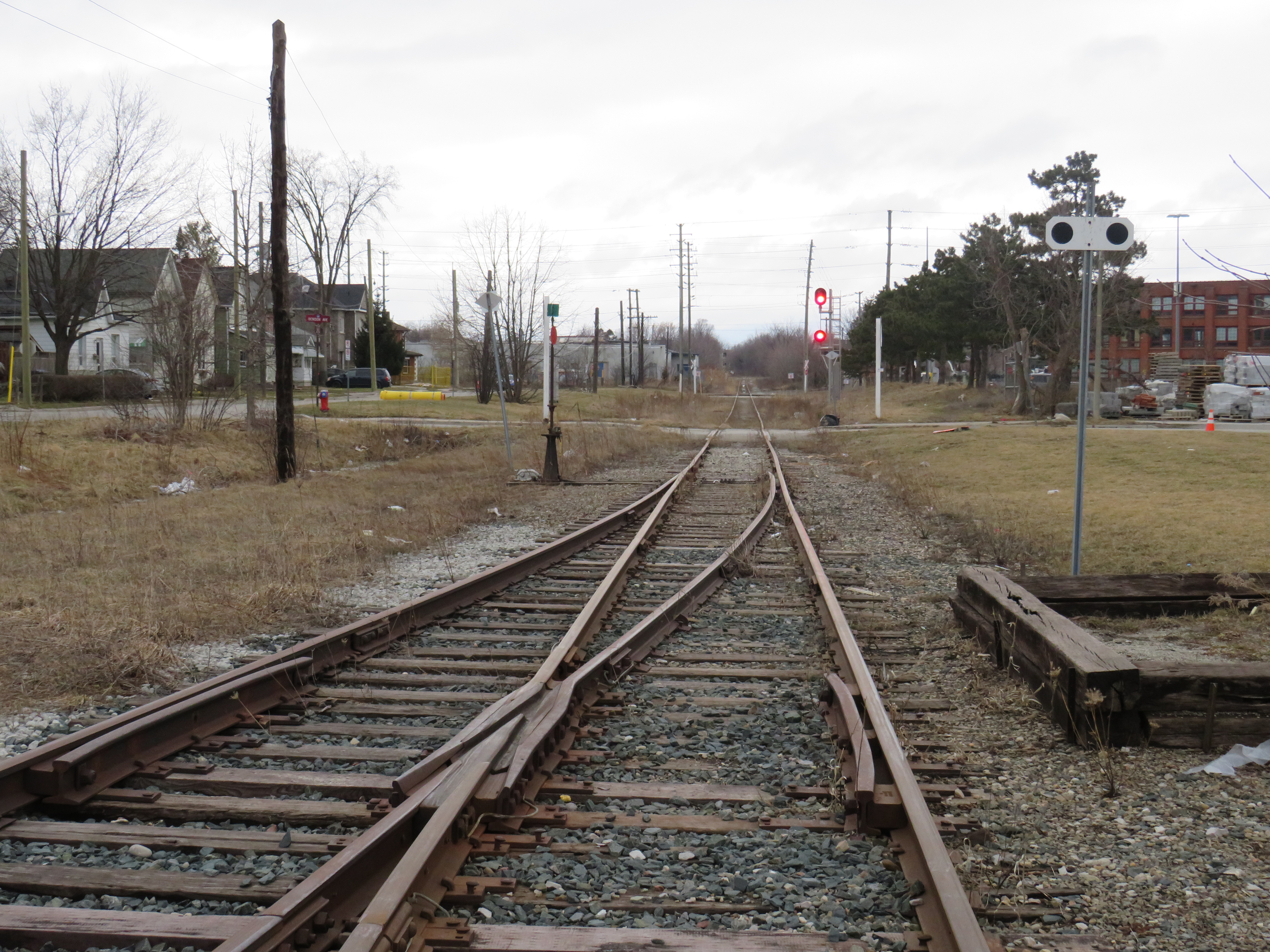
The Lorne Park Road crossing is interesting for several reasons. After many years as a stop on the CN mainline, it was briefly a GO Transit station, with commuter train service only for its first year in 1967-1968. The two-lane road crosses the three-track railway at approximately a 30-degree angle; immediately to the north of the tracks is the intersection with Birchview Drive, which is parallel to the tracks. That intersection is controlled only with a stop sign, with pedestrians crossing the street at a wide angle with no marked crosswalk. The same number of trains that cross Alexandra Avenue also cross at Lorne Park Road, making it a busy crossing, and motor and pedestrian traffic is higher, as Lorne Park Road is a busier collector street with adjacent commercial properties. To its credit, however, Metrolinx recently upgraded the crossing, with enhanced pedestrian gates that prevent access when the railway crossing lights are activated.
City of Mississauga aerial photography of the Lorne Park Road crossing, with Birchview Drive meeting Lorne Park Rd. immediately north of the railway (source)
A 2022 City of Mississauga-commissioned report by HDR recommended that the Lorne Park crossing be studied for future grade separation (it also recommended a more detailed study into closing the Alexandra Avenue crossing along with an Ogden Avenue grade separation), given the high number of train crossings, expected to increase with future GO Transit service expansion.
Building new overpasses or underpasses can be expensive and disruptive, especially in older urban environments where space is at a premium. Closing crossings completely can disconnect communities, especially for pedestrians and cyclists, who may have to travel much longer distances or use dangerous roads to get to their destinations. But they are often necessary for ensuring safe, frequent, and speedy train service. In the meantime, upgrading existing crossing and minimizing risk, along with continued education, is the way to go.
With planning now well underway for the Alto high speed passenger rail corridor between Quebec City and Toronto, there has been some speculation that Ottawa’s grand old Union Station, in the heart of the capital’s downtown core and a mere stone’s throw from Parliament Hill, could see trains again. Local business leaders and Mayor Mark Sutcliffe are excited by the idea of a downtown station, expecting that a downtown transport hub would help revitalize the local economy. Though it’s a very attractive idea, there are unfortunately just too many reasons why this would not be feasible.
To understand why, it’s worth diving into the history and urban politics of railways in the National Capital Region.
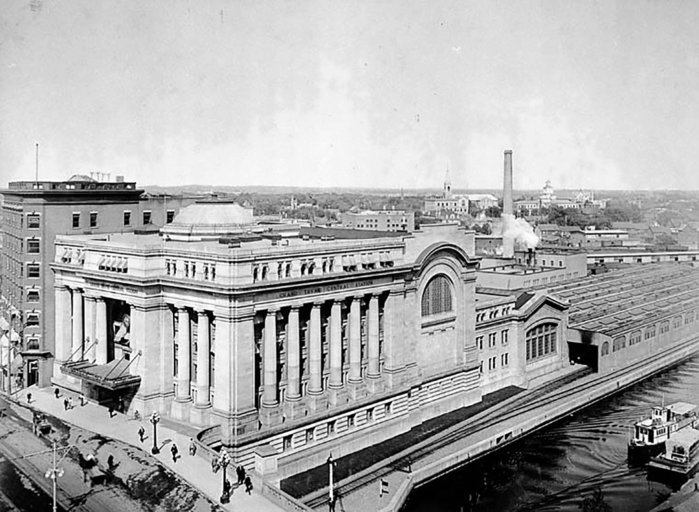
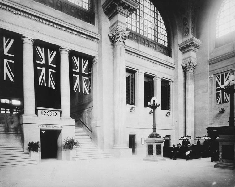
The Grand Trunk Central Station, opened in 1912, provided a grand entrance to Canada’s capital city that was previously served by a few smaller stations just outside the downtown core. The station, designed in the Beaux-Arts style, was built as a stub-end terminal. This meant that trains would arrive and depart from the south and would have to be backed up to change direction. This suited the Grand Trunk Railway just fine, as it lined up perfectly with its route to Montréal via Alexandria (still used by VIA Rail today). The railway also built a hotel across the street — the Chateau Laurier — and connected the station with the hotel with a pedestrian tunnel.
Entrance lobby, soon after opening. Note the tunnel under the staircase to the Chateau Laurier. (Library & Archives Canada)
The 1912 station was intermodal from the very beginning. Right outside the station’s front doors, there were Ottawa Electric Railway streetcar platforms serving several routes on Rideau and Sparks Streets, the two main commercial corridors in Downtown Ottawa. Right below the canal and railway bridge next to the station was the Hull Electric Railway’s loop; its streetcars crossed into Ontario via the Alexandra Bridge.
The Alexandra Bridge carried CPR trains, Hull streetcars, pedestrians, and motor vehicles when it opened in 1901
Soon after opening, the Canadian Pacific Railway joined the Grand Trunk, resulting in the terminal being renamed Union Station; the short-lived Canadian Northern Railway (CNoR) soon followed. As the CPR’s tracks to Hull (via the Alexandra Bridge) ran next to the GTR’s station, it suited the CPR well. Unlike Grand Trunk, both the CPR and CNoR had direct lines to Toronto.
Two platforms on the west side of the station allowed through CPR trains to continue towards the Alexandra Bridge and even return to Ottawa via the Prince of Wales Bridge to the west; this was the route the iconic Canadian train between Montréal and Vancouver took when it was inaugurated in 1955. Most trains — including all GTR and CNoR, however, terminated at the six stub-end tracks. Both GTR and CNoR were absorbed into the new Canadian National Railway (CN) by 1922.
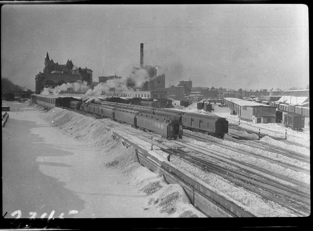
Approach tracks and Bush trainshed, Ottawa Union Station. A wintery scene, with a frozen Rideau Canal on the left. The yards at right are now occupied by the Rideau Centre, Convention Centre, and Department of Defense Headquarters (Library and Archives Canada)
In the 1940s, the federal government led by Liberal prime minister William Lyon Mackenzie King wanted to beautify the nation’s capital region and address traffic congestion. Ottawa — and the federal government — was rapidly growing, while political leaders wanted a cityscape that matched the ambitions of an expanding nation. French urban planner Jacques Gréber was commissioned to plan the region’s future; Gréber’s recommendations, released in 1950, were ambitious and transformative. (You can read the entire report here.)
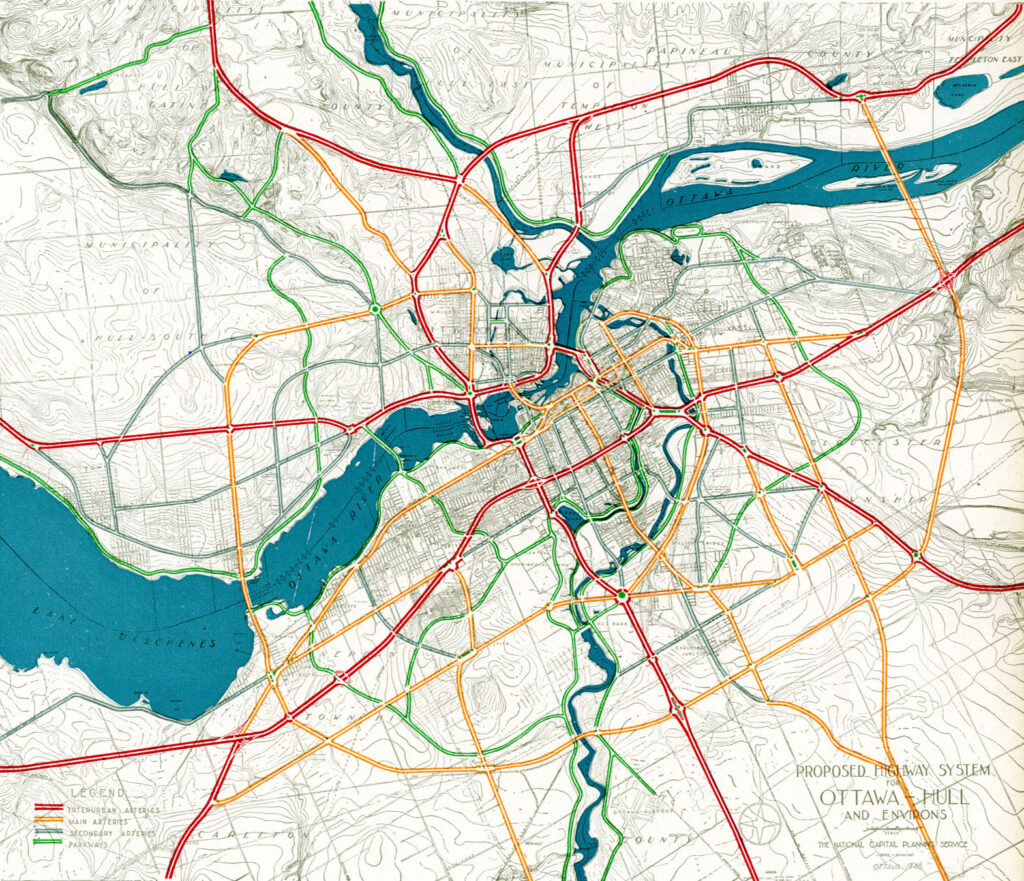
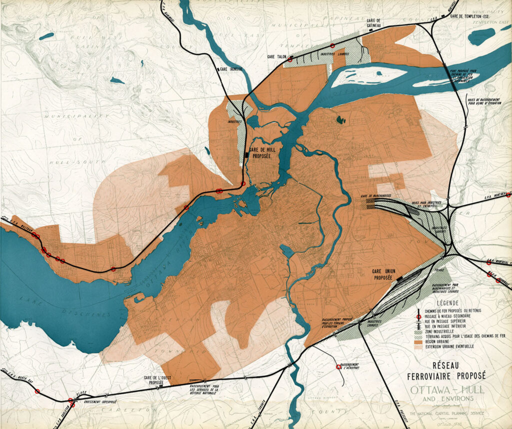
The Gréber Plan — formally titled “Plan for the National Capital” — called for new highways, the abandonment of Ottawa’s streetcars (which were seen as antiquated with unsightly overhead wires), and the removal of all railway infrastructure within the City of Ottawa. The old CN and CPR lines would make way for new roads, including a four-lane arterial along the east side of the Rideau Canal, leading to a new road bridge replacing the Alexandra. A new railway bypass along the periphery of the city would replace all urban trackage, with a proposed new Union Station site in Gloucester Township, south of Walkley Road. Most industrial uses — including the historic paper mills along the Ottawa River — would be moved to the new railway line.
Proposed highway system for Ottawa-Hull and environs, from Gréber’s reportProposed Railway system: Ottawa Hull and environs from Gréber’s report
Though the plan was not fully implemented, it did set the stage for much of the urban planning and infrastructure changes during Ottawa’s next fifty years. The railway bypass was constructed between Bell’s Corners in the west and Ramsayville in the east, with the old Grand Trunk tracks through the city replaced with The Queensway, now part of Highway 417. New parkways lined the rivers and canals. Two new multilane traffic bridges crossed the Ottawa River (though the Alexandra Bridge was maintained for traffic and pedestrians) and Albert and Slater Streets were made one-way, with a new bridge over the Rideau Canal (the Mackenzie King Bridge) linking them to the east. A large Greenbelt encompassed the city region, intended to direct growth while preserving natural areas.
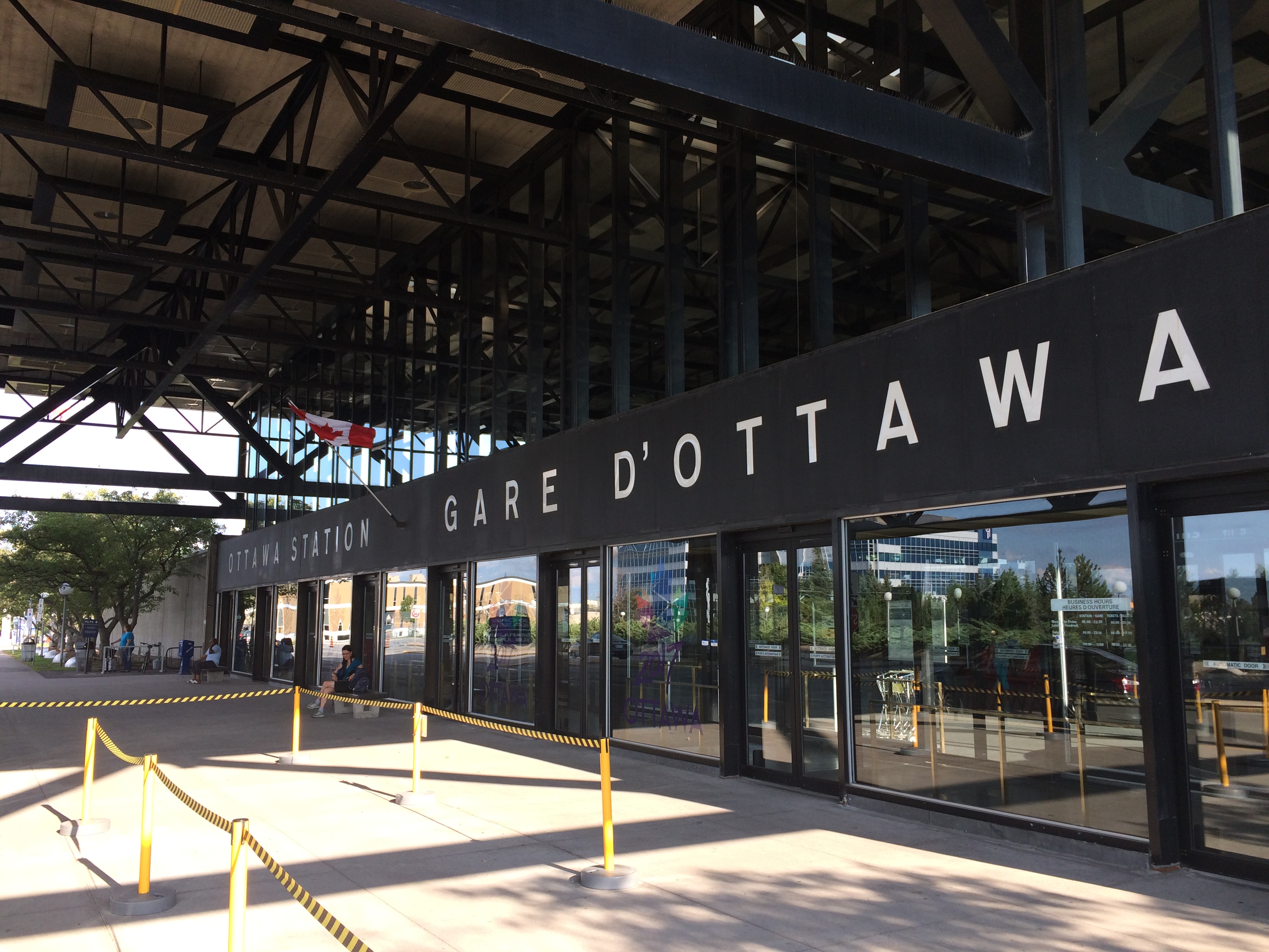
Fortunately, the passenger station was relocated to a point much closer to the city centre than the Gréber Plan envisioned: the old CN and CP tracks along the Rideau River south of the city centre were kept in place but rerouted to serve a new modernist station that opened in July 1966. The new Ottawa Station, designed by John C. Parkin, is one-of-kind. The architecture invokes an airport terminal, with large, sheltered driveways and an airy open lobby/concourse, and was the last grand railway station built in North America. In 1966-1967, there were still two daily transcontinental trains departing from Ottawa Station, along with multiple trains to Toronto and Montreal, including a Toronto-Ottawa night train. Today, there are just eight trains to Toronto and five trains to Montréal.
Ottawa Station, which opened July 31, 1966
Soon after the new station opened, the tracks and ancillary buildings around Union Station were removed, making way for Colonel By Drive, the Rideau Centre shopping mall, a new convention centre, and headquarters for the Department of Defense. The station building itself survived, however, first becoming a temporary museum space during the 1967 Centennial celebrations, then a government conference centre, mostly closed off to the public.
The temporary Senate Chambers in the former train concourse at Ottawa Union Station
Right now, the grand building is the temporary home of Canada’s Senate, and is again accessible to the public, via a free tour. The renovations to the building are very sympathetic to the built heritage. As reconstruction of Centre Block, the regular home of both Houses of Parliament, is still five years away from completion, there’s still lots of time to take the tour.
Awaiting Alto
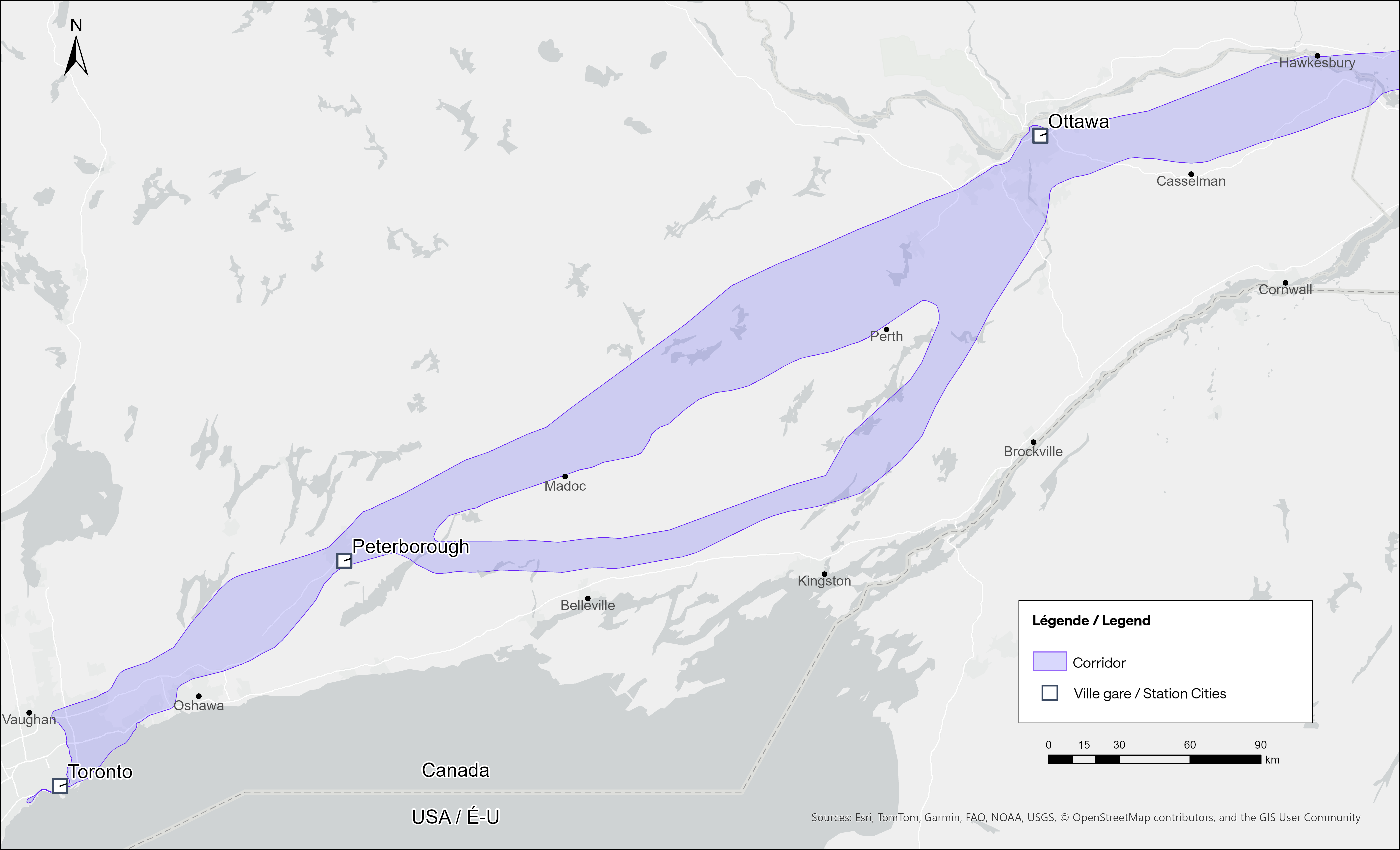
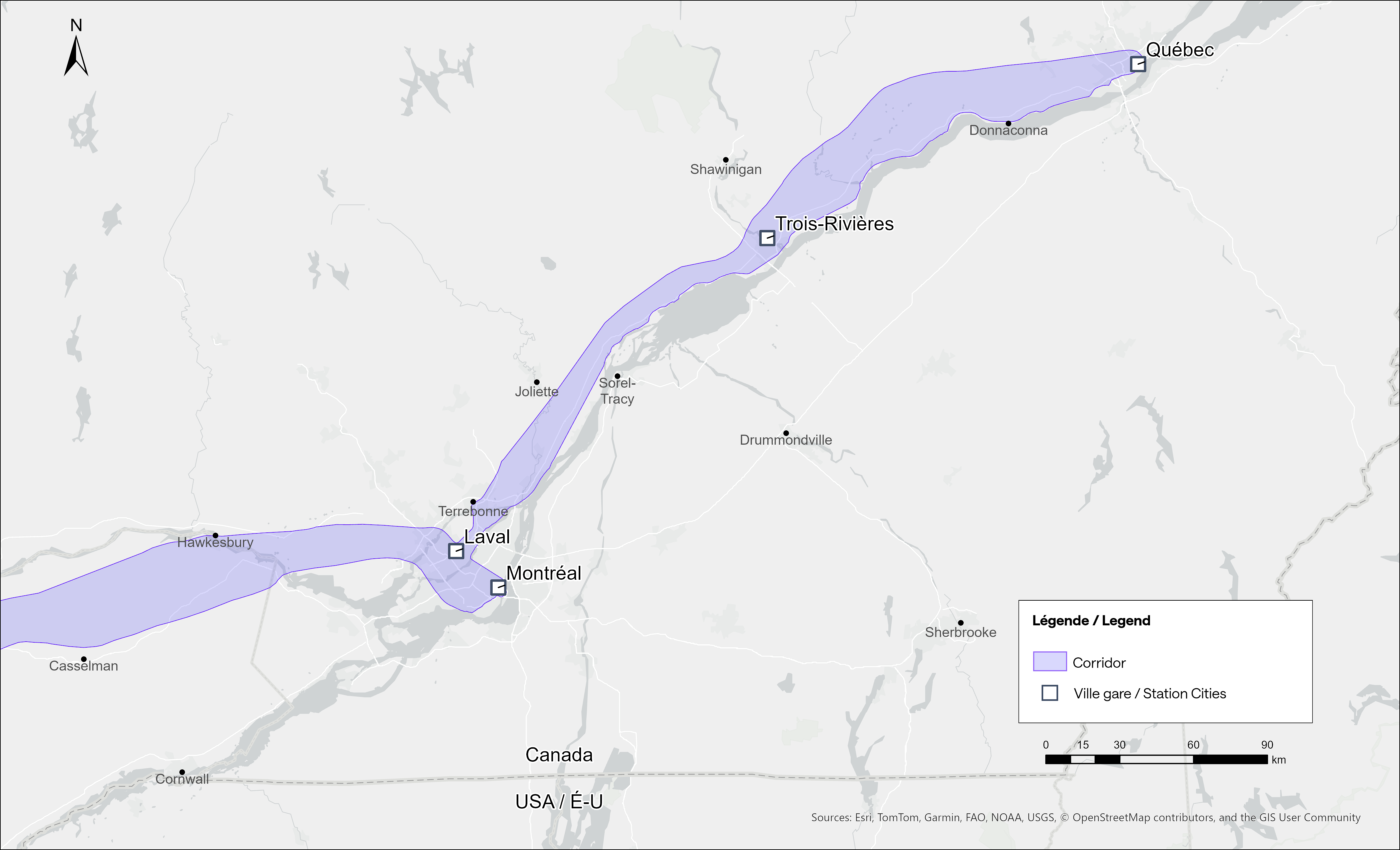
The Alto high speed rail line project, now in the planning stage, will connect Québec, Montréal, Ottawa, and Toronto, with a total of seven stations (the other three are planned in Trois-Rivières, Laval, and Peterborough). The first segment, with the start of construction set for 2029, will link Montréal, Laval, and Ottawa. Consultations on the specific route and station locations are underway, with the broad corridors noted in maps available on the Alto website.
Map of potential routings for the Alto high speed line in OntarioMap of the planned routing for the Alto high speed line in Quebec
The maps clearly show a route between Ottawa and Montréal that will pass through Prescott & Russell Counties, roughly following an abandoned CPR corridor until about Hawkesbury, at which point it would cross into Quebec (following an older abandoned CNoR route) to Laval, then continue south into central Montréal, though not necessarily the existing Central Station (this would likely require a new tunnel under Mount Royal). The Montréal station appears to be a terminal for trains coming from Ottawa and from Trois-Rivières and Québec, much like the existing VIA Central Station.
Alto’s next phase towards Toronto could follow one of two broad routes between Ottawa and Peterborough, either just north of Highway 7, through the Canadian Shield, or a southerly alignment through the Rideau Lakes region and then through South Frontenac and passing near Stirling and Campbellford. All planned routes would require passing through Ottawa entirely on the Ontario side of the Ottawa River, making a through station particularly likely, especially for the critical Toronto-Montréal market.
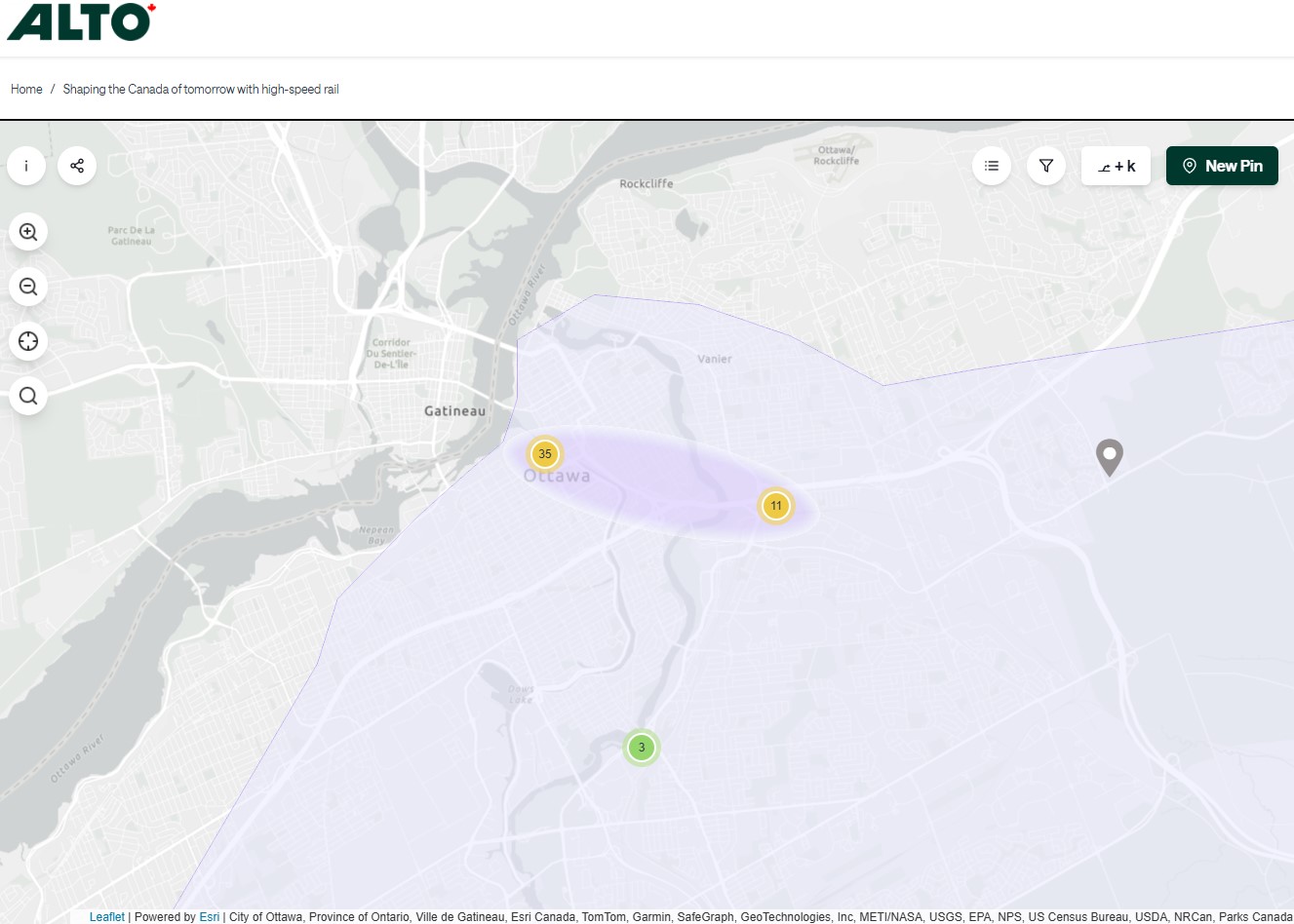
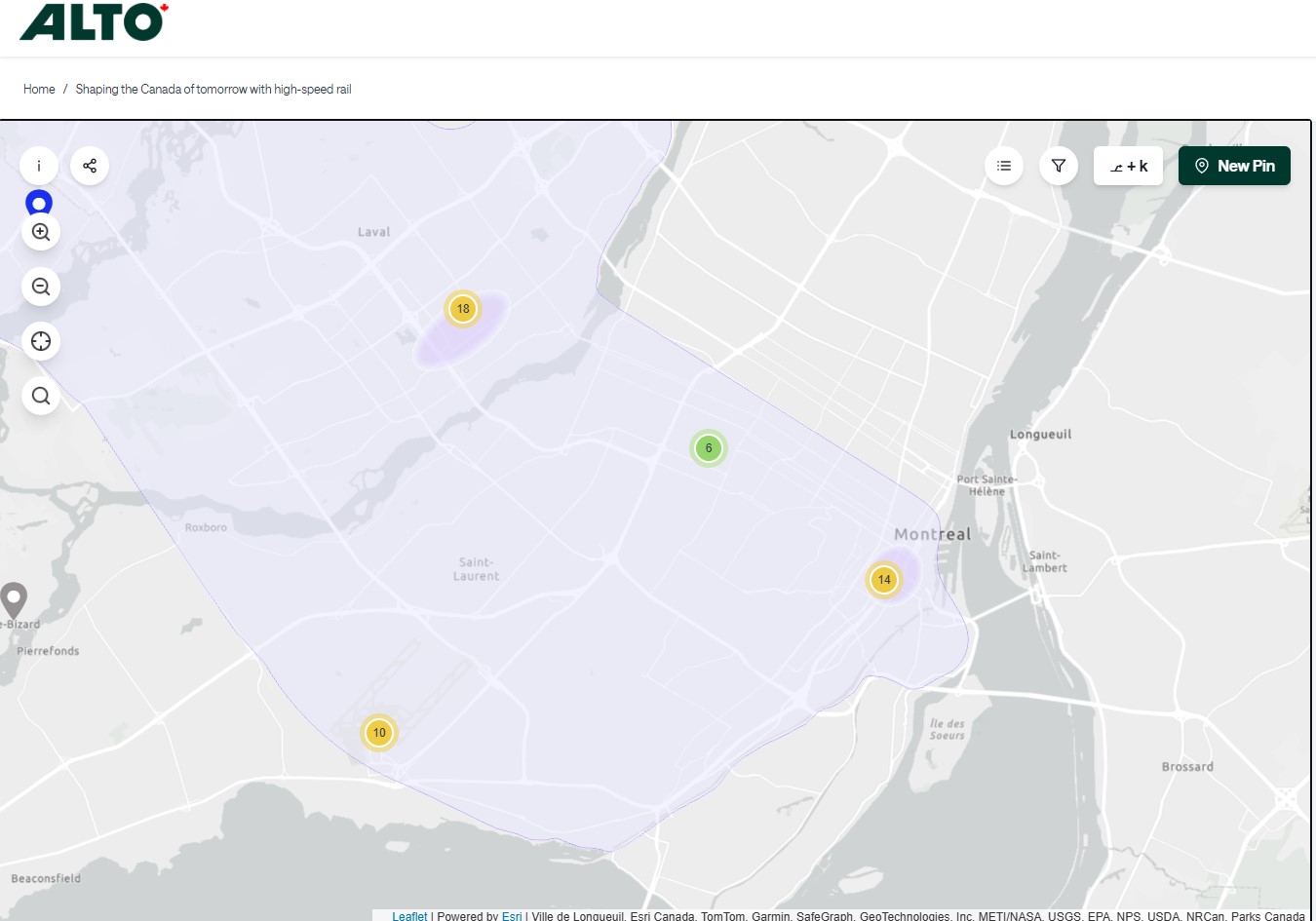
On the detailed consultation map, highlighted areas show where the seven station locations are being considered.
The map for Ottawa shows possible station locations in an area including the current VIA station and the old Union StationThe Montréaland Laval station locations under consideration. The Montréal station area highlighted includes the locations of Central and Lucien L’Allier Stations.The Montréal station for Alto is clearly intended to be a terminal.
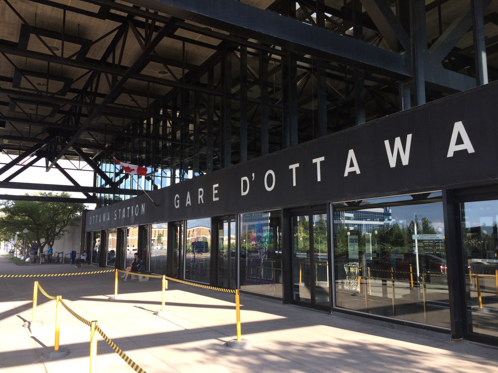
The idea of a downtown Ottawa Station for the new high speed rail corridor is certainly enticing. It would breathe new life into a 114-year-old landmark, provide a very convenient spot for Ottawa politicians, public servants, business travelers, tourists, and students attending nearby University of Ottawa. Rideau O-Train Station is less than two blocks away. However, it would require a new tunnel and/or elevated structure to reach the station from the rail corridors to the south. Furthermore, Centre Block would have to reopen on schedule so the Senate can move back before construction can start on refurbishing the station for passenger service.
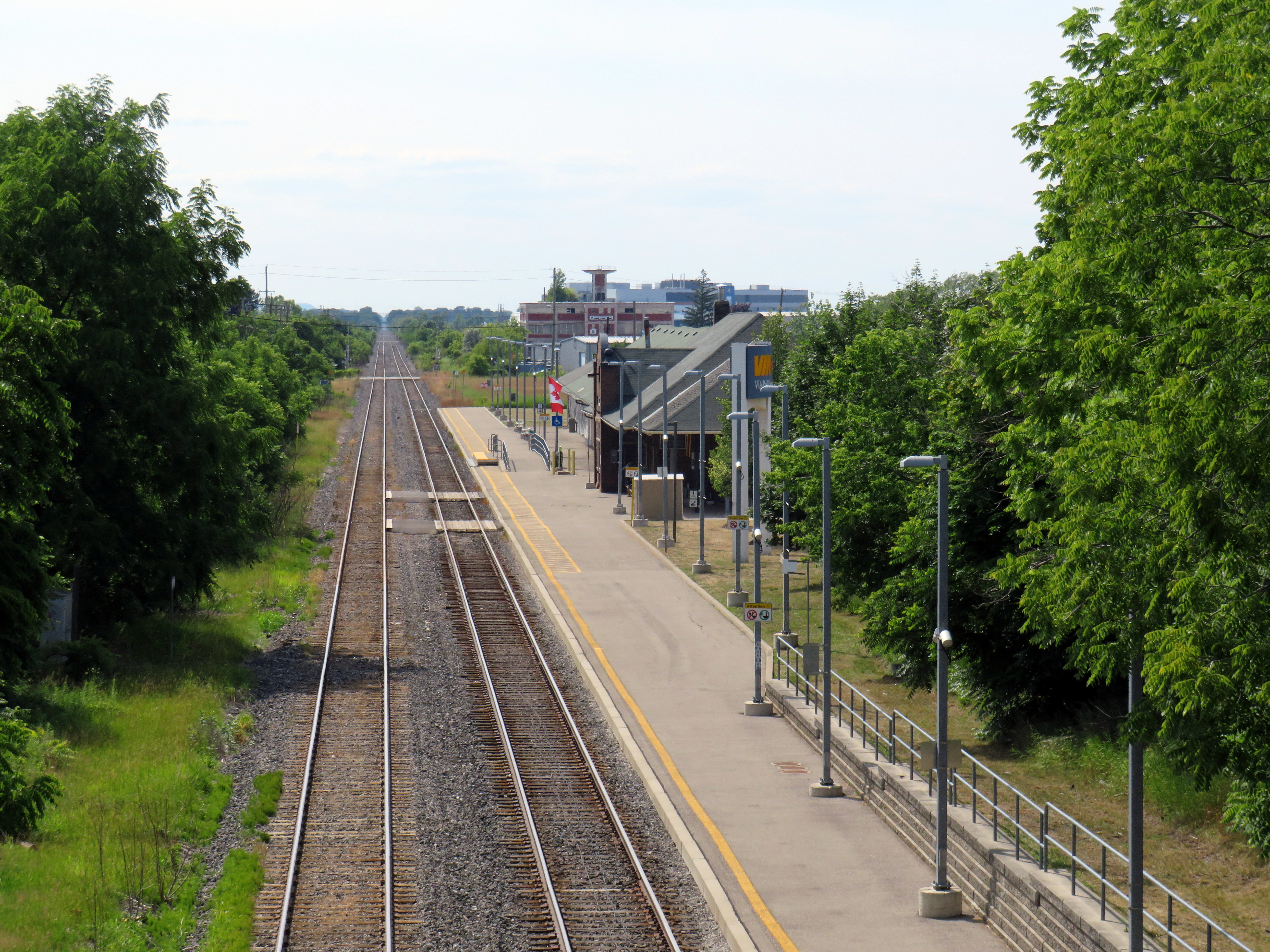
The 1966 Ottawa VIA Station, on the other hand, has its own advantages. There is plenty of room to build new high speed train platforms, which should provide level boarding for efficient passenger movement. There is also room for parking, passenger pick-up and drop-off, as well as easy access to the highway, unlike Union Station. With the closure of the Ottawa bus station, the VIA Rail Station has become a multimodal hub, with Ontario Northland, Flixbus, and Orleans Express all using the station’s driveway, along with a KLM/Air France shuttle to Dorval Airport. There is also a dedicated O-Train LRT station on-site, though it could be better integrated with the station building.
Perhaps most importantly, the existing VIA station can help ensure the existing Corridor service remains integral, as passengers from Kingston, Belleville, and elsewhere on Lake Ontario and the St. Lawrence River will not be served by Alto; neither would Casselman, Alexandria and Dorval. That the station is a through-line, and not a stub-end terminal, will also ensure that the crucial Toronto-Montréal market will see minimal delays from back-tracking and reversing at a downtown terminal. Though there are instances of high-speed trains reversing directions at major hubs — Trenitalia’s Frecciarossa mainline between Milan and Salerno turns back at Roma Termini and at Napoli Centrale — this is an uncommon arrangement.
All the planned Alto high speed rail stations will have to be easily accessible and close to the downtown cores of the cities it serves. At this point in the planning process, this looks like it will be the case at all three big city stations. But it will need more than walk-up traffic like downtown office workers and tourists; it will be most successful as part of a complete network of local, regional and intercity transport, including the conventional VIA rail system. With specific improvements, including new platforms and better O-Train station integration, the modern yet historic 1966 Ottawa Station is well suited for all of these needs.
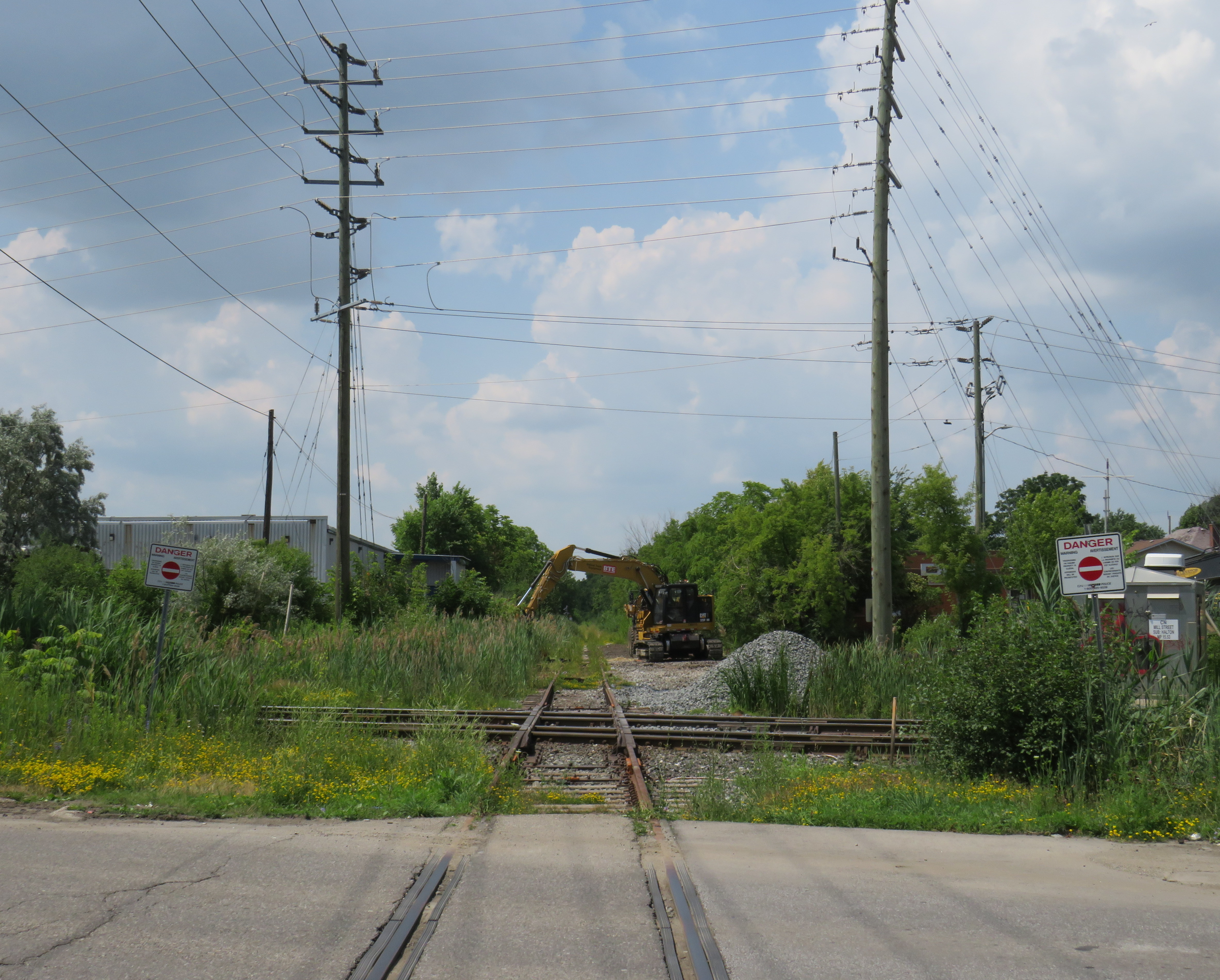
After the last train departed from Orangeville on December 17, 2021, the Orangeville-Brampton Railway (OBRY) became yet another abandoned railway, the last chapter of a once-expansive network of rails that branched out across Midwestern Ontario. Orangeville was the divisional point of Canadian Pacific’s Bruce lines, which served Owen Sound, Walkerton, Teeswater, Fergus and Elora, and dozens of towns and villages en route. By 1995, all of those branches were abandoned by CP, so in 2000, the Town of Orangeville purchased the remaining bit of track to serve local industries, and even launched a scenic excursion train, the Credit Valley Explorer, several years later. For about a decade, the future looked bright.
The Town of Orangeville, which was eager to walk away from the railway it once proudly owned, was quick to tear up the tracks within its boundaries, soon to be replaced by a new multi-use path. In July 2023, the ties are still mostly in place, for now, waiting to be dug up, and while the road crossings are now smooth, signal gantries are still standing on Broadway and Townline Road.
At the old yards and station grounds, the “new” station building, opened in 2007 for the Credit Valley Explorer and an office for OBRY rail crews, is being used as a temporary branch of the Orangeville Public Library, as the main Mill Street location undergoes major renovations.
Warped rails and ties on the old railbed at Townline Road, OrangevilleRailway crossing signal gantries on Townline Road, stripped of their crossbucks and lightsThe “new” Orangeville station, built for the Credit Valley Explorer and an office for OBRY crews; currently used as a temporary location for the Orangeville Public Library
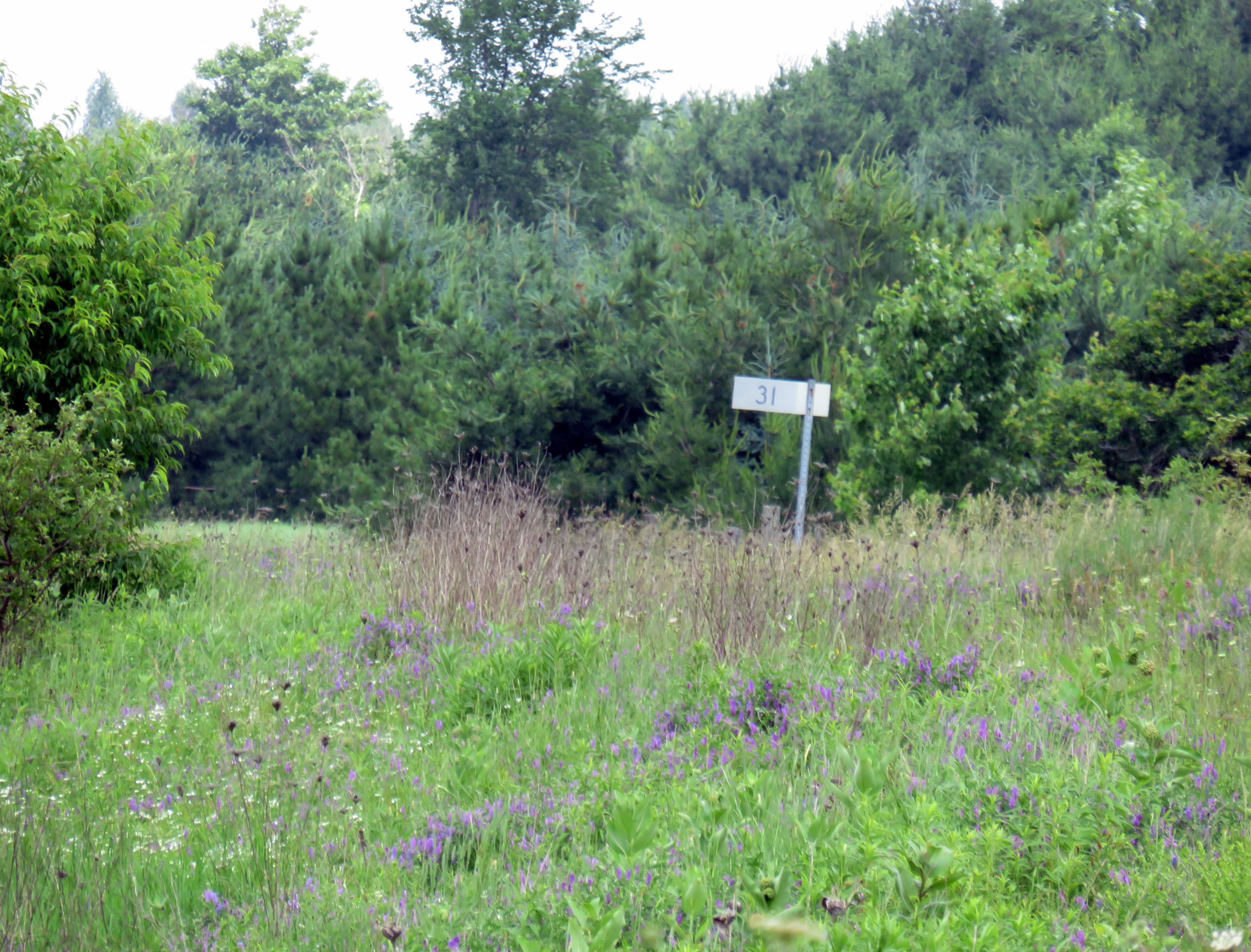
Through Caledon and Brampton, however, the track remains mostly in place, though it has largely been covered by weeds. Near Alton, the Mile 31 signpost remains erect, though nature has completely taken over the right-of-way.
The Region of Peel now owns the corridor, with the promise of a new rail trail, though with the impending disbandment of that upper-tier municipality, it will be up to the Town of Caledon and the Cities of Brampton and Mississauga (and possibly Credit Valley Conservation) to follow through with removing the rails and ties and putting down a new trail.
Mile 31 signpost, north of Alton
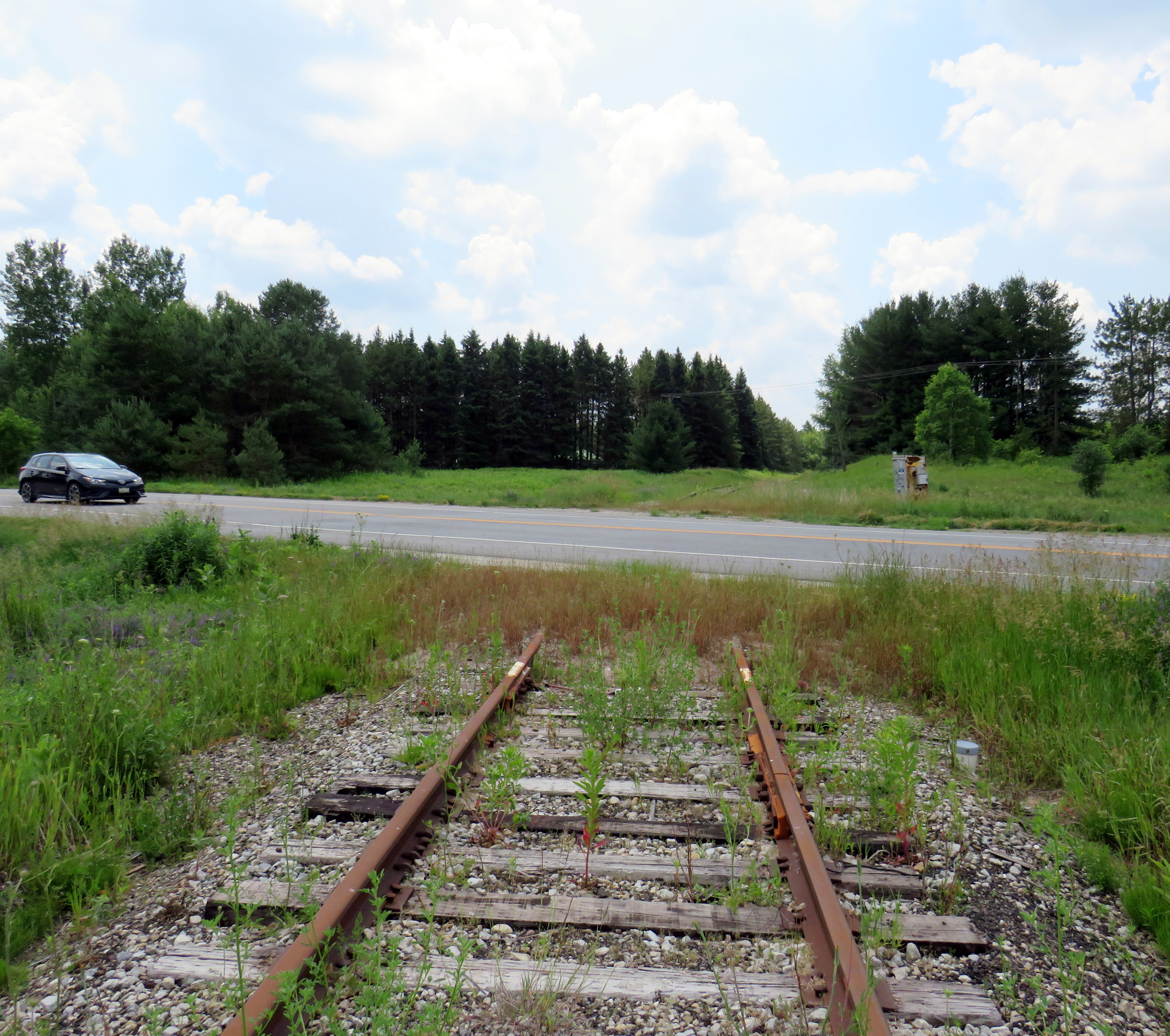
In the meantime, the Region of Peel removed the crossings of Highway 136 near Alton. The rusted track simply disappears into the roadbed on either side. The crossing at Mayfield Road at the Brampton/Caledon border has also been removed to allow for widening of that major arterial road. Otherwise, the tracks are still in place, though weeds, debris, and concrete blocks placed at several bridges to deter unauthorized use, have made the rails impassable.
The abandoned OBRY track disappears at Highway 136 (Porterfield Road)The former Highway 136 (Queen Street) crossing in Alton
At several crossings, the crossbucks, lights and bells have been removed, replaced with warnings to plow drivers to raise their blades at the disused tracks.
At Old School Road, the crossbucks are gone; new signs warn snowplow drivers to raise their blades at the abandoned tracks
In Brampton, though, transit buses still stop at the crossings on Queen Street, Bovaird Drive, and Steeles Avenue as if anytime was still train time. The signals protecting the diamond at the busy CN line in Downtown Brampton are still active, 18 months since the last train passed through on the Orangeville line.
When I last passed by the diamond, on July 5, I saw work equipment on the old OBRY right-of-way, so perhaps that, too, is not long for this world.
Looking north to the Brampton diamond; an excavator can be seen just north of the CN mainline
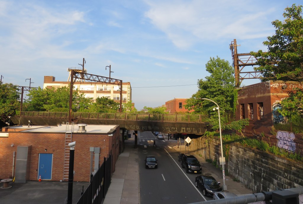
An abandoned railway signal towers over Philadelphia’s Rail Park
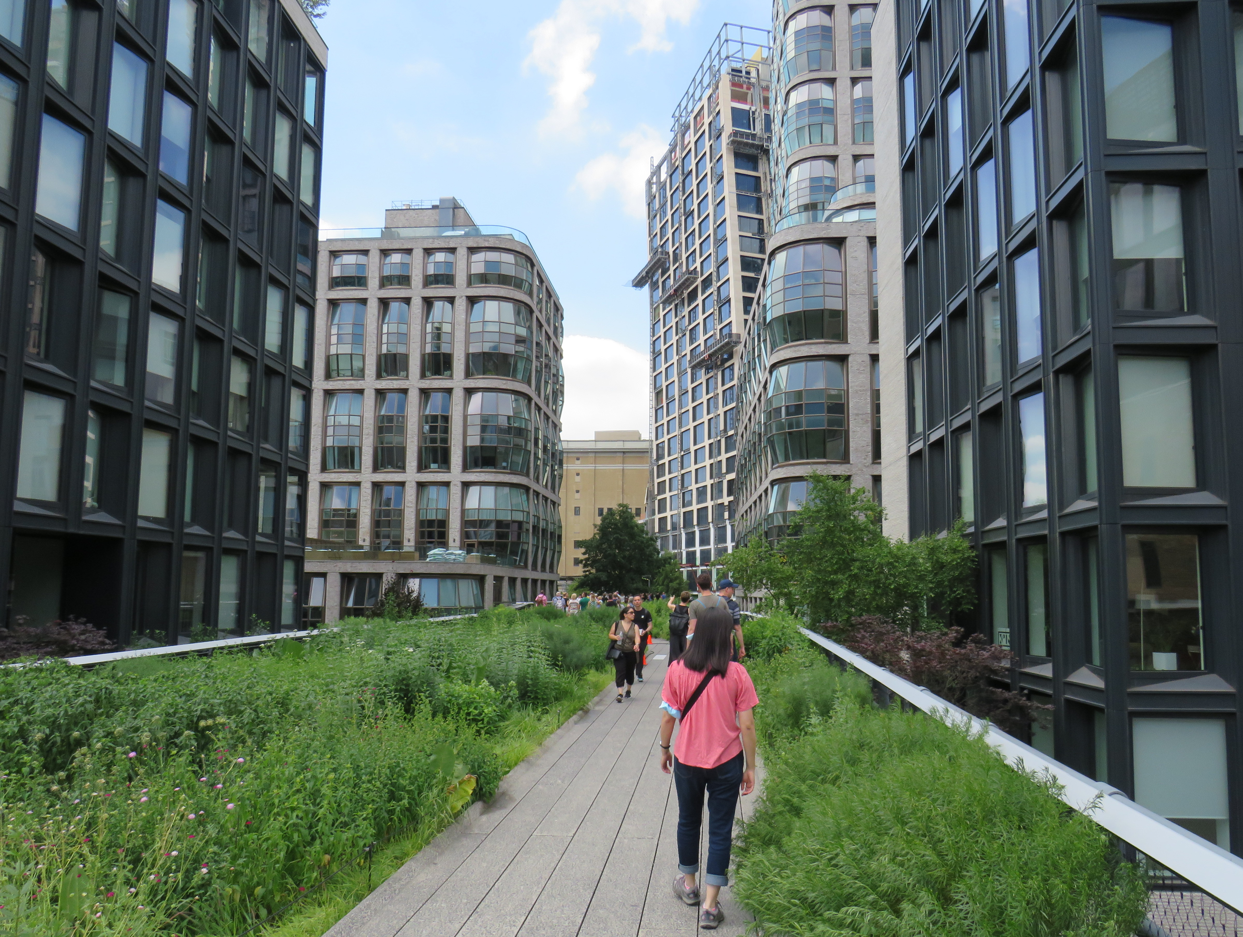
On a road trip early this summer, my spouse and I paid a visit to New York and Philadelphia. In New York, we walked the famous High Line, which revitalized an abandoned elevated freight railway corridor, transforming it into a popular grade-separated walking path on Manhattan’s Lower East Side.
New York’s High Line
While in Philadelphia, I made a point of visiting another abandoned rail viaduct — Rail Park. It’s as ambitious as New York’s famed public space, but — for now — it is much less known.
The viaducts, cuts, and tunnels that will make up Philadelphia Rail Park trace their origin to the golden age of railroading. The Philadelphia and Reading Railroad, which connected Philadelphia with its northern and western suburbs, industrial towns to the northwest, and the lucrative anthracite coal fields of northeast Pennsylvania. For many years, the Reading Railroad, as it was known, was one of the United States’ most profitable companies. In 1893, the railway opened its Philadelphia Terminal, which became famous for the public market that was established below the station platforms. To this day, the Reading Terminal Market remains a vital city landmark. In the 1930s, most of the commuter services were electrified.
The 1893 Reading Terminal headhouse, now the entrance to the Pennsylvania Convention Center
By the 1970s, both the Reading and PRR were bankrupt. PRR merged with its New York-Chicago rival New York Central in 1968, before it too went into insolvency. Conrail took over many failing railways in the US Northeast and Midwest, consolidating operations, abandoning or transferring redundant track, and transferring most remaining commuter train operations (which were not assumed by Amtrak) to regional and state transit authorities.
In the mid-1980s, the Southeast Pennsylvania Transit Authority (SEPTA), which assumed control of the regional rail services formerly operated by the PRR and the Reading undertook an ambitious project to unite the separate regional rail systems. A new four-track tunnel was constructed east from PRR’s Suburban Station, and a new station — Market East — built to replace the old Reading Terminal. For the first time, trains could run through central Philadelphia, providing improved regional rail services.
Though the historic Reading Terminal headhouse and the famous market were preserved, the station platforms were removed to make way for a new convention centre. For years, the abandoned viaducts and tunnels leading into Reading Terminal sat unused. At least they did, until June 2018.
Entrance to the first phase of Rail Park, at Noble and 13th Streets
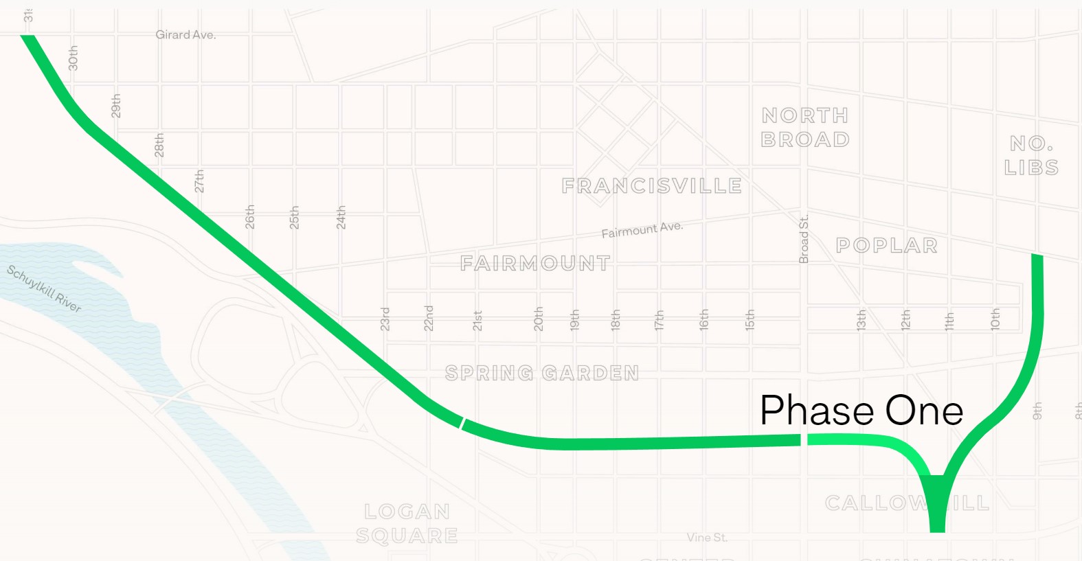
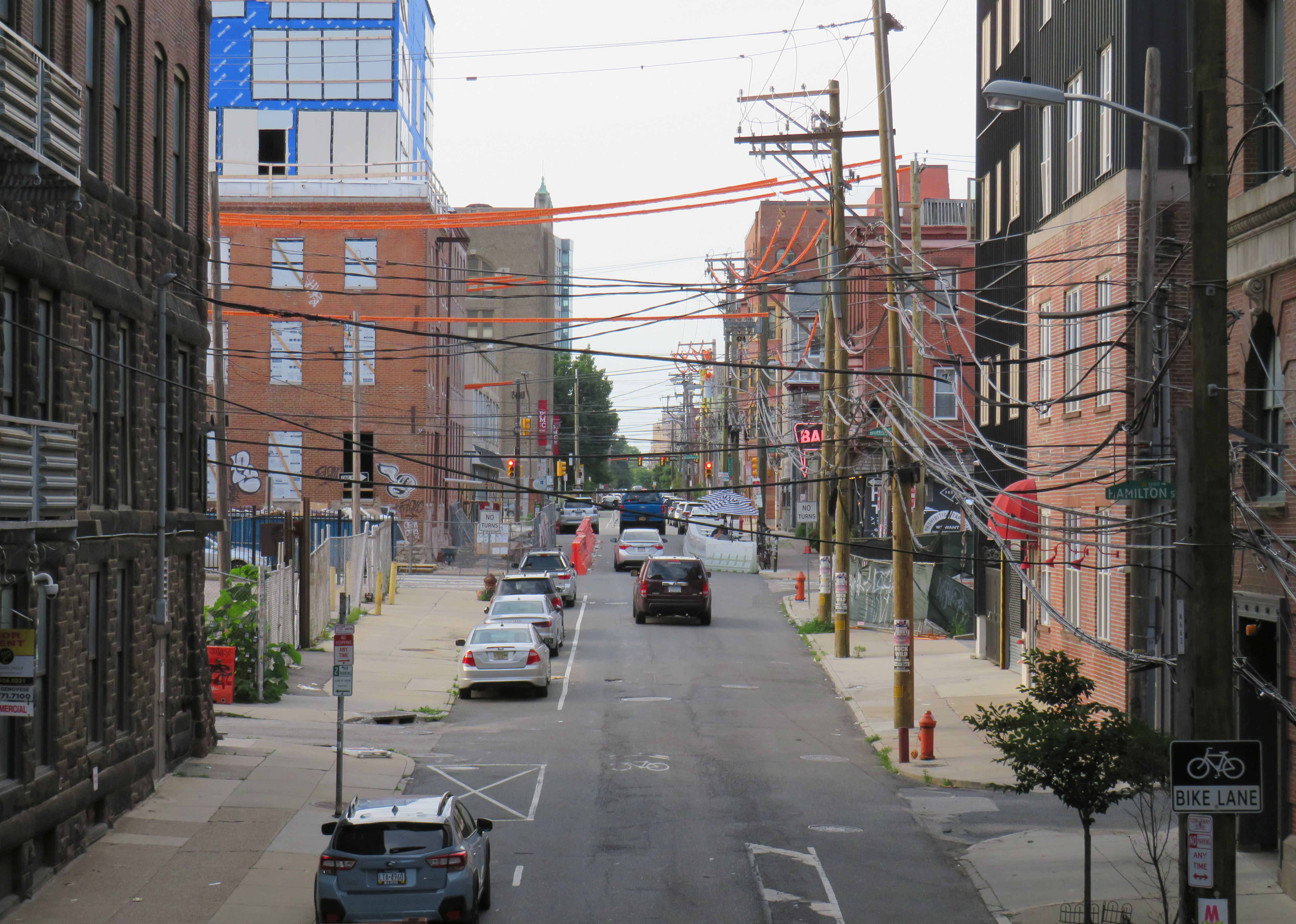
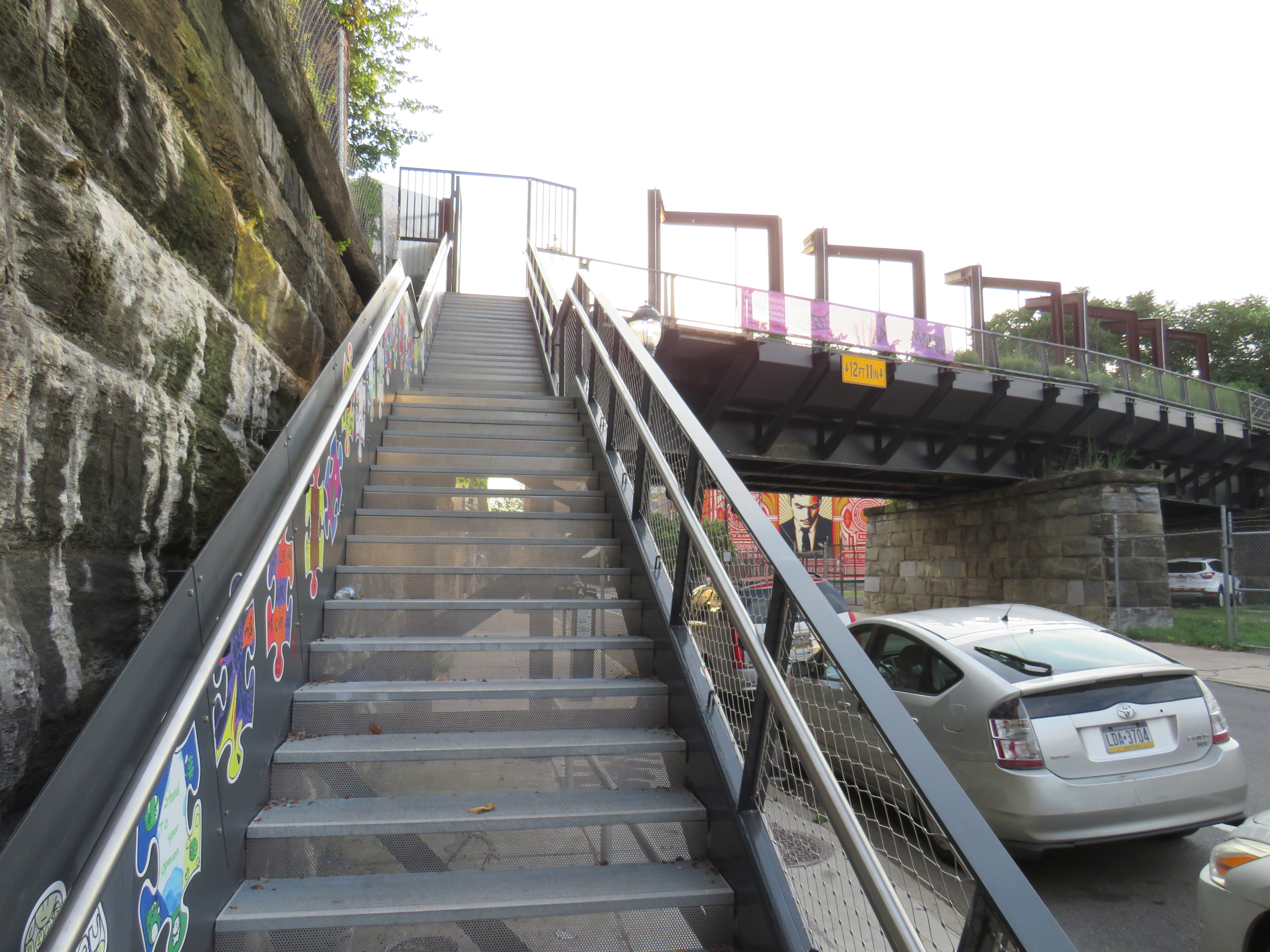
In 2018, a short, initial phase of Rail Park opened to the public. Spanning just two blocks, from Noble and 13th Streets to Callowhill and 11th Streets, it is still a remarkable public space. Like New York’s High Line, the short section of viaduct provides new viewpoints over gritty city streets, with temporary and permanent public art installations along the route.
A map of the proposed extensions of Rail Park, with the opened first phase marked. Interactive map here. Looking north up 13th Street, towards the gentrifying Spring Garden neighbourhood“Workshop of the World” – an interpretive plaque provides information on the industries that lined the Reading Company’s route through PhiladelphiaAn art map of local industries that existed immediately north of Reading Terminal, made from punched Corten steelLooking east to the intersection of Callowhill and 11th Streets. For now, the only fully accessible entrance to Rail Park is at Noble and 13th Streets. The viaduct from the north is visible at left; this will be part of a future phase of Rail Park.A stairway leading up from Callowhill Street. The metal frames at the right hold swings for the public to enjoy.
Future park extensions will continue westward from 13th Street to a below-grade cut starting at Broad Street. It will continue west to the Benjamin Franklin Parkway and the Philadelphia Museum of Art (where the Rocky statue can be found outside), where it will enter a tunnel before emerging at Girard Avenue near Fairmount Park, the greatest of Philadelphia’s urban green spaces. Another section will connect the existing Phase I to the abandoned north-south viaduct between Vine Street and Fairmount Avenue, where the old route to Reading Terminal meets the 1980s rail diversion to Market East Station. Eventually, it will reach 3 miles (5 kilometres) in length.
The formerly abandoned viaduct offers a view of more recently abandoned transit infrastructure: the remnant tracks of the 23-Germantown trolley route, once the longest streetcar line in North America. In the early 1990s, SEPTA was forced to abandon three of its legacy street railway lines due to budget pressures and deteriorating PCC equipment. (Newer Kawasaki-built streetcars were only deployed on the surface-subway routes in West Philadelphia and on the former Red Arrow suburban lines from 69th Street Station.) The 15-Girard Line was later rebuilt with refurbished streetcars, but the 23 and 56-Erie lines were left to rot in a state of “temporary suspension.”
SEPTA has a wealth of transit infrastructure, which I wrote about after my first visit to Philadelphia in 2009, but it hasn’t put enough of it to good use. It has a massive, fully electric regional rail network, yet trains operate only every hour on most routes outside of peak periods. There’s a four-track subway tunnel under Broad Street that’s grossly underused, and unlike Toronto, there are even a few active trolley bus routes. And sadly, it’s allowed much of its infrastructure, like its trolley network, to remain in disuse.
A view down from Rail Park to long-disused trolley tracks on 12th Street
Looking east on the CN mainline from Merritt Street in St. Catharines towards the Welland Canal
The case for reviving Merritton Station
On the morning of Saturday, July 9, a GO Transit train filled with hundreds of passengers heading from Toronto to Niagara Falls, was stuck at St. Catharines when a lift bridge over the Welland Canal was unable to lower the deck to allow trains to pass.
After over an hour of holding at the St. Catharines VIA Station, GO Transit was forced to send the train back to Toronto. In an advisory on Twitter, GO informed customers that they “will need to make their own accommodations” for getting between St. Catharines and Niagara Falls, and would not be sending any shuttle buses.
Until further notice, due to a problem with the Seaway Bridge not coming down, all Niagara Falls train trips must start and finish at St. Catharines GO (VIA station). Any customers looking to make their way to or from Niagara Falls GO, will need to make their own accommodations. pic.twitter.com/E2UmphCy1E
— Lakeshore West Train (@GOtransitLW) July 9, 2022
Needless to say, this left many families disappointed. With GO Transit understandably unable to muster enough buses on a summer weekend to quickly transfer 1500 passengers (which would require at least 25 coaches), the decision not to provide alternate transportation is understandable, if unfortunate.
The summer weekend Toronto-Niagara train service is incredibly popular, especially the Saturday and Sunday morning departures from Union Station, and the evening return trip. Specially-outfitted bicycle coaches allow for dozens of bicycles to be transported by train; Niagara Region is an excellent cycling destination.
Recent fare innovations, including the $10 weekend day pass and a special GO Transit-Niagara Parks package have only contributed to the route’s success. As GO Transit is able to carry 1500 passengers on each train between Toronto and Niagara, it is invaluable not only for supporting the local tourism industry, it provides an alternative to driving on the congested Queen Elizabeth Way.
Unfortunately, the CN Grimsby Subdivision, which runs between Hamilton and Niagara Falls, is hardly ideal for frequent commuter and excursion service. Trains crawl through Hamilton, and much of the line is single-tracked, limiting capacity. Furthermore, trains to and from Niagara must back in to Hamilton’s West Harbour GO Station, which still does not have a direct connecting track to the east.
But the Welland Canal lift bridge is the greatest barrier for providing frequent and reliable rail service to Niagara Falls. During the Great Lakes shipping season, train traffic must yield to the busy St. Lawrence Seaway. Constructing a bridge or a tunnel is difficult and costly as railways are limited to typically no more than a 2% grade, and the freighters require a high clearance (as evident with the nearby QEW Garden City Skyway). Constructing a tunnel is also difficult, as the railway begins climbing the Niagara Escarpment just east of the canal, and would need to climb an even longer distance from canal. (A railway tunnel south of Welland has no such constraints as it is well above the escarpment.)
Looking east towards the Welland Canal lift bridge from Glendale Avenue. The disused CN Thorold Spur disappears into the weeds at right.
As a short-to-medium term measure, Metrolinx should look at constructing a new station at Merritton, located southeast of Downtown St. Catharines and approximately three kilometres east of St. Catharines Station. Until 1961, Merritton was an independent town, an industrial centre served by both the Grand Trunk/CN and the electric Niagara, St. Catharines and Toronto Railway. With amalgamation with St. Catharines, the closure of the passenger railway stations, and the loss of the historic paper and textile mills, Merritt Street has seen better days.
Merritt Street, just south of the CN Railway. The stone building at right is the former town hall.
Merritton’s CN Station was located on the east side of Merritt Street. Passenger service ended by the 1960s, and industrial switching activity between the former NS&T and CN’s Thorold spur line declined, so the building was eventually abandoned. It burned down in 1994, and there is little trace of its existence.
Unlike the active VIA station on the west side of St. Catharines, Merritton is quite close to the Welland Canal and the Niagara Circle Route. Merritt Trail, which follows the original Welland Canal route, is within a short walk from Merritton. It is also much easier for buses arriving from Niagara-On-The-Lake, Thorold, and Niagara Falls to access a station site at Merritton than the awkwardly-located St. Catharines Station, with four to five minutes saved, especially if there were direct access from Glendale Avenue.
St. Catharines VIA/GO Station, off of St. Paul Street West. Awkwardly located for bus access, the station platform is a 25 minute walk to Downtown St. Catharines.
Not too far from Merritton is St. Catharines Museum and Lock 3 Centre, which tells the history of the region and the Welland Canal; a platform provides excellent views of passing ships. Niagara College and the Outlet Collection are also close by, via Glendale Avenue. Whenever there’s a delay or failure at the lift bridge, there are more options at Merritton, especially if a proper bus transfer point is constructed.
Ideally, a grade-separated Welland Canal crossing would become an integral part of a frequent Toronto-Hamilton-Niagara-Bufffalo rail service. In the meantime, a stop at Merritton for GO commuter and excursion trains would provide new transit and cycling connections, while serving passengers in eastern St. Catharines, Niagara-on-the-Lake, and Thorold.
St. Catharines: where the Bruce Trail is at its least Bruce Trail-ish
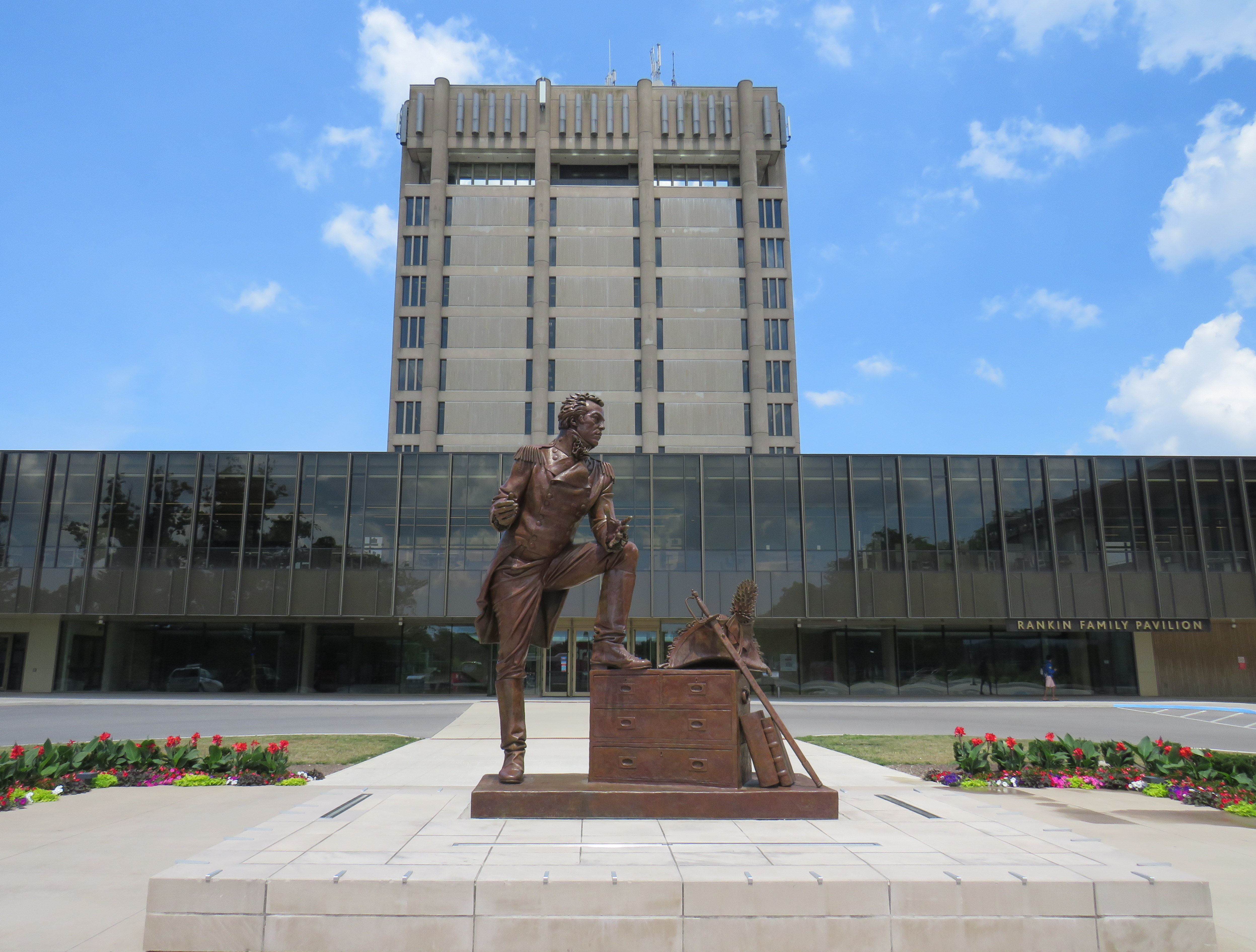
I travelled to St. Catharines on a lovely July Friday, taking GO Transit’s Route 18K bus from Aldershot Station through Hamilton, along the QEW, and to Brock University in St. Catharines. The university campus is at the top of the Niagara Escarpment, boasting direct connections with the Bruce Trail.
Statue of General Brock at the main university entrance
The walk eastwards towards Merritton from Brock University started out promising. The thick tree cover provided welcome shade, and apart from a rather dangerous crossing of Glenridge Avenue, felt little different than anywhere else on the southern part of the famous trail.
A promising startBeing watched by a young red-tailed hawk
At Tremont Drive, the trail suddenly enters a subdivision, with only the tell-tale white blazers to assure hikers that yes, in fact, this is part of the Bruce Trail.
Bruce Trail blazers are the only hint that this is part of Ontario’s greatest hiking trail
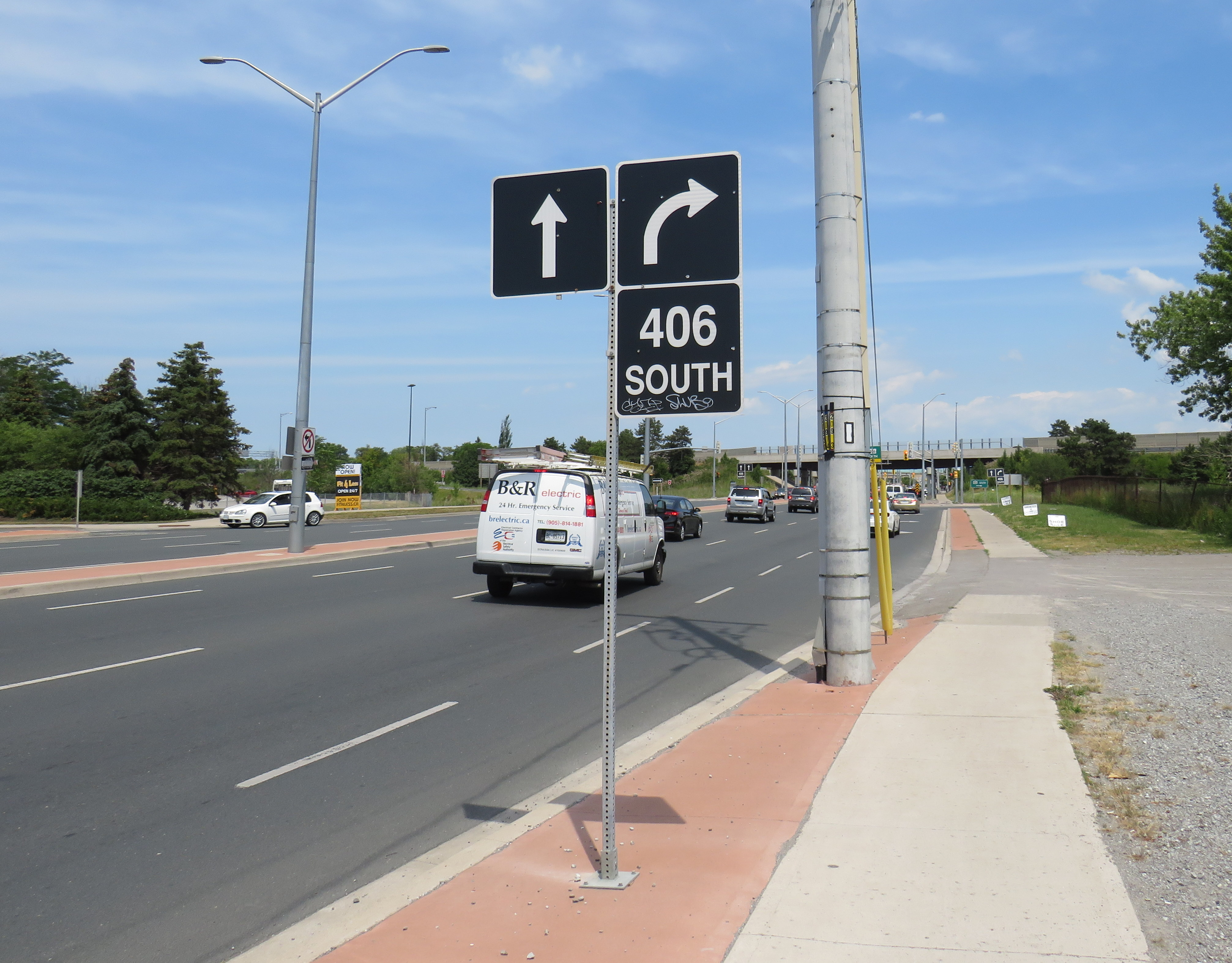
The trail continues to busy Glendale Avenue, and crosses Highway 406 at the interchange. At each traffic light, pedestrians are required to press the “beg button” to get a walk signal, even if one is crossing in the same direction as the through traffic. In most other places, the walk signal comes on automatically in conjunction with the dominant traffic flow.
Though the Bruce Trail also passes through Hamilton, a city nearly four times the size of St. Catharines, the trail there manages to remain separated from traffic and even from the city as a whole, much like Toronto’s ravine park systems.
Glendale Avenue at Highway 406: the lowpoint of the 900 kilometres of Bruce Trail
A partially hidden stairway on Dupont Street leads to the site of the lost CP West Toronto Station
Since 1853, the year that the Ontario, Simcoe & Huron Railway first laid track at the city’s waterfront, Toronto has been criss-crossed by rail corridors. With the exception of the Ontario & Quebec Railway (a subsidiary of Canadian Pacific), every rail line built converged on Toronto’s downtown waterfront, and radiated out across the province, with connections to neighbouring provinces and states. Though Toronto’s first Union Station was built in 1858 by the Grand Trunk Railway (which also hosted two competing railways that the GTR later acquired), there was still a need for smaller stations outside the downtown core.
Outlying stations within the city limits, such as East Toronto (Danforth), Riverdale, and Don Stations in the east, Parkdale, West Toronto, Davenport, and Sunnyside Stations in the west, were particularly important prior to modern dispatch and signalling systems. Station agents at stops outside the city centre were useful to commuters, while the station agent would deliver important messages to train crews entering the congested downtown railyards and passenger facilities. Mail could be collected, delivered, and processed for local residents and businesses. Passengers could purchase tickets without needing to go all the way downtown.
In the early 1900s, Canadian Pacific — tired of delays with constructing a new third Union Station — built a grand station where its original Ontario & Quebec mainline crossed Yonge Street. Though the station was popular with the area’s affluent residents, CP closed the station during the Depression. (Today, it’s a magnificent LCBO flagship store.)
Outside the old City of Toronto, there were staffed passenger stations at Long Branch, Mimico, Scarborough Junction, Port Union, Agincourt, Leaside, Downsview, Weston, and Islington.
By the end of the 1960s, many of these stations were closed. In southern Ontario, mail was being sent by truck instead of rail, sorted in large processing facilities. The loss of the mail contracts spelled the end of many rural passenger rail services. Modern centralized traffic control and wireless communication systems did away for the need for station staff to relay messages and orders to passing trains. Though there were still dozens of passenger trains arriving and departing Union Station, these trains, mostly on the Montreal-Windsor corridor, made fewer stops. In 1967, GO Transit replaced the remaining all-stops commuter service on CN’s line between Hamilton and Toronto; it eventually replaced most of CN’s stations on what are now the Lakeshore, Kitchener, and Stouffville Lines with new station stops or built new facilities at old station sites that better served suburban park-and-ride commuters. GO also added new stations such as Guildwood, Bloor, and Old Cummer.
Within the City of Toronto, there are only four passenger railway station buildings preserved: Union Station, CP North Toronto Station, Mimico Station, and Don Station. Mimico and Don Stations were moved off-site, while only Union Station remains in continuous passenger service. Other stations burned down, were demolished, or were simply left to rot. In a few places, though, old staircases provide clues to these long-lost stations.
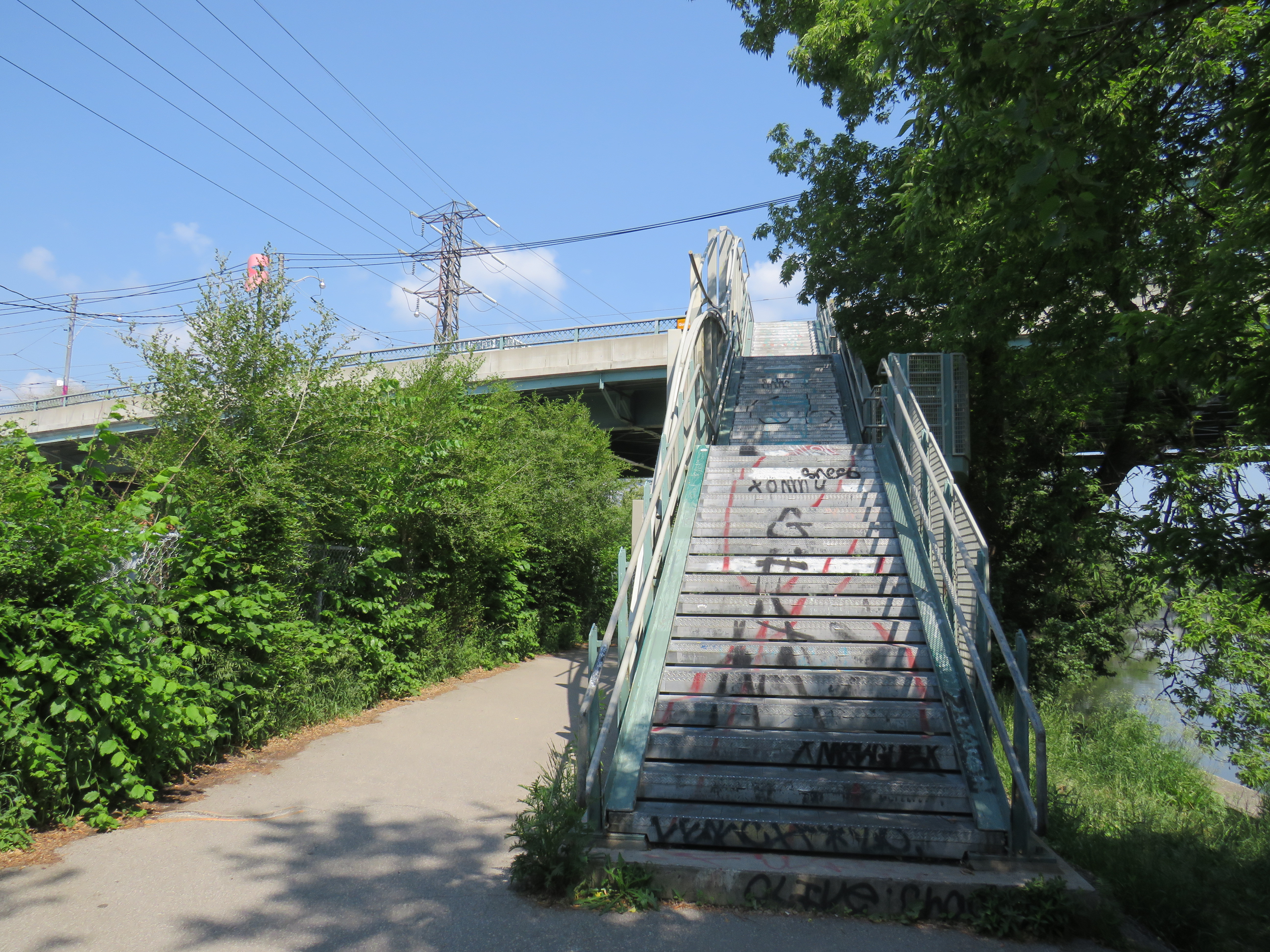
Don Station
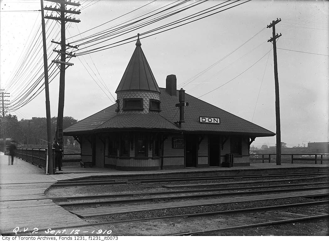
Don Station was built by CP in 1896 to serve its new branch to Union Station from the Ontario & Quebec mainline at Leaside. Located at Queen Street at the Don River, it was an important waystation for train crews to receive orders before arriving at Union Station or before departing northeastward on the long trestle towards Leaside and Montreal. When Canadian Northern built its mainline through the Don Valley in 1906, it shared the approach tracks with CP and also used Don Station.
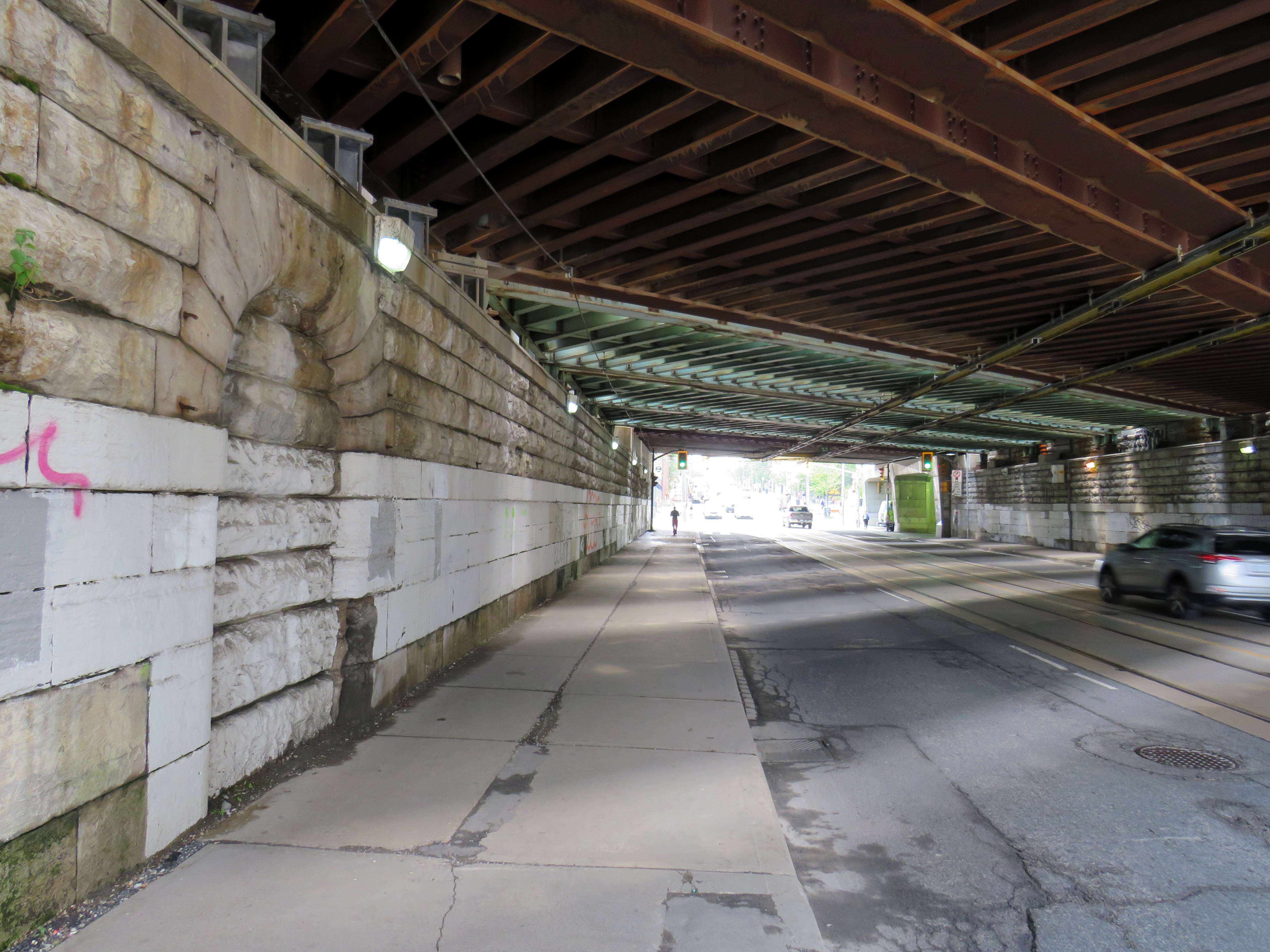
Originally, the CP and CNoR tracks crossed Queen Street at grade. After a catastrophic streetcar-train crash further east on Queen Street, the City of Toronto pushed to grade-separate all major road crossings. In 1911, a higher-level bridge was built that spanned the Don River and the railway tracks. Today, it also spans the Don Valley Parkway.
The station closed in 1967 when the Toronto-Peterborough-Havelock train stopped serving Don, and the station building was moved to Todmorden Mills in 1969. In 2008, the station was moved again, to Roundhouse Park. It now hosts passenger trains again; albeit a miniature train operated by the Toronto Railway Museum.
The original wooden stairway from Queen Street that connected to Don Station was removed by the early 1960s and replaced by a metal staircase. The metal structure has since been refurbished and now connects Queen Street with the Lower Don Trail.
Stairway from the Lower Don Trail to Queen Street EastDon Station in 1910, before the higher-level Queen Street bridge was constructed –City of Toronto Archives Fonds 1231, Item 73
Parkdale CN Station
Sealed portal to CN Parkdale Station
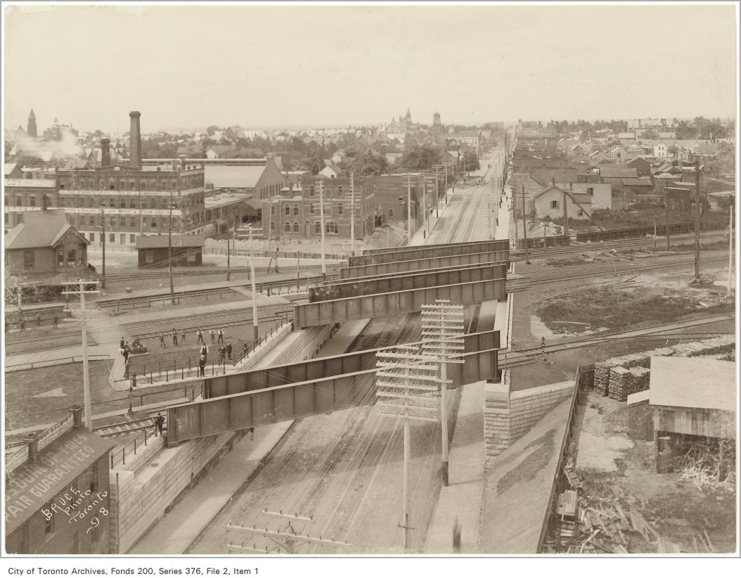
Until 1960, every train on the Toronto-Kitchener-London route made a stop at Parkdale, near the corner of Queen and Bathurst Streets. The Queen Street Subway, completed in 1898, was one of the first road-rail grade separations in the city. The underpass allowed streetcars and traffic to avoid the multiple Grand Trunk and Canadian Pacific mainline and service tracks that crossed Queen Street. Both Grand Trunk (later CN) and CP had stations at Parkdale, though the wooden GTR/CN station was located between the tracks and had to be accessed by a stairway from the south side of the Queen Street underpass.
A bricked up archway betrays the old passage to the now-demolished station.
The new Queen Street Subway, 1898. Parkdale CN Station is to the left of this image, but the stairway down to street level is clearly visible. –City of Toronto Archives Fonds 200, Series 376, File 2, Item 1Old streetcars headed to Haileybury, Ontario pass by the CN Parkdale Station on October 14, 1922. The streetcars, which were slated for scrapping, where being sent north to provide shelter after a disastrous forest fire. – City of Toronto Archives Fonds 16, Series 71, Item 1601
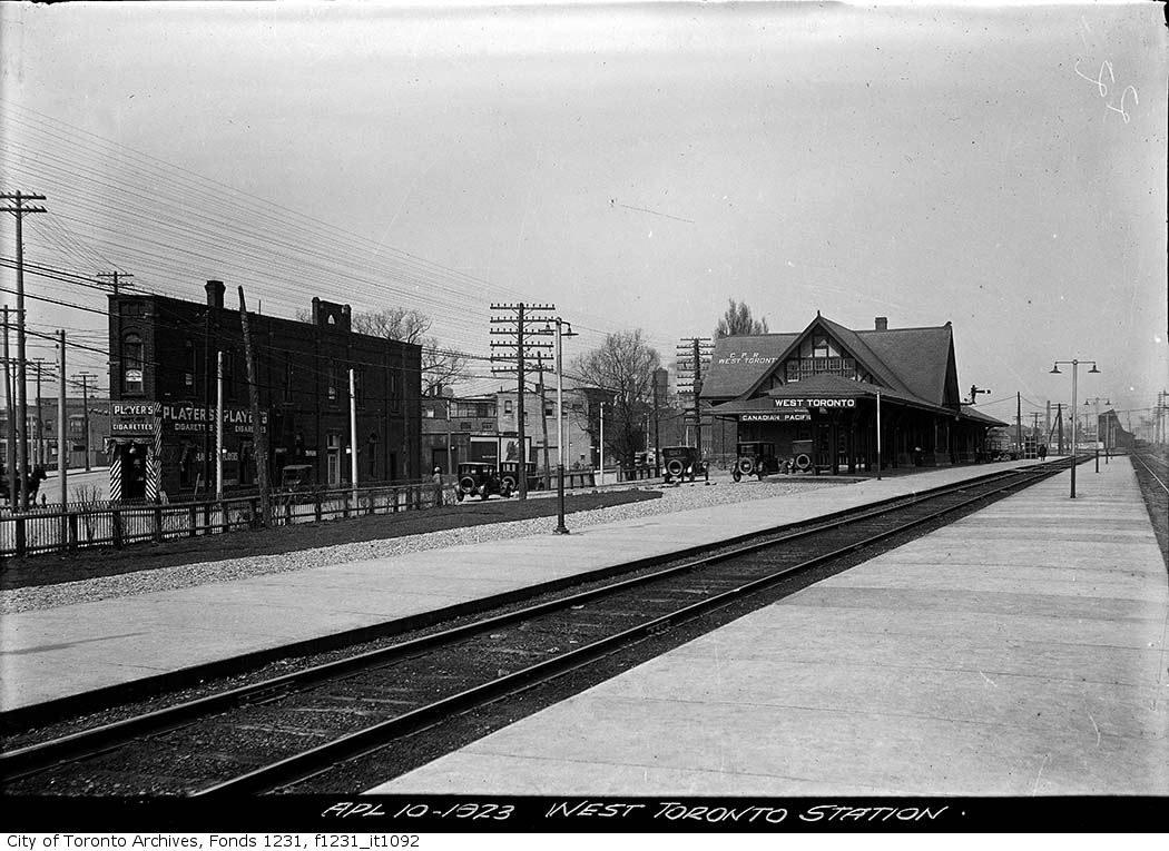
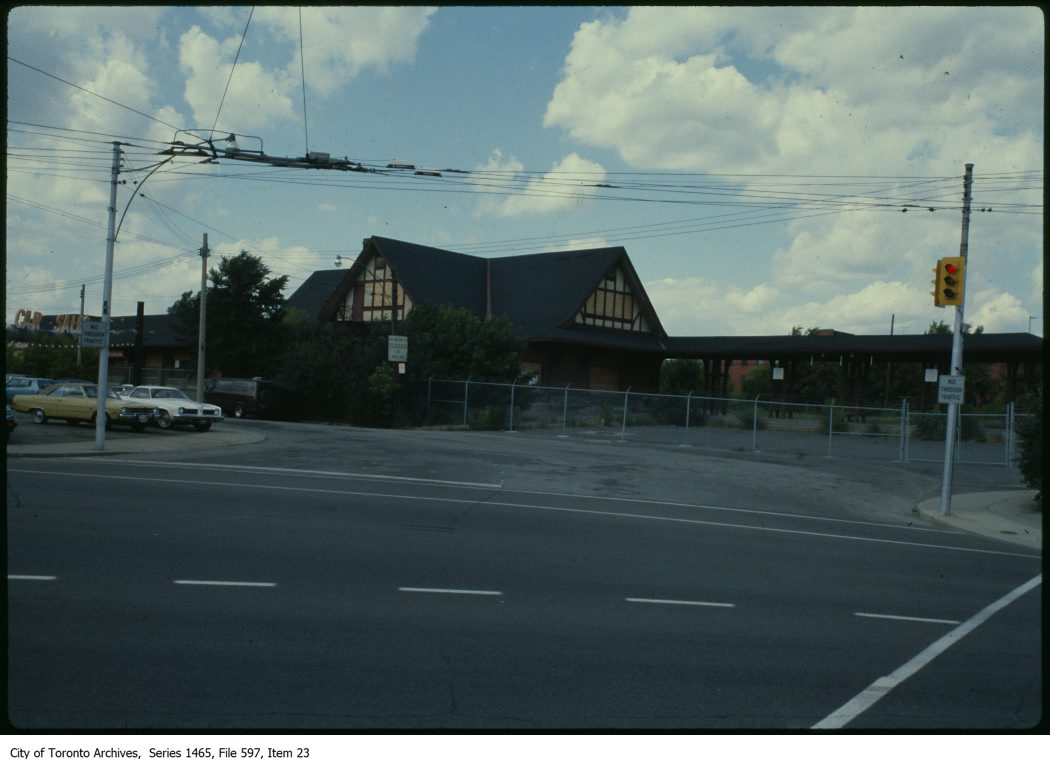
West Toronto CP Station
Both CN and CP had stations at West Toronto. The Grand Trunk (later CN) station was located on Old Weston Road near Davenport Road. The CN station closed in the early 1980s and was demolished in 1999 after being left abandoned to the elements and vandals.
The CP station was located to the south, on Old Weston Road just north of Dupont and Dundas Streets. As the town of West Toronto (originally known as Toronto Junction) built up around the junction between CP’s Ontario & Quebec, Credit Valley, and Toronto, Grey and Bruce Railways, the CP station was the pride of the community. The last station on the site, completed in 1911, was a large building in the Tudor style, with a long canopy. The last train to serve West Toronto, CP’s Canadian, departed in 1978, and CP controversially demolished the station under cover of darkness in 1982.
CP West Toronto Station, 1923 – City of Toronto Archives, Fonds 1231, Item 1092CP West Toronto Station just prior to demolition in 1982 – City of Toronto Archives, Series 1464, File 597, Item 23
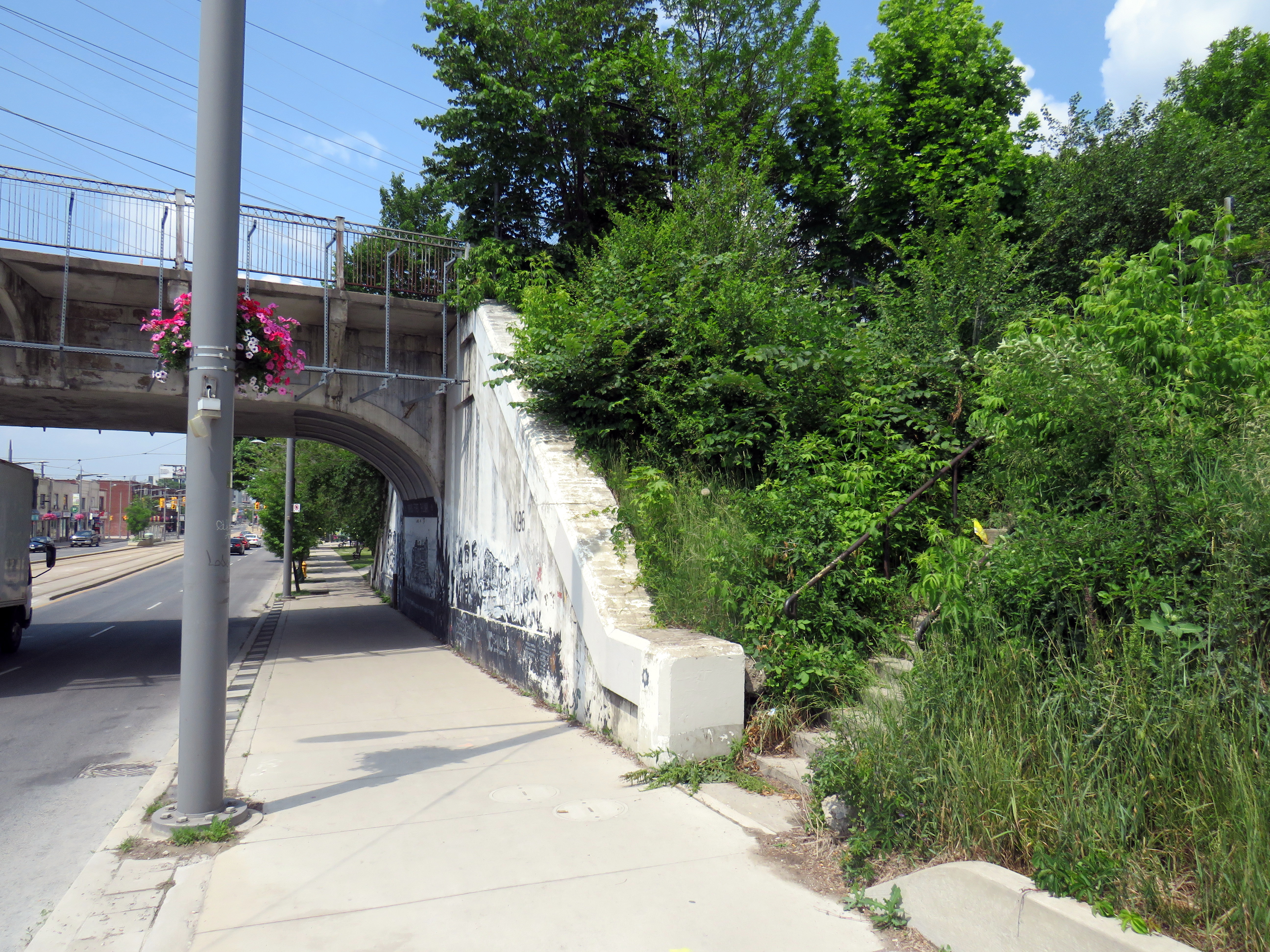
At the south end of the station platform, a stairway led down to the north side of Dupont Street. Though it is fenced off, the stairway is still very much visible just west of the railway underpass. The concrete retaining wall has been brightened up by local graffiti artists.
Fenced-off stairway from the north side of Dupont Street, just east of Dundas Street, leads to the site of the now-demolished CP West Toronto Station
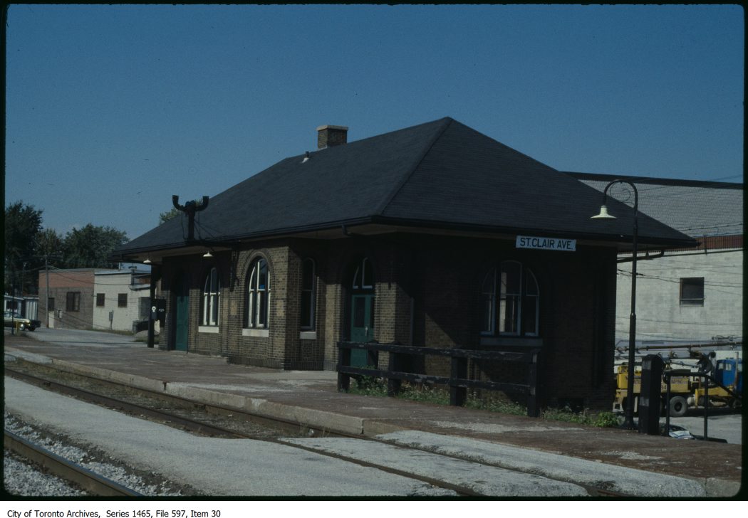
St. Clair Avenue Station
CN St. Clair Avenue Station just prior to its final closure, c. 1983 – City of Toronto Archives, Series 1465, File 597, Item 30
St. Clair Avenue Station was completed in 1931, as part of a grade separation project that finally allowed through streetcar service on St. Clair West. The small brick structure replaced an older station at Davenport Road, which was soon demolished.
St. Clair Avenue served CN trains between Toronto, Northern Ontario, and Western Canada, though passenger services declined through the 1960s and 1970s. When GO Transit took over the local Barrie train from VIA, it cut the stop at St. Clair Avenue. The station was closed for good when VIA’s Canadian was rerouted from the CN Newmarket Subdivision in 1985. Like other disused passenger stations, the building suffered from neglect, vandalism, and arson, before being demolished by CN in 1999.
The remains of the station platform are still visible from the east side of GO trains on the north side of St. Clair, especially in winter and early spring. From St. Clair Avenue itself, a stairway, partially hidden by greenery, leads up to the old station site.
Abandoned stairway north from St. Clair Avenue West, near Caledonia Road, leads to the site of the CN St. Clair Avenue Station
Exhibition Station
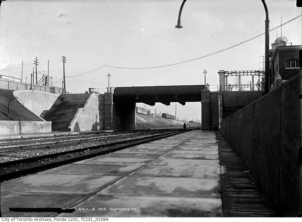
New Grand Trunk Railway Exhibition Station, 1912. City of Toronto Archives, Fonds 1231, Item 1584
In 1912, the Grand Trunk Railway opened a new station that was intended to see train service for only a few weeks a year. Exhibition Station, constructed at the foot of Dufferin Street, was an anomaly. It had no full-time station agent, but it featured wide platforms and staircases leading up to Exhibition Place’s Dufferin Gates. Special trains during the Canadian National Exhibition would quickly load and offload fairgoers. As CP, through its part-ownership of the Toronto, Hamilton & Buffalo Railway, had running rights on the GTR/CN tracks between Union Station and Hamilton, it too, could send trains direct to the CNE.
Exhibition Station remained in use until the early years of GO Transit, when it built a new station farther east in the early 1970s. Upgraded since then, the current Exhibition Station will become a multimodal hub with the construction of the Ontario Line. Meanwhile, the old stairways and platforms remain, though fenced off.
Stairway down to the westbound platform at the old CN Exhibition Station at Dufferin Street
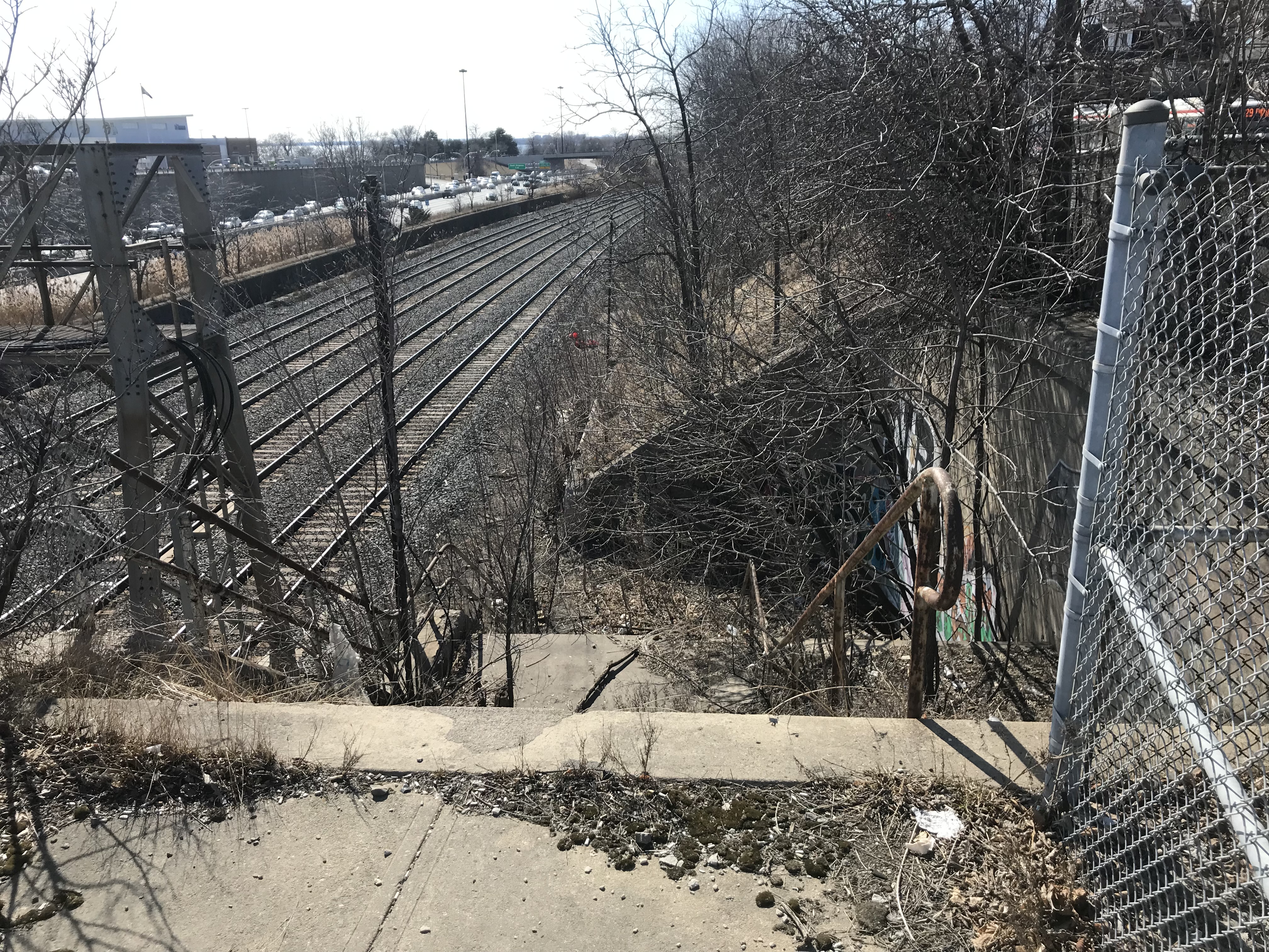
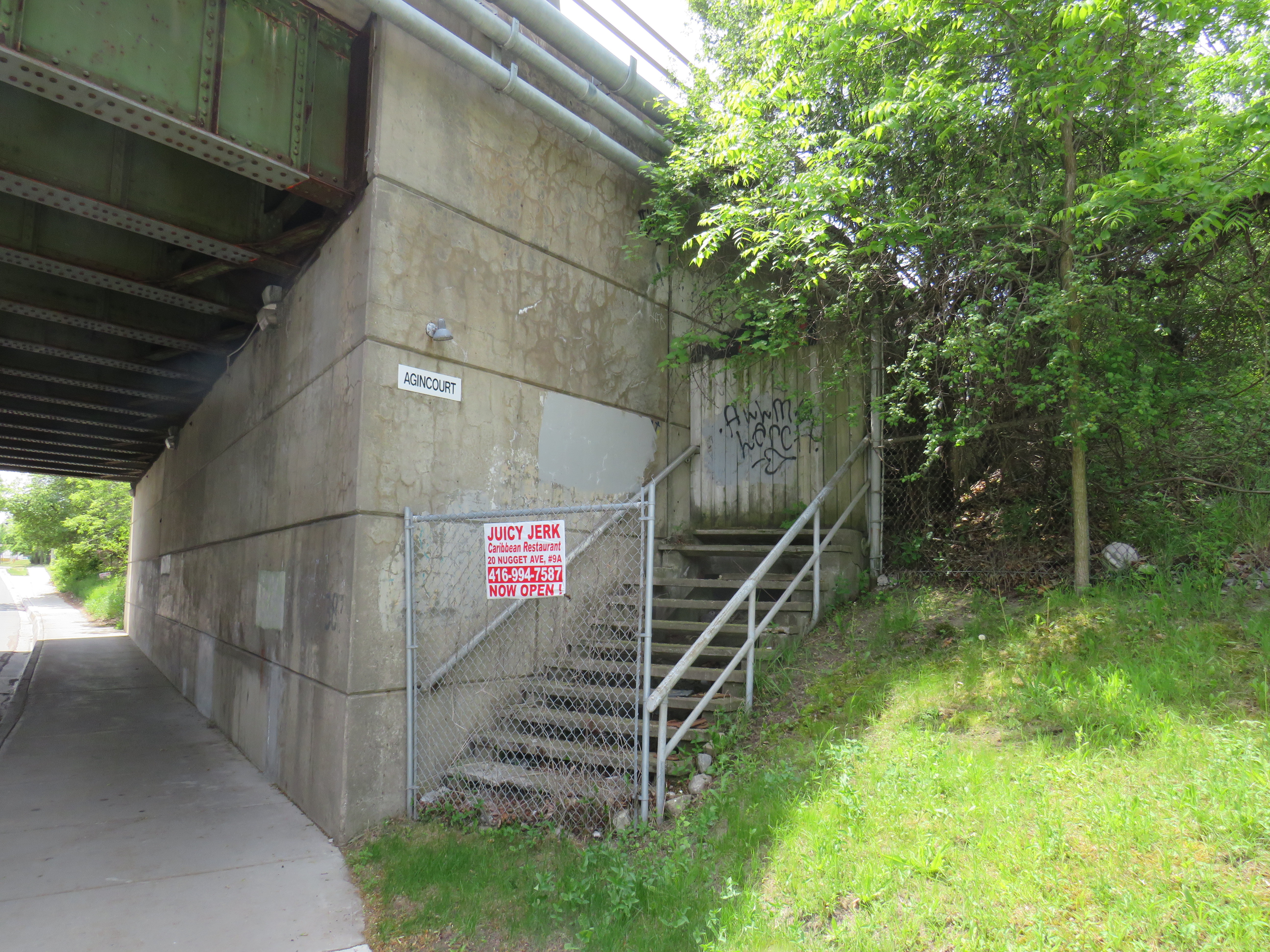
Agincourt CP Station
North side stairway at Brimley Avenue. Note the sign reading “Agincourt” on the underpass structure.
Both CN and CP had stations called Agincourt in North Scarborough, but neither of the historic station buildings remain. The CN station, now the location of Agincourt GO Station, was on Sheppard Avenue East near Kennedy Road, at the centre of the rural settlement. The CP station, originally built in 1884 for its Ontario & Quebec subsidiary, was farther east, located between Sheppard Avenue and Brimley Road. Though the CN station (built in 1871 for the Toronto & Nipissing Railway) was demolished in 1982, the station site remains in active use. Little remains of the CP station.
On the west side of a wide underpass on Brimley north of Sheppard, two fenced-off stairways lead to the north and south side of the CP tracks. In 1960, CP constructed a new freight classification yard in northern Scarborough; as part of that project, it built new underpasses at Sheppard, Brimley, and McCowan Road, and a large overpass for Markham Road. CP replaced the 1884 station with a smaller station building to serve its remaining passenger trains between Toronto, Peterborough, and Havelock. The station building was on the south side of the tracks, with a driveway leading off Sheppard Avenue to the station and a small parking lot, but CP built the stairways on Brimley for walk-up traffic and to provide a safe passage under the tracks between platforms.
Though the rail diesel coach service survived until the 1990 VIA Rail cuts, the station building was demolished in the late 1970s.
The tracks have been ripped out from the once-proud Orangeville-Brampton Railway
Despite calls for the preservation of the Orangeville-Brampton Railway since its discontinuation in December 2021, the removal of rails on the 150-year old line that once connected Toronto with Owen Sound, Teeswater, and points between began this week.
The Town of Orangeville aims to replace the tracks with a multi-use path through the municipality. The Region of Peel is likely to purchase most of the remaining section, with the right-of-way likely to become another recreational trail through Caledon and north Brampton. I will continue to document the railway’s demise and the route’s future.
In the meantime, the rusty rails await their removal.
Looking west at Centre Street, Orangeville, March 30, 2022The hi-rail excavator sitting in the Orangeville yard, March 30, 2022. A pile of removed rails sits in front. At Brampton, signals continue to protect the CN mainline despite the abandonment of the old CP routeA Sarnia-bound VIA Train crosses the Brampton diamond, March 25, 2022. Who knows how long it will be before the diamond is removed for good?
End of the line – video of track removal at Orangeville by Jeremy Williams
The current end of track of the once-important Owen Sound Subdivision, on the outskirts of Orangeville. Beyond, a new paved trail occupies the former right-of-way.
On Townline Road on the south end of Orangeville, across the street from the old railway yard and station grounds, two plaques stand, telling the history of the doomed railway next to them.
The first plaque, a faded provincial marker, commemorates the Toronto, Grey and Bruce Railway, which arrived in Orangeville in 1871 and completed to Owen Sound in 1873. The TG&B was combined with the rival Credit Valley Railway by the Canadian Pacific Railway, and Orangeville became the headquarters of a network of branch lines known as the CP Bruce Division. Passenger service to Owen Sound via Brampton and Orangeville continued until 1970.
The second marker, installed by the Town of Orangeville, commemorates the municipal takeover of the remnants of the Bruce Division, after CP abandoned all track west and north of Orangeville in the 1980s and 1990s. The plaque proudly boasts of a “successful passenger tourist operation” and how the new short line “enhanced opportunities for the long-term economic development of the region.”
The municipal plaque is sadly out of date. The Credit Valley Explorer tour train last operated in early 2018, and the Town of Orangeville lost interest in operating the railway, which was costing the municipality $450,000 a year. The last freight train departed Orangeville on Friday, December 17, 2021.
Toronto, Grey and Bruce Railway plaqueOrangeville-Brampton Railway plaque
Together with Dr. Brian Doucet, Canada Research Chair in Urban Change and Social Inclusion at the University of Waterloo, I toured the line in its waning days. At TVO.org, Doucet and I argue that the corridor is worth preserving, even if the Town of Orangeville is no longer interested in paying for the railway. We note how the province is looking to build a new highway through the very same lands that the dying railway cuts across.
Additional photographs and videos of the once-proud Orangeville and Brampton Railway can be found below.
Rail diesel coaches (RDCs), introduced to Canada’s railways in the 1950s, were used on branch lines and in local service on busy mainlines through the 1980s. Today, they can only be found on VIA’s Sudbury-White River service, a remnant of the once-mighty CPR transcontinental network.
Updated December 18, 2023 as part of my interactive maps migration.
I recently completed a map of all Canadian passenger rail services that operated in 1955, from Whitehorse, Yukon, to St. John’s Newfoundland. As I wrote back in March, the decline in rail services in Canada can be attributed to a few factors: passenger train revenues were augmented by express cargo and mail, mixed trains, carrying both passengers and freight, were still justified in a time before trucks took over general industrial traffic. An incomplete highway network in northern Ontario, Newfoundland, and much of Western Canada also guaranteed healthy passenger demand in an era before jet travel became accessible to the masses.
The introduction of rail diesel coaches (RDCs), with their lower labour costs compared to conventional trains kept some branch lines going through the 1960s, but by the mid 1970s, neither Canadian National nor Canadian Pacific were interested in running passenger trains anymore; both were increasingly focused on bulk freight (grains, minerals, chemicals, finished automobiles) and intermodal container traffic.
VIA Rail took over most of CN and CP’s passenger trains in 1978, with direct government subsidies helping to fund its operations and capital expenses. By then, passenger train service was concentrated in the highly populated Quebec City-Windsor Corridor, but there were still three trains a day between Halifax and Moncton, two trains daily between Montreal and Atlantic Canada, between Winnipeg and Vancouver, and between Calgary and Edmonton. Scheduled bus connections, some even operated by VIA Rail, provided connections to places such as St. John’s, Fredericton, Charlottetown, and the Okanagan Valley.
Cuts imposed in 1981, 1990, and 2012 devastated the network. By 2019, there were only three trains a week in Atlantic Canada, two trains a week between Toronto and Vancouver. Even the Corridor saw cuts: there were five trains a day between Toronto, Kitchener, and Stratford, in 2019, there were just two. The only bright spots were an increase in the number of trains between Toronto and Ottawa and growing commuter rail networks in Toronto and Montreal.
A revised map, linked to below, depicts the passenger network in 1955 and in 1980, just prior to the 1981 cuts. Routes operating between Canada and the United States are depicted (CN, CP, New York Central, Delaware & Hudson, Great Northern, Northern Pacific, and White Pass & Yukon in 1955, Amtrak and White Pass & Yukon in 1980). More information on each route is available by clicking on the lines.
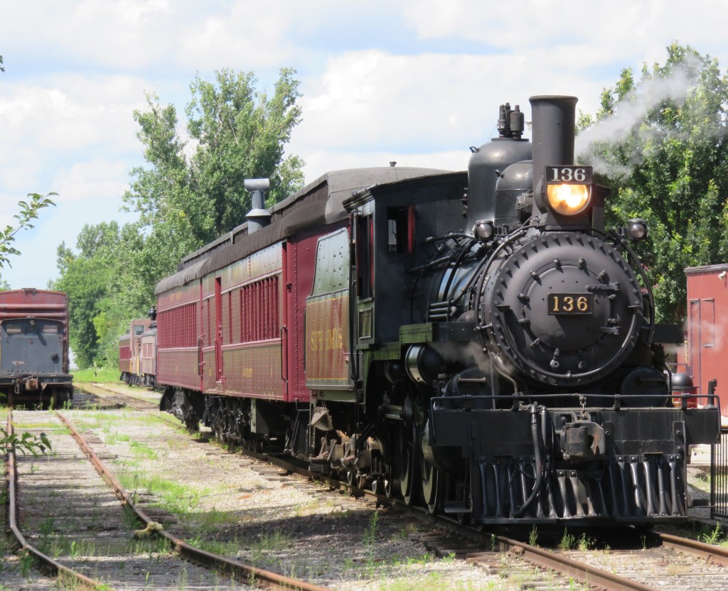
Former Canadian Pacific locomotive #136 hauls excursion trains at the South Simcoe Railway in Tottenham, Ontario
December 17, 2023: The complete map has been migrated to a newer ArcGIS Online account, on account of ESRI suddenly changing its monthly service account to charge bandwidth. That was a pay-as-you go account that helped me get re-acquainted with the ESRI ArcGIS Online platform before I set up a full online subscription to support a small business I co-founded in 2021.
However, I am happy to announce that I completed updates to the Ontario Intercity Transport Map and the 1955 Canada Passenger Rail Map, and that they are safely on a new subscription server at ESRI Canada. Please let me know if you have any suggestions or corrections to the maps, especially during the migration phase.
Sadly, passenger rail has faced a long, slow decline in Canada. Though commuter and regional rail systems in the Toronto and Montreal metropolitan areas have expanded tremendously over the last fifty years, rail service in general has declined in frequency, reliability, and even in speed. Prior to the COVID-19 pandemic, just six trains a day in each direction operated direct between Canada’s two largest cities, the fastest of those trains taking 4 hours 48 minutes to go 539 kilometres to get from Toronto to Montreal.
Seventy years ago, 28 trains on a typical weekday called at CN’s Hamilton Station, departing for Toronto, Niagara Falls, London, Guelph, Barrie, and Simcoe, with another 12 trains calling at the TH&B station on Hunter Street. In 2019, just six GO trains departed Hamilton for Toronto each weekday, with no direct connections even to Niagara, London, or Guelph.
There are several causes for the decline in passenger rail. In 1955, which the map below depicts, passenger train revenues were augmented by express cargo and mail, with the mail contracts alone helping to subsidize many branch lines. Lightly-travelled branch lines were served by mixed trains, which carry both passengers and freight. In Northern Ontario and Quebec, many highways were still of poor quality or unfinished — Highway 17 along the Lake Superior coast was not complete until September 1960. Construction of Highway 401 was just getting underway in 1955. In addition, the airline industry was still new, and air travel was expensive.
Improved highways drew more passengers to coach buses, while the move to trucks for cargo and mail deliveries made many branch lines unprofitable. Larger jet aircraft made air travel cheaper and more convenient for long distances. The major railways concentrated their energies on modernizing their freight networks, with CN and CP building new freight classification and intermodal yards outside of central Toronto, while focusing on bulk freight and shipping containers.
Though CN made efforts to win passengers back in the 1960s and early 1970s with new fare structures and equipment like the Turbo train between Toronto and Montreal, the government of Canada stepped in and took over most intercity passenger rail services in 1977. Though VIA Rail Canada acquired new modern locomotives and rail cars for the Ontario-Quebec corridor services, cuts to government subsidies made in 1981, 1989-1990, and 2012 forced further service cutbacks. British Columbia and Ontario also cut passenger services on their own rural railways.
I mapped the year 1955 for several reasons. I have CN and CP schedules for those years in my collection, while I found contemporary Ontario Northland and New York Central schedules online. It was also the year both railways inaugurated new transcontinental trains: CP launched the Canadian, while CN launched the Super Continental, luxurious diesel-hauled trains with modern sleeping cars and lounges. There were six trains a day leaving Montreal and Toronto for Vancouver that year. In 2019, there were just two trains a week.
In 1955, there were still many branch passenger and mixed trains in Ontario and Quebec, most of which were gone by 1965. Mixed trains were notoriously slow, though, but in many cases, there was a faster parallel highway coach. 1955 was also the last year for CP’s electric trains between Kitchener and Lake Erie, with the London & Port Stanley and Montreal & Southern Counties railways ending passenger runs a year later.
For Ontario and Quebec, I used Paul Delamere’s amazing Ontario Railway Map Collection and Quebec Railway Map Collection, adapting his work to identify those routes used by passenger trains in 1955, then mapping them on my own server. Mapping other routes was much more labourous.
Original version of interactive map
Please contact me if you have any suggestions, corrections, or other feedback.