Birchmount Road and Lawrence Avenue East, Scarborough
On Friday, July 10, the driver of a westbound Toyota RAV4 SUV drove through a red light on Lawrence Avenue East and struck another vehicle travelling south on Birchmount Avenue. The SUV continued forward, mounting the sidewalk where two pedestrians were standing, and then hit a traffic signal pole. The pole, as designed, fell to the ground. The two pedestrians — a 64-year-old man and a 61-year-old woman — were killed. The drivers of both vehicles — as well as two passengers in the RAV4 — were taken to hospital with “non-life-threatening injuries.” Nearly two weeks later, there have been no updates from the Toronto Police or any news outlet letting the public know of any charges laid; there is not even any mention of who the two dead victims were.
As it’s just another “accident,” society shrugs and continues on.
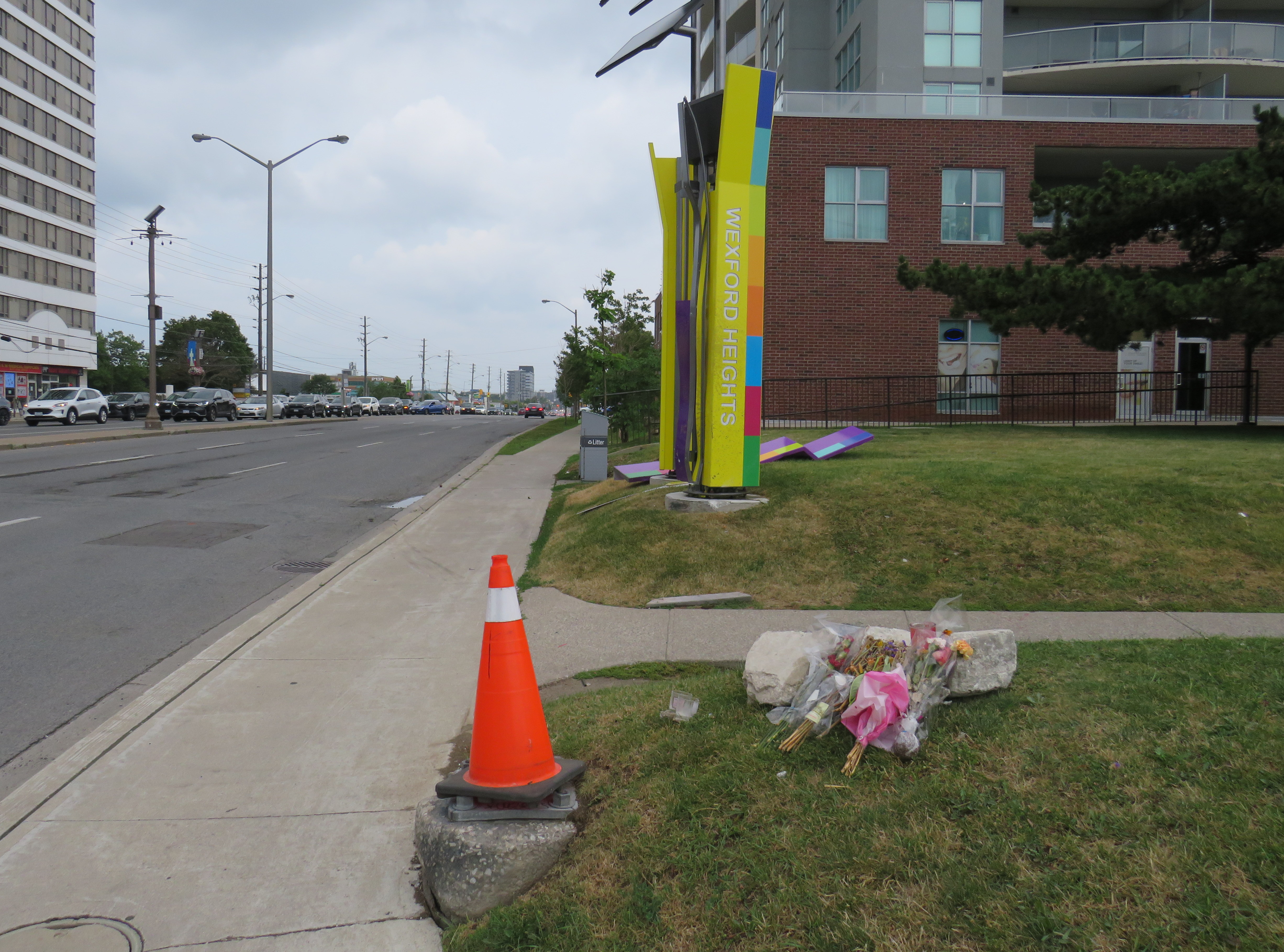
Roadside memorial to two dead pedestrians, with a pylon covering the base of the fallen traffic pole
A day later, just after 8PM on Saturday, July 11, two people were shot dead on St. Clair Avenue West during the Salsa on St. Clair street festival, and four more were injured. This was not a random shooting, but a violent gunfight where the assailants and those killed knew each other. There were many thousands attending the popular street festival that evening; many of those attending fled fearing for their safety.
Elected leaders from all three levels of government were quick to denounce the violence, and Toronto Police, to its credit, refused to hyperbolize the general risk to the public. Chief Myron Demkiw reminded Torontonians that “shootings are down over 26 per cent compared to the same time last year,” followed by the recognition that such violence “…understandably shakes the sense of safety and security that Torontonians expect and deserve.”
However, there are those whose agendas are not served by nuanced remarks like Chief Demkiw’s. Second-time mayoral candidate Brad Bradford was quick to blast senior police officials, saying it was “wrong to call Toronto a safe city.” Bradford followed with his preferred response from police which “…is to say ‘No. No more. Not now, not ever.’” For someone running on a right-wing reactionary platform, such a response would have been much more helpful against an incumbent mayor.
It’s understandable that the St. Clair shooting has gotten lots of attention from the police, news media, and politicians. Despite a continuing decline in violent crime and Toronto’s well-deserved reputation as a safe city, brazen gun violence is frightening, especially in a crowded area where there are thousands enjoying a summer evening. People want to be safe and feel safe while outside their homes. But that also means being able to walk without fear of being struck and killed by a motorist, even when on a sidewalk.
For intermittent street festivals, parades, and temporary pedestrian malls, a lot of attention is already placed on security, especially after recent vehicle attacks. Portable car traps keep vehicles out, while paid duty police and security guards keep watch at intersections and places in between. But we also do very little to protect pedestrians and other road users from dangerous driving. Doug Ford’s provincial government, working against Toronto and other municipalities, moved against bike lane installation (protected bike lanes that serve as a buffer between motor traffic and sidewalks) and speed enforcement cameras, which were working to reduce drivers’ speeds.
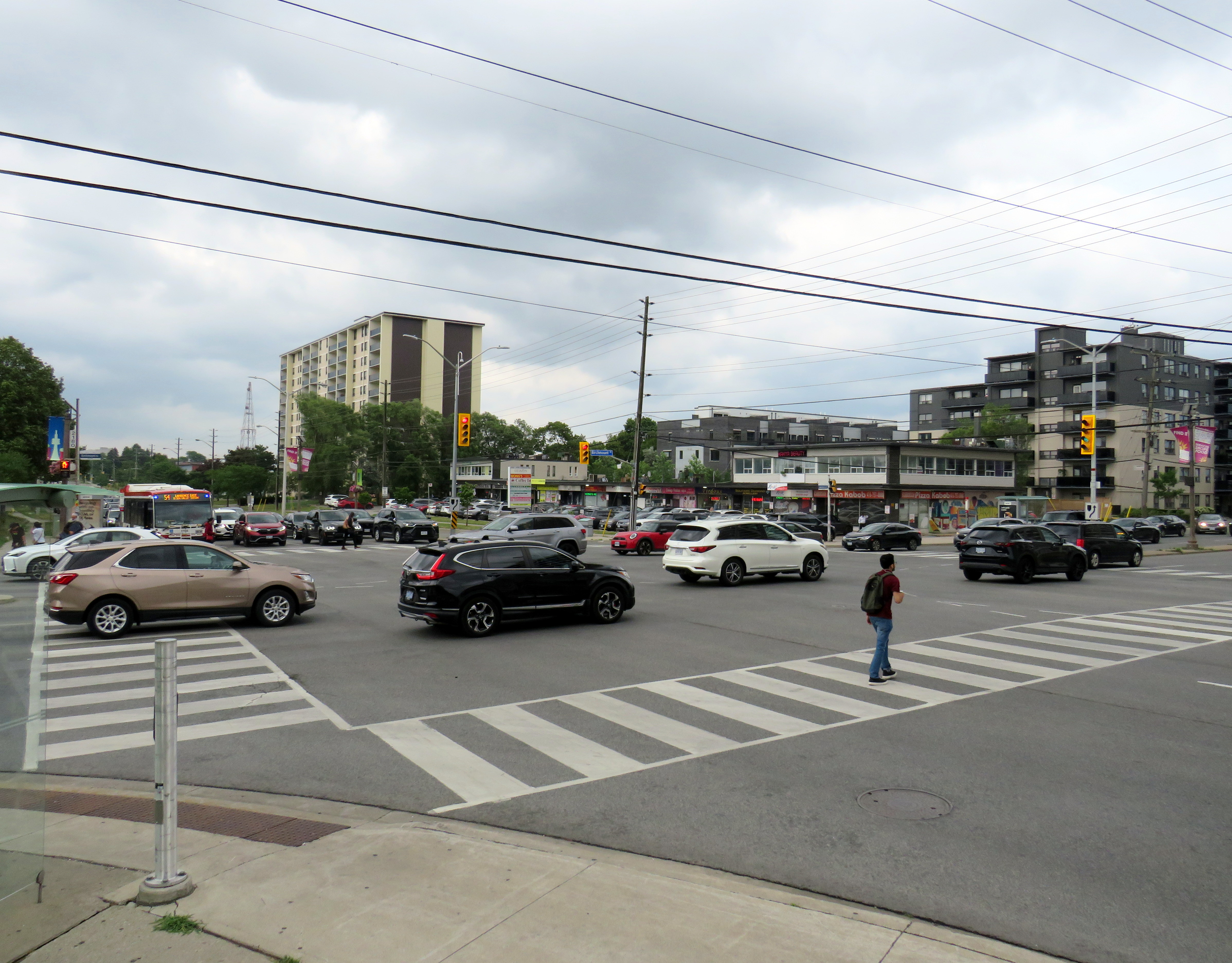
Drivers speeding through a red light on seven-lane Lawrence Avenue East at Birchmount Road. Note the temporary replacement traffic signal affixed to the median pole on the far side of the street.
As a society, we are horrified by gun violence, but generally give scant attention to deaths on our roads that result from motorists’ choices. No councillor, mayor, premier, or prime minister spoke out when two bystanders were killed in Scarborough. Their names have still not been released. There’s no follow up to the police investigation, and it has so far merited just one story in the Toronto Star, CBC Toronto, and CP24.
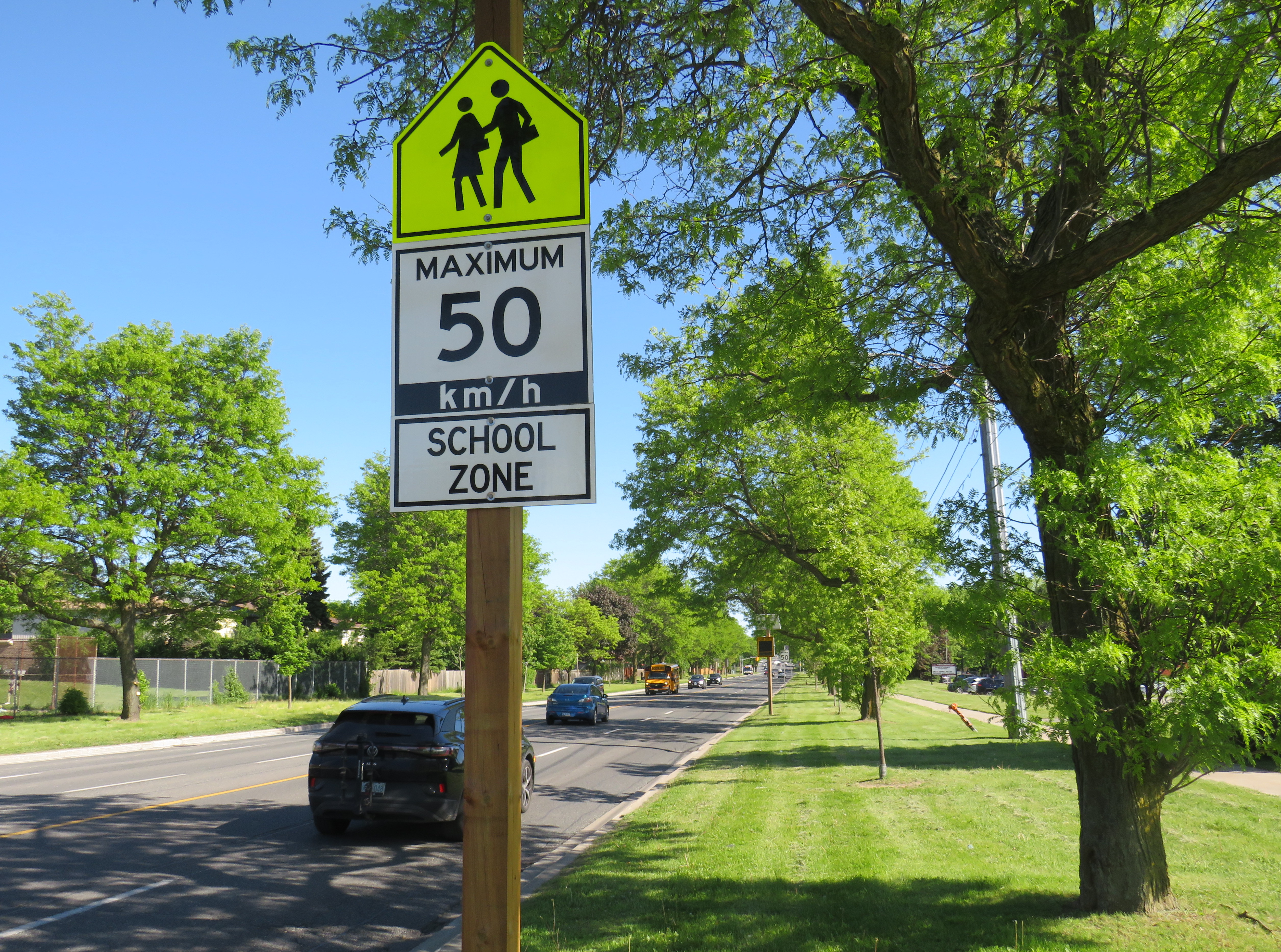
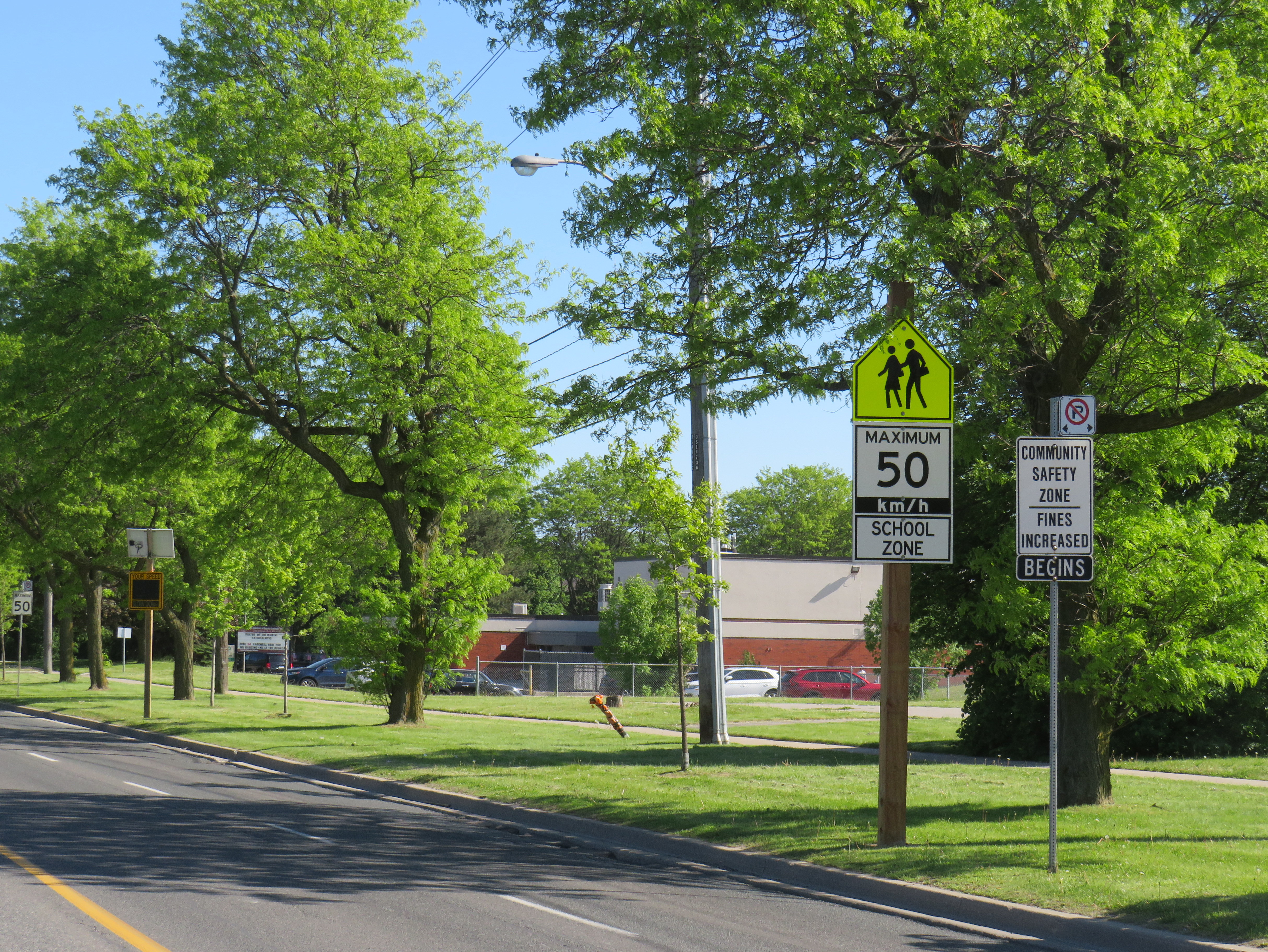
A gigantic school zone speed limit sign on McCowan Road in Scarborough
Months after Doug Ford’s provincial government banned the use of municipal speed enforcement cameras, calling it a “cash grab,” new supersized school speed zone signs are going up across the province. The first ones I encountered are on McCowan Road in Scarborough, near my spouse’s family home.
The signs, placed near St. Ignatius of Loyola Catholic School south of Finch Avenue, are gigantic: nearly 2.5 metres tall, mounted over three metres above the ground, affixed to an extra large wooden pole as the new signs were too big for the standard metal poles used for that purpose. The province delivered 80 signs to the City of Toronto, but with four signs per school zone (two mounted in each direction including advance warning signs), that meant only 20 schools would get these new totems.
The new supersized school zone sign next to an older “community safety zone” sign, affixed to a standard metal sign pole
Before the pro-driver legislation was enacted on November 14, 2025, there was a speed camera placed on McCowan Road adjacent to the elementary school, one of 150 located in the City of Toronto. Under provincial law, municipal speed cameras were only allowed to be installed in specific designated safety zones, namely roadways adjacent to schools, parks, or seniors’ residences, and had to be accompanied with advisory signage.
Between April 2024, when the camera was activated, and July 2025, when the camera was destroyed (one of many vandalized that year), over 19,000 speeding motorists were captured by the photo camera travelling at least 11 km/h over the posted speed limit. This was despite the existing maximum speed, school zone, community safety zone, and municipal speed camera signs on this stretch of road.
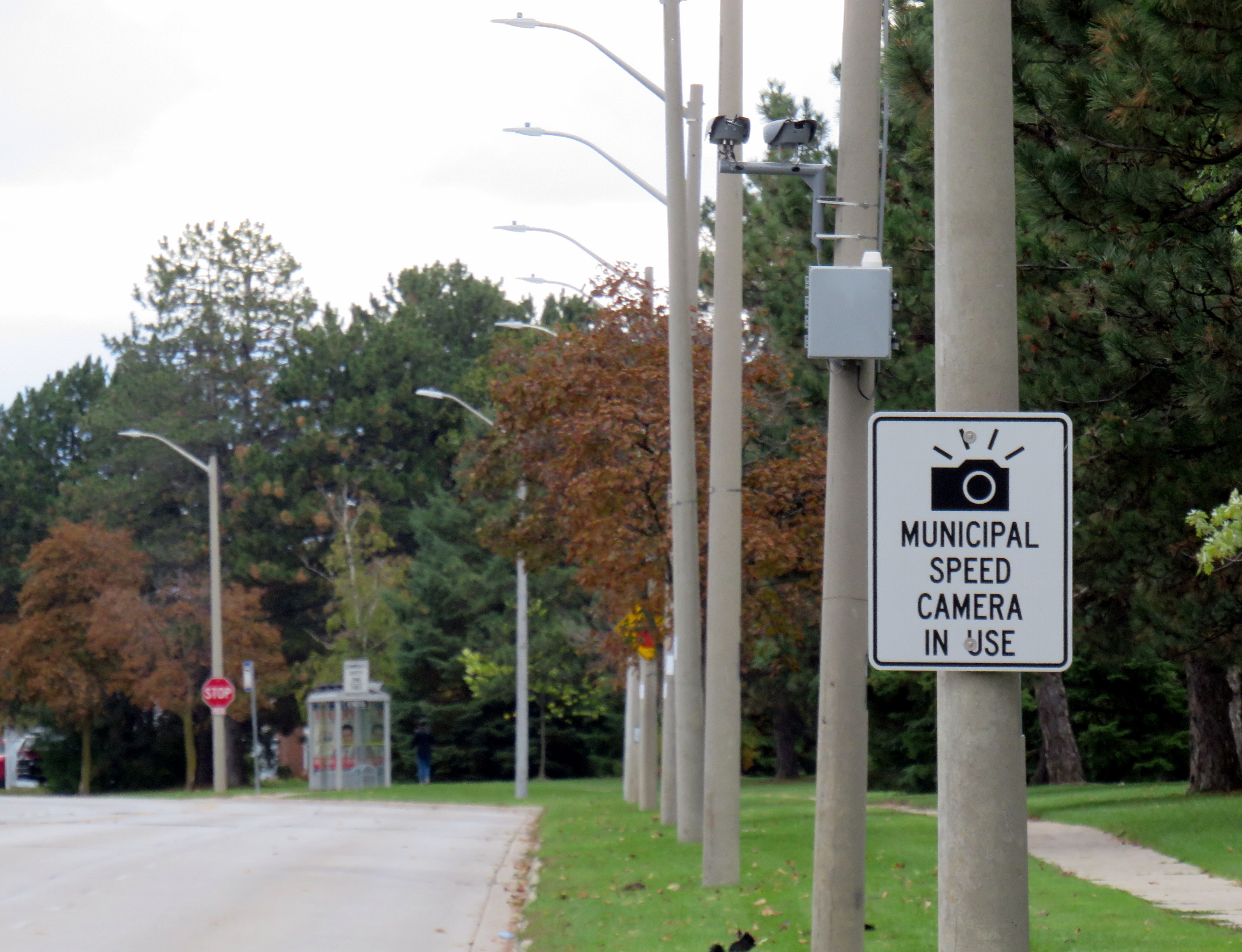
Sign warning of a municipal speed camera in Brampton in October 2025
Despite the high number of infractions, the cameras were doing their job; a job that the Toronto Police isn’t motivated — or able — to do. As seasoned municipal watcher Matt Elliot points out, for period between January 1, 2025 through November 14, 2025 (when camera enforcement was forced to end), 628,165 speeding tickets were issued through the automated speed enforcement program. Toronto Police’s “Vision Zero” traffic unit issued just 14,500 tickets.
New city report notes the Toronto Police Vision Zero Enforcement Team handed out about 14,500 speeding tickets in 2025. Might sound like a lot, but well, compare and contrast.
Despite all those tickets issued, the cameras were especially effective at reducing speeding in school zones. A 2025 Toronto Metropolitan University/SickKids Hospital study found that speed enforcement cameras reduced speeding by 45 per cent and reduced speeds by most drivers by more than 10 km/h.
Active police enforcement remains a valuable tool because officers can lay charges that automatic speed cameras can not catch, including distracted, impaired, and dangerous driving. But policing has a dark history of racial profiling and has a pro-motorist “windshield bias,” while speed enforcement and red light cameras do not discriminate.
Furthermore, North American roads are designed for excessive speed and not for the safety of vulnerable road users. We rely on signs to advise motorists of how we expect them to drive, rather than road design that requires attentive and slower driving. Speed cameras were a useful stopgap that worked a lot better than signage.
So, the new supersized signs going up are not a solution to unsafe driving: they are just another mere indication that children, seniors, and all pedestrians and cyclists don’t really matter, especially to politicians like Doug Ford.
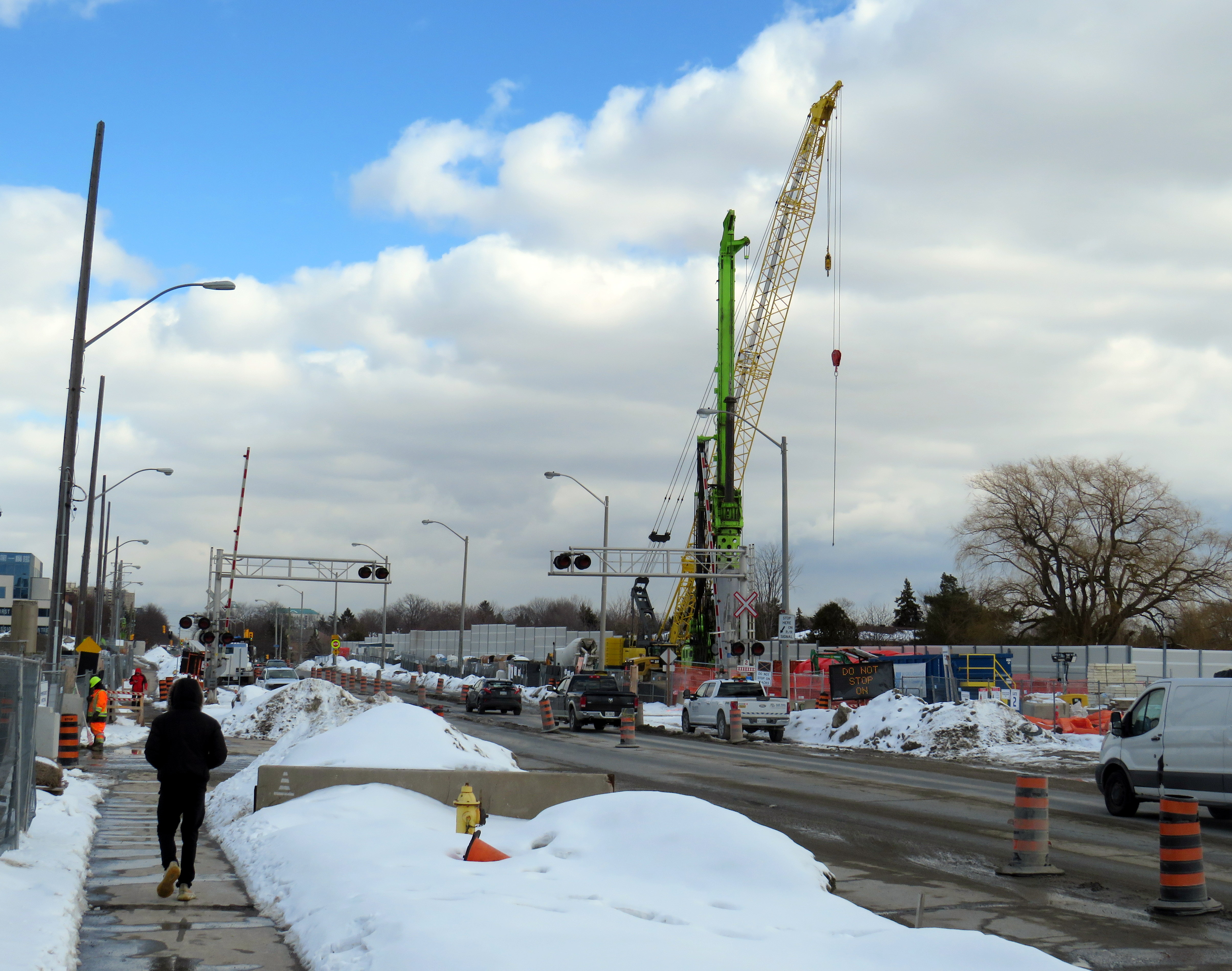
Metrolinx construction on Finch Avenue East in Scarborough
On Finch Avenue East in Scarborough, where the busy roadway meets the GO Stouffville Line, one will encounter a major construction project. Cranes and pile drivers line the railway crossing, with dozens of construction workers busy building a new grade separation between the rails and roadway. Once complete, the underpass will allow Finch Avenue traffic to pass unimpeded by more frequent GO train service and provide additional safety to all road users.
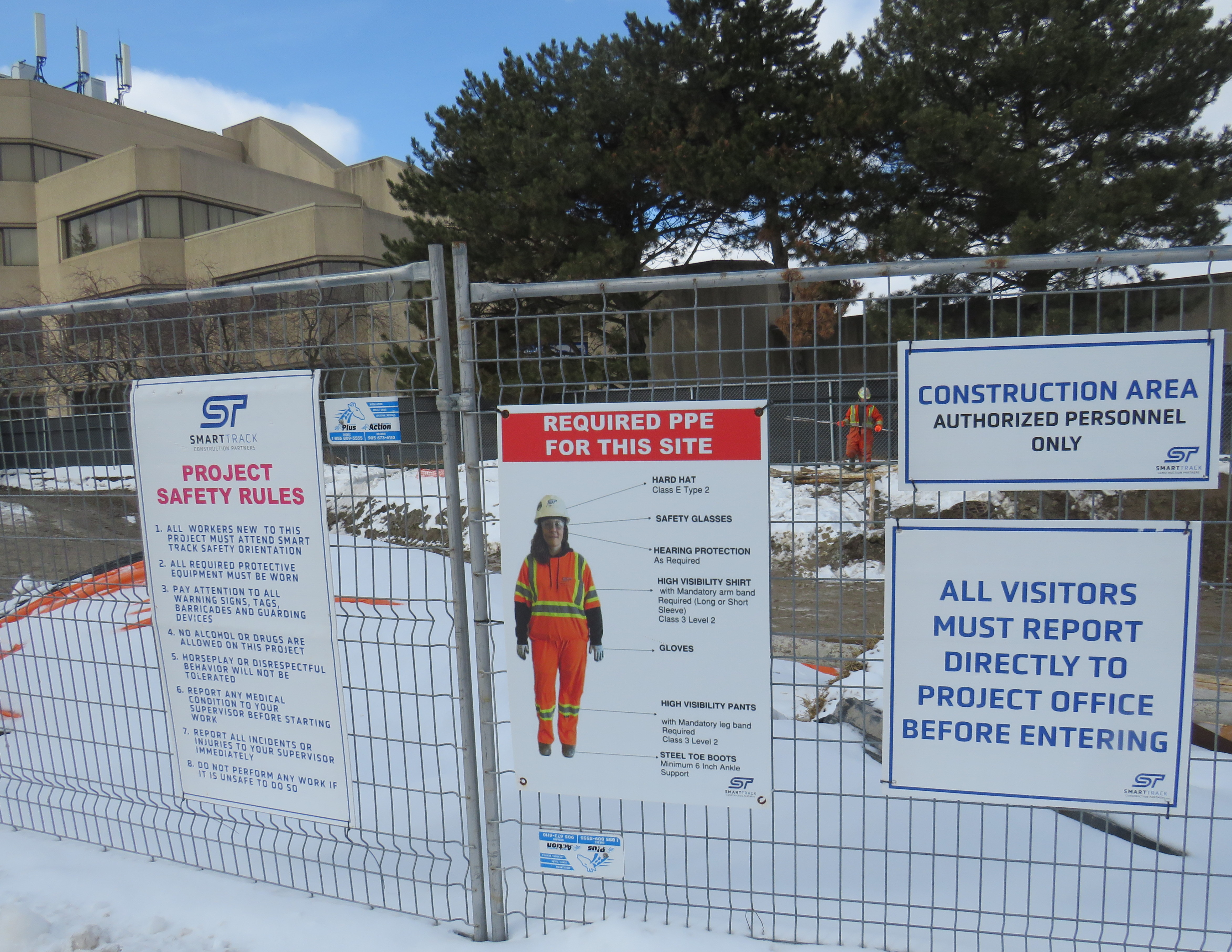
But the overpass was meant to be much more than just a rail bridge. A clue can be found in the construction site signage. Though the construction equipment is all marked for Green Infrastructure Partners (GIP), GIP is part of a project-specific consortium called “SmartTrack Construction Partners” or STCP, noted in a 2024 City of Toronto progress report. The SmartTrack name is interesting, as this was also going to be a site of a so-called SmartTrack station.
Construction site signageCloseup of another site sign, with the “SmartTrack Construction Partners” name and logo clearly displayed
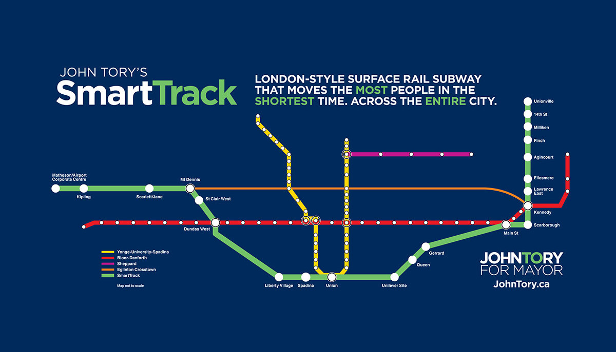
The Finch-Kennedy GO Station became part of a five-stop remnant of the SmartTrack concept, a “surface rail subway” promoted as part of John Tory’s 2014 successful mayoral campaign and subsequently made part of city policy, even maintaining the brand name. As I have written extensivelyabout the troubled proposaland failed implementation of SmartTrack on this website, I will not go into any detail. But SmartTrack promised the construction of 13 entirely new regional rail stations augmenting 9 existing or committed GO stations on the Stouffville and Kitchener corridors, including a new rail branch on Eglinton Avenue West to Mississauga. One of those stations was to be at Finch Avenue East.
“John Tory’s SmartTrack,” depicting what the “London-style” transit service would look like, from Tory’s 2014 campaign
Since 2015, the SmartTrack concept began to shrink as the difficulty of building a regional rail line on Eglinton West became clear and as other transit projects came forward. The Ontario Line, now under construction, fills the downtown subway relief function that SmartTrack promised. The tunneled western extension of Line 5 from Mount Dennis to Renforth replaces the problematic western section of Tory’s proposal. Furthermore, GO Expansion would transform much of the GO rail network into a more frequent, all-day service on five of its seven lines would provide more service to more stations than SmartTrack ever could. (Unfortunately, Metrolinx is dragging its heels on GO’s transformation.) Even better, all these projects were promoted and funded by the province, while SmartTrack was a municipal effort.
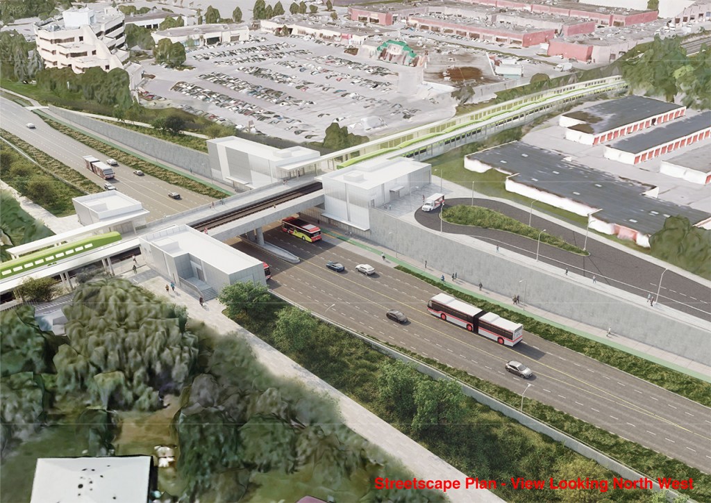
But Finch SmartTrack Station, referred to in official planning materials as “Finch-Kennedy,” survived a whole decade, one of four remaining city-funded SmartTrack-branded stops from that early campaign map (a fifth stop was later added to the Barrie GO Corridor, at Bloor Street). Even as a regular GO Transit stop, Finch-Kennedy would have been quite useful for Scarborough commuters as well as promote new mixed-use development in northeastern Toronto. Surrounding the site are commercial plazas and industrial malls, self-storage units, and low-density residential subdivisions. The streetscape plan of the station below illustrates the site’s surroundings.
As planned, Finch-Kennedy Station would have been a no-frills rapid transit stop, with two tracks and platforms that span the Finch Avenue overpass. Access between the street (with curbside bus stops) and platforms would have been easy and direct, with stairs and elevators connecting the two modes on both sides of the street. With more frequent GO service facilitated by the double track expansion of the corridor, and proposed electrification, the Stouffville Line would have been a really useful link between the frequent 39/939 bus route (the busiest bus corridor in Toronto) to Union Station, the transfers to Lines 2 and 5 at Kennedy Station, and to Markham to the north. There would be no parking on-site, but just an access driveway on the northeast corner for service vehicles.
Though GO could double track the Stouffville Corridor and run more frequent trains without the grade separation if no station was to be built at Finch, an underpass would be necessary if trains were going to decelerate, stop, and accelerate within a short proximity of Finch Avenue. Building the platforms on the bridge structure only makes transit connections easier.
Due to cost overruns, SmartTrack is down to just three stations, which are now in various stages of construction. Along with King-Liberty, Finch-Kennedy was dropped from the list in December 2024, even as construction on the first and most critical phase, the Finch underpass, was already underway. Earlier this week, the Toronto Star reported that nearly $100 million were spent on these two now-deferred stations. The cost of completing Finch-Kennedy had jumped by $130 million, to a total of almost $370 million.
Even though the station is deferred, heavy construction continues on Finch Avenue East. The SmartTrack name lives on through the firm tasked with finishing the grade separation intended to literally support the new transit connection. Presumably, the bridge will be built with provision for the transit station to be added later. But it will only be even more expensive to go back later and complete the job.
Meanwhile, after resigning in disgrace in Winter 2023, not long after his re-election, John Tory is rumoured to make another run for mayor against his replacement, Olivia Chow. Tory will have a lot to answer for if he chooses to run again; the tattered remains of his SmartTrack legacy should certainly be one of those questions.
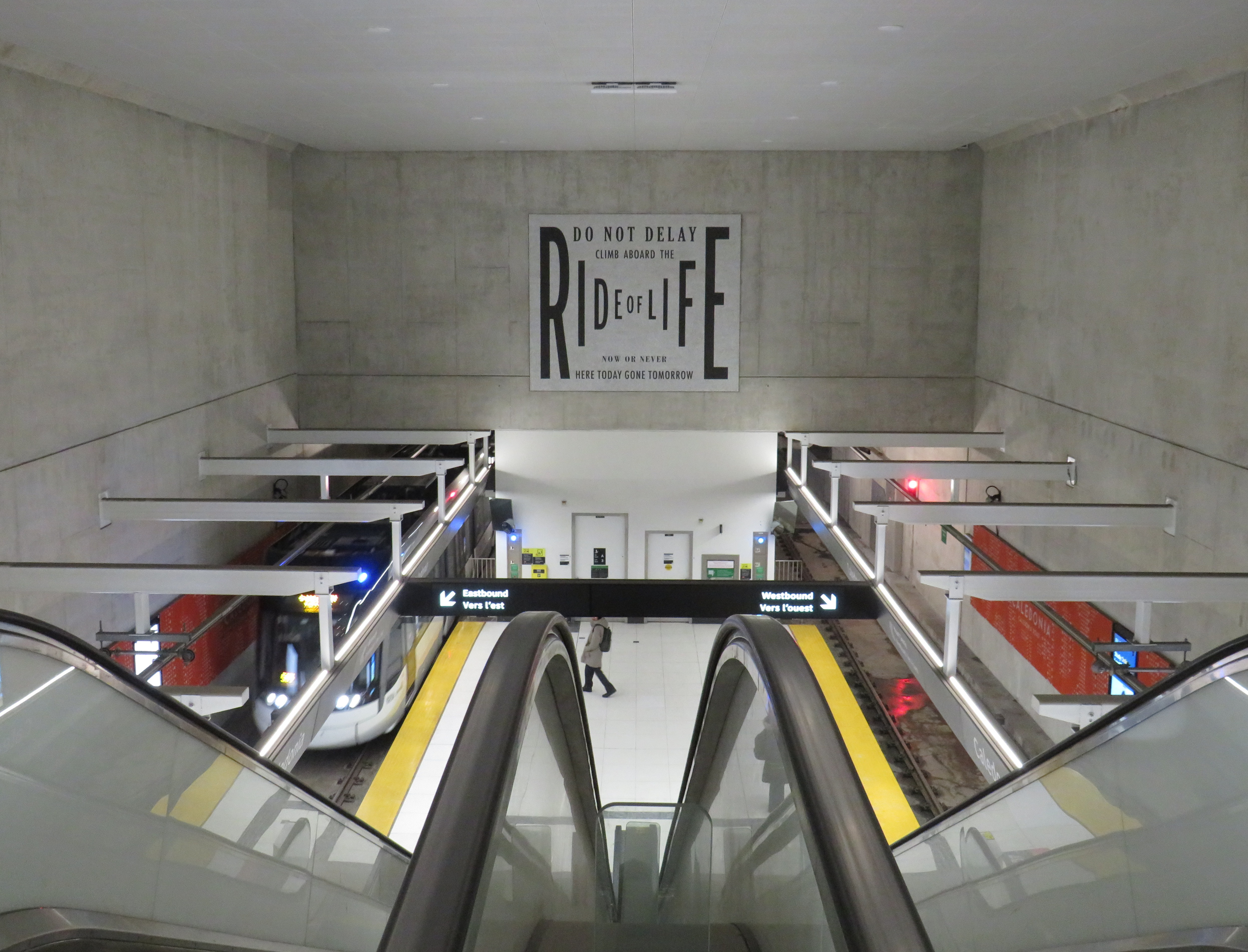
On Sunday, February 8 the Eglinton-Crosstown LRT opened to the public without any pomp or circumstance. Perhaps embarrassed by the public’s reaction to Line 6 Finch West, there were no giveaways, no parties, and no promotional materials. That turned out to be a shame, in a way, because Line 5 seems to be alright so far, a week after its initial opening. Travel times on the LRT are improved over the previous 32 and 34 bus routes, though with lesser speed improvements on the surface section versus the western portion. The two-car Bombardier Flexity trains do not crawl through intersections on Eglinton Avenue East unlike the single-car Alstom Citadis Spirits on Finch Avenue West.
Furthermore, learning some lessons from the botched Line 6 launch, the TTC — the operator of Line 5 trains — is looking for public feedback and promises improvements to speed and frequencies later in 2026. There are certainly ways in which this line can improve further. All that said, the Eglinton-Crosstown LRT offers needed optimism for Toronto’s transit future, especially as more projects are underway.
Mostly smooth operation of Line 5 during the first week(more…)
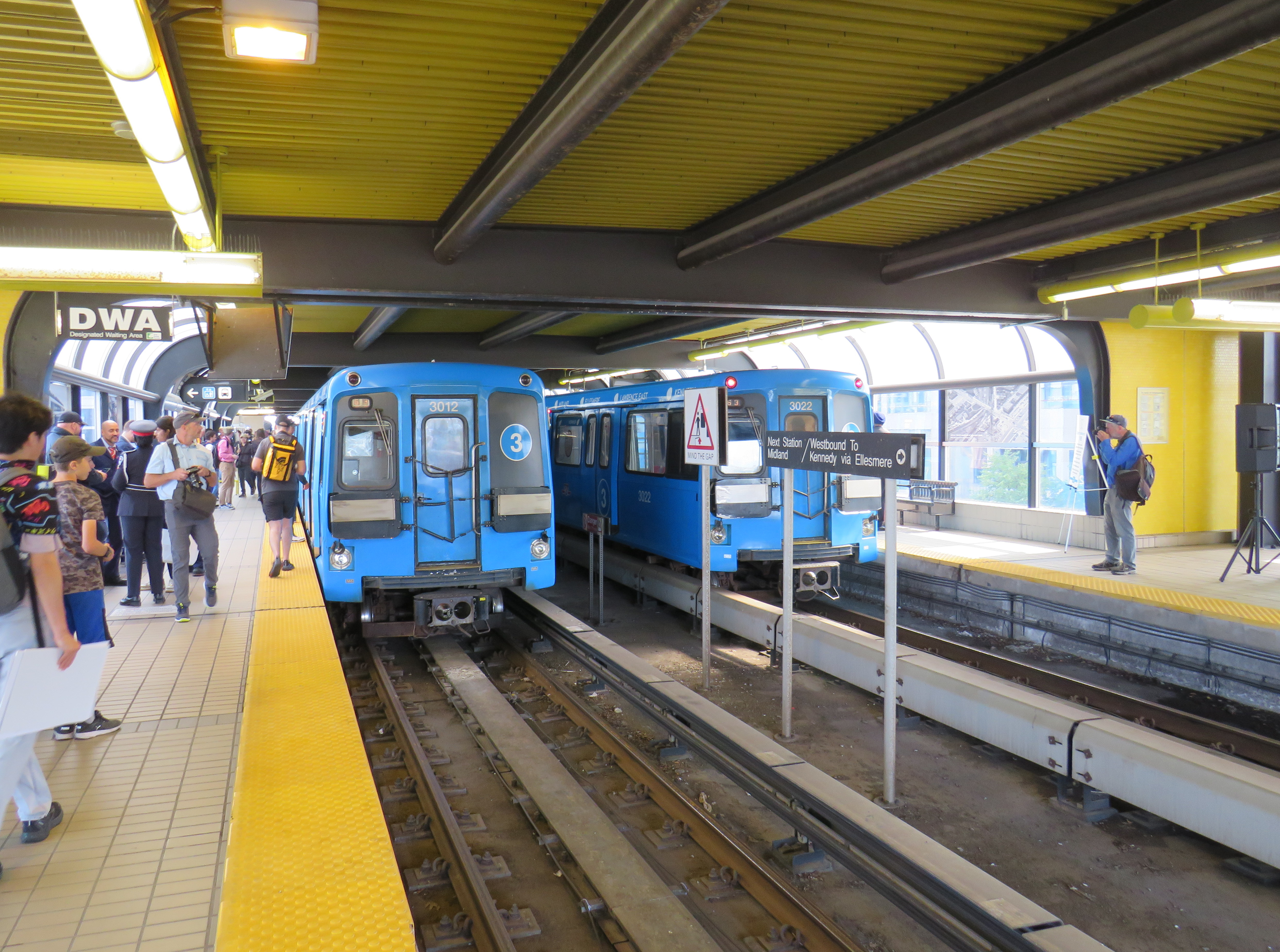
On July 24, 2023, 38 years of Line 3, the Scarborough RT, came to an ignoble end when a car came off the tracks just south of Ellesmere Station, four months ahead of the scheduled closure of the deteriorating line. Though the City of Toronto and the Toronto Transit Commission (TTC) were hesitant to say so at the time, it was apparent that the July derailment meant Line 3’s permanent closure. A farewell party, with two SRT cars, was held at Scarborough Centre Station on September 23, 2023, allowing the public to have one last sit in the venerable cars.
I went to check out the new temporary bus lanes on Midland and Kennedy, installed ahead of a planned busway between Kennedy and Ellesmere Stations. The busway, which will open in 2025 after the old SRT right-of-way is decommissioned, will include a new stop at Tara Avenue, at the Meadoway trail.
In the meantime, most drivers appear to be respecting the new painted lanes, even on busy Kennedy Road. With several bus routes from north and east Scarborough diverted to Kennedy Station to provide a more pleasant ride, the bus lanes are very well used.
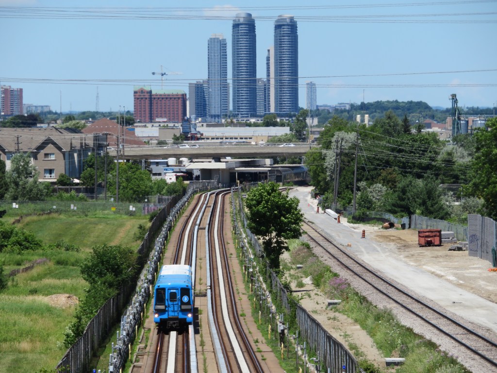
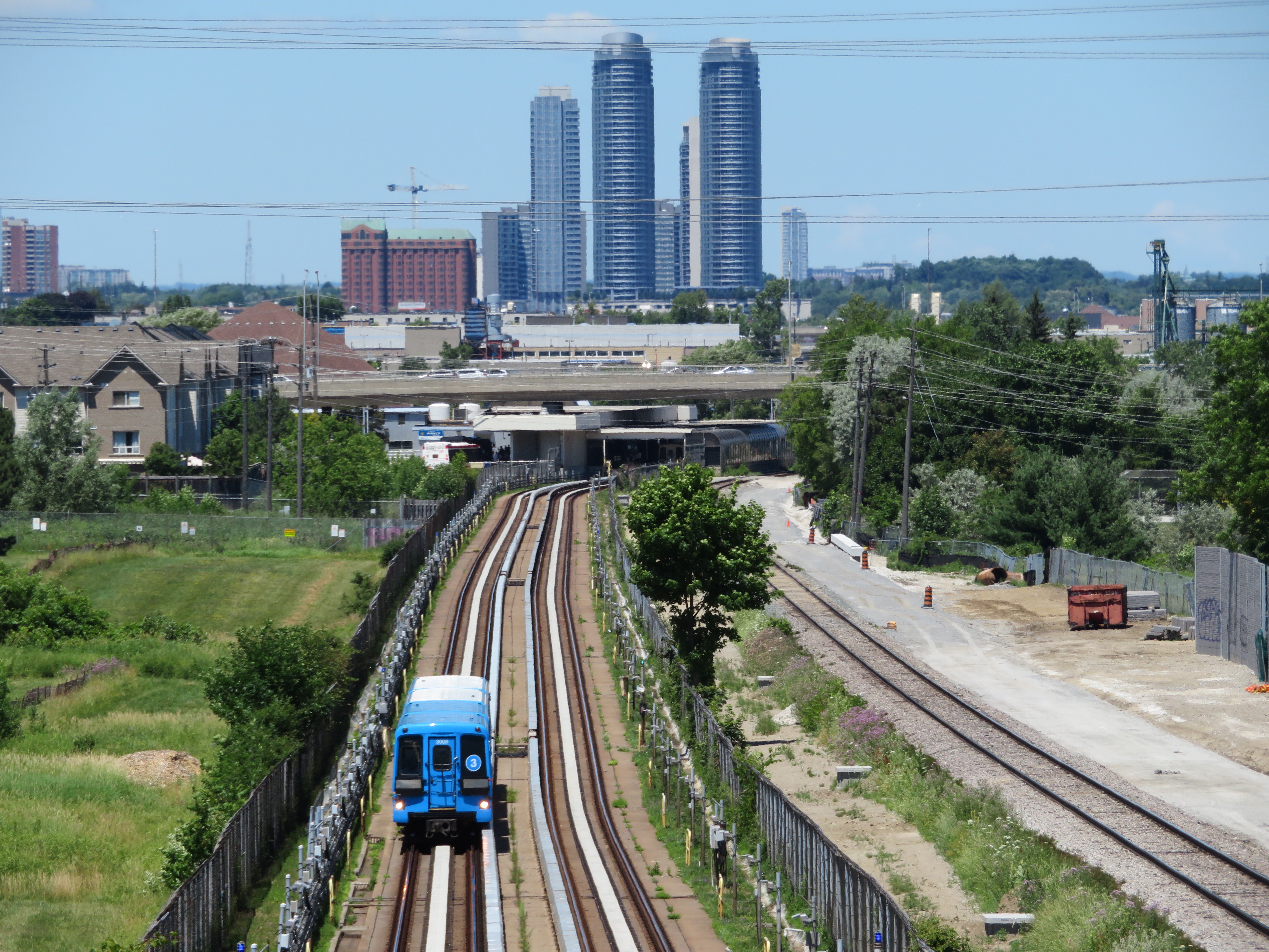
2018 view of the Scarborough RT, looking north towards Ellesmere Station
On Monday July 24, at 6:45 AM, a Scarborough RT car on Line 3 derailed soon after departing Ellesmere Station. Forty-five passengers were on board, and five suffered minor injuries. The Scarborough RT, which opened in March 1985, was suspended, and then permanently closed, four months ahead of its planned shutdown on November 18, 2023. For the first time in its history, Toronto’s rapid transit map has shrunk.
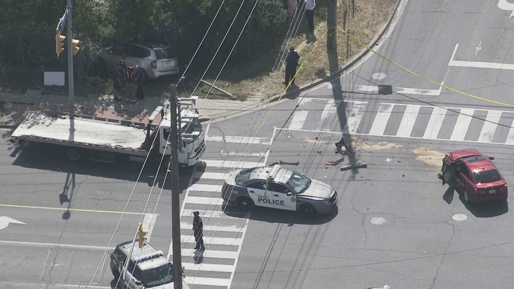
On Thursday, July 21, 2022, at 3:10 PM, a 38-year-old man was standing at a street corner in Scarborough, waiting for a signal to safely cross to the other side. Before he even had the chance to enter the intersection of Warden Avenue at Comstock Road, a driver of a 2009 silver Kia minivan heading south on Warden struck a 2012 red Lexus, whose driver was making a left turn from Warden to Comstock.
Aerial view of the collision, courtesy of CTV News. The Kia minivan struck a 38-year-old man waiting at the corner before plowing into a fence protecting a vacant lot.
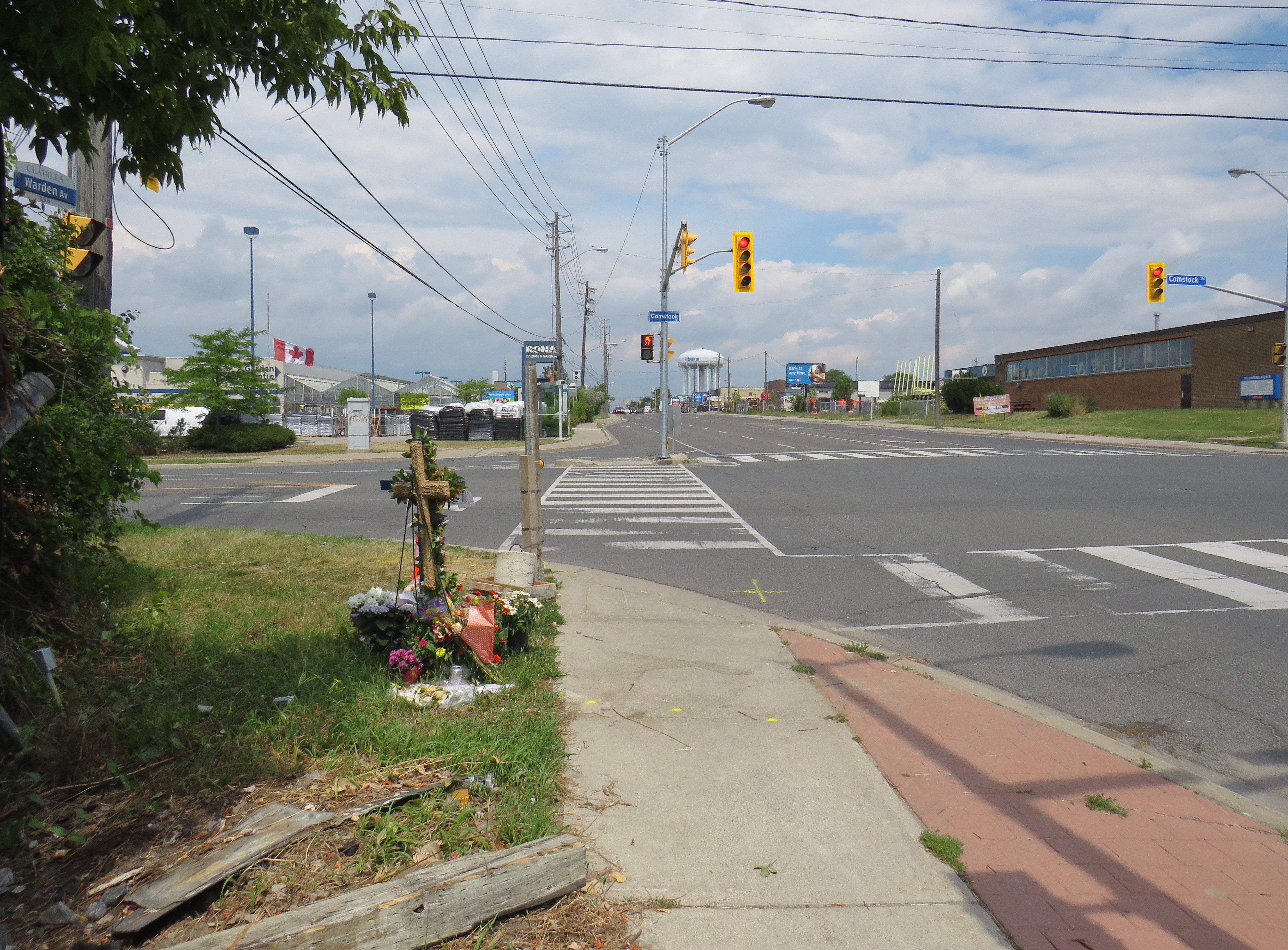
A week after the deadly collision, I visited the intersection. On the southwest corner of Warden and Comstock, a roadside memorial was set up with flowers and a wooden cross. A temporary wooden pole held up a new pedestrian “beg button” for walkers to get across Warden Avenue. The Kia’s path into the sidewalk and the fence was very much visible, though all debris from the collision was cleaned up.
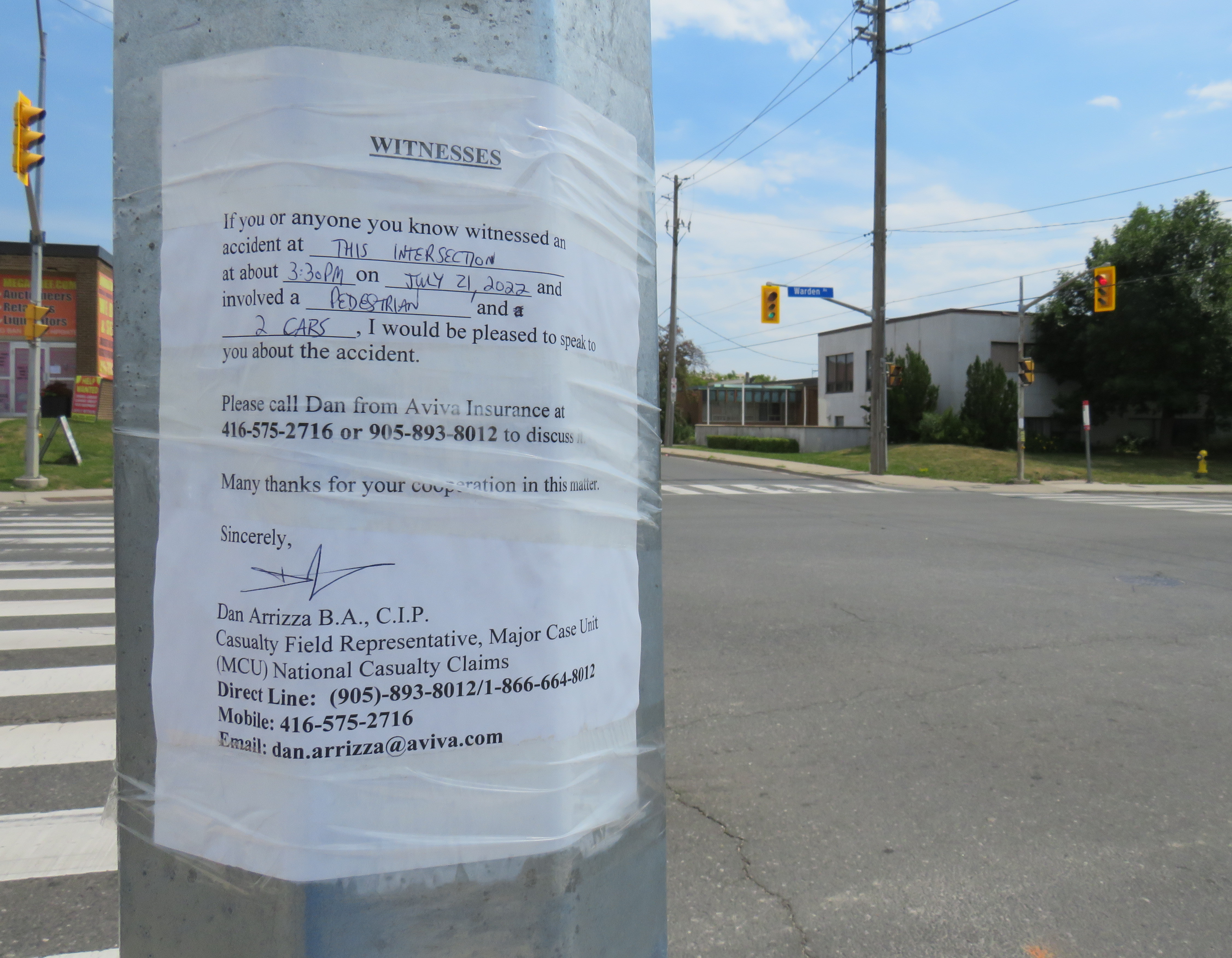
Appeal to witnesses following a deadly collision at Warden Avenue and Comstock Road
The collision was still being investigated. While the Toronto Police were looking for witnesses to the collision, an investigator from Aviva Insurance was also looking for witnesses; several notices were taped to nearby traffic poles.
Without knowing all the facts of the collision — which are unlikely to be reported in the news media — it would be fair to assume that speed and/or inattentive driving were at fault, but the design of the intersection — as well as Warden Avenue and Comstock Road themselves — are also to blame.
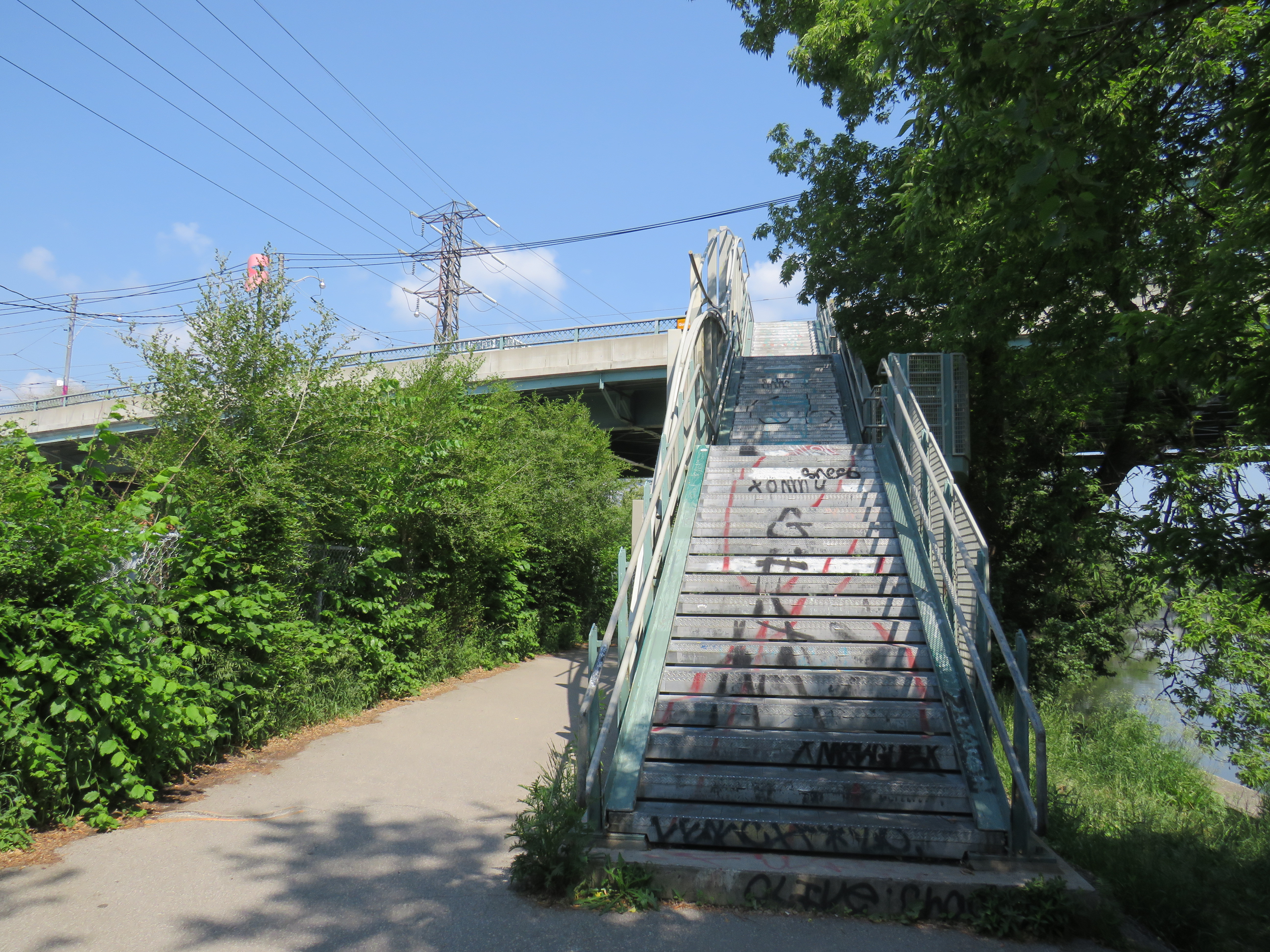
A partially hidden stairway on Dupont Street leads to the site of the lost CP West Toronto Station
Since 1853, the year that the Ontario, Simcoe & Huron Railway first laid track at the city’s waterfront, Toronto has been criss-crossed by rail corridors. With the exception of the Ontario & Quebec Railway (a subsidiary of Canadian Pacific), every rail line built converged on Toronto’s downtown waterfront, and radiated out across the province, with connections to neighbouring provinces and states. Though Toronto’s first Union Station was built in 1858 by the Grand Trunk Railway (which also hosted two competing railways that the GTR later acquired), there was still a need for smaller stations outside the downtown core.
Outlying stations within the city limits, such as East Toronto (Danforth), Riverdale, and Don Stations in the east, Parkdale, West Toronto, Davenport, and Sunnyside Stations in the west, were particularly important prior to modern dispatch and signalling systems. Station agents at stops outside the city centre were useful to commuters, while the station agent would deliver important messages to train crews entering the congested downtown railyards and passenger facilities. Mail could be collected, delivered, and processed for local residents and businesses. Passengers could purchase tickets without needing to go all the way downtown.
In the early 1900s, Canadian Pacific — tired of delays with constructing a new third Union Station — built a grand station where its original Ontario & Quebec mainline crossed Yonge Street. Though the station was popular with the area’s affluent residents, CP closed the station during the Depression. (Today, it’s a magnificent LCBO flagship store.)
Outside the old City of Toronto, there were staffed passenger stations at Long Branch, Mimico, Scarborough Junction, Port Union, Agincourt, Leaside, Downsview, Weston, and Islington.
By the end of the 1960s, many of these stations were closed. In southern Ontario, mail was being sent by truck instead of rail, sorted in large processing facilities. The loss of the mail contracts spelled the end of many rural passenger rail services. Modern centralized traffic control and wireless communication systems did away for the need for station staff to relay messages and orders to passing trains. Though there were still dozens of passenger trains arriving and departing Union Station, these trains, mostly on the Montreal-Windsor corridor, made fewer stops. In 1967, GO Transit replaced the remaining all-stops commuter service on CN’s line between Hamilton and Toronto; it eventually replaced most of CN’s stations on what are now the Lakeshore, Kitchener, and Stouffville Lines with new station stops or built new facilities at old station sites that better served suburban park-and-ride commuters. GO also added new stations such as Guildwood, Bloor, and Old Cummer.
Within the City of Toronto, there are only four passenger railway station buildings preserved: Union Station, CP North Toronto Station, Mimico Station, and Don Station. Mimico and Don Stations were moved off-site, while only Union Station remains in continuous passenger service. Other stations burned down, were demolished, or were simply left to rot. In a few places, though, old staircases provide clues to these long-lost stations.
Don Station
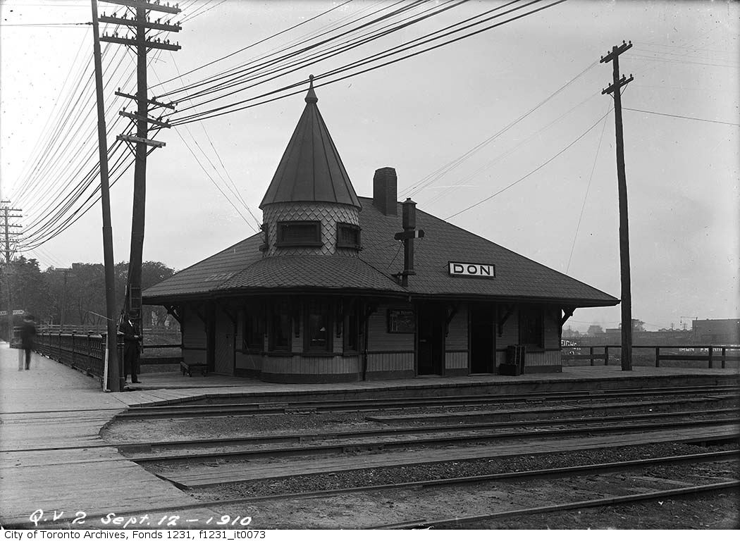
Don Station was built by CP in 1896 to serve its new branch to Union Station from the Ontario & Quebec mainline at Leaside. Located at Queen Street at the Don River, it was an important waystation for train crews to receive orders before arriving at Union Station or before departing northeastward on the long trestle towards Leaside and Montreal. When Canadian Northern built its mainline through the Don Valley in 1906, it shared the approach tracks with CP and also used Don Station.
Originally, the CP and CNoR tracks crossed Queen Street at grade. After a catastrophic streetcar-train crash further east on Queen Street, the City of Toronto pushed to grade-separate all major road crossings. In 1911, a higher-level bridge was built that spanned the Don River and the railway tracks. Today, it also spans the Don Valley Parkway.
The station closed in 1967 when the Toronto-Peterborough-Havelock train stopped serving Don, and the station building was moved to Todmorden Mills in 1969. In 2008, the station was moved again, to Roundhouse Park. It now hosts passenger trains again; albeit a miniature train operated by the Toronto Railway Museum.
The original wooden stairway from Queen Street that connected to Don Station was removed by the early 1960s and replaced by a metal staircase. The metal structure has since been refurbished and now connects Queen Street with the Lower Don Trail.
Stairway from the Lower Don Trail to Queen Street EastDon Station in 1910, before the higher-level Queen Street bridge was constructed –City of Toronto Archives Fonds 1231, Item 73
Parkdale CN Station
Sealed portal to CN Parkdale Station
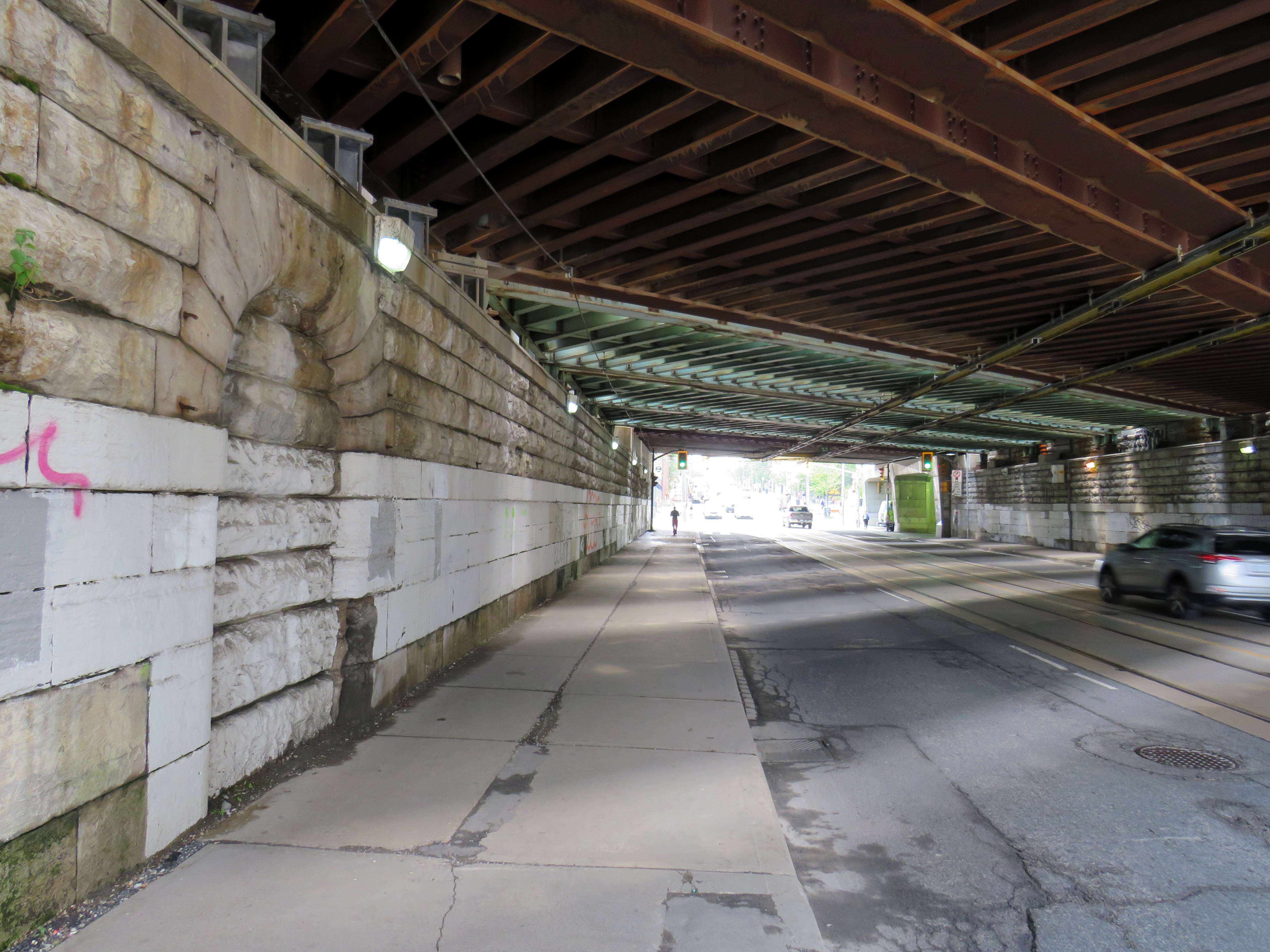
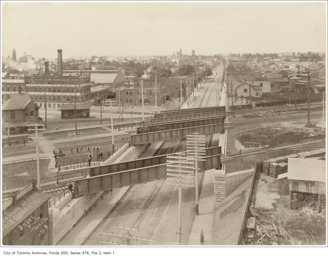
Until 1960, every train on the Toronto-Kitchener-London route made a stop at Parkdale, near the corner of Queen and Bathurst Streets. The Queen Street Subway, completed in 1898, was one of the first road-rail grade separations in the city. The underpass allowed streetcars and traffic to avoid the multiple Grand Trunk and Canadian Pacific mainline and service tracks that crossed Queen Street. Both Grand Trunk (later CN) and CP had stations at Parkdale, though the wooden GTR/CN station was located between the tracks and had to be accessed by a stairway from the south side of the Queen Street underpass.
A bricked up archway betrays the old passage to the now-demolished station.
The new Queen Street Subway, 1898. Parkdale CN Station is to the left of this image, but the stairway down to street level is clearly visible. –City of Toronto Archives Fonds 200, Series 376, File 2, Item 1Old streetcars headed to Haileybury, Ontario pass by the CN Parkdale Station on October 14, 1922. The streetcars, which were slated for scrapping, where being sent north to provide shelter after a disastrous forest fire. – City of Toronto Archives Fonds 16, Series 71, Item 1601
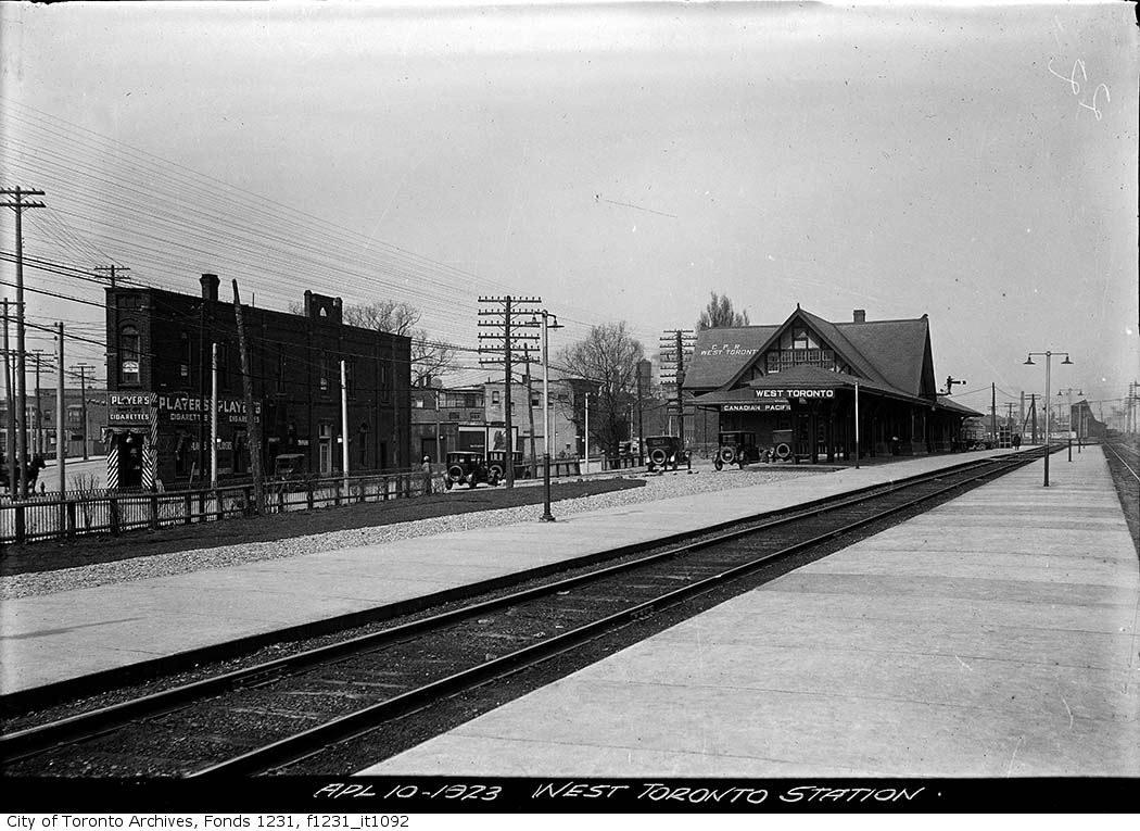
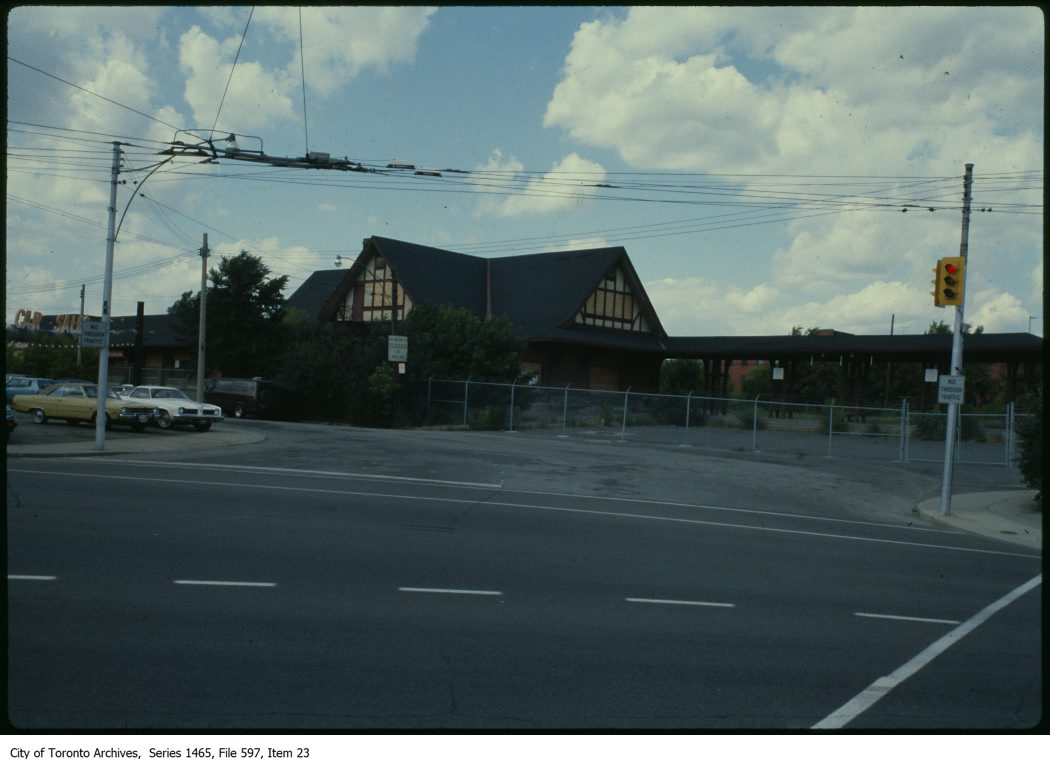
West Toronto CP Station
Both CN and CP had stations at West Toronto. The Grand Trunk (later CN) station was located on Old Weston Road near Davenport Road. The CN station closed in the early 1980s and was demolished in 1999 after being left abandoned to the elements and vandals.
The CP station was located to the south, on Old Weston Road just north of Dupont and Dundas Streets. As the town of West Toronto (originally known as Toronto Junction) built up around the junction between CP’s Ontario & Quebec, Credit Valley, and Toronto, Grey and Bruce Railways, the CP station was the pride of the community. The last station on the site, completed in 1911, was a large building in the Tudor style, with a long canopy. The last train to serve West Toronto, CP’s Canadian, departed in 1978, and CP controversially demolished the station under cover of darkness in 1982.
CP West Toronto Station, 1923 – City of Toronto Archives, Fonds 1231, Item 1092CP West Toronto Station just prior to demolition in 1982 – City of Toronto Archives, Series 1464, File 597, Item 23
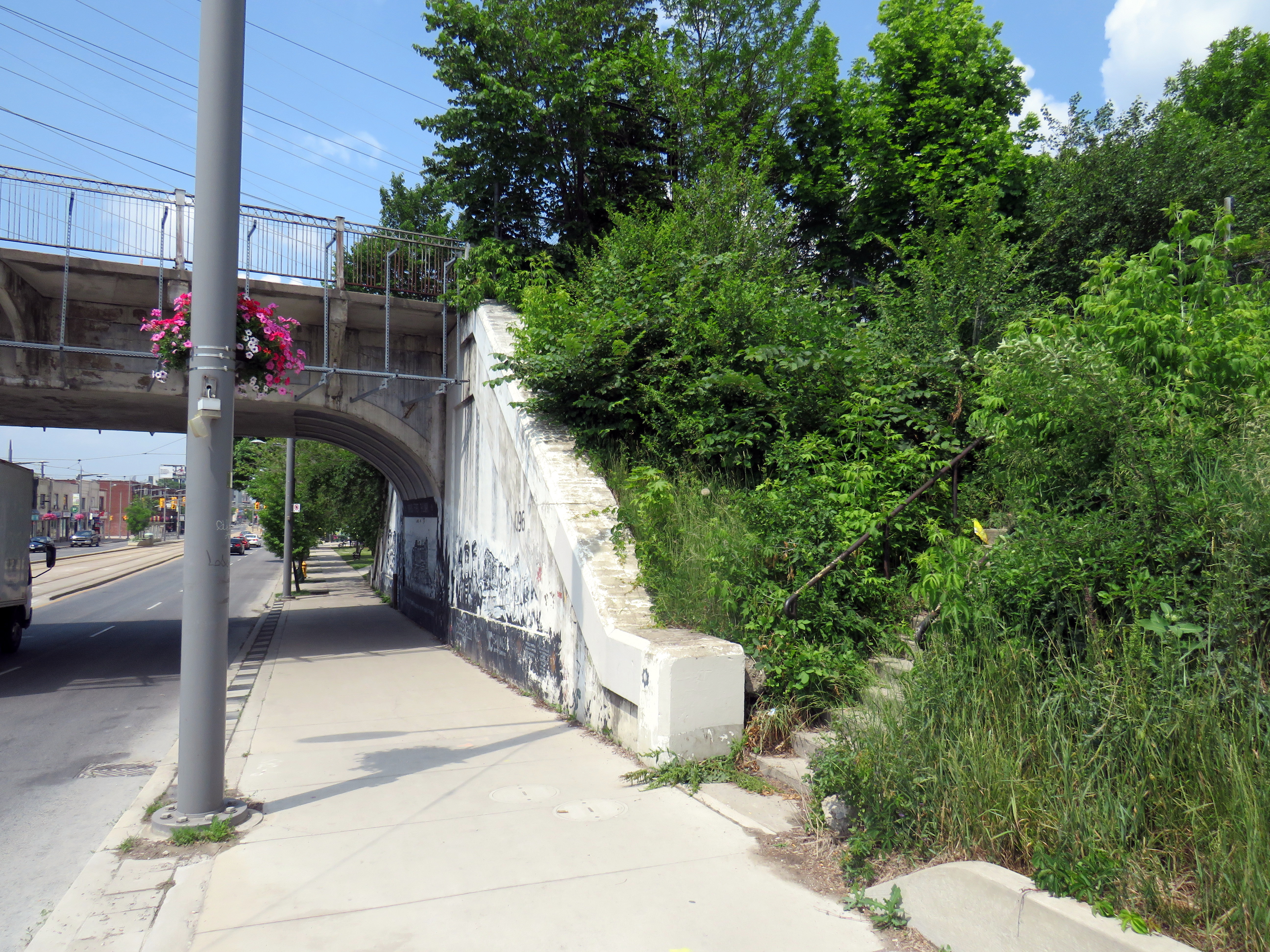
At the south end of the station platform, a stairway led down to the north side of Dupont Street. Though it is fenced off, the stairway is still very much visible just west of the railway underpass. The concrete retaining wall has been brightened up by local graffiti artists.
Fenced-off stairway from the north side of Dupont Street, just east of Dundas Street, leads to the site of the now-demolished CP West Toronto Station
St. Clair Avenue Station
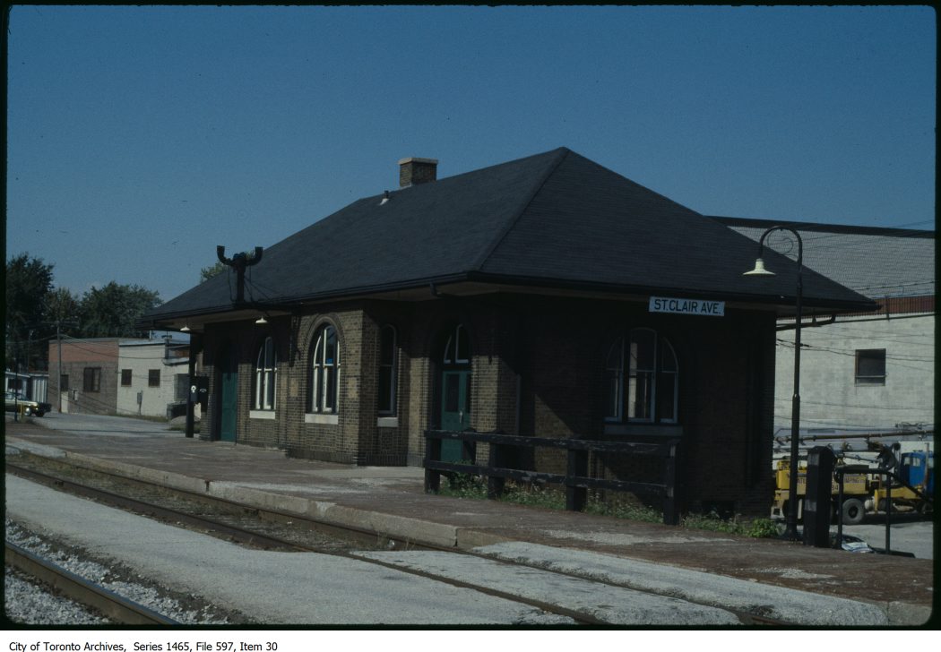
CN St. Clair Avenue Station just prior to its final closure, c. 1983 – City of Toronto Archives, Series 1465, File 597, Item 30
St. Clair Avenue Station was completed in 1931, as part of a grade separation project that finally allowed through streetcar service on St. Clair West. The small brick structure replaced an older station at Davenport Road, which was soon demolished.
St. Clair Avenue served CN trains between Toronto, Northern Ontario, and Western Canada, though passenger services declined through the 1960s and 1970s. When GO Transit took over the local Barrie train from VIA, it cut the stop at St. Clair Avenue. The station was closed for good when VIA’s Canadian was rerouted from the CN Newmarket Subdivision in 1985. Like other disused passenger stations, the building suffered from neglect, vandalism, and arson, before being demolished by CN in 1999.
The remains of the station platform are still visible from the east side of GO trains on the north side of St. Clair, especially in winter and early spring. From St. Clair Avenue itself, a stairway, partially hidden by greenery, leads up to the old station site.
Abandoned stairway north from St. Clair Avenue West, near Caledonia Road, leads to the site of the CN St. Clair Avenue Station
Exhibition Station
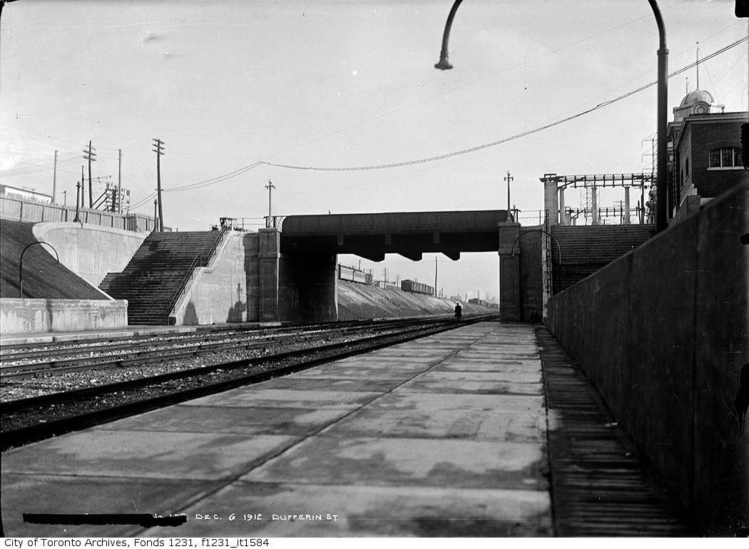
New Grand Trunk Railway Exhibition Station, 1912. City of Toronto Archives, Fonds 1231, Item 1584
In 1912, the Grand Trunk Railway opened a new station that was intended to see train service for only a few weeks a year. Exhibition Station, constructed at the foot of Dufferin Street, was an anomaly. It had no full-time station agent, but it featured wide platforms and staircases leading up to Exhibition Place’s Dufferin Gates. Special trains during the Canadian National Exhibition would quickly load and offload fairgoers. As CP, through its part-ownership of the Toronto, Hamilton & Buffalo Railway, had running rights on the GTR/CN tracks between Union Station and Hamilton, it too, could send trains direct to the CNE.
Exhibition Station remained in use until the early years of GO Transit, when it built a new station farther east in the early 1970s. Upgraded since then, the current Exhibition Station will become a multimodal hub with the construction of the Ontario Line. Meanwhile, the old stairways and platforms remain, though fenced off.
Stairway down to the westbound platform at the old CN Exhibition Station at Dufferin Street
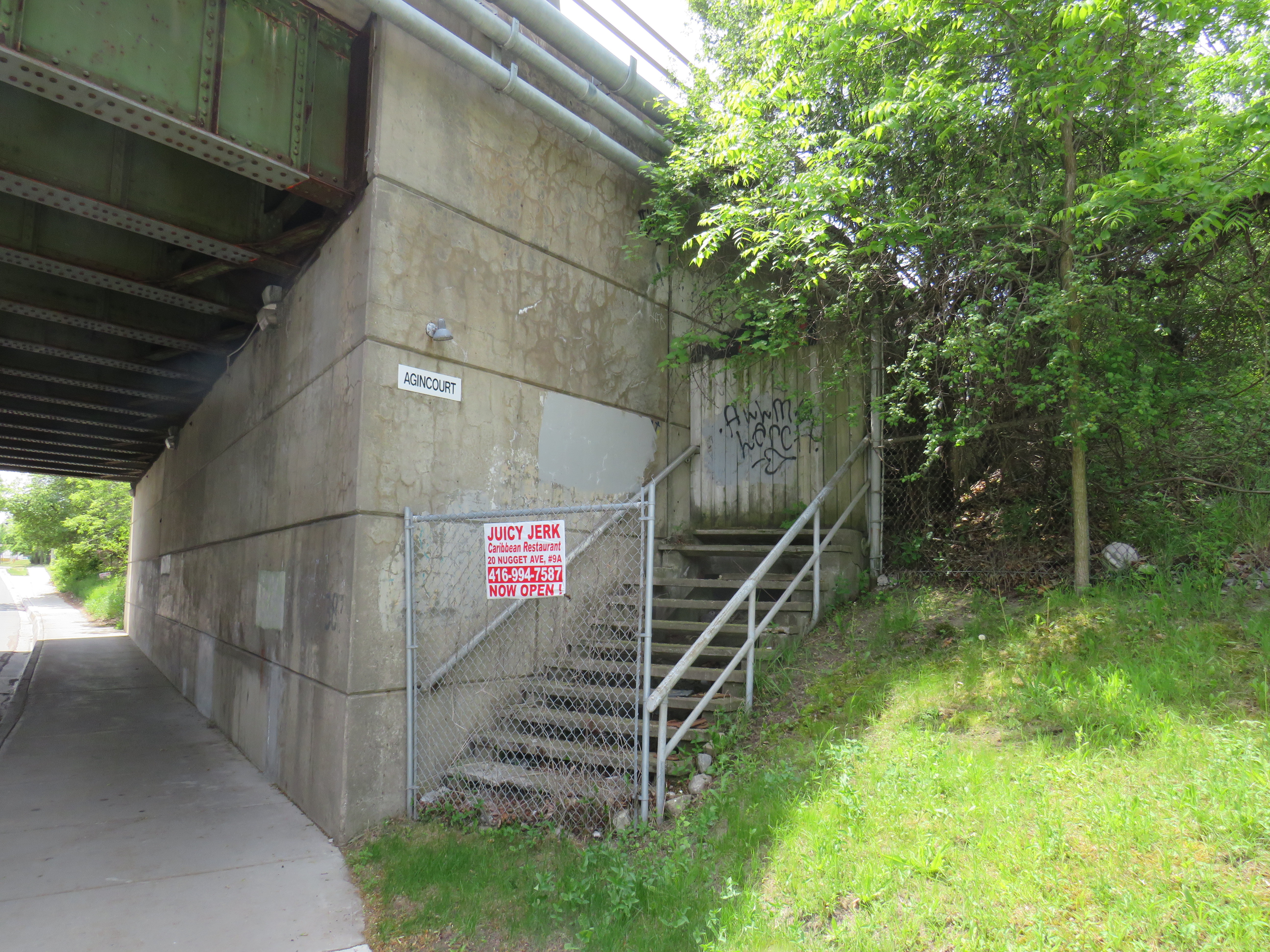
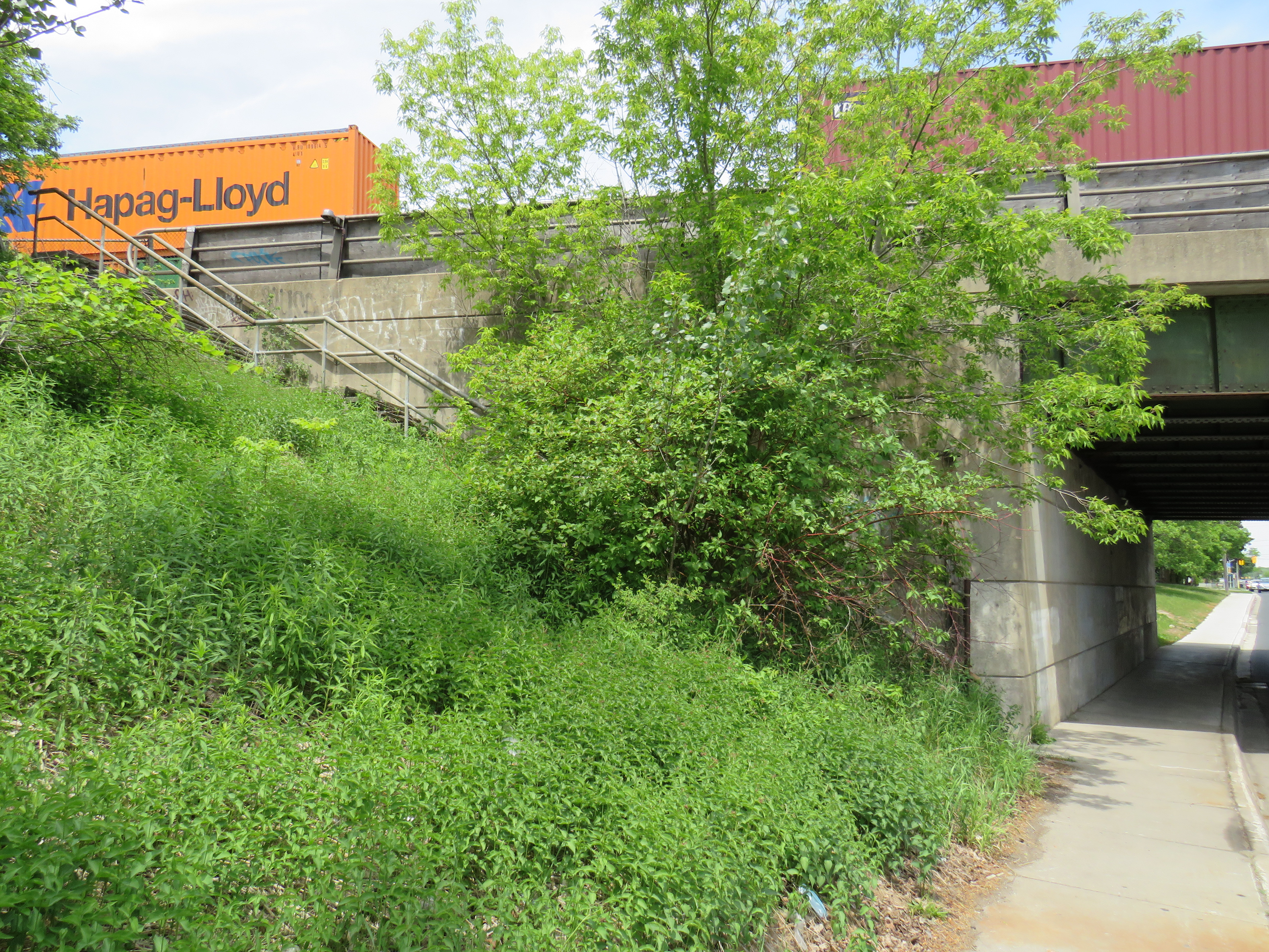
Agincourt CP Station
North side stairway at Brimley Avenue. Note the sign reading “Agincourt” on the underpass structure.
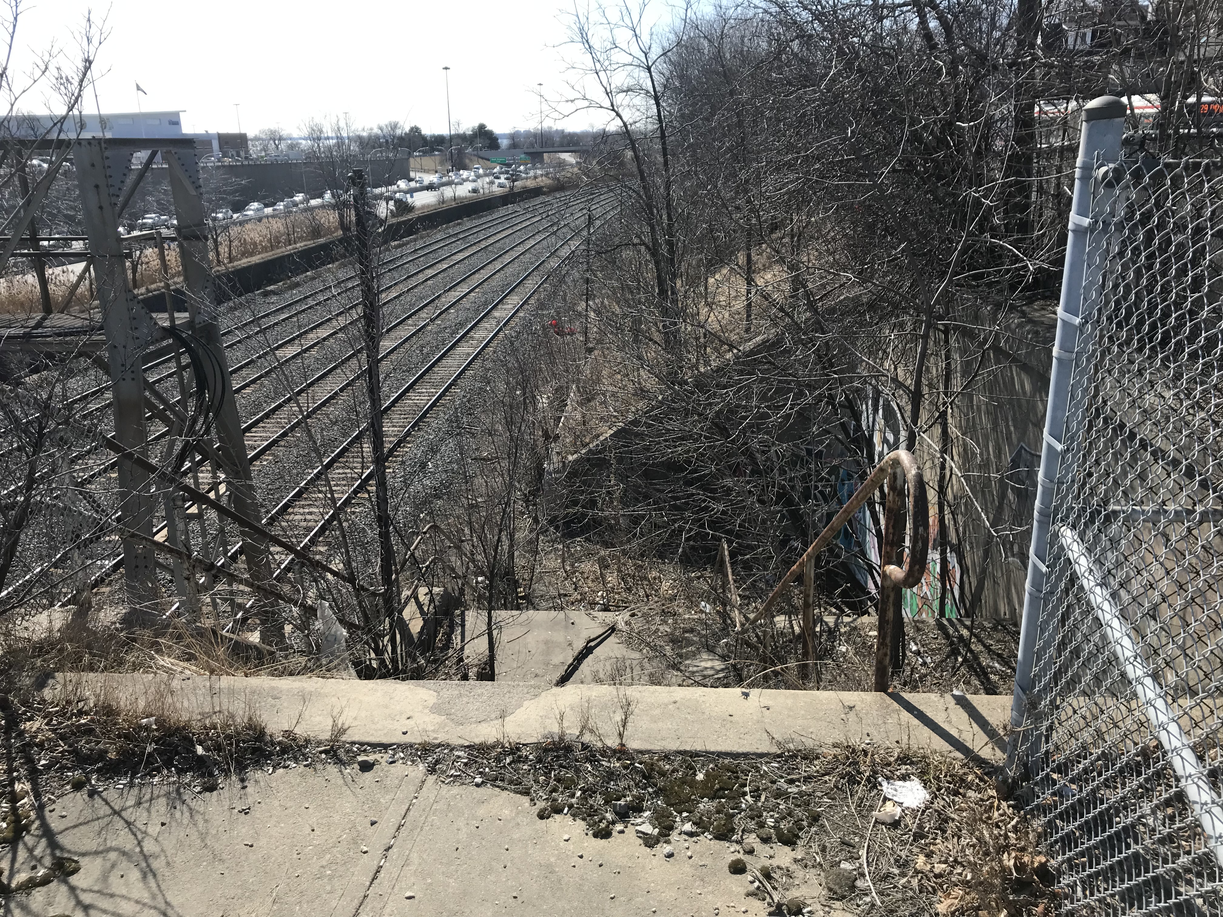
Both CN and CP had stations called Agincourt in North Scarborough, but neither of the historic station buildings remain. The CN station, now the location of Agincourt GO Station, was on Sheppard Avenue East near Kennedy Road, at the centre of the rural settlement. The CP station, originally built in 1884 for its Ontario & Quebec subsidiary, was farther east, located between Sheppard Avenue and Brimley Road. Though the CN station (built in 1871 for the Toronto & Nipissing Railway) was demolished in 1982, the station site remains in active use. Little remains of the CP station.
On the west side of a wide underpass on Brimley north of Sheppard, two fenced-off stairways lead to the north and south side of the CP tracks. In 1960, CP constructed a new freight classification yard in northern Scarborough; as part of that project, it built new underpasses at Sheppard, Brimley, and McCowan Road, and a large overpass for Markham Road. CP replaced the 1884 station with a smaller station building to serve its remaining passenger trains between Toronto, Peterborough, and Havelock. The station building was on the south side of the tracks, with a driveway leading off Sheppard Avenue to the station and a small parking lot, but CP built the stairways on Brimley for walk-up traffic and to provide a safe passage under the tracks between platforms.
Though the rail diesel coach service survived until the 1990 VIA Rail cuts, the station building was demolished in the late 1970s.
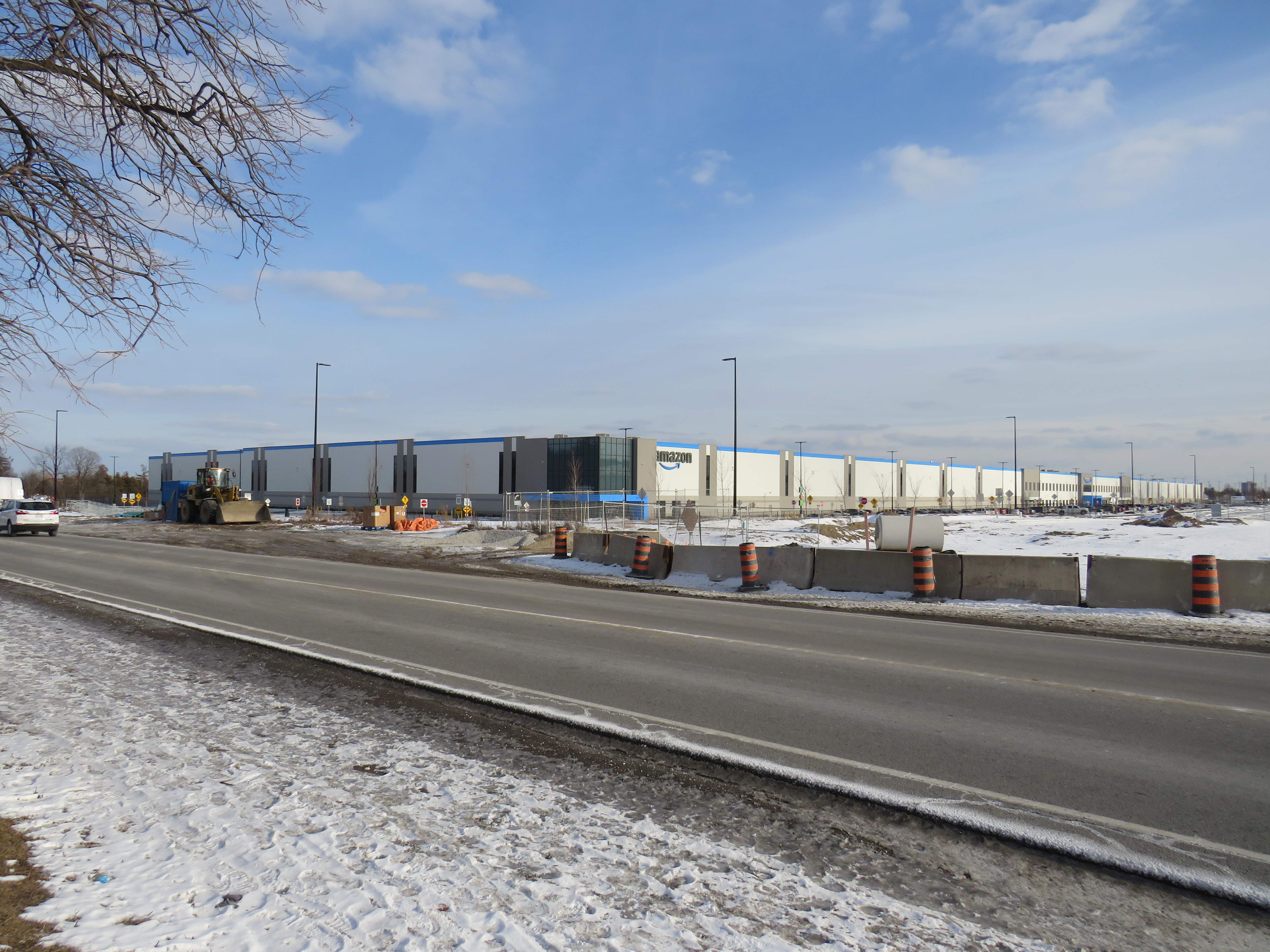
The starting wage for an Amazon fulfillment centre employee is $17.00 an hour, despite notoriously tough working conditions. With most professional and office workers at home, and with ongoing pandemic restrictions, Amazon has enjoyed significant sales increases. But those workers picking and packing orders are not able to work from home – and workplace spread has been a significant factor in COVID-19 transmission in Ontario.
Brampton, home to two of the GTA’s fulfilment centres, and close to Amazon’s Mississauga, Milton and Bolton warehouses, has been a COVID-19 hotspot. Like Toronto, Peel Region has been under lockdown and stay-at-home orders since November.
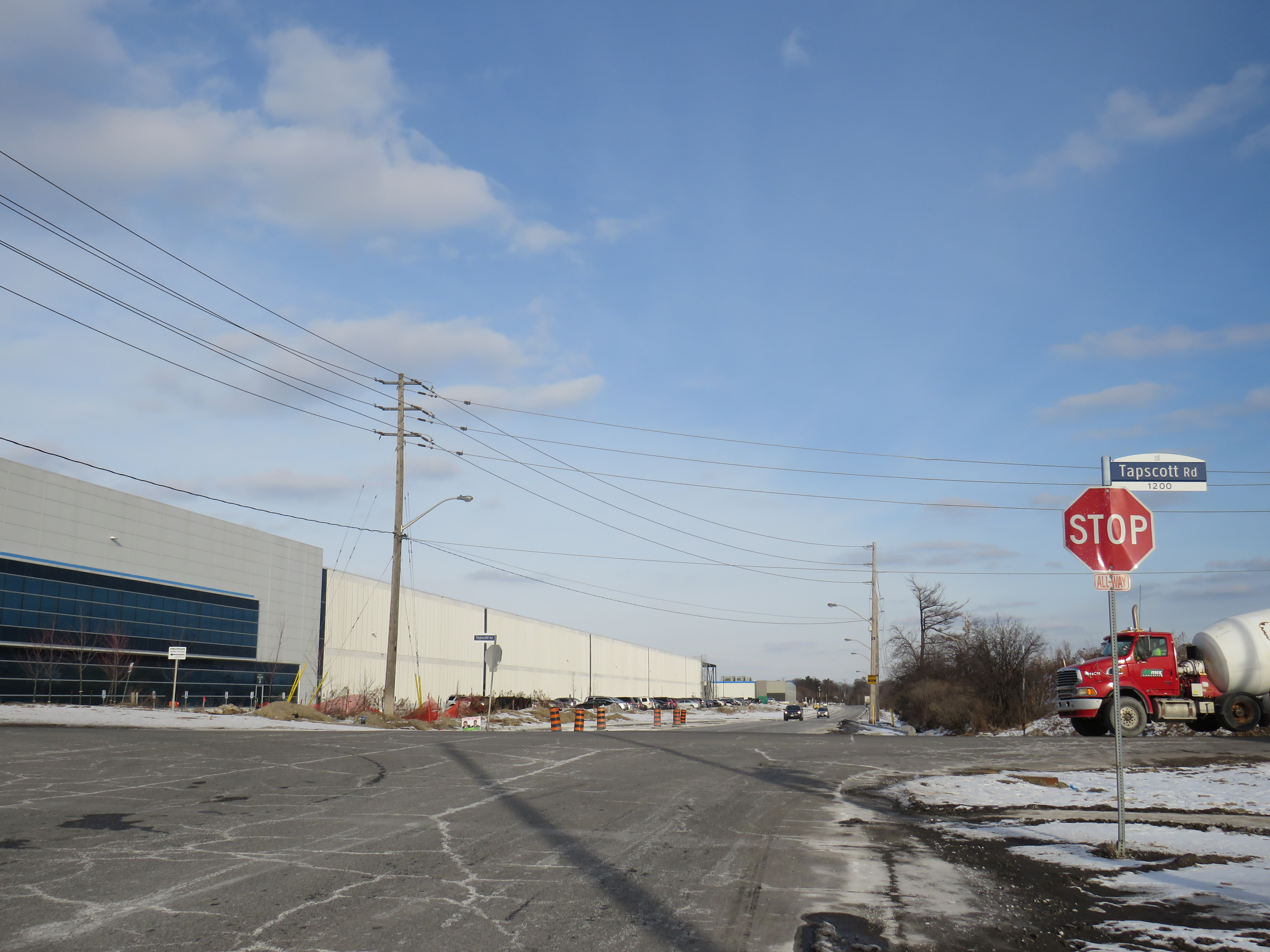
Like most new logistics facilities, the new Scarborough warehouse, like the other five GTA Amazon fulfillment centres, is in an industrial area on the city’s outskirts, where land is plentiful, but transit and pedestrian access is lacking. East of Tapscott Road, Steeles Avenue narrows from four lanes to two, and there are no designated pedestrian crossings at the intersection with Eastvale Drive. The eastbound TTC stop at Eastvale Avenue was removed in 2018 after a passenger was struck and killed trying to cross the street after disembarking from a 53 Steeles East bus. The next nearest stop, at Tapscott Road, is 300 metres west.
Steeles Avenue, looking west towards Eastvale Drive and the signalized intersection beyond, at Tapscott Road
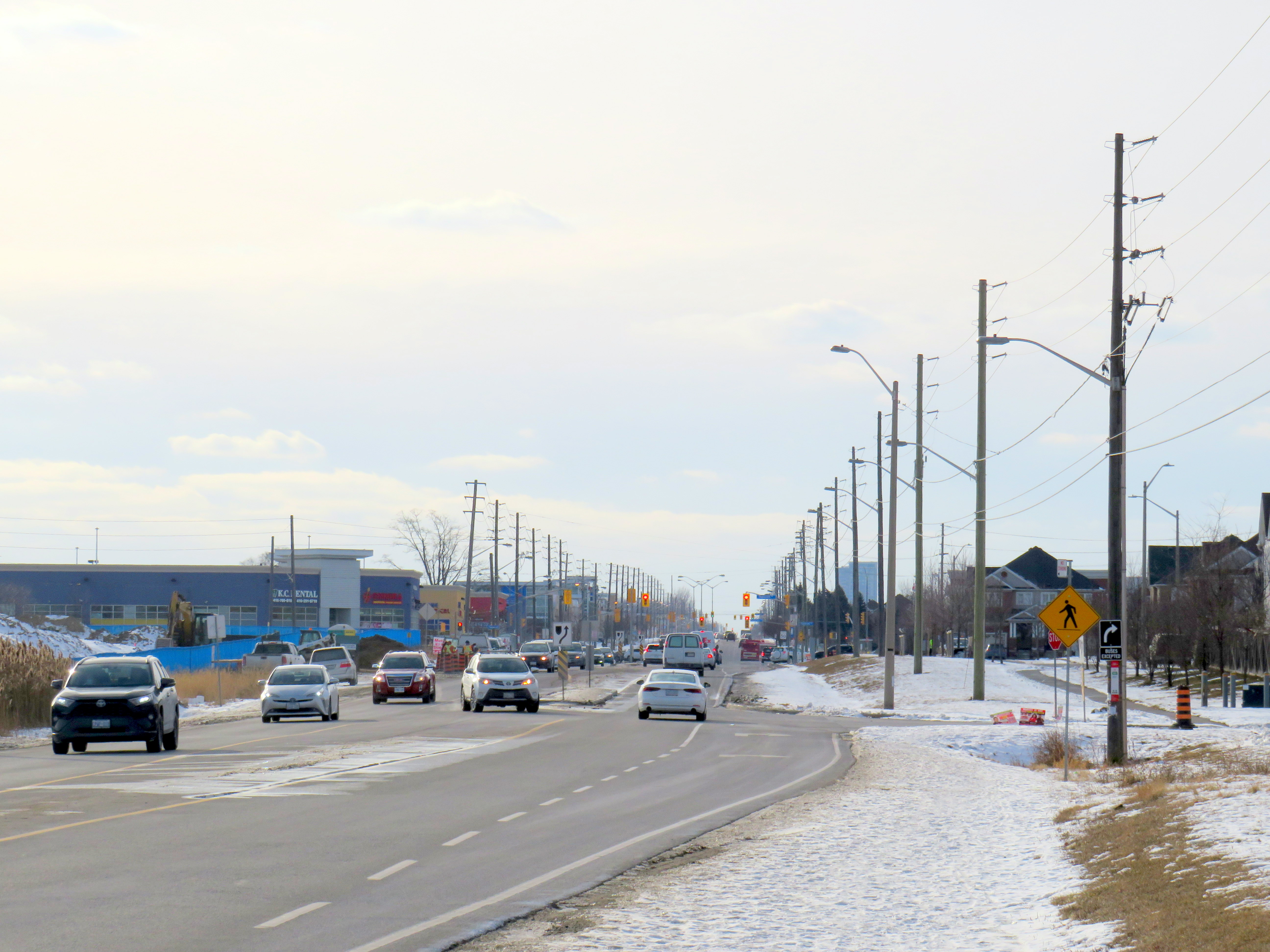
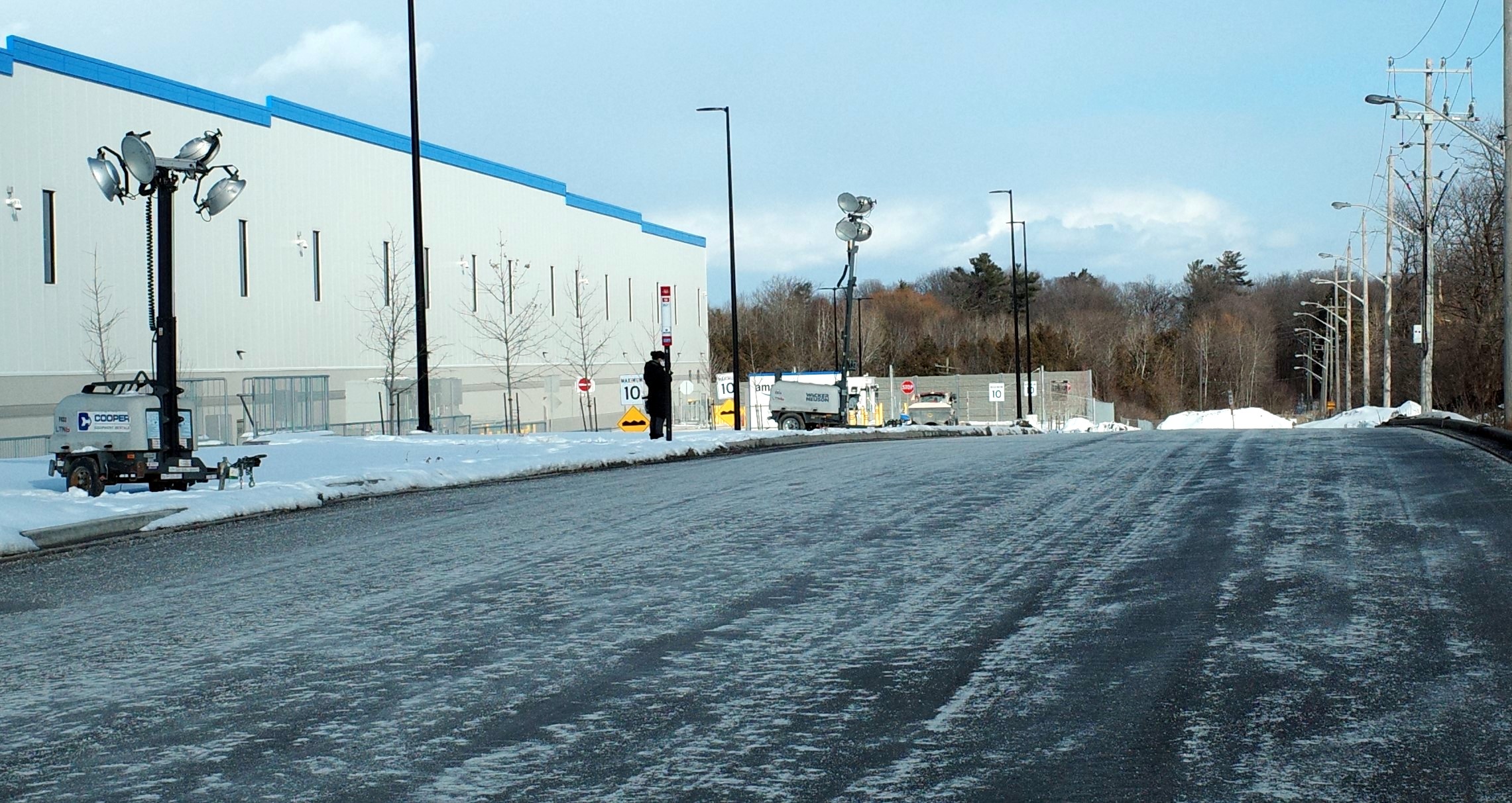
The sidewalk on the south side of Steeles Avenue ends at Tapscott, a few hundred metres west of the Amazon fulfilment centre. On the north side, the sidewalk ends at Ferncliffe Crescent in Markham. Despite a new residential area in Morningside Heights, to the east, there is no sidewalk along Steeles to connect to it. Pedestrians heading to Amazon or towards Staines Road must choose whether to walk in the mud, or on the busy roadway. Though the posted speed limit is 50 km/h, motorists regularly travel at 60 km/h or faster.
Looking east on Steeles from Tapscott Road – despite the sign advising motorists of pedestrian activity, there are no sidewalks leading east towards the new Amazon fulfillment centre (Sonali Praharaj)
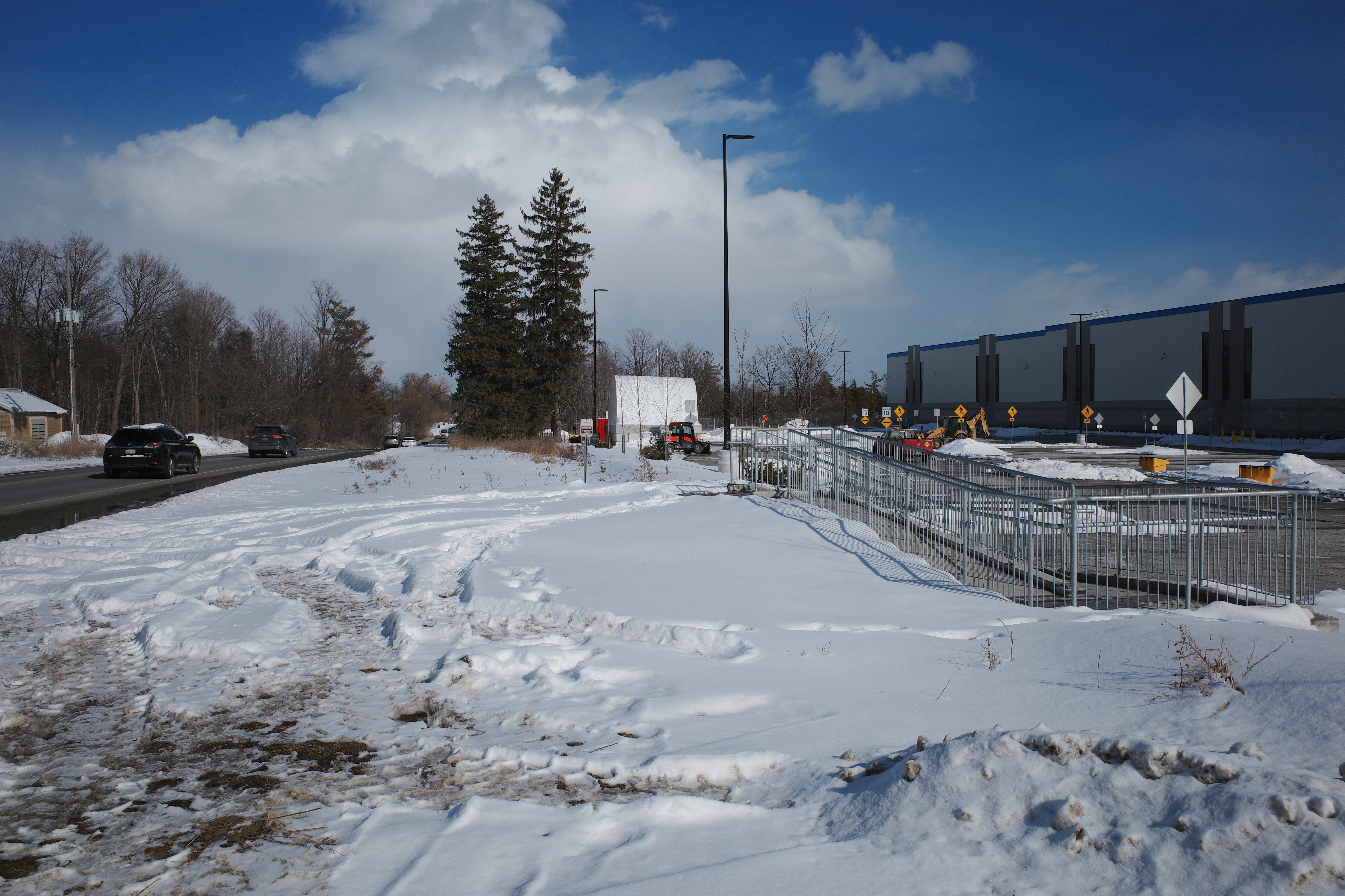
A stairway and ramp were built on the north end of the Amazon property, likely with the expectation that a sidewalk on the south side of Streeles Avenue would soon be installed. This would provide improved pedestrian access to the fulfillment centre. But without a safe and logical way to get to it from the street, it remains largely unused.
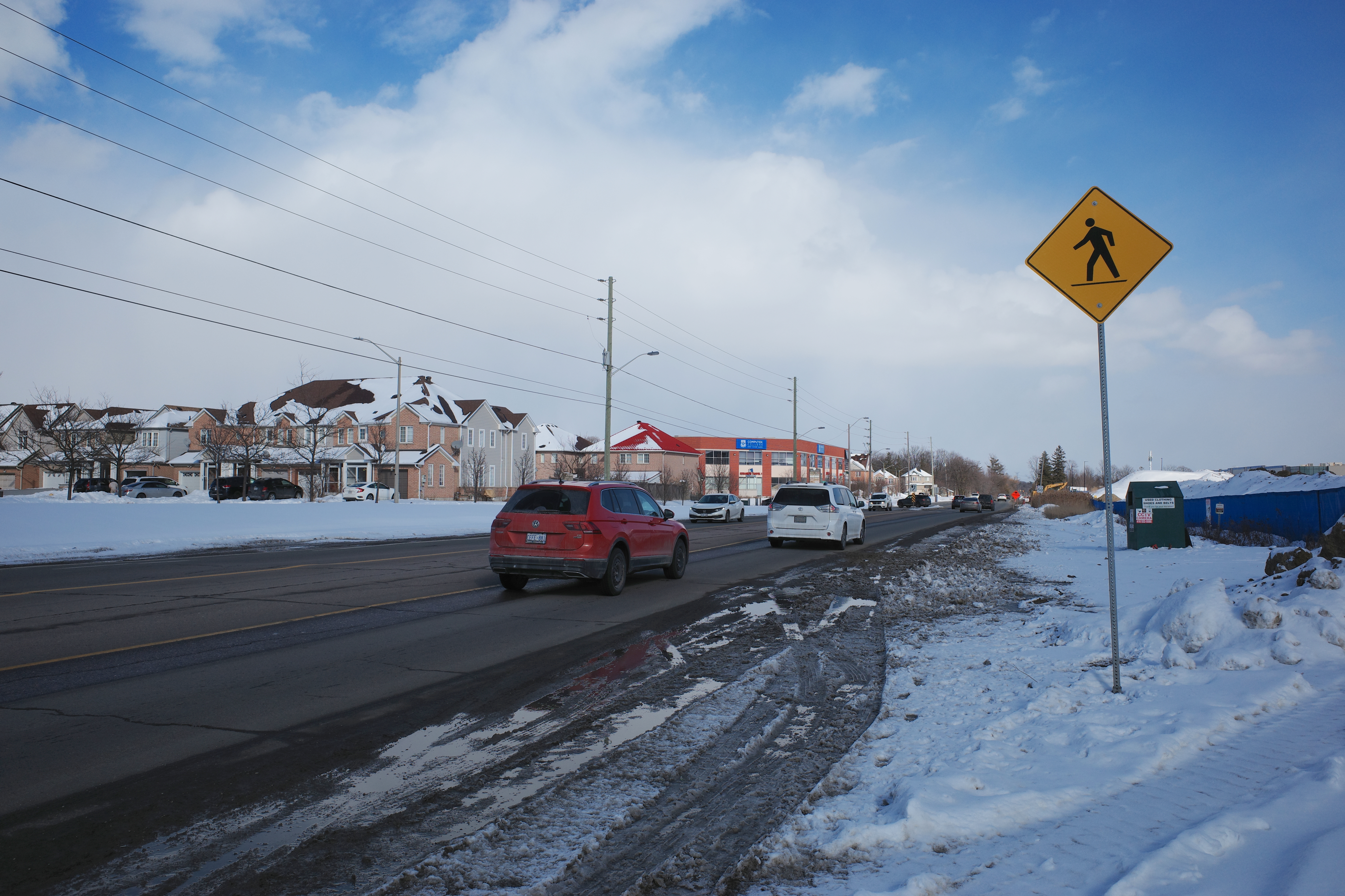
Passmore Avenue, on the south side of the fulfillment centre, was rebuilt with a sidewalk in the late fall of 2020, months after Amazon opened. However, it requires a lengthy walk north to Steeles Avenue up Tapscott, and there are no sidewalks on Tapscott from Passmore south, towards McNicoll Avenue. The intersection of Passmore and Tapscott itself – controlled by an all-way stop – still does not feature proper crosswalks.
Looking east on Steeles from Tapscott Road – despite the sign advising motorists of pedestrian activity, there are no sidewalks leading east towards the new Amazon fulfillment centre (Sonali Praharaj)
Though there are two TTC bus routes that operate to the corner of Tapscott Road and Passmore Avenue – 53B/953B Steeles East and 102B/C Markham Road – for months, workers had to walk on the roadway, through a construction site to access those buses. Anyone looking to go east, towards Morningside Heights, or southeast, towards Malvern, still face a long, dangerous walk or a lengthy bus commute.
The corner of Tapscott Road and Passmore Avenue
The TTC, starting January 11, 2021, began diverting the 53B Steeles East bus to directly serve the Amazon fulfillment centre, finally serving a major industrial trip generator and reducing essential workers’ travel times. Even still, the new sidewalk on Passmore ends at the warehouse entrance – anyone waiting for a bus must still walk and wait in the snow or mud.
Eventually, Steeles Avenue will be widened, with new sidewalks and bike lanes, and Morningside Avenue will be extended north to Steeles Avenue. However, these improvements have been planned for years and completion is still several years away. Though new warehouses have opened here, civic infrastructure has not caught up.
New TTC bus stop serving the Amazon Fulfillment Centre on Passmore Road (Sonali Praharaj)
The TTC’s service change, adding a new bus stop on Passmore Avenue, was a welcome – yet overdue – acknowledgement that essential workers, especially racialized and lower-paid workers, deserve better. It is inexcusable that new employment uses are planned, approved, and constructed before the appropriate pedestrian infrastructure and transit services are in place. It is also inexcusable that after a TTC customer was killed that a nearby bus stop was removed, rather than safety improvements added instead. This is not just a matter of ensuring a basic level of safety for pedestrians – this is a matter of justice for those we consider essential workers.
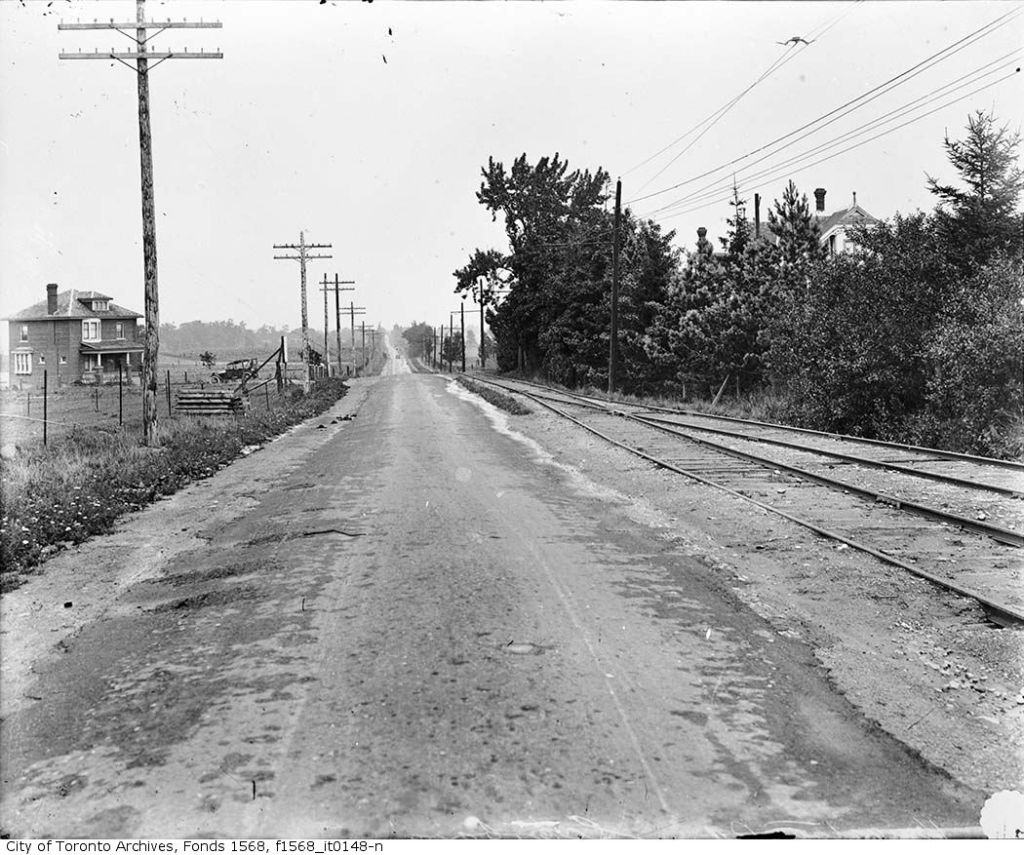
Kingston Road is one of Toronto’s oldest and most important thoroughfares. Sections of the road were first laid out by Asa Danforth in 1799, though a straighter, more direct route was established by the early 1800s. By the 1830s, it was a busy stagecoach route, connecting Toronto with Cobourg, Belleville, and Kingston.
As Toronto grew into a major city, Kingston Road was an obvious route for a radial railway line serving Scarborough Township; by 1906, radial cars extended as far east as West Hill, near Morningside Avenue. The radial line’s stops were numbered from the beginning of the line, first at Queen Street and Kingston Road, then at Kingston and Victoria Park Avenue after the TTC took over city operations.
Kingston Road, east of Bellamy Road, 1918: a rural scene. This siding, Mason’s Switch, was Stop 22. The house on the far left of the photograph still stands at the corner of Kingston and Mason Roads. From Toronto Archives, Fonds 1568, Item 148.
Stop 0 was at the city limits at Victoria Park (with connections to TTC streetcars). Stop 14 was Halfway House at Midland Avenue. Stop 26 was the Scarborough Post Office, near today’s Scarborough Golf Club Road, and Stop 35 was the end of the line, at West Hill.
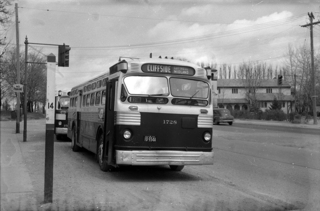
With increasing automobile ownership and new intercity bus lines in the 1920s, Kingston Road was busier than ever, becoming part of the new provincial highway system, but ridership on the radials declined, especially after the TTC extended city streetcars east to Birchmount Avenue in 1928, leaving behind a mostly-rural service. Radial service was cut back to Stop 26 in 1931, and completely replaced by buses in 1936 (the 86 Scarborough bus route is the modern legacy).
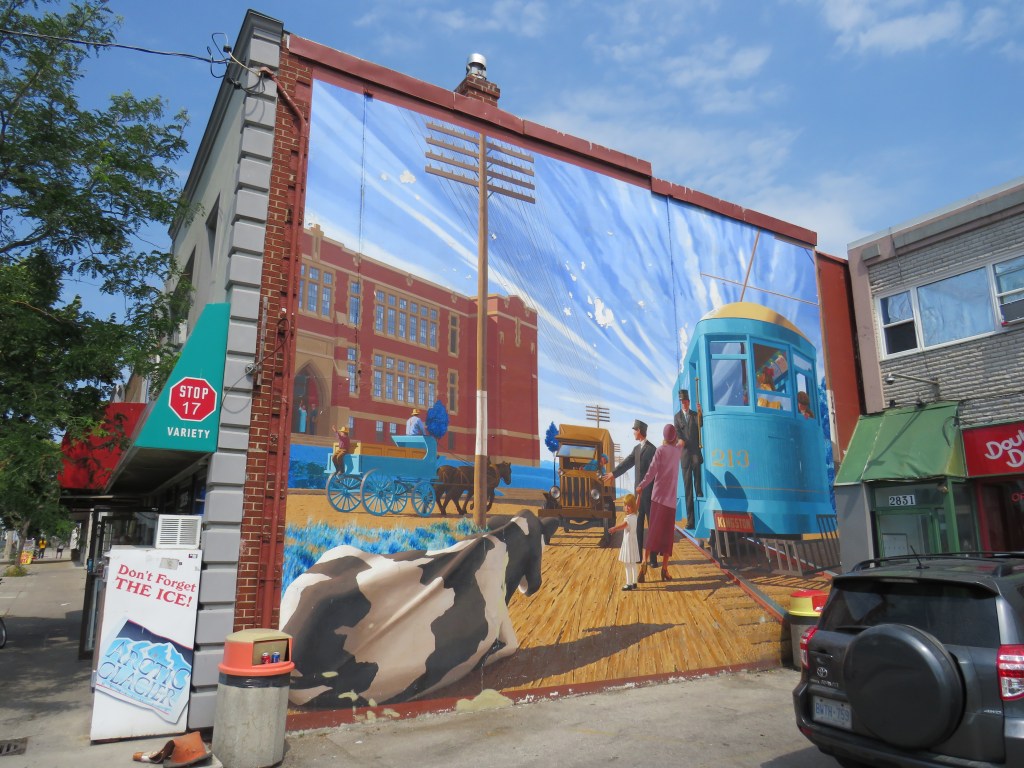
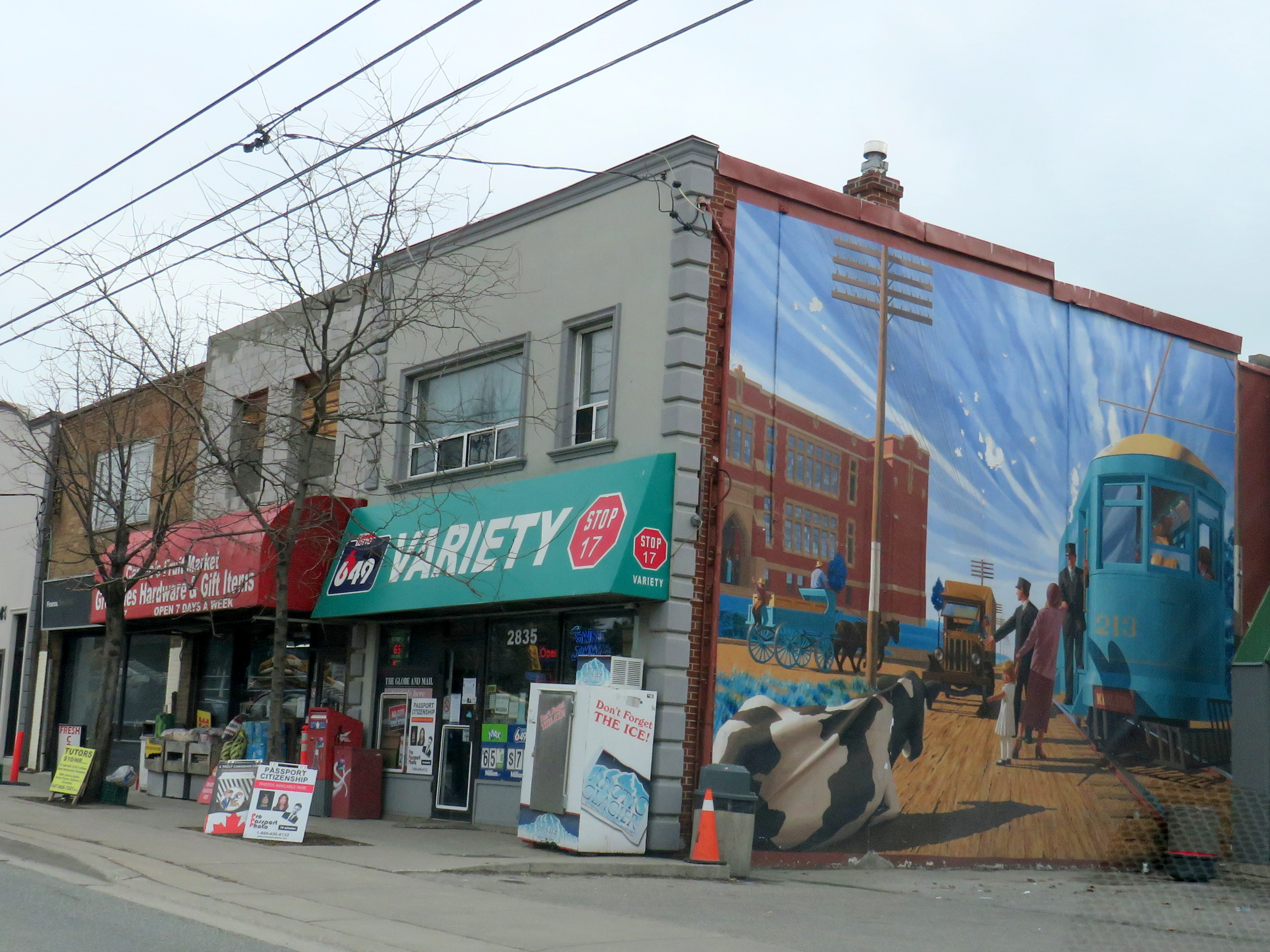
Despite the switch to buses, the stop numbers carried on for many years, listed in TTC timetables through the 1950s. Locals would often refer to stop numbers instead of street intersections. Stop 17, at Kingston Road and St. Clair Avenue East, is one example that has lingered on. A mural on the side of Stop 17 variety depicts a green radial car in front of the Scarborough High School), with a cow blocking the way of a truck looking to pass.
Mural at Stop 17 Variety
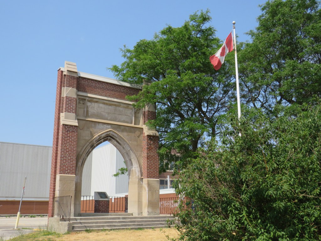
Scarborough High School, on the opposite corner of the variety store, was built in 1922, expanded several times, and later renamed R. H. King Academy. The original building was torn down in 1976, but the entrance way, depicted in the mural, was retained.
Arched entrance way to the demolished original section of Scarborough High School
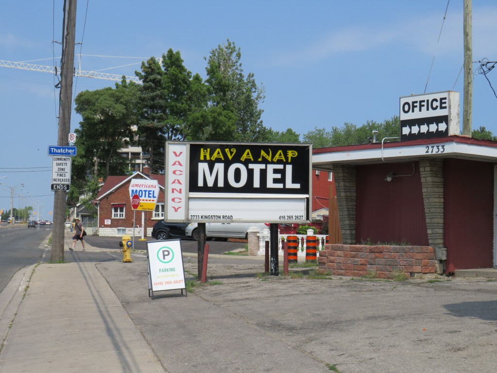
Nearby, towards Brimley Road, several older motels date from the motoring era, when Highway 2 was the main route into the city. Though Highway 401 drew some of the traffic away in the 1950s, it wasn’t until the completion of the Don Valley Parkway (which provided a direct route downtown) and the rise of chain hotels saw a decline in independent motels along Kingston Road and Lake Shore Boulevard. Some have been repurposed as shelters, while others, like the Hav-A-Nap, diversified by offering paid parking for nearby Bluffers Park.
Hav-a-Nap Motel, with the Americana Hotel just behind