Category: History

  • Ottawa’s Union Station problem

    Ottawa’s Union Station problem

    Great Hall, Ottawa Union Station
    Main lobby, Ottawa Union Station

    With planning now well underway for the Alto high speed passenger rail corridor between Quebec City and Toronto, there has been some speculation that Ottawa’s grand old Union Station, in the heart of the capital’s downtown core and a mere stone’s throw from Parliament Hill, could see trains again. Local business leaders and Mayor Mark Sutcliffe are excited by the idea of a downtown station, expecting that a downtown transport hub would help revitalize the local economy. Though it’s a very attractive idea, there are unfortunately just too many reasons why this would not be feasible.

    To understand why, it’s worth diving into the history and urban politics of railways in the National Capital Region.

    The decline and closure of Ottawa Union Station
    Grand Trunk Central Station soon after opening in 1912 (Library & Archives Canada)

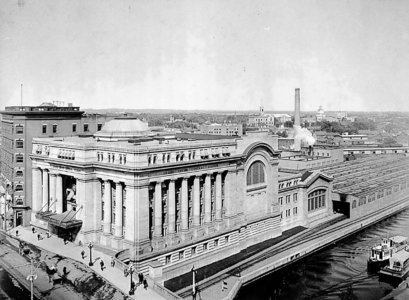
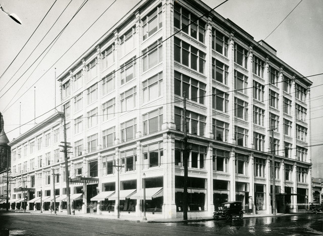
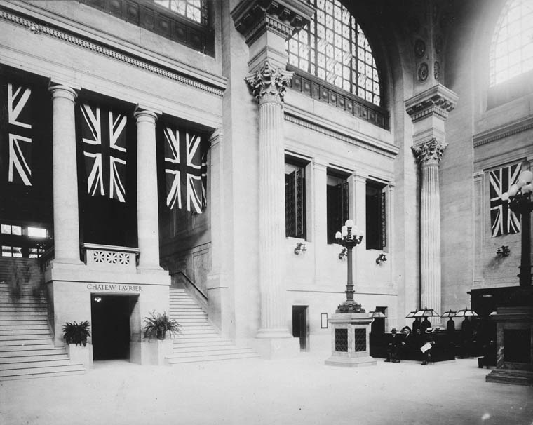
    The Grand Trunk Central Station, opened in 1912, provided a grand entrance to Canada’s capital city that was previously served by a few smaller stations just outside the downtown core. The station, designed in the Beaux-Arts style, was built as a stub-end terminal. This meant that trains would arrive and depart from the south and would have to be backed up to change direction. This suited the Grand Trunk Railway just fine, as it lined up perfectly with its route to Montréal via Alexandria (still used by VIA Rail today). The railway also built a hotel across the street — the Chateau Laurier — and connected the station with the hotel with a pedestrian tunnel.

    Entrance lobby, soon after opening. Note the tunnel under the staircase to the Chateau Laurier. (Library & Archives Canada)

    The 1912 station was intermodal from the very beginning. Right outside the station’s front doors, there were Ottawa Electric Railway streetcar platforms serving several routes on Rideau and Sparks Streets, the two main commercial corridors in Downtown Ottawa. Right below the canal and railway bridge next to the station was the Hull Electric Railway’s loop; its streetcars crossed into Ontario via the Alexandra Bridge.

    Alexandra Bridge
    The Alexandra Bridge carried CPR trains, Hull streetcars, pedestrians, and motor vehicles when it opened in 1901

    Soon after opening, the Canadian Pacific Railway joined the Grand Trunk, resulting in the terminal being renamed Union Station; the short-lived Canadian Northern Railway (CNoR) soon followed. As the CPR’s tracks to Hull (via the Alexandra Bridge) ran next to the GTR’s station, it suited the CPR well. Unlike Grand Trunk, both the CPR and CNoR had direct lines to Toronto.

    Two platforms on the west side of the station allowed through CPR trains to continue towards the Alexandra Bridge and even return to Ottawa via the Prince of Wales Bridge to the west; this was the route the iconic Canadian train between Montréal and Vancouver took when it was inaugurated in 1955. Most trains — including all GTR and CNoR, however, terminated at the six stub-end tracks. Both GTR and CNoR were absorbed into the new Canadian National Railway (CN) by 1922.

    Approach tracks and Bush trainshed, Ottawa Union Station. A wintery scene, with a frozen Rideau Canal on the left. The yards at right are now occupied by the Rideau Centre, Convention Centre, and Department of Defense Headquarters (Library and Archives Canada)

    In the 1940s, the federal government led by Liberal prime minister William Lyon Mackenzie King wanted to beautify the nation’s capital region and address traffic congestion. Ottawa — and the federal government — was rapidly growing, while political leaders wanted a cityscape that matched the ambitions of an expanding nation. French urban planner Jacques Gréber was commissioned to plan the region’s future; Gréber’s recommendations, released in 1950, were ambitious and transformative. (You can read the entire report here.)

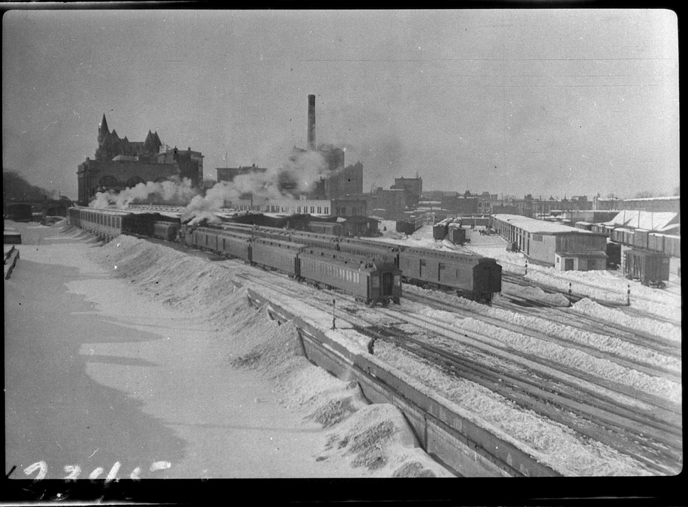
    The Gréber Plan — formally titled “Plan for the National Capital” — called for new highways, the abandonment of Ottawa’s streetcars (which were seen as antiquated with unsightly overhead wires), and the removal of all railway infrastructure within the City of Ottawa. The old CN and CPR lines would make way for new roads, including a four-lane arterial along the east side of the Rideau Canal, leading to a new road bridge replacing the Alexandra. A new railway bypass along the periphery of the city would replace all urban trackage, with a proposed new Union Station site in Gloucester Township, south of Walkley Road. Most industrial uses — including the historic paper mills along the Ottawa River — would be moved to the new railway line.

    Proposed highway system for Ottawa-Hull and environs, from Gréber’s report
    Proposed Railway system: Ottawa Hull and environs from Gréber’s report

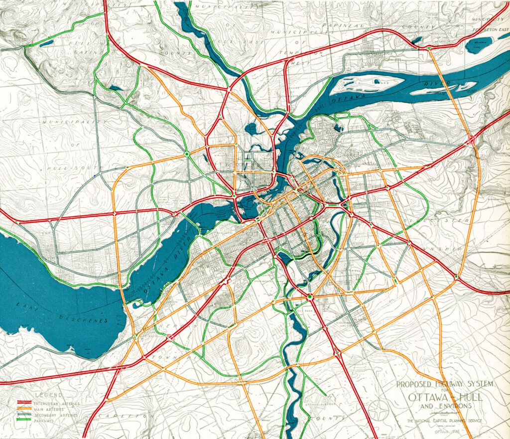
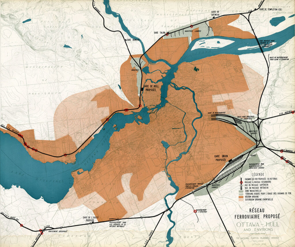
    Though the plan was not fully implemented, it did set the stage for much of the urban planning and infrastructure changes during Ottawa’s next fifty years. The railway bypass was constructed between Bell’s Corners in the west and Ramsayville in the east, with the old Grand Trunk tracks through the city replaced with The Queensway, now part of Highway 417. New parkways lined the rivers and canals. Two new multilane traffic bridges crossed the Ottawa River (though the Alexandra Bridge was maintained for traffic and pedestrians) and Albert and Slater Streets were made one-way, with a new bridge over the Rideau Canal (the Mackenzie King Bridge) linking them to the east. A large Greenbelt encompassed the city region, intended to direct growth while preserving natural areas.

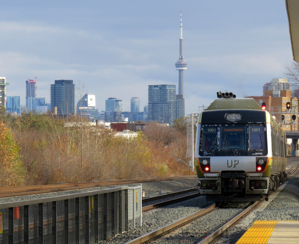
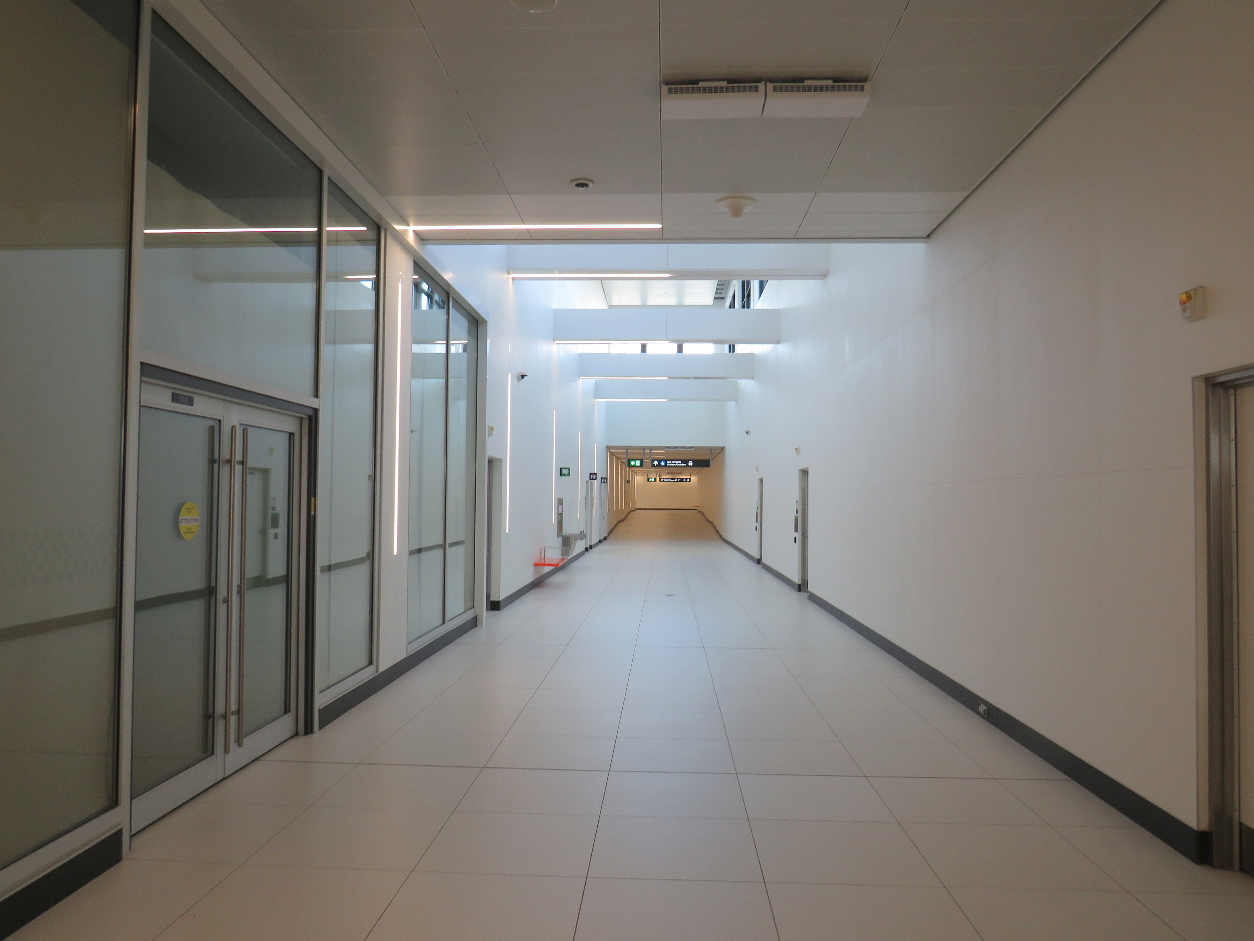
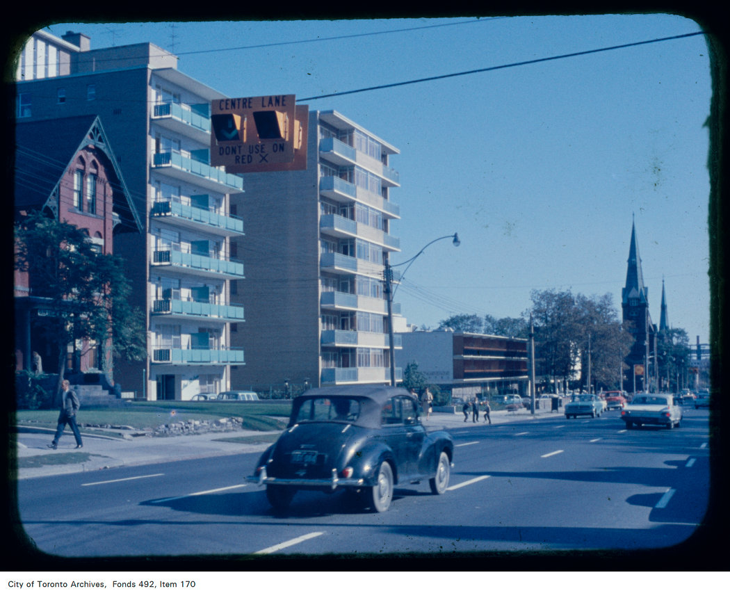
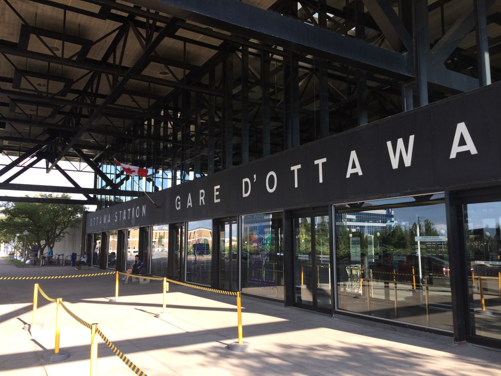
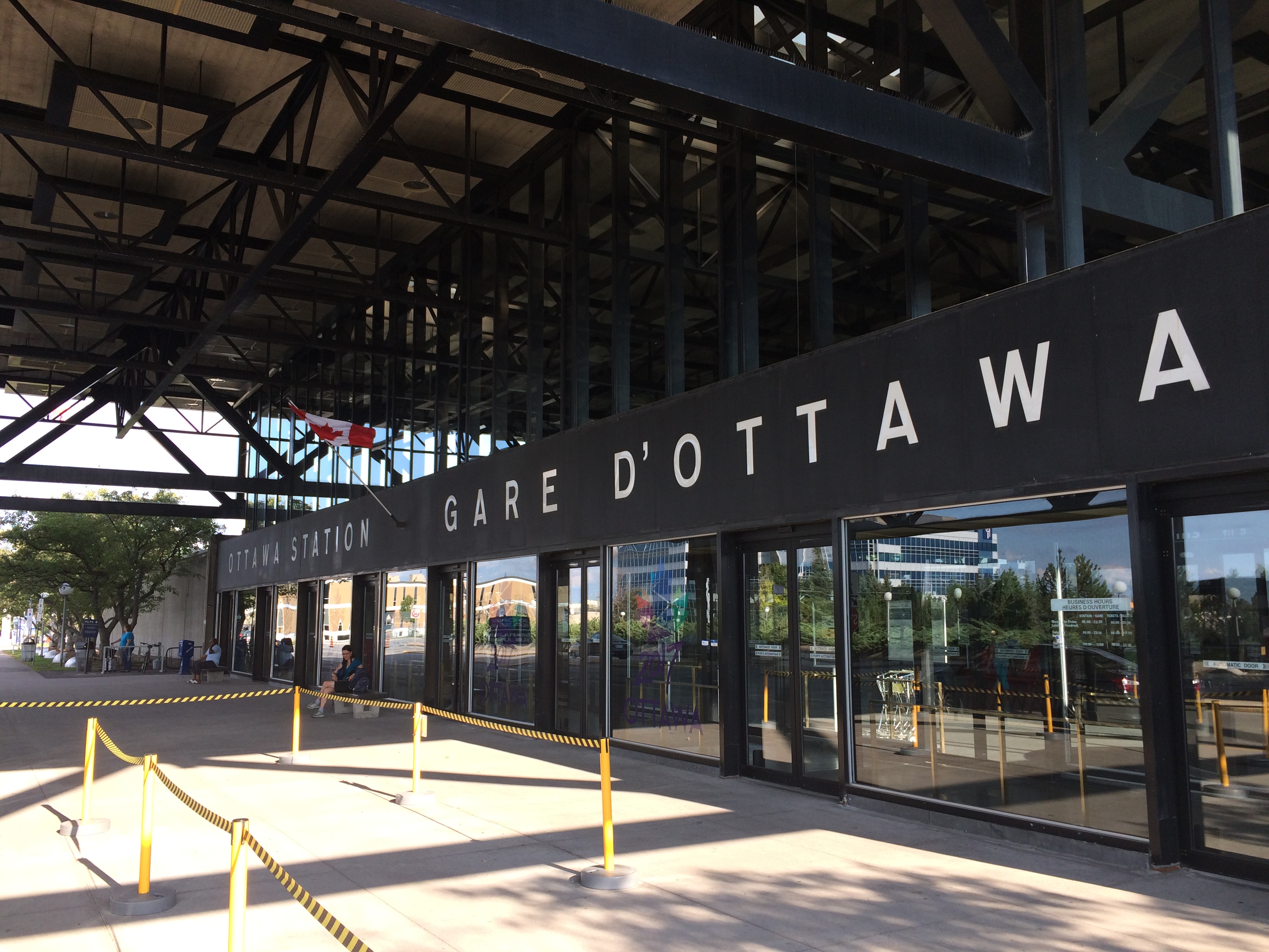
    Fortunately, the passenger station was relocated to a point much closer to the city centre than the Gréber Plan envisioned: the old CN and CP tracks along the Rideau River south of the city centre were kept in place but rerouted to serve a new modernist station that opened in July 1966. The new Ottawa Station, designed by John C. Parkin, is one-of-kind. The architecture invokes an airport terminal, with large, sheltered driveways and an airy open lobby/concourse, and was the last grand railway station built in North America. In 1966-1967, there were still two daily transcontinental trains departing from Ottawa Station, along with multiple trains to Toronto and Montreal, including a Toronto-Ottawa night train. Today, there are just eight trains to Toronto and five trains to Montréal.

    Ottawa Station, which opened July 31, 1966

    Soon after the new station opened, the tracks and ancillary buildings around Union Station were removed, making way for Colonel By Drive, the Rideau Centre shopping mall, a new convention centre, and headquarters for the Department of Defense. The station building itself survived, however, first becoming a temporary museum space during the 1967 Centennial celebrations, then a government conference centre, mostly closed off to the public.

    The Red Chamber
    The temporary Senate Chambers in the former train concourse at Ottawa Union Station

    Right now, the grand building is the temporary home of Canada’s Senate, and is again accessible to the public, via a free tour. The renovations to the building are very sympathetic to the built heritage. As reconstruction of Centre Block, the regular home of both Houses of Parliament, is still five years away from completion, there’s still lots of time to take the tour.

    Awaiting Alto

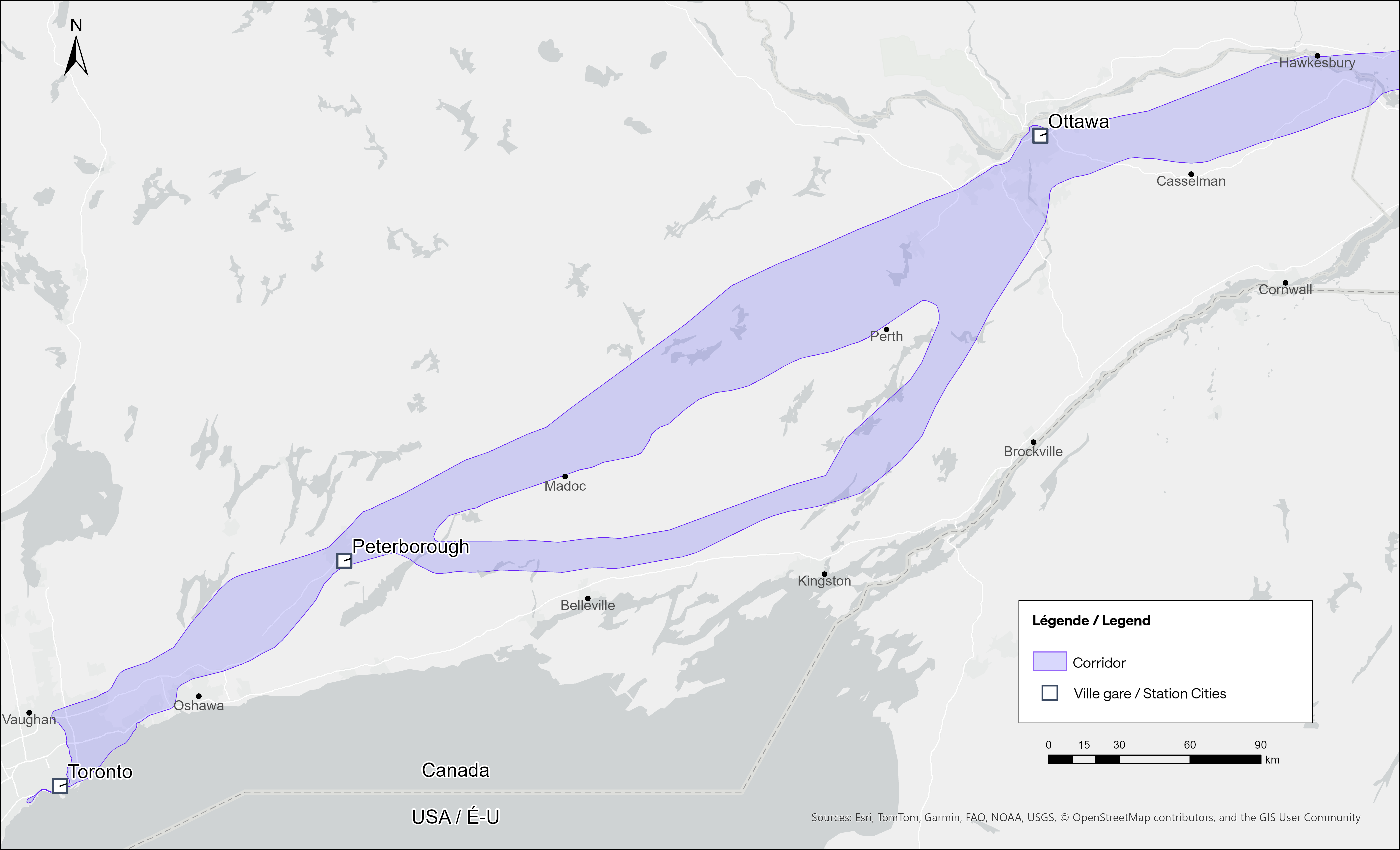
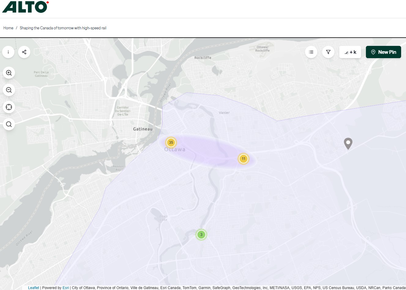
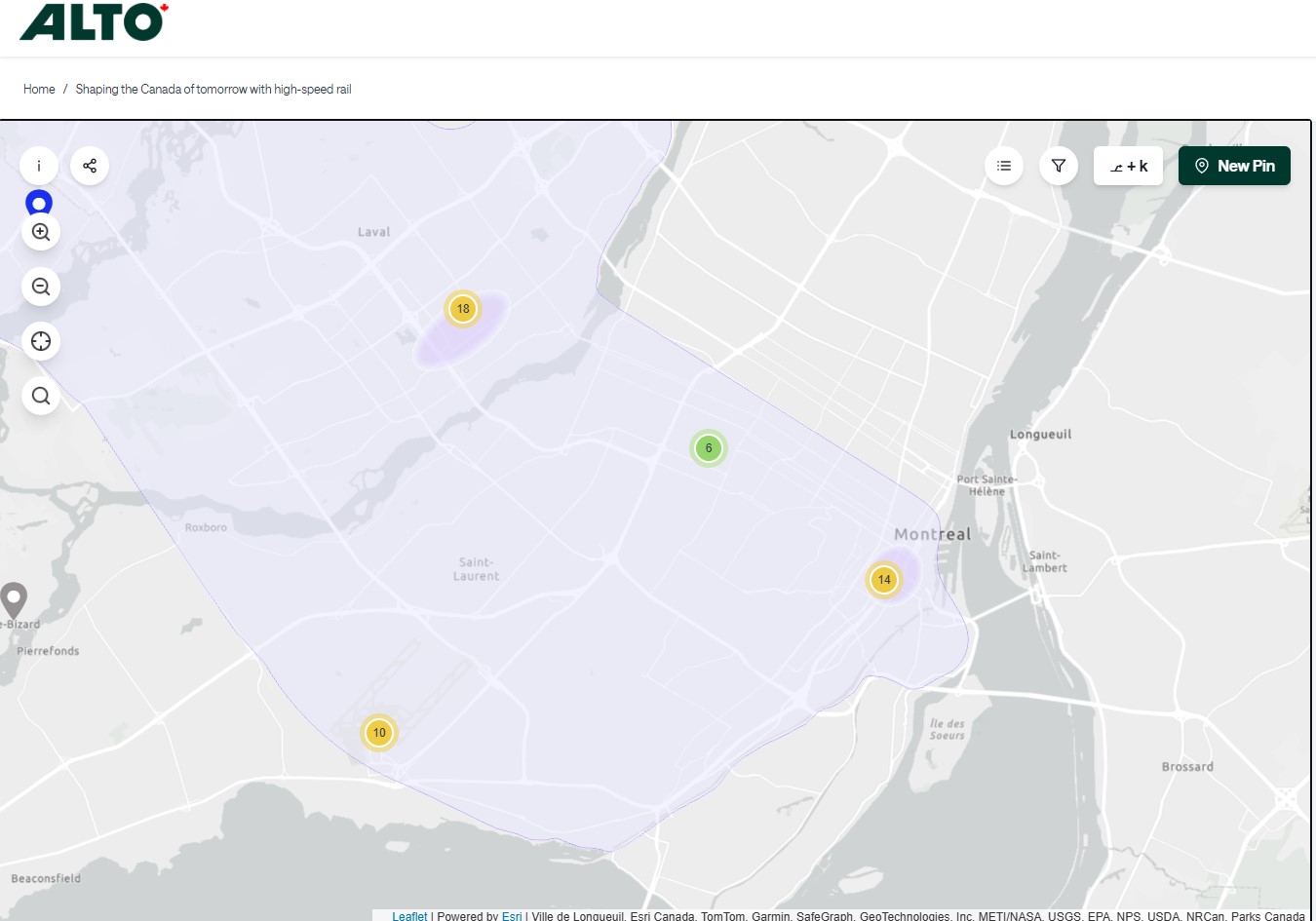
    The Alto high speed rail line project, now in the planning stage, will connect Québec, Montréal, Ottawa, and Toronto, with a total of seven stations (the other three are planned in Trois-Rivières, Laval, and Peterborough). The first segment, with the start of construction set for 2029, will link Montréal, Laval, and Ottawa. Consultations on the specific route and station locations are underway, with the broad corridors noted in maps available on the Alto website.

    Map of potential routings for the Alto high speed line in Ontario
    Map of the planned routing for the Alto high speed line in Quebec

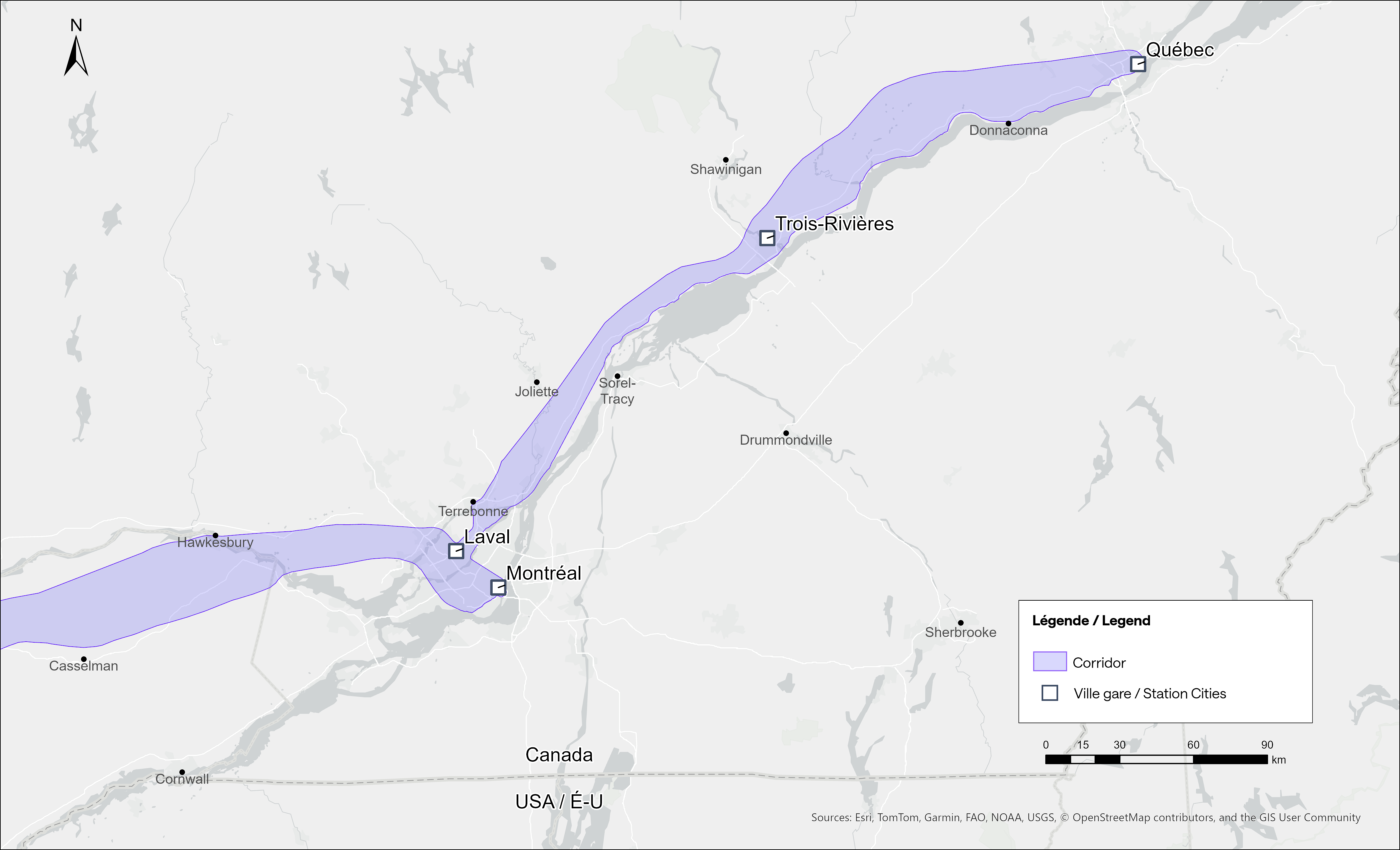
    The maps clearly show a route between Ottawa and Montréal that will pass through Prescott & Russell Counties, roughly following an abandoned CPR corridor until about Hawkesbury, at which point it would cross into Quebec (following an older abandoned CNoR route) to Laval, then continue south into central Montréal, though not necessarily the existing Central Station (this would likely require a new tunnel under Mount Royal). The Montréal station appears to be a terminal for trains coming from Ottawa and from Trois-Rivières and Québec, much like the existing VIA Central Station.

    Alto’s next phase towards Toronto could follow one of two broad routes between Ottawa and Peterborough, either just north of Highway 7, through the Canadian Shield, or a southerly alignment through the Rideau Lakes region and then through South Frontenac and passing near Stirling and Campbellford. All planned routes would require passing through Ottawa entirely on the Ontario side of the Ottawa River, making a through station particularly likely, especially for the critical Toronto-Montréal market.

    On the detailed consultation map, highlighted areas show where the seven station locations are being considered.

    The map for Ottawa shows possible station locations in an area including the current VIA station and the old Union Station
    The Montréal and Laval station locations under consideration. The Montréal station area highlighted includes the locations of Central and Lucien L’Allier Stations. The Montréal station for Alto is clearly intended to be a terminal.

    The idea of a downtown Ottawa Station for the new high speed rail corridor is certainly enticing. It would breathe new life into a 114-year-old landmark, provide a very convenient spot for Ottawa politicians, public servants, business travelers, tourists, and students attending nearby University of Ottawa. Rideau O-Train Station is less than two blocks away. However, it would require a new tunnel and/or elevated structure to reach the station from the rail corridors to the south. Furthermore, Centre Block would have to reopen on schedule so the Senate can move back before construction can start on refurbishing the station for passenger service.

    The 1966 Ottawa VIA Station, on the other hand, has its own advantages. There is plenty of room to build new high speed train platforms, which should provide level boarding for efficient passenger movement. There is also room for parking, passenger pick-up and drop-off, as well as easy access to the highway, unlike Union Station. With the closure of the Ottawa bus station, the VIA Rail Station has become a multimodal hub, with Ontario Northland, Flixbus, and Orleans Express all using the station’s driveway, along with a KLM/Air France shuttle to Dorval Airport. There is also a dedicated O-Train LRT station on-site, though it could be better integrated with the station building.

    Perhaps most importantly, the existing VIA station can help ensure the existing Corridor service remains integral, as passengers from Kingston, Belleville, and elsewhere on Lake Ontario and the St. Lawrence River will not be served by Alto; neither would Casselman, Alexandria and Dorval. That the station is a through-line, and not a stub-end terminal, will also ensure that the crucial Toronto-Montréal market will see minimal delays from back-tracking and reversing at a downtown terminal. Though there are instances of high-speed trains reversing directions at major hubs — Trenitalia’s Frecciarossa mainline between Milan and Salerno turns back at Roma Termini and at Napoli Centrale — this is an uncommon arrangement.

    All the planned Alto high speed rail stations will have to be easily accessible and close to the downtown cores of the cities it serves. At this point in the planning process, this looks like it will be the case at all three big city stations. But it will need more than walk-up traffic like downtown office workers and tourists; it will be most successful as part of a complete network of local, regional and intercity transport, including the conventional VIA rail system. With specific improvements, including new platforms and better O-Train station integration, the modern yet historic 1966 Ottawa Station is well suited for all of these needs.

  • Introducing Mount Dennis

    Introducing Mount Dennis

    Mount Dennis station sign at driveway entrance

    While Montreal was celebrating the opening of another portion of its REM automated light metro system between Gare Centrale and Deux-Montagnes on the region’s north shore, Torontonians had to settle for the partial opening of two light rail stations on the delayed Line 5 Eglinton line: Mount Dennis and Cedarvale.

    While the opening of Cedarvale (apart from the light rail platforms) slightly improved circulation at the existing Eglinton West Station, Mount Dennis Station provides for a new GO Transit and UP Express stop, a large TTC bus terminal, and access to a historic Kodak building. It’s an interesting structure that facilitates new intermodal connections, but could definitely benefit from a few minor improvements.

    An UP Express train leaves Mount Dennis for Union Station, with the Toronto skyline in the background

    The Mount Dennis and Weston neighbourhoods were established around major industries, including CCM, Moffat Stoves, Willys-Overland, Dominion Bridge, Kodak, with even more employment at the nearby stockyards and slaughterhouses at St. Clair Avenue. The CN and CP railways passing through brought materials in and finished goods out. Today, only the Facelle tissue plant — now owned by Irving — remains in operation from that industrial past. The Dominion Bridge property later became the home of a TTC bus garage, while the Kodak plant became the site of the Eglinton Crosstown light rail storage and maintenance facility.

    One building from the massive Kodak complex was preserved: Building 9, the employee recreation centre. The rear section of the main floor contains a public entrance to the station from the passenger pick-up and drop-off area, accessible washrooms, and access to the rest of the building (which is currently vacant). A bright mural, which once graced Building 9, can be found near the GO/UPX platform accesses. A heritage plaque tells the story of the building.

    Mount Dennis Station platforms and Kodak Building 9
    Building 9, as seen from the TTC bus terminal. Note the Metrolinx “T” icon, with the logos of three services – GO, TTC, and UP – below.
    The GO/UP Express section of the station is brightened by a colourful mural saved from Kodak Building 9
    Heritage Toronto Plaque affixed to Kodak Building 9

    As UP Express and most GO Kitchener Line trains now stop at Mount Dennis, approximately three extra minutes is added to train trips. UP Express, which took 25 minutes between Pearson Airport Terminal 1 and Union Station, now takes 28 minutes. On the first day of stopping service last Sunday, very few passengers got on or off UP or GO trains (of the few that did, most appeared to be transit enthusiasts), but with more TTC bus connections and the Line 5 service hopefully coming soon, the station should become much busier.

    Mount Dennis Station was mostly empty on its first day
    A mostly empty Mount Dennis bus terminal currently serves six routes; this will increase to 13 when Line 5 finally opens

    Mount Dennis will be served by 13 different bus routes when the station is fully open, including a new route 901 express between Mount Dennis and Pearson Airport, via Dixon Road. Though most of the changes are simple route extensions to the new terminal (like the 161 and 168), the 35 Jane will be split into two (while the 935 express stays on Jane, bypassing Mount Dennis), and daytime surface service on Eglinton between Mount Dennis and Kennedy Stations will be limited to an infrequent Route 34 bus.

    Map of planned bus network revisions upon opening of Line 5 (click for larger image)

    Despite some long corridors (particularly between the escalators up to the bus terminal and down to the closed-off LRT platforms), the station is well designed for the complexity of the site. The bus terminal and LRT platforms are both within the fare-paid area, eliminating one barrier between buses and rail.

    Corridor towards the elevator and escalators from the TTC fare gates and LRT to the bus terminal. The natural light comes in from the large windows of Building 9. Public washrooms are on the left, past the windowed room, presumably a future retail space.
    Looking down to the LRT platforms

    Three of four UP/GO platforms are in service (the fourth track, which would allow for more frequent GO Kitchener Line service is under construction). I was impressed to see two elevators to each platform, providing essential redundancy for improved accessibility and reliability. However, the GO/UPX platform access points are not easy to spot from this long corridor, which also leads to the Eglinton Avenue and Weston Road intersection.

    Passage to GO and UP Express trains from the TTC bus/LRT area, looking west

    There is no visible wayfinding signage in this long tunnel. Only when one reaches the escalators at the other end are directions apparent, as the overhead signs are affixed to sloped ceilings. This should be a relatively easy fix, but an important one.

    No wayfinding signage visible below escalator level in the GO/UPX area

    Furthermore, an opportunity to provide a useful link to the Mount Dennis neighbourhood from GO/UPX Platform 4 (the west-most platform) has not been exploited. An undeveloped road allowance from the corner of Barr Avenue and Brownsville Road, used for station construction, is fenced off and barricaded. This would provide an alternate route to the station from Weston Road, particularly to the nearby Toronto Public Library branch, and would only need a few Presto tap readers and perhaps a fare vending machine. Perhaps it will take private highrise development to make this happen.

    Looking west from Platform 4 to the Barr Avenue road allowance

    Finally, it was frustrating to see so little wayfinding signage in the TTC bus terminal. Though the TTC has numbered each of the bus bays from 1 to 15, these numbers do not appear inside the waiting area or over the doors. Digital screens over each bay display very small text with next bus information.

    TTC bus terminal plan, with each bus bay and assigned routes
    Outdoor signage at Mount Dennis bus terminal

    The wayfinding signage needs to be corrected, but at least these are simple fixes. Otherwise, it was a treat visiting a new transit hub on a sunny (though cold) November afternoon. The heritage preservation was a nice touch; hopefully, new use is found for Building 9’s upper floors. Furthermore, one hopes the rest of the Line 5 Crosstown stations open soon.

  • The fall of an empire

    The fall of an empire

    The former Hudson’s Bay Store in Downtown Winnipeg, one of its western flagship stores. After years of decline, the store closed in November 2020 and is now being transformed into a centre for Manitoba’s First Nations.

    There’s a touch of irony that in the same year Canadian sovereignty is increasingly threatened by an American president, the Hudson’s Bay Company — one of the world’s oldest corporations — has filed for bankruptcy protection. It will likely close at least half of its 80 stores, but with no guarantee it will emerge in a healthy state, able to rebound.

    On May 2, 1670, The Governor and Company of Adventurers of England, trading into Hudson’s Bay, was given a royal charter to trade in all lands that drained into Hudson’s Bay, 3.9 million km2 of land in the heart of the North American continent, in order to compete with the lucrative French fur trade in the St. Lawrence basin. The new company had monopolistic commercial control of what was then called Rupert’s Land: the entirety of present-day Manitoba, most of Saskatchewan and Northern Ontario, a significant part of present-day Quebec, Alberta, and Nunavut, and even parts of what eventually became Minnesota and North Dakota.

    Of course, this new monopoly, which quickly became known as simply the Hudson’s Bay Company (HBC), was created without consent or consultation with the many First Nations and Inuit communities. In the early days of trade, however, HBC relied on trading with First Nations for the valuable fur trades. It established forts and factories (trading posts) throughout the northwest, establishing places such as Moose Factory and Fort Albany that remain to this day.

    In later years, HBC claimed a trading monopoly on lands draining into the Pacific Ocean; it also brought in missionaries to convert Indigenous peoples. (Its monopoly was challenged by new entrants such as the North West Company, which eventually merged with HBC after violent skirmishes over trading territorial rights.)

    HBC’s vast networks of forts and trading posts, particularly Fort Garry (now Winnipeg) led towards the full colonization of western and northern Canada. In 1870, with the decline of the fur trade HBC relinquished control of Rupert’s Land to the new Dominion of Canada, which led immediately to the creation of the Northwest Territories, followed quickly by the Red River Rebellion and the creation of the Province of Manitoba.

    HBC continued as a fur and goods trading company and it was still the only retailer in remote western and northern communities. In larger cities like Vancouver, Winnipeg, Edmonton, and Calgary, it established new department stores. In smaller communities, especially in the north, it took full advantage of its dominant position, and Northern Stores became notorious for high prices (in 1987, HBC sold off its Northern Stores division). HBC continued to exploit Canada’s natural resources — it even had an oil and gas subsidiary between 1926 and 1982.

    In 1960, HBC focused almost entirely on its department store empire, acquiring the Montreal-based Morgan’s chain, competing head-on with Eaton’s and Simpsons-Sears. In the 1970s and 1980s, it also scooped up discount chain Zellers, Simpson’s stores (after its split from Sears Canada), Ottawa-based Freimans, and Hamilton-based Robinson’s, eventually rebranding those stores as “The Bay.” Finally in 1993, it acquired Vancouver-based Woodward’s. During this time, it sold off the Northern stores and the oil company. In the late 1990s, it launched the Home Outfitters big-box chain. The Zellers chain expanded under HBC ownership, first acquiring the competing Towers discount chain in 1991 and K-Mart’s Canadian stores in 1998.

    Though the flagship stores still proudly proclaimed the May 2, 1670 incorporation date, few thought about the long and checkered history of the company. My first memories of The Bay’s retail empire were of the Simpson’s store close to where we lived in Brampton. Simpson’s was the flagship anchor of Shoppers World, a once-vibrant mall. I also knew Simpson’s from the flagship Queen Street store in Downtown Toronto, famous for its toy section, Christmas window displays, and of course, the TVO children’s program Today’s Special. (The most memorable episodes for me, a young, budding urbanist, dealt with a fictionalized closure and demolition of the store, before a heritage plaque uncovered during the move out saved the day.)

    Opening sequence of “Today’s Special,” set in the downtown Simpson’s Queen Street store

    The Shoppers World Simpson’s store, like the rest of the banner, was converted to “The Bay” in 1991. In 2007 the store closed, not long after I moved to my own apartment in Toronto. (I still have some of the chinaware I purchased at that Bay store before I moved to my own place.) But as I worked, and later lived, in Downtown Toronto, I found the Queen Street store very useful for casual clothes shopping and the occasional big-ticket item.

    Demolition of the Shoppers World Simpson’s/The Bay department store in 2010

    Though HBC was sold to a private equity firm in 2008, under CEO Bonnie Brooks’ leadership, there was still life in the department store, with leading stores like the Queen Street flagship upgraded. The fifth floor was a great place to browse for men’s clothes; the seventh floor had an excellent kitchenware department. HBC persisted through the bankruptcy of Eaton’s in 1997-1999 as well the wind-down of Sears Canada that began in 2012 (when it began selling the leases of its urban flagships, including former Eaton’s stores) and concluded in 2018.

    But private equity did what private equity does best: it began selling off the assets and closing down stores, just as Sears did in its last decade. The Zellers discount department store chain was discontinued, with the majority of store leases sold to the ill-fated Target Canada operation in 2011. The Home Outfitters stores were closed in 2019. Real estate was sold off, with HBC leasing back the properties. For example, the Queen Street store was sold to real estate developer Cadillac Fairview — who owns the adjacent Eaton Centre mall — for $650 million in 2014.

    In the last few years, it became clear that the department store chain was in decline. Though pandemic restrictions in 2020 and 2021 had a major effect, the downtown stores also lost office worker patronage. Suppliers were having trouble getting paid and were seizing merchandise at several stores; escalators and elevators were put out of service, and store hours were reduced at most locations.

    The Hudson’s Bay store at Scarborough Town Centre closed at 7:00 on a weekday evening in March 2024, even though the rest of the mall remained open for another two hours

    The loss of Canada’s last department store is unfortunate, but it comes as no surprise given the way private equity sucks once-proud businesses dry. The evidence was impossible to miss. How could customers be lured back when escalators were blocked off, marketing non-existent, and store opening hours scaled back? Not even Sears turned off the escalators in its last years.

    I suspect, given the company’s 355-year history, a vestige of HBC will live on, especially in an era of renewed Canadian nationalist. Another business will certainly purchase the name and brand to continue selling the famous point blankets. Though the Queen Street store will certainly be redeveloped by Cadillac Fairview, strict heritage considerations will prevent its complete demolition. The Downtown Winnipeg store, closed in 2020, is already being repurposed into a new hub for Manitoba’s First Nations.

    But it will remain a true shame, as I have always felt there was still a place for a full-service department store in Canada. It only needed to be well managed, relevant, and cared for.

  • Woodbine Centre: the end of a Fantasy

    Woodbine Centre: the end of a Fantasy

    Woodbine Centre & Fantasy Fair is up for sale, again

    Growing up in Brampton in the 1980s and early 1990s, there were two favourite day trips I fondly remember.

    There were the drives to nearby Georgetown, which had one of the largest indoor playgrounds at any McDonald’s restaurant. It featured a multistorey indoor crawl maze, a spiral slide that led to a giant ball pit, a tire swing, as well as a standard McDonaldland-themed merry-go-round. A CN caboose could be rented for children’s parties. At least we’d burn off some of the calories from the burgers and fries. (There’s a video on Reddit from 1992 that shows what it looked like.)

    Then there were the trips to Fantasy Fair. When Woodbine Centre opened in 1985, it featured a unique attraction: a large indoor amusement park, complete with a historic Looff carousel (though with replica fiberglass horses), a Ferris wheel, and a train ride that wound through the attraction. The highlight for me, however, was a huge indoor playground that spanned two floors that was many times the size of the Georgetown McDonald’s playground. It had multiple slides, a mirror maze, swings, and two ball pits. There was also a McDonald’s restaurant facing Fantasy Fair, in one of the faux-Victorian storefronts that surrounded the attraction.

    Fantasy Fair Carousel, November 2024

    The mall itself was anchored by The Bay and Simpson’s, along with a Cineplex multiplex cinema, and a complete assortment of mid-market retailers. In 1991, when the Hudson’s Bay Company retired the Simpson’s brand (converting most of those stores into The Bay), it sold the redundant store to Sears Canada. A Zellers discount department store was added in the 1990s. But the mall slowly lost its pizzazz.

    Cadillac Fairview sold Woodbine Centre in 2005 to a numbered company, with real estate management firm Avison Young operating the mall. By then, many of the national retailers had left once their leases were up. The mall’s relatively isolated site, without good transit access became a liability. Changing demographics in northern Etobicoke, competition from surrounding larger malls (Bramalea City Centre, Sherway Gardens, Square One, Vaughan Mills, and Yorkdale) and new big box retail developments also took their toll.

    The Zellers store was not one of the leases picked up by ill-fated Target Canada, and it closed in 2012. Sears closed in March 2017, a few months before the entire chain was liquidated. Sport Chek closed its store in 2018.

    Woodbine Centre’s Zellers store was not picked up by Target, and the parking lot-facing doors still have the defunct retailer’s logo intact

    There was an attempt to renovate the mall, as part of a grand plan to revitalize the property with a new supermarket, refreshed food court, new entertainment options, and condominium towers surrounding the shopping centre. The Woodbine Village proposal competed with the better-financed Woodbine Live plans at the nearby racetrack, which included a casino, hotel, and event hall, all of which were built or are nearing completion. Condominium development is complicated as the property, particularly the southeast corner at Highway 27 and Rexdale Boulevard, is directly below the approach for Pearson Airport’s Runway 23.

    Poster promoting “Woodbine Village” which boasts a new supermarket, condo development, hotel, and expanded Fantasy Fair including indoor waterpark
    NAV Canada map showing approach and noise contours for Runway 23, which passes directly above Woodbine Centre
    Woodbine Centre’s central atrium, including defunct fountain below glass elevator

    After a disheartening American election result on Tuesday, November 5, I decided to turn off the newsfeeds, and out for a walk and explore Woodbine Centre again.

    Though the basic architecture remains intact, the corridor floors were given cheap new brown, grey, and beige tiles that look out of place in the post-modern interior. Much of the original green paint on the roof, walls, railings, and signs is now red and mahogany.

    Apart from the fast food offerings, there were few recognizable store names among the tenants in 2024. Apart from Hudson’s Bay, Foot Locker, Ardene, The Children’s Place, Dollarama, LensCrafters, TD Bank, and Urban Behavior, most stores were independent clothing, home décor, and furniture stores, or were cellphone vendors such as Wow Mobile, Best Buy Express, or Rogers and Bell kiosks. About 20 percent of the store fronts were vacant.

    Looking towards the old Sears store, which is now All Home Furnishings, which was having a clearance sale in November. Note the Payless Shoe Shack, a knock-off of the defunct Payless Shoe Source chain, on the left.
    Vacant faux-Victorian storefronts at Fantasy Fair

    Professional property managers are quick to update signage and keep up appearances; the management at Woodbine has clearly given up. Vacant storefronts are left exposed, rather than blocked off. Signage advertises stores that are long gone. Pot lights flicker on and off.

    Overhead sign pointing the way to Sears, which closed over seven years ago. The Subway restaurant is also gone. Behind the sign, a shuttered Yogen Fruz/Prestotea store front acts as storage.
    A closed KFC/Taco Bell stall in the food court, with the signage still up and illuminated, despite the equipment taken out

    Surprisingly, Fantasy Fair was still operating, even on a Wednesday afternoon where there were few visitors. Ride attendants, dressed in red vests, looked bored, even when running the train for the lone parent and child. The Ferris wheel is now permanently closed, however, and some of the attractions look sadly decrepit.

    The railway crossing lights, bells, and gates still work at Fantasy Fair when the train passes through

    Outside the mall, much of the parking lot is fenced off and is now used for truck and trailer storage, and the storage of overflow rental car fleets. Though the rental car parking began during the COVID-19 pandemic, when people stopped travelling, it continues to be an easy revenue stream for the mall management. The truck trailers, on the other hand, are an unsightly feature, particularly where they face Highway 27.

    Fenced-off rental cars in the Woodbine Centre parking lot
    Truck trailer parking on part of the mall parking lot

    Unfortunately, the future is not good for Woodbine Centre as a mall. Though mixed-use development remains a possibility — Humber College is within walking distance — the airport noise will continue to be a challenge for condominium sales. Transit expansion would certainly help; the nearly-complete Finch West LRT terminates nearby. Extending that two kilometres south to serve Woodbine Centre, Woodbine Racetrack/Casino, and a planned GO Transit station, could be the boost the site needs. (Of course, the mall site could have made a good location for a mega-spa, particularly with the nearby casino venue and hotels, but I digress.)

    The Humber College LRT terminus is less than a kilometre north of Woodbine Centre

    The mall’s fate will likely be decided soon. The site is up for sale again, not advertised as a shopping centre, but as a “50 acre mixed use site.”


    1992 Tenants

    Below is the list of tenants at Woodbine Centre in 1992, obtained from the 1993 Canadian Directory of Shopping Centres, published by Maclean-Hunter. Tenants still open in 2024 are bolded.

    Anchors
    Anchors: The Bay (140,000 sq.ft.), Sears (135,000 sq.ft.)

    Fashions and footwear
    Children’s Wear: Flora’s, Just Kids.
    Family Wear: Cotton Ginny. 
    Ladies’ Wear: Addition-Elle, Antel’s, Au Coton, Braemar, Braemar Petites, La Cache, The Cavery, Cotton Plus, D’Allaird’s, Dalmy’s, Emotions, Fairweather, Irene Hill, Jacob, La Jolie, Karuba, Lady Foot Locker, Limité, Lindor, Liz Porter, Mia, Northern Reflections, Ports International (Ladies), Reitmans, Ricki’s, Shirley K Maternity, Smart Set, Suzy Shier, Tabi International, Tan Jay, Tristan, Tucci Fashions. 
    Menswear: Casa Angelo, Petrocelle Vomo, Randy River, Star’s Men’s Shop, Steel, Tip Top, Tuxedo Royale.

    Unisex / Men’s & Ladies’ Wear: Benetton, Boca, Bootlegger, Canary Island Adventure & Travel Company, Le Château, Frenz Leather, Jean Machine, Levi’s 1850, Pantorama, The Pro Image, Stitches, Thriftys, Willow Ridge. 
    Footwear/Leather Goods: Agnew, Aldo, Bata, Belinda & Brother, Bentley Leathers, Calderon, Florsheim Shoes, Foot Locker, Fredelle, K. Jamson, Kinney, The Little Shoemaker, Moneysworth & Best, Naturalizer, Pegabo
    Jewellery/Fashion Accessories: Accessories For You, Ardene, The Joy of Sox, Mappins, Peoples Jewellers, Reflexions, Young’s Jewellers

    Other retailers
    Books: Classic Bookshop, Coles, Moyer’s The Teacher’s Store, Smithbooks
    Cosmetics/toiletries: Body Reform, Caryl Baker Visage, Enchante Perfumes, Merle Norman Cosmetics
    Department store/mass merchandiser: Marks & Spencer
    Drugs/health & beauty: Shoppers Drug Mart
    Electronics/Computers: Bell Canada Phone Centre, Compucentre, Majestic Sound Warehouse, Radio Shack, Safe & Sound
    Fabric & Sewing: Needle ‘n’ Thread
    Florist/Nursery: Woodbine Florists
    Furniture & Furnishings: Brass Imports, Clocks Unlimited, Diamond Furniture, Lighting Unlimited, Pictures
    Gift: A. David Soloway, China Panda, Den For Men, Jinny’s China & Gifts, Party Hut, Rafters, Le Roulet
    Grocery: Bulk Barn
    Hardware/Paint & Paper: St. Clair The Paint & Paper People
    Hobby/Craft: Lewiscraft
    Housewares: House of Knives, Pot Pourri, Shaver Centre Fine Blade, Stokes
    Music/Records & Tapes: A&A Music & Entertainment, Discus, Music World
    Optical: LensCrafters
    Pet: Aquarium Toronto
    Photo/Camera: Blacks, Japan Camera
    Restaurant and Fast Food: A & W, Abacus Cuisine, Baby O’Donuts, Dutch Treats, Jimmy The Creek, J.J. Muggs, Kentucky Fried Chicken, Kernels, London Style Fish & Chips, Los Rios, Made In Japan A Teriyaki Experience, Manchu Wok, Manfreds, McDonald’s, Mr. Submarine, New York Fries, Sbarro.
    Specialty Food & Drink: Baskin-Robbins, Laura Secord Mrs. Fields Cookies, mmmarvellous mmmuffins, Swiss Fudge, Timothy’s Coffees of the World, Yogurty’s Yogurt Discovery.
    Stationery/Card: Garfield, Grand & Toy, Hallmark. 
    Toy: Toy World. 
    Variety/Convenience: The Silver Dollar Store, United Cigar Store. 
    Dry Cleaners: Parker’s Cleaners.
    Financial/Legal: Bank of Montreal, Canada Trust
    Hairstyling/Esthetics: The Cut Above, Da Vinci, Tantastic, You’nique Hairstyling.
    Medical/Dental: Eye-Exam Centre, Procare Medical Centre, Woodbine Dental.
    Printing: K.P. Copy.
    Theatre / Entertainment: Cineplex, Orville & Wilbur Family Games, Wizard’s Castle
    Travel: Marlin Travel
    Miscellaneous: Lottery Kiosk

  • Transit museums’ transit dilemma

    The Pennsylvania Trolley Museum now features a new main entrance and exhibition hall, along with an on-street boarding area complete with vintage signage.

    While visiting Pittsburgh earlier in June, I also paid a second visit to the Pennsylvania Trolley Museum (PTM), located 45 minutes south of Downtown Pittsburgh in Washington PA. I had visited the museum a few years prior as part of a visit to the Pittsburgh area, but since then, a new section of the museum opened to the public, and there were additional cars in operation.

    While I went to PTM with a friend who planned to stick around until the evening, I planned to return to downtown Pittsburgh earlier in the afternoon. I found information on a local transit service operated by Washington County — called Freedom Transit — that ran a route to and from Pittsburgh that stopped not too far from the museum’s main entrance. That plan did not go well at all.

    It is an unfortunate irony that most North American transit museums have poor or non-existent transit access. There are historical reasons why this came to be, but some of the continent’s best transportation exhibitions are inaccessible to newer generations of transit fans, historians, and enthusiasts, many of which do not or cannot drive.

    Washington County Transportation Authority, or “Freedom Transit,” doesn’t offer much freedom
    (more…)
  • The continuing history of Dundas Street

    The continuing history of Dundas Street

    Yonge-Dundas Square in early 2021

    Nearly three years ago, I wrote about the complicated history of Toronto’s Dundas Street. Calls to rename the street, which honours Henry Dundas, 1st Viscount Melville, came during a time of reckoning in Canada and the United States with racism, colonialism, and our ongoing relationships with First Nations. Ryerson University (my alma mater) changed its name to Toronto Metropolitan University (TMU) in 2022, in acknowledgement of Egerton Ryerson’s role in developing Canada’s system of residential schools.

    After a petition was sent to City Council on June 27, 2020 calling for the renaming of Dundas Street, given Henry Dundas’ role in delaying immediate abolition of slavery in the British Empire, city staff came back to council with a report offering four options:

    • Do nothing
    • Retain the legal street names with additional interpretation and recognitions
    • Retain the legal street names but rename those civic assets with Dundas in their name, except TTC facilities (there are three parks and one library branch that include the Dundas name, and Yonge-Dundas Square; there are two TTC subway stations and one streetcar line that also bear the Dundas name)
    • Rename the streets and all other civic assets now carrying the Dundas name (including Dundas Street East, Dundas Street West, Dundas Square, and Old Dundas Street).

    In 2021, Toronto City Council voted 17-7 in favour of the fourth option, renaming Dundas Street and all associated city assets, such as the library, the two subway stations, Yonge-Dundas Square, and three city parks. At the time, the estimated cost was $8.6 million, but by Fall 2023, it had grown to $12.7 million. There was also a significant backlash to the renaming, which included several conservative city councillors.

    In the end, council voted to approve a compromise that would include renaming Yonge-Dundas Square, Dundas and Dundas West subway stations, and the Jane-Dundas library, but retain the name Dundas Street itself. There would also be a public education campaign “to acknowledge the historical impact of Henry Dundas’s actions and that of slavery more generally.”

    Yonge-Dundas Square would be renamed Sankofa Square, while Dundas Station, directly below, would be renamed with financial support from TMU. “Sankofa” was one of four shortlisted names considered by the Recognition Review Community Advisory Committee (CAC), which was made up of Black and Indigenous leaders, including business owners and residents along Dundas, with the participation of local city councillors.

    Sankofa, a concept that originates with the Akan people of Ghana, “refers to the act of reflecting on and reclaiming teachings from the past which enables us to move forward together.” The CAC’s short list notes the concept’s connection to West Africa, which represented a major portion of the origins of Africans trafficked to the Americas — including Upper Canada — during the slave trade.

    Dundas Street, looking east from Dovercourt Road

    This compromise will not make anyone especially happy, but Mayor Olivia Chow will have to make many more compromises to properly address the fiscal and social crises Toronto is facing. But this is one compromise I mostly agree with. At first I thought Yonge-Dundas Square should have an Indigenous name, but after reading the background materials, I learned that the First Nations elders on the CAC preferred a name that focuses on the Black historical experience.

    Until recently, few people gave the name “Dundas Street,” named over 200 years ago, much thought. Now more people are aware that there were slaves here, in Ontario, despite Governor John Graves Simcoe’s abolitionist leanings. Our understanding of history evolves as we as people evolve — this is the reason why we have historians.

    Nearly three years ago, I wrote about the history of Dundas Street. It’s a really interesting one, by the way, as it continued to change and grow right up until the 1950s. In 2023, we continue to add to the history of the colonial-era road.

  • The end of Sarnia’s Eaton Centre

    The end of Sarnia’s Eaton Centre

    Late last year, I wrote about the closure of the Hamilton City Centre mall, the last of Ontario’s downtown Eaton Centres to open. But Hamilton’s failed shopping centre wasn’t the only old downtown mall to close in recent years: Sarnia’s Bayside Centre, opened in 1982 as the Sarnia Eaton Centre, was recently demolished, with a seniors’ residence and long-term care home set to take its place.

    Bayside Mall in 2013

    I previously visited Sarnia’s Bayside Mall in 2013, when the mall was already mostly dead. Community uses, such as a local museum, a Canadian Blood Services clinic, a seniors’ drop-in centre, and a March of Dimes office predominated, with only Hong Kong Express and Subway left in the food court, and a few other shops — a rug store, an optician, a beauty salon, and a pharmacy — scattered amongst the vacant storefronts. The old Eaton’s department store was already converted into offices for Lambton County’s social services department.

    The old fountain at the main entrance to Bayside Mall in 2013.

    As I discussed previously on this website, there was a downtown redevelopment boom across Ontario in the 1970s and 1980s, with municipalities and the province eager to support the construction of new shopping centres to help them compete with suburban malls.

    The Sarnia Eaton Centre was the first of several malls funded by the Ontario Downtown Redevelopment Program, though previous downtown shopping centres, such as Hamilton’s Jackson Square and the Sudbury City Centre, were built with municipal support.

    The case for Sarnia Eaton Centre was always weak, but it was the result of inter-municipal rivalry as much as it was an attempt to revitalize Downtown Sarnia. In the 1970s, Lambton Mall opened in the city’s outskirts, near the intersection of Highways 40 and 402. But Lambton Mall was built outside the city limits, in suburban Sarnia Township. Lambton Mall’s anchors included Sears, Canadian Tire, and Toys R Us.

    While Sarnia Township’s population was growing due to residential, industrial, and institutional growth (Lambton College’s main campus was also established in the township, near Lambton Mall), the City of Sarnia’s population declined. Along with the new Eaton Centre, the city also encouraged new highrise residential development in the downtown core, and two new office buildings were also constructed. The city – with support from Imperial Oil, a major employer – renovated the old movie theatre, converting it to a playhouse for local productions and touring shows.

    The Imperial Theatre remains a popular attraction

    When it opened in 1982, Sarnia Eaton Centre was the centrepiece of Sarnia’s downtown comeback. It filled in nearly four blocks of Downtown Sarnia, with Lochiel Street closed between Christina and Vidal Streets, and Victoria Street closed north of Cromwell.

    The mall was anchored, of course, by Eaton’s, a smaller, two-storey store with 91,470 sq. ft. of floor space (just under 8500 square metres), and an A&P supermarket on the southern end. Sarnia Eaton Centre’s 1993 Canadian Directory of Shopping Centres, showed that the mall still had a healthy assortment of national retailers, along with some local businesses. But many retailers refused to renew their store leases, and when Eaton’s entered bankruptcy for the first time in 1997, the Sarnia store was among the first to close.

    The City of Sarnia merged with Sarnia Township in 1991, while the area surrounding Lambton Mall continued to grow as the region’s commercial centre. Big-box stores such as Walmart and Home Depot clustered around the older mall, and even with Sears Canada’s closure, Lambton Mall continued to do well, with Marshalls/Home Sense taking over the old Sears store.

    The Bayside Mall property was purchased by Seasons Retirement Communities in 2017, and most of the mall was demolished in 2021-2022. Lambton County, which operated its social services offices in the former Eaton store, expanded its footprint, with a new municipal courthouse located next to the old Eaton’s store, which was renovated.

    Lochiel Street has been partially restored as a pedestrian walkway across the site, while the southern half of the old mall will be redeveloped for mid-rise seniors’ homes, with a central plaza.

    Map showing the redevelopment of Bayside Mall, with the Lambton County building, in red, already complete in early 2023. The top of the map faces west.

    Bayside Centre is certainly not the only mall property in Ontario to be redeveloped for new housing — Hamilton City Centre will soon come down for similar reasons, and other older malls will soon follow — but it’s among the first.

    Meanwhile, Downtown Sarnia will continue to hold its own. It has a few nice restaurants, cafes and pubs, and the highrise development of the 1970s and 1980s ensures that there’s a local population that will frequent the businesses there. The addition of seniors housing won’t hurt either.


    Below is the list of tenants at Sarnia Eaton Centre in 1992, obtained from the 1993 Canadian Directory of Shopping Centres, published by Maclean-Hunter. In 1992, the collection of retailers was still quite strong, largely driven by Cadillac Fairview’s leasing team.

    Anchors

    A&P (26,512 sq ft), Eaton’s (91,470 sq. ft)

    Fashions and footwear
    Children’s wear: Just Kids
    Unisex/family wear: Le Chateau, D’Gala, Pantorama, Stitches, Thrifty’s
    Ladies’ wear: Fairweather, Irene Hill, Just Petites Lady Foot Locker, Lindor, Reitmans, Smart Set, Suzy Shier
    Menswear: Tip Top
    Footwear/leather goods: Agnew, Baronessa, Bata, Belinda & Brother, Joggers, Kinney, Mr. Minit Shore Repair
    Jewellery/accessories: Ardene, People’s

    Other retailers
    Books/stationery: Carlton Cards, Garfield, WH Smith
    Health and beauty: Caryl Baker Visage, Shoppers Drug Mart
    Department store/mass merchandiser: Marks & Spencer, A Buck Or Two
    Electronics: Radio Shack
    Entertainment: Fun & Games
    Furniture & furnishings: Brass Collections
    Gifts: Things Engraved
    Hardware/paint & paper: St. Clair Paint and Wallpaper
    Housewares: The Royal Douton Store, Stokes
    Music/ records & tapes: Discus, Music World
    Pets: Tropicarium Pet Centre
    Photo/camera: Black’s, Japan Camera
    Restaurants & fast food: Elephant & Castle, Global Donuts, Hamby’s, Hong Kong Express, Kernels, Mykie’s, Viva Pasta
    Specialty food & drink: Laura Secord, mmmarvellous mmmuffins, Second Cup

    Services
    Banks/financial: Canada Trust, TD Bank
    Hairstyling/esthetics: Regis Hairstylists
    Medical/dental: Tridont Dental
    Travel: Marlin Travel
    Misc: Infoplace

  • I went back to Toronto

    Back in October 2012, I paid a visit to Toronto, Ohio, population 5,091. Soon after my trip to the Ohio River Valley, I wrote about my visit for Spacing Toronto. A decade later, in October 2022, I returned to Toronto while on a trip to nearby Pittsburgh.

    The small Ohio community was originally named Sloan’s Station, but when it was incorporated as a city, they chose “Toronto” because local businessman W.F. Dunspaugh, a Toronto (Ontario) native, thought his hometown was “a place worth emulating.” Toronto, Ohio is the only other city named Toronto, but other Torontos exist, including the town of Toronto, South Dakota (population 212) and the town of Toronto, New South Wales, Australia (population 5,161).

    In 2012, Downtown Toronto had only a handful of stores, including a Dollar General, a bar, pizzeria, a Hallmark gift shop, and a hair salon. Apart from the bar (which I went into ten years ago), those businesses are still there today, but there was also a new barbecue restaurant, and a coffee shop. Up the street, a disused auto shop was transformed into a pretty good taco joint. Though downtown wasn’t especially busy, the parking spots along 4th Street were mostly full.

    Downtown Toronto. A community garden sits on a vacant lot on the corner.
    4th Street, Toronto’s main street
    The old hotel, now shops and apartments

    Sadly the abandoned, yet still handsome National Bank of Toronto building was torn down a few years ago. Otherwise, Toronto continues to hold its own, with a well-kept little downtown and more places to sit and eat than before.

    Former National Bank of Toronto, October 2012
    Site of the former National Bank of Toronto, October 2022

    Just a few miles to the south is the town of Mingo Junction, Ohio, one of many industrial communities along the Ohio River in Pennsylvania, West Virginia, Ohio, and Kentucky. Mingo Junction is best known as a filming location for movies including the acclaimed 1977 film “The Deer Hunter.” The town now celebrates its cinematic history with large vinyl signs displayed on the north end of Mingo Junction’s main street.

    Large sign celebrating the filming of “The Deer Hunter” in Mingo Junction, Ohio

    While Toronto’s economy is based on a still-busy titanium mill, Mingo Junction is a old steel town, hit hard by the deindustrialization of northeast Ohio in the 1970s and 1980s. The condition of its Main Street

    Mingo Junction’s Main Street, bypassed by a newer expressway. Another mural celebrates “Reckless,” a 1984 film also filmed in town.
  • The jarring streetscape of Jarvis Street

    The jarring streetscape of Jarvis Street

    Curb lanes closed for condominium construction have defeated the purpose of Jarvis Street’s fifth reversible lane

    Over a century ago, Jarvis Street was Toronto’s most fashionable address, and home to prominent families including the Masseys, who made their wealth from the farm equipment industry, and whose names live on through Massey Hall, Hart House, the Fred Victor Mission, and Massey College. The wide boulevards allowed for lush street trees to flourish, and without streetcars, there was no need for a wide roadway, despite the generous right-of-way.

    Jarvis Street looking south towards Carlton Street in the 1880s. City of Toronto Archives: Fonds 1478, Item 12.

    By the 1920s, though, Jarvis was no longer fashionable, with Forest Hill, North Rosedale, and Moore Park taking its place. Many of the old mansions fell into disrepair or were converted into apartments or businesses. The street became lined with low-rise apartment buildings, budget hotels, and missions to the poor and unhoused. After the Second World War, the city government decided to extend Mount Pleasant Road south of St. Clair Avenue to Bloor and Jarvis Streets and widen Jarvis Street to accommodate the increased traffic. Along with building the Dundas Street East extension, widening Dufferin Street, and pushing through Eastern Avenue, the City of Toronto was bending to the whims of the automobile, several years before the creation of Metropolitan Toronto in 1954.

    Jarvis Street looking north from Carlton Street, January 1947, just before the street trees were removed and the street widened. City of Toronto Archives, Series 372, Item 1725.

    By the 1960s, Jarvis Street became the preferred address of federal institutions such as the Moss Park Armoury, the regional Unemployment Insurance offices at Dundas Street, and the brutalist Ontario headquarters for the RCMP. The provincial government expanded the old Juvenile Court with a new modernist building, and Simpsons-Sears, the predecessor of Sears Canada, built a new imposing office building at 222 Jarvis, adjacent to the Simpsons warehouse on Mutual Street.

    Victorian rowhouses stand next to the brutalist RCMP building on Jarvis Street, north of Shuter Street in 1979. The RCMP building later became the home of the Grand Hotel, which installed a glass veneer over the imposing west façade. The Unemployment Insurance office, at the corner of Dundas Street appears in the far left. Both the RCMP/Grand Hotel and the UIC (later Hilton Garden Inn) building were recently demolished, but the rowhouses still stand.
    Photo by Harvey R. Naylor. City of Toronto Archives, Fonds 1526, File 61, Item 27.

    Jarvis Street was also the home of several of the CBC’s scattered radio and television studio spaces until they were consolidated at the CBC Broadcasting Centre on Front Street, and it was also the location of the first Four Seasons Hotel, when it started out as a chic motor hotel.

    Jarvis Street looking south from north of Carlton Street; the Four Seasons Motor Hotel at 415 Jarvis Street and St. Andrew’s Lutheran Church are visible in the background. Note the centre lane indicator above. Creator: Skinner, Dorothea Skinner. City of Toronto Archives Fonds 492, Item 170.

    By the early 1960s, Jarvis Street was reconfigured further to include a new reversible centre lane between Queen Street and Mount Pleasant Road at Charles Street. Then, as now, the centre lane was designated for southbound traffic, except during weekday afternoon rush hour, when the flow is reversed. Parking is prohibited at all times on the east side of the street, while on the west side, street parking is permitted except during the morning and afternoon peak periods. This, at least in theory, allows for two lanes of unobstructed traffic in both directions at all times, and in the rush hours, three lanes of peak-direction traffic. This, of course, depended on strict enforcement of parking and stopping prohibitions, and the lack of construction or other obstructions.

    As Jarvis Street rebounded and new residential development and commercial development began to line the street between the mid-1980s and the present day, the five-lane traffic arterial layout became less suitable. In 2009, City of Toronto staff recommended, with extensive public input, that it was desirable to remove the reversible centre lane, narrow the roadway, and widen the sidewalk on the east side of the street to improve the public realm and address the needs of the thousands of new residents who were moving into the east end of Downtown Toronto. The additional space would have allowed for tree planters and wayfinding signage that would highlight the street’s history. Studies conducted by city staff found that there was no need for the fifth lane to provide adequate traffic movement along the street.

    Cyclists, however, were unhappy that the road redesign did not include cycling lanes and they were able to convince council to alter its plans. As a result, in 2010, the road was not reconstructed, but the reversible lane was removed, with new painted cycle lanes on both sides of the street.

    When Toronto elected Rob Ford as mayor that October, he promised an end to “the war on the car,” even inviting now-disgraced hockey commentator Don Cherry to give the inaugural speech, which turned out to be a controversial rant against “pinko cyclists” and “left wing kooks.” In 2011, with the support of suburban councillors, Rob Ford reversed the decision to install bike lanes on Jarvis Street (along with Pharmacy Avenue and Birchmount Road in Scarborough), and the reversible lane was re-installed.

    Ironically, the demand by cyclists for bike lanes made it easy to restore the auto-oriented configuration, while widened sidewalks would have been much more difficult to remove.

    Between Dundas and Gerrard Street, the lanes shift to accommodate a lane closure for a new condominium tower on the east side of Jarvis Street.

    With much needed watermain and road reconstruction in the last few years, the traffic advantage provided by the reversible lane was negated because of the construction barriers. Several condominium towers being constructed along the street, at Carlton, Gerrard, and Shuter Streets, have further affected the ability of that fifth lane to move motorists quickly, effectively, or safely. Between Dundas and Gerrard Streets, the lanes temporarily shift for a long-term lane closure on the east side, just south of Gerrard. This lane shift adds additional confusion to an already confusing road layout.

    Looking north to Shuter Street, with the curb lane temporarily marked for right turns only.

    At Shuter Street, the construction of the Hyatt Place hotel and condominium apartment development has seen the northbound curb lane closed for several years. Approaching Shuter, the curb lane is marked as a right-turn lane, but it is used as an illegal bypass of traffic waiting at the light or turning left onto Shuter towards St. Michael’s Hospital and the Eaton Centre. This, combined with the hidden sightlines caused by the construction hoarding on the northeast corner, makes it especially dangerous for southbound motorists as well as pedestrians and cyclists crossing at this point. Beyond the construction hoarding, the right lane is used for construction crew parking, as well as staging for vehicles such as cement trucks.

    Looking down towards the Hyatt Place development, showing the obstructed northbound curb lane, as well as a grey SUV crossing into the centre lane, which was reserved for opposing traffic when this photo was taken.

    The long-term closure of lanes on Jarvis Street should make it clear to city officials that the outdated and unsafe middle lane is of no practical use, and it finally has got to go.

    At Jarvis and Shuter Streets, the northbound right turn lane is used by impatient motorists, including a City of Toronto garbage truck, a taxi cab, and the driver of a speeding Lincoln Navigator.

    Collisions are common on Jarvis Street because of the reversible centre lane — which exists nowhere else in Toronto, and in only a few places elsewhere in Canada — because of driver confusion, impatience, negligence and incompetence. As Jarvis Street becomes home to thousands of more residents in the next few years, is beyond time that the street becomes safer and more attractive to live, work, and enjoy life on.

  • The end of another Eaton Centre

    The end of another Eaton Centre

    Main entrance to Hamilton City Centre, on James Street North. Note the awkward spacing of “City” over the entrance; it originally read “Eaton.”

    On December 26, 2022, Hamilton’s former Eaton Centre, opened just 32 years ago, will close for good. Early in the new year, demolition will begin on the failed downtown mall, making way for a new residential development.

    Hamilton Eaton Centre, fully opened in October 1990, was one of several downtown malls built in Ontario through a partnership between Eaton’s and commercial developer Cadillac Fairview, hoping to replicate the success of the Toronto Eaton Centre, which opened in phases between 1977 and 1979. It was the second major shopping centre to open in Downtown Hamilton; it followed the construction of the massive city-led Jackson Square development in the 1970s and 1980s in which entire city blocks were cleared to make way for urban renewal.

    With support from the Ontario and municipal governments, the T. Eaton Company and Cadillac Fairview built new malls in Ottawa, Peterborough, Brantford, Kitchener, Thunder Bay, Sudbury, Sarnia, Hamilton, and expanded London’s existing Wellington Square. These private-public partnerships seemed to be beneficial; smaller cities worried about the decline of their downtowns would get an attractive new shopping centre after expropriating and demolishing existing buildings and/or providing municipal lands for the project. The municipality would finance new parking garages to support the new development. Meanwhile, Eaton’s would help finance the construction and provide a lead anchor for the new development. Cadillac Fairview, which specialized in retail and office development, would arrange the construction and the leasing for the mall stores. (There were a few downtown shopping centre projects in Ontario that did not have Eaton’s involvement, including malls in Chatham, Cornwall, Tillsonburg, and Waterloo.)

    The old Eaton’s Hamilton Store in the 1920s, looking southwest from James Street North and (now disappeared) Merrick Street (Hamilton Public Library)

    Unlike malls in Kitchener, Sarnia, Brantford, or Guelph, the Hamilton Eaton Centre was mostly built upon lands already acquired by Eaton’s itself, much like the larger and more successful Toronto Eaton Centre (the city of Hamilton assisted by closing Merrick Street between York Boulevard and James Street and transferring the right-of-way for the new development). The first phase of the project, built on the site of the Merrick Street parking garage and the old Hamilton Farmers Market, became the home of a new four-storey Eaton’s store to replace the dilapidated building on James Street. When the new store opened in April 1989, the old store was quickly demolished to make way for the mall itself, which opened just 18 months later.

    The new Eaton’s Hamilton store on York Boulevard soon after opening in 1989. The store had exits to both Jackson Square and once completed, the new Eaton Centre mall. (Hamilton Public Library)

    At first, Hamilton’s Eaton Centre was able to attract prestigious tenants such as HMV and Eddie Bauer thanks to Cadillac Fairview’s expertise and new office development in Downtown Hamilton, including a new CIBC office complex. The new mall was also able to attract existing downtown businesses out of storefront retail and the older Jackson Square mall.

    YouTube video showing the exterior and interior of the old Downtown Hamilton Eaton’s store prior to closing, as well as its demolition in 1989 to make way for the new Hamilton Eaton Centre (via Hamilton Sight & Sound YouTube channel)

    However, as I discussed previously on this website, the malls developed by Eaton’s and Cadillac Fairview did not do well in most markets. New, full-line Eaton’s stores were a poor fit for smaller, industrial cities like Peterborough, Brantford, and Sarnia. The malls themselves were more difficult to get to by car, and shoppers usually had to pay for parking. The established suburban malls were typically larger, and they offered ample free parking. By 1990, the old, large industries were in decline due to free trade and industrial automation, and in the 1990s, a new retail format — the big box “power centre” — emerged as serious competition during a major recession. And in 1994, Walmart entered the Canadian market.

    The former Hamilton Eaton Centre (known as Hamilton City Centre since 2000) from the corner of James Street North and York Boulevard. The clocktower on the corner is an homage to the old Hamilton City Hall, which was demolished in 1960. The clocks themselves were originally installed in the old city hall and will be preserved when the current building is demolished.

    With low traffic and many national retailers unwilling to renew their leases, Cadillac Fairview divested itself of most of its downtown malls. It sold its half-stake of Hamilton’s Eaton Centre to the T. Eaton Company in 1995 (Of its downtown malls, Cadillac Fairview would only hold onto the flagship Toronto Eaton Centre, and the Rideau Centre in Ottawa). According to a Hamilton Spectator article from that year, one of the mall’s three floors was already closed, just five years after its grand opening.1 Among the tenants that left the mall early was upscale men’s clothier Harry Rosen. By 1996, only 50 of the 120 stores outside the Eaton’s department store were still occupied, with another six stores closing early that year.2 A McMaster University business school lecturer predicted that one of the two downtown malls — Eaton Centre or Jackson Square — would close within 10 years. (He was only 15 years off the mark.)2

    In February 1997 — after years of mismanagement and neglect by the fourth generation of the Eaton family — Eaton’s entered bankruptcy protection, allowing it to settle debts and restructure. Though stores in other downtown malls in Brantford, Sarnia, and Kitchener were among the first to go, the Downtown Hamilton store was left off the closure lists, as Eaton’s itself owned the property – losing the department store anchor would not help the mall in case of a property sale. In the meantime, Metrus Developments — which purchased the neighbouring Lister Block in 1989 — evicted its remaining tenants and boarded up the six-storey commercial building, hastening Downtown Hamilton’s visual and commercial decline.

    In 1998, the Region of Hamilton-Wentworth (dissolved in 2001 after amalgamation) began leasing space on the formerly vacant third floor of Hamilton Eaton Centre, partly to help maintain the department store’s presence and support Eaton’s, which still owned the property. The City of Hamilton agreed to provide two hours of free parking at the attached York Boulevard garage and planned for the construction of a new store entrance to the Hamilton Farmers’ Market. This was just enough to keep the department store open until the company collapsed in 1999; the store closed for good in October of that year. The mall was rebranded Hamilton City Centre the year after, sold to a private real estate firm.

    View from the third floor in Hamilton City Centre; the conversion of retail space to offices on the top level is apparent
    The central atrium. All remaining stores must close by December 26, 2022.
    The connection between Hamilton City Centre and Jackson Square. This was originally the main route between the old Eaton’s store and the first phase of the 1970s-era mall. The larger Jackson Square will undoubtedly benefit from the residential re-development of the Eaton’s site.

    After Eaton’s closed, part of the massive retail space was renovated and turned into a fitness club. The City of Hamilton leased additional space in the old Eaton’s store, especially as it undertook renovations to its modernist 1960s-era city hall. New windows were punched into the brick facade to provide natural light to the new occupants. But the remaining national retailers like HMV, Fairweather, and Eddie Bauer left the mall, while a few small, independent retailers came in, attracted by cheap rents.

    A fresh labelscar on the south-facing roof of the Eaton’s store, as seen from the patio on top of Jackson Square. Until 2021, a forgotten and unmaintained Eaton’s sign was left alone, hidden from street level.

    The new development will have 1,940 residential apartments, along with street-level retail and office spaces, constructed in three phases. Walkways will allow the public to cut through the property, with one of those roughly following the old Merrick Street alignment. Unfortunately, it is being developed and planned independently of the rest of the Jackson Square superblock bound by James, King, and Bay Streets, and York Boulevard, and which also contains the farmers market, the central library, and Copps Coliseum, the sports venue built for an NHL franchise that never arrived.

    But with the influx of new residents, Jackson Square — which, despite is retail vacancies, holds its own due to the attached office, hotel, and civic functions, as well as the full-service Nations supermarket — will only benefit from the demise of its newer downtown competitor.

    Rendering for the new development on the Eaton Centre site by SRM Architects.
    1. “Eaton eyes the future after buying centre” Hamilton Spectator 13 July 1995: D12.
    2. John Burman. “A tough sell: Struggling Eaton Centre looks for new direction” Hamilton Spectator  13 Feb 1996: A1