Tag: Construction

  • A little more coordination, please?

    No matter how you get around Toronto, it’s feels like it’s more difficult than ever

    Getting around Downtown Toronto can be an exercise in frustration, whether you drive, bike, take transit, or drive. Though necessary transit and road construction projects are the cause of much of the congestion, driver behaviour, poor management, and a lack of coordination between various municipal and provincial agencies have only added to the traffic quagmire.

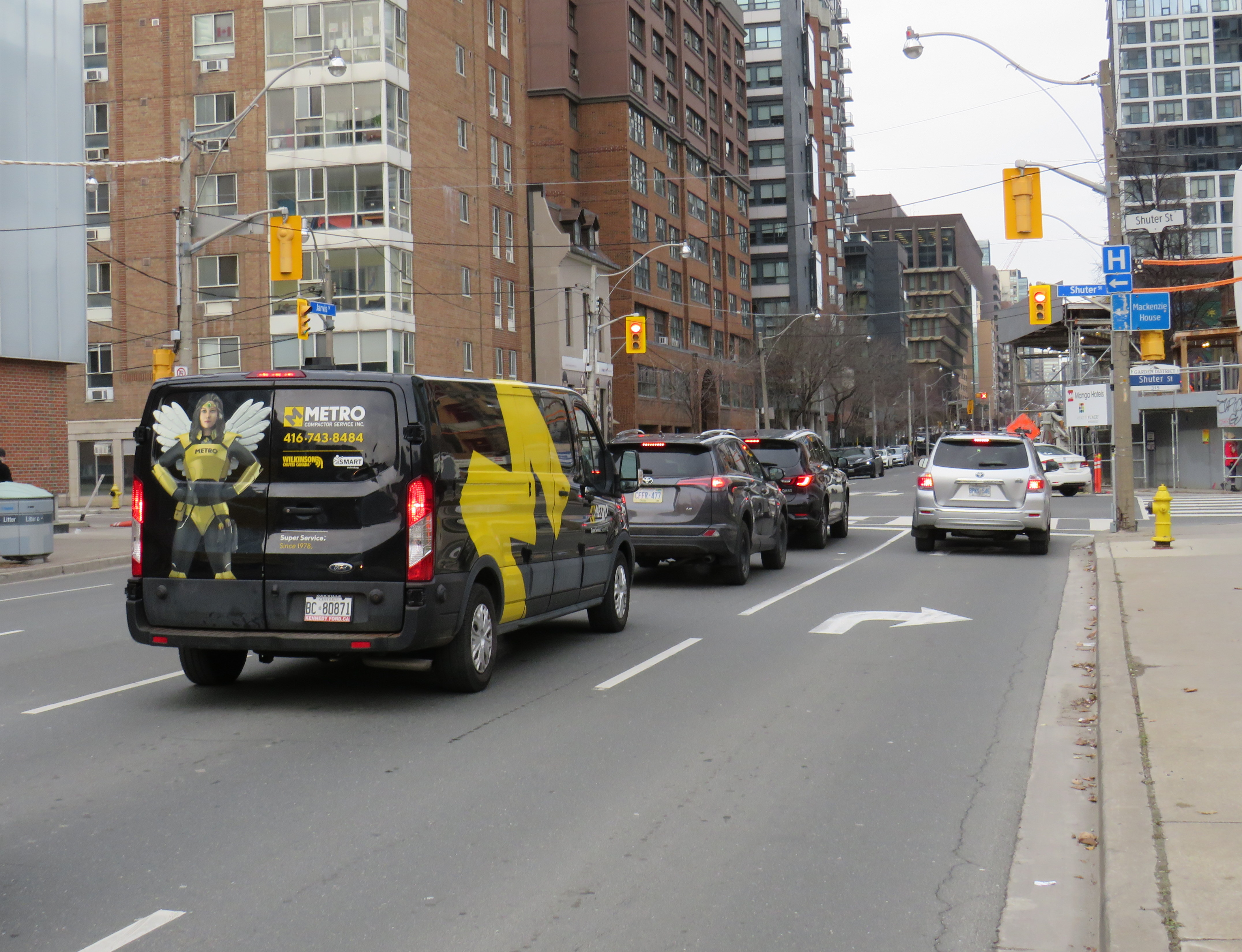
    North-south streets such as Spadina, York, Bay, and Jarvis are jammed by drivers headed south towards the Gardiner Expressway, with lane closures near Exhibition Place only making things worse. Motorists blocking intersections make it difficult for pedestrians, cyclists, streetcars, and through traffic to get across the city centre. Ontario Line construction has closed a portion of Queen Street, while work to rebuild streetcar tracks on York and Adelaide Streets to allow 501 cars to bypass the closure is still proceeding.

    GO Transit is also expanding its rail corridors to allow for more off-peak and express trains, with the long-term goal of having an electrified, frequent, regional rail network that complements and supplements the web of subways, light rail and buses throughout the region. The TTC is also addressing a backlog of state-of-good repair works throughout the subway system, resulting in slow orders, early closures, and weekend shutdowns.

    Meanwhile, people still need to get to places like work, school, conferences and trade shows, concerts, sporting events, social gatherings, festivals, museums, and all the other things that make a city a city. Eventually, with improved GO corridors, the Ontario Line, and the opening of the Crosstown LRT, there will be some redundancy in the transit system that will make planned service closures easier to navigate. But for now, we are stuck with an underbuilt transportation system in a rapidly growing city.

    This makes the coordination of transit closures and projects especially essential so things don’t completely fall apart. Saturday, September 21 was just one example of the failure to do so.

    On Saturday September 21 and Sunday September 22, GO Transit reduced service on the Lakeshore West Line to hourly service on the entire corridor because of work at Long Branch GO Station, where the station is being completely rebuilt for accessibility improvements and future expansion. It also shut down the entire Barrie Line for various construction works along the corridor, with rail replacement buses to Union Station, stuck in traffic on the Don Valley Parkway and Lake Shore Boulevard with all other motorists getting around the Gardiner closure.

    Normally, there are hourly trains as far west as West Harbour Station in Downtown Hamilton, with half-hourly service to Aldershot Station in Burlington. Between Union and Oakville, rail service is as frequent as every 15 minutes during midday and early evenings on Saturday and Sunday. Hourly train service reduced capacity on the inner Lakeshore West line by 75%.

    Compounding the problem was the total closure of the Gardiner Expressway between Highway 427 and the Don River between Friday evening and Sunday morning for routine maintenance (the Gardiner and the Don Valley Parkway are regularly closed twice a year for repairs). Many people who might have otherwise driven into the city would have taken GO Transit instead, normally a very good idea. Though none of Toronto’s professional sports teams were playing at home on Saturday, there was still a Shane Gillis stand-up comedy performance at Scotiabank Arena, and a Rainbow Kitten Surprise concert at Ontario Place.

    Also, to add insult, the Lakeshore East trains between Toronto and Oshawa were not through-running with the Lakeshore West trains and were operating on a modified schedule. I was travelling east of Toronto on Saturday, making a few stops in Durham Region. As I arrived back from Whitby on Saturday afternoon on a train that normally connects onward westbound train at Union Station, we were treated to the sight of the hourly Lakeshore West train just pulling out. It couldn’t have even waited 2-3 minutes to allow passengers to make the cross-platform connection. That resulted in other passengers complaining to GO staff in the concourse, who were not that helpful.

    Tweet from Alan Deschamps, reporting on a full GO train arriving at Long Branch at 6:21 PM on Saturday Sept 21, with the customer service ambassador (CSR) telling waiting passengers to not board and to wait for the next train in an hour

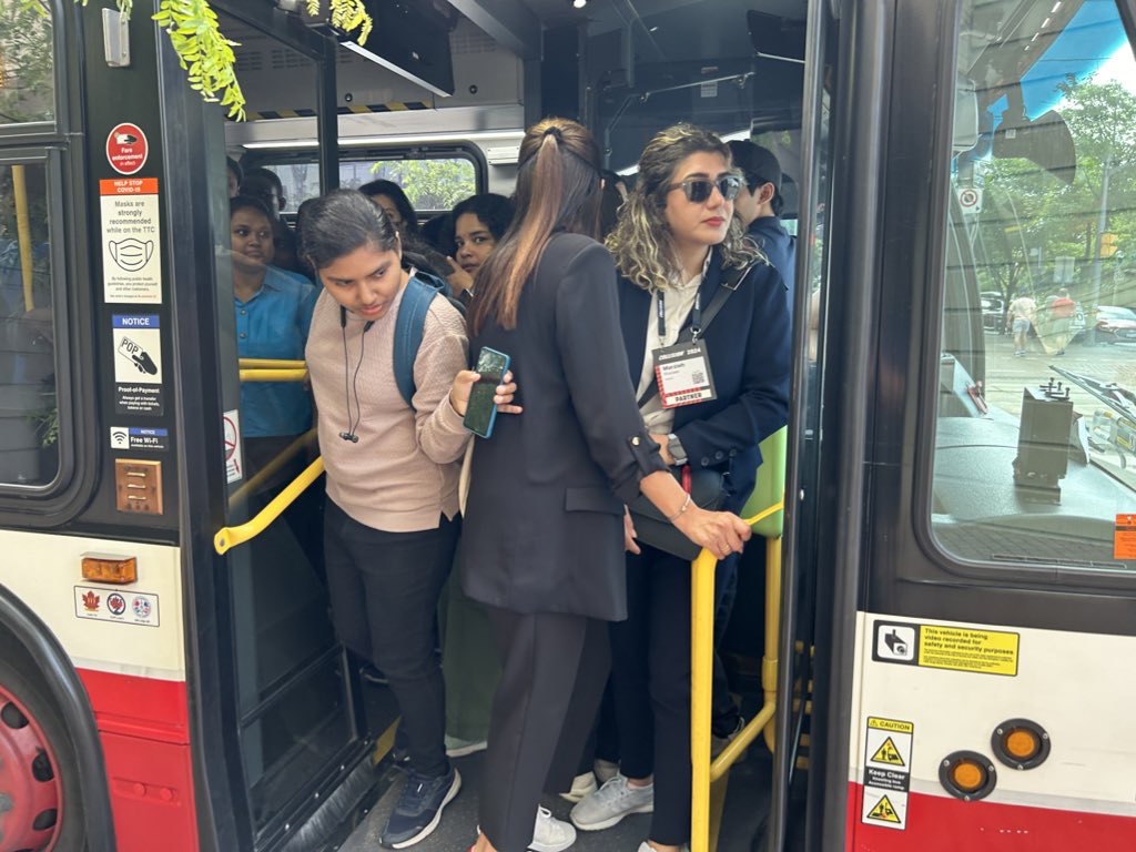
    In the early evening on Saturday, a jam-packed eastbound GO train on the Lakeshore East train was not accepting any passengers at Long Branch or Mimico station because of overcrowding. Waiting passengers were told to wait an hour for the next train.

    One would think that Metrolinx (GO Transit’s parent agency) and the City of Toronto would coordinate their construction schedules to avoid such problems. However, not even the City of Toronto can figure this out. Back in June of this year, the TTC replaced the 509 Harbourfront and 511 Bathurst streetcars with buses for a week for minor overhead work on Fleet Street. The timing coincided with the massive Collision tech conference at Exhibition Place, which resulted in overcrowded shuttle buses and unreliable service. Had the TTC checked with anyone at the city’s economic development office or with Exhibition Place (another city agency), this work could have easily been rescheduled.

    Overloaded 509 Harbourfront bus shuttle on Queen’s Quay in June 2024

    Though coordination of transit closures and construction projects with major events and parallel roadworks will not solve Toronto’s road and transit congestion problems, it will at least reduce some of the frustration of getting around. The poor customer service at GO Transit will certainly make riders question if they will be able to rely on the service in the future.

    Of course, there is one measure that won’t help but still will be implemented by the provincial government later this fall: a prohibition on new bicycle lanes if they take road space from motorists. Despite blocked bike lanes, aggressive drivers, and an incomplete cycling network, it is still the most reliable and fastest mode for many shorter city trips. Along with major transit improvements and construction coordination, cycling is one of the solutions to getting around Toronto.

  • Make streetcars king once more

    Streetcars backed up eastbound at King and University, November 28, 2023

    On Tuesday, November 28, the University of Toronto’s School of Cities released their report that looked at vehicle movement and traffic violations on the King Street Transit Priority Corridor. They found that there are, on average, 6,800 illegal turns and through movements at intersections on the corridor, and less than 0.3% of offenders are stopped by Toronto Police and ticketed. Traffic enforcement was heaviest between November 2017 (when the pilot began) and March 2020 (when the COVID-19 pandemic restrictions began). Enforcement has not caught up since then.

    The U of T School of Cities has provided invaluable quantification of what many Torontonians have suspected for years: the King Street Transit Priority Corridor is broken, and that there is little being done to fix it.

    The transit priority corridor, which runs between Bathurst Street in the west and Jarvis Street in the east, has restrictions on through vehicle movements, where motorists must turn right at most intersections. Until 10 PM daily, only TTC buses and streetcars, emergency vehicles, and bicyclists are exempt. After 10 PM, taxis may also continue through the corridor.

    The pilot program launched on November 12, 2017. The initial pilot, in which signs were erected, Jersey barriers placed to restrict the curb lane, and TTC stops moved to the far side of most intersections, was intended to optimize permanent streetscaping improvements, streetcar stop placement and transit optimization, get motorists acquainted with the new rules (at first, only warnings were issued by police) and allow time for Toronto City Council to decide on whether the pilot should be made permanent. Council approved making the transit priority corridor permanent on April 16, 2019.

    Though Toronto City Council voted to transform King Street permanently, no work has started on the streetscape or public realm to do so. Just like Union Station, temporary Jersey barriers remain in place. The relocated TTC streetcar stops are left at road level, without transit shelters or accessible curbs. Drivers routinely ignore restrictions, with only a 0.3% chance of getting a $85 or $110 ticket. Meanwhile streetcars get stuck and transit riders get nowhere. On Wednesday, November 8, a Toronto police officer decided to enforce congestion on King Street… by ticketing a streetcar operator stuck in the intersection at University Avenue.

    A motorist, ignoring several signs, proceeds straight through on King Street eastbound at Spadina Avenue

    The problem is not just limited to through movements on King Street, though. On Tuesday, November 28, I stood at the corner of King and Spadina between 4:00 PM and 4:20 PM. The backup of cars and trucks headed southbound towards the Gardiner Expressway extended into the south side crosswalk and into the eastbound lanes at times. Motorists are not permitted to enter an intersection on a green light if they cannot clear it before the light turns red; this causes gridlock. But on more than one occasion, streetcars and pedestrians were impeded by illegal intersection blocks.

    At Spadina and King, a truck and three passenger vehicles block the south side crosswalk and prevent a streetcar from proceeding straight on a green light

    After standing at King and Spadina, I walked over to King and University, where the Toronto Police charged a streetcar operator earlier this month. At 5 PM, eastbound streetcars were lining up between University and John Street, unable to proceed.

    Traffic jammed at King Street eastbound at University Avenue

    However, motorists were able to turn right and left from University Avenue to eastbound King, blocking the east side crosswalk to pedestrians and ensuring that no streetcar could continue across. I spoke to one operator, who told me that the day before, he was stuck there for a half hour before he could move across.

    The University and King intersection, at 5:00 PM on Tuesday, November 28. Note the blocked crosswalk and the line of streetcars, all with their hazard lights blinking. Eventually, one streetcar operator decides they had enough, and occupies the intersection.

    While there, I counted several motorists who passed to the right of the stopped streetcar, and instead of turning right as permitted, they went straight, only contributing to the blockage ahead.

    Two eastbound cars pass a stopped streetcar on the right to join the congestion ahead

    The problem downtown is exasperated by several road closures. Queen Street is closed between Bay and Victoria Streets for Ontario Line construction; this will last for at least five years. Adelaide Street, which is one-way eastbound is closed at York Street due to the delayed Adelaide Street diversion track installation that is supposed to allow Queen Streetcars to divert around the Ontario Line closure. York Street is also closed at Adelaide. There are several other lane closures on Bay, Yonge, and Richmond Streets and University Avenue for utility work.

    Adelaide Street is likely to remain closed at York until early 2024

    Yet, one would hope that something was done to allow transit riders to get through the downtown core, especially as the city has been aware of the severe congestion for weeks at this point. The city needs to move ahead on permanent streetscape changes to further discourage through traffic on King Street by closing the curb lanes at the far side of each intersection.

    It is also clear that the Toronto Police are not too interested in ticketing motorists on King Street. Even if they were, it wouldn’t be enough, as it takes 10-15 minutes to stop and ticket a driver; automatic ticketing, similar to red light cameras, would be more effective, though traffic officers can still be strategically deployed at congestion hotspots.

    It’s beyond time for this city to take transit seriously again. King Street would be a great place to start.

  • The jarring streetscape of Jarvis Street

    The jarring streetscape of Jarvis Street

    Curb lanes closed for condominium construction have defeated the purpose of Jarvis Street’s fifth reversible lane

    Over a century ago, Jarvis Street was Toronto’s most fashionable address, and home to prominent families including the Masseys, who made their wealth from the farm equipment industry, and whose names live on through Massey Hall, Hart House, the Fred Victor Mission, and Massey College. The wide boulevards allowed for lush street trees to flourish, and without streetcars, there was no need for a wide roadway, despite the generous right-of-way.

    Jarvis Street looking south towards Carlton Street in the 1880s. City of Toronto Archives: Fonds 1478, Item 12.

    By the 1920s, though, Jarvis was no longer fashionable, with Forest Hill, North Rosedale, and Moore Park taking its place. Many of the old mansions fell into disrepair or were converted into apartments or businesses. The street became lined with low-rise apartment buildings, budget hotels, and missions to the poor and unhoused. After the Second World War, the city government decided to extend Mount Pleasant Road south of St. Clair Avenue to Bloor and Jarvis Streets and widen Jarvis Street to accommodate the increased traffic. Along with building the Dundas Street East extension, widening Dufferin Street, and pushing through Eastern Avenue, the City of Toronto was bending to the whims of the automobile, several years before the creation of Metropolitan Toronto in 1954.

    Jarvis Street looking north from Carlton Street, January 1947, just before the street trees were removed and the street widened. City of Toronto Archives, Series 372, Item 1725.

    By the 1960s, Jarvis Street became the preferred address of federal institutions such as the Moss Park Armoury, the regional Unemployment Insurance offices at Dundas Street, and the brutalist Ontario headquarters for the RCMP. The provincial government expanded the old Juvenile Court with a new modernist building, and Simpsons-Sears, the predecessor of Sears Canada, built a new imposing office building at 222 Jarvis, adjacent to the Simpsons warehouse on Mutual Street.

    Victorian rowhouses stand next to the brutalist RCMP building on Jarvis Street, north of Shuter Street in 1979. The RCMP building later became the home of the Grand Hotel, which installed a glass veneer over the imposing west façade. The Unemployment Insurance office, at the corner of Dundas Street appears in the far left. Both the RCMP/Grand Hotel and the UIC (later Hilton Garden Inn) building were recently demolished, but the rowhouses still stand.
    Photo by Harvey R. Naylor. City of Toronto Archives, Fonds 1526, File 61, Item 27.

    Jarvis Street was also the home of several of the CBC’s scattered radio and television studio spaces until they were consolidated at the CBC Broadcasting Centre on Front Street, and it was also the location of the first Four Seasons Hotel, when it started out as a chic motor hotel.

    Jarvis Street looking south from north of Carlton Street; the Four Seasons Motor Hotel at 415 Jarvis Street and St. Andrew’s Lutheran Church are visible in the background. Note the centre lane indicator above. Creator: Skinner, Dorothea Skinner. City of Toronto Archives Fonds 492, Item 170.

    By the early 1960s, Jarvis Street was reconfigured further to include a new reversible centre lane between Queen Street and Mount Pleasant Road at Charles Street. Then, as now, the centre lane was designated for southbound traffic, except during weekday afternoon rush hour, when the flow is reversed. Parking is prohibited at all times on the east side of the street, while on the west side, street parking is permitted except during the morning and afternoon peak periods. This, at least in theory, allows for two lanes of unobstructed traffic in both directions at all times, and in the rush hours, three lanes of peak-direction traffic. This, of course, depended on strict enforcement of parking and stopping prohibitions, and the lack of construction or other obstructions.

    As Jarvis Street rebounded and new residential development and commercial development began to line the street between the mid-1980s and the present day, the five-lane traffic arterial layout became less suitable. In 2009, City of Toronto staff recommended, with extensive public input, that it was desirable to remove the reversible centre lane, narrow the roadway, and widen the sidewalk on the east side of the street to improve the public realm and address the needs of the thousands of new residents who were moving into the east end of Downtown Toronto. The additional space would have allowed for tree planters and wayfinding signage that would highlight the street’s history. Studies conducted by city staff found that there was no need for the fifth lane to provide adequate traffic movement along the street.

    Cyclists, however, were unhappy that the road redesign did not include cycling lanes and they were able to convince council to alter its plans. As a result, in 2010, the road was not reconstructed, but the reversible lane was removed, with new painted cycle lanes on both sides of the street.

    When Toronto elected Rob Ford as mayor that October, he promised an end to “the war on the car,” even inviting now-disgraced hockey commentator Don Cherry to give the inaugural speech, which turned out to be a controversial rant against “pinko cyclists” and “left wing kooks.” In 2011, with the support of suburban councillors, Rob Ford reversed the decision to install bike lanes on Jarvis Street (along with Pharmacy Avenue and Birchmount Road in Scarborough), and the reversible lane was re-installed.

    Ironically, the demand by cyclists for bike lanes made it easy to restore the auto-oriented configuration, while widened sidewalks would have been much more difficult to remove.

    Between Dundas and Gerrard Street, the lanes shift to accommodate a lane closure for a new condominium tower on the east side of Jarvis Street.

    With much needed watermain and road reconstruction in the last few years, the traffic advantage provided by the reversible lane was negated because of the construction barriers. Several condominium towers being constructed along the street, at Carlton, Gerrard, and Shuter Streets, have further affected the ability of that fifth lane to move motorists quickly, effectively, or safely. Between Dundas and Gerrard Streets, the lanes temporarily shift for a long-term lane closure on the east side, just south of Gerrard. This lane shift adds additional confusion to an already confusing road layout.

    Looking north to Shuter Street, with the curb lane temporarily marked for right turns only.

    At Shuter Street, the construction of the Hyatt Place hotel and condominium apartment development has seen the northbound curb lane closed for several years. Approaching Shuter, the curb lane is marked as a right-turn lane, but it is used as an illegal bypass of traffic waiting at the light or turning left onto Shuter towards St. Michael’s Hospital and the Eaton Centre. This, combined with the hidden sightlines caused by the construction hoarding on the northeast corner, makes it especially dangerous for southbound motorists as well as pedestrians and cyclists crossing at this point. Beyond the construction hoarding, the right lane is used for construction crew parking, as well as staging for vehicles such as cement trucks.

    Looking down towards the Hyatt Place development, showing the obstructed northbound curb lane, as well as a grey SUV crossing into the centre lane, which was reserved for opposing traffic when this photo was taken.

    The long-term closure of lanes on Jarvis Street should make it clear to city officials that the outdated and unsafe middle lane is of no practical use, and it finally has got to go.

    At Jarvis and Shuter Streets, the northbound right turn lane is used by impatient motorists, including a City of Toronto garbage truck, a taxi cab, and the driver of a speeding Lincoln Navigator.

    Collisions are common on Jarvis Street because of the reversible centre lane — which exists nowhere else in Toronto, and in only a few places elsewhere in Canada — because of driver confusion, impatience, negligence and incompetence. As Jarvis Street becomes home to thousands of more residents in the next few years, is beyond time that the street becomes safer and more attractive to live, work, and enjoy life on.

  • Let’s rock out for Vision Zero

    IMG_4345.JPG
    The Major Street Boulder

    On September 18, Toronto Star columnist Jack “The Fixer” Lakey wrote about a boulder that was dug up during construction in the Annex. Bloor Street is currently being dug up between Bathurst Street and Spadina Avenue as the city replaces watermains and reconstructs the roadway. New parkettes at Major Street and Howland Street are also part of the work. As this is going on, bike lanes and parking spaces have been removed, and traffic is rerouted to one side of Bloor Street.

    The billion-year old boulder (its age is unremarkable; the Canadian Shield is older than that) will be incorporated into a nearby parkette. For now, it sits on the side of Major Street immediately south of Bloor. When I visited Thursday evening, the boulder was moved slightly south by a construction crew that was working on the parkette.

    Major Street, despite its grand name, is a minor residential road that leads one-way south from Bloor towards Sussex Street. It is part of a one-way maze of local streets intended to discourage through traffic and permit on-street parking (while frustrating cyclists looking to cut through quiet local streets instead of taking Bathurst or Spadina).

    Lakey was informed about the Major Street boulder by a motorist complaining of turning right onto Major from Bloor and scraping the passenger side as she passed the boulder. She said she couldn’t see the rock because it was below the height of her windows, though there were pylons adjacent to the rock. Lakey visited the site and found two pylons next to the boulder. The city’s response was to ensure that pylons be secured to the rock with caution tape, and to block it off if necessary, as it can not easily be moved.

    IMG_4347-001
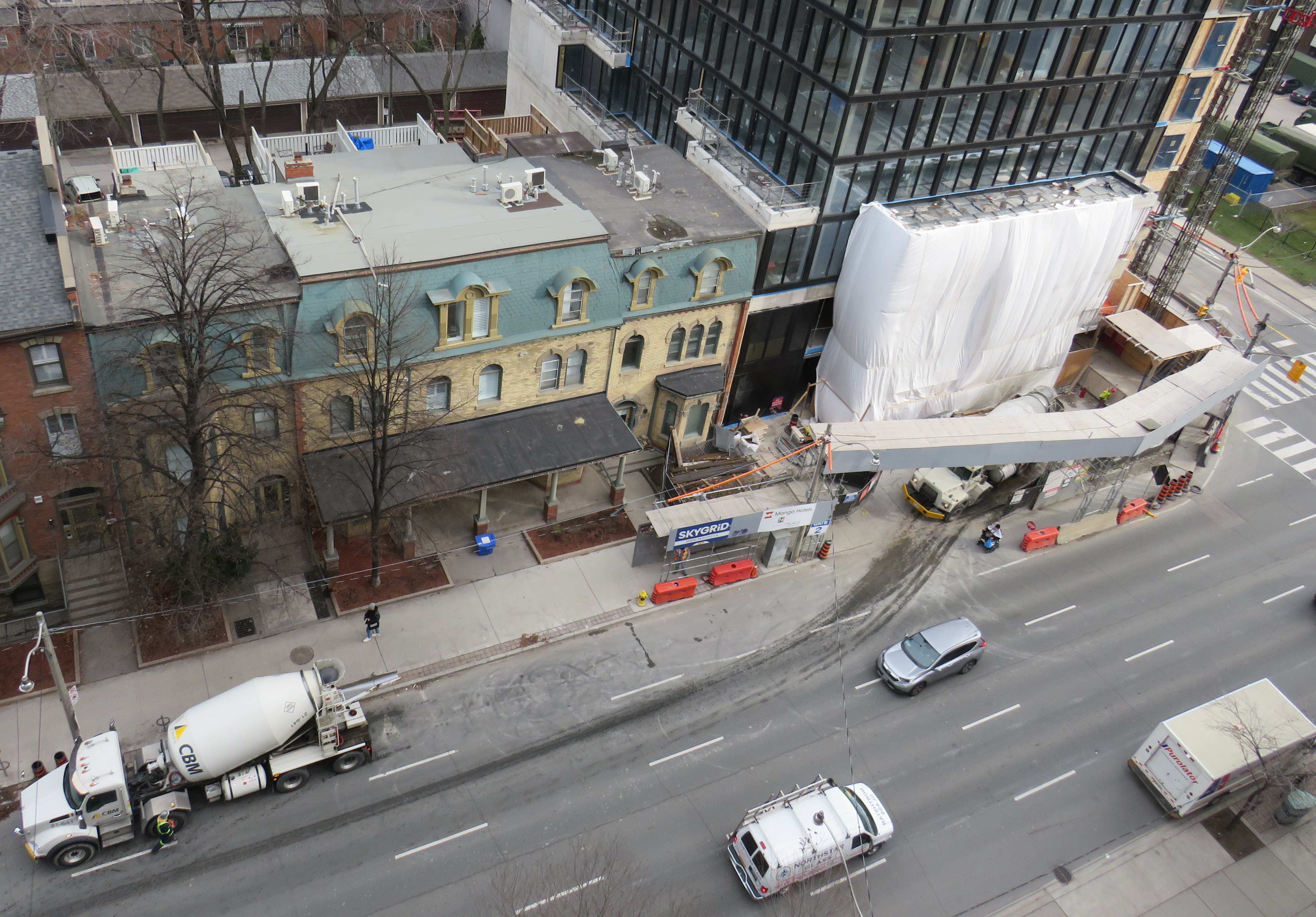
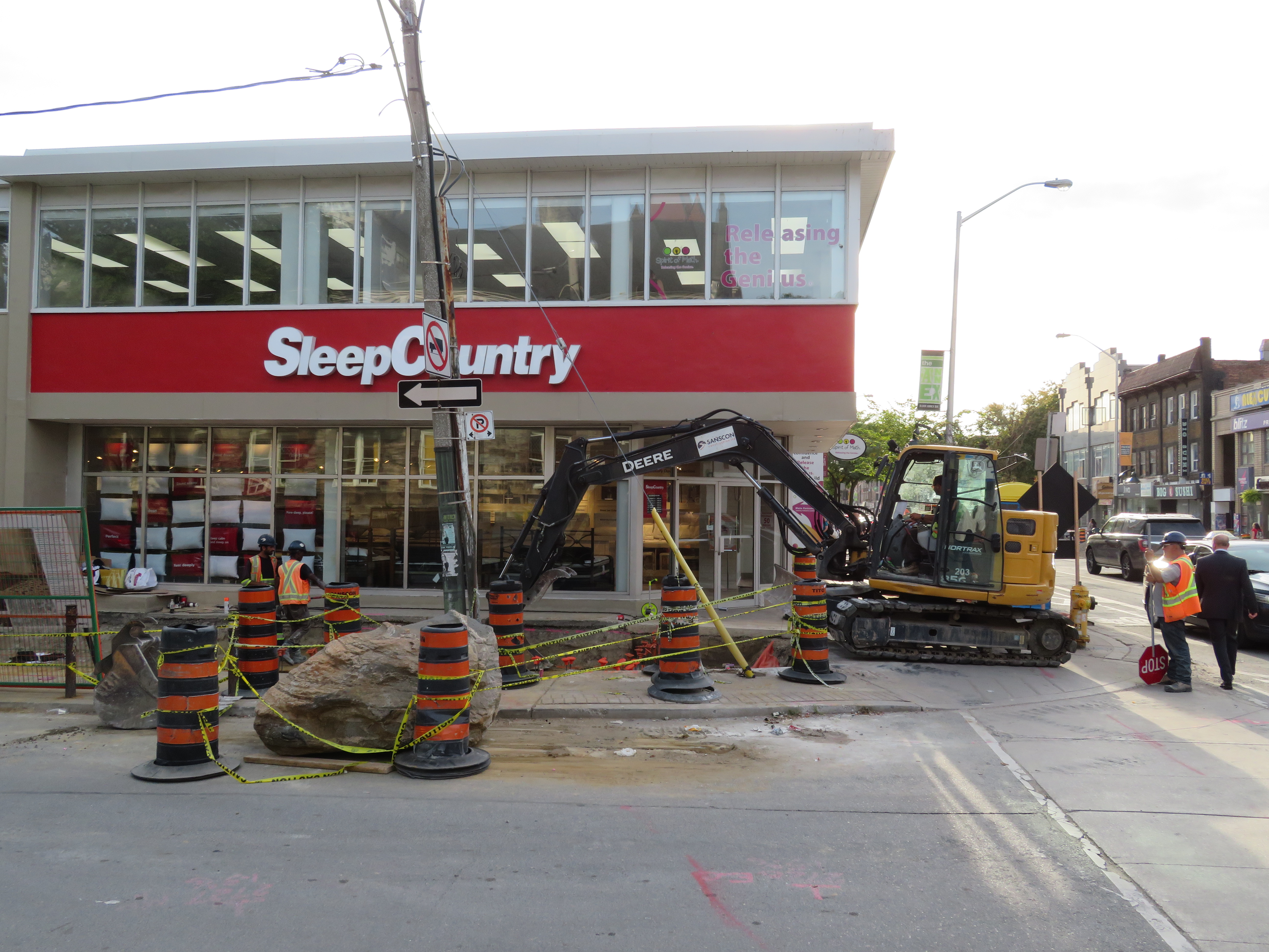
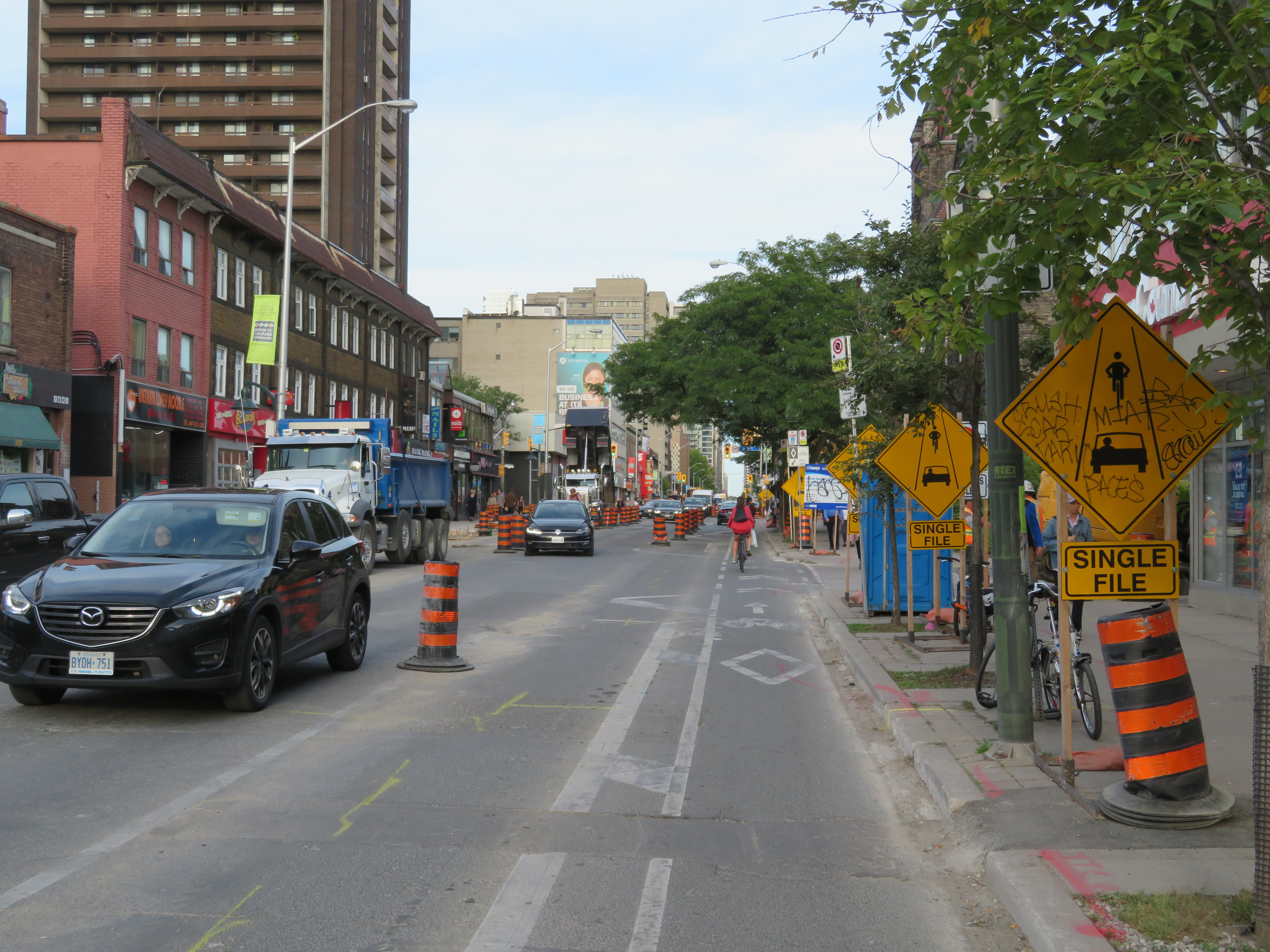
Bloor Street is a mess of construction and signage as construction continues through September

    Though the city was right to improve the visibility of the boulder, placed in a spot where it wouldn’t be expected, I can’t say I have too much sympathy for drivers who miss it and scratch their cars. Bloor Street is a mess, but it is an active construction site. The bike lanes have been closed off, with cyclists expected to travel with traffic, single file with motor vehicles. The lane configuration has changed, and pedestrians must navigate the construction clutter, signs, and fencing on sidewalks and crosswalks. Such an environment calls for slow and considerate driving.

    The motorist quoted in Lakey’s column said that she could not see the 80-centimetre tall boulder as it was below her line of sight. Other things that might be below a driver’s line of sight at close proximity include pylons, knock-down posts, mailboxes, garbage bins, dogs, cats, recumbent bicycles, strollers, small children, wheelchairs, and other mobility devices. As the average vehicle size has become larger (with Ford and General Motors phasing out sedans in favour of SUVs and light trucks), the line of sight has become higher as well.

    But this gives me an idea that can balance the City of Toronto’s supposed commitment to Vision Zero with the mayor’s desire to keep property taxes too low to pay for the implementation of true Vision Zero across the city. Just add rocks. Lots and lots of rocks.

    Boulders can take a pounding, unlike plastic knock-down poles that motorists can just drive over to get into a cycle track. They can be used to narrow wide residential streets at strategic points and discourage fast turns at intersections. Of course, they can be marked with metal reflective signs, but they’d be cheap to install and very effective.

    Boulders are easy and cheap to source with of all the construction going on in Toronto, with foundations being dug for high rise offices and apartment buildings. But if we’re stuck, we can source rocks from Northern Ontario, where the Canadian Shield is blasted away for resource extraction and the twinning of Highway 69.

    Vision Zero on a zero-vision budget.

  • Toronto can do better for cyclists at construction sites

    For years, cyclists in Toronto have not been getting enough respect. In 2011, City Council voted to remove bike lanes on three streets — Jarvis Street, Pharmacy Avenue, and Birchmount Avenue. Major off-road cycling routes are closed for months or years at a time, while additional funds are found to accelerate road closures and construction on the Gardiner Expressway. Mayor Tory is committed to spending $1 billion to maintain the eastern section of the Gardiner, despite low traffic volumes and lost opportunities for the revitalization of the eastern Harbourfront. Yet funding for a comprehensive grid of safe cycling routes remains hard to come by.

    There have been some positive news, however. The new Bloor Street bike lanes — officially a pilot project — between Avenue Road and Shaw Street were recommended for retention by the Public Works and Infrastructure Committee this month. New bike lanes were added on Woodbine Avenue this year. And the Toronto Police Services’ parking enforcement officers have been targeting cars and trucks stopped in bike lanes.

    But one problem that still needs to be addressed is proper messaging at construction sites where bike lanes or general-traffic curb lanes are closed for construction. Too often, cyclists are told to dismount and walk their bikes, despite their status as vehicles, entitled to use the road as any other vehicle. (There are, of course, exceptions such as freeways and some high-speed roads where pedestrians and cyclists are expressly not permitted.)

    For example, cyclists heading west from Danforth Avenue over the Prince Edward Viaduct were greeted with a sign reading “bicycle lane closed – cyclists dismount and use sidewalk.” Next to that sign was a “sidewalk closed” sign, directing pedestrians to the south side of the viaduct.

    https://twitter.com/andreabodkin/status/903318305192247296

    The Ontario Highway Traffic Act says that cyclists are to ride as close to the right of the roadway as practicable. But this does not necessarily mean cyclists must ride right next to the curb either, especially if there are blockages, debris, or other hazards. Motorists must also pass cyclists at a distance of at least one metre, and must wait for a safe opportunity to pass.

    147 (1) Any vehicle travelling upon a roadway at less than the normal speed of traffic at that time and place shall, where practicable, be driven in the right-hand lane then available for traffic or as close as practicable to the right hand curb or edge of the roadway.  R.S.O. 1990, c. H.8, s. 147 (1).

    4) Every person in charge of a vehicle on a highway meeting a person travelling on a bicycle shall allow the cyclist sufficient room on the roadway to pass.  R.S.O. 1990, c. H.8, s. 148 (4).

    (6.1) Every person in charge of a motor vehicle on a highway who is overtaking a person travelling on a bicycle shall, as nearly as may be practicable, leave a distance of not less than one metre between the bicycle and the motor vehicle and shall maintain that distance until safely past the bicycle. 2015, c. 14, s. 42.

    After several complaints, new signage directing cyclists and motorists to yield and share the lane was installed on Danforth Avenue approaching the viaduct.

    On Yonge Street, where construction between Wellington and Richmond Streets has reduced the road to two lanes, “cyclists dismount” signs have appeared as well. While this part of Yonge does not have bike lanes, the signage is still wrong. Cyclists have the same right to take the lane. I complained to a construction worker nearby after spotting these signs, who complained about cyclists riding through anyway, not getting my point.

    IMG_3940.JPG
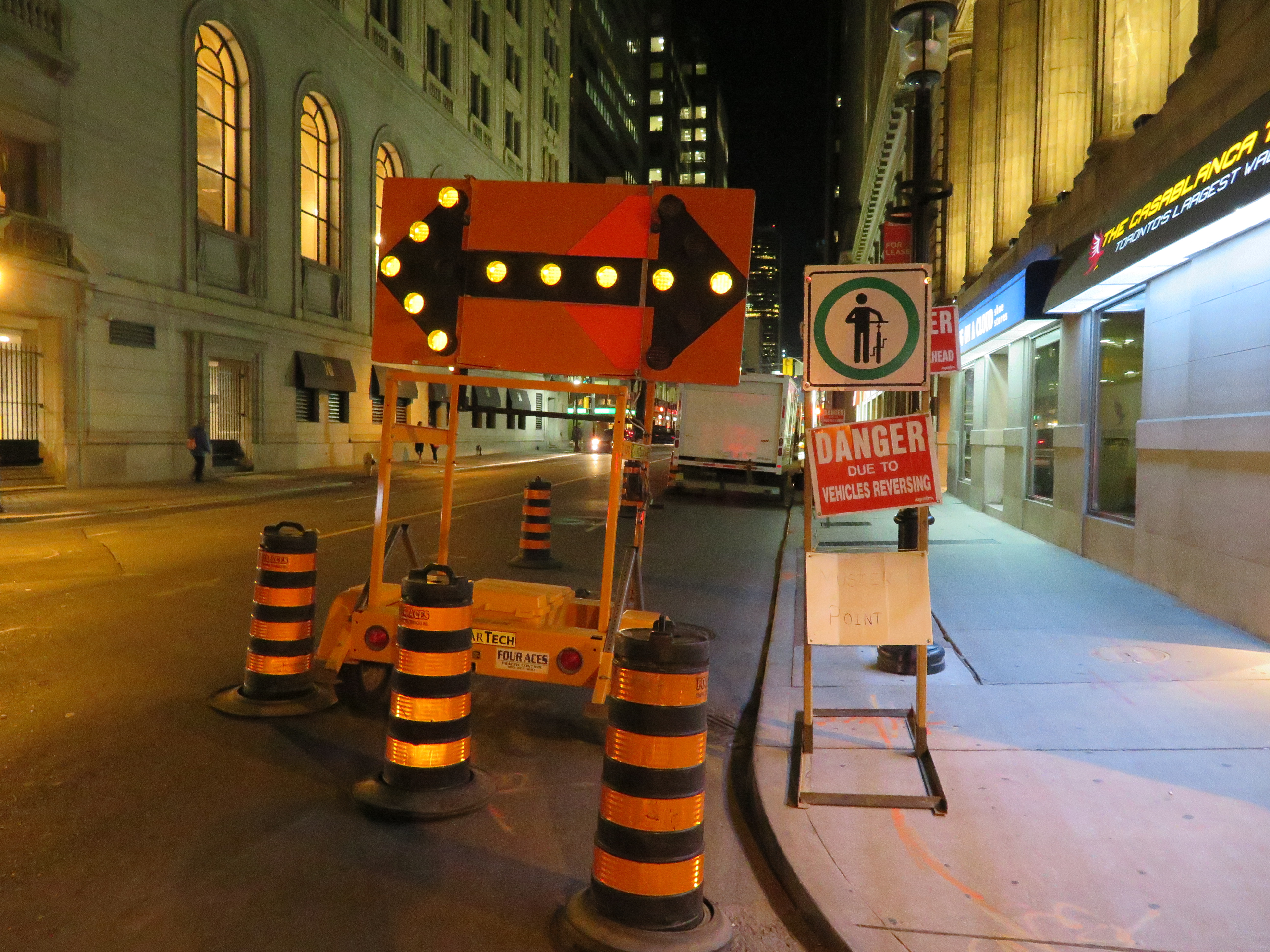
Construction signage on Yonge Street, south of King Street

    Signs telling cyclists to dismount are generally ignored, like those on multi-use paths in suburban Toronto. They’re placed at intersections and at narrow pinch-points for safety (drivers not expecting cyclists to cross; conflicts with pedestrians on sidewalks), but they are poor substitutes for solutions such as traffic calming, painted cross-rides at road crossings, and gentler, more effective measures to slow fast-moving cyclists, such as speed humps and barriers where necessary. At construction sites, it is far better to remind motorists to yield to cyclists and share the road, than expect cyclists to get off their bikes and walk around the construction zone. That said, “cyclists dismount” signs and enforcement is necessary and useful in pedestrianized zones, such as street festivals and pedestrian malls.

    Signage telling cyclists to dismount at construction areas is lazy, de-legitimatizes cycling, and sends the wrong message to motorists. I hear enough complaints about “cyclists who break all the rules.”

    Of course, it’s best to provide a safe passage for cyclists at construction zones, such as detouring a bike lane around the construction. On Richmond and Adelaide Streets, some building construction sites have shifted the separated bike lane around the site, an encouraging development. Where it’s not possible or feasible to maintain a bike lane through the construction zone, the signage still can be improved.

    At a construction site on Simcoe Street, confusing signage and a poorly marked diversion endangered northbound cyclists, forced out of the separated northbound lane and into oncoming traffic. This resulted in at least one close call.

    On a recent visit to Chicago, I came across a sign that delivers the right message. It read: “bike lane closed ahead — shared lane — yield to bikes.” The large orange sign was mounted in the road, in a way that it would be seen by motorists. It also makes it very clear that cyclists not only have the right to use the general traffic lane, it also makes it clear that motorists must give way to cyclists detouring around the closed bike lane. Toronto would do well to follow this example.

    The City needs to develop mandatory standards for bike lane and curb lane blockages, in order to reduce confusion, as well as promote the safety and legitimacy of cycling in this city. It must also enforce those standards vigorously.

    IMG_2904-001.JPG
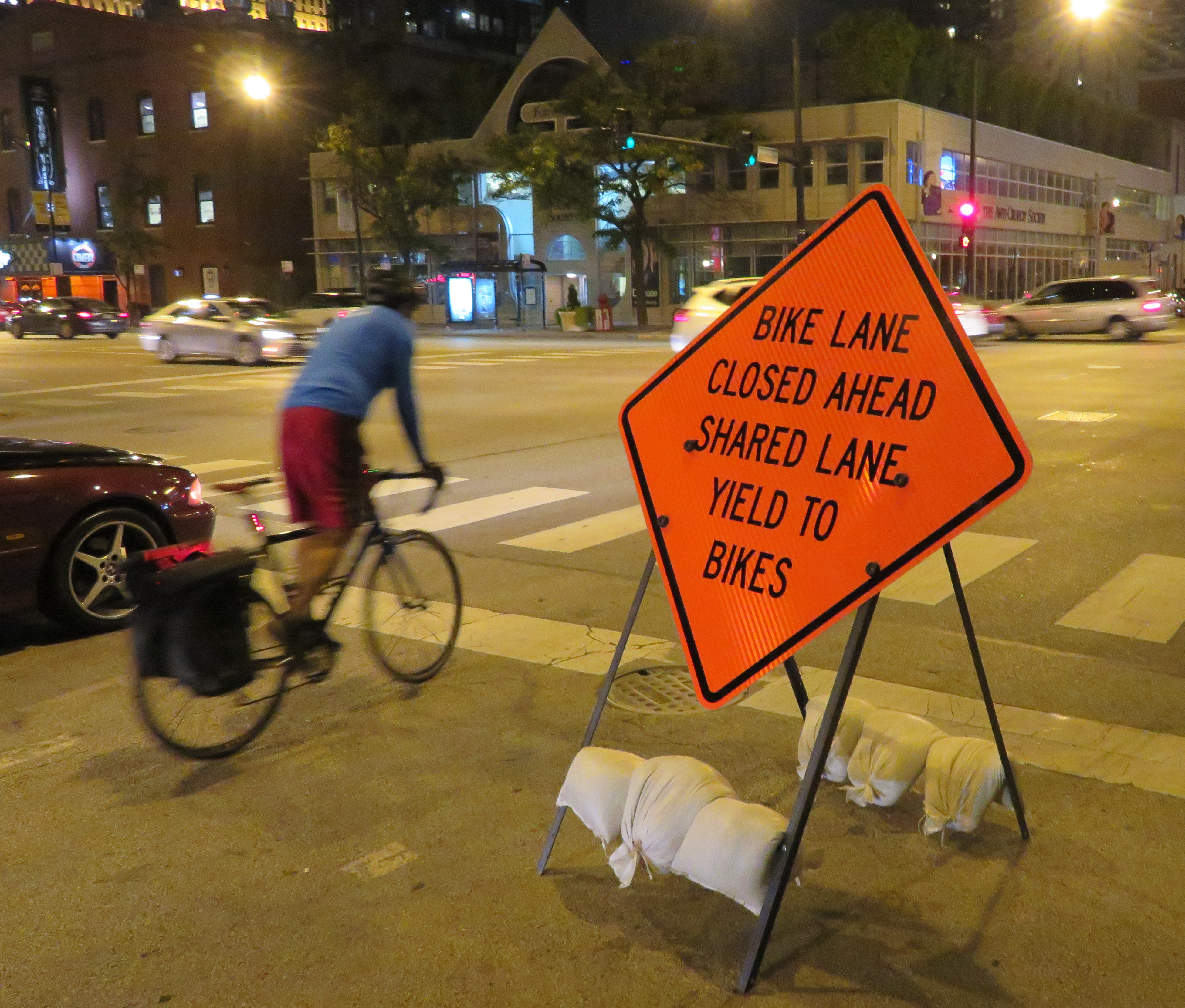
Sign in Chicago sends the right message

  • The ravine run around

    IMG_2475-001
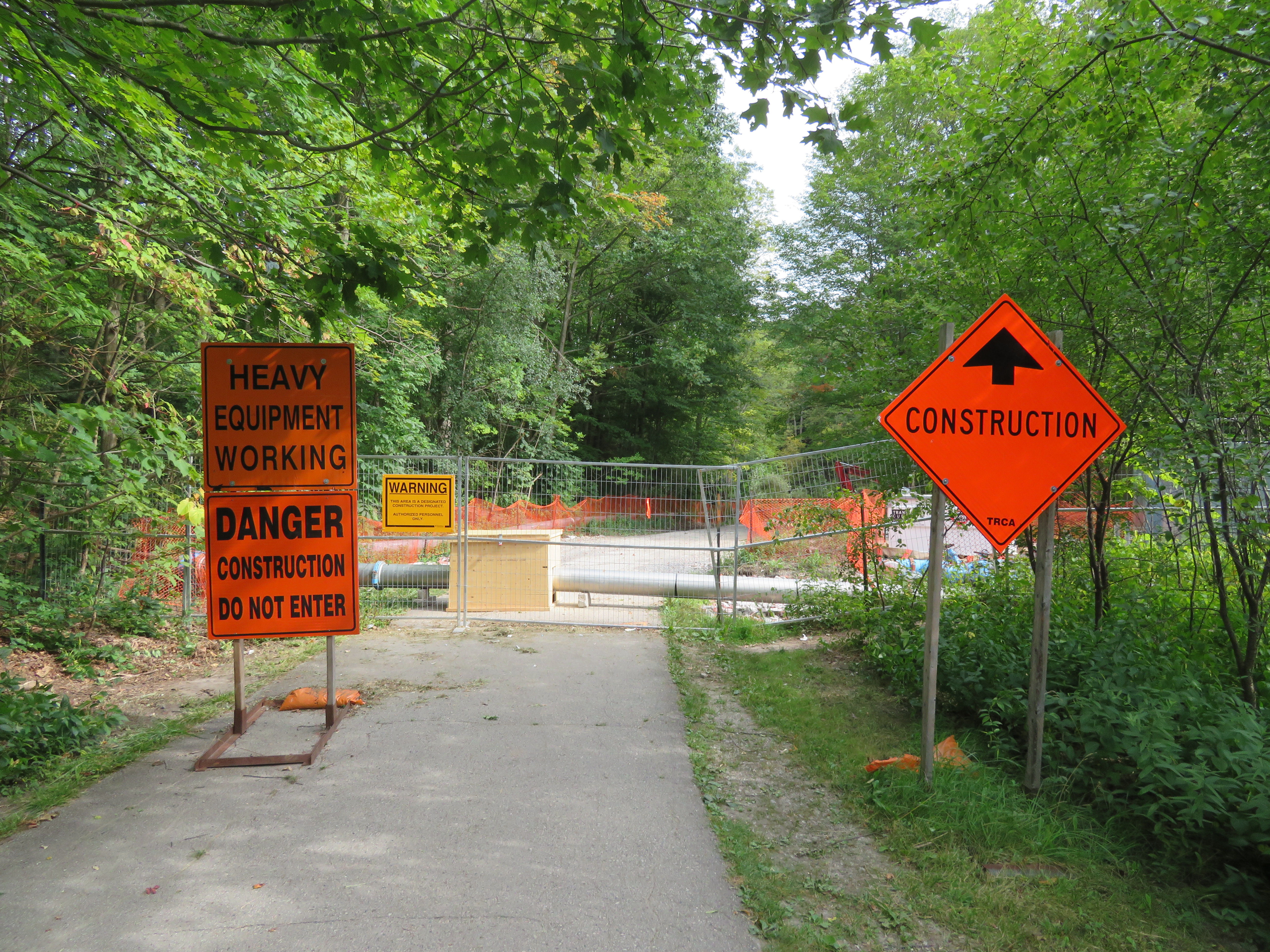
Wilket Creek trail closure, September 2017

    Last week,  my wife and I went for a walk through the Toronto Botanical Gardens, Edwards Gardens, and Wilket Creek Park, all part of Toronto’s wonderful and extensive ravine system. The ravines are one of Toronto’s greatest assets, and many are connected by multi-use trails, allowing pedestrians and cyclists to experience nature, close to home. Some trails, like the Lower Don, are also important commuter routes for those who walk or cycle to school or work.

    Unfortunately, several of these trails are closed for long periods for construction, and they do not get the same attention that roads and highways get.

    The Wilket Creek Trail, between Edwards Gardens and Sunnybrook Park, has been closed since Spring 2017, and will remain closed until Spring 2018. The Toronto Region Conservation Authority (TRCA) is repairing damage caused by erosion, and restoring the local ecosystem. The same trail was closed two years ago for similar construction work.

    The pedestrian detour on Leslie Street is straightforward, and does not deviate too far from the route. However, Leslie Street is busy and motorists drive at high speeds, so it is not a good safe route for cyclists. To the City of Toronto and TRCA’s credit, at least, the detours are well mapped and construction notices are signed well in advance. (I’ve experienced trail closures without any warnings or suitable marked detour routes.)

    IMG_2476-001
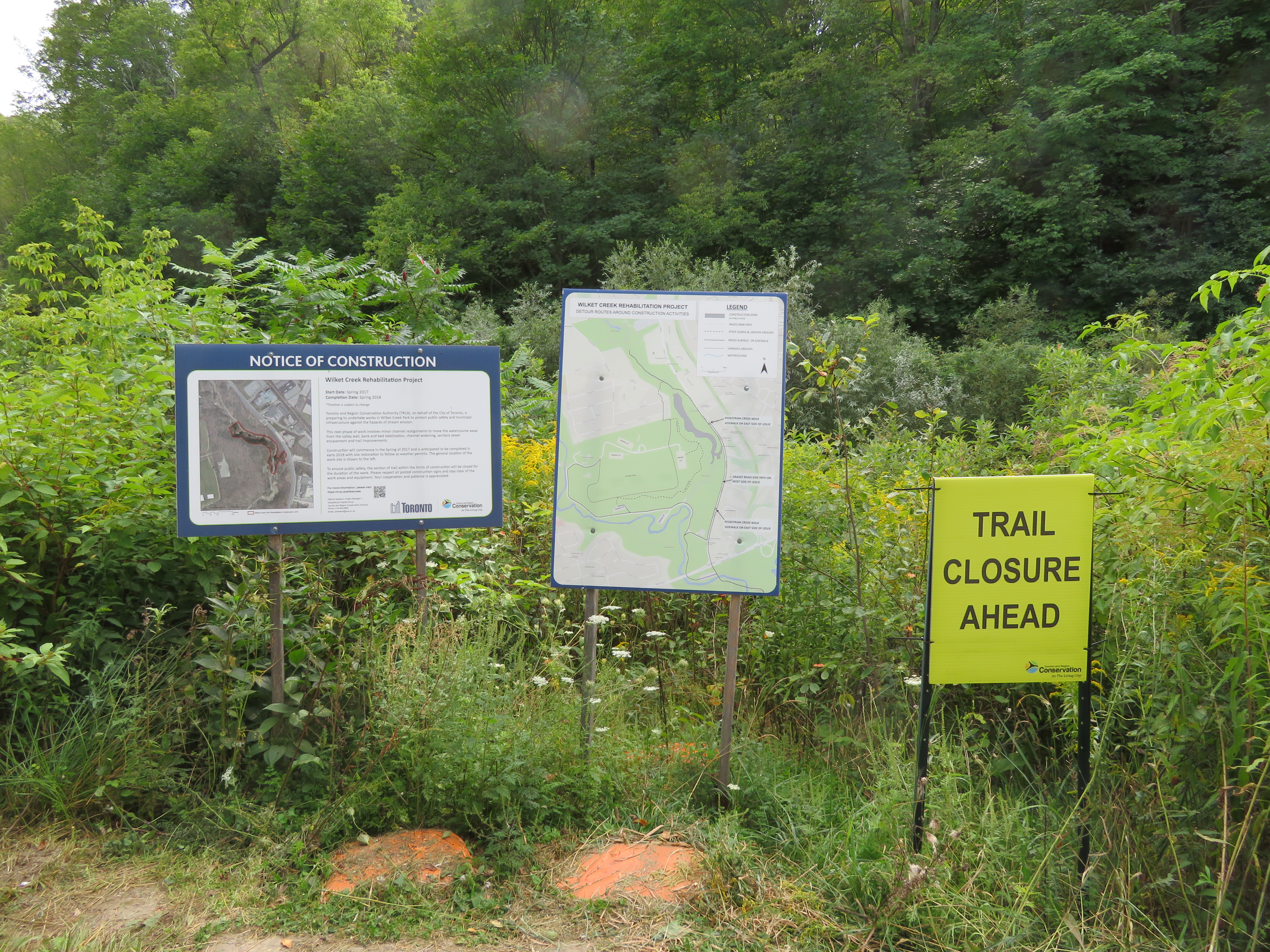
Advance warnings and a detailed detour map on the Wilket Creek Trail

    Further south, the Lower Don Trail between Pottery Road and the footbridge at Riverdale Park will re-open on September 23, 2017, fourteen months late. That work was done to replace an underpass at a disused rail corridor owned by Metrolinx.

    As Metro reporter David Hains points out, that re-opening was re-scheduled several times between July 2016 and August 2017 — unexpected soil conditions and wet weather were blamed for the delays.  Pedestrians and cyclists were directed to use either Broadview Avenue or Bayview Avenue to get around the closure; both are busy roads, and Broadview Avenue is at the top of a steep grade from the Don Valley.

    Other major closures included the Humber River Trail under Highway 401 near Weston Road, which was closed for several months in 2016 so that trail users would not be in the way of construction vehicles. The suggested detour, a 3 kilometre long circuitous route, followed Wilson Avenue, a busy suburban road.

    This year, the Etobicoke Creek Trail under Highway 401 in Mississauga is also closed for two years for bridge work. There are no safe alternatives for crossing Highway 401 in that area.

    Humber.jpg
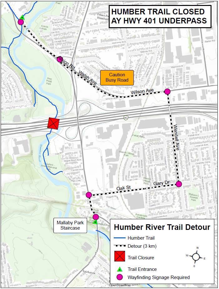
The circuitous and dangerous 2016 Humber River Trail detour at Highway 401. Source: MTO.

    The long and dangerous closures of major pedestrian and cycling routes can be compared to the way road repairs are prioritized. Mayor John Tory announced $3.4 million to speed up construction on the Gardiner Expressway in 2015, when the elevated highway was reduced to two lanes in each direction from three. In August, Tory announced additional funds to speed up watermain and streetcar track construction on Dundas Street between Yonge and Church Streets, perhaps not coincidentally a route many city councillors drive to get to City Hall.

    If only there were some additional money and attention given to projects affecting pedestrians and cyclists in Toronto. It would also be nice to ensure any detours were well signed, and made as safe and comfortable as possible.