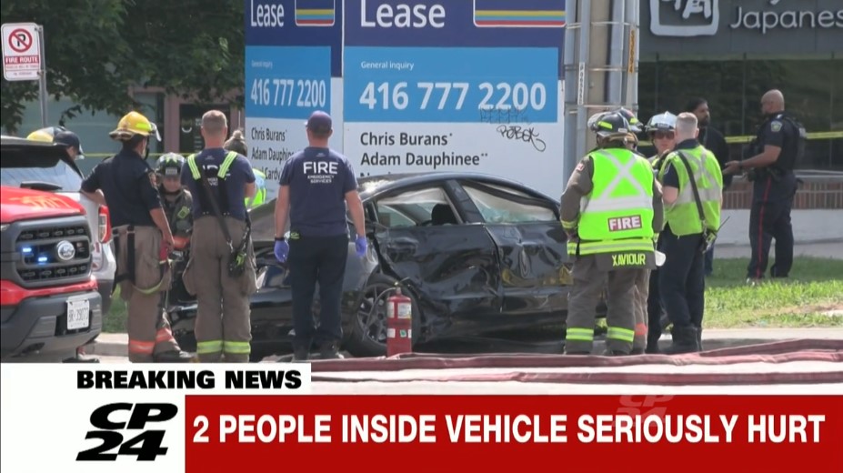
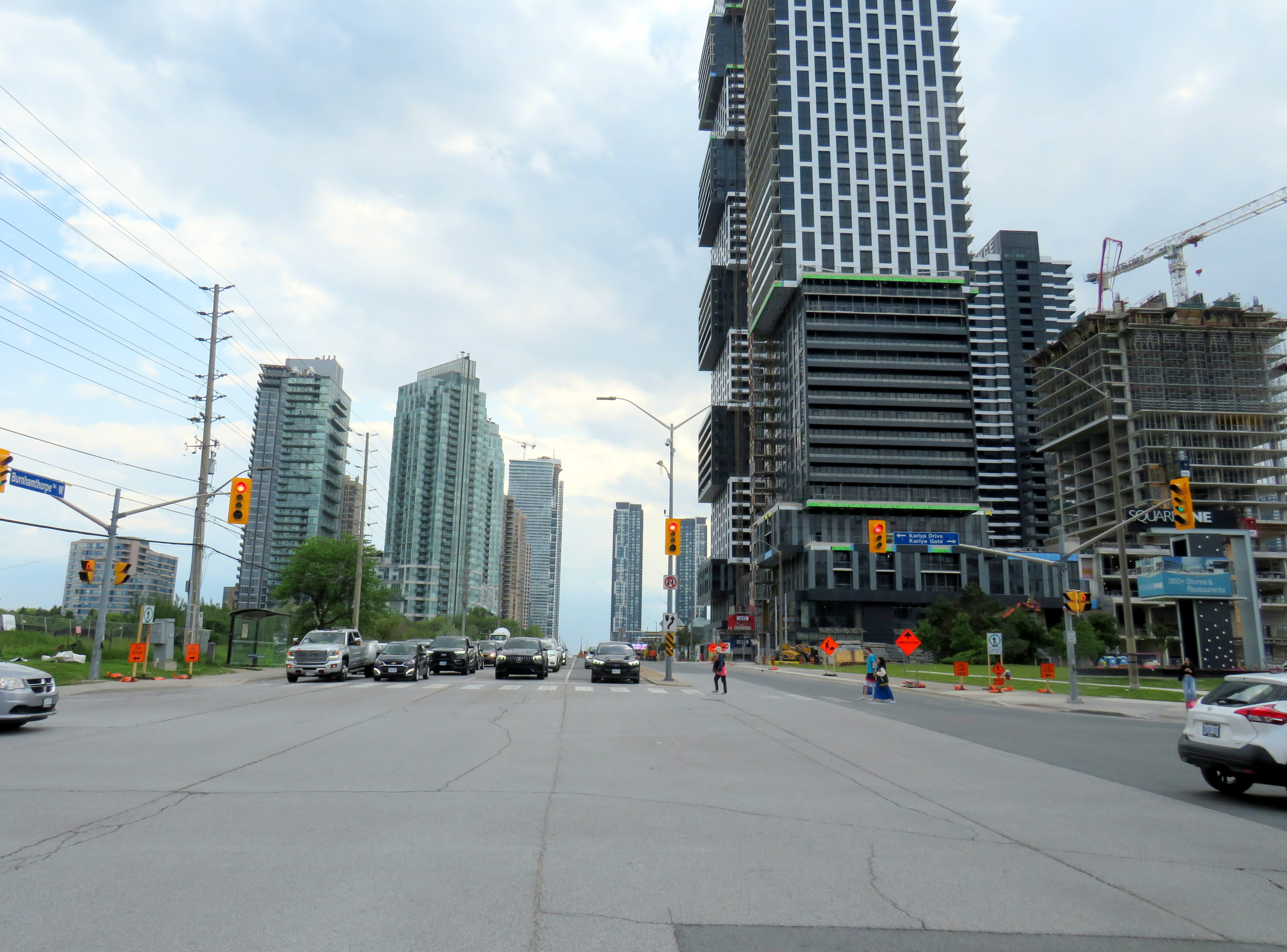
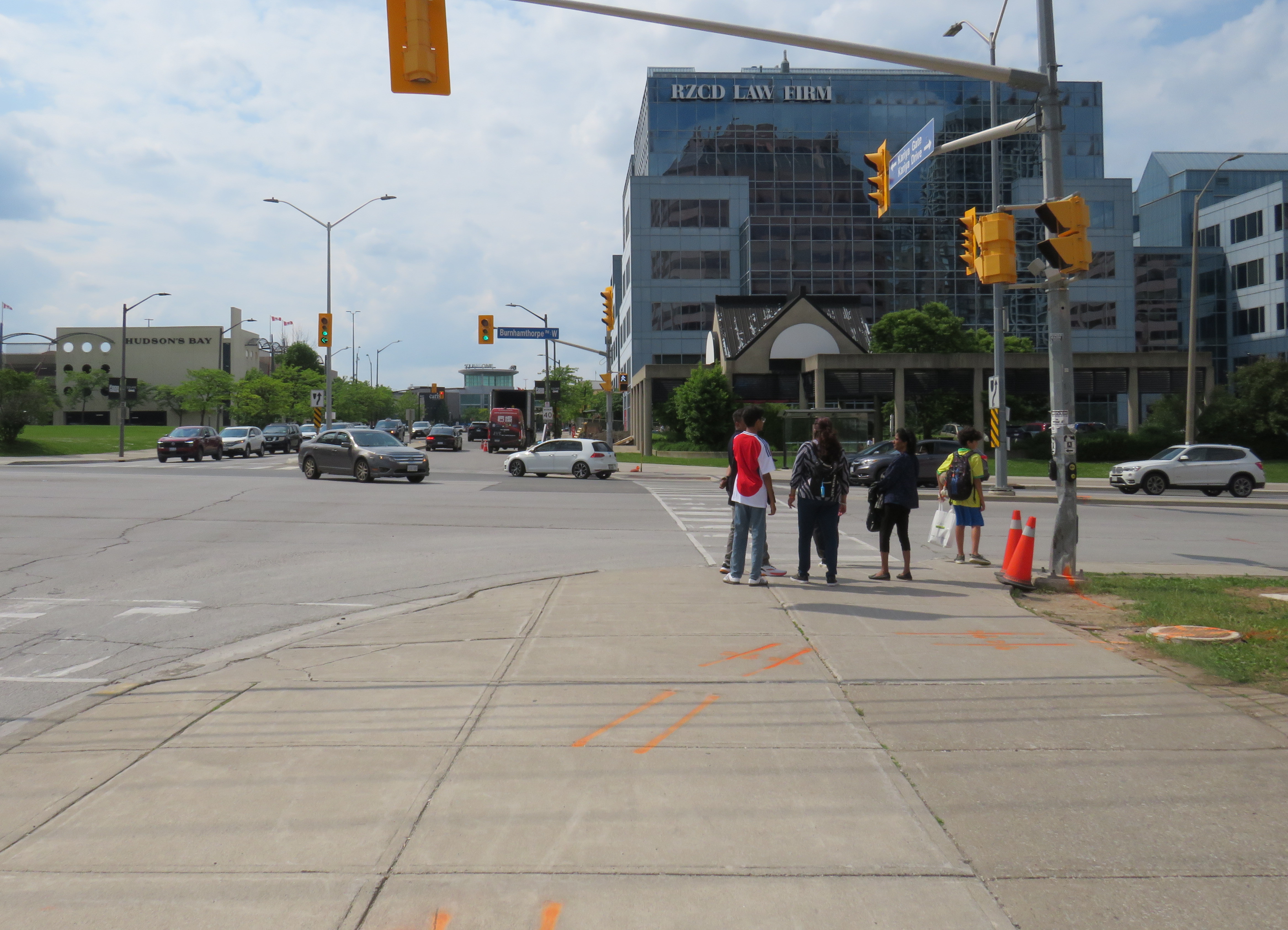
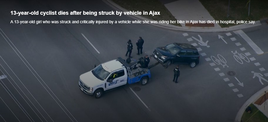
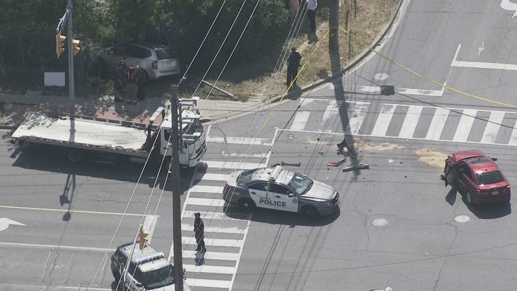
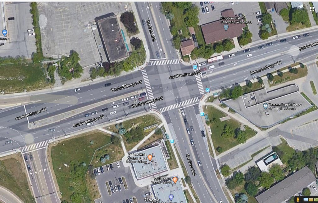
On Saturday, June 7, around 10:20 AM, the drivers of two vehicles collided in the intersection of Burnhamthorpe Road and Kariya Drive in central Mississauga. One of the two cars that collided, a Tesla sedan, slid onto the sidewalk on the southeast corner, hitting a traffic pole, and then colliding with two pedestrians waiting at the corner to cross the street. One of the two pedestrians, a man in his forties, was killed; the other was taken to hospital with serious injuries. CBC Toronto, CP24/CTV News and the Toronto Star covered the collision.
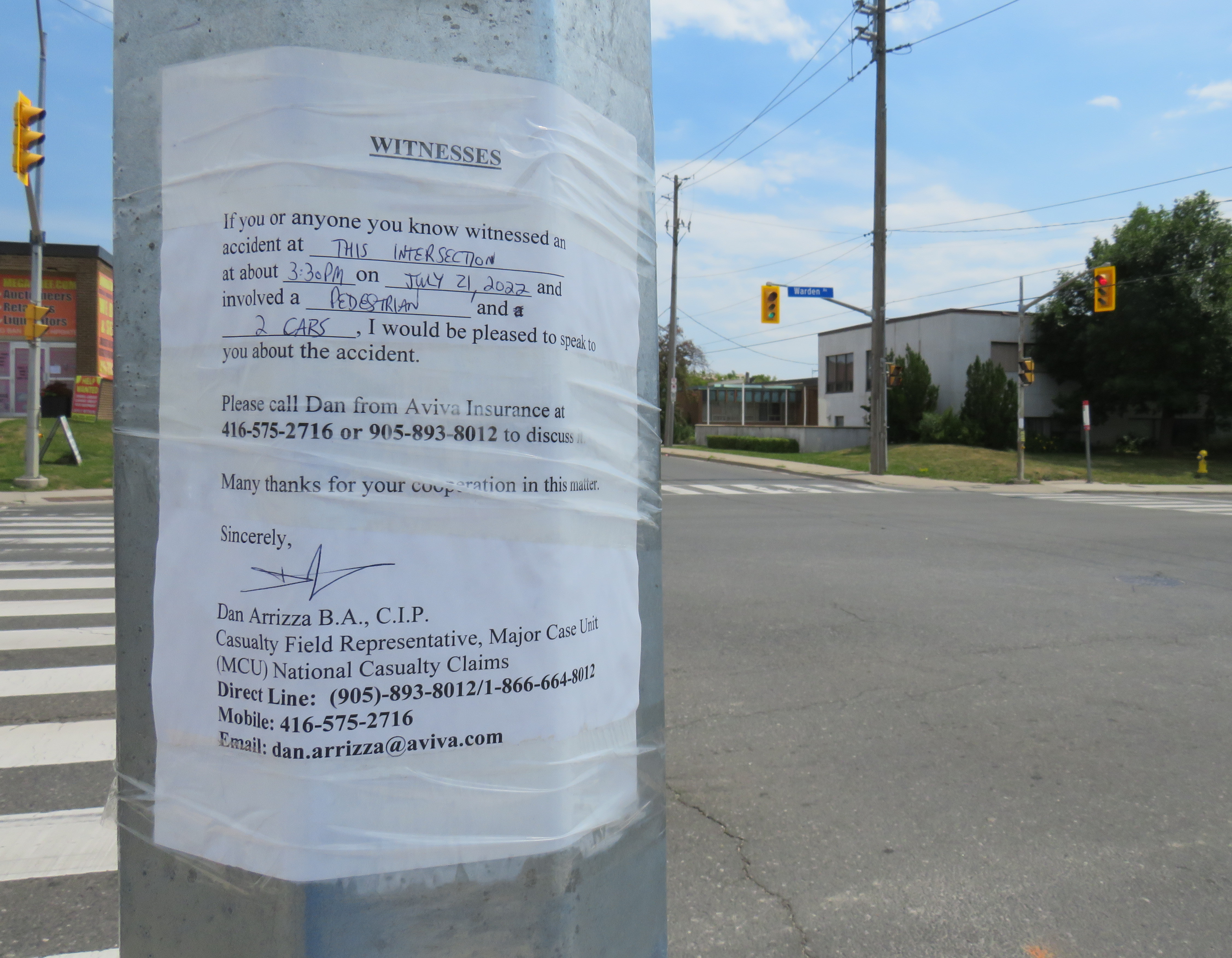
Unfortunately, there has been no follow-up reporting so far, and there is no press release or statement on the Peel Regional Police website.
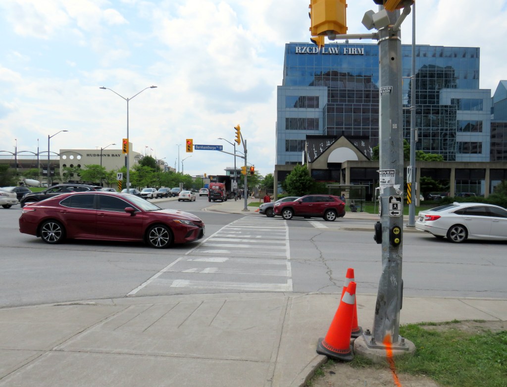
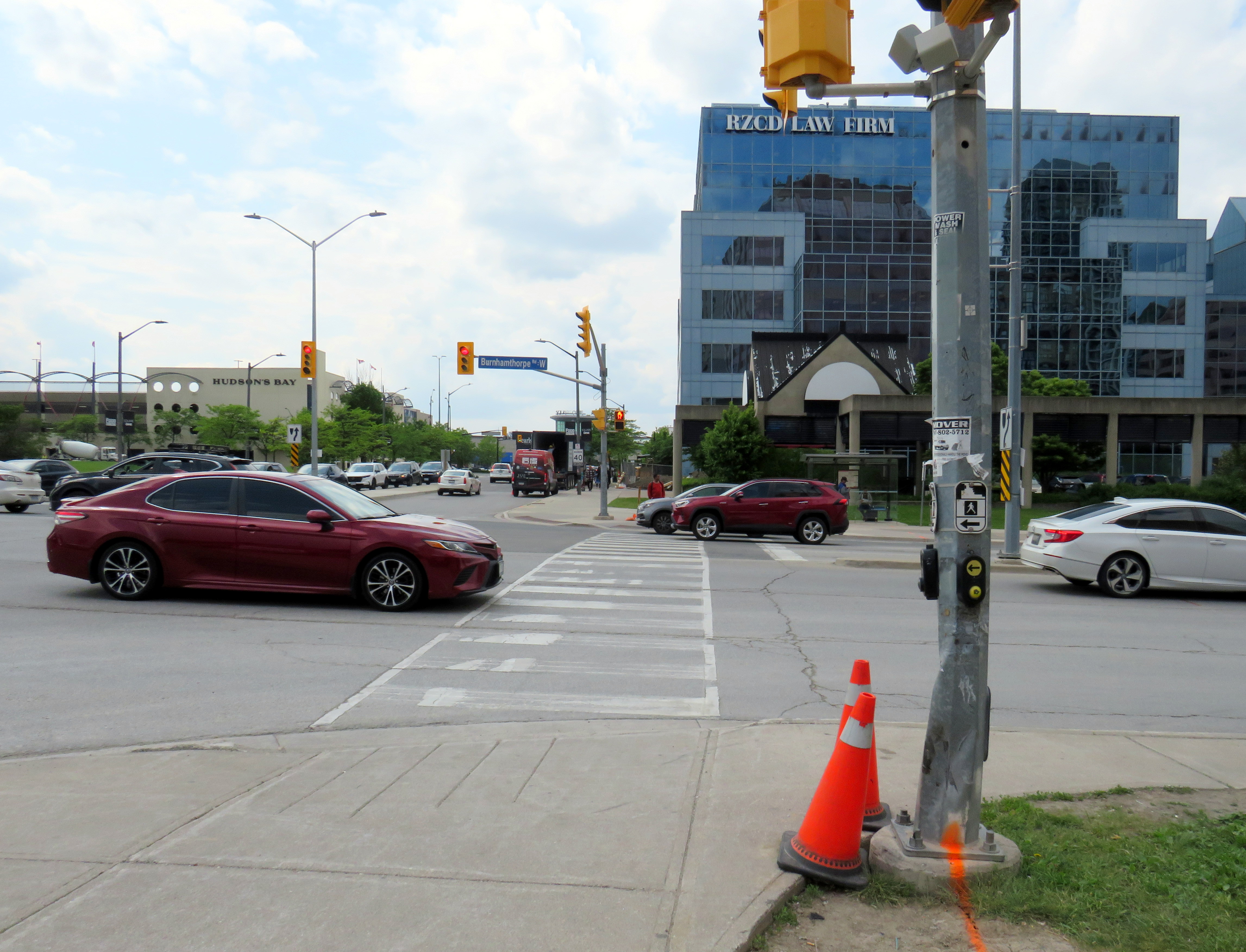
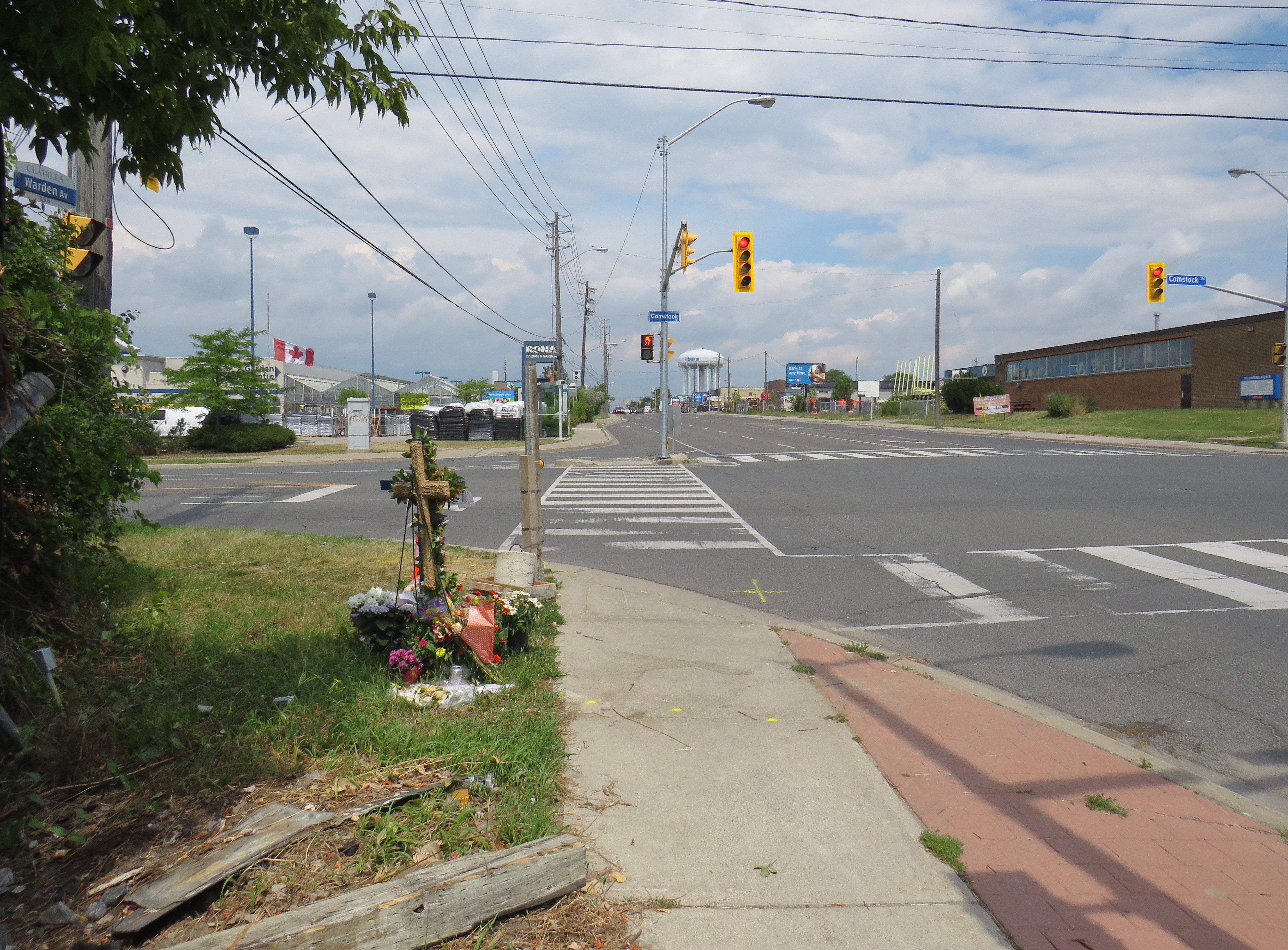
A few days later, I visited the area to take note of the intersection and the surroundings.
The intersection of Burnhamthorpe and Kariya is within the busy, urbanizing Mississauga City Centre (MCC) neighbourhood. MCC, also known as Downtown Mississauga, is the political, commercial, and cultural centre of the sprawling suburb of 750,000. The area is centred around Square One Shopping Centre, which opened in 1973, expanding several times in the next four decades to become one of Canada’s largest malls. Immediately to the west of Square One is Mississauga’s post-modern city hall, which is one of the most interesting and walkable civic centres in Ontario. Nearby is a performing arts theatre, a Sheridan College campus, several office buildings, a YMCA, central library, parks, a transit hub, as well as many high-rise residential towers. Newer residential development includes streetfront retail, oriented to the community with local restaurants, cafes, pharmacies, and grocery stores. Despite its greenfield suburban origins, Mississauga City Centre has become a true 15-minute city.
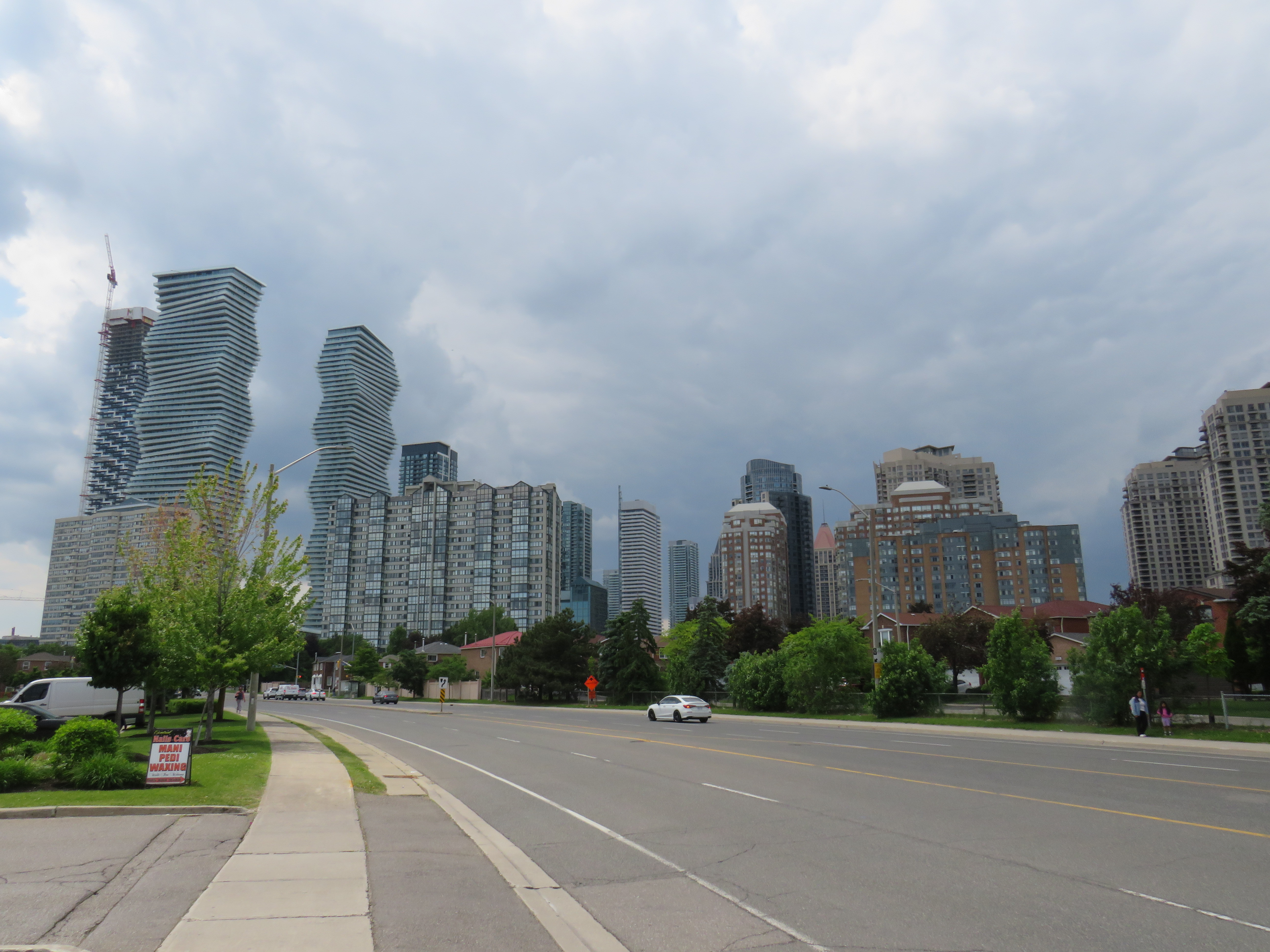
The problem, though, is despite its impressive growth, MCC’s built infrastructure still has the trappings of a suburban speedway. Though some collector streets and minor arterials, like Living Arts Drive and Confederation Boulevard, are more human-scaled, with bicycle lanes, wider sidewalks, benches, and street trees, other streets have not been updated to suit the emerging urban environment. Burnhamthorpe Road is the best example of this.
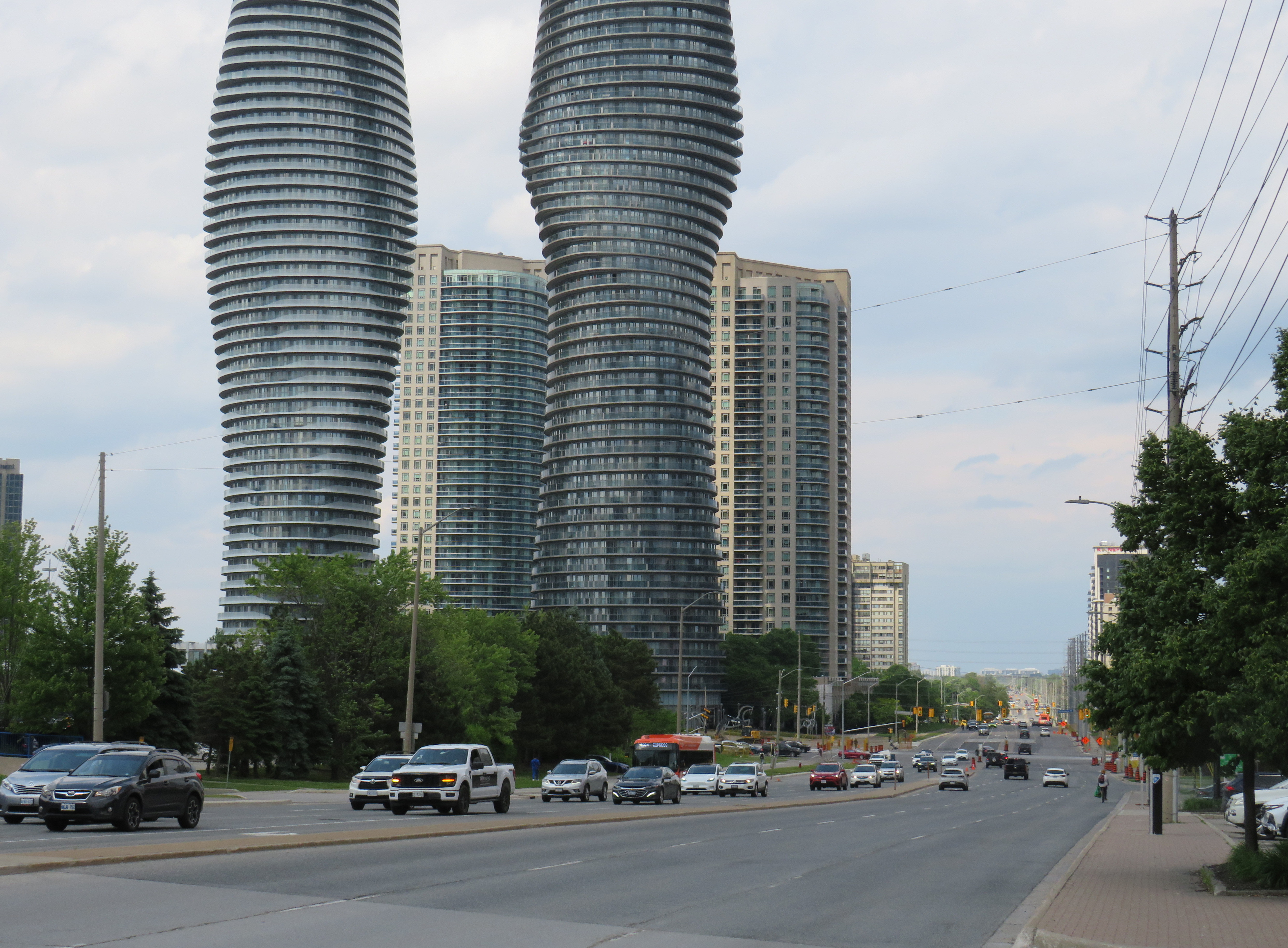
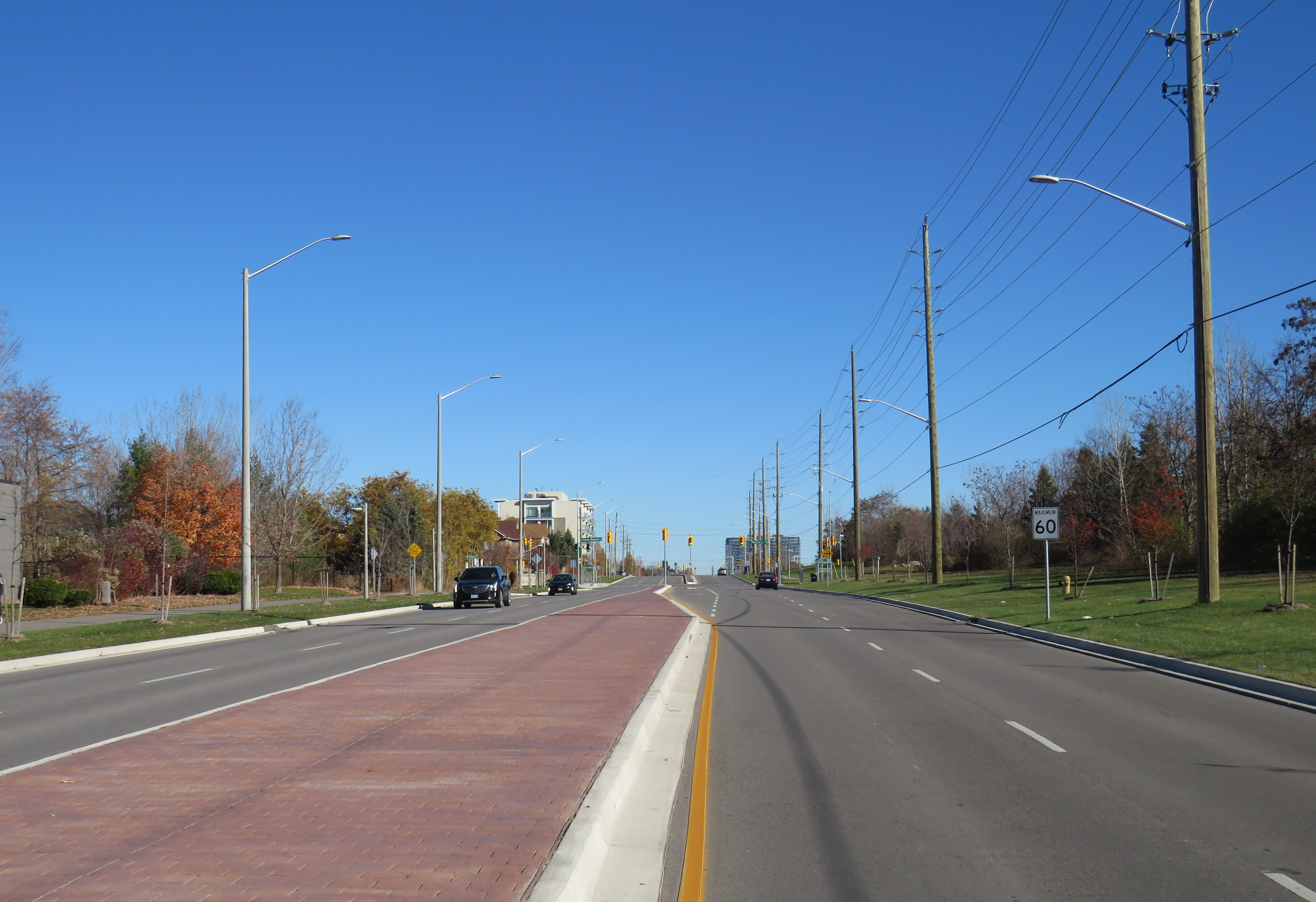
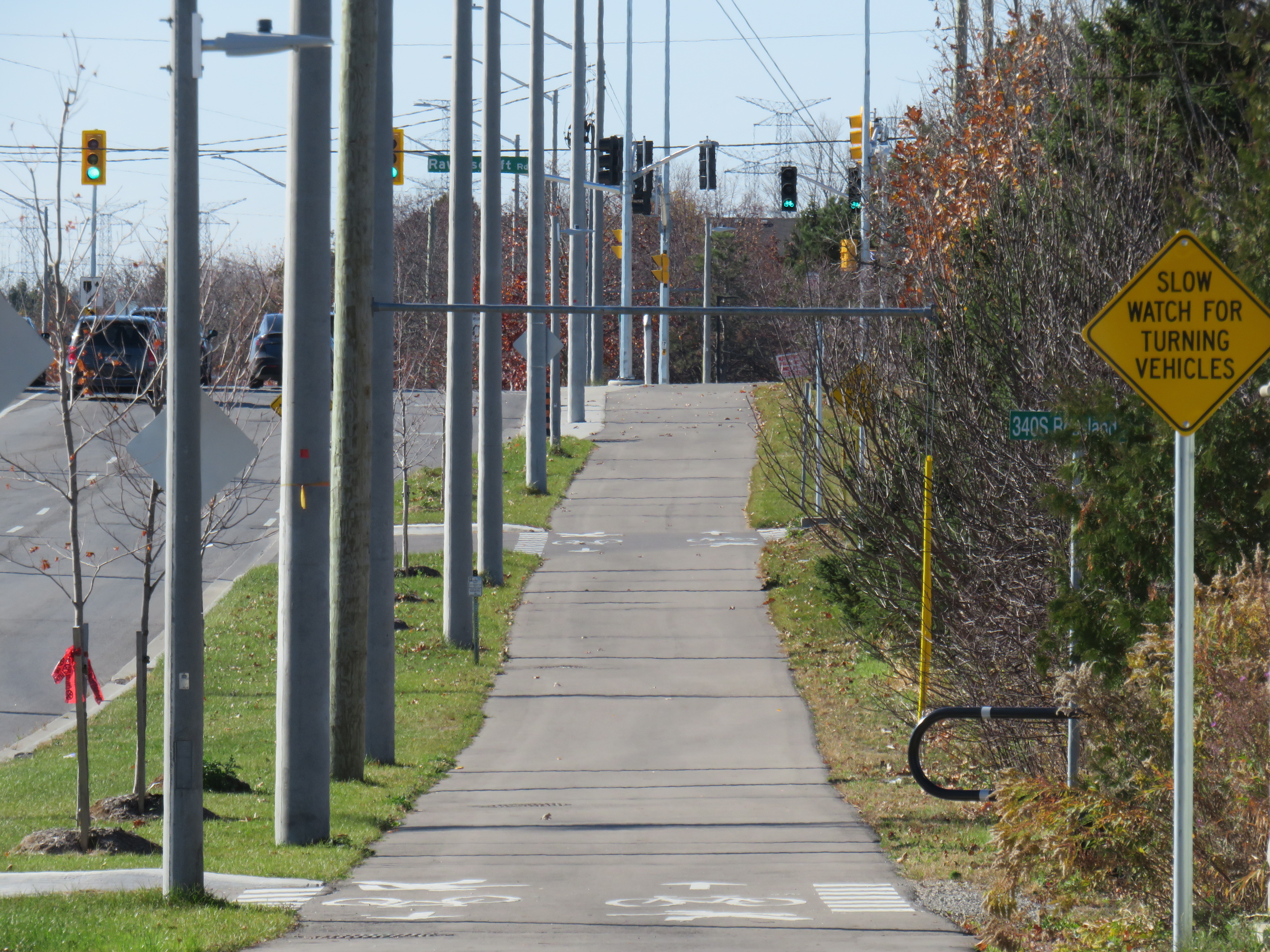
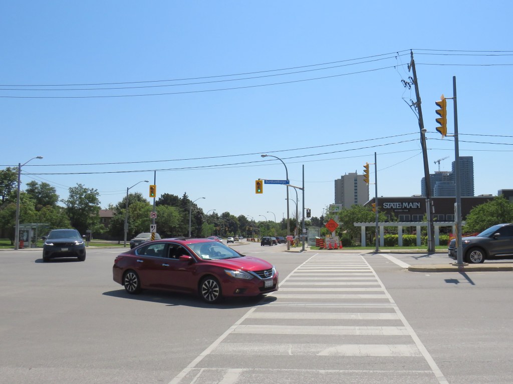
Burnhamthorpe Road is six lanes wide, with an additional left turn lane at every intersection. Though there is a sidewalk on the south side and a designated multiuse path (MUP) on the north side, it is not a pleasant place to walk.
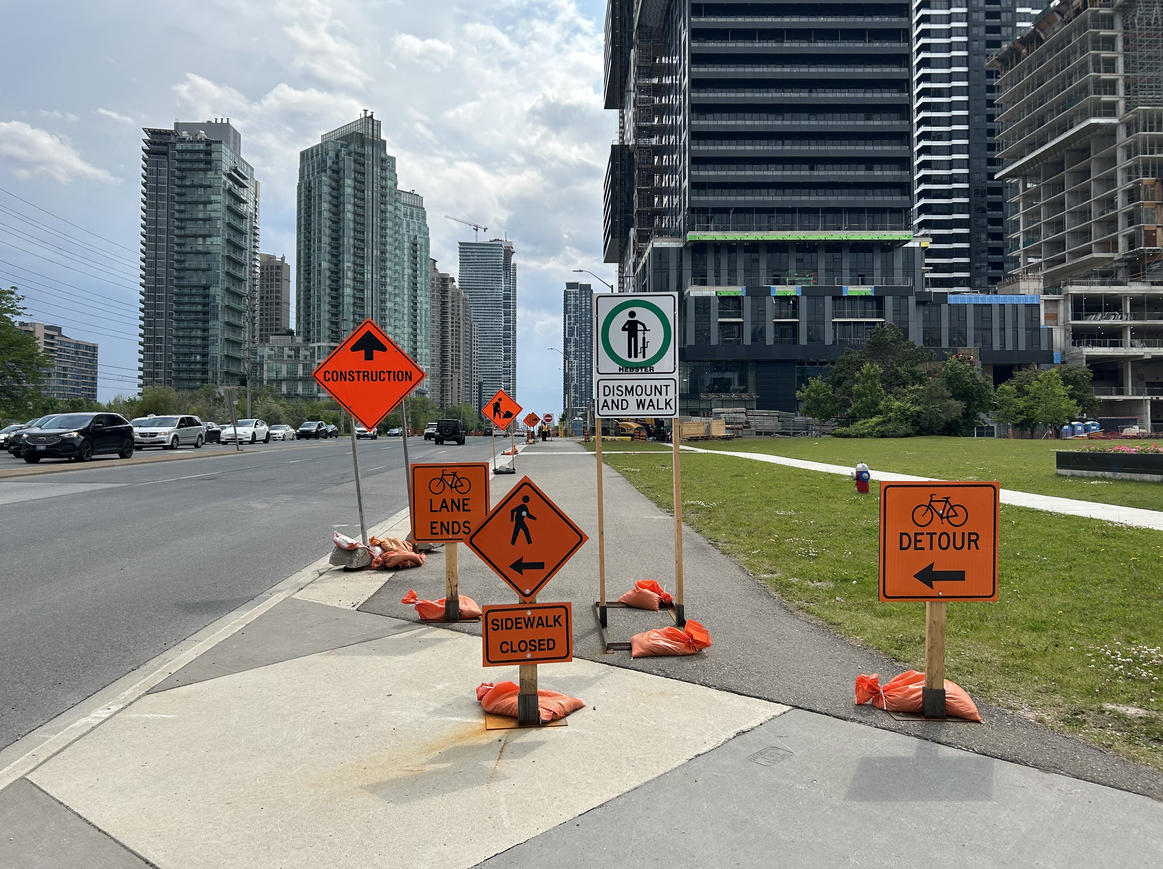
While I visited The MUP on the north side of Burnhamthorpe west of Kariya Drive was also closed off for the convenience of the builders of the Exchange District Condos development, one of many new mixed-use projects in the area. This forces pedestrians to cross the intersection to continue west, and no thought was made to closing one of the three westbound traffic lanes to provide a continuous path.
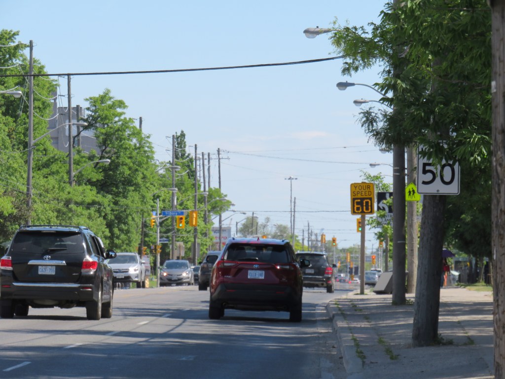
The intersection of Kariya and Burnhamthorpe is quite busy; at every light cycle, there were multiple pedestrians crossing here on mid Tuesday afternoon, including students walking to the mall or to home from nearby schools, couples and young families out for a stroll. (Kariya Park, named for a Japanese city that was twinned with Mississauga in 1981, is a lovely oasis.) Burnhamthorpe has a 60 km/h speed limit, though Kariya has a 40 km/h limit.
The corner is also a busy transfer point. Miway route 26 Burnhamthorpe is a major east-west bus corridor that connects with the TTC subway at Kipling Station; Kariya Drive is the best stop to get to Square One as Route 26 doesn’t serve the main terminal. Routes 3 Bloor and 8 Cawthra, which do continue to the City Centre Terminal, stop here as well.

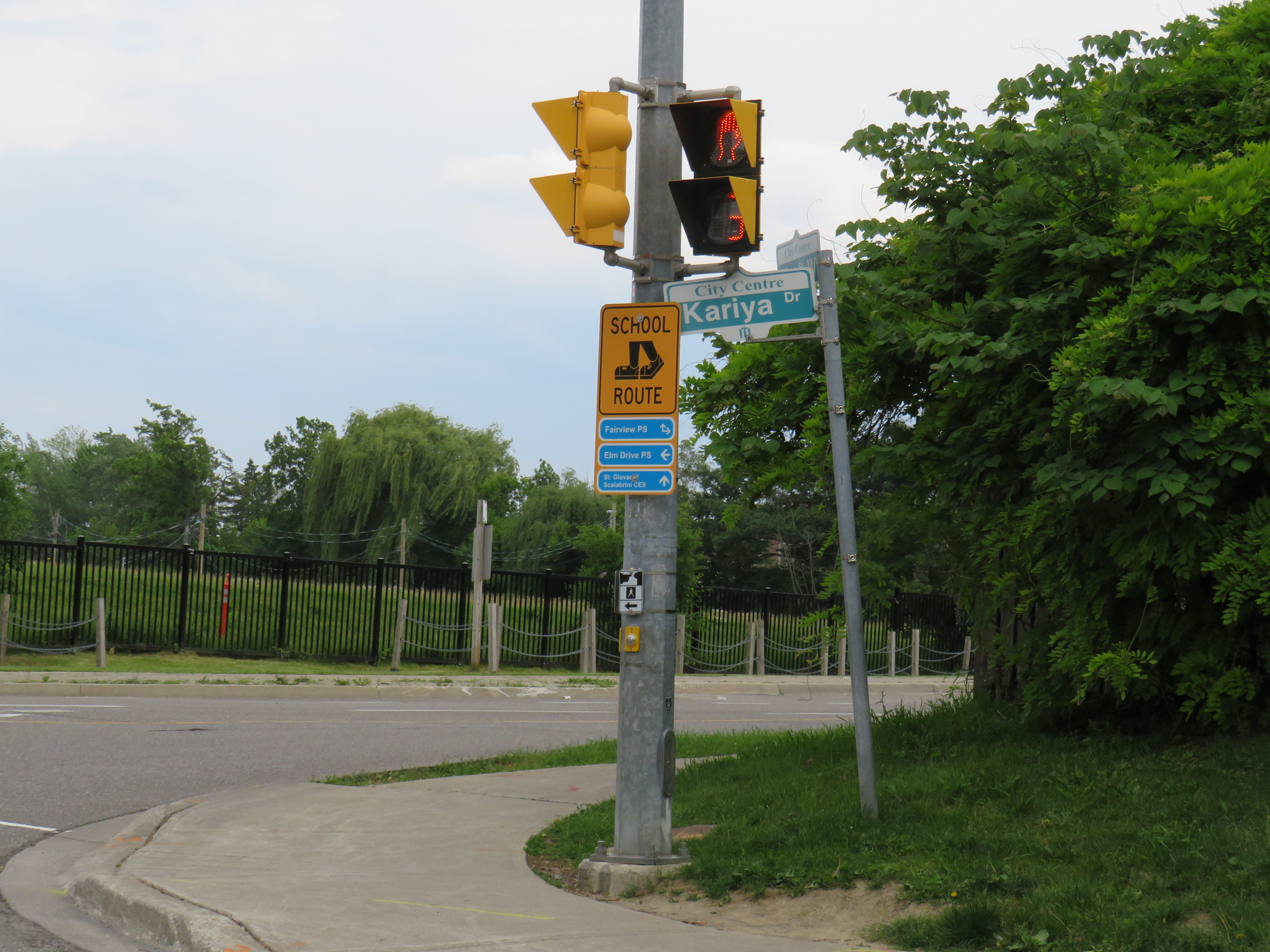
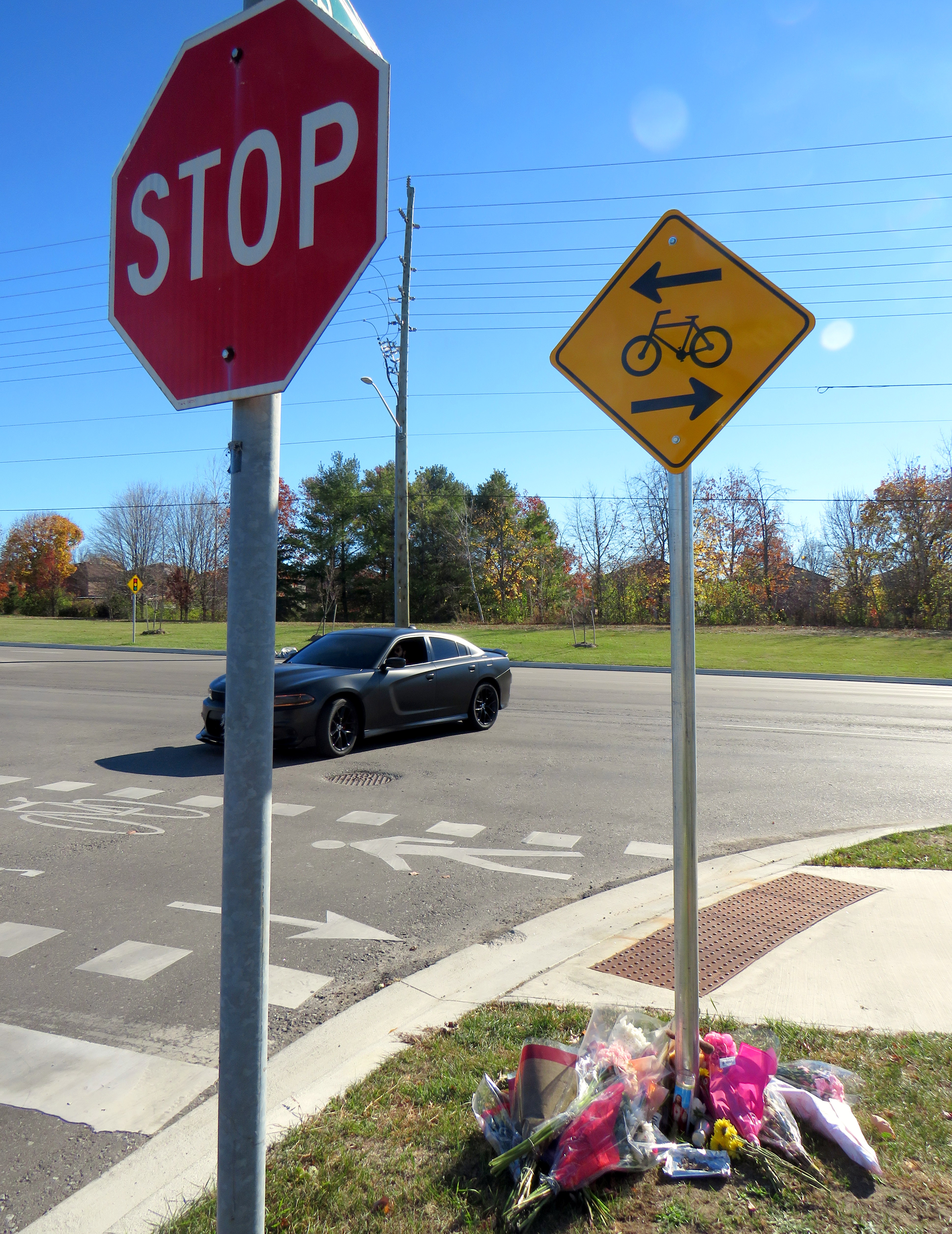
Also worth noting is that Kariya Drive is a signed school route. MCC itself does not have any elementary or secondary schools, but there are several schools within a short walk to the south of Burnhamthorpe, including Fairview Public School, Elm Drive Public School, St. Giovanni Scalabrini Catholic School, and Fr. Michael Goetz Catholic High School. The more people move into MCC, the more necessary safe walking routes will be.
There is nothing particularly remarkable about the intersection of Burnhamthorpe Road and Kariya Drive itself that makes it deadly, but that is the problem here. To make walking safer and more attractive, there is much that should be done. Reducing Burnhamthorpe to four lanes in each direction, along with more street trees, could help to reduce speeds (the speed limit should also be dropped to at least 50 km/h), and with several nearby schools, parks, and YMCA, there’s a case for Burnhamthorpe to be designated a community safety zone, with increased enforcement, along with automated traffic cameras. Perhaps dedicated bus lanes could supplant the third traffic lane in each direction, as the nearby Hurontario LRT nears completion.
Right now, drivers race through the intersection, making left turns against oncoming traffic and crossing pedestrians after the advance arrow signal disappears, as seen in the video below. Wide lanes and a 60 km/h speed limit encourage unsafe driving.
To make Mississauga City Centre a complete urban hub, it needs to be safe for pedestrians and cyclists of all ages and abilities to get around. Six-lane arterials like Burnhamthorpe have no place in a dense, multi-use neighbourhood, especially when nearby Highway 403 can handle goods movement and through traffic. One death is too many.
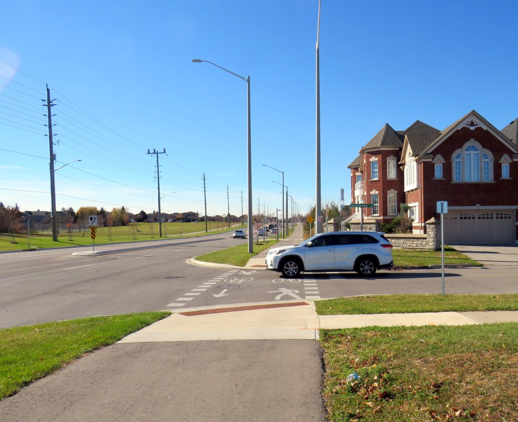
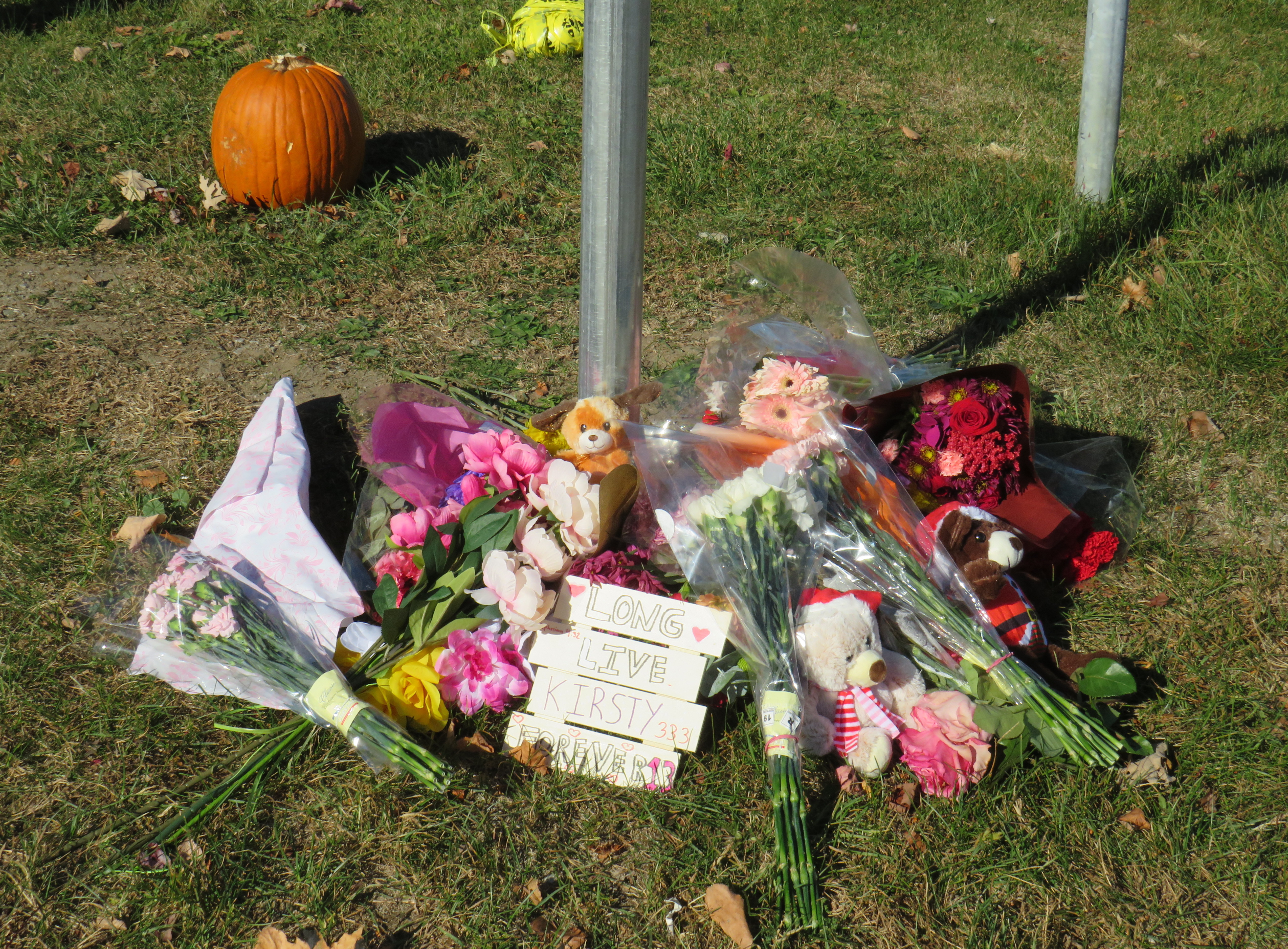


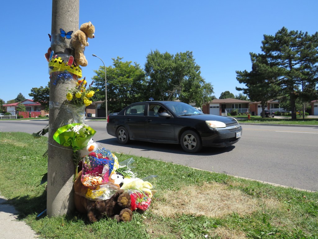


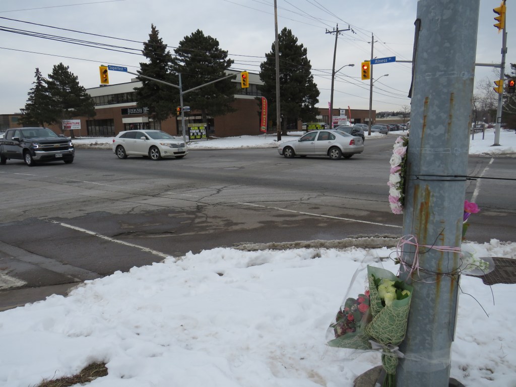
 The intersection of Alness and Supertest, with a makeshift memorial on the southwest corner
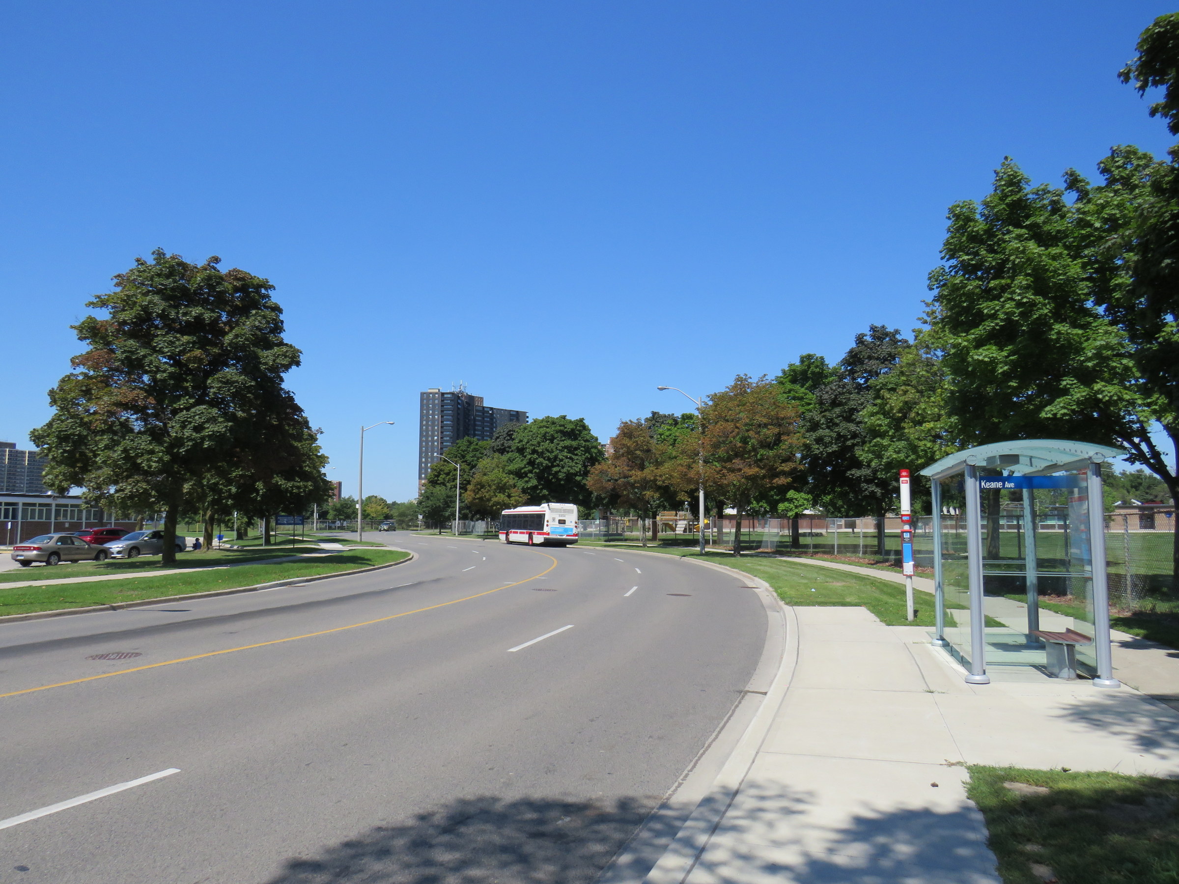
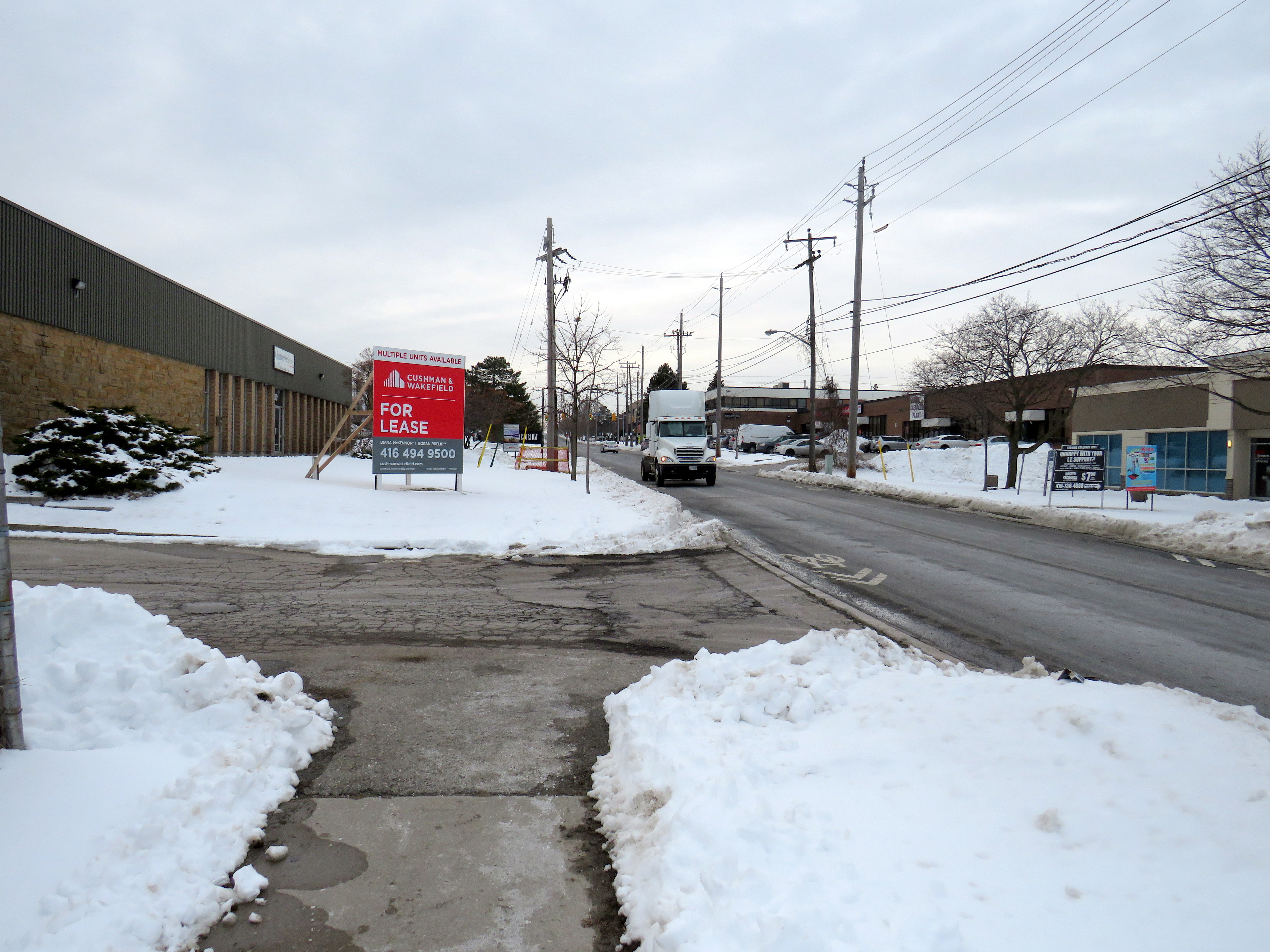 The only sidewalk on Supertest Road comes to an end halfway between Dufferin and Alness
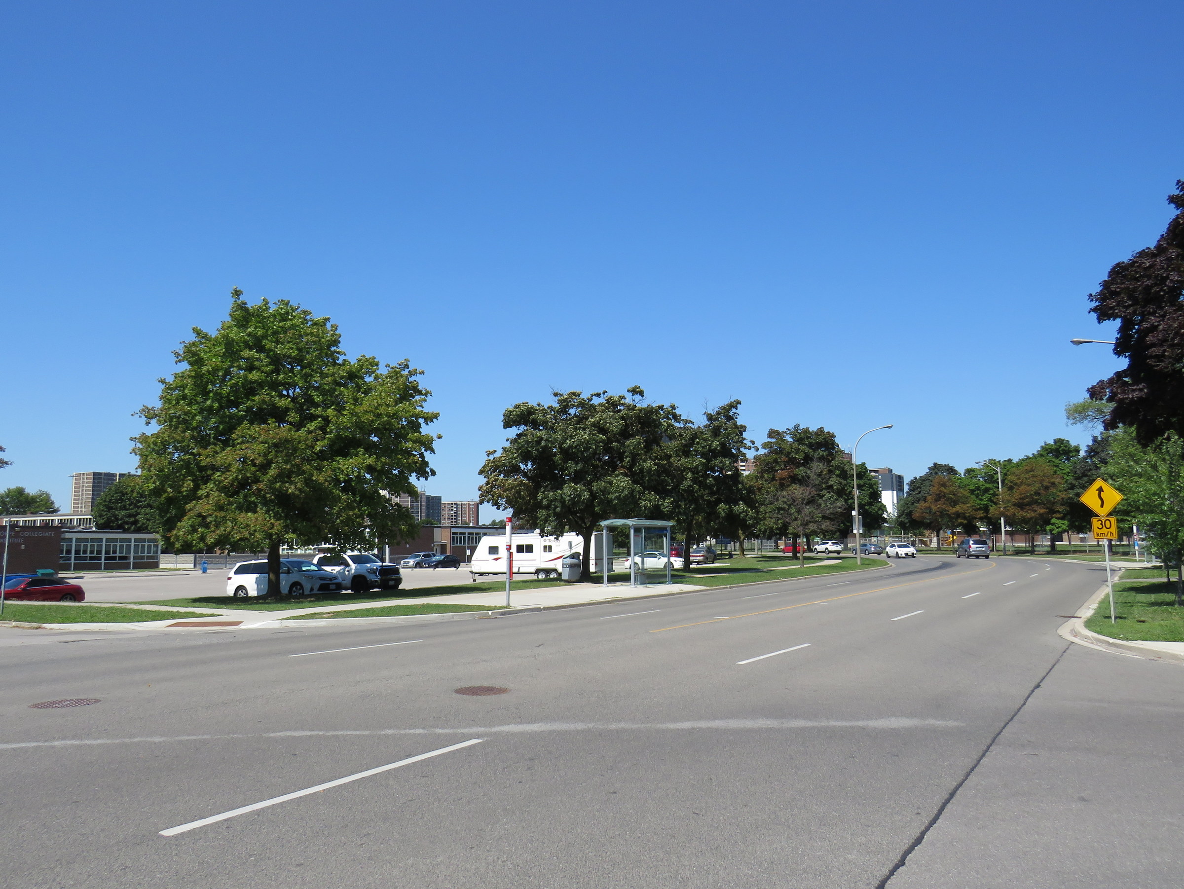
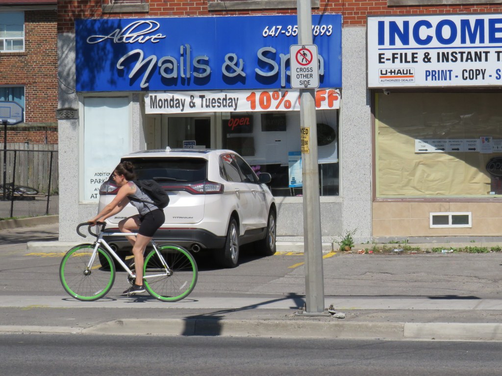
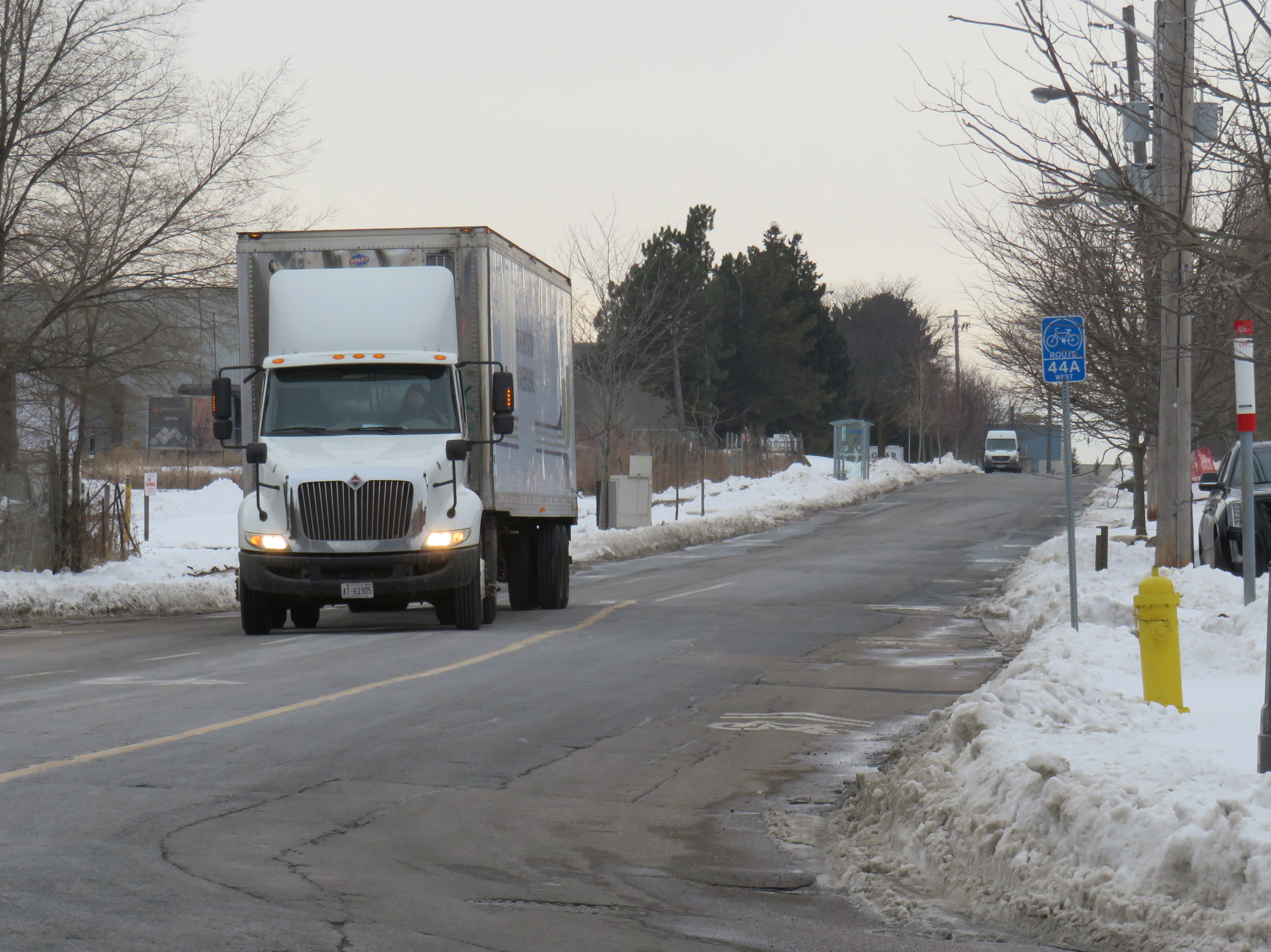 Looking west on Supertest Road, with the sharrow, TTC stop, and bike route sign on the right
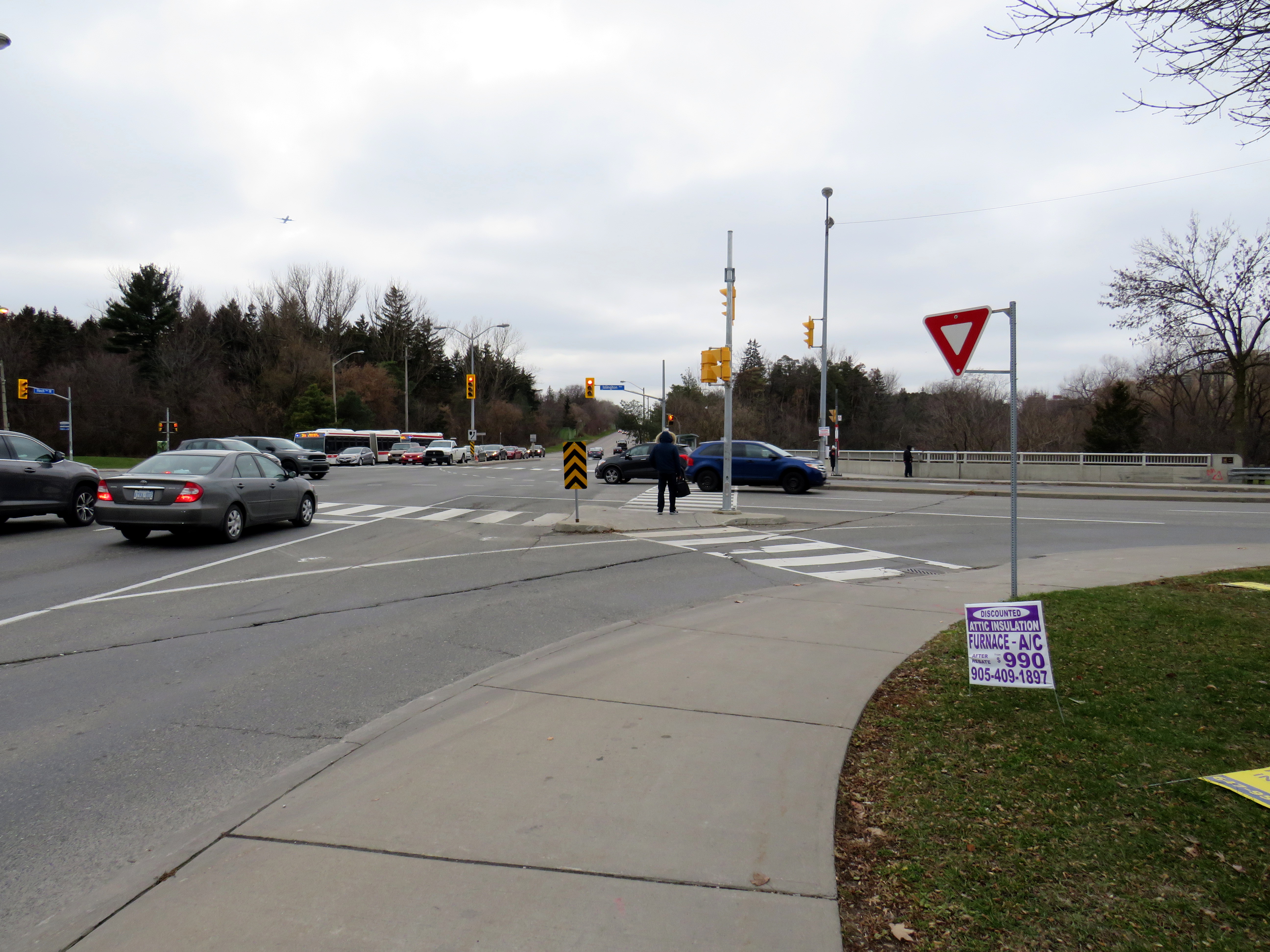
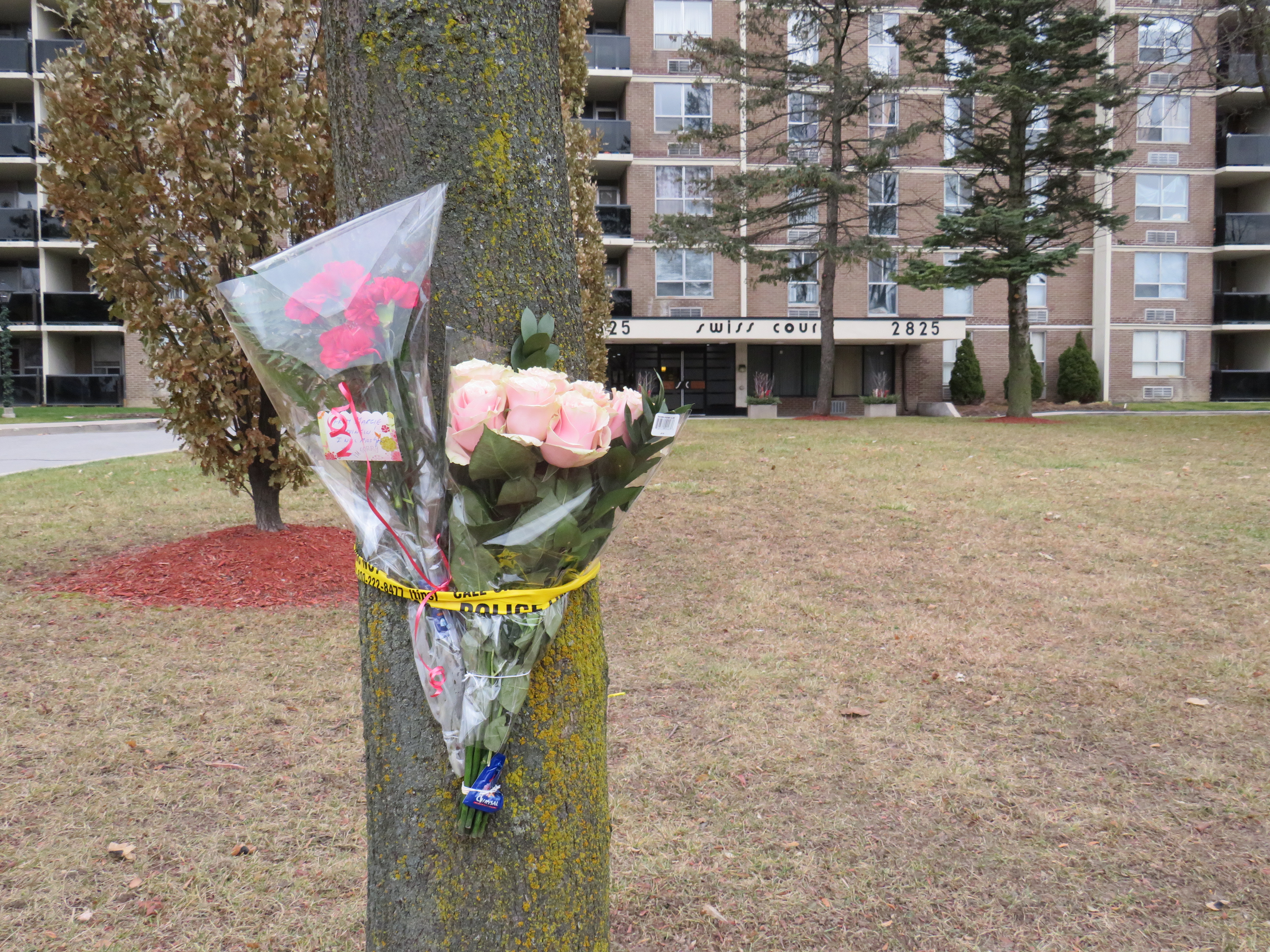 Memorial to 77-year old Pasquina Lapadula in front of her apartment building on Islington Avenue north of Finch
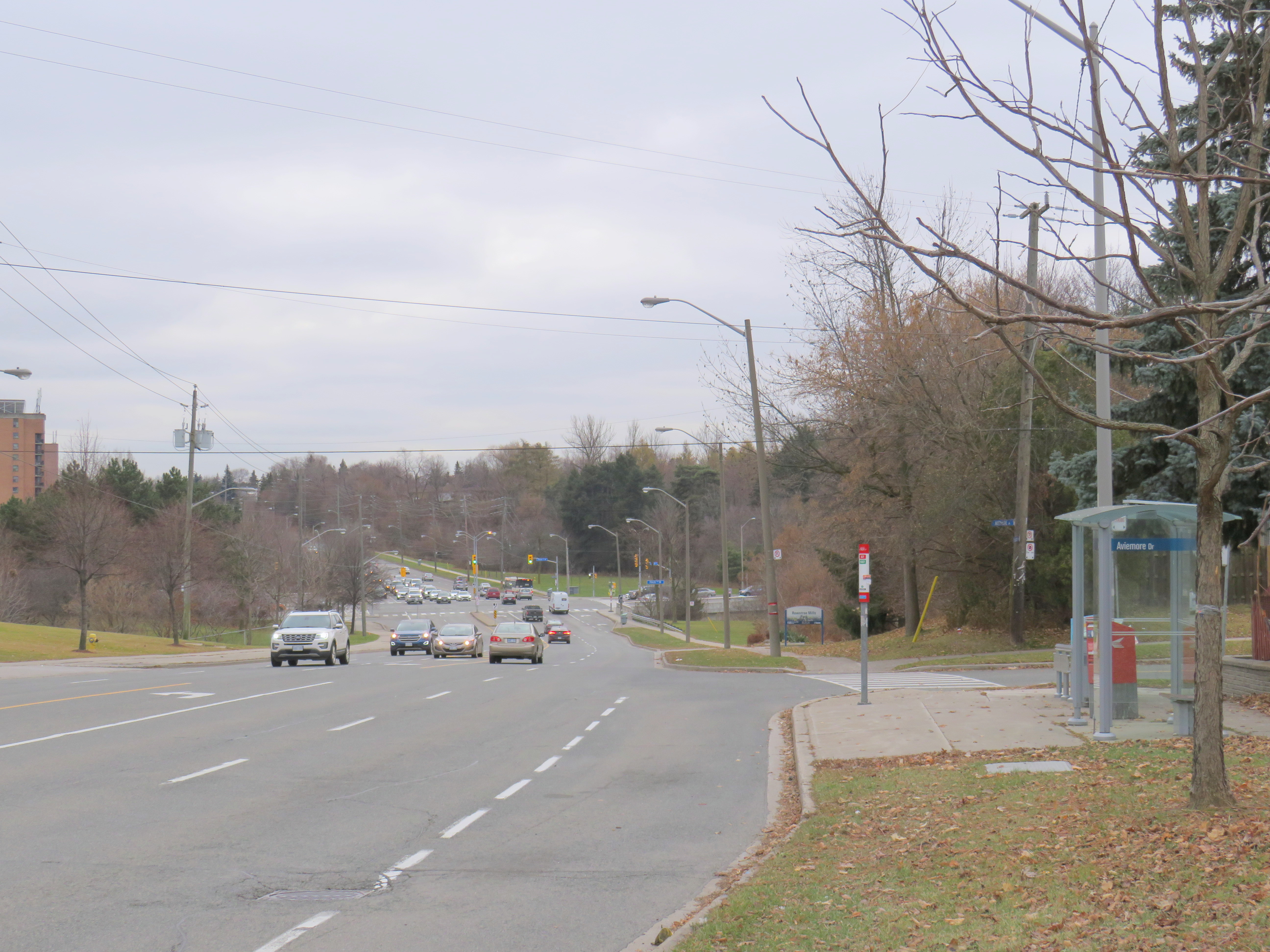 Islington Avenue looking south from Aviemore Drive towards Finch Avenue
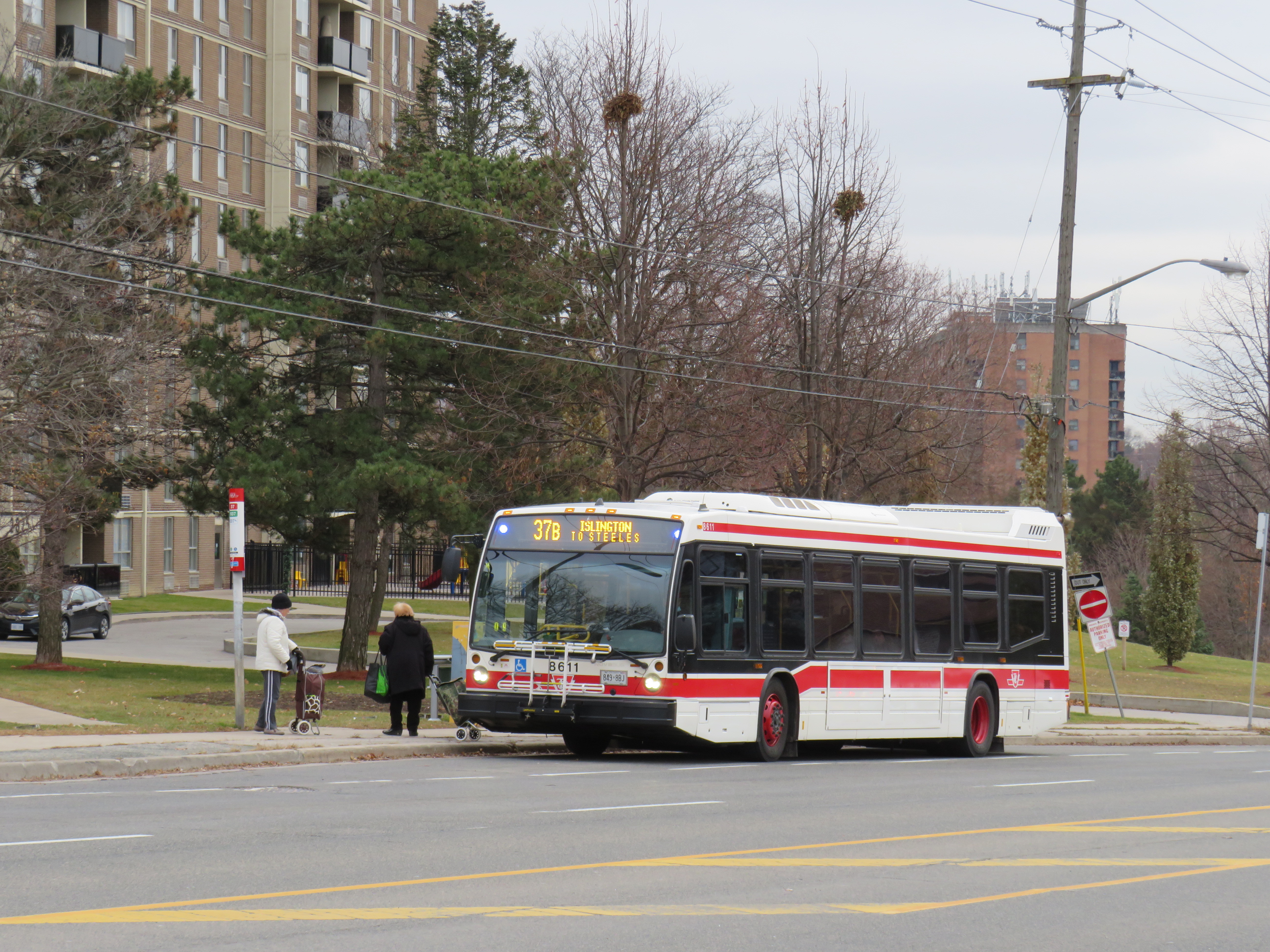 TTC bus stopped in bay in front of Pasquina Lapadula’s apartment building
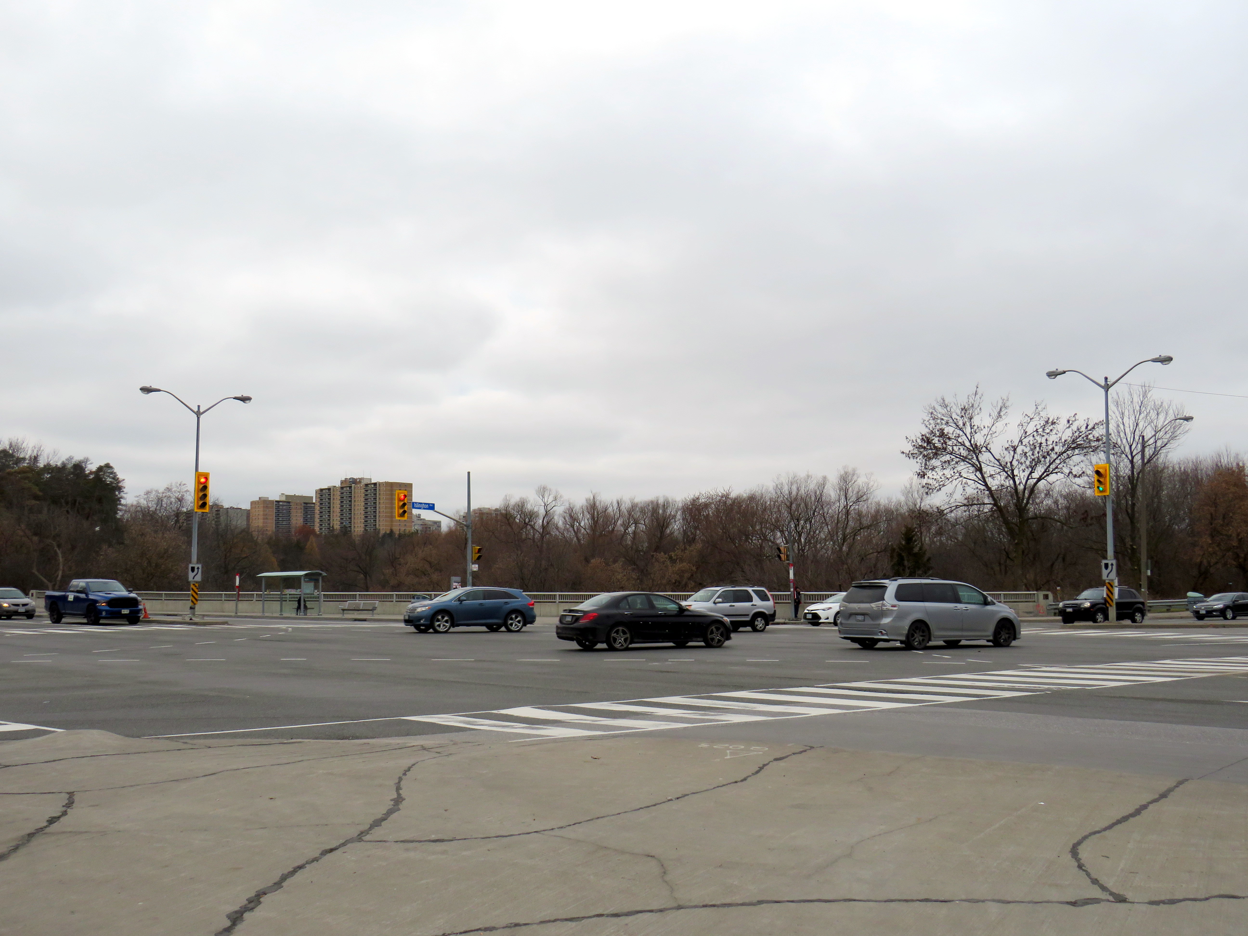 Islington and Finch Avenues