Extensions to Montreal’s REM has resulted in some regional route changes in the Montreal area
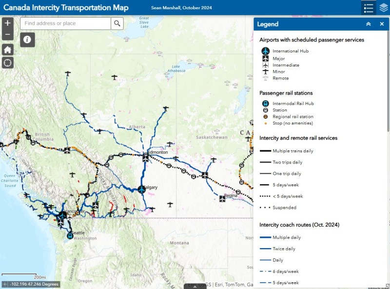
In time for summer, I have updated my Canada Intercity Transportation Map to include new connections and revisions. The only major changes to the intercity coach layer are new routes operated for Flixbus, including new seasonal routes from Toronto to North Bay and Prince Edward County.
In Quebec, the opening of the Deux-Montagnes and Anse-à-l’Orme branches of the REM in Greater Montreal resulted in several long-distance Exo regional bus lines cut back or replaced in favour of local bus routes feeding into the new regional rail service. Therefore, I have decided to remove Exo bus routes from the map where they exist entirely within one or two urban transit zones, being consistent with the municipal transit agencies surrounding Toronto. However, long-distance express routes and routes that serve Montreal’s outer periphery will remain on the map as part of the regional route layers.
In addition, I have also included a few new and previously overlooked services operated by the MRCs (municipalités régionale de comté), including taxibus service areas, which operate similarly to on-demand transit elsewhere in Canada, but have posted stops and semi-fixed schedules; many of these require preregistration before reserving a ride. Where taxibus services operate, I have opted to include those as on-demand, rather than fixed route lines to be consistent across Canada. Only on-demand and taxibus services that are open to the general public are included in the map.
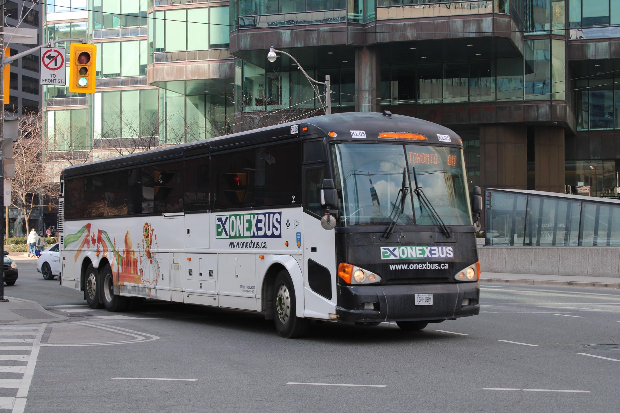
Onex Bus changed its schedules recently, eliminating most departures from Brampton Gateway
Mapping smaller intercity coach operators continues to be challenge, as deregulation in Ontario and Western Canada and online ticketing have made it harder to track changes in schedules and stop locations, though I have noted some changes with Onex Bus’ schedules, which ended most trips to and from Brampton Gateway Terminal at Main and Steeles earlier this year.
Previously, carriers like Greyhound would publish detailed schedules that were valid for at least a few months at a time, including holiday and school break special runs; Ontario Northland and Quebec-based carriers (where provincial regulation remains in force) at least maintain consistent schedules. As it is much harder to track this industry — with no central database — I always appreciate the contributions website visitors provide by email or social media. I thank everyone who has helped so far.
Unfortunately, the costs of maintaining this website and the ArcGIS Online portal to my maps continue to rise. However, I am committed to provide an ad-free, paywall-free resource. If you enjoy my work, please consider buying me a coffee to help with those costs. Thank you!
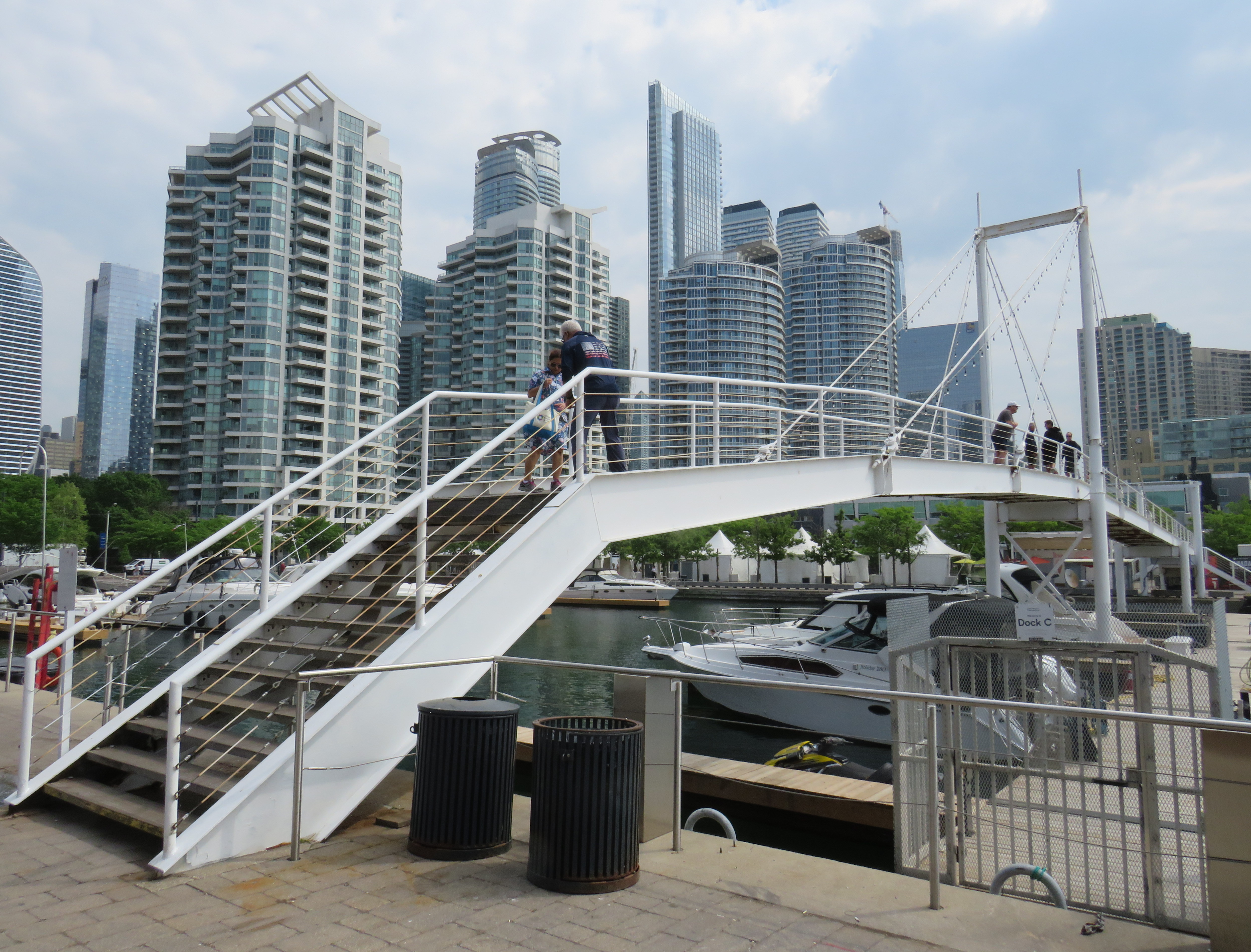
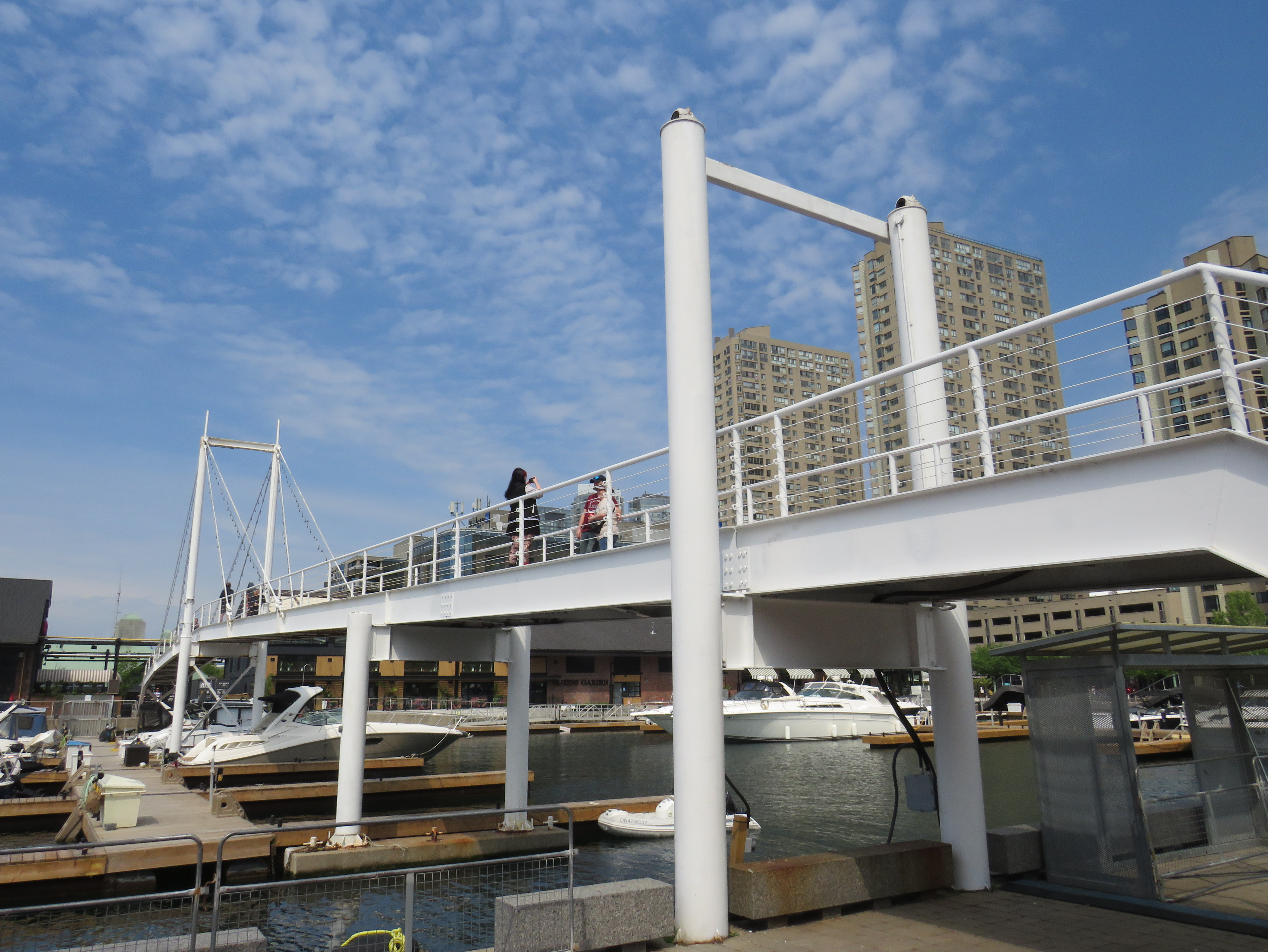
On Sunday, May 31, the Amsterdam Bridge reopened on Toronto’s Harbourfront after being closed for five years. The footbridge, which spans a marina south of Queen’s Quay, is a popular meeting place and photo opportunity, with views of Toronto Harbour to the south and the towering skyline to the north. A gift of the City of Amsterdam, one of Toronto’s sister cities at the time, the bridge was one of the first great public spaces on the waterfront as it was beginning to transition from a derelict industrial space to the city’s new front yard.
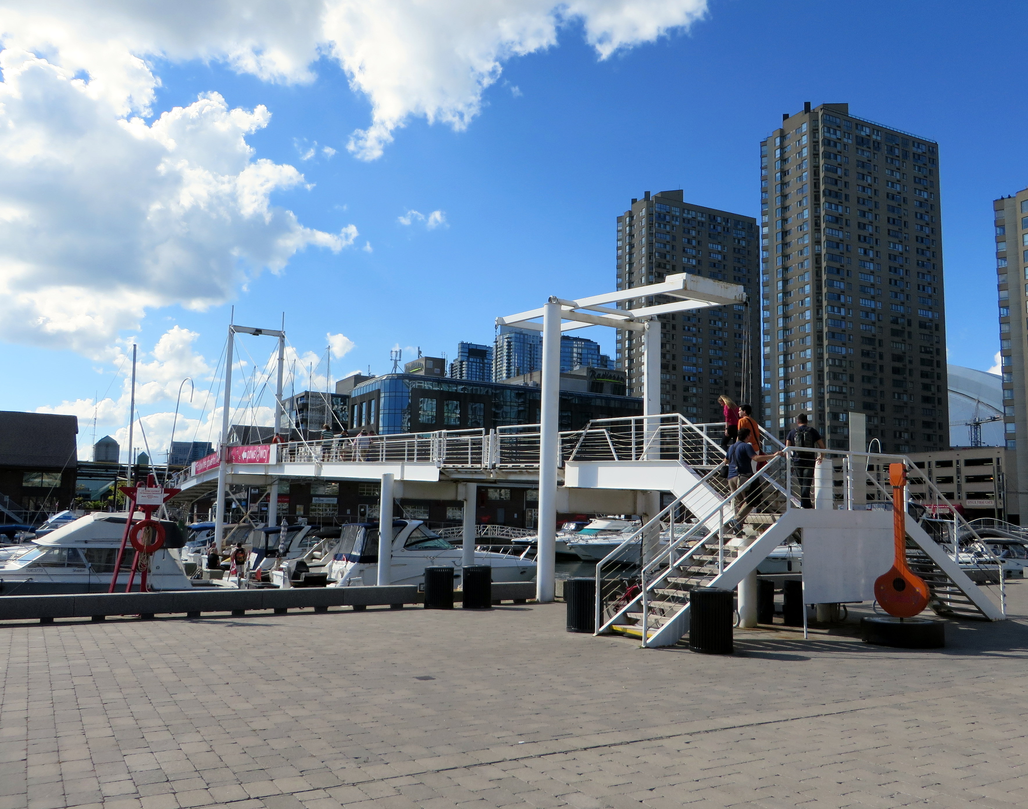
The Amsterdam Bridge in 2014
The footbridge, a cable suspension structure over the marina featured a lifting section on the east side so that tall yachts could moor at the north end of the marina on request, though this was not a regular occurrence. The design mimicked some of the iconic canal crossings in Amsterdam. Sadly, due to neglect, the bridge was closed to pedestrians in 2021 and the lifting section removed.
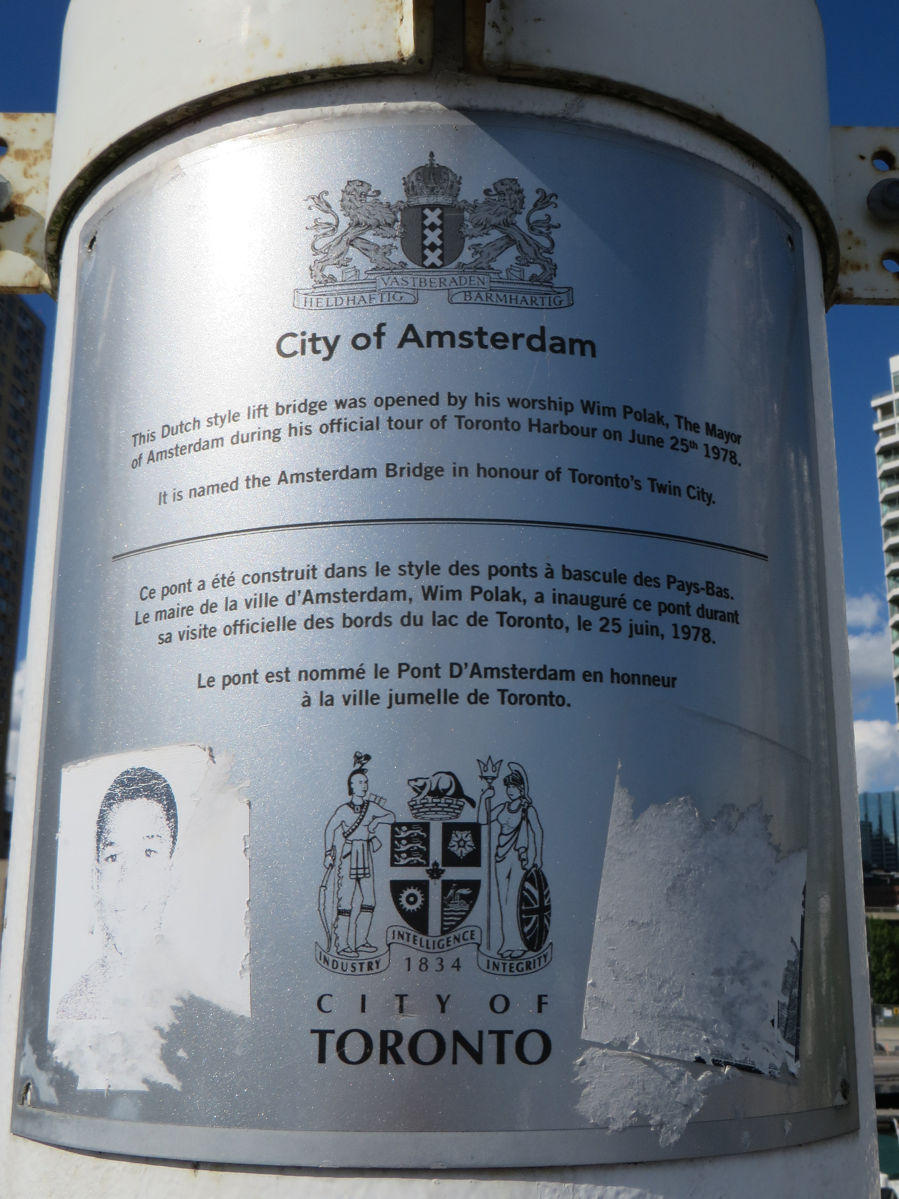
Plaque on the bridge commemorating the opening of the Amsterdam Bridge, a “Dutch style lift bridge” on June 25, 1978 by Amsterdam mayor Wim Polak, taken in 2014. Note the old pre-amalgamation City of Toronto coat of arms below. A replacement plaque with similar text (but with the current post-amalgamation civic coat of arms) since replaced the original.
When the bridge reopened in 2026 just in time for Toronto hosting six World Cup soccer matches, the lifting section was replaced by a fixed span. Once again, visitors can climb the bridge, take in the views, and snap great photographs, but the “lift bridge” of the original “Dutch style lift bridge” is no more. It’s a shame too, that it took five years for this fix to even happen; Toronto needs to do better at maintaining its public assets, especially its unusual, fun, and quirky landmarks.
Fixed deck on the Amsterdam Bridge in 2026
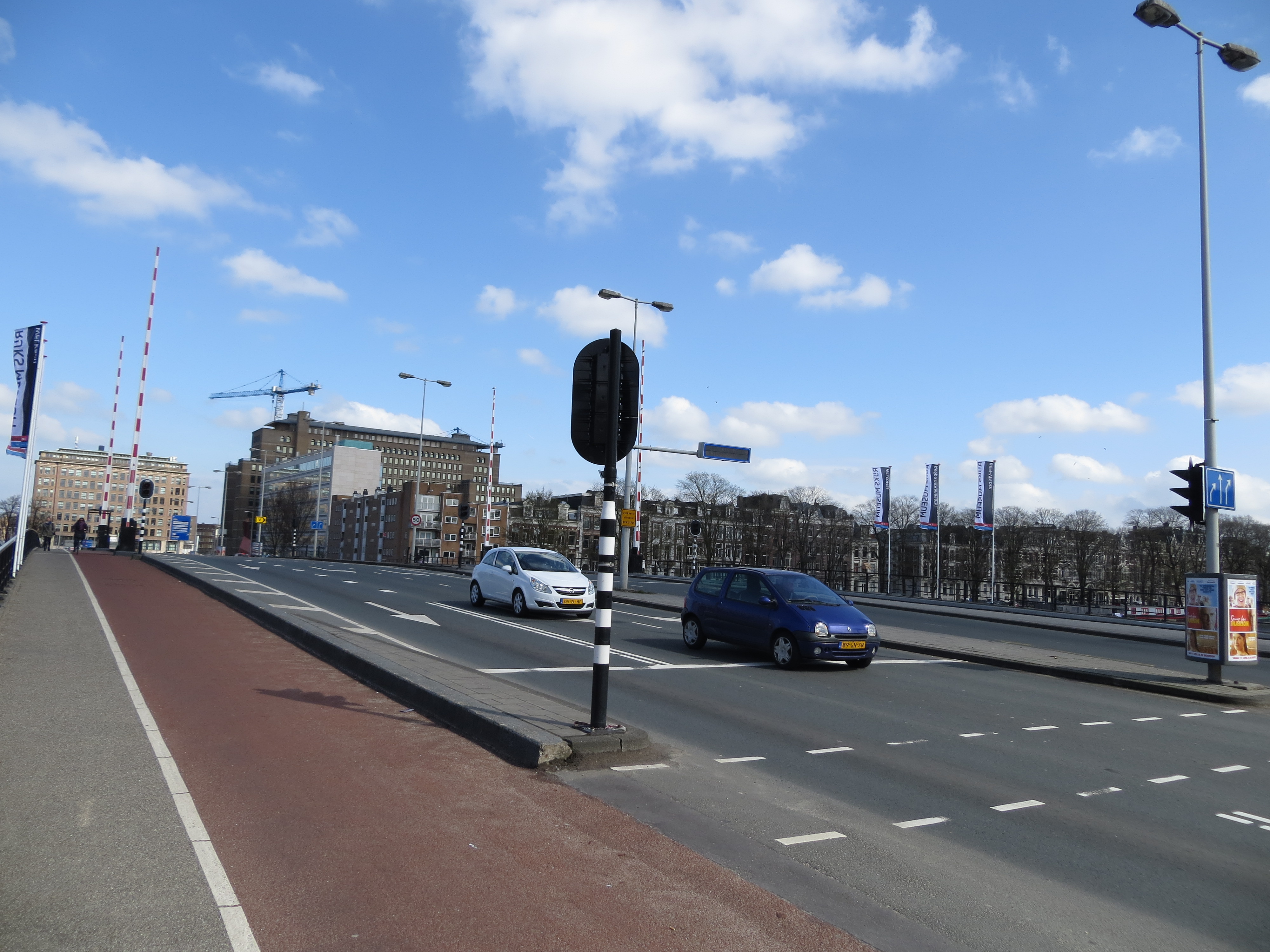
Around the same time Toronto got an Amsterdam Bridge, the City of Amsterdam named a bridge for Toronto. The Torontobrug spans the Amstel River, carrying the busy Centrumring (Central Ring Road). A five-lane traffic artery outside the major tourist areas, the bridge is not iconic by any means (I biked to it during my 2013 visit to Amsterdam) but it is an important road link. There are separated cycle tracks on both sides of the bridge, so it is at least multimodal. The bridge can still open for river boat traffic when necessary.
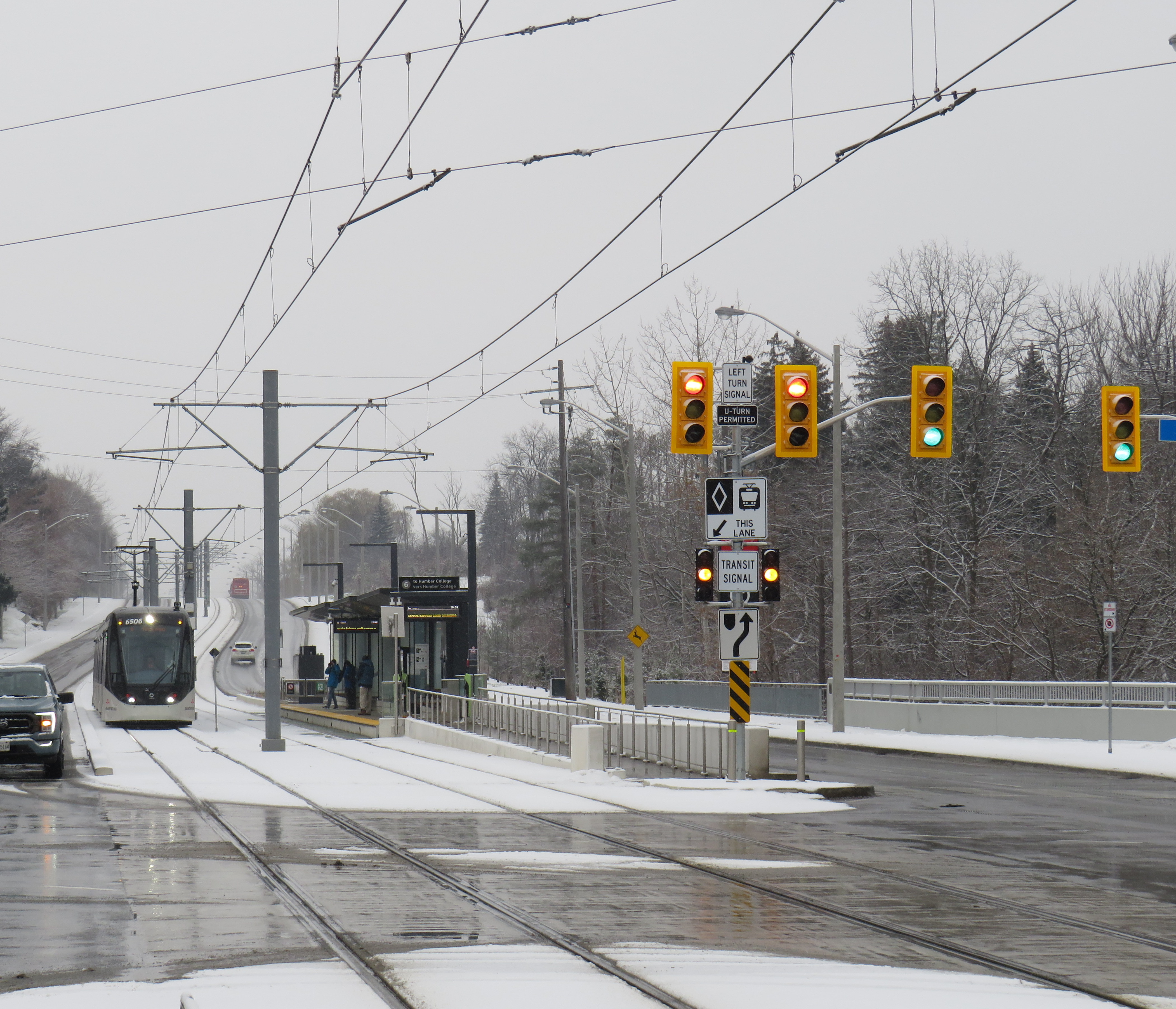
There is a light rail system in Ontario that works in the snow. ION LRT at University of Waterloo.
Less than a two hours drive or train ride from Toronto, where that city’s first light rail line opened to universal disdain, a light rail line has been operating without incident for over five years. Trains operate like clockwork, signal priority works, and it has become the backbone of a regional transit system.
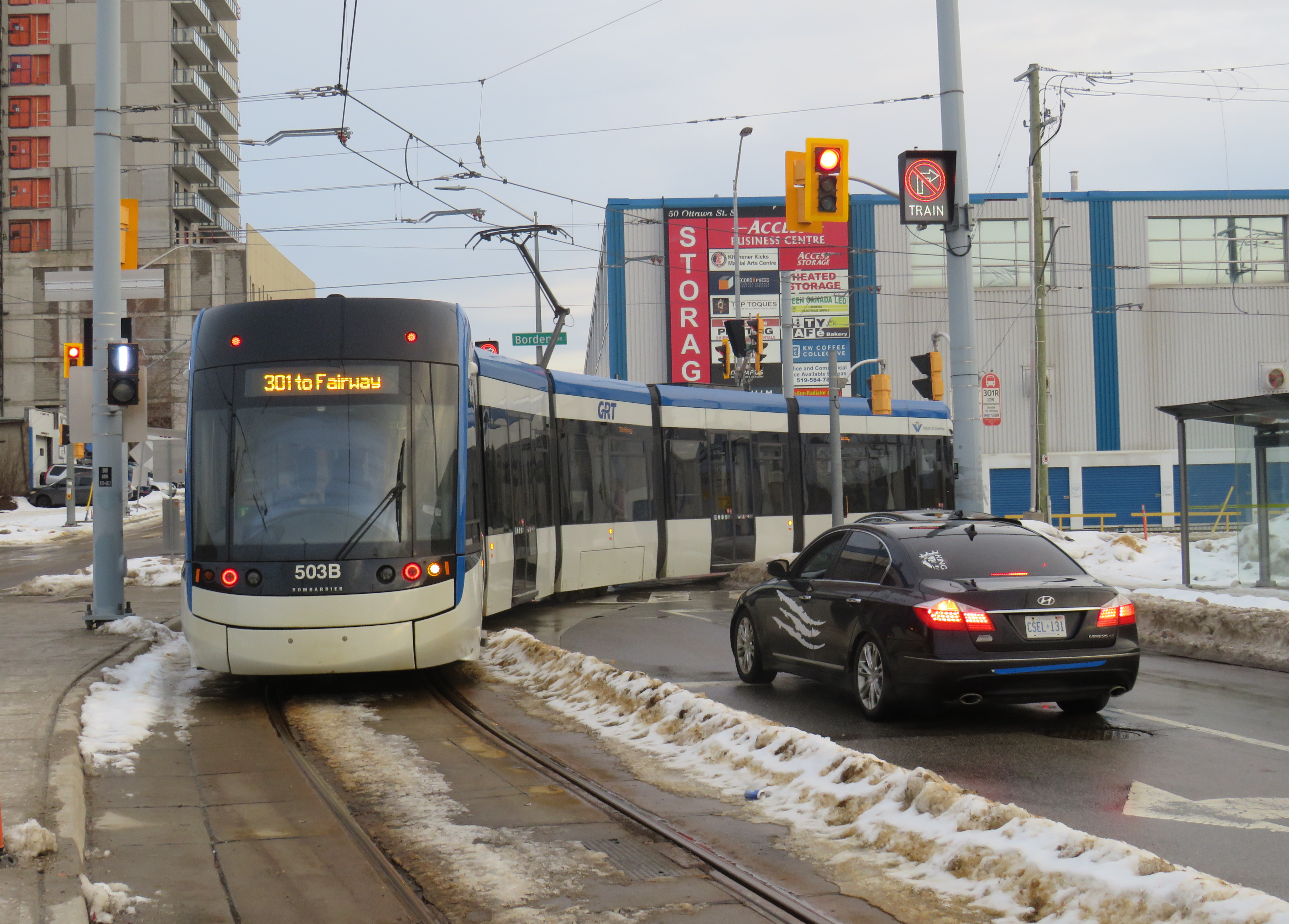
A southbound Ion LRV turns from Charles Street to Borden Avenue. Note the white bar signal and the “no right turn – train” sign lit up.
Funded by all three levels of government, the Ion LRT was constructed and operated by GrandLinq, a public-private partnership (P3) consortium that includes operator Keolis and engineering and construction firms such as Aecon, Kiewit, and Plenary Group. Though design-build-operate P3 models are common for Canadian transit infrastructure projects, they have their challenges, as Waterloo Region would later find out. Fares and service are integrated into the Grand River Transit bus system, which is owned and operated by the regional government.
Waterloo Region is the smallest urban region in North America with a light rail system, and it works largely because of Kitchener-Waterloo’s geography. Many important regional destinations line up along the corridor: the terminals are both major suburban shopping centres that already functioned as major bus transfer points. In between the two malls are Downtown Kitchener and Uptown Waterloo, the two historic town centres, University of Waterloo, Wilfrid Laurier University, and Kitchener-Waterloo Hospital. The LRT serves or passes near all these destinations (though Laurier’s campus is centred a few blocks east of the LRT corridor). Furthermore, the region’s master plan focuses urban growth along the LRT corridor with new high-rise residential and mixed-use development. A planned extension of the LRT into Cambridge south to the historic Galt town centre will further support regional urban intensification goals.
Ion trains operate every 10 minutes during weekday daytime hours; they operate every 15 minutes on weekends and weekday evenings, with 30-minute service from about 10:30 PM to the end of service starting around midnight.
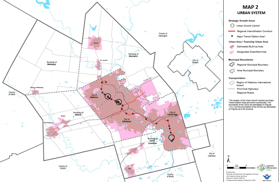
Map of Waterloo Region’s urban system, which directs growth to existing and planned transit corridors and limits growth outside the cities of Kitchener, Waterloo, and Cambridge.From the regional official plan.
Despite following a linear corridor, the LRT winds its way along city streets, railway rights-of-way, and hydro corridors. This allowed the region to reduce property and road construction costs as well as achieve higher speeds in specific off-road sections. The fastest section is north of Uptown Waterloo, where the corridor makes use of a freight railway spur line between Kitchener and Elmira that also happens to run directly past University of Waterloo. In the south end, a different railway corridor and a hydro corridor allow trains to reach Fairview Park Mall on a mostly off-street alignment. These off-road segments are protected by railway signals and barriers, like those in along LRT lines in Calgary and Edmonton.
This ability to switch between different alignment types is a clear advantage of light rail transit for medium-capacity transit systems. During overnight hours, freight trains headed to a plastics plant in Elmira use the same rails north of Uptown Waterloo as the LRT does during the day, making it an example of the “tram-train” model more common in Europe.
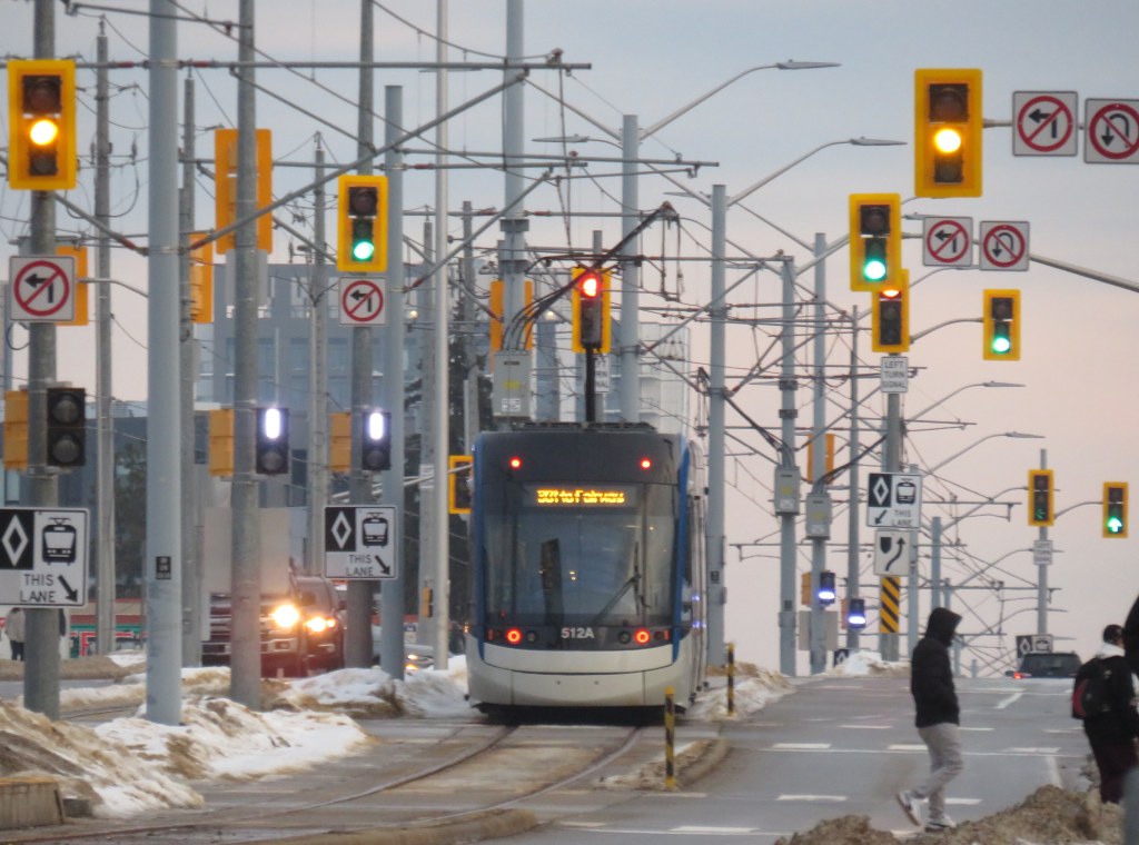
The on-street sections, though slower than the off-road portions, provide access to Downtown Kitchener and Uptown Waterloo, including the planned new transit hub in Downtown Kitchener that will provide a better connection to GO Transit trains to Toronto. Unlike Toronto’s streetcars and Finch West LRT, however, the signal priority system works. On King Street between Downtown and Uptown, there are many intersections with traffic signals, but the LRTs generally do not have to stop at any of those red lights. At intersections, LRVs continue at regular speed, typically 40 km/h through this section.
A southbound LRV on King Street. It just passed two signals with a clear (white vertical bar) signal; the next signal ahead will soon change to allow the LRV to proceed. Note that there are no “transit signal” signs, as Waterloo Region worked to have these approved by the province.
Waterloo Region also worked to permit unique transit signals, which feature only white bar aspects. A vertical bar indicates “proceed” while a horizonal bar indicates “stop.” A flashing horizontal bar lets the operator know that it will soon switch to “proceed” while a flashing vertical bar warns of an upcoming stop signal. This reduces the sign clutter that is found on Toronto’s streetcar and light rail corridors.
A typical Toronto assembly, with red, amber, and green transit signal aspects that look similar to the larger traffic lights above and accompanied with a “transit signal” sign. Of course, the Finch West LRV approached an amber signal, rather than being given a go ahead.
To be fair, the advantage in Waterloo Region is that most of the on-street sections of the LRV corridor are on narrower urban streets rather than suburban arterials like Finch Avenue. King Street and Charles Street in Kitchener only have two general traffic lanes and are not major throughfares (a provincially-maintained freeway between St. Jacobs, Waterloo, Kitchener, and Highway 401 absorbs much of this traffic). The regional government also widened a section of Weber Street to four lanes to divert traffic from King ahead of LRT construction. This resulted in the loss of about two dozen houses and businesses.
But by maintaining a narrow right-of-way on King Street, the LRT runs with minimal delays. It is easier to provide aggressive transit signal priority with short pedestrian crossing distances, narrow intersections, and lower traffic volumes.
The video below illustrates how the LRT runs along King Street northbound from Kitchener Central Station.
View from the front of a train heading north towards Waterloo
Despite the LRT working well, it is still far from perfect: there are several sections in which the trams crawl at a 10 or 15 km/h speed, particularly on the south end. At Hayward Avenue the route switches from a railway corridor to an alignment alongside Courtland Avenue; this section has two tight turns and crosses an industrial driveway. Had a few more properties been expropriated (at additional cost) this would not have been an issue. Until a proper protected pedestrian crossing is installed at a path connecting Trayner Avenue to Fairway Road (a critical pedestrian link that was overlooked during the planning phase), LRVs must also slow down along the hydro corridor approaching Fairview Park Mall.
The P3 contract also limits the ability to make service improvements. In 2024, Waterloo Region proposed revising the LRT schedule to run trains every eight minutes during peak periods, but because of a fixed staffing contract, it would have resulted in 30-minute service after 8PM. Luckily, local transit advocates successfully opposed that change. Had the LRT been operated directly by Grand River Transit, they could have simply trained more operators on the LRT service, even transferring bus drivers to the rail division.
Overall, however, the LRT works in Waterloo Region both as a transit service and a planning tool. It provides useful lessons on what to do (real signal priority and proper signal aspects, make effective use of on-street and off-street routing where each makes sense), and what not to do (enter strict operating contracts) when building a new transit line. Waterloo Region made its rail transit work for its geography and its needs, and that is the most important thing.
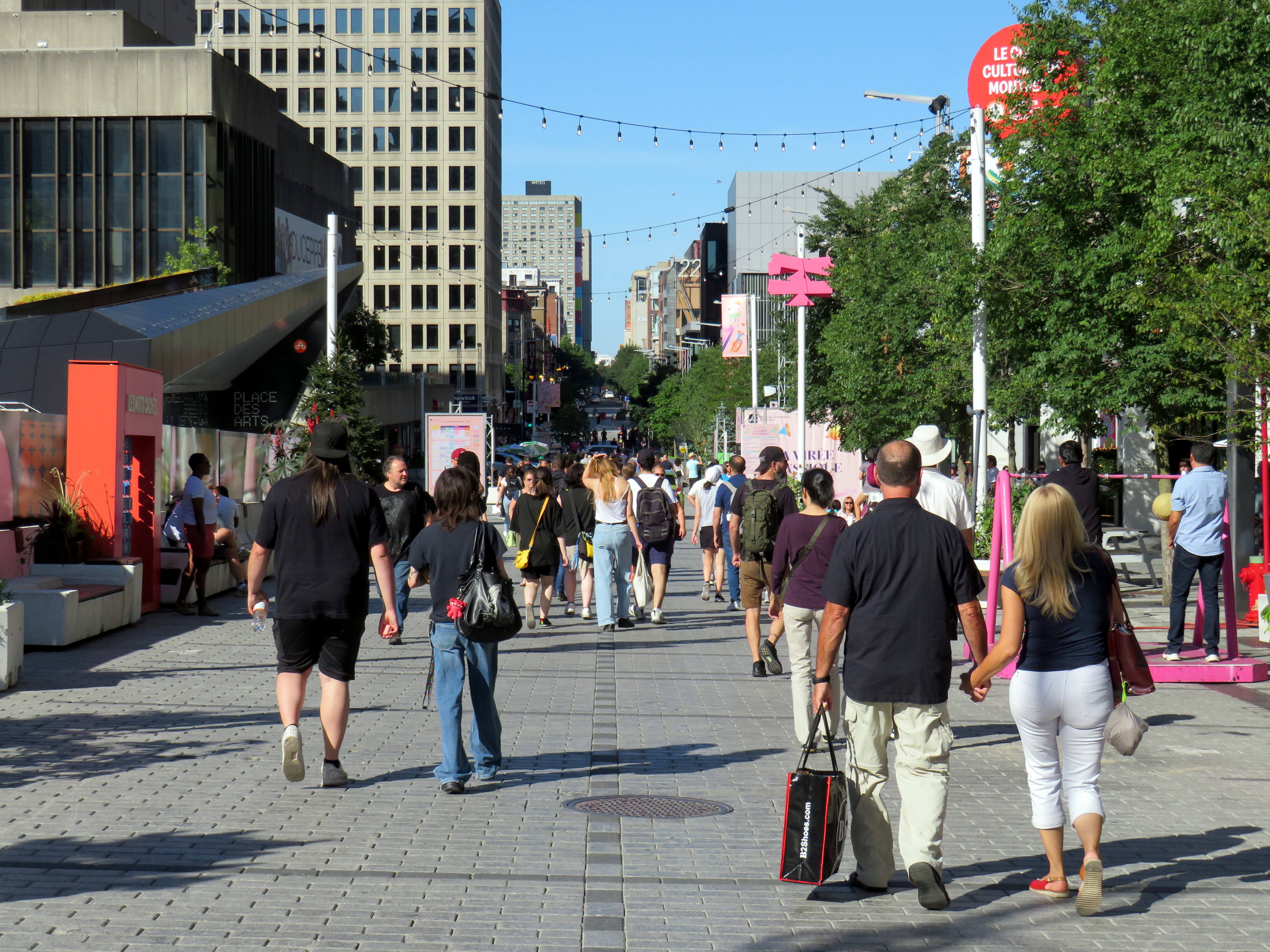
Rue St-Catharine in the Quartier des Spectacles, August 2025
A visit to Montreal can make one jealous. Jealous of the city’s better street furniture, greater cycling infrastructure, great public spaces throughout the city, and an improved pedestrian realm. Entire streets are closed in the summer months to motor traffic, allowing pedestrians to spill out into the roadway, and patios to sprout without the need for concrete blocks to protect them (and less noise and pollution to those dining al fresco).
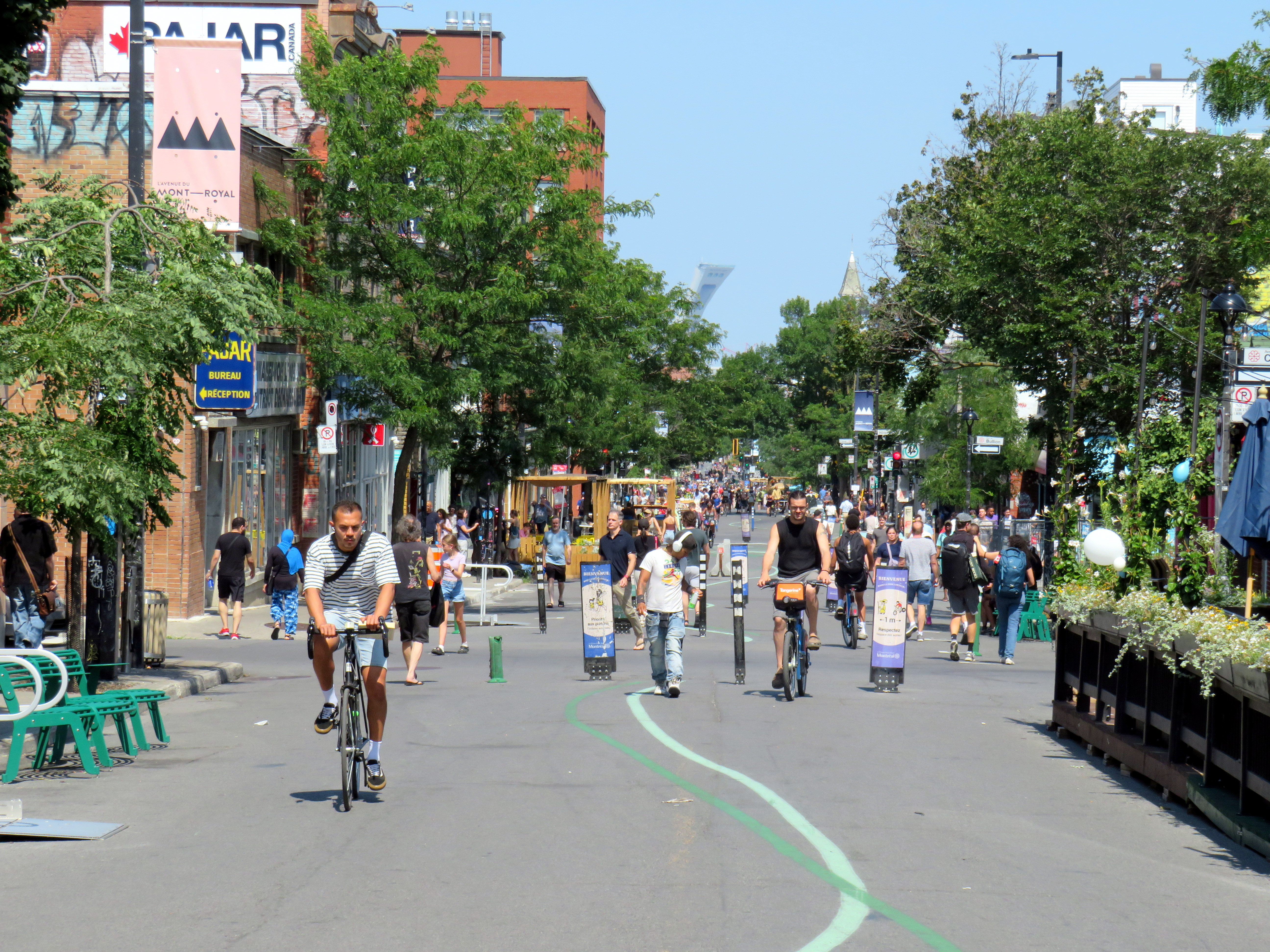
For example, Avenue Mont-Royal, was first closed in Summer 2020 as a “Corridor Sanitare” to encourage people to get outside during the first wave of the COVID-19 pandemic and support local businesses, which set up patios on the sidewalk and the street. My spouse and I rented a car and visited Montreal during this time, getting a lot of walking in a city that opened up as much as safely possible.
Avenue Mont-Royal, looking east, August 2020
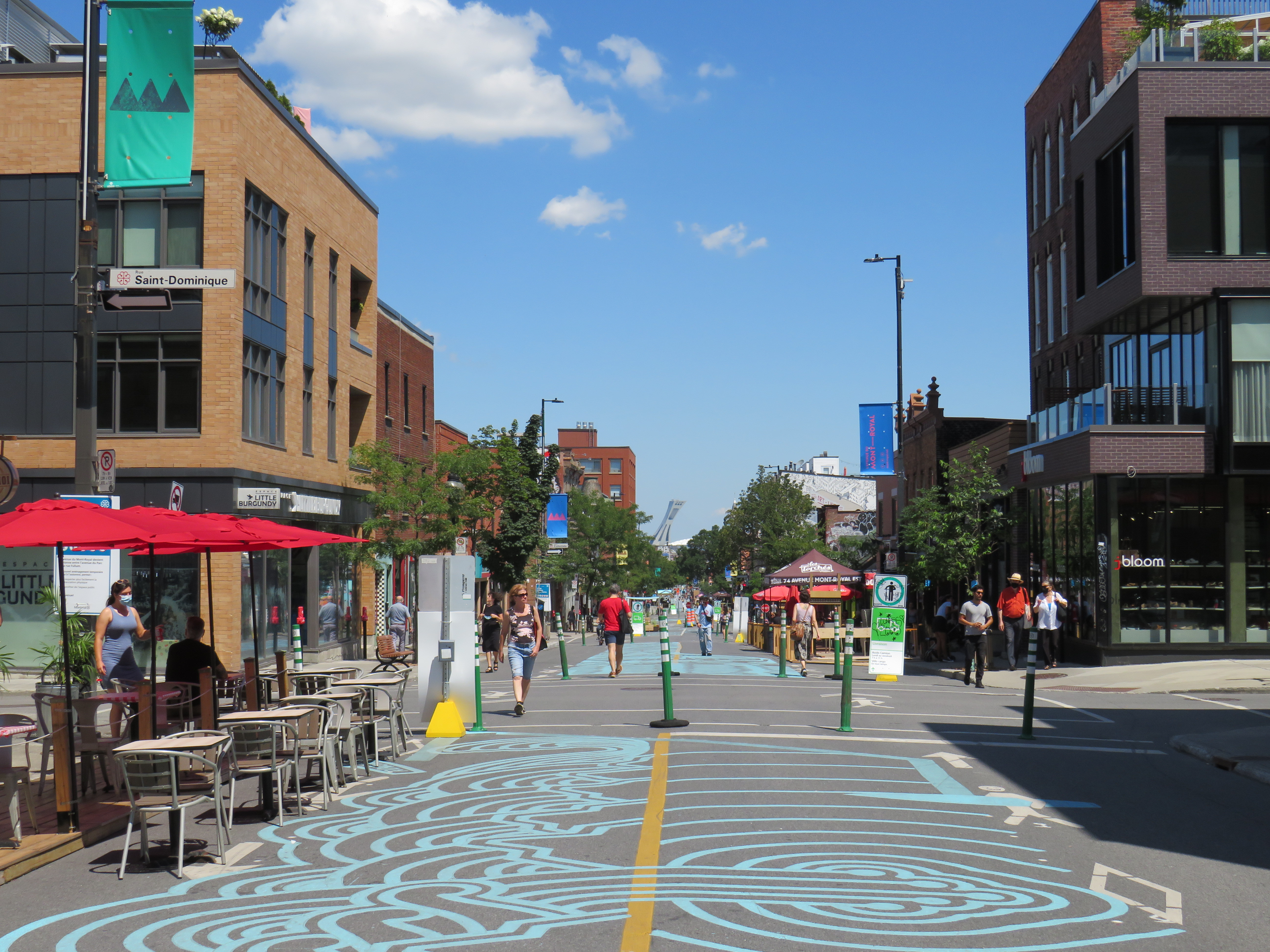
Happily, Montreal continued the tradition in the years since, even as pandemic restrictions eased, then disappeared entirely. Five years later, Avenue Mont-Royal was even more vibrant. Not only were there lots of patios on the street, there were public benches, shade structures, and water fountains, allowing anyone to sit, relax, and enjoy the outdoors. The annual summer closure is a hit.
Avenue Mont-Royal, looking east, August 2025
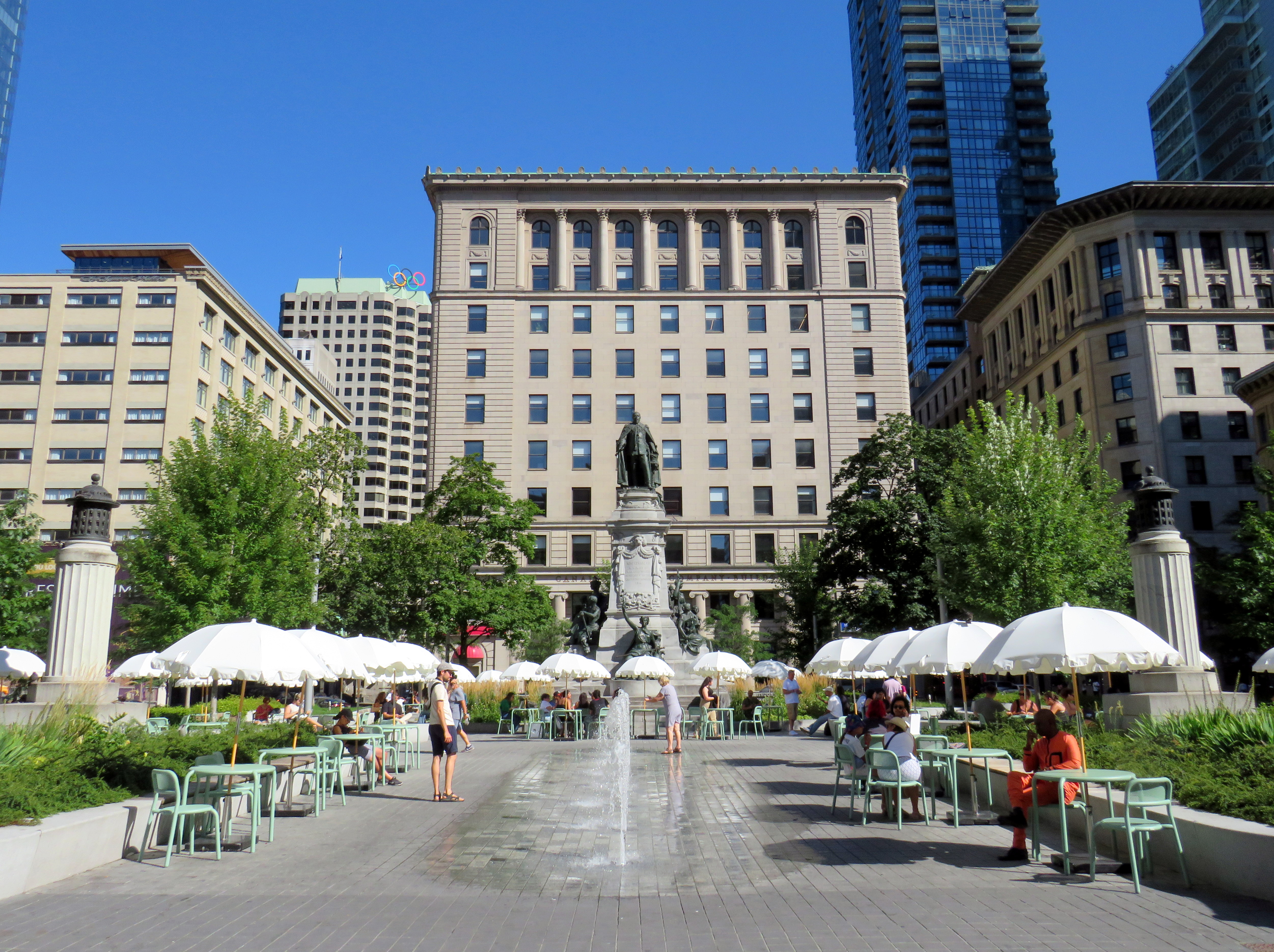
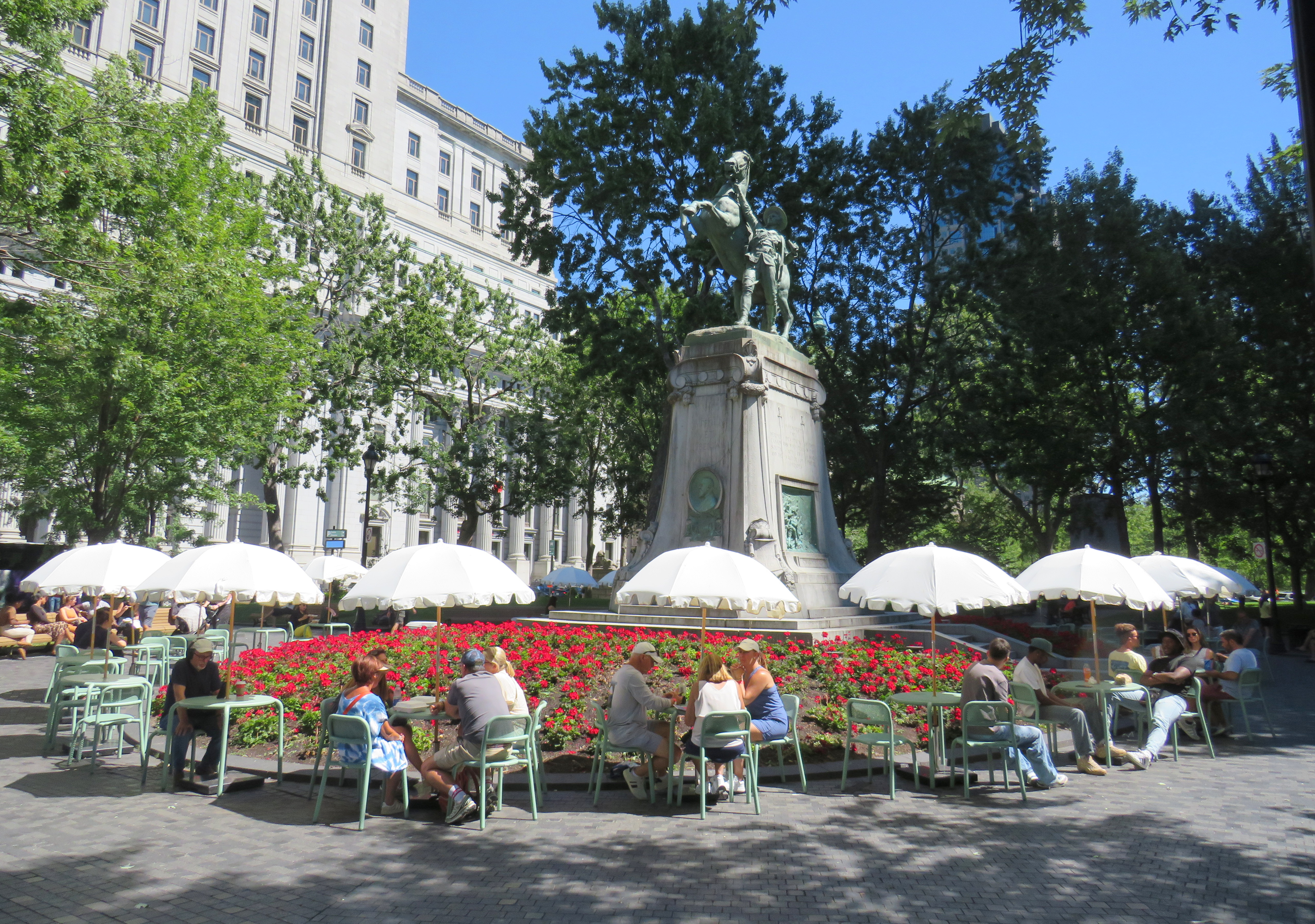
Several public squares were also renewed in recent years. Phillips Square, on Rue Ste-Catharine across from the now-shuttered Hudson’s Bay department store, was renewed with new splash fountains along with small café-style tables and chairs, complete with shade umbrellas. The metal chairs are movable, allowing larger groups to sit around a single table. It’s a refreshed natural congregation point along the city’s main shopping street.
Phillips Square, August 2025
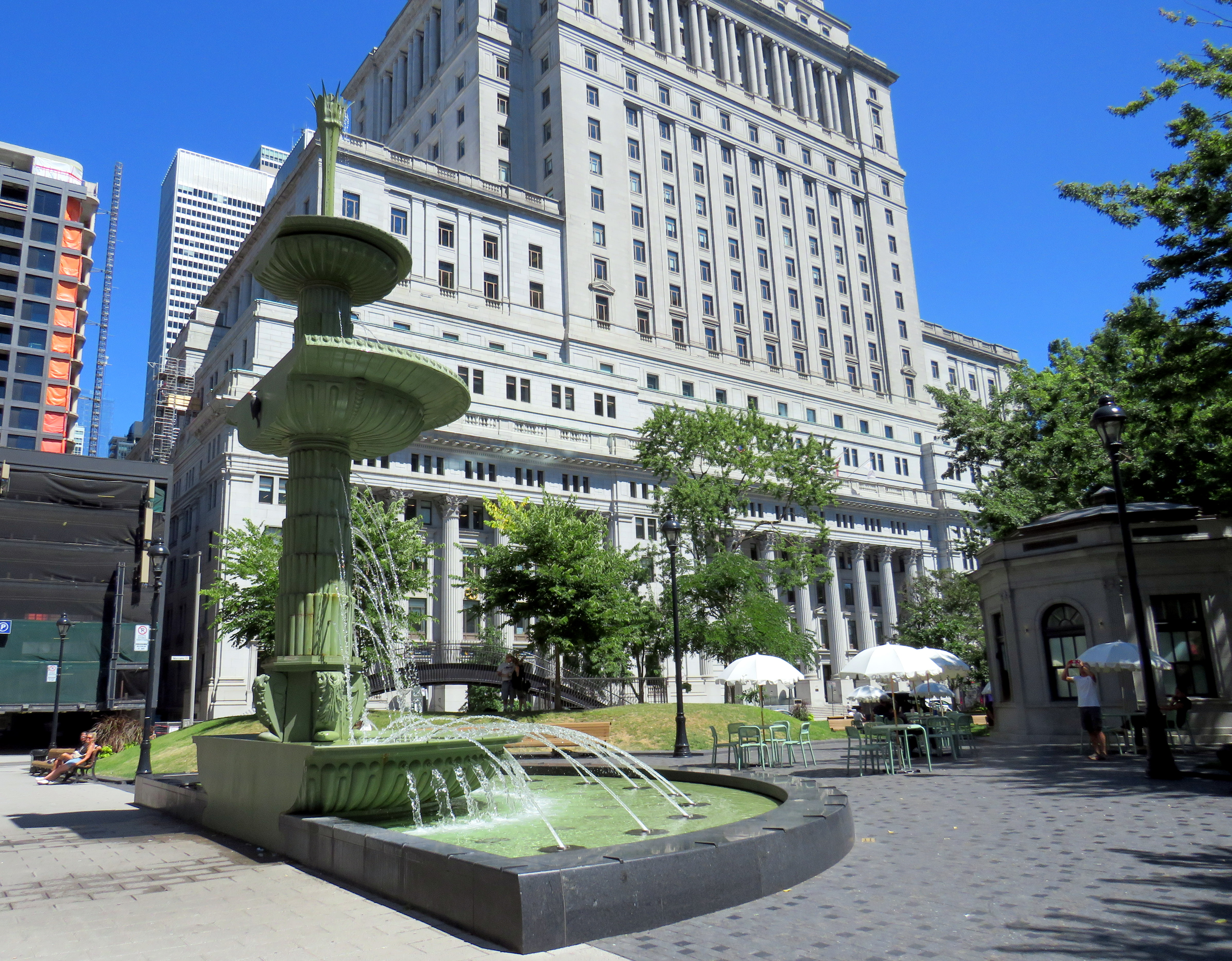
Similar tables and umbrellas were set up at Dorchester Square, several blocks to the west, near Mary, Queen of the World Cathedral and Central Station. Both squares were reimagined by the brilliant landscape architecture firm Claude Cormier + Associés. At Dorchester Square, a new water fountain, seemingly a classic installation, is cut in the rear, with a woodpecker behind. Such Easter eggs are features of Cormier park projects.
Dorchester Square, August 2025Fountain at Dorchester Square; note the woodpecker on the side. One of the two black curved footbridges across the parking ramps is behind.
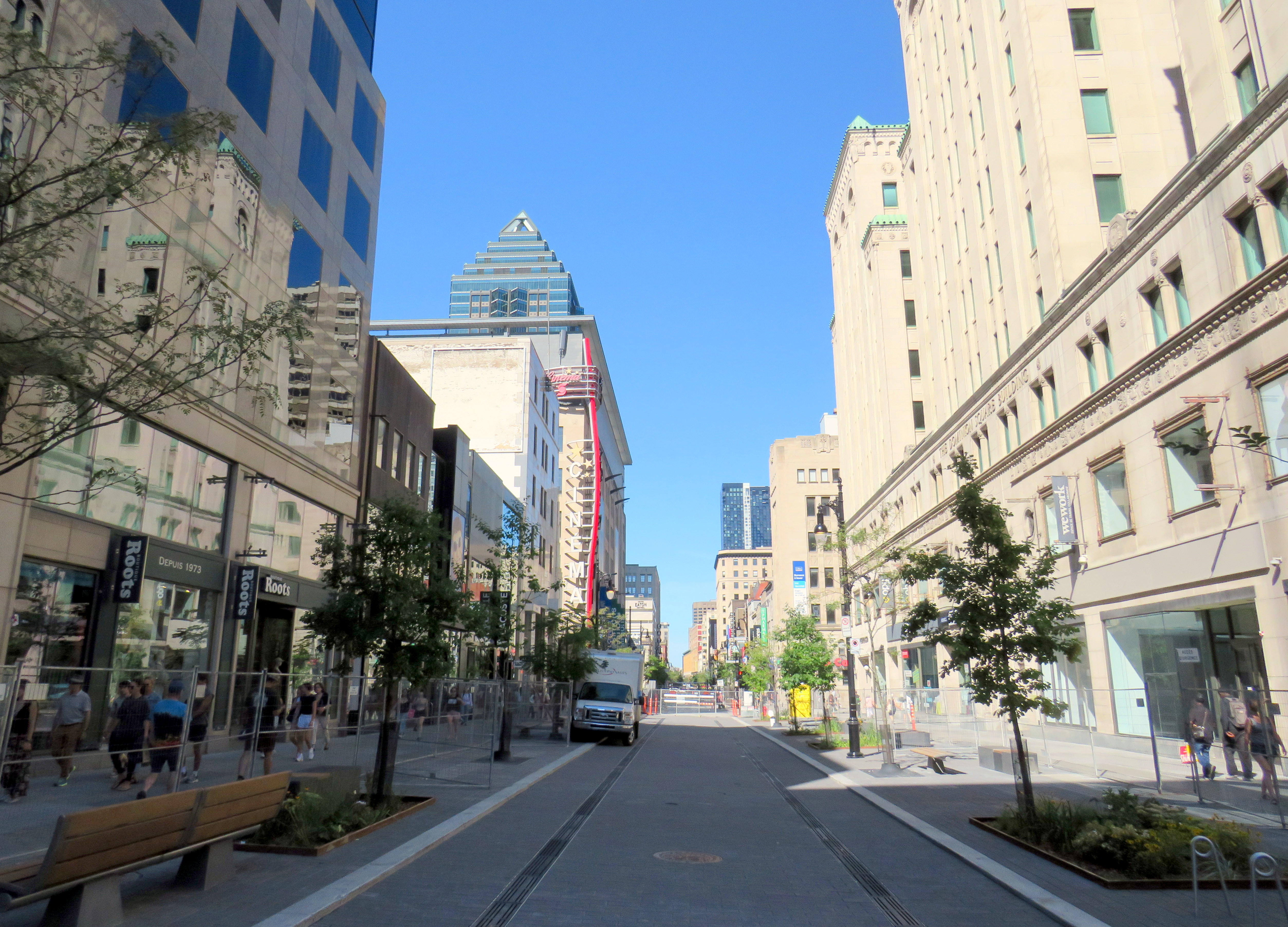
Furthermore, Montreal is rebuilding the western section of Rue St-Catharine towards Crescent. Though motor vehicles are permitted after reconstruction, they are limited to a single through lane, with lay-bys for deliveries, passenger pick-ups and drop-offs, and emergency vehicles. Sidewalks are widened considerably, with more benches, bicycle parking, and street trees.
Completing Rue St-Catharine, near Bishop Street
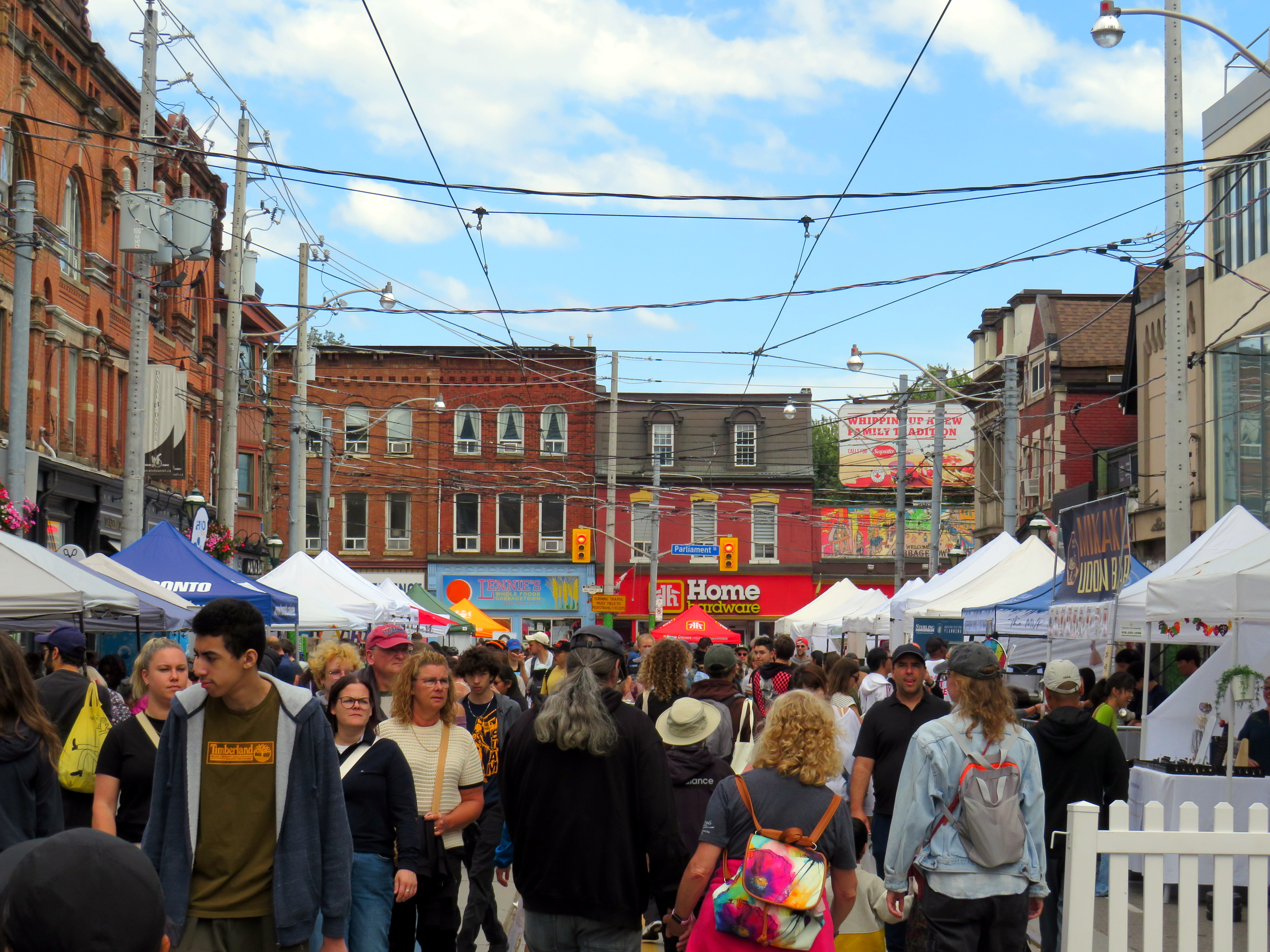
After returning to Toronto, it’s easy to feel down on this city. Montreal seems to do everything right. Meanwhile, ActiveTO, the open streets initiative following the pandemic restrictions here, quickly eroded, and was effectively ended in 2022. Open Streets, which closed sections of Yonge and Bloor Streets to motorists for two Sunday mornings, was last held in 2022. But there are still business improvement area-led weekend street festivals, which attract tens of thousands of pedestrians.
Torontonians want to walk, and pedestrianized streets, even when they’re just weekend events, are immensely popular. One downside, however, is a lack of seating outside of businesses’ patio areas. One is free to walk, enjoy live music, or just people watch, but to sit down, one is compelled to purchase something from one of the businesses with a sanctioned patio.
Torontonians love a street festival: Cabbagetown in September
There are a few other successes. A small segment Gould Street at Toronto Metropolitan University was pedestrianized and rebuilt as a central plaza for that university campus. A short section of Willcocks Street at the University of Toronto was similarly pedestrianized.
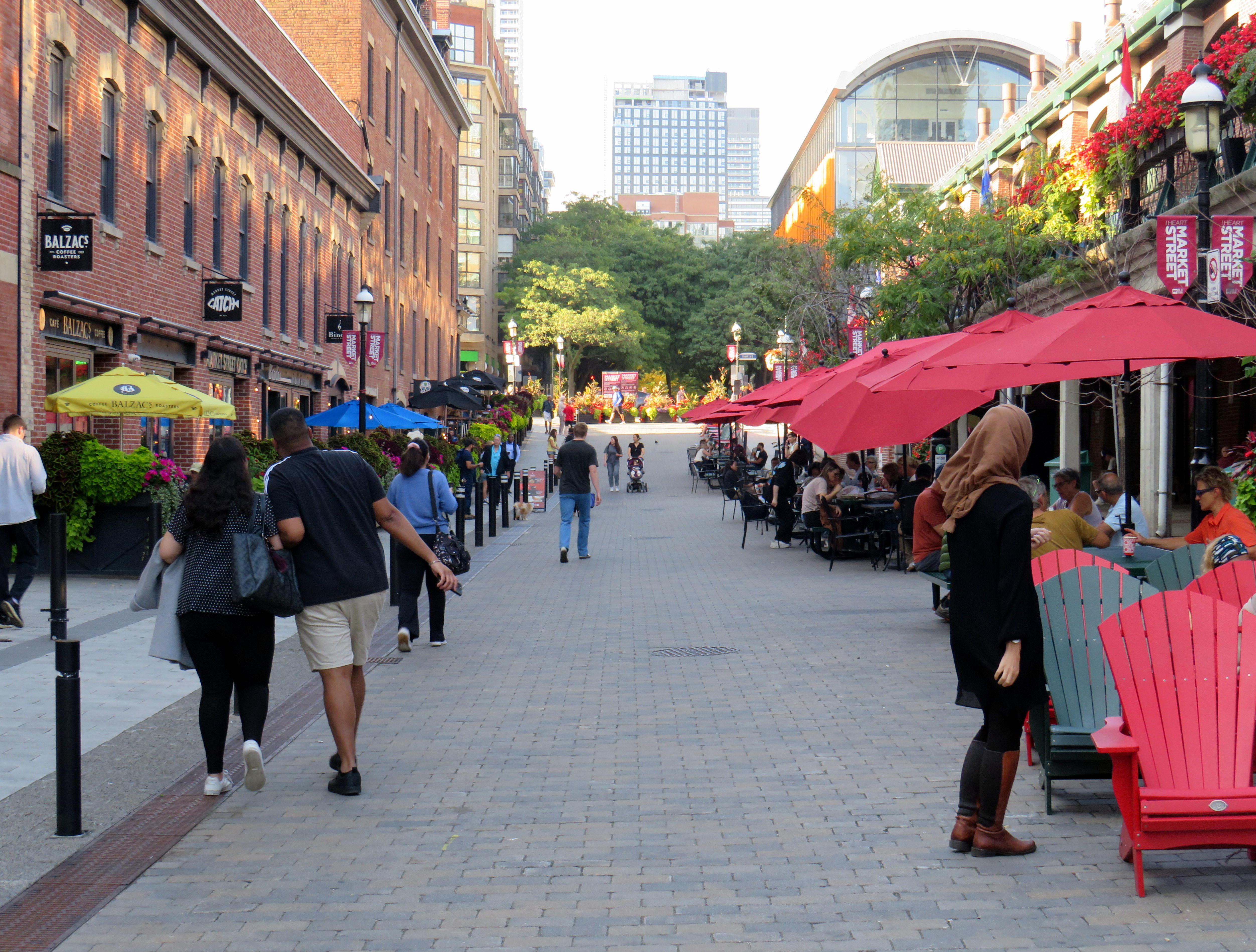
But the best example in Toronto is Market Street, which abuts St. Lawrence Market. Patio space and Muskoka chairs provide plenty of seating, without obligation to purchase anything (though it provides additional seating to those who picked up a snack or lunch inside the market). The shade umbrellas and high-quality surface materials and street furniture make this a wonderful oasis in Toronto’s downtown core.
Market Street looking north from The Esplanade. St. Lawrence Market is on the right.
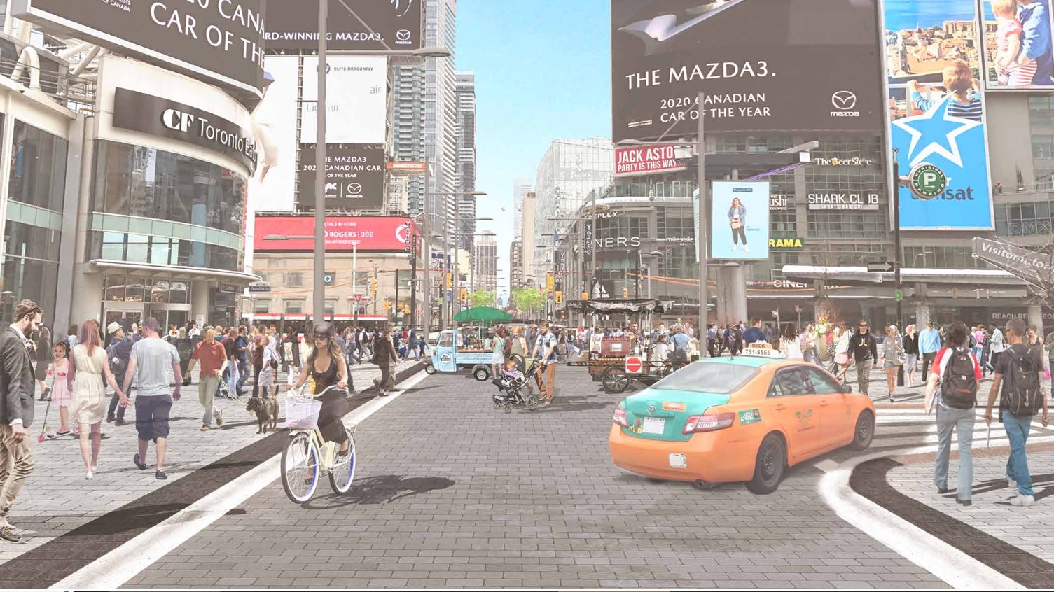
Planning for Yonge Street’s makeover, which will include narrowing the roadway, widening the sidewalks, improvements to the public realm, and seasonal closures of selected sections of the traffic lanes, is complete. Unfortunately, the YongeTOmorrow improvements will have to wait for another five years (work starting in 2030) due to Ontario Line construction.
Rendering of Yonge Street looking north towards Dundas, once YongeTOmorrow improvements are complete
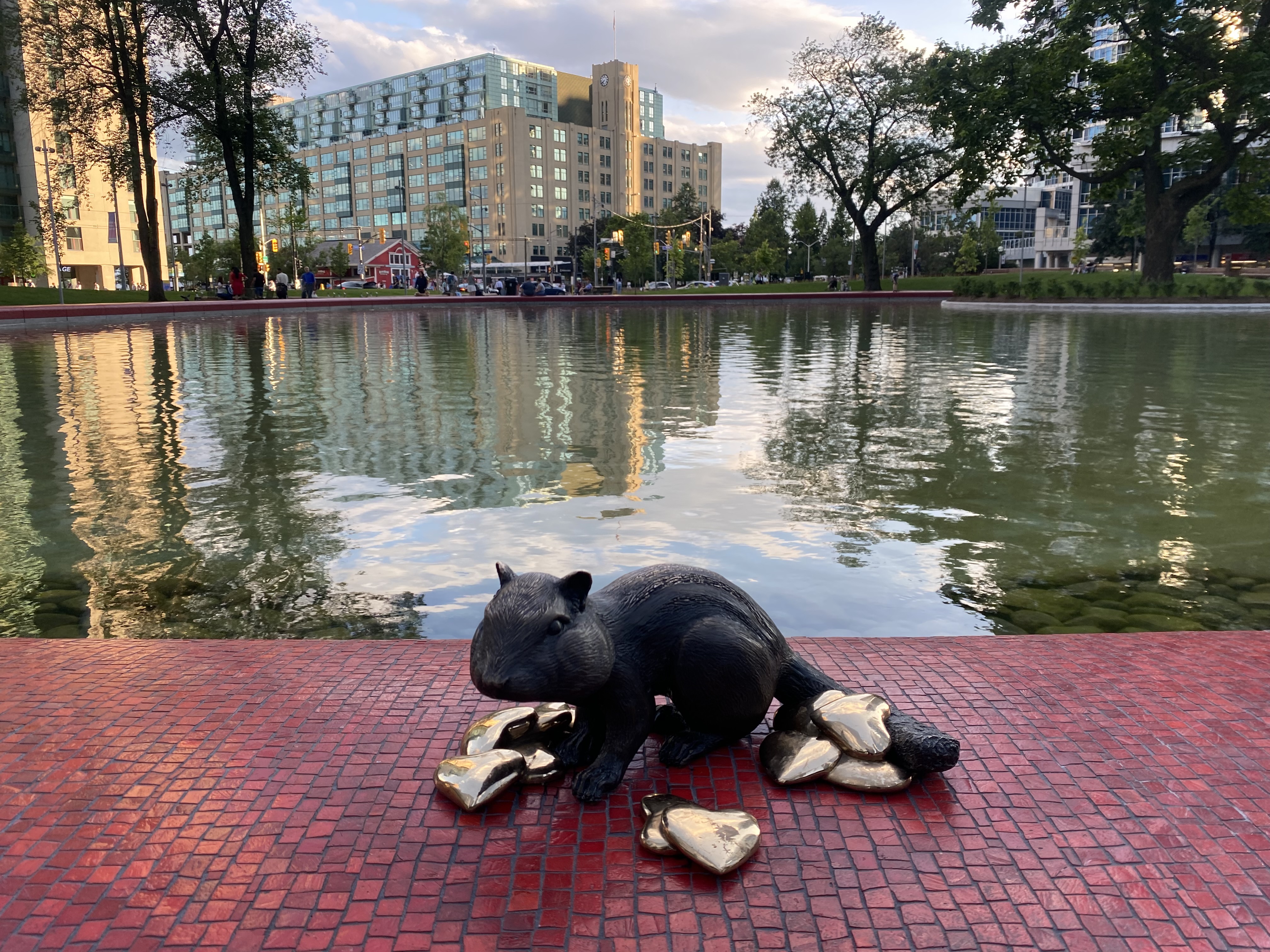
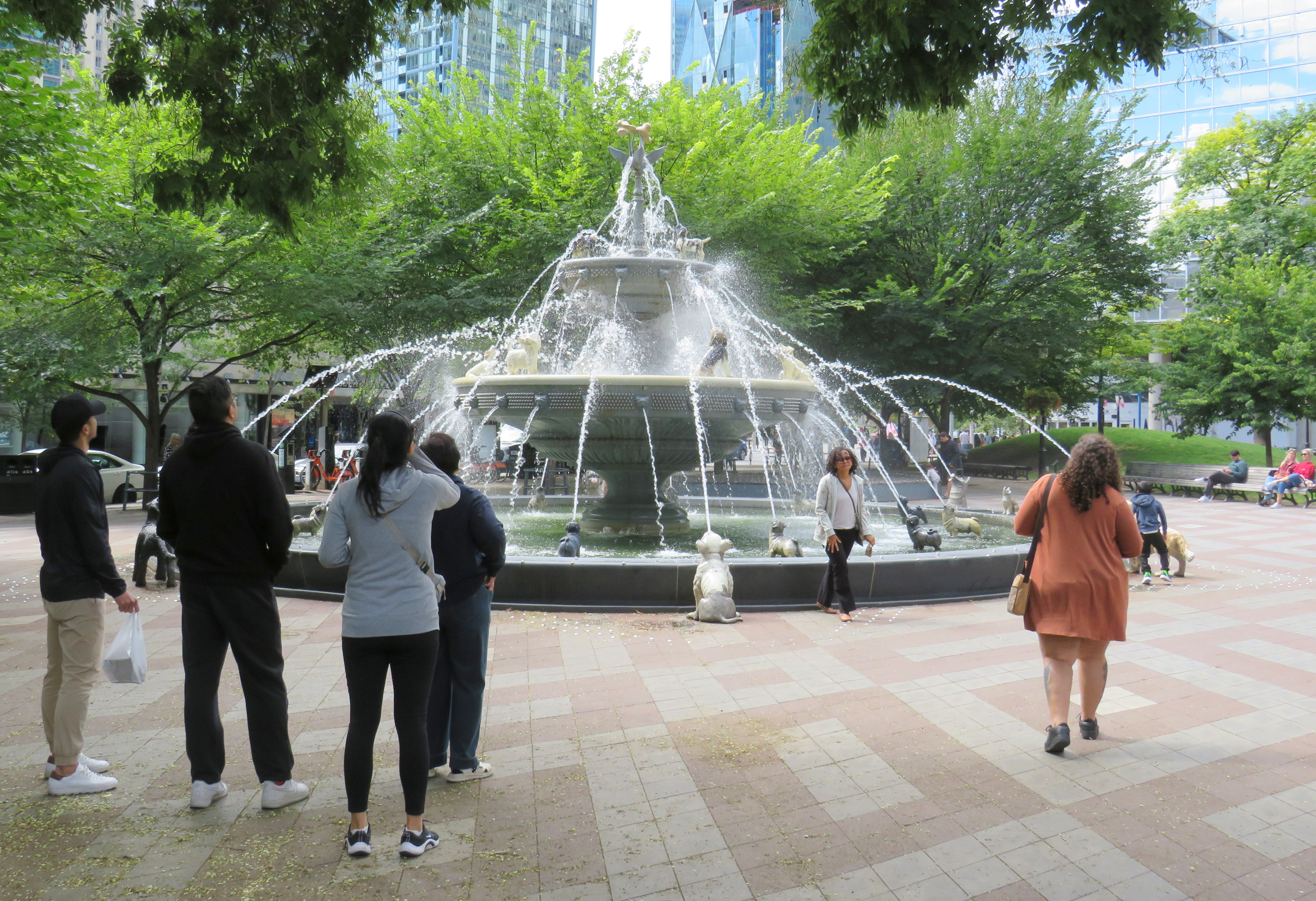
There are also other great things happening in Toronto. Claude Cormier was tapped to create new public spaces, such as HtO Park and Sugar Beach on the Harbourfront, but also reimagine existing places such as Love Park (previously a highway off-ramp) and Berczy Park, home of the popular Dog Fountain. At Love Park, not one of the 45 movable chairs have been taken (though one ended up in the pond). Torontonians have been shown to cherish great public spaces.
HTO Park from Toronto Harbour
Canada’s Sugar Beach
Love Park
Berczy Park
Toronto has made a lot of progress on improving its public realm, and it has shown that it is willing and able to close streets to traffic for the benefit of pedestrians and cyclists. Though it is so very easy to envy Montreal for its greater progress in the last two decades, it is up to us to continue the momentum Toronto does have, and work harder to push for change, even when there’s a car-focused provincial government. Streets can be narrowed, parks can be improved, and streets can be handed over to the people. Additional seating and more public washrooms will open up this city to many more residents and visitors.
This should all be a key pillar of a progressive agenda in next years’ municipal election. When certain candidates talk about tax cuts, austerity, and crime, there needs to be a focus on creating a better quality of life to provide an alternative. And that talk must be backed up with action, with quick wins that don’t require multi-year waits.
BRT median under construction on Wellington Street at South Street, London
The City of London, Ontario has been quietly constructing a new bus rapid transit (BRT) system over the last few years, which will extend south and east of the downtown core. By the end of April 2025, the first major section of this network will begin operation.
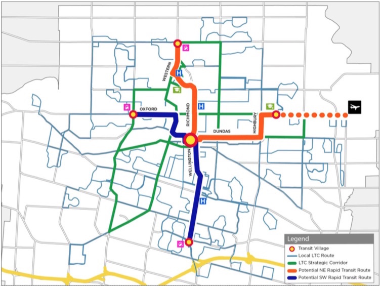
The Wellington Road and Fanshawe College segments are two of the four rapid transit routes originally proposed under London’s SHIFT. At first, a north-to-east line, connecting Masonville Place Mall, Western University, Downtown London, and Fanshawe College, was to be a light rail corridor, featuring a short tunnel under Richmond Street to avoid a busy freight railway crossing. A BRT line would have connected the west end of London, at Oxford Street and Wonderland Road, continued downtown, and head south towards the Victoria Hospital campus and White Oaks Mall near Highway 401. The map below shows the initial proposal.
The original rapid transit proposal called for a light rail (orange route) connecting Western University, downtown, and Fanshawe College and a BRT (blue) corridor to the west and south of downtown
Due to budget constraints, the project was revised to a BRT-only scheme. The Richmond Street leg, leading north to Western University, was cut when the bus tunnel under the CPKC railway and the Oxford Street intersection was deemed to cost $220 million in 2017. Business owners along Richmond Street, a busy restaurant, nightlife, and shopping district known as Richmond Row, were also opposed to the reduction in traffic lanes that the transit tunnel would have required.
This section of Richmond Street — used by eight London Transit routes — is a severe bottleneck as it is not only a busy traffic corridor, it crosses CPKC’s mainline connecting Toronto, Windsor, and the US Midwest.
Several buses cross the CPKC tracks on Richmond Street north of Downtown London
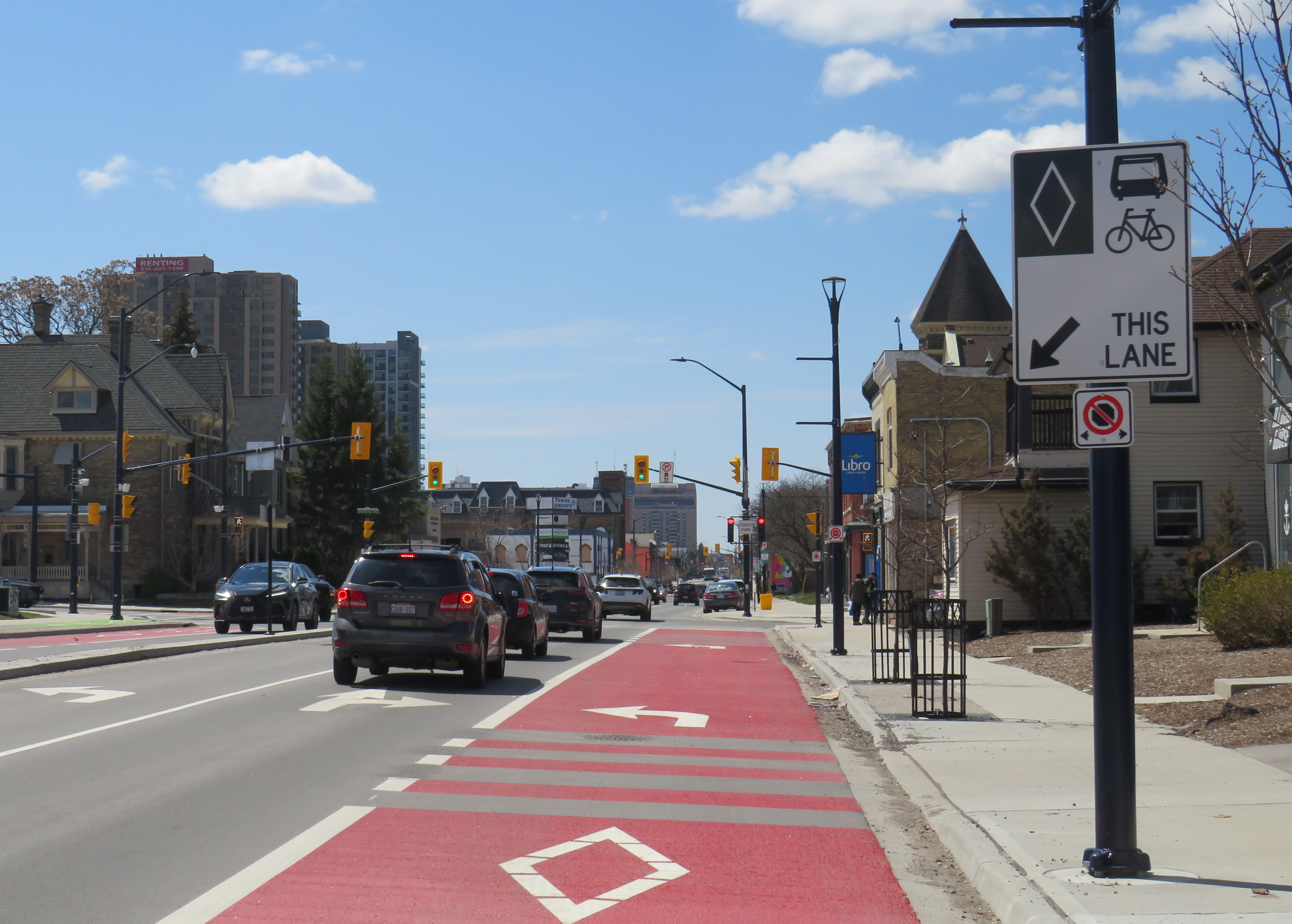
The pared-down BRT project consists of a curbside bus-only lane encircling the downtown core, following King Street, Wellington Street, Queen’s Avenue, and Ridout Street. At each turn, buses must wait for a dedicated signal to make the left turn to continue on the loop. Right now, buses do not have any signal priority, and can wait a full light cycle (up to two minutes) to get the dedicated left turn signal.
Example of a left turn from the right curb lane in London. The dedicated transit signals allow left-turning buses to remain in the right lane without traffic conflicts.
New enlarged shelters and long platforms allow multiple buses to pick up and drop off at each stop; most routes heading through downtown will serve at least one of these new bus stops on their routes. All buses were removed from Dundas Street, which has been re-landscaped to create a more pedestrian-friendly commercial environment called Dundas Place.
New enlarged bus shelters along the BRT corridors; this is at Wellington and King Streets
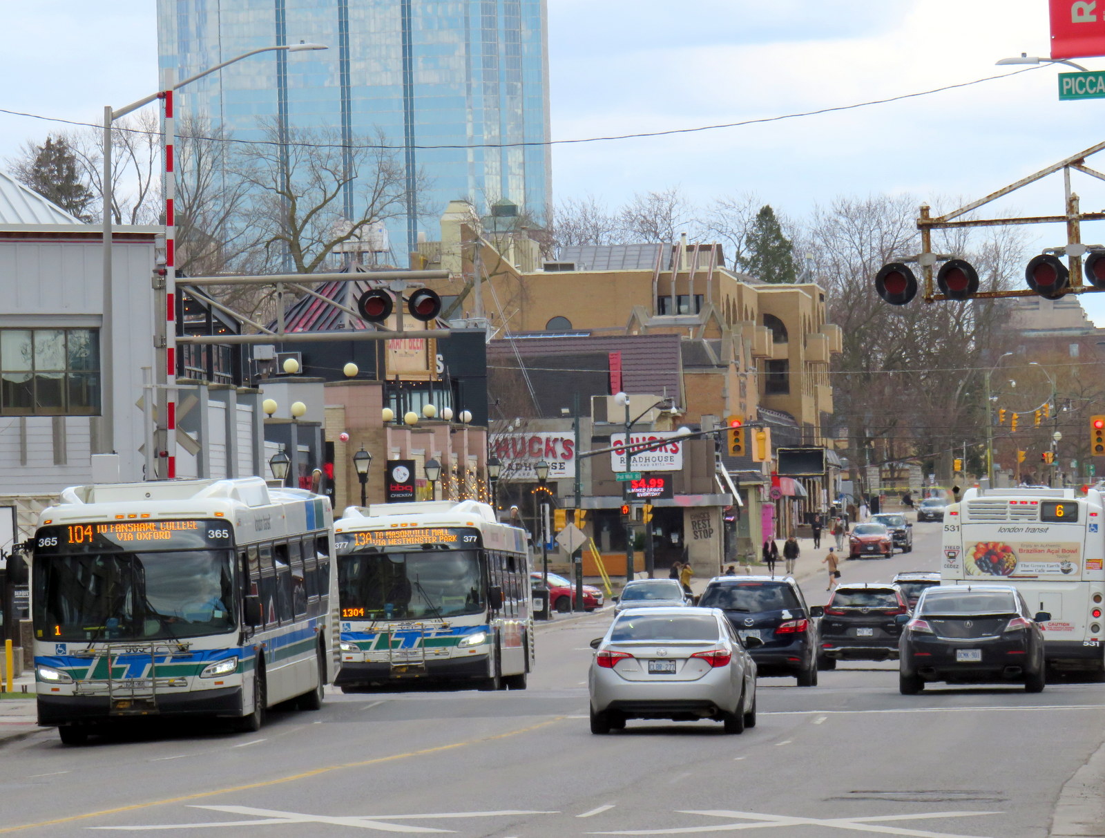
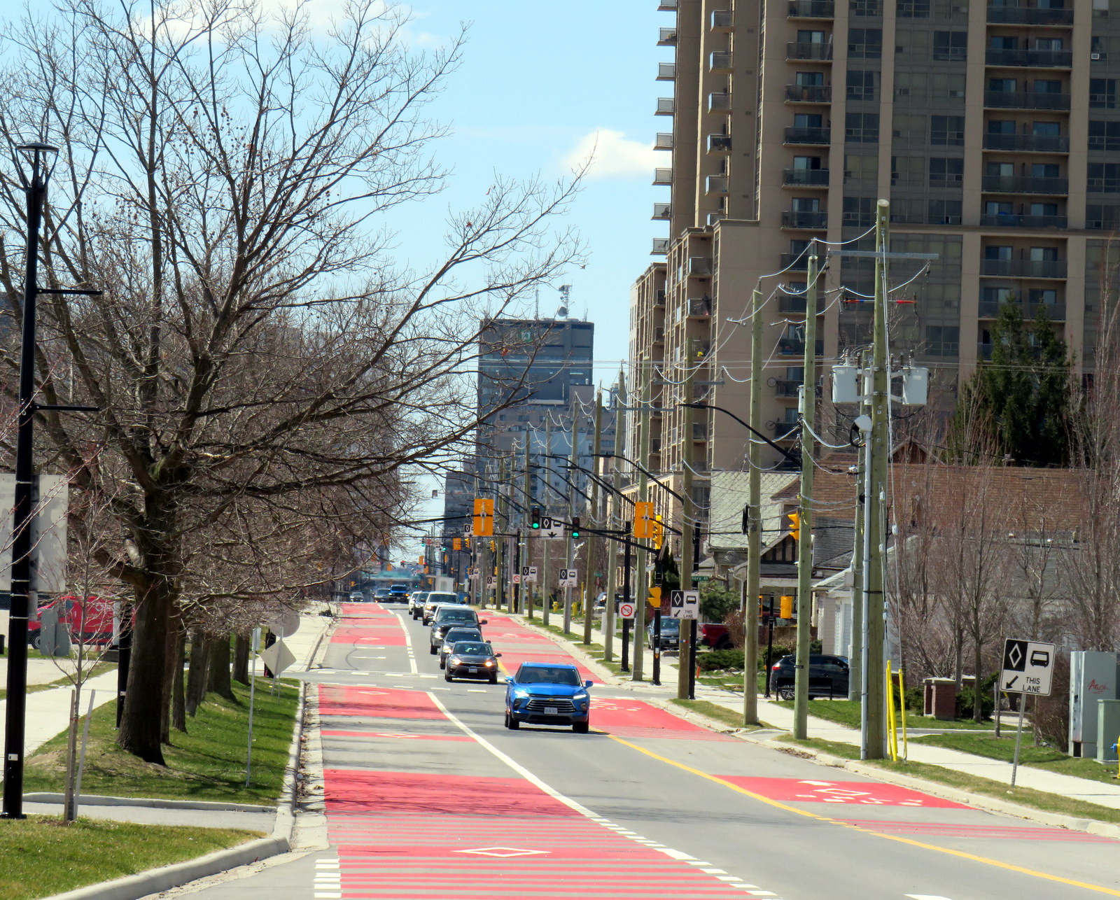
On April 28, Route 94, a weekday express route between Argyle Mall in London’s east end, Downtown London, and Western University, will begin operating in both directions on King Street, and will be the first route using the bus infrastructure outside the downtown loop. King Street was originally a one-way, two-lane-wide roadway east of Downtown London, but was recently widened to allow for painted bus lanes in both directions.
Contraflow bus lane on King Street, previously a two-lane, one-way street
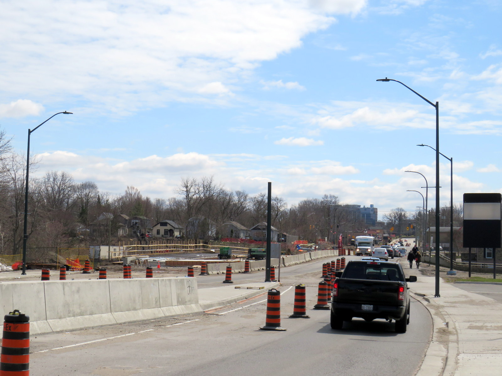
Work is far from complete. Utility work and road reconstruction continues on Dundas east of Ontario Street (at the Western Fairgrounds) and on Highbury Avenue north to Oxford. Construction of the BRT median on Wellington Street/Wellington Road south is also ongoing.
Looking south on Wellington Street at the South Thames River bridge crossing, which is being widened as part of the BRT project
The cost of the BRT project has risen to at least $454 million, and that does not include the north or west segments. Service levels have yet to be determined, along with transit route restructuring once the east and south segments are complete. The new station shelters will not have off-board fare payment equipment, so unless policy changes, all transit riders will still have to enter the bus from the front door.
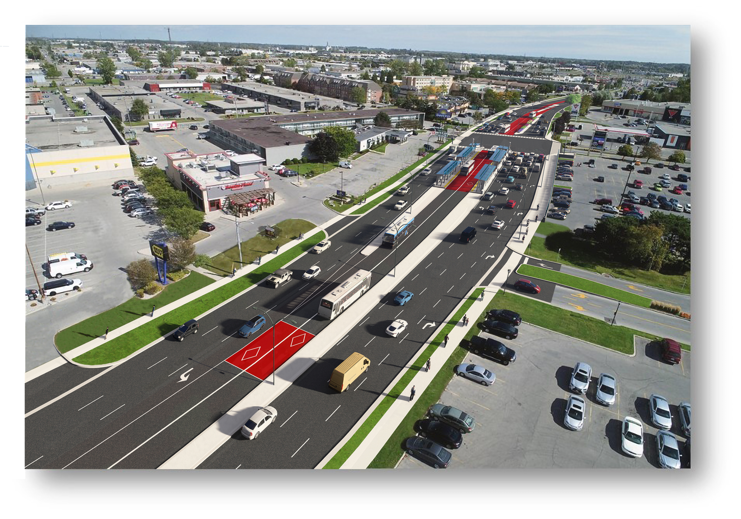
Concept rendering of Wellington Road with new BRT median lanes near White Oaks Mall
Entering and leaving downtown along Wellington Street, south BRT buses will still have to squeeze through an older four-lane railway underpass in mixed traffic, limiting bus throughput. The lack of a northern segment between Downtown, Western University, and Masonville Place Mall is another major downfall.
Bottlenecks, like Richmond Street North, will limit how fast and how attractive transit will be to prospective riders
Though it is hoped that London’s Rapid Transit project will help shape development — much in the same way Waterloo Region’s Ion LRT has — the cost-cutting will limit this potential. The Wellington Road BRT median might help improve bus reliability along a congested traffic corridor, but the lack of signal priority — plus the railway underpass bottleneck — will not help. Western University students will still have to endure a slow ride north from downtown, reducing the attractiveness of Wellington Street, currently littered with big-box stores and strip plazas, as a place to build up with private mixed-use development. Perhaps the eastern segment on King and Dundas Streets, serving the regenerating Old East Village neighbourhood, will be more successful.
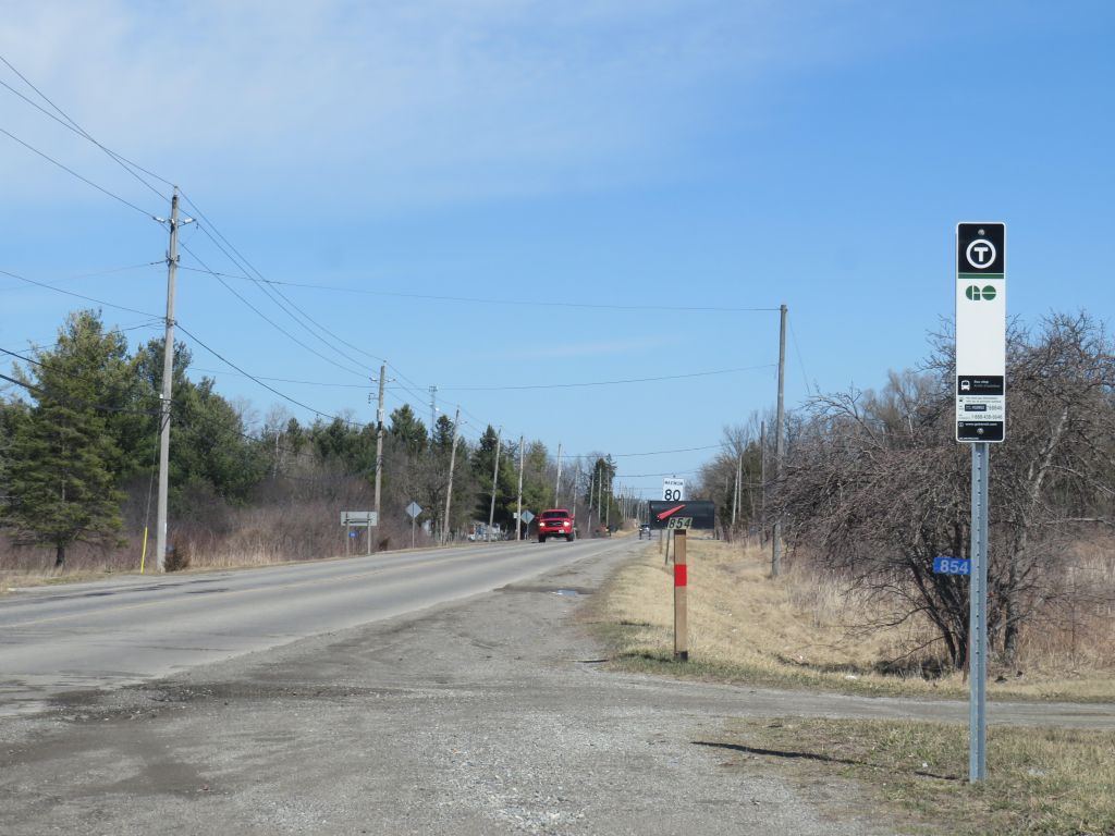
New GO Transit bus stop on Chiefswood Road at Six Nations
As we enter Spring 2025, there are a few significant changes in Ontario’s intercity transportation services. A new daily GO Transit route will now connect Six Nations and the Mississaugas of the Credit First Nation with Brantford, Hamilton, and Greater Toronto. A new seasonal Waterloo-Burlington weekend express could foreshadow more direct service between Kitchener/Waterloo and Hamilton in the future. Flixbus moved its Ottawa terminal stop to the VIA Rail station, joining Ontario Northland and Orleans Express.
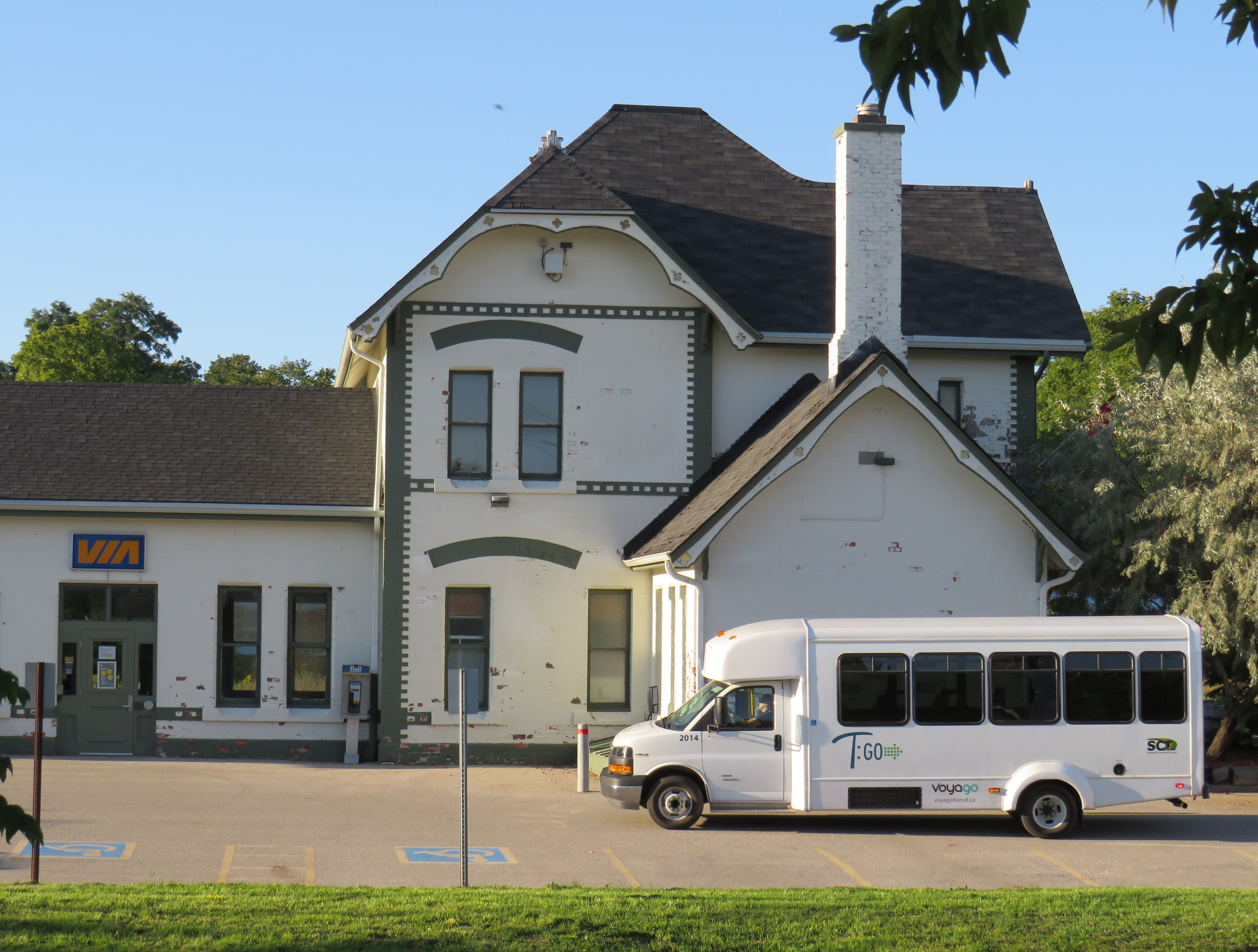
However, there are also some cuts, triggered by the end of the Ontario Intercommunity Transportation Grants. Grey County will terminate all GTR services with the exception of Route 1 between Dundalk, Shelburne, and Orangeville. T:GO is ending its intercommunity services outside of Tillsonburg, including routes that connect with Woodstock and London. PC Connect is cutting its rural route that serves places like Mitchell and Milverton (though routes connecting Listowel, Stratford, and St. Marys to Kitchener/Waterloo and London will continue).
Unfortunately, T:GO will end all intercommunity bus routes outside of Tillsonburg, including the link to Woodstock
Recently, I provided my expertise mapping Canada’s intercity transit links to Transport Canada, which allowed me to enhance and update the interactive map. I am also working with Transport Action Canada to support their efforts advocating improved intercity transport across the country.
As always, please contact me with feedback, corrections, or updates. It is a challenge continually maintaining a Canada-wide map given how frequently things change.
Last month, I wrote about the challenges getting around Toronto’s Union Station, Canada’s busiest transportation hub, particularly for passengers using mobility devices or carrying luggage. Only one poorly-marked elevator directly links the Great Hall and the UP Express platform with the subway station/PATH level, which is located two floors down.
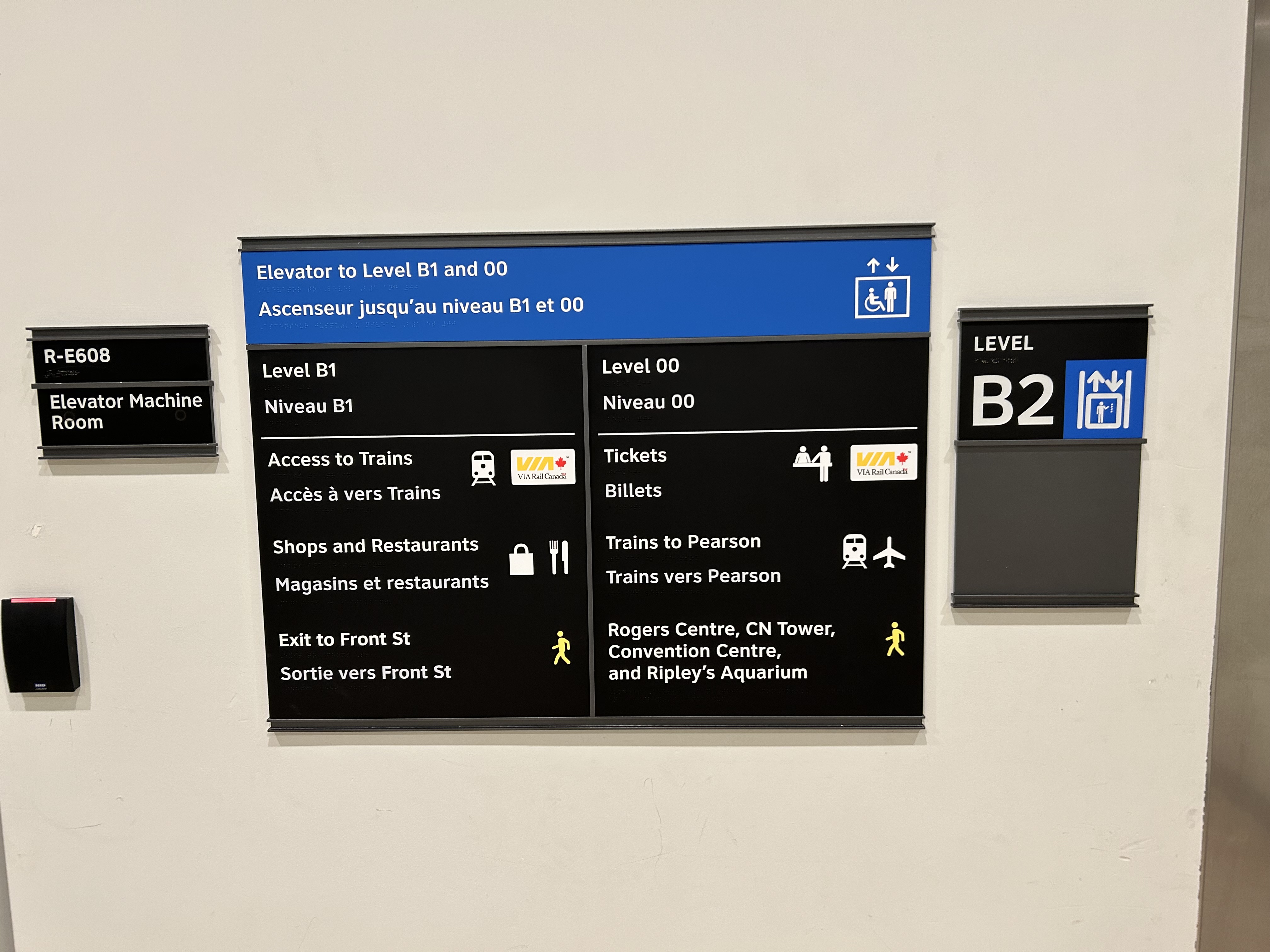
I returned to Union Station on Tuesday, January 7, to see if any improvements were made since I wrote my initial post. Somewhat surprisingly, new signs were installed beside the elevators, indicating which floor goes where.
Elevator signage at B2 level (subway concourse/PATH level by Bay Street) that indicates where the other floors lead to: Level B1 for VIA trains, shops and restaurants, and exit to Front Street, and Level 00 for VIA ticketing, UP Express trains, and access to the Skywalk to Rogers Centre, CN Tower et al.In the GO York Concourse, the elevator leads to Level 00 (The Great Hall) only.
These signs are a notable improvement, but there is still no signage inside the elevator cars themselves, so the traveler must note the directory signage before entering the elevator. Furthermore, the Great Hall, the historic centrepiece of the Union Station complex, is not noted, even though it is a logical meeting place from where access to all GO, VIA, and UP Express train services can be made, or where taxis can be found right outside.
Unfortunately, the elevators themselves are still difficult to locate, and the decision to have just one slow elevator connect the Great Hall/UP Express floor with the subway station entrance remains unfortunate. There is still so much more to be done.
In the Great Hall, there are clear signs directing passengers towards the subway, but there are no indications on where a barrier-free passage can be found. A supplementary sign pointing towards the one elevator, located at the far end of the Great Hall, could be useful here.
Previously on this website, I discussed the problems with the unsightly, intrusive, and poorly thought-out mess of Jersey barriers plopped in front of Union Station along Front Street. They have not only been an eyesore unbefitting a signature heritage structure, but they have also been difficult for pedestrians to navigate around, especially at the corners of Front and Bay and Front and York.
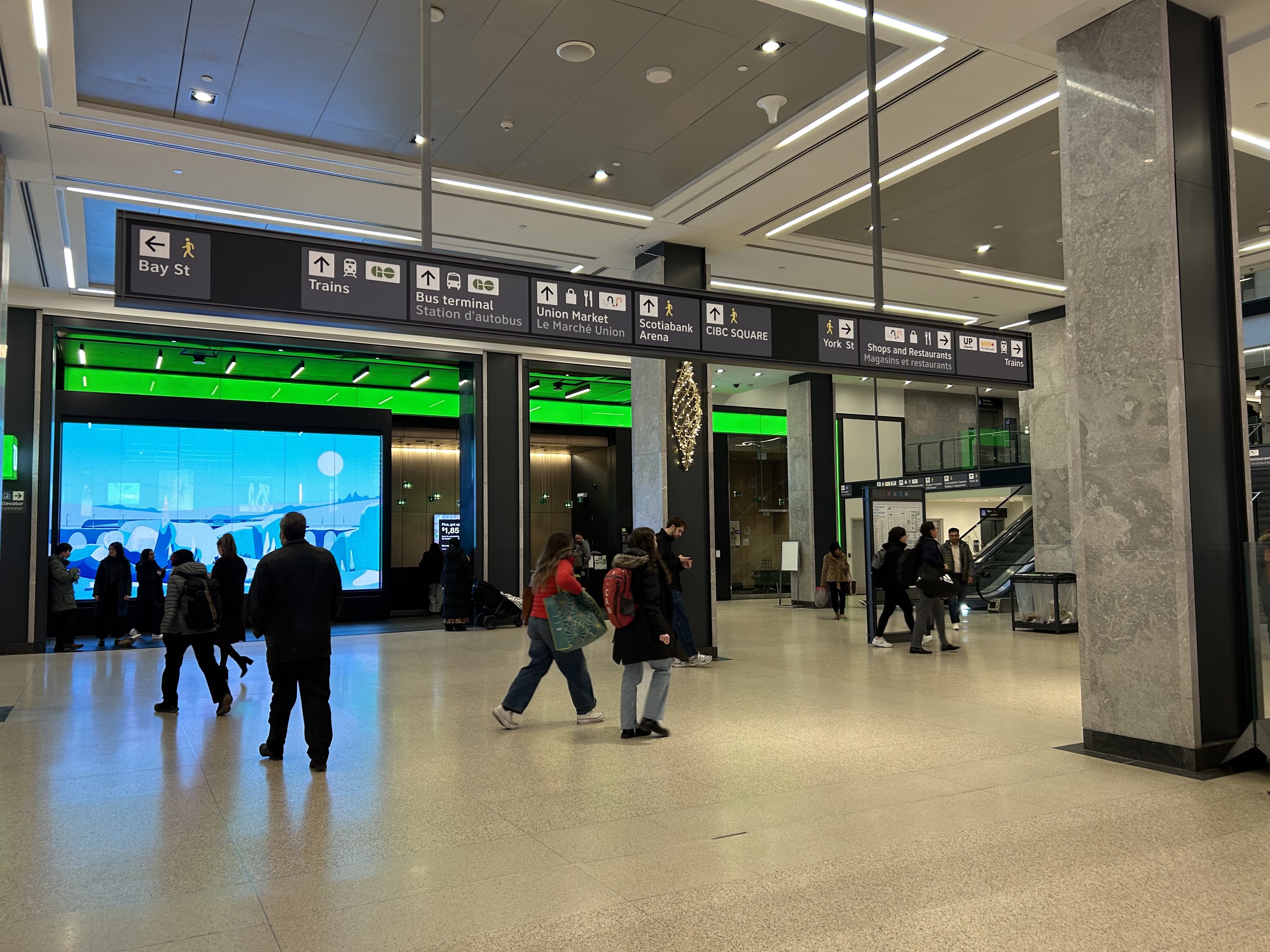
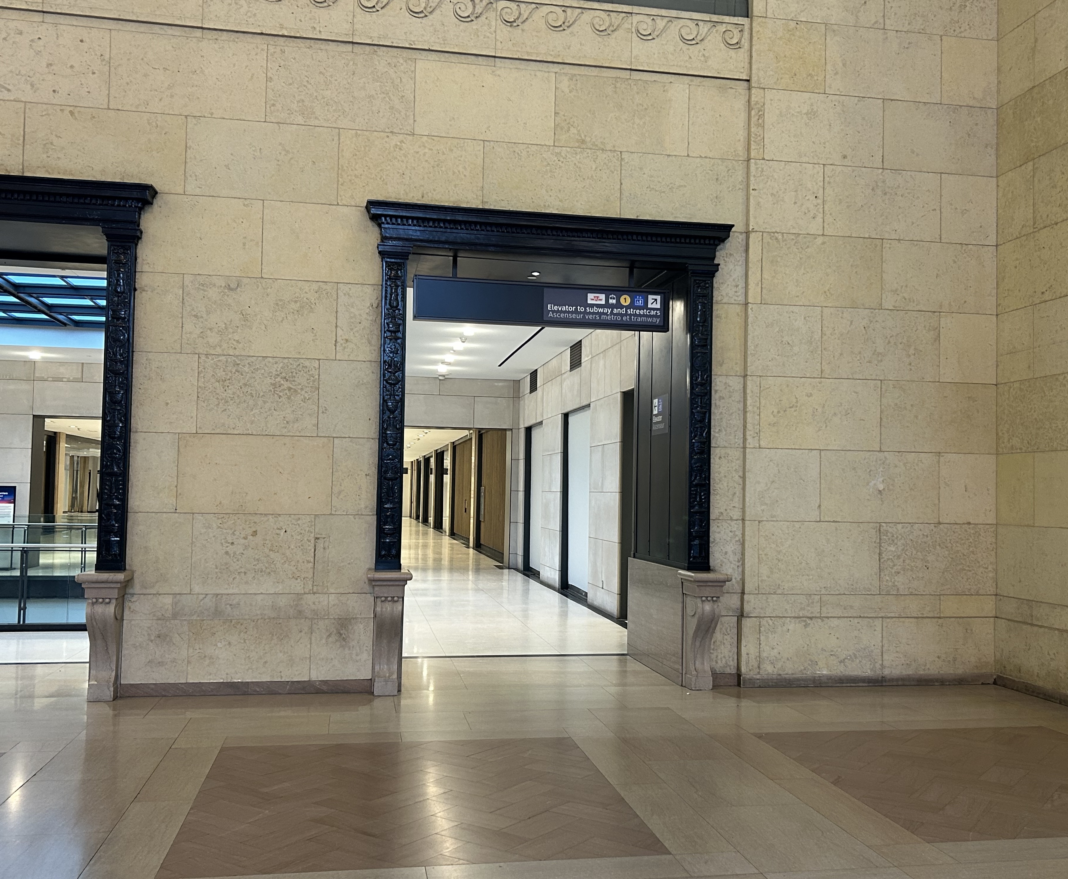
Inside Union Station, however, a lot has changed in the last few years. In general, pedestrian flow within the station building has improved, especially with the opening of the GO Transit York Concourse, which provides a second access point for regional trains. Flow between subway, train, and shops is considerably improved; there are also a lot more food and retail options befitting a central transport hub.
Despite new escalators and elevators, accessibility in Union Station remains poor. Though technically, the station is fully accessible to anyone using a wheelchair or other mobility device, the wayfinding is absent in key areas. There is only one small elevator that directly connects the subway level with the Great Hall, UP Express trains, and Front Street. An accessible route is also difficult to find.
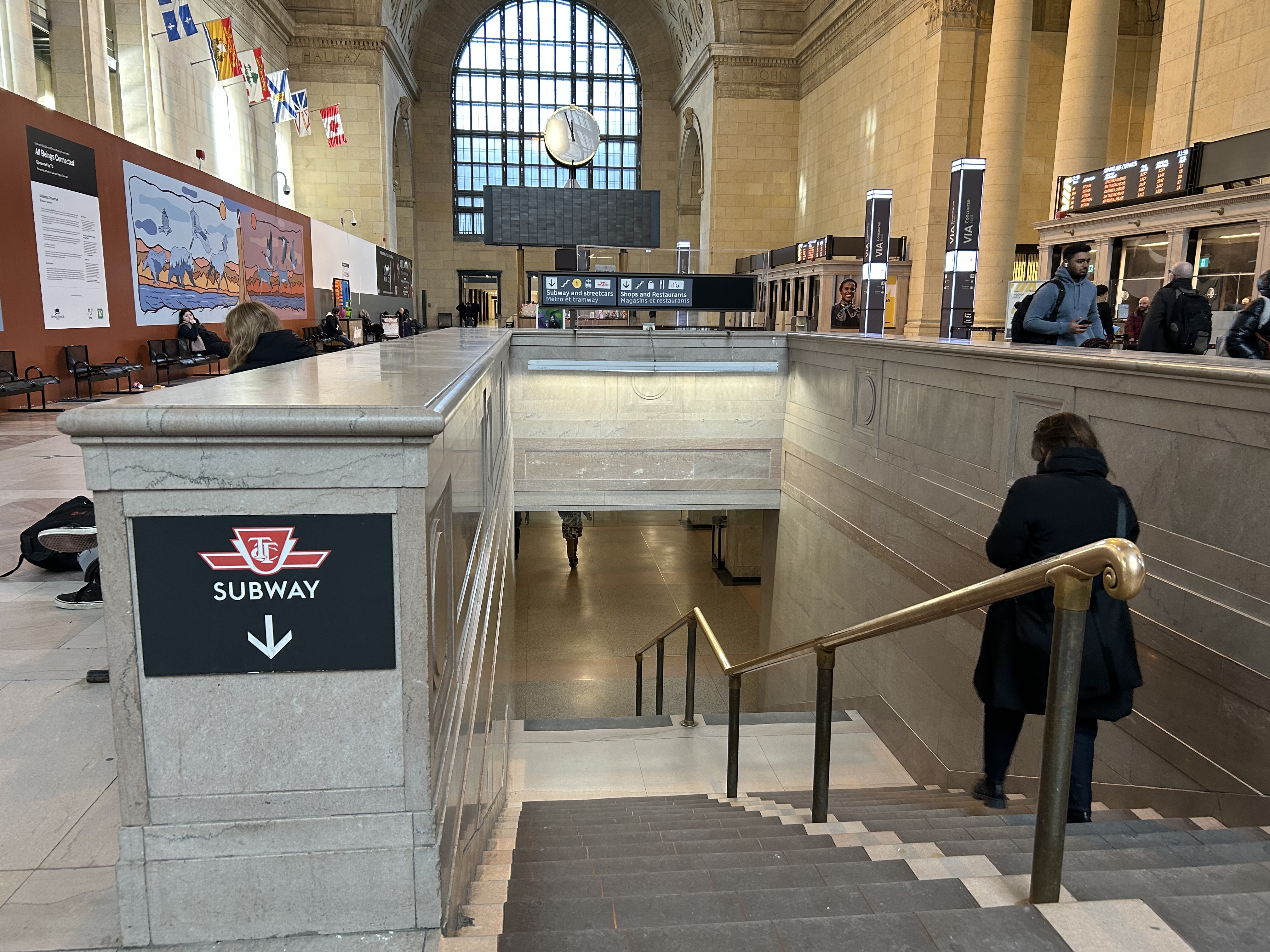
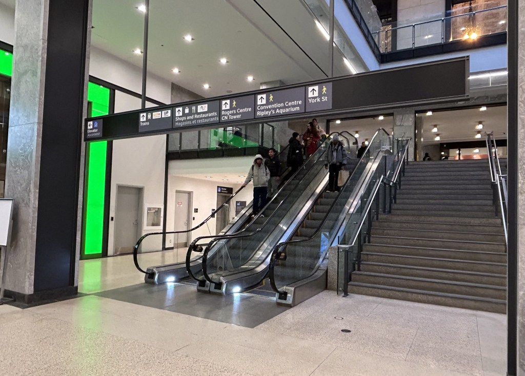
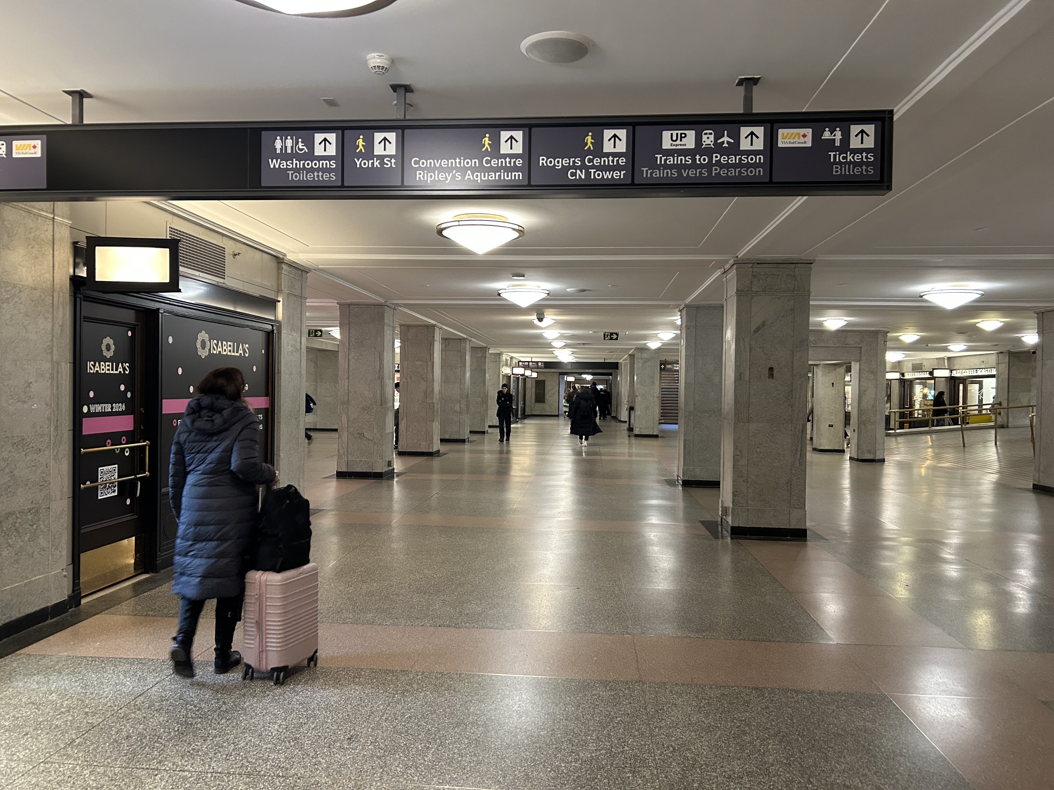
The view after entering the Union Station complex from the TTC subway. The overhead sign shows the way to GO trains, the bus terminal, the Union Market shopping area, Scotiabank Arena, CIBC Square (an office building), York Street, more shops and restaurants, and VIA and UP Express trains.
Imagine entering Union Station from the adjacent TTC subway station with a wheeled device or a mobility aid. There is a large concourse with signs leading forward towards the GO Transit York Concourse along with Scotiabank Arena, the bus terminal, and Union Station shops and food kiosks. To the left is Bay Street, and to the right are a set of escalators and stairs leading up towards VIA Rail and UP Express trains. Behind the stairs and escalators is a single elevator, hidden away.
To the right is a set of escalators, stairs, and hidden behind, a poorly marked single elevator.These lead towards UP Express and VIA trains, York Street, and attractions such as the CN Tower, the Convention Centre, and Rogers Centre.
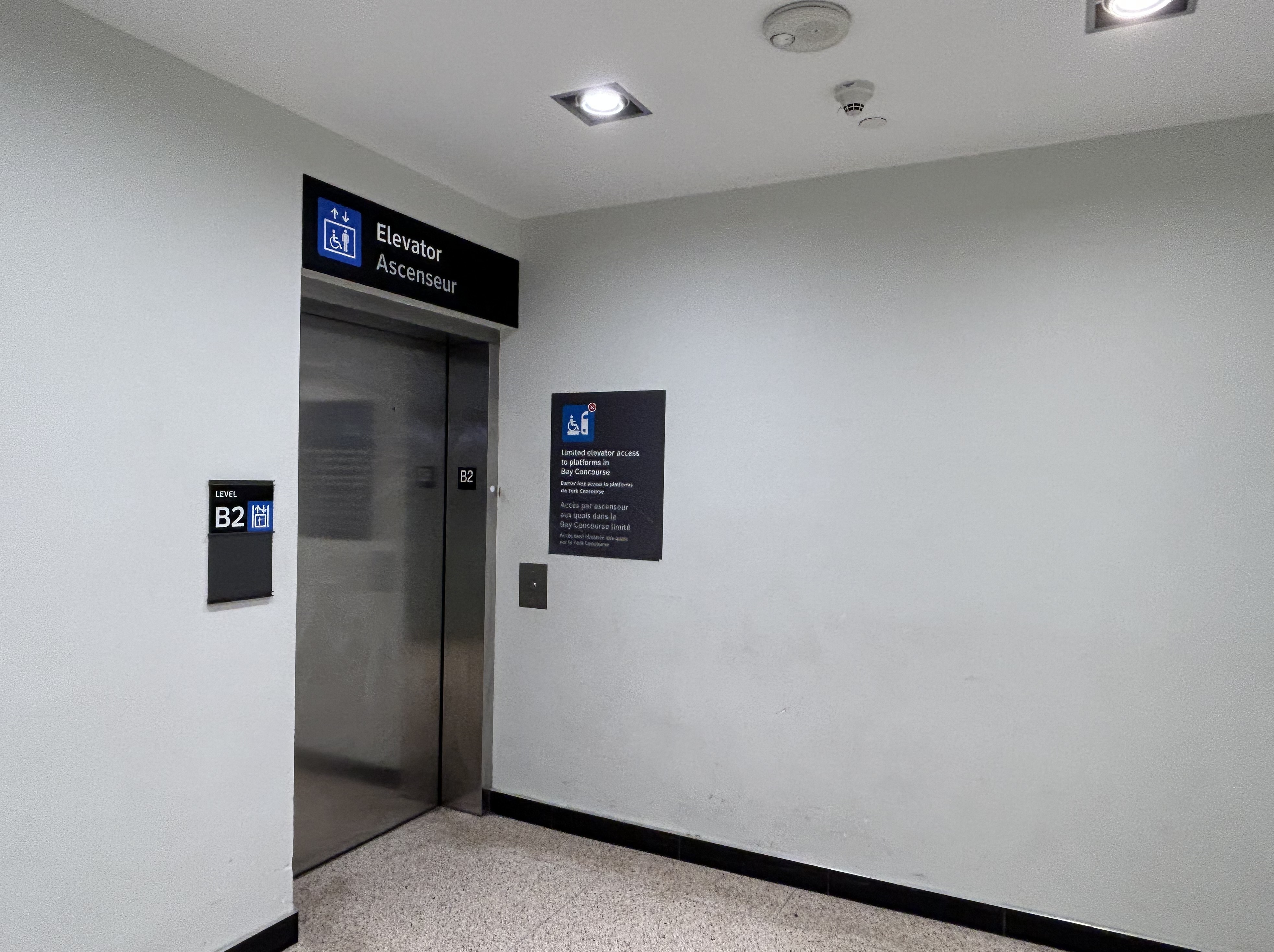
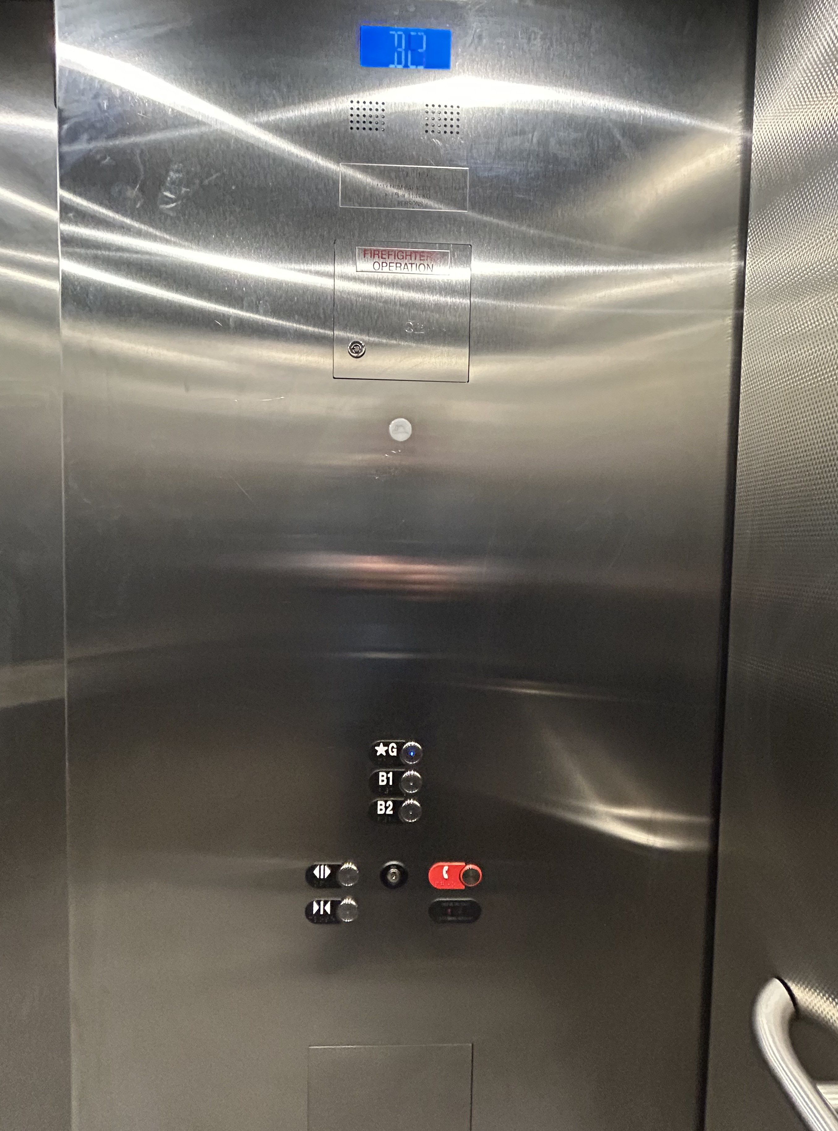
The elevator provides no information other than a sign that indicates that this is, in fact, an elevator, and this is the B2 level. This is a single, small elevator, which operates slowly.
The elevator at the B2 (subway) level
Once inside the elevator, there is no information other than buttons marked “G”, “B1”, and “B2”. There is nothing to tell the elevator user what is accessible from each floor.
Confusingly, the official Union Station map directory calls the three levels “Street Level” (G, the Heritage structure including the Great Hall, West and East Wings, along with the path towards UP Express and the Skywalk), “Lower Level” (B1, the GO York and Bay Concourses, the concourse beneath the Great Hall, and the VIA departure area) and “Retail Level” (B2, including the food court, food hall, and connections to the subway). In the elevators, the audio prompts only mention the three level names.
Inside the elevators, there is no indication what each level is, or where they lead to — the buttons and empty spaces beside them just show G, B1, and B2 levels
At G level, which includes the Great Hall, VIA Rail departures and business class lounge, and the passage west towards UP Express trains and the Skywalk to the CN Tower and Rogers Centre, the elevator is also hidden behind a wall.
The only elevator connecting the Great Hall, the lower concourse, and the subway level is hidden, with tiny signage directing travelers to it
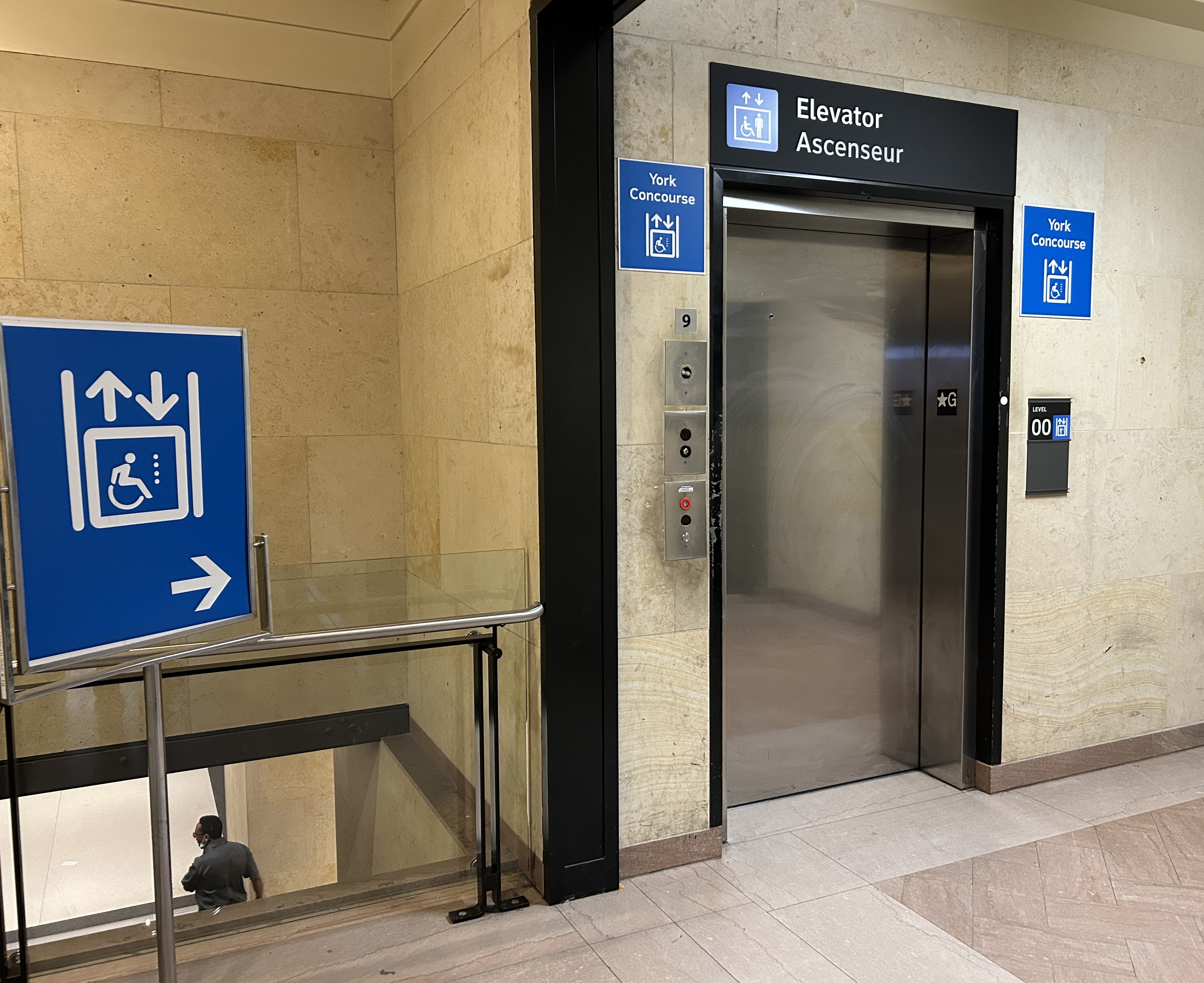
On the west side of The Great Hall, there is also an elevator, beside the stairway down to the GO Transit York Concourse. This elevator does not serve level B2.
York Concourse elevator, on the west side of Union Station’s Great Hall
If the traveler was only connecting from subway to UP Express with a heavy bag, and not using a mobility device, they might decide to take an escalator from the subway B2 level to the B1 level, the lower Union Station concourse originally intended as an arrivals area for intercity trains. However, there is no elevator or upwards escalator to be seen.
Looking west in the lower concourse, towards York Street and UP Express trains
If one knew Union Station well, they could make a lengthy detour through the ramps in the VIA Rail area to get to the Great Hall or go around through the GO York Concourse to reach the elevator or up escalator to the Great Hall. But these routes are not marked from the lower concourse area.
To show how difficult it can be to navigate the station while using a wheeled device (be it a wheelchair, stroller, or wheeled luggage), I shot this video showing how a first-time visitor getting off an UP Express train from Union Station would try to find the TTC subway entrance.
Video depicting 9-minute trip at a normal walking speed between the UP Express area and TTC subway station entrance, using first available elevators each time.
At no point was there any visible signage showing the most direct route for someone requiring a barrier-free path from UP Express to the subway. The maps below show the route I took:
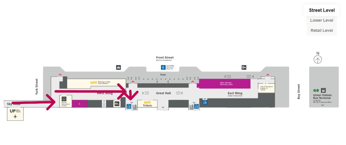
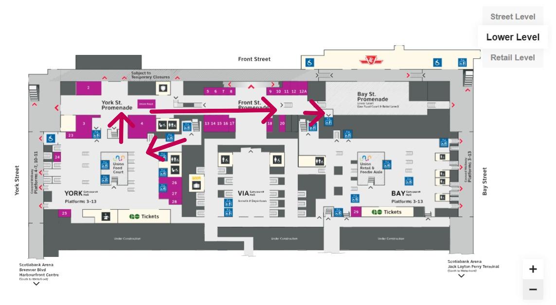
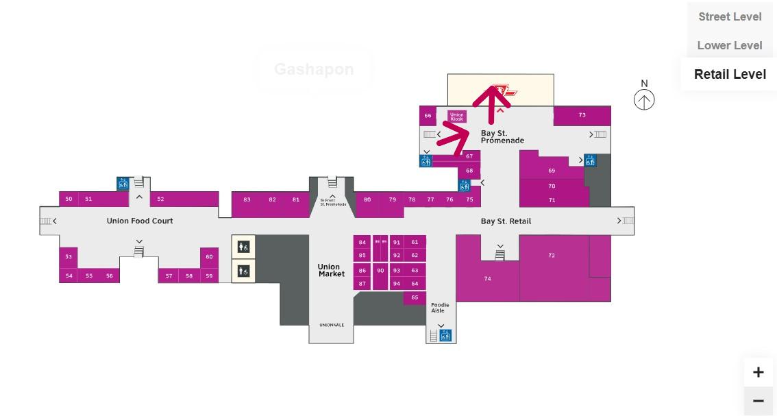
Route from UP Express to the Great Hall and York Concourse Elevator (Street Level, or G). Arrows are added to mark the route I took in the video.Path through York Concourse, lower Union Station concourse (Front St. Promenade) – the B1 Level, and to the second elevator to the Bay St. Promenade (subway level). Arrows are added to mark the route I took in the video.Last part of the trip on the Retail Level (B2) to the subway station entrance. Arrows are added to mark the route I took in the video.
Whenever I travel through an international airport — Toronto Pearson is a good example — I never have to think too hard about where the accessible routes are. Escalators are easy to find. There are banks of two or three large elevators in strategic locations on the ground side of airports, connecting departure and arrival areas, as well as ground transportation facilities. As Canada’s busiest transport hub — busier than Toronto Pearson Airport even — Union Station’s elevators and escalators should be plentiful and easy to find.
I am aware that there are particular challenges at Toronto Union Station — the City of Toronto controls only the common areas, such as the Great Hall, the retail areas, and the main entrances. Metrolinx, the agency responsible for GO Transit and UP Express, controls the York and Bay Concourses, as well as the UP Express station area. VIA Rail maintains its departures area. There are also heritage elements that need to remain intact, such as the Great Hall. But these issues of ownership and heritage preservation do not excuse the difficulty of getting around with a mobility device or even a wheeled bag.
Why weren’t multiple elevators installed connecting all three levels, to improve capacity, speed, and provide redundancy in the case of an elevator outage? Why are there not easy-to-find elevators in the West Wing near the UP Express area?
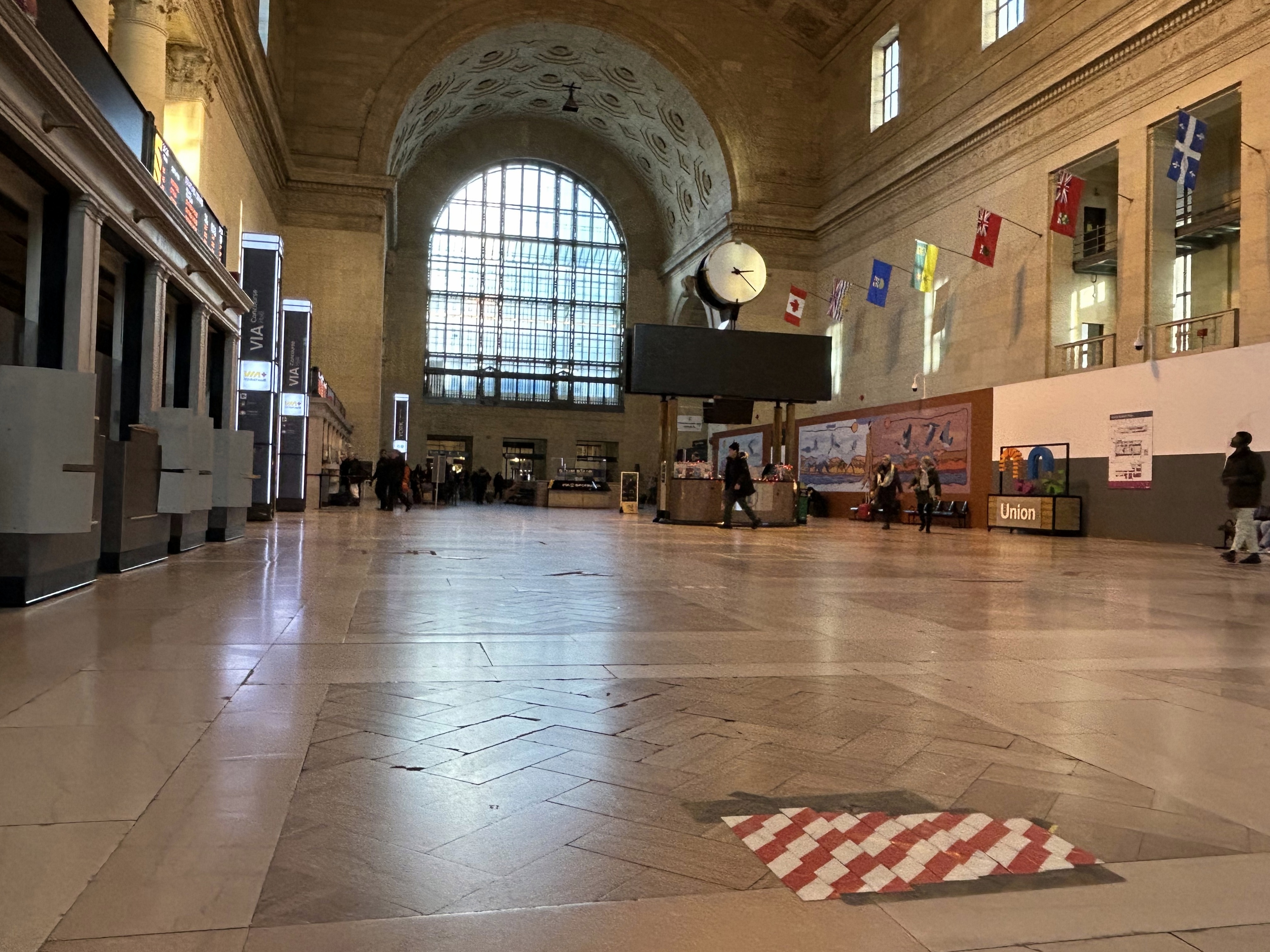
Judging by the condition of the signature Great Hall itself, there is work yet to be done before Union Station is fully restored to its 1920s grandeur. It should not be too hard to improve accessibility and wayfinding as well. Not just for Torontonians, but for international travelers too.
The Great Hall floor is still cracked and patched, with electrical tape covering some of the damaged sections
There are buses to more destinations in 2024, but a few major gaps persist
NOTE: Previous versions of the Ontario and Canada maps are retired; please see the new Canada Intercity Transport Map, launched March 30, 2025. This will now be the only interactive map that I will update.
Unfortunately, outside of Ontario, there not that many updates to make. On Vancouver Island, at least, there is now daily service all the way to Port Hardy in the north and Tofino and Ucluelet to the west, with additional runs between Comox, Nanaimo, and Victoria. There are more buses between Vancouver and Seattle; FlixBus is now operating on the busy Calgary-Edmonton and Calgary-Banff routes. There is also a new twice-weekly Edmonton-Camrose service, thanks to work by the University of Alberta’s student union; it partnered with FlixBus to provide the service.
Also new to the map is Mountain Man Mike’s bus service between Vancouver, Nelson, Kaslo BC, and Calgary, as well as Mobilité Charlevoix, a regional service that connects several towns east of Québec City including Baie-Saint-Paul, La Malbaie, and Clermont.
Unfortunately, several wide gaps remain. Despite plenty of competition on the busiest routes in Southern Ontario and Alberta, there is no bus service between Calgary and Regina, leaving cities like Medicine Hat and Moose Jaw without intercity connections, apart from airport shuttle services, despite once-frequent Greyhound service. Between Winnipeg and Regina, it is still just one bus a week. Maritime Bus, for whatever reason, still has not restored service across the New Brunswick-Québec provincial line.
Without comprehensive government-led coordination and support, these gaps are likely to remain unfilled.
I love maps, especially physical, paper maps. I like to visualize the places I travel to and determine how each city and region’s transit networks work. Though online interactive maps can be very helpful (like the ones I created to show all intercity transport services in Ontarioand across Canada, filling a much-needed gap), there is still nothing like a well-designed static map, especially when it is in print and easily accessible to the public.
This means providing maps that accurately and clearly depict the entire transit system, along with landmarks, connections, and frequency. Los Angeles Metro’s system map does a reasonable job for a map that covers a very large region.
The Los Angeles Metro system map depicts the complex bus and rail network, including non-LA Metro agencies like Culver Citybus and Santa Monica’s Big Blue Bus. Colours and line width used to denote operator, service type, and frequency.
Thankfully, most urban transit systems in North America continue to provide proper system maps both on their websites and in print, provided free on request at subway booths or terminal offices. (Some, however, have charged a small fee for a physical copy of their transit maps, such as San Francisco’s Muni.) In Europe, complete transit maps often have to be purchased, such as in Berlin or Vienna.
I recently visited two mid-sized American cities that have done away with physical maps for their transit systems: Pittsburgh, Pennsylvania and Denver, Colorado. In those cities, figuring out how to get around by tram and bus was frustrating, even in an age of Google and Apple maps and transit planning apps accessible to anyone with a smartphone.
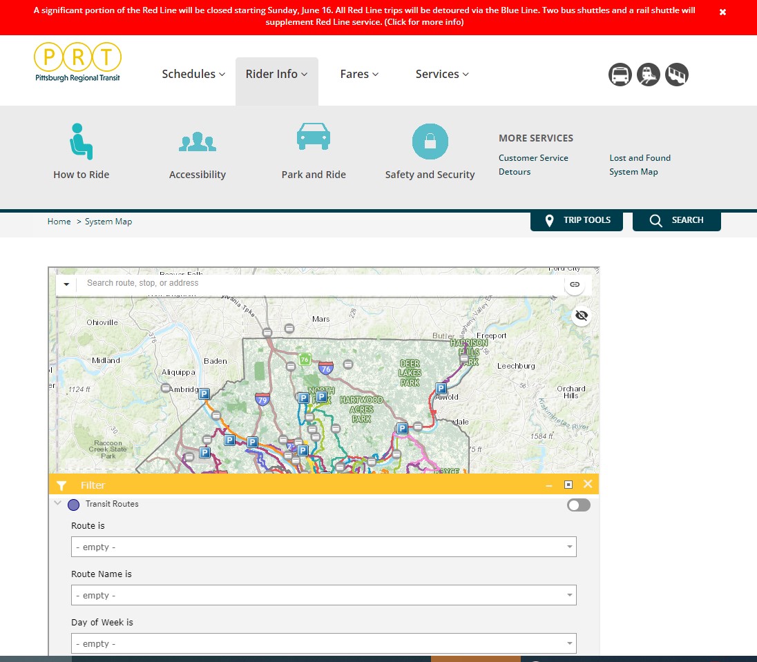
Pittsburgh Regional Transit (formerly known as Port Authority Transit) operates a complicated web of bus routes that radiate from the city’s downtown core, along with a few cross-town and feeder routes. There are three busways and a light rail service to the southern suburbs. However, there is no proper system map, either in print or online as PDF or image file that allows the new or casual user to make sense of the network.
The user can then select a service by route name or number in a drop-down tool, but the map itself is difficult to figure out. Zooming in reveals the location of fare vendors and park-and-ride lots, but not important service details like route numbers or service frequency.
Zooming in, park-and-ride lots become the most prominent feature
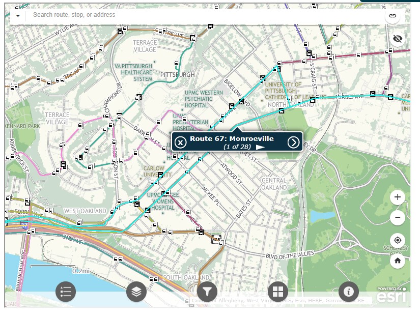
Even at the neighbourhood level the map is difficult to read. The screenshot below shows Pittsburgh’s Oakland district, home to University of Pittsburgh, Carnegie Mellon University, several other educational institutions, medical centres, parks, museums, and cultural venues. Many bus routes follow Forbes Avenue and Fifth Avenue, but as each route is layered on top of each other, it is difficult to discern where each route runs and where they go.
PRT’s ESRI interactive system map, zoomed into the Oakland District
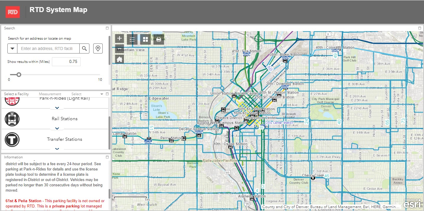
Denver’s Regional Transportation District (RTD) also uses ESRI interactive maps to show bus routes (rail services are depicted in a static image map as well). At a small scale, only the light rail and commuter/regional rail services appear, along with transit park-and-ride locations. Denver’s bus system is less complicated than Pittsburgh, operating largely on a grid, but still, a proper map would make it much easier to get a sense of the network.
Zoom in, and bus routes appear, along with route numbers, but there is nothing to show the level of service for each route.
Though online-only interactive maps have their purpose (my Ontario and Canada intercity maps are designed to show where connections exist, or not, and how to obtain schedule information), they are not well suited for urban transit systems and are very difficult to read on a mobile device. Properly designed static maps, in web image or PDF format do much better jobs.
It is worth comparing Pittsburgh and Denver to the Toronto Transportation Commission (TTC). The TTC’s complete system map is provided to customers for free at subway stations, with smaller, simplified versions available as tear-away pamphlets. Large-format versions are also displayed across the network in bus shelters and subway stations. A PDF version can also be easily found on the TTC website in the main Routes and Schedules page. Surface routes are categorized by service level (express, frequent service, regular service, limited service, seasonal, and community routes) with major landmarks and transfer points to connecting services clearly indicated.
I have some minor complaints about the TTC’s map (like regular routes, express routes should be categorized in the map based on their service levels, for instance) but it is a reasonable, easy to read map that is also quite easy to find.
Unfortunately, more transit systems are moving away from easily accessible paper maps. Durham Region Transit, for example, no longer provides copies of its system map. Fortunately, a proper, well-designed PDF copy remains accessible on its website.
When travelling, or looking to understand a city’s transit network though, there is nothing quite like poring through a well-designed, easy-to-read paper map. It would be a shame if more agencies went the way of Denver and Pittsburgh.