Tag: Toronto

  • Streets are for people: a visit to St. John’s Water Street

    Streets are for people: a visit to St. John’s Water Street

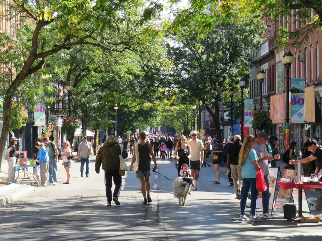
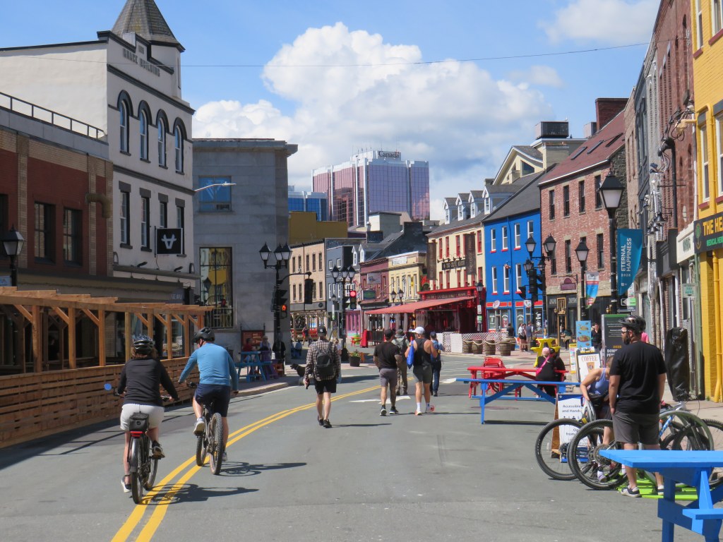
    Pedestrians and cyclists enjoying a sunny Sunday morning in St. John’s

    In late June of this year, my spouse and I had the chance to visit St. John’s, along with a few other destinations in Eastern Newfoundland and Saint Pierre, France. I highly recommend the visit, though even late June can be a bit cool and wet there.

    During our last two days, several blocks — about 700 metres — of Water Street, the main commercial street in St. John’s, was closed to all motor vehicles, and remains so until September 7, Labour Day. This is an annual event, supported by downtown businesses, and is one of the positive legacies of the social distancing era of 2020-2021.

    Though fenced-off restaurant patios spill on to Water Street, there are plenty of public spaces to sit, too

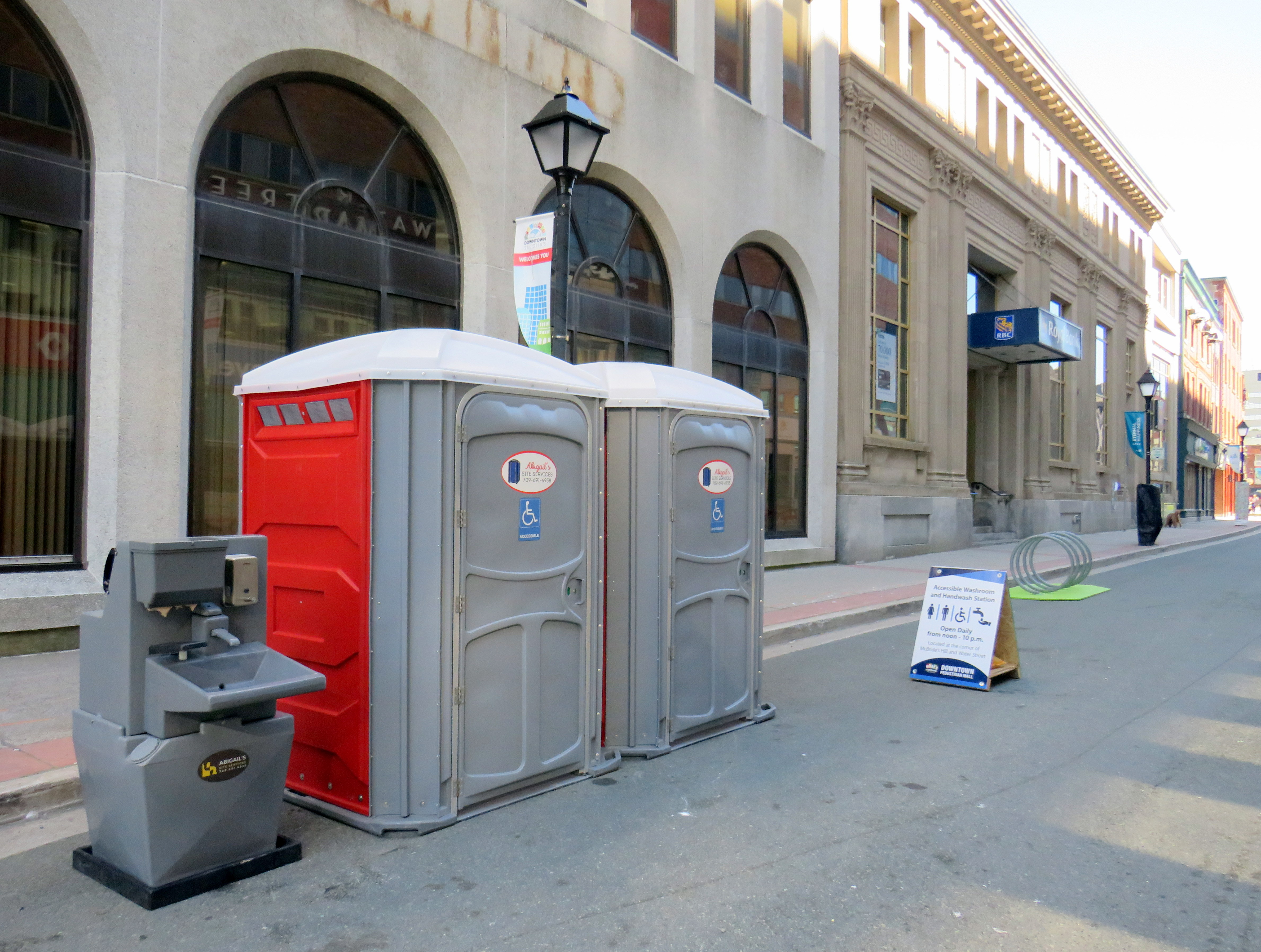
    This is much less a street festival (though there are plenty of organized events) and more of an open street initiative. Though restaurants’ patios spill out into the street, there are plenty of public picnic tables set up for anyone to use, both in sunny and shaded areas. There are several portable toilets, complete with adjacent hand-washing sinks, which provide relief without having to pay to use a washroom.

    Portable washrooms, hand-washing station, and portable bike parking on Water Street

    Pedestrians and pedal cyclists are welcomed, though cyclists are instructed to go at a slow speed, and e-bikes passing through must have their power assist off.

    Sign explaining e-bike policy for the Downtown Pedestrian Mall

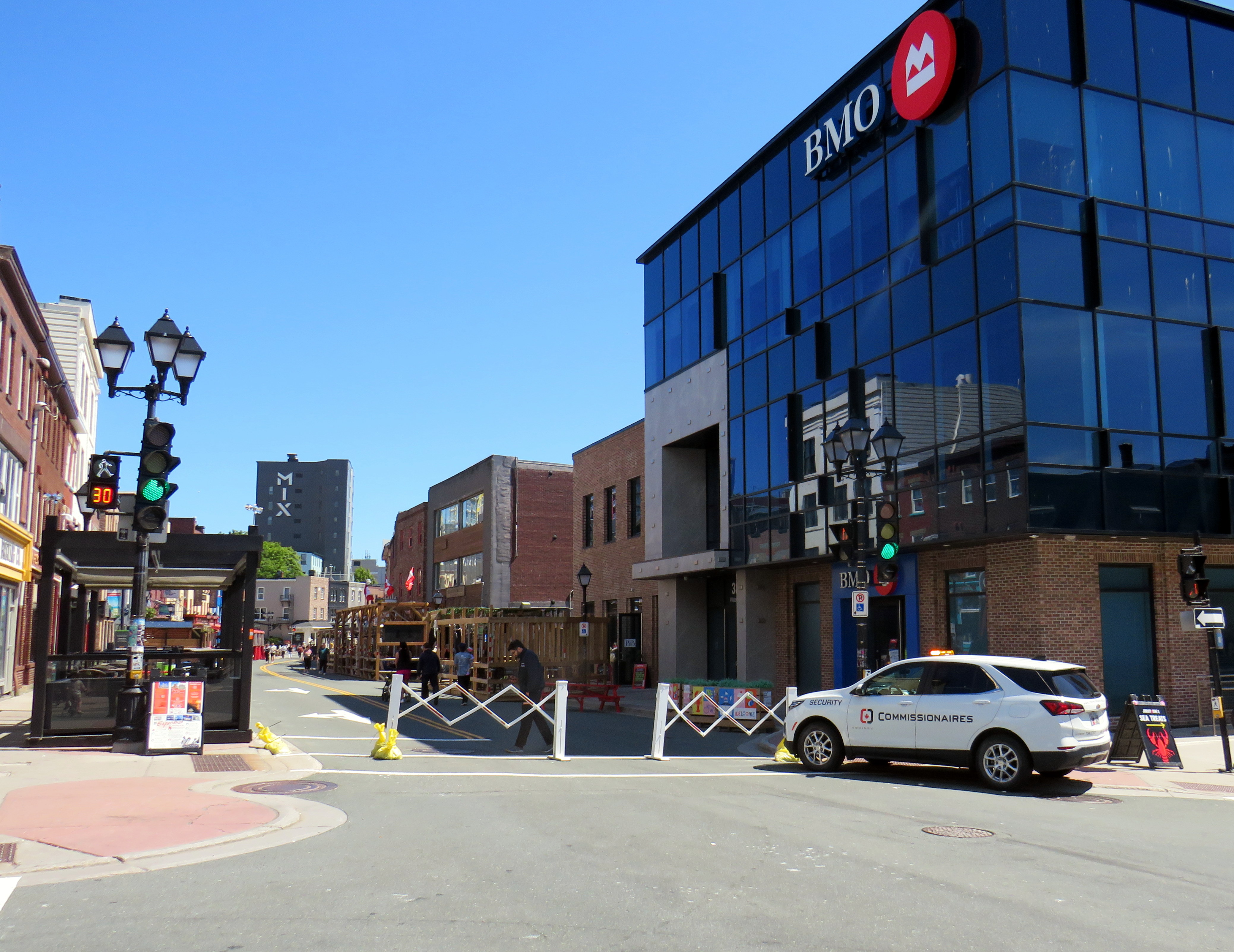
    Of course, there are security guards and gates set up to keep motorists out, apart from emergency vehicles and local deliveries. But I did not notice any police cars stationed at any of the intersecting streets, and the few RNC officers I saw were on general foot patrol. Though several Metrobus routes normally serve Water Street, these are diverted one block away to Harbour Drive.

    Security minding traffic gates at Water and Adelaide Streets, the southern end of the pedestrian mall

    Though St. John’s is a much smaller city than Toronto (its metro area is less than 4% the size of Toronto’s CMA), it is also much more car-dependent, with only a basic bus transit system, and very little cycling infrastructure. Yet, they are able to pull this off for ten weeks a year, on an annual basis. The last Open Streets event in Toronto was in 2022, and those were only held two Sundays of the year. Yes, there are wildly successful street festivals, such as Taste of the Danforth, which just had its record-breaking comeback, but they aren’t the same as they are rammed with crowds, and those only take place over two or three days.

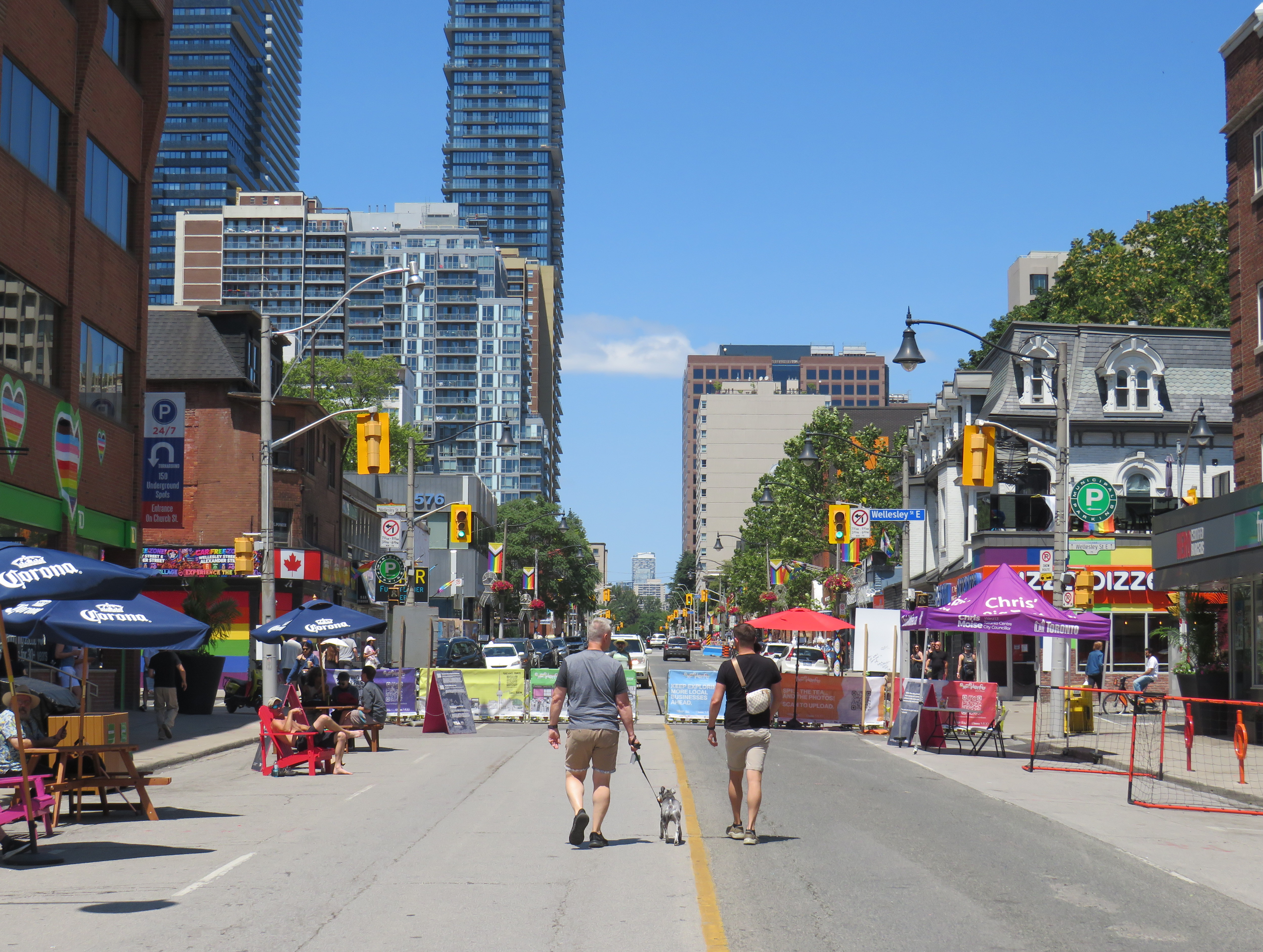
    This year, at least, Toronto gets to enjoy just a little taste of what should be expected in this city. Until August 21, two short blocks of Church Street are open to pedestrians, from Alexander Street to Wellesley Street, with some of the same features I saw in St. John’s.

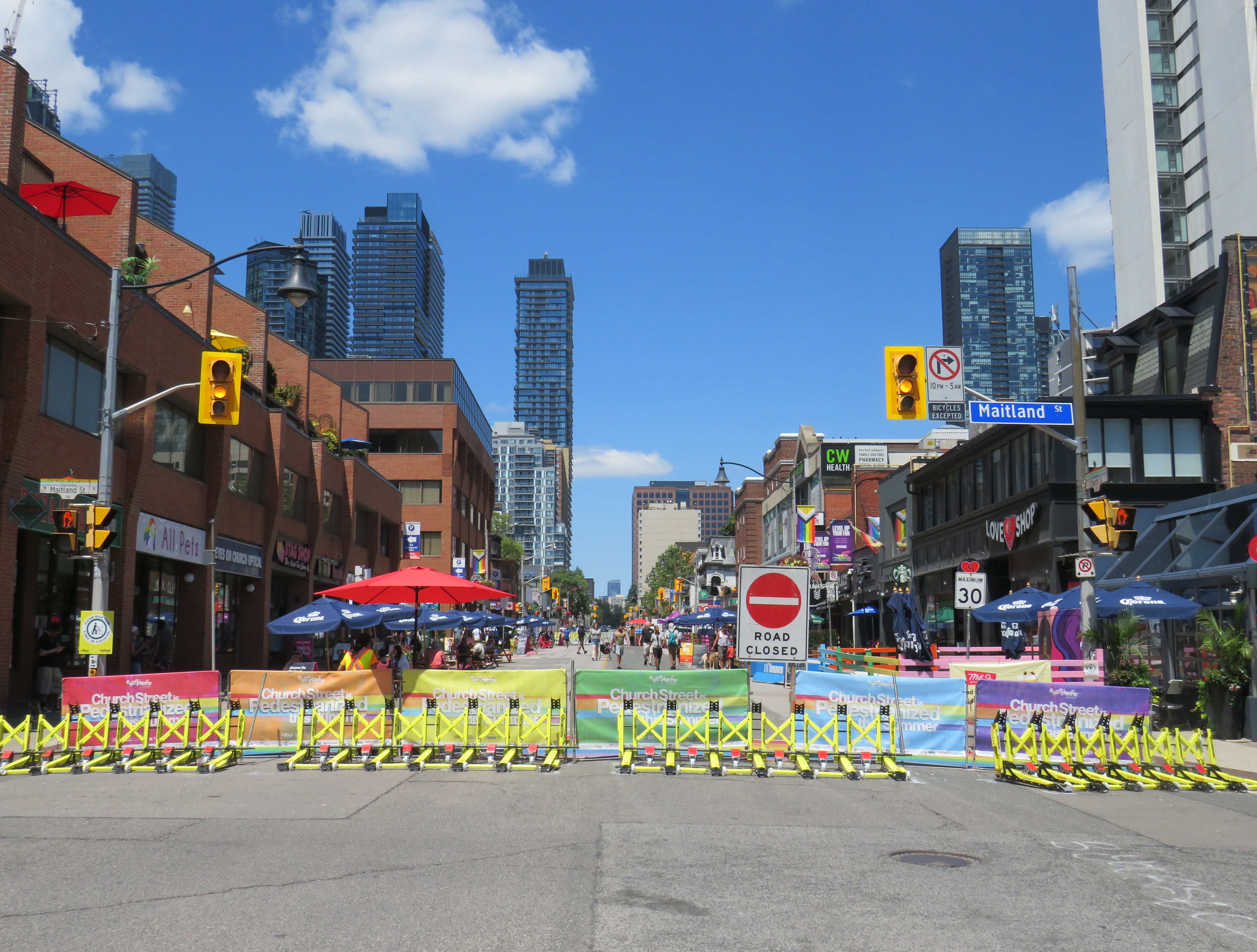
    Moveable car traps and metal barricades block Church Street, looking north at Maitland

    One key noticeable difference are the harder barriers to prevent motor vehicles from entering. Yellow wheel traps are lined up next to metal barricades, decorated with colourful banners. Though understandable given recent history in Toronto and Vancouver with vehicular attacks on sidewalks and a street festival, they sadly act to fence in what should be an open street and pedestrians must enter on the sidewalks. Unlike St. John’s, cycling is prohibited as well.

    Shaded by branded patio umbrellas, the picnic tables and Muskoka chairs on the left are open to anyone

    Still, it’s a great taste of what Toronto should have more of. As on Water Street, there are both private patio spaces on the street as well as public chairs and benches, as well as extra waste bins, though no public toilets. It’s also very well used, especially later in the day. The Church-Wellesley Village is the cultural and commercial centre for Toronto’s 2SLGBTQ+ communities, as well as being in the centre of a very densely-populated area with limited open space.

    It is also oddly quiet, despite the vibrancy. That’s because there are no cars, which are a major source of urban noise pollution. The car-free environment also makes sitting on a curbside patio much more enjoyable, without the noise and smells of passing motorists. How can anyone object?

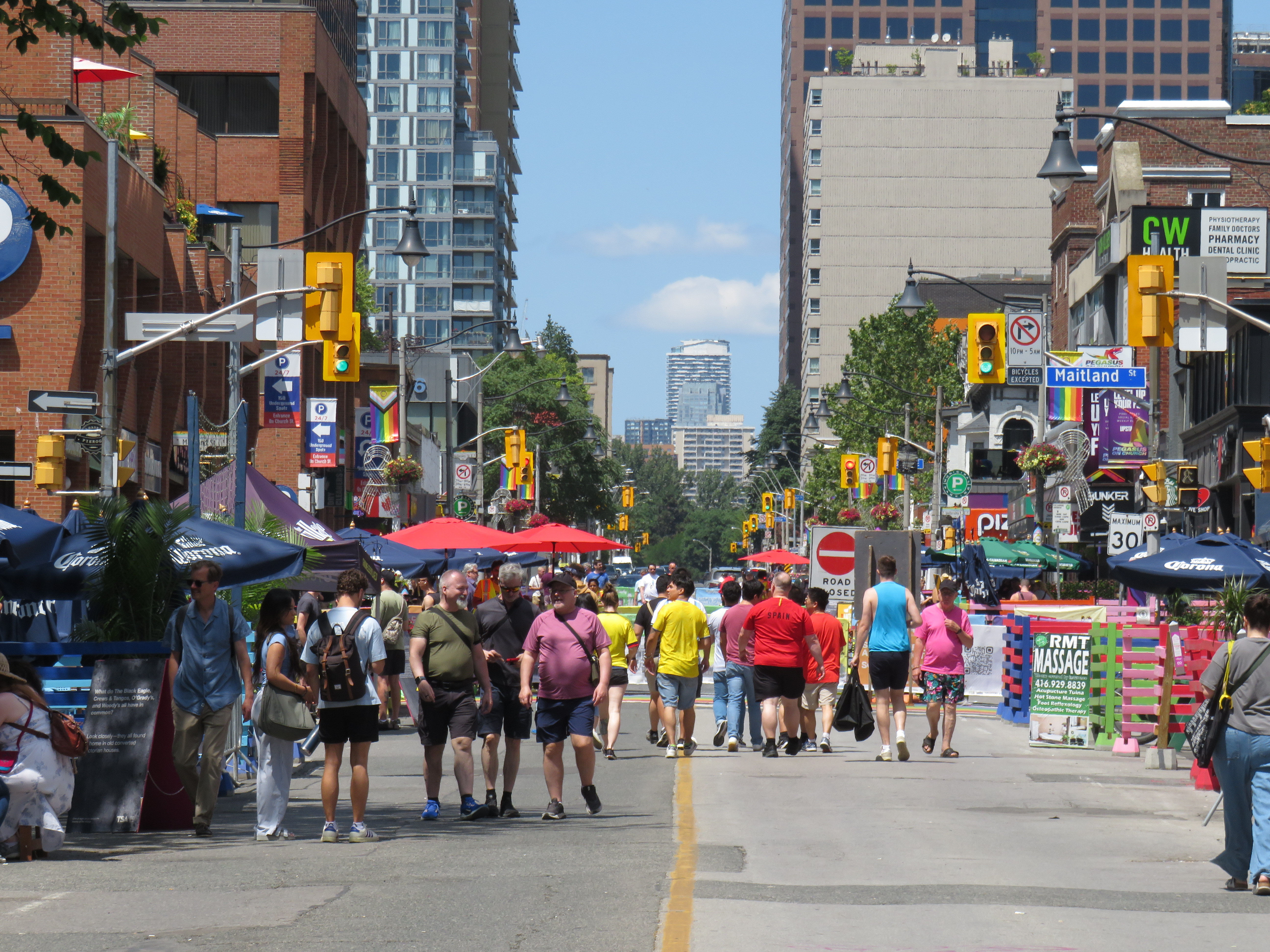
    Later in the afternoon, Church Street was busier with pedestrians

    It might be too much to ask for Montreal-style open street corridors, but Toronto should at least aspire to more, long-term open street set-ups like Water Street and Church Street. Kensington Market would be the perfect place to start. Even on our busy east-west streetcar routes on corridors such as Gerrard Street East or Queen Street West, with a bit of imagination and can-do spirit, we can accommodate those as well.

    With adding long-term implementations, we will need to rethink the costs of policing and security, which are currently a major barrier to providing these spaces in Toronto. In Montreal, security staffing is minimal on open streets such as Ave. Mont-Royal. The needs of policing and securing a regular pedestrianized area are quite different than ensuring safety at a crowded street festival.

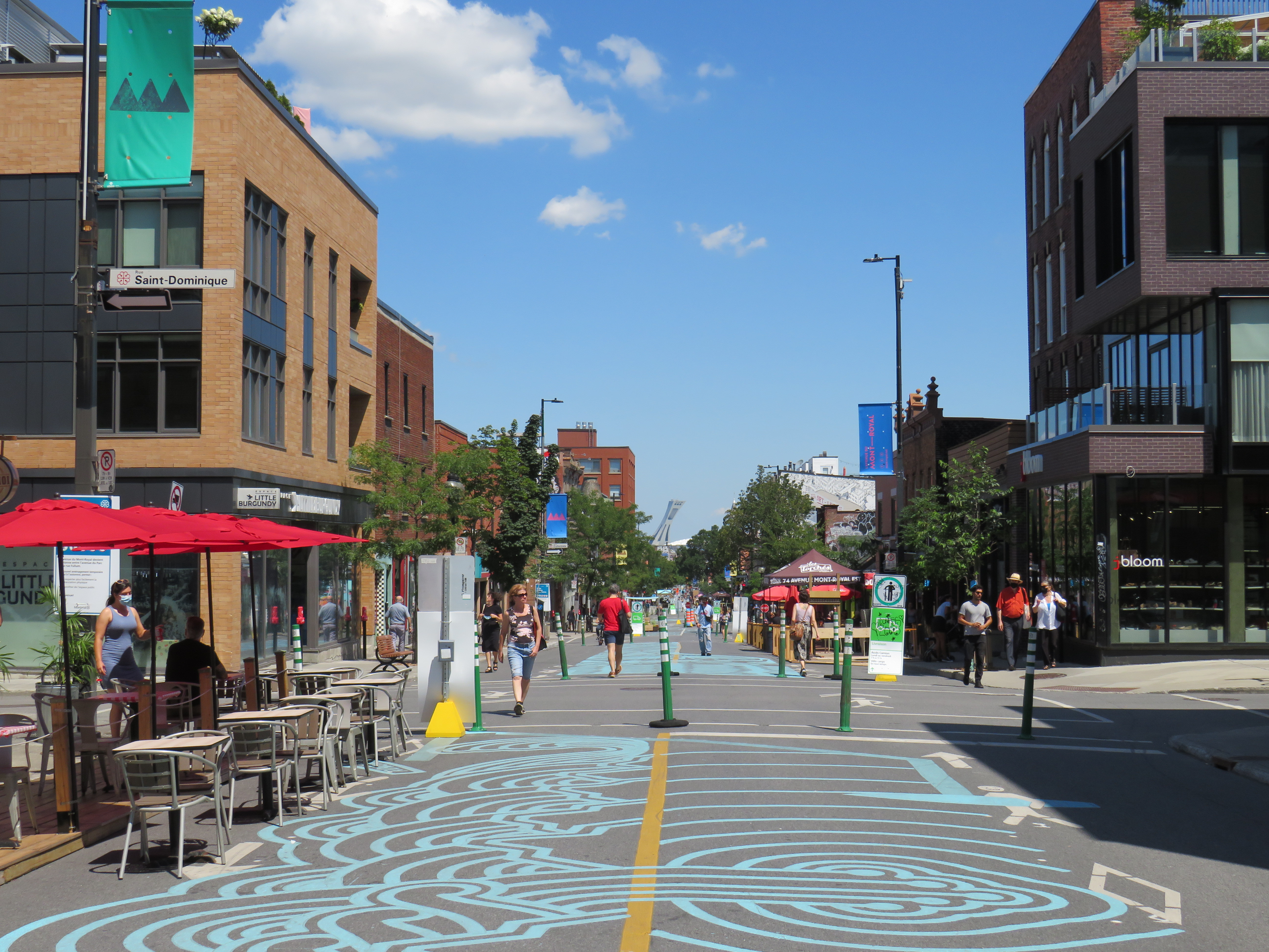
    Ave. Mont-Royal, where security measures are minimal on the summer open street

    Such crowd-pleasing, neighbourhood-building actions as Open Streets should be on any serious mayor or council candidate’s policy platform in the upcoming municipal election.

  • Where’s the outrage when pedestrians are killed?

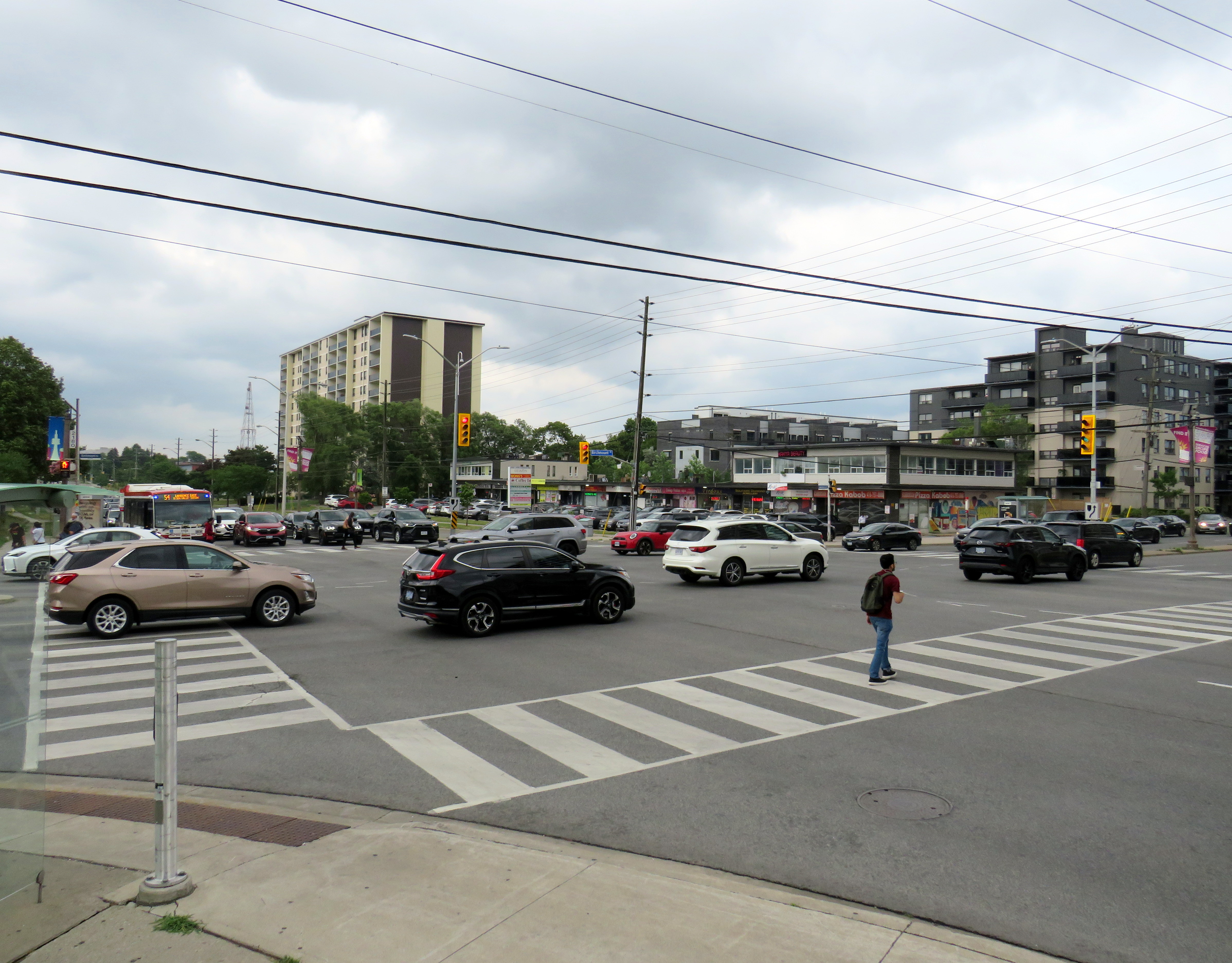
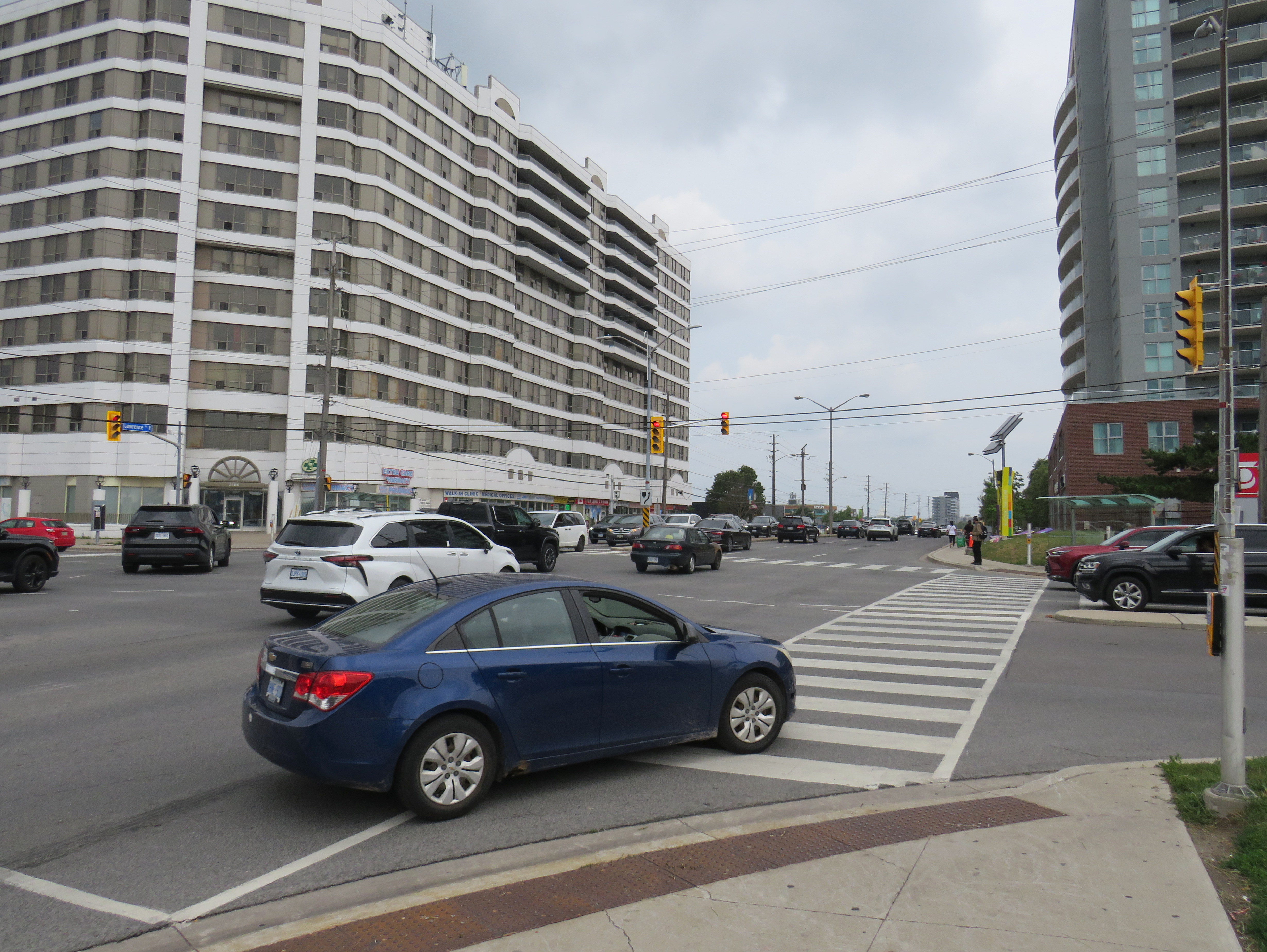
    Birchmount Road and Lawrence Avenue East, Scarborough

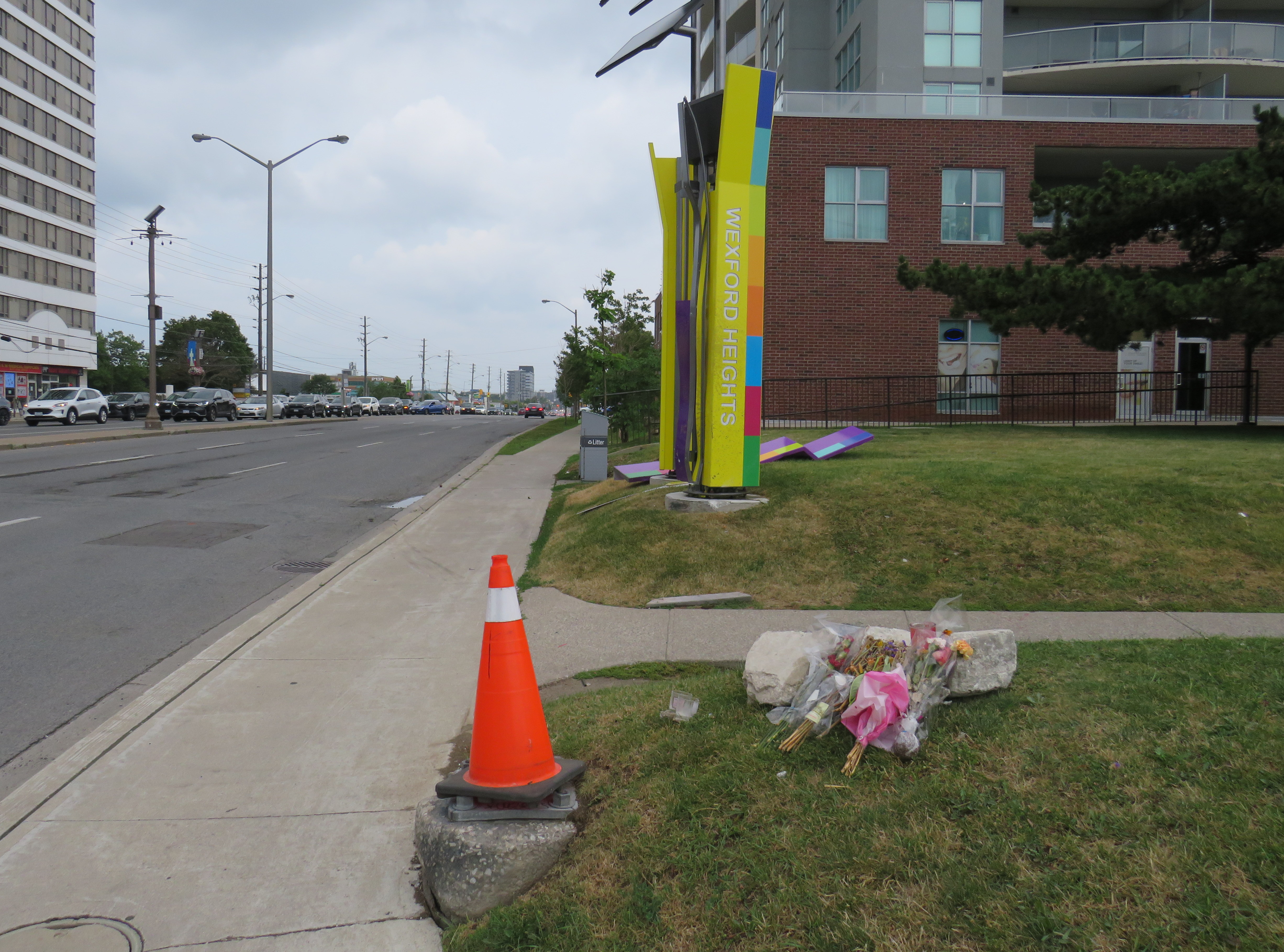
    On Friday, July 10, the driver of a westbound Toyota RAV4 SUV drove through a red light on Lawrence Avenue East and struck another vehicle travelling south on Birchmount Avenue. The SUV continued forward, mounting the sidewalk where two pedestrians were standing, and then hit a traffic signal pole. The pole, as designed, fell to the ground. The two pedestrians — a 64-year-old man and a 61-year-old woman — were killed. The drivers of both vehicles — as well as two passengers in the RAV4 — were taken to hospital with “non-life-threatening injuries.” Nearly two weeks later, there have been no updates from the Toronto Police or any news outlet letting the public know of any charges laid; there is not even any mention of who the two dead victims were.

    As it’s just another “accident,” society shrugs and continues on.

    Roadside memorial to two dead pedestrians, with a pylon covering the base of the fallen traffic pole

    A day later, just after 8PM on Saturday, July 11, two people were shot dead on St. Clair Avenue West during the Salsa on St. Clair street festival, and four more were injured. This was not a random shooting, but a violent gunfight where the assailants and those killed knew each other. There were many thousands attending the popular street festival that evening; many of those attending fled fearing for their safety.

    Elected leaders from all three levels of government were quick to denounce the violence, and Toronto Police, to its credit, refused to hyperbolize the general risk to the public. Chief Myron Demkiw reminded Torontonians that “shootings are down over 26 per cent compared to the same time last year,” followed by the recognition that such violence “…understandably shakes the sense of safety and security that Torontonians expect and deserve.”

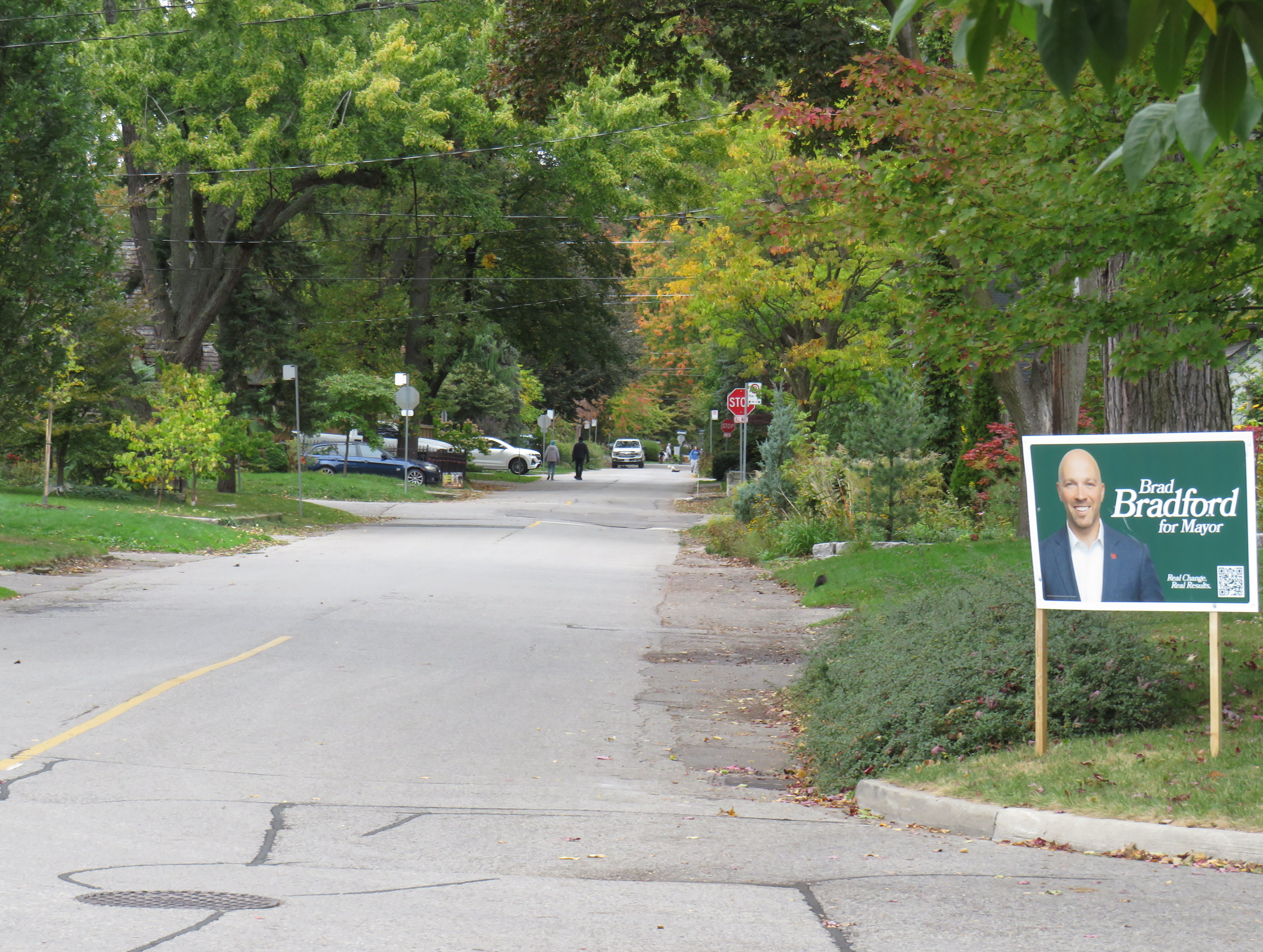
    However, there are those whose agendas are not served by nuanced remarks like Chief Demkiw’s. Second-time mayoral candidate Brad Bradford was quick to blast senior police officials, saying it was “wrong to call Toronto a safe city.” Bradford followed with his preferred response from police which “…is to say ‘No. No more. Not now, not ever.’” For someone running on a right-wing reactionary platform, such a response would have been much more helpful against an incumbent mayor.

    It’s understandable that the St. Clair shooting has gotten lots of attention from the police, news media, and politicians. Despite a continuing decline in violent crime and Toronto’s well-deserved reputation as a safe city, brazen gun violence is frightening, especially in a crowded area where there are thousands enjoying a summer evening. People want to be safe and feel safe while outside their homes. But that also means being able to walk without fear of being struck and killed by a motorist, even when on a sidewalk.

    For intermittent street festivals, parades, and temporary pedestrian malls, a lot of attention is already placed on security, especially after recent vehicle attacks. Portable car traps keep vehicles out, while paid duty police and security guards keep watch at intersections and places in between. But we also do very little to protect pedestrians and other road users from dangerous driving. Doug Ford’s provincial government, working against Toronto and other municipalities, moved against bike lane installation (protected bike lanes that serve as a buffer between motor traffic and sidewalks) and speed enforcement cameras, which were working to reduce drivers’ speeds.

    Drivers speeding through a red light on seven-lane Lawrence Avenue East at Birchmount Road. Note the temporary replacement traffic signal affixed to the median pole on the far side of the street.

    As a society, we are horrified by gun violence, but generally give scant attention to deaths on our roads that result from motorists’ choices. No councillor, mayor, premier, or prime minister spoke out when two bystanders were killed in Scarborough. Their names have still not been released. There’s no follow up to the police investigation, and it has so far merited just one story in the Toronto Star, CBC Toronto, and CP24.

    That is a tragedy in itself.

  • The Amsterdam Bridge and the Torontobrug

    Reopened, at last

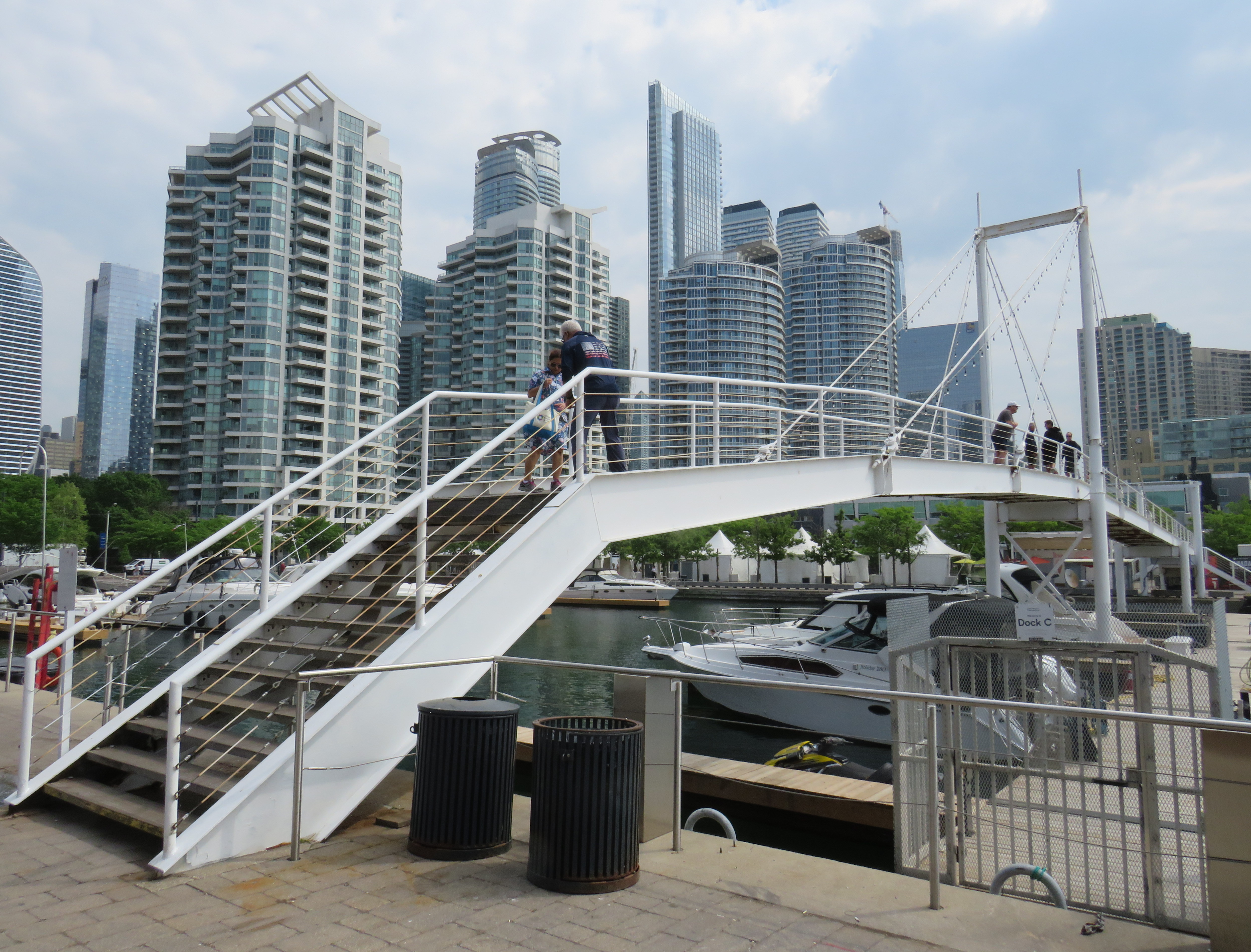
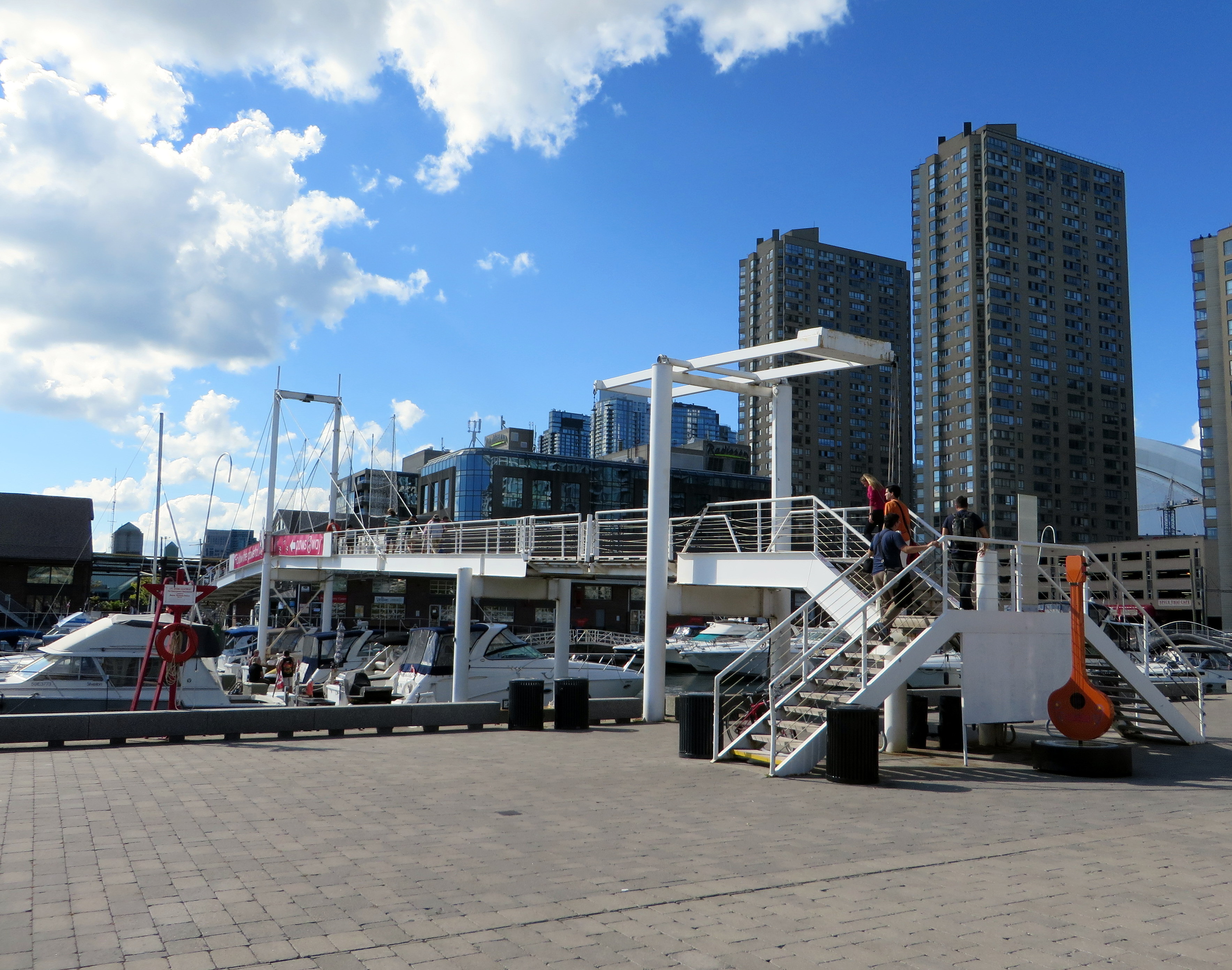
    On Sunday, May 31, the Amsterdam Bridge reopened on Toronto’s Harbourfront after being closed for five years. The footbridge, which spans a marina south of Queen’s Quay, is a popular meeting place and photo opportunity, with views of Toronto Harbour to the south and the towering skyline to the north. A gift of the City of Amsterdam, one of Toronto’s sister cities at the time, the bridge was one of the first great public spaces on the waterfront as it was beginning to transition from a derelict industrial space to the city’s new front yard.

    The Amsterdam Bridge in 2014

    The footbridge, a cable suspension structure over the marina featured a lifting section on the east side so that tall yachts could moor at the north end of the marina on request, though this was not a regular occurrence. The design mimicked some of the iconic canal crossings in Amsterdam. Sadly, due to neglect, the bridge was closed to pedestrians in 2021 and the lifting section removed.

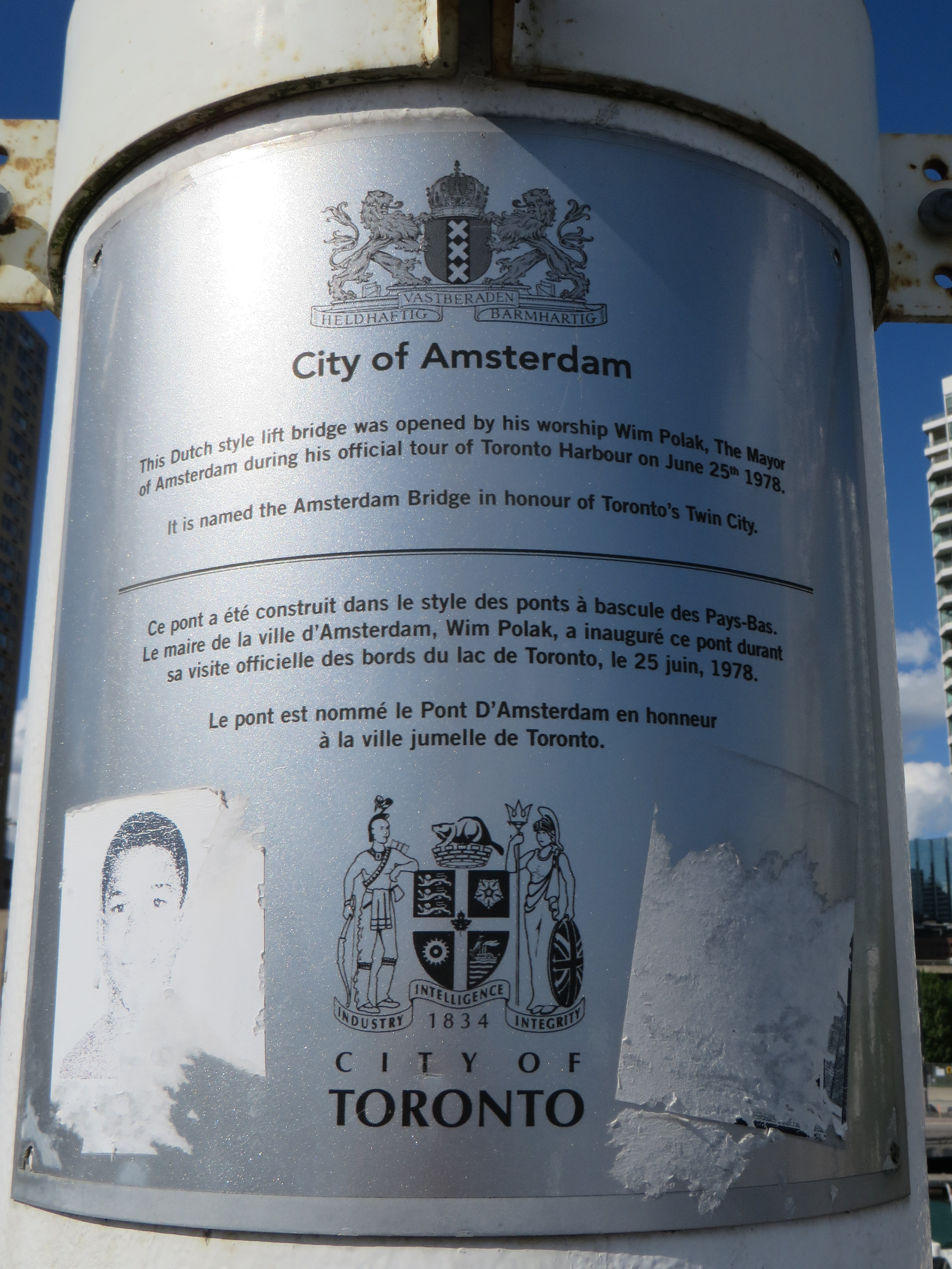
    Plaque on the bridge commemorating the opening of the Amsterdam Bridge, a “Dutch style lift bridge” on June 25, 1978 by Amsterdam mayor Wim Polak, taken in 2014. Note the old pre-amalgamation City of Toronto coat of arms below. A replacement plaque with similar text (but with the current post-amalgamation civic coat of arms) since replaced the original.

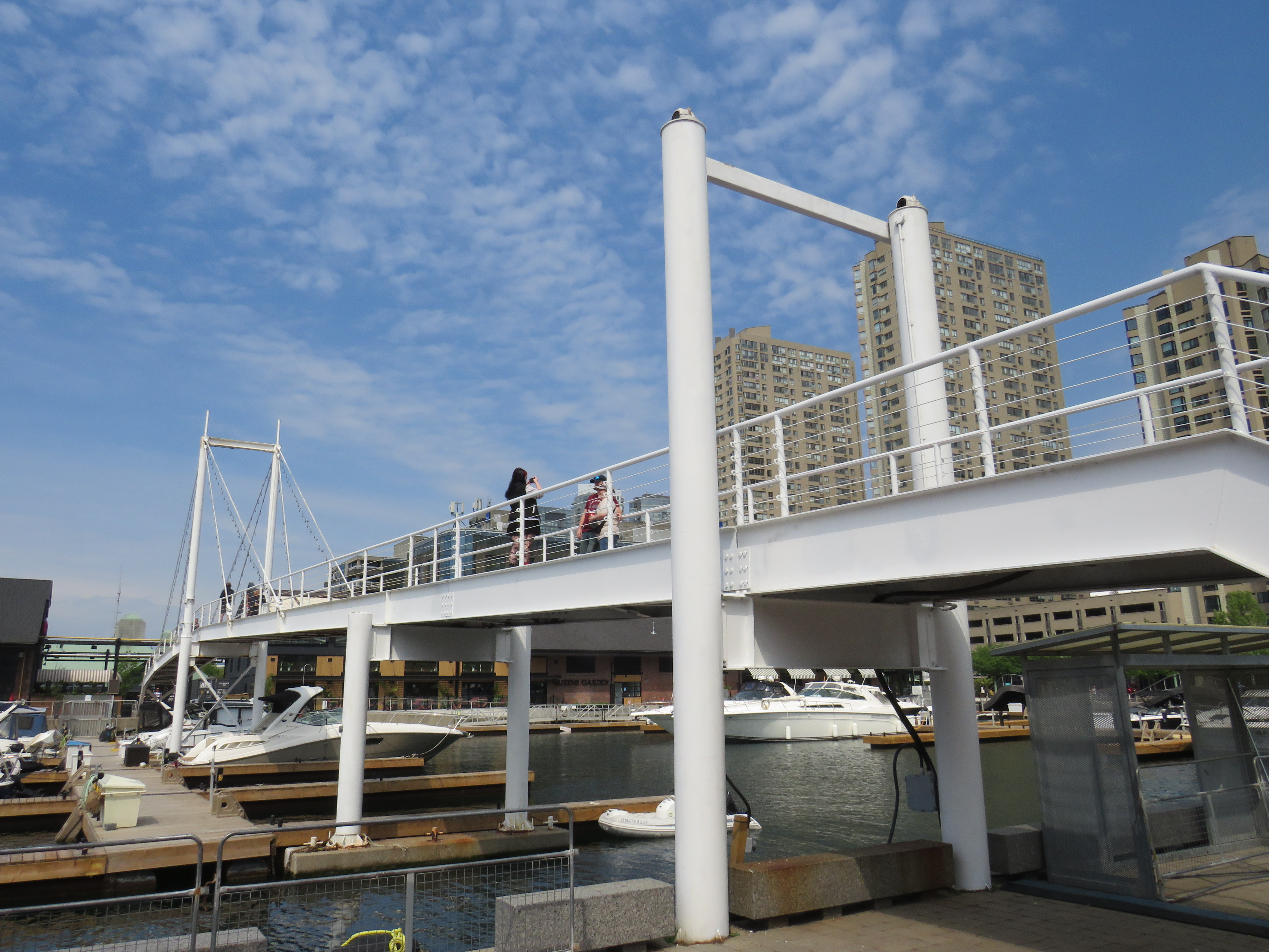
    When the bridge reopened in 2026 just in time for Toronto hosting six World Cup soccer matches, the lifting section was replaced by a fixed span. Once again, visitors can climb the bridge, take in the views, and snap great photographs, but the “lift bridge” of the original “Dutch style lift bridge” is no more. It’s a shame too, that it took five years for this fix to even happen; Toronto needs to do better at maintaining its public assets, especially its unusual, fun, and quirky landmarks.

    Fixed deck on the Amsterdam Bridge in 2026

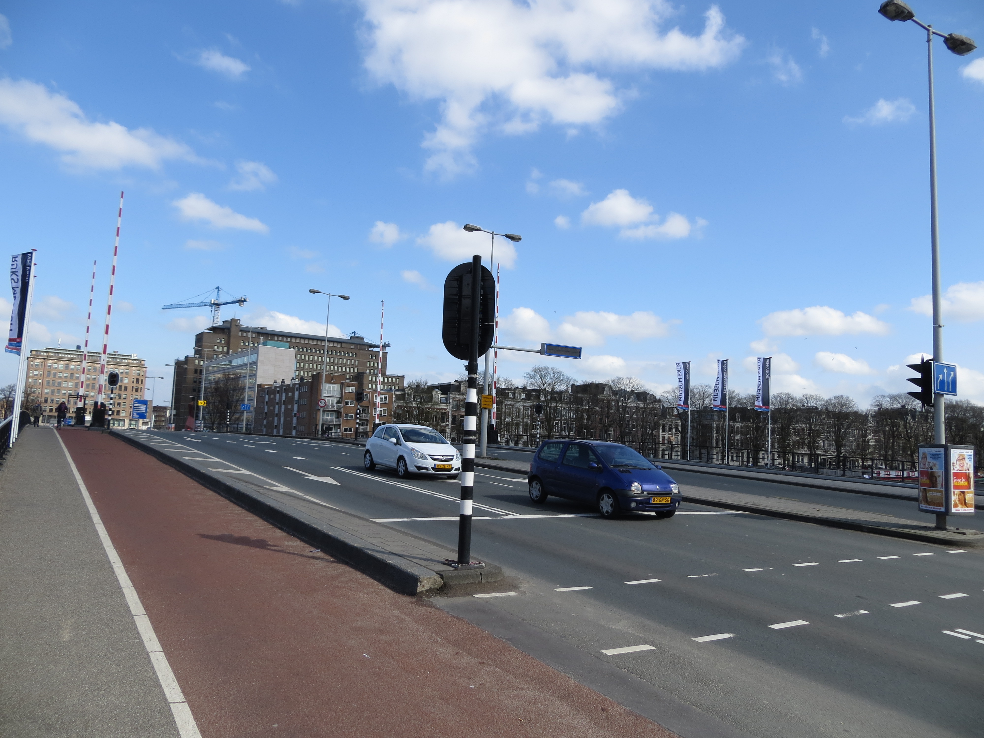
    Around the same time Toronto got an Amsterdam Bridge, the City of Amsterdam named a bridge for Toronto. The Torontobrug spans the Amstel River, carrying the busy Centrumring (Central Ring Road). A five-lane traffic artery outside the major tourist areas, the bridge is not iconic by any means (I biked to it during my 2013 visit to Amsterdam) but it is an important road link. There are separated cycle tracks on both sides of the bridge, so it is at least multimodal. The bridge can still open for river boat traffic when necessary.

    The Torontobrug in Amsterdam, 2013

  • Woodbine Centre, revisited

    Woodbine Centre, revisited

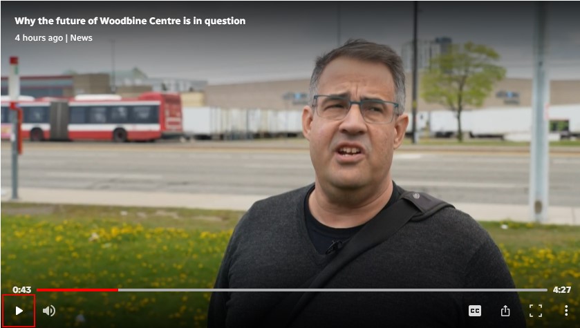
    You can catch me on CBC Toronto today talking about the history of Woodbine Centre and Fantasy Fair with reporter Nav Nanwa. The CBC television report has some pretty good drone shots of the mall as well.

    Here’s me standing in front of Highway 27 and the trailers stored in the old Sears parking lot

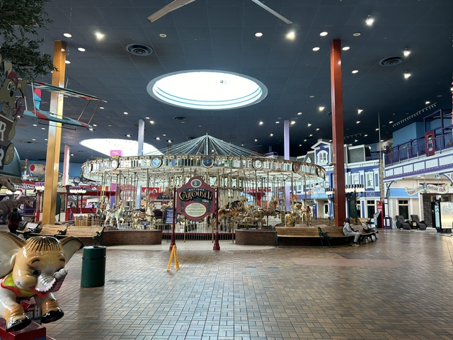
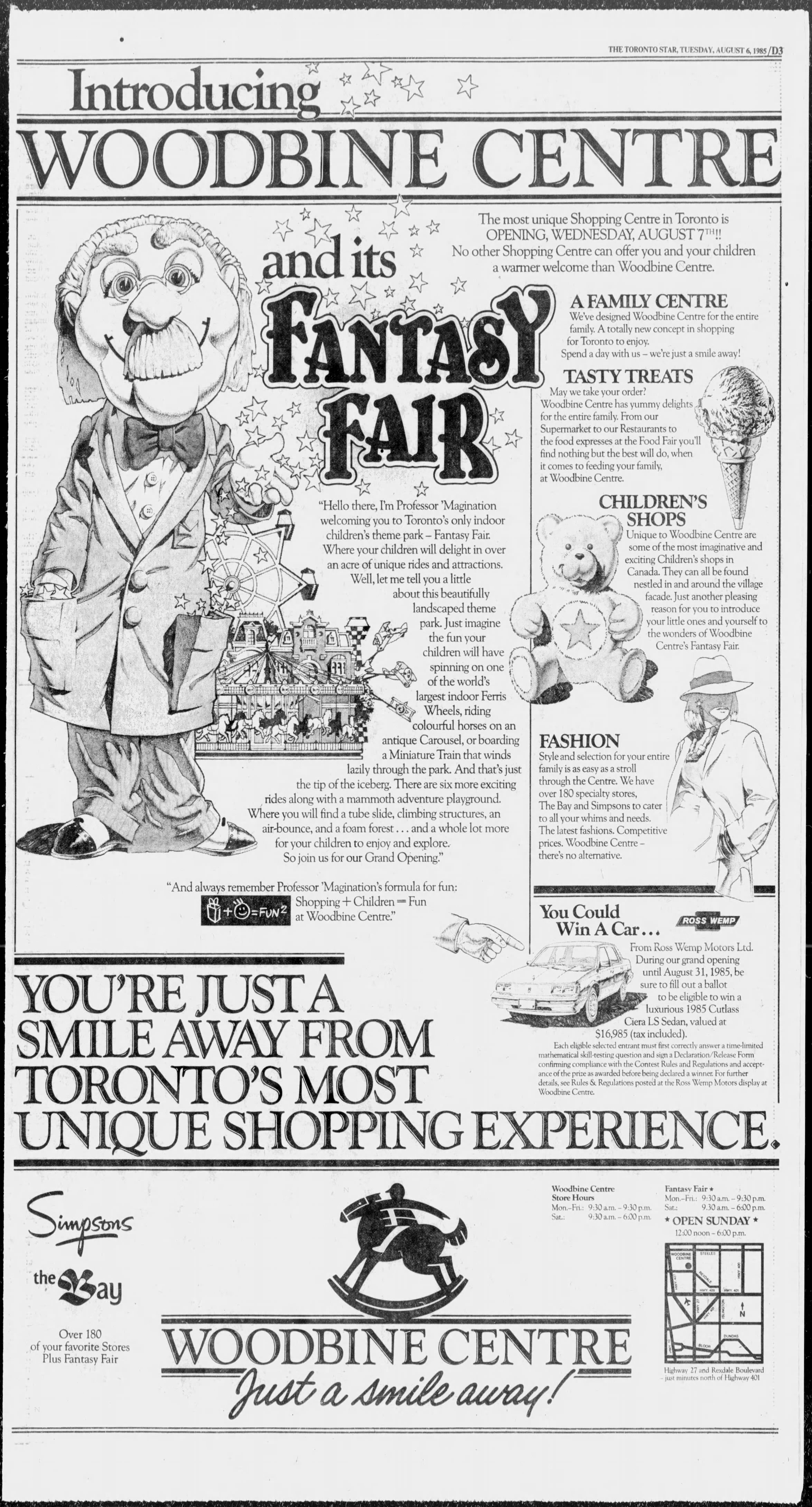
    I wrote more about the history of Woodbine Centre in November 2024, which you can read here. Looking for reports of the mall opening from 1985, I found this full page ad in the Tuesday, August 6, 1985 edition of the Toronto Star.

  • Return to Line 6: a slightly faster ride

    Return to Line 6: a slightly faster ride

    Slow ride, take it easy

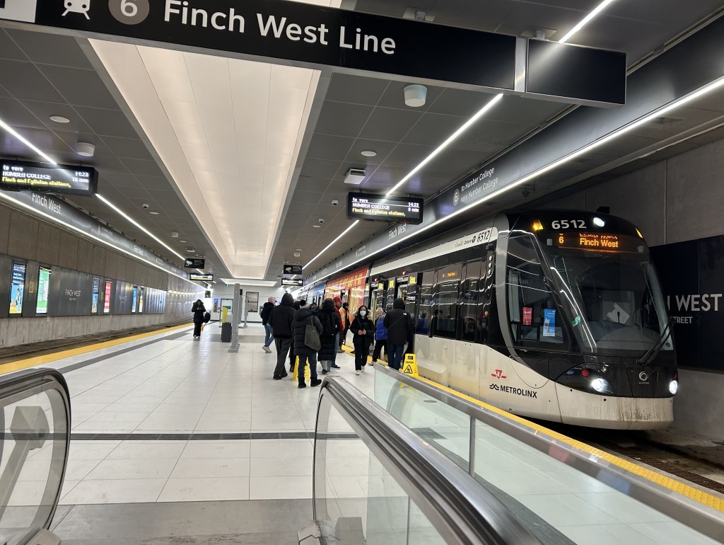
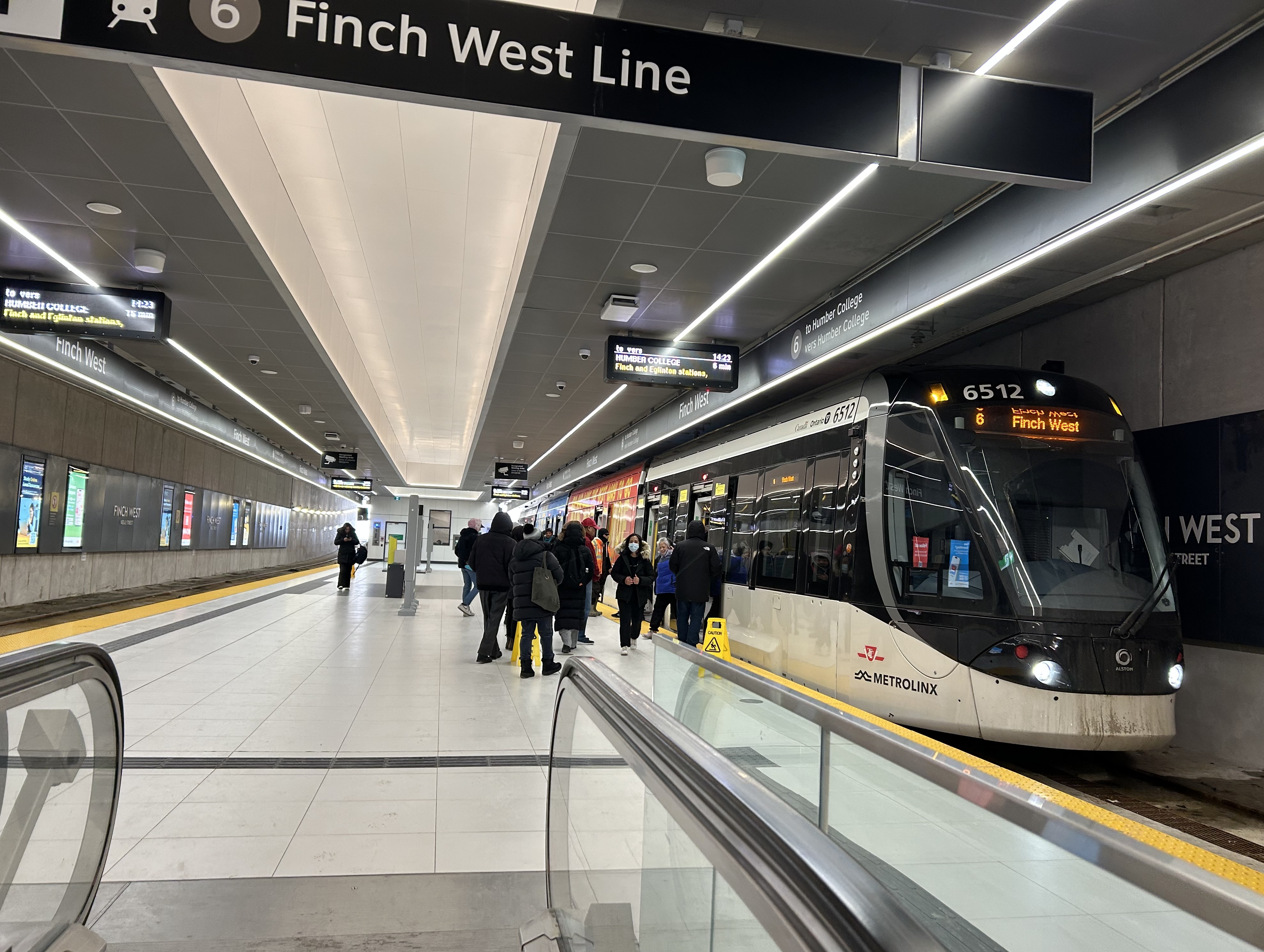
    On Thursday, February 26, I went west on Finch Avenue from Scarborough to North York via the 939B Finch East Express bus to take another ride on Line 6, the problem-plagued Finch West LRT. After hearing of enhanced signal priority being introduced on Finch Avenue, I wanted to see if it had any effect on running times since my last visit a few days after opening.

    Interestingly, the 939B, which runs all the way from Kennedy Station to Finch West Station via Scarborough Centre, McCowan Road, and Finch Avenue, uses the York University Busway to get between Dufferin Street and Finch West Station. That busway, opened in 2009, was built to speed up travel times between the former subway terminus at Downsview Station (now called Sheppard West Station) and the university campus as the Line 1 extension to Vaughan was underway. When the Scarborough Busway opens — likely by the end of this year — it will use that exclusive transitway (also a temporary measure to speed buses along a subway project) as well.

    From Finch West Station, it took 44 minutes to ride to the other end at Humber College Station, 20 minutes faster than during a problematic ride back in December. The average speed was 14.1 km/h, with a short spurt of speed (up to 56 km/h) up the hill between Islington and Kipling Avenues.

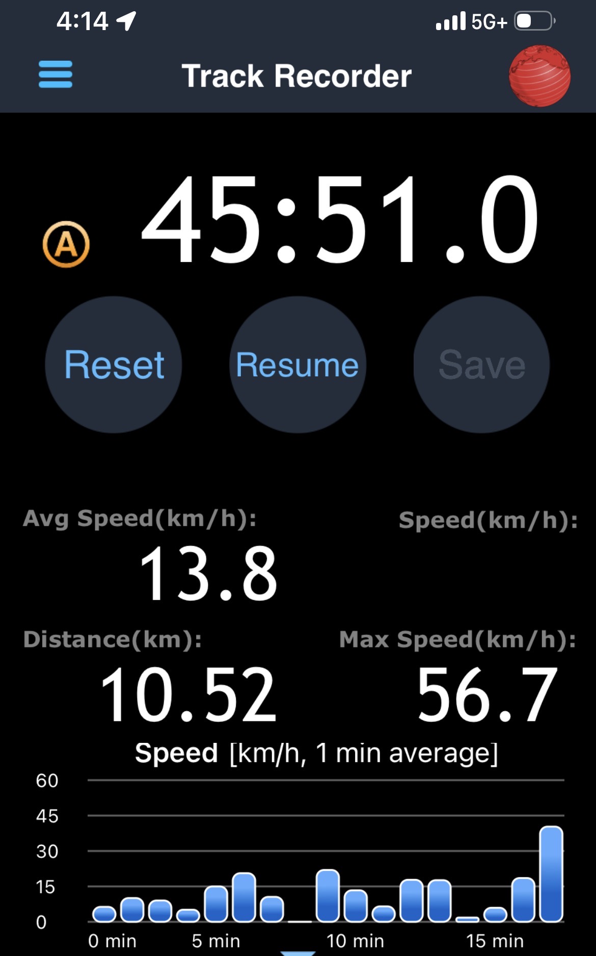
    Screenshot from a GPS app with the distance, average speed, and time it took to get from Humber College to Finch West Station

    On the return trip, it took almost 46 minutes from Humber College to Finch West, less than 4 minutes faster than my last eastbound ride in December, and with an average speed of 13.8 km/h. The eastbound train I was riding managed to arrive at Kipling Avenue (Mount Olive Station) just as the LRT signals were turning from amber to red (motor traffic still had 10 seconds of green light), followed by the stop at the far-side station there. The train also managed to arrive at Islington Avenue as the LRT signal was turning red, resulting in another long wait. At each intersection, the trains crawled at 15-20 km/h as parallel traffic sped by, and the Alstom Citadis cars were noticeably rough riding. The section between Humber College Station and Westmore Drive is especially painful, with LRV cars making the turn at 7-8 km/h.

    On Eglinton Avenue east, the two-car Bombardier Flexity trams manage to glide through at-grade intersections at a less frustrating speed, and they noticeably provide a lighter, quieter ride.

    On the positive side, station dwell times on Line 6 were noticeably reduced, and it seems that operations are a bit more consistent after two months of operation; there were no notable gaps between LRV cars. However, there are still issues to be worked out, as Friday, February 27 saw more switch problems that closed part of the line for several hours.

    Hopefully, further operational improvements and signal priority follow, and the signal and track issues get sorted out. I’ll return later in March for another ride to see if the ride improves further. I worry, though, about the Citadis LRVs, as they are looking more and more like a defective product that may not be redeemable.

    Line 6 travel times on Thursday Feb. 26
    Eastbound
    (read down)
    Stop/stationWestbound
    (read up)
    3:28 PM (dep.)Humber College
    LRT Station
    3:12 PM (arr.)
    3:32Westmore Dr.3:08
    3:34Martin Grove Rd.3:06
    3:43Kipling Ave. (Mt. Olive)3:00
    3:47Islington Ave. (Rowntree Mills)2:58
    3:56Weston Rd. (Emery)2:48
    4:00Arrow Rd./Signet Dr.2:45
    4:05Jane and Finch2:37
    4:08Tobermory Dr.2:33
    4:10Sentinel Rd.2:30
    4:13 PM (arr.)Finch West Stn.
    (LRT Terminal)
    2:28 PM (dep.)
    45 minutesTotal time44 minutes

  • Line 5 is alive

    Line 5 is alive

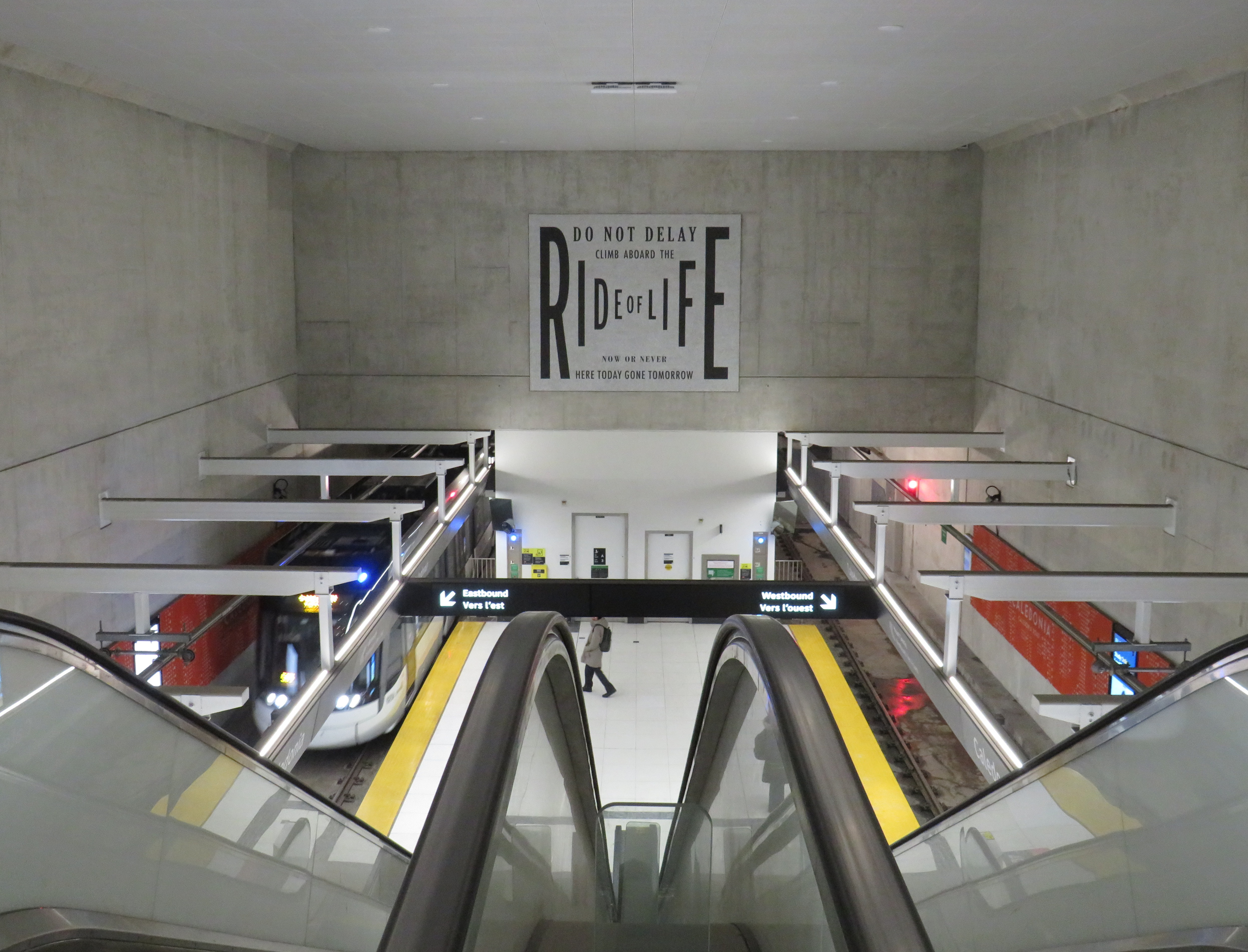
    Caledonia LRT Station

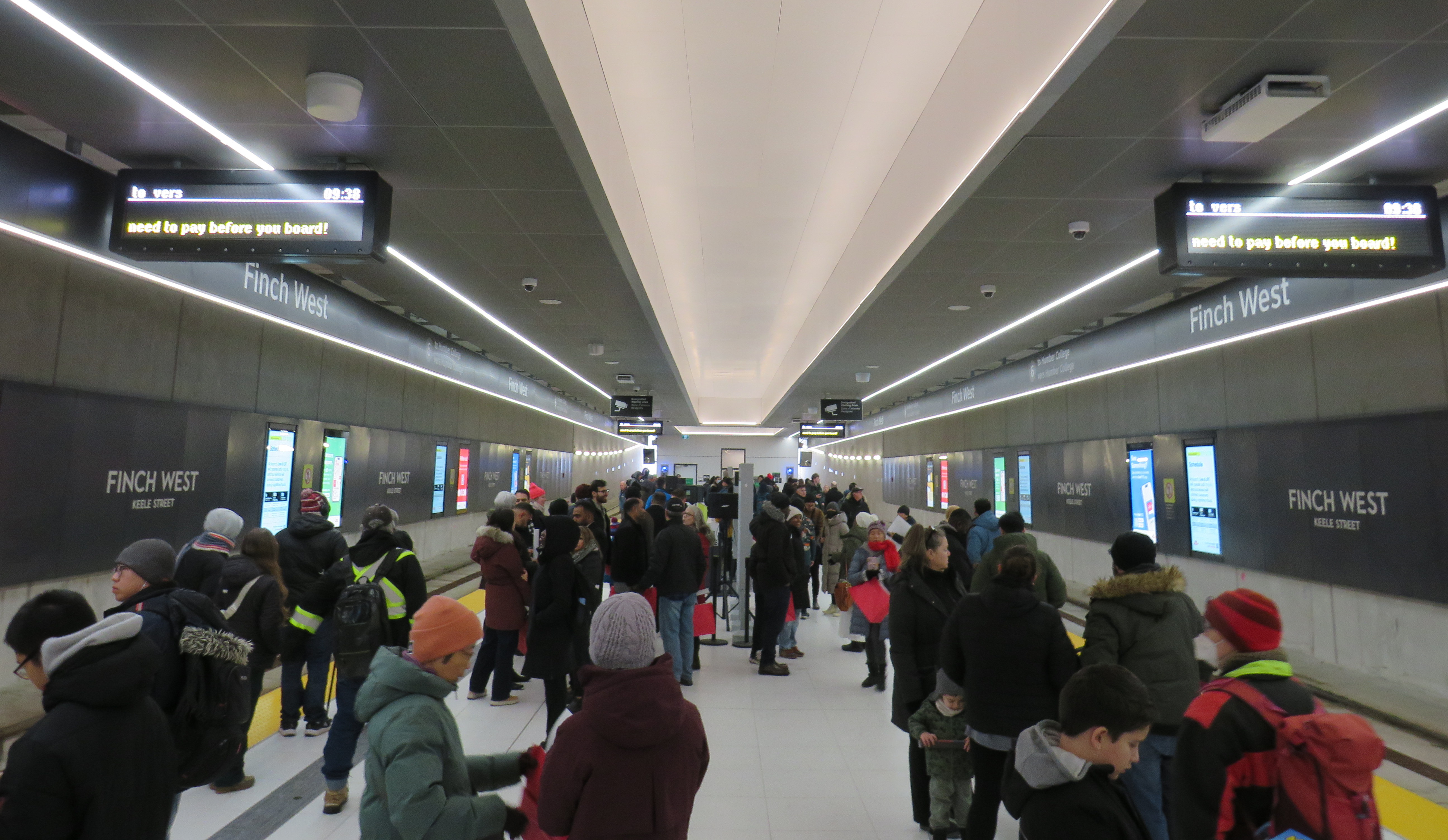
    On Sunday, February 8 the Eglinton-Crosstown LRT opened to the public without any pomp or circumstance. Perhaps embarrassed by the public’s reaction to Line 6 Finch West, there were no giveaways, no parties, and no promotional materials. That turned out to be a shame, in a way, because Line 5 seems to be alright so far, a week after its initial opening. Travel times on the LRT are improved over the previous 32 and 34 bus routes, though with lesser speed improvements on the surface section versus the western portion. The two-car Bombardier Flexity trains do not crawl through intersections on Eglinton Avenue East unlike the single-car Alstom Citadis Spirits on Finch Avenue West.

    Furthermore, learning some lessons from the botched Line 6 launch, the TTC — the operator of Line 5 trains — is looking for public feedback and promises improvements to speed and frequencies later in 2026. There are certainly ways in which this line can improve further. All that said, the Eglinton-Crosstown LRT offers needed optimism for Toronto’s transit future, especially as more projects are underway.

    Mostly smooth operation of Line 5 during the first week
    (more…)
  • Line 5: a quiet opening for a troubled project

    Line 5: a quiet opening for a troubled project

    A westbound LRV train on Eglinton Avenue in Scarborough, January 2026

    After fifteen long years, the wait is over. On Sunday, February 8, the Eglinton-Crosstown LRT will finally open to the public, with the first train leaving Kennedy Station at 7:00 AM. (The first eastbound train will depart Mount Dennis at 7:07 AM.) Rides will be free on that first day, but there will be no opening celebration, no ribbon cutting, and no giveaways. At first, trains will run until 11 PM, with Line 5 shuttle buses from 10 PM until 1AM, when the 334 night bus takes over.

    After the botched opening of Line 6 Finch West, it is clear that no one in charge wants to celebrate the opening of this new transit line after years of construction delays and false hope of completion in 2020, 2021, 2022, 2023, 2024 and 2025. So if you want to check out Toronto’s new ride, go do it at your own convenience. You won’t miss anything.

    There will be no party, like the one arranged last December at Finch West

    But even if the trains run slower than originally planned at first, there should be a ramping up of speeds and transit priority in the surface-running eastern section. The tunneled section will have speeds up to 60 km/h between stations, making it considerably faster than the buses it will replace. During a visit to Scarborough last month, it already seemed that trains were running a bit faster in the outdoor section than on Finch West, so there’s definitely some reason to welcome the LRT in its initial “soft opening” phase.

    The TTC notes that once full service is operational later in 2026, the end‑to‑end travel times will be “approximately 50–55 minutes.” That’s about twice as fast as the bus when going all the way from Mount Dennis to Kennedy. Perhaps, once the trains are running on a full schedule until 1AM and with expected performance improvements, there will be a formal ceremony to conclude this long journey.

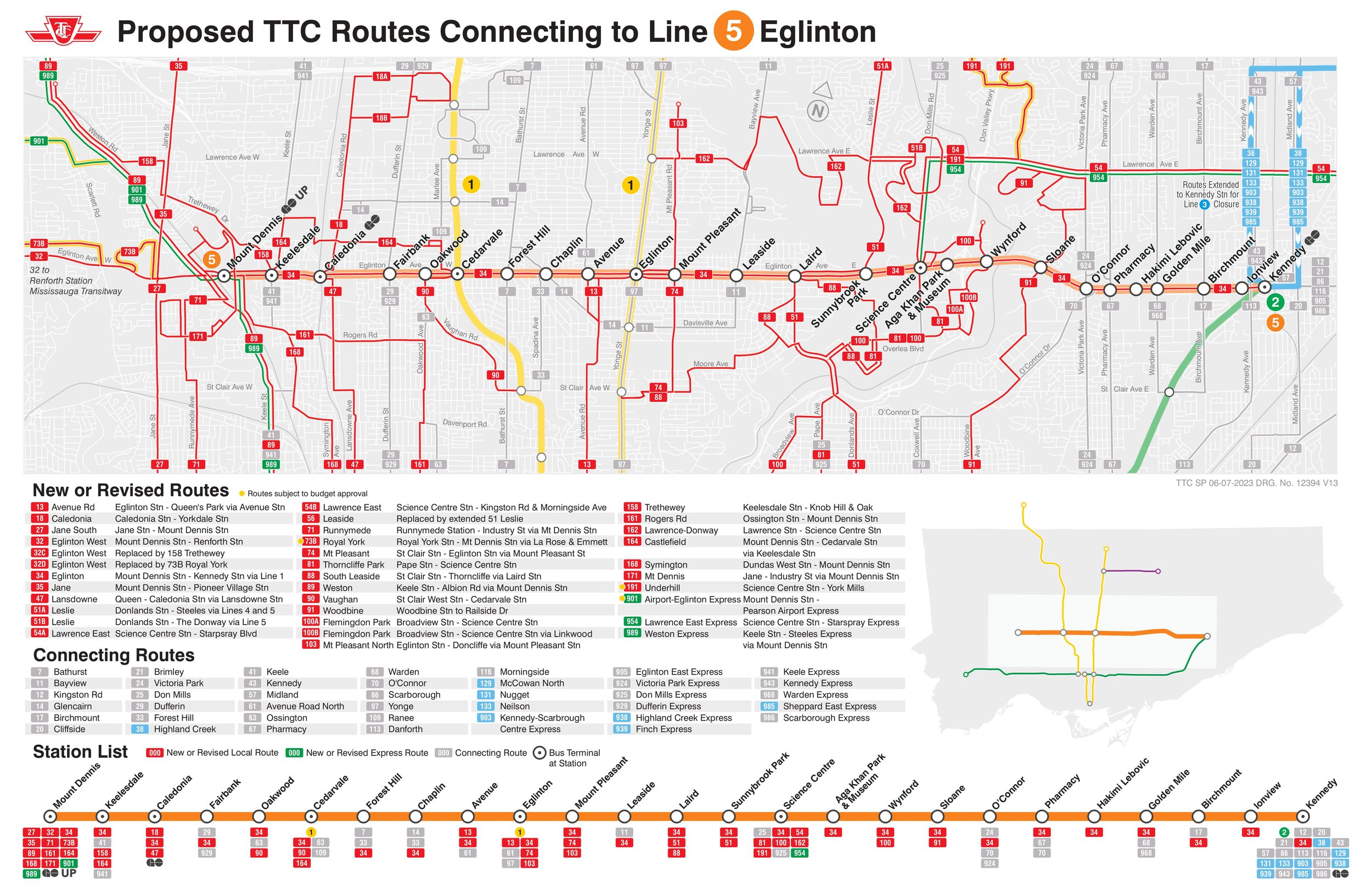
    Notably on Sunday February 8, there will be significant changes to the bus network, including 2 discontinued routes, 13 route changes, and 4 new routes. Most notably, Routes 54 and 954 on Lawrence Avenue East will now terminate at Don Valley Station instead of at the subway at Eglinton Station. Route 35 Jane will no longer continue south of Weston Road, but will instead terminate at Mount Dennis (with new Route 27 Jane South taking over that southern section). The 47 Lansdowne will be split into two, with 18 Caledonia providing service north of Eglinton. Routes 51 Leslie and 56 Leaside will be merged (with a short 151 Leslie North bus on the north end), and the 32C branch will be replaced with the new 158 Trethewey bus. The map below shows how the TTC buses will connect with Line 5. (Route 901, between Mount Dennis Station and Pearson Airport via Dixon Road, has not yet been approved.)

    Map showing TTC bus route changes; several of these were already implemented in late 2025. Only the 901 express route to Pearson Airport has not been approved.

    I will certainly make time to check out Line 5 on Sunday, followed by a more fulsome review a week or two after opening to form an honest and thoughtful opinion.

  • Can the Eglinton LRT outrun the bus?

    Can the Eglinton LRT outrun the bus?

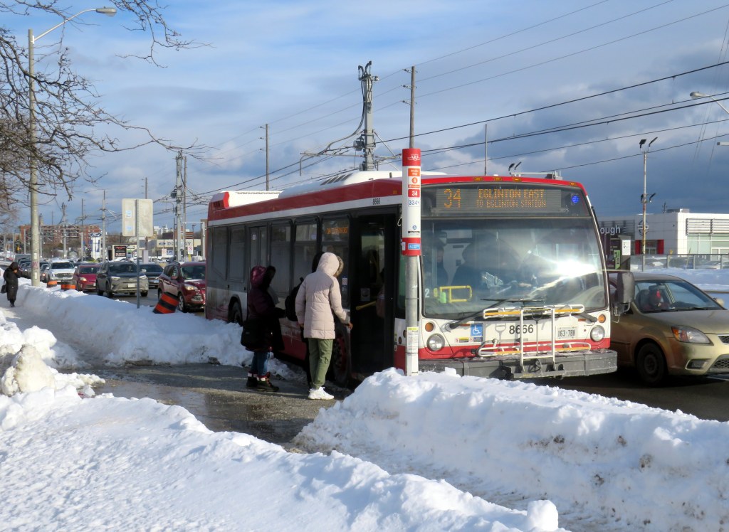
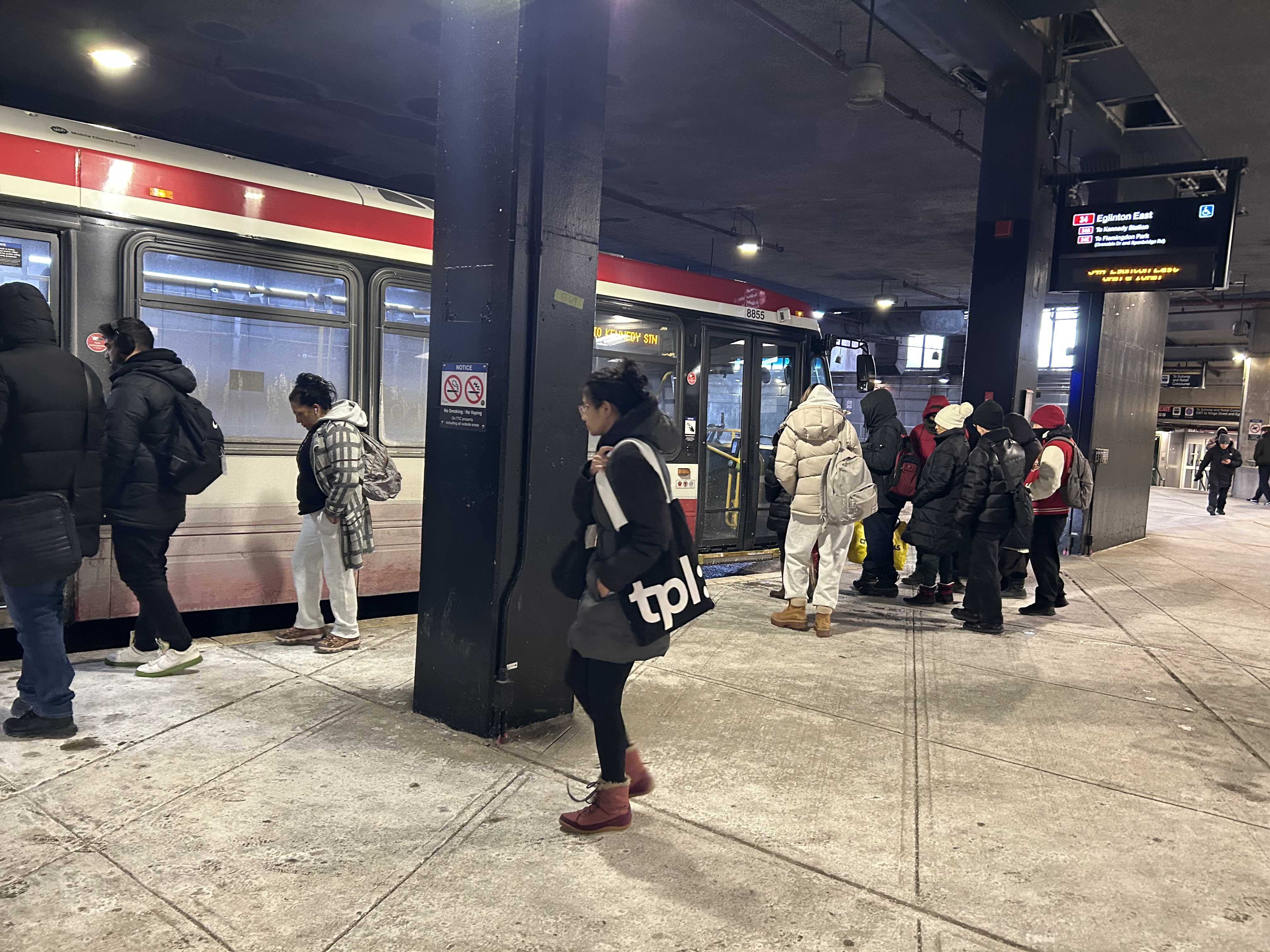
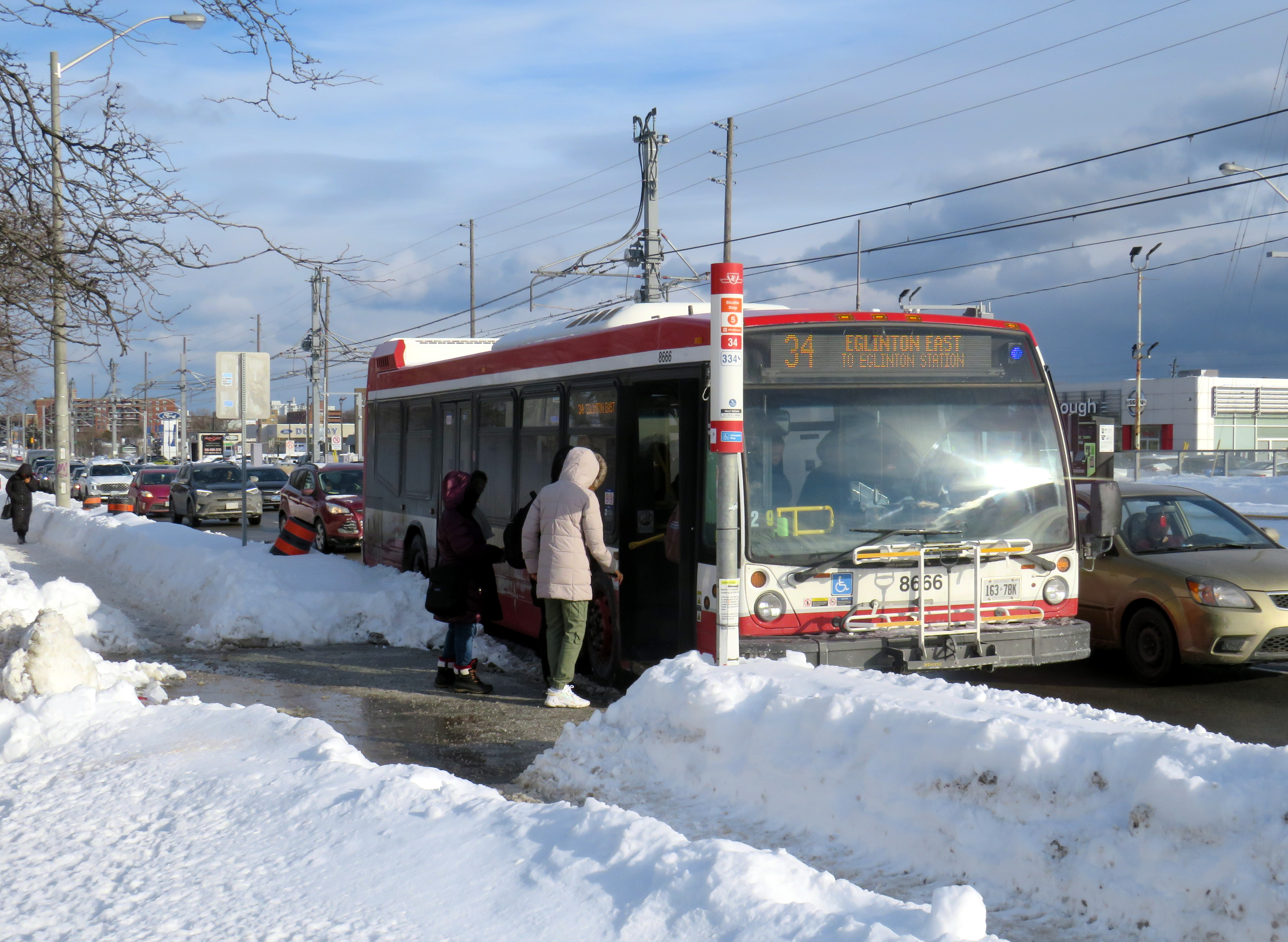
    Passengers boarding the 34 Eglinton East bus, January 28, 2026

    On Sunday, February 8, the long-awaited (and long-delayed) Line 5 Crosstown LRT will finally open to the public (or maybe not). The new line, 19 kilometres long with 25 stops, is nearly twice as long as the 11-kilometre Finch West LRT that opened in December.

    Unlike the troubled Finch West LRT, the Eglinton-Crosstown line is largely underground, with twelve stations, from Mount Dennis to Laird, completely separated from road traffic. A western extension through central Etobicoke to the Mississauga border at Renforth will also be completely grade-separated. There are several other major differences: the Crosstown line will be more frequent than Finch West, and will have more capacity, with two-car trains operating at all times. The equipment will be different too: Bombardier Flexity cars, the same as those used in Kitchener-Waterloo, will make the up the trains. Furthermore, the underground section will be computer controlled (which might turn out to be a complication, rather than an advantage).

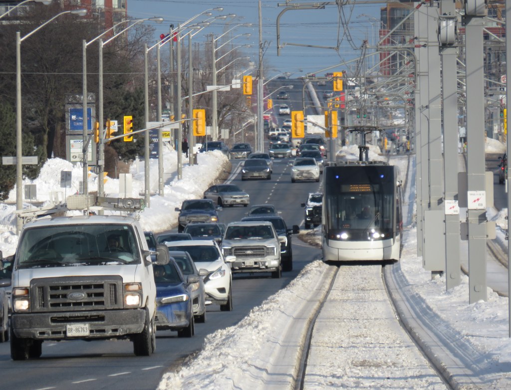
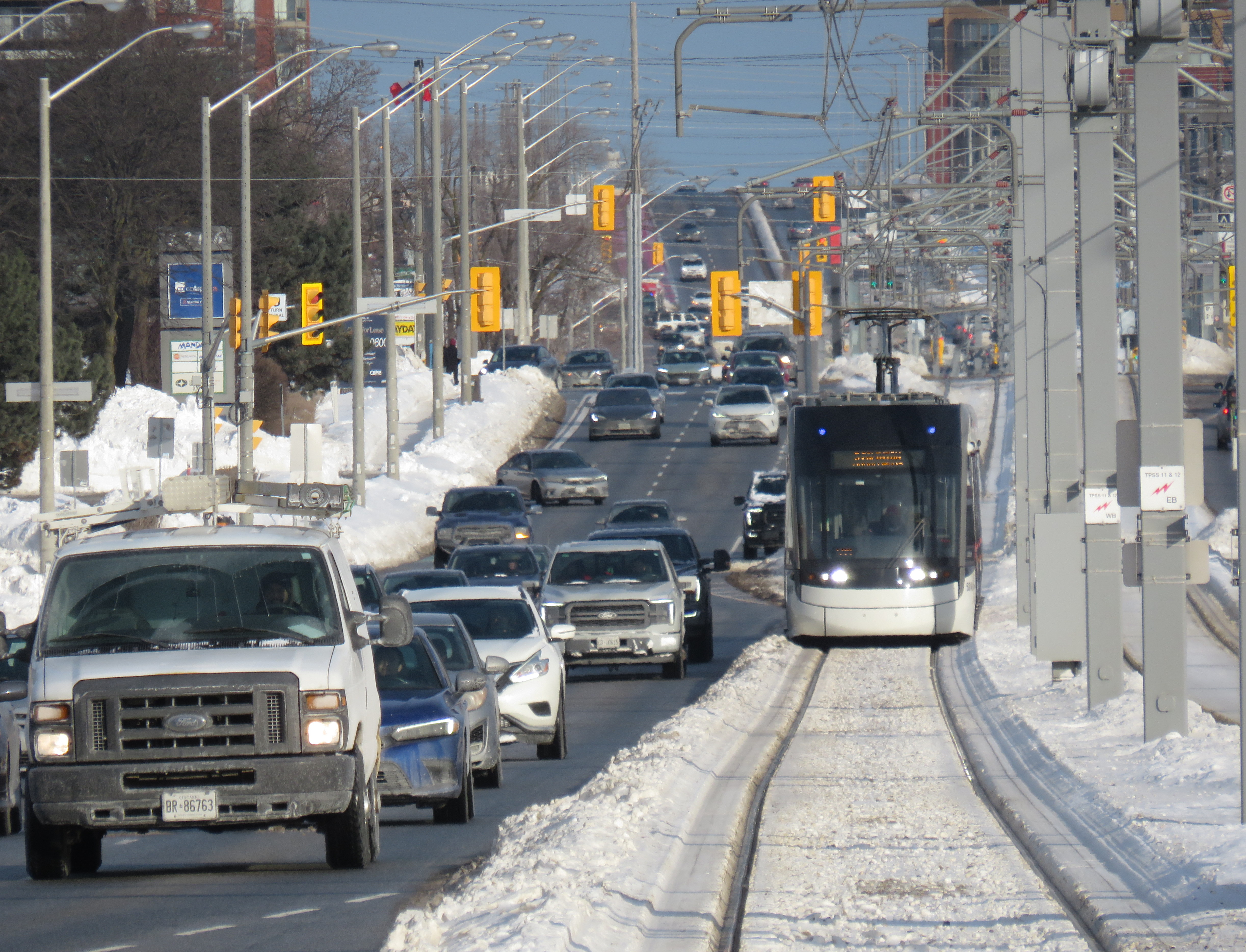
    A light rail train passes traffic on Eglinton Avenue East in Scarborough

    However, some aspects will be the same. The surface-running eastern section between Leslie Street and Kennedy Road will feature 10 outdoor stops and 16 traffic signals, though the LRT will dip below ground at Don Mills Road (formerly Science Centre Station, now Don Valley Station) and under Kennedy Road into the Kennedy Station transit hub. As with Finch West, this was a Metrolinx-led project with a private consortium in charge of construction and maintenance, with the TTC in charge of train operations. So it will be interesting to see how Line 5 fares.

    With subway, light rail, buses, and GO trains, Kennedy Station is becoming a proper transit hub

    In the meantime, just as with my visits to Finch West, I decided to see how long it takes to get across the LRT corridor. In May 2024, I walked the entire route over three days, getting to know the corridor better (while documenting my stroll on a social media platform that I have since abandoned). With rumours of a mid-winter 2026 opening, I decided to ride the buses to get further context and time the rides.

    Congestion at Eglinton Avenue West and Oakwood Avenue, May 2024

    Tuesday, January 20 was an ideal day to ride the 32 Eglinton West and 34 Eglinton East buses. That was several days after the last snowfall (and a few days before the next big dump), and the roads and sidewalks were completely clear. It was a bright, sunny (albeit cold) day, and there was only one short construction zone on Eglinton Avenue, near Caledonia Road. Though only a small number of riders would use the entire Crosstown LRT line as part of a regular commute, it was worth getting a sense of how long the trip would take between each station.

    I started at Kennedy Station after taking a Stouffville Line GO train one stop from Union Station, rode the 34 Eglinton East bus all the way to Eglinton Station at Yonge Street, and then after a break (including a stop at Cinnabon), continued west to Mount Dennis Station, which is already open to GO and UP Express trains, as well as a few TTC routes. The last half of the ride coincided with high school dismissal times that resulted in some crowding, especially between Avenue Road and Dufferin Street.

    From Mount Dennis, I returned eastbound during a busy weekday afternoon rush hour, transferring to the first available 34 Eglinton East bus at Eglinton Station all the way back to Kennedy.

    Waiting for the 34 Eglinton East bus to Kennedy Station, January 20, 2026

    The table below shows the timings at each LRT stop.

    Westbound
    (read down)
    Stop/StationEastbound
    (read up)
    1:28 PM dep.Kennedy5:35 PM arr.
    1:32Ionview5:30
    1:34Birchmount5:28
    1:37Warden Ave.
    (Golden Mile)
    5:24
    1:39Hakimi Lebovic5:22
    1:42Pharmacy5:20
    1:43Victoria Park Ave.
    (O’Connor)
    5:18
    1:46Bermondsey5:15
    1:49Wynford5:08
    1:51Don Mills Rd.
    (Don Valley)
    5:01
    1:53Leslie St.
    (Sunnybrook Park)
    4:58
    1:57Laird4:50
    2:00Bayview Ave. (Leaside)4:48
    2:04Mount Pleasant4:44
    2:10 PM arr.
    2:47 PM dep.*
    Eglinton Station
    (Bus transfer)
    4:39 PM dep.
    4:32 PM arr.***
    2:52Avenue Road4:25
    2:54Chaplin4:19
    2:58Bathurst St.
    (Forest Hill)
    4:15
    3:03Cedarvale Stn.4:09
    3:07Oakwood3:56
    3:11Dufferin St.
    (Fairbank)
    3:51
    3:18Caledonia**3:44
    3:21Keele St.
    (Keelesdale)
    3:41
    3:25Mount Dennis3:37 PM
    87 minutesTotal ride time
    (inc. a 7 min transfer at Eglinton Stn.)
    118 minutes
    * This gap provided an opportunity to use the washroom, and get a coffee and snack
    ** Time noted at Blackthorn Ave, the closest stop to the LRT station entrance
    *** Took first 34A bus to Kennedy Station that departed Eglinton after my arrival; a 34C bus to Wynford Dr. and Flemingdon Park departed first

    On the surface buses, the most significant traffic delays are near the Don Valley Parkway and Allen Road, especially eastbound between Oakwood Avenue and Cedarvale Station and between Don Mills Road and Bermondsey Avenue. For anyone crossing Yonge Street, the transfer between buses takes on average seven minutes including walking and waiting time.

    Line 5, the Eglinton Crosstown LRT, will run deep below the Line 1 University Subway at Cedarvale Station

    The dedicated right of way should allow transit riders to get ahead of traffic congestion, especially around Allen Road, where the trains will run in a deep bore tunnel. In theory, the median right-of-way will help get passengers past congestion near the DVP and the big box retail in the Golden Mile, but if the trams are as slow through intersections as on Finch and held up by red lights, the advantage here will be minimal.

    At Eglinton and Warden, I did see a traffic signal hold a green light a few extra seconds to allow a train to pass through before changing, so that was a positive sign. But watching the trains go by every few minutes, I noted that the transit priority system was not at all aggressive, and as on Finch, transit signals turn red 12 seconds before the general traffic signals do.

    On January 28, Eglinton and Warden, the transit signals stayed green for a short extra time to allow the non-revenue LRT train to pass through and stop at the far-side platform. The train was moving at a more reasonable clip too.

    The Eglinton Crosstown LRT, unlike Finch West, serves a regional need that requires better speeds and more capacity than a mere surface tram, especially as it will have many bus routes directly feeding into it, rather than just intersecting. Several bus routes that used to continue into Eglinton Station, such as 54 Lawrence East, will instead terminate at Don Valley (formerly Science Centre) Station, where riders going west to the subway will have to transfer. For inexplicable reasons, the short section between Don Mills Road and Laird will have one at-grade station with a signalized intersection, a weak link in what will likely be a very busy section of the line.

    Map of planned changes to TTC bus routes with Line 5’s opening. Some of the changes, including the introduction of Route 164 Castlefield and the extensions of routes 79, 161, and 168 to Mount Dennis Station have already been implemented.

    Hopefully, some of the lessons from the Line 6 opening will be applied to Eglinton before it opens. There should also be an opportunity, just as there is on Finch, to make further changes to operations where applicable during a “soft opening” period. But we can not afford yet another botched transit project, especially after 15 years of waiting.

  • Still waiting for the Finch West LRT

    Still waiting for the Finch West LRT

    December 7, 2025 may be a day that will live in transit infamy. That was the day Line 6, the Finch West LRT, opened to the public, and it did not go well.

    First off, any discussion on the initial failure of Line 6 should acknowledge that was never designed to be a rapid, regional transit link. The LRT, serving Northwestern Toronto, was intended to be an upgrade to the slow, congested, and busy 36 Finch West bus, feeding into the rapid transit network at Finch West Station. Line 6 is a legacy of Transit City, a LRT plan proposed under previous mayor David Miller intended to connect the inner suburbs of Etobicoke, North York, and Scarbrorough to the subway and to each other.

    As with all proposed Transit City routes (with the exception of the tunneled central section of the Eglinton-Crosstown LRT), there were always going to be compromises on Finch that would not make it a true rapid transit service. Situated almost entirely on the surface, Line 6 trains are easier for residents to access than subways in deep tunnels; closer stop spacing was intended so the new transit line continues to serve the needs of those who live, work, go to school, and frequent the corridor, without the necessity of a parallel local bus. Anyone expecting subway speeds were in for disappointment.

    Still, the LRT was supposed to improve travel times over the existing bus, with wider stop spacing than the legacy streetcar network, a congestion-free right of way, signal priority, and decent operating speeds. With a promised average speed of 20-21 kilometres per hour, a total trip time of 33-34 minutes each way, it would have been a bit faster, more comfortable, and certainly more reliable than the bus. It was never going to be as fast as a subway, but for Finch Avenue West, that was okay.

    Screen capture of a Metrolinx FAQ webpage, with frequent and relatively speedy transit service promised for the Finch West LRT. The webpage was still up as of December 18, 2025.

    As the first modern LRT to open in the Greater Toronto and Hamilton Area (GTHA), Line 6 was to be a preview of additional lines planned and under construction elsewhere in the Golden Horseshoe, including the yet-to-open Line 5 Crosstown LRT, the Hurontario Line, the Hamilton LRT, and a proposed Line 7 on Eglinton Avenue East towards the University of Toronto Scarborough Campus and Malvern. Delivered by Metrolinx, the provincial transit agency, each line would be constructed and maintained by a P3 consortium, though the Toronto LRTs would be operated by TTC employees.

    The hoped-for narrative that the provincial government, Metrolinx, the city of Toronto, and the TTC all touted — a smooth new ride, worthy of including on the subway maps — quickly fell apart on Sunday December 7, though there were plenty of warning signs of slower-than-promised operations.

    Opening day crowds on December 7. Passengers disembark from a wrapped LRV that touts Line 6 as “far and wide the best way to go far and wide.”

    On Sunday, December 7, there were plenty of people eager to try the new LRT: railfans and urbanists, curious families, and local residents, lured by free fares on the opening day. Though I was there and took several trips, I wasn’t going to make too many judgements on opening day. There would be inevitable hiccups with the large crowds and cold, snowy temperatures. Still, there were visible problems.

    An eastbound LRV approaches Islington Avenue (Mount Olive Station) as the transit signal switches from green to amber. The traffic signals are still green.

    So far, a lot of the post-opening discourse has been on operating speeds and traffic operations. Instead of 33-34 minutes, as claimed by Metrolinx, trips were taking 55 minutes each way. Additionally, the transit signal priority (TSP) system has not been activated, causing light rail vehicles (LRVs) to wait entire light cycles, even for private vehicles to turn left before proceeding. The dedicated transit signals turn red about 10-20 seconds before general traffic gets a red light, even as LRVs approach the intersections. On December 16, Toronto City Council approved a motion to implement “more aggressive” TSP on Finch West and the surface portion of the Line 5 Eglinton-Crosstown LRT, as well as on the legacy streetcar network.

    The problem on Finch West is not just a matter of transit signal priority. The number of stops along the line, also criticized by several critics, is also not a problem, as Finch West was never intended to be a high-speed regional line. (That said, Mount Olive and nearby Stevenson could have been consolidated into a single stop west of Kipling Avenue.) The other problems are poorly managed schedules and streetcar-style slow zones on a modern LRT alignment.

    Right now, LRVs are forced to slow to 25 km/h at all intersections, even though all conflicting traffic has a red light. This is an inexplicable restriction given that motor traffic, including TTC buses, have a 50 km/h limit, and many drivers will proceed at significantly above the posted limit. These restrictions are not found elsewhere in North America; in Calgary and Edmonton, LRTs are protected at many at-grade intersections with railway-style lights and gates. In places like Minneapolis-St. Paul and Phoenix, additional LED flashing signs warn drivers of an approaching LRV, which glides through the signalized intersection at higher speeds than on Finch. (There is also a lot less sign clutter, with intuitive signals for left turns and transit).

    Transit schedules are also needlessly padded, with too much time for lower speeds and lengthy station stops. On a repeat visit to Finch West, on Wednesday December 17, 2025, travel times were inconsistent and slower then either 36C bus I took a few days before the LRT opened. (Even the trip with the long Starbucks pitstop.)

    Line 6 travel times on Wednesday Dec. 17
    Eastbound
    (read down)
    Stop/stationWestbound
    (read up)
    12:59 PM (dep.)Humber College
    LRT Station
    12:31 PM (arr.)
    1:03Westmore Dr.12:25
    1:05Martin Grove Rd.12:22
    1:10Kipling Ave. (Mt. Olive)12:13
    1:14Islington Ave. (Rowntree Mills)12:09
    1:26Weston Rd. (Emery)11:57
    1:29Arrow Rd./Signet Dr.11:54
    1:33Jane and Finch11:46
    1:37Tobermory Dr.11:35
    1:45Sentinel Rd.11:32
    1:48 PM (arr.)Finch West Stn.
    (LRT Terminal)
    11:27 AM (dep.)
    49 minutesTotal time1 h 4 minutes

    It took eleven minutes to go two stops, less than a kilometre, from Tobermory Drive to Jane Street on the westbound trip. Lengthy station dwell times at Tobermory (five minutes) and Mount Olive (three minutes) on that westbound ride, with no onboard announcements was especially frustrating. The return eastbound trip from Humber College was 15 minutes faster, even with much of the same slow zones at intersections and switches, the 10 km/h curve near Humber College Station, and lengthy stops.

    With such unpredictable and unreliable service, Line 6 is running at least as badly as the downtown streetcar routes. Without immediate fixes, people will completely lose faith in the TTC and future LRTs, including Eglinton-Crosstown. We can not just rely on tweaks to signal times; we need a complete review and overhaul of streetcar and LRT operating practices.

    At least we know what can and should be fixed before the Eglinton-Crosstown line opens, a much longer LRT route that will have a regional transit role.

    One more thing…

    What is with all the doors between the Line 1 subway station and the LRT terminal at Finch West. Passengers have to pass through four sets of doors to transfer between two TTC services, as well as ascend one escalator or elevator, walk down one set of stairs (or navigate a long and circuitous ramp) and then ascend another escalator or elevator to get to the other platform.

    Stairs or a long, circuitous ramp between the doors from subway to LRT

    Though transfers can be tricky, at the very least, these doorways should be kept open, and shut only during station closures or during fire alarms, as done in hospitals or shopping centres. Other TTC stations have no such barriers between modes or may have a single door to exit a subway station terminal to the bus platform. Automatic sliding doors could have also been an option. Instead, the powered doors are left to one side, with the button against the wall. It’s not an ideal design from an accessibility point of view.

  • Waiting for Finch West

    Waiting for Finch West

    Two Line 6 LRVs cross Jane Street at Finch Avenue, December 3, 2025 as training wraps up ahead of revenue service on December 7

    Can a brand-new light rail line outrun the local bus it replaces? Starting on Sunday, December 7, Torontonians will get the chance to find out when the new Line 6 Finch West light rail line finally opens to the public. Though built and maintained by Metrolinx, the service will be operated by TTC employees.

    The new LRT, 11 kilometres long, with 18 stops, runs almost exclusively in a transit-only median on Finch Avenue West between Finch West Station at Keele Street in North York and Highway 27 in Etobicoke. The end terminals are below grade, with three traffic signals skipped. Otherwise, the light rail vehicles will be subject to stopping at the same traffic lights as all other cars, trucks, and buses.

    New maps in the TTC subway system show the long-delayed Line 5 Eglinton-Crosstown (opening date still TBD) and Line 6, which opens Sunday December 7

    For the last few weeks, Finch West has been served by the 36C bus, running between Finch West Station at Keele Street and Humberwood Loop near the Mississauga border, making a stop at the Humber College bus terminal. A separate 36 Finch West bus continues east from Finch West Station to Finch Station at Yonge Street. There will only be eight fewer stops on Line 6 than there bus stops between Finch West Station and Humber College; apart from overnight service, there will be no parallel local bus serving the corridor.

    Map of the Route 36C Finch West-Humberwood service, modified from the TTC’s original

    Without limited stops and signal priority, the new light rail line will not achieve any real time savings. On his website, transit advocate Steve Munro notes that the end-to-end time of the new Line 6 LRT is scheduled for 46 minutes, consistent across all operating time periods. The 36C’s fastest round trip times, late evenings and early Sunday mornings, is between 79 and 82 minutes, or 40-41 minutes one way on a slightly longer route.
    To see this for myself, I visited Finch Avenue West and rode the 36C both ways between Finch West and Humber College. Wednesday, December 3 was an overcast and cold day, with the daytime high temperature hovering around the freezing mark. But the roads were clear and dry, with no collisions and little construction work in the way of traffic on Finch; conditions couldn’t be any better for early December.
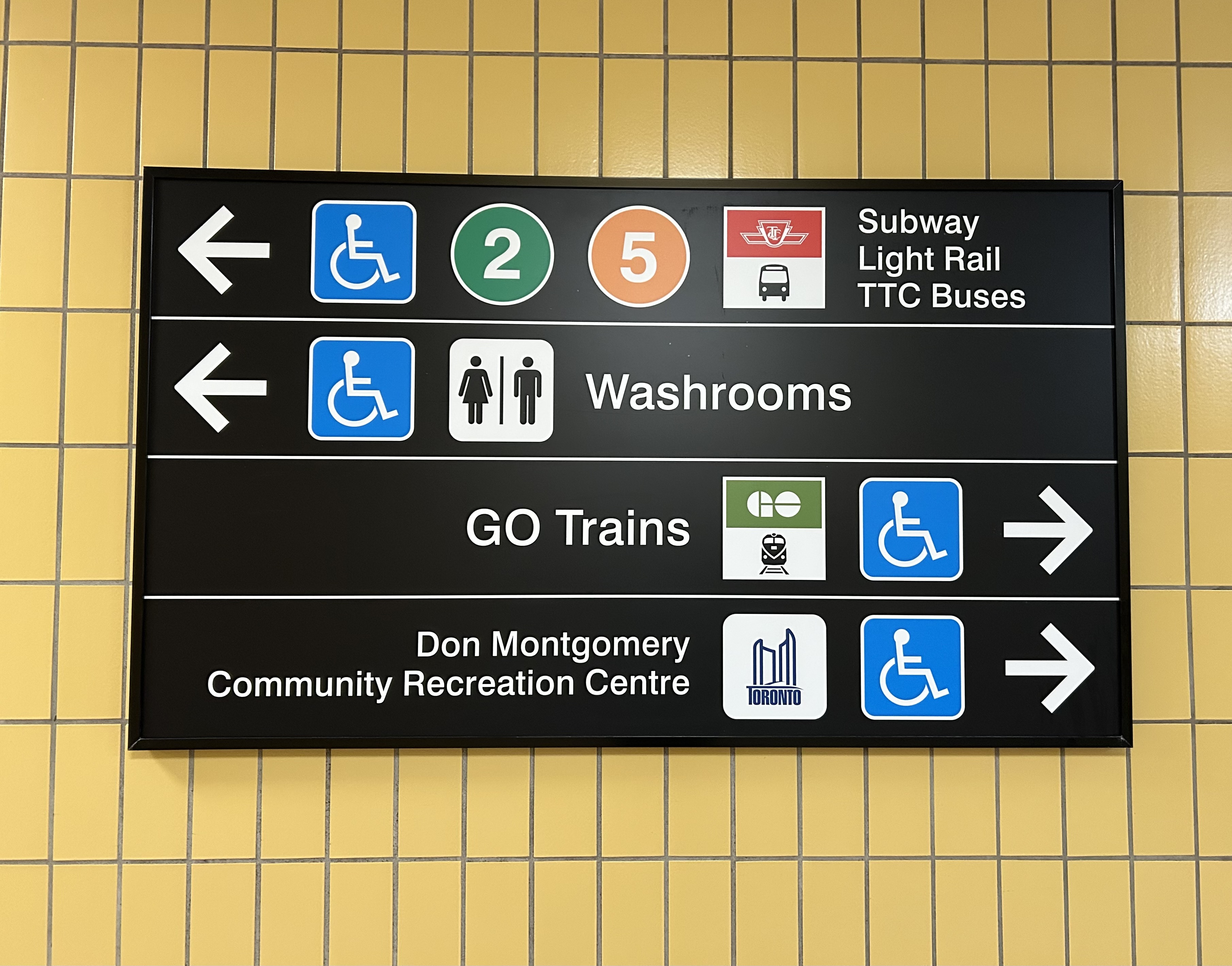
    Here were the times for the two buses I took. I started timing the runs as soon as the bus doors closed and departed the originating stop; waiting times at the initial stops were not included.

    TTC Route 36C travel times on Wednesday Dec. 3
    Eastbound
    (read down)
    Stop/stationWestbound
    (read up)
    12:07 PM (dep.)Humber College
    bus loop
    1:50 PM (arr.)
    12:11Westmore Dr.1:37**
    12:13Martin Grove Rd.1:24
    12:18Kipling Ave. (Mt. Olive)1:29
    12:20Islington Ave. (Rowntree Mills)1:19*
    12:28Weston Rd. (Emery)1:11
    12:33Arrow Rd./Signet Dr.1:09
    12:38Jane and Finch1:04
    12:42Tobermory Dr.1:01
    12:44Sentinel Rd.1:00
    12:51 PM (arr.)Finch West Stn.
    (bus terminal)
    12:57 PM (dep.)
    44 minutesTotal time53 minutes
    * At Islington Avenue westbound, the bus was delayed by five minutes by a troublesome passenger
    ** At Westmore Drive westbound, the operator left the bus with twelve passengers on board to order coffee at a nearby Starbucks, resulting in a second delay of nearly ten minutes

    The eastbound departure, leaving Humber College at 12:07 PM, made it to Finch West Station in 44 minutes, two minutes faster than the scheduled LRT trip. This bus, an articulated (18-metre) vehicle was relatively busy, with a few standees between Jane Street and Finch West Station, and most en route stops were made. There were no unusual delays; just some traffic near Highway 400; it also took two light cycles to complete the left turn from Finch to Keele approaching the subway station.

    Westbound 36C bus waiting to depart Finch West Station

    I returned towards Humber College on a different bus that left Finch West Station at 12:57 PM. For a while, this run, a standard 12-metre bus, was making exceptionally good time, with only a few passengers on board. It skipped several bus stops as no one wanted on or off until Tobermory Drive. Line 6 LRVs will stop at every station, just like the subway, even if there aren’t any waiting passengers.

    At Islington Avenue there was a delay caused by a prospective passenger who rushed through a don’t walk/red light to get the bus, despite another one close behind. As the passenger was using a mobility device, the bus operator had trouble deploying the ramp because the bus had already inched ahead of the bus stop pad, ready to proceed with the green light. The driver needed to reposition the ramp and wait for the next green, which resulted in a five-minute delay.

    Another delay came a few minutes later, when at Westmore Drive, just one stop before the Humber College bus terminal, the operator left the bus without notice and walked into a nearby Starbucks. After a few minutes, and seeing two other westbound 36C buses pass by, most passengers exited the open doors to flag down the next bus.

    Passengers leave an unattended Route 36C bus on Finch Avenue West at Westmore Drive. The portal for Line 6 LRVs to descend under Highway 27 towards Humber College is behind

    The TTC operator returned eight minutes later, and we finally arrived at Humber College Bus Terminal at 1:50, 53 minutes after departing Finch West Station. (It’s worth noting that Humber College also has a Starbucks and public washrooms in the main building near the bus loop.)

    At least that’s one instance where the LRT will certainly be faster than taking the bus.

    A longer walk, a longer wait

    TTC and Brampton Transit buses layover at Humber College

    Humber College’s bus terminal serves a total of nine TTC, Brampton Transit, Miway, and YRT routes. It’s also a connection point between TTC Wheel-Trans and Peel Region’s TransHelp paratransit services. But the LRT terminal station is a five-minute walk away from the terminal, which is adjacent to several primary buildings on campus.

    A walkway leads between the bus terminal and LRT station, with partial shelter provided by a long canopy that blocks northerly winds, but not the prevailing westerly winds. At the end of the walkway is the entrance to the below-grade LRT platforms, which are parallel to nearby Highway 27. This alignment reduced construction costs over a longer approach to the college, but it permits a future extension to the planned Woodbine GO Station two kilometres to the south and even Pearson Airport.

    Humber College Station entrance, at Highway 27. The walkway to the bus terminal and main campus is behind.

    During weekday peak periods, the LRT will run every 6 minutes, about as frequent as the current 36C bus during weekday daytime periods. However, during off peak times, trains will only come every 10-12 minutes, resulting in longer waits. Anyone travelling from Humber College will have to factor in the longer walk and potentially longer wait time.


    I will certainly go out on Sunday December 7 to celebrate the opening of this new line, which despite the unnecessarily slow speeds, will result in a more predictable and more comfortable ride, with significant capacity improvements during peak periods, especially at school dismissal times. LRT doors will line up with the platforms, making loading and unloading easier for passengers with mobility devices, strollers, or carts.

    I will also go ride the LRT after the opening day crowds are done, to see how it works in day-to-day operation. There are ways to speed up the schedule: more aggressive transit priority, shorter station dwell times, quick turnarounds at the terminals with “step back” operation, schedule optimization, and I hope these are considered by Metrolinx, the TTC and the city as everyone gets used to the new transit line.

    If you like my work and you would like to help out with my webhosting costs (I just had to renew my ad-free WordPress subscription), consider buying me a coffee. Thank you!