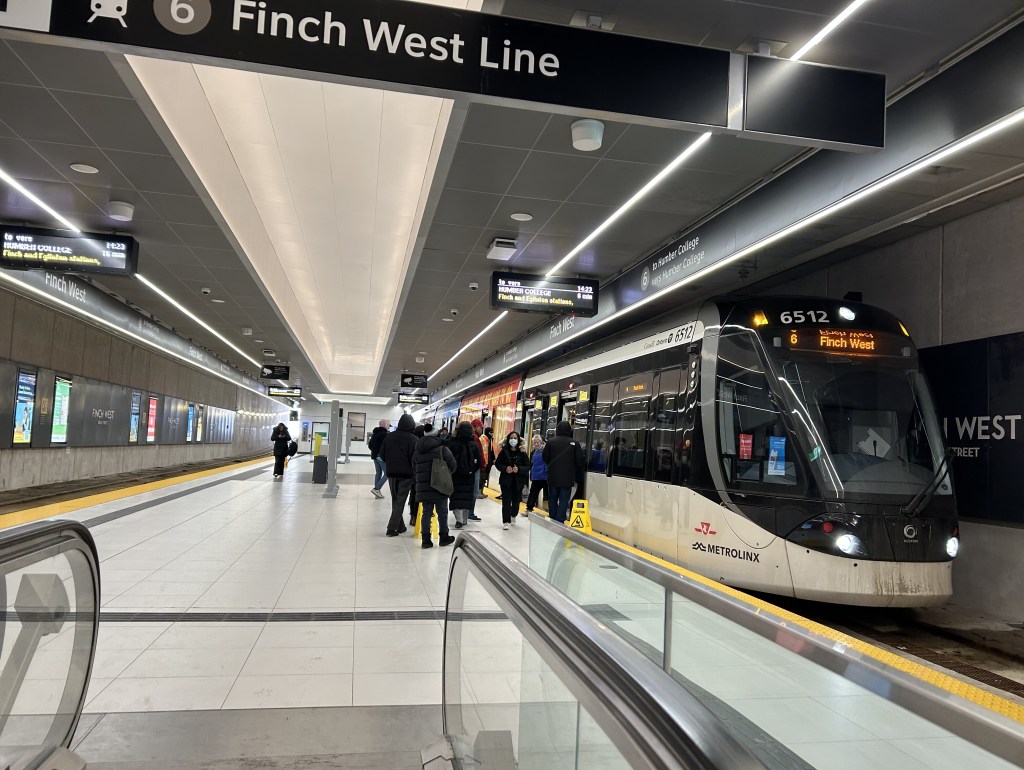
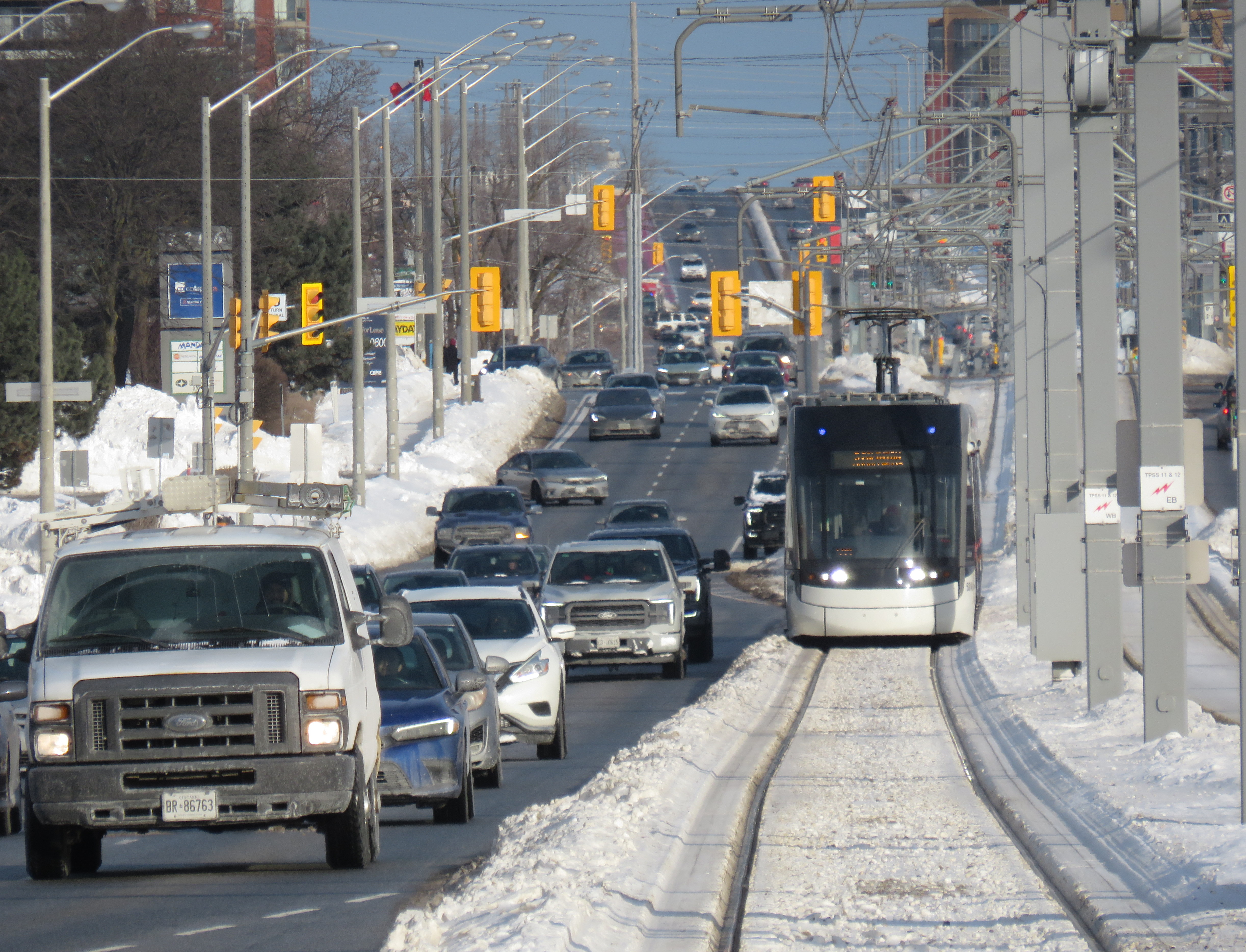
Interestingly, the 939B, which runs all the way from Kennedy Station to Finch West Station via Scarborough Centre, McCowan Road, and Finch Avenue, uses the York University Busway to get between Dufferin Street and Finch West Station. That busway, opened in 2009, was built to speed up travel times between the former subway terminus at Downsview Station (now called Sheppard West Station) and the university campus as the Line 1 extension to Vaughan was underway. When the Scarborough Busway opens — likely by the end of this year — it will use that exclusive transitway (also a temporary measure to speed buses along a subway project) as well.
From Finch West Station, it took 44 minutes to ride to the other end at Humber College Station, 20 minutes faster than during a problematic ride back in December. The average speed was 14.1 km/h, with a short spurt of speed (up to 56 km/h) up the hill between Islington and Kipling Avenues.
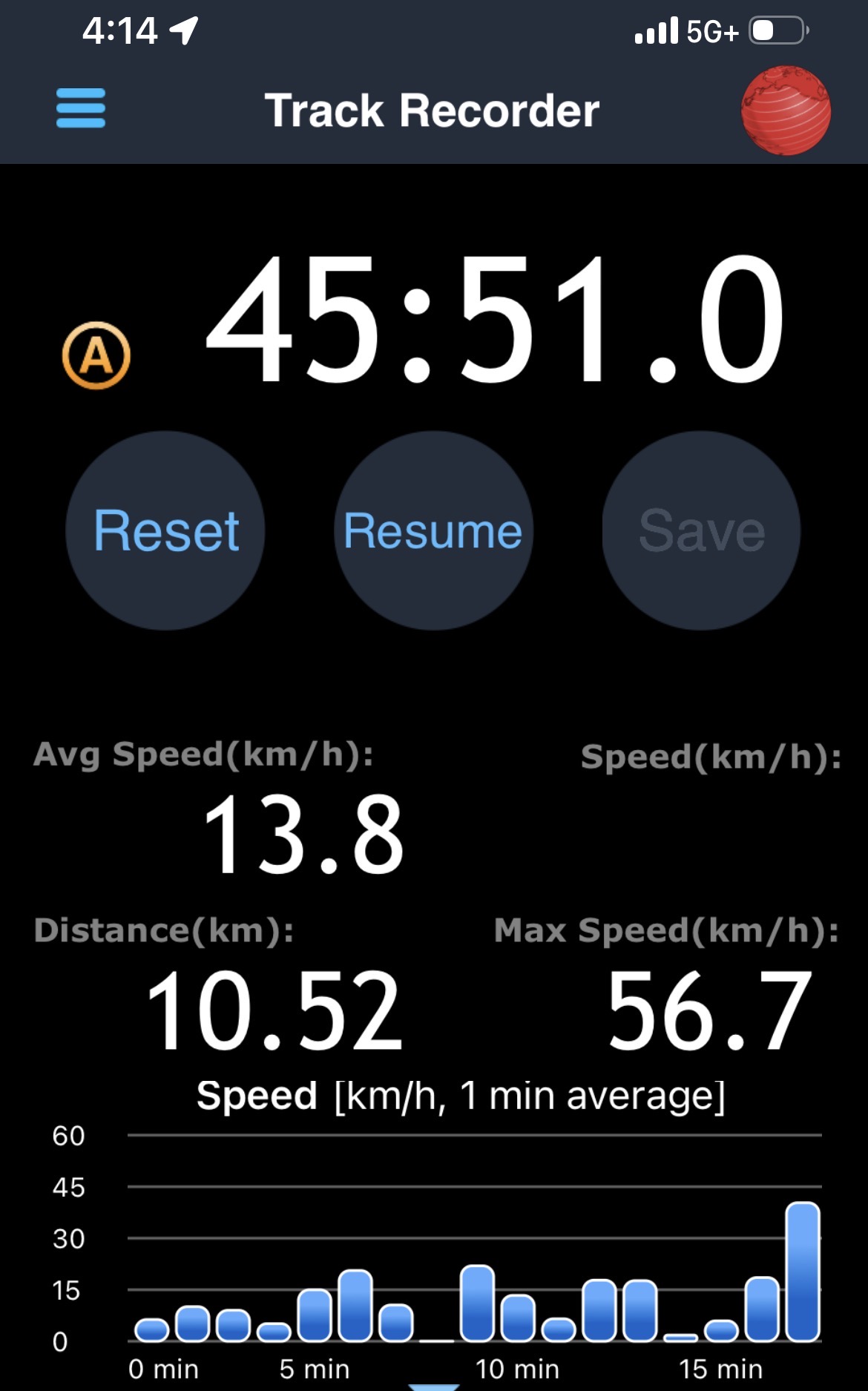
Screenshot from a GPS app with the distance, average speed, and time it took to get from Humber College to Finch West Station
On the return trip, it took almost 46 minutes from Humber College to Finch West, less than 4 minutes faster than my last eastbound ride in December, and with an average speed of 13.8 km/h. The eastbound train I was riding managed to arrive at Kipling Avenue (Mount Olive Station) just as the LRT signals were turning from amber to red (motor traffic still had 10 seconds of green light), followed by the stop at the far-side station there. The train also managed to arrive at Islington Avenue as the LRT signal was turning red, resulting in another long wait. At each intersection, the trains crawled at 15-20 km/h as parallel traffic sped by, and the Alstom Citadis cars were noticeably rough riding. The section between Humber College Station and Westmore Drive is especially painful, with LRV cars making the turn at 7-8 km/h.
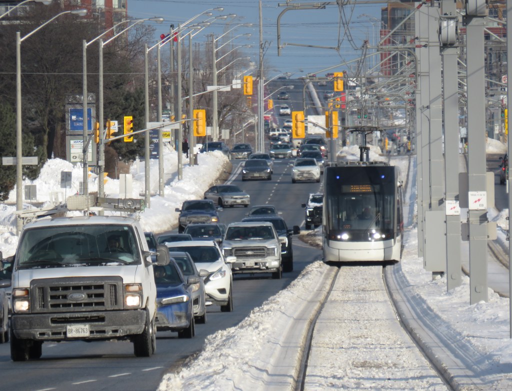
On Eglinton Avenue east, the two-car Bombardier Flexity trams manage to glide through at-grade intersections at a less frustrating speed, and they noticeably provide a lighter, quieter ride.
On the positive side, station dwell times on Line 6 were noticeably reduced, and it seems that operations are a bit more consistent after two months of operation; there were no notable gaps between LRV cars. However, there are still issues to be worked out, as Friday, February 27 saw more switch problems that closed part of the line for several hours.
Hopefully, further operational improvements and signal priority follow, and the signal and track issues get sorted out. I’ll return later in March for another ride to see if the ride improves further. I worry, though, about the Citadis LRVs, as they are looking more and more like a defective product that may not be redeemable.
On Sunday, February 8 the Eglinton-Crosstown LRT opened to the public without any pomp or circumstance. Perhaps embarrassed by the public’s reaction to Line 6 Finch West, there were no giveaways, no parties, and no promotional materials. That turned out to be a shame, in a way, because Line 5 seems to be alright so far, a week after its initial opening. Travel times on the LRT are improved over the previous 32 and 34 bus routes, though with lesser speed improvements on the surface section versus the western portion. The two-car Bombardier Flexity trains do not crawl through intersections on Eglinton Avenue East unlike the single-car Alstom Citadis Spirits on Finch Avenue West.
Furthermore, learning some lessons from the botched Line 6 launch, the TTC — the operator of Line 5 trains — is looking for public feedback and promises improvements to speed and frequencies later in 2026. There are certainly ways in which this line can improve further. All that said, the Eglinton-Crosstown LRT offers needed optimism for Toronto’s transit future, especially as more projects are underway.
Mostly smooth operation of Line 5 during the first week(more…)
A westbound LRV train on Eglinton Avenue in Scarborough, January 2026
After fifteen long years, the wait is over. On Sunday, February 8, the Eglinton-Crosstown LRT will finally open to the public, with the first train leaving Kennedy Station at 7:00 AM. (The first eastbound train will depart Mount Dennis at 7:07 AM.) Rides will be free on that first day, but there will be no opening celebration, no ribbon cutting, and no giveaways. At first, trains will run until 11 PM, with Line 5 shuttle buses from 10 PM until 1AM, when the 334 night bus takes over.
After the botched opening of Line 6 Finch West, it is clear that no one in charge wants to celebrate the opening of this new transit line after years of construction delays and false hope of completion in 2020, 2021, 2022, 2023, 2024 and 2025. So if you want to check out Toronto’s new ride, go do it at your own convenience. You won’t miss anything.
There will be no party, like the one arranged last December at Finch West
But even if the trains run slower than originally planned at first, there should be a ramping up of speeds and transit priority in the surface-running eastern section. The tunneled section will have speeds up to 60 km/h between stations, making it considerably faster than the buses it will replace. During a visit to Scarborough last month, it already seemed that trains were running a bit faster in the outdoor section than on Finch West, so there’s definitely some reason to welcome the LRT in its initial “soft opening” phase.
The TTC notes that once full service is operational later in 2026, the end‑to‑end travel times will be “approximately 50–55 minutes.” That’s about twice as fast as the bus when going all the way from Mount Dennis to Kennedy. Perhaps, once the trains are running on a full schedule until 1AM and with expected performance improvements, there will be a formal ceremony to conclude this long journey.
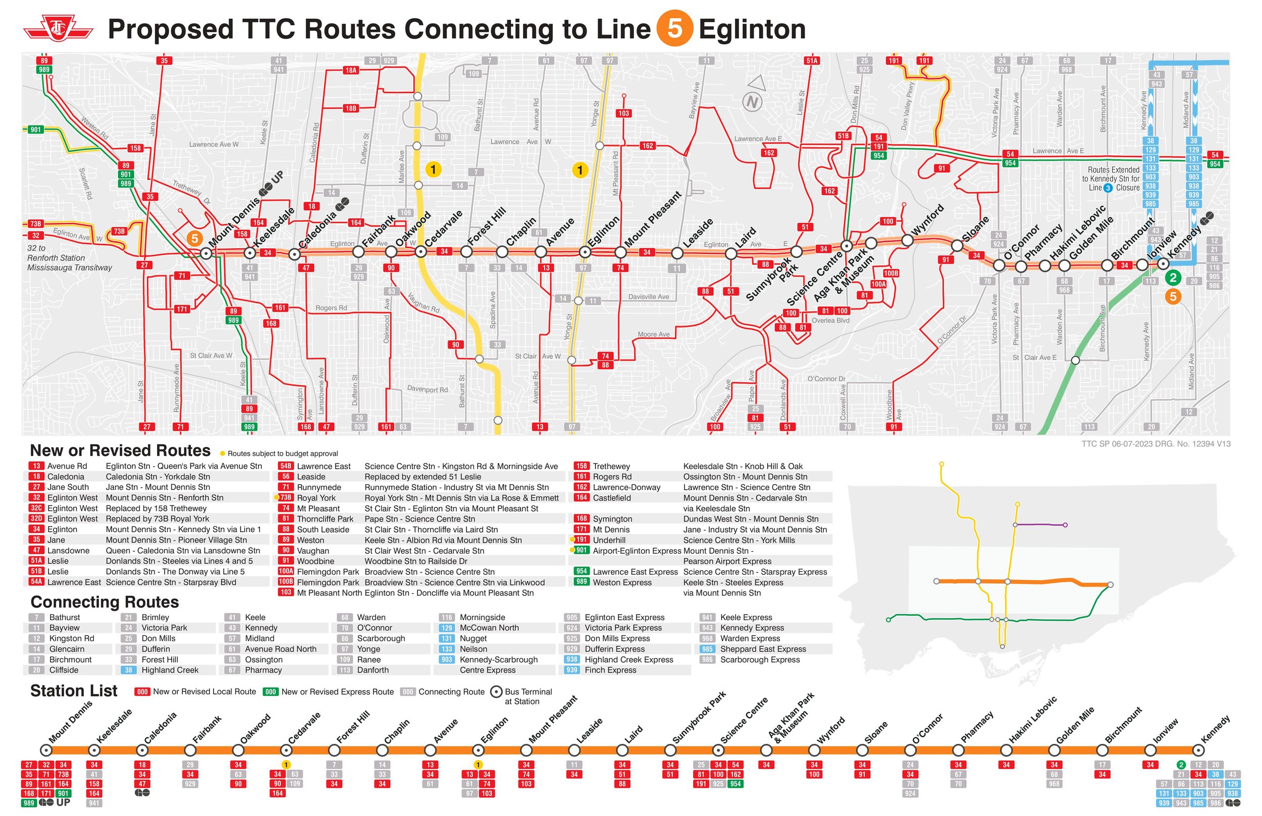
Notably on Sunday February 8, there will be significant changes to the bus network, including 2 discontinued routes, 13 route changes, and 4 new routes. Most notably, Routes 54 and 954 on Lawrence Avenue East will now terminate at Don Valley Station instead of at the subway at Eglinton Station. Route 35 Jane will no longer continue south of Weston Road, but will instead terminate at Mount Dennis (with new Route 27 Jane South taking over that southern section). The 47 Lansdowne will be split into two, with 18 Caledonia providing service north of Eglinton. Routes 51 Leslie and 56 Leaside will be merged (with a short 151 Leslie North bus on the north end), and the 32C branch will be replaced with the new 158 Trethewey bus. The map below shows how the TTC buses will connect with Line 5. (Route 901, between Mount Dennis Station and Pearson Airport via Dixon Road, has not yet been approved.)
Map showing TTC bus route changes; several of these were already implemented in late 2025. Only the 901 express route to Pearson Airport has not been approved.
I will certainly make time to check out Line 5 on Sunday, followed by a more fulsome review a week or two after opening to form an honest and thoughtful opinion.
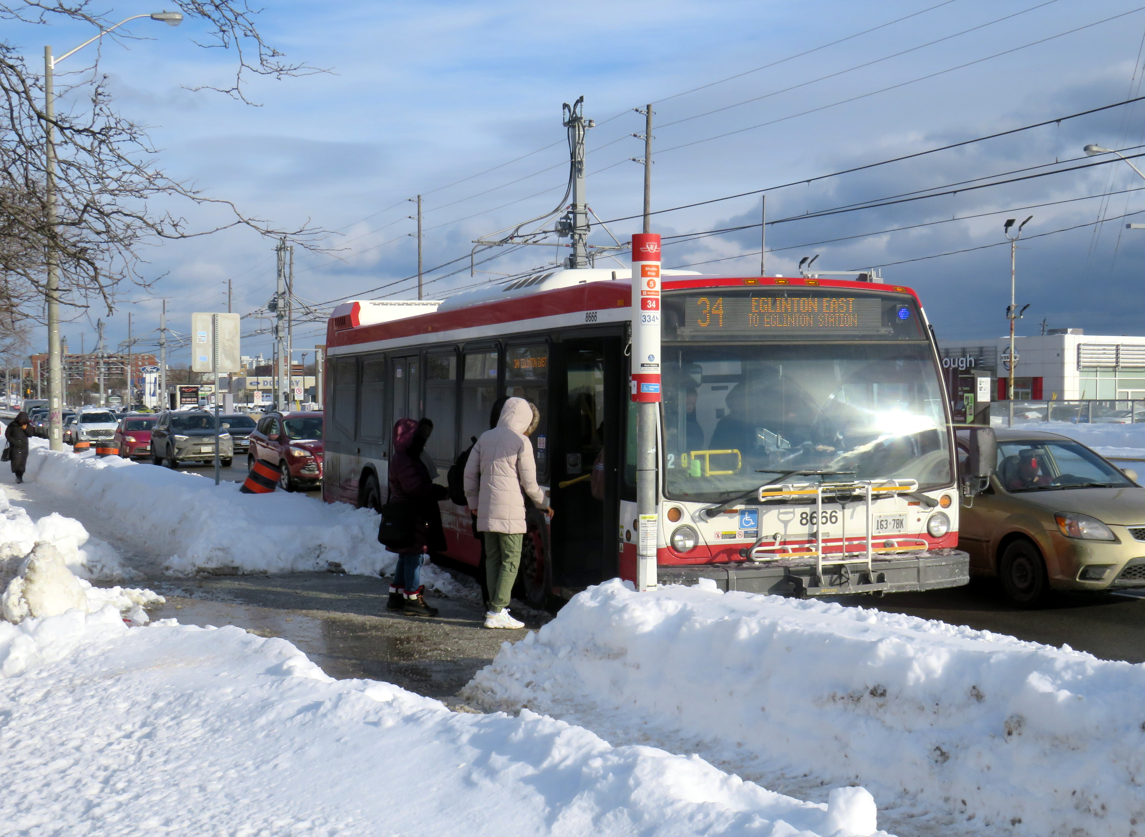
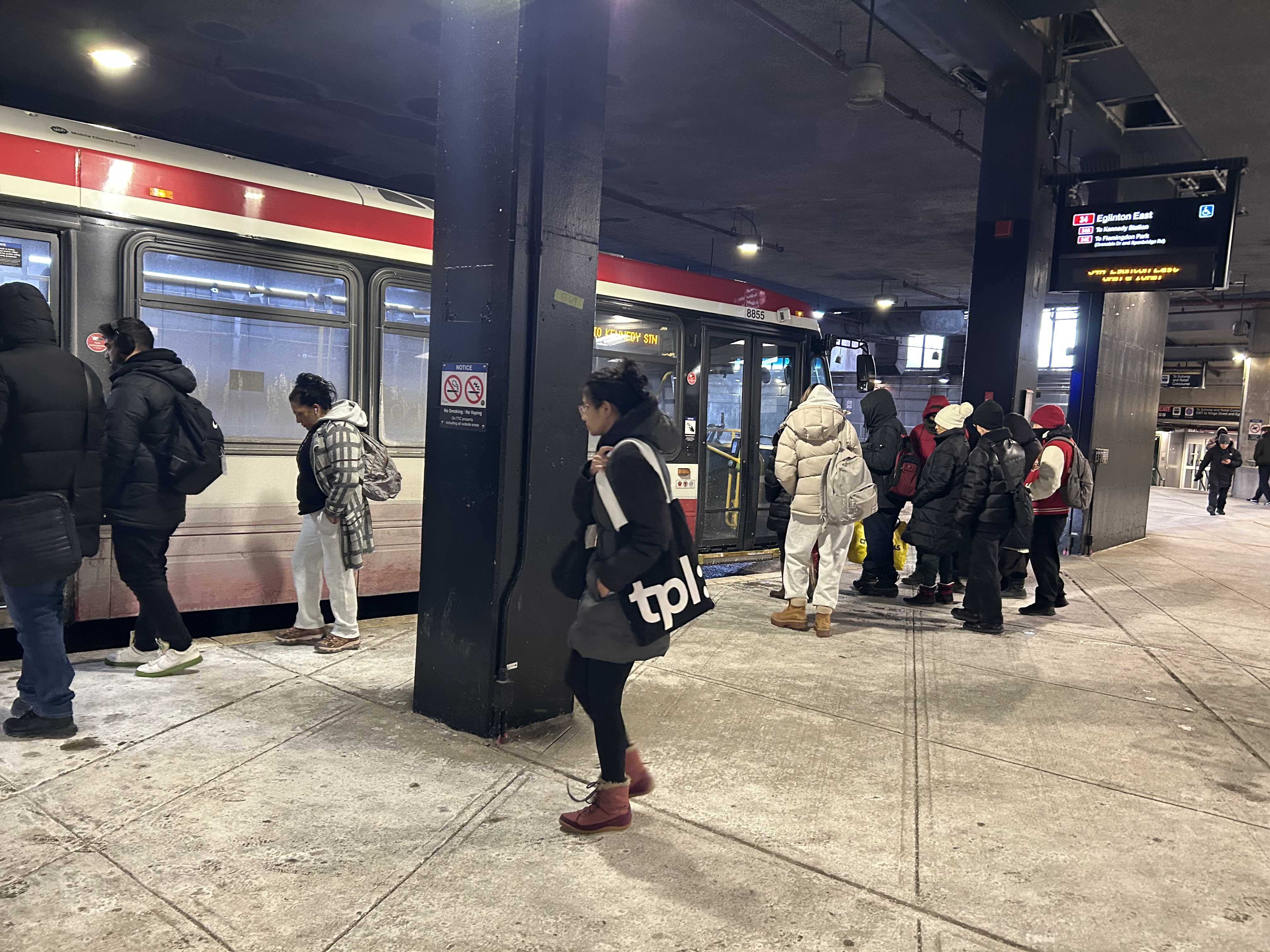
Passengers boarding the 34 Eglinton East bus, January 28, 2026
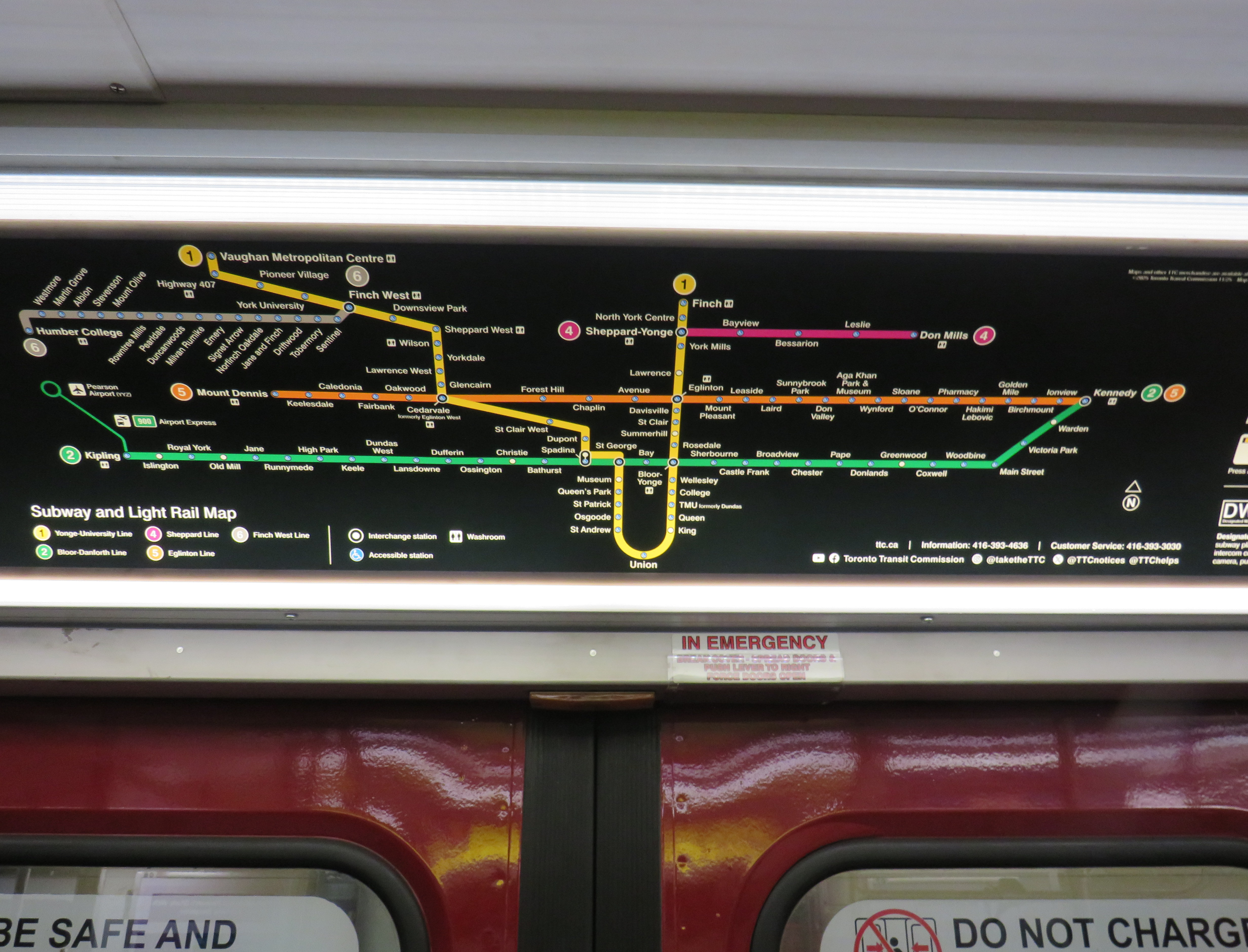
On Sunday, February 8, the long-awaited (and long-delayed) Line 5 Crosstown LRT will finally open to the public (or maybe not). The new line, 19 kilometres long with 25 stops, is nearly twice as long as the 11-kilometre Finch West LRT that opened in December.
Unlike the troubled Finch West LRT, the Eglinton-Crosstown line is largely underground, with twelve stations, from Mount Dennis to Laird, completely separated from road traffic. A western extension through central Etobicoke to the Mississauga border at Renforth will also be completely grade-separated. There are several other major differences: the Crosstown line will be more frequent than Finch West, and will have more capacity, with two-car trains operating at all times. The equipment will be different too: Bombardier Flexity cars, the same as those used in Kitchener-Waterloo, will make the up the trains. Furthermore, the underground section will be computer controlled (which might turn out to be a complication, rather than an advantage).
A light rail train passes traffic on Eglinton Avenue East in Scarborough
However, some aspects will be the same. The surface-running eastern section between Leslie Street and Kennedy Road will feature 10 outdoor stops and 16 traffic signals, though the LRT will dip below ground at Don Mills Road (formerly Science Centre Station, now Don Valley Station) and under Kennedy Road into the Kennedy Station transit hub. As with Finch West, this was a Metrolinx-led project with a private consortium in charge of construction and maintenance, with the TTC in charge of train operations. So it will be interesting to see how Line 5 fares.
With subway, light rail, buses, and GO trains, Kennedy Station is becoming a proper transit hub
In the meantime, just as with my visits to Finch West, I decided to see how long it takes to get across the LRT corridor. In May 2024, I walked the entire route over three days, getting to know the corridor better (while documenting my stroll on a social media platform that I have since abandoned). With rumours of a mid-winter 2026 opening, I decided to ride the buses to get further context and time the rides.
Congestion at Eglinton Avenue West and Oakwood Avenue, May 2024
Tuesday, January 20 was an ideal day to ride the 32 Eglinton West and 34 Eglinton East buses. That was several days after the last snowfall (and a few days before the next big dump), and the roads and sidewalks were completely clear. It was a bright, sunny (albeit cold) day, and there was only one short construction zone on Eglinton Avenue, near Caledonia Road. Though only a small number of riders would use the entire Crosstown LRT line as part of a regular commute, it was worth getting a sense of how long the trip would take between each station.
I started at Kennedy Station after taking a Stouffville Line GO train one stop from Union Station, rode the 34 Eglinton East bus all the way to Eglinton Station at Yonge Street, and then after a break (including a stop at Cinnabon), continued west to Mount Dennis Station, which is already open to GO and UP Express trains, as well as a few TTC routes. The last half of the ride coincided with high school dismissal times that resulted in some crowding, especially between Avenue Road and Dufferin Street.
From Mount Dennis, I returned eastbound during a busy weekday afternoon rush hour, transferring to the first available 34 Eglinton East bus at Eglinton Station all the way back to Kennedy.
Waiting for the 34 Eglinton East bus to Kennedy Station, January 20, 2026
The table below shows the timings at each LRT stop.
Westbound (read down)
Stop/Station
Eastbound (read up)
1:28 PM dep.
Kennedy
5:35 PM arr.
1:32
Ionview
5:30
1:34
Birchmount
5:28
1:37
Warden Ave. (Golden Mile)
5:24
1:39
Hakimi Lebovic
5:22
1:42
Pharmacy
5:20
1:43
Victoria Park Ave. (O’Connor)
5:18
1:46
Bermondsey
5:15
1:49
Wynford
5:08
1:51
Don Mills Rd. (Don Valley)
5:01
1:53
Leslie St. (Sunnybrook Park)
4:58
1:57
Laird
4:50
2:00
Bayview Ave. (Leaside)
4:48
2:04
Mount Pleasant
4:44
2:10 PM arr. 2:47 PM dep.*
Eglinton Station (Bus transfer)
4:39 PM dep. 4:32 PM arr.***
2:52
Avenue Road
4:25
2:54
Chaplin
4:19
2:58
Bathurst St. (Forest Hill)
4:15
3:03
Cedarvale Stn.
4:09
3:07
Oakwood
3:56
3:11
Dufferin St. (Fairbank)
3:51
3:18
Caledonia**
3:44
3:21
Keele St. (Keelesdale)
3:41
3:25
Mount Dennis
3:37 PM
87 minutes
Total ride time (inc. a 7 min transfer at Eglinton Stn.)
118 minutes
* This gap provided an opportunity to use the washroom, and get a coffee and snack ** Time noted at Blackthorn Ave, the closest stop to the LRT station entrance *** Took first 34A bus to Kennedy Station that departed Eglinton after my arrival; a 34C bus to Wynford Dr. and Flemingdon Park departed first
On the surface buses, the most significant traffic delays are near the Don Valley Parkway and Allen Road, especially eastbound between Oakwood Avenue and Cedarvale Station and between Don Mills Road and Bermondsey Avenue. For anyone crossing Yonge Street, the transfer between buses takes on average seven minutes including walking and waiting time.
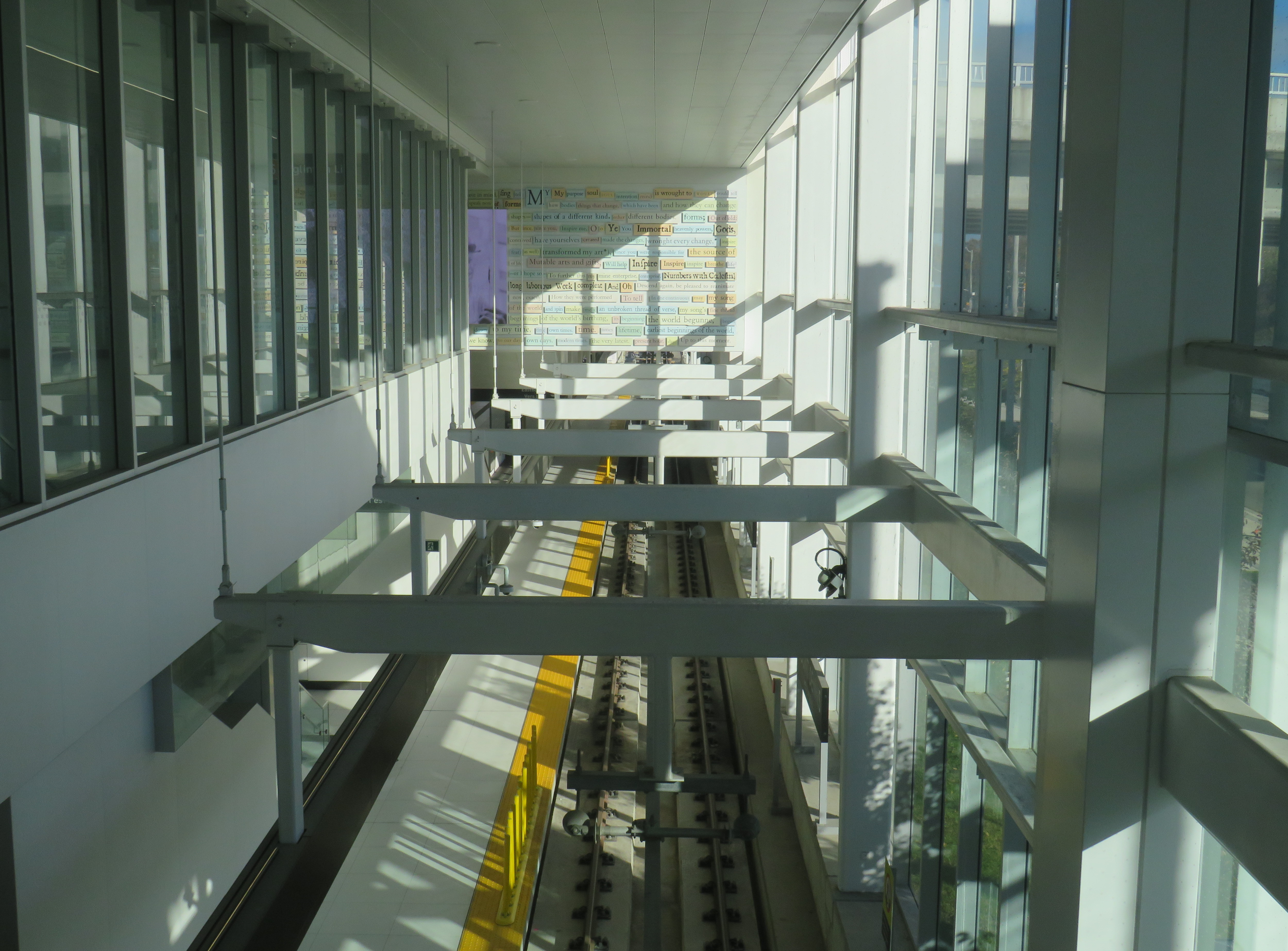
Line 5, the Eglinton Crosstown LRT, will run deep below the Line 1 University Subway at Cedarvale Station
The dedicated right of way should allow transit riders to get ahead of traffic congestion, especially around Allen Road, where the trains will run in a deep bore tunnel. In theory, the median right-of-way will help get passengers past congestion near the DVP and the big box retail in the Golden Mile, but if the trams are as slow through intersections as on Finch and held up by red lights, the advantage here will be minimal.
At Eglinton and Warden, I did see a traffic signal hold a green light a few extra seconds to allow a train to pass through before changing, so that was a positive sign. But watching the trains go by every few minutes, I noted that the transit priority system was not at all aggressive, and as on Finch, transit signals turn red 12 seconds before the general traffic signals do.
On January 28, Eglinton and Warden, the transit signals stayed green for a short extra time to allow the non-revenue LRT train to pass through and stop at the far-side platform. The train was moving at a more reasonable clip too.
The Eglinton Crosstown LRT, unlike Finch West, serves a regional need that requires better speeds and more capacity than a mere surface tram, especially as it will have many bus routes directly feeding into it, rather than just intersecting. Several bus routes that used to continue into Eglinton Station, such as 54 Lawrence East, will instead terminate at Don Valley (formerly Science Centre) Station, where riders going west to the subway will have to transfer. For inexplicable reasons, the short section between Don Mills Road and Laird will have one at-grade station with a signalized intersection, a weak link in what will likely be a very busy section of the line.
Map of planned changes to TTC bus routes with Line 5’s opening. Some of the changes, including the introduction of Route 164 Castlefield and the extensions of routes 79, 161, and 168 to Mount Dennis Station have already been implemented.
Hopefully, some of the lessons from the Line 6 opening will be applied to Eglinton before it opens. There should also be an opportunity, just as there is on Finch, to make further changes to operations where applicable during a “soft opening” period. But we can not afford yet another botched transit project, especially after 15 years of waiting.
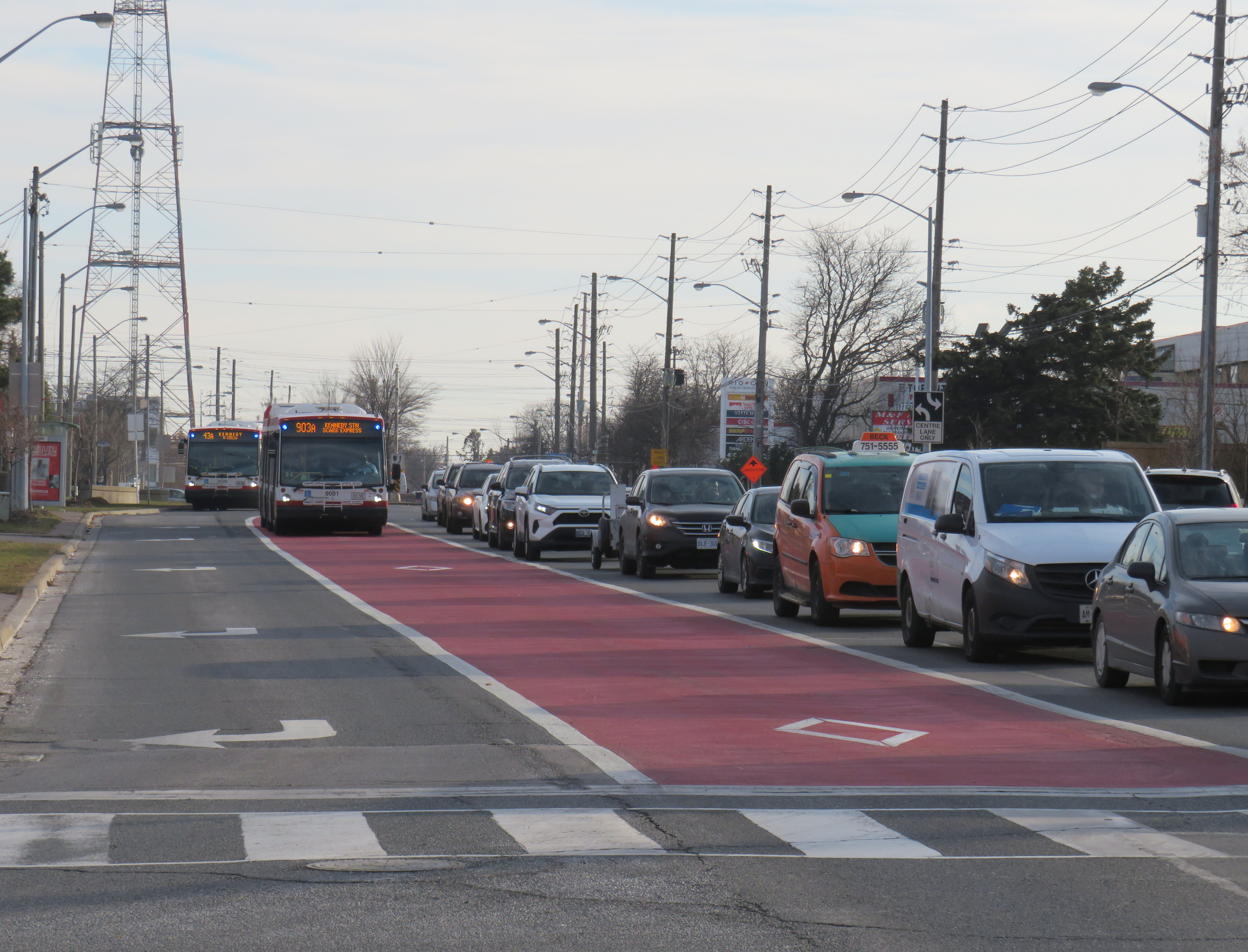
Adding priority bus lanes is one way to speed up transit across the entire city
Transit planning is a long-term endeavour, not a one-time project with a single solution. In a municipal election year, we need to demand more from leaders and those charged with planning and running transit services than simple soundbites that recall old political slogans.
In Spacing, I wrote about the trouble of resorting to catchphrases such as “subways, subways, subways” when our transit troubles are more widespread — yet also fixable. We simply cannot rely on a single solution to our transit woes.
December 7, 2025 may be a day that will live in transit infamy. That was the day Line 6, the Finch West LRT, opened to the public, and it did not go well.
First off, any discussion on the initial failure of Line 6 should acknowledge that was never designed to be a rapid, regional transit link. The LRT, serving Northwestern Toronto, was intended to be an upgrade to the slow, congested, and busy 36 Finch West bus, feeding into the rapid transit network at Finch West Station. Line 6 is a legacy of Transit City, a LRT plan proposed under previous mayor David Miller intended to connect the inner suburbs of Etobicoke, North York, and Scarbrorough to the subway and to each other.
As with all proposed Transit City routes (with the exception of the tunneled central section of the Eglinton-Crosstown LRT), there were always going to be compromises on Finch that would not make it a true rapid transit service. Situated almost entirely on the surface, Line 6 trains are easier for residents to access than subways in deep tunnels; closer stop spacing was intended so the new transit line continues to serve the needs of those who live, work, go to school, and frequent the corridor, without the necessity of a parallel local bus. Anyone expecting subway speeds were in for disappointment.
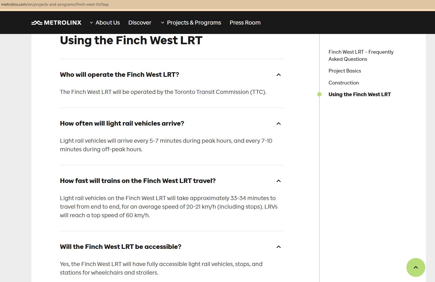
Still, the LRT was supposed to improve travel times over the existing bus, with wider stop spacing than the legacy streetcar network, a congestion-free right of way, signal priority, and decent operating speeds. With a promised average speed of 20-21 kilometres per hour, a total trip time of 33-34 minutes each way, it would have been a bit faster, more comfortable, and certainly more reliable than the bus. It was never going to be as fast as a subway, but for Finch Avenue West, that was okay.
Screen capture of a Metrolinx FAQ webpage, with frequent and relatively speedy transit service promised for the Finch West LRT. The webpage was still up as of December 18, 2025.
As the first modern LRT to open in the Greater Toronto and Hamilton Area (GTHA), Line 6 was to be a preview of additional lines planned and under construction elsewhere in the Golden Horseshoe, including the yet-to-open Line 5 Crosstown LRT, the Hurontario Line, the Hamilton LRT, and a proposed Line 7 on Eglinton Avenue East towards the University of Toronto Scarborough Campus and Malvern. Delivered by Metrolinx, the provincial transit agency, each line would be constructed and maintained by a P3 consortium, though the Toronto LRTs would be operated by TTC employees.
The hoped-for narrative that the provincial government, Metrolinx, the city of Toronto, and the TTC all touted — a smooth new ride, worthy of including on the subway maps — quickly fell apart on Sunday December 7, though there were plenty of warning signs of slower-than-promised operations.
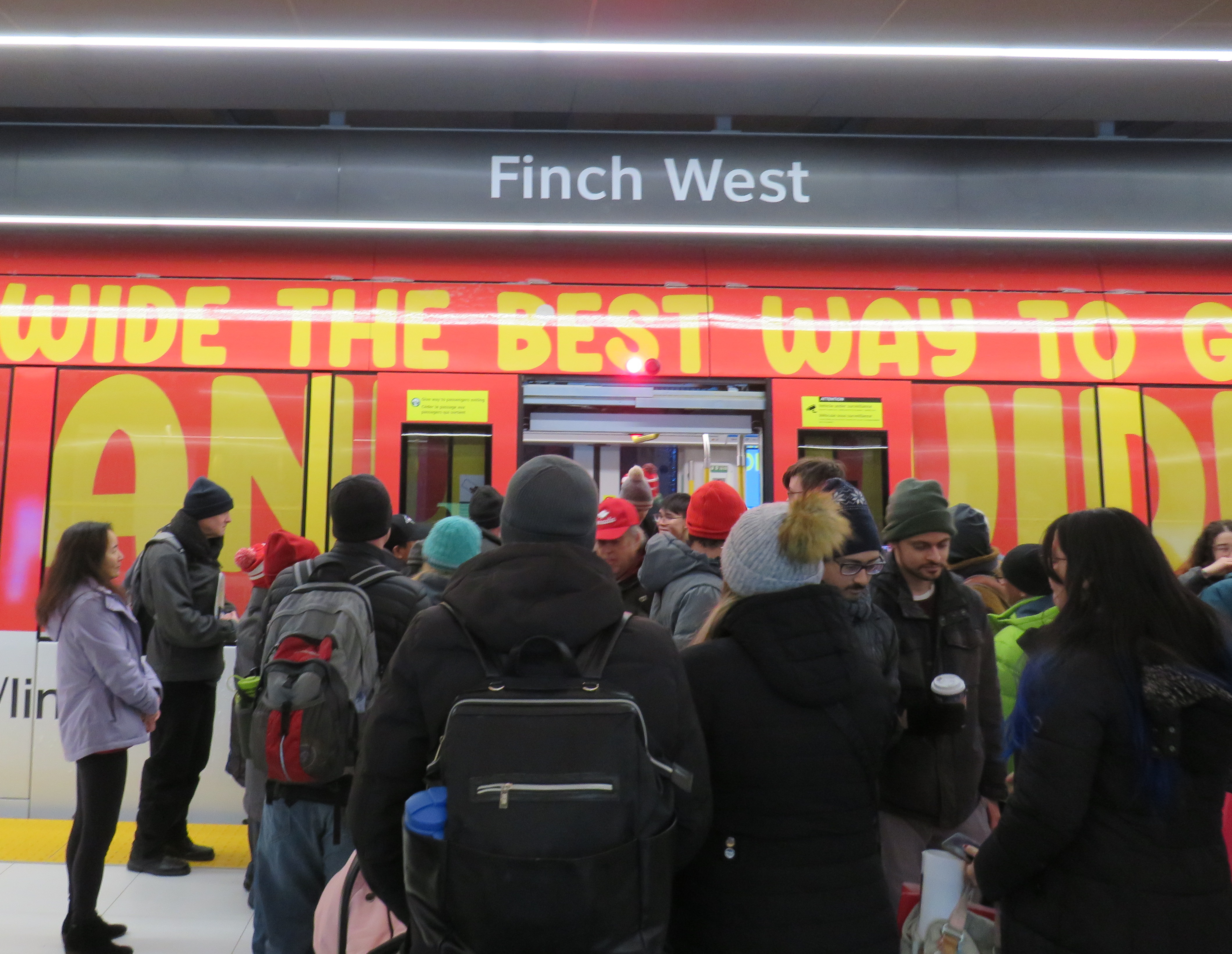
Opening day crowds on December 7. Passengers disembark from a wrapped LRV that touts Line 6 as “far and wide the best way to go far and wide.”
On Sunday, December 7, there were plenty of people eager to try the new LRT: railfans and urbanists, curious families, and local residents, lured by free fares on the opening day. Though I was there and took several trips, I wasn’t going to make too many judgements on opening day. There would be inevitable hiccups with the large crowds and cold, snowy temperatures. Still, there were visible problems.
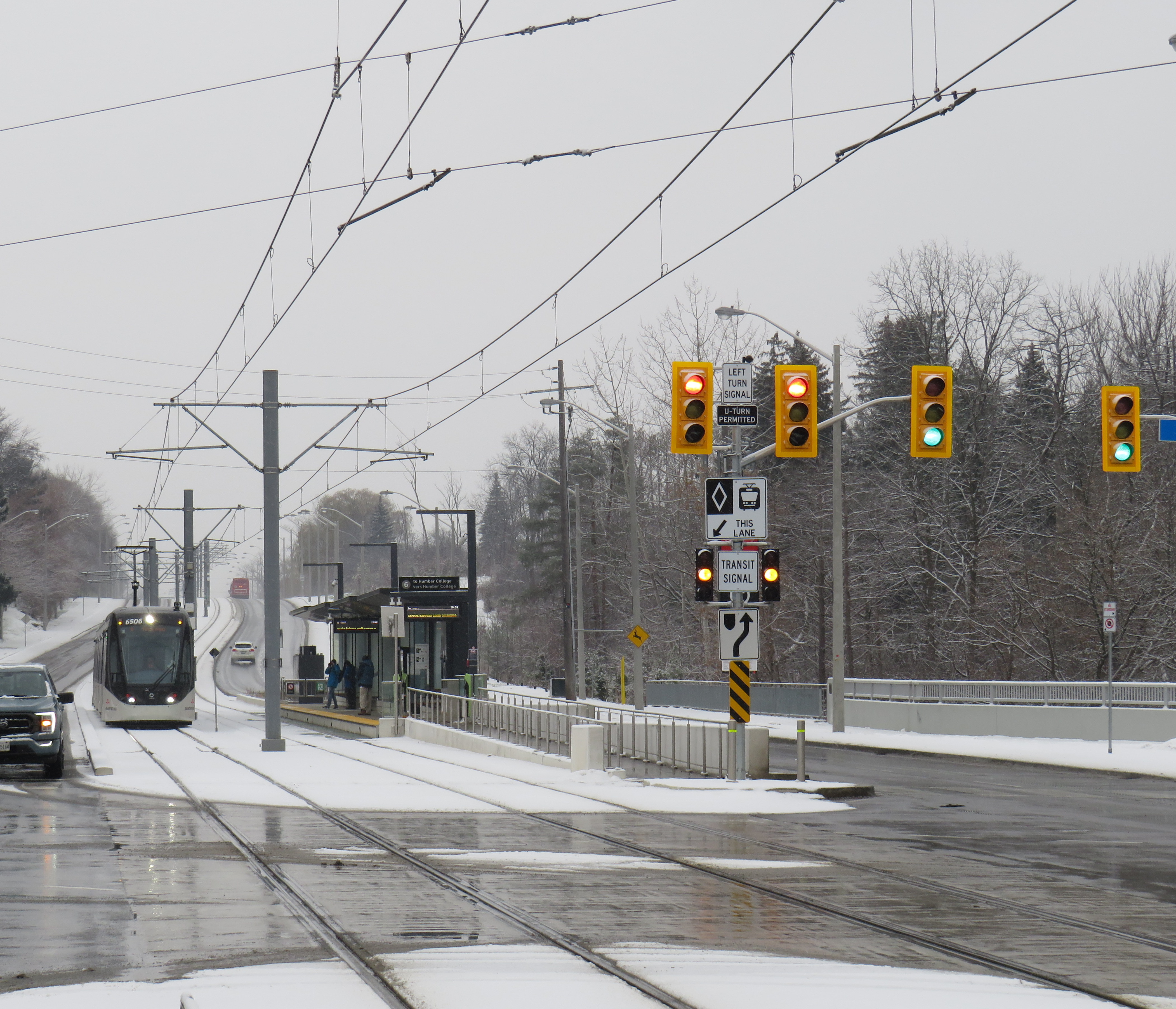
An eastbound LRV approaches Islington Avenue (Mount Olive Station) as the transit signal switches from green to amber. The traffic signals are still green.
So far, a lot of the post-opening discourse has been on operating speeds and traffic operations. Instead of 33-34 minutes, as claimed by Metrolinx, trips were taking 55 minutes each way. Additionally, the transit signal priority (TSP) system has not been activated, causing light rail vehicles (LRVs) to wait entire light cycles, even for private vehicles to turn left before proceeding. The dedicated transit signals turn red about 10-20 seconds before general traffic gets a red light, even as LRVs approach the intersections. On December 16, Toronto City Council approved a motion to implement “more aggressive” TSP on Finch West and the surface portion of the Line 5 Eglinton-Crosstown LRT, as well as on the legacy streetcar network.
The problem on Finch West is not just a matter of transit signal priority. The number of stops along the line, also criticized by several critics, is also not a problem, as Finch West was never intended to be a high-speed regional line. (That said, Mount Olive and nearby Stevenson could have been consolidated into a single stop west of Kipling Avenue.) The other problems are poorly managed schedules and streetcar-style slow zones on a modern LRT alignment.
Right now, LRVs are forced to slow to 25 km/h at all intersections, even though all conflicting traffic has a red light. This is an inexplicable restriction given that motor traffic, including TTC buses, have a 50 km/h limit, and many drivers will proceed at significantly above the posted limit. These restrictions are not found elsewhere in North America; in Calgary and Edmonton, LRTs are protected at many at-grade intersections with railway-style lights and gates. In places like Minneapolis-St. Paul and Phoenix, additional LED flashing signs warn drivers of an approaching LRV, which glides through the signalized intersection at higher speeds than on Finch. (There is also a lot less sign clutter, with intuitive signals for left turns and transit).
Transit schedules are also needlessly padded, with too much time for lower speeds and lengthy station stops. On a repeat visit to Finch West, on Wednesday December 17, 2025, travel times were inconsistent and slower then either 36C bus I took a few days before the LRT opened. (Even the trip with the long Starbucks pitstop.)
Line 6 travel times on Wednesday Dec. 17
Eastbound (read down)
Stop/station
Westbound (read up)
12:59 PM (dep.)
Humber College LRT Station
12:31 PM (arr.)
1:03
Westmore Dr.
12:25
1:05
Martin Grove Rd.
12:22
1:10
Kipling Ave. (Mt. Olive)
12:13
1:14
Islington Ave. (Rowntree Mills)
12:09
1:26
Weston Rd. (Emery)
11:57
1:29
Arrow Rd./Signet Dr.
11:54
1:33
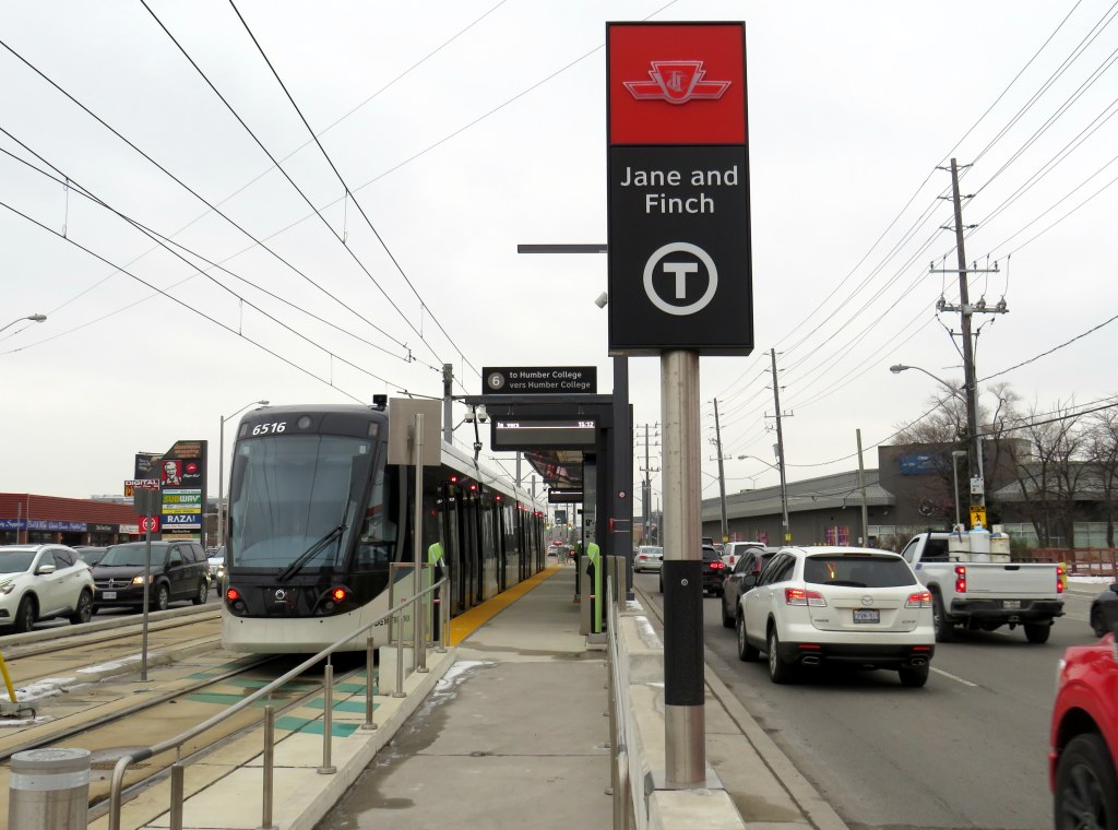
Jane and Finch
11:46
1:37
Tobermory Dr.
11:35
1:45
Sentinel Rd.
11:32
1:48 PM (arr.)
Finch West Stn. (LRT Terminal)
11:27 AM (dep.)
49 minutes
Total time
1 h 4 minutes
It took eleven minutes to go two stops, less than a kilometre, from Tobermory Drive to Jane Street on the westbound trip. Lengthy station dwell times at Tobermory (five minutes) and Mount Olive (three minutes) on that westbound ride, with no onboard announcements was especially frustrating. The return eastbound trip from Humber College was 15 minutes faster, even with much of the same slow zones at intersections and switches, the 10 km/h curve near Humber College Station, and lengthy stops.
With such unpredictable and unreliable service, Line 6 is running at least as badly as the downtown streetcar routes. Without immediate fixes, people will completely lose faith in the TTC and future LRTs, including Eglinton-Crosstown. We can not just rely on tweaks to signal times; we need a complete review and overhaul of streetcar and LRT operating practices.
At least we know what can and should be fixed before the Eglinton-Crosstown line opens, a much longer LRT route that will have a regional transit role.
One more thing…
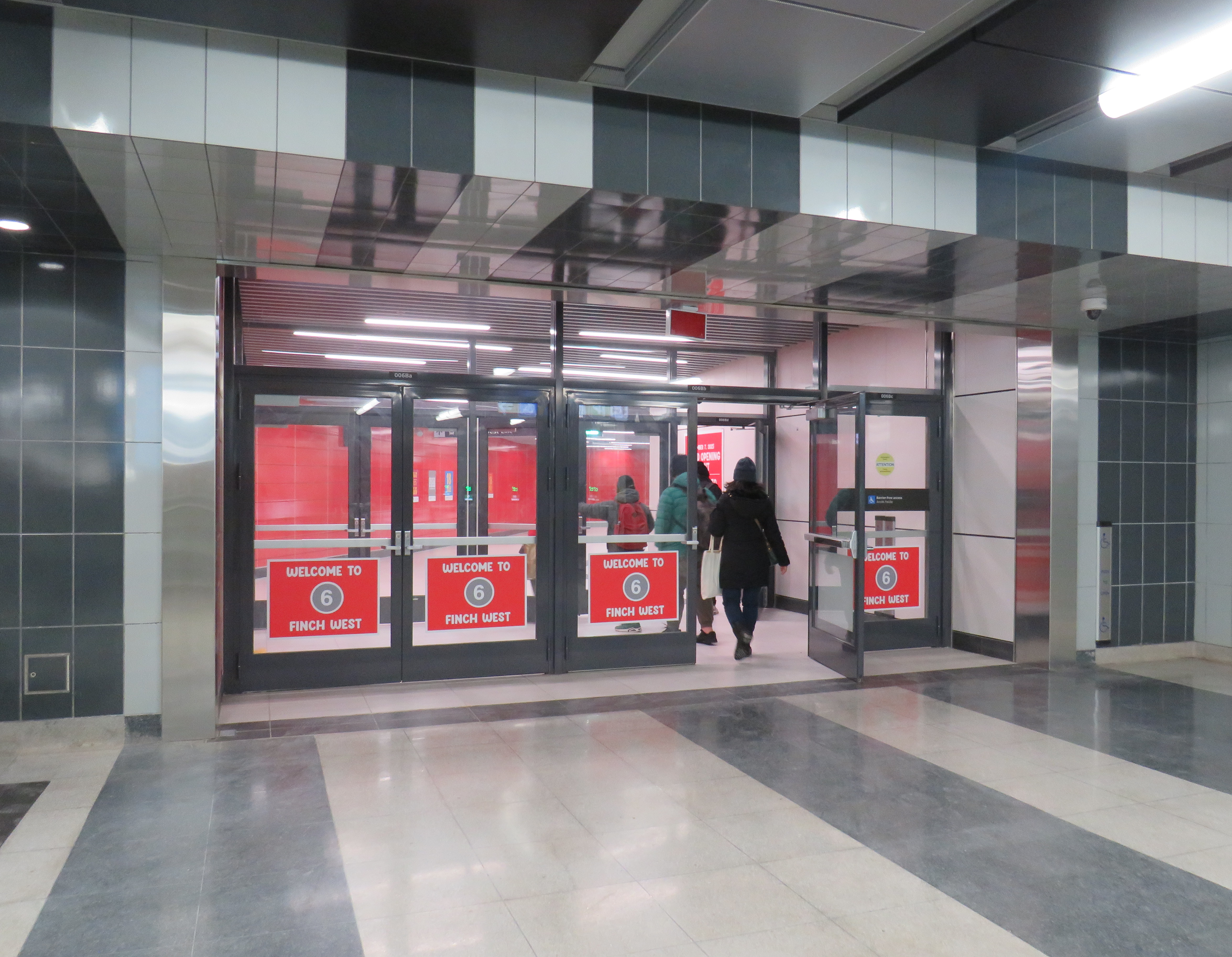
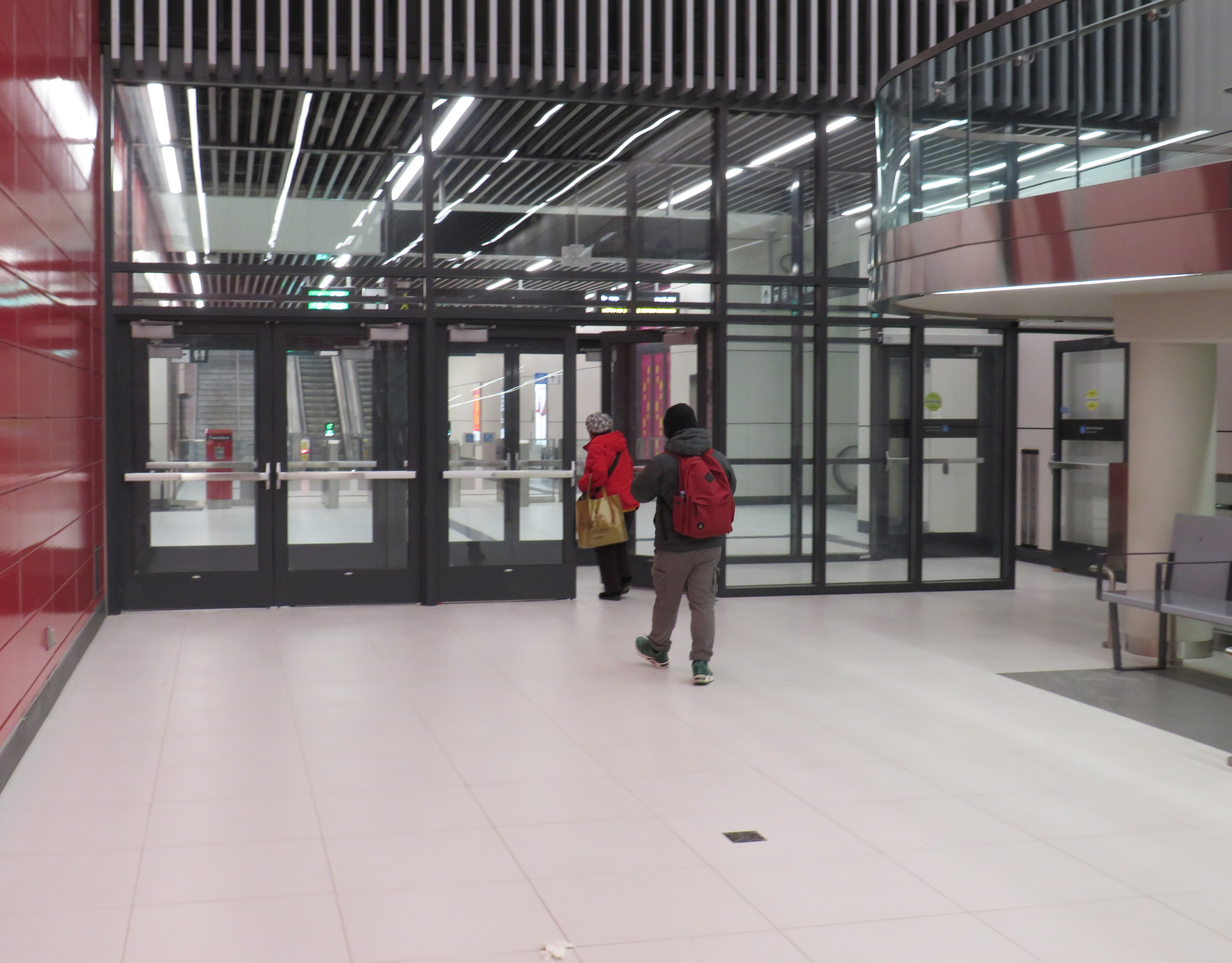
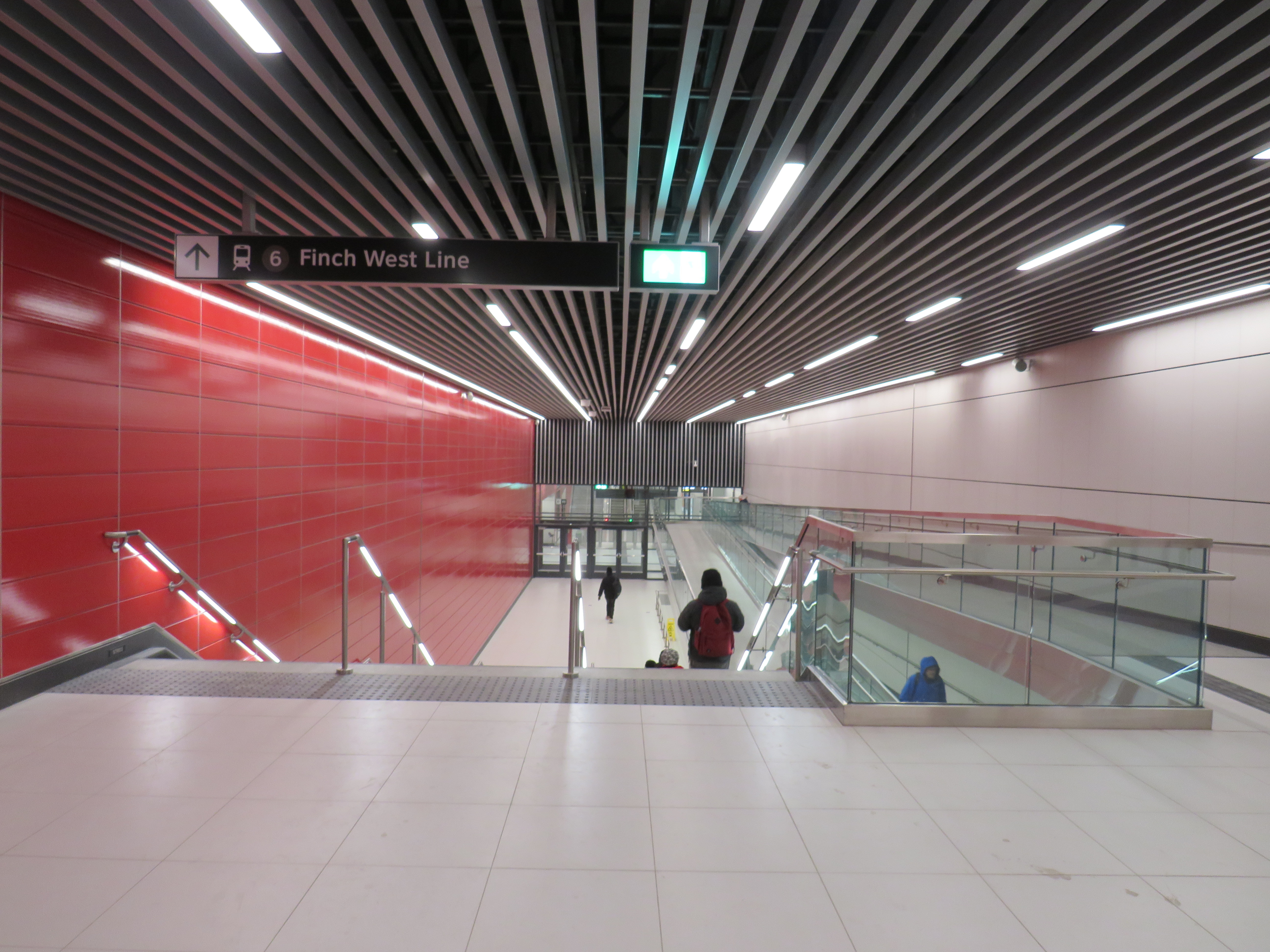
What is with all the doors between the Line 1 subway station and the LRT terminal at Finch West. Passengers have to pass through four sets of doors to transfer between two TTC services, as well as ascend one escalator or elevator, walk down one set of stairs (or navigate a long and circuitous ramp) and then ascend another escalator or elevator to get to the other platform.
Stairs or a long, circuitous ramp between the doors from subway to LRT
Though transfers can be tricky, at the very least, these doorways should be kept open, and shut only during station closures or during fire alarms, as done in hospitals or shopping centres. Other TTC stations have no such barriers between modes or may have a single door to exit a subway station terminal to the bus platform. Automatic sliding doors could have also been an option. Instead, the powered doors are left to one side, with the button against the wall. It’s not an ideal design from an accessibility point of view.
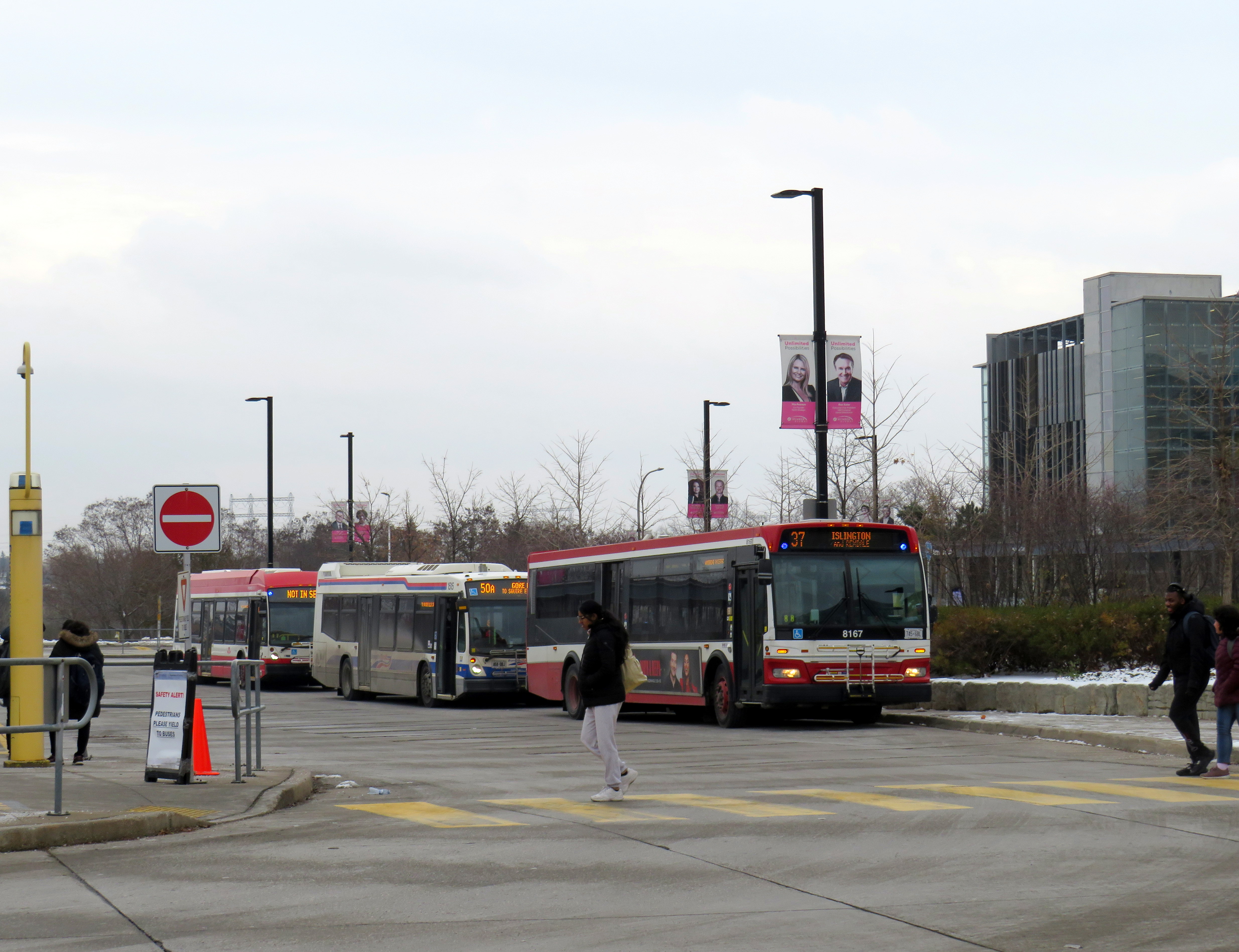
Two Line 6 LRVs cross Jane Street at Finch Avenue, December 3, 2025 as training wraps up ahead of revenue service on December 7
Can a brand-new light rail line outrun the local bus it replaces? Starting on Sunday, December 7, Torontonians will get the chance to find out when the new Line 6 Finch West light rail line finally opens to the public. Though built and maintained by Metrolinx, the service will be operated by TTC employees.
The new LRT, 11 kilometres long, with 18 stops, runs almost exclusively in a transit-only median on Finch Avenue West between Finch West Station at Keele Street in North York and Highway 27 in Etobicoke. The end terminals are below grade, with three traffic signals skipped. Otherwise, the light rail vehicles will be subject to stopping at the same traffic lights as all other cars, trucks, and buses.
New maps in the TTC subway system show the long-delayed Line 5 Eglinton-Crosstown (opening date still TBD) and Line 6, which opens Sunday December 7
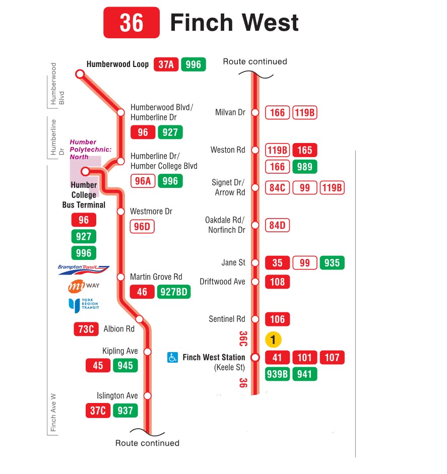
For the last few weeks, Finch West has been served by the 36C bus, running between Finch West Station at Keele Street and Humberwood Loop near the Mississauga border, making a stop at the Humber College bus terminal. A separate 36 Finch West bus continues east from Finch West Station to Finch Station at Yonge Street. There will only be eight fewer stops on Line 6 than there bus stops between Finch West Station and Humber College; apart from overnight service, there will be no parallel local bus serving the corridor.
Map of the Route 36C Finch West-Humberwood service, modified from the TTC’s original
Without limited stops and signal priority, the new light rail line will not achieve any real time savings. On his website, transit advocate Steve Munro notes that the end-to-end time of the new Line 6 LRT is scheduled for 46 minutes, consistent across all operating time periods. The 36C’s fastest round trip times, late evenings and early Sunday mornings, is between 79 and 82 minutes, or 40-41 minutes one way on a slightly longer route.
To see this for myself, I visited Finch Avenue West and rode the 36C both ways between Finch West and Humber College. Wednesday, December 3 was an overcast and cold day, with the daytime high temperature hovering around the freezing mark. But the roads were clear and dry, with no collisions and little construction work in the way of traffic on Finch; conditions couldn’t be any better for early December.
Here were the times for the two buses I took. I started timing the runs as soon as the bus doors closed and departed the originating stop; waiting times at the initial stops were not included.
TTC Route 36C travel times on Wednesday Dec. 3
Eastbound (read down)
Stop/station
Westbound (read up)
12:07 PM (dep.)
Humber College bus loop
1:50 PM (arr.)
12:11
Westmore Dr.
1:37**
12:13
Martin Grove Rd.
1:24
12:18
Kipling Ave. (Mt. Olive)
1:29
12:20
Islington Ave. (Rowntree Mills)
1:19*
12:28
Weston Rd. (Emery)
1:11
12:33
Arrow Rd./Signet Dr.
1:09
12:38
Jane and Finch
1:04
12:42
Tobermory Dr.
1:01
12:44
Sentinel Rd.
1:00
12:51 PM (arr.)
Finch West Stn. (bus terminal)
12:57 PM (dep.)
44 minutes
Total time
53 minutes
* At Islington Avenue westbound, the bus was delayed by five minutes by a troublesome passenger ** At Westmore Drive westbound, the operator left the bus with twelve passengers on board to order coffee at a nearby Starbucks, resulting in a second delay of nearly ten minutes
The eastbound departure, leaving Humber College at 12:07 PM, made it to Finch West Station in 44 minutes, two minutes faster than the scheduled LRT trip. This bus, an articulated (18-metre) vehicle was relatively busy, with a few standees between Jane Street and Finch West Station, and most en route stops were made. There were no unusual delays; just some traffic near Highway 400; it also took two light cycles to complete the left turn from Finch to Keele approaching the subway station.
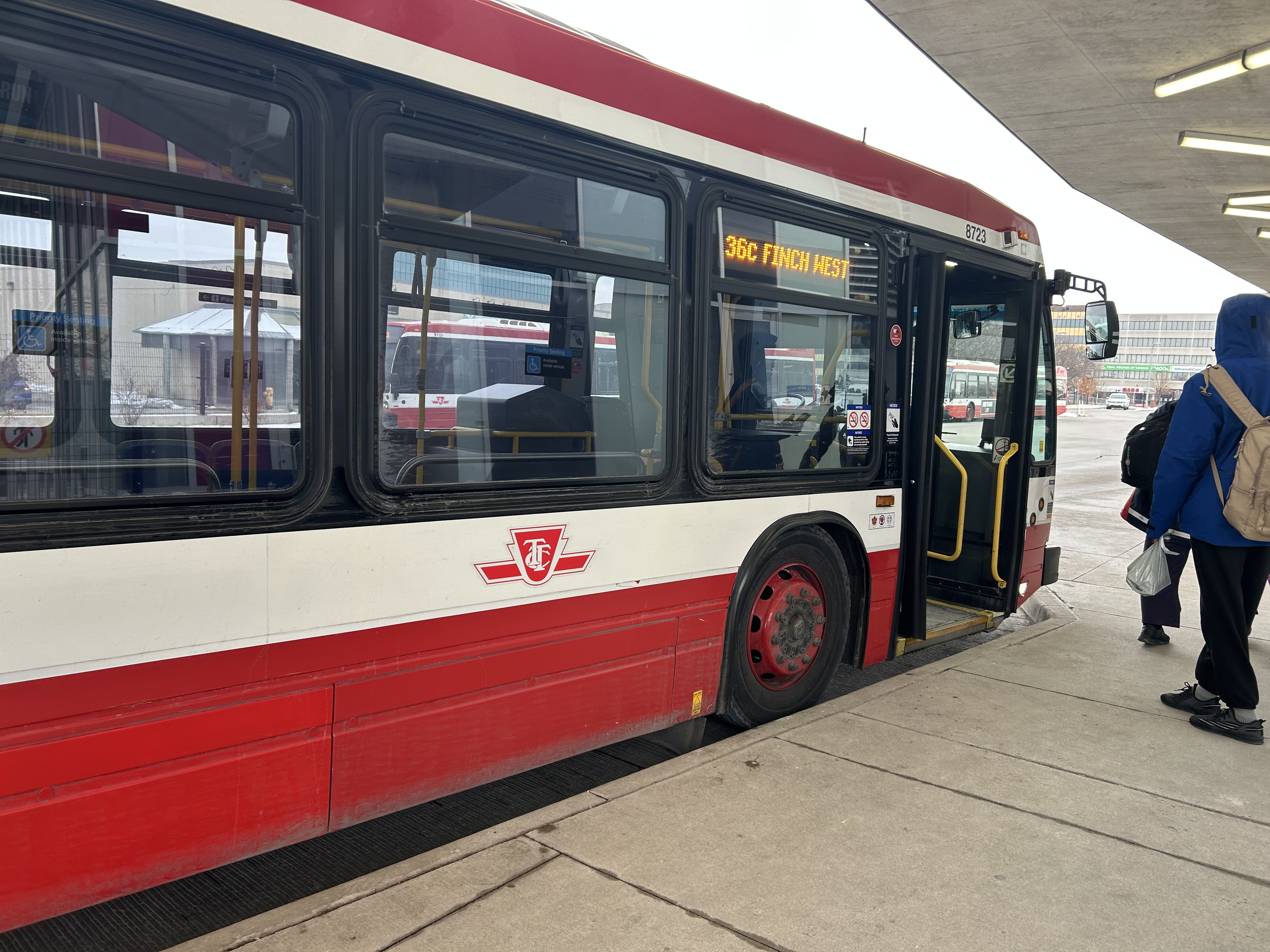
Westbound 36C bus waiting to depart Finch West Station
I returned towards Humber College on a different bus that left Finch West Station at 12:57 PM. For a while, this run, a standard 12-metre bus, was making exceptionally good time, with only a few passengers on board. It skipped several bus stops as no one wanted on or off until Tobermory Drive. Line 6 LRVs will stop at every station, just like the subway, even if there aren’t any waiting passengers.
At Islington Avenue there was a delay caused by a prospective passenger who rushed through a don’t walk/red light to get the bus, despite another one close behind. As the passenger was using a mobility device, the bus operator had trouble deploying the ramp because the bus had already inched ahead of the bus stop pad, ready to proceed with the green light. The driver needed to reposition the ramp and wait for the next green, which resulted in a five-minute delay.
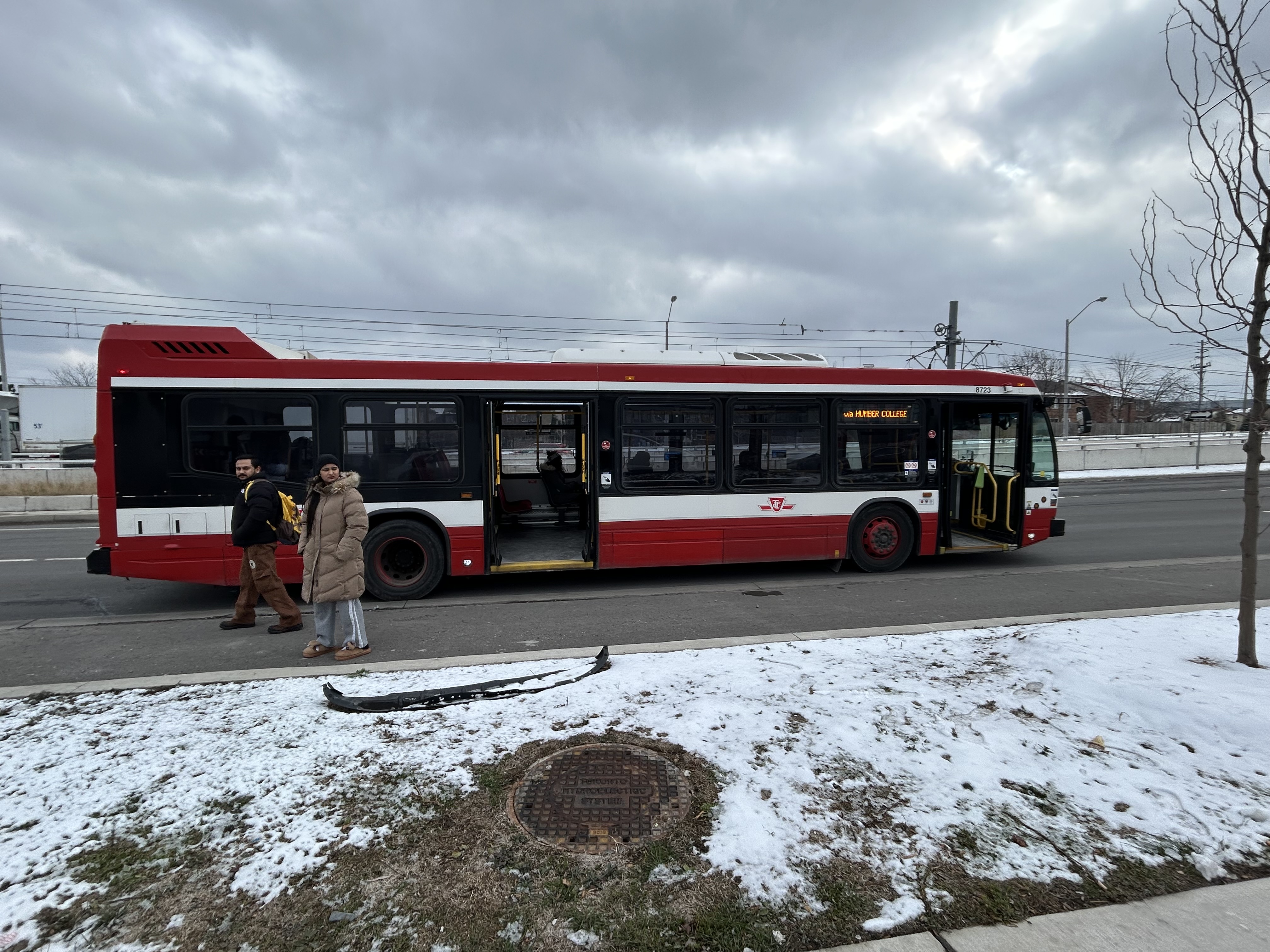
Another delay came a few minutes later, when at Westmore Drive, just one stop before the Humber College bus terminal, the operator left the bus without notice and walked into a nearby Starbucks. After a few minutes, and seeing two other westbound 36C buses pass by, most passengers exited the open doors to flag down the next bus.
Passengers leave an unattended Route 36C bus on Finch Avenue West at Westmore Drive. The portal for Line 6 LRVs to descend under Highway 27 towards Humber College is behind
The TTC operator returned eight minutes later, and we finally arrived at Humber College Bus Terminal at 1:50, 53 minutes after departing Finch West Station. (It’s worth noting that Humber College also has a Starbucks and public washrooms in the main building near the bus loop.)
At least that’s one instance where the LRT will certainly be faster than taking the bus.
A longer walk, a longer wait
TTC and Brampton Transit buses layover at Humber College
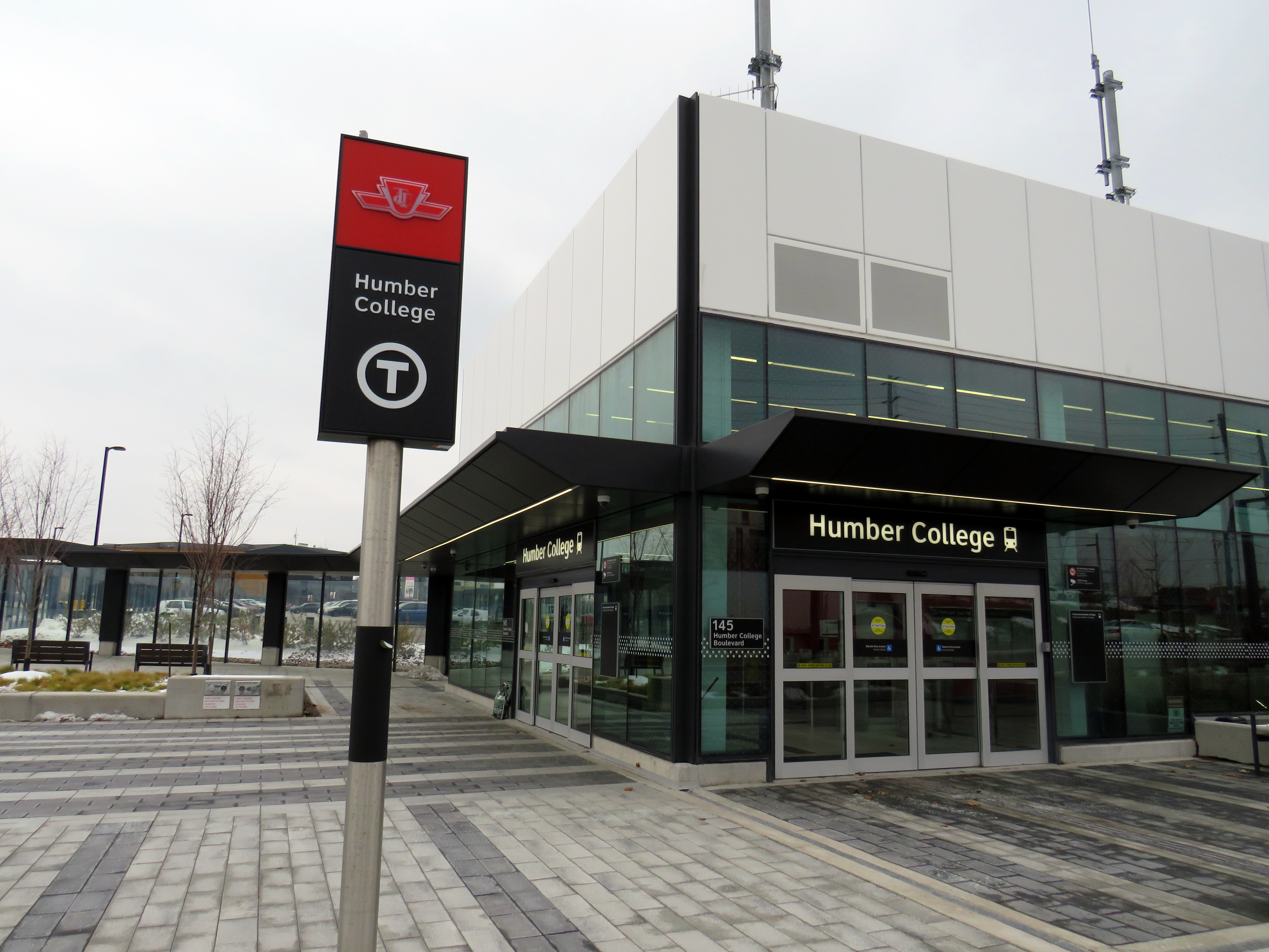
Humber College’s bus terminal serves a total of nine TTC, Brampton Transit, Miway, and YRT routes. It’s also a connection point between TTC Wheel-Trans and Peel Region’s TransHelp paratransit services. But the LRT terminal station is a five-minute walk away from the terminal, which is adjacent to several primary buildings on campus.
A walkway leads between the bus terminal and LRT station, with partial shelter provided by a long canopy that blocks northerly winds, but not the prevailing westerly winds. At the end of the walkway is the entrance to the below-grade LRT platforms, which are parallel to nearby Highway 27. This alignment reduced construction costs over a longer approach to the college, but it permits a future extension to the planned Woodbine GO Station two kilometres to the south and even Pearson Airport.
Humber College Station entrance, at Highway 27. The walkway to the bus terminal and main campus is behind.
During weekday peak periods, the LRT will run every 6 minutes, about as frequent as the current 36C bus during weekday daytime periods. However, during off peak times, trains will only come every 10-12 minutes, resulting in longer waits. Anyone travelling from Humber College will have to factor in the longer walk and potentially longer wait time.
I will certainly go out on Sunday December 7 to celebrate the opening of this new line, which despite the unnecessarily slow speeds, will result in a more predictable and more comfortable ride, with significant capacity improvements during peak periods, especially at school dismissal times. LRT doors will line up with the platforms, making loading and unloading easier for passengers with mobility devices, strollers, or carts.
I will also go ride the LRT after the opening day crowds are done, to see how it works in day-to-day operation. There are ways to speed up the schedule: more aggressive transit priority, shorter station dwell times, quick turnarounds at the terminals with “step back” operation, schedule optimization, and I hope these are considered by Metrolinx, the TTC and the city as everyone gets used to the new transit line.
If you like my work and you would like to help out with my webhosting costs (I just had to renew my ad-free WordPress subscription), consider buying me a coffee.Thank you!
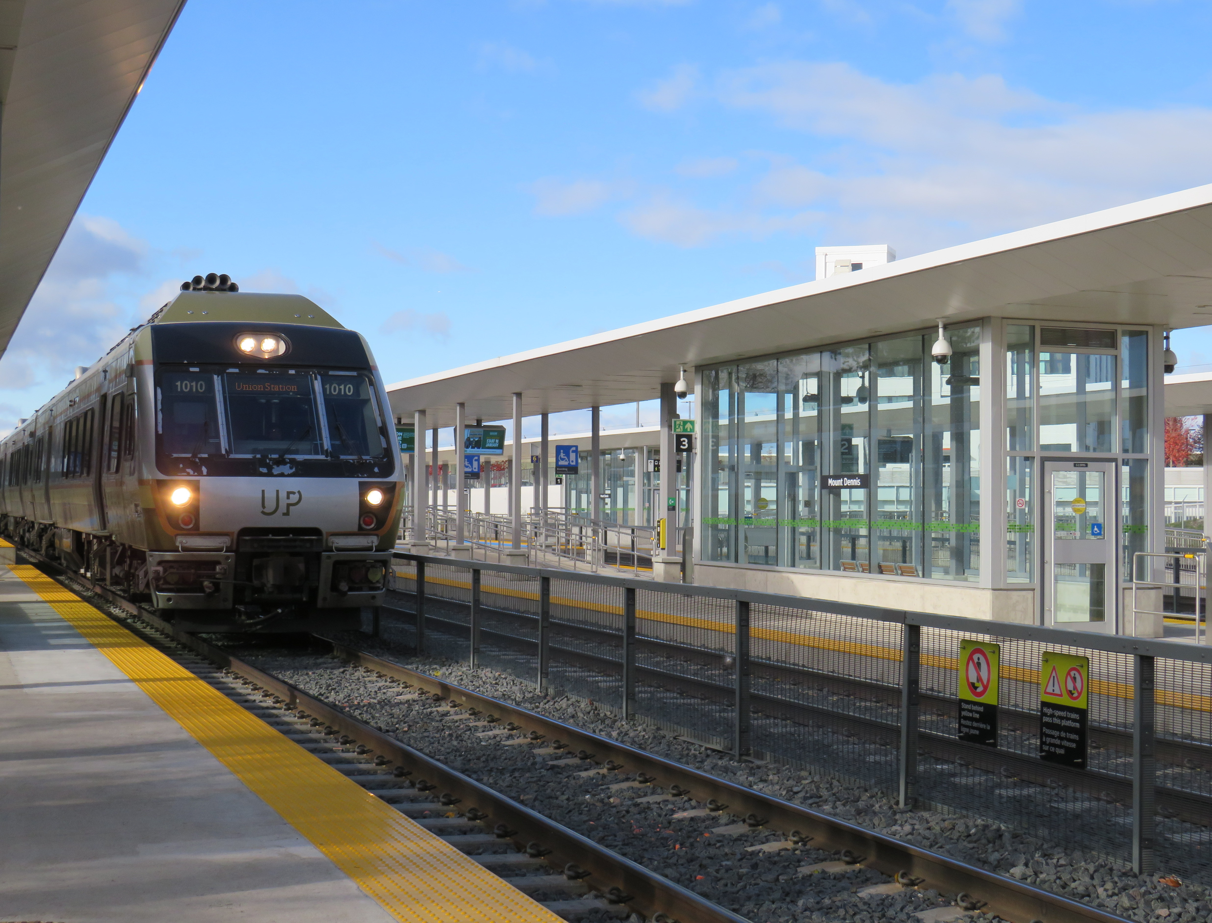
While Montreal was celebrating the opening of another portion of its REM automated light metro system between Gare Centrale and Deux-Montagnes on the region’s north shore, Torontonians had to settle for the partial opening of two light rail stations on the delayed Line 5 Eglinton line: Mount Dennis and Cedarvale.
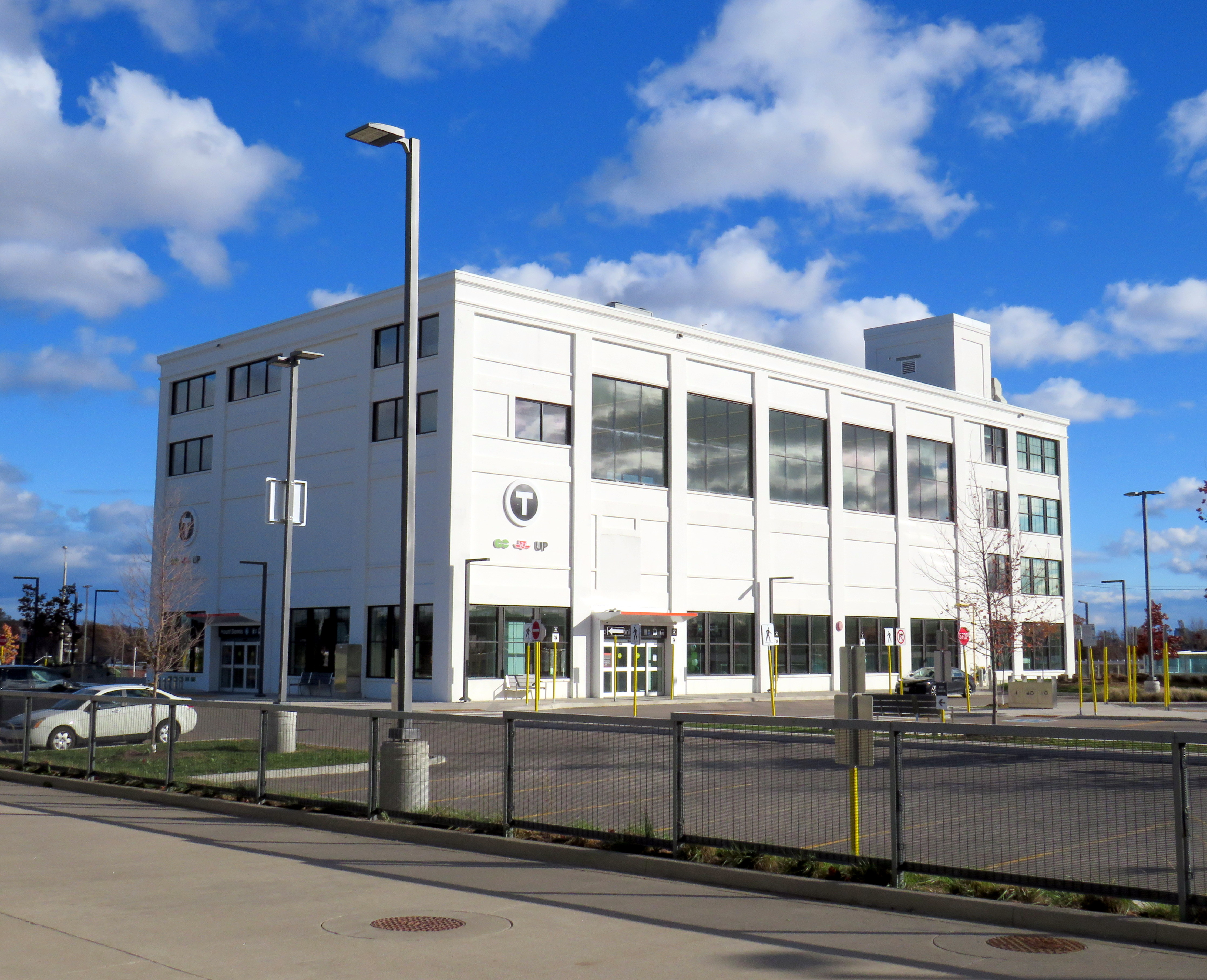
While the opening of Cedarvale (apart from the light rail platforms) slightly improved circulation at the existing Eglinton West Station, Mount Dennis Station provides for a new GO Transit and UP Express stop, a large TTC bus terminal, and access to a historic Kodak building. It’s an interesting structure that facilitates new intermodal connections, but could definitely benefit from a few minor improvements.
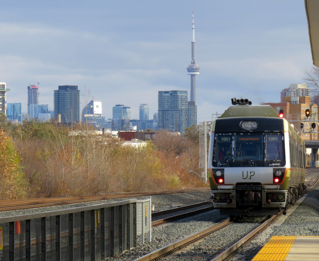
An UP Express train leaves Mount Dennis for Union Station, with the Toronto skyline in the background
The Mount Dennis and Weston neighbourhoods were established around major industries, including CCM, Moffat Stoves, Willys-Overland, Dominion Bridge, Kodak, with even more employment at the nearby stockyards and slaughterhouses at St. Clair Avenue. The CN and CP railways passing through brought materials in and finished goods out. Today, only the Facelle tissue plant — now owned by Irving — remains in operation from that industrial past. The Dominion Bridge property later became the home of a TTC bus garage, while the Kodak plant became the site of the Eglinton Crosstown light rail storage and maintenance facility.
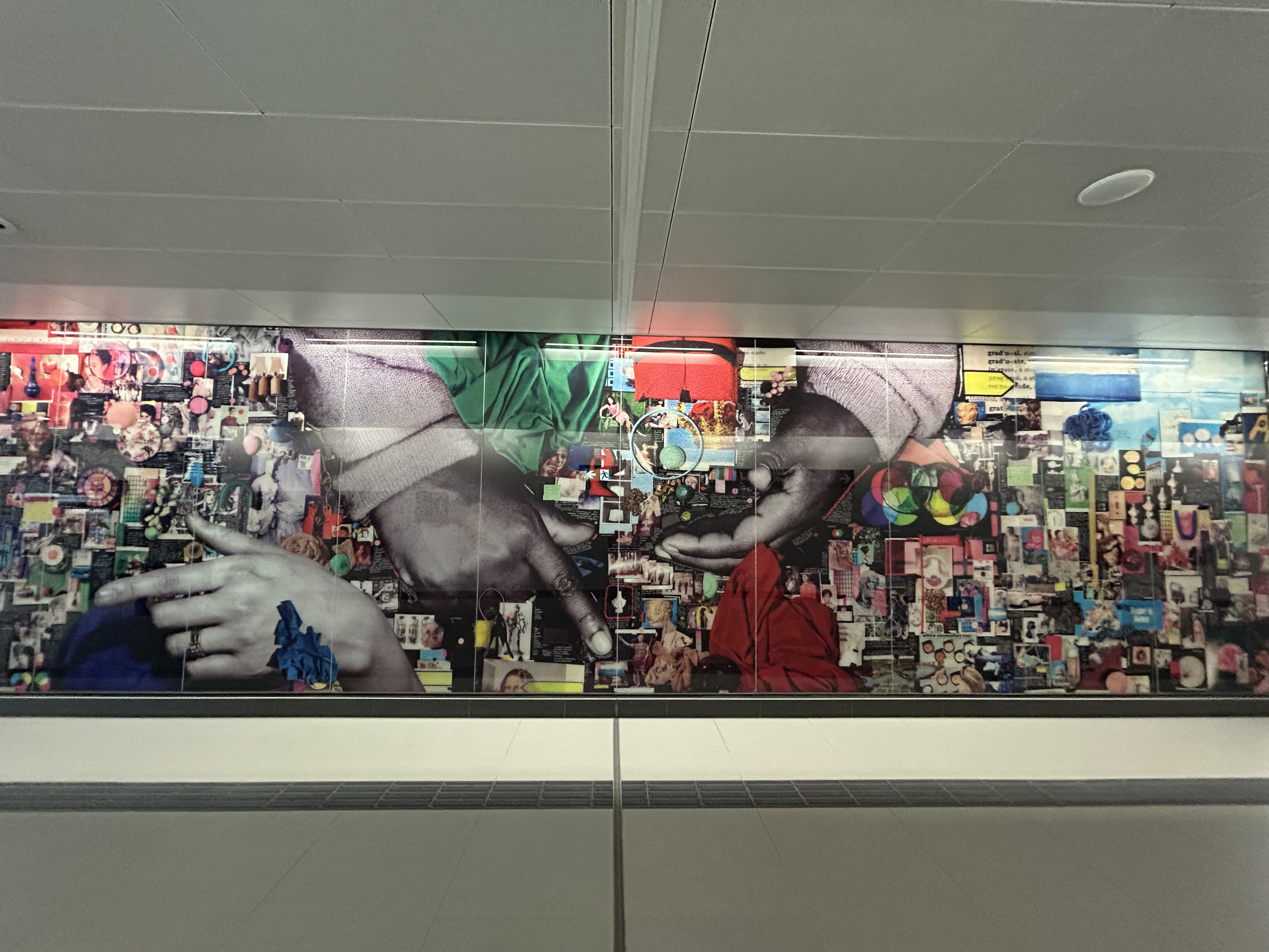
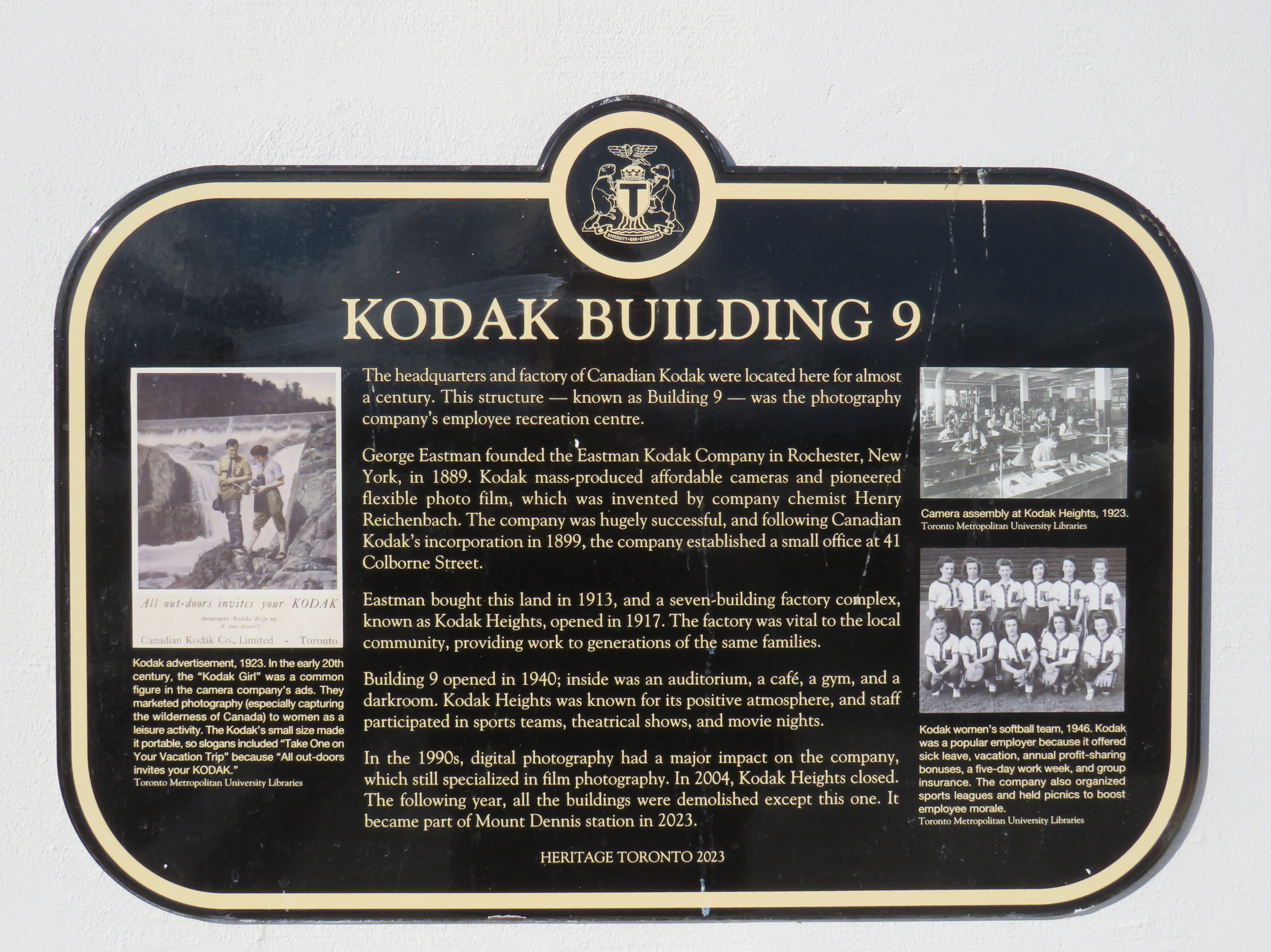
One building from the massive Kodak complex was preserved: Building 9, the employee recreation centre. The rear section of the main floor contains a public entrance to the station from the passenger pick-up and drop-off area, accessible washrooms, and access to the rest of the building (which is currently vacant). A bright mural, which once graced Building 9, can be found near the GO/UPX platform accesses. A heritage plaque tells the story of the building.
Mount Dennis Station platforms and Kodak Building 9Building 9, as seen from the TTC bus terminal. Note the Metrolinx “T” icon, with the logos of three services – GO, TTC, and UP – below.The GO/UP Express section of the station is brightened by a colourful mural saved from Kodak Building 9Heritage Toronto Plaque affixed to Kodak Building 9
As UP Express and most GO Kitchener Line trains now stop at Mount Dennis, approximately three extra minutes is added to train trips. UP Express, which took 25 minutes between Pearson Airport Terminal 1 and Union Station, now takes 28 minutes. On the first day of stopping service last Sunday, very few passengers got on or off UP or GO trains (of the few that did, most appeared to be transit enthusiasts), but with more TTC bus connections and the Line 5 service hopefully coming soon, the station should become much busier.
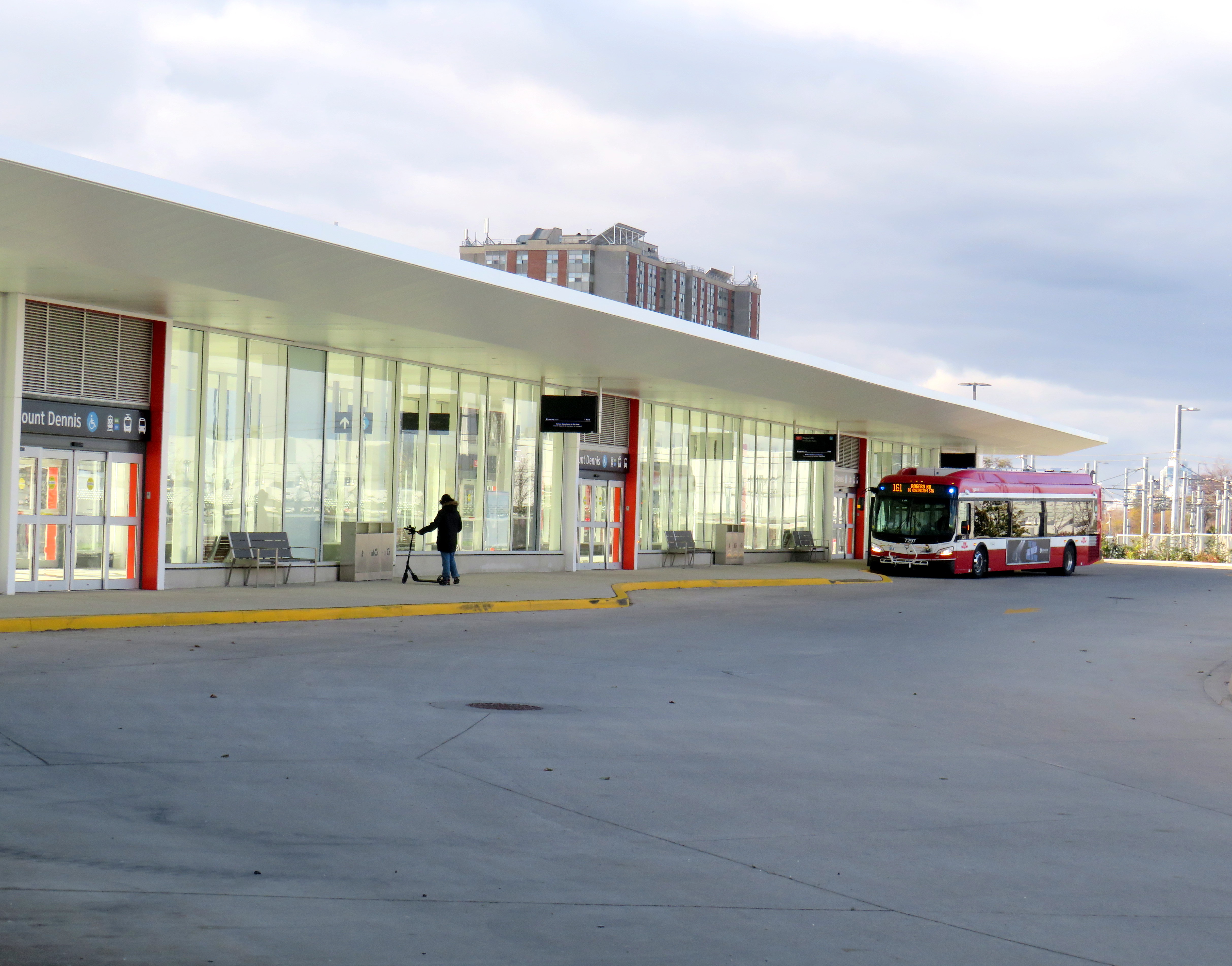
Mount Dennis Station was mostly empty on its first dayA mostly empty Mount Dennis bus terminal currently serves six routes; this will increase to 13 when Line 5 finally opens
Mount Dennis will be served by 13 different bus routes when the station is fully open, including a new route 901 express between Mount Dennis and Pearson Airport, via Dixon Road. Though most of the changes are simple route extensions to the new terminal (like the 161 and 168), the 35 Jane will be split into two (while the 935 express stays on Jane, bypassing Mount Dennis), and daytime surface service on Eglinton between Mount Dennis and Kennedy Stations will be limited to an infrequent Route 34 bus.
Map of planned bus network revisions upon opening of Line 5 (click for larger image)
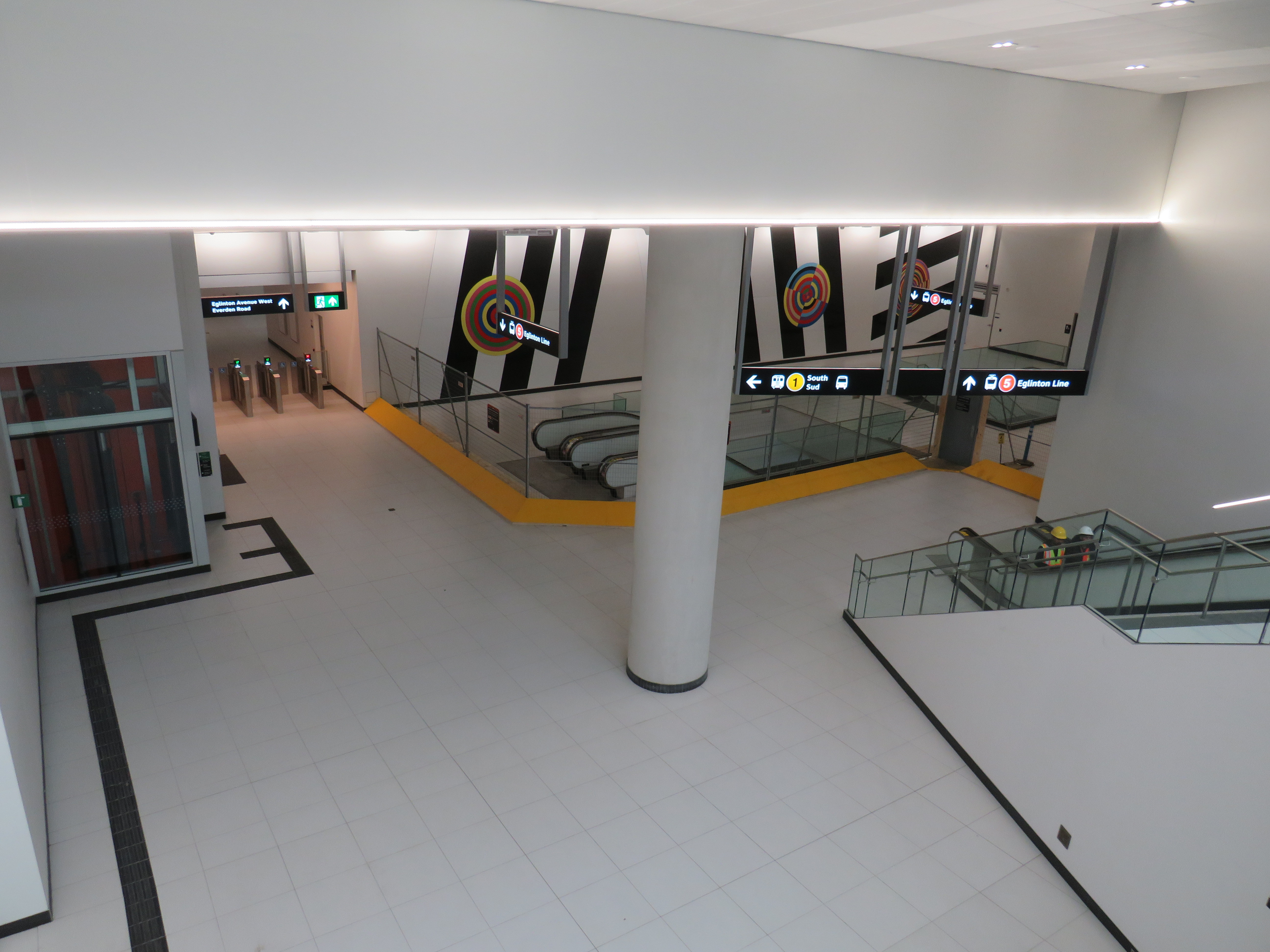
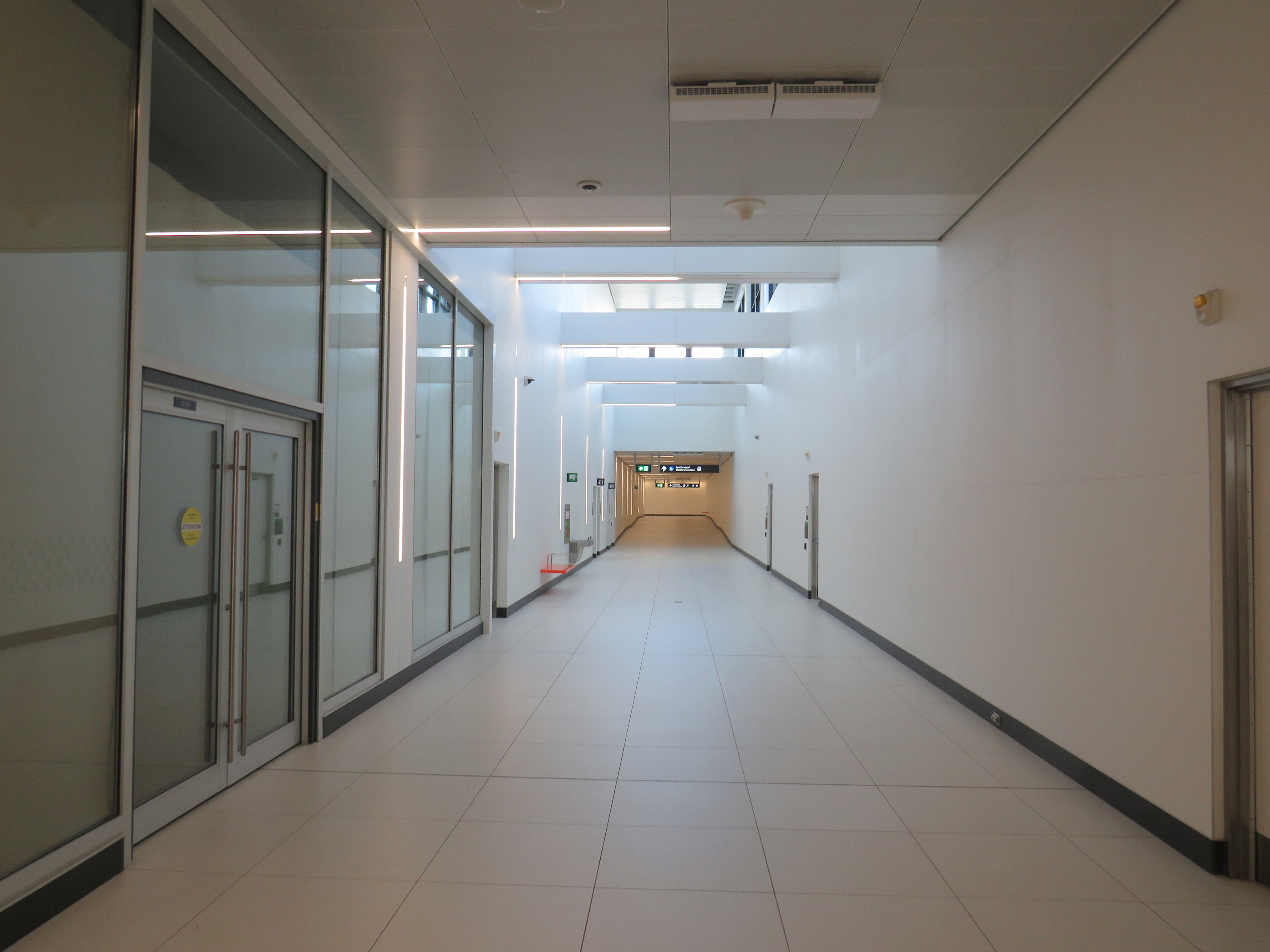
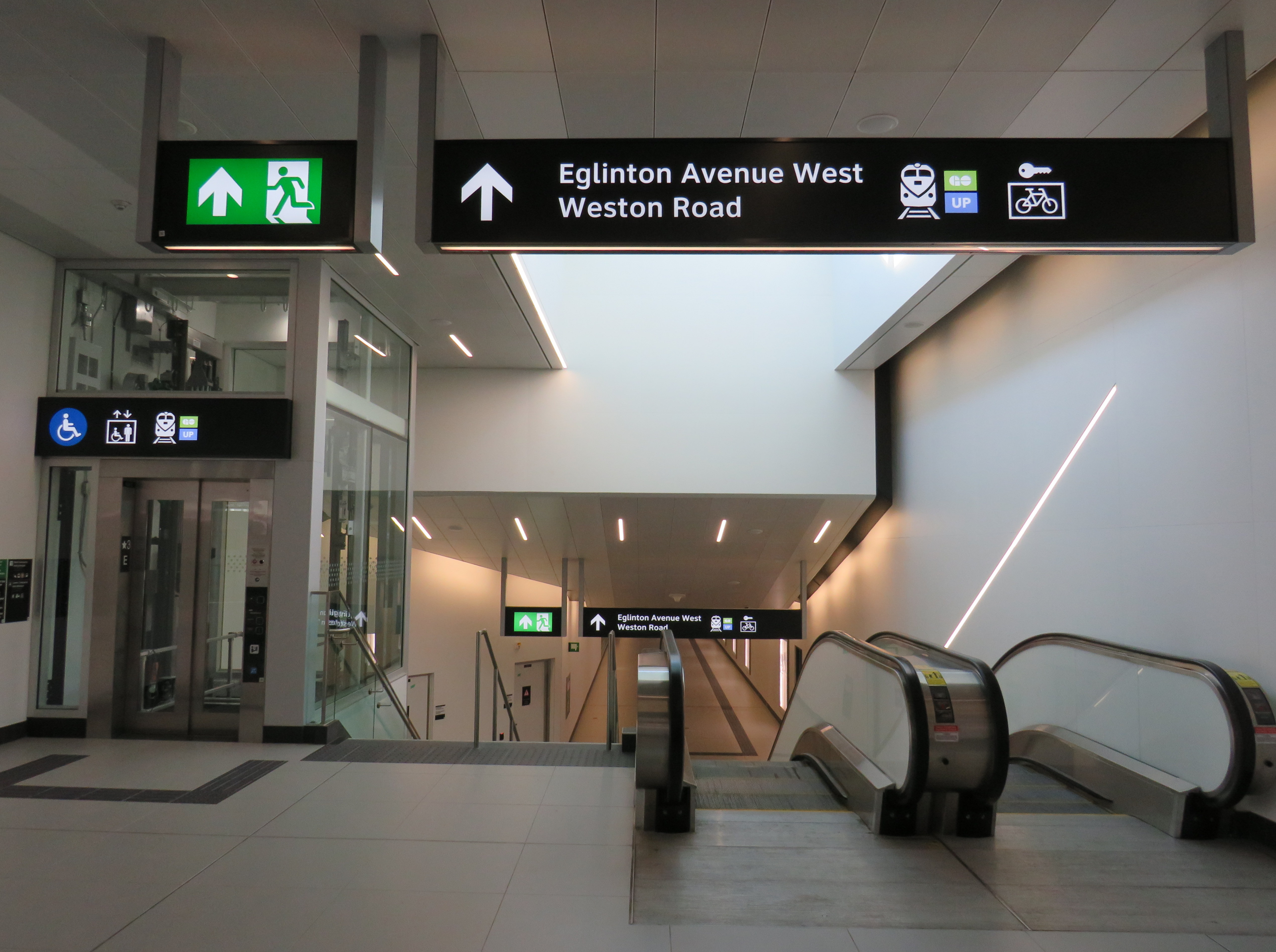
Despite some long corridors (particularly between the escalators up to the bus terminal and down to the closed-off LRT platforms), the station is well designed for the complexity of the site. The bus terminal and LRT platforms are both within the fare-paid area, eliminating one barrier between buses and rail.
Corridor towards the elevator and escalators from the TTC fare gates and LRT to the bus terminal. The natural light comes in from the large windows of Building 9. Public washrooms are on the left, past the windowed room, presumably a future retail space.Looking down to the LRT platforms
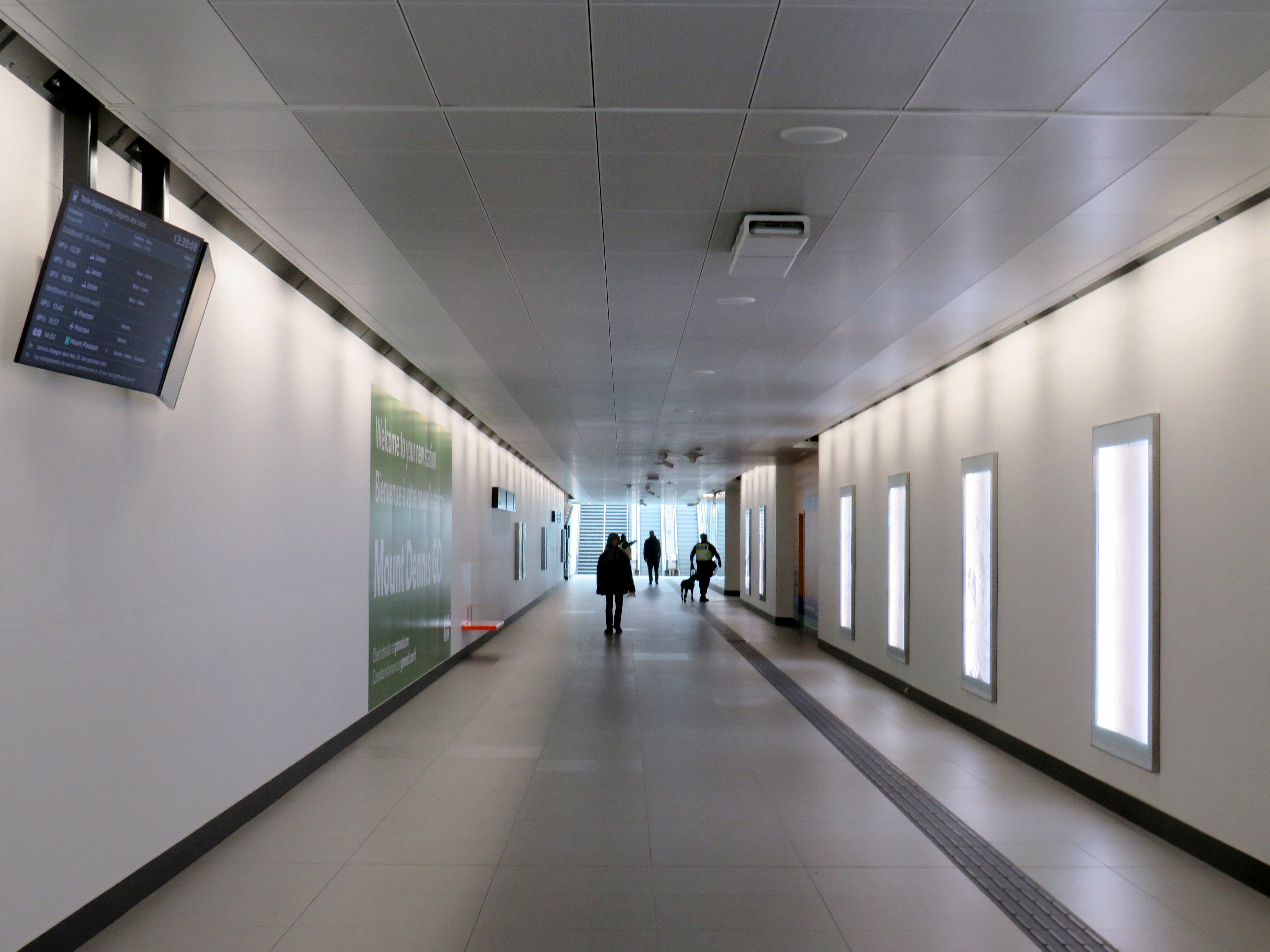
Three of four UP/GO platforms are in service (the fourth track, which would allow for more frequent GO Kitchener Line service is under construction). I was impressed to see two elevators to each platform, providing essential redundancy for improved accessibility and reliability. However, the GO/UPX platform access points are not easy to spot from this long corridor, which also leads to the Eglinton Avenue and Weston Road intersection.
Passage to GO and UP Express trains from the TTC bus/LRT area, looking west
There is no visible wayfinding signage in this long tunnel. Only when one reaches the escalators at the other end are directions apparent, as the overhead signs are affixed to sloped ceilings. This should be a relatively easy fix, but an important one.
No wayfinding signage visible below escalator levelin the GO/UPX area
Furthermore, an opportunity to provide a useful link to the Mount Dennis neighbourhood from GO/UPX Platform 4 (the west-most platform) has not been exploited. An undeveloped road allowance from the corner of Barr Avenue and Brownsville Road, used for station construction, is fenced off and barricaded. This would provide an alternate route to the station from Weston Road, particularly to the nearby Toronto Public Library branch, and would only need a few Presto tap readers and perhaps a fare vending machine. Perhaps it will take private highrise development to make this happen.
Looking west from Platform 4 to the Barr Avenue road allowance
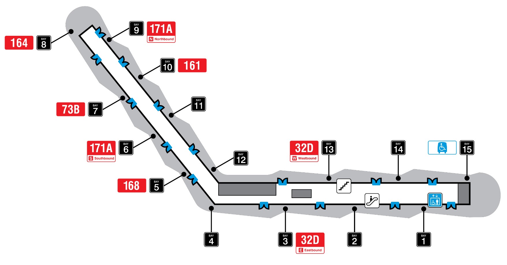
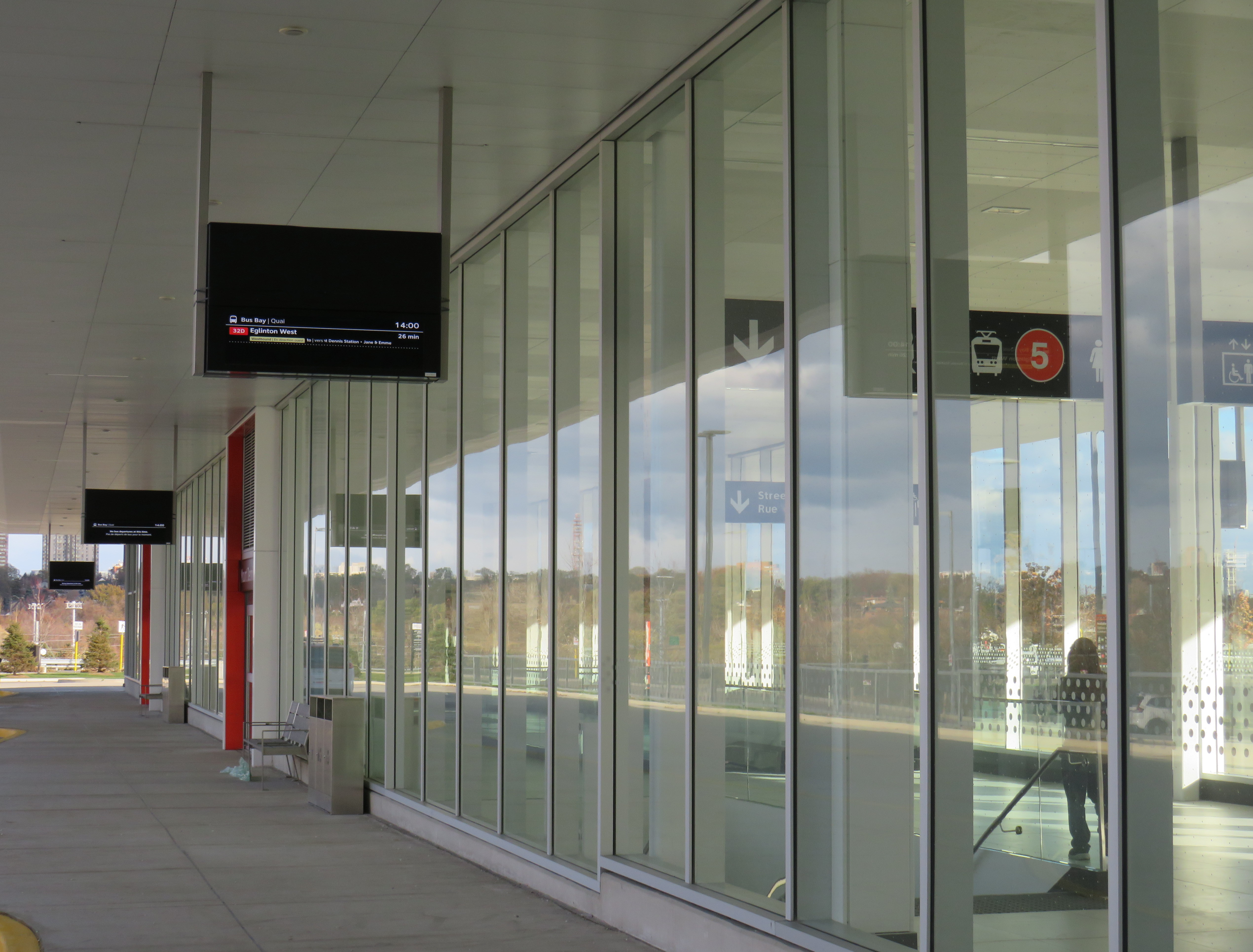
Finally, it was frustrating to see so little wayfinding signage in the TTC bus terminal. Though the TTC has numbered each of the bus bays from 1 to 15, these numbers do not appear inside the waiting area or over the doors. Digital screens over each bay display very small text with next bus information.
TTC bus terminal plan, with each bus bay and assigned routesOutdoor signage at Mount Dennis bus terminal
The wayfinding signage needs to be corrected, but at least these are simple fixes. Otherwise, it was a treat visiting a new transit hub on a sunny (though cold) November afternoon. The heritage preservation was a nice touch; hopefully, new use is found for Building 9’s upper floors. Furthermore, one hopes the rest of the Line 5 Crosstown stations open soon.
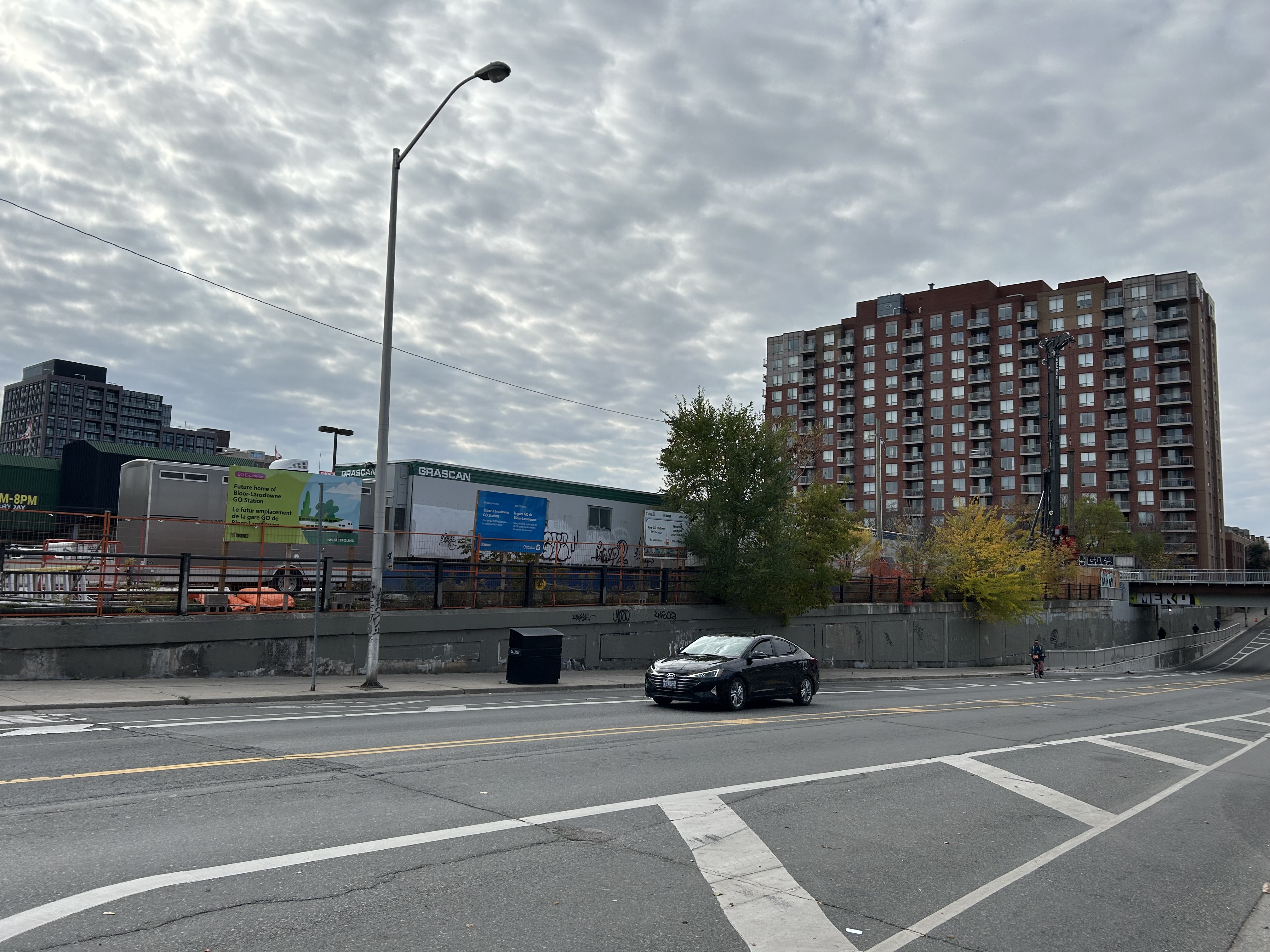
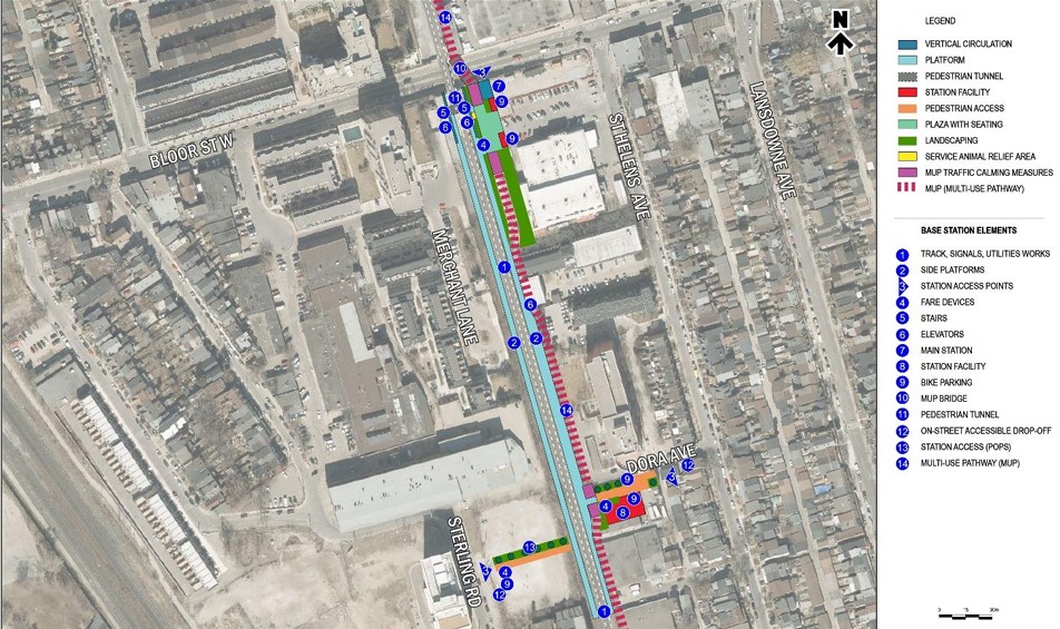
Bloor-Lansdowne Station construction, November 2, 2025
Bloor-Lansdowne Station, one of five “SmartTrack” stations planned for existing GO Transit rail lines in the City of Toronto, is located just south of Bloor Street West on the GO Barrie Line, and south of the Davenport Diamond grade-separation. The purpose of this new two-platform GO station is to provide a new connection between GO trains and the TTC subway, similar to existing stations like Bloor/Dundas West, Danforth/Main Street, or Downsview Park. Unfortunately, it will not be an easy transfer.
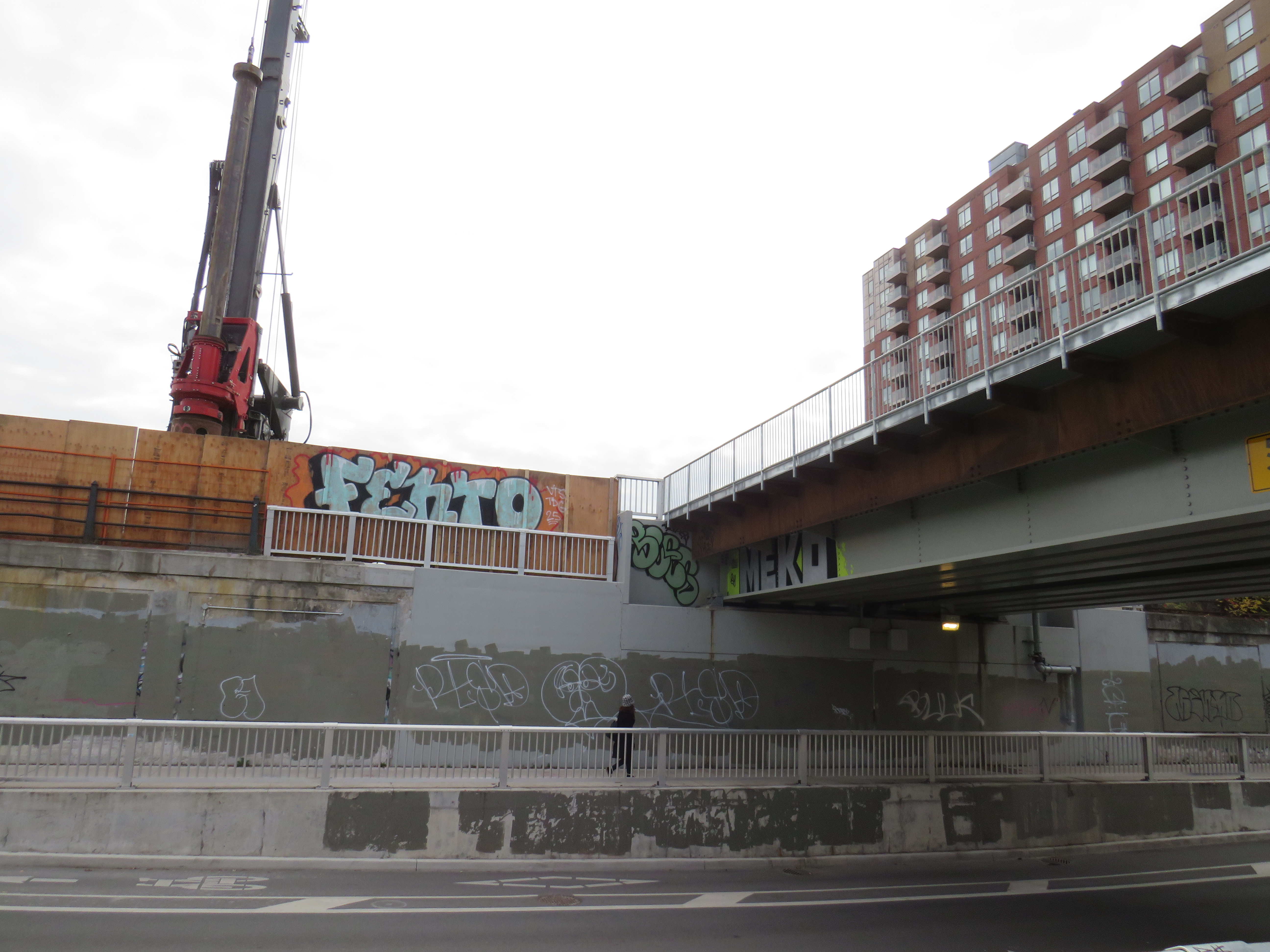
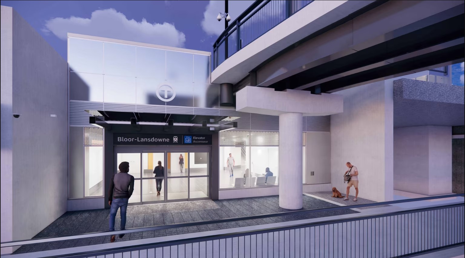
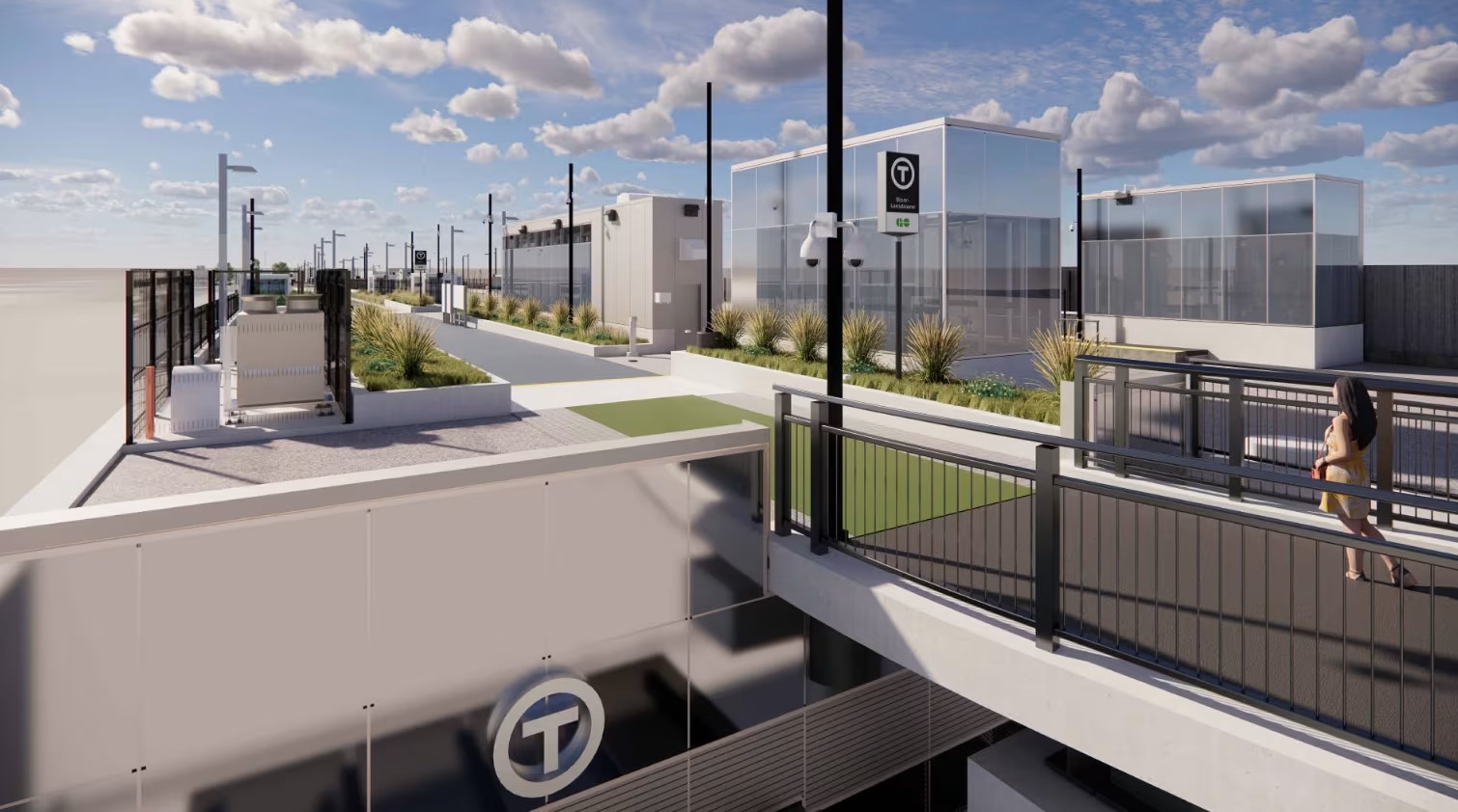
The future Bloor-Lansdowne station entrance, 2025Rendering of Bloor-Lansdowne Station entrance (from Metrolinx web page)
When GO Transit began operations on the Lakeshore Line in 1967, it was built on a shoestring, meant to be a three-year experiment to see if commuter rail would work in the growing Greater Toronto Area. Stations were built cheaply, with asphalt platforms with bus shelters, constructed on easily purchased land for suburban parking lots. At stations like Long Branch and Danforth, connections to TTC subways and streetcars were on-street; most connections would be made at Union Station. When the Georgetown (now Kitchener) Line opened in 1974, Bloor Station was accessed only by narrow stairways down to the sidewalk, with a 4-5 minute walk to Dundas West Station (a direct subway connection is finally nearing completion). Newer GO rail stations, like Kipling (1980-1981), Kennedy (GO platform opened 2005), and Downsview Park (2015), were built with direct intermodal connections, befitting GO’s increasing importance. When it opens on November 16, Mount Dennis GO/UP station will have a direct connection to the future Line 5 Crosstown LRT.
Though Lansdowne subway station is north of Bloor Street and two blocks to the east, the new GO station will be located entirely south of Bloor Street
But Bloor-Lansdowne, located next to a former Value Village, will feature a subway-train transfer worse than the current connection between Bloor GO and Dundas West subway station. It took me nearly 7 minutes to get from the Lansdowne subway platform to the planned main entrance below the rail overpasses, including waiting at the Bloor-Lansdowne intersection for a walk signal, and crossing an unsignalized intersection at St. Helens Avenue. (See video below.)
The construction of a new pedestrian overpass connected with the long-delayed Davenport Greenway will provide a slightly more pleasant walking path between the subway and GO train, avoiding a busy signalized intersection. But it will not reduce walking times or the amount of time without shelter from the elements.
Proposed Davenport Greenway
Granted, for some commuters, Bloor-Lansdowne will significantly reduce travel times, especially for those travelling between parts of York Region and western Toronto. But nearby Bloor Station on the GO Kitchener Line will have much better TTC connections and more frequent service with both GO and UP Express service and will be a much more attractive route towards Downtown Toronto. Compared to the benefits to riders on the 39/939 Finch East — the TTC’s busiest bus corridor — that Finch-Kennedy Station will offer, or the benefit of King-Liberty’s GO and UP Express service to riders in Liberty Village, Parkdale, and West Queen West with King-Liberty, Bloor-Lansdowne has limited ridership potential.
No matter how you get around Toronto, it’s feels like it’s more difficult than ever
Getting around Downtown Toronto can be an exercise in frustration, whether you drive, bike, take transit, or drive. Though necessary transit and road construction projects are the cause of much of the congestion, driver behaviour, poor management, and a lack of coordination between various municipal and provincial agencies have only added to the traffic quagmire.
North-south streets such as Spadina, York, Bay, and Jarvis are jammed by drivers headed south towards the Gardiner Expressway, with lane closures near Exhibition Place only making things worse. Motorists blocking intersections make it difficult for pedestrians, cyclists, streetcars, and through traffic to get across the city centre. Ontario Line construction has closed a portion of Queen Street, while work to rebuild streetcar tracks on York and Adelaide Streets to allow 501 cars to bypass the closure is still proceeding.
GO Transit is also expanding its rail corridors to allow for more off-peak and express trains, with the long-term goal of having an electrified, frequent, regional rail network that complements and supplements the web of subways, light rail and buses throughout the region. The TTC is also addressing a backlog of state-of-good repair works throughout the subway system, resulting in slow orders, early closures, and weekend shutdowns.
Meanwhile, people still need to get to places like work, school, conferences and trade shows, concerts, sporting events, social gatherings, festivals, museums, and all the other things that make a city a city. Eventually, with improved GO corridors, the Ontario Line, and the opening of the Crosstown LRT, there will be some redundancy in the transit system that will make planned service closures easier to navigate. But for now, we are stuck with an underbuilt transportation system in a rapidly growing city.
This makes the coordination of transit closures and projects especially essential so things don’t completely fall apart. Saturday, September 21 was just one example of the failure to do so.
On Saturday September 21 and Sunday September 22, GO Transit reduced service on the Lakeshore West Line to hourly service on the entire corridor because of work at Long Branch GO Station, where the station is being completely rebuilt for accessibility improvements and future expansion. It also shut down the entire Barrie Line for various construction works along the corridor, with rail replacement buses to Union Station, stuck in traffic on the Don Valley Parkway and Lake Shore Boulevard with all other motorists getting around the Gardiner closure.
Normally, there are hourly trains as far west as West Harbour Station in Downtown Hamilton, with half-hourly service to Aldershot Station in Burlington. Between Union and Oakville, rail service is as frequent as every 15 minutes during midday and early evenings on Saturday and Sunday. Hourly train service reduced capacity on the inner Lakeshore West line by 75%.
Compounding the problem was the total closure of the Gardiner Expressway between Highway 427 and the Don River between Friday evening and Sunday morning for routine maintenance (the Gardiner and the Don Valley Parkway are regularly closed twice a year for repairs). Many people who might have otherwise driven into the city would have taken GO Transit instead, normally a very good idea. Though none of Toronto’s professional sports teams were playing at home on Saturday, there was still a Shane Gillis stand-up comedy performance at Scotiabank Arena, and a Rainbow Kitten Surprise concert at Ontario Place.
Also, to add insult, the Lakeshore East trains between Toronto and Oshawa were not through-running with the Lakeshore West trains and were operating on a modified schedule. I was travelling east of Toronto on Saturday, making a few stops in Durham Region. As I arrived back from Whitby on Saturday afternoon on a train that normally connects onward westbound train at Union Station, we were treated to the sight of the hourly Lakeshore West train just pulling out. It couldn’t have even waited 2-3 minutes to allow passengers to make the cross-platform connection. That resulted in other passengers complaining to GO staff in the concourse, who were not that helpful.
I’m on the GO Train now. The CSR on the LW train is telling people at Long Branch to not board because the train is too full, so they now have to wait an hour. Lots of people heading to Budweiser Stage and Scotiabank concerts. Very poor planning/coordination between city and MLX. https://t.co/LXNATzYwoV
Tweet from Alan Deschamps, reporting on a full GO train arriving at Long Branch at 6:21 PM on Saturday Sept 21, with the customer service ambassador (CSR) telling waiting passengers to not board and to wait for the next train in an hour
In the early evening on Saturday, a jam-packed eastbound GO train on the Lakeshore East train was not accepting any passengers at Long Branch or Mimico station because of overcrowding. Waiting passengers were told to wait an hour for the next train.
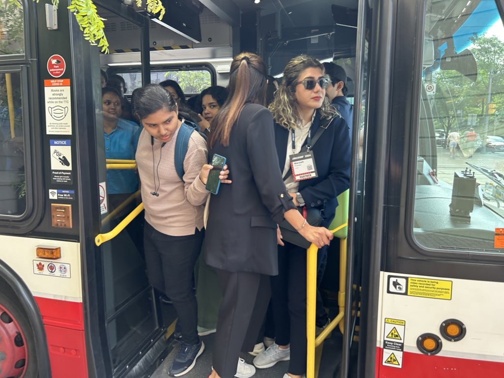
One would think that Metrolinx (GO Transit’s parent agency) and the City of Toronto would coordinate their construction schedules to avoid such problems. However, not even the City of Toronto can figure this out. Back in June of this year, the TTC replaced the 509 Harbourfront and 511 Bathurst streetcars with buses for a week for minor overhead work on Fleet Street. The timing coincided with the massive Collision tech conference at Exhibition Place, which resulted in overcrowded shuttle buses and unreliable service. Had the TTC checked with anyone at the city’s economic development office or with Exhibition Place (another city agency), this work could have easily been rescheduled.
Overloaded 509 Harbourfront bus shuttle on Queen’s Quay in June 2024
Though coordination of transit closures and construction projects with major events and parallel roadworks will not solve Toronto’s road and transit congestion problems, it will at least reduce some of the frustration of getting around. The poor customer service at GO Transit will certainly make riders question if they will be able to rely on the service in the future.
Of course, there is one measure that won’t help but still will be implemented by the provincial government later this fall: a prohibition on new bicycle lanes if they take road space from motorists. Despite blocked bike lanes, aggressive drivers, and an incomplete cycling network, it is still the most reliable and fastest mode for many shorter city trips. Along with major transit improvements and construction coordination, cycling is one of the solutions to getting around Toronto.