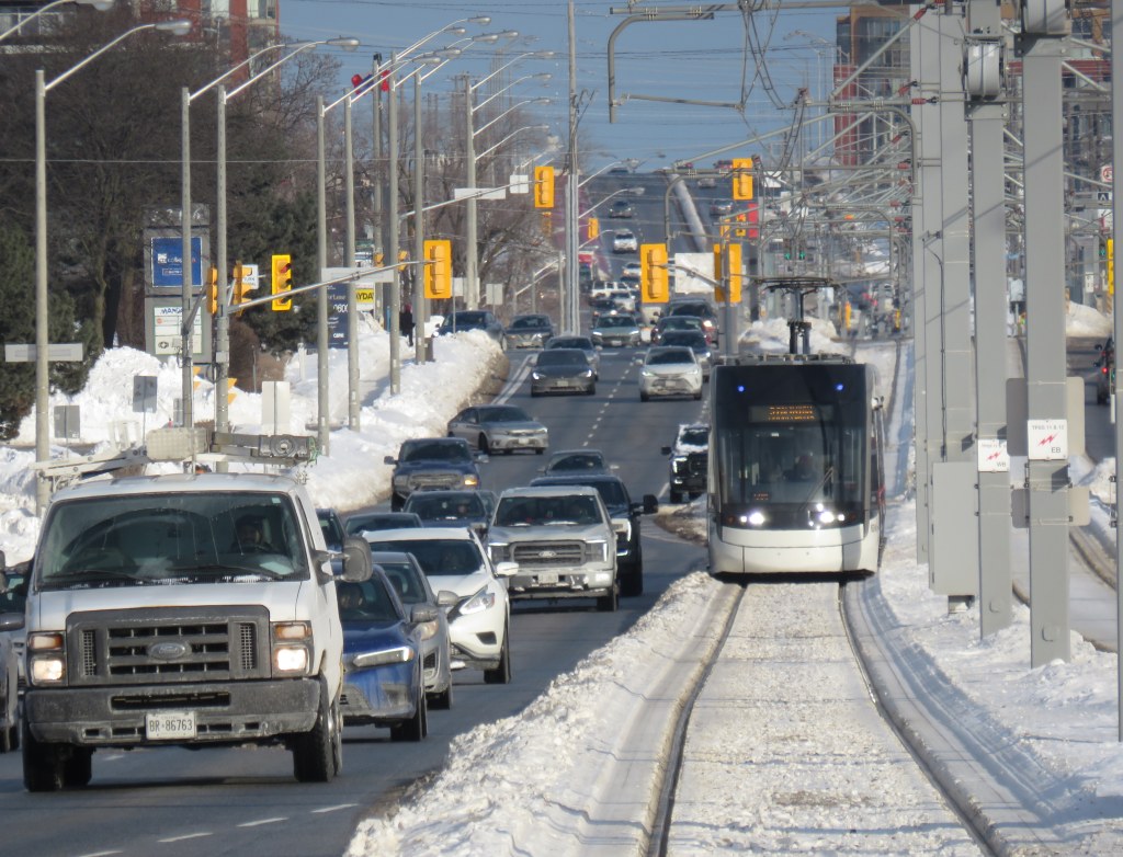
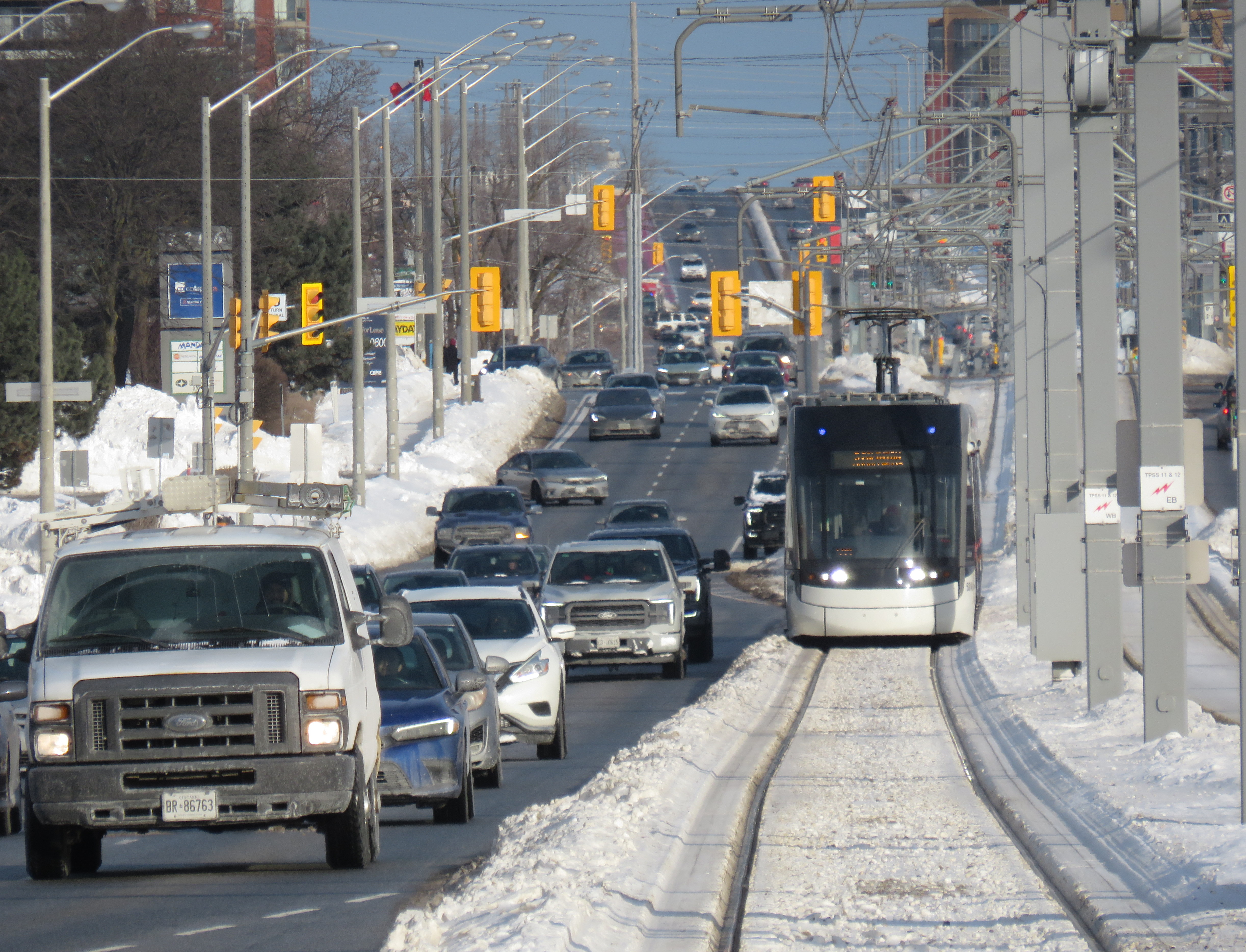
On Sunday, February 8 the Eglinton-Crosstown LRT opened to the public without any pomp or circumstance. Perhaps embarrassed by the public’s reaction to Line 6 Finch West, there were no giveaways, no parties, and no promotional materials. That turned out to be a shame, in a way, because Line 5 seems to be alright so far, a week after its initial opening. Travel times on the LRT are improved over the previous 32 and 34 bus routes, though with lesser speed improvements on the surface section versus the western portion. The two-car Bombardier Flexity trains do not crawl through intersections on Eglinton Avenue East unlike the single-car Alstom Citadis Spirits on Finch Avenue West.
Furthermore, learning some lessons from the botched Line 6 launch, the TTC — the operator of Line 5 trains — is looking for public feedback and promises improvements to speed and frequencies later in 2026. There are certainly ways in which this line can improve further. All that said, the Eglinton-Crosstown LRT offers needed optimism for Toronto’s transit future, especially as more projects are underway.
Mostly smooth operation of Line 5 during the first week(more…)
A westbound LRV train on Eglinton Avenue in Scarborough, January 2026
After fifteen long years, the wait is over. On Sunday, February 8, the Eglinton-Crosstown LRT will finally open to the public, with the first train leaving Kennedy Station at 7:00 AM. (The first eastbound train will depart Mount Dennis at 7:07 AM.) Rides will be free on that first day, but there will be no opening celebration, no ribbon cutting, and no giveaways. At first, trains will run until 11 PM, with Line 5 shuttle buses from 10 PM until 1AM, when the 334 night bus takes over.
After the botched opening of Line 6 Finch West, it is clear that no one in charge wants to celebrate the opening of this new transit line after years of construction delays and false hope of completion in 2020, 2021, 2022, 2023, 2024 and 2025. So if you want to check out Toronto’s new ride, go do it at your own convenience. You won’t miss anything.
There will be no party, like the one arranged last December at Finch West
But even if the trains run slower than originally planned at first, there should be a ramping up of speeds and transit priority in the surface-running eastern section. The tunneled section will have speeds up to 60 km/h between stations, making it considerably faster than the buses it will replace. During a visit to Scarborough last month, it already seemed that trains were running a bit faster in the outdoor section than on Finch West, so there’s definitely some reason to welcome the LRT in its initial “soft opening” phase.
The TTC notes that once full service is operational later in 2026, the end‑to‑end travel times will be “approximately 50–55 minutes.” That’s about twice as fast as the bus when going all the way from Mount Dennis to Kennedy. Perhaps, once the trains are running on a full schedule until 1AM and with expected performance improvements, there will be a formal ceremony to conclude this long journey.
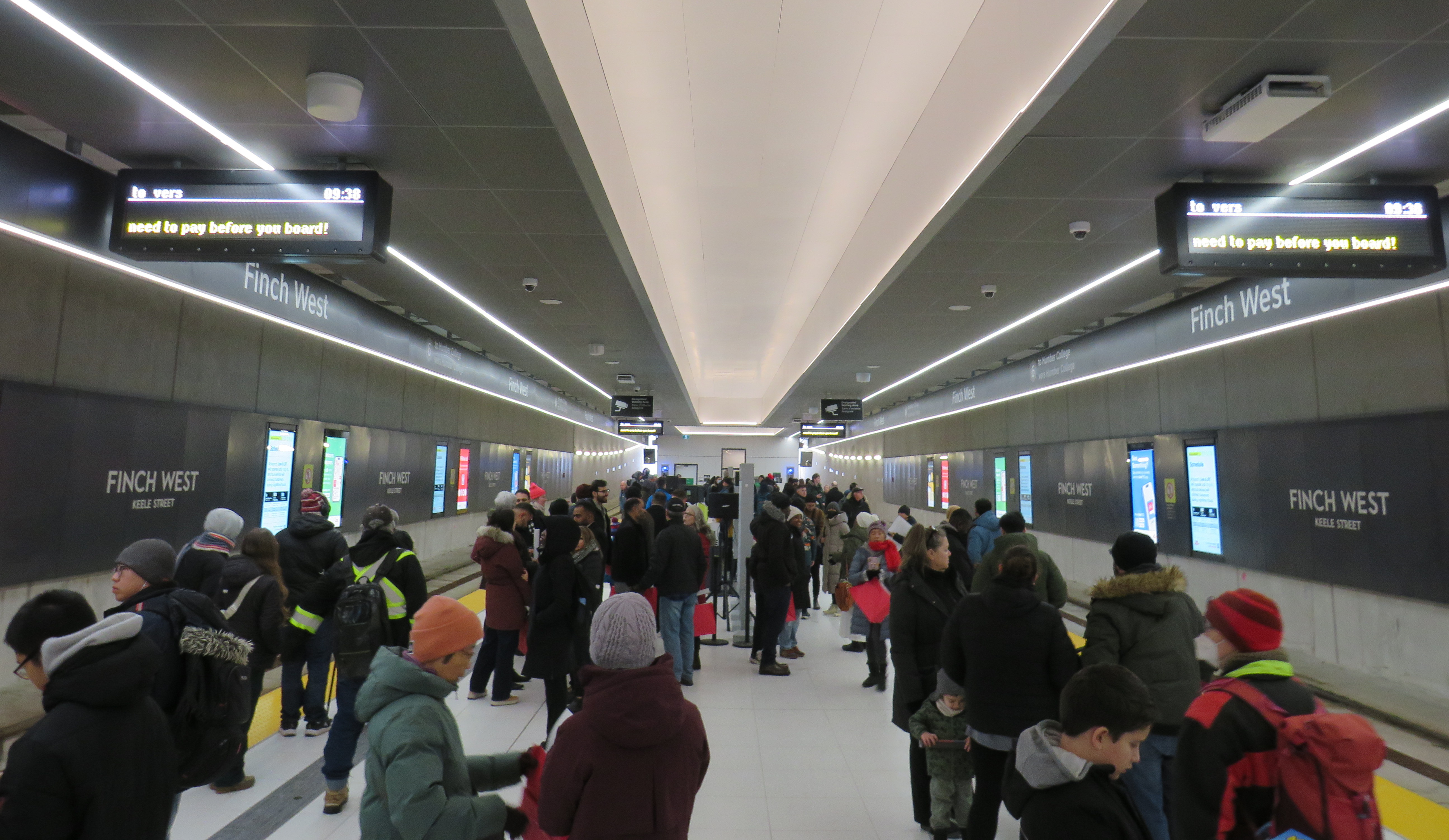
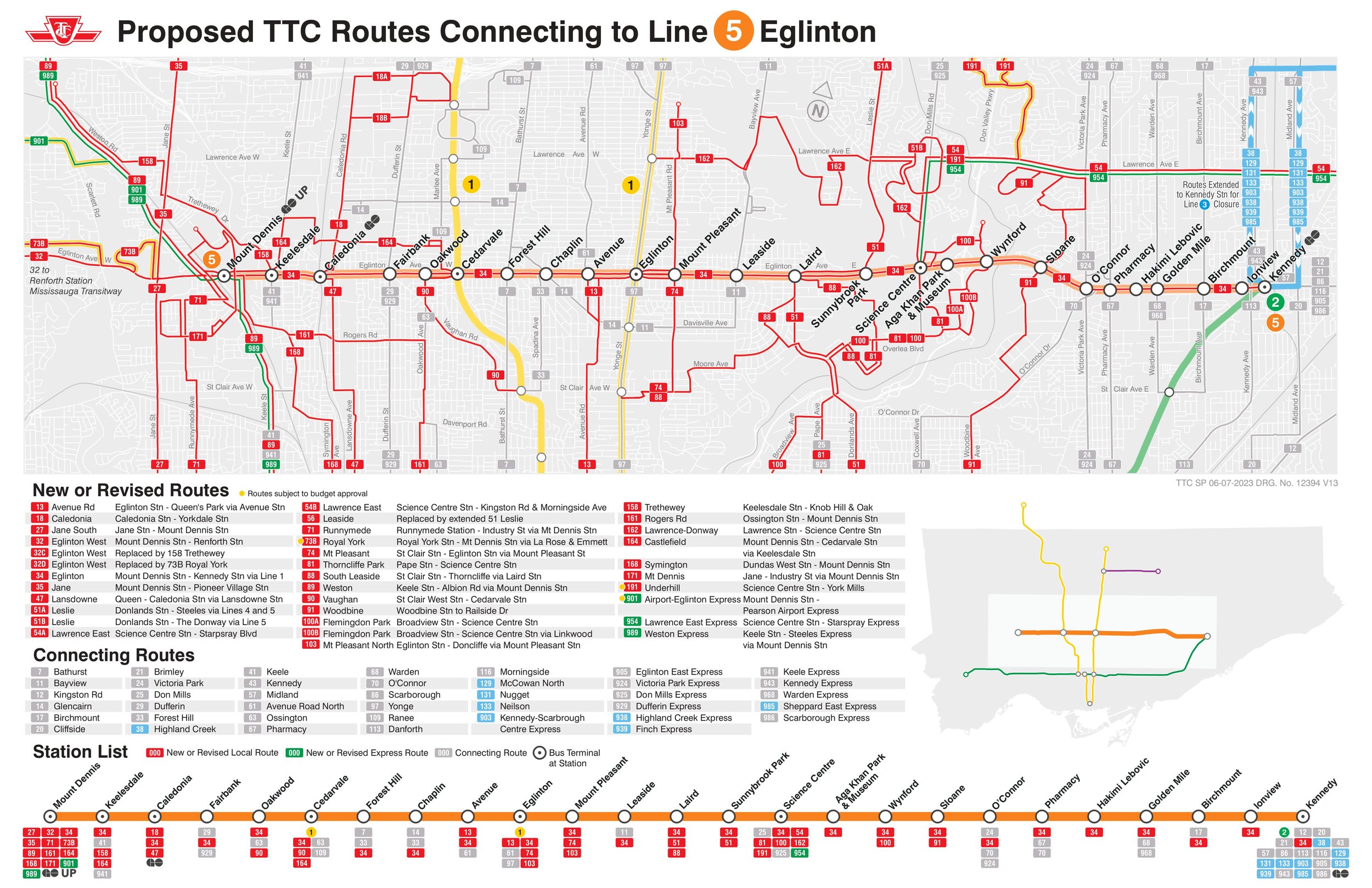
Notably on Sunday February 8, there will be significant changes to the bus network, including 2 discontinued routes, 13 route changes, and 4 new routes. Most notably, Routes 54 and 954 on Lawrence Avenue East will now terminate at Don Valley Station instead of at the subway at Eglinton Station. Route 35 Jane will no longer continue south of Weston Road, but will instead terminate at Mount Dennis (with new Route 27 Jane South taking over that southern section). The 47 Lansdowne will be split into two, with 18 Caledonia providing service north of Eglinton. Routes 51 Leslie and 56 Leaside will be merged (with a short 151 Leslie North bus on the north end), and the 32C branch will be replaced with the new 158 Trethewey bus. The map below shows how the TTC buses will connect with Line 5. (Route 901, between Mount Dennis Station and Pearson Airport via Dixon Road, has not yet been approved.)
Map showing TTC bus route changes; several of these were already implemented in late 2025. Only the 901 express route to Pearson Airport has not been approved.
I will certainly make time to check out Line 5 on Sunday, followed by a more fulsome review a week or two after opening to form an honest and thoughtful opinion.
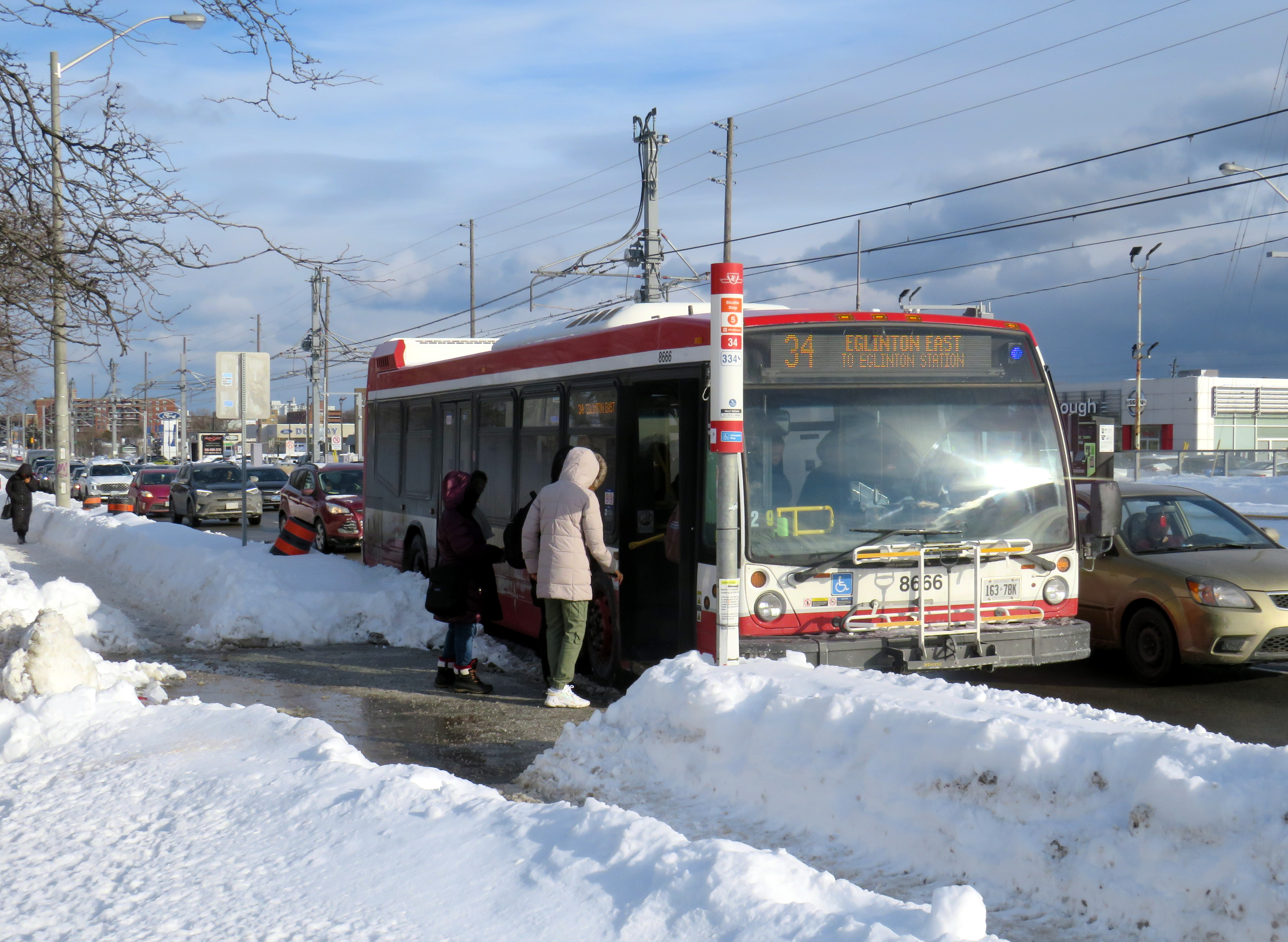
Passengers boarding the 34 Eglinton East bus, January 28, 2026
On Sunday, February 8, the long-awaited (and long-delayed) Line 5 Crosstown LRT will finally open to the public (or maybe not). The new line, 19 kilometres long with 25 stops, is nearly twice as long as the 11-kilometre Finch West LRT that opened in December.
Unlike the troubled Finch West LRT, the Eglinton-Crosstown line is largely underground, with twelve stations, from Mount Dennis to Laird, completely separated from road traffic. A western extension through central Etobicoke to the Mississauga border at Renforth will also be completely grade-separated. There are several other major differences: the Crosstown line will be more frequent than Finch West, and will have more capacity, with two-car trains operating at all times. The equipment will be different too: Bombardier Flexity cars, the same as those used in Kitchener-Waterloo, will make the up the trains. Furthermore, the underground section will be computer controlled (which might turn out to be a complication, rather than an advantage).
A light rail train passes traffic on Eglinton Avenue East in Scarborough
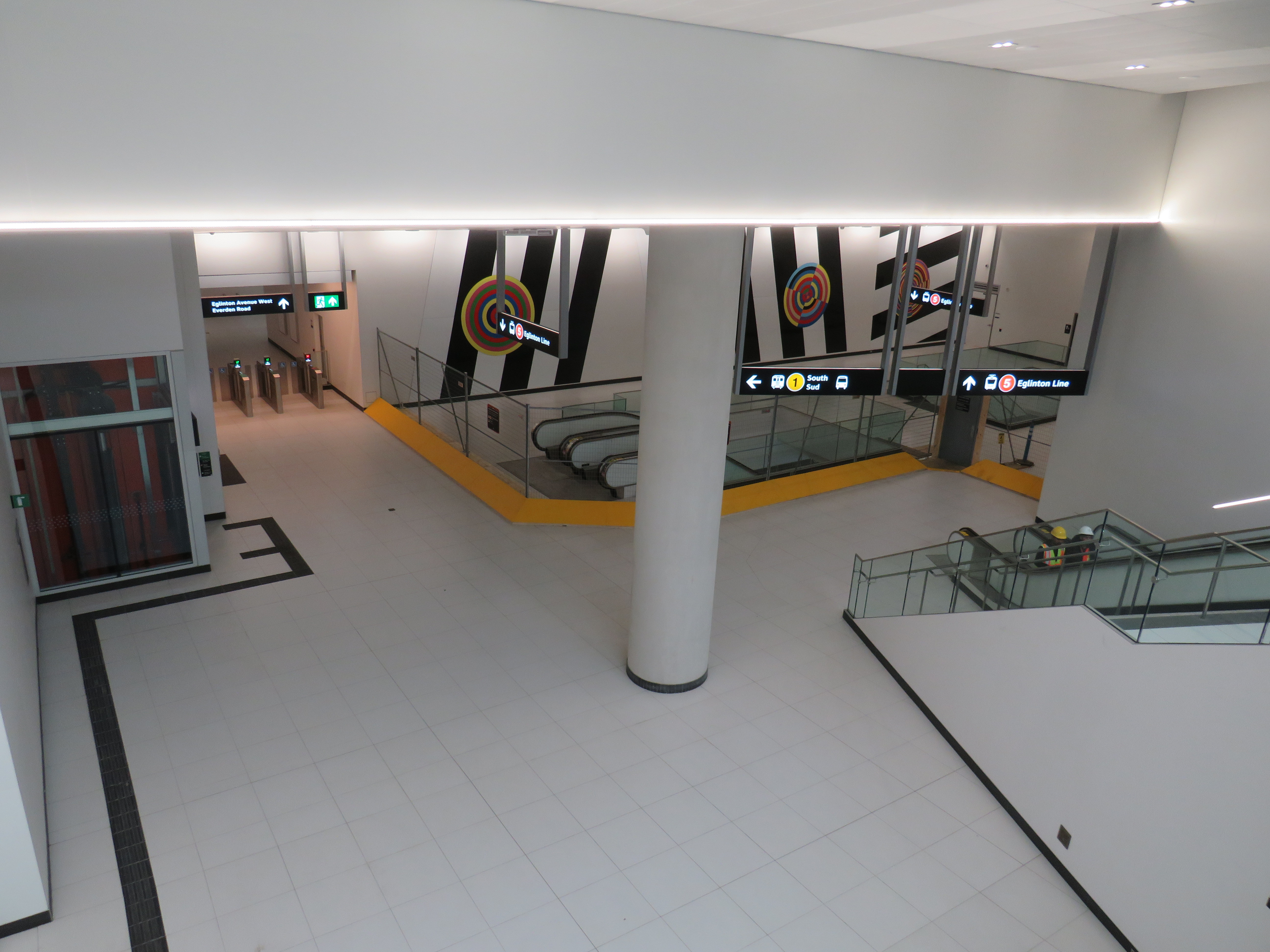
However, some aspects will be the same. The surface-running eastern section between Leslie Street and Kennedy Road will feature 10 outdoor stops and 16 traffic signals, though the LRT will dip below ground at Don Mills Road (formerly Science Centre Station, now Don Valley Station) and under Kennedy Road into the Kennedy Station transit hub. As with Finch West, this was a Metrolinx-led project with a private consortium in charge of construction and maintenance, with the TTC in charge of train operations. So it will be interesting to see how Line 5 fares.
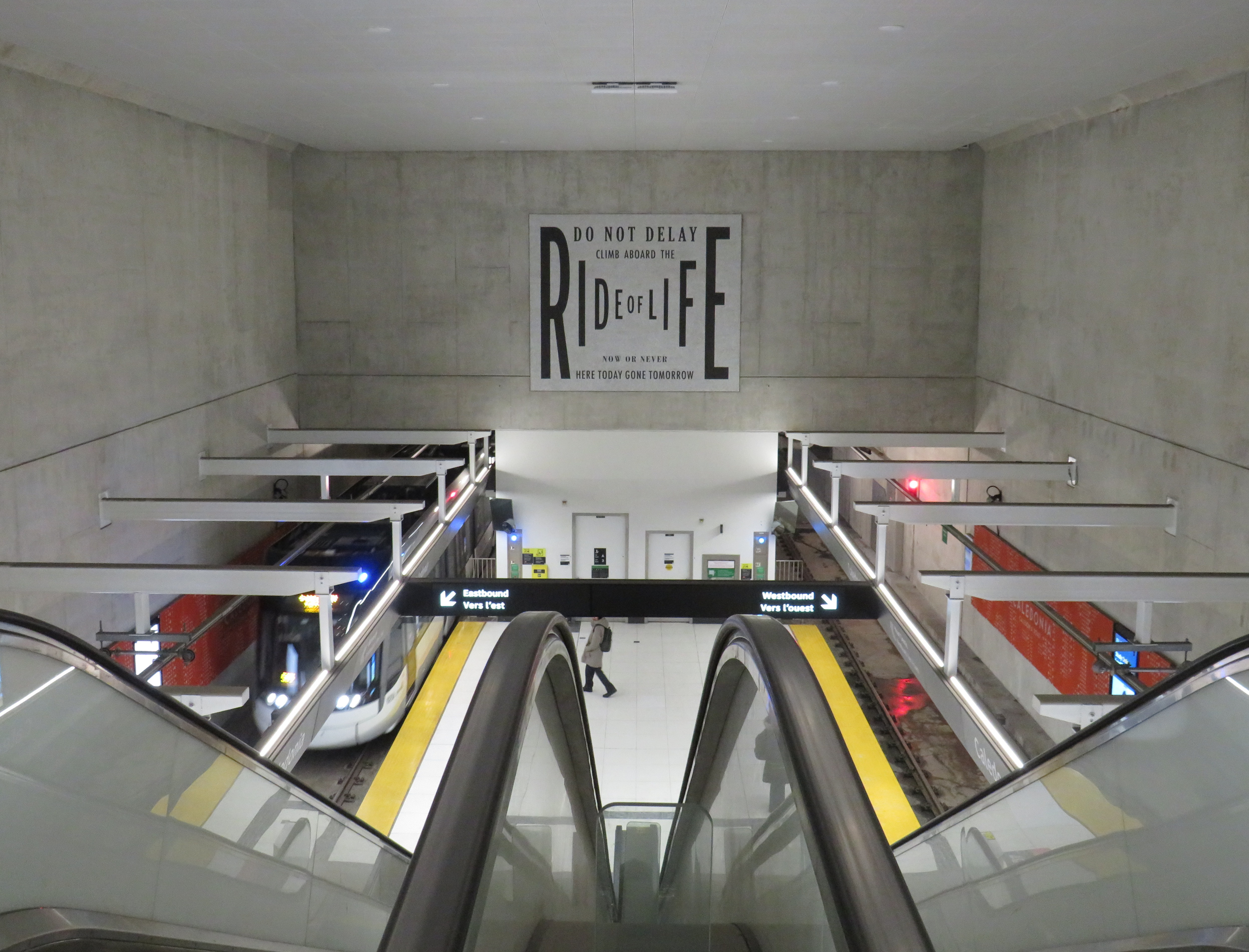
With subway, light rail, buses, and GO trains, Kennedy Station is becoming a proper transit hub
In the meantime, just as with my visits to Finch West, I decided to see how long it takes to get across the LRT corridor. In May 2024, I walked the entire route over three days, getting to know the corridor better (while documenting my stroll on a social media platform that I have since abandoned). With rumours of a mid-winter 2026 opening, I decided to ride the buses to get further context and time the rides.
Congestion at Eglinton Avenue West and Oakwood Avenue, May 2024
Tuesday, January 20 was an ideal day to ride the 32 Eglinton West and 34 Eglinton East buses. That was several days after the last snowfall (and a few days before the next big dump), and the roads and sidewalks were completely clear. It was a bright, sunny (albeit cold) day, and there was only one short construction zone on Eglinton Avenue, near Caledonia Road. Though only a small number of riders would use the entire Crosstown LRT line as part of a regular commute, it was worth getting a sense of how long the trip would take between each station.
I started at Kennedy Station after taking a Stouffville Line GO train one stop from Union Station, rode the 34 Eglinton East bus all the way to Eglinton Station at Yonge Street, and then after a break (including a stop at Cinnabon), continued west to Mount Dennis Station, which is already open to GO and UP Express trains, as well as a few TTC routes. The last half of the ride coincided with high school dismissal times that resulted in some crowding, especially between Avenue Road and Dufferin Street.
From Mount Dennis, I returned eastbound during a busy weekday afternoon rush hour, transferring to the first available 34 Eglinton East bus at Eglinton Station all the way back to Kennedy.
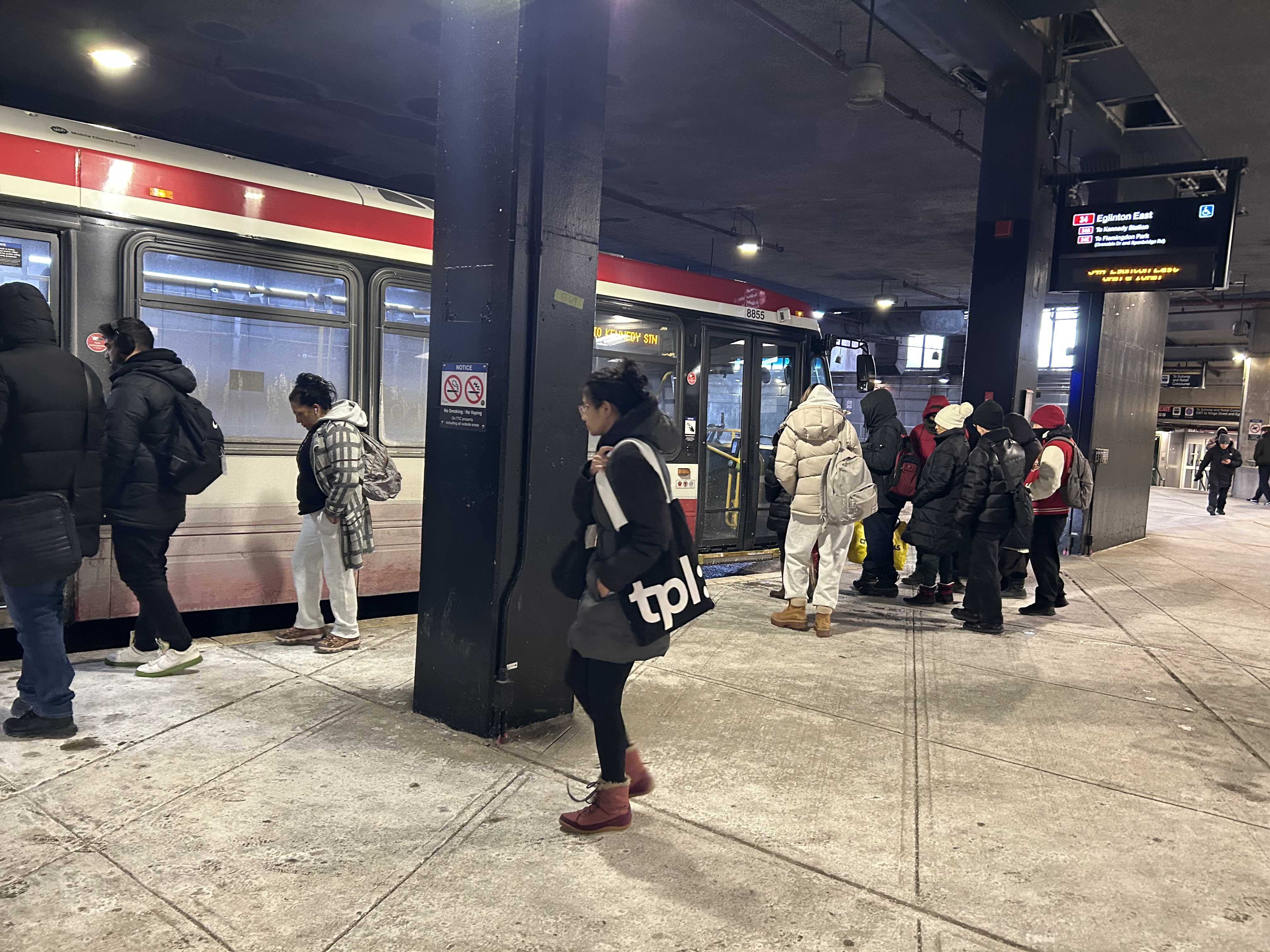
Waiting for the 34 Eglinton East bus to Kennedy Station, January 20, 2026
The table below shows the timings at each LRT stop.
Westbound (read down)
Stop/Station
Eastbound (read up)
1:28 PM dep.
Kennedy
5:35 PM arr.
1:32
Ionview
5:30
1:34
Birchmount
5:28
1:37
Warden Ave. (Golden Mile)
5:24
1:39
Hakimi Lebovic
5:22
1:42
Pharmacy
5:20
1:43
Victoria Park Ave. (O’Connor)
5:18
1:46
Bermondsey
5:15
1:49
Wynford
5:08
1:51
Don Mills Rd. (Don Valley)
5:01
1:53
Leslie St. (Sunnybrook Park)
4:58
1:57
Laird
4:50
2:00
Bayview Ave. (Leaside)
4:48
2:04
Mount Pleasant
4:44
2:10 PM arr. 2:47 PM dep.*
Eglinton Station (Bus transfer)
4:39 PM dep. 4:32 PM arr.***
2:52
Avenue Road
4:25
2:54
Chaplin
4:19
2:58
Bathurst St. (Forest Hill)
4:15
3:03
Cedarvale Stn.
4:09
3:07
Oakwood
3:56
3:11
Dufferin St. (Fairbank)
3:51
3:18
Caledonia**
3:44
3:21
Keele St. (Keelesdale)
3:41
3:25
Mount Dennis
3:37 PM
87 minutes
Total ride time (inc. a 7 min transfer at Eglinton Stn.)
118 minutes
* This gap provided an opportunity to use the washroom, and get a coffee and snack ** Time noted at Blackthorn Ave, the closest stop to the LRT station entrance *** Took first 34A bus to Kennedy Station that departed Eglinton after my arrival; a 34C bus to Wynford Dr. and Flemingdon Park departed first
On the surface buses, the most significant traffic delays are near the Don Valley Parkway and Allen Road, especially eastbound between Oakwood Avenue and Cedarvale Station and between Don Mills Road and Bermondsey Avenue. For anyone crossing Yonge Street, the transfer between buses takes on average seven minutes including walking and waiting time.
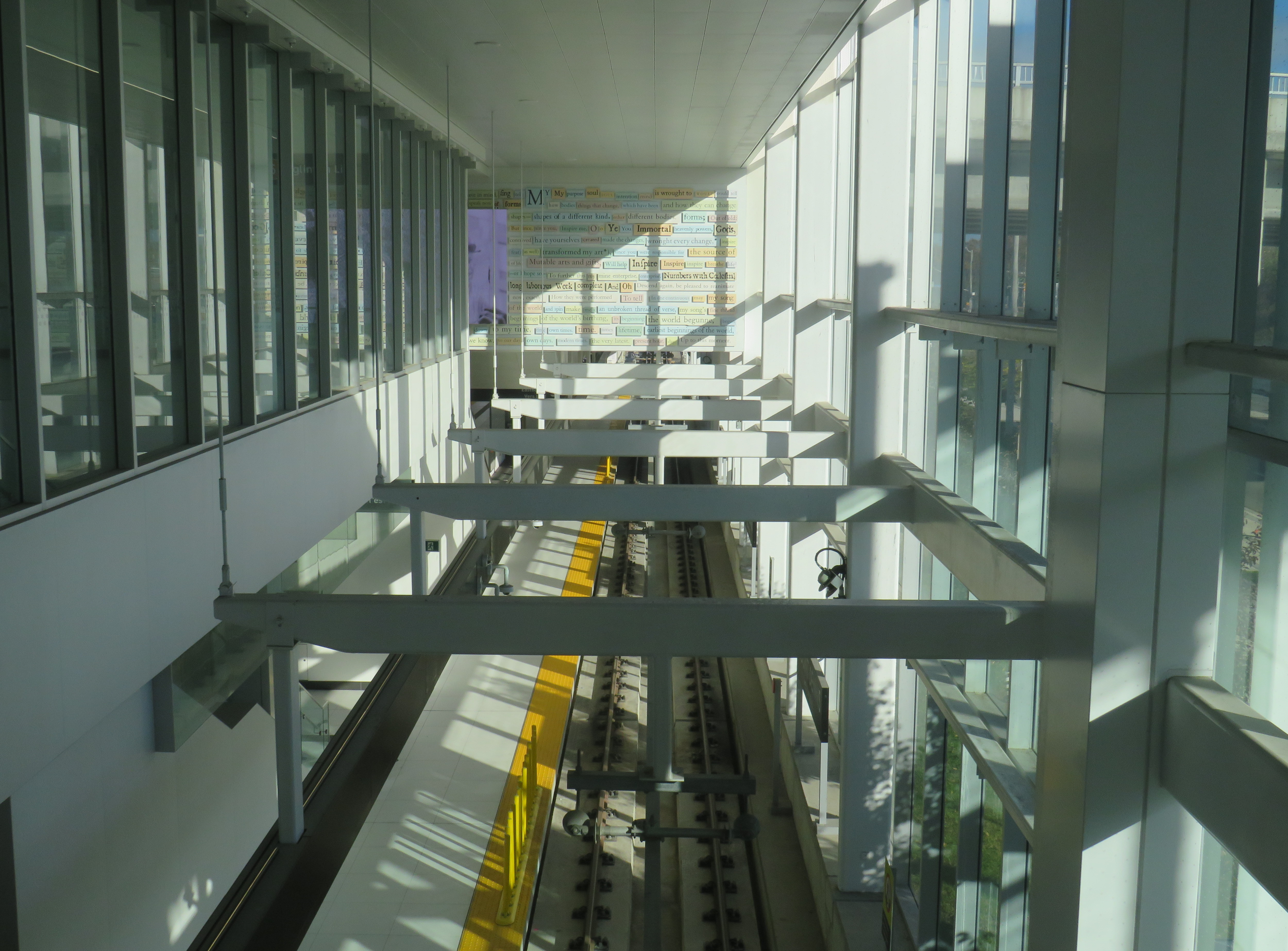
Line 5, the Eglinton Crosstown LRT, will run deep below the Line 1 University Subway at Cedarvale Station
The dedicated right of way should allow transit riders to get ahead of traffic congestion, especially around Allen Road, where the trains will run in a deep bore tunnel. In theory, the median right-of-way will help get passengers past congestion near the DVP and the big box retail in the Golden Mile, but if the trams are as slow through intersections as on Finch and held up by red lights, the advantage here will be minimal.
At Eglinton and Warden, I did see a traffic signal hold a green light a few extra seconds to allow a train to pass through before changing, so that was a positive sign. But watching the trains go by every few minutes, I noted that the transit priority system was not at all aggressive, and as on Finch, transit signals turn red 12 seconds before the general traffic signals do.
On January 28, Eglinton and Warden, the transit signals stayed green for a short extra time to allow the non-revenue LRT train to pass through and stop at the far-side platform. The train was moving at a more reasonable clip too.
The Eglinton Crosstown LRT, unlike Finch West, serves a regional need that requires better speeds and more capacity than a mere surface tram, especially as it will have many bus routes directly feeding into it, rather than just intersecting. Several bus routes that used to continue into Eglinton Station, such as 54 Lawrence East, will instead terminate at Don Valley (formerly Science Centre) Station, where riders going west to the subway will have to transfer. For inexplicable reasons, the short section between Don Mills Road and Laird will have one at-grade station with a signalized intersection, a weak link in what will likely be a very busy section of the line.
Map of planned changes to TTC bus routes with Line 5’s opening. Some of the changes, including the introduction of Route 164 Castlefield and the extensions of routes 79, 161, and 168 to Mount Dennis Station have already been implemented.
Hopefully, some of the lessons from the Line 6 opening will be applied to Eglinton before it opens. There should also be an opportunity, just as there is on Finch, to make further changes to operations where applicable during a “soft opening” period. But we can not afford yet another botched transit project, especially after 15 years of waiting.
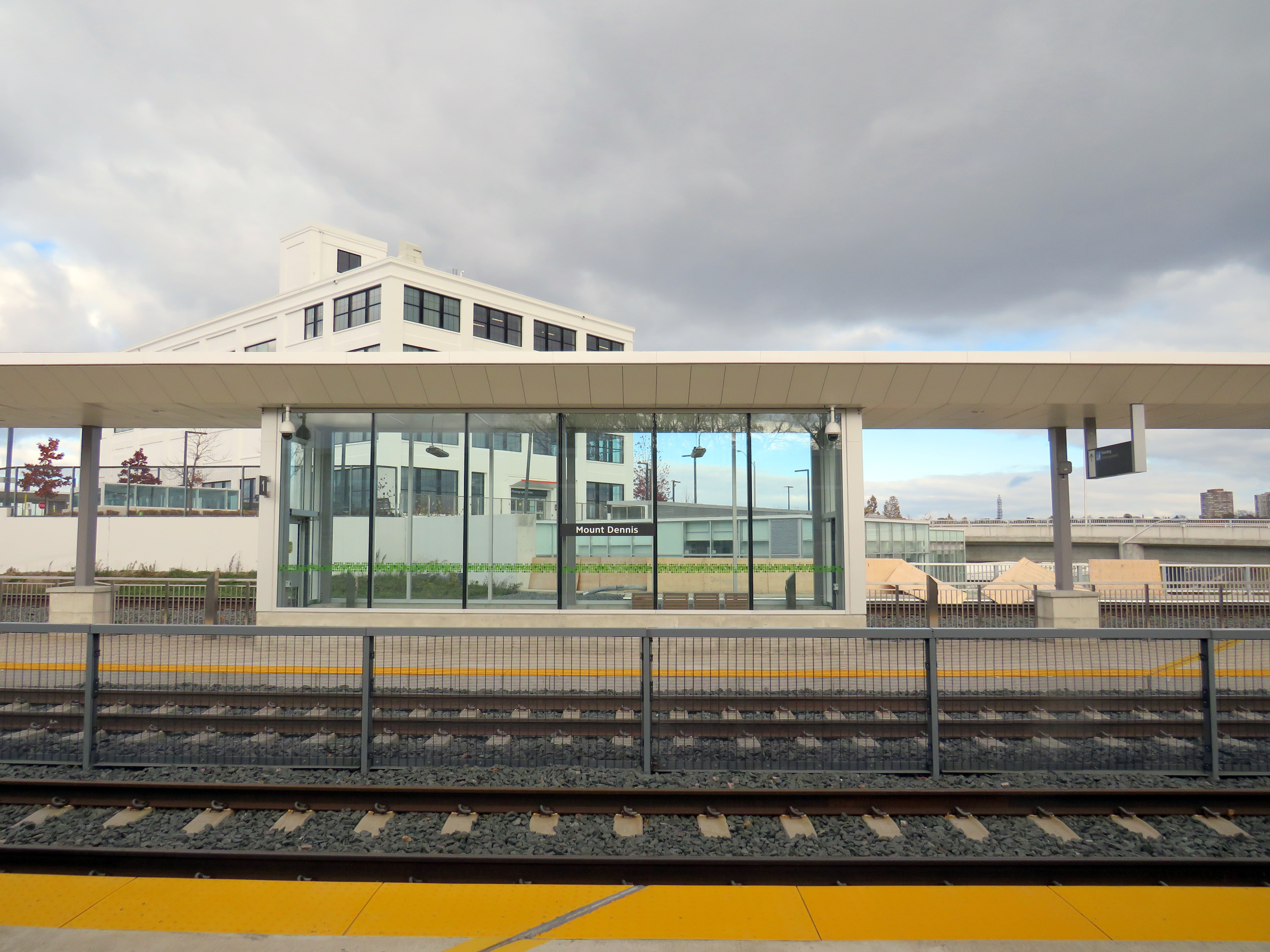
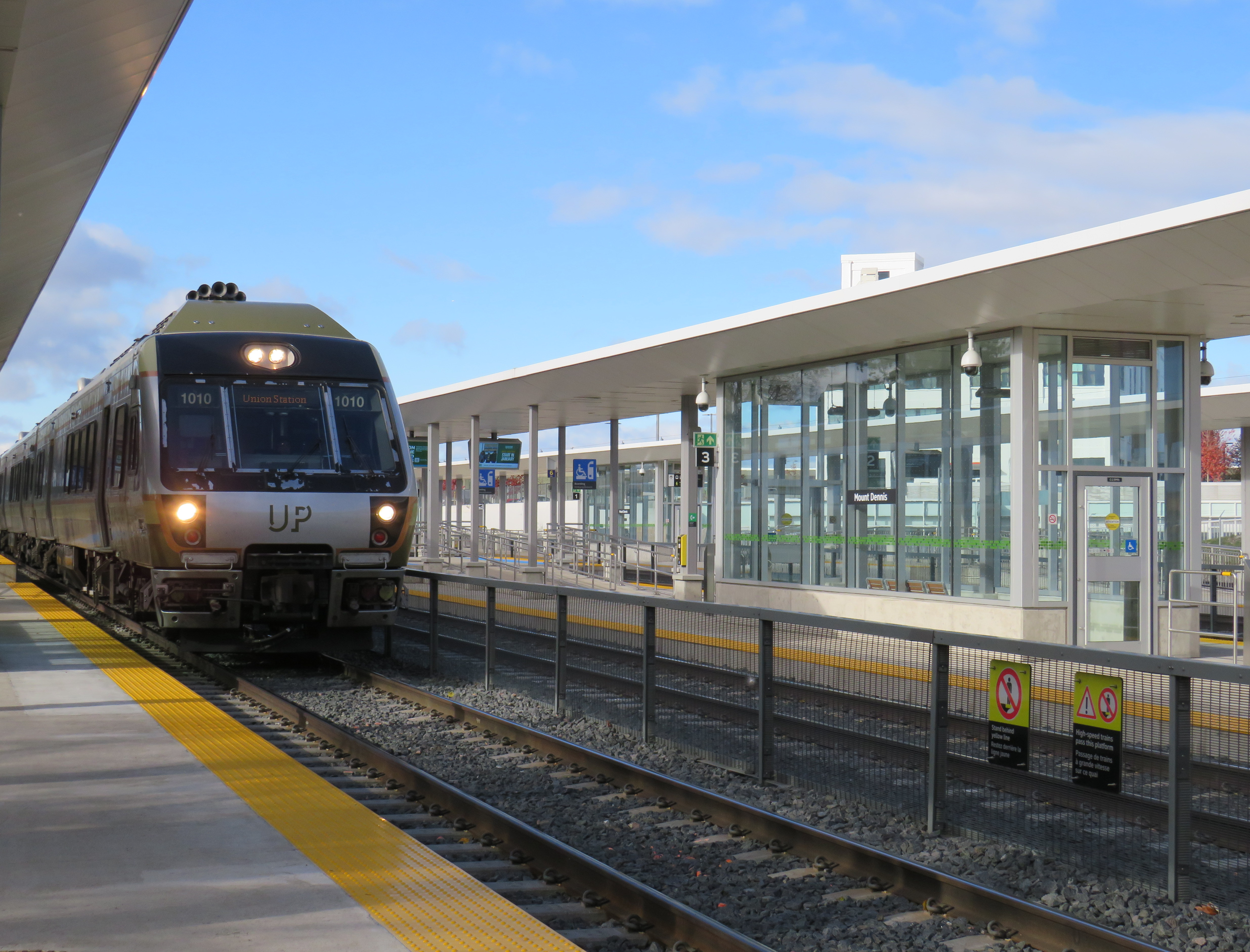
While Montreal was celebrating the opening of another portion of its REM automated light metro system between Gare Centrale and Deux-Montagnes on the region’s north shore, Torontonians had to settle for the partial opening of two light rail stations on the delayed Line 5 Eglinton line: Mount Dennis and Cedarvale.
While the opening of Cedarvale (apart from the light rail platforms) slightly improved circulation at the existing Eglinton West Station, Mount Dennis Station provides for a new GO Transit and UP Express stop, a large TTC bus terminal, and access to a historic Kodak building. It’s an interesting structure that facilitates new intermodal connections, but could definitely benefit from a few minor improvements.
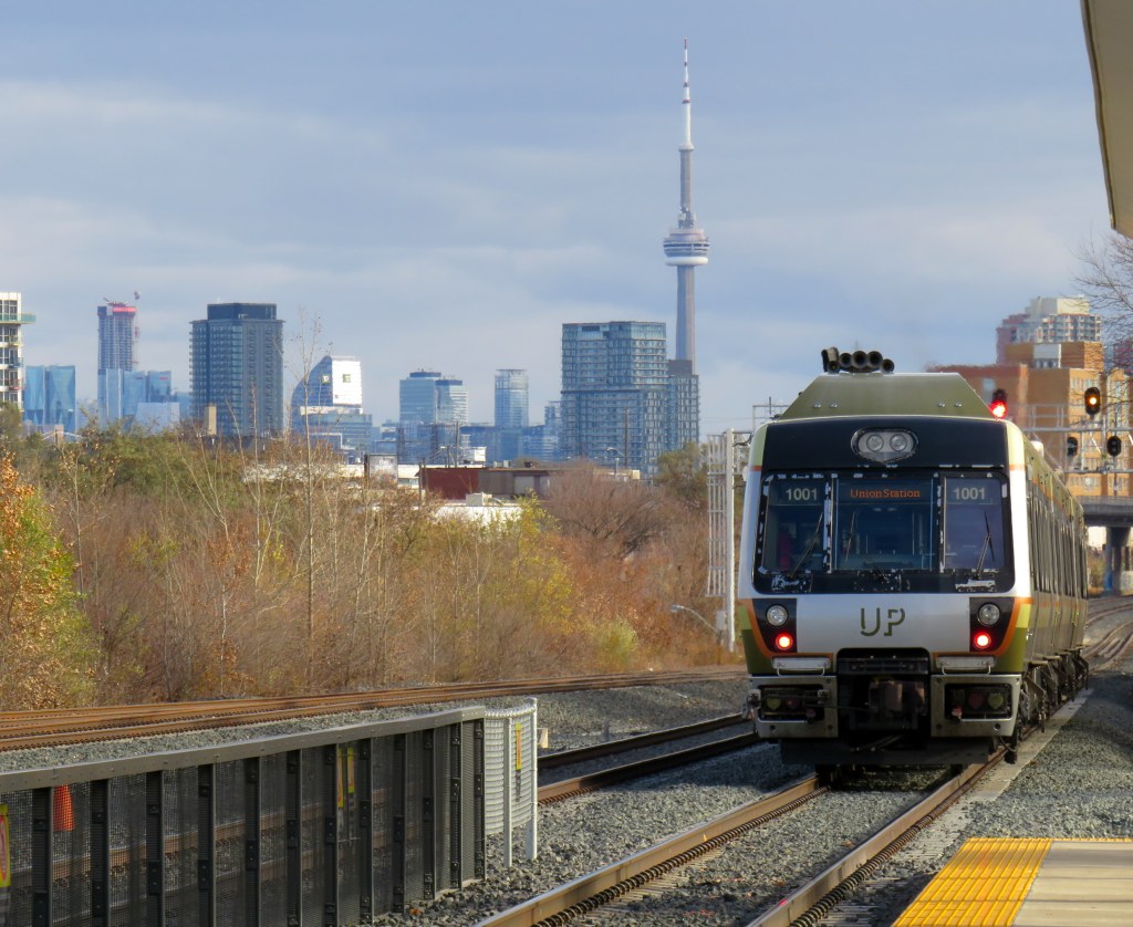
An UP Express train leaves Mount Dennis for Union Station, with the Toronto skyline in the background
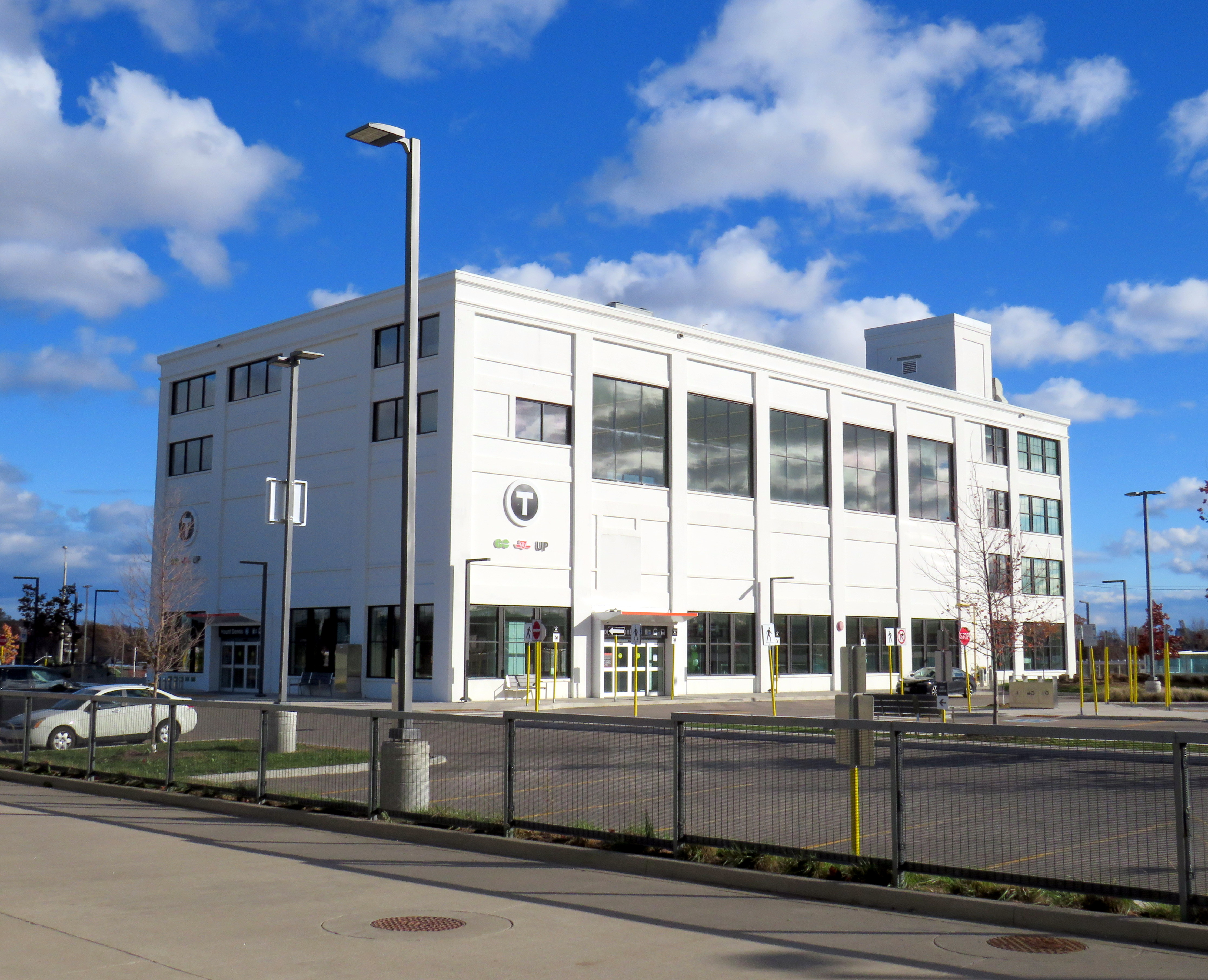
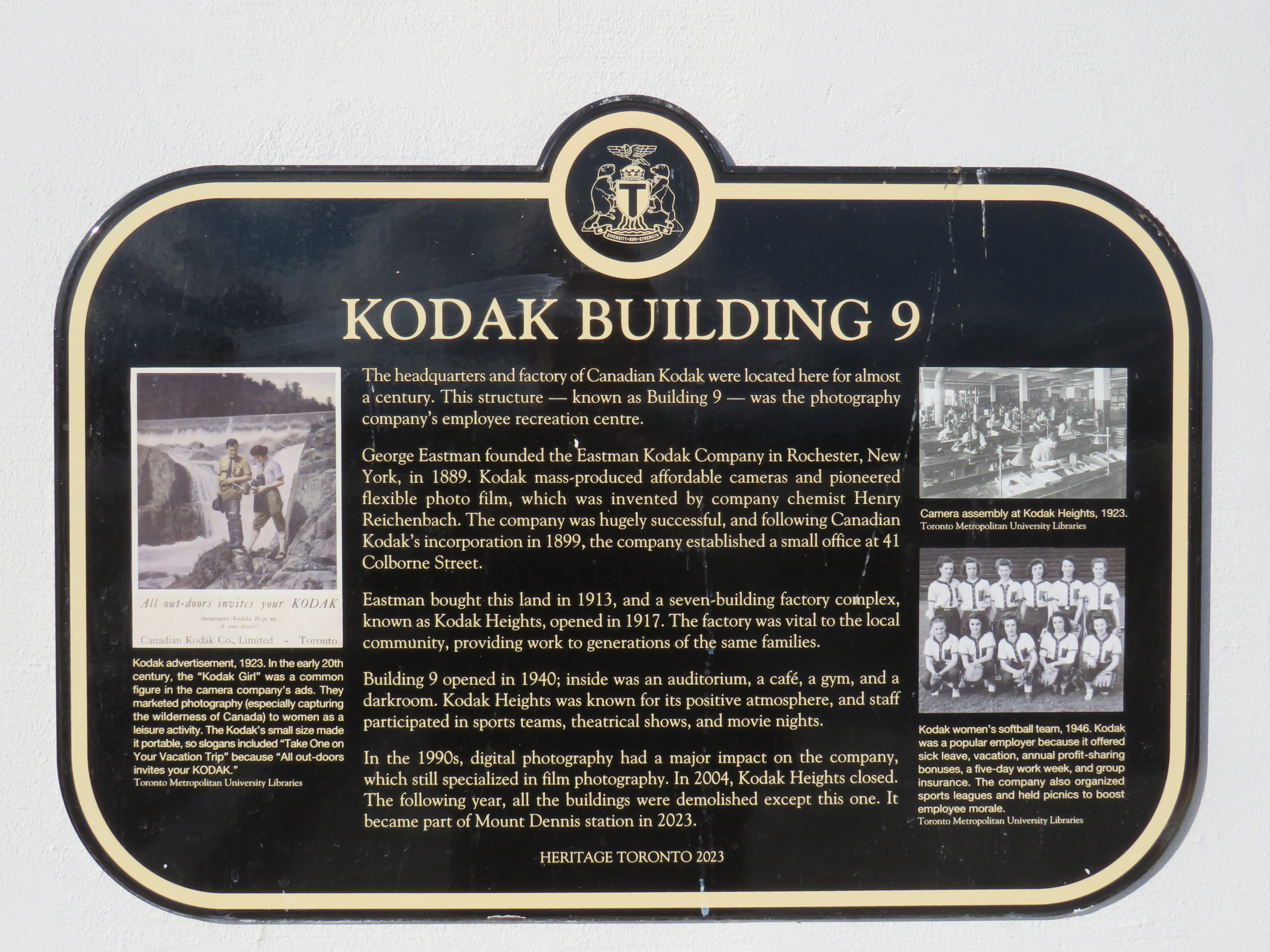
The Mount Dennis and Weston neighbourhoods were established around major industries, including CCM, Moffat Stoves, Willys-Overland, Dominion Bridge, Kodak, with even more employment at the nearby stockyards and slaughterhouses at St. Clair Avenue. The CN and CP railways passing through brought materials in and finished goods out. Today, only the Facelle tissue plant — now owned by Irving — remains in operation from that industrial past. The Dominion Bridge property later became the home of a TTC bus garage, while the Kodak plant became the site of the Eglinton Crosstown light rail storage and maintenance facility.
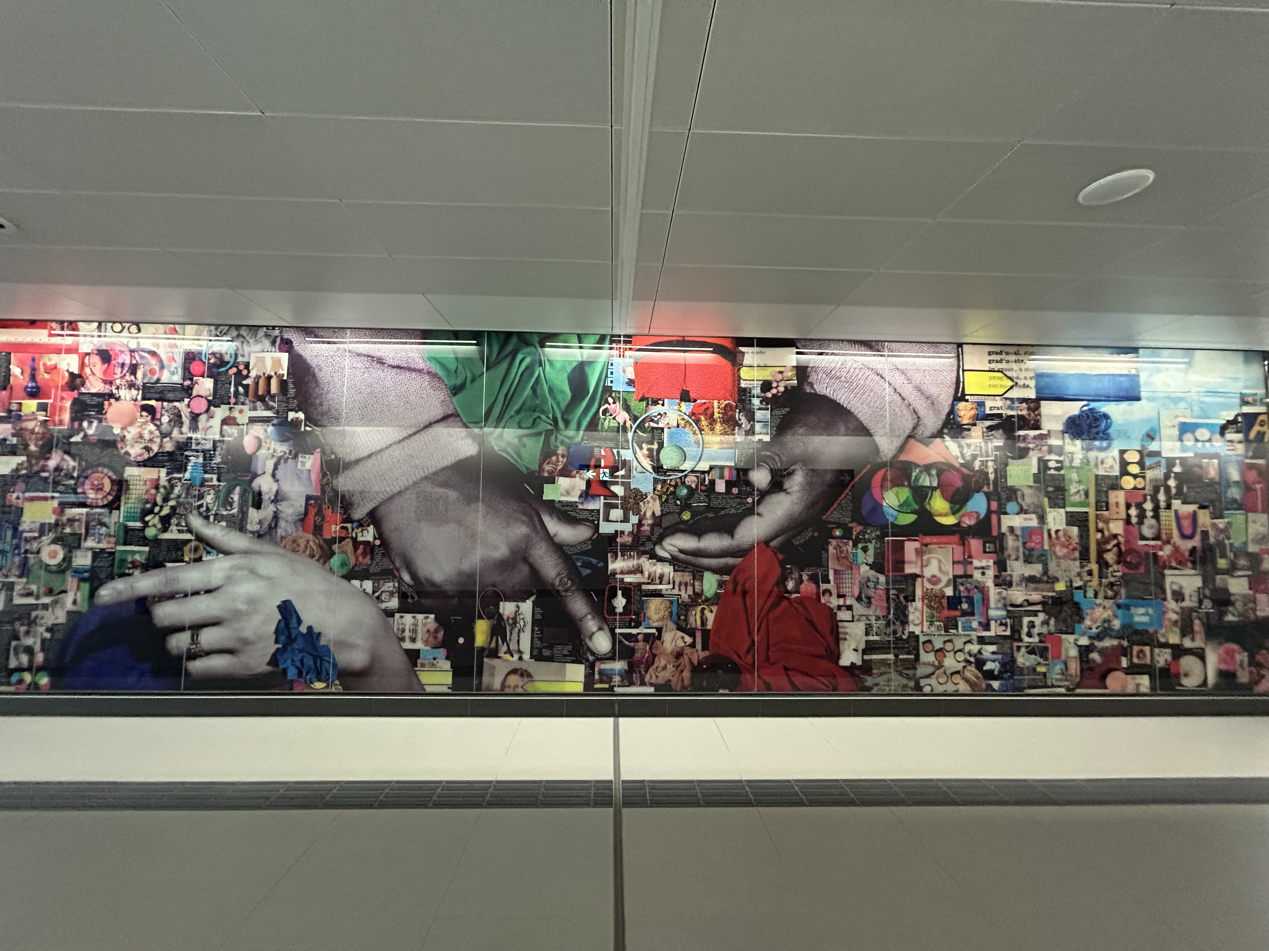
One building from the massive Kodak complex was preserved: Building 9, the employee recreation centre. The rear section of the main floor contains a public entrance to the station from the passenger pick-up and drop-off area, accessible washrooms, and access to the rest of the building (which is currently vacant). A bright mural, which once graced Building 9, can be found near the GO/UPX platform accesses. A heritage plaque tells the story of the building.
Mount Dennis Station platforms and Kodak Building 9Building 9, as seen from the TTC bus terminal. Note the Metrolinx “T” icon, with the logos of three services – GO, TTC, and UP – below.The GO/UP Express section of the station is brightened by a colourful mural saved from Kodak Building 9Heritage Toronto Plaque affixed to Kodak Building 9
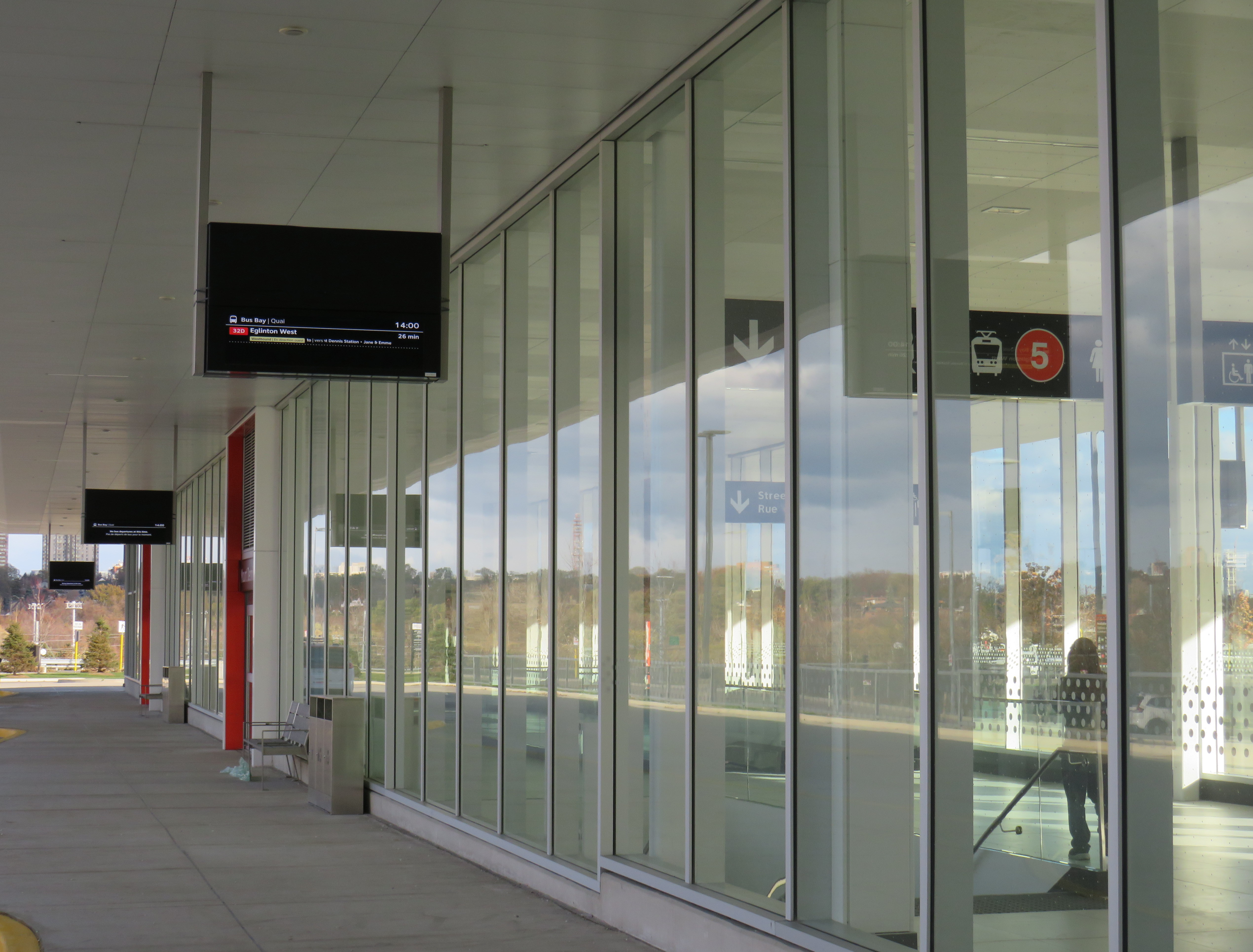
As UP Express and most GO Kitchener Line trains now stop at Mount Dennis, approximately three extra minutes is added to train trips. UP Express, which took 25 minutes between Pearson Airport Terminal 1 and Union Station, now takes 28 minutes. On the first day of stopping service last Sunday, very few passengers got on or off UP or GO trains (of the few that did, most appeared to be transit enthusiasts), but with more TTC bus connections and the Line 5 service hopefully coming soon, the station should become much busier.
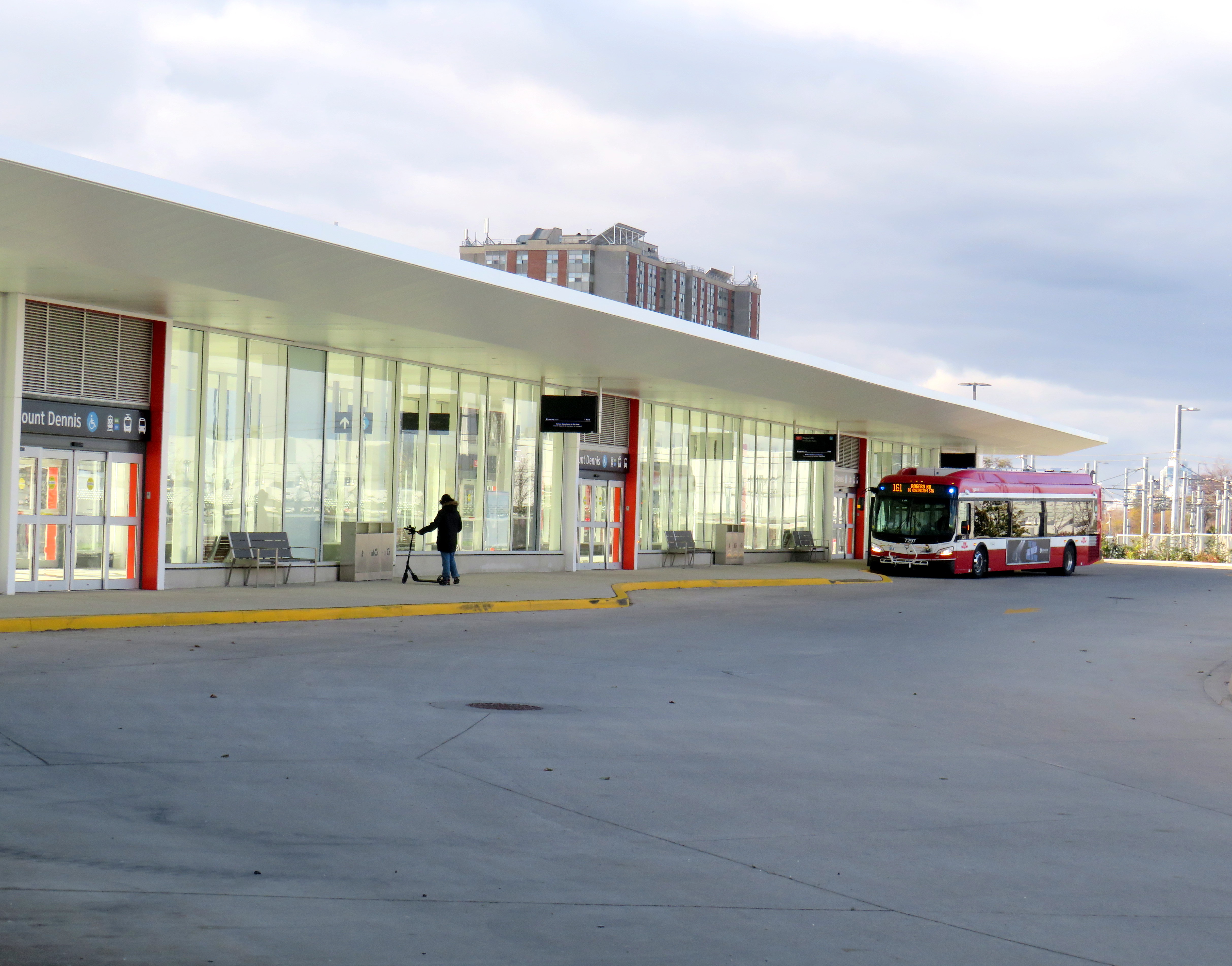
Mount Dennis Station was mostly empty on its first dayA mostly empty Mount Dennis bus terminal currently serves six routes; this will increase to 13 when Line 5 finally opens
Mount Dennis will be served by 13 different bus routes when the station is fully open, including a new route 901 express between Mount Dennis and Pearson Airport, via Dixon Road. Though most of the changes are simple route extensions to the new terminal (like the 161 and 168), the 35 Jane will be split into two (while the 935 express stays on Jane, bypassing Mount Dennis), and daytime surface service on Eglinton between Mount Dennis and Kennedy Stations will be limited to an infrequent Route 34 bus.
Map of planned bus network revisions upon opening of Line 5 (click for larger image)
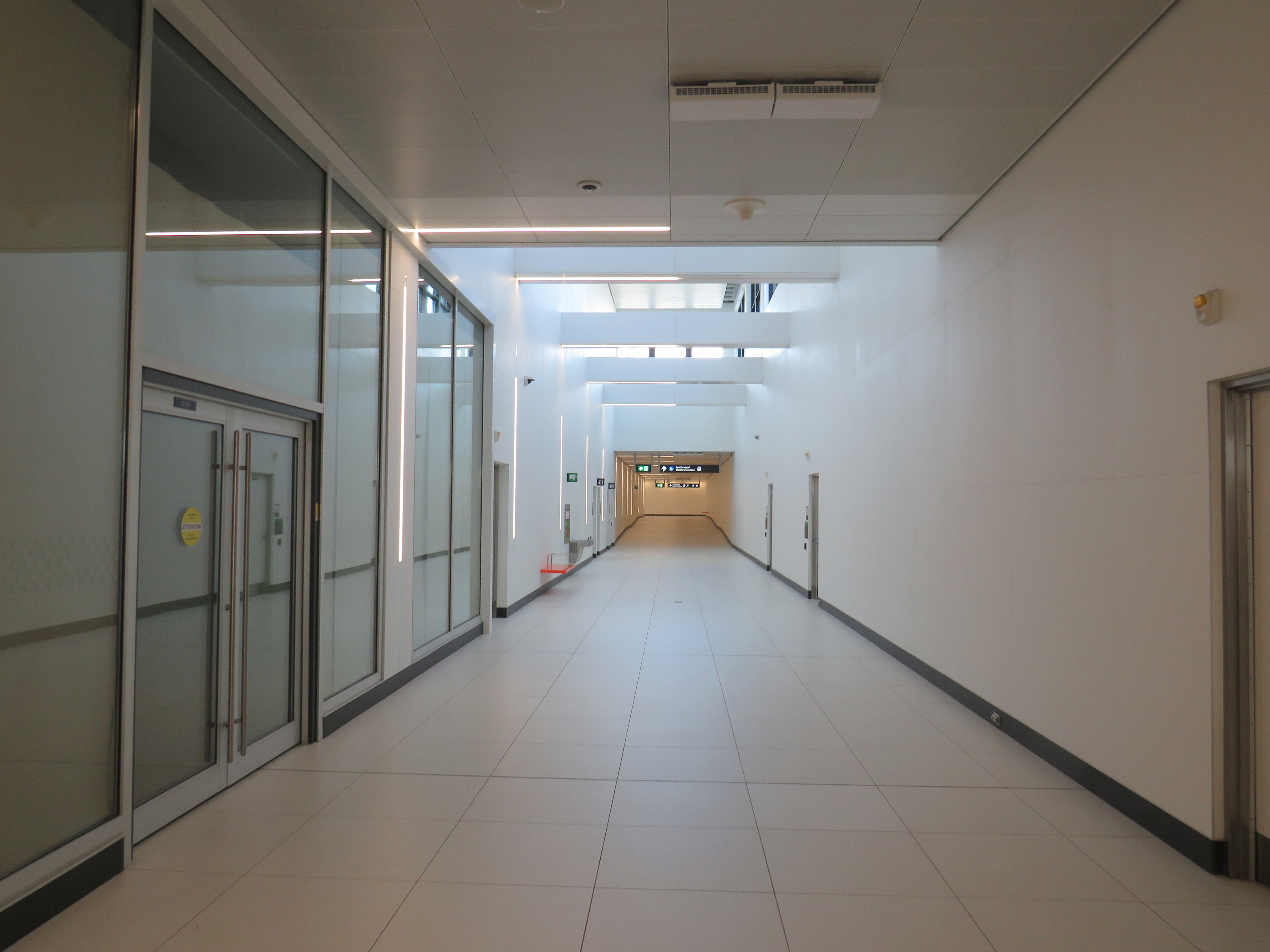
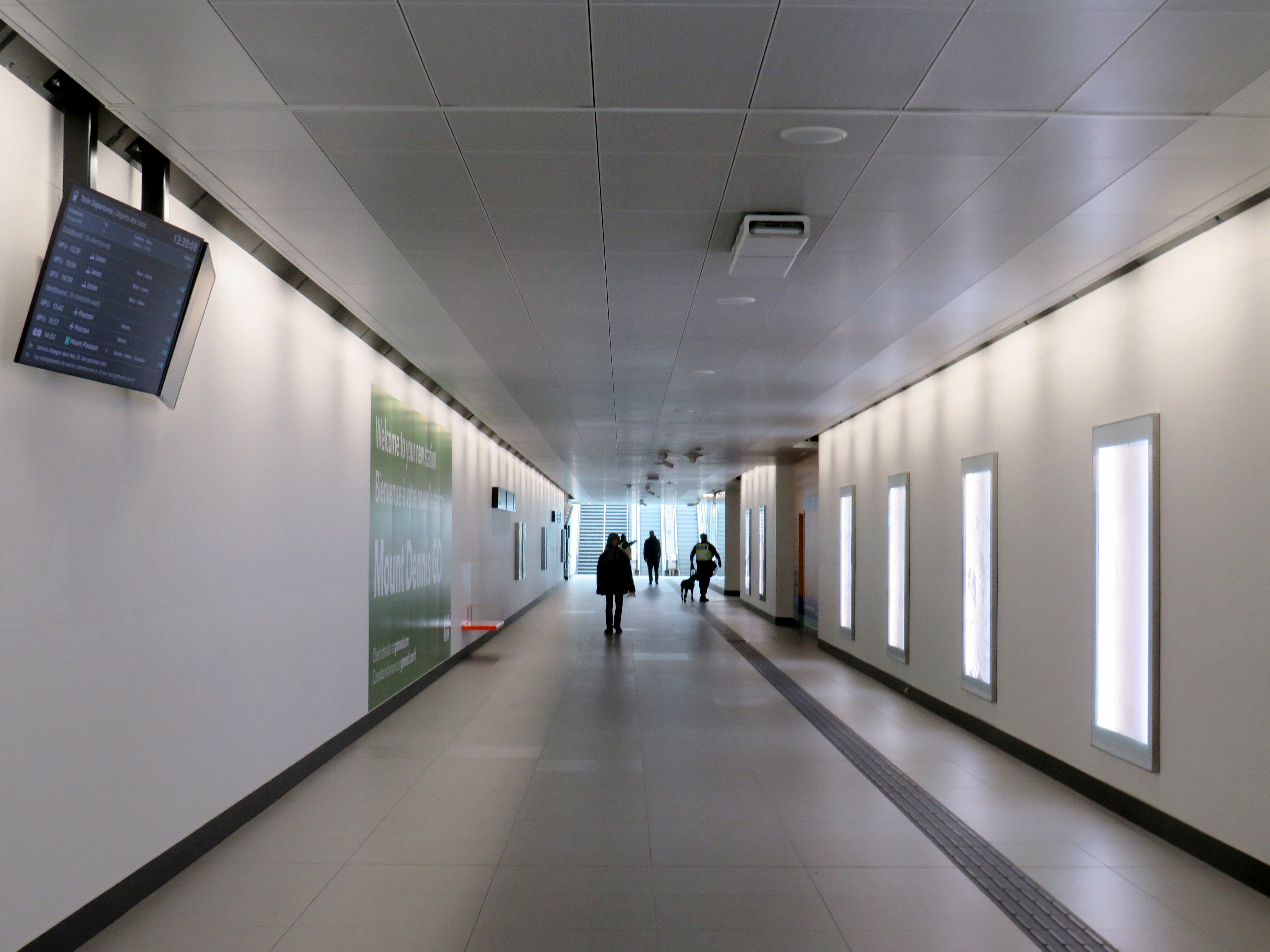
Despite some long corridors (particularly between the escalators up to the bus terminal and down to the closed-off LRT platforms), the station is well designed for the complexity of the site. The bus terminal and LRT platforms are both within the fare-paid area, eliminating one barrier between buses and rail.
Corridor towards the elevator and escalators from the TTC fare gates and LRT to the bus terminal. The natural light comes in from the large windows of Building 9. Public washrooms are on the left, past the windowed room, presumably a future retail space.Looking down to the LRT platforms
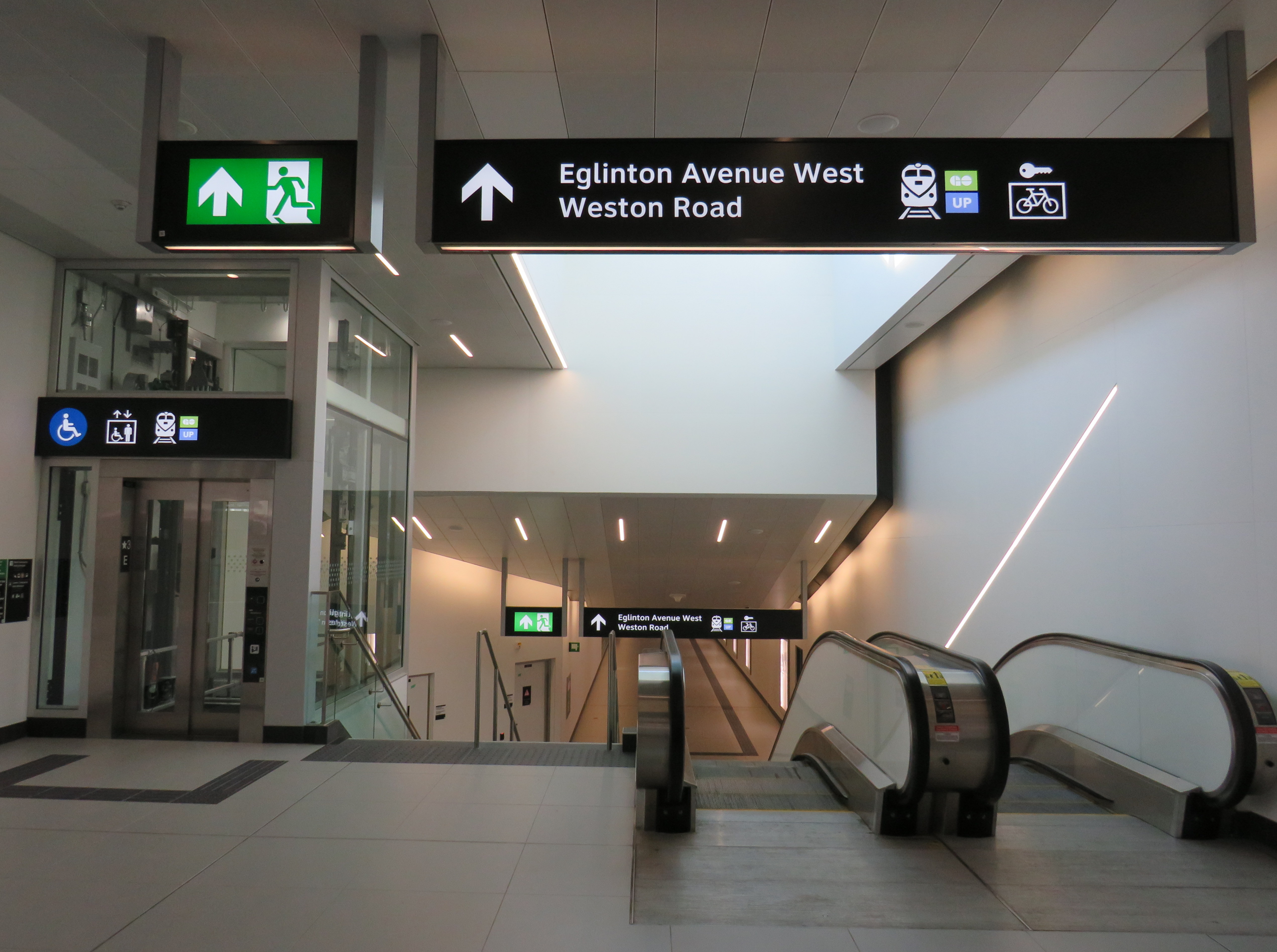
Three of four UP/GO platforms are in service (the fourth track, which would allow for more frequent GO Kitchener Line service is under construction). I was impressed to see two elevators to each platform, providing essential redundancy for improved accessibility and reliability. However, the GO/UPX platform access points are not easy to spot from this long corridor, which also leads to the Eglinton Avenue and Weston Road intersection.
Passage to GO and UP Express trains from the TTC bus/LRT area, looking west
There is no visible wayfinding signage in this long tunnel. Only when one reaches the escalators at the other end are directions apparent, as the overhead signs are affixed to sloped ceilings. This should be a relatively easy fix, but an important one.
No wayfinding signage visible below escalator levelin the GO/UPX area
Furthermore, an opportunity to provide a useful link to the Mount Dennis neighbourhood from GO/UPX Platform 4 (the west-most platform) has not been exploited. An undeveloped road allowance from the corner of Barr Avenue and Brownsville Road, used for station construction, is fenced off and barricaded. This would provide an alternate route to the station from Weston Road, particularly to the nearby Toronto Public Library branch, and would only need a few Presto tap readers and perhaps a fare vending machine. Perhaps it will take private highrise development to make this happen.
Looking west from Platform 4 to the Barr Avenue road allowance
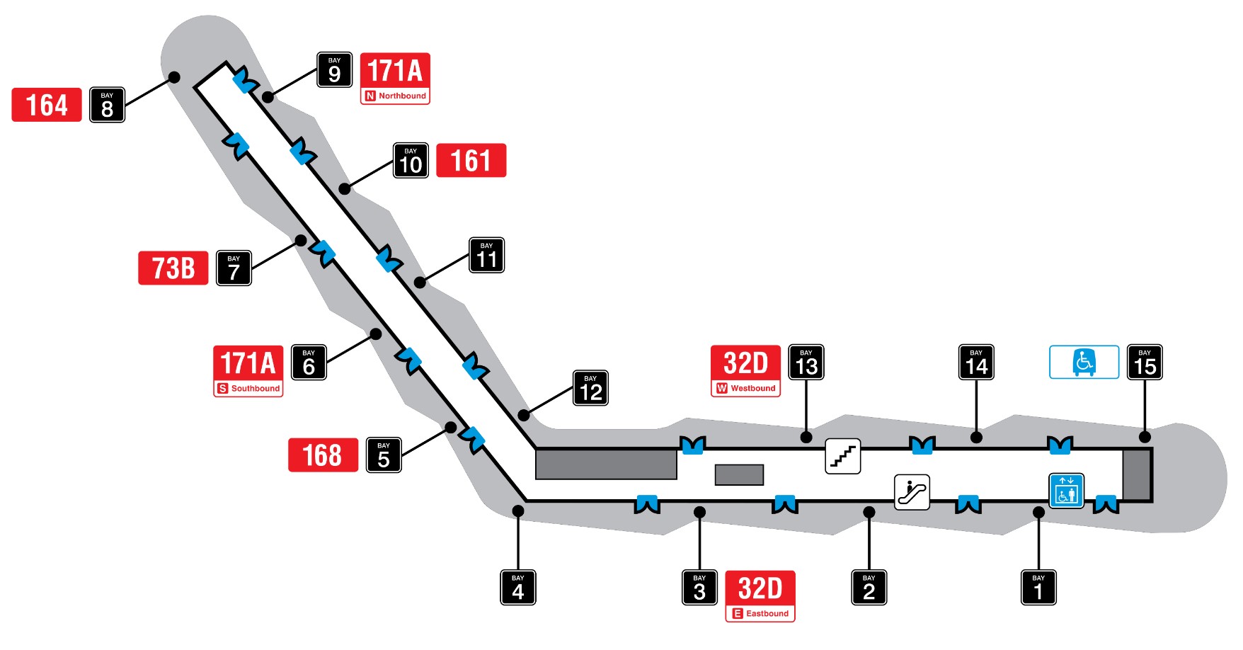
Finally, it was frustrating to see so little wayfinding signage in the TTC bus terminal. Though the TTC has numbered each of the bus bays from 1 to 15, these numbers do not appear inside the waiting area or over the doors. Digital screens over each bay display very small text with next bus information.
TTC bus terminal plan, with each bus bay and assigned routesOutdoor signage at Mount Dennis bus terminal
The wayfinding signage needs to be corrected, but at least these are simple fixes. Otherwise, it was a treat visiting a new transit hub on a sunny (though cold) November afternoon. The heritage preservation was a nice touch; hopefully, new use is found for Building 9’s upper floors. Furthermore, one hopes the rest of the Line 5 Crosstown stations open soon.
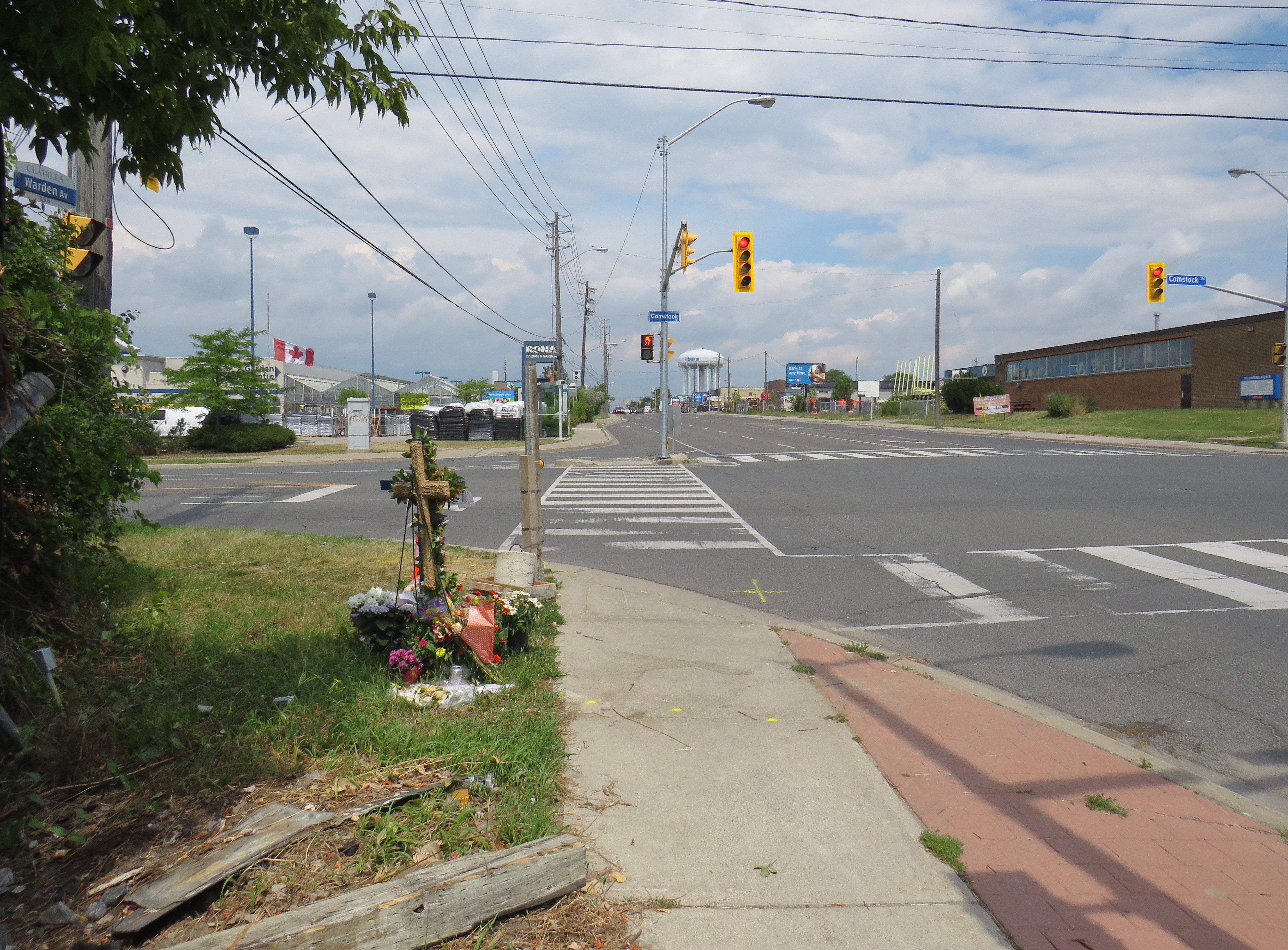
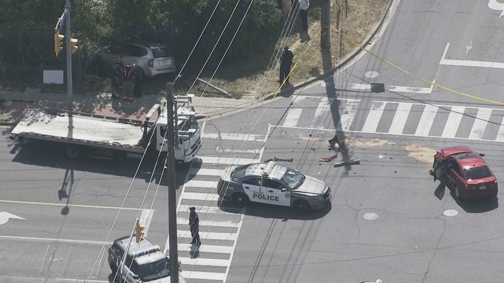
On Thursday, July 21, 2022, at 3:10 PM, a 38-year-old man was standing at a street corner in Scarborough, waiting for a signal to safely cross to the other side. Before he even had the chance to enter the intersection of Warden Avenue at Comstock Road, a driver of a 2009 silver Kia minivan heading south on Warden struck a 2012 red Lexus, whose driver was making a left turn from Warden to Comstock.
Aerial view of the collision, courtesy of CTV News. The Kia minivan struck a 38-year-old man waiting at the corner before plowing into a fence protecting a vacant lot.
A week after the deadly collision, I visited the intersection. On the southwest corner of Warden and Comstock, a roadside memorial was set up with flowers and a wooden cross. A temporary wooden pole held up a new pedestrian “beg button” for walkers to get across Warden Avenue. The Kia’s path into the sidewalk and the fence was very much visible, though all debris from the collision was cleaned up.
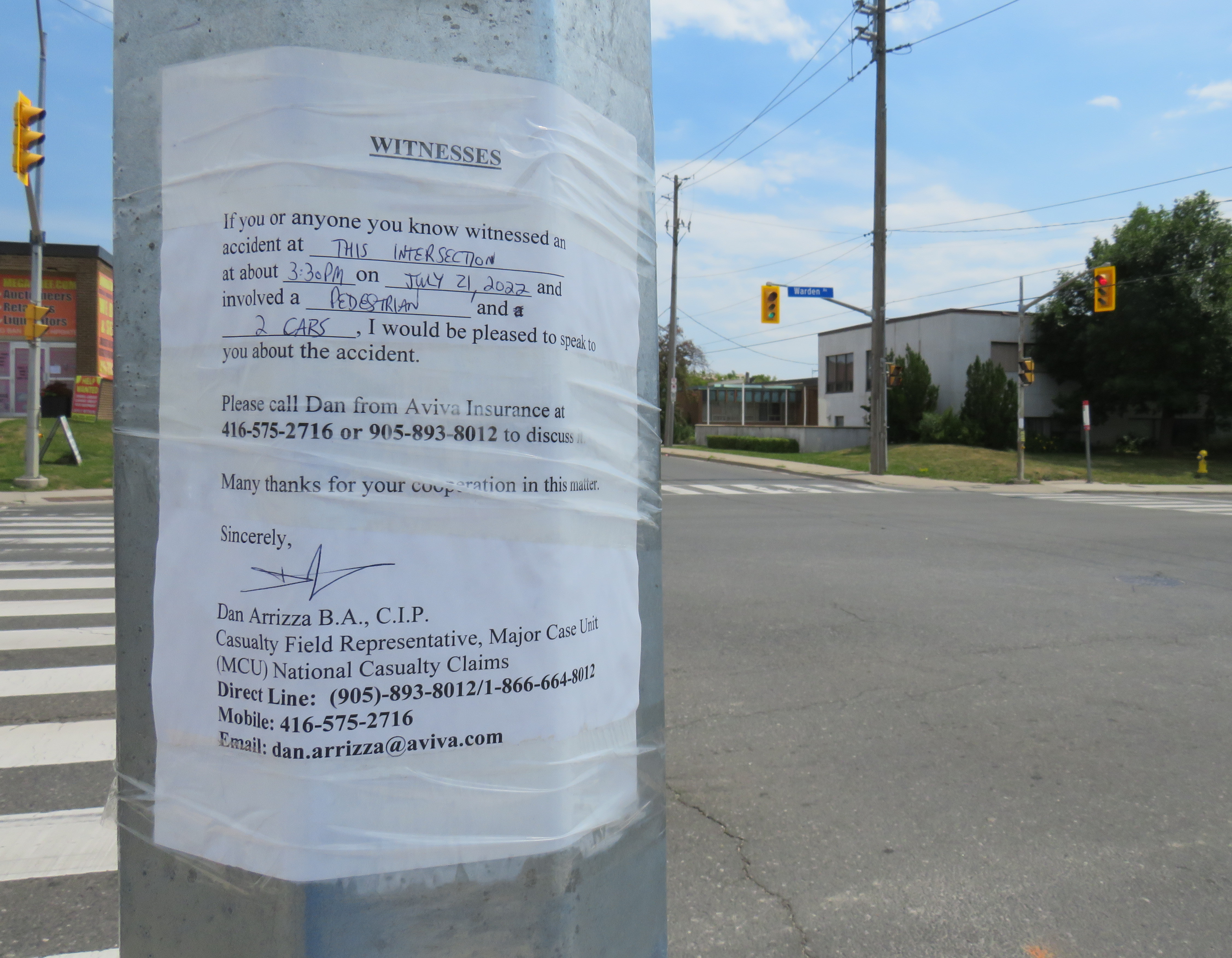
Appeal to witnesses following a deadly collision at Warden Avenue and Comstock Road
The collision was still being investigated. While the Toronto Police were looking for witnesses to the collision, an investigator from Aviva Insurance was also looking for witnesses; several notices were taped to nearby traffic poles.
Without knowing all the facts of the collision — which are unlikely to be reported in the news media — it would be fair to assume that speed and/or inattentive driving were at fault, but the design of the intersection — as well as Warden Avenue and Comstock Road themselves — are also to blame.
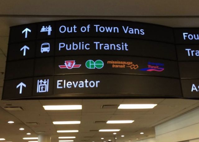
Sign in Terminal 1 at Pearson Airport. Whether we realize it or not, Pearson Airport is already a transit hub.
Updated April 7, 2016
Lester B. Pearson International Airport is Canada’s busiest airport, handling 41 million passengers a year. It is not the busiest transportation hub in the Greater Toronto Area, though; Union Station is considerably busier (GO Transit alone handles 64.4 million passengers a year at Canada’s busiest station).
Pearson Airport is located almost entirely within the City of Mississauga, but the terminals are less than a kilometre away fromthe City of Toronto’s western boundary; due to the location of the airport terminals, most passengers reaching the airport by road, or transit pass through the City of Toronto to get to it.
The Greater Toronto Airports Authority (GTAA), the not-for-profit agency that operates Canada’s busiest airport, has expressed interest in creating a transit hub and guiding transit-oriented development around it. It’s an interesting idea, and some of the facts are compelling.
There are approximately 300,000 jobs located at and near Pearson Airport. The airport itself hosts 40,000 employees that work for the airport authority and its contractors and tenants, including retailers, airlines, and allied services. The remaining 250,000 jobs are located in office parks and industrial areas that surround the airport, in the cities of Toronto, Mississauga, and Brampton, a very large area that extends north into Bramalea, west of Hurontario Street and south to Highway 403.
You can read the GTAA’s report, written by the prestigious planning firm Urban Strategies Inc., and named Pearson Connects: A Multi-Modal Platform for Prosperity online as a PDF. The report claims that Pearson Airport and environs has more jobs, and more economic clout than any Canadian downtown, with the exception of Downtown Toronto. To a degree, this is true. But the size of the Airport Employment Zone, as the GTAA defines it, is much larger in size than any downtown, even Toronto’s; the jobs are mostly dispersed in warehouses, factories, and suburban office buildings difficult to reach by transit.
In fact, Pearson Airport and its surrounding area — all 25,600 hectares (256 square kilometres) — has fewer than 25 employees per hectare, while Downtown Toronto, one-tenth the size, has nearly 200 employees per hectare (and a growing residential population as well). Igor Dragovic calculated these figures from a recent Neptis report. The low employment densities found in business parks and warehouse districts are only partly to blame; the airport itself, with five active runways and a large land buffer, contributes to this.
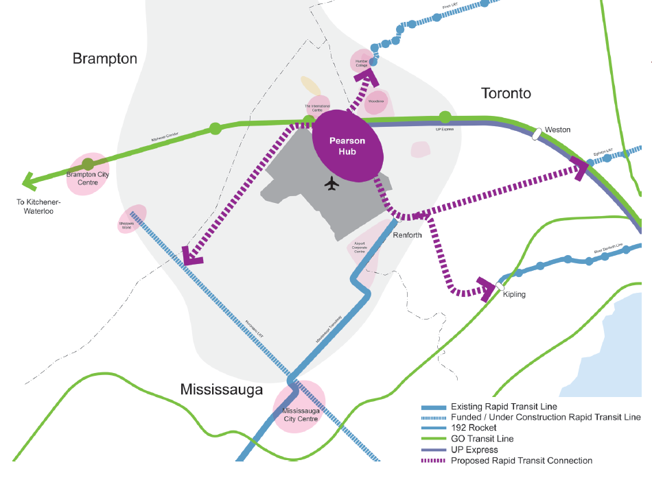
The GTAA wants to build an “airport-related multi-modal hub” that would tie together existing and planned rapid transit services, including the Kitchener RER Service, LRTs on Eglinton and Finch Avenues, the Mississauga Transitway BRT and a proposed Derry Road transit corridor. It cites airports in Amsterdam, Frankfurt, London, and Hong Kong as examples to emulate.
The report also neglects to recognize that Pearson Airport is already a major transit hub; the problems lie in integrating the existing and proposed transit services together. And for an area the size of the GTAA’s Airport Employment Zone, that’s a very tall order.
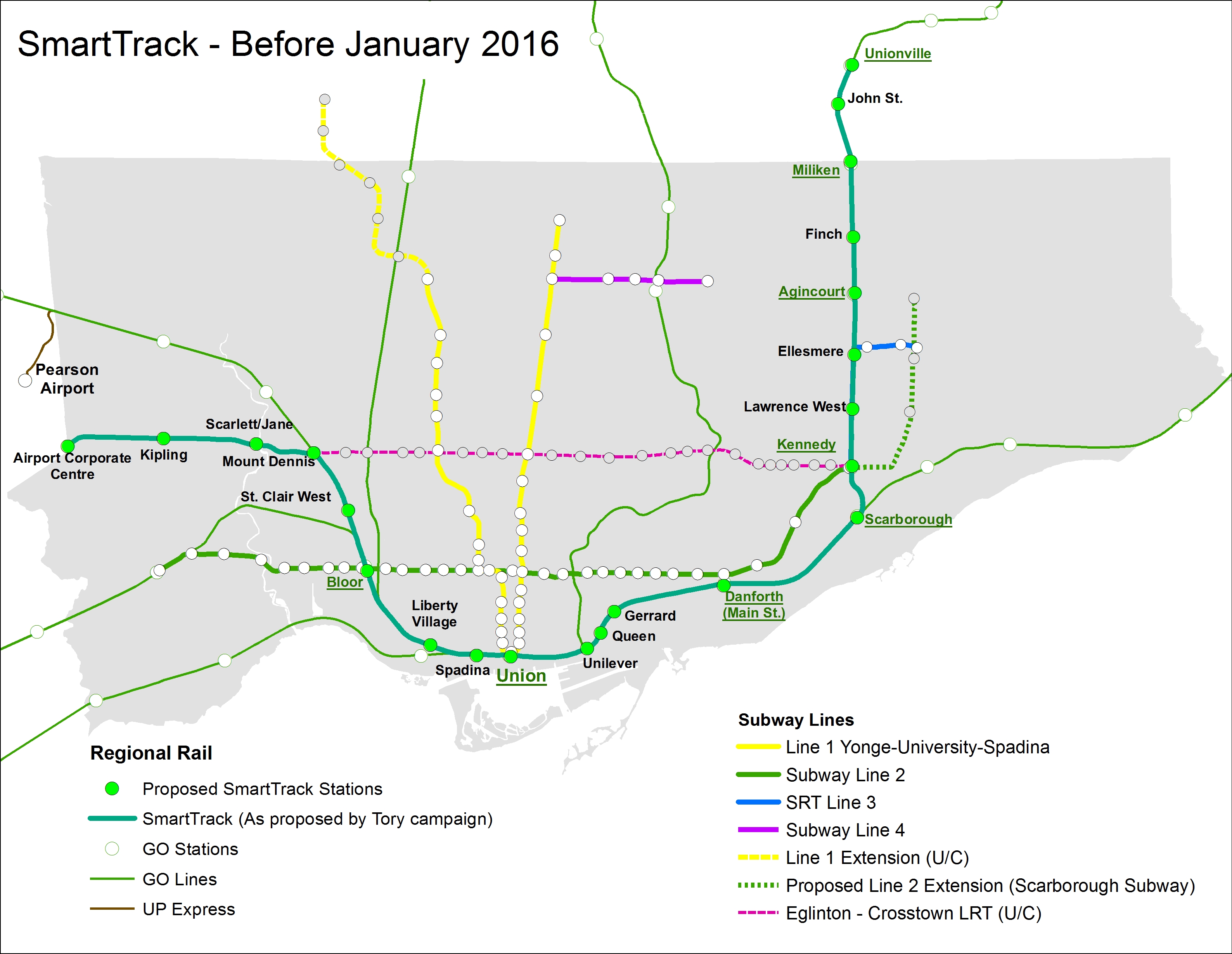
Tory’s SmartTrack plan, dreamed up by a private-sector planning firm, was intended to connect office parks in Mississauga and Markham to Downtown Toronto, as well as serve the proposed First Gulf development at the Unilever site near the mouth of the Don River. Tory promised that it would provide relief to Toronto’s overburdened subway system, but that was never the main objective.
I have been aware of rumours that Tory’s SmartTrack plan was going to be walked back due to mounting costs and technical issues of implementing the mayor’s campaign promise. The team that came up with the idea of a U-shaped rail network intended to connect several suburban employment centres with Downtown Toronto overlooked some important details, such as the availability of land along the former Richview Expressway corridor along Eglinton Avenue West. SRRA, the private-sector planning organization that came up with SmartTrack, assumed that the Richview lands were available and owned by the province, but the city owned the land, and sold much of it off for development in 2011 and 2012.
The cost of building the western spur between Mount Dennis and the Airport Corporate Centre was, in all likelihood, found to be prohibitive, though we have yet to find out what the estimated costs for a tunnel along that section. The eastern section, north of Kennedy Station, would have closely paralleled both the Scarborough RT and the proposed extension of the Bloor-Danforth Subway to McCowan Road, a project that Tory also backed.
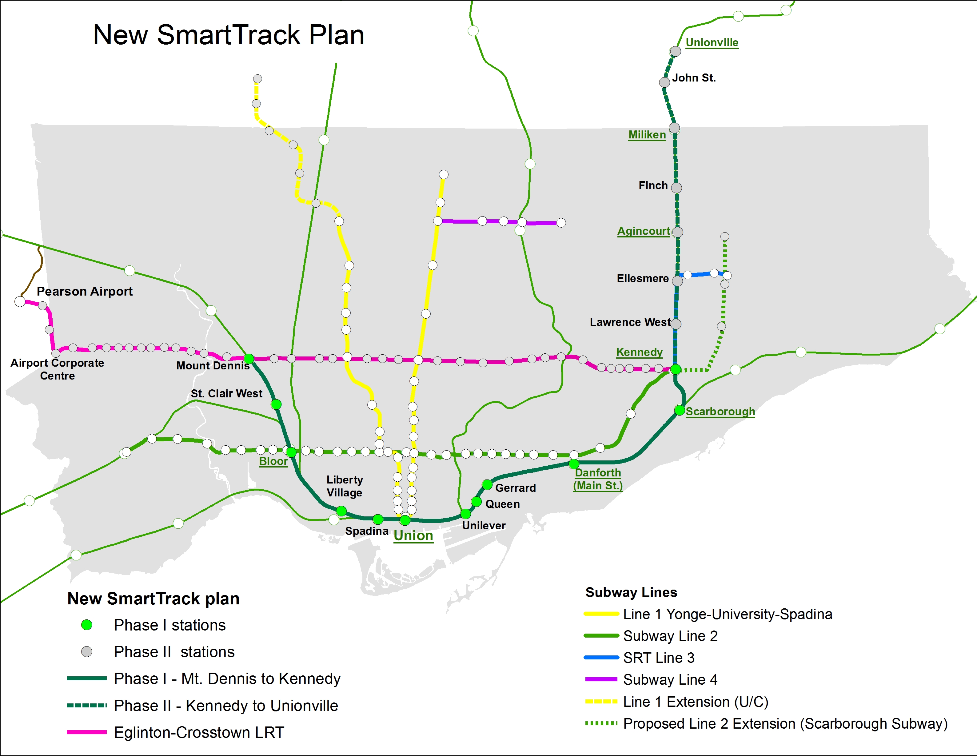
The Globe and Mail’s Oliver Moore reports that SmartTrack will cover a much shorter section than the map on John Tory’s 2014 campaign brochures. Frequent rail service will complement existing GO Transit Regional Express Rail (RER) services on the Kitchener and Stouffville Corridors, terminating at Mount Dennis and Kennedy Stations. The Eglinton West section will be covered by the “shovel-ready” Phase II of the Eglinton-Crosstown light rail transit line (ECLRT), which is already under construction east of Mount Dennis. (The provincial government deferred funding for this section of the ECLRT in 2010 for budgetary reasons.) The north-eastern section of SmartTrack, between Kennedy Station and Unionville Station in Markham, will be deferred.
This new plan, which is being finalized and will likely be officially announced later this year, will cost an additional $2-billion to $3.5-billion to the existing plans for RER, in order to facilitate more frequent, subway-like frequencies, as well as complete the western section of the ECLRT.
If Moore’s reporting is accurate (and I have seen maps and other materials that collaborate his report), then Tory will have to eat some crow. Spin doctors will have to figure out how to polish this turd as Tory seeks a second mandate in 2018. It’s also inevitable that the new additional service on this corridor will continue to be branded as “SmartTrack.” But this is the best solution, and maybe this is a sign that Tory is learning on the job.
At the end of the day, what Toronto gets is what Metrolinx’s “Big Move” plan envisioned: upgrades of most GO Transit corridors to RER, as well as Phase II of the Eglinton-Crosstown LRT line to Pearson Airport. (The Finch West and Sheppard East LRTs are also approved, but have yet to start construction.) The paired-down SmartTrack plan, if trains are frequent enough, and with attractive transfers with the subway and TTC surface routes, will draw some riders. It could help provide medium-term relief as the [Downtown] Relief Line Subway is studied and built.
The new SmartTrack plan, including Phase II of the Eglinton-Crosstown LRT
But where I find myself annoyed is when I realize that we wasted over a year on Tory’s campaign slogan without any progress on the Relief Line (which will offer real, long-term relief to the Yonge Subway), the Waterfront West LRT, or other transit priorities such as accessibility at all existing subway stations. I remember during the 2014 election campaign, critics of Tory’s simplistic and flawed SmartTrack plan were dismissed without acknowledging their objections. It’s also worth noting that Tory also adopted rival Olivia Chow’s bus plan, after belittling it during the campaign.
In order to provide fast and reliable transit to the Airport Corporate Centre and Pearson Airport itself, there are opportunities to refine the western section of the Eglinton-Crosstown LRT. The environmental assessment called for 15 stops between Mount Dennis and Pearson Airport, while SmartTrack would have had as few as three stops along the same section. If the ECLRT can be sped up at all, it would be worth considering. I would also be interested in whether the SmartTrack corridor could be integrated with the UP Express rail link, whose ridership started off quite low.
And maybe, just maybe, the high costs of constructing the Scarborough Subway extension will also prompt a rethink, going back to the original LRT replacement and extension plan. As the Spadina Subway extension to York University and Vaughan is now two years late (and yet another $400 million over-budget), maybe there’s an opportunity to get it right there as well. It’s also imperative that proponents of the Relief Line Subway strike now.
I could be giddy with the revelation that Mayor Tory’s signature campaign platform is coming undone, having foreseen the problems with his plan. But I’m not. However, I do take pleasure in knowing that we have a smarter plan in the works.