Tag: LRT

  • A disaster in the making

    A disaster in the making

    Hurontario Street, looking south from Steeles Avenue, where the first phase of the Hurontario LRT will terminate

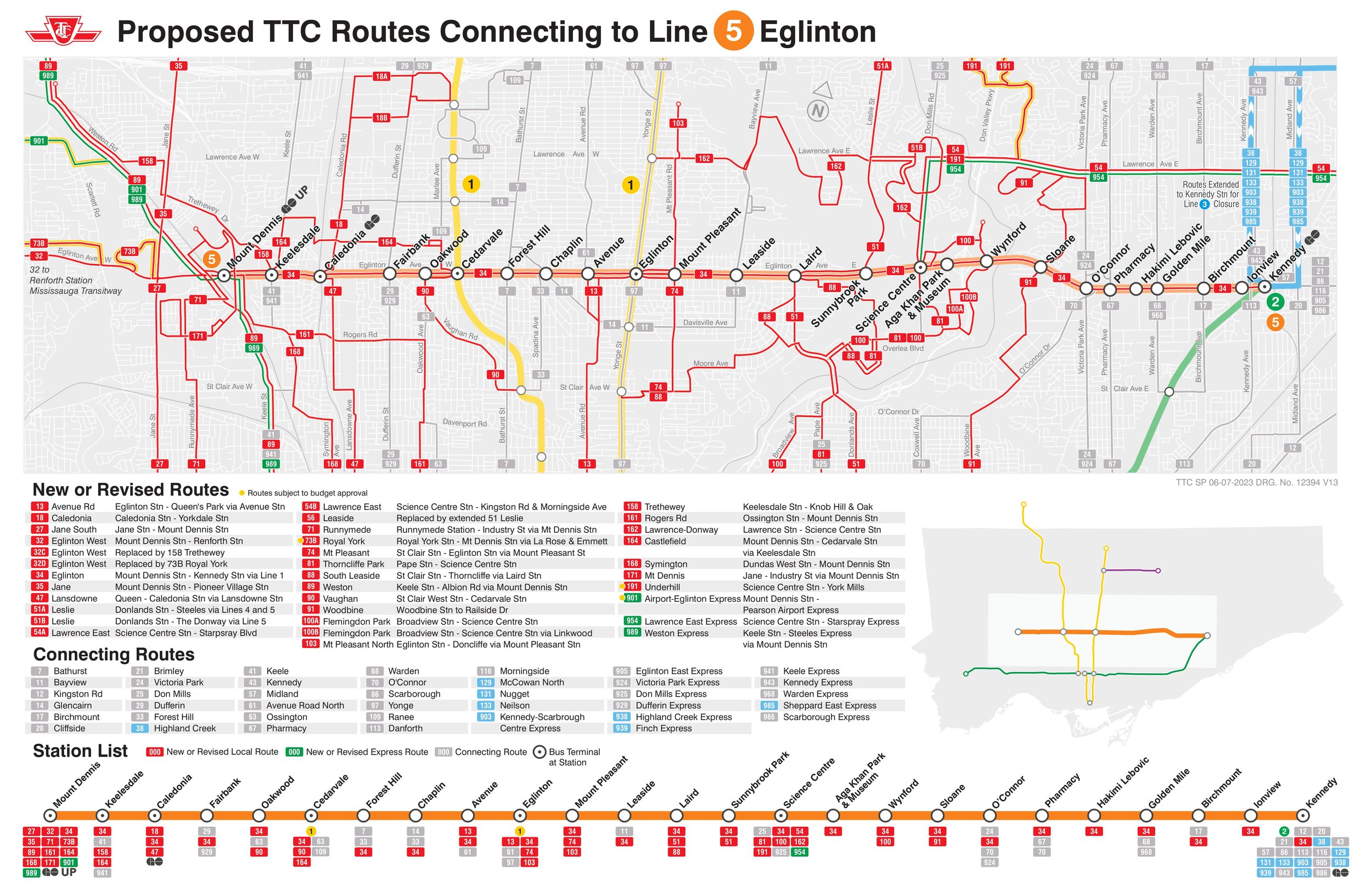
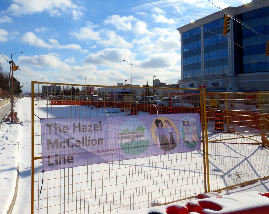
    The first phase of the Hurontario LRT, which will between Port Credit GO Station and Steeles Avenue in Brampton, is slowly taking shape after years of construction delays. In Spring 2026, eight years since construction started on the corridor, work on the LRT guideway into south Brampton has finally begun.

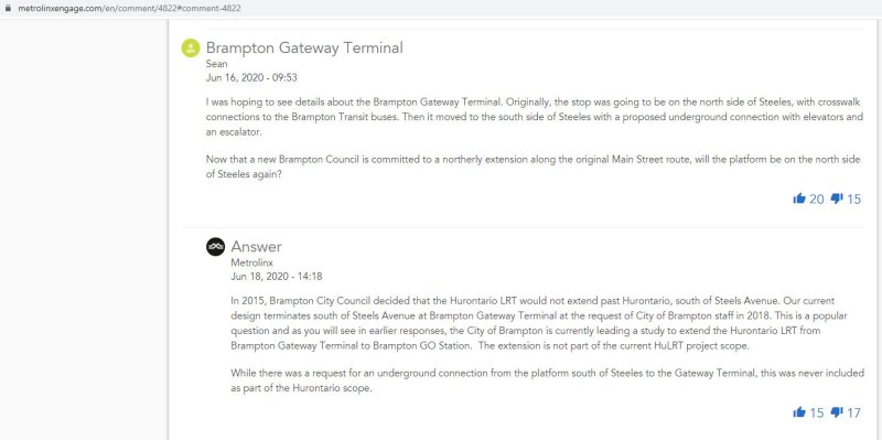
    As I wrote in detail before, a previous iteration of Brampton City Council narrowly voted against the LRT entering downtown as a surface line in 2015. This was the version selected in the provincial environmental assessment. Instead, that council voted to study alternative corridors into Downtown Brampton requiring lengthy detours, and asking for the LRT northern terminus to be on the south side of Steeles Avenue, despite a major bus exchange — Brampton Gateway Terminal — on the north side of the intersection to accommodate all options. After the 2018 election, council recommitted to a Main Street alignment (though preferring a tunnel) and asked the province to restore the terminus on the north side of Steeles pending a decision on the final four kilometres into Downtown Brampton. In early 2026, only one of the six councillors opposed to the Main Street LRT ten years ago remains in office.

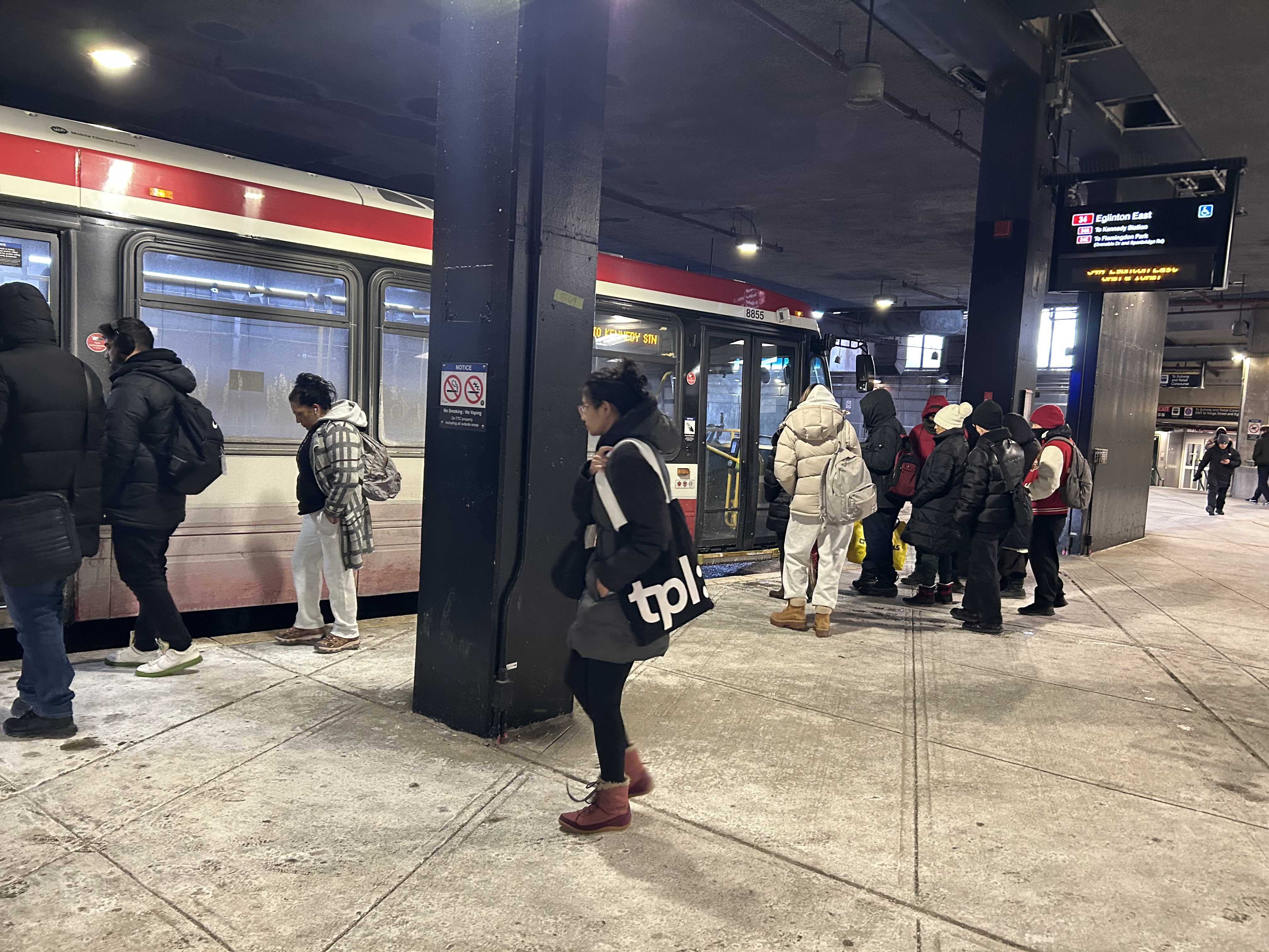
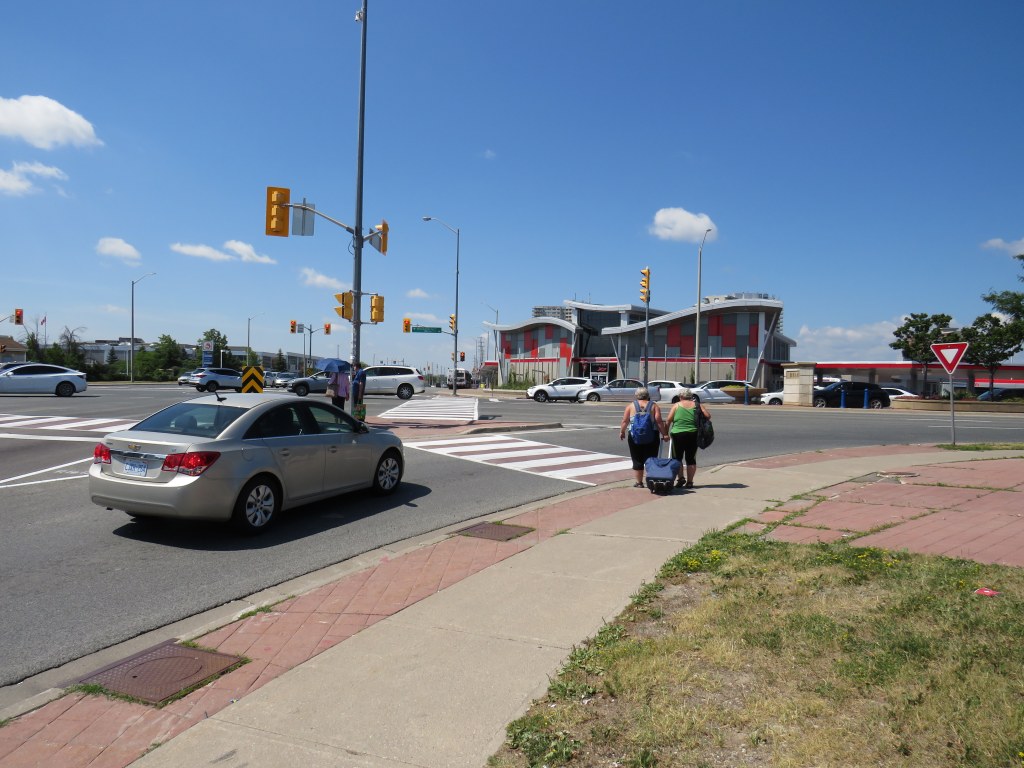
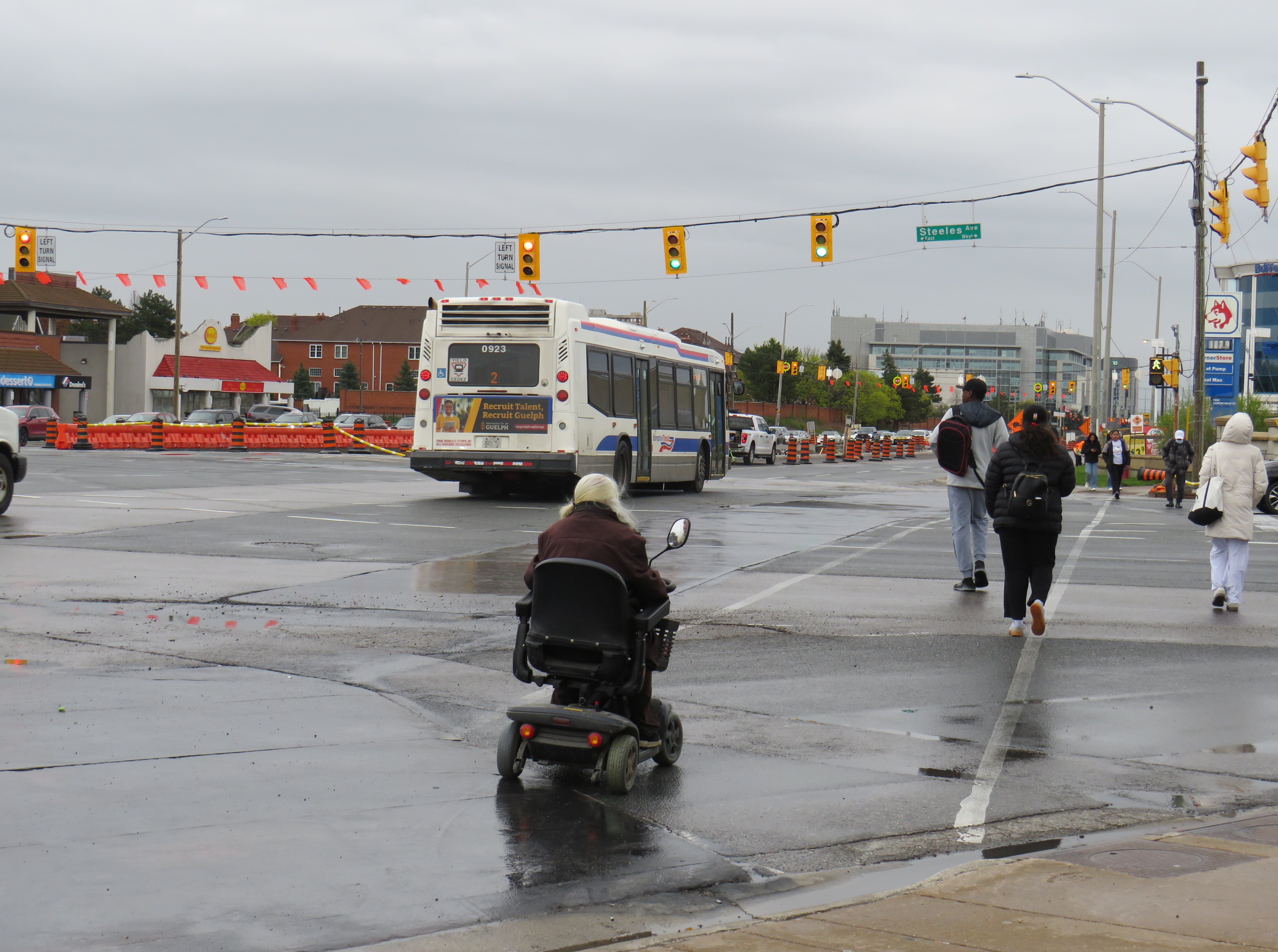
    I wanted to follow up with Metrolinx to see how pedestrians would be safely accommodated at the Steeles and Hurontario intersection, given high traffic volumes, wide roads, and likely thousands of passengers switching between modes on a daily basis. Early concepts of an underground pedestrian tunnel were rejected by the province as out-of-scope, so pedestrians would have to cross both Hurontario and Steeles to make the transfer. Having no satisfactory answers despite many attempts to get an answer to this question, I took the lengthy and expensive route of submitting a freedom of information (FOI) request.

    In summary, I learned that despite multiple requests from City of Brampton officials to restore the north side stop, Metrolinx and the provincial government refused. With the financial close with Mobilinx — the private-sector consortium selected to build, operate, and maintain the LRT — imminent in early 2019, there was no interest to make the minor change to facilitate the terminal, even though the city committed to taking on the cost on its own. The province was open to other changes to the line, however, as in 2022, it unilaterally renamed the line for a former Mississauga mayor and political ally of Doug Ford.

    Looking south across Hurontario Street across a very busy multi-lane intersection towards the end of the LRT

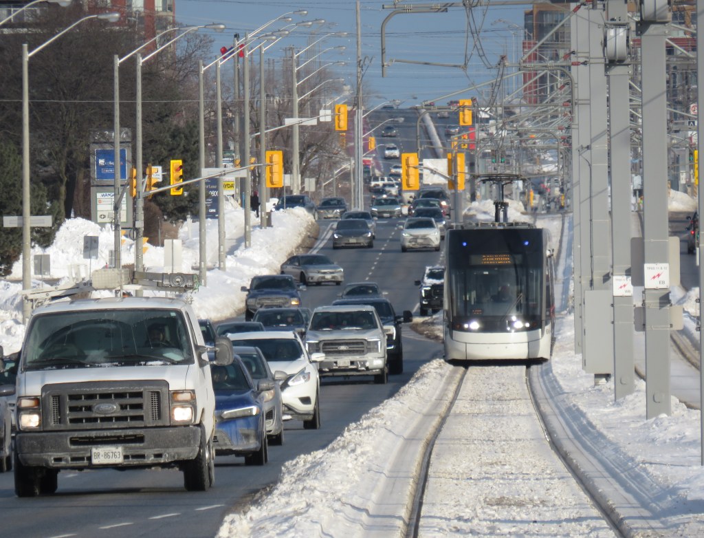
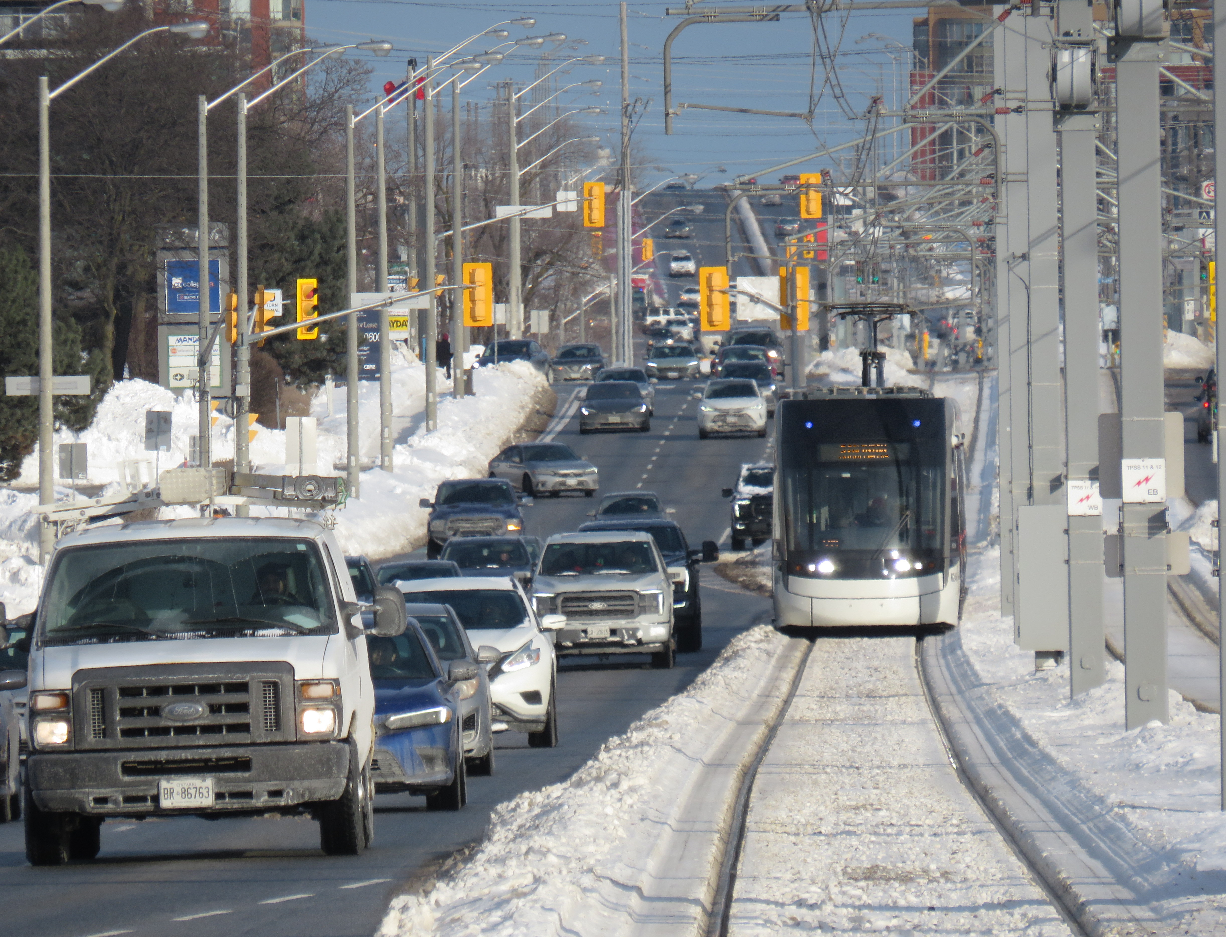
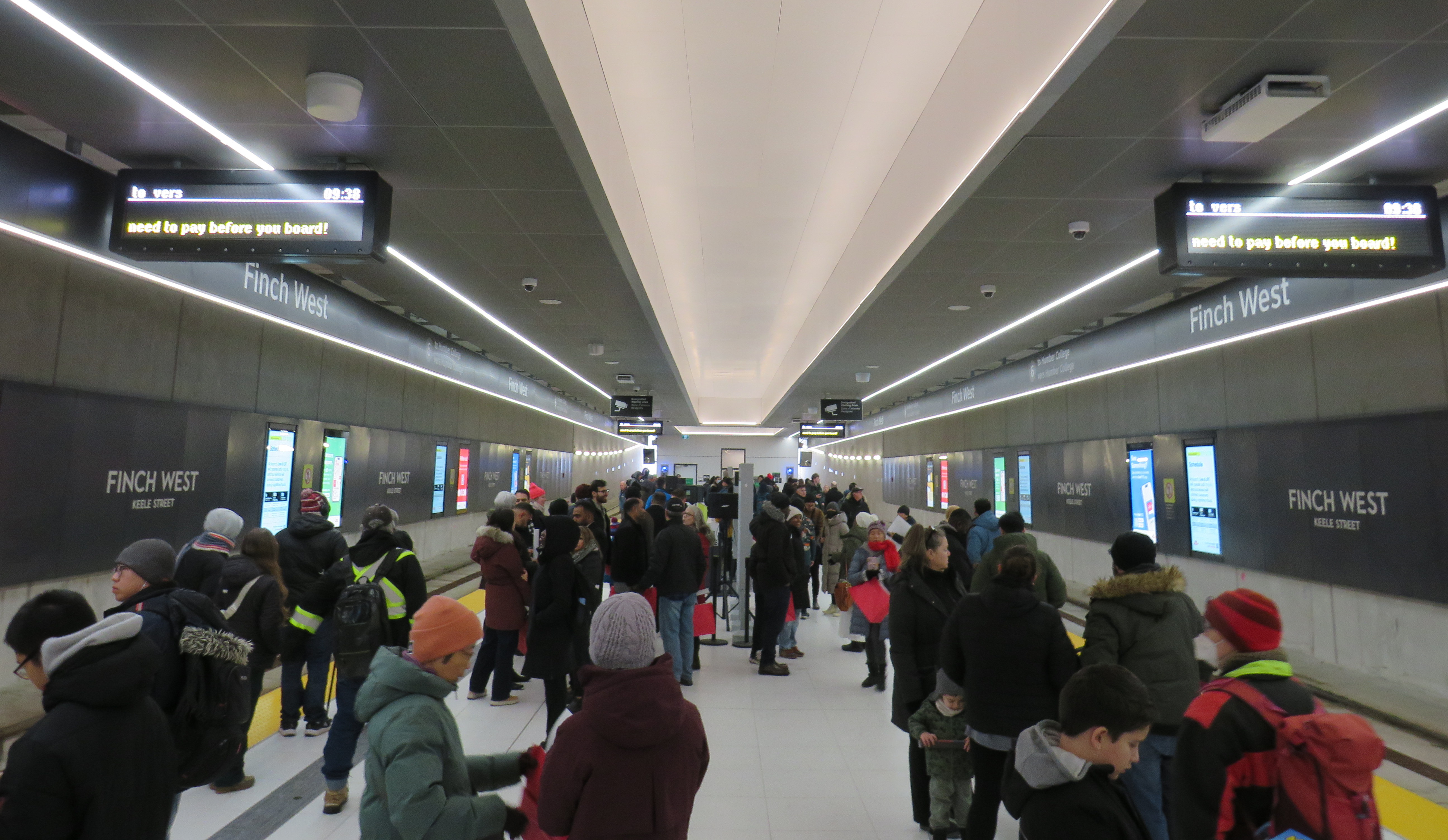
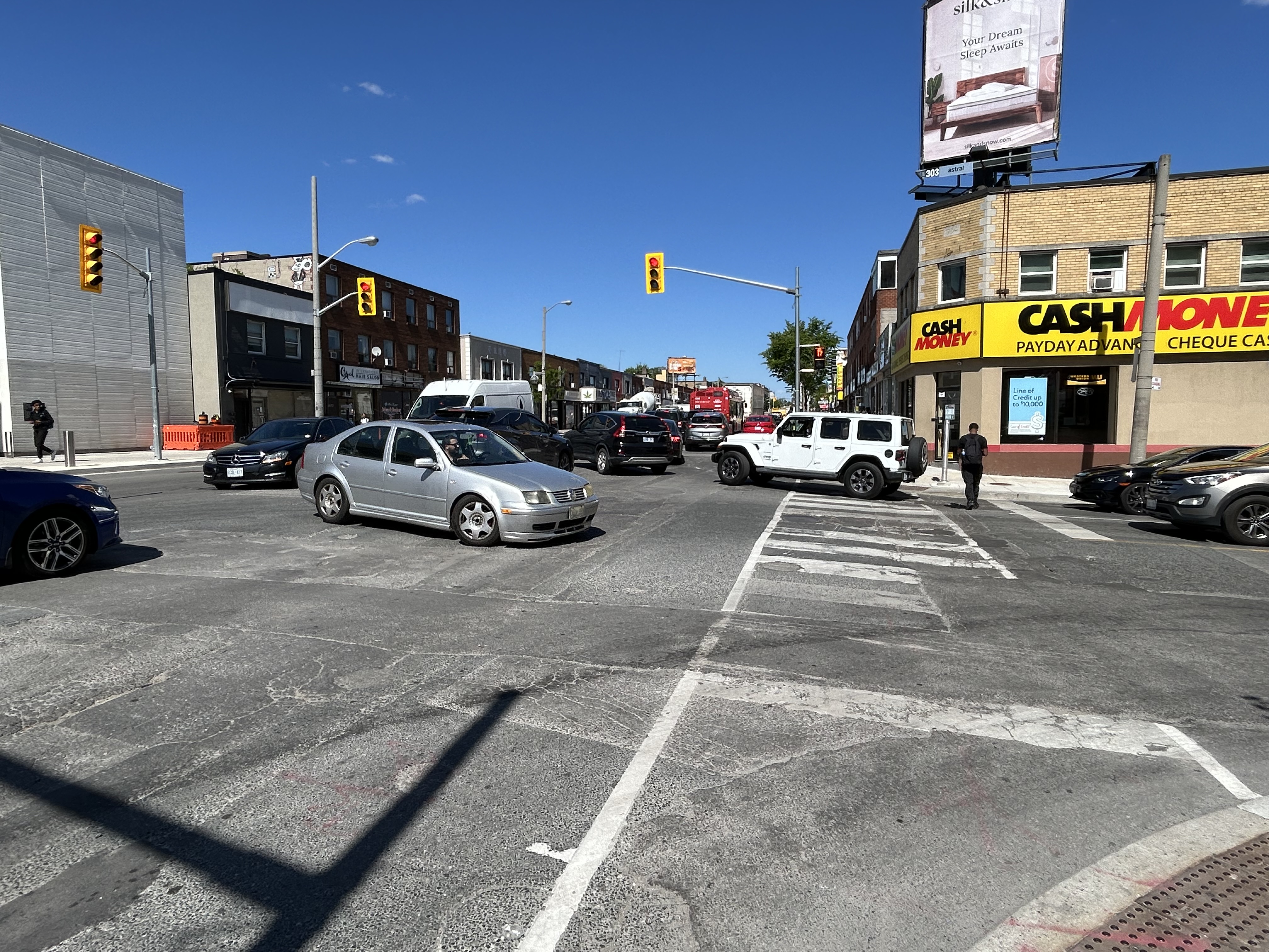
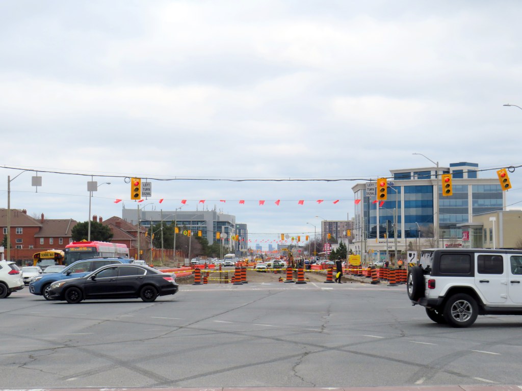
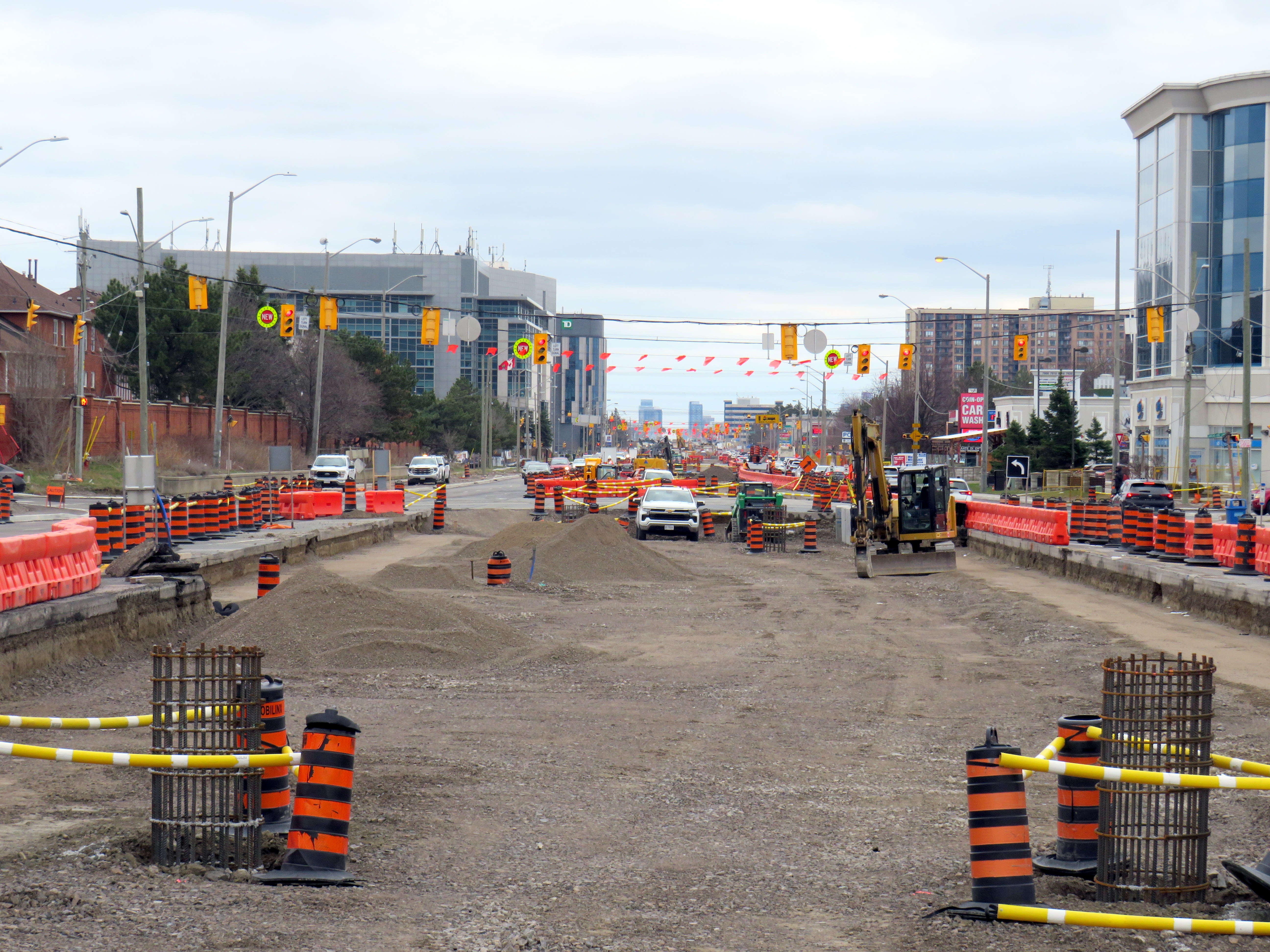
    As work at the Steeles-Hurontario intersection is now well underway, it has become visually clear the problem will be once the LRT opens. The population around the Brampton Gateway Terminal area is rapidly growing; a 40-storey condominium tower on nearby Steeles Avenue West is nearing completion, with many more highrise and mixed-use developments planned, including the eventual redevelopment of Shoppers World Mall. Already, there are dozens who cross nine-lane Steeles Avenue hourly; once passengers have to transfer from the LRT to the transit terminal on the northwest corner, there will be hundreds.

    Furthermore, once the (now-funded) Phase 2 of the LRT to Downtown Brampton is started, the intersection will have to be torn up yet again to extend the tracks across Steeles and build a new north-side stop. The province’s refusal to do this all at once is baffling, and will likely be much more expensive than if it was done right the first time.

    Looking across from Gateway Terminal towards the future LRT terminus on Wednesday, May 6. Already, there are plenty of pedestrians crossing here.

    Already, the costs of the current Mobilinx contract have ballooned while construction delays pile up. The Hurontario LRT was originally supposed to open in 2024. In 2025, Mobilinx had to completely rebuild the track intersection at Topflight Drive just south of Highway 407 after track was already laid in 2023 due to construction errors. In February 2026, Global News reported that only 45 percent of the track was laid. Due to delays and problems paying contractors, the consortium’s credit rating was downgraded by Standard & Poor to BBB, which is near junk status.

    Given the multiple delays and difficulties building the LRT, work is only now at the point where the dangerous terminal location is being baked in. Even though construction errors are fixed, and the project name changed, Metrolinx has been unwilling to address the safety issue at Steeles Avenue that was raised many times. In the meantime, Metrolinx, Peel Region, and City of Brampton will have to figure out how to mitigate the potential disaster that is now in the making.

  • Return to Line 6: a slightly faster ride

    Return to Line 6: a slightly faster ride

    Slow ride, take it easy

    On Thursday, February 26, I went west on Finch Avenue from Scarborough to North York via the 939B Finch East Express bus to take another ride on Line 6, the problem-plagued Finch West LRT. After hearing of enhanced signal priority being introduced on Finch Avenue, I wanted to see if it had any effect on running times since my last visit a few days after opening.

    Interestingly, the 939B, which runs all the way from Kennedy Station to Finch West Station via Scarborough Centre, McCowan Road, and Finch Avenue, uses the York University Busway to get between Dufferin Street and Finch West Station. That busway, opened in 2009, was built to speed up travel times between the former subway terminus at Downsview Station (now called Sheppard West Station) and the university campus as the Line 1 extension to Vaughan was underway. When the Scarborough Busway opens — likely by the end of this year — it will use that exclusive transitway (also a temporary measure to speed buses along a subway project) as well.

    From Finch West Station, it took 44 minutes to ride to the other end at Humber College Station, 20 minutes faster than during a problematic ride back in December. The average speed was 14.1 km/h, with a short spurt of speed (up to 56 km/h) up the hill between Islington and Kipling Avenues.

    Screenshot from a GPS app with the distance, average speed, and time it took to get from Humber College to Finch West Station

    On the return trip, it took almost 46 minutes from Humber College to Finch West, less than 4 minutes faster than my last eastbound ride in December, and with an average speed of 13.8 km/h. The eastbound train I was riding managed to arrive at Kipling Avenue (Mount Olive Station) just as the LRT signals were turning from amber to red (motor traffic still had 10 seconds of green light), followed by the stop at the far-side station there. The train also managed to arrive at Islington Avenue as the LRT signal was turning red, resulting in another long wait. At each intersection, the trains crawled at 15-20 km/h as parallel traffic sped by, and the Alstom Citadis cars were noticeably rough riding. The section between Humber College Station and Westmore Drive is especially painful, with LRV cars making the turn at 7-8 km/h.

    On Eglinton Avenue east, the two-car Bombardier Flexity trams manage to glide through at-grade intersections at a less frustrating speed, and they noticeably provide a lighter, quieter ride.

    On the positive side, station dwell times on Line 6 were noticeably reduced, and it seems that operations are a bit more consistent after two months of operation; there were no notable gaps between LRV cars. However, there are still issues to be worked out, as Friday, February 27 saw more switch problems that closed part of the line for several hours.

    Hopefully, further operational improvements and signal priority follow, and the signal and track issues get sorted out. I’ll return later in March for another ride to see if the ride improves further. I worry, though, about the Citadis LRVs, as they are looking more and more like a defective product that may not be redeemable.

    Line 6 travel times on Thursday Feb. 26
    Eastbound
    (read down)
    Stop/stationWestbound
    (read up)
    3:28 PM (dep.)Humber College
    LRT Station
    3:12 PM (arr.)
    3:32Westmore Dr.3:08
    3:34Martin Grove Rd.3:06
    3:43Kipling Ave. (Mt. Olive)3:00
    3:47Islington Ave. (Rowntree Mills)2:58
    3:56Weston Rd. (Emery)2:48
    4:00Arrow Rd./Signet Dr.2:45
    4:05Jane and Finch2:37
    4:08Tobermory Dr.2:33
    4:10Sentinel Rd.2:30
    4:13 PM (arr.)Finch West Stn.
    (LRT Terminal)
    2:28 PM (dep.)
    45 minutesTotal time44 minutes

  • Line 5: a quiet opening for a troubled project

    Line 5: a quiet opening for a troubled project

    A westbound LRV train on Eglinton Avenue in Scarborough, January 2026

    After fifteen long years, the wait is over. On Sunday, February 8, the Eglinton-Crosstown LRT will finally open to the public, with the first train leaving Kennedy Station at 7:00 AM. (The first eastbound train will depart Mount Dennis at 7:07 AM.) Rides will be free on that first day, but there will be no opening celebration, no ribbon cutting, and no giveaways. At first, trains will run until 11 PM, with Line 5 shuttle buses from 10 PM until 1AM, when the 334 night bus takes over.

    After the botched opening of Line 6 Finch West, it is clear that no one in charge wants to celebrate the opening of this new transit line after years of construction delays and false hope of completion in 2020, 2021, 2022, 2023, 2024 and 2025. So if you want to check out Toronto’s new ride, go do it at your own convenience. You won’t miss anything.

    There will be no party, like the one arranged last December at Finch West

    But even if the trains run slower than originally planned at first, there should be a ramping up of speeds and transit priority in the surface-running eastern section. The tunneled section will have speeds up to 60 km/h between stations, making it considerably faster than the buses it will replace. During a visit to Scarborough last month, it already seemed that trains were running a bit faster in the outdoor section than on Finch West, so there’s definitely some reason to welcome the LRT in its initial “soft opening” phase.

    The TTC notes that once full service is operational later in 2026, the end‑to‑end travel times will be “approximately 50–55 minutes.” That’s about twice as fast as the bus when going all the way from Mount Dennis to Kennedy. Perhaps, once the trains are running on a full schedule until 1AM and with expected performance improvements, there will be a formal ceremony to conclude this long journey.

    Notably on Sunday February 8, there will be significant changes to the bus network, including 2 discontinued routes, 13 route changes, and 4 new routes. Most notably, Routes 54 and 954 on Lawrence Avenue East will now terminate at Don Valley Station instead of at the subway at Eglinton Station. Route 35 Jane will no longer continue south of Weston Road, but will instead terminate at Mount Dennis (with new Route 27 Jane South taking over that southern section). The 47 Lansdowne will be split into two, with 18 Caledonia providing service north of Eglinton. Routes 51 Leslie and 56 Leaside will be merged (with a short 151 Leslie North bus on the north end), and the 32C branch will be replaced with the new 158 Trethewey bus. The map below shows how the TTC buses will connect with Line 5. (Route 901, between Mount Dennis Station and Pearson Airport via Dixon Road, has not yet been approved.)

    Map showing TTC bus route changes; several of these were already implemented in late 2025. Only the 901 express route to Pearson Airport has not been approved.

    I will certainly make time to check out Line 5 on Sunday, followed by a more fulsome review a week or two after opening to form an honest and thoughtful opinion.

  • Can the Eglinton LRT outrun the bus?

    Can the Eglinton LRT outrun the bus?

    Passengers boarding the 34 Eglinton East bus, January 28, 2026

    On Sunday, February 8, the long-awaited (and long-delayed) Line 5 Crosstown LRT will finally open to the public (or maybe not). The new line, 19 kilometres long with 25 stops, is nearly twice as long as the 11-kilometre Finch West LRT that opened in December.

    Unlike the troubled Finch West LRT, the Eglinton-Crosstown line is largely underground, with twelve stations, from Mount Dennis to Laird, completely separated from road traffic. A western extension through central Etobicoke to the Mississauga border at Renforth will also be completely grade-separated. There are several other major differences: the Crosstown line will be more frequent than Finch West, and will have more capacity, with two-car trains operating at all times. The equipment will be different too: Bombardier Flexity cars, the same as those used in Kitchener-Waterloo, will make the up the trains. Furthermore, the underground section will be computer controlled (which might turn out to be a complication, rather than an advantage).

    A light rail train passes traffic on Eglinton Avenue East in Scarborough

    However, some aspects will be the same. The surface-running eastern section between Leslie Street and Kennedy Road will feature 10 outdoor stops and 16 traffic signals, though the LRT will dip below ground at Don Mills Road (formerly Science Centre Station, now Don Valley Station) and under Kennedy Road into the Kennedy Station transit hub. As with Finch West, this was a Metrolinx-led project with a private consortium in charge of construction and maintenance, with the TTC in charge of train operations. So it will be interesting to see how Line 5 fares.

    With subway, light rail, buses, and GO trains, Kennedy Station is becoming a proper transit hub

    In the meantime, just as with my visits to Finch West, I decided to see how long it takes to get across the LRT corridor. In May 2024, I walked the entire route over three days, getting to know the corridor better (while documenting my stroll on a social media platform that I have since abandoned). With rumours of a mid-winter 2026 opening, I decided to ride the buses to get further context and time the rides.

    Congestion at Eglinton Avenue West and Oakwood Avenue, May 2024

    Tuesday, January 20 was an ideal day to ride the 32 Eglinton West and 34 Eglinton East buses. That was several days after the last snowfall (and a few days before the next big dump), and the roads and sidewalks were completely clear. It was a bright, sunny (albeit cold) day, and there was only one short construction zone on Eglinton Avenue, near Caledonia Road. Though only a small number of riders would use the entire Crosstown LRT line as part of a regular commute, it was worth getting a sense of how long the trip would take between each station.

    I started at Kennedy Station after taking a Stouffville Line GO train one stop from Union Station, rode the 34 Eglinton East bus all the way to Eglinton Station at Yonge Street, and then after a break (including a stop at Cinnabon), continued west to Mount Dennis Station, which is already open to GO and UP Express trains, as well as a few TTC routes. The last half of the ride coincided with high school dismissal times that resulted in some crowding, especially between Avenue Road and Dufferin Street.

    From Mount Dennis, I returned eastbound during a busy weekday afternoon rush hour, transferring to the first available 34 Eglinton East bus at Eglinton Station all the way back to Kennedy.

    Waiting for the 34 Eglinton East bus to Kennedy Station, January 20, 2026

    The table below shows the timings at each LRT stop.

    Westbound
    (read down)
    Stop/StationEastbound
    (read up)
    1:28 PM dep.Kennedy5:35 PM arr.
    1:32Ionview5:30
    1:34Birchmount5:28
    1:37Warden Ave.
    (Golden Mile)
    5:24
    1:39Hakimi Lebovic5:22
    1:42Pharmacy5:20
    1:43Victoria Park Ave.
    (O’Connor)
    5:18
    1:46Bermondsey5:15
    1:49Wynford5:08
    1:51Don Mills Rd.
    (Don Valley)
    5:01
    1:53Leslie St.
    (Sunnybrook Park)
    4:58
    1:57Laird4:50
    2:00Bayview Ave. (Leaside)4:48
    2:04Mount Pleasant4:44
    2:10 PM arr.
    2:47 PM dep.*
    Eglinton Station
    (Bus transfer)
    4:39 PM dep.
    4:32 PM arr.***
    2:52Avenue Road4:25
    2:54Chaplin4:19
    2:58Bathurst St.
    (Forest Hill)
    4:15
    3:03Cedarvale Stn.4:09
    3:07Oakwood3:56
    3:11Dufferin St.
    (Fairbank)
    3:51
    3:18Caledonia**3:44
    3:21Keele St.
    (Keelesdale)
    3:41
    3:25Mount Dennis3:37 PM
    87 minutesTotal ride time
    (inc. a 7 min transfer at Eglinton Stn.)
    118 minutes
    * This gap provided an opportunity to use the washroom, and get a coffee and snack
    ** Time noted at Blackthorn Ave, the closest stop to the LRT station entrance
    *** Took first 34A bus to Kennedy Station that departed Eglinton after my arrival; a 34C bus to Wynford Dr. and Flemingdon Park departed first

    On the surface buses, the most significant traffic delays are near the Don Valley Parkway and Allen Road, especially eastbound between Oakwood Avenue and Cedarvale Station and between Don Mills Road and Bermondsey Avenue. For anyone crossing Yonge Street, the transfer between buses takes on average seven minutes including walking and waiting time.

    Line 5, the Eglinton Crosstown LRT, will run deep below the Line 1 University Subway at Cedarvale Station

    The dedicated right of way should allow transit riders to get ahead of traffic congestion, especially around Allen Road, where the trains will run in a deep bore tunnel. In theory, the median right-of-way will help get passengers past congestion near the DVP and the big box retail in the Golden Mile, but if the trams are as slow through intersections as on Finch and held up by red lights, the advantage here will be minimal.

    At Eglinton and Warden, I did see a traffic signal hold a green light a few extra seconds to allow a train to pass through before changing, so that was a positive sign. But watching the trains go by every few minutes, I noted that the transit priority system was not at all aggressive, and as on Finch, transit signals turn red 12 seconds before the general traffic signals do.

    On January 28, Eglinton and Warden, the transit signals stayed green for a short extra time to allow the non-revenue LRT train to pass through and stop at the far-side platform. The train was moving at a more reasonable clip too.

    The Eglinton Crosstown LRT, unlike Finch West, serves a regional need that requires better speeds and more capacity than a mere surface tram, especially as it will have many bus routes directly feeding into it, rather than just intersecting. Several bus routes that used to continue into Eglinton Station, such as 54 Lawrence East, will instead terminate at Don Valley (formerly Science Centre) Station, where riders going west to the subway will have to transfer. For inexplicable reasons, the short section between Don Mills Road and Laird will have one at-grade station with a signalized intersection, a weak link in what will likely be a very busy section of the line.

    Map of planned changes to TTC bus routes with Line 5’s opening. Some of the changes, including the introduction of Route 164 Castlefield and the extensions of routes 79, 161, and 168 to Mount Dennis Station have already been implemented.

    Hopefully, some of the lessons from the Line 6 opening will be applied to Eglinton before it opens. There should also be an opportunity, just as there is on Finch, to make further changes to operations where applicable during a “soft opening” period. But we can not afford yet another botched transit project, especially after 15 years of waiting.

  • Ion: An Ontario LRT that somehow works

    Ion: An Ontario LRT that somehow works

    There is a light rail system in Ontario that works in the snow. ION LRT at University of Waterloo.

    Less than a two hours drive or train ride from Toronto, where that city’s first light rail line opened to universal disdain, a light rail line has been operating without incident for over five years. Trains operate like clockwork, signal priority works, and it has become the backbone of a regional transit system.

    Though the Ion LRT project was subject to several delays, opening eighteen months behind schedule, operations have been notably smooth since the public opening on June 21, 2019. The delay is attributed to Bombardier’s late delivery of their Flexity light rail vehicles, which were built on the same assembly line as the TTC’s new streetcars.

    A southbound Ion LRV turns from Charles Street to Borden Avenue. Note the white bar signal and the “no right turn – train” sign lit up.

    Funded by all three levels of government, the Ion LRT was constructed and operated by GrandLinq, a public-private partnership (P3) consortium that includes operator Keolis and engineering and construction firms such as Aecon, Kiewit, and Plenary Group. Though design-build-operate P3 models are common for Canadian transit infrastructure projects, they have their challenges, as Waterloo Region would later find out. Fares and service are integrated into the Grand River Transit bus system, which is owned and operated by the regional government.

    Waterloo Region is the smallest urban region in North America with a light rail system, and it works largely because of Kitchener-Waterloo’s geography. Many important regional destinations line up along the corridor: the terminals are both major suburban shopping centres that already functioned as major bus transfer points. In between the two malls are Downtown Kitchener and Uptown Waterloo, the two historic town centres, University of Waterloo, Wilfrid Laurier University, and Kitchener-Waterloo Hospital. The LRT serves or passes near all these destinations (though Laurier’s campus is centred a few blocks east of the LRT corridor). Furthermore, the region’s master plan focuses urban growth along the LRT corridor with new high-rise residential and mixed-use development. A planned extension of the LRT into Cambridge south to the historic Galt town centre will further support regional urban intensification goals.

    Ion trains operate every 10 minutes during weekday daytime hours; they operate every 15 minutes on weekends and weekday evenings, with 30-minute service from about 10:30 PM to the end of service starting around midnight.

    Map of Waterloo Region’s urban system, which directs growth to existing and planned transit corridors and limits growth outside the cities of Kitchener, Waterloo, and Cambridge. From the regional official plan.

    Despite following a linear corridor, the LRT winds its way along city streets, railway rights-of-way, and hydro corridors. This allowed the region to reduce property and road construction costs as well as achieve higher speeds in specific off-road sections. The fastest section is north of Uptown Waterloo, where the corridor makes use of a freight railway spur line between Kitchener and Elmira that also happens to run directly past University of Waterloo. In the south end, a different railway corridor and a hydro corridor allow trains to reach Fairview Park Mall on a mostly off-street alignment. These off-road segments are protected by railway signals and barriers, like those in along LRT lines in Calgary and Edmonton.

    This ability to switch between different alignment types is a clear advantage of light rail transit for medium-capacity transit systems. During overnight hours, freight trains headed to a plastics plant in Elmira use the same rails north of Uptown Waterloo as the LRT does during the day, making it an example of the “tram-train” model more common in Europe.

    The on-street sections, though slower than the off-road portions, provide access to Downtown Kitchener and Uptown Waterloo, including the planned new transit hub in Downtown Kitchener that will provide a better connection to GO Transit trains to Toronto. Unlike Toronto’s streetcars and Finch West LRT, however, the signal priority system works. On King Street between Downtown and Uptown, there are many intersections with traffic signals, but the LRTs generally do not have to stop at any of those red lights. At intersections, LRVs continue at regular speed, typically 40 km/h through this section.

    A southbound LRV on King Street. It just passed two signals with a clear (white vertical bar) signal; the next signal ahead will soon change to allow the LRV to proceed. Note that there are no “transit signal” signs, as Waterloo Region worked to have these approved by the province.

    Waterloo Region also worked to permit unique transit signals, which feature only white bar aspects. A vertical bar indicates “proceed” while a horizonal bar indicates “stop.” A flashing horizontal bar lets the operator know that it will soon switch to “proceed” while a flashing vertical bar warns of an upcoming stop signal. This reduces the sign clutter that is found on Toronto’s streetcar and light rail corridors.

    A typical Toronto assembly, with red, amber, and green transit signal aspects that look similar to the larger traffic lights above and accompanied with a “transit signal” sign. Of course, the Finch West LRV approached an amber signal, rather than being given a go ahead.

    To be fair, the advantage in Waterloo Region is that most of the on-street sections of the LRV corridor are on narrower urban streets rather than suburban arterials like Finch Avenue. King Street and Charles Street in Kitchener only have two general traffic lanes and are not major throughfares (a provincially-maintained freeway between St. Jacobs, Waterloo, Kitchener, and Highway 401 absorbs much of this traffic). The regional government also widened a section of Weber Street to four lanes to divert traffic from King ahead of LRT construction. This resulted in the loss of about two dozen houses and businesses.

    But by maintaining a narrow right-of-way on King Street, the LRT runs with minimal delays. It is easier to provide aggressive transit signal priority with short pedestrian crossing distances, narrow intersections, and lower traffic volumes.

    The video below illustrates how the LRT runs along King Street northbound from Kitchener Central Station.

    View from the front of a train heading north towards Waterloo

    Despite the LRT working well, it is still far from perfect: there are several sections in which the trams crawl at a 10 or 15 km/h speed, particularly on the south end. At Hayward Avenue the route switches from a railway corridor to an alignment alongside Courtland Avenue; this section has two tight turns and crosses an industrial driveway. Had a few more properties been expropriated (at additional cost) this would not have been an issue. Until a proper protected pedestrian crossing is installed at a path connecting Trayner Avenue to Fairway Road (a critical pedestrian link that was overlooked during the planning phase), LRVs must also slow down along the hydro corridor approaching Fairview Park Mall.

    The P3 contract also limits the ability to make service improvements. In 2024, Waterloo Region proposed revising the LRT schedule to run trains every eight minutes during peak periods, but because of a fixed staffing contract, it would have resulted in 30-minute service after 8PM. Luckily, local transit advocates successfully opposed that change. Had the LRT been operated directly by Grand River Transit, they could have simply trained more operators on the LRT service, even transferring bus drivers to the rail division.

    Overall, however, the LRT works in Waterloo Region both as a transit service and a planning tool. It provides useful lessons on what to do (real signal priority and proper signal aspects, make effective use of on-street and off-street routing where each makes sense), and what not to do (enter strict operating contracts) when building a new transit line. Waterloo Region made its rail transit work for its geography and its needs, and that is the most important thing.

  • Still waiting for the Finch West LRT

    Still waiting for the Finch West LRT

    December 7, 2025 may be a day that will live in transit infamy. That was the day Line 6, the Finch West LRT, opened to the public, and it did not go well.

    First off, any discussion on the initial failure of Line 6 should acknowledge that was never designed to be a rapid, regional transit link. The LRT, serving Northwestern Toronto, was intended to be an upgrade to the slow, congested, and busy 36 Finch West bus, feeding into the rapid transit network at Finch West Station. Line 6 is a legacy of Transit City, a LRT plan proposed under previous mayor David Miller intended to connect the inner suburbs of Etobicoke, North York, and Scarbrorough to the subway and to each other.

    As with all proposed Transit City routes (with the exception of the tunneled central section of the Eglinton-Crosstown LRT), there were always going to be compromises on Finch that would not make it a true rapid transit service. Situated almost entirely on the surface, Line 6 trains are easier for residents to access than subways in deep tunnels; closer stop spacing was intended so the new transit line continues to serve the needs of those who live, work, go to school, and frequent the corridor, without the necessity of a parallel local bus. Anyone expecting subway speeds were in for disappointment.

    Still, the LRT was supposed to improve travel times over the existing bus, with wider stop spacing than the legacy streetcar network, a congestion-free right of way, signal priority, and decent operating speeds. With a promised average speed of 20-21 kilometres per hour, a total trip time of 33-34 minutes each way, it would have been a bit faster, more comfortable, and certainly more reliable than the bus. It was never going to be as fast as a subway, but for Finch Avenue West, that was okay.

    Screen capture of a Metrolinx FAQ webpage, with frequent and relatively speedy transit service promised for the Finch West LRT. The webpage was still up as of December 18, 2025.

    As the first modern LRT to open in the Greater Toronto and Hamilton Area (GTHA), Line 6 was to be a preview of additional lines planned and under construction elsewhere in the Golden Horseshoe, including the yet-to-open Line 5 Crosstown LRT, the Hurontario Line, the Hamilton LRT, and a proposed Line 7 on Eglinton Avenue East towards the University of Toronto Scarborough Campus and Malvern. Delivered by Metrolinx, the provincial transit agency, each line would be constructed and maintained by a P3 consortium, though the Toronto LRTs would be operated by TTC employees.

    The hoped-for narrative that the provincial government, Metrolinx, the city of Toronto, and the TTC all touted — a smooth new ride, worthy of including on the subway maps — quickly fell apart on Sunday December 7, though there were plenty of warning signs of slower-than-promised operations.

    Opening day crowds on December 7. Passengers disembark from a wrapped LRV that touts Line 6 as “far and wide the best way to go far and wide.”

    On Sunday, December 7, there were plenty of people eager to try the new LRT: railfans and urbanists, curious families, and local residents, lured by free fares on the opening day. Though I was there and took several trips, I wasn’t going to make too many judgements on opening day. There would be inevitable hiccups with the large crowds and cold, snowy temperatures. Still, there were visible problems.

    An eastbound LRV approaches Islington Avenue (Mount Olive Station) as the transit signal switches from green to amber. The traffic signals are still green.

    So far, a lot of the post-opening discourse has been on operating speeds and traffic operations. Instead of 33-34 minutes, as claimed by Metrolinx, trips were taking 55 minutes each way. Additionally, the transit signal priority (TSP) system has not been activated, causing light rail vehicles (LRVs) to wait entire light cycles, even for private vehicles to turn left before proceeding. The dedicated transit signals turn red about 10-20 seconds before general traffic gets a red light, even as LRVs approach the intersections. On December 16, Toronto City Council approved a motion to implement “more aggressive” TSP on Finch West and the surface portion of the Line 5 Eglinton-Crosstown LRT, as well as on the legacy streetcar network.

    The problem on Finch West is not just a matter of transit signal priority. The number of stops along the line, also criticized by several critics, is also not a problem, as Finch West was never intended to be a high-speed regional line. (That said, Mount Olive and nearby Stevenson could have been consolidated into a single stop west of Kipling Avenue.) The other problems are poorly managed schedules and streetcar-style slow zones on a modern LRT alignment.

    Right now, LRVs are forced to slow to 25 km/h at all intersections, even though all conflicting traffic has a red light. This is an inexplicable restriction given that motor traffic, including TTC buses, have a 50 km/h limit, and many drivers will proceed at significantly above the posted limit. These restrictions are not found elsewhere in North America; in Calgary and Edmonton, LRTs are protected at many at-grade intersections with railway-style lights and gates. In places like Minneapolis-St. Paul and Phoenix, additional LED flashing signs warn drivers of an approaching LRV, which glides through the signalized intersection at higher speeds than on Finch. (There is also a lot less sign clutter, with intuitive signals for left turns and transit).

    Transit schedules are also needlessly padded, with too much time for lower speeds and lengthy station stops. On a repeat visit to Finch West, on Wednesday December 17, 2025, travel times were inconsistent and slower then either 36C bus I took a few days before the LRT opened. (Even the trip with the long Starbucks pitstop.)

    Line 6 travel times on Wednesday Dec. 17
    Eastbound
    (read down)
    Stop/stationWestbound
    (read up)
    12:59 PM (dep.)Humber College
    LRT Station
    12:31 PM (arr.)
    1:03Westmore Dr.12:25
    1:05Martin Grove Rd.12:22
    1:10Kipling Ave. (Mt. Olive)12:13
    1:14Islington Ave. (Rowntree Mills)12:09
    1:26Weston Rd. (Emery)11:57
    1:29Arrow Rd./Signet Dr.11:54
    1:33Jane and Finch11:46
    1:37Tobermory Dr.11:35
    1:45Sentinel Rd.11:32
    1:48 PM (arr.)Finch West Stn.
    (LRT Terminal)
    11:27 AM (dep.)
    49 minutesTotal time1 h 4 minutes

    It took eleven minutes to go two stops, less than a kilometre, from Tobermory Drive to Jane Street on the westbound trip. Lengthy station dwell times at Tobermory (five minutes) and Mount Olive (three minutes) on that westbound ride, with no onboard announcements was especially frustrating. The return eastbound trip from Humber College was 15 minutes faster, even with much of the same slow zones at intersections and switches, the 10 km/h curve near Humber College Station, and lengthy stops.

    With such unpredictable and unreliable service, Line 6 is running at least as badly as the downtown streetcar routes. Without immediate fixes, people will completely lose faith in the TTC and future LRTs, including Eglinton-Crosstown. We can not just rely on tweaks to signal times; we need a complete review and overhaul of streetcar and LRT operating practices.

    At least we know what can and should be fixed before the Eglinton-Crosstown line opens, a much longer LRT route that will have a regional transit role.

    One more thing…

    What is with all the doors between the Line 1 subway station and the LRT terminal at Finch West. Passengers have to pass through four sets of doors to transfer between two TTC services, as well as ascend one escalator or elevator, walk down one set of stairs (or navigate a long and circuitous ramp) and then ascend another escalator or elevator to get to the other platform.

    Stairs or a long, circuitous ramp between the doors from subway to LRT

    Though transfers can be tricky, at the very least, these doorways should be kept open, and shut only during station closures or during fire alarms, as done in hospitals or shopping centres. Other TTC stations have no such barriers between modes or may have a single door to exit a subway station terminal to the bus platform. Automatic sliding doors could have also been an option. Instead, the powered doors are left to one side, with the button against the wall. It’s not an ideal design from an accessibility point of view.

  • Waiting for Finch West

    Waiting for Finch West

    Two Line 6 LRVs cross Jane Street at Finch Avenue, December 3, 2025 as training wraps up ahead of revenue service on December 7

    Can a brand-new light rail line outrun the local bus it replaces? Starting on Sunday, December 7, Torontonians will get the chance to find out when the new Line 6 Finch West light rail line finally opens to the public. Though built and maintained by Metrolinx, the service will be operated by TTC employees.

    The new LRT, 11 kilometres long, with 18 stops, runs almost exclusively in a transit-only median on Finch Avenue West between Finch West Station at Keele Street in North York and Highway 27 in Etobicoke. The end terminals are below grade, with three traffic signals skipped. Otherwise, the light rail vehicles will be subject to stopping at the same traffic lights as all other cars, trucks, and buses.

    New maps in the TTC subway system show the long-delayed Line 5 Eglinton-Crosstown (opening date still TBD) and Line 6, which opens Sunday December 7

    For the last few weeks, Finch West has been served by the 36C bus, running between Finch West Station at Keele Street and Humberwood Loop near the Mississauga border, making a stop at the Humber College bus terminal. A separate 36 Finch West bus continues east from Finch West Station to Finch Station at Yonge Street. There will only be eight fewer stops on Line 6 than there bus stops between Finch West Station and Humber College; apart from overnight service, there will be no parallel local bus serving the corridor.

    Map of the Route 36C Finch West-Humberwood service, modified from the TTC’s original

    Without limited stops and signal priority, the new light rail line will not achieve any real time savings. On his website, transit advocate Steve Munro notes that the end-to-end time of the new Line 6 LRT is scheduled for 46 minutes, consistent across all operating time periods. The 36C’s fastest round trip times, late evenings and early Sunday mornings, is between 79 and 82 minutes, or 40-41 minutes one way on a slightly longer route.

    To see this for myself, I visited Finch Avenue West and rode the 36C both ways between Finch West and Humber College. Wednesday, December 3 was an overcast and cold day, with the daytime high temperature hovering around the freezing mark. But the roads were clear and dry, with no collisions and little construction work in the way of traffic on Finch; conditions couldn’t be any better for early December.

    Here were the times for the two buses I took. I started timing the runs as soon as the bus doors closed and departed the originating stop; waiting times at the initial stops were not included.

    TTC Route 36C travel times on Wednesday Dec. 3
    Eastbound
    (read down)
    Stop/stationWestbound
    (read up)
    12:07 PM (dep.)Humber College
    bus loop
    1:50 PM (arr.)
    12:11Westmore Dr.1:37**
    12:13Martin Grove Rd.1:24
    12:18Kipling Ave. (Mt. Olive)1:29
    12:20Islington Ave. (Rowntree Mills)1:19*
    12:28Weston Rd. (Emery)1:11
    12:33Arrow Rd./Signet Dr.1:09
    12:38Jane and Finch1:04
    12:42Tobermory Dr.1:01
    12:44Sentinel Rd.1:00
    12:51 PM (arr.)Finch West Stn.
    (bus terminal)
    12:57 PM (dep.)
    44 minutesTotal time53 minutes
    * At Islington Avenue westbound, the bus was delayed by five minutes by a troublesome passenger
    ** At Westmore Drive westbound, the operator left the bus with twelve passengers on board to order coffee at a nearby Starbucks, resulting in a second delay of nearly ten minutes

    The eastbound departure, leaving Humber College at 12:07 PM, made it to Finch West Station in 44 minutes, two minutes faster than the scheduled LRT trip. This bus, an articulated (18-metre) vehicle was relatively busy, with a few standees between Jane Street and Finch West Station, and most en route stops were made. There were no unusual delays; just some traffic near Highway 400; it also took two light cycles to complete the left turn from Finch to Keele approaching the subway station.

    Westbound 36C bus waiting to depart Finch West Station

    I returned towards Humber College on a different bus that left Finch West Station at 12:57 PM. For a while, this run, a standard 12-metre bus, was making exceptionally good time, with only a few passengers on board. It skipped several bus stops as no one wanted on or off until Tobermory Drive. Line 6 LRVs will stop at every station, just like the subway, even if there aren’t any waiting passengers.

    At Islington Avenue there was a delay caused by a prospective passenger who rushed through a don’t walk/red light to get the bus, despite another one close behind. As the passenger was using a mobility device, the bus operator had trouble deploying the ramp because the bus had already inched ahead of the bus stop pad, ready to proceed with the green light. The driver needed to reposition the ramp and wait for the next green, which resulted in a five-minute delay.

    Another delay came a few minutes later, when at Westmore Drive, just one stop before the Humber College bus terminal, the operator left the bus without notice and walked into a nearby Starbucks. After a few minutes, and seeing two other westbound 36C buses pass by, most passengers exited the open doors to flag down the next bus.

    Passengers leave an unattended Route 36C bus on Finch Avenue West at Westmore Drive. The portal for Line 6 LRVs to descend under Highway 27 towards Humber College is behind

    The TTC operator returned eight minutes later, and we finally arrived at Humber College Bus Terminal at 1:50, 53 minutes after departing Finch West Station. (It’s worth noting that Humber College also has a Starbucks and public washrooms in the main building near the bus loop.)

    At least that’s one instance where the LRT will certainly be faster than taking the bus.

    A longer walk, a longer wait

    TTC and Brampton Transit buses layover at Humber College

    Humber College’s bus terminal serves a total of nine TTC, Brampton Transit, Miway, and YRT routes. It’s also a connection point between TTC Wheel-Trans and Peel Region’s TransHelp paratransit services. But the LRT terminal station is a five-minute walk away from the terminal, which is adjacent to several primary buildings on campus.

    A walkway leads between the bus terminal and LRT station, with partial shelter provided by a long canopy that blocks northerly winds, but not the prevailing westerly winds. At the end of the walkway is the entrance to the below-grade LRT platforms, which are parallel to nearby Highway 27. This alignment reduced construction costs over a longer approach to the college, but it permits a future extension to the planned Woodbine GO Station two kilometres to the south and even Pearson Airport.

    Humber College Station entrance, at Highway 27. The walkway to the bus terminal and main campus is behind.

    During weekday peak periods, the LRT will run every 6 minutes, about as frequent as the current 36C bus during weekday daytime periods. However, during off peak times, trains will only come every 10-12 minutes, resulting in longer waits. Anyone travelling from Humber College will have to factor in the longer walk and potentially longer wait time.


    I will certainly go out on Sunday December 7 to celebrate the opening of this new line, which despite the unnecessarily slow speeds, will result in a more predictable and more comfortable ride, with significant capacity improvements during peak periods, especially at school dismissal times. LRT doors will line up with the platforms, making loading and unloading easier for passengers with mobility devices, strollers, or carts.

    I will also go ride the LRT after the opening day crowds are done, to see how it works in day-to-day operation. There are ways to speed up the schedule: more aggressive transit priority, shorter station dwell times, quick turnarounds at the terminals with “step back” operation, schedule optimization, and I hope these are considered by Metrolinx, the TTC and the city as everyone gets used to the new transit line.

    If you like my work and you would like to help out with my webhosting costs (I just had to renew my ad-free WordPress subscription), consider buying me a coffee. Thank you!

  • Heavy interference in a light rail transit project

    Heavy interference in a light rail transit project

    Banner promoting “The Hazel McCallion Line” on Hurontario Street in Brampton, January 2024

    Previously on this website, I wrote about the renaming of two GO Transit stations: Oshawa and Brampton. I explained why renaming transit infrastructure is problematic, especially when they violate wayfinding standards, which call for simple, accurate, unique, and self-locating names.

    Both GO Transit stations were renamed by provincial agency Metrolinx, on behalf of the provincial government. Metrolinx operates GO Transit buses and trains, the UP Express airport link, administers the Presto fare payment system, and oversees the construction of new rapid transit projects in the Greater Toronto and Hamilton Area. The Hurontario LRT, which is currently under construction between Port Credit GO Station in Mississauga and Steeles Avenue in Brampton, is just one of many transit projects managed by Metrolinx.

    On February 14, 2022, at Cooksville GO Station, Premier Doug Ford, then Transportation Minister Caroline Mulroney, then Mississauga Mayor Bonnie Crombie, and Metrolinx CEO Phil Verster joined former Mississauga mayor Hazel McCallion announcing the name change from the Hurontario LRT to the Hazel McCallion LRT. The occasion also marked McCallion’s 101st birthday.

    Hazel McCallion with Metrolinx CEO Phil Verster, February 14, 2022 (Metrolinx photo)

    This is the first rapid transit line in North America to be named for a person, contradicting established standards for transit projects.1 Though McCallion was a formidable and popular mayor whose political career spanned seven decades, she was also very close to the Ford government in the last few years of her life. She also had many other public facilities named in her honour — a senior public school in Mississauga’s Streetsville neighbourhood, the library at University of Toronto’s Mississauga campus, the City of Mississauga’s central public library, a walkway leading to Square One Shopping Centre, and the Mississauga campus of Sheridan College. There is also the Hazel McCallion Auditorium at Mississauga Valley Community Centre and the Hazel McCallion Hall at Vic Johnston Community Centre. There was no need for yet another civic asset to be renamed for her.

    In Toronto, most former mayors have just one public asset named for them: David Crombie, Art Eggleton, June Rowlands, and Barbara Hall have parks dedicated in their honour. Mel Lastman — mayor of North York for 24 years before being elected mayor of amalgamated Toronto for another six — and Nathan Phillips have major public squares.2 In Mississauga, there was no need to rename yet another piece of civic infrastructure for the same person.

    Furthermore, there was no public consultation about the name change — even officials at the cities of Brampton and Mississauga were kept in the dark — while the name itself contravenes Metrolinx’s own naming conventions.

    In July, 2023, I submitted an access to information request to Metrolinx, the second time I went through the freedom of information process to find out more about the light rail transit project. There were several delays, and I did not receive my requested documents and communications until late January 2024.

    A deep dive into the background of the Hurontario LRT project, the person it is being renamed for, and my findings and impressions follow.

    (more…)
  • Brampton LRT: a second chance to get it right

    A mock-up of a Bombardier Flexity tram sits in Gage Park while a Brampton Züm bus passes by in 2013

    On Wednesday, May 10, Brampton’s Committee of Council will consider a staff report on the proposed extension of the Hurontario LRT north from Steeles Avenue to Downtown Brampton.

    This section of the LRT, planned last decade, was narrowly rejected by Brampton City Council in a 6-5 vote, with then-mayor Linda Jeffrey supporting the transit line’s construction. Unfortunately, six city councillors sided with several downtown merchants and affluent Main Street South residents (including former premier Bill Davis), who did not support a surface tram on Main Street, back in October 2015.

    Councillors who voted to reject the Main Street alignment later backed the study of slower, more indirect alternative routes, while voting to ask Metrolinx and the provincial government, which was planning the line, to terminate the LRT on the south side of Steeles Avenue to allow for their potential fantasy options. Unfortunately, Metrolinx obligated.

    In 2019, a newly elected council, led by a new mayor, Patrick Brown, was willing to revisit the LRT decision, again backing a direct Main Street alignment. City staff were directed to update the original, approved 2014 Transit Project Assessment Process (TPAP). In 2021, staff narrowed the alternatives to just two options: an all-surface alignment from Steeles Avenue to the GO station in Downtown Brampton, and an underground option between Nanwood Avenue and the rail corridor. Meanwhile, Brampton staff and elected officials tried, without success, to restore the north-side LRT terminal at Steeles Avenue/Gateway Terminal.

    Now that the 30% design work for the two options is complete, city officials must decide how to proceed, especially if they expect senior levels of government to cover the costs of this major transit project.

    The alignments

    The all-surface alignment three stops in each direction between the Gateway Terminal at Steeles Avenue and the Brampton GO Station: at Charolais Boulevard, Nanwood Drive, and split northbound and southbound stops between Wellington and Queen Streets. These stop locations match the existing 502 Züm Main stops on this section of Main Street.

    Between Nanwood Drive and Wellington Street, the LRT would operate in dedicated lanes, with general traffic in the outer two lanes. There would not be room for bicycle lanes, and left turns would be prohibited at non-signalized intersections. North of Wellington, the LRT would run in mixed traffic, with cycle tracks and widened sidewalks on both sides of the street.

    The preferred surface alignment

    The northern terminus would be on the GO Station property, on the west side of Main Street, in a below-grade trench. Stairs and elevators would connect the platform with the GO Station, while the historic 1907 station building would be moved to support GO train service expansion on the busy CN freight corridor. The street surface would need to be lowered by one metre for the light rail vehicles and the overhead wire to clear the railway underpass.

    Alignment of off-street surface LRT alignment on the GO Station property
    Design concept for the GO and LRT terminal

    The tunnel alignment – which was not part of the approved 2014 TPAP – includes the same surface stops at Brampton Gateway Terminal and Charolais Boulevard, and two underground stations, at Nanwood Drive and the terminal, just south of the GO Station. Between Elgin and Nanwood, the tunnel would be dug in the traditional cut-and-cover method while the portion under Etobicoke Creek and the downtown core would be constructed using the sequential excavation method.

    The tunnel portal would be located at Elgin Drive, several hundred metres south of Nanwood. The longer tunnel section is required to avoid the Etobicoke Creek floodplains. Though Nanwood Drive has no intersecting transit routes and relatively low density, the rundown Brampton Mall property would be an ideal urban development site, as would the commercial properties immediately to the south.

    The preferred tunnel alignment

    The downtown terminal station would include a primary access at the corner of Main and Nelson Streets, to provide access to the GO Station and the proposed new transportation hub, as well as a secondary entrance closer to Queen Street and Garden Square.

    The two options were compared, putting the tunnel alignment ahead in all categories apart from cost and schedule. The tunnel would allow for continuous cycling infrastructure on Main Street, minimize traffic impacts, while having slightly higher ridership and somewhat faster transit. The tunnel would also better satisfy homeowners and businesses along the corridor. Staff also note that the tunnel alignment, without the bend into the GO station property, would be easier to extend farther north.

    As with other transit projects, the costs of delaying this segment of the LRT are subject to inflation. The surface alignment would cost $933 million, while the tunnel route would cost $2.8 billion. The surface option would take one to two fewer years to complete, an important consideration given Brampton’s fast-growing transit ridership and delays on other complex LRT projects, such as the Eglinton-Crosstown line.

    Cost comparisons for the tunnel and surface alignments

    The Pitch

    Towards the end of the staff report is a section called “Funding Advocacy.” Staff rightfully point out the need for the LRT extension, given the city’s and the province’s goals of directing high density development to the downtown core and other transit station areas, as well as the city’s record of continuous ridership growth and transit improvements.

    They also point out that the funding that Brampton is seeking (for the Queen Street BRT project and the LRT, specifically the tunnel option) is comparable to other transit projects in the Greater Toronto and Hamilton Area. The table below compares the costs and funding sought for Brampton’s proposed projects to those funded and underway in Toronto and Hamilton.

    Table comparing costs, funding and system ridership for Toronto, Hamilton, and Brampton

    An appendix to the staff report compares the cost of the tunnel option with other tunnelled Ontario projects (the Scarborough Subway Extension, the Ontario Line, the Eglinton-Crosstown), and the surface alignment with other surface projects (Finch West LRT, Hamilton LRT, Ion LRT extension in Cambridge).

    Concluding thoughts

    It is still a shame that Brampton City Council put the interests of a small, but affluent, minority of voters first back in 2015-2016. Had they not prevailed, the LRT into Downtown Brampton would have been under construction right now – at the same time that critical water infrastructure is being replaced in Downtown Brampton, and we would be looking forward to it being open in just two years. However, just three of the eleven council members that voted on the LRT in 2015-2016 remain at Brampton City Hall, and two of those three councillors supported the original project.

    The arguments in favour of the tunnel are enticing: a faster transit ride though a congested part of the city, an appeal to provincial and federal governments that have historically short-changed Brampton on its infrastructure needs, in a city that will have six seats up for grabs in the next elections.

    However, a surface LRT will be quicker and much cheaper to build. I also do not see the need for further extensions northward, at least via Main Street, and even then, it would require a second tunnel portal somewhere near Vodden Street, adding at least $1 billion to future costs. The GO station terminal points towards the abandoned Orangeville-Brampton Railway, which could provide a good alignment northward from Downtown Brampton, even with a parallel cycling path.

    More than anything, I want to see the Hurontario-Main LRT completed to Downtown Brampton as soon as possible, especially as work progresses on all-day hourly train service between Toronto and Kitchener and revitalization and intensification of Downtown Brampton accelerates.

    The provincial government has signaled that they prefer the surface alignment for cost reasons (notwithstanding it spending billions of dollars on an unnecessary tunnel on Eglinton West in Etobicoke), as does the Brampton Board of Trade. It is also worth noting that this study is only at the 30% design phase, detailed engineering work may find further costs.

    The surface option was the right choice in 2015, and it remains the right choice today. This time, maybe, Brampton will get it right.

  • How Brampton commuters are caught in the middle at Steeles

    How Brampton commuters are caught in the middle at Steeles

    The intersection of Steeles Avenue and Main and Hurontario Streets

    Last year, I wrote about a foreseeable problem coming to the corner of Steeles Avenue and Hurontario and Main Streets in Brampton: the planned Hurontario LRT terminus, to be located on the south side of Steeles Avenue, would require thousands of commuters to transfer to Brampton Transit buses on the north-west corner of the intersection.

    This transfer would require crossing ten or eleven lanes of traffic at one of Peel Region’s busiest intersections, with crowding at the street corners, with passengers awaiting a walk signal two separate times to make the necessary connection.

    After twice receiving unsatisfactory answers at a Metrolinx online town hall, and hearing no information about how the crossing at this intersection might be mitigated, on March 9, 2021, I took the step of making an Access to Information Request to Metrolinx under the province’s Freedom of Information and Protection of Privacy Act asking for communications between Metrolinx, the Ministry of Transportation, Mobilinx (the consortium awarded the contract to build and operate the LRT), and the City of Brampton.

    I received a package with the requested materials from Metrolinx on July 29, 2021. The request cost me $360.00, plus a $5.00 application fee. Communications from Metrolinx’s privacy officer were professional, friendly, and very helpful.

    Through my request that covered the dates December 1, 2018 to March 11, 2021, I obtained several letters from Brampton officials, including City Councillor Gurpreet Singh Dhillon, Director of Transportation Special Projects Chris Duyvestyn, Chief Administrative Officer David Barrick, and Mayor Patrick Brown to Metrolinx and Ministry of Transportation Officials requesting restoration of the north side stop at Steeles Avenue/Brampton Gateway Terminal. I also obtained replies from senior Metrolinx staff, including President and CEO Phil Verster and the Deputy Minister and the Minster of Transportation.

    What is the communications reveal is that decisions made during the 2014-2018 term of Brampton Council significantly tied the hands of everyone involved — both at the City of Brampton (which reversed its previous decisions when a new council was elected in October 2018) — and at Metrolinx, which was quickly working towards finalizing the contracts to construct the transit project. Unfortunately, important details, such as the final configuration of the Steeles-Hurontario/Main intersection, remain unknown. Neither Metrolinx nor the Ministry of Transportation, which funds Metrolinx, appear to grasp the problems that will be caused when thousands of commuters have to cross two major streets at an especially busy intersection.

    Despite Brampton’s work since December 2018 to move the Brampton Gateway stop back north of Steeles Avenue, including formal requests to Metrolinx and the Ontario Ministry of Transportation (MTO), and despite a similar request from RioCan, owner of the massive Shoppers World Mall property at Main Street and Steeles Avenue, Metrolinx and the province have held firm in their decision.

    Though Metrolinx’s mandate is to “improve the coordination and integration of all modes of transportation in the Greater Toronto and Hamilton Area,” terminating the LRT on the south side of Steeles Avenue will only reduce the integration of transit modes at Brampton Gateway.

    While Metrolinx and the MTO cite the difficulties of reopening a project which was getting underway, and concerned about setting precedents for other changes to the Hurontario LRT or other transit projects, this would still be a minor change, costing just $15 to $20 million according to a 2020 letter from Metrolinx CEO and President Phil Verster to Brampton Mayor Patrick Brown.

    Sadly, transit riders in Brampton – who do not have affluence or political might — have been left in the middle of this political back-and-forth between municipal politicians, the province, and Metrolinx. They will be forced to endure a more difficult transfer between LRT and bus than anything proposed to them in public consultations.

    (more…)