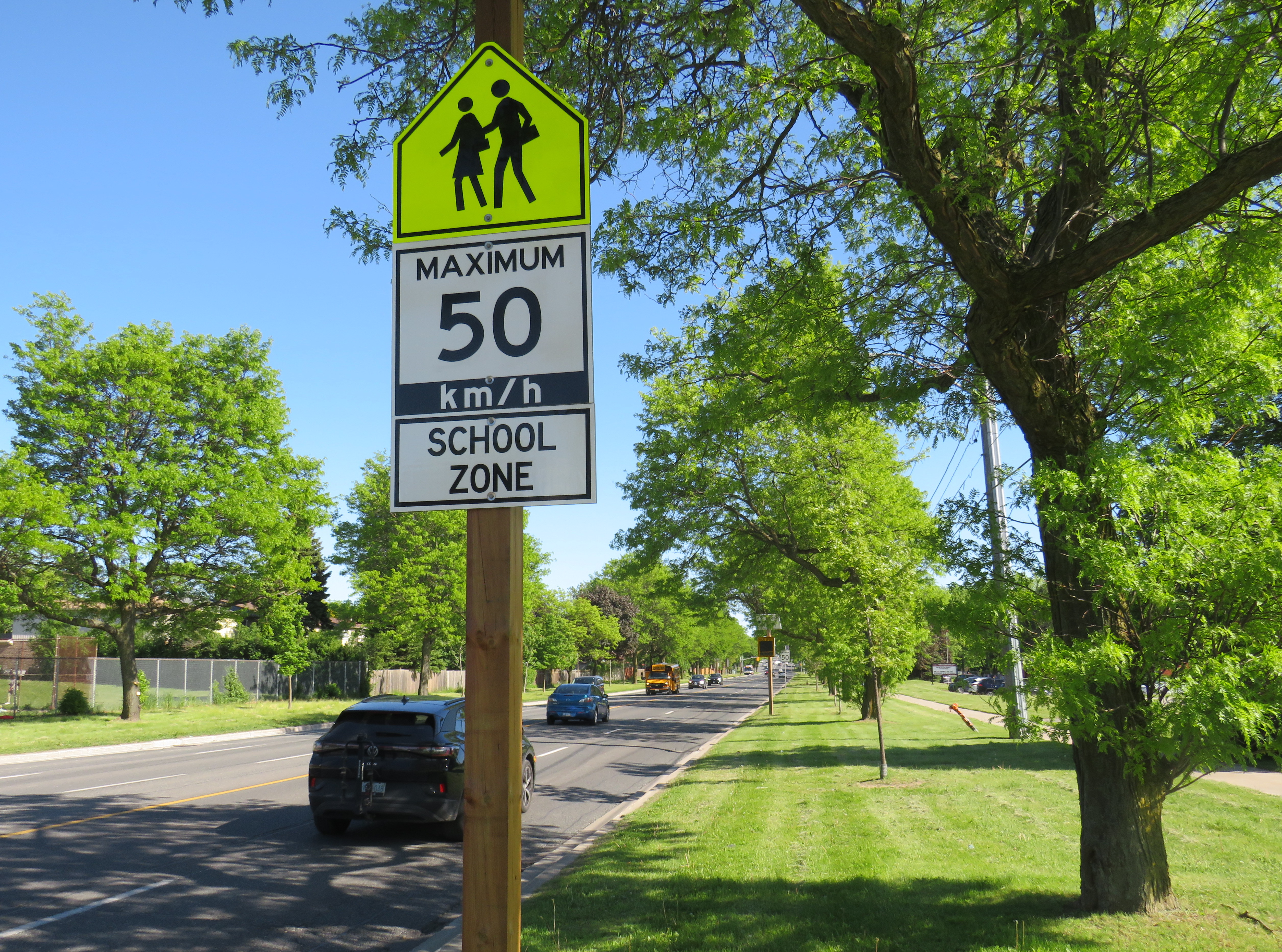
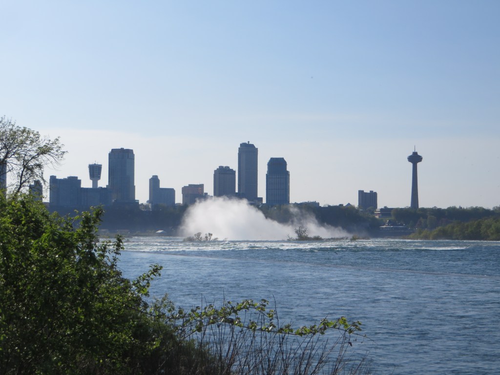
A gigantic school zone speed limit sign on McCowan Road in Scarborough
Months after Doug Ford’s provincial government banned the use of municipal speed enforcement cameras, calling it a “cash grab,” new supersized school speed zone signs are going up across the province. The first ones I encountered are on McCowan Road in Scarborough, near my spouse’s family home.
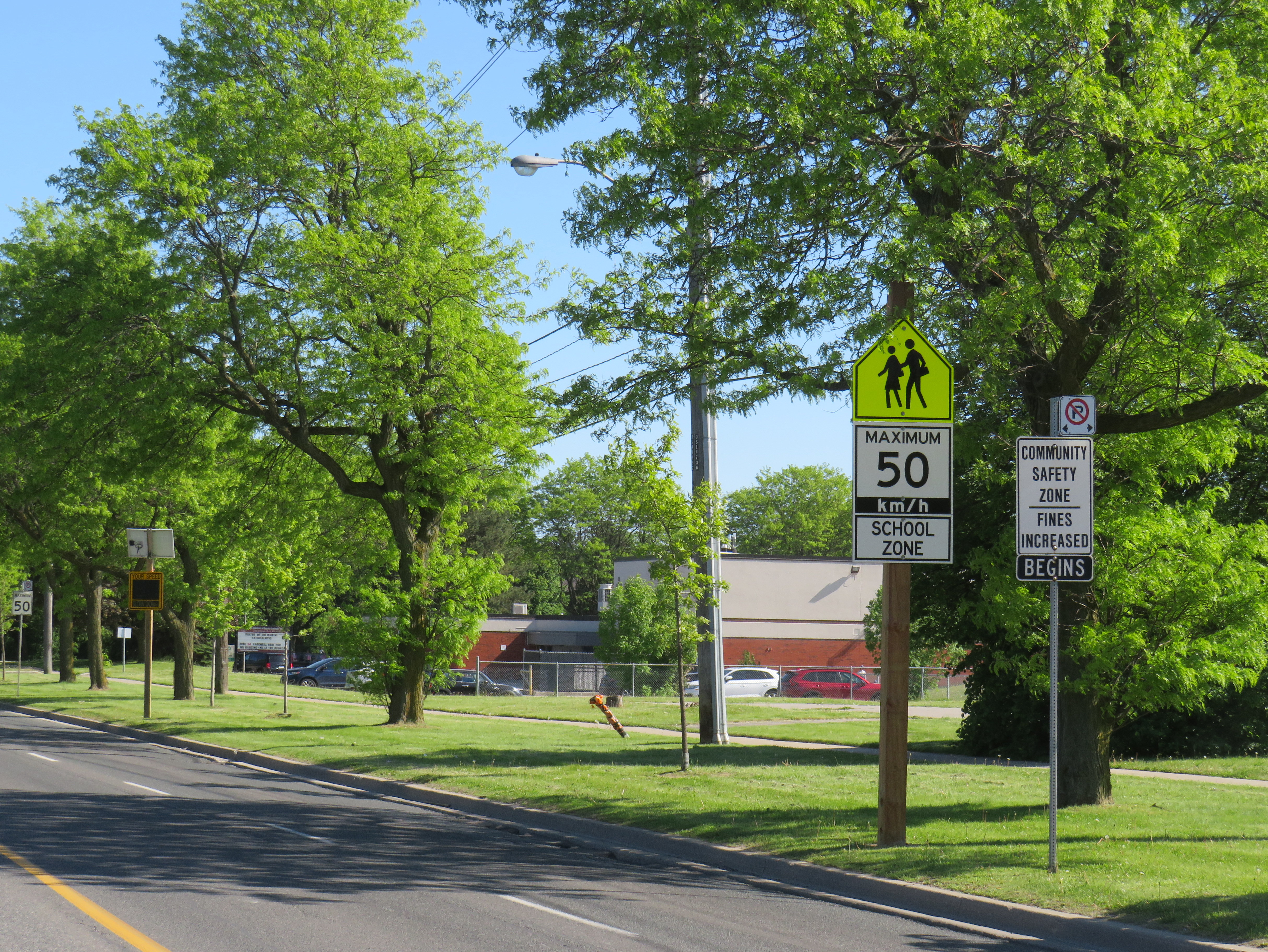
The signs, placed near St. Ignatius of Loyola Catholic School south of Finch Avenue, are gigantic: nearly 2.5 metres tall, mounted over three metres above the ground, affixed to an extra large wooden pole as the new signs were too big for the standard metal poles used for that purpose. The province delivered 80 signs to the City of Toronto, but with four signs per school zone (two mounted in each direction including advance warning signs), that meant only 20 schools would get these new totems.
The new supersized school zone sign next to an older “community safety zone” sign, affixed to a standard metal sign pole
Before the pro-driver legislation was enacted on November 14, 2025, there was a speed camera placed on McCowan Road adjacent to the elementary school, one of 150 located in the City of Toronto. Under provincial law, municipal speed cameras were only allowed to be installed in specific designated safety zones, namely roadways adjacent to schools, parks, or seniors’ residences, and had to be accompanied with advisory signage.
Between April 2024, when the camera was activated, and July 2025, when the camera was destroyed (one of many vandalized that year), over 19,000 speeding motorists were captured by the photo camera travelling at least 11 km/h over the posted speed limit. This was despite the existing maximum speed, school zone, community safety zone, and municipal speed camera signs on this stretch of road.
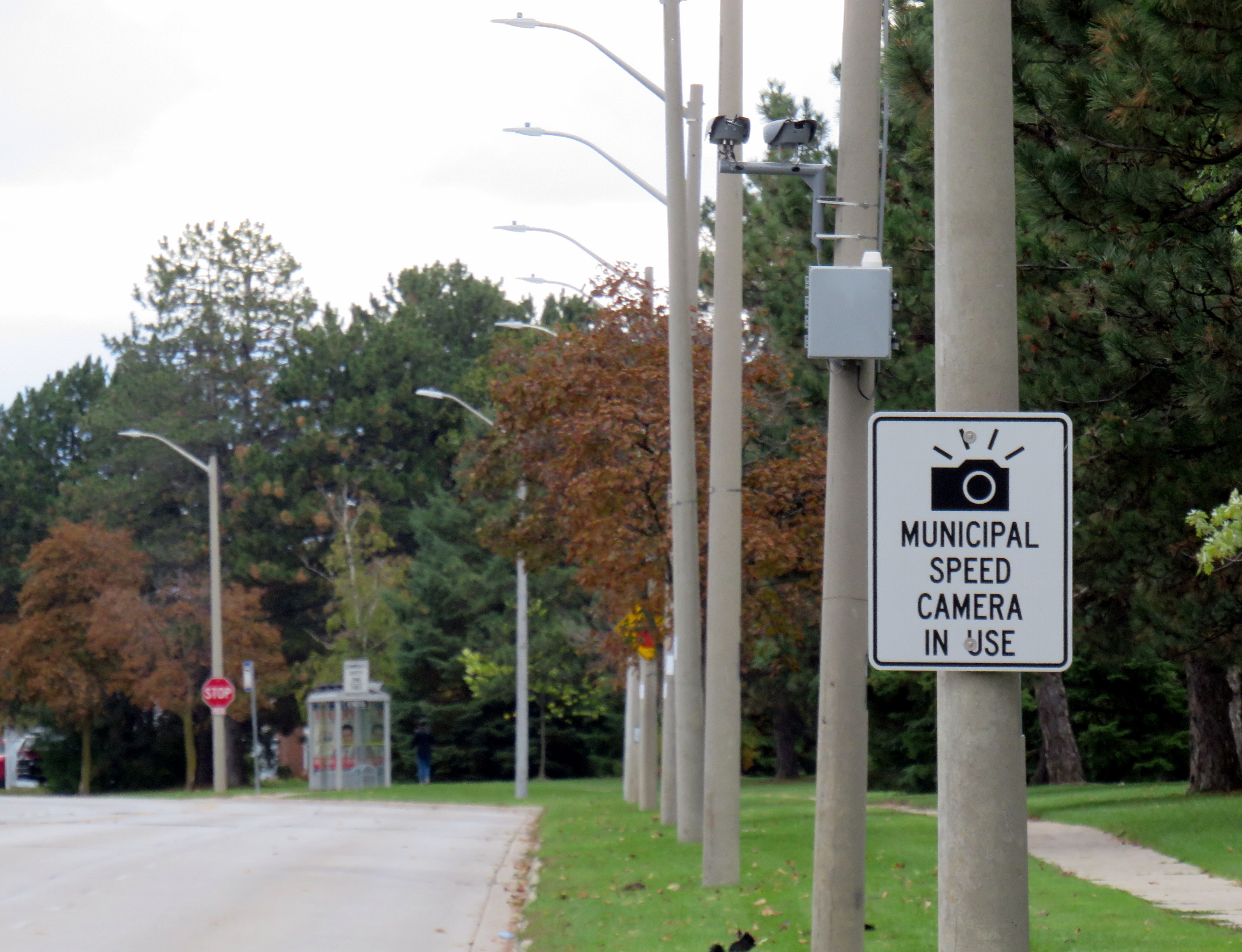
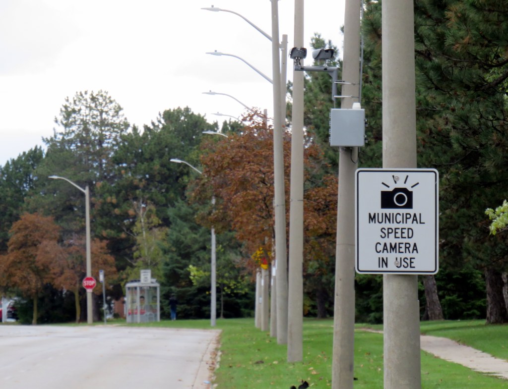
Sign warning of a municipal speed camera in Brampton in October 2025
Despite the high number of infractions, the cameras were doing their job; a job that the Toronto Police isn’t motivated — or able — to do. As seasoned municipal watcher Matt Elliot points out, for period between January 1, 2025 through November 14, 2025 (when camera enforcement was forced to end), 628,165 speeding tickets were issued through the automated speed enforcement program. Toronto Police’s “Vision Zero” traffic unit issued just 14,500 tickets.
New city report notes the Toronto Police Vision Zero Enforcement Team handed out about 14,500 speeding tickets in 2025. Might sound like a lot, but well, compare and contrast.
Despite all those tickets issued, the cameras were especially effective at reducing speeding in school zones. A 2025 Toronto Metropolitan University/SickKids Hospital study found that speed enforcement cameras reduced speeding by 45 per cent and reduced speeds by most drivers by more than 10 km/h.
Active police enforcement remains a valuable tool because officers can lay charges that automatic speed cameras can not catch, including distracted, impaired, and dangerous driving. But policing has a dark history of racial profiling and has a pro-motorist “windshield bias,” while speed enforcement and red light cameras do not discriminate.
Furthermore, North American roads are designed for excessive speed and not for the safety of vulnerable road users. We rely on signs to advise motorists of how we expect them to drive, rather than road design that requires attentive and slower driving. Speed cameras were a useful stopgap that worked a lot better than signage.
So, the new supersized signs going up are not a solution to unsafe driving: they are just another mere indication that children, seniors, and all pedestrians and cyclists don’t really matter, especially to politicians like Doug Ford.
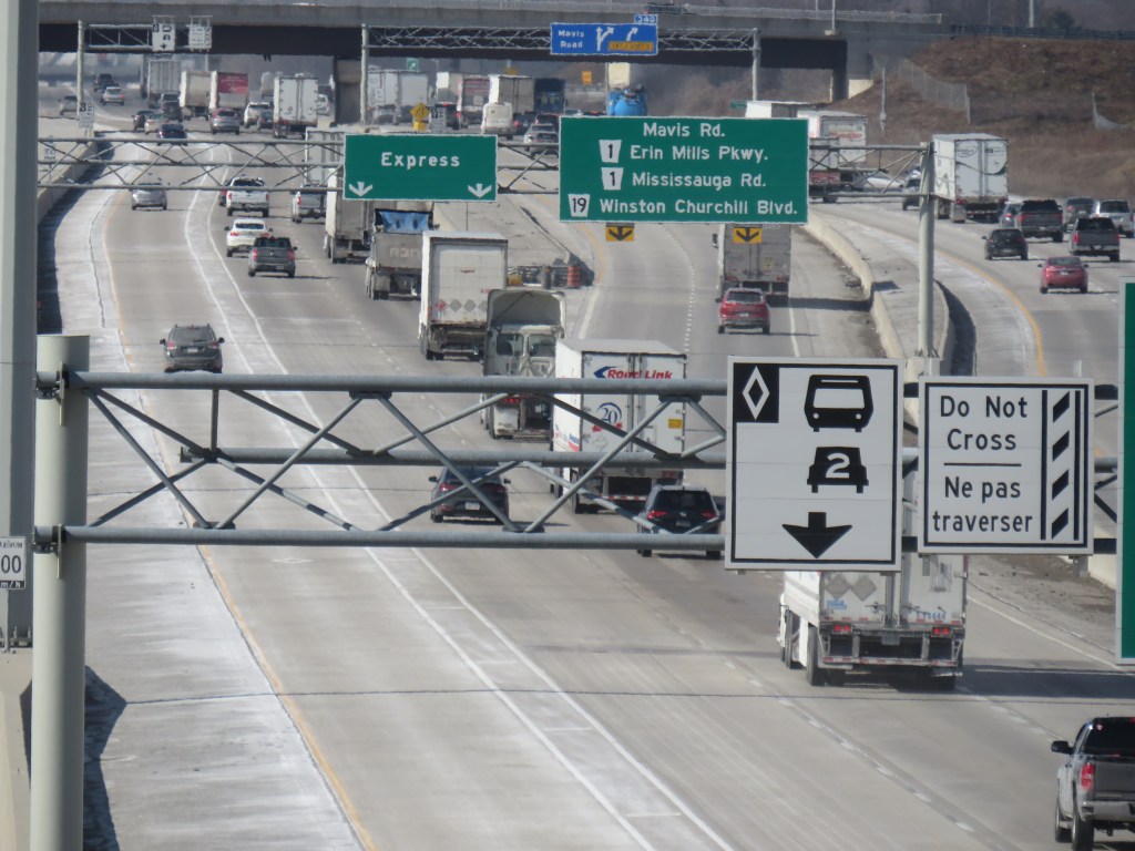
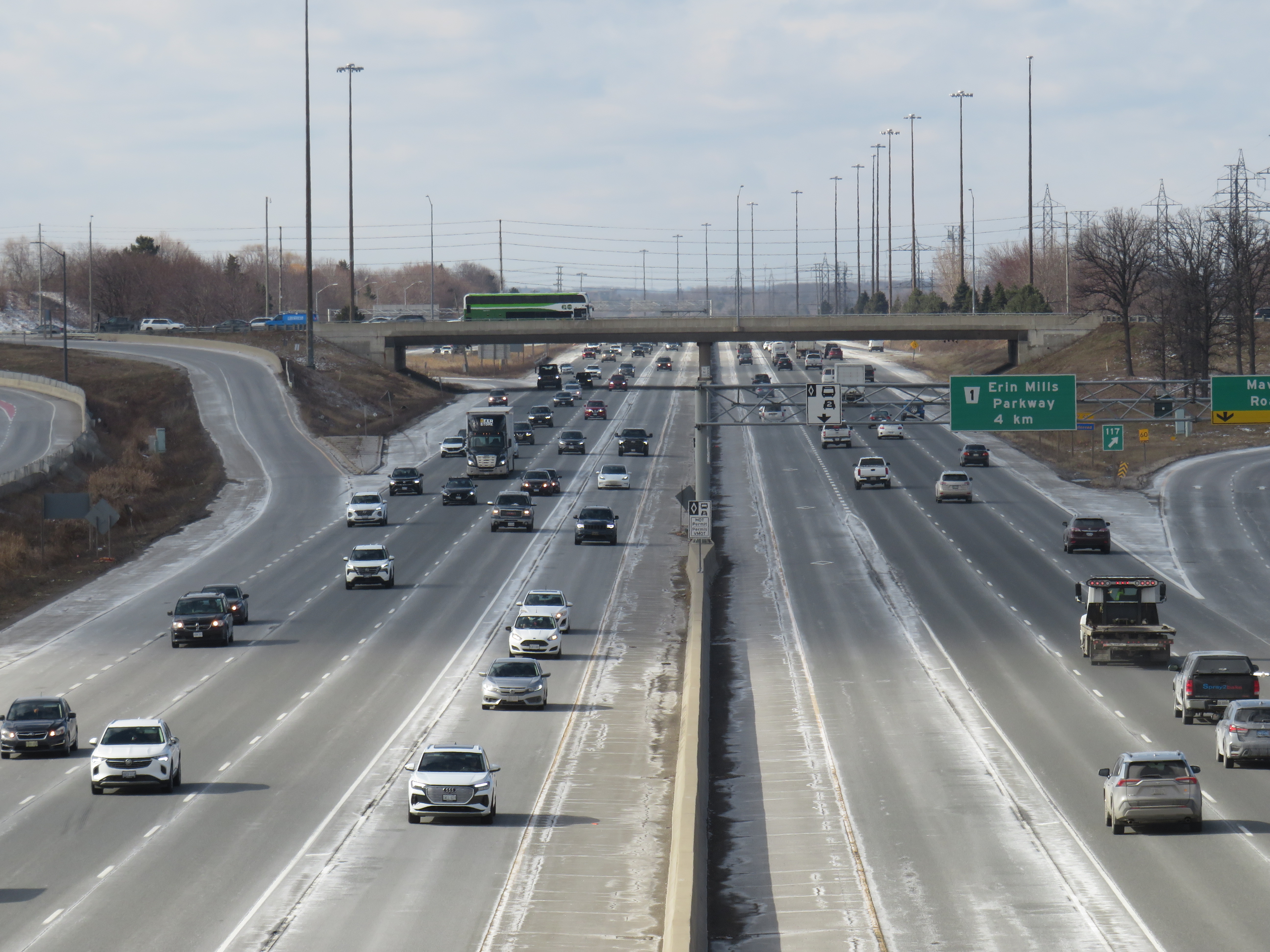
Highway 403 in Mississauga, with HOV lanes in the centre
In the last year, making the occasional car trip to visit family in Northeastern Ontario or just to get out of the city for a day or two, I kept wondering what the point of those new high occupancy vehicle (HOV) lanes were on the Queen Elizabeth Way, Highway 400, or Highway 401. At first, they seemed like a real time saver for anyone riding on a transit bus or driving with a few family members, friends, or carpool colleagues in the car. As time went on, with new exceptions, minimal or no police enforcement, and increasingly aggressive driving post-pandemic, one is left wondering why the province even bothers adding them to more highways.
Now, amongst a flood of moves and musings by our oft-Trumpian premier, it appears that the province has given up on even the veneer of sustainability with these highway widenings throughout the Greater Golden Horseshoe and Ottawa regions. On Tuesday, March 17 — St. Patrick’s Day — Transportation Minister Prabmeet Sarkaria announced a proposed regulatory amendment that would allow all cars and light trucks in the HOV lanes, during off-peak periods. The change would “help keep drivers moving across the province, so they can spend less time in traffic and more time with their families and friends.”
This announcement is part of a stream of messages from Doug Ford and his government clearly seeking the attention of the news media and the public. The week prior, Ford was talking about expanding the Toronto Island airport, even seizing control of the City of Toronto’s interest to ensure that jets could land on the waterfront. Before that, Ford mused about a new convention centre built on Lake Ontario near Exhibition Place. This week, Ford was on a law-and-order kick, attacking a fair and impartial judiciary, promoting the idea of “Bail TV,” and praising a homeowner that shot an intruder during a home invasion. Maybe this is to distract from scandal and a new proposed law to shield the premier, ministers, and staff from journalists using freedom of information requests to keep the government accountable.
The legislative assembly will finally reconvene next week, starting Monday, March 23, after a 14-week break.
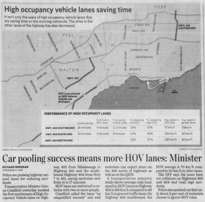
The first HOV lanes were introduced on Highway 403 through Mississauga and on Highway 404 southbound from Highway 7 to Highway 401/Don Valley Parkway in 2005. A year later, the HOV lanes were touted as an “unqualified success,” with the minister of transportation at the time, Liberal Donna Cansfield, promising more reserved lanes to follow, with the QEW through Oakville and Burlington to be the next implementation. With the Ontario Provincial Police (OPP) conducting active enforcement on those two sections, they found that only 5 percent of motorists in the HOV lanes were violating the law.
GO Transit was an especially keen user of the new HOV lanes. In 2005, only the Lakeshore Line had regular off-peak train service, and buses filled in the gaps in between. The 404 lanes saved valuable minutes for buses on the 70/71 Stouffville Line route between Union Station and Markham; the City of Toronto designated sections of the inner paved median on the DVP as well for GO buses that could be used to bypass traffic congestion.
Clip from the Toronto Star on Thursday, Dec 14, 2006
At the time, the HOV lanes saved carpoolers and transit riders up to 17 minutes on the initial segments on Highways 403 and 404. The additional capacity created with the new lane (no existing lanes were to be converted to HOV-only under provincial policy) also led to time savings for all drivers, at least in the short term. Increased traffic caused by suburban growth and induced demand eventually negated those time savings for general traffic.
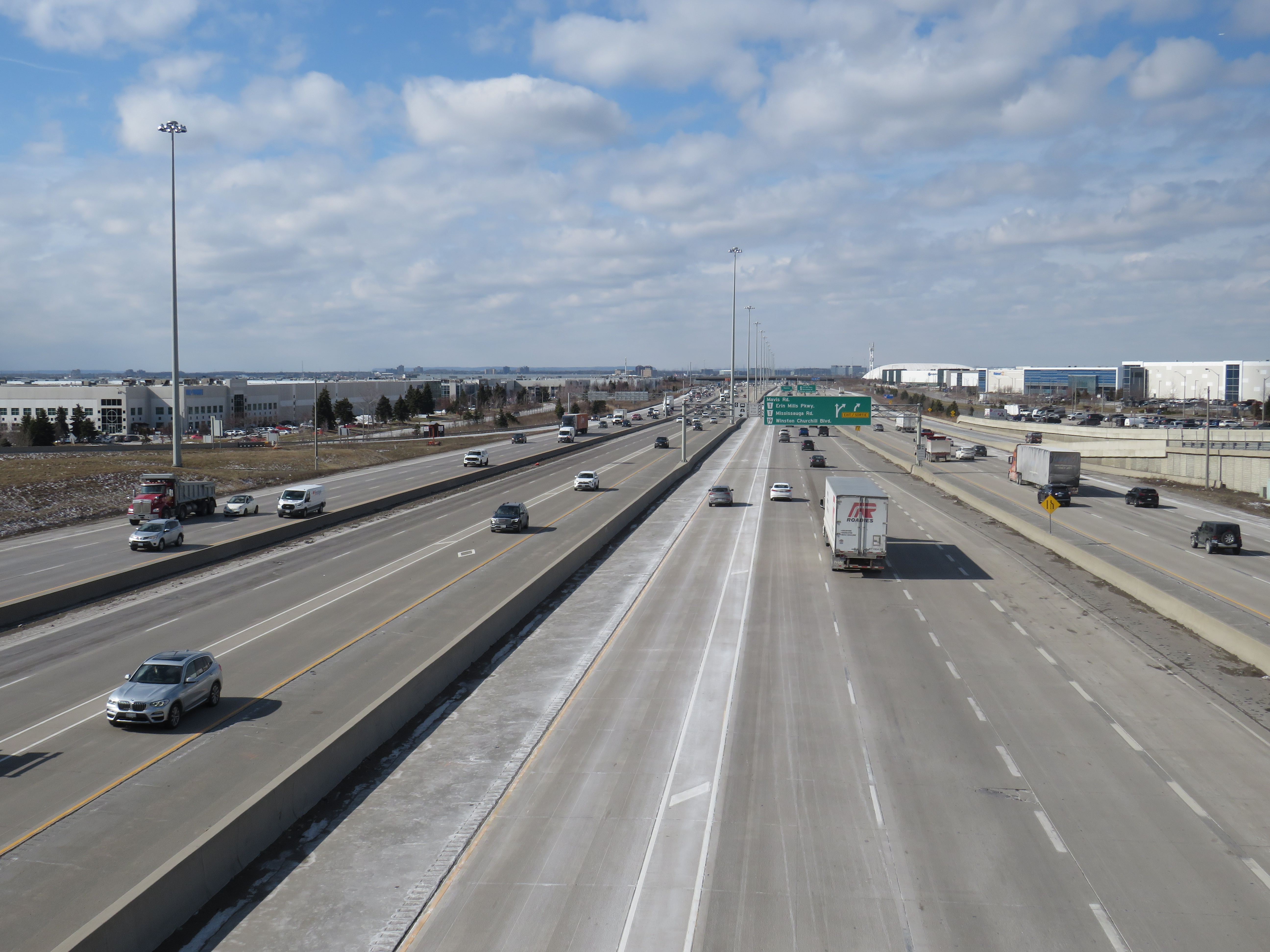
HOV lanes were included in more highway expansion projects. The QEW HOV lanes through Oakville and Burlington were added in 2011. Lanes on Highways 400, 410, and 427 and Highway 417 in Ottawa followed, and when Highway 401’s express/collector system was expanded through western Mississauga and Milton, HOV lanes were part of that too.
“One more lane should do it,” Highway 401 in Mississauga, with HOV lanes in the middle of a recently widened highway
Regulations on the use of HOV lanes were relaxed over the years too. Motorcyclists were permitted, as were any vehicle with a “green” license plate (available to any battery-electric or plug-in hybrid car, SUV, or light truck). HOT permits were also added, for anyone willing to pay and enter a lottery for the right to use the lanes while driving alone. Taxis and airport limos were also allowed, even when not carrying a passenger.
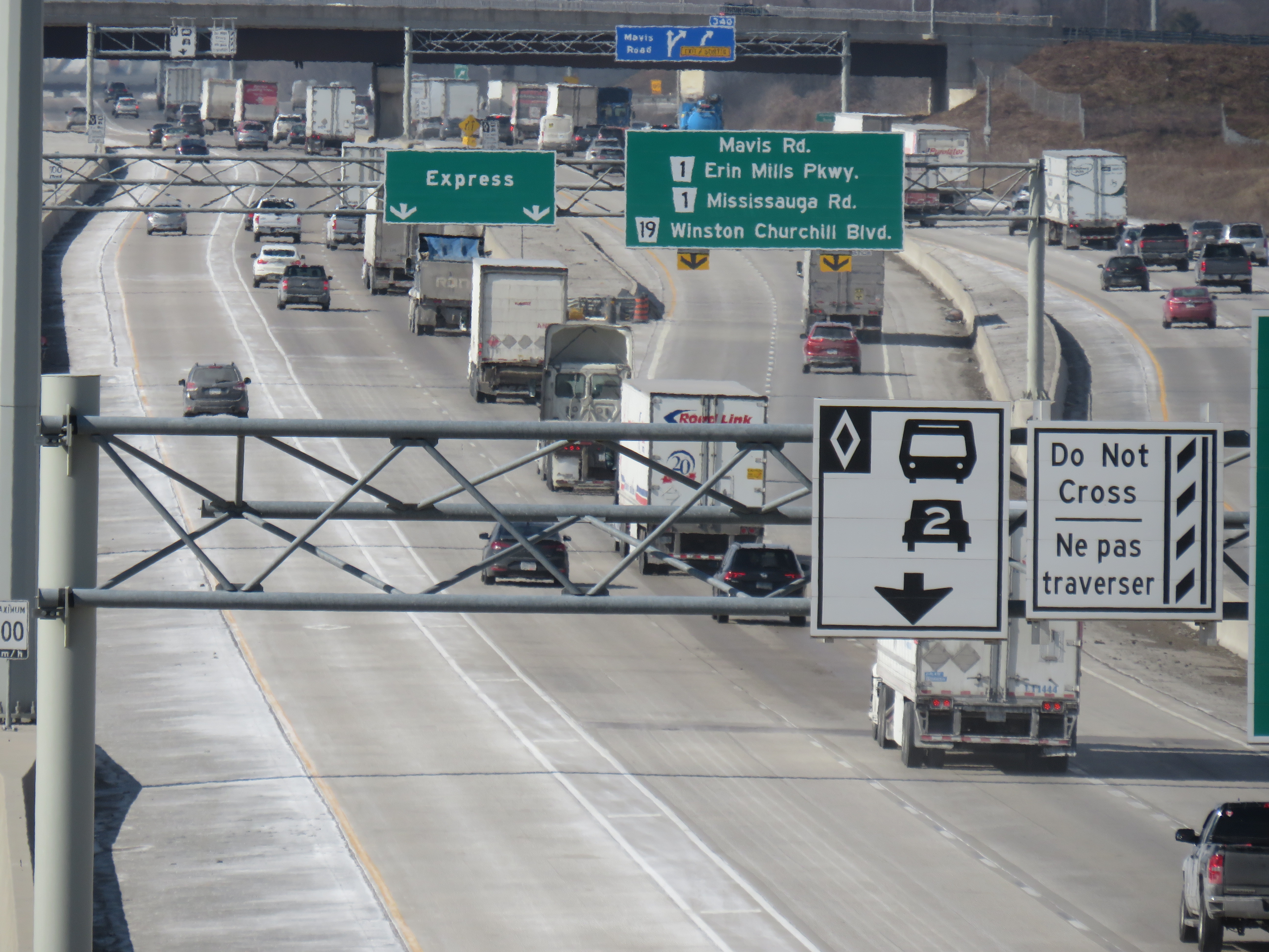
Poor driving habits, which seemed to have gotten worse since the COVID-19 pandemic, have made a mockery of the initial intentions of the HOV lanes. Without enforcement, the HOV lanes are essentially treated by some drivers as fast lanes, with sudden swerving in and out despite double solid lines and “Do Not Cross” signs consistently posted along the highway, intended to reduce weaving. Solo drivers regularly use the lanes without consequence to get around slower drivers or trucks.
Despite “Do Not Cross” signs, and a double solid line between the HOV lane and general traffic, this regulation is regularly ignored
For now, we do not know what “off-peak hours” would mean when the provincial government finally legalizes another bit of the selfish and aggressive driving behaviour the rest of us have sadly gotten accustomed to. The QEW is frequently jammed most weekends between May and October, when families and tourists travel between Toronto, Hamilton, and Niagara. Highway 400 is notorious on Friday evenings and Sunday afternoons during Cottage Country commutes.
This is yet another motorist-friendly move by this government eager to hold onto seats in suburban ridings and please its wealthy backers, along with permanent gas tax breaks, abandonment of license plate renewal fees, the prohibition on speed enforcement cameras, and the construction of destructive new highways like the 413. But at least this latest move is an acknowledgement of something I have felt for years about the HOV lanes in Ontario: a simple greenwashing of highway expansion, making us feel better about laying more concrete and asphalt.
Once again, Doug Ford wants to mess with local democracy. This time, it’s in Niagara Region.
With the recent news overload — yet another war in the Middle East, rising fuel costs, another municipal mayoral race — not to mention the flood of news from Queen’s Park (a new mega-convention centre on Lake Ontario, moves to let bigger passenger jets on an expanded island airport, and legislation to increase secrecy within the highest levels of provincial government), you might be forgiven for missing yet another bit of news.
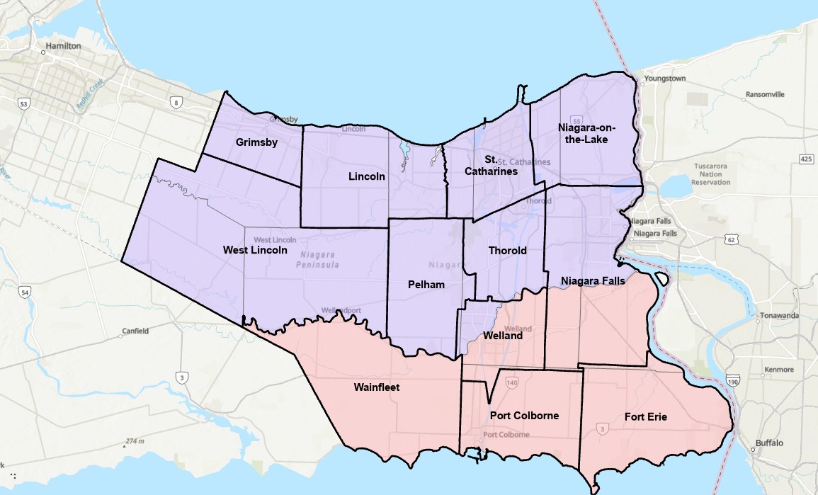
Niagara Region municipalities, with former Lincoln County townships in blue and Welland County townships in red
Niagara Region is one of eight regional governments in Ontario, a specialized level of government introduced by an earlier Progressive Conservative government in the 1970s, following on the success of Metropolitan Toronto created in 1954. Regional governments had more powers and responsibilities than counties, including regional planning and the provision of water and wastewater systems deemed essential for smart urban growth. Most regions formed their own police services, and many took on responsibility for household waste management and public transit (Durham, Waterloo, York, and most recently Niagara). Other services, such as fire departments, libraries, local planning, parks and recreation, and local public works remained the responsibility of the cities, towns, and townships.
The Mike Harris-led PC government, elected in 1995, was a big proponent of municipal amalgamations. After amalgamating the City of Toronto in 1998, it replaced regional governments in the Hamilton, Ottawa, and Sudbury areas with amalgamated cities in 2001, and broke up the former region of Haldimand-Norfolk creating two stand-alone municipalities. Dozens of other amalgamations took place in those years, including Chatham-Kent and Kawartha Lakes (formerly Victoria County). On top of that, provincial costs were downloaded to those new creations, including social and health services and thousands of kilometres of provincial highways.
That era of drastic municipal change came to an end in December 2003, when a new Liberal government was elected, with relative calm for nearly fifteen years, until June 2018. During that time, the status quo prevailed, without a full review of the operations, finances, and role of municipal governments that would inform good faith reforms.
Niagara Region is made up of twelve lower tier municipalities: the cities of St. Catharines, Niagara Falls, Welland, Thorold, and Port Colborne, the towns of Fort Erie, Grimsby, Lincoln, Niagara-on-the-Lake, and Pelham, and the townships of Wainfleet and West Lincoln. The current region is a result of that earlier wave of regional government establishments in much of Ontario; prior to 1970, Niagara was made up of two counties — Lincoln and Welland — with fifteen townships and nearly a dozen smaller cities and towns between them.
As with all remaining regional governments, Niagara Region Council is made up of municipal politicians who also sit on their local city or town councils. Each mayor sits on the regional board, and to make up for population disparity between urban centres and rural townships, the larger municipalities send additional councillors who already sit on their local councils. Though some regions have chairs elected by the region’s populations, others have a non-elected chair, typically chosen by the regional council.
The Niagara problem started when the provincial government used its new authority to appoint its own preferred chair to Regional Council after the previous chair, former Liberal MPP Jim Bradley, died in office in late 2025. Bob Gale quickly promoted regional amalgamation, backed by Premier Ford, citing tax increases and too many local politicians. The idea is unpopular amongst Niagara residents, especially those in smaller communities such as Niagara-on-the-Lake, which under a four-municipality model, would be joined with Niagara Falls (whose mayor backed the idea).
Repeatedly, it has been shown that municipal amalgamations fail to save taxpayers’ money but only make municipal government more distant to the residents it serves. Though the number of municipal politicians would decrease (there are 126 across the 12 lower-tier municipalities), in smaller towns and rural townships, these are part-time positions. In Toronto, the moves from seven councils down to one in 1998 and from 44 councillors down to 25 in 2018 failed to save operating funds, as the number of paid employees to support each councillor increased to manage their greater workloads. Even the conservative Fraser Institute found no tax savings when studying the effects of amalgamation on smaller Ontario municipalities. Furthermore, with many services already the responsibility of the region, what savings could be had if police, transit, social services, housing, and major roads are already amalgamated?
For now, the idea of amalgamation in Niagara Region is stalled, but not because wiser heads prevailed. Chair Bob Gale resigned just three months into his term after local anti-hate organizations found he had in his collection of historical artifacts a copy of Mein Kampf signed by its author, Adolf Hitler.
One of the other problems with a quick amalgamation of such a large area is that there is no study on what boundaries actually make sense. Does the combination of 12 municipalities into just four actually work? Should the new boundaries just lump existing towns together, or more intelligently redraw existing boundaries completely? For example, should the City of Thorold be just thrown in with a neighbour as is, or could be split into three, with the urbanized area joining St. Catharines, the area east of the canal joining Niagara Falls, and the southern rural area joining Pelham and Welland?
Unfortunately, as hospitals face funding and staffing crises, as students face increasing debt loads to complete post-secondary education, and the economy continues to face headwinds, Doug Ford manages to get bogged down into distractions like shiny new buildings on Toronto’s waterfront, municipal restructurings, and needless new highways. The next provincial election will not come for another three years, and yet the premier wants to play mayor.
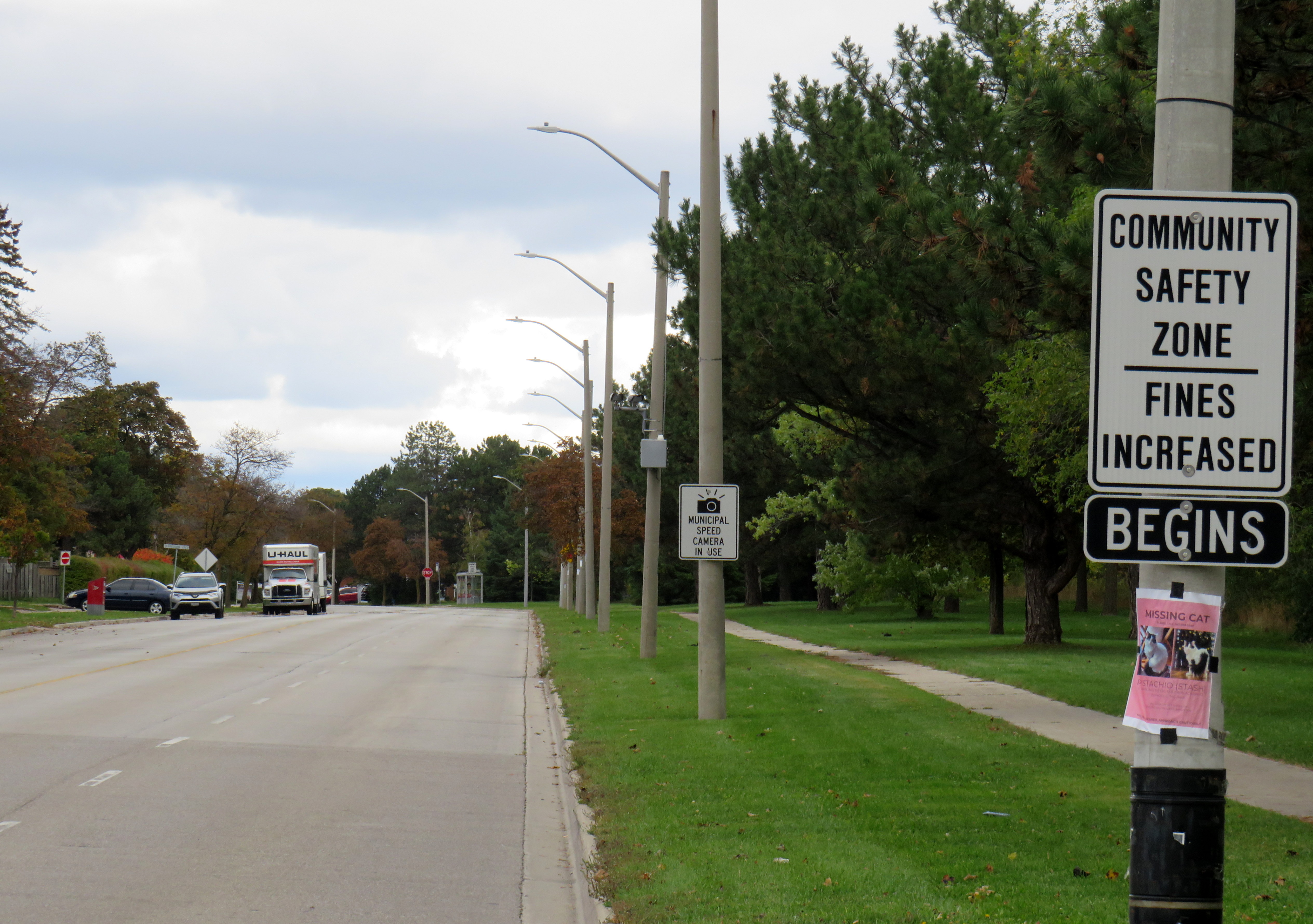
Dearbourne Boulevard, a four-lane collector street designated a community safety zone
Last week, while visiting Brampton, I came across one of the hundreds municipal speed enforcement cameras that Premier Doug Ford’s government wants to rip out across the province. The camera, on a four-lane collector street in Bramalea, is in a residential area, adjacent to several parks, including a pathway to a local public school, in an area designated a community safety zone. This is precisely the type of place that the government intended speed enforcement cameras would go when they were permitted under provincial legislation in 2019.
In a September 2025 government press release touting the move as “protecting taxpayers,” Ford, whose government was in power when these cameras were permitted, claimed that the program became “a cash grab;” supporting quotes included those from former Liberal leader and current Vaughan mayor Steven Del Duca, a representative of the province’s municipal police unions, and a spokesperson from the right-wing Canadian Taxpayers Federation.
If only there was a simple, effective way for taxpayers to avoid the so-called “cash grab.”
It was interesting who was not quoted in that press release, including doctors, educators, safety advocates, and even police brass. Ontario police chiefs support automated speed enforcement. It is also worth noting most municipalities support the cameras; Vaughan is one of only a few municipalities that recently rejected the road safety program; Del Duca was joined by just two other conservative-leaning mayors.
Of course, the arguments against the cameras, which in Toronto, were repeatedly vandalized or stolen, never held water. There were no tickets mailed out to drivers going just a few kilometres over the limit. Furthermore, speed enforcement was never a “cash grab” as the fines collected went to pay for the administration of the program, to “Vision Zero” works, such as the installation of speed cushions and improved pedestrian crossings, and to the province, which the collects the victim surcharges added to every Highway Traffic Act fine. The City of Brampton found that not only were the cameras effective in reducing speeds, they had the support of a majority of its residents.
Municipal speed camera
That said, while visiting Dearbourne Boulevard, I realized that speed enforcement cameras on their own are not effective in creating safer streets.
Dearbourne Boulevard serves one of the oldest parts of Bramalea, established in the early 1960s as a self-contained satellite town, where residents were expected to drive to most destinations. After amalgamation into the City of Brampton, traffic increased and more transit became available. Nearby, several newer high-rise apartment buildings were built, walking distance to Bramalea GO Station. A bus route, 16 Dearbourne, runs along the street, connecting the neighbourhood with several shopping plazas, the GO Station, and the transit hub adjacent to Bramalea City Centre.
Despite having low traffic and serving a residential area (an industrial area is just to the south, but it is inaccessible from Dearbourne), it is still a wide four lane street. The only traffic signal is at Bramalea Road; there are two all-way stops at Delamere Drive and Dorchester Road. At the east end of Dearbourne, the T-intersection with Balmoral Drive is controlled only be a stop sign, with two long and gentle right turn slip lanes. The speed limit is 50 km/h, and there are no speed cushions, curb extensions, or even painted buffers to indicated that drivers should go slower. In October 2022, a pedestrian was struck and seriously injured at one of the two all-way stop intersections; the driver fled the scene.
Though to its credit, the City of Brampton has been improving many suburban streets and roads to reduce speeds and promote walking and cycling. Charolais Drive, Vodden Street, Central Park Boulevard, and Vodden Road saw traffic lanes replaced by new cycling lanes, with little pushback from residents. Dearbourne Boulevard was also slated for improvements in 2021-2022, but that work was not yet started.
Central Park Boulevard, Howden Boulevard, and Vodden Street were among several four-lane collector roads tamed with new cycling infrastructure in the last five years, creating a new through east-west cycle route
Now, it might be too late. Not only will the speed camera be prohibited under a bill being rushed through the provincial legislature (going around the consultation process where concerned citizens, advocates, or safety experts could depute to MPPs), but another omnibus bill was just introduced, which if passed, would prohibit all Ontario municipalities from removing general traffic lanes to install cycling infrastructure, or even transit lanes and on-street patios.
Given the provincial government’s increasing hostility to anything that inconveniences drivers, be it road tolls, vehicle license renewal fees, automated speed enforcement, or bike lanes, it leaves municipalities fewer options to protect their most vulnerable road users and promote sustainable and healthy transport options. Though Doug Ford claims that alternatives like flashing lights and more signs would do the trick, they do not do much to deter aggressive and dangerous drivers, unlikely to get caught.
For streets like Dearbourne Boulevard, there are a few options. Lowering the speed limit to 40 km/h should be a first step. The redundant outer two lanes could be converted to parking-only spaces, with curb extensions and bollards at intersections. The slip lanes at Balmoral Drive should be ripped out.
Roads designed in the 1960s and 1970s for traffic that never really materialized need to be rethought, with or without Queen’s Park’s support.
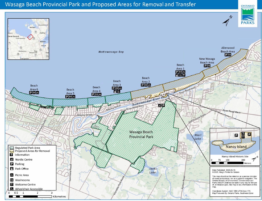
In late July, online news outlet PressProgress reported on the provincial government’s plans to divest itself of 60 percent of the beach areas of Wasaga Beach Provincial Park, transferring the waterfront lands to the Town of Wasaga Beach. This report raised a number of concerns, including environmental issues (the beach is an important habitat for the piping plover, an endangered species of shorebird which breeds on sandy shorelines), as well as continued public access to the world’s longest freshwater beach. By amending legislation to transfer these lands from provincial to local control without future votes in the legislature, future provincial park lands could also be sold off to municipalities or to the private sector.
Wasaga Beach Provincial Park and proposed areas for removal and transfer to the municipality
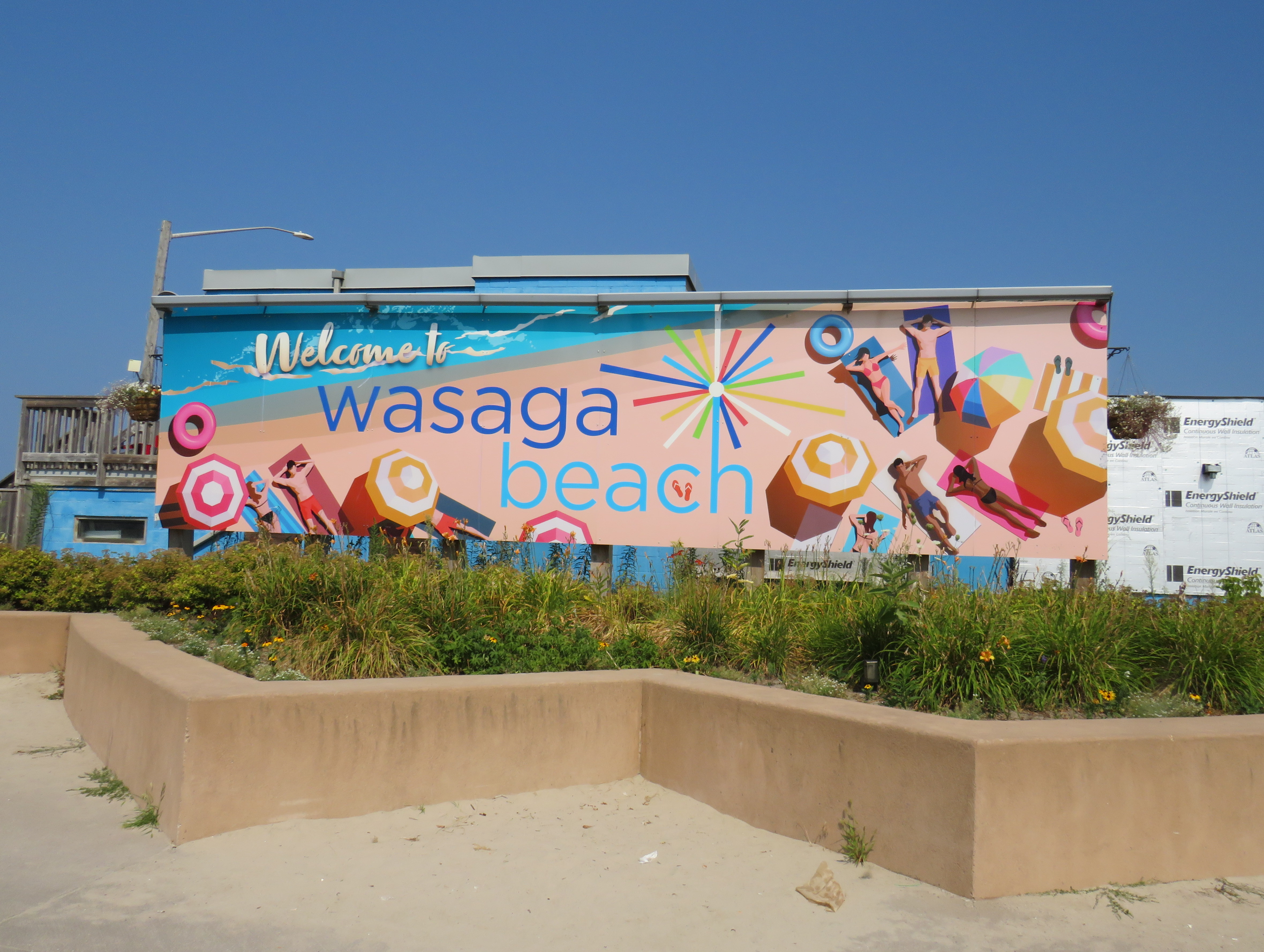
Sign touting provincial funding for Wasaga Beach’s beachfront redevelopment
Amending the Act to permit the divestment of protected lands is a bad precedent, though arguably it was already set by the privatization of much of Ontario Place for the troubled Therme spa development. The closed Ontario Science Centre grounds remain in limbo as well.
As Shawn Micallef recently pointed out in the Toronto Star, much of Ontario’s prime lakefronts are privatized or purposely made inaccessible to outside residents — not just the popular Muskoka Lakes, but also much of the Great Lakes shores, such as in Tiny Township near Midland. The big, popular, beach areas are worth preserving and expanding, not only to meet current demand, but also provide sustainable and affordable getaways for a growing population in Southern Ontario.
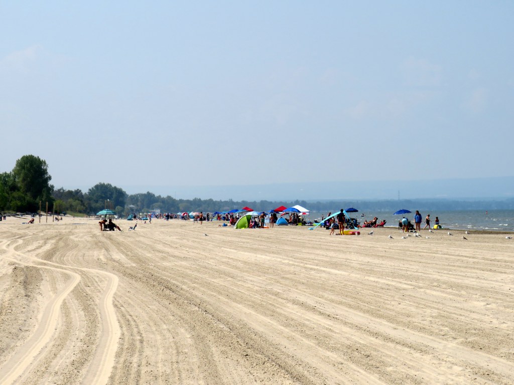
The beautiful sand at Wasaga Beach Provincial Park on Thursday, August 14
That demand for summer lake access brings up another challenge — how to get people to and from beach destinations. In Toronto, the lineups for the Island ferries are notorious in the summer. The compound where ferry-goers are forced to wait only adds to the inhospitable atmosphere, though temporary shade structures were added for 2025. The beach at Ontario Place, one of the cleanest on Lake Ontario, has been closed off for the controversial Therme spa construction.
For those living in Toronto’s suburbs, or anyone looking to avoid the downtown congestion, to get to a good beach will probably mean a road trip to somewhere like Wasaga Beach, Sauble Beach, Grand Bend, Port Dover, Long Point, or Prince Edward County. Many of these places are completely inaccessible without a car, or at best, have limited bus options. Furthermore, even where there is a transit link, the best beach areas are nowhere near where the bus or train makes its stops. Even though Brampton is a straight shot up Airport Road to Georgian Bay, driving is the only reasonable way to get to Wasaga Beach (as I will get into in the second half of this post).
Right now, Wasaga Beach and Collingwood – a four-season resort town – are connected to Toronto, Barrie, and elsewhere only by two-lane roads: Highway 26, Airport Road, and Sunnidale Road. These roads are often congested with both visitors and with regular traffic. Highway 400 up to Barrie is already being widened, but it too will face additional traffic from population growth in Simcoe County and additional leisure travel.
If Wasaga Beach goes ahead and develops transferred provincial parklands for more intensive economic development, it will have to contend with these transportation challenges. That will mean wider roads and new highways, improved transit links, or both.
Local and regional buses behind a Loblaws superstore parking lot in Wasaga Beach
The way to Wasaga
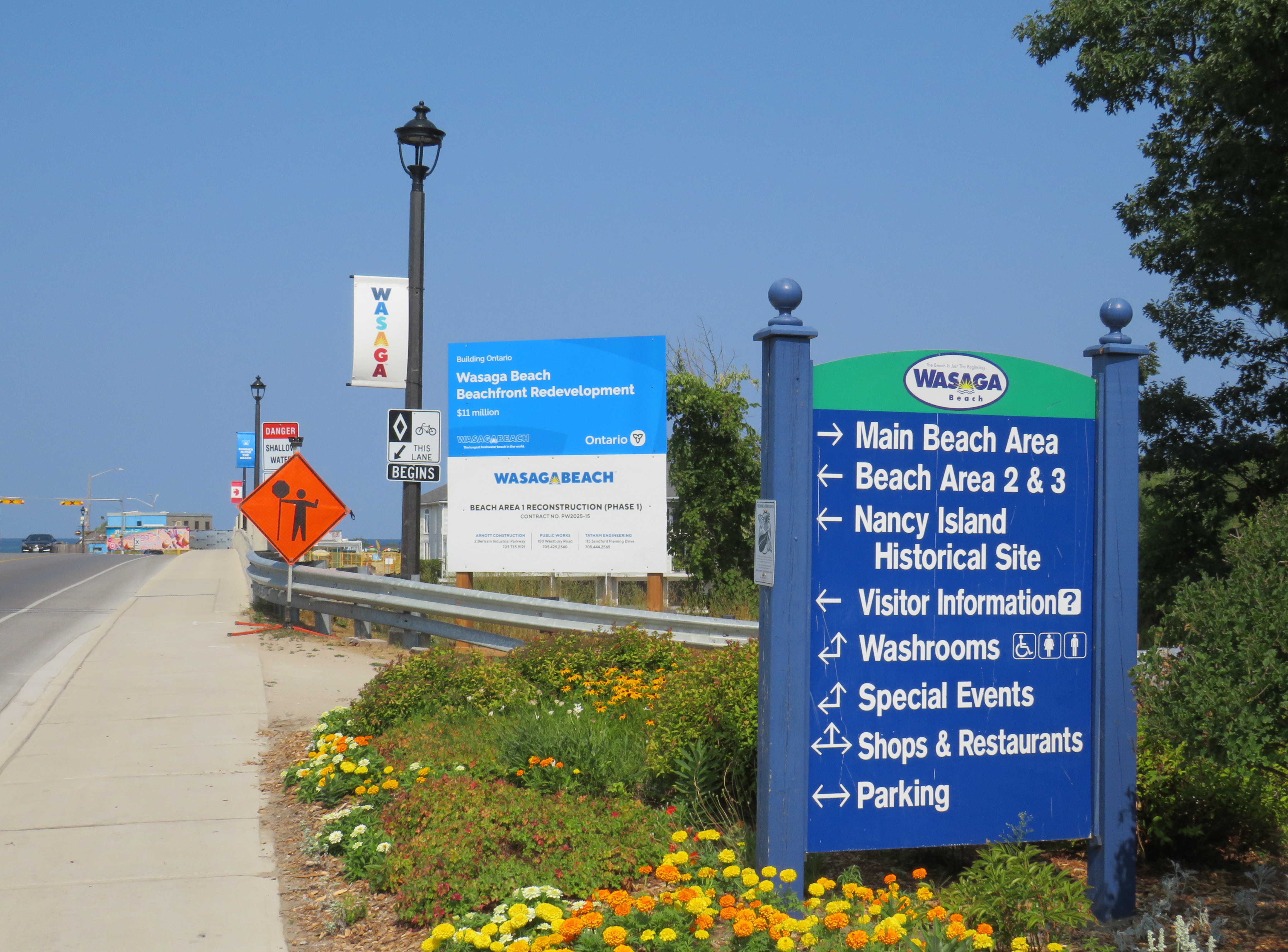
There are currently two ways of getting to Wasaga Beach without a personal vehicle or a taxi ride.
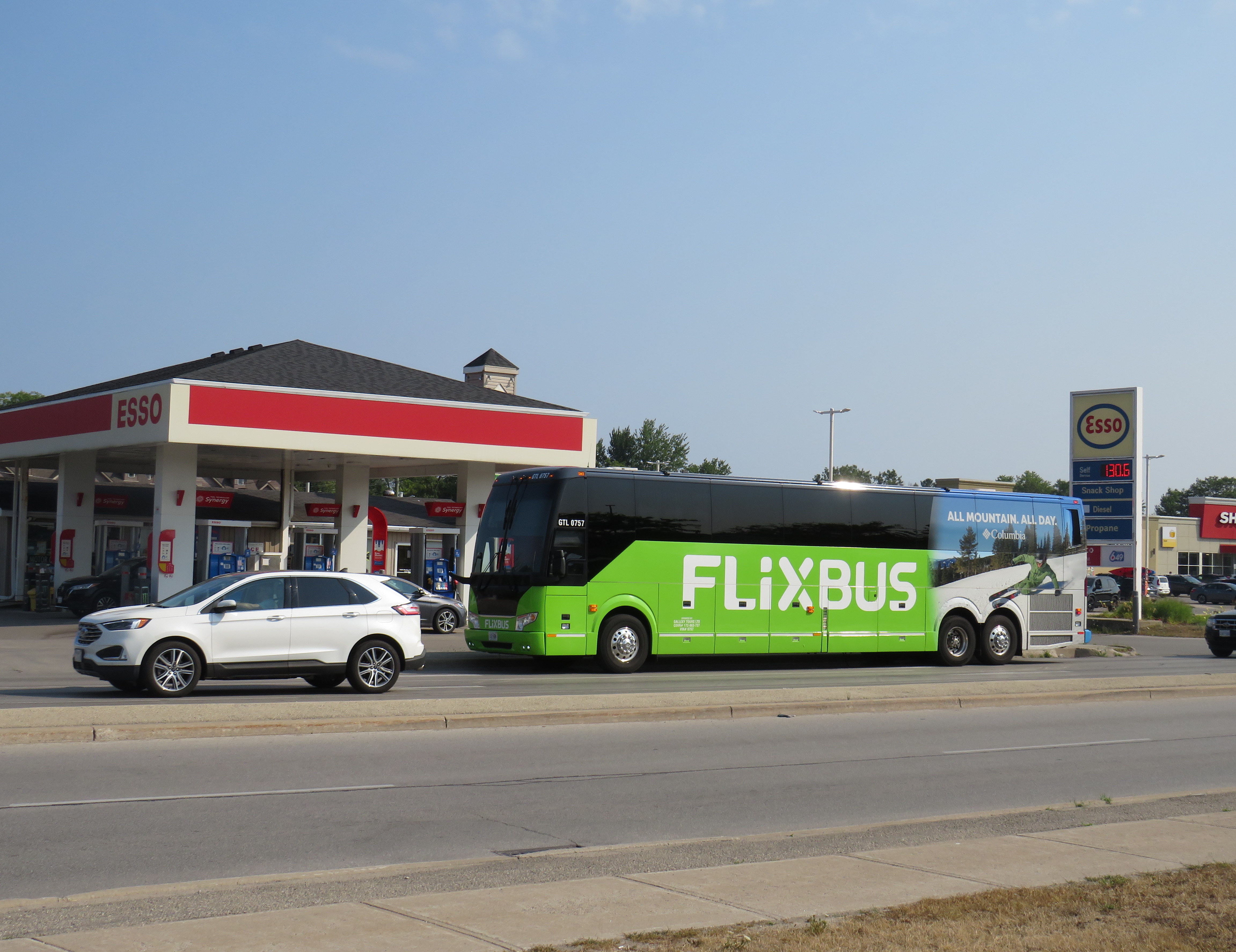
There is one daily Flixbus coach trip from Downtown Toronto and Pearson Airport to Wasaga Beach, continuing onwards to Collingwood, Owen Sound, and Port Elgin. Northbound, the bus leaves Union Station Bus Terminal at 7:30 in the morning and arrives in Wasaga Beach at 10:00. The return bus leaves Wasaga Beach at 4:20 PM and arrives at Union Station at 6:50 PM, though traffic conditions can certainly impact those times. This bus is often nearly or completely sold out.
Flixbus loads in front of an Esso gas station on Mosley Streetat 45th Street
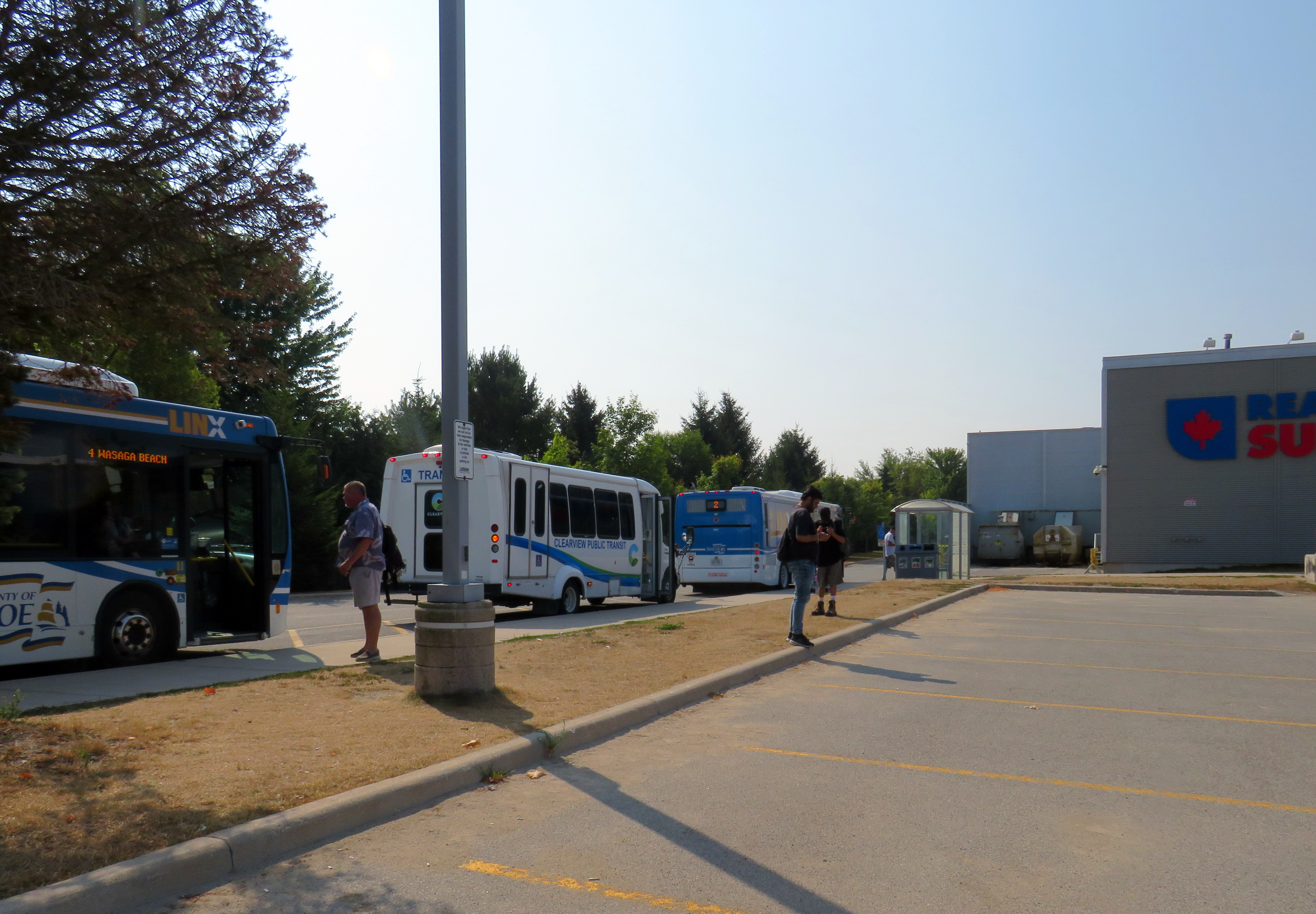
A cheaper and more frequent option is Simcoe County Linx, a regional bus service provided by the County of Simcoe. Linx Route 2, which connects Wasaga Beach to Allandale Waterfront GO Station, connects with GO buses and trains as well as local Barrie Transit buses. Unfortunately, the Simcoe County Linx system has limited service hours, and routes do not necessarily connect with each other. The last buses on Route 2 leave Wasaga Beach and Barrie at 6:30 PM, and there is no weekend or holiday service. (The sole exception is Linx Route 4, which runs between Collingwood and Wasaga Beach seven days a week.)
Both Flixbus and Simcoe County Linx stop on the west side of town, seven kilometres from the main tourist area at Beach Area 1. There are two Wasaga Beach Transit routes connecting these two points, but service is every 60-90 minutes. The limited bus options, combined with a lengthy transfer to get to the main beach areas, makes for an unpleasant trip. The early shutdown of Simcoe County Linx limits the time one can spend in Wasaga Beach, especially if it means a local bus transfer back to the west end of the town.
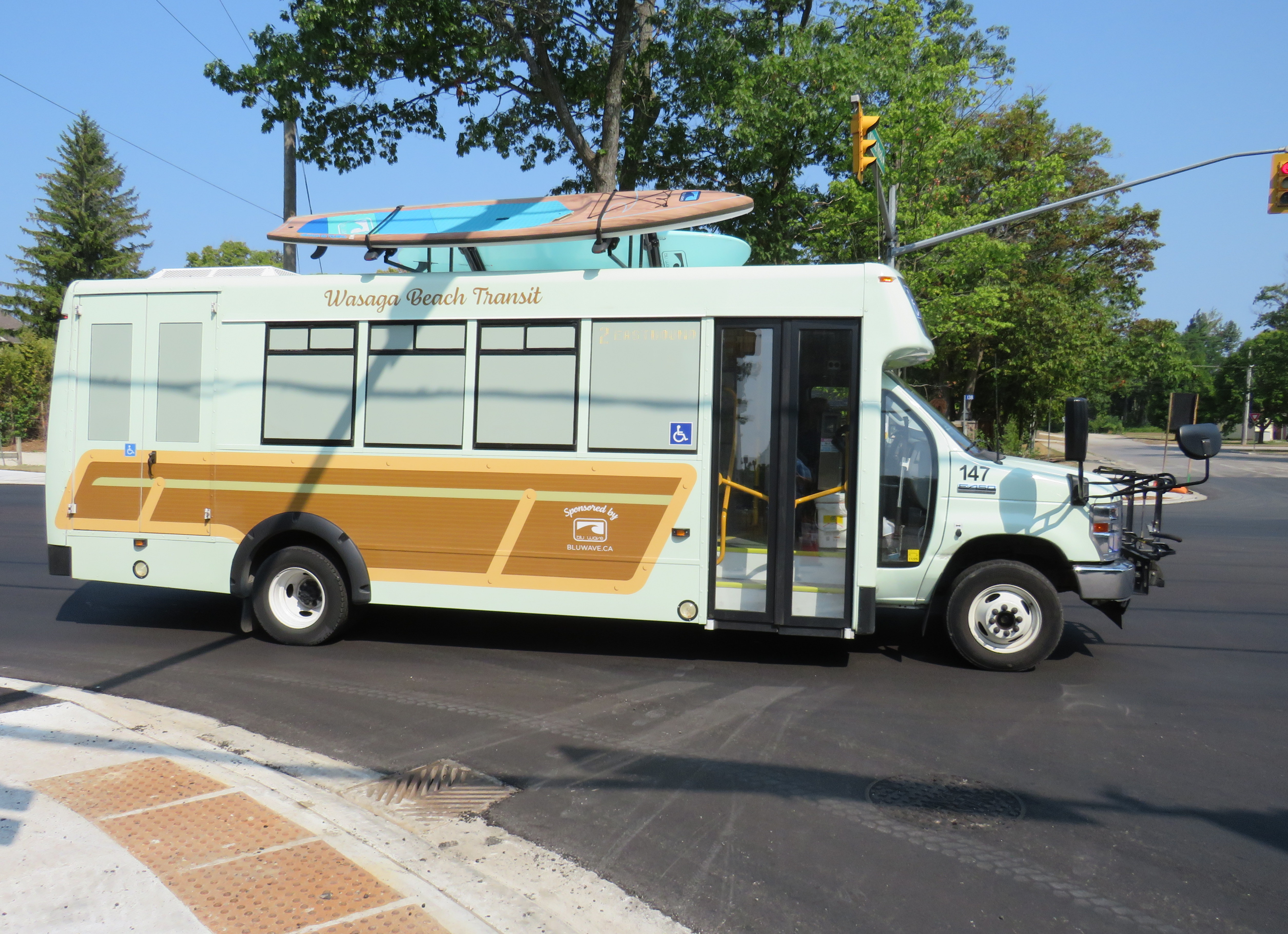
Wasaga Beach Transit minibus, decorated with vinyl wrap and stand-up paddleboards affixed to the roof
From Brampton or Mississauga, travellers must get to either Union Station or Pearson Airport to get the direct Flixbus service or get to the Barrie GO Corridor in order to make the transfer to Simcoe Linx. If there was only a direct bus up Airport Road from Peel Region, Wasaga Beach would be more accessible to another 1.5 million residents.
Furthermore, the only connections to Wasaga Beach are via Airport Road from the south and via Highway 26, a mostly two-lane highway between Barrie and Owen Sound. Wasaga Beach has never had rail access, and the former Barrie-Collingwood Railway through Stayner has been torn up. Both roads are increasingly congested due to both tourist travel and regular commuter traffic; the towns of Collingwood, Wasaga Beach, and Stayner are all growing with new residential subdivisions. Costco is constructing a new retail warehouse at Mosley Street and Highway 26 on the Wasaga Beach’s west side.
This is not just a Wasaga Beach problem. Access to most of Ontario’s other great beaches and resort towns is even more limited. Prince Edward County has a weekday-only bus service between Belleville, Bloomfield, and Picton, but it does not serve Wellington (home of the Drake Devonshire Hotel) or Sandbanks Provincial Park. Port Dover only has a weekday-only on-demand transit service accessible from Simcoe; Sauble Beach is only served by the same Flixbus route that runs through Wasaga Beach. At least Huron Shores Area Transit provides daily service to Grand Bend from both Sarnia and London.
Port Stanley used to have regular electric train service from London — where the municipality owned the railway — until 1956. Even though bus services took over from the L&PS, the only way to get there these days is to drive.
Though several Ontario cities have good urban beaches, accessible by transit — Ottawa’s Britannia Beach and Petrie Island, Hamilton Beach, and Toronto’s many beaches certainly count — there really should be better access for all to the great summer destinations like Wasaga Beach. That not only means protecting the land for public use and environmental preservation, but it also means providing accessible, sustainable, and equitable access by bus and rail. As Wasaga Beach and Collingwood seek to grow their populations and their economy, more transit is needed to connect residents to those additional jobs.
To start, Simcoe County Linx should operate Route 2 evenings and weekends. In the longer term, Simcoe County, its constituent towns, and the cities of Barrie and Orillia should merge their transit systems, focusing on fare integration and facilitating easier transfers between its routes and with GO Transit. There is also room for more intercity bus services between the Greater Toronto Area — particularly Mississauga and Brampton — with Wasaga Beach and Collingwood, offering more capacity and faster, more direct options. On my way home on Thursday, August 14, it took me over four hours to get back to Toronto Union Station via Simcoe County Linx and GO Transit buses; driving takes less than half that time, even with traffic.
Wasaga Beach is a treasure of provincial significance. It deserves to remain owned by the public and fully open to all, with better access to those who can’t or don’t want to drive.
The old Doug Ford — the angry bull-in-a-china-shop we remember from 2018-2019 — is back, and it is clear that governing, in fact, has not changed him. After six years, and a rumoured early provincial election, Doug Ford will need to run on something, because there’s little to show for his promises of getting housing built, transit projects completed, and hospitals fixed. An RCMP investigation continues to look at the government’s Greenbelt land swaps, and it is rare for provincial or federal governments in Canada to get elected with a majority three times in a row. So here we are.
But after three straight days of political red meat policy announcements, the strategy has become clear: Doug Ford is “deadcatting.” Dead cat theory, popularized during the leadership of former London mayor and British prime minister Boris Johnson, is the practice of suddenly throwing down an outrageous policy or statement to divert attention away from an unpleasant topic. The shocked audience is suddenly compelled to talk about the metaphorical dead cat thrown on the table. In the United States in recent weeks, dead cats have become less metaphorical, with baseless and racist accusations against Haitian migrants in Ohio spread by Donald Trump, vice-presidential candidate J.D. Vance, and far-right commentators.
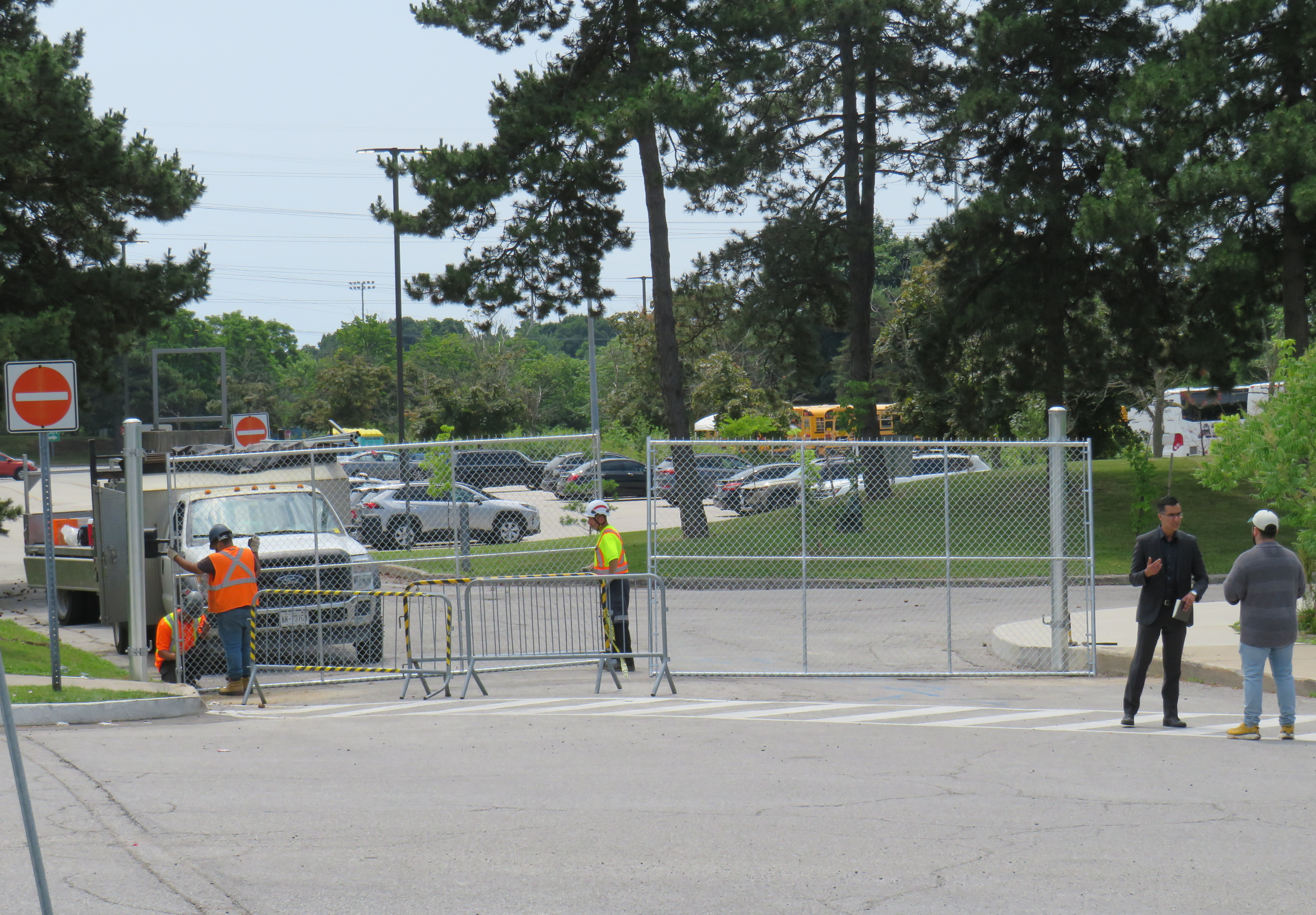
There is no way a Highway 401 tunnel will be built. Not only would it be the longest road tunnel in the world, but the long on-ramps and off-ramps required to access a deep-bore urban highway tunnel will make it completely infeasible. The proposal also completely ignores the problem of induced demand, and it won’t solve the problem of where the traffic goes when it gets off that additional highway. For these reasons, it was especially disappointing to see the Toronto and Region Board of Trade (TRBoT) endorse the idea.
There are things that can help alleviate traffic. One is ensuring that transit projects are completed, funded, and maintained. That doesn’t just mean building and completing projects like the Crosstown LRT and the Ontario Line, it’s also making sure the system remains in excellent condition to avoid problems like the persistent slow orders in the Toronto Subway. It also means making the best use of existing infrastructure, like Highway 407, for goods movement. Highway 407 passes by every major freight yard in Greater Toronto, but trucks clog Highway 401, Highway 7, and Steeles Avenue instead because of the high tolls. And it means active transportation improvements, like bike lanes and multi-use paths.
What we don’t need are more dead cats to distract us from the real problems.
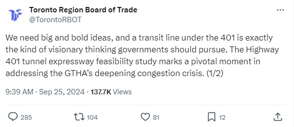
A family enters the Science Centre for the last time on Friday June 21, 2024
When I was growing up, our family would make a trip every year to the Ontario Science Centre, a 45-minute car drive from our home in suburban Brampton. Invariably, these trips would take place on the first PA day of the school year, typically on a Friday in late September or early October, when the ravine was still lush and green, with only the first hints of the changing season.
Because it was early in the school year, and since the Toronto school boards typically had different PA days than the Dufferin-Peel Catholic board, the Science Centre would be mostly empty; my father would run with my brothers and I along the corridor over the ravine between the entrance hall and the great hall. At the end of our visit would be an hour spent at the Science Arcade, the highlight of any child’s visit to the once-great institution. I marveled at Raymond Moriyama’s wonderful harmony of concrete, glass, and natural beauty as one descended into the West Don Ravine by means of glass walkways and escalators.
Later visits in high school and in my early adulthood, however, were not as great. The exhibits were getting old, and the place started feeling worn out. The Dalton McGuinty and Kathleen Wynne-led governments did not value the Science Centre enough to invest in its relevance or its long-term maintenance. Doug Ford’s PC government continued the neglect, favouring a private redevelopment of Ontario Place (closed under the previous Liberal government) with a new, downsized Science Centre to take its place.
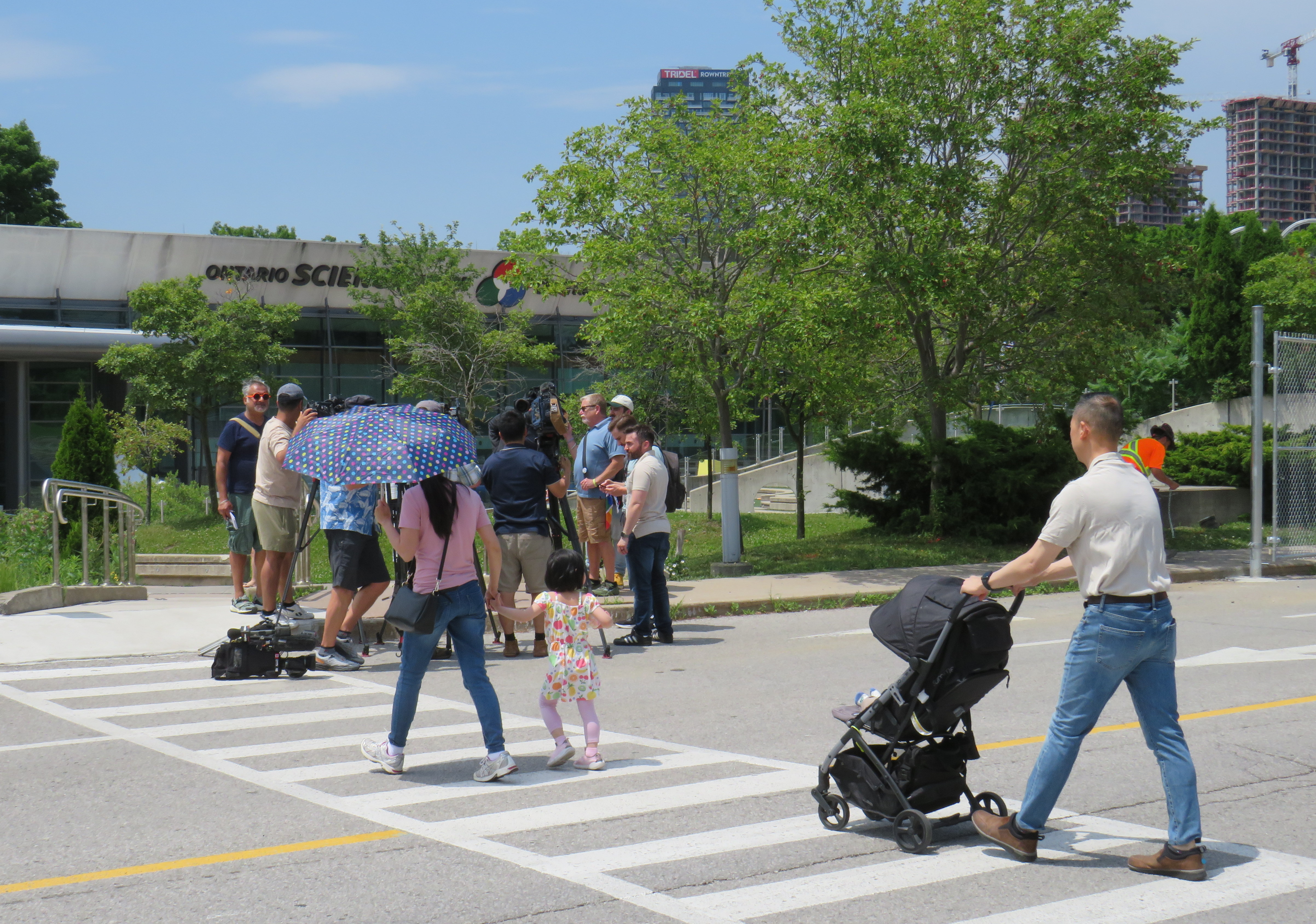
In 2022, that once-wonderful double-deck bridge between the entrance hall and the exhibition space was closed due to the risk of structural failure, with no plans to fix or restore the link. Instead, $2 million a year was spent on shuttle buses ferrying visitors between the upper parking lot (after they paid admission) and the lowest level at the bottom of the ravine. That year, the planetarium (a smaller version of the McLaughlin Planetarium that operated next to the Royal Ontario Museum until the 1990s) also closed due to deterioration.
A December 2023 report from the provincial Auditor General’s office took issue with the government’s management of the Ontario Science Centre and the flawed business case for moving it to a new location on Toronto’s waterfront, in a location much less accessible to school groups.
Loading Ontario Science Centre visitors on shuttle buses, June 21, 2024
The most recent development in which engineers warned of sections of the roof in danger of failure and collapse in a report to Infrastructure Ontario (linked in full on the CBC Toronto website) after October 31, 2024, with repairs costing between $22 million and $40 million. The immediate closure, announced on a Friday afternoon, would provide time to allow the exhibits to be removed, possibly to an interim location. However, most of the roof was found to be in good or fair condition in an the engineer’s report, making the immediate closure suspect.
The Ontario government is shutting the Science Centre today citing an engineer’s report – which does *not* say the place must close or that all work is urgent. What a betrayal. pic.twitter.com/qp21sEjYBn
Globe and Mail architecture critic Alex Bozilkovic questioning the government’s sudden closure on X/Twitter.
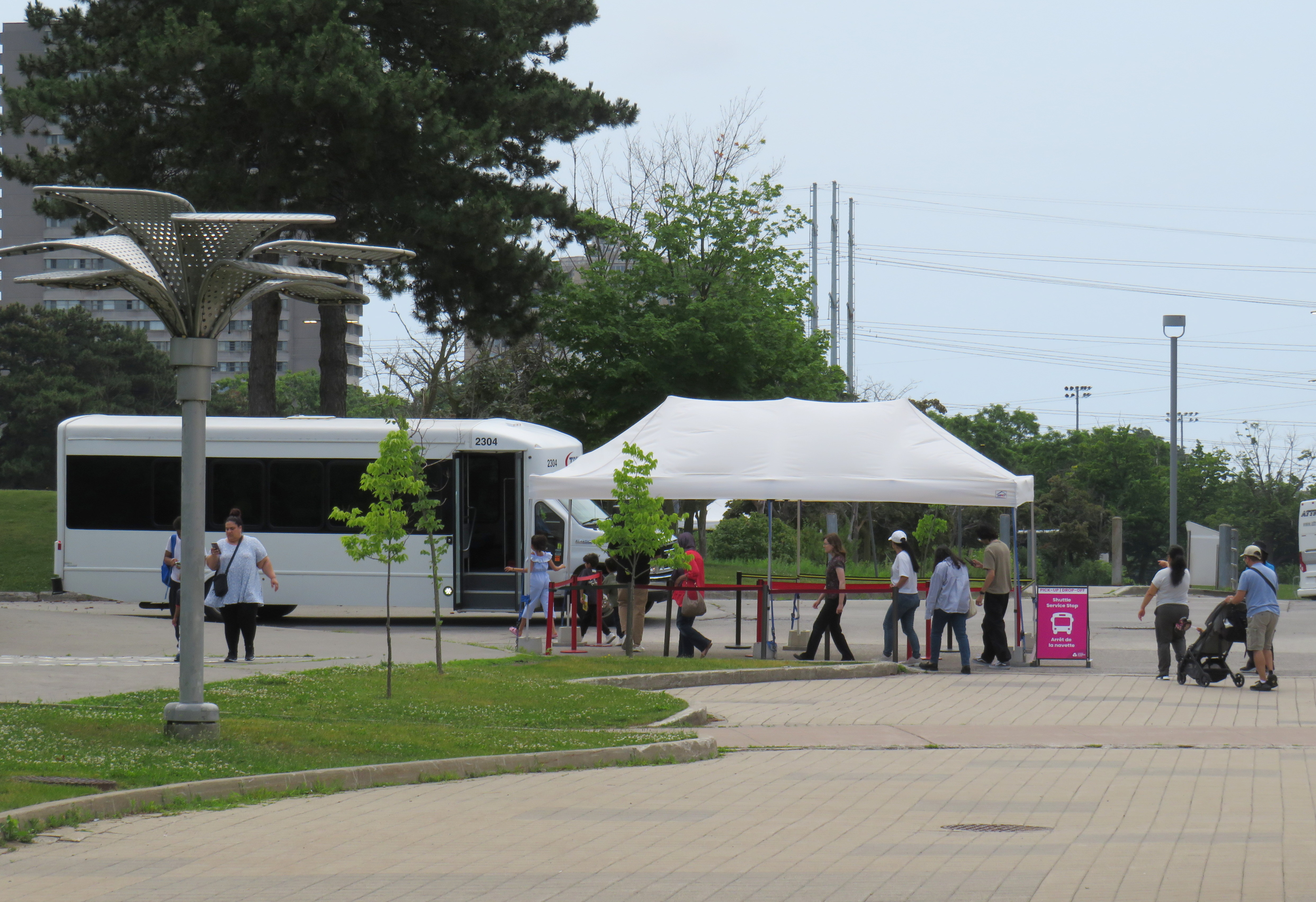
On Friday morning, gates were already being installed at the parking lot entrances to the Science Centre, before the official announcement, even before the Toronto Star published the first story about the closure on its website around noon.
Workers install rigid gates at the staff parking and bus exit at Ontario Science Centre. Local Liberal MPP Dr. Adil Shamji speaks to a reporter in front.
One cannot help but be skeptical about the sudden decision to close the Science Centre, despite the demolition by neglect by the Liberal and PC governments. Had an announcement been made, but with the closure taking effect two weeks later after the long weekend, it would have given visitors one last time to appreciate the Science Centre and its unique architecture. But that might also be the point. By making the closure a done deal without the opportunity for the community to rally to save the Ontario Science Centre, Doug Ford’s PCs have shut down debate. By the time the legislature meets again in October, their hope is that opposition to the destruction of Ontario Place and the Ontario Science Centre will have dissipated. The Friday afternoon news dump also fits this strategy.
Though I made it up on Friday to document the closure, I am sad that I did not make it for one last visit, just as with the sudden closure of the Scarborough RT last year.
The most heartbreaking thing for me was watching a young family walk from Flemingdon Park into the Science Centre just as the news media was assembling for a press conference with Don Valley East MPP Dr. Adil Shamji and Floyd Ruskin of SaveOSC. The young child looked so excited for a day at the science centre, unaware that it would be the last day it would ever be open.
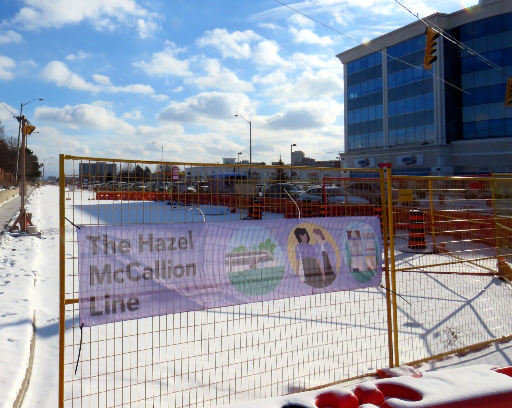
Banner promoting “The Hazel McCallion Line” on Hurontario Street in Brampton, January 2024
Previously on this website, I wrote about the renaming of two GO Transit stations: Oshawa and Brampton. I explained why renaming transit infrastructure is problematic, especially when they violate wayfinding standards, which call for simple, accurate, unique, and self-locating names.
Both GO Transit stations were renamed by provincial agency Metrolinx, on behalf of the provincial government. Metrolinx operates GO Transit buses and trains, the UP Express airport link, administers the Presto fare payment system, and oversees the construction of new rapid transit projects in the Greater Toronto and Hamilton Area. The Hurontario LRT, which is currently under construction between Port Credit GO Station in Mississauga and Steeles Avenue in Brampton, is just one of many transit projects managed by Metrolinx.
On February 14, 2022, at Cooksville GO Station, Premier Doug Ford, then Transportation Minister Caroline Mulroney, then Mississauga Mayor Bonnie Crombie, and Metrolinx CEO Phil Verster joined former Mississauga mayor Hazel McCallion announcing the name change from the Hurontario LRT to the Hazel McCallion LRT. The occasion also marked McCallion’s 101st birthday.
Hazel McCallion with Metrolinx CEO Phil Verster, February 14, 2022 (Metrolinx photo)
This is the first rapid transit line in North America to be named for a person, contradicting established standards for transit projects.1 Though McCallion was a formidable and popular mayor whose political career spanned seven decades, she was also very close to the Ford government in the last few years of her life. She also had many other public facilities named in her honour — a senior public school in Mississauga’s Streetsville neighbourhood, the library at University of Toronto’s Mississauga campus, the City of Mississauga’s central public library, a walkway leading to Square One Shopping Centre, and the Mississauga campus of Sheridan College. There is also the Hazel McCallion Auditorium at Mississauga Valley Community Centre and the Hazel McCallion Hall at Vic Johnston Community Centre. There was no need for yet another civic asset to be renamed for her.
In Toronto, most former mayors have just one public asset named for them: David Crombie, Art Eggleton, June Rowlands, and Barbara Hall have parks dedicated in their honour. Mel Lastman — mayor of North York for 24 years before being elected mayor of amalgamated Toronto for another six — and Nathan Phillips have major public squares.2 In Mississauga, there was no need to rename yet another piece of civic infrastructure for the same person.
Furthermore, there was no public consultation about the name change — even officials at the cities of Brampton and Mississauga were kept in the dark — while the name itself contravenes Metrolinx’s own naming conventions.
In July, 2023, I submitted an access to information request to Metrolinx, the second time I went through the freedom of information process to find out more about the light rail transit project. There were several delays, and I did not receive my requested documents and communications until late January 2024.
A deep dive into the background of the Hurontario LRT project, the person it is being renamed for, and my findings and impressions follow.
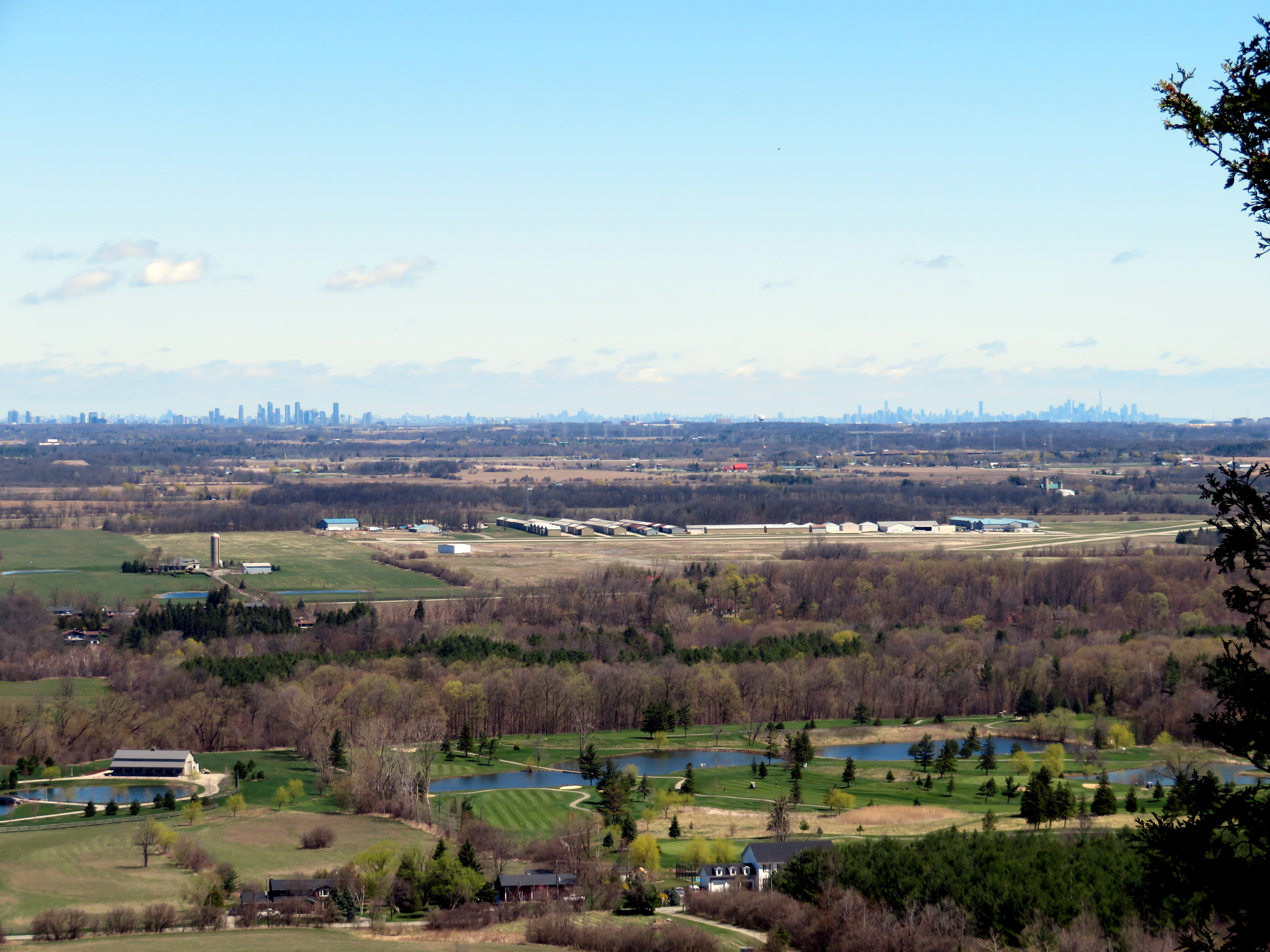
View from the Niagara Escarpment at Mount Nemo Conservation Area towards Mississauga and Toronto
One of Ontario’s greatest success stories has been the development of conservation authorities (CAs). The provincial Conservation Authorities Act was introduced in 1946 to provide for new joint provincial-municipal bodies protect farmland and natural features from deforestation, flooding, and erosion, organized not by political boundaries, but by watersheds. In 1954, south-central Ontario was hit by Hurricane Hazel, which caused extreme and deadly flooding. This highlighted the need for strong local authorities to coordinate flood protection strategies, including dams, floodways and reservoirs, but also land use planning, the protection of headwaters, and the naturalization of important landscapes, such as the Niagara Escarpment and Toronto’s ravines. Planners at CAs help to ensure that any new development is protected from flooding or erosion and will not negatively impact other properties or the watershed as a whole.
Most of Ontario’s 36 CAs also operate conservation areas, open to the public as parklands. These may contain hiking trails, wildlife sanctuaries, campgrounds, lakes and reservoirs for swimming, boating, or fishing, as well as waterfalls, caves, scenic lookouts, or other unique natural features. A few conservation authorities also operate historic sites, including old mills, or even entire pioneer villages, such as Black Creek. Many CAs also hold special events, such as festivals, school tours, and even concerts.
Many of these programs and services are incredibly important, but all are beneficial to the public. And they are under attack by the provincial government.
Earlier this year, the province cut funding for natural hazards planning by 50 percent. Late last week, the minister for Minister of Environment, Conservation and Parks, Jeff
Yurek, sent a letter to all CAs and their partner municipalities to begin to wind down any programs not directly related to their “core mandate.”
Yurek commented that “over the years, conservation authorities have expanded past their core mandate into activities such as zip-lining, maple syrup festivals and photography and wedding permits.”
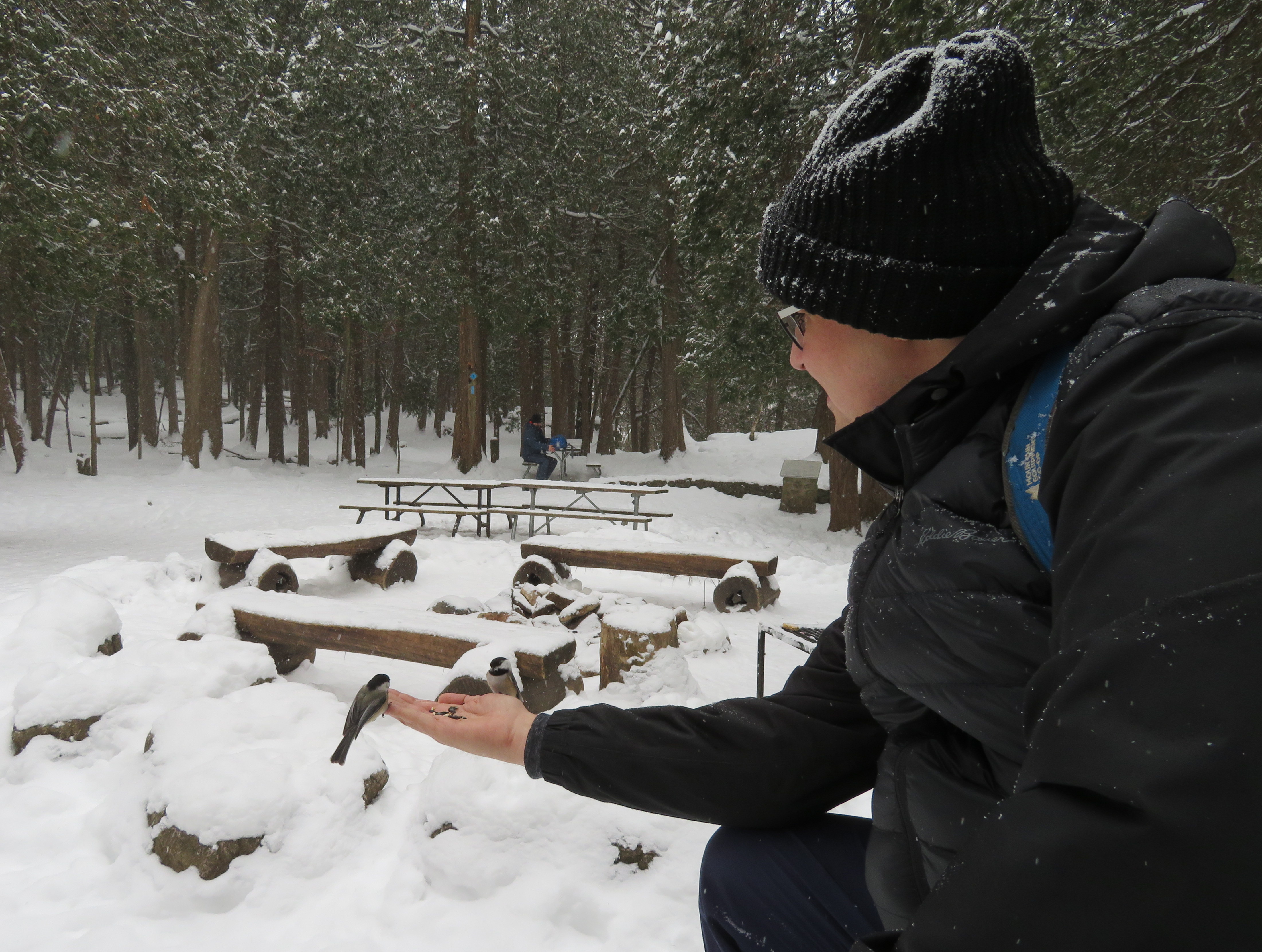
One such CA, Conservation Halton, operates several conservation areas in Halton Region and the City of Hamilton.
Kelso Conservation Area includes a ski hill, a reservoir that provides for paddle boating, fishing, and a swimming beach, and a campground. There are also outdoor movie nights. At Mountsberg Conservation Area, Conservation Halton operates a Raptor Centre, where injured birds of prey are treated and shown to the public. It also has one of those maple syrup festivals in its sugar bush.
Feeding chickadees at Hilton Falls Conservation Area
Conservation Halton has a $30 million annual budget, but it only gets $145,000 from the province for core programs. The rest of its funds come from municipalities and from park user fees, rentals, and sales. The festivals, event bookings and wedding permits help fund the important conservation work. Offering festivals and other special events also help engage the public, especially children.
Of course, the Doug Ford-led Progressive Conservative government’s attack on conservation authorities isn’t about saving money. Instead it’s about restricting their mandate, reducing their ability to raise funds and engage the public.
Perhaps this all has to do with the influence of the development industry. Ontario Proud, a third-party advertiser connected with the Progressive Conservatives, ran attack ads on social media and on outdoor billboards against the last Liberal government in 2016 and 2017. It was funded by the development and construction industry, with Mattamy Homes being its largest contributor. The province also weakened planning legislation and municipal power to restrict new development through Bill 108, the so-called More Homes, More Choice Act.
If the Ford government gets its way, conservation authorities will have fewer resources to protect watersheds and natural lands and reduce the risk of the effects of climate change. Without maple syrup festivals and other “non-core” programming, there will also be less fun and reduced awareness of Ontario’s wonderful natural landscape. This isn’t about fiscal responsibility. It’s about ideology and payback.
There are plenty of developers who’d love to pave over the Greenbelt
On the CBC radio program Metro Morning on March 28, Toronto Mayor John Tory spoke about his concerns regarding Premier Doug Ford’s plans to upload the city’s subway system, as well as Ford’s intentions to build new subway extensions to Richmond Hill and Scarborough Centre, bury the Eglinton West LRT, and start the long-planned Relief Line. Instead of a conventional subway, the Relief Line envisioned by the province would use a “new technology,” despite planning and engineering underway for a subway, using an existing subway yard for Relief Line train storage.
But Tory, who has been passive so far about the province’s plans, was hopeful that the unspecified new technology proposed for the Relief Line would be a “fantastic bonanza” for Toronto, but he added that he didn’t know for sure what would come of the new plan.
Mayor Tory tells @metromorning he's prepared to hold out hope that the province's unspecified new tech for the Relief Line is a "fantastic bonanza for us. But I don't know."
It is curious that Tory called this hostile takeover a “fantastic bonanza.” Bonanza was a long-running Western television show, starring Lorne Greene as the patriarch of the Cartwright family, owners of a vast ranch on Lake Tahoe. Bonanza was famous for its theme music and opening credits, which featured a burning map of the Cartwrights’ Ponderosa ranch before introducing the cast.
Opening theme for Bonanza
Bonanza’s burning map is a great metaphor for Toronto’s transit planning. Newly elected mayors and premiers burn the maps left behind by their predecessors, and time is wasted on new feasibility studies and engineering reports, ready just in time for someone else to get elected with yet another idea. Plans come and go, but hardly anything ever gets built.
There’s plenty of blame to go around. After a prolonged spurt of subway construction in the 1950s, 1960s and 1970s, momentum was lost. In the 1980s, Bill Davis’ Progressive Conservatives insisted on a novel linear-induction rail system for Scarborough, rather than the light rail project already underway. The Liberals, under David Peterson, proposed several subway lines, though it was scaled back under NDP Premier Bob Rae. In 1994, work started on the first phases of the Eglinton and Sheppard subways. When Mike Harris’ government was elected in 1995, they cancelled Eglinton, filling in a hole already dug for the tunnel boring machines.
There was new hope in 2003, when a new Liberal provincial government was elected, and David Miller, an urban progressive, became mayor of Toronto. While the province’s top priority was the extension of the Spadina Subway to York University and Vaughan, it was willing to help fund major improvements to GO Transit, along with new light rail systems in Ottawa, Kitchener-Waterloo, Hamilton, and Mississauga-Brampton. It also committed to Miller’s proposed Transit City LRT network, including a fully grade-separated replacement of the ageing Scarborough RT.
There were valid criticisms of Transit City — there were too many transfers to get around the top of the city, there was no Relief Line, and a few of the proposed lines, like parts of the Jane and Don Mills LRTs, were too difficult to build as surface rail projects. But because of Miller, the Eglinton-Crosstown LRT is well underway, and preliminary work continues on Finch Avenue West.
Work would have also started on the Scarborough RT replacement and expansion and the Sheppard East LRT, had Rob Ford not been elected in 2010, promising “subways, subways, subways” and burning the transit maps for which new projects were planned and being built. Seven funded LRT stops in Scarborough became three unfunded subway stops. Overestimating Rob Ford, and hoping to keep seats in Scarborough, the Liberal government folded to his demands, and work stopped on the LRT replacement.
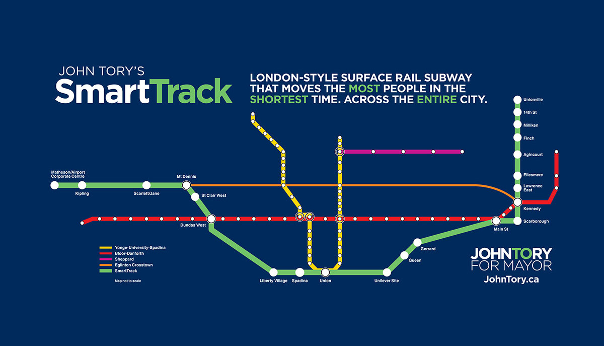
Rob Ford’s disastrous term was followed by John Tory’s twin obsessions of SmartTrack and an austerity agenda, at a time when the Yonge and Bloor-Danforth subways were overwhelmed by demand caused by a growing population and a booming economy — hardly the conditions that demanded low spending on civic services and infrastructure and yet another half-baked transit plan.
SmartTrack map from the 2014 John Tory campaign
Tory promised that it would only take seven years to build SmartTrack, which would mostly use existing railway infrastructure, along with a new section of track in Etobicoke, on land already sold off for development. Tory’s insistence on SmartTrack further delayed momentum on the Relief Line. Though Tory remained committed to the Scarborough subway extension over the approved and funded LRT, it was reduced to a single stop as costs ballooned, while the subway and SmartTrack threatened to cannibalize each other. We don’t hear much about SmartTrack anymore, but at least Tory has come around on the Relief Line.
But Doug Ford’s latest musings make it clear why the planned subway upload is so dangerous.
Canada Line in Richmond, British Columbia
So what now for the Relief Line?
Despite the inevitable Simpsons monorail jokes (Doug Ford did promise a monorail on Toronto’s waterfront when he was a city councillor in 2011), the new technology the province is considering is likely an automated light metro line, similar to the Canada Line in Vancouver. The Canada Line links Vancouver’s city centre with the international airport and the suburb of Richmond. It was built as a private-public partnership (P3) project, in which a private company was contracted to design, build, and operate the line. It’s an attractive option for a conservative government: P3s promise to be cheaper to build and operate than a conventional public project.
But the Canada Line has problems. Though trains are frequent, it was built too small to accommodate growth. The outer terminals at Vancouver airport and Richmond-Brighouse are both single track/single platform. Station platforms are too short — only 40 metres long — to increase train sizes. And as many stations are underground, it’s too expensive to extending platforms to fit larger trains. Some relief is coming, but even then, the maximum capacity of the Canada line is 15,000 persons per direction per hour, far less than Vancouver’s SkyTrain lines or Toronto’s subway. If this is the route Toronto takes, it won’t be long before the Relief Line itself will need relief.
Once again, I fear that Toronto will continue to spin its wheels thanks to the Ford circus. And it’s a shame — though sadly not surprising — that Mayor Tory isn’t fighting back.


 Feeding chickadees at Hilton Falls Conservation Area
 There are plenty of developers who’d love to pave over the Greenbelt
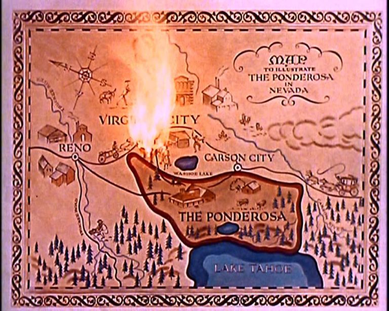
 SmartTrack map from the 2014 John Tory campaign
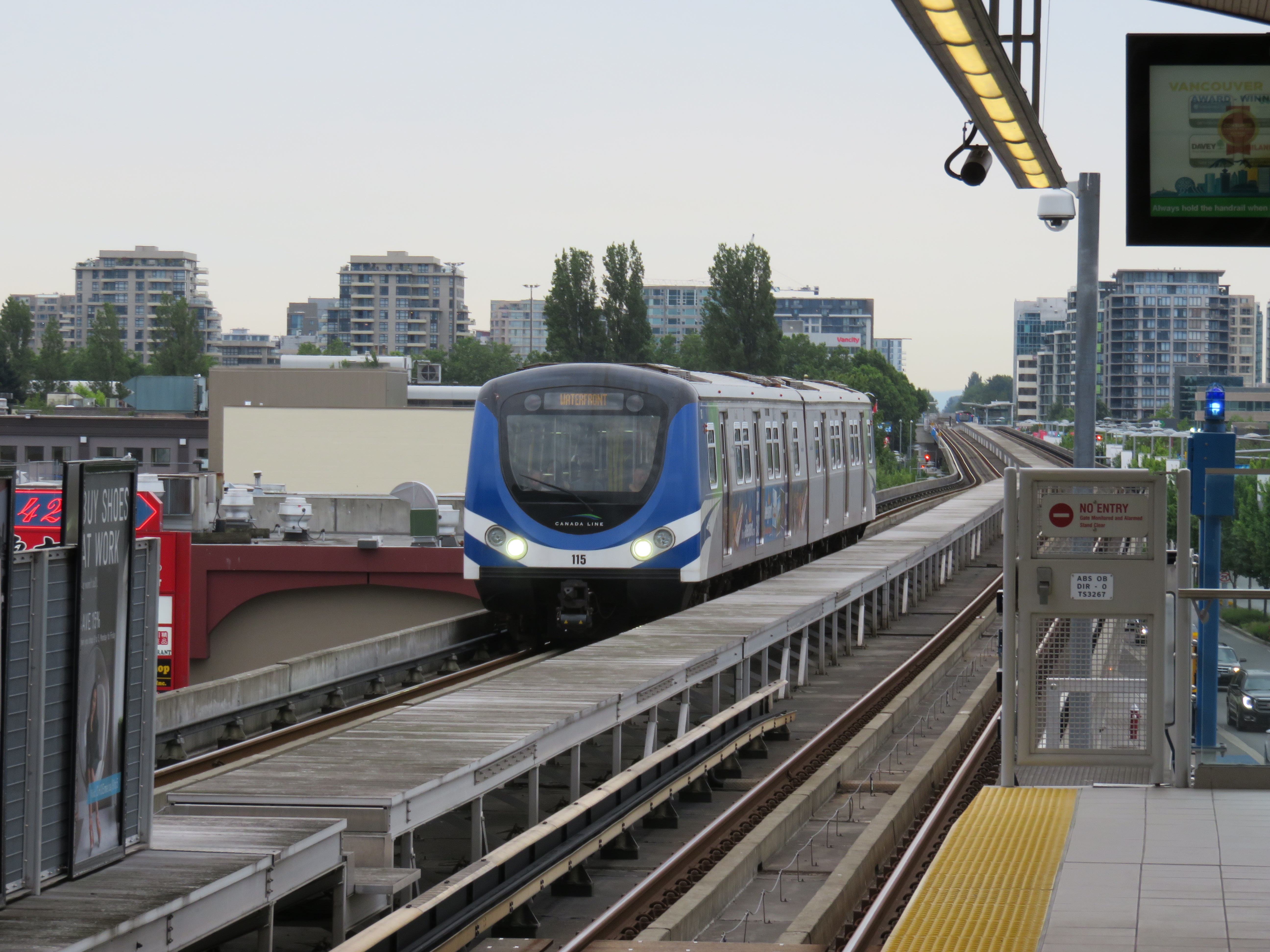 Canada Line in Richmond, British Columbia