Extensions to Montreal’s REM has resulted in some regional route changes in the Montreal area
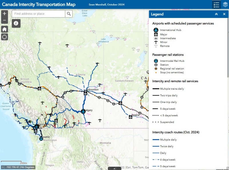
In time for summer, I have updated my Canada Intercity Transportation Map to include new connections and revisions. The only major changes to the intercity coach layer are new routes operated for Flixbus, including new seasonal routes from Toronto to North Bay and Prince Edward County.
In Quebec, the opening of the Deux-Montagnes and Anse-à-l’Orme branches of the REM in Greater Montreal resulted in several long-distance Exo regional bus lines cut back or replaced in favour of local bus routes feeding into the new regional rail service. Therefore, I have decided to remove Exo bus routes from the map where they exist entirely within one or two urban transit zones, being consistent with the municipal transit agencies surrounding Toronto. However, long-distance express routes and routes that serve Montreal’s outer periphery will remain on the map as part of the regional route layers.
In addition, I have also included a few new and previously overlooked services operated by the MRCs (municipalités régionale de comté), including taxibus service areas, which operate similarly to on-demand transit elsewhere in Canada, but have posted stops and semi-fixed schedules; many of these require preregistration before reserving a ride. Where taxibus services operate, I have opted to include those as on-demand, rather than fixed route lines to be consistent across Canada. Only on-demand and taxibus services that are open to the general public are included in the map.
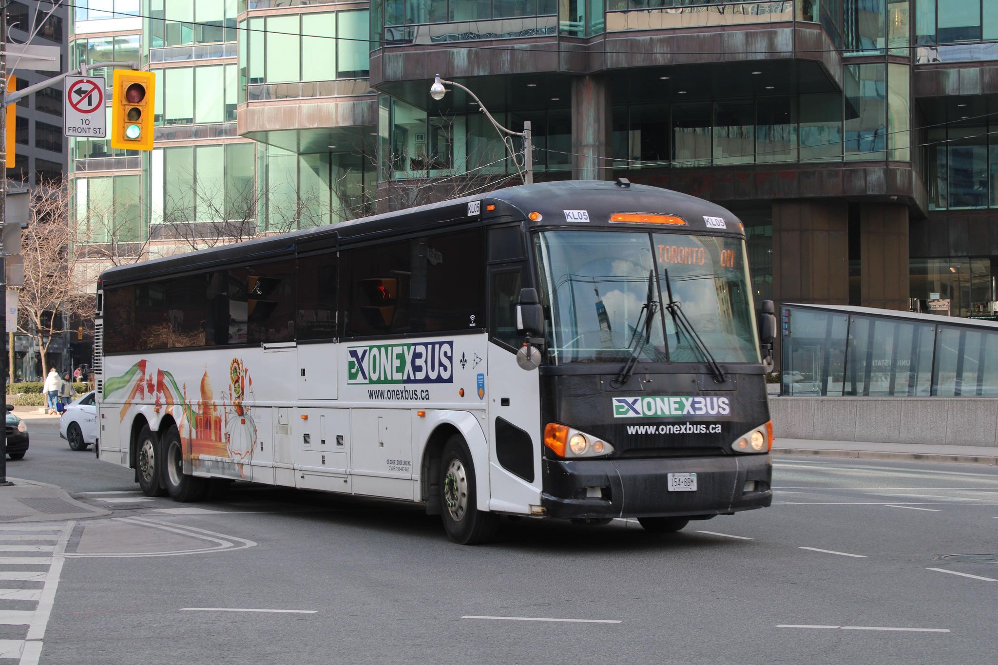
Onex Bus changed its schedules recently, eliminating most departures from Brampton Gateway
Mapping smaller intercity coach operators continues to be challenge, as deregulation in Ontario and Western Canada and online ticketing have made it harder to track changes in schedules and stop locations, though I have noted some changes with Onex Bus’ schedules, which ended most trips to and from Brampton Gateway Terminal at Main and Steeles earlier this year.
Previously, carriers like Greyhound would publish detailed schedules that were valid for at least a few months at a time, including holiday and school break special runs; Ontario Northland and Quebec-based carriers (where provincial regulation remains in force) at least maintain consistent schedules. As it is much harder to track this industry — with no central database — I always appreciate the contributions website visitors provide by email or social media. I thank everyone who has helped so far.
Unfortunately, the costs of maintaining this website and the ArcGIS Online portal to my maps continue to rise. However, I am committed to provide an ad-free, paywall-free resource. If you enjoy my work, please consider buying me a coffee to help with those costs. Thank you!
On June 30, 2026, the Toronto Starfeatured a story about the City of Oshawa’s “lofty plan” to build a new urban aerial gondola system above Simcoe Street, that community’s main north-south corridor. While the technology is novel, it is a fundamentally bad idea for what the regional government proposes it for. Simcoe Street is currently served by the busiest bus route in Durham Region – Route 901 Pulse – as well as several GO Transit buses (routes 52, 56, and 92).
Gondolas have their place in the urban transit toolbox and they have several advantages. They can be inexpensive to build, as they require minimal right-of-way acquisition and do not require tunnelling. They are adept for climbing steep hills and can offer very frequent service with low operating costs. Gondolas can operate in all sorts of weather conditions, from tropical cities to mountain ski resorts. Modern gondola or cable lift operations allow each car to slow or stop at each station to allow passengers to comfortably board and alight, unlike older, traditional ski lifts. The technology is popular in Latin American cities such as Medellín, Colombia (where the Metrocable system feeds that city’s metro), and La Paz, Bolivia, where a network of Mi Teleférico lines makes up the backbone of the transit service.
But in those hilly cities in developing countries, the gondolas cover short distances (only between two and five stations per line) and have limited capacity (Mexico City’s Mexicable line has an hourly capacity of just 3,000 per hour). In the United States, the only transit-based aerial cable cars are the Roosevelt Island Tramway in New York and the Portland Aerial Tram, which charges a very high $9 round-trip fare to the general public. In Canada, the most serious gondola proposal would connect Simon Fraser University with the Skytrain in Burnaby, BC and be part of the Translink network. That proposal – though stalled – is logical as it involves just two stations and allows passengers to easily access the university campus located at the top of Burnaby Mountain, reducing the number of buses that have to climb that long, winding access road.
In contrast, the idea of a gondola running over Simcoe Street in Oshawa makes very little sense, and it seems that the concept will not get beyond a consultant’s report. There are far more reasonable alternatives that merit a closer look, including simple painted bus lanes and other “BRT-lite” measures that can benefit both Durham Region Transit (DRT) and GO Transit passengers.
Oshawa’s transit past and future
Simcoe Street, Oshawa’s backbone, has always been the key to Oshawa’s development as an industrial centre; its future opportunities also line the corridor; good transit is essential.
Established as a small village at the crossroads of Kingston Road and Simcoe Street (an early “colonialization road” that connected Lake Ontario with Lake Scugog), Oshawa grew as an industrial centre starting in the 1870s, when Robert McLaughlin’s carriage works moved to expanded facilities in Oshawa to be nearer the Grand Trunk Railway (GTR) and Oshawa Harbour. As more industries followed, a streetcar line, the first component of the Oshawa Railway Company (OR) was built on Simcoe Street in 1895 to connect the burgeoning downtown with the GTR station and harbour to the south. The original Simcoe Street line was built with several freight spurs to allow shippers direct rail access to their properties. Residents could take the streetcar down to Lakeview Park to relax or to beat the summer heat.
As industry grew (the McLaughlin Carriage Works moved into automobile manufacturing starting in 1907, eventually becoming the founding component of General Motors Canada) OR built a new freight-only electric line east of Simcoe Street with direct freight yard connections with the GTR. When the Canadian Pacific and Canadian Northern Railways built new lines through the Oshawa area, the OR connected with those as well. The incomplete Toronto Eastern Railway, a failed interurban line along Kingston Road, provided some use to OR as it provided access to several customers along the TER’s completed section of track.
Though buses replaced passenger service on the single-track Simcoe Street streetcar line in 1940, OR’s freight operations remained busy until the 1960s, with the last electric locomotive withdrawn in 1964. Oshawa’s bus service was taken over by Durham Region Transit in 2006.
When GM opened a modern assembly complex south of the new Highway 401 in 1950, it slowly abandoned its older plants north and west of the downtown core. Its new property had direct CN and CP rail connections and no longer relied on the OR. Meanwhile, other factories such as A.G. Simpson, Duplate/Pittsburgh Plate Glass, Fittings Limited, Ontario Malleable Iron, and Pedlar People, either closed or stopped relying on rail shipments. The old OR tracks, operated by CN diesels in the last few decades, disappeared in the 1990s, replaced by the Michael Starr multi-use trail north of Highway 401. The last remnant of the Oshawa Railway, a Highway 401 overpass built in the late 1930s, was demolished in 2011.
After OR removed its remaining downtown trackage in the 1960s, a one-way road system was implemented in Downtown Oshawa. Simcoe Street became northbound-only between Brock and Elm Streets with Centre Street taking on southbound traffic. King Street was twinned with Bond Street, which followed the disused Toronto Eastern Railway tracks. This helped to speed traffic through the downtown core.
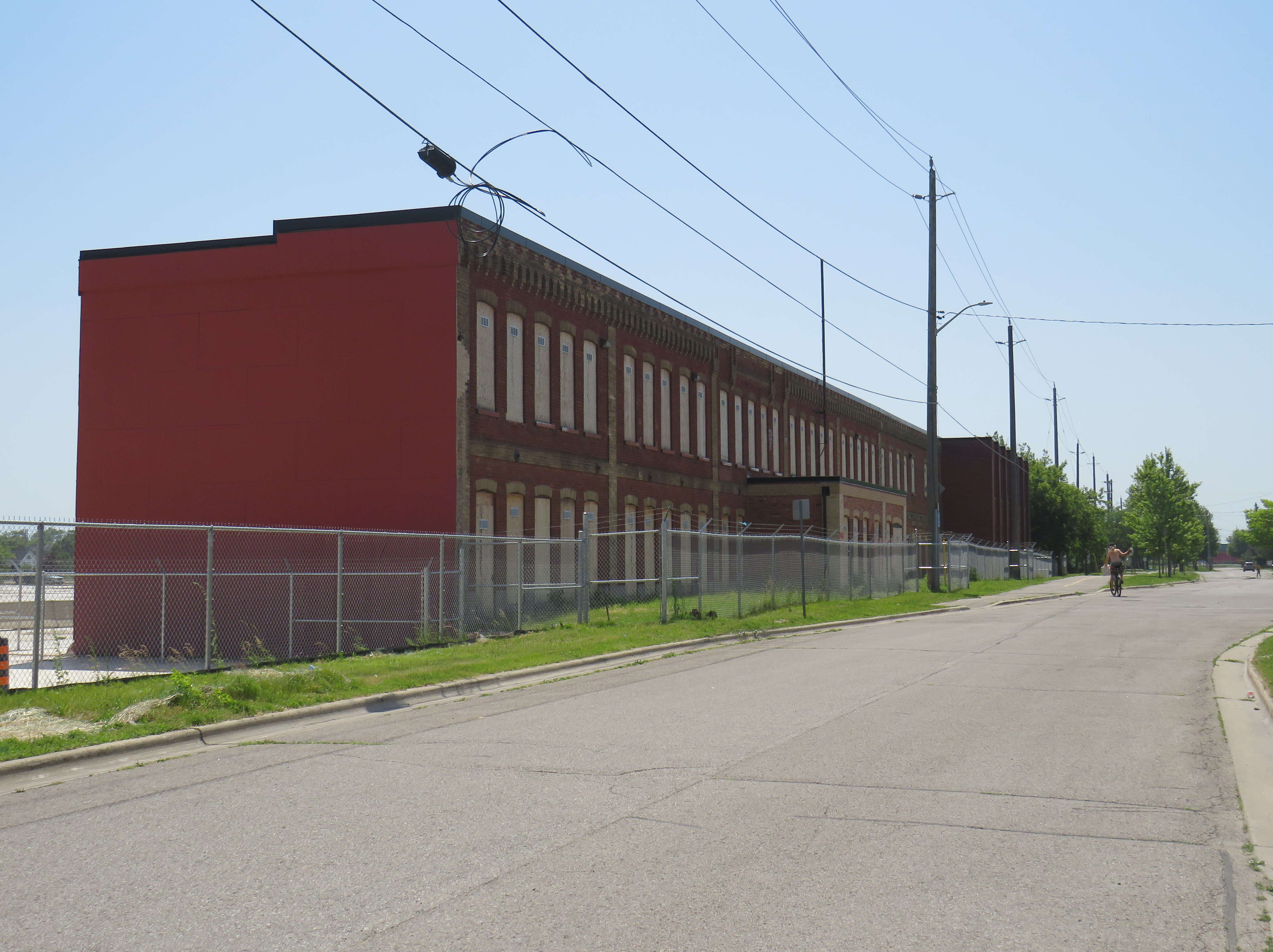
Many of the older industrial lands saw new uses: Most of the old GM North Plant properties are now home to apartment buildings, the Durham Regional Courthouse, and a big box retail complex anchored by Costco Wholesale. The Pedlar People plant was demolished to become a Zellers-anchored plaza on Simcoe Street South. The Ontario Malleable Iron factory became a Knob Hill Farms supermarket which operated between 1981 and 2000. That plant, now mostly demolished, is to be the site of a new GO Transit station; surrounding property, including the old PPG plant, is designated for future development.
Facade of the old Ontario Malleable Iron factory, later Knob Hill Farms
The construction of Highway 401 and changes to intercity rail also changed Oshawa considerably. As Toronto grew and GM’s influence began to decline, Oshawa became part of the metropolitan commutershed. CN closed the old GTR station off Simcoe Street and built a new modern station between Oshawa and Whitby in 1967, consolidating passenger service for those two communities at a single location with space for commuter parking. Though GO Transit was also established that year, its trains only went as far east as Pickering; GO bus service via Highway 401 and via Highway 2 extended the provincial agency’s reach to Oshawa until 1995, when the Lakeshore East line was fully extended to Oshawa.
Map of Oshawa’s transit past and possible future, highlighting the old Oshawa Railway streetcar and freight tracks, connecting railways, and major Oshawa institutions. The proposed route of the gondola along Simcoe Street is highlighted in green. Click image for full size.
With the decline of General Motors’ Canadian operations along with many of its feeder plants, Oshawa’s economy shifted towards education and government services while becoming more of a Toronto suburb rather than an independent industrial centre. The downtown hockey arena/entertainment venue, which opened as the General Motors Centre, is now named for Tribute Communities, a residential developer. Durham College’s campus, on the north end of the city, has grown and now includes Ontario Tech University. Between the campus and downtown is the main Lakeridge Health campus, which is the largest hospital in Durham Region.
As Oshawa and its postsecondary educations have continued to grow, it is no wonder that Durham Region Transit’s 901 Simcoe Street bus – the successor to the old Oshawa Railway streetcar – is so busy and congested. But a gondola is not the right solution, either.
Why better buses are the answer
Typical traffic on Simcoe Street at Adelaide Avenue, near the famous Parkwood Estate and Lakeridge Hospital
As Metrolinx starts work on the Bowmanville GO Transit expansion – which will extend the Lakeshore East rail corridor into central Oshawa and eastward into Clarington – it is replacing the Simcoe Street bridge over the CPKC tracks, a two-year project that has forced the closure of Oshawa’s main street south of downtown. Most north-south traffic now follows Ritson Road, Park Road, or Stevenson Road. Though traffic is heavier on each of those alternatives (especially on Ritson), Oshawa is coping without experiencing complete gridlock.
Metrolinx construction on the replacement Simcoe Street Bridge
Ideally, when the Simcoe Street bridge reopens in late 2027 or early 2028, two of its lanes could be dedicated to DRT and GO buses. These bus-only lanes can then extend northwards towards Downtown Oshawa, Lakeridge Hospital, and Durham College/Ontario Tech. As some of Oshawa’s most important destinations, such as the Oshawa Centre shopping mall and the Oshawa GO/VIA Rail station, are off Simcoe Street, buses can divert on and off the bus lanes to serve those, and other, trip generators; a gondola would not be able to do so.
As the Bowmanville extension of the Lakeshore East GO service will see limited service (peak-direction train service during rush hours and limited off-peak runs) along with a low-speed diversion from the GO corridor to the CPKC line, many passengers connecting to GO towards Toronto would still choose to transfer at the main GO/VIA station.
As the planned new Oshawa Centre GO Station is located on the old Malleable Iron/Knob Hill site two blocks east of Simcoe Street, a gondola would have to swing over to serve it or force a long walking transfer. Depending on how bus service on Simcoe Street is planned by DRT, buses could either divert to serve it, or a dedicated route could provide that connection.
Furthermore, the former Oshawa Railway lands can be better utilized for active transportation purposes. Though the Michael Starr trail runs all the way from Lviv Boulevard (just north of Highway 401) to Taunton Road, it is treated as a recreational trail, rather than a vital transport link. At most crossings, east-west motor traffic is prioritized over pedestrians and cyclists, with “stop and dismount” signs at many trail crossings. There is also a considerable gap between Bruce Street south of Downtown Oshawa and Adelaide Street to the north, as the OR followed Bruce Street and Ritson Road to serve GM’s north plant.
Creating a high-quality through cycling path using part of the OR/Michael Starr right-of-way and improving the existing bike lanes on Mary Street through Downtown Oshawa and extending it to Durham College/Ontario Tech can divert some DRT passengers between the future GO station, the downtown, the hospital, and the campus, and get at least a few car drivers to switch to active transport modes.
Michael Starr Trail, built on the old OR right-of-way. Note the yellow “stop and dismount” signs.
If built, Oshawa’s 13-kilometre, 16-station gondola line would be the longest urban aerial transit route in the world and while it might allow for the retention of four lanes of traffic on Simcoe Street, land would still be required to build the towers, stations, and maintenance facility. Buildings will still have to be demolished. The gondola’s capacity would be limited. The estimated $1.1 billion spent on gondola towers, stations, and vehicles could be much better spent.
Once better bus and active transportation infrastructure is provided, Oshawa might find that the fears of Simcoe Street gridlock may not come to pass. An expensive median busway is not necessarily the answer either: simple reserved lanes, enhanced bus stops with off-board fare payment and all-door bus boarding, signal priority and queue-jumps at busy intersections could do a lot in the short term. Yes, that would mean inconvenience for drivers, but the Metrolinx construction on Simcoe Street south is already an inconvenience.
Unfortunately, the costs of maintaining this website and the ArcGIS Online portal to my maps continue to rise. However, I am committed to provide an ad-free, paywall-free resource. If you enjoy my work, please consider buying me a coffee to help with those costs. Thank you!
In the fifth year that I have been following and mapping Canada’s intercity transportation links, the network (if you could call it that) remains in flux. Spring 2026 brings several new routes, particularly in Western Canada, that restore some former Greyhound services. Unfortunately, regional and commuter services in Ontario and Alberta are coming to an end. Wednesday, April 30 was the last day for the LTW Route 42 between Leamington and Windsor. In Alberta’s On-It is winding down its commuter buses between Calgary and Cochrane and Okatoks.
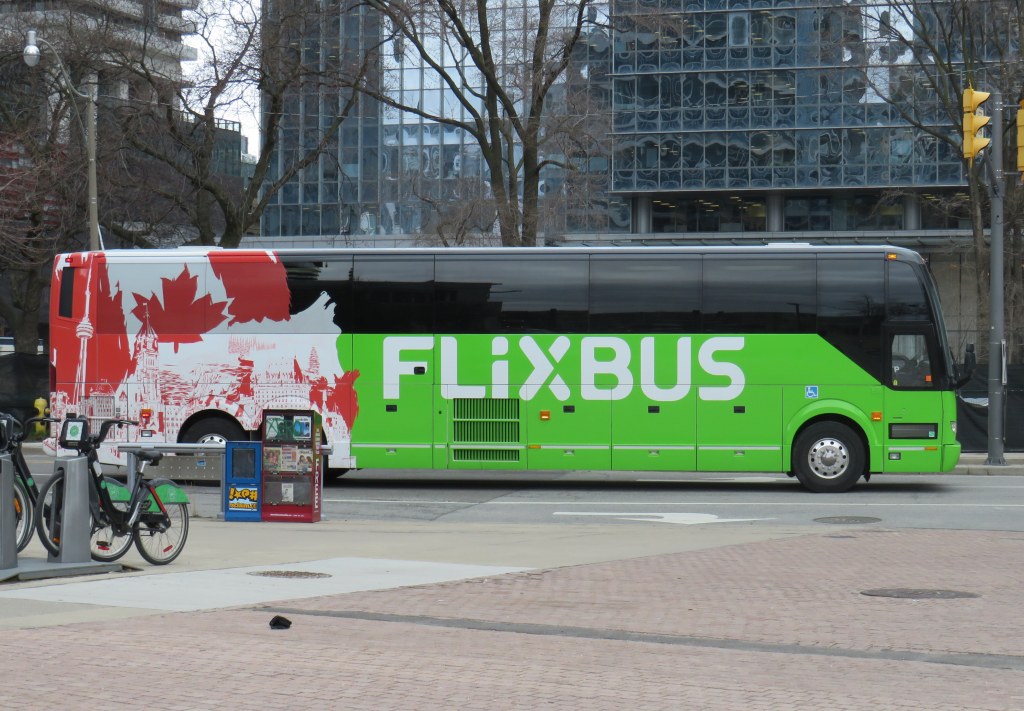
However, Flixbus continues to expand, taking over more former Greyhound routes. Unlike Greyhound or most other intercity transport companies, Flixbus is not a bus company per se, as it does not own or operate the services; instead it uses smaller contracted operators while coordinating branding, schedules, and ticketing. But starting in May, it will operate three-four days a week between Calgary, Regina, and Winnipeg, with stops in cities that have long been without service, such as Moose Jaw and Swift Current. Another route will connect Calgary with Drumheller, including a stop at the famous Royal Tyrrell Museum.
Despite the recent loss of TOK’s Southampton route and last year’s cutback of Grey County’s GTR services, there is hope for new connections in Midwestern Ontario. Grey County, together with neighbouring Bruce, Dufferin, and Wellington Counties, is studying a regional system to augment and replace the limited existing services. Hopefully, it will include regular service to fast-growing Saugeen Shores, which recently lost that TOK service. In Centre Wellington, a new local service connecting Elora and Fergus will soon start operations.
One of the major issues continually faces is the lack of intramodality and useful connections. A viable passenger rail system — be it a classic corridor service such as the Quebec-Windsor VIA train or a high-speed line such as the planned ALTO project — is much more useful to many more passengers when there are easy connections at stations. Through-ticketing and schedule coordination should be implemented whenever possible. Furthermore, though the Upper Ottawa Valley (towns and cites such as Renfrew and Pembroke) has a daily Ontario Northland bus, it arrives in Ottawa late in the evening and leaves early in the morning, limiting its usefulness to areas closer to Ottawa that could benefit from a commuter connection or onward trips to Montreal, Toronto, or Kingston. Despite more gaps seemingly filled, other gaps remain.
In 1998, the new City of Toronto was created when the Progressive Conservative government led by Mike Harris forced the merger of Metropolitan Toronto and its six constituent cities and borough. Dubbed the Megacity, it was part of a new round of municipal restructurings that affected much of the province, with Hamilton and Ottawa getting the same treatment three years later. Making less news in 1998 was the abolition of Kent County and the amalgamation of all 21 of its towns, villages and townships with the City of Chatham, creating the new municipality of Chatham-Kent.
Over 25 years later, there are challenges remaining from amalgamation. The new, larger municipality must administer a large mostly rural area but where nearly half the population lives in just one urban centre. But there are benefits, such as a consolidated library system that provides rural residents with more materials and services. Importantly too, is that Chatham-Kent was one of the first municipalities to introduce a rural transit service to connect outlying communities with the city centre, expanding the reach of Chatham’s existing urban bus system.
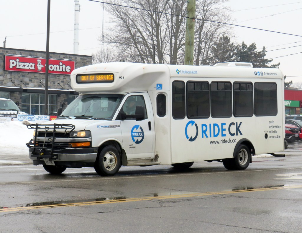
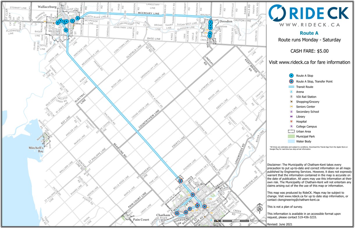
Three Ride CK routes — A, C, and D — extend from the bus terminal in Downtown Chatham to Wallaceburg (the second-largest community in Chatham-Kent), Dresden, Blenheim, Ridgetown, and Tilbury, covering most of the former towns that made up Kent County. (A fourth route, B, was proposed to serve Thamesville and Bothwell, but has not been implemented.) There is also a seasonal summer bus that serves the lakeside communities of Erieau and Mitchell’s Bay, echoing the former Chatham, Wallaceburg, and Lake Erie electric interurban service.
Most RideCK buses — local and intercommunity — are cutaways, meaning that the passenger seating area is in a separately-built body added to a cab and truck chassis. Though these vehicles are popular for paratransit services, low-ridership rural routes, and in smaller communities like Brockville, they do not offer a particularly smooth ride. However, they are an economical option for smaller communities.
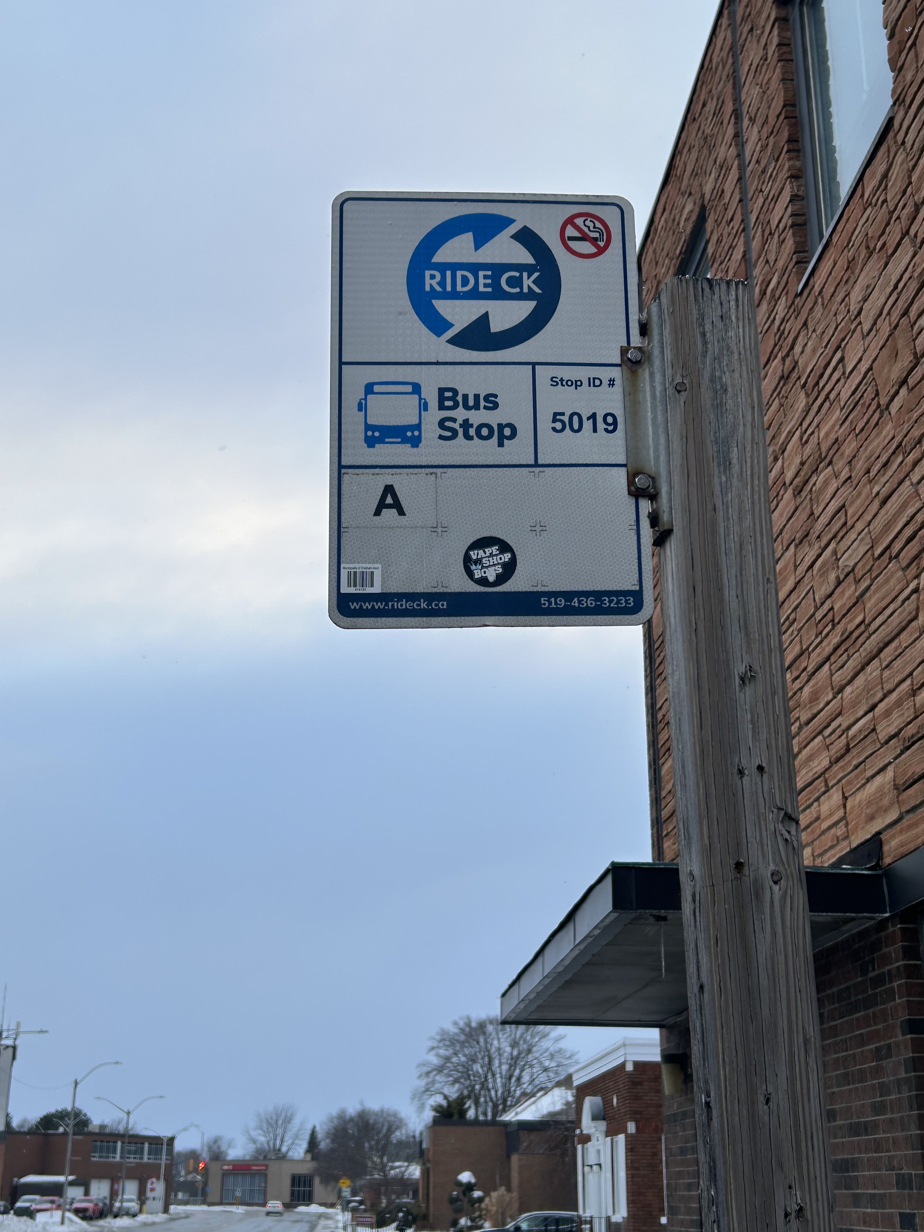
Bus stop in Wallaceburg
Each of the three intercommunity routes operate Monday through Saturday, with two morning and two evening round trips, with an additional midday run that leaves Downtown Chatham at 12:15 PM on weekdays; this additional trip was added several years after service began. There is a timed transfer to the local Chatham routes, allowing for onward connections to shopping, schools, medical services, employment, or social activities. All three rural routes also stop at the hospital in Chatham. The midday trip was added to provide an early return home for anyone taking the bus from outlying areas, such as for a medical appointment, and not then stuck waiting an entire day in Chatham.
I rode RideCK between Chatham and Wallaceburg and back in early February 2026; the midday 12:15 departure had decent ridership with six other passengers leaving the bus terminal (a seventh got on at the big box retail cluster north of Chatham’s urban area); there were five other passengers on the way back south on the first evening bus (5:45 PM leaving Chatham). Given that Chatham-Kent has maintained the service for so long is indicative of how the rural buses are seen as a necessity in the municipality. In Wallaceburg, on-demand local transit is also available, a recent improvement by the municipality.
Intercommunity routes have a flat cash fare of $5.25 (though online materials still show the older $5 fare), though transfers to local transit are provided.
Ride CK Route A between Chatham, Wallaceburg, and Dresden
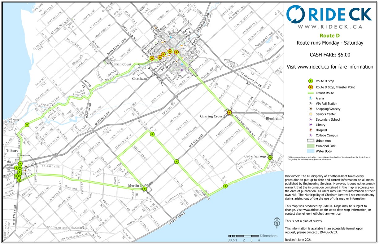
Though Routes A and C are fairly direct, Route D involves a long one-way loop to serve several small communities (including Cedar Springs, Buxton, and Merlin) before continuing to the former town of Tilbury and then back to Chatham. The route passes near, but does not stop at, Pain Court, and completely misses Wheatley.
The circuitous Ride CK Route D making a one-way loop through Cedar Springs and Tilbury
Though Chatham-Kent should be commended on identifying the need for rural transit and maintaining it for over two decades, it still demonstrates the challenges and gaps of operating a municipally provided rural transit service. Ideally, Chatham-Kent would be able to partner with neighbouring Lambton and Essex Counties to provide direct service to more communities. Tilbury should be part of an east-west service between Chatham and Windsor along the Highway 2 corridor, serving towns along Lake St. Clair such as Belle River. That would open connections to the University of Windsor and the main St. Clair College campus, along with other destinations, while improving service to Tilbury.
Route D, then, could be straightened and routed to serve Wheatley, even continuing west to make a connection to Leamington (which sadly, is losing its bus service to Windsor). With good scheduling, such connections could allow passengers to continue on VIA Rail service to London and Toronto.
Ontario needs a province-wide rural transit strategy with long-term funding and strong incentives to get reluctant municipalities (such as Halidmand County) on board. Until then, it is up to each local area to determine what, if any, transit service could look like, and up to residents to demand — and make use — of these services.
Unfortunately, the costs of maintaining this website and the ArcGIS Online portal to my maps continue to rise, especially as the amount of information provided and the number of views grow. If you enjoy my work and find the maps useful, please consider buying me a coffee to help with those costs. Thank you!
Over the last six years, Greyhound Canada disappeared after years of decline, the COVID-19 pandemic hit with travel restricted, the Ontario provincial government set up one-time funding for intercommunity transport links while deregulating the intercity coach industry, and many municipalities dipped their toes into providing rural transit services.
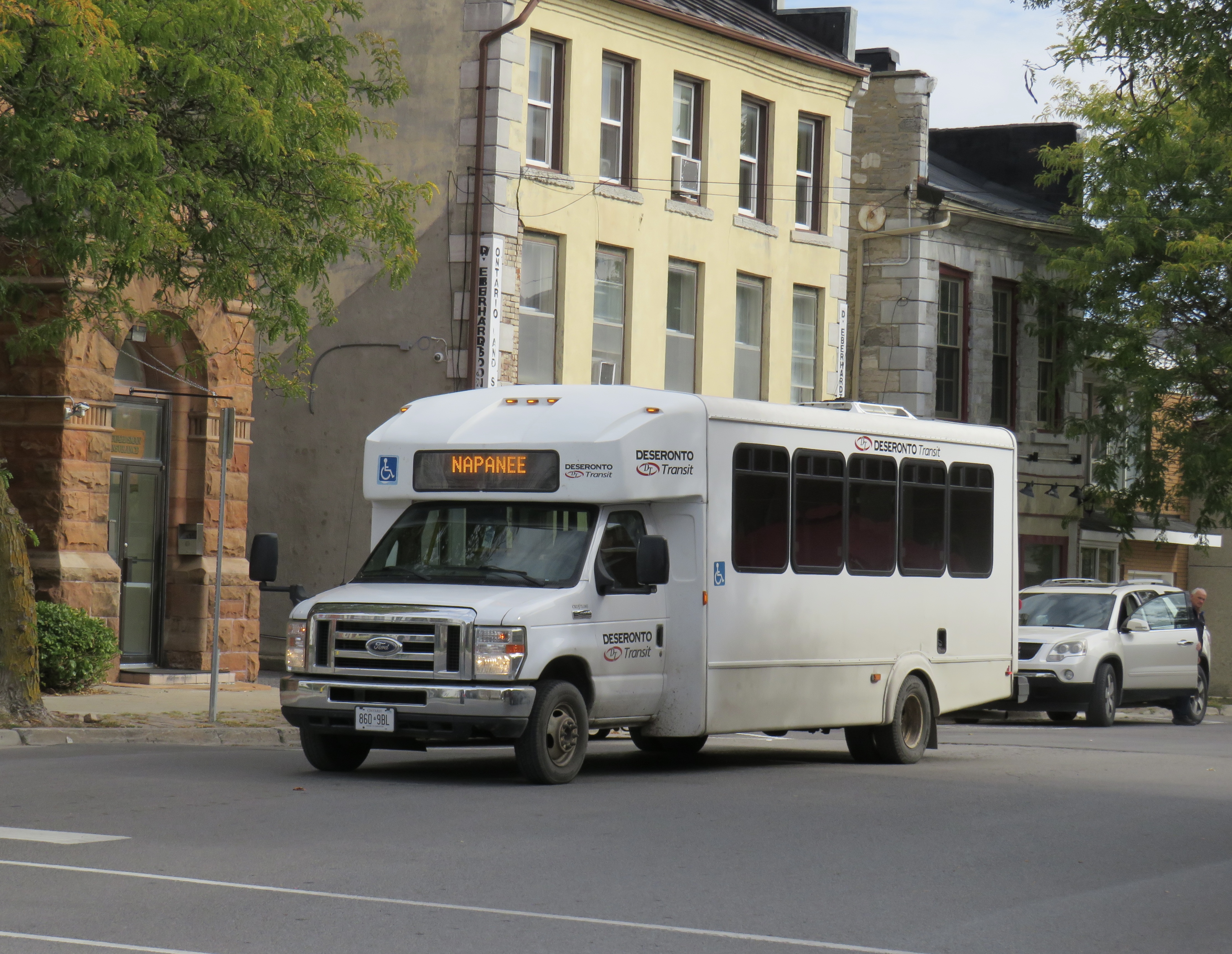
At the end of 2025, there was some good news to note — several rail transit lines opened in Toronto, Montreal, Ottawa, and Edmonton, while a few new rural services opened in Eastern Ontario. Unfortunately, there were also some major losses in Ontario, particularly in Grey County, Oxford County, Napanee-Deseronto, and the impending cancellation of a major route in Essex County. Unlike in Ontario, however, rural transport links remain stable in Quebec and British Columbia.
Stable funding is essential to keep these intercommunity and intercity links alive, particularly where private operators have not filled a need. For example, Flixbus recently cut back their once-a-day route from Toronto to the Lake Huron coast and will not serve rapidly-growing Saugeen Shores during the colder months. That part of Ontario is left only with a three-days-a-week TOK coach despite potential demand. A well-funded regional transport service coordinated by Grey, Bruce, and other adjacent counties could address this, but there needs to be political will to ensure stable and predictable service needed to grow ridership over the long term.
I just completed a round of edits to my intercity map, noting changes to routes, service levels, and in some cases, stop locations. A few new scheduled air shuttles in Atlantic Canada and Manitoba are included; these types of services are only mapped if they also provide non-airport service or at least connect to urban transport.
There are also more grey lines. Starting with edits in mid 2024, I have chosen to grey out abandoned routes, rather than just eliminating them. It is well worth noting where transport links have disappeared, and where replacement service might be worth planning.
Hopefully 2026 will see better service than the end of 2025.
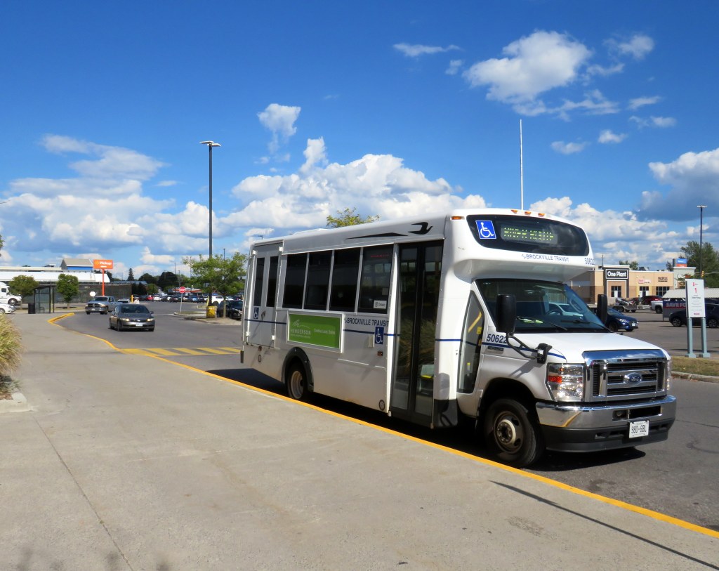
River Route, operated by Brockville Transit, serves several communities in Eastern Ontario
A few new transit services have come online in Eastern Ontario in the last few years. In Leeds and Grenville Counties, the River Route connects Brockville with Prescott and Cardinal. North Grenville, which includes the town of Kemptville, launched an intra-municipal on-demand service earlier this year, with a new Ottawa connection that started earlier in September.
The River Route connects with Brockville Transit in a big-box retail plaza, with timed transfers with local services to the nearby hospital, VIA Rail Station, and Brockville’s beautiful downtown core. The regular River Route fare is $5, though it includes an inbound free transfer to local Brockville Transit routes (though not the other way around). I recently travelled to Brockville and Prescott to check out the service, and I found it to be well used. Hugging the St. Lawrence River and passing through several historic towns, it might be Ontario’s most scenic regional bus route.
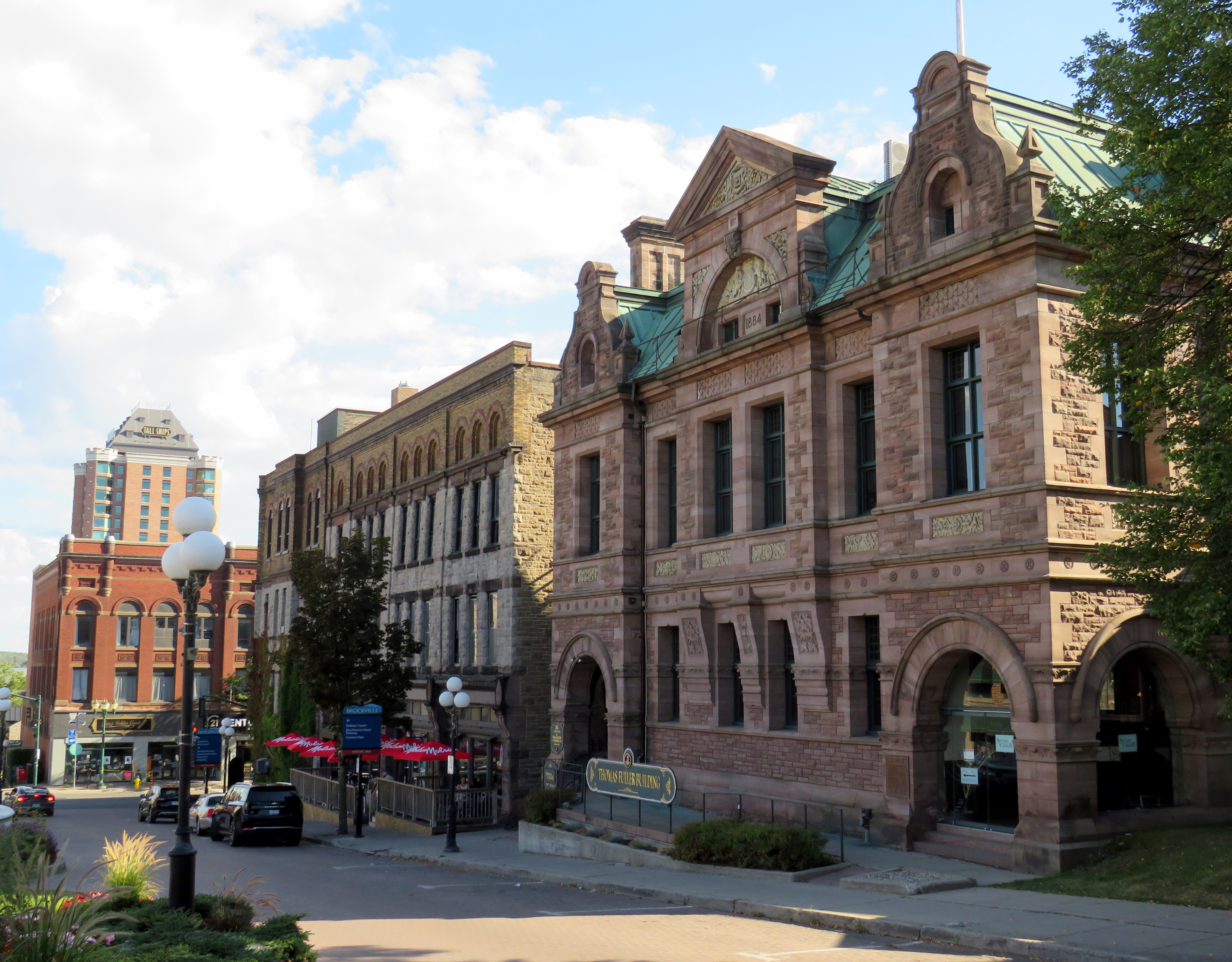
Downtown Brockville
The small city of Pembroke restored local public transit within the municipality, a weekday-only on-demand service. Unfortunately, Pembroke is only connected to neighbouring communities by a once-a-day Ontario Northland bus that runs between Sudbury and Ottawa.
Despite these improvements, vital connections remain missing. Commuter bus services from Ottawa to neighbouring towns such as Arnprior, Almonte, Carleton Place, and Rockland have not been restored; only Kemptville, Cassleman, and Russell/Embrun, have limited weekday service again, despite the federal, provincial, and municipal governments’ push to bring civil servants back to the office up to five days a week.
In Prescott & Russell Counties, experiments with fixed-route and on-demand transit have failed, though those came at a time when COVID-19 was still declared a public health emergency. The Town of Hawkesbury, population 10,194, is the second-largest urbanized municipality in Ontario without any inter-community transport links. (The largest is Tillsonburg, which lost its connection to Woodstock earlier this year.)
I have made updates to my intercity transportation map to include these changes: I also added a missing service in the Lachute, Quebec region. If there any further changes that I have missed, please contact me.
New GO Transit bus stop on Chiefswood Road at Six Nations
As we enter Spring 2025, there are a few significant changes in Ontario’s intercity transportation services. A new daily GO Transit route will now connect Six Nations and the Mississaugas of the Credit First Nation with Brantford, Hamilton, and Greater Toronto. A new seasonal Waterloo-Burlington weekend express could foreshadow more direct service between Kitchener/Waterloo and Hamilton in the future. Flixbus moved its Ottawa terminal stop to the VIA Rail station, joining Ontario Northland and Orleans Express.
However, there are also some cuts, triggered by the end of the Ontario Intercommunity Transportation Grants. Grey County will terminate all GTR services with the exception of Route 1 between Dundalk, Shelburne, and Orangeville. T:GO is ending its intercommunity services outside of Tillsonburg, including routes that connect with Woodstock and London. PC Connect is cutting its rural route that serves places like Mitchell and Milverton (though routes connecting Listowel, Stratford, and St. Marys to Kitchener/Waterloo and London will continue).
Unfortunately, T:GO will end all intercommunity bus routes outside of Tillsonburg, including the link to Woodstock
Recently, I provided my expertise mapping Canada’s intercity transit links to Transport Canada, which allowed me to enhance and update the interactive map. I am also working with Transport Action Canada to support their efforts advocating improved intercity transport across the country.
As always, please contact me with feedback, corrections, or updates. It is a challenge continually maintaining a Canada-wide map given how frequently things change.
There are buses to more destinations in 2024, but a few major gaps persist
NOTE: Previous versions of the Ontario and Canada maps are retired; please see the new Canada Intercity Transport Map, launched March 30, 2025. This will now be the only interactive map that I will update.
Unfortunately, outside of Ontario, there not that many updates to make. On Vancouver Island, at least, there is now daily service all the way to Port Hardy in the north and Tofino and Ucluelet to the west, with additional runs between Comox, Nanaimo, and Victoria. There are more buses between Vancouver and Seattle; FlixBus is now operating on the busy Calgary-Edmonton and Calgary-Banff routes. There is also a new twice-weekly Edmonton-Camrose service, thanks to work by the University of Alberta’s student union; it partnered with FlixBus to provide the service.
Also new to the map is Mountain Man Mike’s bus service between Vancouver, Nelson, Kaslo BC, and Calgary, as well as Mobilité Charlevoix, a regional service that connects several towns east of Québec City including Baie-Saint-Paul, La Malbaie, and Clermont.
Unfortunately, several wide gaps remain. Despite plenty of competition on the busiest routes in Southern Ontario and Alberta, there is no bus service between Calgary and Regina, leaving cities like Medicine Hat and Moose Jaw without intercity connections, apart from airport shuttle services, despite once-frequent Greyhound service. Between Winnipeg and Regina, it is still just one bus a week. Maritime Bus, for whatever reason, still has not restored service across the New Brunswick-Québec provincial line.
Without comprehensive government-led coordination and support, these gaps are likely to remain unfilled.
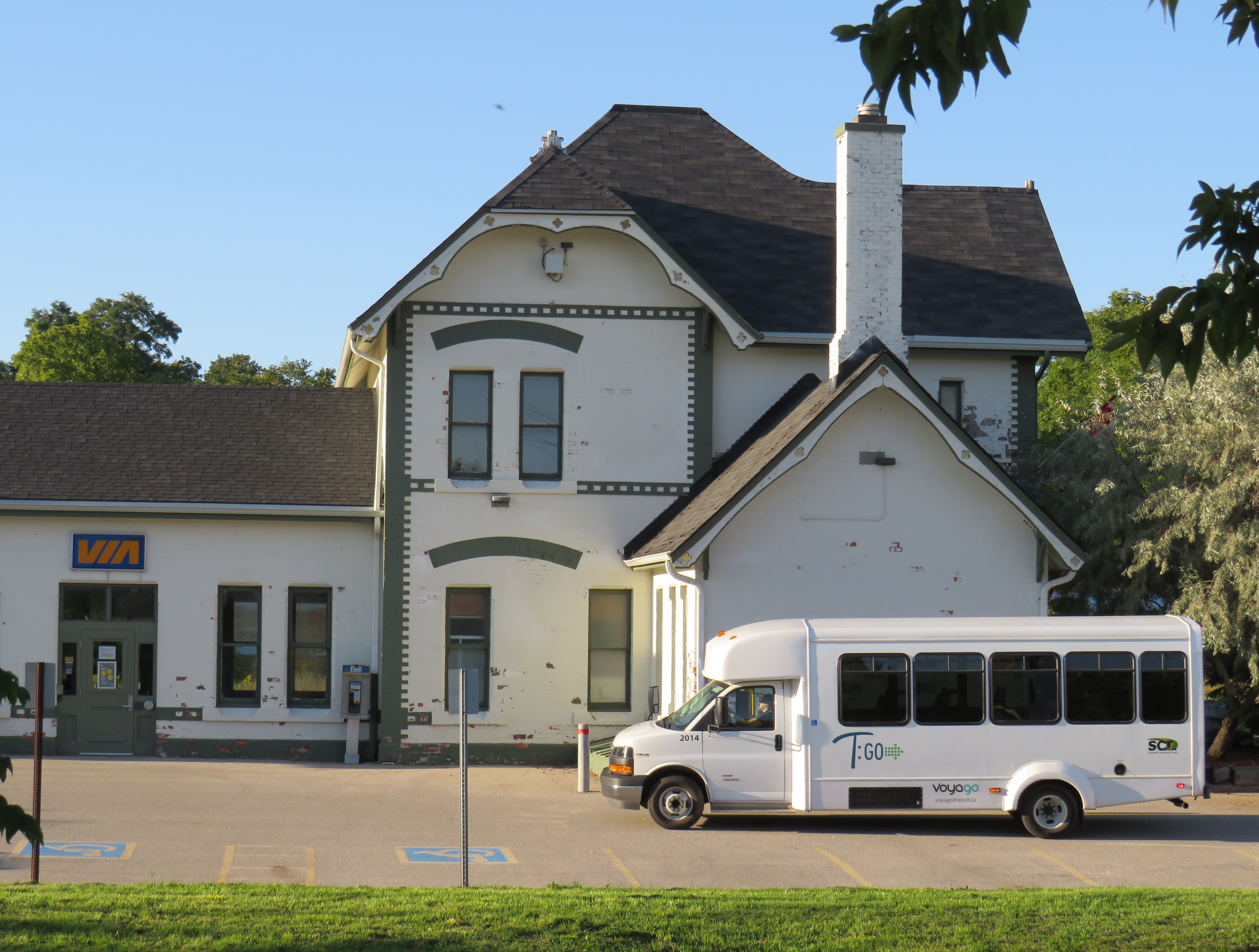
Southern Ontario Transit minibus in Dunnville, October 2024
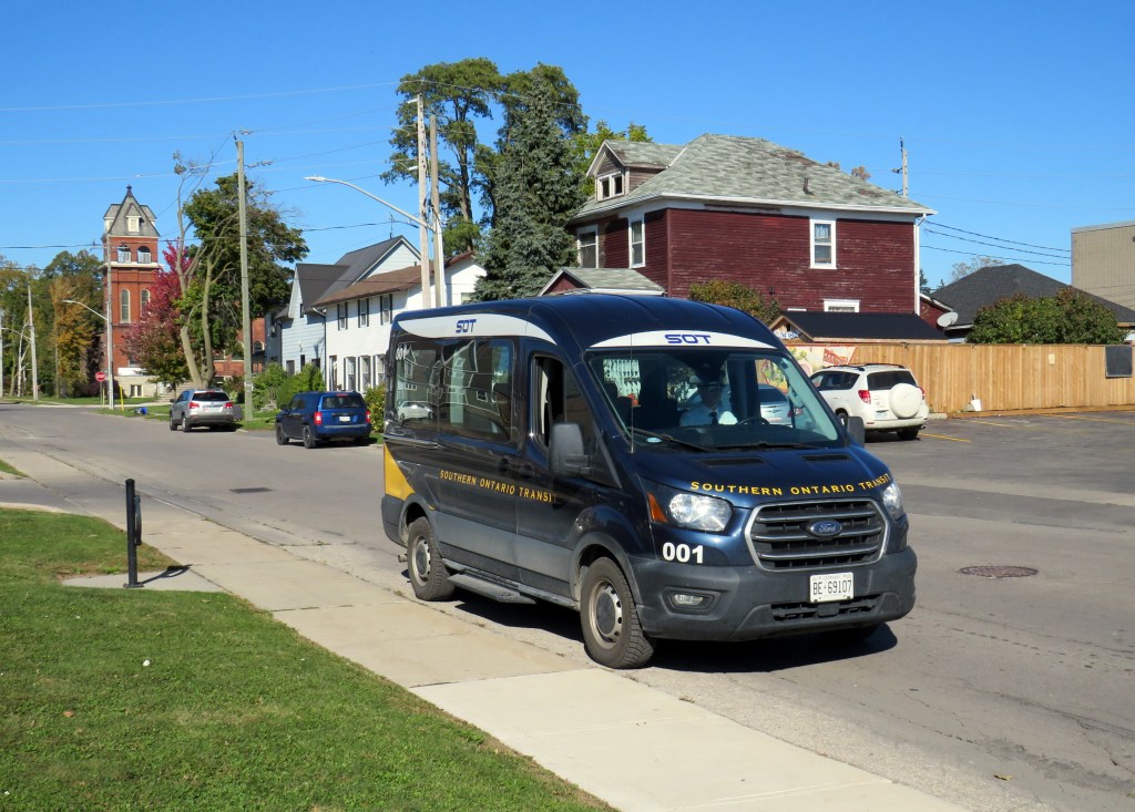
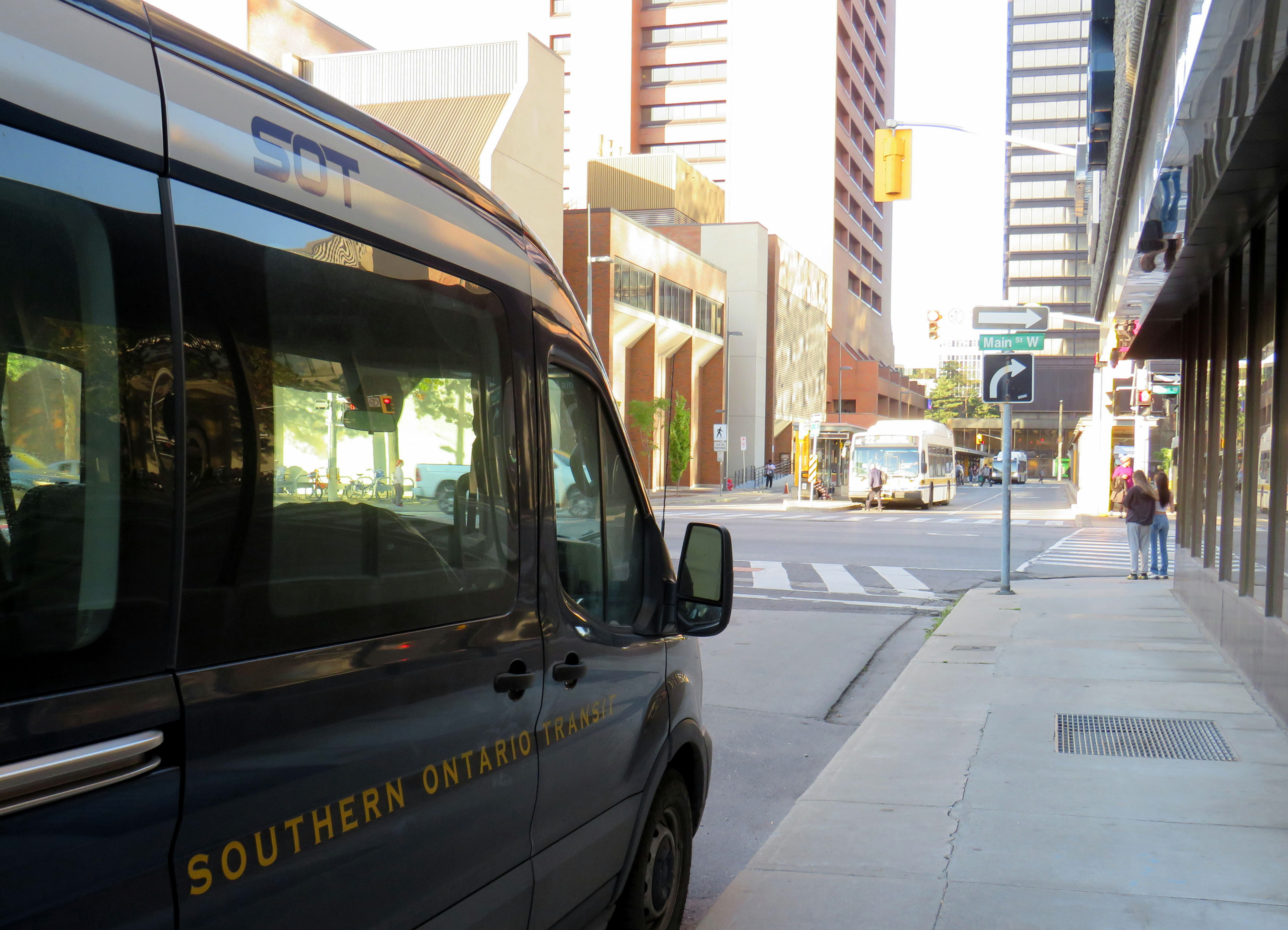
Earlier in October, I got to meet Rae Rivard, owner-operator of Southern Ontario Transit (SOT), a new intercity transit operator currently serving Hamilton and Haldimand County. The route, which launched on September 16th, offers three weekday round trips between Downtown Hamilton and Dunnville, serving the communities of Caledonia, Hagersville, and Cayuga.
Haldimand County, along with the neighbouring Six Nations and Mississaugas of the Credit First Nation reserves, remained unserved by intercity or local bus services since the early 2000s; in 1990, United Trails operated a daily bus between Port Dover, Hagersville, Caledonia, and Hamilton. Cayuga and Dunnville were served by a Greyhound route on Highway 3 between Niagara and London. More recently, as Niagara Region was building a regional transit service and Norfolk County successfully applied for provincial funding for a new service between Simcoe and Brantford, Haldimand County refused to take part. Enter SOT.
SOT, which charges a $10 one-way fare, operates without the support of the municipal government, and is unable to put up bus stop signs or actively promote its service at municipal facilities such as libraries or community centres. For this reason, ridership remains low, despite growing populations in Caledonia and Hagersville and convenient links to Hamilton Airport, Mohawk College, St. Joseph’s Hospital, and to GO Transit and HSR services.
Rivard will tell you that “the primary challenge we face today is slow uptake. Due to a number of limitations and challenges currently out of our control, the number of regular and new riders trends up every week, but not as fast as we need to cover expenses…. Many of the limitations we are dealing with right now can easily be addressed at no expense, but these choices are out of our control.”
Rivard reached out to businesses and social service organizations, but was turned away, adding that “the entire operation has been entirely funded out of me and my wife’s savings, and we are really struggling to keep up with expenses at this rate.”
Without approved bus stop locations with curb access, SOT is not able to provide fully-accessible service, though it already has a wheelchair-accessible vehicle. The lack of physical bus stops and publicity has made it difficult to attract riders, though while riding with Rivard on a beautiful October afternoon, it was clear that a demand exists as several residents came up to the minibus to find out more information.
My hope is that word spreads about this unique and essential operation and that the local communities provide the needed support to make this service work. If this initial route succeeds, SOT would like to expand service in Haldimand and take on other gaps in the Ontario network.
I updated my Ontario Intercity Transport Map to add Southern Ontario Transit’s route. Commuter Connect in Northumberland County ended service not long after VIA Rail finally resumed its early morning train from Kingston to Toronto. East Zorra-Tavistock Transit in Oxford County did not last long either, and service there has ended.
Added to the map:
Southern Ontario Transit between Hamilton, Caledonia, and Dunnville
Red Arrow’s daily Toronto-Western University express, which replaces its Toronto-Niagara Falls run
A new daily Flixbus route between Toronto, Hamilton, and St. Thomas
A new OnexBus route between London, Goderich, and Port Elgin, operating Friday through Monday
OnexBus’s London-Pearson Airport-Brampton route, which operates several trips a day
Ourbus’s Toronto-Ottawa route
Kasper’s daily Winnipeg-Kenora-Sioux Lookout service
Revisions to on-demand services in Niagara Region
Some revised routings and service levels across the province
Removed from the map:
Commuter Connect in Northumberland County
East Zorra-Tavistock Transit
Kasper’s on-demand service to Red Lake/Balmerton
Though it is good to see Bruce County — particularly rapidly growing Saugeen Shores — get another link, that part of Ontario is still poorly served; there should be daily services between larger Bruce County communities like Saugeen Shores, Kincardine, and Walkerton at least to Owen Sound and Hanover. Lindsay is also left without any intercity services, after TOK ended service from Toronto to Haliburton last year. where a Peterborough-Lindsay-Pontypool service, perhaps extending to Durham College/Ontario Tech University in Oshawa could prove to be a very useful route.
If you like this post and you would like to help out with my online mapping and webhosting costs, consider buying me a coffee.Thank you!
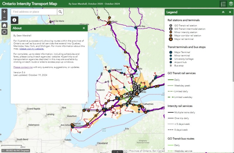
I love maps, especially physical, paper maps. I like to visualize the places I travel to and determine how each city and region’s transit networks work. Though online interactive maps can be very helpful (like the ones I created to show all intercity transport services in Ontarioand across Canada, filling a much-needed gap), there is still nothing like a well-designed static map, especially when it is in print and easily accessible to the public.
This means providing maps that accurately and clearly depict the entire transit system, along with landmarks, connections, and frequency. Los Angeles Metro’s system map does a reasonable job for a map that covers a very large region.
The Los Angeles Metro system map depicts the complex bus and rail network, including non-LA Metro agencies like Culver Citybus and Santa Monica’s Big Blue Bus. Colours and line width used to denote operator, service type, and frequency.
Thankfully, most urban transit systems in North America continue to provide proper system maps both on their websites and in print, provided free on request at subway booths or terminal offices. (Some, however, have charged a small fee for a physical copy of their transit maps, such as San Francisco’s Muni.) In Europe, complete transit maps often have to be purchased, such as in Berlin or Vienna.
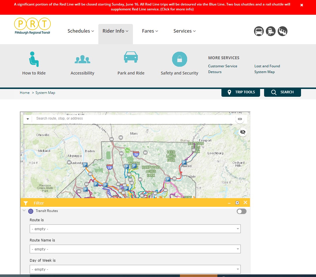
I recently visited two mid-sized American cities that have done away with physical maps for their transit systems: Pittsburgh, Pennsylvania and Denver, Colorado. In those cities, figuring out how to get around by tram and bus was frustrating, even in an age of Google and Apple maps and transit planning apps accessible to anyone with a smartphone.
Pittsburgh Regional Transit (formerly known as Port Authority Transit) operates a complicated web of bus routes that radiate from the city’s downtown core, along with a few cross-town and feeder routes. There are three busways and a light rail service to the southern suburbs. However, there is no proper system map, either in print or online as PDF or image file that allows the new or casual user to make sense of the network.
The user can then select a service by route name or number in a drop-down tool, but the map itself is difficult to figure out. Zooming in reveals the location of fare vendors and park-and-ride lots, but not important service details like route numbers or service frequency.
Zooming in, park-and-ride lots become the most prominent feature
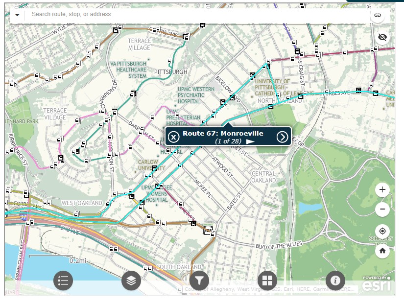
Even at the neighbourhood level the map is difficult to read. The screenshot below shows Pittsburgh’s Oakland district, home to University of Pittsburgh, Carnegie Mellon University, several other educational institutions, medical centres, parks, museums, and cultural venues. Many bus routes follow Forbes Avenue and Fifth Avenue, but as each route is layered on top of each other, it is difficult to discern where each route runs and where they go.
PRT’s ESRI interactive system map, zoomed into the Oakland District
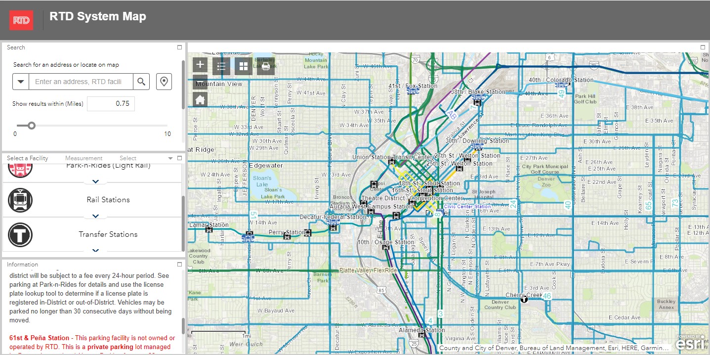
Denver’s Regional Transportation District (RTD) also uses ESRI interactive maps to show bus routes (rail services are depicted in a static image map as well). At a small scale, only the light rail and commuter/regional rail services appear, along with transit park-and-ride locations. Denver’s bus system is less complicated than Pittsburgh, operating largely on a grid, but still, a proper map would make it much easier to get a sense of the network.
Zoom in, and bus routes appear, along with route numbers, but there is nothing to show the level of service for each route.
Though online-only interactive maps have their purpose (my Ontario and Canada intercity maps are designed to show where connections exist, or not, and how to obtain schedule information), they are not well suited for urban transit systems and are very difficult to read on a mobile device. Properly designed static maps, in web image or PDF format do much better jobs.
It is worth comparing Pittsburgh and Denver to the Toronto Transportation Commission (TTC). The TTC’s complete system map is provided to customers for free at subway stations, with smaller, simplified versions available as tear-away pamphlets. Large-format versions are also displayed across the network in bus shelters and subway stations. A PDF version can also be easily found on the TTC website in the main Routes and Schedules page. Surface routes are categorized by service level (express, frequent service, regular service, limited service, seasonal, and community routes) with major landmarks and transfer points to connecting services clearly indicated.
I have some minor complaints about the TTC’s map (like regular routes, express routes should be categorized in the map based on their service levels, for instance) but it is a reasonable, easy to read map that is also quite easy to find.
Unfortunately, more transit systems are moving away from easily accessible paper maps. Durham Region Transit, for example, no longer provides copies of its system map. Fortunately, a proper, well-designed PDF copy remains accessible on its website.
When travelling, or looking to understand a city’s transit network though, there is nothing quite like poring through a well-designed, easy-to-read paper map. It would be a shame if more agencies went the way of Denver and Pittsburgh.