Category: Maps

  • Changing tracks: passenger rail in 1980 and 2024

    Changing tracks: passenger rail in 1980 and 2024

    A VIA Rail train in Stratford, Ontario. In 1989, there were five trains a day connecting Stratford to Toronto. In 2024, there is only one.

    July 2024: Map edited to include one new daily intercity train: Amtrak’s Borealis, an extension of an existing Chicago-Milwaukee train to St. Paul, Minnesota, offering a second daily train on the eastern section of the Empire Builder route.


    Unlike in Europe or Asia, the story of passenger rail in North America the last seventy-five years has generally been one of decline. There are exceptions: service on the Northeast Corridor between Boston and Washington is frequent and relatively speedy. Commuter rail services have expanded in most major metro areas. And a new privately-owned intercity rail service in Florida offers frequent, dependable, and fast service between Miami and Orlando, with expansion on the way.

    The development of new interstate highways, the loss of mail contracts and express freight to trucking, more affordable air travel, and competition from coach operators all contributed to the decline in North America. Though Canada and the United States both established national rail passenger services in the 1970s in an attempt to halt — or at least manage — the disappearance of intercity rail, the two countries had vastly different operating environments. Mexico, which had a nationalized railway network, privatized its assets and wound down intercity rail in 1995; today there is now only a commuter train in Mexico City and a new tourist-focused Tren Maya service in the Yucatan Peninsula.

    Canada had only two major railway systems since the 1920s: privately-owned and profitable Canadian Pacific, and government-owned Canadian National. There were only several smaller railways owned by provincial governments and industrial concerns, along with a few American connections such the New York Central (NYC) line through southwestern Ontario, and the Toronto, Hamilton and Buffalo Railway, a joint venture of CP and NYC.

    In the United States, there were dozens of medium and large railroads, all competing for fewer passengers and depleting natural resources. In the Northeast and Midwest, mergers between one-time rivals like NYC and Pennsylvania Railroad (Penn Central) and the Erie and Delaware, Lackawanna and Western Railroads (Erie Lackawanna) failed, leading to the creation of federally-backed Conrail. (Today, there are only six Class I railroads in the US, including CN and CP-Kansas City Southern)

    In the midst of failing railroads and declining passenger services, Amtrak was formed in 1971 and took over the operation of most remaining intercity trains. (Commuter trains, often subsidized by local or state governments, remained operated by the freight railroads before being absorbed by transit agencies.) Amtrak purchased new rail cars for regional services to replace decrepit rolling stock (Amfleet); eventually new long-distance cars were also acquired one it was clear it would maintain those routes (Superliners)

    Amtrak’s “International” in Sarnia, Ontario in 2004, equipped with Superliner coaches

    In Canada, VIA Rail started off in 1976 as a passenger rail brand of CN, which, as a Crown corporation, was still committed to passenger services. In 1977, it became a separate agency and in 1978, it took over CP’s remaining rail services. The 1980 map shows what VIA Rail’s system looked like in the early years. VIA did not take over everything; CN and CP retained ownership of commuter trains in the Montreal area, which were not yet assumed by the regional transit agency there. Railways not owned by CN and CP also maintained their own passenger services, usually with government support or direct provincial operation (i.e., GO Transit, Ontario Northland, BC Rail, Algoma Central).

    Both Amtrak and VIA saw major funding cuts from federal governments in the first decade of their existence. In the United States, poorly-performing routes such as the Mountaineer (Norfolk-Cincinnati-Chicago), the Floridian (Chicago-Nashville-Miami), the Lone Star (Chicago-Kansas City-Oklahoma City-Houston) and the National Limited (Washington-Columbus-Kansas City) were eliminated between 1977 and 1979; deteriorating track conditions on insolvent host railroads were a contributing factor.

    VIA Rail also saw several service cuts after its formation. Though the trains eliminated between 1977 and 1980 were generally marginal services in Western Canada and Northern Ontario and Quebec, 1981 saw more drastic cuts across the country, including the elimination of CN’s transcontinental train through Saskatoon and Edmonton. Though those cuts were partially reversed in 1985, in 1990, nearly half of VIA’s trains were wiped from the timetable, including nearly every train in the Maritime Provinces and the famed Canadian on the CP route from Montreal and Ottawa through Thunder Bay, Regina, Calgary and Banff.

    Amtrak, despite its challenges, never saw cuts as drastic as those made to VIA Rail. Unlike VIA, Amtrak enjoys more autonomy from the federal government. Many of its services are funded by state governments rather than the federal government. Powerful senators will lobby to maintain services or add new trains in their state. (Canadian federal politicians generally enjoy less influence and autonomy in our parliamentary system, with power increasingly centralized in the Prime Minister’s Office.)

    Amtrak routes added since 1980 and depicted in the map below include the restoration of previously eliminated services. The Heartland Flyer (Oklahoma City-Fort Worth) is a partial restoration of the Lone Star, while Amtrak Regional service to Roanoke, Virginia, restores part of the cancelled Mountaineer. There are three daily transcontinental trains between Chicago and the West Coast and two between New York, Washington, and Florida. Daily service means these long-distance trains are much more useful for regular and casual travelers than VIA’s remaining long-distance trains.

    Over a dozen states contribute to the operation of many daily trains. California goes even further, with a distinct Amtrak California brand with a dedicated fleet owned by that state’s department of transportation. If such a model existed in Canada, one might expect the continuation of services such as Toronto-Peterborough, Montreal-Sherbrooke, or even Calgary-Edmonton.

    Bucking the trend: commuter rail

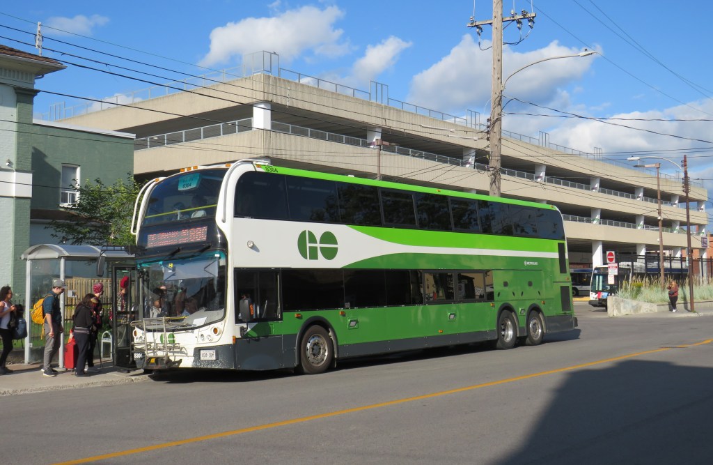
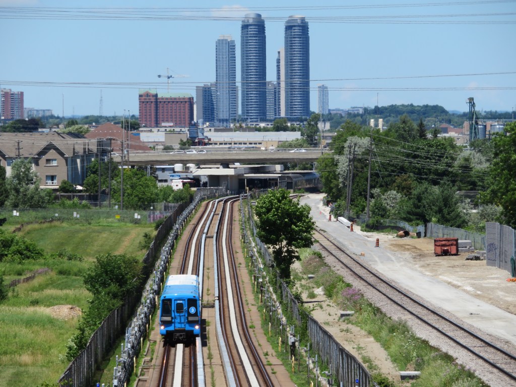
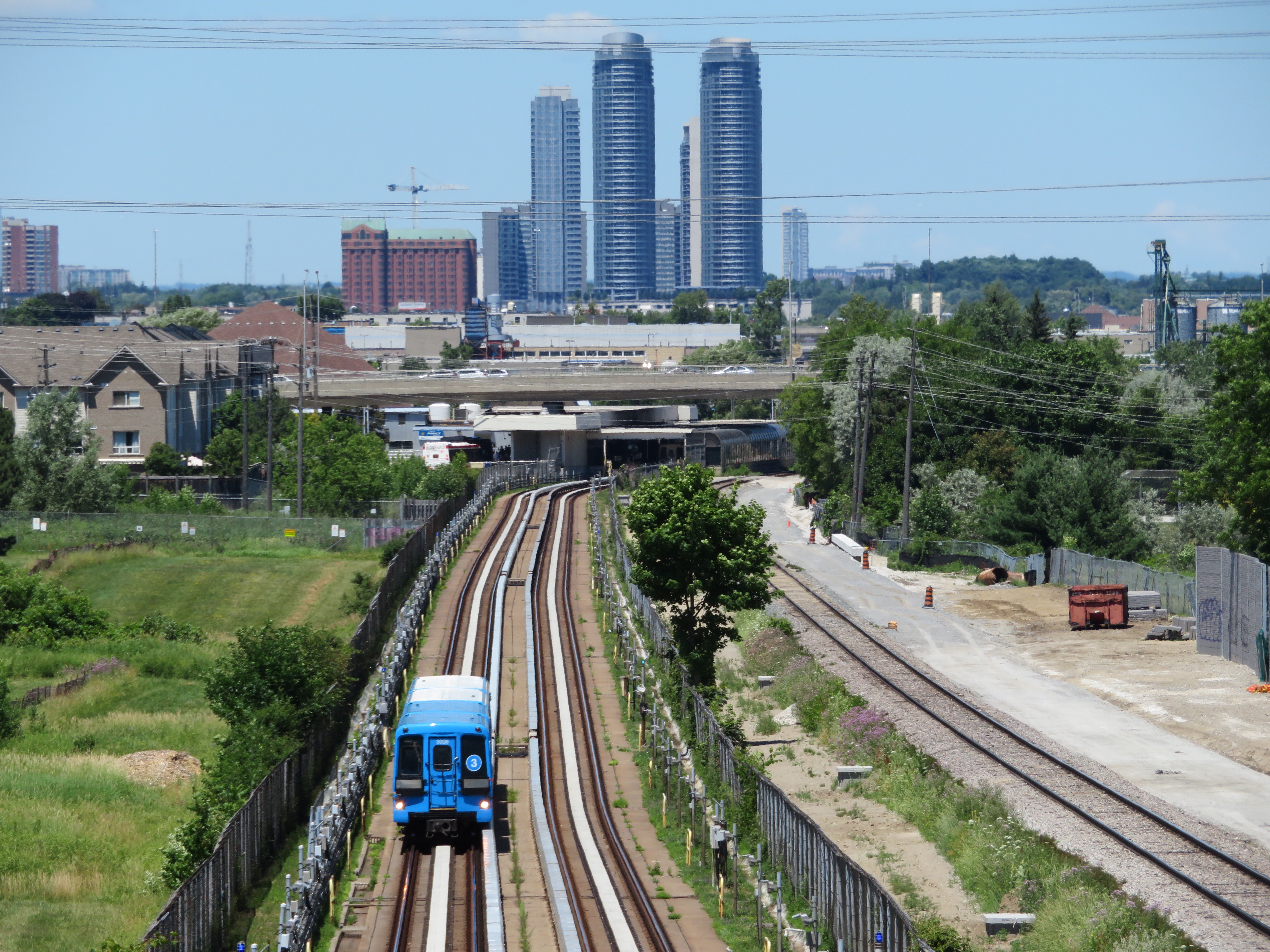
    Unlike intercity passenger rail, commuter rail services have expanded in Canada and the United States. In 1980, there were only 11 metropolitan areas with commuter rail services (and in Pittsburgh and Detroit, those would soon disappear). In 2024, there were 23. Though systems in the New York and Chicago areas barely expanded (and in Philadelphia, commuter rail coverage actually shrunk), there was impressive growth in commuter services in the Greater Toronto Area, the San Francisco Bay Area, and in Southern California, to the point that GO Transit and Caltrain are evolving towards becoming true regional rail systems.

    Interactive map

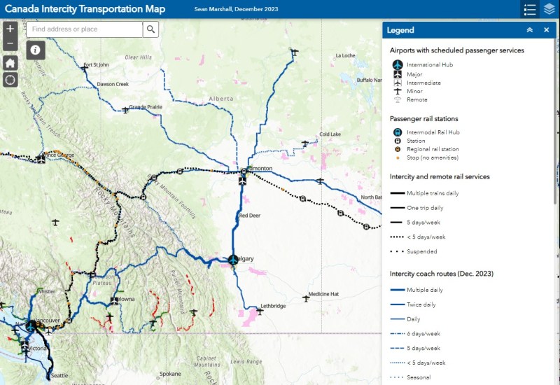
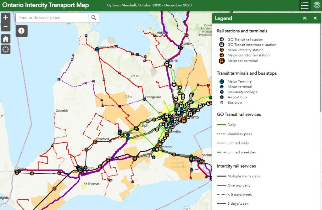
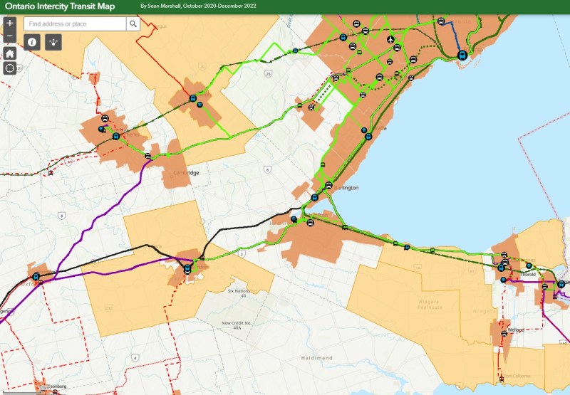
    An interactive map, linked below, shows what the Amtrak and VIA Rail systems looked like in 1980 and in 2024, along with independent railways and commuter services. The 1980 map includes notable routes (in grey) that were cut since 1976, the year of America’s bicentennial and the Summer Olympics in Montreal. Use the slider to compare the two maps and click on any line for more details on each route.

    Link to interactive map

    For a comparison of Canadian passenger rail services between 1955 and 1980, please visit my previous post here.

    The Museum of Railway Timetables website is an invaluable archive of Amtrak system timetables; I consulted it many times in the making of this latest map.


    If you like this post and you would like to help out with my online mapping and webhosting costs, consider buying me a coffee. Thank you!

  • Mapping Canada’s intercity links

    Mapping Canada’s intercity links

    A Calgary-bound Pacific Western Ebus Coach loads at Red Deer, Alberta

    NOTE: Previous versions of the Ontario and Canada maps are retired; please see the new Canada Intercity Transport Map, launched March 30, 2025. This will now be the only interactive map that I will update.

    In 2022, I was approached by staff at Infrastructure Canada who were interested in compiling information on intercity bus services across the country. Unfortunately, no repository had existed for a very long time, especially as transit and intercity coach services are primarily under provincial and municipal jurisdiction. Ontario’s provincial government last published a map of intercity carriers in 1990-1991, while Saskatchewan abolished its provincial bus service in 2017. The withering of Greyhound Canada’s once-extensive network left many communities from Ontario west to British Columbia and the Yukon without any service, while new private operators like Ebus and Rider Express filled in to serve the most lucrative routes.

    Though the Federal Government operates VIA Rail and oversees air, marine, and long-distance rail transport, for road and city transport, its role has been more limited to helping to fund transit projects and some major road infrastructure improvements. Knowing that, I was excited to learn that there was interest in understanding the state of the country’s rural and intercity transport initiatives. I completed the project for Infrastructure Canada in June 2023, but I have recently updated a version of the map I completed, which I am excited to share.

    A simplified methodology of how I completed this map can be found below.

    Canada-wide intercity transportation map
    (more…)
  • Taking stock of Ontario’s transport links in 2023

    Taking stock of Ontario’s transport links in 2023

    GO Transit’s new Route 17 between Kitchener-Waterloo, Guelph, and Hamilton was one of the good news stories of 2023

    At the end of 2023, there have been several changes reflected in my Ontario Intercity Transit Map. Intercity Bus, a London-based company that took over the closed Greyhound bus terminal there, launched a second route, offering three daily trips between London and Sarnia; they plan to launch a London-St. Thomas route as well. In January 2024, Deseronto Transit will start running a new fixed-route service between Belleville, Tynendiaga Mohawk Territory, Deseronto, and Napanee, with a route designed to serve major employers, shopping centres, and health services.

    This year, GO Transit finally began service connecting Kitchener-Waterloo, Guelph, and Hamilton and improved rail and bus service on the Kitchener Corridor. This was one of the most important changes in 2023, though, as I argued here, they could do even more.

    Unfortunately, some routes disappeared, including Grey Transit Route’s Walkerton-Flesherton Route 6, and Northumberland County’s service between Cobourg and Campbellford. At the end of January 2024, TOK Coachline’s bus serving Lindsay and Haliburton will also be gone for good. On-demand services have replaced fixed routes in parts of Durham Region and Norfolk County, while all service came to an end in Prescott & Russell and Manitoulin Island.

    Keeping track of the changes continues to be challenging, given the lack of a central repository of transport services in Ontario. For this reason, I have made the choice to not map services provided by Book-a-Ride, whose schedules, routes, and locations change frequently, as that company acts more like a charter airline (changing routes and schedules regularly to meet expected demand) than a traditional motor coach operator (which has more consistent schedules and routes). I tried doing that once, and I will not attempt to do so again.

    For now, gaps remain between London and St. Thomas, while Haldimand, and Elgin Counties remain entirely disconnected. Bruce County has just two bare threads connecting Saugeen Shores, Kincardine, and Goderich to the outside world, and Lindsay/Kawartha Lakes and Haliburton will soon lose their only public transport option.

    As always, please message me with any corrections, changes, comments, or suggestions.

    Ontario Intercity Transport Map

    This interactive map has been migrated to a newer ArcGIS Online account, on account of ESRI suddenly changing its monthly service account to charge for bandwidth. I previously hosted my maps on a pay-as-you go account that helped me get re-acquainted with the ESRI ArcGIS Online platform before I set up a full online subscription to support a small business I co-founded in 2021.

    What once cost me approximately US $8 a month to post maps such as my Ontario Intercity Map and these historical interactive maps cost me over US $1000 for November 2023. Though I got one email from ESRI US advising of the change in the billing, there was no way to expect that a monthly fee would go up over 1000%. As of December 27, I am still trying to get that addressed after several calls and emails and an unsuccessful attempt to contest the charge to my credit card.

    I’m hoping for some good news soon on that front.

  • The slow way to Peterborough

    The slow way to Peterborough

    A busy GO Transit Route 88C bus loads passengers in front of the Peterborough Bus Terminal in the city’s downtown core

    Peterborough, Ontario, a city of 84,000 people, is about a 90-minute drive from Downtown Toronto, without heavy traffic. A regional centre for central-east Ontario, Peterborough is home to Trent University, a mid-sized liberal arts institution with about 10,000 full time students, and Fleming College, which has over 6,000 full time students and 10,000 part time students.

    Given its relative importance and its proximity to the Greater Toronto Area, especially Durham Region, one might expect to find good transit links from Peterborough to not only Toronto, but elsewhere in Ontario. Unfortunately, this is not really the case.

    Prior to the COVID-19 pandemic and the closure of Greyhound Canada’s remaining service in Ontario and Quebec, there were four daily Greyhound buses between Peterborough and Toronto (three on Saturdays and Sundays), with one of those daily runs continuing east on Highway 7 to Ottawa, with stops in towns such as Havelock, Madoc, and Perth.

    The scheduled time between the old Toronto Coach Terminal at Bay and Dundas Streets and Downtown Peterborough was between one hour and 45 minutes (making only an intermediate stop at Scarborough Centre Station) and two hours, 15 minutes (making local stops in Ajax, Oshawa, and Orono).

    2019 Greyhound timetable for Ottawa-Peterborough-Toronto service. Note the overnight 5757/5790 runs that also followed Highway 7, but only stopped at Madoc for a rest break.

    In September 2009, GO Transit first started a bus service between Oshawa GO Station, Downtown Peterborough, and Trent University, following the success of other bus services to universities and colleges in the region. Before 2020, that route made only four stops between Oshawa Station and Downtown Peterborough; all were park-and-ride lots adjacent to Highway 35/115; the bus would take just over an hour between the station and Downtown Oshawa.

    Despite GO Transit’s competition, the Greyhound service remained popular, as it offered a direct, faster, one-seat ride between Downtown Toronto and Downtown Peterborough, with most buses only stopping at Scarborough Town Centre along the way. Three days a week, there were connections to Bancroft and Pembroke. GO Transit’s advantage was a slightly cheaper fare, connections to local transit and other GO services, and a more convenient service for passengers travelling between Durham Region and Peterborough. Unlike Greyhound, GO Transit continued to Trent University. Apart from the Newcastle (Hwy 2 at Hwy 35/115) park-and-ride, where passengers could connect to GO Transit routes 90/91 to Newcastle, Bowmanville, Courtice, and Downtown Oshawa, the park-and-ride stops were little-used.

    GO Transit Route 88 map, January 2020. There were only four stops between Oshawa GO Station and Peterborough Bus Terminal

    In mid-2020, with the COVID-19 pandemic causing major reductions in bus and rail ridership, GO Transit cut and consolidated several services, particularly in areas where local transit agencies operate. Route 90 was reduced to early morning and late-night service between Union Station and Oshawa GO when trains were not operating. The remainder of Route 90 through Courtice, Bowmanville, and Newcastle was cut entirely. Route 91 was merged into Route 88, which added new stops in Courtice and Bowmanville.

    Route 88B, which includes stops at park-and-ride lots at proposed new GO Stations in central Oshawa and Courtice, takes up to 120 minutes to get from Trent University to Oshawa Station. The regular 88 bus takes 105 to 115 minutes to complete the trip. That is a very long time to sit on a bus, especially one not equipped with a lavatory.

    GO Transit’s Route 88 bus timetable, including connecting train service from Toronto Union Station (click for larger size)

    On Thursdays and Fridays, during regular school days between September and April, there are several express 88C buses, that only stop at Trent University, Peterborough Bus Terminal, and Oshawa GO. They make the complete trip in 1 hour 20 minutes; from Union Station to Downtown Peterborough is 2 hours, 20 minutes, not much slower than the slowest Greyhound bus.

    The Route 88 route map in September 2023

    Granted, for anyone living in Bowmanville and headed to Peterborough, the route is an improvement, with a new one-seat-ride now possible. While travelling to Peterborough earlier in September, I noted several passengers getting on in Downtown Bowmanville. But for through passengers, the backtrack to get to the Clarington Boulevard Park & Ride (the proposed location for the Bowmanville GO Station) and then the local stops to Newcastle are a bit annoying. Once on the highway, the bus has to get off at the Highway 35/115 split near Pontypool, and again at County Road 10 near Cavan and Millbrook, despite the very occasional time a passenger wants to get on or off (which has never happened when I rode Route 88). These diversions add 2-3 minutes each to the trip.

    Pulling up to a deserted GO bus stop at County Road 10 near Cavan

    These carpool stops might be useful if there were connecting transit services, rather than just a parking lot and a bus shelter. The 35/115 lot near Pontypool is 34 kilometres to Lindsay, a town of nearly 20,000 people, but whose only transit connection is a 3 day/week TOK coach bus between Haliburton and Toronto. A shuttle connection to Lindsay (which has a local transit service) would provide new links to Toronto, Durham Region, and Peterborough. Meanwhile, the Highway 2 carpool lot does not have direct Durham Region Transit service either.

    Since Greyhound Canada’s withdrawal from the Canadian market, GO was the only intercity operator serving Peterborough until earlier this year, when Rider Express and Flixbus resumed service on the Toronto-Peterborough-Ottawa route. Both companies offer express, one-seat rides to downtown Toronto, but they have two major disadvantages over GO or even the old Greyhound service: frequency and in-town connections.

    Flixbus offers one daily round trip, leaving the Union Station Bus Terminal at 11:00 AM and arriving at a Tim Hortons parking lot (at 1200 Lansdowne Street West, on the southwest side of Peterborough), at 1:05 PM, with stops near Scarborough Town Centre and at Thickson Road and Highway 401 in Whitby. The return trip leaves Peterborough at 9:05 PM, arriving in Toronto at 11:05 PM.

    Boarding a Flixbus coach in a parking lot behind a Tim Horton’s in Peterborough’s suburbs

    Rider Express runs on the same route four days a week, leaving Union Station at 12:00 PM, arriving at a different Tim Horton’s parking lot (on Ashburnham Road, on the southeast side of Peterborough) at 1:45 PM, making one stop in Scarborough. The return trip leaves Peterborough at 10:05 PM and arrives in Toronto at 11:35 PM. The map below shows where GO, Flixbus, and Rider Express stop in Peterborough.

    While GO stops at Trent University, Downtown Peterborough, and a park-and-ride lot on the south end of the city, Flixbus and Rider Express only stop at locations close to the main highway on the south side of Peterborough, pulling into parking lots with nowhere to sit and no real amenities, unless waiting passengers had a car to wait in or paid for a coffee or snack at the Tim Horton’s. The old Greyhound terminal, which was located on the same block as the downtown transit terminal, has since been sold, and is now converted for local community services. Though they offer a much faster ride to downtown Toronto, the private operators are neither frequent enough nor convenient enough to compete with GO.

    One day, Peterborough may get intercity rail service again thanks to the federal High Frequency Rail project, still in the early procurement phase, which would provide the speedy, frequent intercity service Peterborough needs. Until then, Metrolinx should revise the entire Peterborough bus service, including working with Durham Region and the City of Kawartha Lakes to make the service more useful for more riders, with a mix of daily express buses and enhanced local connections. The Selwyn Link bus service, which connects GO and Peterborough Transit with Selwyn Township and Curve Lake First Nation at Trent University, is great example to build upon.


    I have updated the Ontario Intercity Transport Map for September 2023 with new and revised routes right across the province. The notable losses include Prescott-Russell’s abandonment of its rural on-demand service, the closure of Grey Transit Route’s service between Walkerton and Flesherton, and Trailways’ stop in Chatham. The London-to-St. Thomas gap remains unfilled, and there’s a clear gap in Huron and Bruce Counties, especially with the loss of service to Walkerton. For the most part, it is good to see most regional transit services continuing, with mostly minor adjustments.

    I look forward to sharing my Canada Intercity Transit Map, based on work I recently completed for Infrastructure Canada, in the near future.

    Link to intercity map
  • Line 3: struck from the maps

    Line 3: struck from the maps

    2018 view of the Scarborough RT, looking north towards Ellesmere Station

    On Monday July 24, at 6:45 AM, a Scarborough RT car on Line 3 derailed soon after departing Ellesmere Station. Forty-five passengers were on board, and five suffered minor injuries. The Scarborough RT, which opened in March 1985, was suspended, and then permanently closed, four months ahead of its planned shutdown on November 18, 2023. For the first time in its history, Toronto’s rapid transit map has shrunk.

    (more…)
  • Mapping the 2023 mayoral byelection

    Last week Monday, I was at Spacing’s election night party at a pub in the Annex, watching the results of the election roll in after 8PM. Public polls consistently saw former Toronto city councillor and NDP MP Olivia Chow leading an especially crowded race of 102 candidates for mayor. It was the most exciting election I’ve followed since at least 2014.

    Former three-term councillor Ana Bailão, one of former mayor John Tory’s protégées, was consistently in second place, followed by former Toronto Police Chief (and provincial PC candidate) Mark Saunders, sitting councillors Josh Matlow (who ran as a progressive) and Brad Bradford (who ran to the right), and right-wing columnist Anthony Furey. Though Bailão, a centrist, had the endorsements of multiple sitting councillors, Liberal MPs and MPPs, and several public and private sector unions, she had difficulty positioning herself as the presumptive centre-right challenger, especially with Premier Doug Ford backing Saunders.

    It was not until the advance polls had closed that Deputy Mayor Jennifer McKelvie, the Toronto Star Editorial Board, and then Tory himself endorsed Bailão, likely spooked by Chow’s continued lead. (David Rider and Ben Spurr at the Star wrote a great article about the leadup to Tory’s endorsement.) Tory, who resigned after admitting to a long-term city hall affair, hummed and hawed over providing his endorsement, and hid from reporters even while robocalling Torontonians pleading them to vote for his appointed successor.

    It is quite possible that Tory’s endorsement came too little, too late for Bailão. Nearly 150,000 electors (representing 21.7% of all votes cast) already voted in advance polls or by mail, and their votes were locked in. But the late push for Bailão was able to convince at least some election day voters to choose strategically — the percentage of voters who chose Saunders, Furey, and Matlow fell, while Bailão’s share grew on election day. Indeed, Bailão placed first among election day voters. But Chow, whose campaign encouraged advance voting, carried the day in the end.

    For example, Josh Matlow placed a close second in Ward 12 in the advance polls (with 30.6% of the vote), where he’s a popular local councillor. On election day, Matlow placed third behind Bailão and Chow, with Chow eking out a narrow win overall there. In every ward, Chow placed first in the advance polls, but when all votes were counted, she placed first in 14 of the 25 wards. The table below shows how the vote shifted.

    Table of ward-level mayoral byelection results, showing advance poll and election day results for the leading five candidates. PDF version here.

    Chow won with 269,372 votes (37.2%) to Ana Bailão’s 235,175 (32.5%). Saunders, Ford’s pick, got just 8.6% of the vote despite his positioning as the only candidate to “stop Chow.” Furey placed a distant fourth, with 5%, and Matlow got 4.9%, acknowledging that Bailão’s late surge draw support away from him and towards Bailão and Chow. Brad Bradford was the biggest loser of the night, netting just 1.3% and placing fifth in his own ward.

    “Saunders is how you stop Chow” sign

    Though I was skeptical of Olivia Chow’s second run for mayor after an uninspiring run against Rob and Doug Ford and John Tory in 2014 (she placed third), she proved herself worthy this time around. She was more relaxed, more herself, and certainly tapped into a desire for change after eight years of Tory’s dull austerity and four years of chaos under Rob Ford (enabled by his brother Doug).

    I fear Toronto’s political establishment — both Conservative and Liberal — will try to make Chow’s term as mayor difficult, even though their low-tax, low-spend agenda caused many of the problems that she will have to tackle. But for now, I’m pleased we will try it her way.


    I created an interactive map showing the results of the election at the ward and electoral subdivision (poll) level. For the wards, I provided information on the advance and election day poll results.

    Note that not all polls are mapped. Until the City of Toronto releases revised electoral subdivision boundaries (I suspect due to poll consolidations), there are some missing polls. However, 95% of all polls are depicted, and the results are interesting.

    I look forward to your feedback as well; I approve all reasonable comments and reply to most emails.

    Link to map

    Thanks to David Del Grande for pointing out a needed correction.

  • Voter turnout in the 2022 municipal election

    Ever since John Tory was elected mayor of Toronto in 2014, voter turnout in municipal elections has been in decline. In 2010, the year Rob Ford was elected mayor, turnout was 50.4 percent. Four years later, 54.7 percent of all eligible voters went to the polls to elect a new chief magistrate. However, in 2018, just 40.9 percent bothered to vote, and in 2022, turnout fell further, to just 29.7 percent.

    With the recent release of detailed voter statistics from the 2022 municipal election in the Toronto Open Data catalogue, it is now possible to see how much turnout dropped in each ward.

    I dig deeper into the last election’s dismal showing, and what it might mean for the upcoming mayoral by-election, at Spacing Toronto.

  • Ontario intercity transportation at the end of 2022: More choices, fewer routes

    A Red Arrow coach lays over at a Harvey’s restaurant in Kingston on the way to Ottawa

    On December 7, I took a trip out to Kingston to ride the newest coach operator to arrive in Ontario: Red Arrow. A division of Pacific Western, Red Arrow is the latest carrier to stake a claim to the busy Toronto-Kingston-Ottawa route, which is now served by five private companies.

    Between Toronto and Ottawa, five intercity coach carriers–Megabus, Rider Express, Flixbus, Book-A-Ride, and Red Arrow–compete for the same passengers, along with VIA Rail and three airlines (Air Canada, WestJet, and Porter).

    There is also fierce competition for the Toronto-London route. Passengers have the choice of taking Megabus, Rider Express, Onex, Flixbus, Book-A-Ride, VIA Rail, or a very slow weekday-only GO train. Along with VIA, Flixbus also continues west, to Windsor (where the Tunnel Bus connection to Detroit has finally been restored). The Toronto-St. Catharines-Niagara route is also served by multiple bus and rail services.

    Red Arrow coach seating

    Despite new intercity coach players like Red Arrow (which provides a high-end coach service, with comfortable seating in a 2+1 arrangement, along with complimentary soft drinks and light snacks) and Book-A-Ride (which operates like a charter airline, with schedules that change frequently based on demand), many other routes still have limited or no service. Flixbus quietly dropped its Kitchener-Hamilton-Niagara route earlier this year, eliminating service on a corridor that once had frequent Canada Coach Lines buses; that route had been sold in 1990 to Trentway-Wagar/Coach Canada. Flixbus also ended service to Guelph, instead concentrating on its other corridors. Early next year, Megabus will end its route between Toronto, Buffalo, Philadelphia, and Washington DC.

    The deregulation of motor coach services within the Province of Ontario may have made some sense. The old bargain of providing exclusive franchises for busy, profitable routes made sense when operators would use those cash cows to help subsidize less-trafficked rural services. But as Greyhound, Stagecoach, and other large companies bought up smaller carriers (such as Gray Coach, Canada Coach Lines, and PMCL) in the 1980s and 1990s, they were allowed to slowly abandon the smaller routes. Greyhound itself divested most of its network before disappearing altogether. As the franchising scheme didn’t work, there was no point keeping it.

    But now, there’s the absurd situation where there are up to 25 daily buses and trains between Toronto and Ottawa (see table below). In contrast, there is not a single daily bus service connecting Hamilton and Kitchener-Waterloo–two urban centres of over 500,000 people each, just an hour apart, with three large universities (Waterloo, Wilfrid Laurier, and McMaster) and two major colleges (Conestoga and Mohawk) between them.

    Available trips from Toronto to Ottawa, December 2022, with times for Kingston and Peterborough. Bus and rail tips to Montreal via Kingston are not included.
    A PDF version can be found here.

    Elsewhere, where GO Transit and government-subsidized regional connections have filled gaps, the services are often slower and less direct than the old coach bus service. PMCL used to operate daily bus service between Owen Sound and Toronto via Collingwood and Barrie. Today, the same trip is possible via Grey Transit Route, Colltrans, Simcoe County Linx, and GO Transit, but the trip will take the better part of a day. Meanwhile, other gaps remain. Elgin County (Aylmer and St. Thomas) and Haldimand County (Caledonia, Dunnville, Hagersville, and Jarvis) are left without any outside connections.

    Such is the state of the intercity transportation network (if you can call it that) in Ontario.


    Though I enjoyed the trip on Red Arrow to Kingston (especially as I took advantage of a special $25 fare), I wondered how well the service will do here in Ontario. Its base price is over $100 one-way to Ottawa, more expensive than other coach operators and priced more like VIA Rail, which itself is slightly faster (as long as CN freight trains do not get in the way). Red Arrow uses the same locations in Ottawa (the VIA Rail Station itself) and Toronto (Union Station Bus Terminal) as the train. Red Arrow does well in Alberta, where there is no useful passenger rail service (Pacific Western also offers a no-frills coach bus service on the same Calgary-Edmonton route).

    The latest version of my interactive intercity transit map is below:

    Link to the newest version of my map of Ontario’s Intercity bus and rail connections

  • Mapping the results of the 2022 Toronto municipal election

    How Toronto voted for mayor. Areas shaded in blue represent electoral subdivisions (polls) where John Tory placed first. Areas shaded in purple represent polls where Gil Penalosa placed first. Click here for the interactive version.

    As has become my tradition after Toronto’s municipal elections, I mapped out the poll-by-poll results of the mayoral race and some of the more interesting council races. After creating maps for the 2014 election and sharing those on social media, it was suggested that I have a website to host these maps. That is how this website came to be.

    This time, I created an interactive map showing the results of the mayoral race, along with six council races: Ward 3 Etobicoke-Lakeshore, Ward 4 Parkdale High-Park, Ward 5 York South-Weston, Ward 11 University-Rosedale, Ward 18 Willowdale, and Ward 20 Scarborough Southwest.

    I offer more thoughts over at Spacing Toronto, as part of a series mapping the municipal election.

  • Please stand by…

    November 5: I’m happy to report that my interactive maps are all online again.


    In case you’ve been looking for my interactive maps, such as the Ontario Intercity Transportation Map, I apologize for the interruption.

    I host my interactive maps on Esri’s ArcGIS Online, and I pay a monthly “pay as you go” for the service. It’s not a large sum, but it ensures that my maps are available and easily updatable. I have a second Esri account that I use for ArcGIS Pro and for new professional contracts.

    But even after updating my credit card information and contacting Esri’s customer service many times now, my account is paused. I will let you know when it’s back up. As you’d think a very large IT corporation would be able to resolve this quickly, I’m disappointed and annoyed.

    Thank you!