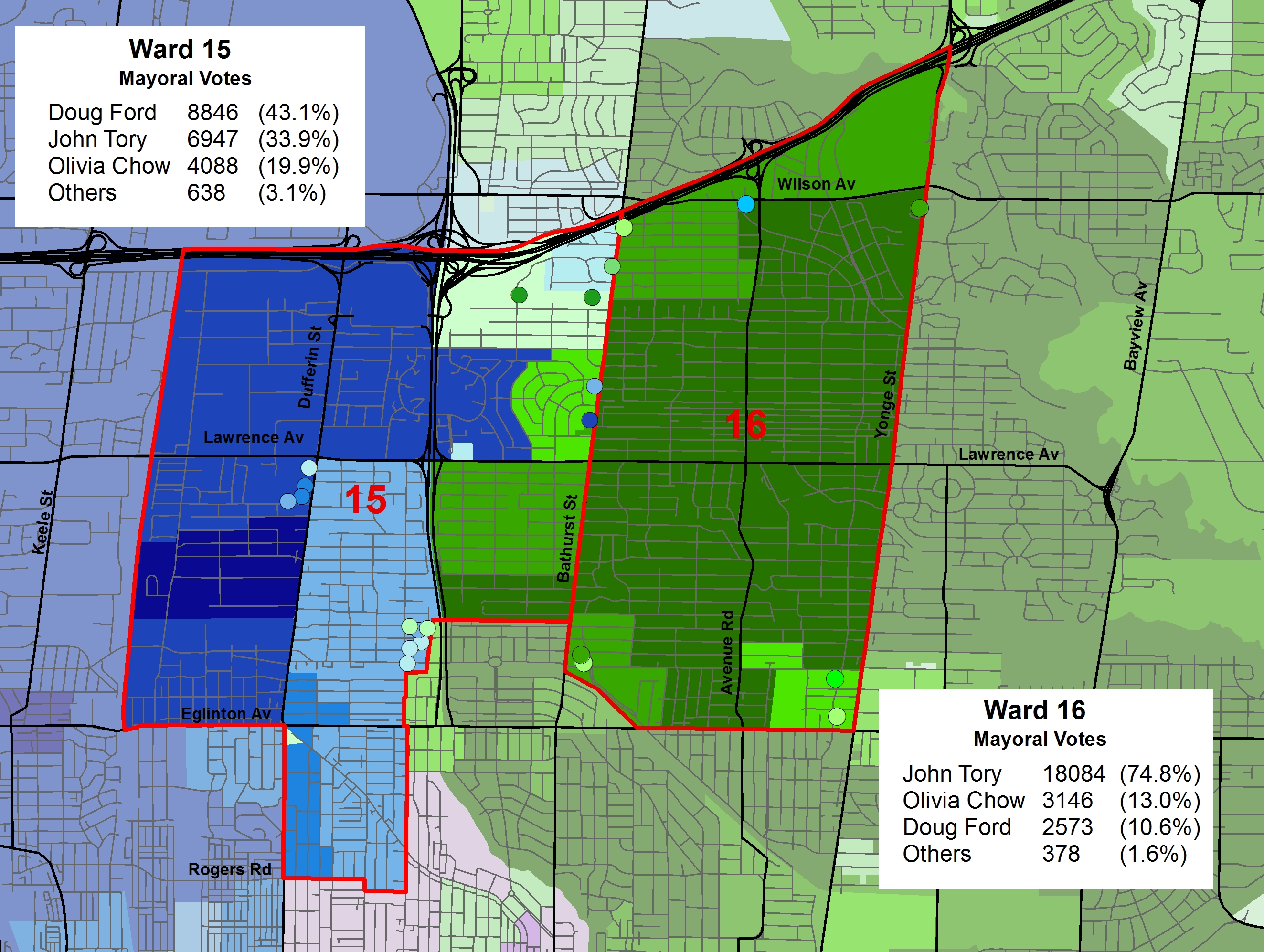
 Map of the mayoral race in Wards 15 and 16, Eglinton-Lawrence
The second set of maps I posted on Twitter was the results for Ward 16, which had an interesting council race. In this post, I present poll results maps for both Wards 15 and 16; the two wards named. Eglinton-Lawrence. The name Eglinton-Lawrence comes from the federal/provincial riding that was split into two civic wards at Bathurst Street. This post covers both wards.
Bathurst Street represents an important east-west divide on the electoral map. It separates several affluent North Toronto neighbourhoods to the east (such as Lawrence Park) and relatively lower-income neighbourhoods to the west. In 2010, the average household income in Ward 15 was $71,529, slightly below the city’s average; in Ward 16, it was $175,528, the second highest in the city. Ward 15 contains the large Lawrence Heights TCHC housing development and has a larger proportion of immigrants than its eastern, wealthier, neighbour.
Tory won an astounding 74.8% of all votes cast in Ward 16. This was the highest ward-level result for Tory in the last election and the largest winning margin of any mayoral candidate. Olivia Chow came in a very distant second place with 13.0% of the vote, and Doug Ford placed third, taking only 10.6% of all votes cast. Only one poll, Poll 033, located in a TCHC building, thought differently and voted for Ford. On the other side of Bathurst, in Ward 15, Ford won a plurality of votes cast – 43.1% of the vote – and won 29 polls. Tory won mostly in polls on the eastern edge of the ward, closest to Bathurst Street, Ford won Lawrence Heights and every poll west of Dufferin Street.
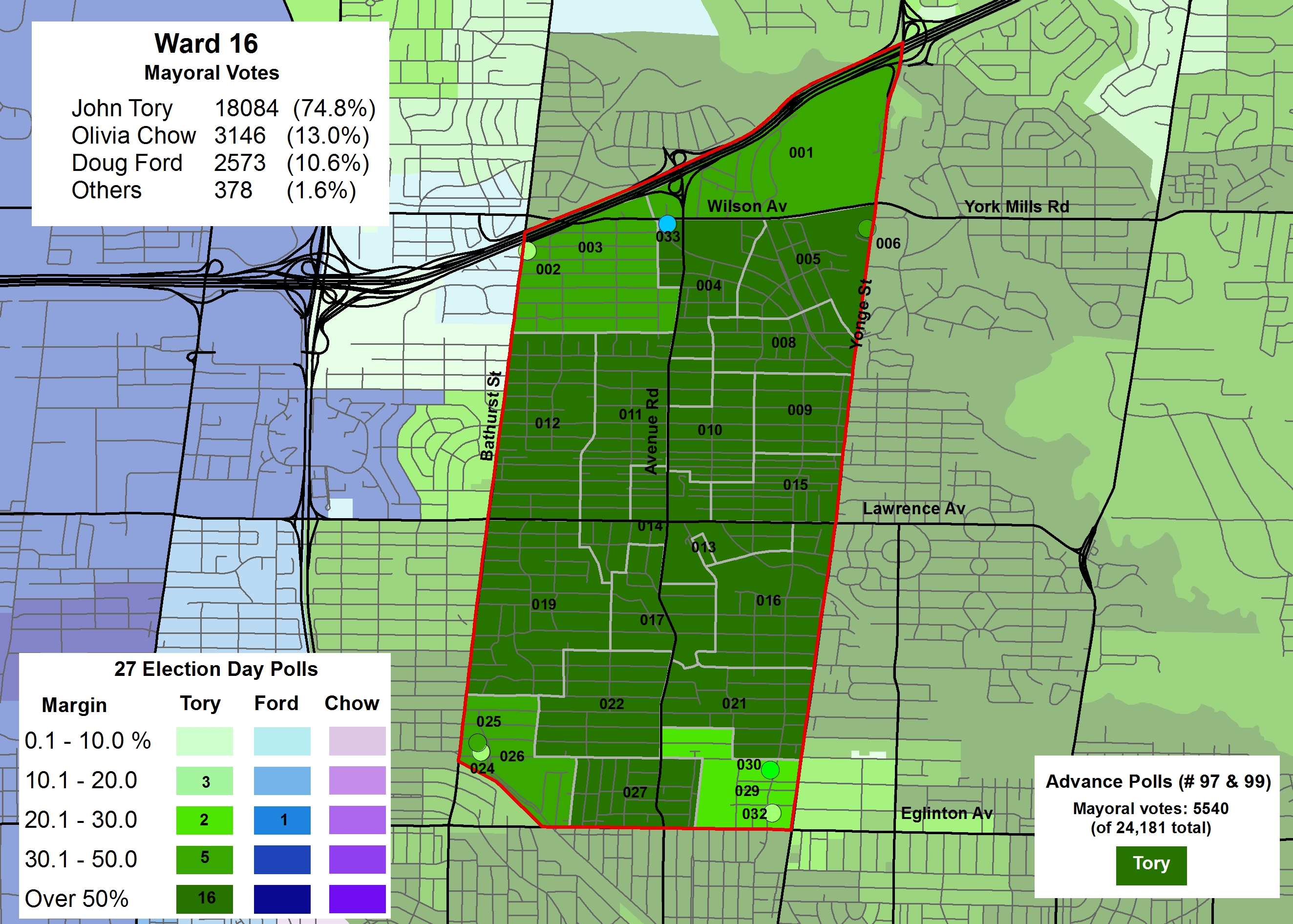
2014 mayoral race results in Ward 16
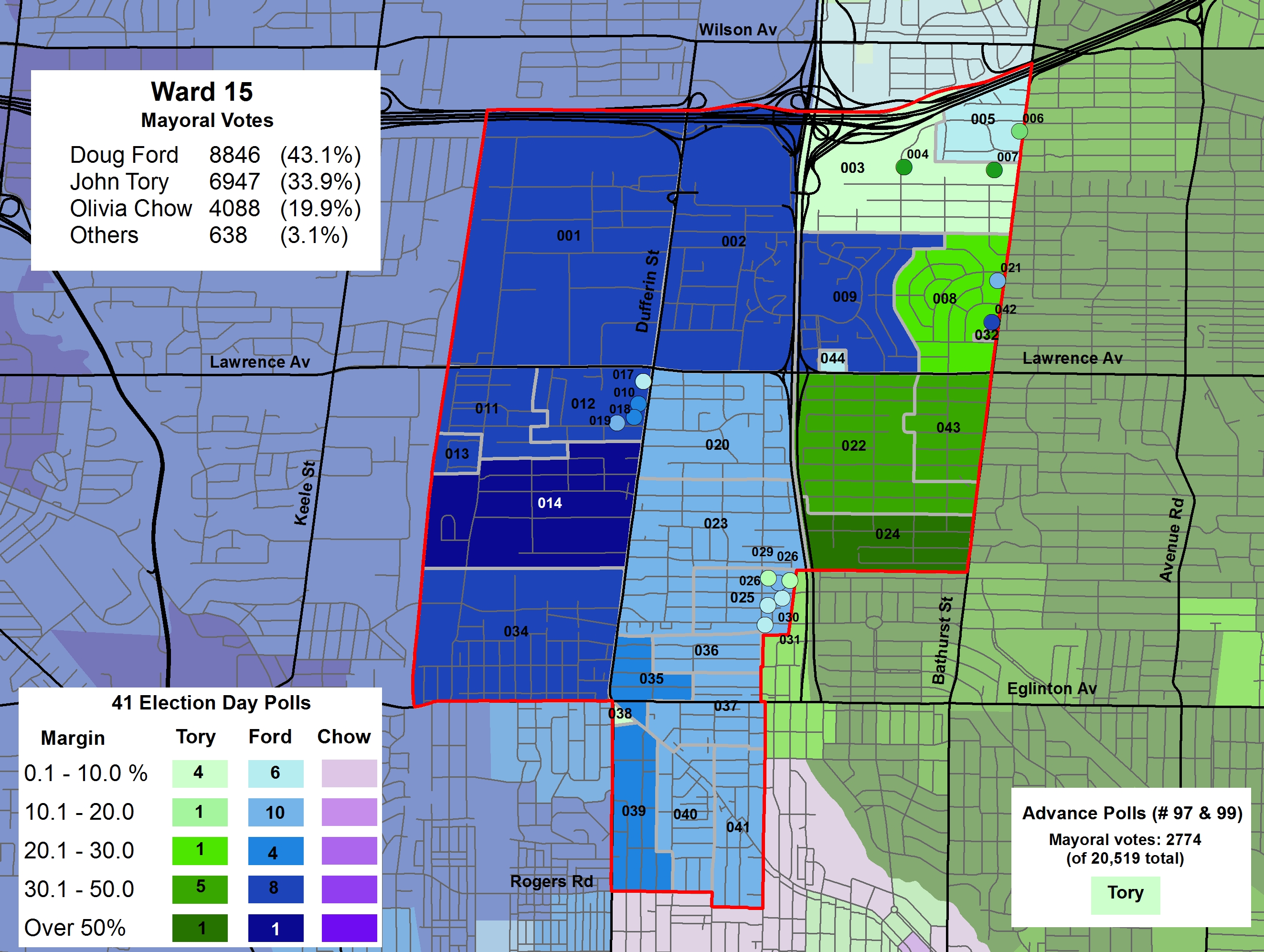
2014 mayoral race results in Ward 15


