This coming Monday, October 24, Ontarians will be electing new city councils. In Brampton, Ottawa, and Hamilton, the mayoral races should prove to be interesting. For Ottawa in particular, with Jim Watson stepping down, voters have a clear choice (and I’ll be cheering for Catherine McKenney). Though Gil Penalosa offers a new vision of a sustainable, active, and safer city, it’s very likely John Tory will win an unprecedented third term, the first to do so since amalgamation in 1998.
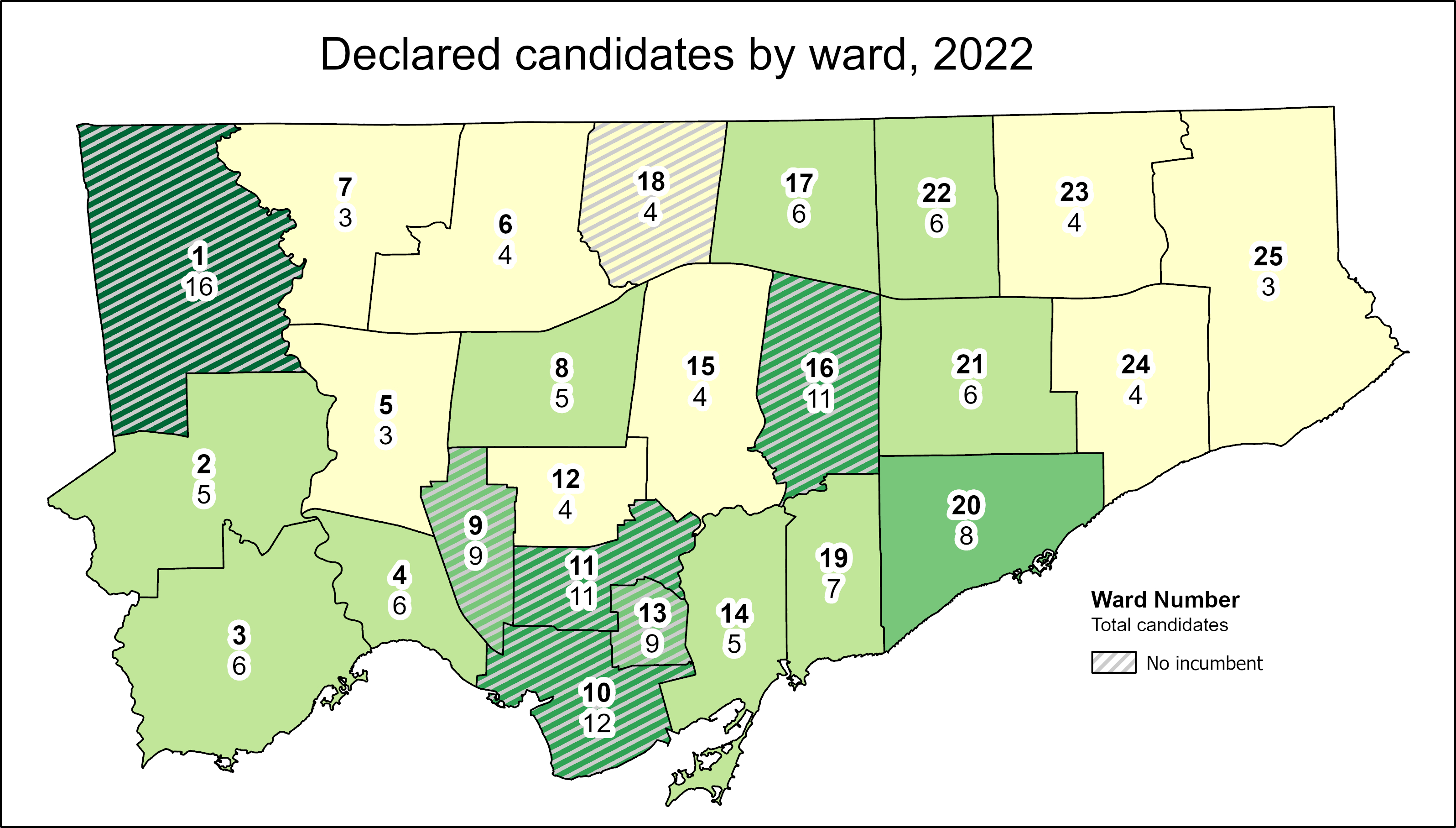
At Spacing Toronto, I have been offering some insights by mapping the state of our local democracy, ward by ward. Though there are seven wards in which no sitting councillor is running for re-election, the new council may not look too much different from the last one. That’s because two former councillors — Vincent Crisanti and Jon Burnside — will be looking to get back into office. Meanwhile, Mayor Tory has been busy campaigning for twelve candidates, including eight incumbents, that will help advance his agenda of incrementalism and austerity. Among Tory’s picks are Frances Nunziata, who has been in municipal office uninterrupted since 1988.
Here are the links to my posts at Spacing:
Open wards and the power of incumbency: The power of incumbency, and the mayor’s own influence, will weigh heavy on the final results. Though there may be seven “open” wards and a few more truly-competitive races, there is a lot happening behind the scenes to favour certain candidates.
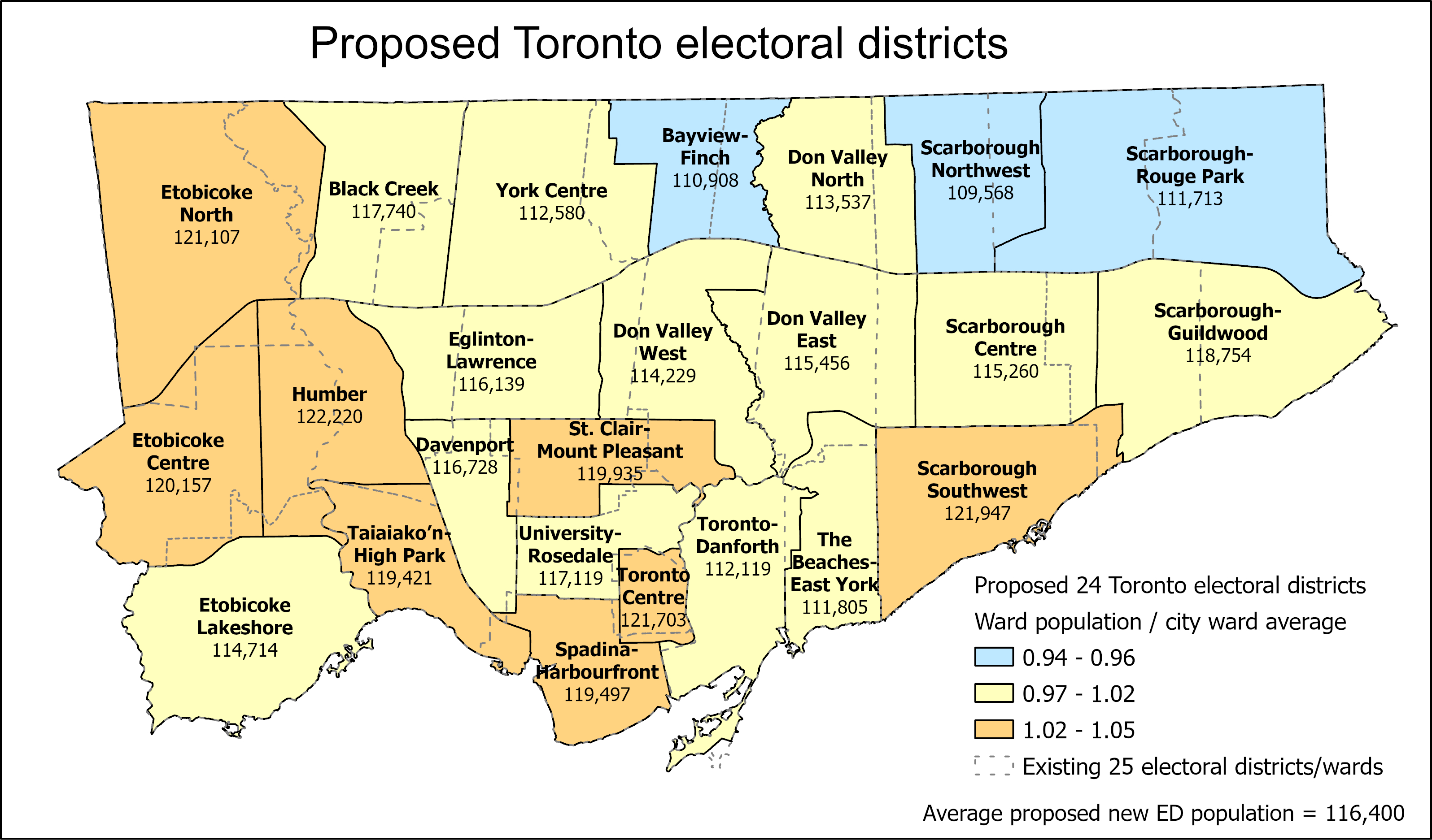
Population disparities between Toronto’s 25 wards: How ward boundaries that were drawn in 2013 have exasperated imbalances in population, leading to burnout in high-growth wards (with several downtown councillors deciding to move on). If Toronto continues to be forced to use federal/provincial riding boundaries, it will have just 24 wards in the 2026 election.
What Toronto’s new ward boundaries might look like
Toronto is a highrise, rental city – unlike City Council: Though nearly half of all Torontonians live in highrise dwellings and/or rent their homes, Toronto City Council is made up almost entirely of homeowners. In only a few wards, detached houses make up the vast majority of the housing stock and homeowners dominate. I ask why city council doesn’t reflect the way an increasing number of us live. The interest in this post had me on CBC Metro Morning for the first time, early on September 30.
Duelling campaign endorsements: Though Mayor John Tory has supported a few candidates before (most notably, Etobicoke councillor Mark Grimes), this time, he’s actively campaigning with twelve allies. Meanwhile Progress Toronto is backing nine challengers, focusing on races where it hopes to help get new faces elected.
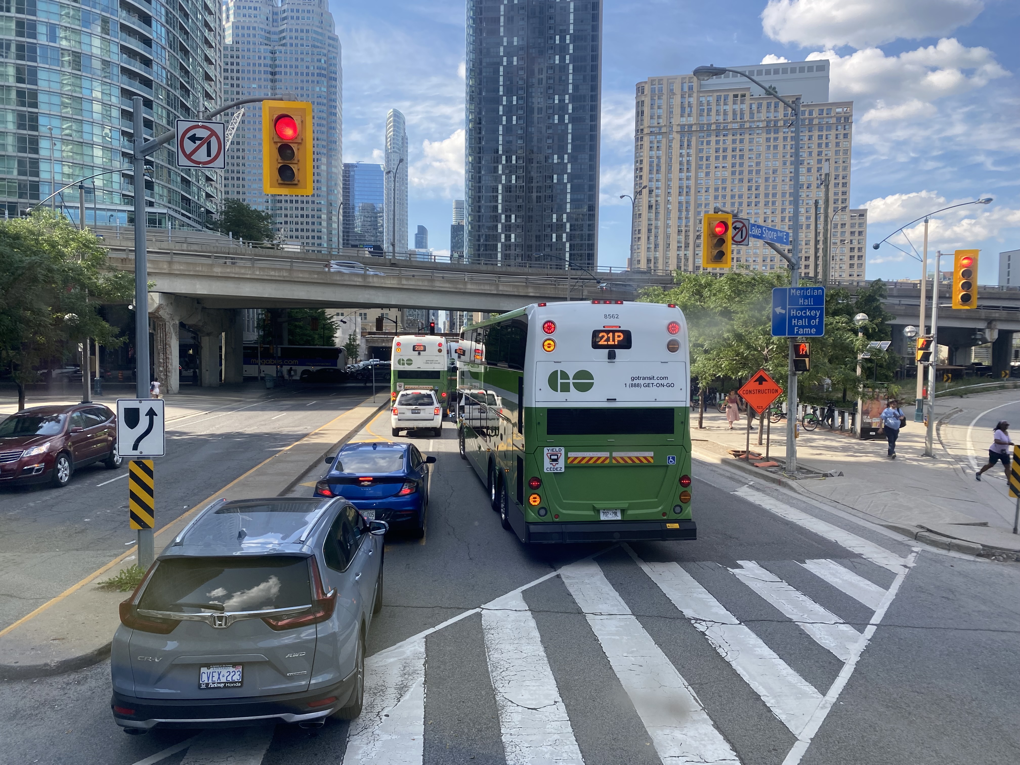
GO Transit buses stuck in Downtown Toronto gridlock in July, 2022
While travelling through the Northeastern United States this spring and summer, I found myself feeling lucky to be living in Toronto. Though the New York City Subway and the PATH trains between New Jersey and Manhattan were operating pretty much as I remember them, in other big cities, the mass transit systems were in rough shape. In Washington, underfunding and incompetence led to the long-term withdrawal of over half of its Metro cars. During our visit in April, we were treated to long waits and crowded trains, though at least the system was clean. When we visited Philadelphia in late June, it was clear that the Southeastern Pennsylvania Transit Authority (SEPTA) had given up: poor communications, lengthy waits, unsafe subway stations, and general apathy among staff and passengers made my spouse and I resort to driving on our last day there.
In Toronto, at least, the subway was still running frequently (with only minor service cuts due to the pandemic), the buses and streetcars as (un)reliable as ever, and despite more anti-social behaviour on some of its surface routes, I almost never felt afraid for my well-being when riding the Rocket, compared to my experience in Philly. GO Transit responded to the pandemic very well. Though it was forced to suspend many of its train and bus trips due to a sudden plunge in ridership, it maintained a basic service level on nearly all of its routes, slowly restoring certain services in 2021 as ridership slowly rebounded. Some corridors, like the Kitchener Line, had more service in the early Fall of 2021 than it did prior to the pandemic. As Metrolinx continued planning and construction of major transit projects like GO Expansion, the Ontario Line, and several LRT corridors, the future looked bright. In Spring 2022, GO Transit introduced a special weekend day pass for $10 per day or $15 per weekend, to help grow ridership.
Unfortunately by late June 2022, GO began to fall apart.
Looking north from Lake Ontario up Hurontario Street in Port Credit
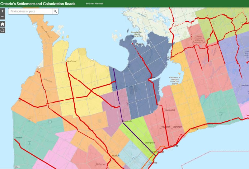
Ontario’s first roads were trade routes established by First Nations, including the Toronto Carrying Place, which linked Lake Ontario, Lake Simcoe, and Lake Huron. These routes followed the topology and existing water courses, making navigation simple and avoiding steep hills. Many modern streets, such as Toronto’s Davenport Road, follow these old trails.
With the establishment of the British colony of Upper Canada, new roads were established that took straight lines, instead of following existing trails or the lay of the land. Governor John Graves Simcoe named two of these routes — Yonge Street and Dundas Street — after British officials. Though Yonge and Dundas Streets were established for military purposes, they soon became used for settlement.
Hurontario Street — a portmanteau of “Huron” and “Ontario” — was among the first of a new wave of roads laid out by colonial officials, established for settlement purposes. These colonization roads were built across southwestern and south-central Ontario and became the basis for the concession land grant system that forms the grid of country roads and arterial avenues throughout Southern Ontario.
Other roads surveyed and built in this period included Simcoe Street, which connected Lake Ontario (at Oshawa) with Lake Scugog (at today’s Port Parry); Brock Road, which ran between Hamilton Harbour and Guelph with branches towards Lake Huron near modern-day Port Elgin (Elora Road) and towards Owen Sound (Garafraxa Road). Huron Road led west from Guelph towards Goderich through lands held by the Canada Company.
Hurontario Street followed a nearly straight line north from Lake Ontario, perpendicular to the shoreline, with only a slight bend near present-day Orangeville to reach Georgian Bay at a perpendicular angle. Together with the Toronto-Sydenham Road, which branched off northwest towards Owen Sound, it quickly became an important route.
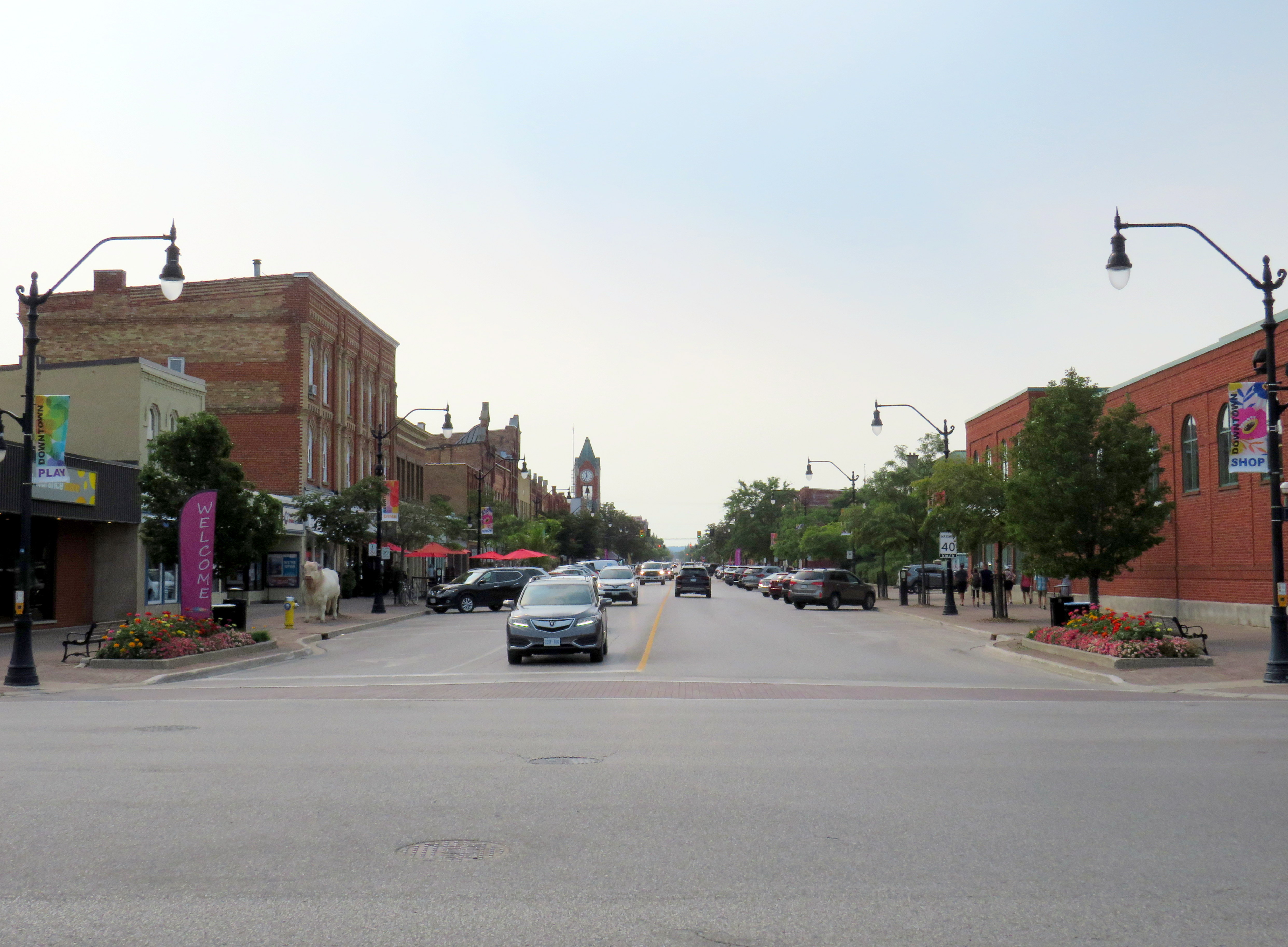
Taverns, villages, and towns were established along the way, including Cooksville, Buffy’s Corners (which incorporated as the Village of Brampton in 1853) and Collingwood. Collingwood proved to be an excellent harbour and became famous for its shipbuilding industry.
Looking south from Georgian Bay up Hurontario Street in Downtown Collingwood
But Hurontario’s straight trajectory was a problem. For the first 57 kilometres, the straight line was sufficient, as it followed a mostly flat route through present-day Mississauga and Brampton and climbed the Niagara Escarpment on a relatively gentle incline in Caledon. But through Dufferin and Simcoe Counties, the surveyed route went up and down several steep hills on the edge of the escarpment, including Hockley Valley and Boyne Valley. The final descent down the Niagara Escarpment towards Collingwood was very steep.
Early settlers were granted low-cost or free land grants in exchange for clearing and improving their land and maintaining the new settlement roads being drawn across southern Ontario. They rerouted troublesome segments of the surveyed roadways and either abandoned the surveyed road allotments or designated new survey lines for through traffic. In Dufferin County, traffic switched to the first concession line to the west, which offered an easier path towards Owen Sound. The Town of Orangeville was established where the route deviated.
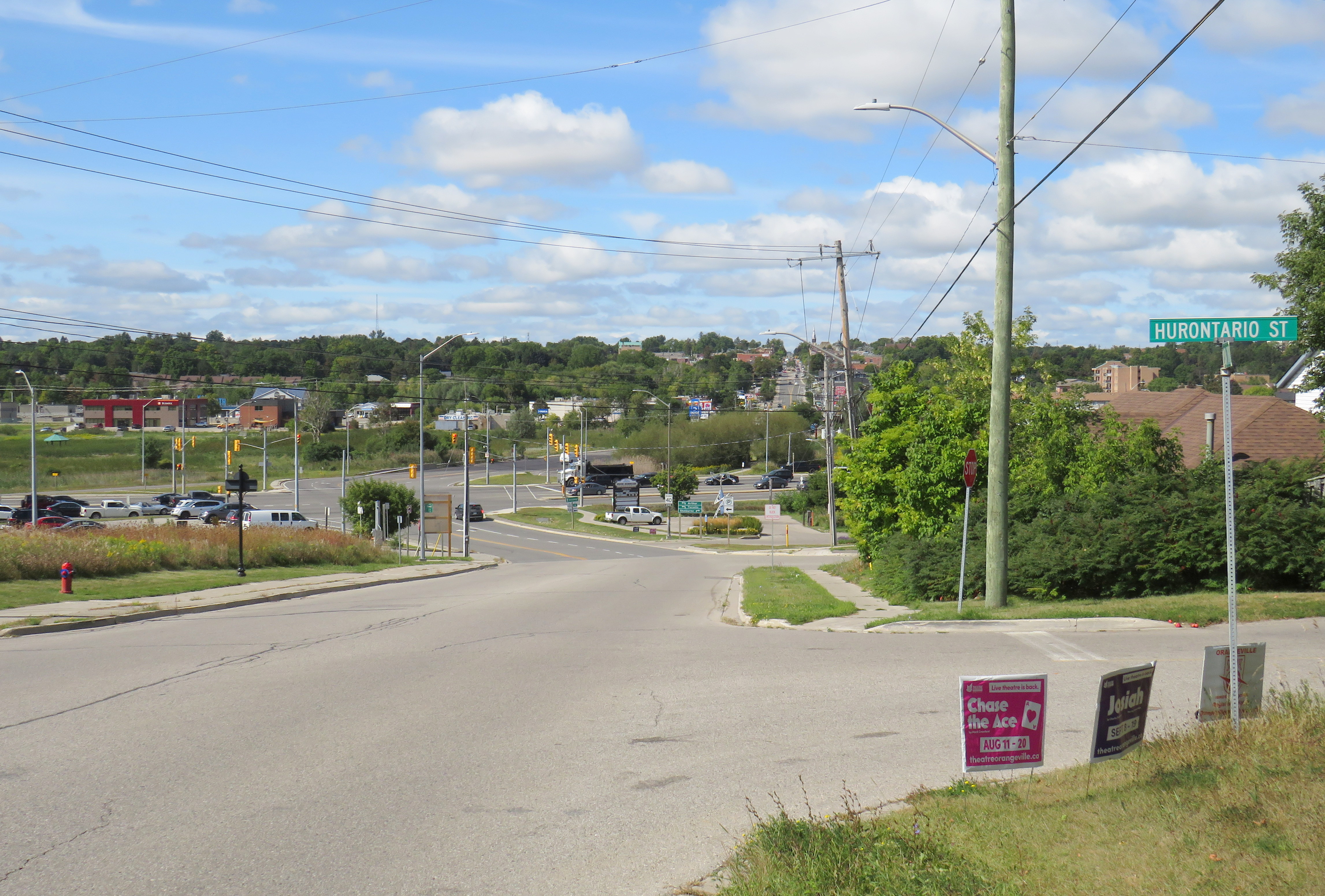
Hurontario Street on the eastern outskirts of Orangeville, crossing the old alignment of Highway 9. Highway 10 curves on a bypass around Downtown Orangeville in the background.
Like many early roads, Hurontario Street’s importance declined with the growing network of railways in Ontario. In 1855, the Ontario, Simcoe and Huron Railway reached Collingwood and the Great Western Railway opened between Toronto and Hamilton. The next year, the Grand Truck Railway opened its line through Brampton; the Toronto, Grey and Bruce Railway (TG&B) reached Orangeville 15 years later. Soon the TG&B built all the way to Owen Sound, closely following the Toronto-Sydenham Road.
Hurontario Street is a discontinuous dirt road north of Island Lake at Orangeville.
With the rise of motor vehicles in the 1920s, the Province of Ontario began establishing a highway network; the historical settlement roads became the foundation of this new system of roadways. Highway 10, one of the first 16 routes established by the province, followed the Toronto-Sydenham Road and Hurontario Street between Owen Sound and Port Credit, though it used the well-travelled First Line West through Mono Township, rather than the old, partially abandoned Hurontario Street alignment.
Highway 10 increased in importance through the 20th century, especially when Toronto’s postwar growth reached Mississauga and Brampton. Highway 410 was built to relieve congestion on Highway 10 and other nearby routes; by 2019, the new highway connected with the old route north of Brampton, and Highway 10 through Mississauga and Brampton was no more, once-again simply known as Hurontario Street except in the older part of Brampton, where it remains Main Street.
Meanwhile, the railways have fallen to the modern highway. The old TG&B, later acquired by Canadian Pacific, abandoned the Orangeville-Owen Sound line and its connecting branches by 1995. In 2021, the last train from Orangeville made its departure.
As Mississauga and Brampton continue to grow, a new light rail transit line is being built on Hurontario Street. In a deviation from Metrolinx norms, instead of honouring the road on which this line is built, the PC-led government decided to name the LRT after Hazel McCallion, the former Mississauga mayor who, despite leaving some challenging legacies, has had many publicly funded spaces named for her. Time will tell whether residents will adopt the new name or, instead, favour a name that reflects the historical and contemporary importance of Hurontario Street. My hope is that transit users will continue to use the 200-year old name they’re most familiar with.
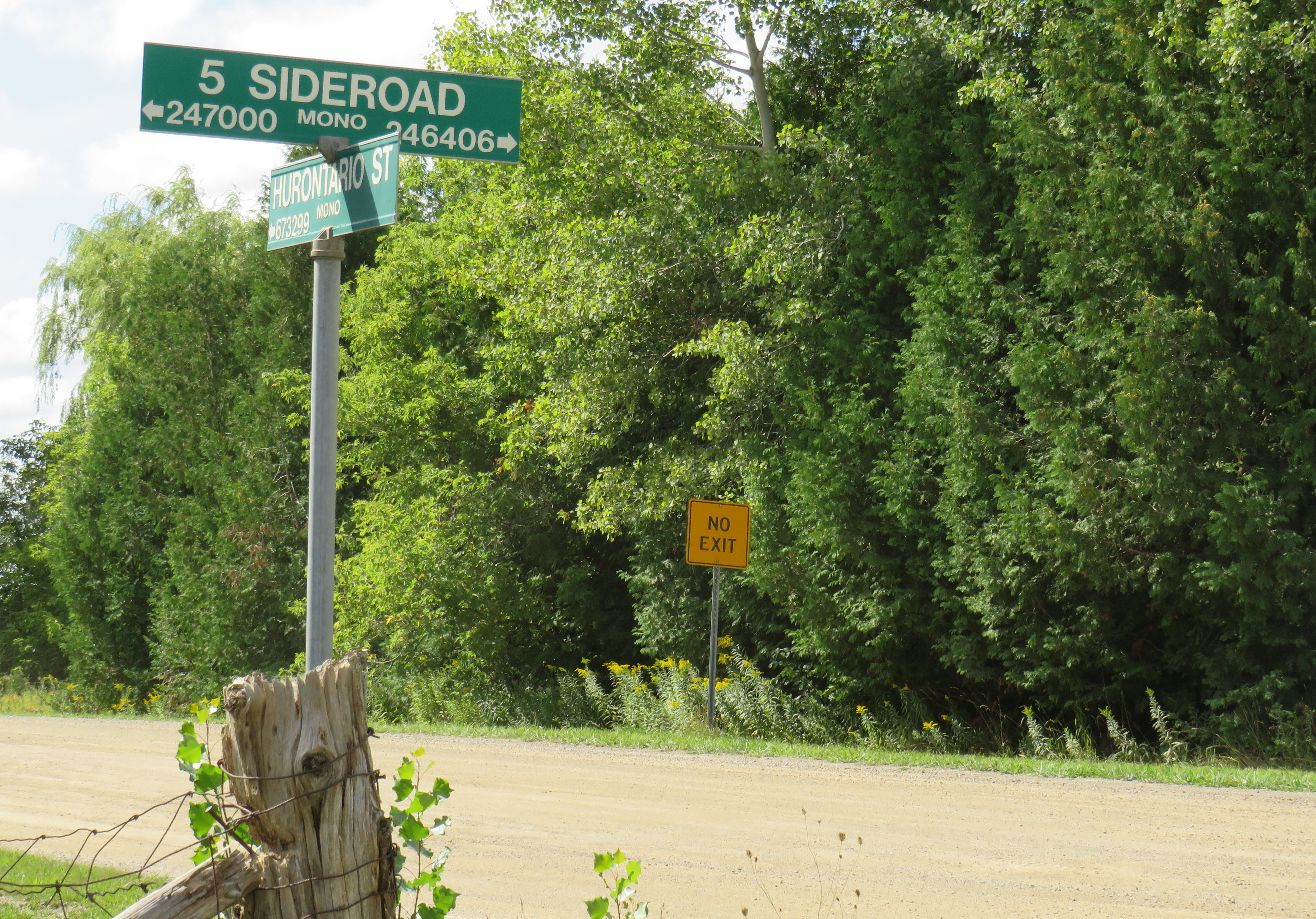
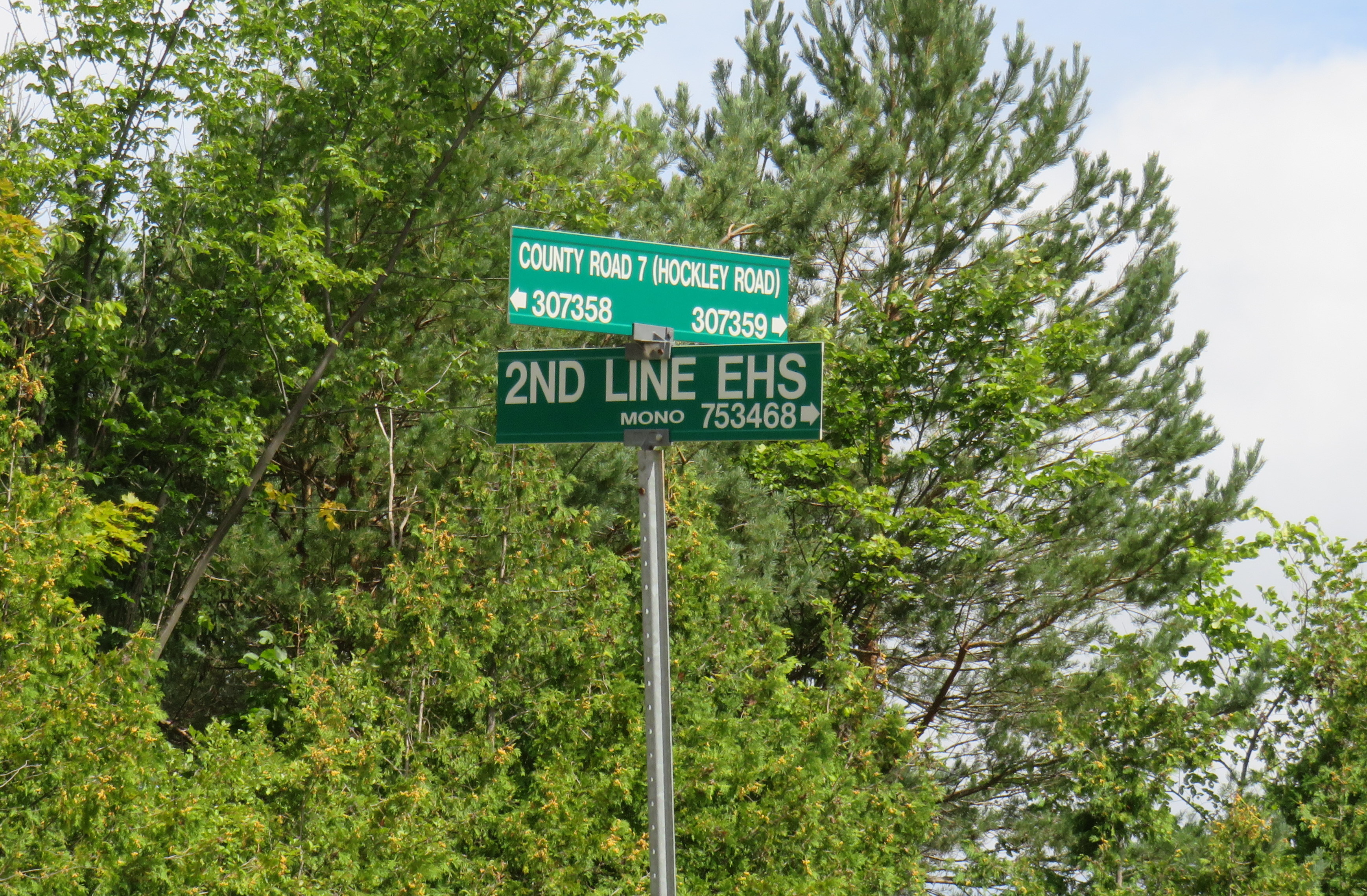
What does First Line West or 2nd Line EHS mean?
In Mono Township, the concession lines are numbered sequentially from how far east or west they are from Hurontario Street, which was the original basis for the land surveys. For example, 2nd Line EHS can be found two roads east of Hurontario Street. Highway 10 follows the first line west of Hurontario Street, a much gentler route than the original surveyed line. In the north half of Toronto Township (now the City of Mississauga), and in Chinguacousy and Caledon Townships (now Brampton and Caledon), these roads were similarly numbered before acquiring names. McLaughlin Road used to be known as First Line West, while Dixie Road used to go by Third Line East.
As the centre line of several townships, Hurontario Street was often known as Centre Road, especially in Toronto Township (Mississauga) and Mulmur Township. In Mississauga, where Highway 10, Hurontario Street and Centre Road were once used interchangeably, it now goes exclusively by Hurontario Street.
In Mono Township, north of Orangeville, 2nd Line E. H. S. can be found two survey lines east of Hurontario Street. Highway 10 follows 1st Line W. H. S. in Mono.
Hurontario Street and other settlement roads
As mentioned above, Hurontario Street was one of many early settlement and colonization roads established across the new colony, and later by the province. The first few roads, including Yonge and Dundas Streets, were surveyed and cleared by the colonial military as defensive routes first, but they quickly became important settlement roads. Roads such as Hurontario Street, established in the 1820s, had little military purpose, but became the basis for land surveys, which led to the establishment of townships and counties. Brock Road, Elora Road, and Durham Road are examples of these colonial settlement roads.
In some cases, private companies or individuals who were given large land grants established their own roads to attract settlers and trade; Huron Road and Talbot Road are examples of these.
Starting in the 1870s, the provincial government built new roads into less hospitable lands on the Canadian Shield, hoping to draw settlement further north as the supply of quality farming land was exhausted. In some cases, farmers were able to make a go of the marginal farmlands in northern Victoria, Hastings, and Lanark Counties, in other cases, the roads quickly fell into disuse. The Muskoka Road, built to Lake Nipissing, was a rare success: though there was little viable farmland along the route, it helped open up Northern Ontario for resource exploitation, tourism, and settlement. The Muskoka Road was upgraded in the 1920s and 1930s as the Ferguson Highway, before becoming part of Highway 11.
The map below shows the routes of Hurontario Street and many other settlement and colonization roads in Southern and Central Ontario, along with the township system that followed these corridors.
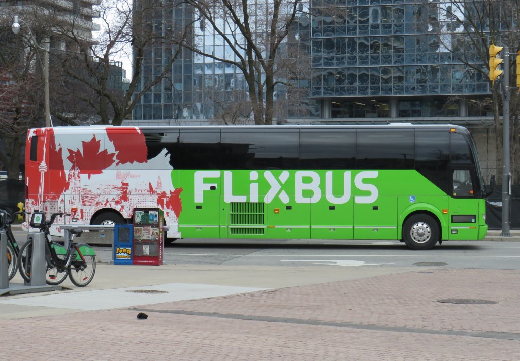
Flixbus is one of many intercity coach operators in Ontario right now
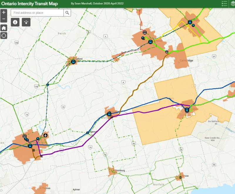
With university and college campuses reopening for in-class instruction, white-collar workers slowly returning to the office, and pandemic restrictions receding, there are more intercity transport options in Ontario than at any time prior to March 2020.
New operators, including Germany’s Flixbus, have arrived in Ontario (with routes between Toronto, Guelph/Kitchener, Niagara, and Ottawa), while Greyhound, which pulled out of Canada two years ago, restarted cross-border runs from Toronto, Montreal, and Vancouver. In Southern Ontario, intercommunity bus and van operations continued through the pandemic, with notable service improvements in Simcoe and Grey Counties, new routes in Eastern Ontario, as well as the expansion of “on-demand” services in rural communities and smaller urban centres, including parts of Niagara Region, as the regional government there slowly assumes responsibility for all municipal transit services.
Despite these advances, there are still many gaps in Ontario that need to be filled. The deregulation of Ontario’s motor coach industry has opened the highways up to more operators, but they are all chasing the same customers, rather than attracting new riders.
For getting between Toronto and Ottawa, passengers have a plethora of choices. They may fly — the fastest, but most expensive option — on Air Canada, WestJet or Porter. They may choose VIA Rail, which is comfortable, but slower. Or they may choose to book a ticket on a Megabus, Rider Express, or Flixbus coach, the slowest, cheapest, and least frequent option. (As of May 2022, only Megabus will begin operating daily buses between Toronto and Ottawa.)
Between London and Toronto, passengers can choose between a four-hour GO Transit train ride that departs at 5:33 AM, one of several daily VIA trains (approximately 2 hours), one of three daily Onex buses (2 hours, 35 minutes) or one of three daily non-stop Megabus trips (2 hours, 10 minutes).
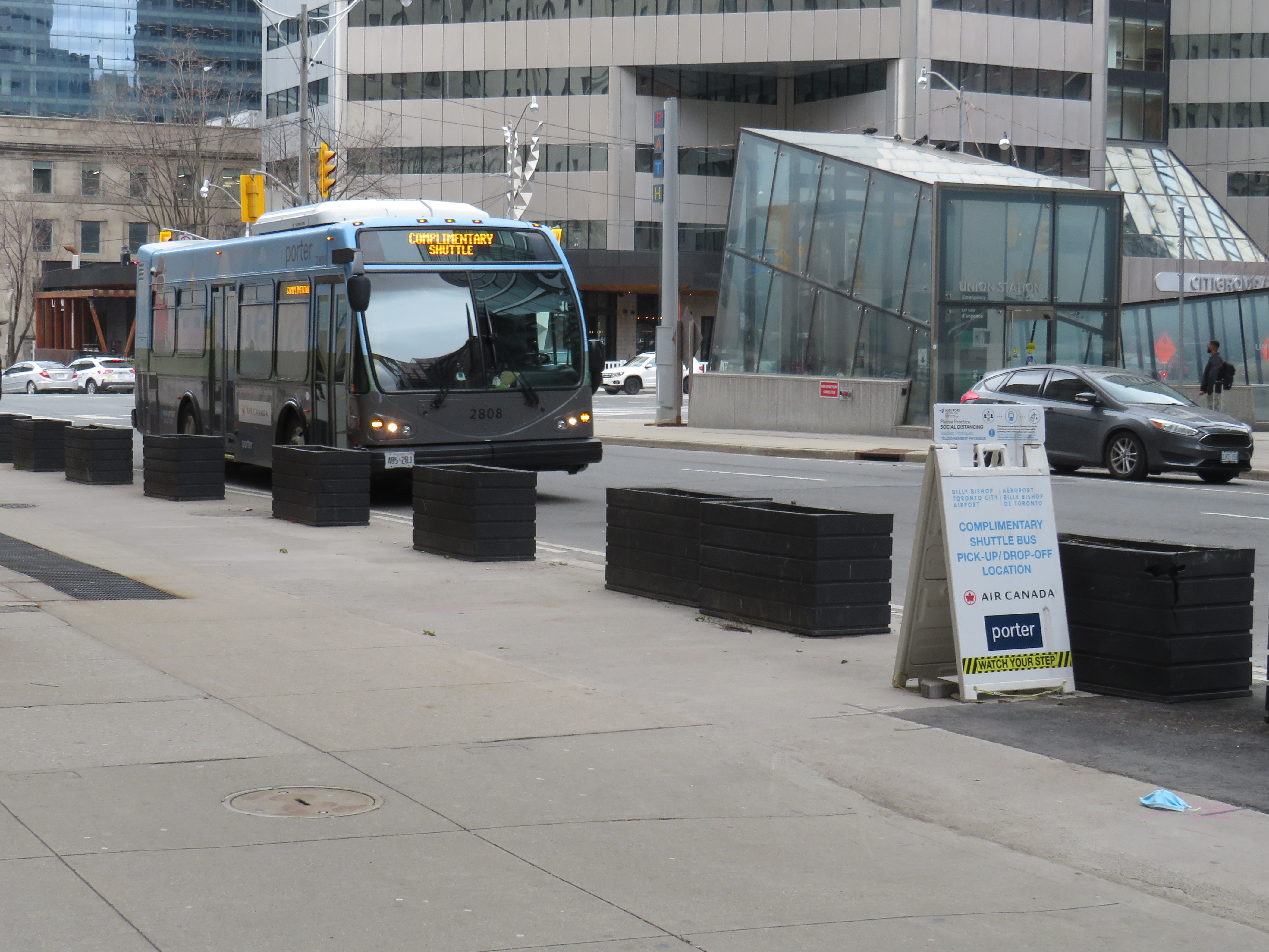
Not all bus operators serve the same locations, either, creating new disconnections. In Toronto, GO Transit, Megabus, Rider Express TOK Coach, and Greyhound USA use the new Union Station Bus Terminal, which is directly connected to VIA and GO trains at Union Station and the TTC subway and streetcar system.
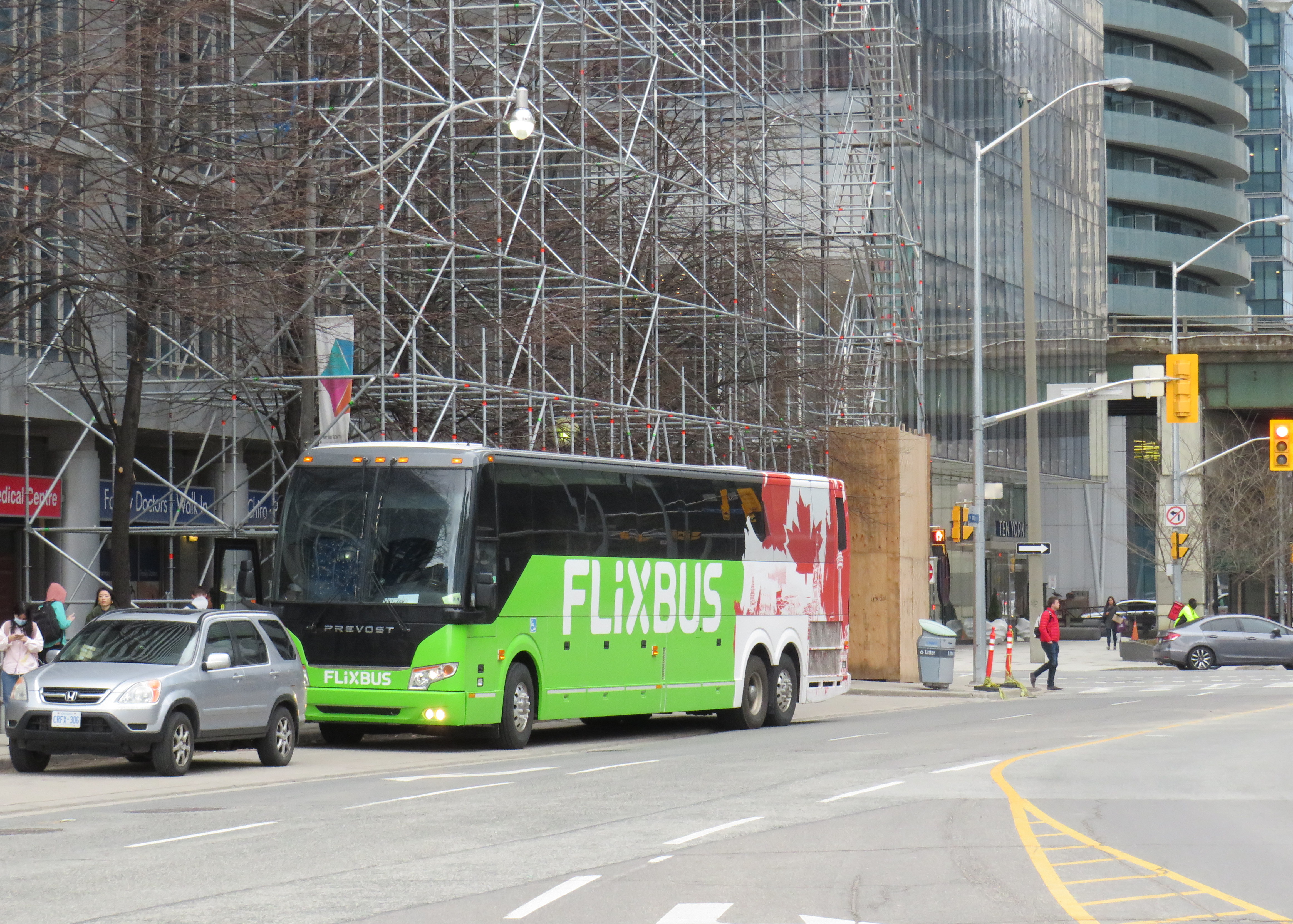
Flixbus stops at a curbside layby on York Street south of the Gardiner Expressway
To save on terminal fees, Onex stops beside the Royal York Hotel on York Street, across the street from Union Station, sharing the layby with the Toronto Island Airport shuttle. Flixbus uses a different coach bus layby on York Street south of the Gardiner Expressway, in the Harbourfront area. Neither curbside stop is marked for either company. Though Ontario Northland still sends some buses downtown to Union Station, some of its buses to and from Sudbury and North Bay now terminate at the Yorkdale Bus Terminal in North York.
The layby next to Royal York Hotel serves the Toronto Island Airport shuttle (which has a sign) and Onex bus (which has no bus stop sign)
In Ottawa, Ontario Northland and Orleans Express use the VIA Rail station (which is on the O-Train LRT system), while Megabus terminates at the St. Laurent O-Train station. Autobus Maheux and Flixbus use curbside stops in Downtown Ottawa. The London-Toronto Megabus route bypasses Downtown London on its route from Western University, while Onex Bus and VIA Rail stop right downtown, along with Strathroy-Caradoc’s intercommunity route.
Another issue is that apart from the Toronto-Kitchener-London, Toronto-Niagara, Toronto-Kingston-Ottawa, Toronto-Kingston-Montreal and Ottawa-Montreal corridors, there is still little choice in price, operator, or schedule.
Rider Express suspended service to Windsor last year, so that the three or four VIA rail trains to London and Toronto (or a flight from Windsor airport) are the only option available for anyone travelling without a car. (Transit Windsor’s Tunnel Bus to Detroit remains suspended, despite the continued loosening of border crossing restrictions.) Peterborough, once a major destination for Greyhound Canada on its Toronto-Ottawa corridor, now only has a nearly two-hour-long GO bus connection to Oshawa GO Station.
Gaps that I wrote about several years ago still remain on the map, which are only more evident as new intercommunity services start up and new carriers emerge. The City of St. Thomas and Elgin County remain the most visible of these gaps; St. Thomas is the only urban transit system in Ontario completely disconnected to any other community, despite its short distance to London. Haldimand County, despite its proximity to Brantford and Hamilton has also chosen to remain off the map. While neighbouring Perth, Lambton, Middlesex, and Grey Counties have developed useful transit connections, Huron and Bruce Counties have very limited links to the rest of the province.
Finally, the gaps between Hamilton and Brantford to the south and Guelph and Kitchener-Waterloo to the north remain to be filled despite the growing population and multiple post-secondary institutions in each urban area. Though the Hamilton-Guelph-Kitchener triangle should be a natural expansion for GO Transit, it has yet to announce its intentions. Meanwhile, no private coach operator has filled this obvious need.
The labour-backed Link the Watershed proposal would connect Guelph, Kitchener, Cambridge, and Brantford, but that plan requires the support of local government, but it still leaves the Hamilton corridor wide open.
As more students return to school full time, and more workers return to the office, the need for reliable and attractive transportation options across Ontario will only continue to grow. As housing prices to continue to increase higher than the already-high inflation rate, intercity transport will be one way to ensure students can stay at home while going to school, and workers don’t have to move or endure long and expensive highway commuting.
Hopefully by autumn, these gaps will finally close for good.
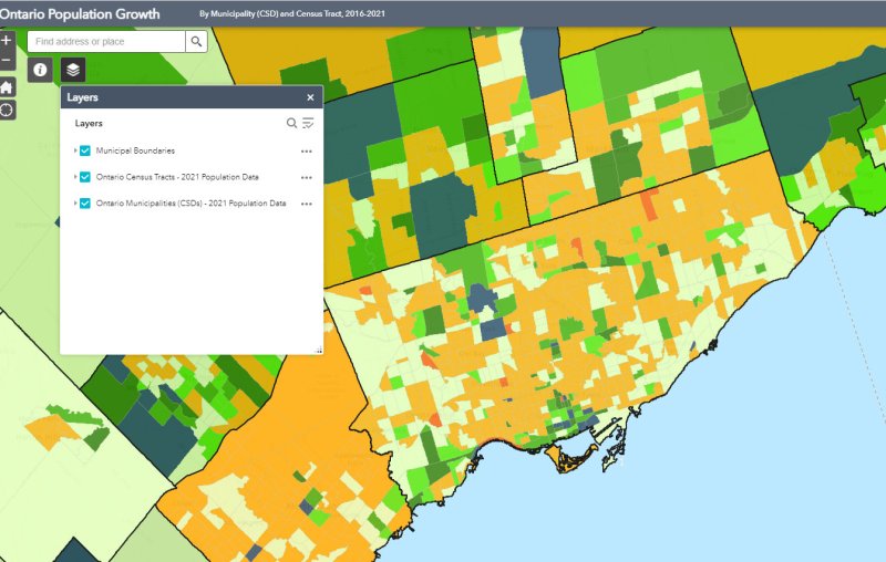
Despite new highrise development in its city centre, Mississauga lost 3,368 residents between 2016 and 2011
On February 9, data geeks across Canada rejoiced when Statistics Canada released the first round of data from the 2021 Census of the Population.
The data was released at all levels of geography made available by Statscan. At the federal level, Canada grew by 5.2% since the 2016 Census, with a total population of 36,991,981. Immigration, rather than natural growth (births vs. deaths) drove Canada’s population increase.
Of course, this growth did not occur evenly across the country. Newfoundland and Labrador lost residents, while Prince Edward Island and British Columbia saw the biggest population increases.
Within the Greater Toronto and Hamilton Area, Mississauga experienced population decline (-0.5%) for the first time since it became a city in 1974. Outer suburbs, such as Milton, East Gwillimbury, and areas just beyond the GTHA, such as New Tecumseth and Bradford saw population growth over 20%, driven by new greenfield development.
In older Toronto suburbs, including much of Etobicoke, North York, Scarborough, and even Mississauga, population losses at the local census tract level can be explained by ageing households, where Millennial and older Gen Z children moved out on their own, particularly into fast-growing downtown areas. These areas, dominated by single-family housing, could accommodate much of the GTHA’s growth with gentle density, including secondary suites (such as basement apartments), garden suites, and zoning policies that would make it easier and more economical to build “missing middle” housing such as walkup apartments and multiplex homes.
Toronto grew by 62,785 residents in the last five years, with only a few areas accommodating all that growth: the downtown core between Dufferin Street and Broadview Avenue, South Etobicoke, Yonge-Eglinton, and former industrial, instructional, and commercial lands stretching along the Highway 401 corridor through North York and West Scarborough. This corridor includes the Downsview Park development, a new condominium cluster at Wilson Subway Station, the former Canadian Tire lands near Sheppard Avenue and Leslie Street, and the intensification of the Fairview Mall area.
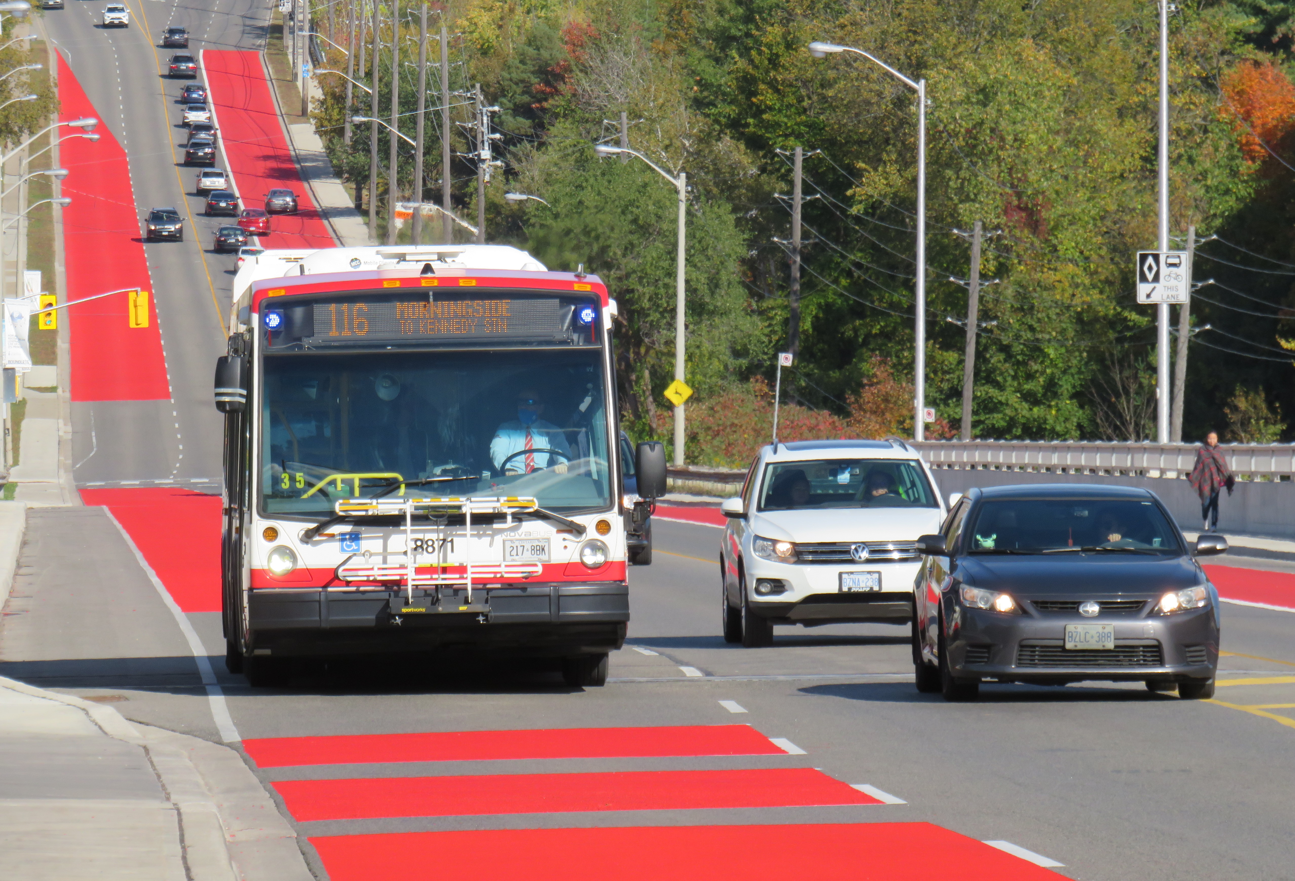
Route 116 Morningside was created in 1989, replacing a branch of Route 34 Eglinton East
On Sunday, June 20, the TTC will renumber two bus routes, Route 5 Avenue Road and 6 Bay. This change comes ahead of the opening of the Crosstown LRT and the Finch West LRT, which will be assigned those numbers, as they added to the city’s rapid transit network in the next few years.
Route 5 Avenue Road, in service since 1954, will become Route 13 Avenue Road. 6 Bay, which has existed since 1963, will be renumbered 19 Bay. Those follow similar measures in 2001, when the 2 Anglesey and 4 Annette routes were renamed to 48 Rathburn and 26 Dupont, respectively.
Though there are over 150 bus routes operated by the TTC, including express routes and all-night routes, the TTC was relatively late numbering all of its services. A consistent system for numbering bus routes did not exist until the late 1950s (though they did not appear on system maps until 1964), while streetcar lines were not assigned numbers until 1979.
Later, new series of route numbers were assigned to the overnight “Blue Night” network in the late 1980s, rapid transit lines in 2001 (just prior to the Sheppard Subway’s opening), and express bus routes only a few years ago. But for the regular service lines (those between 7 and 189), the numbers seem random — not grouped by geography, service type, or year each route was established.
In the late 1950s, though, when bus routes were numbered for the first time in 30 years, there was a system: numbers would be assigned in alphabetical order, with north-south routes given odd numbers, and east-west routes assigned even numbers.
Bus on Route 34 Eglinton East, in the late 1950s. City of Toronto Archives Series 648, File 29, Item 1.
Route 1, Armour Heights, was a short shuttle that ran along Avenue Road between the fare zone boundary at Roe Avenue (the end of the frequent 61 Nortown trolley coach) and Bombay Avenue, north of Highway 401. Route 2 Anglesey served several neighbourhoods in central Etobicoke. Route 96 Wilson remains a busy east-west route in North York, and Route 97 Yonge was originally a very frequent trolley coach route between the north end of the subway at Eglinton Station and the City of Toronto limits at Glen Echo Loop.
In 1964, the numbering system was still mostly intact, with two notable exceptions: 6 Bay, introduced one year earlier in 1963, was a north-south route. Route 17 Birchmount, introduced in 1960, broke the alphabetical order after Route 15 Brimley.
The opening of the Bloor-Danforth Subway in 1966 and major extensions in 1968 resulted in major route restructurings, and while the TTC tried to maintain the odd numbers for north-south routes and even numbers for east-west routes, that eventually came to an end, especially when further expansion required the use of three-digit numbers in the mid 1970s.
The interactive map below shows the full extent of the TTC’s service area in 1964, along with the municipal boundaries of that era, before Metro went from thirteen cities, towns, and townships to just six.
Link to interactive map
Though today’s regular service bus route numbers do not follow a specific pattern, recent changes to the night bus and express bus numbering systems have restored order to the numbering scheme.
Number
Route Type
1-6
Rapid transit lines (subway, LRT).
7-189
Regular local bus service
300-396
Night bus and streetcar routes, with numbers often echoing the daytime service (for instance, 329 Dufferin night buses follows the daytime 29 Dufferin bus’s route)
400-407
Community buses, offering ultra-local accessible services in selected parts of the city.
501-512
Streetcar routes. Streetcar route numbers were introduced in 1979, coincident with the introduction of the CLRV streetcars. The small area for destination signs in the new vehicles required numbers to be displayed instead of names for information to be legible.
600-699
Subway operations, internal use only. Previously, rapid transit routes were numbered in the 600-series, with Yonge-University-Spadina numbered 601, Bloor-Danforth 602, and Scarborough RT 603. Briefly, the Harbourfront Streetcar was branded as a rapid transit route and assigned number 604.
900-996
Express network bus routes, with numbers often echoing the regular service (for instance, 996 Wilson Express follows the local 96 Wilson bus’s route)
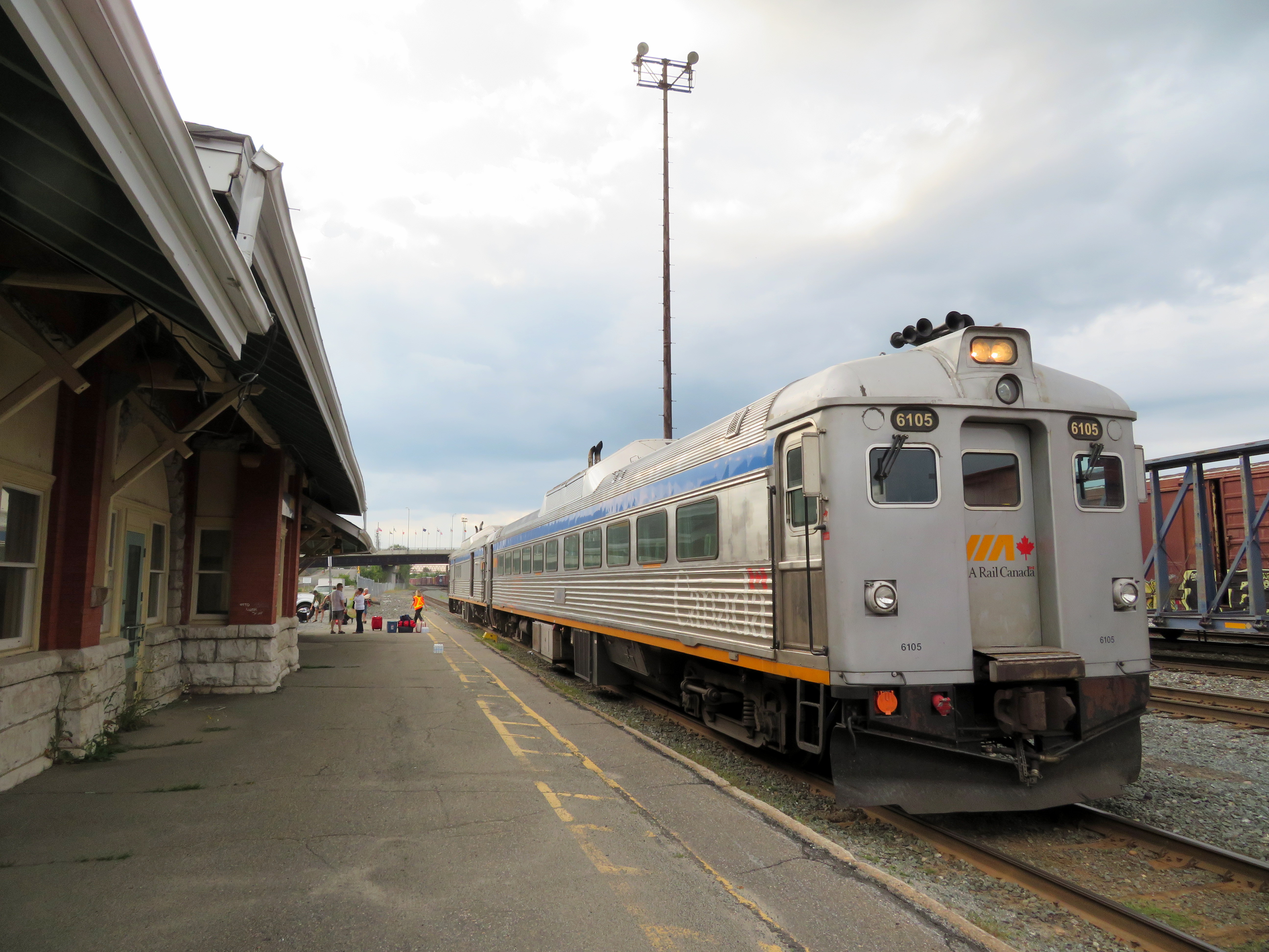
Rail diesel coaches (RDCs), introduced to Canada’s railways in the 1950s, were used on branch lines and in local service on busy mainlines through the 1980s. Today, they can only be found on VIA’s Sudbury-White River service, a remnant of the once-mighty CPR transcontinental network.
Updated December 18, 2023 as part of my interactive maps migration.
I recently completed a map of all Canadian passenger rail services that operated in 1955, from Whitehorse, Yukon, to St. John’s Newfoundland. As I wrote back in March, the decline in rail services in Canada can be attributed to a few factors: passenger train revenues were augmented by express cargo and mail, mixed trains, carrying both passengers and freight, were still justified in a time before trucks took over general industrial traffic. An incomplete highway network in northern Ontario, Newfoundland, and much of Western Canada also guaranteed healthy passenger demand in an era before jet travel became accessible to the masses.
The introduction of rail diesel coaches (RDCs), with their lower labour costs compared to conventional trains kept some branch lines going through the 1960s, but by the mid 1970s, neither Canadian National nor Canadian Pacific were interested in running passenger trains anymore; both were increasingly focused on bulk freight (grains, minerals, chemicals, finished automobiles) and intermodal container traffic.
VIA Rail took over most of CN and CP’s passenger trains in 1978, with direct government subsidies helping to fund its operations and capital expenses. By then, passenger train service was concentrated in the highly populated Quebec City-Windsor Corridor, but there were still three trains a day between Halifax and Moncton, two trains daily between Montreal and Atlantic Canada, between Winnipeg and Vancouver, and between Calgary and Edmonton. Scheduled bus connections, some even operated by VIA Rail, provided connections to places such as St. John’s, Fredericton, Charlottetown, and the Okanagan Valley.
Cuts imposed in 1981, 1990, and 2012 devastated the network. By 2019, there were only three trains a week in Atlantic Canada, two trains a week between Toronto and Vancouver. Even the Corridor saw cuts: there were five trains a day between Toronto, Kitchener, and Stratford, in 2019, there were just two. The only bright spots were an increase in the number of trains between Toronto and Ottawa and growing commuter rail networks in Toronto and Montreal.
A revised map, linked to below, depicts the passenger network in 1955 and in 1980, just prior to the 1981 cuts. Routes operating between Canada and the United States are depicted (CN, CP, New York Central, Delaware & Hudson, Great Northern, Northern Pacific, and White Pass & Yukon in 1955, Amtrak and White Pass & Yukon in 1980). More information on each route is available by clicking on the lines.
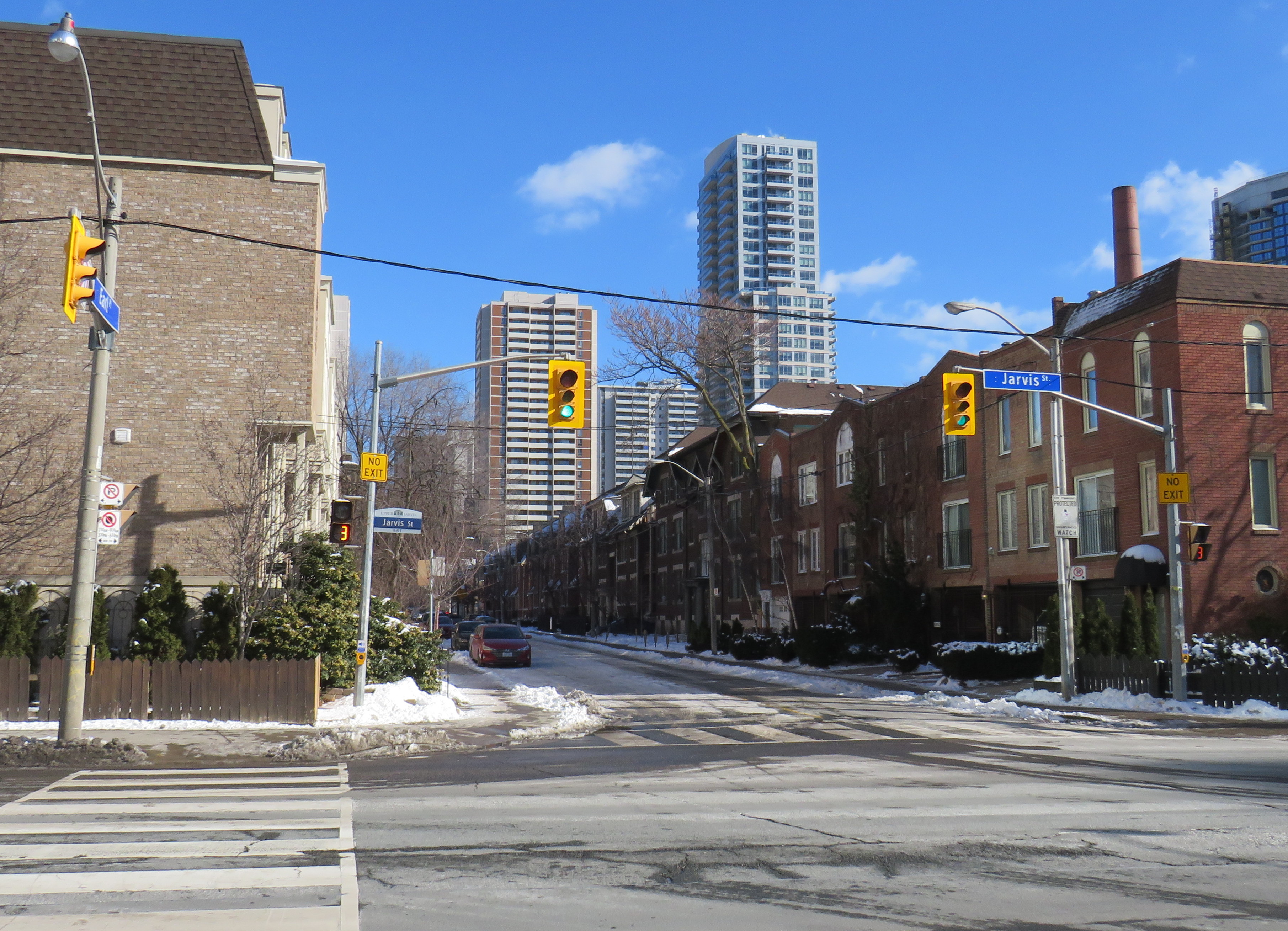
Misleading “no exit” signs, like these on Maitland Place at Jarvis Street, will soon be changed by the City of Toronto to indicate that indeed, pedestrians can continue through
Though these signs are required under traffic codes and regulations, they do not reflect that in many cases, there is an exit for pedestrians.
I quickly created a Google map of all locations in the City of Toronto marking such locations. Through a social media campaign led by Walk Toronto, we were quickly able to map over 450 locations where a pathway, sidewalk, or staircase allows a pedestrian to continue their way where motor vehicles are forced to turn around.
The motion, which was amended to strengthen the wording, requests city staff to develop a new signage standard to indicate where “no exit” signage betrays a pedestrian passage, and to begin installing these new signs this year.
Councillor Paula Fletcher’s motion (inspired by @Walk_TO) to have staff modify “No Exit” signage in places where there are, in fact, exits for pedestrians carries via show of hands, with some amended wording. https://t.co/owNfqtPgNUpic.twitter.com/eevn2bMwkN
The map that I created based on Dylan’s initial suggestion will be used to help identify these locations.
Given the ongoing pandemic, where we are all subjected to yet another lockdown, walking is one of the few permitted ways for each of us to get outside, enjoy the fresh spring air, and get much needed exercise. Knowing where one can walk, especially away from heavy traffic or busy sidewalks and paths, will only help unlock the city for more Torontonians.
I want to thank everyone who submitted locations for the map to Walk Toronto or to myself via Twitter or directly to me on this website. This couldn’t have happened without the help of fellow Torontonians.
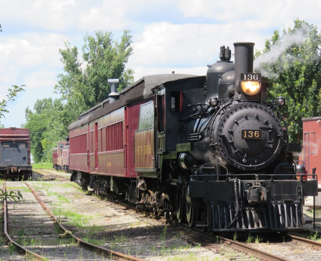
Former Canadian Pacific locomotive #136 hauls excursion trains at the South Simcoe Railway in Tottenham, Ontario
December 17, 2023: The complete map has been migrated to a newer ArcGIS Online account, on account of ESRI suddenly changing its monthly service account to charge bandwidth. That was a pay-as-you go account that helped me get re-acquainted with the ESRI ArcGIS Online platform before I set up a full online subscription to support a small business I co-founded in 2021.
However, I am happy to announce that I completed updates to the Ontario Intercity Transport Map and the 1955 Canada Passenger Rail Map, and that they are safely on a new subscription server at ESRI Canada. Please let me know if you have any suggestions or corrections to the maps, especially during the migration phase.
Sadly, passenger rail has faced a long, slow decline in Canada. Though commuter and regional rail systems in the Toronto and Montreal metropolitan areas have expanded tremendously over the last fifty years, rail service in general has declined in frequency, reliability, and even in speed. Prior to the COVID-19 pandemic, just six trains a day in each direction operated direct between Canada’s two largest cities, the fastest of those trains taking 4 hours 48 minutes to go 539 kilometres to get from Toronto to Montreal.
Seventy years ago, 28 trains on a typical weekday called at CN’s Hamilton Station, departing for Toronto, Niagara Falls, London, Guelph, Barrie, and Simcoe, with another 12 trains calling at the TH&B station on Hunter Street. In 2019, just six GO trains departed Hamilton for Toronto each weekday, with no direct connections even to Niagara, London, or Guelph.
There are several causes for the decline in passenger rail. In 1955, which the map below depicts, passenger train revenues were augmented by express cargo and mail, with the mail contracts alone helping to subsidize many branch lines. Lightly-travelled branch lines were served by mixed trains, which carry both passengers and freight. In Northern Ontario and Quebec, many highways were still of poor quality or unfinished — Highway 17 along the Lake Superior coast was not complete until September 1960. Construction of Highway 401 was just getting underway in 1955. In addition, the airline industry was still new, and air travel was expensive.
Improved highways drew more passengers to coach buses, while the move to trucks for cargo and mail deliveries made many branch lines unprofitable. Larger jet aircraft made air travel cheaper and more convenient for long distances. The major railways concentrated their energies on modernizing their freight networks, with CN and CP building new freight classification and intermodal yards outside of central Toronto, while focusing on bulk freight and shipping containers.
Though CN made efforts to win passengers back in the 1960s and early 1970s with new fare structures and equipment like the Turbo train between Toronto and Montreal, the government of Canada stepped in and took over most intercity passenger rail services in 1977. Though VIA Rail Canada acquired new modern locomotives and rail cars for the Ontario-Quebec corridor services, cuts to government subsidies made in 1981, 1989-1990, and 2012 forced further service cutbacks. British Columbia and Ontario also cut passenger services on their own rural railways.
I mapped the year 1955 for several reasons. I have CN and CP schedules for those years in my collection, while I found contemporary Ontario Northland and New York Central schedules online. It was also the year both railways inaugurated new transcontinental trains: CP launched the Canadian, while CN launched the Super Continental, luxurious diesel-hauled trains with modern sleeping cars and lounges. There were six trains a day leaving Montreal and Toronto for Vancouver that year. In 2019, there were just two trains a week.
In 1955, there were still many branch passenger and mixed trains in Ontario and Quebec, most of which were gone by 1965. Mixed trains were notoriously slow, though, but in many cases, there was a faster parallel highway coach. 1955 was also the last year for CP’s electric trains between Kitchener and Lake Erie, with the London & Port Stanley and Montreal & Southern Counties railways ending passenger runs a year later.
For Ontario and Quebec, I used Paul Delamere’s amazing Ontario Railway Map Collection and Quebec Railway Map Collection, adapting his work to identify those routes used by passenger trains in 1955, then mapping them on my own server. Mapping other routes was much more labourous.
Original version of interactive map
Please contact me if you have any suggestions, corrections, or other feedback.
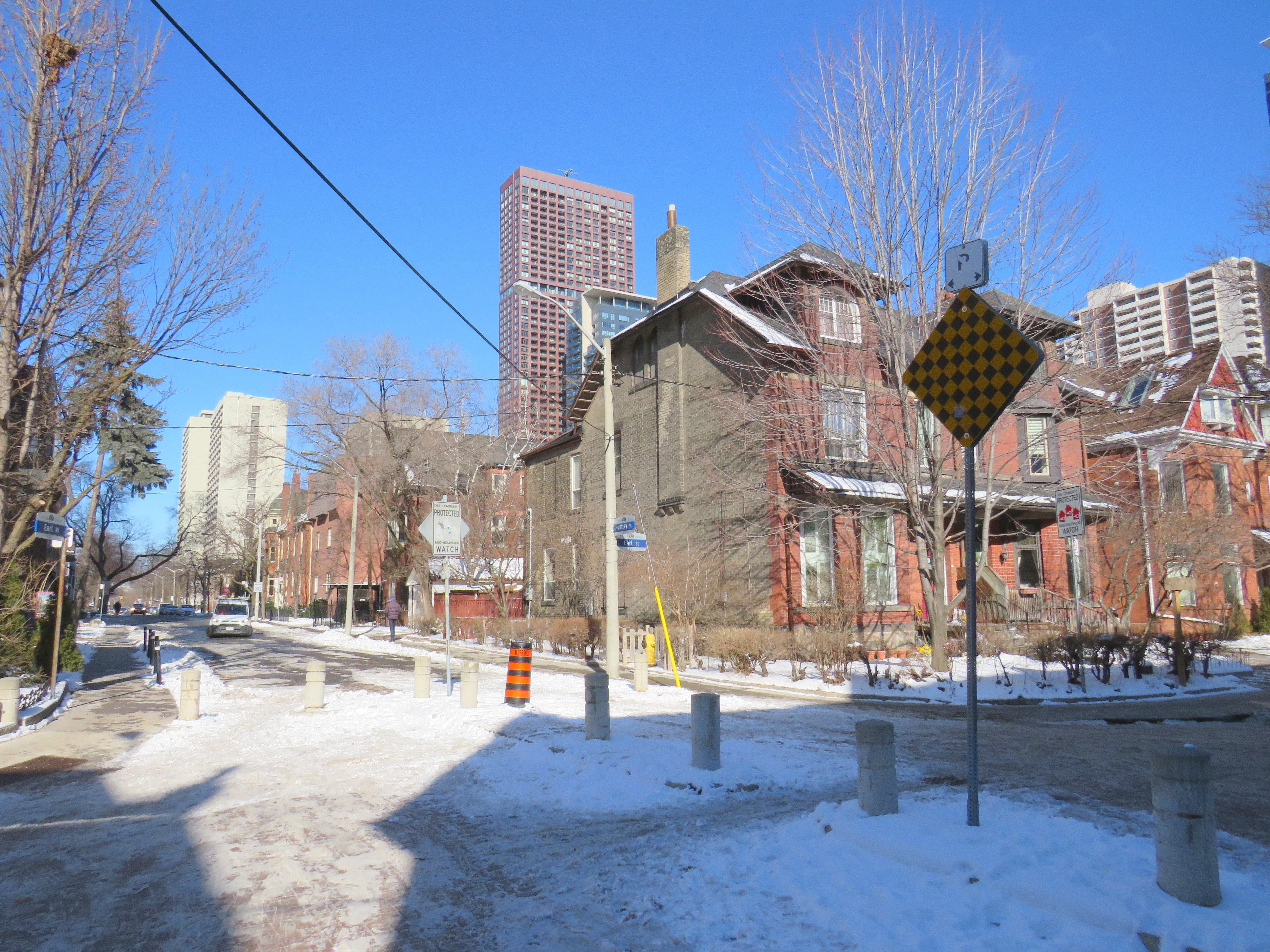
Earl Place, where “No Exit” signs betray through access for pedestrians and cyclists
Last week, Dylan Reid and I, both co-founders of Walk Toronto, decided to create an inventory of all instances in the city where “No Exit” signs do not apply to all road users. Though these signs are required under traffic codes and regulations, they do not reflect that in many cases, there is an exit for pedestrians. Some of those offer through passage for cyclists as well. We were inspired by a Twitter thread that expressed the frustration of getting around the city by foot, where signage is designed entirely for motorists.
Instances where pedestrians or cyclists may continue past a “No Exit” sign include traffic calming measures meant to keep out through motor vehicles on once-continuous roads. The intersection of Earl Place, Earl Street, and Huntley Street is just one example: curbs and bollards restrict motorists from continuing through, though a narrow passage allows cyclists to continue past; sidewalks also allow through pedestrian movement.
Earl Place and Huntley Street
In many other cases, suburban street designs, such as cul-de-sacs, limit vehicular movement though residential subdivisions, but narrow public walkways allow pedestrians access to parklands and neighbouring streets. In other cases, changes in grade between streets allow for a staircase, but not a through roadway down a steep hill. These are common in the Swansea, Baby Point, Silverthorn, and East Toronto neighbourhoods.
As of January 30, 2021, I have mapped over 250 misleading “No Exit” signs throughout the City of Toronto, though I know there are many more. Please send them to me via Twitter or via a direct message, and I will be sure to add your submission.
Our goal is to convince the City of Toronto to add signage recognizing where pedestrians and cyclists do have an exit. Perhaps too, this might inspire you to get outside, and walk around the neighbourhood, checking out passageways you might have not known about.