Tag: Ottawa

  • Ottawa’s Union Station problem

    Ottawa’s Union Station problem

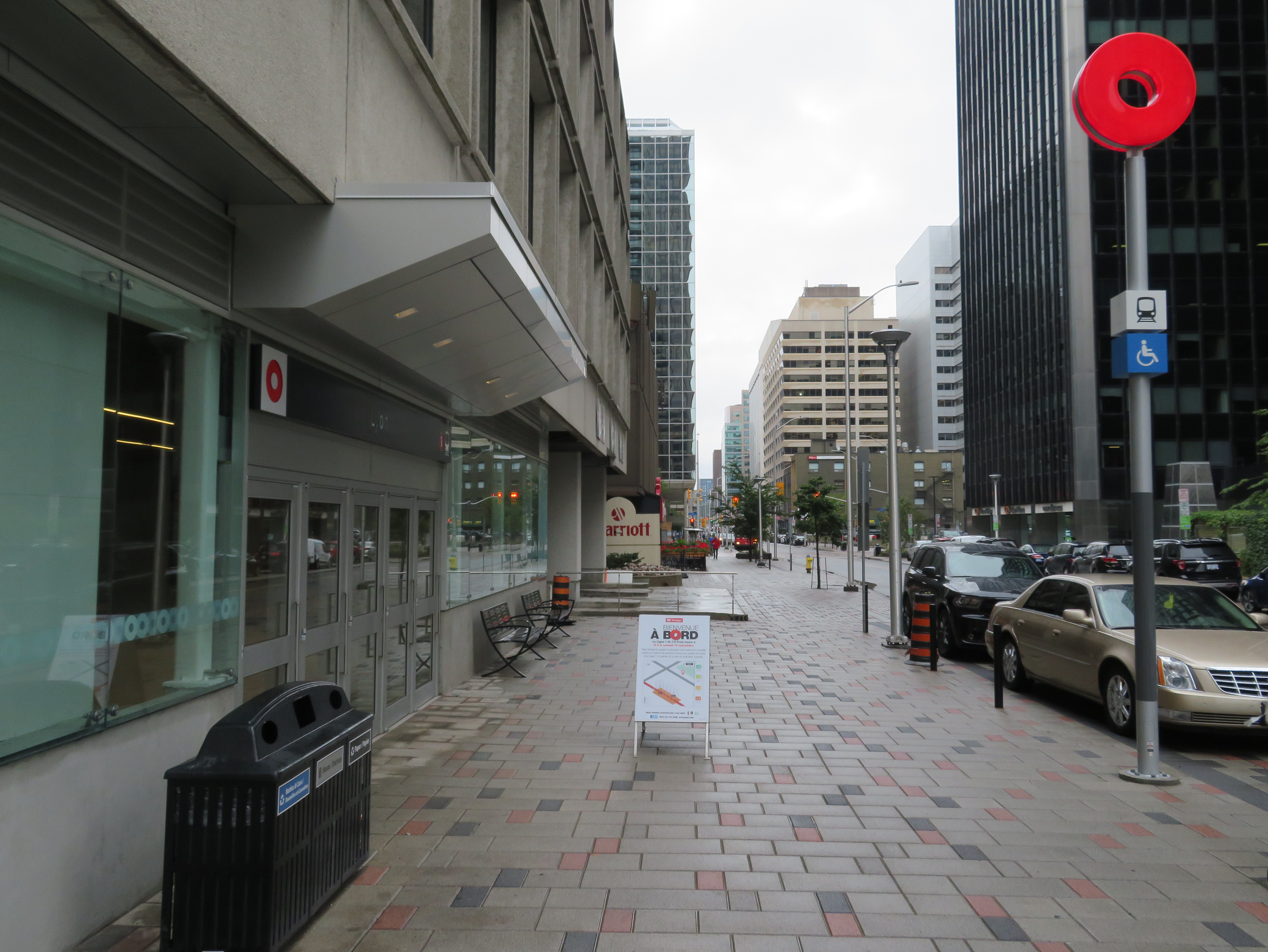
    Great Hall, Ottawa Union Station
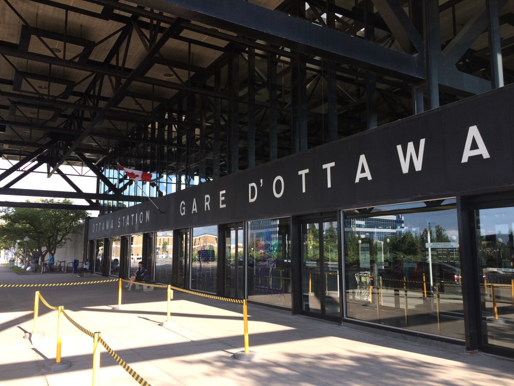
    Main lobby, Ottawa Union Station

    With planning now well underway for the Alto high speed passenger rail corridor between Quebec City and Toronto, there has been some speculation that Ottawa’s grand old Union Station, in the heart of the capital’s downtown core and a mere stone’s throw from Parliament Hill, could see trains again. Local business leaders and Mayor Mark Sutcliffe are excited by the idea of a downtown station, expecting that a downtown transport hub would help revitalize the local economy. Though it’s a very attractive idea, there are unfortunately just too many reasons why this would not be feasible.

    To understand why, it’s worth diving into the history and urban politics of railways in the National Capital Region.

    The decline and closure of Ottawa Union Station
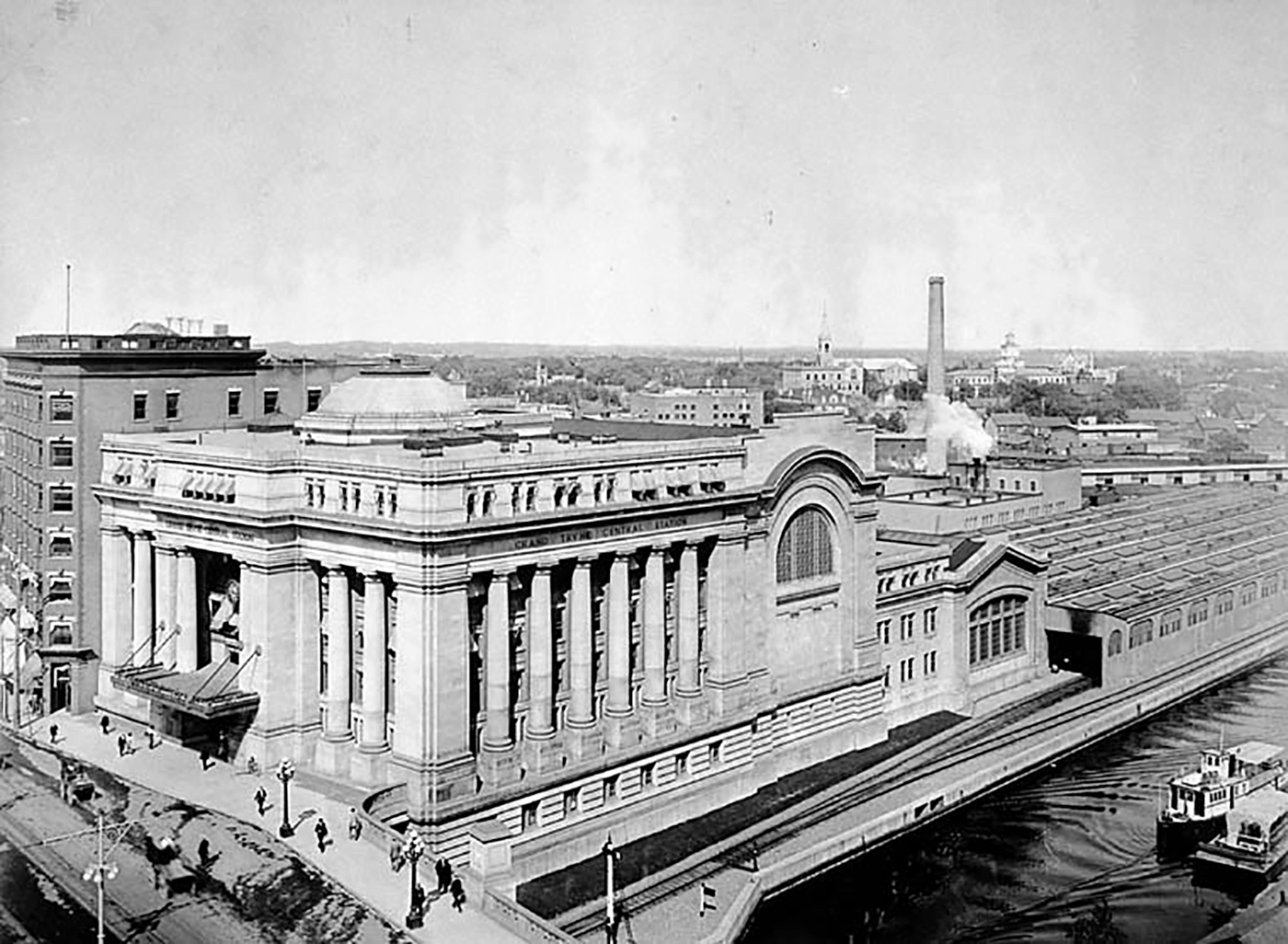
    Grand Trunk Central Station soon after opening in 1912 (Library & Archives Canada)

    The Grand Trunk Central Station, opened in 1912, provided a grand entrance to Canada’s capital city that was previously served by a few smaller stations just outside the downtown core. The station, designed in the Beaux-Arts style, was built as a stub-end terminal. This meant that trains would arrive and depart from the south and would have to be backed up to change direction. This suited the Grand Trunk Railway just fine, as it lined up perfectly with its route to Montréal via Alexandria (still used by VIA Rail today). The railway also built a hotel across the street — the Chateau Laurier — and connected the station with the hotel with a pedestrian tunnel.
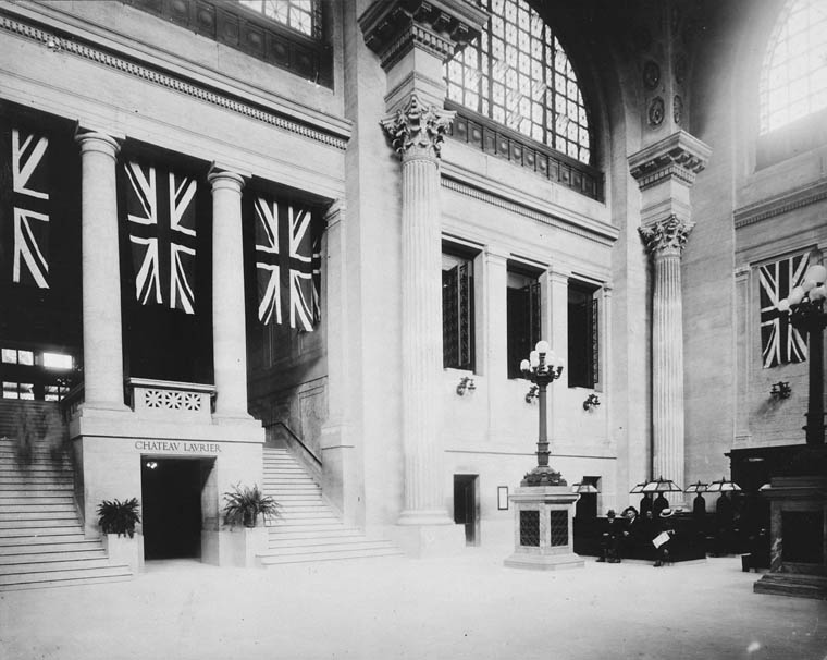
    Entrance lobby, soon after opening. Note the tunnel under the staircase to the Chateau Laurier. (Library & Archives Canada)

    The 1912 station was intermodal from the very beginning. Right outside the station’s front doors, there were Ottawa Electric Railway streetcar platforms serving several routes on Rideau and Sparks Streets, the two main commercial corridors in Downtown Ottawa. Right below the canal and railway bridge next to the station was the Hull Electric Railway’s loop; its streetcars crossed into Ontario via the Alexandra Bridge.

    Alexandra Bridge
    The Alexandra Bridge carried CPR trains, Hull streetcars, pedestrians, and motor vehicles when it opened in 1901

    Soon after opening, the Canadian Pacific Railway joined the Grand Trunk, resulting in the terminal being renamed Union Station; the short-lived Canadian Northern Railway (CNoR) soon followed. As the CPR’s tracks to Hull (via the Alexandra Bridge) ran next to the GTR’s station, it suited the CPR well. Unlike Grand Trunk, both the CPR and CNoR had direct lines to Toronto.

    Two platforms on the west side of the station allowed through CPR trains to continue towards the Alexandra Bridge and even return to Ottawa via the Prince of Wales Bridge to the west; this was the route the iconic Canadian train between Montréal and Vancouver took when it was inaugurated in 1955. Most trains — including all GTR and CNoR, however, terminated at the six stub-end tracks. Both GTR and CNoR were absorbed into the new Canadian National Railway (CN) by 1922.
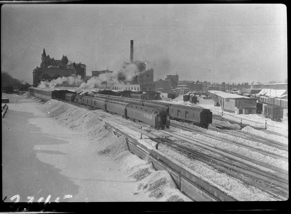
    Approach tracks and Bush trainshed, Ottawa Union Station. A wintery scene, with a frozen Rideau Canal on the left. The yards at right are now occupied by the Rideau Centre, Convention Centre, and Department of Defense Headquarters (Library and Archives Canada)

    In the 1940s, the federal government led by Liberal prime minister William Lyon Mackenzie King wanted to beautify the nation’s capital region and address traffic congestion. Ottawa — and the federal government — was rapidly growing, while political leaders wanted a cityscape that matched the ambitions of an expanding nation. French urban planner Jacques Gréber was commissioned to plan the region’s future; Gréber’s recommendations, released in 1950, were ambitious and transformative. (You can read the entire report here.)

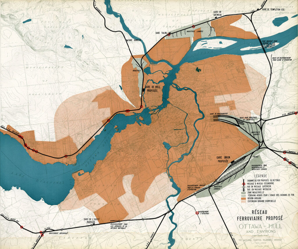
    The Gréber Plan — formally titled “Plan for the National Capital” — called for new highways, the abandonment of Ottawa’s streetcars (which were seen as antiquated with unsightly overhead wires), and the removal of all railway infrastructure within the City of Ottawa. The old CN and CPR lines would make way for new roads, including a four-lane arterial along the east side of the Rideau Canal, leading to a new road bridge replacing the Alexandra. A new railway bypass along the periphery of the city would replace all urban trackage, with a proposed new Union Station site in Gloucester Township, south of Walkley Road. Most industrial uses — including the historic paper mills along the Ottawa River — would be moved to the new railway line.
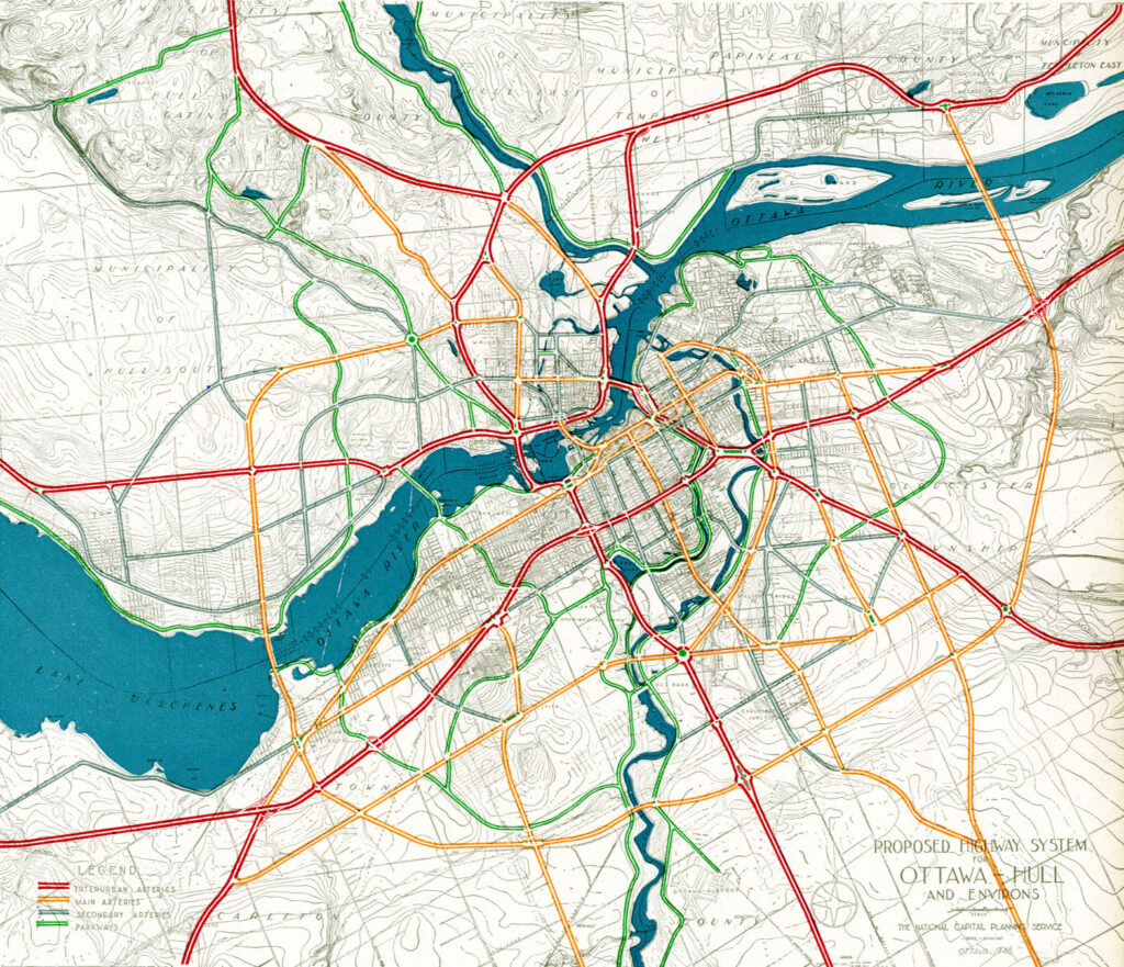
    Proposed highway system for Ottawa-Hull and environs, from Gréber’s report
    Proposed Railway system: Ottawa Hull and environs from Gréber’s report

    Though the plan was not fully implemented, it did set the stage for much of the urban planning and infrastructure changes during Ottawa’s next fifty years. The railway bypass was constructed between Bell’s Corners in the west and Ramsayville in the east, with the old Grand Trunk tracks through the city replaced with The Queensway, now part of Highway 417. New parkways lined the rivers and canals. Two new multilane traffic bridges crossed the Ottawa River (though the Alexandra Bridge was maintained for traffic and pedestrians) and Albert and Slater Streets were made one-way, with a new bridge over the Rideau Canal (the Mackenzie King Bridge) linking them to the east. A large Greenbelt encompassed the city region, intended to direct growth while preserving natural areas.

    Fortunately, the passenger station was relocated to a point much closer to the city centre than the Gréber Plan envisioned: the old CN and CP tracks along the Rideau River south of the city centre were kept in place but rerouted to serve a new modernist station that opened in July 1966. The new Ottawa Station, designed by John C. Parkin, is one-of-kind. The architecture invokes an airport terminal, with large, sheltered driveways and an airy open lobby/concourse, and was the last grand railway station built in North America. In 1966-1967, there were still two daily transcontinental trains departing from Ottawa Station, along with multiple trains to Toronto and Montreal, including a Toronto-Ottawa night train. Today, there are just eight trains to Toronto and five trains to Montréal.
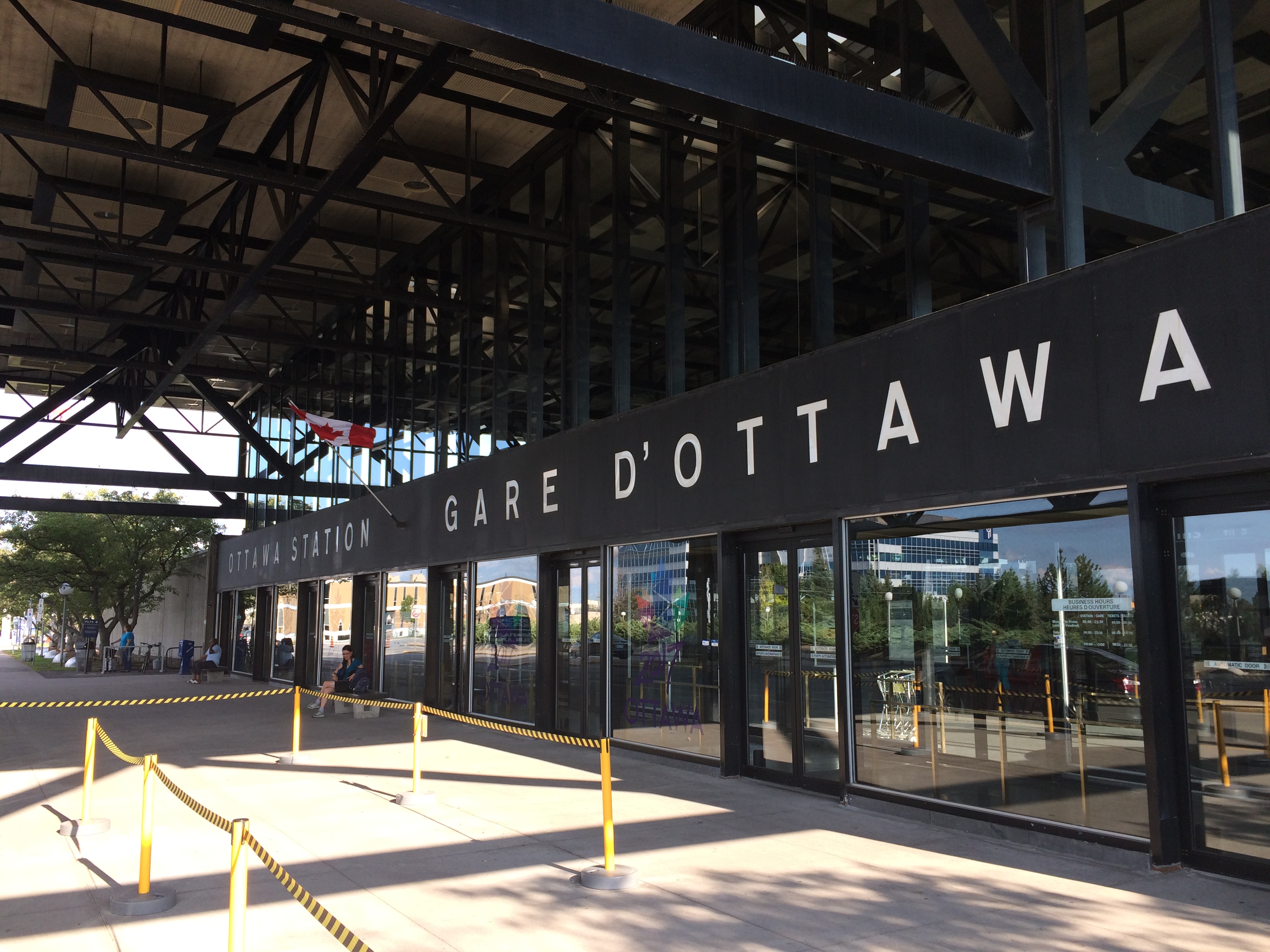
    Ottawa Station, which opened July 31, 1966

    Soon after the new station opened, the tracks and ancillary buildings around Union Station were removed, making way for Colonel By Drive, the Rideau Centre shopping mall, a new convention centre, and headquarters for the Department of Defense. The station building itself survived, however, first becoming a temporary museum space during the 1967 Centennial celebrations, then a government conference centre, mostly closed off to the public.

    The Red Chamber
    The temporary Senate Chambers in the former train concourse at Ottawa Union Station

    Right now, the grand building is the temporary home of Canada’s Senate, and is again accessible to the public, via a free tour. The renovations to the building are very sympathetic to the built heritage. As reconstruction of Centre Block, the regular home of both Houses of Parliament, is still five years away from completion, there’s still lots of time to take the tour.

    Awaiting Alto

    The Alto high speed rail line project, now in the planning stage, will connect Québec, Montréal, Ottawa, and Toronto, with a total of seven stations (the other three are planned in Trois-Rivières, Laval, and Peterborough). The first segment, with the start of construction set for 2029, will link Montréal, Laval, and Ottawa. Consultations on the specific route and station locations are underway, with the broad corridors noted in maps available on the Alto website.
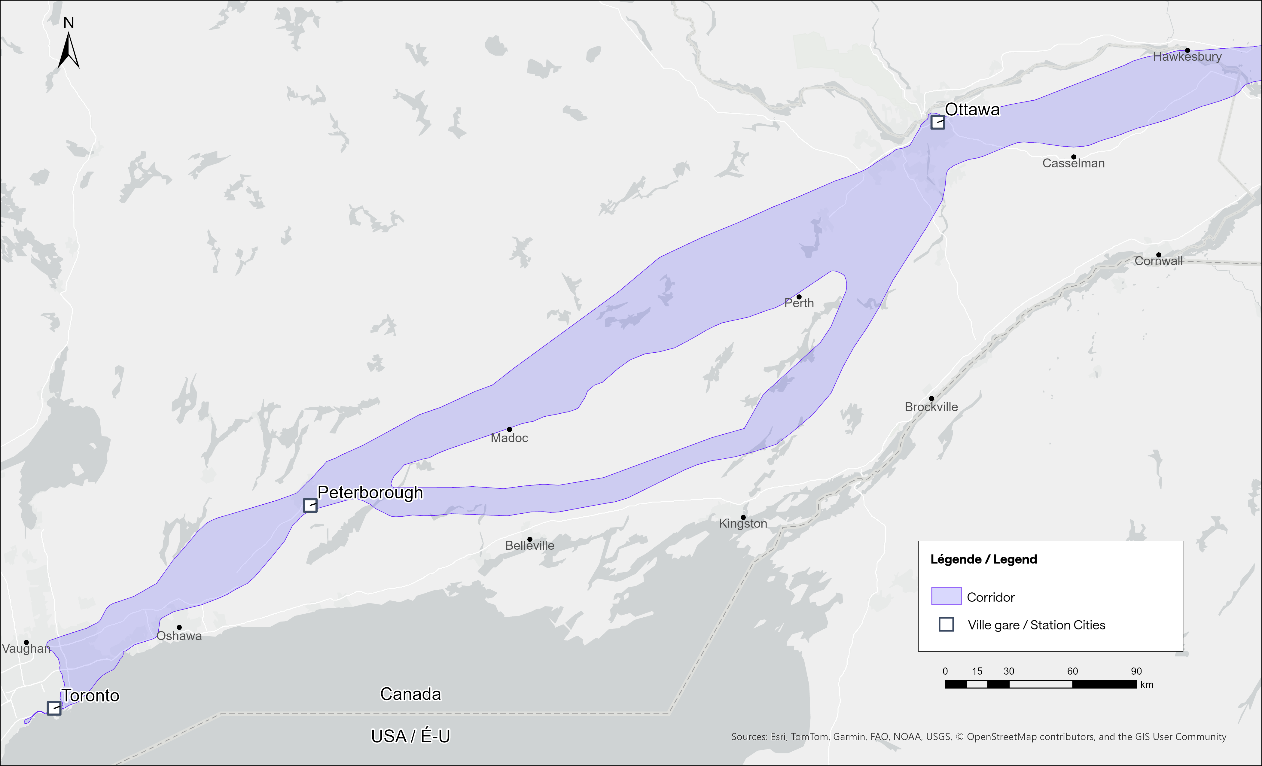
    Map of potential routings for the Alto high speed line in Ontario
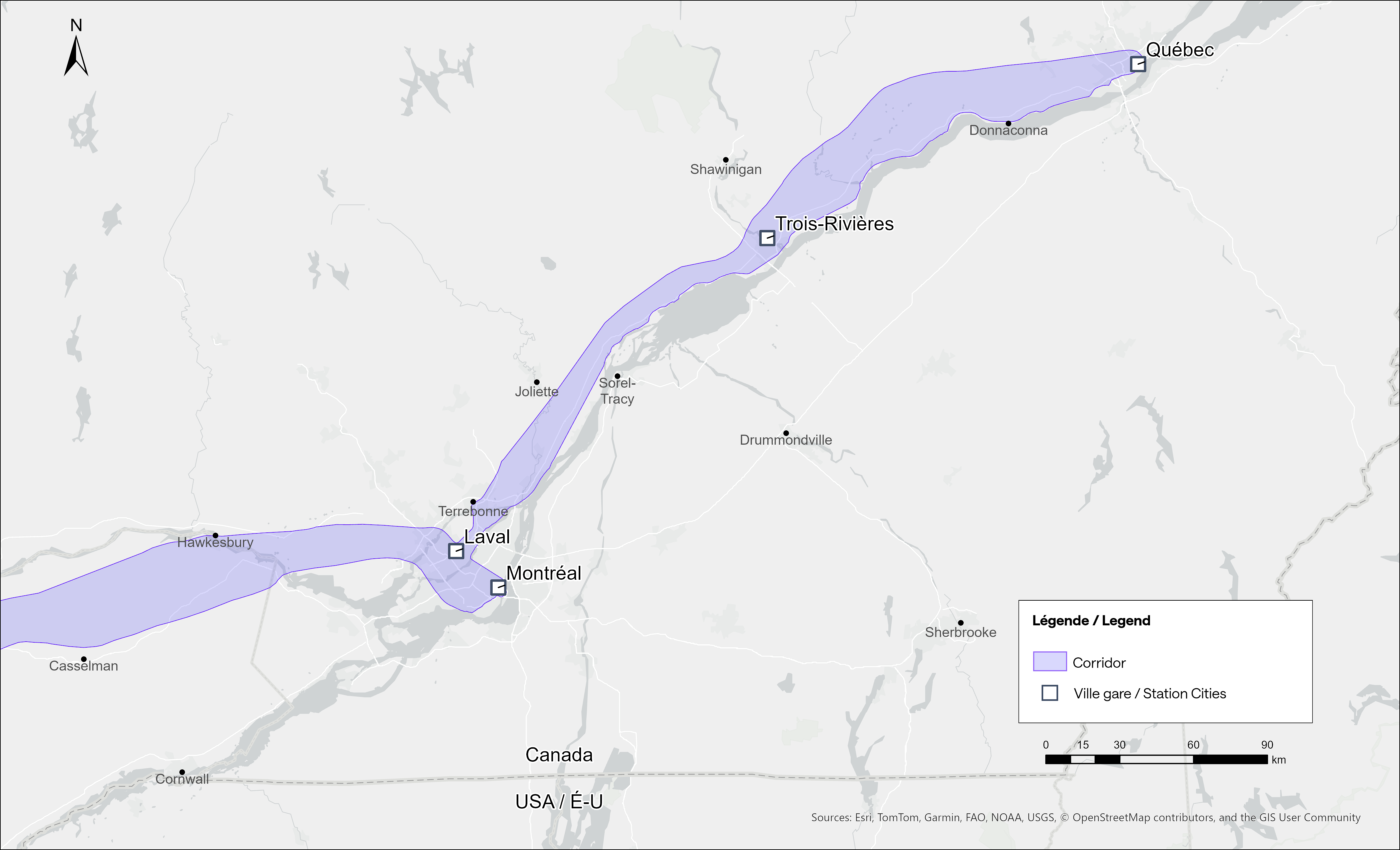
    Map of the planned routing for the Alto high speed line in Quebec

    The maps clearly show a route between Ottawa and Montréal that will pass through Prescott & Russell Counties, roughly following an abandoned CPR corridor until about Hawkesbury, at which point it would cross into Quebec (following an older abandoned CNoR route) to Laval, then continue south into central Montréal, though not necessarily the existing Central Station (this would likely require a new tunnel under Mount Royal). The Montréal station appears to be a terminal for trains coming from Ottawa and from Trois-Rivières and Québec, much like the existing VIA Central Station.

    Alto’s next phase towards Toronto could follow one of two broad routes between Ottawa and Peterborough, either just north of Highway 7, through the Canadian Shield, or a southerly alignment through the Rideau Lakes region and then through South Frontenac and passing near Stirling and Campbellford. All planned routes would require passing through Ottawa entirely on the Ontario side of the Ottawa River, making a through station particularly likely, especially for the critical Toronto-Montréal market.

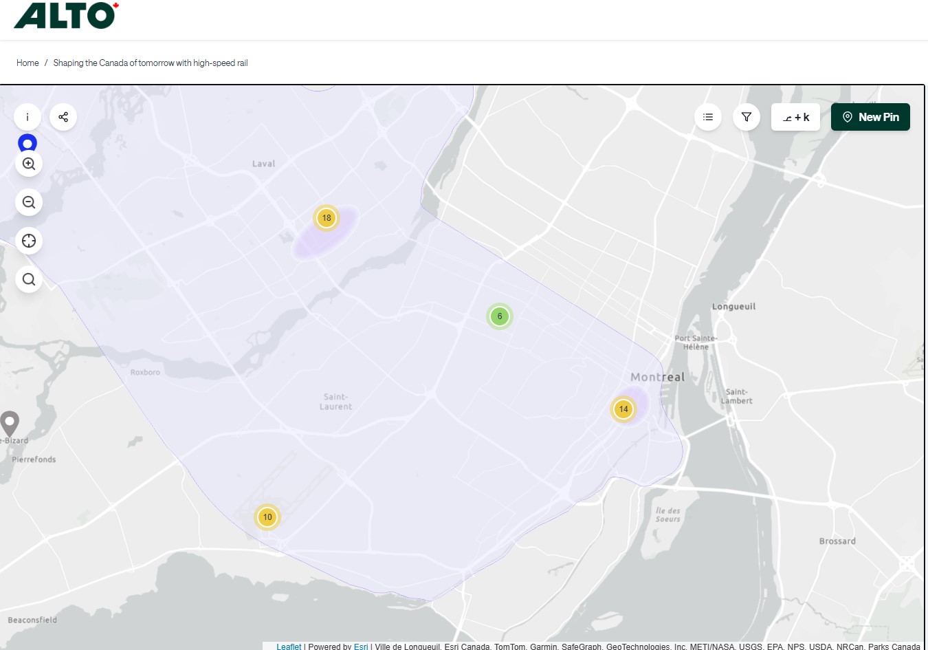
    On the detailed consultation map, highlighted areas show where the seven station locations are being considered.
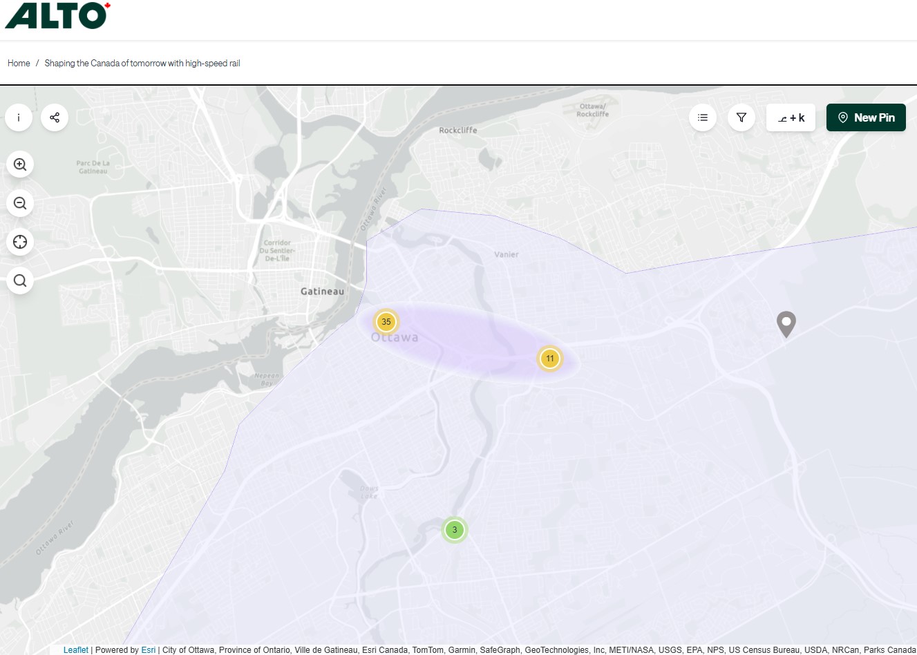
    The map for Ottawa shows possible station locations in an area including the current VIA station and the old Union Station
    The Montréal and Laval station locations under consideration. The Montréal station area highlighted includes the locations of Central and Lucien L’Allier Stations. The Montréal station for Alto is clearly intended to be a terminal.

    The idea of a downtown Ottawa Station for the new high speed rail corridor is certainly enticing. It would breathe new life into a 114-year-old landmark, provide a very convenient spot for Ottawa politicians, public servants, business travelers, tourists, and students attending nearby University of Ottawa. Rideau O-Train Station is less than two blocks away. However, it would require a new tunnel and/or elevated structure to reach the station from the rail corridors to the south. Furthermore, Centre Block would have to reopen on schedule so the Senate can move back before construction can start on refurbishing the station for passenger service.

    The 1966 Ottawa VIA Station, on the other hand, has its own advantages. There is plenty of room to build new high speed train platforms, which should provide level boarding for efficient passenger movement. There is also room for parking, passenger pick-up and drop-off, as well as easy access to the highway, unlike Union Station. With the closure of the Ottawa bus station, the VIA Rail Station has become a multimodal hub, with Ontario Northland, Flixbus, and Orleans Express all using the station’s driveway, along with a KLM/Air France shuttle to Dorval Airport. There is also a dedicated O-Train LRT station on-site, though it could be better integrated with the station building.

    Perhaps most importantly, the existing VIA station can help ensure the existing Corridor service remains integral, as passengers from Kingston, Belleville, and elsewhere on Lake Ontario and the St. Lawrence River will not be served by Alto; neither would Casselman, Alexandria and Dorval. That the station is a through-line, and not a stub-end terminal, will also ensure that the crucial Toronto-Montréal market will see minimal delays from back-tracking and reversing at a downtown terminal. Though there are instances of high-speed trains reversing directions at major hubs — Trenitalia’s Frecciarossa mainline between Milan and Salerno turns back at Roma Termini and at Napoli Centrale — this is an uncommon arrangement.

    All the planned Alto high speed rail stations will have to be easily accessible and close to the downtown cores of the cities it serves. At this point in the planning process, this looks like it will be the case at all three big city stations. But it will need more than walk-up traffic like downtown office workers and tourists; it will be most successful as part of a complete network of local, regional and intercity transport, including the conventional VIA rail system. With specific improvements, including new platforms and better O-Train station integration, the modern yet historic 1966 Ottawa Station is well suited for all of these needs.
  • New transport links in Eastern Ontario

    New transport links in Eastern Ontario

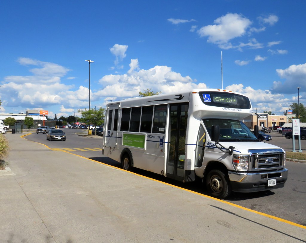
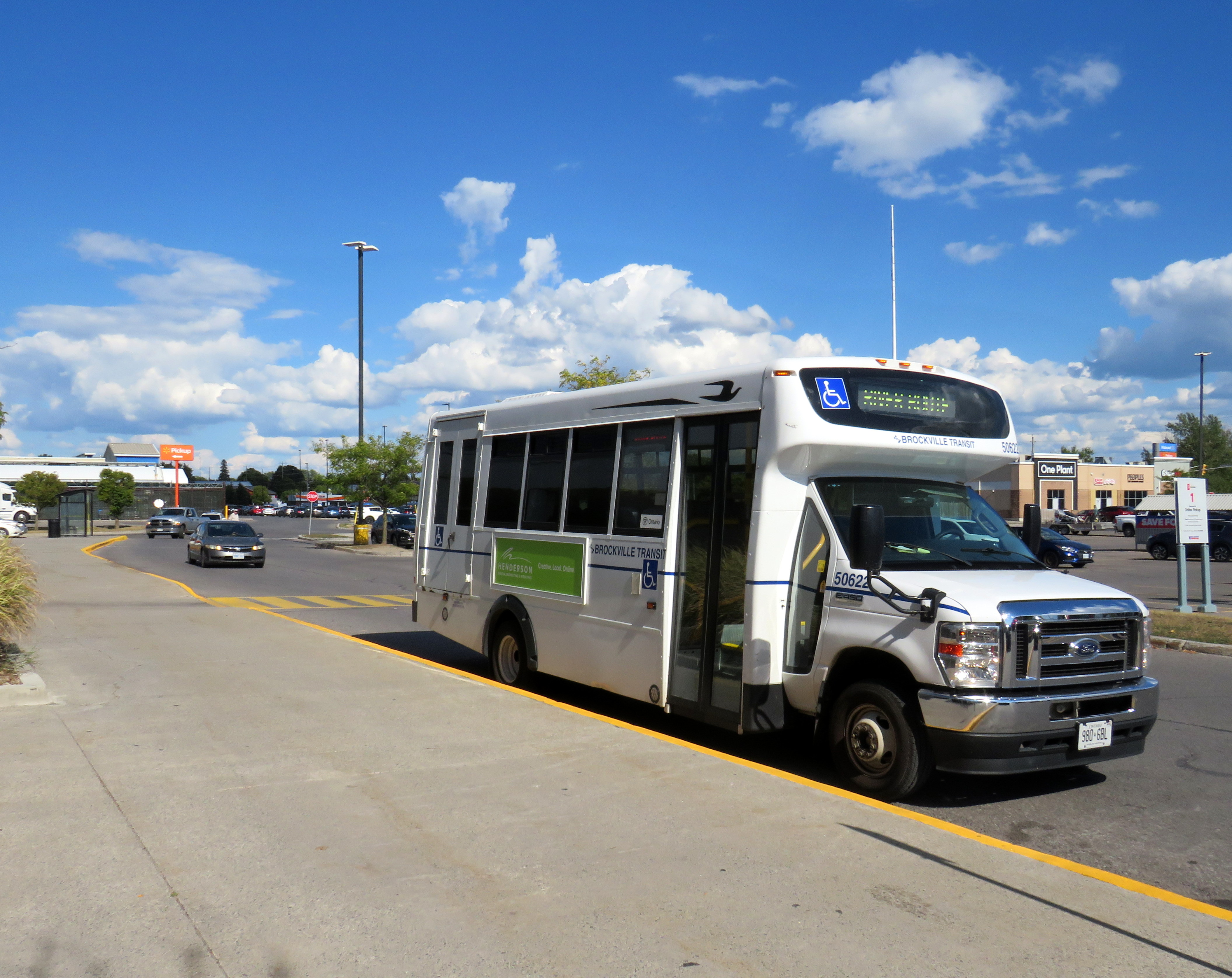
    River Route, operated by Brockville Transit, serves several communities in Eastern Ontario

    A few new transit services have come online in Eastern Ontario in the last few years. In Leeds and Grenville Counties, the River Route connects Brockville with Prescott and Cardinal. North Grenville, which includes the town of Kemptville, launched an intra-municipal on-demand service earlier this year, with a new Ottawa connection that started earlier in September.

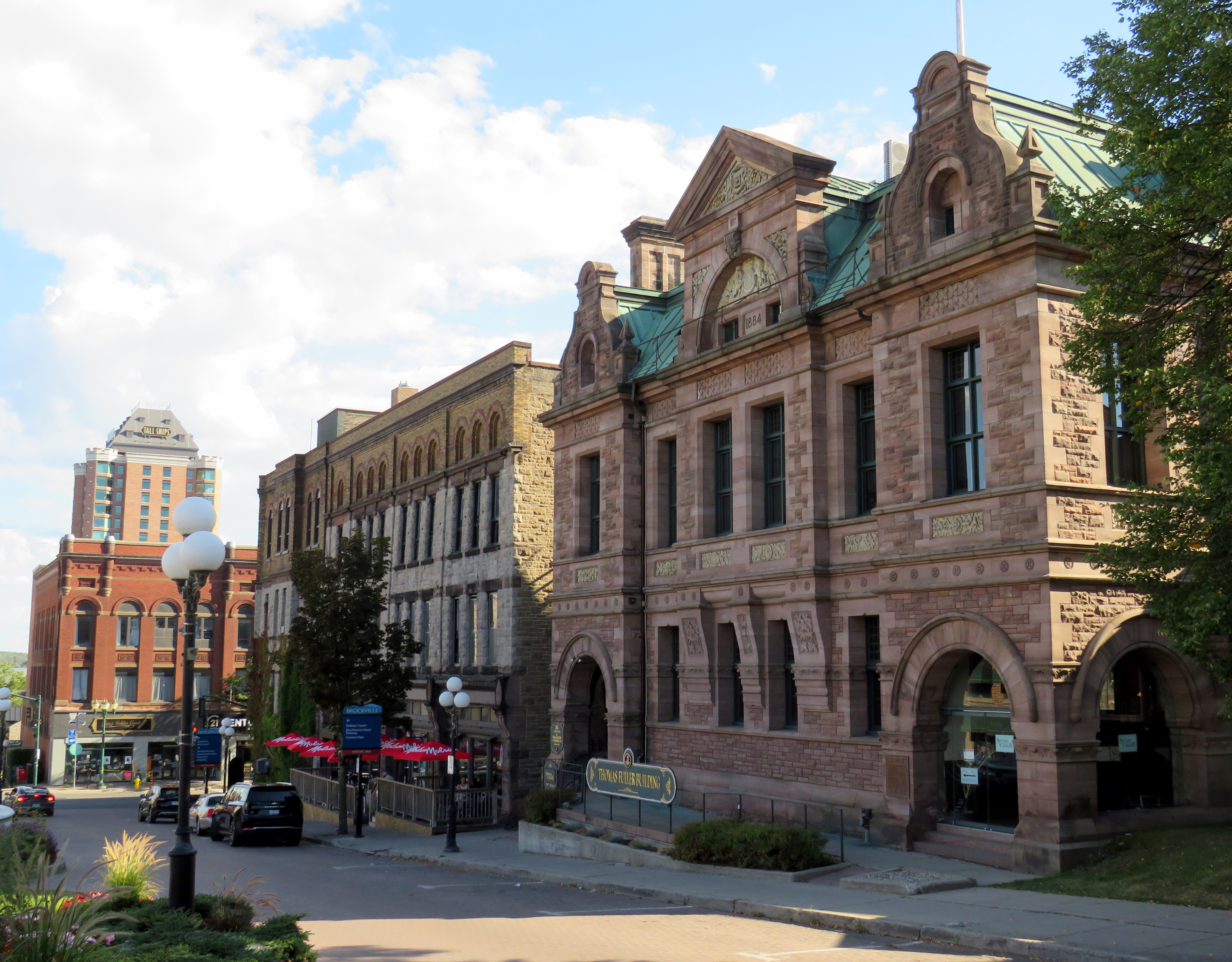
    The River Route connects with Brockville Transit in a big-box retail plaza, with timed transfers with local services to the nearby hospital, VIA Rail Station, and Brockville’s beautiful downtown core. The regular River Route fare is $5, though it includes an inbound free transfer to local Brockville Transit routes (though not the other way around). I recently travelled to Brockville and Prescott to check out the service, and I found it to be well used. Hugging the St. Lawrence River and passing through several historic towns, it might be Ontario’s most scenic regional bus route.

    Downtown Brockville

    The small city of Pembroke restored local public transit within the municipality, a weekday-only on-demand service. Unfortunately, Pembroke is only connected to neighbouring communities by a once-a-day Ontario Northland bus that runs between Sudbury and Ottawa.

    Despite these improvements, vital connections remain missing. Commuter bus services from Ottawa to neighbouring towns such as Arnprior, Almonte, Carleton Place, and Rockland have not been restored; only Kemptville, Cassleman, and Russell/Embrun, have limited weekday service again, despite the federal, provincial, and municipal governments’ push to bring civil servants back to the office up to five days a week.

    In Prescott & Russell Counties, experiments with fixed-route and on-demand transit have failed, though those came at a time when COVID-19 was still declared a public health emergency. The Town of Hawkesbury, population 10,194, is the second-largest urbanized municipality in Ontario without any inter-community transport links. (The largest is Tillsonburg, which lost its connection to Woodstock earlier this year.)

    I have made updates to my intercity transportation map to include these changes: I also added a missing service in the Lachute, Quebec region. If there any further changes that I have missed, please contact me.

  • Ontario intercity transportation at the end of 2022: More choices, fewer routes

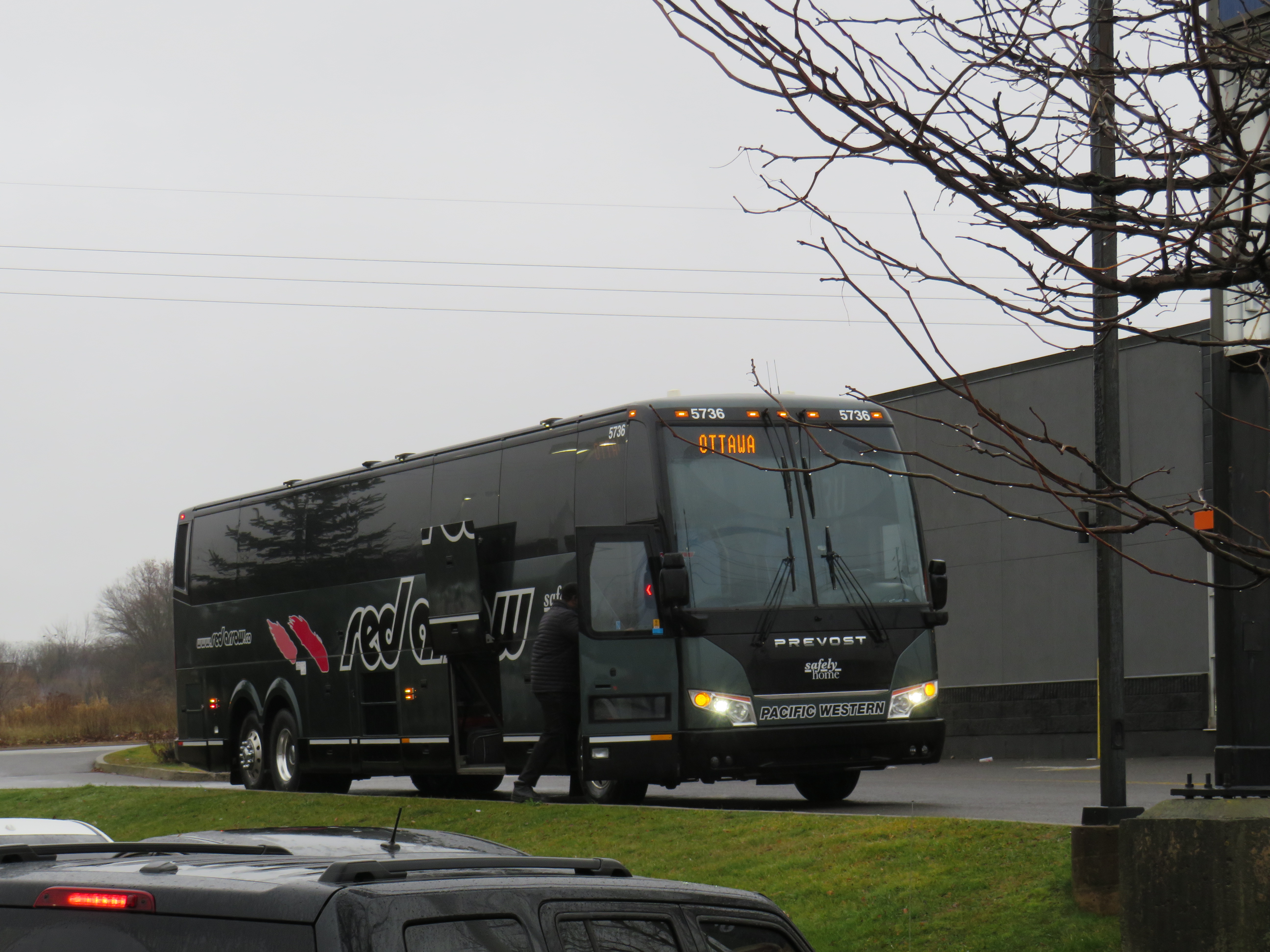
    A Red Arrow coach lays over at a Harvey’s restaurant in Kingston on the way to Ottawa

    On December 7, I took a trip out to Kingston to ride the newest coach operator to arrive in Ontario: Red Arrow. A division of Pacific Western, Red Arrow is the latest carrier to stake a claim to the busy Toronto-Kingston-Ottawa route, which is now served by five private companies.

    Between Toronto and Ottawa, five intercity coach carriers–Megabus, Rider Express, Flixbus, Book-A-Ride, and Red Arrow–compete for the same passengers, along with VIA Rail and three airlines (Air Canada, WestJet, and Porter).

    There is also fierce competition for the Toronto-London route. Passengers have the choice of taking Megabus, Rider Express, Onex, Flixbus, Book-A-Ride, VIA Rail, or a very slow weekday-only GO train. Along with VIA, Flixbus also continues west, to Windsor (where the Tunnel Bus connection to Detroit has finally been restored). The Toronto-St. Catharines-Niagara route is also served by multiple bus and rail services.

    Red Arrow coach seating

    Despite new intercity coach players like Red Arrow (which provides a high-end coach service, with comfortable seating in a 2+1 arrangement, along with complimentary soft drinks and light snacks) and Book-A-Ride (which operates like a charter airline, with schedules that change frequently based on demand), many other routes still have limited or no service. Flixbus quietly dropped its Kitchener-Hamilton-Niagara route earlier this year, eliminating service on a corridor that once had frequent Canada Coach Lines buses; that route had been sold in 1990 to Trentway-Wagar/Coach Canada. Flixbus also ended service to Guelph, instead concentrating on its other corridors. Early next year, Megabus will end its route between Toronto, Buffalo, Philadelphia, and Washington DC.

    The deregulation of motor coach services within the Province of Ontario may have made some sense. The old bargain of providing exclusive franchises for busy, profitable routes made sense when operators would use those cash cows to help subsidize less-trafficked rural services. But as Greyhound, Stagecoach, and other large companies bought up smaller carriers (such as Gray Coach, Canada Coach Lines, and PMCL) in the 1980s and 1990s, they were allowed to slowly abandon the smaller routes. Greyhound itself divested most of its network before disappearing altogether. As the franchising scheme didn’t work, there was no point keeping it.

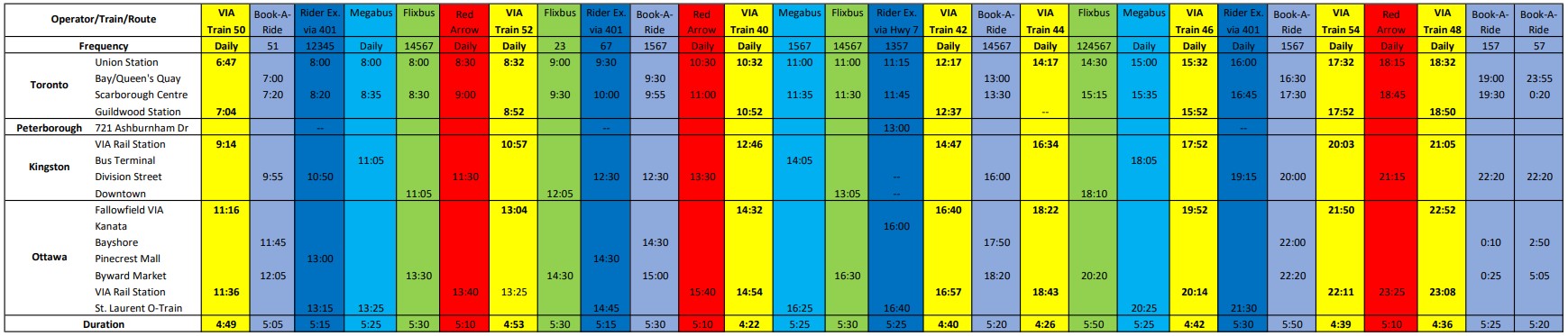
    But now, there’s the absurd situation where there are up to 25 daily buses and trains between Toronto and Ottawa (see table below). In contrast, there is not a single daily bus service connecting Hamilton and Kitchener-Waterloo–two urban centres of over 500,000 people each, just an hour apart, with three large universities (Waterloo, Wilfrid Laurier, and McMaster) and two major colleges (Conestoga and Mohawk) between them.

    Available trips from Toronto to Ottawa, December 2022, with times for Kingston and Peterborough. Bus and rail tips to Montreal via Kingston are not included.
    A PDF version can be found here.

    Elsewhere, where GO Transit and government-subsidized regional connections have filled gaps, the services are often slower and less direct than the old coach bus service. PMCL used to operate daily bus service between Owen Sound and Toronto via Collingwood and Barrie. Today, the same trip is possible via Grey Transit Route, Colltrans, Simcoe County Linx, and GO Transit, but the trip will take the better part of a day. Meanwhile, other gaps remain. Elgin County (Aylmer and St. Thomas) and Haldimand County (Caledonia, Dunnville, Hagersville, and Jarvis) are left without any outside connections.

    Such is the state of the intercity transportation network (if you can call it that) in Ontario.


    Though I enjoyed the trip on Red Arrow to Kingston (especially as I took advantage of a special $25 fare), I wondered how well the service will do here in Ontario. Its base price is over $100 one-way to Ottawa, more expensive than other coach operators and priced more like VIA Rail, which itself is slightly faster (as long as CN freight trains do not get in the way). Red Arrow uses the same locations in Ottawa (the VIA Rail Station itself) and Toronto (Union Station Bus Terminal) as the train. Red Arrow does well in Alberta, where there is no useful passenger rail service (Pacific Western also offers a no-frills coach bus service on the same Calgary-Edmonton route).

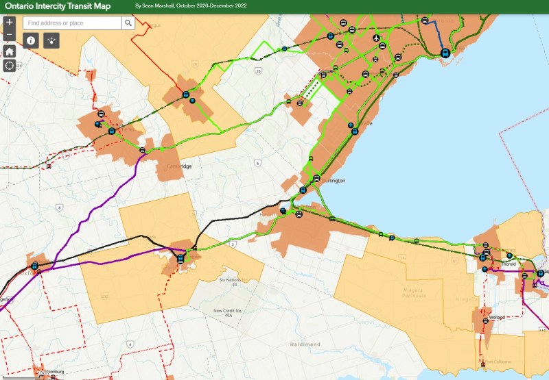
    The latest version of my interactive intercity transit map is below:

    Link to the newest version of my map of Ontario’s Intercity bus and rail connections

  • Greyhound Canada’s inevitable decline leaves a few gaps to fill

    Greyhound Canada’s inevitable decline leaves a few gaps to fill

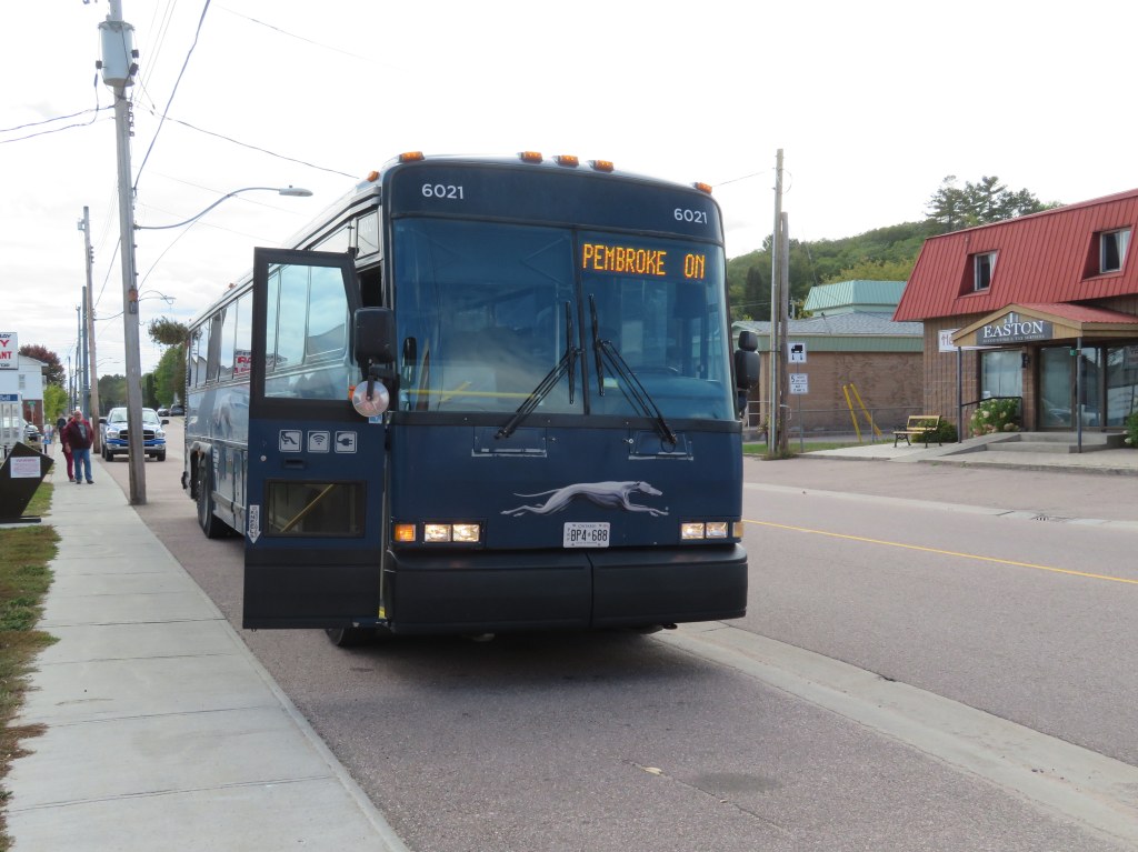
    Barry’s Bay, on Greyhound’s Peterborough-Pembroke route, is one of many smaller towns and villages that permanently lost all intercity bus connections since the COVID-19 pandemic

    On Thursday, May 13, Greyhound Canada announced that it was permanently ceasing operations. This should not have come as a shock to anyone following the intercity transport industry: for over three decades, intercity bus carriers in this country were privatized (Gray Coach and Canada Coach Lines in Ontario, shut down (Saskatchewan Transportation Corporation), or strangled by continued cutbacks and poor customer service (Greyhound). In 2018, Greyhound Canada ended all its remaining services between Vancouver and Sudbury. The loss of commuter and student traffic — Greyhound’s bread-and-butter in Ontario and Quebec — due to the pandemic led to a temporary, then permanent shutdown.

    The next day, on Friday, May 14, Megabus — operated by Coach Canada, a subsidiary of UK-based Stagecoach — announced that it would begin service on the Toronto-Ottawa and Toronto-Kingston routes abandoned by Greyhound. Two buses a day will soon operate between Toronto, Scarborough Town Centre, Kingston, and Ottawa, daily except Tuesdays and Wednesdays, terminating at St-Laurent Shopping Centre, a stop on Ottawa’s new LRT. Though this provides a new option for travelers between the big three cities (VIA Rail continues to serve this route), it does not fill the gaps left by years of decline by private intercity bus operators.

    (I updated my map of Ontario’s intermunicipal carriers to include Megabus’ new route).

    Before Greyhound’s website disappeared, I downloaded the PDF schedules for Ontario and Quebec. In 2019, Greyhound operated three routes between Toronto and Ottawa: an express bus, with stops only in Scarborough, Belleville, Peterborough, Madoc, and/or Kanata, a local bus, making stops in cities and towns along Highway 7 between Peterborough and Carleton Place, and a Kingston-Ottawa bus via Smiths Falls. You can view and download the schedules below:

    Peterborough loses two buses a day to and from Ottawa and express bus service to Downtown Toronto (which made the trip in less than two hours off-peak.) Though Peterborough is still connected to Toronto via GO Transit bus Route 88, it can take nearly three hours to go between Union Station and Downtown Peterborough, including a train connection at Oshawa, and many local stops in Clarington and along Highway 115. Other towns, such as Norwood, Marmora, Madoc, Perth, and Carleton Place, lose all bus services, except for a commuter-oriented weekday run between Ottawa and Carleton Place.

    Greyhound has chosen to become irrelevant to most Canadians long before the final shutdown announcement. Northern Ontario, at least, still has Ontario Northland (which has expanded its reach), and the Greater Toronto and Hamilton Area has GO Transit (though gaps continue to exist in that network). If your rural community is lucky, your local or regional municipality launched a new, subsidized bus or microtransit service. There is also VIA Rail, which serves most larger communities that lost Greyhound services in 2020-2021 (Windsor, Chatham, Belleville, Ottawa, etc.), though it is typically more expensive.

    Despite these continued and emerging services, there remains a need for government support of those crucial links left behind by Megabus, VIA, and GO Transit.

  • Room to share: How cities can make physical distancing work

    Room to share: How cities can make physical distancing work

    IMG_8405
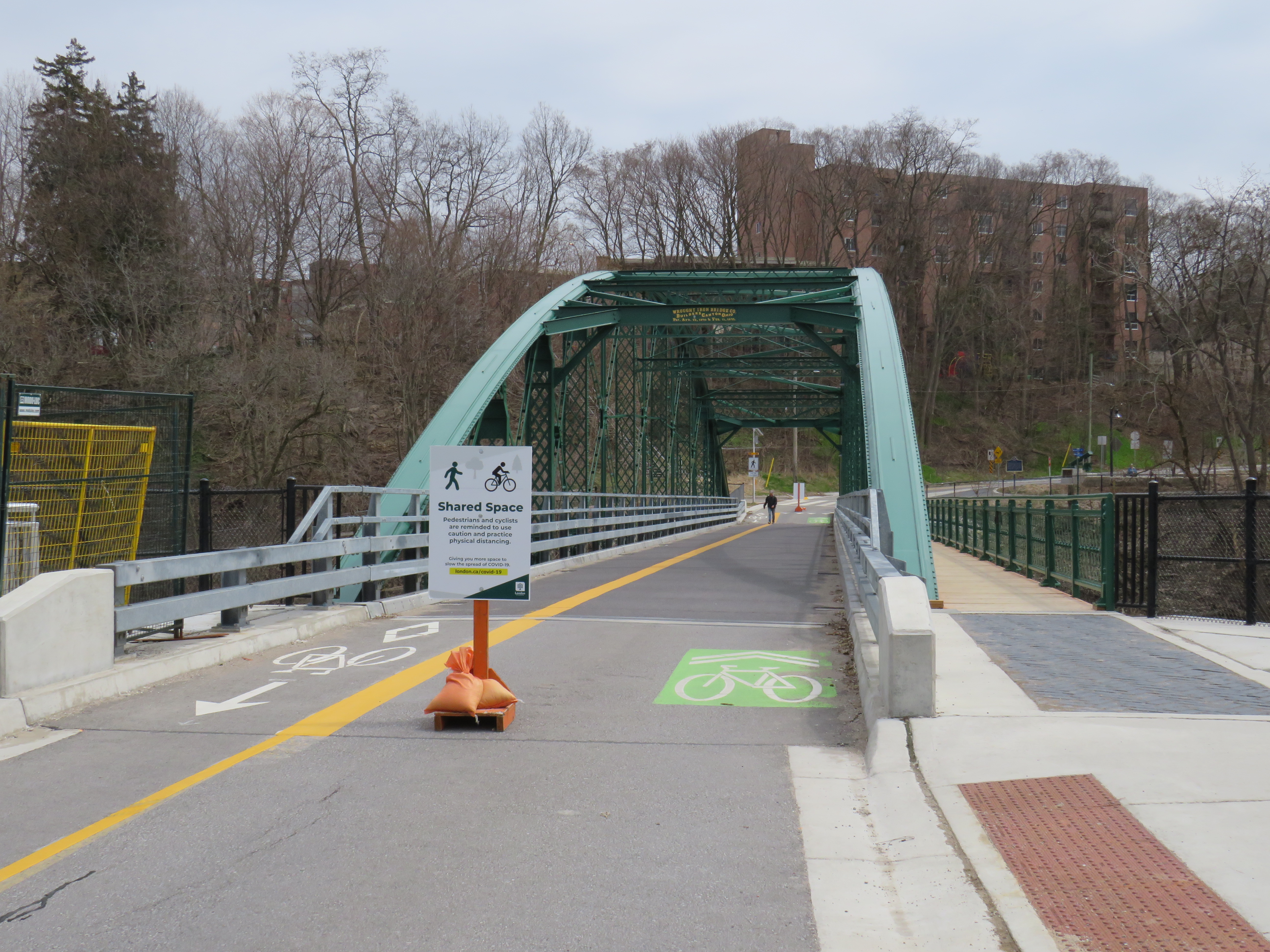
    Blackfriars Bridge open to pedestrians and cyclists in London, Ontario

    For my latest TVO article, I spoke with Councillor Shawn Menard in Ottawa, Councillor Rowena Santos in Brampton, and Ryerson University epidemiologist Anne Harris about how cities in Ontario are reallocating road space for pedestrians and cyclists during the ongoing COVID-19 pandemic, or why they may be hesitant to do so.

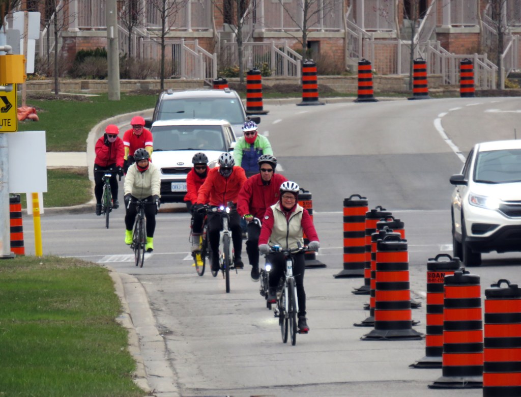
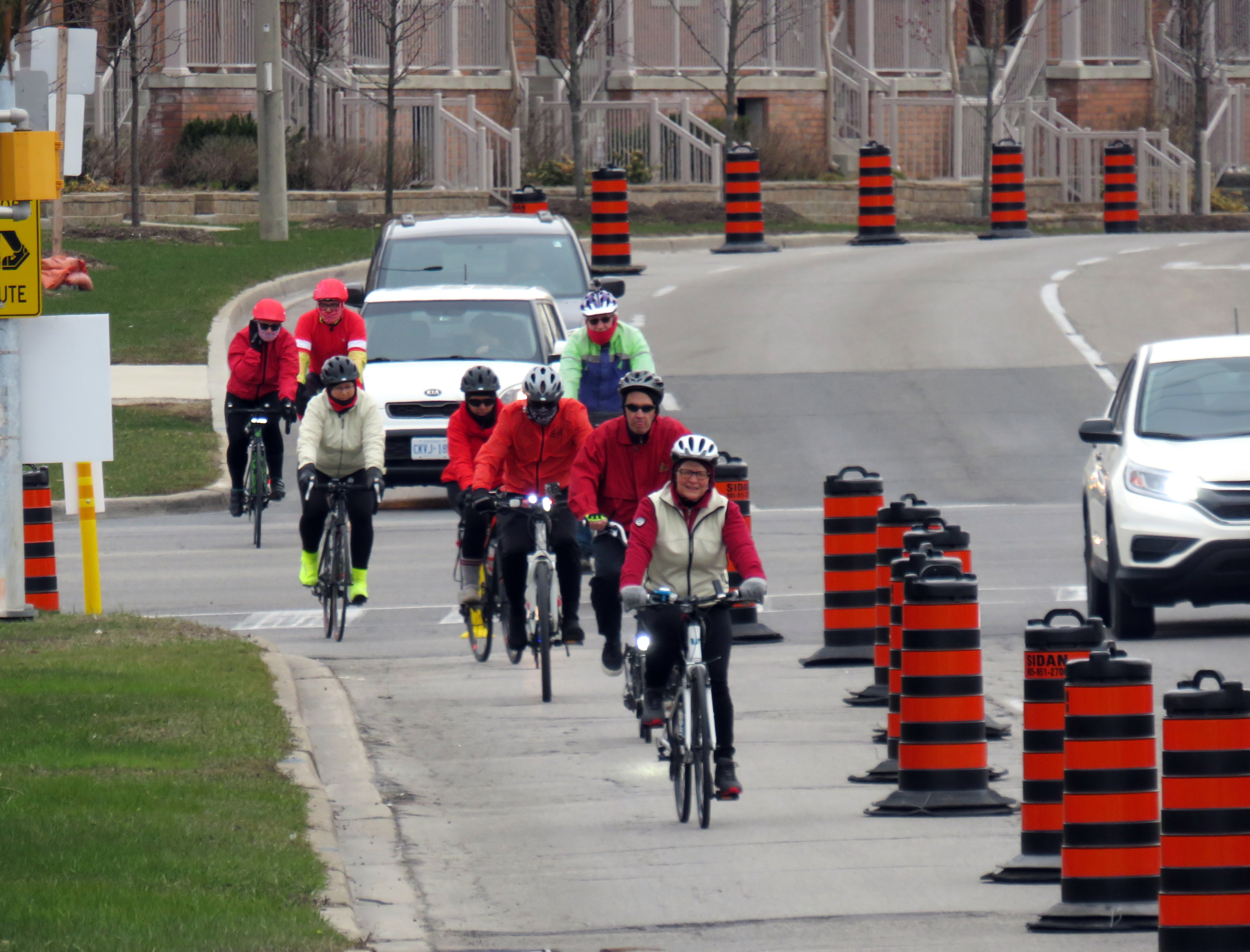
    In Brampton, five kilometres of new bike lanes, proposed in that city’s new transportation plan, were quickly approved as part of its response to COVID-19. This benefits both pedestrians and cyclists by reducing conflicts on sidewalks, reducing congestion on city paths, and recognizing that cycling is an increasingly important mode of transportation.

    IMG_8499-001
    Cyclists on Howden Boulevard, Brampton

    In Ottawa, despite resistance from the the mayor and council, Shawn Menard, who represents an urban ward just south of Parliament Hill, was able to temporarily close two lanes of traffic on a narrow bridge on a major retail street, and worked with the National Capital Commission to re-allocate a section of parkway for active transportation.

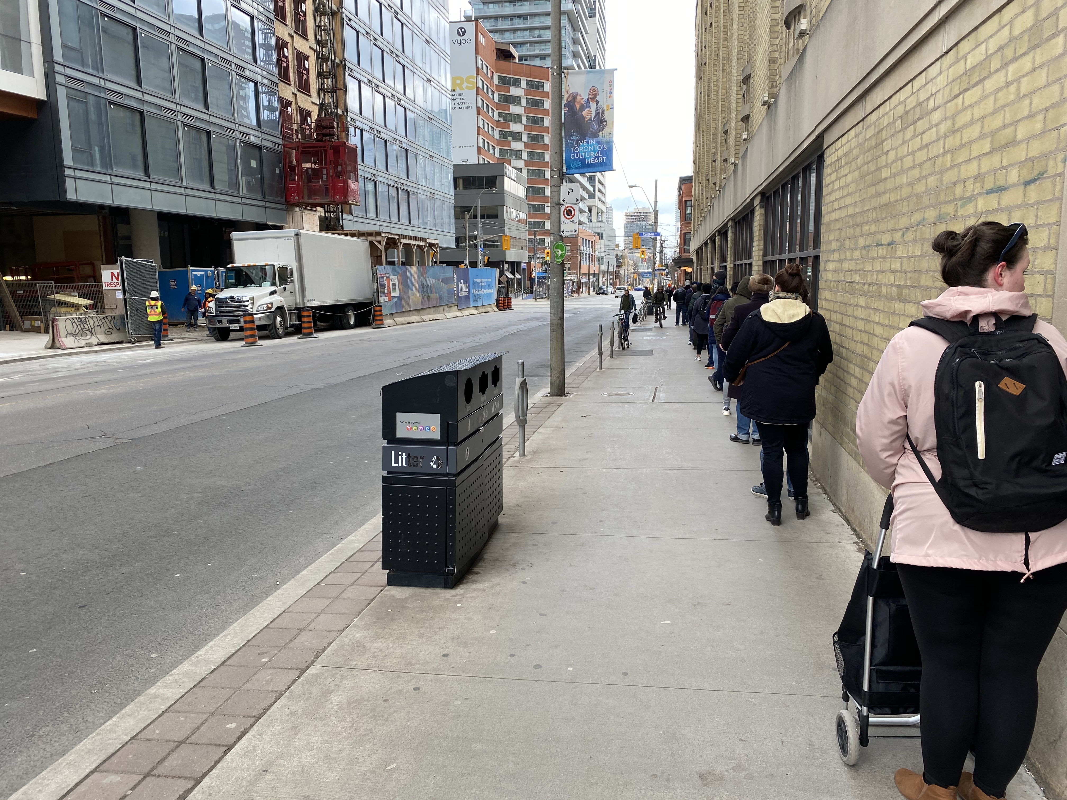
    Meanwhile in Toronto, the mayor and medical officer of health were resistant to increasing calls for sidewalk expansions in congested urban areas, including where queues formed to enter grocery stores, pharmacies, hardware stores, and LCBO outlets.

    This was one of my favourite articles I have written so far. 


    Loblaws queue on Church Street
    Queue on Church Street at Carlton to enter Loblaws supermarket

    With Walk Toronto, I have been involved with pushing the City of Toronto to take action, especially in pinch points where store queues, construction barriers, and other obstructions have made it difficult — if not impossible — to safely practice physical distancing when walking or cycling for essential purposes, or even getting a little bit of fresh air or light exercise in dense urban areas.

    The good news is that ten problem areas — including the intersection of Carlton and Church — have finally been identified for curb lane closures, with potentially more on the way. This is a timid first step, made after weeks of advocacy, but it is welcome.

  • Some love for Ontario’s municipal flags

    Some love for Ontario’s municipal flags

    Flag of TorontoThe flag of the City of Toronto, designed by Renato De Santis, is an example of a very good civic flag



    I was in Orillia last week, mainly to check out the new Simcoe County Lynx bus system. While there, the flag flying from the Opera House (formerly the city hall) caught my attention. Most municipal flags are boring, usually consisting of the town or city’s coat of arms, shield, or logo on a plain background.

    Orillia municipal flag, with a yellow sun in the middle

    But Orillia’s flag is different. It has waving blue and white waves, with two green triangles facing the centre, and a bright yellow sun in the middle. The symbolism wasn’t difficult to figure out: the city’s position on the narrows between Lake Simcoe and Lake Couchiching, with the sun being a nod to Orillia author Stephen Leacock’s Sunshine Sketches of a Little Town, a light, humourous collection of short stories about the denizens of Mariposa, a thinly-veiled fictionalization of Orillia.

    Yet Canadian cities that boast populations twenty or thirty times that of Orillia can’t boast having such a fine flag.

    For the most part, we don’t think about state, provincial, and municipal flags, and that’s a pity. In the few cities that have an unique and powerful flag, they have become part of that city’s iconography. Unfortunately, though Toronto does have a very good civic flag, we don’t fly it like it should.

    According to the North American Vexillological Association, there are five principles for creating a good flag:

    • Keep it simple — so simple, it can be drawn by a child from memory
    • Use meaningful symbolism
    • Use two or three basic colours
    • Never use lettering or seals
    • Be distinctive or be related

    Canada’s flag, adopted in 1965, adheres to these principles perfectly. It uses just two basic colours: red and white. With a large red maple leaf in the middle, it’s easily recognizable around the world. While a child might not get the eleven-point maple leaf exactly right, it’s otherwise easy to draw from memory.

    There are, of course, exceptions to these principles.

    Maryland’s complicated state flag, based on the coat of arms of colony founder Cecil Calvert, Lord Baltimore, is distinctive and popular, nearly as common as the US flag. California’s state flag is emblazoned with the words “California Republic” but it has significant historical meaning. The flag of South Africa, adopted in 1994, has six colours, but by merging the Pan-African colours of the African National Congress with the red white and blue of Britain and the Netherlands, it represents unity in the post-apartheid era.

    Flags of Maryland, California, and South Africa, notable exceptions to the rules

    For the most part, famous and great civic flags adhere to these principles. The flags of Amsterdam, Berlin, Chicago, and Tokyo all stand out. In Chicago and Amsterdam, these flags are proudly flown from private homes and watercraft, found on t-shirts and souvenirs, and well known around the world. The bear from Berlin’s flag is almost as popular as the Ampelmännchen. Though Amsterdam’s flag’s origins go back centuries (the “x”s are actually St. Andrew’s crosses), it looks bad-ass, and on-brand for a city famous for its tolerance.

    Great civic flags: Amsterdam, Berlin, Chicago, Tokyo

    Compared to the great examples above, Ontario’s provincial flag is just bad. Compare the provincial red ensign with the flag of Manitoba, and then compare it to the Franco-Ontarien flag.

    The Ontario and Manitoba flags, British red ensigns defaced with the provincial shields, were only adopted in 1965 and 1966 as conservative reactions to the new flag of Canada. The two flags are difficult to tell apart from a distance, and they both contain the St. George’s cross (representing England) twice: once in the union flag in the canton, and again in the shield. There’s very little Ontario to be found. (At least the Manitoba flag contains a bison, a recognizable symbol of that province.)

    Meanwhile, the Franco-Ontarien flag is immediately recognizable, with the fleur-de-lis and a stylized trillium, the provincial flower, representing the French-Canadian presence in Ontario.

    Like Orillia, there are a few other civic flags in Ontario that get it right.

    Flags of Thunder Bay, Hamilton, Ottawa, and Toronto

    Thunder Bay’s flag depicts a rising sun above Lake Superior and the Sleeping Giant, a prominent natural landmark across the water. The flag of Hamilton includes a yellow cinquefoil, the badge of the Clan of Hamilton, with a steel chain with six large links representing the steel industry and the six municipalities amalgamated into the modern city. The flag of Ottawa contains the civic logo, with the points representing waterways and the Peace Tower on Parliament Hill. Finally, the flag of Toronto has an abstract depiction of Toronto’s city hall, with a maple leaf where the council chamber sits. The two towers also make a “T.”

    It’s a shame that Toronto doesn’t make more of its simple, yet great flag.

    Unfortunately, most flags look like those used by Ontario’s third and fourth largest cities.

    Mississauga’s flag violates most of the principles listed above by including the name of the place it represents, with the addition of “incorporated 1974” at the bottom. In the middle is the civic shield, with the typical trappings: a cog representing industry, a lighthouse representing a port (Port Credit), a waterwheel, a stalk of wheat, and wings, possibly representing Pearson Airport. Though Mississauga is a proud city with its own identity, this flag doesn’t appear except in front of civic buildings.

    Brampton’s flag is just the civic shield on a white background, again with similar trappings: a bushel of wheat, a plow, a steam locomotive, and a beaver. According to the city’s website, the gold colour and castle top signify the city’s relation with the small Cumbrian town of Brampton, England. The shield dates from the small rural town before post-war growth, with only a pine tree in the middle to represent the old township of Chinguacousy it merged with. There’s no recognition of Brampton’s modern identity as a multicultural city.

    But at least they’re not as bad as the worst city flag identified by the North American Vexillological Association, that of the city of Pocatello, Idaho, which manages to include the city slogan, a trademark, and a copyright notice. After some embarrassment, the city came up with a new, much better flag.

    Old Flag of PocatelloThe former flag of Pocatello, Idaho

    It would be wonderful to see Brampton and Mississauga come up with better designs. Brampton’s new logo and slogan, Flower City, better represents the city’s history and ambitions. A pretty good flag could be made out of that.

    As for Toronto, let’s embrace our flag more. It’s a fine one and far better than the province’s. As Torontonians generally think of themselves as Canadian first, Torontonian second, and Ontarian third, perhaps we should give our municipal banner more love.

  • O-Train impressions: this is what LRT looks like

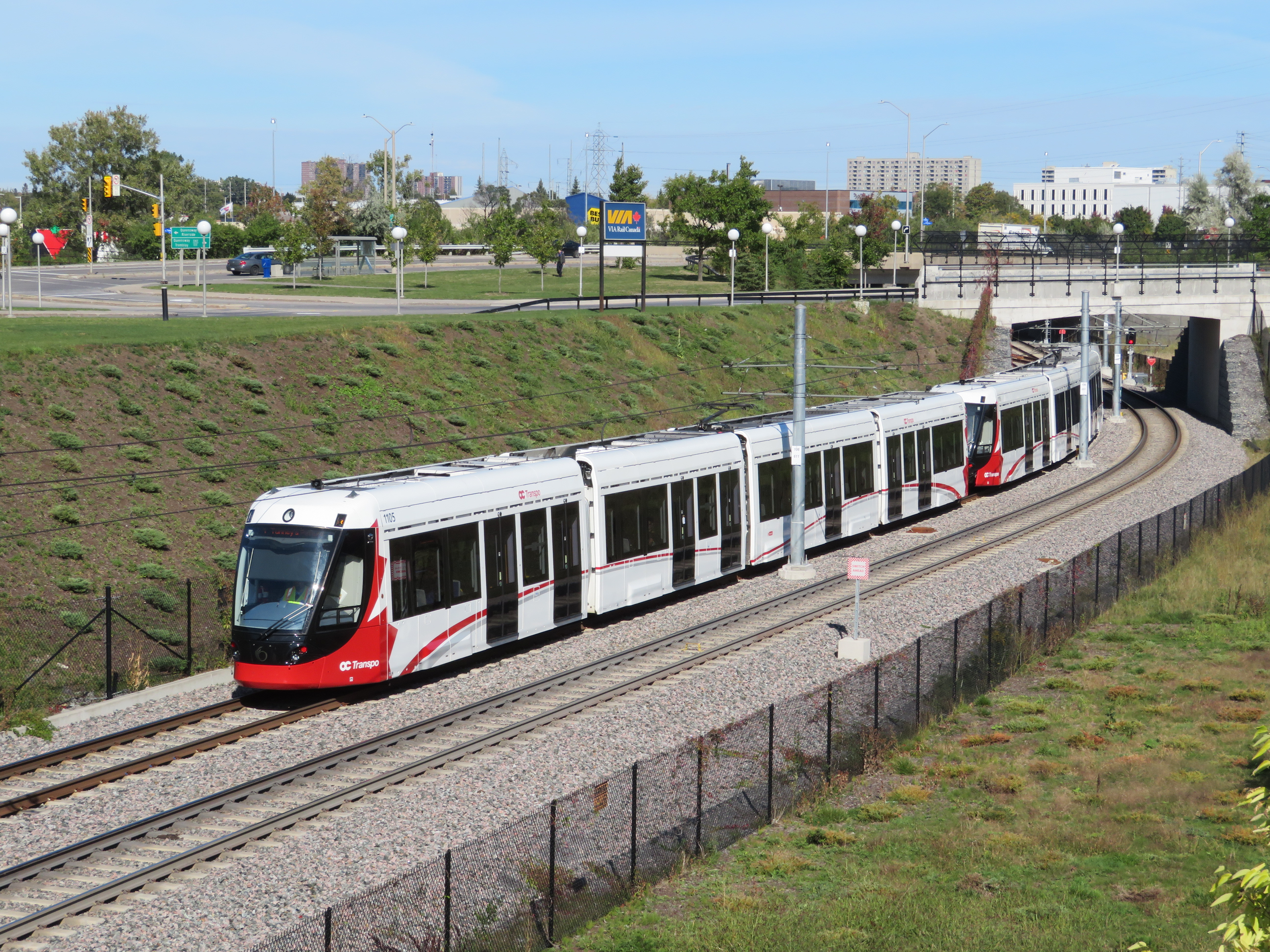
    IMG_4614-001Confederation Line train approaching Tremblay Station
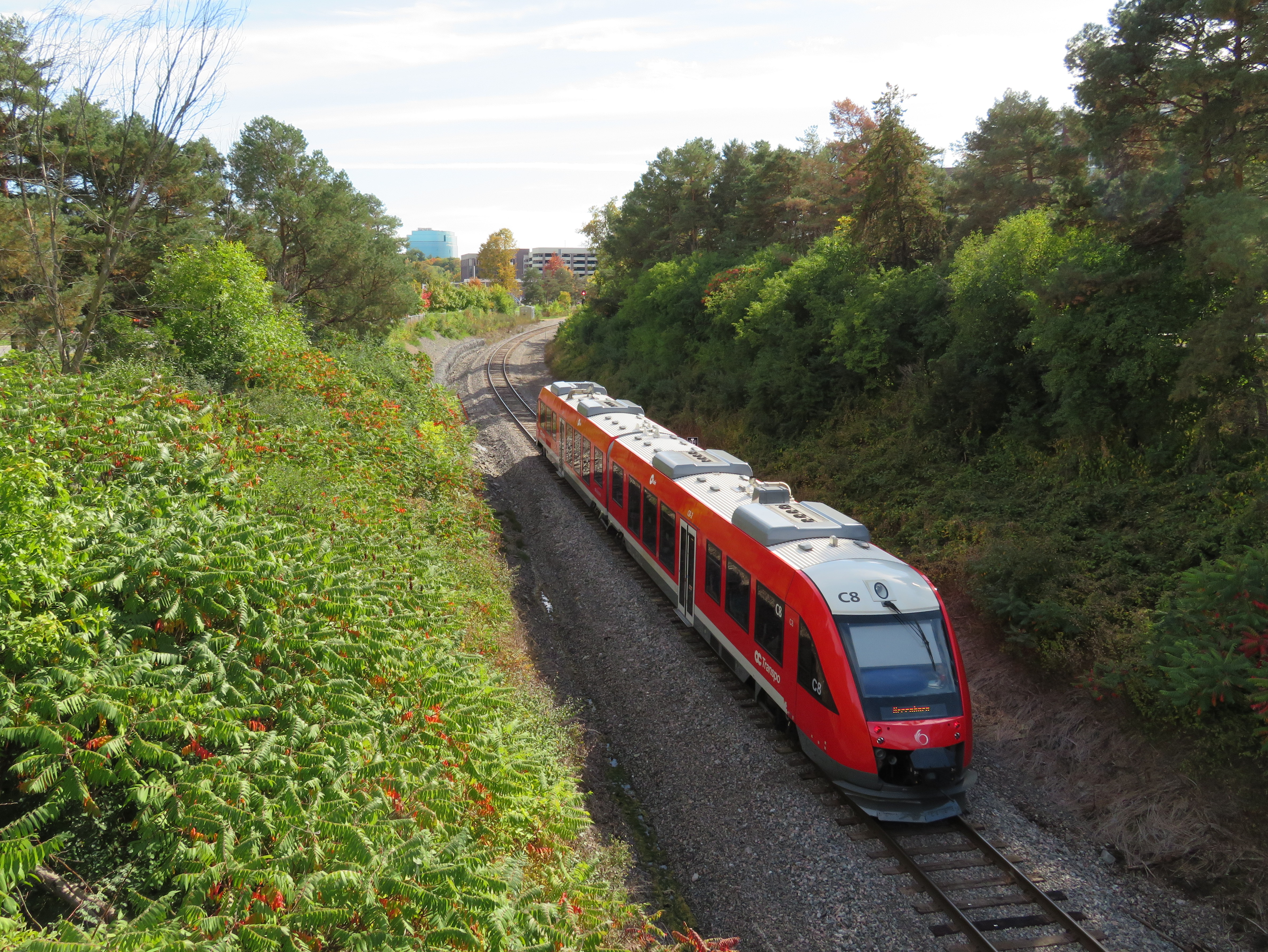
    Last weekend, I visited Ottawa to check out the new Confederation Line LRT. Canada’s newest rapid transit line, delayed by two years, finally opened on Saturday, September 14. It is the second LRT to open in Ontario this year; Waterloo Region’s ION service opened in June.

    The new 13-station Confederation Line includes a 2.5-kilometre tunnel under Downtown Ottawa, with three stations deep underground. Phase 2 will add 15 more stations to the Confederation Line. I was impressed with the speed, accessibility, and capacity of the new LRT, though I noticed a few flaws, some of which hopefully will be corrected.

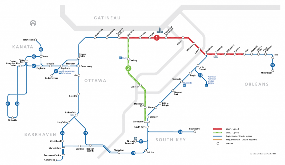
    The Confederation Line is not the Ottawa Region’s first rapid transit project, however. The Transitway first opened in 1983, one of the world’s first true bus rapid transit systems. Rapibus, a BRT corridor in Gatineau similar to the Transitway, opened in 2013. In 2001, the Trillium Line, a diesel light rail service, opened. It operates on a disused Canadian Pacific Railway corridor through Carleton University. Collectively, the Confederation Line (Line 1) and the Trillium Line (Line 2) are marked at the O-Train.

    IMG_4567-001.JPG
    Trillium Line DMU train approaching Carleton University

    2018_Network_R.png

    O-Train and bus rapid transit map from the OC Transpo website. The Confederation Line is marked on maps and signs as Line 1; the diesel Trillium Line as Line 2.

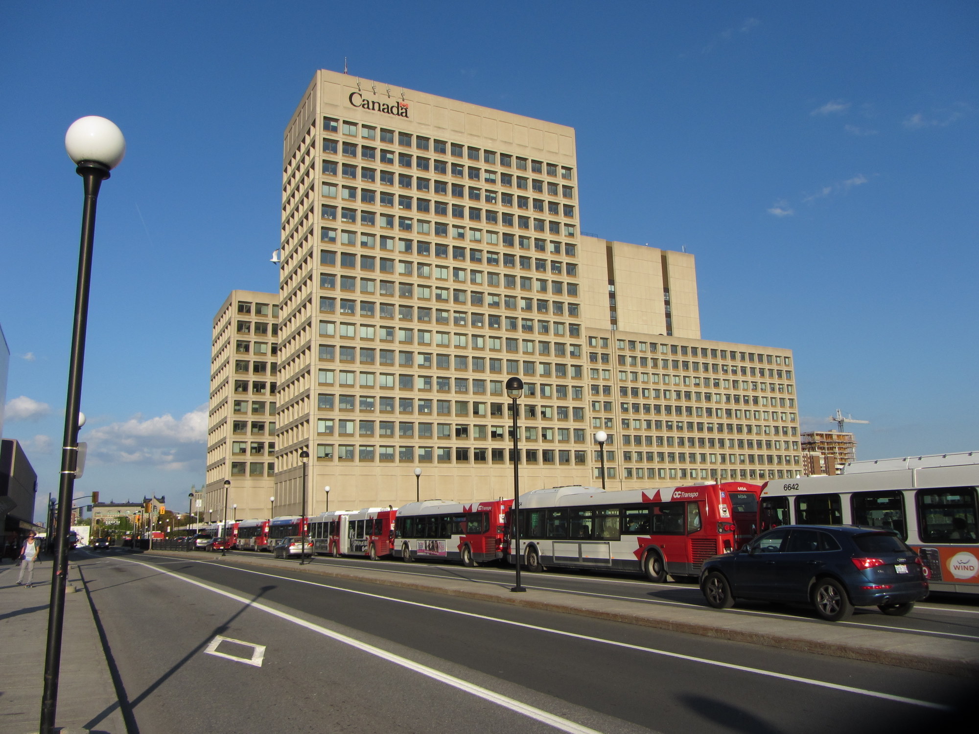
    The first phase of Line 1 replaces the busiest section of the Transitway, including the congested on-street downtown section on Albert and Slater Streets. Though most sections of the Transitway are grade-separated — following the Queensway (Highway 417) on the east end and an abandoned railway corridor on the west end — the downtown section was the weak link. As OC Transpo, Ottawa’s transit agency operated dozens of suburban express routes into the Transitway during weekday peak periods, lines of buses would often stretch for blocks, an especially inefficient transit operation.

    6205682867_7d38a920b6_o.jpgBus congestion on the Mackenzie King Bridge in Downtown Ottawa in 2011

    With most buses gone from the downtown core, the LRT allows for much more efficient operations, even if many commuters no longer enjoy a one-seat ride to work.

    At several stations, including the Transitway connections at Blair, Tunney’s Pasture and Hurdman, fare-paid areas allow passengers to move between bus and train without having to tap at faregates or show fare payment to the bus operator, like many TTC subway stations. This helps to ensure the LRT is a backbone to a strong feeder bus network, rather than a stand-alone operation.

    Most stations are equipped with escalators as well as multiple stairways. There were two side-by-side elevators at most points, providing the necessary redundancy to ensure full barrier-free accessibility. Access is controlled with fare gates like those in Toronto, where Presto cards, paper tickets, and transfers provide access to platform level. All O-Train stations are identified by a simple red circle at each entrance that looks similar to a Lifesaver candy.

    IMG_4483-002.JPGDowntown entrance to Lyon Station, with the O-Train “Lifesaver” totem
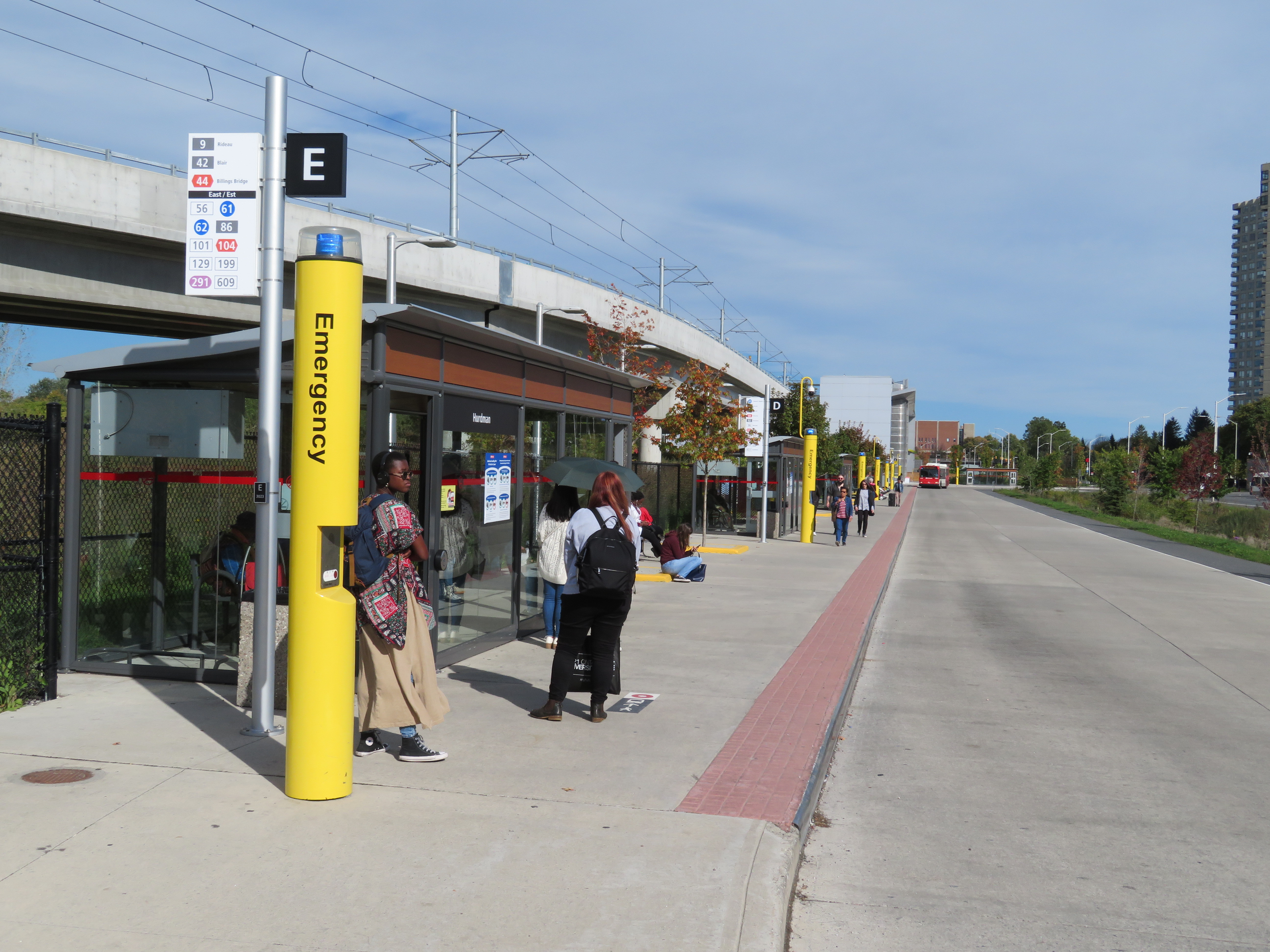
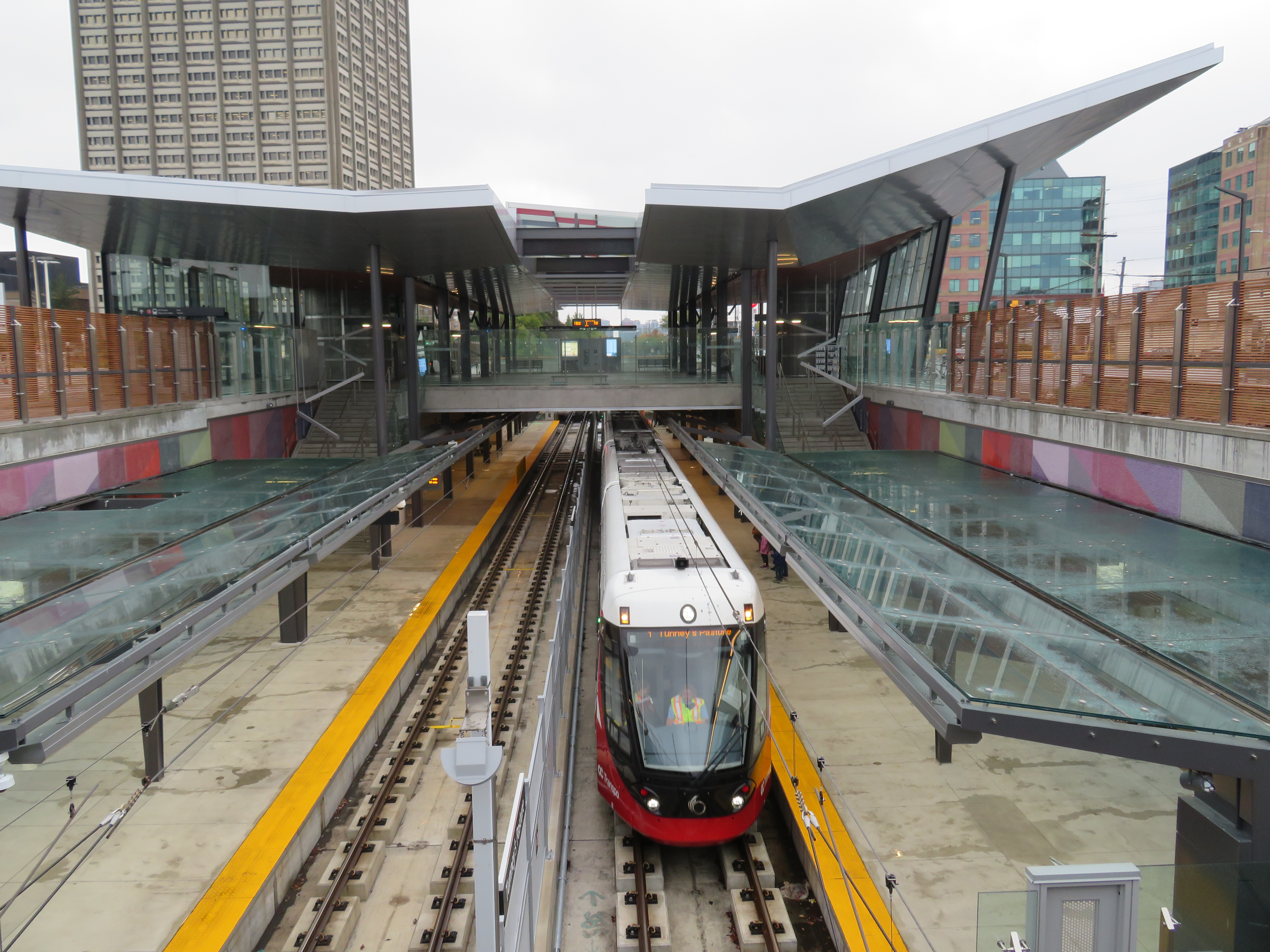
    Unfortunately, some of those rail-bus connections require a long walk outside, such as at Hurdman Station. This was probably the greatest flaw I experienced during my visit last week. Though it was tolerable on a sunny September afternoon, it would be extremely unpleasant in winter or during a rainstorm. It’s unfortunate that the bus terminal was not better thought out to minimize distances between buses and train platforms.

    Ottawa - Hurdman Station
    Bus bay E at Hurdman Station. The bus in the distance is in front of the entrance to the train platforms

    A long-term challenge for the Confederation Line is the ability to direct transit-oriented development around many of the new stations. Though Hurdman Station is major transfer point with the Southeast Transitway, it is located in a floodplain next to the Rideau River. Iris and Blair Stations are located within highway interchanges. There is more potential around Pimisi Station (in the Lebreton Flats, which are already seeing new urban development), St-Laurent (where a second-tier mall could be urbanized), and possibly Cyrville. But all east-end stations are limited by the Queensway.

    These bus transfer and land use concerns were also raised by Alex Bozikovic at the Globe and Mail.


    Vicinity of Hurdman Station
    To the west, however, there is lots of potential for the government office complex at Tunney’s Pasture, which is surrounded by thousands of surface parking lots, as well as eastern Phase 2 stations, which will follow former railway and streetcar corridors, allowing for infill development and urbanization.

    IMG_4502-001Train arriving at the Tunney’s Pasture terminal
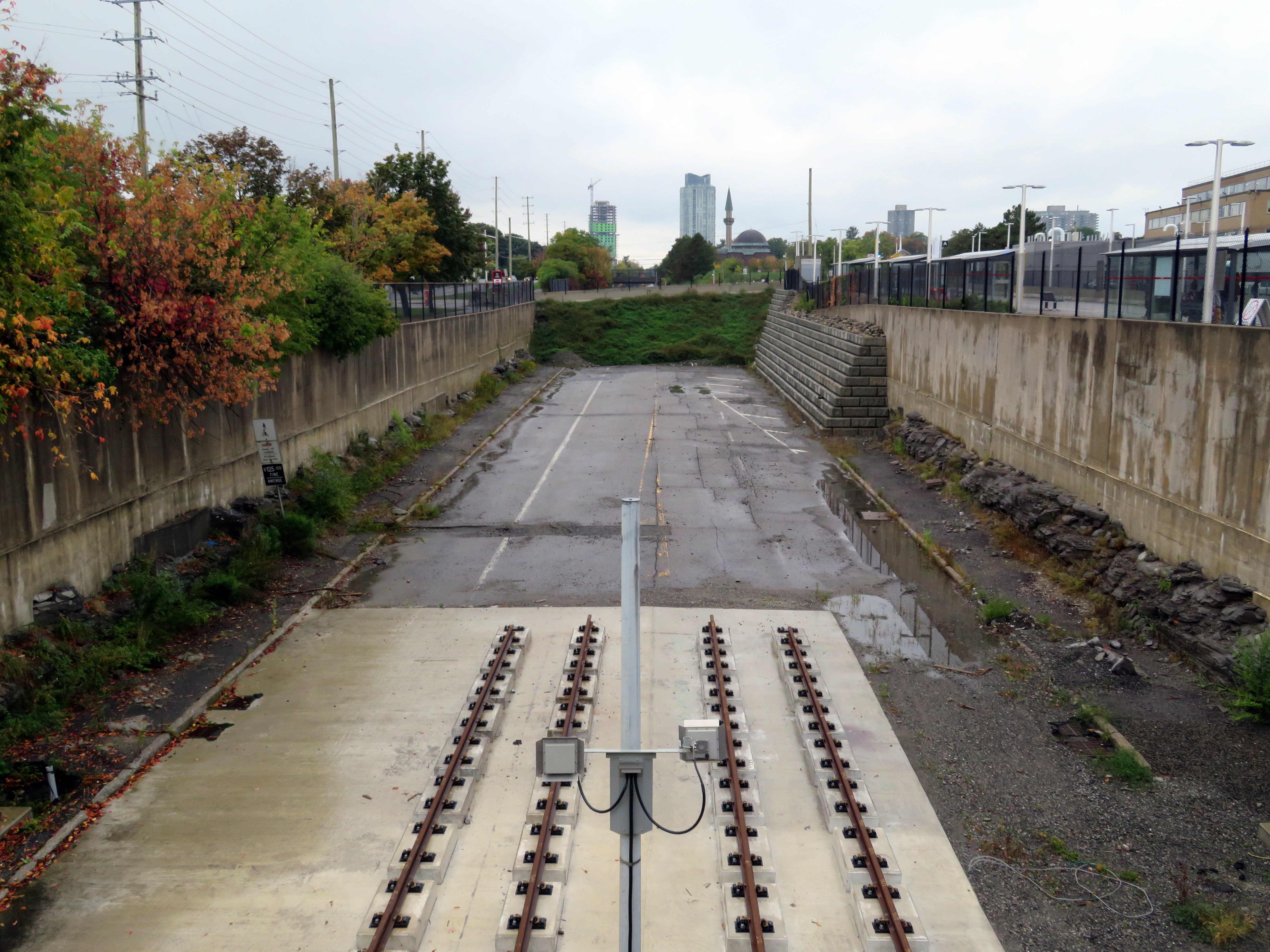
    Light rail transit is misunderstood in Toronto, where it is often equated with streetcars, rather than a flexible rapid transit solution. Indeed, light rail covers a wide spectrum, from traditional streetcars, like the TTC’s legacy street railway, to fully grade-separated high-speed LRTs, like Ottawa’s new line. (The Waterloo ION LRT, with a mix of reserved lanes, median operation, and off-road segments, fits somewhere in between.)

    The Confederation Line’s average speed is 31 km/h, with a top speed of 80 km/h. In comparison, TTC Line 1 has a weekday average speed of 28 km/h, and the 501 Queen Streetcar has an average speed of just 9.9 km/h during the morning rush hour. The Waterloo ION LRT currently has an average speed of 21 km/h.

    It is worth noting that the Scarborough RT replacement, once fully funded and ready to start construction six years ago, would have been just as fast and smooth as the Confederation Line. Instead, our local and provincial politicians continue to spin their wheels on planning a subway extension that’s going nowhere. Meanwhile, Ottawa has already started work on Phase 2 of its light rail network.

    IMG_4493-001The end of the beginning: the old Transitway is visible west of Tunney’s Pasture, where Phase 2 of the Confederation Line will continue towards Baseline and Moodie Stations

    The Eglinton-Crosstown LRT will have a long underground segment, with two-car LRT trains similar to those used in Ottawa. When that opens — planned for late 2021 — Torontonians will finally get a taste of high-order light rail transit.