Quinte Transit bus stopped at the Belleville Bus Terminal, August 2026
Last month, I visited two beautiful towns in Eastern Ontario: Picton, in Prince Edward County, and Almonte, in Lanark County. Both communities have populations of just over 5,000 (though Almonte, within Ottawa’s commutershed, is growing), and both have wonderful downtowns full of independent stores, restaurants, and great public spaces. But you can only get to one of them without a car.
It was pretty easy to get to Picton from Downtown Toronto on a Thursday morning. Flixbus offers a direct seasonal service from Pearson Airport and Union Station Bus Terminal, stopping at Scarborough Town Centre, Whitby, and Trenton, and in Wellington, Bloomfield, and Picton in Prince Edward County. The County (which is actually a single-tier municipality) has become a popular tourism area, with visitors attracted by local wineries, art galleries, resorts, and the famous Sandbanks Provincial Park on Lake Ontario, so having alternative modes of transport to get to and around the area is welcome.
Unbranded Flixbus unloading in disused parking lot near Downtown Picton
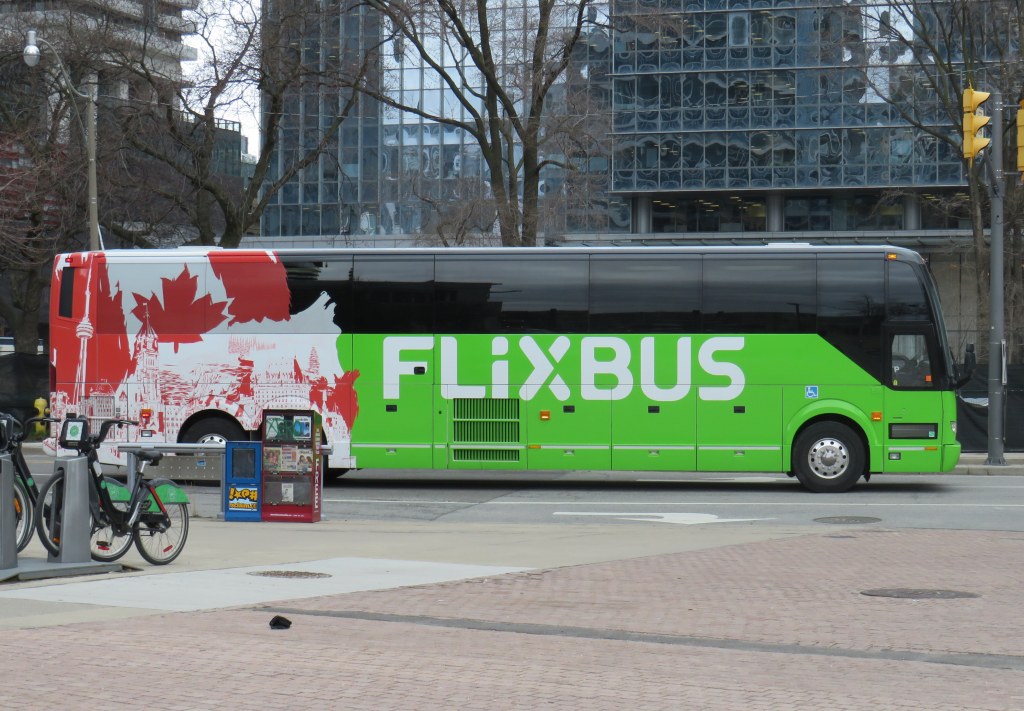
As Flixbus does not operate its own buses — it partners with local coach operators — the buses do not have a consistent look. The bus on my August 20 trip, operated by Eastern Charter Inc., was a plain grey coach bus, but it was a comfortable ride. The last stop, in an unused parking lot off Picton Main Street, is across the street from a McDonald’s but is also a short walk to the downtown area. The parking lot, once used by a now-demolished church, is large enough to turn the bus around for the return trip.
Picton Main Street
Downtown Picton itself is very walkable, with regular pedestrian crossings and beautifully maintained sidewalks and street furniture. Even though there are larger retailers just outside the town centre, most storefronts are occupied by clothing stores, antique dealers, financial services, and craft shops, there is also a large independent bookseller, complete with attached cafe. Though many businesses are geared towards tourists and more affluent residents, it is not exclusively the case. The public library, a renovated and expanded Carnegie building, serves the entire community well. Discount chain Giant Tiger also thrives in the downtown area. The Regent Theatre, one of Ontario’s oldest continuously-operating theatres, has been hosting concerts, shows, and first-run movies since 1931.
Regent Theatre, which also contains a tourism information desk, is open between showsThe Carnegie Library on Picton’s Main Street, with a small playground out frontThe sidewalks full of life and room for street trees, benches, and outdoor store displays.
Prince Edward County also offers on-demand transit service within the municipality and a weekday fixed-route service between Picton, Bloomfield, and Belleville operated by Trenton-based Quinte Transit. During the summer and early fall, additional fixed-route services operate between Belleville, Wellington, and Picton, sponsored by local wineries and tourist attractions. Bus stops are well marked, with current schedules posted at each point.
County Transit bus stop at the Fairgrounds (Crystal Palace)
At Downtown Belleville, there are connections to Belleville Transit, which serves the VIA Rail Station and the Megabus/Flixbus stops near Highway 401 and to Quinte Transit’s Trenton service at Loyalist College. There also used to be a connection at the downtown terminal for Deseronto and Napanee, but sadly it disappeared last year.
Prince Edward County does a fine job running and marketing a transit service geared to both its residents and to visitors. It should be a model for other communities in Southern Ontario and elsewhere.
Almonte: Nowhere to go
Dr. James Nasmith Square, Almonte. The old post office on the right is home to a great Italian restaurant, fittingly named Il Postino.
Almonte, less than an hour’s drive from Downtown Ottawa, is another charming and busy town, full of independent shops and restaurants in heritage buildings. On a busy summer weekend, parking can be hard to find. The town, part of the municipality of Mississippi Mills, is also growing, with new residential development to the east of the historic downtown. It has just about everything that Picton has, except for a transit link.
Prior to the COVID-19 pandemic of 2020, there was a weekday commuter bus that would shuttle workers from Almonte and Carleton Place to Ottawa and back, making several stops along the OC Transpo bus network. Though Flixbus has restored the lost Greyhound route along Highway 7 between Toronto, Peterborough, and Ottawa with stops in Carleton Place and Perth (and with a schedule that accommodates commuters), these coach buses stop at gas stations along Highway 7 and don’t serve the communities very well, unlike the commuter-centric buses operated by smaller companies like 417 Coach and Thom Transport.
As the federal government is mandating full in-office shifts again, and as towns like Almonte and Perth become popular day trip destinations, it’s time for places like Lanark County to follow Prince Edward’s lead.
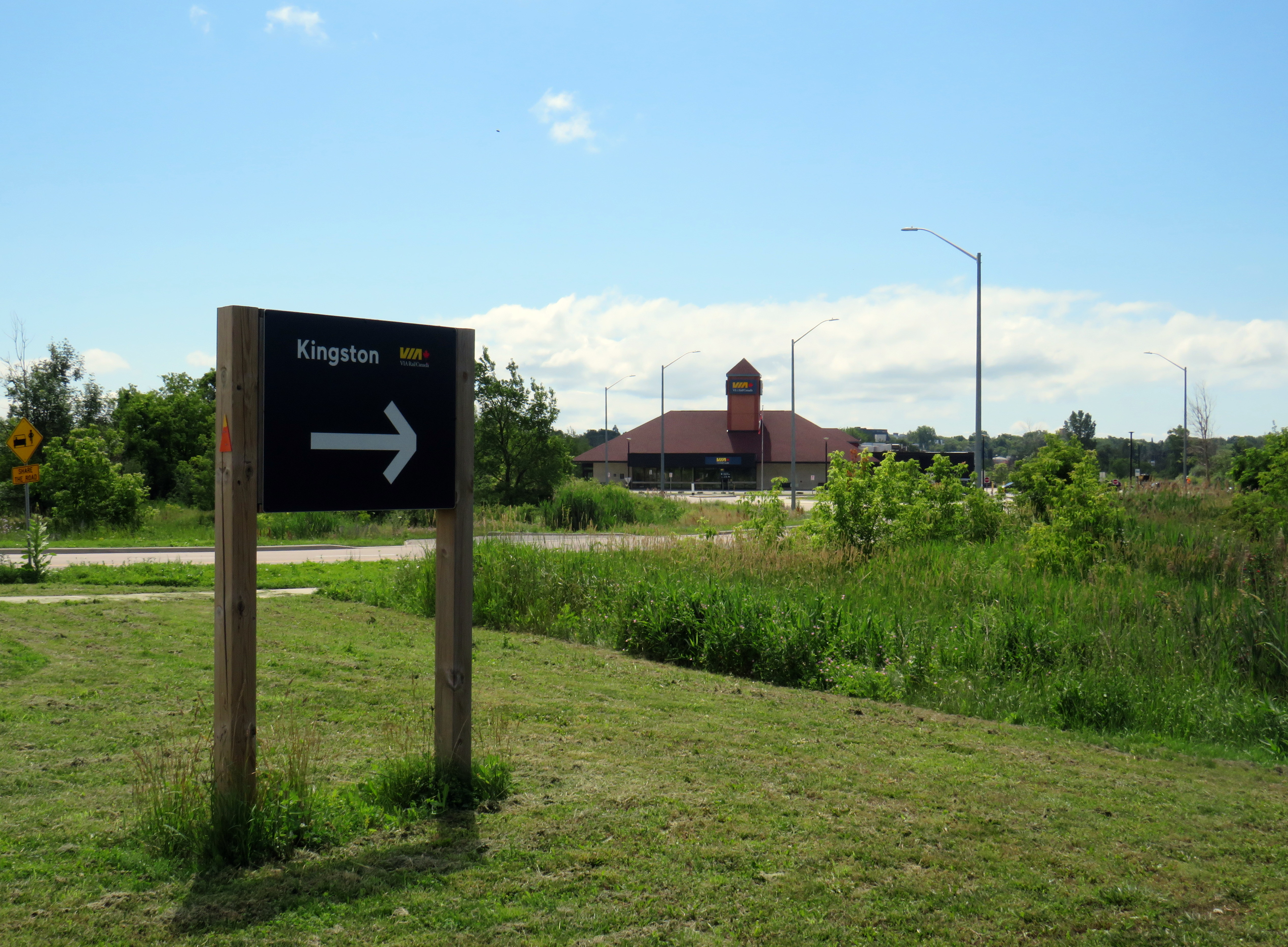
Located in a marshy area, Kingston Station is unnecessarily isolated from the rest of the city
Kingston, Ontario, is the largest city between the Greater Toronto Area, Ottawa, and Montreal. With Queen’s University, Royal Military College, and St. Lawrence College, Kingston is a major trip generator for VIA Rail, and has one of the busiest stations on the Quebec-Windsor corridor. It is also one of the most isolated intercity rail stations in Southern Ontario. Kingston’s geography and earlier decisions made by CN are largely to blame, but the future of VIA’s existing rail services is largely dependant on the fate of Kingston Station.
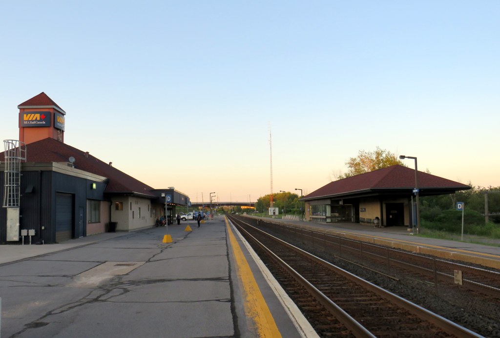
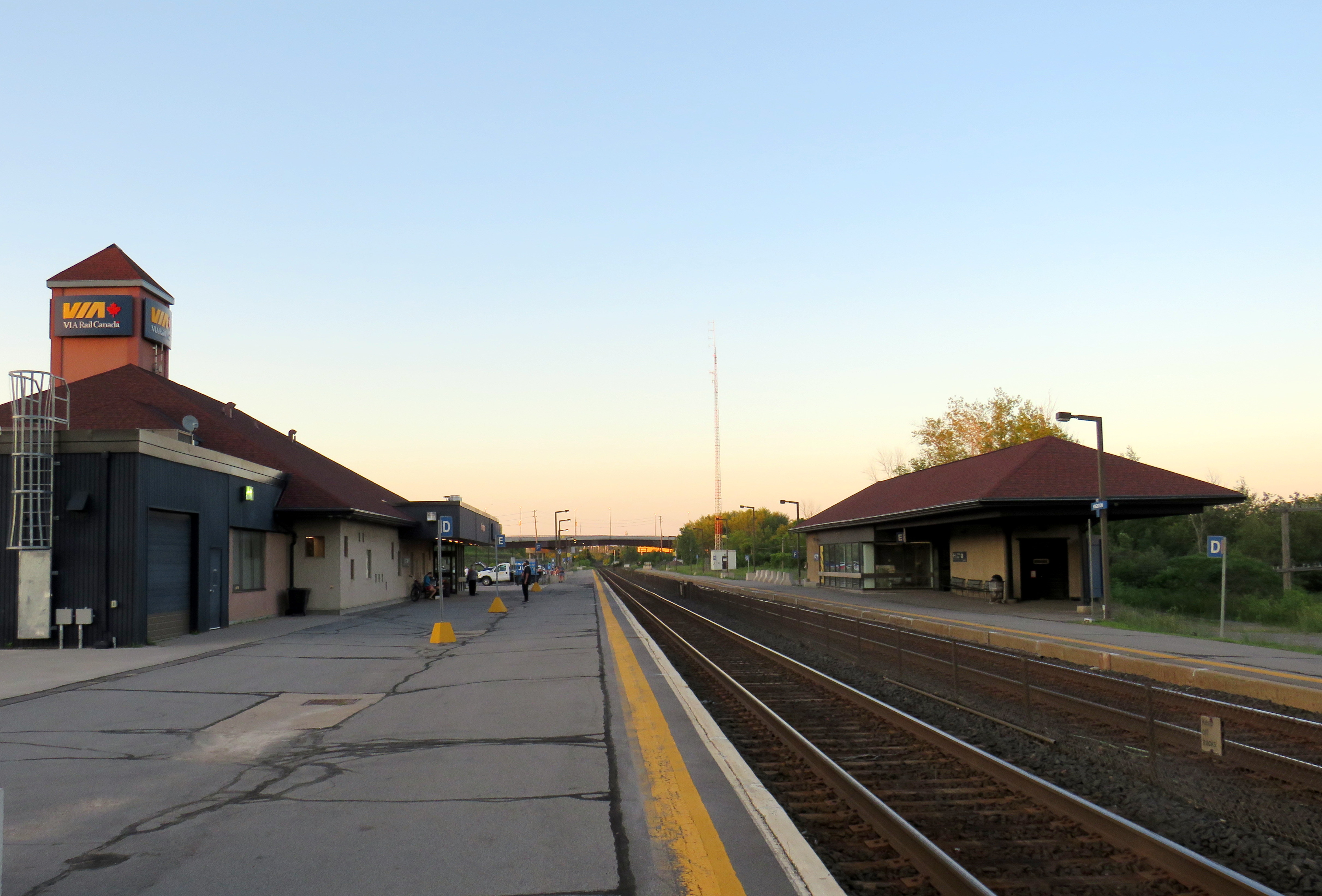
The VIA Rail station, off John Counter Boulevard, was constructed by CN in 1974 to replace a 1850s-era railway station on Montreal Street. The station has a ticket counter, washrooms, a ticket counter, and a small business class lounge, and two platforms. The south platform is connected to the station by way of a tunnel, with elevators, stairs and escalators providing access. Renovations in the early 2000s added a peaked roof and a tower displaying the VIA Rail logo to the minimalist CN station.
But the station is in an isolated location, located in a marshy area; the nearest businesses are a furniture store, a funeral home and a used car dealership. Despite this, Kingston Transit does a satisfactory job connecting the station to the downtown and post-secondary institutions, but the bus stop is unsheltered and a short walk away from the station building.
The two-track arrangement at Kingston Station does not suit CN or VIA particularly well. Both tracks are on the mainline, meaning that they are shared by VIA and freight. Delays to either CN or VIA causes congestion, one of several causes of train delays, contributing to VIA’s poor on-time performance. It also limits VIA’s flexibility in offering early morning or late evening trains that originate or terminate at Kingston or local all-stop service in conjunction with through express services. Newer VIA stations in Belleville and Cobourg have three platforms; the Belleville station tracks allow VIA trains to bypass the CN yard to the north.
The two-platform Kingston Station
The reasons for the Kingston station’s relative isolation compared to other mid-sized centres like London or Brantford, partly goes back to the 1850s, when the Grand Trunk Railway, which built the Toronto-Montreal mainline, routed its tracks away from Kingston’s urban centre. As the historic downtown sits at the mouth of the wide Cataraqui River, the Grand Trunk sought a narrower crossing further inland. To compensate, it built a spur into Downtown Kingston to serve local passengers and freight service; eventually a streetcar line ran to the main Montreal Street station and the city grew north to meet the railway.
In the 1970s, Canadian National, the successor to the Grand Trunk, was in the midst of modernizing its core infrastructure to focus on long-distance freight and container shipping. It rerouted its mainline north of Kingston on a shallower curve while eliminating several at-grade crossings. As CN continued to operate passenger rail on the corridor, it had to build a new station to replace the old Montreal Street location. The new Kingston Station had plenty of parking along with a passenger pick-up/drop-off loop, easily accessible to Princess Street and the new subdivisions in Kingston Township.
CN had the same principles in mind when it built new stations after the Second World War in Oshawa, Saskatoon, and Ste-Foy, outside of Québec City. Ease of rail operation and access to parking were bigger considerations than having a downtown station accessible by foot or public transit.
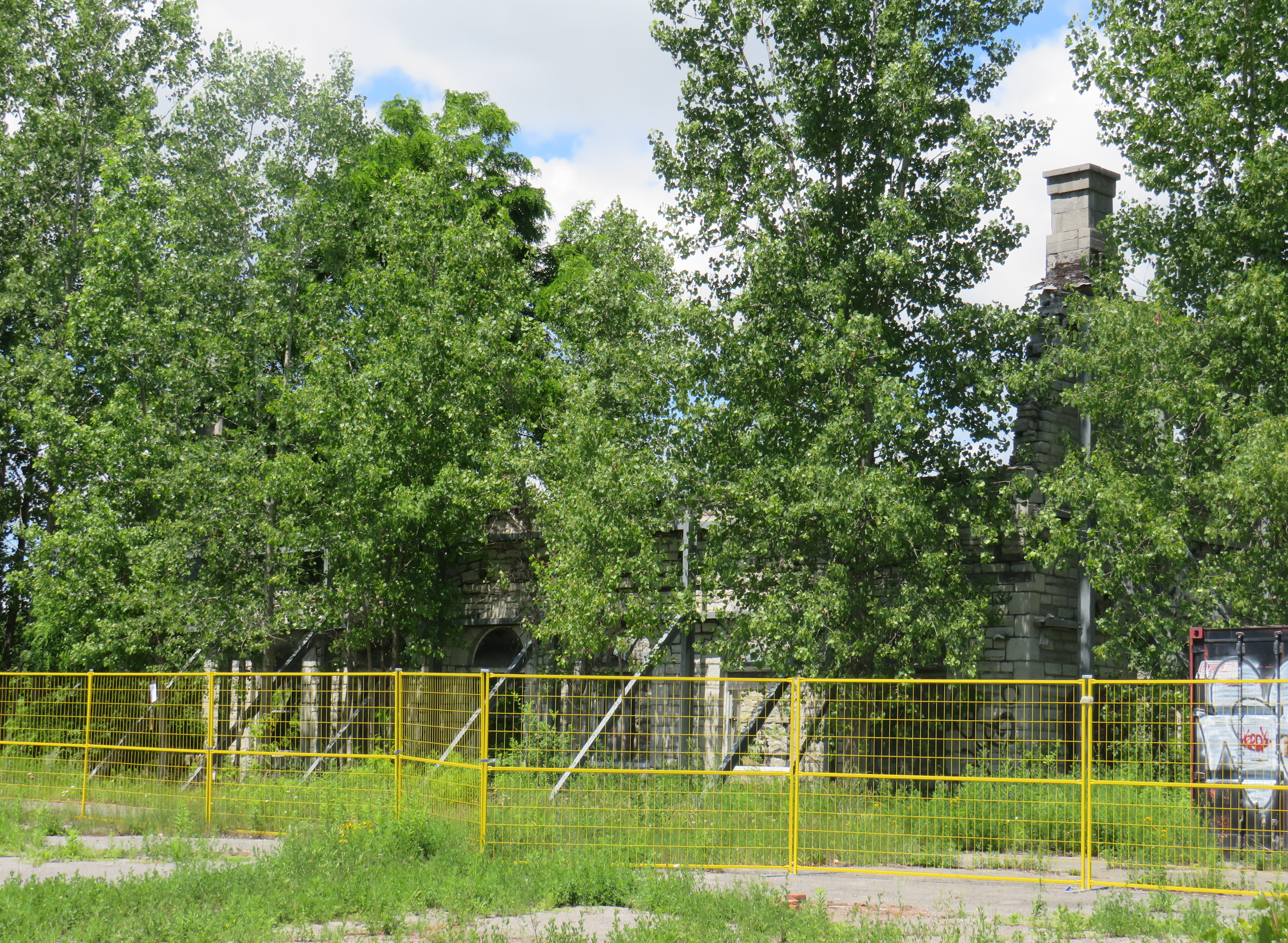
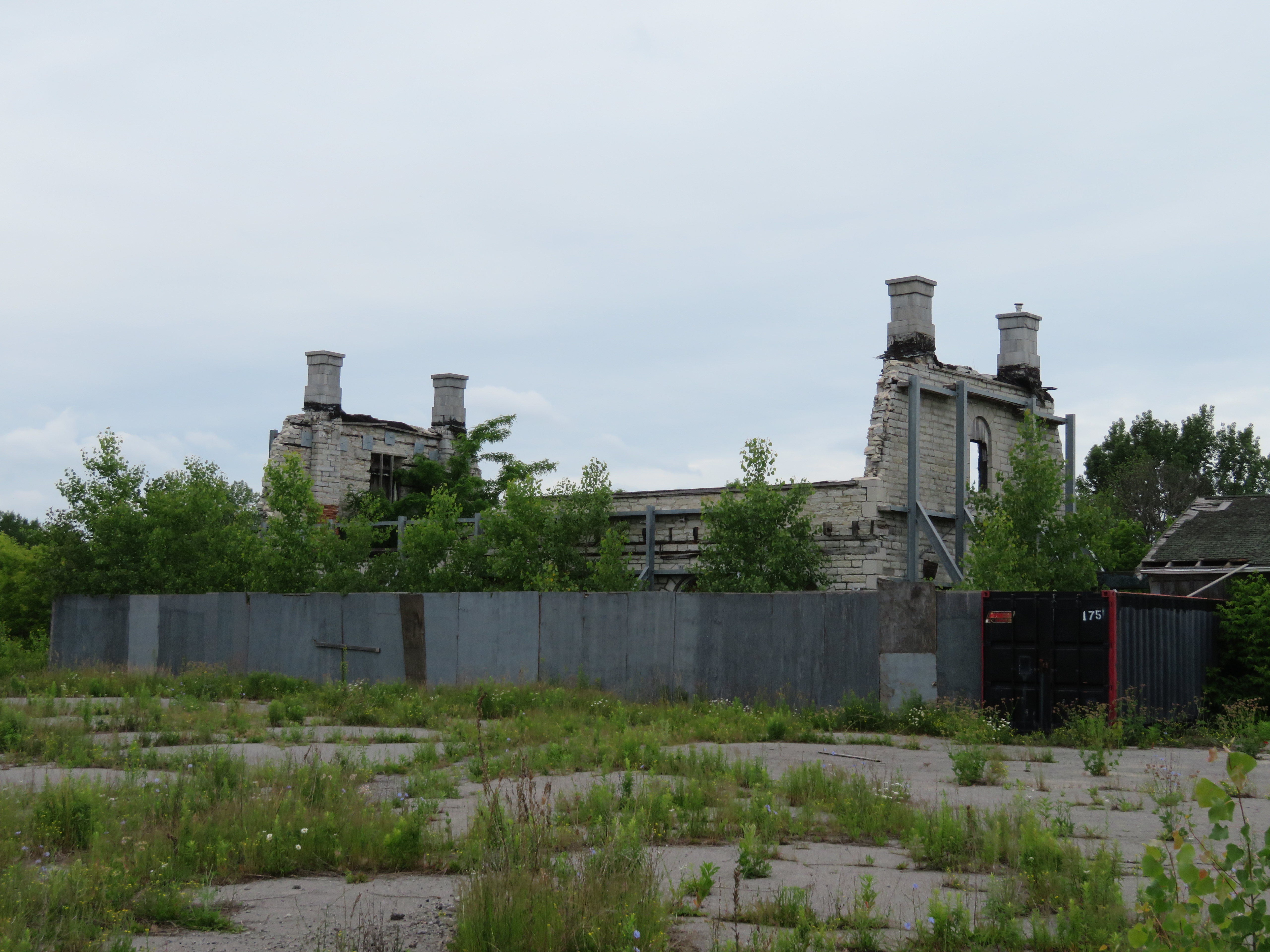
Trees grow around the stone ruins of the 1850s Kingston GTR StationA similar view eight years earlier, in 2018
Today, the original GTR station lies in ruins, fenced off, and partially hidden by trees that have grown around it. The roof is long-gone, as are the additional station buildings such as the express freight and restaurant structures. With the vacant railway lands sitting abandoned for decades, this part of Montreal Street looks rough.
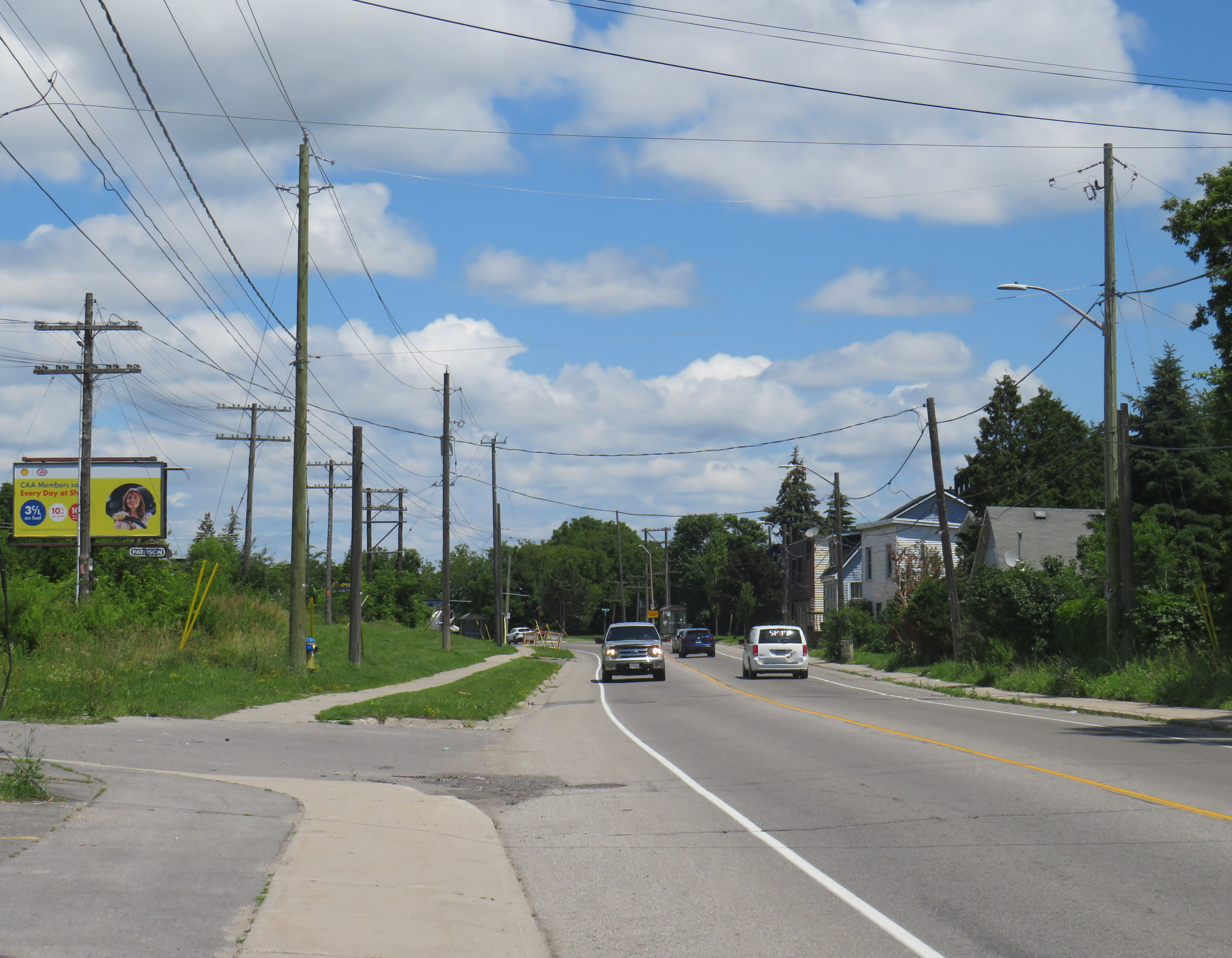
Montreal Street near the old station. The old railway telegraph lines at left betray the old railway route
An opportunity for a new station
Happily, there’s an ideal place for a larger Kingston Station between the old Montreal Street and the newer John Counter Road site that could serve as a proper multimodal hub while being somewhat more convenient to Downtown Kingston and Queen’s University: Division Street. I alluded to this in an earlier post, but after a recent visit, it appears that this is an excellent opportunity.
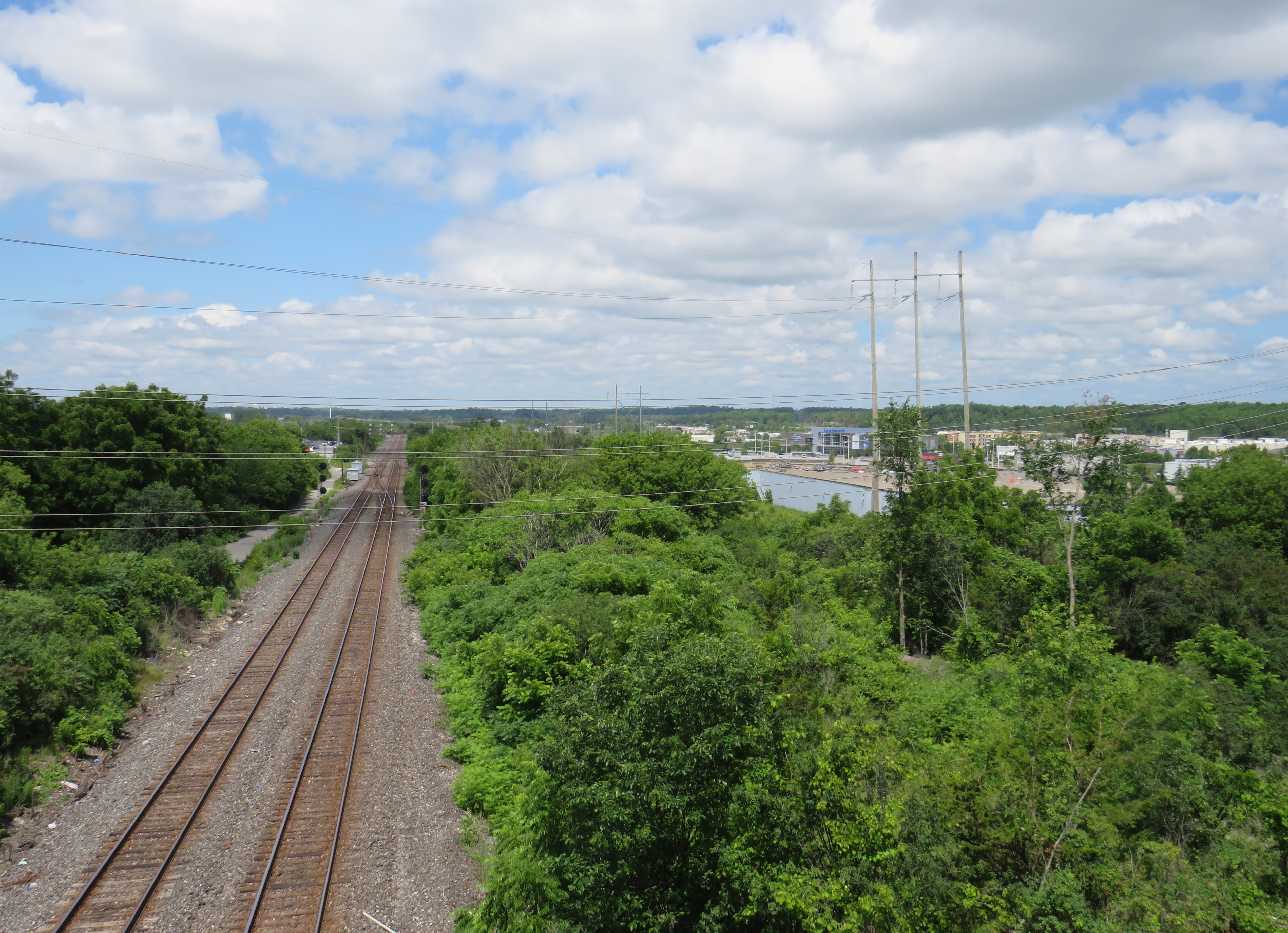
Looking west from Division Street over the CN mainline. The wooded area immediately to the north (right side) offers plenty of room for a new intermodal station.
The CN mainline passes under a long overpass at Division Street that was built in the 1970s not only to cross the CN line but also a Canadian Pacific-owned branch line that once ran between Kingston’s waterfront and Renfrew, near the Ottawa River. The additional room allocated for the now-abandoned CP branch could easily fit two VIA-exclusive tracks, separate from through CN freight trains. This would allow VIA trains to sit overnight, and provide early-morning service to Toronto, Montreal, and Ottawa leaving on schedule. If the Alto HSR takes over the bulk of the through passenger traffic, Kingston will have an excellent regional hub that will serve Eastern Ontario rail passengers far better than the status quo, with more reliable schedules and the opportunity for late night arrivals.
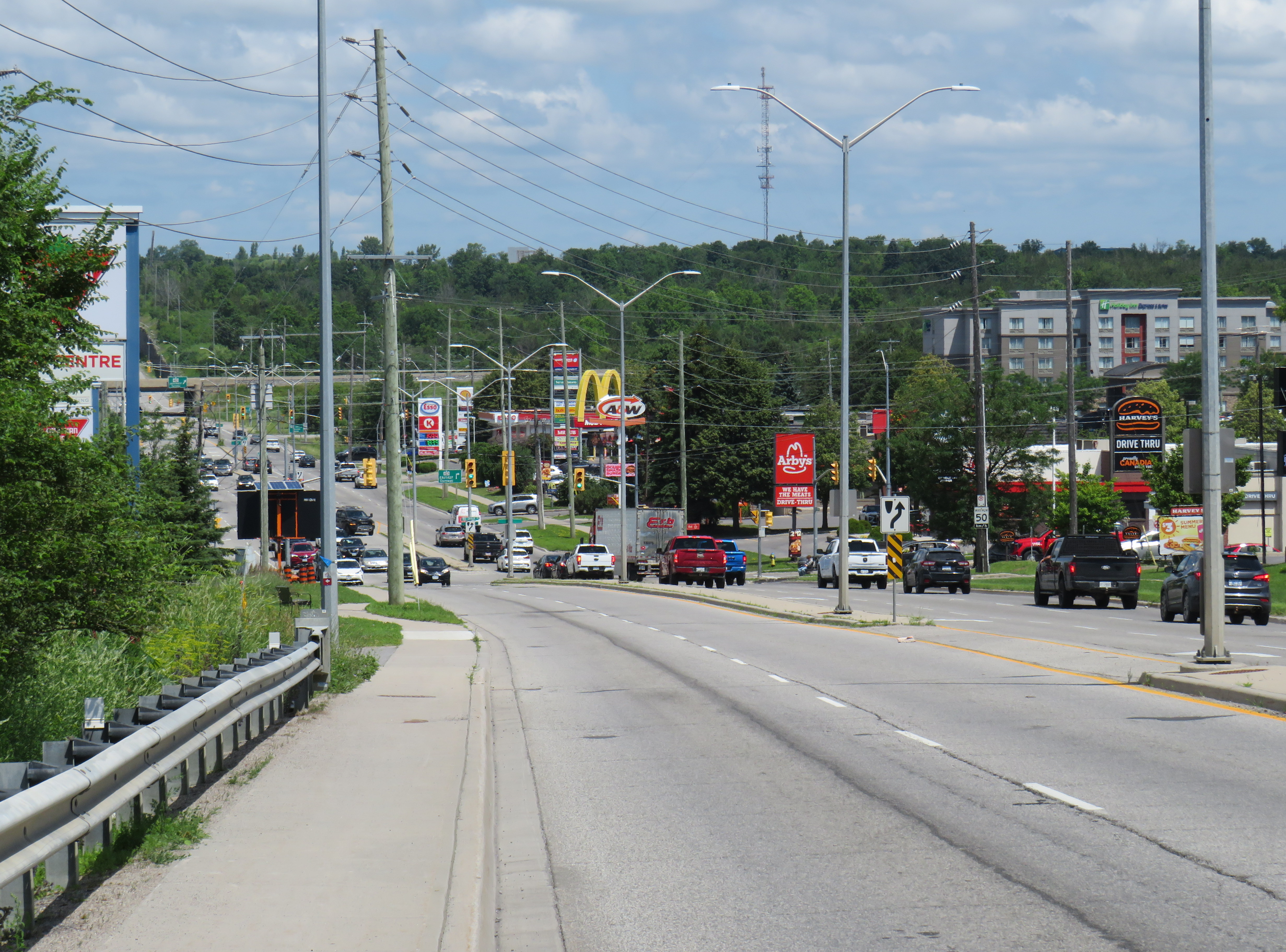
Looking north from the Division Street railway overpass towards Highway 401.
Another advantage of the Division Street site is the proximity to Highway 401. This would allow intercity and regional buses to easily exit and enter the intermodal station. As Division Street continues south towards Downtown Kingston and Queen’s University and is already a major Kingston Transit corridor (with direct and regular service on Routes 1, 2, and 701/702 express, as well as other nearby routes), it’s a logical focal point that can consolidate the various intercity bus stops.
Back in June, Alto announced that federal transport minister Steven MacKinnon directed the consortium to “…develop a plan to assess a southern route option between Peterborough and Ottawa that includes a potential stop in Kingston that would interconnect with VIA Rail services, subject to technical feasibility and project requirements.”
Previous conceptual maps showed the proposed southern alignment located far from Kingston’s urban area, with the closest potential station locations in sparsely-populated South Frontenac Township near the communities of Verona, Sydenham, or Perth Road, at least 20-30 minutes north of Kingston’s urban area by car. If Alto were to serve Kingston properly, it would have to swing much further south, adding to construction costs and through travel times. A spur line into Kingston might make more sense, then, just as the Grand Trunk did 170 years ago.
The time savings to Montreal, Toronto, and Ottawa with a high speed line from Kingston might be better provided with a new conventional railway station and more flexible, reliable service to meet the needs of communities like Kingston, Belleville, and Brockville, rather than forcing Alto farther south. Division Street offers that opportunity.
Extensions to Montreal’s REM has resulted in some regional route changes in the Montreal area
In time for summer, I have updated my Canada Intercity Transportation Map to include new connections and revisions. The only major changes to the intercity coach layer are new routes operated for Flixbus, including new seasonal routes from Toronto to North Bay and Prince Edward County.
In Quebec, the opening of the Deux-Montagnes and Anse-à-l’Orme branches of the REM in Greater Montreal resulted in several long-distance Exo regional bus lines cut back or replaced in favour of local bus routes feeding into the new regional rail service. Therefore, I have decided to remove Exo bus routes from the map where they exist entirely within one or two urban transit zones, being consistent with the municipal transit agencies surrounding Toronto. However, long-distance express routes and routes that serve Montreal’s outer periphery will remain on the map as part of the regional route layers.
In addition, I have also included a few new and previously overlooked services operated by the MRCs (municipalités régionale de comté), including taxibus service areas, which operate similarly to on-demand transit elsewhere in Canada, but have posted stops and semi-fixed schedules; many of these require preregistration before reserving a ride. Where taxibus services operate, I have opted to include those as on-demand, rather than fixed route lines to be consistent across Canada. Only on-demand and taxibus services that are open to the general public are included in the map.
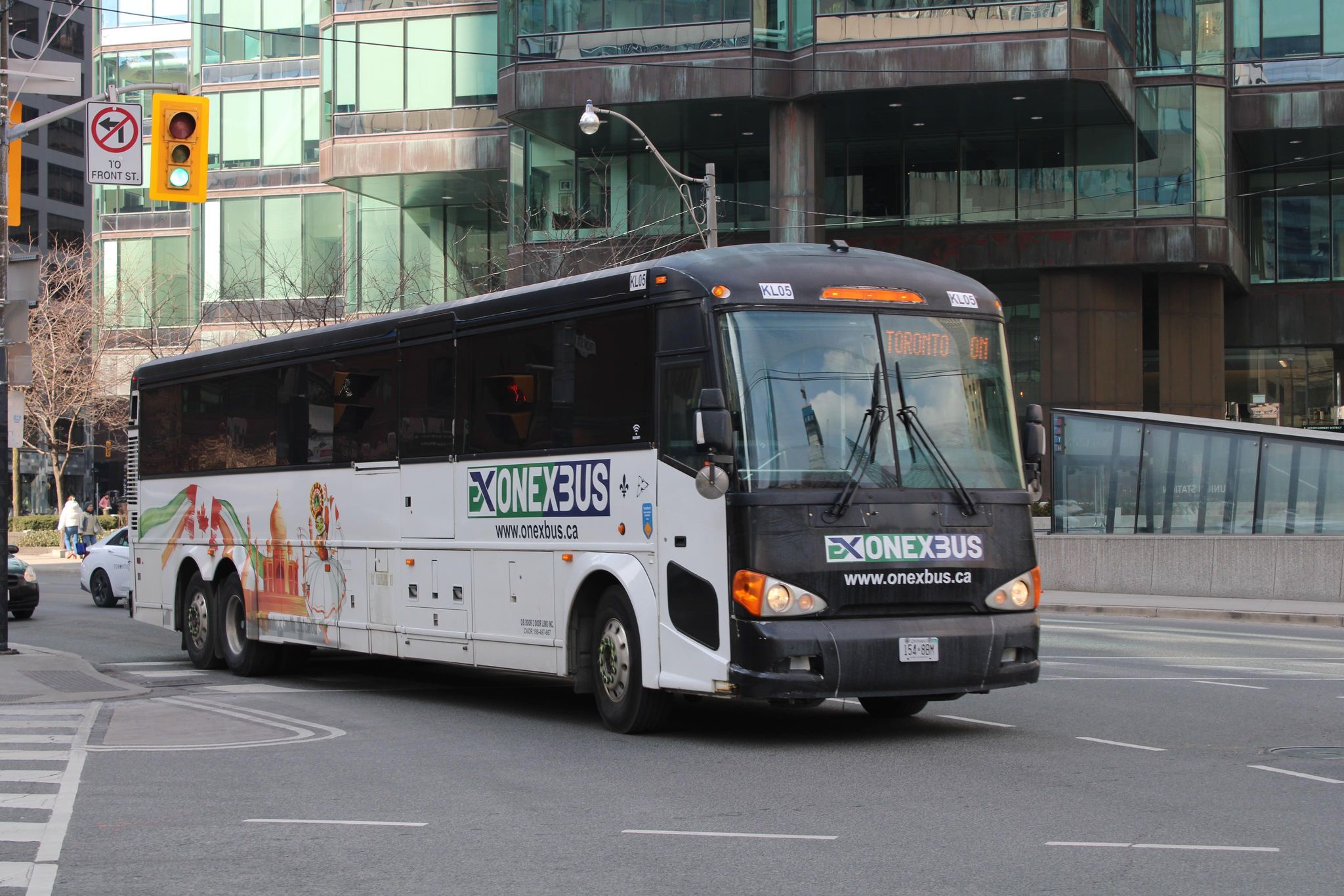
Onex Bus changed its schedules recently, eliminating most departures from Brampton Gateway
Mapping smaller intercity coach operators continues to be challenge, as deregulation in Ontario and Western Canada and online ticketing have made it harder to track changes in schedules and stop locations, though I have noted some changes with Onex Bus’ schedules, which ended most trips to and from Brampton Gateway Terminal at Main and Steeles earlier this year.
Previously, carriers like Greyhound would publish detailed schedules that were valid for at least a few months at a time, including holiday and school break special runs; Ontario Northland and Quebec-based carriers (where provincial regulation remains in force) at least maintain consistent schedules. As it is much harder to track this industry — with no central database — I always appreciate the contributions website visitors provide by email or social media. I thank everyone who has helped so far.
Unfortunately, the costs of maintaining this website and the ArcGIS Online portal to my maps continue to rise. However, I am committed to provide an ad-free, paywall-free resource. If you enjoy my work, please consider buying me a coffee to help with those costs. Thank you!
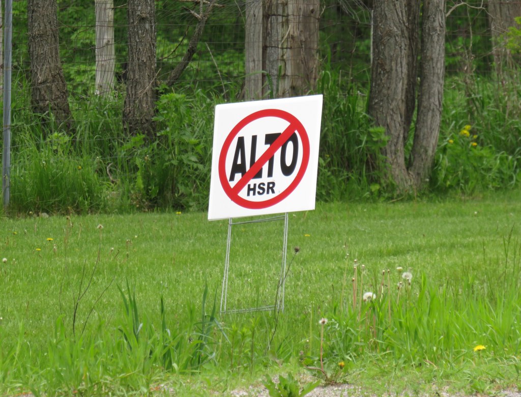
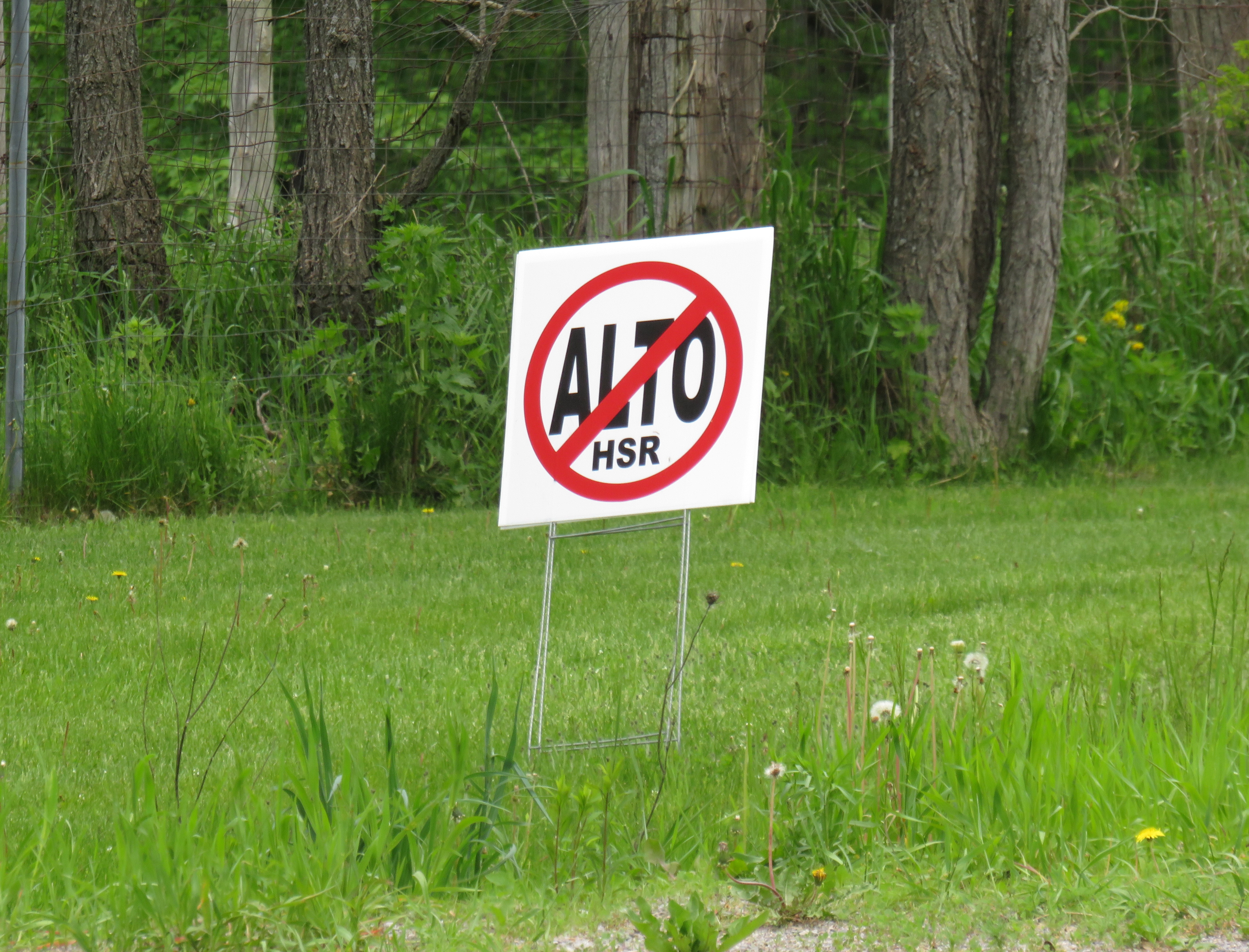
A “No ALTO HSR” sign on a property near Marmora, Ontario
There’s a running joke that Canada leads the world in high speed rail studies, but we never follow through with actually building those high speed lines. Comedian Rick Mercer had at least two sketches on his old weekly CBC television show mocking this state of affairs, as the idea goes back to the 1970s.
“VIA Rail: Yesterday’s speeds, today.”
“Canada’s High Speed Rail Study Industry: The future, never!”
In 2026, however, Canada is finally past the high speed rail study phase and appears to be committed to building the seven-station corridor between Toronto, Ottawa, Montreal, and Quebec City, with a consortium selected that is already planning the detailed route. It’s an exciting time as the first phase, between Ottawa and Montreal, should start construction in three years once the exact corridor is decided upon and land acquisition has begun.
High speed rail, if done right, should benefit Eastern Canada as a whole. Fast and frequent train service will divert a lot of the travel in the busy Toronto-Montreal-Ottawa triangle from the air, reducing emissions and allowing existing airports to handle any increases in long-haul demand. Faster and more reliable passenger train service would also take traffic off the highways and boost commerce within the most populated part of the country. If done right, it will also support plans for better transport infrastructure outside the corridor to Southwestern Ontario and provide Canadian expertise for other projects such as in Alberta, which is contemplating its own passenger rail network between Calgary and Banff and north to Edmonton.
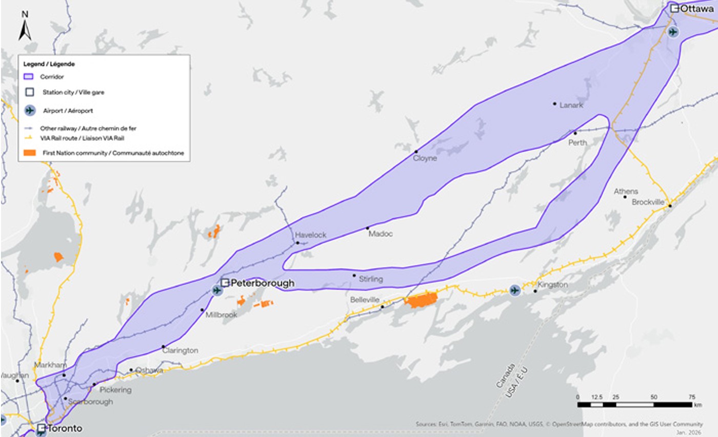
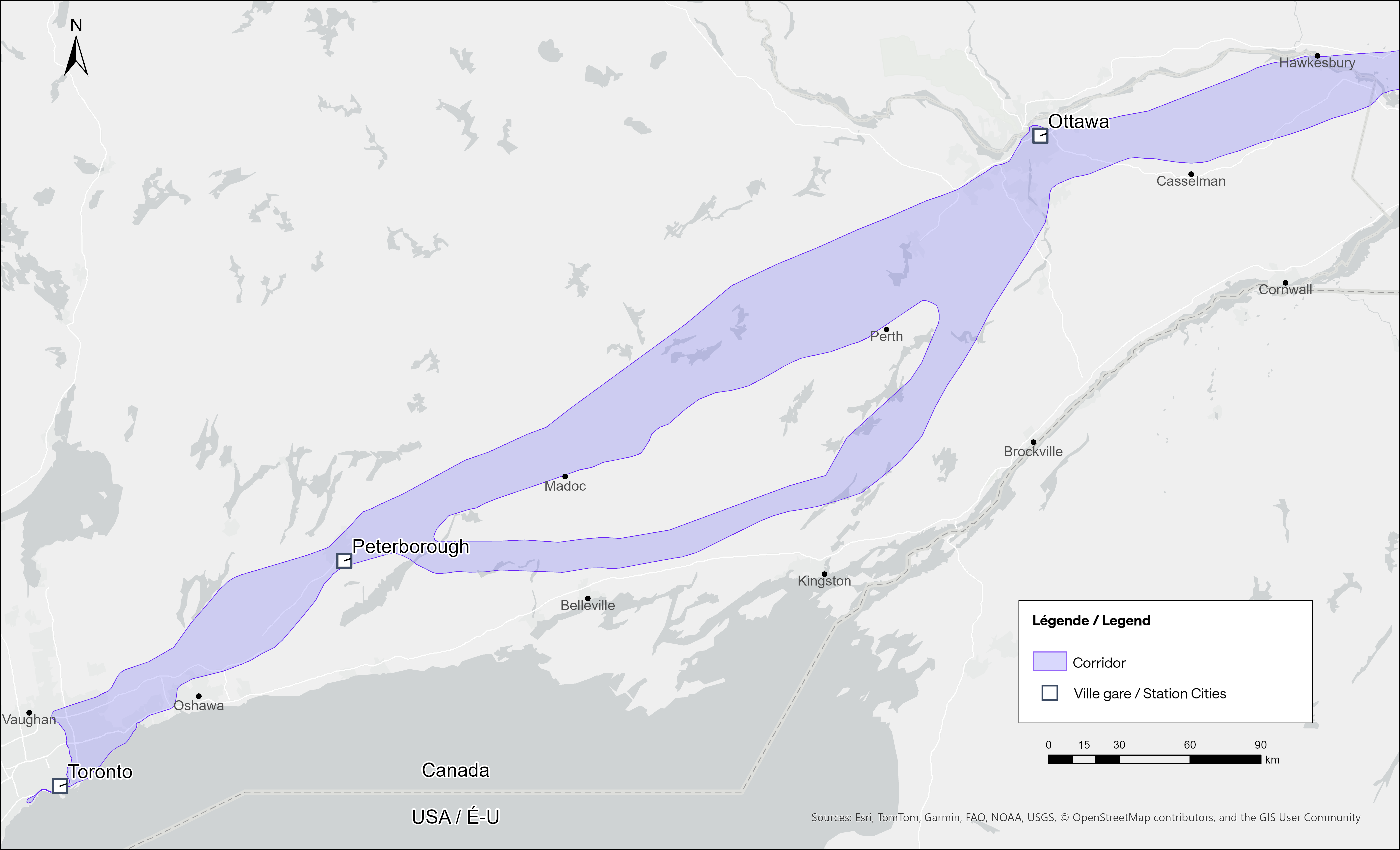
Map of potential routings for the Alto high speed line in Ontario
Not unexpectedly, there is opposition from residents and landowners along the route, especially in Eastern Ontario and the area of Quebec just northwest of Montreal. In Hastings County, north of Trenton and Belleville, there are a few dozen “No Alto HSR” signs on lawns and farms in places like Madoc, Marmora, Stirling, and Tweed. In this part of Ontario, between Peterborough and the Rideau Lakes region southwest of Ottawa, there are two broad potential routes: a southerly corridor runs near Campbellford, Stirling, Tweed, and Westport, including through some productive farmland in Northumberland and Hastings Counties. A second route runs north of Highway 7, just north of Madoc and Perth, along the southern fringes of the Canadian Shield.
Though a high speed railway line would be straight and relatively narrow, it would require the acquisition and severance of hundreds of properties. Along the existing CN and CP railway corridors to the south constructed in the 1850s and 1900s, there are frequent public road and private-access level crossings, something that is not possible with modern high speed trains passing at up to 300 kilometres per hour, so farmers whose land is crossed by the new high speed railway corridor may not be able to access parts of their property easily. Furthermore, there are no stops planned between Peterborough and Ottawa, a distance of over 250 kilometres.
In Prescott & Russell Counties in the Lower Ottawa Valley, even the local governments are opposed to Alto crews doing early survey work to determine an optimum route, with county warden Mario Zanth clear on the matter: “This council does not want them on our territory.” For now, Alto surveying is mostly done by way of drones over land where landowners have not granted access.
Once a more specific route is selected, hopefully some of the opposition will fade. Detailed design work and further consultation should also help mitigate concerns. This is especially important west of Ottawa, where there are the two diverging routes.
Despite the rural opposition, Alto should go ahead. Other major infrastructure projects, especially new highways, can be far more disruptive to local land use. But without local community benefits — at least a new freeway has regular access points — it will be harder to get buy-in.
Therefore, this needs to be a matter of “Alto and” than just “Alto” by itself. This means building and maintaining a supporting network of conventional VIA service, intercity and regional buses, and local transit connections. It might also mean adding a few additional stations along the route, in places such as Perth. Adding additional stops doesn’t have to slow down trains at all; Japan’s Shinkansen has three classes of trains, from the super-express Nozomi to the all-stops Kodama. While most passengers would be through Toronto-Ottawa-Montreal travellers, offering additional stops for select trains can make Alto more accessible to more people, especially if it means providing new options to underserved communities.
An express train passes the local Odawara Shinkansen Station in April 2019
If Alto becomes the backbone of a strong, integrated transportation network in Ontario and Quebec, the benefits will go far beyond those in the six cities directly served the planned high speed line, even to those directly bypassed by Alto trains. This integration is commonplace in Japan and Europe.
In Kingston, for example, a new or upgraded VIA station with additional tracks and platforms would allow for early morning departures and late evening arrivals from Toronto, Ottawa, and Montreal without having to sit on active CN freight tracks overnight; VIA schedules built around serving cities like Belleville, Kingston, and Drummondville would ensure the existing service remains vital as through passengers switch to the faster line. A new Kingston station near Division Street could integrate rail and bus services, with easy access to Highway 401, with local and regional buses to places like Gananoque. Enhanced bus connections to the rest of the Ottawa Valley from the Ottawa Alto/VIA Station could allow travelers from Pembroke, Arnprior, or Hawkesbury to quickly continue their journeys via train. At Trois-Rivières, there should be seamless connections to places like Shawinigan and Victoriaville. The Canada Intercity Transportation Map on this website shows which communities are unserved or underserved by bus and rail: these include many towns in Southern Ontario and Quebec that are within 100 kilometres of the Alto corridor.
Canada is right to invest in high quality and sustainable transportation infrasturure as a nation-building project, to boost the regional and national economy, and promote environmentally friendly travel options. But focusing only on Alto, without a strategy of leveraging the conventional VIA network and intercity bus connections to feed that network, can only limit the success of high speed rail. The communities in between deserve better.
In the fifth year that I have been following and mapping Canada’s intercity transportation links, the network (if you could call it that) remains in flux. Spring 2026 brings several new routes, particularly in Western Canada, that restore some former Greyhound services. Unfortunately, regional and commuter services in Ontario and Alberta are coming to an end. Wednesday, April 30 was the last day for the LTW Route 42 between Leamington and Windsor. In Alberta’s On-It is winding down its commuter buses between Calgary and Cochrane and Okatoks.
However, Flixbus continues to expand, taking over more former Greyhound routes. Unlike Greyhound or most other intercity transport companies, Flixbus is not a bus company per se, as it does not own or operate the services; instead it uses smaller contracted operators while coordinating branding, schedules, and ticketing. But starting in May, it will operate three-four days a week between Calgary, Regina, and Winnipeg, with stops in cities that have long been without service, such as Moose Jaw and Swift Current. Another route will connect Calgary with Drumheller, including a stop at the famous Royal Tyrrell Museum.
Despite the recent loss of TOK’s Southampton route and last year’s cutback of Grey County’s GTR services, there is hope for new connections in Midwestern Ontario. Grey County, together with neighbouring Bruce, Dufferin, and Wellington Counties, is studying a regional system to augment and replace the limited existing services. Hopefully, it will include regular service to fast-growing Saugeen Shores, which recently lost that TOK service. In Centre Wellington, a new local service connecting Elora and Fergus will soon start operations.
One of the major issues continually faces is the lack of intramodality and useful connections. A viable passenger rail system — be it a classic corridor service such as the Quebec-Windsor VIA train or a high-speed line such as the planned ALTO project — is much more useful to many more passengers when there are easy connections at stations. Through-ticketing and schedule coordination should be implemented whenever possible. Furthermore, though the Upper Ottawa Valley (towns and cites such as Renfrew and Pembroke) has a daily Ontario Northland bus, it arrives in Ottawa late in the evening and leaves early in the morning, limiting its usefulness to areas closer to Ottawa that could benefit from a commuter connection or onward trips to Montreal, Toronto, or Kingston. Despite more gaps seemingly filled, other gaps remain.
In 1998, the new City of Toronto was created when the Progressive Conservative government led by Mike Harris forced the merger of Metropolitan Toronto and its six constituent cities and borough. Dubbed the Megacity, it was part of a new round of municipal restructurings that affected much of the province, with Hamilton and Ottawa getting the same treatment three years later. Making less news in 1998 was the abolition of Kent County and the amalgamation of all 21 of its towns, villages and townships with the City of Chatham, creating the new municipality of Chatham-Kent.
Over 25 years later, there are challenges remaining from amalgamation. The new, larger municipality must administer a large mostly rural area but where nearly half the population lives in just one urban centre. But there are benefits, such as a consolidated library system that provides rural residents with more materials and services. Importantly too, is that Chatham-Kent was one of the first municipalities to introduce a rural transit service to connect outlying communities with the city centre, expanding the reach of Chatham’s existing urban bus system.
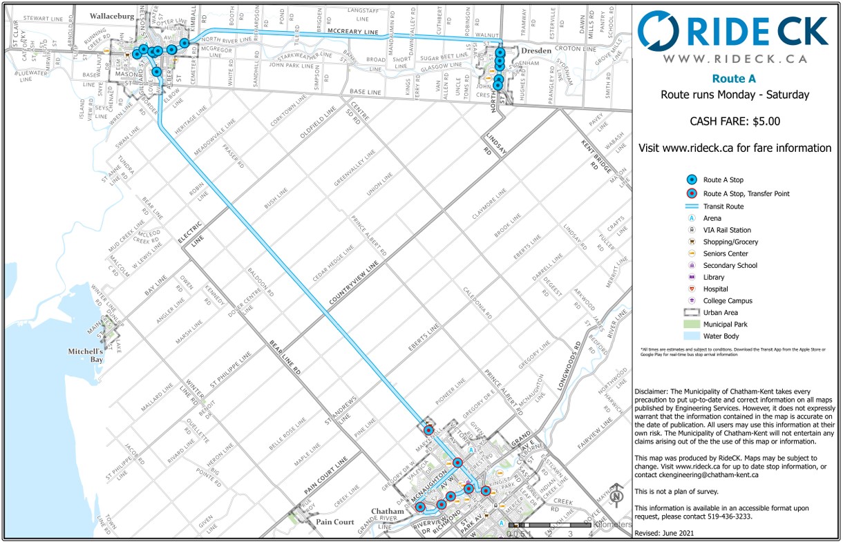
Three Ride CK routes — A, C, and D — extend from the bus terminal in Downtown Chatham to Wallaceburg (the second-largest community in Chatham-Kent), Dresden, Blenheim, Ridgetown, and Tilbury, covering most of the former towns that made up Kent County. (A fourth route, B, was proposed to serve Thamesville and Bothwell, but has not been implemented.) There is also a seasonal summer bus that serves the lakeside communities of Erieau and Mitchell’s Bay, echoing the former Chatham, Wallaceburg, and Lake Erie electric interurban service.
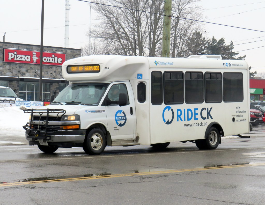
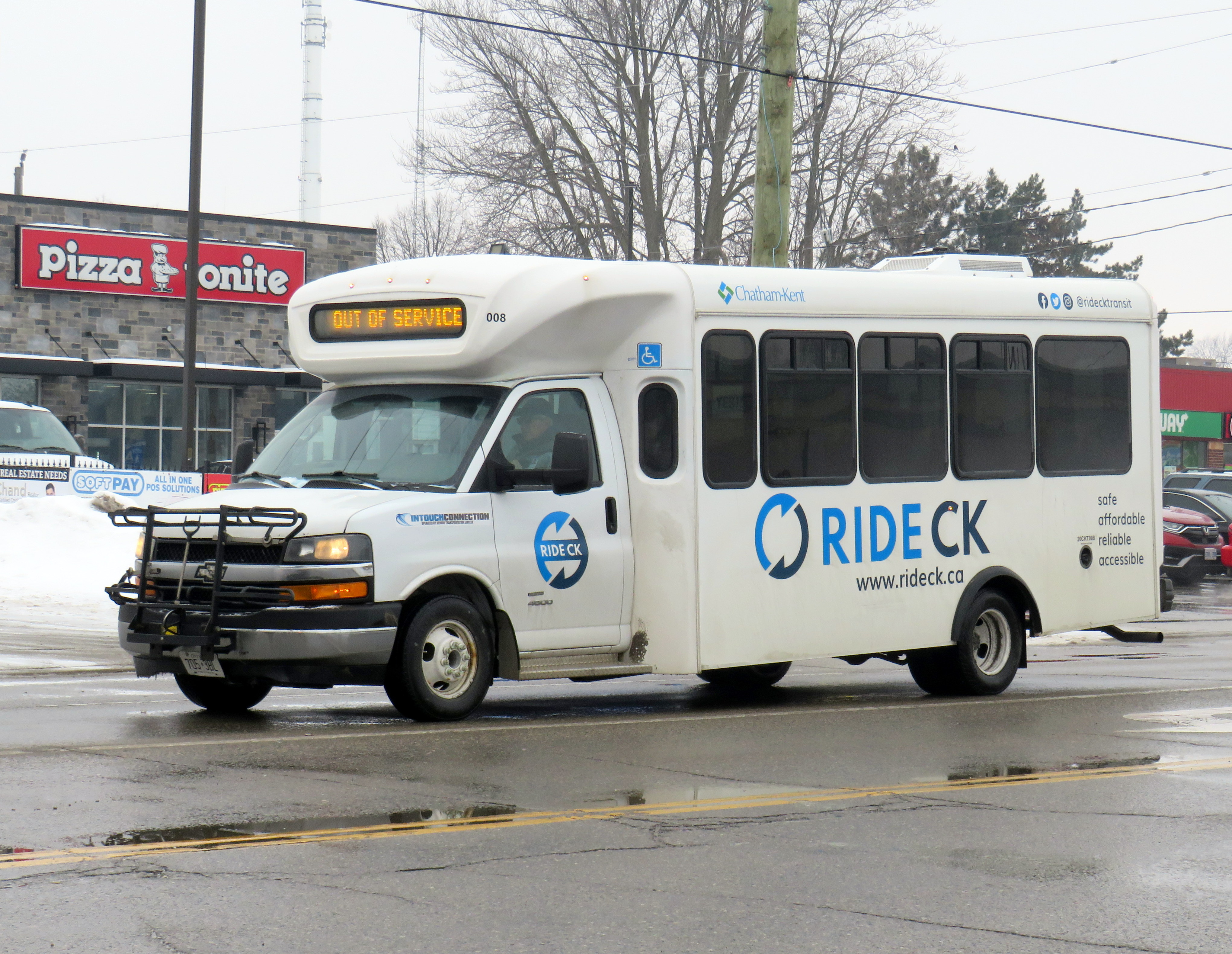
Most RideCK buses — local and intercommunity — are cutaways, meaning that the passenger seating area is in a separately-built body added to a cab and truck chassis. Though these vehicles are popular for paratransit services, low-ridership rural routes, and in smaller communities like Brockville, they do not offer a particularly smooth ride. However, they are an economical option for smaller communities.
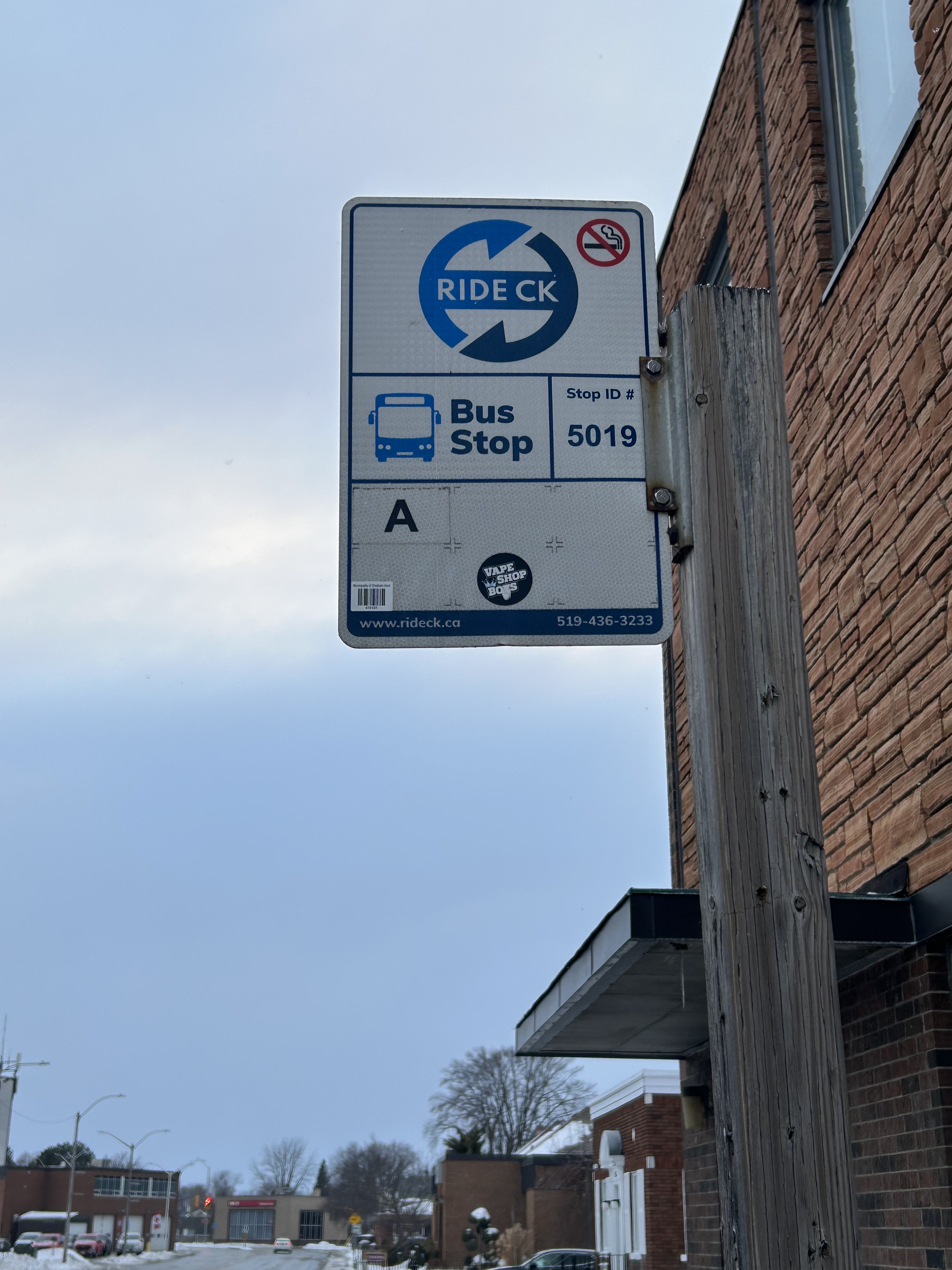
Bus stop in Wallaceburg
Each of the three intercommunity routes operate Monday through Saturday, with two morning and two evening round trips, with an additional midday run that leaves Downtown Chatham at 12:15 PM on weekdays; this additional trip was added several years after service began. There is a timed transfer to the local Chatham routes, allowing for onward connections to shopping, schools, medical services, employment, or social activities. All three rural routes also stop at the hospital in Chatham. The midday trip was added to provide an early return home for anyone taking the bus from outlying areas, such as for a medical appointment, and not then stuck waiting an entire day in Chatham.
I rode RideCK between Chatham and Wallaceburg and back in early February 2026; the midday 12:15 departure had decent ridership with six other passengers leaving the bus terminal (a seventh got on at the big box retail cluster north of Chatham’s urban area); there were five other passengers on the way back south on the first evening bus (5:45 PM leaving Chatham). Given that Chatham-Kent has maintained the service for so long is indicative of how the rural buses are seen as a necessity in the municipality. In Wallaceburg, on-demand local transit is also available, a recent improvement by the municipality.
Intercommunity routes have a flat cash fare of $5.25 (though online materials still show the older $5 fare), though transfers to local transit are provided.
Ride CK Route A between Chatham, Wallaceburg, and Dresden
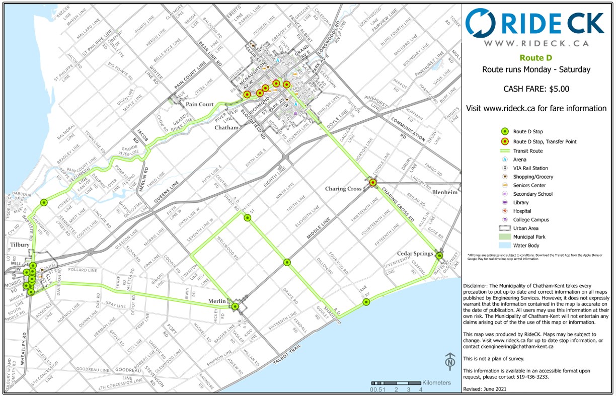
Though Routes A and C are fairly direct, Route D involves a long one-way loop to serve several small communities (including Cedar Springs, Buxton, and Merlin) before continuing to the former town of Tilbury and then back to Chatham. The route passes near, but does not stop at, Pain Court, and completely misses Wheatley.
The circuitous Ride CK Route D making a one-way loop through Cedar Springs and Tilbury
Though Chatham-Kent should be commended on identifying the need for rural transit and maintaining it for over two decades, it still demonstrates the challenges and gaps of operating a municipally provided rural transit service. Ideally, Chatham-Kent would be able to partner with neighbouring Lambton and Essex Counties to provide direct service to more communities. Tilbury should be part of an east-west service between Chatham and Windsor along the Highway 2 corridor, serving towns along Lake St. Clair such as Belle River. That would open connections to the University of Windsor and the main St. Clair College campus, along with other destinations, while improving service to Tilbury.
Route D, then, could be straightened and routed to serve Wheatley, even continuing west to make a connection to Leamington (which sadly, is losing its bus service to Windsor). With good scheduling, such connections could allow passengers to continue on VIA Rail service to London and Toronto.
Ontario needs a province-wide rural transit strategy with long-term funding and strong incentives to get reluctant municipalities (such as Halidmand County) on board. Until then, it is up to each local area to determine what, if any, transit service could look like, and up to residents to demand — and make use — of these services.
Unfortunately, the costs of maintaining this website and the ArcGIS Online portal to my maps continue to rise, especially as the amount of information provided and the number of views grow. If you enjoy my work and find the maps useful, please consider buying me a coffee to help with those costs. Thank you!
Over the last six years, Greyhound Canada disappeared after years of decline, the COVID-19 pandemic hit with travel restricted, the Ontario provincial government set up one-time funding for intercommunity transport links while deregulating the intercity coach industry, and many municipalities dipped their toes into providing rural transit services.
At the end of 2025, there was some good news to note — several rail transit lines opened in Toronto, Montreal, Ottawa, and Edmonton, while a few new rural services opened in Eastern Ontario. Unfortunately, there were also some major losses in Ontario, particularly in Grey County, Oxford County, Napanee-Deseronto, and the impending cancellation of a major route in Essex County. Unlike in Ontario, however, rural transport links remain stable in Quebec and British Columbia.
Stable funding is essential to keep these intercommunity and intercity links alive, particularly where private operators have not filled a need. For example, Flixbus recently cut back their once-a-day route from Toronto to the Lake Huron coast and will not serve rapidly-growing Saugeen Shores during the colder months. That part of Ontario is left only with a three-days-a-week TOK coach despite potential demand. A well-funded regional transport service coordinated by Grey, Bruce, and other adjacent counties could address this, but there needs to be political will to ensure stable and predictable service needed to grow ridership over the long term.
I just completed a round of edits to my intercity map, noting changes to routes, service levels, and in some cases, stop locations. A few new scheduled air shuttles in Atlantic Canada and Manitoba are included; these types of services are only mapped if they also provide non-airport service or at least connect to urban transport.
There are also more grey lines. Starting with edits in mid 2024, I have chosen to grey out abandoned routes, rather than just eliminating them. It is well worth noting where transport links have disappeared, and where replacement service might be worth planning.
Hopefully 2026 will see better service than the end of 2025.
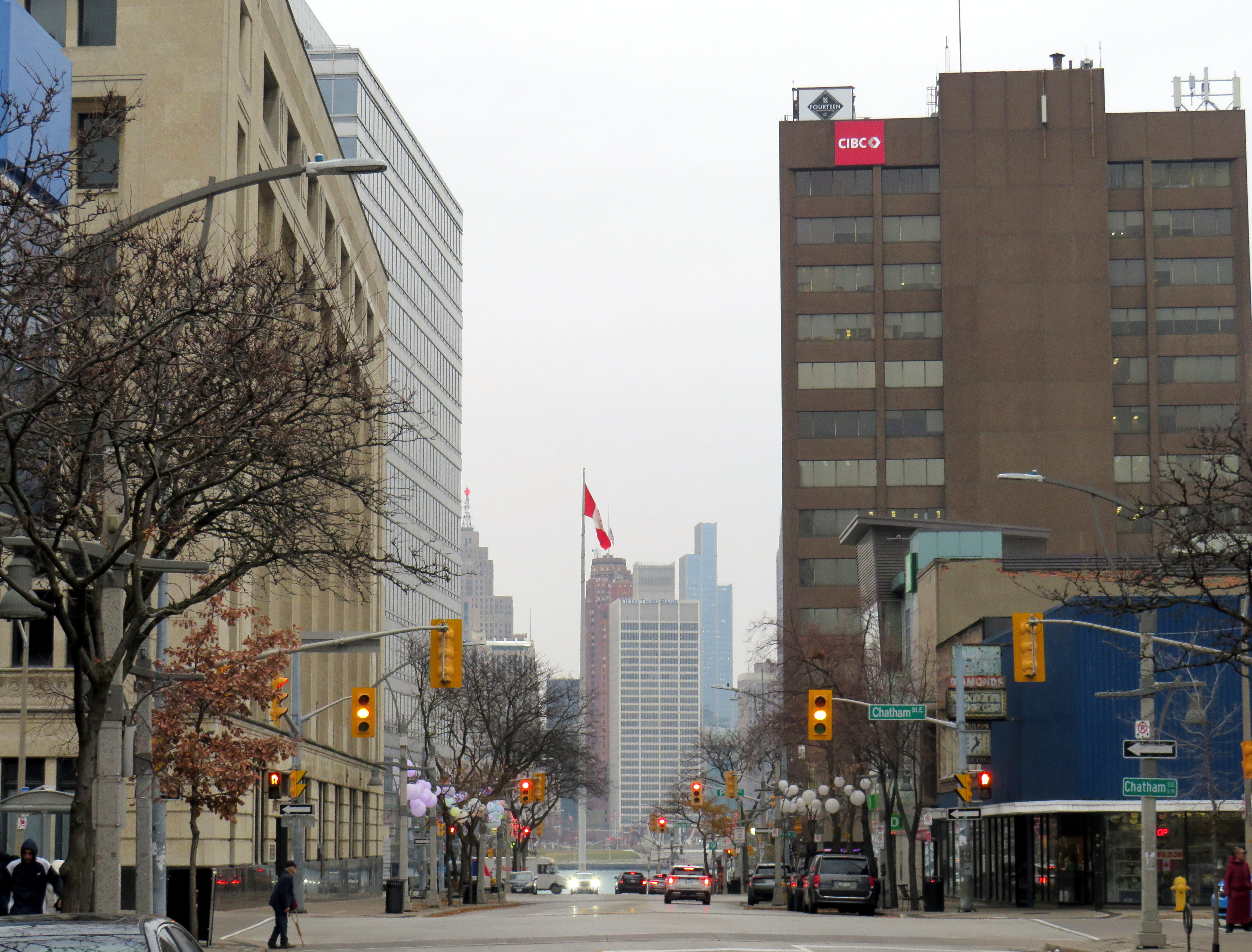
Downtown Detroit, as seen from Downtown Windsor, on a gloomy November morning
Windsor, Ontario, is built on transportation. The city’s position, right across the river from Detroit, has shaped the region ever since French settlers made their home on the wide, short, slow-moving river between Lake Erie and Lake St. Clair. (The river’s name, Detroit, is the French word for strait.) The narrow river made it a hub for shipping and for railways, followed by rail and road tunnels and highway bridges.
As the American auto industry got its start in Detroit, propelling it from a minor regional centre to the fourth-largest city in the United States, Windsor was a natural spot for companies like Ford, General Motors, and Chrysler to set up their first international operations. Canadian distillers and brewers also made Windsor their home and independent towns and cities lined the river, with names like Walkerville and Ford City. (These locales amalgamated with Windsor in 1935). The city had two electric railways: the Sandwich, Windsor, and Amherstburg (SW&A), a local streetcar and bus operation that also ran suburban lines to Amhertsburg and Tecumseh and the Windsor, Essex, and Lakeshore Rapid Railway (WE&L), which extended to Lake Erie at Leamington.
Today, Windsor has a population of 230,000, while neighbouring towns and townships in Essex County add another 200,000 people to the region. Though Windsor’s auto industry has been in flux since the 1980s thanks first to free trade agreements and now by US tariffs and protectionism, the region’s population continues to grow.
However, despite the region’s history and growth shaped by water, rail, and road links, public transport is lacking in Windsor-Essex, with several routes in peril. This is despite the presence of the University of Windsor, St. Clair College, two major hospital campuses, and a large built-up prewar urban area. Windsor was also the only large urban municipality to completely cease transit operations during the COVID-19 pandemic, where others continued to provide basic services subject to health and safety restrictions.
On August 30, 2025, Transit Windsor’s Tunnel Bus service was cancelled, after Windsor Mayor Drew Dilkens vetoed a council decision to maintain the service (funded partly by an increase in the one-way fare from $10 to $20). Even though the historic cross-border relationship is strained by threats of annexation, tariffs, and an authoritarian president, the Tunnel Bus still provides an essential link for business and leisure, with many fans of Detroit’s sports teams on the Canadian side of the river, and hundreds of workers crossing daily to Detroit’s offices and hospitals. Without access to an automobile or an expensive cross-border taxi ride, the bus is the only year-round way to get to the United States between Fort Erie and Walpole Island, as neither the tunnel or the Ambassador Bridge allow pedestrians or cyclists.
The new Gordie Howe Bridge will include a new multiuse path. However, it is not convenient to Windsor or Detroit destinations, nor is it close to decent transit options on either side of the soon-to-open crossing, including the Q-Line Streetcar, D-DOT and SMART buses, or intercity links such as VIA Rail, Amtrak, or Greyhound.
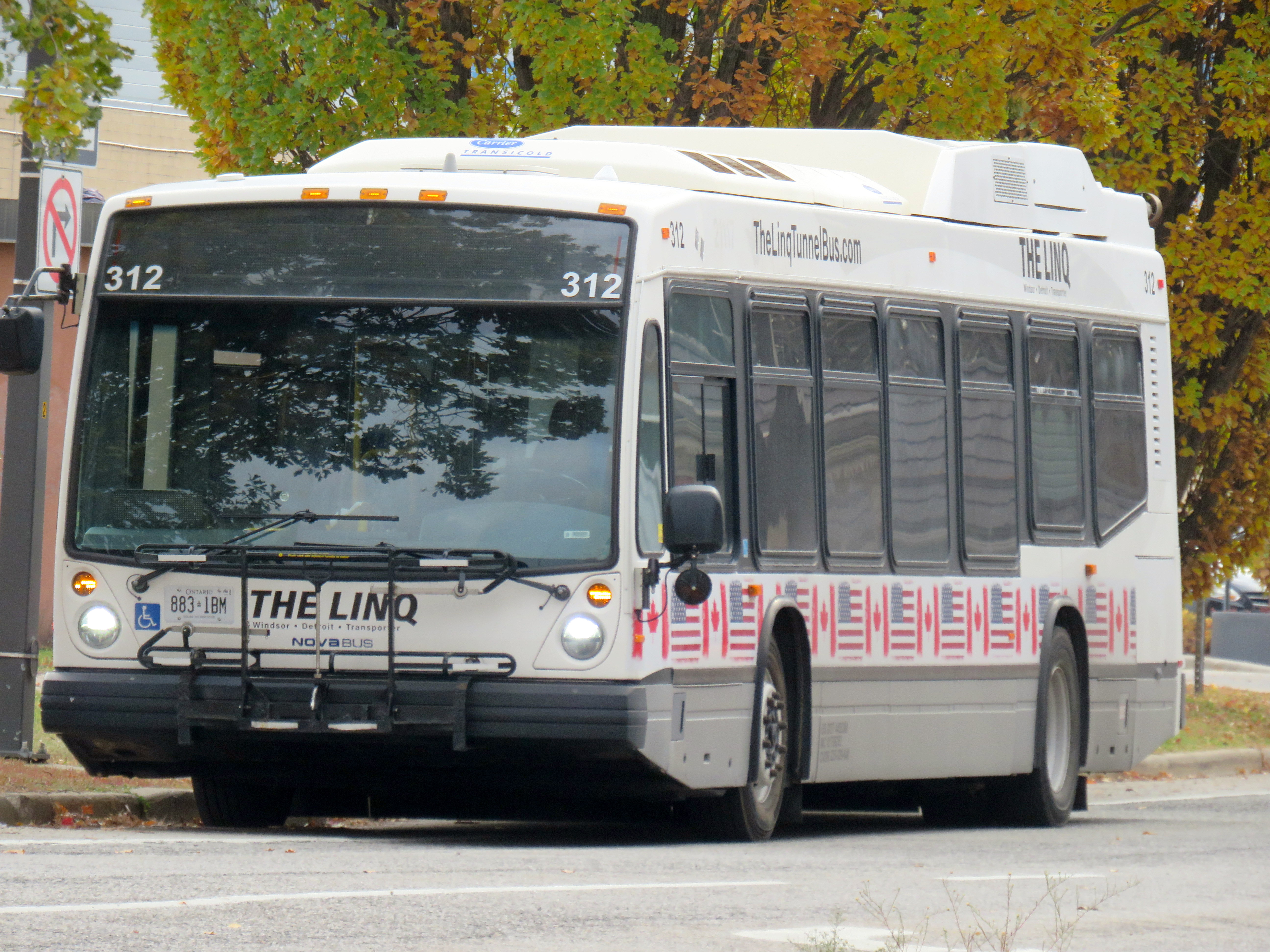
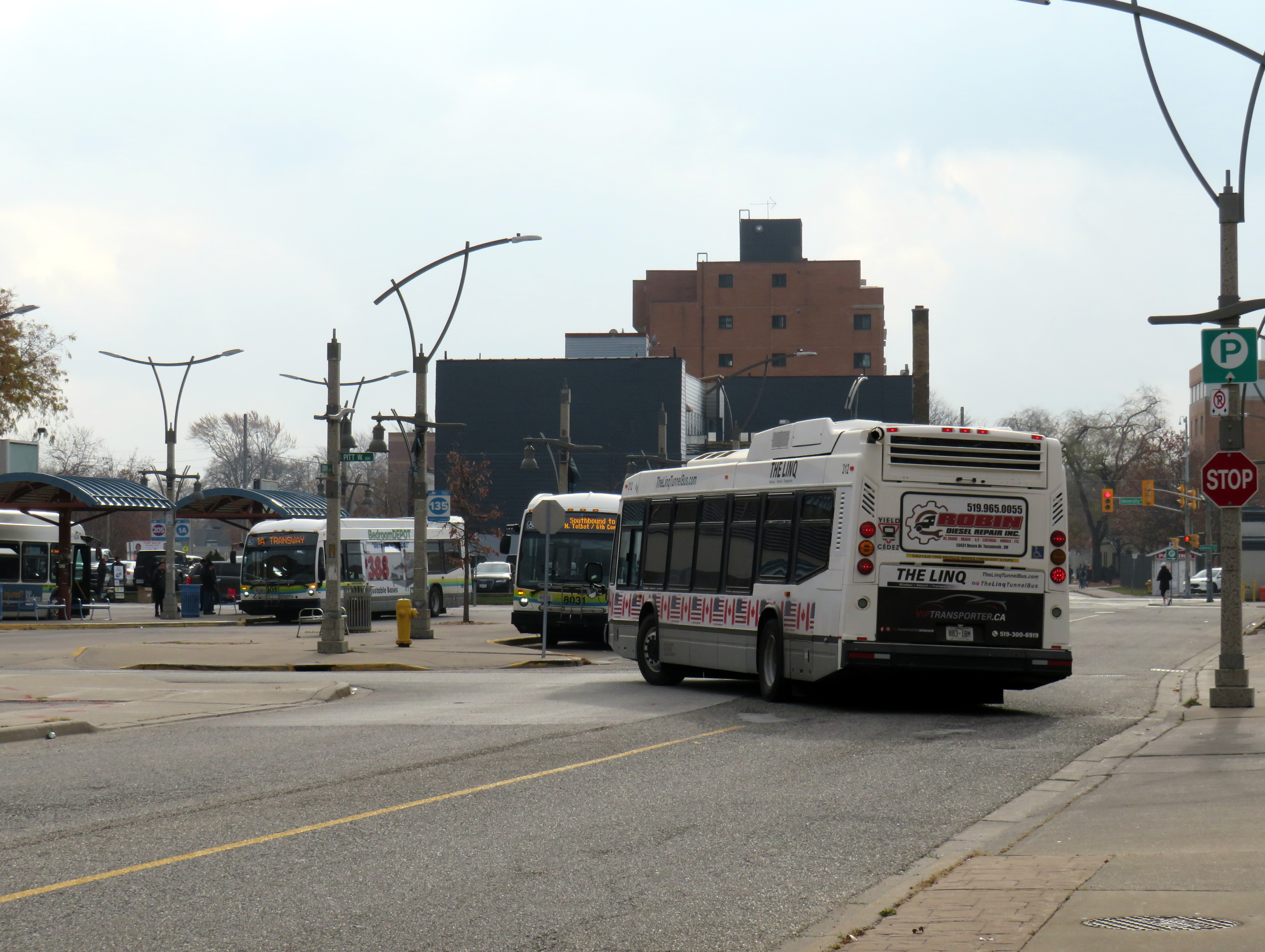
The Linq, the new privately-operated Tunnel bus between Windsor and Detroit
There is, however, a new privately-operated bus service, called The Linq. It has several used transit buses with bike racks and offers trips every two hours for a $15 one-way fare. It is a downgrade from the Transit Windsor-provided service, but the connection is still there.
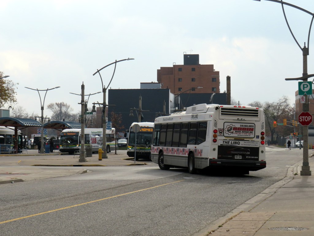
Though the Linq tunnel bus passes by the Windsor transit terminal, it doesn’t stop close by
Unfortunately, there is no direct connection between Linq and Transit Windsor. The only pickup location in Windsor is at the corner of Bruce Avenue and Riverside Drive, a five-minute walk from the transit terminal where the former city-operated bus departed from. Though the Linq bus passes by the Windsor terminal, it does not stop right there. The route still serves the Rosa Parks Transit Terminal on the Detroit side, along with the stop by the tunnel entrance next to Mariners’ Church.
Regional (dis)connections
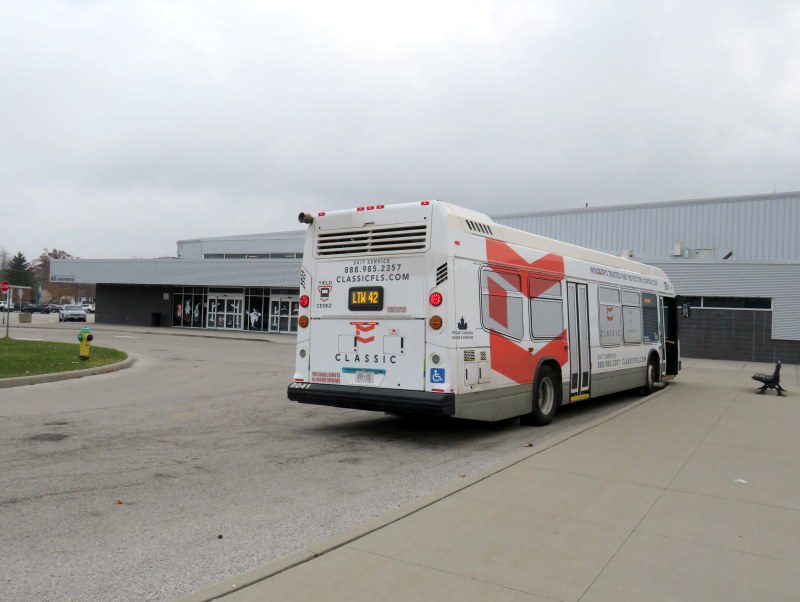
LTW 42 bus at Essex Sports Centre
While visiting Windsor, I wanted to ride Route 42, the bus service linking Windsor with the towns of Essex, Kingsville, and Leamington. Operated by Transit Windsor using urban transit vehicles, the service got funding from the province, the County of Essex, and the Town of Leamington. It operates three weekday and two Saturday round trips, charging a flat $10 one-way fare or a $15 same day return fare, with free transfers to Leamington’s LTGO on-demand service and Transit Windsor’s urban routes at St. Clair College.
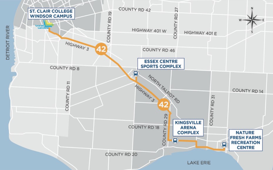
The service began in 2019, replacing a long-discontinued intercity coach route operated by Greyhound Canada and Chatham Coach Lines, along the old route of the WE&L Rapid Railway that ran until 1932. The bus only makes four stops: St. Clair College in Windsor, and sports and recreation centres in the three towns. The route’s number is not inspired by Douglas Adams but by the 42nd parallel, which runs a few hundred metres south of Leamington.
LTW Route 42 route map
Unfortunately, the three sports centres are poor locations for promoting transit ridership. In Essex, the arena is a 10-to-15-minute walk to the town centre, a reasonable stroll for many. In Kingsville, the arena complex northeast of the built-up area is 2.5 kilometres from the town centre, a 35-45 minute walk with no local transit options. Without access to a car ride, the Route 42 service becomes inaccessible to many potential users.
Previous coach service operated by Greyhound and Chatham Coach Lines stopped in the town centres.
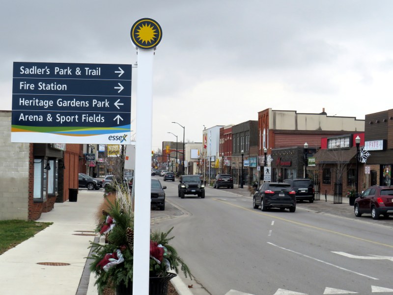
Essex Town Centre, a 10-15-minute walk from Route 42 at the sports centre
As of April 30, 2026, the LTW Transit service connecting Windsor with Essex, Kingsville, and Leamington will come to an end. This was a matter of funding. The provincial rural transport funding program came to an end, and neither the County of Essex nor the Town of Leamington were willing to continue subsidizing the service beyond the end of the academic year.
Though the province is willing to fund expensive new highway and transit projects in the Greater Toronto and Hamilton Area, including new subways and light rail and sprawl-inducing freeways, it is unwilling to back the provision of small town and rural transit services that connect residents to larger centres, whether it be for work, school, health appointments, shopping or social connections. Without a province-wide strategy and a sustainable funding program, services that started up with much promise are disappearing in places like Grey and Oxford Counties and Napanee and Deseronto.
It also does not help that Windsor-Essex does not have a regional level of government or even a degree of cooperation between the various municipalities. In York, Waterloo, Durham, and Niagara, regional governments have taken over transit services and are working to connect their entire regions together, even rural communities. Even Simcoe County provides a regional transit service to its smaller towns. The suburban Town of Tecumseh has a limited transit service separate from Windsor’s, while LaSalle and Amherstburg contract Transit Windsor for limited service within their communities. A regional transit service, subsidized by the entire Windsor-Essex tax base, could go a long way.
That’s a wrap
To conclude this post, I have few other observations of riding Transit Windsor over two days in late November. There are several ways that transit service can be improved, including better wayfinding, better connections between modes, and giving passengers a better view.
VIA Rail runs four daily trains between Toronto and Windsor, from a station in the Walkerville neighbourhood, three kilometres east of the downtown core. Passenger trains on the CN line used to continue to the downtown waterfront until the 1960s, when service was cut back to Walkerville, which had a wye to turn trains around. Eventually, all the CN, CP, and Michigan Central tracks and docks were removed from the riverside, which allowed Windsor to develop a lovely waterfront park system.
The Crosstown Route 2 along Wyandotte Street stops nearby the VIA Station off Walker Road, about a five-minute walk between bus and train. But getting between the two modes is not clear. Apart from a VIA Rail logo on the transit map, there is little indication of this useful connection at the station or at the bus stops on Wyandotte. Route 2 offers decent service during daytime hours, every 10-15 minutes on weekdays from 6:00 AM to 6:00 PM, but it quickly drops to every 30 minutes at 6:30 PM. Saturday daytime service is every 20 minutes, and on Sundays, every 40 minutes. Frequencies on other core routes, including the 1A and 1C Transway buses, is similar.
Compare this with Kingston, a city less than half of Windsor’s size, which provides direct transit service onto the VIA station grounds. In London, the downtown station is a more prominent landmark, and easy to get to by multiple routes.
As a regular transit passenger used to fare cards, transit apps, and open payment systems, I found myself annoyed by having to carry exact change — a toonie, a loonie, and three quarters — every time I rode. Transit Windsor does have plastic fare cards, but they can only be loaded up with individual fares or a 15-day or 30-day pass, not a declining balance that could be used on regional routes. As cash is less common as a payment type (with some smaller businesses going cashless), larger transit agencies should catch up.
The typical view from a Transit Windsor bus
Finally, I became annoyed by how many buses in Transit Windsor’s fleet are fully covered by vinyl advertising wraps, excepting only the windshield, front door, and driver’s side window. Even the LTW 42 bus, which goes a long distance at higher speeds, was fully wrapped. I took six different buses in two days and only one wasn’t wrapped. It makes for a miserable time as a rider, especially one who wants to see the neighbourhoods the buses pass through; I explained why advertising wraps are a bad idea before. At the very least, ad wraps should limit how much of the passenger window area is covered, as the TTC does.
Windsor has all the essentials for building a good transit system: a large pre-war urban area, post-secondary institutions, hospitals, and a well-populated and growing exurban and rural periphery. It just needs the leadership to recognize its potential.
A few weeks ago, I wrote about several new intercommunity transit services in Eastern Ontario. I went out to Brockville to ride River Route, which follows the St. Lawrence River between Brockville and Cardinal. I also noted the introduction of a new bus service between Kemptville and Ottawa, as well as services in Pembroke and Loyalist Township.
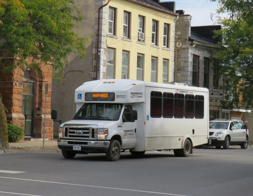
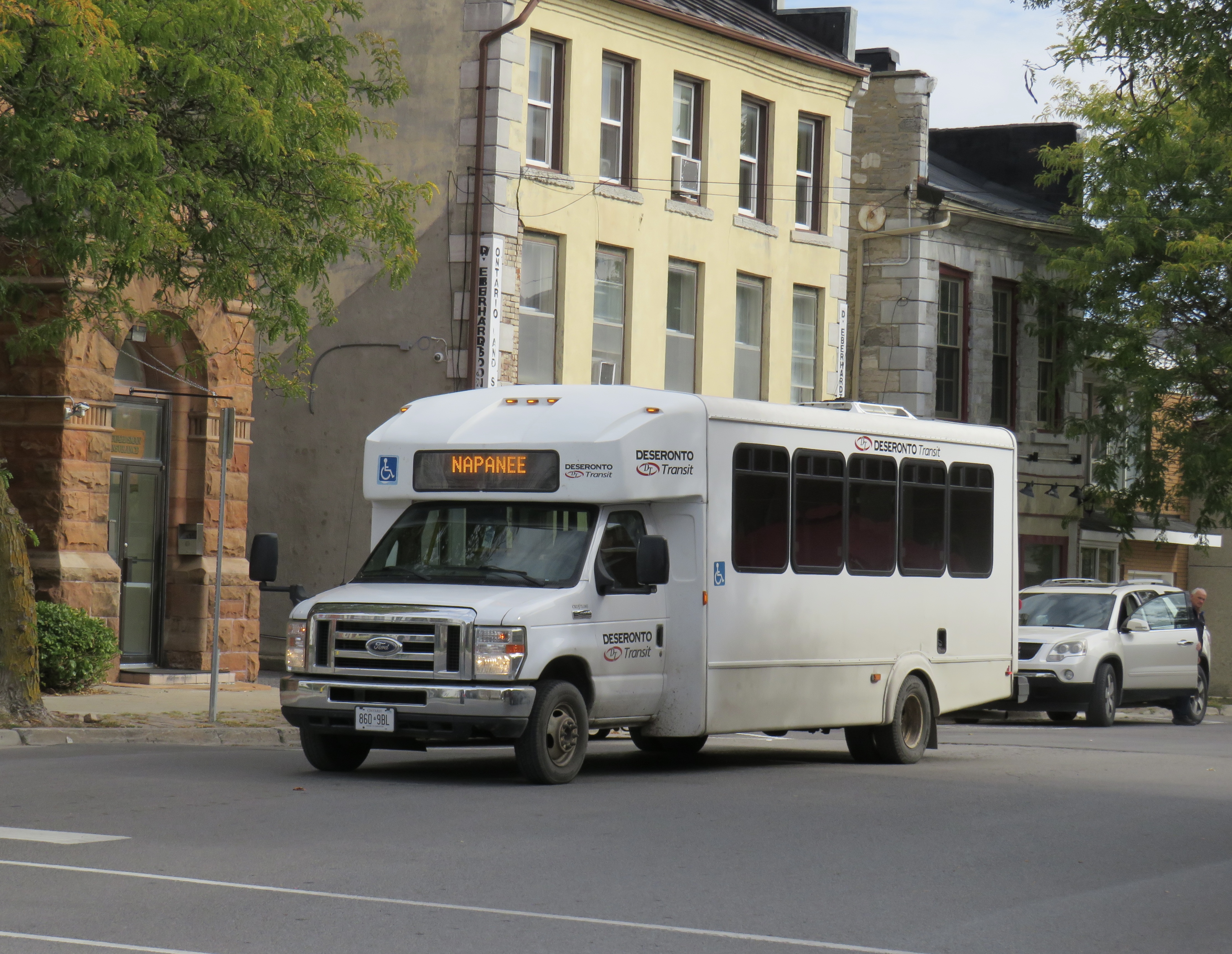
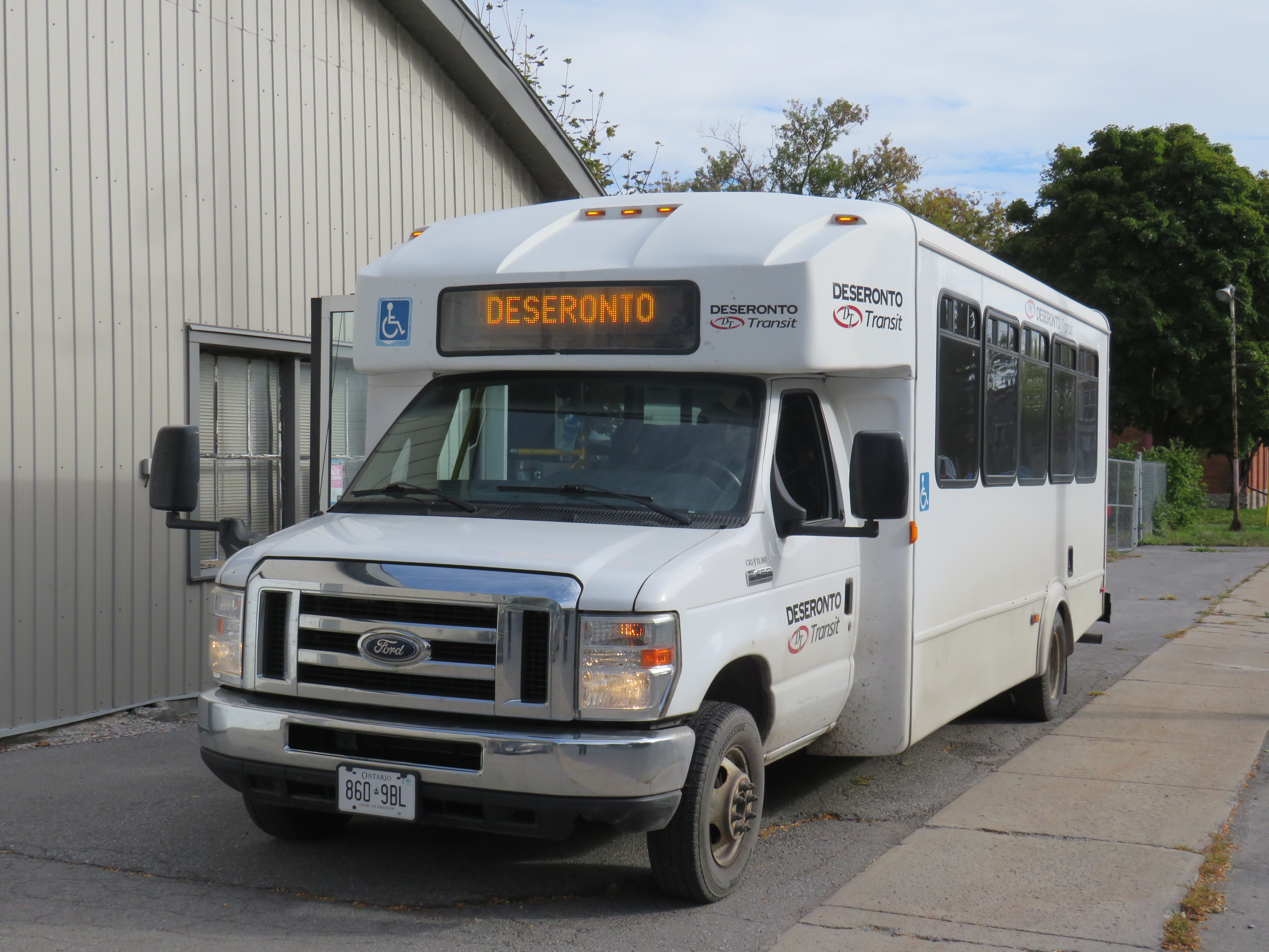
Unfortunately, another Eastern Ontario service, Deseronto Transit, will come to an end on November 28, 2025. Deseronto Transit is operated by the small town located on the Bay of Quinte between Belleville and Napanee; its single route runs between these three communities, while also stopping at Tyendinaga Mohawk Territory and Shannonville.
Early in 2025, the Town of Deseronto moved to end service by December 1, 2025, citing increasing expenses and ageing equipment and the end of provincial grant funding. As Deseronto is a very small town, population 1,750, the continued operation of a regional bus service is especially challenging. Despite the planned closure of service, it is commendable that the town was willing to give it a go, connecting its residents to employment areas in Belleville, as well as medical, educational, and shopping destinations in both Napanee and Belleville.
Laying over at Deseronto Transit’s garage
At its peak, Deseronto Transit was able to average 12-15 passengers per trip, thanks largely to its schedule and route that operates to important destinations in Belleville including Quinte Mall, Belleville General Hospital, and an industrial park in the northeast part of that city. But with the wind-down, ridership has fallen; I was one of only two passengers headed west to Belleville from Napanee and Deseronto on Friday, October 17.
In Belleville, there are still connections to Prince Edward County (which introduced a summer weekend service in 2025) at the Downtown Terminal, and to Trenton via Quinte Transit at Loyalist College. There is also an informal on-demand service to various communities north of Belleville within Hastings County.
One of the challenges operating small inter-community services is that they need long-term, dedicated funding, rather than a one-time grant. They also need to be publicized better, with proper bus stop signage, integrated websites, and easy connections to local transit and other intercity services.
A smart provincial government would not only ensure that these connections are funded and maintained; it would help to better integrate, brand, and advertise inter-community services, touting their benefits to residents and visitors alike. It already does this in the Greater Toronto and Hamilton Area (GO Transit) and in Northern Ontario (Ontario Northland); there really should be more to ensure rural and small town connections are sustainable and sustained in Southern Ontario.
Why going to Napanee is so complicated
To get to Napanee and to take a ride on Deseronto Transit, I had to take the only weekday morning departure from Toronto: a Maple Bus trip from Yorkdale Station to a gas station drop off north of Highway 401 in Napanee. The town is also served by Megabus (on the Pearson Airport-Kingston Route) and two daily VIA Rail trains, but these all leave the city in the PM hours. Maple Bus, a new entry not yet added to my intercity map, operates several buses a day between the Toronto area and Ottawa, with stops at most cities and towns along Highway 401 between Oshawa and Brockville.
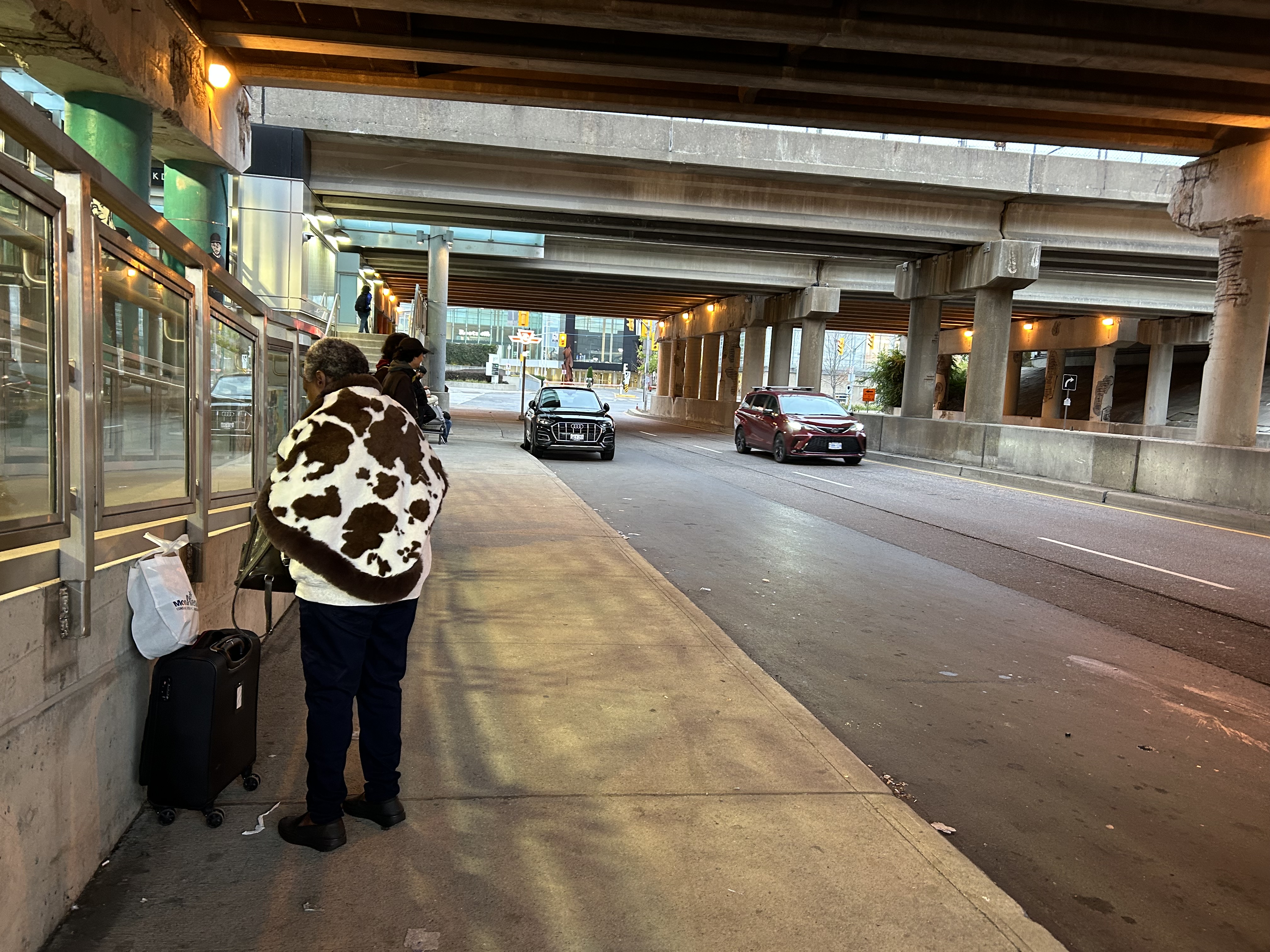
The main Toronto stop for Maple Bus and Flixbus is the passenger pick-up/drop-off area of Yorkdale Station, a curbside stopping zone under the Allen Road/Highway 401 ramps next to Yorkdale Subway Station. GO Transit, Megabus, and Ontario Northland use a nearby purpose-built bus terminal. Though the area is sheltered from rain by the overpasses, there is only one small bench to sit at. It is not a great place to wait for a bus, especially when it is nearly 40 minutes late, as my bus was.
Waiting under highway ramps at Yorkdale Station
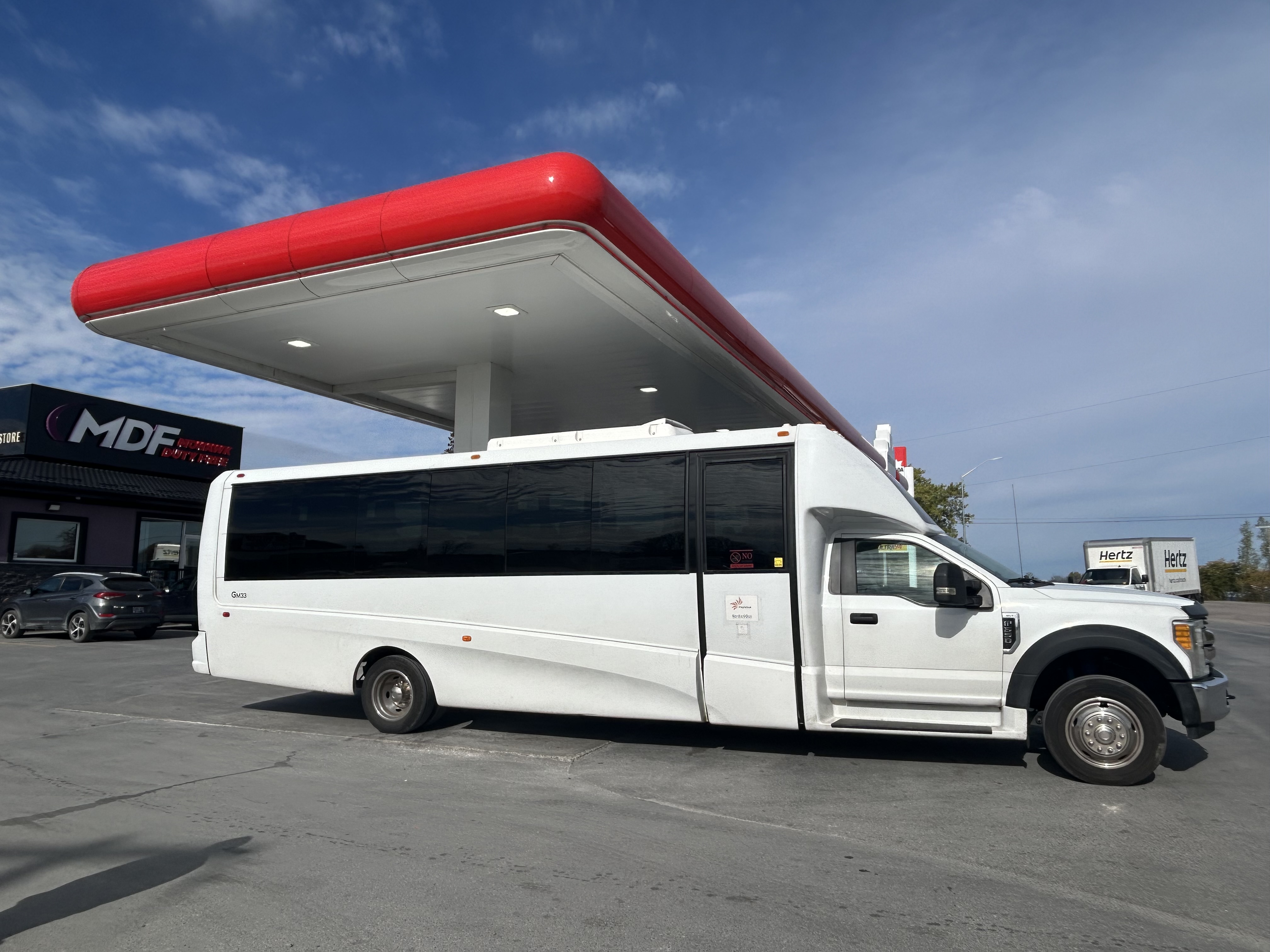
At least the Maple Bus vehicle was comfortable. The bus assigned was a mid-sized body-on-truck-chassis coach, which sits 25 in comfortable bucket seats (I have rode in smaller, less comfortable vehicles before). However, it does not have a toilet on board, and food and beverages are not allowed to be consumed. There was a rest stop, where the driver also refueled, at Tyendinaga First Nation off Highway 401 between Belleville and Napanee. When we made this stop, we were only ten minutes from my destination.
Maple Bus vehicle, during a rest break/refueling stop at Tyendinaga First Nation near Belleville
The most challenging part was the walk from the Maple Bus stop at a Petro-Canada/A&W north of Highway 401 towards the town centre. Megabus stops across the street at a Flying J truck stop. Presumably, these bus stop locations are chosen because of their ease of access on and off the highway, and because the property operators are cooperative with the bus operators, but they make things difficult for anyone without a pre-arranged ride.
The Maple Bus route stops at a Petro-Canada north of Highway 401
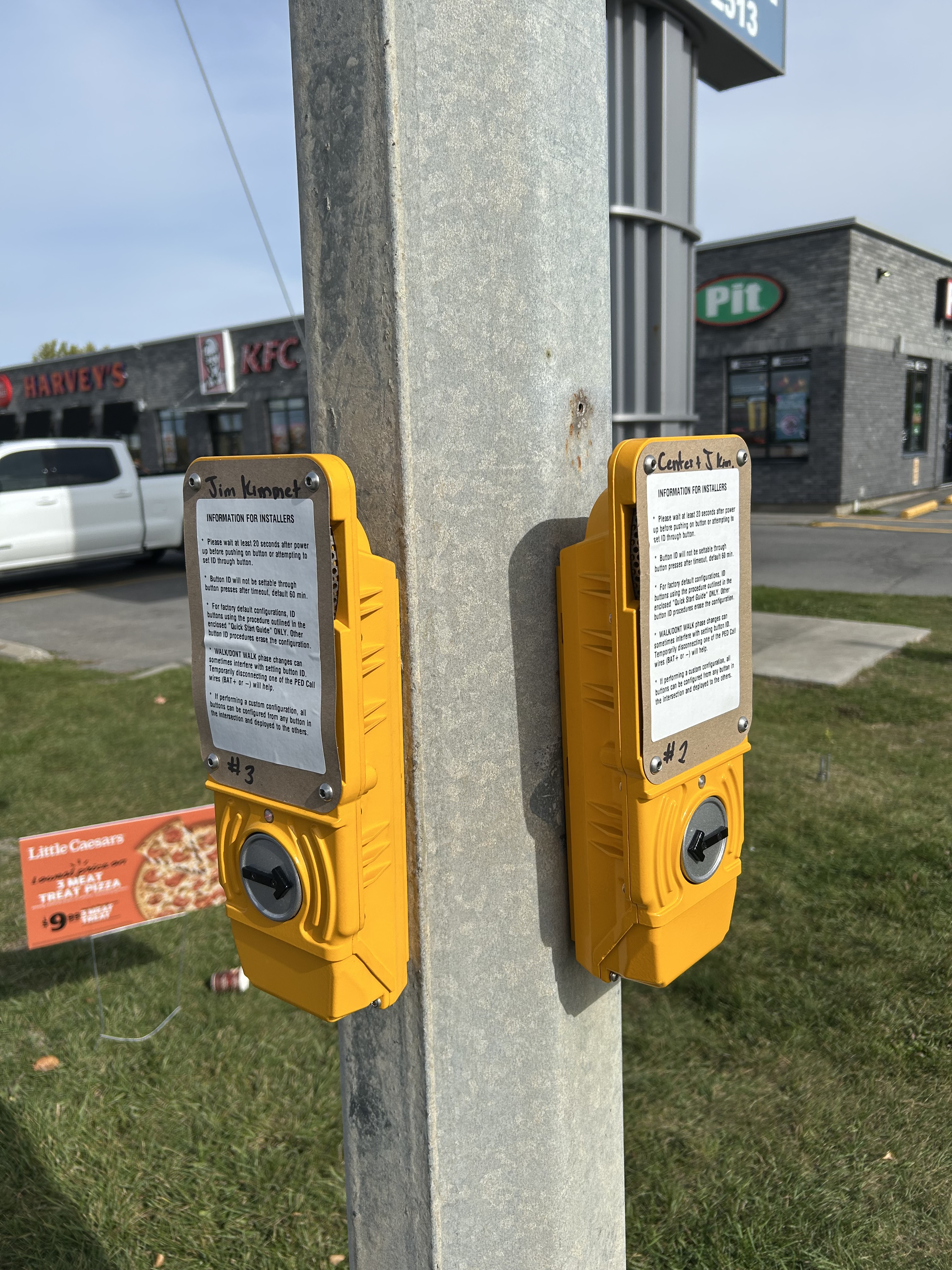
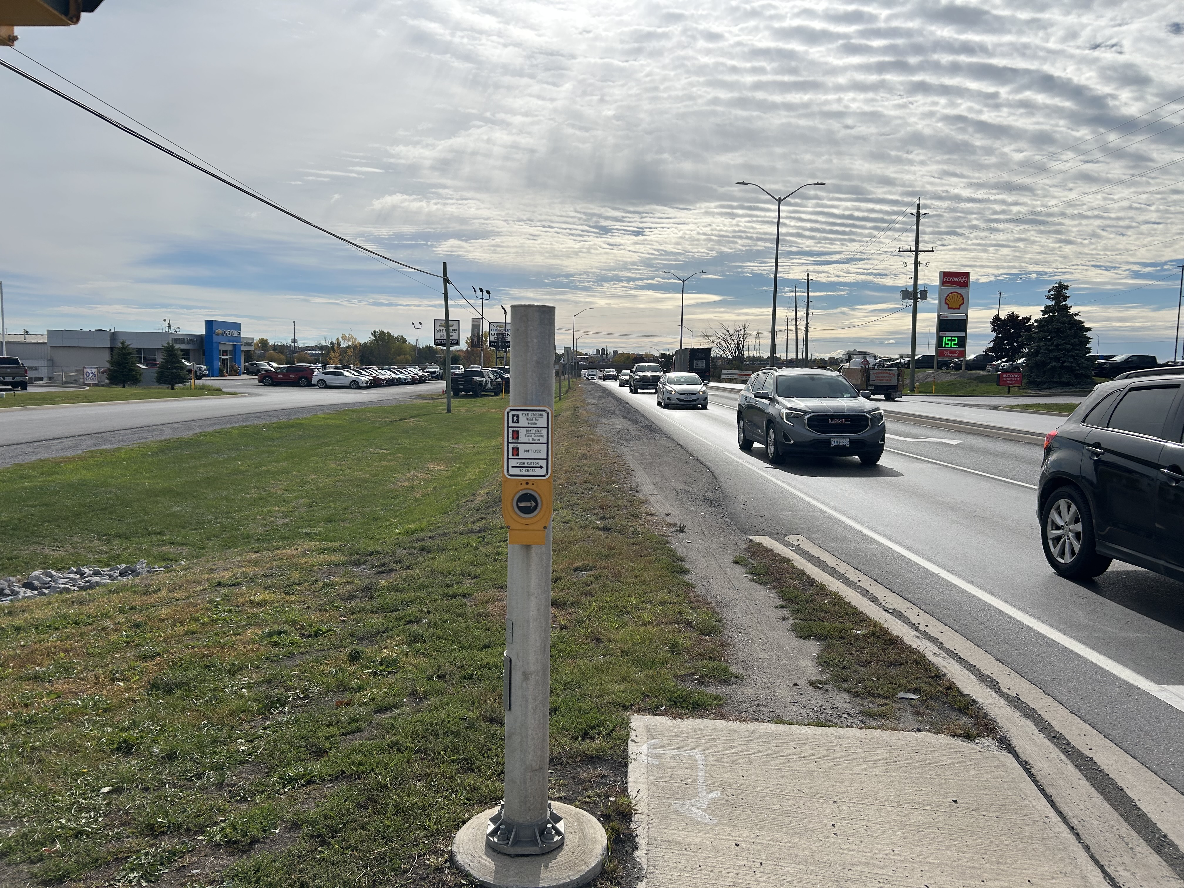
Though there are signalized pedestrian crossings at Highway 41 and Community Road, next to the Flying J and Petro-Canada, complete with crosswalks and “beg” buttons, there are no sidewalks continuing in any direction. Many push-button panels still have their installation instructions visible, rather than a “push button to cross” message.
Instructions for beg button installation still visible on two panels in NapaneeA dirt path continues south where there should be a paved sidewalk. The Flying J truck stop is on the right.
My walk south into the town centre required a precarious crossing of Highway 401 in a dark underpass alongside four lanes of traffic with very little clearance, as seen in the video below. Just further south of the interchange, there was another squeeze point at a drainage culvert. In snow, ice, or wet conditions, this would be especially dangerous.
Navigating the walk along Highway 41 south towards Napanee
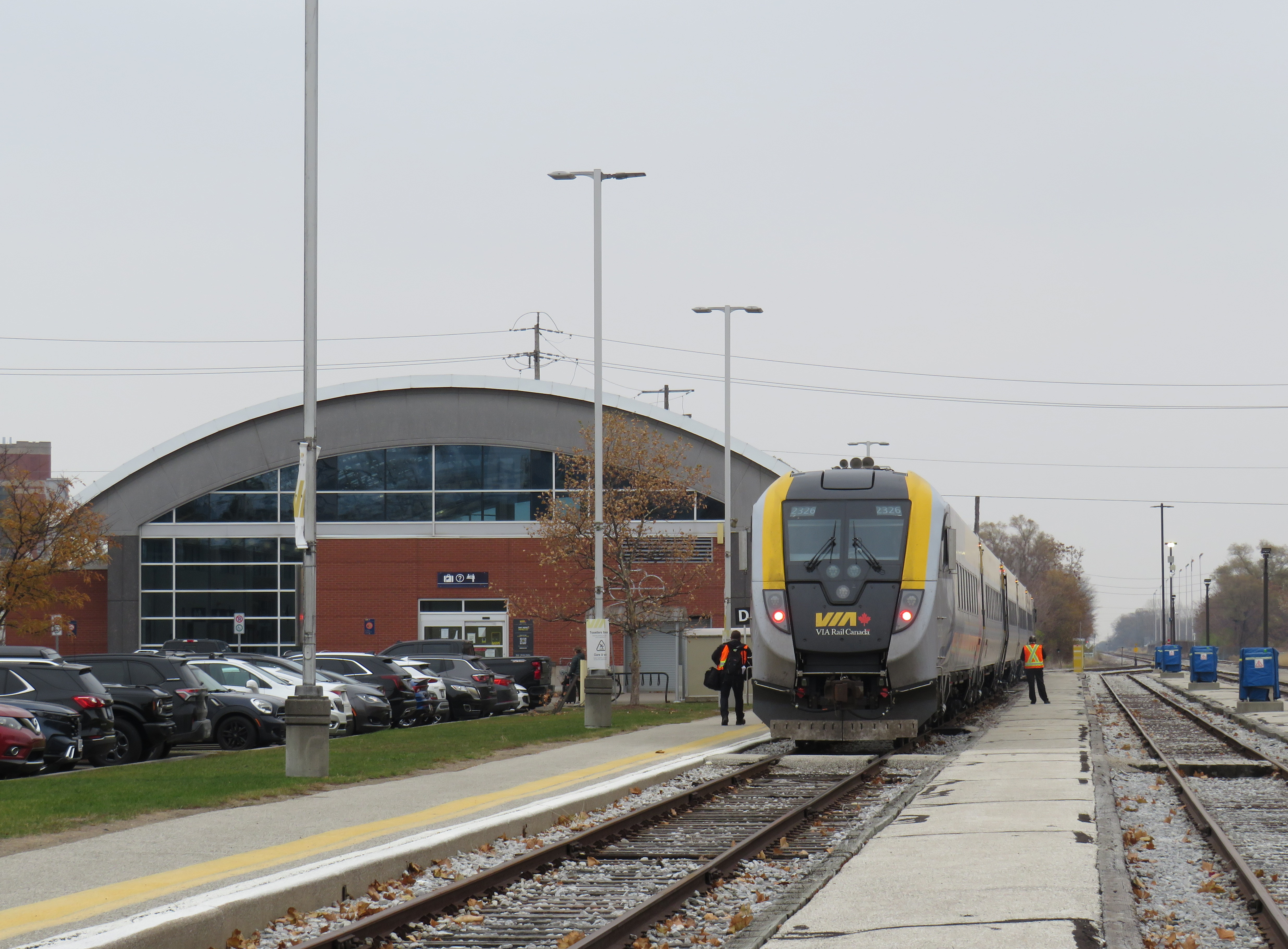
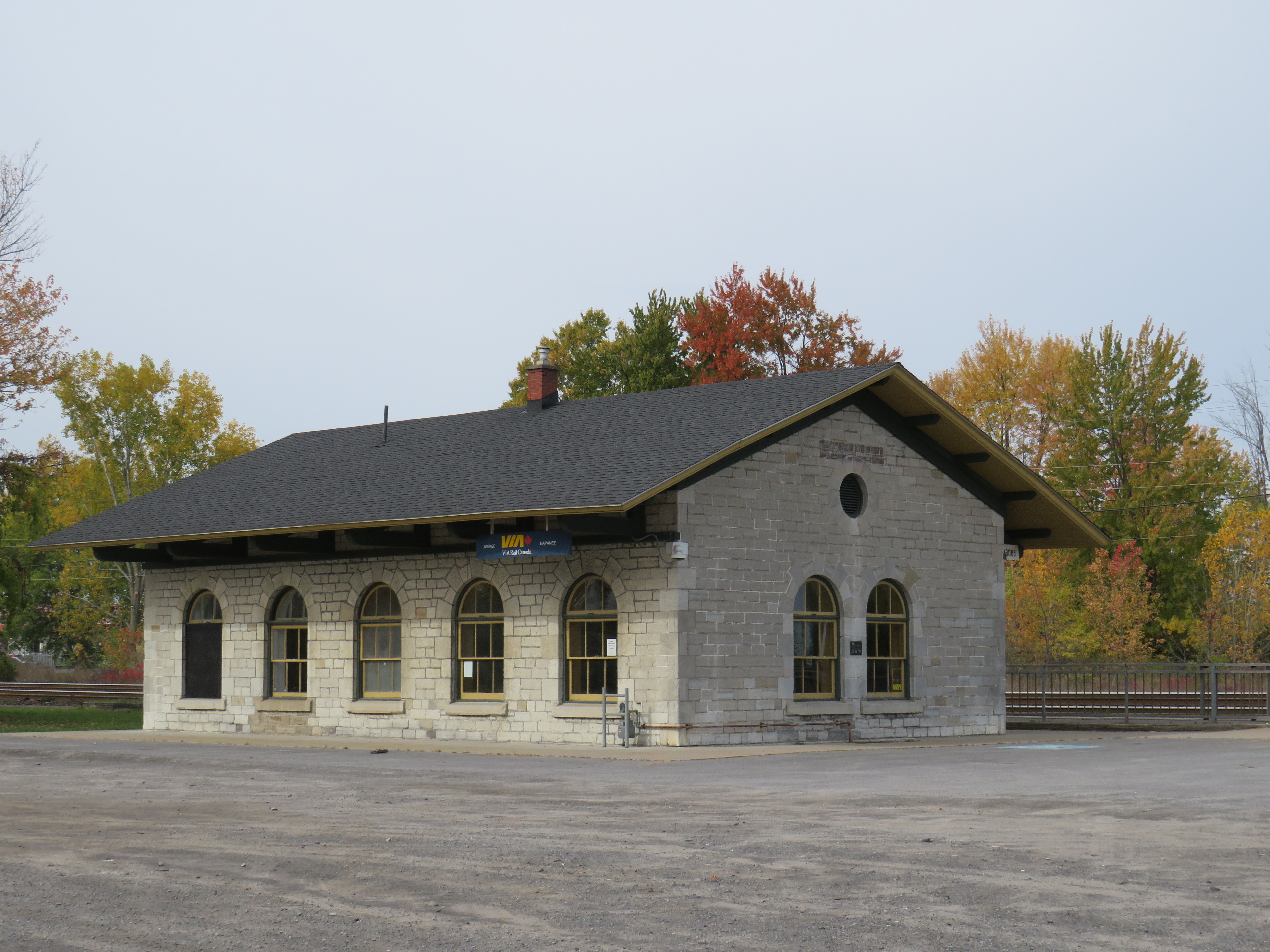
The VIA Rail station, located at a historic Grand Trunk Railway structure, is a short walking distance to Napanee’s downtown core, and to much of the populated urban centre. However, with a very limited train schedule and higher fares, many will still opt for the bus.
Napanee Railway Station
Unfortunately, the last-mile problem is common with intercity bus services, where bus stops are chosen out of convenience rather than passenger access and comfort, with distant truck stops favoured in places like Napanee, Chatham, and Cornwall. In major centres such as Toronto and Ottawa, carriers will choose more central, transit-accessible stops, but in smaller cities and rural areas, passengers are left on their own.
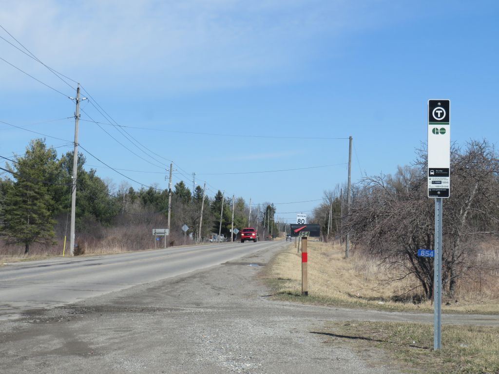
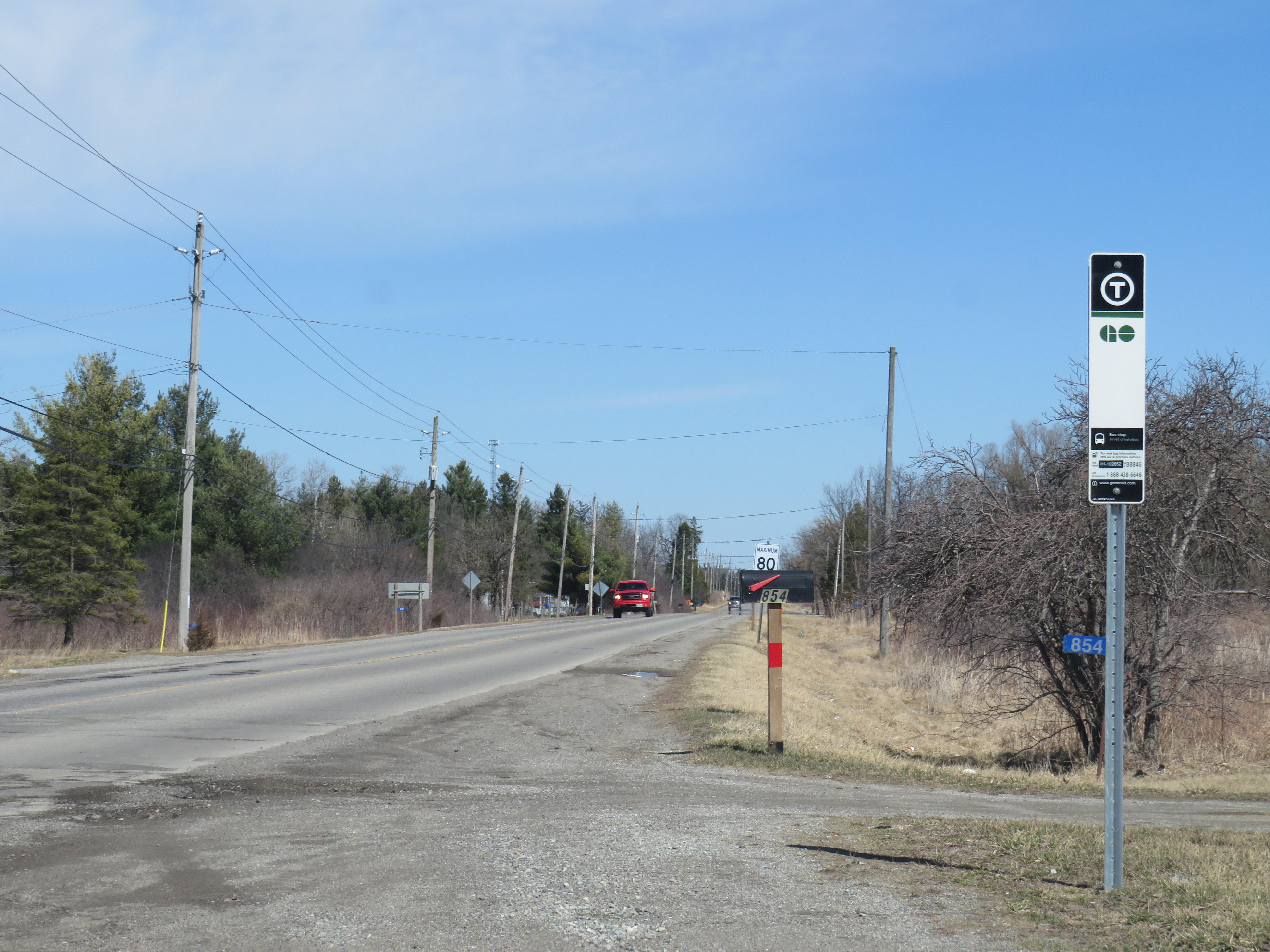
New GO Transit bus stop on Chiefswood Road at Six Nations
As we enter Spring 2025, there are a few significant changes in Ontario’s intercity transportation services. A new daily GO Transit route will now connect Six Nations and the Mississaugas of the Credit First Nation with Brantford, Hamilton, and Greater Toronto. A new seasonal Waterloo-Burlington weekend express could foreshadow more direct service between Kitchener/Waterloo and Hamilton in the future. Flixbus moved its Ottawa terminal stop to the VIA Rail station, joining Ontario Northland and Orleans Express.
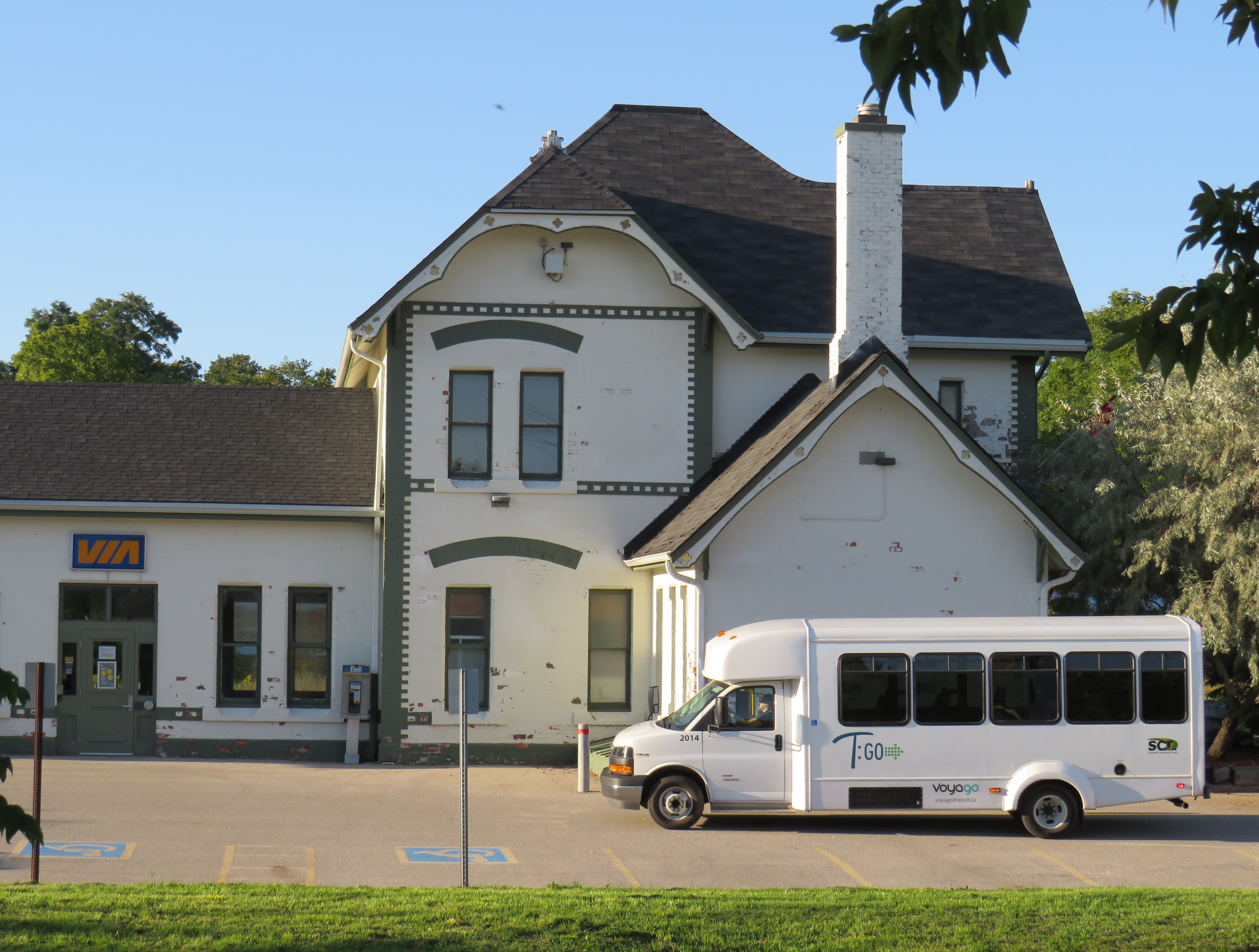
However, there are also some cuts, triggered by the end of the Ontario Intercommunity Transportation Grants. Grey County will terminate all GTR services with the exception of Route 1 between Dundalk, Shelburne, and Orangeville. T:GO is ending its intercommunity services outside of Tillsonburg, including routes that connect with Woodstock and London. PC Connect is cutting its rural route that serves places like Mitchell and Milverton (though routes connecting Listowel, Stratford, and St. Marys to Kitchener/Waterloo and London will continue).
Unfortunately, T:GO will end all intercommunity bus routes outside of Tillsonburg, including the link to Woodstock
Recently, I provided my expertise mapping Canada’s intercity transit links to Transport Canada, which allowed me to enhance and update the interactive map. I am also working with Transport Action Canada to support their efforts advocating improved intercity transport across the country.
As always, please contact me with feedback, corrections, or updates. It is a challenge continually maintaining a Canada-wide map given how frequently things change.