Category: Intercity Rail

  • Alto: Yes, and…

    Alto: Yes, and…

    A “No ALTO HSR” sign on a property near Marmora, Ontario

    There’s a running joke that Canada leads the world in high speed rail studies, but we never follow through with actually building those high speed lines. Comedian Rick Mercer had at least two sketches on his old weekly CBC television show mocking this state of affairs, as the idea goes back to the 1970s.

    “VIA Rail: Yesterday’s speeds, today.”
    “Canada’s High Speed Rail Study Industry: The future, never!”

    In 2026, however, Canada is finally past the high speed rail study phase and appears to be committed to building the seven-station corridor between Toronto, Ottawa, Montreal, and Quebec City, with a consortium selected that is already planning the detailed route. It’s an exciting time as the first phase, between Ottawa and Montreal, should start construction in three years once the exact corridor is decided upon and land acquisition has begun.

    High speed rail, if done right, should benefit Eastern Canada as a whole. Fast and frequent train service will divert a lot of the travel in the busy Toronto-Montreal-Ottawa triangle from the air, reducing emissions and allowing existing airports to handle any increases in long-haul demand. Faster and more reliable passenger train service would also take traffic off the highways and boost commerce within the most populated part of the country. If done right, it will also support plans for better transport infrastructure outside the corridor to Southwestern Ontario and provide Canadian expertise for other projects such as in Alberta, which is contemplating its own passenger rail network between Calgary and Banff and north to Edmonton.

    Map of potential routings for the Alto high speed line in Ontario

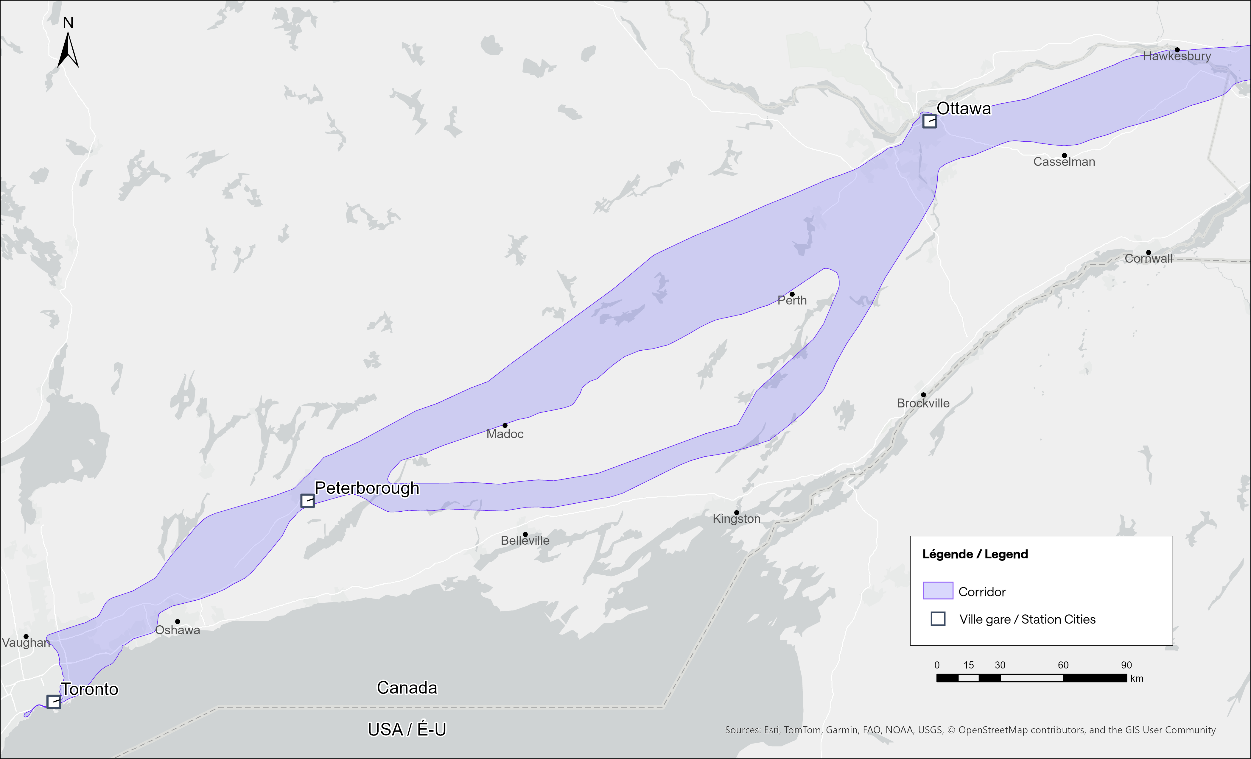
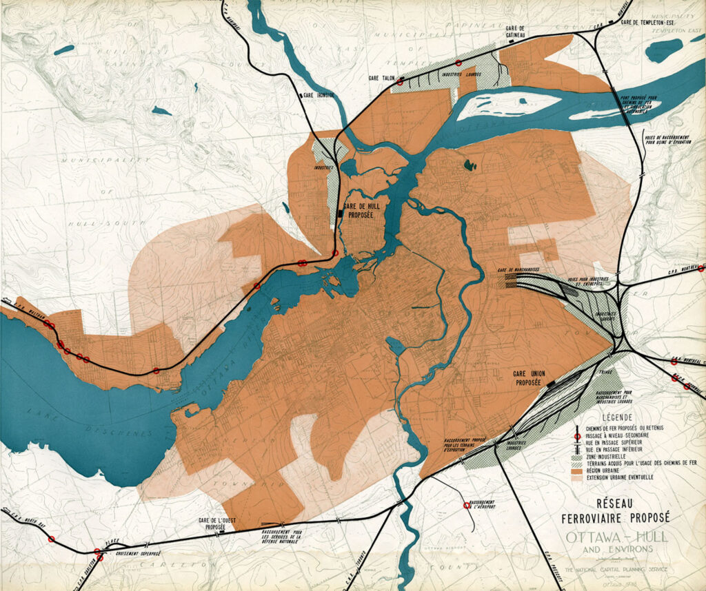
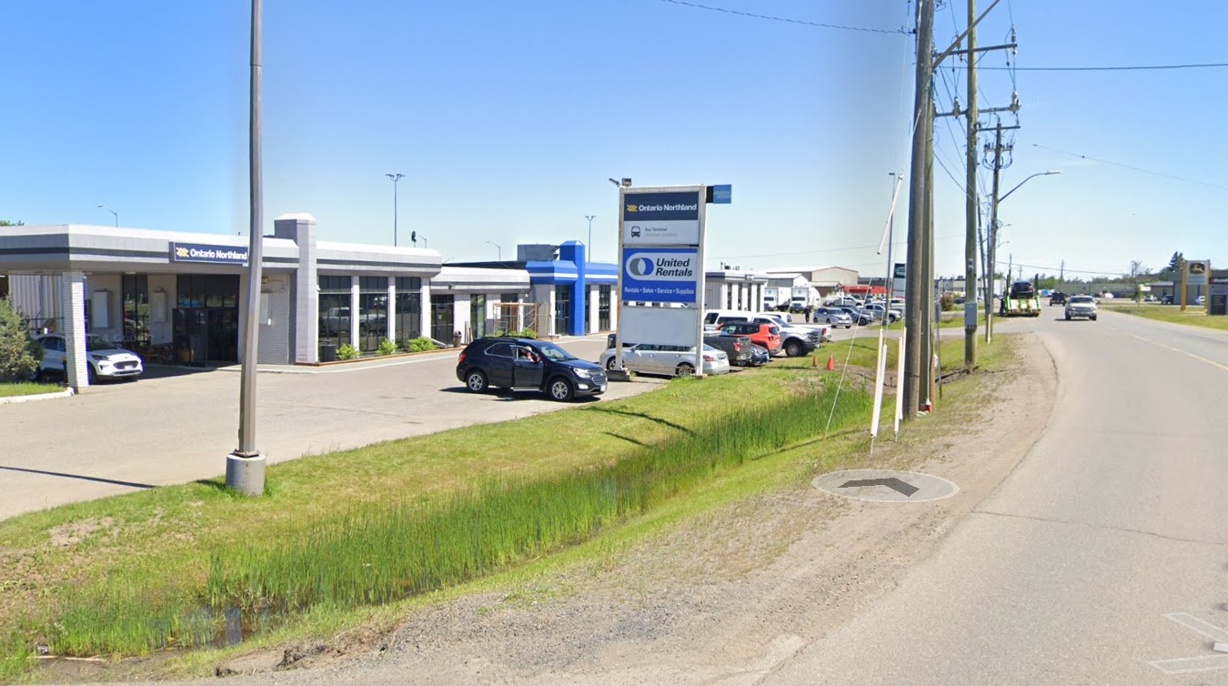
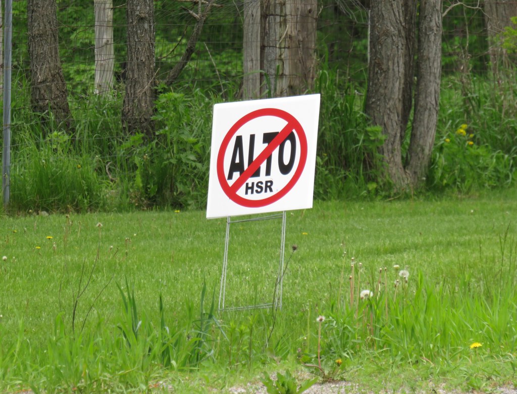
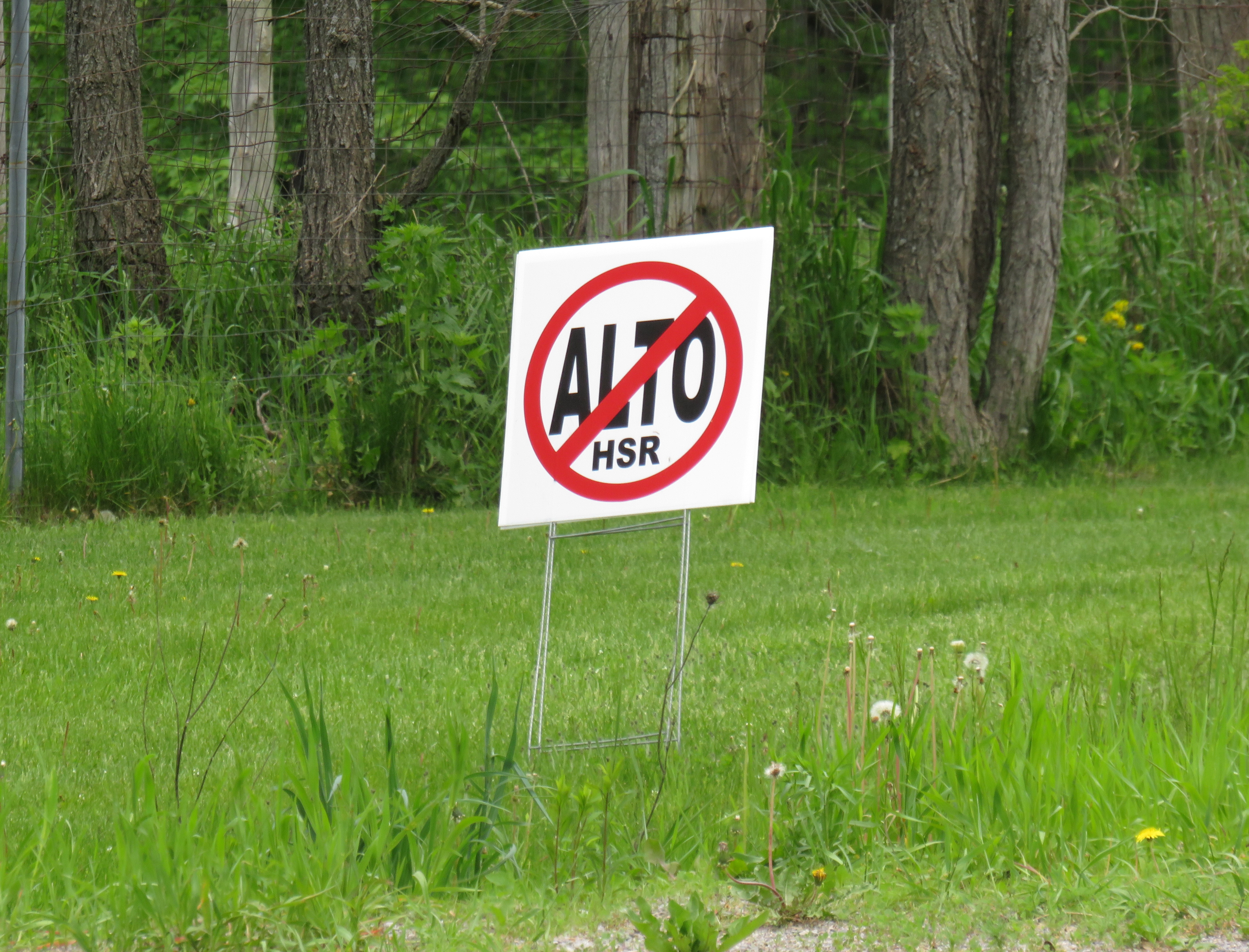
    Not unexpectedly, there is opposition from residents and landowners along the route, especially in Eastern Ontario and the area of Quebec just northwest of Montreal. In Hastings County, north of Trenton and Belleville, there are a few dozen “No Alto HSR” signs on lawns and farms in places like Madoc, Marmora, Stirling, and Tweed. In this part of Ontario, between Peterborough and the Rideau Lakes region southwest of Ottawa, there are two broad potential routes: a southerly corridor runs near Campbellford, Stirling, Tweed, and Westport, including through some productive farmland in Northumberland and Hastings Counties. A second route runs north of Highway 7, just north of Madoc and Perth, along the southern fringes of the Canadian Shield.

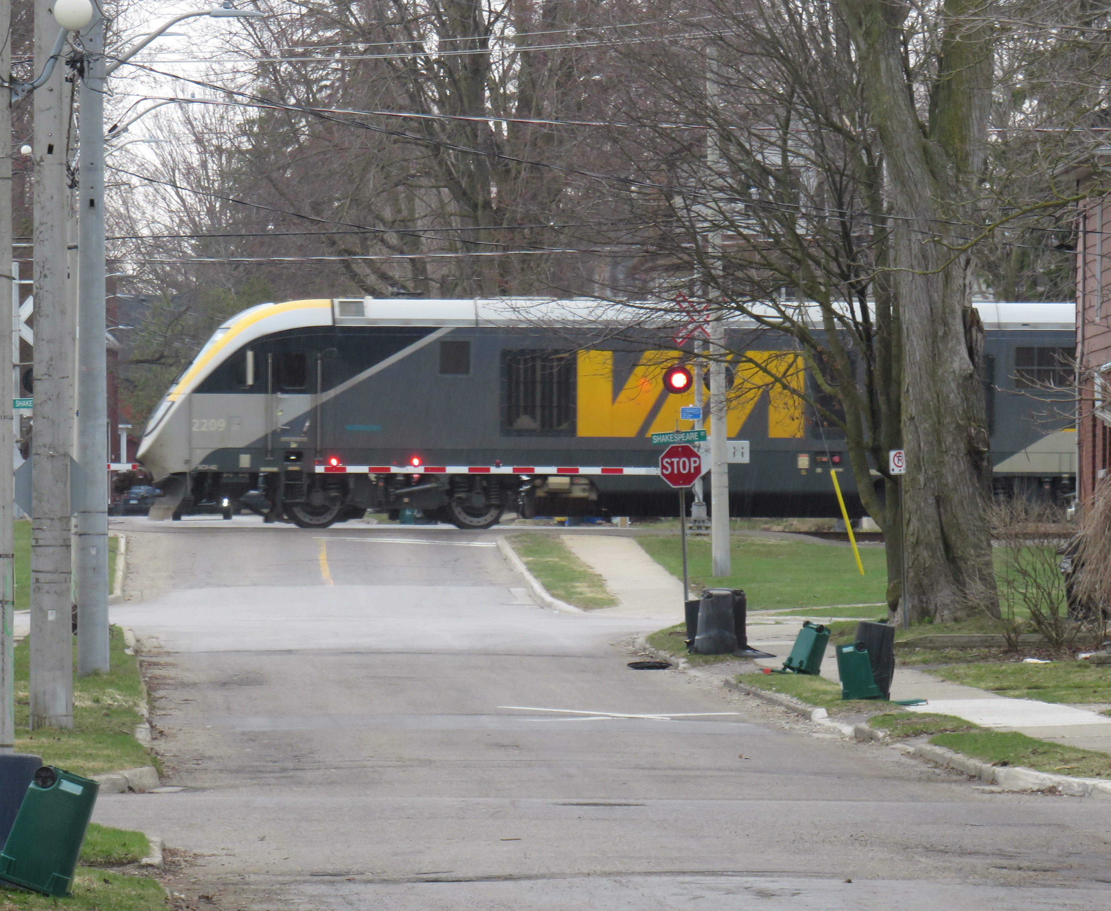
    Though a high speed railway line would be straight and relatively narrow, it would require the acquisition and severance of hundreds of properties. Along the existing CN and CP railway corridors to the south constructed in the 1850s and 1900s, there are frequent public road and private-access level crossings, something that is not possible with modern high speed trains passing at up to 300 kilometres per hour, so farmers whose land is crossed by the new high speed railway corridor may not be able to access parts of their property easily. Furthermore, there are no stops planned between Peterborough and Ottawa, a distance of over 250 kilometres.

    In Prescott & Russell Counties in the Lower Ottawa Valley, even the local governments are opposed to Alto crews doing early survey work to determine an optimum route, with county warden Mario Zanth clear on the matter: “This council does not want them on our territory.” For now, Alto surveying is mostly done by way of drones over land where landowners have not granted access.

    Once a more specific route is selected, hopefully some of the opposition will fade. Detailed design work and further consultation should also help mitigate concerns. This is especially important west of Ottawa, where there are the two diverging routes.

    Despite the rural opposition, Alto should go ahead. Other major infrastructure projects, especially new highways, can be far more disruptive to local land use. But without local community benefits — at least a new freeway has regular access points — it will be harder to get buy-in.

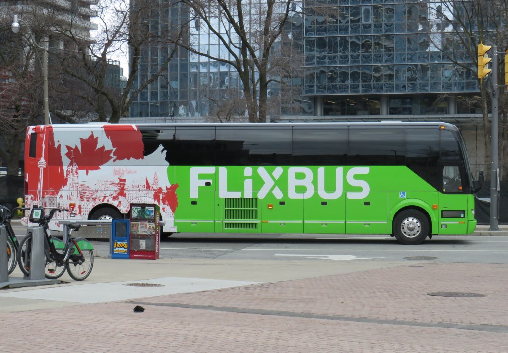
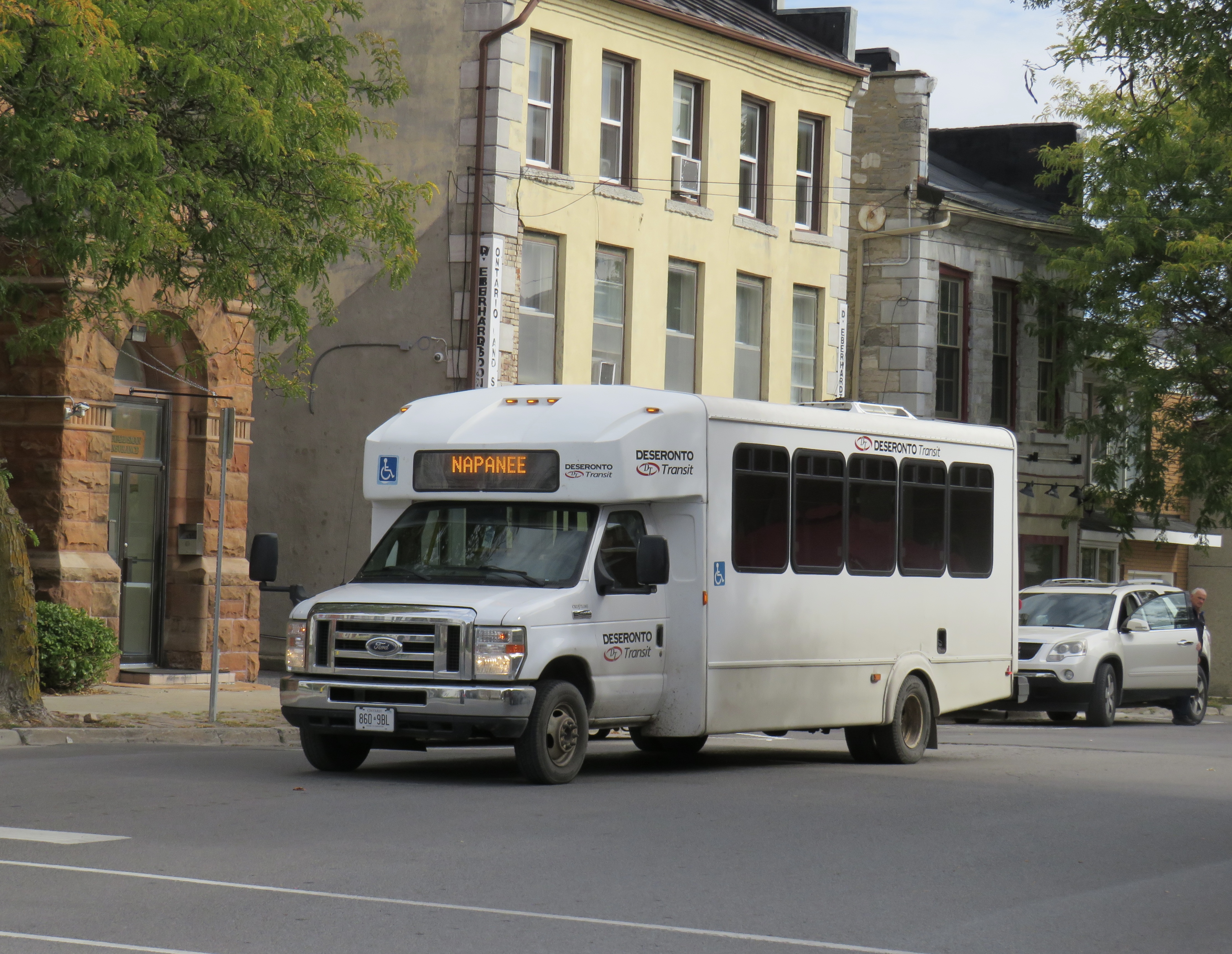
    Therefore, this needs to be a matter of “Alto and” than just “Alto” by itself. This means building and maintaining a supporting network of conventional VIA service, intercity and regional buses, and local transit connections. It might also mean adding a few additional stations along the route, in places such as Perth. Adding additional stops doesn’t have to slow down trains at all; Japan’s Shinkansen has three classes of trains, from the super-express Nozomi to the all-stops Kodama. While most passengers would be through Toronto-Ottawa-Montreal travellers, offering additional stops for select trains can make Alto more accessible to more people, especially if it means providing new options to underserved communities.

    An express train passes the local Odawara Shinkansen Station in April 2019

    If Alto becomes the backbone of a strong, integrated transportation network in Ontario and Quebec, the benefits will go far beyond those in the six cities directly served the planned high speed line, even to those directly bypassed by Alto trains. This integration is commonplace in Japan and Europe.

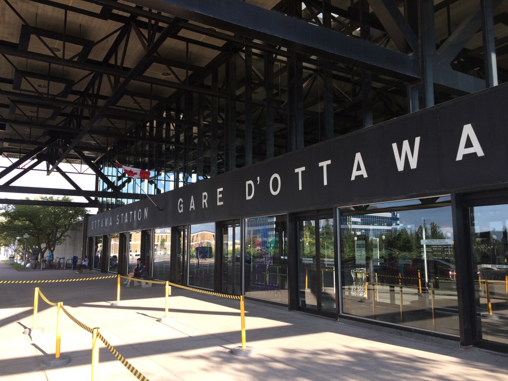
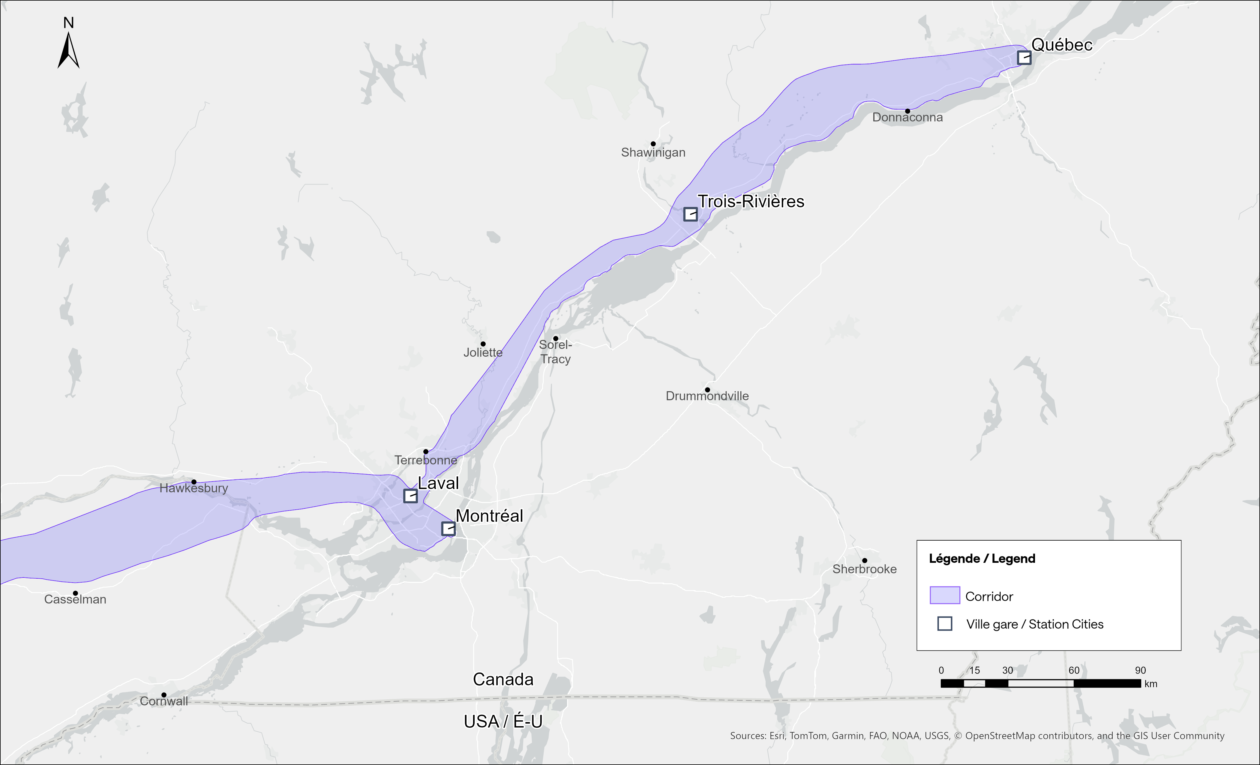
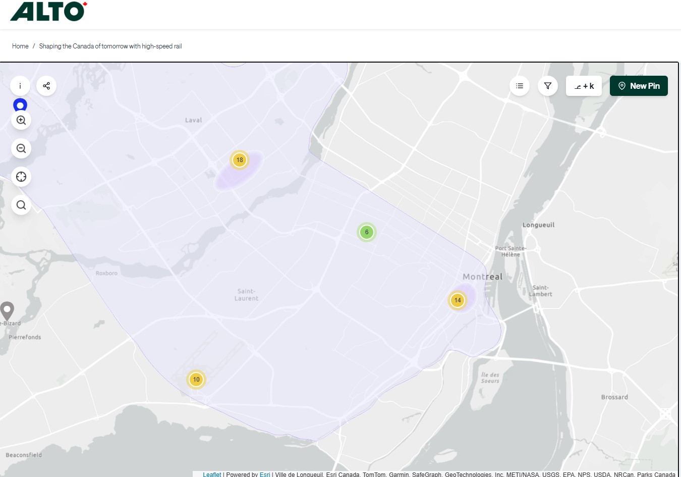
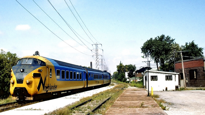
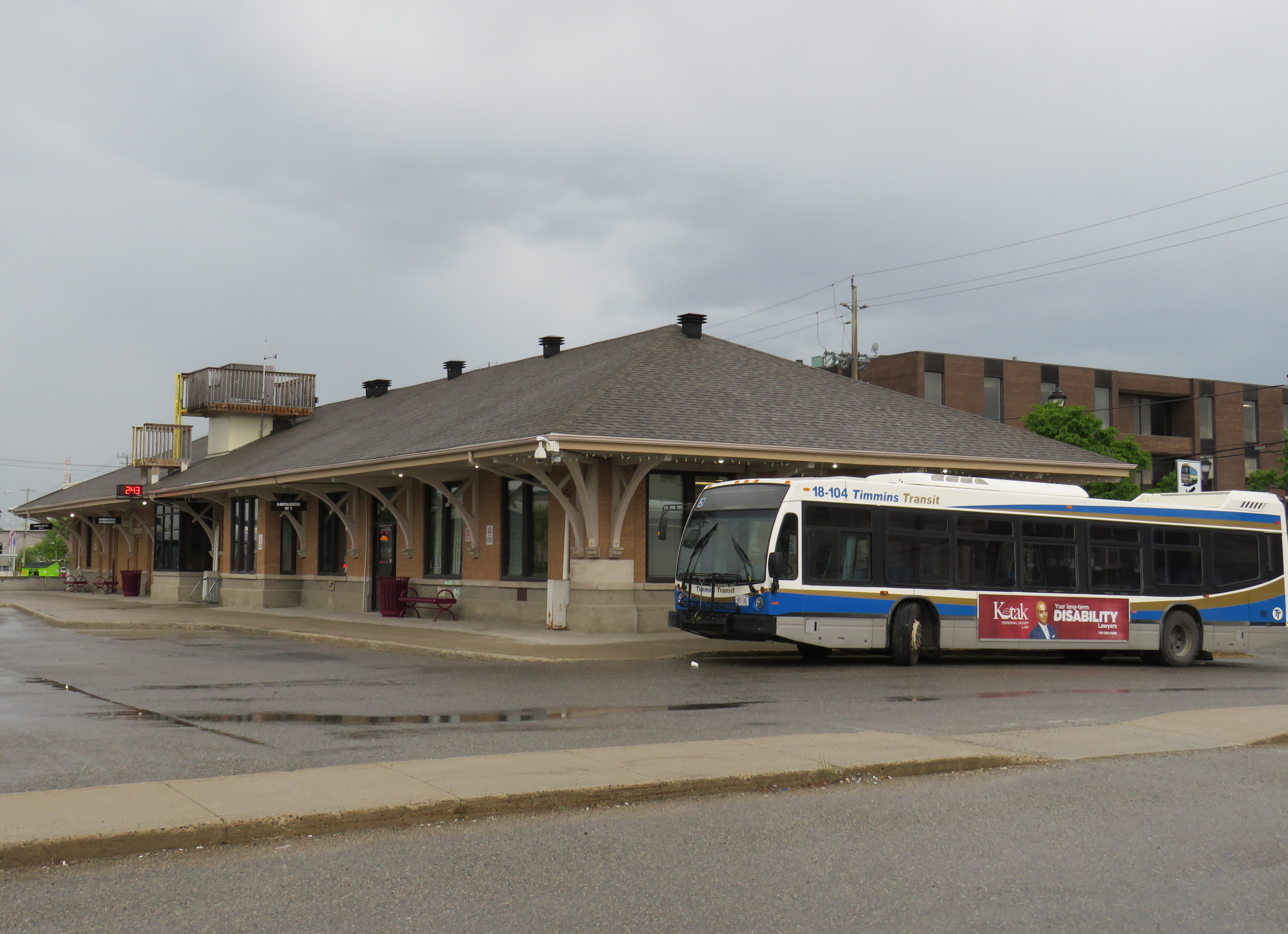
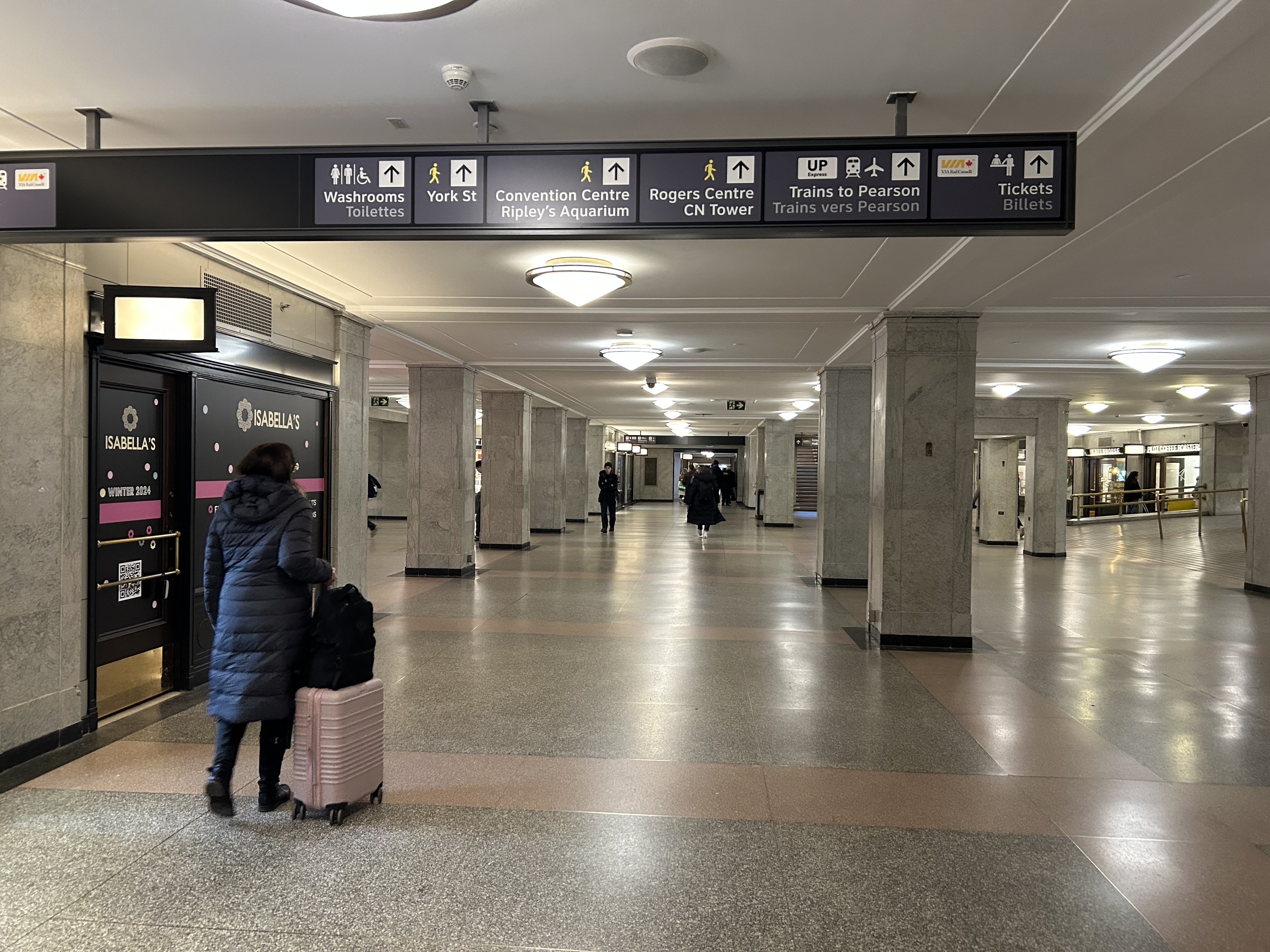
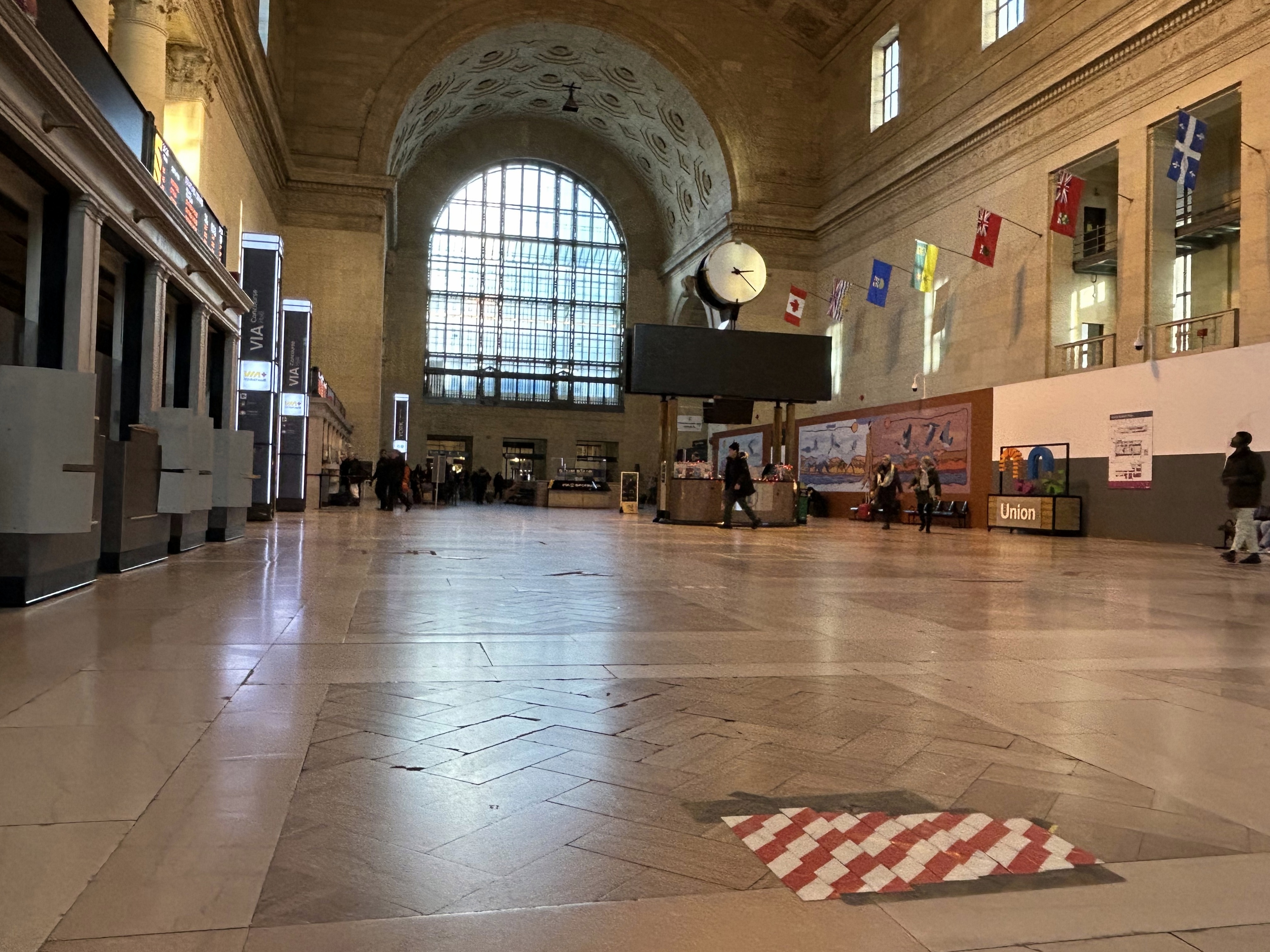
    In Kingston, for example, a new or upgraded VIA station with additional tracks and platforms would allow for early morning departures and late evening arrivals from Toronto, Ottawa, and Montreal without having to sit on active CN freight tracks overnight; VIA schedules built around serving cities like Belleville, Kingston, and Drummondville would ensure the existing service remains vital as through passengers switch to the faster line. A new Kingston station near Division Street could integrate rail and bus services, with easy access to Highway 401, with local and regional buses to places like Gananoque. Enhanced bus connections to the rest of the Ottawa Valley from the Ottawa Alto/VIA Station could allow travelers from Pembroke, Arnprior, or Hawkesbury to quickly continue their journeys via train. At Trois-Rivières, there should be seamless connections to places like Shawinigan and Victoriaville. The Canada Intercity Transportation Map on this website shows which communities are unserved or underserved by bus and rail: these include many towns in Southern Ontario and Quebec that are within 100 kilometres of the Alto corridor.

    Canada is right to invest in high quality and sustainable transportation infrasturure as a nation-building project, to boost the regional and national economy, and promote environmentally friendly travel options. But focusing only on Alto, without a strategy of leveraging the conventional VIA network and intercity bus connections to feed that network, can only limit the success of high speed rail. The communities in between deserve better.

  • How Metrolinx gets in the way of passenger rail service

    How Metrolinx gets in the way of passenger rail service

    Slow orders at CN railway crossings are not the only slowdowns encountered by VIA trains

    On the way home from a meeting I had in Ottawa on Sunday, May 3, I was aboard VIA Train 647, which left Ottawa Station at 4:51 PM. Our train was held up twice in the first hour: once at Smiths Falls, where we had to wait just under ten minutes for a CPKC freight train to pass, and again at Jasper, where we sat on a siding for about five minutes for an Ottawa-bound train to pass. As a result, our train arrived in Kingston at 7:10 PM, 15 minutes later than scheduled.

    VIA Rail owns the track north of Brockville, where Toronto-Ottawa trains verge off the CN mainline between Toronto and Montreal, though it still has to cross the CPKC mainline at Smiths Falls through a freight yard there. Around 2010, after VIA took over the track from Canadian Pacific (once part of a line from Brockville to the Ottawa River near Arnprior), it built new passing sidings and moved the Smiths Falls station stop away from the old CP station to increase passenger train capacity and reduce conflicts. Ideally, the VIA and CPKC tracks would be completely separated, but it would be very expensive to implement.

    Despite CN restrictions on VIA’s Venture equipment, with mandated reduced speeds at level crossings, we lost only ten more minutes upon arrival at Oshawa, getting there at 9:01 PM instead of the scheduled time of 8:36. But we had yet to encounter one last obstruction: Metrolinx-owned track between Pickering and Toronto Union Station.

    Train 647 on Sunday, May 3; real time arrivals from VIA’s online train tracking webpage

    Where the CN Kingston Sub meets the GO corridor west of Pickering Station, our train once again came to a stop for about five minutes. We were held behind a westbound GO Lakeshore East train, slowed down by its regular stop at Rouge Hill. Once we got moving again, our train stopped briefly at Guildwood to allow a few passengers to get off, and now we were 28 minutes late on the VIA train.

    From Guildwood westward, the Lakeshore East corridor is triple tracked, so we were able to pass the westbound GO train as it made stops at Eglinton, Scarborough, and Danforth. But under the Main Street bridge, we stopped once again; two minutes later the GO train started moving slowly beside us, taking the lead. With the corridor down to two tracks between Woodbine Avenue and the Don River for Ontario Line work and track expansion, Metrolinx dispatchers decided it was worth holding back a VIA train that would have cleared the section quickly if we were permitted to proceed past Main Street, so that a GO train would have priority and not wait one minute or two despite that train being on time.

    View from a stopped VIA train as a GO train picks up speed after stopping at Danforth Station

    We finally arrived at Union at 9:59 PM, 41 minutes late. Sadly, this is a very common occurrence, particularly with inbound trains to Toronto.

    Though CN gets plenty of blame for slowing down VIA Rail passenger trains by prioritizing its freight operations and its level crossing spat, Metrolinx must wear some of the blame for VIA’s woes. It is worth pointing out that nearly all VIA passengers affected by poor train dispatching are travelling to or from destinations served by GO Transit: Toronto, Oakville, Oshawa, Aldershot, Brampton, and the majority are travelling within Ontario, including cities such as London, Ottawa, and Kingston. As an agency of the province, Metrolinx should support Ontarians travelling on trains within Ontario, even if they are not aboard Metrolinx-operated GO trains.

  • Spring intercity map update: new routes and new gaps

    Spring intercity map update: new routes and new gaps

    More Flixbus routes are coming to Western Canada

    In the fifth year that I have been following and mapping Canada’s intercity transportation links, the network (if you could call it that) remains in flux. Spring 2026 brings several new routes, particularly in Western Canada, that restore some former Greyhound services. Unfortunately, regional and commuter services in Ontario and Alberta are coming to an end. Wednesday, April 30 was the last day for the LTW Route 42 between Leamington and Windsor. In Alberta’s On-It is winding down its commuter buses between Calgary and Cochrane and Okatoks.

    However, Flixbus continues to expand, taking over more former Greyhound routes. Unlike Greyhound or most other intercity transport companies, Flixbus is not a bus company per se, as it does not own or operate the services; instead it uses smaller contracted operators while coordinating branding, schedules, and ticketing. But starting in May, it will operate three-four days a week between Calgary, Regina, and Winnipeg, with stops in cities that have long been without service, such as Moose Jaw and Swift Current. Another route will connect Calgary with Drumheller, including a stop at the famous Royal Tyrrell Museum.

    Despite the recent loss of TOK’s Southampton route and last year’s cutback of Grey County’s GTR services, there is hope for new connections in Midwestern Ontario. Grey County, together with neighbouring Bruce, Dufferin, and Wellington Counties, is studying a regional system to augment and replace the limited existing services. Hopefully, it will include regular service to fast-growing Saugeen Shores, which recently lost that TOK service. In Centre Wellington, a new local service connecting Elora and Fergus will soon start operations.

    One of the major issues continually faces is the lack of intramodality and useful connections. A viable passenger rail system — be it a classic corridor service such as the Quebec-Windsor VIA train or a high-speed line such as the planned ALTO project — is much more useful to many more passengers when there are easy connections at stations. Through-ticketing and schedule coordination should be implemented whenever possible. Furthermore, though the Upper Ottawa Valley (towns and cites such as Renfrew and Pembroke) has a daily Ontario Northland bus, it arrives in Ottawa late in the evening and leaves early in the morning, limiting its usefulness to areas closer to Ottawa that could benefit from a commuter connection or onward trips to Montreal, Toronto, or Kingston. Despite more gaps seemingly filled, other gaps remain.

    I updated my intercity transportation map to note these changes.  As always, please contact me with any information that I have missed. While I’ve tried to keep this map as accurate and up to date as possible, Canada is a big country. 

  • Ottawa’s Union Station problem

    Ottawa’s Union Station problem

    Great Hall, Ottawa Union Station
    Main lobby, Ottawa Union Station

    With planning now well underway for the Alto high speed passenger rail corridor between Quebec City and Toronto, there has been some speculation that Ottawa’s grand old Union Station, in the heart of the capital’s downtown core and a mere stone’s throw from Parliament Hill, could see trains again. Local business leaders and Mayor Mark Sutcliffe are excited by the idea of a downtown station, expecting that a downtown transport hub would help revitalize the local economy. Though it’s a very attractive idea, there are unfortunately just too many reasons why this would not be feasible.

    To understand why, it’s worth diving into the history and urban politics of railways in the National Capital Region.

    The decline and closure of Ottawa Union Station
    Grand Trunk Central Station soon after opening in 1912 (Library & Archives Canada)

    The Grand Trunk Central Station, opened in 1912, provided a grand entrance to Canada’s capital city that was previously served by a few smaller stations just outside the downtown core. The station, designed in the Beaux-Arts style, was built as a stub-end terminal. This meant that trains would arrive and depart from the south and would have to be backed up to change direction. This suited the Grand Trunk Railway just fine, as it lined up perfectly with its route to Montréal via Alexandria (still used by VIA Rail today). The railway also built a hotel across the street — the Chateau Laurier — and connected the station with the hotel with a pedestrian tunnel.

    Entrance lobby, soon after opening. Note the tunnel under the staircase to the Chateau Laurier. (Library & Archives Canada)

    The 1912 station was intermodal from the very beginning. Right outside the station’s front doors, there were Ottawa Electric Railway streetcar platforms serving several routes on Rideau and Sparks Streets, the two main commercial corridors in Downtown Ottawa. Right below the canal and railway bridge next to the station was the Hull Electric Railway’s loop; its streetcars crossed into Ontario via the Alexandra Bridge.

    Alexandra Bridge
    The Alexandra Bridge carried CPR trains, Hull streetcars, pedestrians, and motor vehicles when it opened in 1901

    Soon after opening, the Canadian Pacific Railway joined the Grand Trunk, resulting in the terminal being renamed Union Station; the short-lived Canadian Northern Railway (CNoR) soon followed. As the CPR’s tracks to Hull (via the Alexandra Bridge) ran next to the GTR’s station, it suited the CPR well. Unlike Grand Trunk, both the CPR and CNoR had direct lines to Toronto.

    Two platforms on the west side of the station allowed through CPR trains to continue towards the Alexandra Bridge and even return to Ottawa via the Prince of Wales Bridge to the west; this was the route the iconic Canadian train between Montréal and Vancouver took when it was inaugurated in 1955. Most trains — including all GTR and CNoR, however, terminated at the six stub-end tracks. Both GTR and CNoR were absorbed into the new Canadian National Railway (CN) by 1922.

    Approach tracks and Bush trainshed, Ottawa Union Station. A wintery scene, with a frozen Rideau Canal on the left. The yards at right are now occupied by the Rideau Centre, Convention Centre, and Department of Defense Headquarters (Library and Archives Canada)

    In the 1940s, the federal government led by Liberal prime minister William Lyon Mackenzie King wanted to beautify the nation’s capital region and address traffic congestion. Ottawa — and the federal government — was rapidly growing, while political leaders wanted a cityscape that matched the ambitions of an expanding nation. French urban planner Jacques Gréber was commissioned to plan the region’s future; Gréber’s recommendations, released in 1950, were ambitious and transformative. (You can read the entire report here.)

    The Gréber Plan — formally titled “Plan for the National Capital” — called for new highways, the abandonment of Ottawa’s streetcars (which were seen as antiquated with unsightly overhead wires), and the removal of all railway infrastructure within the City of Ottawa. The old CN and CPR lines would make way for new roads, including a four-lane arterial along the east side of the Rideau Canal, leading to a new road bridge replacing the Alexandra. A new railway bypass along the periphery of the city would replace all urban trackage, with a proposed new Union Station site in Gloucester Township, south of Walkley Road. Most industrial uses — including the historic paper mills along the Ottawa River — would be moved to the new railway line.

    Proposed highway system for Ottawa-Hull and environs, from Gréber’s report
    Proposed Railway system: Ottawa Hull and environs from Gréber’s report

    Though the plan was not fully implemented, it did set the stage for much of the urban planning and infrastructure changes during Ottawa’s next fifty years. The railway bypass was constructed between Bell’s Corners in the west and Ramsayville in the east, with the old Grand Trunk tracks through the city replaced with The Queensway, now part of Highway 417. New parkways lined the rivers and canals. Two new multilane traffic bridges crossed the Ottawa River (though the Alexandra Bridge was maintained for traffic and pedestrians) and Albert and Slater Streets were made one-way, with a new bridge over the Rideau Canal (the Mackenzie King Bridge) linking them to the east. A large Greenbelt encompassed the city region, intended to direct growth while preserving natural areas.

    Fortunately, the passenger station was relocated to a point much closer to the city centre than the Gréber Plan envisioned: the old CN and CP tracks along the Rideau River south of the city centre were kept in place but rerouted to serve a new modernist station that opened in July 1966. The new Ottawa Station, designed by John C. Parkin, is one-of-kind. The architecture invokes an airport terminal, with large, sheltered driveways and an airy open lobby/concourse, and was the last grand railway station built in North America. In 1966-1967, there were still two daily transcontinental trains departing from Ottawa Station, along with multiple trains to Toronto and Montreal, including a Toronto-Ottawa night train. Today, there are just eight trains to Toronto and five trains to Montréal.

    Ottawa Station, which opened July 31, 1966

    Soon after the new station opened, the tracks and ancillary buildings around Union Station were removed, making way for Colonel By Drive, the Rideau Centre shopping mall, a new convention centre, and headquarters for the Department of Defense. The station building itself survived, however, first becoming a temporary museum space during the 1967 Centennial celebrations, then a government conference centre, mostly closed off to the public.

    The Red Chamber
    The temporary Senate Chambers in the former train concourse at Ottawa Union Station

    Right now, the grand building is the temporary home of Canada’s Senate, and is again accessible to the public, via a free tour. The renovations to the building are very sympathetic to the built heritage. As reconstruction of Centre Block, the regular home of both Houses of Parliament, is still five years away from completion, there’s still lots of time to take the tour.

    Awaiting Alto

    The Alto high speed rail line project, now in the planning stage, will connect Québec, Montréal, Ottawa, and Toronto, with a total of seven stations (the other three are planned in Trois-Rivières, Laval, and Peterborough). The first segment, with the start of construction set for 2029, will link Montréal, Laval, and Ottawa. Consultations on the specific route and station locations are underway, with the broad corridors noted in maps available on the Alto website.

    Map of potential routings for the Alto high speed line in Ontario
    Map of the planned routing for the Alto high speed line in Quebec

    The maps clearly show a route between Ottawa and Montréal that will pass through Prescott & Russell Counties, roughly following an abandoned CPR corridor until about Hawkesbury, at which point it would cross into Quebec (following an older abandoned CNoR route) to Laval, then continue south into central Montréal, though not necessarily the existing Central Station (this would likely require a new tunnel under Mount Royal). The Montréal station appears to be a terminal for trains coming from Ottawa and from Trois-Rivières and Québec, much like the existing VIA Central Station.

    Alto’s next phase towards Toronto could follow one of two broad routes between Ottawa and Peterborough, either just north of Highway 7, through the Canadian Shield, or a southerly alignment through the Rideau Lakes region and then through South Frontenac and passing near Stirling and Campbellford. All planned routes would require passing through Ottawa entirely on the Ontario side of the Ottawa River, making a through station particularly likely, especially for the critical Toronto-Montréal market.

    On the detailed consultation map, highlighted areas show where the seven station locations are being considered.

    The map for Ottawa shows possible station locations in an area including the current VIA station and the old Union Station
    The Montréal and Laval station locations under consideration. The Montréal station area highlighted includes the locations of Central and Lucien L’Allier Stations. The Montréal station for Alto is clearly intended to be a terminal.

    The idea of a downtown Ottawa Station for the new high speed rail corridor is certainly enticing. It would breathe new life into a 114-year-old landmark, provide a very convenient spot for Ottawa politicians, public servants, business travelers, tourists, and students attending nearby University of Ottawa. Rideau O-Train Station is less than two blocks away. However, it would require a new tunnel and/or elevated structure to reach the station from the rail corridors to the south. Furthermore, Centre Block would have to reopen on schedule so the Senate can move back before construction can start on refurbishing the station for passenger service.

    The 1966 Ottawa VIA Station, on the other hand, has its own advantages. There is plenty of room to build new high speed train platforms, which should provide level boarding for efficient passenger movement. There is also room for parking, passenger pick-up and drop-off, as well as easy access to the highway, unlike Union Station. With the closure of the Ottawa bus station, the VIA Rail Station has become a multimodal hub, with Ontario Northland, Flixbus, and Orleans Express all using the station’s driveway, along with a KLM/Air France shuttle to Dorval Airport. There is also a dedicated O-Train LRT station on-site, though it could be better integrated with the station building.

    Perhaps most importantly, the existing VIA station can help ensure the existing Corridor service remains integral, as passengers from Kingston, Belleville, and elsewhere on Lake Ontario and the St. Lawrence River will not be served by Alto; neither would Casselman, Alexandria and Dorval. That the station is a through-line, and not a stub-end terminal, will also ensure that the crucial Toronto-Montréal market will see minimal delays from back-tracking and reversing at a downtown terminal. Though there are instances of high-speed trains reversing directions at major hubs — Trenitalia’s Frecciarossa mainline between Milan and Salerno turns back at Roma Termini and at Napoli Centrale — this is an uncommon arrangement.

    All the planned Alto high speed rail stations will have to be easily accessible and close to the downtown cores of the cities it serves. At this point in the planning process, this looks like it will be the case at all three big city stations. But it will need more than walk-up traffic like downtown office workers and tourists; it will be most successful as part of a complete network of local, regional and intercity transport, including the conventional VIA rail system. With specific improvements, including new platforms and better O-Train station integration, the modern yet historic 1966 Ottawa Station is well suited for all of these needs.

  • Canadian intercity transport at the end of 2025

    Canadian intercity transport at the end of 2025

    Deseronto Transit is now one of Ontario’s lost transit links

    December 2025 marks the end of the sixth year that I have been keeping track of Ontario’s intercity transportation links. In 2020, I launched an online Ontario intercity map, expanding that effort to a Canada-wide map in 2022.

    Over the last six years, Greyhound Canada disappeared after years of decline, the COVID-19 pandemic hit with travel restricted, the Ontario provincial government set up one-time funding for intercommunity transport links while deregulating the intercity coach industry, and many municipalities dipped their toes into providing rural transit services.

    At the end of 2025, there was some good news to note — several rail transit lines opened in Toronto, Montreal, Ottawa, and Edmonton, while a few new rural services opened in Eastern Ontario. Unfortunately, there were also some major losses in Ontario, particularly in Grey County, Oxford County, Napanee-Deseronto, and the impending cancellation of a major route in Essex County. Unlike in Ontario, however, rural transport links remain stable in Quebec and British Columbia.

    Stable funding is essential to keep these intercommunity and intercity links alive, particularly where private operators have not filled a need. For example, Flixbus recently cut back their once-a-day route from Toronto to the Lake Huron coast and will not serve rapidly-growing Saugeen Shores during the colder months. That part of Ontario is left only with a three-days-a-week TOK coach despite potential demand. A well-funded regional transport service coordinated by Grey, Bruce, and other adjacent counties could address this, but there needs to be political will to ensure stable and predictable service needed to grow ridership over the long term.

    I just completed a round of edits to my intercity map, noting changes to routes, service levels, and in some cases, stop locations. A few new scheduled air shuttles in Atlantic Canada and Manitoba are included; these types of services are only mapped if they also provide non-airport service or at least connect to urban transport.

    There are also more grey lines. Starting with edits in mid 2024, I have chosen to grey out abandoned routes, rather than just eliminating them. It is well worth noting where transport links have disappeared, and where replacement service might be worth planning.

    Hopefully 2026 will see better service than the end of 2025.

    As always, please contact me with any information that I have missed. While I’ve tried to keep this map as accurate and up to date as possible, Canada is a big country. 

  • The end of the line at Porcupine

    The end of the line at Porcupine

    Sign says "Porcupine" near the new Ontario Northland terminus.
    The end of the line for the restored Northlander train

    Timmins, a resource town of 40,000 in Northeastern Ontario, is known for a few things: gold mines, beer parlours, the birthplace of country musician Shania Twain, and the place where folk musician Stompin’ Tom Connors got his start. If Connors — a travelling musician who delighted small town crowds with songs about their communities (like the hard working and hard drinking times of a “Sudbury Saturday Night”) — was still around, he’d probably write and perform a new song about getting kicked off an overnight train in the sparse environs of Porcupine, Ontario. After all, the song would quickly rhyme itself.

    Porcupine is a small community of about 1,000 on the far eastern edge of the populated area in the geographically gigantic City of Timmins. Before the wave of municipal amalgamations across Ontario in the 1990s and early 2000s, Timmins was the largest city or town in the province by geographic area; it was formed through the amalgamation of the smaller City of Timmins with adjoining Mountjoy and Tisdale Townships (along with the town of South Porcupine) in the 1970s.

    Until 1990, when the devastating cuts to VIA Rail took place, there were two daily trains between Toronto, North Bay, and Northeastern Ontario. The Northlander, a daytime train operated by Ontario Northland Railway, terminated at a downtown station in Timmins. The Northland, a joint VIA/ONR train, ran overnight between Kapuskasing and Toronto, with a bus connection to downtown Timmins. Famously, for a short period the daytime Northlander operated using former Trans-Europ-Express (TEE) cars, purchased used from Dutch and Swiss rail operators.

    Northbound Northlander TEE set at St. Clair Avenue in Toronto, by HardHatMak on Flickr

    After 1990, Timmins was only connected by bus, with one daily bus to North Bay (and onwards to Toronto), and one bus, six days a week, to Sudbury (with connections to Toronto). The new daily overnight train — discussed earlier on this site — promises to restore a new daily trip, along with a more comfortable journey, even if sleeping accommodations will not be provided.

    Timmins Station with transit bus
    The Timmins Station is now a bus terminal serving local transit and Ontario Northland intercity coaches

    Unfortunately, the train will not be returning to Downtown Timmins. The end of rail is at Highway 101 at Porcupine, 13 kilometres to the east. Since abandonment of the passenger rail service, the railway was torn out west of South Porcupine; the railway overpass over Algonquin Boulevard (Highway 101) near the old Timmins Station was removed last year. Ore collected at the open-pit gold mines, previously loaded onto railcars, is now sent on massive dump trucks for processing at a plant at Hoyle, east of Porcupine.

    The Northlander train departs Timmins on the now-demolished railway bridge over Algonquin Boulevard in the early 1980s

    Happily, the Timmins station building remains in use as a transit terminal and Ontario Northland coach stop; it will likely serve a bus shuttle to the new Timmins-Porcupine Station now under construction.

    The end of track at Highway 101 in Porcupine; construction has started on the new terminal station for the Northlander

    Since I last wrote about the promised return of the Northlander, there have been a few updates. The new station building will be somewhat more substantial than first proposed; it will include washrooms, a waiting area, and a service counter for ticket sales and bus parcels. This is welcome, as there is very little around the Porcupine station site. Nearby, there are only a few dozen houses, a propane depot, a small park, and a gas station across the street.

    Rendering of new Timmins-Porcupine Station

    Most other stations will still just get enclosed shelters, though at Matheson, Swastika, New Liskeard, and Temagami, the construction of new platforms is well underway. Even though there are heritage passenger stations at Matheson (which just escaped demolition), Temagami, South River, Huntsville, and Gravenhurst, there will just be shelters for Northlander passengers at these stops. Shelters depicted on the Ontario Northland website resemble those at BRT stops or GO Transit station platforms, with lighting and overhead heat.

    Fencing protects the construction of a new platform beside the handsome Temagami ONR Station. The station building will not be used for passenger services; it currently hosts a café and gift shop.
    Rendering of passenger shelter for Northlander stops

    It will be nice to see the return of passenger rail to Northeastern Ontario when it launches in two years. Unfortunately, I remain unsure whether it will attract enough riders to be seen as viable after a year or two of service.

  • North by northwest: a short winter jaunt

    North by northwest: a short winter jaunt

    VIA Train #1 at Hornepayne, Ontario. Normally this stop would be made overnight.

    In late January, I went on a short vacation. Many people, given the short days and cold weather, opt for warmer climes. I, on the other hand, decided to travel to the infamously cold city of Winnipeg, Manitoba. Back in November, VIA Rail offered great deals on winter travel as part of its “Black Friday” sale; a berth in a sleeping car from Toronto to Winnipeg cost $271, with meals included. Winter travel by train can be beautiful, and I had fond memories of my February 2014 trip aboard the Algoma Central Railway between Sault Ste. Marie and Hearst.

    I planned to spend two nights in Winnipeg, including taking in my first NHL game since the pandemic. The Jets were playing on Friday night against the original Winnipeg Jets, the Utah Hockey Club (which moved to Salt Lake City from Phoenix in 2024). I would then travel back east by bus, with a stopover in Kenora, flying home from Thunder Bay.

    Unfortunately, my train from Toronto was delayed by eleven hours, a new record in my rail travel setbacks. The train from Vancouver faced several setbacks due to extreme cold conditions in the Prairies and Northern Ontario, arriving in Toronto over 15 hours late, around 8AM on Wednesday morning. (VIA Rail’s communications were subpar, and though I got two emails advising of a 5:00 PM departure on Wednesday, we did not actually leave until 8:00 PM, about 10 hours late from Toronto.)

    Despite the delays, it was a very pleasant train ride across Northern Ontario in the snow. The cooked-to-order meals served aboard the Canadian, as always, were very good, and service was friendly. The lights in the dome car for our section were turned off, allowing passengers to gaze into the wilderness, even at night.

    As it turned out, I was able to cancel my first night’s stay in Winnipeg without penalty, which was fortunate as the train arrived at 7AM Friday, nearly 12 hours late. But for me, it was fortunate, as by then, coffee shops were opening up in Downtown Winnipeg. An earlier arrival, had the train made up time, would have forced me to find a 24-hour restaurant to wait at, and there aren’t any in the downtown area.

    The monument to the 1919 Winnipeg General Strike; a Corten steel replica of a toppled streetcar, covered in snow
    The monument to the 1919 Winnipeg General Strike; a Corten steel replica of a toppled streetcar across the street from Winnipeg City Hall. It was especially compelling partially buried in snow.

    Though I have been to Winnipeg several times before, this was my first time visiting the city in winter. I was pleased to see how the city embraced the short, dark, cold days. Out at The Forks, where the Assiniboine River joins the Red River, there is a lively marketplace located in former railway maintenance and freight buildings behind Union Station. The complex includes a branch of the local McNally-Robinson bookstore chain, restaurants, cafes, art shops, and other local businesses. There are plenty of tables and seating, with water dispensers and plenty of public washrooms. It is one of Canada’s great public spaces.

    An old two-story brick industrial building with a great skylight, with tables and seating below
    Inside one of the market buildings in the Forks, a former railway maintenance building

    Outside, there were Warming Huts art stations, many of which were very compelling. Ice skaters have a choice of an artificial ice rink, covered by a tent-like canopy, or getting out on to a cleared natural path along the Assiniboine River.

    Skaters on the Assiniboine River; warming huts along the ice give skaters a place to sit
    One of the Warming Huts, titled “Wrong Turn,” representing a car sinking into an icy river

    After 24 hours in Winnipeg, capped by a great hockey game in a lively arena, I made my way west towards Kenora and Thunder Bay. Kasper, which I last rode in 2019, has an early morning departure from Downtown Winnipeg, at the Balmoral bus terminal, stopping at Kenora, Dryden, and Sioux Lookout. Among the six passengers were a First Nations woman and her companion, returning home from a medical visit. Intercity buses are a lifeline. The Kasper bus was a 12-passenger van, and despite the poor winter weather conditions, it was a safe, comfortable, and friendly service.

    View out the front window of the Kasper minibus to a snow-covered highway
    Snowy conditions on the Trans-Canada Highway headed east from Winnipeg

    Taking the morning Kasper trip allowed me to spend a few hours in Kenora, population 15,000. The community on the Lake of the Woods is a popular summer vacation spot; this was my first time visiting Ontario’s most westerly city. Kasper’s Kenora stop is at a McDonalds just east of downtown; this gives passengers a chance to stretch, use the washroom, and grab food.

    Kasper minibus - a white van with the side door slid open - in a parking lot
    Kasper Minibus at the Kenora McDonald’s

    The walk from the McDonald’s back towards downtown was pleasant. I was greeted by several deer, in their winter coats, comfortable wandering in a residential neighbourhood.

    Three deer standing in the snow adjacent to a house in Kenora
    Northern white-tailed deer in their heavy winter coats

    Kenora’s downtown is small, but blessed with a solid collection of historic buildings, including the old post office (now city hall), the district courthouse, a two-storey Canadian Pacific railway station (which served VIA until 1990), and the five-story Kenrica Hotel. The hotel has seen better days — the ground floor defaced by an unfortunate 1950s-era streetfront — but it still has good bones.

    Kenrica Hotel, on the main corner in Downtown Kenora

    South of Downtown Kenora, on the lakefront, a cylindrical hotel, ten storeys high, overlooks Lake of the Woods, with a marina at its base. The hotel’s mid-century modernist form is unusual for Ontario, which makes it stand out even more.

    The Clarion Inn on Lake of the Woods

    Many towns and cities in Northern Ontario feature a roadside attraction. Sudbury has the Big Nickel, Wawa has a giant goose, and White River has Winnie-the-Pooh. Kenora’s is a giant sculpture of a muskie fish, called “Husky.”

    “Husky the Muskie” – Kenora’s roadside attraction

    Ontario Northland operates a bus six days a week between Winnipeg, Thunder Bay, Sault Ste. Marie, and Sudbury, with operator changes at Thunder Bay and Sault Ste. Marie. Between Kenora and Thunder Bay, the route alternates, with service to Fort Frances and Atikokan three days a week and to Dryden and Ignace the other three days. Passing through Fort Frances (where the bus stopped at a McDonald’s there for a rest break), I finally visited every county, district, and region in Ontario, with Rainy River District being the final one.

    Ontario Northland coach bus in a snow-covered McDonald's in Fort Frances, Ontario
    Ontario Northland bus in a snow-covered McDonald’s in Fort Frances, Ontario

    The Ontario Northland bus driver that day was exceptional; because of a winter storm, Highway 17 was closed near Batchewana Bay; as such, the bus would not continue past Thunder Bay. Though we were nearly an hour late arriving into Thunder Bay due to road conditions, the operator was willing to continue past the Thunder Bay Ontario Northland depot to drop anyone off continuing to the hospital campus. I was also able to get off the bus by my hotel.

    The Ontario Northland depot at Thunder Bay is not in a very good location, in an industrial area off Highway 61 near the Thunder Bay airport, without direct local transit connections or adjacent amenities. At least a stop at Thunder Bay Regional Health Sciences Centre (which has local transit and is near Lakehead University) is also provided.

    Google Streetview capture of a small bus station in an industrial area
    Ontario Northland Thunder Bay depot, located in an industrial area on a road without sidewalks (Google Streetview)

    Difficult winter road conditions make travel across the North a challenge; this is why professional and safe bus and train operators are so important for getting around.

  • Dysfunction Junction: another Union Station malfunction

    Dysfunction Junction: another Union Station malfunction

    Previously on this website, I discussed the problems with the unsightly, intrusive, and poorly thought-out mess of Jersey barriers plopped in front of Union Station along Front Street. They have not only been an eyesore unbefitting a signature heritage structure, but they have also been difficult for pedestrians to navigate around, especially at the corners of Front and Bay and Front and York.

    The barriers in 2021

    Fortunately, work is just starting on a new system of concrete blocks and bollards to protect the pedestrian plaza and the sidewalks in front of the station. However, this will not be complete until the end of 2025.

    Inside Union Station, however, a lot has changed in the last few years. In general, pedestrian flow within the station building has improved, especially with the opening of the GO Transit York Concourse, which provides a second access point for regional trains. Flow between subway, train, and shops is considerably improved; there are also a lot more food and retail options befitting a central transport hub.

    Despite new escalators and elevators, accessibility in Union Station remains poor. Though technically, the station is fully accessible to anyone using a wheelchair or other mobility device, the wayfinding is absent in key areas. There is only one small elevator that directly connects the subway level with the Great Hall, UP Express trains, and Front Street. An accessible route is also difficult to find.

    The view after entering the Union Station complex from the TTC subway. The overhead sign shows the way to GO trains, the bus terminal, the Union Market shopping area, Scotiabank Arena, CIBC Square (an office building), York Street, more shops and restaurants, and VIA and UP Express trains.

    Imagine entering Union Station from the adjacent TTC subway station with a wheeled device or a mobility aid. There is a large concourse with signs leading forward towards the GO Transit York Concourse along with Scotiabank Arena, the bus terminal, and Union Station shops and food kiosks. To the left is Bay Street, and to the right are a set of escalators and stairs leading up towards VIA Rail and UP Express trains. Behind the stairs and escalators is a single elevator, hidden away.

    To the right is a set of escalators, stairs, and hidden behind, a poorly marked single elevator. These lead towards UP Express and VIA trains, York Street, and attractions such as the CN Tower, the Convention Centre, and Rogers Centre.

    The elevator provides no information other than a sign that indicates that this is, in fact, an elevator, and this is the B2 level. This is a single, small elevator, which operates slowly.

    The elevator at the B2 (subway) level

    Once inside the elevator, there is no information other than buttons marked “G”, “B1”, and “B2”. There is nothing to tell the elevator user what is accessible from each floor.

    Confusingly, the official Union Station map directory calls the three levels “Street Level” (G, the Heritage structure including the Great Hall, West and East Wings, along with the path towards UP Express and the Skywalk), “Lower Level” (B1, the GO York and Bay Concourses, the concourse beneath the Great Hall, and the VIA departure area) and “Retail Level” (B2, including the food court, food hall, and connections to the subway). In the elevators, the audio prompts only mention the three level names.

    Inside the elevators, there is no indication what each level is, or where they lead to — the buttons and empty spaces beside them just show G, B1, and B2 levels

    At G level, which includes the Great Hall, VIA Rail departures and business class lounge, and the passage west towards UP Express trains and the Skywalk to the CN Tower and Rogers Centre, the elevator is also hidden behind a wall.

    The only elevator connecting the Great Hall, the lower concourse, and the subway level is hidden, with tiny signage directing travelers to it

    On the west side of The Great Hall, there is also an elevator, beside the stairway down to the GO Transit York Concourse. This elevator does not serve level B2.

    York Concourse elevator, on the west side of Union Station’s Great Hall

    If the traveler was only connecting from subway to UP Express with a heavy bag, and not using a mobility device, they might decide to take an escalator from the subway B2 level to the B1 level, the lower Union Station concourse originally intended as an arrivals area for intercity trains. However, there is no elevator or upwards escalator to be seen.

    Looking west in the lower concourse, towards York Street and UP Express trains

    If one knew Union Station well, they could make a lengthy detour through the ramps in the VIA Rail area to get to the Great Hall or go around through the GO York Concourse to reach the elevator or up escalator to the Great Hall. But these routes are not marked from the lower concourse area.

    To show how difficult it can be to navigate the station while using a wheeled device (be it a wheelchair, stroller, or wheeled luggage), I shot this video showing how a first-time visitor getting off an UP Express train from Union Station would try to find the TTC subway entrance.

    Video depicting 9-minute trip at a normal walking speed between the UP Express area and TTC subway station entrance, using first available elevators each time.

    At no point was there any visible signage showing the most direct route for someone requiring a barrier-free path from UP Express to the subway. The maps below show the route I took:

    Route from UP Express to the Great Hall and York Concourse Elevator (Street Level, or G). Arrows are added to mark the route I took in the video.
    Path through York Concourse, lower Union Station concourse (Front St. Promenade) – the B1 Level, and to the second elevator to the Bay St. Promenade (subway level). Arrows are added to mark the route I took in the video.
    Last part of the trip on the Retail Level (B2) to the subway station entrance. Arrows are added to mark the route I took in the video.

    Whenever I travel through an international airport — Toronto Pearson is a good example — I never have to think too hard about where the accessible routes are. Escalators are easy to find. There are banks of two or three large elevators in strategic locations on the ground side of airports, connecting departure and arrival areas, as well as ground transportation facilities. As Canada’s busiest transport hub — busier than Toronto Pearson Airport even — Union Station’s elevators and escalators should be plentiful and easy to find.

    I am aware that there are particular challenges at Toronto Union Station — the City of Toronto controls only the common areas, such as the Great Hall, the retail areas, and the main entrances. Metrolinx, the agency responsible for GO Transit and UP Express, controls the York and Bay Concourses, as well as the UP Express station area. VIA Rail maintains its departures area. There are also heritage elements that need to remain intact, such as the Great Hall. But these issues of ownership and heritage preservation do not excuse the difficulty of getting around with a mobility device or even a wheeled bag.

    Why weren’t multiple elevators installed connecting all three levels, to improve capacity, speed, and provide redundancy in the case of an elevator outage? Why are there not easy-to-find elevators in the West Wing near the UP Express area?

    Judging by the condition of the signature Great Hall itself, there is work yet to be done before Union Station is fully restored to its 1920s grandeur. It should not be too hard to improve accessibility and wayfinding as well. Not just for Torontonians, but for international travelers too.

    The Great Hall floor is still cracked and patched, with electrical tape covering some of the damaged sections

  • Travel by train (or bus): Denver’s renewed Union Station

    Travel by train (or bus): Denver’s renewed Union Station

    Denver’s Union Station, with the iconic “Travel by Train” neon signage

    Earlier this summer, I had the privilege of travelling with my spouse to California. We started in San Diego (where my partner was attending a conference) and then made our way northwards, to Los Angeles, Santa Barbara, San Simeon, and finally the San Francisco Bay Area. I continued my trip an extra three days to ride Amtrak’s California Zephyr train east through Nevada and Utah to Denver, Colorado.

    Looking south from the California Zephyr across the Colorado River near the Utah-Colorado border

    Besides the breathtaking scenery through eastern Utah and western Colorado, I wanted to visit Denver itself, including its Union Station.

    Denver’s Union Station was constructed in 1881 to serve the Denver Pacific Railway (the city’s connection to the Union Pacific transcontinental railroad at Cheyenne, Wyoming), as well as the Denver & Rio Grande, the Denver, South Park & Pacific and the Colorado Central Railroads. (Today, it is reached by tracks belonging to the Union Pacific or BNSF Railroads.) Renovated and expanded in 1914, one of the station’s most iconic features, rooftop neon signs beckoning customers to “Travel by train” were added in the 1950s, as interstate highways were being planned and constructed across the United States and air travel became more common.

    The station was nearly closed in the 1980s with only Amtrak’s Oakland-Chicago California Zephyr calling once a day in each direction. Passenger train facilities would have been moved to a small “Amshack” building outside of the downtown core, with the station building incorporated into a proposed new convention centre. (This proposal is similar to the fate of St. Louis’ Union Station, which was turned into a hotel, shopping, and entertainment centre, with the Amtrak station moved into a small building off-site.) Luckily, this never took place.

    Denver’s Regional Transit District (RTD) purchased the station in 2001, with a new master plan developed for the station property and the vicinity in 2002, approved by voters in 2004 as part of the “FasTracks” program. Denver’s light rail system was extended to Union Station in 2002, while the immediate area was redeveloped with midrise apartment and office buildings. The train platforms were rebuilt with a new canopy, meant to accommodate both Amtrak and proposed new commuter and regional rail services.

    Denver Union Station train platforms

    Connecting the historic Union Station building and train platforms with the LRT platforms two blocks north is a long underground bus concourse.

    Denver Union Station’s underground bus terminal

    The underground bus terminal serves local and regional RTD services, as well as Bustang, the State of Colorado’s intercity coach service. Bustang offers multiple daily bus services to cities such as Colorado Springs, Fort Collins, Grand Junction, and Pueblo, connecting most of the state together. There are also seasonal ski buses from Denver, along with special runs for Denver Bronco games.

    Bustang service map

    There are also two free RTD bus services connecting Union Station with the rest of Denver’s downtown core: MallRide, a frequent, daily service along the 16th Avenue pedestrian mall (which was undergoing reconstruction in July 2024, and was on detour), and MetroRide, which operates during daytime hours on a parallel route.

    Splash fountains in the Union Station west plaza

    Union Station now hosts a boutique hotel, several restaurants and bars, a branch of a local bookshop chain, and includes amenities such as public art and a splash fountain outside its main entrance. Though the main lobby was undergoing minor renovations, it was clear how much work went into the project.

    Union Station lobby
    Take the A-Train
    Arriving at Denver International Airport

    Like Toronto’s Union Station, Denver offers an airport rail link, operating every 15 minutes most of the day. The electric A-Line train runs from Union Station, making 7 intermediate stops. With the exception of the airport itself, the A-Line operates within the regular RTD fare zone, with free transfers between connecting buses and trains.

    To enter or exit the airport station itself, occasional travelers must purchase a special $10 day pass (a standard day pass is $5.50), but that, of course, includes all rides taken before or after arriving at or departing from the airport. (By contrast, there are no transfers or fare discounts when connecting between UP Express and GO Transit, TTC, or suburban transit services.)

    Because of the additional stops and the long distance between Downtown Denver and the international airport (25 miles or 40 kilometres), the trip takes 37 minutes versus UP Express’ 25 minutes.

    Unfortunately, most RTD rail services, like the A-Line, follow existing or abandoned rail corridors. Though these routes offer limited obstructions to construction and allow for faster service than operating within roadways, they limit how much ridership can be generated by walk-on service. Even the Downtown Littleton station on the D-Line is distant from any commercial or residential uses, with a large commuter parking lot behind the historic station building.

    At least many RTD stations offer convenient bus transfers, which draw much of the ridership.

    The D-Line LRT at Littleton, Colorado

    A lot was done right at Denver Union Station, which is well served by local, state, and national rail and bus connections, and is serves well as a model for developing a good intermodal hub in a midsized city like Denver. There are certainly aspects that could be replicated at some GO Transit stations, such as Brampton, Port Credit, or Unionville, which are poised to become important intermodal hubs, such as great public spaces, easy connections between nodes, and complementary retail spaces. At Brampton in particular, much can be done with the small historic station building there to make it a centrepiece of a great downtown redevelopment.

    I am glad I visited Denver, and I am glad to have travelled by train.

  • A review of Metrolinx’s April 2024 service changes

    A review of Metrolinx’s April 2024 service changes

    With a GO train serving as a backdrop, Premier Doug Ford, along with Transportation Minister Prabmeet Sarkaria, announced major changes to GO Transit service, with 300 new weekly trains (a 15% service increase). The service changes will take effect on Sunday, April 28, 2024.

    Though most new trains will be added on the Lakeshore West, Lakeshore East, and Kitchener Lines (the Milton Line gets just one additional weekday round trip in the peak direction), the media event was held in Milton, where a byelection was called to replace outgoing PC MPP Parm Gill. With a competitive race between PC candidate Zeeshan Hamid and Liberal candidate Galen Naidoo Harris, the choice of venue made it an especially political event.

    News of the pending service changes was publicized in regular Metrolinx email newsletters in March, but was since taken down, likely to allow for the news to be shared first by the premier and minister of transportation. It is quite clear that Metrolinx is entirely beholden to the provincial government these days, where communications are tightly controlled by its political masters.

    The new GO Transit schedules are now available online. Though there is plenty of good news, some of the added trains are merely restoration of previous service levels. Meanwhile, there will be a significant service cut for two Toronto stations.

    Lakeshore Corridor

    Fifteen-minute train service returns on the busy Lakeshore line on weekend afternoons and evenings, between Oshawa and Oakville Stations only. Service will still run every half-hour on weekdays, weekend mornings, and to Bronte, Appleby, Burlington, and Aldershot Stations, and every hour to West Harbour GO in Hamilton.

    However, weekend 15-minute service starts late in the afternoon. Frequent service from Oakville to Union starts at 2:30 PM Saturdays and Sundays and at 3:14 at Union Station. This additional service starts too late for family day trips to the city or for getting to afternoon Blue Jays games.

    Bus route 18K, which operates between Aldershot, West Harbour, St. Catharines, and Brock University, is renumbered to Route 11.

    Milton Corridor
    Map of Route 21

    There will be one new peak-period round trip leaving Milton at 6:43 AM and leaving Union at 4:10 PM.

    More importantly, Route 21 will return to its previous routing, operating directly into Union Station Bus Terminal. When I wrote about the April 2023 changes, I commented that the changes simplified the complicated Route 21 while improving reliability and predictability for Milton Line passengers. However, the changes proved to be unpopular, with poorly timed connections between buses and trains.

    But with the Gardiner Expressway down to two lanes between Dufferin Street and Strachan Avenue for long-term construction, and with downtown Toronto’s traffic, I am wondering how much better the ride will be.

    Route 21A, which ran between Milton and Oakville, will be replaced by Route 22, which offers much more limited service — every two hours, weekdays only. Route 21A offered useful connections to GO buses at Trafalgar Road Park & Ride for Highway 407 services to McMaster University, Downtown Hamilton, Square One, and beyond. It is a shame to see that service reduced, though perhaps Milton Transit should begin serving it.

    Kitchener Corridor and UP Express
    New UP Express service pattern

    The good news? There will be new weekday half-hourly train service between Bramalea and Union Stations during midday and early evening periods. (Hourly service between Bramalea and Union will remain in the counter-peak direction.) There are no changes to rail service between Kitchener, Mount Pleasant, or Union Station and only minor changes to connecting GO buses. Not all trains will stop at Etobicoke North, which only has one platform.

    The bad news? UP Express service will be split into express and local services, with non-stop service between Union Station and Pearson Airport every 30 minutes, and local trains every 30 minutes stopping at Bloor and Weston. Both local stations will see improved weekday GO service, but this still amounts to a service cut, especially at Bloor, an important connection to the Line 2 Subway and local TTC services. This is also at a time when the connection between Dundas West Station and Bloor Station is finally being improved.

    Other changes

    Weekday evening train service will be restored on the Stouffville Line on April 28.

    Elsewhere, there are minor schedule adjustments — it’s always a good idea to check your trip before you depart.

    One last thing worth commenting about is a brand new, well-designed GO Transit bus map that clearly shows each route and how they connect to the rail network. Bus routes are sorted into “core” and “train support” services, a useful distinction.

    My only criticism is that they should show frequency or level of service — some “train support” routes run hourly or better, seven days a week (like Route 30) while some of the “core” routes do not operate evenings and weekends.

    Regional bus map
    Finally

    Apart from my observations and criticism above, I would have liked to have seen more changes to the bus network. For example, service to Peterborough remains too slow, while there should be weekend service between Kitchener, Guelph, and Hamilton. Hopefully, there will be more changes in September.