Tag: North York

  • Still waiting for the Finch West LRT

    Still waiting for the Finch West LRT

    December 7, 2025 may be a day that will live in transit infamy. That was the day Line 6, the Finch West LRT, opened to the public, and it did not go well.

    First off, any discussion on the initial failure of Line 6 should acknowledge that was never designed to be a rapid, regional transit link. The LRT, serving Northwestern Toronto, was intended to be an upgrade to the slow, congested, and busy 36 Finch West bus, feeding into the rapid transit network at Finch West Station. Line 6 is a legacy of Transit City, a LRT plan proposed under previous mayor David Miller intended to connect the inner suburbs of Etobicoke, North York, and Scarbrorough to the subway and to each other.

    As with all proposed Transit City routes (with the exception of the tunneled central section of the Eglinton-Crosstown LRT), there were always going to be compromises on Finch that would not make it a true rapid transit service. Situated almost entirely on the surface, Line 6 trains are easier for residents to access than subways in deep tunnels; closer stop spacing was intended so the new transit line continues to serve the needs of those who live, work, go to school, and frequent the corridor, without the necessity of a parallel local bus. Anyone expecting subway speeds were in for disappointment.

    Still, the LRT was supposed to improve travel times over the existing bus, with wider stop spacing than the legacy streetcar network, a congestion-free right of way, signal priority, and decent operating speeds. With a promised average speed of 20-21 kilometres per hour, a total trip time of 33-34 minutes each way, it would have been a bit faster, more comfortable, and certainly more reliable than the bus. It was never going to be as fast as a subway, but for Finch Avenue West, that was okay.
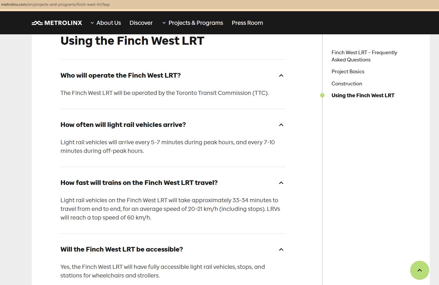
    Screen capture of a Metrolinx FAQ webpage, with frequent and relatively speedy transit service promised for the Finch West LRT. The webpage was still up as of December 18, 2025.

    As the first modern LRT to open in the Greater Toronto and Hamilton Area (GTHA), Line 6 was to be a preview of additional lines planned and under construction elsewhere in the Golden Horseshoe, including the yet-to-open Line 5 Crosstown LRT, the Hurontario Line, the Hamilton LRT, and a proposed Line 7 on Eglinton Avenue East towards the University of Toronto Scarborough Campus and Malvern. Delivered by Metrolinx, the provincial transit agency, each line would be constructed and maintained by a P3 consortium, though the Toronto LRTs would be operated by TTC employees.

    The hoped-for narrative that the provincial government, Metrolinx, the city of Toronto, and the TTC all touted — a smooth new ride, worthy of including on the subway maps — quickly fell apart on Sunday December 7, though there were plenty of warning signs of slower-than-promised operations.
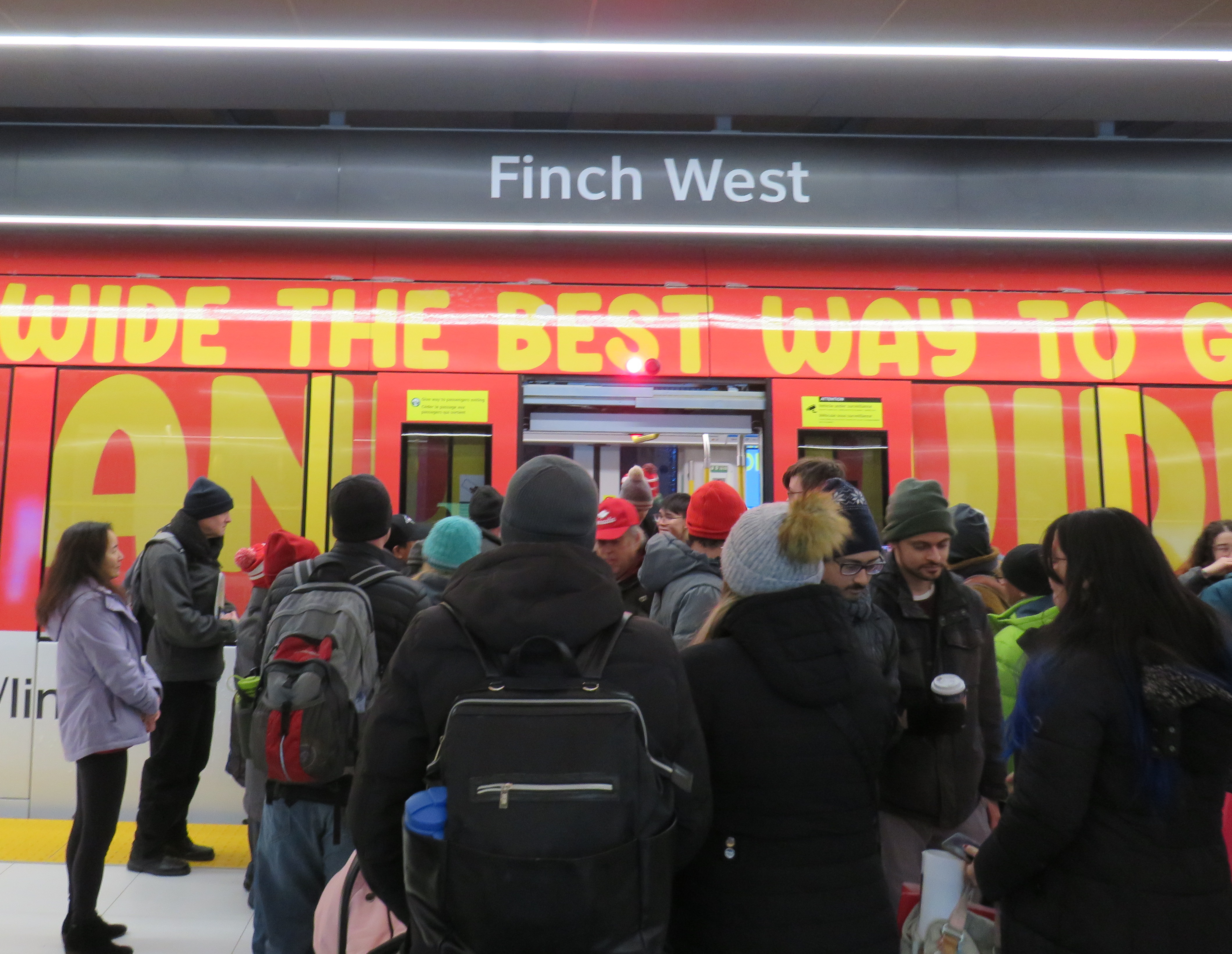
    Opening day crowds on December 7. Passengers disembark from a wrapped LRV that touts Line 6 as “far and wide the best way to go far and wide.”

    On Sunday, December 7, there were plenty of people eager to try the new LRT: railfans and urbanists, curious families, and local residents, lured by free fares on the opening day. Though I was there and took several trips, I wasn’t going to make too many judgements on opening day. There would be inevitable hiccups with the large crowds and cold, snowy temperatures. Still, there were visible problems.
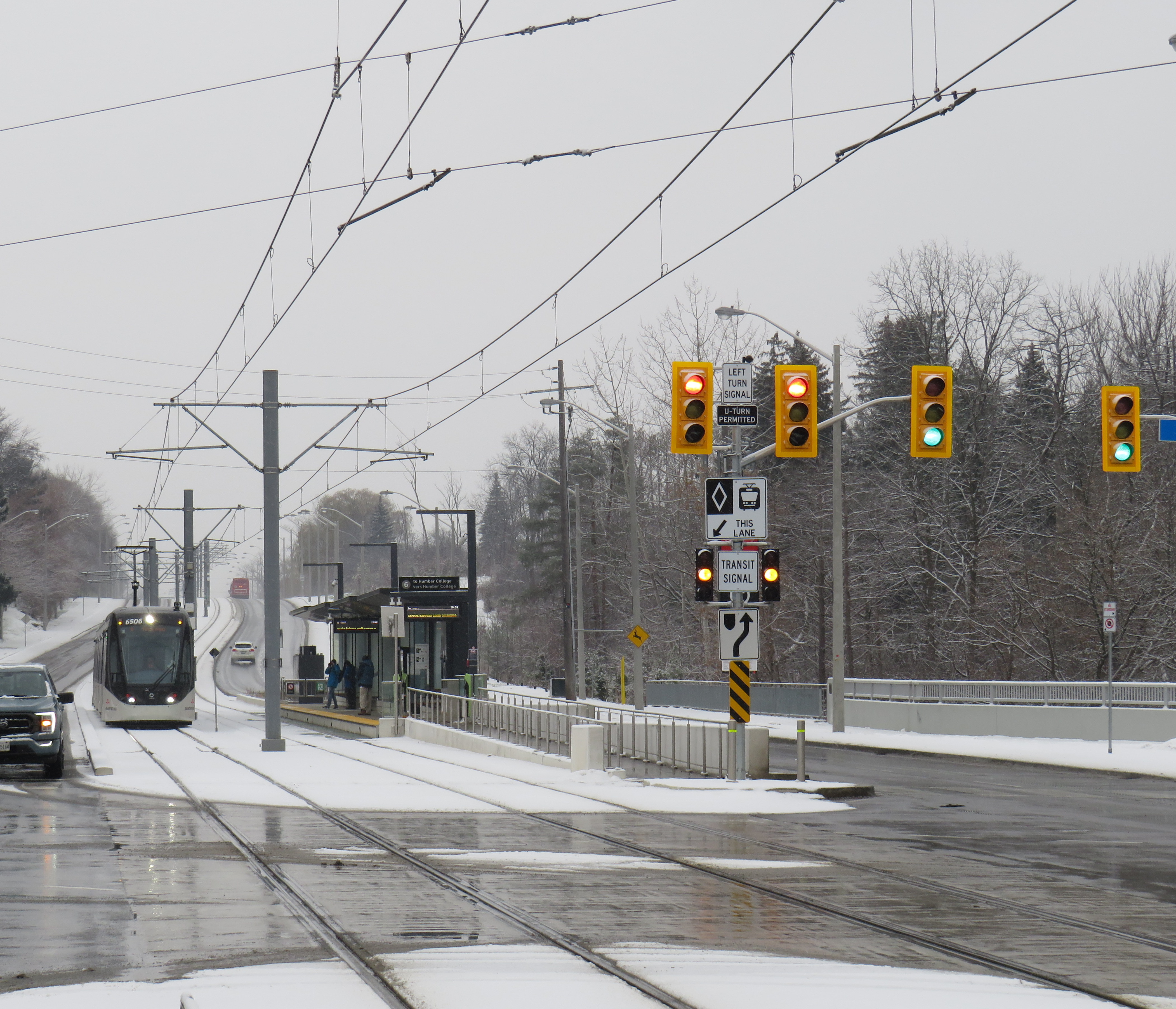
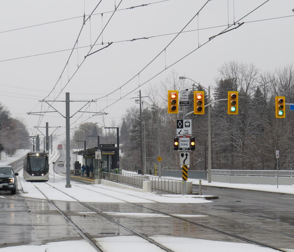
    An eastbound LRV approaches Islington Avenue (Mount Olive Station) as the transit signal switches from green to amber. The traffic signals are still green.

    So far, a lot of the post-opening discourse has been on operating speeds and traffic operations. Instead of 33-34 minutes, as claimed by Metrolinx, trips were taking 55 minutes each way. Additionally, the transit signal priority (TSP) system has not been activated, causing light rail vehicles (LRVs) to wait entire light cycles, even for private vehicles to turn left before proceeding. The dedicated transit signals turn red about 10-20 seconds before general traffic gets a red light, even as LRVs approach the intersections. On December 16, Toronto City Council approved a motion to implement “more aggressive” TSP on Finch West and the surface portion of the Line 5 Eglinton-Crosstown LRT, as well as on the legacy streetcar network.

    The problem on Finch West is not just a matter of transit signal priority. The number of stops along the line, also criticized by several critics, is also not a problem, as Finch West was never intended to be a high-speed regional line. (That said, Mount Olive and nearby Stevenson could have been consolidated into a single stop west of Kipling Avenue.) The other problems are poorly managed schedules and streetcar-style slow zones on a modern LRT alignment.

    Right now, LRVs are forced to slow to 25 km/h at all intersections, even though all conflicting traffic has a red light. This is an inexplicable restriction given that motor traffic, including TTC buses, have a 50 km/h limit, and many drivers will proceed at significantly above the posted limit. These restrictions are not found elsewhere in North America; in Calgary and Edmonton, LRTs are protected at many at-grade intersections with railway-style lights and gates. In places like Minneapolis-St. Paul and Phoenix, additional LED flashing signs warn drivers of an approaching LRV, which glides through the signalized intersection at higher speeds than on Finch. (There is also a lot less sign clutter, with intuitive signals for left turns and transit).

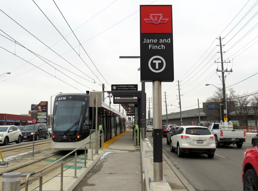
    Transit schedules are also needlessly padded, with too much time for lower speeds and lengthy station stops. On a repeat visit to Finch West, on Wednesday December 17, 2025, travel times were inconsistent and slower then either 36C bus I took a few days before the LRT opened. (Even the trip with the long Starbucks pitstop.)

    Line 6 travel times on Wednesday Dec. 17
    Eastbound
    (read down)
    Stop/stationWestbound
    (read up)
    12:59 PM (dep.)Humber College
    LRT Station
    12:31 PM (arr.)
    1:03Westmore Dr.12:25
    1:05Martin Grove Rd.12:22
    1:10Kipling Ave. (Mt. Olive)12:13
    1:14Islington Ave. (Rowntree Mills)12:09
    1:26Weston Rd. (Emery)11:57
    1:29Arrow Rd./Signet Dr.11:54
    1:33Jane and Finch11:46
    1:37Tobermory Dr.11:35
    1:45Sentinel Rd.11:32
    1:48 PM (arr.)Finch West Stn.
    (LRT Terminal)
    11:27 AM (dep.)
    49 minutesTotal time1 h 4 minutes

    It took eleven minutes to go two stops, less than a kilometre, from Tobermory Drive to Jane Street on the westbound trip. Lengthy station dwell times at Tobermory (five minutes) and Mount Olive (three minutes) on that westbound ride, with no onboard announcements was especially frustrating. The return eastbound trip from Humber College was 15 minutes faster, even with much of the same slow zones at intersections and switches, the 10 km/h curve near Humber College Station, and lengthy stops.

    With such unpredictable and unreliable service, Line 6 is running at least as badly as the downtown streetcar routes. Without immediate fixes, people will completely lose faith in the TTC and future LRTs, including Eglinton-Crosstown. We can not just rely on tweaks to signal times; we need a complete review and overhaul of streetcar and LRT operating practices.

    At least we know what can and should be fixed before the Eglinton-Crosstown line opens, a much longer LRT route that will have a regional transit role.

    One more thing…
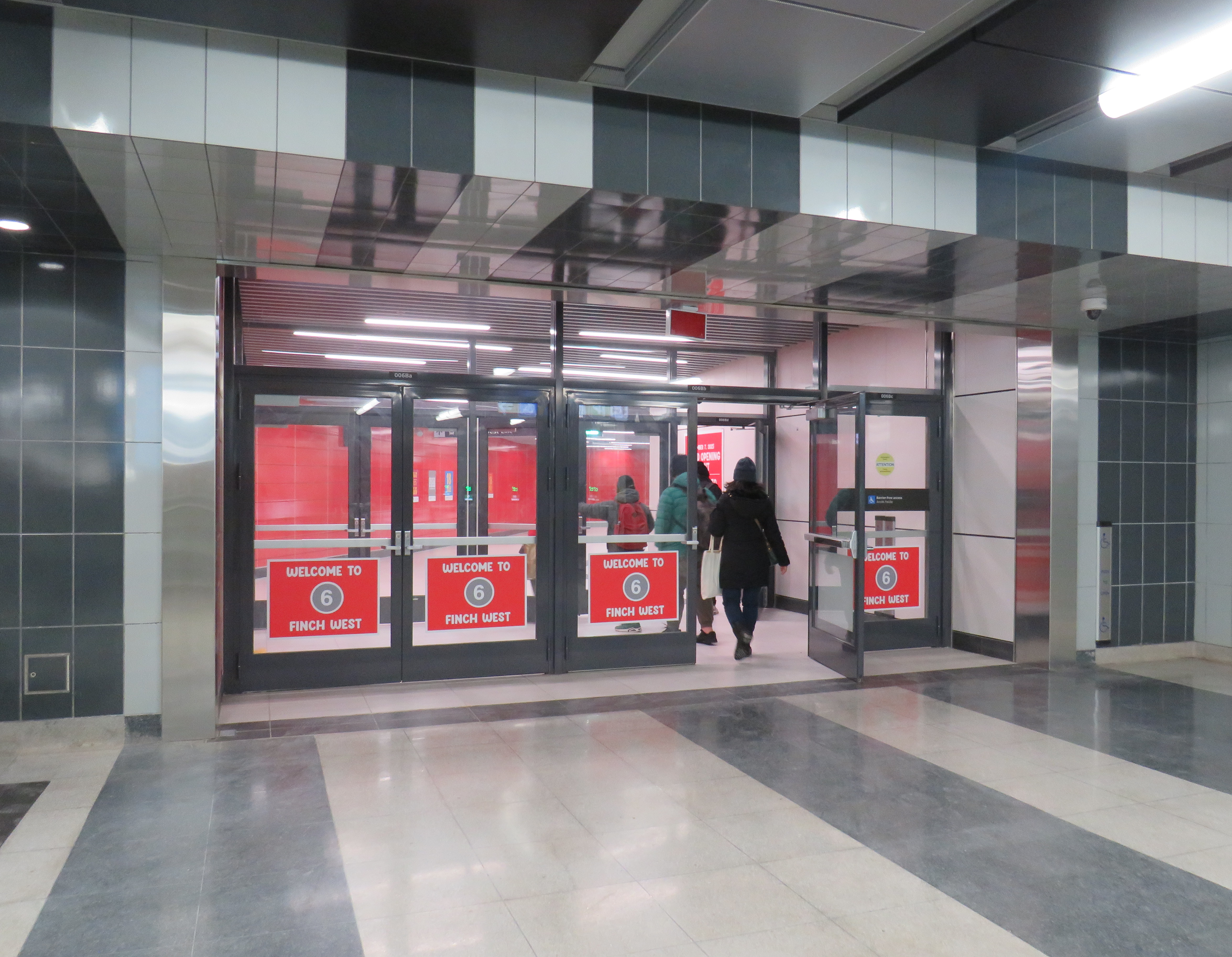
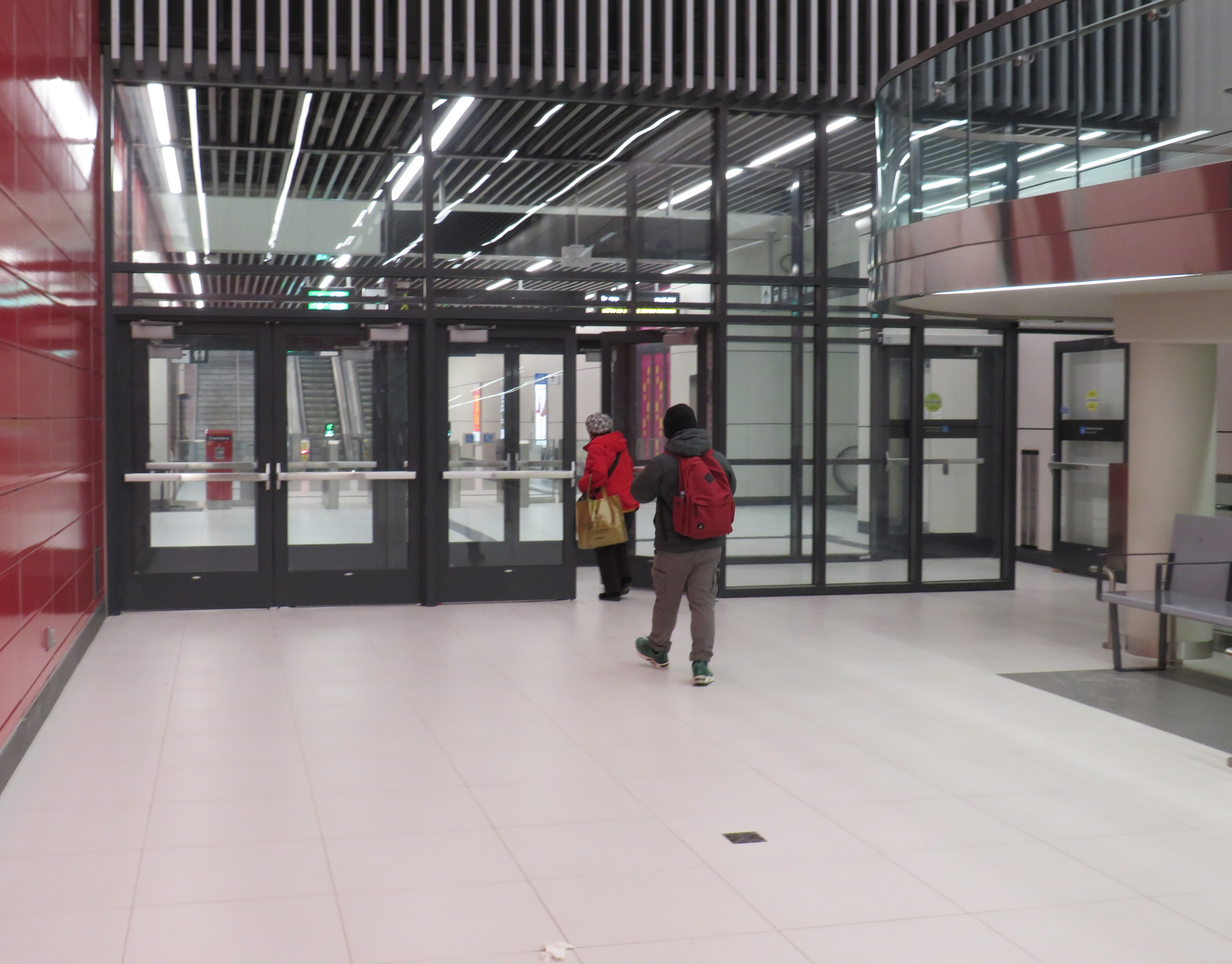
    What is with all the doors between the Line 1 subway station and the LRT terminal at Finch West. Passengers have to pass through four sets of doors to transfer between two TTC services, as well as ascend one escalator or elevator, walk down one set of stairs (or navigate a long and circuitous ramp) and then ascend another escalator or elevator to get to the other platform.
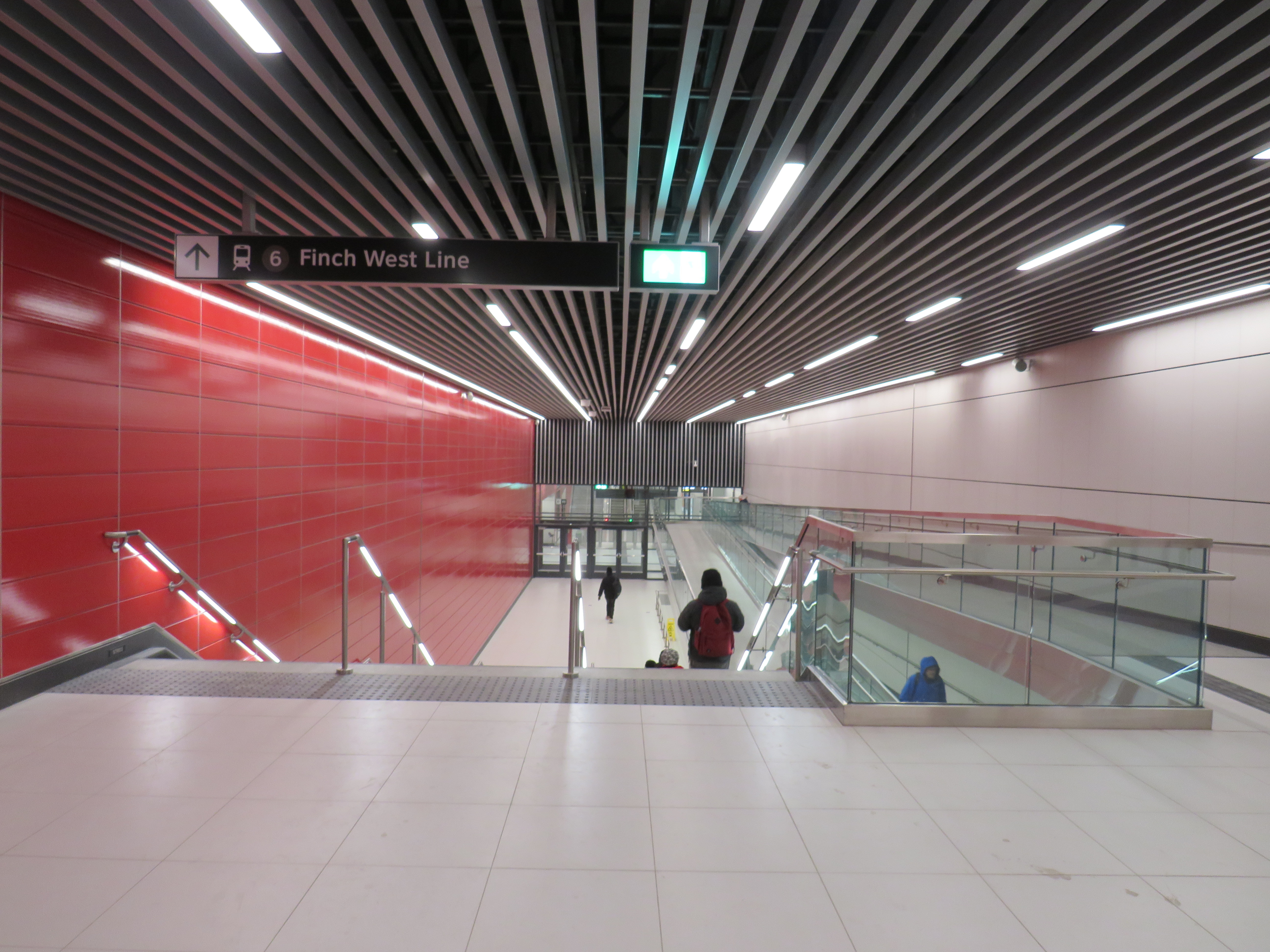
    Stairs or a long, circuitous ramp between the doors from subway to LRT

    Though transfers can be tricky, at the very least, these doorways should be kept open, and shut only during station closures or during fire alarms, as done in hospitals or shopping centres. Other TTC stations have no such barriers between modes or may have a single door to exit a subway station terminal to the bus platform. Automatic sliding doors could have also been an option. Instead, the powered doors are left to one side, with the button against the wall. It’s not an ideal design from an accessibility point of view.
  • Waiting for Finch West

    Waiting for Finch West

    Two Line 6 LRVs cross Jane Street at Finch Avenue, December 3, 2025 as training wraps up ahead of revenue service on December 7

    Can a brand-new light rail line outrun the local bus it replaces? Starting on Sunday, December 7, Torontonians will get the chance to find out when the new Line 6 Finch West light rail line finally opens to the public. Though built and maintained by Metrolinx, the service will be operated by TTC employees.

    The new LRT, 11 kilometres long, with 18 stops, runs almost exclusively in a transit-only median on Finch Avenue West between Finch West Station at Keele Street in North York and Highway 27 in Etobicoke. The end terminals are below grade, with three traffic signals skipped. Otherwise, the light rail vehicles will be subject to stopping at the same traffic lights as all other cars, trucks, and buses.

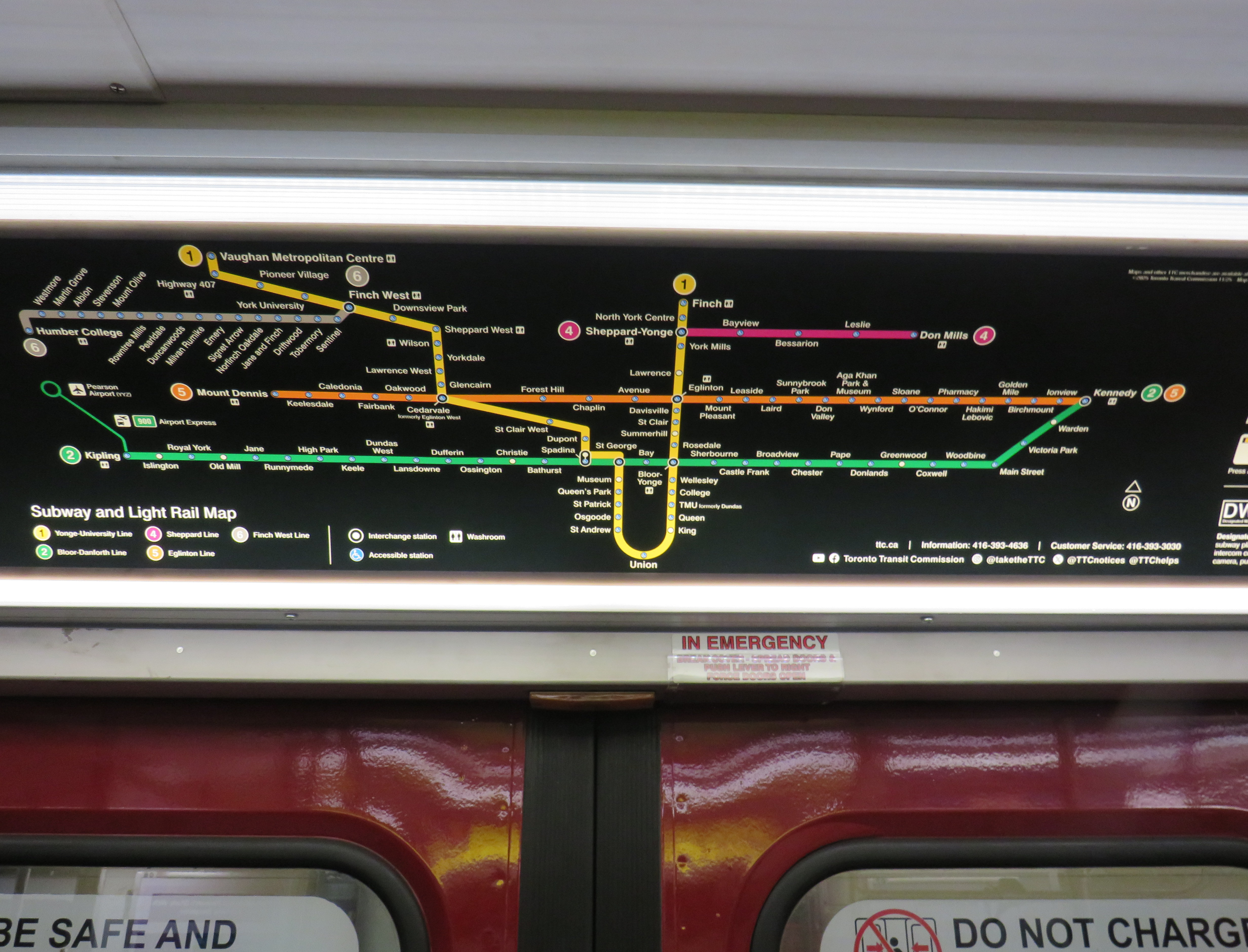
    New maps in the TTC subway system show the long-delayed Line 5 Eglinton-Crosstown (opening date still TBD) and Line 6, which opens Sunday December 7

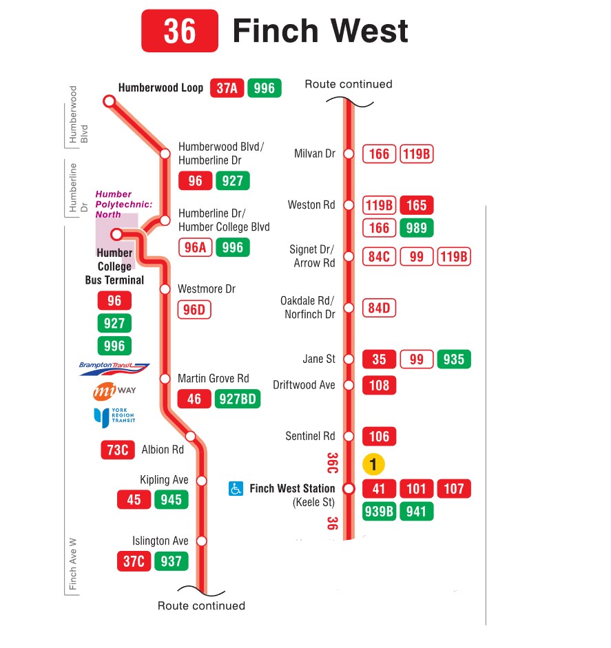
    For the last few weeks, Finch West has been served by the 36C bus, running between Finch West Station at Keele Street and Humberwood Loop near the Mississauga border, making a stop at the Humber College bus terminal. A separate 36 Finch West bus continues east from Finch West Station to Finch Station at Yonge Street. There will only be eight fewer stops on Line 6 than there bus stops between Finch West Station and Humber College; apart from overnight service, there will be no parallel local bus serving the corridor.

    Map of the Route 36C Finch West-Humberwood service, modified from the TTC’s original

    Without limited stops and signal priority, the new light rail line will not achieve any real time savings. On his website, transit advocate Steve Munro notes that the end-to-end time of the new Line 6 LRT is scheduled for 46 minutes, consistent across all operating time periods. The 36C’s fastest round trip times, late evenings and early Sunday mornings, is between 79 and 82 minutes, or 40-41 minutes one way on a slightly longer route.

    To see this for myself, I visited Finch Avenue West and rode the 36C both ways between Finch West and Humber College. Wednesday, December 3 was an overcast and cold day, with the daytime high temperature hovering around the freezing mark. But the roads were clear and dry, with no collisions and little construction work in the way of traffic on Finch; conditions couldn’t be any better for early December.

    Here were the times for the two buses I took. I started timing the runs as soon as the bus doors closed and departed the originating stop; waiting times at the initial stops were not included.

    TTC Route 36C travel times on Wednesday Dec. 3
    Eastbound
    (read down)
    Stop/stationWestbound
    (read up)
    12:07 PM (dep.)Humber College
    bus loop
    1:50 PM (arr.)
    12:11Westmore Dr.1:37**
    12:13Martin Grove Rd.1:24
    12:18Kipling Ave. (Mt. Olive)1:29
    12:20Islington Ave. (Rowntree Mills)1:19*
    12:28Weston Rd. (Emery)1:11
    12:33Arrow Rd./Signet Dr.1:09
    12:38Jane and Finch1:04
    12:42Tobermory Dr.1:01
    12:44Sentinel Rd.1:00
    12:51 PM (arr.)Finch West Stn.
    (bus terminal)
    12:57 PM (dep.)
    44 minutesTotal time53 minutes
    * At Islington Avenue westbound, the bus was delayed by five minutes by a troublesome passenger
    ** At Westmore Drive westbound, the operator left the bus with twelve passengers on board to order coffee at a nearby Starbucks, resulting in a second delay of nearly ten minutes

    The eastbound departure, leaving Humber College at 12:07 PM, made it to Finch West Station in 44 minutes, two minutes faster than the scheduled LRT trip. This bus, an articulated (18-metre) vehicle was relatively busy, with a few standees between Jane Street and Finch West Station, and most en route stops were made. There were no unusual delays; just some traffic near Highway 400; it also took two light cycles to complete the left turn from Finch to Keele approaching the subway station.

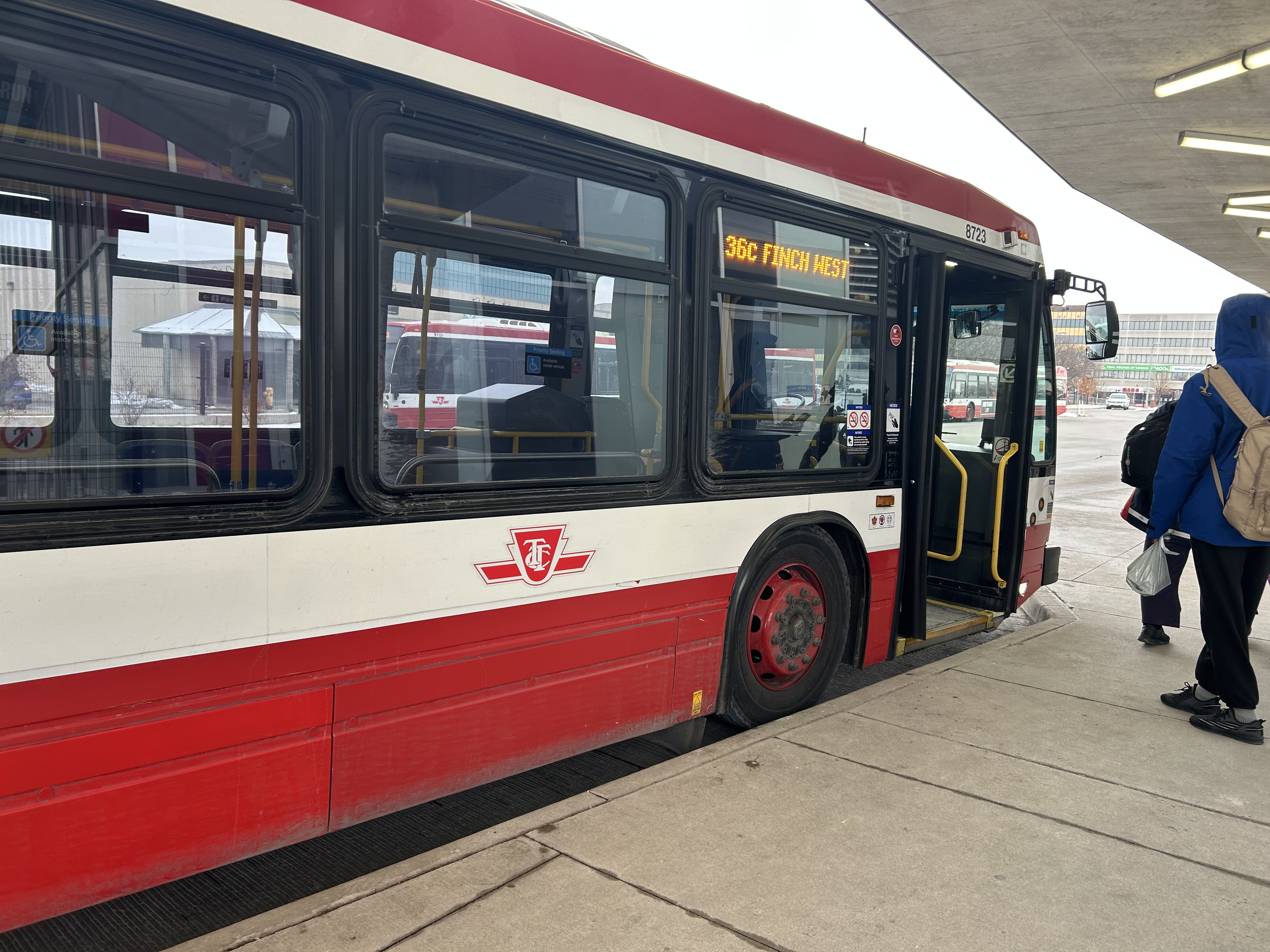
    Westbound 36C bus waiting to depart Finch West Station

    I returned towards Humber College on a different bus that left Finch West Station at 12:57 PM. For a while, this run, a standard 12-metre bus, was making exceptionally good time, with only a few passengers on board. It skipped several bus stops as no one wanted on or off until Tobermory Drive. Line 6 LRVs will stop at every station, just like the subway, even if there aren’t any waiting passengers.

    At Islington Avenue there was a delay caused by a prospective passenger who rushed through a don’t walk/red light to get the bus, despite another one close behind. As the passenger was using a mobility device, the bus operator had trouble deploying the ramp because the bus had already inched ahead of the bus stop pad, ready to proceed with the green light. The driver needed to reposition the ramp and wait for the next green, which resulted in a five-minute delay.

    Another delay came a few minutes later, when at Westmore Drive, just one stop before the Humber College bus terminal, the operator left the bus without notice and walked into a nearby Starbucks. After a few minutes, and seeing two other westbound 36C buses pass by, most passengers exited the open doors to flag down the next bus.

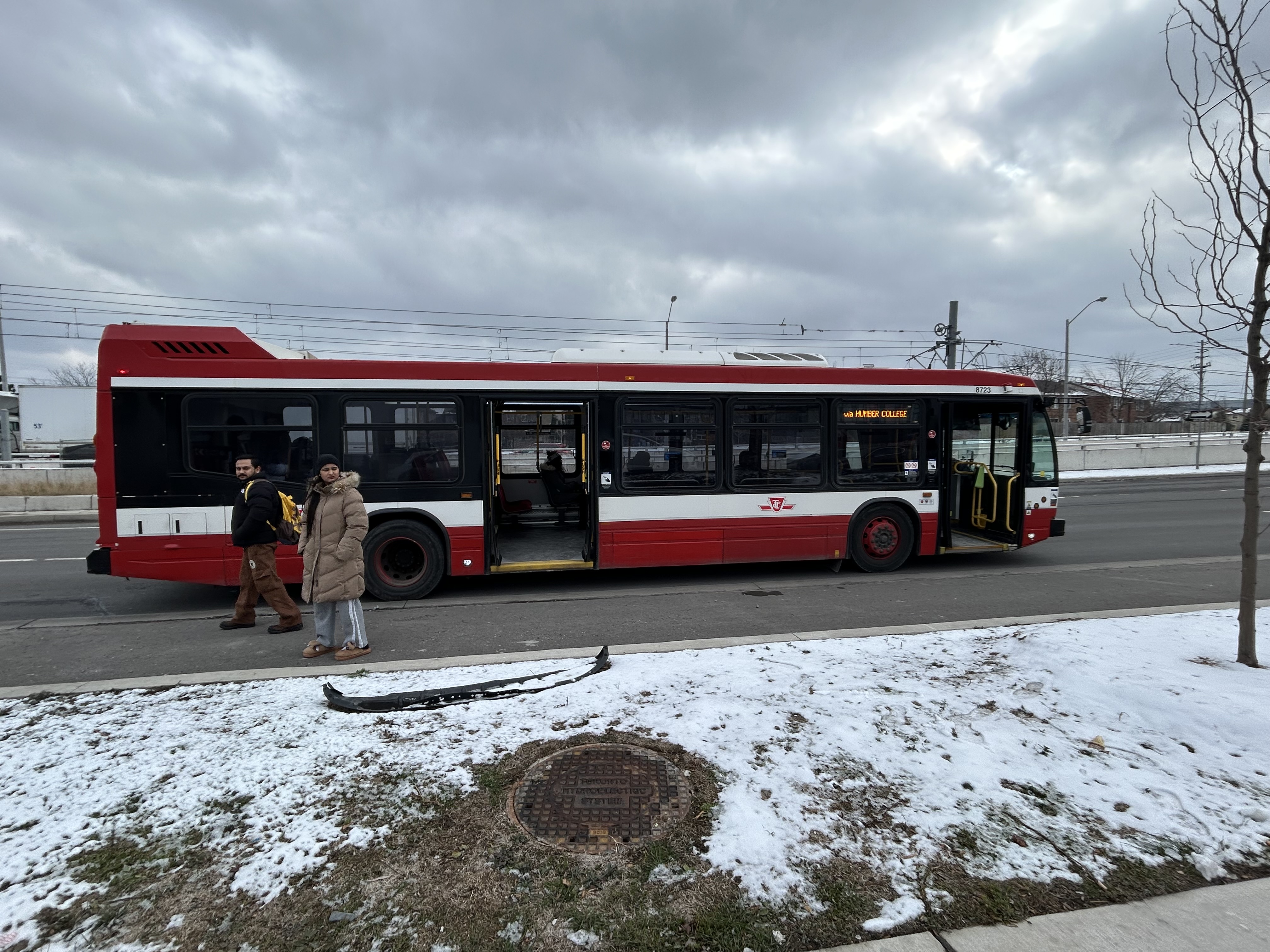
    Passengers leave an unattended Route 36C bus on Finch Avenue West at Westmore Drive. The portal for Line 6 LRVs to descend under Highway 27 towards Humber College is behind

    The TTC operator returned eight minutes later, and we finally arrived at Humber College Bus Terminal at 1:50, 53 minutes after departing Finch West Station. (It’s worth noting that Humber College also has a Starbucks and public washrooms in the main building near the bus loop.)

    At least that’s one instance where the LRT will certainly be faster than taking the bus.

    A longer walk, a longer wait

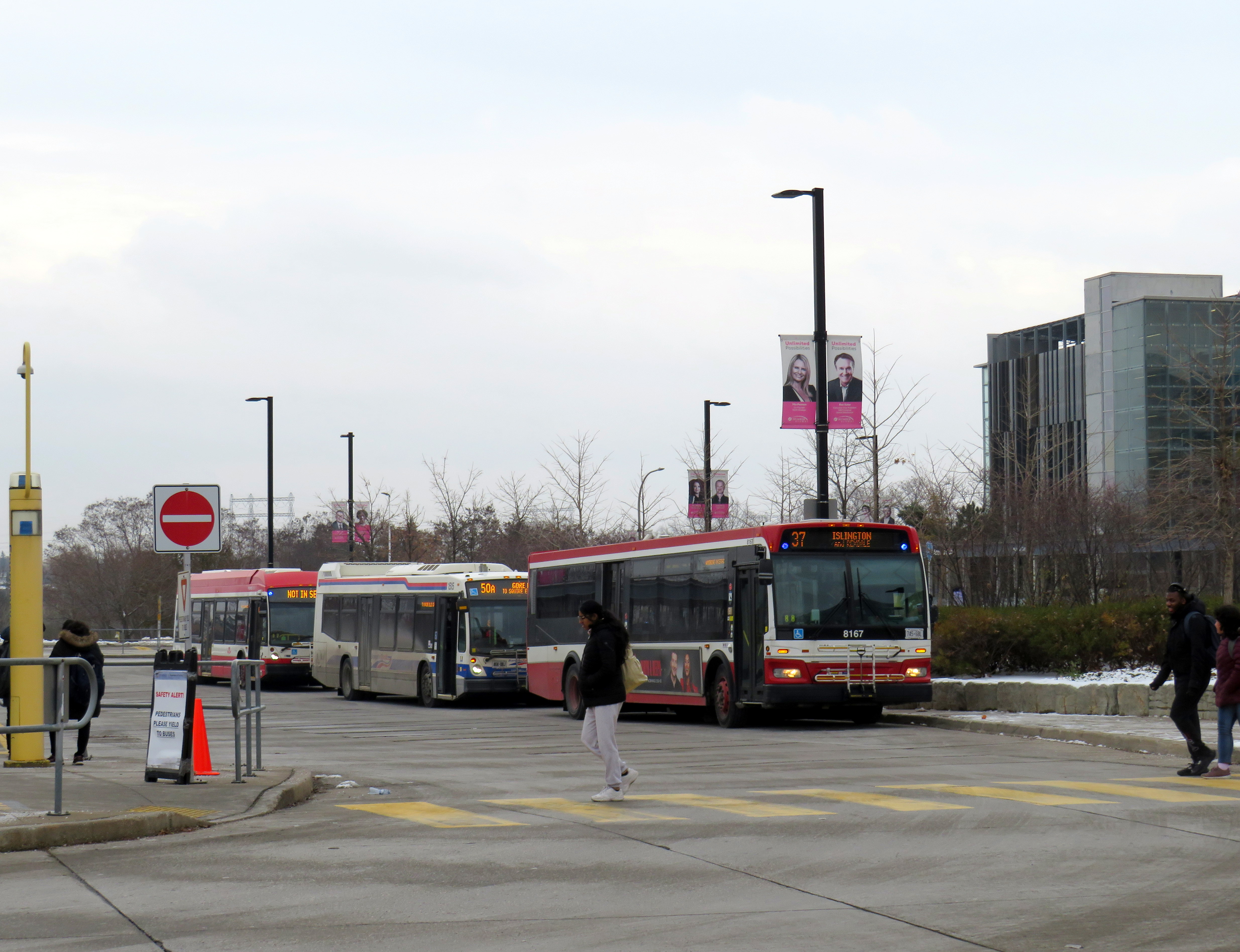
    TTC and Brampton Transit buses layover at Humber College

    Humber College’s bus terminal serves a total of nine TTC, Brampton Transit, Miway, and YRT routes. It’s also a connection point between TTC Wheel-Trans and Peel Region’s TransHelp paratransit services. But the LRT terminal station is a five-minute walk away from the terminal, which is adjacent to several primary buildings on campus.

    A walkway leads between the bus terminal and LRT station, with partial shelter provided by a long canopy that blocks northerly winds, but not the prevailing westerly winds. At the end of the walkway is the entrance to the below-grade LRT platforms, which are parallel to nearby Highway 27. This alignment reduced construction costs over a longer approach to the college, but it permits a future extension to the planned Woodbine GO Station two kilometres to the south and even Pearson Airport.

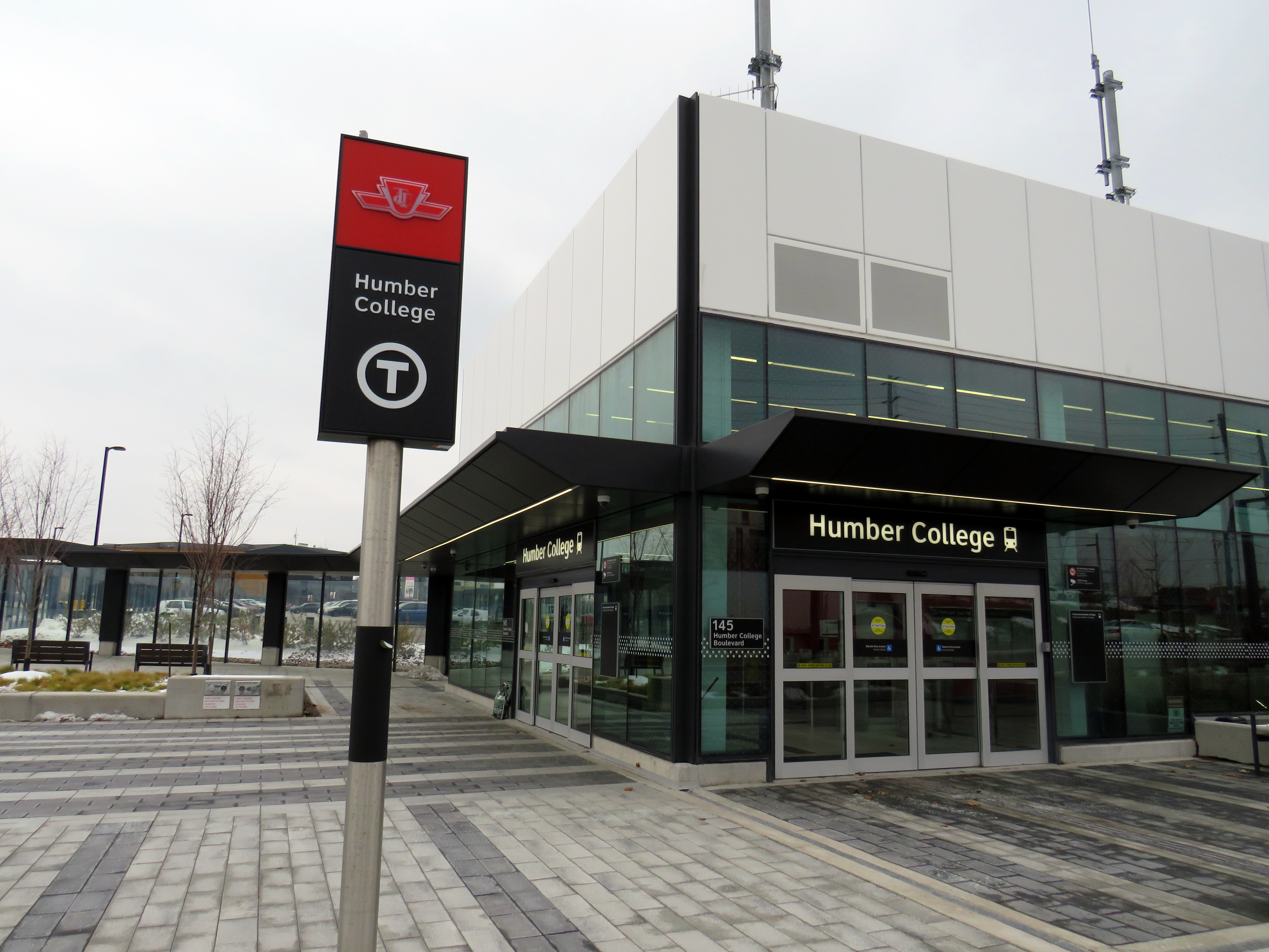
    Humber College Station entrance, at Highway 27. The walkway to the bus terminal and main campus is behind.

    During weekday peak periods, the LRT will run every 6 minutes, about as frequent as the current 36C bus during weekday daytime periods. However, during off peak times, trains will only come every 10-12 minutes, resulting in longer waits. Anyone travelling from Humber College will have to factor in the longer walk and potentially longer wait time.


    I will certainly go out on Sunday December 7 to celebrate the opening of this new line, which despite the unnecessarily slow speeds, will result in a more predictable and more comfortable ride, with significant capacity improvements during peak periods, especially at school dismissal times. LRT doors will line up with the platforms, making loading and unloading easier for passengers with mobility devices, strollers, or carts.

    I will also go ride the LRT after the opening day crowds are done, to see how it works in day-to-day operation. There are ways to speed up the schedule: more aggressive transit priority, shorter station dwell times, quick turnarounds at the terminals with “step back” operation, schedule optimization, and I hope these are considered by Metrolinx, the TTC and the city as everyone gets used to the new transit line.

    If you like my work and you would like to help out with my webhosting costs (I just had to renew my ad-free WordPress subscription), consider buying me a coffee. Thank you!

  • How a transit authority has become a barrier to active mobility

    How a transit authority has become a barrier to active mobility

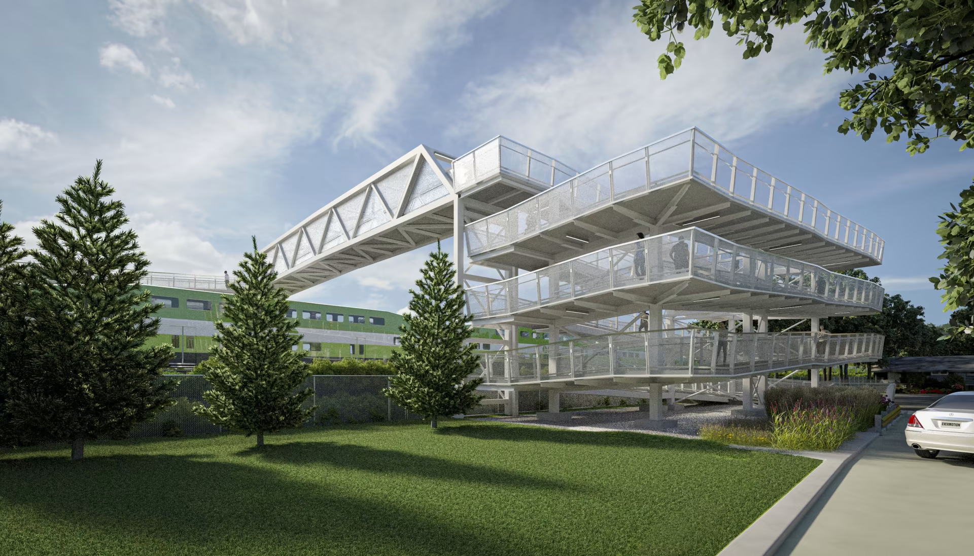
    Metrolinx rendering of the planned new Drury Lane pedestrian overpass in Burlington

    On the home page of Metrolinx, the provincial agency tasked with building and operating regional transit in the Greater Toronto and Hamilton Area and beyond, there is a statement under the heading “Connecting Communities.”

    The Greater Golden Horseshoe is growing, and you need to get places. Our transit projects will connect new, established and emerging communities across the Greater Golden Horseshoe.
    Metrolinx

    Unfortunately, the very same transit projects and rail corridor upgrades can serve to disconnect, rather than connect, communities. Too often, GO Transit lines are secured without regard to the neighbourhoods they run through, without simple and convenient crossings for pedestrians and cyclists. Where overpasses are provided, they are built in such a way that makes them more difficult than necessary to cross.

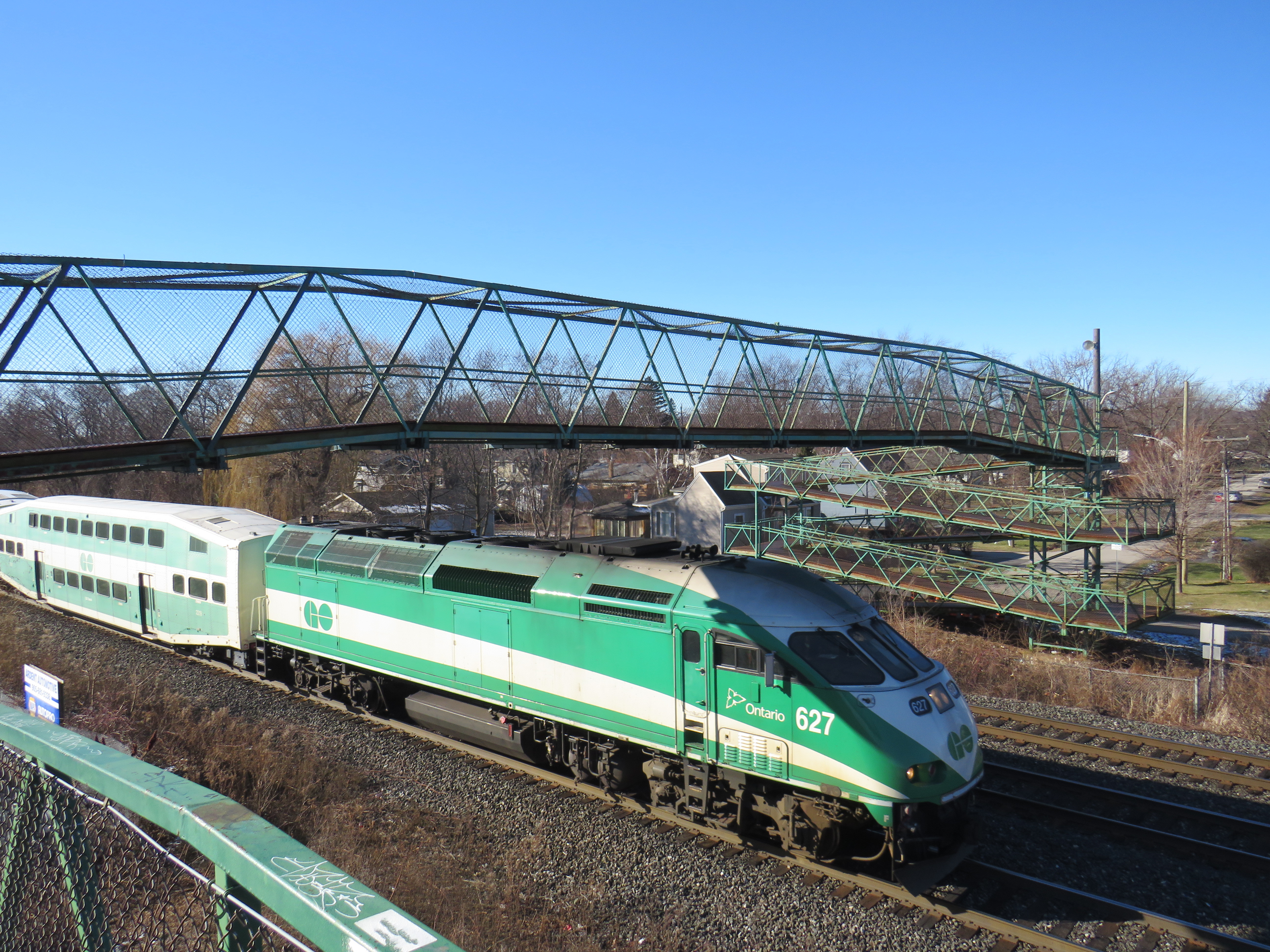
    A GO Transit train passes under the existing Drury Lane pedestrian overpass

    Take the example of the planned replacement of the Drury Lane pedestrian overpass in Burlington, which connects Fairview Avenue to the south and Orpha Street and a postwar residential neighbourhood to the north. With Burlington GO Station only 500 metres to the west, the pedestrian overpass provides a useful connection to GO and Burlington Transit services as well as (the station’s north end is poorly connected to the Orpha Street area, it is primarily a motor vehicle access to a large parking structure). Drury Lane continues south of Fairview Street towards Burlington’s Central Park, the city’s main library branch, and leads towards the waterfront and downtown core. Unlike Brant Street, Fairview Street, or Guelph Line, Drury Lane is relatively quiet, with painted cycle lanes.

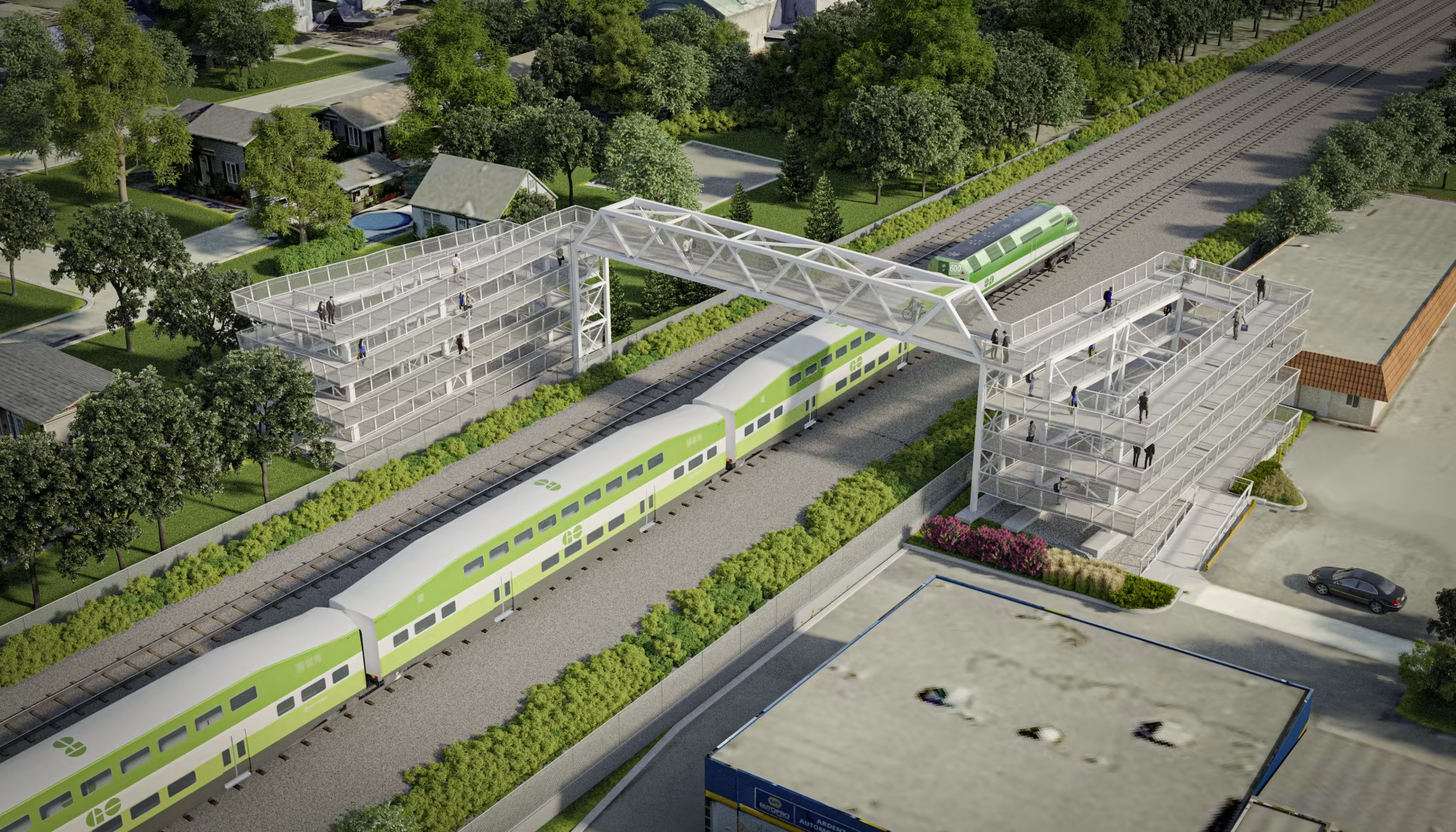
    The planned new Drury Lane pedestrian overpass in Burlington with lengthy access ramps

    The new overpass, replacing the existing 50-year-old structure, will be taller, with longer approach ramps. Metrolinx touts the improved accessibility of the new bridge, even though it will add more time to travel times with an extra ramp segment on each end. No stairs are provided to provide a short-cut for those able to navigate steps.

    The new bridge’s increased height will provide additional clearance for the planned electrification of the Lakeshore West rail corridor.

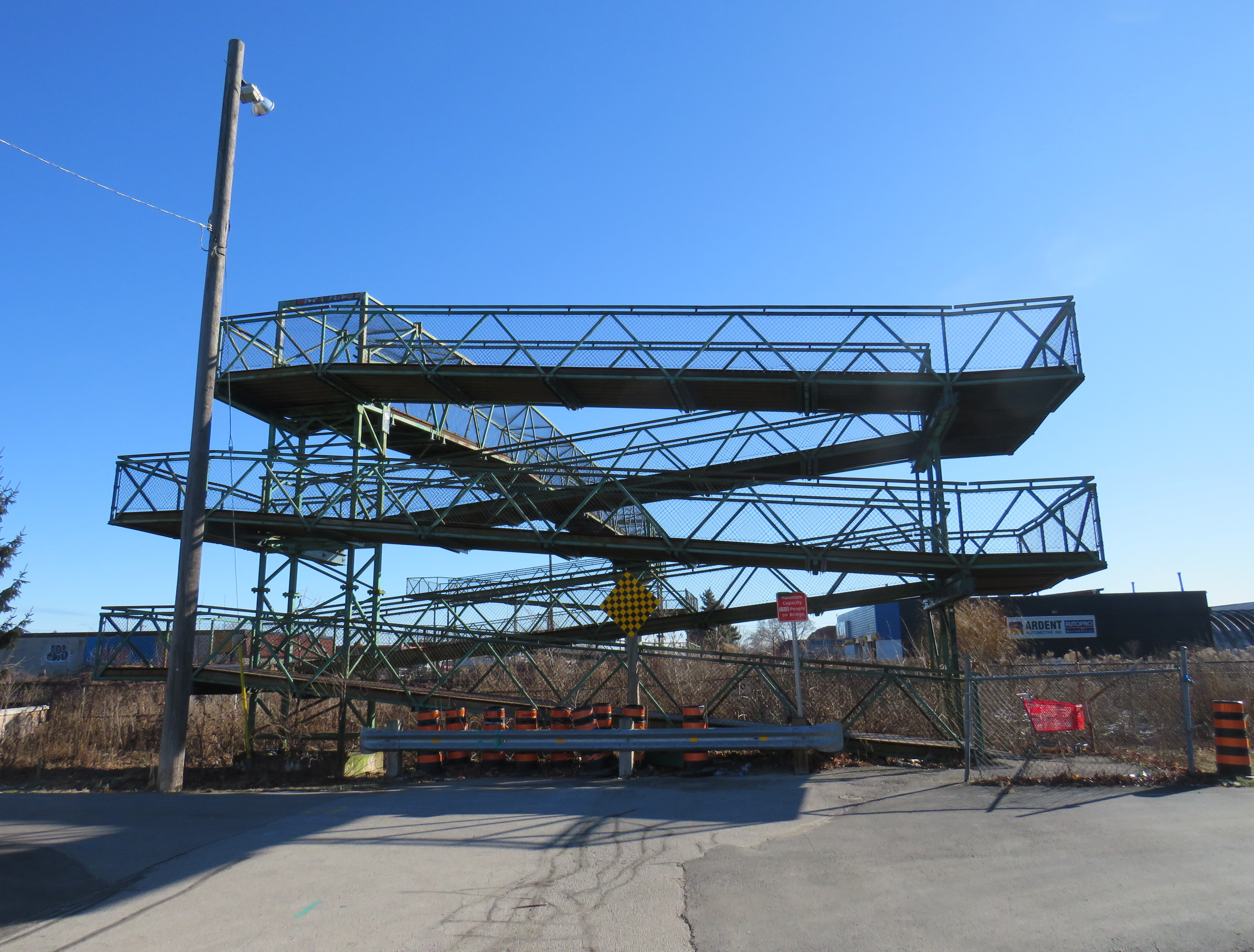
    Existing ramps at the north (Orpha Street) end, which requires three full turns to reach the top

    A simpler solution would have to build an underpass, which would require a much shorter vertical route for pedestrians and cyclists. Indeed, the rails are on a slight embankment above street level already. A wide, well-lit underpass would improve accessibility; in fact, pedestrian underpasses are provided at nearly all GO rail station where grade separations are required as they provide quicker and easier access between platforms and the station building, parking and bus stops.

    Though it has yet to open, the Paton Road connection under the GO Barrie Line in Toronto shows how a wide pedestrian underpass could look.

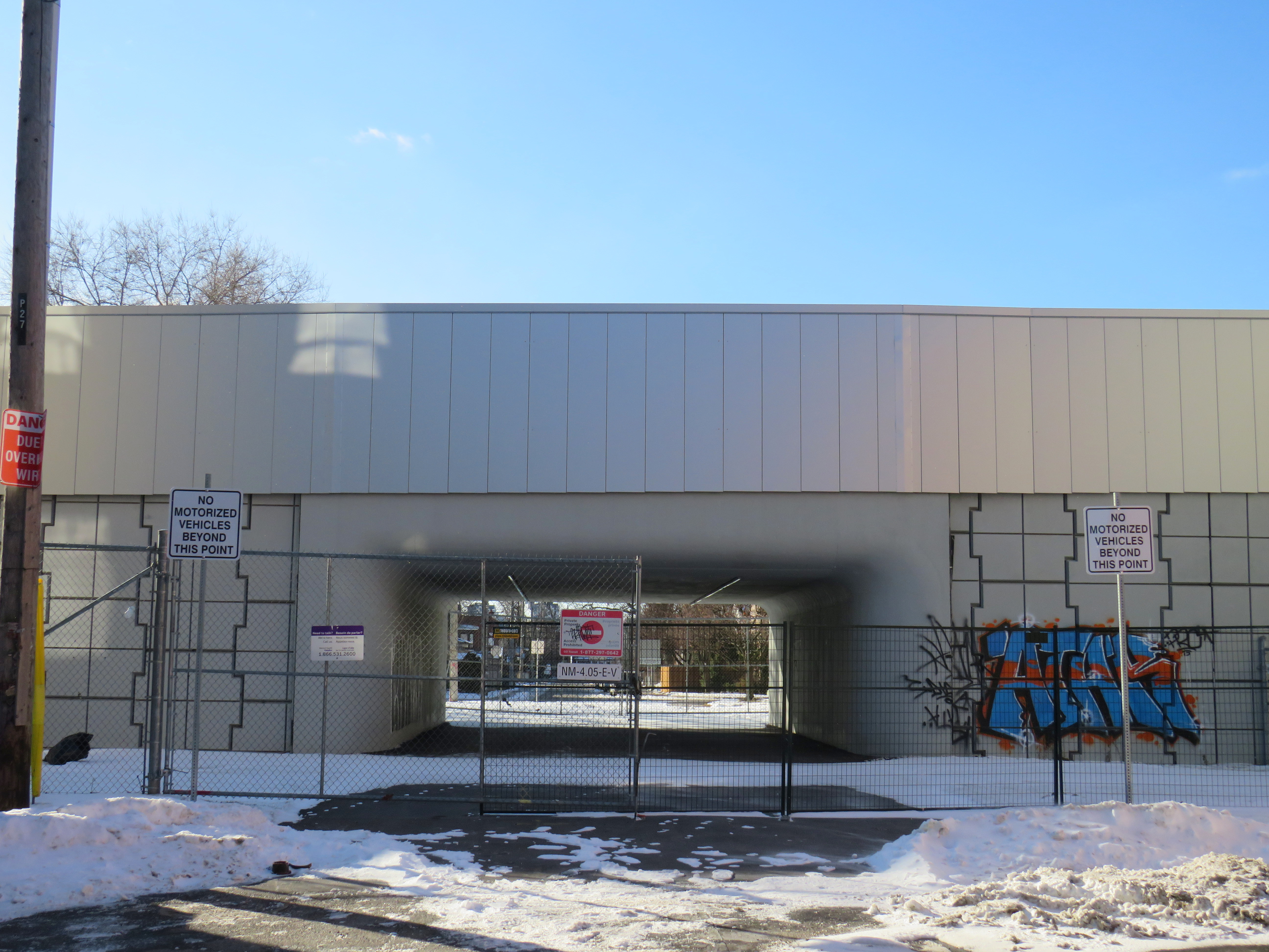
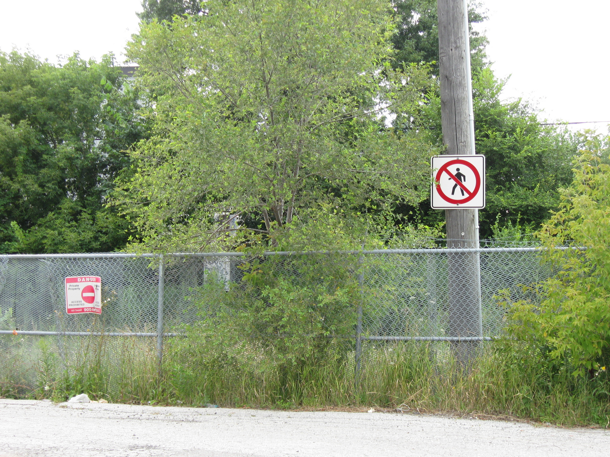
    There are many other opportunities for safe and accessible pedestrian and cycling infrastructure along GO Transit corridors. The best example might be in North York, where the combination of a Metrolinx rail corridor and a twelve-lane Highway 401 make pedestrian and cyclist movement especially difficult and unsafe. At one time, it was easy (though still illegal) to cross the tracks between Floral Parkway, a residential street running east-west from Keele Street to the GO Barrie Line, to Bridgeland Road, an industrial street connecting to Caledonia Road and leading towards Yorkdale Mall.

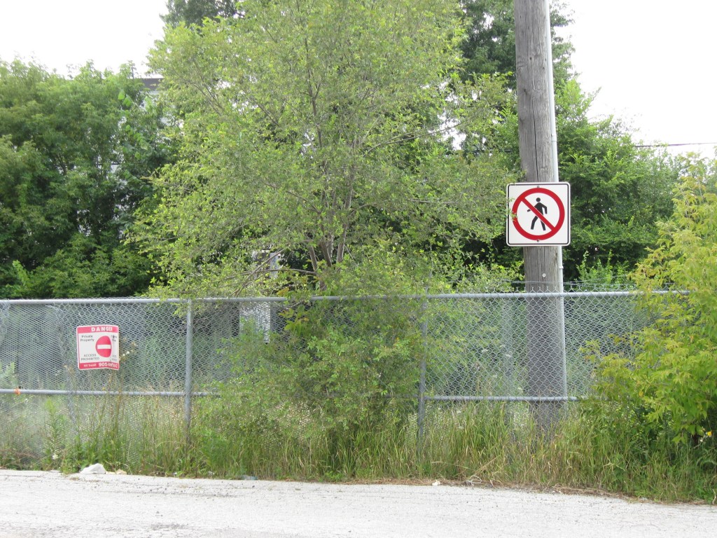
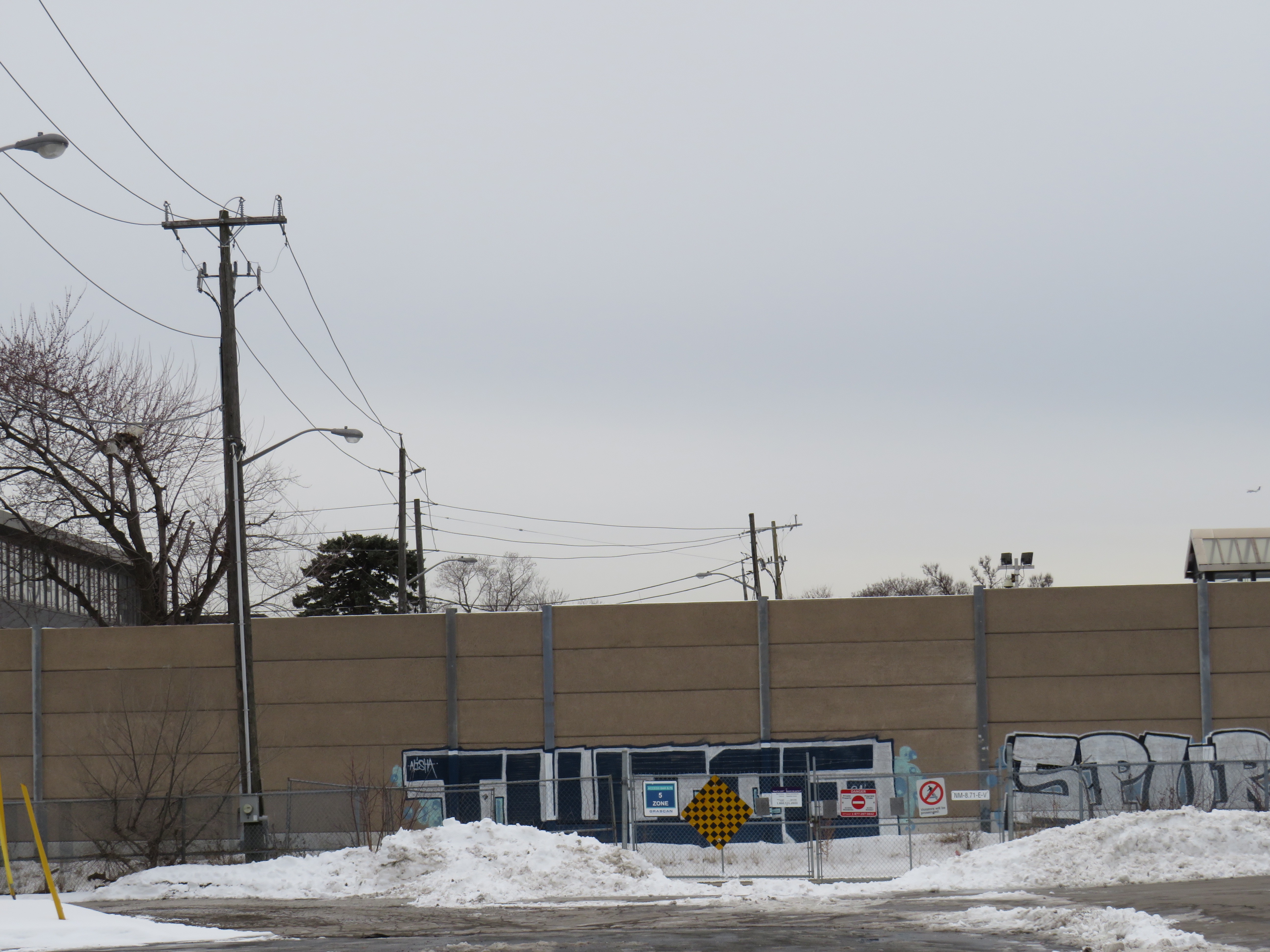
    By the late 2000s, new fencing was put up to prevent pedestrian crossings here; this was further upgraded with reinforced chainlink fences, and more recently, a noise wall. Metrolinx knew this was a popular place to cross, but instead of providing a safe route (either a signalized and gated at-grade crossing, an overpass, or an underpass), it worked only to harden its property.

    The highly-secured Bridgeland Road/Floral Parkway crossing in 2013
    The Bridgeland/Floral crossing in January 2025, with a noise barrier completely blocking Floral Parkway from the tracks

    As new high-density residential development is nearing completion at Dufferin and Bridgeland on the site of an old Holiday Inn, as well as mixed-use development planned at Yorkdale Mall and a major hospital at Keele and Highway 401, there is even more of a need for sustainable, safe, active transport. The walk between Floral Parkway and Bridgeland Road is 49 minutes; the Highway 401 interchanges at Keele and Dufferin are also unsafe to navigate by foot or bicycle; fast moving traffic and narrow sidewalks make them unpleasant as well.

    There are many other opportunities for improved active transport connections where railways and highways impose major barriers. There are a few good initiatives, such as new multiuse path connections in Mississauga’s Port Credit neighbourhood across the QEW and Credit River; a partnership between the Ministry of Transportation, the City of Mississauga, and the Region of Peel.

    We need local and provincial officials to push for safe and accessible access across transit corridors and major highways for all users, but especially pedestrians and cyclists who are typically overlooked when these projects are planned and built.

    Though transit construction is very beneficial for the region’s growth, it is still frustrating when an agency tasked with “[connecting] new, established and emerging communities across the Greater Golden Horseshoe” fails to connect the communities its transit projects run through.

  • A heartbreaking end for the Ontario Science Centre

    A heartbreaking end for the Ontario Science Centre

    A family enters the Science Centre for the last time on Friday June 21, 2024

    When I was growing up, our family would make a trip every year to the Ontario Science Centre, a 45-minute car drive from our home in suburban Brampton. Invariably, these trips would take place on the first PA day of the school year, typically on a Friday in late September or early October, when the ravine was still lush and green, with only the first hints of the changing season.

    Because it was early in the school year, and since the Toronto school boards typically had different PA days than the Dufferin-Peel Catholic board, the Science Centre would be mostly empty; my father would run with my brothers and I along the corridor over the ravine between the entrance hall and the great hall. At the end of our visit would be an hour spent at the Science Arcade, the highlight of any child’s visit to the once-great institution. I marveled at Raymond Moriyama’s wonderful harmony of concrete, glass, and natural beauty as one descended into the West Don Ravine by means of glass walkways and escalators.

    Later visits in high school and in my early adulthood, however, were not as great. The exhibits were getting old, and the place started feeling worn out. The Dalton McGuinty and Kathleen Wynne-led governments did not value the Science Centre enough to invest in its relevance or its long-term maintenance. Doug Ford’s PC government continued the neglect, favouring a private redevelopment of Ontario Place (closed under the previous Liberal government) with a new, downsized Science Centre to take its place.

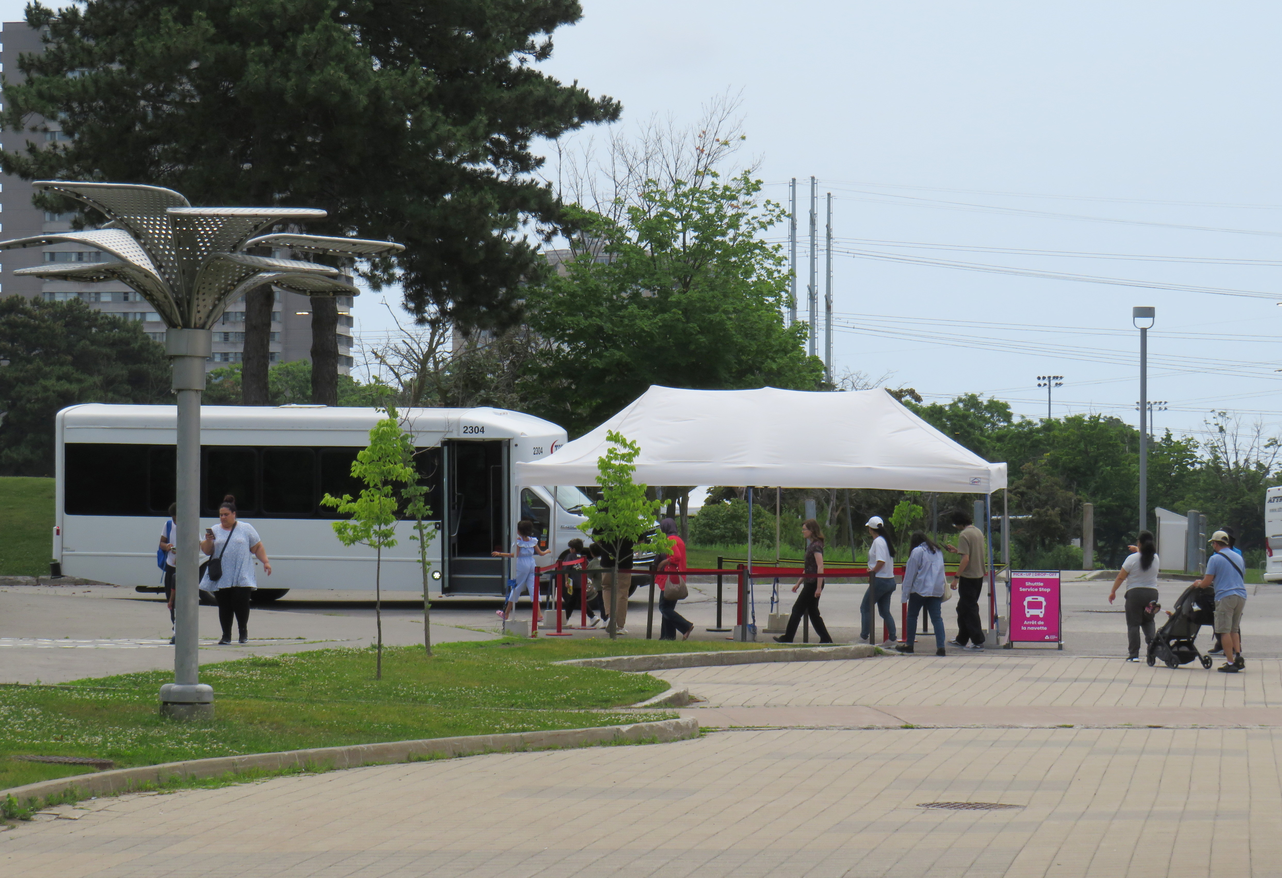
    In 2022, that once-wonderful double-deck bridge between the entrance hall and the exhibition space was closed due to the risk of structural failure, with no plans to fix or restore the link. Instead, $2 million a year was spent on shuttle buses ferrying visitors between the upper parking lot (after they paid admission) and the lowest level at the bottom of the ravine. That year, the planetarium (a smaller version of the McLaughlin Planetarium that operated next to the Royal Ontario Museum until the 1990s) also closed due to deterioration.

    A December 2023 report from the provincial Auditor General’s office took issue with the government’s management of the Ontario Science Centre and the flawed business case for moving it to a new location on Toronto’s waterfront, in a location much less accessible to school groups.

    Loading Ontario Science Centre visitors on shuttle buses, June 21, 2024

    The most recent development in which engineers warned of sections of the roof in danger of failure and collapse in a report to Infrastructure Ontario (linked in full on the CBC Toronto website) after October 31, 2024, with repairs costing between $22 million and $40 million. The immediate closure, announced on a Friday afternoon, would provide time to allow the exhibits to be removed, possibly to an interim location. However, most of the roof was found to be in good or fair condition in an the engineer’s report, making the immediate closure suspect.

    Globe and Mail architecture critic Alex Bozilkovic questioning the government’s sudden closure on X/Twitter.

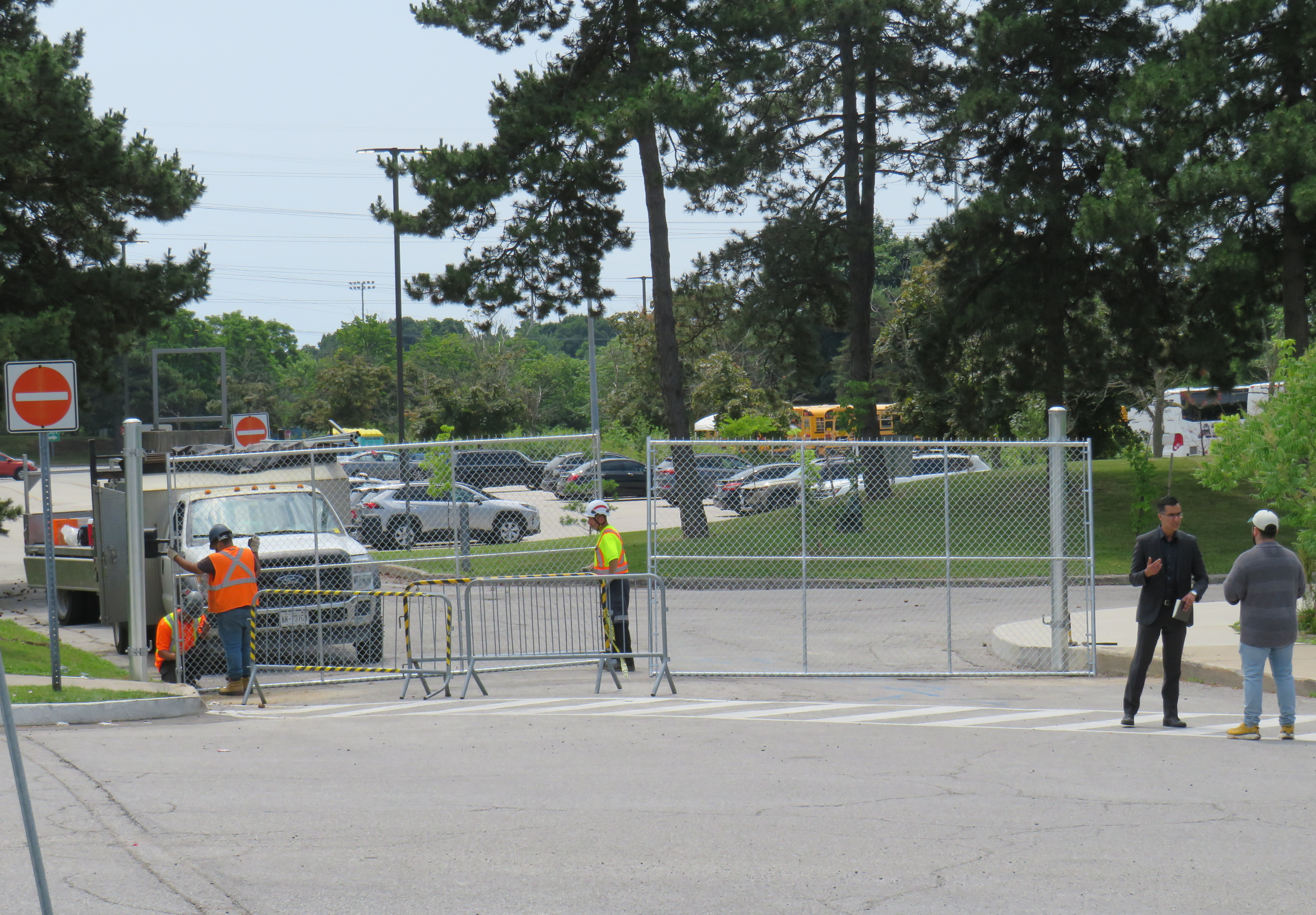
    On Friday morning, gates were already being installed at the parking lot entrances to the Science Centre, before the official announcement, even before the Toronto Star published the first story about the closure on its website around noon.

    Workers install rigid gates at the staff parking and bus exit at Ontario Science Centre. Local Liberal MPP Dr. Adil Shamji speaks to a reporter in front.

    One cannot help but be skeptical about the sudden decision to close the Science Centre, despite the demolition by neglect by the Liberal and PC governments. Had an announcement been made, but with the closure taking effect two weeks later after the long weekend, it would have given visitors one last time to appreciate the Science Centre and its unique architecture. But that might also be the point. By making the closure a done deal without the opportunity for the community to rally to save the Ontario Science Centre, Doug Ford’s PCs have shut down debate. By the time the legislature meets again in October, their hope is that opposition to the destruction of Ontario Place and the Ontario Science Centre will have dissipated. The Friday afternoon news dump also fits this strategy.

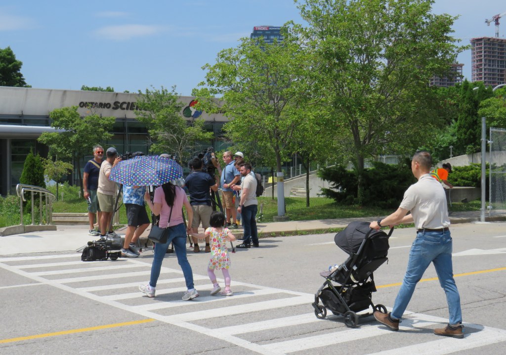
    Though I made it up on Friday to document the closure, I am sad that I did not make it for one last visit, just as with the sudden closure of the Scarborough RT last year.

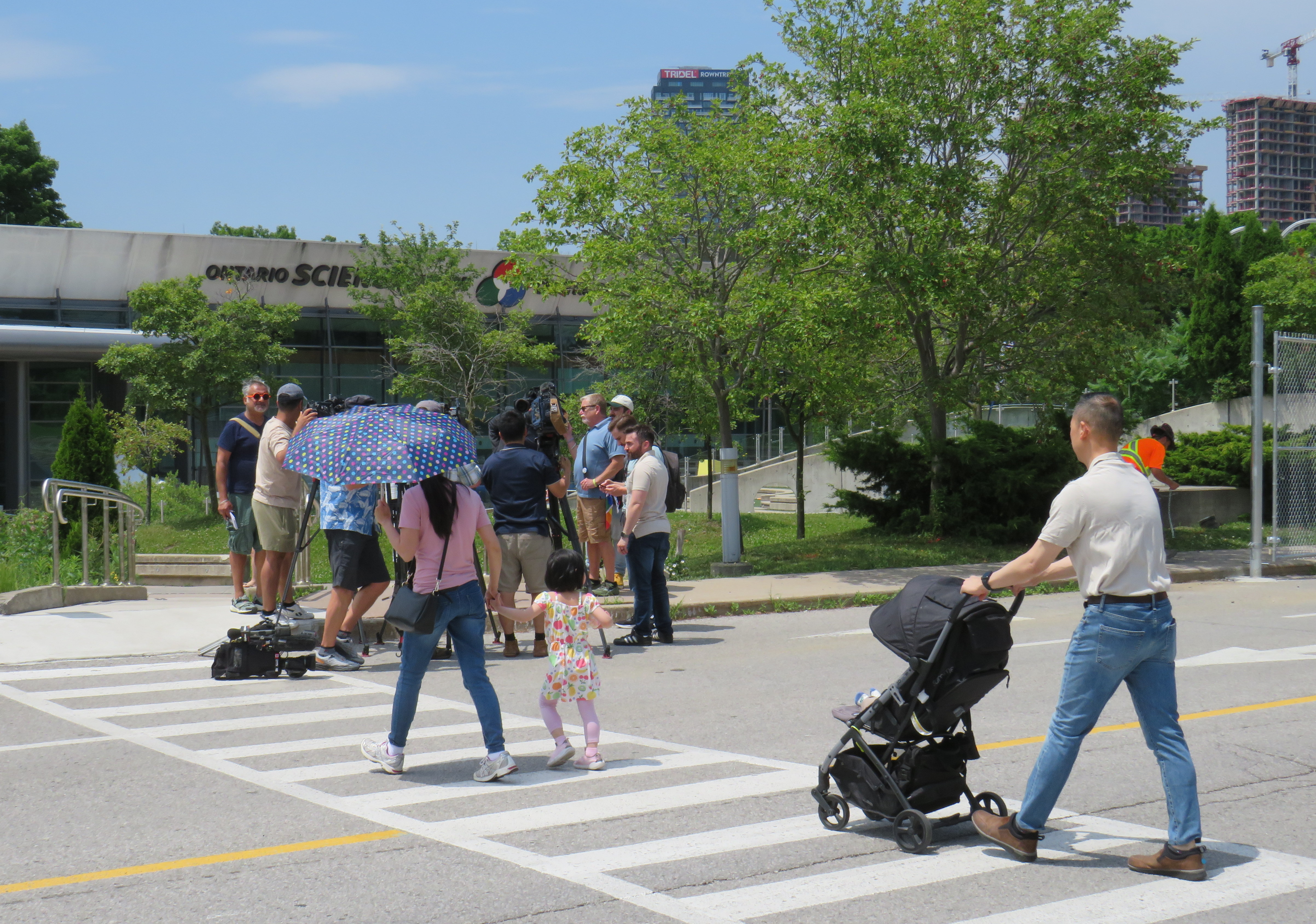
    The most heartbreaking thing for me was watching a young family walk from Flemingdon Park into the Science Centre just as the news media was assembling for a press conference with Don Valley East MPP Dr. Adil Shamji and Floyd Ruskin of SaveOSC. The young child looked so excited for a day at the science centre, unaware that it would be the last day it would ever be open.

  • Deadly by design: Keele Street and Calvington Drive

    Deadly by design: Keele Street and Calvington Drive

    On Sunday, June 7, Olivia and Julia Sarracini were crossing Calvington Drive at Keele Street. It was 12:15 in the morning. The walk sign turned on, and the two sisters, aged 17 and 19, entered the crosswalk, walking north. Behind them, the driver of a black SUV waited for southbound traffic to clear the intersection before turning left, directly into the two young women, who were already halfway across the intersection.

    Julia suffered leg injuries and was sent to hospital. Olivia, who was just finishing Grade 12, was pronounced dead at the scene. The driver of the SUV did not stop, but fled westbound on Calvington Drive.

    Two days later, Toronto Police arrested 46-year-old Shawn Ramsey. He was charged with two criminal offences: fail to stop at the scene of an accident causing death and fail to stop at the scene of an accident causing bodily harm.

    The driver was definitely at fault for striking the two women, who were walking with the right of way and all due care necessary. But it remains quite possible that if the motorist remained at the scene that night might only be facing minor Highway Traffic Act charges. (Without a vulnerable road users’ law, justice for pedestrians and cyclists injured or killed on Ontario’s streets is terribly inadequate.) Yet road design and a poor transportation network in Toronto’s inner suburbs played a significant role here.

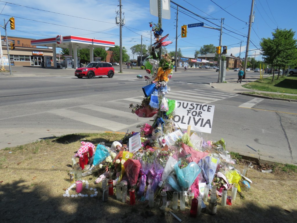
    Memorial for Olivia Sarracini

    This section of Keele Street provides a link between Highway 401 and Humber River Regional Hospital to the south, and Finch Avenue, York University, and several industrial areas to the north. Downsview Park is just to the north of Calvington Avenue, and along with the large parkspace, new residential development is well underway, with more planned.

    The area around Keele and Calvington was developed in the 1950s and 1960s, though visages of the old village of Downsview can be found close by, towards Wilson Avenue to the south. Between Wilson and Sheppard, Keele Street is five lanes wide, with a centre left-turn lane. Traffic is heavy throughout the day and evening, with many trucks headed to and from industrial lands and nearby construction sites. Even in heavy traffic, motorists regularly exceed the 50 km/h speed limit.

    Pedestrians are provided only with narrow sidewalks, close to the road. These sidewalks are not separated from strip plaza parking spaces. Despite a major hospital, nearby elementary and secondary schools, a library, Downsview Park, and urban intensification taking place in the area, there are no cycling facilities. Cyclists, therefore, usually take the sidewalk. While cyclists avoid heavy traffic on Keele’s narrow lanes, they infringe on the little bit of space given to pedestrians.

    Strip plaza across Keele Street from Calvington Avenue

    Calvington runs west from Keele, with a strip plaza and gas station on the east side of the intersection. Though most traffic off Calvington turns south, pedestrians are prohibited from crossing at the north side, lest they slow down left-turning motorists off of Calvington. Furthermore, an advance left turn signal gives priority to northbound motorists turning on to Calvington from Keele, though the advance signal is only triggered by a queue of several left-turning vehicles.

    Though neither the advance signal nor the crossing restriction were factors in the collision on June 7, they are just further reminders of who the streetscape was designed for.

    Pedestrians are prohibited from crossing at the north side of the Keele and Calvington intersection. Note the sidewalk cyclist, likely headed to nearby Downsview Park.

    Soon after Olivia Sarracini’s death, Councillor James Pasternak moved to request a traffic safety review of the Keele and Calvington intersection at the June 16 meeting of North York Community Council. Pasternak suggested that street lighting, traffic signal synchronization, traffic signage, and “the feasibility of installing advance green traffic lights” be included in the review.
    The trouble with that motion is that it too narrow. There are dozens of similar intersections in Toronto’s post-war suburbs. The intersection already has an advance green traffic signal. I would suggest that a review of the whole district is necessary in the the context of new and upcoming urban development, poor access to Downsview Park from the south and west, and inadequate and unsafe active transportation infrastructure. Nearby Highway 401 and the GO Transit Barrie Line both create significant barriers to pedestrians and cyclists in the area.

    Olivia Sarracini was killed and Julia Sarracini was injured by a dangerous and callous driver who did not have the humanity to stay and offer assistance and take responsibility. This tragedy shouldn’t warrant a narrow safety review. Without changing the built environment, tragedies like these will continue.
  • A tale of two streets: Winona Drive and Shaughnessy Boulevard

    A tale of two streets: Winona Drive and Shaughnessy Boulevard

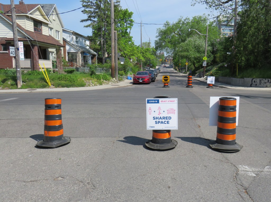
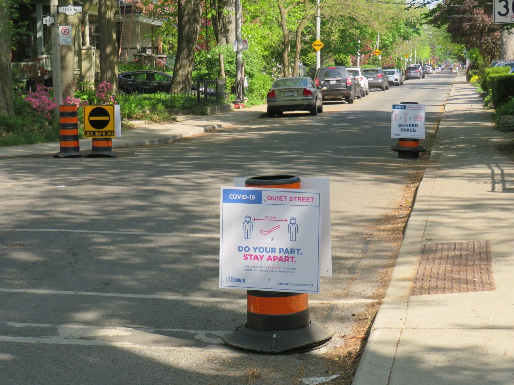
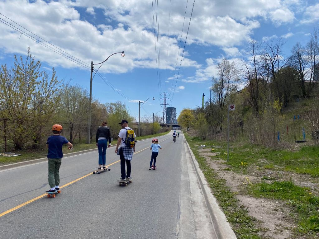
    Typical Quiet Street signage and pylon placement, Crawford Street

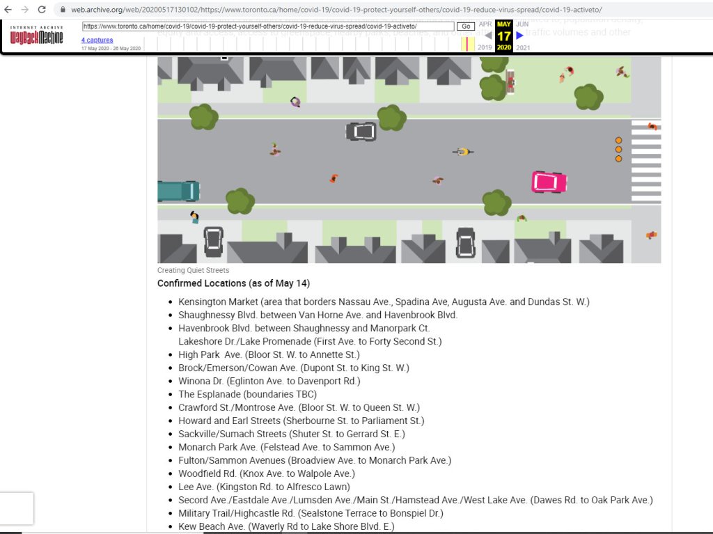
    Earlier this month, as part of Toronto’s long-overdue response to the ongoing COVID-19 pandemic, the city introduced ActiveTO. ActiveTO includes several measures addressing the need for safe active transportation and recreation routes as summer approaches and businesses slowly reopen.

    Current ActiveTO initiatives include weekend traffic closures of sections of Lake Shore Boulevard and Bayview Avenue to take pressure off narrow and busy multi-use paths, designating specific “quiet streets” to provide safer cycling and pedestrian corridors, and the construction of new bike lanes and cycle tracks, accelerating work on the painfully slow implementation of the city’s cycling network plan.

    One of many families enjoying the Bayview Avenue extension closure on May 16. The weekend closure provides a safe, spacious alternative to the crowded Lower Don Trail

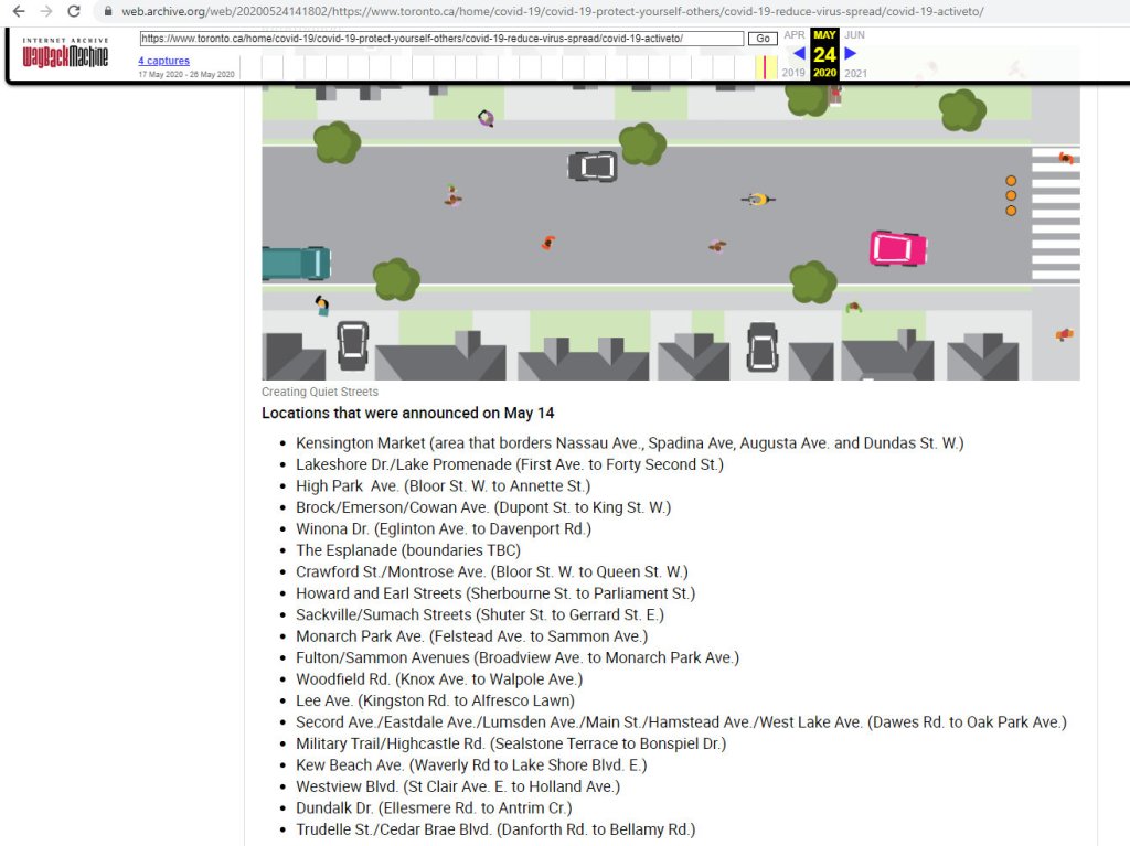
    I visited two Toronto streets this week included in the initial list of ActiveTO quiet streets that were announced on May 14, 2020.

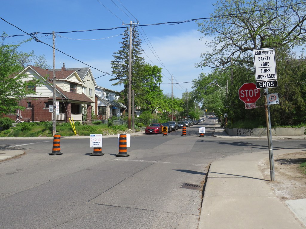
    On Winona Drive, the pylons and signs placed by city work crews were moved by residents to block an entire lane of traffic at each intersection. This enhances their effectiveness in reminding motorists that the space is for local traffic only and that the roadway is shared with pedestrians and cyclists.

    Winona Drive at Benson Avenue, May 25, 2020
    Close-up of relocated pylons on Winona Drive

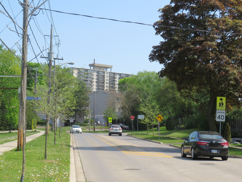
    Shaughnessy and Havenbrook Boulevards, near Sheppard Avenue and Don Mills Road, connect the densely populated Fairview Mall and Don Valley Village neighbourhoods with the Betty Sutherland Trail, part of the Don River ravine system. Though Shaughnessy is mostly fronted by comfortable, midcentury homes, it borders several apartment buildings and townhouse complexes, including several Toronto Community Housing properties.

    Shaughnessy Boulevard looking north at Rochelle Crescent

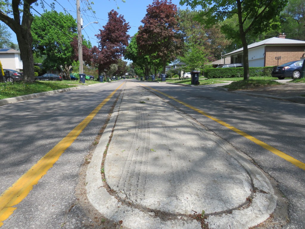
    In 2012, some road calming measures were undertaken on Shaughnessy to slow down traffic, particularly near local schools and parks. A four-lane section between Sheppard Avenue and Glenworth Road was narrowed, including a very short section of bike lanes. A shallow concrete median was added between Glenworth and Esterbrooke Avenue. However, the street remained problematic.

    The shallow median on Shaughnessy Boulevard does nothing to slow down aggressive motorists

    In a recent Toronto Star article, resident Robin Sacks noted that the street was unsafe as motorists used it as a bypass of parallel Don Mills Road. She, and many of her neighbours, supported Shaughnessy’s designation as an ActiveTO quiet street.

    Unfortunately, other residents took it upon themselves to remove the pylons and signs and complain to their local city councillor as soon as they were installed. By the weekend, they — along with concrete barriers placed in the median — were removed, and the street wiped from the city’s website.

    Councillor Shelley Carroll, a progressive, was quoted in the Star article that she felt those who objected to the traffic calming measures were on “solid ground,” as there were no community consultations before the measures were introduced. She also noted that Shaughnessy is “a safe street with ample sidewalks and, unlike denser parts of downtown, ‘no one’s having any trouble distancing.’”

    To Carroll’s credit, a consultation is planned for Wednesday, May 27. Overall, her track record has been supportive of safer streets in her community and in Toronto as a whole, so I was surprised by her comments. Hopefully, Shaughnessy, like many other suburban streets, will see improvements shortly.

    Quiet streets, if planned as a network, are helpful for encouraging active transportation, especially where wider sidewalks and cycle lanes are unable to be installed on parallel major roads (due to streetcar lines, for example), or where they can connect major parks, off-road trails, and other cycling corridors.

    To make such quiet streets permanent, curb extensions at intersections and other physical cues should be used to slow down traffic. Traffic circles and well-marked crosswalks could also take the place of four-way stops, which are easily ignored by motorists while frustrating cyclists.

    The COVID-19 pandemic has exposed severe inequities; between those who work in the logistics, healthcare, and food service industries, and those who are able to work at home; between those who have comfortable homes with access to ample green space and those who do not, and those can rely on their own automobiles, and those who must walk, cycle, or take transit. This is why expanding public space and providing safe routes to travel is so important.

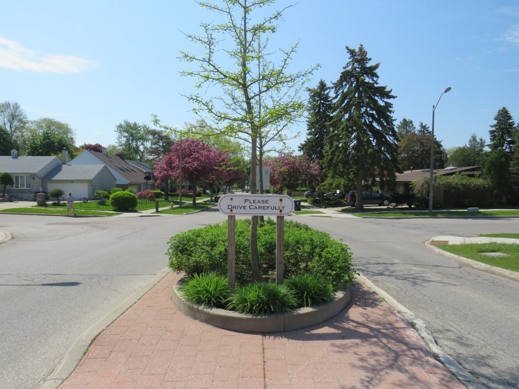
    “please drive carefully” – sign in median of Shaughnessy Boulevard

  • Deadly by design: Supertest Road

    Deadly by design: Supertest Road

    IMG_7204-001

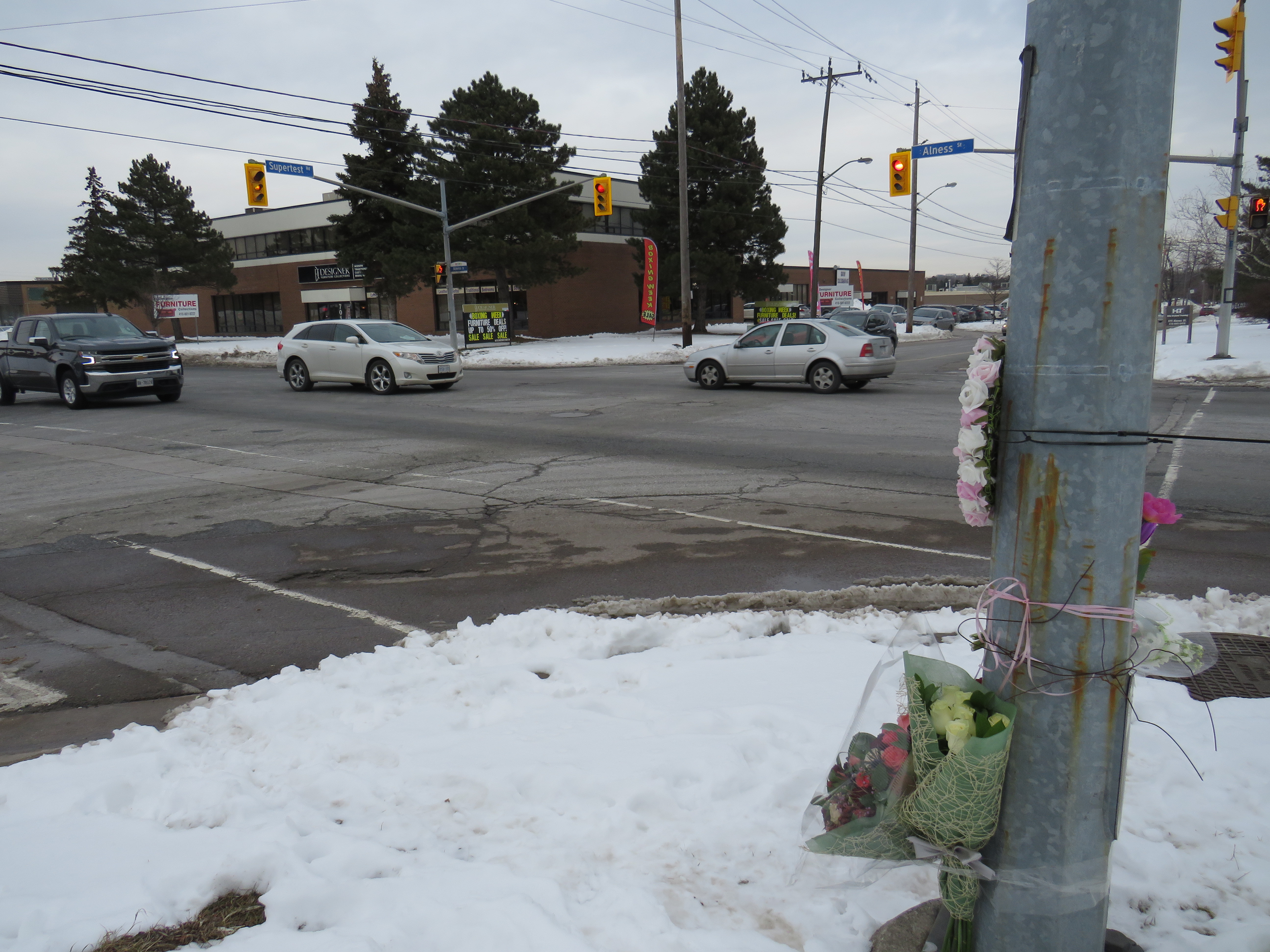
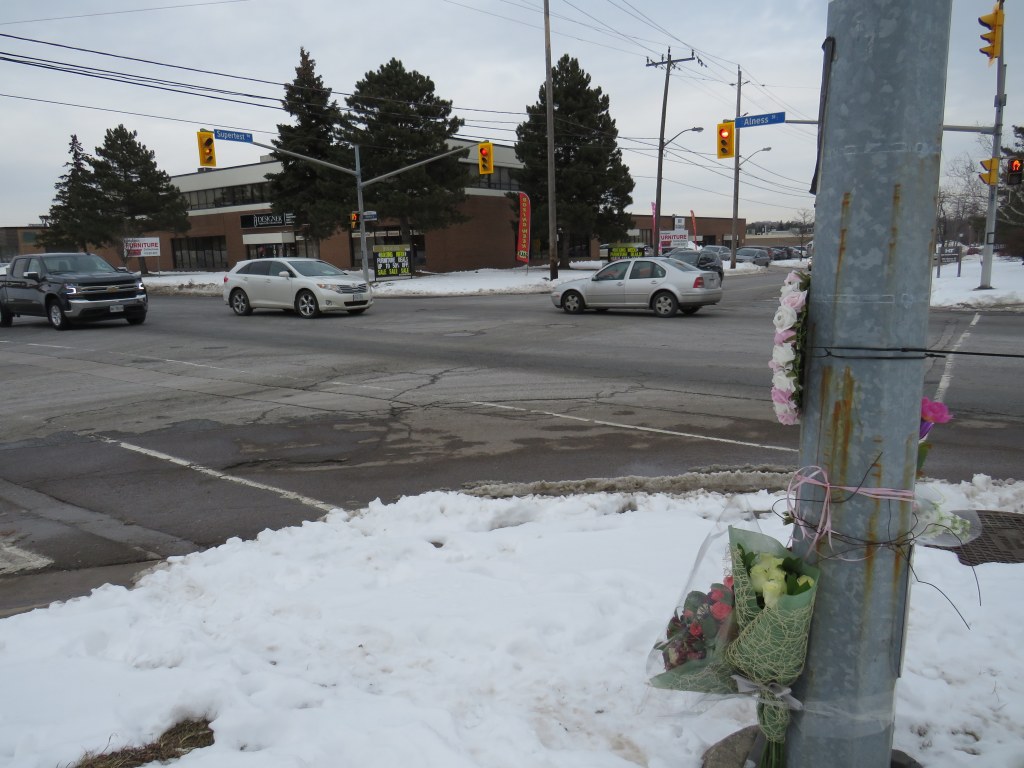
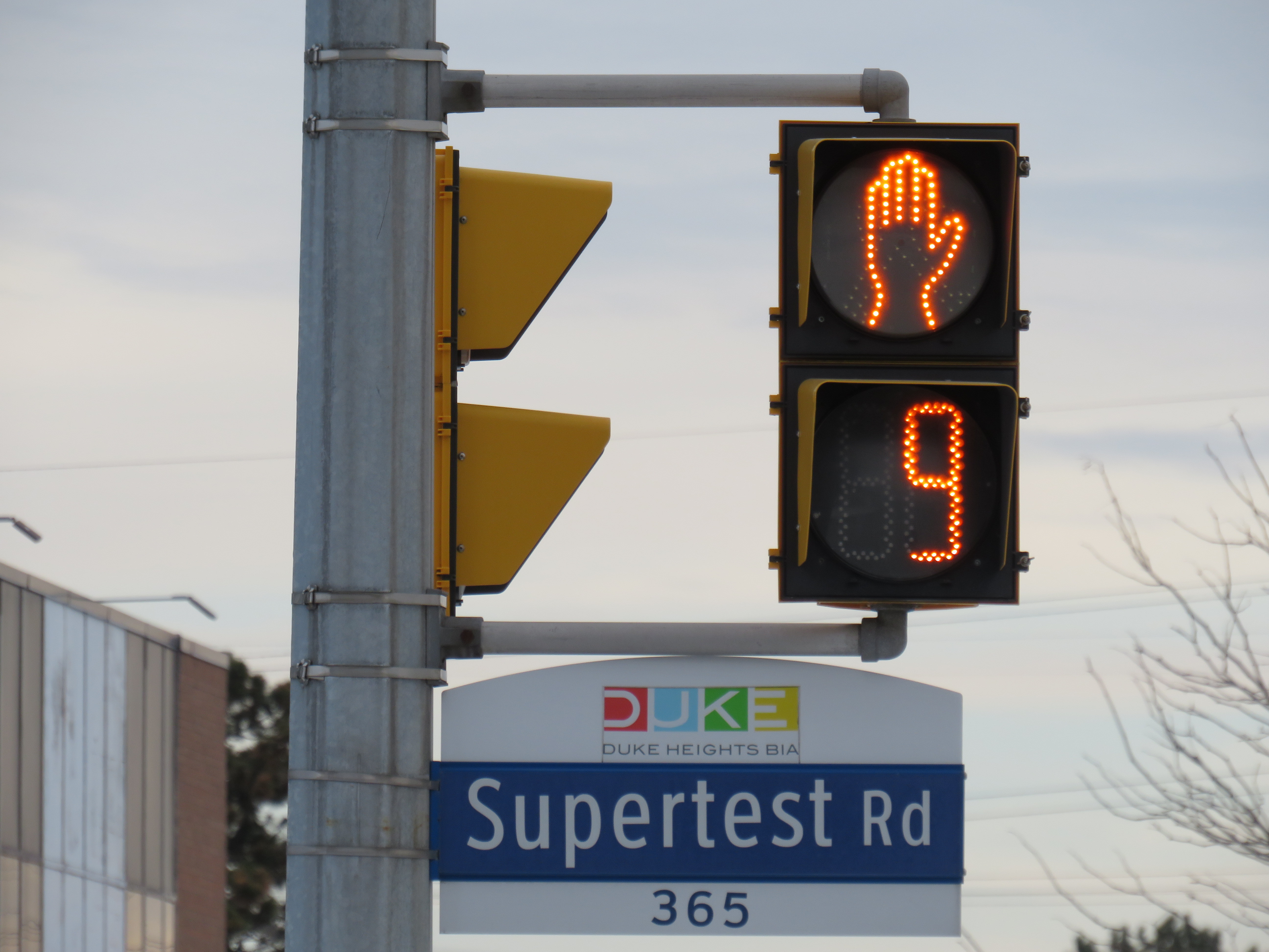
    On Tuesday, January 21, a 26-year-old woman was struck and killed by the driver of a tractor-trailer at the corner of Supertest Road and Alness Street in North York. According to police, the truck driver was making a right turn from Supertest south to Alness when he hit the pedestrian.

    Last week, I paid a visit to the intersection, located in an industrial area off Dufferin Street, just south of Steeles Avenue. It was immediately apparent that pedestrians are an afterthought in this part of the city, and tragedy was inevitable.

    The intersection of Alness and Supertest, with a makeshift memorial on the southwest cornerThe intersection of Alness and Supertest, with a makeshift memorial on the southwest corner
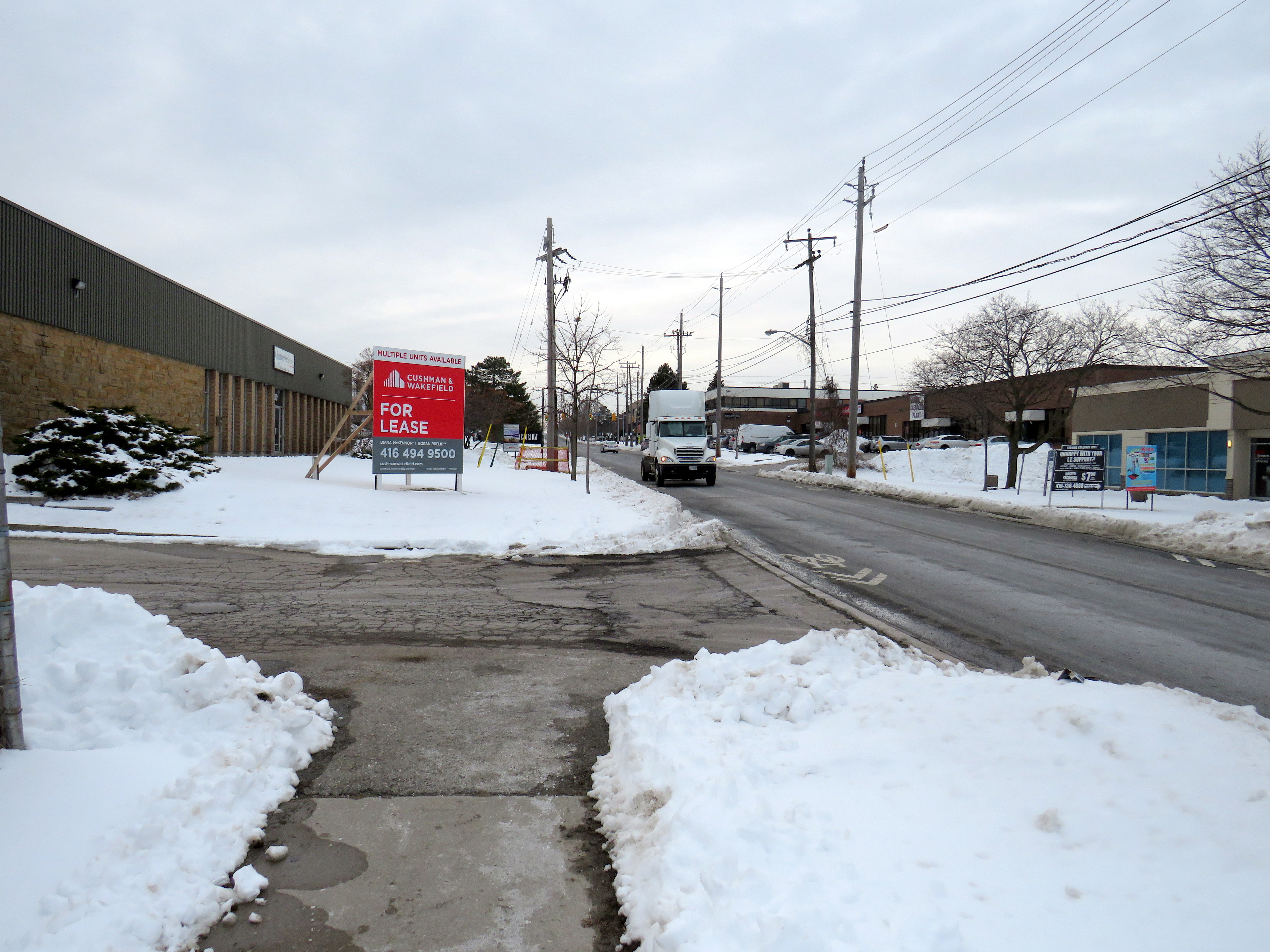
    I took the 105 Dufferin North bus from Sheppard West Station and got off at Supertest Road before walking west towards Alness Street. I pressed the beg button to cross Dufferin, but it did not work, so I crossed with the solid “don’t walk” sign. At least I had enough time to cross before traffic on Dufferin got the green light. With a bus stop at the intersection, G. Ross Lord Park to the east, and a busy supermarket on the southwest corner, there is no excuse for a malfunctioning pedestrian signal. In fact, the walk signal should appear by default.

    As I walked westward on Supertest, the lone sidewalk on the south side of the street came to an end at an industrial driveway about halfway between Dufferin and Alness. With the snow, I was forced to walk on the street, which was busy with cars and trucks. Without any sidewalk, anyone using a wheeled device would also be forced on the street.

    End of sidewalkThe only sidewalk on Supertest Road comes to an end halfway between Dufferin and Alness
    With my smartphone, I recorded my walk along the curb towards Alness Street, avoiding the snowbanks, debris, and motor traffic. It was not a pleasant walk.

    The intersection of Supertest and Alness is a signalized intersection, with pedestrian signals and crosswalks on all four sides. Alness has a through sidewalk, but only on the east side of the street. The intersection is surrounded by a scrapyard on the southwest corner, a bank on the northwest corner, and warehouses to the east. The missing sidewalk on the south side Supertest east of the intersection resumes west of Alness.

    The traffic lights are on a timer, and walk signals automatically appear, so there are no beg buttons at Alness and Supertest. What I noticed during my visit is that motorists will regularly rush to get through an amber signal, sometimes running a red. Truck drivers make wide right turns. Though the area is not pedestrian friendly, I did note several pedestrians in the area, running errands at the bank or walking to and from several of the nearby businesses.

    Truck turning from Supertest to Alness

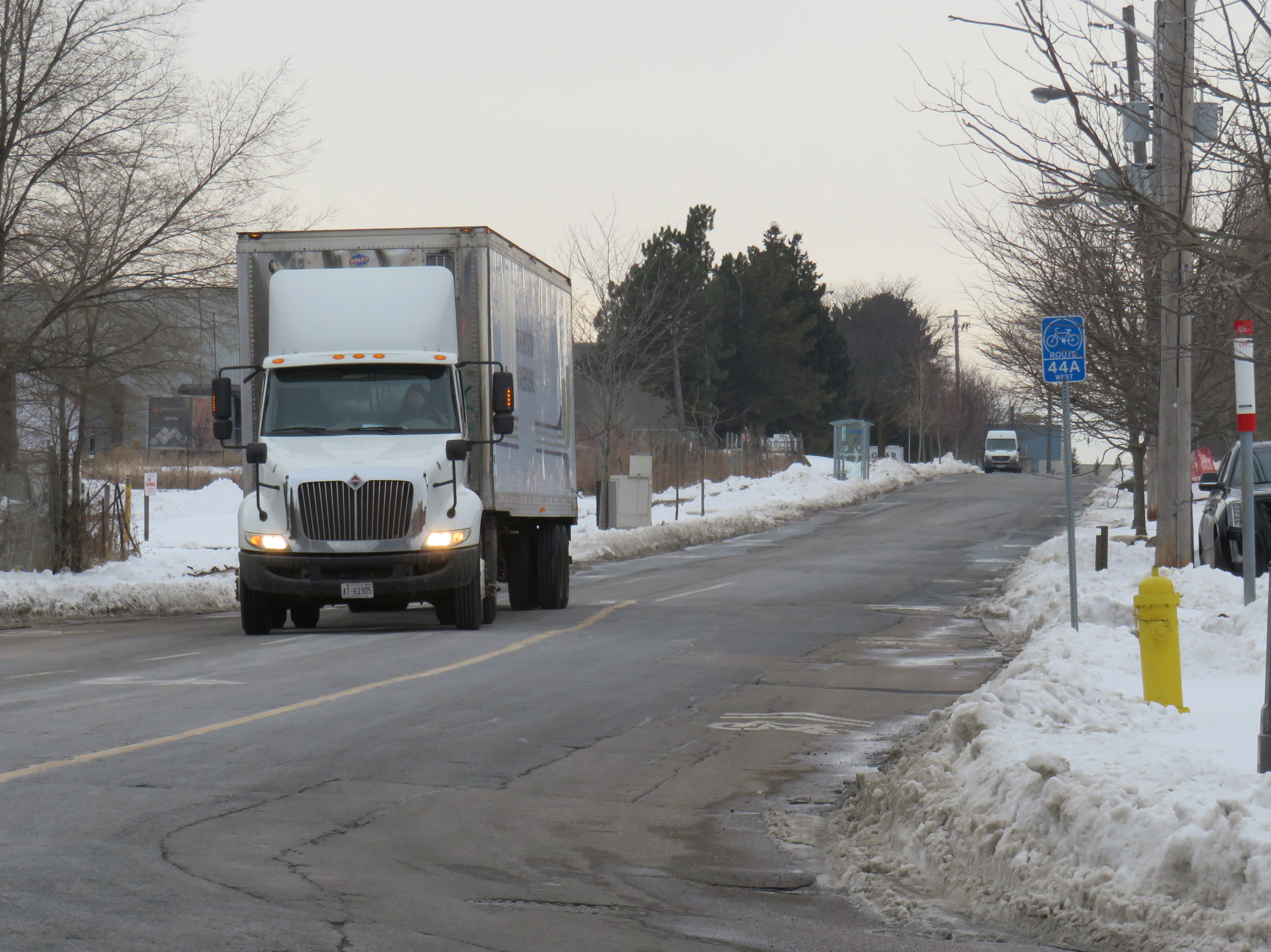
    Finally, I noted the sharrows, the signed bicycle route on Supertest Road, and the TTC stop on the north side. The cycle route is supposed to connect G. Ross Lord Park on the east side of Dufferin to Flint Road to the west and south to the Finch Corridor Recreational Trail, but it’s not an enticing place to bike. Meanwhile, the TTC stop, for the limited-service 117 Alness route, is inaccessible without a sidewalk leading to it.

    Looking west on Supertest RoadLooking west on Supertest Road, with the sharrow, TTC stop, and bike route sign on the right
    Everything about this industrial intersection was designed to fail pedestrians and cyclists. Last week, it did exactly that.

  • Islington Avenue: deadly by design

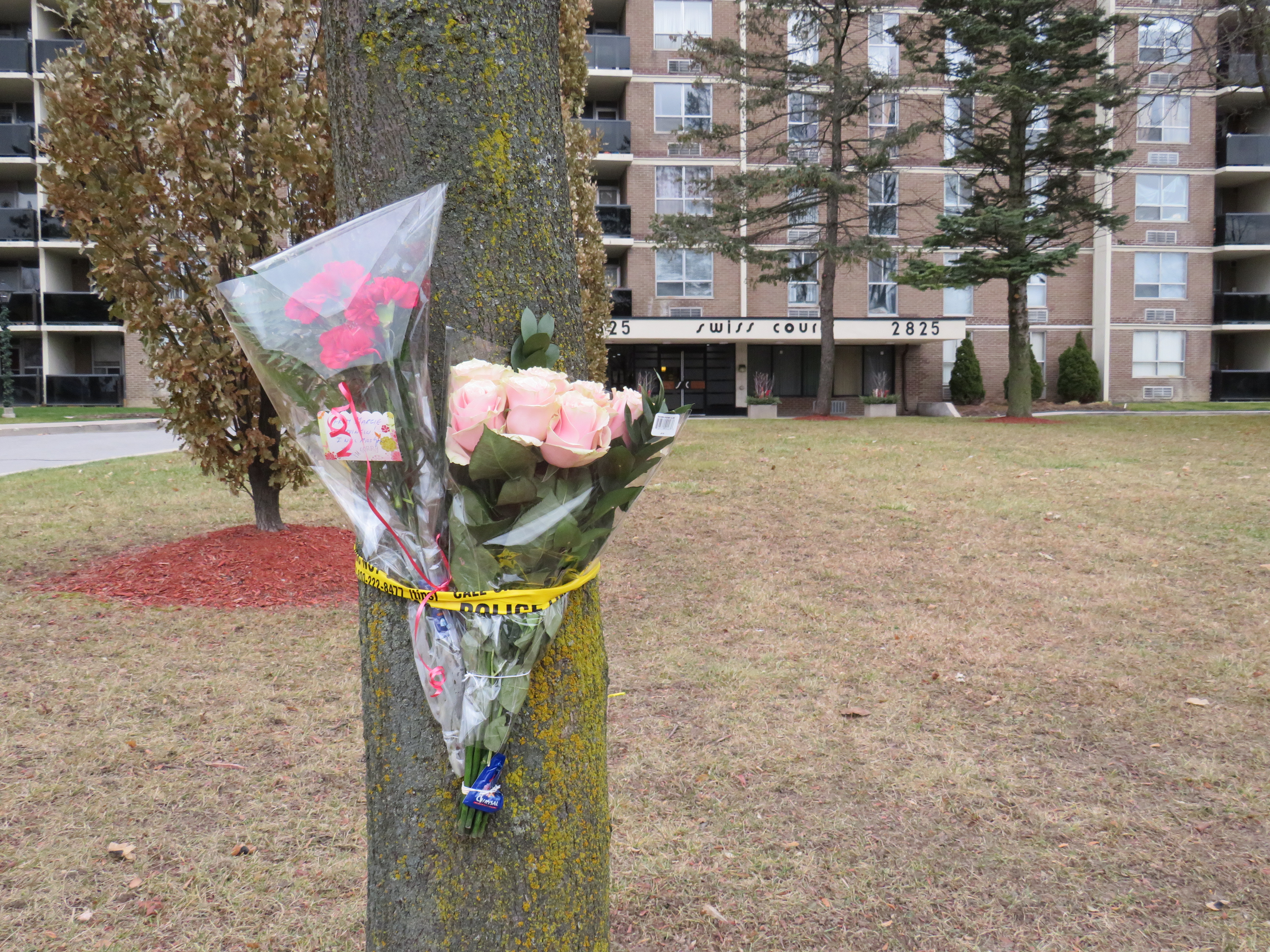
    IMG_6266-001Memorial to 77-year old Pasquina Lapadula in front of her apartment building on Islington Avenue north of Finch
    On Thursday, November 29 at 6:30AM, Pasquina Lapadula left her Islington Avenue apartment building and crossed the street in front of her home. Soon after stepping out, she was struck and killed by the driver of an SUV traveling northbound. The driver then fled the scene. Sadder still, drivers passed the scene without stopping to help.

    Toronto police are looking for a dark coloured SUV with bright headlights and fog lights. They have yet to find the driver and lay charges.

    According to the Toronto Star, 37 pedestrians have been killed on Toronto’s streets. Of those, 24 were 60 years old or over. Since 2007, 410 pedestrians were killed on Toronto’s streets; 238 of those were aged 60 or older. November 2019 was an especially deadly month; Lapadula was the third older pedestrian killed in Toronto in just three days.

    Though blame can be laid at the driver, who despite having ultra-bright headlights and fog lights, struck Lapadula and sped away afterwards, this part of Islington Avenue, like many other suburban roads in Toronto, is deadly by design.

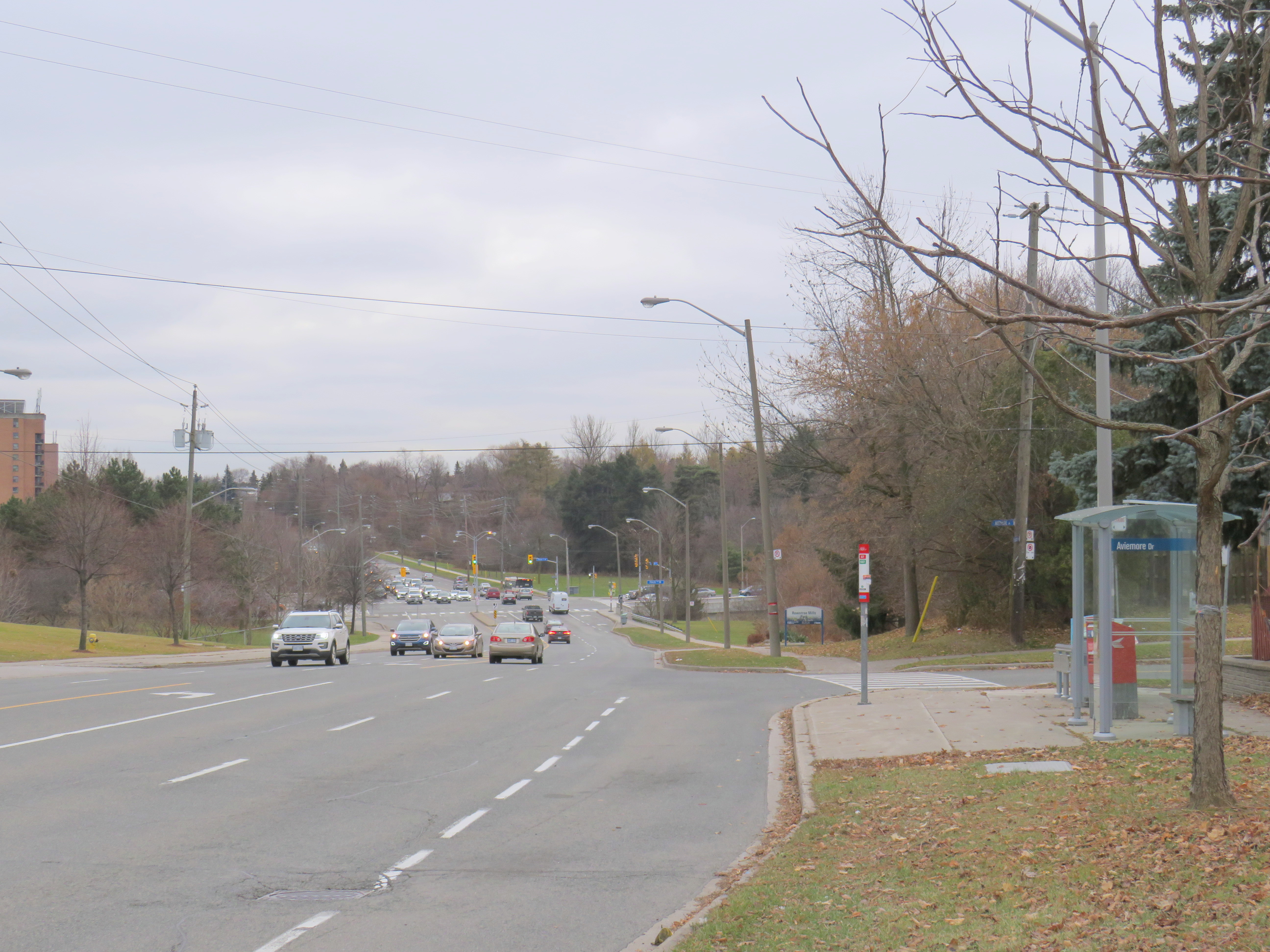
    IMG_6283-001Islington Avenue looking south from Aviemore Drive towards Finch Avenue
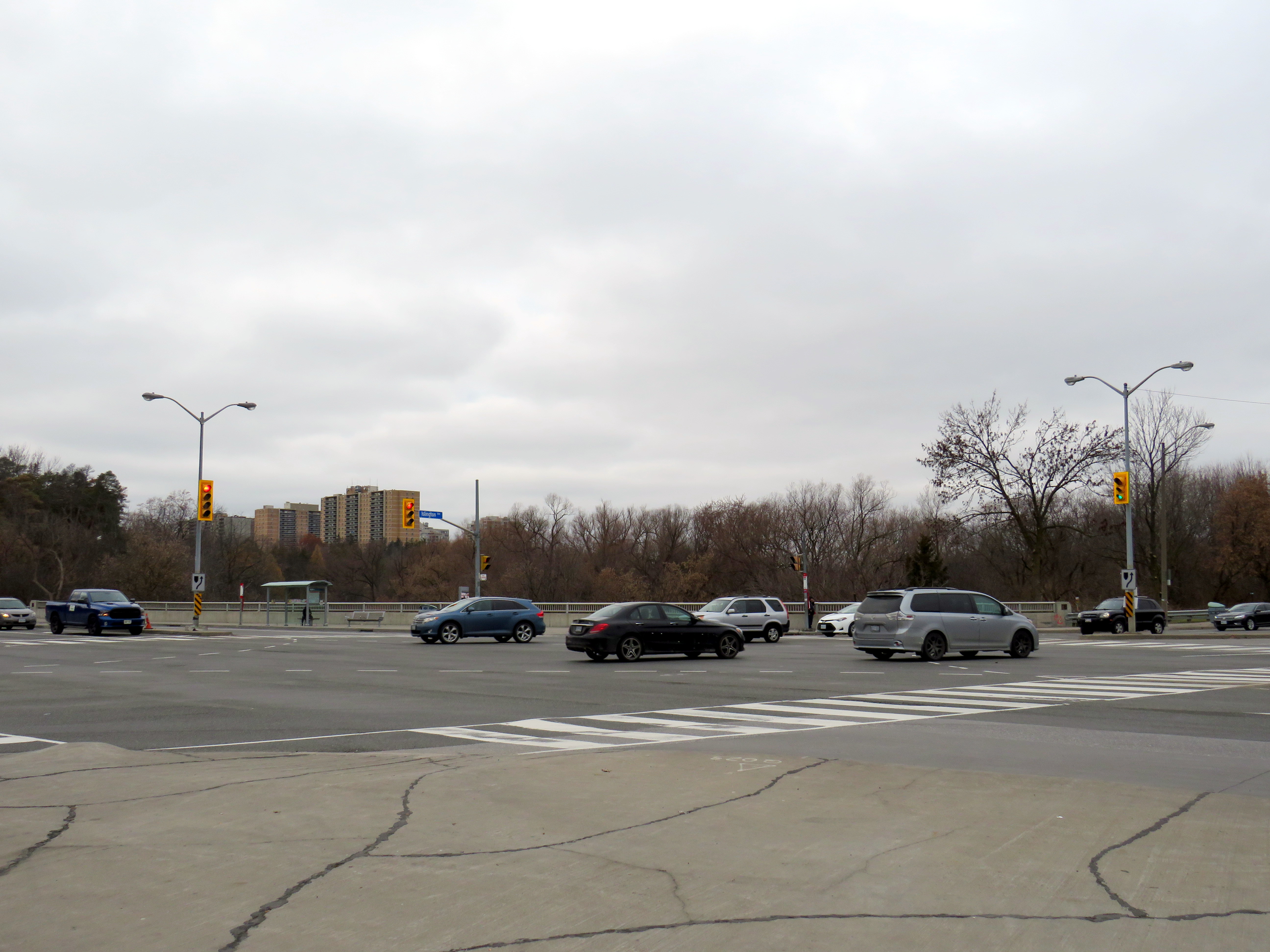
    The collision took place at Aviemore Drive in Humber Summit, in Toronto’s northwestern corner, near the boundary between the former cities of Etobicoke and North York. The area was developed in the 1960s and 1970s, when automobile-centric planning was at its peak.

    Islington Avenue is five lanes wide between intersections, including a striped middle lane that turns into left turn lanes at intersections. Sidewalks are separated by wide boulevards, and there are long distances between traffic signals.

    The road has a slight curve north of Finch Avenue, with a hill down towards the East Humber River at Finch. From Aviemore Drive, it is a 220 metre walk south to the crosswalk at Finch Avenue and 430 metres north to the traffic signals at Milady Road. Just south of Aviemore Drive are entrances to Gord and Irene Risk Park and Recreation Centre and Rowntree Mills Park.

    As the speed limit is unposted on this section of Islington Avenue, by law, vehicles may only go a maximum of 50 kilometres per hour. However, the road design encourages speeds far greater than the limit.

    IMG_6299-001TTC bus stopped in bay in front of Pasquina Lapadula’s apartment building
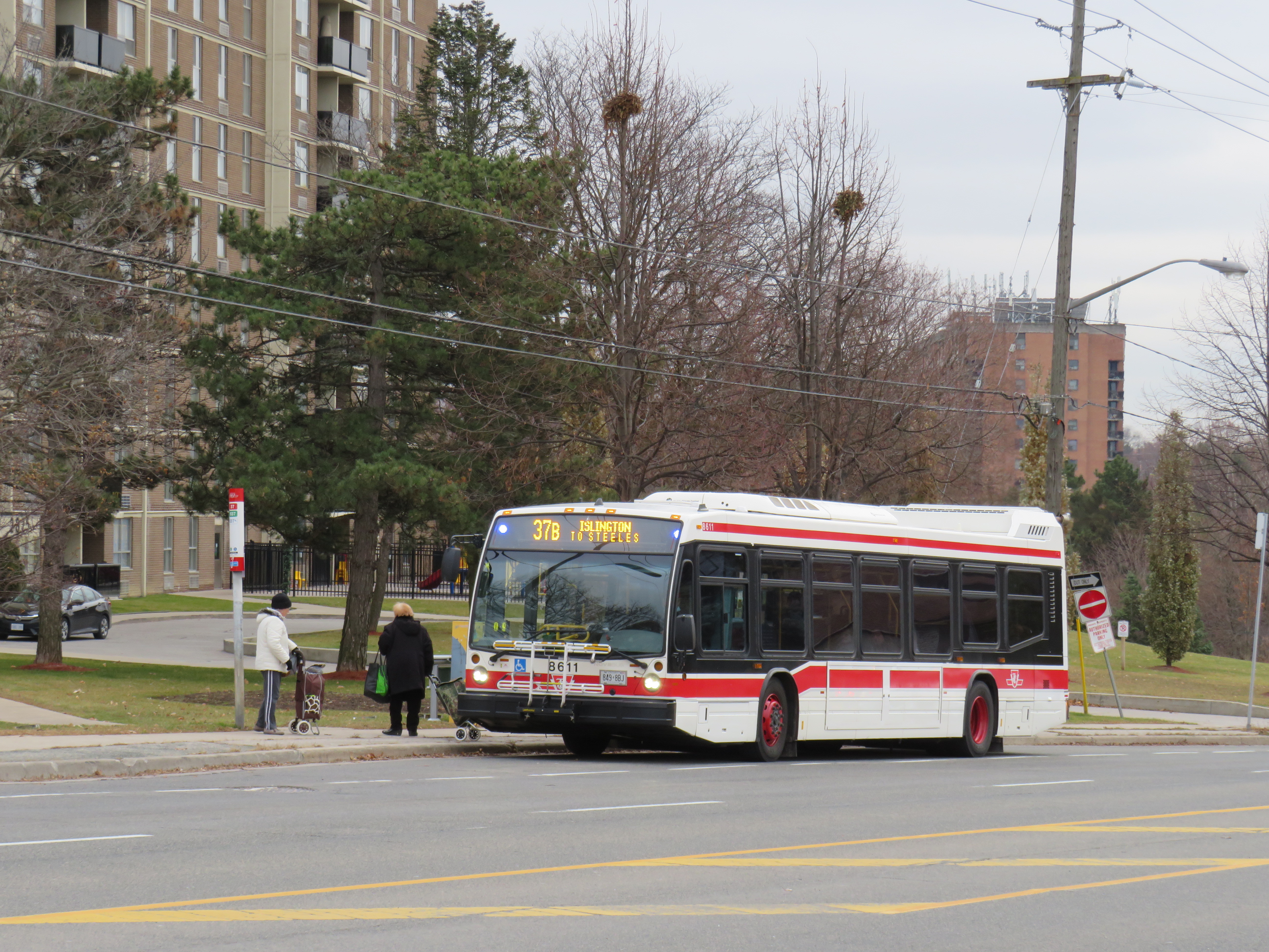
    As on Don Mills Road north of Finch, TTC buses stop in bus bays instead of on the street itself. These bus bays were not designed for the benefit of transit, but instead for the convenience of private motorists. Buses stopping get out of the way of traffic, and then must merge back in. (A law requiring other motorists to do so exists, but is never enforced.)

    Everything about the road design is designed for high vehicle throughput, with little consideration for pedestrian safety.

    IMG_6248-001Islington and Finch Avenues

    It is true that Pasquina Lapadula could have walked 220 metres down to Finch Avenue, and depending on her destination, another 220 metres back up the hill. The traffic signals and painted crosswalks would have provided additional safety. But the intersection of Finch and Islington itself is problematic.

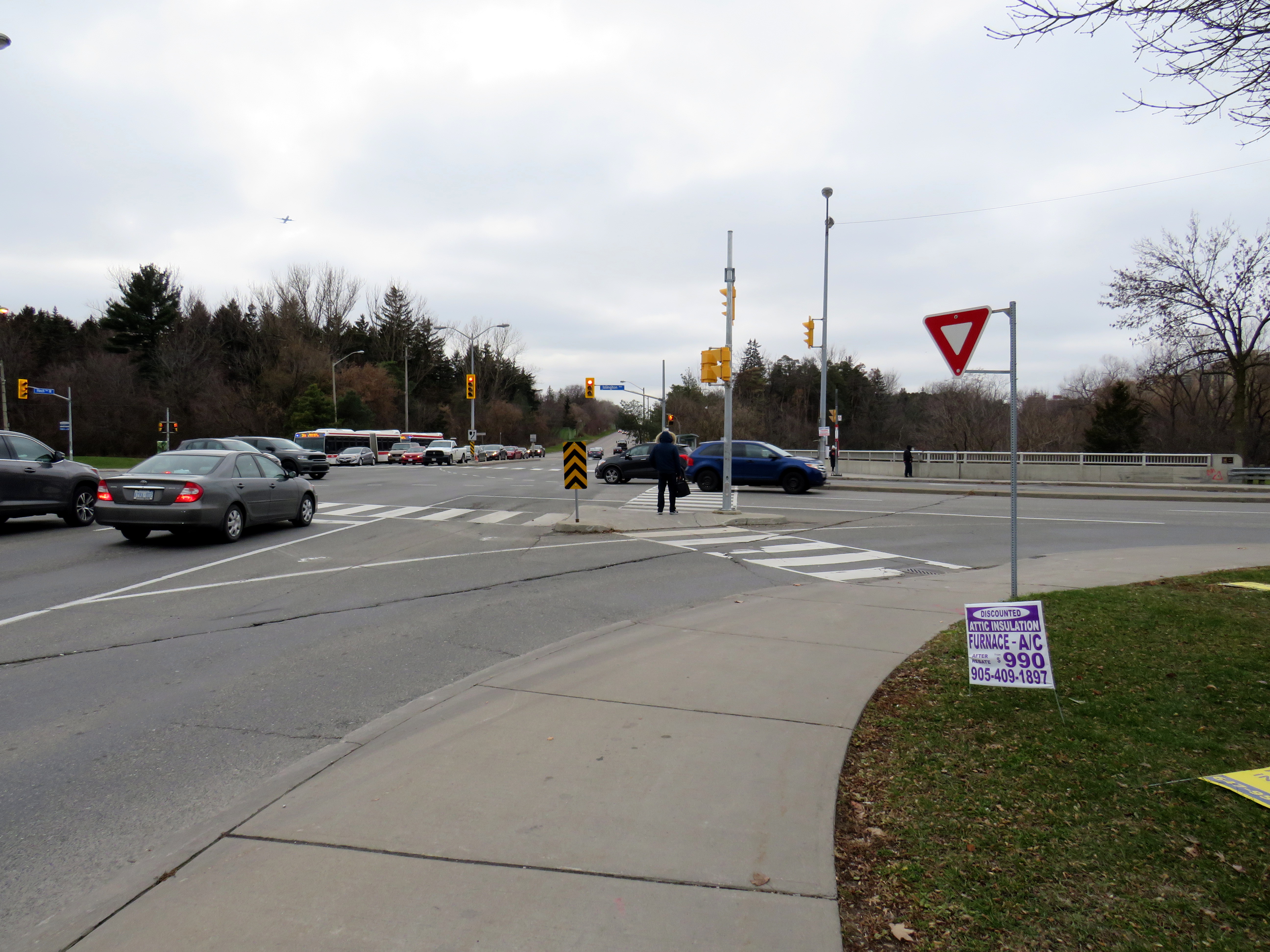
    The intersection sits on a large viaduct over the East Humber River. Right turn slip lanes are found on the southwest and northeast quadrants, allowing right-turning traffic to pass by quickly while requiring pedestrians to cross an additional lane of traffic governed only by a yield sign. Buses on Finch stop at bus bays at the far side of the intersection, further lengthening the distance pedestrians must cross.

    IMG_6255-001Slip lane from Finch to Islington

    I was frustrated when two Toronto councillors advocate giving out reflective armbands for pedestrians to wear, especially as one of those councillors opposed road safety initiatives in her own ward. I was angered the Toronto Star’s editorial board ignore city data, their own reporters and columnists, and pedestrian and cycling advocates to back those two suburban councillors.

    This was especially tone deaf given the Toronto Police Service’s abandonment of traffic enforcement, the epidemic of pedestrians being killed in the last two years, and the disturbing number of hit-and-runs. Armbands would not have saved Pasquina Lapadula’s life when she was confronted by the driver of a speeding SUV, with blindingly bright headlights and fog lights.

    This is why we need real Vision Zero measures like lower speed limits, more safe pedestrian crossings, road re-engineering to slow down vehicles, complete streets, and effective police enforcement.

  • The dangers of Don Mills Road

    IMG_3664.JPGDon Mills Road looking south towards McNicoll Avenue, North York
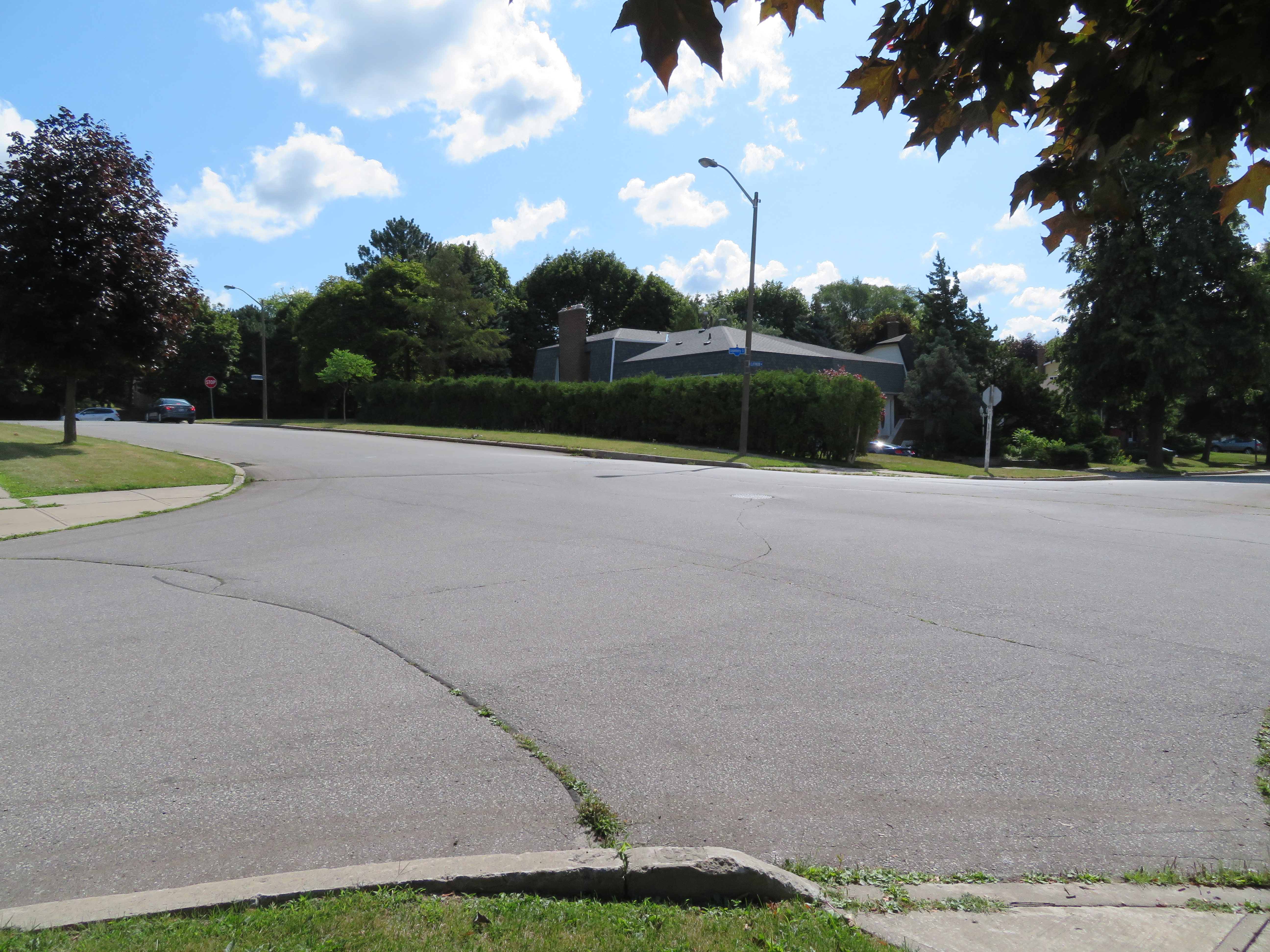
    On the afternoon of Tuesday July 16, a woman was struck and killed by the driver of a left-turning waste collection truck as she was crossing the street. The tragedy happened at the corner of Cliffwood Road and Barkwood Crescent, in a quiet North York residential neighbourhood. The 68-year old was the eighteenth pedestrian killed on Toronto’s streets in 2019. 

    Cliffwood Road is a typical suburban residential street in northeast North York, just south of the municipal boundary at Steeles Avenue. It meets Don Mills Road twice; at the north end, there are traffic signals, with a middle school and a plaza on the east side of the four-way intersection. On the south side, Cliffwood meets Don Mills at a three-way intersection, protected only by a a stop sign facing Cliffwood. As Cliffwood loops back on itself and has no direct connections to Steeles Avenue, it is not a useful short-cut for speeding motorists unlike many other suburban streets.

    What, in particular, contributed to this deadly crash? I paid a visit to the area to find out.

    IMG_3647.JPGThe intersection of Cliffwood Road and Barkwood Crescent, looking southeast

    Between Don Mills Road and Barkwood Crescent, Cliffwood Road is 12 metres wide without any lane markings or medians to separate traffic or slow vehicles turning off of busy Don Mills Road. West of Barkwood Crescent, Cliffwood Road narrows to 8.5 metres. Twelve metres is a lot of road space: Beverley Street in Downtown Toronto is the same width, but it has two driving lanes, a parking lane, and two unprotected bike lanes. The wide street width here only encourages motorists to drive fast after coming off Don Mills Road, while wide curb radii at the corners at Don Mills and at Barkwood Crescent also encourage motorists to take turns quickly.

    At Barkwood Crescent, Cliffwood Road has a speed limit of 50 km/h, the default speed limit in the City of Toronto. Closer to the schools to the north, a 40 km/h speed limit is posted, but there are no physical measures to slow down cars and trucks. Cliffwood Road, like so many other suburban streets, was built for speed, and not for local residents on foot.

    IMG_3648-001An unnecessarily large intersection at Cliffwood Road and Barkwood Crescent, and a wide approach to Don Mills Road
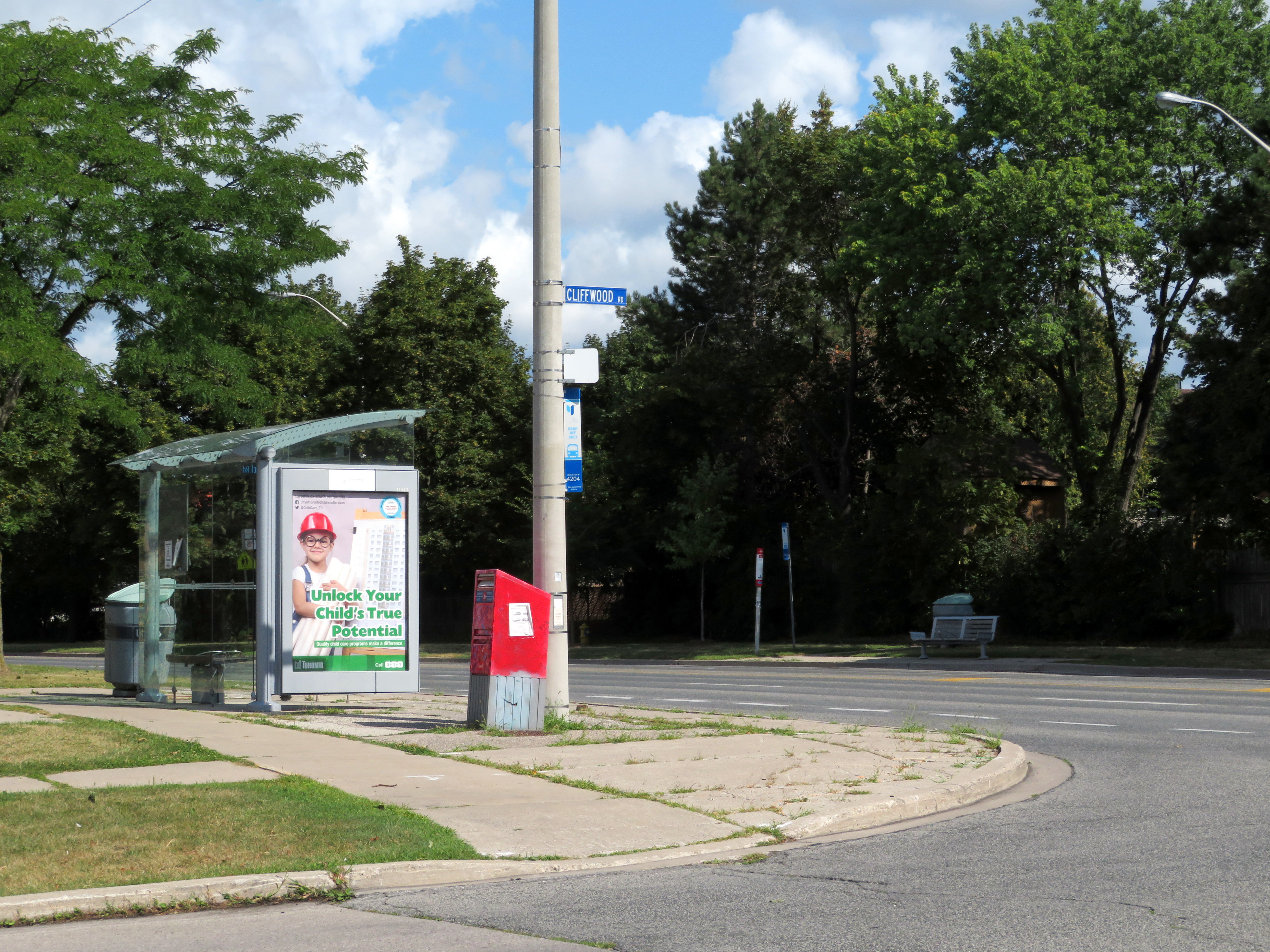
    I also noted the condition of nearby Don Mills Road, a busy thoroughfare connecting office parks in Richmond Hill and Markham with Fairview Mall to the south. Don Mills is a busy bus corridor, with both TTC and YRT buses providing frequent weekday service.

    Despite the frequent bus service, Don Mills Road is hostile to pedestrians and transit users. At the southern intersection of Don Mills and Cliffwood Roads, the nearest crosswalk is nearly 300 metres to the north, or 600 metres to the south. Understandably, most transit users will choose to cross at the nearest TTC stop, rather than walk an extra five or ten minutes twice a day, especially in inclement weather.

    In late August, a pedestrian was crossing Sheppard Avenue East in Scarborough to get to a nearby TTC bus stop when she was fatally struck by a motorist who then fled the scene. That stretch of Sheppard Avenue is flat and straight.

    IMG_3652-001The corner of Cliffwood and Don Mills Roads with bus stops
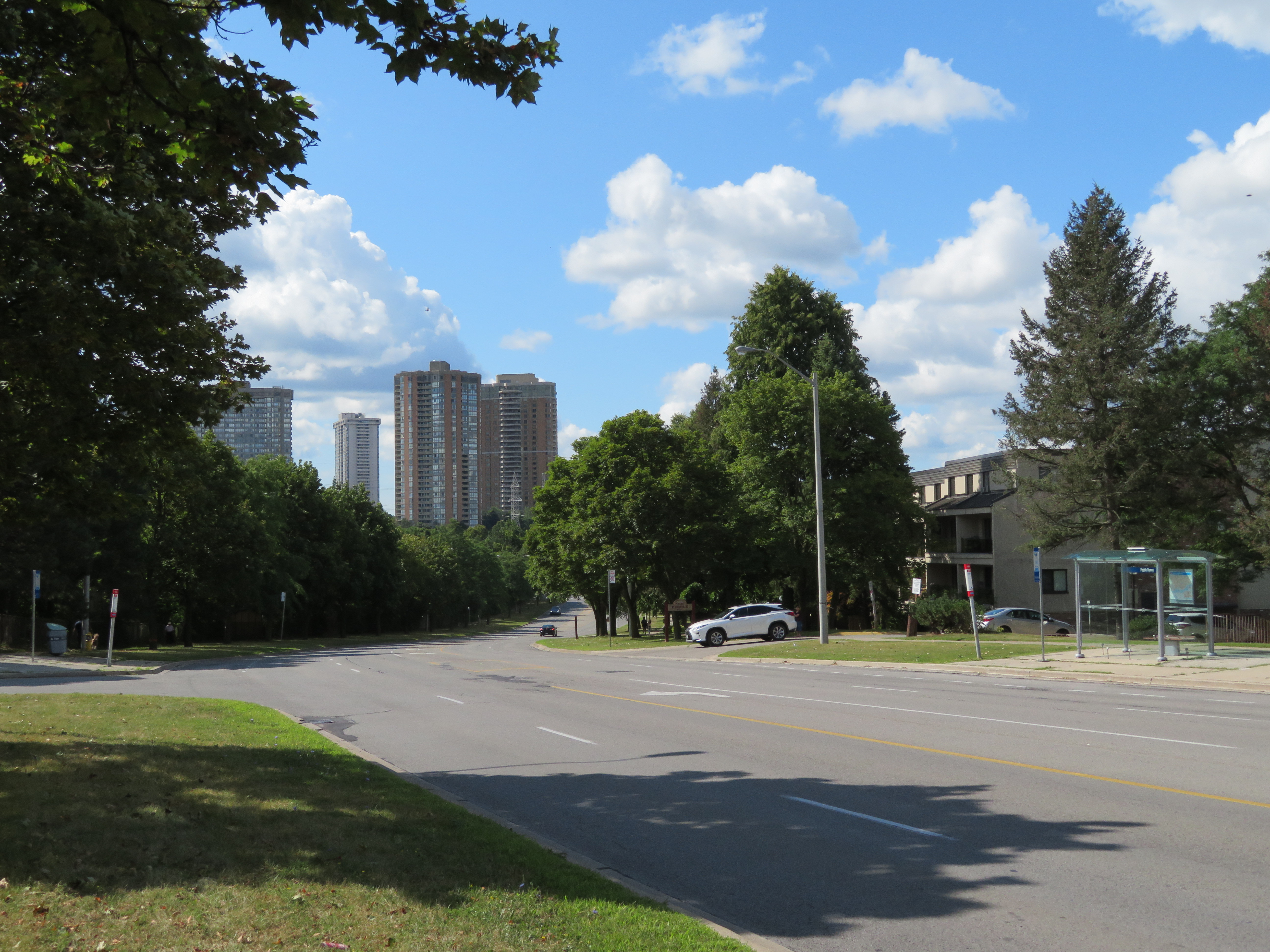
    Most area bus stops are adjacent to bus bays. Bus bays are designed to get buses out of the way of traffic while they are dropping off and picking up passengers. Once the bus is ready to leave the bus stop, it must then merge back into traffic. In addition, many of these bus bays double as right-turn lanes, increasing the distance a pedestrian must cross the street.

    Furthermore, Don Mills has several hills and curves north of Finch Avenue that makes this especially dangerous because of low visibility, making it difficult to judge how far or how fast traffic may be coming. There are five lanes plus bus bays/right turn lanes; the centre lane alternates between serving as a left turn lane or a striped buffer space between northbound and southbound traffic, which further encourages high speeds.

    IMG_3663-001.JPGBus stop at Don Mills Road and Mogul Drive, illustrating the high-speed curves
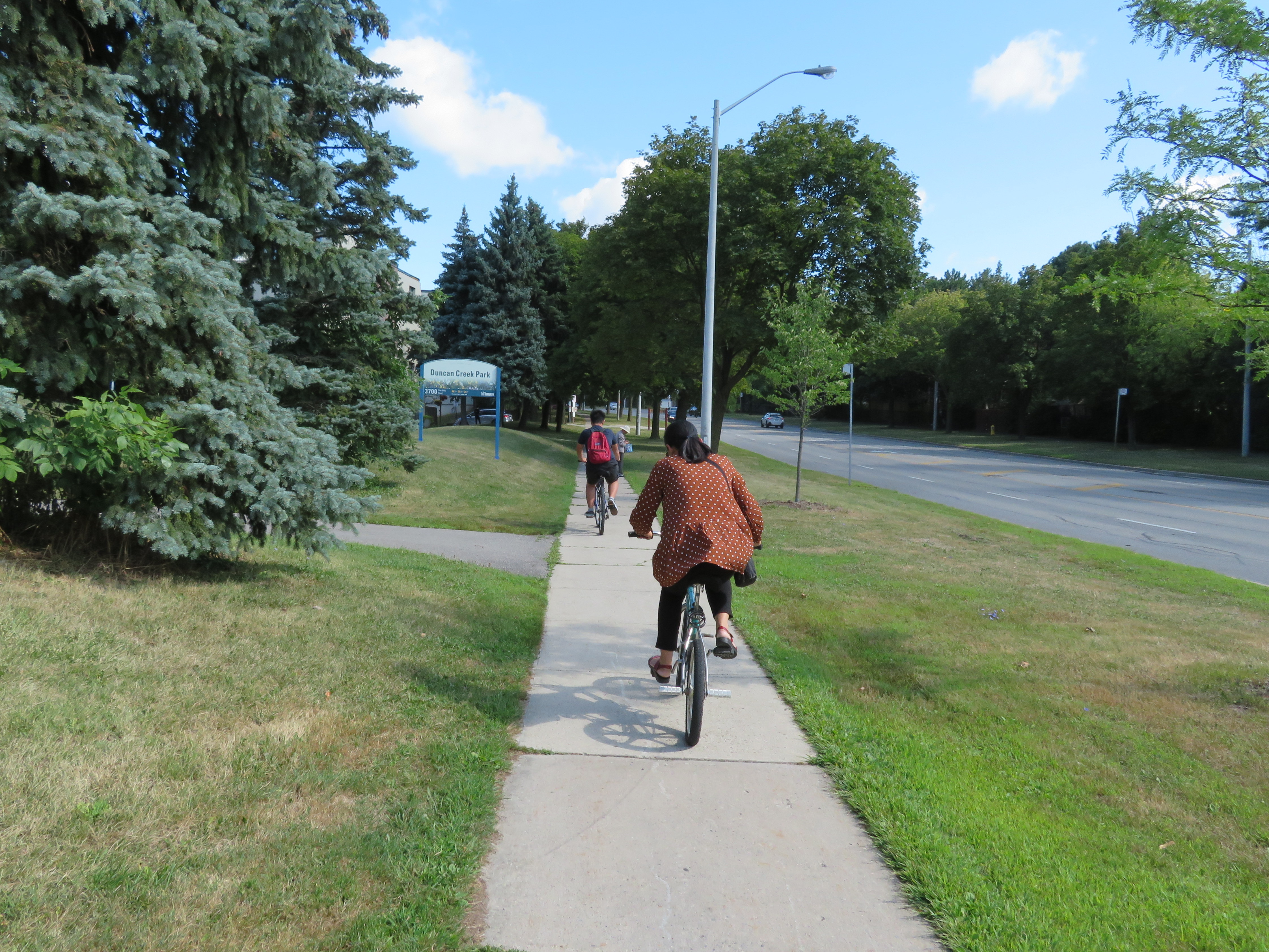
    It is no wonder too that cyclists choose the sidewalks. Despite the wide right-of-way with generous boulevards between the backyard fences and the curbs, no though has been made to improve cycling infrastructure in this part of Toronto. Separated bike lanes or a multi-use path, similar to those on Eglinton Avenue in Etobicoke, or in Peel Region, would make sense here, and along other suburban arterials.

    Cross-ride marking and signals at intersections would improve the safety for suburban cyclists and legitimize a common practice.

    IMG_3630-001Cyclists take the sidewalk on Don Mills Road
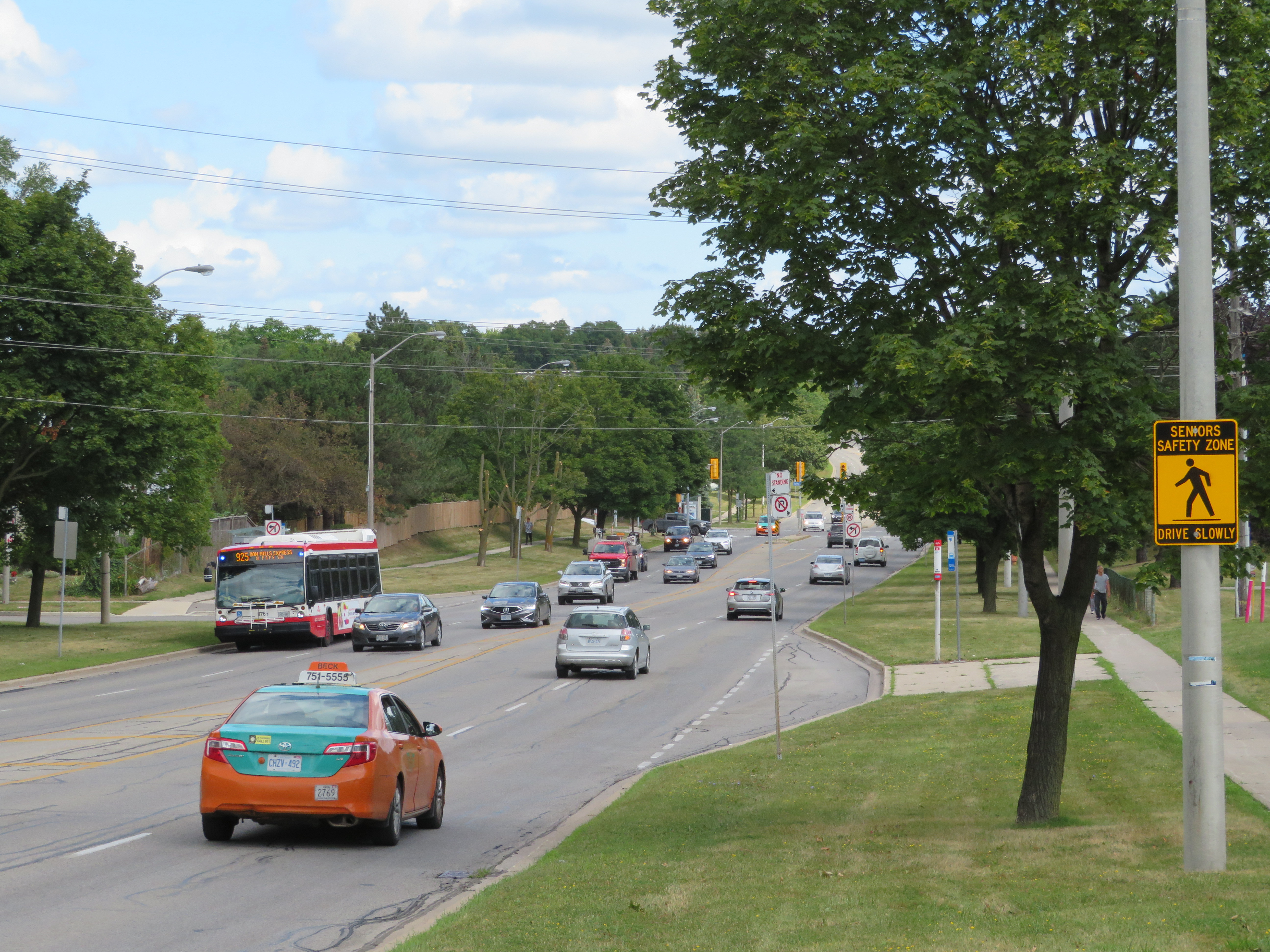
    At the end of my tour of upper Don Mills Road, I could not help but notice I was walking in a signed “Seniors Safety Zone.” As with Eglinton Avenue East in Scarborough, signs were put up but no measures were put in place to slow motorists down, and there was no sign of police enforcement of the posted limit either.

    IMG_3684-001.JPG“Seniors Safety Zone” – note the bus bay behind the sign
    There are a few things that can be done in Toronto’s suburbs to improve the safety of vulnerable road users (pedestrians and cyclists) and reduce the incidence and severity of crashes when they do happen. The installation of safer pedestrian crossings, such as traffic signals would reduce the distance required to get to a TTC stop safely. Bus bays should be eliminated with every road reconstruction project, as they do not benefit transit riders and encourage fast-moving traffic. Finally, residential streets should be narrowed, especially at intersections to slow motorists down, reduce the time a pedestrian is in the street while crossing, and improve their visibility.

    Finally, wide multi-use paths along suburban corridors like Don Mills Road would help promote active transportation and reduce conflicts between pedestrians and cyclists.

  • Mapping the results in Ward 15 – Don Valley West and Ward 16 – Don Valley East

    Happy holidays!

    In this post, I take a look at the council races in Ward 15 Don Valley West and Ward 16 Don Valley East. The new two wards, introduced under Bill 5, encompass most of what used to be Wards 25, 26, and 34.

    Ward 25, Toronto’s most affluent under the 44 ward model, was represented by Jaye Robinson, a centre-right councillor. First elected in 2010, she served on both Rob Ford and John Tory’s executive committees. In 2014, she was appointed chair of the powerful Public Works and Infrastructure Committee, whose responsibility includes roads and transportation. Robinson was roundly criticized by road safety advocates (including Walk Toronto, of which I am a co-founder) for a weak “Vision Zero” plan to reduce traffic deaths in Toronto, especially pedestrians and cyclists. 2018 has turned out to be an especially deadly year on Toronto’s streets.

    Ward 26 was represented by Jon Burnside, a former Toronto Police officer. In 2014, Burnside defeated incumbent councillor John Parker — the only council race in which a sitting councillor was defeated by a challenger that year. Parker was a Progressive Conservative MPP in Mike Harris’ government, but came to be one of the most effective opponents of the Ford Brothers’ plans for Toronto’s waterfront, and brought a dry wit that was much needed at the time. In the 2014 election, John Tory endorsed Burnside, and Parker was defeated. Burnside had the support of the wealthier Leaside neighbourhood and condo towers off Wynford Drive, while the lower-income Flemingdon and Thorncliffe Park neighbourhoods supported Parker or Ishrath Velshi.

    Since the 2014 election, Burnside has proven himself as a thoughtful, moderate conservative.

    Meanwhile, Ward 34 was represented by Denzil Minnan-Wong, probably city council’s staunchest and most effective conservative.

    Minnan-Wong has been a municipal politician since 1994, when he was appointed to North York City Council. Since 1997, he has sat on Toronto City Council. He’s an advocate of contracting out city services, such as waste collection. Though he supported separated bicycle lanes on Sherbourne, Harbord, Richmond and Adelaide Streets, he quickly moved to scrub bike lanes on Jarvis Street downtown and Pharmacy and Birchmount Avenues in Scarborough. He has been especially powerful during the mayoralties of Rob Ford and John Tory, serving as Tory’s deputy mayor.

    In June 2018, Minnan-Wong was nominated by local Progressive Conservatives and ran in the June provincial election. He lost narrowly to the Liberal incumbent, Michael Coteau. Unlike council colleagues Shelley Carroll and Chin Lee, Minnan-Wong did not resign his seat to run provincially.

    Under the 47 ward model approved by City Council, each of the three incumbents were poised to run in wards similar to the ones they represented. Only one candidate registered to run against Jaye Robinson in new Ward 27 — Kyle Ashley, a former parking enforcement officer who made a name for himself on Twitter ticketing and shaming motorists blocking Toronto’s bike lanes. He ran against Robinson because of a perceived lack of leadership on Vision Zero. In new Ward 33, Burnside faced a few opponents, but was looking to cruise to re-election.

    Meanwhile, Minnan-Wong was challenged by former Liberal MPP and provincial minister David Caplan in new Ward 32. After leaving provincial politics, Caplan served as chair of the Infrastructure Lab and vice-chair of Global Public Affairs Toronto. It would be the first time in many years that Minnan-Wong would face a high-profile opponent.

    But then the new 25 wards were imposed on the city.

    Ward 15

    Ward 15, the provincial/federal riding of Don Valley West, is represented by Liberals both provincially and federally: former premier Kathleen Wynne continues to serve the community, while Rob Oliphant is the Liberal MP.

    The new ward boundary, severely disadvantaged Burnside: a significant chunk of old Ward 26, including Flemingdon Park, was now part of Don Valley East. A small part of old Ward 22, between Mount Pleasant Road and Bayview Avenue, was added. Meanwhile, Robinson did not lose any of her old ward. Several candidates, including Ashley, dropped out of the new race.

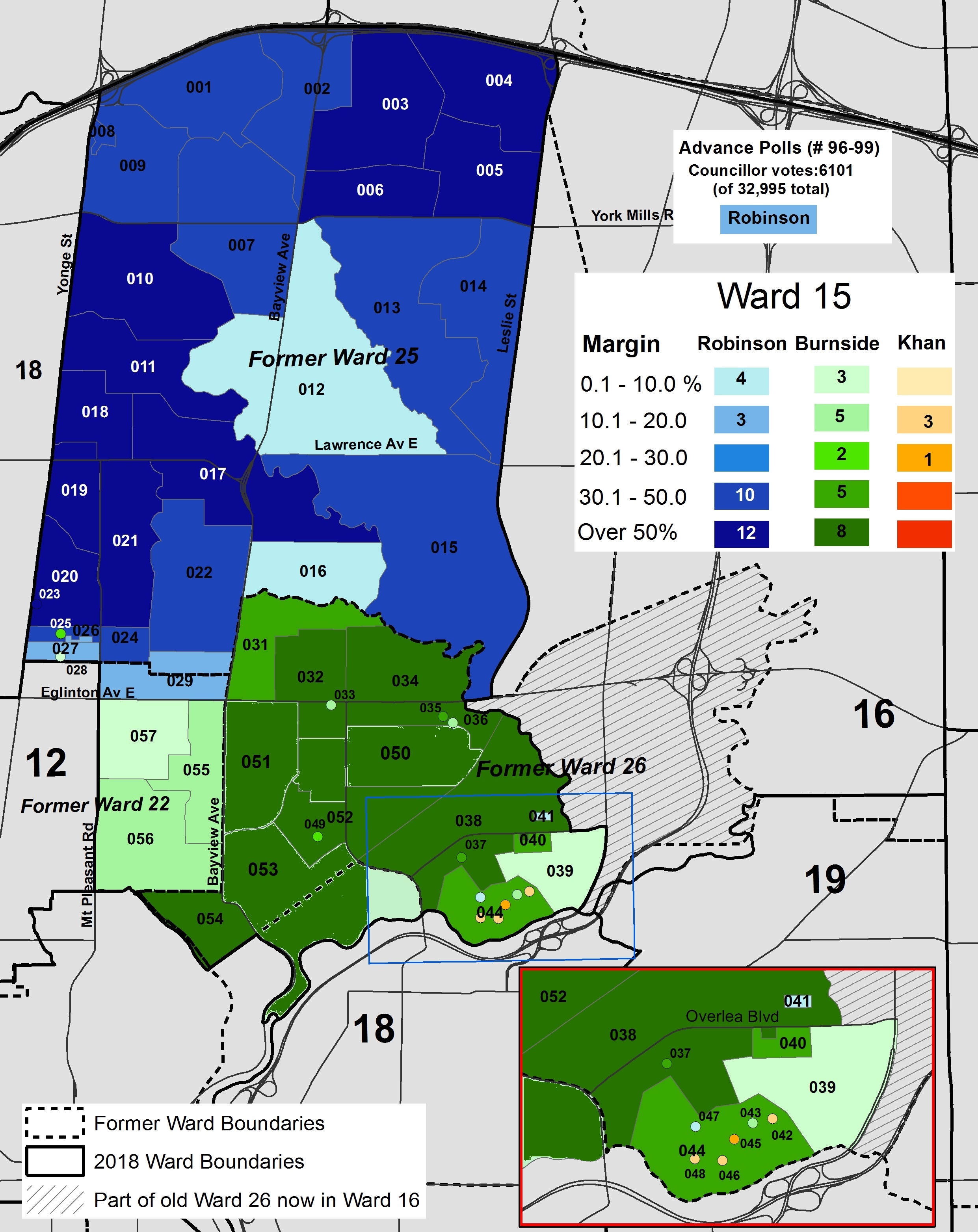
    Burnside placed first in former Ward 26, getting 68 percent of the vote there, and won all three polls in former Ward 22, though by a small margin over Robinson. In Thorncliffe Park, however, Tanweer Khan got over 30 percent of the vote and placed first in four polls. Khan, a local business owner, was an organizer against the updated provincial health and sex-ed curriculum. Khan also ran for the nomination for the provincial Progressive Conservatives PC nomination in Don Valley West, but lost. Khan only got 4.0 percent of the vote ward-wide, but it helped Robinson win.

    Robinson took 67 percent of the vote in her former ward. She won Ward 15 overall with 49.2 percent of the vote, to Burnside’s 43.8 percent. Though Robinson will not be part of the Tory’s executive committee this term, she was recently appointed Chair of the Toronto Transit Commission.

    What bothers me mostly is not the result, but of the geographic isolation of Thorncliffe Park under the new 25 ward model. It is now a geographically isolated corner of a mostly affluent ward. I fear it, and neighbourhoods like it, will be ignored under a much smaller council.

    2018 Election - W15.jpgPoll results in Ward 15

    Ward 16

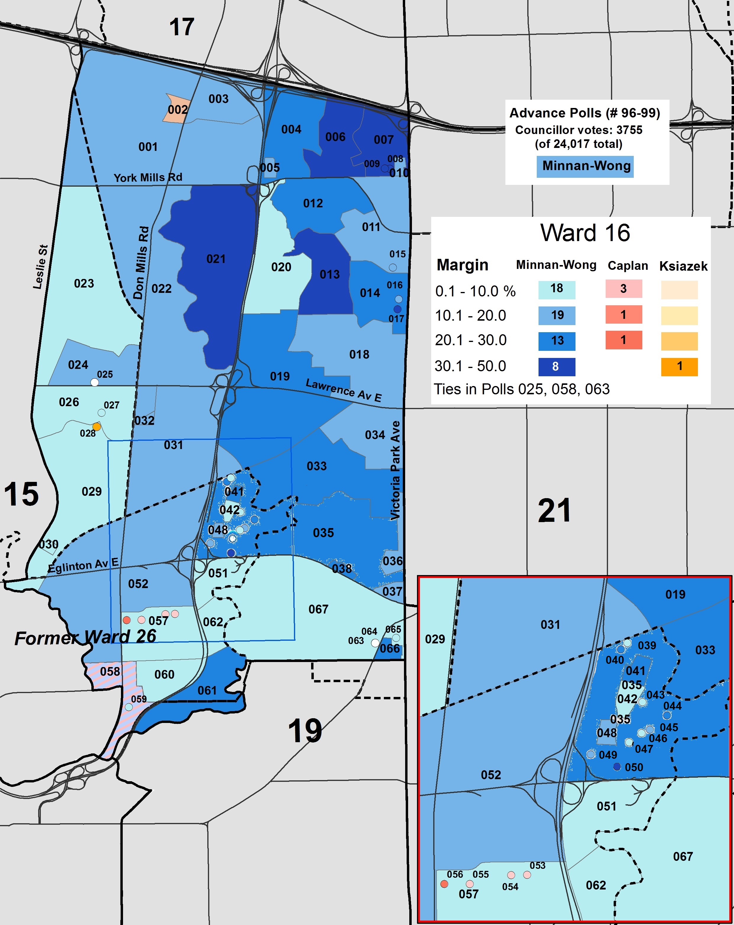
    David Caplan was no match for Denzil Minnan-Wong. Caplan was able to get over 30 percent of the vote, but he placed first in just five polls. The combination of Minnan-Wong’s name recognition and incumbency, Caplan’s long absence from provincial politics and his involvement in the eHealth boondoggle (he resigned as Minister of Health in 2009 and did not run in the 2011 provincial election) probably also played a part as well. Caplan did best in Flemingdon Park, a low-income neighbourhood with a large immigrant population that was previously part of Ward 26.

    Self-described “pragmatist” Stephen Ksiazek, a local business owner who sits on the Don Mills Residents Association, placed third with 7.1 percent of the vote, coming first in one poll.

    Minnan-Wong will serve a second term as Tory’s primary deputy mayor, and will once again set an agenda of low taxes and austerity at City Hall.

    2018 Election - W16.jpgWard 16 poll results


    Ward 15 – Don Valley West
    Candidate Votes Percent
    Jon Burnside 14440 43.8
    Tanweer Khan 1309 4.0
    Minh Le 404 1.2
    Jaye Robinson 16219 49.2
    Nikola Streker 583 1.7


    Ward 16 – Don Valley East
    Candidate Votes Percent
    Aria Alavi 582 2.4
    David Caplan 7277 30.3
    Diane Gadoutsis 569 2.4
    Stephen Ksiazek 1698 7.1
    Pushpalatha Mathanalingam 888 3.7
    Denzil Minnan-Wong 11128 46.3
    Dimitre Popov 1104 4.6
    Michael Woulfe 771 3.2