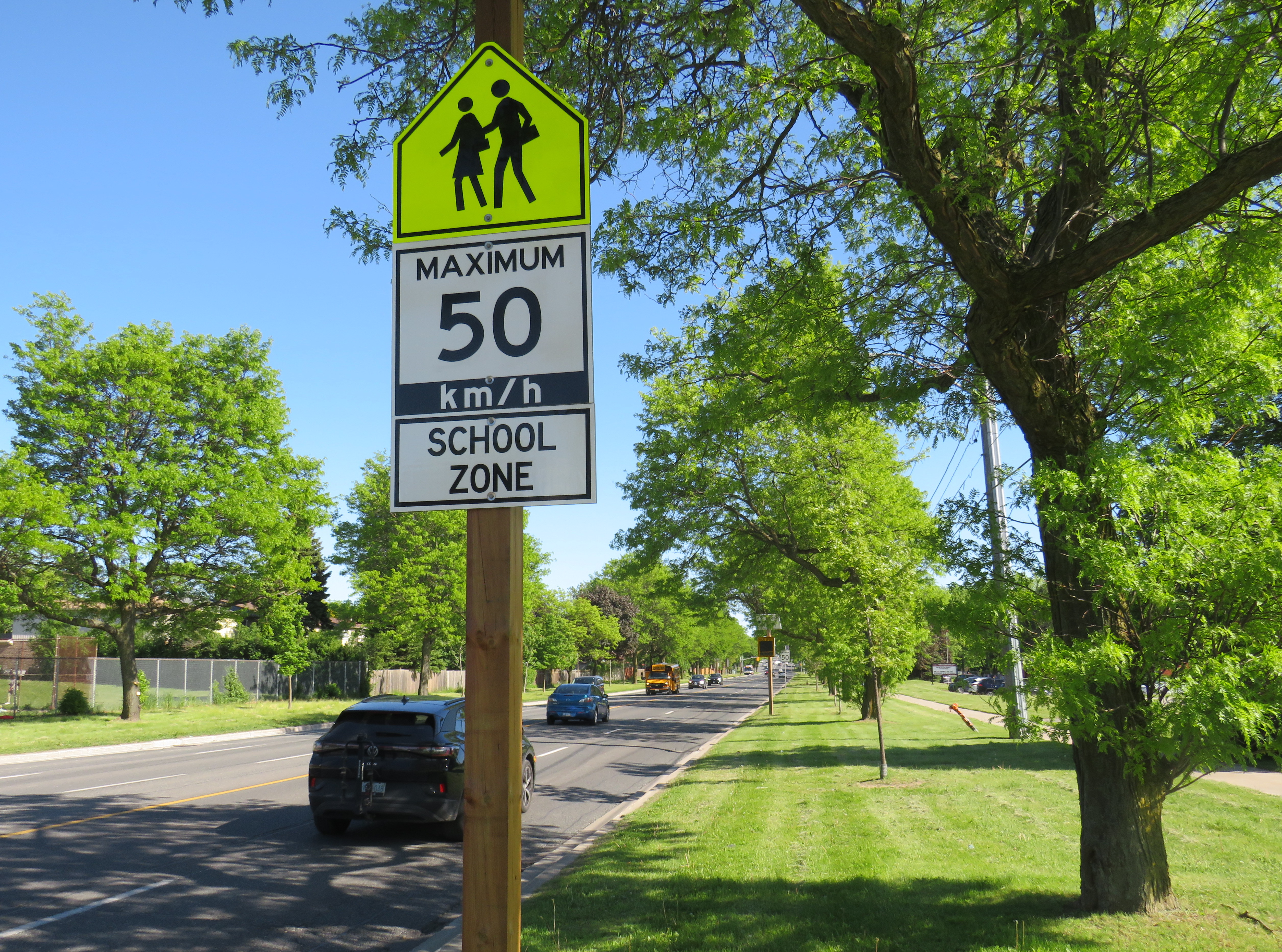
A gigantic school zone speed limit sign on McCowan Road in Scarborough
Months after Doug Ford’s provincial government banned the use of municipal speed enforcement cameras, calling it a “cash grab,” new supersized school speed zone signs are going up across the province. The first ones I encountered are on McCowan Road in Scarborough, near my spouse’s family home.
The signs, placed near St. Ignatius of Loyola Catholic School south of Finch Avenue, are gigantic: nearly 2.5 metres tall, mounted over three metres above the ground, affixed to an extra large wooden pole as the new signs were too big for the standard metal poles used for that purpose. The province delivered 80 signs to the City of Toronto, but with four signs per school zone (two mounted in each direction including advance warning signs), that meant only 20 schools would get these new totems.
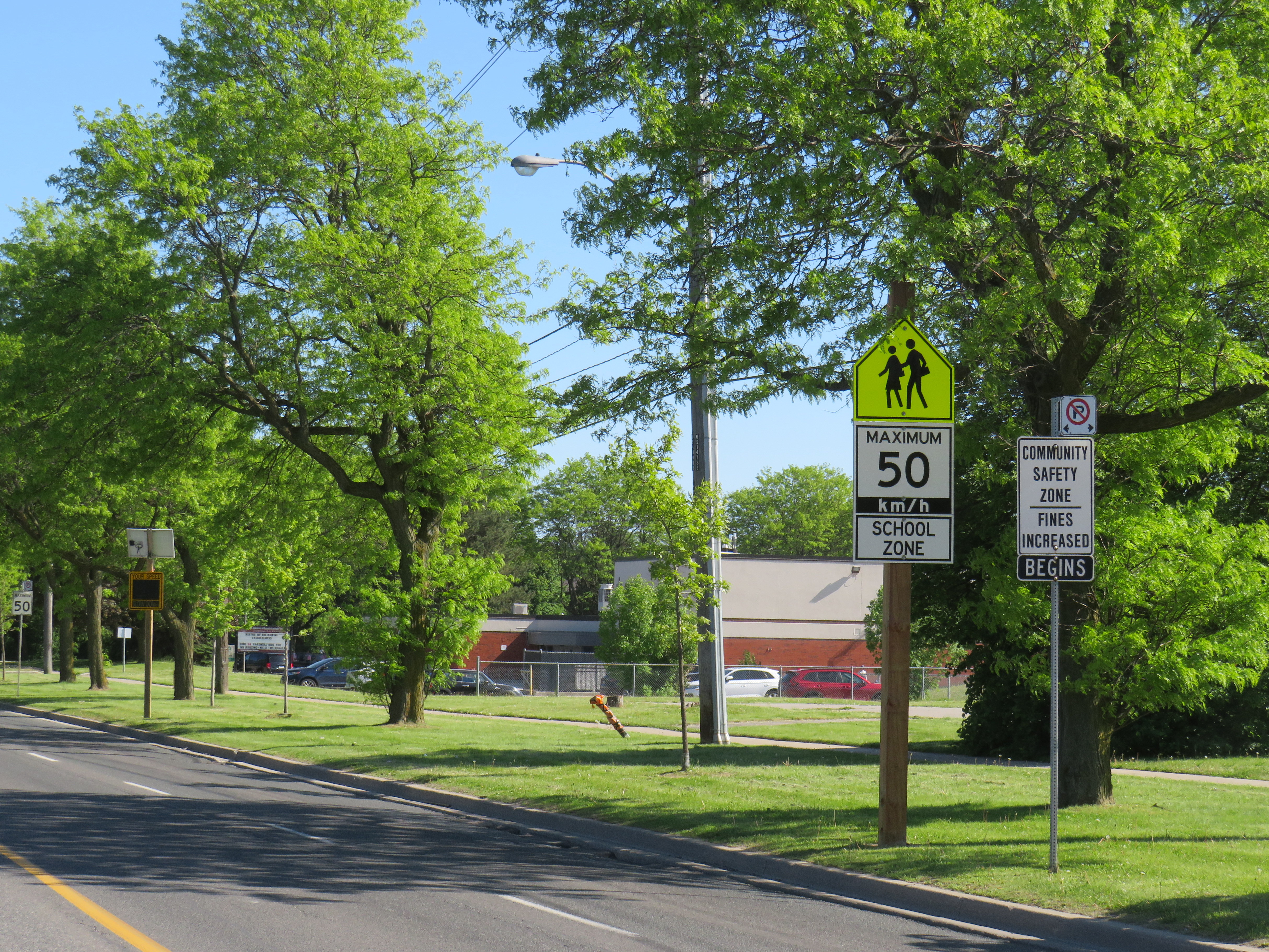
The new supersized school zone sign next to an older “community safety zone” sign, affixed to a standard metal sign pole
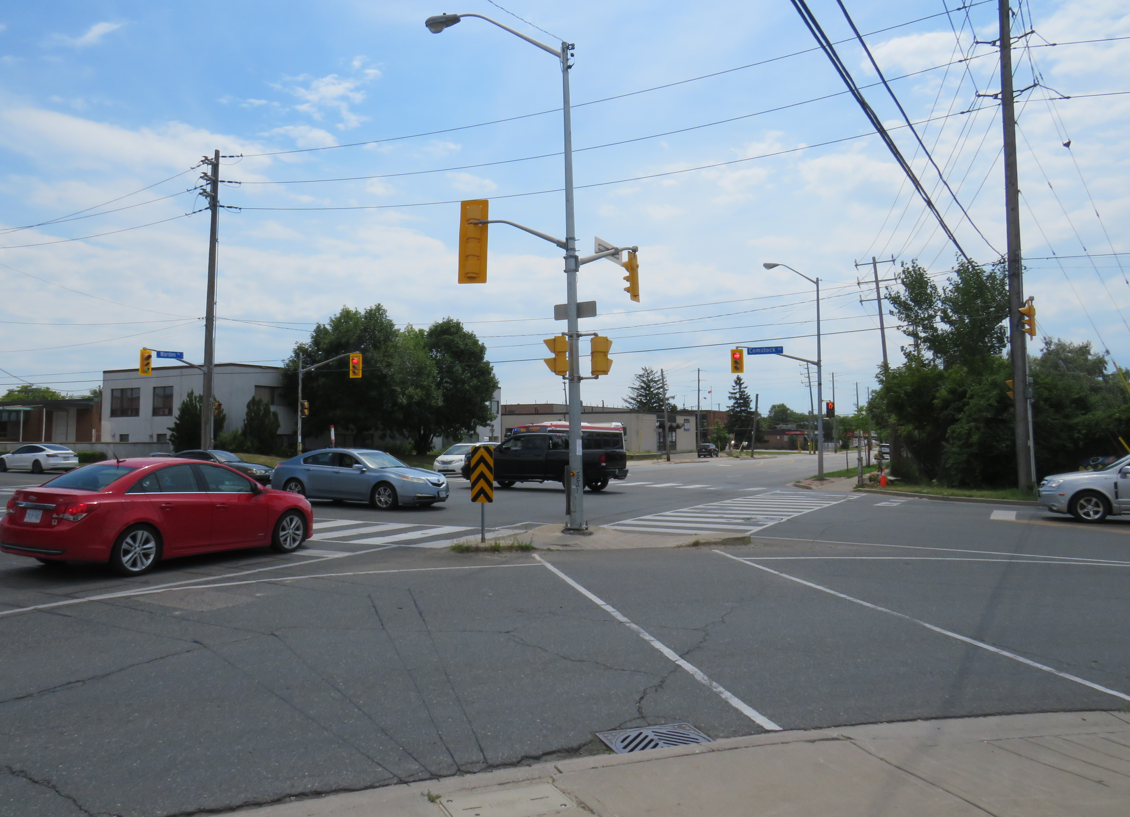
Before the pro-driver legislation was enacted on November 14, 2025, there was a speed camera placed on McCowan Road adjacent to the elementary school, one of 150 located in the City of Toronto. Under provincial law, municipal speed cameras were only allowed to be installed in specific designated safety zones, namely roadways adjacent to schools, parks, or seniors’ residences, and had to be accompanied with advisory signage.
Between April 2024, when the camera was activated, and July 2025, when the camera was destroyed (one of many vandalized that year), over 19,000 speeding motorists were captured by the photo camera travelling at least 11 km/h over the posted speed limit. This was despite the existing maximum speed, school zone, community safety zone, and municipal speed camera signs on this stretch of road.
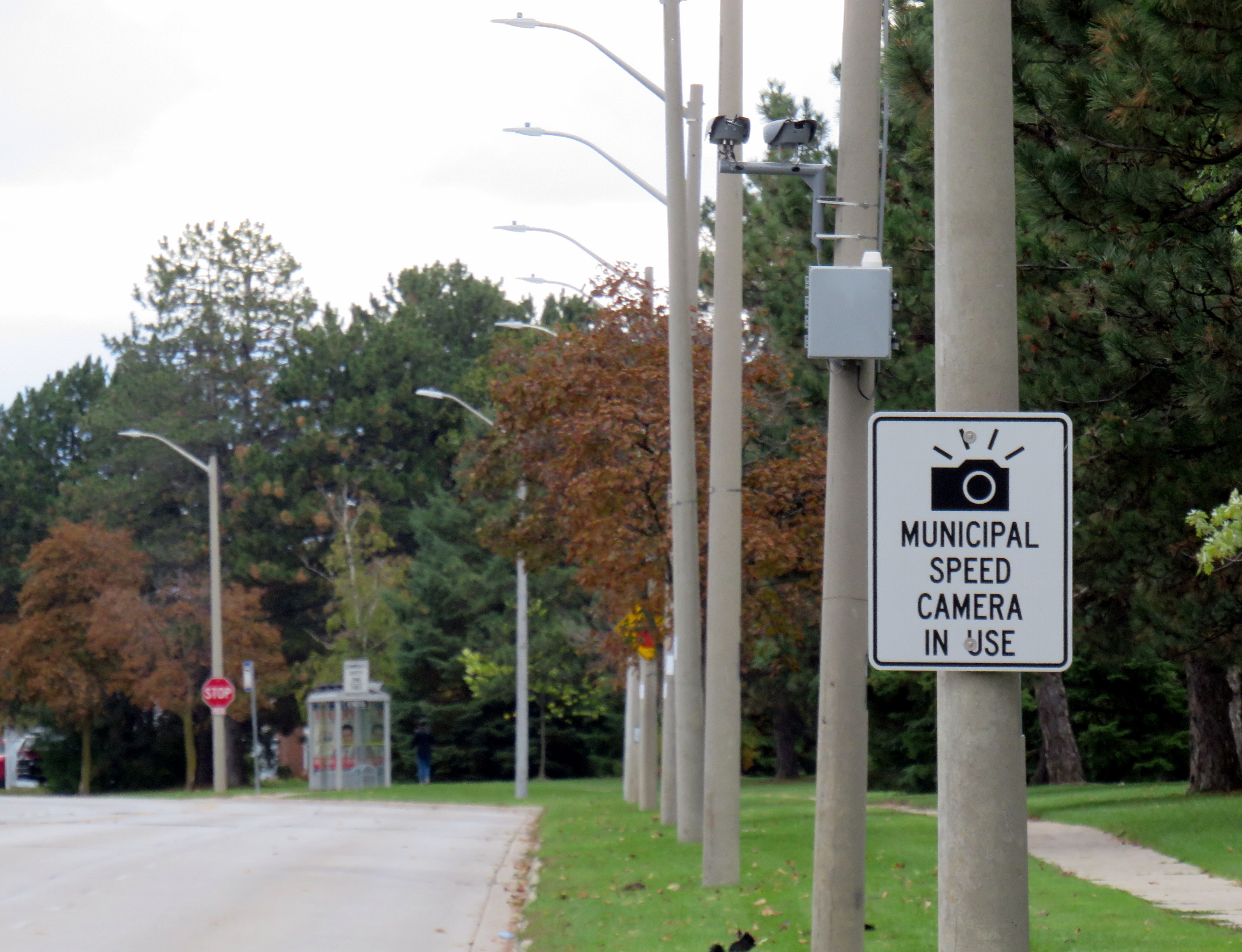
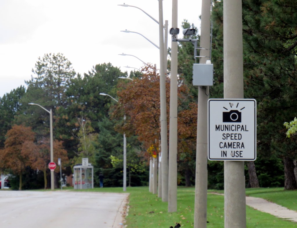
Sign warning of a municipal speed camera in Brampton in October 2025
Despite the high number of infractions, the cameras were doing their job; a job that the Toronto Police isn’t motivated — or able — to do. As seasoned municipal watcher Matt Elliot points out, for period between January 1, 2025 through November 14, 2025 (when camera enforcement was forced to end), 628,165 speeding tickets were issued through the automated speed enforcement program. Toronto Police’s “Vision Zero” traffic unit issued just 14,500 tickets.
New city report notes the Toronto Police Vision Zero Enforcement Team handed out about 14,500 speeding tickets in 2025. Might sound like a lot, but well, compare and contrast.
Despite all those tickets issued, the cameras were especially effective at reducing speeding in school zones. A 2025 Toronto Metropolitan University/SickKids Hospital study found that speed enforcement cameras reduced speeding by 45 per cent and reduced speeds by most drivers by more than 10 km/h.
Active police enforcement remains a valuable tool because officers can lay charges that automatic speed cameras can not catch, including distracted, impaired, and dangerous driving. But policing has a dark history of racial profiling and has a pro-motorist “windshield bias,” while speed enforcement and red light cameras do not discriminate.
Furthermore, North American roads are designed for excessive speed and not for the safety of vulnerable road users. We rely on signs to advise motorists of how we expect them to drive, rather than road design that requires attentive and slower driving. Speed cameras were a useful stopgap that worked a lot better than signage.
So, the new supersized signs going up are not a solution to unsafe driving: they are just another mere indication that children, seniors, and all pedestrians and cyclists don’t really matter, especially to politicians like Doug Ford.
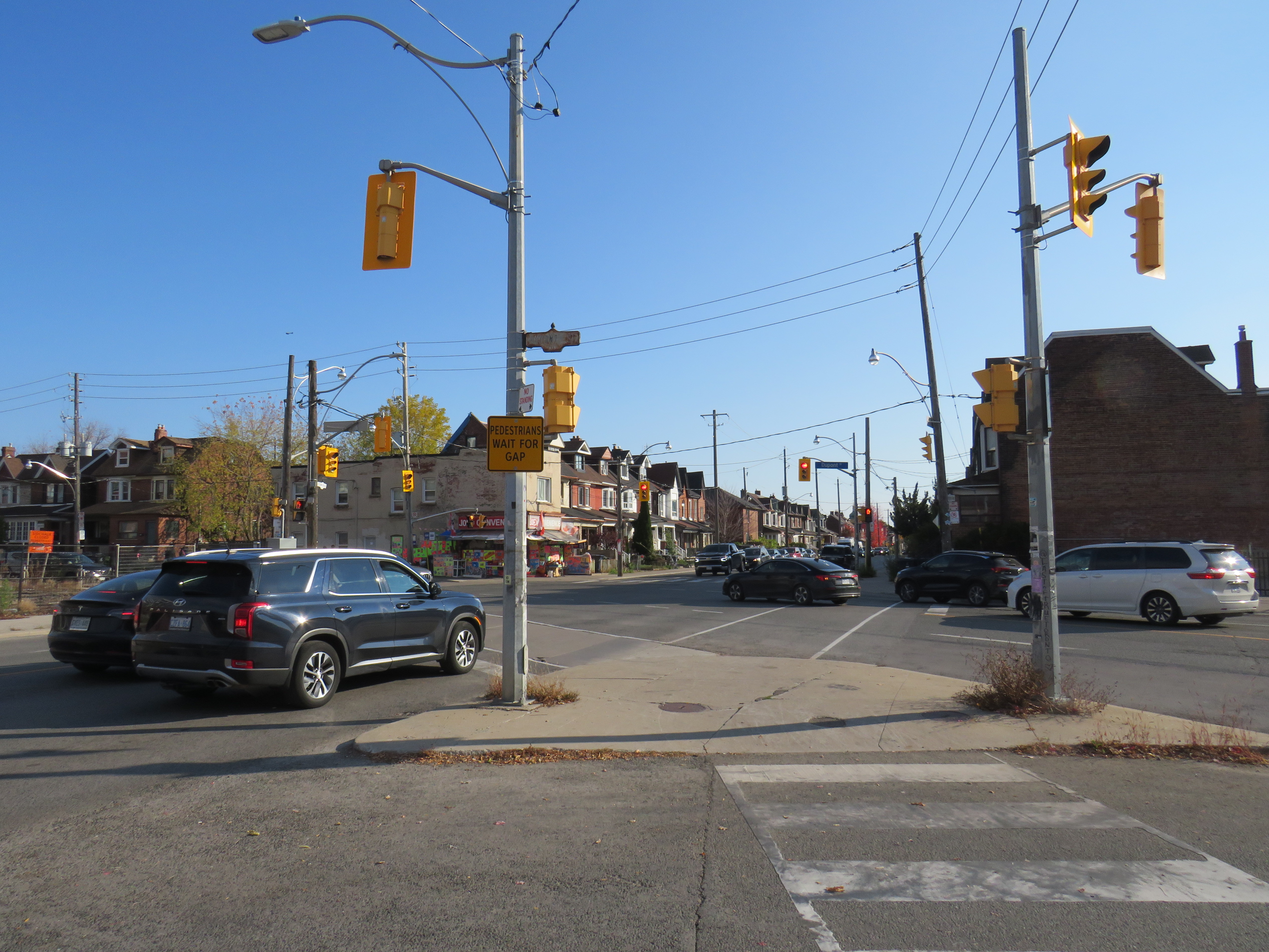
Slip lane with small pedestrian refuge island at Dupont Street and Ossington Avenue
There are many ways that road design acts to facilitate vehicle drivers yet impede pedestrian mobility. There’s the beg button (traffic engineers prefer the term “pedestrian call button”) that ensures maximum traffic throughput unless a pesky pedestrian or cyclist decides they want to cross the road too when the light turns green. There’s the two-phase pedestrian crossing that guarantees a long wait to cross a wide traffic artery on foot. Wide curb radii at intersections allow drivers to easily turn, yet they intrude into the crosswalk space. And there’s the slip lane, also known as a channelized right turn.
Most slip lanes are designed to allow right-turning motor vehicles to bypass an intersection. Where an intersection may be controlled by a traffic signal or a stop sign, typically, a slip lane is only controlled by a yield sign, reminding motorists to give way to pedestrians crossing and/or oncoming traffic on the roadway being turned into. They are typically built for higher speeds, with turn radii even greater than those afforded by generous curved curbs at many urban intersections. The space left over in the triangular bit of concrete is where pedestrians must wait to cross the main roadways.
Occasionally, slip lanes are used to discourage or prevent certain turning movements. At shopping plaza entrances, for example, slip lanes are used to prevent left turns into or out of the driveway. They may also be used at one-way streets for the same purpose.
Thankfully, slip lanes are not the standard in the City of Toronto. At least forty slip lanes were removed between 2005 and 2025, including Front Street eastbound at Yonge, from Coxwell Avenue southbound at Dundas Street East, and a half dozen on Danforth Road in Scarborough. In the downtown core, there are only three remaining examples that cross pedestrian pathways: from southbound Bay Street to Queen Street West, from eastbound Bloor Street to Parliament Street, and from Mount Pleasant Road to Jarvis Street. There are several other intersections in the city centre that allow some right-turning vehicles to bypass the main intersection, such as Adelaide and Richmond Streets at Jarvis, University at Front, or Parliament at Gerrard, but these still require a full turn at their start or end point, mitigating their danger.
A map of slip lanes in Toronto, and those removed in the last twenty years, is below. This work was assisted my followers on BlueSky for their additions and corrections, and I appreciate their help.
By removing slip lanes, pedestrians and cyclists are better protected, and there can often be new space for seating, public art, or even plant life.
Slip lanes are far more common in suburban neighbourhoods outside the City of Toronto. In Brampton and Mississauga, slip lanes are common on regional roads such as Steeles Avenue, Dixie Road, or Erin Mills Parkway. These six-lane roads are designated as goods movement corridors, and are designed for heavy traffic, including tractor-trailers. Even in Peel, though, slip lanes are being rethought. Several were removed on Bovaird Drive in Brampton two years ago (replaced by signalized crossrides), while others are being repainted to empathize the pedestrian crossing and encourage slower movements. More signage tells motorists to stop for pedestrians.
Modified slip lane at Bovaird Drive and Main Street in Brampton. Further east, slip lanes were removed at three lower-traffic intersections and replaced by multi-use path crossings.
Though the City of Toronto has done some good work eliminating or modifying slip lanes in the name of traffic safety and an improved pedestrian realm, there are many more that still should be examined, such as the one at Ossington and Dupont, where, unusually, pedestrians are instructed to wait for a gap, rather than motorists instructed to yield. These “wait for gap” signs are found at the entrances and exits to expressways, such as the Gardiner Expressway or Highway 401. But these, too, can be changed. At the eastbound ramp to northbound Don Valley Parkway on the Prince Edward Viaduct, a free-flowing on-ramp was changed to a signalized right turn, improving safety and comfort for pedestrians and cyclists.
Crossing the Bay Street on-ramp to the eastbound Gardiner Expressway makes getting to the Waterfront more dangerous and uncomfortable than it should be
Hopefully, City of Toronto staff work to correct the situation at Dupont and Ossington (there’s no reason why pedestrians should be expected to yield to traffic in this revitalizing part of the city) and continue the work to make our streets safer for all.
If you like my work and you would like to help out with my webhosting costs (I just had to renew my ad-free WordPress subscription), consider buying me a coffee.Thank you!
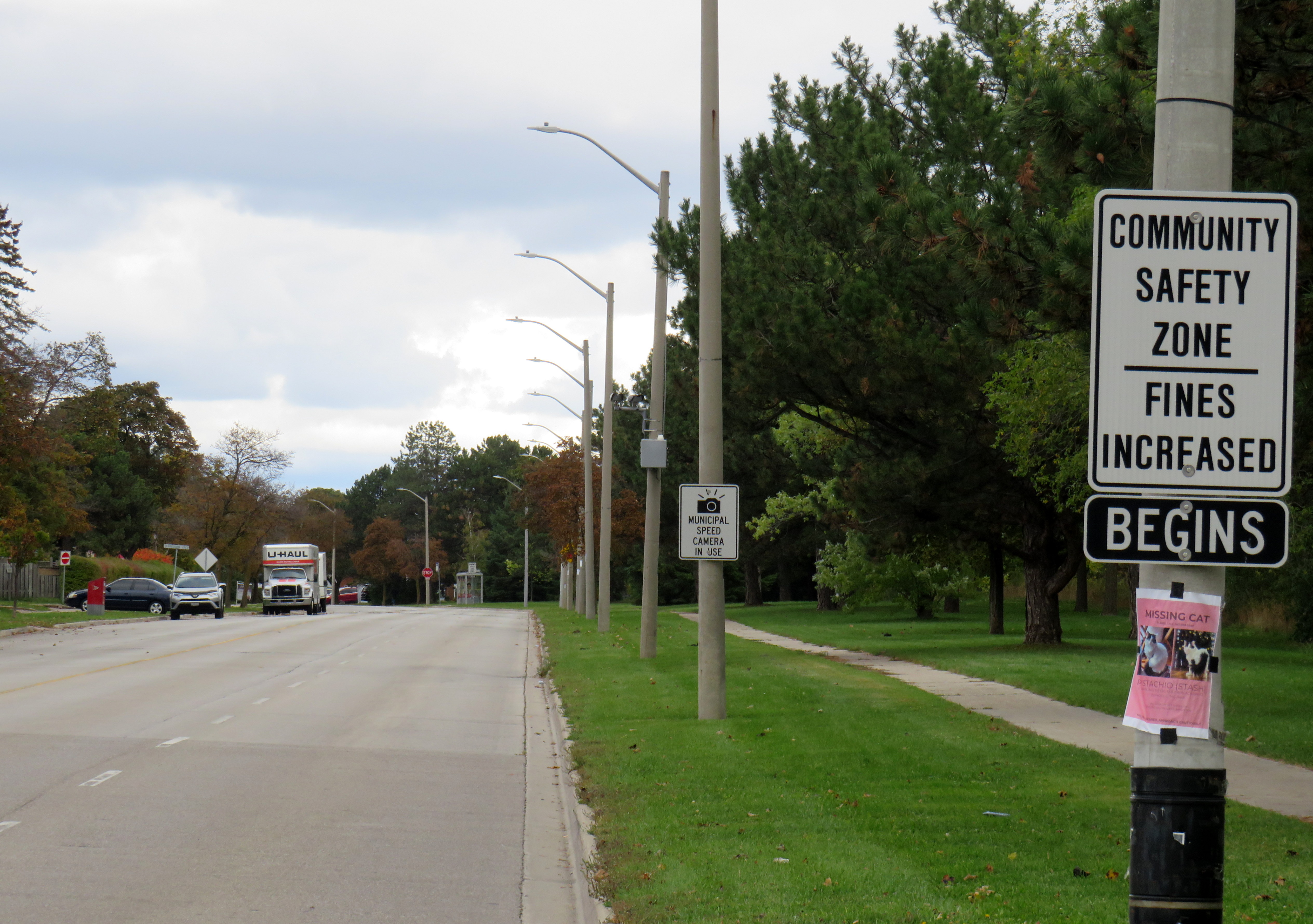
Dearbourne Boulevard, a four-lane collector street designated a community safety zone
Last week, while visiting Brampton, I came across one of the hundreds municipal speed enforcement cameras that Premier Doug Ford’s government wants to rip out across the province. The camera, on a four-lane collector street in Bramalea, is in a residential area, adjacent to several parks, including a pathway to a local public school, in an area designated a community safety zone. This is precisely the type of place that the government intended speed enforcement cameras would go when they were permitted under provincial legislation in 2019.
In a September 2025 government press release touting the move as “protecting taxpayers,” Ford, whose government was in power when these cameras were permitted, claimed that the program became “a cash grab;” supporting quotes included those from former Liberal leader and current Vaughan mayor Steven Del Duca, a representative of the province’s municipal police unions, and a spokesperson from the right-wing Canadian Taxpayers Federation.
If only there was a simple, effective way for taxpayers to avoid the so-called “cash grab.”
It was interesting who was not quoted in that press release, including doctors, educators, safety advocates, and even police brass. Ontario police chiefs support automated speed enforcement. It is also worth noting most municipalities support the cameras; Vaughan is one of only a few municipalities that recently rejected the road safety program; Del Duca was joined by just two other conservative-leaning mayors.
Of course, the arguments against the cameras, which in Toronto, were repeatedly vandalized or stolen, never held water. There were no tickets mailed out to drivers going just a few kilometres over the limit. Furthermore, speed enforcement was never a “cash grab” as the fines collected went to pay for the administration of the program, to “Vision Zero” works, such as the installation of speed cushions and improved pedestrian crossings, and to the province, which the collects the victim surcharges added to every Highway Traffic Act fine. The City of Brampton found that not only were the cameras effective in reducing speeds, they had the support of a majority of its residents.
Municipal speed camera
That said, while visiting Dearbourne Boulevard, I realized that speed enforcement cameras on their own are not effective in creating safer streets.
Dearbourne Boulevard serves one of the oldest parts of Bramalea, established in the early 1960s as a self-contained satellite town, where residents were expected to drive to most destinations. After amalgamation into the City of Brampton, traffic increased and more transit became available. Nearby, several newer high-rise apartment buildings were built, walking distance to Bramalea GO Station. A bus route, 16 Dearbourne, runs along the street, connecting the neighbourhood with several shopping plazas, the GO Station, and the transit hub adjacent to Bramalea City Centre.
Despite having low traffic and serving a residential area (an industrial area is just to the south, but it is inaccessible from Dearbourne), it is still a wide four lane street. The only traffic signal is at Bramalea Road; there are two all-way stops at Delamere Drive and Dorchester Road. At the east end of Dearbourne, the T-intersection with Balmoral Drive is controlled only be a stop sign, with two long and gentle right turn slip lanes. The speed limit is 50 km/h, and there are no speed cushions, curb extensions, or even painted buffers to indicated that drivers should go slower. In October 2022, a pedestrian was struck and seriously injured at one of the two all-way stop intersections; the driver fled the scene.
Though to its credit, the City of Brampton has been improving many suburban streets and roads to reduce speeds and promote walking and cycling. Charolais Drive, Vodden Street, Central Park Boulevard, and Vodden Road saw traffic lanes replaced by new cycling lanes, with little pushback from residents. Dearbourne Boulevard was also slated for improvements in 2021-2022, but that work was not yet started.
Central Park Boulevard, Howden Boulevard, and Vodden Street were among several four-lane collector roads tamed with new cycling infrastructure in the last five years, creating a new through east-west cycle route
Now, it might be too late. Not only will the speed camera be prohibited under a bill being rushed through the provincial legislature (going around the consultation process where concerned citizens, advocates, or safety experts could depute to MPPs), but another omnibus bill was just introduced, which if passed, would prohibit all Ontario municipalities from removing general traffic lanes to install cycling infrastructure, or even transit lanes and on-street patios.
Given the provincial government’s increasing hostility to anything that inconveniences drivers, be it road tolls, vehicle license renewal fees, automated speed enforcement, or bike lanes, it leaves municipalities fewer options to protect their most vulnerable road users and promote sustainable and healthy transport options. Though Doug Ford claims that alternatives like flashing lights and more signs would do the trick, they do not do much to deter aggressive and dangerous drivers, unlikely to get caught.
For streets like Dearbourne Boulevard, there are a few options. Lowering the speed limit to 40 km/h should be a first step. The redundant outer two lanes could be converted to parking-only spaces, with curb extensions and bollards at intersections. The slip lanes at Balmoral Drive should be ripped out.
Roads designed in the 1960s and 1970s for traffic that never really materialized need to be rethought, with or without Queen’s Park’s support.
Streetcars backed up eastbound at King and University, November 28, 2023
On Tuesday, November 28, the University of Toronto’s School of Cities released their report that looked at vehicle movement and traffic violations on the King Street Transit Priority Corridor. They found that there are, on average, 6,800 illegal turns and through movements at intersections on the corridor, and less than 0.3% of offenders are stopped by Toronto Police and ticketed. Traffic enforcement was heaviest between November 2017 (when the pilot began) and March 2020 (when the COVID-19 pandemic restrictions began). Enforcement has not caught up since then.
The U of T School of Cities has provided invaluable quantification of what many Torontonians have suspected for years: the King Street Transit Priority Corridor is broken, and that there is little being done to fix it.
The transit priority corridor, which runs between Bathurst Street in the west and Jarvis Street in the east, has restrictions on through vehicle movements, where motorists must turn right at most intersections. Until 10 PM daily, only TTC buses and streetcars, emergency vehicles, and bicyclists are exempt. After 10 PM, taxis may also continue through the corridor.
The pilot program launched on November 12, 2017. The initial pilot, in which signs were erected, Jersey barriers placed to restrict the curb lane, and TTC stops moved to the far side of most intersections, was intended to optimize permanent streetscaping improvements, streetcar stop placement and transit optimization, get motorists acquainted with the new rules (at first, only warnings were issued by police) and allow time for Toronto City Council to decide on whether the pilot should be made permanent. Council approved making the transit priority corridor permanent on April 16, 2019.
Though Toronto City Council voted to transform King Street permanently, no work has started on the streetscape or public realm to do so. Just like Union Station, temporary Jersey barriers remain in place. The relocated TTC streetcar stops are left at road level, without transit shelters or accessible curbs. Drivers routinely ignore restrictions, with only a 0.3% chance of getting a $85 or $110 ticket. Meanwhile streetcars get stuck and transit riders get nowhere. On Wednesday, November 8, a Toronto police officer decided to enforce congestion on King Street… by ticketing a streetcar operator stuck in the intersection at University Avenue.
A motorist, ignoring several signs, proceeds straight through on King Street eastbound at Spadina Avenue
The problem is not just limited to through movements on King Street, though. On Tuesday, November 28, I stood at the corner of King and Spadina between 4:00 PM and 4:20 PM. The backup of cars and trucks headed southbound towards the Gardiner Expressway extended into the south side crosswalk and into the eastbound lanes at times. Motorists are not permitted to enter an intersection on a green light if they cannot clear it before the light turns red; this causes gridlock. But on more than one occasion, streetcars and pedestrians were impeded by illegal intersection blocks.
At Spadina and King, a truck and three passenger vehicles block the south side crosswalk and prevent a streetcar from proceeding straight on a green light
After standing at King and Spadina, I walked over to King and University, where the Toronto Police charged a streetcar operator earlier this month. At 5 PM, eastbound streetcars were lining up between University and John Street, unable to proceed.
Traffic jammed at King Street eastbound at University Avenue
However, motorists were able to turn right and left from University Avenue to eastbound King, blocking the east side crosswalk to pedestrians and ensuring that no streetcar could continue across. I spoke to one operator, who told me that the day before, he was stuck there for a half hour before he could move across.
The University and King intersection, at 5:00 PM on Tuesday, November 28. Note the blocked crosswalk and the line of streetcars, all with their hazard lights blinking. Eventually, one streetcar operator decides they had enough, and occupies the intersection.
While there, I counted several motorists who passed to the right of the stopped streetcar, and instead of turning right as permitted, they went straight, only contributing to the blockage ahead.
Two eastbound cars pass a stopped streetcar on the right to join the congestion ahead
The problem downtown is exasperated by several road closures. Queen Street is closed between Bay and Victoria Streets for Ontario Line construction; this will last for at least five years. Adelaide Street, which is one-way eastbound is closed at York Street due to the delayed Adelaide Street diversion track installation that is supposed to allow Queen Streetcars to divert around the Ontario Line closure. York Street is also closed at Adelaide. There are several other lane closures on Bay, Yonge, and Richmond Streets and University Avenue for utility work.
Adelaide Street is likely to remain closed at York until early 2024
Yet, one would hope that something was done to allow transit riders to get through the downtown core, especially as the city has been aware of the severe congestion for weeks at this point. The city needs to move ahead on permanent streetscape changes to further discourage through traffic on King Street by closing the curb lanes at the far side of each intersection.
It is also clear that the Toronto Police are not too interested in ticketing motorists on King Street. Even if they were, it wouldn’t be enough, as it takes 10-15 minutes to stop and ticket a driver; automatic ticketing, similar to red light cameras, would be more effective, though traffic officers can still be strategically deployed at congestion hotspots.
It’s beyond time for this city to take transit seriously again. King Street would be a great place to start.
Curb lanes closed for condominium construction have defeated the purpose of Jarvis Street’s fifth reversible lane
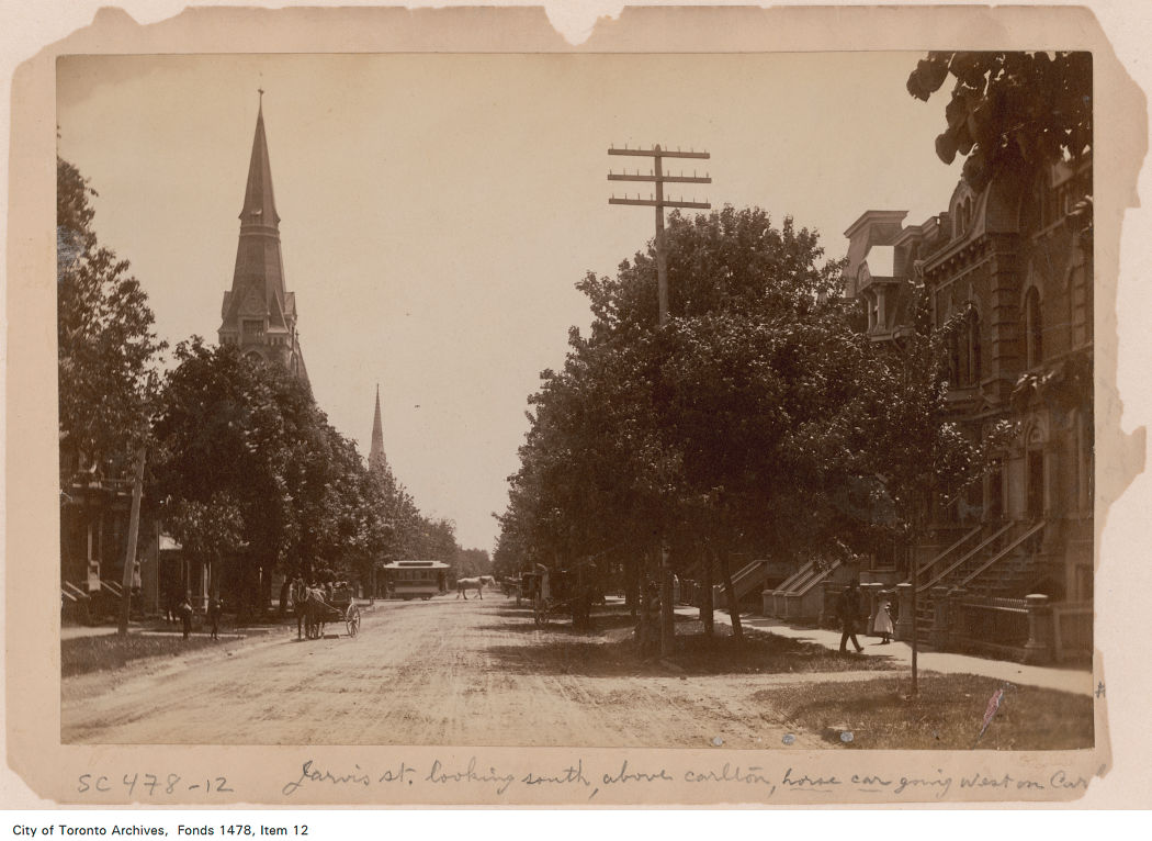
Over a century ago, Jarvis Street was Toronto’s most fashionable address, and home to prominent families including the Masseys, who made their wealth from the farm equipment industry, and whose names live on through Massey Hall, Hart House, the Fred Victor Mission, and Massey College. The wide boulevards allowed for lush street trees to flourish, and without streetcars, there was no need for a wide roadway, despite the generous right-of-way.
Jarvis Street looking south towards Carlton Street in the 1880s. City of Toronto Archives: Fonds 1478, Item 12.
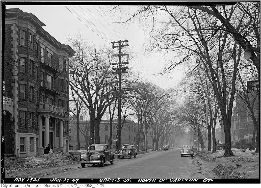
By the 1920s, though, Jarvis was no longer fashionable, with Forest Hill, North Rosedale, and Moore Park taking its place. Many of the old mansions fell into disrepair or were converted into apartments or businesses. The street became lined with low-rise apartment buildings, budget hotels, and missions to the poor and unhoused. After the Second World War, the city government decided to extend Mount Pleasant Road south of St. Clair Avenue to Bloor and Jarvis Streets and widen Jarvis Street to accommodate the increased traffic. Along with building the Dundas Street East extension, widening Dufferin Street, and pushing through Eastern Avenue, the City of Toronto was bending to the whims of the automobile, several years before the creation of Metropolitan Toronto in 1954.
Jarvis Street looking north from Carlton Street, January 1947, just before the street trees were removed and the street widened. City of Toronto Archives, Series 372, Item 1725.
By the 1960s, Jarvis Street became the preferred address of federal institutions such as the Moss Park Armoury, the regional Unemployment Insurance offices at Dundas Street, and the brutalist Ontario headquarters for the RCMP. The provincial government expanded the old Juvenile Court with a new modernist building, and Simpsons-Sears, the predecessor of Sears Canada, built a new imposing office building at 222 Jarvis, adjacent to the Simpsons warehouse on Mutual Street.
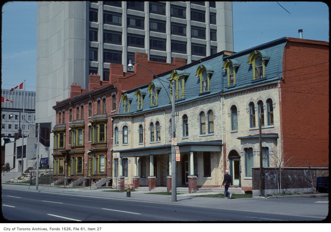
Victorian rowhouses stand next to the brutalist RCMP building on Jarvis Street, north of Shuter Street in 1979. The RCMP building later became the home of the Grand Hotel, which installed a glass veneer over the imposing west façade. The Unemployment Insurance office, at the corner of Dundas Street appears in the far left. Both the RCMP/Grand Hotel and the UIC (later Hilton Garden Inn) building were recently demolished, but the rowhouses still stand. Photo by Harvey R. Naylor. City of Toronto Archives, Fonds 1526, File 61, Item 27.
Jarvis Street was also the home of several of the CBC’s scattered radio and television studio spaces until they were consolidated at the CBC Broadcasting Centre on Front Street, and it was also the location of the first Four Seasons Hotel, when it started out as a chic motor hotel.
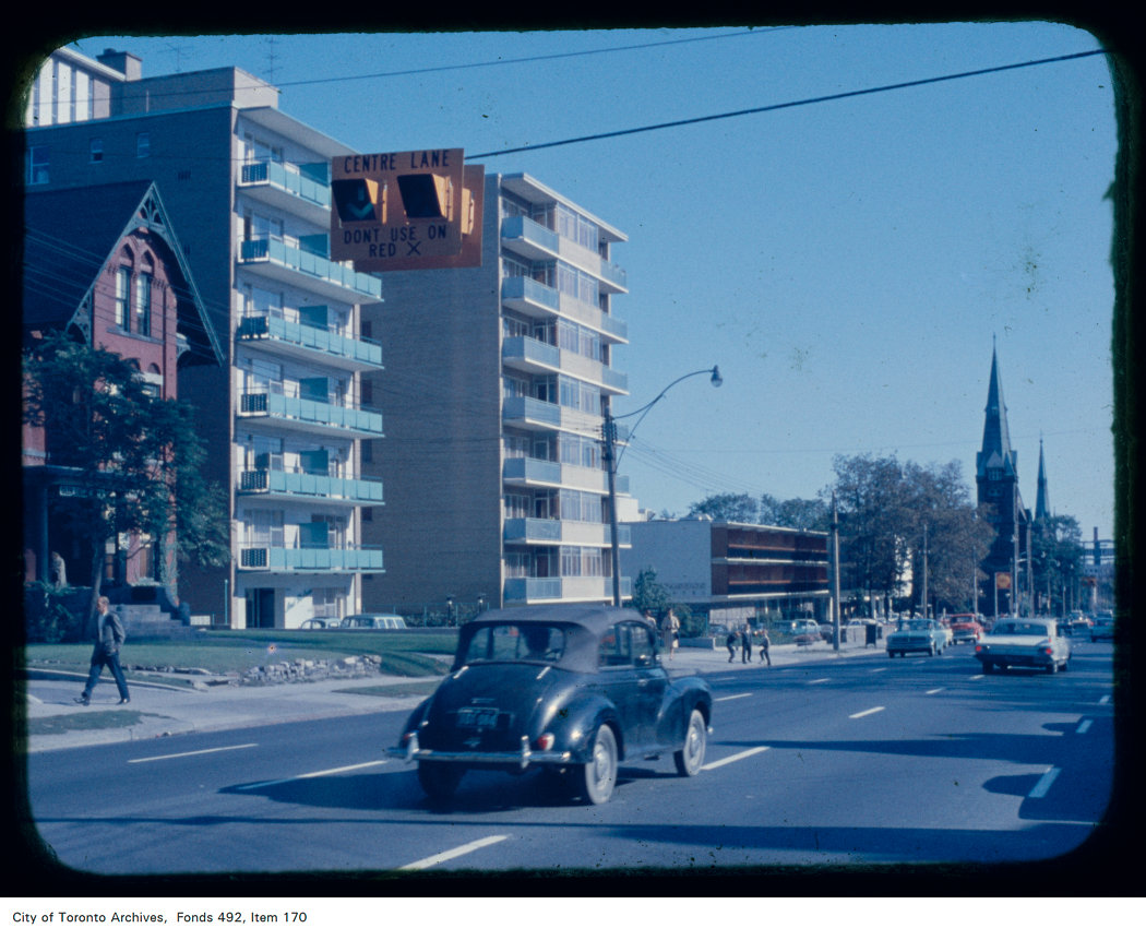
Jarvis Street looking south from north of Carlton Street; the Four Seasons Motor Hotel at 415 Jarvis Street and St. Andrew’s Lutheran Church are visible in the background. Note the centre lane indicator above. Creator: Skinner, Dorothea Skinner. City of Toronto Archives Fonds 492, Item 170.
By the early 1960s, Jarvis Street was reconfigured further to include a new reversible centre lane between Queen Street and Mount Pleasant Road at Charles Street. Then, as now, the centre lane was designated for southbound traffic, except during weekday afternoon rush hour, when the flow is reversed. Parking is prohibited at all times on the east side of the street, while on the west side, street parking is permitted except during the morning and afternoon peak periods. This, at least in theory, allows for two lanes of unobstructed traffic in both directions at all times, and in the rush hours, three lanes of peak-direction traffic. This, of course, depended on strict enforcement of parking and stopping prohibitions, and the lack of construction or other obstructions.
As Jarvis Street rebounded and new residential development and commercial development began to line the street between the mid-1980s and the present day, the five-lane traffic arterial layout became less suitable. In 2009, City of Toronto staff recommended, with extensive public input, that it was desirable to remove the reversible centre lane, narrow the roadway, and widen the sidewalk on the east side of the street to improve the public realm and address the needs of the thousands of new residents who were moving into the east end of Downtown Toronto. The additional space would have allowed for tree planters and wayfinding signage that would highlight the street’s history. Studies conducted by city staff found that there was no need for the fifth lane to provide adequate traffic movement along the street.
Cyclists, however, were unhappy that the road redesign did not include cycling lanes and they were able to convince council to alter its plans. As a result, in 2010, the road was not reconstructed, but the reversible lane was removed, with new painted cycle lanes on both sides of the street.
When Toronto elected Rob Ford as mayor that October, he promised an end to “the war on the car,” even inviting now-disgraced hockey commentator Don Cherry to give the inaugural speech, which turned out to be a controversial rant against “pinko cyclists” and “left wing kooks.” In 2011, with the support of suburban councillors, Rob Ford reversed the decision to install bike lanes on Jarvis Street (along with Pharmacy Avenue and Birchmount Road in Scarborough), and the reversible lane was re-installed.
Ironically, the demand by cyclists for bike lanes made it easy to restore the auto-oriented configuration, while widened sidewalks would have been much more difficult to remove.
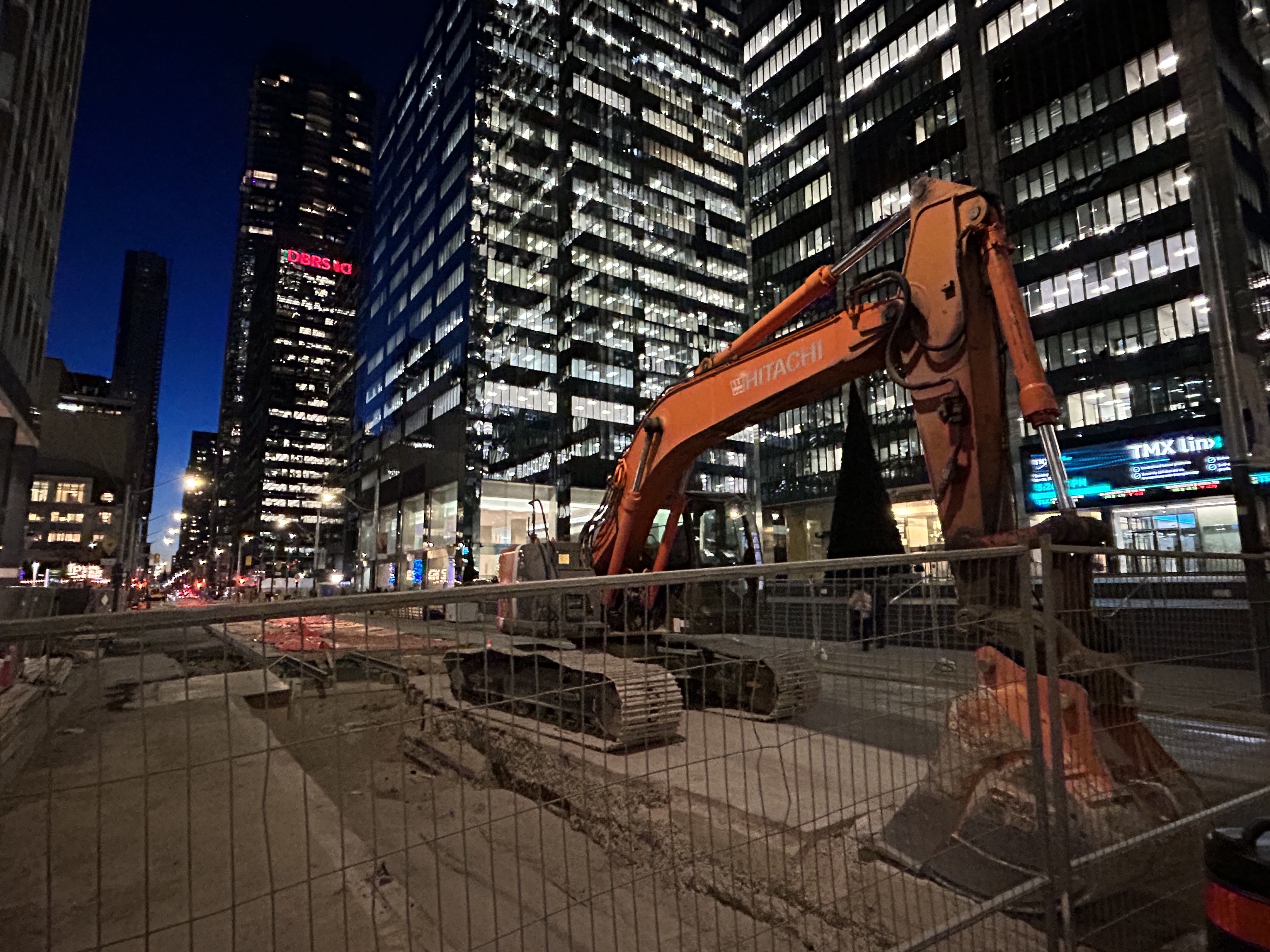
Between Dundas and Gerrard Street, the lanes shift to accommodate a lane closure for a new condominium tower on the east side of Jarvis Street.
With much needed watermain and road reconstruction in the last few years, the traffic advantage provided by the reversible lane was negated because of the construction barriers. Several condominium towers being constructed along the street, at Carlton, Gerrard, and Shuter Streets, have further affected the ability of that fifth lane to move motorists quickly, effectively, or safely. Between Dundas and Gerrard Streets, the lanes temporarily shift for a long-term lane closure on the east side, just south of Gerrard. This lane shift adds additional confusion to an already confusing road layout.
Looking north to Shuter Street, with the curb lane temporarily marked for right turns only.
At Shuter Street, the construction of the Hyatt Place hotel and condominium apartment development has seen the northbound curb lane closed for several years. Approaching Shuter, the curb lane is marked as a right-turn lane, but it is used as an illegal bypass of traffic waiting at the light or turning left onto Shuter towards St. Michael’s Hospital and the Eaton Centre. This, combined with the hidden sightlines caused by the construction hoarding on the northeast corner, makes it especially dangerous for southbound motorists as well as pedestrians and cyclists crossing at this point. Beyond the construction hoarding, the right lane is used for construction crew parking, as well as staging for vehicles such as cement trucks.
Looking down towards the Hyatt Place development, showing the obstructed northbound curb lane, as well as a grey SUV crossing into the centre lane, which was reserved for opposing traffic when this photo was taken.
The long-term closure of lanes on Jarvis Street should make it clear to city officials that the outdated and unsafe middle lane is of no practical use, and it finally has got to go.
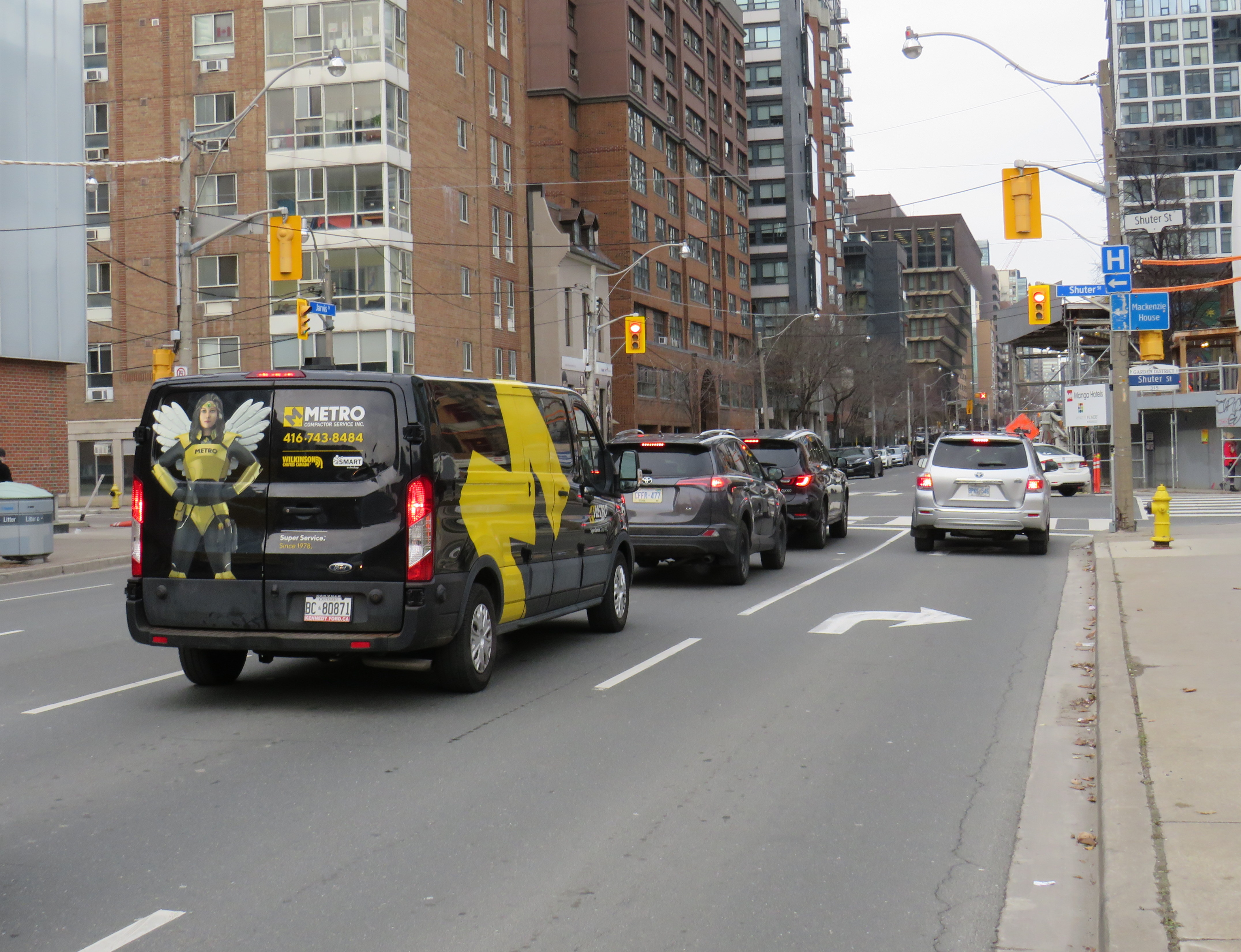
At Jarvis and Shuter Streets, the northbound right turn lane is used by impatient motorists, including a City of Toronto garbage truck, a taxi cab, and the driver of a speeding Lincoln Navigator.
Collisions are common on Jarvis Street because of the reversible centre lane — which exists nowhere else in Toronto, and in only a few places elsewhere in Canada — because of driver confusion, impatience, negligence and incompetence. As Jarvis Street becomes home to thousands of more residents in the next few years, is beyond time that the street becomes safer and more attractive to live, work, and enjoy life on.
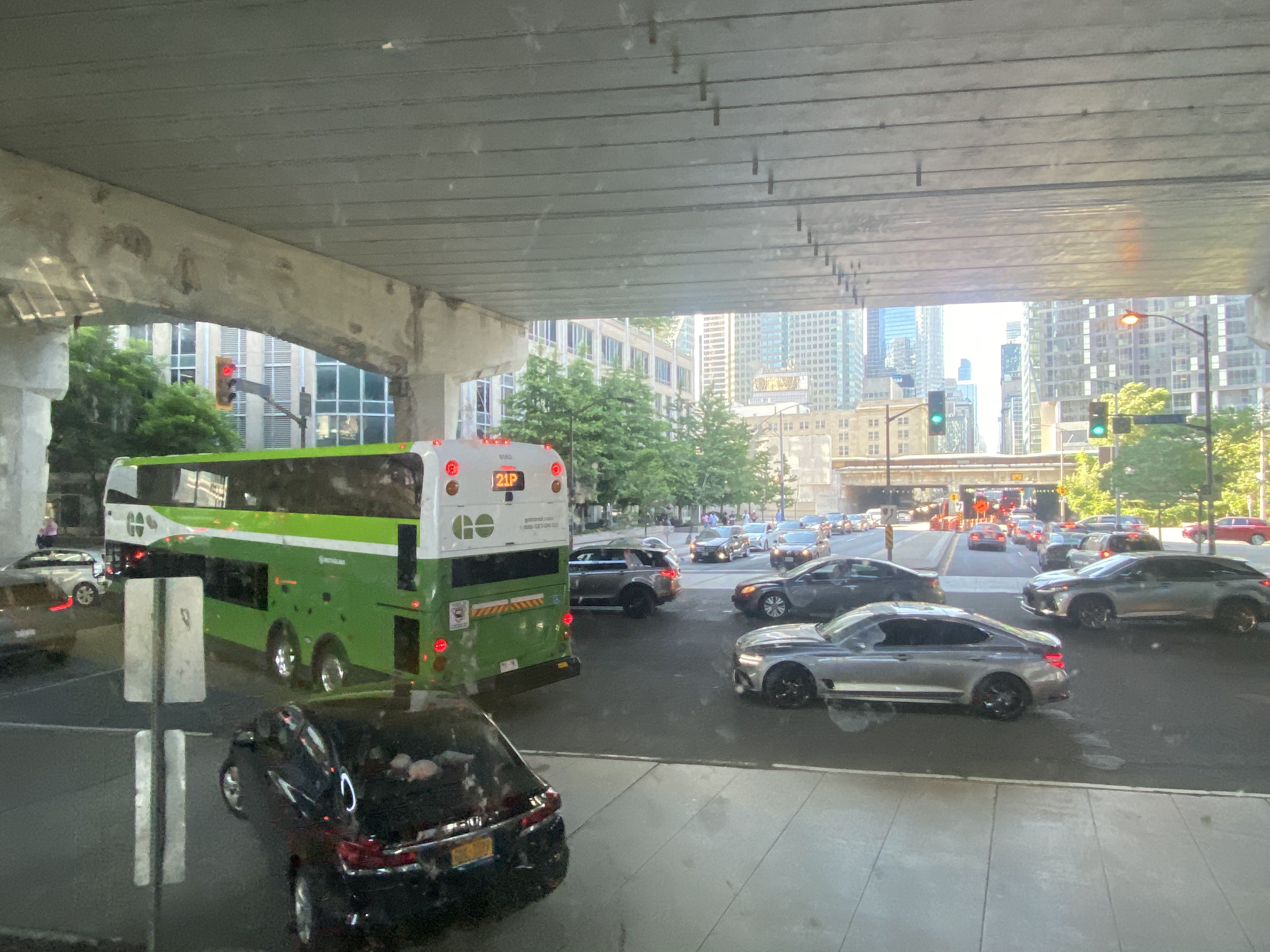
GO Transit buses stuck in Downtown Toronto gridlock in July, 2022
While travelling through the Northeastern United States this spring and summer, I found myself feeling lucky to be living in Toronto. Though the New York City Subway and the PATH trains between New Jersey and Manhattan were operating pretty much as I remember them, in other big cities, the mass transit systems were in rough shape. In Washington, underfunding and incompetence led to the long-term withdrawal of over half of its Metro cars. During our visit in April, we were treated to long waits and crowded trains, though at least the system was clean. When we visited Philadelphia in late June, it was clear that the Southeastern Pennsylvania Transit Authority (SEPTA) had given up: poor communications, lengthy waits, unsafe subway stations, and general apathy among staff and passengers made my spouse and I resort to driving on our last day there.
In Toronto, at least, the subway was still running frequently (with only minor service cuts due to the pandemic), the buses and streetcars as (un)reliable as ever, and despite more anti-social behaviour on some of its surface routes, I almost never felt afraid for my well-being when riding the Rocket, compared to my experience in Philly. GO Transit responded to the pandemic very well. Though it was forced to suspend many of its train and bus trips due to a sudden plunge in ridership, it maintained a basic service level on nearly all of its routes, slowly restoring certain services in 2021 as ridership slowly rebounded. Some corridors, like the Kitchener Line, had more service in the early Fall of 2021 than it did prior to the pandemic. As Metrolinx continued planning and construction of major transit projects like GO Expansion, the Ontario Line, and several LRT corridors, the future looked bright. In Spring 2022, GO Transit introduced a special weekend day pass for $10 per day or $15 per weekend, to help grow ridership.
Unfortunately by late June 2022, GO began to fall apart.
On Saturday, my spouse and I decided to take advantage of the GO Transit weekend day pass and take the train to Hamilton for a short excursion. We did some shopping on James Street North in Downtown Hamilton and on Ottawa Street in the city’s east end, where there’s a great cluster of fabric, decor, and antique shops, as well as cafes and restaurants.
The new weekend passes, which cost $10 for one day and $15 for two days, have been a major contributor to GO Transit’s ridership recovery. Though weekend ridership has recovered to 90 percent of pre-pandemic levels (despite lower service levels on many routes), weekday ridership is only half of what it was in 2019.
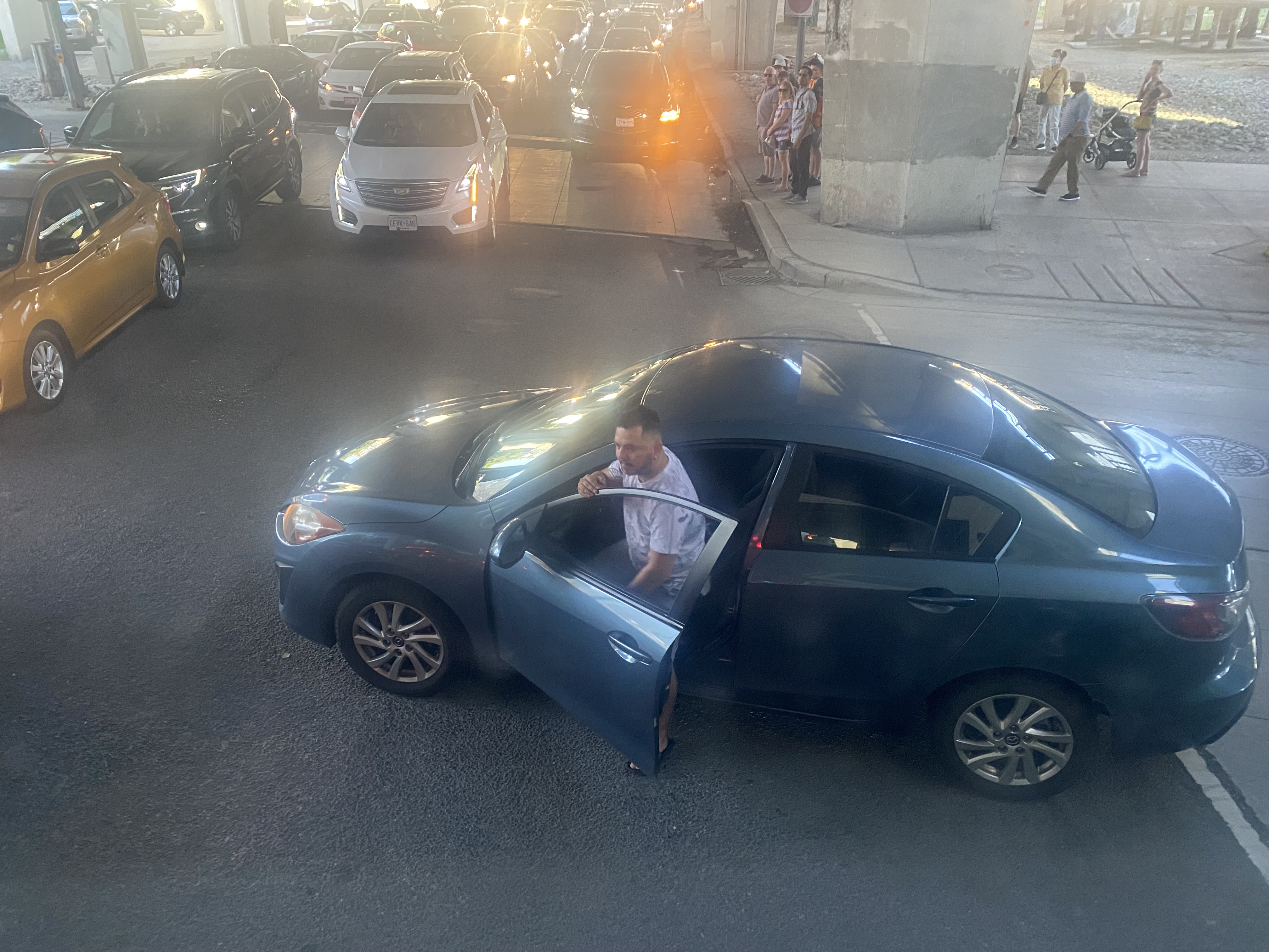
On our return trip to Toronto, we decided to take the Route 16 express bus, departing from Hamilton GO Centre at 3:30. As the train between Union and Hamilton’s West Harbour Stations runs only every hour, it seemed that the express bus to Union Station would be the fastest and most convenient option. How wrong we were.
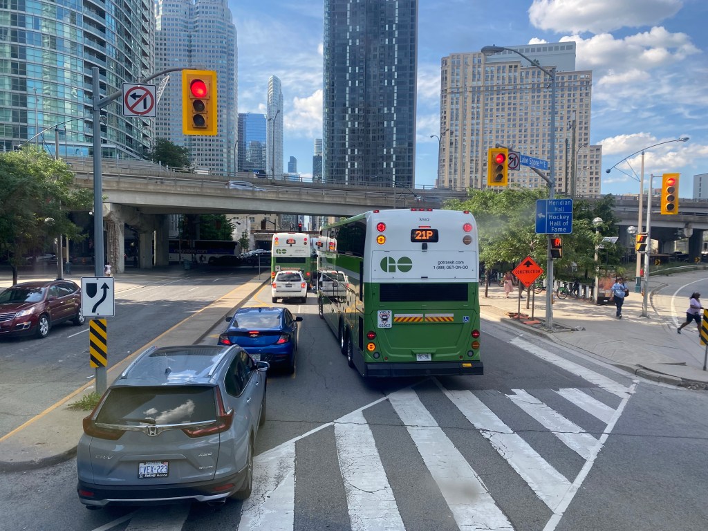
A line of GO buses attempting to turn left from Lake Shore Boulevard to Yonge Street
As we were among the first to board the double-decker bus, we had front row seats to Toronto’s Carmageddon.
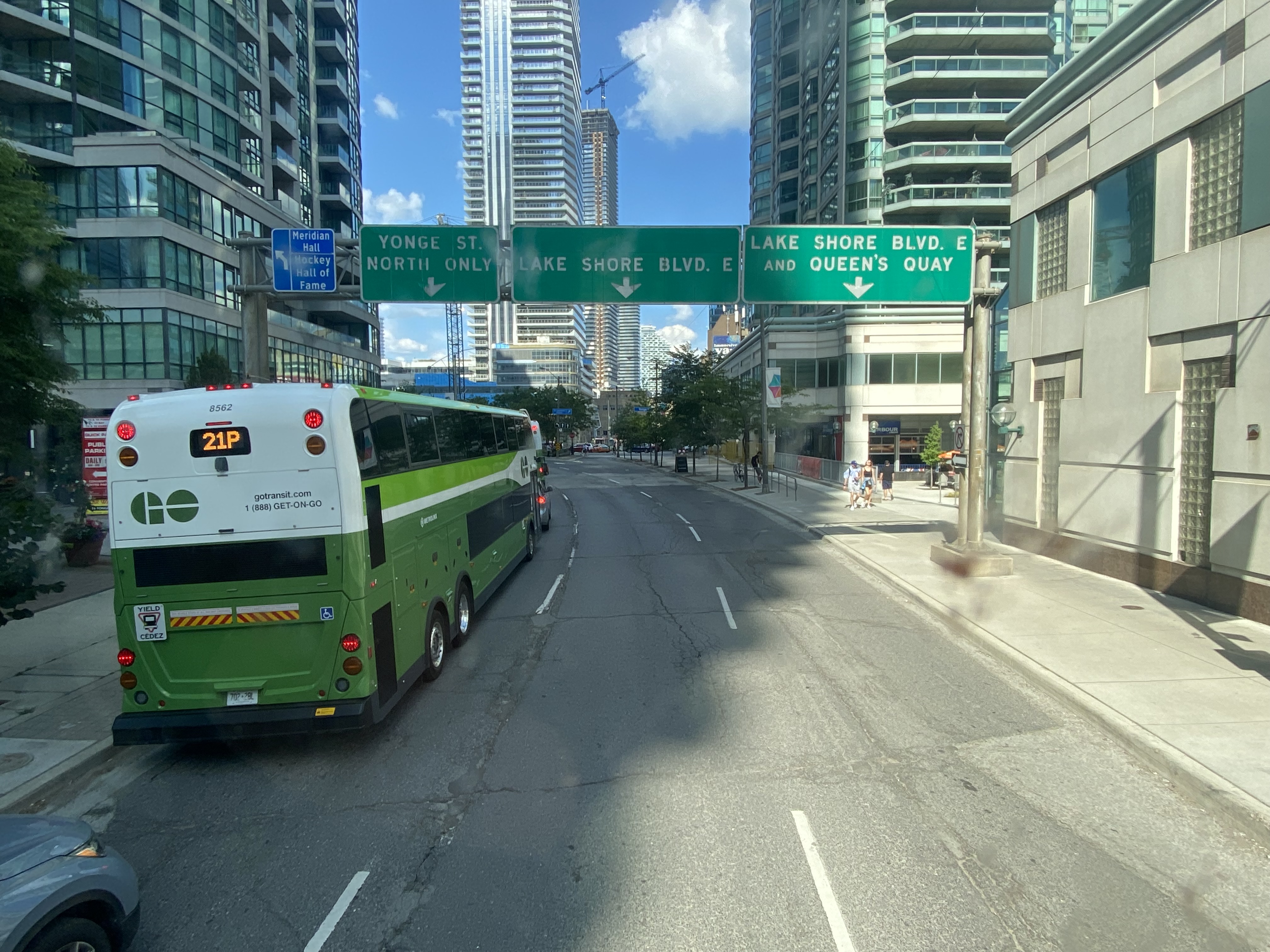
Despite it being a beautiful afternoon on the long weekend, the ride on Highway 403, the Queen Elizabeth Way, and the Gardiner Expressway was uneventful, with only a few spots where traffic moved slowly. Until the bus got off the York-Bay-Yonge ramp, we were making decent time. That is when we were confronted with a long line of cars and trucks, all trying to turn north on York, Bay, and Yonge Streets.
The new Union Station Bus Terminal, located on the north side of the westbound Lake Shore Boulevard lanes, requires buses coming from the west to turn left on to Yonge Street from eastbound Lake Shore, and then turn left again onto westbound Lakeshore before turning right into the terminal itself.
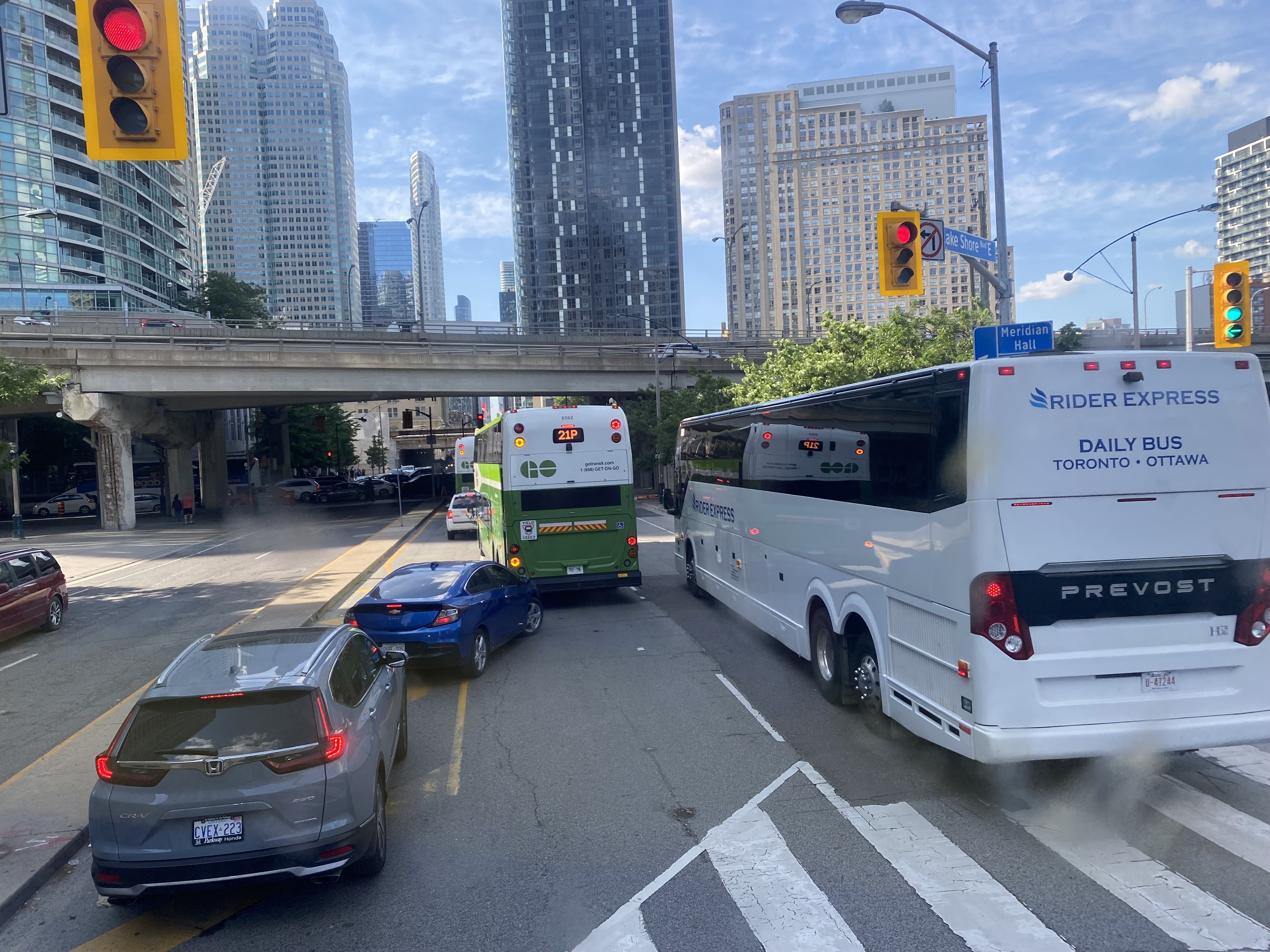
After finally turning north from eastbound Lake Shore Boulevard, private vehicles, a Rider Express bus, and GO Transit buses attempt to turn left onto a gridlocked westbound Lake Shore Boulevard
But with construction obstructing two westbound lanes of Lake Shore at Bay Street, drivers leaving the first of two Blue Jays games that afternoon (a rare doubleheader hosting the Tampa Bay Rays), and other drivers arriving for the evening Jays game, an Eric Church concert at Scotiabank Arena, along with the usual weekend traffic, traffic could not move, creating literal gridlock. Police or traffic wardens that could monitor and manage the gridlock were nowhere to be seen.
Motorists jam the intersection of Lake Shore Boulevard West and Yonge StreetOne driver expresses his frustration with the traffic
At 5:50, 2 hours and 20 minutes after the bus departed Hamilton GO Centre, we were let out on the curb outside the terminal entrance. In response to the backlog of buses attempting to enter and exit the Union Station terminal, GO cut back the Route 16, meeting the half-hourly Lakeshore West train service at Aldershot Station (one stop short of West Harbour). Several Route 16, 21, and 31 trips were cancelled due to the traffic in the downtown core, requiring some customers in places like Milton and Georgetown to wait an entire hour for the next bus.
After similar gridlock conditions on Sunday, July 3, Route 21 (Milton Corridor) and Route 31 (Kitchener Corridor) buses were rerouted to Port Credit GO, requiring a transfer to trains there.
Route 21 and 31 GO buses will begin and end at Port Credit GO due to heavy traffic into Toronto. Regular LSW train service will run between Port Credit and Union. Click https://t.co/QEMf9GRLsf for more into.
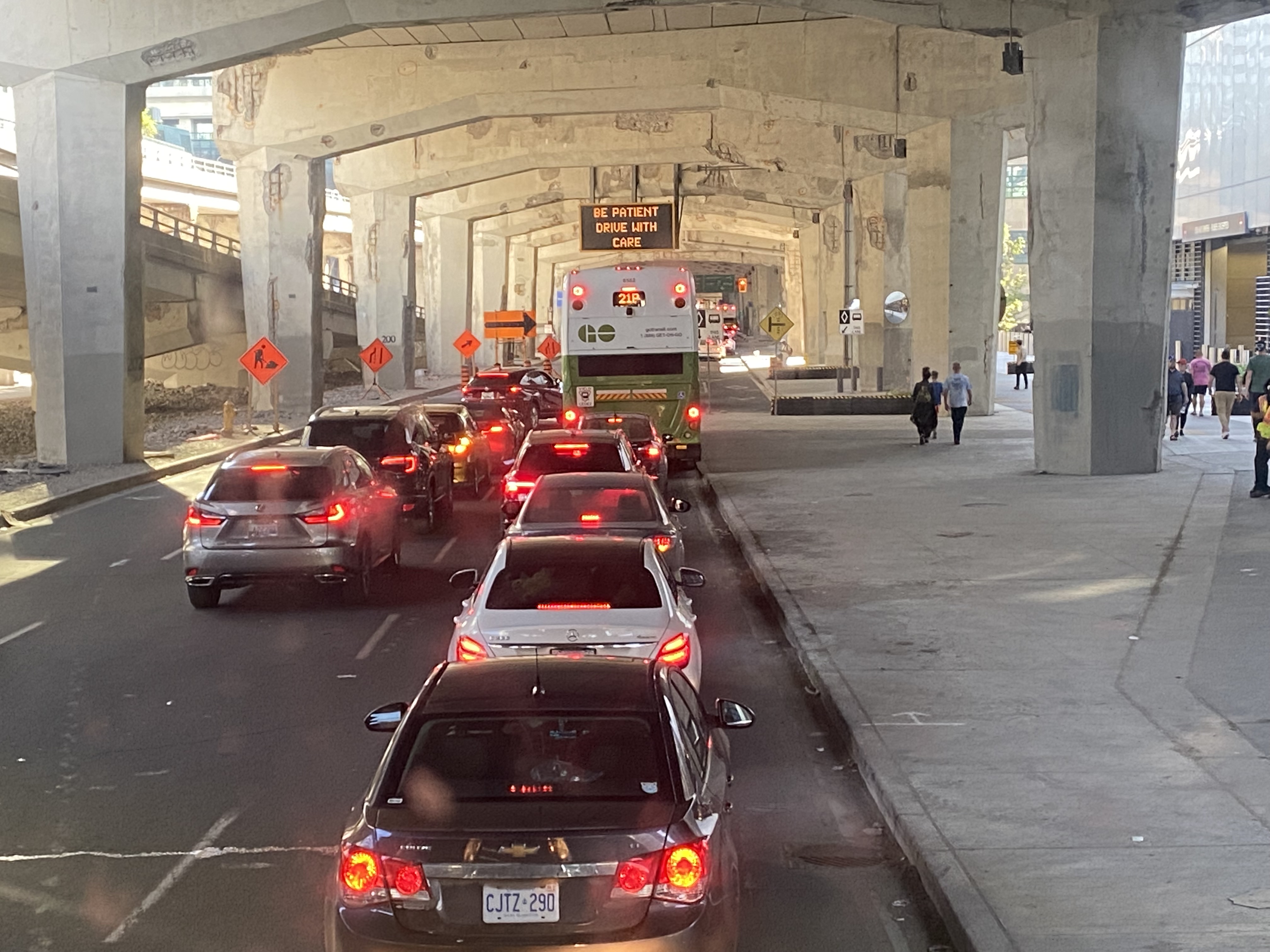
The new terminal’s location is excellent for consolidating all intercity bus and rail services and is much safer than the old Union Station Terminal or the dilapidated Metro Toronto Coach Terminal at Bay and Dundas Streets. Direct, indoor connections can be made with the subway, several hotels, Scotiabank Arena, and to the vast PATH system of underground walkways. Its major failure, however, is the lack of dedicated bus lanes to speed highway coaches in and out of the facility.
On Lake Shore Boulevard. The bus entrance to the Union Station terminal is at right
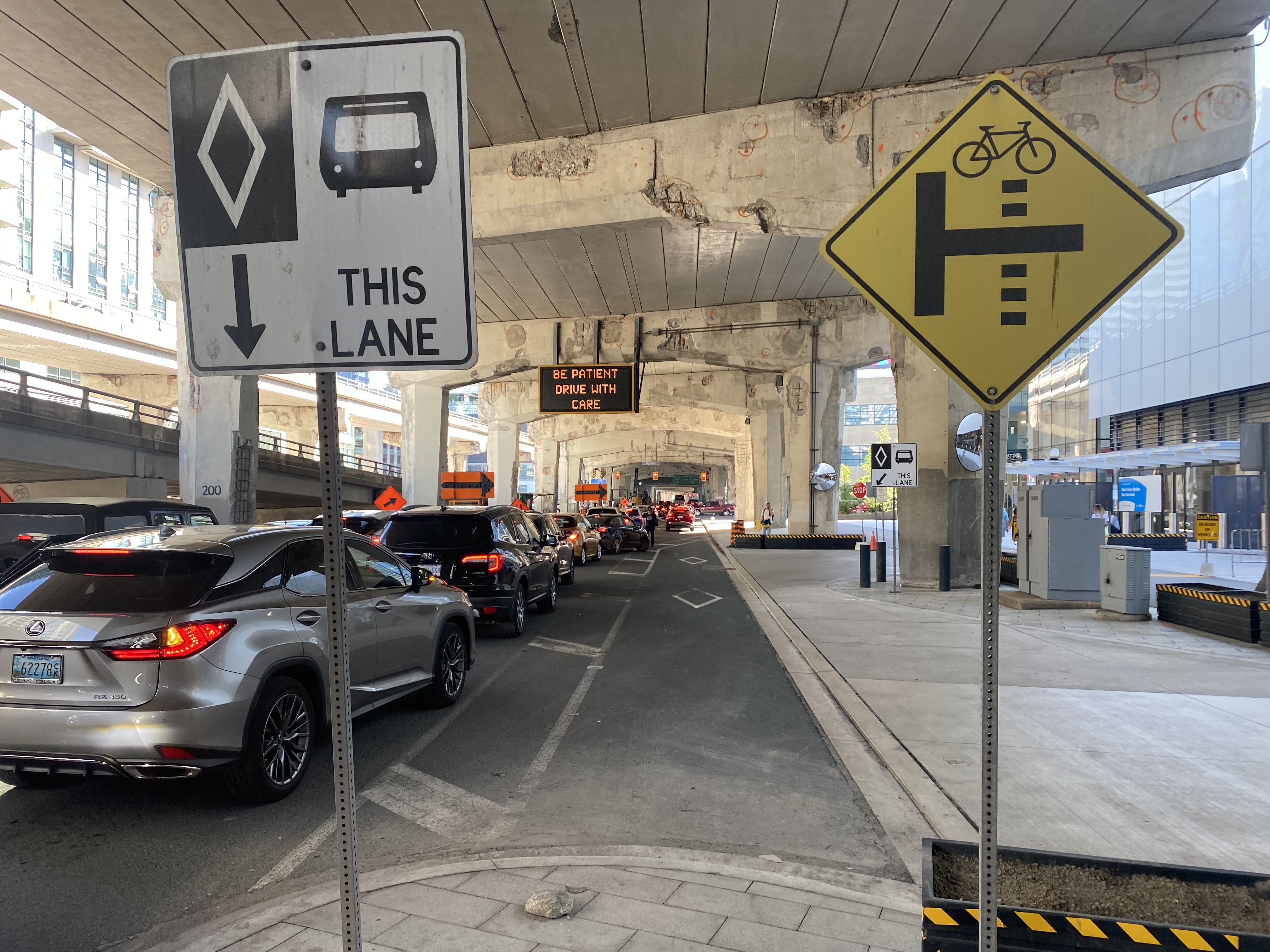
There is an exceptionally wide sidewalk on the north side of Lake Shore approaching the bus entrance to the terminal, and an extremely short bus lane in front of the terminal’s entrance and exit. It is no wonder why some private coach operators, such as FlixBus and Onex, opt for on-street stops, rather than the terminal used by GO, Megabus, Rider Express, TOK, and Ontario Northland.
Toronto’s shortest and least-effective bus lane, in front of the Union Station Bus Terminal. Note the sign reading “be patient – drive with care” above.
A dedicated bus lane for the entire distance between Yonge and Bay Streets would undoubtedly improve operations. A dedicated left turn lane from Yonge to westbound Lakeshore would also allow easier access to the terminal from the west, where the majority of GO and intercity coach buses arrive from. Similar dedicated left turn lanes at Queen Street and Central Park Drive in Brampton allow Brampton Transit buses to quickly enter and exit the Bramalea Terminal. Better traffic management, including police enforcement, would help ensure a clear path for transit and coach buses.
The gridlock continued west of Bay Street, as motorists lined up to get to the Gardiner Expressway or go west on Lake Shore Boulevard
GO Transit’s reaction, to reroute buses to the already-crowded Lakeshore West Train, is not a sustainable solution, though it is the only effective tool it has at the moment. Though Route 16 passengers are not taken far out of their way with a transfer at Aldershot GO, the detour is more onerous for some Route 21 and all Route 31 passengers forced to backtrack to Port Credit GO for a forced transfer there.
Stouffville and Barrie Corridor passengers were spared the hassles with the return of weekend train service earlier this year. Unfortunately, Canadian Pacific’s control of almost the entirety of the Milton Corridor precludes midday, evening, and weekend train service, but there’s an opportunity to finally bring limited weekend train service to the Kitchener Corridor. GO Transit already offers an hourly midday and evening weekday train service to Mount Pleasant Station in Brampton, despite CN’s control of the corridor west of Bramalea Station.
Track improvements completed nearly 20 years ago (an additional track between Bramalea and Mount Pleasant and a second platform at Brampton GO Station) provides the capacity for hourly GO trains and CN’s freight operations. Weekend Route 30 bus service between Kitchener and Bramalea can provide a reasonable and reliable bus link until corridor improvements, such as new passing tracks, are completed between Georgetown and Kitchener.
As I was sitting in traffic for an hour, I found myself aggravated once again by Blue Jays CEO Mark Shapiro lobbying the city to end the Sunday closure of Lake Shore Boulevard West to allow for the city’s (much-diminished) Active TO program. In a letter addressed to Mayor John Tory, General Manager of Transportation Services Barbara Gray, and the city clerk, Shapiro argued that “removing one of the only ways into and out of the downtown core would be extremely challenging to our fans” claiming that “on the days when Active TO has been in effect on Lake Shore, our local fans have experienced significant transit delays because traffic is grinded to a halt on all downtown routes.” (It is worth noting that the Toronto Blue Jays baseball club is a wholly-owned subsidiary of Rogers Communications. The mayor of Toronto, a former Rogers executive, remains involved with the Rogers family trust.)
The Lake Shore closure allowed cyclists and runners to bypass the overcrowded Martin Goodman Trail along Toronto’s Western Beaches, on a section of roadway paralleled by GO Transit’s Lakeshore Corridor. The traffic congestion last weekend was completely unrelated to ActiveTO (which is now suspended on Lake Shore Boulevard, partly due to Shaprio’s lobbying) and transit riders, who make up a large percentage of the Blue Jays’ fanbase, were left in the mess that motorists made.
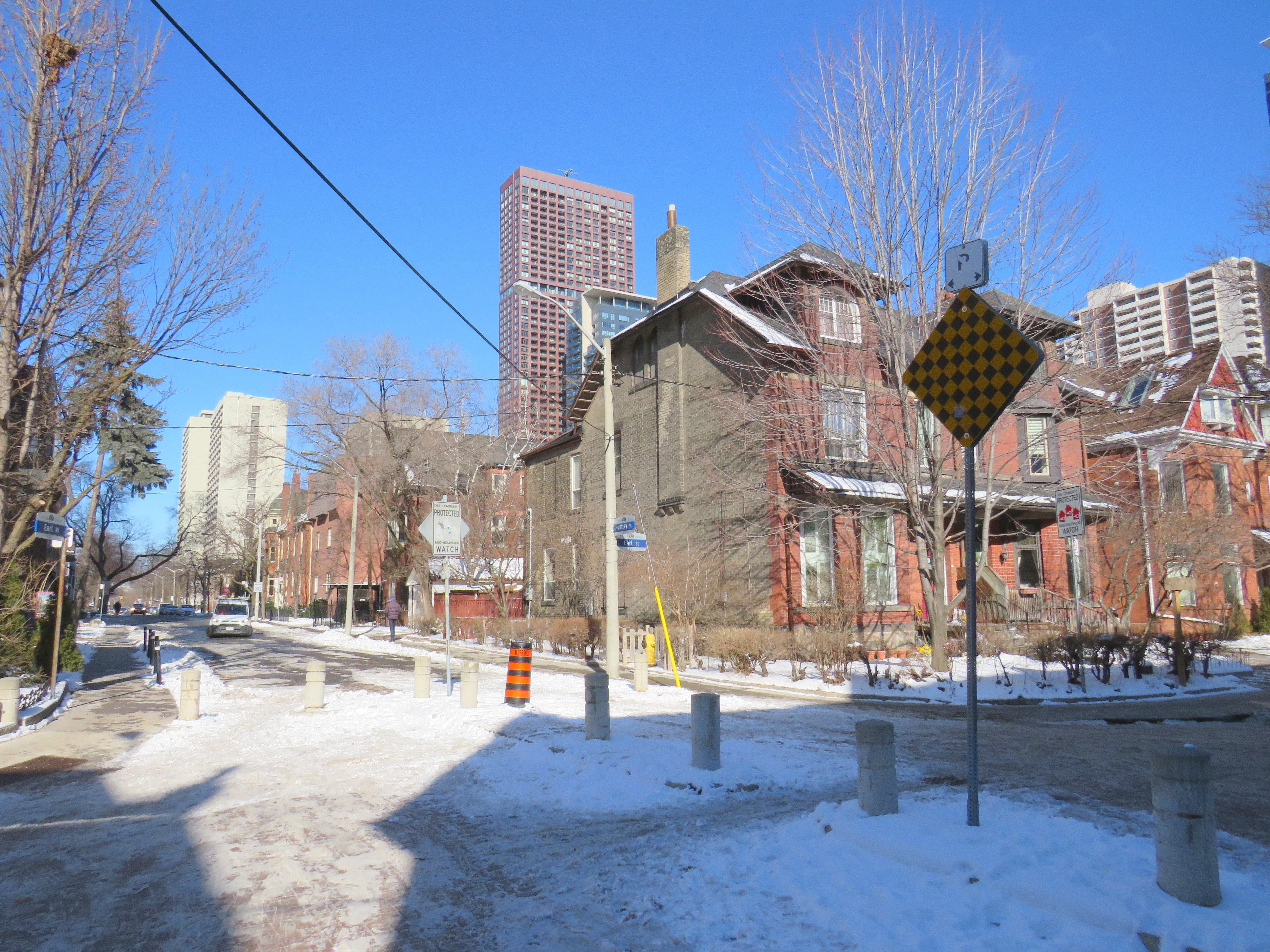
Earl Place, where “No Exit” signs betray through access for pedestrians and cyclists
Last week, Dylan Reid and I, both co-founders of Walk Toronto, decided to create an inventory of all instances in the city where “No Exit” signs do not apply to all road users. Though these signs are required under traffic codes and regulations, they do not reflect that in many cases, there is an exit for pedestrians. Some of those offer through passage for cyclists as well. We were inspired by a Twitter thread that expressed the frustration of getting around the city by foot, where signage is designed entirely for motorists.
Instances where pedestrians or cyclists may continue past a “No Exit” sign include traffic calming measures meant to keep out through motor vehicles on once-continuous roads. The intersection of Earl Place, Earl Street, and Huntley Street is just one example: curbs and bollards restrict motorists from continuing through, though a narrow passage allows cyclists to continue past; sidewalks also allow through pedestrian movement.
Earl Place and Huntley Street
In many other cases, suburban street designs, such as cul-de-sacs, limit vehicular movement though residential subdivisions, but narrow public walkways allow pedestrians access to parklands and neighbouring streets. In other cases, changes in grade between streets allow for a staircase, but not a through roadway down a steep hill. These are common in the Swansea, Baby Point, Silverthorn, and East Toronto neighbourhoods.
As of January 30, 2021, I have mapped over 250 misleading “No Exit” signs throughout the City of Toronto, though I know there are many more. Please send them to me via Twitter or via a direct message, and I will be sure to add your submission.
Our goal is to convince the City of Toronto to add signage recognizing where pedestrians and cyclists do have an exit. Perhaps too, this might inspire you to get outside, and walk around the neighbourhood, checking out passageways you might have not known about.
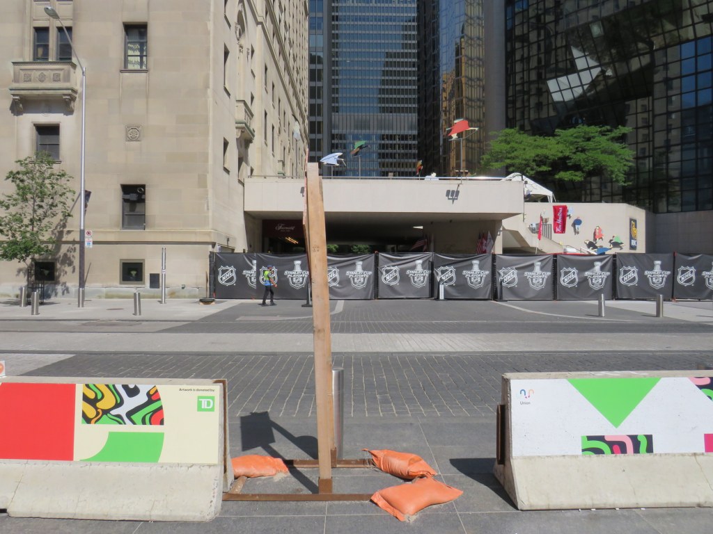
Over two years later, concrete Jersey barriers continue to disrupt pedestrians in front of Union Station
A year ago, I wrote about the unsightly Jersey barriers that were plopped down in front of Toronto’s Union Station in April 2018, creating bottlenecks at two of Toronto’s busiest pedestrian intersections. Though the city promised improvements in 2018and in 2019, the only changes were the application of decals to the existing Jersey barriers.
Though the front of Union Station looks slightly better, and the bottlenecks have been lessened by the ongoing COVID-19 pandemic, this is not a satisfactory solution, especially for Toronto’s busiest and most important transportation hub.
The Jersey barriers were hastily plopped down on Front Street after the April 23, 2018 van attack, where one man steered a rented cargo van onto busy sidewalks in North York, killing 10 and injuring 16 more before he was apprehended by police. As an iconic and crowded pedestrian area, it was felt that special protection was necessary. At the time, the assumption was that the van attack was an act of terrorism, requiring such drastic measures. (It was soon found the motives were not terrorist related.)
In 2018, city councillor John Campbell likened the front of Union Station to “a war zone” while a city spokesperson said that a broader security plan was “in the works,” including for protecting the station has been in the works for some time, including interim measures that would fit into the streetscape.
In March 2019, nearly a year after Jersey barriers were added, the Toronto Star’s Jack Lakey dismissed complaints about their awkwardness and appearance, calling them “effective in stopping a driver bent on another deadly attack.” However, Lakey noted that another city spokesperson said that “city is finalizing the design of permanent vehicle barriers around Union Station”, that would “be smaller, more aesthetically pleasing and easier to navigate for pedestrians.” Those barriers would be installed later in 2019.
Afternoon rush hour crowds navigate around the Jersey barriers at Front and Bay Streets, August 2019
It is now August 2020, and the concrete barriers are still there, creating a mess for anyone using a wheeled mobility device, or for anyone in a hurry.
Bay and Front Streets, August 2020
The only thing that has changed are new artistic vinyl stickers covering the bare concrete, with messages saying that “artwork is donated by TD [Bank].”
TD is the “premier sponsor and exclusive financial services partner” of Union Station, most of which is owned and operated by the City of Toronto. (Some sections used by GO Transit are owned by Metrolinx.) TD enjoys exclusive branding rights, ATM locations, and sponsors Union Station’s wifi and charging stations.
“Artwork is donated by TD”
Perhaps TD was embarrassed by the Jersey barriers (after all, it has its headquarters just up Bay Street). Or perhaps the city decided that something needed to happen here., after two years of unfilled promises.
While examining the barriers, I noticed construction signage wedged within the gaps, creating a trip hazard. I also saw the original metal bollards installed when Front Street was rebuilt for a more pedestrian-friendly streetscape in 2014-2015.
Construction signage creates a trip hazard in the gaps between Jersey barriers. Note the original metal bollard behind.
Though the inconvenience caused by the lingering “temporary” concrete barriers has been lessened as there are fewer pedestrians entering and leaving Union Station right now, it also makes it a good time to finally make the necessary renovations by installing permanent sturdy bollards.
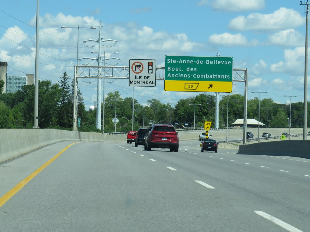
Entering Montreal on Autoroute 20, with a sign reminding motorists of the blanket ban on right turns on red on Montreal Island
During the August long weekend, my spouse and I rented a car and drove to Montreal. Normally, I take the train, as it’s a long and boring drive on Highway 401, while VIA Rail offers a quiet, relaxing, and more interesting ride. But with the ongoing COVID-19 pandemic, driving seemed like a good idea. (In doing so, I finally drove the entire length of Highway 401 — I had not yet done the section between Cornwall and the Quebec border).
Despite Montreal’s infamous potholes, never-ending construction, and stereotypically aggressive motorists, I found driving around the city less stressful than in my own home city of Toronto. It may sound counter-intuitive, but a big reason for this was the city’s blanket ban on right turns on red.
Outside of North America, turning movements on red lights are generally prohibited. They were only widely introduced to the United States as part of an energy-saving measure in the 1970s, as a response to the first oil shock; a regulation was written into a 1975 federal bill that provided federal aid to states provided that they permit right turns on red lights (along with carpool programs and energy, thermal, and lighting efficiency measures), though many western US states had such laws on their books much earlier.
U.S. Energy Policy and Conservation Act, 1975, Section 362(c)

Each proposed State energy conservation plan to be eligible for
Federal assistance under this part shall include —
 (1) mandatory lighting efficiency standards for public buildings
 (except public buildings owned or leased by the United States);
 (2) programs to promote the availability and use of carpools,
 vanpools, and public transportation (except that no Federal funds
 provided under this part shall be used for subsidizing fares for
 public transportation);
 (3) mandatory standards and policies relating to energy efficiency
 to govern the procurement practices of such State and its political
 subdivisions;
 (4) mandatory thermal efficiency standards and insulation
 requirements for new and renovated buildings (except buildings owned
 or leased by the United States); and
 (5) a traffic law or regulation which, to the maximum extent
 practicable consistent with safety, permits the operator of a motor
 vehicle to turn such vehicle right at a red stop light after
 stopping.
The Province of Quebec was the last subnational holdout in North America, permitting the practice in 2003. However, the City of Montreal continued to outlaw turns on red, following New York City’s continued prohibition, while Mexico City introduced a new prohibition in 2018.
In my experience, though, I found driving less stressful when I knew I could not turn on red. I did not have to worry about a driver behind me inching forward, pressuring me to move past the stop line and into the intersection so they could turn. If I was waiting to turn right, I knew I could relax and wait for the green signal before I had to try to make the maneuver. The leading pedestrian interval common in central Montreal (which also allows through traffic — including cyclists — to go first) made pedestrians easier to see and predict as I was making my turn.
Montreal’s leading pedestrian interval signal
I might have saved a minute or two on each car trip had I been able to turn on a red light. But it did not feel like much of a difference. The reduced stress was worth it.
As a pedestrian and as a cyclist, I appreciated turn-on-red prohibitions whenever I was in a city where they are in place, as I did not have to worry about right-turning motorists not seeing me as I crossed at a street corner, or those motorists who rush red lights or refuse to stop before turning. As a driver, I appreciated it too.