Tag: news

  • A transit trip to Paris, Ontario

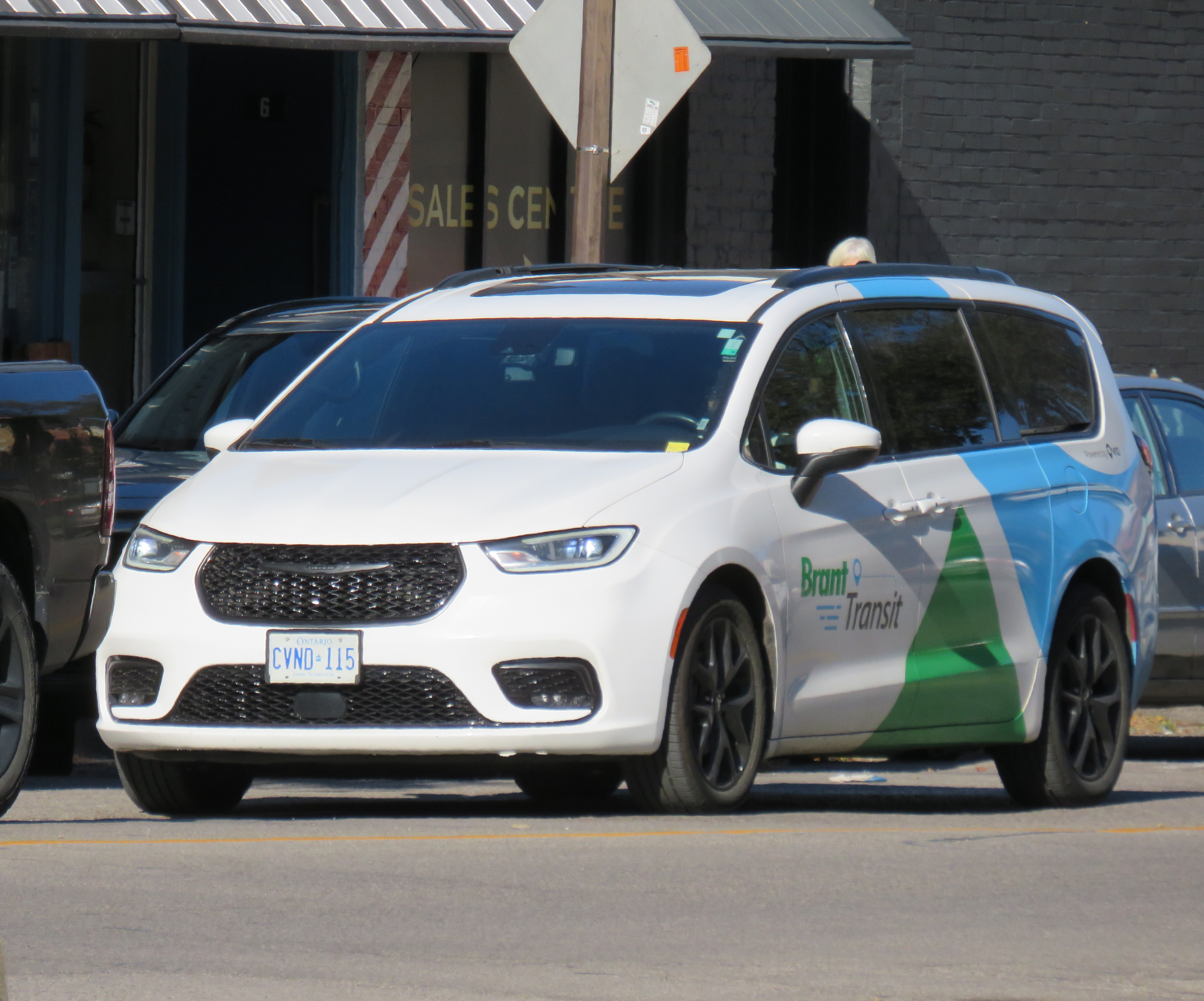
    Brant Transit van on Mechanic Street, Paris

    Two and a half years ago, I took my first transit trip using an on-demand service, travelling between Port Perry and Cannington in rural Durham Region. It was part of a quest I undertook to visit every city and town hall in the Greater Toronto and Hamilton Area without a car. In March 2023, I found DRT’s booking service to be an exercise in frustration at first, though I eventually landed on a time that worked.

    In September 2026, I wanted to travel to Paris, Ontario, a picturesque town of 15,000 people on the Grand River, and only a 15-minute drive from Brantford. In 2000, the Town of Paris was amalgamated with the rural county that surrounds the City of Brantford.
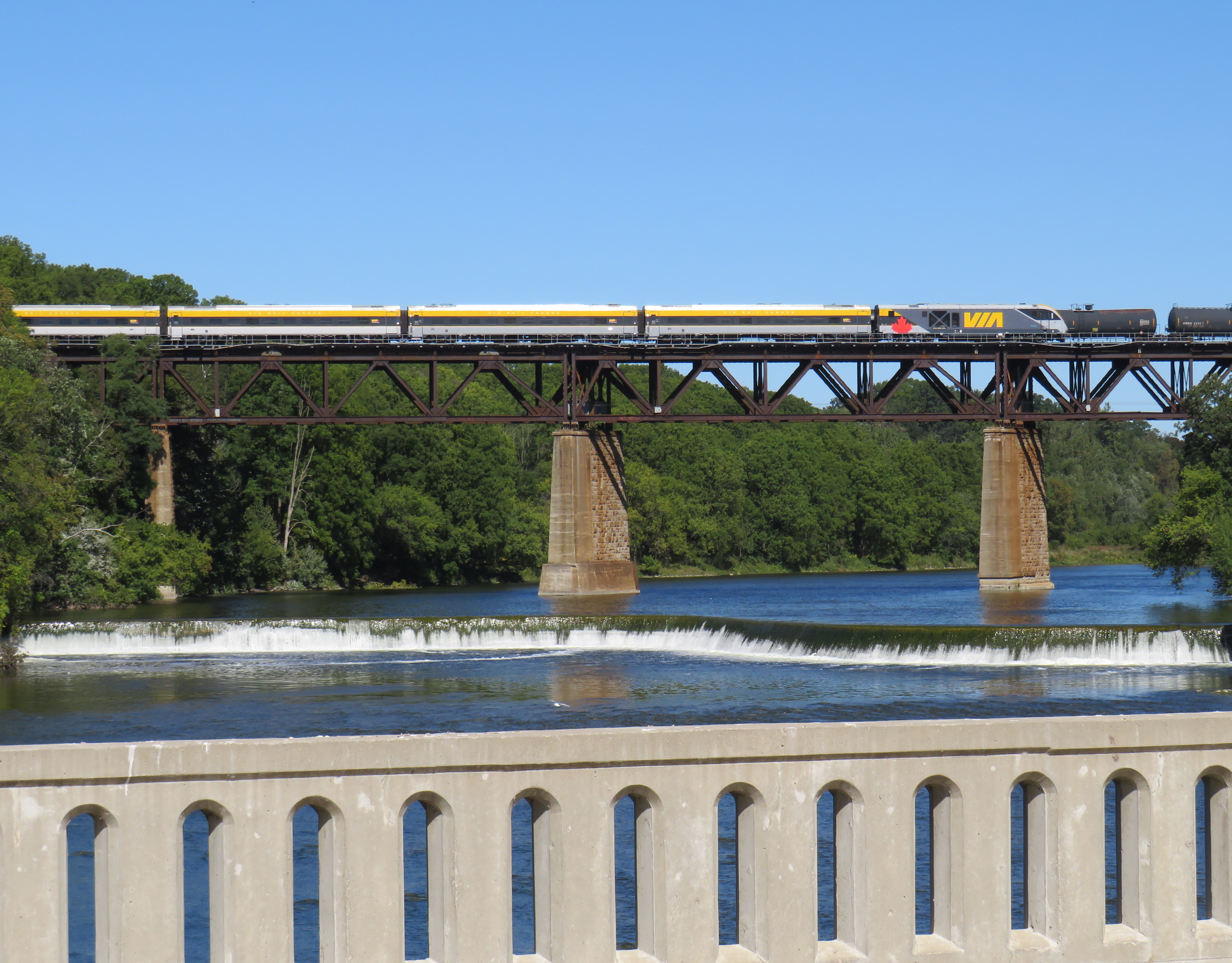
    Though ten VIA trains a day pass through Paris, the closest stop is in Brantford

    In the 1980s and early 1990s, Paris was served by a Brantford Transit bus route, which made sense given the short distance between the two communities. This service was discontinued in 1996 due to funding cutbacks to transit province-wide by the Mike Harris-led Progressive Conservatives. With the loss of Greyhound’s once-a-day local bus between London and Toronto in 2018, there was no way to get to Paris without a car or a taxi ride.

    In 2019, the county launched Brant e-Ride, which was later branded as Brant Transit. An on-demand transit service, Brant Transit serves the entire municipality. It also allows pick-ups and drop-offs anywhere within Brantford, as long as either the origin or destination is within the county’s boundaries. Rides are $6 one-way, or $4 for adults over 55 and free for children 12 and under.

    The ability to travel between Brantford and the surrounding county allows Brant County residents easy access to workplaces, schools, shopping, or medical services in Brantford, as well as connections to GO buses to McMaster University and Aldershot Station, VIA Rail trains, and the weekday Ride Norfolk service to Waterford and Simcoe. The service also allows Brantford residents to get to employment areas in Brant County, such as the Ford and Adidas warehouses by Highway 403 and Rest Acres Road (Highway 24 South).

    The current contractor to Brant Transit is Via Transportation, a New York-based mobility software company specializing in on-demand transit and shuttle service platforms. Drivers are hired locally and use Brant Transit-branded minivans and SUVs.

    Brant Transit ridership is growing, with over 25,000 rides provided in 2024, up 11% from 2023. The overwhelming majority of rides taken are between Brantford and Brant County, rather than within the municipality, with 57% of passengers using the service to get to and from work and another 24% using it to access health services.

    Unlike the 2024 DRT experience, I found the booking system easy to use and it accepted my trip requests within the times I was looking for: a pickup in Brantford around 10AM (plenty of time for me to get there from Toronto either by VIA train or GO train/bus) and a pickup in Paris around 4PM. That would give me plenty of time for a leisurely walk around Paris, enjoy a relaxed lunch, and browse the downtown.

    I travelled between the bus terminal in Downtown Brantford and the Paris Wincey Mills building, just off Paris’ main street. The old textile mill, once a Canadian Tire store, was beautifully restored, with a café, market, and brewery on the lower level, and offices on the upper two floors.
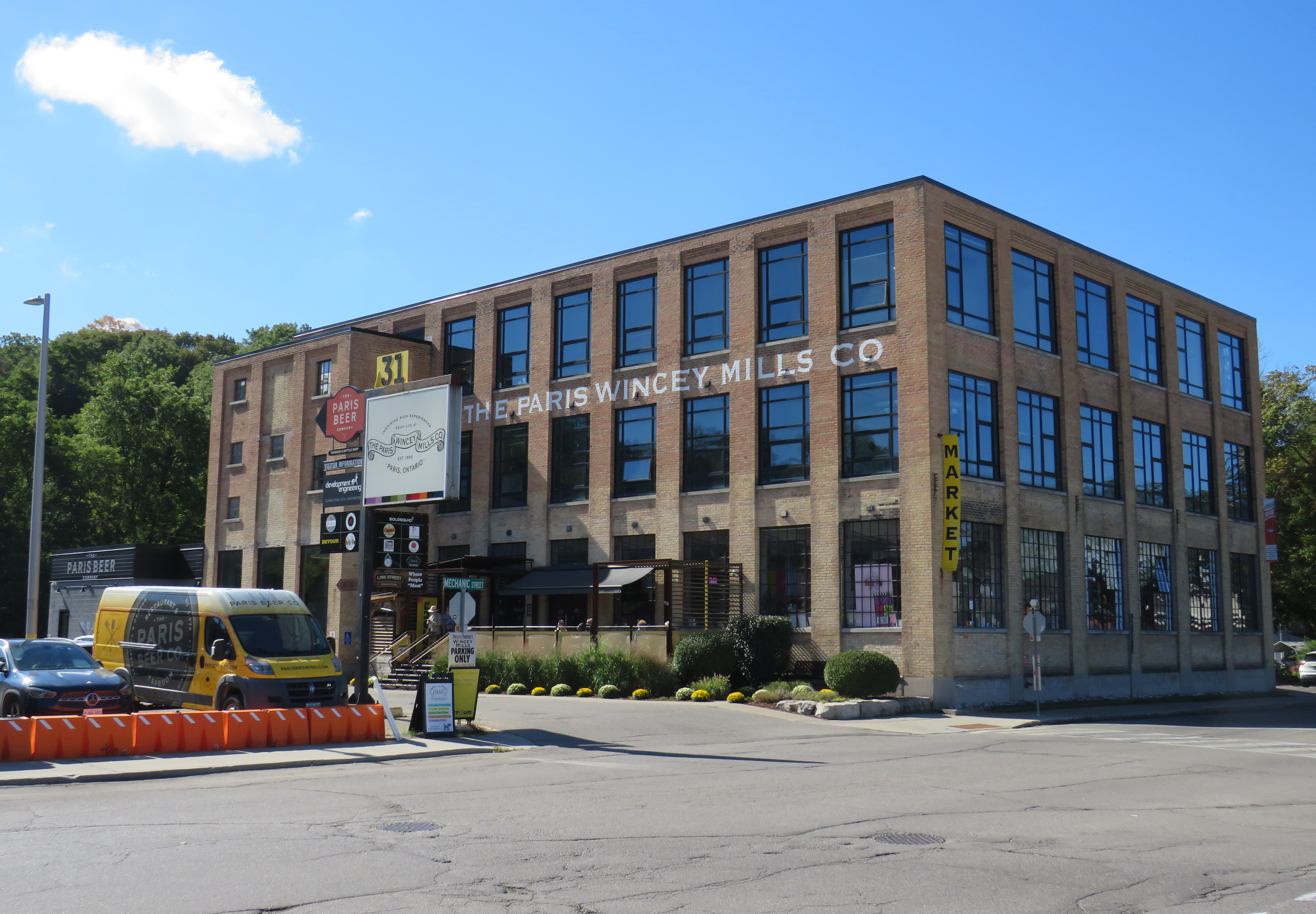
    Paris Wincey Mills Co. building

    The only trouble was the initial pick-up. The app, as well as the text alerts, kept telling me to wait at 73 George Street, the location of the old Brantford Carnegie Library now occupied by Wilfrid Laurier University. However, the tracking app — which appears similar to the Uber or Lyft platforms — showed the that correct location was actually the bus terminal. Luckily, I made it in time to meet the driver.
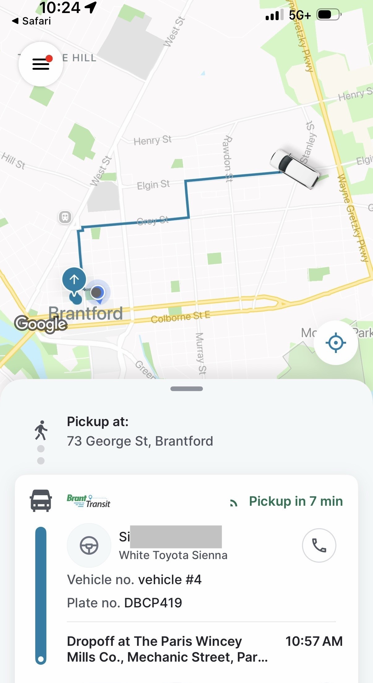
    Information provided to me in the Brant Transit App, with driver’s name (redacted), vehicle info (plate and make), pickup time and location and estimated drop off time

    I shared the ride to Paris with one other passenger, who remained on board after I departed. On the return ride, I could see the driver made several stops before picking me up, with a stop en route at one of the warehouses near Highway 403, where two other passengers were waiting, all headed to Brantford.
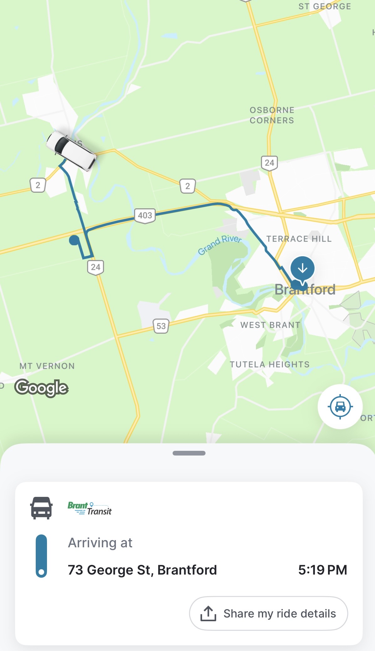
    Screenshot of Brant Transit App showing my route back to Brantford Bus Terminal from Paris with an intermediate stop at a warehouse near Highways 24 and 403

    Overall, I was satisfied with my experience. The drivers were friendly, the ride comfortable, and the app easy to use. If Brant Transit on a September Thursday was reflective of on-demand transit in general, the concept would leave a very positive experience for users and municipalities alike.

    That said, there are some caveats. As the Paris area continues to grow, especially with large employers (an Amazon fulfillment centre is nearing completion), there will be increasing demand for transit. Nearby, Brantford Transit increased service to the North West industrial area, with two routes (20 and 21) now serving that employment cluster, just on the border with Brant County.

    Furthermore, Paris itself continues to grow, with new residential subdivisions on Rest Acres Road near Highway 403. In the future, Brant County should seriously consider fixed-route services to serve commercial and residential growth in and around Paris, either as part of Brant Transit, contracted to Brantford as before 1996, or both. In the meantime, the on-demand service can continue to provide mobility for the rest of the county, and even within Paris during off-peak times such as evenings and weekends.

    I would have benefitted from a fixed-route service for a leisurely visit; once the transit times are booked, the passenger is tied to those times. After three hours in Paris, I had more than enough time to see everything I planned; had there been a bus at 3:30, I would have hopped on that instead of waiting for a 4:35 pickup. Though on-demand transit offers geographical flexibility in a sparsely populated or low demand area, fixed-route, scheduled services provide temporal flexibility that on-demand services can not match.
  • Safer streets need more than just speed cameras

    Safer streets need more than just speed cameras

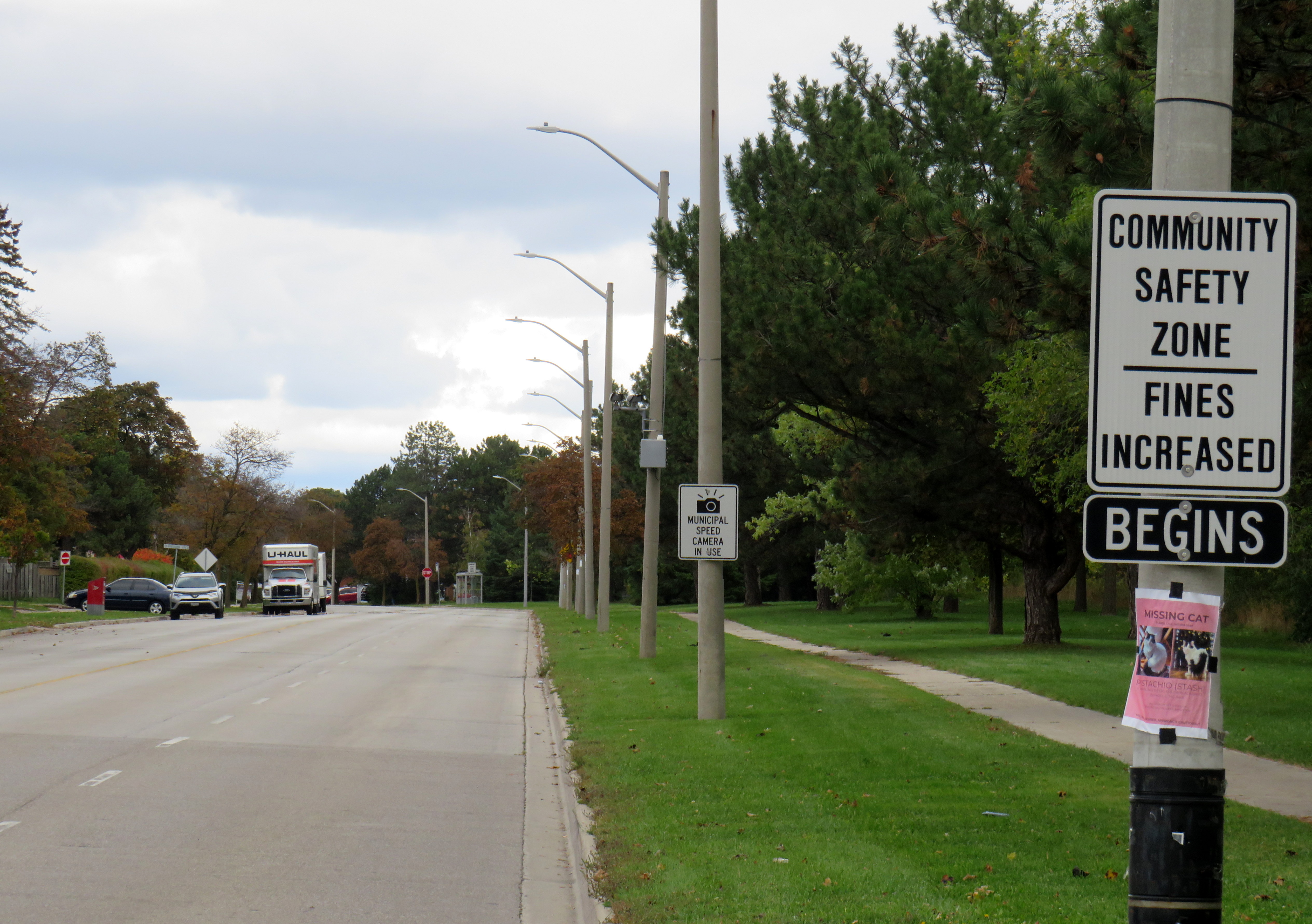
    Dearbourne Boulevard, a four-lane collector street designated a community safety zone

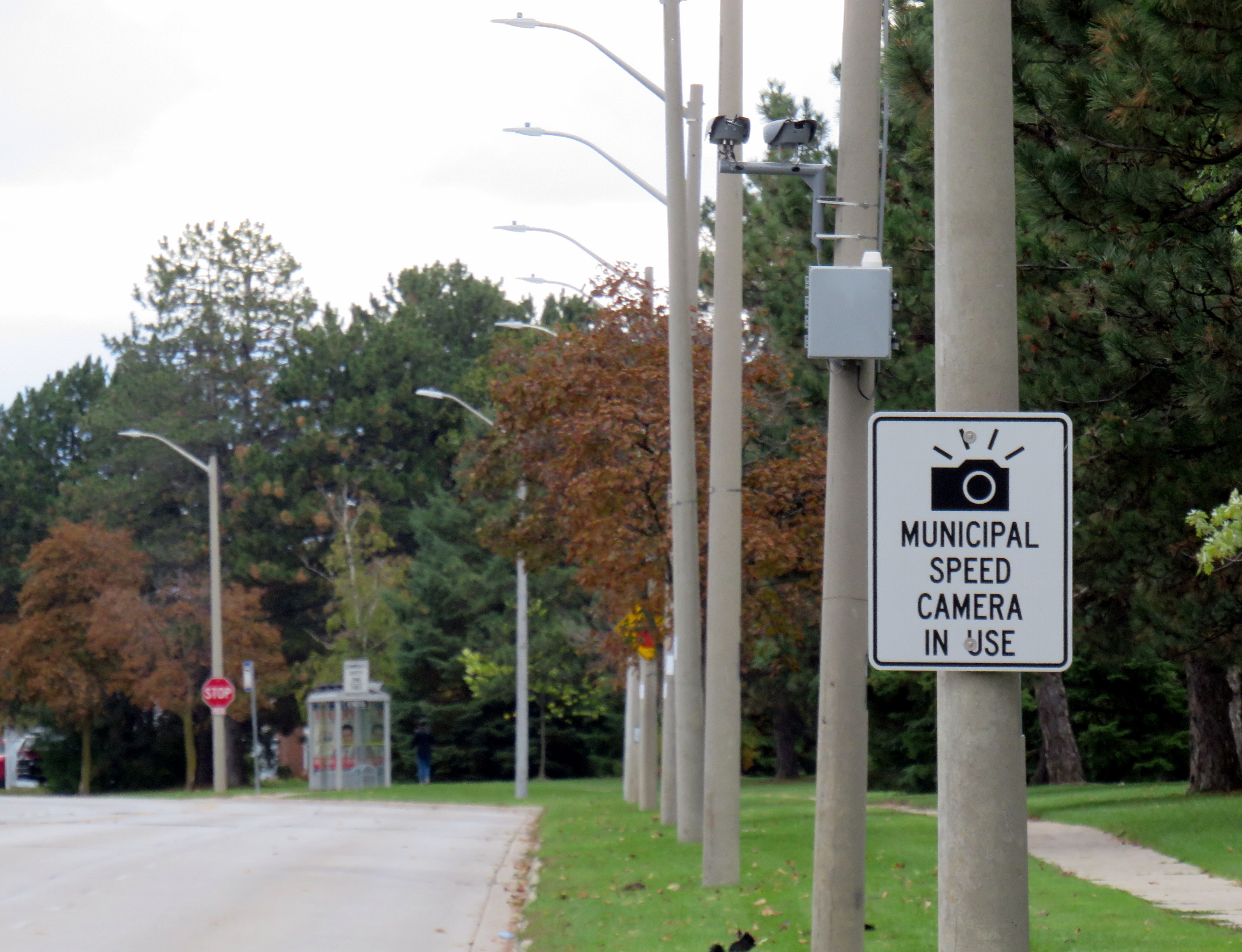
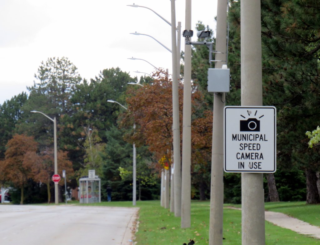
    Last week, while visiting Brampton, I came across one of the hundreds municipal speed enforcement cameras that Premier Doug Ford’s government wants to rip out across the province. The camera, on a four-lane collector street in Bramalea, is in a residential area, adjacent to several parks, including a pathway to a local public school, in an area designated a community safety zone. This is precisely the type of place that the government intended speed enforcement cameras would go when they were permitted under provincial legislation in 2019.

    In a September 2025 government press release touting the move as “protecting taxpayers,” Ford, whose government was in power when these cameras were permitted, claimed that the program became “a cash grab;” supporting quotes included those from former Liberal leader and current Vaughan mayor Steven Del Duca, a representative of the province’s municipal police unions, and a spokesperson from the right-wing Canadian Taxpayers Federation.

    If only there was a simple, effective way for taxpayers to avoid the so-called “cash grab.”

    It was interesting who was not quoted in that press release, including doctors, educators, safety advocates, and even police brass. Ontario police chiefs support automated speed enforcement. It is also worth noting most municipalities support the cameras; Vaughan is one of only a few municipalities that recently rejected the road safety program; Del Duca was joined by just two other conservative-leaning mayors.

    Of course, the arguments against the cameras, which in Toronto, were repeatedly vandalized or stolen, never held water. There were no tickets mailed out to drivers going just a few kilometres over the limit. Furthermore, speed enforcement was never a “cash grab” as the fines collected went to pay for the administration of the program, to “Vision Zero” works, such as the installation of speed cushions and improved pedestrian crossings, and to the province, which the collects the victim surcharges added to every Highway Traffic Act fine. The City of Brampton found that not only were the cameras effective in reducing speeds, they had the support of a majority of its residents.

    Municipal speed camera

    That said, while visiting Dearbourne Boulevard, I realized that speed enforcement cameras on their own are not effective in creating safer streets.

    Dearbourne Boulevard serves one of the oldest parts of Bramalea, established in the early 1960s as a self-contained satellite town, where residents were expected to drive to most destinations. After amalgamation into the City of Brampton, traffic increased and more transit became available. Nearby, several newer high-rise apartment buildings were built, walking distance to Bramalea GO Station. A bus route, 16 Dearbourne, runs along the street, connecting the neighbourhood with several shopping plazas, the GO Station, and the transit hub adjacent to Bramalea City Centre.

    Despite having low traffic and serving a residential area (an industrial area is just to the south, but it is inaccessible from Dearbourne), it is still a wide four lane street. The only traffic signal is at Bramalea Road; there are two all-way stops at Delamere Drive and Dorchester Road. At the east end of Dearbourne, the T-intersection with Balmoral Drive is controlled only be a stop sign, with two long and gentle right turn slip lanes. The speed limit is 50 km/h, and there are no speed cushions, curb extensions, or even painted buffers to indicated that drivers should go slower. In October 2022, a pedestrian was struck and seriously injured at one of the two all-way stop intersections; the driver fled the scene.

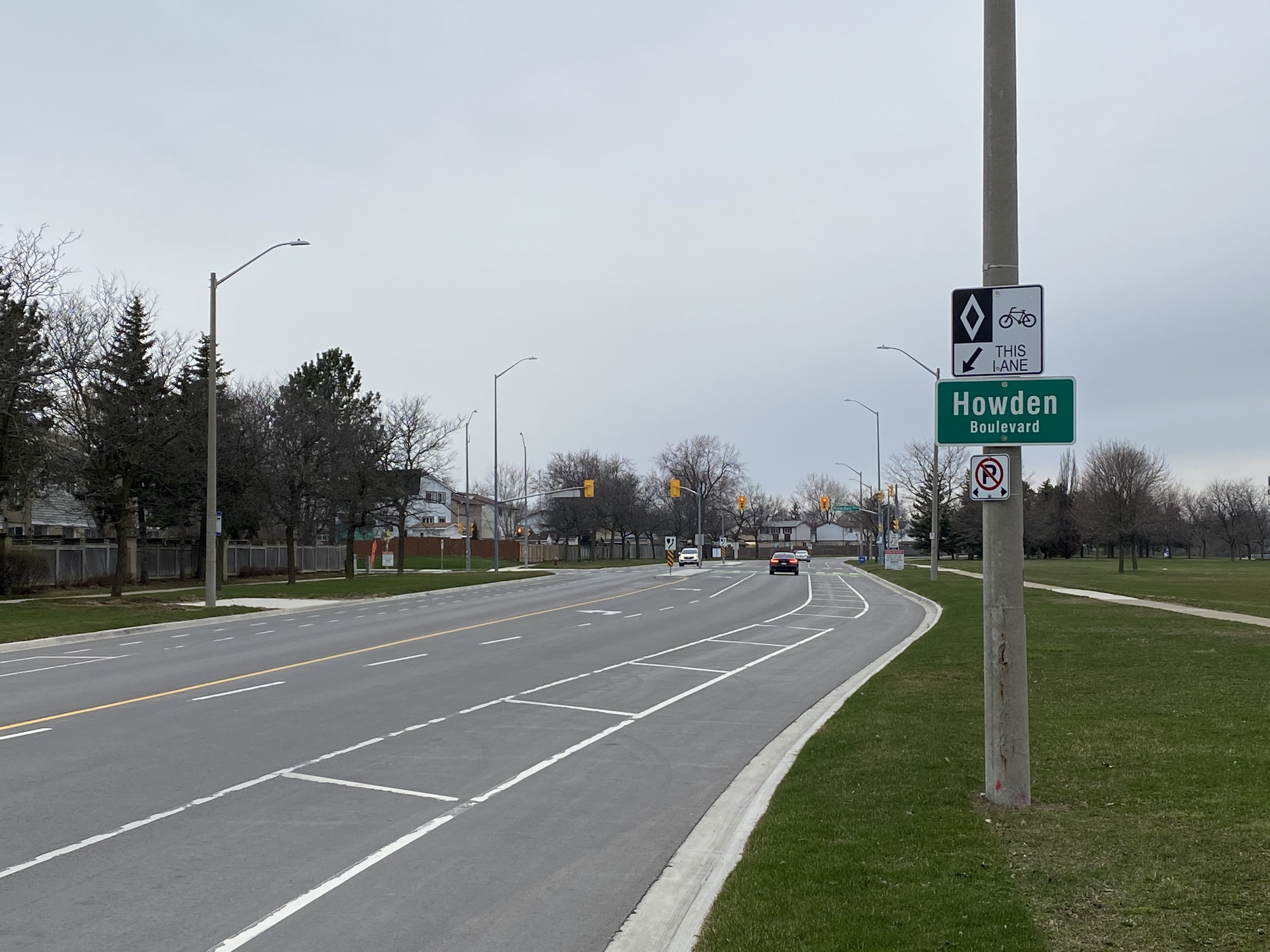
    Though to its credit, the City of Brampton has been improving many suburban streets and roads to reduce speeds and promote walking and cycling. Charolais Drive, Vodden Street, Central Park Boulevard, and Vodden Road saw traffic lanes replaced by new cycling lanes, with little pushback from residents. Dearbourne Boulevard was also slated for improvements in 2021-2022, but that work was not yet started.

    Central Park Boulevard, Howden Boulevard, and Vodden Street were among several four-lane collector roads tamed with new cycling infrastructure in the last five years, creating a new through east-west cycle route

    Now, it might be too late. Not only will the speed camera be prohibited under a bill being rushed through the provincial legislature (going around the consultation process where concerned citizens, advocates, or safety experts could depute to MPPs), but another omnibus bill was just introduced, which if passed, would prohibit all Ontario municipalities from removing general traffic lanes to install cycling infrastructure, or even transit lanes and on-street patios.

    Given the provincial government’s increasing hostility to anything that inconveniences drivers, be it road tolls, vehicle license renewal fees, automated speed enforcement, or bike lanes, it leaves municipalities fewer options to protect their most vulnerable road users and promote sustainable and healthy transport options. Though Doug Ford claims that alternatives like flashing lights and more signs would do the trick, they do not do much to deter aggressive and dangerous drivers, unlikely to get caught.

    For streets like Dearbourne Boulevard, there are a few options. Lowering the speed limit to 40 km/h should be a first step. The redundant outer two lanes could be converted to parking-only spaces, with curb extensions and bollards at intersections. The slip lanes at Balmoral Drive should be ripped out.

    Roads designed in the 1960s and 1970s for traffic that never really materialized need to be rethought, with or without Queen’s Park’s support.

  • Crossride of death: how an Ajax girl was killed riding her bike

    Crossride of death: how an Ajax girl was killed riding her bike

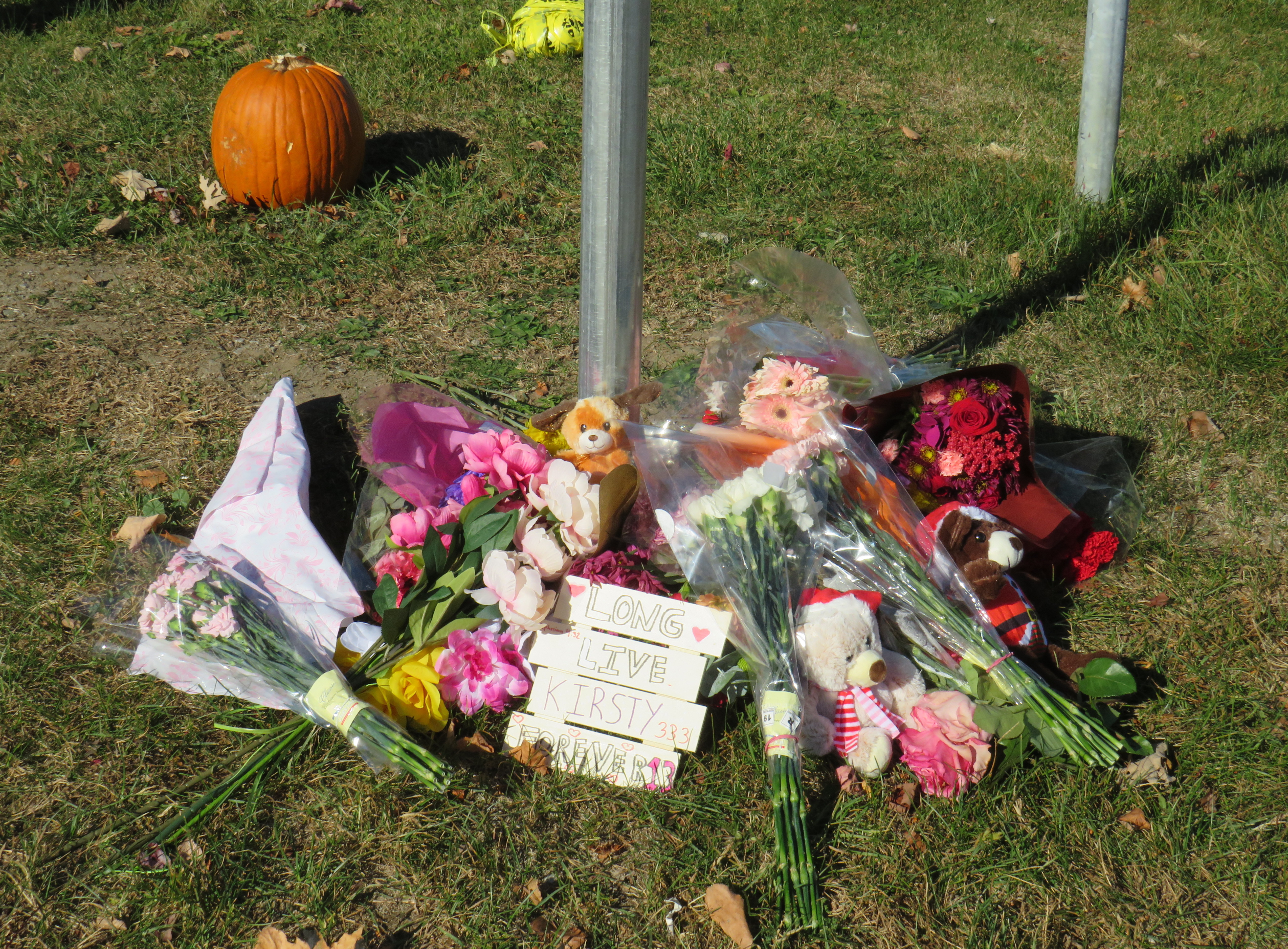
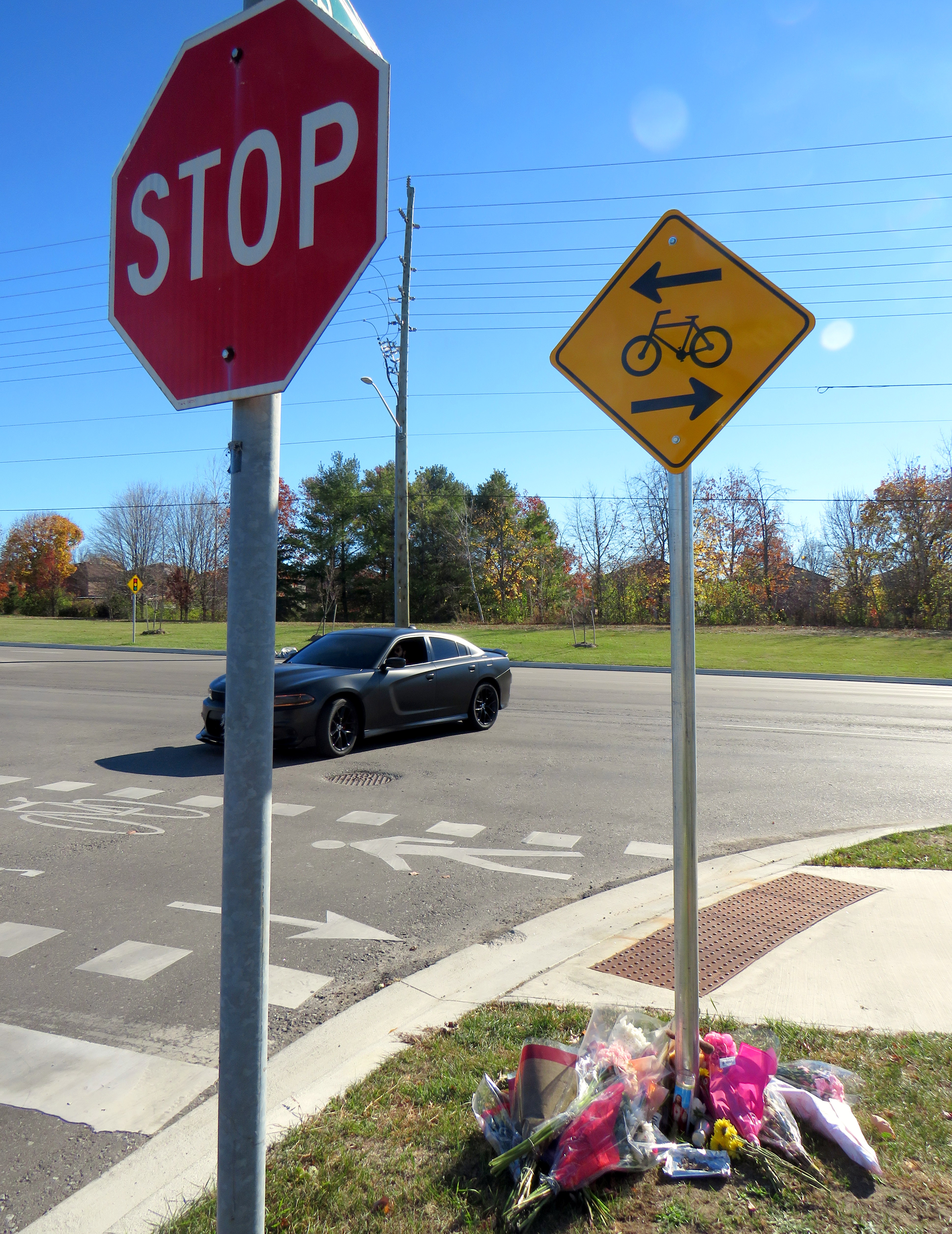
    Memorial for 13-year-old Kirsty, who was struck and killed while riding a bicycle in Ajax on November 7
    Memorial for 13-year-old Kirsty, who was struck and killed while riding a bicycle in Ajax on November 7

    January 13, 2025 update: A 44-year-old woman was charged by Durham Regional Police with careless driving causing death, over two months after this tragic collision.


    On Thursday, November 7, at approximately 7:35 AM, a 13-year-old girl was struck and killed by the driver of a Hyundai Santa Fe (a midsized crossover SUV) at Rossland Road and Stevensgate Drive. The girl was riding a bicycle in a marked crossride, a crossing designated for both pedestrians and cyclists along a multiuse path, when she was struck and pinned beneath the vehicle.

    Multiuse paths (MUPs) are typically found in parks, particularly along waterbodies such as lakes, rivers, and creeks such as Lake Ontario or the Don River. They are shared by all sorts of people, including walkers, runners, cyclists, dog-walkers, rollerbladers, and wheelchair users, often coming into conflict on busy, narrow sections such as the Martin Goodman Trail or the Lower Don Trail.

    In the suburbs surrounding Toronto (and in a few locations within the city, such as on Lake Shore Boulevard East and Eglinton Avenue West), MUPs are a popular form of cycling infrastructure along busier roads with higher speed limits. Older boulevard MUPs required cyclists to stop and dismount at road crossings (though these instructions were usually ignored). Newer and upgraded MUPs allow cyclists to ride across intersecting roadways, at marked crossrides. Signage advises motorists to watch for cyclists and advises cyclists to slow and watch for motorists and to yield to pedestrians. At signalized intersections, most new MUPs include dedicated bicycle signals.

    It was at one of these new crossrides that Kirsty was struck and killed. Though no official police press release or any follow-up news articles provided the girl’s name, that name was clearly visible at the makeshift memorial next to where she was killed.

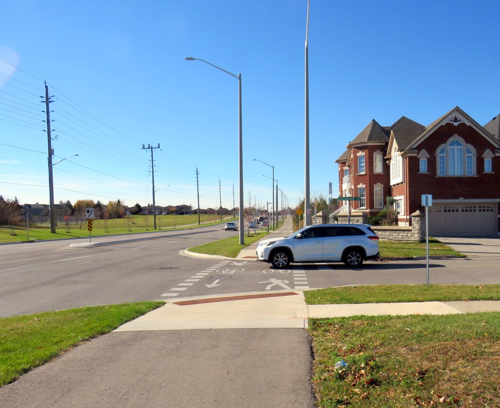
    Crossride at Stevensgate Drive, where a driver pulled out ahead into the crossride without stopping at the stop sign/stop line first.
    Crossride at Stevensgate Drive, where a driver pulled out ahead into the crossride without stopping at the stop sign/stop line first.

    Rossland Road was recently widened from two to four through lanes; a new multiuse path was built on the north side of the roadway, complete with crossrides and cyclist signals. Rossland Road is very much a road. There are no houses fronting onto the roadway, while the few driveways on Rossland provide access only to church and commercial plaza parking lots.

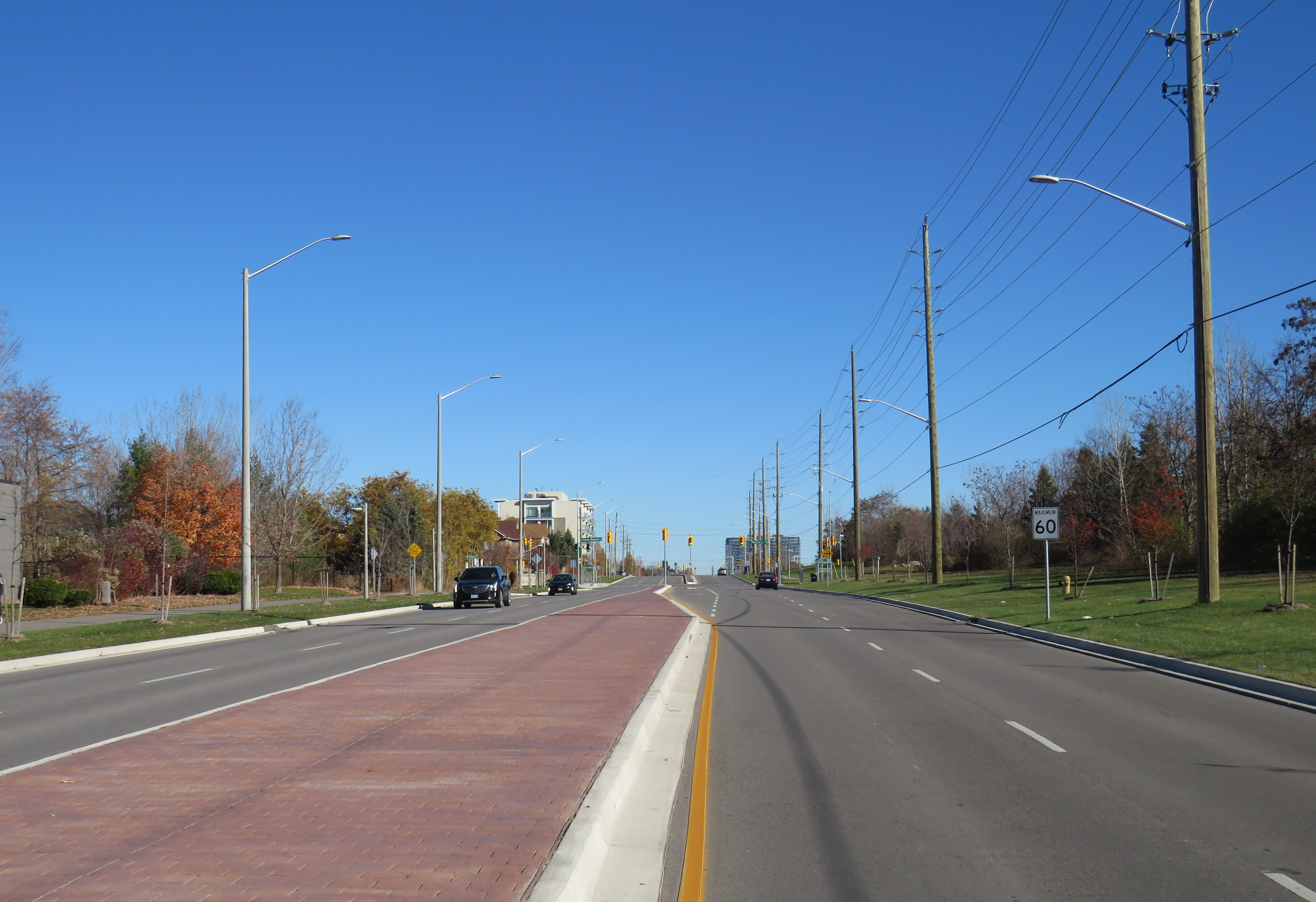
    Rossland Road in Ajax has two lanes in each direction, with a concrete median in between. The speed limit on Rossland is 60 km/h.

    Stevensgate Drive, which leads north from Rossland Road, is a quiet residential street with about two dozen homes and an evangelical church. A stop sign controls traffic at Rossland Road. Though Stevensgate connects to a large subdivision to the north, there are several other streets with signalized intersections that also provide access to the community.

    Motorists take wide turns pulling into Stevensgate Drive. The memorial is below.
    Motorists take wide turns pulling into Stevensgate Drive

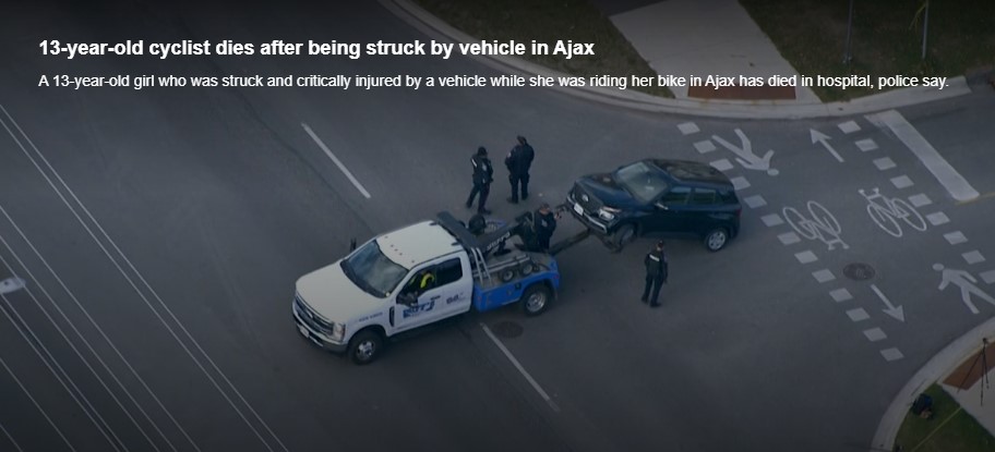
    When Kirsty was struck, it was by the southbound Santa Fe driver who would have passed a stop sign and a clearly painted stop line before entering the crossride. A CP24 news report clearly showed the vehicle being towed onto Rossland Road from the southbound direction. At 7:35 AM, it was daylight.

    Screenshot from CP24 report
    Screenshot from CP24 report

    Drivers rolling through stop signs are a common occurrence, even though the law clearly states that a full and complete stop at the stop sign and painted stop line is required before proceeding. Had the driver done so, this tragedy most likely would have been prevented.

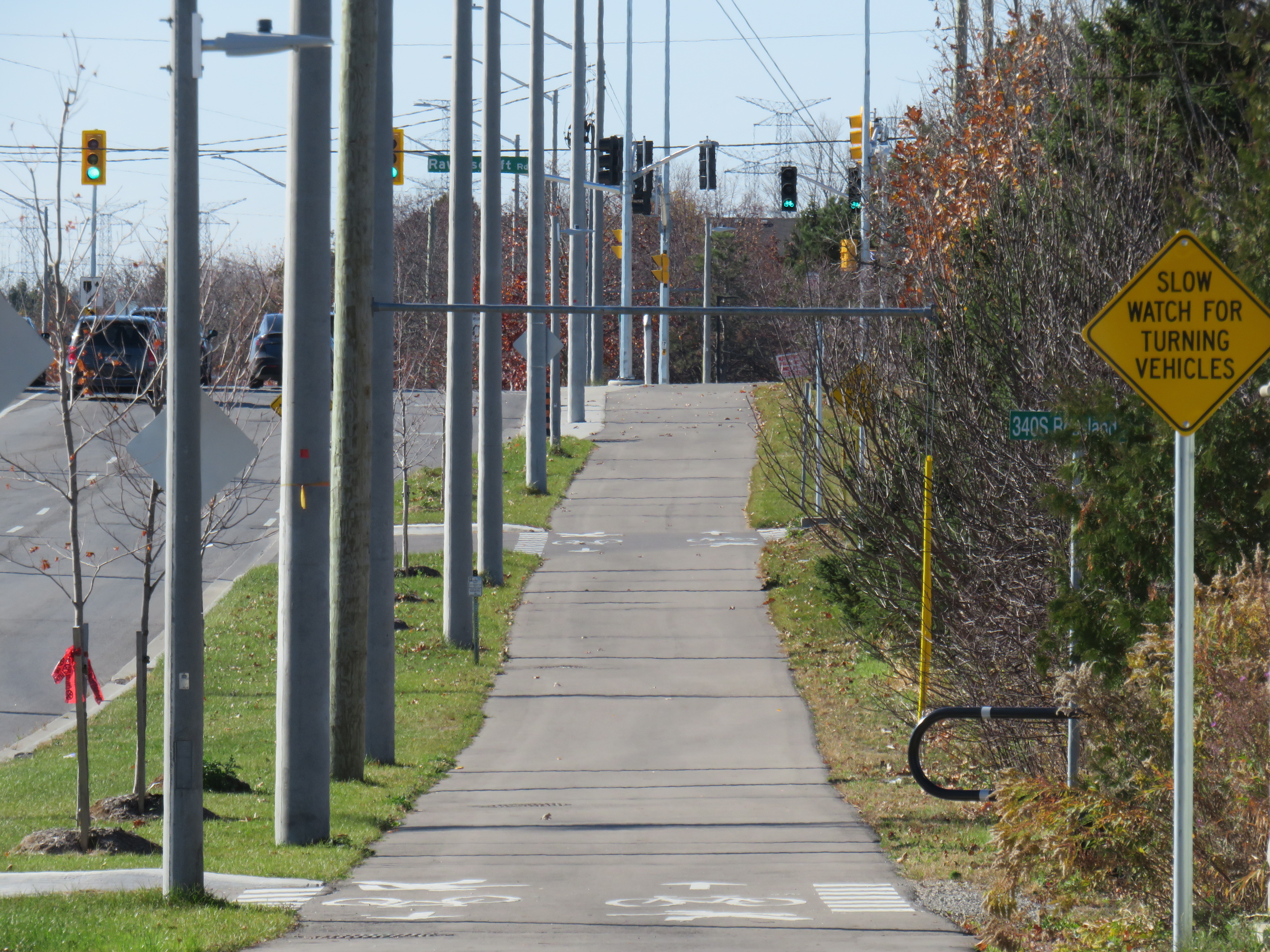
    Looking west along the multiuse path from Stevensgate Drive, towards Ravenscroft Road
    Looking west along the multiuse path, towards Ravenscroft Road

    Two days later, on Saturday, November 9, I visited the scene. I noted the roadside memorial next to the stop sign facing Stevensgate Drive. While I was there, several people stopped to visit the memorial; at least two people left flowers and cards of sympathy.

    While there, I mounted a small digital camera on the trunk of a car parked on the west side of Stevensgate, about 75 metres north of the intersection, in a legal parking spot. The camera, mounted on a mini-tripod, was mostly inconspicuous. Within 25 minutes, five motorists improperly stopped after the stop line and into the crossride; two properly stopped before creeping up to make their turn. Two drivers also made fast, wide right turns into Stevensgate during that time. The edited video below shows motorists’ actions during that 25 minutes

    Video taken on Saturday, November 9 showing motorists driving south on
    Stevensgate Drive towards Rossland Road (3 minutes, 7 seconds)

    While taking photographs and recording the videos, a resident, who lived a few houses north of the intersection, came to talk to me, and asked if I knew the girl. I explained why I was there, and we had a short, but good chat, about the collision and road safety. He noted that it is hard to see traffic from the stop line, and that he has to pull forward before turning. But he agreed that the stop line was there for a reason, and that drivers often rush to get onto Rossland.

    Police enforcement is not necessarily the answer. There are too many intersections to watch, and the careless driving behaviours exhibited are normalized. In Toronto, it is cyclists on quiet streets and in public parks who are typically targeted at stop signs, not motorists, even though cyclists are the more vulnerable road users.

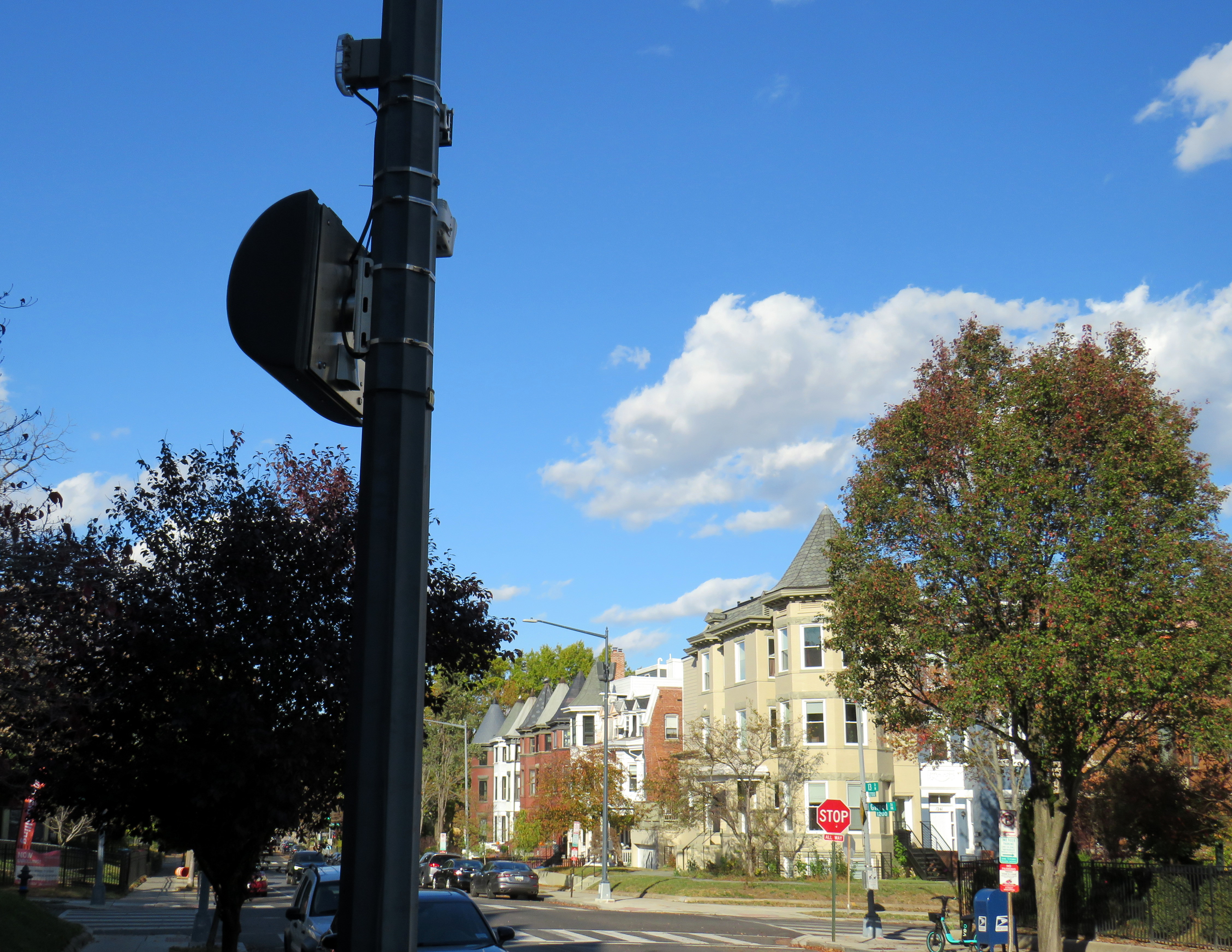
    In Washington DC, there are stop sign cameras mounted at specific locations, though there are only about a dozen of those throughout the city at any given time. These could provide a useful tool for targeted automated enforcement on Ontario’s roads to reinforce proper driving behaviour.

    A pole-mounted camera faces an all-way stop in Washington DC
    A pole-mounted camera faces an all-way stop in Washington DC

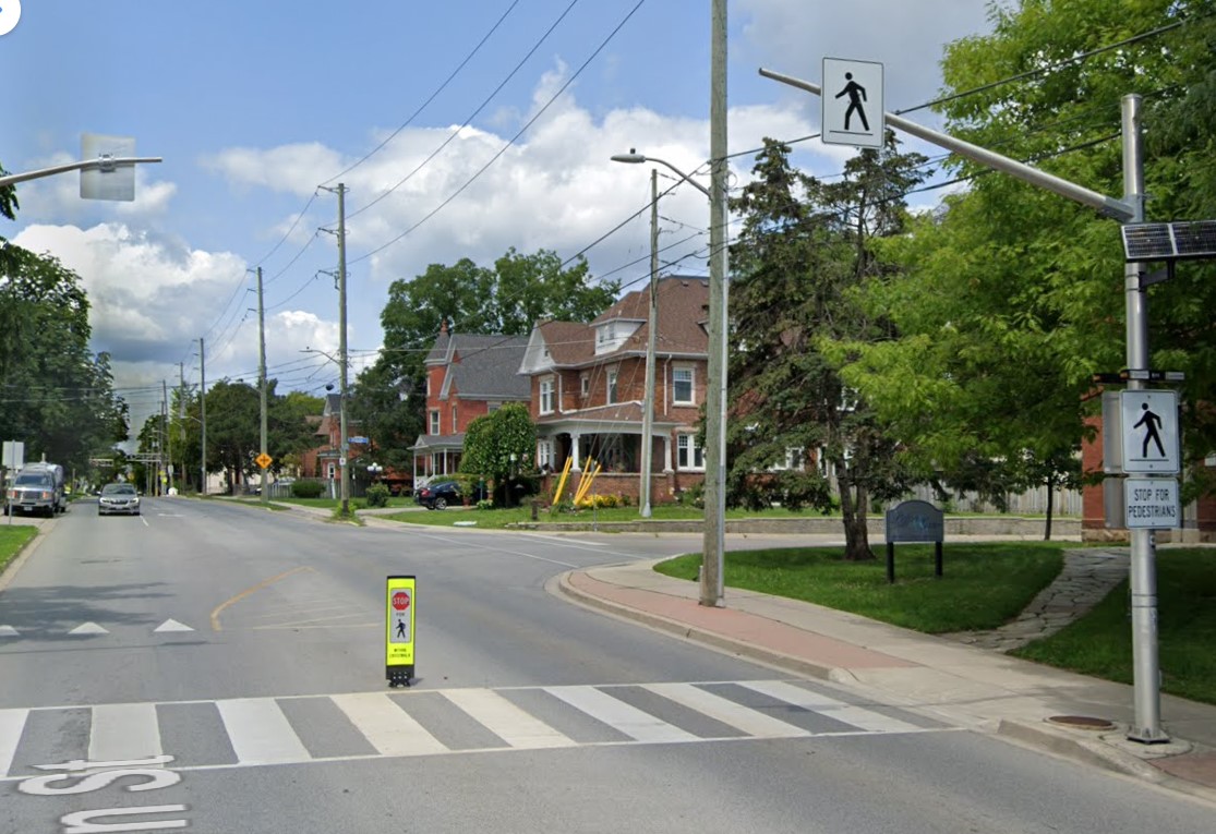
    Intersections should also be redesigned to improve the visibility of pedestrians and cyclists at crosswalks and crossrides and act to slow down motorists; raised sidewalks and path crossings would act as a speed hump as well as enhance visibility. A concrete island or short median at the stop sign would force motorists to approach the stop at a slower speed and prevent wide turns on to and off the intersecting street. A quick and inexpensive (though less-effective) solution could be to place wide knock-down bollards with supplemental crossing and stop sign messages in the middle of the roadway at each stop bar and crosswalk/crossride. Though this is best as a short-term measure.

    A wide knock-down bollard designed to provide additional visibility to a crosswalk
    (Milton, Ontario, via Google Streetview)

    As the provincial government vindictively overrides municipalities’ ability to provide safer on-road cycling infrastructure, off-street infrastructure, such as MUPs, will remain an important tool for promoting active transportation, especially in suburban areas and high-traffic neighbourhoods. Though boulevard MUPs provide separation from traffic in most cases, they are particularly hazardous at intersections, especially when motorists are distracted, aggressive, or just merely careless. There is much more that can and should be done to make them safer for all road users.

  • Deadcatting: Doug Ford’s big dig

    We need a Highway 401 Tunnel like we need a dead cat on the dining room table

    On Wednesday, September 25, Ontario Premier Doug Ford, along with transportation minister Pradmeet Sarkaria, announced that the provincial government would fund a feasibility study on building a new highway tunnel under Highway 401 from Peel Region to Durham Region, along with an unspecified new transit facility.

    Earlier this week, Doug Ford exclaimed that those living in homeless encampments and anyone else without housing who he thought could work should “get off their a-s-s and start working like everyone else.” The day before that, we learned that Ford’s Progressive Conservative government would prohibit new bicycle infrastructure if it took road space away from motorists.

    The old Doug Ford — the angry bull-in-a-china-shop we remember from 2018-2019 — is back, and it is clear that governing, in fact, has not changed him. After six years, and a rumoured early provincial election, Doug Ford will need to run on something, because there’s little to show for his promises of getting housing built, transit projects completed, and hospitals fixed. An RCMP investigation continues to look at the government’s Greenbelt land swaps, and it is rare for provincial or federal governments in Canada to get elected with a majority three times in a row. So here we are.

    But after three straight days of political red meat policy announcements, the strategy has become clear: Doug Ford is “deadcatting.” Dead cat theory, popularized during the leadership of former London mayor and British prime minister Boris Johnson, is the practice of suddenly throwing down an outrageous policy or statement to divert attention away from an unpleasant topic. The shocked audience is suddenly compelled to talk about the metaphorical dead cat thrown on the table. In the United States in recent weeks, dead cats have become less metaphorical, with baseless and racist accusations against Haitian migrants in Ohio spread by Donald Trump, vice-presidential candidate J.D. Vance, and far-right commentators.

    The strategy is thought to come from Lynton Crosby, an Australian conservative strategist who worked on Johnson’s mayoral and UK Conservative leadership campaigns, as well as Canada’s Conservative Party in 2015.

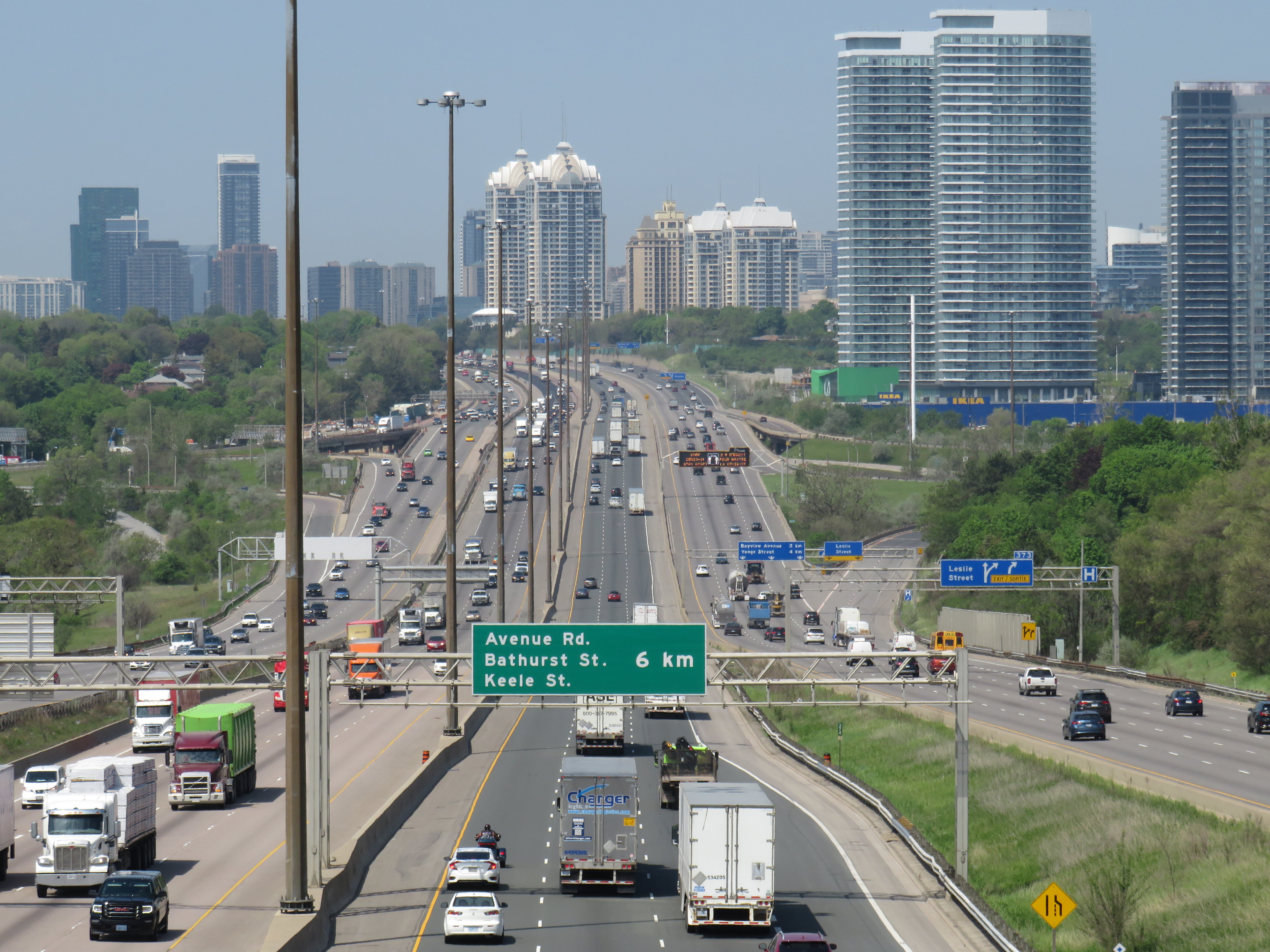
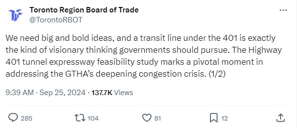
    There is no way a Highway 401 tunnel will be built. Not only would it be the longest road tunnel in the world, but the long on-ramps and off-ramps required to access a deep-bore urban highway tunnel will make it completely infeasible. The proposal also completely ignores the problem of induced demand, and it won’t solve the problem of where the traffic goes when it gets off that additional highway. For these reasons, it was especially disappointing to see the Toronto and Region Board of Trade (TRBoT) endorse the idea.

    TRBoT post on September 25, 2024

    There are things that can help alleviate traffic. One is ensuring that transit projects are completed, funded, and maintained. That doesn’t just mean building and completing projects like the Crosstown LRT and the Ontario Line, it’s also making sure the system remains in excellent condition to avoid problems like the persistent slow orders in the Toronto Subway. It also means making the best use of existing infrastructure, like Highway 407, for goods movement. Highway 407 passes by every major freight yard in Greater Toronto, but trucks clog Highway 401, Highway 7, and Steeles Avenue instead because of the high tolls. And it means active transportation improvements, like bike lanes and multi-use paths.

    What we don’t need are more dead cats to distract us from the real problems.