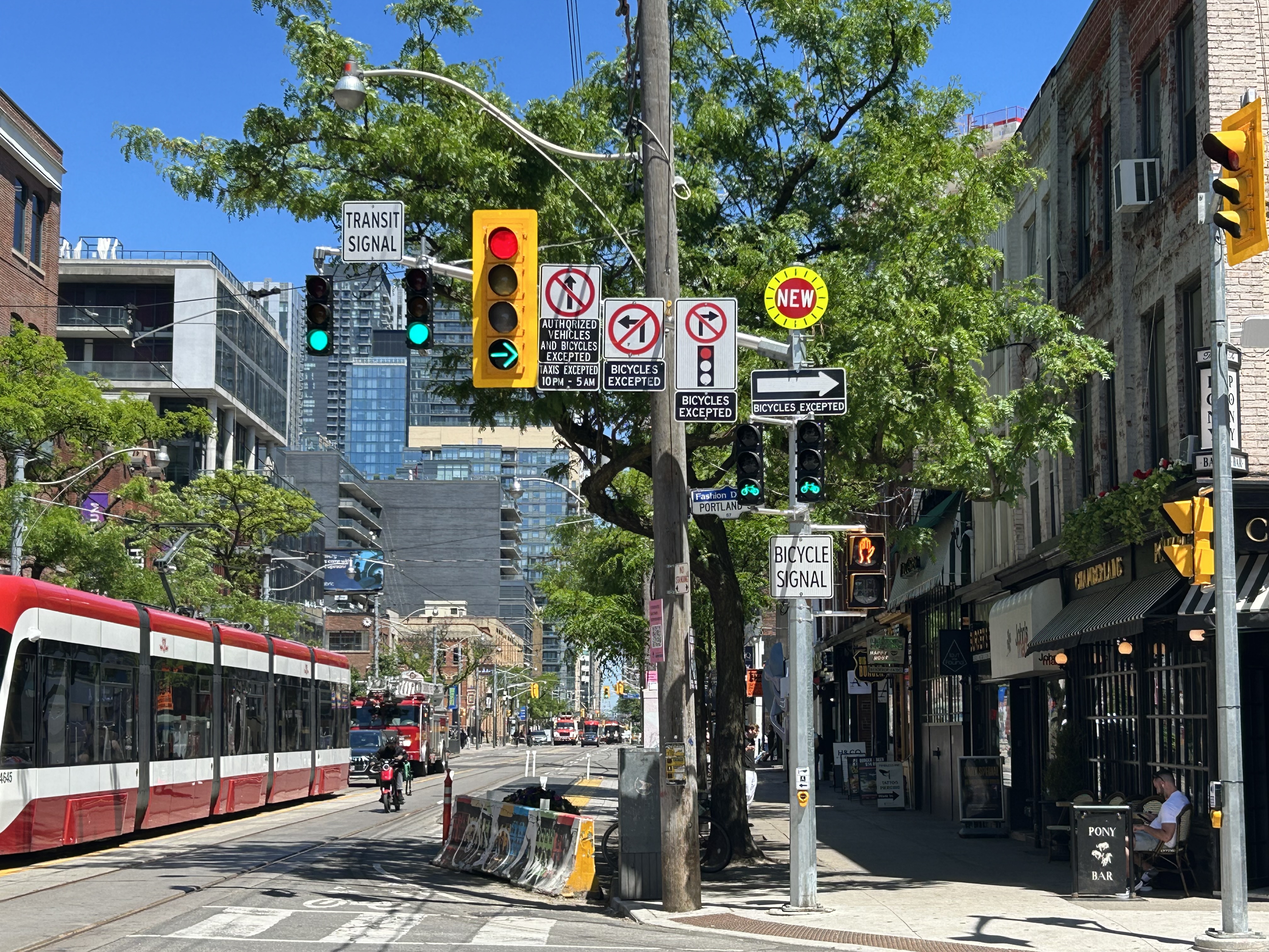
A mess of signs and signals on King Street West at Portland Avenue
On a lovely weekday afternoon in early June, I went for a ride through Downtown Toronto to check out the changes to Portland Street between Richmond Avenue and Front Street. This side street, just west of the downtown core, connects the busy Richmond-Adelaide cycle tracks with the Puente De Luz walking/cycling bridge across the Union Station Rail Corridor to CityPlace and via Dan Leckie Way to the Waterfront.
While the City of Toronto is currently restricted in adding new cycling lanes on major corridors, it continues to piece together alternative routes where possible; Portland Street, which parallels congested Spadina Avenue and Bathurst Street, is one of those opportunities. A new two-way cycle track was opened while most of Portland Street itself is now one-way for motorists.
Looking south at the end of Portland Street towards CityPlace and the ramp to the Puente De Luz Bridge (bridge at far left)
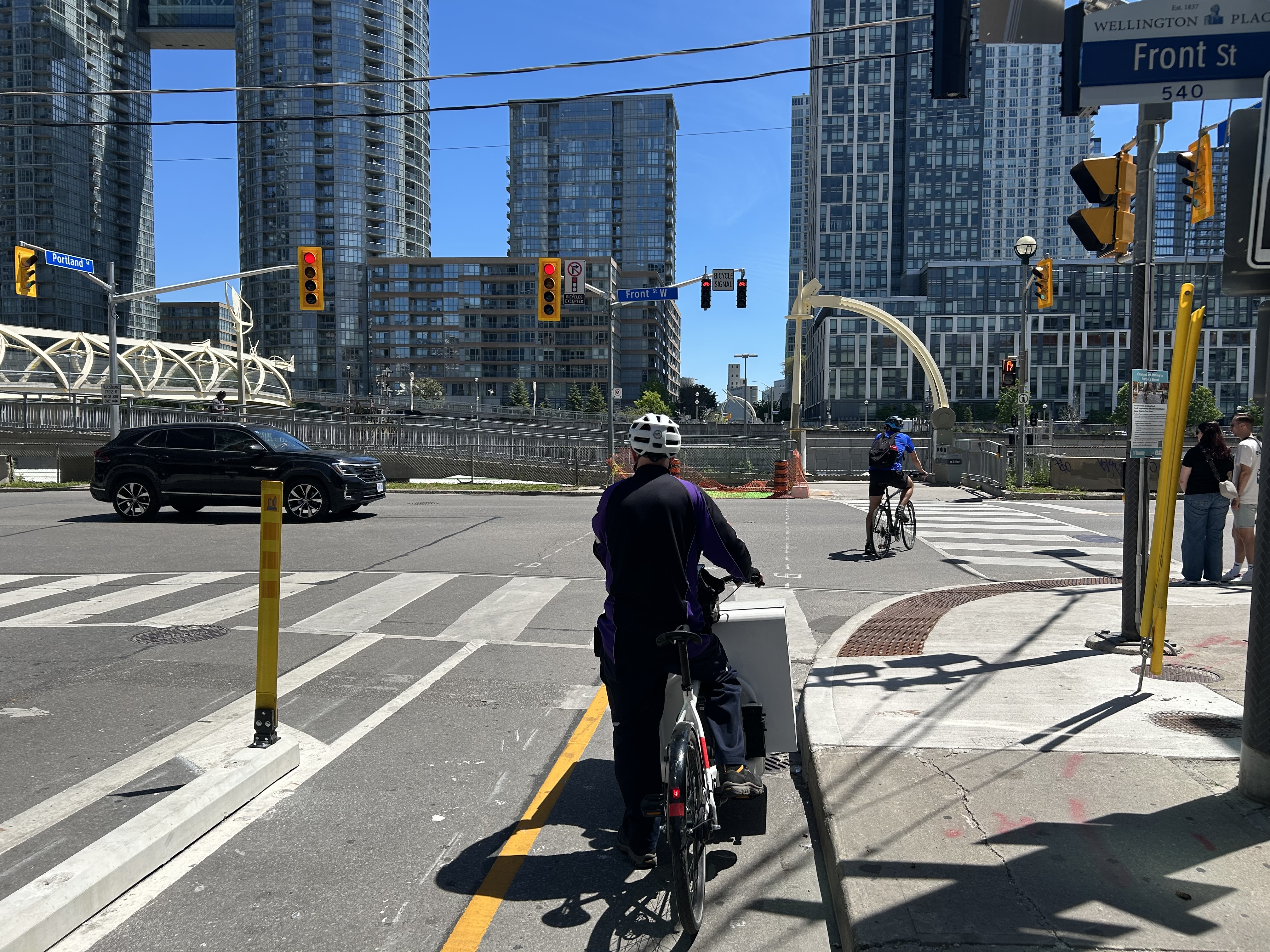
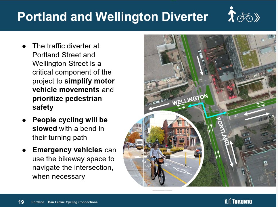
At Portland and Wellington Streets, an interesting new traffic alignment diverts motor traffic around the complex intersection while permitting through cyclist and pedestrian movement on all sides, improving safety for all road users. On Portland Street northbound and southbound, drivers are required to turn right onto Wellington maintaining local access while discouraging through drivers. This new layout, complete with Muskoka chairs laid out in the middle of the intersection is unusual for Toronto and is more common in cycling-friendly cities such as Montreal. Emergency vehicles can still pass through, following the cycling paths.
Wellington Street is a designated east-west cycling route connecting the Downtown Core and west end neighbourhoods like Parkdale and Liberty Village and will eventually hookup with an extension of the West Toronto Railpath. Together with increased density in the downtown area, this intersection will only get busier with cyclists and pedestrians in the future.
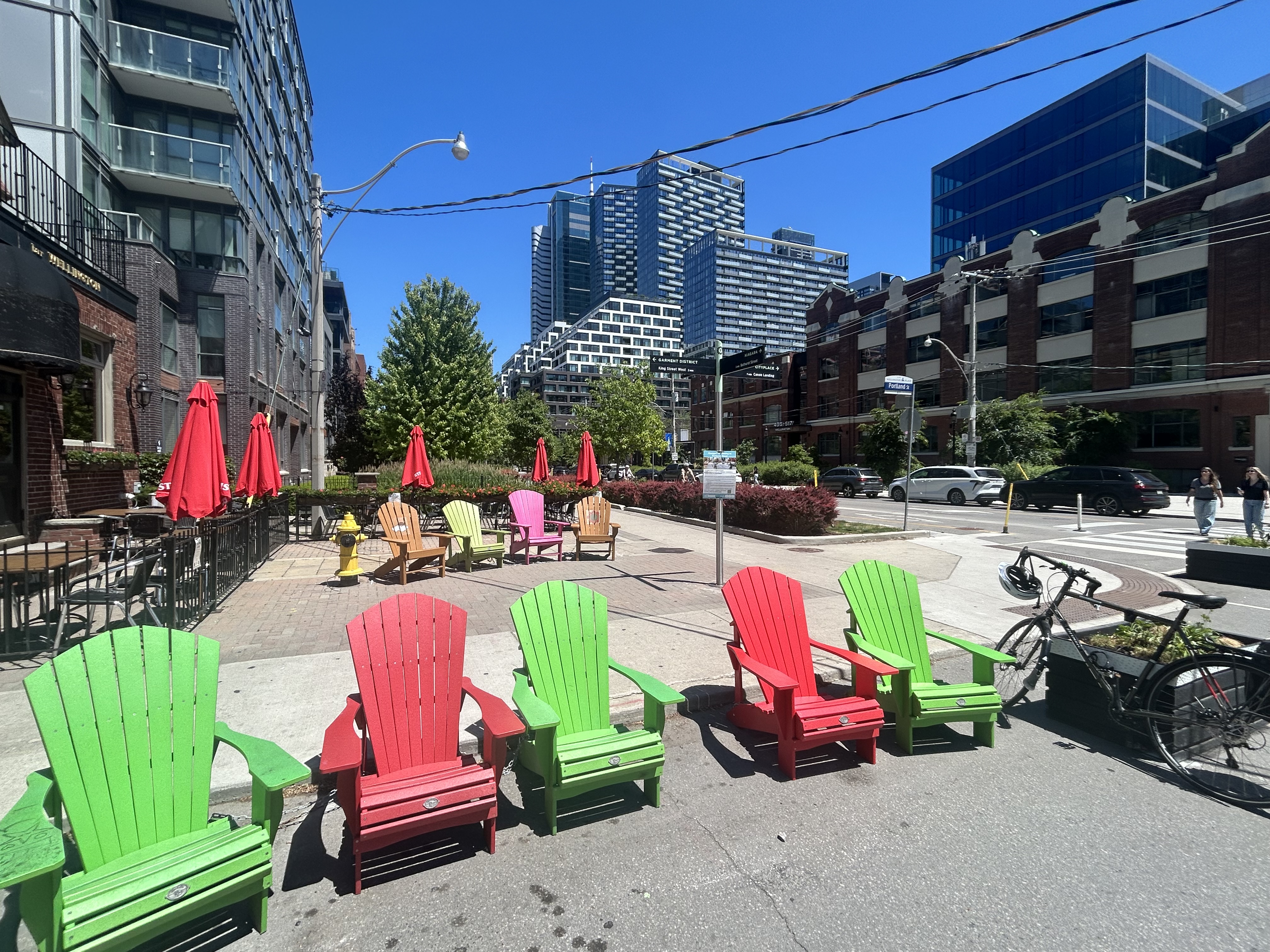
Portland looking north at Wellington. Motorists must turn in one direction from Wellington or Portland, opening up the middle of the crossing to a four-way cycling intersection, with planters and colourful Muskoka chairs Comfortable places to sit in the middle of an intersection
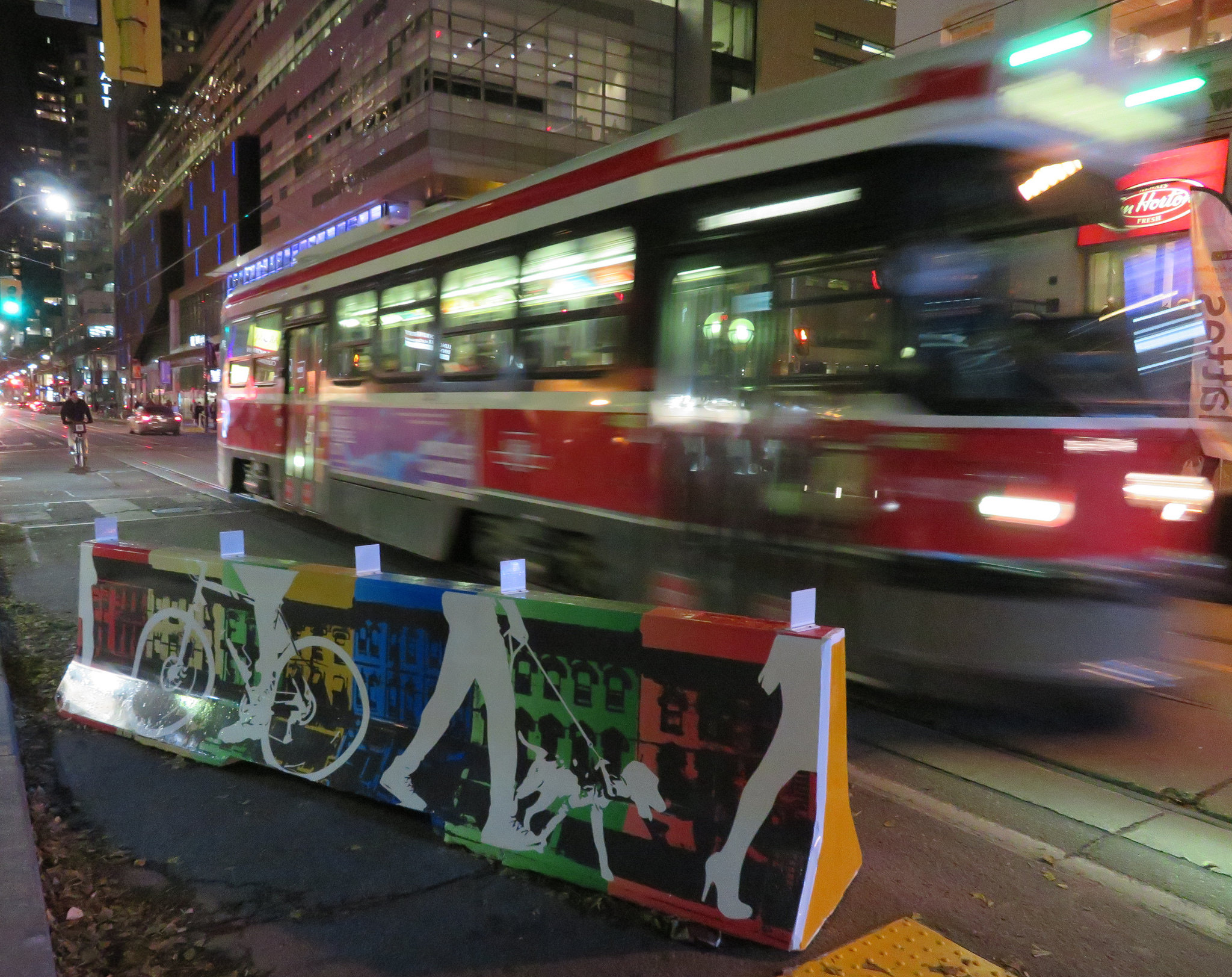
Despite the very unToronto urban intervention at Portland and Wellington, a very Toronto intervention continues one block north at King Street. Though the King Street Pilot was launched in November 2017, over eight years ago, little has been done since to improve the street for pedestrians or transit users. To discourage motorists from illegally proceeding through intersections (intended to eliminate congestion for streetcars and buses), the curb lanes are blocked with painted Jersey barriers. More recently, additional traffic lights were installed, so there are now signals for transit, cyclists, motorists, and pedestrians.
At Portland, and every other intersection that drivers are not permitted to go straight (taxi drivers are excepted after 10 pm), the traffic signals remain red at all times. A right green arrow appears for 5-10 seconds at the beginning of the cycle, allowing motorists to turn unimpeded. At Portland, however, eastbound motorists on King may not make a right on red because of the two-way cycle track on the west side of the street. Because of all these restrictions, there are seven signs facing eastbound drivers affixed to the traffic pole, along with two transit signals, one traffic signal, two bicycle signals, and one pedestrian signal.
This could have been clearer
The amount of clutter here can be confusing and is also unsightly. First off, there is no need for the “bicycle signal” sign below the two bicycle signal heads and next to the pedestrian signal. The signal aspects are already clearly for bicycles without the sign. Revising the Ontario Traffic Manual (OTM) to allow red arrows on traffic signals could both simplify the yellow traffic signal here and eliminate the need for the “no right turn on red” sign. It would also be clear then that right is the only permitted sign. Speaking of the OTM, dedicated transit signal aspects such as those used in Europe or even several American cities would eliminate the need for the “transit signal” sign and further reduce confusion. If the late night taxi exception was removed, the “no left turn” and “no straight movement” signs could be consolidated as well.
But most of all, the sign clutter makes it even more clear that the King Street Pilot configuration needs to become permanent, with raised curb extensions at the far sides of each intersection, with a level platform for streetcar boarding. Permanent planters and benches would be a visual cue to drivers that King Street is not a throughfare, but a pedestrian and transit-first corridor.
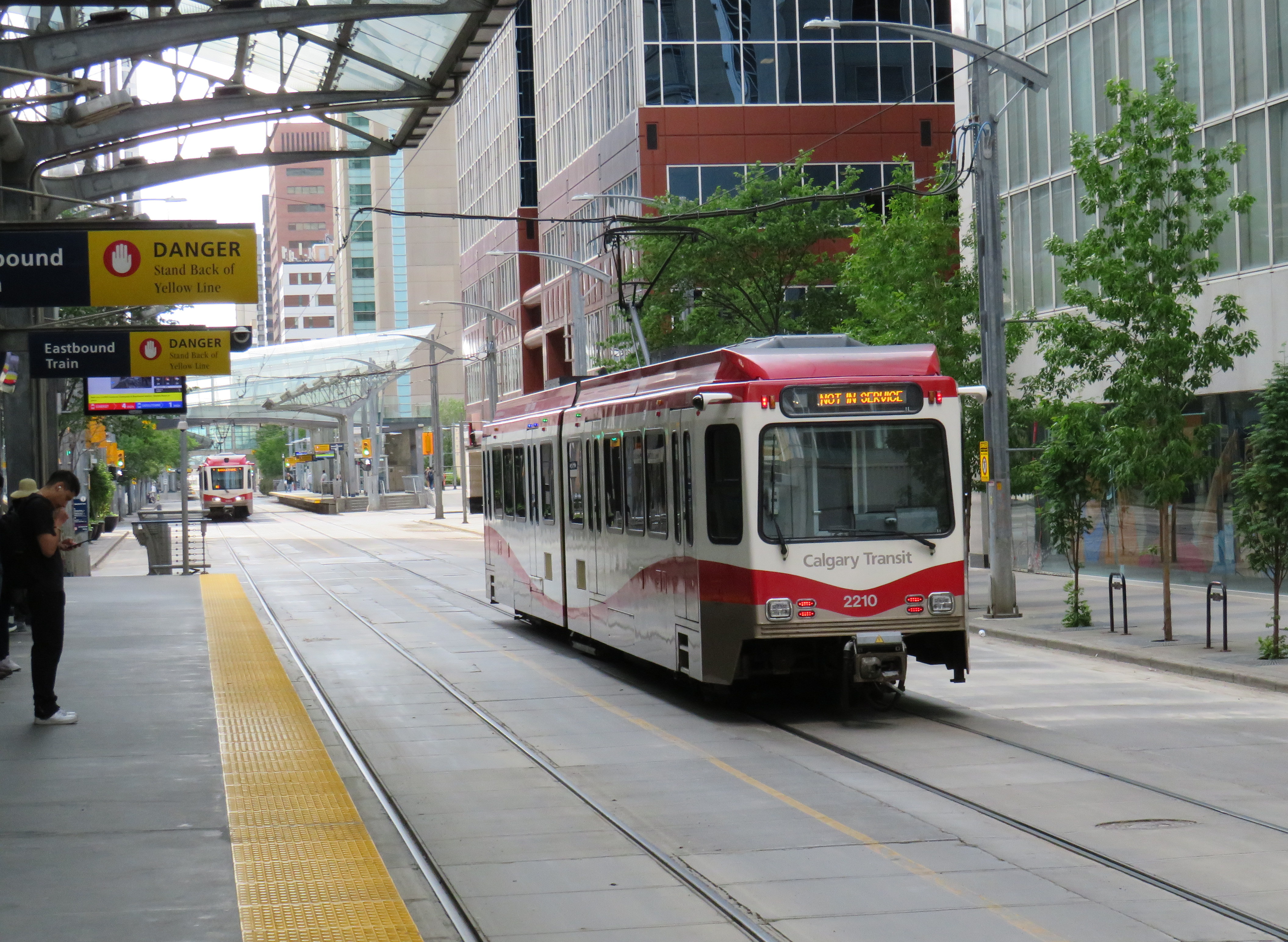
There is a lot less sign clutter along Seventh Avenue in Calgary, which is exclusively a transit and pedestrian corridor
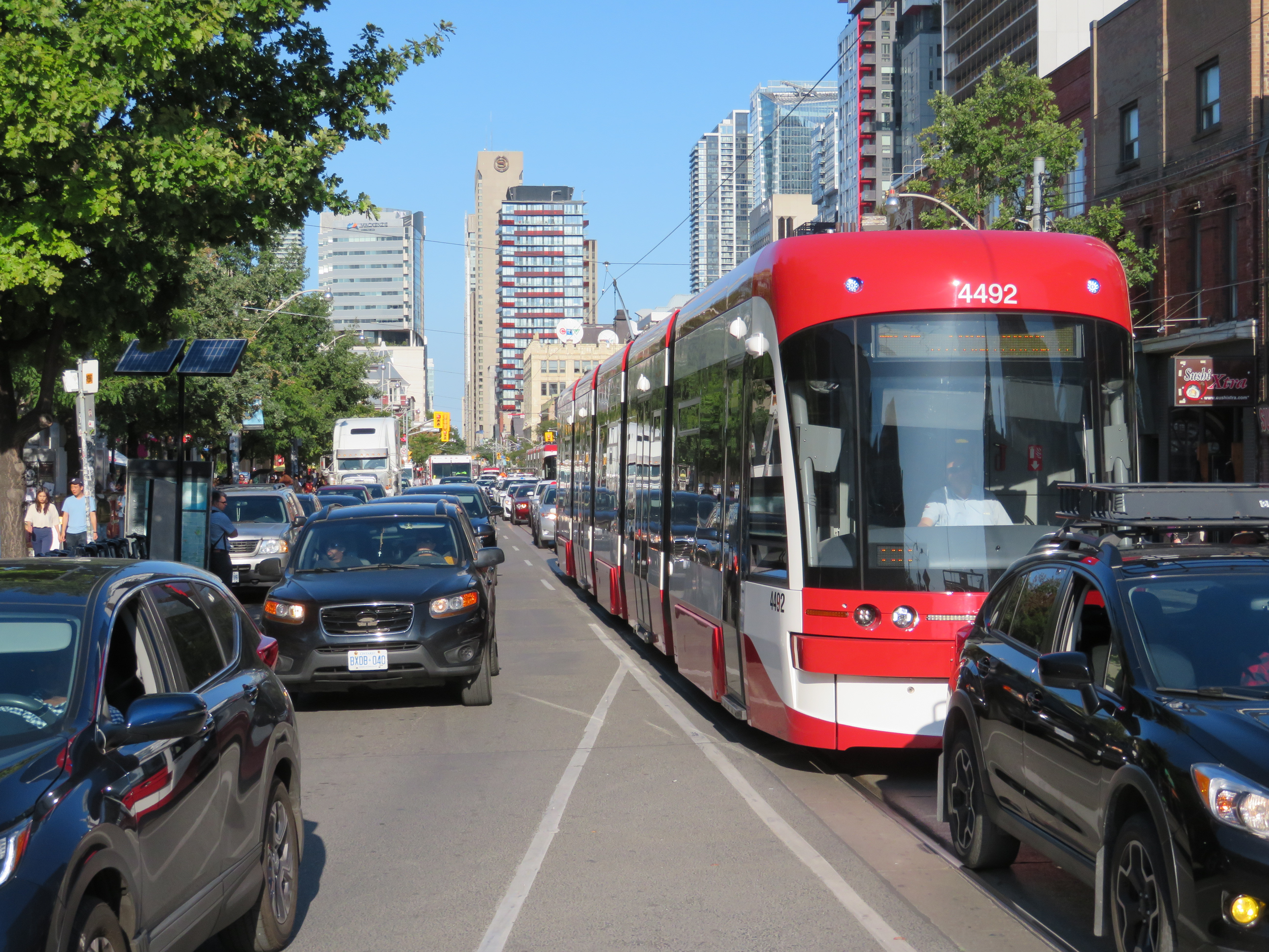
Streetcars backed up eastbound at King and University, November 28, 2023
On Tuesday, November 28, the University of Toronto’s School of Cities released their report that looked at vehicle movement and traffic violations on the King Street Transit Priority Corridor. They found that there are, on average, 6,800 illegal turns and through movements at intersections on the corridor, and less than 0.3% of offenders are stopped by Toronto Police and ticketed. Traffic enforcement was heaviest between November 2017 (when the pilot began) and March 2020 (when the COVID-19 pandemic restrictions began). Enforcement has not caught up since then.
The U of T School of Cities has provided invaluable quantification of what many Torontonians have suspected for years: the King Street Transit Priority Corridor is broken, and that there is little being done to fix it.
The transit priority corridor, which runs between Bathurst Street in the west and Jarvis Street in the east, has restrictions on through vehicle movements, where motorists must turn right at most intersections. Until 10 PM daily, only TTC buses and streetcars, emergency vehicles, and bicyclists are exempt. After 10 PM, taxis may also continue through the corridor.
The pilot program launched on November 12, 2017. The initial pilot, in which signs were erected, Jersey barriers placed to restrict the curb lane, and TTC stops moved to the far side of most intersections, was intended to optimize permanent streetscaping improvements, streetcar stop placement and transit optimization, get motorists acquainted with the new rules (at first, only warnings were issued by police) and allow time for Toronto City Council to decide on whether the pilot should be made permanent. Council approved making the transit priority corridor permanent on April 16, 2019.
Though Toronto City Council voted to transform King Street permanently, no work has started on the streetscape or public realm to do so. Just like Union Station, temporary Jersey barriers remain in place. The relocated TTC streetcar stops are left at road level, without transit shelters or accessible curbs. Drivers routinely ignore restrictions, with only a 0.3% chance of getting a $85 or $110 ticket. Meanwhile streetcars get stuck and transit riders get nowhere. On Wednesday, November 8, a Toronto police officer decided to enforce congestion on King Street… by ticketing a streetcar operator stuck in the intersection at University Avenue.
A motorist, ignoring several signs, proceeds straight through on King Street eastbound at Spadina Avenue
The problem is not just limited to through movements on King Street, though. On Tuesday, November 28, I stood at the corner of King and Spadina between 4:00 PM and 4:20 PM. The backup of cars and trucks headed southbound towards the Gardiner Expressway extended into the south side crosswalk and into the eastbound lanes at times. Motorists are not permitted to enter an intersection on a green light if they cannot clear it before the light turns red; this causes gridlock. But on more than one occasion, streetcars and pedestrians were impeded by illegal intersection blocks.
At Spadina and King, a truck and three passenger vehicles block the south side crosswalk and prevent a streetcar from proceeding straight on a green light
After standing at King and Spadina, I walked over to King and University, where the Toronto Police charged a streetcar operator earlier this month. At 5 PM, eastbound streetcars were lining up between University and John Street, unable to proceed.
Traffic jammed at King Street eastbound at University Avenue
However, motorists were able to turn right and left from University Avenue to eastbound King, blocking the east side crosswalk to pedestrians and ensuring that no streetcar could continue across. I spoke to one operator, who told me that the day before, he was stuck there for a half hour before he could move across.
The University and King intersection, at 5:00 PM on Tuesday, November 28. Note the blocked crosswalk and the line of streetcars, all with their hazard lights blinking. Eventually, one streetcar operator decides they had enough, and occupies the intersection.
While there, I counted several motorists who passed to the right of the stopped streetcar, and instead of turning right as permitted, they went straight, only contributing to the blockage ahead.
Two eastbound cars pass a stopped streetcar on the right to join the congestion ahead
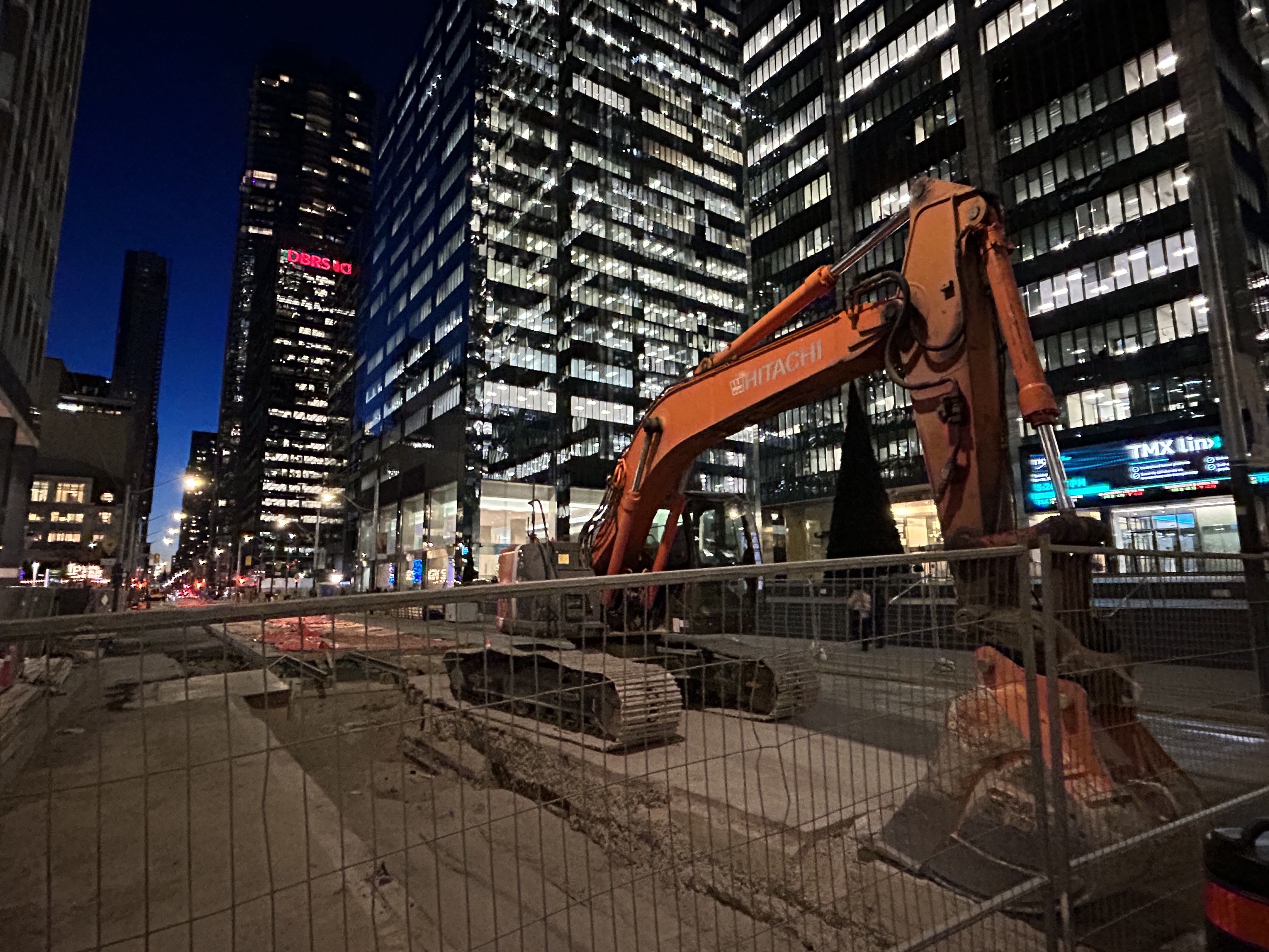
The problem downtown is exasperated by several road closures. Queen Street is closed between Bay and Victoria Streets for Ontario Line construction; this will last for at least five years. Adelaide Street, which is one-way eastbound is closed at York Street due to the delayed Adelaide Street diversion track installation that is supposed to allow Queen Streetcars to divert around the Ontario Line closure. York Street is also closed at Adelaide. There are several other lane closures on Bay, Yonge, and Richmond Streets and University Avenue for utility work.
Adelaide Street is likely to remain closed at York until early 2024
Yet, one would hope that something was done to allow transit riders to get through the downtown core, especially as the city has been aware of the severe congestion for weeks at this point. The city needs to move ahead on permanent streetscape changes to further discourage through traffic on King Street by closing the curb lanes at the far side of each intersection.
It is also clear that the Toronto Police are not too interested in ticketing motorists on King Street. Even if they were, it wouldn’t be enough, as it takes 10-15 minutes to stop and ticket a driver; automatic ticketing, similar to red light cameras, would be more effective, though traffic officers can still be strategically deployed at congestion hotspots.
It’s beyond time for this city to take transit seriously again. King Street would be a great place to start.
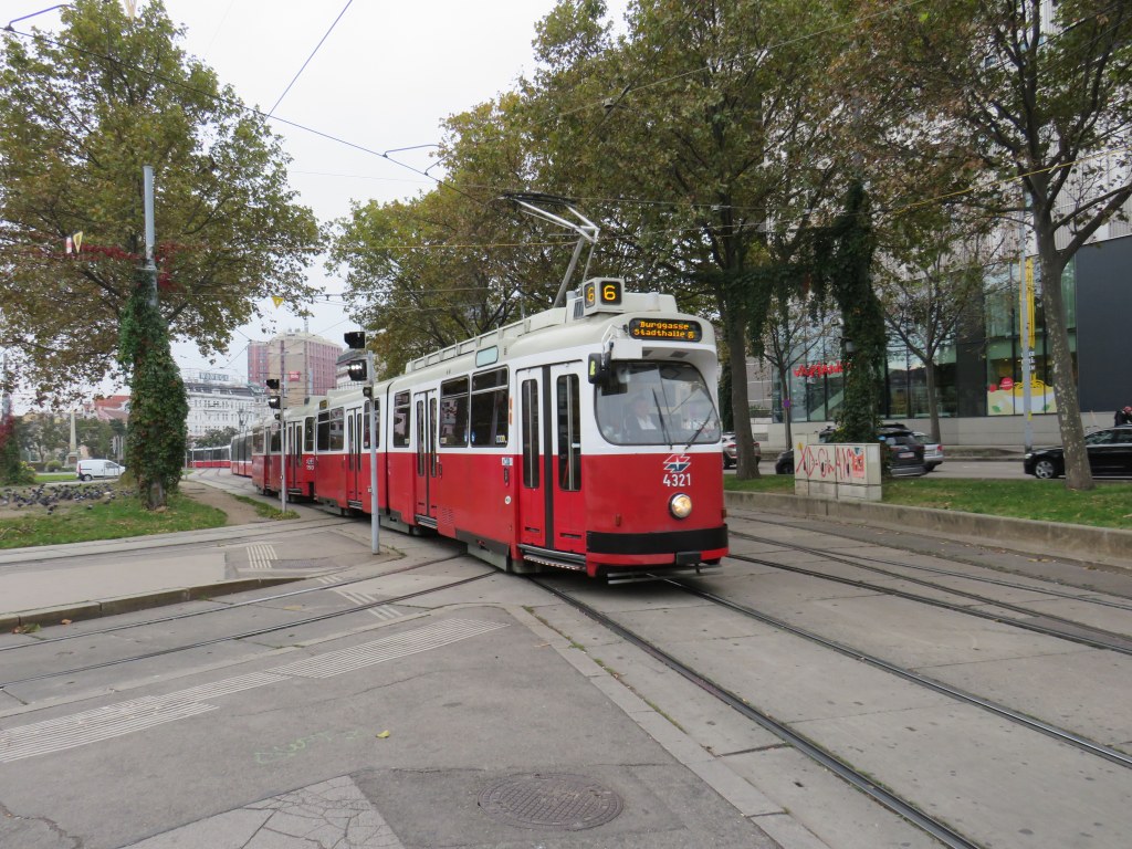
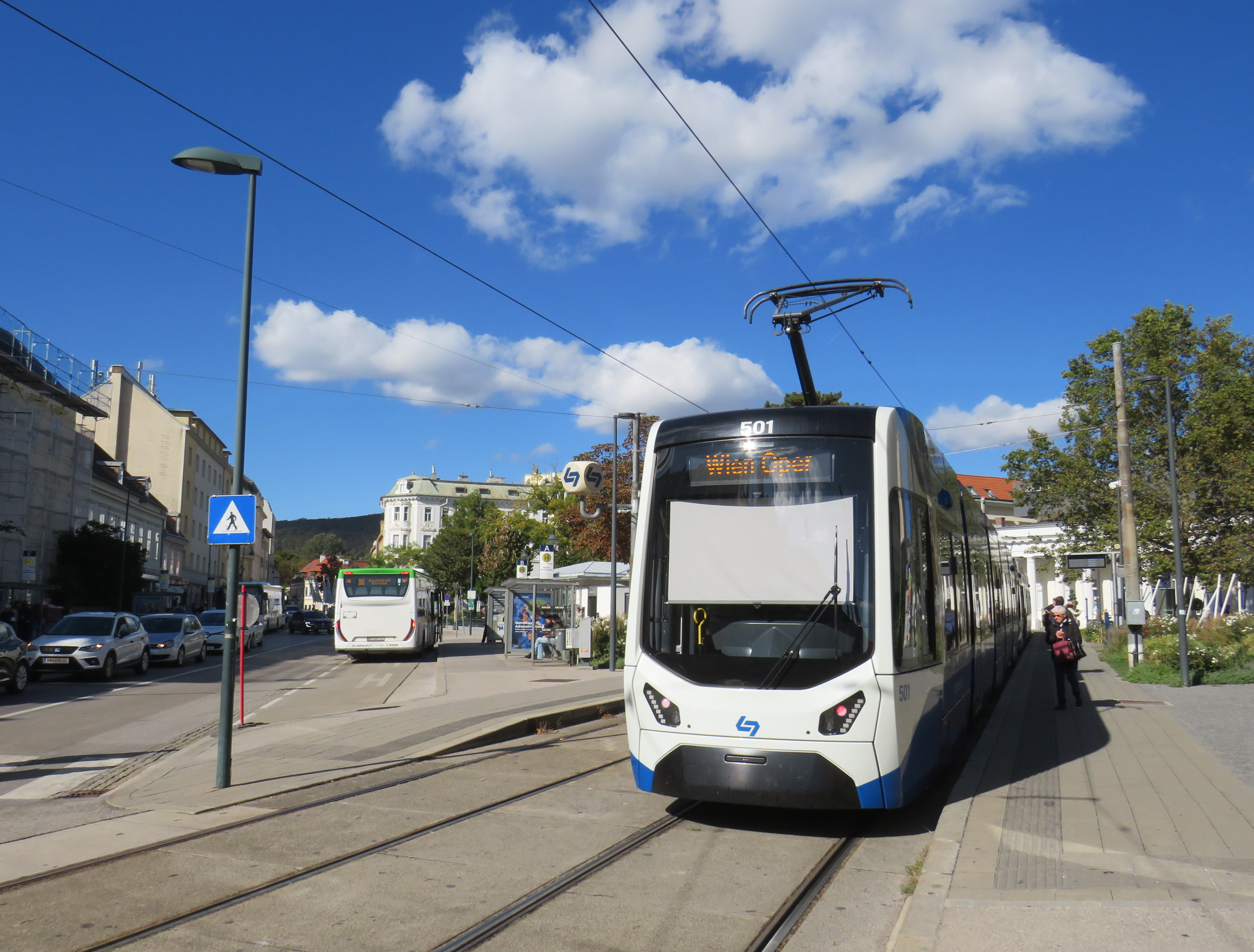
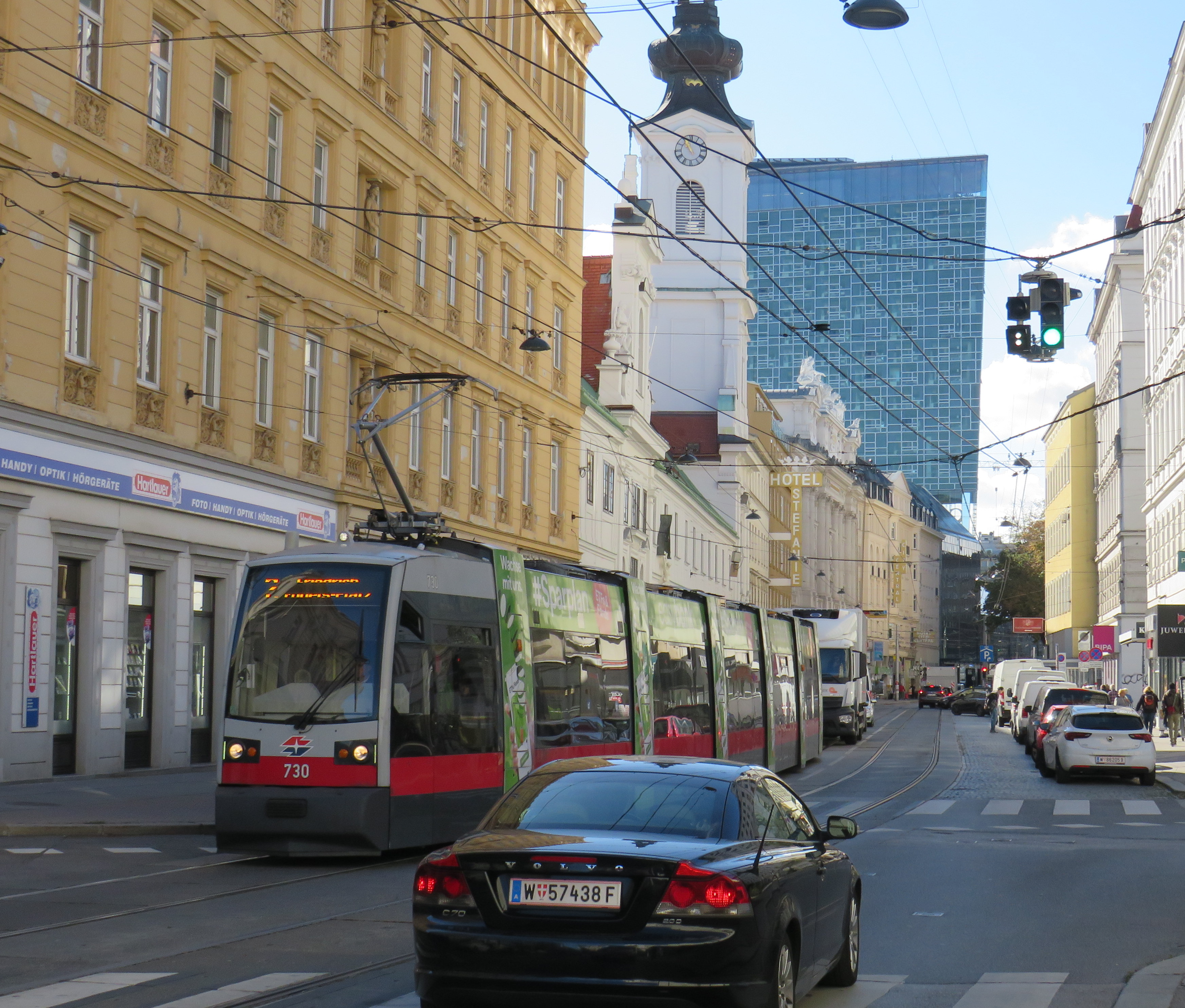
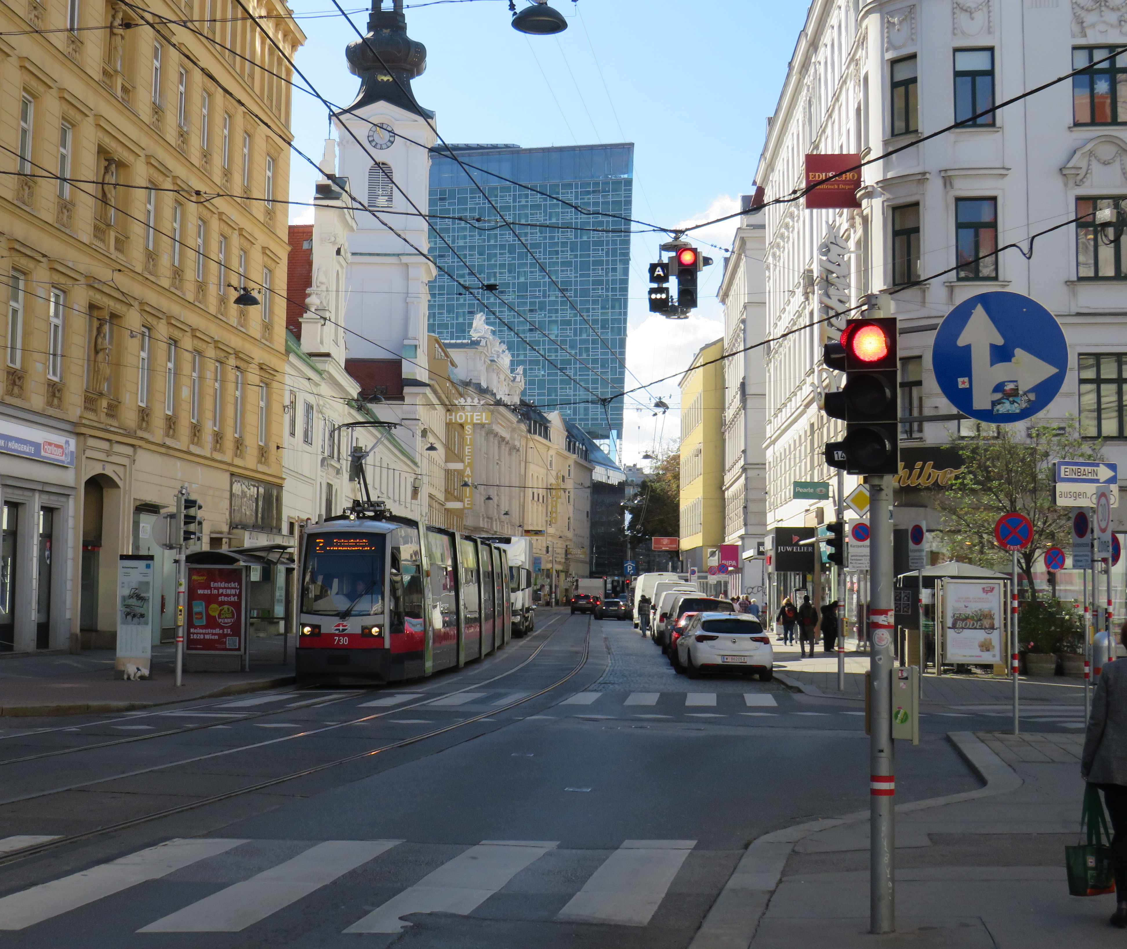
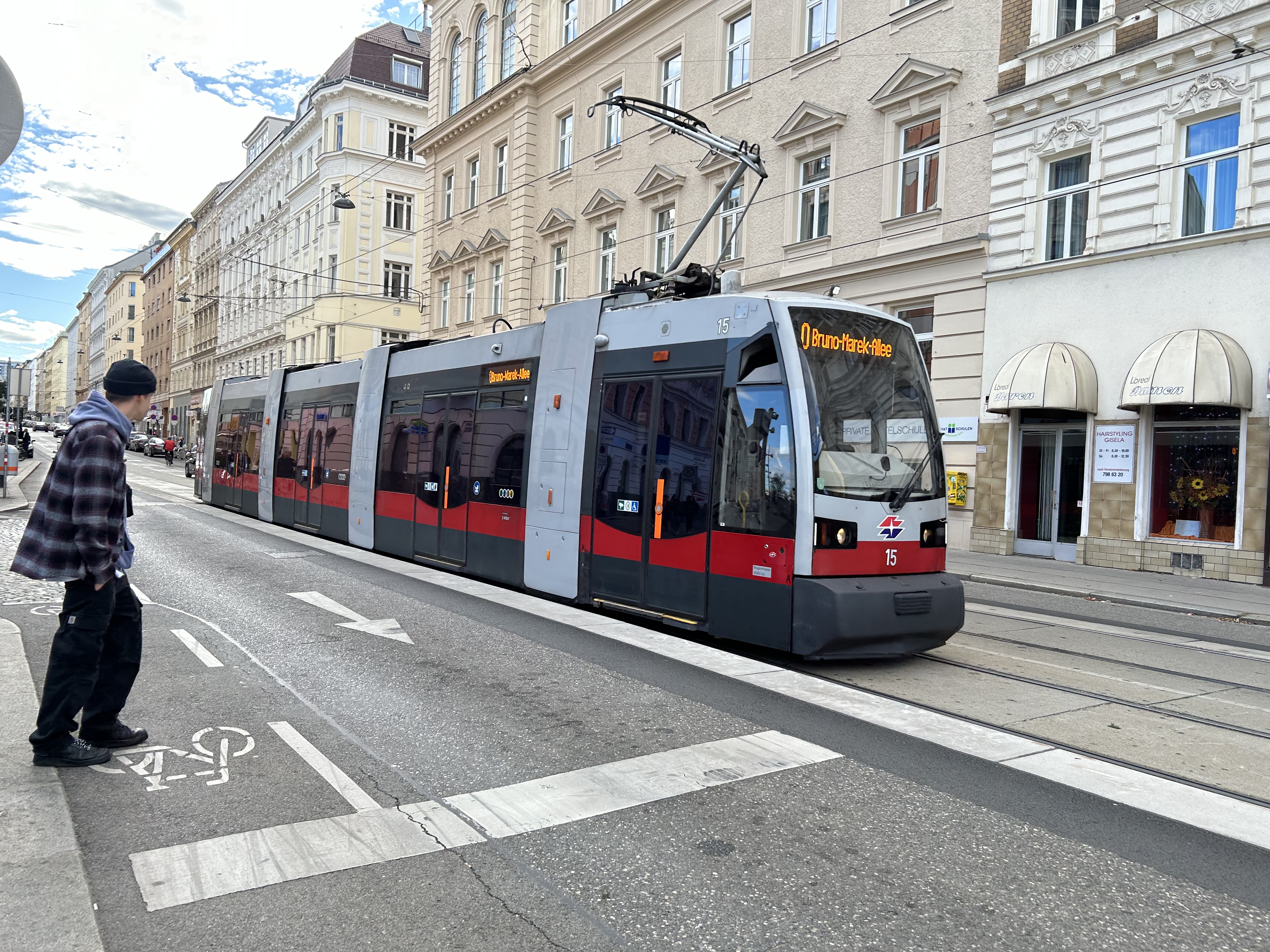
Vienna low-floor tram in the Leopoldstadt district
Back in October, my spouse and I had the opportunity to visit several countries in Central Europe: Austria, Slovakia, Hungary, and the Czech Republic, though we spent the majority of our time in and around Vienna, as that is where my spouse attended business meetings for several days; we also took time to explore the city and surrounding areas together.
While there, I experienced how serious cities operate trams seriously. In Bratislava, I saw how a streetcar priority corridor can work in a busy downtown core. In Prague, trams made it through watermain construction zones without detours or unreliable bus shuttles. In Budapest, I rode the world’s longest trams that move more people per hour than many metro lines. In Vienna, where I spent the most time, I experienced a city where transit passengers are treated with respect, and where the trams are reliable, despite no discernable signal priority and plenty of mixed-traffic operations.
Vienna is an amazing city to visit. It’s been described to me as “what people think Paris is.” That’s pretty much true. It’s a very walkable city with a fantastic café culture full of independent konditorei cafés (which offer sit-down service), with an assortment of rich, tasty cakes and great coffee. It has great art galleries and grand imperial palaces, but without the crushing crowds of Paris and Versailles. As the original Music City, it’s easy to find shows and performances to suit your tastes. (We attended the famous Wiener Staatsoper, where I took in my first live opera, ever, at a surprisingly reasonable price). It’s also a compact city, easy to walk, though the transport system is excellent. Vienna is also a great base for visiting other cities in Central Europe, where Salzburg, Bratislava, Budapest, and Prague are only a few hours away by (frequent and relatively speedy) train.
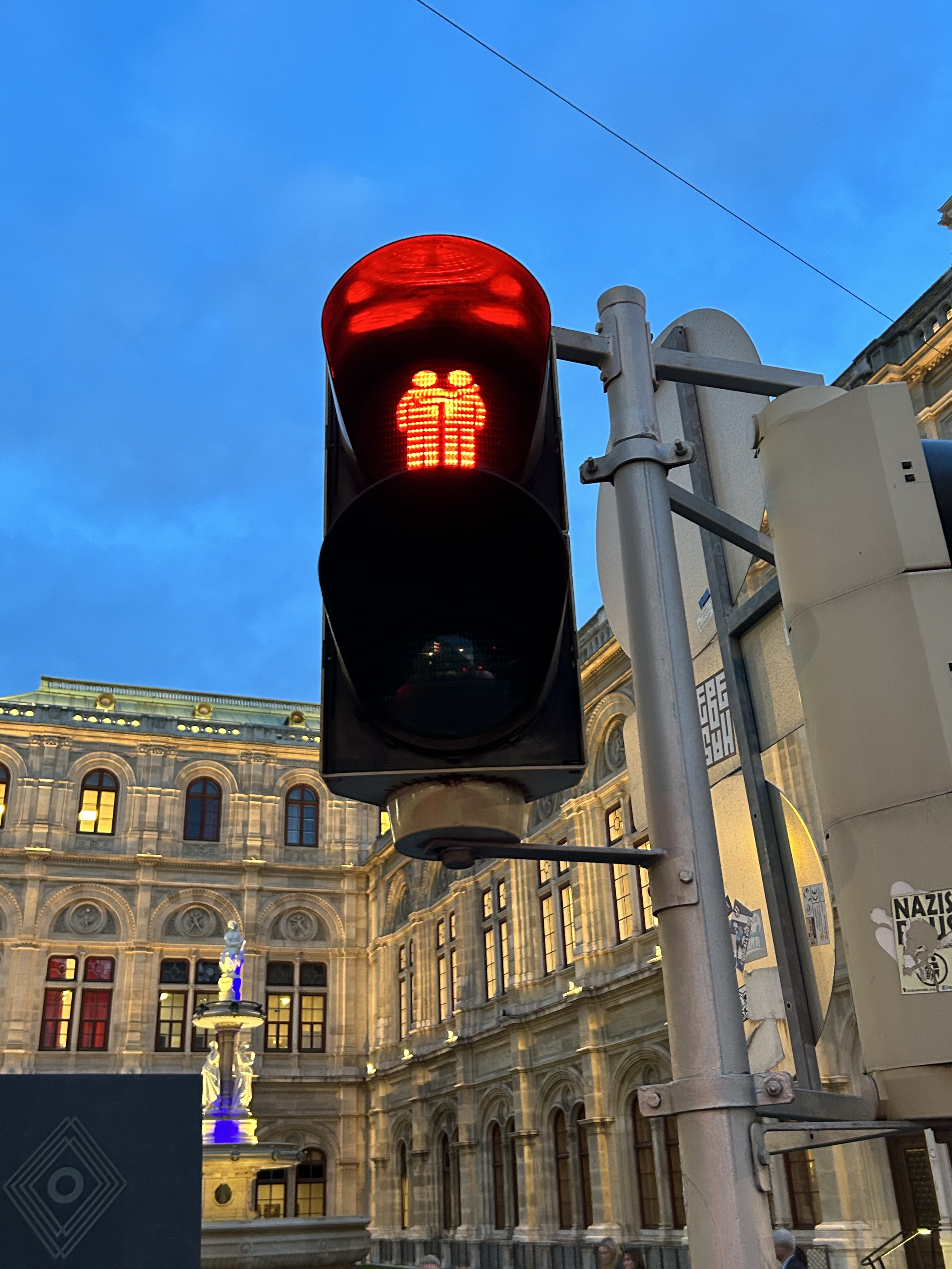
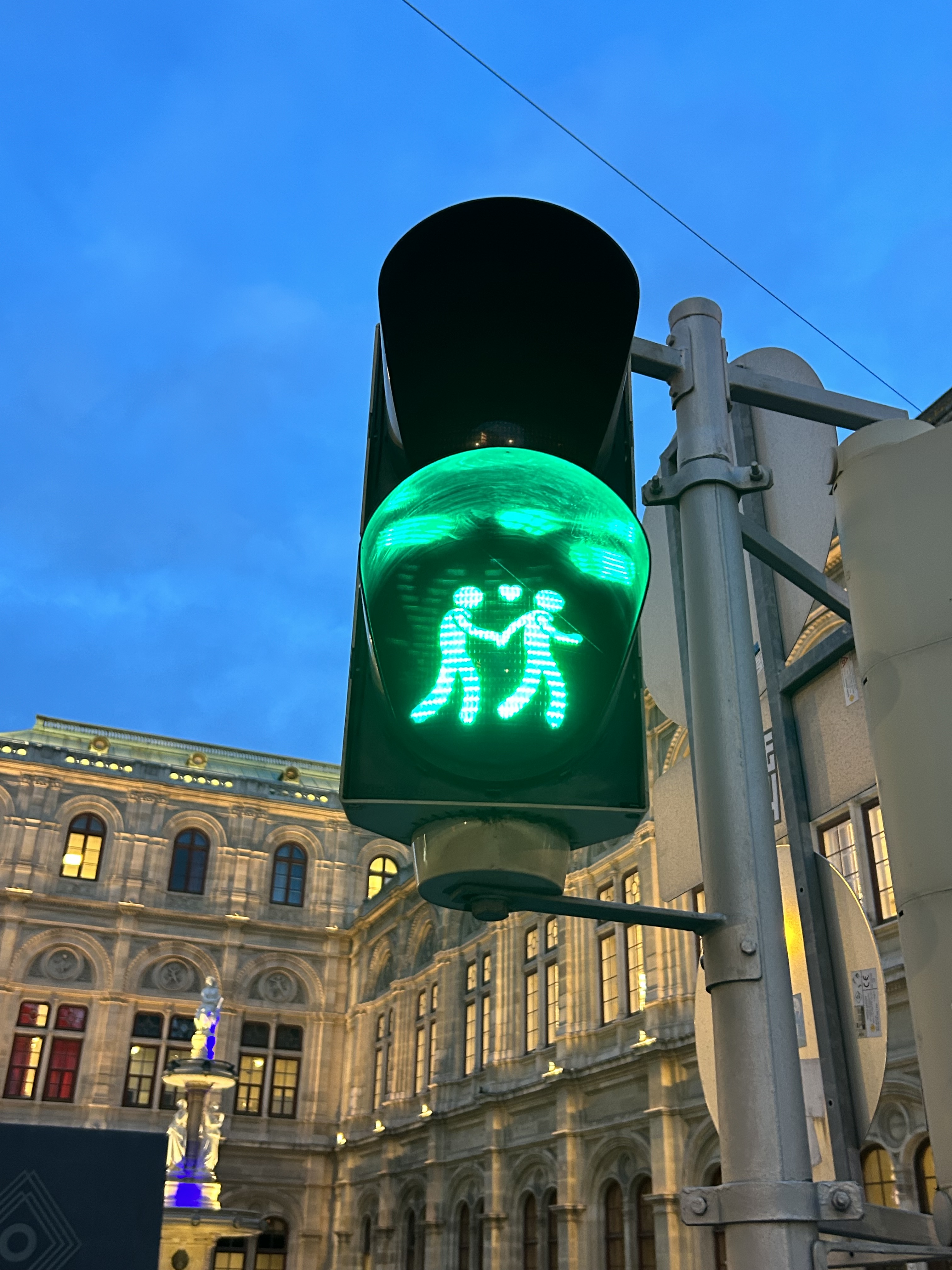
We noticed several pedestrian signs showing loving couples, rather than the standard, like this one in front of the Wiener Staatsoper (Opera House)
Vienna has one of the largest tram systems in Europe, with 30 lines over 176.9 kilometres, and a fleet of 525 cars, including modern articulated LRVs and older trams and trailers. In Vienna, trams alone carry approximately 300 million passengers a year. They run in many different environments: on-street in mixed traffic, reserved lanes, dedicated median and side-of-street rights-of-way; there is also a tram tunnel south of the city centre. Until the 1980s, Straßenbahnen (the German name for trams) were the backbone of Vienna’s transport network, with a small Stadtbahn system (now incorporated into the modern U-Bahn) and regional and suburban (S-Bahn) trains providing limited rapid transit services. Though there are now five U-Bahn lines (two of which evolved from the Stadtbahn), the tram system remains robust and very useful for getting around.
Like all four cities mentioned in this post, Vienna operates a mix of low-floor trams built in the last 25 years, as well as older high-floor trams, many of which are accompanied by an unstaffed trailer. Vienna’s entire network — trams, buses, U-Bahn, and S-Bahn — is a proof-of-payment system. Fare inspections appeared to be infrequent; neither my spouse nor I were checked during our eight days in Vienna. Tickets and passes can be purchased from a machine (found at every U-Bahn entrance and at many tram stops) or on the WienMobil app.
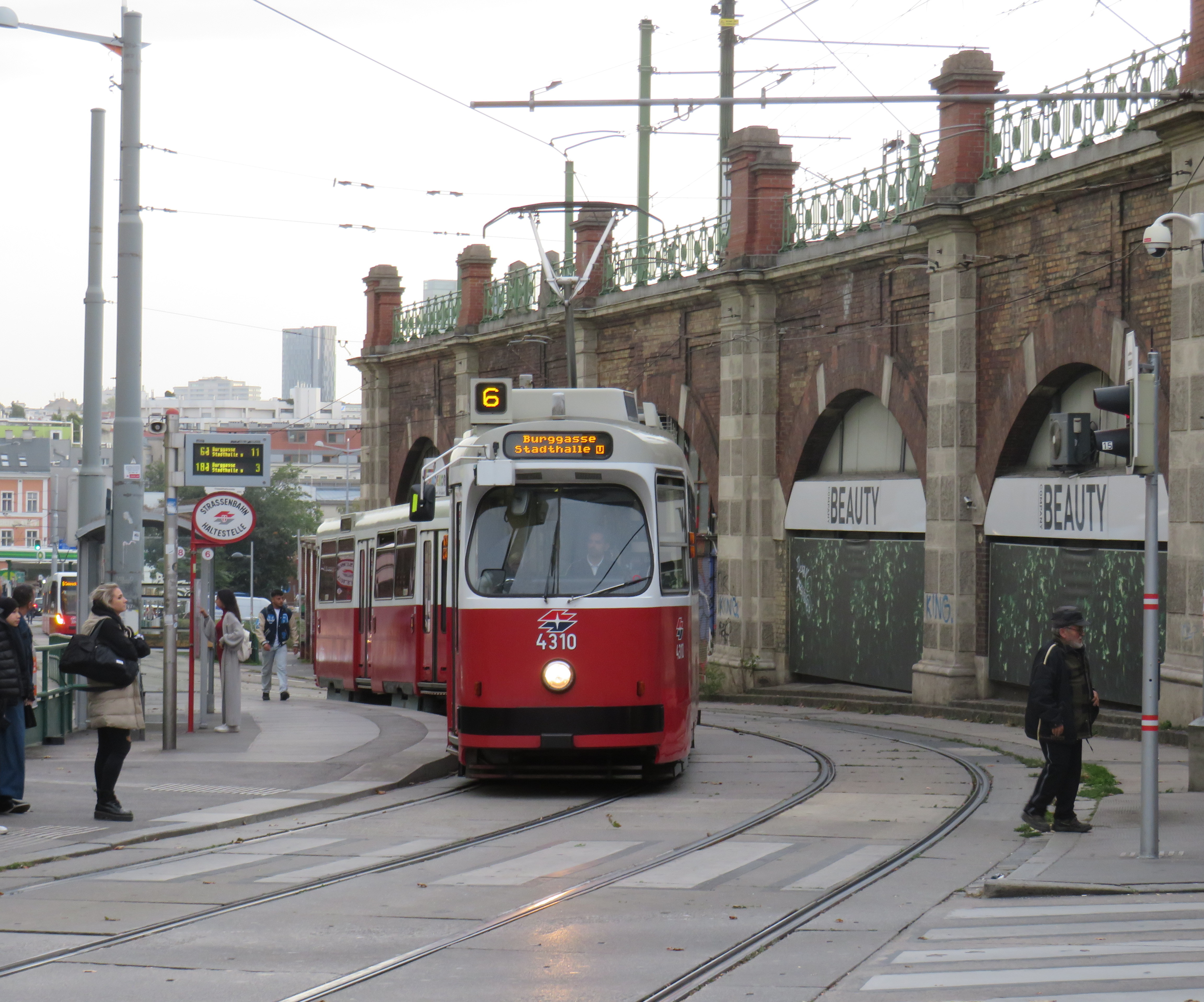
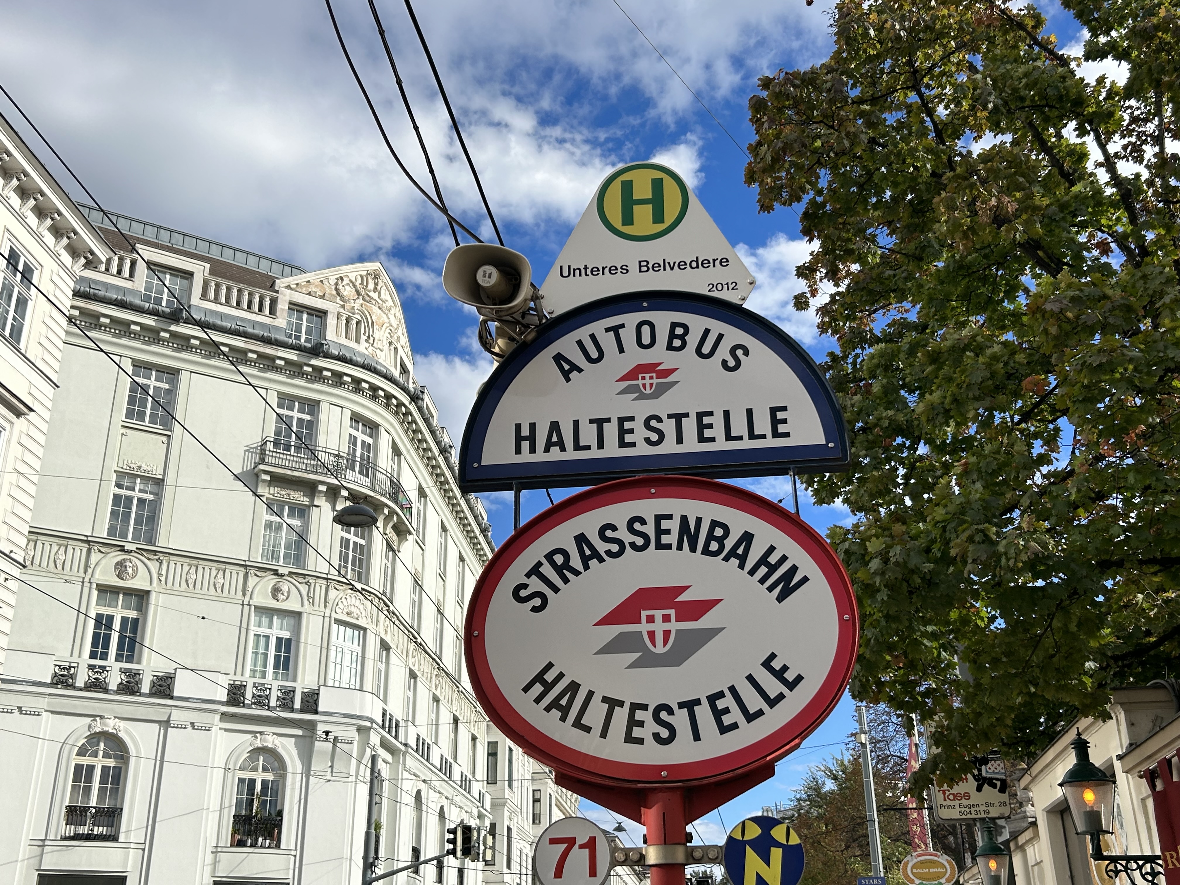
An older Type E2 high-floor tram and trailer at Gumpendorfer Straße. Behind is the old Stadtbahn viaduct, which is now part of Line U6. Note the large red “Strassenbahn Haltestelle” sign to the left, a classic Viennese icon that indicates a tram stop.
There is also a separate interurban tram service called Badner Bahn, which extends to the historic spa town of Baden bei Wien, an hour south of Vienna’s city centre.
Badner Bahn tram, laying over at Josefsplatz in Baden bei Wien
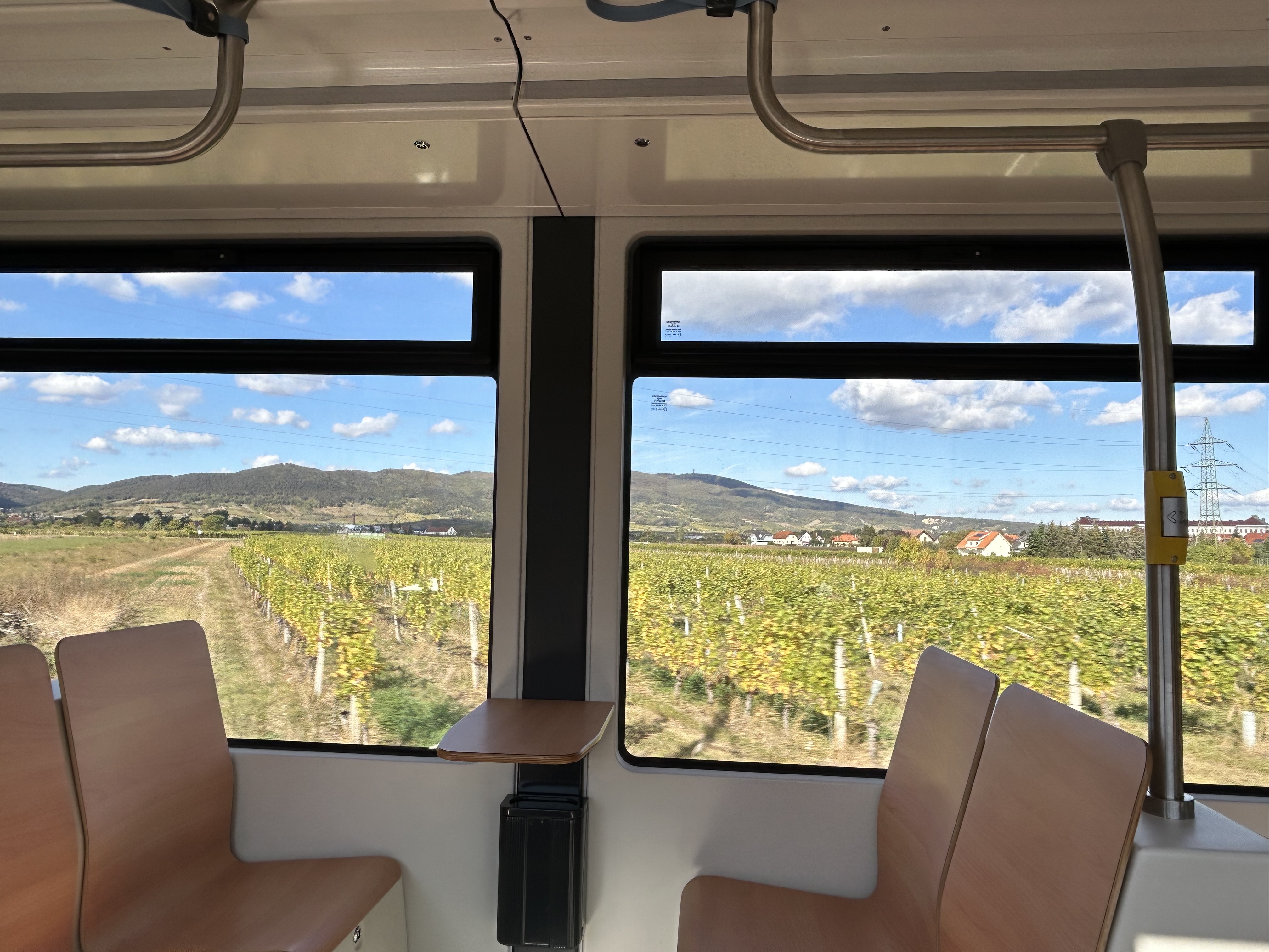
The modernized interurban originates in the heart of Vienna — across the street from the Wiener Staatsoper (Opera House) — then along local tram tracks and through the tunnel before entering its own right-of-way through the southern suburbs, and onwards through small towns, farms, and vineyards before arriving in Baden. There are several spurs leading to local industries; the regular passenger service shares the tracks with local freight trains.
View of the vineyards from Badner Bahn
A sample of the journey aboard Badner Bahn. Arriving southbound at Guntramsdorf, heading towards Baden bei Wien.
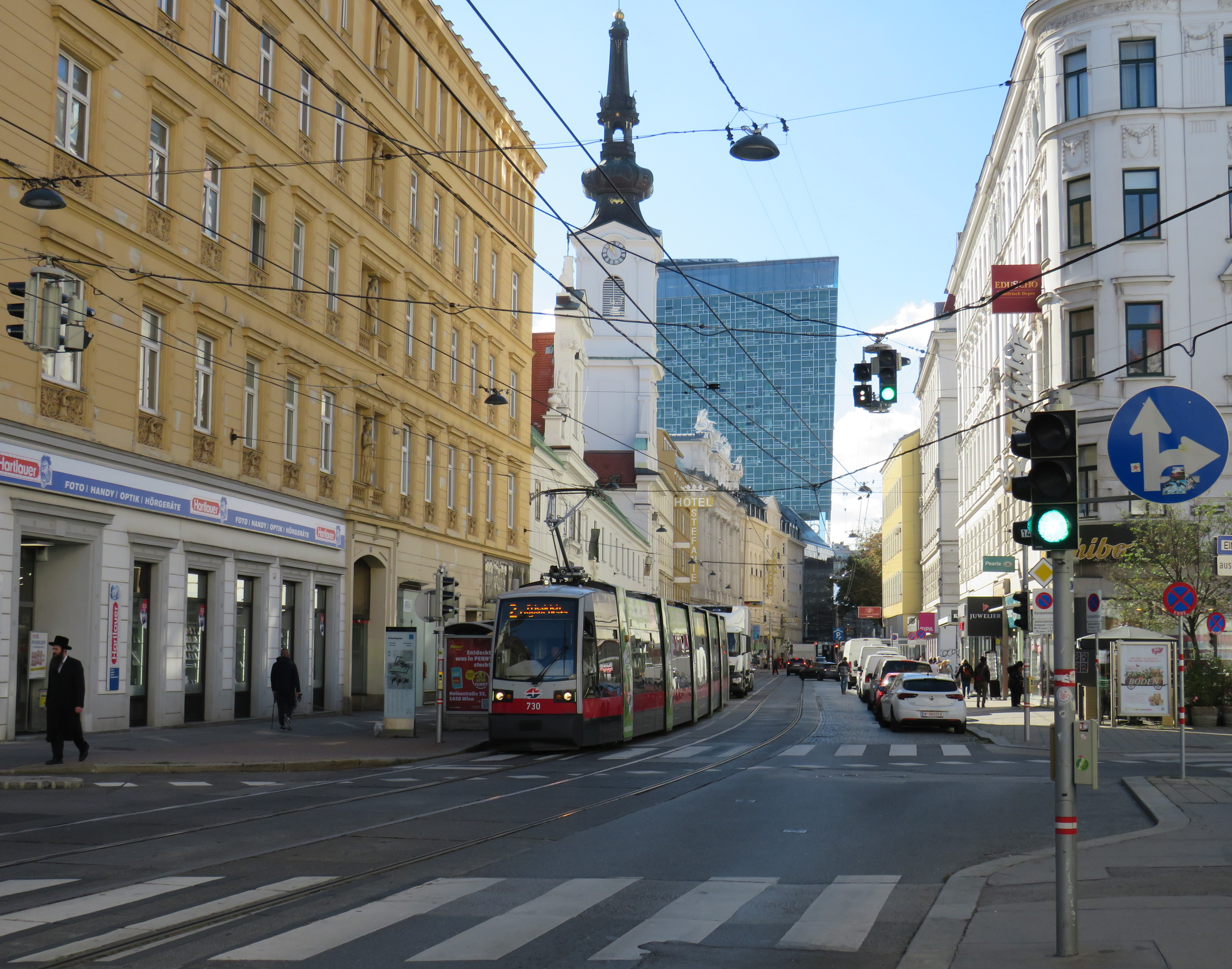
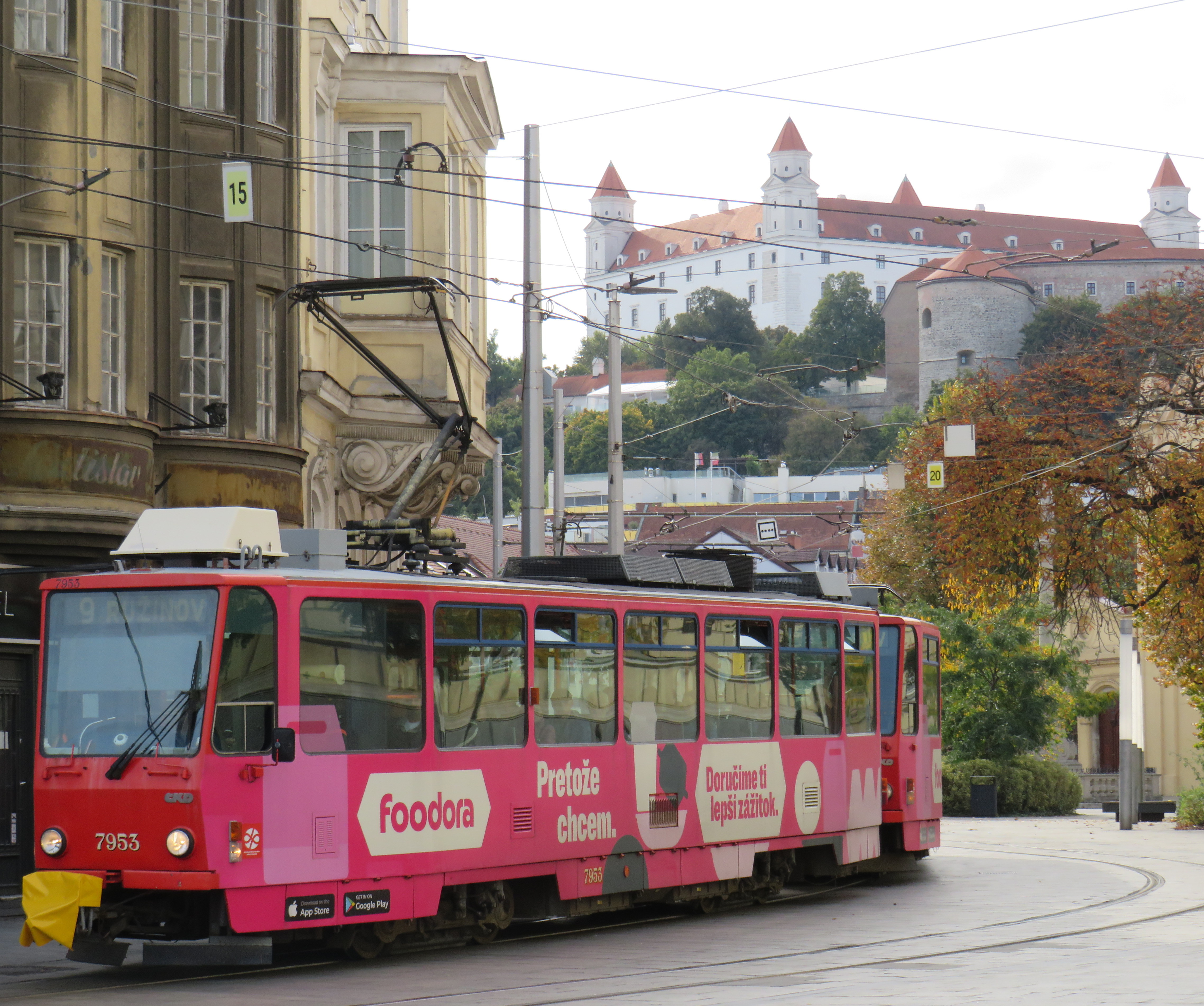
Bratislava, just over one hour away from Vienna by train (or by catamaran), is served by a network of metre-gauge trams, trolley buses, and diesel buses, though trams predominate in the city centre. On Obchodná, several tram lines, pedestrians, cyclists, and the occasional delivery or emergency services vehicle share a narrow, but busy shopping street. It just works.
Obchodná, Bratislava
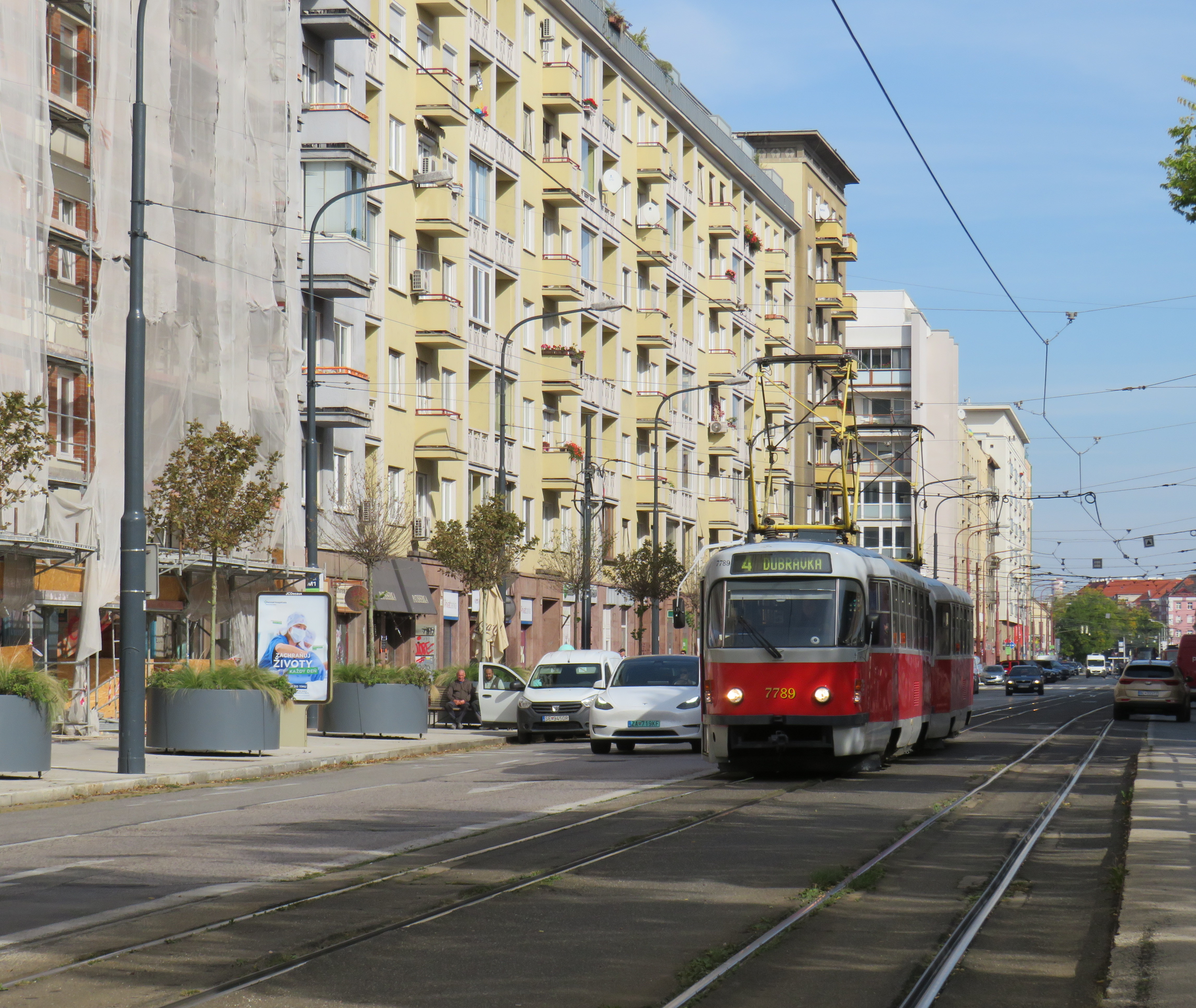
Outside the congested urban core, trams are afforded reserved lanes, sometimes separated from general traffic with curbs (and even grass medians), sometimes just painted lines. Bratislava’s tram system is smaller than Toronto’s, with 211 cars and 42 kilometres of revenue track, carrying around 70 million riders a year in 2019 (Toronto’s streetcars carried 108 million that year). It is also a much smaller city, with a population of around 660,000. I only visited Bratislava for a day, but I got to ride much of the tram network; I found it an easy and convenient way to get around.
Reserved, painted tram lanes just outside Bratislava’s city centre
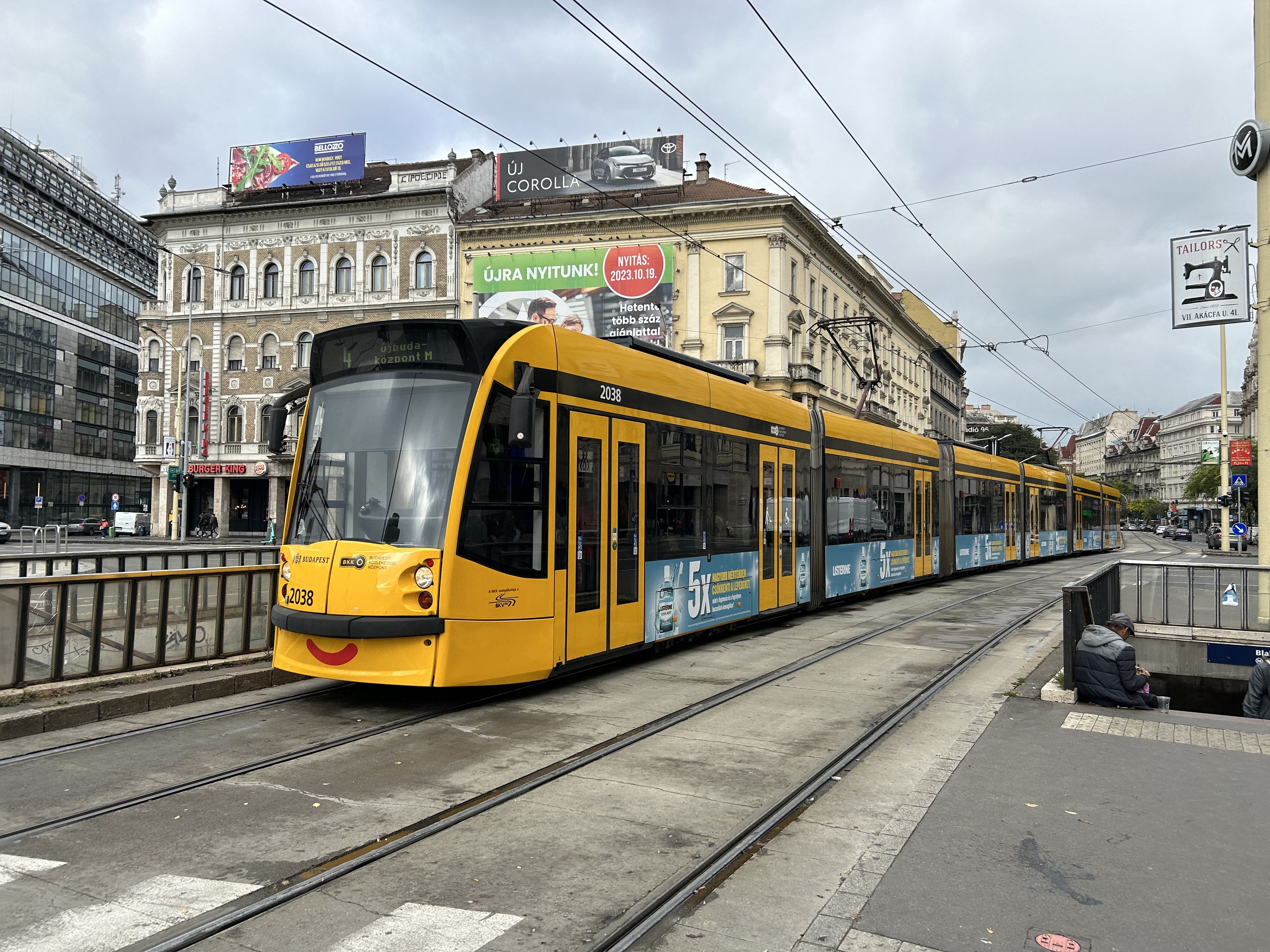
Budapest, Hungary has the largest street railway system in the world by ridership, with Route 4/6 on Budapest’s Grand Boulevard (Hungarian: Nagykörút), often cited as the world’s busiest tram line. Route 4/6 also operates 53.99 metre long Combino Plus trams, which, when introduced in 2006, were the world’s longest. The Combinos are almost twice the length of Toronto’s new Bombardier Flexity cars, which are 28 metres long. Even with the huge capacity these trams have (they require two pantographs to draw enough power to operate), they operate on Line 4/6 every few minutes, all day long, every day.
A Combino Plus tram on Line 4 traverses Budapest’s Nagykörút (Grand Boulevard)
Through the 1970s and 1980s, Budapest’s tram network was slowly cut back in favour of buses, trolley buses, and metro construction. By the 1990s, however, there was a street railway renaissance in Hungary’s capital because of the capacity and economy trams offered. With high frequencies, a private median, and high-capacity low-floor vehicles, Line 4/6 easily matches the capacity of a metro, at comparable speeds. Elsewhere, dedicated lanes and private rights-of-way make it clear that transit riders come first.
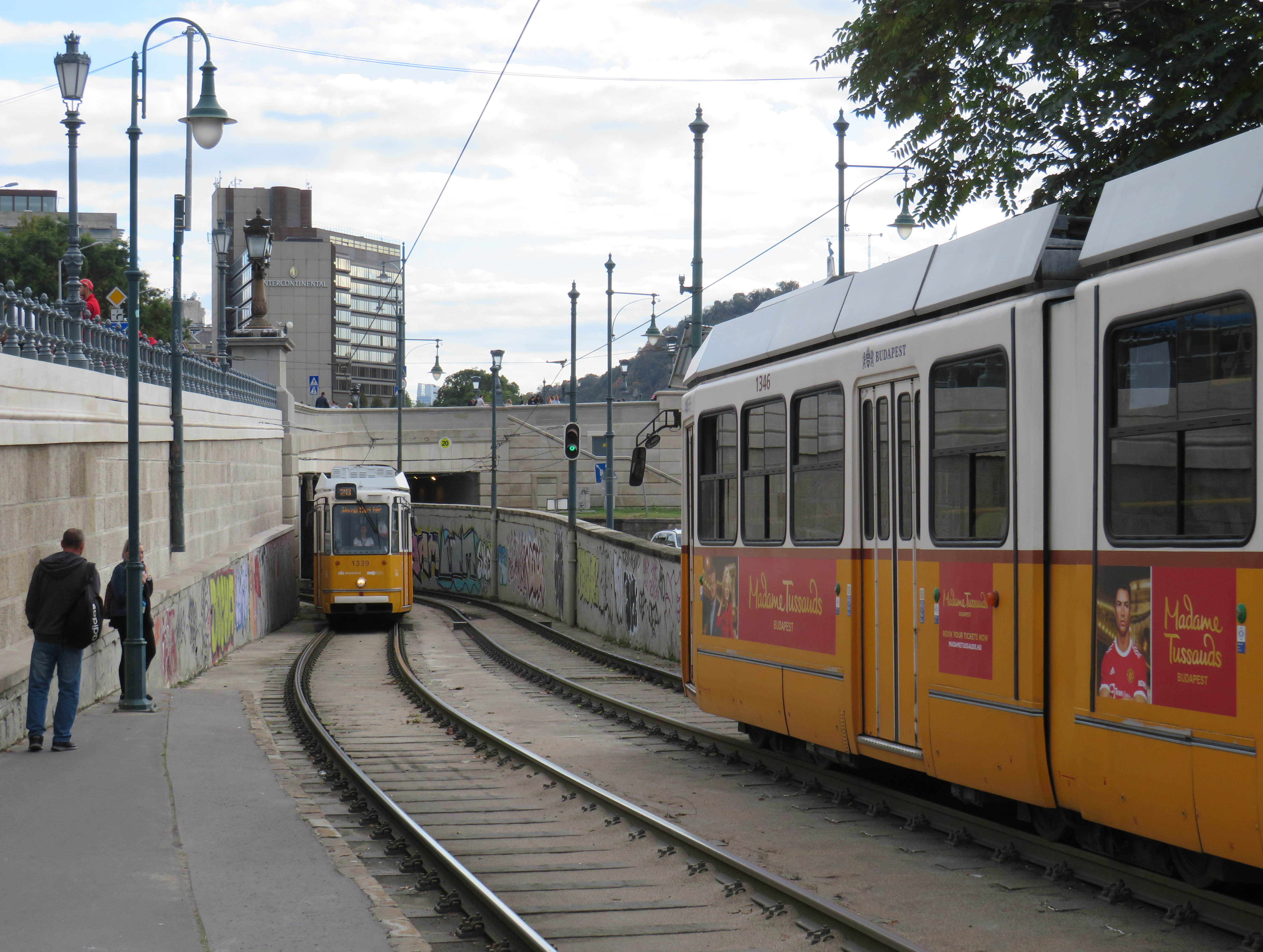
Older trams running along the Danube dip under road bridges on a private right-of-way
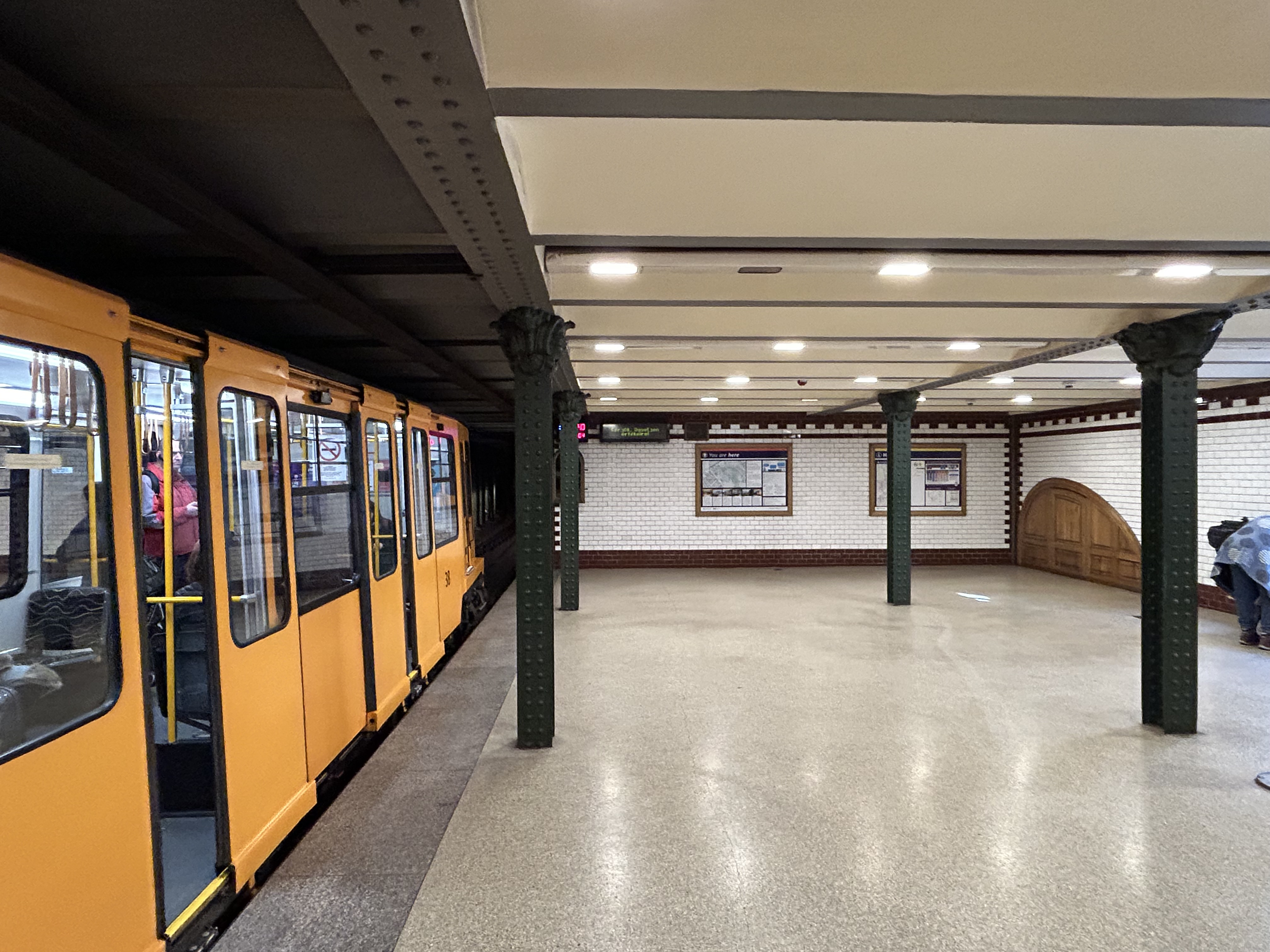
Though Budapest has a large metro network, most of it was not constructed until the l970s and 1980s. However, Line M1 was opened in 1896 as a shallow subway under Andrássy Avenue, the first electric underground metro in the world, and only the second subway, after London’s initial Underground line. Uniquely among urban transit routes, it it is listed as part of an UNESCO World Heritage Site.
Budapest Line M1 stations, restored to their original appearance, look like miniature New York stations, only cleaner
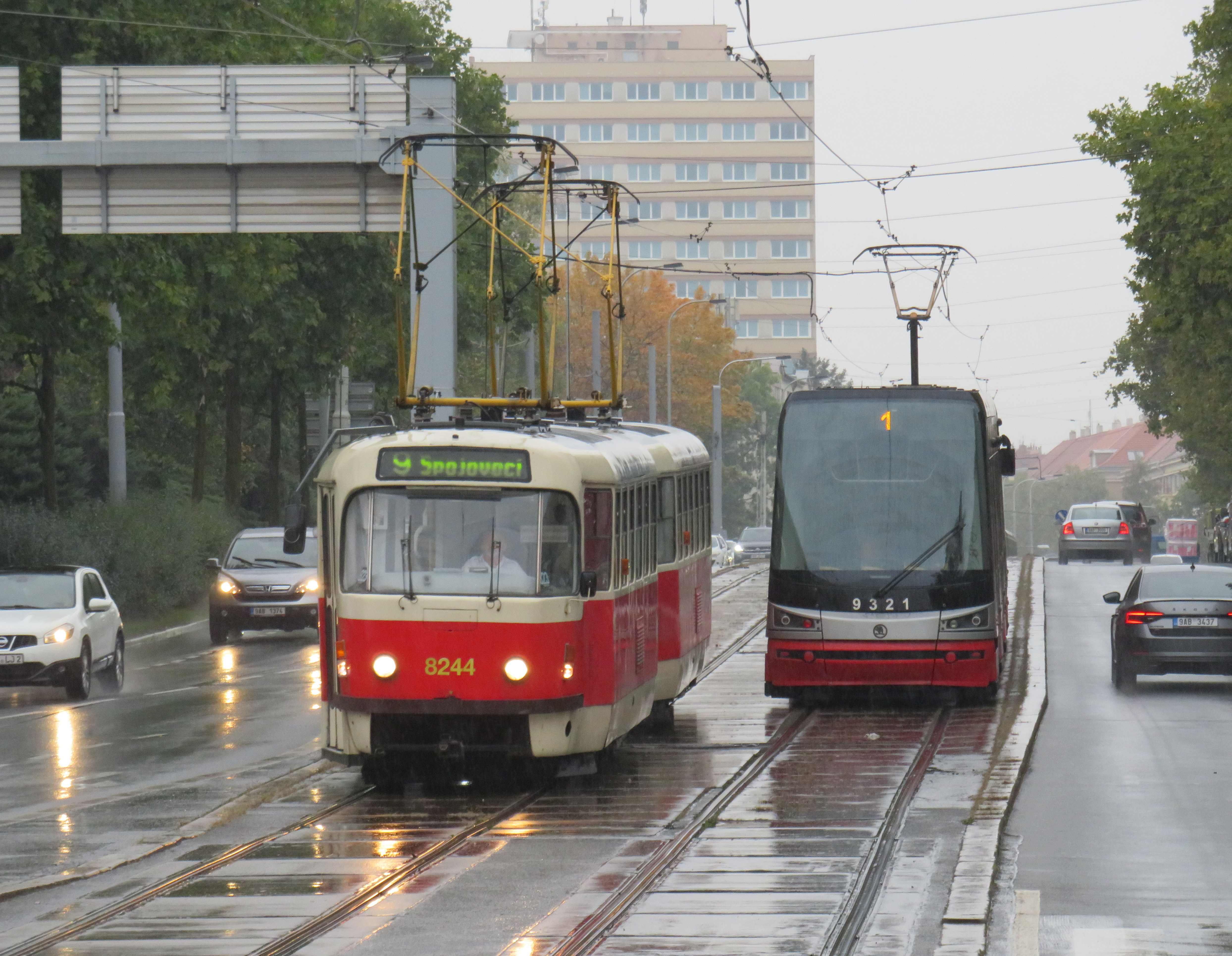
Finally, in Prague, we took several trams to take shelter from the rains that greeted us after arriving from Budapest, but also to see the city outside the crowded tourist spots. We took Line 1 from the city centre to the suburban district of Hrdlořezy, and returned via Line 9, taking a slightly different route back. Like Budapest, a metro system was planned and built in the 1970s and 1980s, but trams remained important, often providing local services parallel to deep underground metro lines.
Old two-car tram train on Line 9, passing a newer low-floor tram on Line 1, Sokolovská, Prague. Most trams run on reserved rights-of-way.
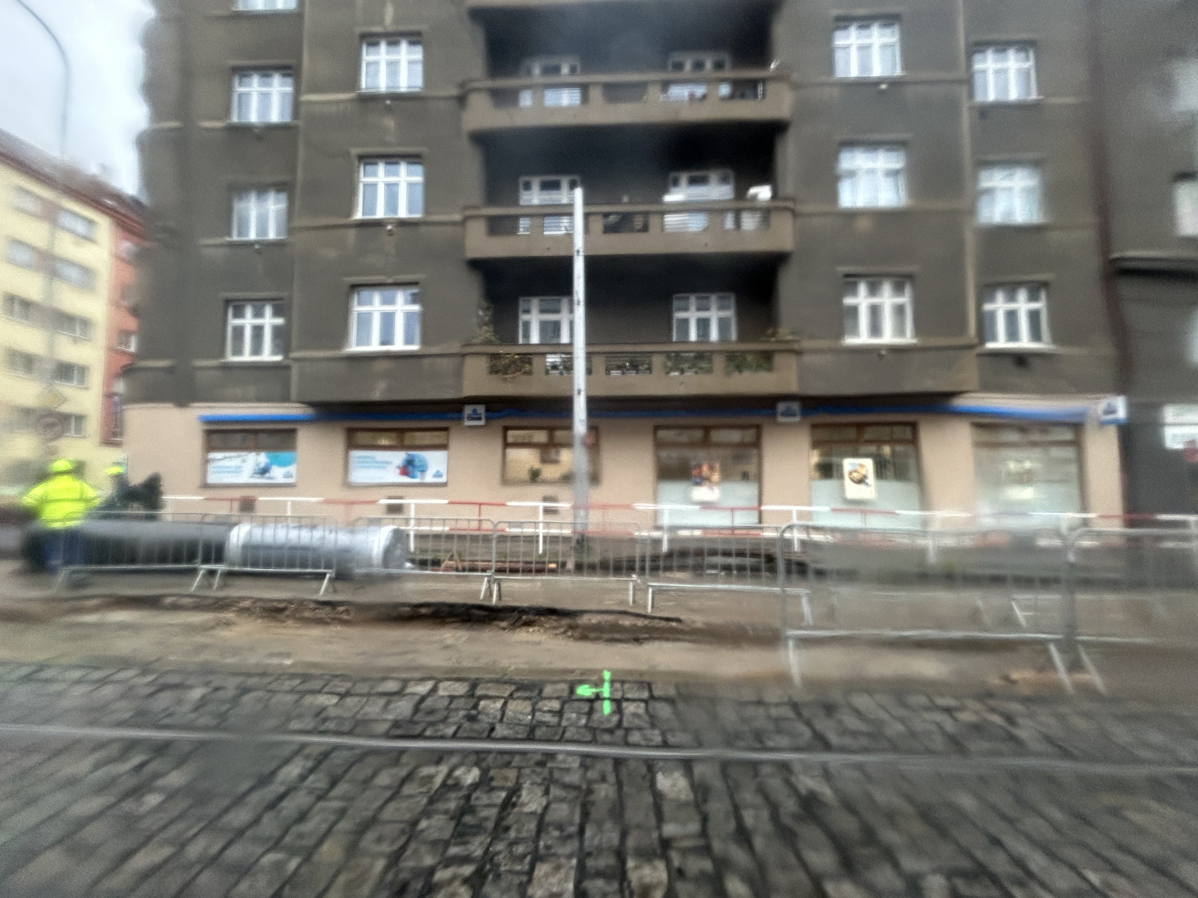
What interested me was seeing major watermain work along the line. Through trams slowed where work was adjacent, there were no diversions or shuttle buses. The trams ran through.
Watermain replacement in Prague, with trams still running(taken on a rainy morning)
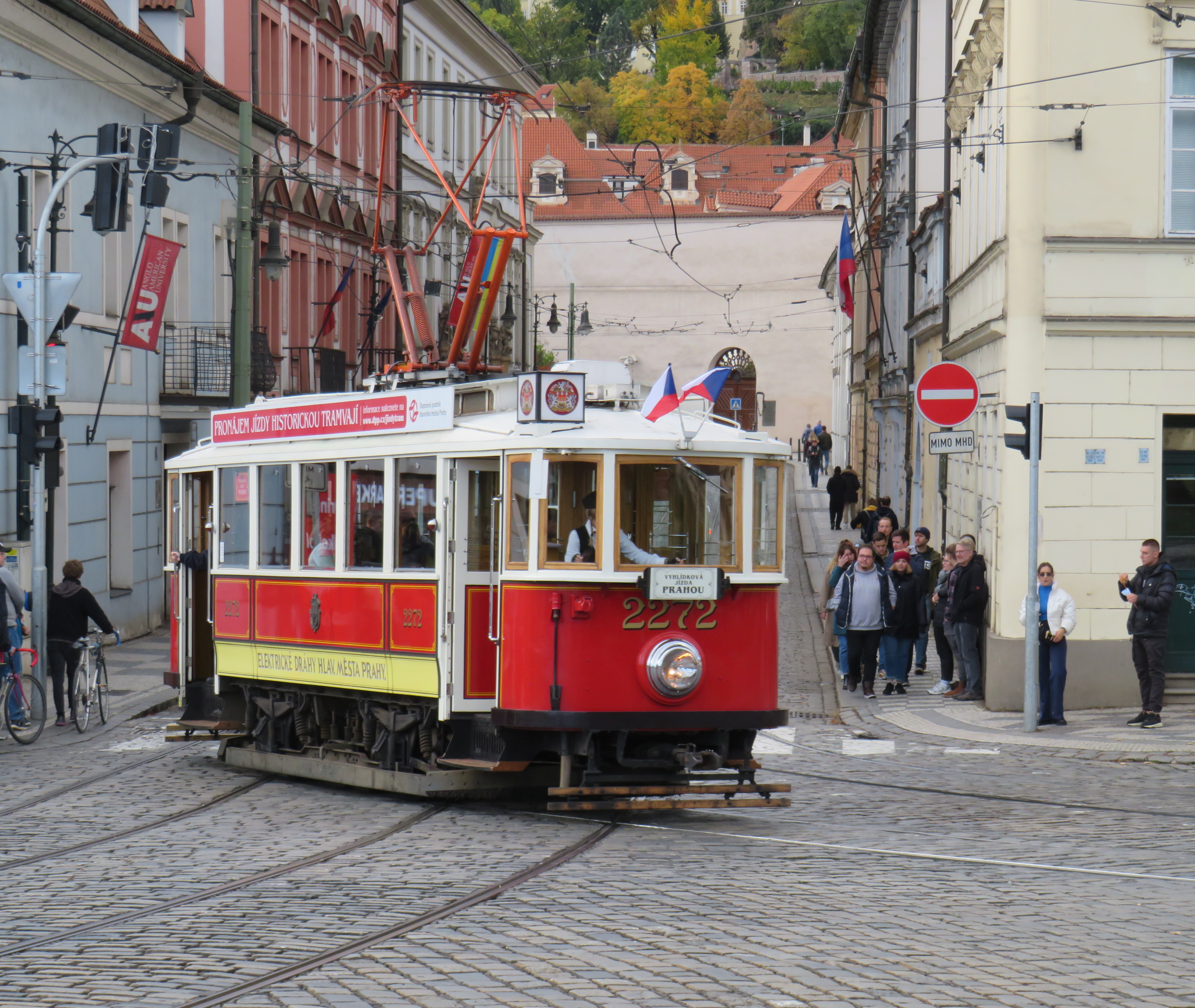
Like Vienna, Bratislava, and Budapest, Prague operates a mixed fleet of older high-floor trams and modern low-floor light rail vehicles, similar to Toronto’s new fleet. But in Prague, heritage trams could often be spotted in service, especially on the west bank of the Vltava near Prague Castle.
Heritage tram #2272 in Prague
Lessons for Toronto
After travelling, it can be easy to spot one’s hometown flaws and faults. But I spent a lot of time riding Vienna’s metros, trams, and buses, and mindfully experiencing the transport networks in Bratislava, Budapest, Prague, and Salzburg (which does not run trams, but has a large trolleybus network), I was left with some key takeaways on how to do transit here.
First and foremost, transit riders were respected. Not necessarily in terms of personable customer service, but the feeling that the next tram or bus was going to arrive on time, and a reliable interval. If there was a delay, it was very well communicated.
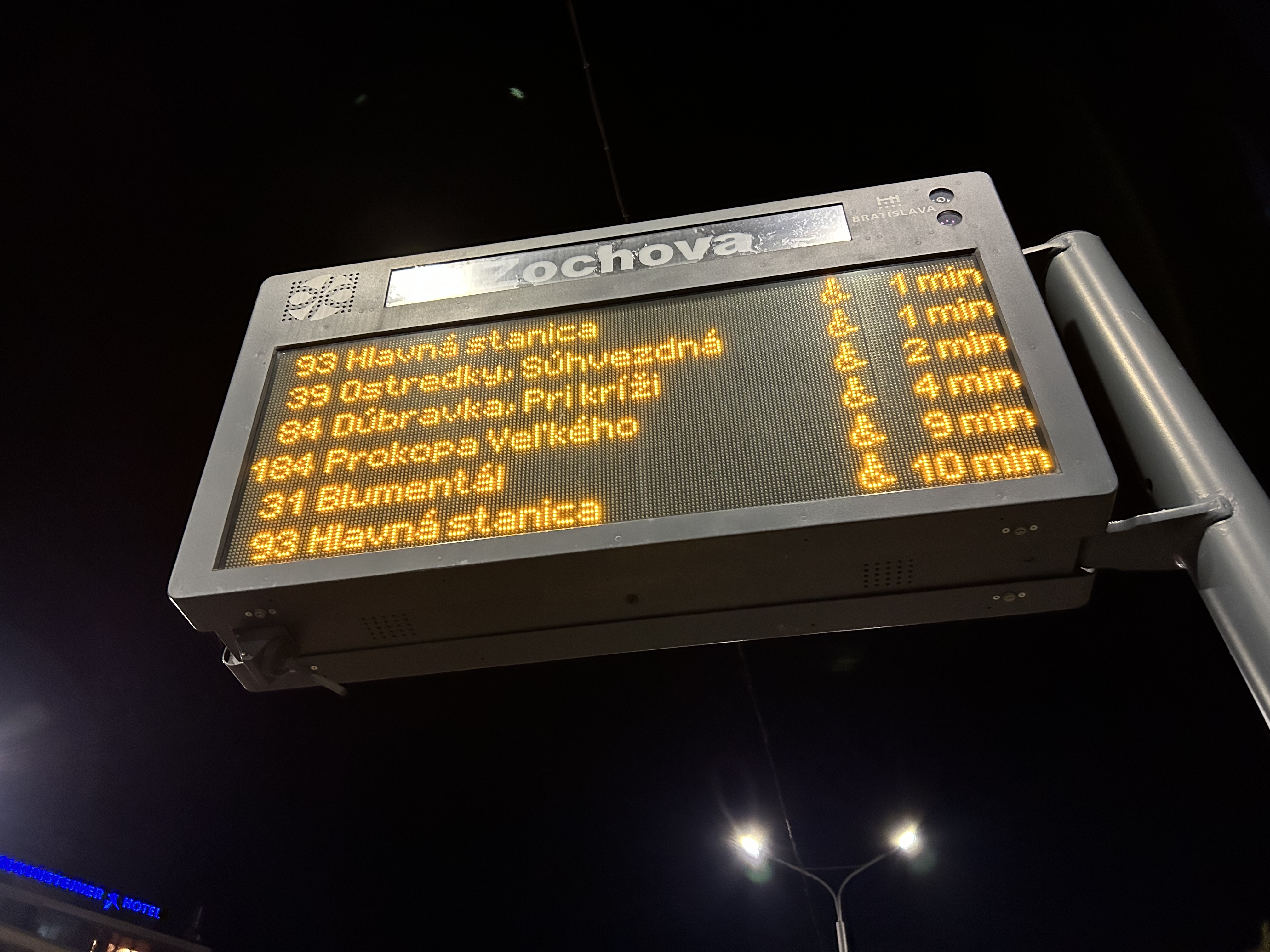
For instance, while waiting for a tram in Vienna, we experienced an unusually long wait. The next tram display kept showing the next two arrivals at 3 and 4 minutes. Not long after, a voice came on a loudspeaker posted above the tram stop sign announcing (in German, translated in English to us by one of my spouse’s colleagues) a delay because of a collision along the route. The blockage cleared after a few minutes, and we boarded a crowded tram. I appreciated the audio announcement, especially as it was a basic tram stop.
The classic Vienna tram stop. Note the loudspeakers atop the blue bus stop sign (at night, buses take over, hence the Strassenbahn and Autobus stop signs).
Next vehicle displays were common in every city we visited. They would list — in real time — the next several buses or trams, as well as if the vehicle was low-floor accessible or not with a wheelchair symbol. All buses are now fully accessible, but the information is useful for the tram lines, where there are still many older high-floor vehicles.
Next vehicle display at a bus stop in Bratislava
I also noted that in Vienna, and for the most part elsewhere, vinyl advertisement wraps did not cover passenger windows on trams and buses. Bratislava’s wrapped trams had some ads that used window areas, but these were kept to a minimum.
In Vienna, advertisement wraps kept windows completely free of obstructionsAdvertisement wraps in Bratislava had minimal window coverage
It was also clear that trams had dedicated signals on their routes, if not necessarily signal priority. But with smaller intersections and relatively short signal timings, the waits at each signalized intersection were generally minimal.
Note the white tram signals next to the overhead traffic signal. The “A” indicates that a proceed signal will soon appear, and the operator can cancel the door release, so that no more passengers can enter or exit.
Tram signaling in Vienna and other Central European cites also includes remotely operated electric switches. Overhead signals indicate which direction the switch is set to; operators can pass through junctions at speed. While this is how trams operate in most places around the world, in Toronto, streetcar operators are required to stop before each switch and then crawl.
Trams pass through a track junction, along with an ambulance and a transit maintenance van. The overhead horizontal signal indicates the switch direction.
Though many tram stops are in private rights-of-way, in-street tram stops are designed for passenger safety and accessibility. These stops, depicted by the photograph below, have the curb lane raised to the level of the low-floor trams. This increases the visibility of passengers boarding and egressing, and also simplifies ramp deployment. Operators need not exit the cab and manually deploy the accessibility ramp, a timesaver versus the TTC’s ramp deployment on major streets. In the winter, this also helps keep the slush away from the tram stops.
The raised on-street curb lane at an on-street tram stop in Vienna.
Though Toronto is a very different city than Vienna, Budapest, or Prague, there are some clear takeaways. Keep the tram windows free of advertisements. Improve communications. Fix the track switches and signalize them. Raise the curb lanes at streetcar stops for safety, convenience, and accessibility. Fix the King Street Transit Priority corridor with a permanent streetscape and tighter vehicle restrictions. If it can be done on a narrow commercial street in Bratislava’s historic centre, there’s no reason why it can’t be done in a world financial capital.
These can even be done incrementally, but they need to be done if transit riders are deserving of respect and reliable surface transit.
504 King Streetcar diverting onto Spadina on Thursday, September 5
For the sixth year in a row, King Street between University and Spadina Avenues was closed for four straight days. This closure was for the Toronto International Film Festival (TIFF) “Festival Street,” which took place between Thursday September 5 and Sunday September 8. In addition, King Street was closed during the afternoon rush hours the following Monday and Tuesday for “Red Carpet Events.”
TIFF has been recognized among the world’s most important film festivals, and one where the public has the opportunity to take part (albeit at increasingly inaccessible prices for many screenings). It offers tremendous economic and cultural value to Toronto. It compliments and helps to support many other annual film festivals, such as Hot Docs and Inside Out.
But TIFF’s clout and influence has also led to entitlement, with “Festival Street” being the most disruptive result. While King Street is closed off to traffic during the film festival, it has severe effects for the 84,000 daily riders of the 504 King Street, as well as riders on the busy 501 Queen and 510 Spadina cars.
501 Queen and 504 King Streetcars stuck in traffic westbound at Queen and Spadina
Several major TIFF screening locations are located on or near King Street West, including Roy Thomson Hall, the Princess of Wales Theatre, the TIFF Bell Lightbox, and two blocks north, the Scotiabank Cinemas. Industry parties and galas are held at nearby hotels and restaurants. It’s natural that King Street would be a hub of activity for the film festival. But it is also the third busiest transit route in Toronto, after the Yonge-University and Bloor-Danforth subways.
The King Street Pilot, which began in late 2017, prohibits through motor vehicle traffic on King Street between Jarvis and Bathurst Streets through the downtown core, though all vehicles are permitted to use King Street for short segments. Despite spotty enforcement, the pilot project allowed the TTC to operate much more reliably through the busy corridor, with an increase of capacity and ridership. In early 2017, daily ridership on the 504 King was 72,000. By March 2018, it grew to 84,000. In April, council voted to make the pilot permanent. This will allow for streetscape improvements along the corridor and wider sidewalks, with improved physical measures to further restrict through traffic.
On Friday, CBC Toronto ran a story on several King Street West businesses that have claimed that the new King Street Pilot have caused them to lose customers in December. The three business owners mentioned in the article were Laleh Larijani of Forno Cultura, a bakery on King east of Bathurst, and two Restaurant Row restaurateurs: Jesse Warfield, whose family owns the Gabby’s chain of restaurants, and Fred Luk, owner of Fred’s Not Here and The Red Tomato.
The King Street Pilot was launched by the City of Toronto on November 12, 2017. At many intersections between Bathurst and Jarvis Streets, cars and trucks are required to turn right off of King Street, prioritizing streetcar traffic. Most on-street parking spots were removed from King Street through this section, but designated areas allow for deliveries, passenger pick-ups and drop-offs, and access to local properties, including parking garages. Despite some [predictable] hyperbole from suburban politicians and reactionary journalists, cars are not in fact banned from any section of King Street. And there are many public and privately-owned garages adjacent to the pilot corridor for motorists to park at.
For transit riders, the King Street Pilot is working. In December, the TTC reported travel time reductions for the busy 504 King and 514 Cherry Streetcars of up to 24 percent. However, it still struggles to keep up with demand. The continuing delays in the new streetcar deliveries from Bombardier have not helped matters; and streetcars still often run overcrowded, leaving some passengers behind at streetcar stops. There are some necessary tweaks to be made: TTC schedules should take advantage of improved travel times, and transit signal priority is also necessary with the new far-side stop locations at intersections. Signal priority will help to ensure streetcars don’t have to stop at a red light at the near side of the intersection and again to load passengers at the far side.
But since it’s a year-long pilot project, these tweaks can be made.
Unfortunately the CBC article was weak in that it presented only the business owners’ complaints about the King Street Pilot, without hard data to back up the claims of lost business. Only one Toronto city councillor was quoted, John Campbell, who represents Ward 4, Etobicoke Centre. Ward 4 is an affluent, suburban part of the city that does not have any streetcar lines. Councillor Campbell, who also sits on the Toronto Transit Commission, would like to see street parking permitted during evenings and weekends:
“I would like to see people able to park here in the evening, park here on the weekends, because listen, when it’s –15 C people don’t want to walk a block-and-a-half to get to a restaurant. They want to park within 100 metres. I think that would bring more vibrancy back,” [Campbell] explained.
It’s worth pointing out that motorists will walk much further than 100 metres when parking at busy suburban malls like Sherway Gardens or Yorkdale; it’s also the distance from many GO Transit parking spots to the train platform. The walk between the front doors of the Royal Alexandra Theatre and Princess of Wales Theatre on King Street is nearly 200 metres.
Watering down the King Street Pilot would doom it to failure: as any King Street transit rider knows, traffic congestion didn’t suddenly disappear at 6:30 PM. It’s an unreasonable expectation to find ample parking 100 metres from many downtown businesses and institutions.
It’s worth noting that a suburban councillor has taken so much interest in watering down a downtown initiative championed by downtown councillors, and that as a member of the TTC board, Campbell wishes to reduce the benefit to many of the transit agency’s customers.
Fred Luk, profiled in the CBC article, has a long history of complaining to Toronto media, as pointed out by urbanist and writer Shawn Micallef on Twitter. In the last few years, Luk has complained about the increase in the minimum wage, higher energy costs, the effects of the 2003 SARS outbreak and the 2010 G20 Summit, even the 1999 municipal indoor smoking ban. Yet Luk’s King Street restaurants persisted.
Here's restaurateur Fred Luk complaining about the King Street pilot. His biz is suffering. This is going to be a thread. https://t.co/7qsSi9qZP2
There are many factors that can influence the success of restaurant businesses. Obviously, the quality of food and service should be examined. It’s worth noting that Toronto is bearing with unseasonably cold temperatures, it’s the low season for tourism, and there aren’t any blockbuster musicals currently playing at the Royal Alex or Princess of Wales. Motorists still have to get used to the new arrangements and change their habits; it’s only been seven weeks so far. Once the weather improves, the curb lane in front of Restaurant Row can be used for wider sidewalks, even enlarged front patios.
The smart thing for a business owner concerned about a decline in patronage would be to use the free publicity to promote the restaurants, rather than complain about a loss of business. Businesses in the Entertainment District are largely driven by walk-up traffic; there’s a reason why menus are posted by the doors and in the summertime, you can’t walk past Restaurant Row without having a representative out front trying to get you to look at their menu.
Locating a restaurant on King Street West has lots of advantages: the proximity to thousands of residents, many nearby offices, hotels, entertainment and sports venues, and excellent transit access and ever increasing pedestrian activity. It is not realistic to expect ample street parking to be one those advantages.
If access to parking were the chief concern, it would be wise to set up in a suburban plaza somewhere else, like in John Campbell’s Etobicoke. Complaining about a major improvement to the travel times of thousands of commuters, without offering any incentives for potential customers to visit your restaurants isn’t productive. Instead, doom and gloom messaging may only damage business further, resulting in a self-fulfilling prophecy.