Kingston Road is one of Toronto’s oldest and most important thoroughfares. Sections of the road were first laid out by Asa Danforth in 1799, though a straighter, more direct route was established by the early 1800s. By the 1830s, it was a busy stagecoach route, connecting Toronto with Cobourg, Belleville, and Kingston.
As Toronto grew into a major city, Kingston Road was an obvious route for a radial railway line serving Scarborough Township; by 1906, radial cars extended as far east as West Hill, near Morningside Avenue. The radial line’s stops were numbered from the beginning of the line, first at Queen Street and Kingston Road, then at Kingston and Victoria Park Avenue after the TTC took over city operations.
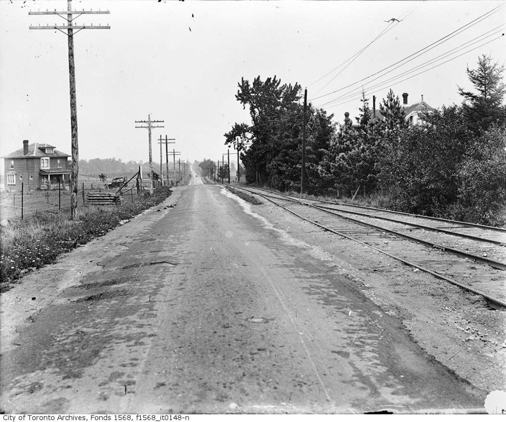
From Toronto Archives, Fonds 1568, Item 148.
Stop 0 was at the city limits at Victoria Park (with connections to TTC streetcars). Stop 14 was Halfway House at Midland Avenue. Stop 26 was the Scarborough Post Office, near today’s Scarborough Golf Club Road, and Stop 35 was the end of the line, at West Hill.
With increasing automobile ownership and new intercity bus lines in the 1920s, Kingston Road was busier than ever, becoming part of the new provincial highway system, but ridership on the radials declined, especially after the TTC extended city streetcars east to Birchmount Avenue in 1928, leaving behind a mostly-rural service. Radial service was cut back to Stop 26 in 1931, and completely replaced by buses in 1936 (the 86 Scarborough bus route is the modern legacy).
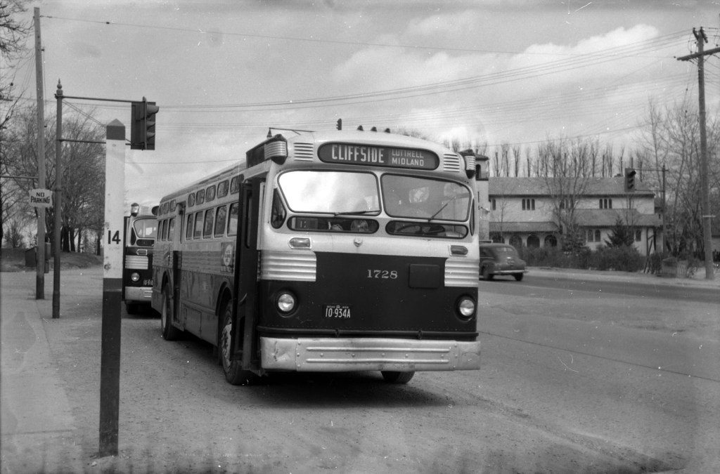
Photo by James V. Salmon, from the Toronto Public Library collection.
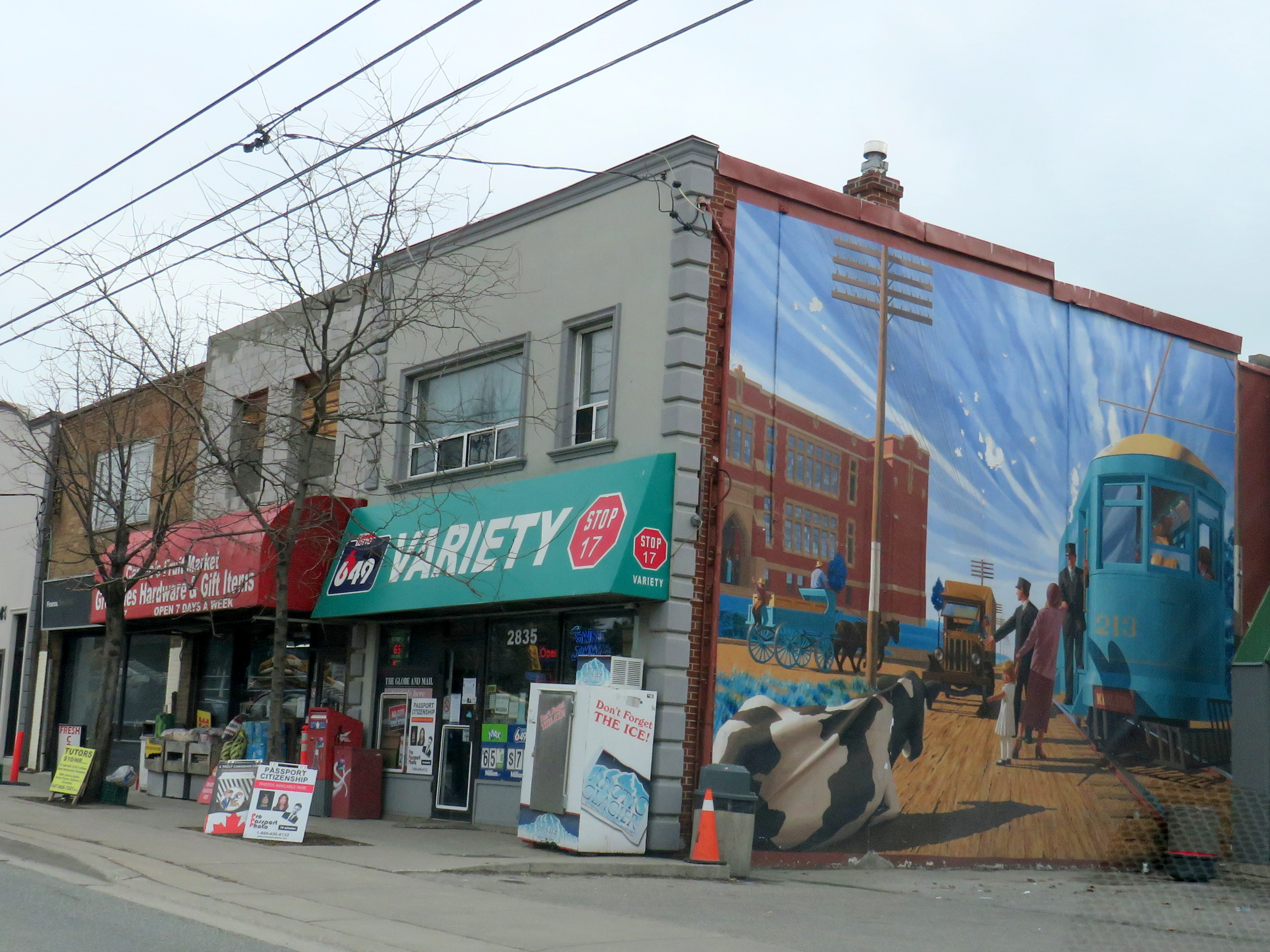
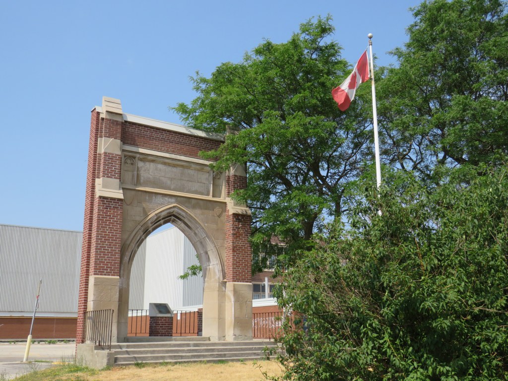
Despite the switch to buses, the stop numbers carried on for many years, listed in TTC timetables through the 1950s. Locals would often refer to stop numbers instead of street intersections. Stop 17, at Kingston Road and St. Clair Avenue East, is one example that has lingered on. A mural on the side of Stop 17 variety depicts a green radial car in front of the Scarborough High School), with a cow blocking the way of a truck looking to pass.
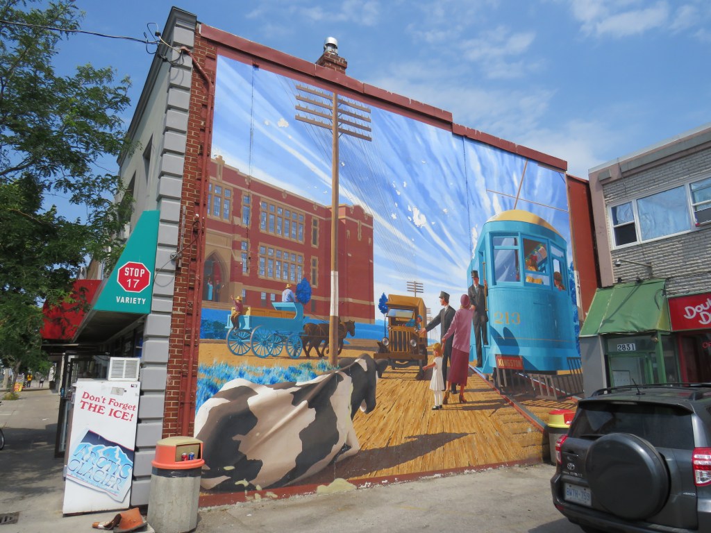
Scarborough High School, on the opposite corner of the variety store, was built in 1922, expanded several times, and later renamed R. H. King Academy. The original building was torn down in 1976, but the entrance way, depicted in the mural, was retained.
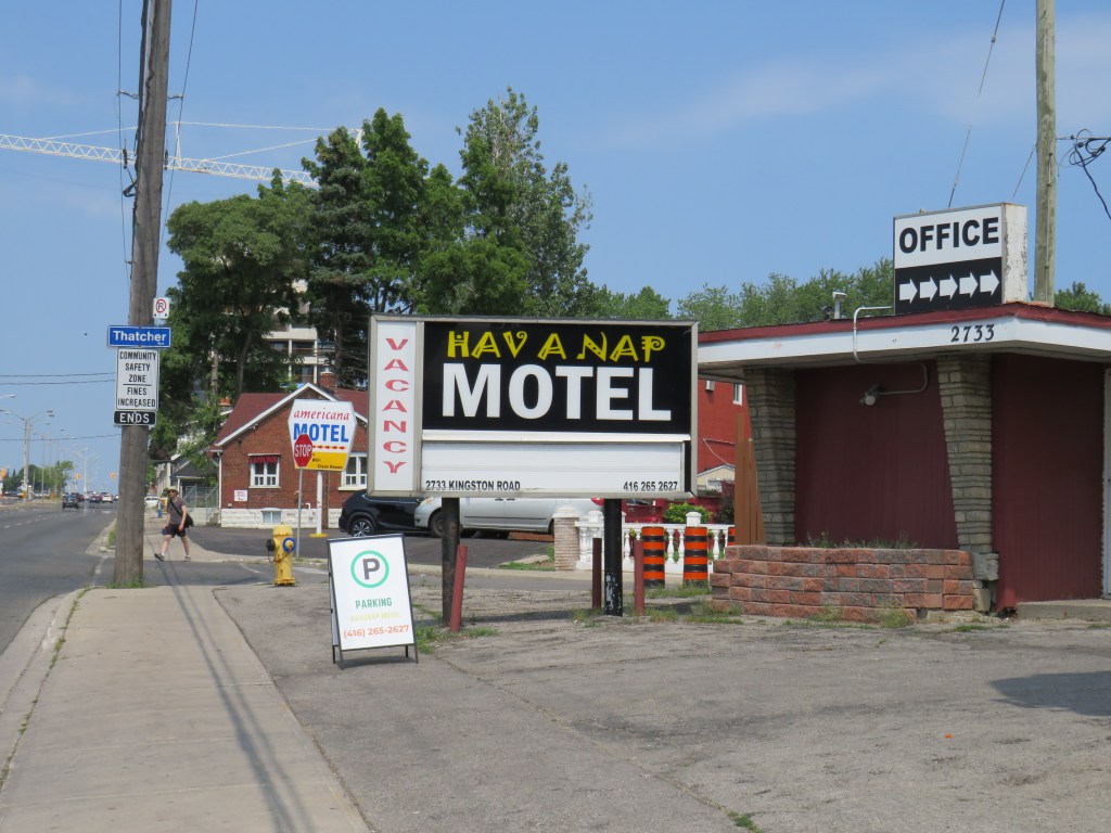
Nearby, towards Brimley Road, several older motels date from the motoring era, when Highway 2 was the main route into the city. Though Highway 401 drew some of the traffic away in the 1950s, it wasn’t until the completion of the Don Valley Parkway (which provided a direct route downtown) and the rise of chain hotels saw a decline in independent motels along Kingston Road and Lake Shore Boulevard. Some have been repurposed as shelters, while others, like the Hav-A-Nap, diversified by offering paid parking for nearby Bluffers Park.

Leave a comment