Tag: Caledon

  • Caledon rethinks its transit as Brampton retrenches

    Caledon rethinks its transit as Brampton retrenches

    An Argo minibus lays over at Shoppers World Brampton

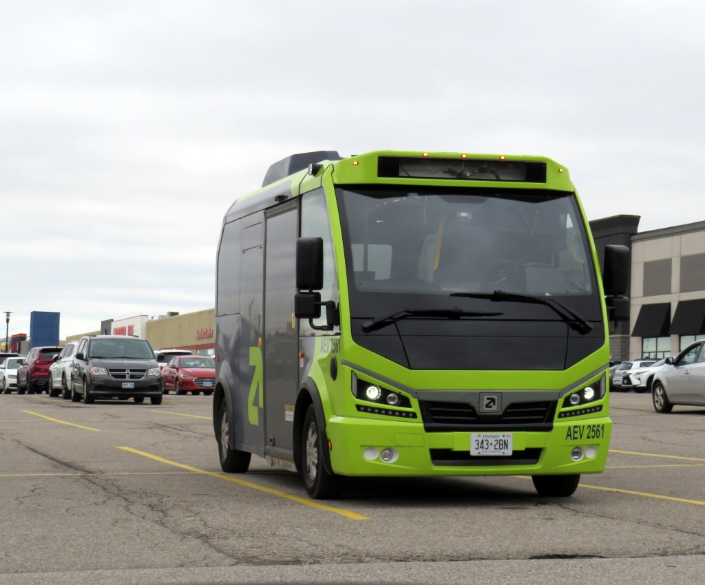
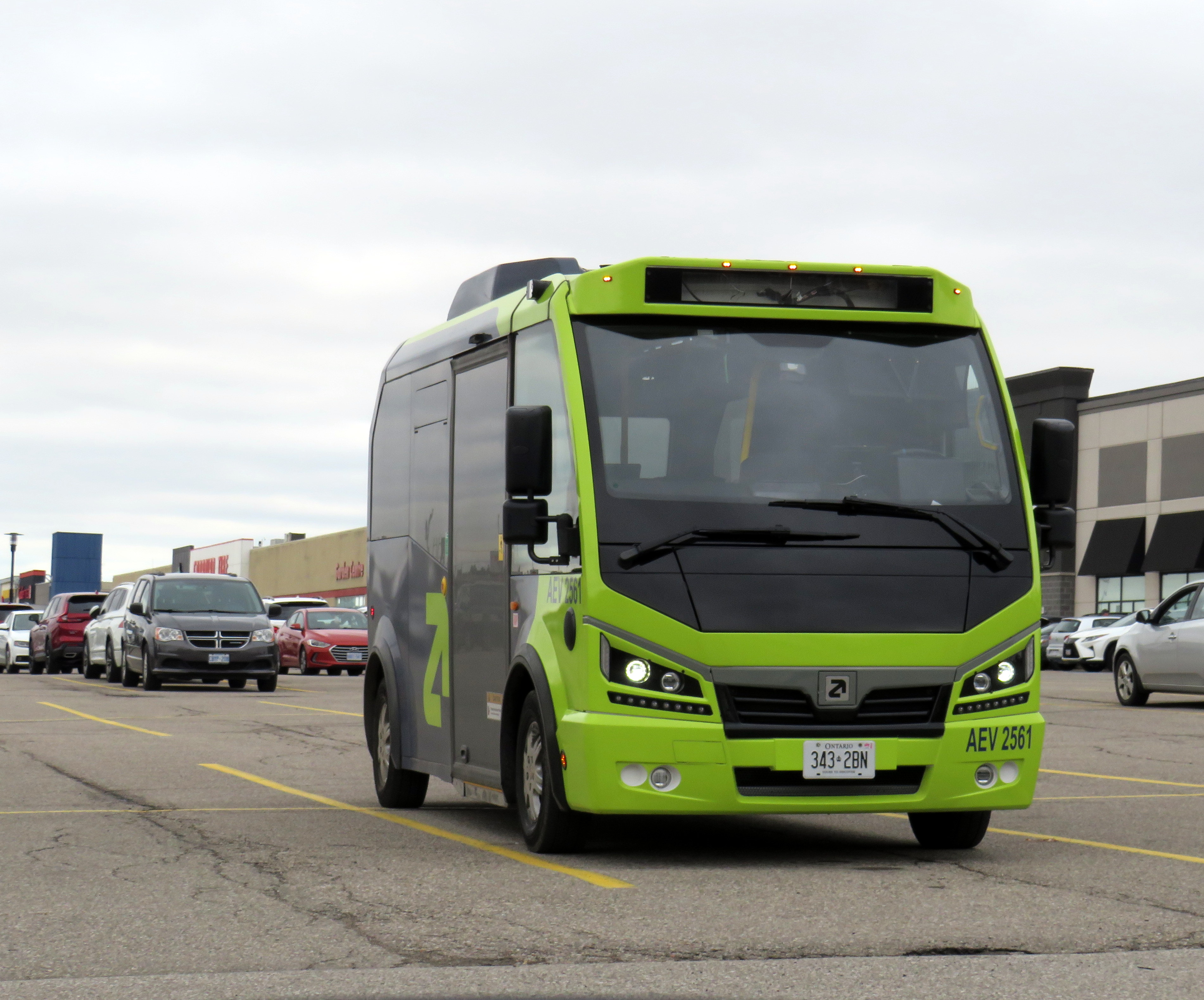
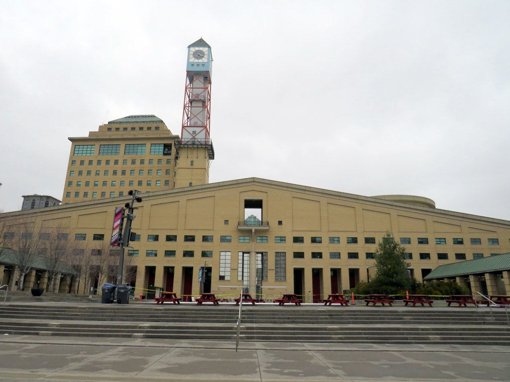
    In an interesting staff report presented to Caledon Town Council, that municipality is planning to enter into a 15-month On-Demand Micro-Transit Pilot Agreement with Argo Transit, a Brampton-based provider of electric minibus services. This new on-demand transit service would replace most of the contracted Brampton Transit services in the Town of Caledon, including Routes 41, which serves Bolton, and 81, which runs along Kennedy Road north of Mayfield Road. Extensions of Route 30 Airport Road and 18 Dixie would continue under Brampton Transit, as they are limited-service extensions directly serving specific employers.

    Argo already provides on-demand service in Bradford-West Gwillimbury, replacing a fixed-route service there last year It also operates a supplemental door-to-door on-demand service in central Brampton on top of the fixed route Brampton Transit service. In Brampton, and as expected in Caledon, the same fares at Brampton’s regular service are charged, paid through a Presto card or app.

    The benefits for Caledon include new service to and within Caledon East, which is currently without transit, as well as midday, early evening, and weekend service not currently provided through Caledon’s contract with Brampton Transit. The proposed service times will be Monday to Friday from 5:30 AM to 8:00 PM, and Saturday and Sunday from 7:00 AM to 7:00 PM. If implemented, Argo service would begin October 1, 2026.

    The map, included as an appendix to the staff report, shows connections to Brampton Transit on Mayfield Road and to York Region Transit in Kleinburg.

    Map of proposed Argo service areas in Caledon, with connecting links.

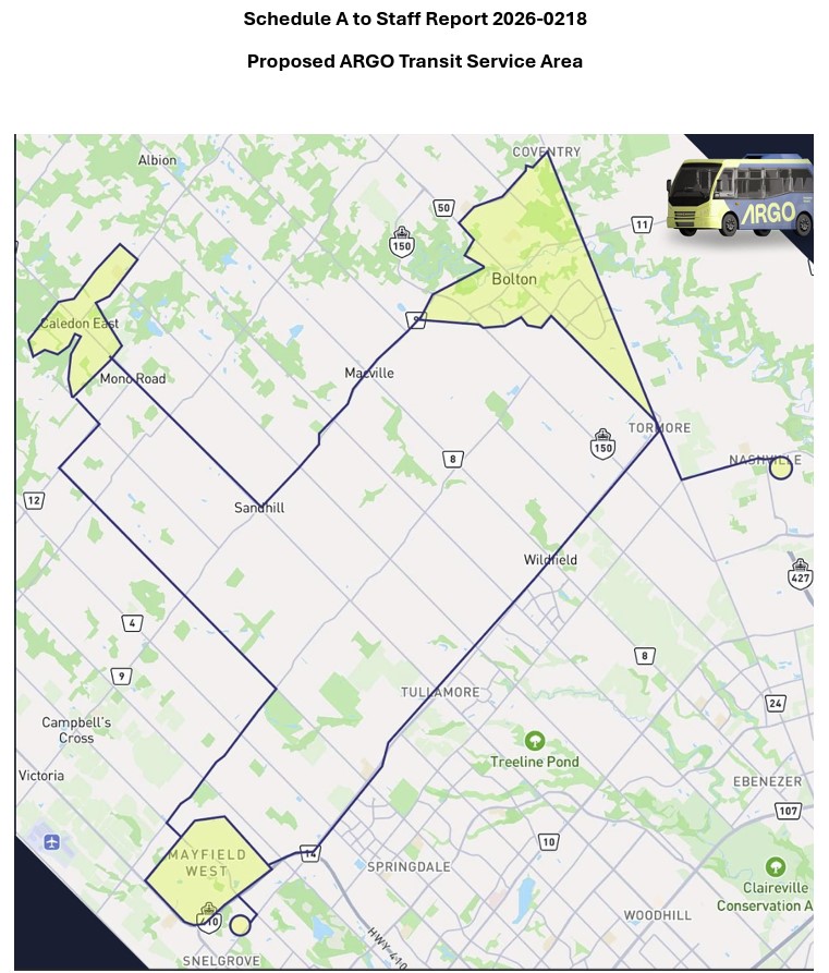
    There are some questions that should be addressed before October. Currently, Route 41 provides service to employment areas in south Bolton and provides connections to several Brampton Transit and YRT routes at Highway 50 and Queen Street, with easy transfers to the TTC subway in Vaughan and Humber College in Etobicoke. Would Brampton maintain a shortened route to Mayfield Road and Highway 50 that could make this link? Would transfers be permitted to other Brampton Transit routes along Mayfield Road, including Routes 15, 18, and 30, or would stops outside the on-demand areas be restricted to those in the map?

    For Caledon, on-demand transit looks like an attractive option to replace Brampton Transit-contracted routes with low ridership and limited service hours. For it to succeed — and even build ridership for new fixed-route service in the future — connections to other transit will be necessary.

    Despite population growth, Brampton Transit ridership is in decline

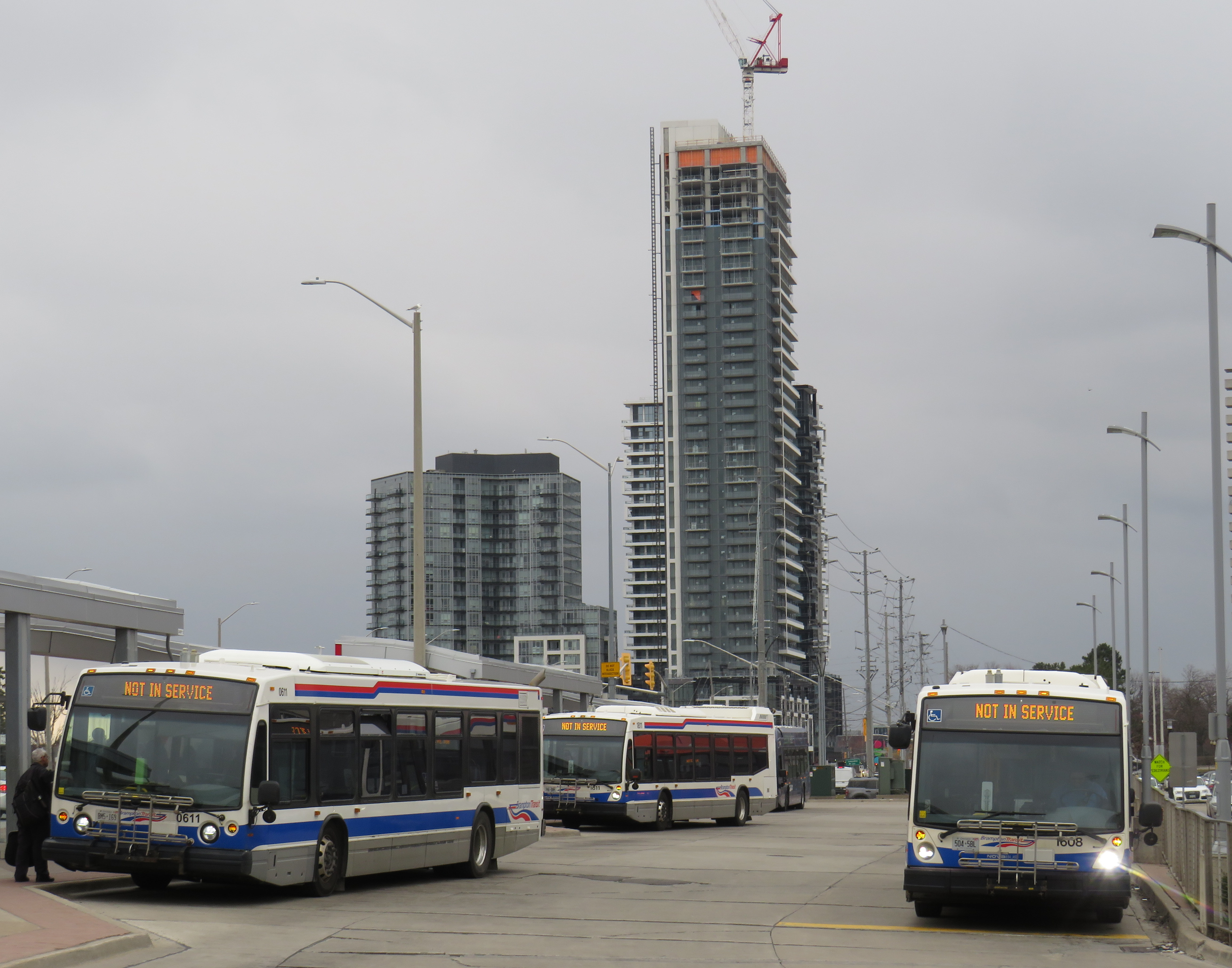
    Meanwhile, Brampton Transit, after several years of dramatic ridership growth after the end of COVID-19 restrictions, is cutting back as ridership has taken a sudden dip in 2025-2026. Four minor routes — 33 Peter Robertson, 36 Gardenbrooke, 55 Elbern Markell and 56 Kingknoll — will be discontinued. These four neighbourbood routes provide local service in areas where other routes are within walking distance or operate in the opposite direction, so the effects are minor and the cuts justifiable if it keeps service going elsewhere.

    However, Route 5 Bovaird, a major local route between Westwood Mall and Mount Pleasant GO Station, will see significant cuts: in the weekday peak from 13 minutes to 20 minutes and evenings from 30 to 40 minutes, and weekend evenings from every 30 to 50 minutes. The 505 Zum route that parallels the 5 does not operate weekend evenings, resulting in very poor service along the Bovaird corridor during those times.

    This is a disappointing setback for transit in my hometown, which up to now has been a model for promoting ridership growth in a suburban edge city. For years, I have wrote about its success in growing demand by operating good service, especially to destinations well beyond its boundaries to places like York University (later the subway terminal in Vaughan), Mississauga City Centre, Humber College, and Pearson International Airport.

    It would be very unfortunate if transit were allowed to enter a “death spiral” of ridership decline, fare hikes, and service cuts in response to this dip, largely due to a decline in international student enrollment at colleges and universities. Brampton has shown before that good service, with incremental growth is a great way of boosting ridership. This means operating buses at least every 20-30 minutes at all times on major corridors like Bovaird.

  • Can you walk to City Hall?

    Can you walk to City Hall?

    Mississauga City Hall, one of the most walkable municipal buildings in Ontario

    In late March 2024, with a streak of mild, sunny days, I was eager to get outside and walk. As I have long been interested in local politics and planning issues, public transit, active transportation (especially walking advocacy), I thought I would try to get to every city, town, and township hall in the Greater Toronto and Hamilton Area (GTHA) without a car.

    This was a fun project, even if there were times I felt really frustrated at times by poor transit and long hikes. The highlight of my quest was a tour of Mississauga City Hall from Councillor Joe Horneck. Mississauga’s civic centre is one of Ontario’s most iconic — and walkable — government buildings.

    Mississauga Council Chambers

    Of the three levels of government (federal, provincial, municipal), the municipal level has the most impact on the day-to-day lives of most Canadians; it is also the closest level of government to all. Residents can depute at committee meetings, get meetings with their local councillor and city staff, and obtain building permits, marriage licenses, or pay bills at city and town halls. Therefore, they should be as accessible as possible, especially to those without cars.

    Only one GTHA town hall (Caledon) was completely inaccessible without a car, though several other town halls required long walks from the nearest transit stop, making them inaccessible to some residents. But I could get to Brock Township, the least-populated and most-rural municipality in the GTHA, thanks to Durham Region Transit’s On-Demand service, though I had some difficulty there.

    The complete list of GTHA city and town halls, along with photographs and a map can be accessed here.

    Preview of Story Map

  • The end of the line for the Orangeville-Brampton Railway

    The end of the line for the Orangeville-Brampton Railway

    The current end of track of the once-important Owen Sound Subdivision, on the outskirts of Orangeville. Beyond, a new paved trail occupies the former right-of-way.

    On Townline Road on the south end of Orangeville, across the street from the old railway yard and station grounds, two plaques stand, telling the history of the doomed railway next to them.

    The first plaque, a faded provincial marker, commemorates the Toronto, Grey and Bruce Railway, which arrived in Orangeville in 1871 and completed to Owen Sound in 1873. The TG&B was combined with the rival Credit Valley Railway by the Canadian Pacific Railway, and Orangeville became the headquarters of a network of branch lines known as the CP Bruce Division. Passenger service to Owen Sound via Brampton and Orangeville continued until 1970.

    The second marker, installed by the Town of Orangeville, commemorates the municipal takeover of the remnants of the Bruce Division, after CP abandoned all track west and north of Orangeville in the 1980s and 1990s. The plaque proudly boasts of a “successful passenger tourist operation” and how the new short line “enhanced opportunities for the long-term economic development of the region.”

    The municipal plaque is sadly out of date. The Credit Valley Explorer tour train last operated in early 2018, and the Town of Orangeville lost interest in operating the railway, which was costing the municipality $450,000 a year. The last freight train departed Orangeville on Friday, December 17, 2021.

    Together with Dr. Brian Doucet, Canada Research Chair in Urban Change and Social Inclusion at the University of Waterloo, I toured the line in its waning days. At TVO.org, Doucet and I argue that the corridor is worth preserving, even if the Town of Orangeville is no longer interested in paying for the railway. We note how the province is looking to build a new highway through the very same lands that the dying railway cuts across.

    Additional photographs and videos of the once-proud Orangeville and Brampton Railway can be found below.

    (more…)
  • Going for a ride on the Bolton Bus

    IMG_6666-001.JPG

    Caledon, a town of 66,000 located northwest of Toronto, is known for charming villages, fall colours, and horse farms. Its most popular landmarks include the waterfall at Forks of the Credit Provincial Park, the unique Cheltenham Badlands, and the vast Albion Hills Conservation Area. Much of the municipality lies within Niagara Escarpment and Greenbelt protected areas, with lands set aside for farms, estates, parks, and golf. That’s how many Caledonians like it.

    Despite its green reputation, Caledon is urbanizing its southeastern quadrant, filling it up with warehouses, truck terminals, and low-density residential subdivisions, all adjacent to the built-up areas of Brampton and Vaughan. Bolton, once a small village, now has a population of 20,000. New subdivisions north of Mayfield Road are indistinguishable from Brampton’s residential development.

    Though two GO Transit bus routes ran through Caledon, it had no transit system of its own. This was becoming more of a problem as new warehouses employing thousands of workers opened. GO Transit’s buses were scheduled to connect with trains to and from Downtown Toronto, not to serve reverse commuters. Though Brampton Transit operated several routes close to Caledon’s borders, it could not extend north of Mayfield Road without an agreement with the town.

    Despite Caledon’s historical resistance to public transit, its attitude slowly changed for the better.

    In May 2010, Brampton Transit’s 30 Airport Road bus was extended to the AMB (now Prologis) warehouse complex just north of Mayfield Road. This was done at the request of AMB, though the Town of Caledon had to agree to the request for service.

    In 2015, Caledon began to study the need for a local transit system, retaining consultants from Steer Group to evaluate and develop options for new transit services, including routes, operators, and service hours. In April 2019, the report to council recommended starting with a route on Kennedy Road in Mayfield West (contracted by Brampton Transit) and a route connecting employment areas in Bolton with Brampton Transit and YRT at Highways 7 and 50 (contracted to a third party), with a demand-response service within Bolton and an extension of a future Brampton Transit route along Mayfield Road provided within a second phase.

    Meanwhile, GO Transit announced the abandonment of Route 38 in June, citing the planned new local transit service as justification for the cut, even though it wasn’t yet setup. Though GO partially restored the service (two daily round trips to Malton GO continue, for now), it remains a short-term solution.

    The Mayfield West service — Brampton Transit Route 81 — began in September, connecting with the 502 Züm at Sandalwood Parkway. On Monday, November 11, 2019, the Bolton Route began service, contracted to Voyago. Both routes operate on 30 minute frequencies, weekday peak hours only.

    IMG_4900-001.JPGNew Brampton Transit stop on Kennedy Road in Caledon

    The two separate agreements don’t work that well for creating a unified transit service.

    Though Route 81 and the Bolton Route both have a $4.00 cash fare, the Brampton Transit-contracted service operates on that agency’s fare structure. There’s a discount for Presto card users and a two-hour transfer valid on any other Brampton Transit route. The 80 cent co-fare to and from GO Transit also applies (Route 81 connects with the frequent 502 bus to Downtown Brampton). It’s a good deal for residents in west Caledon.

    However, the Voyago-contracted buses serving Bolton are only equipped with a fare box, and only accept $4.00 cash fares. There are no free transfers to or from connecting buses at Highways 7 and 50. (Brampton Transit routes 501 Züm, 1, 23, and 36 connect there, as does YRT route 77. It’s a few minutes’ walk to BT routes 31 and 50.)

    Last week, I took the new Bolton bus to get a feel for the new service. The Bolton line operates with two minibuses with twenty seats each and a spot for mobility devices at the rear. Within Bolton, the bus makes a long loop, primarily serving the industrial area in the southwestern quadrant.

    I boarded an afternoon bus from Highway 7 at 3:26 PM and rode to Downtown Bolton. I returned on the bus leaving Bolton at 4:30 PM. I was the only passenger each way; I was told by one driver that was typical. By riding the bus, I was able to learn about some of Caledon’s challenges.

    Transit options from Caledon council reportCaledon Transit high-priority route options from the April 2019 council report

    If the Bolton Line were integrated with York Region Transit and Brampton Transit and made more stops within Brampton, it’d be a useful service, attracting many more passengers. There are several major employers on the Vaughan side of Highway 50, including XPO Logistics, Home Depot, and the Canadian Pacific Intermodal Yard. Additional stops at Major Mackenzie/Coleraine, Rutherford/Castlemore, Trade Valley/Bellechase, and Zenway/Cortrelle would make the bus more accessible and useful to residents and employers. Another stop at Queen Street (Highway 7) and Gore Road would improve connections to Route 50, which serves Humber College.

    Those additional stops would likely require a third bus, but the current route struggles to maintain a 60-minute round trip even with the limited stops currently in place. But with fare integration and local service, it could then attract more passengers, defraying the cost of the additional vehicle and operator.

    In the long term, it would be good to see more cooperation with Brampton Transit, especially as Brampton continues to develop new subdivisions and industrial lands in the northeast, in the areas bordering Caledon and Vaughan. If GO Transit goes ahead and abandons the remnant of Route 38 an express route between Bolton and Malton GO will still be necessary; ideally, that would would be a partnership between Brampton and Caledon.

    Hopefully, Caledon will continue its commitment to building a transit service within its urbanized area. Despite very low ridership at present, the potential is there as population and employment continue to grow. It will take time to tweak the service, improve connections, and build ridership that can count on affordable, reliable transit.

    It’s also time for Halton Hills — now the last GTHA municipality without local transit — to step up and follow Caledon’s lead.

  • A ride from Caledon to Guelph via the Elora-Cataract Trailway

    IMG_5393-001

    On Friday, September 2, I went for an 80 kilometre ride between Caledon and Guelph on what turned out to be a spectacular day: sunny, a high of 23 Celsius and without too much humidity. The summer of 2016 has been exceptionally hot and muggy for long-distance rides, so I’ve done fewer of them. I was lucky to have that Friday off.

    I started my trip in Caledon Village, after taking a GO train to Brampton and transferring to GO Transit’s Route 37 Orangeville bus, which only runs on weekdays. This made the trip very difficult to do on a weekend (I would have to ride 20 kilometres up from Brampton, on busy roads, and up the Niagara Escarpment, otherwise). The racks at the front of GO buses are wonderful for getting out of town (I used GO’s bike racks on similar rides this year), but they tie you to a schedule.

    Map of my ride

    The Elora-Cataract Trailway, owned and managed by Credit Valley Conservation (Cataract to Hillsburgh), and the Grand River Conservation Authority (Hillsburgh to Elora) is one of the best rail trails that I have ever rode. The surface was in near perfect condition along the entire stretch. Wayfinding, including through a gap at Fergus, was great. Barriers at crossings keep motor vehicles out, but are not too difficult to get around for cyclists. And it’s easy enough to get to and from Guelph. But it’s not so easy to get to from Brampton/Caledon.

    After getting off the Route 37 bus in Caledon Village, and after a quick stop there for refreshments, I rode west along Charleston Sideroad for four kilometres to Cataract Road, the only possible route without very lengthy and hilly detours.. That was the most aggravating and dangerous bike ride in a very long time. There’s no paved shoulder, so I rode on the white line demarcating the far right side of the lane. There are several quarries nearby, and Charleston Sideroad was once known as Highway 24. There were many quarry trucks and other large vehicles, most who refused to provide the mandatory 1-metre space that the Highway Traffic Act now mandates. One quarry truck driver blared his multiple times at me, angry and unwilling to share the road.

    image1Westbound on Charleston Sideroad

    The dirt shoulder, filled with large stones and debris, is not suitable for cycling. The Region of Peel, responsible for this road, should pave the shoulders as soon as possible. Improved connections to Brampton and the Caledon Trailway should also be identified and built. But once off Charleston Sideroad, the ride quickly became one of my favourites.  (more…)

  • A Simcoe Day ride from Georgetown to Newmarket

    A few weekends ago, on Simcoe Day (Civic Holiday), I cycled a new route, taking 90 kilometre ride between Georgetown and Newmarket. Just over half of the roue took me on the Caledon Trailway, a beautifully-maintained rail trail between Terra Cotta and Tottenham. From Georgetown to Terra Cotta and between Tottenham and Newmarket, I mostly used quiet, country roads. It was a very rewarding trip, one that I will likely redo in the future.

    The Caledon Trailway is one of the most-used rail trails in Ontario, and I encountered many fellow cyclists and pedestrians along the path. For those with cars, there are several convenient parking areas along the route.

    I took the GO Transit bus on Monday, August 3 from Union Station to Georgetown, taking advantage of the bike racks installed on all of that regional transit agency’s buses.  From Newmarket, I took a special summer GO Train that operates between Barrie (Allandale Waterfront Station) and Union Station. Like all non-rush hour GO trains, bicycles are welcomed aboard as well.


    My route between Georgetown and Newmarket

    A few photos and observations follow.

    (more…)