Tag: Oshawa

  • Why an Oshawa gondola should be a no-go

    Looking north on Simcoe Street, July 2026

    On June 30, 2026, the Toronto Star featured a story about the City of Oshawa’s “lofty plan” to build a new urban aerial gondola system above Simcoe Street, that community’s main north-south corridor. While the technology is novel, it is a fundamentally bad idea for what the regional government proposes it for. Simcoe Street is currently served by the busiest bus route in Durham Region – Route 901 Pulse – as well as several GO Transit buses (routes 52, 56, and 92).

    Gondolas have their place in the urban transit toolbox and they have several advantages. They can be inexpensive to build, as they require minimal right-of-way acquisition and do not require tunnelling. They are adept for climbing steep hills and can offer very frequent service with low operating costs. Gondolas can operate in all sorts of weather conditions, from tropical cities to mountain ski resorts. Modern gondola or cable lift operations allow each car to slow or stop at each station to allow passengers to comfortably board and alight, unlike older, traditional ski lifts. The technology is popular in Latin American cities such as Medellín, Colombia (where the Metrocable system feeds that city’s metro), and La Paz, Bolivia, where a network of Mi Teleférico lines makes up the backbone of the transit service.
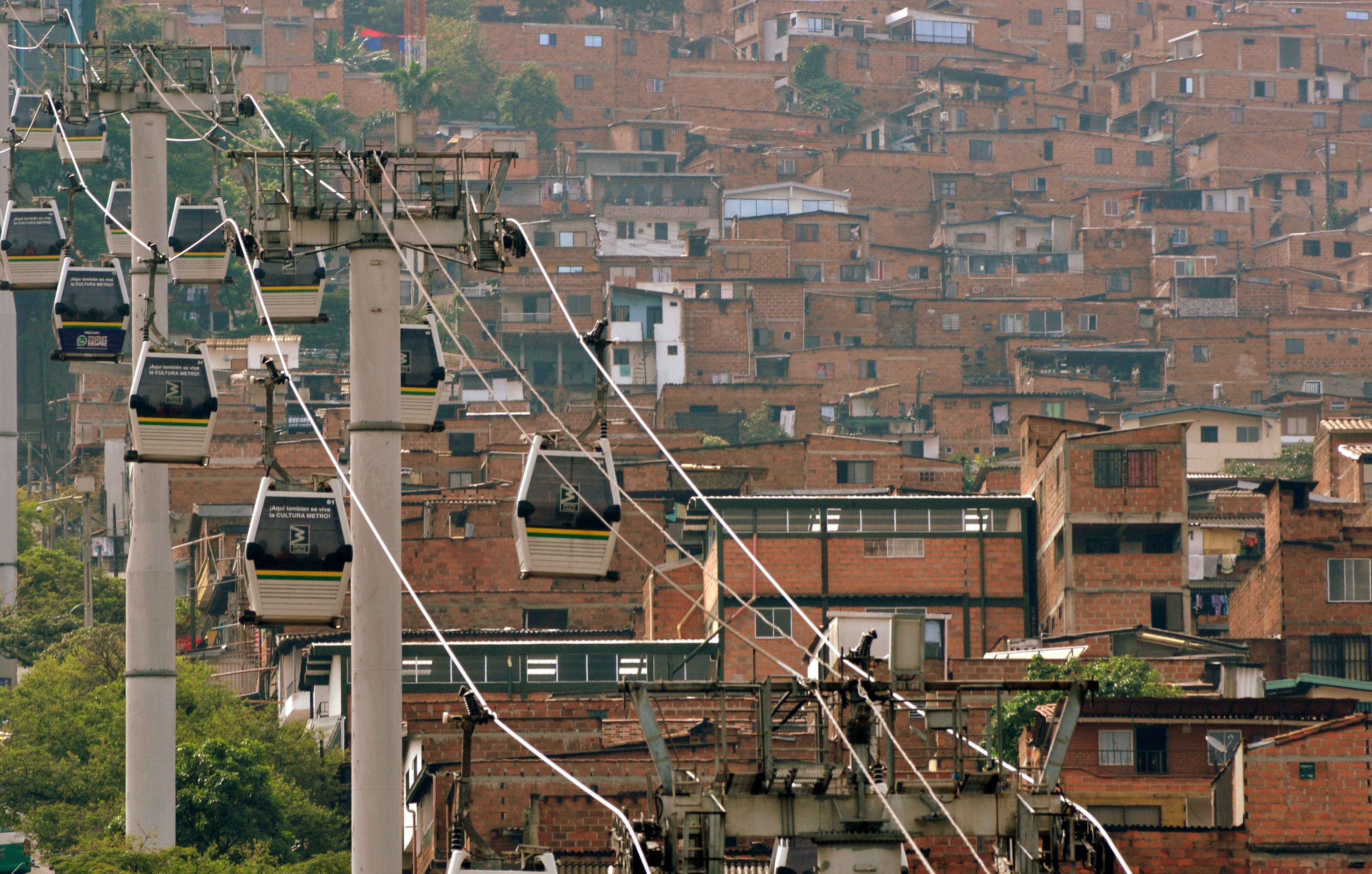
    Metrocable, by FABIAN KRONENBERGER, on Flickr (CC BY-ND 2.0)

    But in those hilly cities in developing countries, the gondolas cover short distances (only between two and five stations per line) and have limited capacity (Mexico City’s Mexicable line has an hourly capacity of just 3,000 per hour). In the United States, the only transit-based aerial cable cars are the Roosevelt Island Tramway in New York and the Portland Aerial Tram, which charges a very high $9 round-trip fare to the general public. In Canada, the most serious gondola proposal would connect Simon Fraser University with the Skytrain in Burnaby, BC and be part of the Translink network. That proposal – though stalled – is logical as it involves just two stations and allows passengers to easily access the university campus located at the top of Burnaby Mountain, reducing the number of buses that have to climb that long, winding access road.

    In contrast, the idea of a gondola running over Simcoe Street in Oshawa makes very little sense, and it seems that the concept will not get beyond a consultant’s report. There are far more reasonable alternatives that merit a closer look, including simple painted bus lanes and other “BRT-lite” measures that can benefit both Durham Region Transit (DRT) and GO Transit passengers.

    Oshawa’s transit past and future

    Simcoe Street, Oshawa’s backbone, has always been the key to Oshawa’s development as an industrial centre; its future opportunities also line the corridor; good transit is essential.

    Established as a small village at the crossroads of Kingston Road and Simcoe Street (an early “colonialization road” that connected Lake Ontario with Lake Scugog), Oshawa grew as an industrial centre starting in the 1870s, when Robert McLaughlin’s carriage works moved to expanded facilities in Oshawa to be nearer the Grand Trunk Railway (GTR) and Oshawa Harbour. As more industries followed, a streetcar line, the first component of the Oshawa Railway Company (OR) was built on Simcoe Street in 1895 to connect the burgeoning downtown with the GTR station and harbour to the south. The original Simcoe Street line was built with several freight spurs to allow shippers direct rail access to their properties. Residents could take the streetcar down to Lakeview Park to relax or to beat the summer heat.

    As industry grew (the McLaughlin Carriage Works moved into automobile manufacturing starting in 1907, eventually becoming the founding component of General Motors Canada) OR built a new freight-only electric line east of Simcoe Street with direct freight yard connections with the GTR. When the Canadian Pacific and Canadian Northern Railways built new lines through the Oshawa area, the OR connected with those as well. The incomplete Toronto Eastern Railway, a failed interurban line along Kingston Road, provided some use to OR as it provided access to several customers along the TER’s completed section of track.

    Though buses replaced passenger service on the single-track Simcoe Street streetcar line in 1940, OR’s freight operations remained busy until the 1960s, with the last electric locomotive withdrawn in 1964. Oshawa’s bus service was taken over by Durham Region Transit in 2006.

    When GM opened a modern assembly complex south of the new Highway 401 in 1950, it slowly abandoned its older plants north and west of the downtown core. Its new property had direct CN and CP rail connections and no longer relied on the OR. Meanwhile, other factories such as A.G. Simpson, Duplate/Pittsburgh Plate Glass, Fittings Limited, Ontario Malleable Iron, and Pedlar People, either closed or stopped relying on rail shipments. The old OR tracks, operated by CN diesels in the last few decades, disappeared in the 1990s, replaced by the Michael Starr multi-use trail north of Highway 401. The last remnant of the Oshawa Railway, a Highway 401 overpass built in the late 1930s, was demolished in 2011.

    After OR removed its remaining downtown trackage in the 1960s, a one-way road system was implemented in Downtown Oshawa. Simcoe Street became northbound-only between Brock and Elm Streets with Centre Street taking on southbound traffic. King Street was twinned with Bond Street, which followed the disused Toronto Eastern Railway tracks. This helped to speed traffic through the downtown core.

    Many of the older industrial lands saw new uses: Most of the old GM North Plant properties are now home to apartment buildings, the Durham Regional Courthouse, and a big box retail complex anchored by Costco Wholesale. The Pedlar People plant was demolished to become a Zellers-anchored plaza on Simcoe Street South. The Ontario Malleable Iron factory became a Knob Hill Farms supermarket which operated between 1981 and 2000. That plant, now mostly demolished, is to be the site of a new GO Transit station; surrounding property, including the old PPG plant, is designated for future development.
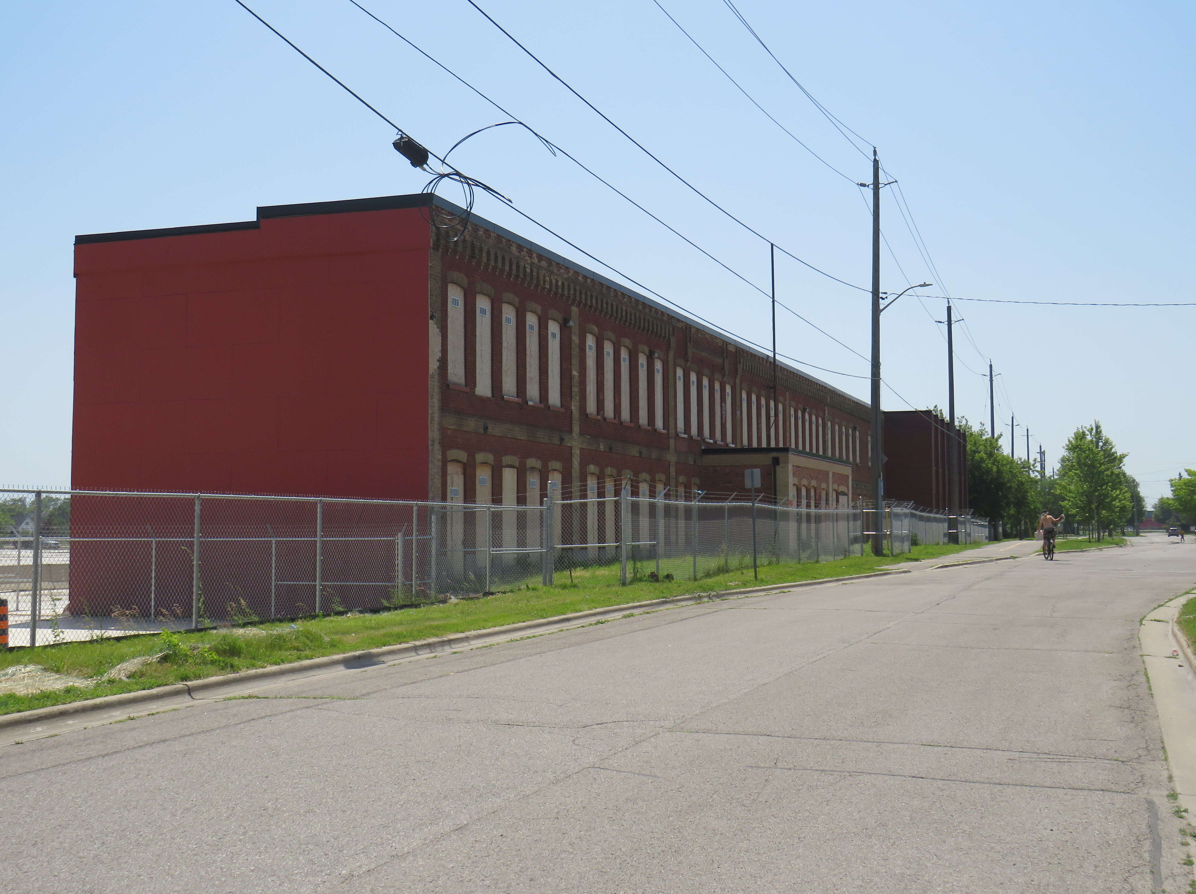
    Facade of the old Ontario Malleable Iron factory, later Knob Hill Farms

    The construction of Highway 401 and changes to intercity rail also changed Oshawa considerably. As Toronto grew and GM’s influence began to decline, Oshawa became part of the metropolitan commutershed. CN closed the old GTR station off Simcoe Street and built a new modern station between Oshawa and Whitby in 1967, consolidating passenger service for those two communities at a single location with space for commuter parking. Though GO Transit was also established that year, its trains only went as far east as Pickering; GO bus service via Highway 401 and via Highway 2 extended the provincial agency’s reach to Oshawa until 1995, when the Lakeshore East line was fully extended to Oshawa.

    Map of Oshawa’s transit past and possible future, highlighting the old Oshawa Railway streetcar and freight tracks, connecting railways, and major Oshawa institutions. The proposed route of the gondola along Simcoe Street is highlighted in green. Click image for full size.

    With the decline of General Motors’ Canadian operations along with many of its feeder plants, Oshawa’s economy shifted towards education and government services while becoming more of a Toronto suburb rather than an independent industrial centre. The downtown hockey arena/entertainment venue, which opened as the General Motors Centre, is now named for Tribute Communities, a residential developer. Durham College’s campus, on the north end of the city, has grown and now includes Ontario Tech University. Between the campus and downtown is the main Lakeridge Health campus, which is the largest hospital in Durham Region.

    As Oshawa and its postsecondary educations have continued to grow, it is no wonder that Durham Region Transit’s 901 Simcoe Street bus – the successor to the old Oshawa Railway streetcar – is so busy and congested. But a gondola is not the right solution, either.

    Why better buses are the answer

    Typical traffic on Simcoe Street at Adelaide Avenue, near the famous Parkwood Estate and Lakeridge Hospital

    As Metrolinx starts work on the Bowmanville GO Transit expansion – which will extend the Lakeshore East rail corridor into central Oshawa and eastward into Clarington – it is replacing the Simcoe Street bridge over the CPKC tracks, a two-year project that has forced the closure of Oshawa’s main street south of downtown. Most north-south traffic now follows Ritson Road, Park Road, or Stevenson Road. Though traffic is heavier on each of those alternatives (especially on Ritson), Oshawa is coping without experiencing complete gridlock.

    Metrolinx construction on the replacement Simcoe Street Bridge

    Ideally, when the Simcoe Street bridge reopens in late 2027 or early 2028, two of its lanes could be dedicated to DRT and GO buses. These bus-only lanes can then extend northwards towards Downtown Oshawa, Lakeridge Hospital, and Durham College/Ontario Tech. As some of Oshawa’s most important destinations, such as the Oshawa Centre shopping mall and the Oshawa GO/VIA Rail station, are off Simcoe Street, buses can divert on and off the bus lanes to serve those, and other, trip generators; a gondola would not be able to do so.

    As the Bowmanville extension of the Lakeshore East GO service will see limited service (peak-direction train service during rush hours and limited off-peak runs) along with a low-speed diversion from the GO corridor to the CPKC line, many passengers connecting to GO towards Toronto would still choose to transfer at the main GO/VIA station.

    As the planned new Oshawa Centre GO Station is located on the old Malleable Iron/Knob Hill site two blocks east of Simcoe Street, a gondola would have to swing over to serve it or force a long walking transfer. Depending on how bus service on Simcoe Street is planned by DRT, buses could either divert to serve it, or a dedicated route could provide that connection.

    Portion of DRT system map centred on Downtown Oshawa (full system map available here)

    Furthermore, the former Oshawa Railway lands can be better utilized for active transportation purposes. Though the Michael Starr trail runs all the way from Lviv Boulevard (just north of Highway 401) to Taunton Road, it is treated as a recreational trail, rather than a vital transport link. At most crossings, east-west motor traffic is prioritized over pedestrians and cyclists, with “stop and dismount” signs at many trail crossings. There is also a considerable gap between Bruce Street south of Downtown Oshawa and Adelaide Street to the north, as the OR followed Bruce Street and Ritson Road to serve GM’s north plant.

    Creating a high-quality through cycling path using part of the OR/Michael Starr right-of-way and improving the existing bike lanes on Mary Street through Downtown Oshawa and extending it to Durham College/Ontario Tech can divert some DRT passengers between the future GO station, the downtown, the hospital, and the campus, and get at least a few car drivers to switch to active transport modes.

    Michael Starr Trail, built on the old OR right-of-way. Note the yellow “stop and dismount” signs.

    If built, Oshawa’s 13-kilometre, 16-station gondola line would be the longest urban aerial transit route in the world and while it might allow for the retention of four lanes of traffic on Simcoe Street, land would still be required to build the towers, stations, and maintenance facility. Buildings will still have to be demolished. The gondola’s capacity would be limited. The estimated $1.1 billion spent on gondola towers, stations, and vehicles could be much better spent.

    Once better bus and active transportation infrastructure is provided, Oshawa might find that the fears of Simcoe Street gridlock may not come to pass. An expensive median busway is not necessarily the answer either: simple reserved lanes, enhanced bus stops with off-board fare payment and all-door bus boarding, signal priority and queue-jumps at busy intersections could do a lot in the short term. Yes, that would mean inconvenience for drivers, but the Metrolinx construction on Simcoe Street south is already an inconvenience.


    Unfortunately, the costs of maintaining this website and the ArcGIS Online portal to my maps continue to rise. However, I am committed to provide an ad-free, paywall-free resource. If you enjoy my work, please consider buying me a coffee to help with those costs. Thank you!
  • Can you walk to City Hall?

    Can you walk to City Hall?

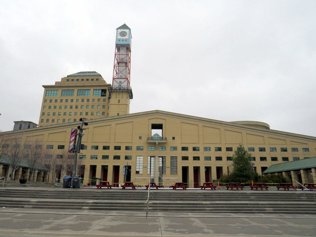
    Mississauga City Hall, one of the most walkable municipal buildings in Ontario

    In late March 2024, with a streak of mild, sunny days, I was eager to get outside and walk. As I have long been interested in local politics and planning issues, public transit, active transportation (especially walking advocacy), I thought I would try to get to every city, town, and township hall in the Greater Toronto and Hamilton Area (GTHA) without a car.

    This was a fun project, even if there were times I felt really frustrated at times by poor transit and long hikes. The highlight of my quest was a tour of Mississauga City Hall from Councillor Joe Horneck. Mississauga’s civic centre is one of Ontario’s most iconic — and walkable — government buildings.

    Mississauga Council Chambers

    Of the three levels of government (federal, provincial, municipal), the municipal level has the most impact on the day-to-day lives of most Canadians; it is also the closest level of government to all. Residents can depute at committee meetings, get meetings with their local councillor and city staff, and obtain building permits, marriage licenses, or pay bills at city and town halls. Therefore, they should be as accessible as possible, especially to those without cars.

    Only one GTHA town hall (Caledon) was completely inaccessible without a car, though several other town halls required long walks from the nearest transit stop, making them inaccessible to some residents. But I could get to Brock Township, the least-populated and most-rural municipality in the GTHA, thanks to Durham Region Transit’s On-Demand service, though I had some difficulty there.

    The complete list of GTHA city and town halls, along with photographs and a map can be accessed here.

    Preview of Story Map

  • Neither here, nor there: the folly of transit naming rights

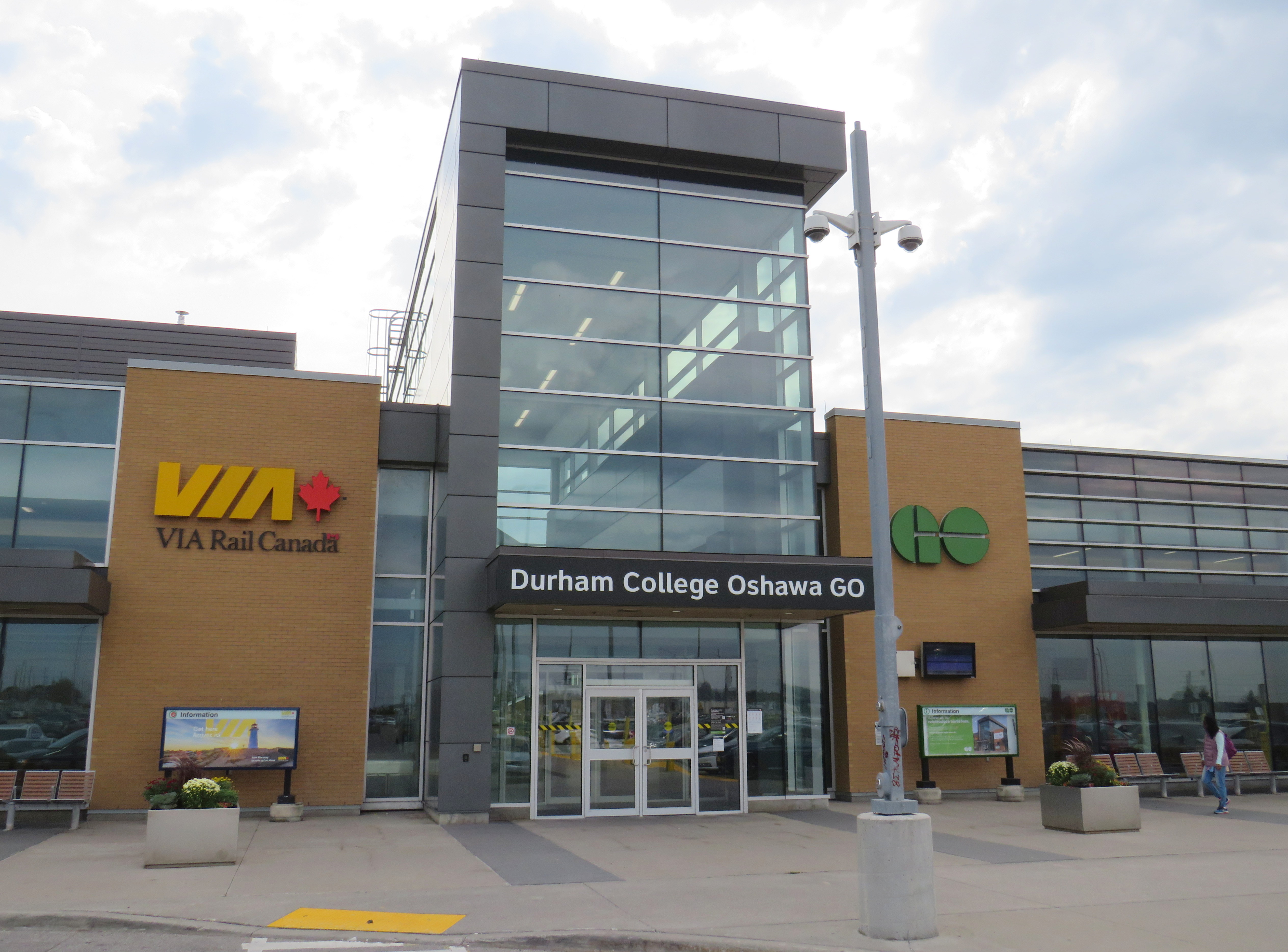
    On Tuesday, October 4, Metrolinx announced a new name for Oshawa GO Station, the eastern terminus of its busy Lakeshore Corridor. In a ten-year agreement with Durham College, a publicly funded post-secondary institution, the station will now be known as “Durham College Oshawa GO.” This was announced on Metrolinx’s Twitter account, Durham College’s social media, and on the GO Transit Lakeshore East Twitter account, which usually advises passengers of train delays and cancellations.

    GO Transit Lakeshore East Train tweet on October 4
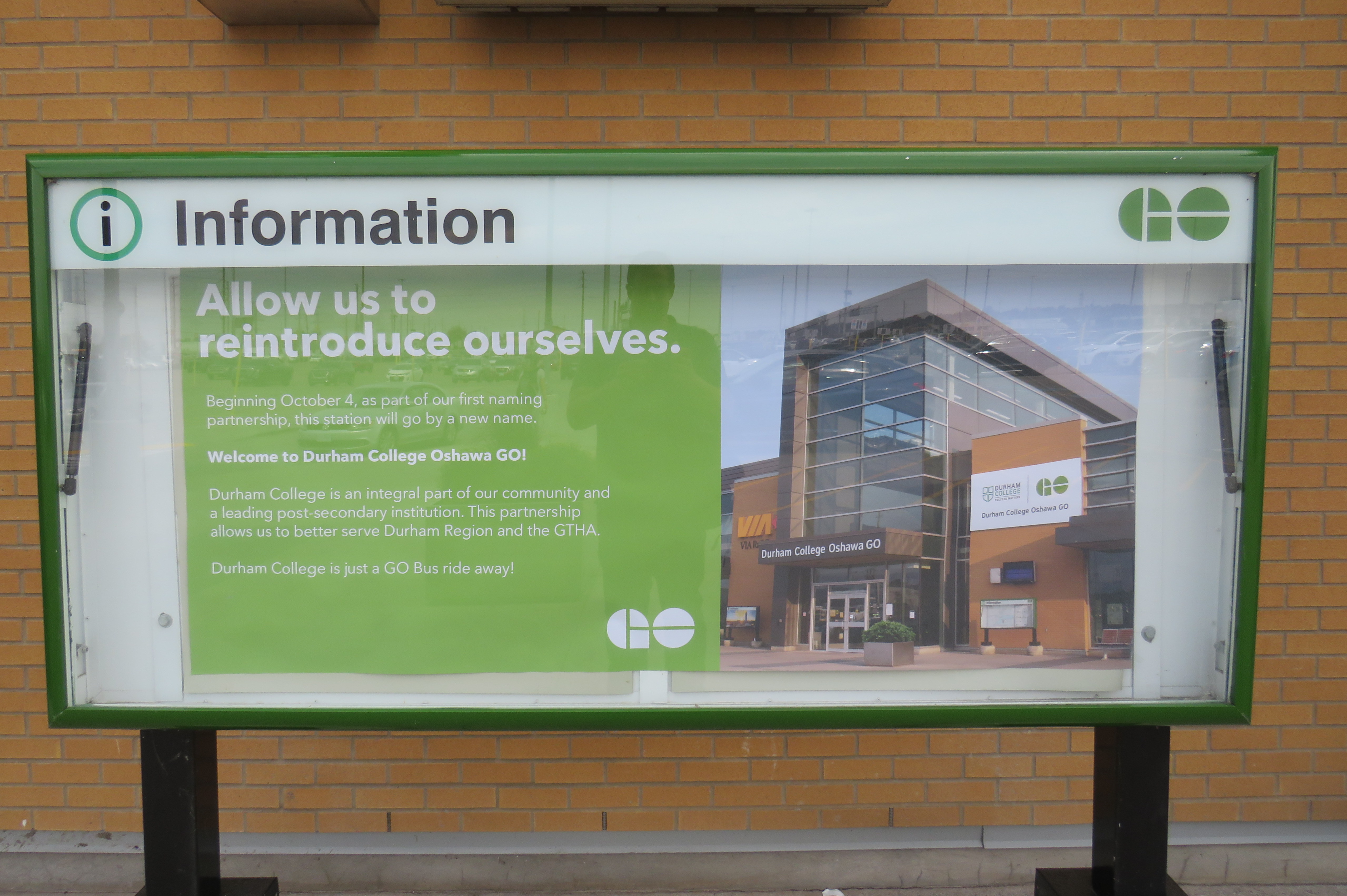
    “Allow us to reintroduce ourselves” – promotional poster at Oshawa Station proclaiming the new “Durham College Oshawa GO” name

    Metrolinx, the regional transit agency that operates GO Transit, claims that “the partnership allows us to better serve Durham Region and the GTHA” in its communications, including an informational poster in front of the station building.

    The news did not go over well with GO Transit customers and transit users across the Greater Toronto Area; Metrolinx later deleted its tweet after it was “ratioed” — meaning that negative comments and quote-tweets outnumbered the number of positive responses by a large margin. It is easy to understand why the station renaming was not popular.

    Firstly, though “Oshawa” remains in the station name, Durham College comes first with the new moniker. Schedules, signs, and maps will be updated to reflect the new name, while announcements by on-board staff and digital schedule information already reflect the new name. VIA Rail, which shares the station with GO Transit, is not a party to the agreement, and will likely continue referring to the station as “Oshawa.”

    Specific details of the agreement, such as how much Durham College is paying for the branding agreement, remain confidential.

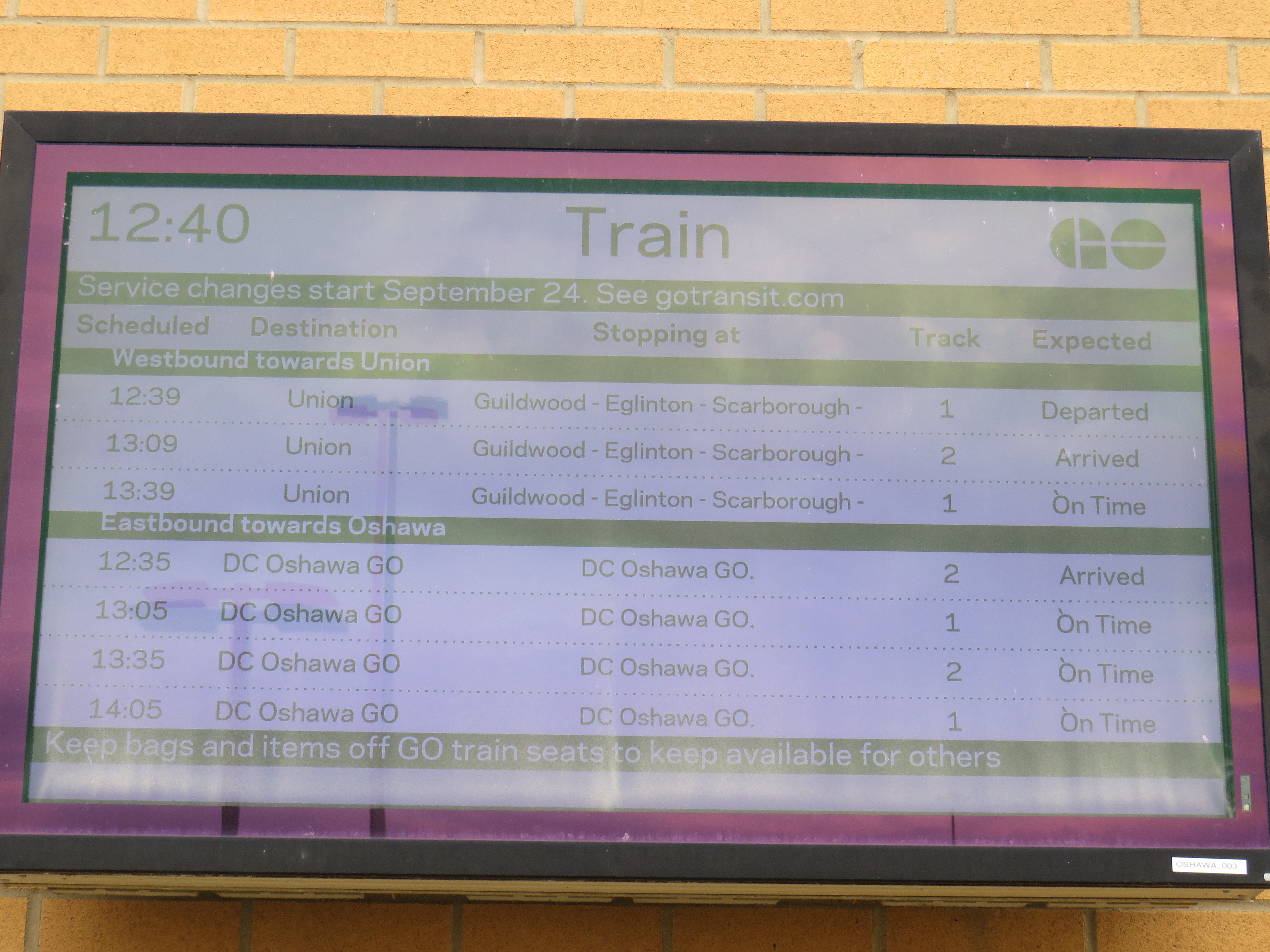
    On GO Transit schedule boards, Oshawa Station now appears as “DC Oshawa GO”

    The new policy of naming rights agreements goes against years of Metrolinx policy for naming stations. When planning the Eglinton-Crosstown LRT, it developed five standards for naming stations and stops:

    1. Simple. Simple names are easier to remember

    2. Logical. Logical names provide a mental link when trip planning: they should be relevant to the area they reside

    3. Durable. Names should be relevant as long as the station exists

    4. Self-Locating. Names should allow users to mentally locate themselves within the region

    5. Unique. A unique name is one that cannot be confused with any other.

    Metrolinx principles for determining new names

    “Durham College Oshawa GO” violates most of the above principles. The name is now a mouthful, much like “Vaughan Metropolitan Centre” (another controversial station name that the TTC objected to, but was overruled due to political considerations), and is no longer simple. The agreement only lasts ten years, so it is not durable. As I will explain further, the name is also neither logical, self-locating, nor unique.

    Durham College has three campuses. Its main campus is located in the north end of Oshawa, on a site shared with Ontario Tech University. GO Transit has a bus stop there called “Ontario Tech/Durham College” that is served by GO Transit Route 56 on weekdays, and Route 52 on weekends and holidays. The main Oshawa campus is a two hour walk from the GO station, a 25-35 minute GO bus ride, or a 20 minute drive from the station. This was the main reason why transit users were ridiculing the new station name on Twitter.

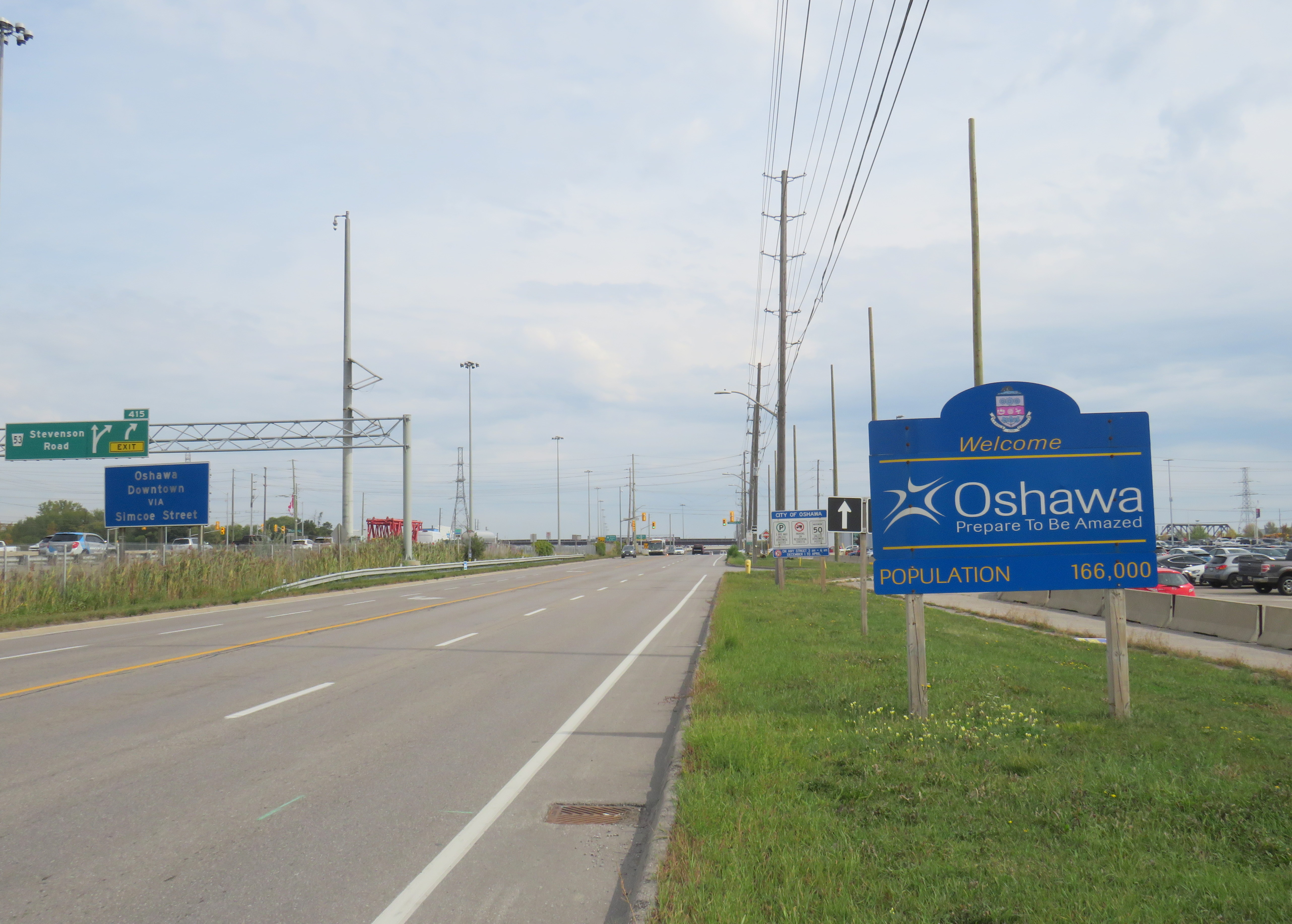
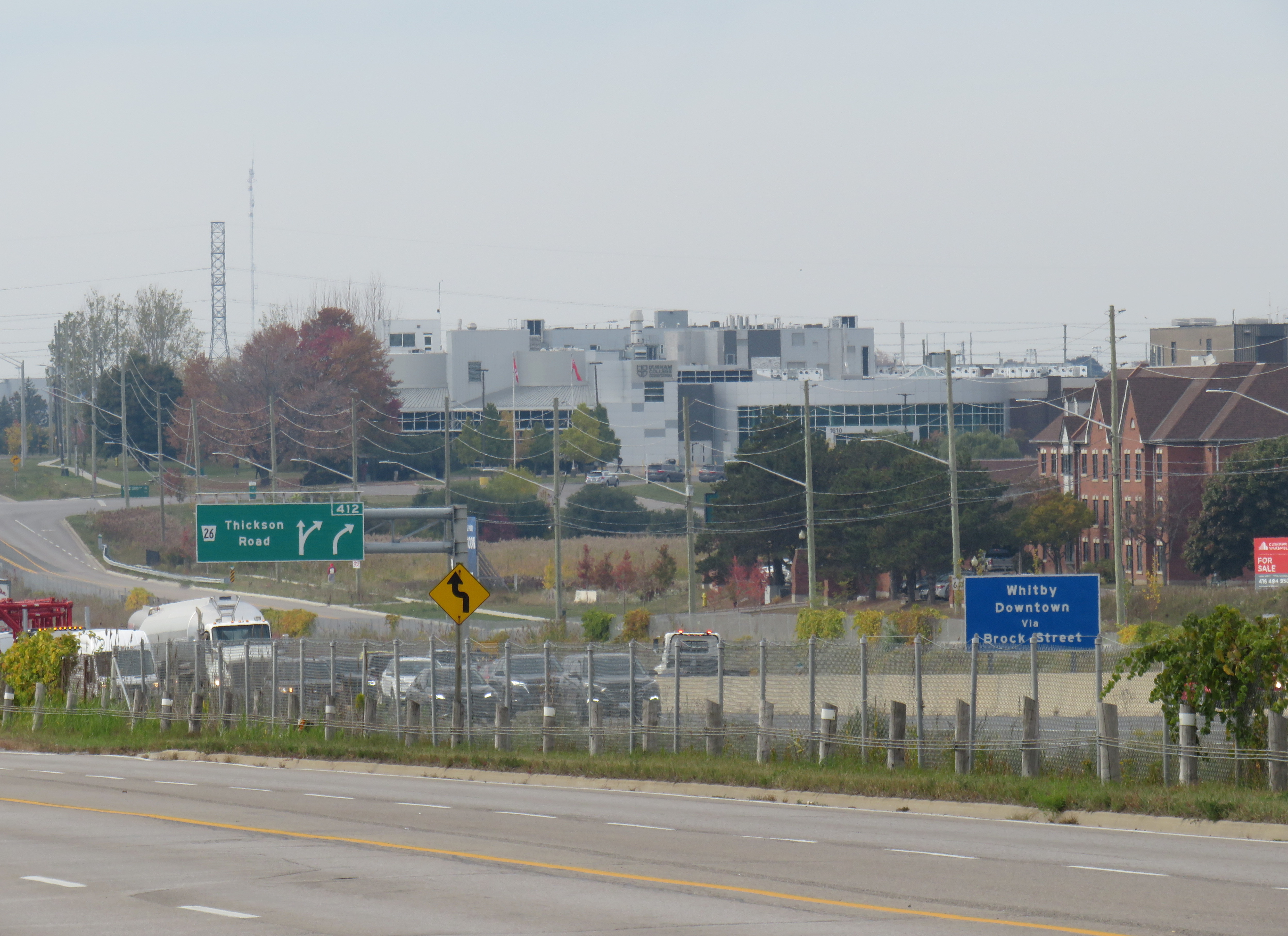
    Durham College’s Whitby Campus is much closer to Oshawa GO Station, in fact, it is less than 500 metres from the Oshawa GO Station parking lot as the crow flies. Oshawa Station is actually right on the border of Oshawa and Whitby, with the “Welcome to Oshawa” signs next to the main GO Transit parking lot. The overflow lot for Oshawa GO is actually in the Town of Whitby.

    The “Oshawa: Prepare To Be Amazed” sign marking the city limit sits next to the GO Station parking lot.

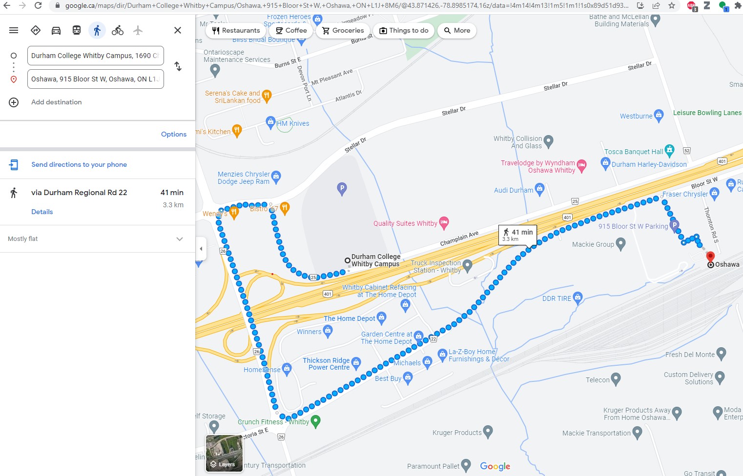
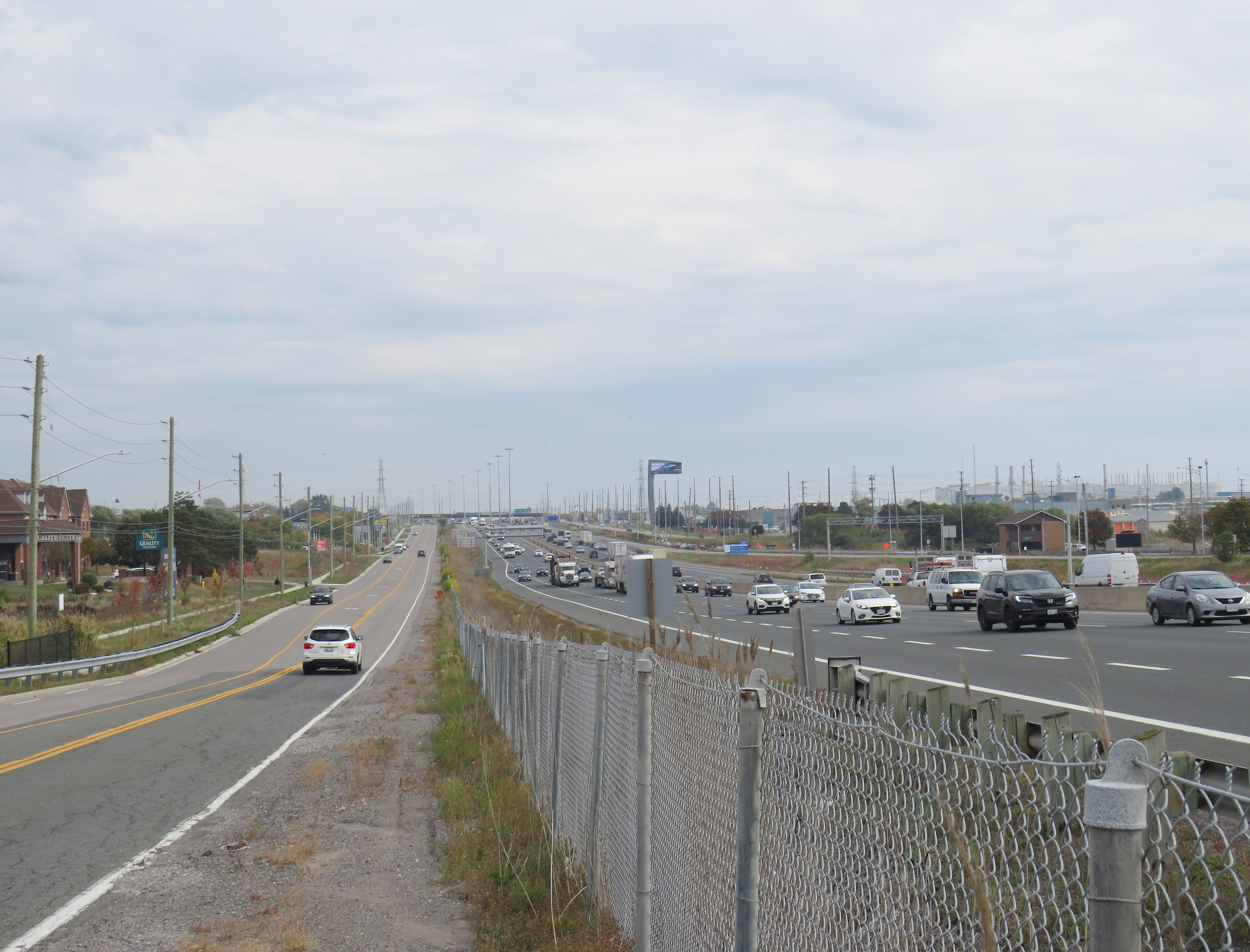
    However, the Whitby campus is even harder to get to from Oshawa GO than the main Oshawa campus because it is separated by Highway 401. It is a 41 minute walk between the station and the Whitby college campus along Victoria Street (which has no sidewalks along most of its length), Thickson Road, Stellar Drive, and Champlain Avenue, though a footbridge over the highway would reduce the walking time to a more comfortable 15 minutes.

    Google Maps directions from Oshawa Station to Durham College Whitby Campus
    Looking northwest from the Oshawa GO parking lot towards Durham College Whitby Campus, the large grey building above and to the right of the green Thickson Road exit sign
    Looking east on Champlain Boulevard in front of the Whitby campus across Highway 401 towards Oshawa GO Station, which is marked by the tall digital billboard towering over the roadway

    The irony is that both major Durham College campuses are better reached from Whitby Station than the newly named “Durham College Oshawa GO.” There are no direct buses to the Whitby Campus from Oshawa Station, but Durham Region Transit (DRT) Route 917 provides regular service from Whitby Station. Furthermore, DRT operates more frequent service on Route 905 between Whitby Station and the Oshawa Campus than GO Transit does from Oshawa Station. Google Transit itself recommends transferring at Whitby to DRT, rather than at Oshawa, because the connections are more convenient. GO Route 56 operates only every hour on weekdays, and Route 52 runs every two hours on weekends and holidays. Meanwhile Route 905 stops in front of the Oshawa campus every 15-30 minutes, 7 days a week.

    The connection at Oshawa Station to Durham College’s main Oshawa Campus makes sense only when transferring from a VIA Train, or from GO Transit Route 88 from Peterborough and Clarington.

    Excerpt from Durham Region Transit system map, with Oshawa and Whitby stations and both Durham College campus locations highlighted

    Therefore, at this point, renaming Oshawa Station to “Durham College Oshawa GO” makes no sense. The new name violates basic wayfinding standards, while Durham College itself is better accessed from a different GO Station. Perhaps Durham College could operate a shuttle service to its campuses from the station, making the co-branding a more plausible.

    More concerning is that future renamings are in the work. In February, I noted that Metrolinx was looking for expressions of interest for station naming opportunities, specifically four Lakeshore Corridor stations: Whitby GO Station, Exhibition GO Station, Clarkson GO Station and Oakville GO Station, but noted that they would be willing to consider other proposals as well.

    Though I am critical of the process, I am sympathetic to Metrolinx’s position. I do not believe they were supportive of the province’s decision to rename a major LRT project for a political ally and paid advisor to Doug Ford’s Progressive Conservatives. I strongly believe there are many within the organization who are not happy about the station renaming agreements either. They must work with a very “hands on” government that is eager to promote new transit projects and benefit their supporters.

    Such is the state of things in Ontario.

  • Greenfield infrastructure: not so green

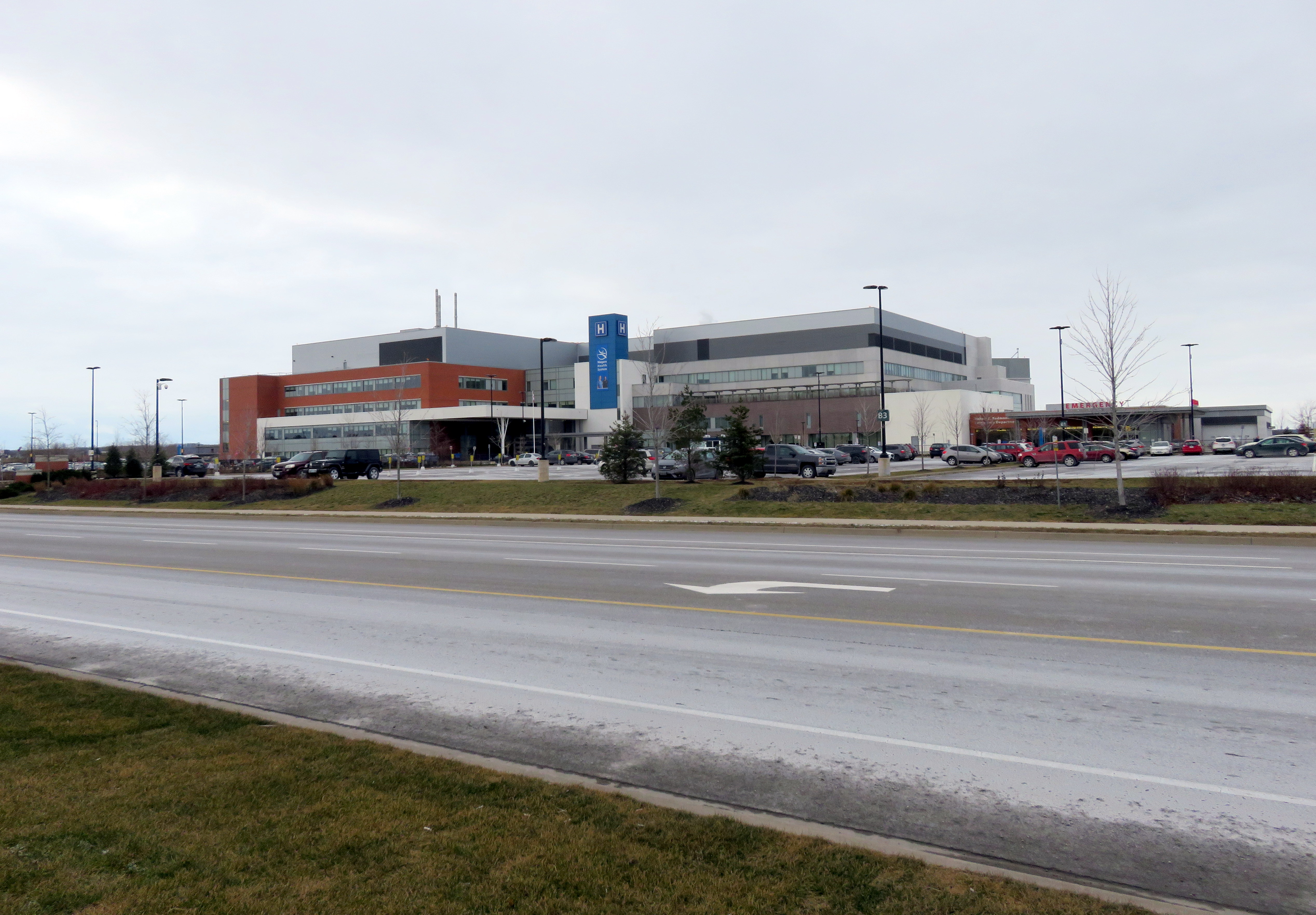
    St. Catharines site, Niagara Health System

    I recently visited two Ontario cities, St. Catharines and Orillia, to illustrate the problems of building new medical and educational institutions on isolated greenfield sites.

    Large greenfield lands have several advantages: they’re easy and inexpensive to build on, they can accommodate large parking lots, and offer room for future expansion. But by the nature of their isolation, they’re more expensive to serve with road and water infrastructure, and more difficult to connect to transit. Students, patients, and employees must travel farther, and they don’t foster economic and social connections with the local community as well.

    St. Catharines

    In 2013, a new hospital campus opened in St. Catharines, replacing two smaller, run-down hospital sites just outside of the city’s downtown core. The new Niagara Health System site offers new and improved services, such as regional cancer centre, a spacious and bright dialysis unit, and a modern mental health centre. When the site opened, it was a vast improvement over the older facilities.

    But there was one, major, drawback: the new hospital site is located on the far western edge of St. Catharines’ suburban sprawl, almost inaccessible without a car.


    Location of current and former St. Catharines hospital sites

    St. Catharines Transit re-routed a bus route (Route 1) to serve the new hospital site, but it costs the transit system nearly $400,000 a year to do so. The old General Hospital had four bus routes within walking distance to its urban location. Passengers from Thorold, Merritton, or several other neighbourhoods are required to make an additional transfer at the downtown bus terminal in order to access the new site. The distance makes taxi trips more expensive for the majority of St. Catharines residents and more difficult to get to by foot or by bike.

    (more…)
  • Dispatches from Durham Region, and Kingston Road tokenism

    Two weeks ago, I was out exploring Durham Region, the eastern end of the Greater Toronto Area. While south Durham Region is mostly made up of generic suburban sprawl, there are some interesting historic villages and new urbanist neighbourhoods. North of Highway 7, Durham Region is still mostly rural, though plans for a new airport in North Pickering may change that.

    Sadly, Durham Region remains auto-centric in its outlook, even more so than other suburbs to the north and west of Toronto. The provincial government is constructing an eastern extension of Highway 407, with two new connecting highways to Highway 401 either nearly complete, or proposed. Oshawa, the largest city in Durham, is the birthplace of General Motors Canada, but while the auto industry declines, the city has been continuing to make many civic planning mistakes. And in Ajax, a small symbol of change – new bus and bicycle lanes – is still merely a token effort.

    (more…)