I love maps, especially physical, paper maps. I like to visualize the places I travel to and determine how each city and region’s transit networks work. Though online interactive maps can be very helpful (like the ones I created to show all intercity transport services in Ontarioand across Canada, filling a much-needed gap), there is still nothing like a well-designed static map, especially when it is in print and easily accessible to the public.
This means providing maps that accurately and clearly depict the entire transit system, along with landmarks, connections, and frequency. Los Angeles Metro’s system map does a reasonable job for a map that covers a very large region.
The Los Angeles Metro system map depicts the complex bus and rail network, including non-LA Metro agencies like Culver Citybus and Santa Monica’s Big Blue Bus. Colours and line width used to denote operator, service type, and frequency.
Thankfully, most urban transit systems in North America continue to provide proper system maps both on their websites and in print, provided free on request at subway booths or terminal offices. (Some, however, have charged a small fee for a physical copy of their transit maps, such as San Francisco’s Muni.) In Europe, complete transit maps often have to be purchased, such as in Berlin or Vienna.
I recently visited two mid-sized American cities that have done away with physical maps for their transit systems: Pittsburgh, Pennsylvania and Denver, Colorado. In those cities, figuring out how to get around by tram and bus was frustrating, even in an age of Google and Apple maps and transit planning apps accessible to anyone with a smartphone.
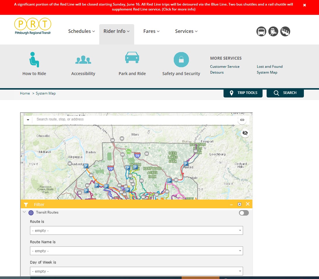
Pittsburgh Regional Transit (formerly known as Port Authority Transit) operates a complicated web of bus routes that radiate from the city’s downtown core, along with a few cross-town and feeder routes. There are three busways and a light rail service to the southern suburbs. However, there is no proper system map, either in print or online as PDF or image file that allows the new or casual user to make sense of the network.
The user can then select a service by route name or number in a drop-down tool, but the map itself is difficult to figure out. Zooming in reveals the location of fare vendors and park-and-ride lots, but not important service details like route numbers or service frequency.
Zooming in, park-and-ride lots become the most prominent feature
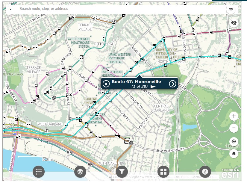
Even at the neighbourhood level the map is difficult to read. The screenshot below shows Pittsburgh’s Oakland district, home to University of Pittsburgh, Carnegie Mellon University, several other educational institutions, medical centres, parks, museums, and cultural venues. Many bus routes follow Forbes Avenue and Fifth Avenue, but as each route is layered on top of each other, it is difficult to discern where each route runs and where they go.
PRT’s ESRI interactive system map, zoomed into the Oakland District
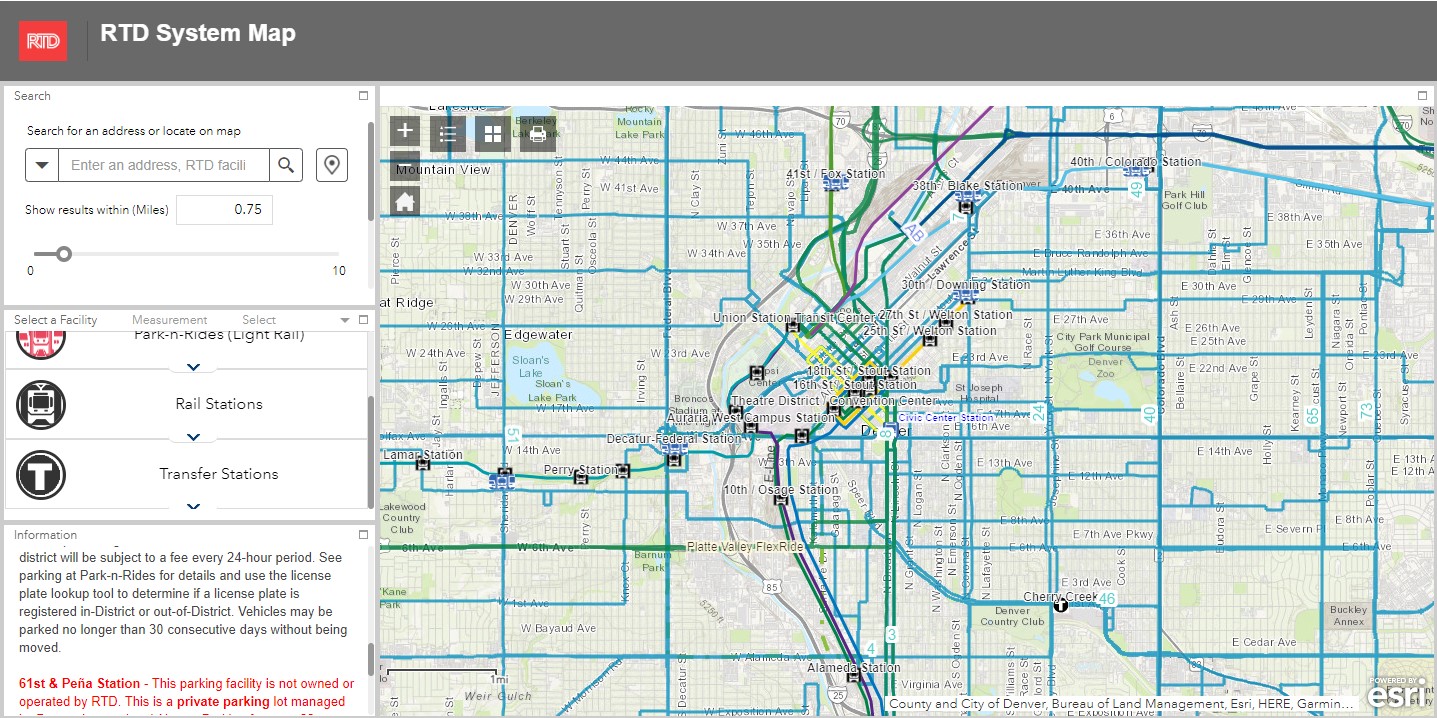
Denver’s Regional Transportation District (RTD) also uses ESRI interactive maps to show bus routes (rail services are depicted in a static image map as well). At a small scale, only the light rail and commuter/regional rail services appear, along with transit park-and-ride locations. Denver’s bus system is less complicated than Pittsburgh, operating largely on a grid, but still, a proper map would make it much easier to get a sense of the network.
Zoom in, and bus routes appear, along with route numbers, but there is nothing to show the level of service for each route.
Though online-only interactive maps have their purpose (my Ontario and Canada intercity maps are designed to show where connections exist, or not, and how to obtain schedule information), they are not well suited for urban transit systems and are very difficult to read on a mobile device. Properly designed static maps, in web image or PDF format do much better jobs.
It is worth comparing Pittsburgh and Denver to the Toronto Transportation Commission (TTC). The TTC’s complete system map is provided to customers for free at subway stations, with smaller, simplified versions available as tear-away pamphlets. Large-format versions are also displayed across the network in bus shelters and subway stations. A PDF version can also be easily found on the TTC website in the main Routes and Schedules page. Surface routes are categorized by service level (express, frequent service, regular service, limited service, seasonal, and community routes) with major landmarks and transfer points to connecting services clearly indicated.
I have some minor complaints about the TTC’s map (like regular routes, express routes should be categorized in the map based on their service levels, for instance) but it is a reasonable, easy to read map that is also quite easy to find.
Unfortunately, more transit systems are moving away from easily accessible paper maps. Durham Region Transit, for example, no longer provides copies of its system map. Fortunately, a proper, well-designed PDF copy remains accessible on its website.
When travelling, or looking to understand a city’s transit network though, there is nothing quite like poring through a well-designed, easy-to-read paper map. It would be a shame if more agencies went the way of Denver and Pittsburgh.
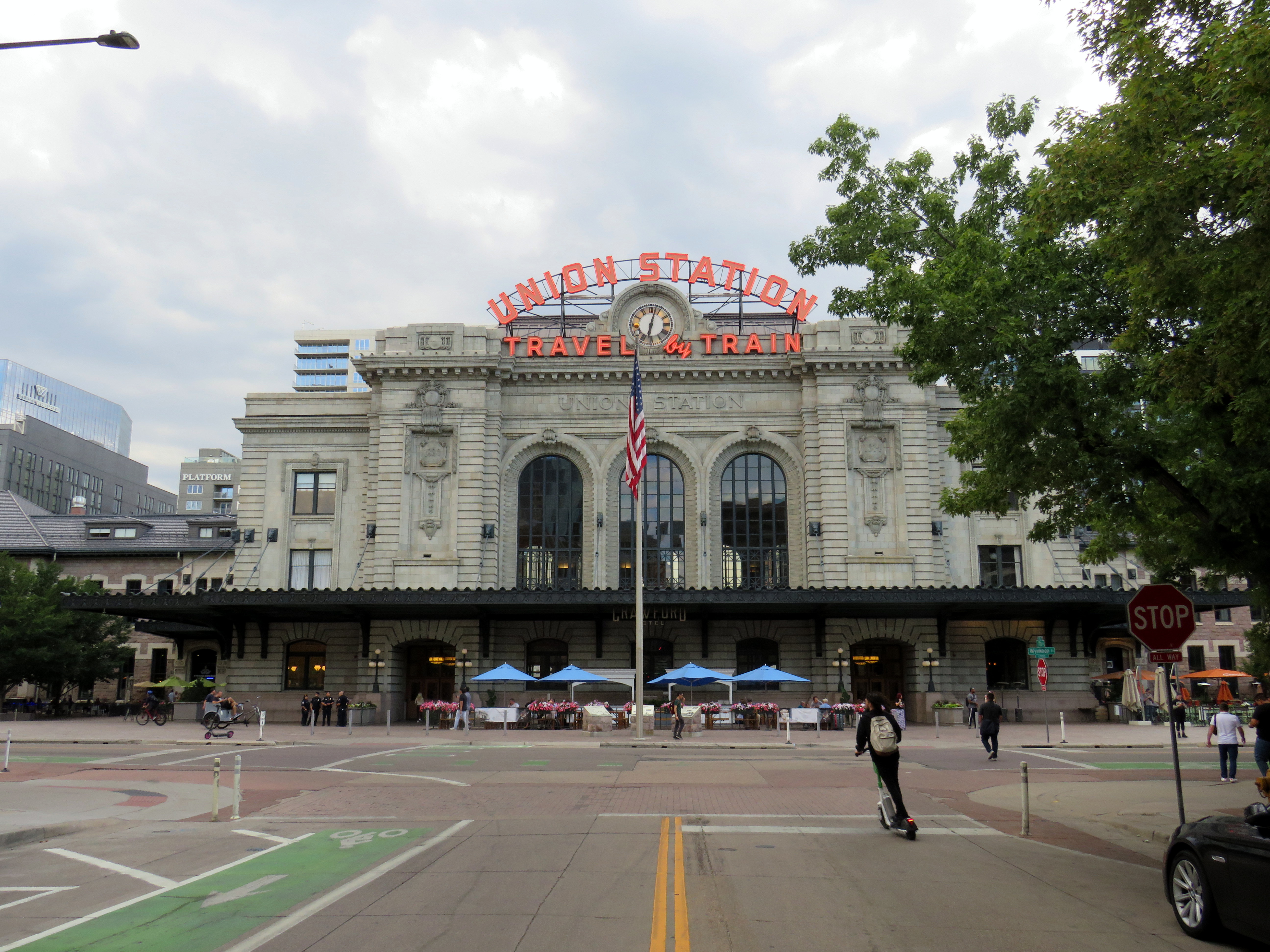
Denver’s Union Station, with the iconic “Travel by Train” neon signage
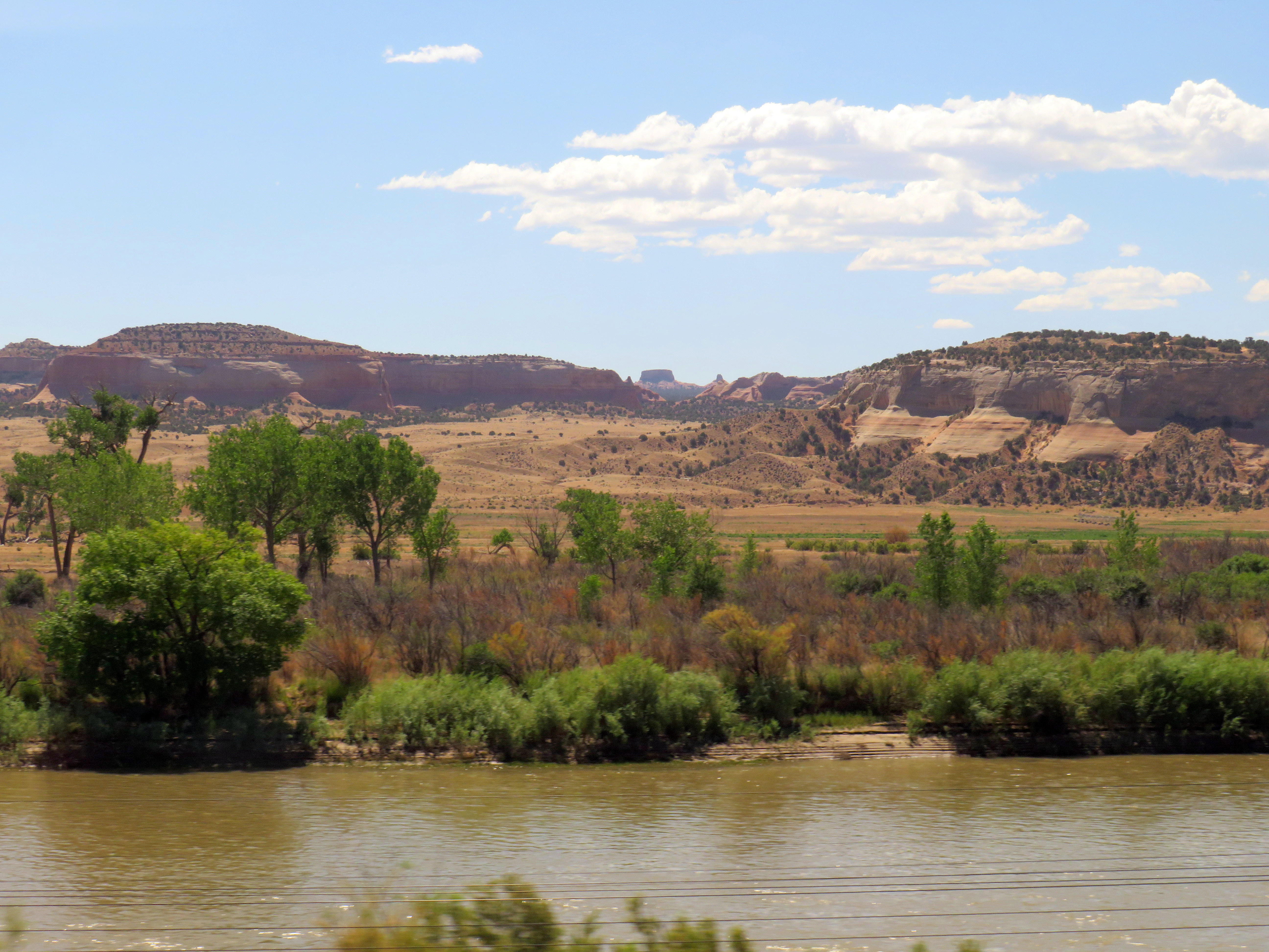
Earlier this summer, I had the privilege of travelling with my spouse to California. We started in San Diego (where my partner was attending a conference) and then made our way northwards, to Los Angeles, Santa Barbara, San Simeon, and finally the San Francisco Bay Area. I continued my trip an extra three days to ride Amtrak’s California Zephyr train east through Nevada and Utah to Denver, Colorado.
Looking south from the California Zephyr across the Colorado River near the Utah-Colorado border
Besides the breathtaking scenery through eastern Utah and western Colorado, I wanted to visit Denver itself, including its Union Station.
Denver’s Union Station was constructed in 1881 to serve the Denver Pacific Railway (the city’s connection to the Union Pacific transcontinental railroad at Cheyenne, Wyoming), as well as the Denver & Rio Grande, the Denver, South Park & Pacific and the Colorado Central Railroads. (Today, it is reached by tracks belonging to the Union Pacific or BNSF Railroads.) Renovated and expanded in 1914, one of the station’s most iconic features, rooftop neon signs beckoning customers to “Travel by train” were added in the 1950s, as interstate highways were being planned and constructed across the United States and air travel became more common.
The station was nearly closed in the 1980s with only Amtrak’s Oakland-Chicago California Zephyr calling once a day in each direction. Passenger train facilities would have been moved to a small “Amshack” building outside of the downtown core, with the station building incorporated into a proposed new convention centre. (This proposal is similar to the fate of St. Louis’ Union Station, which was turned into a hotel, shopping, and entertainment centre, with the Amtrak station moved into a small building off-site.) Luckily, this never took place.
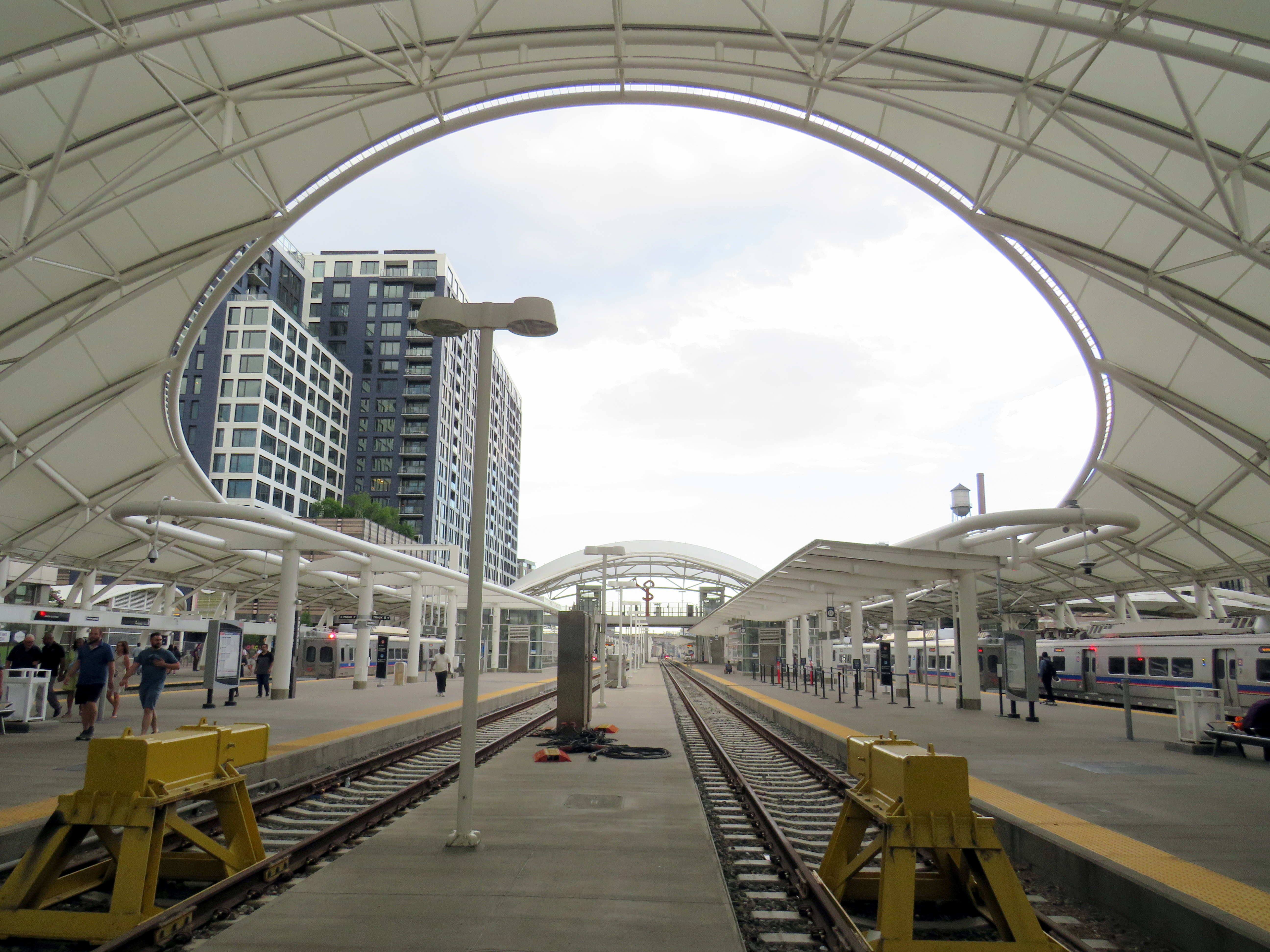
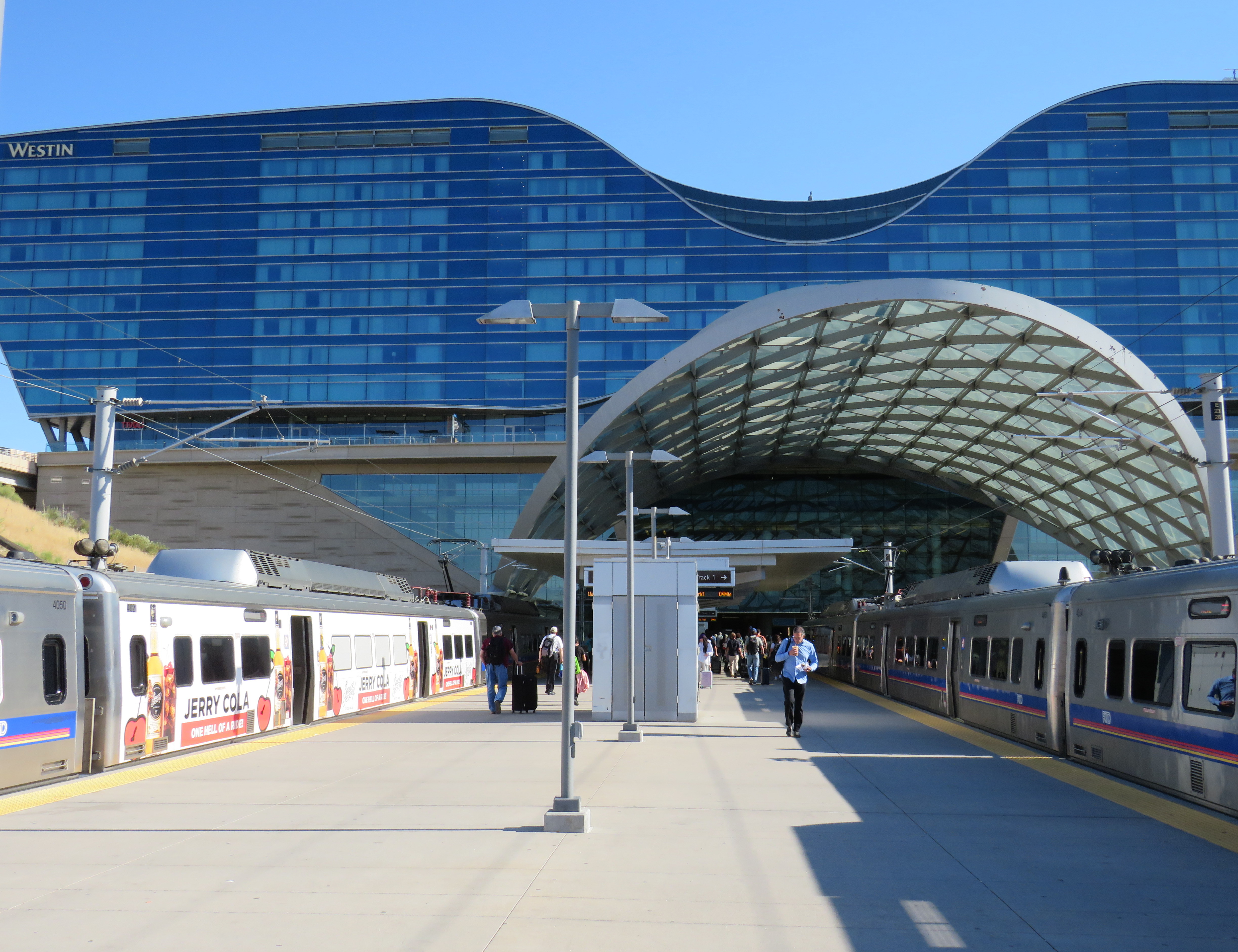
Denver’s Regional Transit District (RTD) purchased the station in 2001, with a new master plan developed for the station property and the vicinity in 2002, approved by voters in 2004 as part of the “FasTracks” program. Denver’s light rail system was extended to Union Station in 2002, while the immediate area was redeveloped with midrise apartment and office buildings. The train platforms were rebuilt with a new canopy, meant to accommodate both Amtrak and proposed new commuter and regional rail services.
Denver Union Station train platforms
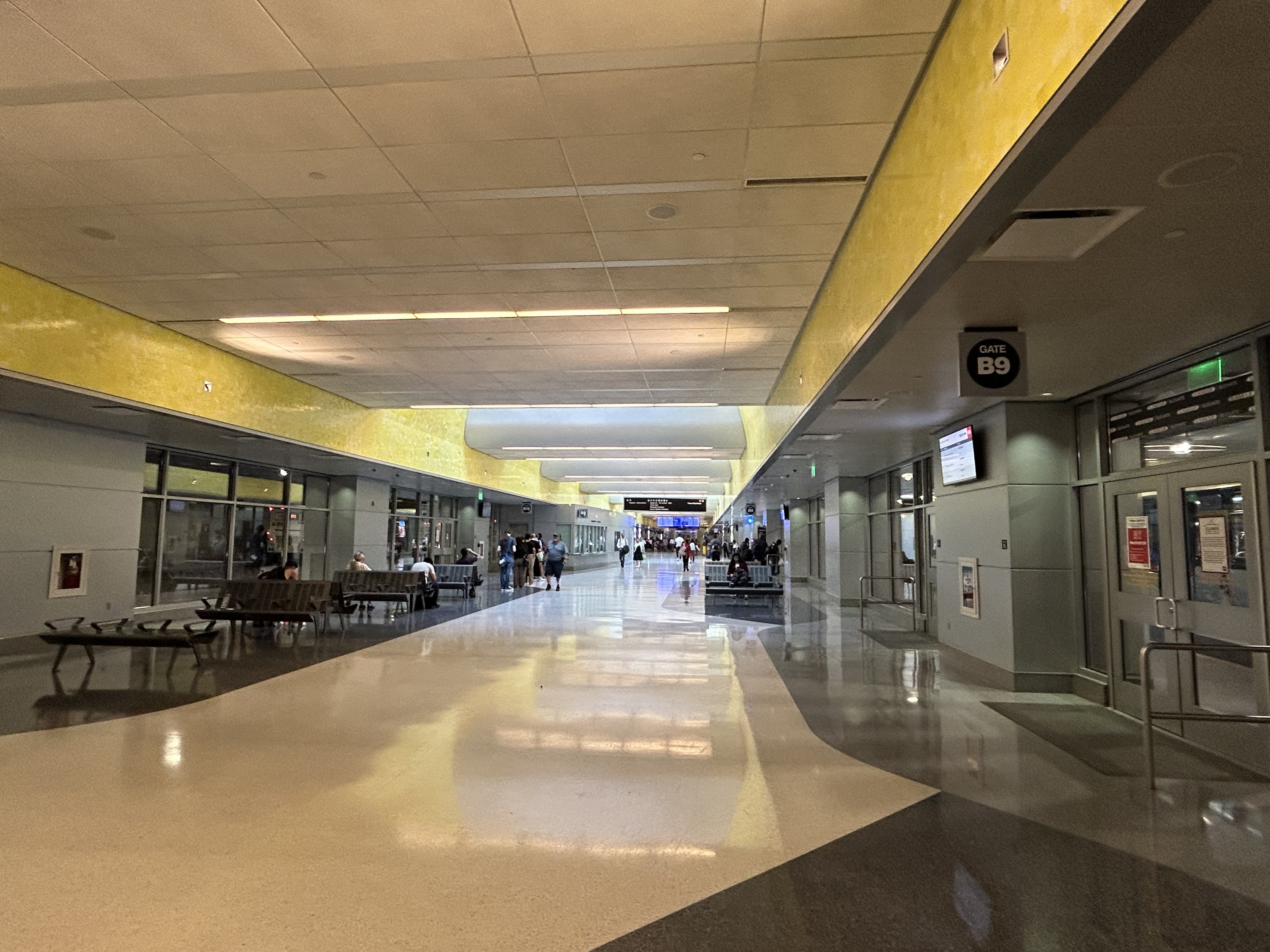
Connecting the historic Union Station building and train platforms with the LRT platforms two blocks north is a long underground bus concourse.
Denver Union Station’s underground bus terminal
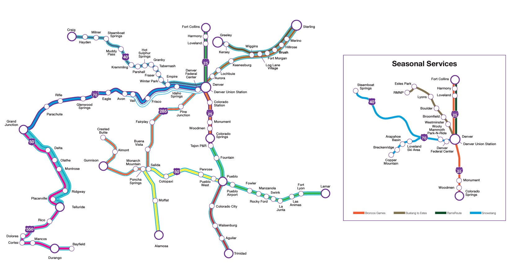
The underground bus terminal serves local and regional RTD services, as well as Bustang, the State of Colorado’s intercity coach service. Bustang offers multiple daily bus services to cities such as Colorado Springs, Fort Collins, Grand Junction, and Pueblo, connecting most of the state together. There are also seasonal ski buses from Denver, along with special runs for Denver Bronco games.
Bustang service map
There are also two free RTD bus services connecting Union Station with the rest of Denver’s downtown core: MallRide, a frequent, daily service along the 16th Avenue pedestrian mall (which was undergoing reconstruction in July 2024, and was on detour), and MetroRide, which operates during daytime hours on a parallel route.
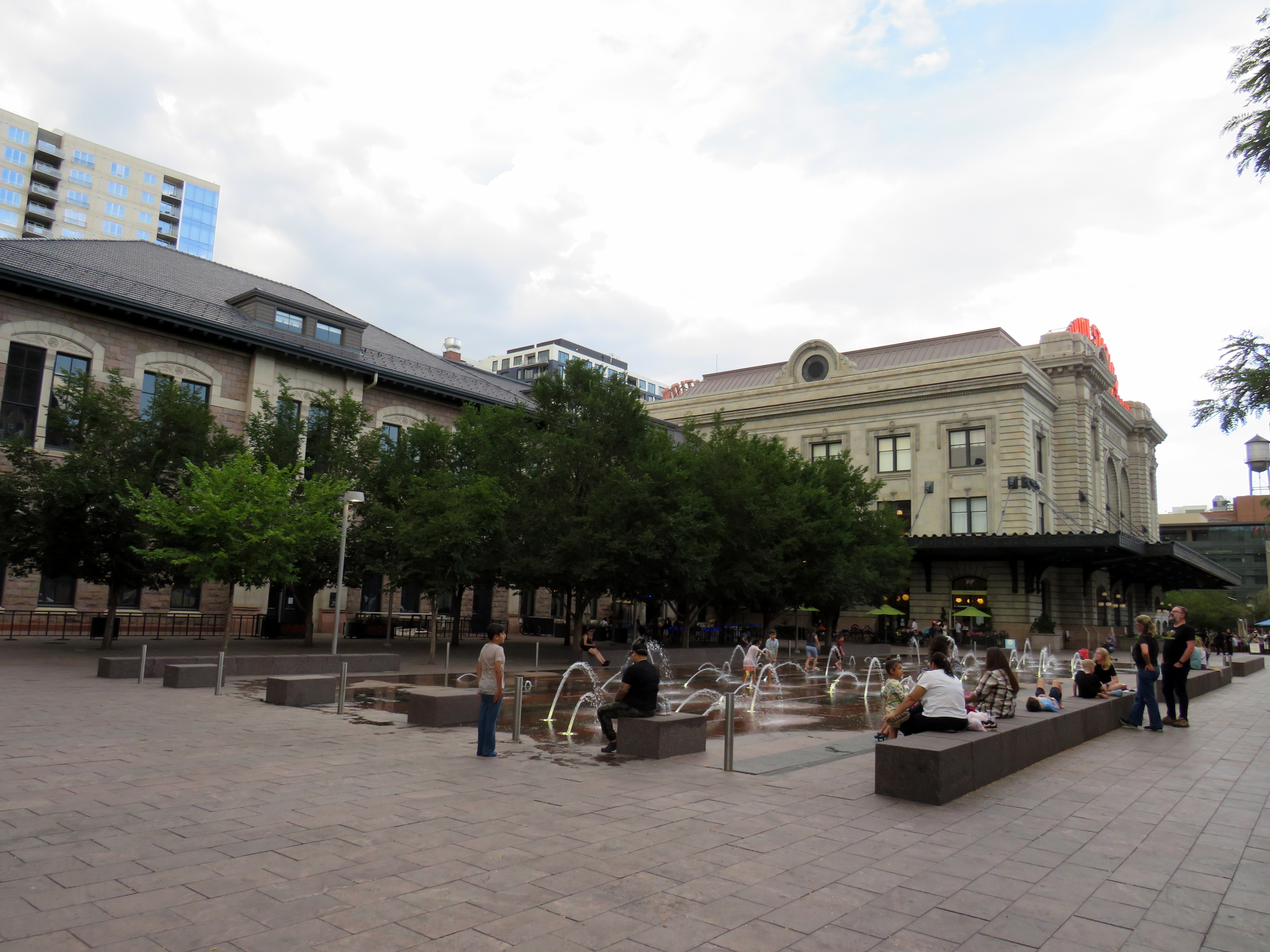
Splash fountains in the Union Station west plaza
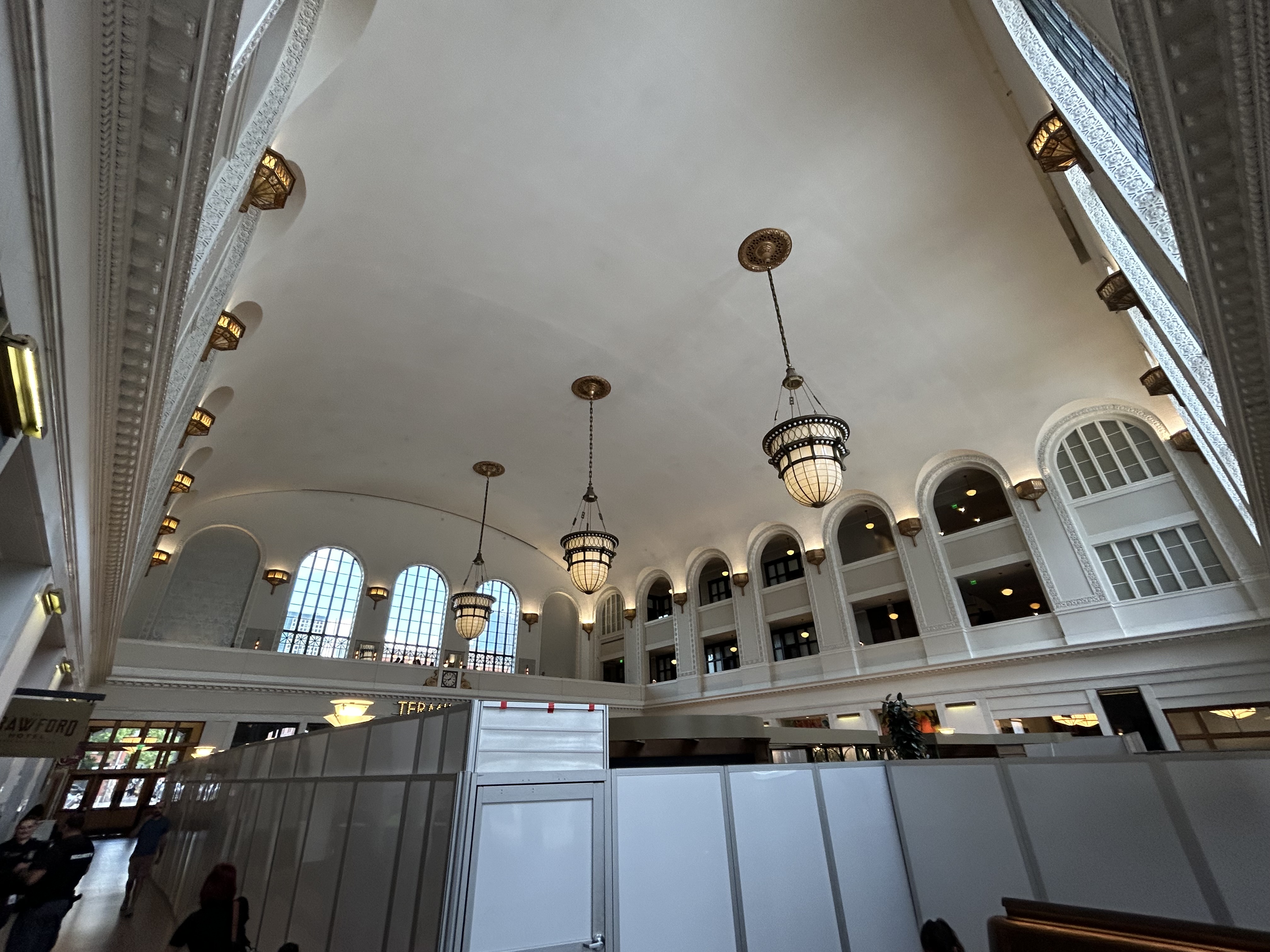
Union Station now hosts a boutique hotel, several restaurants and bars, a branch of a local bookshop chain, and includes amenities such as public art and a splash fountain outside its main entrance. Though the main lobby was undergoing minor renovations, it was clear how much work went into the project.
Union Station lobby
Take the A-Train
Arriving at Denver International Airport
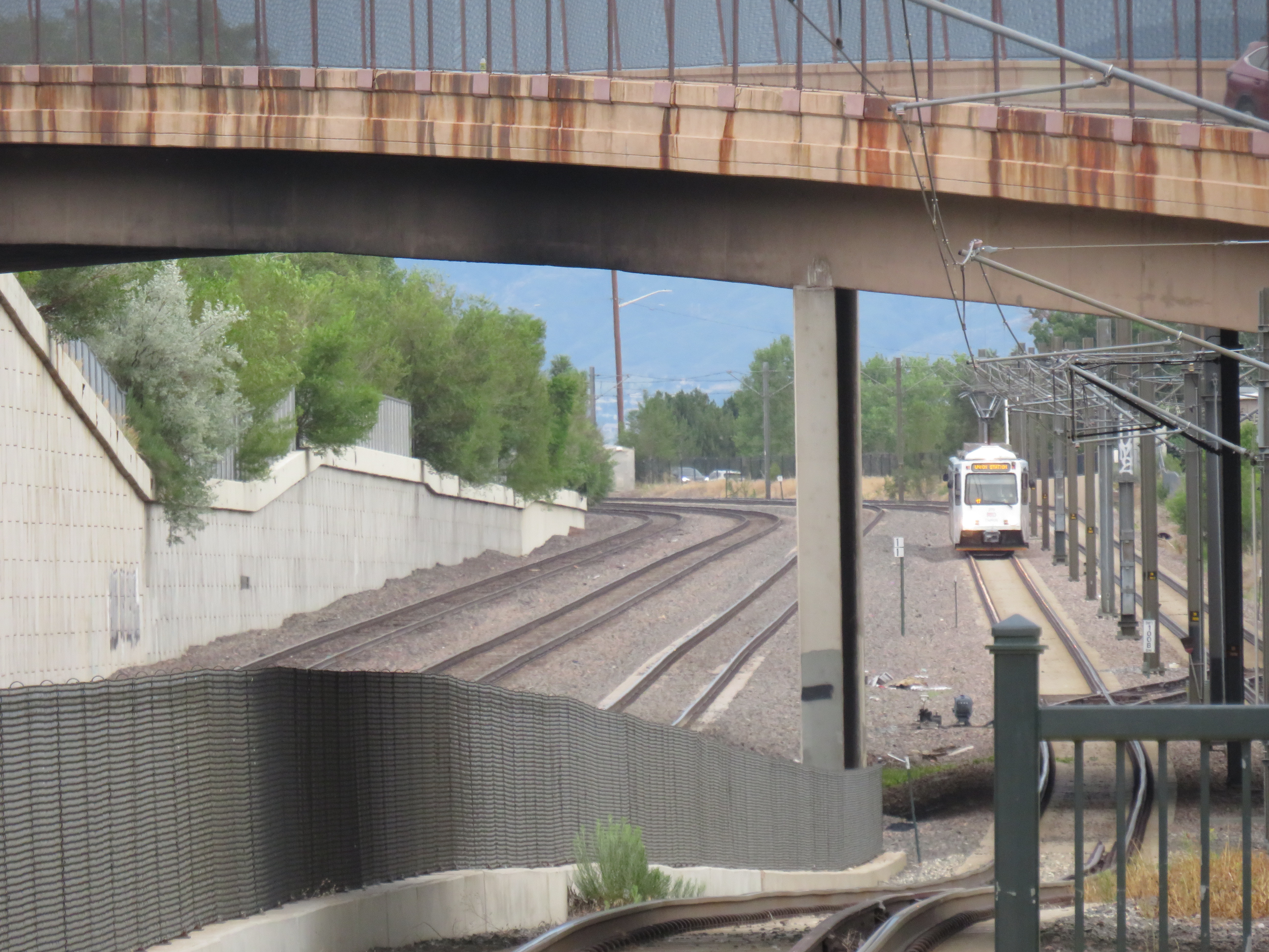
Like Toronto’s Union Station, Denver offers an airport rail link, operating every 15 minutes most of the day. The electric A-Line train runs from Union Station, making 7 intermediate stops. With the exception of the airport itself, the A-Line operates within the regular RTD fare zone, with free transfers between connecting buses and trains.
To enter or exit the airport station itself, occasional travelers must purchase a special $10 day pass (a standard day pass is $5.50), but that, of course, includes all rides taken before or after arriving at or departing from the airport. (By contrast, there are no transfers or fare discounts when connecting between UP Express and GO Transit, TTC, or suburban transit services.)
Because of the additional stops and the long distance between Downtown Denver and the international airport (25 miles or 40 kilometres), the trip takes 37 minutes versus UP Express’ 25 minutes.
Unfortunately, most RTD rail services, like the A-Line, follow existing or abandoned rail corridors. Though these routes offer limited obstructions to construction and allow for faster service than operating within roadways, they limit how much ridership can be generated by walk-on service. Even the Downtown Littleton station on the D-Line is distant from any commercial or residential uses, with a large commuter parking lot behind the historic station building.
At least many RTD stations offer convenient bus transfers, which draw much of the ridership.
The D-Line LRT at Littleton, Colorado
A lot was done right at Denver Union Station, which is well served by local, state, and national rail and bus connections, and is serves well as a model for developing a good intermodal hub in a midsized city like Denver. There are certainly aspects that could be replicated at some GO Transit stations, such as Brampton, Port Credit, or Unionville, which are poised to become important intermodal hubs, such as great public spaces, easy connections between nodes, and complementary retail spaces. At Brampton in particular, much can be done with the small historic station building there to make it a centrepiece of a great downtown redevelopment.
I am glad I visited Denver, and I am glad to have travelled by train.
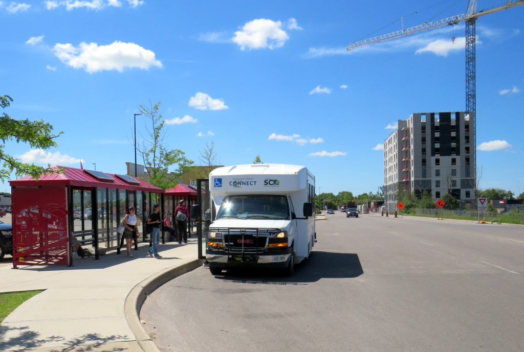
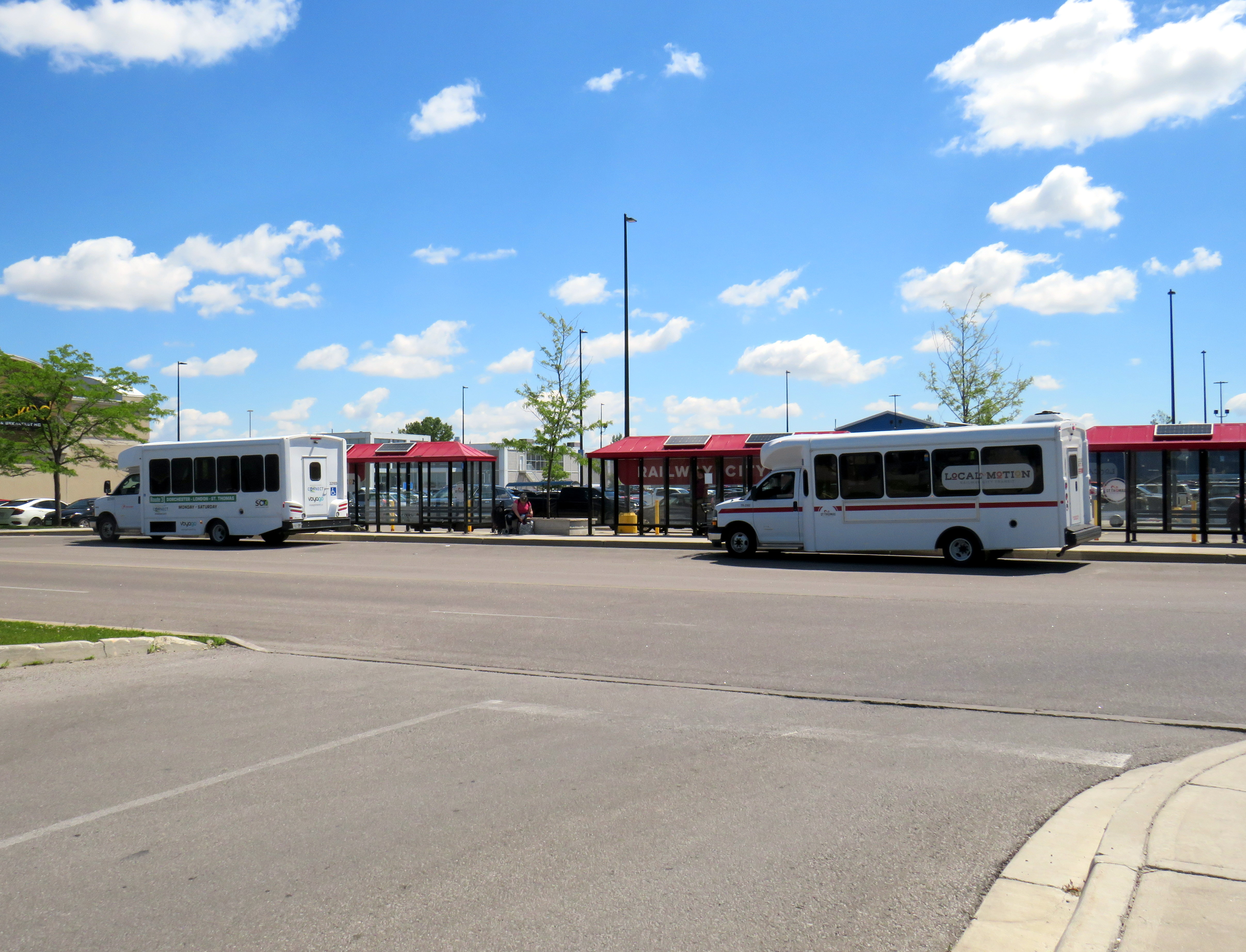
Middlesex County Connect and “Local Motion” buses at St. Thomas, June 2024
On Saturday, June 15, I took a trip that was not possible for over a decade: I went to St. Thomas, Ontario, without a car. This was possible because of one of several new intercity transit links that opened this year in Ontario, and I have updated my interactive map accordingly.
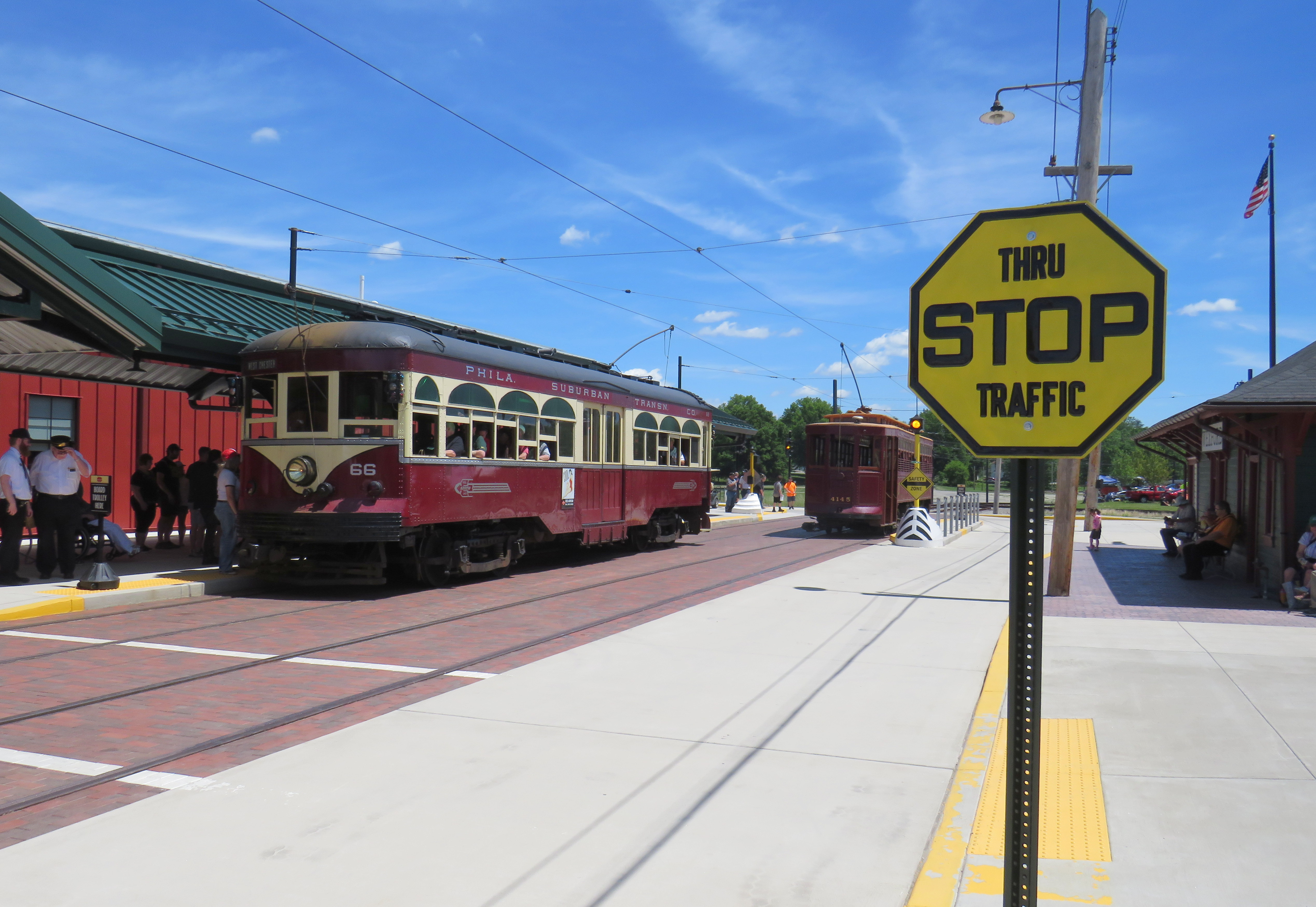
The Pennsylvania Trolley Museum now features a new main entrance and exhibition hall, along with an on-street boarding area complete with vintage signage.
While visiting Pittsburgh earlier in June, I also paid a second visit to the Pennsylvania Trolley Museum (PTM), located 45 minutes south of Downtown Pittsburgh in Washington PA. I had visited the museum a few years prior as part of a visit to the Pittsburgh area, but since then, a new section of the museum opened to the public, and there were additional cars in operation.
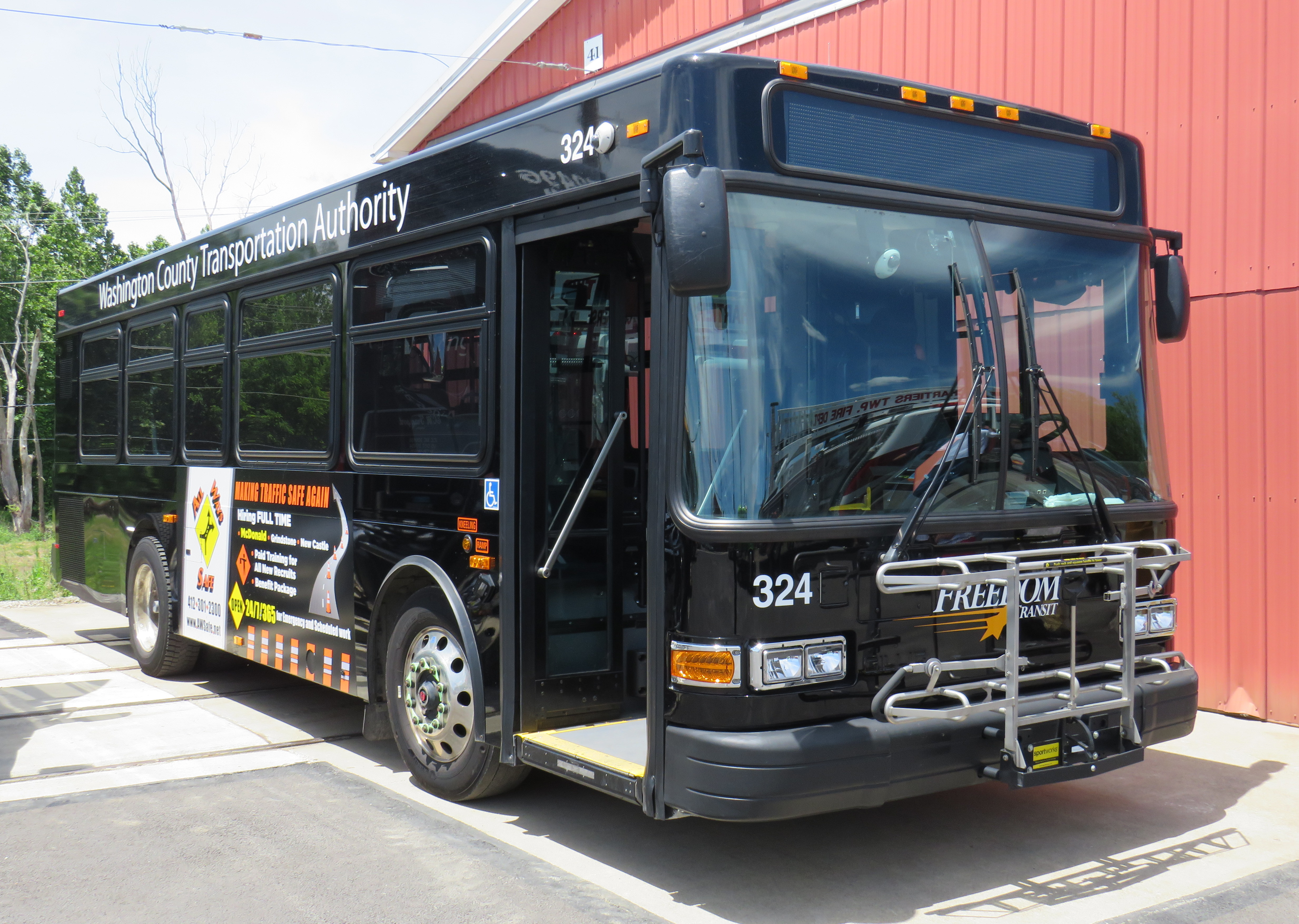
While I went to PTM with a friend who planned to stick around until the evening, I planned to return to downtown Pittsburgh earlier in the afternoon. I found information on a local transit service operated by Washington County — called Freedom Transit — that ran a route to and from Pittsburgh that stopped not too far from the museum’s main entrance. That plan did not go well at all.
It is an unfortunate irony that most North American transit museums have poor or non-existent transit access. There are historical reasons why this came to be, but some of the continent’s best transportation exhibitions are inaccessible to newer generations of transit fans, historians, and enthusiasts, many of which do not or cannot drive.
Washington County Transportation Authority, or “Freedom Transit,” doesn’t offer much freedom(more…)
Returning to Downtown Pittsburgh across the Roberto Clemente Bridge after the game and a fireworks display
Earlier in June, a friend and I took a weekend road trip to Pittsburgh, a five-hour drive southwest of Toronto. On our first night there, we took in a ballgame at PNC Park, where the hometown Pirates hosted the Minnesota Twins.
Though I do not follow the Pirates (who are in the National League) nor the Twins (who are in the AL Central), I was excited to take in a ballgame in Pittsburgh because I have heard about the park’s intimate confines, the great view of the Pittsburgh skyline, and the fireworks that follow certain Friday and Saturday night games. PNC Park lived up to the hype.
Among the major North American sports leagues, Major League Baseball has the most significant differences between venues. Unlike hockey, basketball, soccer, and football fields, the dimensions of each playing surface vary considerably, as does the architecture. PNC Park was built in the retro-classic style similar to Baltimore’s Camden Yards; it opened in 2001. When the naming rights for the new publicly-financed stadium was purchased by local bank PNC, the city renamed the adjacent 6th Avenue Bridge for beloved Pirates player Roberto Clemente, a Hall of Famer and a humanitarian. That bridge is closed before and after each game to motor vehicles so that fans can walk and bike across the Allegheny River to and from downtown.
Statue of Roberto Clemente located between the stadium and the bridge renamed in his honour. No statues of cable tycoons can be found here.
The skyline view from behind home plate is spectacular, showcasing the most iconic buildings and some of the many bridges crossing the three rivers in the downtown area. With lots of washrooms, a wide concourse, and plenty of food and drink concessions, the stadium felt intimate, yet uncrowded. Lineups were always short, and where play wasn’t visible (such as in the washrooms), speakers played the radio broadcast. Ushers were very friendly and helpful as well.
View from up behind home plate
The game was followed by a 10-minute fireworks display, with the rockets launched off a barge in the Allegheny River.
Finale of fireworks show
Though transit access is quite good — there is a station one block away on Pittsburgh LRT’s North Shore extension — many fans walked part of the way home. Downtown parking garages — built for office commuters — provide much of the parking demand, so there are few surface parking spaces surrounding the stadium. Even the football stadium, a few blocks to the west, is mostly served by parking garages and another LRT station. Hotels, restaurants, museums, and apartments neighbour the two North Shore stadiums.
Walkability and transit access are the key to fostering a great fan experience. Walkable stadiums promote safe, accessible, and sustainable travel to and from sports venues, and help support local businesses. Downtown locations have the advantage of having better transit access, existing parking facilities, and in the case of Pittsburgh (or Detroit, or Minneapolis), a downtown ballpark can be a point of civic pride, showing off the city to its inhabitants, and to a much larger audience.
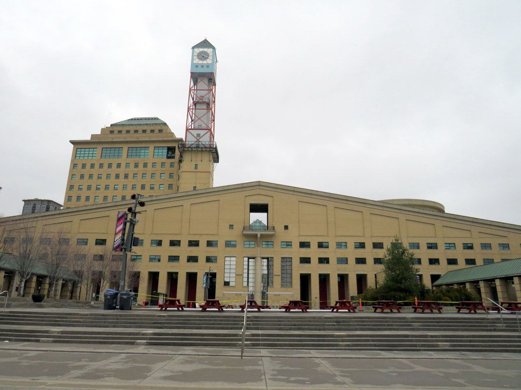
Mississauga City Hall, one of the most walkable municipal buildings in Ontario
In late March 2024, with a streak of mild, sunny days, I was eager to get outside and walk. As I have long been interested in local politics and planning issues, public transit, active transportation (especially walking advocacy), I thought I would try to get to every city, town, and township hall in the Greater Toronto and Hamilton Area (GTHA) without a car.
This was a fun project, even if there were times I felt really frustrated at times by poor transit and long hikes. The highlight of my quest was a tour of Mississauga City Hall from Councillor Joe Horneck. Mississauga’s civic centre is one of Ontario’s most iconic — and walkable — government buildings.
Mississauga Council Chambers
Of the three levels of government (federal, provincial, municipal), the municipal level has the most impact on the day-to-day lives of most Canadians; it is also the closest level of government to all. Residents can depute at committee meetings, get meetings with their local councillor and city staff, and obtain building permits, marriage licenses, or pay bills at city and town halls. Therefore, they should be as accessible as possible, especially to those without cars.
Only one GTHA town hall (Caledon) was completely inaccessible without a car, though several other town halls required long walks from the nearest transit stop, making them inaccessible to some residents. But I could get to Brock Township, the least-populated and most-rural municipality in the GTHA, thanks to Durham Region Transit’s On-Demand service, though I had some difficulty there.
The complete list of GTHA city and town halls, along with photographs and a map can be accessed here.
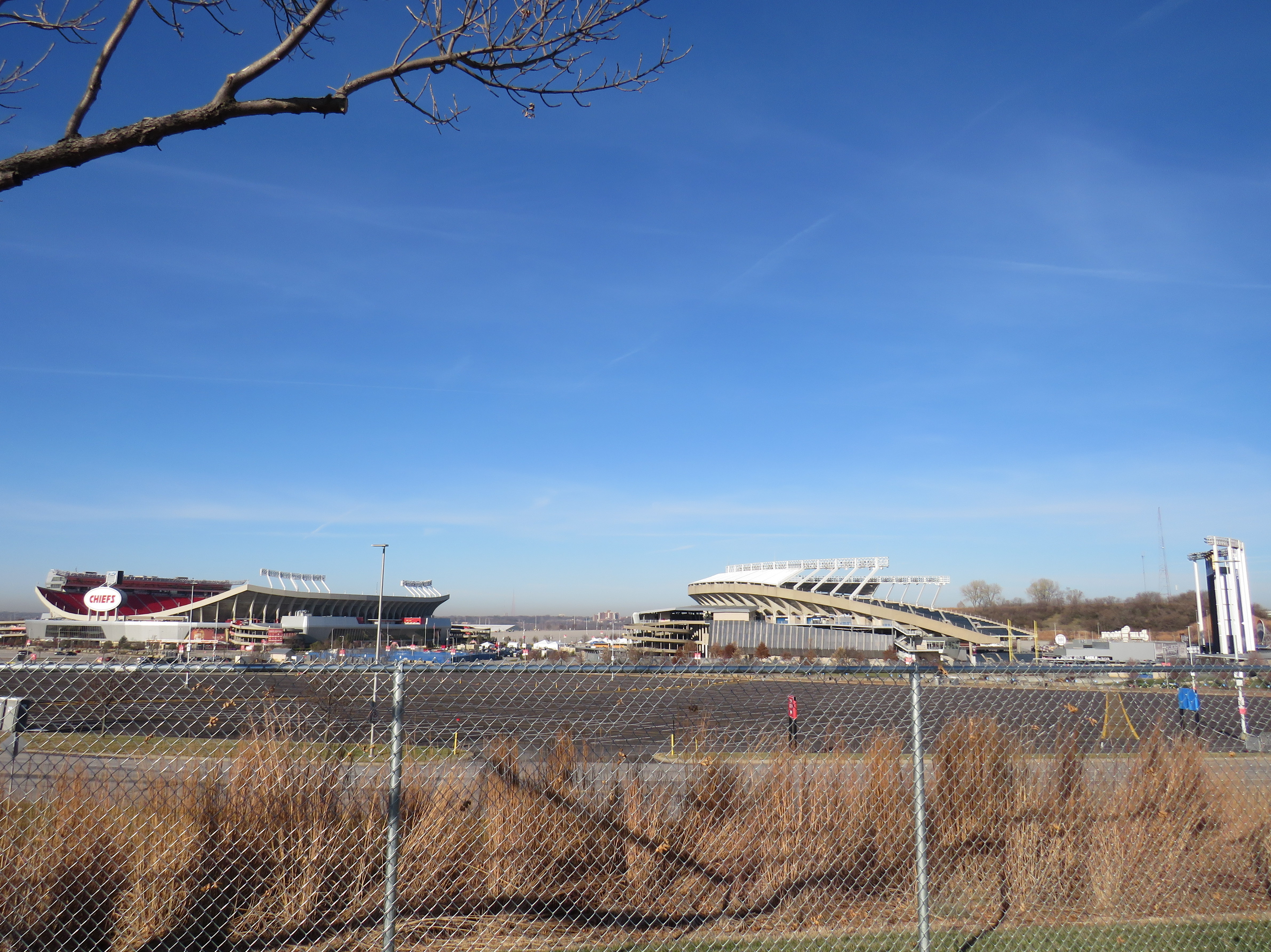
Truman Sports Complex, Kansas City, Missouri. Kauffman Stadium (MLB Royals) on right, Arrowhead Stadium (NFL) on left. Kauffman Stadium has the lowest Walk Score in the league. Both sports venues have especially poor transit access, even for Kansas City.
One of the best — or worst — experiences in North America can be going to see a ball or hockey game, concert, or other special event at a sports arena or stadium. Perhaps you want to make a day of it, taking in the city, going for a meal or drinks first and meeting up with friends or family. Or maybe you want just to park in a lot hours before game time and have a cookout.
But the trip to and from that venue can make or break the experience. Does it involve hours in gridlock? Does it mean a long line in the outdoors for a shuttle bus? Or can it mean a short walk to a transit stop and quickly getting on your way?
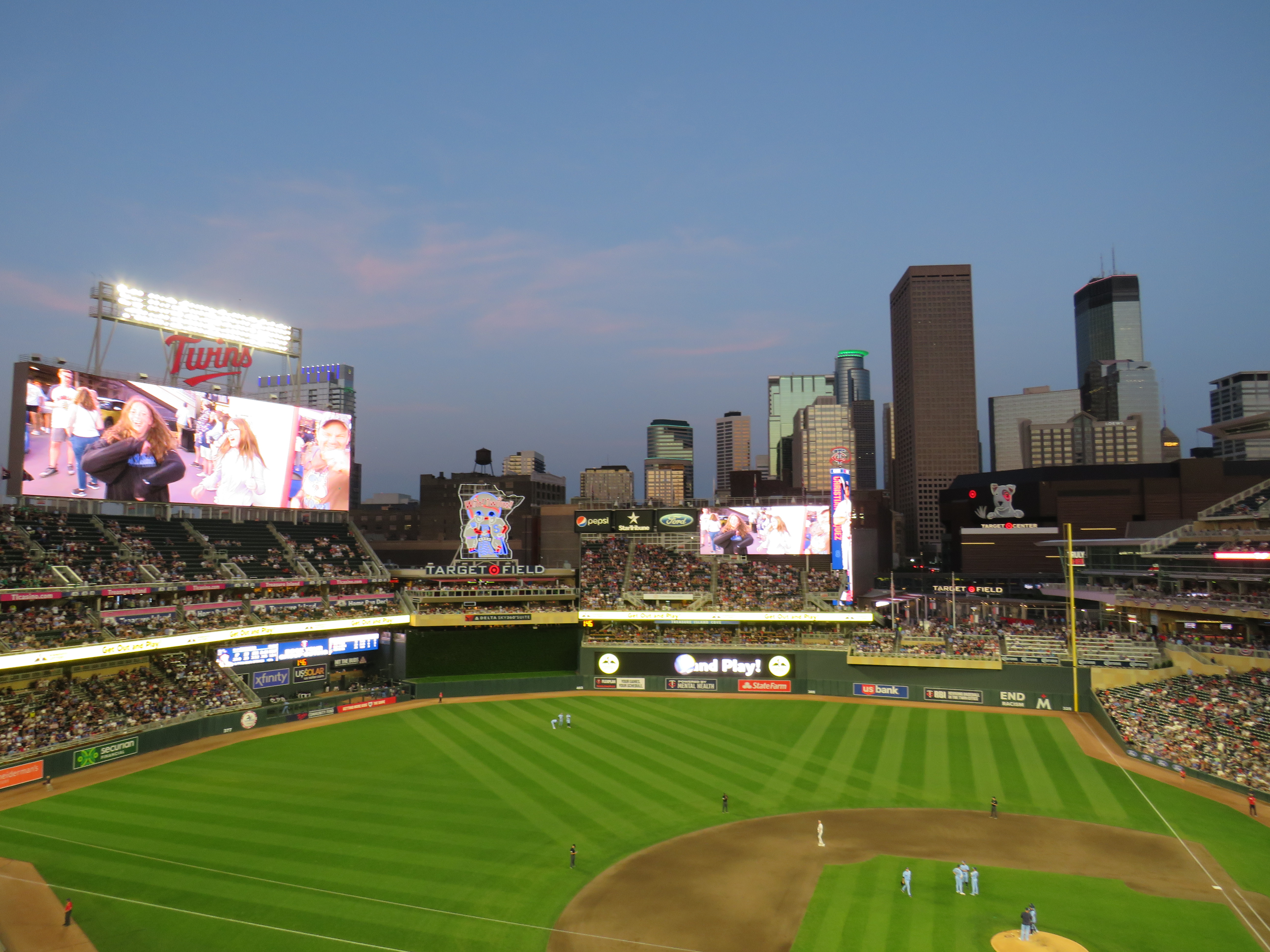
Target Field, in Downtown Minneapolis. Both light rail lines stop right next door.
Last summer, I got to see the Toronto Blue Jays play at Target Field in Downtown Minneapolis. The Jays have a Canada-wide fan base, and the Twin Cities have the closest baseball venue to places like Thunder Bay, Winnipeg, and even Regina and Saskatoon. It felt like a home game with a very pro-Toronto crowd.
Earlier that day, I noticed plenty of people wearing Jays hats and jerseys that were making the most of their road trip. They flooded local restaurants and bars. They checked out museums and the city’s signature parks. The Mall of America, at the other end of the Metro Blue Line LRT, was also full of Canadians. Minneapolis has a lively downtown, with very good bus and rail connections to the airport, the malls, St. Paul, and elsewhere.
Walkability and transit access are the key fostering a great fan experience, for promoting safe, accessible, and sustainable travel to and from the venue, and for supporting local businesses. Though economists and urban experts will — rightly — dispute the economic benefits of subsidizing new sports stadiums, if they must be built, they should allow spectators to get around without a car as much as possible to reduce congestion, curtail impaired driving, and create a vibrant urban environment that everyone can enjoy.
I used Redfin’s Walk Score tool to rank the venues of six major leagues in Canada and the United States: the CFL, MLB, MLS, NBA, NHL, and NFL; I also comment on their transit connections. Toronto’s three venues do very well, as do NBA/NHL venues in major cities like New York, Washington, and Los Angeles. Not surprisingly, football stadiums — especially NFL venues — do poorly.
Earlier in March, as part of my quest to visit every town, city, and regional government office in the Greater Toronto and Hamilton Area (GTHA) without a car, I took my first on-demand transit rides in a decade. This was necessary to visit Brock Township’s municipal offices, located in the village of Cannington, north of Port Perry. (I will discuss more about this project in the coming weeks.)
Brock Township’s municipal offices, at right, sits in the heart of the village of Cannington
Brock Township is the GTHA’s most rural and least populated municipality, home to just over 12,000. Until April 2023, GO Transit ran a daily bus service between Whitby GO Station, Port Perry, Cannington, and Beaverton (Brock’s largest community), but was cancelled after a ridership review. (GO has quietly cancelled several other bus routes that don’t cross county or regional boundaries in the last decade.) However, Durham Region Transit (DRT) offered an alternative: on demand transit.
On-demand transit is not a new idea. In the 1970s, GO Transit operated experimental dial-a-bus services in suburban parts of Toronto, offering door-to-door service to and from the nearest subway station or a designated transfer point to frequent fixed-route bus services. In Bramalea, Chinguacousy Township operated Bramalea Dial-a-Bus, which brought residents to local employers, schools, and Bramalea City Centre. The service was replaced by fixed-route services when Brampton Transit was established shortly after amalgamation, merging the dial-a-bus operation and a privately contracted transit service in the old town of Brampton.
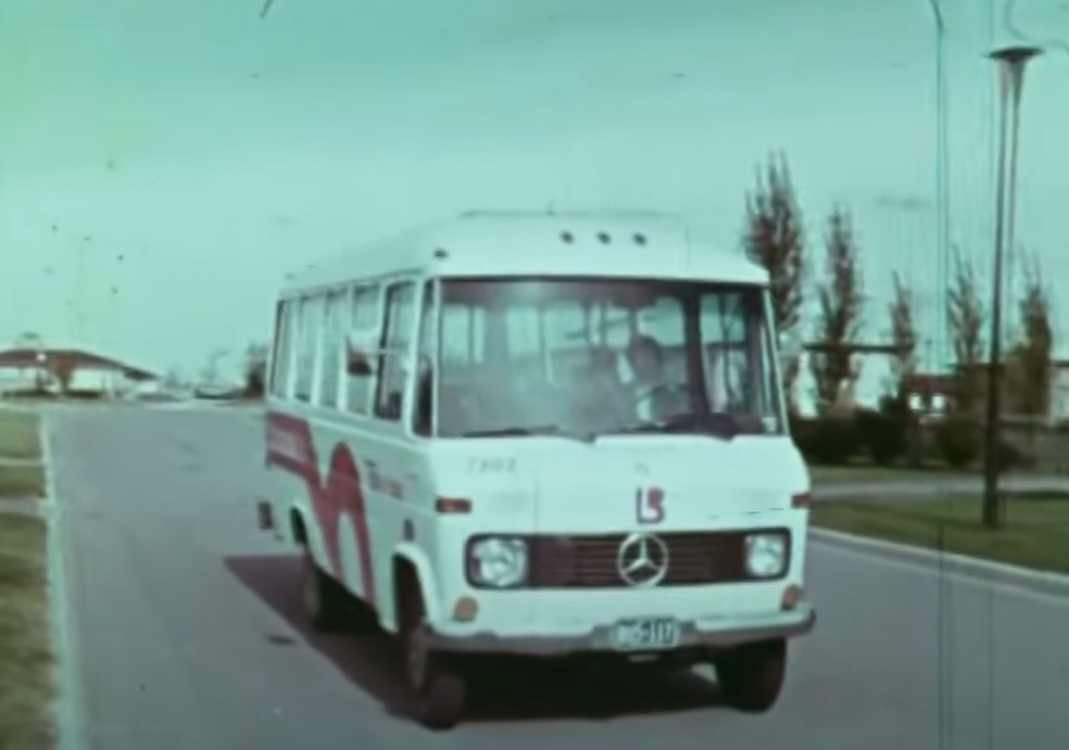
Still image from “People on the GO,” a 1973 film by the Ontario Ministry of Transportation and Communications. Bramalea’s Dial-a-Bus’ pink “lazy-b” logo was adopted by the successor transit agency, Brampton Transit during its first decade.
“Trans-Cab” services continue to be used in outlying areas of communities such as Hamilton, Peterborough, and Sudbury, where transit agencies partner with local taxi companies to allow transit riders to begin or end their journey outside of urban or regional fixed-route areas, often at a premium fare.
My first on-demand transit experience was taking Oakville Transit’s “zone bus” service in 2005. At the time, there was no fixed-route Sunday bus service in Oakville, but there were four zones for which you could call and request a ride, with a bus picking you up at the nearest bus stop. If your destination was in a different zone, you would transfer to another bus at Oakville GO Station. Today, Oakville offers on-demand service during late evenings from the Oakville GO Station and in new and outlying subdivisions where there are no nearby scheduled services.
My other previous on-demand transit experience was in Winter and early Spring 2012, after I suffered a broken knee cap and had to rely on Toronto’s Wheel-Trans paratransit system. Though I was fortunate to be able to get around using Wheel-Trans during a temporary disability, it was often a frustrating experience trying to book trips, especially for social or leisure purposes. I quickly came to prefer the conventional system and used it as much as I could while recovering from that injury.
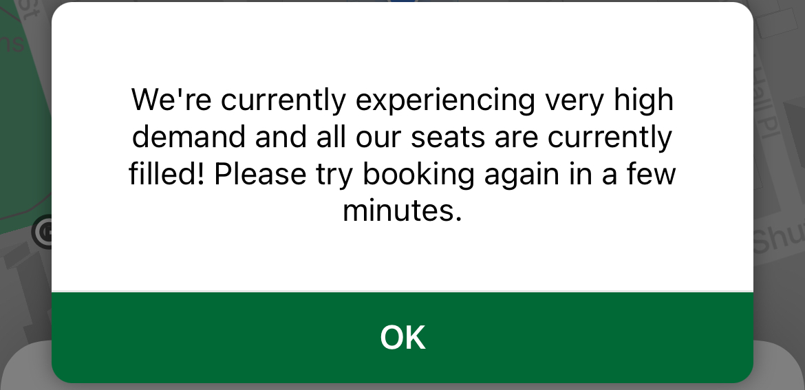
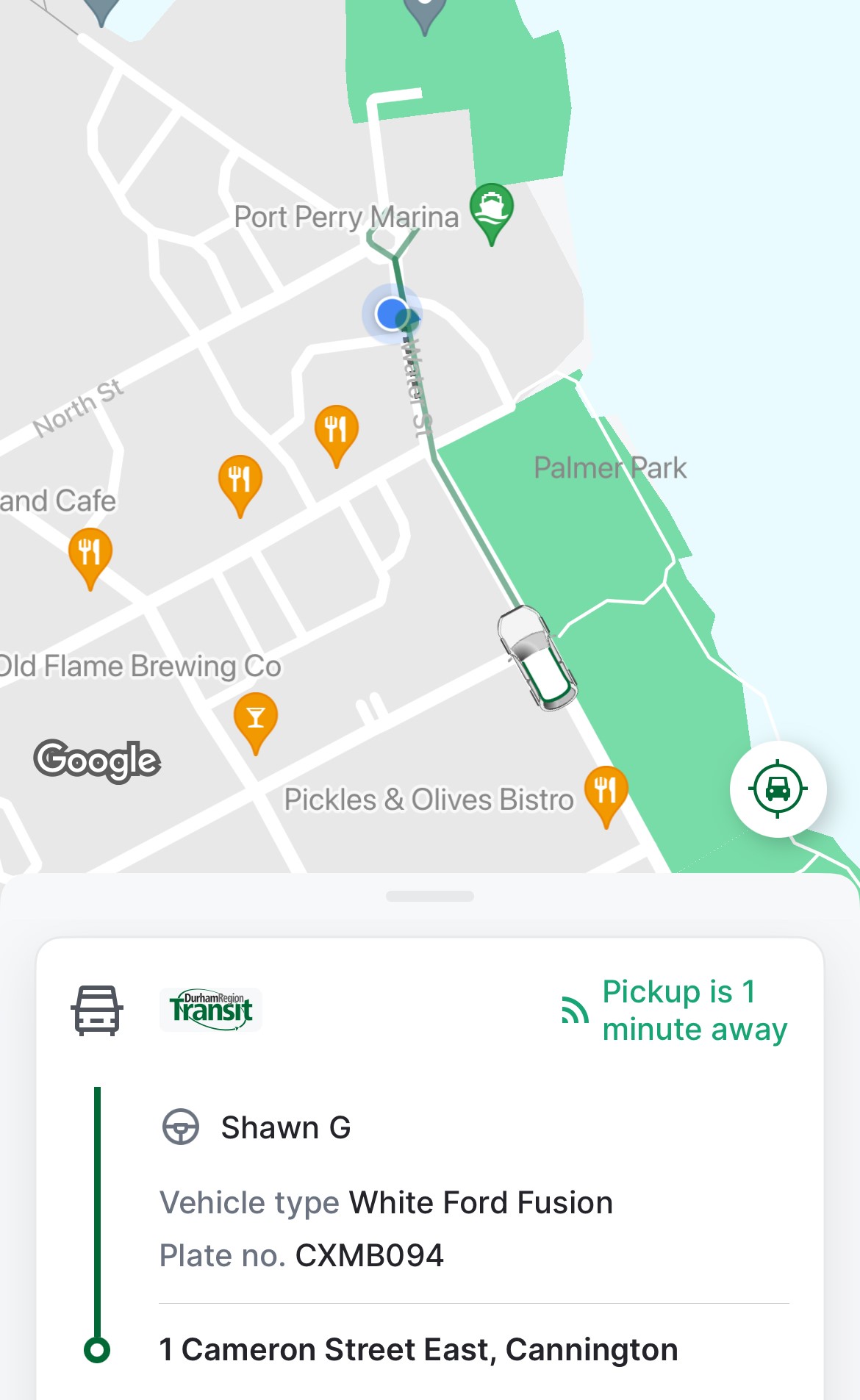
A common message while trying to book rides on DRT On-Demand
In 2024, there are over a dozen transit agencies providing on-demand transit services in Ontario and Quebec, either as standalone operations or in conjunction with fixed-route systems. You can find them in my interactive transport maps.
Modern on-demand services, though they are typically accessed by mobile apps these days, present some of the same challenges, including cumbersome booking processes as well as high demand and limited availability for next-day and same-day trips.
DRT offers on-demand transit trips for customers with disabilities (who are eligible for door-to-door service anywhere in the region), rural areas, and in designated urban areas (where pickups and drop offs are made at signed bus stops).
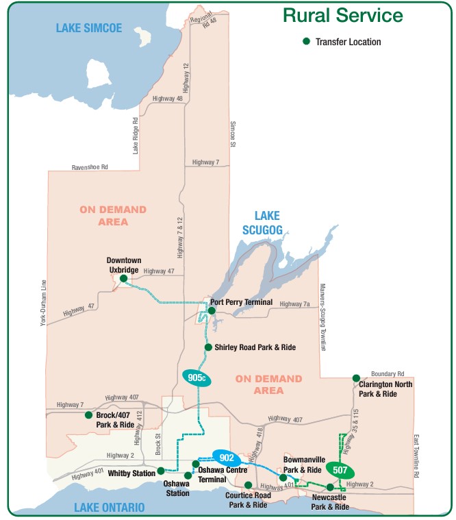
DRT rural services, showing the rural on-demand service area and transfer points to fixed-route services (including GO buses at Downtown Uxbridge, Brock/407 and Clarington North)
As Brock Township was the most distant and most difficult town hall in the GTHA to reach by public transport, I tried to book for the first day of my visits: Monday, March 11. After downloading the DRT app and inputting my information (name, email address, mobile phone number) I tried to book a return trip from Port Perry (which has a scheduled route connecting it to Uxbridge, Oshawa, and Whitby) the day before.
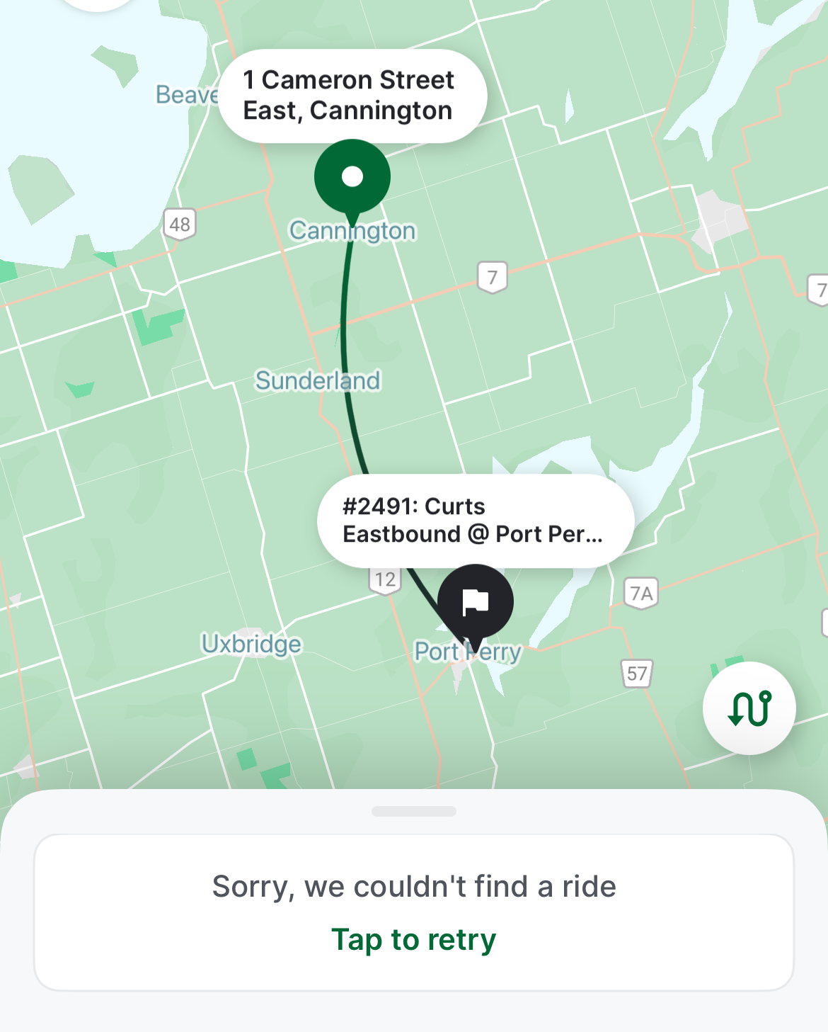
At one point, I was able to get an outbound trip around 12:00 PM, but I could not get a return trip after multiple attempts. After failed attempts to book each ride, the app would go back to the beginning, requiring the user to input most of the same information multiple times. I gave up and went to northern York Region instead. After midnight, early Monday morning, when one could book trips for the following day, I tried again and managed to get a return trip that met my needs for Tuesday the 12th.
Unable to book a return trip from Cannington to Port Perry for Monday, March 11, 2024
Once I booked my trip, the rest of the experience was smooth. I got a text reminder of my upcoming trips, and on the app, I could track my upcoming ride, much like Uber or Lyft, with the driver’s name, vehicle description, and location. Each time, I paid with my Presto card, with DRT charging the same fare for on-demand as for conventional bus service. Drivers were professional and friendly. I was the only passenger for both trips, though they are often shared, and minibuses — such as accessible paratransit vehicles — are used for passengers with disabilities or larger groups.
Notice of pickup
I learned that the service could be quite busy and the app sometimes problematic — there is also a toll-free number that passengers can call, and that sometimes the telephone agent would be able to find matching rides that the app would not show.
I was lucky that my trip was discretionary, but I could see how on-demand transit can be difficult and/or frustrating to use.
Though DRT has restored most urban bus routes (many were suspended during pandemic-related restrictions), it still struggles to meet demand on its busiest corridors, especially those serving colleges and universities in Oshawa, Whitby, and Scarborough. A fire in one of DRT’s garages last summer hasn’t helped either. As a result, some urban areas in Ajax, Pickering, Whitby, and Bowmanville still have on-demand areas where fixed-route services have yet to be restored.
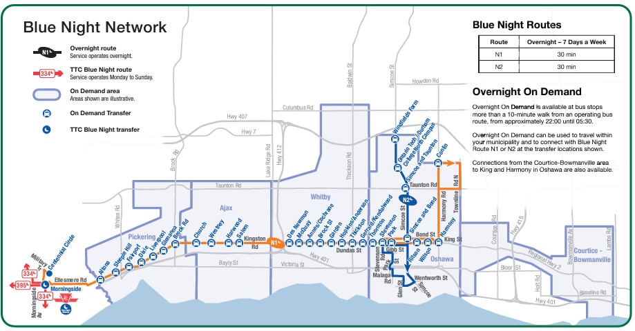
On-demand transit has its place, especially in rural and outlying suburban areas, or during times of low demand. If done right, it provides affordable mobility to people who might otherwise go without, and as an alternative to driving a car or paying an expensive taxi fare for those with travel options. Durham Region has done a good job covering the entire region with fixed-route and on-demand services, especially at night, where the urban south enjoys 24-hour transit access.
DRT overnight services, which includes two scheduled buses and five on-demand zones in the urbanized part of the region.
Despite Durham’s efforts, on-demand services can be costly to operate, less flexible for prospective passengers, and be frustrating to use, though they can cover much larger areas than line haul routes. Scheduled, fixed-route buses offer predictable, simple, and often faster service than point-to-point bespoke services. On-demand transit has its place, but it is only one tool in a vast toolbox of mobility solutions. This was true in the 1970s and remains true today.
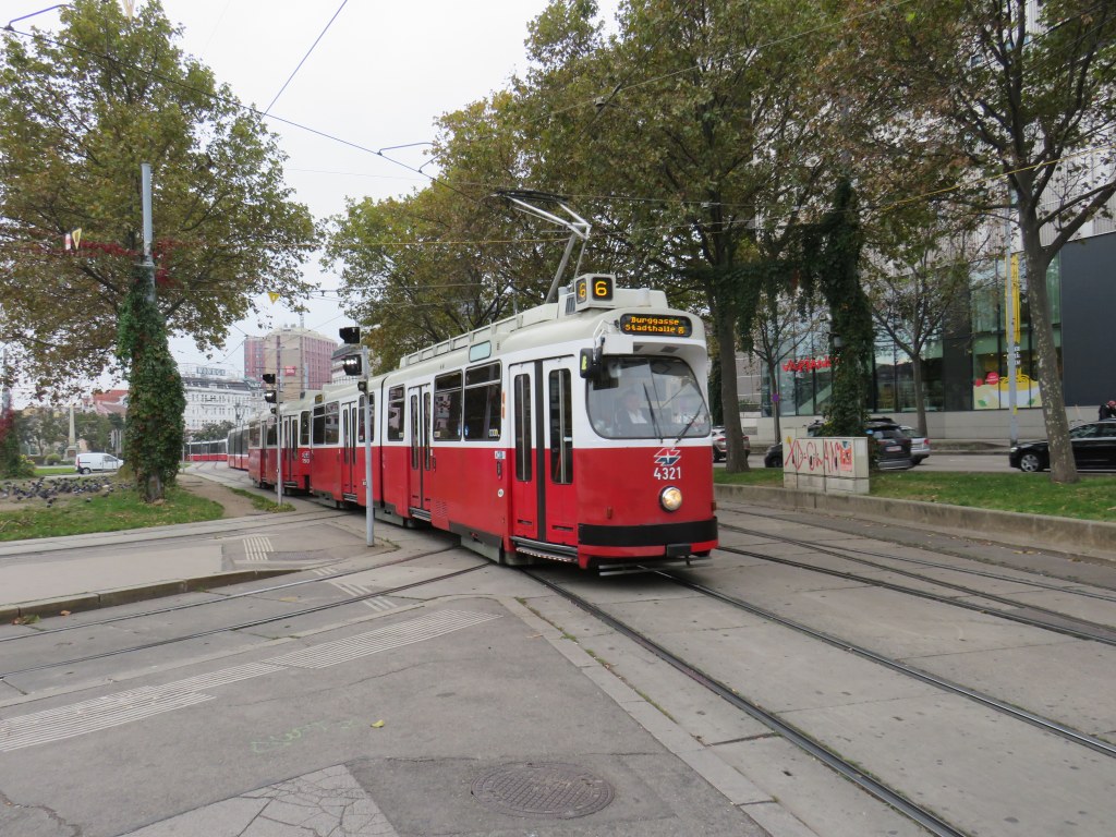
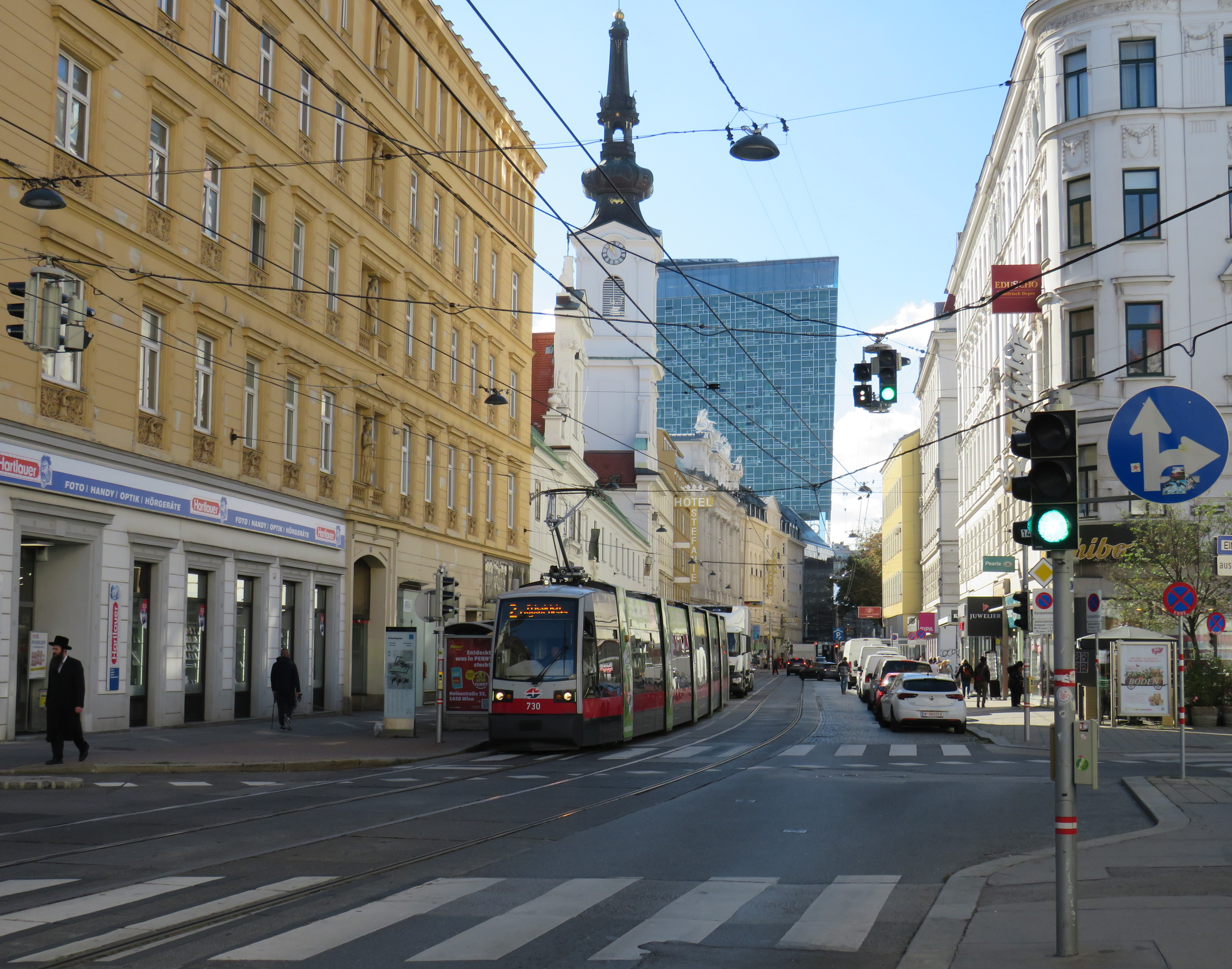
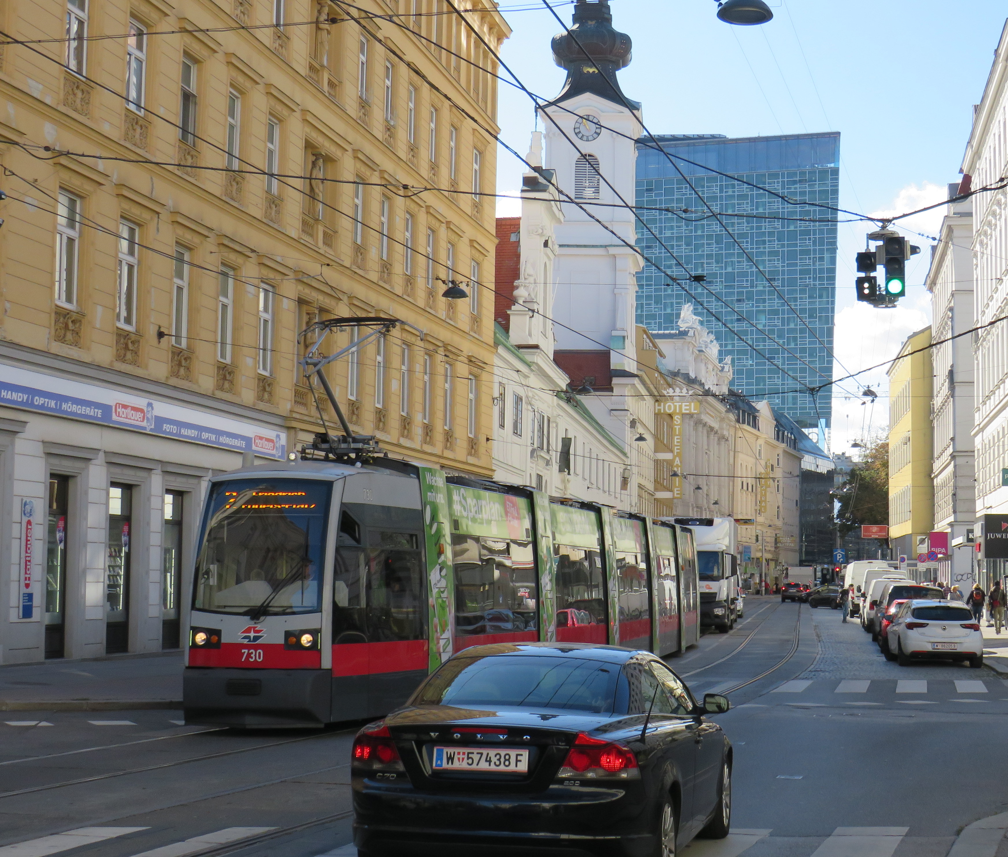
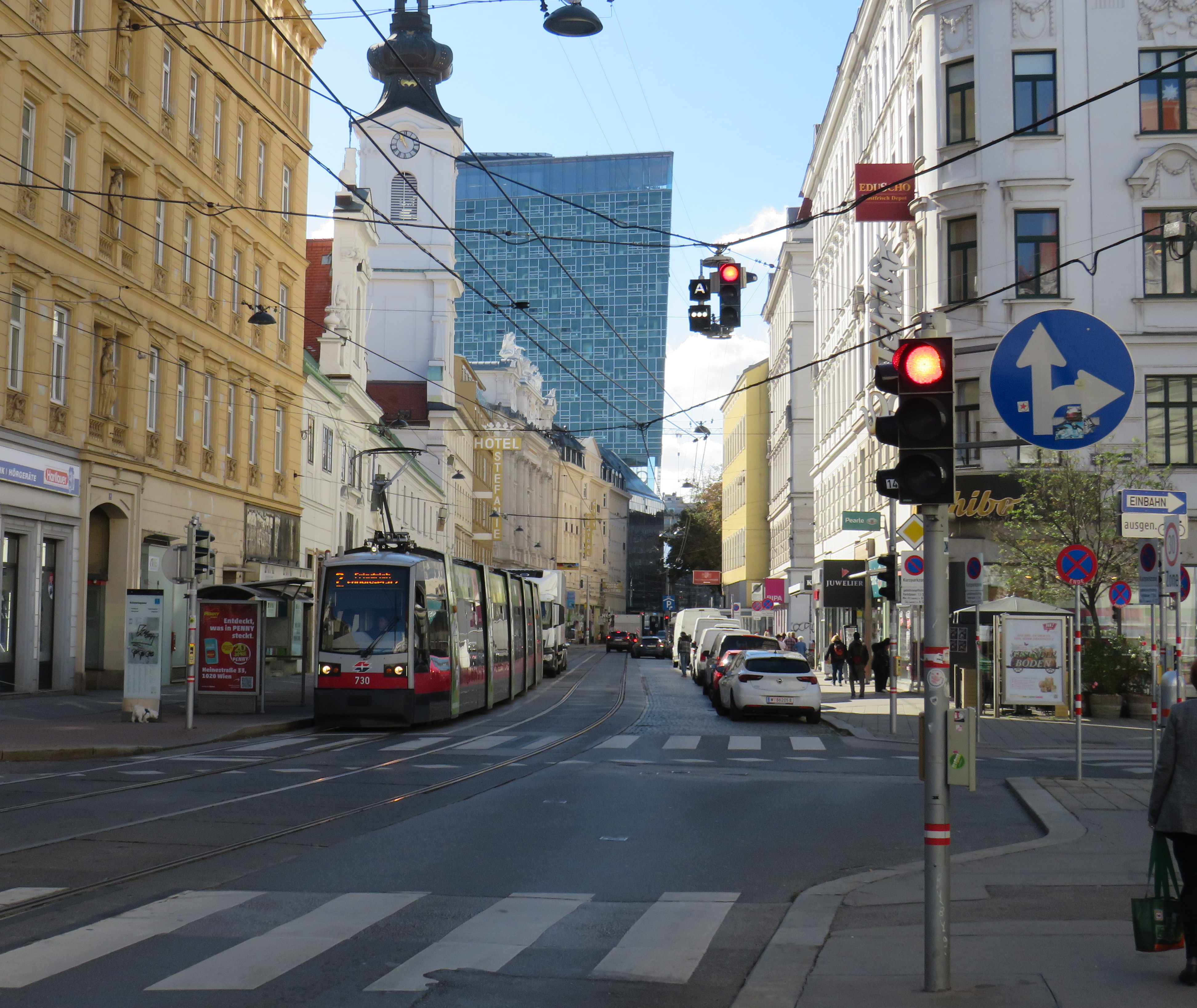
Vienna low-floor tram in the Leopoldstadt district
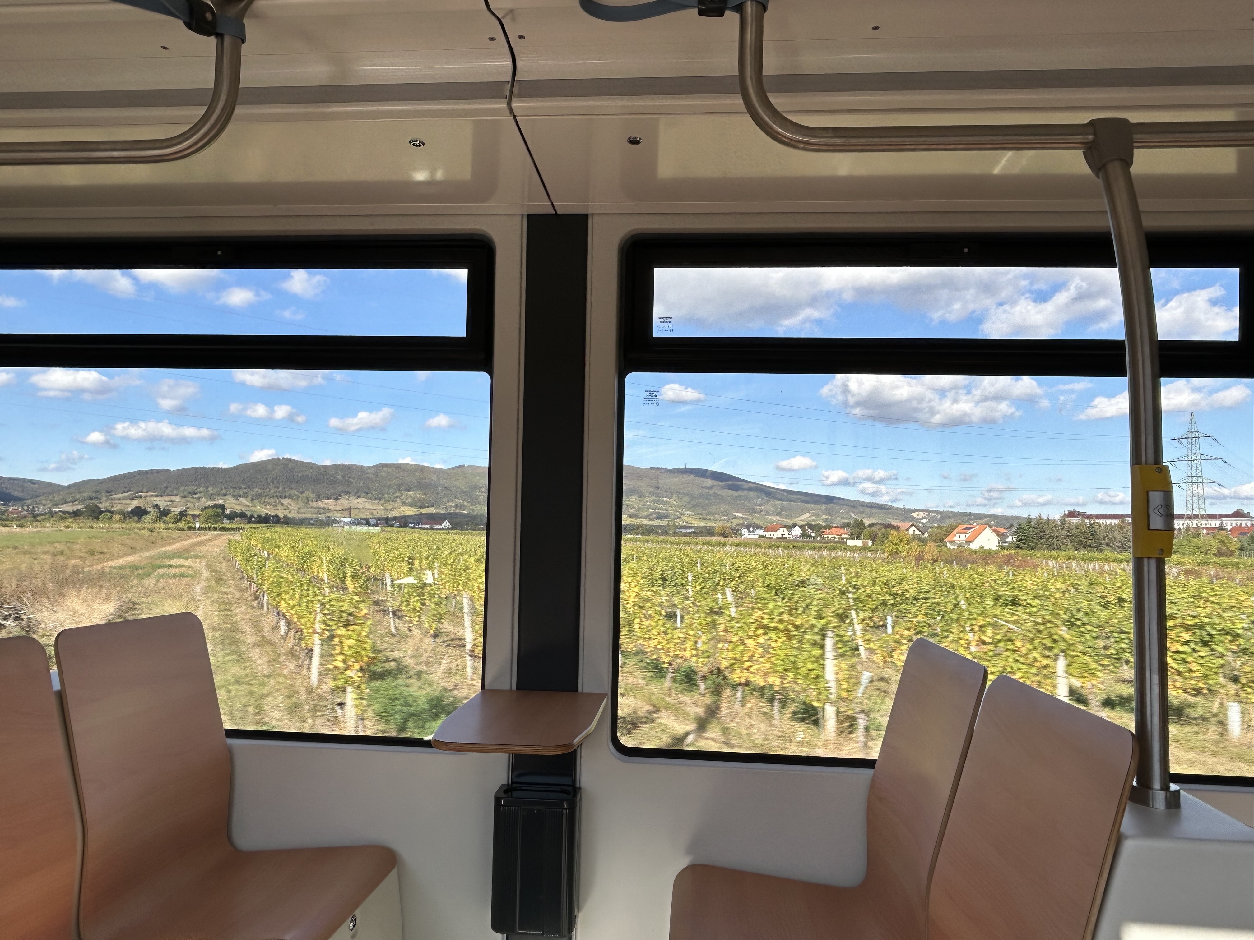
Back in October, my spouse and I had the opportunity to visit several countries in Central Europe: Austria, Slovakia, Hungary, and the Czech Republic, though we spent the majority of our time in and around Vienna, as that is where my spouse attended business meetings for several days; we also took time to explore the city and surrounding areas together.
While there, I experienced how serious cities operate trams seriously. In Bratislava, I saw how a streetcar priority corridor can work in a busy downtown core. In Prague, trams made it through watermain construction zones without detours or unreliable bus shuttles. In Budapest, I rode the world’s longest trams that move more people per hour than many metro lines. In Vienna, where I spent the most time, I experienced a city where transit passengers are treated with respect, and where the trams are reliable, despite no discernable signal priority and plenty of mixed-traffic operations.
Vienna is an amazing city to visit. It’s been described to me as “what people think Paris is.” That’s pretty much true. It’s a very walkable city with a fantastic café culture full of independent konditorei cafés (which offer sit-down service), with an assortment of rich, tasty cakes and great coffee. It has great art galleries and grand imperial palaces, but without the crushing crowds of Paris and Versailles. As the original Music City, it’s easy to find shows and performances to suit your tastes. (We attended the famous Wiener Staatsoper, where I took in my first live opera, ever, at a surprisingly reasonable price). It’s also a compact city, easy to walk, though the transport system is excellent. Vienna is also a great base for visiting other cities in Central Europe, where Salzburg, Bratislava, Budapest, and Prague are only a few hours away by (frequent and relatively speedy) train.
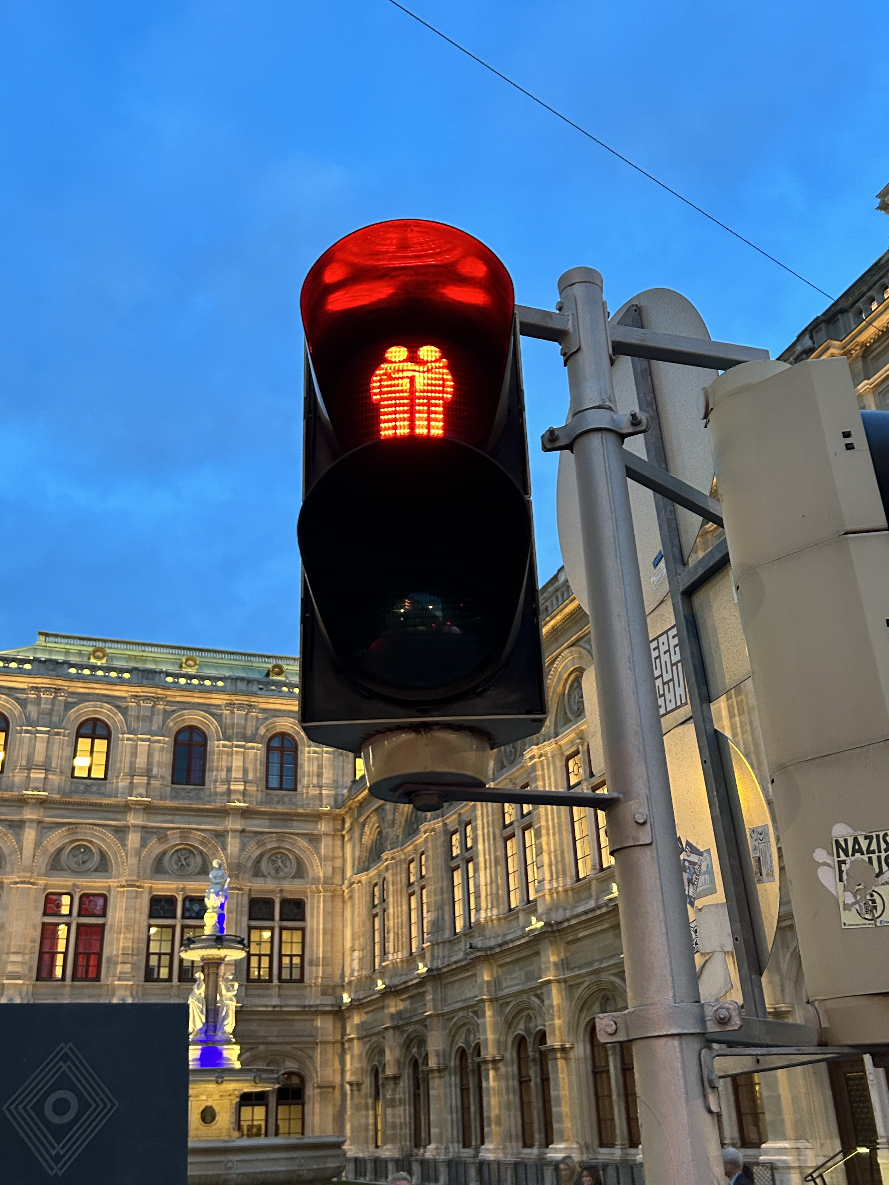
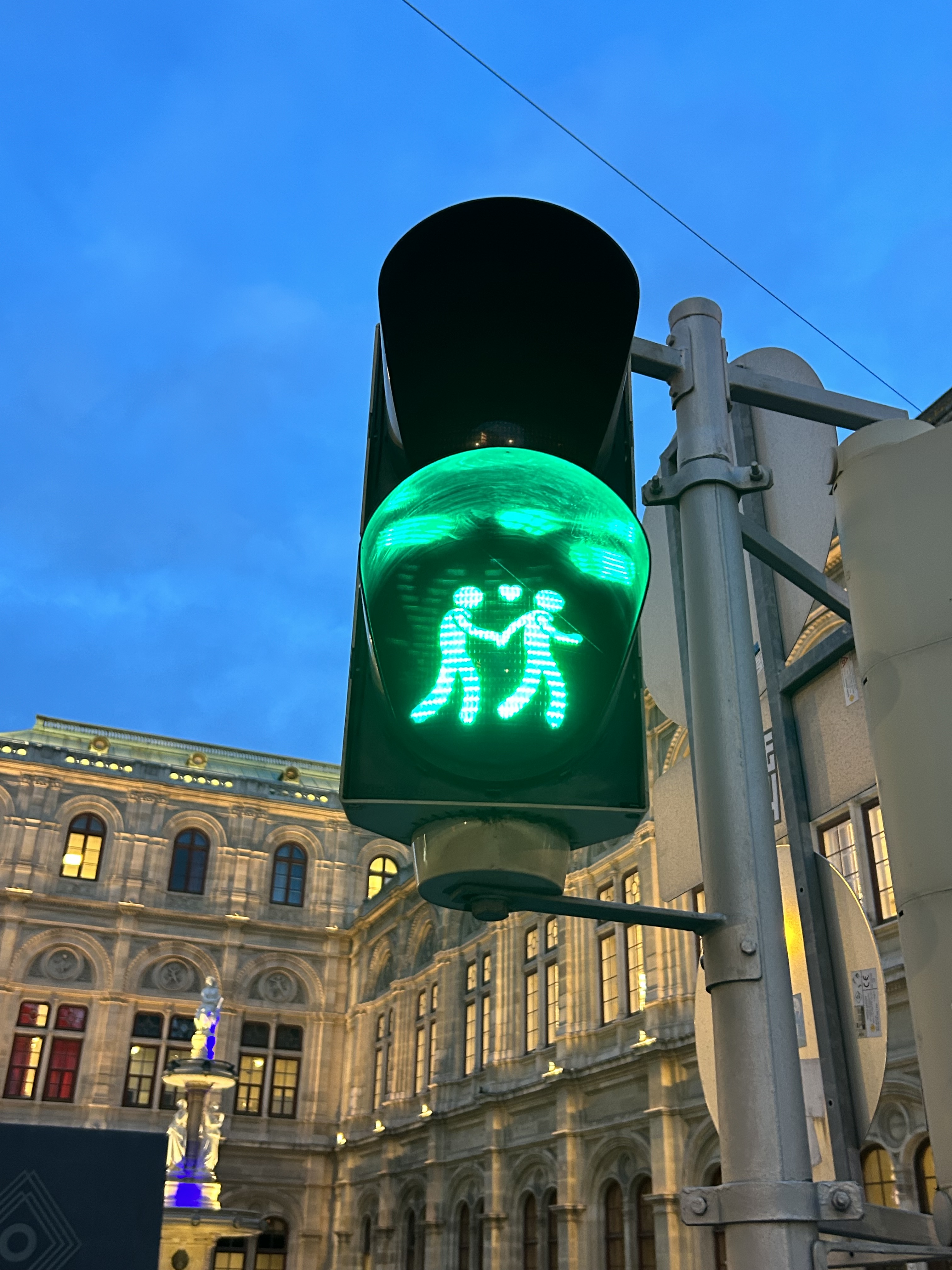
We noticed several pedestrian signs showing loving couples, rather than the standard, like this one in front of the Wiener Staatsoper (Opera House)
Vienna has one of the largest tram systems in Europe, with 30 lines over 176.9 kilometres, and a fleet of 525 cars, including modern articulated LRVs and older trams and trailers. In Vienna, trams alone carry approximately 300 million passengers a year. They run in many different environments: on-street in mixed traffic, reserved lanes, dedicated median and side-of-street rights-of-way; there is also a tram tunnel south of the city centre. Until the 1980s, Straßenbahnen (the German name for trams) were the backbone of Vienna’s transport network, with a small Stadtbahn system (now incorporated into the modern U-Bahn) and regional and suburban (S-Bahn) trains providing limited rapid transit services. Though there are now five U-Bahn lines (two of which evolved from the Stadtbahn), the tram system remains robust and very useful for getting around.
Like all four cities mentioned in this post, Vienna operates a mix of low-floor trams built in the last 25 years, as well as older high-floor trams, many of which are accompanied by an unstaffed trailer. Vienna’s entire network — trams, buses, U-Bahn, and S-Bahn — is a proof-of-payment system. Fare inspections appeared to be infrequent; neither my spouse nor I were checked during our eight days in Vienna. Tickets and passes can be purchased from a machine (found at every U-Bahn entrance and at many tram stops) or on the WienMobil app.
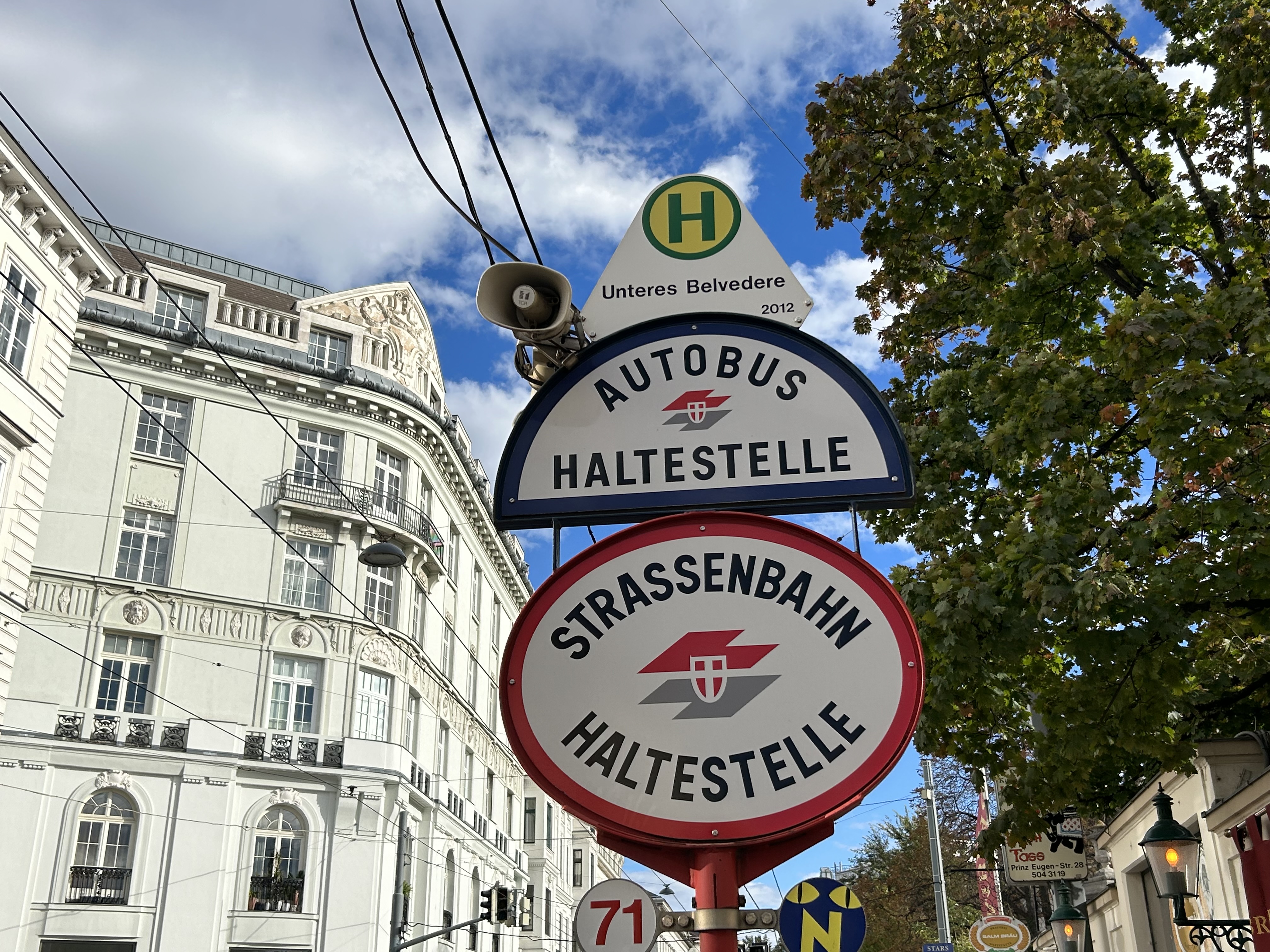
An older Type E2 high-floor tram and trailer at Gumpendorfer Straße. Behind is the old Stadtbahn viaduct, which is now part of Line U6. Note the large red “Strassenbahn Haltestelle” sign to the left, a classic Viennese icon that indicates a tram stop.
There is also a separate interurban tram service called Badner Bahn, which extends to the historic spa town of Baden bei Wien, an hour south of Vienna’s city centre.
Badner Bahn tram, laying over at Josefsplatz in Baden bei Wien
The modernized interurban originates in the heart of Vienna — across the street from the Wiener Staatsoper (Opera House) — then along local tram tracks and through the tunnel before entering its own right-of-way through the southern suburbs, and onwards through small towns, farms, and vineyards before arriving in Baden. There are several spurs leading to local industries; the regular passenger service shares the tracks with local freight trains.
View of the vineyards from Badner Bahn
A sample of the journey aboard Badner Bahn. Arriving southbound at Guntramsdorf, heading towards Baden bei Wien.
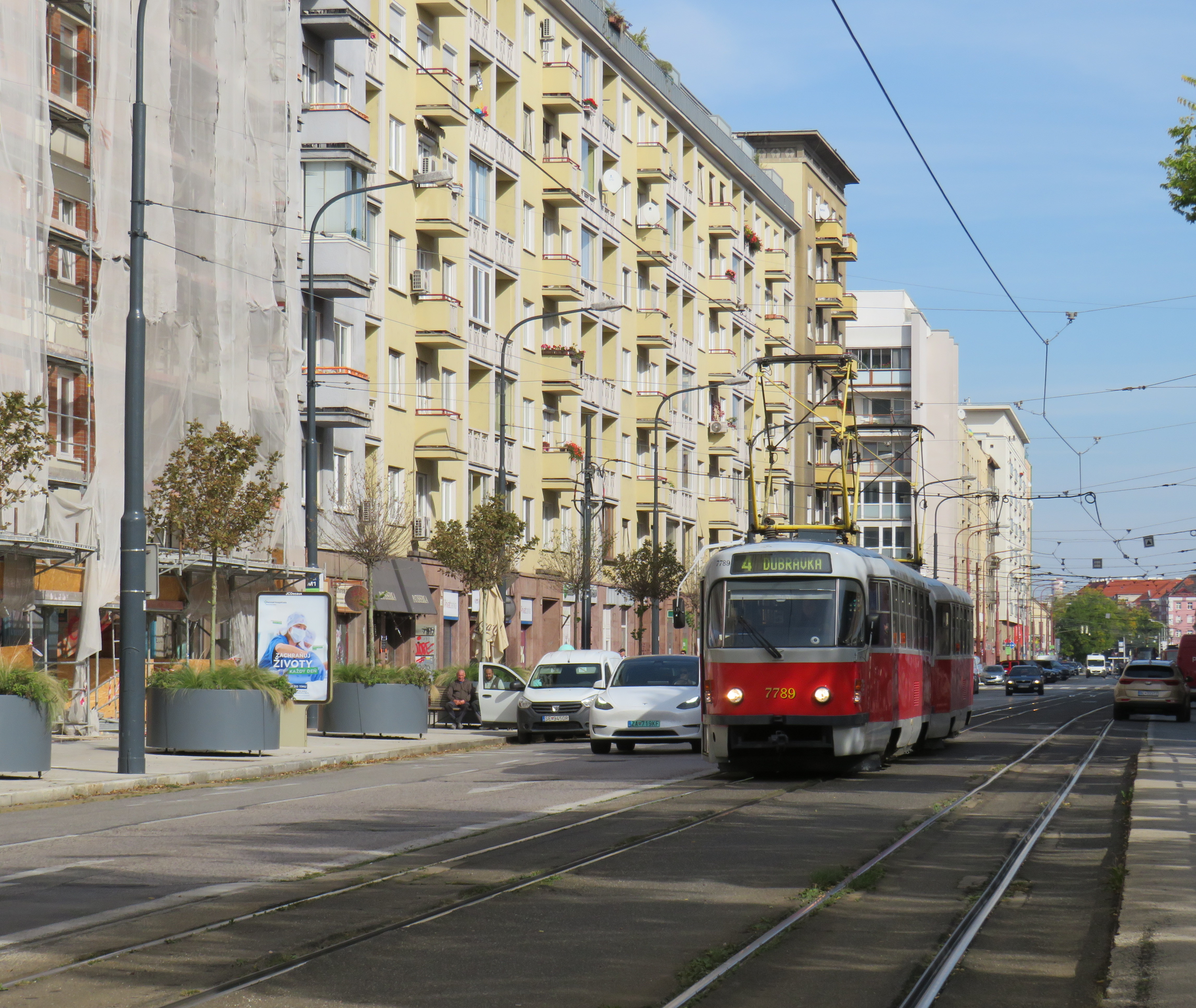
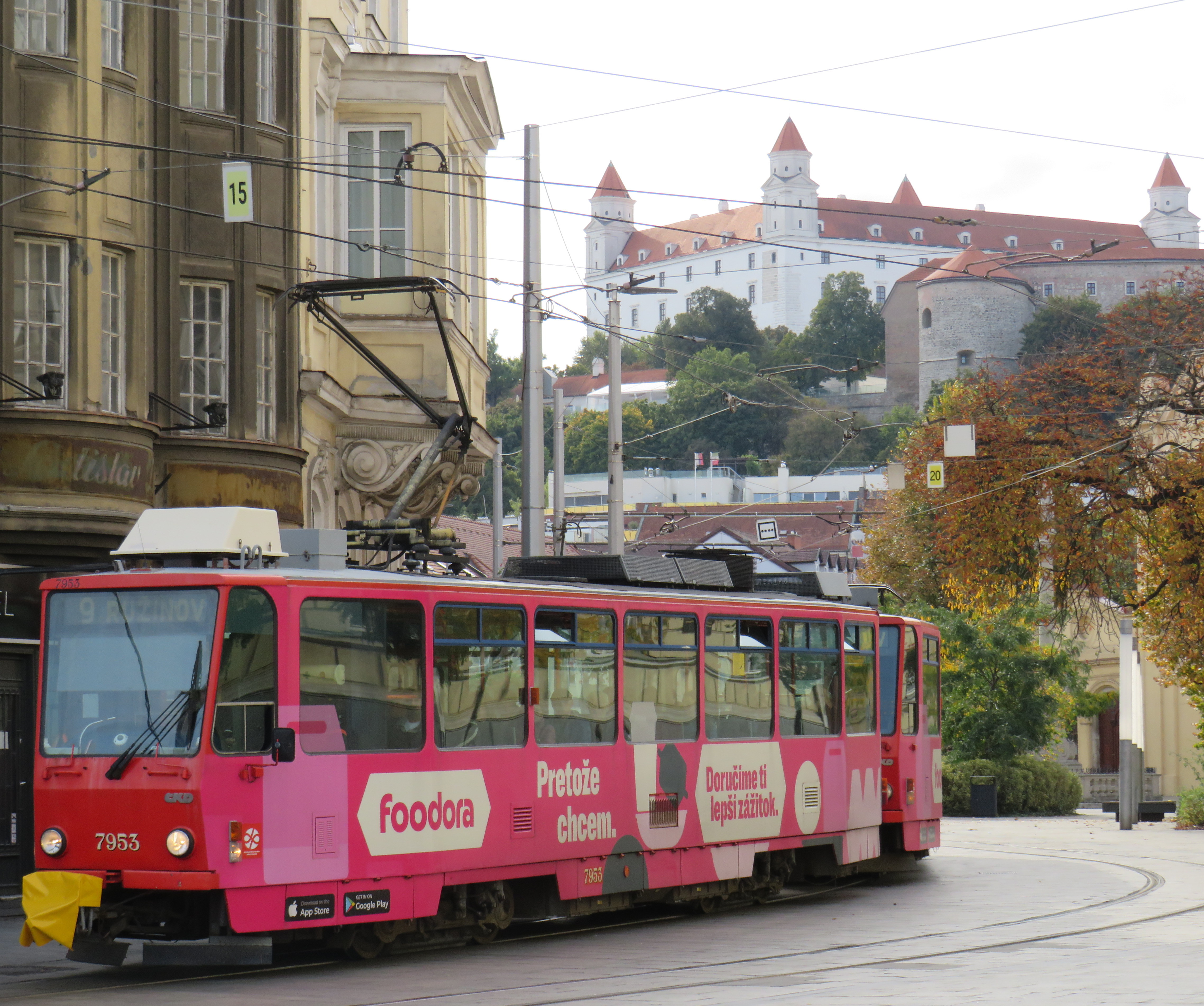
Bratislava, just over one hour away from Vienna by train (or by catamaran), is served by a network of metre-gauge trams, trolley buses, and diesel buses, though trams predominate in the city centre. On Obchodná, several tram lines, pedestrians, cyclists, and the occasional delivery or emergency services vehicle share a narrow, but busy shopping street. It just works.
Obchodná, Bratislava
Outside the congested urban core, trams are afforded reserved lanes, sometimes separated from general traffic with curbs (and even grass medians), sometimes just painted lines. Bratislava’s tram system is smaller than Toronto’s, with 211 cars and 42 kilometres of revenue track, carrying around 70 million riders a year in 2019 (Toronto’s streetcars carried 108 million that year). It is also a much smaller city, with a population of around 660,000. I only visited Bratislava for a day, but I got to ride much of the tram network; I found it an easy and convenient way to get around.
Reserved, painted tram lanes just outside Bratislava’s city centre
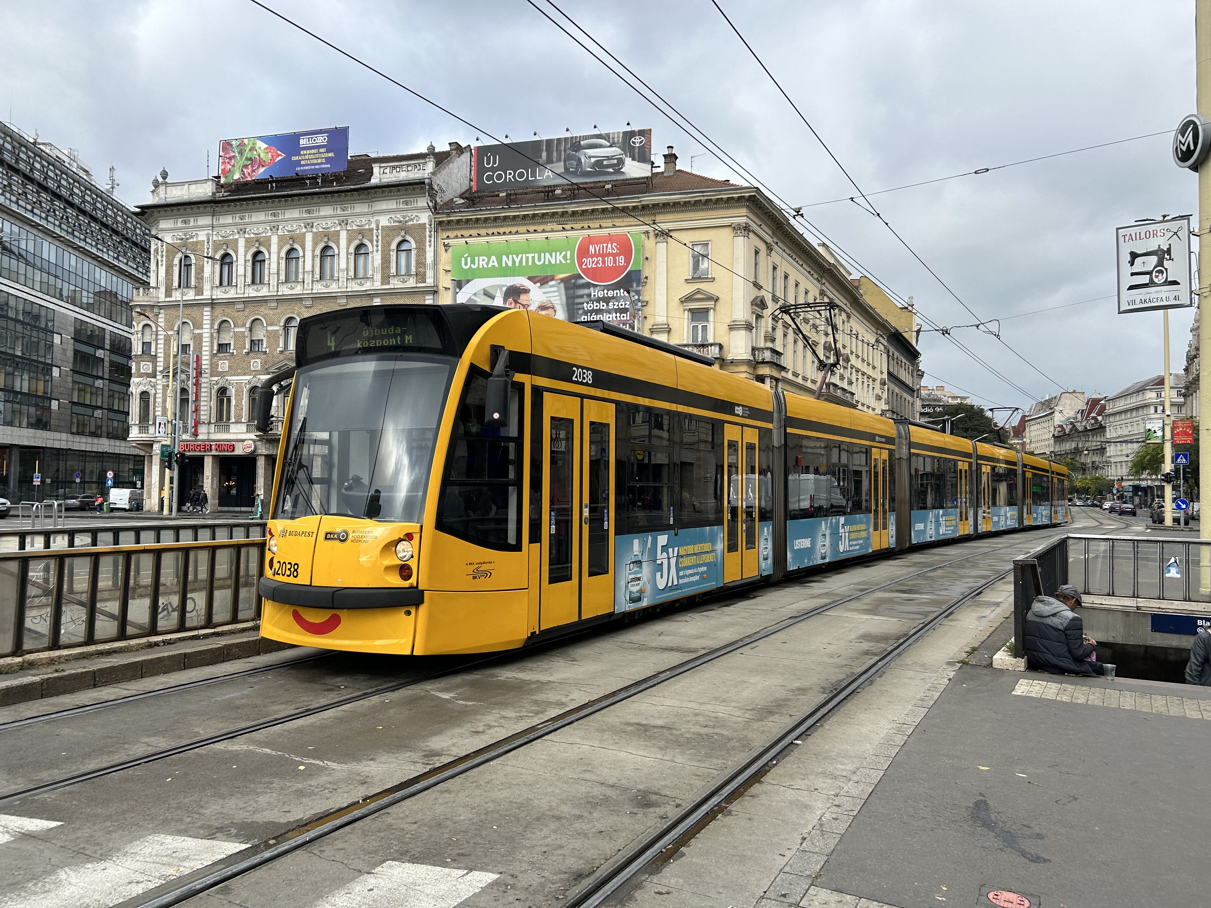
Budapest, Hungary has the largest street railway system in the world by ridership, with Route 4/6 on Budapest’s Grand Boulevard (Hungarian: Nagykörút), often cited as the world’s busiest tram line. Route 4/6 also operates 53.99 metre long Combino Plus trams, which, when introduced in 2006, were the world’s longest. The Combinos are almost twice the length of Toronto’s new Bombardier Flexity cars, which are 28 metres long. Even with the huge capacity these trams have (they require two pantographs to draw enough power to operate), they operate on Line 4/6 every few minutes, all day long, every day.
A Combino Plus tram on Line 4 traverses Budapest’s Nagykörút (Grand Boulevard)
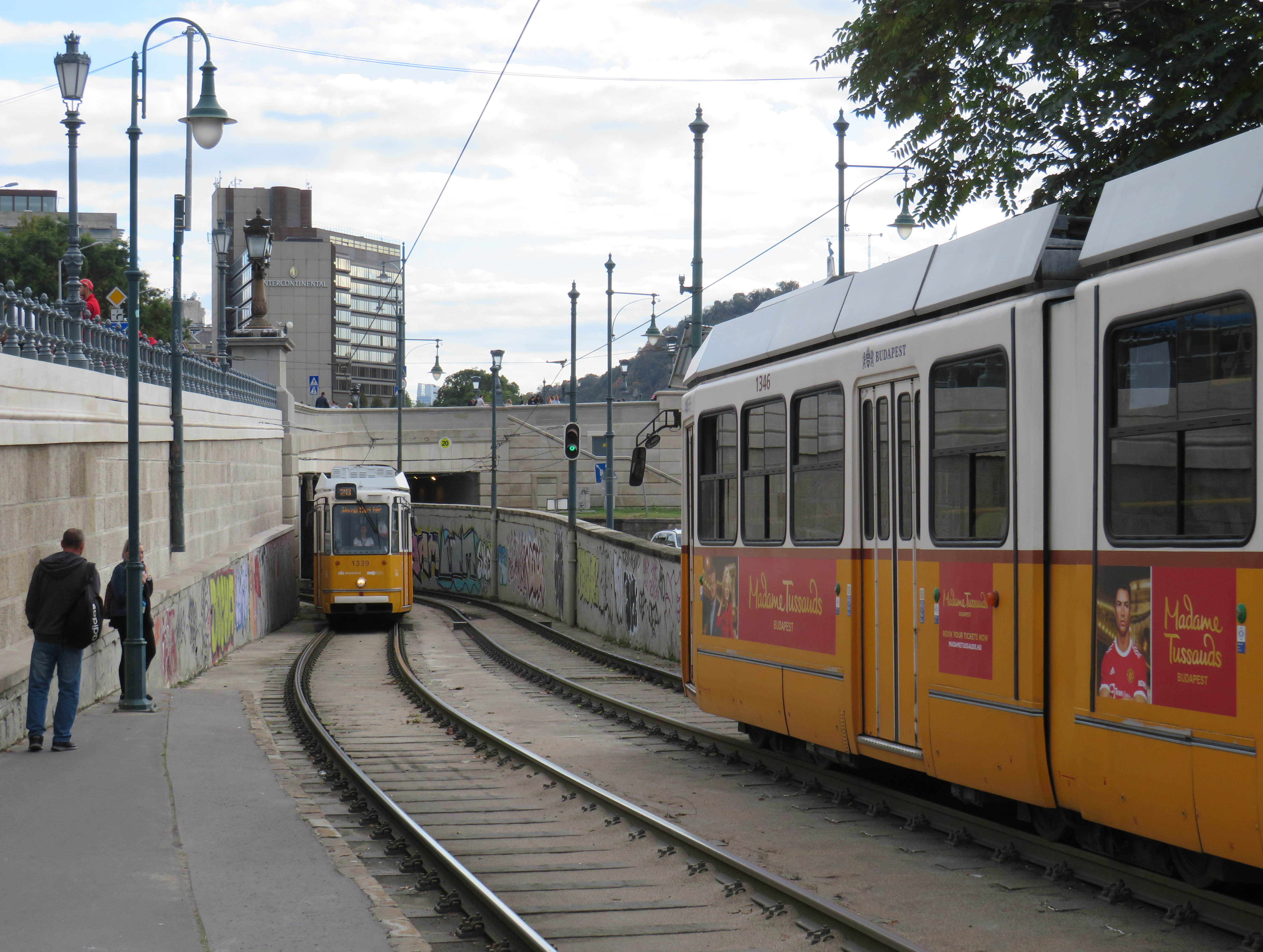
Through the 1970s and 1980s, Budapest’s tram network was slowly cut back in favour of buses, trolley buses, and metro construction. By the 1990s, however, there was a street railway renaissance in Hungary’s capital because of the capacity and economy trams offered. With high frequencies, a private median, and high-capacity low-floor vehicles, Line 4/6 easily matches the capacity of a metro, at comparable speeds. Elsewhere, dedicated lanes and private rights-of-way make it clear that transit riders come first.
Older trams running along the Danube dip under road bridges on a private right-of-way
Though Budapest has a large metro network, most of it was not constructed until the l970s and 1980s. However, Line M1 was opened in 1896 as a shallow subway under Andrássy Avenue, the first electric underground metro in the world, and only the second subway, after London’s initial Underground line. Uniquely among urban transit routes, it it is listed as part of an UNESCO World Heritage Site.
Budapest Line M1 stations, restored to their original appearance, look like miniature New York stations, only cleaner
Finally, in Prague, we took several trams to take shelter from the rains that greeted us after arriving from Budapest, but also to see the city outside the crowded tourist spots. We took Line 1 from the city centre to the suburban district of Hrdlořezy, and returned via Line 9, taking a slightly different route back. Like Budapest, a metro system was planned and built in the 1970s and 1980s, but trams remained important, often providing local services parallel to deep underground metro lines.
Old two-car tram train on Line 9, passing a newer low-floor tram on Line 1, Sokolovská, Prague. Most trams run on reserved rights-of-way.
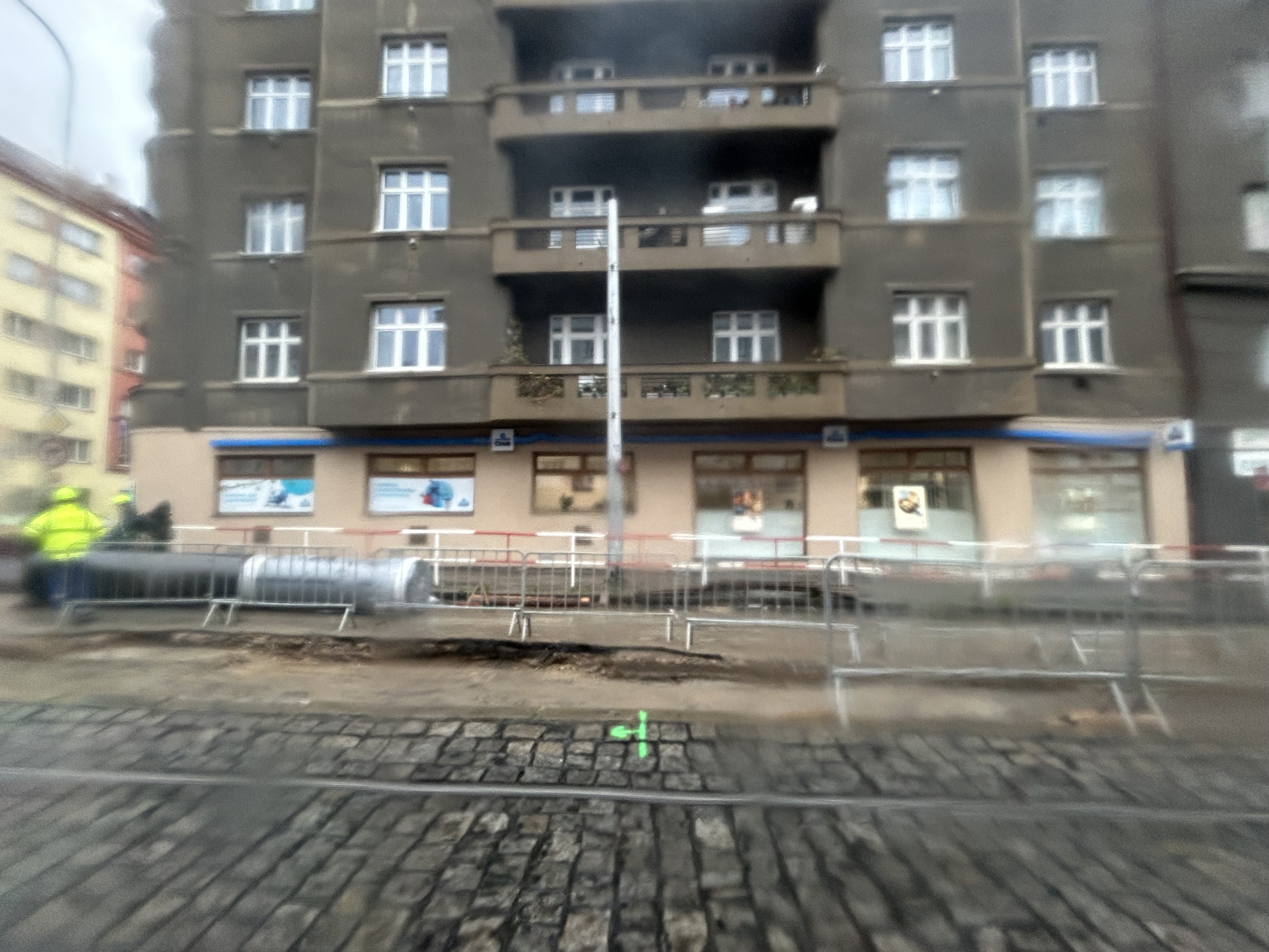
What interested me was seeing major watermain work along the line. Through trams slowed where work was adjacent, there were no diversions or shuttle buses. The trams ran through.
Watermain replacement in Prague, with trams still running(taken on a rainy morning)
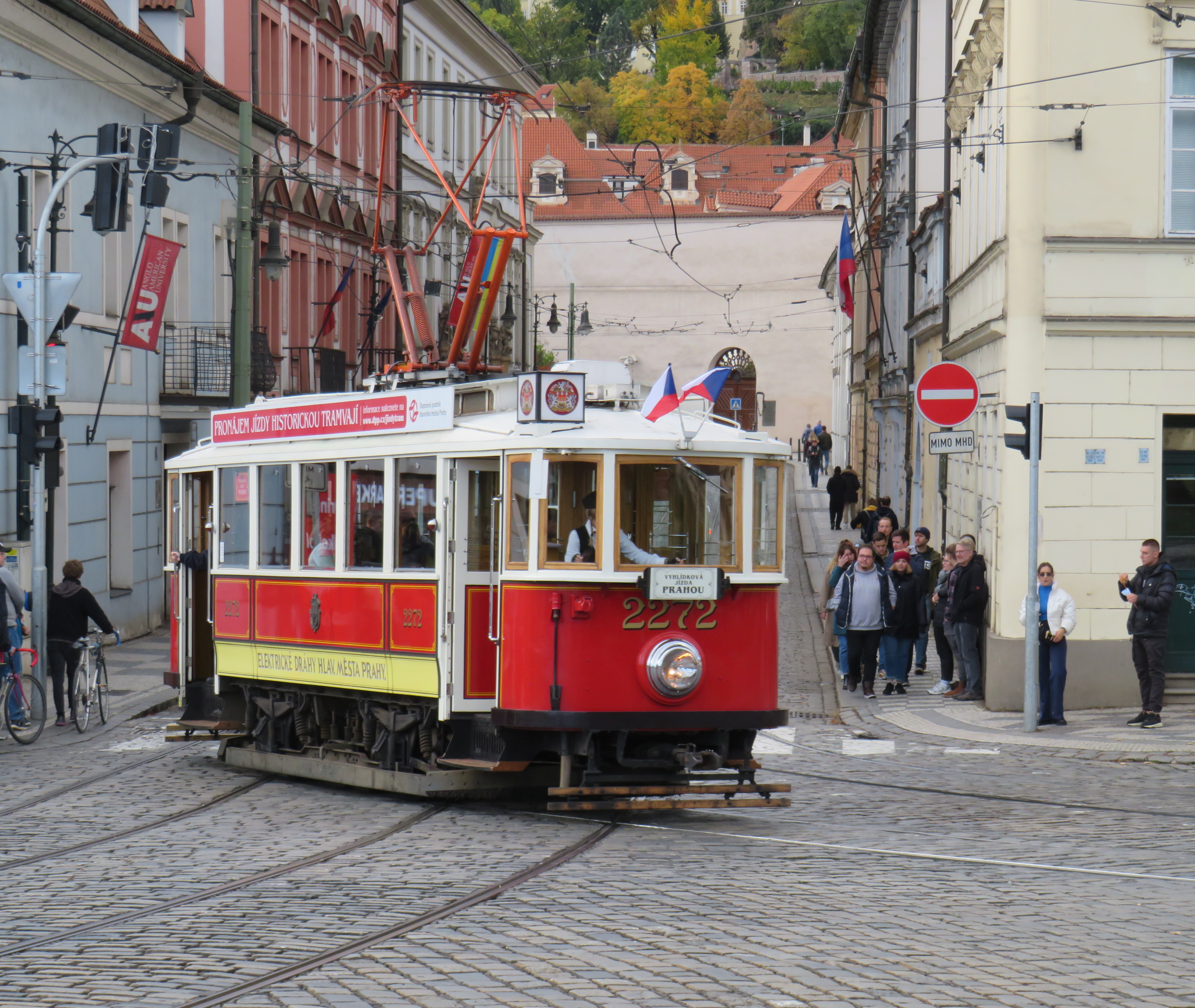
Like Vienna, Bratislava, and Budapest, Prague operates a mixed fleet of older high-floor trams and modern low-floor light rail vehicles, similar to Toronto’s new fleet. But in Prague, heritage trams could often be spotted in service, especially on the west bank of the Vltava near Prague Castle.
Heritage tram #2272 in Prague
Lessons for Toronto
After travelling, it can be easy to spot one’s hometown flaws and faults. But I spent a lot of time riding Vienna’s metros, trams, and buses, and mindfully experiencing the transport networks in Bratislava, Budapest, Prague, and Salzburg (which does not run trams, but has a large trolleybus network), I was left with some key takeaways on how to do transit here.
First and foremost, transit riders were respected. Not necessarily in terms of personable customer service, but the feeling that the next tram or bus was going to arrive on time, and a reliable interval. If there was a delay, it was very well communicated.
For instance, while waiting for a tram in Vienna, we experienced an unusually long wait. The next tram display kept showing the next two arrivals at 3 and 4 minutes. Not long after, a voice came on a loudspeaker posted above the tram stop sign announcing (in German, translated in English to us by one of my spouse’s colleagues) a delay because of a collision along the route. The blockage cleared after a few minutes, and we boarded a crowded tram. I appreciated the audio announcement, especially as it was a basic tram stop.
The classic Vienna tram stop. Note the loudspeakers atop the blue bus stop sign (at night, buses take over, hence the Strassenbahn and Autobus stop signs).
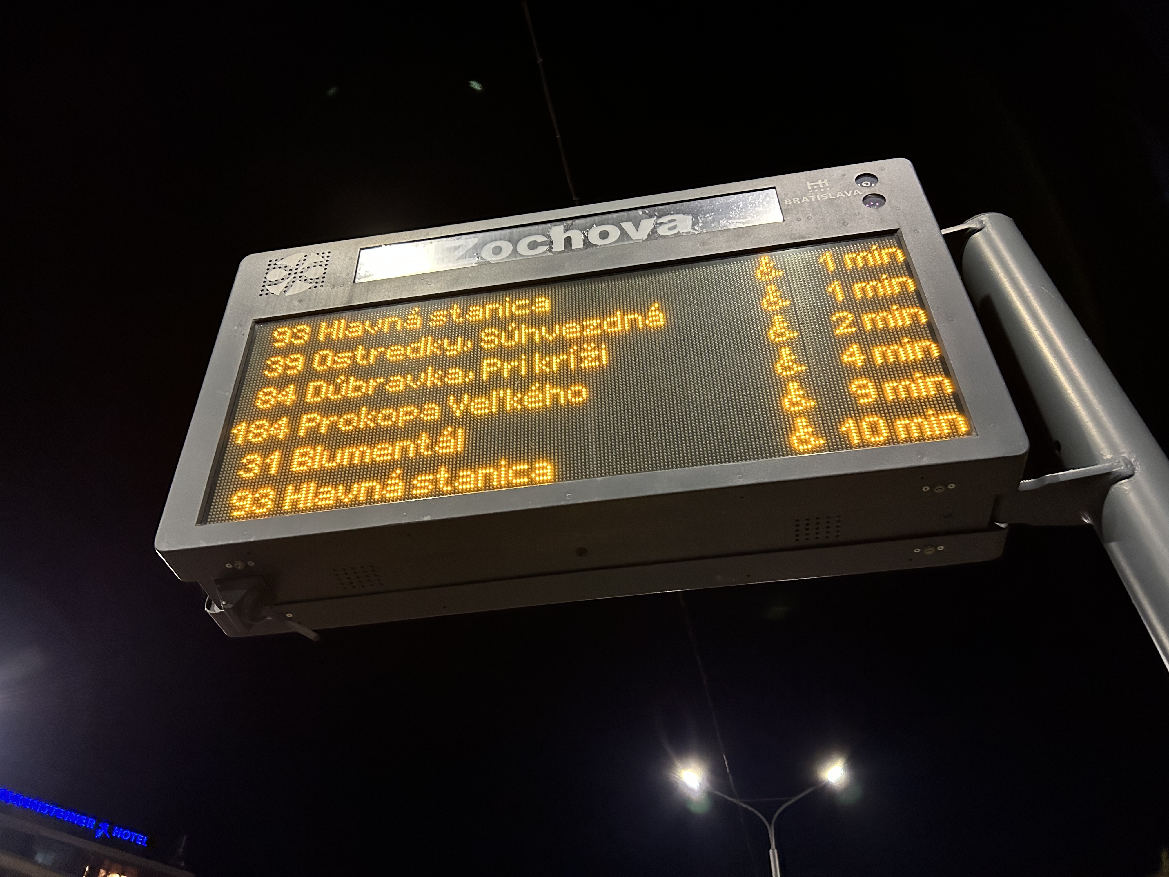
Next vehicle displays were common in every city we visited. They would list — in real time — the next several buses or trams, as well as if the vehicle was low-floor accessible or not with a wheelchair symbol. All buses are now fully accessible, but the information is useful for the tram lines, where there are still many older high-floor vehicles.
Next vehicle display at a bus stop in Bratislava
I also noted that in Vienna, and for the most part elsewhere, vinyl advertisement wraps did not cover passenger windows on trams and buses. Bratislava’s wrapped trams had some ads that used window areas, but these were kept to a minimum.
In Vienna, advertisement wraps kept windows completely free of obstructionsAdvertisement wraps in Bratislava had minimal window coverage
It was also clear that trams had dedicated signals on their routes, if not necessarily signal priority. But with smaller intersections and relatively short signal timings, the waits at each signalized intersection were generally minimal.
Note the white tram signals next to the overhead traffic signal. The “A” indicates that a proceed signal will soon appear, and the operator can cancel the door release, so that no more passengers can enter or exit.
Tram signaling in Vienna and other Central European cites also includes remotely operated electric switches. Overhead signals indicate which direction the switch is set to; operators can pass through junctions at speed. While this is how trams operate in most places around the world, in Toronto, streetcar operators are required to stop before each switch and then crawl.
Trams pass through a track junction, along with an ambulance and a transit maintenance van. The overhead horizontal signal indicates the switch direction.
Though many tram stops are in private rights-of-way, in-street tram stops are designed for passenger safety and accessibility. These stops, depicted by the photograph below, have the curb lane raised to the level of the low-floor trams. This increases the visibility of passengers boarding and egressing, and also simplifies ramp deployment. Operators need not exit the cab and manually deploy the accessibility ramp, a timesaver versus the TTC’s ramp deployment on major streets. In the winter, this also helps keep the slush away from the tram stops.
The raised on-street curb lane at an on-street tram stop in Vienna.
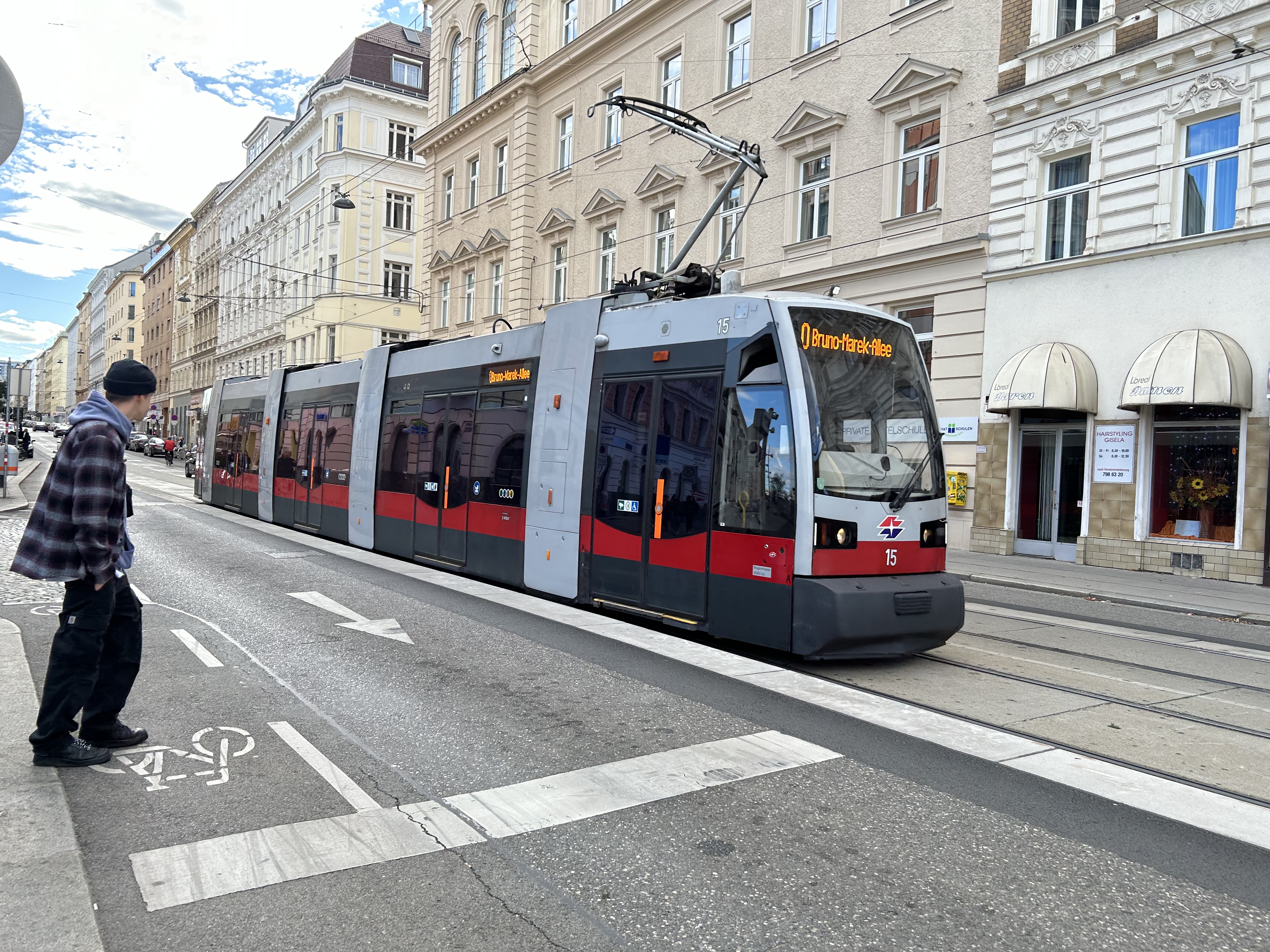
Though Toronto is a very different city than Vienna, Budapest, or Prague, there are some clear takeaways. Keep the tram windows free of advertisements. Improve communications. Fix the track switches and signalize them. Raise the curb lanes at streetcar stops for safety, convenience, and accessibility. Fix the King Street Transit Priority corridor with a permanent streetscape and tighter vehicle restrictions. If it can be done on a narrow commercial street in Bratislava’s historic centre, there’s no reason why it can’t be done in a world financial capital.
These can even be done incrementally, but they need to be done if transit riders are deserving of respect and reliable surface transit.
It is no secret that I am fascinated by Ontario’s failed downtown malls. Over the last decade, I have visited most of these half-dead shopping centres, from Thunder Bay to Sarnia to Peterborough. All of these malls were built in smaller centres hoping to revitalize their urban cores, especially after the successes of the Toronto Eaton Centre and Ottawa’s Rideau Centre.
A majority of downtown shopping centres in Ontario counted Eaton’s as an anchor, starting with London’s Wellington Square in 1960. New malls in Sudbury (1970), Hamilton (Jackson Square, 1972-1975) and Kitchener (Market Square, 1974) followed, with the pace of downtown mall openings quickening in the late 1970s and 1980s as the provincial government provided assistance through the Ontario Downtown Redevelopment Program (ODRP).
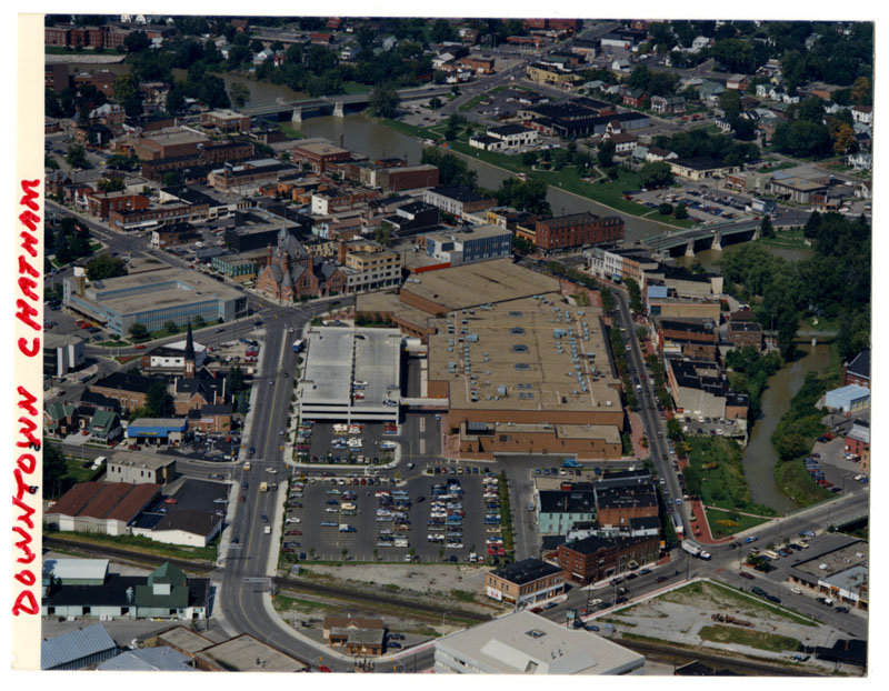
A few downtown malls did not secure Eaton’s as the lead anchor. These malls, which were anchored by Sears, included King Centre (Downtown Kitchener’s second indoor mall), Cornwall Square, and Downtown Chatham Centre. I visited the latter mall in late September 2023.
Chatham, a small city located halfway between London and Windsor, has had bad luck ever since the 1950s. City growth was curtailed when neighbouring townships fought the city’s annexation efforts to develop new industrial lands on the urban outskirts. Political pressure from exurban residents kept the city rather isolated from the new Highway 401, which passes south of the old city limits; residents of the hamlet of Charing Cross opposed a highway interchange that would have provided direct access into Downtown Chatham. Meanwhile, a new Multi-Malls shopping development was approved for a site north of Chatham; an appeal to the Ontario Municipal Board by the city was dismissed, and the new Woolco and Loblaw-anchored plaza helped to draw customers — and tax revenues — from the city proper.
This unfortunate situation was only rectified in 1998, when the City of Chatham was amalgamated with not just its neighbouring townships, but the entire county, creating the new municipality of Chatham-Kent, coming far too late for the industrial and commercial development Chatham had hoped for. In the meantime, a new downtown mall that would not only retain shoppers but hopefully attract new visitors to the city, was seen as the solution.
While most downtown malls built during the ODRP era were led by Eaton’s and Cadillac Fairview, the Downtown Chatham Centre (DCC) was managed by Cambridge Shopping Centres. The city of Chatham conducted the land assembly (using its powers of expropriation where necessary), and cleared two city blocks, including the Garner Hotel, the old market square, the Romanesque Harrison Hall, and several commercial blocks, including a shuttered Eaton’s store.
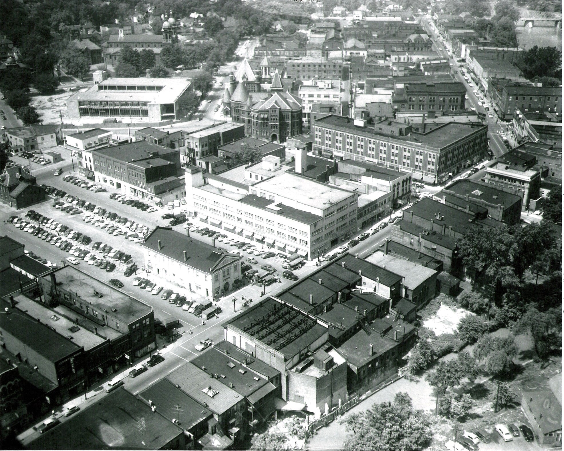
Downtown Chatham in the 1950s. Most of the buildings in the foreground and midground have since been demolished. The old market square became a parking lot by the 1950s; to the immediate left of the old market is the 3-4 storey Eaton’s store. Harrison Hall, with its conic tower, stands behind Eaton’s.The Downtown Chatham Centre soon after opening in 1983(Chatham-Kent Museum)
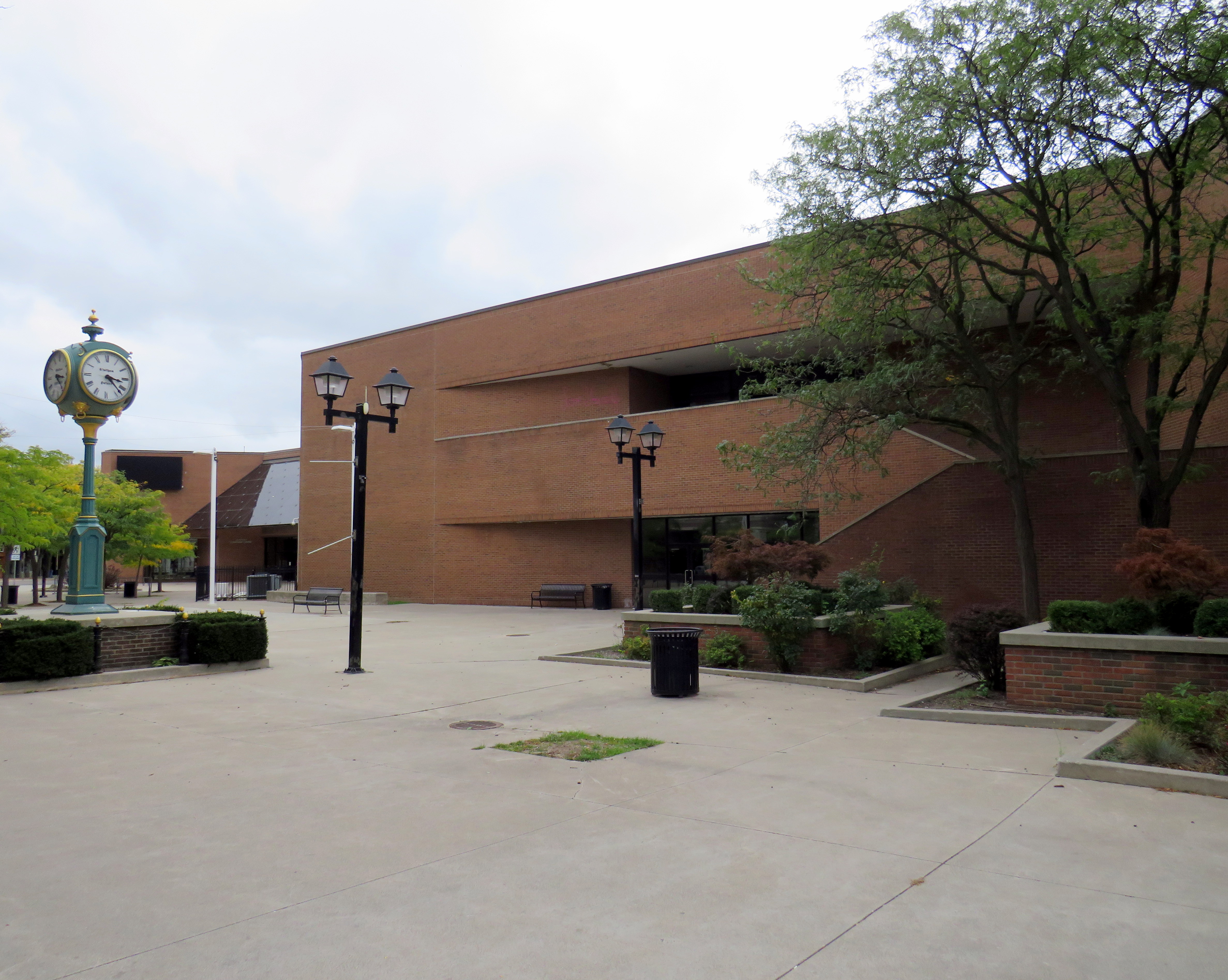
Instead of Eaton’s — which closed its Chatham store in 1974 — the lead anchor would be Sears, which was expanding its Canadian footprint at the time, as it just pulled out from its 25-year partnership with Simpson’s. Unlike most downtown malls built in Ontario, DCC had always offered ample customer parking, located in a garage linked to both of the mall’s two shopping levels, as well as an adjacent surface lot, with mall visitors able to get their parking validated. On the south side of the mall, there was a Miracle Food Mart, along with a food court on the second floor. Downtown Chatham offered the only full-line department store in town; the mall also had the city’s only escalators. The plaza out front featured a fountain in the summer and a public skating rink in the winter.
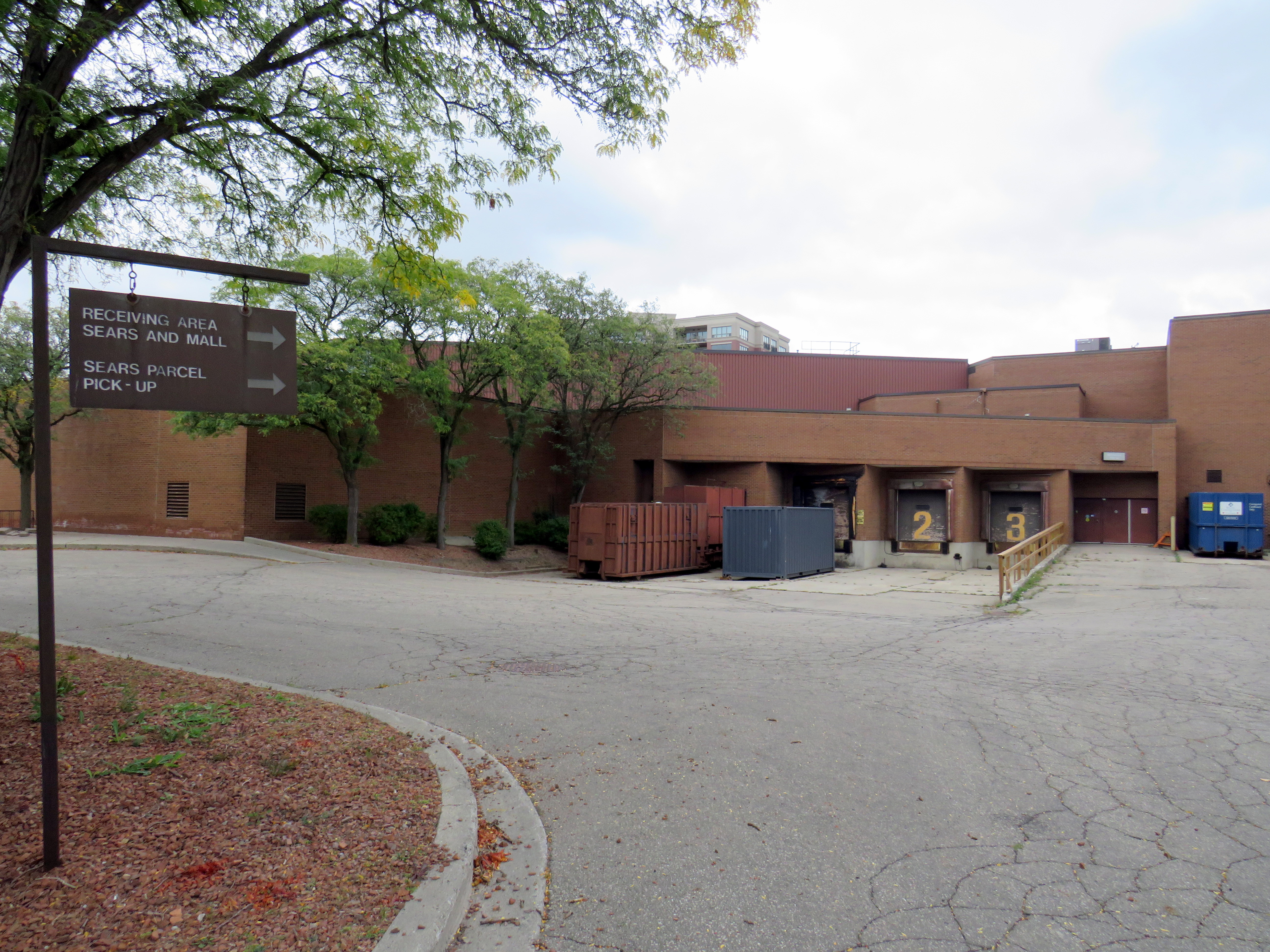
Harrison Hall, which was home to both the City of Chatham and Kent County before demolition in 1978 to make way for the Downtown Chatham Centre. (Chatham-Kent Museum)The site of demolished Harrison Hall in 2023. Asign still directs drivers to the Sears receiving area and the parcel pick-up.
For a time, DCC held its own. Sears was a much more suitable department store for a smaller industrial/agricultural city like Chatham than Eaton’s would have been. Though the Multi-Mall development north of the city on Highway 40 and the Thames-Lea plaza in the suburbs provided competition, the downtown mall’s regional market dominance was undisputed in the 1980s and most of the 1990s. Unlike Eaton’s, Sears Canada was particularly healthy until the early 2000s as it catered to the suburban middle class; in 1999, it purchased the remains of the bankrupt T. Eaton Company, converting many better performing Eaton’s stores to its own brand.
Unlike Chatham’s peer cities like Brantford and Sarnia, the mall’s tenant mix stayed relatively healthy well into the new millennium (see the 1992 and 2014 tenant lists below). Though Miracle Food Mart closed, that space was remised into a Sport Chek and a Goodlife Fitness gym. It wasn’t until the last decade that serious decline began to set in.
What happened?
The empty public plaza outside the vacant Sears store
There were several factors that led towards the decline of Downtown Chatham Centre, similar to the reasons why most downtown malls failed. The main difference is that the decline came later than most others.
Chatham’s economy, like most smaller Ontario centres, was in flux, particularly in the 1990s and early 2000s. Free trade agreements affected the local industrial economy, which was already weaker than neighbouring cities like Sarnia, Windsor, and London-St. Thomas.
Factory closures included the Navistar plant. For nearly a century, International Harvester was one of Chatham’s largest employers. The Chatham plant, which assembled International truck tractors and employed 2400 workers in 2001, closed for good in 2011. The rise of Walmart, which moved into the old Woolco store on Highway 40 along with other big-box retailers, also hurt the downtown mall. But Sears Canada entered its own death spiral in the mid-2000s. In 2005, the company was taken over by the private equity firm Pershing Square, whose CEO, Edward Lampert, was already slowly sucking the American parent company dry. Sears Canada sold off its credit card division, its Downtown Toronto headquarters, and eventually the leases for its most attractive stores in 2012 and 2013, including the former Eaton’s flagship in Toronto Eaton Centre.
By 2014, the DCC Sears was converted to an outlet store, foreshadowing its eventual closure in 2017, less than year before the entire chain disappeared from Canada.
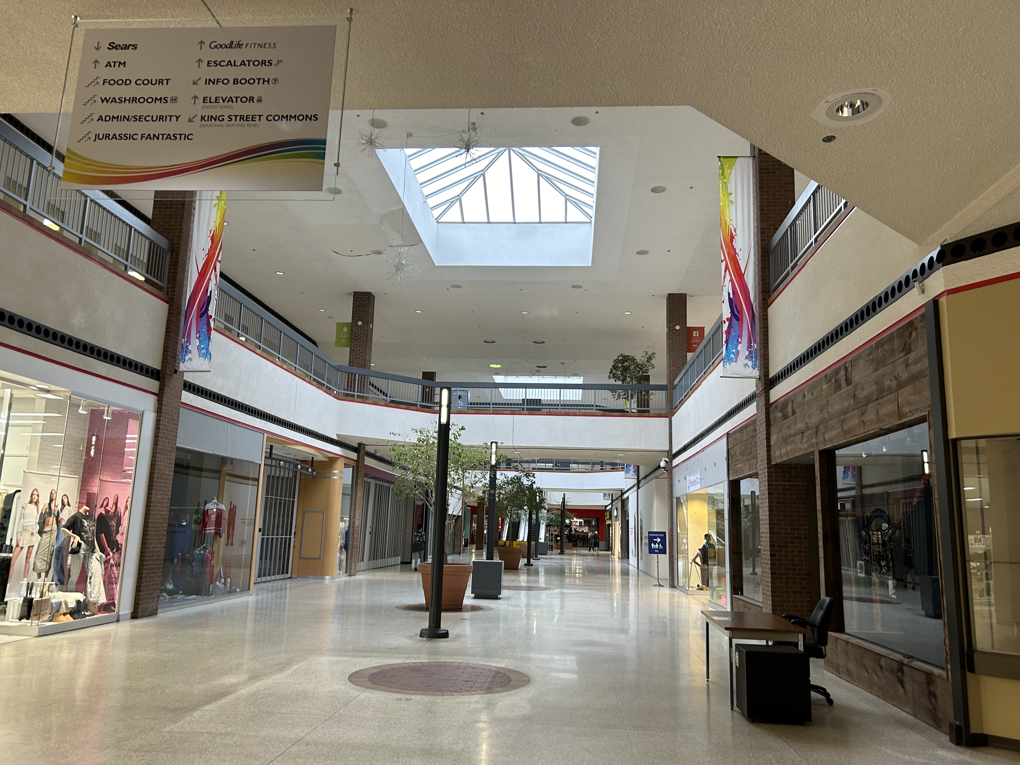
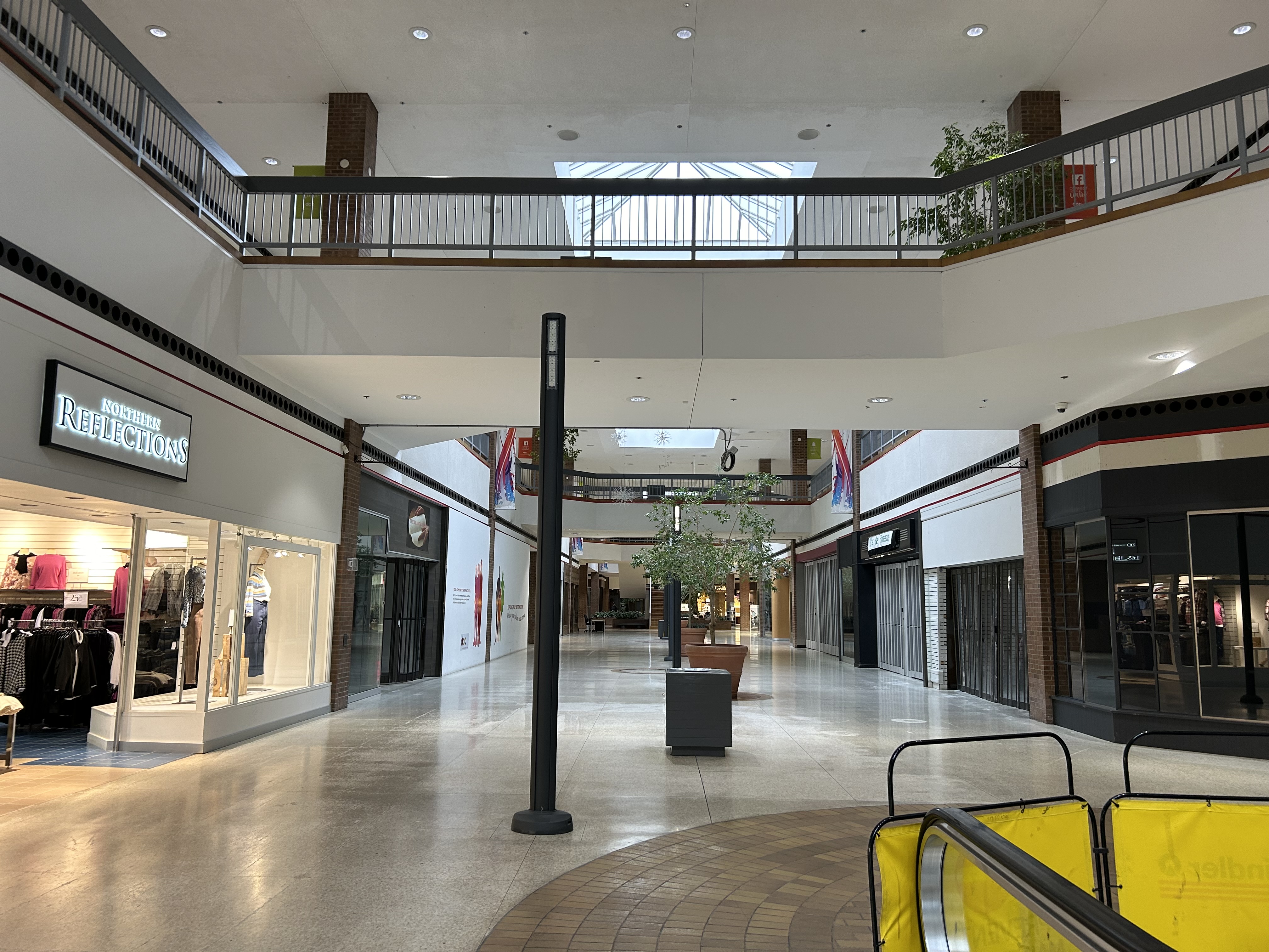
Mall interior looking east, September 2023
In September 2023, there were only a handful of open stores left inside DCC, including Northern Reflections, a Dollarama, Fit4Less (a budget brand of Goodlife Fitness), Ardene, an independent jewellery store, and a Hart discount department store located in the old Miracle Food Mart/Sport Chek space. All open retail spaces were on the first floor; the escalators were completely blocked off. The Ardene store was already in the process of moving to the Thames-Lea plaza.
Security guards were stationed at both public entrances, likely to ensure the mall did not become a hangout for Chatham’s unhoused.
Mall interior, looking west
The mall also has a pharmacy and medical office, but since 2015, they are accessed only from the outside, in a storefront facing King Street.
What’s next?
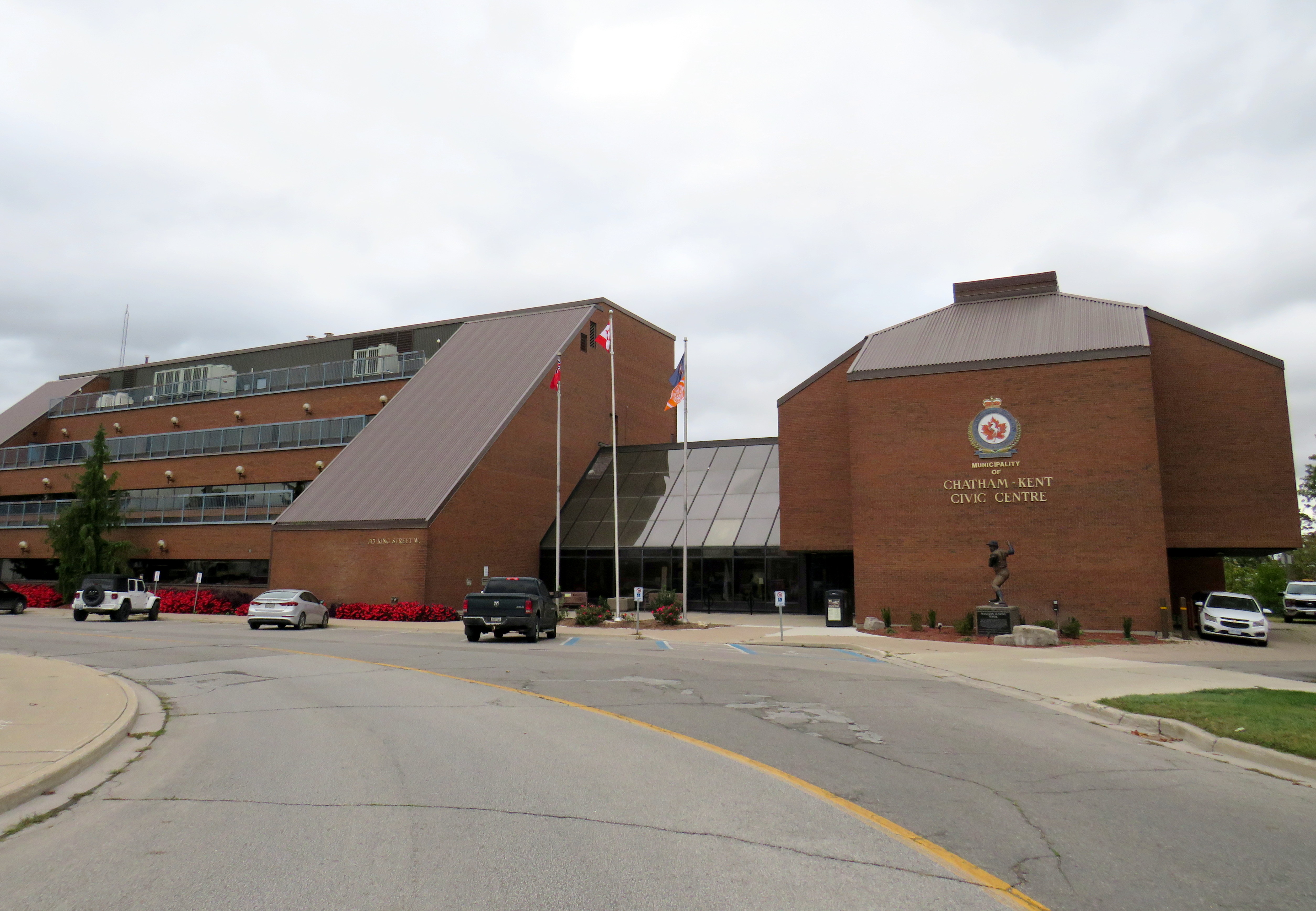
Chatham-Kent Civic Centre, built in 1975-1976
The Municipality of Chatham-Kent currently occupies the Chatham Civic Centre, which was built in the late 1970s on the site of a former gas works on the Thames River. The Civic Centre requires major renovations or replacement, and the municipal government is considering purchasing part of the Downtown Chatham Centre, and moving the municipal government, the main library, and the art gallery/museum into the Sears store, which would be heavily renovated. Staff report that the cost of purchasing and renovating part of the DCC ($42,387,400) was similar to renovating the existing Civic Centre, library, and museum ($38.7 million to $45.8 million) and nearly half the cost of building brand new.
Earlier plans also included a new entertainment centre to host concerts and the Chatham Maroons minor hockey team, replacing an existing municipal arena constructed in 1949. Those plans were later dropped by the mall’s owners.
If Chatham-Kent agrees to purchase and renovate the vacant Sears store, they will relocate to nearly the same site as the old Harrison Hall.
The proposed relocation of the civic centre and library to a central location, adjacent to the RideCK transit terminal (which serves the old City of Chatham as well as many smaller population centres within the municipality) is certainly a more sustainable and equitable outcome than building a new civic centre outside the downtown core. It repurposes an existing building and helps to support downtown business. However, more housing, both on the surface lot and on any vacated civic properties would help bring even more people into the downtown core, which can use the boost. Though retailers may not flock back into the mall once renovations are complete, the storefronts offer flexible space for community programs and small business incubators.
For a small city like Chatham, this is likely the best outcome.
1992 Tenants
Below is the list of tenants at Downtown Chatham Centre in 1992, obtained from the 1993 Canadian Directory of Shopping Centres, published by Maclean-Hunter.
Fashions and footwear Children’s wear: Just Kids Unisex/family wear: Cotton Ginny, Le Château, Pantorama, Stitches, Work World Ladies’ wear: Addition-Elle, Born Free, D’Allairds, Fairweather, Irene Hill, Just Petites, Lady Foot Locker, The Lady’s a Champ, Mariposa, Northern Reflections, Pennington’s, Personally Yours, Reitman’s, Ricki’s, Station Cotton, Suzy Shier, Thyme Maternity Menswear: Tip Top Footwear & leather goods: Foot Locker, Joggers, Kinney, The Shoe Place Jewellery/accessories: Lady Jewellery Company, Ostranders, Young’s Jewellers
Other retailers Books: Classic Bookshop, Coles Drugs/health & beauty: Pharma Plus, The Soap Emporium Department/mass merchandiser: A Buck or Two Electronics: Radio Shack Gift: Den For Men, Things Engraved Hardware/paint & paper: Tool Den Housewares: Junor’s, Stokes Music/Records: Sam the Record Man Pet: Pet Paradise Photo/Camera: Black’s, Japan Camera 1 Hour Photo. Restaurant/fast food: A&W, Crumbles Muffins, Frankfurters, Lumberjack Restaurant, Manchu Wok, Mulligan’s Roadhouse, Sorrento Specialty Food & Drink: Bright’s Wines, Laura Secord, The Gourmet Cup Stationery/Card: Carlton Cards, Hallmark, Willson Stationers Toy: Toys & Wheels Variety/Convenience: News Room Dry Cleaners: La Moderna Dry Cleaning. Hairstyling/Esthetics: The Golden Razor Theatre/Entertainment: Fun & Games Miscellaneous: Infoplace
2014 Tenants
The 2015 Canadian Directory of Shopping Centres tenant list was shorter, though still much more robust than former Eaton’s-anchored downtown malls in comparably-sized cities like Sarnia, Brantford, or Peterborough at the time.