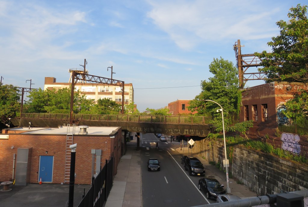
An abandoned railway signal towers over Philadelphia’s Rail Park
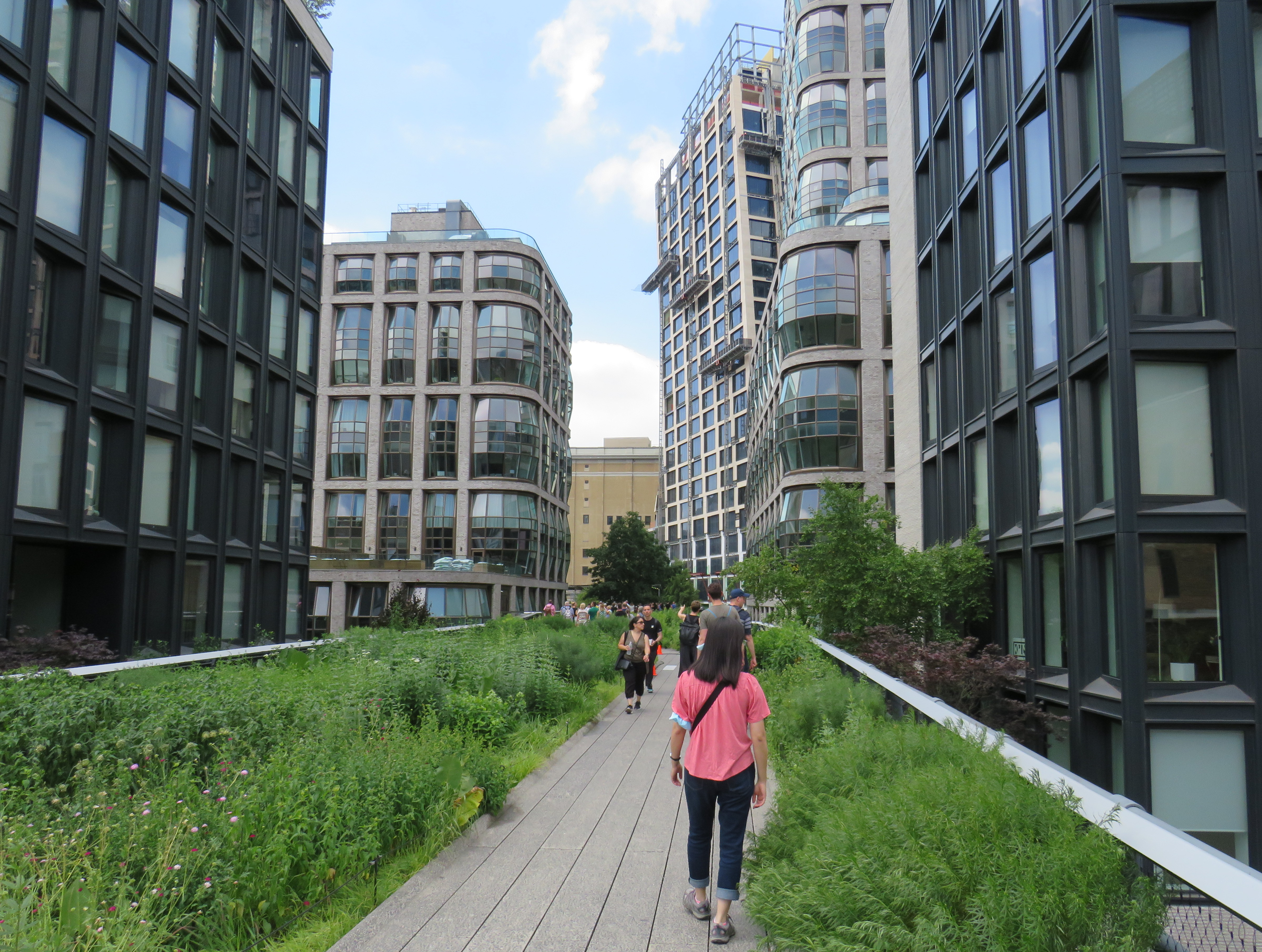
On a road trip early this summer, my spouse and I paid a visit to New York and Philadelphia. In New York, we walked the famous High Line, which revitalized an abandoned elevated freight railway corridor, transforming it into a popular grade-separated walking path on Manhattan’s Lower East Side.
New York’s High Line
While in Philadelphia, I made a point of visiting another abandoned rail viaduct — Rail Park. It’s as ambitious as New York’s famed public space, but — for now — it is much less known.
The viaducts, cuts, and tunnels that will make up Philadelphia Rail Park trace their origin to the golden age of railroading. The Philadelphia and Reading Railroad, which connected Philadelphia with its northern and western suburbs, industrial towns to the northwest, and the lucrative anthracite coal fields of northeast Pennsylvania. For many years, the Reading Railroad, as it was known, was one of the United States’ most profitable companies. In 1893, the railway opened its Philadelphia Terminal, which became famous for the public market that was established below the station platforms. To this day, the Reading Terminal Market remains a vital city landmark. In the 1930s, most of the commuter services were electrified.
The 1893 Reading Terminal headhouse, now the entrance to the Pennsylvania Convention Center
By the 1970s, both the Reading and PRR were bankrupt. PRR merged with its New York-Chicago rival New York Central in 1968, before it too went into insolvency. Conrail took over many failing railways in the US Northeast and Midwest, consolidating operations, abandoning or transferring redundant track, and transferring most remaining commuter train operations (which were not assumed by Amtrak) to regional and state transit authorities.
In the mid-1980s, the Southeast Pennsylvania Transit Authority (SEPTA), which assumed control of the regional rail services formerly operated by the PRR and the Reading undertook an ambitious project to unite the separate regional rail systems. A new four-track tunnel was constructed east from PRR’s Suburban Station, and a new station — Market East — built to replace the old Reading Terminal. For the first time, trains could run through central Philadelphia, providing improved regional rail services.
Though the historic Reading Terminal headhouse and the famous market were preserved, the station platforms were removed to make way for a new convention centre. For years, the abandoned viaducts and tunnels leading into Reading Terminal sat unused. At least they did, until June 2018.
Entrance to the first phase of Rail Park, at Noble and 13th Streets
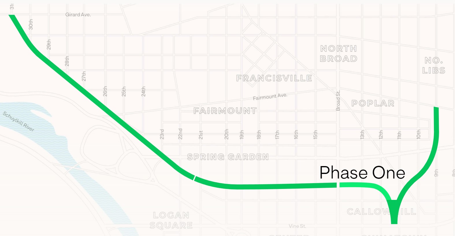
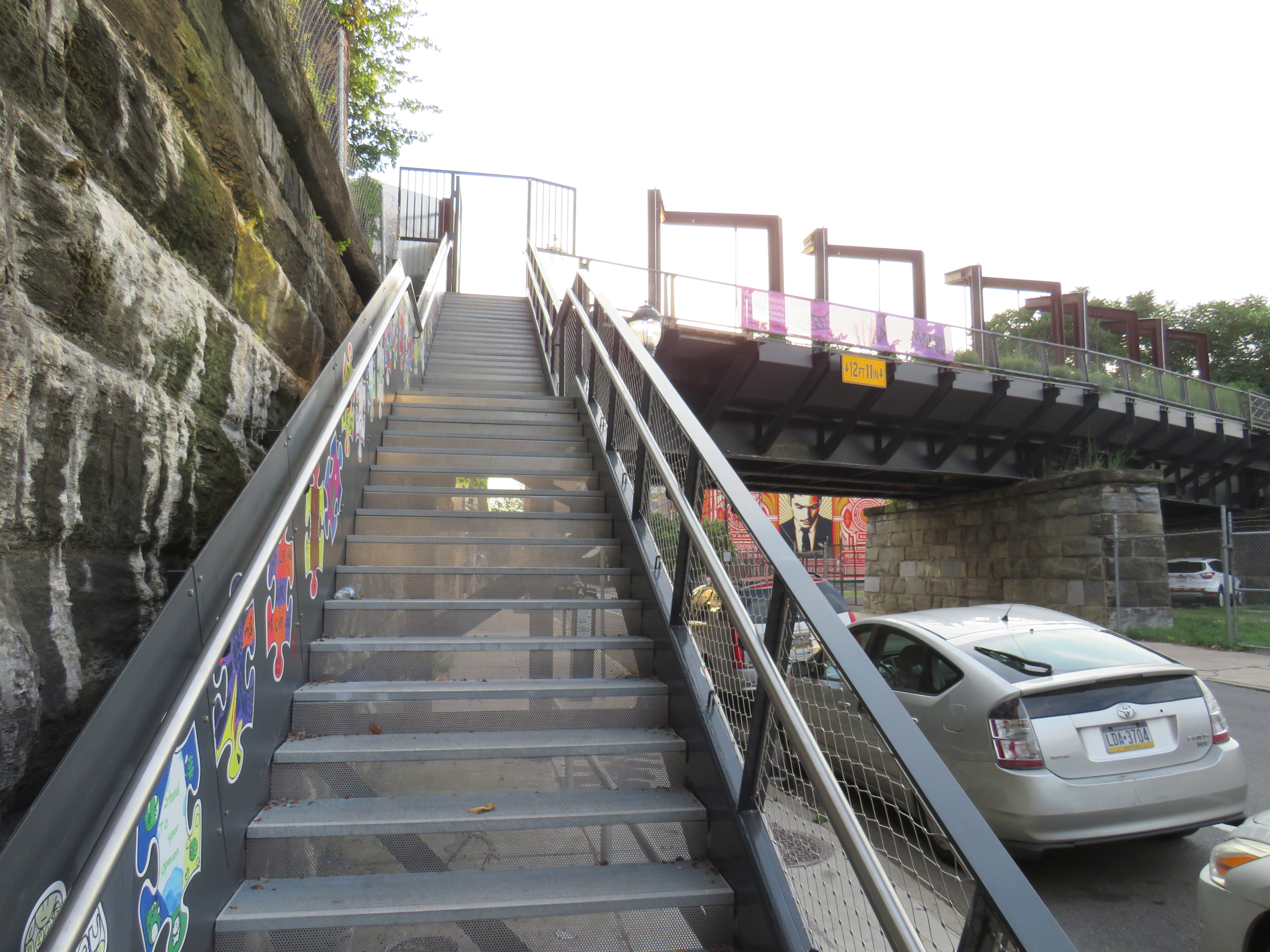
In 2018, a short, initial phase of Rail Park opened to the public. Spanning just two blocks, from Noble and 13th Streets to Callowhill and 11th Streets, it is still a remarkable public space. Like New York’s High Line, the short section of viaduct provides new viewpoints over gritty city streets, with temporary and permanent public art installations along the route.
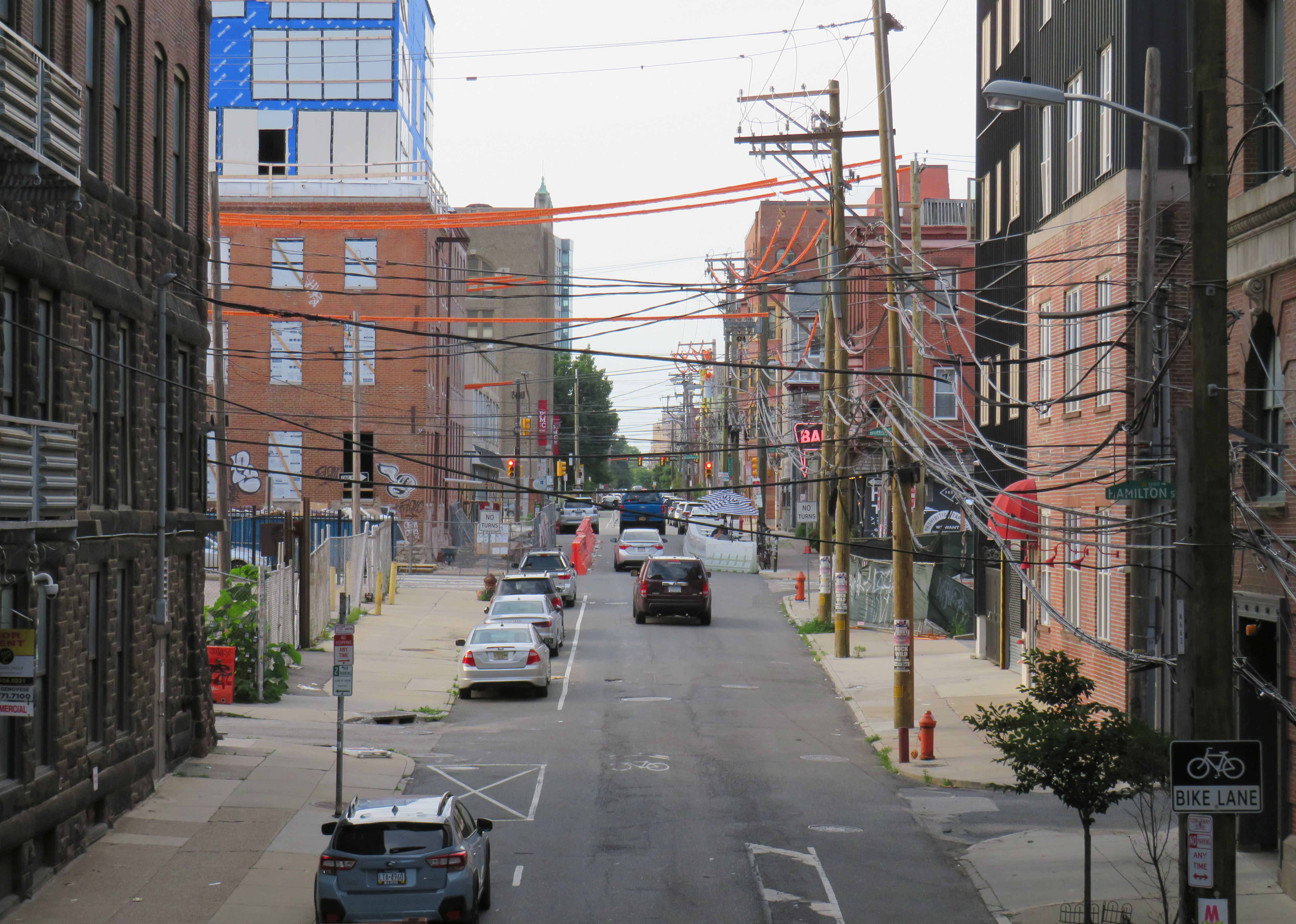
A map of the proposed extensions of Rail Park, with the opened first phase marked. Interactive map here. Looking north up 13th Street, towards the gentrifying Spring Garden neighbourhood“Workshop of the World” – an interpretive plaque provides information on the industries that lined the Reading Company’s route through PhiladelphiaAn art map of local industries that existed immediately north of Reading Terminal, made from punched Corten steelLooking east to the intersection of Callowhill and 11th Streets. For now, the only fully accessible entrance to Rail Park is at Noble and 13th Streets. The viaduct from the north is visible at left; this will be part of a future phase of Rail Park.A stairway leading up from Callowhill Street. The metal frames at the right hold swings for the public to enjoy.
Future park extensions will continue westward from 13th Street to a below-grade cut starting at Broad Street. It will continue west to the Benjamin Franklin Parkway and the Philadelphia Museum of Art (where the Rocky statue can be found outside), where it will enter a tunnel before emerging at Girard Avenue near Fairmount Park, the greatest of Philadelphia’s urban green spaces. Another section will connect the existing Phase I to the abandoned north-south viaduct between Vine Street and Fairmount Avenue, where the old route to Reading Terminal meets the 1980s rail diversion to Market East Station. Eventually, it will reach 3 miles (5 kilometres) in length.
The formerly abandoned viaduct offers a view of more recently abandoned transit infrastructure: the remnant tracks of the 23-Germantown trolley route, once the longest streetcar line in North America. In the early 1990s, SEPTA was forced to abandon three of its legacy street railway lines due to budget pressures and deteriorating PCC equipment. (Newer Kawasaki-built streetcars were only deployed on the surface-subway routes in West Philadelphia and on the former Red Arrow suburban lines from 69th Street Station.) The 15-Girard Line was later rebuilt with refurbished streetcars, but the 23 and 56-Erie lines were left to rot in a state of “temporary suspension.”
SEPTA has a wealth of transit infrastructure, which I wrote about after my first visit to Philadelphia in 2009, but it hasn’t put enough of it to good use. It has a massive, fully electric regional rail network, yet trains operate only every hour on most routes outside of peak periods. There’s a four-track subway tunnel under Broad Street that’s grossly underused, and unlike Toronto, there are even a few active trolley bus routes. And sadly, it’s allowed much of its infrastructure, like its trolley network, to remain in disuse.
A view down from Rail Park to long-disused trolley tracks on 12th Street
On Friday, May 13, I embarked on a day trip through Southwestern Ontario from Downtown Toronto. I wanted to ride more of Ontario’s new intercommunity transit services and try one of the new intercity bus operators that’s filling the vacuum left by Greyhound’s departure. I started my trip at Union Station, spent some time in Kitchener-Waterloo, then continued on to London, returning home that evening.
Between Toronto and Kitchener, there are several options. VIA Rail is the fastest and most comfortable ride, but it now only operates one train a day between Toronto and Kitchener.
GO Transit is the most frequent option, with several weekday trains between Toronto, Brampton, Guelph, and Kitchener, and connecting buses at Bramalea GO Station for Downtown Kitchener and Waterloo. The train and bus trip via Bramalea is just under 2 hours, costing $19.40. (Weekend GO service is much slower, requiring a change of bus at Square One, with a 2 hour, 33 minute ride.)
The traveler might also choose one of the new private carriers. FlixBus has one daily departure at 7:45 AM from Downtown Toronto (on York Street, south of Union Station), with a second 2:15 PM trip departing Thursdays through Sundays. Though FlixBus is the cheapest option — only $14.24 with tax — it is slightly slower than GO Transit’s direct train or its Bramalea bus connection, as it deals with Downtown Toronto traffic and serves Guelph on its way to Kitchener. Onex Bus also stops at Kitchener on its Toronto-London route, but it stops at the Sportsworld Terminal near Highway 401, requiring a change to Grand River Transit’s buses.
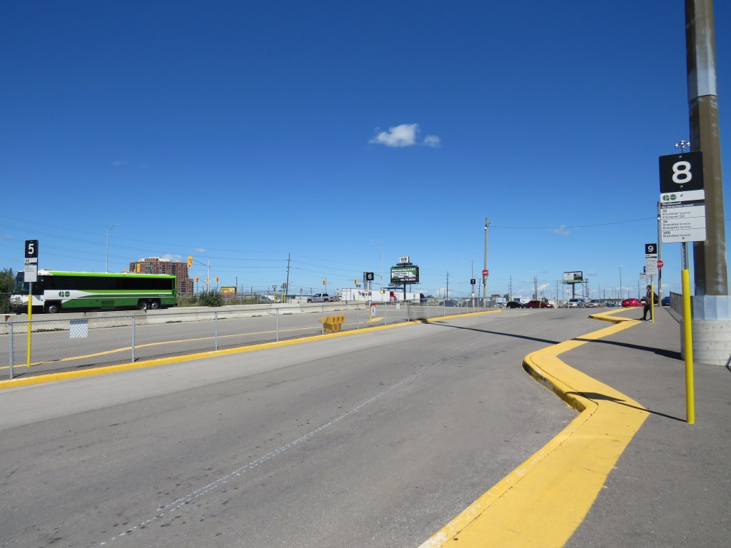
Because of the flexibility and convenience, I choose GO Transit, switching from train to bus at Bramalea. Because of continuing construction at Bramalea Station, I had trouble finding the bus stop for the Route 30 to Kitchener and University of Waterloo, but once work is complete on the bus loop, the transfer between modes will be quite easy.
Route 30 is a fast bus route, stopping only at the Meadowvale Business Park in Mississauga, where connections can be made to several other GO Transit bus routes as well as Miway and Brampton Transit. In Kitchener-Waterloo, the GO bus stops at Downtown Kitchener, at Wilfrid Laurier University, and at a new terminal at University of Waterloo. This is in contrast to Route 25 between Square One and University of Waterloo, which exits the highway multiple times to make local stops, and is the only weekend GO service.
The new bus terminal at University of Waterloo, serving local GRT routes, GO Transit, and the ION LRT.
Between Kitchener and London, however, options are much more limited. Though the GO Transit Kitchener Line was recently extended to London, this is limited to one weekday train leaving London at 5:30 AM and returning to London at 8:37 PM. There is just one VIA train between the two cities as well. Onex Bus offers up to five trips daily between Sportsworld and Downtown London.
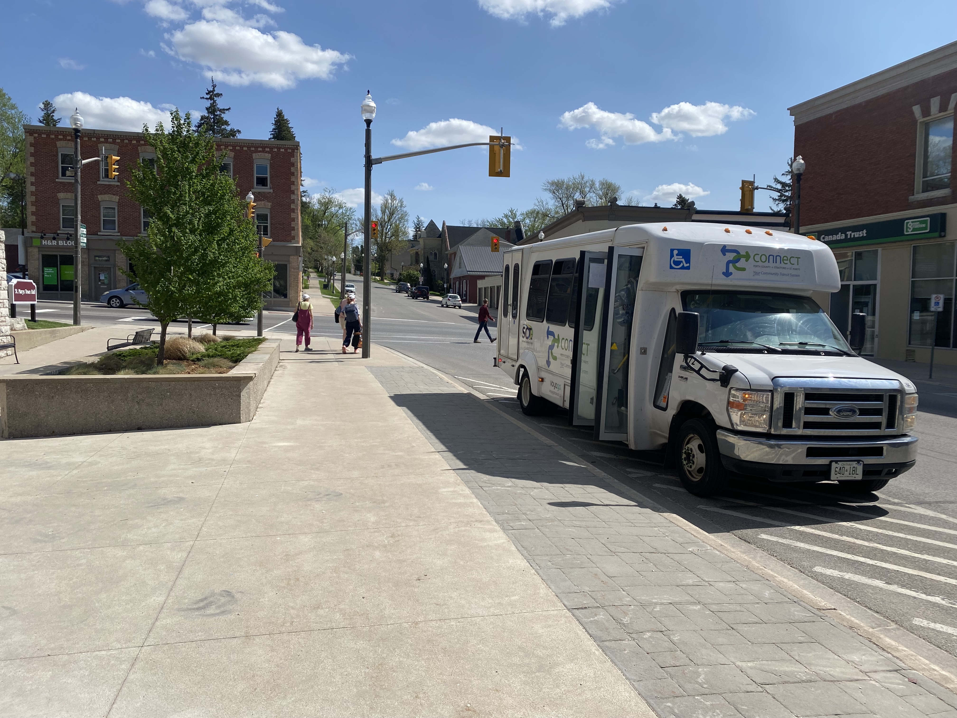
The other option is PC Connect, a provincially-funded intercommunity service connecting Stratford and St. Marys with Kitchener-Waterloo and London, as well as towns within Perth County with each other. From Conestoga Mall in Waterloo, I took the 2:50 PC Connect trip to Stratford and St. Marys. At St. Marys, I changed to a connecting bus for Masonville Place Mall in London. Each ride cost $12 cash. Service was friendly and on-time.
PC Connect Bus in St. Marys
At London, PC Connect stops on Fanshawe Park Road, adjacent to Masonville Place Mall, but a ten-minute walk from the main LTC bus terminal where connections can be made to Western University and Downtown London. (Huron Shores Area Transit, with service to Exeter and Grand Bend, stops on the north side of Fanshawe Park Road).
With VIA Rail’s service reduced between Windsor, London, and Toronto, the only trip back to Toronto after 5PM (on a Friday, a traditionally busy travel day) was an Onex Bus departure from the downtown VIA Rail station’s parking lot at 9:15 PM to Pearson Airport (the last trip of the evening continues to Bramalea City Centre, rather than Downtown Toronto). The VIA station at least is still open at that hour, with washrooms and an indoor waiting area.
I expected a coach bus, but instead, the 13 people waiting were greeted with a 15-seater van. Though the seats were relatively comfortable given the size of the van, passengers had to sit in tight spaces and there was no on-board lavatory like those on Greyhound or Coach Canada coaches. The one-way fare was $38.
The 15-seat van from London to Pearson Airport
Though the van arrived late in London (helpfully, a text was sent out to passengers), the trip to Pearson was uneventful, though it arrived about 30 minutes later than scheduled. I still had an hour’s TTC ride home to look forward to, instead of a 20 minute walk from Union Station or the old Toronto Coach Terminal.
As a private company operating in the newly deregulated intercity coach market, it made sense for OnexBus to utilize a smaller vehicle to minimize costs (the requirement for online advance booking makes this easier). But it was not up to the standards of legacy carriers such as Ontario Northland or Greyhound.
As more Ontarians travel and as post-secondary institutions return to full on-site learning in September 2022, it will be interesting to see how intercity transit providers and customers adapt to the new normal. I certainly would look forward to taking the train again once VIA returns to its full schedule.
On the morning of Thursday, August 19, I departed Toronto’s Union Station. My destination: Union Station. I set out to travel the longest distance possible by local and regional transportation services, taking advantage of several new routes set up by local and county governments to fill the gaps left by traditional intercity coach operators.
The round trip from Union Station required two trains and seven buses, operating on five separate transportation agencies. In some cases, the transfers were smooth and reliable; in Owen Sound, I waited several hours between connecting trips. For a casual traveler like myself, this was not a problem, but for more frequent commuters, the patchwork of various schedules and fares is not ideal.
I left Union Station on a westbound Kitchener Line train at 7:34 AM on Thursday, August 19. I returned to Union Station at 9:34 PM Friday evening, staying in Meaford overnight. I made time for short visits to Owen Sound, Meaford, Collingwood, and Barrie, with short stopovers in Guelph and at the Blue Mountain resort.
The following is a travelogue of sorts, concluding with a few conclusions on how parts of this trip can be made better for future passengers.
Thursday: Toronto to Owen Sound and Meaford
Intending to catch the morning GOST (Guelph-Owen Sound Transportation) minibus from downtown Guelph, I boarded the first westbound Kitchener Line train at Union Station at 7:34 AM. The train only goes as far as Bramalea Station, requiring a transfer to a bus to continue westward. Happily, the train arrived at Bramalea on time, so there was no problem taking the connecting bus that departs at 8:18 AM. (I had bad luck on a previous trip through Bramalea.)
The connecting bus from Bramalea to Guelph is a slow, local service, winding its way through Brampton, Georgetown, Acton, and rural Wellington County before arriving at Downtown Guelph at 10:13. Through GO Transit’s buses are comfortable, they lack lavatories, so a two-hour trip may be difficult on some passengers’ bladders. Though the 7:34 train to Bramalea connects to an express bus via Highways 407 and 401 to Kitchener, anyone headed to Guelph gets to ride the scenic route.
Though an express bus would be welcome, I noted the importance of the local GO bus for workers living in Brampton getting to jobs in Halton Hills, and residents in Acton and Rockwood commuting to Guelph. There is a need for both services.
At least I got a spot at the front of the double decker bus and was able to enjoy the ride.
This first leg on GO Transit between Toronto and Guelph cost $14.06, deducted from my Presto card.
Brampton Transit used to operate a double-decker bus. GO Transit has brought them back to the Flower City. Due to a construction project on Highway 7 in Rockwood, the double-decker bus took a scenic, yet unexpected detour on country roads. This must have turned some heads.
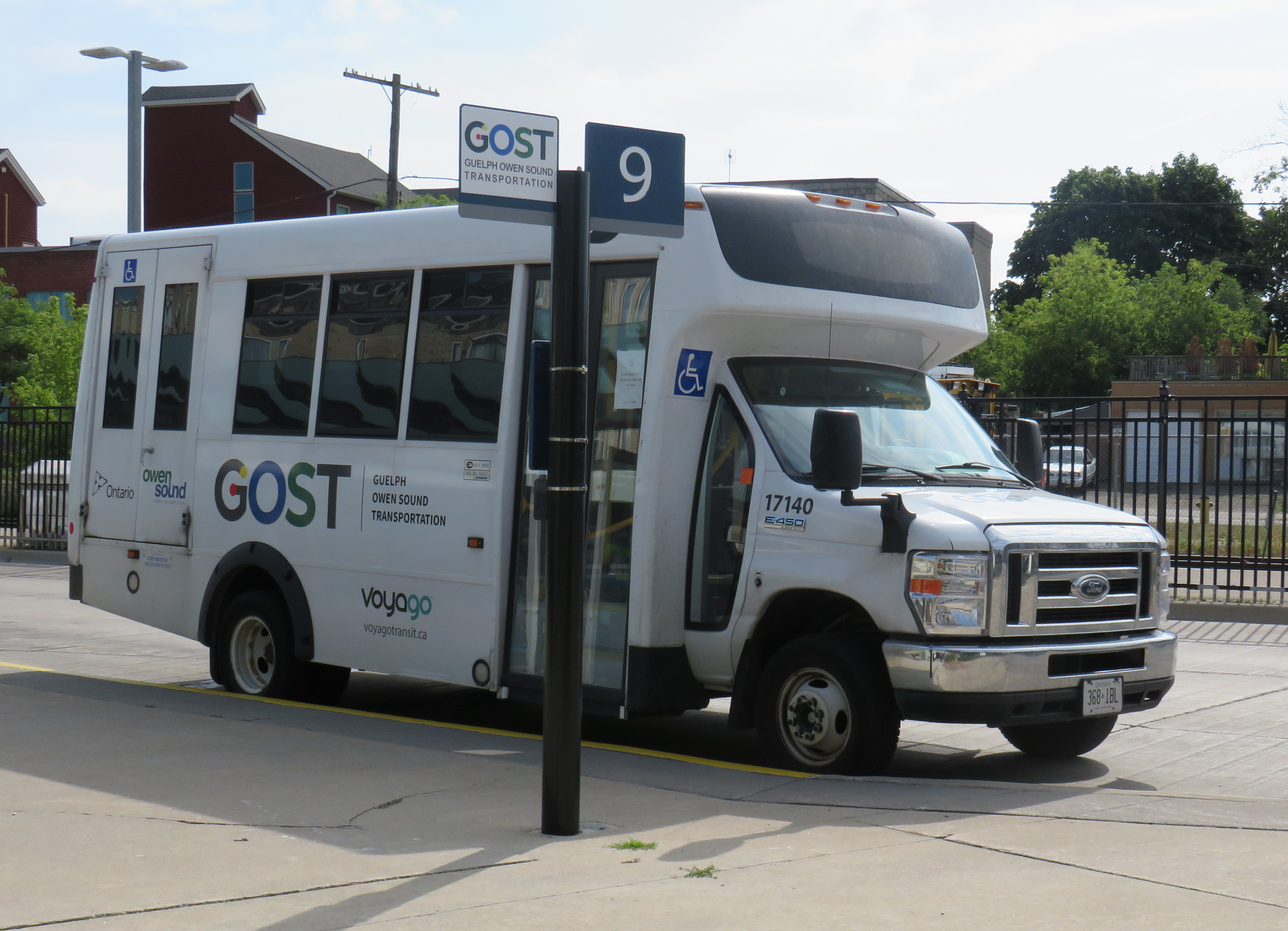
At Downtown Guelph, I had just under 20 minutes to use a washroom and have a quick coffee before switching to the GOST minibus. GOST serves the Guelph Central Station bus terminal, with easy connections to GO buses and trains and most Guelph Transit services.
A GOST minibus waiting for departure at Guelph Central Station
The GOST minibus service operates two round trips, seven days a week, between Guelph and Owen Sound, with stops in Elora, Fergus, Arthur, Mount Forest, Durham, Williamsford, and Chatsworth. Except for Fergus, all stops are located in or near each town’s commercial centre. The service is funded by Owen Sound and a provincial grant, and operated by London-based Voyago (which operates several other rural services in Western Ontario).
Until the mid 2000s, Greyhound ran buses six days a week between Toronto and Owen Sound via Highway 10 through Brampton and Orangeville or via Highway 6 through Guelph and Mount Forest, each route on alternating days. Gray Coach, the TTC-owned predecessor to Greyhound, ran several daily trips. The twice-daily GOST bus is a significant improvement over Greyhound’s schedule in its waning years.
On this Thursday midday northbound trip, there were two passengers going all the way up to Owen Sound, one getting off in Elora, one disembarking at Mount Forest, and one passenger who boarded at Williamsford for Owen Sound. The fare from Guelph to Owen Sound is $20 cash, with cheaper fares to ride shorter distances.
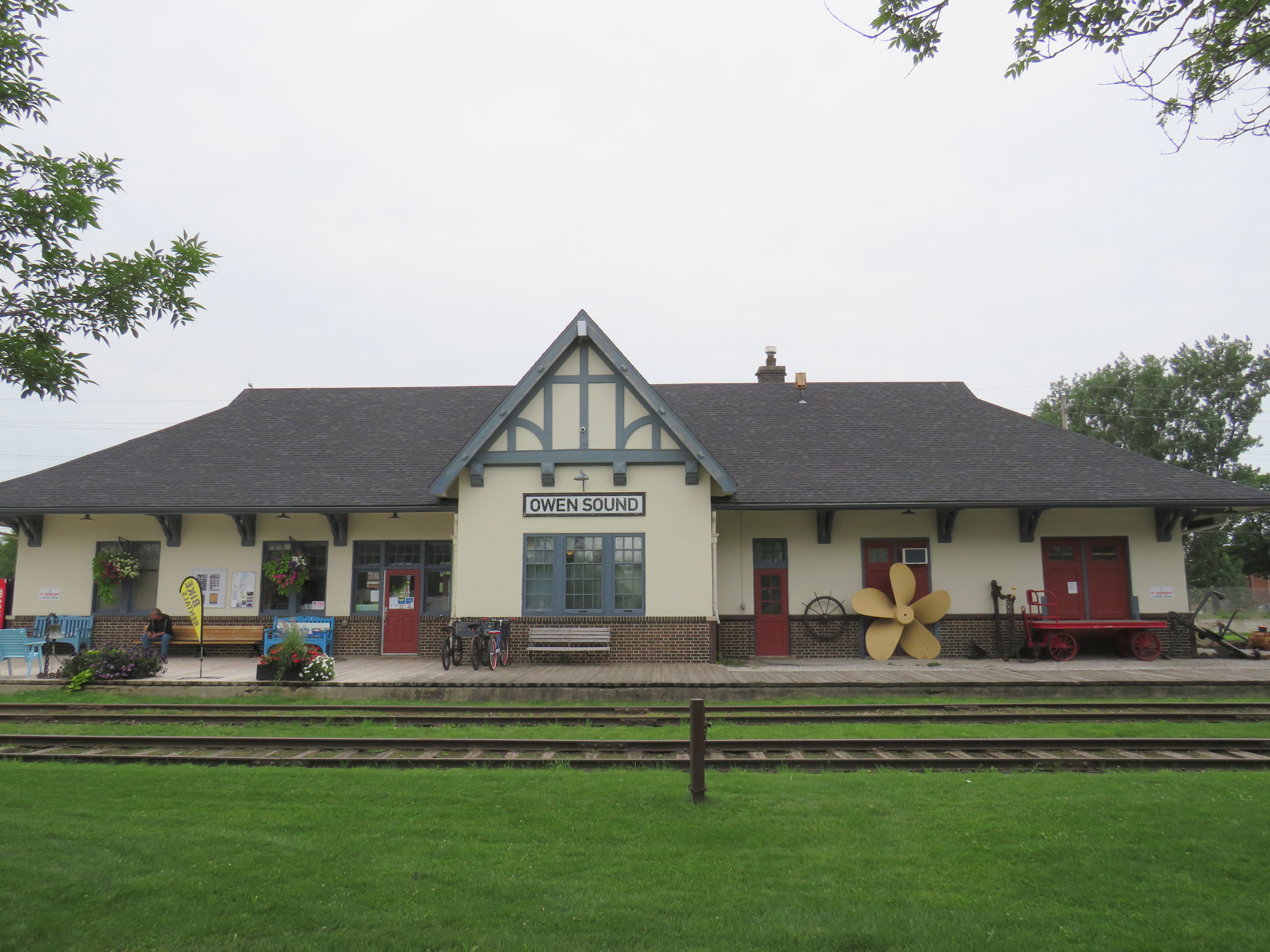
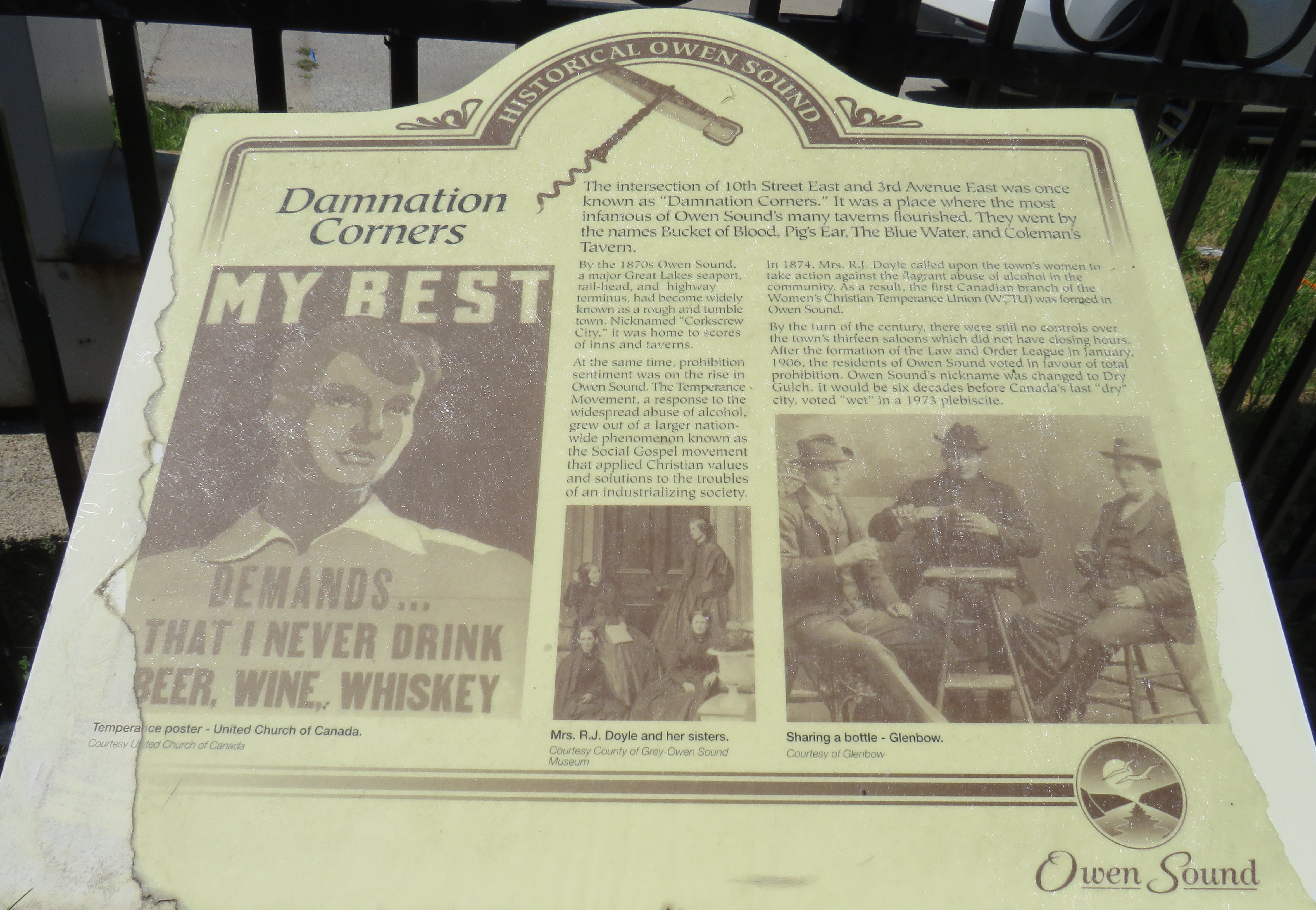
I arrived in Owen Sound a few minutes before 1:00 PM, with several hours to spend before my next ride to Meaford. Owen Sound, population 26,000, has an interesting history as a Great Lakes port and railhead for both the Canadian Pacific and Grand Trunk/Canadian National Railways. The maritime traffic and local industry gave Owen Sound a reputation as a hard drinking town; it became one of the first municipalities in Ontario to go “dry” in 1906. It remained that way until 1973.
With the construction of the St. Lawrence Seaway and the decline of branch lines across Ontario, the city declined as a port and both railways were torn up in the late 1990s. However, both stations remain standing – the Grand Trunk Station on the west side of the harbour is now a local museum, while the modernist CP station, built after the Second World War, is now a brewpub.
With a lovely downtown, harbour, parks, and heritage neighbourhoods to wander through, Owen Sound was worth a three-and-a-half stopover.
Owen Sound Marine and Rail Museum, the former Grand Trunk/CN StationMudtown Station, the old CP Station in Owen SoundPlaque commemorating “Damnation Corners” where taverns once stood on all four corners. One block to the east was “Salvation Corners” where four Protestant churches still stand.
I decided to stay in Meaford overnight. Though I could get as far east as Wasaga Beach via Grey Transit Route, Colltrans, and Simcoe County Linx, I would not have been able to continue my trip back to Toronto that night, missing the last Linx bus from Wasaga Beach to Barrie by one hour.
Meaford had cheaper accommodations than Owen Sound or Collingwood, and by staying there overnight, it gave me plenty of time in Meaford and Collingwood the next day. Before Greyhound Canada suspended operations in April 2020, there was one daily bus between Toronto, Barrie, Collingwood, and Owen Sound. PMCL, which Greyhound purchased in the 1990s, used to run several buses a day on that route.
I departed Owen Sound on a pre-booked GTR minibus at 4:30 PM, which cost $5 for the trip into Meaford. As I was the only one on that departure, the driver was kind enough to drop me off right by my motel. There are six daily trips between Owen Sound and Meaford, with four of those trips offering a timed connection or direct run to Blue Mountain Resort, GTR’s eastern terminus.
GTR minibus at Owen Sound Terminal (October 2020)
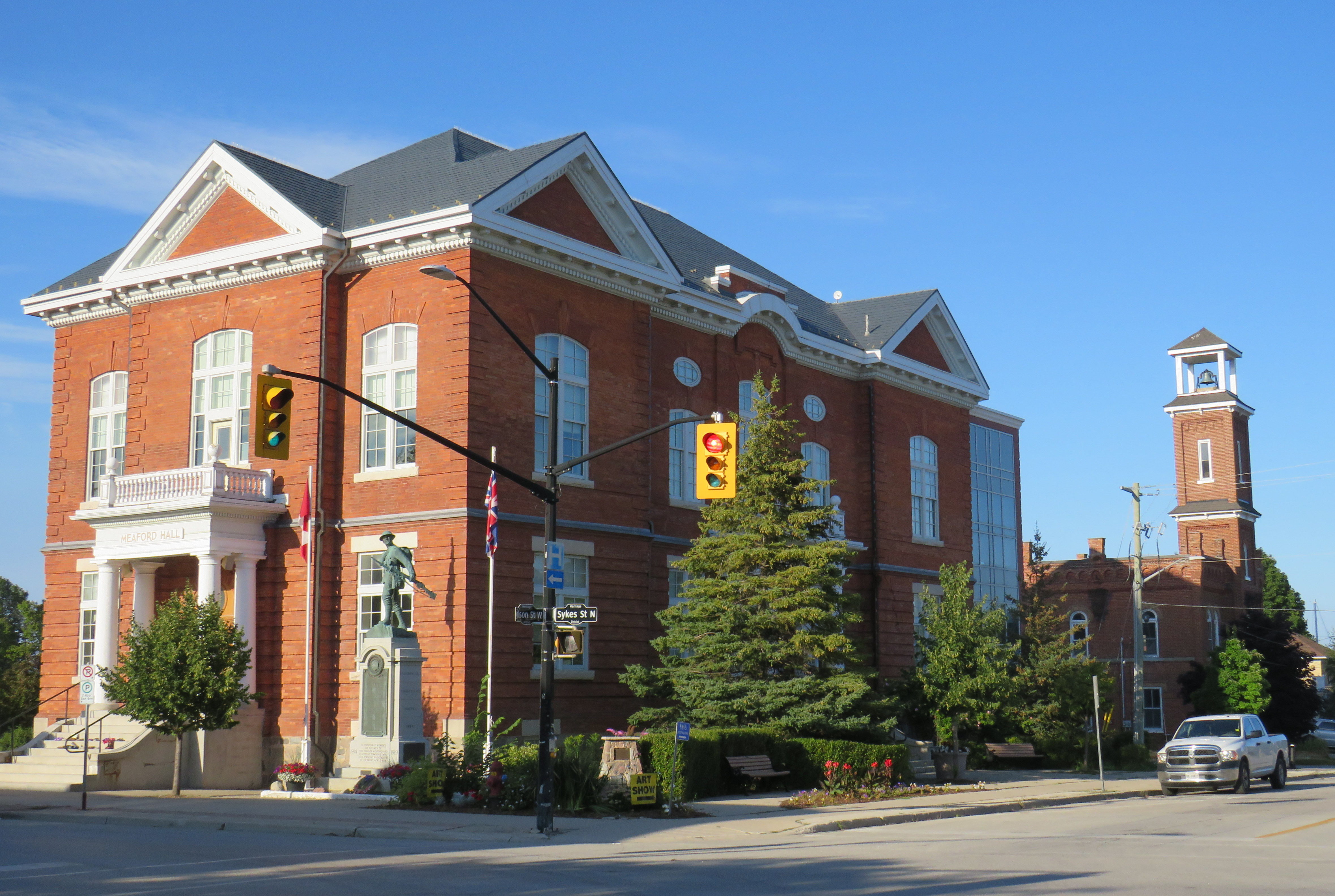
Meaford itself is a charming little town, with several good restaurants, and a lovely harbour. Meaford is the western terminus of the Georgian Trail to Collingwood, one of Ontario’s first rail trails. As GTR minivans and Simcoe Linx and Colltrans buses all have bike racks, Meaford would make for a nice cycling trip.
Meaford Hall, with the old fire station behindTerminus of the Georgian Trail, which continues to Collingwood, with connections beyond
Friday: Meaford to Collingwood and Toronto
The next morning, I departed Meaford on GTR Route 4 at 8:46AM, and arrived at Blue Mountain Village just after 9:30, another $5 pre-booked trip. The popular resort is also served by Colltrans’ Blue Mountain Link route to Downtown Collingwood, with connections to local buses and the Simcoe County Linx Route 4 to Wasaga Beach.
Approaching Blue Mountain, the driver helpfully asked me if I needed to catch the bus to Collingwood. Though the timetables between GTR Route 4 and Colltrans’ bus don’t permit an easy connection, if I got off at Craigleith, at the bottom of the escarpment, I would be sure to get the onward bus. I declined the offer, because I was curious to see Blue Mountain Village itself, and I needed a coffee.
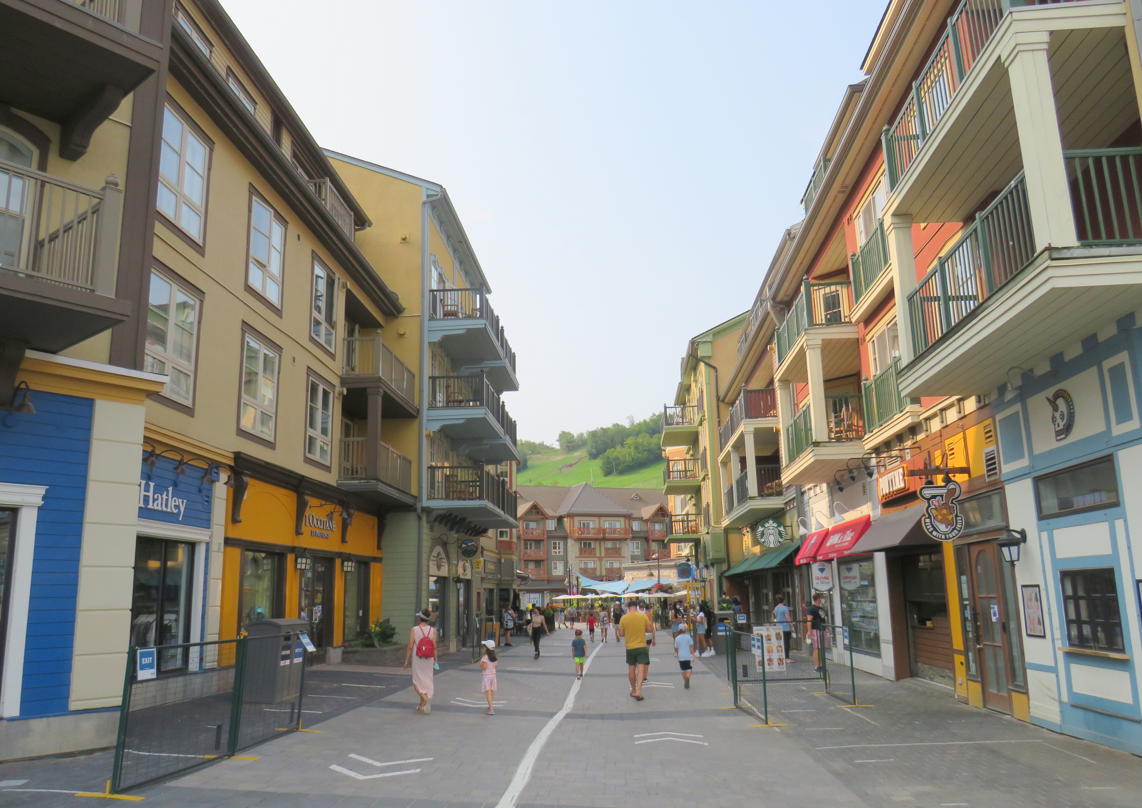
The Disneyland-like urbanity of Blue Mountain Village
Blue Mountain Village, the heart of the sprawling Blue Mountain resort, contains many shops, restaurants and bars, along with three hotels and timeshare apartment complexes with the architecture and walkways meant to invoke a European ski resort. Cars are not permitted in the internal streets, which gives it a somewhat surreal atmosphere. In the summer, tourists and vacationers are attracted by several golf courses, downhill mountain biking trails, rope courses, spas, nearby beaches, and, of course, the shops.
Having gotten my coffee and my morning walk, I paid my $2 fare and got on the 10:20 bus to Downtown Collingwood.
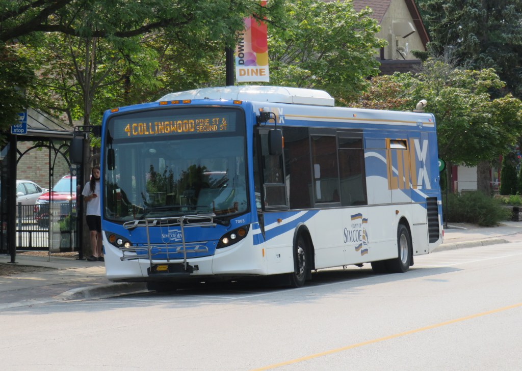
Colltrans and Simcoe County Linx buses at Downtown Collingwood
Like Owen Sound, Collingwood has a lovely and vibrant downtown core, with its own proud marine and railway history. Collingwood was the terminus of the Ontario Simcoe & Huron Railway, the province’s first rail connection, built in 1853-1854. The OS&H was built as a shortcut between the Upper Great Lakes and Toronto and prospered before merging with several other railways to become part of the massive Grand Trunk system. Sadly, passenger service to Collingwood ended in 1960, and the railway itself is abandoned and partially removed.
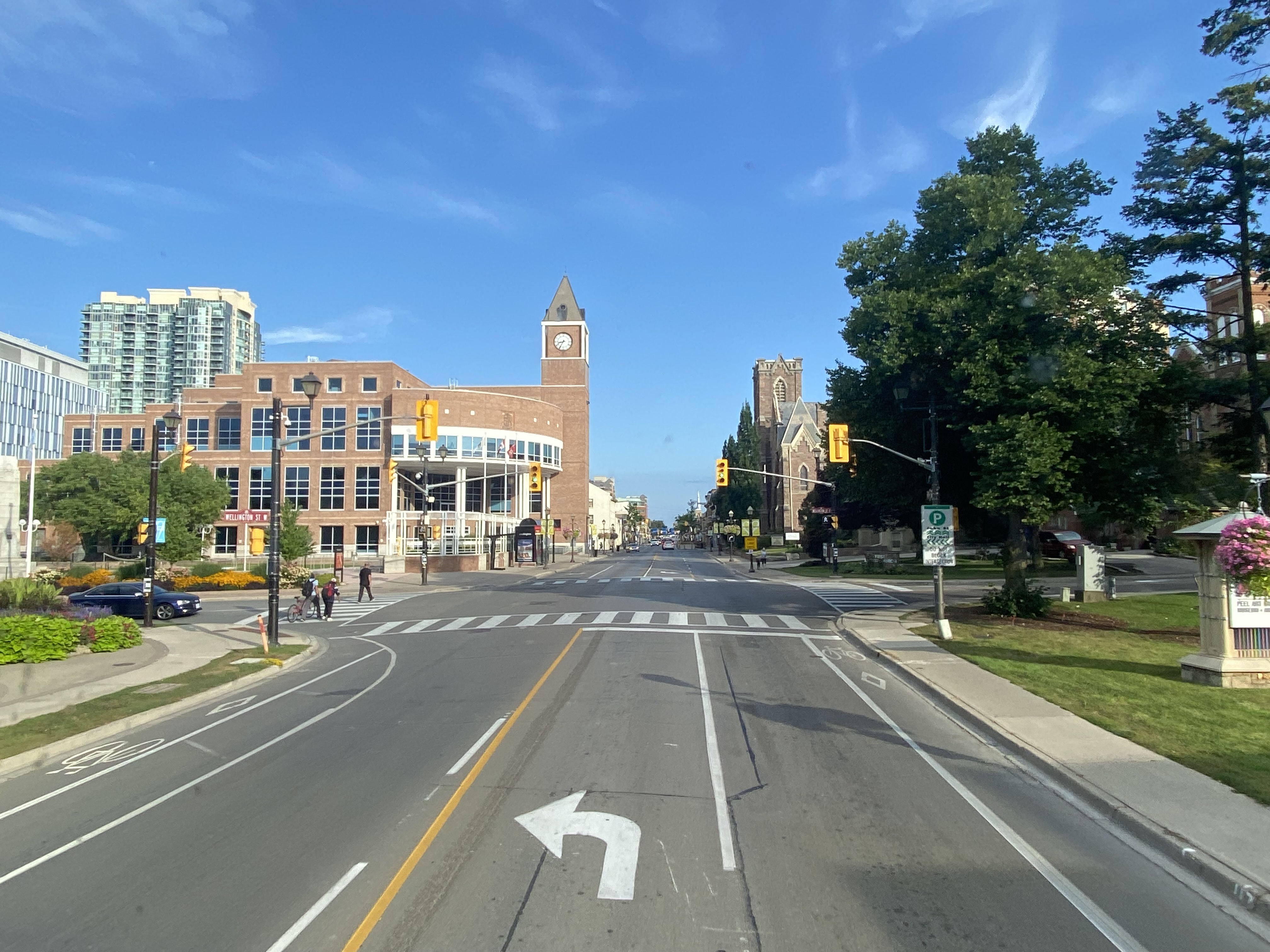
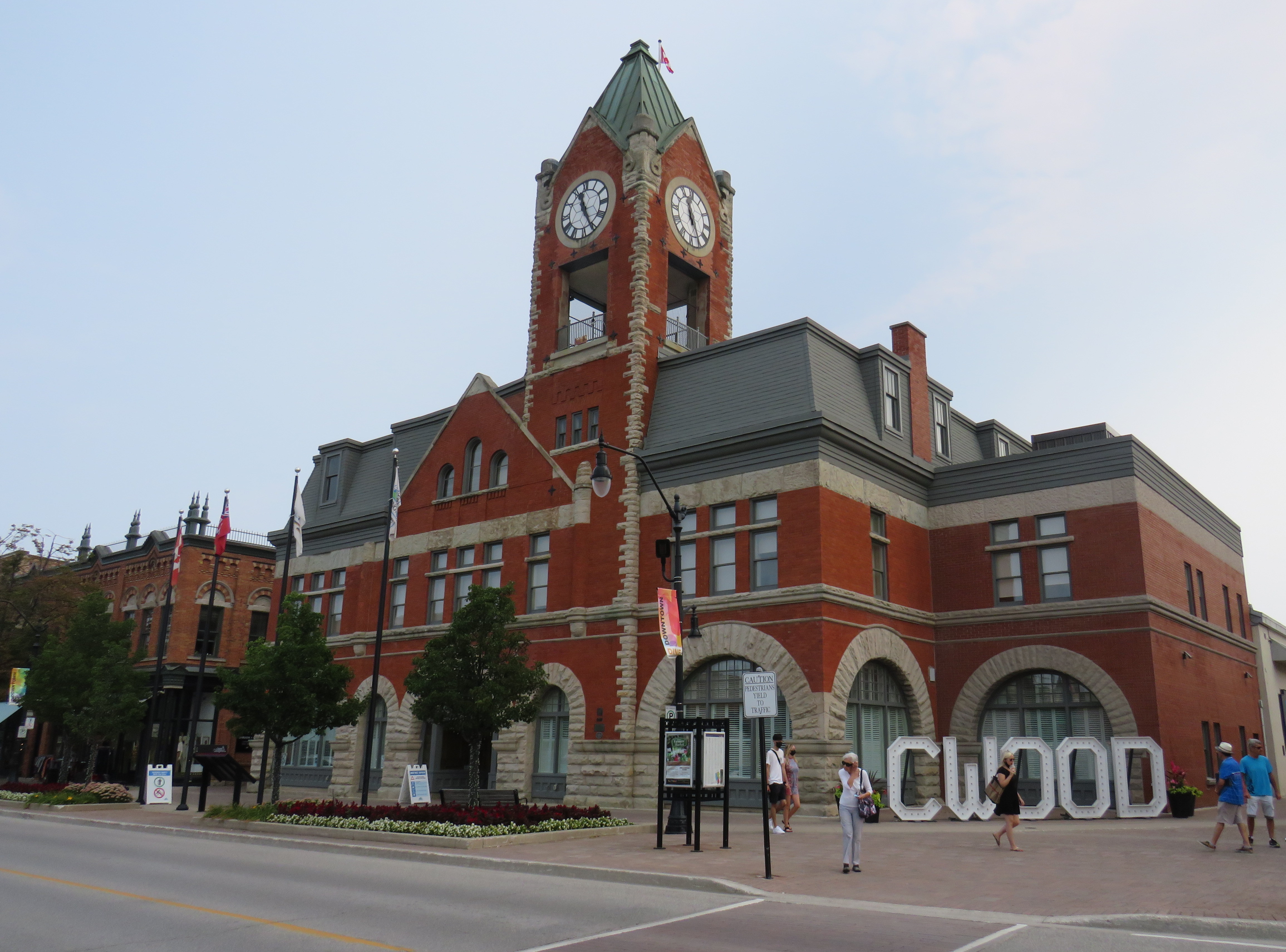
Collingwood Town Hall
After a hearty lunch in Downtown Collingwood and walk through the area, I paid another toonie and boarded Simcoe Linx Route 4 to Wasaga Beach.
In the back parking lot of a Loblaws Superstore in the west end of Wasaga Beach, two Simcoe County Linx buses, a Wasaga Beach Transit bus, and a Clearview Transit minibus meet to exchange passengers. The grocery store is distant from the main tourist area and the downtown commercial centre, but at least transfers between buses are easy. The Wasaga Beach Transit bus does pass by most motels, tourist traps, and beach areas. I changed to another Simcoe County Linx bus (Route 2) that passes through Stayner and Angus for Allandale Waterfront GO Station south of Downtown Barrie. The fare between Wasaga Beach and Allandale was $6.00 cash.
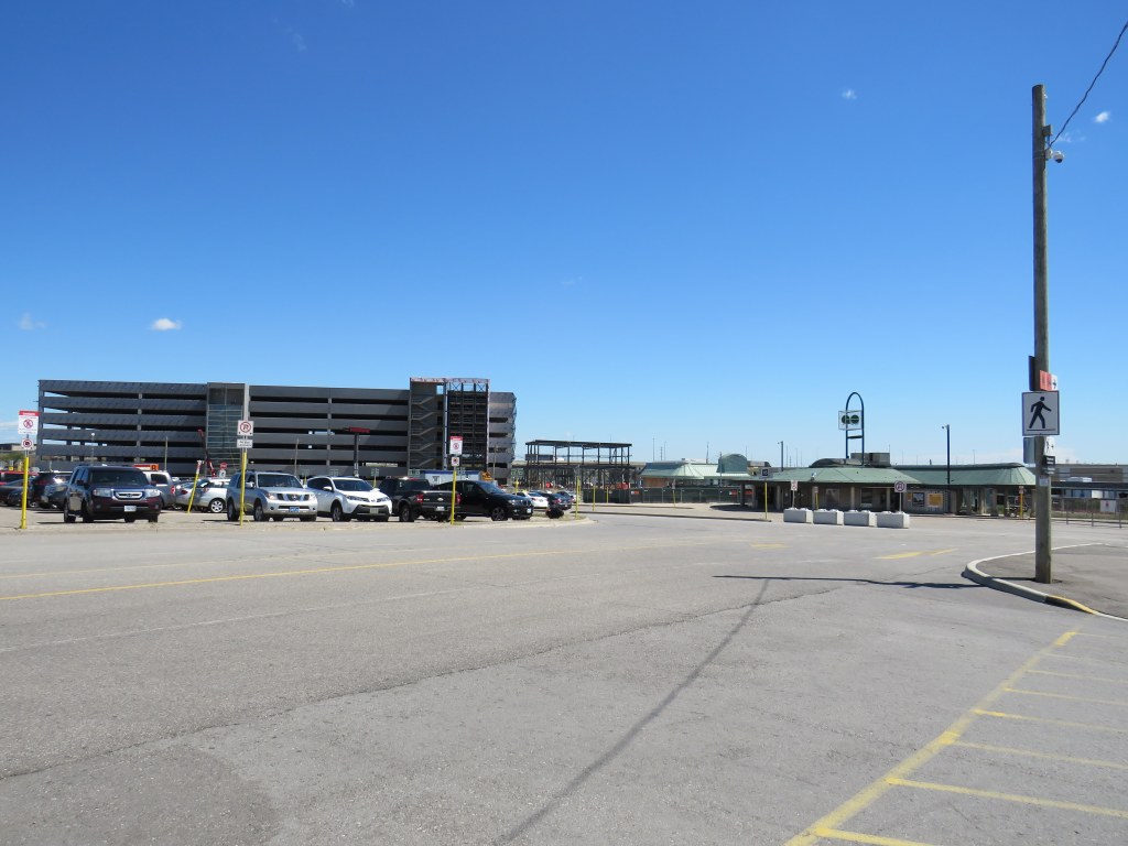
At a grocery store parking lot, Simcoe County Linx, Wasaga Beach Transit, and Clearview Township buses meetArrival at Allandale Waterfront GO Station
Allandale Waterfront GO Station, which hosts GO trains and buses and several Barrie Transit routes, is one of two Barrie terminal points for Simcoe County Linx’s buses. Buses to Orillia and Midland terminate at Georgian College and Royal Victoria Hospital in the northeastern corner of Barrie, with a Barrie Transit fare and a 30-minute local bus ride to get from one Linx route to another.
Kempenfelt Bay, Barrie
The ride back to Union Station, which included a bus to Aurora GO and a change to a train the rest of the way. That final trip cost me $13.76 on my Presto card.
In total, I paid $39.06 on Thursday and $28.76 on Friday to complete the round trip between Toronto and Georgian Bay.
Analysis and Conclusions
It is good to see Owen Sound, Grey County, and Simcoe County develop local solutions to replace and improve upon vanished coach services that ran on Highways 6, 10, and 26, better schedules and improved connections will only make their services better.
With limited schedules, particularly on Grey Transit Route and Simcoe County Linx, I could only do this exact trip by leaving Toronto on a Wednesday or Thursday. GTR’s Routes 3 and 4 between Owen Sound, Meaford, and Blue Mountain operates Wednesdays through Sundays. Though transit between Blue Mountain Village and Wasaga Beach runs 7 days a week, the Simcoe Linx bus between Wasaga Beach and Barrie only runs weekdays, with the last buses leaving Allandale GO and Wasaga Beach Superstore at 6:30 PM.
Later service hours and weekend service between Barrie and Wasaga Beach would allow GTHA residents to get to one of the Great Lakes’ great beaches without a car for a weekend getaway, without more congestion on Highways 400 and 26.
In addition, it would be good to see Simcoe County and municipal systems in Collingwood, Wasaga Beach, Barrie, Orillia, and Midland/Penetanguishene develop a coordinated fare structure, as transfers or fare discounts are not provided between each service, except between Linx and Midland/Penetanguishene. Simcoe County Linx already has its own farecard; if that were upgraded it would at least allow frequent riders to benefit from easy fare payments and transfer discounts.
These are relatively simple changes that can further drive ridership growth and improve mobility throughout fast-growing Simcoe County as well as attract more visitors from Toronto and beyond.
The Toronto-Guelph leg of my trip was unnecessarily slow, and will continue to be so until all-day, two way GO service is introduced on the entire Kitchener Corridor, or if express buses are added to the schedule. While all-day GO train service will take several years with several construction projects underway or necessary in Toronto, Brampton, and Guelph to provide the necessary capacity, improved bus service can provide a stopgap for the time being.
Without an express GO bus or competing services such as Greyhound (which used to operate multiple buses between Guelph and Toronto) or a morning VIA Rail train, it can take nearly three hours to get from Toronto to Guelph without a car.
Though GO Transit will introduce significant service improvements starting Labour Day, including new peak-direction express trains on the Kitchener Corridor. Unfortunately, there are no travel time improvements for getting between Toronto and Guelph weekday mornings. Given that there is currently no alternative access between the two cities, there’s a market that GO Transit is clearly missing right now.
The inhospitable temporary bus terminal at Bramalea GO Station
On Tuesday, August 25, I paid a visit to Kitchener.
Greyhound suspended all operations in Eastern Canada on May 13, 2020 due to low ridership during the COIVD-19 pandemic. Meanwhile VIA Rail reduced its operations, including Train 85, which departed Union Station at 10:55 AM for Guelph, Kitchener, Stratford, and London. Therefore, GO Transit became the only way to get between Toronto and Kitchener-Waterloo for a day trip without a car.
From boarding the 11:53 Kitchener Line train from Union Station, it should have taken just under two hours to get to Downtown Kitchener. Instead, because of a minor train delay, and a failure of the connecting bus to hold for transferring passengers, it took me three and a half hours.
If we value transit users, passengers must not be left behind when making these transfers, especially when connecting between posted connections.
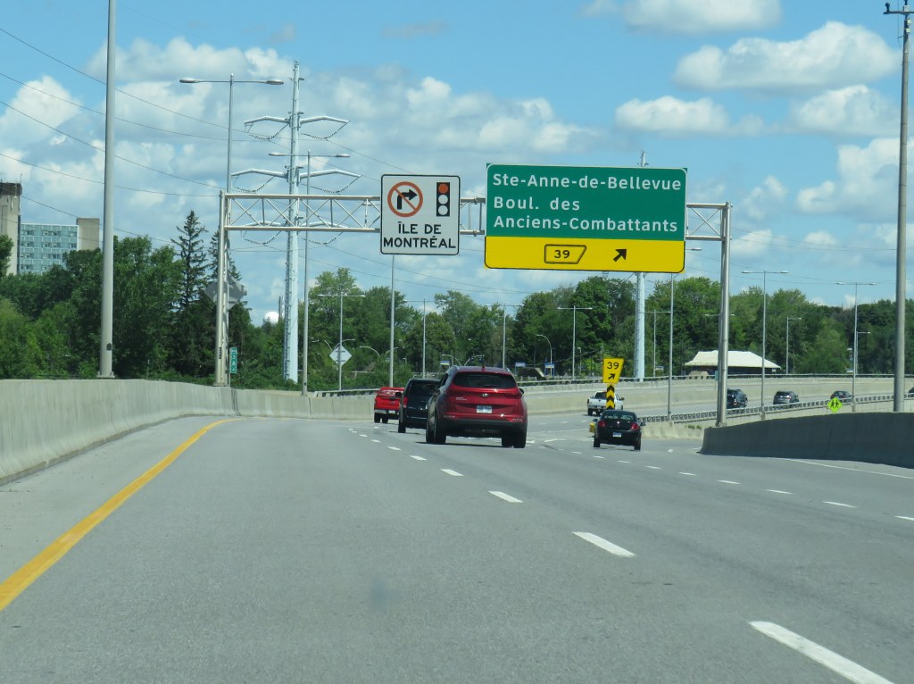
Entering Montreal on Autoroute 20, with a sign reminding motorists of the blanket ban on right turns on red on Montreal Island
During the August long weekend, my spouse and I rented a car and drove to Montreal. Normally, I take the train, as it’s a long and boring drive on Highway 401, while VIA Rail offers a quiet, relaxing, and more interesting ride. But with the ongoing COVID-19 pandemic, driving seemed like a good idea. (In doing so, I finally drove the entire length of Highway 401 — I had not yet done the section between Cornwall and the Quebec border).
Despite Montreal’s infamous potholes, never-ending construction, and stereotypically aggressive motorists, I found driving around the city less stressful than in my own home city of Toronto. It may sound counter-intuitive, but a big reason for this was the city’s blanket ban on right turns on red.
Outside of North America, turning movements on red lights are generally prohibited. They were only widely introduced to the United States as part of an energy-saving measure in the 1970s, as a response to the first oil shock; a regulation was written into a 1975 federal bill that provided federal aid to states provided that they permit right turns on red lights (along with carpool programs and energy, thermal, and lighting efficiency measures), though many western US states had such laws on their books much earlier.
U.S. Energy Policy and Conservation Act, 1975, Section 362(c)

Each proposed State energy conservation plan to be eligible for
Federal assistance under this part shall include —
 (1) mandatory lighting efficiency standards for public buildings
 (except public buildings owned or leased by the United States);
 (2) programs to promote the availability and use of carpools,
 vanpools, and public transportation (except that no Federal funds
 provided under this part shall be used for subsidizing fares for
 public transportation);
 (3) mandatory standards and policies relating to energy efficiency
 to govern the procurement practices of such State and its political
 subdivisions;
 (4) mandatory thermal efficiency standards and insulation
 requirements for new and renovated buildings (except buildings owned
 or leased by the United States); and
 (5) a traffic law or regulation which, to the maximum extent
 practicable consistent with safety, permits the operator of a motor
 vehicle to turn such vehicle right at a red stop light after
 stopping.
The Province of Quebec was the last subnational holdout in North America, permitting the practice in 2003. However, the City of Montreal continued to outlaw turns on red, following New York City’s continued prohibition, while Mexico City introduced a new prohibition in 2018.
In my experience, though, I found driving less stressful when I knew I could not turn on red. I did not have to worry about a driver behind me inching forward, pressuring me to move past the stop line and into the intersection so they could turn. If I was waiting to turn right, I knew I could relax and wait for the green signal before I had to try to make the maneuver. The leading pedestrian interval common in central Montreal (which also allows through traffic — including cyclists — to go first) made pedestrians easier to see and predict as I was making my turn.
Montreal’s leading pedestrian interval signal
I might have saved a minute or two on each car trip had I been able to turn on a red light. But it did not feel like much of a difference. The reduced stress was worth it.
As a pedestrian and as a cyclist, I appreciated turn-on-red prohibitions whenever I was in a city where they are in place, as I did not have to worry about right-turning motorists not seeing me as I crossed at a street corner, or those motorists who rush red lights or refuse to stop before turning. As a driver, I appreciated it too.
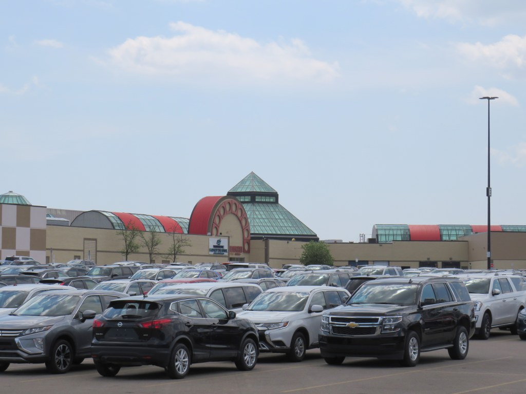
Un-plated rental cars stored in the Woodbine Centre parking lot
In a distant corner of Woodbine Centre’s parking lot, dozens of late model cars and trucks sit with their licence plates removed. These are all rental cars, left idle due to the collapse of demand during the ongoing COVID-19 pandemic. Friday, Hertz — the United States’ second-largest car rental company — filed for bankruptcy. Hertz’s brands include Dollar and Thrifty.
Woodbine Centre, a once-vibrant mall in northwest Toronto is a short drive from Toronto-Pearson International Airport, making it an ideal place to store the suddenly surplus fleets. Though in the 1980s and 1990s, Woodbine boasted cinemas, two-full line department stores, Zellers, and dozens of national chain stores, it has lost most of its cachet, with both Sears and Zellers gone, and Hudson’s Bay barely hanging on. Its parking lot was typically half-empty in recent years.
Though the demand for rental cars, especially at the airport, have dried up, many neighbourhood car rental branches remain open, offering attractive rates for daily and weekly rentals. I have taken advantage of the low prices right now (often as cheap as $25 a day on a multi-day rental) to run errands, go for short drives, conduct some field research for future articles and projects, and visit nearby provincial parks and regional forests for physically-distant nature hikes. I am also able to help family members by delivering groceries and medications. With the surplus of available cars, upgrades from the intermediate or standard car booking can be expected. (I was given a Mercedes-Benz E-class a few weeks ago, though I had booked a standard sedan.)
Though we live downtown, my partner and I prefer to shop at a Chinese grocery store in Scarborough, which is calmer, better organized, and better stocked than our local stores (flour, rice, and meat are plentiful). Having a car makes it easy to carry a large load, reducing the number of grocery trips required.
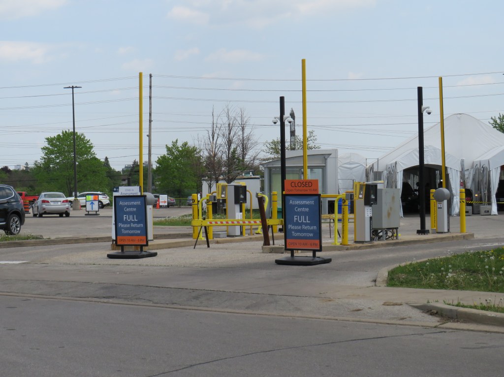
Across the street from Woodbine Centre, in another parking lot, there is another sign of the times: an overflow lot for Humber College has been transformed into a drive-through COVID-19 assessment centre. At 12:30 on Monday, May 25, the centre, which is normally open daily from 10:00 AM to 6:00 PM, was already full, and not accepting any more patients who were looking to be tested.
While Premier Doug Ford urged anyone worried about having COVID-19 or being in contact with anyone with it last Sunday, it’s not surprising to see the huge demand. While the change in eligibility is good news, it is troubling that actually getting tested may take so long.
Full COVID-19 assessment centre in North Etobicoke
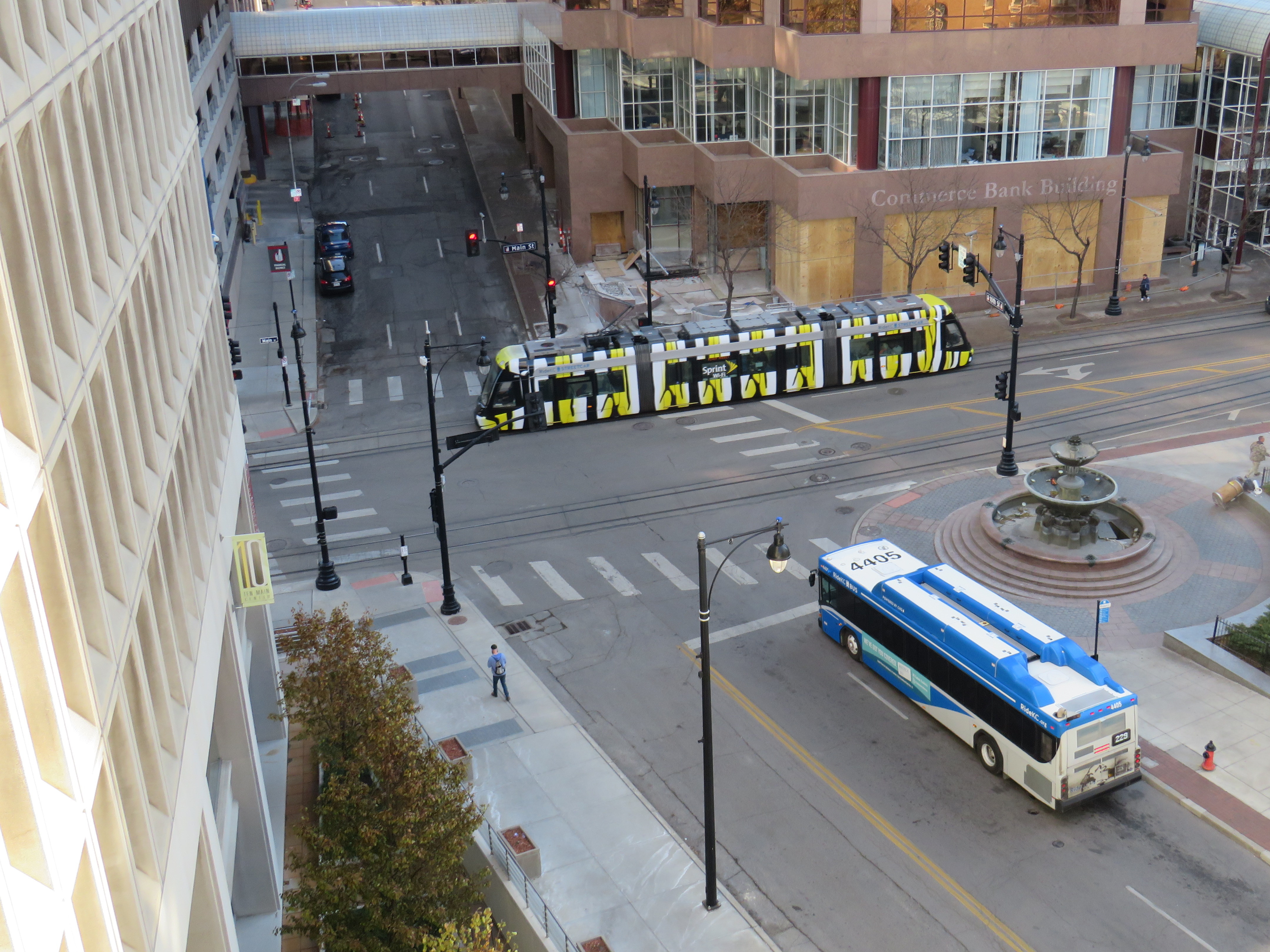
Kansas City, Missouri made news this month when its City Council voted unanimously to include a plan for free fixed-route public transit in the next city budget. Though that budget would still have to be passed in the New Year, the mayor’s support for the measure is a promising sign. Though it will cost $8 million, local politicians support the idea as it will benefit low income riders.
It is worth noting that Kansas City Area Transit Authority’s 2016 annual ridership was just over 14 million a year, while the cost recovery rate was just 12 percent. It would be much harder to offer free transit in Toronto. The TTC’s cost recovery rate is 68%, with transit fares bringing in over $1.2 billion a year. Though a two-hour transfer and free children’s fares were recently introduced, there’s little chance that the City of Toronto would agree to funding fare-free transit. In any case, Kansas City’s experiment will be interesting to watch.
Kansas City was a more interesting city than I expected; I am glad I made the impromptu trip. There are a few Toronto connections, including a streetcar that traveled the continent, a restored Union Station, and a 1920s shopping plaza whose concept was imitated 80 years later in Don Mills.
I enjoyed an evening at a jazz club at the 18th and Vine Historic District and local barbecue. Besides transit, I also got around on an electric pedal assist bike that’s part of the local bike share. It’s friendly, urban city, definitely worth a visit. (more…)
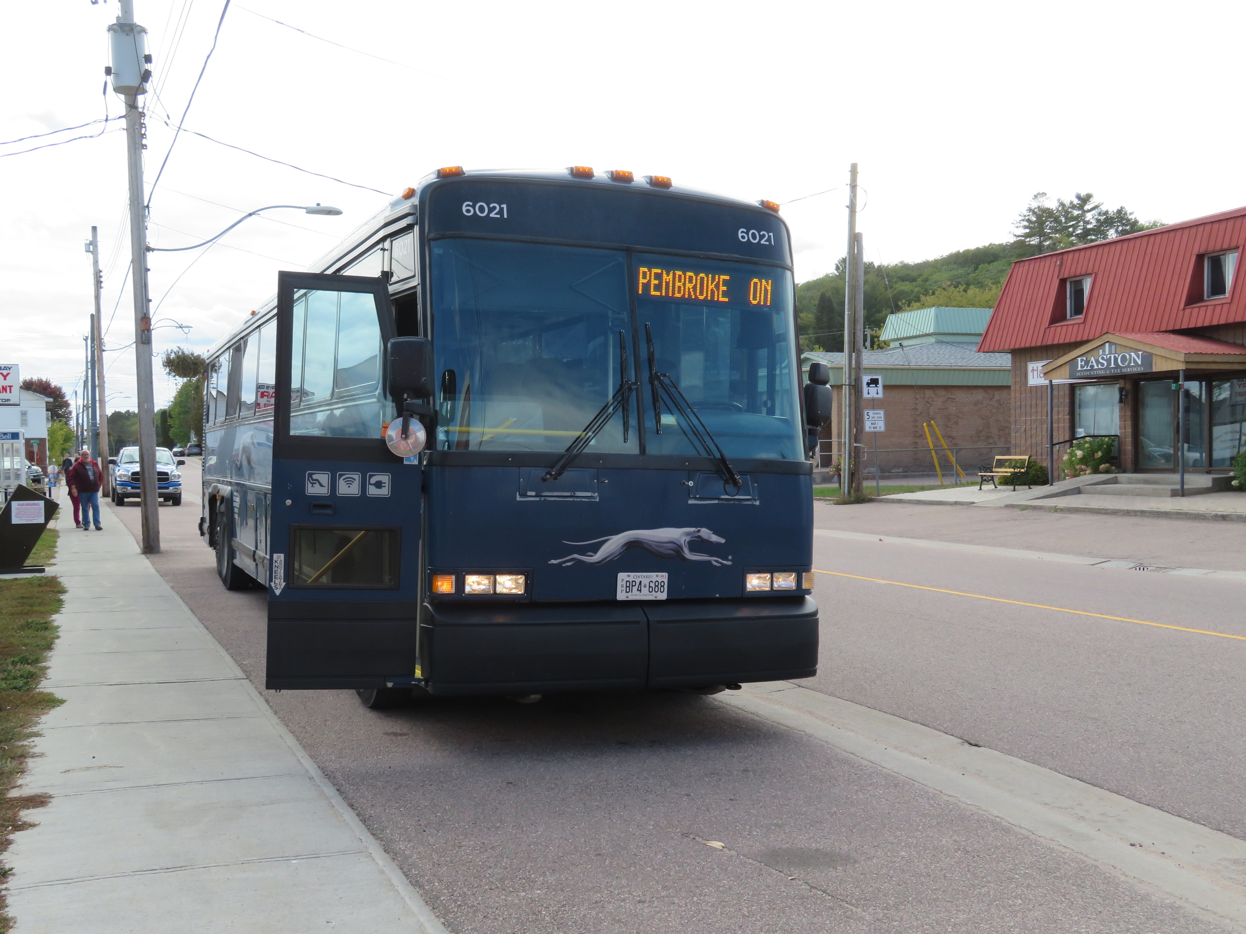
A few weeks ago, I went for another long-distance bus trip. I started my journey in Downtown Toronto, and continued on to Peterborough and Pembroke, before arriving in Ottawa late in the evening. Apart from the Toronto-Peterborough leg aboard a packed, delayed bus, this was the most pleasant of all my long-distance bus trips.
Greyhound’s Peterborough-Pembroke route only operates a few days a week, on Friday, Saturday, and Sunday. It is one of the last rural bus routes operated by Greyhound Canada as most remaining routes operate on highways between large urban centres. The bus follows Highways 28, 62, and 60, stopping at small towns such as Bancroft, Maynooth and Barry’s Bay. North of Lakefield, the route passes through the Canadian Shield, with its lakes, rocks, and trees.
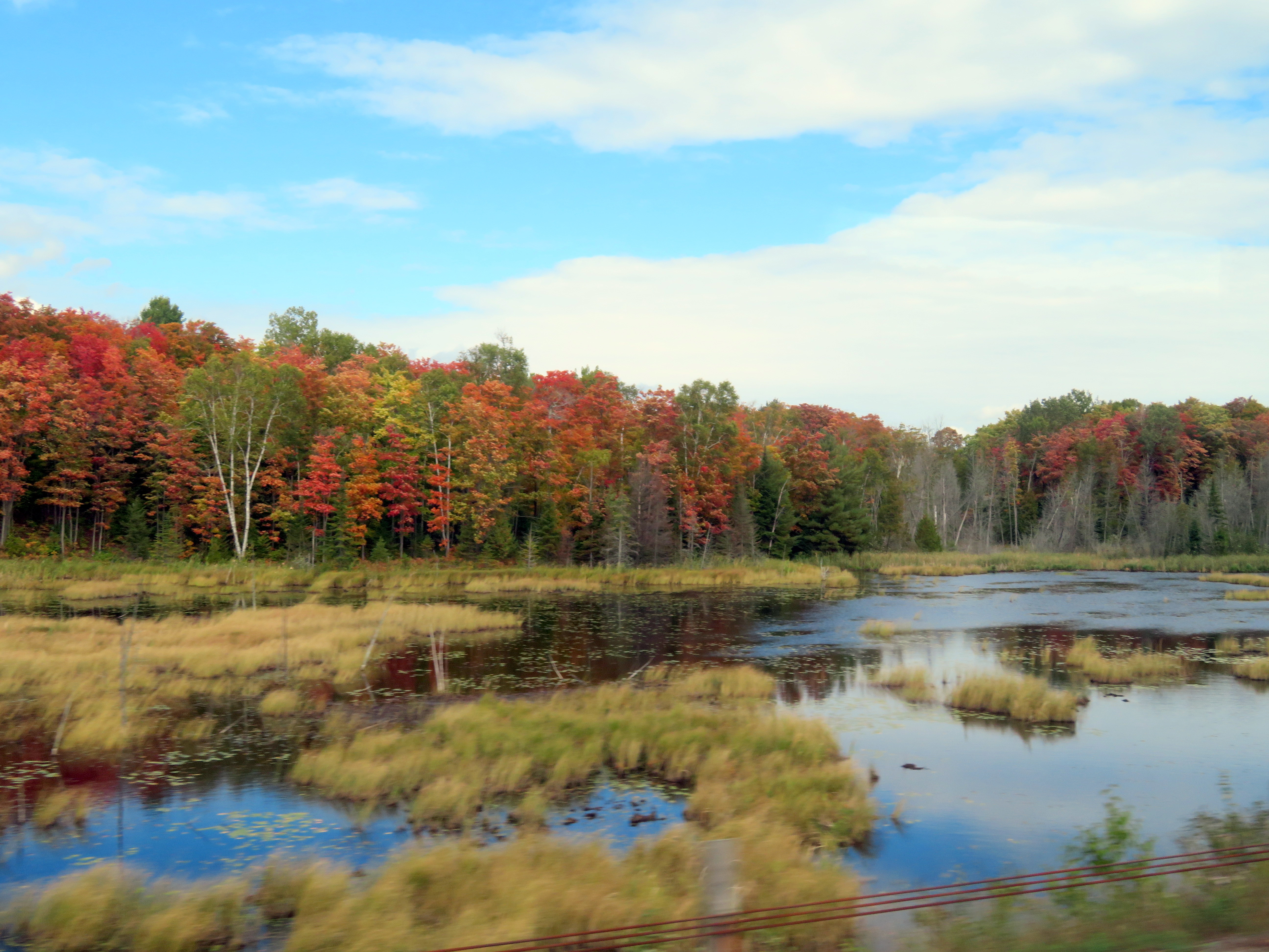
As I traveled on last Friday in September, the fall colours were almost at their peak in the Haliburton Highlands, making this an especially scenic ride. There was an informal fifteen-minute stop in Barry’s Bay, enough time to get a decent coffee and a snack.
The view from Highway 28 near Bancroft, September 27
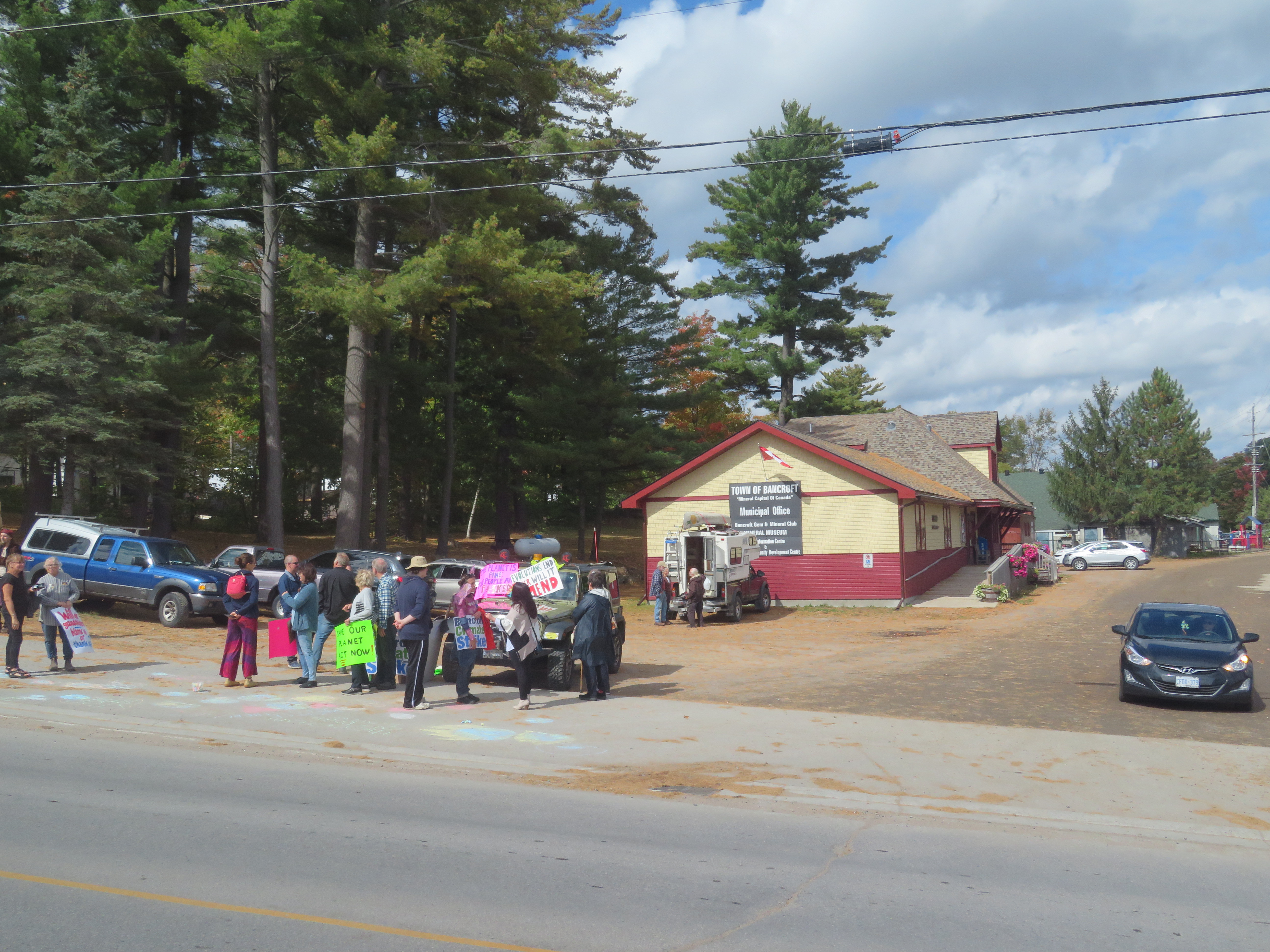
At Bancroft, we passed by the old Central Ontario Railway Station. Passenger service ended in the 1950s, while the tracks were torn up in the 1980s. The station was preserved and is now a local museum. In front, a dozen citizens took part in a local climate strike that took place across Canada, part of the Global Week for Future. It was nice to see residents take part, even in small town Ontario.
Climate strikers in Bancroft. The former railway station stands behind
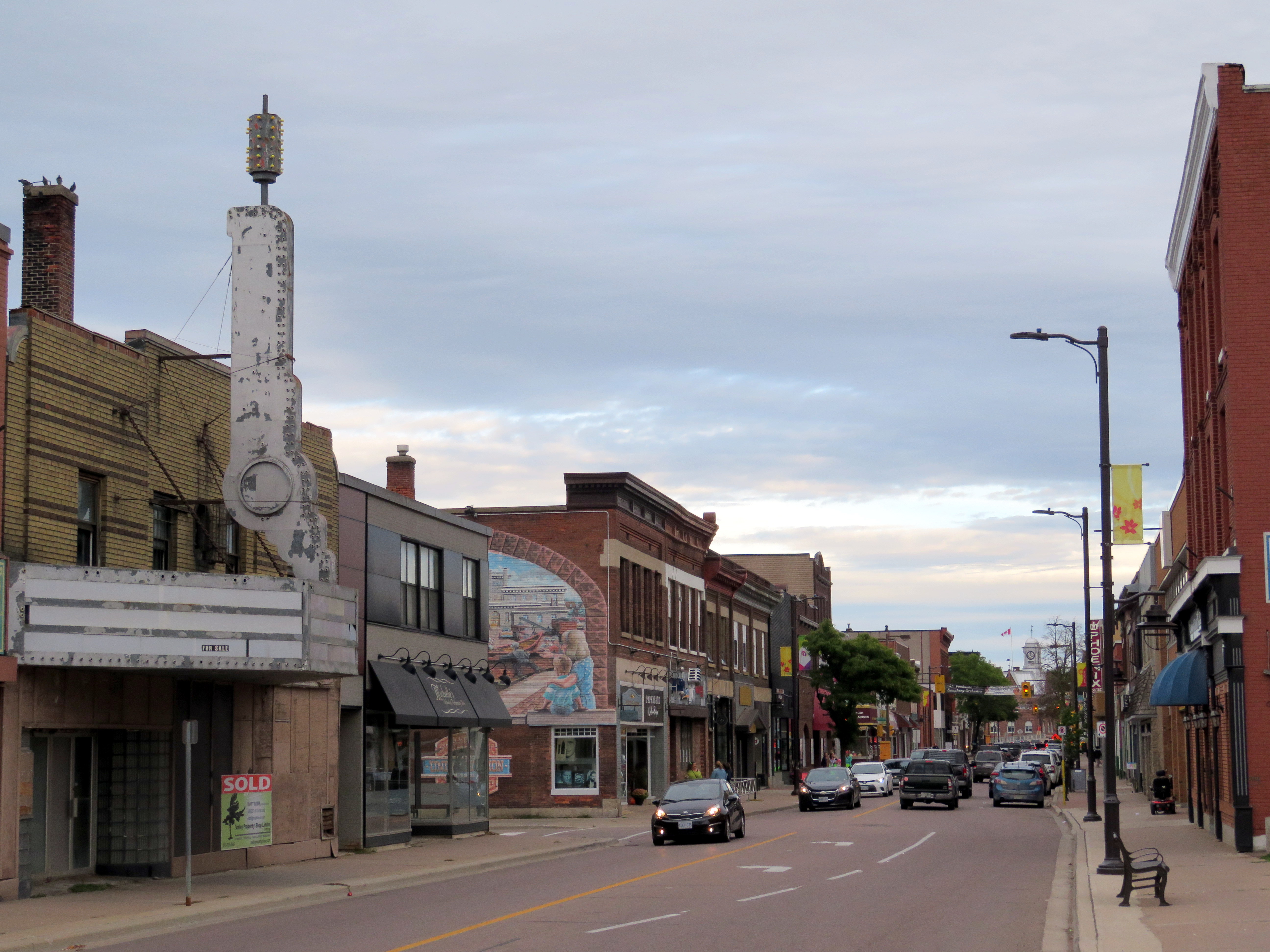
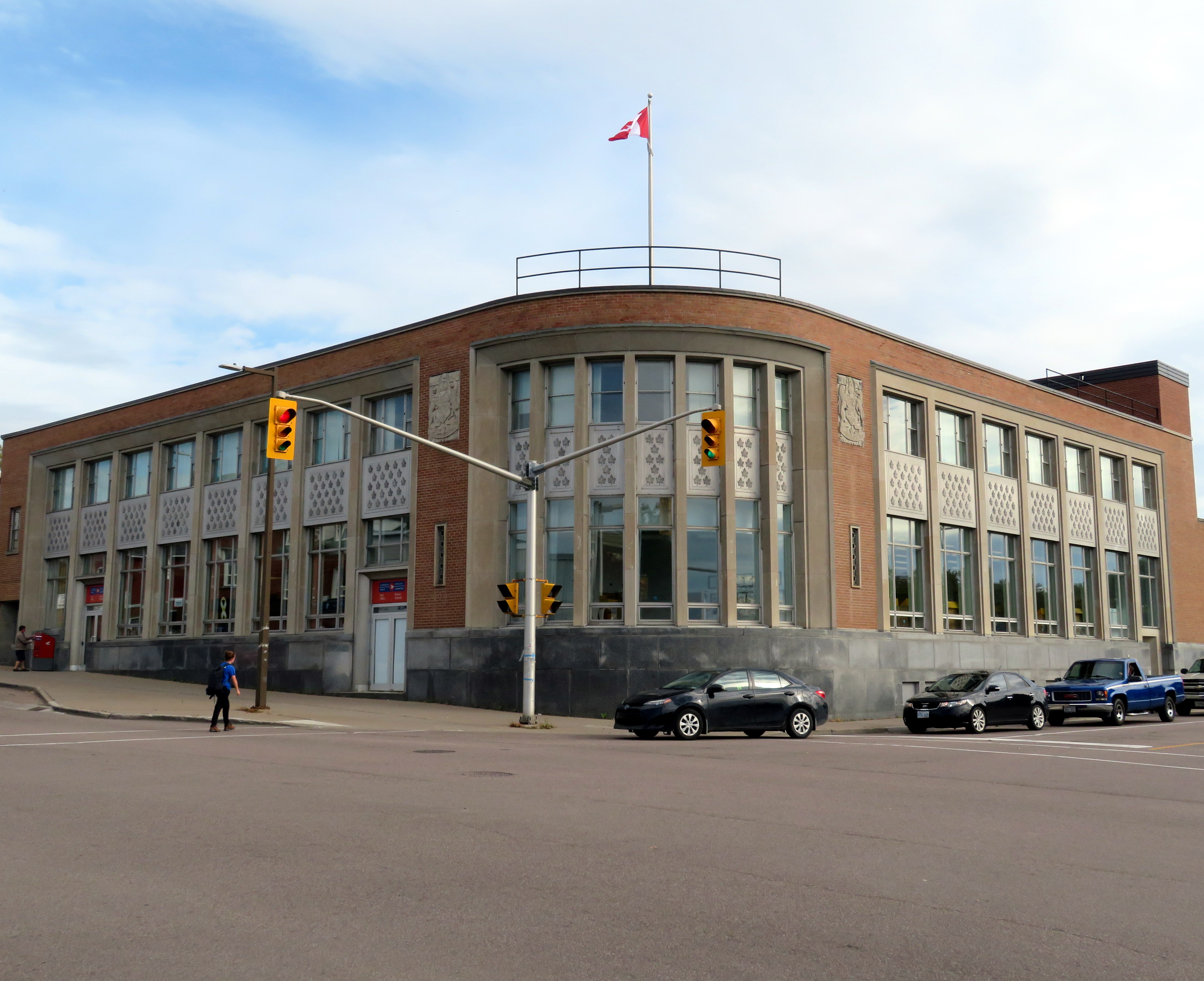
At Pembroke, I had several hours before the Ontario Northland bus departed for Ottawa. While Pembroke’s downtown core could use some TLC, it has great bones and a great collection of heritage buildings, including a late Victorian post office, its late Art Moderne replacement, the historic Renfrew County courthouse, solid commercial blocks, and a fascinating library.
Downtown Pembroke
Pembroke’s post offices. The 1888 building, designed by Thomas Fuller, is now City Hall. The 1950s replacement, on the left, still houses Canada Post.
Pembroke’s public library is especially unique, as it looks like it could have been designed by Frank Lloyd Wright. Built in 1914, it was designed by Francis Conroy Sullivan, a Canadian-born architect who studied under Wright in Chicago before establishing his firm in Ottawa. Expansions and renovations have remained faithful to the Prairie Style architecture.
Entrance to the Pembroke Public Library
Library interior
Though Pembroke was served by three different railways — the Canadian Pacific transcontinental mainline, a branch of the Canada Atlantic that operated between Montreal and Parry Sound, and the Canadian Northern — all tracks were removed by 2013, when Canadian National ripped up the Beachburg Subdivision. None of the station buildings survive, but the abandoned rights-of-way are still intact. At the west end of town, a long trestle now carries a snowmobile trail where the CN mainline once crossed the Indian River.
Former CN trestle, Pembroke
The removal of the CN and CP routes through the Ottawa Valley were especially unfortunate, as all through freight and passenger traffic across Canada must now pass through Greater Toronto. This was the result of cost-cutting and the loss of local rail customers, such as lumber and pulp industries. The Commonwealth Plywood plant in Pembroke still stands as a reminder of the industrial past of the Upper Ottawa Valley.
Abandoned Commonwealth Plywood plant
The last passenger train, VIA’s Canadian, called at Pembroke in 1990. But there are two daily bus trips in each direction between Ottawa and North Bay/Sudbury, one operated by Greyhound, the other by Ontario Northland. From Pembroke, I was able to take a Northland bus that left at 9:00 PM, arriving in Ottawa by 11:00 PM. This gave me plenty of time for dinner after a long walk around town.
My trip to Pembroke made for a pleasant detour, giving me a chance to see another part of Ontario.
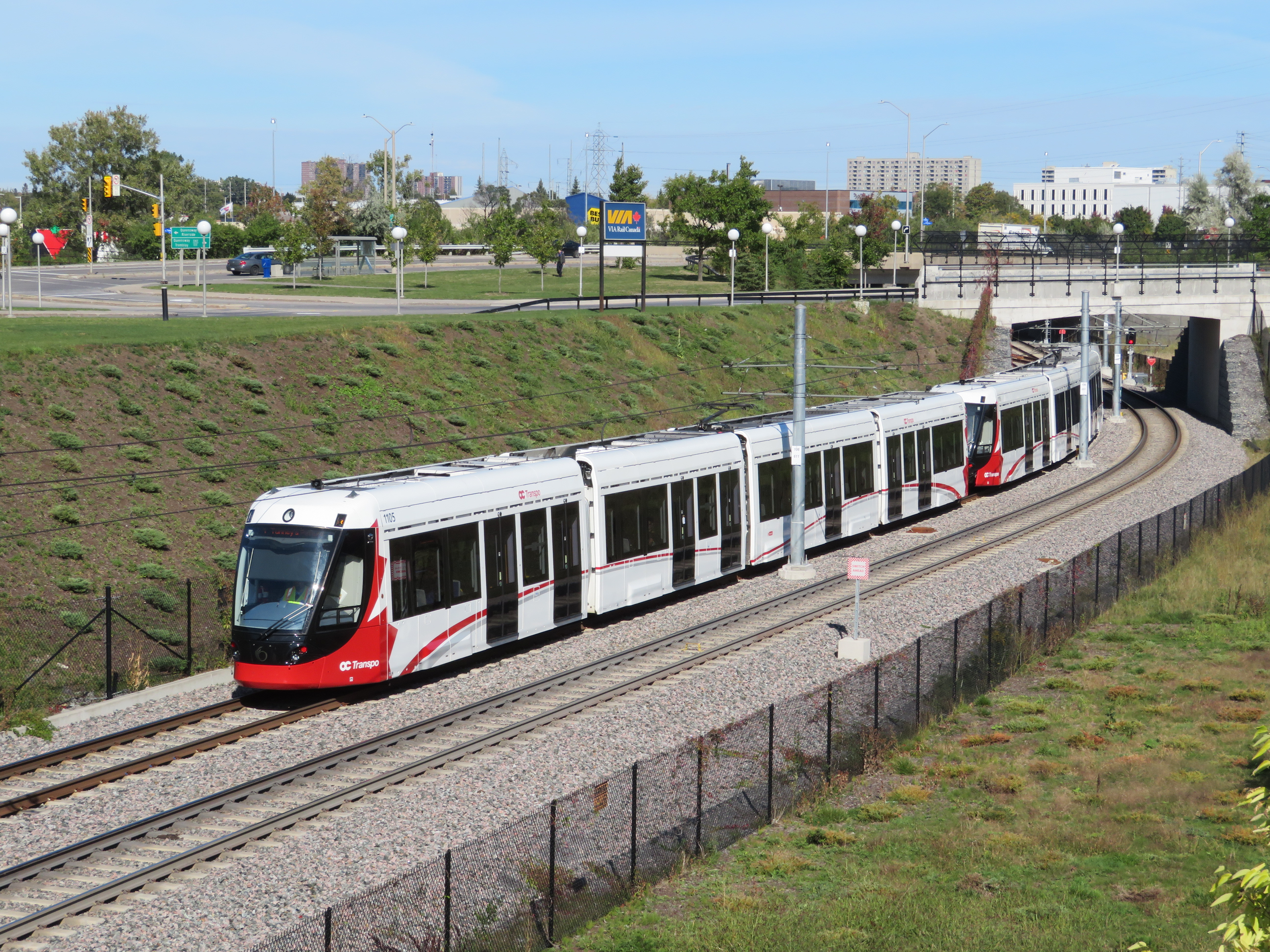
Confederation Line train approaching Tremblay Station
Last weekend, I visited Ottawa to check out the new Confederation Line LRT. Canada’s newest rapid transit line, delayed by two years, finally opened on Saturday, September 14. It is the second LRT to open in Ontario this year; Waterloo Region’s ION service opened in June.
The new 13-station Confederation Line includes a 2.5-kilometre tunnel under Downtown Ottawa, with three stations deep underground. Phase 2 will add 15 more stations to the Confederation Line. I was impressed with the speed, accessibility, and capacity of the new LRT, though I noticed a few flaws, some of which hopefully will be corrected.
The Confederation Line is not the Ottawa Region’s first rapid transit project, however. The Transitway first opened in 1983, one of the world’s first true bus rapid transit systems. Rapibus, a BRT corridor in Gatineau similar to the Transitway, opened in 2013. In 2001, the Trillium Line, a diesel light rail service, opened. It operates on a disused Canadian Pacific Railway corridor through Carleton University. Collectively, the Confederation Line (Line 1) and the Trillium Line (Line 2) are marked at the O-Train.
Trillium Line DMU train approaching Carleton University
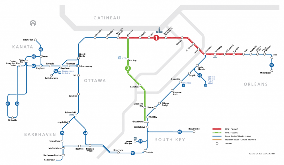
O-Train and bus rapid transit map from the OC Transpo website. The Confederation Line is marked on maps and signs as Line 1; the diesel Trillium Line as Line 2.
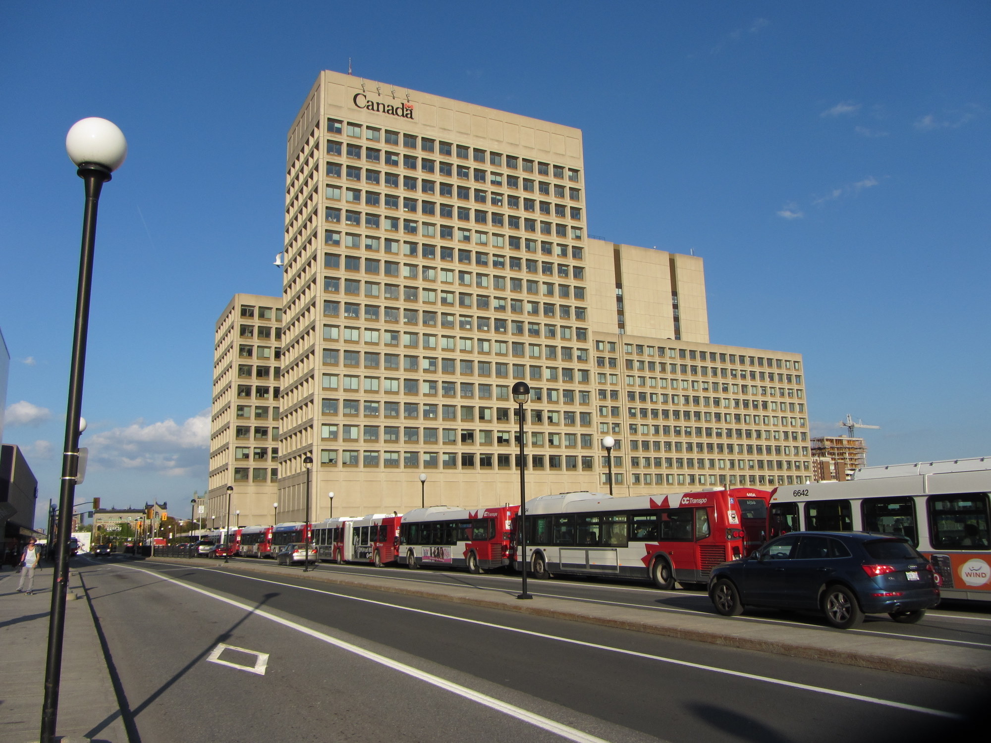
The first phase of Line 1 replaces the busiest section of the Transitway, including the congested on-street downtown section on Albert and Slater Streets. Though most sections of the Transitway are grade-separated — following the Queensway (Highway 417) on the east end and an abandoned railway corridor on the west end — the downtown section was the weak link. As OC Transpo, Ottawa’s transit agency operated dozens of suburban express routes into the Transitway during weekday peak periods, lines of buses would often stretch for blocks, an especially inefficient transit operation.
Bus congestion on the Mackenzie King Bridge in Downtown Ottawa in 2011
With most buses gone from the downtown core, the LRT allows for much more efficient operations, even if many commuters no longer enjoy a one-seat ride to work.
At several stations, including the Transitway connections at Blair, Tunney’s Pasture and Hurdman, fare-paid areas allow passengers to move between bus and train without having to tap at faregates or show fare payment to the bus operator, like many TTC subway stations. This helps to ensure the LRT is a backbone to a strong feeder bus network, rather than a stand-alone operation.
Most stations are equipped with escalators as well as multiple stairways. There were two side-by-side elevators at most points, providing the necessary redundancy to ensure full barrier-free accessibility. Access is controlled with fare gates like those in Toronto, where Presto cards, paper tickets, and transfers provide access to platform level. All O-Train stations are identified by a simple red circle at each entrance that looks similar to a Lifesaver candy.
Downtown entrance to Lyon Station, with the O-Train “Lifesaver” totem
Unfortunately, some of those rail-bus connections require a long walk outside, such as at Hurdman Station. This was probably the greatest flaw I experienced during my visit last week. Though it was tolerable on a sunny September afternoon, it would be extremely unpleasant in winter or during a rainstorm. It’s unfortunate that the bus terminal was not better thought out to minimize distances between buses and train platforms.
Bus bay E at Hurdman Station. The bus in the distance is in front of the entrance to the train platforms
A long-term challenge for the Confederation Line is the ability to direct transit-oriented development around many of the new stations. Though Hurdman Station is major transfer point with the Southeast Transitway, it is located in a floodplain next to the Rideau River. Iris and Blair Stations are located within highway interchanges. There is more potential around Pimisi Station (in the Lebreton Flats, which are already seeing new urban development), St-Laurent (where a second-tier mall could be urbanized), and possibly Cyrville. But all east-end stations are limited by the Queensway.
These bus transfer and land use concerns were also raised by Alex Bozikovic at the Globe and Mail.
Vicinity of Hurdman Station
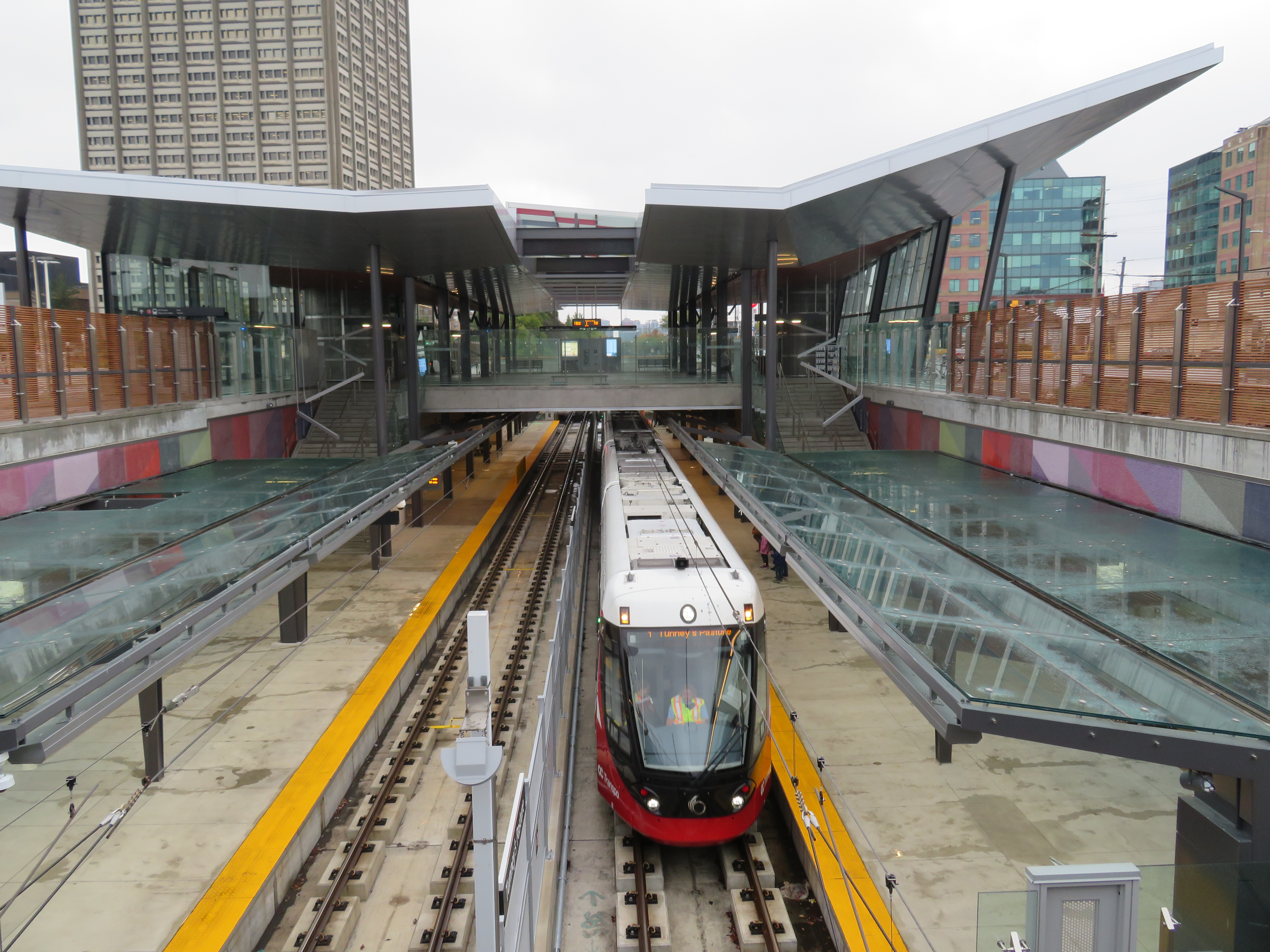
To the west, however, there is lots of potential for the government office complex at Tunney’s Pasture, which is surrounded by thousands of surface parking lots, as well as eastern Phase 2 stations, which will follow former railway and streetcar corridors, allowing for infill development and urbanization.
Train arriving at the Tunney’s Pasture terminal
Light rail transit is misunderstood in Toronto, where it is often equated with streetcars, rather than a flexible rapid transit solution. Indeed, light rail covers a wide spectrum, from traditional streetcars, like the TTC’s legacy street railway, to fully grade-separated high-speed LRTs, like Ottawa’s new line. (The Waterloo ION LRT, with a mix of reserved lanes, median operation, and off-road segments, fits somewhere in between.)
The Confederation Line’s average speed is 31 km/h, with a top speed of 80 km/h. In comparison, TTC Line 1 has a weekday average speed of 28 km/h, and the 501 Queen Streetcar has an average speed of just 9.9 km/h during the morning rush hour. The Waterloo ION LRT currently has an average speed of 21 km/h.
It is worth noting that the Scarborough RT replacement, once fully funded and ready to start construction six years ago, would have been just as fast and smooth as the Confederation Line. Instead, our local and provincial politicians continue to spin their wheels on planning a subway extension that’s going nowhere. Meanwhile, Ottawa has already started work on Phase 2 of its light rail network.
The end of the beginning: the old Transitway is visible west of Tunney’s Pasture, where Phase 2 of the Confederation Line will continue towards Baseline and Moodie Stations
The Eglinton-Crosstown LRT will have a long underground segment, with two-car LRT trains similar to those used in Ottawa. When that opens — planned for late 2021 — Torontonians will finally get a taste of high-order light rail transit.
VIA RDC train about to depart Sudbury for White River
Last month, I embarked on a journey from Toronto to Thunder Bay, a distance of over 1,300 kilometres. My journey took me nearly three days as I opted to travel by bus and rail, rather than by car or by air. Though I had to take three separate trips to accomplish it (an Ontario Northland bus, a VIA Rail RDC train, and a Kasper Transportation mini-bus), it was a very interesting trip.
Unloading a canoe from the RDC on the Spanish River, northwest of Sudbury
Once I arrived in Thunder Bay, I rented a car. Though I know Northeastern Ontario quite well, I had yet to visit Northwestern Ontario (a brief stop in Sioux Lookout on VIA’s Canadian notwithstanding). There are several beautiful provincial parks within a short drive of Thunder Bay, and the city itself has a few interesting sights. Highway 17 along the Lake Superior shoreline is probably Ontario’s most scenic drive.
Travelling without a car has its challenges, especially as the traveler is at the mercy of sudden schedule changes, traffic delays, and other hiccups, but it is still possible to get across Northern Ontario even after Greyhound’s withdrawal from Western Canada and Northern Ontario last year.


 Downtown Pembroke
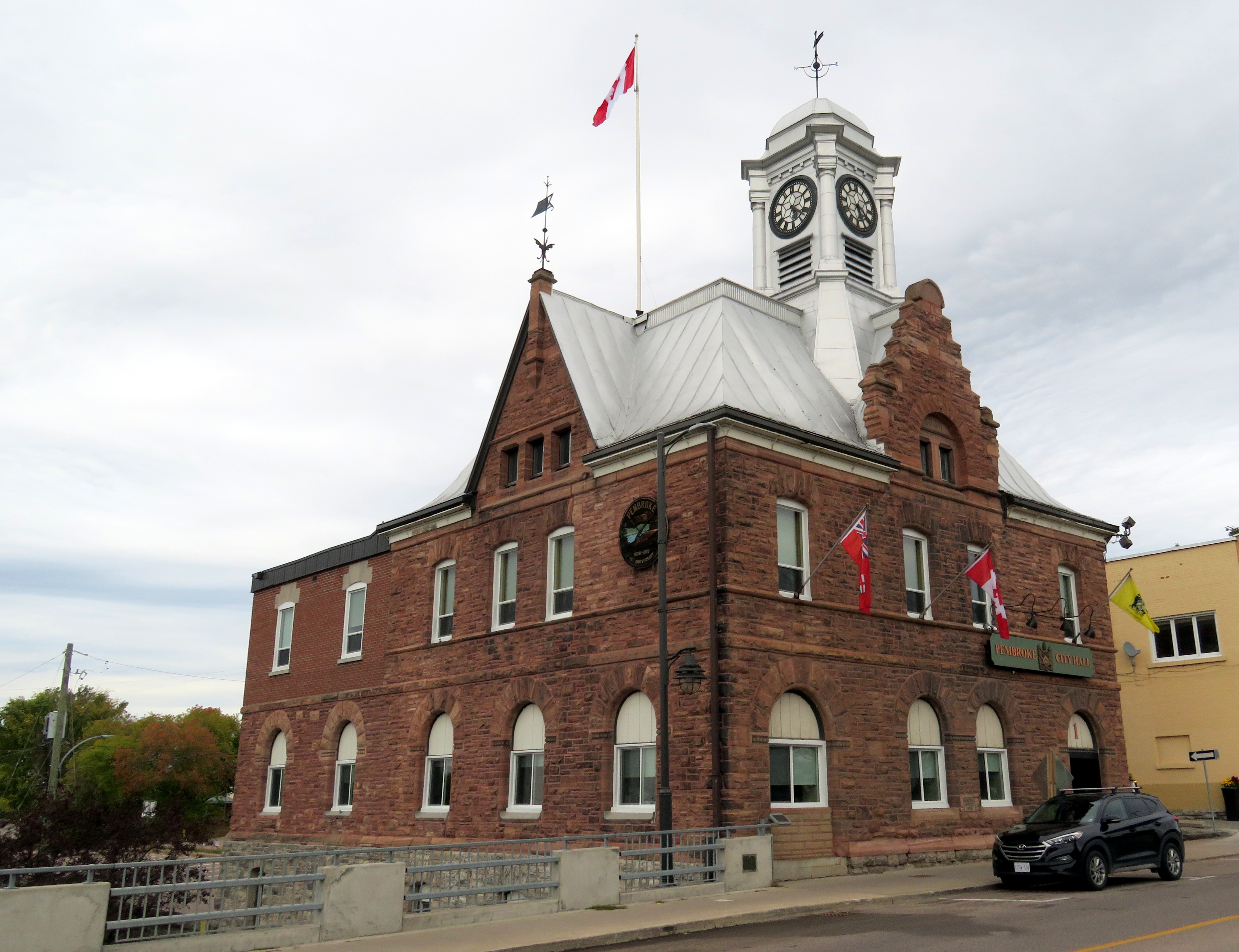
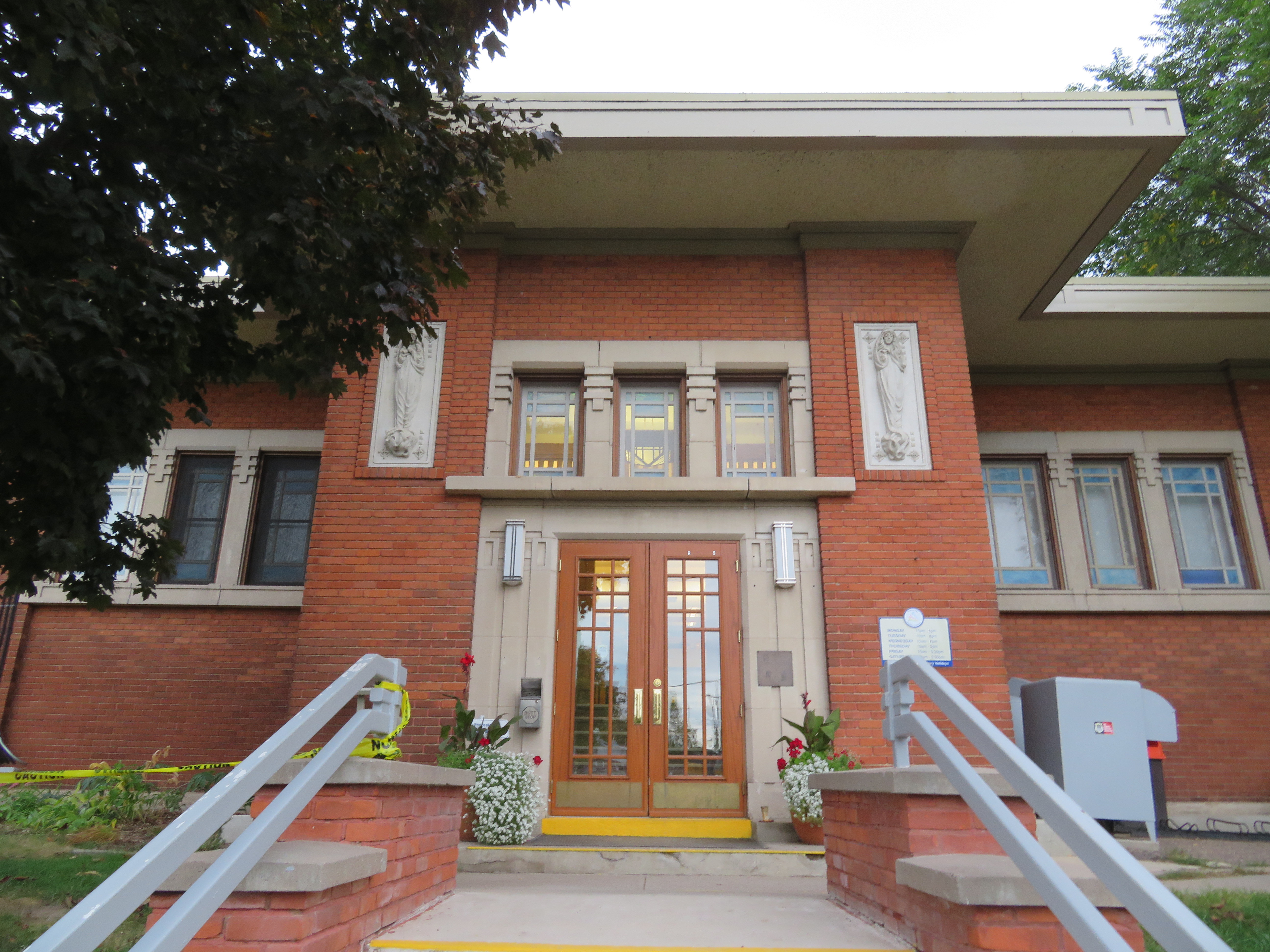 Entrance to the Pembroke Public Library
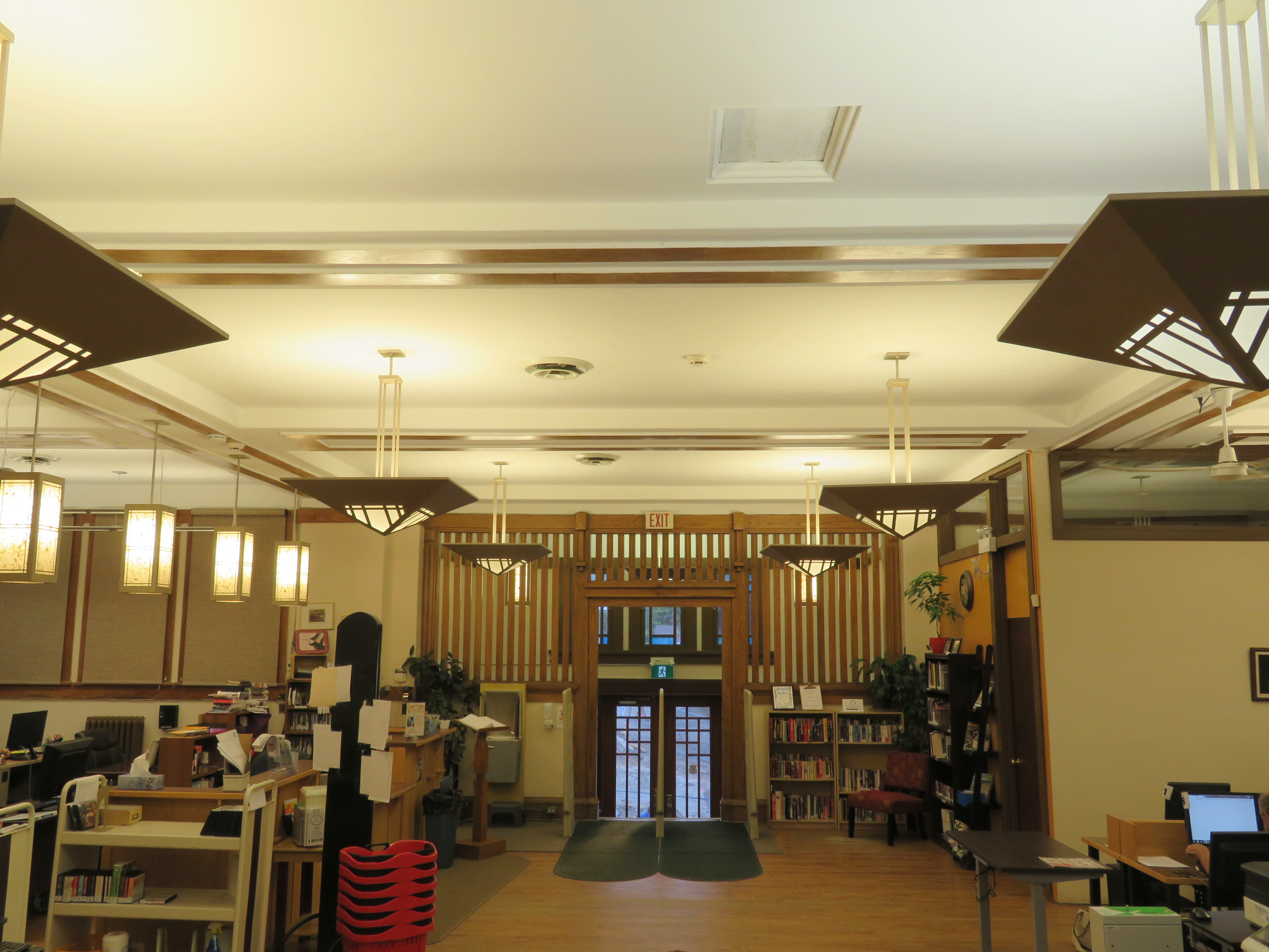 Library interior
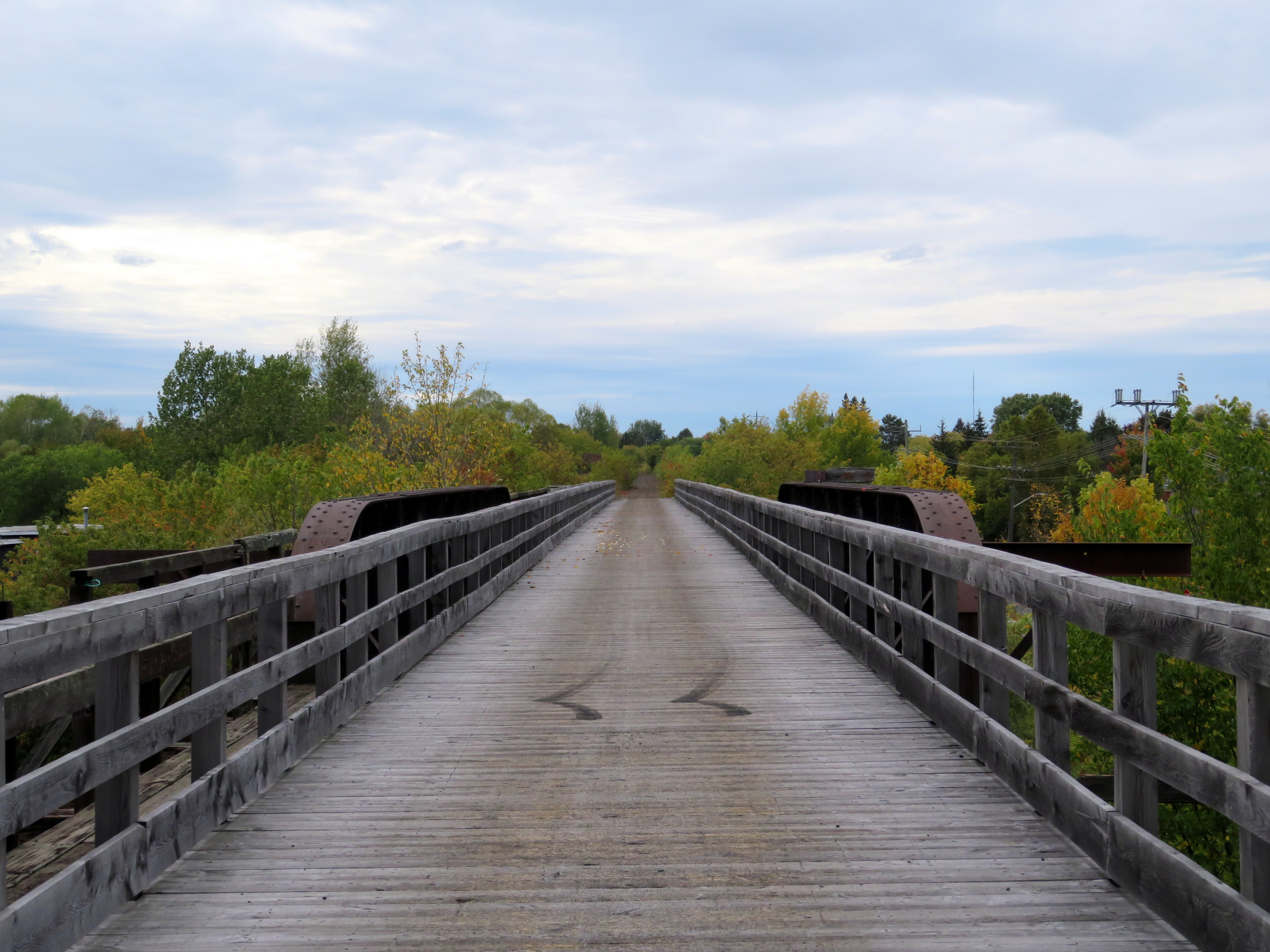 Former CN trestle, Pembroke
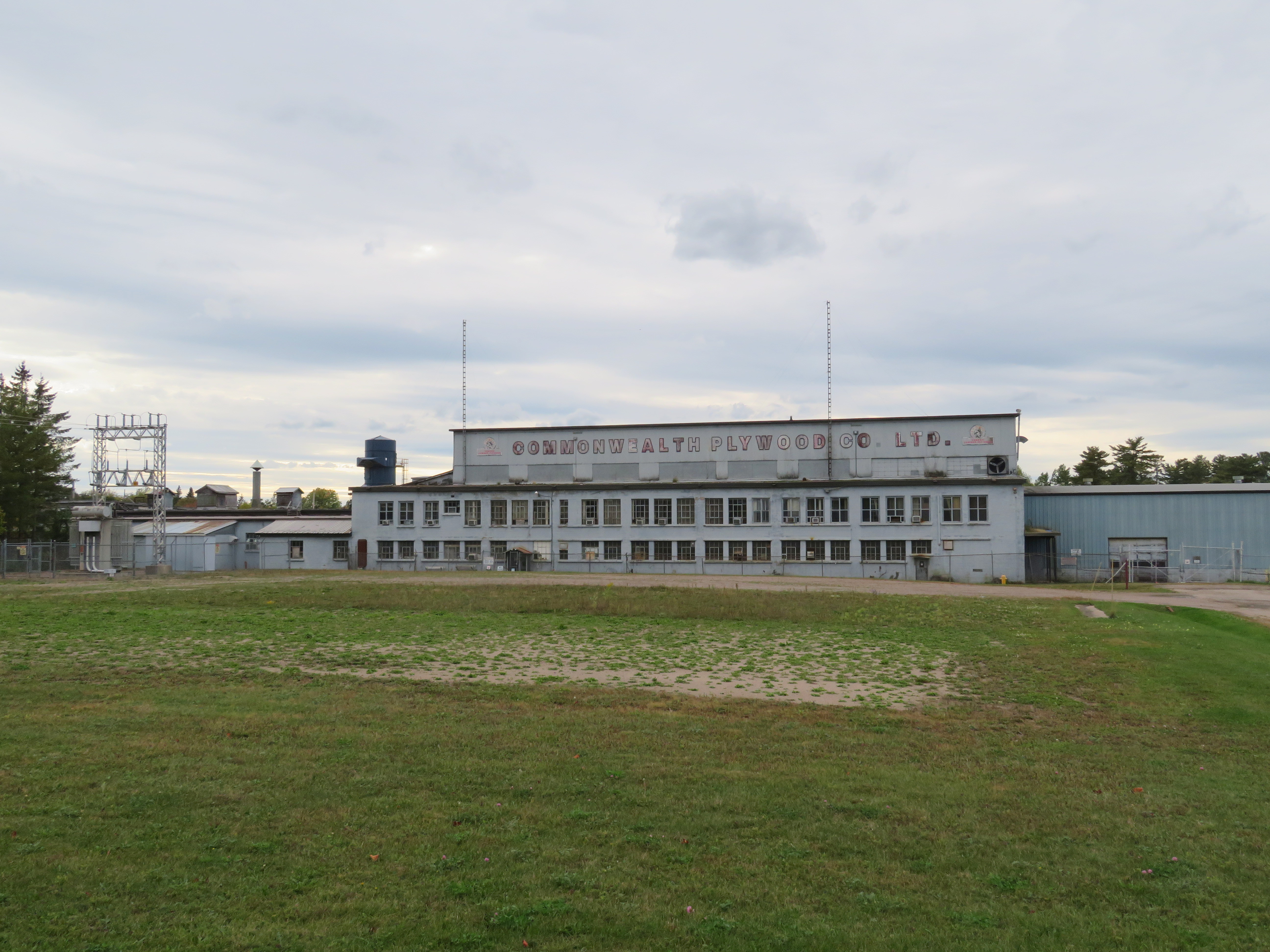
 Confederation Line train approaching Tremblay Station
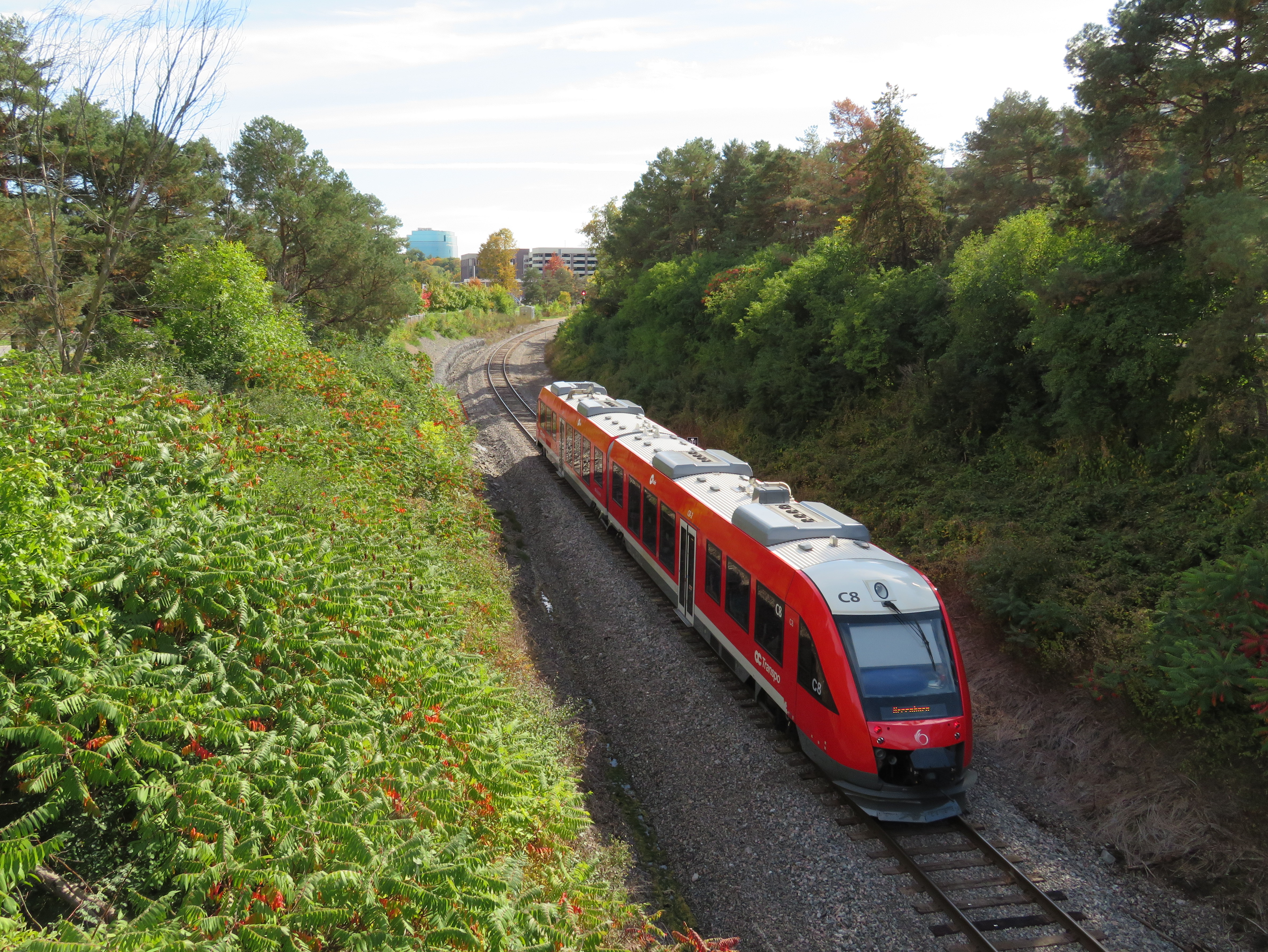
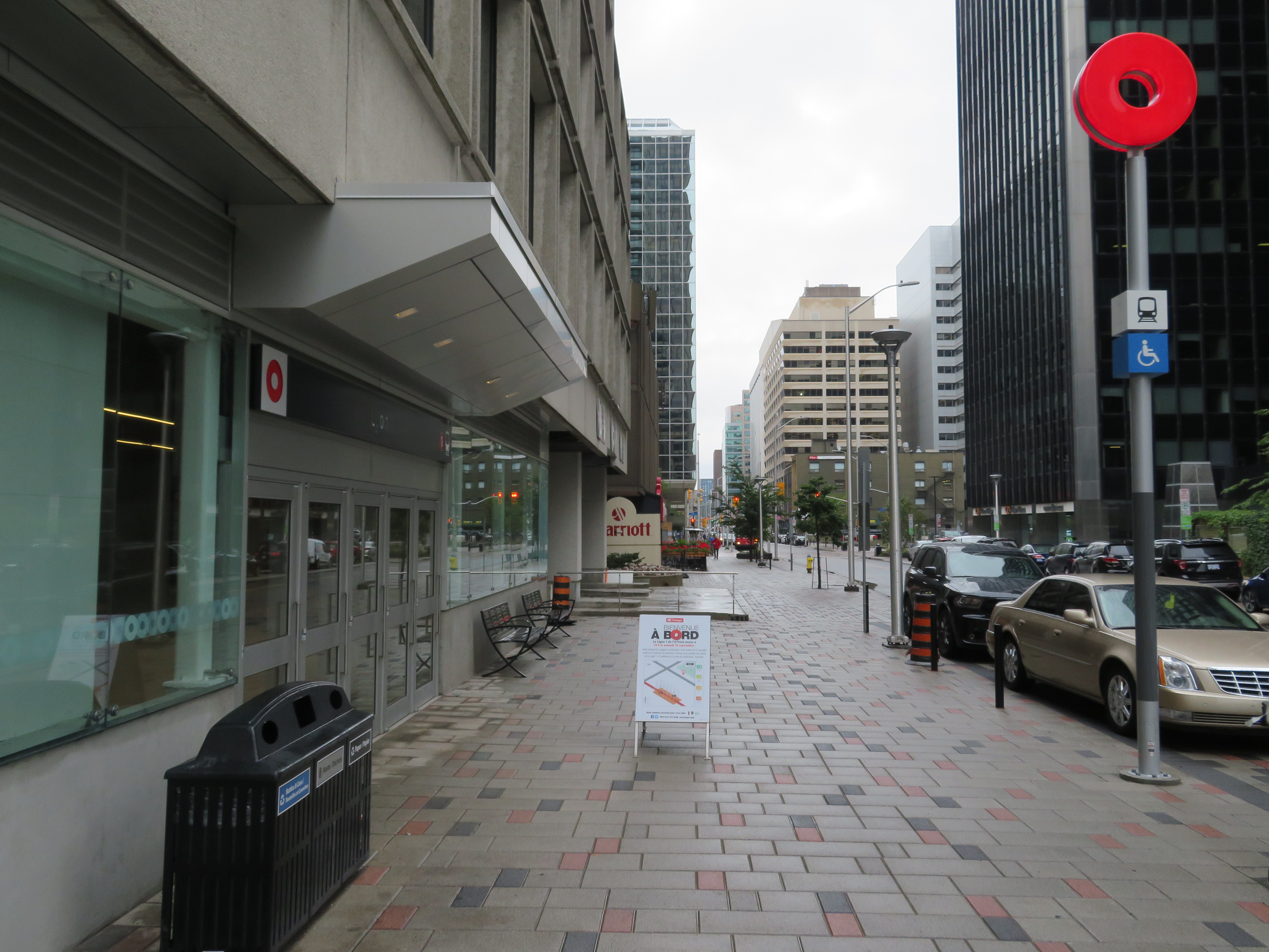 Downtown entrance to Lyon Station, with the O-Train “Lifesaver” totem
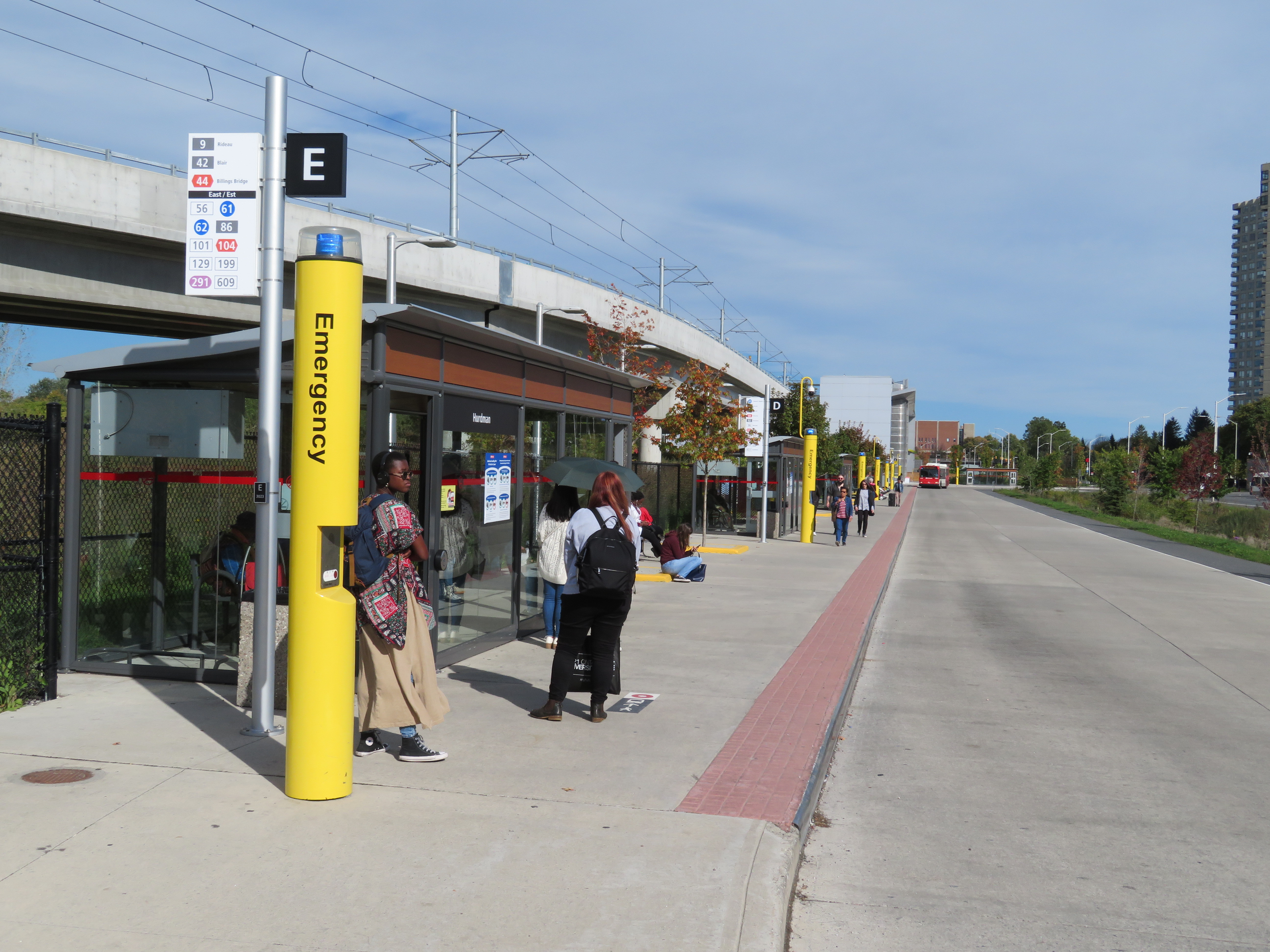
 Train arriving at the Tunney’s Pasture terminal
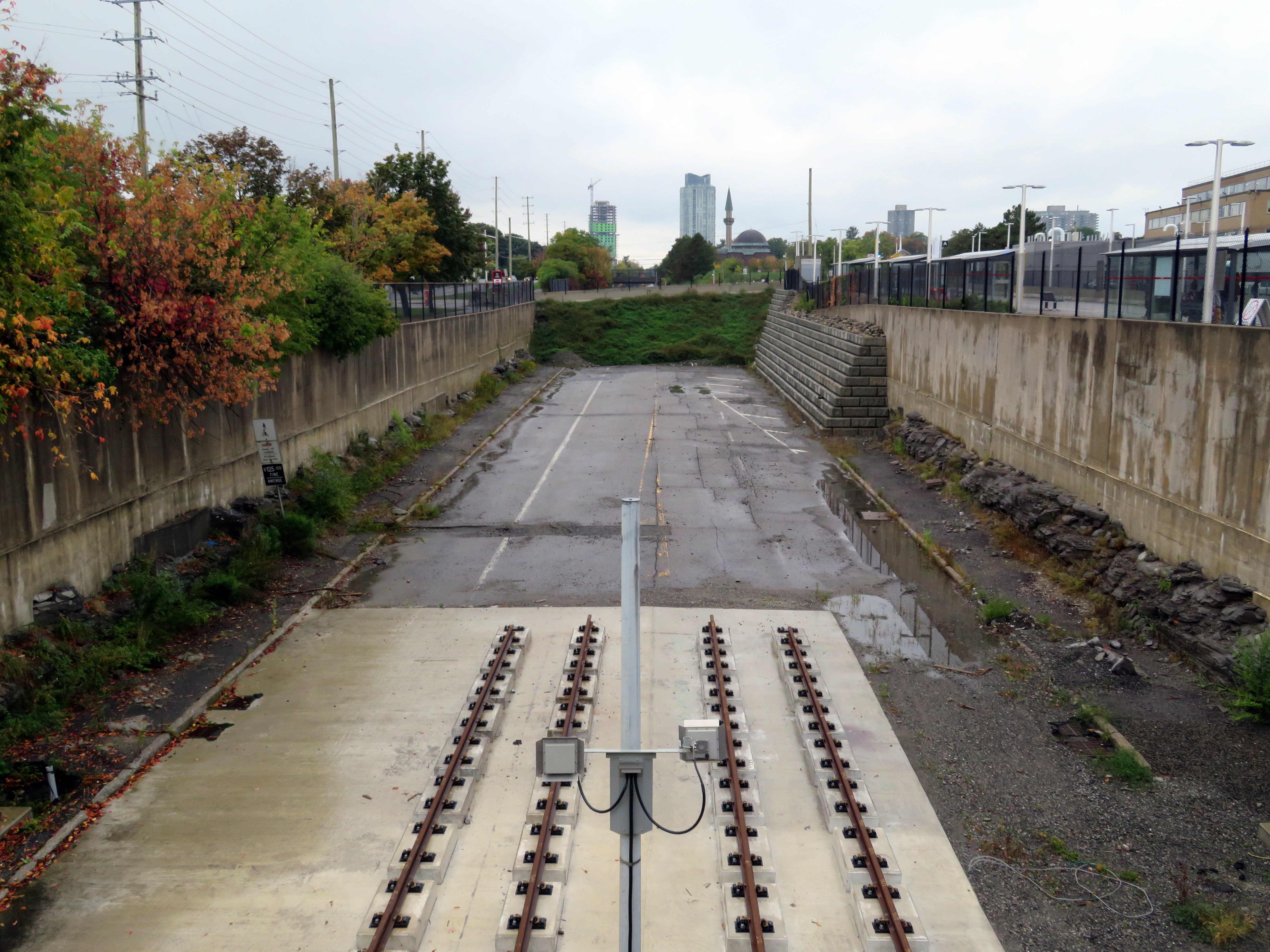
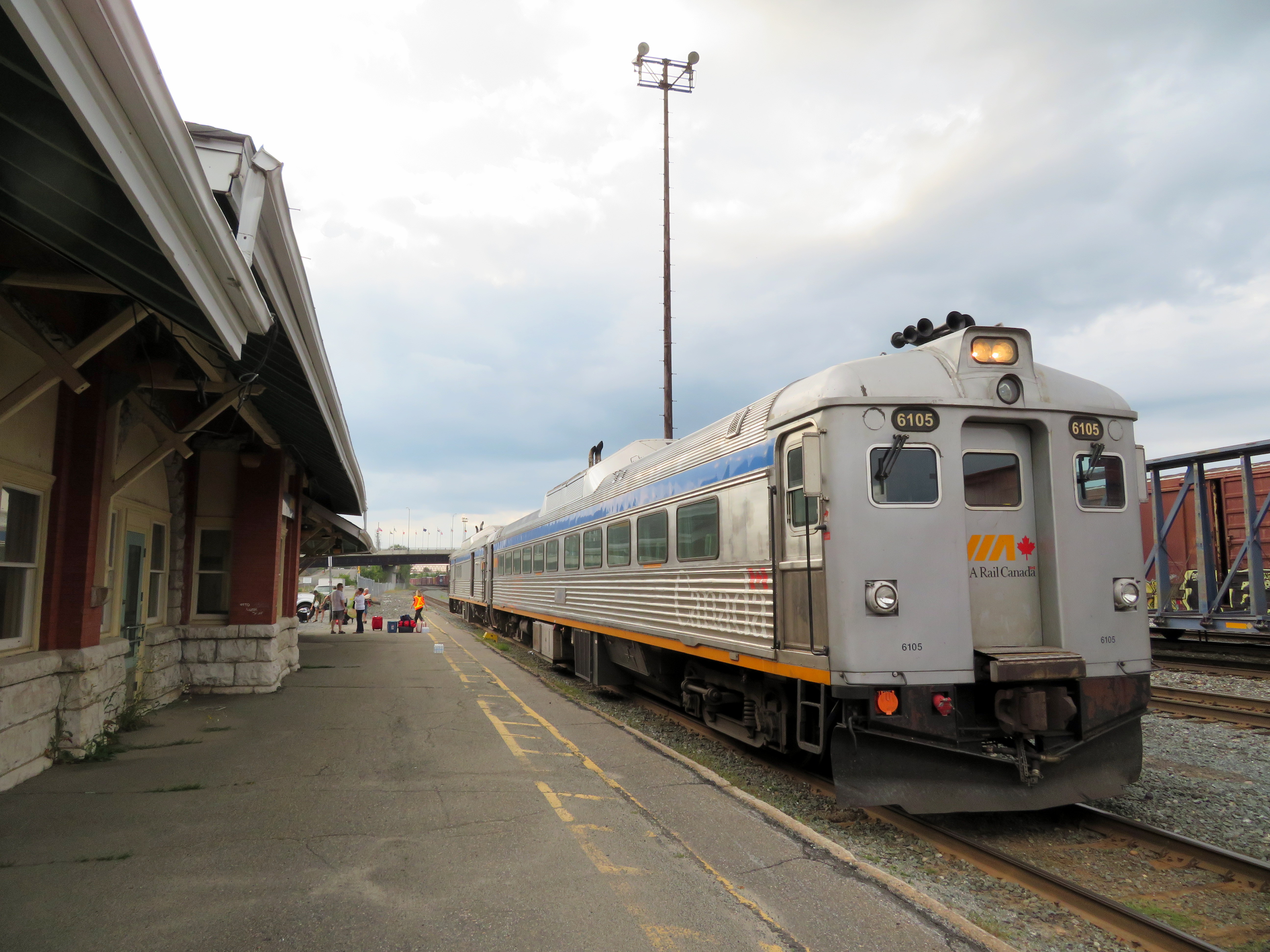 VIA RDC train about to depart Sudbury for White River
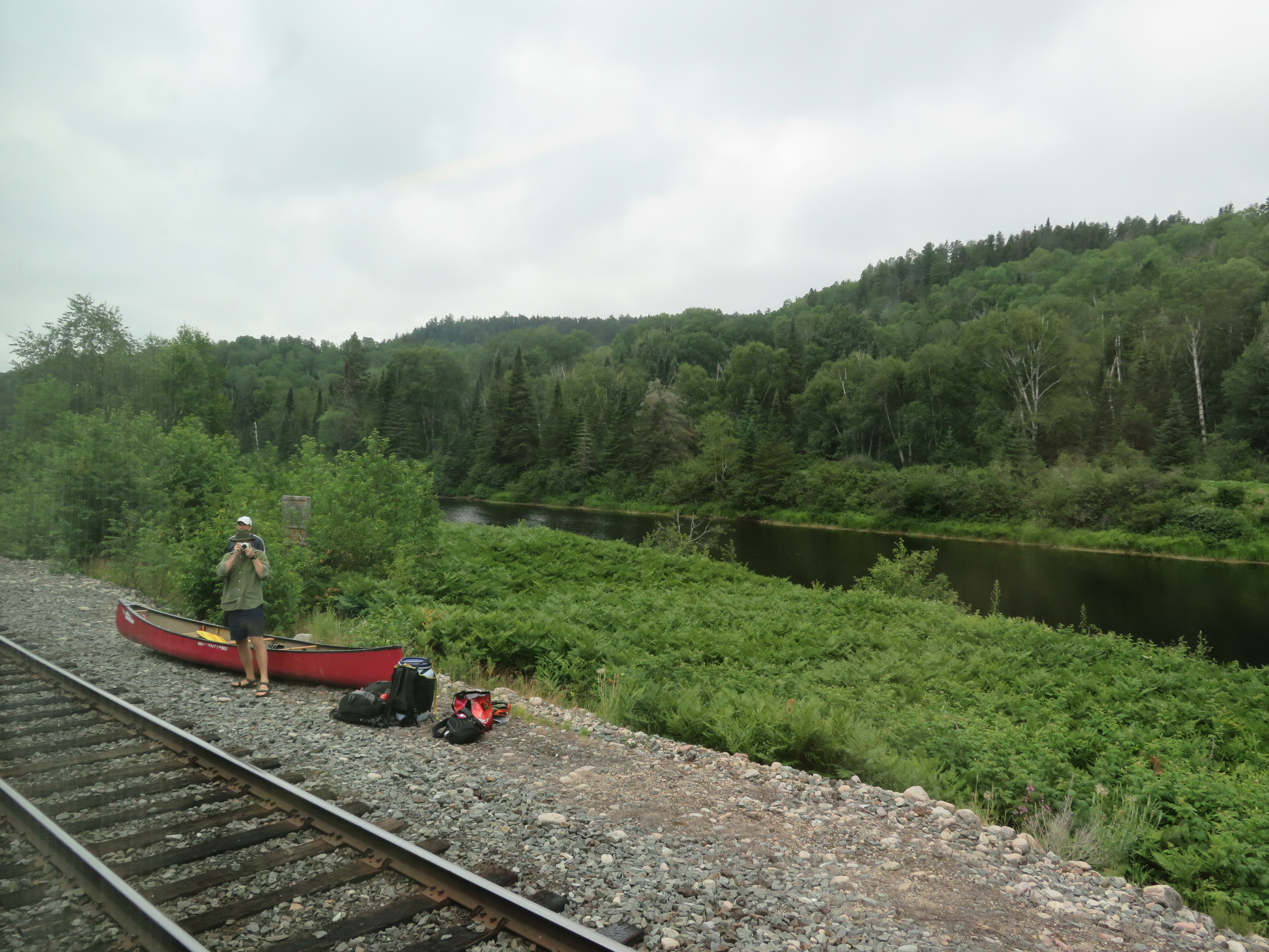 Unloading a canoe from the RDC on the Spanish River, northwest of Sudbury
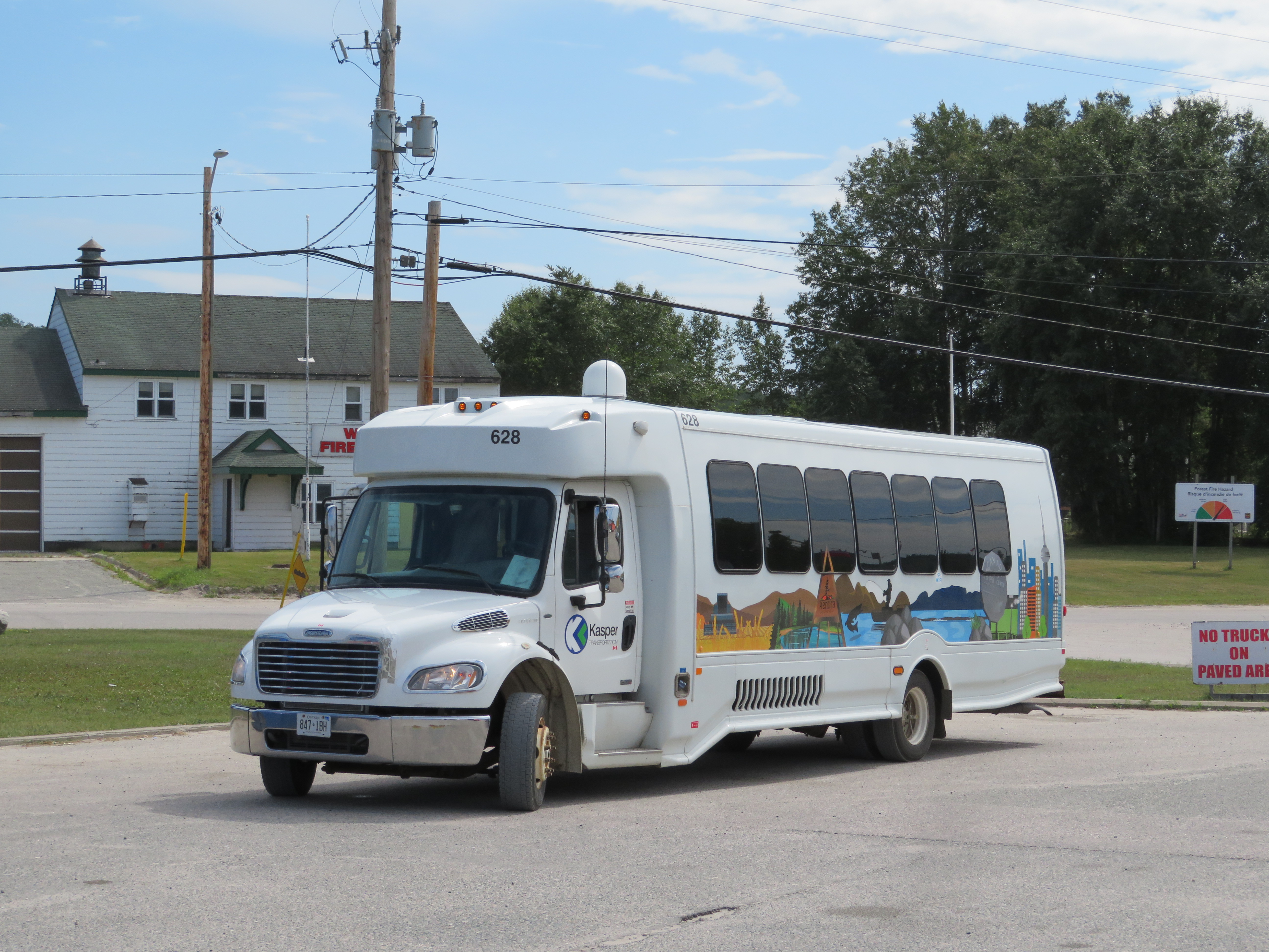 Kasper Transporation bus at White River – filling the gap left by Greyhound