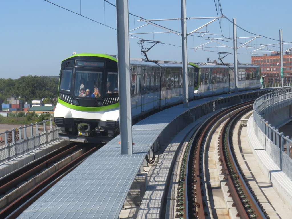
North America’s newest rapid transit service, the Réseau express métropolitain (REM), opened on Monday, July 31, 2023 after a weekend of free public rides. I took my first ride several weeks later, on August 22, 2023. The five stop, 16.6-kilometre line between Central Station and Autoroute 30 in Brossard, is the first of four phases of the initial REM network, with branches north and west of Downtown Montreal to open in the next few years.
Built by the CDPQ Infra, a division of Caisse de dépôt et placement du Québec (a provincial public pension fund), REM is a light metro network connecting suburban communities with Montreal’s urban core. With limited stops, a downtown-suburban focus, and frequent service, REM has similarities to Bay Area Rapid Transit (BART) in the San Francisco metro region, to S-Bahn systems in Germany and Austria, or RER in metropolitan Paris. Like Vancouver’s SkyTrain or the future Ontario Line here in Toronto, the trains are short, and operate fully automatically, running every 3.5 minutes during weekday peak periods, and every 7.5 minutes at all other times, from 5:30 AM until after midnight.
As REM is being built by a pension fund — which seeks to make an 8% return on building and operating the service — financing the line is a bit different. Though it received financing from the Canada Infrastructure Bank and support from the provincial government, much of the funding comes from other sources, such as development levees. It is also guaranteed a share of fare revenue from the provincial government.
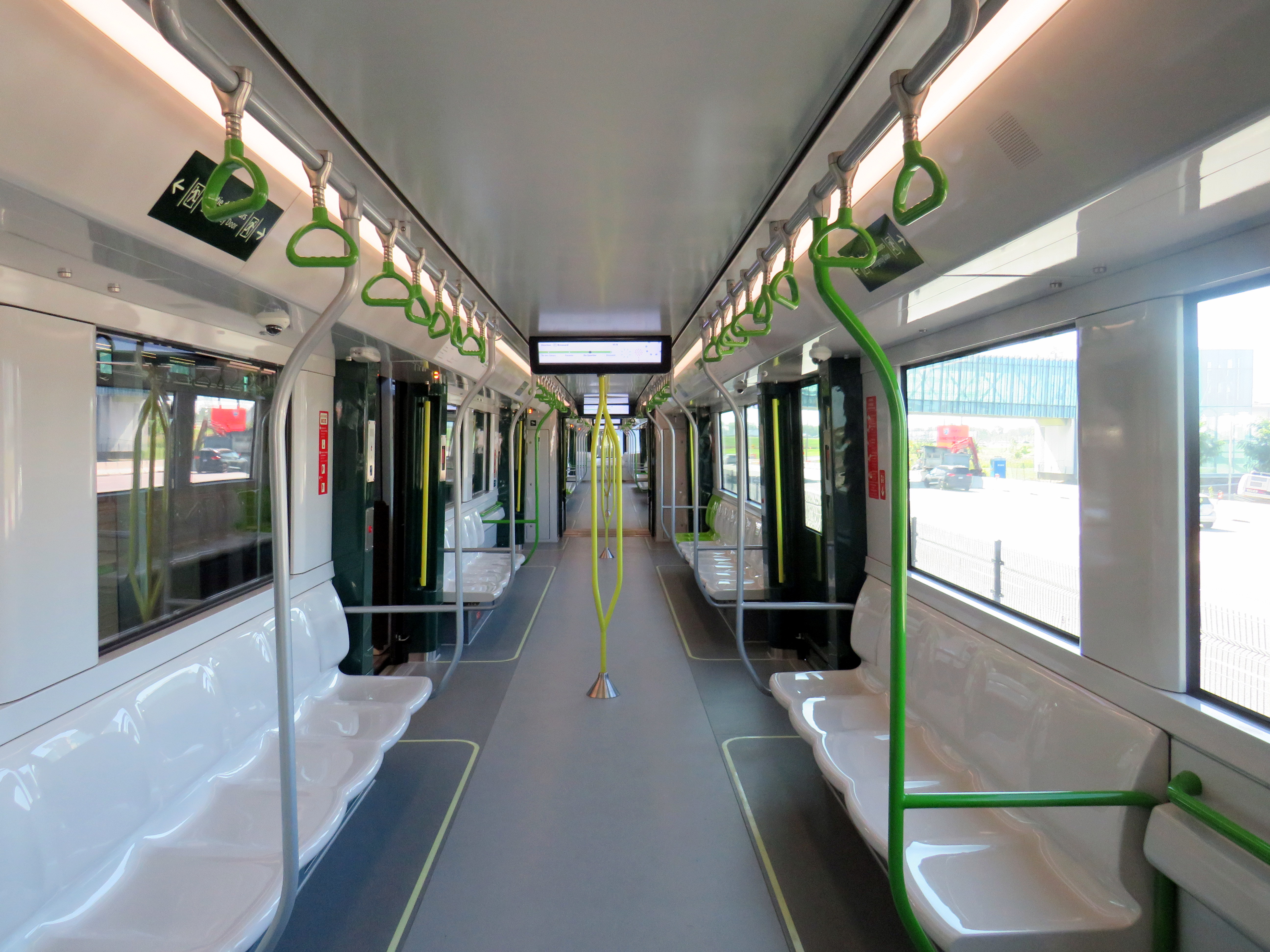
Rail car interior. All seats face inwards, there are 64 seats per car, with standing room for up to 300.
Though several notable transport enthusiasts have already documented the new REM during its opening weekend, I wanted to wait for some of the excitement to wane; I also wanted to experience the service from a regular passenger’s point of view, including checking out the stations and transfers to other transit operators.
For the most part, I came away satisfied. However, I encountered several shortcomings, particularly with service integration and transfers between modes.
Earlier this year, I had the opportunity to travel to the US Midwest. My spouse had a business meeting to attend in Chicago, so we made the most of our trip. I spent time in a few interesting cities, including Milwaukee, Madison, and Minneapolis-St. Paul.
Having been to Chicago many times now, I sought out new and interesting places to visit off the tourists’ beaten paths. One of these places was The 606/Bloomingdale Trail, located a few miles northwest of Chicago’s downtown Loop.
Though Chicago is famous for its elevated railway transit system (known as the “L”) it is also crisscrossed by hundreds of miles of mainline and spur railways, most of which is grade-separated from the local street network. These rail corridors were built by over a dozen railroad companies, whose vast networks converged on Chicago, bringing in, among many other things, grain, cattle, metals, and sending out cereals, meat products, industrial goods, and merchandise purchased from Sears, Roebuck and Montgomery Ward. Chicago’s dominance as a rail centre allowed it to grow into America’s second-largest city (it is now the third-largest).
There are still many railways and yards throughout the city, along with an expansive commuter rail network, but many of the industrial spurs and branch lines became redundant with the decline of heavy industry and the shift to trucking. The Bloomingdale line, once a busy freight corridor owned by the Chicago, Milwaukee, St. Paul and Pacific Railroad (known as the Milwaukee Road, later part of Canadian Pacific’s network) was just one of these routes.
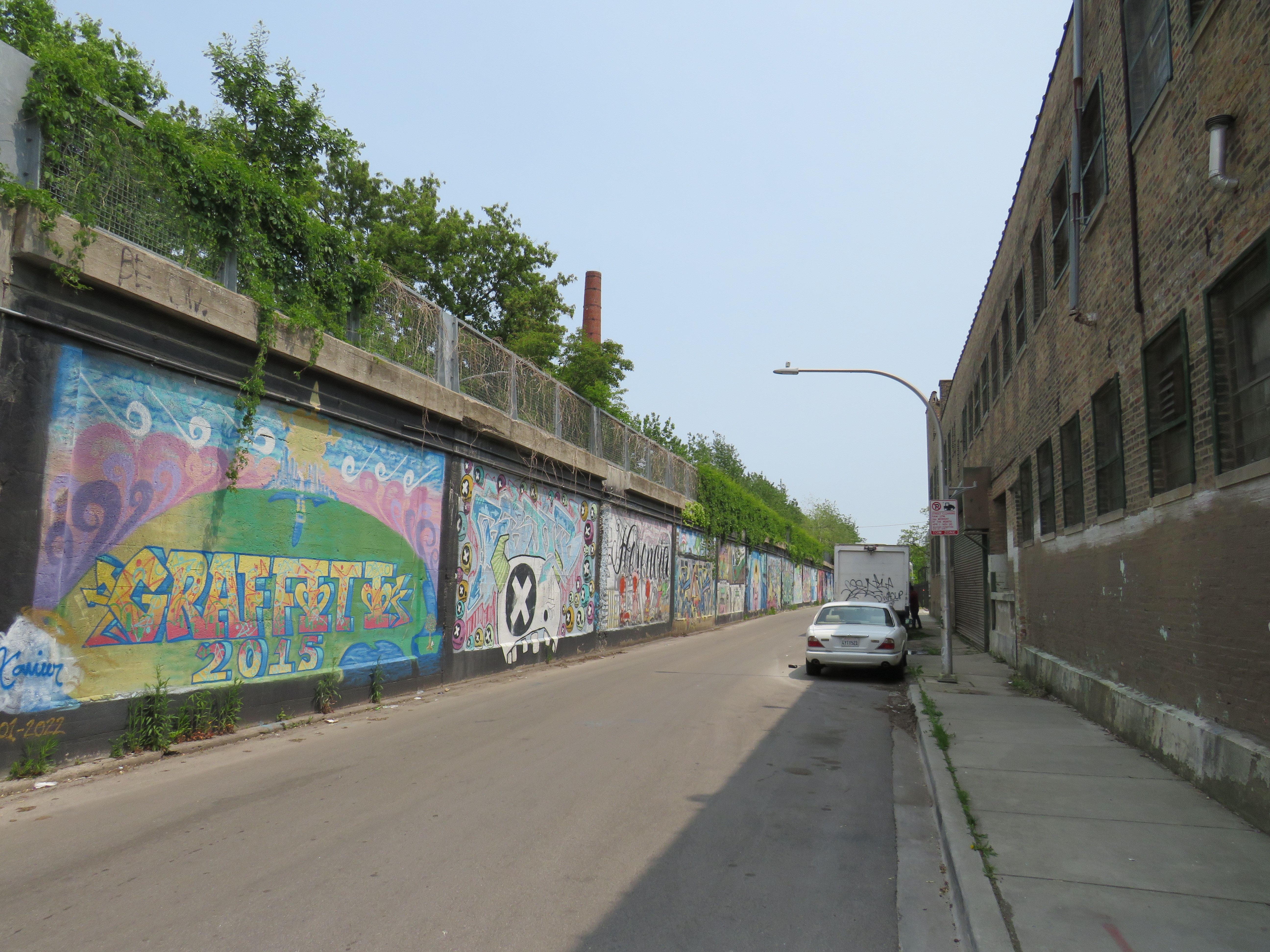
Some local industries still stand on Bloomingdale Avenue next to the abandoned rail corridor
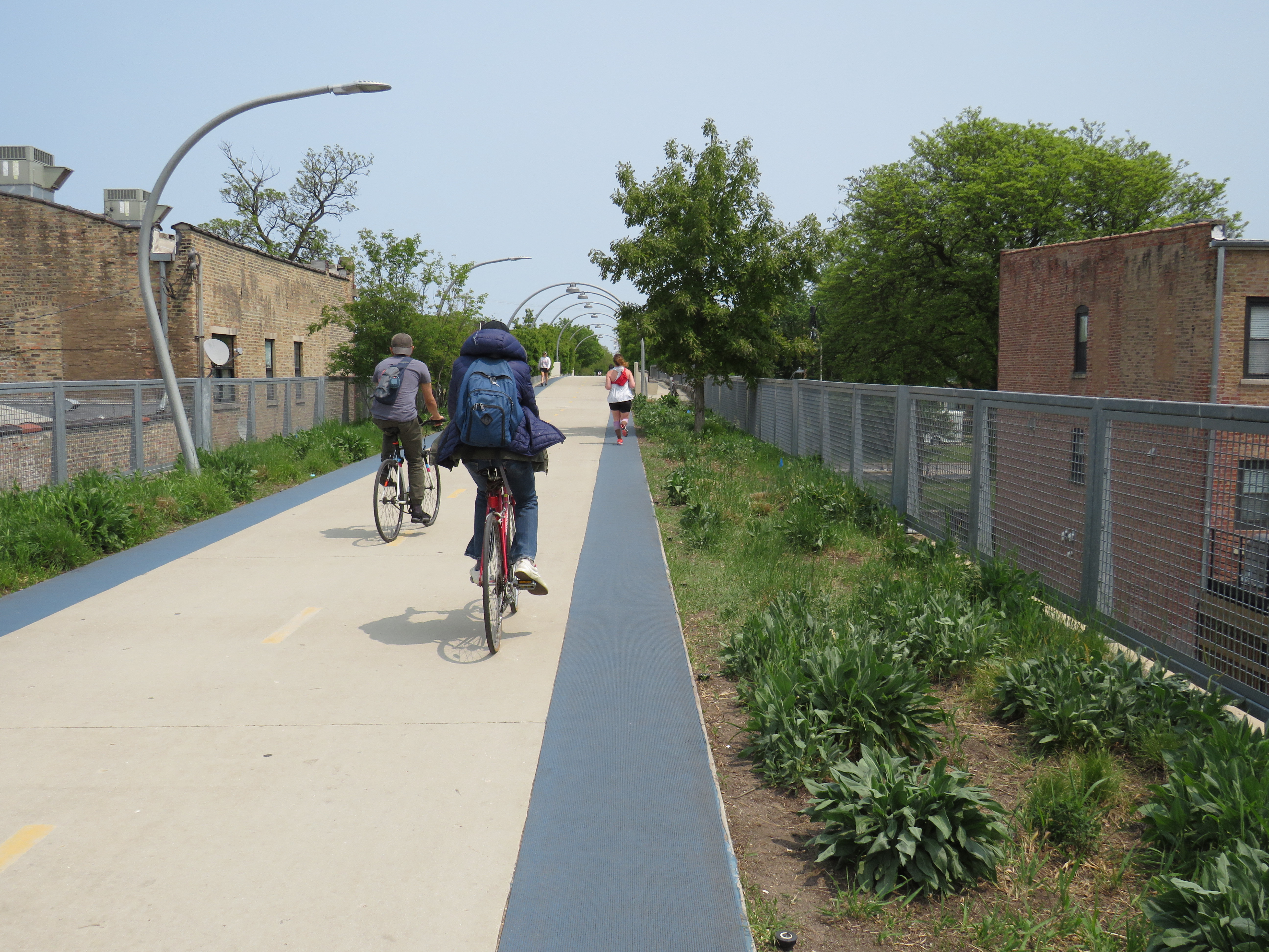
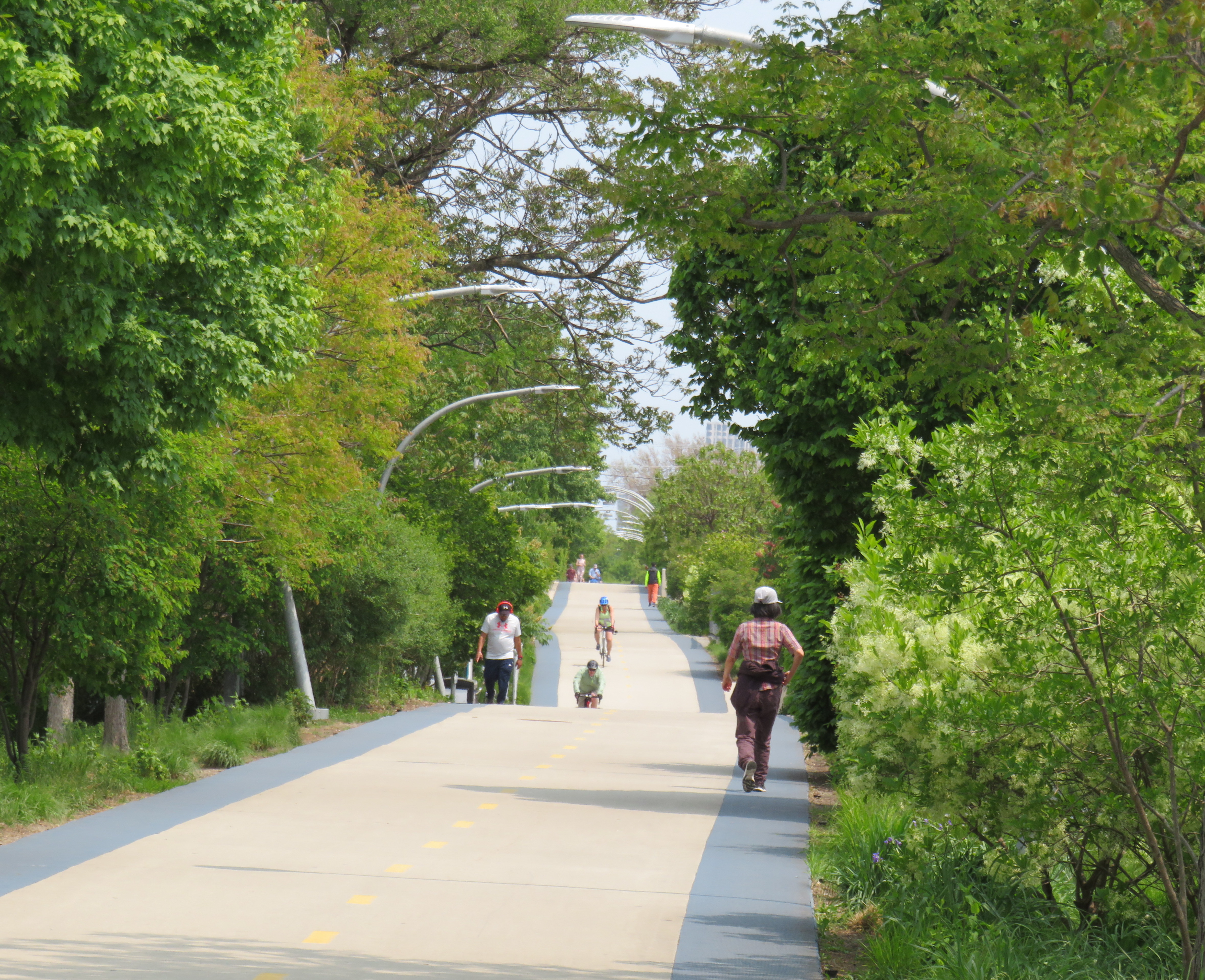
The trail, built as a partnership between the local Friends of Bloomingdale Trail group, the federal non-profit Trust for Public Land, and the City of Chicago, opened in June 2013. Ten years later, the corridor is kept in excellent shape, and still looks fresh. The 4.3 kilometre (2.7 mile) trail is the longest elevated greenway in North America, longer even than New York’s High Line.
On the day I visited, I rode the entire length of the trail in one direction on a Divvy bikeshare bike and walked most of the distance on the way back.
The Bloomingdale Trail crosses Central Park Avenue, near the western terminus of the public corridor
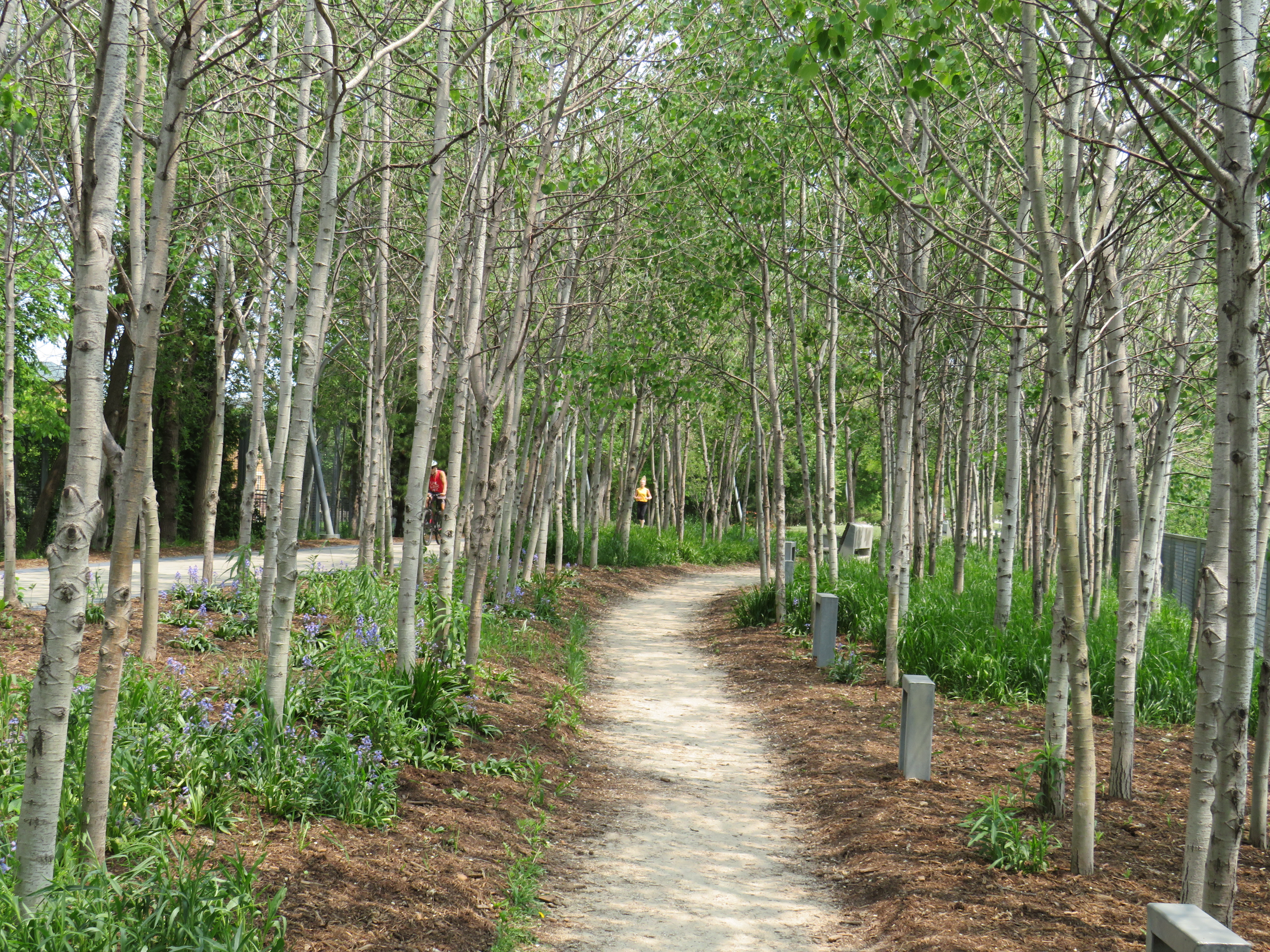
Unlike the High Line, the Bloomingdale Trail is open to cyclists, and is much less programmed, catering more to the surrounding neighbourhoods than tourists. The pathway is quite wide, making it quite suited to multiple uses. On each side of the pathway is a rubberized track, providing an incentive to walkers and runners to keep to the right. The trees are well maintained, providing plenty of shade. Benches and working water fountains are found throughout.
Rubberized edges on both sides of the pathwayOne of many water fountains along the routeA stand of poplars and a walking path at a wider part of the elevated right-of-way
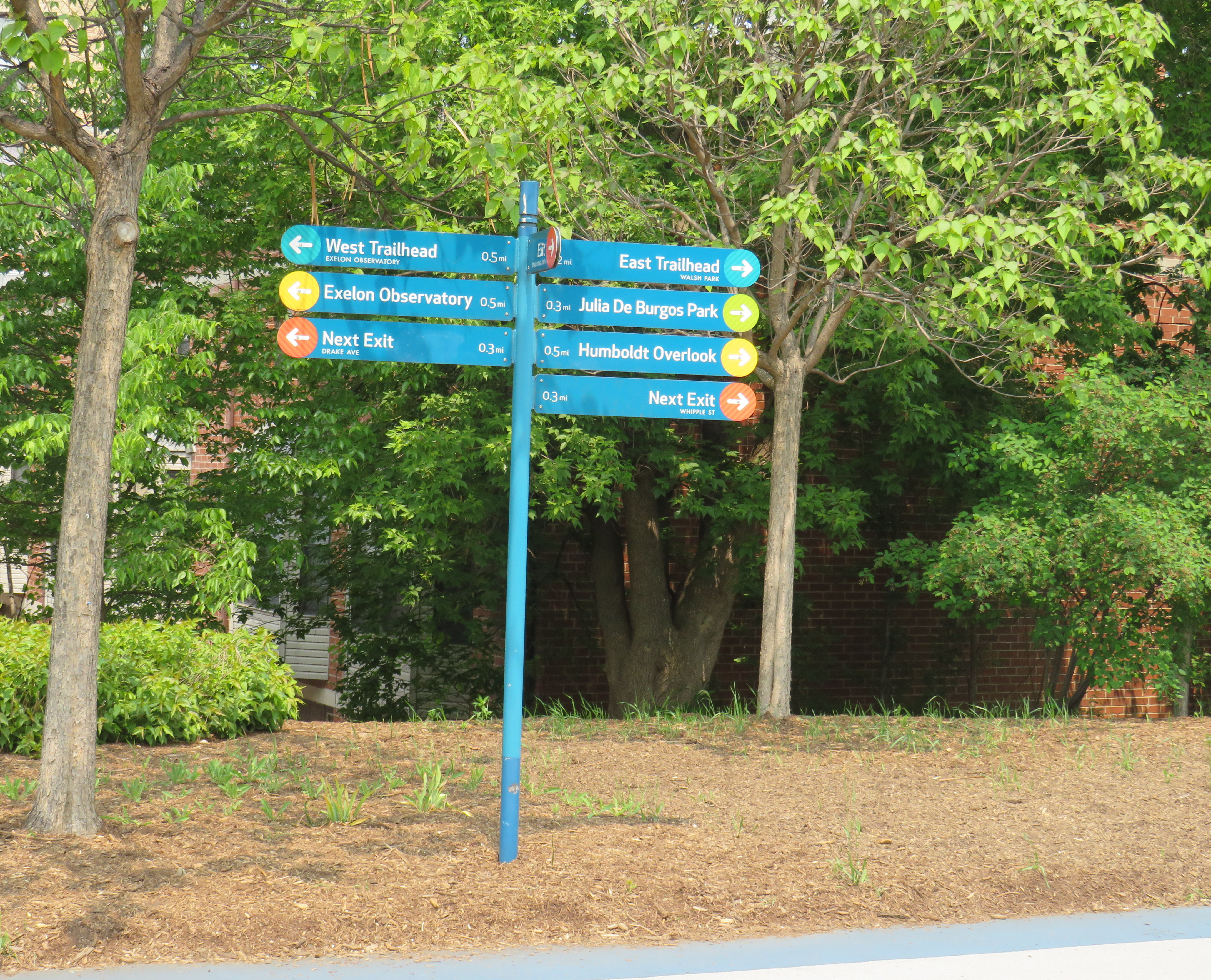
As the path follows an elevated rail corridor, not every intersecting street has an entrance to The 606/Bloomingdale Trail. However, fully accessible ramps are offered every 3-4 blocks, with stairwells installed at other locations. Wayfinding signage is good too, indicating the distances to local highlights and the nearest exits.
Wayfinding sign, indicating trail highlights, connecting parks, and the next exits
One thing I really appreciated about the Bloomingdale Trail are the unique vantage points. Milwaukee Avenue offers a lovely view towards Wicker Park and the Loop, while other parts of the trail pass by neighbourhood parks, backyards, and old warehouses.
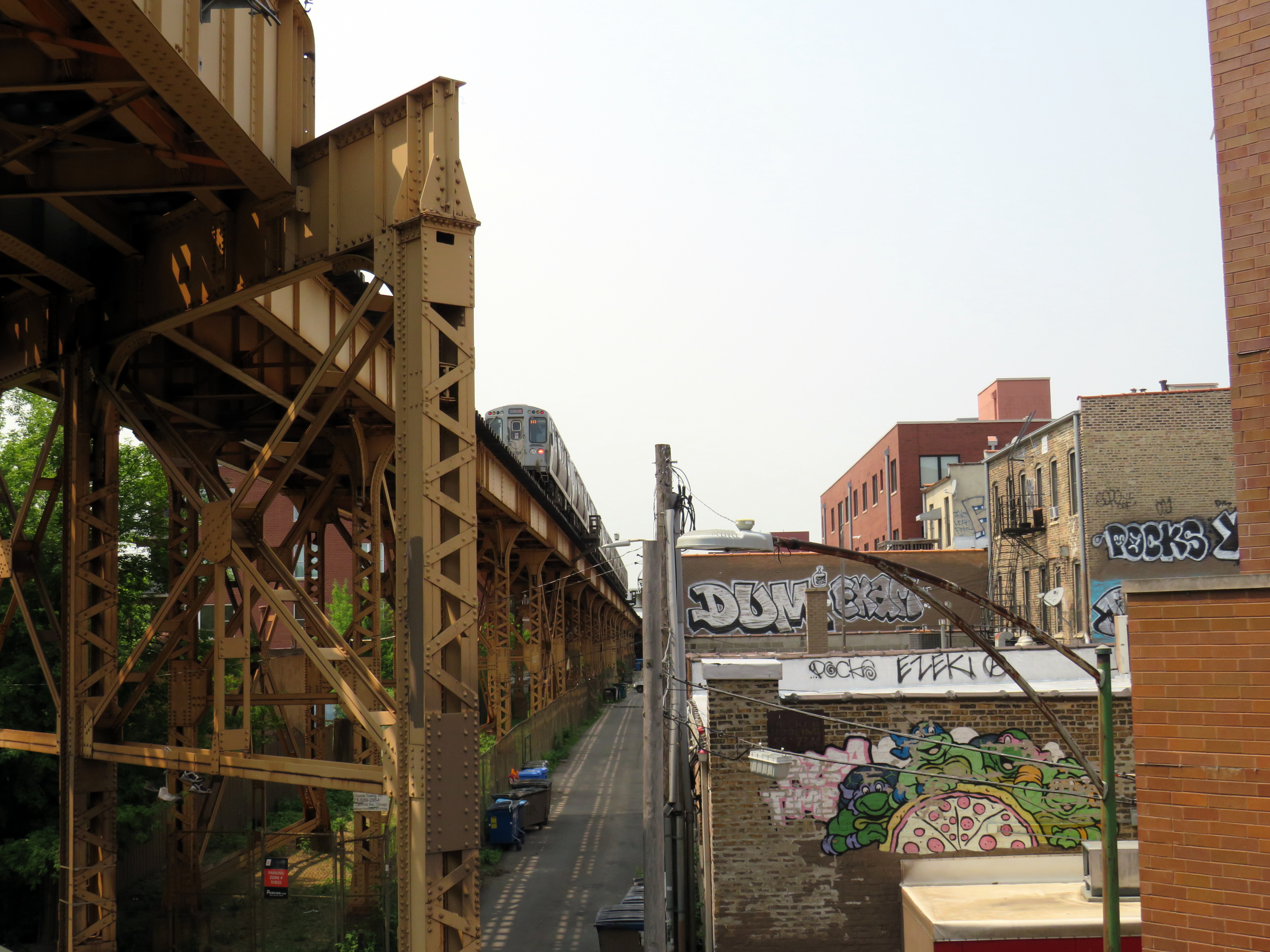
Looking southeast down Milwaukee Avenue towards Wicker ParkView looking northwest to the Blue Line L and the alley behind Milwaukee Avenue
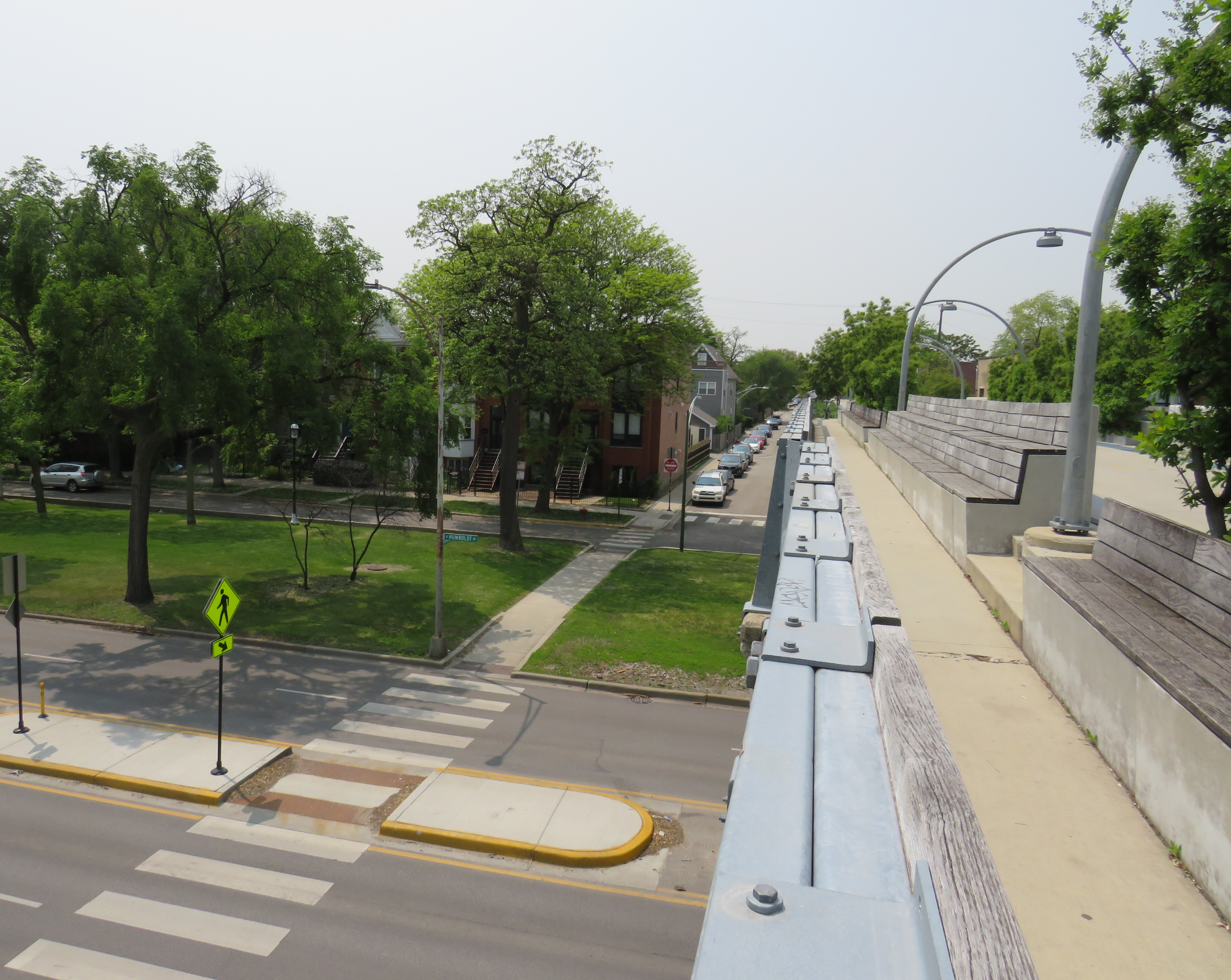
At several intersecting streets, benches have been strategically placed to provide gathering places called “overlooks.” Where it crosses Humboldt Boulevard, part of the parkway ring surrounding central Chicago, over hundred people could sit and watch the traffic below. at once
Lookout to Humboldt Boulevard
Though the circumstances that allowed for the great elevated parks like Chicago’s 606 or New York’s High Line are unique to their locations, there are lessons that can be learned for other projects, as in Toronto.
The presence of shade helps to make Chicago’s Bloomingdale Trail a success, as does the very wide pathway that accommodates all active transport users. (On a pleasant Thursday afternoon, the trail was about as busy as the Lower Don Trail here in Toronto, but the wide spaces reduced conflict between walkers, runners, and cyclists.) There need not be a lot of special features to animate the space, though thoughtful places to sit, hydrate, and connect to intersecting public spaces and streets are important.
There are opportunities for Toronto to expand and improve upon its off-street greenways like the West Toronto Rail Path, the ravine trails, the Greenway, and possibilities for the Green Line and East Toronto; this is just one example of the concept done well.
Across Canada, our biggest cities are building new transit. Here in Toronto, the Crosstown and Finch West LRTs are well underway (though the first phase of the Eglinton-Crosstown is already three years late), as well as the Scarborough subway expansion, the Ontario Line, and GO Transit corridor improvements. Vancouver is building a major expansion to its Skytrain network, the Broadway Subway. Ottawa, Calgary, and Edmonton are all expanding their LRT networks. And in Montreal, the first phase of the Réseau express métropolitain (REM) will open for service, while major work on the Blue Line Métro extension has just begun.
While Greater Montreal has been busy with rail transit projects, it has also opened two new busways: on Boulevard Le Corbusier in Laval, and on Boulevard Pie-IX on Montreal’s east side. The Laval busway was completed in late 2017. The SRB Pie-IX corridor was mostly completed by the end of 2022, though a section near Boulevard Jean-Talon remains under construction for the Blue Line Métro extension.
Laval’s Boulevard Le Corbusier
Looking south on Le Corbusier at Boul. Saint-Martin
Laval, a sprawling suburban municipality immediately north of Montreal Island, has a population of over 400,000. Though the large island has several historical town and village centres, the municipality is mostly made up of suburban subdivisions, shopping centres, low-rise apartment buildings, crisscrossed by several autoroute highways, including the A-13, A-15, A-19, A-25, and A-440. Despite the post-war sprawl and auto infrastructure, the far eastern end of the island remains largely agricultural.
After the extension of the Orange Line Métro into Laval in 2007, the city of Laval has worked towards urbanizing its geographical centre into “Centre-Ville Laval.” Laval’s new downtown core would consist of new and expanded educational institutions, new cultural and entertainment venues, office and high-tech employment, along with new higher-density, urban-scaled residential development. The new city centre would be focused on Boulevard Le Corbusier northward from Montmorency Métro Station, in an area lined with aging commercial properties.
During my March visit to Laval, some of the progress on Centre-Ville Laval was evident. A new sports and concert venue, Place Bell, opened in 2017, luring the Montreal Canadiens’ AHL affliate from St. John’s. (Place Bell should not be confused with Centre Bell, the home of the Canadiens, also located on the Orange Line). The Université de Montréal also opened a suburban campus next to the Métro station. Slowly, mid-ride condo buildings were built on the south end of Le Corbusier, within walking distance from the campuses and transit links.
New residential development on the south end of Boul. Le Corbusier, in the near distance
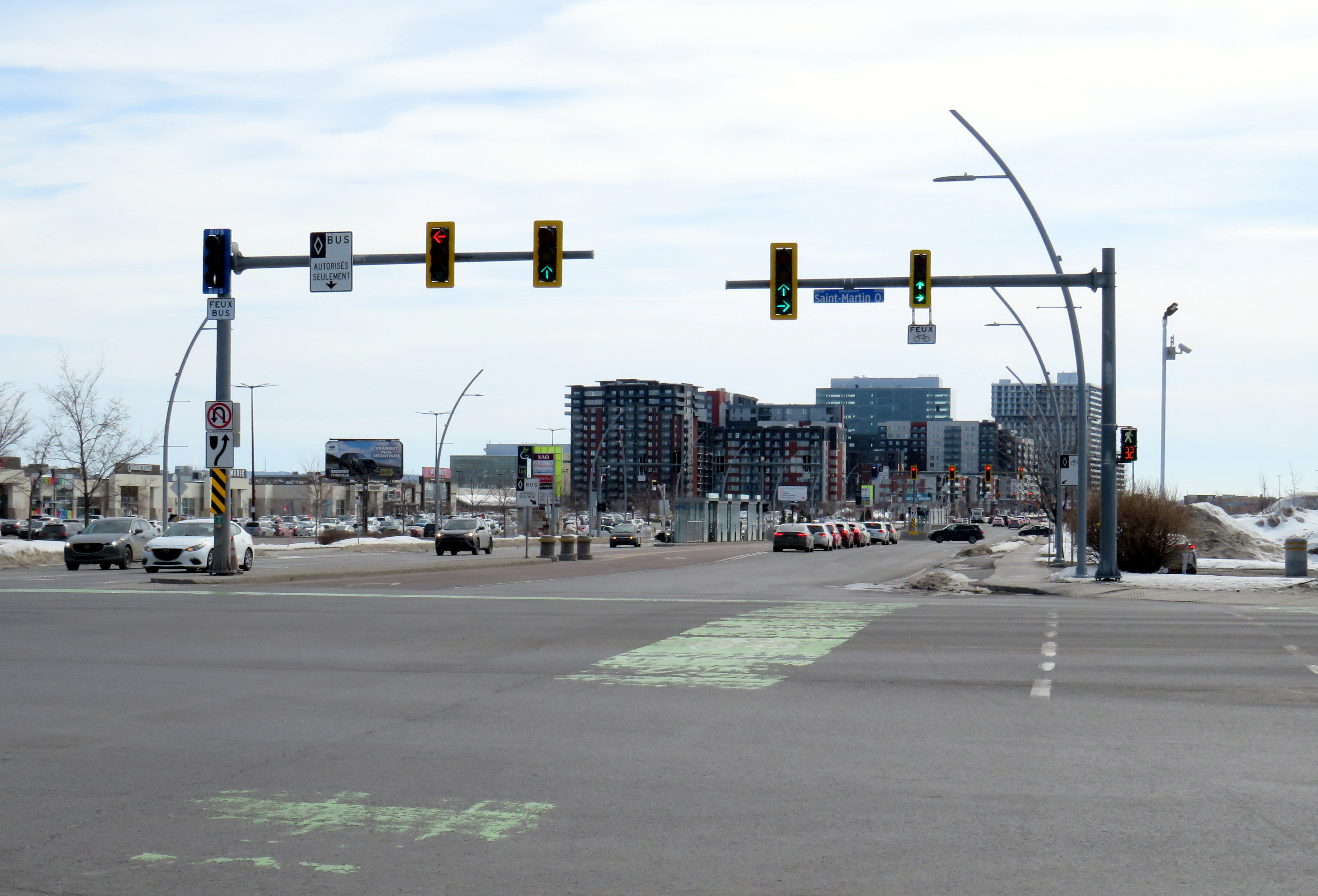
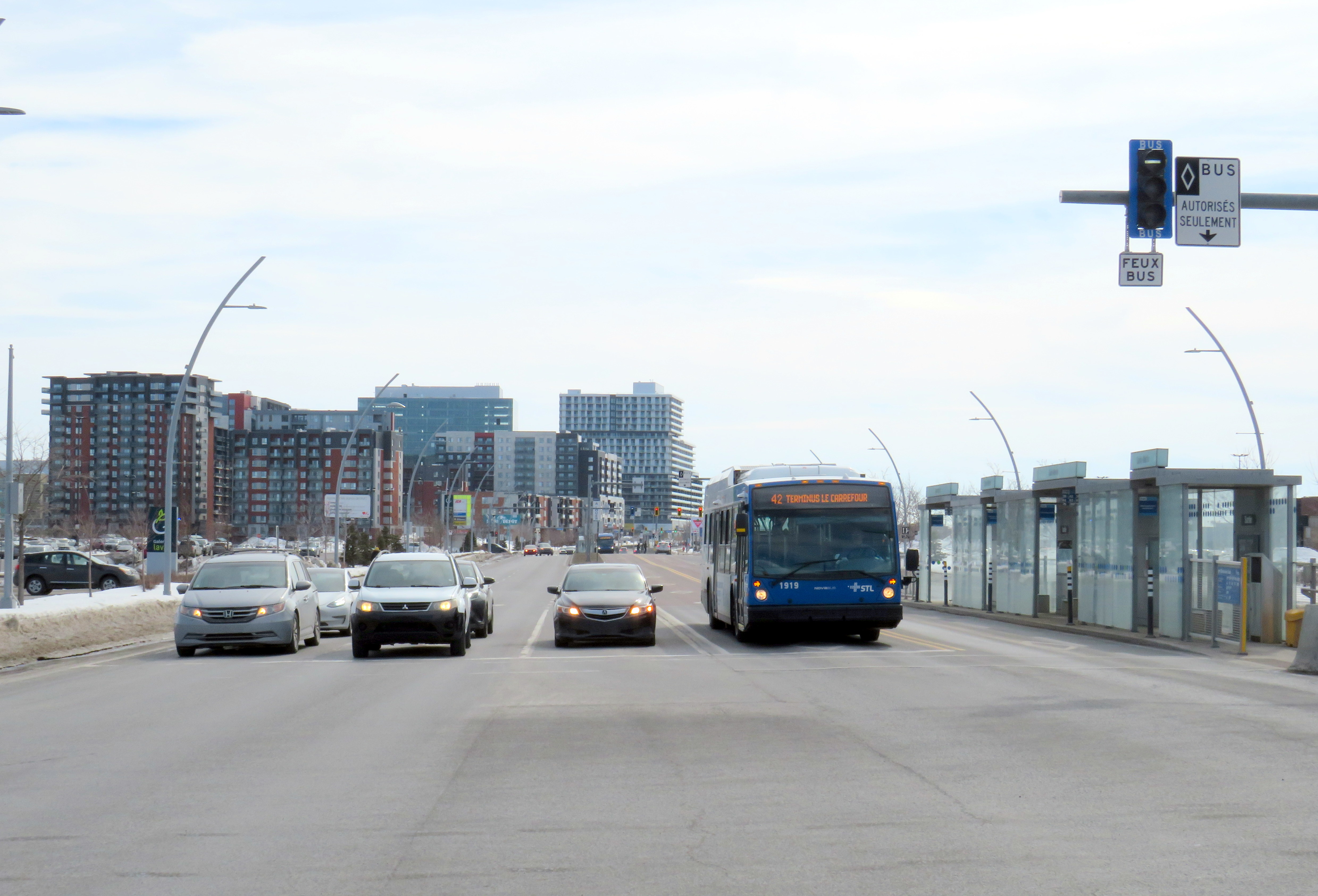
To support the planned growth of Laval’s city centre, a new busway was built northward, towards the massive Carrefour Laval shopping centre, a Cadillac Fairview-owned mall that dominates Montreal’s north suburbs. The busway passes between older, smaller shopping malls, such as Centre Laval and Galleries Laval, which will one day get redeveloped. Building the new busway, along with semi-protected cycling lanes, was clearly a way of indicating the municipality’s urban planning goals.
Unfortunately, the Laval busway reminded me of the things I disliked most about York Region’s Viva Rapidways. For one, the Laval busway doesn’t speed up bus service. It is only one kilometre long, and does not properly connect with either the bus terminal at Montmorency Métro or the bus terminal across the street from Carrefour Laval. Buses must re-enter mixed traffic at both ends of the route. As in Toronto and York Region, left-turning cars are prioritized at each traffic light, and there was no apparent transit priority.
The median bus stops are also difficult to get to. Despite many days since Montreal’s last significant snowfall, and bone-dry sidewalks and roadways, the curbs and crosswalks were left uncleared. This forces pedestrians to either mount the piles of old, packed, crusty snow, or divert into the roadways to cross the street. The bike lanes were merely a convenient snow storage space.
Laval should be embarrassed by its inaccessible crosswalks and bus infrastructure
For a Saturday morning, transit service on the busway was adequate, but not especially impressive. The Société de transport de Laval, the municipal transit agency, operates a free shuttle bus on weekends, holidays, and summer weekdays between Montmorency Métro and Carrefour Laval every 20 minutes. Otherwise, bus service was sporadic despite multiple routes using the busway: two or three buses would come at once, followed by a gap of 10 or 15 minutes.
Quebec’s unique traffic signals were both interesting for out-of-province visitors and frustrating for pedestrians. In Ontario and most other jurisdictions, a right green arrow indicates absolute right-of-way for right-turning motorists. In Quebec, it merely indicates that motorists have a green signal to turn right, regardless of conflicting movements. Outside of Montreal, motorists are permitted to turn right on a red light, unless signed otherwise. This is not great signalization, especially on high-speed suburban roadways.
Right-turning motorists have the green arrow to turn right, conflicting with pedestrians (which have the walk signal) and cyclists
However, bus signals are unmistakable from general traffic signals, with white bar aspects (and a white triangle instead of an amber light). That’s one thing that is done better than here in Ontario.
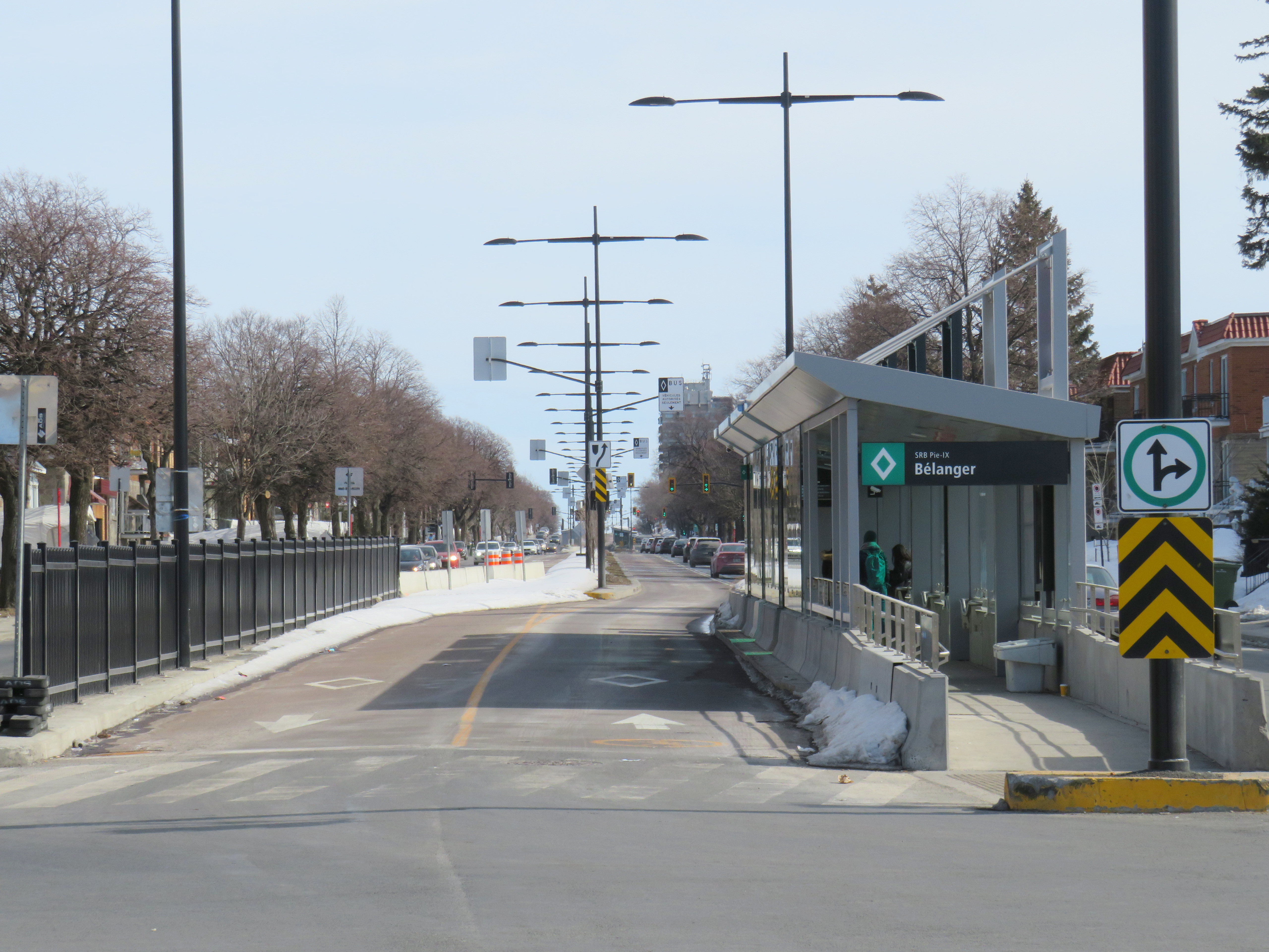
Montreal’s SRB Pie-IX
Looking south on Boul. Pie-IX from Rue Bélanger
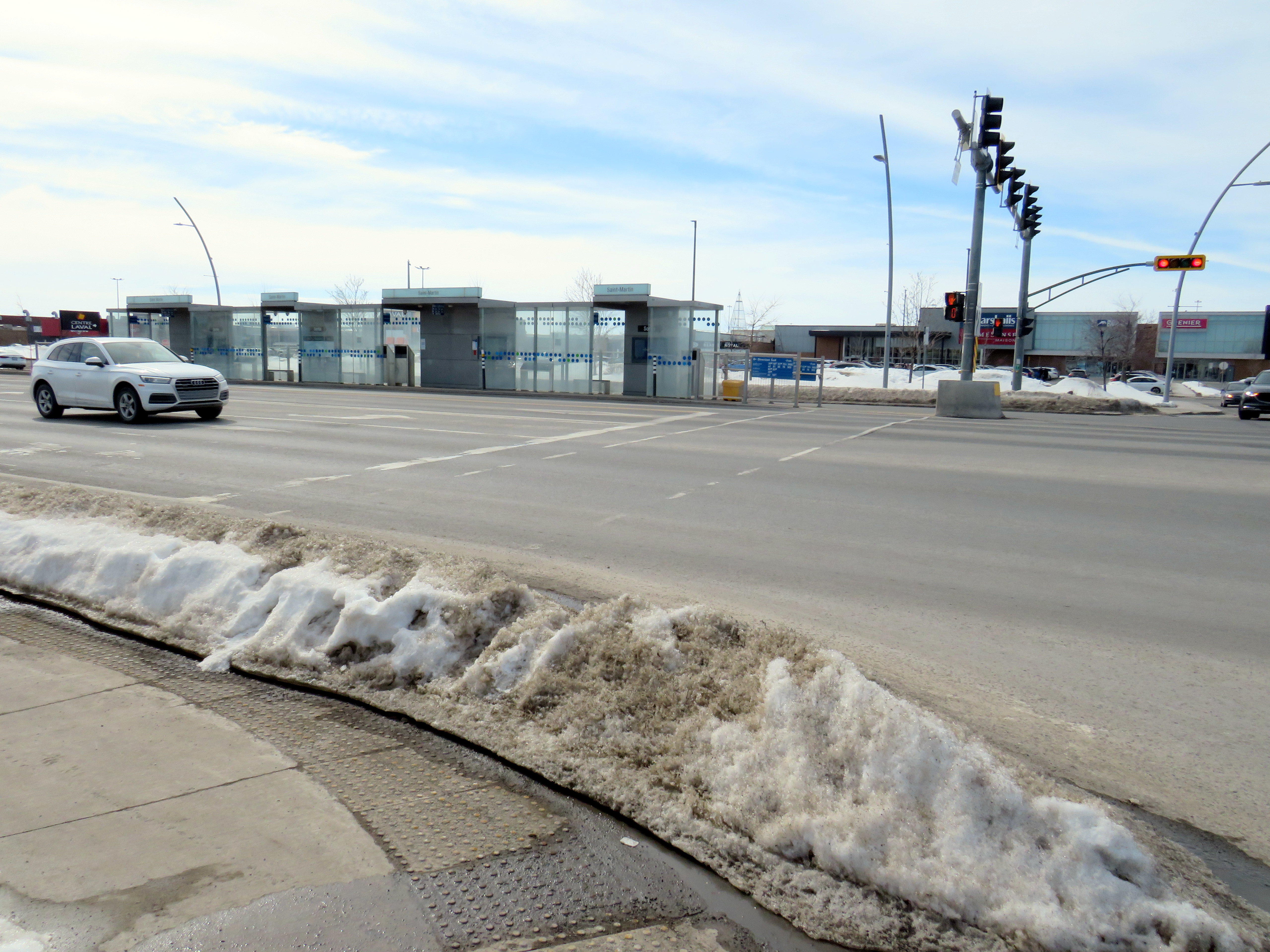
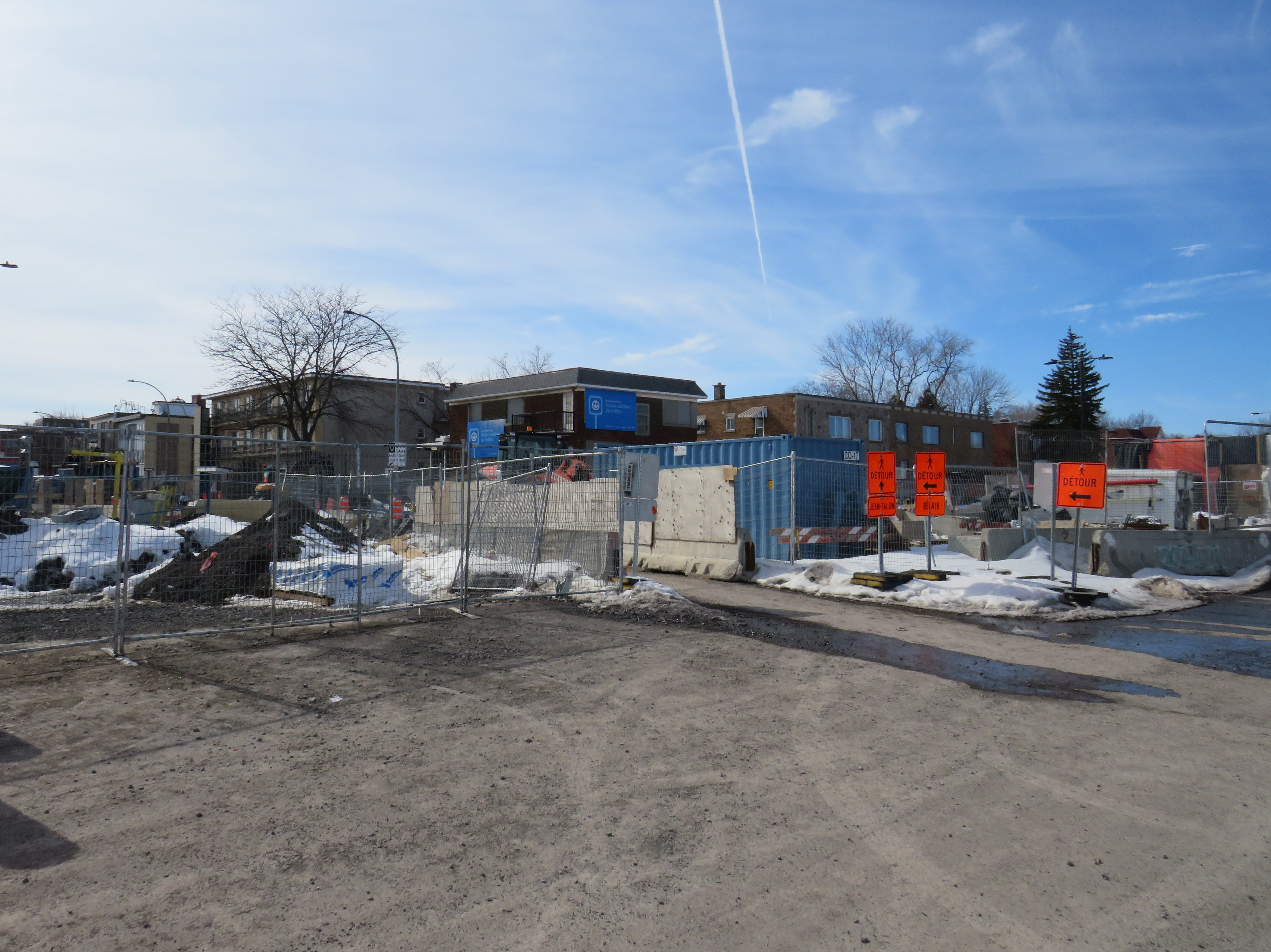
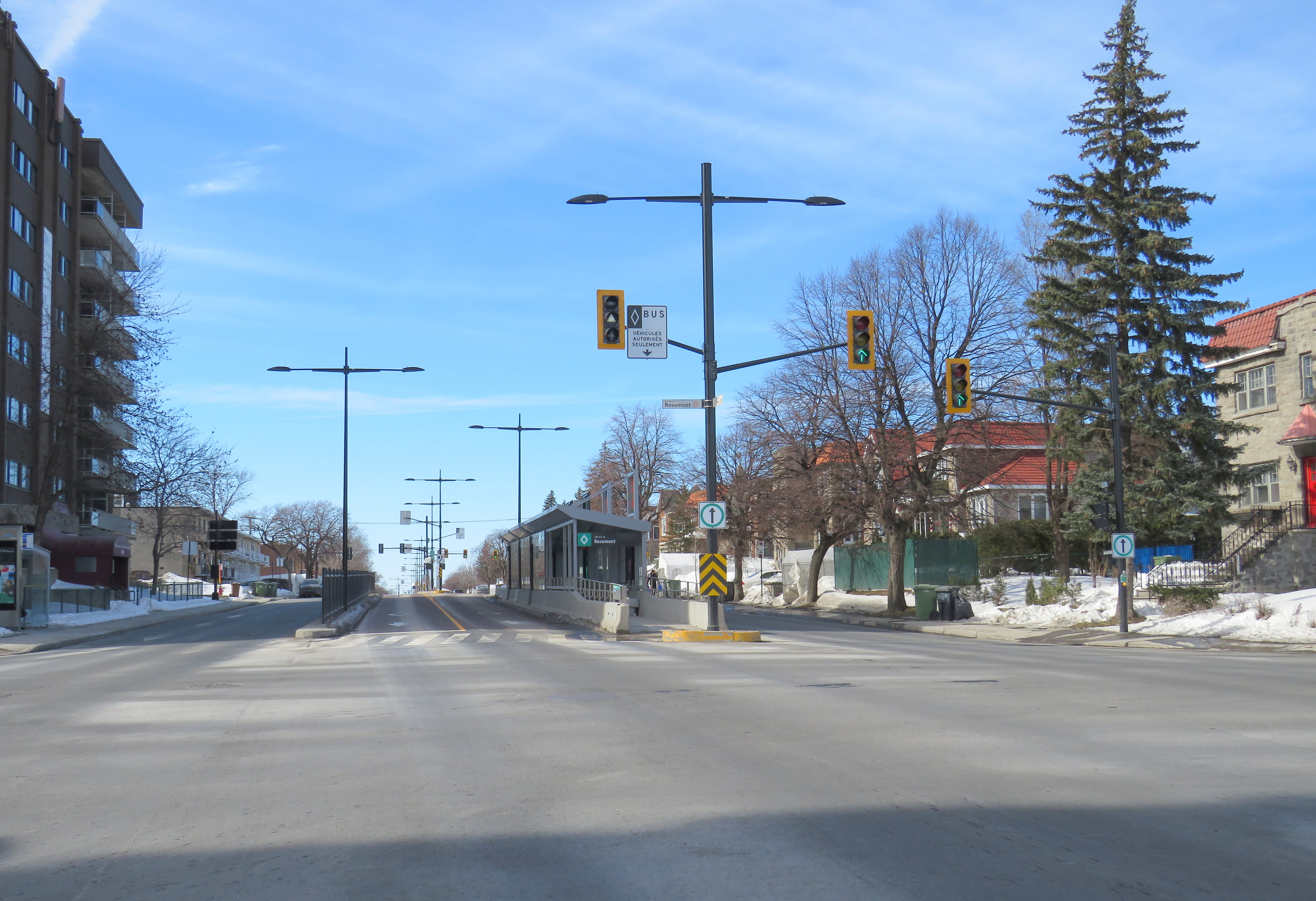
The SRB (BRT) corridor on Montreal’s Boulevard Pie-IX, which I visited later the same day, was a welcome contrast to Laval’s implementation. Boulevard Pie-IX (named for Pope Pius IX, the founder of the dogma of papal infallibility), is a wide north-south boulevard on Montreal’s east side, passing through Hochalaga, past Olympic Stadium and the Botanical Gardens, all the way into Laval. It’s a busy bus corridor, feeding into the Métro Green Line as well as the future extension of the Blue Line to Anjou.
The intersection of Pie-IX and Jean-Talon, where a new Métro station is under construction
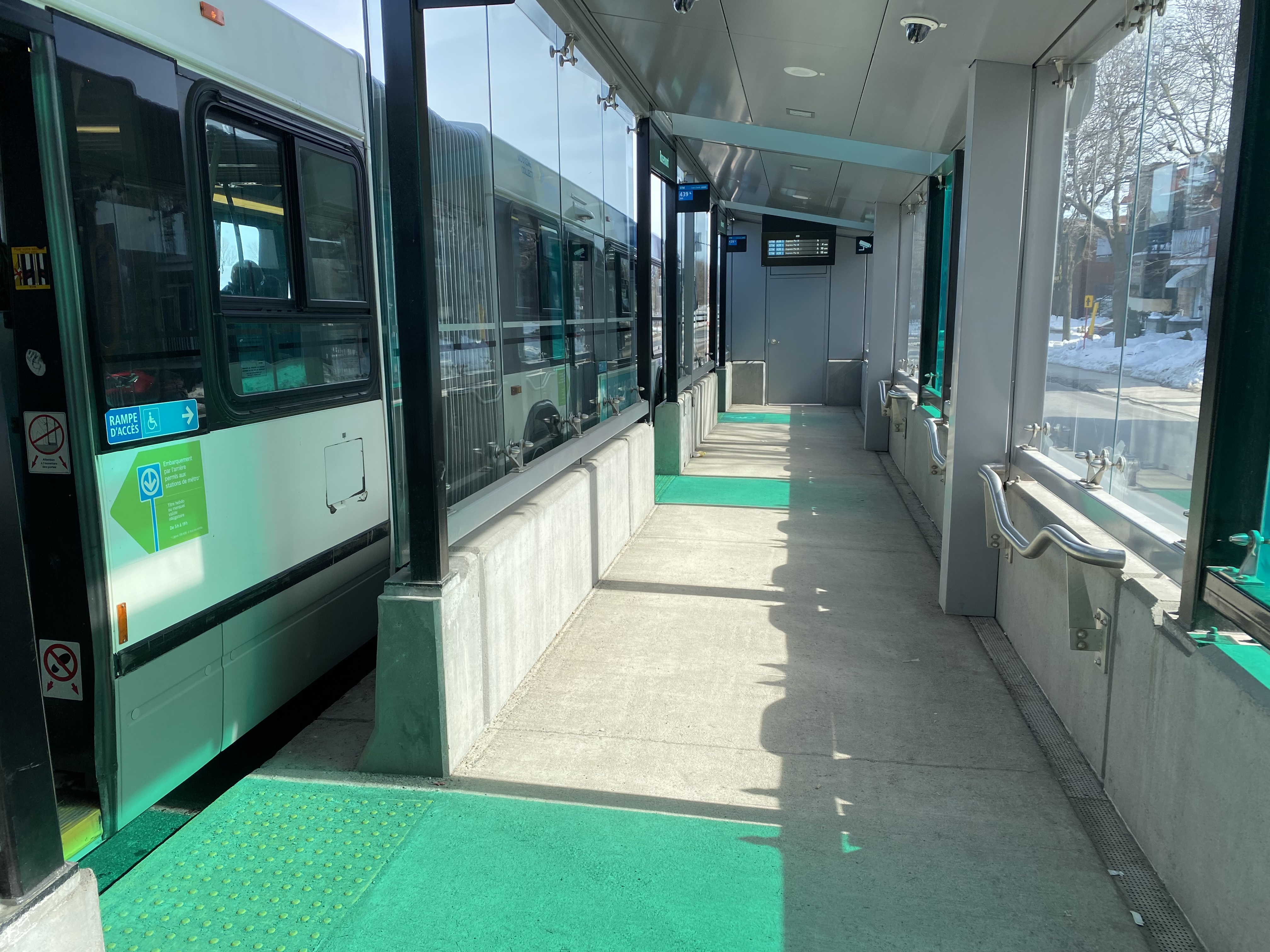
The 439 SRB route parallels the local 139 Pie-IX bus, and like other median busways, passengers board and exit at stops at the far side of the intersection. Though there is no fare pre-payment, passengers are permitted to board at rear doors with a valid Opus card or ticket. Shelters are simple, but the stained green glass lines up nicely with the gaps where the bus doors open.
Inside a SRB shelter
Unlike median busways elsewhere in Ontario or Quebec, buses are not slowed down by left-turning motorists as left turns are prohibited along the entire SRB corridor. This simplifies operations, allows for easier transit priority, and reduces the space required at intersections for dedicated left turn lanes. Unlike Laval, the crosswalks in Montreal were cleared and easy to traverse in winter.
Left turns are banned along the entire SRB corridor. Note the triangle light on the bus signal.
The current bus rapid transit alignment replaces an older, more dangerous set up where there was a central median where the inner lane was dedicated to buses in the opposite peak (contraflow) direction during weekday rush hours. Buses assigned to Pie-IX were equipped with special flashing arrows to warn oncoming motorists, along with overhead lights indicating the lane restriction. After several serious collisions, the arrangement was abandoned.
2009 Google Streetview image of the old Pie-IX express bus arrangement, where buses in the AM peak used the leftmost northbound lane to travel south, stopping at the median shelter. In the PM peak, northbound buses used the rightmost southbound lane.
Once again, Montreal shows how buses can be sped up without compromising safety or road space. Restricting left turns along the entire corridor was the right choice, and a solution that should be considered along some of Toronto’s busiest bus corridors as well.
Finally, rapid transit corridors on arterial roads are reliant on walk-up traffic, and should therefore be as easy and safe as possible to walk up to the transit service. This means effective and quick snow removal at crosswalks, pedestrian priority (there should be no beg buttons to push to access BRT/LRT stops), and proper pedestrian infrastructure and a walkable realm. The Viva Rapidways and the Laval Boul. Le Corbusier fail this basic criteria, while Montreal does a better job.
As Greater Toronto area plans more arterial LRT and BRT corridors, such as on Dundas Street in Mississauga/Oakville, and on Queen Street in Brampton, it would be wise to put transit and active transportation first, even if it means sacrificing a few left turn lanes.
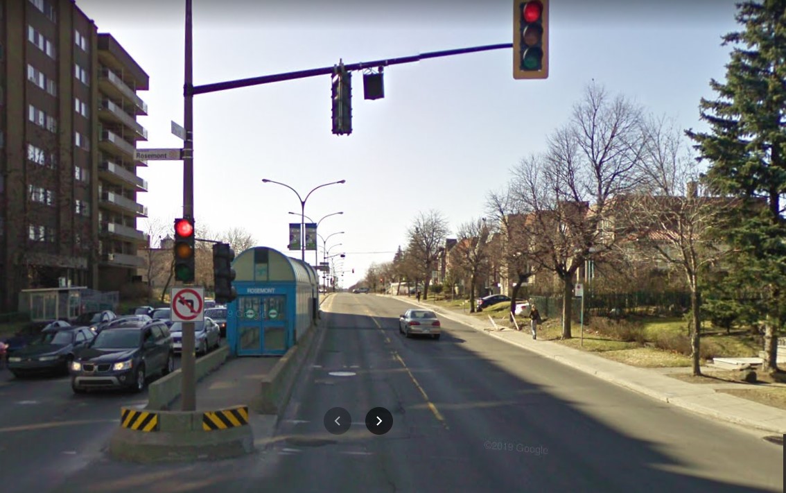
In January 2023, while visiting the site of the now-demolished Sarnia Eaton Centre, I took advantage of two new rural transit services serving Southwestern Ontario: Strathroy-Caradoc Transit and Huron Shores Area Transit. While both services connect London and Sarnia, they operate as separate services with different fares; they also have different terminals.
Strathroy-Caradoc Inter-Community Transit bus at Lambton Mall in Sarnia
Strathroy-Caradoc Transit offers the most direct service between London and Sarnia, with stops at London International Airport, Downtown London (on York Street near the VIA Station), Komoka, Mount Brydges, Strathroy, Lambton Mall, and Downtown Sarnia.
The regular cash fare between London and Sarnia is $20, though from London or Sarnia to Strathroy, the fare is $10. On my westbound trip on Sunday, January 29, the schedule allowed for a quick washroom and coffee break in Downtown Strathroy, a necessity given the long ride on a small minibus.
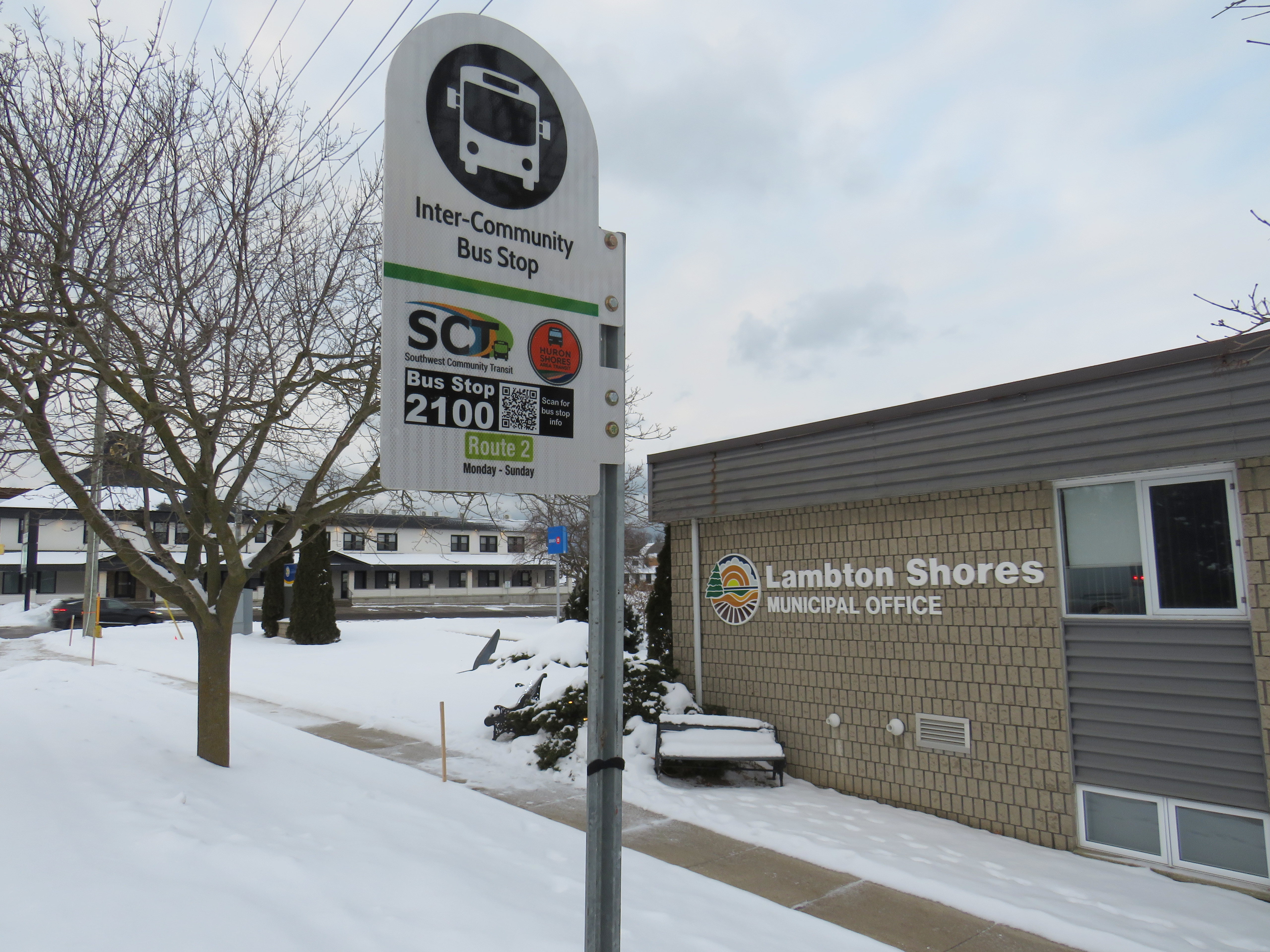
Returning the next day from Sarnia, I opted to ride Huron Shores Area Transit (HSAT) back to London. HSAT, which is also contracted to Voyago, connects several communities in Lambton, Huron, and Middlesex Counties. All four HSAT routes converge in the summer resort town of Grand Bend. Two routes operate seven days a week (Route 1, connecting Sarnia, Forest, Thedford, and Kettle Point & Stoney Point First Nation, and Route 2, serving Exeter, Lucan, Centralia, and London). There are two additional routes operating two days a week from Grand Bend to Goderich and to Parkhill and Strathroy.
Unlike Strathroy-Caradoc, HSAT operates on a flat $5 cash fare. Even though I was traveling the long way between Sarnia and London, with an hour-long layover in Grand Bend, I was offered a slip of paper marked by the driver that allowed me to board the second bus without a second fare. Huron Shores buses have bike racks, though the operator recommends calling ahead to ensure their availability.
While Strathroy-Caradoc Transit serves downtown London and Sarnia, HSAT’s buses go only as far as the first major destination in both cities. The Sarnia stops for Route 1 are at Lambton College and nearby Lambton Mall, while the London stops on Route 2 are on London’s north end, near Masonville Place and at the University Hospital on the Western University campus. Getting downtown requires a transfer to Sarnia or London Transit.
Huron Shores Area Transit bus at London’s University Hospital. Note the bike rack.
Though VIA Rail still operates one daily train between Toronto, London, and Sarnia, it is not on a convenient schedule for most passengers (it leaves Sarnia early in the morning and arrives late in the evening), so the new bus services fill a key role in providing mobility options. Though it is more expensive, the Strathroy-Caradoc route is the direct and the fastest connection. But Huron Shores trip is the more scenic and cheaper ride.
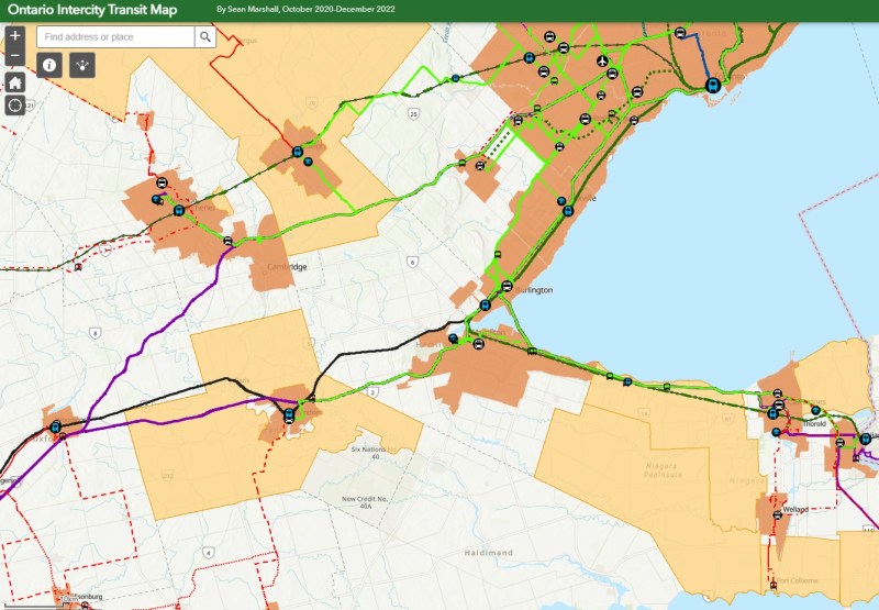
I updated my Ontario intercity transportation map for April 2023 to include the major GO Transit service changes, the gradual resumption of some Ottawa commuter bus routes, the start of Travelways bus service between Detroit, London, and Toronto, and minor route and service changes elsewhere in the province.
The hour-long layover in Grand Bend gave me a chance to wander the town. On the main street, almost every business was closed for the season. There was very little traffic on Main Street, so it had a bit of a ghost town feel. On Highway 21 and to the east, however, typical chain stores like Tim Hortons, Sobey’s, and Shoppers Drug Mart serve the year-round population.
Grand Bend’s famous beach — in JanuaryHello Sunshine
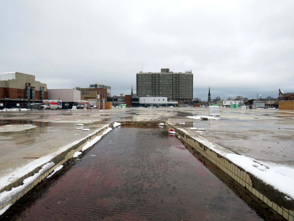
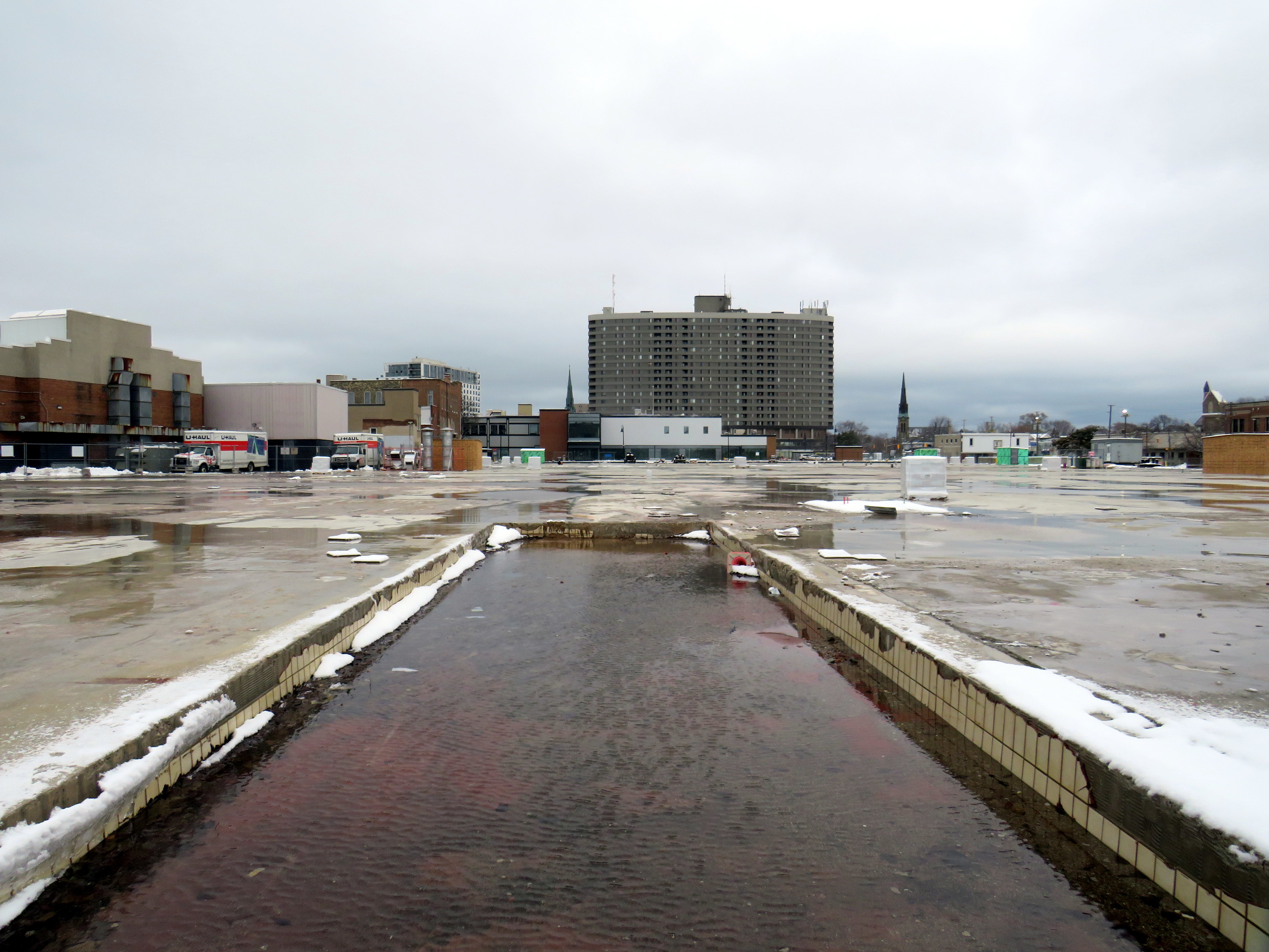
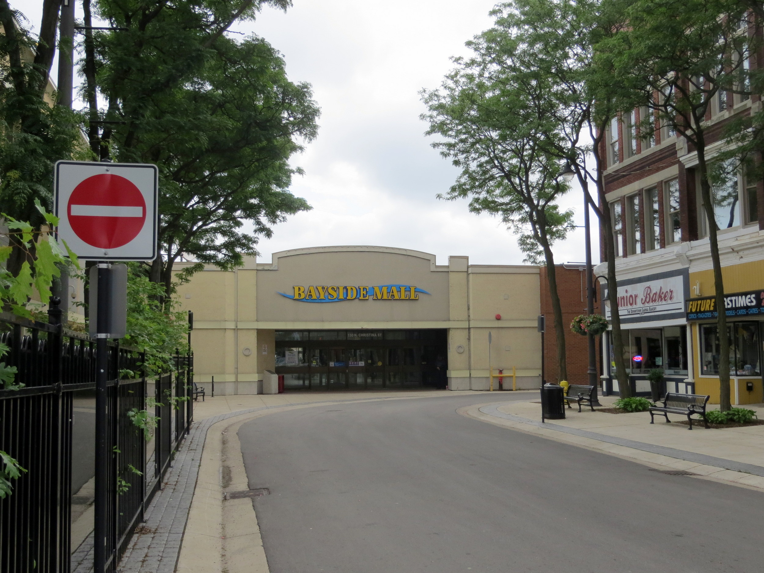
Late last year, I wrote about the closure of the Hamilton City Centre mall, the last of Ontario’s downtown Eaton Centres to open. But Hamilton’s failed shopping centre wasn’t the only old downtown mall to close in recent years: Sarnia’s Bayside Centre, opened in 1982 as the Sarnia Eaton Centre, was recently demolished, with a seniors’ residence and long-term care home set to take its place.
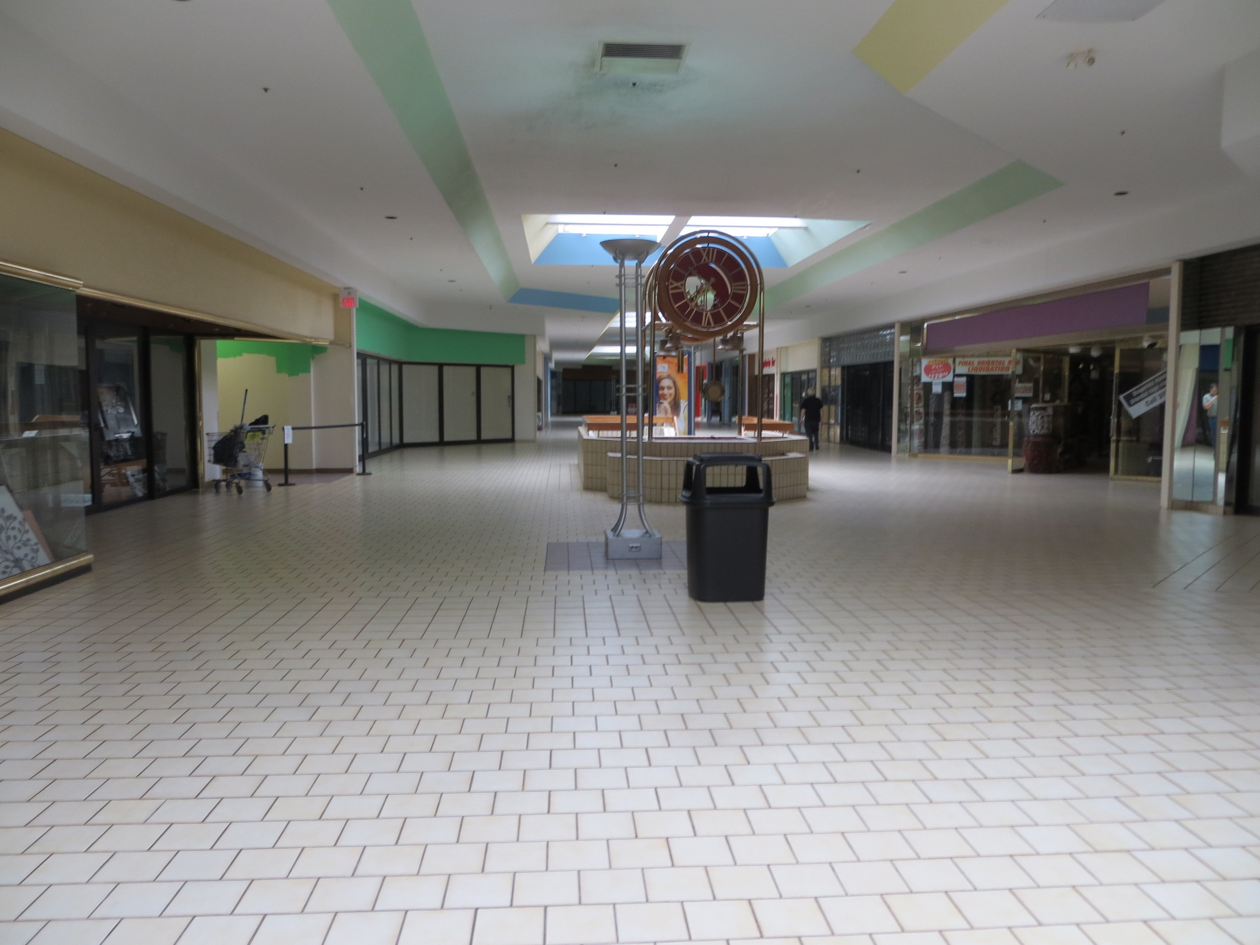
Bayside Mall in 2013
I previously visited Sarnia’s Bayside Mall in 2013, when the mall was already mostly dead. Community uses, such as a local museum, a Canadian Blood Services clinic, a seniors’ drop-in centre, and a March of Dimes office predominated, with only Hong Kong Express and Subway left in the food court, and a few other shops — a rug store, an optician, a beauty salon, and a pharmacy — scattered amongst the vacant storefronts. The old Eaton’s department store was already converted into offices for Lambton County’s social services department.
The old fountain at the main entrance to Bayside Mall in 2013.
As I discussed previously on this website, there was a downtown redevelopment boom across Ontario in the 1970s and 1980s, with municipalities and the province eager to support the construction of new shopping centres to help them compete with suburban malls.
The Sarnia Eaton Centre was the first of several malls funded by the Ontario Downtown Redevelopment Program, though previous downtown shopping centres, such as Hamilton’s Jackson Square and the Sudbury City Centre, were built with municipal support.
The case for Sarnia Eaton Centre was always weak, but it was the result of inter-municipal rivalry as much as it was an attempt to revitalize Downtown Sarnia. In the 1970s, Lambton Mall opened in the city’s outskirts, near the intersection of Highways 40 and 402. But Lambton Mall was built outside the city limits, in suburban Sarnia Township. Lambton Mall’s anchors included Sears, Canadian Tire, and Toys R Us.
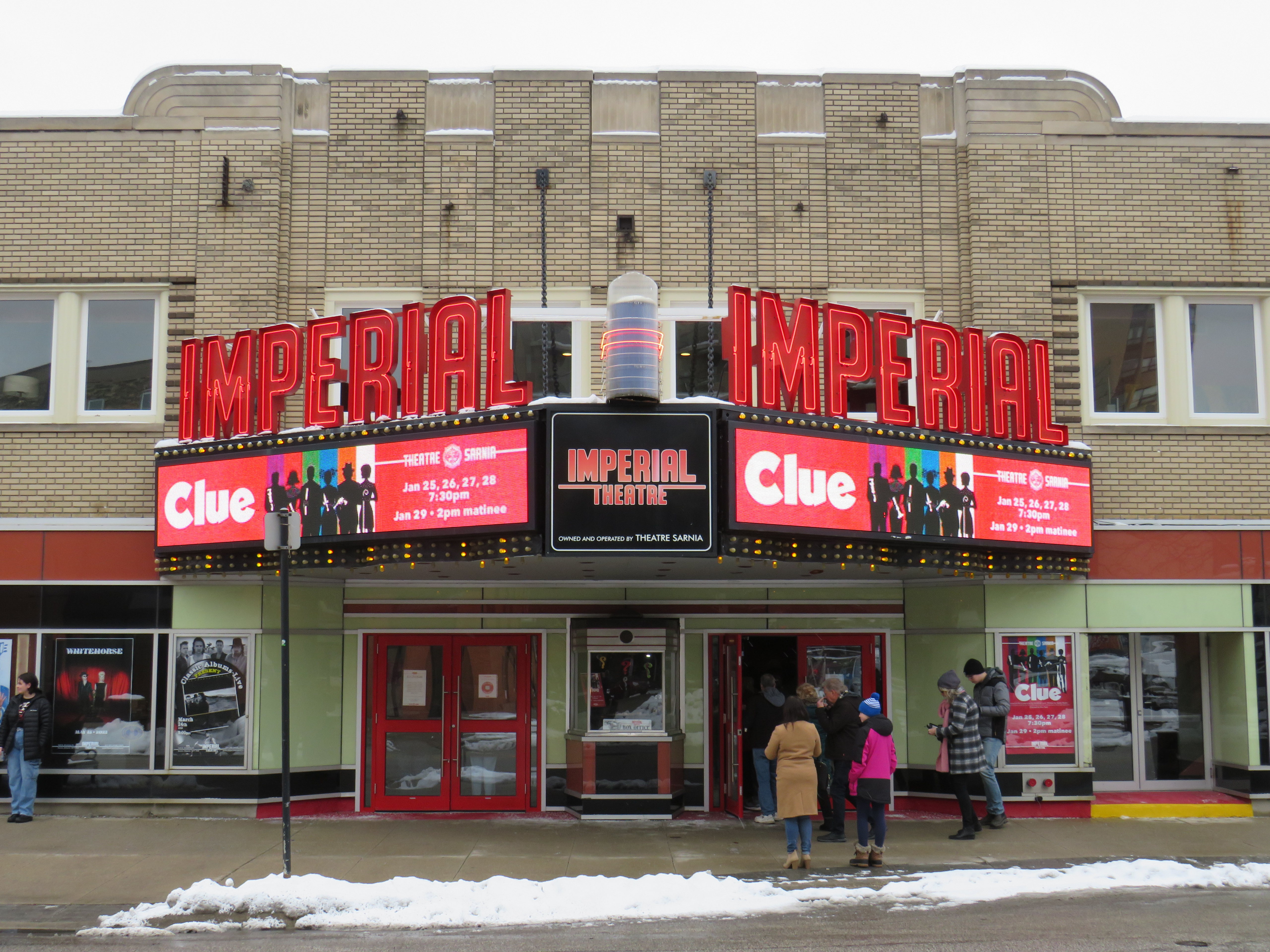
While Sarnia Township’s population was growing due to residential, industrial, and institutional growth (Lambton College’s main campus was also established in the township, near Lambton Mall), the City of Sarnia’s population declined. Along with the new Eaton Centre, the city also encouraged new highrise residential development in the downtown core, and two new office buildings were also constructed. The city – with support from Imperial Oil, a major employer – renovated the old movie theatre, converting it to a playhouse for local productions and touring shows.
The Imperial Theatre remains a popular attraction
When it opened in 1982, Sarnia Eaton Centre was the centrepiece of Sarnia’s downtown comeback. It filled in nearly four blocks of Downtown Sarnia, with Lochiel Street closed between Christina and Vidal Streets, and Victoria Street closed north of Cromwell.
The mall was anchored, of course, by Eaton’s, a smaller, two-storey store with 91,470 sq. ft. of floor space (just under 8500 square metres), and an A&P supermarket on the southern end. Sarnia Eaton Centre’s 1993 Canadian Directory of Shopping Centres, showed that the mall still had a healthy assortment of national retailers, along with some local businesses. But many retailers refused to renew their store leases, and when Eaton’s entered bankruptcy for the first time in 1997, the Sarnia store was among the first to close.
The City of Sarnia merged with Sarnia Township in 1991, while the area surrounding Lambton Mall continued to grow as the region’s commercial centre. Big-box stores such as Walmart and Home Depot clustered around the older mall, and even with Sears Canada’s closure, Lambton Mall continued to do well, with Marshalls/Home Sense taking over the old Sears store.
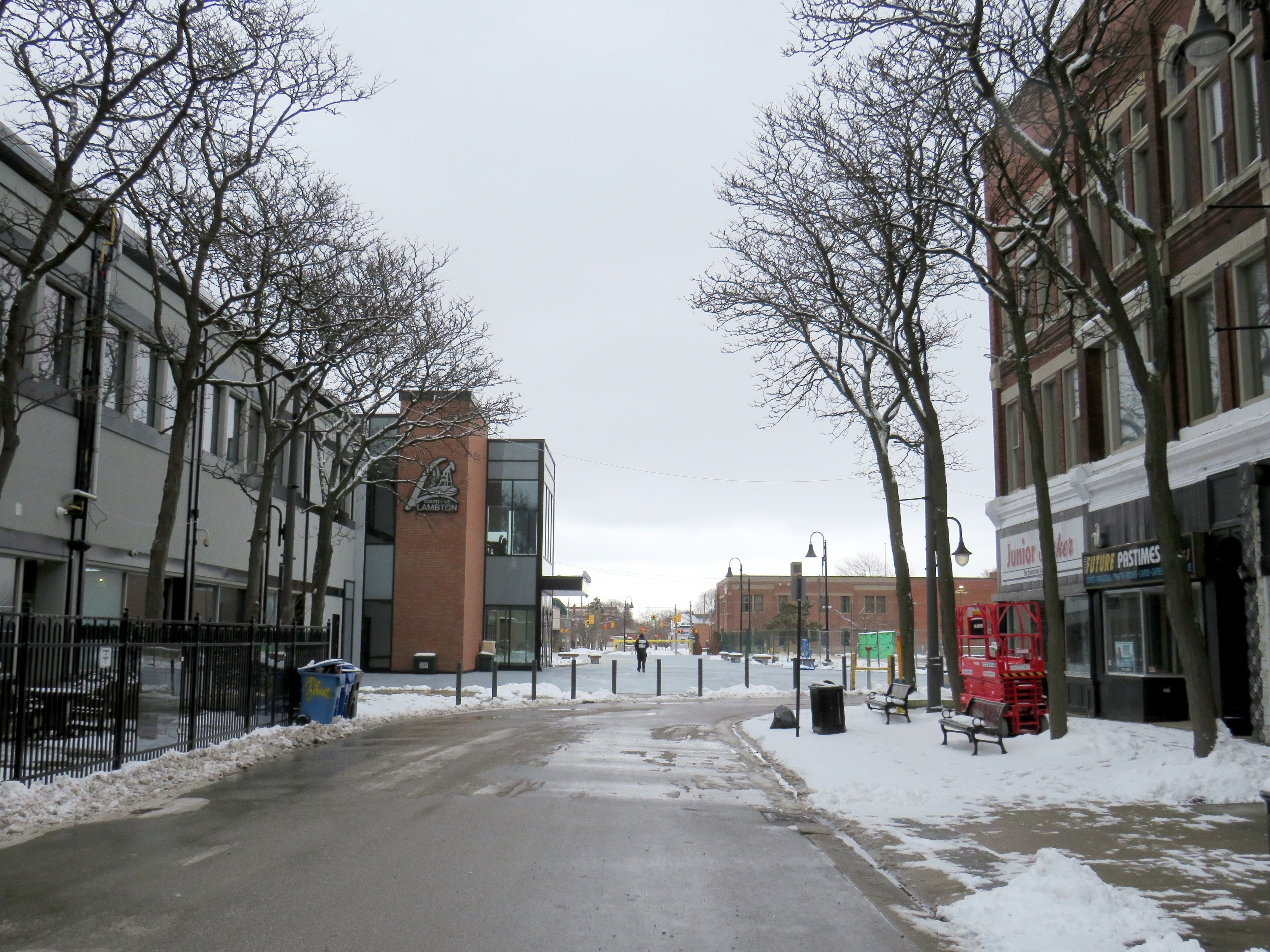
20132023
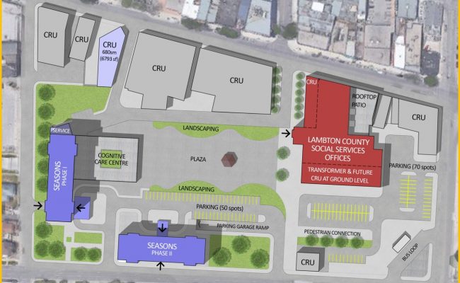
The Bayside Mall property was purchased by Seasons Retirement Communities in 2017, and most of the mall was demolished in 2021-2022. Lambton County, which operated its social services offices in the former Eaton store, expanded its footprint, with a new municipal courthouse located next to the old Eaton’s store, which was renovated.
Lochiel Street has been partially restored as a pedestrian walkway across the site, while the southern half of the old mall will be redeveloped for mid-rise seniors’ homes, with a central plaza.
Map showing the redevelopment of Bayside Mall, with the Lambton County building, in red, already complete in early 2023. The top of the map faces west.
Meanwhile, Downtown Sarnia will continue to hold its own. It has a few nice restaurants, cafes and pubs, and the highrise development of the 1970s and 1980s ensures that there’s a local population that will frequent the businesses there. The addition of seniors housing won’t hurt either.
Below is the list of tenants at Sarnia Eaton Centre in 1992, obtained from the 1993 Canadian Directory of Shopping Centres, published by Maclean-Hunter. In 1992, the collection of retailers was still quite strong, largely driven by Cadillac Fairview’s leasing team.
Anchors
A&P (26,512 sq ft), Eaton’s (91,470 sq. ft)
Fashions and footwear Children’s wear: Just Kids Unisex/family wear: Le Chateau, D’Gala, Pantorama, Stitches, Thrifty’s Ladies’ wear: Fairweather, Irene Hill, Just Petites Lady Foot Locker, Lindor, Reitmans, Smart Set, Suzy Shier Menswear: Tip Top Footwear/leather goods: Agnew, Baronessa, Bata, Belinda & Brother, Joggers, Kinney, Mr. Minit Shore Repair Jewellery/accessories: Ardene, People’s
Other retailers Books/stationery: Carlton Cards, Garfield, WH Smith Health and beauty: Caryl Baker Visage, Shoppers Drug Mart Department store/mass merchandiser: Marks & Spencer, A Buck Or Two Electronics: Radio Shack Entertainment: Fun & Games Furniture & furnishings: Brass Collections Gifts: Things Engraved Hardware/paint & paper: St. Clair Paint and Wallpaper Housewares: The Royal Douton Store, Stokes Music/ records & tapes: Discus, Music World Pets: Tropicarium Pet Centre Photo/camera: Black’s, Japan Camera Restaurants & fast food: Elephant & Castle, Global Donuts, Hamby’s, Hong Kong Express, Kernels, Mykie’s, Viva Pasta Specialty food & drink: Laura Secord, mmmarvellous mmmuffins, Second Cup
Services Banks/financial: Canada Trust, TD Bank Hairstyling/esthetics: Regis Hairstylists Medical/dental: Tridont Dental Travel: Marlin Travel Misc: Infoplace
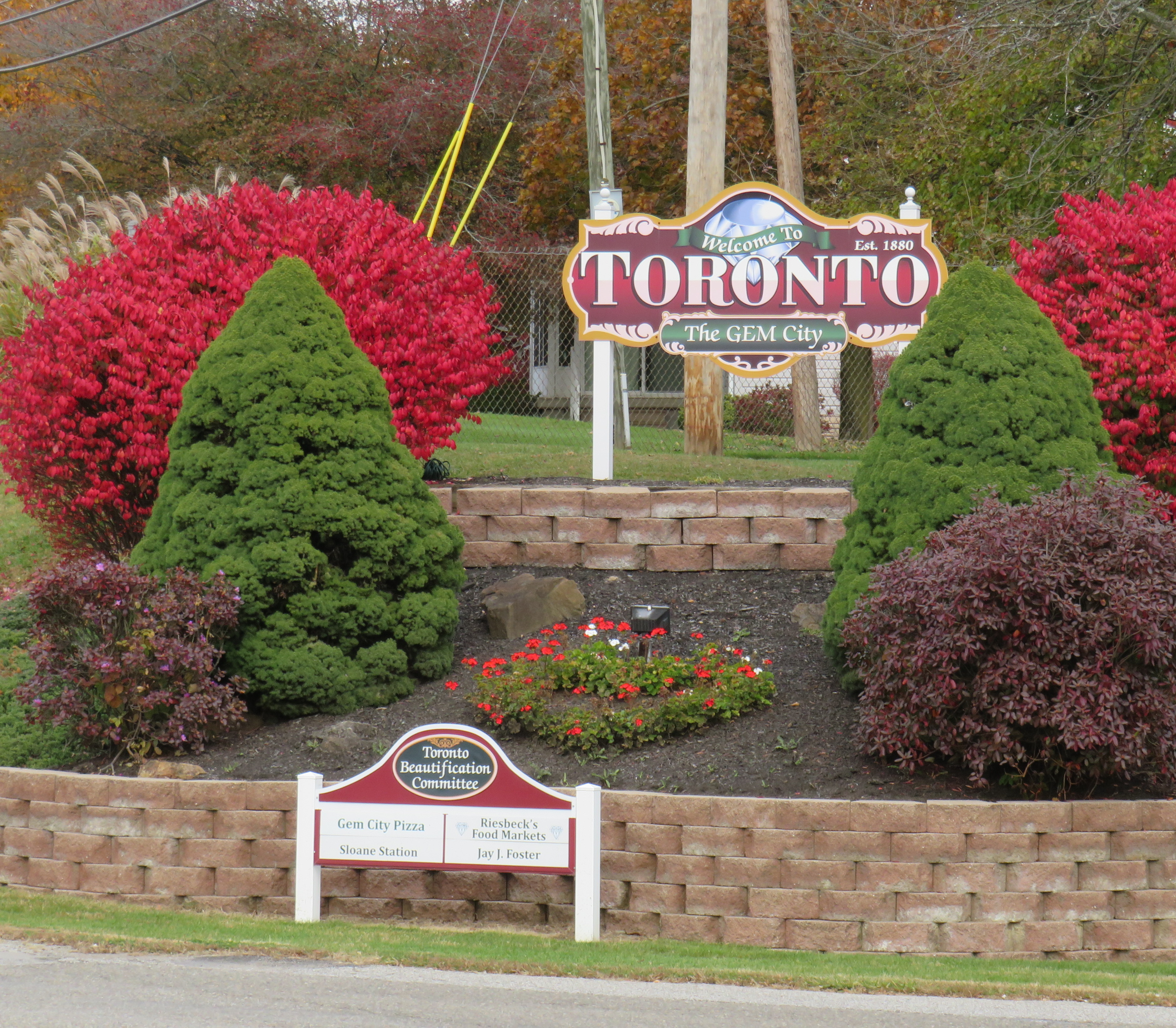
The small Ohio community was originally named Sloan’s Station, but when it was incorporated as a city, they chose “Toronto” because local businessman W.F. Dunspaugh, a Toronto (Ontario) native, thought his hometown was “a place worth emulating.” Toronto, Ohio is the only other city named Toronto, but other Torontos exist, including the town of Toronto, South Dakota (population 212) and the town of Toronto, New South Wales, Australia (population 5,161).
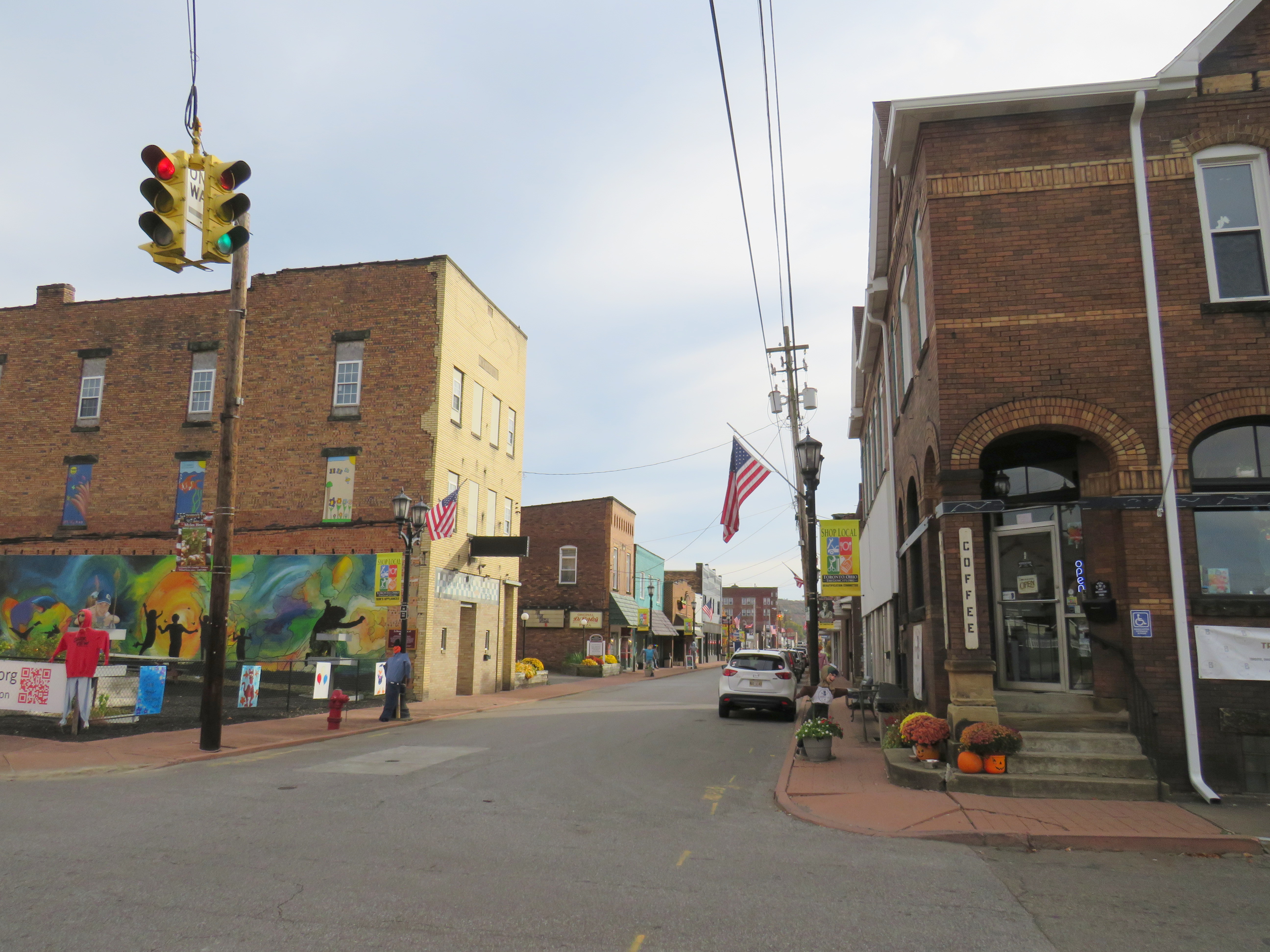
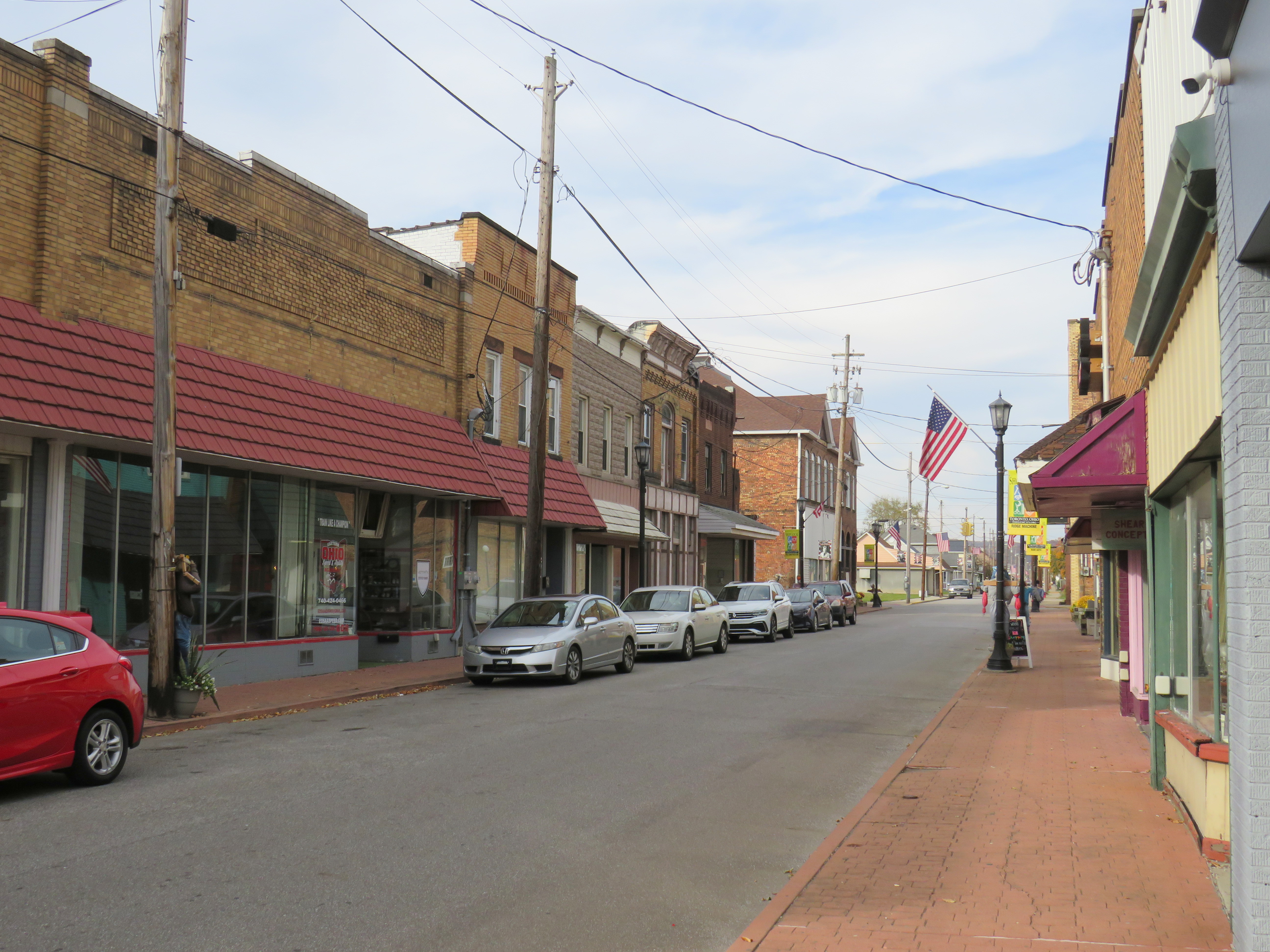
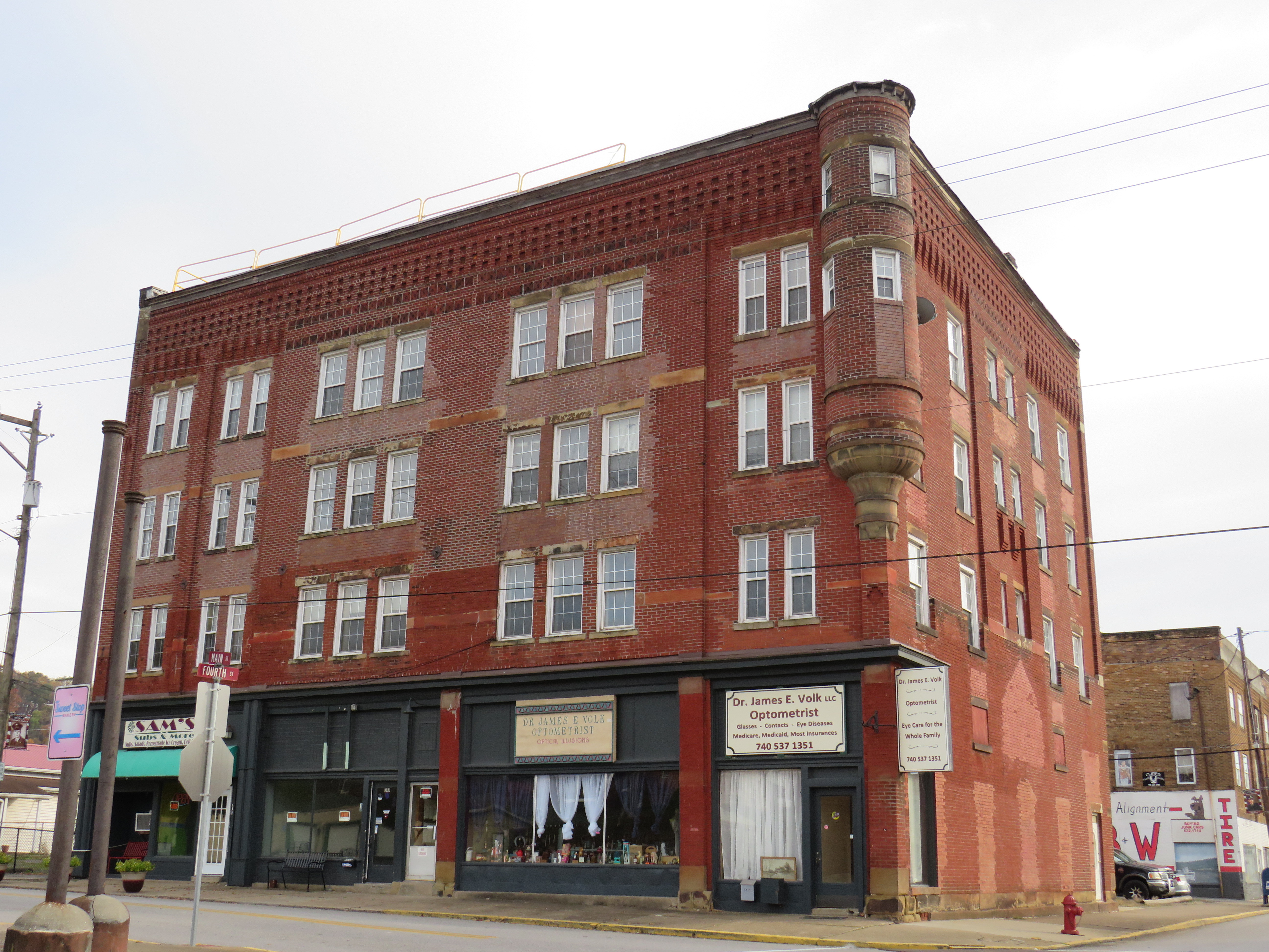
In 2012, Downtown Toronto had only a handful of stores, including a Dollar General, a bar, pizzeria, a Hallmark gift shop, and a hair salon. Apart from the bar (which I went into ten years ago), those businesses are still there today, but there was also a new barbecue restaurant, and a coffee shop. Up the street, a disused auto shop was transformed into a pretty good taco joint. Though downtown wasn’t especially busy, the parking spots along 4th Street were mostly full.
Downtown Toronto. A community garden sits on a vacant lot on the corner. 4th Street, Toronto’s main street The old hotel, now shops and apartments
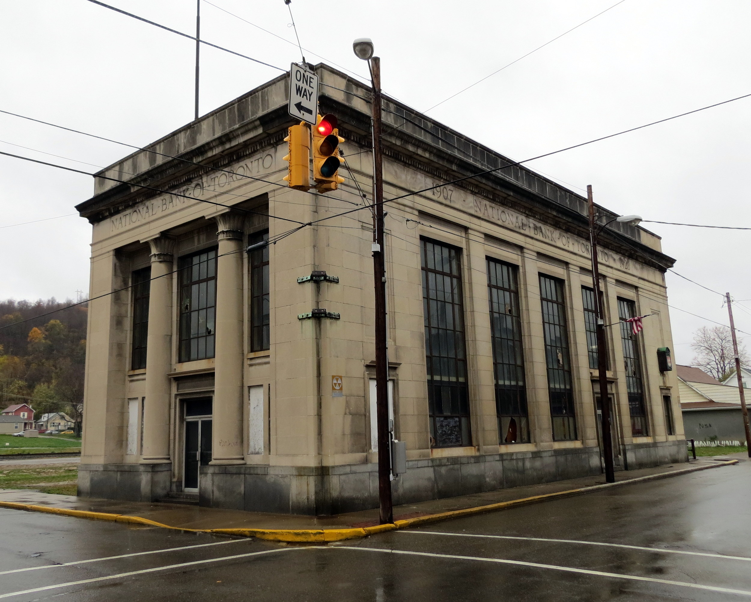
Sadly the abandoned, yet still handsome National Bank of Toronto building was torn down a few years ago. Otherwise, Toronto continues to hold its own, with a well-kept little downtown and more places to sit and eat than before.
Former National Bank of Toronto, October 2012Site of the former National Bank of Toronto, October 2022
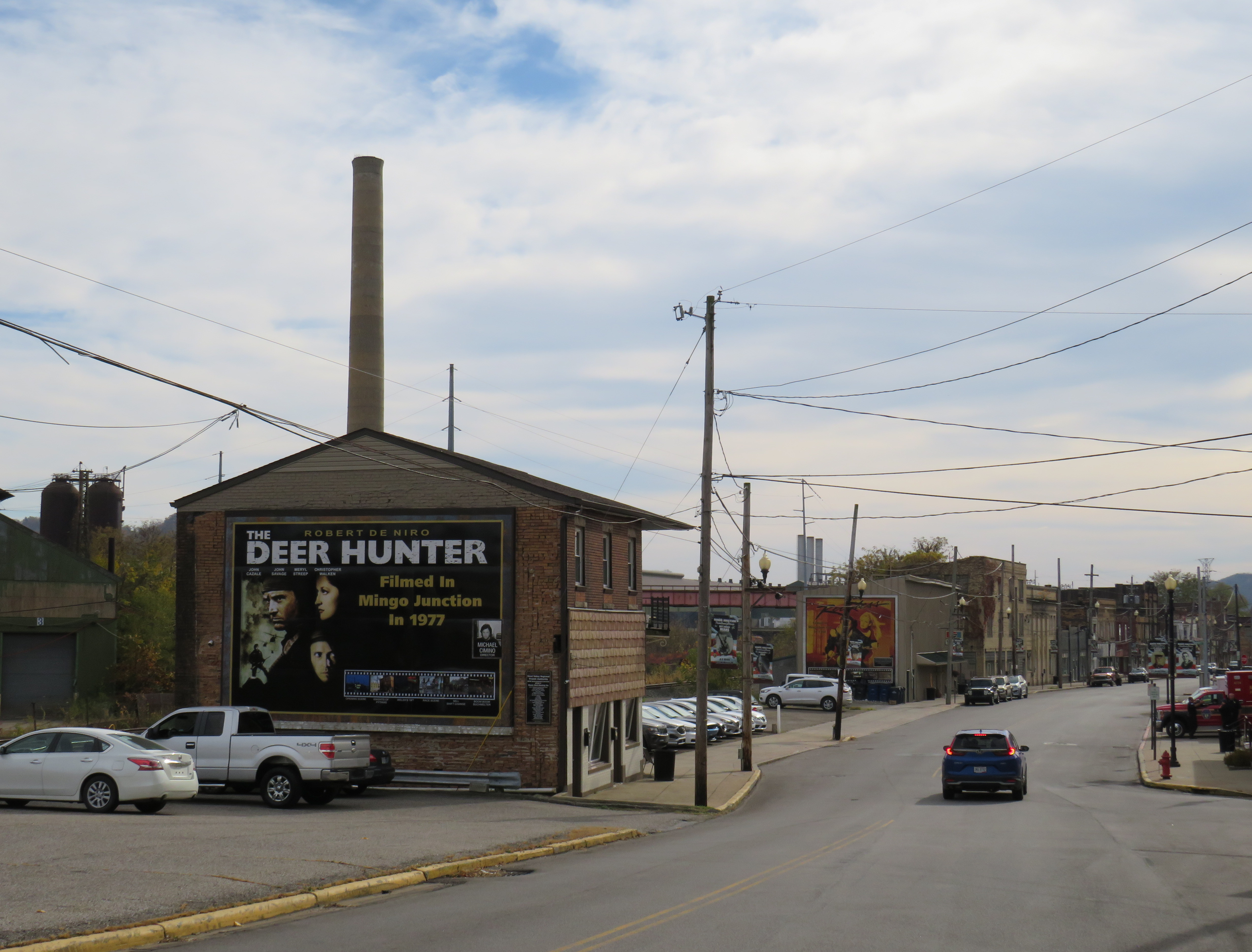
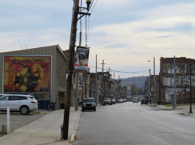
Just a few miles to the south is the town of Mingo Junction, Ohio, one of many industrial communities along the Ohio River in Pennsylvania, West Virginia, Ohio, and Kentucky. Mingo Junction is best known as a filming location for movies including the acclaimed 1977 film “The Deer Hunter.” The town now celebrates its cinematic history with large vinyl signs displayed on the north end of Mingo Junction’s main street.
Large sign celebrating the filming of “The Deer Hunter” in Mingo Junction, Ohio
While Toronto’s economy is based on a still-busy titanium mill, Mingo Junction is a old steel town, hit hard by the deindustrialization of northeast Ohio in the 1970s and 1980s. The condition of its Main Street
Mingo Junction’s Main Street, bypassed by a newer expressway. Another mural celebrates “Reckless,” a 1984 film also filmed in town.
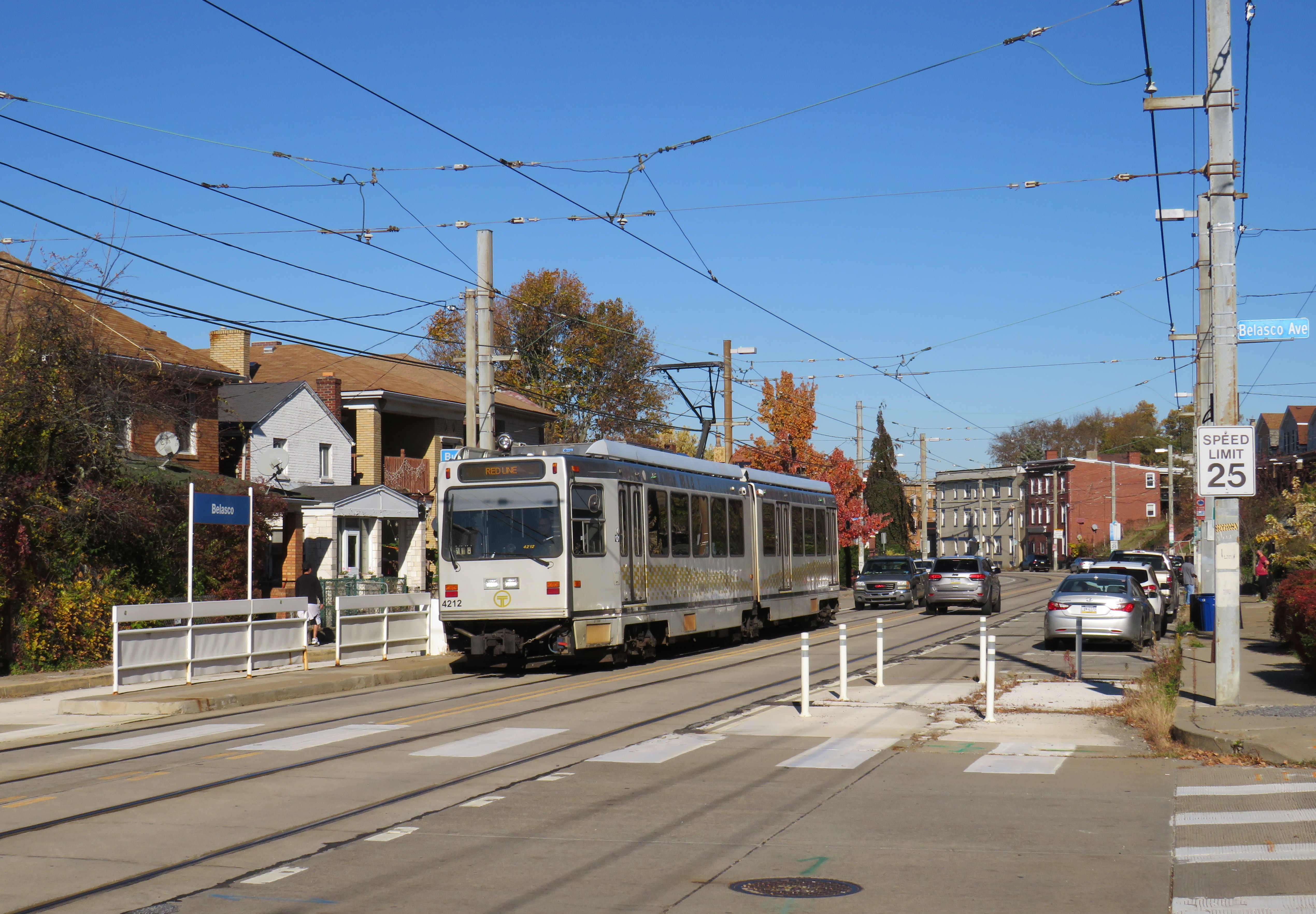
Pittsburgh Regional Transit Red Line train in the Brookline neighbourhood
In 2022, with travel restrictions eased, I had the opportunity to take several road trips throughout the Northeast and Midwestern states, from New York and Maryland to Kentucky and Michigan. Previously on this site, I wrote about my visit to Philadelphia’s Rail Park, a lesser-known, yet ambitious project to repurpose former Reading Railroad corridors in the city’s north end. I also wrote about Dayton’s trolley bus network, which, if operated to its full potential, could be a model for electrifying transit across North America.
In this post, I write about some of the other interesting transit services in Pennsylvania, Ohio, and West Virginia that I visited on my travels late last year, including a personal rapid transit prototype, the remnants of a huge legacy streetcar system transformed into a modern light rail line, bus rapid transit lines, and a new streetcar service I last visited while under construction in 2015. I even got to ride TANK.
Cleveland
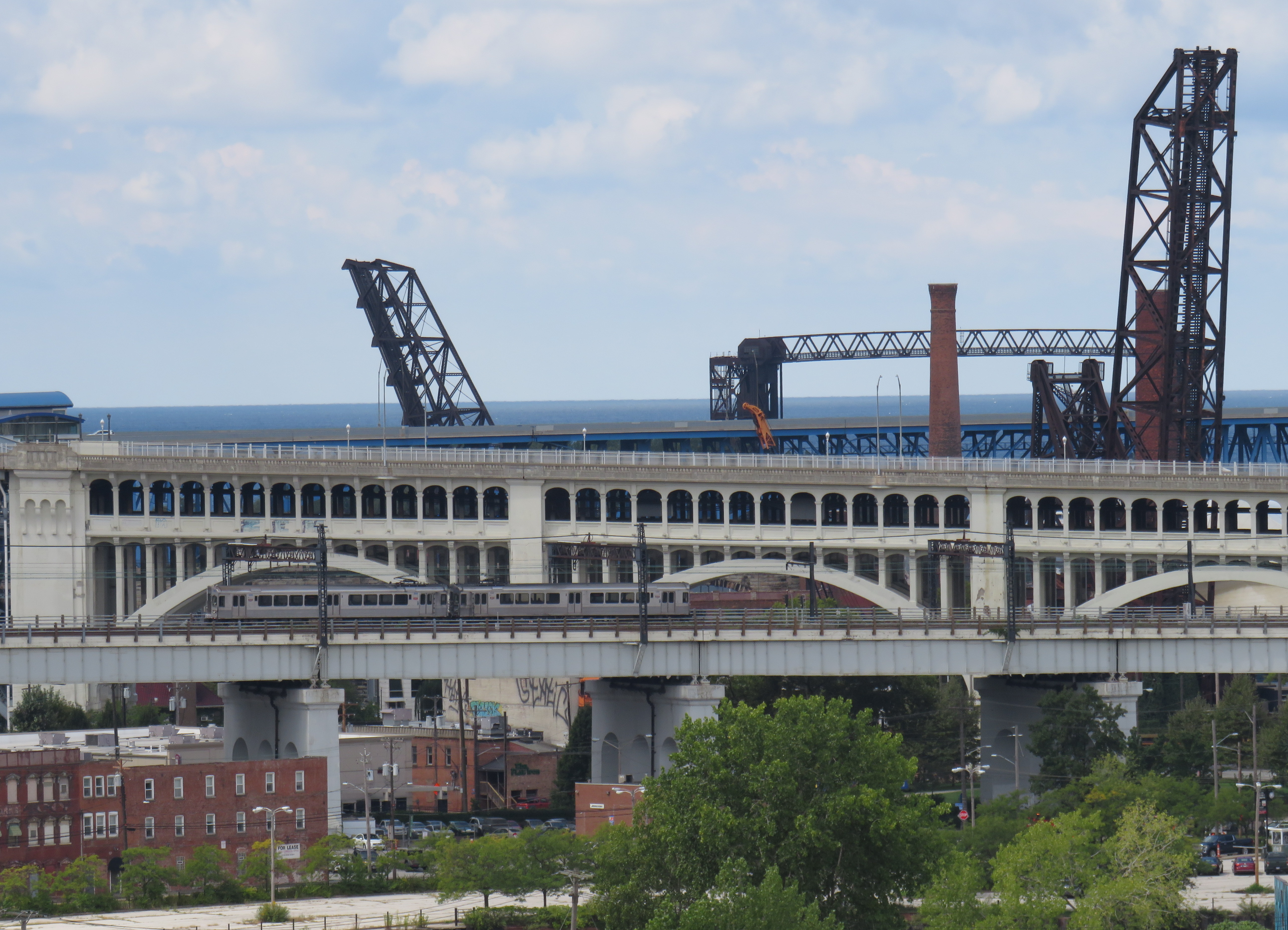
Cleveland Red Line train on one of the many bridges spanning the Cuyahoga River and the Flats. The arched double-decked bridge beyond the Rapid train once carried a streetcar subway into Downtown Cleveland from the west.
I visited Cleveland, Cincinnati, and Dayton in September 2022.
Cleveland, like most American cities, once had an expansive streetcar and interurban tram network. The city streetcars lasted until the early 1950s (its PCCs were acquired by the TTC), though the separate Shaker Heights Rapid Transit, which also used PCCs, continued in service.
The Cleveland system, made up of the heavy-rail Red Line, and the light-rail Blue and Green Lines (the former Shaker Heights services), run almost entirely on the surface, largely adjacent to railway rights-of-way. The Red Line, built between the 1930s and 1960s, was North America’s first airport rail link when that extension opened in 1968. Unfortunately, the service suffers from low ridership, so it operates in two-car trains, every 15 minutes during daytime hours.
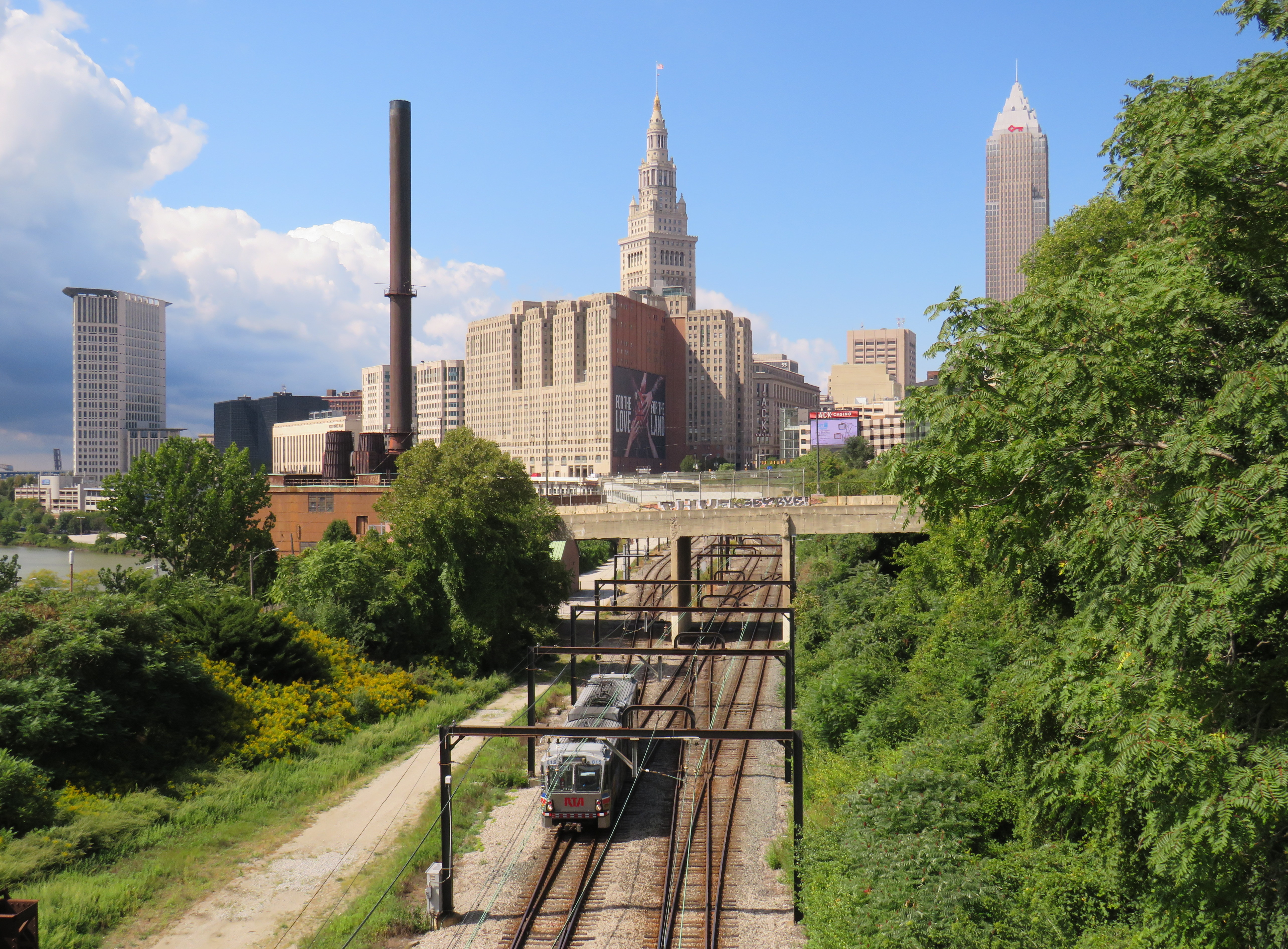
A Greater Cleveland RTA light rail vehicle heads eastbound from Downtown Cleveland, headed towards Shaker Heights. Terminal Tower in the centre background.
The Red Line follows an old passenger railway alignment into Terminal Tower, the massive transportation hub, office tower, and commercial development on Public Square. The complex included a hotel, Higbee’s Department Store (made famous by its appearance in A Christmas Story) and local and intercity train platforms. With the decline of passenger rail, the trains moved to a much smaller station on the waterfront, and the Higbee’s store later became a casino.
Both the Red Line and the former Shaker Heights light rail lines share the same tracks east of Downtown Cleveland, and both services run on overhead catenary.
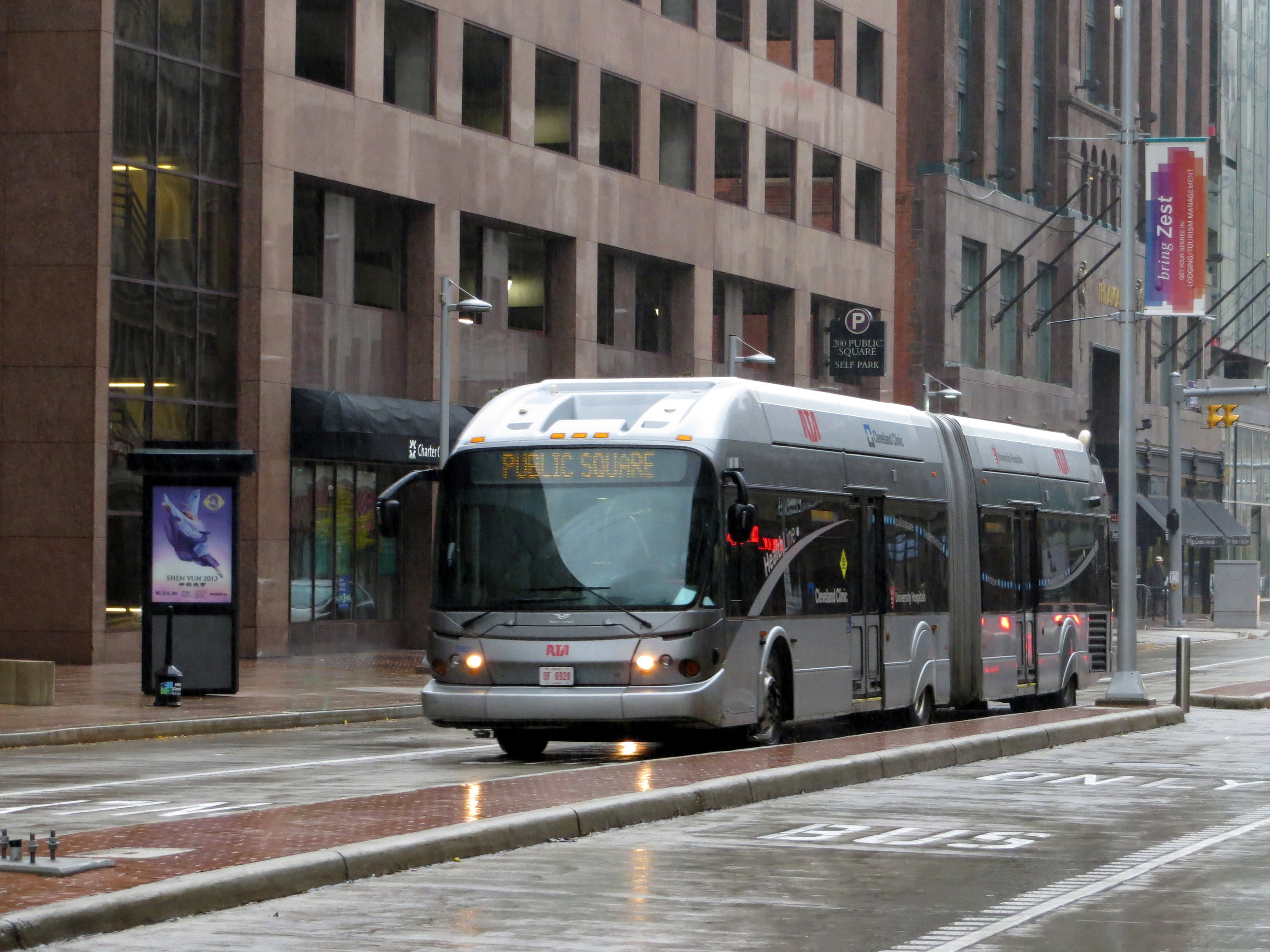
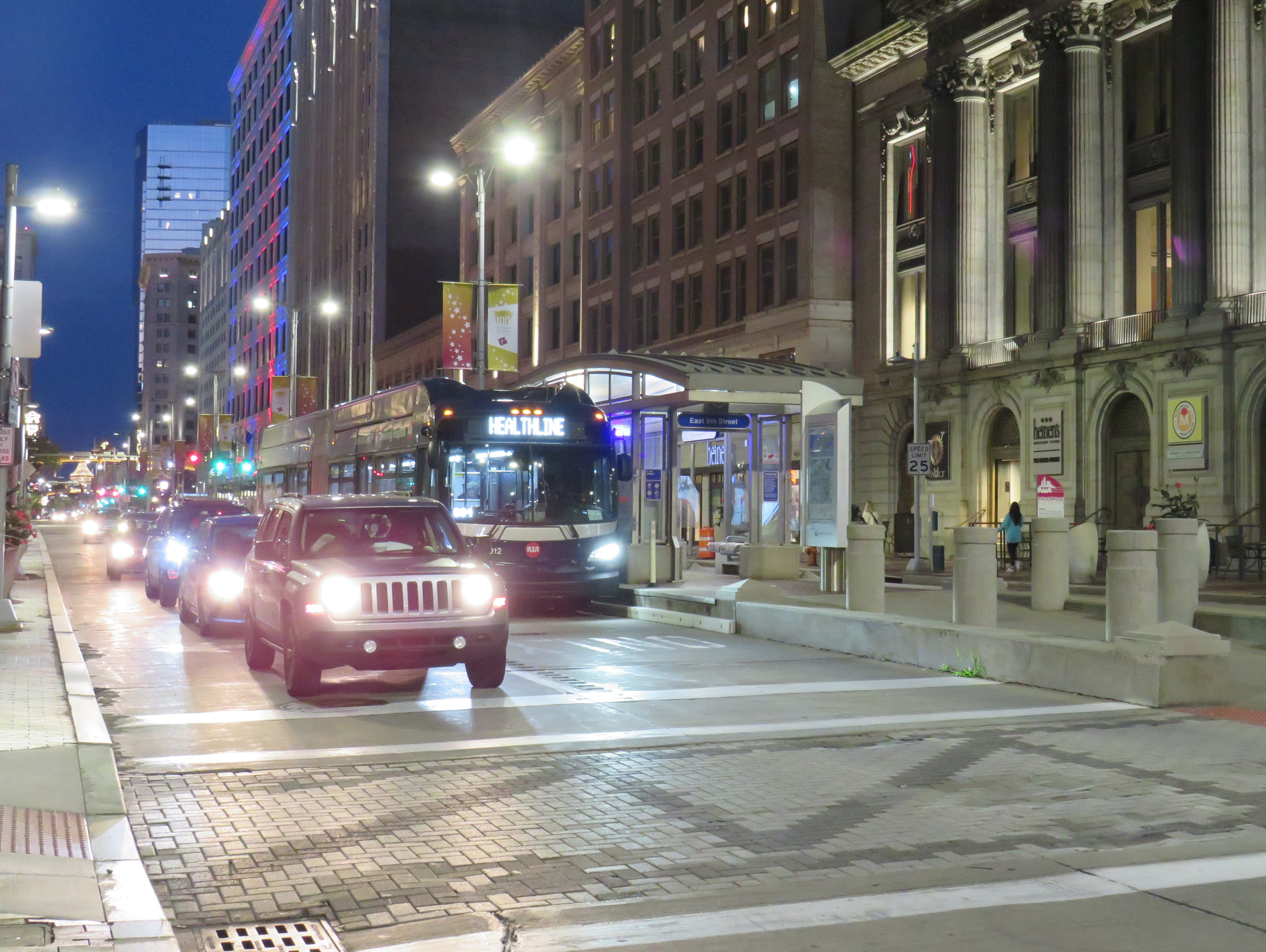
As the Red Line doesn’t follow city streets, Cleveland built a bus rapid transit line, branded “The HealthLine” on Euclid Avenue between Public Square and East Cleveland. The HealthLine is sponsored by the University Hospital and Cleveland Clinic health care corporations which it serves along with Case Western University and the art and cultural institutions clustered east of Downtown.
HealthLine bus with left-side doors
Though the HealthLine operates with special articulated buses with doors on both sides (to serve dedicated median stations, like that shown below), dedicated bus lanes are limited, and buses do not enjoy signal priority. However, the route is frequent and reliable, which is better than most urban bus services in the United States.
HealthLine bus on Euclid Avenue in Downtown Cleveland
Cincinnati
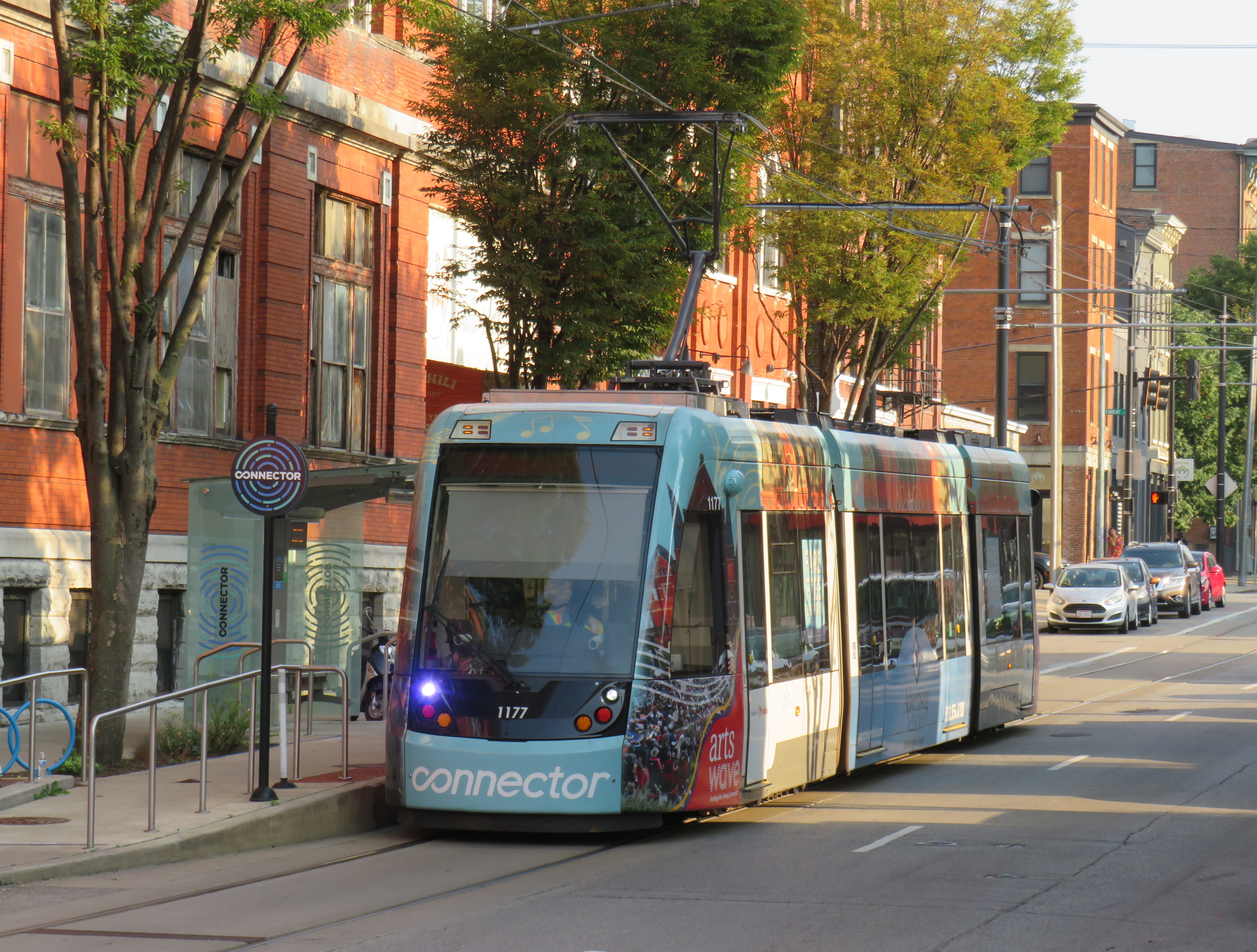
Cincinnati Connector
Like Cleveland, Cincinnati once had a large streetcar network, with trams also feeding into the city from communities in Northern Kentucky. Cincinnati abandoned its streetcars in the early 1950s, with the TTC acquiring its old PCC fleet.
The last time I visited Cincinnati, in January 2015, work had started on a new urban streetcar line that would connect its waterfront, the sports stadiums, the central downtown core, and the Over-the-Rhine area, a gentrifying neighbourhood north of the city core.
Like the modern urban streetcars in Atlanta, Detroit, Kansas City, and Portland, Cincinnati’s Connector serves a small area on a route practically geared to young urban residents and visitors. Though I came away with positive impressions of Kansas City’s streetcar (which is undergoing a lengthy extension), I felt that Cincinnati’s streetcar — like Atlanta’s and Detroit’s — was too slow, too infrequent, and too short to be of great use. At least the service was free to use.
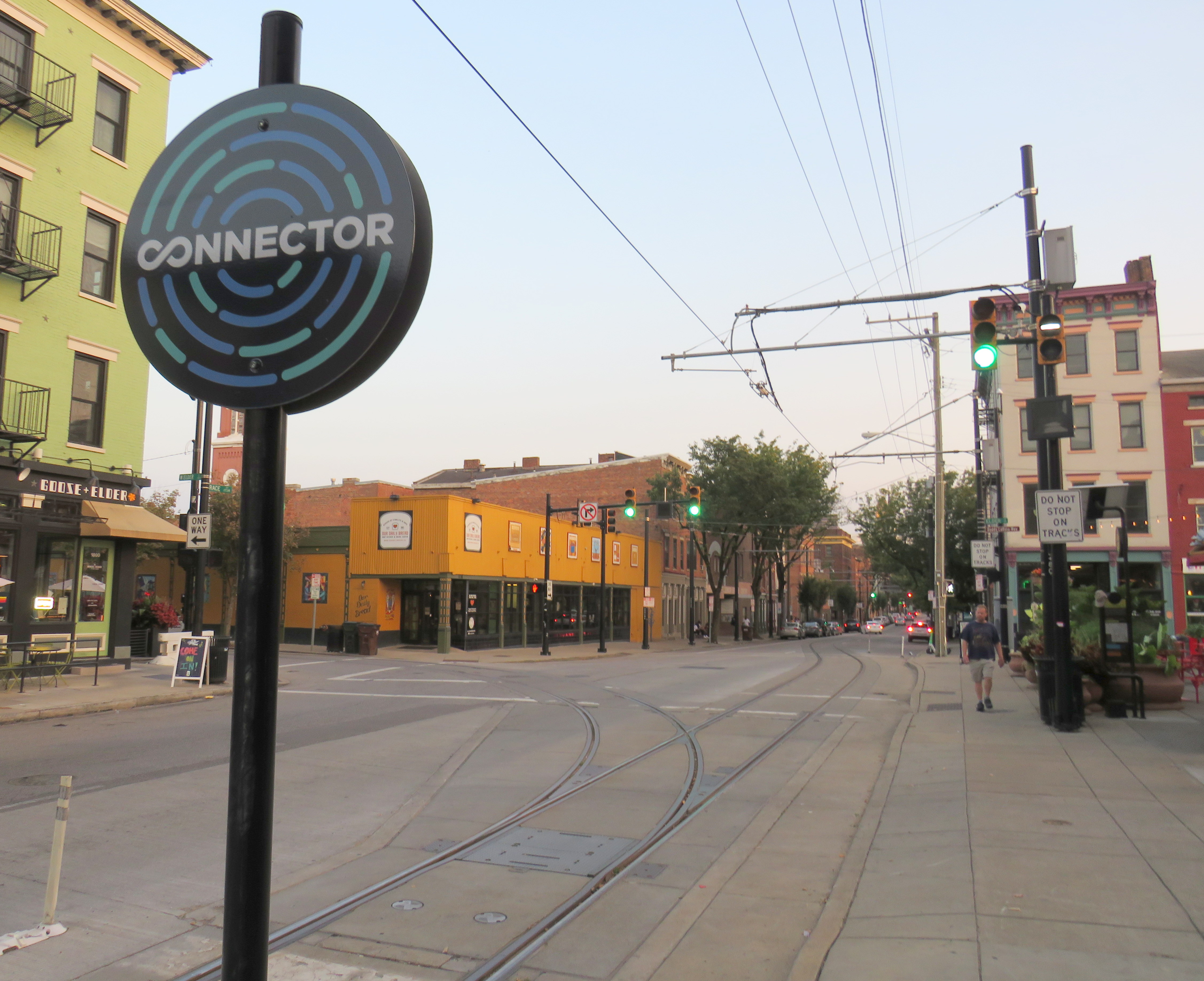
Junction to yet-to-be-built extension to University of Cincinnati
One thing I did note is that, unlike Toronto’s busy — and useful — legacy streetcar network, the small Cincinnati Connector loop was built with modern tram standards. The few switches (like the one shown above) are double-point switches, with dedicated signals. This allows streetcars to pass intersections at normal speed, unlike the TTC’s insistence on stopping and then proceeding at a dead slow pace over its manual, single-point track switches.
As a Torontonian, where streetcars form the backbone of transit in the dense, urban downtown area, it’s frustrating to see a small, novelty streetcar line build proper track infrastructure, while our crowded trams are forced to crawl at every intersection because of indifference at the TTC and at City Hall.
A Cincinnati Bell Connector Streetcar, followed by a SORTA bus
One of the amusing oddities of transit in the Cincinnati area are the acronyms used by the two local agencies. Cincinnati and the surrounding Ohio municipalities are served by the Southwest Ohio Regional Transit Authority, or SORTA. The agency wisely uses “Metro” as its public brand. Covington and other Kentucky communities are served by the Transit Authority of Northern Kentucky, or TANK. To their credit, the two agencies cooperate on fares, a $5 day pass purchased on one bus is good for all regular services on both agencies. Many TANK routes enter Downtown Cincinnati as well.
Pittsburgh
In late October, my spouse and I visited Pittsburgh to attend a conference. Pittsburgh has one of North America’s most fascinating cityscapes, with the downtown core situated where the Allegheny and Monongahela join to form the Ohio River, with steep hills immediately to the north and south. The steep topography is the main reason why Pittsburgh maintained two historic incline railways, where many other cities (including Hamilton) abandoned theirs.
The Duquesne Incline, on a very bright autumn afternoon
Pittsburgh was also a leading operator of PCC streetcars until the late 1960s, with a fleet of 666 PCCs — North America’s third-largest — at its peak. Because of Pittsburgh’s many hills, often requiring private rights-of-way or tunnels for streetcars to serve outlying areas, Pittsburgh was late to abandoning its street railway, but with highway projects in the 1950s, a public takeover in the 1960s, declining ridership, and a desire to modernize, most of the lines were abandoned and replaced by buses by 1971. Only a few South Hills lines, which used a lengthy tunnel to access Downtown Pittsburgh, remained.
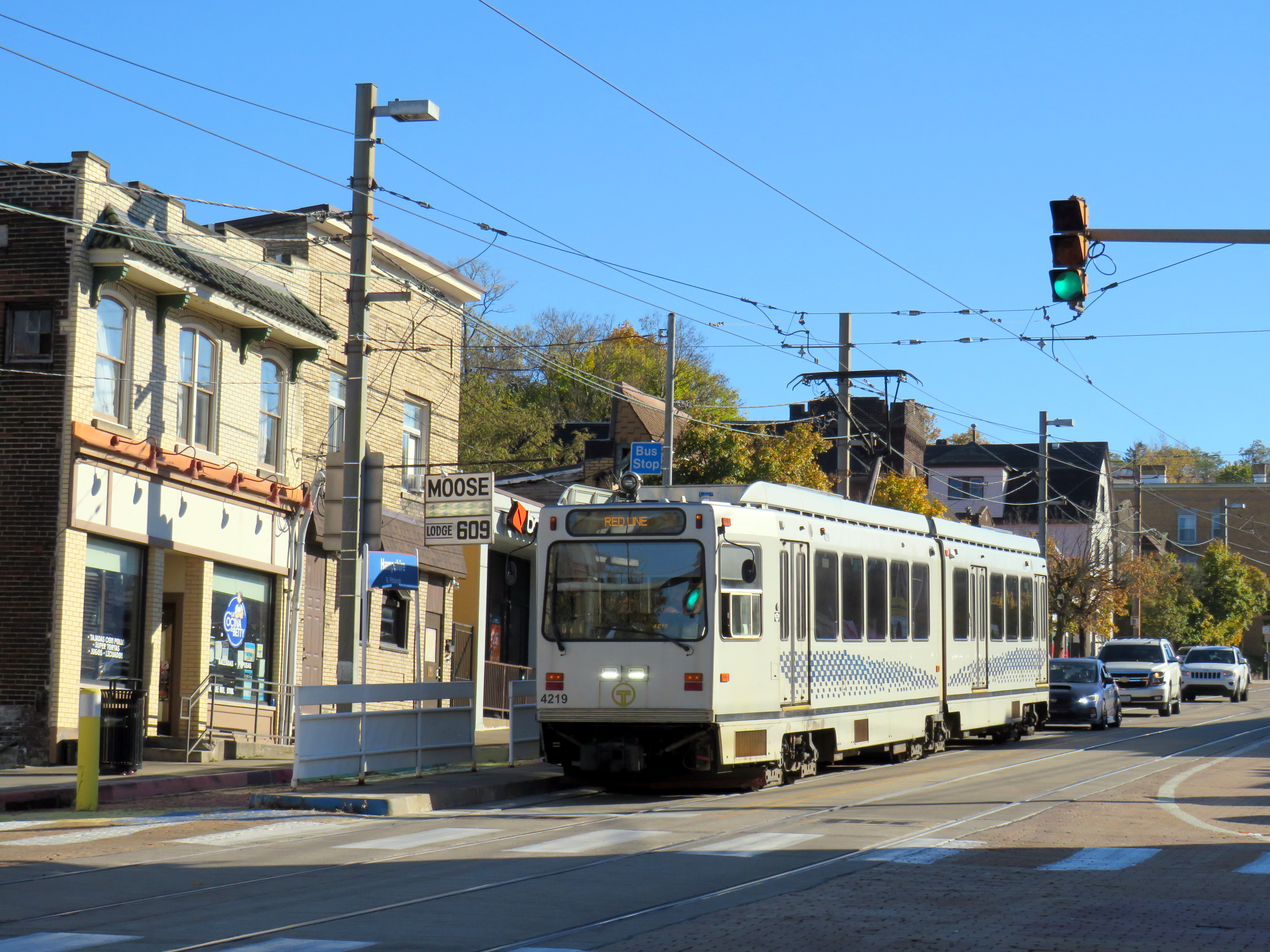
Red Line train in Beechview
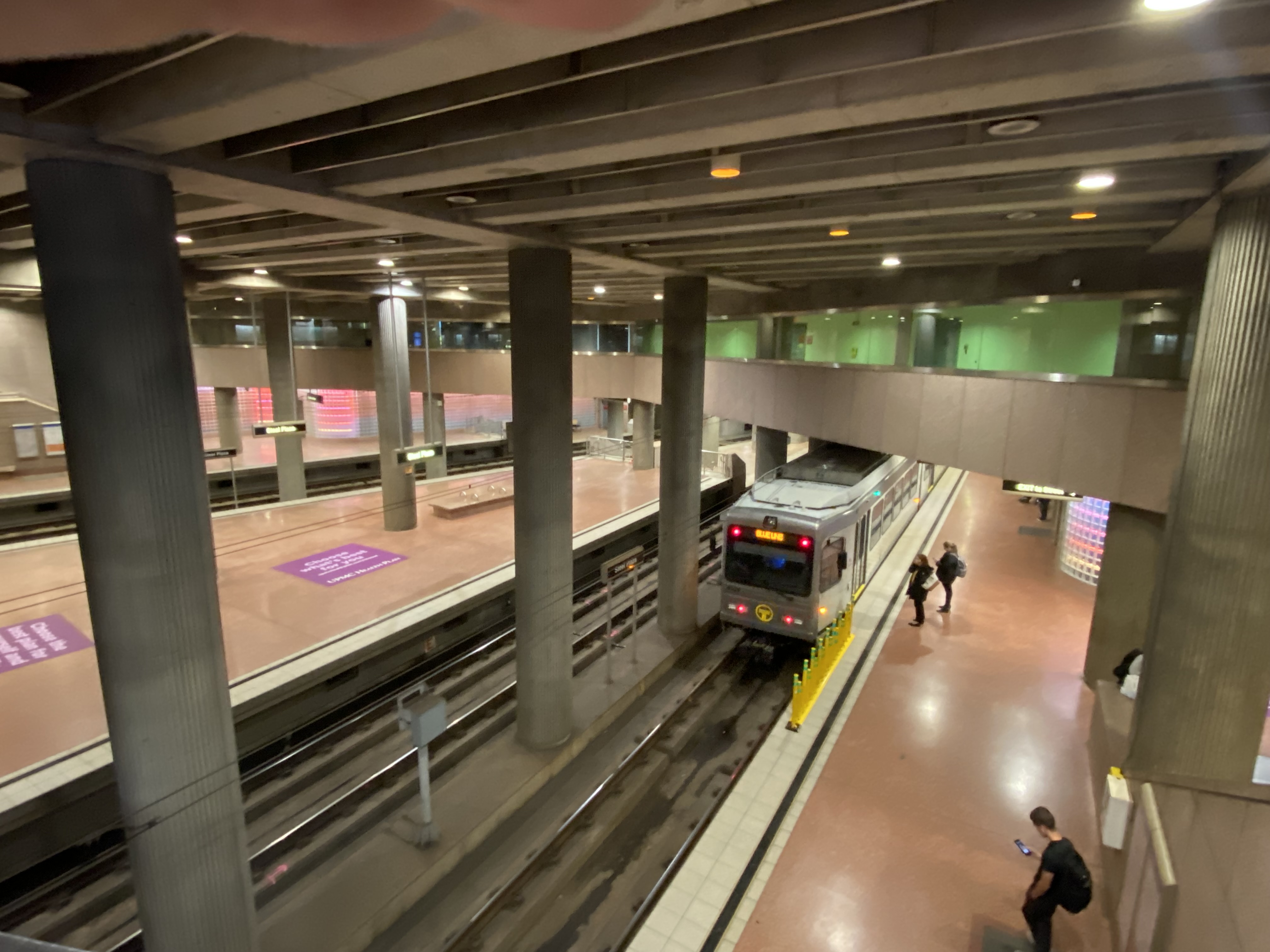
The two core southern lines were gradually upgraded to light rail standards, with a downtown tunnel replacing the on-street trackage there. Only a short section of Red Line in Beechview still operates on-street, betraying the service’s streetcar legacy. In 2012, the downtown subway was extended north under the Allegheny River to serve the North Shore, particularly the baseball and football stadiums.
Steel Plaza Station, part of the Downtown Subway
In the 1980s, the Port Authority of Allegheny County, the public agency tasked with operating the city’s transit system, designed and built several busways radiating out of the city centre. Like Ottawa’s Transitway before construction of the Confederation Line LRT, the Pittsburgh busways follow former or current railway rights-of-way, with grade-separated road crossings, and with on-street operation in the downtown core. The busways offer rapid transit service, though stations are quite simple, with at-grade pedestrian crossings at most locations and basic shelters.
Dr. Martin Luther King Jr. (East) Busway, Swissvale
Pittsburgh’s problem though is that the busways and LRT managed to avoid the main university campuses and many of the city’s most vibrant neighbourhoods. Oakwood, the home of University of Pittsburgh, Carnegie Mellon University, many of the city’s arts and cultural institutions and some of its densest neighbourhoods, has only local bus service. Not coincidentally, Oakwood was one of the last parts of Pittsburgh to lose its streetcars in 1967.
South of Pittsburgh, streetcars operate on an abandoned interurban line near Washington, Pennsylvania. Unlike the Halton County Radial Railway, the Washington interurban line’s tracks were not yet removed when the Pennsylvania Trolley Museum was formed. The museum, which operates several streetcars and hosts a large collection of static displays, is well worth the visit.
Former Pittsburgh Railway Company trolley #4398 carries autumn crowds at the museum in Washington, PA. Behind is a former Philadelphia Suburban Lines (Red Arrow) trolley.
Morgantown, West Virginia
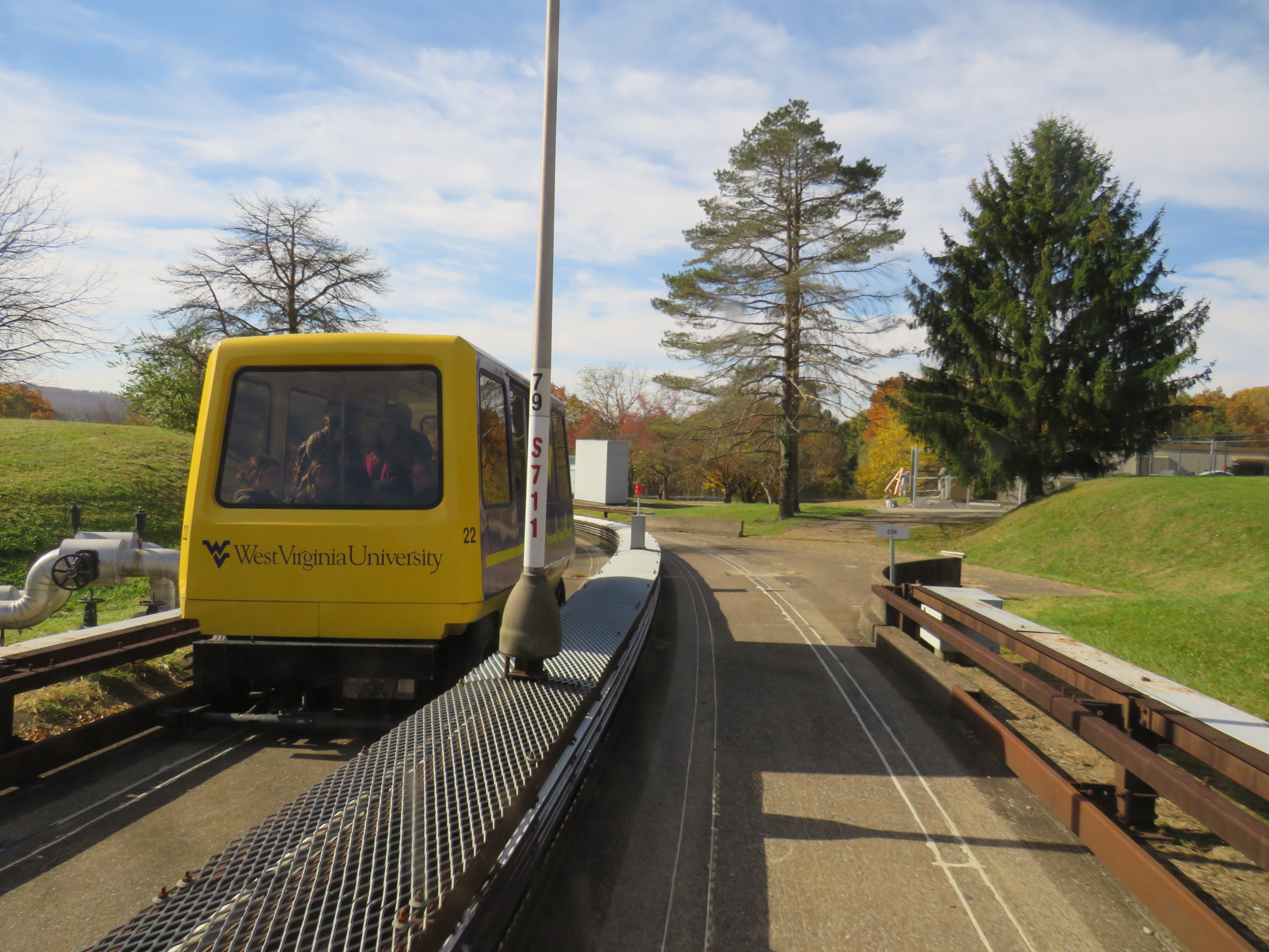
Only a 90-minute drive south of Pittsburgh is the city of Morgantown, West Virginia, home of the sprawling West Virginia University. What makes the public university especially unique is the automated transit system that serves the university and connects it to Downtown Morgantown.
The one-of-a-kind Morgantown PRT, opened in 1975, has five stations between Downtown Morgantown and the main campus to the north. What makes the line a “personal” rapid transit system is passengers, upon paying the fare or swiping their university ID card, select their destination station, and wait for a car that will take them to their desired point, skipping any stations in between. Though the technology can be described as a “gadgetbahn” it fills a unique niche, and still runs with the original rolling stock and guideways, though software and motor upgrades were required. Because of the limited road space between Morgantown and the university facilities to the north and the mountainous topology of West Virginia, traditional bus service gets caught in traffic, especially on game days.
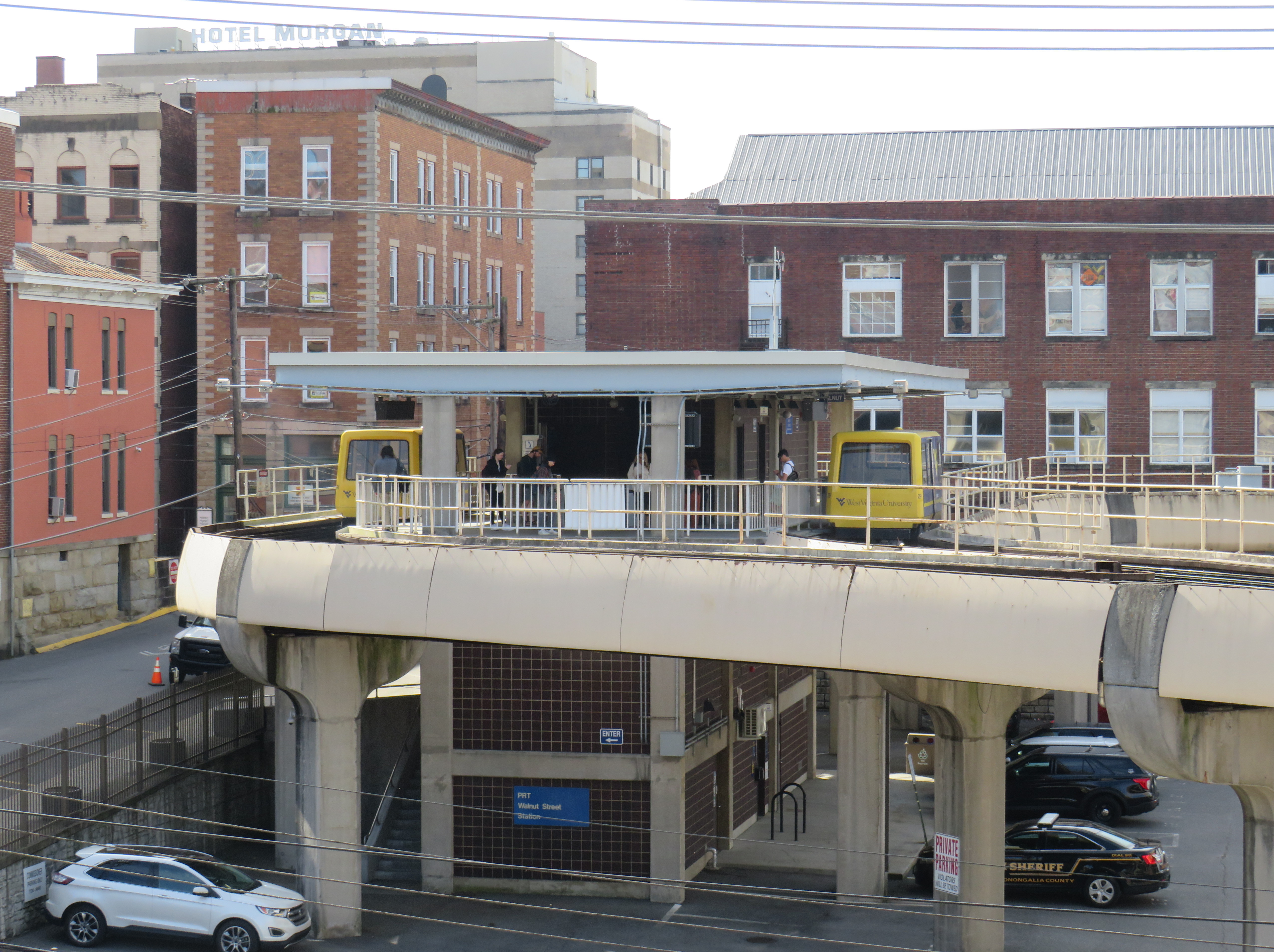
Walnut Street Station in Downtown Morgantown
Each car has eight seats and allows for twelve standees, so despite the name, the service isn’t precisely “personal.” As it is operated by the university mostly for staff and students, it does not run on Sundays, holidays, or when classes are not in session. During off-peak periods, the PRT usually runs in an all-stops configuration.
The video below shows how the PRT operates, including the bypass of Towers Station.
Part of the nine-minute ride on the Morgantown PRT at the University of West Virginia
I will follow up with posts covering my return to Toronto, Ohio (which is just an hour’s drive west of Pittsburgh), and some thoughts after visiting a local history museum.
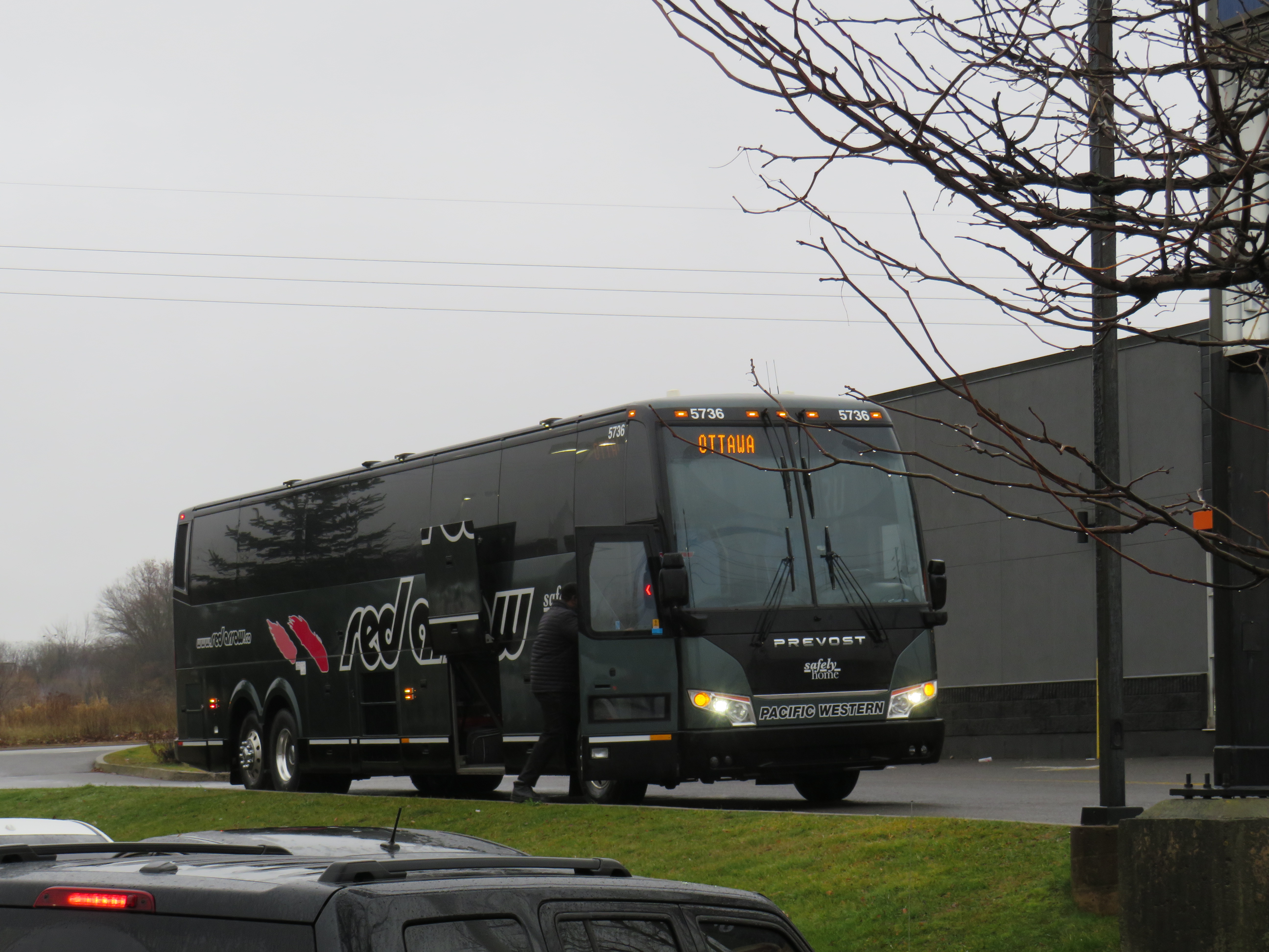
A Red Arrow coach lays over at a Harvey’s restaurant in Kingston on the way to Ottawa
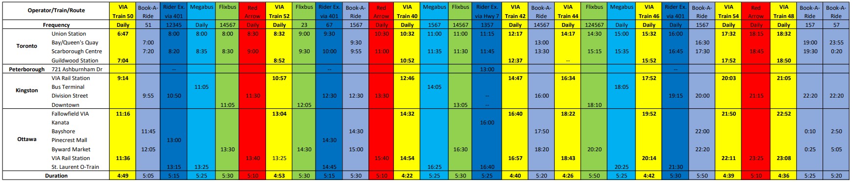
On December 7, I took a trip out to Kingston to ride the newest coach operator to arrive in Ontario: Red Arrow. A division of Pacific Western, Red Arrow is the latest carrier to stake a claim to the busy Toronto-Kingston-Ottawa route, which is now served by five private companies.
Between Toronto and Ottawa, five intercity coach carriers–Megabus, Rider Express, Flixbus, Book-A-Ride, and Red Arrow–compete for the same passengers, along with VIA Rail and three airlines (Air Canada, WestJet, and Porter).
There is also fierce competition for the Toronto-London route. Passengers have the choice of taking Megabus, Rider Express, Onex, Flixbus, Book-A-Ride, VIA Rail, or a very slow weekday-only GO train. Along with VIA, Flixbus also continues west, to Windsor (where the Tunnel Bus connection to Detroit has finally been restored). The Toronto-St. Catharines-Niagara route is also served by multiple bus and rail services.
Red Arrow coach seating
Despite new intercity coach players like Red Arrow (which provides a high-end coach service, with comfortable seating in a 2+1 arrangement, along with complimentary soft drinks and light snacks) and Book-A-Ride (which operates like a charter airline, with schedules that change frequently based on demand), many other routes still have limited or no service. Flixbus quietly dropped its Kitchener-Hamilton-Niagara route earlier this year, eliminating service on a corridor that once had frequent Canada Coach Lines buses; that route had been sold in 1990 to Trentway-Wagar/Coach Canada. Flixbus also ended service to Guelph, instead concentrating on its other corridors. Early next year, Megabus will end its route between Toronto, Buffalo, Philadelphia, and Washington DC.
The deregulation of motor coach services within the Province of Ontario may have made some sense. The old bargain of providing exclusive franchises for busy, profitable routes made sense when operators would use those cash cows to help subsidize less-trafficked rural services. But as Greyhound, Stagecoach, and other large companies bought up smaller carriers (such as Gray Coach, Canada Coach Lines, and PMCL) in the 1980s and 1990s, they were allowed to slowly abandon the smaller routes. Greyhound itself divested most of its network before disappearing altogether. As the franchising scheme didn’t work, there was no point keeping it.
But now, there’s the absurd situation where there are up to 25 daily buses and trains between Toronto and Ottawa (see table below). In contrast, there is not a single daily bus service connecting Hamilton and Kitchener-Waterloo–two urban centres of over 500,000 people each, just an hour apart, with three large universities (Waterloo, Wilfrid Laurier, and McMaster) and two major colleges (Conestoga and Mohawk) between them.
Available trips from Toronto to Ottawa, December 2022, with times for Kingston and Peterborough. Bus and rail tips to Montreal via Kingston are not included. A PDF version can be found here.
Elsewhere, where GO Transit and government-subsidized regional connections have filled gaps, the services are often slower and less direct than the old coach bus service. PMCL used to operate daily bus service between Owen Sound and Toronto via Collingwood and Barrie. Today, the same trip is possible via Grey Transit Route, Colltrans, Simcoe County Linx, and GO Transit, but the trip will take the better part of a day. Meanwhile, other gaps remain. Elgin County (Aylmer and St. Thomas) and Haldimand County (Caledonia, Dunnville, Hagersville, and Jarvis) are left without any outside connections.
Such is the state of the intercity transportation network (if you can call it that) in Ontario.
Though I enjoyed the trip on Red Arrow to Kingston (especially as I took advantage of a special $25 fare), I wondered how well the service will do here in Ontario. Its base price is over $100 one-way to Ottawa, more expensive than other coach operators and priced more like VIA Rail, which itself is slightly faster (as long as CN freight trains do not get in the way). Red Arrow uses the same locations in Ottawa (the VIA Rail Station itself) and Toronto (Union Station Bus Terminal) as the train. Red Arrow does well in Alberta, where there is no useful passenger rail service (Pacific Western also offers a no-frills coach bus service on the same Calgary-Edmonton route).
The latest version of my interactive intercity transit map is below:
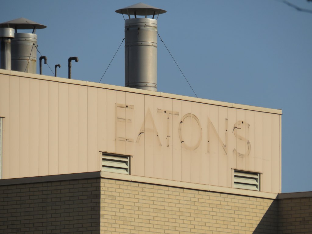
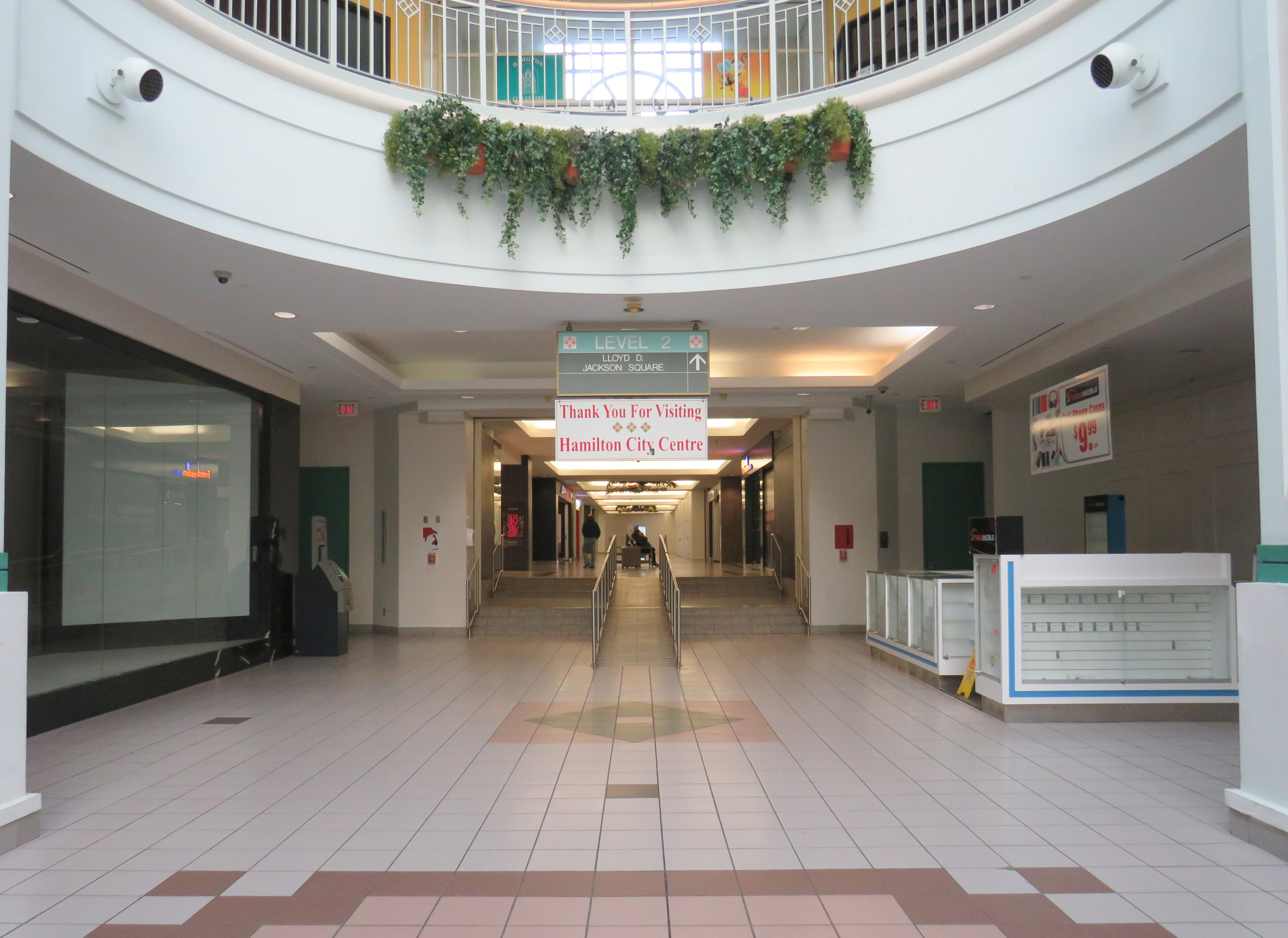
Main entrance to Hamilton City Centre, on James Street North. Note the awkward spacing of “City” over the entrance; it originally read “Eaton.”
On December 26, 2022, Hamilton’s former Eaton Centre, opened just 32 years ago, will close for good. Early in the new year, demolition will begin on the failed downtown mall, making way for a new residential development.
Hamilton Eaton Centre, fully opened in October 1990, was one of several downtown malls built in Ontario through a partnership between Eaton’s and commercial developer Cadillac Fairview, hoping to replicate the success of the Toronto Eaton Centre, which opened in phases between 1977 and 1979. It was the second major shopping centre to open in Downtown Hamilton; it followed the construction of the massive city-led Jackson Square development in the 1970s and 1980s in which entire city blocks were cleared to make way for urban renewal.
With support from the Ontario and municipal governments, the T. Eaton Company and Cadillac Fairview built new malls in Ottawa, Peterborough, Brantford, Kitchener, Thunder Bay, Sudbury, Sarnia, Hamilton, and expanded London’s existing Wellington Square. These private-public partnerships seemed to be beneficial; smaller cities worried about the decline of their downtowns would get an attractive new shopping centre after expropriating and demolishing existing buildings and/or providing municipal lands for the project. The municipality would finance new parking garages to support the new development. Meanwhile, Eaton’s would help finance the construction and provide a lead anchor for the new development. Cadillac Fairview, which specialized in retail and office development, would arrange the construction and the leasing for the mall stores. (There were a few downtown shopping centre projects in Ontario that did not have Eaton’s involvement, including malls in Chatham, Cornwall, Tillsonburg, and Waterloo.)
The old Eaton’s Hamilton Store in the 1920s, looking southwest from James Street North and (now disappeared) Merrick Street (Hamilton Public Library)
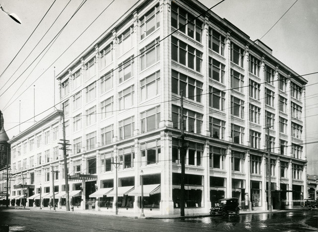
Unlike malls in Kitchener, Sarnia, Brantford, or Guelph, the Hamilton Eaton Centre was mostly built upon lands already acquired by Eaton’s itself, much like the larger and more successful Toronto Eaton Centre (the city of Hamilton assisted by closing Merrick Street between York Boulevard and James Street and transferring the right-of-way for the new development). The first phase of the project, built on the site of the Merrick Street parking garage and the old Hamilton Farmers Market, became the home of a new four-storey Eaton’s store to replace the dilapidated building on James Street. When the new store opened in April 1989, the old store was quickly demolished to make way for the mall itself, which opened just 18 months later.
The new Eaton’s Hamilton store on York Boulevard soon after opening in 1989. The store had exits to both Jackson Square and once completed, the new Eaton Centre mall. (Hamilton Public Library)
At first, Hamilton’s Eaton Centre was able to attract prestigious tenants such as HMV and Eddie Bauer thanks to Cadillac Fairview’s expertise and new office development in Downtown Hamilton, including a new CIBC office complex. The new mall was also able to attract existing downtown businesses out of storefront retail and the older Jackson Square mall.
YouTube video showing the exterior and interior of the old Downtown Hamilton Eaton’s store prior to closing, as well as its demolition in 1989 to make way for the new Hamilton Eaton Centre (via Hamilton Sight & Sound YouTube channel)
However, as I discussed previously on this website, the malls developed by Eaton’s and Cadillac Fairview did not do well in most markets. New, full-line Eaton’s stores were a poor fit for smaller, industrial cities like Peterborough, Brantford, and Sarnia. The malls themselves were more difficult to get to by car, and shoppers usually had to pay for parking. The established suburban malls were typically larger, and they offered ample free parking. By 1990, the old, large industries were in decline due to free trade and industrial automation, and in the 1990s, a new retail format — the big box “power centre” — emerged as serious competition during a major recession. And in 1994, Walmart entered the Canadian market.
The former Hamilton Eaton Centre (known as Hamilton City Centre since 2000) from the corner of James Street North and York Boulevard. The clocktower on the corner is an homage to the old Hamilton City Hall, which was demolished in 1960. The clocks themselves were originally installed in the old city hall and will be preserved when the current building is demolished.
With low traffic and many national retailers unwilling to renew their leases, Cadillac Fairview divested itself of most of its downtown malls. It sold its half-stake of Hamilton’s Eaton Centre to the T. Eaton Company in 1995 (Of its downtown malls, Cadillac Fairview would only hold onto the flagship Toronto Eaton Centre, and the Rideau Centre in Ottawa). According to a Hamilton Spectator article from that year, one of the mall’s three floors was already closed, just five years after its grand opening.1 Among the tenants that left the mall early was upscale men’s clothier Harry Rosen. By 1996, only 50 of the 120 stores outside the Eaton’s department store were still occupied, with another six stores closing early that year.2 A McMaster University business school lecturer predicted that one of the two downtown malls — Eaton Centre or Jackson Square — would close within 10 years. (He was only 15 years off the mark.)2
In February 1997 — after years of mismanagement and neglect by the fourth generation of the Eaton family — Eaton’s entered bankruptcy protection, allowing it to settle debts and restructure. Though stores in other downtown malls in Brantford, Sarnia, and Kitchener were among the first to go, the Downtown Hamilton store was left off the closure lists, as Eaton’s itself owned the property – losing the department store anchor would not help the mall in case of a property sale. In the meantime, Metrus Developments — which purchased the neighbouring Lister Block in 1989 — evicted its remaining tenants and boarded up the six-storey commercial building, hastening Downtown Hamilton’s visual and commercial decline.
In 1998, the Region of Hamilton-Wentworth (dissolved in 2001 after amalgamation) began leasing space on the formerly vacant third floor of Hamilton Eaton Centre, partly to help maintain the department store’s presence and support Eaton’s, which still owned the property. The City of Hamilton agreed to provide two hours of free parking at the attached York Boulevard garage and planned for the construction of a new store entrance to the Hamilton Farmers’ Market. This was just enough to keep the department store open until the company collapsed in 1999; the store closed for good in October of that year. The mall was rebranded Hamilton City Centre the year after, sold to a private real estate firm.
View from the third floor in Hamilton City Centre; the conversion of retail space to offices on the top level is apparentThe central atrium. All remaining stores must close by December 26, 2022.The connection between Hamilton City Centre and Jackson Square. This was originally the main route between the old Eaton’s store and the first phase of the 1970s-era mall. The largerJackson Square will undoubtedly benefit from the residential re-development of the Eaton’s site.
After Eaton’s closed, part of the massive retail space was renovated and turned into a fitness club. The City of Hamilton leased additional space in the old Eaton’s store, especially as it undertook renovations to its modernist 1960s-era city hall. New windows were punched into the brick facade to provide natural light to the new occupants. But the remaining national retailers like HMV, Fairweather, and Eddie Bauer left the mall, while a few small, independent retailers came in, attracted by cheap rents.
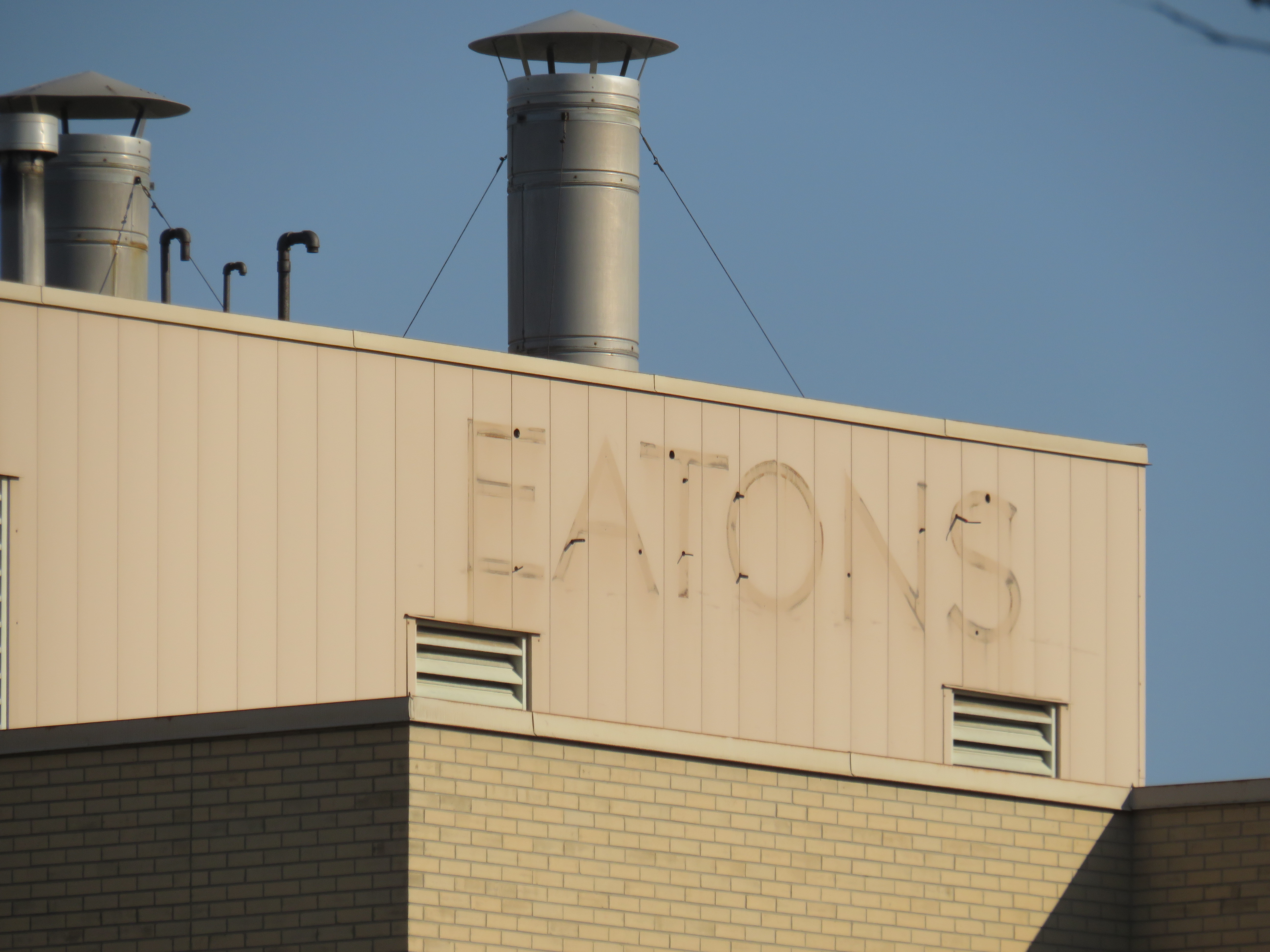
A fresh labelscar on the south-facing roof of the Eaton’s store, as seen from the patio on top of Jackson Square. Until 2021, a forgotten and unmaintained Eaton’s sign was left alone, hidden from street level.
The new development will have 1,940 residential apartments, along with street-level retail and office spaces, constructed in three phases. Walkways will allow the public to cut through the property, with one of those roughly following the old Merrick Street alignment. Unfortunately, it is being developed and planned independently of the rest of the Jackson Square superblock bound by James, King, and Bay Streets, and York Boulevard, and which also contains the farmers market, the central library, and Copps Coliseum, the sports venue built for an NHL franchise that never arrived.
But with the influx of new residents, Jackson Square — which, despite is retail vacancies, holds its own due to the attached office, hotel, and civic functions, as well as the full-service Nations supermarket — will only benefit from the demise of its newer downtown competitor.
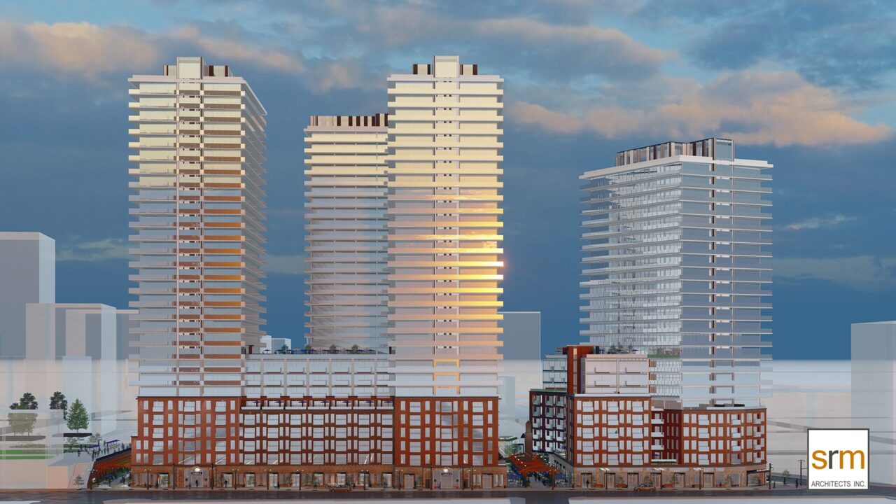
Rendering for the new development on the Eaton Centre site by SRM Architects.
“Eaton eyes the future after buying centre” Hamilton Spectator 13 July 1995: D12.
John Burman. “A tough sell: Struggling Eaton Centre looks for new direction” Hamilton Spectator 13 Feb 1996: A1
Dayton, Ohio is probably best known as the hometown of Wilbur and Orville Wright, the two bicycle mechanics who made the first successful controlled heavier-than-air flight. The city has remained a centre of the aviation industry. The US Air Force (and its predecessors) have operated a major base in Dayton for over a century, which includes an impressive museum of military aviation history.
But among transit buffs, Dayton is notable for another reason. It is one of only a handful of cities in North America that continues to operate and maintain an electric trolley bus system. The Greater Dayton RTA is also the smallest transit system to have operated trolleys since the mid 1970s.
Though there were early adopters of “trackless trolleys” in the late 1910s and early 1920s, the technology was particularly popular between the late 1930s and early 1950s. For street railway operators burdened with ageing streetcars and worn out infrastructure, electric trolleys offered several advantages. They could make continued use of electric substations, poles, and overhead wires, without the need for maintaining tracks and rights-of-way. Trolley buses were quiet and smooth-running, unlike gasoline and early diesel buses, and had larger capacities. They were cheap to operate and easy to maintain, and were especially adept at climbing steep grades.
TTC trolley bus on Ossington Avenue in the 1950s. The Ossington trolley was established as part of a major post-war route restructuring.
Most of the big cities in Canada and the US continued operating streetcars into at least the 1950s, as newer PCC streetcars helped keep those fleets going. But trolley buses were ideal for smaller and midsized cities that still had robust transit demand that buses could not yet meet. Even cities that retained streetcars into the 1950s — like Toronto — used trolley buses to replace marginal streetcar lines and allow for major route restructurings.
In Canada, fourteen cities established trolley bus fleets between 1936 and 1951. In Halifax, the Nova Scotia Light and Power Company replaced its decrepit streetcar system and its feeder bus network with an all-electric fleet in 1949; at the system’s peak, there was even a trolley route across the Macdonald Bridge to Dartmouth. Cities as small as Cornwall and Port Arthur/Fort William (now Thunder Bay) even replaced their streetcars with trolley buses.
By the 1970s, the coach bodies purchased 30 years earlier were showing their age, and many agencies had decided to simplify their fleets and go with modern diesel buses, which had improved in size, power, and capacity since the 1940s. In Canada, only Toronto, Hamilton, Edmonton, and Vancouver decided to renew their fleets, while only five cities in the United States (Boston, Dayton, Philadelphia, San Francisco, and Seattle) kept their electric trolley systems. Since then, Hamilton, Toronto, Edmonton — and most recently, Boston — gave up when the latest generation of trolleys were due for replacement.
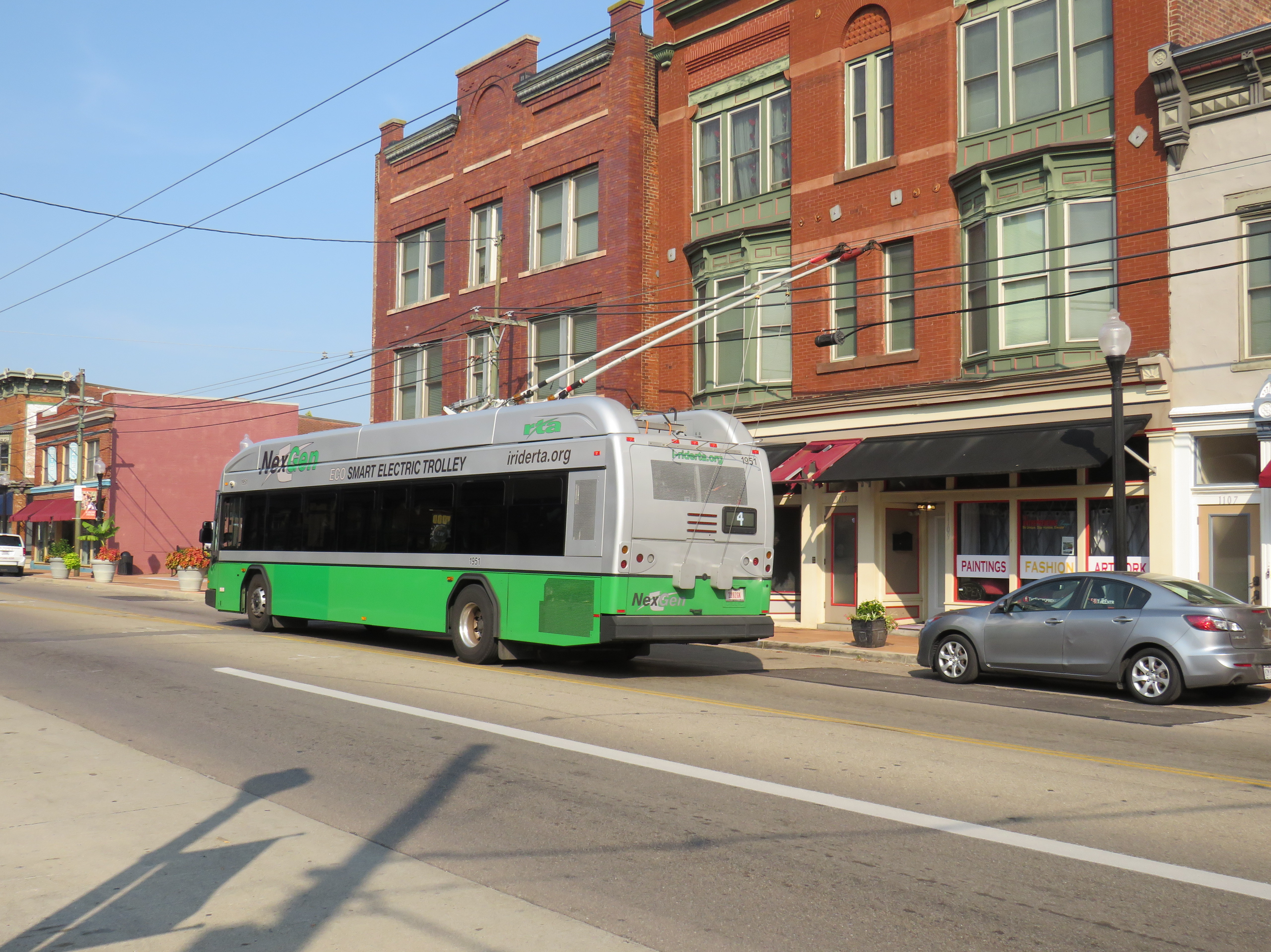
But of all places, the small, deindustrialized city of Dayton took a very different direction. In 2020, the Greater Dayton Regional Transit Authority (GDRTA) received the last of its 45 new Kiepe/Gillig Next Generation trolley buses, equipped with large, powerful battery packs and computer systems that allow for long-distance, full speed off-wire capability. (The previous generation of trolleys, like what Translink in Vancouver currently operates, allow only for limited, low-speed off-wire operation).
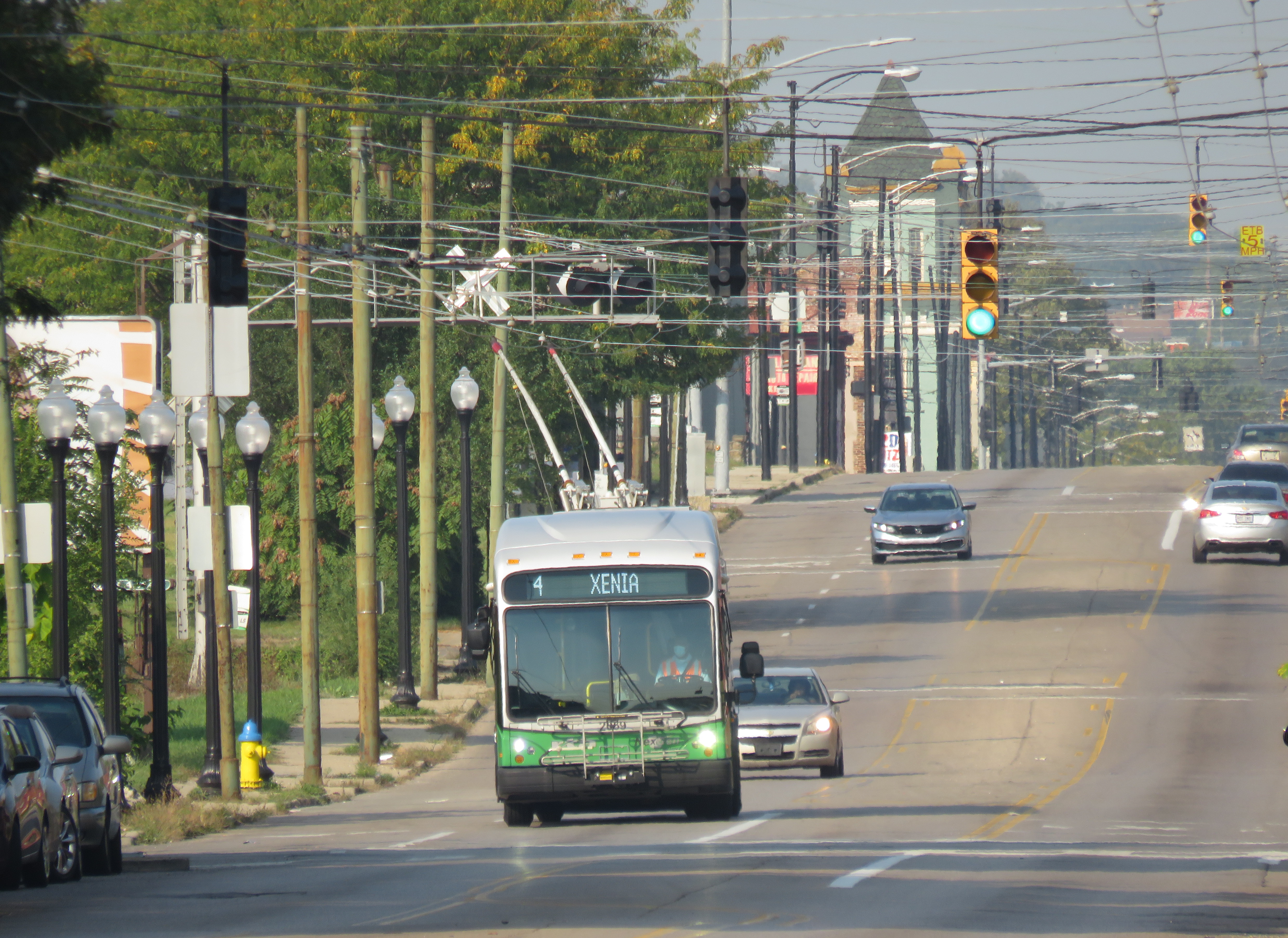
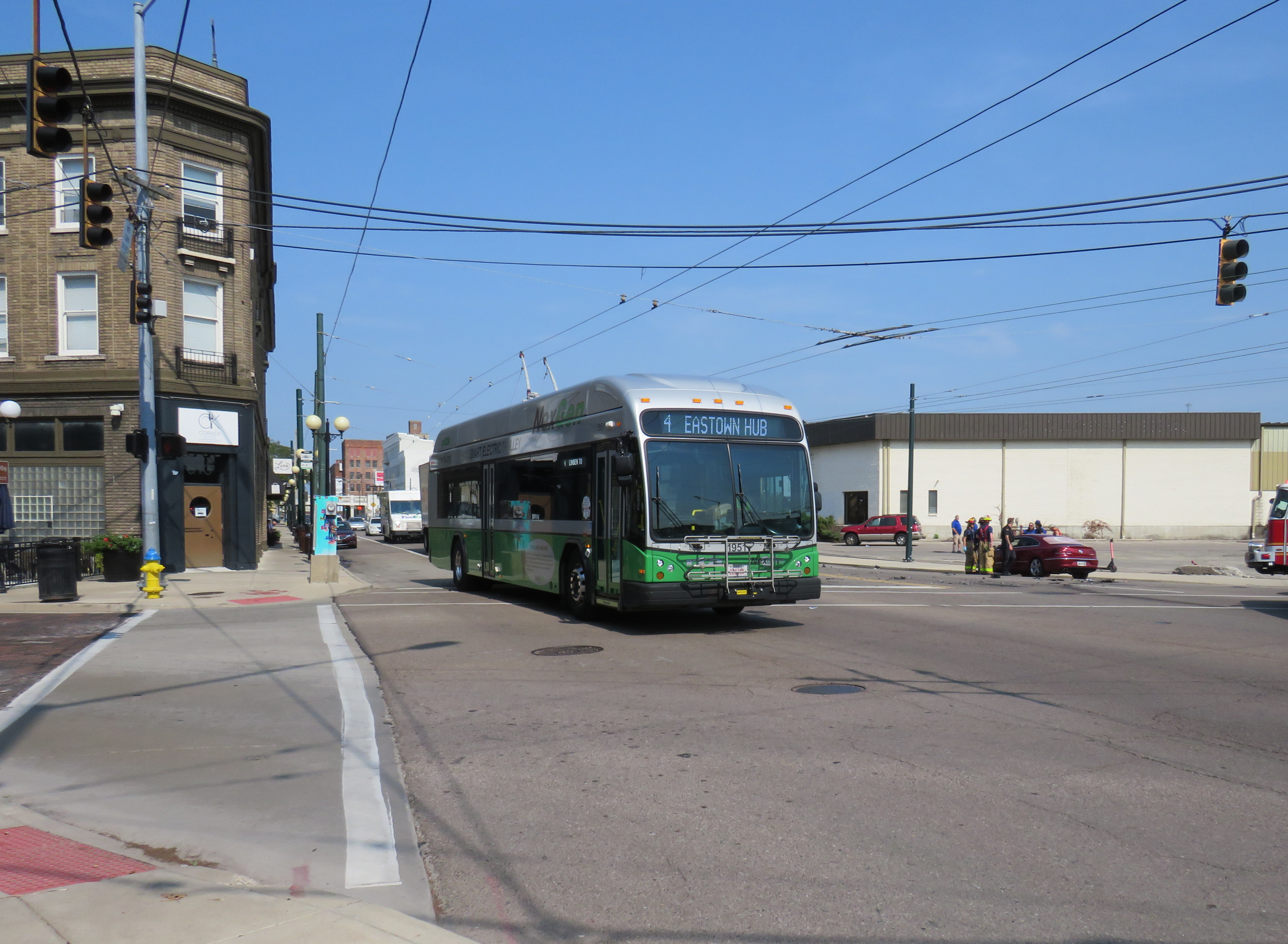
The new NexGen trolley on Third Street on Dayton’s West SideA trolley on Route 4 running with its poles down. I captured this photo just after getting off the bus on September 16, 2022.
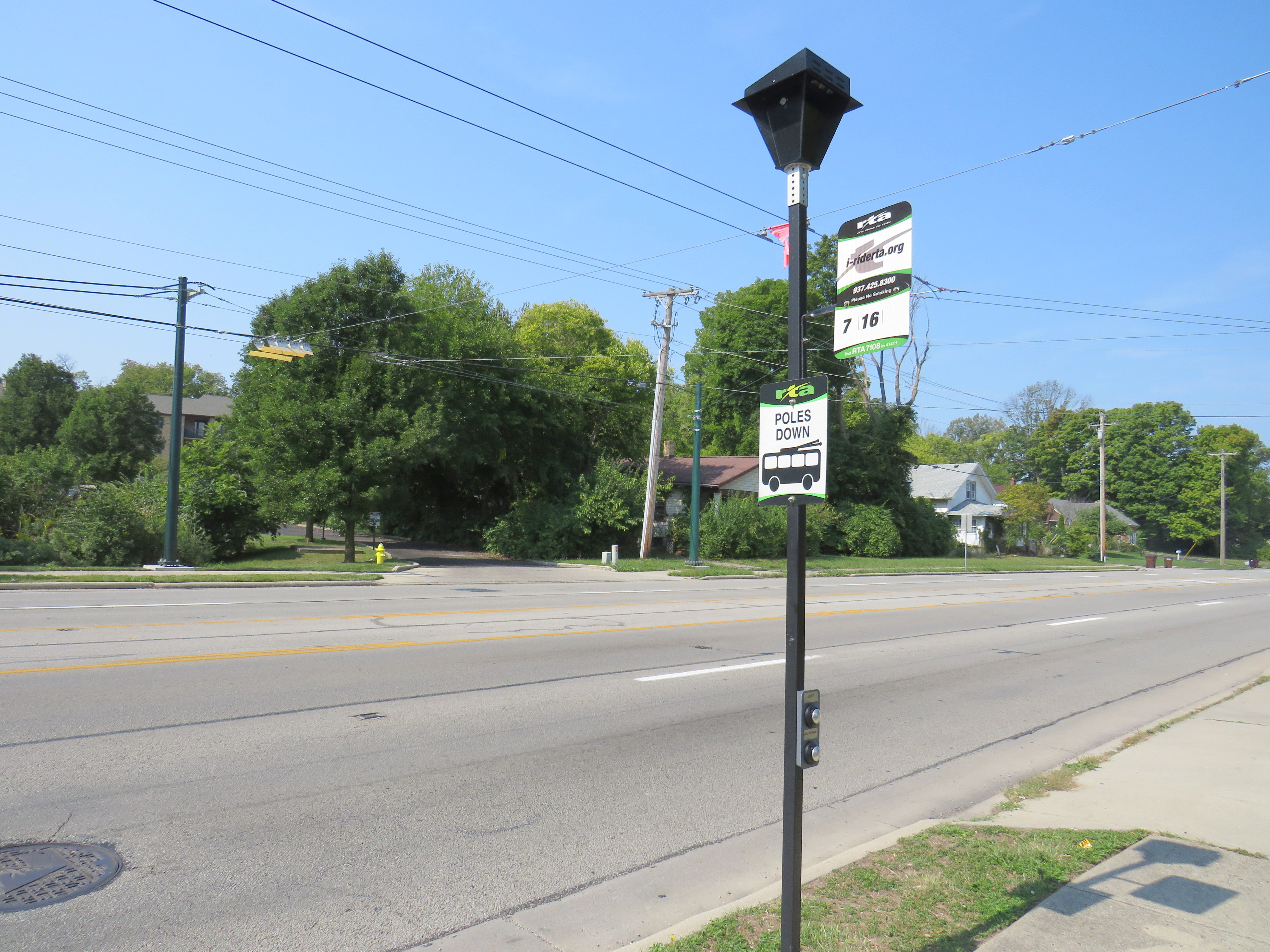
The extended off-wire capability has allowed the GDRTA to extend two of its trolley bus routes further into the suburbs without extending wire. Route 7 was extended 5 kilometres northwest, while Route 1 was extended 6 kilometres east to Wright State University. Though the corridors were already served by longer-distance diesel bus routes, it provided additional service to some of Dayton’s major suburban trip generators.
North Main Street at Elm Hill Drive, where the Route 7 trolley wire ends (note the “poles down” sign), but trolley buses can continue another 5 kilometres onward.
Unfortunately, despite the new fleet and plenty of wire to run it, the GDRTA has only been operating its trolley buses on a single route in the last few months, despite four routes being fully capable of electric service. When I visited Dayton on September 15, not a single trolley was out. Though I did go visit the US Air Force Museum and the Wright Brothers National Historic Site (where one of the brothers’ bicycle shops were preserved on site; the family home and another of their shops were moved to Henry Ford’s Greenfield Village), I was really disappointed. But having a car, and a hotel reservation less than an hour away, I went back the next morning to see these new vehicles in action and take a ride.
A line up of diesel buses, including the trolley-capable Route 7, in Downtown Dayton, just south of the main bus terminal on September 15, 2022. Note the trolley wire, completely unused.
Happily, Route 4 was operating with trolleys, though on a Saturday schedule, imposed by GDRTA because of an ongoing driver shortage that has plagued transit systems across North America. During the daytime, three buses offer 30 minute service on the route. Between Downtown Dayton and the West Side, my first ride that morning was interesting as the bus was operating with its poles down for some reason. But riding the bus, I couldn’t tell: it was a smooth, quiet, and quick jaunt. I took two more trips on Route 4 to the east end, to get the most out of my visit.
A NextGen trolley outbound on Wayne Avenue at East 5th Street, September 16
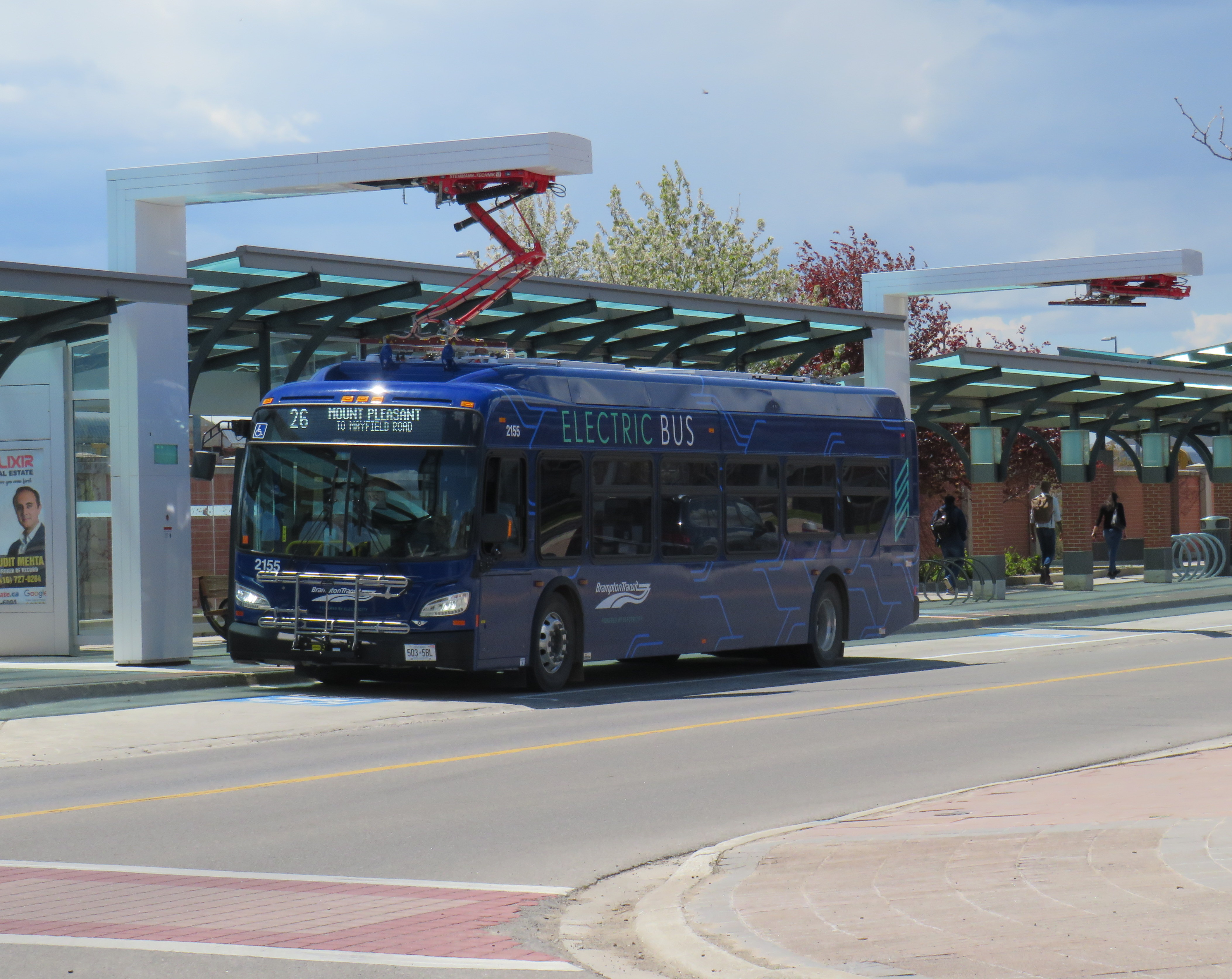
Despite my disappointment with the GDRTA’s utilization of its fleet, I came away still confident about the technology’s future. Though many transit systems are re-electrifying their bus fleets, they have been purchasing battery-electric fleets that do not have any in-motion charging, unlike Dayton’s advanced trolleys. Some agencies, like the TTC, have battery buses that are charged only at the garages. Other cities, like Brampton, Winnipeg, and Montreal have en-route charging stations at terminal points as well as garage charging points. But bus batteries are extremely heavy, and they have not yet gone through a complete life cycle yet in the harsh Canadian climate.
Brampton Transit electric bus charging at Mount Pleasant Village
The TTC in particular is suited to restoring its trolley network using modern on-wire charging buses like those used in Dayton, as it has much of the infrastructure already in place, including substations (that feed the subway and streetcar network) and existing overhead wire systems. With long-distance off-wire capability, there is no need for complex wire junctions and short-turn loops, unlike older trolleybus networks. Busy, straight routes such as Dufferin and Bathurst would be ideal.
Though Dayton isn’t using its new fleet of electric buses to its potential, it does show the way to renewing sustainable electric transit services for cities like Toronto.