Category: Travels

  • Passenger trains of Northern Ontario

    6876541686_61533293ef_o.jpg
    Southbound Northlander train arriving at Gravenhurst, March 2012

    In a few weeks, I will travel from Toronto to Thunder Bay by bus and by train, stopping at cities and towns like Sudbury, Chapleau, White River, Marathon, and Schreiber. I expect to write about the experience and the challenges of getting around Northern Ontario without a car. At one time, it was possible to take just one bus or train from Toronto or Ottawa to Thunder Bay. Now, the same trip can only be done in three separate segments.

    Greyhound Canada, which once ran four daily bus trips between Toronto and Winnipeg, reduced service to just two daily trips in 2009, and then to just one trip in 2015. Greyhound pulled out completely from Western and Northern Canada in October 2018, cutting all its bus routes between Whitehorse, Vancouver, and Sudbury.

    According to the joint Canadian National/Canadian Pacific railway schedule of 1976, there were daily passenger trains connecting Montreal, Ottawa, and Toronto with North Bay, Sudbury, Thunder Bay, Timmins, and Kapuskasing. There was also a daily train between Sudbury and Sault Ste. Marie, and there were trains to Fort Frances, and several trains a week through the wilderness in Algoma District.

    Most of those trains are now gone. The CP Sudbury-Sault Ste. Marie train lasted just one more year, before being eliminated in 1977. The 1990 cuts to VIA Rail resulted in the loss of the daily Canadian through Thunder Bay, Sudbury, and North Bay, and the end of direct rail service to Timmins and Kapuskasing. The Canadian, now operating on the less scenic and less-populated CN mainline, ran just three times a week, with only a shuttle service on the most remote section of the CP route between Sudbury and White River.

    21589509683_e1c3df65b0_o
    VIA Rail RDC stopped at Cartier, Ontario on its way to White River

    In 2012, the Liberal provincial government announced the elimination of the Northlander, a daily train operated by Ontario Northland between Toronto, North Bay, and Cochrane. This decision was made with the intention of “modernizing” Ontario Northland, the provincial Crown corporation that operates freight and passenger rail and coach buses in northeastern Ontario. In 2014, the federal Conservative government cancelled the subsidy to run thrice-weekly Algoma Central Railway’s passenger train between Sault Ste. Marie and Hearst. (A popular excursion train still operates to Agawa Canyon.)

    Though I was too young to travel on my own when the devastating 1990 VIA Rail cuts were made, I was able ride the Northlander and the Algoma Central Railway passenger trains while they were still operating.

    With a friend from Calgary, I rode the Northlander from to Toronto to Cochrane and back, in May 2012. We continued to Moosonee near the shores of James Bay coast on the Polar Bear Express, which continues to operate. I made a second trip on the Northlander from Cochrane to Toronto in September 2012.

    Ontario Northland continues to operate a freight railway, scheduled coach buses, and the Polar Bear Express, a mixed train between Cochrane and Moosonee. There are no all-season roads to Moosonee, so the train remains a lifeline for the James Bay community. We also took that train in May 2012.

    In February 2014, after learning that Canadian National (owner of Algoma Central) was planning on discontinuing the local ACR passenger service, a friend and I made the trip to Sault Ste. Marie to ride the train all the way to Hearst and back. It was an especially memorable ride because of the deep snow, as well as the opportunity to take photographs from the vestibules between the rail cars. We traveled with a group of snowmobilers from Wisconsin (their Ski-Doos were in a baggage car) as well as local residents heading to their cabins.

  • Biking off to Buffalo

    IMG_6241Tonawanda Rail Trail

    Back on Victoria Day weekend, I biked down to Toronto’s Union Station, loaded by wheels onto a GO train, and headed for Niagara. I have biked through Niagara before, and it is a very pleasant place for cycling, with many paved paths, quiet roads, and paved shoulders and bike lanes along many busier roads. Charming towns such as Niagara-on-the-Lake and Port Colborne offer many places for cyclists to eat, drink, and stay. If you haven’t yet done so, GO Transit’s bike train is worth checking out this year.

    It is also possible to cross the border by bike as well, where there are many great bike routes and parks worth exploring. On my last trip, this is exactly what I did.

    IMG_6143.jpg
    GO Transit’s bike train at Union Station

    Officially, cyclists may cross at three of the four bridges over the Niagara River. To the north, cyclists may cross at the Queenston-Lewiston Bridge, which connects Ontario Highway 405 with Interstate 190. However, cyclists must cross with traffic (there’s no sidewalk, and pedestrians are prohibited), an unappealing option.

    The Rainbow Bridge allows both pedestrians and cyclists, though cyclists can not use the sidewalk (which offers great view of the nearby falls),but must also ride with traffic. But the Rainbow Bridge prohibits trucks; it is easy to access from city streets in both Niagara Falls, Ontario, and Niagara Falls, New York.

    The Peace Bridge, at the end of the Queen Elizabeth Way in Fort Erie, also permits pedestrians and cyclists, though cyclists must walk their bikes on the sidewalk. A multi-year rehabilitation project closed the sidewalk, but work was recently completed and the sidewalk will open shortly. In the meantime, the Peace Bridge offers a shuttle van (I called on July 1 2019 to confirm its operation, the representative I spoke to advises to call the Peace Bridge office to request a pick up). The Peace Bridge’s website offers detailed instructions on how to access the crossing on both sides.

    The Peace Bridge is free to pedestrians and cyclists in both directions, though cyclists on the Rainbow Bridge are charged $1 (US or Canadian) to travel to Canada.

    I chose to take the Rainbow Bridge both ways. It being a long weekend, I had to wait in traffic both ways, but at least the views are decent, and it’s a flat bridge deck.

    IMG_6166Crossing the Rainbow Bridge by bike means waiting in traffic…

    IMG_6169…though at least the view is nice

    Once across in Niagara Falls, New York, it is easy to access Niagara Falls State Park, which offers great views of the Falls, and is free to enter (though there are charges for parking and for accessing the viewing tower and lower gorge trails). Cyclists are asked to dismount and walk in sections of the park, though it is a reasonable request due to the crowds.

    I then biked along the Niagara Scenic Parkway upriver towards Tonawanda. The parkway was formerly named the Robert Moses State Parkway, but it has since been tamed to improve pedestrian and cycling facilities along the Niagara River, with the road closed completely at the Rainbow Bridge, and narrowed elsewhere. I doubt the Power Broker would have approved.

    1-IMG_1624.JPGAbandoned section of the Robert Moses State Parkway under the Rainbow Bridge

    South of Tonawanda, I chose to follow a new rail trail that followed an old interurban line that connected Buffalo with Tonawanda and Niagara Falls. The International Railway Company once operated a large network of street railways in Buffalo and Niagara Falls, as well as rural lines leading as far as Hamburg and Lockport. It also once operated a tourist trolley along both sides of the Niagara River, making it a truly international operation. Interurban service ended in 1937, while the last streetcars ran in 1950.

    IMG_6244
    Tonawanda Rail Trail guide sign

    The Niagara Frontier Transportation Authority, the public successor to the IRC, retained ownership of the Tonawanda corridor, planning a spur line of the new Buffalo Metro LRT. But local opposition and a lack of funds derailed those plans; happily, it is now a wonderful trail with safe, signalized crossings at every major cross street.

    Once in Buffalo, there are many bike lanes, and lower levels of traffic. Not once was I honked at or felt threatened by motorists. The city is mostly flat, and there are many neighbourhoods and landmarks worth checking out, with great restaurants, bars, and breweries. There are many hotels and bed and breakfasts in Downtown Buffalo and in the Allentown area.

    1-IMG_1528
    Bike Lanes on tree-lined Richmond Avenue

    1-IMG_1525-001
    Symphony Circle, one of many traffic circles as part of Fredrick Law Olmsted’s parkway system developed for Buffalo

    Visiting Buffalo on a Sunday/Monday of a Canadian long weekend also meant being in town on normal working day on Monday, where commercial and institutional buildings are open to the public. The view from the observation deck at Buffalo City Hall is fantastic, while the Council Chamber is an art deco masterpiece.

    1-IMG_1594
    I had lunch in the Ellicott Square Building, which, when completed in 1896, was the largest office building in the world. The building was designed by Charles Atwood of Chicago’s D.H. Burham & Company, and its interior courtyard is spectacular. Several food vendors operate weekdays.

    1-IMG_1570-001Courtyard, Ellicott Square Building

    Buffalo is an attractive cycling destination because a back-up option exists. The NFTA buses are all equipped with bike racks; the Route 40 bus runs direct from Downtown Buffalo to Downtown Niagara Falls, New York. The Monday was cool, wet, and windy, and I was tired (I later found out I was coming down with a bad cold), so I opted to spend the extra time cycling around downtown and the Erie Canal Harbour area and take advantage of the bus service back.

    The GO Niagara bike train operates every weekend until Labour Day, and again during Canadian Thanksgiving Weekend. The Buffalo-Niagara region has a lot to offer cyclists, and it is worth your consideration.

  • The streetcars of Hiroshima: a symbol of resilience

    The Hiroshima Peace Memorial (A-Bomb Dome), with modern Hiroshima rising beyond. Despite its fame, there’s so much more to the city than the memorials.

    My wife and I recently came back from an 18-day trip to Japan. It was my first time visiting the country. We stayed in three cities: Tokyo, Kyoto, and Hiroshima, though we made good use of our Japan Rail Passes and made several day trips as well.

    Despite hundreds of years of history, Hiroshima is best known as the city upon which the United States dropped the first atomic bomb on August 6, 1945, in the final weeks of the Second World War. The memorial (originally the Hiroshima Prefectural Industrial Promotion Hall, but widely known as the A-Bomb Dome) is a UNESCO World Heritage Site, and stands as a reminder of the destructive force and tragedy of modern warfare.

    Most tourists to Hiroshima may only visit the Peace Memorial Park and associated memorials, or take a ferry to Miyajima to visit Itsukushima Shrine and its famous floating gate. But what’s remarkable about Hiroshima is the city’s resilience and pride, and there is much more to see, do, and taste. For me, one of those things is the city’s streetcars.

    The Hiroshima Electric Railway, known as Hiroden for short, operates Japan’s largest street railway network, as well as many local buses and ferries. While most Japanese cities abandoned their streetcars after the Second World War, Hiroshima made a conscious decision to retain its streetcars; they are a symbol of Hiroshima’s resilience. Though 108 out of Hiroden’s 123 streetcars were damaged or destroyed, seven days after the blast, service resumed on the suburban Miyajima line.

    IMG_0264-001Map of the Hiroden streetcar network, with information in Japanese, English, Korean and simplified Chinese

    Today, Hiroden operates 271 streetcars, and it has an eclectic fleet. All streetcars are double-ended, and articulated cars operate with both an operator and a conductor. Passengers pay on exit, though customers using a farecard must tap on and off. (The city fare is a flat 180 yen, though an additional fare is charged on the Miyajima Line.)

    IMG_0279-001Two newer Hiroden low-floor streetcars pass each other on Aioi-dori. 

    Among Hiroden’s assets are two vehicles (#651 and #652) that survived the atomic blast. In the 1960s and 1970s, Hiroshima purchased used streetcars from other cities that were abandoning their systems, including Kyoto, Osaka, and Kobe, some of which still operate today. New articulated low-floor streetcars augment the streetcar fleet, providing barrier-free transit. A complete description of the Hiroden fleet is available on the local transportation museum’s website.

    IMG_0794-001Streetcar #1912 was built in 1957 for Kyoto’s municipal railway. It was acquired by Hiroden when Kyoto abandoned its streetcar system in 1978.

    (more…)

  • Brantford’s downtown was the “worst in Canada” – but has it bounced back?

    IMG_7684-001
    Interior of former Eaton Market Square, 2018

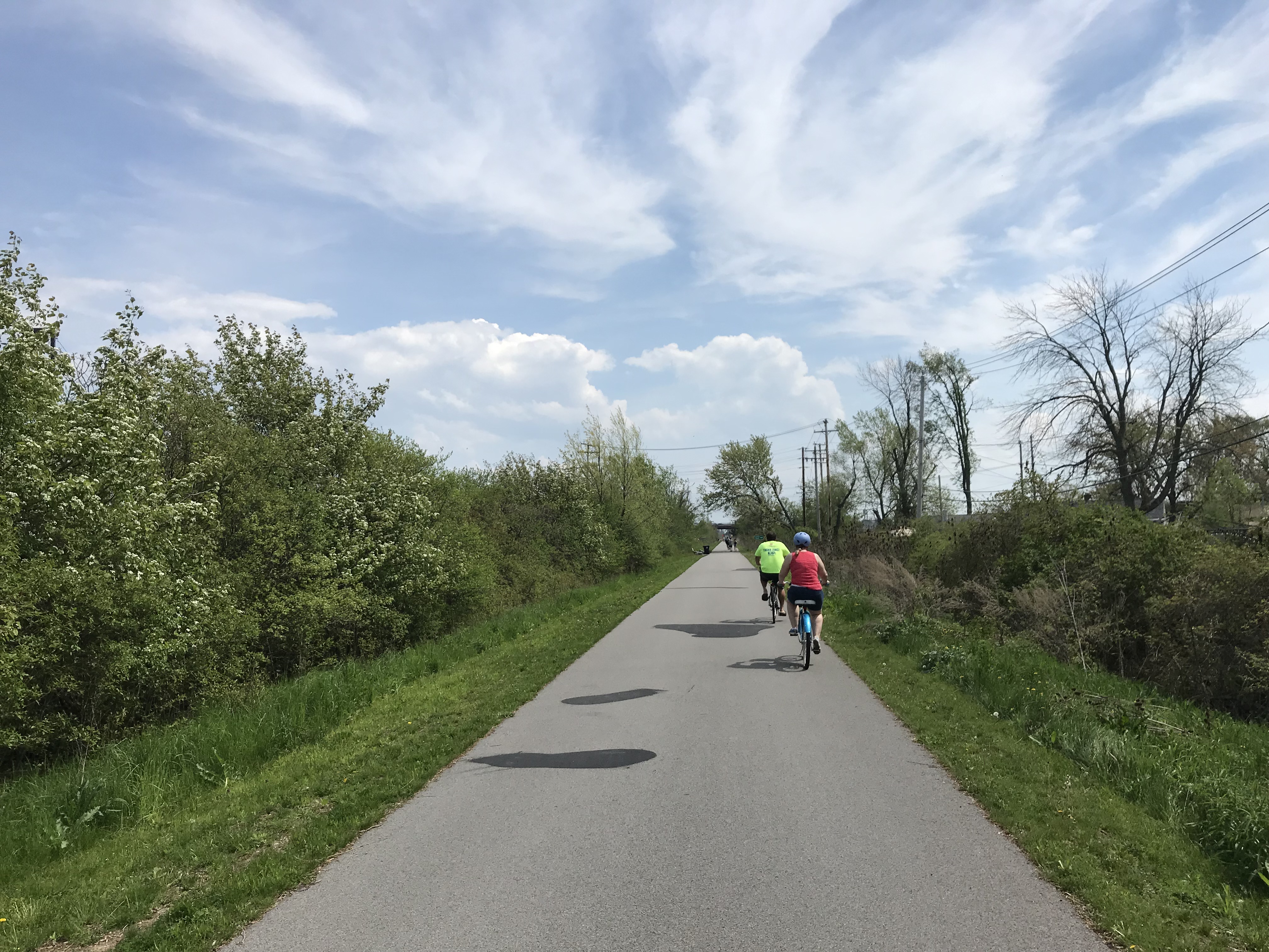
    On Labour Day weekend, I paid a visit to Brantford. I brought my bike on GO Transit, taking a train to Aldershot and a bus from there to the Telephone City. I then biked from Brantford to Hamilton on one of Ontario’s best rail trails.

    Over a decade ago, Mayor Chris Friel called Brantford “the worst downtown in Canada.” It was not hard to understand why. Colborne Street, Brantford’s main street, was lined with neglected commercial buildings, many with boarded up streetfronts. In the 1990s, many of the plywood hoardings had been decorated with pretend business names and silhouettes of customers, either as an attempt at beautifying the street or recalling the variety of businesses that had once occupied the strip. Only a few stores and restaurants remained open.

    4360965559_d1aa044078_o.jpgBoarded up storefront, Colborne Street, 2010

    There were several reasons for Downtown Brantford’s decline. In the 1980s, Brantford’s major industries, including the once-mighty Massey-Ferguson, had shut down local operations. Other industries like Cockshutt (later White Farm Equipment) had also departed Brantford. By the early 1990s, the unemployment rate hit 24 per cent.

    Cockshutt plant offices in 2004, and the remains in 2018

    The city also made some questionable urban renewal decisions. The old open-air marketplace at Colborne and Market Street, along with a whole city block was cleared for Eaton Market Square, which opened in 1986. The city also built a new parking structure to the south, as well as a new office building across the street from the new mall. Like most downtown malls built in Ontario, Eaton Market Square was a commercial failure. Brantford already had two suburban malls — Lyndon Park Mall, anchored by Sears, and Brantford Mall, anchored by the Right House, a Hamilton-based department store, Woolco and Loblaws.

    While parking at the suburban malls was free and plentiful, customers had to pay to park downtown, and Eaton’s in the 1980s was too upmarket for a smaller, blue collar city. Brantford’s downtown parking garage, built by the municipality, was to be paid for with parking fees.

    IMG_7686-001
    Eaton Market Place dropped the Eaton name after its anchor closed, but the mall’s past has since revealed itself

    While Eaton Market Square brought in many of the remaining retailers that were left on Colborne Street when the mall opened, as the mall floundered, most major tenants left as soon as their leases were due for renewal. By 1997, when Eaton’s entered bankrupcy and closed the Brantford store, many of the other shops had already closed.

    But the mall wasn’t the only thing Brantford officials did to try to revitalize its city centre.

    Like Flint, Michigan’s efforts to attract tourists and shoppers downtown coincident with the decline of its manufacturing base (described in Michael Moore’s film Roger and Me), Brantford pursued other projects along with the new mall to revitalize its downtown core. The provincial government planned a new electronic processing centre, but was cancelled by the NDP-led government in the early 1990s due to budget pressures.

    Icomm was to be a new telecommunications museum, science centre, and research hub, built on an old industrial site just south of downtown. While the building was completed in the early 1990s, it was left vacant after Bell Canada pulled its funding for the venture. Though city officials hoped for a post secondary educational institution, the Icomm building became a casino. Next to the casino, a commercial plaza, including a supermarket, fast food restaurants and a LCBO store was built, along with free surface parking.

    IMG_7676-001.JPGMarket Square

    Eventually, Brantford found a viable solution for revitalizing its downtown core. In 1999, Wilfrid Laurier University opened a satellite campus, starting out in the old Carnegie Library sold by the city for $1. By 2002, there were 340 students; today, enrollment is  about 3,000. Laurier now owns dozens of building downtown, including a previously abandoned movie theatre, and even the old old Eaton Market Square building. Hundreds of students live in local residences.

    IMG_7664-001The old Carnegie Library, Brantford

    Yet, there is still little retail downtown, though there are now several newer restaurants, bars, and coffee shops.

    It hasn’t been all good news. Nipissing University, based in North Bay, also established a satellite campus in Brantford. In December 2014 it announced that it would be winding down its presence there, including its joint programs with Laurier. The Ministry of Education had capped the number of funded spaces for Bachelor of Education students and reduced funding for the program. The joint programs were one of Brantford-Laurier’s main draws.

    4360965043_88fea24940_o.jpgColborne Street, January 2010

    Meanwhile Colborne Street continued to languish. In 2010, the city expropriated and demolished the entire south side of the street, including several commercial blocks still occupied. A new joint Laurier-YMCA athletics and recreation facility was built on the site, which will open by the end of the year. Sadly, the new building contributes very little to Brantford’s main street.

    IMG_7674-001The architecture of the new YMCA-Laurier athletic building is sterile compared to the old Colborne Street storefronts

    At the least, Laurier’s Brantford campus has brought some life back to a moribund downtown core that suffered through misguided urban renewal schemes, a major restructuring of the local economy, competition from suburban retail developments, and urban neglect.

    But a satellite post-secondary institution on its own isn’t necessarily a panacea for other suffering downtowns. As Norma Zminkowska pointed out recently in an article for TVO, satellite campuses aren’t necessarily permanent boosts to the local economy. In Barrie and Bracebridge, small campuses were closed for financial reasons. They weren’t able to attract enough students. Small campuses, especially those with fewer than 3500 students, often struggle to attract students and faculty — and scattering programs can weaken the institution. This is a warning worth considering as Laurier plans another satellite campus in Milton and Ryerson plans its second campus in Downtown Brampton.


    As an aside, Brantford is an interesting town, and is well-positioned at the junction of three major cycling trails connecting it to Cambridge and Kitchener-Waterloo to the north, Simcoe and Port Dover to the south, and Hamilton to the east. The Hamilton-Brantford Rail Trail is one of Ontario’s best trails, in excellent condition, and a gentle grade climbing the Niagara Escarpment.

    IMG_4333
    Hamilton-Brantford Rail Trail

    Within Brantford itself, there are several interesting sights. The Bell Telephone building features a statue of Alexander Graham Bell, who resided just outside of town for a number of years. The world’s first long-distance telephone call was made between nearby Paris, Ontario and Brantford in 1876. The area surrounding Victoria Square north of Colborne Street and the mall is reminiscent of a New England town square.

    IMG_7649.JPGBell Telephone Building

    Brantford was named for Joseph Brant, the anglicized name given to Thayendanegea, the Mohawk leader who allied with the British in the American War of Independence. His community, which previously resided in what is now Upstate New York, was given a large land grant on the Grand River. That land grant shrunk to what is now Six Nations. Her Majesty’s Royal Chapel of the Mohawks is one of the oldest buildings in Ontario, built in 1785. It is worth a visit. Nearby, the Woodland Cultural Centre is a museum and art gallery housed in a former residential school. The museum is dedicated to the history and future of the province’s First Nations.

    IMG_7727.JPGHer Majesty’s Royal Chapel of the Mohawks

    IMG_7709-001.JPGWoodland Cultural Centre. This building formerly housed the Mohawk Institute, one of many residential schools built as part of Canada’s shameful attempts at eradicating Indigenous heritage. It is now a First Nations museum and art gallery. 


  • Subways don’t always last 100 years

    IMG_7232-001
    Former Toronto Mayor Rob Ford liked to claim that subways would last one hundred years, while other “inferior” forms of transit, like light rail systems, would last only thirty.

    At the time, Ford was pushing for a subway extension to Scarborough Town Centre that would replace the Scarborough RT. The SRT opened in 1985 and nearly thirty years later, the line needed a major rebuild, including new equipment. The City of Toronto planned to replace the aging system with a modern LRT route, including a three kilometre extension with two new stations at Centennial College and at Sheppard and Progress Avenues in Malvern. The line would have been fully funded by the province, and the rebuild would have reduced the cumbersome transfer from the subway platforms.

    Of course, Rob Ford was wrong about subways lasting 100 years. While Toronto’s subway system is over sixty years old — the original Yonge Subway opened in 1954 between Union and Eglinton Stations —  only the tunnels and station structures themselves remain from that era. The Yonge Subway is on its fourth generation of vehicles. Each of the stations have been renovated with new turnstiles, tiling, signage, and elevators. The TTC is also working on a new automated signalling system, and track replacement is an ongoing program.

    Had the Scarborough RT been built as originally planned as an LRT route, there would only be the need for ongoing maintenance and new replacement vehicles. Extensions of the line would have been much easier and cheaper. The problem was that the planned route was converted — with pressure from the provincial government — to an Intermediate Capacity Transit System, a novel technology which was then being developed by the Province of Ontario. The rolling stock — nearing 30 years old — had to be replaced, and Bombardier, the successor to the provincial Urban Transportation Development Corporation, no longer built vehicles that could fit a tight turning radius between Ellesmere and Midland Stations. That’s why, after 30 years, the SRT needs a replacement.

    But you don’t have to travel far to see proof that subways don’t last a hundred years. In Rochester’s case, that city’s subway lasted only twenty-nine years before abandonment.

    IMG_7219-001High Falls, Rochester

    Rochester, New York is an interesting city. It’s best known as the home of Kodak and Xerox, with a few attractions that make it a worthwhile place to visit, including the George Eastman Museum and estate, The Strong Museum, and the most easterly of Frank Lloyd Wright’s classic Prairie Style houses.

    It also has America’s only fully-abandoned subway system.

    The Rochester Subway was one of three subways planned and built in mid-sized American cities after the First World War. All three, coincidentally, were designed to permit streetcars to run under city streets using abandoned canal beds.

    Cincinnati’s subway was the first to begin construction. Work began in 1919 on the path of the old Miami and Erie Canal, which once linked the Ohio River with Lake Erie at Toledo. But costs increased and construction was never completed. Today, the Cincinnati Streetcar runs on top of the abandoned subway route along Central Parkway.

    IMG_5599-001Central Parkway in Cincinnati in January 2015, where new streetcar tracks run above the abandoned subway line

    Rochester was the second city to build a subway line in a disused canal bed. The Erie Canal was rerouted around Downtown Rochester in 1919 and the new subway line — of which less than three kilometres was below grade — was built along the old waterway. A new downtown roadway, Broad Street. was built above the old canal. Service began in 1927 and was abandoned in 1956, as streetcar service in Rochester came to an end. Suburban growth along with population decline in old central city, and the prioritization of new interstate highways, put an end to rapid transit in that city.

    Newark was the last city to build a new subway system in an old canal bed. Opened in 1935, the Newark City Subway was built between the Pennsylvania Railroad Station (which now serves Amtrak, NJ Transit commuter trains, and PATH subway trains to New York City) and northwestern suburbs. The City Subway, which operated PCC streetcars until 2001, later became the core of New Jersey Transit’s Newark Light Rail System.

    IMG_7230-001

    In Rochester, several sections of the abandoned subway remain visible to the public, including both tunnel portals. Stairs leading down from the Broad Street Bridge, which spans the Genesee River and once carried the Erie Canal, allow the general public to get a glimpse of the tunnel (it is also accessible from the Genesee Riverway Trail next to Blue Cross Arena without stairs), and all the graffiti lining the walls.

    IMG_7238-001A public walkway from the Genesee Riverway at the Broad Street Bridge allows visitors to get a glimpse of the abandoned Rochester Subway

  • How two Ontario cities are re-imagining abandoned railway relics

    Brockville and St. Thomas are two small Ontario industrial cities that wouldn’t normally attract much attention. But both communities are working on remarkable projects that re-purpose former railway infrastructure to create interesting public spaces that don’t just lure out-of-town visitors, but add a significant asset to be enjoyed by the entire community. The St. Thomas Elevated Park and the Brockville Railway Tunnel are the type of local, community-driven projects that I can get excited about.

    St. Thomas likes to call itself the Railway Capital of Canada. One hundred years ago, five separate railway companies served the city. The Canada Southern (CASO) Railway, later purchased by the Michigan Central Railroad (which became part of the New York Central empire), built its headquarters and shops here; its double-tracked corridor was the fastest route between Buffalo and Detroit. St. Thomas was a stop on the London and Port Stanley Railway, a busy electric railway that ran regular passenger services until 1957. On the edge of town is the Jumbo monument, near the site where the famous Barnum and Bailey circus elephant was killed during a train stop.

    IMG_1330-001Jumbo Monument, at the westerly entrance to Downtown St. Thomas

    IMG_1310-001
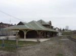
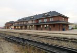
The 1873 Canada Southern Station. The tracks it once served have disappeared.

    Today, most lines into St. Thomas are abandoned, including the once-mighty Canada Southern; major rail customers such as Ford Motor Company closed local factories. The last passenger train, Amtrak’s Niagara Rainbow, departed from St. Thomas in 1979. The Port Stanley Terminal Railway runs tour trains along part of the old L&PS route, but its trains — for now — only board in Port Stanley.

    Despite the loss of the railways, St. Thomas has retained much of its railway heritage. The Elgin County Railway Museum has made its home in the old Michigan Central shops. The station building still stands too — built in 1873, it is one of the longest stations in Canada, extending 108 metres. It was recently renovated and houses offices and retail businesses. A replica of the LP&S station was built downtown, with the hopes of accommodating Port Stanley-bound tour trains. Just west of Downtown St. Thomas is the Kettle Creek Viaduct, which is slated to become a new signature park.

    IMG_1326-001Kettle Creek Viaduct, the future St. Thomas Elevated Park, in August 2017

    (more…)

  • The streetcar returns to Detroit – but who benefits?

    IMG_1489-001Woodward Avenue at Mack Avenue, August 2017

    I grew up in Brampton, a suburb of Toronto. Our family could not justify long, expensive vacations, but we did make several trips to Detroit and the region, usually to visit the Henry Ford Museum and Greenfield Village. We’d stay at a hotel outside Detroit, usually one with a swimming pool. Besides the museum visit and the pool, my parents would usually include a stop at an outlet mall. We’d also drive through Detroit itself, sparking my enduring fascination with the city.

    Since my first visit in the mid-1980s, the Hudson’s Department Store has been demolished, the Michigan Central Station has been permanently closed and allowed to deteriorate, and several downtown skyscrapers have closed and been abandoned. The city itself continued to lose population as more auto plants closed in the city and surrounding suburbs, and city services declined.

    But on recent trips, on my own or with friends, we started to see the beginnings of what looked like a comeback. New downtown baseball and football stadiums, followed by new office buildings, the re-opening of the long-abandoned Book-Cadillac and Fort Shelby Hotels, the opening of the Detroit Riverwalk and Dequindre Cut multi-use paths, and new residential development Downtown and Midtown.

    On the last trip to Detroit, my wife and I stayed downtown, at a hotel in the David Whitney Building, a formerly-abandoned office tower. We walked around Downtown Detroit and Eastern Market, visited the famous Art Deco Fisher Building, and went to several museums, including the Charles H. Wright Museum of African-American History, and the Detroit Historical Museum, both of which had special exhibitions marking the 50th anniversary of the 1967 Detroit Rebellion (also known as the 12th Street Riot). We ate at great local restaurants as well.

    And I went back to the Henry Ford Museum and Greenfield Village, both of which were as fun and as interesting as I remember.

    We also took the new QLine Streetcar. It was a fun ride, and I’m happy to report that the service was well used by both residents and tourists alike. But I have some serious concerns as well.

    (more…)

  • The Halifax Department of Silly Walks

    IMG_0772-001.JPG

    As part of our trip through the Maritime Provinces a few weeks ago, we visited Halifax. Nova Scotia’s capital and largest city is the economic, cultural and transportation hub for Atlantic Canada. In 1996, the City of Halifax was merged with surrounding towns and suburbs, as well as rural Halifax County; the Halifax Regional Municipality is now 5,490 square kilometres, nearly nine times the size of the City of Toronto.

    Like many amalgamated cities in Canada, Halifax has a historic, densely populated inner core, surrounded by urban neighbourhoods. Beyond the old cities of Halifax and Dartmouth is a ring of suburban homes and businesses, such as Bedford, Cole Harbour, and Bayer’s Lake. And like Hamilton and Ottawa, there’s another, even larger ring of rural farms, woodlands, small villages, and exurban estates. Peggy’s Cove, for example, is near Halifax’s eastern boundary. Councils of these amalgamated cities must reconcile the needs and desires of the urban centre with those of suburban and exurban residents. In Toronto, bike lanes are held up, or even removed, for the benefit of motorists living outside the urban core. The debate over Hamilton’s LRT has pitted suburban councillors against those representing the lower city. Halifax is no exception.

    Halifax’s urban core is worth exploring, despite construction detours around the new convention centre, the waterfront, and new condominium development. Downtown includes the historic Citadel, Province House, and the Art Gallery of Nova Scotia, among other museums. Halifax Common and the Public Gardens are welcoming public spaces in the classic New England style.

    Halifax Transit operates a ferry service to Dartmouth — only $2.50 per person, with the return trip free if taken within 90 minutes — which offers great views of the city and the various commercial and naval ships in the harbour. The ferry is also fully integrated with the local bus system. The new Halifax Central Library is one of Canada’s greatest new public buildings: the five storeys are bright and user-friendly, and there is even a rooftop patio and café to visit.

    Downtown is compact and a pleasure to walk abound.

    IMG_0903-001.JPGThe spectacular new Halifax Central Library

    But once you stroll beyond Halifax’s urban core, the landscape changes. Signed crosswalks are fewer and farther between, even in older residential neighbourhoods.

    Maritimers are famously courteous to pedestrians; most motorists will slow or stop if they see a pedestrian about to cross the street, whether or not there’s a marked crosswalk. But that slower pace of life in itself does not prevent collisions. As in any North American city, Halifax’s arterial roads and suburban streets are built to move cars through quickly and efficiently.

    That’s where the flags come in. What was intended as a well-meaning, inexpensive measure to promote pedestrians’ safety at crosswalks has become one of the most ridiculous pedestrian initiatives.

    Crosswalk flags were the idea of just one man, Norm Collins, a Dartmouth retiree. The flags and buckets only cost $200 per crosswalk, compared to $15,000-25,000 per crosswalk for proper signal lights. In 2015, municipal staff were cool to pedestrian flags, though the idea enjoyed support from HRM councillors, particularly suburban politicians, and the flags were approved by council.

    Now, at most crosswalks outside Halifax’s urban core, there are buckets of bright orange flags for pedestrians to take when crossing the street. These buckets and flags can even be found at signalized crossings with flashing amber lights activated by pressing a button. Each bucket has instructions printed on how to “be cautious…be seen…be safe.”

    IMG_0966-002.JPG
    One of the buckets, with instructions on how to use the flags left inside

    Yes, even when there are flashing lights at an intersection, Halifax Regional Council expects pedestrians to use these flags (even if city staff disagree). The instructions above clearly indicate that the onus for safety is entirely on the pedestrian crossing the street, not on motorists taking care by driving safely and attentively.

    Vision Zero is the Swedish road safety philosophy that seeks to end traffic fatalities by minimizing the effects of mistakes made my all road users. Lower speed limits, enforced by road re-engineering works (such as bump-outs, speed humps, and tighter corners at intersections) that slow down cars and trucks is one such effective measure. So are complete streets, designed to improve the safety and comfort of pedestrians and cyclists. Cheap pedestrian flags, which do not address the root problem, are not within the spirit of Vision Zero.

    If Halifax Council — or any municipal government — was serious about improving pedestrian safety, features that would help include improved lighting, narrowing the roadways at pedestrian crossings, and raising the crosswalks closer to the curb level, forcing motorists to slow down (and also improving drainage. Flags and high-visibility clothing are useful for temporary conditions and for traffic control personnel, but not for everyday conditions and everyday people. The onus should always be first on the licensed motorist to be attentive to the road and drive according to the conditions.

    A ridiculous pedestrian safety measure deserves a ridiculous walk, as I demonstrated in Dartmouth.


  • A visit to New Glasgow, Nova Scotia

    IMG_0319-001New Glasgow City Hall

    After our wedding, we went away to Nova Scotia and Prince Edward Island. I’ve been to Halifax and the Annapolis Valley once before, in April 2004, but I’ve never been to Cape Breton (which has become one of my favourite places in Canada), or PEI.

    It was a wonderful trip. We drove the Cabot Trail, hiked several trails in Cape Breton Highlands National Park, enjoyed great meals featuring local seafood, visited restored historic sites such as the Fortress of Louisbourg, and spent some time wandering around Halifax and Charlottetown. I’ll write more on those adventures later.

    Driving through Nova Scotia on the way to Cape Breton, you must pass through Pictou County on Highway 104, part of the Trans-Canada Highway. Most travelers pass through, or stop off the highway for gas or food. But the region has an interesting history, and we visited two historic sites there which are off most tourists’ radar.

    Once an industrial powerhouse, settlements such as New Glasgow, Stellarton, and Trenton have been hit by the closures in the steel industry and in coal mining. Trenton had a large steel mill; the TrentonWorks plant produced rail cars until 2007. Coal mining was also important to both northern Nova Scotia and in Cape Breton, but today, only one surface coal mine remains in the province near Stellarton. Today, Stellarton might be most known as the hometown of and headquarters for the Sobeys supermarket chain and its parent company, Empire Corp. The town of Pictou was known for its shipbuilding industry.

    New Glasgow, which we visited, is the largest community in Pictou County, and the regional centre for central Nova Scotia. We stayed in New Glasgow overnight, as we were to take the Northumberland Ferry to PEI early the next morning.


    In 1947, Viola Desmond, a successful Black entrepreneur, was removed by police from the Roseland Theatre for refusing to sit in the upper segregated seating area, but in the ‘whites only’ section. She was charged and convicted for tax evasion – the one cent difference in the provincial amusement tax between the ticket she was sold and the lower level seating. Despite this injustice, the apology and pardon from the Nova Scotia government didn’t come until 2010. That year, a plaque was unveiled in New Glasgow. Since then, there has been more recognition of this injustice and of Desmond’s importance — a new ferry was named for her in Halifax, and she will appear on the next issue of the $10 bank note.

    IMG_0318-001
    Roseland Theatre building, June 30, 2017

    Today, the Roseland Theatre is closed (the theatre later became a club). I found the building (which is being renovated, and the marquee removed), but I had trouble finding the plaque. I found out it was located two blocks away from the theatre building, next to the public library.

    IMG_0323-001
    The plaque commemorating Viola Desmond is located two blocks away from the Roseland Theatre

    IMG_0321-001


    On May 9, 1992, sixteen miners were killed in a methane and coal gas explosion at the nearby Westray Mine. News of the explosion, and coverage of the attempted rescue efforts was one of the first major news stories I clearly remember, and the first I really understood. I was eleven when it happened. (Though I also remember the 1989 fall of the Berlin Wall, I was eight years old at the time, and I couldn’t understand the significance. Westray was the first news story that I remember and which I could understand clearly.)

    Tragically, eleven bodies remain underground. The mining company ignored unsafe working conditions, and the government was complicit in knowing about the problems but not forcing changes — the Westray mine promised jobs, not only in the mine, but in other local industries, such as TrentonWorks, which was contracted to supply rail cars for shipping coal to a nearby power generation station. The mine had lots of support at all three levels of government; this likely contributed to pressure to keep it open despite serious safety concerns. Furthermore, criminal proceedings against the company and its management were botched.

    IMG_0316-001Their Light Shall Always Shine Memorial Park, New Glasgow

    Though the main Westray Mine site and shaft were located at Plymouth, to the south of New Glasgow, the explosion took place north of Highway 104, within the city limits. Their Light Shall Always Shine Memorial Park is located close to the site. Besides a garden and a monument with all sixteen men’s names, there are several interpretative plaques on the history of the Westray Mine, the explosion, and the aftermath.

  • Cycling the Greater Golden Horseshoe

    IMG_4179You never know who you might meet when you ride through Toronto’s ravines

    Spring is here!

    One of my favourite things to do is go for a ride, either within town, or on a day trip or an overnight excursion. Toronto’s ravines are a treat; and the further away from Lake Ontario you get, the quieter the trails are.

    Two years ago, I was riding up the Humber River Trail north of Highway 401 when I saw a deer wandering down the path. I stopped, and the deer passed by, within metres of where I was standing. Not much further north, I saw two deer — a fawn and its mother — fording the Humber. Tommy Thompson Park, better known as the Leslie Street Spit, is another favourite place to go. The Spit was created from clean landfill to create a new outer harbour in anticipation for St. Lawrence Seaway shipping that never came. Instead, it has become an important migratory bird sanctuary. The views of Downtown Toronto are great, and there are no ferry lines to wait in.

    For longer distances, GO Transit is especially helpful. All of their buses are equipped with bike racks and their train (outside of rush hour, of course) can handle over 25 bicycles each. (The seasonal Niagara trains have dedicated bike coaches as well.) GO Transit can get you out of the city for more rural rides, or for longer one-way rides to or from Toronto.

    At least twice a year, I ride out to Hamilton on the Waterfront Trail, opting to enter that city by going around Burlington Bay and taking Cannon Street in from the east. It’s an 85 kilometre trip that takes the better part of the day. I’ll have dinner and drinks at one of the many Downtown Hamilton establishments before loading my bike on the bus at the Hamilton GO Centre. Other times, I have used GO Transit to get out to rail trails in Peterborough, Uxbridge, Guelph, or Barrie.

    I prefer rail trails as they’re more relaxed than rural roads or highways; I’m not able to keep up with roadies, and I’m okay with that. Rail trails are flat, but they’re also usually unpaved, and some sections are very quiet. (I have gone 20 or 30 minutes without meeting another trail user in some rural areas.)

    Here is a summary of some of my favourite long-distance rides.

    (more…)