Category: Travels

  • A visit to New Glasgow, Nova Scotia

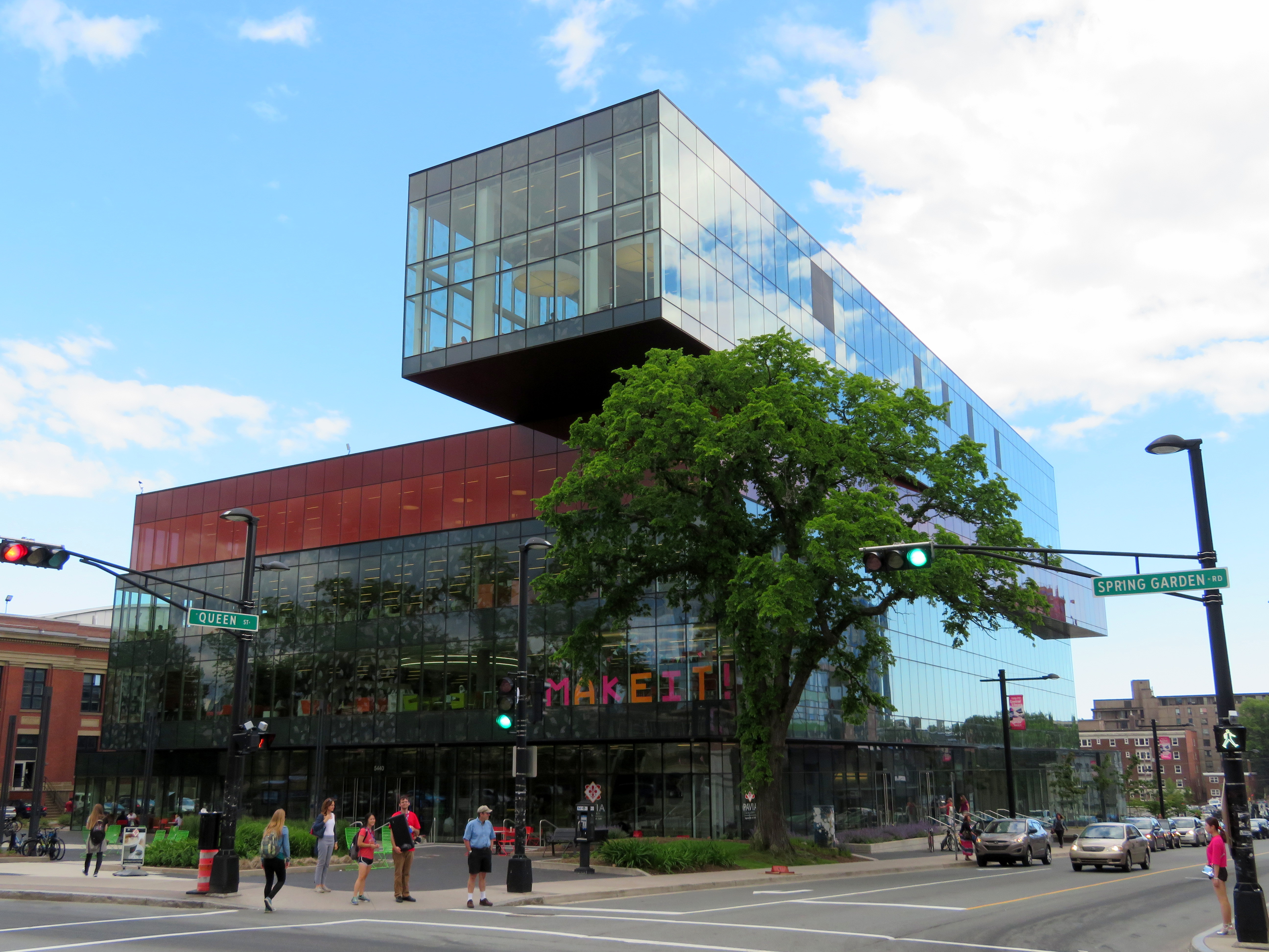
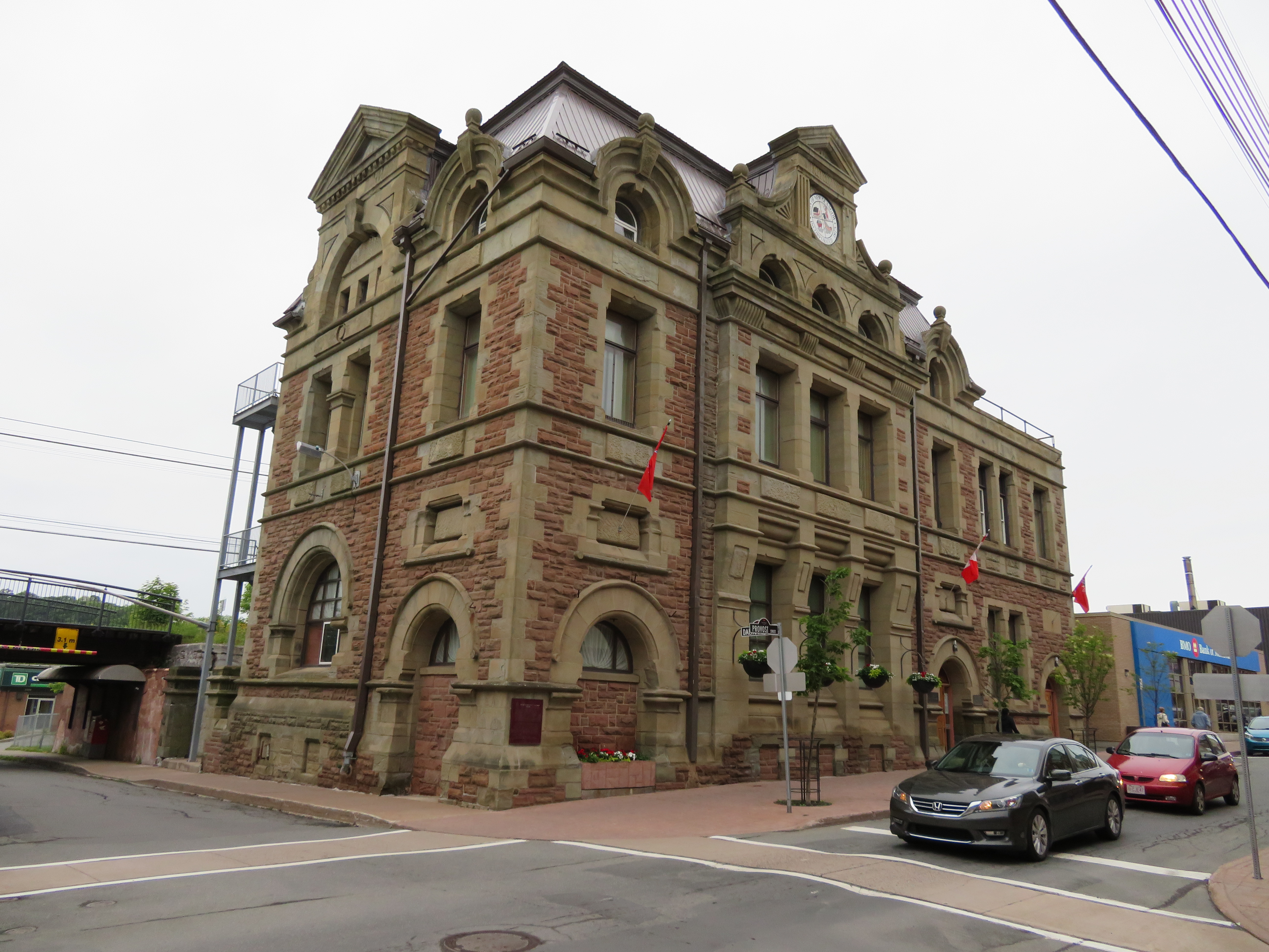
    IMG_0319-001New Glasgow City Hall

    After our wedding, we went away to Nova Scotia and Prince Edward Island. I’ve been to Halifax and the Annapolis Valley once before, in April 2004, but I’ve never been to Cape Breton (which has become one of my favourite places in Canada), or PEI.

    It was a wonderful trip. We drove the Cabot Trail, hiked several trails in Cape Breton Highlands National Park, enjoyed great meals featuring local seafood, visited restored historic sites such as the Fortress of Louisbourg, and spent some time wandering around Halifax and Charlottetown. I’ll write more on those adventures later.

    Driving through Nova Scotia on the way to Cape Breton, you must pass through Pictou County on Highway 104, part of the Trans-Canada Highway. Most travelers pass through, or stop off the highway for gas or food. But the region has an interesting history, and we visited two historic sites there which are off most tourists’ radar.

    Once an industrial powerhouse, settlements such as New Glasgow, Stellarton, and Trenton have been hit by the closures in the steel industry and in coal mining. Trenton had a large steel mill; the TrentonWorks plant produced rail cars until 2007. Coal mining was also important to both northern Nova Scotia and in Cape Breton, but today, only one surface coal mine remains in the province near Stellarton. Today, Stellarton might be most known as the hometown of and headquarters for the Sobeys supermarket chain and its parent company, Empire Corp. The town of Pictou was known for its shipbuilding industry.

    New Glasgow, which we visited, is the largest community in Pictou County, and the regional centre for central Nova Scotia. We stayed in New Glasgow overnight, as we were to take the Northumberland Ferry to PEI early the next morning.


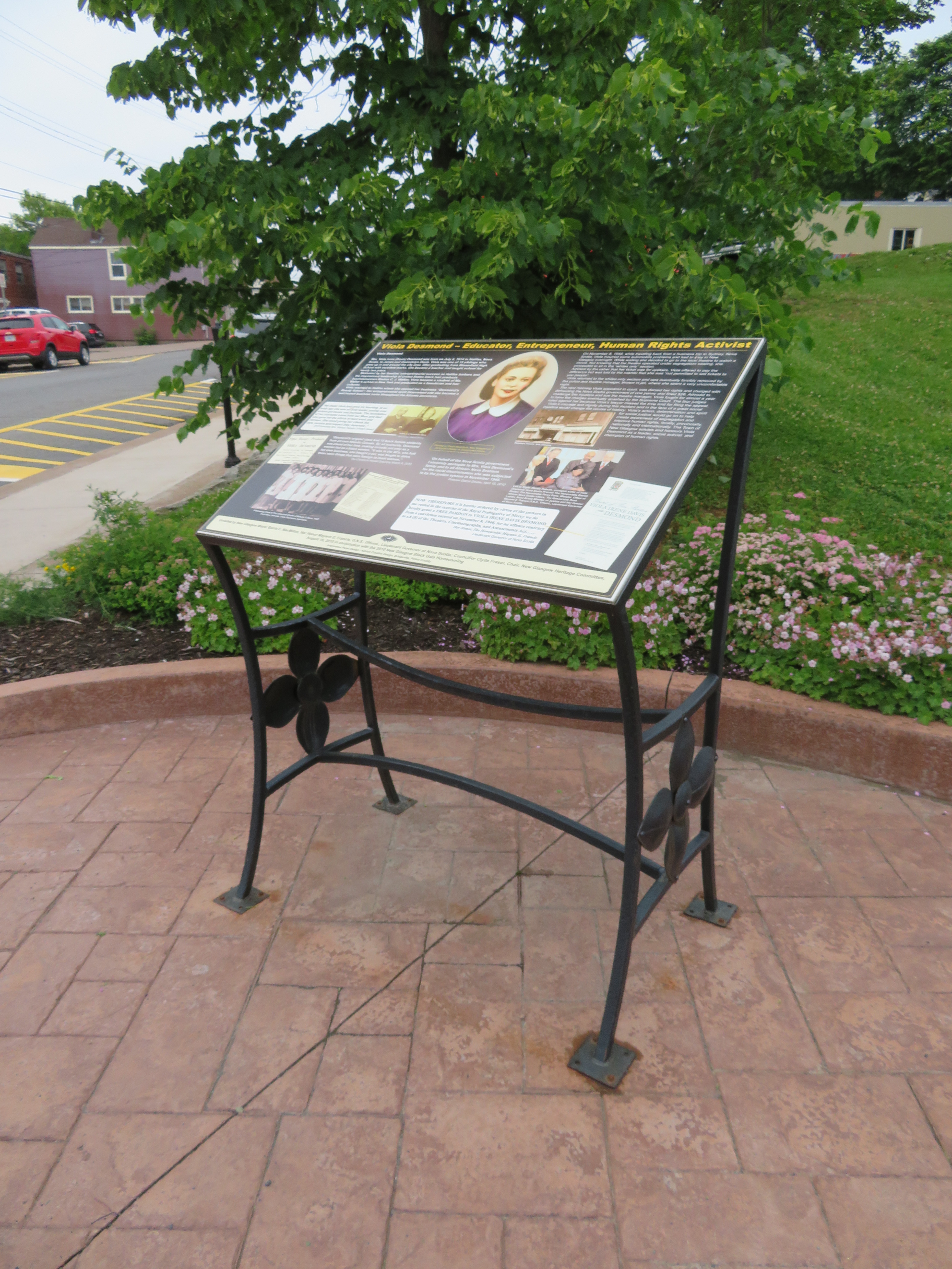
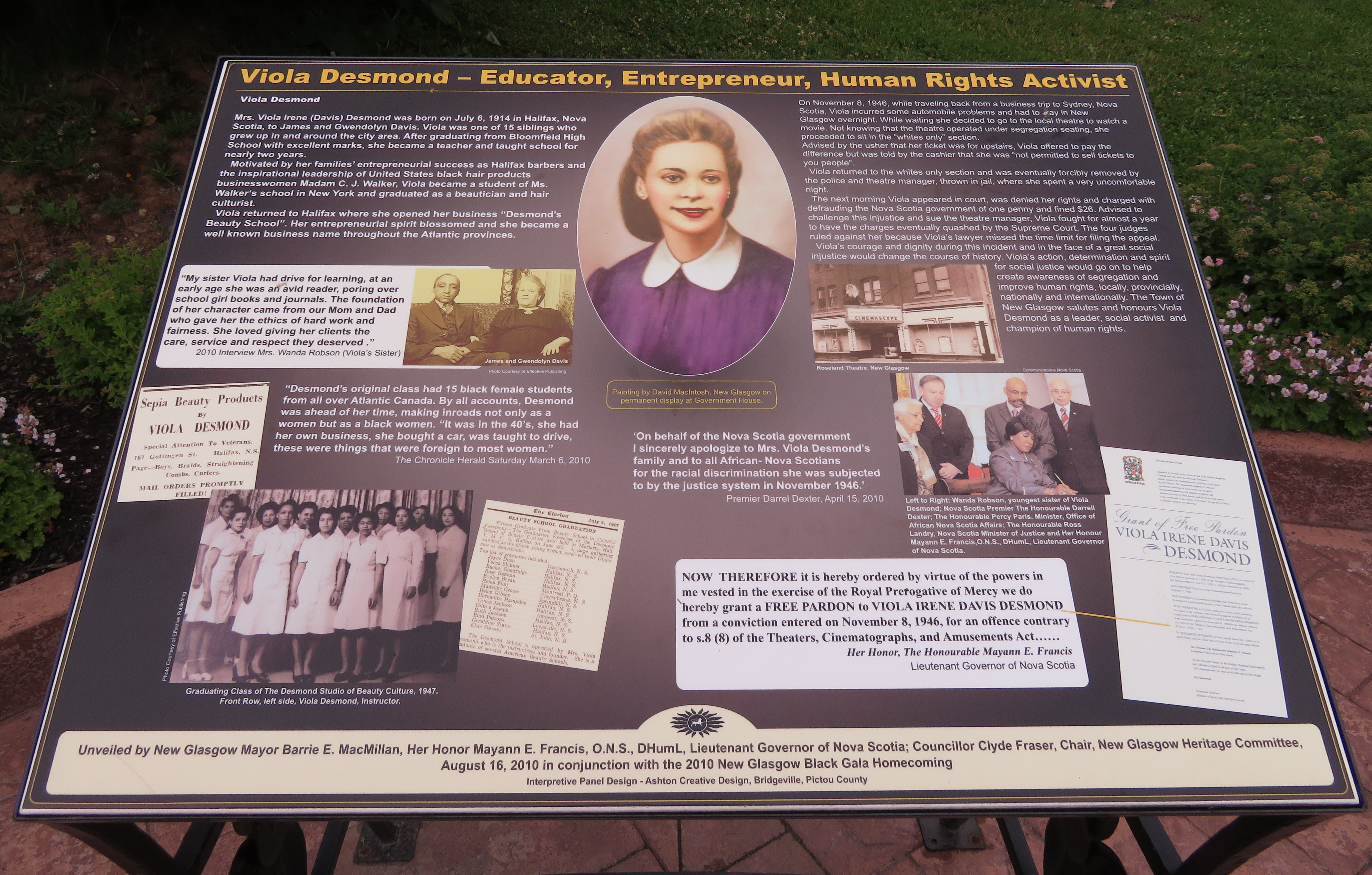
    In 1947, Viola Desmond, a successful Black entrepreneur, was removed by police from the Roseland Theatre for refusing to sit in the upper segregated seating area, but in the ‘whites only’ section. She was charged and convicted for tax evasion – the one cent difference in the provincial amusement tax between the ticket she was sold and the lower level seating. Despite this injustice, the apology and pardon from the Nova Scotia government didn’t come until 2010. That year, a plaque was unveiled in New Glasgow. Since then, there has been more recognition of this injustice and of Desmond’s importance — a new ferry was named for her in Halifax, and she will appear on the next issue of the $10 bank note.

    IMG_0318-001
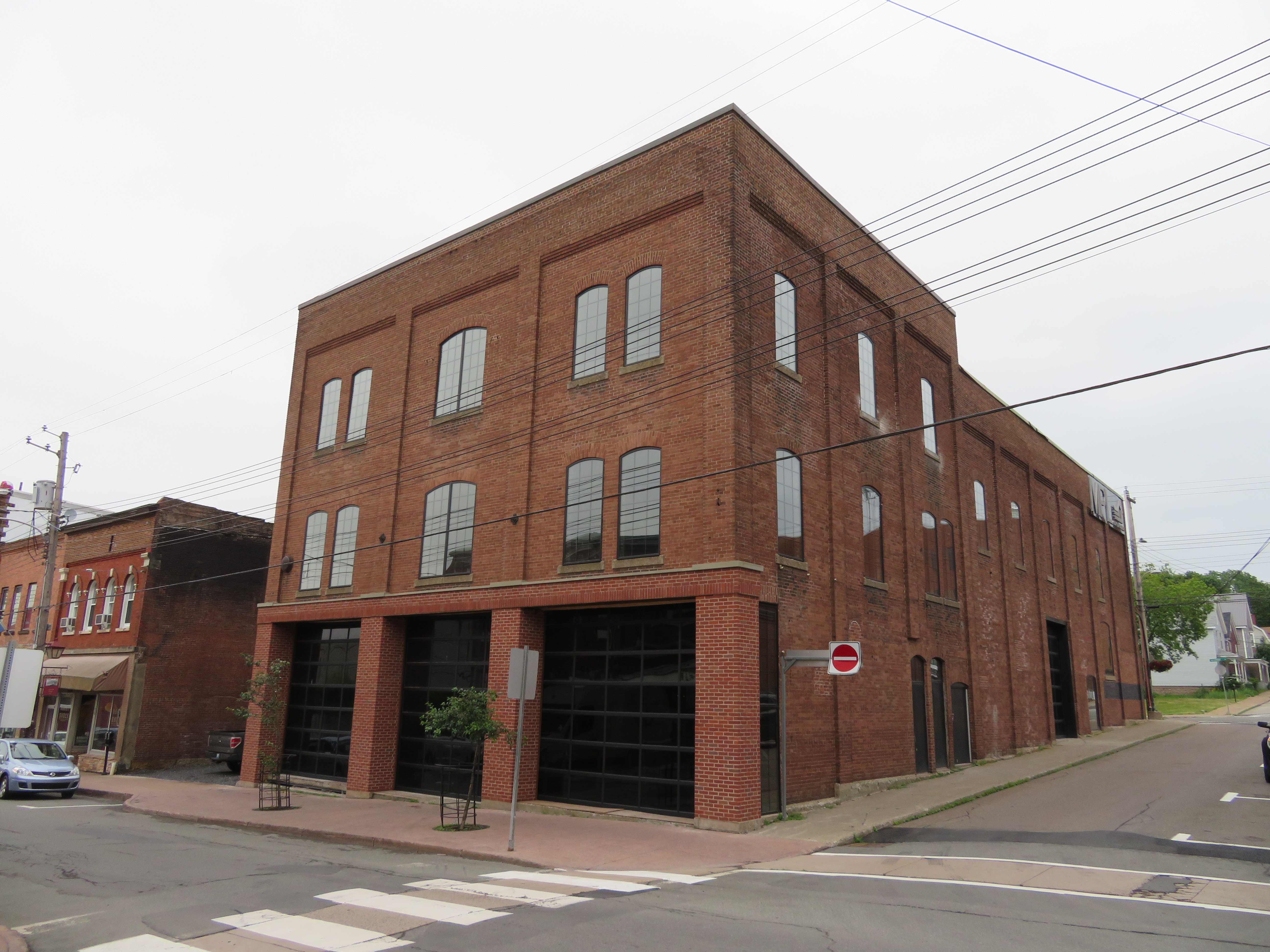
    Roseland Theatre building, June 30, 2017

    Today, the Roseland Theatre is closed (the theatre later became a club). I found the building (which is being renovated, and the marquee removed), but I had trouble finding the plaque. I found out it was located two blocks away from the theatre building, next to the public library.

    IMG_0323-001
    The plaque commemorating Viola Desmond is located two blocks away from the Roseland Theatre

    IMG_0321-001


    On May 9, 1992, sixteen miners were killed in a methane and coal gas explosion at the nearby Westray Mine. News of the explosion, and coverage of the attempted rescue efforts was one of the first major news stories I clearly remember, and the first I really understood. I was eleven when it happened. (Though I also remember the 1989 fall of the Berlin Wall, I was eight years old at the time, and I couldn’t understand the significance. Westray was the first news story that I remember and which I could understand clearly.)

    Tragically, eleven bodies remain underground. The mining company ignored unsafe working conditions, and the government was complicit in knowing about the problems but not forcing changes — the Westray mine promised jobs, not only in the mine, but in other local industries, such as TrentonWorks, which was contracted to supply rail cars for shipping coal to a nearby power generation station. The mine had lots of support at all three levels of government; this likely contributed to pressure to keep it open despite serious safety concerns. Furthermore, criminal proceedings against the company and its management were botched.

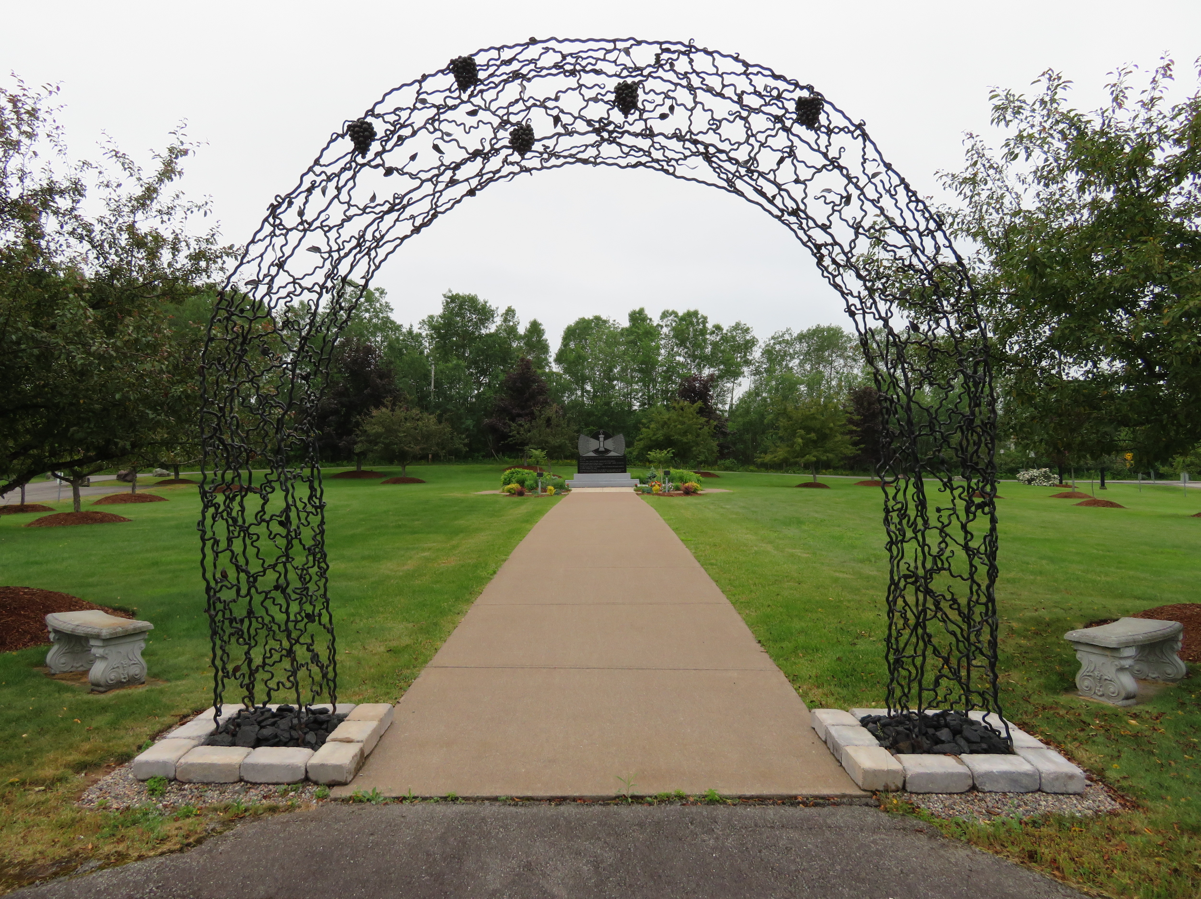
    IMG_0316-001Their Light Shall Always Shine Memorial Park, New Glasgow

    Though the main Westray Mine site and shaft were located at Plymouth, to the south of New Glasgow, the explosion took place north of Highway 104, within the city limits. Their Light Shall Always Shine Memorial Park is located close to the site. Besides a garden and a monument with all sixteen men’s names, there are several interpretative plaques on the history of the Westray Mine, the explosion, and the aftermath.

  • Cycling the Greater Golden Horseshoe

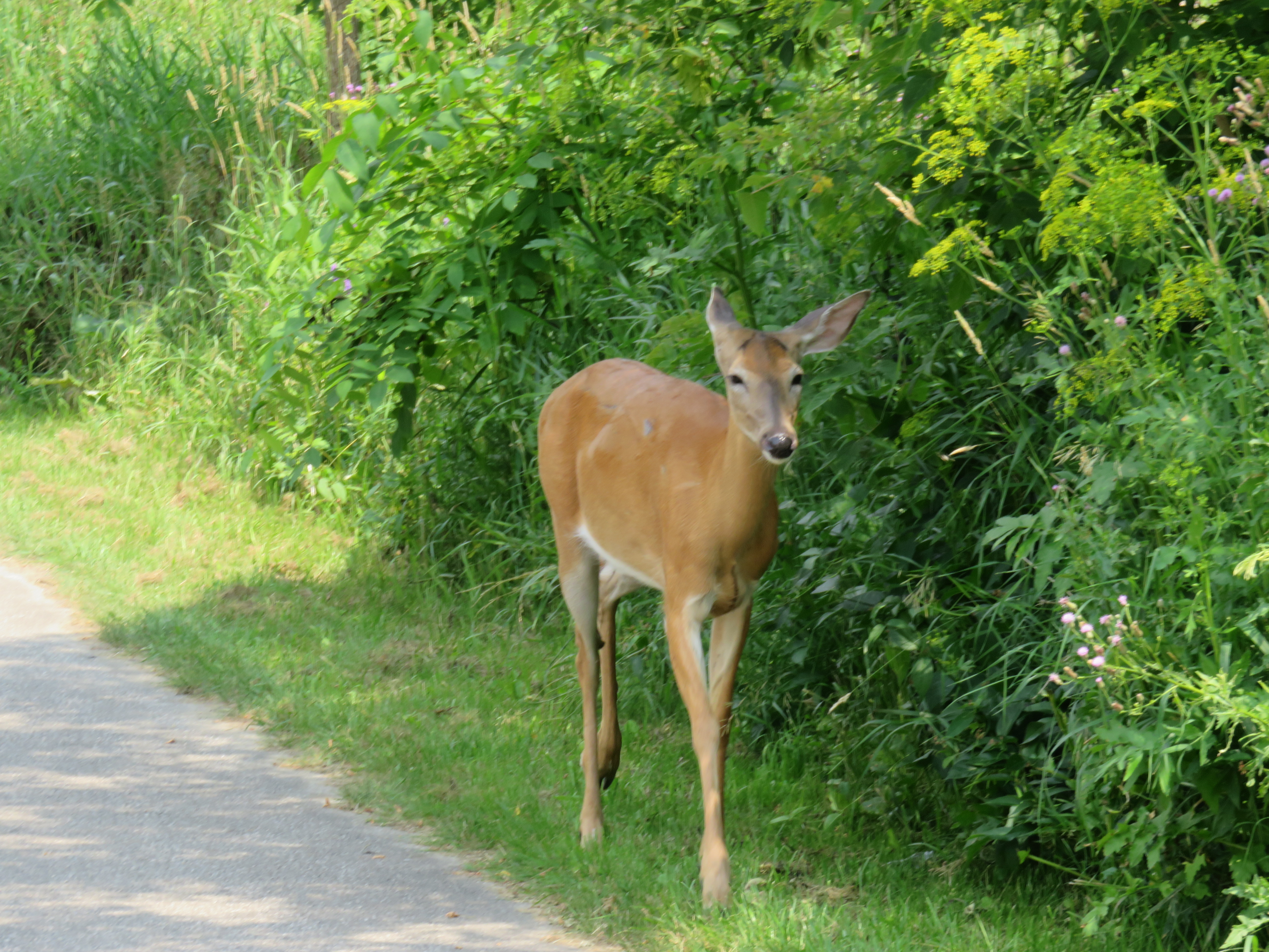
    IMG_4179You never know who you might meet when you ride through Toronto’s ravines
    Spring is here!

    One of my favourite things to do is go for a ride, either within town, or on a day trip or an overnight excursion. Toronto’s ravines are a treat; and the further away from Lake Ontario you get, the quieter the trails are.

    Two years ago, I was riding up the Humber River Trail north of Highway 401 when I saw a deer wandering down the path. I stopped, and the deer passed by, within metres of where I was standing. Not much further north, I saw two deer — a fawn and its mother — fording the Humber. Tommy Thompson Park, better known as the Leslie Street Spit, is another favourite place to go. The Spit was created from clean landfill to create a new outer harbour in anticipation for St. Lawrence Seaway shipping that never came. Instead, it has become an important migratory bird sanctuary. The views of Downtown Toronto are great, and there are no ferry lines to wait in.

    For longer distances, GO Transit is especially helpful. All of their buses are equipped with bike racks and their train (outside of rush hour, of course) can handle over 25 bicycles each. (The seasonal Niagara trains have dedicated bike coaches as well.) GO Transit can get you out of the city for more rural rides, or for longer one-way rides to or from Toronto.

    At least twice a year, I ride out to Hamilton on the Waterfront Trail, opting to enter that city by going around Burlington Bay and taking Cannon Street in from the east. It’s an 85 kilometre trip that takes the better part of the day. I’ll have dinner and drinks at one of the many Downtown Hamilton establishments before loading my bike on the bus at the Hamilton GO Centre. Other times, I have used GO Transit to get out to rail trails in Peterborough, Uxbridge, Guelph, or Barrie.

    I prefer rail trails as they’re more relaxed than rural roads or highways; I’m not able to keep up with roadies, and I’m okay with that. Rail trails are flat, but they’re also usually unpaved, and some sections are very quiet. (I have gone 20 or 30 minutes without meeting another trail user in some rural areas.)

    Here is a summary of some of my favourite long-distance rides.

    (more…)

  • A check-up on Downtown Barrie

    IMG_8357-001
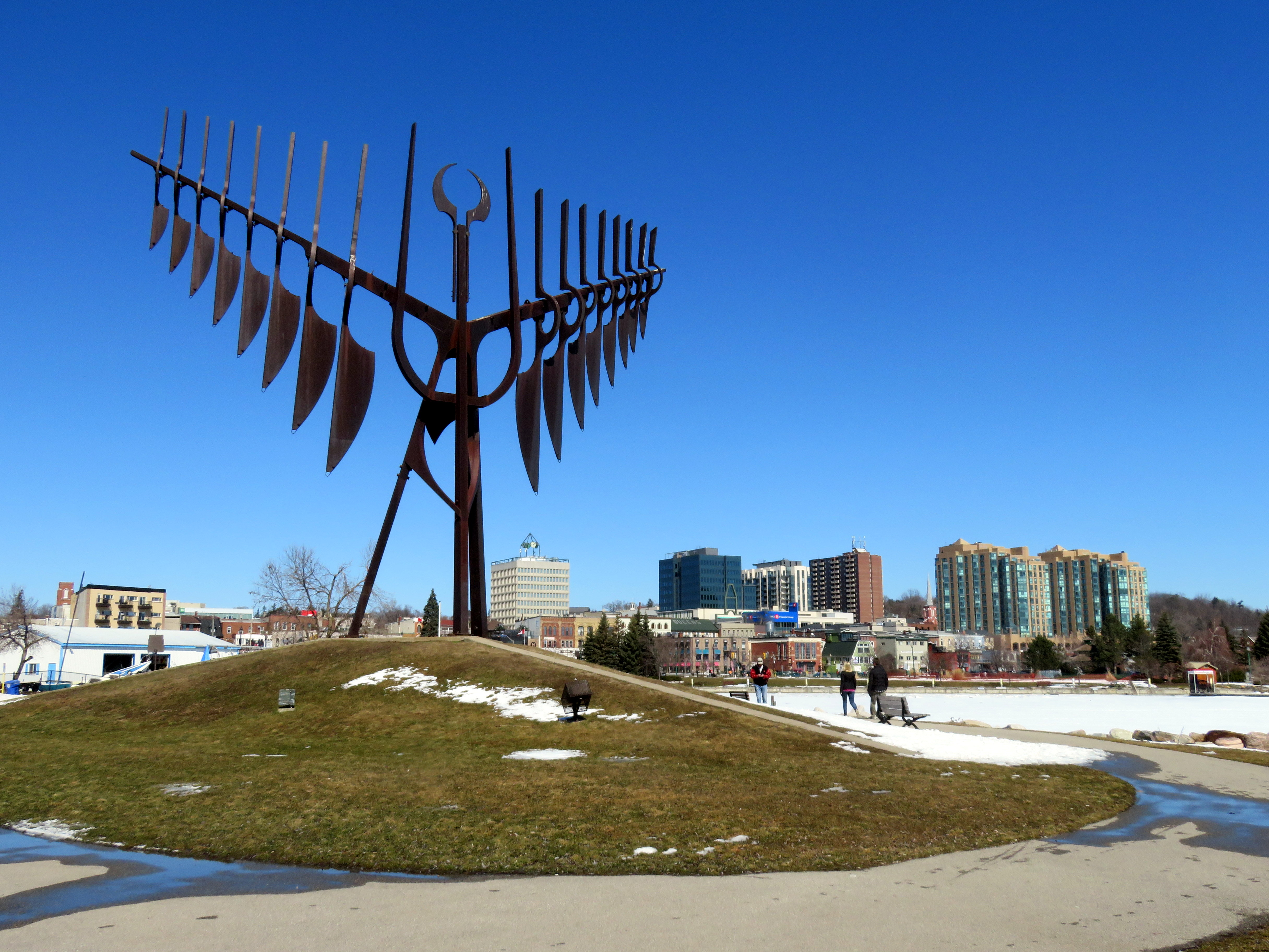
    “Spirit Catcher” by Ron Baird on Downtown Barrie’s Waterfront

    Last weekend, I made a trip up to Barrie on GO Transit. Most people in the Greater Toronto Area know of Barrie as a place you pass on Highway 400 on the way north to Collingwood, Wasaga Beach, or Muskoka, but it has a population of 140,000 people, many of them commuters to the Greater Toronto Area.

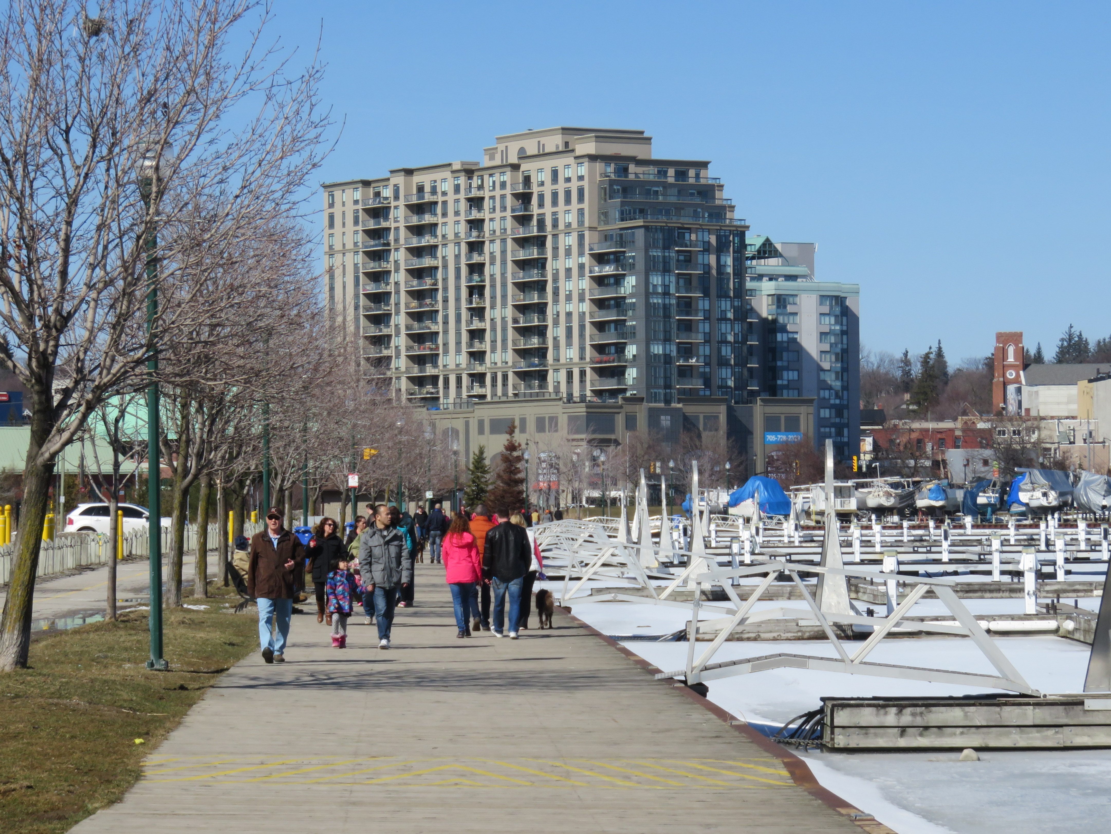
    Barrie features a lovely waterfront, situated at the end of Lake Simcoe’s Kempenfelt Bay. After the abandonment of the Canadian National Railway tracks north of Allandale Station in 1997, a new waterfront trail was created and Lakeshore Drive moved inland to provide more park space. The waterfront trail connects on the north with a rail trail that extends to Orillia. The waterfront has three swimming areas, a marine, food concessions, playgrounds, and gardens. On a warm Sunday in March, the boardwalk and waterfront paths were very well used. Work is being completed on further enhancements to the public realm.

    IMG_8386-001A busy March Sunday on Barrie’s waterfront
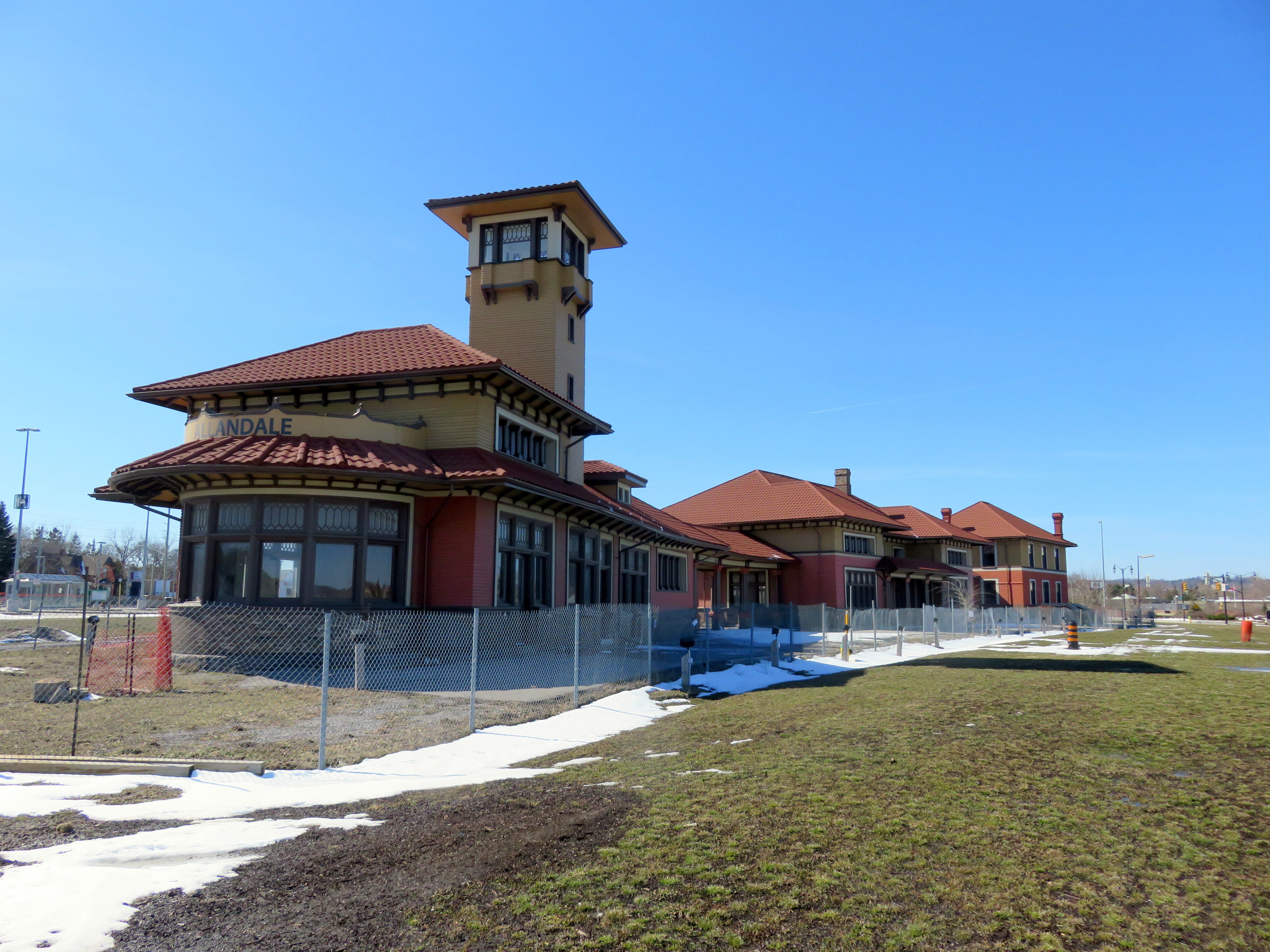
    In 2012, GO Transit extended the Barrie line to Allandale Waterfront Station, at the closest point possible to Downtown Barrie where tracks remained. The old Allandale Station, built by the Grand Trunk Railway in 1905 and abandoned by CN in the 1980s, still stands just north of the GO station, newly restored. Yet the station is fenced off and is awaiting re-use.

    IMG_8372-001.JPGAllandale Station is fully restored on the outside, but remains fenced off. The GO Station is to the far left.
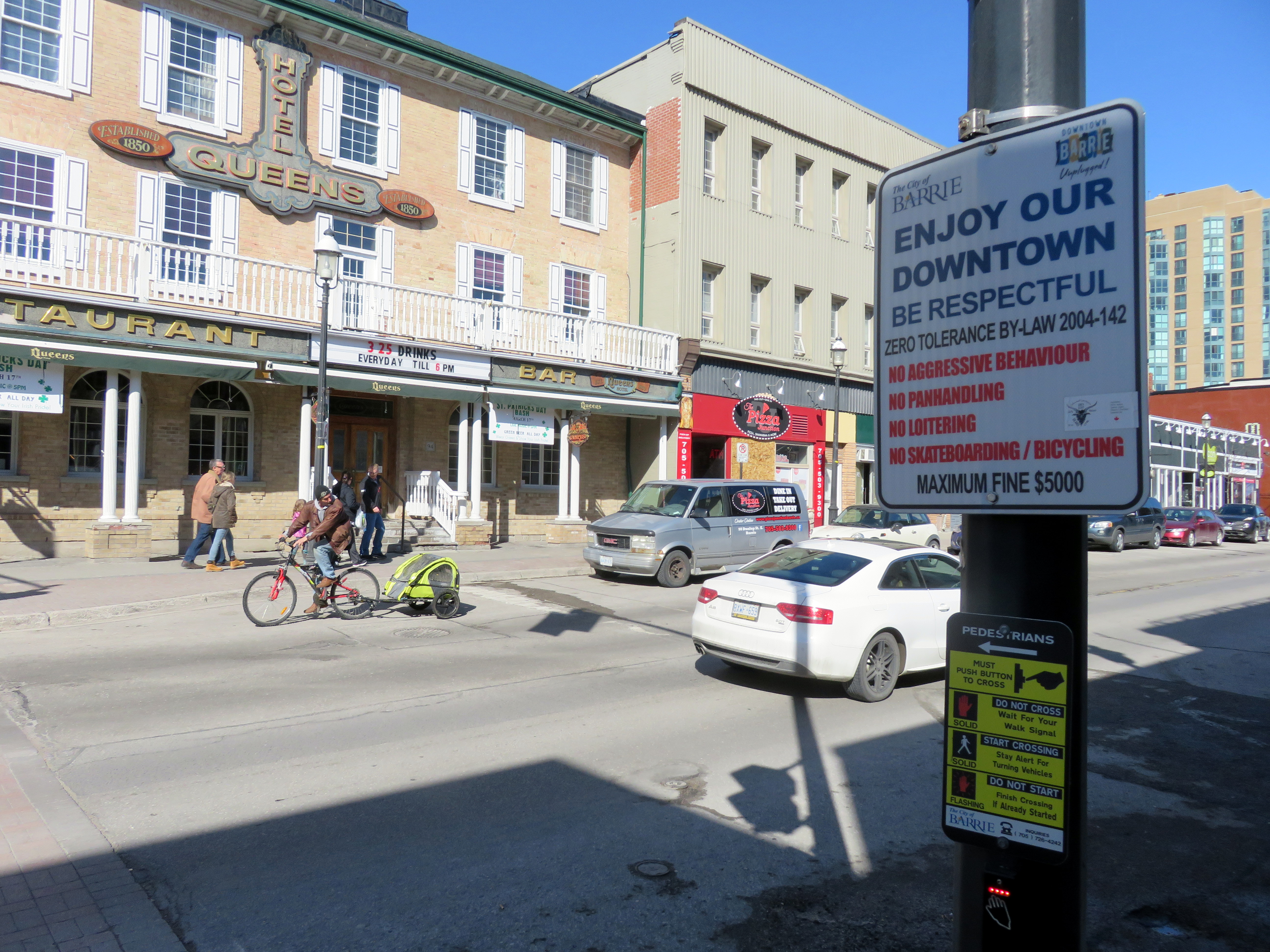
    Downtown Barrie hosts many heritage buildings. Despite a catastrophic fire in 2007, the downtown core boasts a mostly-intact inventory of heritage commercial and institutional buildings. The old Carnegie Library was incorporated into the MacLaren Art Centre (a new central library was built in the 1980s). The Queen’s Hotel on Dunlop Street, established in the 1850s, retains its historical veranda. Brampton and other county towns had similar hotels, but many were lost to fire or development.

    The downtown business improvement area has been active as well. During the summer months, patios are brought out into the streets, and festivals are put on year-round. New condominium towers built along the waterfront and downtown bring new residents that can support the historic city centre.

    Despite my positive impressions, one thing really bothered me: Downtown has many signs posted reminding people of a 2004 by-law prohibiting “aggressive behaviour, panhandling, loitering, and skateboarding/bicycling” with a maximum fine of $5000. Surveillance cameras are positioned at several downtown corners.

    IMG_8396-002Sign reminding of Downtown Barrie’s Zero Tolerance Bylaw. The historic Queen’s Hotel is in the background.
    The intent of the rule against cycling probably refers to bicycles ridden on sidewalks, rather than on roadways (there are some bicycle lock-up locations downtown and along the waterfront). That said, the signage and the by-law have the effect of telling young people and low-income residents that they are not welcome.

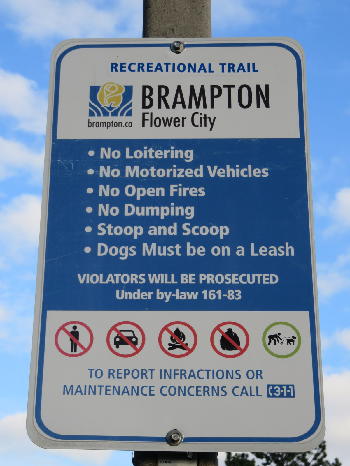
    Signs and specific bylaws such as this are not uncommon in Ontario. In Brampton, signs in public parks and along its pathways prohibit loitering as well. Yet sidewalks and parks are public spaces; parks in particular are places where one might wish to relax, have a picnic, or just sit and enjoy nature or to people-watch.

    IMG_2362-001.JPG“No loitering” in Brampton’s parks

    Downtown Barrie has struggled with poverty, vacant lots, derelict properties on the periphery, as well as crime, such as assaults, and drug trafficking. Downtown Barrie has many of the support services for economically and socially marginalized people; there are affordable rental apartments and rooming houses in the core as well. Downtown has several cafes and restaurants, a few clothing and furniture stores, as well as a craft brewery, but many of the businesses along the main streets are convenience stores, hair salons, vape shops, tattoo parlours, bars, and nightclubs. Especially missing are businesses such as a drug store, and a supermarket.

    To discourage loitering, benches were removed from Dunlop Street, Barrie’s main street. However, seniors in particular benefit from places to sit and rest while going on walks or doing shopping. Payphones downtown were also removed in 2013; the local councillor said that they were “degrading the quality of the neighbourhood.”

    In 2014, the City of Hamilton was looking at adopting a similar by-law to discourage low-income and homeless people congregating and creating a nusiance in Downtown Hamilton. Councillor Jason Farr pointed to Downtown Barrie’s success, but noted the importance of consulting with poverty advocates to “include that social side of the argument.”

    Instead of merely implementing aggressive regulations and ticketing, there’s a need for inclusive urbanism. Are there adequate recreational and social activities for youth and marginalized populations? Barrie has a skateboard/BMX park nearby, at Queen’s Park, but that might not be enough to satisfy local youth. What urban interventions would Barrie’s low income populations like to see? Sadly, I doubt they were consulted.

    Barrie’s waterfront is one of Ontario’s best: accessible by transit, connected to its downtown, hosting many activities and events. As construction concludes, it should help revitalize the neighbourhoods around it. Barrie should not further push away its already marginalized populations; it should find a way to be welcoming to all.

  • To Stratford by Train

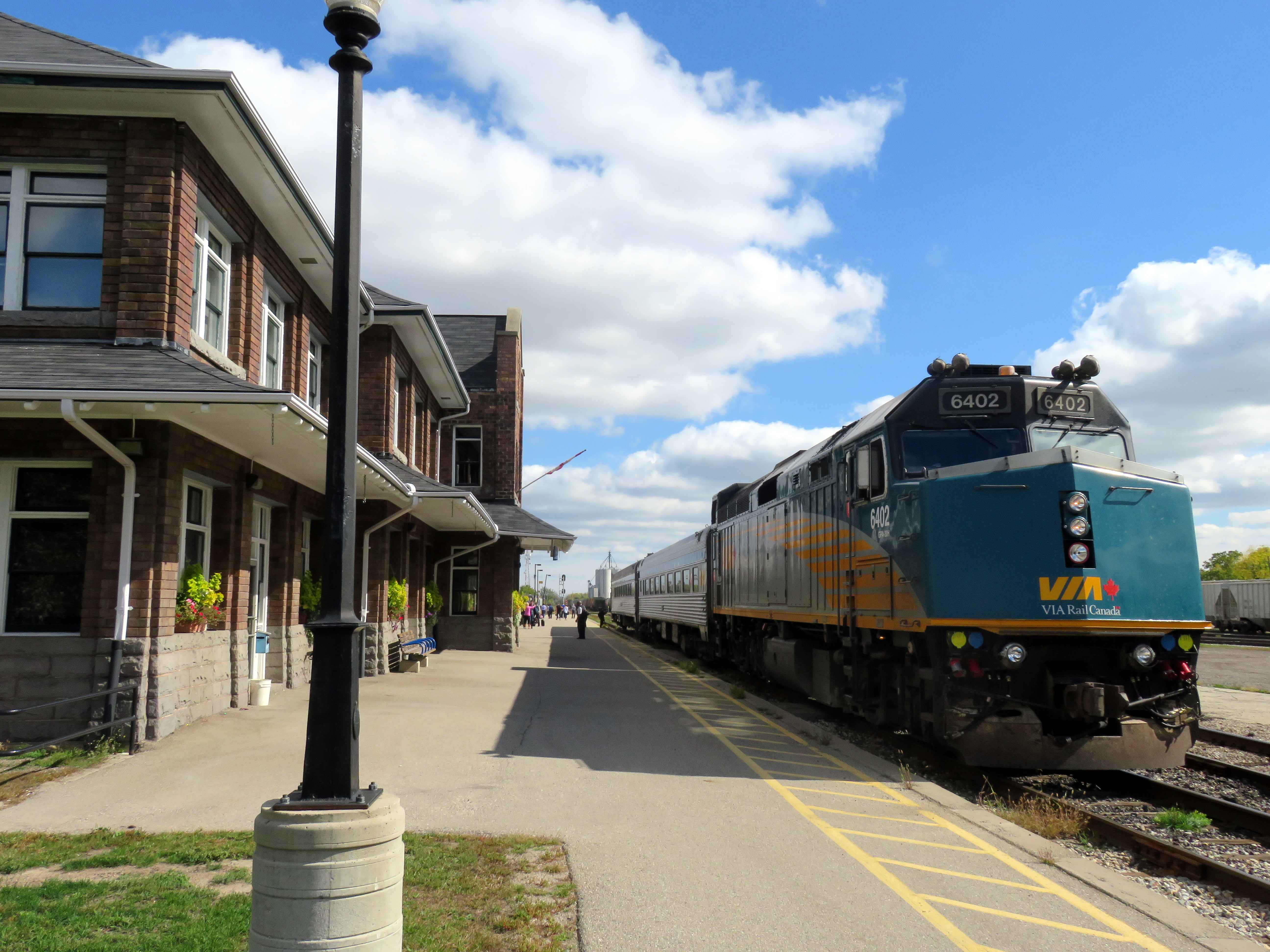
    IMG_6135-001.JPGVIA Train 85 at Stratford Station, October 8, 2016
    On Thanksgiving weekend, my partner and I made the trip out to Stratford to get away from Toronto for two days and see two shows: Macbeth and The Hypochondriac. Both plays were excellent, and we had a lovely time strolling through Stratford’s downtown and parks as well. We took the train to Stratford, unfortunately it’s not a very convenient option for festival goers, nor for anyone visiting Stratford or for those who live there.

    (more…)

  • A ride from Caledon to Guelph via the Elora-Cataract Trailway

    IMG_5393-001

    On Friday, September 2, I went for an 80 kilometre ride between Caledon and Guelph on what turned out to be a spectacular day: sunny, a high of 23 Celsius and without too much humidity. The summer of 2016 has been exceptionally hot and muggy for long-distance rides, so I’ve done fewer of them. I was lucky to have that Friday off.

    I started my trip in Caledon Village, after taking a GO train to Brampton and transferring to GO Transit’s Route 37 Orangeville bus, which only runs on weekdays. This made the trip very difficult to do on a weekend (I would have to ride 20 kilometres up from Brampton, on busy roads, and up the Niagara Escarpment, otherwise). The racks at the front of GO buses are wonderful for getting out of town (I used GO’s bike racks on similar rides this year), but they tie you to a schedule.

    Map of my ride

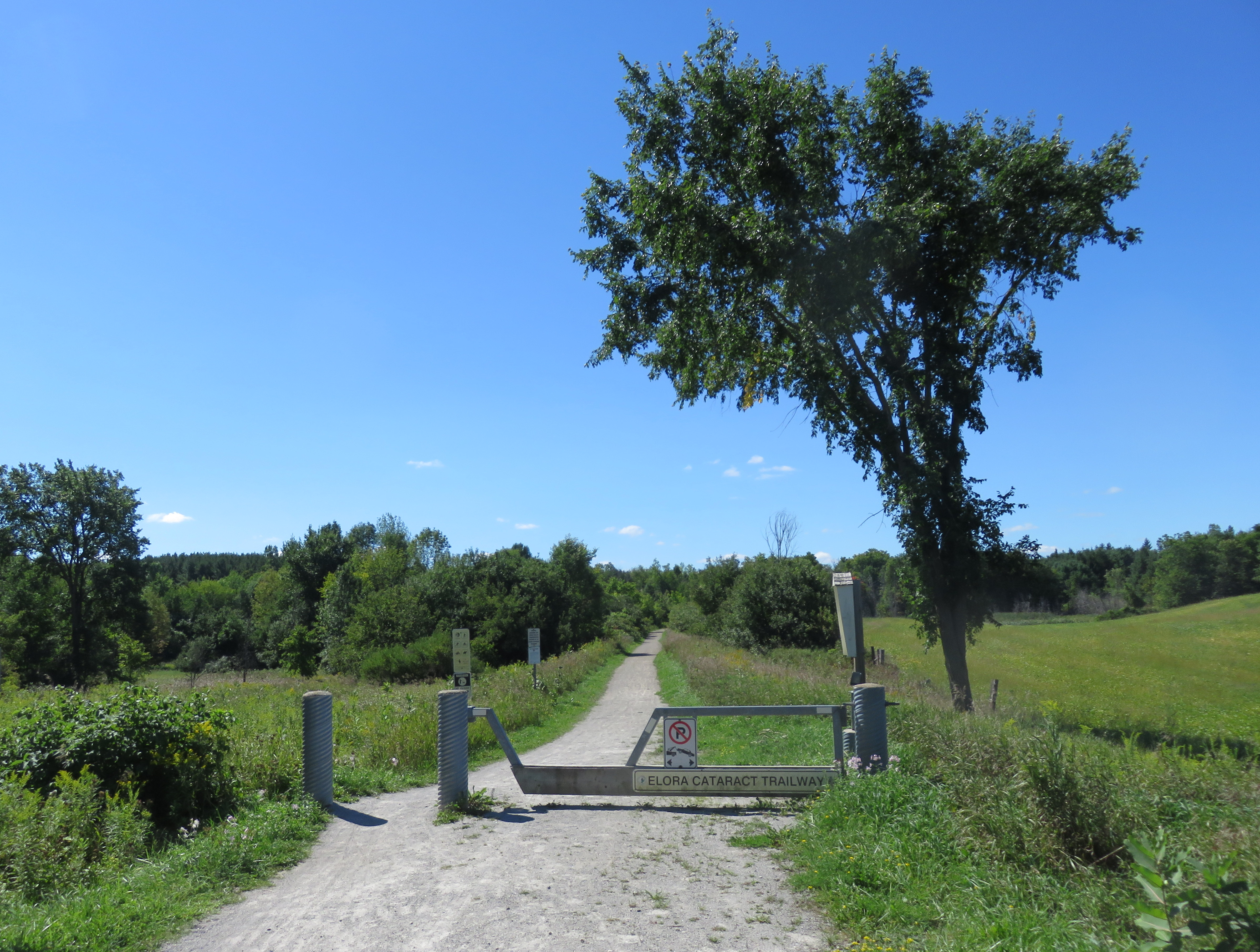
    The Elora-Cataract Trailway, owned and managed by Credit Valley Conservation (Cataract to Hillsburgh), and the Grand River Conservation Authority (Hillsburgh to Elora) is one of the best rail trails that I have ever rode. The surface was in near perfect condition along the entire stretch. Wayfinding, including through a gap at Fergus, was great. Barriers at crossings keep motor vehicles out, but are not too difficult to get around for cyclists. And it’s easy enough to get to and from Guelph. But it’s not so easy to get to from Brampton/Caledon.

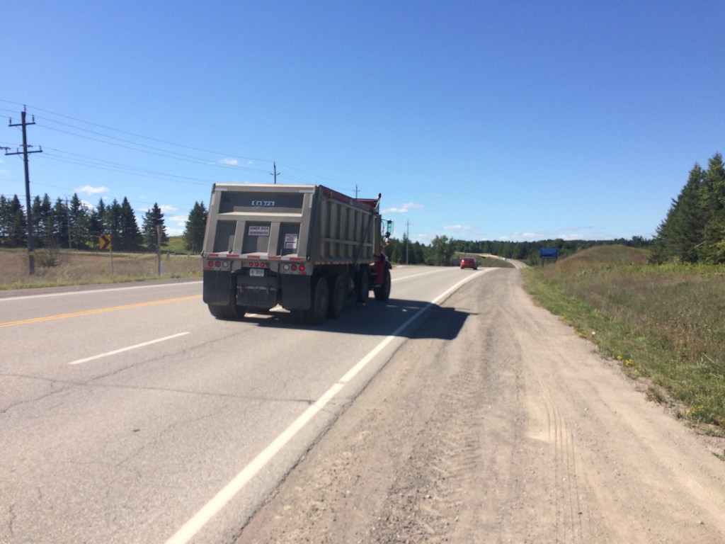
    After getting off the Route 37 bus in Caledon Village, and after a quick stop there for refreshments, I rode west along Charleston Sideroad for four kilometres to Cataract Road, the only possible route without very lengthy and hilly detours.. That was the most aggravating and dangerous bike ride in a very long time. There’s no paved shoulder, so I rode on the white line demarcating the far right side of the lane. There are several quarries nearby, and Charleston Sideroad was once known as Highway 24. There were many quarry trucks and other large vehicles, most who refused to provide the mandatory 1-metre space that the Highway Traffic Act now mandates. One quarry truck driver blared his multiple times at me, angry and unwilling to share the road.

    image1Westbound on Charleston Sideroad

    The dirt shoulder, filled with large stones and debris, is not suitable for cycling. The Region of Peel, responsible for this road, should pave the shoulders as soon as possible. Improved connections to Brampton and the Caledon Trailway should also be identified and built. But once off Charleston Sideroad, the ride quickly became one of my favourites.  (more…)

  • A ride from Peterborough to Uxbridge (Day 2)

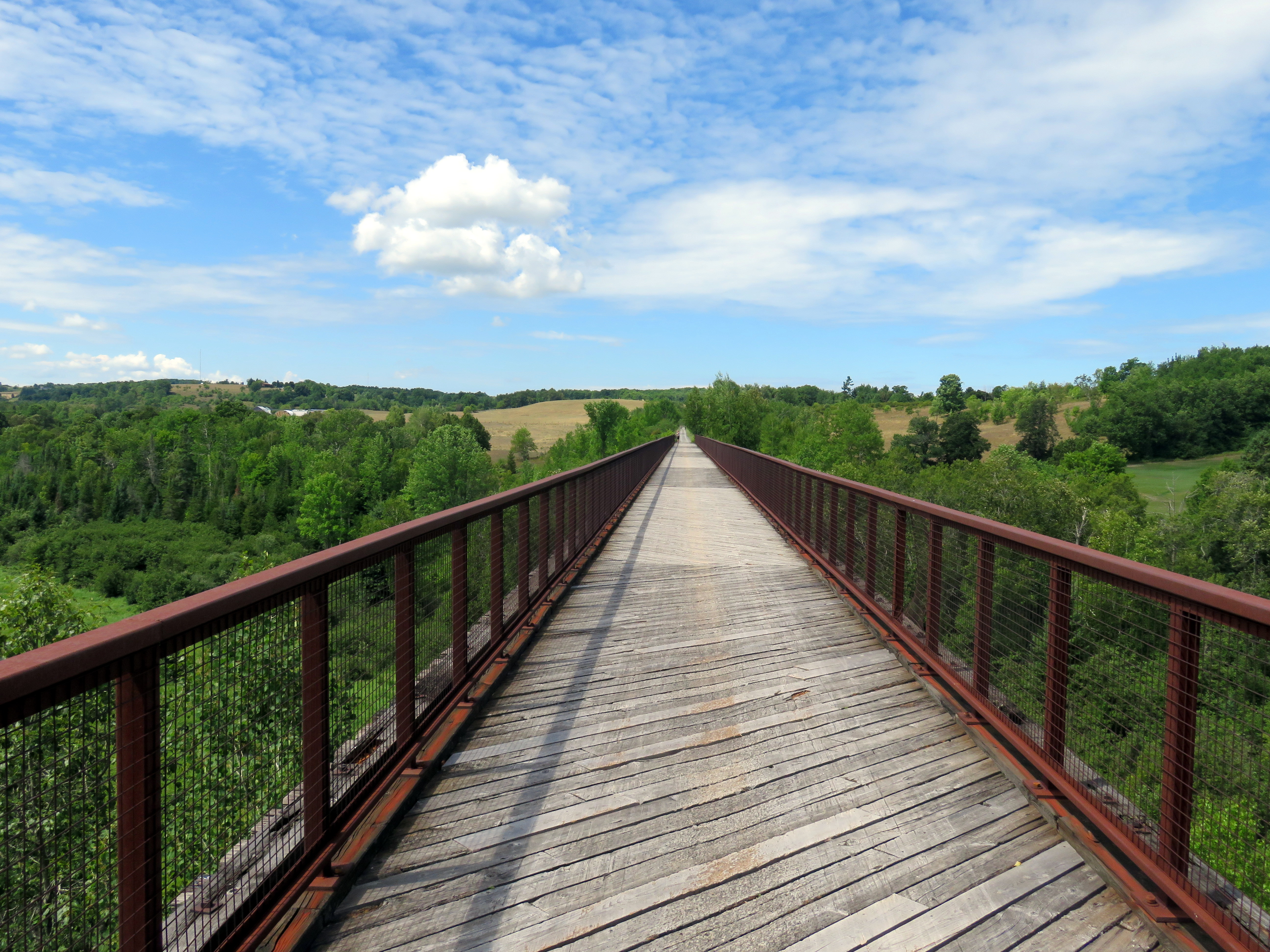
    IMG_4092-001Looking west on Doube’s Trestle, between Peterborough and Omemee

    After riding the Lang-Hastings trail on Sunday July 30, I cycled from Peterborough to Uxbridge on Monday, August 1, stopping at Trent University. This is one of my favourite rides in Ontario, having done this route twice before. But this was the first time I rode west towards Uxbridge, rather than east to Peterborough.

    In total, I rode 99 kilometres that day, and given the heat (and the lack of shade), I ended up ending up a little bit dehydrated — and quite tired — at the end of the trip. There are no places to rest or buy snacks or beverages between Lindsay and Uxbridge, so it’s best to plan ahead. Bring lots of water; Lindsay is an excellent place to take a break and have a light meal. At Uxbridge, I had dinner at a local pub before loading my bike on a GO Transit bus back to Toronto.

    There are a number of great rail trails in Southern Ontario, but except in the Lindsay-Peterborough and  Kitchener-Brantford-Hamilton regions, rail trails in Ontario, where they exist, are usually disconnected from each other and difficult to access from Toronto without a car. It makes me long for Québec s Route Verte network of trails and cyclist-friendly roadways.

    (more…)

  • A ride between Peterborough and Hastings (Day 1)

    IMG_4015-001The Trans-Canada Trail crosses the Otonabee River near downtown Peterborough, next to the Canadian Pacific Railway

    During the Civic Holiday long weekend, I spent two days cycling around Peterborough and two of the rail trails that radiate out of it. Peterborough is one of my favourite places to cycle; it is my third time there on two wheels.

    On Sunday July 31, I started by taking the GO Lakeshore East Train, then transferring to the 88 Peterborough GO bus. Every GO bus is equipped with a rack that can accommodate two bicycles, and all non-peak GO trains can take two or four bicycles per coach (there are special bike coaches as well on the Niagara summer weekend service). After getting off the bus in Downtown Peterborough, and getting coffee at one of that city’s many downtown cafes, I biked out to Hastings, on the Lang-Hastings Trail, returning via (mostly) the same route, a 40 kilometre one-way trip.

    I stayed overnight in Downtown Peterborough and biked to Uxbridge via Lindsay the following day (more on that in a subsequent post), making a diversion via Trent University. That one-way trip was almost 100 kilometres in length. At Uxbridge, I had dinner and took a GO bus back to Toronto.

    (more…)

  • Cuba’s Hershey Train: the last interurban railway

    IMG_1305-001

    Last week, my partner-in-crime and I escaped to Cuba for a short vacation. Eschewing the all-inclusive resorts at Varadero, we decided to spend our time in Havana instead.

    Havana is a fascinating place that’s worth exploring beyond the popular spots such as the picturesque Old City, Revolution Square, and the Cristóbal Colón Cemetery; like any great city, it is best explored by foot.

    One of our highlights was getting an impromptu tour of the José Martí National Library of Cuba in Havana. The library, named for the Cuban national hero, is adjacent to Plaza de la Revolución. The Plaza also holds the seat of the Communist Government and is famous for the towering monument of Martí and the metal mural of Che Guevara.

    We met a wonderful guide, who with great pride described the library’s programs, but also the effects of the 55-year American embargo on obtaining educational materials, up-to-date computers and access to the Internet and other digital resources. We were fortunate for experiences like that, where we met interesting people and learned a bit more about the country. These were experiences that tourists staying at beachside resorts, perhaps visiting Havana on a bus tour or to see a cabaret show, sadly miss.

    But, being on vacation, we made sure to spend some time to relax and enjoy the hot — yet pleasantly non-humid — weather. So we decided to go to the beach for our last full day in Cuba. But instead of taking the tourist buses, we decided to hop on the Hershey Train, probably the last true interurban railway in the Americas.

    Interurban railways once existed all over Canada and the United States. Electrically-powered trains linked towns and cities together, providing passenger and local freight services and filling a niche between urban streetcars and long-distance steam railways. Improved roads, and increased car and truck ownership resulted in the closure of just about every interurban railway in North America, the last to close in Canada was the Niagara, St. Catharines and Toronto Railway in 1959. A few remnants of North America’s interurban lines survive as modernized commuter services, such as the South Shore Line between Chicago and South Bend, Indiana. But Cuba’s Hershey Train still looks, and operates, like the electric railways that once crisscrossed much of southwestern Ontario and the eastern United States.

    (more…)

  • A ride through Midwestern Ontario, Part II

    IMG_6019-001The Cambridge to Paris Rail Trail, part of a network of rail trails that join together in the City of Brantford

    Previously in this blog, I described the first day of a two-day ride through Midwestern Ontario, between Guelph and Kitchener via West Montrose and St. Jacobs. I rode through Ontario’s only authentic covered bridge, along infrastructure created for both cyclists and carriages, and through several picturesque towns and villages.

    Midwestern Ontario is a term that I generally use to describe the part of the province west of the Greater Toronto Area, yet outside the flat, prairie landscapes of Southwestern Ontario (Essex, Lambton, and Kent Counties). The rural landscape is marked by gentle rolling hills, livestock and cash crop farms, as well as cities and towns adjusting to a post-industrial economy. Brantford was once the capital of Canada’s once massive farm implement industry, but now not even the factories remain. Kitchener-Waterloo’s diverse heavy manufacturing concerns have mostly left; but there’s now a strong knowledge economy. Galt (now part of Cambridge) and Paris straddle the Grand River, their grand stone churches and commercial blocks make these some of Ontario’s most picturesque.

    Electric and steam railways — the Grand River Railway, the Lake Erie & Northern, the Toronto, Hamilton & Buffalo, the Grand Trunk, the Canada Southern — tied many of these communities together; now highways do. But many those abandoned railways have found new purpose as hiking and cycling trails; Brantford is at the heart of this new network.

    The second day’s ride, on August 30, took me from Downtown Kitchener, where I stayed overnight, through Cambridge, I then followed the Grand River closely to Brantford. After a stop in Brantford, I took the former TH&B railway corridor into Downtown Hamilton, where I enjoyed dinner and refreshments before loading my bike on a GO Transit bus and rode back home to Toronto. I completed a similar trip in 2012; I wrote about that ride in Spacing.

    Photos and commentary follow.

    (more…)

  • A ride through Midwestern Ontario, Part I

    IMG_5885-001

    Just prior to Labour Day weekend, I went on a two-day bike excursion west of Toronto, starting in Guelph, staying in Downtown Kitchener, and finishing my ride in Downtown Hamilton. [Part II, Kitchener to Hamilton is here.]

    I find that cycling long distances, especially in the countryside, is valuable “me” time. I go at my own place, which is great, because I do not have the stamina nor the build for keeping up with seasoned road cyclists. In my opinion, well-maintained rail trails are excellent — there are no hills to climb, no traffic to deal with (except where the trail crosses busy country roads), and there is much peace and quiet. Fellow trail users are friendly, a nod, a hello, or a wave are normally exchanged by passing cyclists or pedestrians.

    On the first day of this 160-kilometre ride, I rode from Guelph, through West Montrose, Elmira, and St. Jacobs to Downtown Kitchener. I stopped at a covered bridge, rode through several charming small towns, sampled the beers of a craft brewery celebrating its second anniversary, and checked out some interesting cycling infrastructure shared by a very different form of muscle-powered transport.

    I don’t have a car, so planning rural rides are little bit more challenging. Happily, for most out-of-town ride I rely on GO Transit’s trains and buses, which provide an opportunity for one-way or “open-jaw” trips without worrying about the logistics of organizing shuttle rides. In the last few years, I’ve used GO Transit to get to/from Uxbridge, Lindsay and Peterborough, Hamilton (and on to Port Dover by bike), Niagara Region, Georgetown and Newmarket, and Barrie (and on to Orillia and Midland), these cities served by GO are all great places to start or finish a ride.

    IMG_4943-002Downtown Guelph. The Basilica Church of Our Lady Immaculate dominates McConnell Street (photo taken earlier this year)

    On a pleasant Saturday, I loaded my bike on the rack took a GO bus from the Union Station Bus Terminal to Guelph, a long bus ride that took nearly two hours. GO Transit’s buses are quite comfortable; if you’re planning to bring a bike along, just be sure to arrive early to make sure you get one of the two bike rack spots.

    (more…)