Tag: Yonge Street

  • A welcome revision at Major Mackenize

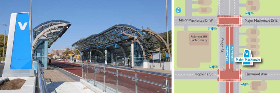
    Earlier this year, I wrote about a major malfunction at a new Viva Rapidway station near Downtown Richmond Hill. The Major Mackenzie station on Yonge Street was built one block south of the busy east-west arterial road; passengers taking Viva buses were forced to walk from Major Mackenzie Drive south to the intersection of at the intersection of Elmwood Avenue and Hopkins Street, push a “beg button” and wait to cross to the bus platforms in the middle of Yonge.

    The reason for this unusual situation was that the Yonge Street right-of-way narrows through Downtown Richmond Hill. At Major Mackenzie Drive, northbound Viva buses must enter mixed traffic for approximately two kilometres before returning to a median busway. (The northbound traffic signal at Major Mackenzie has a dedicated transit phase that allows Viva buses to exit the median ahead of general traffic.) This required the median Viva bus stop (called a VivaStation) to be located considerably south of the intersection of Yonge Street and Major Mackenzie Drive.

    Back in February, temporary barriers and YRT transit enforcement officers were used to dissuade transit customers from Back in February, temporary barriers and YRT transit enforcement officers were used to dissuade transit customers from taking the faster and direct, yet more dangerous, route to Major Mackenzie Drive and connecting east-west buses by crossing midblock north of the platform, the faster and direct, yet more dangerous, route to Major Mackenzie Drive and connecting east-west buses.

    The Major Mackenzie VivaStation and layout, February 2021

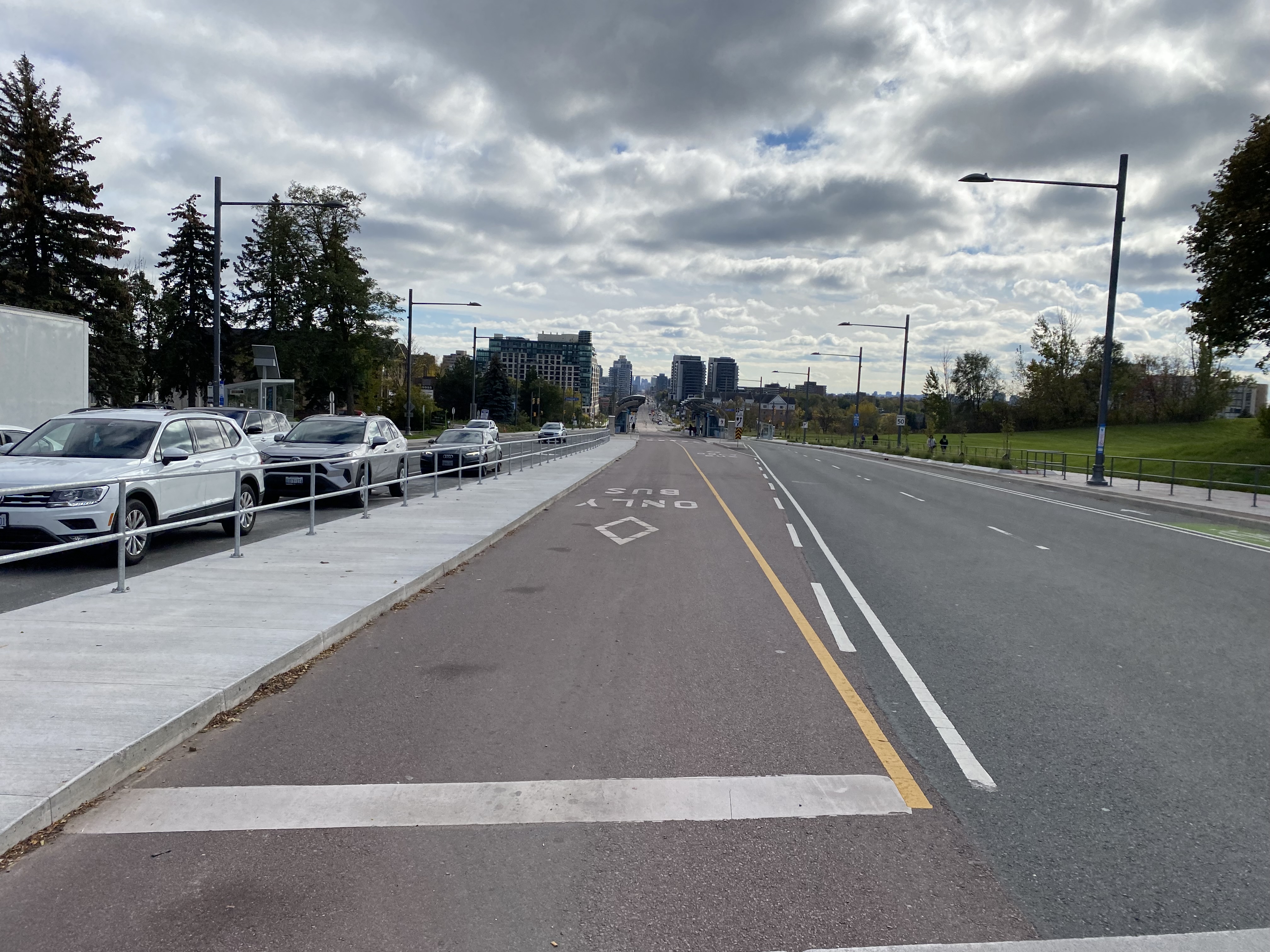
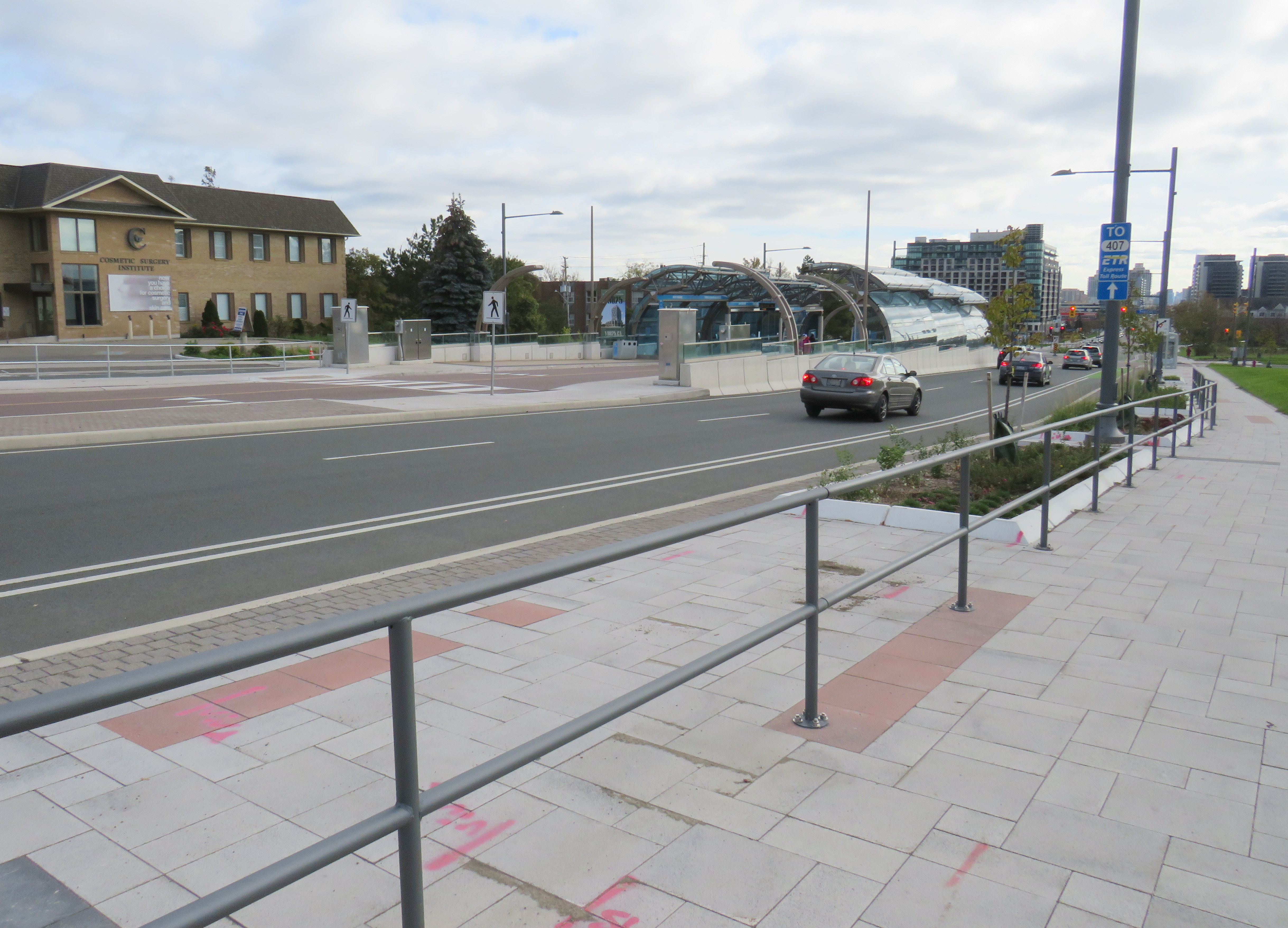
    To my pleasant surprise, York Region fixed its mistake. Though the revised station is not ideal (it is still a long walk from Major Mackenzie Drive itself), a new walkway alongside the east side of the bus right-of-way from the VivaStation to the Major Mackenzie intersection makes the transfer to and from buses on Major Mackenzie much simpler.

    Looking south from Major Mackenzie Drive

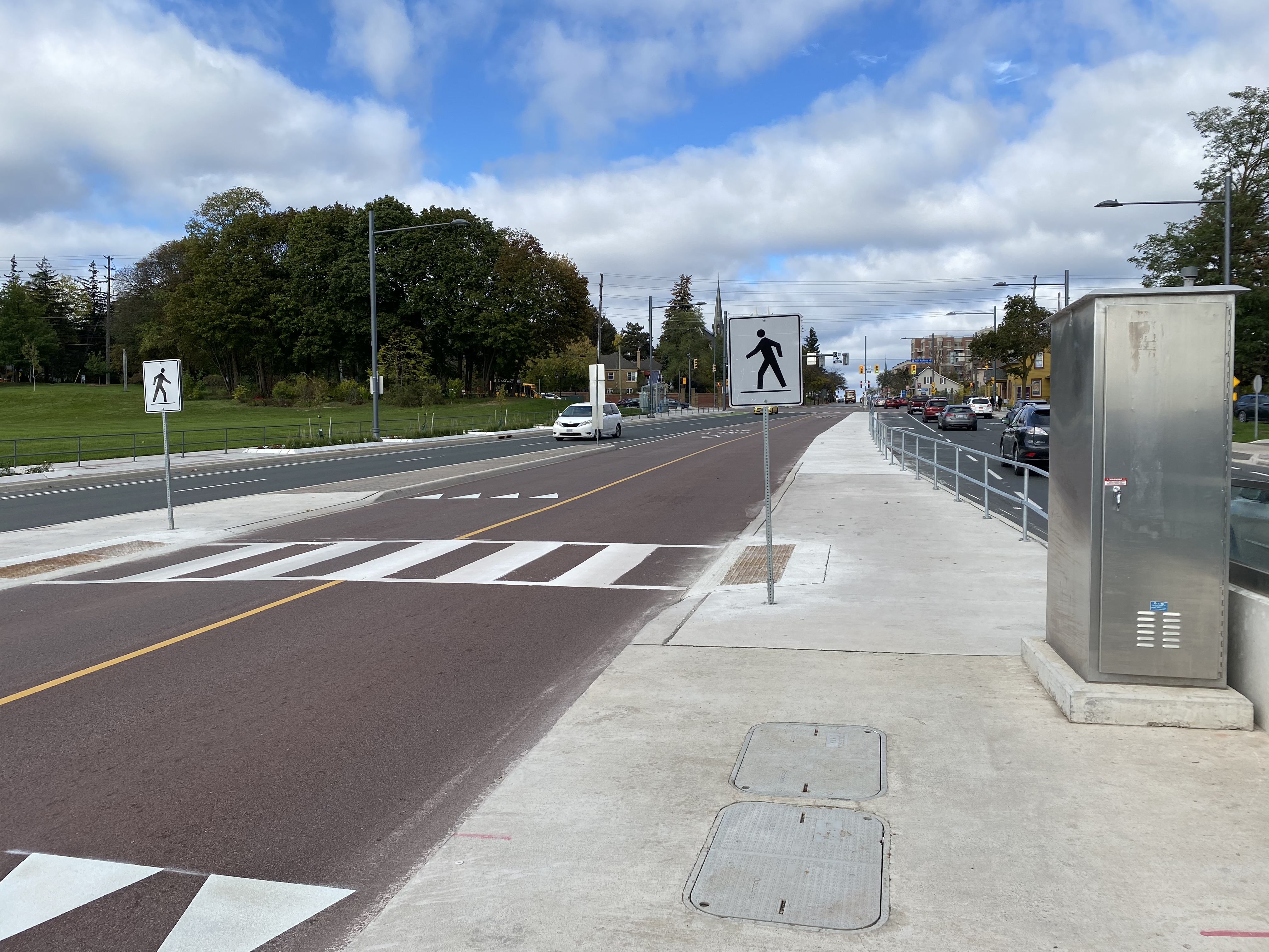
    Just north of the bus platforms, a signed crosswalk allows passengers to go from the walkway and northbound platform to the southbound platform on the west side of the bus right-of-way.

    Looking north towards Major Mackenzie Drive at the new crosswalk, which allows passengers to go between the southbound bus platform to a new walkway connecting the Major Mackenzie VivaStation to its namesake street.

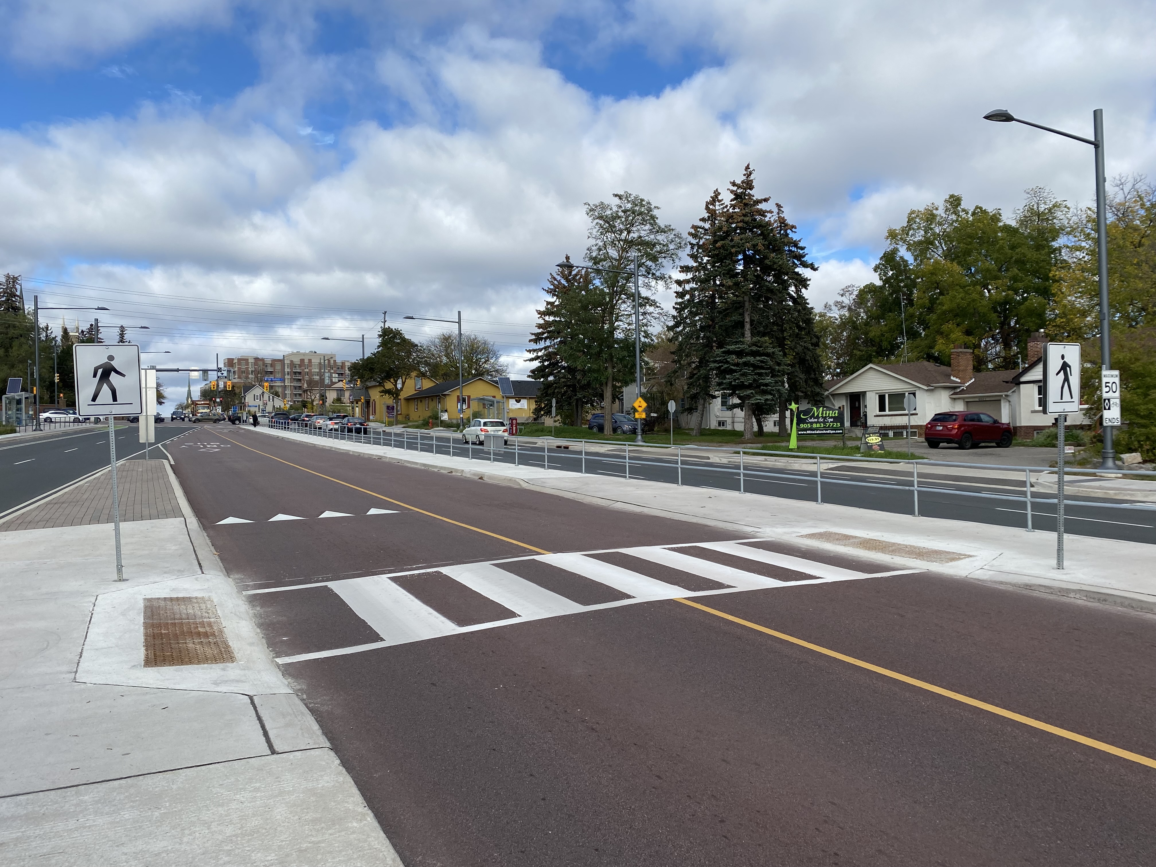
    Permanent metal rails prevent passengers from crossing Yonge Street until they get to the signalized intersection at Major Mackenzie. But transit enforcement officers were nowhere to be seen on this visit, on a Friday afternoon.

    Metal barricades deter pedestrian crossings outside of signalized crosswalks.

    Unfortunately, to make room for the walkway between the station and Major Mackenzie Drive, the northbound bicycle lane was cut, and replaced with “sharrows.” Though the new bicycle lanes on Yonge ended at Major Mackenzie (not enough room if you have to maintain four through traffic lanes through a historic town centre), this diminishes the gains cyclists made with the reconstruction of Yonge Street for the BRT lanes.

    When surface transit projects — like the Viva Rapidways — are designed to fit into existing suburban roadways, compromises to the passenger experience are made. At Richmond Hill, this meant maintaining two traffic lanes in each direction while trying to squeeze a bus rapid transit station into the roadway. This resulted in the original blunder, which should have been thought though earlier in the planning stages.

    The fix is not perfect, but it at least addresses the problems with the Major Mackenzie BRT station. Perhaps, one day, we will plan for transit, walking, and cycling first in places like Downtown Richmond Hill, rather than planning for private motor traffic first.

  • Yonge, tomorrow

    Yonge, tomorrow

    Over the past few years, I have been involved with the YongeTOmorrow project on behalf of Walk Toronto. It has been a very interesting and worthwhile experience being part of a stakeholder advisory group. Allied organizations working towards a more exciting and sustainable Yonge Street include Cycle Toronto, 8 80 Cities, and the David Suzuki Foundation.

    After several rounds of public consultations and stakeholder meetings, you can now see what the proposed changes to Yonge Street will look like.

    Rendering of proposed changes to Yonge Street , looking north towards Dundas Square. In this section, northbound traffic is permitted, with two-way cycling, and much wider sidewalks, along with new trees and improved street furniture.

    Though the selected concept is not perfect, the proposed changes will provide significant improvements to Yonge Street between Queen and College Streets. These include wider sidewalks, patio space, bike facilities, and a pedestrianized zone between Dundas Square and Edward Street, allowing for better circulation, more flexibility for special events, and a more pleasant street.

    With more high-rise development on the way (including the redevelopment of the Chelsea Hotel on Gerrard Street), it is only right that more space be given to residents, students, employees, and visitors. Compromises in the plan allow for access to parking garages, permit taxi and other vehicle drop-offs and pick-ups, as well as business deliveries.

    I encourage you to have a look and provide your feedback. The online survey is available until September 30.

  • One hundred years of Ontario’s provincial highways

    One hundred years of Ontario’s provincial highways

    IMG_2956

    On February 26, 1920, Ontario’s provincial highway network was born. That year, 16 highways were established across southern Ontario, between the Ottawa and Detroit Rivers. These highways, previously maintained by townships and counties, connected the province’s largest cities and provided important links to Quebec and the United States.

    In 1925, these highways were assigned numbers 2 through 17, in rough order from west to east. There was no Highway 13; instead, the Port Hope-Peterborough Highway was assigned Route 12A. Highway 2, alternatively known as the Trans-Provincial Highway, extended from Windsor to the west to the Quebec border in the east, continuing eastwards as Quebec Highway 2. (That province renumbered its entire highway system in the 1960s and 1970s.) Meanwhile, Highway 15, connecting Kingston and Ottawa, took a deviating “S” shaped route via Perth. Highway 7 only went as far east as Brampton. While the province used triangular highway markers at the time, in 1930, they were renamed “King’s Highways” and assigned crowned highway shields still in use today.

    The map below illustrates the highway system at the time.

    1920OntarioOntario Provincial Highways, 1925 (click for larger version)

    Several of Ontario’s first highways no longer exist. Highway 12A was later renumbered to Highway 28; that first section was later downloaded to Northumberland and Peterborough Counties. The first section of Highway 14, which originally ran between Foxboro and Picton via Belleville, was later integrated with the longer and more important Highway 62. The short stub of Highway 14 between Foxboro and Marmora was also downloaded in the 1990s.

    But Highway 11, formed out of Yonge Street and the Barrie-Muskoka Highway, eventually became the province’s longest and one of its most famous highways (even if it never was the world’s longest street). To mark the occasion, I wrote about Highway 11’s history for TVO. 

    If you’re interested in learning more about Ontario’s highways, nearly 100 years of digitized provincial road maps are available on the Archives of Ontario website. I also suggest visiting The King’s Highway website, which contains histories and photographs for most of Ontario’s highways.

  • Survey says… Torontonians demand safer streets

    IMG_3729
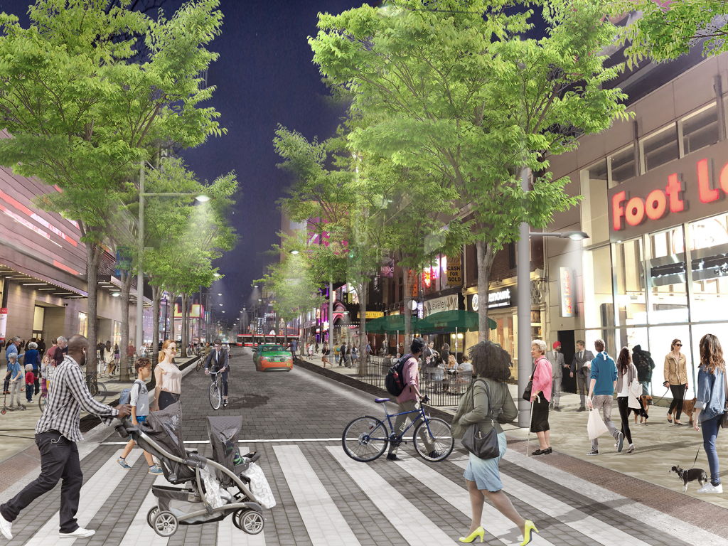
A mock-up of a re-imagined Danforth Avenue, Summer 2019

    Yesterday, I met with fellow road safety advocates Keagan Gartz, executive director of Cycle Toronto, Gideon Forman from the David Suzuki Foundation, and Jessica Spieker, from Friends & Families for Safe Streets. The occasion was to publicize a new poll commissioned by the David Suzuki Foundation that gauged Torontonians’ support for action on road safety as well improvements to pedestrian and cycling infrastructure, including two projects planned for Yonge Street — YongeTOmorrow  in the Downtown Core and Transform Yonge in North York.

    Almost 90 percent of Torontonians are concerned about road safety, with close to 70 percent responding that the city is “is not doing enough.” Furthermore, 72 per cent of respondents are in favour of the changes planned for Yonge Street, and 80 percent of respondents want the city to build more protected bike infrastructure.

    On behalf of Walk Toronto, I was quoted by CBC journalist Lauren Pelley in her report, quoting the number of pedestrians killed in 2018 and 2019, noting “two pedestrian deaths this week — one in Brampton, one in Toronto — and those were both hit-and-run collisions. And it’s going to happen again, and it’s going to happen all over the city.”

    These poll results indicate an appetite for change. Hopefully Toronto City Council will take notice.

  • Suburban Toronto’s transit past and future on north Yonge Street

    IMG_4846-001
    Stop 17 shelter in Thornhill

    On Yonge Street in Thornhill, a small green hut sits beside the busy roadway at the entrance to Cricklewood Park. On the side of the small building, a wood sign says “Stop 17.” Hundreds of buses and thousands of cars pass by this hut daily, yet few may know about the transit history it represents.

    Stop 17 was a stop on the Toronto & York Radial Railway line that extended north from a terminal at Toronto’s city limits at Yonge Street and Glen Echo Avenue (now the location of a Loblaws supermarket) all the way to Sutton, via Richmond Hill and Newmarket. Electric radial service to Thornhill and Richmond Hill began in 1897. By 1908, radial service reached Lake Simcoe.

    Stop 17 was one of two stops in Thornhill, located at the present-day intersection of Yonge Street and Royal Orchard Boulevard. The TTC, the eventual owner of most of Toronto’s radial lines, closed the Lake Simcoe route in 1930. Soon afterwards, the wooden shelter was moved to a nearby golf club, where it served as a snack bar and rain shelter. (The radial line was resurrected in late 1930 as a suburban streetcar service to Richmond Hill until 1948.)

    f1568_it0441
    Yonge Street looking south in Thornhill, September 1931. City of Toronto Archives, Fonds 1568, Item 441.

    In November 2000, the Stop 17 shelter was moved back to Yonge Street and restored. It stands as a historical building in Thornhill, and as a monument to early suburban transit in Greater Toronto. Only a few other structures exist from the radial railway era including the Newmarket Radial Arch, the footings of a Toronto Suburban Railway trestle over the Humber River, and a radial power station in Guelph.

    There was another Stop 17, on the Scarboro Radial Line between Toronto and West Hill.  By coincidence, it is also memorialized in the name of a variety store (Stop 17 Variety), which also sports a mural depicting a T&Y radial car stopped in front of the Scarborough High School (now R.H. King Academy).

    Stop 17 Variety
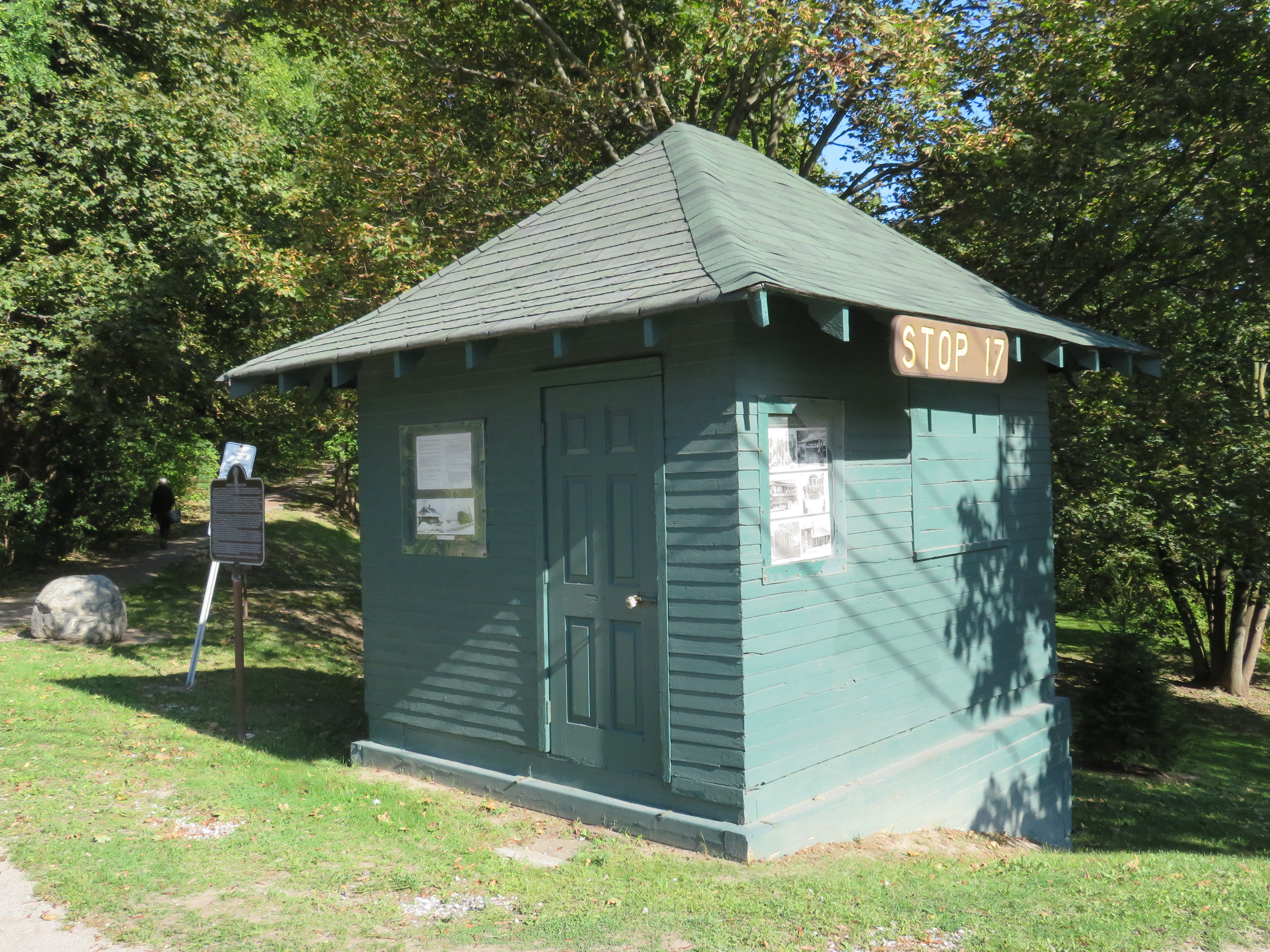
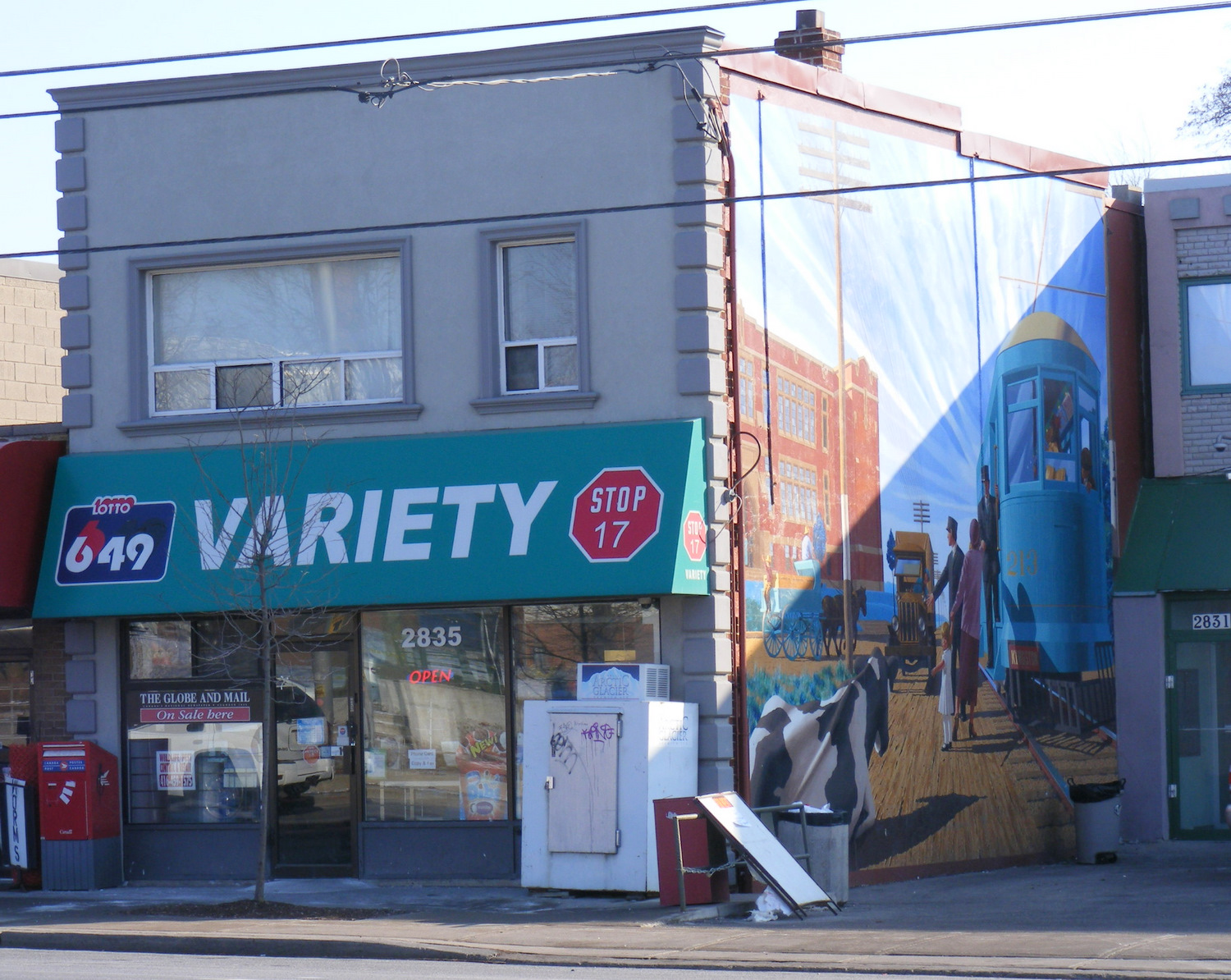
Stop 17 Variety on Kingston Road at St. Clair Avenue in Scarborough

    Nearby the Stop 17 shelter in Thornhill, I noticed several markings in the sidewalk. After a closer look, I noticed that they were survey markers, indicating a location where holes were drilled for preliminary core samples for the planned Yonge North Subway Extension from Finch Station to Richmond Hill.

    One day, the subway will be extended north into York Region, a sensible project given the ridership potential, especially as Yonge Street sees urban intensification through Thornhill and Richmond Hill. The City of Toronto has been resistant to the extension, as the Yonge Subway is already operating over capacity, with a relief subway required to handle the loads.

    The politics of subway building aside, it is fascinating to find the history and future of Toronto’s suburban transit in such close proximity.

    IMG_4848-001
    Sidewalk markings on Yonge Street

    IMG_4848-002
    “TTC YSE” marker

  • The John Tory Way

    32267768383_8c2f20d0d5_k
    Yonge Street looking south from Richmond Hill

    There’s an episode of The Simpsons where Homer Simpson changes his name to Max Power, after he’s ridiculed for sharing the name with a buffoonish television character. It’s not a great episode — it came out at the time the show was in transition from its glory years to the “Zombie Simpsons” era — but it has a few good laughs.

    There’s one good memorable quote:

    — “There’s the right way, the wrong way, and the Max Power way!”
    — “Isn’t that the wrong way?”
    — “Yeah, but faster!”

    On important transportation projects, the John Tory way is the wrong way, but costlier. We’ve seen this several times during his mayoralty.

    When it came time to replace the underused eastern section of the Gardiner Expressway, Tory and his suburban allies on council voted in favour of a more expensive “hybrid” option that maintains much of the elevated highway, instead of a cheaper at-grade option that would provide a better pedestrian realm on the Eastern Waterfront and better support new development.

    In Scarborough, Tory stubbornly supports building a one-stop subway extension that was last estimated to cost $3.35 billion dollars, instead of supporting a seven stop LRT route from Kennedy Station that would extend the existing grade-separated Scarborough RT route to Centennial College and Sheppard Avenue. A proposed SmartTrack station at Lawrence East (whose estimated construction cost has risen from $26 million to $155 million) may not be able to be built while the Scarborough RT is still in operation.

    And on February 27, Toronto’s Public Works and Infrastructure Committee (PWIC) voted against plans backed by city staff, the local councillor, John Filion, and many residents and road safety advocates, to transform Yonge Street in North York Centre between Sheppard and Finch Avenues. This section of Yonge Street is due for reconstruction, hence the opportunity to rethink the street to better serve the community.

    The REimagining Yonge Street plan seeks to improve the pedestrian realm with widened sidewalks, would add new cycling infrastructure. To make room for these improvements, two traffic lanes — used for street parking outside of weekday rush hours — would be removed. This stretch of Yonge Street has seen many new condominium towers built over the last decade, and there are three subway stations serving this stretch of Yonge Street.

    Mayor Tory, who has the power to select committee chairs and members, stated his preference for the status quo on Yonge Street, suggesting that the bike lanes be moved one block west, to Beecroft Avenue. PWIC moved for this alternative option as well, even though city staff reported that the change would cost an additional $20 million.

    YongeCrossSection
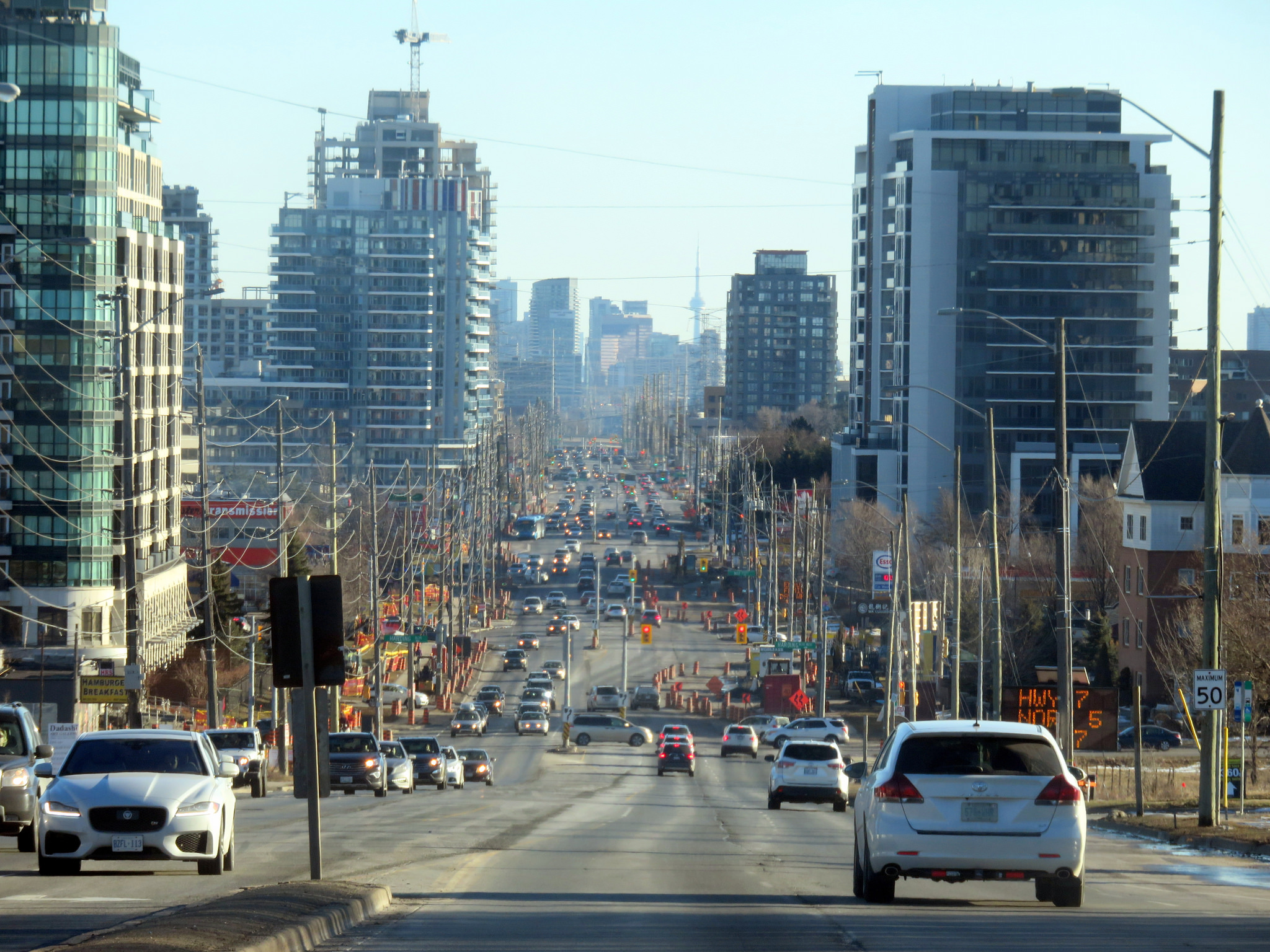
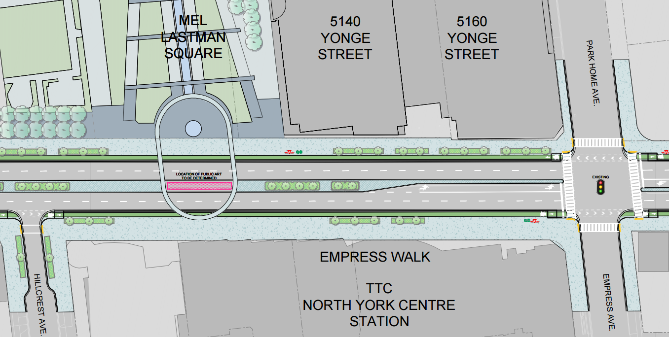
Yonge Street between Sheppard and Finch Avenues would have seen new separated bike lanes, wider sidewalks, and new public art. (From the EA materials.)

    The decision to maintain the status quo on Yonge Street benefits commuters outside of Toronto more than local residents, so it is puzzling why Mayor Tory has declared his support — once again — for an option that puts drivers first. Nearly three-quarters of rush-hour drivers on Yonge Street through North York come from York Region. A majority of residents take transit, walk, or cycle; they would benefit from a safer, more pleasant street. Moving the bicycle route to Beecroft Avenue serves to move cyclists out of the way of cars, rather than providing a direct route with better access to transit, shops, and homes.

    With Doug Ford focused on the Ontario Progressive Conservative party leadership race, there are — as of yet — no high-profile challengers to Mayor Tory’s re-election bid. There is no need to pander to a voting bloc angered by a so-called “war on the car” unless Tory actually supports suburban commuters over his own constituents. And this decision will only cost more money.

    Once again, Mayor John Tory has chosen the wrong way.

  • From the vaults: the end of Yonge Street

    5608188561_bf233bac9d_o

    Note: This article was previously published in Spacing Toronto on April 13, 2011.

    One of Toronto’s greatest debates concerns Yonge Street’s controversial claim as “the World’s Longest Street.” Indeed, the Guinness Book of World Records published Yonge Street’s status as the true record until 1999; a bronze art installation in front of the Eaton Centre at Yonge and Dundas has a map of Yonge Street extending to Rainy River.

    This claim rests on the rather tenuous claim that that the 1,896 kilometre length of Yonge Street from Queen’s Quay on Toronto’s Harbourfront to Rainy River via Highway 11, at the Minnesota-Ontario border is in fact, the longest continuous “street.”

    While a popular claim, I’ve been a skeptic of this local legend. Highway 11 and Yonge Street have never been one and the the same, especially after the downloading of Highway 11 south of Barrie by the Harris government in the late 1990s.

    In 1920, Yonge Street was added to the Ontario provincial highway systemas Highway 11, which extended from Downtown Toronto as far as the end of Simcoe County, at the Severn River north of Orillia, where an unnumbered highway continued through the unincorporated Districts of Muskoka, Parry Sound and Nipissing to North Bay. In 1937, Highway 11 assumed the Severn River-North Bay portion and the newly-completed North Bay-Hearst section.

    During the Second World War, the section between Nipigon and Hearst was completed; it finally provided a complete provincial highway link between the Manitoba and Quebec borders and formed a crucial part of the Trans-Canada Highway until the more direct Highway 17 link from Sault Ste. Marie to Wawa was completed in the 1960s. Indeed, Highway 11 could still claim as the longest signed route within a sub-national entity but several national routes, such as US Interstates and US highways, are longer. In fact, the last reference to Yonge Street on Highway 11 north of Holland Landing is a short section of former Highway 11 in south Barrie.

    (more…)